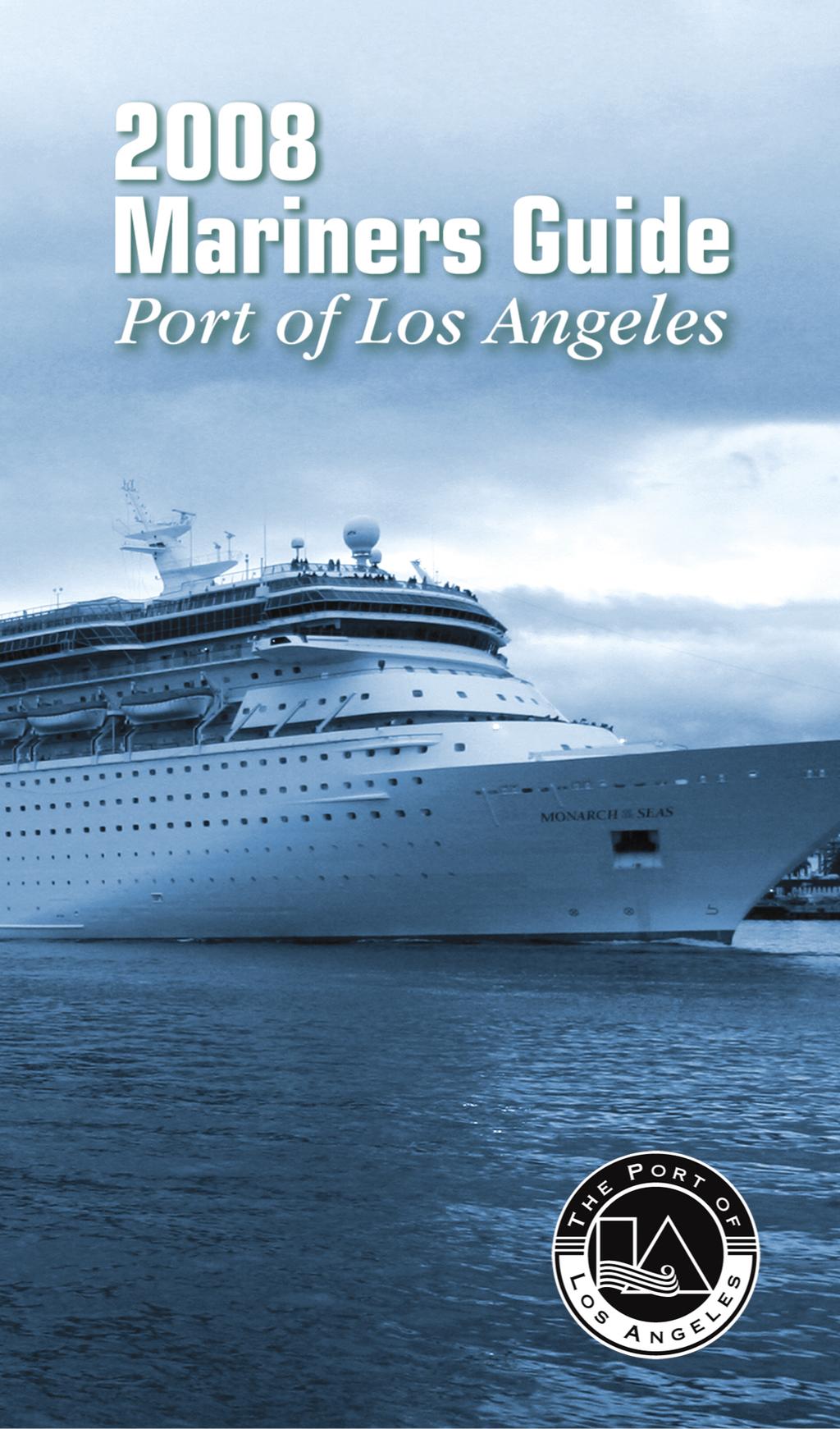
WELCOME TO THE PORT OF LOS ANGELES!
|
|
|
- Ashley Todd
- 5 years ago
- Views:
Transcription
1
2 CONTENTS Introduction Los Angeles Pilot Service Pilot Ladder Requirements Radio Communications Information Sources - Websites Land Line Telephone Numbers Tugs, Water Taxis and Salvage Environmental Notice to Ships Vessel Operating Procedures Public Notice on the Los Angeles Channel Deepening Project Facilities for Visiting Seafarers Foreign Quarantine Wharf Elevation and Depth at Berths National Weather Service Horizontal and Vertical Clearances Formula for Degree of List and Increase in Draft Due to Pitch Map of the Port of Los Angeles Boating Safety Information Controlled Navigation Areas Small (Recreational) Vessel Safety Metric Conversion Tables Sunrise and Sunset Table Tide Tables Wind Force Chart The data contained herein is provided only for general informational purposes and no reliance should be placed upon it for determining the course of conduct by any user of the Port of Los Angeles. The accuracy of statistical data is not assured by this Port, as it has been furnished by outside agencies and sources. Acceptance of Port of Los Angeles Pilot Service is pursuant to all the terms, conditions and restrictions of the Port of Los Angeles Tariff and any amendments thereto.
3 2 WELCOME TO THE PORT OF LOS ANGELES! Now entering its second century, the Port of Los Angeles is A m e r i c a s Po r t, Southern Califo rn i a s premier gateway to international commerce. Located in San Pedro Bay, just 20 miles south of downtown Los Angeles, the Port of Los Angeles sustains its competitive edge with efficient cargo operations and access to Southern California s vast goods movement system. The Port is also an acknowledged leader in groundbreaking environmental initiatives, progressive security measures, and diverse recreational and educational facilities. With an exceptional credit record, the Port maintains an Aa2 bond rating, the highest assigned to any seaport in the United States operating without the benefit of taxpayer support. The Port also wields tremendous economic impact, generating employment for more than 3.3 million Americans nationwide. In California alone, nearly one million jobs are related to trade through the Port of Los Angeles. The Port of Los Angeles encompasses 7500 acres and 43 miles of waterfront, and features 25 cargo terminals, including dry and liquid bulk, container, breakbulk, automobile and omni fa c i l i t i e s. Combined, these terminals handle more than 182 million metric revenue tons of cargo annually, valued at approximately $230 billion. Last year, the Port moved more than 8.5 million TEUs (twenty-foot equivalent units, standard maritime measurement for containers), establishing an impressive national container record for the seventh consecutive year. The San Pedro Bay Ports of Los Angeles and Long Beach together handle more than 40% of the cargo entering the U.S. The Port is also home to the nation s most secure cruise passenger complex, the World Cruise Center in San Pedro. Handling in excess of one million passengers annually, the Port is the leading cruise port on the West Coast of the United States. The LA Waterfront connects the Cruise Center to downtown San Pe d r o s international restaura n t s, galleries and shops via a promenade, which offers Port visitors a leisurely, landscaped stroll along a five-block stretch of Harbor Boulevard. Visitors may also enjoy a ride along the Waterfront Red Car Line s 1.5-mile route. The commu n i t y s conceptual plan for development along the Wilmington side of the waterfront is also moving forward. This project includes 75 acres of land along the Avalon Boulevard
4 Corridor, between Harry Bridges Boulevard and C Street, and focuses on open space and waterfront accessibility. O t h e r Wilmington waterfront development effo rts include the Po r t s development of Avalon Triangle Park and enhanced waterfront access surrounding Banning s Landing Community Center. In 2006, the Port released the landmark San Pedro Bay Ports Clean Air Action Plan, which provides a comprehensive strategy fo r a g gr e s s i vely curbing port-related emissions by 45% by Developed in partnership with the Port of Long Beach, the Clean Air Action Plan looks at all port-related emission sources and focuses on performance-based standards for equipment pursuing clean diesel, LNG and other technologies. The revolutionary plan received the support of the U.S. Environmental Protection Agency, the California Air Resources Board and the South Coast Air Quality Management Board. Complementing its busy terminal operations with green alternatives, the Port of Los Angeles remains committed to managing resources and conducting Po rt developments and operations in both an environmentally and fiscally responsible manner. The Port s stature carries with it responsibility for leadership in achieving enhancements in securi t y, environmental stewa r d s h i p, operational efficiency, community outreach and job creations. All are high priorities for the Port of Los Angeles. The Port of Los Angeles A Cleaner Port. A Brighter Future. Please visit our website at 3
5 LOS ANGELES PILOT SERVICE The Los Angeles Pilot Service dates back to 1907, when the Port of Los Angeles was founded. Today, the Pilot Service employs 34 dedicated professionals, combining the skills of pilots, dispatchers and boat crew to provide expert pilotage services to Port of Los Angeles customers. The mission of the Los Angeles Pilot Service is to provide safe, reliable and efficient pilotage and marine services. Over the last decade, the Los Angeles Pilots have safely completed more than 55,000 vessel movements. They are among the best-trained pilots in the maritime industry. After a rigorous two-year training program, each pilot attends manned-model shiphandling courses in Grenoble, France, once every four years. Each pilot also attends ship simulator training every two years. LOS ANGELES PILOT SERVICE Jim Morgan, Pilot Service Manager Bent Christiansen, Chief Port Pilot Michael Rubino, Chief Port Pilot Pilots John Arndt William Baumann John Betz Richard Crowley Kerry DeMatos John Dwyer Craig Flinn James Larkins Jeffrey Lee Joe Manlove Brett McDaniel Michael Owens Richard Rauhut Douglas Rill Ron Rogers Ed Royles Dispatchers Beth Adamik Kathleen Bautista Jessica Bautista Pauline Hospe James Dixon Boat Operators John Cameron Danny Domingo Mark Hansen Martin Maher Deckhands Debora Biron Kirk Bosco Robin Craigen Raymond Maese Carol S. Peckham 4
6 PORT OF LOS ANGELES PILOT SERVICE Berth 68 San Pedro (310) (310) (fax) VHF Radio Channel 73 ( MHz) Call: KEB260 Los Angeles Pilots The Los Angeles Pilot Station is manned 24 hours a day. Pilots board arriving vessels from the pilot boat in the vicinity of Los Angeles Channel RACON Buoy #3. Tank vessels will be boarded at least two miles from the Los Angeles entrance. Deep-draft vessels (draft more than 55 feet) will be boarded in the vicinity of Los Angeles Channel Buoy #1. Under normal weather conditions, the pilot ladder should be rigged on the starboard side one meter above water. A minimum of two hours advance notice is required for Port Pilot service. Masters or agents are requested to advise the Pilot Station when there is a change in the arrival or sailing time. COMMUNICATIONS Operational communications in the Los Angeles/Long Beach harbor area are conducted by marine VHF radio and commercial telephone from five principal nodes: VTS, Los Angeles Port Pilot Service, Long Beach Pilots, Port of Long Beach Security and the U.S. Coast Guard Long Beach. All users are encouraged to minimize voice traffic on all channels, maintain circuit discipline and broadcast on low power whenever possible. FIRE ALARM SIGNAL All Vessels Except Those Underway Five prolonged blasts on whistle or siren. Repeat at intervals to attract attention. TELEPHONE LOS ANGELES FIRE DEPARTMENT DISPATCH CENTER (non-emergencies) (213) EMERGENCIES 911 5
7 PILOT LADDER REQUIREMENTS Pilot Ladder Requirements for Los Angeles Pilots in Addition to SOLAS Regulation 17, Chapter 5. a) Please contact Los Angeles Pilots KEB260 by VHF Radio Channel 73 a minimum of two hours prior to arrival to confirm estimated time of arrival and for information regarding desired lee. b) Rigging of the pilot ladder, as well as the embarking or disembarking of the pilot, should be under supervision of a responsible officer. c) The ladder should be made in one length and fitted with spreaders approximately 10 feet apart to comply with SOLAS Regulation 17, Chapter 5. d) The area of the deck where the pilot boards should be clear of obstacles to ensure a safe passage for the pilot. e) Trailing lines or retrieving lines should not be attached to the lower end of the ladder. f) Ladders should be rigged well clear of discharge and water outlets and at a place near midship clear of the finer lines of the vessel. At no time should the ladder be rigged near the stern of the ship. g) The ladder should be in good condition and rigged so that the steps remain horizontal when used. h) Accommodation ladders must not be used for pilot boarding or disembarking. 6
8 7
9 RADIO COMMUNICATIONS Los Angeles/Long Beach Area VHF Radio PRINCIPAL OPERATING CHANNELS Station Channel Frequency Bridge to Bridge MHz Noncommercial Calling MHz Distress Safety and Calling MHz Vessel Traffic Information Service MHz Los Angeles Port Pilots MHz 63A MHz Long Beach Port Pilots MHz MHz U.S. Coast Guard 22A (Primary) MHz 12 (Secondary) MHz U.S. Navy 12 (Primary) MHz 65A (Secondary) MHz Harbor Tugs 77 (Primary LA) MHz 5A (Primary LB) MHz 65A (Secondary) MHz Intership Safety MHz INFORMATION SOURCES - WEBSITES Port of Los Angeles Port of Los Angeles Tariff Marine Exchange of Southern California VTS Users Manual Meteorological information for Los Angeles and Long Beach Harbors United States Coast Guard Los Angeles 8
10 LAND LINE TELEPHONE NUMBERS American Marine Corp (310) /(310) AMNAV Marine Services (310) Badger Avenue Bridge (310) California Department of Fish & Game Marine Region (562) Commodore Heim Bridge (562) Crowley Marine Services (310) Foss Maritime Co (562) Dept. of Homeland Security Immigration & Customs Enforcement (310) Jankovich Company (310) Long Beach Pilots (562) Los Angeles Pilots (310) Marine Exchange (310) Marine Operator Dial 0 /Ask for Marine Operator Millennium Maritime Inc (310) National Lines Bureau (310) Pacific Tugboat Service (562) Peninsula Tugboat Service (310) Port Meteorological Office (562) Public Service Marine Inc (310) Sause Bros. Ocean Towing......(562) /(800) Seaway Co. of Catalina (310) So. Cal. Ship Services (310) U.S. Coast Guard Captain of the Port (310) Waterways Management (310) Vessel Inspections (Domestic) (310) Vessel Inspections (International) (310) Regional Exam Center (562) Hour Emergency (800) 221-USCG Environmental Response (310) Facilities/Container Inspections (310) Investigations (310) U.S. Customs-Agriculture Long Beach (562) Hawthorne (310) U.S. Customs-Marine Section (562) U.S. Water Taxi (310) Westoil Marine Services Inc (310) LOS ANGELES HARBOR DEPARTMENT General Information (310) /TDD Executive Offices (310) Chief Wharfinger (310) Port Police (310) Port Pilots (310) POLICE AND FIRE EMERGENCY NUMBERS
11 TUGS, WATER TAXIS AND SALVAGE AMERICAN MARINE CORP. Berths , 1500 S. Barracuda St., Terminal Island (310) , (310) AMNAV Marine Services 100 Pine Ave., Ste. 804, Long Beach (310) CROWLEY MARINE SERVICES Berth 86, 300 S. Harbor Blvd., San Pedro (310) FOSS MARITIME CO. Berth 35, Pier D St., Long Beach (562) MILLENNIUM MARITIME INC. 300 E. Waters St., Wilmington (310) PACIFIC TUGBOAT SERVICE, INC. Berth C-58, 1512 W. Pier C St., Long Beach (562) PUBLIC SERVICE MARINE INC. 300 E. Waters St., Wilmington (310) SAUSE BROS. OCEAN TOWING 1607 W. Pier D St., Long Beach (562) , (800) SEAWAY CO. OF CATALINA Berth 184, 100 W. Water St., Wilmington (310) SO. CAL. SHIP SERVICES Berth 240X, 971 S. Seaside Ave., Terminal Island (310) SOUTHBAY OIL TRANSPORT 110 Pine Ave., Suite 804, Long Beach (562) U.S. WATER TAXI Berth 60, San Pedro (310) WESTOIL MARINE SERVICES INC. Berth 74, 300 E. Waters St., Wilmington (310)
12 ENVIRONMENTAL NOTICE TO SHIPS EXCESSIVE SMOKE/BOILER TUBE BLOWING If boiler tube blowing results in soot being deposited in such quantities as to create a nuisance, Section of the California Health and Safety Code will be enforced. Section provides that no person shall discharge from any source whatsoever such quantities of air contaminants or other material which cause injury, detriment, nuisance, or annoyance to any considerable number of persons or to the public, or which endanger the comfort, repose, health or safety of any such persons or the public, or which cause, or have a natural tendency to cause, injury or damage to business or property. Furthermore, as provided in Section of the California Health and Safety Code, it shall be unlawful for any person from any source whatsoever to discharge into the atmosphere any contaminant, other than uncombined water vapor, for a period or periods aggregating more than three minutes in any one hour which is as dark or darker in shade as that designated as No. 2 on the Ringelmann Chart, as published by the United States Bureau of Mines. VESSEL SPEED REDUCTION PROGRAM Leading an industry-wide, first of its kind voluntary program, the Port of Los Angeles asks that every vessel within 20 miles of the Port reduce its speed to 12 knots. This reduction eliminates tons of smog fo rming emissions each day, upholding the Po rt s commitment to cleaner harbor air. Port of Los Angeles customers have observed this voluntary speed limit since Vessel speeds are monitored by the Marine Exchange of Southern California. For more information, call (310)
13 POLLUTION REGULATIONS Los Angeles Harbor is one of the cleanest in the world due to extensive efforts to combat water pollution. Anti-pollution regulations at the Port of Los Angeles are strictly enforced. It is unlawful to discharge oil into the water in any quantity sufficient to cause a sheen. All discharges of oil must be reported immediately to the National Response Center (NRC) at (800) If unable to reach NRC, you can contact the local Coast Guard unit at (562) or on VHF/FM Channel 16. Also notify the California Office of Emergency Services at (800) BALLAST WATER The unintentional introduction of non-native organisms can create serious ecological problems and cause economic harm. California state law requires open ocean exchange of ballast water for ships that will be discharging ballast water into California waters after operating outside the EEZ (Exclusive Economic Zone) unless safety considerations do not permit such exchange. Ballast water reporting forms must be filed for a ship making its first call at a California port after operating outside the EEZ. Reports are due to the California State Lands Commission after ballasting operations are completed and before the ship leaves port. The California State Board of Equalization, Environmental Fees Division, collects a $200 fee for each qualifying voya g e. Contact the Califo rnia State Lands Commission at (562) for further information on state requirements. In addition, a ballast water reporting form must be filed with the U. S. Coast Guard at the first U. S. p o rt of call. Other fe d e ra l requirements may apply. Contact the U. S. Coast Guard at (310) for more information. 12
14 VESSEL OPERATING PROCEDURES The LA/LB Harbor Safety Plan (HSP) contains opera t i n g procedures for vessels. An electronic copy of the HSP can be seen on the Marine Exchange website at All of the procedures are considered Good Marine Practice, but some are regulations (either local, state or federal) while others are nonregulatory "Standards of Care." These Vessel Operating Procedures have been extracted from the main text of the HSP in order to create a helpful "Quick Reference Guide" containing the most important information necessary for safe, reliable and environmentally sound vessel movements in and around the port area. These Vessel Operating Procedures list only the basics. Additional and more detailed information can be found in HSP chapters addressing each topic. Port tariffs also contain requirements for vessels operating in and around the port. Familiarization and compliance with the Harbor Safety Plan and the port tariff(s) are a must! Nothing in these procedures precludes a master and/or pilot from taking necessary and prudent actions to avoid or mitigate unsafe conditions. Important General Information Pilot Requirements: Local port tariffs require vessels of greater than 300 gross tons to use a federally-licensed pilot whenever navigating inside the Federal Breakwater. In most circumstances, vessels employ the services of a federally-licensed local pilot from the Los Angeles Pilot Service (for the Port of Los Angeles) or Jacobsen Pilot Service (for the Port of Long Beach). In instances where a local pilot is not used, Masters must have a local federal pilot license and receive approval from the Coast Guard Captain of the Port (COTP) prior to entering or departing port. Vessels are required (outbound vessels:15 minutes prior to getting underway; inbound vessels:15 minutes prior to entering the Federal Breakwater) to establish communications and coordinate movements with the appropriate local pilot organization and Vessel Traffic Service (VTS). Equipment Failures Vessels are required by law to report navigational equipment, propulsion, steering or other vital system failures as soon as possible to the Coast Guard via the COTP office or the Captain of the Port representative at VTS on Channel
15 The COTP will require appropriate "equivalent levels of safety" provided by such things as: 1. Directing vessels to outside anchorage pending verification of repairs. 2. Proceed into port at safest slow speed with suitable tug escort/assist. 3. Second licensed navigation officer on the bridge for radar plotting, etc. 4. Sea trials performed to the satisfaction of the Master, pilot and COTP. VESSEL TRAFFIC MANAGEMENT SYSTEM Vessel traffic in the ports of and approaches to Los Angeles and Long Beach is managed by three entities: 1. Vessel Traffic Service for the port approaches (25 nautical miles from Point Fermin to the Federal Breakwater). 2. Los Angeles Pilot Service for the Port of Los Angeles. 3. Jacobsen Pilot Service for the Port of Long Beach. Vessel Traffic Service (VTS) A VTS is in operation on the approaches to Los Angeles and Long Beach harbors. Operated jointly by the U.S. Coast Guard and the Marine Exchange, the VTS provides information about commercial, other vessel traffic and navigation safety. Covered vessels are required to participate in the VTS. The following are considered "Covered Mandatory Full Participant" vessels: 1. Every power-driven vessel of 40 meters (131 feet) or more in length, while navigating. 2. Commercial vessels 8 meters (26 feet) or more in length that are towing alongside, astern or by pushing ahead. 3. Every vessel certificated to carry 50 or more passengers for hire, while engaged in trade, under sail or power. The following are considered "Mandatory Passive Participants": Every power-driven vessel 20 meters (65 feet) or more in length, eve ry vessel 100 gross tons or more carrying one or more passengers for hire and every dredge or floating plant are required to monitor Channel 14 VHF/FM when operating in the VTS area. 14
16 Notes of Interest 1. The outer limit of the VTS AOR is defined by a 25-nm arc from Point Fe rmin (LAT 'N, 'W). 2. A minimum vessel separation of 1/4 nm is required in the P r e c a u t i o n a ry Area. 3. Code of Fe d e ral Regulations, CFR 33, Pa rt 165, Subsection , identifies portions of the Precautionary Area as a Regulated Navigation Area. Arriving Vessels Upon Entering the 25-Mile Outer Limit Call "San Pedro Traffic" on VHF/FM Channel 14 and provide the fo l l owing info rm a t i o n : 1. Vessel name/call sign 2. Position, course and speed 3. Vessel destination 4. State whether or not taking a pilot 5. Estimated time of arri val to the breakwa t e r / a n c h o ra g e 6. Tank vessels report their displacement Contact Los Angeles Pilots on Channel 73 or Long Beach Pilots on Channel 12 to arrange pilot serv i c e. Limit speed to 12 knots or less upon entry to the Precautionary Area. Upon Entering the Precautionary Area Call "San Pedro Traffic" and provide the fo l l owing info rm a t i o n : 1. C o n f i rm vessel speed is 12 knots or less. 2. C o n f i rm master is on the bri d g e. 3. C o n f i rm vessel is in hand steeri n g. 4. C o n f i rmmain propulsion has been successfully tested ahead and astern. 5. Maintain a minimum vessel separation of 1/4 nm. 15
17 Departing Vessels from Inside the Breakwater 15 minutes prior to getting underway, contact Los Angeles Pilots on Channel 73 or Long Beach Pilots on Channel 12 (depending on which harbor the vessel is in) to check into the traffic system. P r ovide ve s s e l n a m e, type, departure point, destination and intended route. 15 minutes prior to the breakwater entra n c e, call "San Pedro Tra f f i c " on VHF/FM Channel 14. B r e a k water entrances include Los Angeles Gate (LA), Long Beach Gate (LB) and Anaheim Bay (Naval We a p o n s S u p p o rt Fa c i l i t y, Seal Beach). P r ovide the fo l l ow i n g : 1. Vessel name/call sign 2. Destination 3. A ck n owledge VTS traffic report 4. R e p o rt departure from Precautionary Area to V T S 5. If outbound, ETA to 25 nm from Point Fe rm i n 6. R e p o rt departure from VTS at 25 nm limit Maintain speed at 12 knots or less through Precautionary Area. Sea Approaches CAUTION The Master s attention is directed to NOAA Chart nos & or BA 1063 & 1082 regarding regulations fo r: 1. Passage of Los Angeles and Long Beach sea bu oy s 2. Transit of Los Angeles and Long Beach pilot boarding areas 3. A n c h o rage G, outside the Breakwa t e r VESSEL SPEED LIMITS These speed restrictions do not preclude the master or pilot from adjusting speeds to avoid or mitigate unsafe conditions. We a t h e r, ve s s e l - m a n e u ve ring chara c t e ri s t i c s, traffic density, constru c t i o n / dredging and other possible items should also be taken into account. Tank Vessels P r e c a u t i o n a ry area (approach to port ) kts Within pilot operating areas and anywhere inside the breakwa t e r ( except where lower speed limits apply): 60,000 displacement tons or less kts Greater than 60,000 displacement tons kts 16
18 Other Than Tank Vessels P r e c a u t i o n a ry area (approach to port ) : kts Los Angeles (Port of Los Angeles Tariff): Outer Harbor (between the breakwater and Reservation Point) if dra f t is greater than 1.5 meters: kts E ve rywhere else in the harbor kts See Po rt Ta riff for speed limits for vessels that have drafts of 5 feet or 1.5 meters or less. Po rt of Los Angeles Ta riff No.4 is ava i l a ble online at: w w w. p o rt o f l o s a n g e l e s. o r g Long Beach (Port of Long Beach Tariff): Within the Main Channel between the breakwater entrance and Long Beach Channel Lights kts E ve rywhere else in the harbor: kts VESSEL MOVEMENT DURING REDUCED VISIBILITY In conditions of restricted visibility, the movement of vessels is coordinated with the VTS outside the breakwater and the appropri a t e pilot service (the Los Angeles Pilot Service for Los Angeles waters and Jacobsen Pilot Service for Long Beach waters) inside the breakwa t e r. Standards of Care for Vessel Movements During Reduced Visibility Reduced visibility requires that all mariners apply ex t ra vigilant a t t e n t i o n. This section is intended to provide clear guidance to m a riners as to what is expected of them when navigating in reduced visibility in the area covered by the HSP. Nothing in this section shall be construed to require the Master of a vessel to commence a t ransit in reduced visibility, nor does this section replace compliance with COLREGS. It is recognized, howeve r, that under cert a i n c i r c u m s t a n c e s, vessels may safely transit in reduced visibility prov i d e d that equivalent safety levels are employe d. This section defines reduced visibility, provides guidance for use in determining whether or not to commence a vessel transit and outlines minimum equiva l e n t l evels of safety to be used when transiting in reduced visibility. 17
19 Definitions of Reduced Visibility a. Tankers greater than 150,000 DWT: 1 nautical mile b. Tankers greater than 60,000 DWT:.75 nautical mile c. All other vessels 45 draft or more:.75 nautical mile d. All other tankers and petroleum barges:.5 nautical mile e. All other vessels: 3 times vessels LOA General Guidelines a. A vessel should not initiate an inbound transit if the area in the vicinity of the destined berth is ex p e riencing reduced visibility. b. A vessel should not initiate an outbound transit if the area in the vicinity of the berth is experiencing reduced visibility. c. An intra / inter harbor shift is considered to combine two parts, as in 3a and 3b above. d. Whenever visibility inside the federal breakwater is less than.5 mile, the respective Vessel Traffic Center (VTC) will impose one-way traffic where appropriate. e. When reduced visibility is encountered after commencing a transit, all precautions should be taken to minimize the risk of collision. These precautions include but are not limited to a n c h o ring, reducing speed, enlisting shore-based ra d a r support and securing a tug escort. 18 Application of Equivalent Safety Levels Whenever a vessel Master intends to commence a vessel transit in reduced visibility, at a minimum, the following equivalent safety levels should be adhered to: a. Vessels 1600 GT or greater, operating inside the federal breakwater are under the control of a USCG licensed pilot with the appropriate endorsement for the vessel and area of operation. b. Vessels 1600 GT or greater has a shore based ra d a r immediately available to assist the vessel. c. A positive evaluation shall be made by the Master and pilot (if employed) of the maneuvering characteristics of the vessel, the quality of the vessel s radar and navigation systems, the availability of carry-on enhanced navigational tools such as
20 the ARINC Pilot Mate and Marimetech E-Sea Fix System, the vessel s size and draft in relation to the area to be transited, quality of the vessel s bridge team and special circumstances to be encountered (e.g. dredging projects, obstructions). COTP Notification of Intention to Move in Restricted Visibility Vessels 1600 GT or greater, that intend to commence a vessel transit in reduced visibility without complying with item 4 in this section, shall make the following broadcast to the VTS on VHF Channel 14 at least 15 minutes prior to getting underway: Vessel name/call sign, making our reduced visibility COT P notification that we intend to transit from vessel location to intended destination as per guidance within the Harbor Safety Plan. A safety broadcast will be made on Channel 13 and we will coordinate our movement with the appropriate Vessel Traffic Center. Applicability The standards of care contained in this section apply to all vessels covered under the Los Angeles Long Beach Vessel Traffic Service (VTS) User Manual. TUG ESCORT/ASSISTANCE FOR TANK VESSELS Overview " Tug Escort" refers to the stationing of tugs in proximity of a vessel as it transits into port to provide immediate assistance should a steeri n g or propulsion failure deve l o p. " Tug Assist" refers to the positioning of tugs alongside a vessel and applying force to assist in making turn s, reducing speed, providing propulsion and dock i n g. Additional assist tugs may be required inside the breakwa t e r. A r rangements should be made via the vessel agent, tug company and appropriate pilot s e rv i c e. Outbound laden tank vessels are not required to use tugs once they have safely cleared the breakwa t e r. All tank vessels shifting within the harbor(s) (including dock to a n ch o r, a n chor to anchor and dock to dock) shall comply with the escort requirements. A r rangements should be made via the vessel agent, tug company or appropriate pilot service to ensure compliance. 19
21 Tug Escort Applicability All laden tank vessels (tankers or barges carrying as cargo a total volume of oil greater than or equal to 5,000 long tons of oil) entering the port should ensure proper implementation of the Displacement To n / Tug Braking Force Ta ble listed on page 18. I n a dd i t i o n, to meet the requirements of the Force Selection Matrix, tractor tugs shall be tethered, inbound and outbound. C o nventional tugs may be tethered or untethered inbound, bu t shall be tethered outbound.i n b o u n d, laden oil and chemical tank vessels shall not proceed closer than two nautical miles from the Federal Breakwater entrance unless the prescribed escort tug(s) are in position at the southern boundary of the pilot operating a r e a s. Masters shall also ensure that anchors are ready for letting go p rior to entering the pilot operating areas. The tank vessel Master/pilot shall hold a "pre-escort conference" that should at a minimum include: 1. Contacting the escort tug operator to confirm the number and position of the escort tug(s) 2. E s t a blishing the radio frequency to be used 3. E s t a blishing the destination of the tank ve s s e l 4. Discussing any other pertinent info rmation that the master/pilot and escort tug operator deem necessary These standards reflect favo ra ble circumstances and conditions. A d verse we a t h e r, unusual port / t raffic congestion or other conditions/circumstances may require additional tugboat assistance. 20
22 FORCE SELECTION MATRIX Tanker Displacement Tractor Tugs See Note Below Long Tons Kips Short Tons 2ND Tug Ratio Ahead Forces Conventional Tugs 2ND Tug Ratio RT2 Kips Short RC2 Kips Tons Astern Forces Short Tons 0<60, ,000<100, ,000<140, ,000<180, ,000<212, ,000<220, ,000<260, ,000<300, Note: Ahead forces for tugs using stern line (VSP); astern forces for tugs using headline (ASD). TUGS EMPLOYED IN LA/LB Name TOTAL AHEAD ASTERN BOLLARD PULL BOLLARD PULL HP (ADV) (Short Tons (Short Tons) AMNAV MARITIME SERVICES Defiant 3, Pacific Combi 2, Sandra Hugh 5, CROWLEY MARINE SERVICES INC. Admiral 4, Leader 4, Master 4, Scout 4,
23 TUGS EMPLOYED IN LA/LB Name TOTAL AHEAD ASTERN BOLLARD PULL BOLLARD PULL HP (ADV) (Short Tons (Short Tons) FOSS MARITIME Campbell Foss 5, Morgan Foss 5, Pacific Escort 3, Pacific Explorer 4, MILLENNIUM MARITIME INC. Millennium Dawn 4, Millennium Maverick 4, Tim Quigg 3, Z Three 3, SAUSE BROTHERS Arapaho 1, Laguna 1, Redondo 1, Solana 1,
24 UNDERKEEL CLEARANCE Minimum clearances (between the deepest point on the vessel and the bottom in still water conditions) are established for these ports and depend upon transit/anchor location. On November 27, 1996, new Coast Guard underkeel clearance regulations for tank vessels without double hulls became effective (33 CFR ). Though some provisions were delayed pending further comment, most of the regulations are in effect. The new regulations require, in part, that the Master calculate the tankship's deepest navigational draft and the controlling depth of the intended transit and to discuss these issues with the pilot prior to any transit. Consideration of the following is required: 1. The tankship's mean draft 2. The tankship's trim and list characteristics 3. The intended transit speed and corresponding squat characteristics 4. The tide and current conditions 5. Present sea state conditions 6. Past weather impact on water depth 7. The depth at the facility or anchorage 8. The depth of the transit area GENERAL ANCHORING GUIDELINES OUTSIDE THE FEDERAL BREAKWATER 1. All anchorages outside the Federal Breakwater will be managed and monitored by the Vessel Traffic Service (VTS). 2. Any vessel desiring to use one of these anchorages must advise its intentions to VTS on VHF/FM Channel 14 and receive clearance to do so from VTS. 3. VTS will not assign an anchorage to tankers or ve s s e l s exceeding 200 meters length overall (LOA) in the first row of anchorage sites closest to the breakwater (G-1 to G-3 and F-1 to F-4). 4. VTS will not provide shoreside radar direction during anchoring. However, ranges and bearings from either the Angels Gate Light or Queens Gate Light to the center of a particular anchorage site will be offered, if requested. 5. Tug assistance outside the Federal Breakwater is not required for anchoring. 23
25 Port of Los Angeles 1. Between the Los Angeles Sea Buoy and Los Angeles Main Channel Buoy #11, minimum underkeel clearance is 10% of vessel's draft. 2. In the channel between Los Angeles Main Channel Buoy #11 and position off of designated berth, minimum underke e l clearance is 1.5 feet (.46 meters). 3. Final approach to berth, and while at berth, vessel to remain always afloat. 4. Anchorages inside breakwater, minimum underkeel clearance is 1.5 feet (.46 meters). Port of Long Beach 1. Between the Long Beach Sea Buoy and Long Beach Channel Buoy #3, minimum underkeel clearance is 10% of vessel's draft (before roll and pitch correction). 2. In the channel between Long Beach Channel Buoy #3 and position off of designated berth, minimum underkeel clearance is: a. Vessels 120,000 DWT and under: 1.5 feet (.46 meters). b. Vessels over 120,000 DWT: 3 feet (.91 meters). 3. Final approach to berth, and while at berth, vessel to remain always afloat. 4. Anchorages inside breakwater, minimum underkeel clearance is: a. All anchorages, except as noted below: 1.5 feet (.46 meters). b. Anchorages B-7 and B-11 when vessel's draft is 50 feet (15.24 meters) or more: 4 feet (1.22 meters). Shifts via Outer Harbor between Los Angeles and Long Beach, minimum keel clearance is 3 feet (.91 meters). All tank vessels without double hulls will not enter the Ports of Long Beach and Los Angeles with less than 10% of the vessel's deepest draft for underkeel clearance. 24
26 CAPTAIN OF THE PORT OF LOS ANGELES - LONG BEACH PUBLIC NOTICE NO LOS ANGELES CHANNEL DEEPENING PROJECT The purpose of the COTP Public Notice is to: Increase awareness by all harbor waterway users of the potential for increased risk of vessel collisions, or groundings associated with dredging operations in the Los Angeles Main Channel. E m p h a s i ze the importance of timely and accura t e communication between the dredge, vessel traffic managers and other waterway users in order to minimize that risk. Ensure vessel masters and pilots have the information needed to perform safe transits and avoid surprises. Establish uniform procedures for vessel operators, dredging contractors, vessel traffic managers and other involved parties to facilitate the safe movement of vessels operating in the vicinity of the Los Angeles Channel Deepening Project. The Captain of the Port LA-LB in conjunction with the U.S. Army Corps of Engineers, LA Deepening Constructors Joint Venture, Port of Los Angeles, Los Angeles Pilot Service, Jacobsen Pilot Service, and other representatives of the maritime industry, have developed uniform procedures to facilitate safe movement of vessels during this dredging project, anticipated to last two years. This project involves dredging in Los Angeles main, east and west channels. The disposal of dredge spoils will be at Southwest Slip, Cabrillo Shallow Water Habitat Expansion, Pier 300 expansion, and Pier 400 submerged material storage site. See map on page 25. This dredging and derrick barge activity will be 7 days a week, 24 hours per day, and has the potential to increase the risk of a navigation mishap. This notice summarizes procedures to be followed by LA Deepening Constructors Joint Venture, dredge and vessel operators and shoreside vessel traffic managers for the duration of the dredging project. Nothing contained herein shall preclude the master, operator, or person in charge of a vessel to exercise good seamanship in deviating from these rules when it is necessary to avoid risk of collision, grounding or other vessel mishaps. 25


27 LOS ANGELES CHANNEL DEEPENING PROJECT 26
28 APPLICABILITY These procedures apply to dredge opera t o r s, vessel tra f f i c managers and all VTS active users covered vessels, i.e., power driven vessels of 40 meters (approximately 131 feet) or more in length, towing vessels 8 meters (approximately 26 feet) or more in length, engaged in towing. VESSEL TRAFFIC PROCEDURES A. PASSING ARRANGEMENTS WITH ALL DREDGES AND DERRICK BARGES: Mariners must contact the dredge or d e r ri ck barge operators to make appropriate passing arrangements at least 15 minutes prior to passing, using communication procedures listed on page 28. This advance notice is critical, as the dredge or derrick barge must take the necessary measures to allow for safe passage of vessels. B. VESSEL TRAFFIC MANAGEMENT SYSTEM (VTMS): It is critical that all covered vessels report into the appropriate traffic system 15 minutes prior to entering the system or 15 minutes before getting underway. The Vessel Traffic Service (VTS), Los Angeles Pilots, and Jacobsen Pilot Service (Long Beach) will provide information about vessel traffic within their respective areas and help ensure mariners are informed of any waterway restrictions resulting from the dredge s location or operations. Formal procedures for vessels to participate in the VTS are published in the VTS user s manual available at Covered vessels not complying with vessel traffic management procedures should be immediately referred to the Coast Guard LA-LB for appropriate enforcement action. NAVIGATIONAL PROCEDURES The following are the procedures that were agreed upon by interested parties during a special navigational meeting held on September 4, All parties/mariners need to pay close attention to the Los Angeles Main Channel Deepening Project " D a i ly Navigational Faxes" to verify location of dredges, derrick barges and pipeline so that agreed upon procedures are implemented at the appropriate times during these dredging elements. To be included on the fax distribution list, contact the Channel Deepening construction office at (310)
29 Due to the restrictive nature of this dredging operation: One-way traffic should be utilized, slowest safe speeds should be exercised in the vicinity of work, strict adherence to limited visibility guidelines, and when in doubt or when visibility and/or wind conditions are questionable, transits should postponed until conditions improve for safe navigation. A. Vessels: COMMUNICATION PROCEDURES Dredge Florida Dredge H.R. Morris D/B Los Angeles D/B Long Beach D/B CP-28 M/V Elmer M M/V Durango All vessels will monitor VHF/FM Channels 16,13 and working on 79A and 67. B. Los Angeles Channel Deepening Project/Office: (310) C. VTS San Pedro: Working Frequency: VHF/FM Channel 14 Office: (310) Fax: (310) D. LA Pilots: Working Frequency: VHF/FM Channel 73 Office: (310) Fax: (310) E. Jacobsen Pilot Service: Working Frequency: VHF/FM Channel 74 Office: (562) Fax: (562) F. Captain of the Port LA-LB: EMERGENCIES: VHF/FM CHANNEL 16 Working Frequency: Channel 83 Office: (310) Fax: (310) HR: (310)
30 COORDINATION PROCEDURES Dredging and other construction activities will continue in Los Angeles Harbor for the the duration of the project. S p e c i f i c restrictions and procedures may vary from time to time depending on the location and nature of the activity. Therefore, the following procedures will be used to exchange information with all concerned parties. A. SECURITE CALLS: The dredge or derrick barge operator will issue a securite call on Channel 13 prior to the initial or subsequent commencement of dredge operations and immediately before retracting gear in preparation to transit to disposal site. D u ring periods of less than one-half mile visibility, the frequency of the securite calls will be increased to every hour. B. FA S T FA X : The Captain of the Po rt will utilize fa xes to c o m municate wa t e r way management or additional safe t y information to vessel operators, vessel traffic managers, and pilots. Normally, this system will be used for communicating o n e - way traffic or other operational procedures and restrictions, which require COTP LA-LB authorization. C. NOTICE TO MARINERS: The Coast Guard will continue to use local Notice to Mariners and broadcast notice to mariners to provide pertinent information to mariners. D. SUBMERGED/FLOATING PIPELINE: The use of submerged and floating pipeline will be used throughout the project duration. E. AIDS TO NAVIGATION/ANCHOR MARKERS. Due to the nature of the dredging operations, there may be times where aids to navigation will have to be tempora rily remove d. Mariners are advised and encouraged to review Notice to Mariners for the latest information. Mariners are also advised and encouraged to verify aids to navigation by contacting Vessel Traffic Service (VTS) or the local pilots. F. MEETINGS: Navigational Safety meetings will provide an appropriate forum for addressing navigational safety issues. These meetings will be held at 1300 hours, at the Contractor s office every third Thursday of each month. Contact the Coast Guard at (310) for further information and to obtain a meeting schedule. 29
31 FACILITIES FOR VISITING SEAFARERS Apostleship of the Sea World Cruise Center Berth 93A, Cargo Level 101 San Pedro, CA Phone: (310) ) International Seafarers Center 120 South Pico Avenue Long Beach, CA Phone: (562) Fax: (562) Norwegian and Swedish Seamen s Church 1035 South Beacon Street San Pedro, CA Phone: (310) Seafarers Communication Center World Cruise Center, Berth 93A Cargo Mezzanine Level 101 San Pedro, CA Phone: (310) Worldport Crew Center World Cruise Center Berth 93A Passenger Level 102 San Pedro, CA Phone: (310)
32 FOREIGN QUARANTINE U.S. Public Health Service CDC, NCID, Division of Quarantine Los Angeles Quarantine Station 380 World Way, Box N-19 Los Angeles, California Telephone: (310) (24 hours) Fax: (310) STANDARD PROCEDURES Radio Free Pratique clears a vessel to enter the harbor without inspection. Inspection officer will board a vessel based on the following criteria: A. 15 days prior to entering a U.S. port, if any crew member or passenger exhibits these symptoms: 1. Temperature of 100 degrees or higher for two days or is accompanied by any of the following: a. rash b. jaundice c. glandular swelling 2. Diarrhea severe enough to prevent performing normal duties. 3. Death aboard ship. B. Any ship visiting a plague-infested country within 60 days prior to entering a U.S. port. C. Any ship that has requested a de-ratting inspection/exemption certificate. If subject to inspection, vessel boarding hours are 0600 to 1800, Monday-Saturday regular time is overtime, including Sundays and holidays. Reporting or request for boarding must be relayed and received by the office 24 hours prior to a ship s arrival. Under conditions A and B above, the quarantine flag may be ordered flown. 31
33 HIGHEST ELEVATION OF WHARF DECKS/ (In Feet, Above Mean Lower Low Water) DEPTH OF WATER ALONGSIDE BERTHS (In Feet) Mean Lower Low Water = 0.0 Feet Berth Elevation Depth Berth Elevation Depth 45/ / / / / / / / / / / / / / / A G / / / / / / / / /
34 Berth Elevation Depth Berth Elevation Depth 226/ / / / / / B C Z face 26.6 Fish Harbor 17.2 SW # 1 So L.B SW # L.B SW # 3 No L.B The information provided here is based upon sources deemed to be reliable and is believed to be correct as of 9/25/07, but the accuracy is not guaranteed. Whenever a vessel is scheduled which would approach the depth of a particular berth, the Pilot Station management should be contacted so that an individual judgment can be made. NATIONAL WEATHER SERVICE VHF Radio Frequency MHz; Station KW037. This is a continuous tape broadcast that is updated hourly. Broadcast consists of public and marine forecasts and observations. Telephone Reports Local forecast (recorded): (805) Marine forecast (recorded): (805) Port Meteorological Office United States Voluntary Observing Ship Program: (562) The Weather Channel Website The Weather Network 33
35 HORIZONTAL AND VERTICAL CLEARANCES Vertical clearances are given above Mean High Water (4.7 feet) VINCENT THOMAS BRIDGE Horizontal usable width (of channel): 1150 feet Vertical clearance: 165 feet Middle 500 ft. width: Vertical clearance 185 feet BADGER AVENUE (HENRY FORD) BRIDGE Horizontal clearance: 180 feet Vertical clearance: 6.7 feet (bridge down); 165 feet (bridge up) COMMODORE HEIM BRIDGE Horizontal clearance: 180 feet Vertical clearance: 38 feet (bridge down); 163 feet (bridge up) CERRITOS CHANNEL DRAWBRIDGES: CONSOLIDATED REQUIREMENTS (The U.S. Coast Guard has consolidated the requirements for drawbridge operations, including Cerritos Channel, as contained in Code 33 of Federal Regulations, Part 117.) (a)the draw of the Commodore Schuyler F. Heim Highway Bridge, mile 4.5 at Long Beach, shall open on signal, except that from 6:30 a.m. to 8 a.m. and 3:30 p.m. to 6 p.m., Monday through Friday except federal holidays, the draws need not open for the passage of vessels. (b)the draw of the Henry Ford Avenue Railroad Bridge shall be maintained in the open to navigation position except when a train is crossing or when maintenance work is being performed. (c)the opening signal for the Commodore Schuyler Heim Bridge is three prolonged blasts. The acknowledging signal is two prolonged blasts followed by one short blast when the draw will open immediately, and five short blasts when the draw cannot open immediately. (d)if the draw of the Henry Ford Avenue Railroad Bridge is in the closed position, the opening signal is two short blasts followed by one prolonged blast. The acknowledging signal is two prolonged blasts followed by one short blast when the draw will open immediately and five short blasts when the draw cannot open immediately. (e)radio telephones are installed to enable the drawtender at the Commodore Schuyler Heim Bridge and the Henry Ford Avenue Railroad Bridge to communicate with vessels on radio telephone frequency MHz (Channel 13), or such other frequency as may be assigned by the Federal Communications Commission. GERALD DESMOND BRIDGE Horizontal usable width (of channel): 260 feet Vertical clearance: 155 feet SOUTHERN CALIFORNIA EDISON CO. OVERHEAD POWER CABLES Vertical clearance: 155 feet 34
36 FORMULA FOR DEGREE OF LIST The formula for calculating the increase in draft for degree of list is: Beam 2 x Sine of angle (Bowditch Table 31) Examples: Beam 1 list 50 feet INCREASE IN DRAFT DUE TO PITCH (IN FEET) (Table assumes tipping center is at midpoint.) Length
37 36
38 37
39 BOATING SAFETY INFORMATION The Department of Boating and Waterways offers a home study boating course. The course, which includes a colorful handbook, can be completed at one s own pace. Upon successful completion of the optional final examination, the student will receive a state certificate in the mail. For more information, contact the Department of Boating and Waterways, 1629 S Street, Sacramento, CA In addition, boaters can call California Boating Information at (800) 869-SAIL for information on U.S. Power Squadron and U.S. Coast Guard Auxiliary boating safety classes offered throughout California. For general safety information, contact the Los Angeles Port Police, (310) CONTROLLED NAVIGATION AREAS Controlled Navigation Areas (CNAs) have been added to Tariff No. 4, restricting entry into certain areas of the Port by recreational boats without a Port Police-issued permit. Creation of the CNAs will help to ensure navigational safety for large commercial vessels by reducing non-essential boating tra f f i c, while also increasing waterside security by limiting access to commercial or permitted vessels. The Main Channel and other primary waterways will remain open to recreational boaters, but those areas best kept for commercial-only vessels will be restricted. (See map on pages ) CNAs will be identified with posted signs and enforced by the Los Angeles Port Police. Recreational vessel owners/operators may request to enter a CNA by contacting the Port Police at (310) The Controlled Navigation Areas are part of the Port of Los Angeles Responsible Marina Program. 38
40 SMALL (RECREATIONAL) VESSEL SAFETY Recreational vessels should follow the Standards of Care (listed below) to ensure the safe operation of their craft while in and around the port. Recreational vessel operators should be sensitive to the fact that large commercial vessels are severely limited in their ability to stop or alter course, and many times are limited in their ability to see small vessels due to blind spots that extend more than 1/2 mile ahead. These large commercial vessels cannot easily avoid a collision with a smaller, more maneuverable recreational vessel. 1. Ensure vessel is safe before getting underway. 2. Ensure vessel is seaworthy. 3. Keep flares and distress calling equipment readily accessible. 4. Be extra careful in fog. 5. Comply with Rules of the Road, Rule 9: Small vessels remain clear of large vessels that must navigate within a narrow channel. 6. Avoid passing larger vessels close aboard. 7. Pass tugs with caution. 8. Know the locations of traffic lanes and the regulated navigational area. 9. Know how and when to monitor VHF Channels 16, 14, and Know vessel s position. 11. Be an informed mariner: - Know the Rules of the Road. - Read Coast Guard Notices to Mariners. - Monitor the weather. - Listen to Channel 16 for Coast Guard information broadcasts. 39
41 METRIC CONVERSION TABLE Meters Feet Meters Feet Meters Feet
42 METRIC CONVERSION TABLE Meters Feet Meters Feet Meters Feet
43 METRIC CONVERSION TABLE Meters Feet Meters Feet Meters Feet
44 METRIC CONVERSION TABLE Meters Feet Meters Feet Meters Feet
45 METRIC CONVERSION TABLE Meters Feet Meters Feet Meters Feet
46 METRIC CONVERSION TABLE Meters Feet Meters Feet Meters Feet
47 METRIC CONVERSION TABLE Meters Feet Meters Feet
48 SUNRISE AND SUNSET TABLE LOS ANGELES, CALIFORNIA Pacific Standard Time (Time Meridian 120 West for Latitude N., Longitude W.) This table gives the time of the rising and setting of the sun s upper limb for every fifth day of the year. An allowance of five meters has been made for the elevation of the observe r. The table is approximately correct for any year, as the declination of the sun varies but little from its mean value from year to year. Add one hour for daylight-saving time where applicable. D a t e S u n r i s e S u n s e t Ja n Fe b M a r c h A p ri l M ay Ju n e D a t e S u n r i s e S u n s e t Ju l y Au g S e p t O c t N ov D e c The information provided here has been compiled from reliable government sources. The Port assumes no responsibility for its accuracy. 47
49 Tide Ta bl e s LOS ANGELES (Outer Harbor) C A L I F O R N I A 4 8
50 January 2008 Times and Heights of High and Low Water (heights in feet) 4 9
51 Tide Ta bl e s LOS ANGELES (Outer Harbor) C A L I F O R N I A 5 0
52 February 2008 Times and Heights of High and Low Water (heights in feet) 5 1
53 Tide Ta bl e s LOS ANGELES (Outer Harbor) C A L I F O R N I A 5 2
54 March 2008 Times and Heights of High and Low Water (heights in feet) 5 3
55 Tide Ta bl e s LOS ANGELES (Outer Harbor) C A L I F O R N I A 5 4
56 April 2008 Times and Heights of High and Low Water (heights in feet) 5 5
57 Tide Ta bl e s LOS ANGELES (Outer Harbor) C A L I F O R N I A 5 6
58 May 2008 Times and Heights of High and Low Water (heights in feet) 5 7
59 Tide Ta bl e s LOS ANGELES (Outer Harbor) C A L I F O R N I A 5 8
60 June 2008 Times and Heights of High and Low Water (heights in feet) 5 9
61 Tide Ta bl e s LOS ANGELES (Outer Harbor) C A L I F O R N I A 6 0
62 July 2008 Times and Heights of High and Low Water (heights in feet) 6 1
63 Tide Ta bl e s LOS ANGELES (Outer Harbor) C A L I F O R N I A 6 2
64 August 2008 Times and Heights of High and Low Water (heights in feet) 6 3
65 Tide Ta bl e s LOS ANGELES (Outer Harbor) C A L I F O R N I A 6 4
66 September 2008 Times and Heights of High and Low Water (heights in feet) 6 5
67 Tide Ta bl e s LOS ANGELES (Outer Harbor) C A L I F O R N I A 6 6
68 October 2008 Times and Heights of High and Low Water (heights in feet) 6 7
69 Tide Ta bl e s LOS ANGELES (Outer Harbor) C A L I F O R N I A 6 8
70 November 2008 Times and Heights of High and Low Water (heights in feet) 6 9
71 Tide Ta bl e s LOS ANGELES (Outer Harbor) C A L I F O R N I A 7 0
72 December 2008 Times and Heights of High and Low Water (heights in feet) 7 1

73 72
74
WELCOME TO THE PORT OF LOS ANGELES!
 CONTENTS Introduction...2-3 Los Angeles Pilot Service...4-5 Pilot Ladder Requirements...6-7 Radio Communications...8 Information Sources - Websites...8 Land Line Telephone Numbers...9 Tugs, Water Taxis
WELCOME TO THE PORT OF LOS ANGELES!
 CONTENTS Introduction...2-3 Los Angeles Pilot Service...4-5 Pilot Ladder Requirements...6-7 Radio Communications...8 Information Sources - Websites...8 Land Line Telephone Numbers...9 Tugs, Water Taxis
3.9 Marine Transportation
 3.9 Marine Transportation 3. Affected Environment and Environmental Analysis 3.9 Marine Transportation 3.9.1 Introduction This section describes existing marine vessel transportation within the Port, the
Cover photo by Michael Justice. PORT OF LOS ANGELES 425 S. Palos Verdes Street San Pedro, CA Phone/TDD: (310) portoflosangeles.
 portoflosangeles.") 2018 MARINERS GUIDE PORT OF LOS ANGELES 425 S. Palos Verdes Street San Pedro, CA 90731 Phone/TDD: (310) 732-3508 portoflosangeles.org fb.com/portofla @PortofLA @portofla The data contained herein is provided
2018 MARINERS GUIDE PORT OF LOS ANGELES 425 S. Palos Verdes Street San Pedro, CA 90731 Phone/TDD: (310) 732-3508 portoflosangeles.org fb.com/portofla @PortofLA @portofla The data contained herein is provided
WORK-REST REQUIREMENTS FOR PILOTS
 AN ORDER OF THE BOARD OF PILOT COMMISSIONERS FOR THE PORT OF CORPUS CHRISTI AUTHORITY REGARDING WORK-REST REQUIREMENTS FOR PILOTS AND COMBINED BEAM RESTRICTION Whereas, the current Rules and Regulations
GENERAL LIMITATIONS AND RESTRICTIONS. LNGC Temporary Exemption (Effective August 21, 2018)
") RULES AND REGULATIONS GOVERNING PILOTS AND PILOTAGE ON THE CORPUS CHRISTI SHIP CHANNEL EFFECTIVE AUGUST 1, 2013 AMENDED EFFECTIVE MAY 13, 2014 AMENDED EFFECTIVE OCTOBER 1, 2014 AMENDED EFFECTIVE JANUARY
RULES AND REGULATIONS GOVERNING PILOTS AND PILOTAGE ON THE CORPUS CHRISTI SHIP CHANNEL EFFECTIVE AUGUST 1, 2013 AMENDED EFFECTIVE MAY 13, 2014 AMENDED EFFECTIVE OCTOBER 1, 2014 AMENDED EFFECTIVE JANUARY
Delaware River Vessel Reporting System Mariners Advisory Committee For
 Delaware River Vessel Reporting System Mariners Advisory Committee For the Bay and River Delaware The Mariner's Advisory Committee is comprised of Master Mariners, River Pilots, and concerns itself with
The LA/LB Harbors handle more than 5,500 commercial vessel arrivals per year (excluding local coastwise and Catalina Island traffic).
.") X. SMALL CRAFT For the purpose of the Los Angeles and Long Beach Harbor Safety Plan, pleasure vessels, commercial fishing vessels and sportfishing boats are designated as small craft. A. BACKGROUND: The
X. SMALL CRAFT For the purpose of the Los Angeles and Long Beach Harbor Safety Plan, pleasure vessels, commercial fishing vessels and sportfishing boats are designated as small craft. A. BACKGROUND: The
GENERAL LIMITATIONS AND RESTRICTIONS. Draft Restrictions
 RULES AND REGULATIONS GOVERNING PILOTS AND PILOTAGE ON THE CORPUS CHRISTI SHIP CHANNEL EFFECTIVE AUGUST 1, 2013 AMENDED EFFECTIVE MAY 13, 2014 AMENDED EFFECTIVE OCTOBER 1, 2014 I GENERAL The Rules and
3.9 Marine Transportation
 3.9 Marine Transportation 3. Affected Environment and Environmental Analysis 3.9 Marine Transportation 3.9.1 Introduction This section describes existing marine vessel transportation within the Port, the
PORT INFO GENERAL BERTH INFO
 s ervices SHIPWRIGHT WWW.SHIPWRIGHTSERVICES.CO.ZA 9 DE DUINE CLOSE, BLUEWATERBAY, SALDANHA, 7395, WESTERN CAPE, SOUTH AFRICA TEL. +27 71 040 6022 EMAIL. DERICK@SHIPWRIGHTSERVICES.CO.ZA PORT INFO GENERAL
PILOTAGE DIRECTIONS REVIEWED DECEMBER 2016
 PILOTAGE DIRECTIONS REVIEWED DECEMBER 2016 REVISION LIST Revision No. Date Details Approved by: Original All sections 12 Dec 2013 First edition of C W Brand v1.0 Pilotage Directions Revision 2 all sections
NavRule Practice Exam, 70 Series Practice April 24, Labeled F (I received a reply from the testing service that all these answers were
 1. INTERNATIONAL & INLAND An all-round flashing yellow light may be exhibited by a(n)? a. vessel laying cable b. vessel towing a submerged object c. vessel not under command d. air cushion vessel 2. INTERNATIONAL
MAC Transit Advisories as of April 30, 2018
 MAC Transit Advisories as of April 30, 2018 The Mariners Advisory Committee for the Bay and River Delaware was established in October 1964. Its members and associate members are mainly comprised of master
Commandant United States Coast Guard NAVIGATION AND VESSEL INSPECTION CIRCULAR NO. 2-97, CHANGE 1
 Commandant United States Coast Guard 200 Second Street, S.W. Washington, DC 20593-000 Staff Symbol: G-MOC Phone: 202-267-464 A DISTRIBUTION SDL No. 34 a b c d e f g h I j k l m n o p q r s t u v w x y
HELSINKI COMMISSION HELCOM SAFE NAV 4/2014 Group of Experts on Safety of Navigation Fourth Meeting Helsinki, Finland, 4 February 2014
 HELSINKI COMMISSION HELCOM SAFE NAV 4/2014 Group of Experts on Safety of Navigation Fourth Meeting Helsinki, Finland, 4 February 2014 Agenda Item 3 Accidents and ship traffic in the Baltic Sea Document
National Maritime Center
 National Maritime Center Providing Credentials to Mariners Q301 Rules of the Road-Inland (Sample Examination) Page 1 of 19 Choose the best answer to the following Multiple Choice Questions. NO reference
3.7 VESSEL TRANSPORTATION Environmental Setting Area of Influence Setting. Vessel Transportation Service
 3.7.1 Environmental Setting 3.7.1.1 Area of Influence The vessel transportation analysis covers the waters serving POLB, and the San Pedro Bay, which is shared with POLA. This analysis considers the shipping
Pilotage Directions 2017
 Pilotage Directions 2017 1. Commencement These Pilotage Directions shall come into force on 31 st August 2017 on which date the existing Pilotage Directions are revoked. 2. Short Title These Pilotage Directions
3.7 VESSEL TRANSPORTATION Environmental Setting Area of Influence Setting
 3.7 VESSEL TRANSPORTATION 3.7.1 Environmental Setting 3.7.1.1 Area of Influence The vessel transportation analysis covers the waters of San Pedro Bay, which includes the Pier S site. Given the proximity
Rules Practice Exam 11
 1 BOTH INTERNATIONAL & INLAND While underway in fog, you hear a vessel sound one prolonged blast followed by two short blasts on the whistle. What does this signal indicate? A. A vessel towing B. A vessel
COAST GUARD ADVISORY NOTICE (CGAN ) To: Distribution Date: September 1, 2017
 To: Distribution Date: September 1, 2017") Commander United States Coast Guard Sector New York 212 Coast Guard Drive Staten Island, NY 10305 Staff Symbol: (spw) Phone: (718) 354-2353 Fax: (718) 354-4190 COAST GUARD ADVISORY NOTICE (CGAN 2017-016)
Commander United States Coast Guard Sector New York 212 Coast Guard Drive Staten Island, NY 10305 Staff Symbol: (spw) Phone: (718) 354-2353 Fax: (718) 354-4190 COAST GUARD ADVISORY NOTICE (CGAN 2017-016)
GENERAL GUIDELINES FOR VESSELS TRANSITING RESTRICTED WATERWAYS OR PORTS
 GENERAL GUIDELINES FOR VESSELS TRANSITING RESTRICTED WATERWAYS OR PORTS Revised: March 5, 2018 TABLE OF CONTENTS GENERAL DEFINITIONS... 2 VESSEL SPACING... 3 HORIZONTAL CLEARANCE... 3 UNDER-KEEL CLEARANCE
COOPERATIVE VESSEL TRAFFIC SERVICE (CVTS) TAMPA BAY, FLORIDA
 TAMPA BAY, FLORIDA") COOPERATIVE VESSEL TRAFFIC SERVICE (CVTS) TAMPA BAY, FLORIDA USERS MANUAL Oct 2010 1 st Edition Serving the Port of Tampa, Port Manatee, Port of Saint Petersburg, and the Waterways of Tampa Bay 1 Table
COOPERATIVE VESSEL TRAFFIC SERVICE (CVTS) TAMPA BAY, FLORIDA USERS MANUAL Oct 2010 1 st Edition Serving the Port of Tampa, Port Manatee, Port of Saint Petersburg, and the Waterways of Tampa Bay 1 Table
APC Operating Procedures Oil Tankers
 APC Operating Procedures Oil Tankers August 2013 The APC Operating Procedures were developed to aid the Master and Operator of oil tankers in ensuring all aspects of the APC are complied with when transiting
You must stop your. pass with caution on the port side of vessel "B" The vessel moving upstream against the current
 BK NUM ANS QUESTION ANSWER A ANSWER B ANSWER C ANSWER D ILLUST 1 1 C 1 2 B INLAND ONLY You are navigating in a narrow channel and must remain in the channel for safe operation. Another vessel is crossing
Marine Safety Information Bulletin COAST GUARD GUIDANCE FOR DEAD SHIP MOVEMENT IN SECTOR HONOLULU CAPTAIN OF THE PORT ZONE.
 Marine Safety Information Bulletin 16-002 U.S. DEPARTMENT OF HOMELAND SECURITY U. S. Coast Guard Sector Honolulu Sand Island Parkway Honolulu, Hawaii 96819 (808) 842-2600 COAST GUARD GUIDANCE FOR DEAD
Port Sections Guide Section 01
 s Guide 01 Cow Bay Marina Date 10/1/2016 Position (lat / lon) Minimum controlled water depth Chart datum Range of water densities Tidal range alongside Bottom type Dredging regime Distance pilot station
Forth Ports Limited. Port of Dundee. Rig Move Guidelines
 Forth Ports Limited Port of Dundee Contents 1 Introduction... 4 2 Pre-Arrival... 4 2.1 Planning Meetings... 4 2.2 Priority of Movements... 4 2.3 Confirmation/Cancellations... 5 2.4 Weather Parameters...
Rules Practice Exam 14
 1 BOTH INTERNATIONAL & INLAND Additional light signals are provided in the Annexes to the Rules for vessels. A. engaged in fishing B. not under command C. engaged in towing D. under sail 2 BOTH INTERNATIONAL
Rules Practice Exam 7
 1 INTERNATIONAL ONLY The light which may be used with a vessel's whistle is to be. A. used when the whistle is broken B. used prior to sounding the whistle C. used only at night D. a white light 2 INTERNATIONAL
NavRule Practice Exam, 70 Series Practice April 18, Labeled C have been copied to collection
 1C. INTERNATIONAL & INLAND There are two classes of vessel which, to the extent necessary to carry out their work, do not have to comply with the rule regarding traffic separation schemes. One of these
SECTION THREE PILOTAGE DEFINITIONS
 SECTION THREE PILOTAGE First Revised Page... 30 Original Page... 30 DEFINITIONS (a) Pilotage is the charge, calculated in accordance with the pilotage rates named in this Tariff, assessed against a vessel,
IMO RESOLUTION A.960(23) Adopted 5 December 2003 (Agenda item 17)
 Adopted 5 December 2003 (Agenda item 17)") INTERNATIONAL MARITIME ORGANIZATION E IMO ASSEMBLY 23rd session Agenda item 17 A 23/Res.960 5 March 2004 Original: ENGLISH RESOLUTION A.960(23) Adopted 5 December 2003 (Agenda item 17) RECOMMENDATIONS
INTERNATIONAL MARITIME ORGANIZATION E IMO ASSEMBLY 23rd session Agenda item 17 A 23/Res.960 5 March 2004 Original: ENGLISH RESOLUTION A.960(23) Adopted 5 December 2003 (Agenda item 17) RECOMMENDATIONS
NOTICE TO SHIPPING #1 NIAGARA REGION WELLAND CANAL GENERAL INSTRUCTIONS 1. HOLDING POSITION - 'HEAD OF THE LOCK'
 2014 - NOTICE TO SHIPPING #1 NIAGARA REGION WELLAND CANAL GENERAL INSTRUCTIONS 1. HOLDING POSITION - 'HEAD OF THE LOCK' Mariners are advised that when a vessel is dispatched to hold at the Head of the
properly applied assessment in the use.1 landmarks.1 approved in-service of ECDIS is not experience The primary method of fixing required for those
 STCW Code Table A-II/3 Specification of minimum standard of for officers in charge of a navigational watch and for masters on ships of less than 500 gross tonnage engaged on near-coastal voyages Ref: https://www.edumaritime.net/stcw-code
Rules Practice Exam 5
 1 BOTH INTERNATIONAL & INLAND Vessel "A" (towing) and vessel "B" are meeting as shown. In this situation, which statement is TRUE? Diagram 12 A. Both vessels should alter course to starboard and pass port
Enhanced Discussion of Requirements for Commercial Fishing Vessels
 Update on U.S. Commercial Fishing Industry Vessel Requirements Based On Section 604 of the Coast Guard Authorization Act of 2010 (Public Law 111-281) And Section 305 of the Coast Guard and Maritime Transportation
UNITED NEW YORK SANDY HOOK PILOTS BENEVOLENT ASSOCIATION AND UNITED NEW JERSEY SANDY HOOK PILOTS BENEVOLENT ASSOCIATION
 UNITED NEW YORK SANDY HOOK PILOTS BENEVOLENT ASSOCIATION AND UNITED NEW JERSEY SANDY HOOK PILOTS BENEVOLENT ASSOCIATION TO: All Shipping Agents and Interested Parties January 19, 2017 SUBJECT: Anchorage
Enclosure (5) to NVIC 03-16
 to NVIC 03-16") TOWING OFFICER ASSESSMENT RECORD LIMITED LOCAL AREA LOCAL LIMITED AREA (LLA) TOAR INSTRUCTIONS FOR USE The following Towing Officer Assessment Record (TOAR) is intended as a model for endorsements as Limited
TOWING OFFICER ASSESSMENT RECORD LIMITED LOCAL AREA LOCAL LIMITED AREA (LLA) TOAR INSTRUCTIONS FOR USE The following Towing Officer Assessment Record (TOAR) is intended as a model for endorsements as Limited
SECTION 3.6 VESSEL TRANSPORTATION
 3.6 VESSEL TRANSPORTATION The vessel transportation analysis assesses the waters serving Channels 2 and 3, the POLB, and San Pedro Bay. Given the proximity of the Project to the POLA, the vessel transportation
Columbia River Pilots Vessel Movement Guidelines. Table of Contents
 Columbia River Pilots Vessel Movement Guidelines Table of Contents I. Introduction.... 2 II. Pilot Transfers.. 3 III. General Information.... 4 Harbor Safety Plan... 4 Restricted Main Engine RPMs 4 Channel
Rules Practice Exam 12
 1 INLAND ONLY You are on vessel "A", and vessel "B" desires to overtake you on your starboard side as shown. After the vessels have exchanged one blast signals, you should. Diagram 31 A. alter course to
References: Manual Chapt. 9 ISO 9001 par.7 ISO par. 4 ISM Code par. 7; 8
 SQEMS OPERATING PROCEDURE OP-SAF-03 1 of 5 References: Manual Chapt. 9 ISO 9001 par.7 ISO 14001 par. 4 ISM Code par. 7; 8 1. SCOPE This Procedure establishes criteria for the control and management of
LOCAL NOTICE TO MARINERS
 USCG Notice to Mariners 3/7/18 (View full Notice here) LNM 10/18 Coast Guard District 1: U.S. Department of Homeland Security United States Coast Guard LOCAL NOTICE TO MARINERS COASTAL WATERS FROM EASTPORT,
V. HARBOR DEPTHS, CHANNEL DESIGN AND PROPOSED CONSTRUCTION AND DREDGING
 V. HARBOR DEPTHS, CHANNEL DESIGN AND PROPOSED CONSTRUCTION AND DREDGING A. DISCUSSION: For the most part, projects that involve dredging and construction require a comprehensive design and review process
National Maritime Center
 National Maritime Center Providing Credentials to Mariners (Sample Examination) Page 1 of 19 Choose the best answer to the following multiple choice questions. NO reference materials are authorized for
Introduction Environmental Setting. Section 3.10 Marine Transportation Vessel Transportation Safety
 Section.0 Marine Transportation 0 0.0. Introduction This section describes existing marine transportation within the Port of Los Angeles (Port) and the West Basin and potential s on marine transportation
International regulations and guidelines for maritime spatial planning related to safe distances to multiple offshore structures (e.g.
 International regulations and guidelines for maritime spatial planning related to safe distances to multiple offshore structures (e.g. wind farms) Introduction This is a summary of the most important international
ANCHORING. Small Craft Advisories (sustained winds 21 to 33 knots
 SOC Quick Reference ANCHORING Risk General Information All Puget Sound regions other than Smith Cove East and West in Elliott Bay and Commencement Bay All Weather Visibility Gale Warnings (sustained winds
National Maritime Center
 National Maritime Center Providing Credentials to Mariners U.S.C.G. Merchant Marine Exam (Sample Examination) Page 1 of 22 U.S.C.G. Merchant Marine Exam: Illustrations: 10 Choose the best answer to the
August April 18,2008 First Revision
 August 15 2011 Slide 01 April 18,2008 First Revision August 15, 2011 Text converted to Tables for ease of formatting instructor guide. Slide 23 Sound Signals Corrected Danger Signal 5 or More Short Blasts
TOWING OFFICER ASSESSMENT RECORD
 TOWING OFFICER ASSESSMENT RECORD NEAR COASTAL / OCEANS SIGNATED EXAMINER INFORMATION All Designated Examiners (s) signing off successful completion of practical assessments should provide the information
MANAGEMENT SYSTEM MANUAL
 1. Purpose The purpose of this procedure is to establish routine check-off lists to be used in preparation for arrival and departure aboard the R/V Oceanus. 2. Responsibility The Master is responsible
GUIDELINES FOR NAVIGATION UNDER THE CONFEDERATION BRIDGE
 (12/2009) GUIDELINES FOR NAVIGATION UNDER THE CONFEDERATION BRIDGE REVISION 1 DECEMBER 2009 Responsible Authority The Regional Director Marine Safety Atlantic Region is responsible for this document, including
SECTION SUMMARY. Section 3.10 Marine Transportation
 Section.0 Marine Transportation 0 0 0 SECTION SUMMARY This section describes existing marine transportation within the Port and identifies potential impacts to marine transportation including navigation
Towing Officers' Assessment Record: Near Coastal/Oceans
 Towing Officers' Assessment Record: Near Coastal/Oceans NAME: LICENSE NO.: Task No. Considered Proficient Common Element Task or Duty DE's Initials Date A. Vessel Familiarization A.1. X Locate and demonstrate
Code Of Practice For Towage Operations In The Port of St Helier (Towage Guidelines)
") Code Of Practice For Towage Operations In The Port of St Helier (Towage Guidelines) This Code Covers The Use Of Tugs And Towage In The Port Of St Helier Page number Contents 2 Introduction 3 Communication
Code Of Practice For Towage Operations In The Port of St Helier (Towage Guidelines) This Code Covers The Use Of Tugs And Towage In The Port Of St Helier Page number Contents 2 Introduction 3 Communication
DUBLIN PORT COMPANY PILOTAGE BYE-LAWS. 1st July Dublin Port Company Pilotage Bye-Laws, 1 st July 2018 Page 1
 DUBLIN PORT COMPANY PILOTAGE BYE-LAWS 1st July 2018 Dublin Port Company Pilotage Bye-Laws, 1 st July 2018 Page 1 Contents PILOTAGE BYE-LAWS... 3 1) Interpretation... 3 2) Compulsory Pilotage and Exempted
SEMI FINAL EXAMINATION
 SEMI FINAL EXAMINATION 1. Which vessel may exhibit, if practicable, the lights for sailing vessels, but if she does not, she shall have ready at hand a electric torch or lighted lantern showing a white
Towed Barge Standard of Care
 Lower Columbia Region Harbor Safety Committee Towed Barge Standard of Care Page 1 of 6 A. 1. Purpose The Columbia River is intended to eliminate conflicts between towing vessels conducting astern towing
Harbourmaster s Office Tamaki River. Navigation Safety Operating Requirements 2014
 Harbourmaster s Office Tamaki River Navigation Safety Operating Requirements 2014 Auckland Council Harbourmaster s Office TAMAKI RIVER Navigation Safety Operating Requirements FOREWARD The purpose of these
Transport Infrastructure Act 1994 Gladstone Ports Corporation. Port Notice 04/17 LNG Vessel Operating Parameters
 Transport Infrastructure Act 1994 Gladstone Ports Corporation Port Notice 04/17 LNG Vessel Operating Parameters 1. These operating parameters have been developed based on navigation simulations with LNG
AK-APC-NTV Operating Procedures for Cargo and Passenger Non Tank Vessels Transiting and Operating in Alaska Waters December 26, 2015
 AK-APC-NTV Operating Procedures for Cargo and Passenger Non Tank Vessels Transiting and Operating in Alaska Waters December 26, 2015 The Alternative Planning Criteria (APC) Operating Procedures were developed
C C S Technical Information
 C C S Technical Information (2014) Technical Information No.7 Total No.129 Jan.28,2014 (Total 3+5+1 pages) To: CCS Surveyors, Plan Approval Surveyors, Relevant Ship Companies, Shipyards and Design Institutes
This direction contains the requirements for the compulsory pilotage areas within the Auckland region. This
 Harbourmaster s Direction 2-15 Pilotage Foreword This direction contains the requirements for the compulsory pilotage areas within the Auckland region. This direction updates and supersedes previous Harbourmaster
New Requirements for Commercial Fishing Industry Vessels Section 604 Coast Guard Authorization Act of 2010 (Public Law )
") New Requirements for Commercial Fishing Industry Vessels Section 604 Coast Guard Authorization Act of 2010 (Public Law 111-281) On October 15, 2010, the President signed the law that included provisions
New Requirements for Commercial Fishing Industry Vessels Section 604 Coast Guard Authorization Act of 2010 (Public Law 111-281) On October 15, 2010, the President signed the law that included provisions
General Directions for Navigation in the Forth
 General Directions for Navigation in the Forth Forth Ports Limited, in exercise of their powers under section 3 of the Forth Ports Authority Order 1980 and having carried out the consultations required
ADANI PORTS & SEZ LTD. ++ MUNDRA PORT ++ GENERAL INFORMATION
 ADANI PORTS & SEZ LTD. ++ MUNDRA PORT ++ GENERAL INFORMATION LOCATION Mundra Port is all weather, independent, commercial port with geographical and hydrological advantages on the West Coast of India,
Movement and traffic procedures
 Section 3 Movement and traffic procedures Maritime Safety Queensland, through the authority of the Regional Harbour Master, has jurisdiction over the safe movement of all shipping within the pilotage area.
THE SYLLABUS FOR WRITTEN EXAMINATION PILOT'S FOURTH CLASS LICENCE (TEES AND HARTLEPOOL) AND
 AND") PD TEESPORT CONSERVANCY DIVISION HARBOUR MASTER'S OFFICE THE SYLLABUS FOR WRITTEN EXAMINATION IN RESPECT OF A PILOT'S FOURTH CLASS LICENCE (TEES AND HARTLEPOOL) AND PILOTAGE EXEMPTION CERTIFICATE (Issued
PD TEESPORT CONSERVANCY DIVISION HARBOUR MASTER'S OFFICE THE SYLLABUS FOR WRITTEN EXAMINATION IN RESPECT OF A PILOT'S FOURTH CLASS LICENCE (TEES AND HARTLEPOOL) AND PILOTAGE EXEMPTION CERTIFICATE (Issued
Rules Practice Exam 9
 1 BOTH INTERNATIONAL & INLAND If your vessel is underway in fog and you hear one prolonged and three short blasts, this is a. A. vessel not under command B. sailing vessel C. vessel being towed (manned)
LOWER MISSISSIPPI RIVER PRE-ENTRY INFORMATION
 LOWER MISSISSIPPI RIVER PRE-ENTRY INFORMATION Notice of Arrivals Prior to Arrival at any U.S. port, the vessel master should ensure a complete and accurate Notice of Arrival has been submitted to National
ABP South Wales and River Usk Towage Guidelines
 Date of issue: Jan 2012 ABP South Wales and River Usk wage January 2012 Page 1 of 17 Approved by: Deputy Harbour Master South Wales Issue 1.0 Date of issue: Jan 2012 AMENDMENTS Amendment issue number Page
Vessel Traffic in the Salish Sea Mitigating Risk... Captain Joe Raymond Coast Sector Puget Sound
 Vessel Traffic in the Salish Sea Mitigating Risk.... Captain Joe Raymond Coast Sector Puget Sound Overview Prevention Waterways Management Oil Spill Data Mitigating Risks Sector Puget Sound AOR Blan k
Gorgon - Pilotage - Passage Plan Materials Offloading Facility (MOF) to PBG
 to PBG") Gorgon - Pilotage - Passage Plan Materials Offloading Facility (MOF) to PBG 1.0 Introduction Vessels transiting within port limits from the Materials Offloading Facility (MOF) to the Barrow Island Pilot
Gorgon - Pilotage - Passage Plan Materials Offloading Facility (MOF) to PBG 1.0 Introduction Vessels transiting within port limits from the Materials Offloading Facility (MOF) to the Barrow Island Pilot
29 cfr. 33 cfr. 46 US Code (Annotated) 46 cfr CHAPTER II CHAPTER I
 46 cfr CHAPTER II CHAPTER I") 29 cfr Captain Joe's DECK LICENSE PROGRAM G Documentation and Measurement of Vessels H Passenger Vessels 1902 Develop And Enforce Of State Standards I Cargo and Misc. Vessels 1903 Inspections, Citations
29 cfr Captain Joe's DECK LICENSE PROGRAM G Documentation and Measurement of Vessels H Passenger Vessels 1902 Develop And Enforce Of State Standards I Cargo and Misc. Vessels 1903 Inspections, Citations
Important Information for Yachts & Agents
 Important Information for Yachts & Agents 1. The Yacht Services of Alaska agent is your contact for all requests for pilotage and pilot boat services. Refer all communication regarding pilotage to them.
Rules of the Road. United States Power Squadrons USPS University
 Rules of the Road United States Power Squadrons USPS University Seminar and contents copyrighted by USPS 2008 Per Inland Rules: Boats 12 m or greater must carry a copy of these rules Seminar Reference
All comments received will be taken into consideration before the proposed amendments are implemented.
 Notice of Amendment Port Information Guide Notification date: February 13 th, 2018 Preamble In accordance with the Canada Marine Act, 1998, Section 57 Notice, the Vancouver Fraser Port Authority is proposing
ASSOCIATED BRITISH PORTS - LOWESTOFT
 ASSOCIATED BRITISH PORTS - LOWESTOFT PILOTAGE DIRECTION (With Amendments To 01/02/2012) 1. AUTHORISATION Pilotage Act 1987. Associated British Ports Lowestoft (Pilotage) Harbour Revision Order 1988. 2.
Harbourmaster s Office Operation of Superyacht in the Auckland Region Navigation Safety Operating Requirements
 Harbourmaster s Office Operation of Superyacht in the Auckland Region Navigation Safety Operating Requirements Foreword Maritime Rule 90 requires that every vessel of 500 Gross tonnage or greater carries
TOWAGE GUIDELINES FOR THE GLOUCESTER HARBOUR. August 2018
 TOWAGE GUIDELINES FOR THE GLOUCESTER HARBOUR August 2018 Version History Version Reason for Change Date 1.0 Original Document 1 December 2011 1.1 Revised small craft requirements 3 February 2016 1.2 Revised
SAFETY MANAGEMENT MANUAL SOP-PRT-007N. Ballast Water Management Plan (Proteus)
") Page 1 of 5 1.0 Introduction 2.0 References 3.0 Procedures 3.1 Potable Water 3.2 Sea Water 3.3 Alternate Procedures Under Extraordinary Conditions 4.0 Responsibilities 5.0 Reports 6.0 Definitions Revision/
Page 1 of 5 1.0 Introduction 2.0 References 3.0 Procedures 3.1 Potable Water 3.2 Sea Water 3.3 Alternate Procedures Under Extraordinary Conditions 4.0 Responsibilities 5.0 Reports 6.0 Definitions Revision/
Severe Weather Planning Information. Maritime Stakeholders
 Severe Weather Planning Information for the Maritime Stakeholders Port Arthur Captain of the Port Zone Sabine-Neches Waterway, Calcasieu Waterway and Gulf Intracoastal Waterway Revised: May 2018 INTRODUCTION
Uncontrolled document if printed.
 APPENDIX 3 APPRENTICE PILOT S TRAINING SYLLABUS Issue Date: 16 th March, 2010 Date of Revision: 22nd May, 2013 Revision #2 i THE PURPOSE OF THIS SYLLABUS The purpose of this training syllabus is to ensure
Rule 8 - Action to avoid collision
 a) Any action to avoid collision shall be taken in accordance with the Rules of this Part and shall, if the circumstances of the case admit, be positive, made in ample time and with due regard to the observance
Incident Management Guidelines for Initial Actions and Communications
 Lower Columbia Region Harbor Safety Committee Incident Management Guidelines for Initial Actions and Communications Page 1 of 16 Table of Contents A. INCIDENT MANAGEMENT GUIDELINES... 3 1. PURPOSE... 3
ADMINISTRATIVE INSTRUCTION No. STCW-14 QUALIFICATION / CERTIFICATION REQUIRED FOR OPERATION OF A DOMESTIC VESSESL
 ADMINISTRATIVE INSTRUCTION No. STCW-14 QUALIFICATION / CERTIFICATION REQUIRED FOR OPERATION OF A DOMESTIC VESSESL (Issued under section 3(5) of the Gibraltar Merchant Shipping (Safety etc.) Ordinance 1993
MARINER S GUIDE TO THE FORTH
 MARINER S GUIDE TO THE FORTH INTRODUCTION 1. The Statutory Harbour Authority s area of jurisdiction on the River and Firth of Forth ( The Forth ) extends from approximately one mile west of the Isle of
3 Navigation Rules Rules General
 115 3 Navigation Rules Rules General Basis for Rules The International Rules were formalized at the Convention for Preventing Collisions at Sea of 1972. These International Rules were ratified in 1977
STANDARD PILOTAGE CONDITIONS
 STANDARD PILOTAGE CONDITIONS (Revised on 1st January 2009) THE TOKYO BAY LICENCED PILOTS' ASSOCIATION 1 STANDARD PILOTAGE CONDITIONS (Revised on 1st January 2009) Chapter I General Conditions (Scope of
Whitstable Harbour Pilotage Information
 Whitstable Harbour Pilotage Information (Issue 4 October 2014) Contents 1. Pilotage Services 2. Pilotage Directions 3. Pilotage Directions - Supporting Information 4. Passage Plan 5. Pilotage Recruitment
SAFETY MANAGEMENT MANUAL SOP-GYRE-007N. Ballast Water Management Plan (Gyre) SOP GYRE-007N
 SOP GYRE-007N") Page 1 of 5 SOP GYRE-007N 1.0 Introduction 2.0 References 3.0 Procedures 3.1 Potable Water 3.2 Sea Water 3.3 Alternate Procedures Under Extraordinary Conditions 4.0 Responsibilities 5.0 Reports 6.0 Definitions
Page 1 of 5 SOP GYRE-007N 1.0 Introduction 2.0 References 3.0 Procedures 3.1 Potable Water 3.2 Sea Water 3.3 Alternate Procedures Under Extraordinary Conditions 4.0 Responsibilities 5.0 Reports 6.0 Definitions
Note to Shipbuilders, shipowners, ship Managers and Masters. Summary
 MARINE GUIDANCE NOTE MGN 301 (M+F) Manoeuvring Information on Board Ships Note to Shipbuilders, shipowners, ship Managers and Masters This note supersedes Marine Guidance Note MGN 201 (M+F) Summary The
Forth Ports Limited. Port of Dundee. Marine Guidelines and Port Information
 Forth Ports Limited Port of Dundee Marine Guidelines and Port Information LIST OF AMENDMENTS DATE PAGE NUMBER 22 NEW EDITION 7 March 2016 Ruling Depths 18 23 rd Application updated 3 23 rd - Tug fleet
SAILING INSTRUCTIONS
 2009 Transpacific Yacht Race SAILING INSTRUCTIONS The Transpac Notice of Race and the Notice of Race Amendments are integral parts of these Sailing Instructions. To avoid confusion, the numbering of the
2018 SPINNAKER CUP San Francisco To Monterey Saturday, May 26
 2018 SPINNAKER CUP San Francisco To Monterey Saturday, May 26 SAILING INSTRUCTIONS Organizing Authorities: The San Francisco Yacht Club, Belvedere, CA and Monterey Peninsula Yacht Club, Monterey, CA 1
STANDARD PILOTAGE CONDITIONS
 STANDARD PILOTAGE CONDITIONS (Revised on 1st July 2018) THE TOKYO BAY LICENCED PILOTS' ASSOCIATION 1 STANDARD PILOTAGE CONDITIONS (Revised on 1st July 2018) Chapter I General Conditions (Scope of these
HOUSTON SEA CHEST CLOGGING SURVEY
 HOUSTON SEA CHEST CLOGGING SURVEY *** YOUR HELP IS VOLUNTARY AND ANONYMOUS*** ***PLEASE DO NOT INCLUDE VESSEL NAME OR NUMBER *** IT IS 2015 MENHADEN SEASON IN THE HOUSTON SHIP CHANNEL To Vessel Master/Chief