Agenda Town of Duck Planning Board Regular Meeting Paul F. Keller Meeting Hall Wednesday, July 12, :30 p.m.
|
|
|
- Madeleine Mills
- 5 years ago
- Views:
Transcription

1 Agenda Town of Duck Planning Board Regular Meeting Paul F. Keller Meeting Hall Wednesday, July 12, :30 p.m. 1. Call to Order 2. Public Comments 3. New Business a. Conditional Use Permit : Application by Jonathan E. Britt for four conditional use permits: (1) to construct a commercial structure greater than 5,000 square feet, but less than 10,000 square feet; (2) to add a restaurant (eating establishment); (3) to alter the layout of the existing sailing and watersports business (boat launching and rental facilities); and (4) approve the Village Commercial Development Option to allow gravel parking and bring existing parking encroachments into compliance at 1314 Duck Road. b. Discussion of Dune Walkovers: Discussion of dune walkover designs to address beach access for people with mobility challenges. 4. Approval of Minutes a. Minutes from June 14, 2017 Regular Meeting 5. Staff Comments a. Summary of July 5, 2017 Town Council Meeting b. Project Updates 6. Board Comments 7. Adjournment
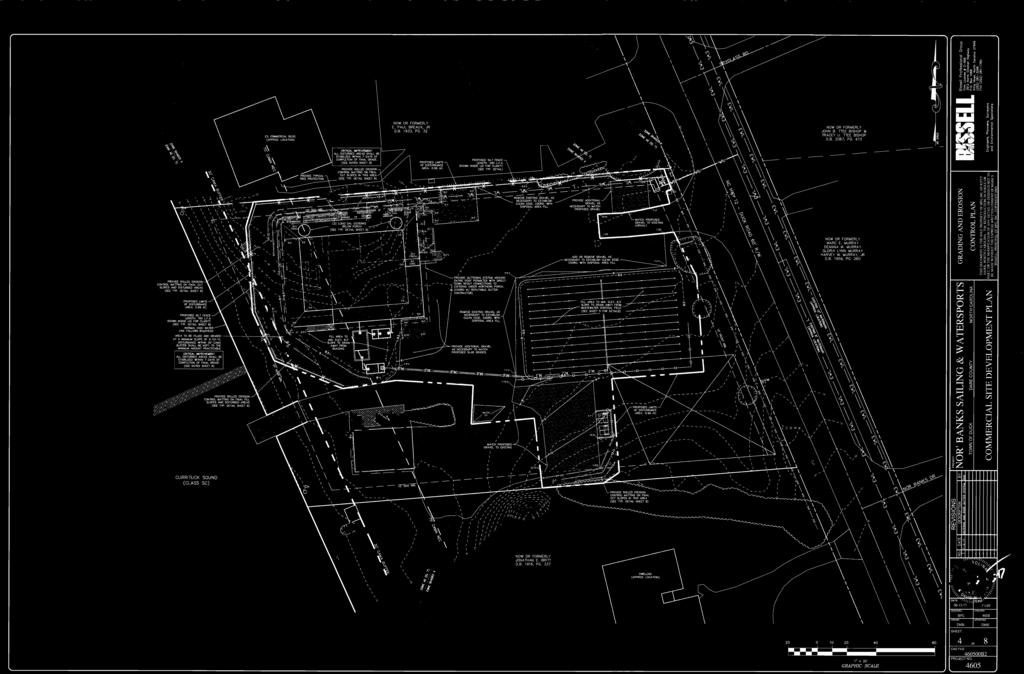
2 Town of Duck, North Carolina Department of Community Development CUP , Nor Banks Watersports/Restaurant 1314 Duck Road Agenda Item 3a TO: FROM: Chairman Blakaitis & Members of the Duck Planning Board Joe Heard, AICP, Director of Community Development DATE: July 12, 2017 RE: Staff Report for CUP , Nor Banks Watersports/Restaurant, 1314 Duck Road Application Information Application #: CUP Project Location: 1314 Duck Road Zoning: Village Commercial (V-C) Dare County PINs: , & portion of Property Owners: 1312 & 1314 Duck Road Nor Banks, Inc Duck Road Jonathan E. Britt Applicant: Jonathan E. Britt, President & Owner Proposal As outlined in the application materials for the proposed project (Attachments B, C, D, and E), the applicant is requesting four conditional use permits: (1) to construct a commercial structure greater than 5,000 square feet, but less than 10,000 square feet; (2) to add a restaurant (eating establishment); (3) to alter the layout of the existing sailing and watersports business (boat launching and rental facilities); and (4) approve the Village Commercial Development Option to allow gravel parking and bring existing parking encroachments into compliance at 1314 Duck Road. The proposed redevelopment project will include: Combination of two adjoining parcels and a portion of a third parcel to create a 1.62 acre property for the development. Demolition of the existing watersports building and removal of a large wooden deck surrounding the building. Removal of a section of gravel parking area and raised landscaped bed to the east of the existing building. Construction of a new, two-story building housing a restaurant and watersports business. Establishment of a restaurant with 4,420 square feet of indoor dining on the upper floor, 600 square feet of outdoor dining on the upper floor porch, and 970 square feet of outdoor seating/entertainment on the ground floor. 1
3 Town of Duck, North Carolina Department of Community Development CUP , Nor Banks Watersports/Restaurant 1314 Duck Road Agenda Item 3a Provision of a 2,678 square foot service area and separate bathrooms (an additional 605 square feet) for the watersports business on the ground floor of the building. Expansion of the existing gravel parking area by approximately 13 additional parking spaces. Landscaping, including the removal of some existing trees, use of some existing trees, and additional vegetation to be planted around the new parking areas. Utility improvements supporting the proposed development. Property Information The area proposed for redevelopment presently consists of two entire parcels, plus a portion of a third parcel, all of which is zoned Village Commercial (V-C). Although technically separate parcels, the properties at 1312 and 1314 Duck Road currently function together as Nor Banks Sailing and Watersports. The property at 1314 Duck Road is presently 33,698 square feet (0.77 acre) in size and contains the driveway entrance, some parking, and a customer service building for Nor Banks Sailing and Watersports. The adjoining property at 1312 Duck Road is presently 34,827 square feet (0.80 acre) in size and contains some parking, a boat ramp, and a garage/service building for Nor Banks Sailing and Watersports. The entire property at 1310 Duck Road is approximately 55,619 square feet (1.28 acre) and contains the applicant s residence. A strip of this property 20 feet in width will be combined with the other two parcels to create the development parcel. The subject property adjoins the Currituck Sound to the west. The adjoining property to the south will be the remaining portion of the parcel at 1310 Duck Road. This property is zoned Village Commercial (V-C) and contains. The abutting property to the north at 1316 Duck Road is 0.86 acre in size, zoned Neighborhood Commercial (C-1), and contains an approximately 3,300 square foot office building for Sun Realty. To the east of the project area across Duck Road are two properties zoned Single-Family Residential (RS-1), each of which contains a single-family residence. Prior Approval History The sailing and watersports business was established on the subject property in On May 2, 1994, the applicant received approval for a conditional use permit from Dare County to extend the existing sailing and watersports business 50 feet south into an RS-1 zoned property. While under the jurisdiction of unincorporated Dare County, the subject property and two parcels to the south were rezoned from the Single-Family Residential (RS-1) district to the Village Commercial (V-C) district on February 4, The Sun Realty and Portside Condominiums properties to the north were already zoned Neighborhood Commercial (C-1) at that time. 2
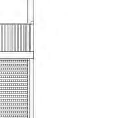
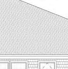
4 Town of Duck, North Carolina Department of Community Development CUP , Nor Banks Watersports/Restaurant 1314 Duck Road Agenda Item 3a On November 10, 2005, a plan of development was approved by the Director of Community Development to pave an asphalt driveway entrance approximately 75 feet into the subject property. Staff Analysis A technical review committee consisting of the Community Development Director, Permit Coordinator, Building Inspector, Fire Chief, Police Chief, Town Engineer, and Dare County Water Department met with the applicant s engineer and contractor to conduct an initial review the development proposal on June 22, The Dare County Environmental Health Department and N.C. Department of Transportation were also sent copies of the development proposal and asked to review and comment on the project. The applicant s engineer submitted the attached, revised site plans addressing many of the comments received at the meeting. Staff has compiled the following comments: Lot Combination (E): In order to eliminate issues with setback lines and provide adequate area for the proposed development, the applicant plans to combine two adjoining parcels and a twenty foot (20 ) wide strip of a third parcel to create a 1.62 acre property for the development. The process for combining the parcels is for a surveyor to prepare a plat that abandons and adjusts the property lines to create one larger commercial parcel addressed as 1314 Duck Road (the subject property) and one smaller residential parcel at 1310 Duck Road. Under State and Town regulations, this plat is defined as an exempt plat as it decreases the number of parcels. Therefore, the Director of Community Development will sign an exemption certificate on the plat and it may then be recorded at the Dare County Register of Deeds Office. As a portion of the parcel at 1310 Duck Road will be transferred to the larger parcel, a deed must also be recorded documenting the transfer of land. Proposed Use (C): Sheet 1, Notes 6 & 7 of the Site Plan & Redevelopment Summary The proposed uses include the construction of a new restaurant featuring indoor and outdoor seating areas and redevelopment of the existing sailing and watersports rental business. Both these uses are listed as conditional uses in the Village Commercial (V-C) zoning district. Building Size (D)(7): Sheet 1, Note 7 of the Site Plan & Floor Plans The proposed building is two stories in height. The upper floor contains a restaurant 4,420 square feet in size with an additional 1,950 square feet of porches. The eastern side of the ground floor (associated with the restaurant) contains an open bar/entertainment area with small enclosures for a walk-in cooler, storage, and bathrooms. The western portion of the ground floor is also mostly open and contains bathrooms and activity areas associated with the watersports business. 3
5 Measurements for the enclosed areas are as follows: Use Square Footage Restaurant (indoor seating) 4,420 s.f. Bathrooms (watersports) 605 s.f. Bathrooms (restaurant outdoor) 125 s.f. Walk-In Cooler 120 s.f. Storage 49 s.f. Total Enclosed Area 5,319 s.f. Town of Duck, North Carolina Department of Community Development CUP , Nor Banks Watersports/Restaurant 1314 Duck Road Agenda Item 3a The proposed building exceeds the maximum building size standard of 5,000 square feet in the V- C district, but is being considered for approval as a conditional use for commercial structures greater than 5,000 square feet, but less than 10,000 square feet in size Section (C)(9). Additional open areas covered by a roof or building include the following areas: Use Watersports Activity Area (ground floor) Porches (upper floor, including outdoor seating) Outdoor Entertainment Area (ground floor) Square Footage 2,678 s.f. 1,950 s.f. 970 s.f. Building Height (D)(6): Building Elevation Drawings The maximum height allowed in the V-C district is thirty-five feet (35 ) from the finished grade to the tallest roofline of a building. The building elevations show a height of 34.1 feet, in compliance with the maximum height standard. Building Setbacks (D)(2), (3) & (4): Sheet 3 of the Site Plan The proposed building has the following setbacks from property lines: Proposed Required Front 164 feet 15 feet Rear 40 feet 20 feet South Side 122 feet 10 feet North Side 12 feet 10 feet The proposed building complies with the minimum building setback standards. An existing garage/service building on the property does not conform with current setback standards as it appears to be located directly on the southern property line. With the recombination of the lots as part of the proposed project, this structure will be brought into compliance with minimum setback standards as it will be located 20 feet from the southern side property line. 4
6 Town of Duck, North Carolina Department of Community Development CUP , Nor Banks Watersports/Restaurant 1314 Duck Road Agenda Item 3a Lot Area (D)(1): Sheet 1, Note 4 of the Site Plan As part of this redevelopment project, the applicant proposes to combine the two existing parcels at 1312 and 1314 Duck Road, plus a portion of the property at 1310 Duck Road to the south. The combined area of these properties will result in a single parcel 1.62 acre in size, which exceeds the minimum lot size of 20,000 square feet for the V-C district. Lot Coverage (D)(5): Sheet 1, Note 9 of the Site Plan The new building, parking area expansion, and other improvements will increase the amount of lot coverage by 8,338 square feet on the subject property. With this increase, the total amount of lot coverage will be 33,878 square feet or 47.9% of the property. The proposed expansion complies with the maximum lot coverage requirement of 60% in the V-C zoning district. CAMA Lot Coverage: Sheet 1, Note 10 of the Site Plan In addition to the Town s standards for lot coverage for the entire parcel, the proposed development is subject to a 30% maximum lot coverage standard within the CAMA Area of Environmental Concern. The proposed building, porches, walkways, and stairways will increase the amount of lot coverage in the CAMA AEC by 2,038 square feet. With this increase, the total amount of lot coverage in the CAMA AEC will be 4,496 square feet or 27.0% of the area within the CAMA AEC, under the 30% threshold. Access (G) & : Sheet 3 of the Site Plan The current watersports business at 1314 Duck Road presently gains access to Duck Road from an existing asphalt drive approximately 18 feet in width. The applicant proposes to maintain access from the existing drive with no improvements being proposed. The driveway widens to a width of approximately 26 feet at the property line, which complies with the maximum width standard of 30 feet at the property line. The distance between the existing access drive on the subject property and the access drive into the adjoining Sun Realty property to the north is approximately 69 feet. This layout does not comply with the Town s current standards requiring a minimum of 80 feet between driveways. However, as both entrances have existed in this configuration for many years, this is considered a legal, nonconforming situation. Internal Traffic Circulation ( & ): Sheet 4 of the Site Plan Nearly all of the parking spaces are accessed via a drive aisle 24 feet in width, which exceeds the Town s minimum standard of 20 feet and is wider than found in most parking areas. Two parking spaces (#61 & #62) have a narrower maneuvering area of only 20 feet, which is adequate and more typical for standard parking lots. 5
7 Town of Duck, North Carolina Department of Community Development CUP , Nor Banks Watersports/Restaurant 1314 Duck Road 6 Agenda Item 3a Parking Spaces ( , & ): Sheet 1, Note 7 & Sheet 3 of the Site Plan The existing parking area does not contain many designated parking spaces, but the applicant s engineer estimates that there is presently parking for approximately 50 vehicles on site. To accommodate the proposed redevelopment, the applicant has proposed the expansion of the existing gravel parking area in two places and the construction of three concrete ADA handicap parking spaces adjoining the new building. The minimum number of parking spaces for the site (including the expansion) is calculated below: Use Size Ratio # Required Spaces Outdoor Recreation (existing) 1,711 s.f. 1/200 s.f spaces Outdoor Recreation (proposed) 3,283 s.f. 1/200 s.f spaces Outdoor Recreation 4 employees 1/2 employees 2.00 spaces Restaurant (indoor) 60 seats 1/3 seats spaces Restaurant (outdoor) 1,570 s.f. 1/150 s.f. 1st 150 s.f spaces Restaurant 12 employees 1/3 employees 4.00 spaces TOTAL spaces **The minimum parking requirement rounds down to 60 parking spaces. With the additional gravel parking being proposed, the site is designed to contain a total of 63 parking spaces, which exceeds the minimum parking requirements for the site. Standards of the Americans with Disabilities Act (ADA) require a minimum of three handicap accessible parking spaces on the site. Three ADA parking spaces are provided in close proximity to the handicap access ramp for the new building. ADA compliant walkways are provided to connect the parking spaces to the ramp. Parking Location: Sheet 3 of the Site Plan Found in the definition of the term Yard, Town standards require a minimum setback of five feet from side property lines. The subject property has existing nonconformities with parking spaces encroaching into the five foot setback along the northern (Spaces 1-6) and southern (Spaces 57-62) property lines. All of the newly proposed parking spaces comply with the minimum setback standard. However, the applicant is seeking approval under the Village Commercial Development Option to maintain the existing, nonconforming parking spaces in their current locations and bring these existing parking encroachments into compliance. Parking Surface ( & ): Sheet 3 of the Site Plan Town standards for commercial parking surfaces state, all parking lots shall be improved with asphalt, concrete, pavers, porous pavement, or similar dust proof surface. The current drive aisle and parking spaces for the Nor Banks Sailing & Watersports business are
8 Town of Duck, North Carolina Department of Community Development CUP , Nor Banks Watersports/Restaurant 1314 Duck Road 7 Agenda Item 3a surfaced entirely with gravel. As this condition existed long before the Town of Duck s incorporation, the gravel parking area is considered to be a legal, nonconforming situation. At this time, the applicant is proposing to expand the existing, nonconforming parking area with additional gravel parking. As a gravel parking surface does not comply with the Town s current standards, the applicant is seeking approval of this parking surface through the Village Commercial Development Option in the V-C zoning district. Loading Zone ( ): Sheet 3 of the Site Plan The property is required to have a loading zone at least 12 x 25 in size to serve the proposed businesses. In compliance with this standard, a 12 x 25 loading zone is being provided northeast of the existing garage/service building. Landscaping ( & ): Sheets 2 & 6 of the Site Plan The location and construction of the proposed buildings will require the removal of an existing tree (17 multi-stem) and dozens of existing shrubs (see Sheet 2) to the northeast of the existing watersports building. The applicant is proposing to save a mature pine tree located near the same area, but notes that it may be subject to removal if necessary during construction. A section of tall hedge near the garage/service building will also be removed to accommodate a parking area. The landscaping plan (Sheet 6) shows new landscaping in landscaped beds around the eastern edges of the area where the parking lot is being expanded. The proposed landscaping abutting the southern side of the parking area expansion also doubles as a landscape buffer between the commercial activities on the subject property and the residential use on the adjoining property to the south. As the adjacent parcel to the north is zoned Neighborhood Commercial (C-1) and used commercially, there are no requirements for buffering the subject property from this property. The number and location of the trees and shrubs complies with the Town s landscaping standards. As a commercial development, the parcel is also required to install and maintain vegetation equally or exceeding 10% canopy coverage. Based on the amount of large trees, small trees, and shrubs being kept or planted in the landscape plan, the proposed redevelopment will comply with the 10% standard. Waste Management ( ): Sheet 3 of the Site Plan The applicant has provided two dumpsters located at the eastern end of the drive aisle in the southern parking area. The dumpsters on the site plan are screened from Duck Road per the Town s standards. Lighting ( ): The submitted plans and information do not contain any information about proposed lighting for the site. Additional information will need to be provided to determine if exterior lighting for the proposed building and parking area will comply with the Town s lighting standards.
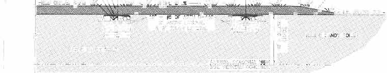
9 Town of Duck, North Carolina Department of Community Development CUP , Nor Banks Watersports/Restaurant 1314 Duck Road Agenda Item 3a Signs ( ): A freestanding sign is shown in the same location as the existing sign on the property. Any new signs, sign faces, or sign lighting will be reviewed and approved under a separate permit by the Community Development Department. Water Service ( ): Sheet 5 of the Site Plan Existing 8 and 12 water mains are located on the east side of Duck Road. So, any new lines would have to be bored underneath Duck Road to the subject property. There is an existing water line on the subject property that serves the watersports business. A note on the utility plan states, The water service to the existing building shall be field located. Its adequacy to serve the proposed development is to be determined. Coordinate with plumber, engineer, Water Department, and Health Department for continued use or modifications relative to proposed site improvements. An additional water line serving the sprinkler system in the proposed building will be installed parallel to the northern side property line. Wastewater Disposal ( ): Sheet 1, Note 8 and Sheet 5 of the Site Plan As part of the proposed redevelopment, the existing septic system serving the sailing and watersports business will be removed. The site plan shows the proposed location of the septic field in the center near the eastern boundary of the property. The repair area is proposed further to the south of the septic field. Jack Flythe, Supervisor of the Dare County Environmental Health Department, has conducted an initial evaluation and found the site and soil to be suitable for on-site wastewater disposal. The applicant must obtain a permit from the Dare County Environmental Health Department for the design and installation of the proposed wastewater treatment system improvements prior to the issuance of a land disturbance or building permit. Land Disturbance ( ): Sheet 4 of the Site Plan Certain areas of the existing site have a rolling terrain. Much of the proposed grading work involves levelling the topography in areas of development. The area within the building footprint will be lowered by as much as five feet in one area and raised approximately 1-2 feet in other areas to create a level building pad. The easternmost area of the parking lot along the southern side of the property will be levelled by removing several feet from the side of an existing dune. The proposed septic field will be levelled (higher in some areas, lower in others). The applicant must obtain a land disturbance permit from the Community Development Department prior to engaging in any tree removal, fill, or grading activity on site. 8
10 Town of Duck, North Carolina Department of Community Development CUP , Nor Banks Watersports/Restaurant 1314 Duck Road Agenda Item 3a Stormwater Management ( ): Sheet 4 of the Site Plan As the proposed redevelopment project does not increase the impervious coverage by more than 10,000 square feet, the applicant is not required to obtain a stormwater management permit from the NCDENR Division of Energy, Mineral & Land Resources. However, Town standards require the applicant to accommodate the stormwater runoff generated by a 1.5 design storm. The applicant has designed a stormwater management system that includes a system of gutters and two 2,500 gallon cisterns that will collect rainwater to be reused on-site for irrigation and/or washing boats. Town engineering consultant Mike Robinson has provided the following comments: I have reviewed the revised stormwater submittal package from David Klebitz P.E. and in my opinion it meets the intent of the Town s Stormwater Management Ordinance. Dave and I discussed the reuse of the cistern-stored water for irrigation and/or boat wash-down. It is an excellent use of the resource, but there is still some uncertainty as to how this will be handled and we may want require an operational plan and maintenance plan prior to placing the system in service. I would also ask that the cisterns and hose bib connected to the cisterns be clearly labeled non-potable. Flood Zone (Chapter 150): Sheet 3 of the Site Plan The subject property is presently located within two different flood zones. A portion of the property abutting Currituck Sound is in an AE flood zone with a regulatory flood protection elevation (RFPE) of eight feet (including the freeboard requirement in the Town s flood damage protection ordinance). The existing garage/service building is located within the AE flood zone. A majority of the property, including the area proposed for the new building, is located in an X flood zone. The X zone does not have any building elevation requirements for construction. CAMA: Sheet 3 of the Site Plan The boundaries of the CAMA buffer and area of environmental concern (AEC) are shown toward the western side of the site plan. As a significant portion of the proposed building is located within the CAMA AEC, a CAMA minor permit must be obtained from the N.C. Division of Coastal Management for this development. None of the proposed improvements are located within the required CAMA buffer. Building/Fire Codes: Sheet 5 of the Site Plan The provision of a sprinkler system within the proposed building satisfies many of the requirements under the N.C. Fire Code. A water line serving the sprinkler system in the proposed building will be installed parallel to the northern side property line. 9
11 Town of Duck, North Carolina Department of Community Development CUP , Nor Banks Watersports/Restaurant 1314 Duck Road Agenda Item 3a An existing fire hydrant is located on the east side of Duck Road. Per the request of the Duck Fire Department, the site plan shows the installation of a new hydrant on the western side of the highway to serve the proposed businesses. Duck CAMA Land Use Plan The Future Land Use Map in the Town of Duck s adopted CAMA Land Use Plan designates the subject property as a General Commercial Area. The General Commercial Area is defined as General commercial areas include areas that primarily encourage the concentration of commercial facilities in clusters or group developments and to provide readily accessible shopping facilities and will provide for the proper grouping and development of commercial facilities to serve permanent and seasonal residents and the general public. Group developments are envisioned and should be encouraged in these areas. The proposed restaurant and watersports business appear to be consistent with the type of uses allowed in a General Commercial Area. As part of its recommendation, the Planning Board is asked to determine if the proposed text amendment is or is not consistent with the Town s adopted CAMA Land Use Plan. Staff Recommendation Staff recommends APPROVAL of the conditional use permit to redevelop the property at 1314 Duck Road with a new watersports/restaurant building and associated site improvements, subject to the following conditions: 1. A plat and deed combining parcels (1314 Duck Road), (1312 Duck Road), and a portion of (1310 Duck Road) per the proposed plans must be approved and recorded at the Dare County Register of Deeds Office. 2. All parking spaces must be delineated through the use of curb stops or other acceptable markings. 3. An operational and maintenance plan must be provided to the Community Development Department prior to placing the system for reuse of the cistern-stored water into service. 4. A site lighting plan must be submitted and approved by the Community Development Department to ensure compliance with the Town s lighting standards. 5. Approval must be obtained from the Dare County Water and Health departments to authorize use of the existing water line or upgrade the water service to accommodate the proposed uses. 6. An encroachment permit must be obtained from the N.C. Department of Transportation for the installation of the water lines and fire hydrant within the State right-of-way. 7. A permit must be obtained from the Dare County Environmental Health Department for the design and installation of the proposed wastewater treatment system prior to the issuance of a land disturbance or building permit. 10

12 Town of Duck, North Carolina Department of Community Development CUP , Nor Banks Watersports/Restaurant 1314 Duck Road Agenda Item 3a 8. A CAMA minor permit must be obtained from the N.C. Division of Coastal Management prior to the issuance of a land disturbance or building permit. 9. The applicant must obtain a land disturbance permit from the Community Development Department prior to engaging in any tree removal, fill, or grading activity on site. 10. The buildings must be constructed in substantial conformance with the elevation drawings and floor plans submitted with the CUP application, as prepared by Finch & Company and dated June 12, Any new signs, sign faces, or sign lighting must be reviewed and approved under a separate permit by the Community Development Department. 12. The applicant must submit the final site plan and site plan review fees as provided for in the Town s adopted fee schedule concurrent with final engineer-stamped site plan drawings, as may be revised through the approval and condition process, with all required information referenced in the CUP conditions, prior to issuance of a building permit for the project. 13. This conditional use permit will expire in 18 months from the date of approval, unless construction has commenced with the required site plan and building permit approvals. ATTACHMENTS Attachment A Attachment B Attachment C Attachment D Attachment E Attachment F Location Map and Property Information Conditional Use Application Development Summary Site Plan (8 Sheets) Building Elevations and Floor Plans Comments from Dare County Environmental Health Department 11


13


14


15
16 DUCK SPYGLASS NOR BANKS Town of Duck North Carolina 1310, 1312 and 1314 Duck Road prepared July 7, 2017


17
18
19
20
21
22
23
24


25


26


27


28


29


30


31


32
33 UP UP 15' - 2 3/16" 14' /16" 29' - 11" UP 81' - 0" 20' - 2 1/2" 16' - 6 1/2" 5' - 2 3/4" 10' - 0" 60' - 0" 75' - 2 3/4" 10' - 0" 10' - 0" MENS R.R. WOMENS R.R S.F S.F. 10' - 0" 5' - 4" 1' - 7" 20' - 8 1/2" 5' - 7" 6' - 0" 37' - 7 1/4" 9' - 9" LATTICE, TYP. 75' - 2 3/4" 0' - 0" 26' - 3 1/2" 33' - 5 1/2" 10' - 0" UNDER PORCH OUTDOOR RECREATION ACTIVITY COVERED SERVICE AREA 2678 S.F. 19' - 0" stage OUTDOOR ENTERTAINMENT AREA 970 S.F. STORAGE bar WALK-IN COOLER 20' - 11" 4' - 7" 8' - 0" 7' - 7" 4' - 9 1/2" 39' - 9 1/2" 9' - 6 1/2" 10' - 8" 36" KNEEWALL W/ LATTICE NOR' BANKS RESTAURANT 1312/1314 Duck Rd. Duck, N.C GROUND FLR. PLAN Project # Date 7/5/17v.11 A-1 Drawn by R.E.S. Checked by O.F. Scale 1/8" = 1'-0" 7/5/2017 9:46:57 AM 1 1/8" = 1'-0" 62' - 0"
34 DN KITCHEN 934 S.F. BY OTHERS COVERED PORCH 1950 S.F. HANDICAP RAMP 734 S.F. EXIT DN DINING FLOOR DN WAITING AREA BAR EXIT OUTDOOR DINNG AREA 600 S.F. ENTRY MOP RM. 32 S.F. FIRST FLOOR TOTAL S.F WALK-IN 6'X8' FREEZER 8'X6' COVERED PORCH COVERED PORCH COVERED PORCH NOR' BANKS RESTAURANT 1312/1314 Duck Rd. Duck, N.C FIRST FLR.PLAN Project # Date 7/5/17v.11 A-2 Drawn by R.E.S. Checked by O.F. Scale 1/8" = 1'-0" 7/5/2017 9:46:58 AM 1 1/8" = 1'-0"


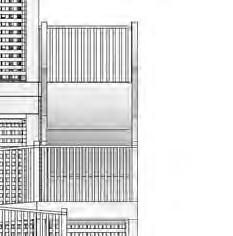

35 34' - 1 1/8" ridge to slab 1 1/8" = 1'-0" 1312/1314 Duck Rd. Duck, N.C EAST ELEVATION Project # Date Drawn by Checked by /5/17v.11 R.E.S. O.F. Scale A-7 1/8" = 1'-0" 7/5/2017 9:51:59 AM


36 1 1/8" = 1'-0" 1312/1314 Duck Rd. Duck, N.C WEST ELEVATION Project # Date Drawn by Checked by /5/17v.11 R.E.S. O.F. Scale A-8 1/8" = 1'-0" 7/5/2017 9:52:35 AM


37 1 1/8" = 1'-0" 1312/1314 Duck Rd. Duck, N.C NORTH ELEVATION Project # Date Drawn by Checked by /5/17v.11 R.E.S. O.F. Scale A-9 1/8" = 1'-0" 7/5/2017 9:53:20 AM


38 1 1/8" = 1'-0" 1312/1314 Duck Rd. Duck, N.C SOUTH ELEVATION Project # Date Drawn by Checked by /5/17v.11 R.E.S. O.F. Scale A-10 1/8" = 1'-0" 7/5/2017 9:54:06 AM


39
40 Town of Duck, North Carolina Department of Community Development Discussion: Dune Walkovers/Mobility Agenda Item 3b TO: Chairman Blakaitis and Members of the Town of Duck Planning Board FROM: Joe Heard, AICP, Director of Community Development DATE: July 12, 2017 RE: Discussion of Dune Walkovers & Access for Limited Mobility Background Information During its annual retreat on February 14-15, 2017, the Duck Town Council authorized the Planning Board and Community Development staff to develop the necessary text amendments to address changes and issues associated with the Town s beach nourishment project. The Duck Planning Board previously reviewed and recommended amendments relating to the establishment of a static vegetation line, limitations on beach pushes, and standards for dune walkovers. Immediately following the public hearings, the Duck Town Council adopted the standards recommended by the Planning Board (with a couple of changes) at its meeting on July 5, During the Town Council s consideration of the standards for dune walkovers, there was a good deal of discussion about the challenges of accessing the beach for people with physical handicaps or limited mobility. The Council members discussed several different alternatives (such as allowing post and rope barriers, railings, or wooden walkways down the eastern side of the dune), but decided to adopt the gentler approach recommended by the Planning Board (beach access matting) as an initial step. However, the Town Council requested that the Community Development Department work with the Planning Board to evaluate options for providing better access for people with limited mobility. Subsection (C)(1) With the recent adoption of the standards for dune walkovers within the beach nourishment area, the current standards in Section (C)(1) of the Zoning Ordinance now read as follows: (1) Dune walkover structures. Dune walkover structures shall be constructed to entail negligible alteration of the dune. The following construction standards shall apply: (a) Dune walkover structures for residential use shall be no wider than 4 feet and shall be constructed on raised posts or pilings embedded no less than 4 feet and no greater than 5 feet below grade. Walkover structures for commercial or public use may be constructed up to 6 feet in width and shall utilize piling embedment criteria consistent with the North Carolina Building Code. 1
41 Town of Duck, North Carolina Department of Community Development Discussion: Dune Walkovers/Mobility Agenda Item 3b (b) The underside of the dune walkover structure across the frontal or primary dune shall be a minimum of 18 inches and a maximum of 30 inches above grade. (c) Dune walkover structures shall be located such that the first step down to the beach is placed no farther seaward than the beginning of the downward slope of the dune. (d) Dune walkover structures shall be constructed so that the staircase turns parallel to the dune if there is more than a 12-foot-vertical rise in the staircase required to provide access to the surface of the beach. The requirement to turn the stairs shall not apply in instances where it would preclude the placement of the stairs entirely within the subject property. (e) Within the beach nourishment project area, dune walkover structures must be constructed to meet the following standards: 1. A dune walkover structure on the western side of the dune may consist of a hardened structure (ramp/stairway), beach access matting, or any material consistent with the standards of this chapter. 2. A dune walkover extending over the top of a dune may only be constructed of beach access matting. 3. A dune walkover is permitted to extend down to the toe of the eastern side of the dune. This walkover may only be constructed of beach access matting. (f) Where a lawful dune walkover structure exists on July 5, 2017 within the beach nourishment project area that could not be built under the terms of Subsection (e) above, the structure may be continued so long as it remains lawful, subject to the following provisions. 1. The non-conforming dune walkover structure may not be enlarged or altered in a way which increases its non-conformity, but any structure or portion thereof may be altered to decrease its non-conformity. 2. Should the non-conforming portion of a dune walkover structure be destroyed by any means to an extent of more than 50% of its replacement cost at the time of destruction, it shall not be reconstructed, except in conformity with the provisions of this chapter. 3. If located at an elevation higher than the top of the dune, an extension of the nonconforming dune walkover structure, not exceeding five feet in length, may be added to lower the walkover structure to the elevation at the top of the dune. 2

42 Town of Duck, North Carolina Department of Community Development Discussion: Dune Walkovers/Mobility Agenda Item 3b Applicable Definitions: DUNE SYSTEM, FRONTAL DUNE. The first mound of sand located landward of the beach having sufficient vegetation, height, continuity, and configuration to offer protective value. DUNE SYSTEM, PRIMARY DUNE. The first mounds of sand located landward of the beach having an elevation equal to the mean flood level for the area plus 6 feet. The primary dune extends landward to the lowest elevation in the depression behind the same mound of sand. DUNE WALKOVER STRUCTURE. A raised walkway constructed for the purpose of providing access to the beach from points landward of the dune system. Staff Analysis The Town s beach nourishment project has resulted in a relatively gentle 1:5 slope (five foot run for each one foot rise) on the east side of the constructed dune. The typical profile for the east side of the newly constructed dune runs 70 feet from the east side of the dune crest (elevation of 20 feet) to the ocean beach (elevation of 6 feet). The longer length of the eastern side of the dune and beach has created greater challenges for people with mobility limitations to access the beach and ocean. At its meeting on June 14, 2017, the Planning Board had considerable discussion about accessibility concerns. Similar to the decision made by Town Council, the Board members recognized that there might be individual issues, but using a less obtrusive approach with beach access matting instead of hardened ramps or stairways was a better initial approach until the Town can observe how the dune and beach are shaped over time. With the quick turnaround from the Town Council meeting, staff has not had the opportunity to explore the variety of beach access alternatives that may be used by other coastal communities. However, staff has identified the following list of issues that the Planning Board may wish to discuss. The Board members may have additional ideas for discussion as well. Issues for Discussion 1. Access/viewing areas for ADA handicap access (ramps, decks). 2. Rest areas/viewing areas for individuals with mobility limitations (benches, decks). 3. Physical support for individuals with mobility limitations (railings, walkways). 4. Apply to neighborhood beach accesses differently than individual properties. 5. Apply town-wide or in beach nourishment area. 6. Enact as policies, standards, or incentives. 3
43 TOWN OF DUCK PLANNING BOARD REGULAR MEETING June 14, 2017 The Planning Board for the Town of Duck convened at the Paul F. Keller Meeting Hall on Wednesday, June 14, Present were: Chair Joe Blakaitis, Vice Chair Marc Murray, Tim McKeithan, and James Cofield. Absent: Sandy Whitman Also present were: Director of Community Development Joe Heard, Permit Coordinator Sandy Cross, Coastland Times Reporter Philip Ruckle, Julien Devisse of Coastal Planning and Engineering, Henry Blaha, John Wander, Sharron Young and Jackie Orsulak. Others Present: None. Others Absent: Council Liaison Chuck Burdick. Chair Blakaitis called to order the Regular Meeting of the Planning Board for June 14, 2017 at 6:37 p.m. PUBLIC COMMENTS None. OLD BUSINESS None. NEW BUSINESS Text Amendment Ordinance 17-06: Proposal to Amend Section of the Town Code with Standards for Dune Walkover Structures within the Beach Nourishment Project Area Director Heard stated that during the Town Council s annual retreat, Council authorized the Planning Board and Community Development staff to develop the necessary text amendments to address changes and issues associated with the Town s beach nourishment project. He stated that the Board previously recommended amendments relating to the establishment of a static vegetation line and limitations on beach pushes. He added that the Board is now asked to consider developing a standard defining the type and characteristics of dune walkovers within the beach nourishment project area. Director Heard stated that a key concern is the potential length of dune walkover structures. He noted that Subsection (D)(3)(a) permits dune walkovers to potentially extend 20 feet beyond the seaward toe of the frontal dune. He stated that the beach nourishment project will - 1 -
44 result in a gentle slope of a five-foot run for each one foot rise on the east side of the constructed dune. He explained that the typical profile for the east side of the newly constructed dune will run 70 feet from the dune crest, which is at an elevation of 20 feet, to the ocean beach, with an elevation of six feet. He stated that if the Town s current standards for dune walkovers are applied to the to the project area, a homeowner could potentially construct a dune walkover structure extending 60 feet down the east side of the dune (10 feet from the beach). Director Heard stated that there were people who have more mobility limitations than others, but there was also interest in allowing the dunes to stabilize and minimize any issues with the vegetation. He stated that there were concerns about limiting the length of the access ways to encourage safe access for ocean safety and emergency vehicles and not to obstruct access along the beach. He noted that the Board should evaluate and consider the different perspectives in developing the standards. Director Heard stated that there can be different things that occur over the next six to twelve months as the dune and beach settle and shape themselves. He stated that one of the main principles that staff is looking at are ways to use a light touch rather than going in and allowing long, hardened structures to run all the way down the front of the dune. The Town can look at alternatives such as matting and evaluate the needs of beachgoers within the project area. He noted that staff s suggestions are based on that thought process. Director Heard pointed out that the staff report contains the Town s current standards for dune walkover structures. He added that staff put in some information from The Dune Book, which the Board also had a copy. He stated that even though the book was written 14 years ago, it is still considered to be the gospel as far as how communities can deal with the care of dunes along the ocean. He explained that the book was put together by North Carolina Sea Grant and was meant to be a document that a layperson can read and understand. He highlighted out some key items regarding dune walkways in the staff report. Director Heard stated that in looking at potential amendments to some of the Town standards, there are standards for limitations on the width of the walkways, which currently are four feet in width for individual residential properties and six feet in width for commercial or public dune walkovers. He stated that staff does not see any particular reason why the standards for width need to change as a result of the project and is not recommending any changes to the Board. Director Heard stated that the second item staff reviewed was potential limitations on the length of dune walkovers. He stated that the current ordinance effectively limits the length of a dune walkover to 60 feet on the east side of a dune. He noted that when a 12-foot drop in elevation is reached, a dune walkover structure is required to turn sideways. Vice Chair Murray asked if this assumes that the walkway is completely level from the top of the dune. Director Heard stated that the walkway has to go down because it has to hug the dune. Vice Chair Murray asked how far down the slope the sand fencing and beach planting will go. Permit Coordinator Cross stated that planting is only planned on the top of the dune at this point. Vice Chair Murray asked if there are no improvements allowed on the dune slope and an individual rolls something out on it, what will keep pedestrians, particularly those who don t need the harder surface, from going off to the right or left. Chair Blakaitis stated that it could be - 2 -
45 the sand fencing. Vice Chair Murray disagreed. Permit Coordinator Cross stated that it could be coastal vegetation. Chair Blakaitis pointed out that sand fencing was already put out down half the dune. He added that the Town doesn t want people walking around the dune and, in addition, there will likely be additional signage put up on the dune fence until the planting takes hold. He added that in the Sanderling neighborhood, they paid the sand fence contractor an additional amount to put fencing on the slope. Member Cofield asked how far out it went. Chair Blakaitis stated that it goes all the way down. Member McKeithan stated that he looked at the beach access matting at Jennette s Pier and there are thousands of people walking on it. He added that it is not digging out an area or creating a path or trench. He added that it looks very effective. Vice Chair Murray clarified that the matting at Jennette s is not at a 1:5 slope. Chair Blakaitis stated that part of it is. Member McKeithan didn t think it is. Vice Chair Murray noted that the staff report notes the State is using the matting at Jennette s Pier. He pointed out that the 1:5 slope of the dune in Duck will not be ADA compliant. Chair Blakaitis agreed. Member Cofield asked what the matting is made from. Chair Blakaitis stated that it is made from recycled plastic with millions of holes to make it porous and bars going across with grabholds for your feet. He added that it isn t a perfect solution. Member McKeithan noted that the matting also has the effect of guiding pedestrians into a certain area instead of them choosing different access points. Director Heard stated that the natural, west side of the dune typically rises at a steeper slope than the east side of the constructed dune. He noted that it may make more sense on that side of the dune to have a hardened structure for people to get up the steeper slope. He added that the gentler slope on the east side of the dune should be easier for pedestrians to traverse; however, at approximately 70 feet in length to the beach, it covers a significant distance. He stated that the top of the constructed dune is generally flat, approximately feet in length, and will generally be the easiest part of the dune to cross. Director Heard stated that staff proposed in the draft ordinance the following concepts: Allow a hardened structure (ramp/stairway), beach access matting, or nothing on the western side of the dune. Allow beach access matting or nothing across the flat top of the dune. Allow a short stretch of beach access matting or nothing down the eastern side of the dune. Director Heard noted that even though the proposed amendment may prove to be a viable permanent solution, staff is also considering this concept as an important temporary measure. He added that following the completion of the beach nourishment project, sand fencing and planting will be installed to help stabilize the dune. However, the profile of the constructed dunes may adjust over time as wind, waves and other forces shape them. He noted that whatever beach access improvements the Town decides to allow, staff encourages further analysis of these options as conditions change in the future. He added that staff s opinion is less is better as - 3 -
46 beach matting can be easily rolled up and thrown away or reused. Whereas, hardened structures are more likely to become permanent fixtures on the dunes or beach. Member McKeithan clarified that Spencer Rodgers is not recommending the beach matting at the 5:1 slope. Permit Coordinator Cross stated that she had asked him about and he thought it will be somewhat of a nuisance because of the potential of ocean overwash. She added that she didn t think he truly grasped the size and scope of the dune when she spoke to him. Chair Blakaitis thought beach matting has been around a long time, but the newer matting is a better quality. Permit Coordinator Cross noted that the matting is very heavy. Chair Blakaitis agreed. Chair Blakaitis asked what is the significance of staff s recommendation for allowing matting 20 feet down the eastern side of the slope. Director Heard stated that it seems like a reasonable distance to begin guiding people down the slope. Chair Blakaitis asked if it is something that should put in the text amendment. Director Heard thought the challenge in going all the way down the slope is that there are still some concerns with people walking or emergency vehicles having to access that area. Chair Blakaitis noted that an emergency vehicle could drive across the matting. Director Heard stated that it would be easier for emergency vehicles to drive over it. Vice Chair Murray asked if it is relevant. He added that when he looks at the finished dune in front of Ocean Pines, it levels off and drops down. He asked if that was correct since the 1:5 slope did not continue. Director Heard stated that the 1:5 slope continues to the toe of the beach, then flattens onto the beach. Vice Chair Murray clarified that the flat beach is where any emergency vehicles will generally operate. Director Heard stated that would be correct most of the time. Member McKeithan stated that he is going to recommend that the beach matting be allowed to go to the bottom of the east side of the dune, because emergency vehicles should not be driving on the incline of the dune. Permit Coordinator Cross stated he is correct. She added that if the beach is crowded, there is the potential that emergency vehicles will not have access in an emergency situation. She noted that an ATV was driving up the slope earlier in the week. Member Cofield asked if the 70 feet measurement is from the top of the dune. Director Heard responded that he is correct. Vice Chair Murray realized that the projection is that the Town will lose up to 40% of the constructed sand material. Director Heard stated that more will be lost the beach than the dune. CB&I engineer Julien Devisse stated that some of the dune could be lost. Vice Chair Murray understands the reasoning for using the matting, but the concerns the Board talked about are regarding stabilizing the slope. He added that, historically speaking, the Town has used a fourfoot wide walkway to protect the dunes. He thought that a beach mat or hardened structure will be equally effective in keeping off the vegetation. Vice Chair Murray added that the obvious thing to put in the ordinance will be, if someone opts for a hardened structure, they will need in order to dismantle it in a timely fashion if conditions change. He added that he is curious since they ve been effective for a very long time and met the goals of the Town to protect the dune and vegetation. Director Heard stated that it is the significant change in the slope of the dune. Vice Chair Murray understood, but asked how it will negatively affect things. He stated that it used to be that a roped off walkway would be the most effective option. He asked how that is any different. Permit Coordinator Cross explained that with erosion, the posts can wash away. She - 4 -
Fact Sheet Ordinance Regulating Erosion Threatened Structures
 Fact Sheet Ordinance Regulating Erosion Threatened Structures Town of Duck, North Carolina August 15, 2011 What is being considered? The Town of Duck Council is considering an ordinance to limit the encroachment
This Chapter sets forth the minimum design, technical criteria and specifications to be used in the preparation of all roadway plans.
 4.1 GENERAL This Chapter sets forth the minimum design, technical criteria and specifications to be used in the preparation of all roadway plans. These Roadway Standards are for new construction and modification
Town of Siler City - Unified Development Ordinance ARTICLE XIV - Streets and Sidewalks
 ARTICLE XIV - Streets and Sidewalks 193 Street Classification (a) In all new subdivisions, streets that are dedicated to public use shall be classified as provided in 193(b) (1) The classification shall
REMOVE BARRIERS TO, ENCOURAGE CREATION OF AND PROVIDE GUIDELINES FOR SAFE ROUTES (ALL DISTRICTS)
") Ordinance 2009-98 AN ORDINANCE OF THE BOARD OF SUPERVISORS OF PIMA COUNTY, ARIZONA; RELATING TO ZONING; AMENDING THE PIMA COUNTY ZONING CODE TITLE 18 BY AMENDING SECTION 18.03.020 (DEFINITIONS) TO ADD
Ordinance 2009-98 AN ORDINANCE OF THE BOARD OF SUPERVISORS OF PIMA COUNTY, ARIZONA; RELATING TO ZONING; AMENDING THE PIMA COUNTY ZONING CODE TITLE 18 BY AMENDING SECTION 18.03.020 (DEFINITIONS) TO ADD
DESIGN CODE. Enterprise West Harlow London Road North Design Code 21
 DESIGN CODE Enterprise West Essex @ Harlow London Road North Design Code 21 4 MAXIMUM BUILDING HEIGHTS 4.1 Table 4A sets out maximum building height standards for each character area within the LDO boundary.
Roadway Classification Design Standards and Policies. Pueblo, Colorado November, 2004
 Roadway Classification Design Standards and Policies Pueblo, Colorado November, 2004 Table of Contents Page Chapter 1. General Provisions 1.1 Jurisdiction 3 1.2 Purpose and Intent 3 1.3 Modification 3
La Crescent Township Zoning Ordinance
 La Crescent Township Zoning Ordinance Table of Contents SECTION 1 ~ PREAMBLE, TITLE, SHORT TITLE AND PURPOSE... 1 0101 Preamble... 1 0102 Title... 1 0103 Short Title... 1 0104 Purpose... 1 SECTION 2 ~
Town of Kiawah Island Board of Zoning Appeals
 Town of Kiawah Island Board of Zoning Appeals March 19, 2018 Town of Kiawah Island Municipal Center 4475 Betsy Kerrison Parkway Kiawah Island, SC 29455 CASE# BZA-12-17-00233 Applicant/Property Owner(s):
Sidewalk Cafe City of St. Petersburg City Code Chapter 16, Land Development Regulations
 Section 16.50.370 Sidewalk Café Sections: 16.50.370.1 Generally 16.50.370.2 Declarations 16.50.370.3 Definitions 16.50.370.4 Permit Required 16.50.370.5 Application, Permit and Fee 16.50.370.6 Liability
4.7 Landscape Provisions.
 4.7. A. Intent. Landscaping of required Yards and required Bufferyards is an essential element of the design of a site with respect to promoting the public health, safety, comfort, convenience and general
1.3 Pedestrian Environments
 SECTION 1: COMMERCIAL DEVELOPMENT 1.3 Pedestrian Environments Design Principle The quality of the pedestrian environment often defines the overall success of a commercial project. Attention to the development
ORDINANCE NO AN ORDINANCE OF THE CITY OF FOLSOM AMENDING CHAPTER OF THE FOLSOM MUNICIPAL CODE CONCERNING SWIMMING POOLS, SPAS AND HOT TUBS
 ORDINANCE NO. 1267 AN ORDINANCE OF THE CITY OF FOLSOM AMENDING CHAPTER 14.28 OF THE FOLSOM MUNICIPAL CODE CONCERNING SWIMMING POOLS, SPAS AND HOT TUBS THE CITY COUNCIL OF THE CITY OF FOLSOM HEREBY DOES
REAR YARDS - There shall be a rear yard no less than forty (40) feet.
 feet.") ARTICLE VII - RESIDENCE R-2 DISTRICT 700-PURPOSE - The purpose of the R-2 District is to permit the establishment of medium density one and two family dwellings. 701-PERMITTED USES - After obtaining a
ARTICLE VII - RESIDENCE R-2 DISTRICT 700-PURPOSE - The purpose of the R-2 District is to permit the establishment of medium density one and two family dwellings. 701-PERMITTED USES - After obtaining a
Street Paving and Sidewalk Policy
 City Commission Policy 600 Street Paving and Sidewalk Policy DEPARTMENT: Public Works DATE ADOPTED: June 7, 1995 DATE OF LAST REVISION: December 10, 2014 Policy No. 600.01 AUTHORITY: PASS City of Tallahassee-Leon
GENERAL INSTRUCTIONS FOR A FENCE PERMIT
 Need To Submit: GENERAL INSTRUCTIONS FOR A FENCE PERMIT 1. Building permit application for accessory structures filled out completely. 2. Plot plan or survey showing the location of the proposed fence
RESIDENTIAL SWIMMING POOLS
 How to Obtain a Building Permit RESIDENTIAL SWIMMING POOLS MIAMI COUNTY, KANSAS BUILDING INSPECTION DEPARTMENT 201 South Pearl Street Paola, Kansas 66071-1777 Phone: (913) 294-4145 Fax: (913) 294-9545
CHAPTER 16 PEDESTRIAN FACILITIES DESIGN AND TECHNICAL CRITERIA TABLE OF CONTENTS
 CHAPTER 16 PEDESTRIAN FACILITIES DESIGN AND TECHNICAL CRITERIA TABLE OF CONTENTS Section Title Page 16.1 General... 16-1 16.1.1 AASHTO Reference... 16-1 16.1.2 ADA Requirements... 16-1 16.2 Sidewalks...
INTER- AND INTRA-CONNECTIVITY INTERPRETIVE GUIDELINES
 INTER- AND INTRA-CONNECTIVITY INTERPRETIVE GUIDELINES Prepared by: The City of Sanibel Planning Department March 6, 2014 Introduction One of the City Councils goals adopted for the fiscal year of 2013-2014
Table of Contents City of Shelbyville Unified Development Ordinance
 City of Shelbyville Unified Development Ordinance 2012, Bradley E. Johnson, AICP Table of Contents 1: Ordinance Foundation 1.01 Title... 1-2 1.02 Unified Development Ordinance... 1-2 1.03 Defined Words...
City of Rolling Hills Equestrian Facility Guidelines
 City of Rolling Hills Equestrian Facility Guidelines Drafted by the Stable Ad Hoc Committee STABLE GUIDELINES 1 2 [STABLE GUIDELINES] 2017 INTRODUCTION The Rolling Hills City Council noted a recent trend
City of Los Angeles Department of Building & Safety Disabled Access Section Supplemental Plan Review Checklist No. 8 RECREATION FACILITIES
 AMUSEMENT RIDES, BOAT SLIPS, BOWLING LANES, COURT SPORTS, FISHING PIERS Plan Check No. 1. Amusement rides required to comply with 11B-234, Amusement Rides shall provide accessible routes in accordance
Accommodating Pedestrians in the Work Zone
 Accommodating Pedestrians in the Work Zone Guidance for Section C Plan Preparers Some impacts cannot be avoided and those impacts apply to residents, businesses, motorists, and pedestrians alike. However,
*A Certificate of Survey for the property may be on file at City Hall if the house was built after 1984.
 Swimming Pools ** Permits are required for pools having a water surface area exceeding 100 square feet ** Permits are required for pools having a water surface area exceeding 100 square feet (11-3-3/8
ATLANTIC COAST OF LONG ISLAND, JONES INLET TO EAST ROCKAWAY INLET, LONG BEACH ISLAND, NY. Contract #2 Construction Scope. April 18th-19th 2018
 ATLANTIC COAST OF LONG ISLAND, JONES INLET TO EAST ROCKAWAY INLET, LONG BEACH ISLAND, NY Contract #2 Construction Scope April 18th-19th 2018 New York District PLAN COMPONENTS Length of Beachfill 35,000
NO wiring shall be above the pool within 10, measured horizontally, or under a pool within 5, measured horizontally.
 CITY OF PARK RIDGE 505 BUTLER PLACE PARK RIDGE, IL 60068 TEL: 847/ 318-5291 FAX: 847/ 318-6411 TDD:847/ 318-5252 URL:http://www.parkridge.us DEPARTMENT OF COMMUNITY PRESERVATION AND DEVELOPMENT BUILDING
Americans with Disabilities Act Transition Plan for Public Right-of-Way Improvements
 Americans with Disabilities Act Transition Plan for Public Right-of-Way Improvements Prepared by: Public Works Department Engineering Division October 2015 Table of Contents Section I Introduction.. 3
Town of Poughkeepsie Received: Permit # Aboveground/Inground Pool Building Permit Application
 Town of Poughkeepsie Received: Permit # Aboveground/Inground Pool Building Permit Application Property Address: Street: City: Zip: Grid Number: Zoning District: Owners Name: Phone: (H) (W) Builder : Phone:
POOL BARRIER AMENDMENTS & GUIDELINES: APPENDIX G SWIMMING POOLS, SPAS AND HOT TUBS
 SECTION AG101 - GENERAL POOL BARRIER AMENDMENTS & GUIDELINES: APPENDIX G SWIMMING POOLS, SPAS AND HOT TUBS AG101.1 General. The requirements of this appendix shall apply to the design and construction
ADA on Construction. Guidance for Section C Plan Preparers
 ADA on Construction Guidance for Section C Plan Preparers Some impacts cannot be avoided and those impacts apply to residents, businesses, motorists, and pedestrians alike. However, good planning can minimize
DEPARTMENT OF COMMUNITY PLANNING, HOUSING AND DEVELOPMENT Planning Division/Site Plan Review Committee
 DEPARTMENT OF COMMUNITY PLANNING, HOUSING AND DEVELOPMENT Planning Division/Site Plan Review Committee 2100 Clarendon Boulevard, Suite 700, Arlington, VA 22201 TEL 703-228-3525 FAX 703-228-3543 www.arlingtonva.us
Village of Plainfield Design and Operational Guidelines for Outdoor Uses within the Public Right-of-Way
 Village of Plainfield Design and Operational Guidelines for Outdoor Uses within the Public Right-of-Way Table of Contents 1. Applicability... 2 Purpose: The Village of Plainfield wishes to allow outdoor
Driveway Design Criteria
 Design Manual Chapter 5 - Roadway Design 5L - Access Management 5L-4 Driveway Design Criteria A. General For efficient and safe operations, access drives and minor public street intersections can be improved
City of Roseville Section 13 Design Standards. _Bikeways January 2016 SECTION 13 BIKEWAYS
 SECTION 13 BIKEWAYS 13-1 GENERAL The City of Roseville bikeway standards are designed to insure that transportation and recreational bikeways are constructed in a manner that would provide a safe and comfortable
Swimming Pool Requirements
 Swimming Pool Requirements 1. Definitions: Approved Safety Pool Cover. Means a manually or power-operated safety pool cover that meets all of the performance standards of the American Society for Testing
T A B L E OF C O N T E N T S
 T A B L E OF C O N T E N T S PART III SUBDIVISION REGULATIONS OF THE DEPARTMENT OF PUBLIC WORKS, C & C D PAGE PAGE Responsibility for Development of Streets......... 29 Right-of-Way Widths...... 37 Purpose...........
ADA Transition Plan. City of Gainesville FY19-FY28. Date: November 5, Prepared by: City Of Gainesville Department of Mobility
 ADA Transition Plan FY19-FY28 Date: November 5, 2018 Prepared by: City Of Gainesville Department of Mobility 1.0 INTRODUCTION 1.1 BACKGROUND The federal statute known as the Americans with Disabilities
SECTION 3 STREET DESIGN
 3.01 GENERAL SECTION 3 STREET DESIGN For purposes of geometric and structural design, streets shall be classified according to the following table. The City Engineer will determine the class of all proposed
Building Code Guidelines for Residential Pools
 Building Code Guidelines for Residential Pools KEEP YOUR POOL SAFE Department of Development and Permits 306 Cedar Road, City Hall 2 nd Floor Chesapeake, VA 23322 Phone: (757) 382-6018 E-mail: develop-permits@cityofchesapeake.net
CONNECTIVITY PLAN. Adopted December 5, 2017 City of Virginia Beach
 CONNECTIVITY PLAN Adopted December 5, 2017 City of Virginia Beach CONTENTS 1.0 Background & Purpose... 2 2.0 Existing Inventory & Analysis... 3 ViBe District Existing Walking Conditions... 4 3.0 ViBe District
Item to be Addressed Checklist Consideration YES NO N/A Required Description Complete Streets Guidelines
 Passaic County Complete Streets Checklist - Concept Development Project Name Item to be Addressed Checklist Consideration YES NO N/A Required Description Complete Streets Guidelines Existing Plans Have
TRAFFIC IMPACT STUDY CRITERIA
 Chapter 6 - TRAFFIC IMPACT STUDY CRITERIA 6.1 GENERAL PROVISIONS 6.1.1. Purpose: The purpose of this document is to outline a standard format for preparing a traffic impact study in the City of Steamboat
Thoreau Path Master Plan Final Draft. prepared for: The Boston Redevelopment Authority West End Community November 2007
 Thoreau Path Master Plan Final Draft prepared for: The Boston Redevelopment Authority West End Community November 2007 Introduction Carol R. Johnson Associates ( CRJA ) was retained by the Boston Redevelopment
CURBSIDE ACTIVITY DESIGN
 5 CURBSIDE ACTIVITY DESIGN This chapter provides design guidance for separated bike lanes adjacent to curbside activities including parking, loading and bus stops. Typical configurations are presented
WHEREAS delivery trucks also pass through the Narrows, into the northern parking lot, to loading docks in the back of the building.
 CEDAR-ISLES-DEAN NEIGHBORHOOD ASSOCIATION ( CIDNA ) RESOLUTION OPPOSING A DRUG STORE DRIVE THRU, AND COMMENDING DORAN COMPANIES FOR PROPOSING MITIGATING AMENITIES INCLUDING NEW LANDSCAPING AND A DEDICATED
ADA TRANSITION PLAN. For
 Page 1 of 7 ADA TRANSITION PLAN For PUBLIC WORKS DEPARTMENT 121 SW Port St. Lucie Boulevard Port St. Lucie, FL 34983 Phone: 772-871-5177 Website: www.cityofpsl.com September 2018 Table of Contents 1) Introduction
Non-required Fences Update
 Non-required Fences Update Quality of Life & Environment Committee January 11, 2016 Presented by the Department of Sustainable Development and Construction Purpose Follow up on the May 26, 2015, August
CHAPTER XXII SWIMMING POOLS 22 1 CONFORMITY REQUIRED.
 CHAPTER XXII SWIMMING POOLS 22 1 CONFORMITY REQUIRED. 22-1.1 General. Pools used for swimming or bathing shall be in conformity with the requirements of this chapter. However, these regulations shall not
November 13, Planning and Land Development Regulation Commission (PLDRC)
") 1 of 29 GROWTH AND RESOURCE MANAGEMENT DEPARTMENT PLANNING AND DEVELOPMENT SERVICES DIVISION CURRENT PLANNING ACTIVITY 123 W. Indiana Avenue, DeLand, FL 32720 (386) 943-7059 PUBLIC HEARING: CASE NO: SUBJECT:
1 of 29 GROWTH AND RESOURCE MANAGEMENT DEPARTMENT PLANNING AND DEVELOPMENT SERVICES DIVISION CURRENT PLANNING ACTIVITY 123 W. Indiana Avenue, DeLand, FL 32720 (386) 943-7059 PUBLIC HEARING: CASE NO: SUBJECT:
ORDINANCE NO Text Amendment Z-S-695, to allow horse boarding as an interim use on undeveloped CRzoned
 ORDINANCE NO. 1204 AN ORDINANCE OF THE CITY COUNCIL OF THE CITY OF SIMI VALLEY APPROVING A CITY-INITIATED SIMI VALLEY MUNICIPAL CODE TEXT AMENDMENT TO ALLOW THE BOARDING OF HORSES ON UNDEVELOPED LAND IN
The Corporation of the Town of Bradford West Gwillimbury. By-law Swimming Pool Fence By-law
 The Corporation of the Town of Bradford West Gwillimbury By-law 2016-65 Swimming Pool Fence By-law A by-law to provide for the owners of privately-owned outdoor swimming pools to erect and maintain fences.
MEMORANDUM Ashford Dunwoody Road: Request to waive right of way dedication requirements of Sec
 MEMORANDUM To: From: Mayor and City Council Michael Smith, Public Works Director Date: October 13, 2014 Subject 4400 Ashford Dunwoody Road: Request to waive right of way dedication requirements of Sec.
Americans with Disabilities Act and Curb Ramps
 Americans with Disabilities Act and Curb Ramps Katherine Smutzer Standards Engineer, INDOT Purdue Road School Wednesday March 9, 2016 Two Items to Remember All curb ramps, sidewalks and sidewalk driveway
SWIMMING POOL, SPA, & HOT TUB GUIDELINES
 SWIMMING POOL, SPA, & HOT TUB GUIDELINES A. Adopted construction codes and installation requirements 1. 2015 edition of the International Residential Code and Appendix Q, 2. 2014 edition of the National
Information Required on Building Permit Applications and Building Plans for the Installation of Swimming Pools, Spas, and Hot Tubs
 CASS COUNTY, MISSOURI BUILDING CODES, ENVIRONMENTAL HEALTH AND ZONING DEPARTMENT 30508 S. West Outer Road, Harrisonville, MO 64701 P- (816) 380-8134 F- (816) 380-8130 Information Required on Building Permit
CORPORATION OF THE MUNICIPALITY OF STRATHROY-CARADOC BYLAW NO
 CORPORATION OF THE MUNICIPALITY OF STRATHROY-CARADOC BYLAW NO. 26-12 A Bylaw to Amend Bylaw No. 24-09 Being a Bylaw to regulate enclosures around privately-owned pools in the Municipality of Strathroy-Caradoc
Midway City Council 15 January 2019 Regular Meeting. Homestead Villas / Preliminary Approval
 Midway City Council 15 January 2019 Regular Meeting Homestead Villas / Preliminary Approval CITY COUNCIL MEETING STAFF REPORT DATE OF MEETING: January 15, 2018 NAME OF PROJECT: NAME OF APPLICANT: AGENDA
ARTICLE V - AGRICULTURAL SUBURBAN ESTATE RESIDENTIAL - A- SER
 Adopted August 23, 2010 ARTICLE V - AGRICULTURAL SUBURBAN ESTATE RESIDENTIAL - A- SER 500-PURPOSE - The purpose of the A-SER District is: 1) to preserve and protect the decreasing supply of prime agricultural
RI Regulatory Setbacks & Buffers: Coastal Management Issues
 RI Regulatory Setbacks & Buffers: Coastal Management Issues New England Onsite Wastewater Training Program @ URI OWT 155 - November 29, 2012 James Boyd - Coastal Policy Analyst Photo: October 30, 2012
Compliance with Section 18-52(4) City of Thornton Development Code
 City of Thornton Development Code") May 25, 2016 Jay Ruchti City of Thornton City Development Department 9500 Civic Center Drive Thornton, CO 80229 RE: Golf Safety Netting TOPGOLF Entertainment Complex (Southeast Corner of East 136 th Avenue
May 25, 2016 Jay Ruchti City of Thornton City Development Department 9500 Civic Center Drive Thornton, CO 80229 RE: Golf Safety Netting TOPGOLF Entertainment Complex (Southeast Corner of East 136 th Avenue
Access requests to County streets and roadways are processed through one of the following methods:
 13.1 GENERAL APPLICATION PROCESS Access requests to County streets and roadways are processed through one of the following methods: A. Planned Developments may set general locations for access points.
Article 1 Administration and Enforcement Article 2 Zoning Districts and Map
 CITY OF RICHMOND ZONING ORDINANCE TABLE OF CONTENTS Article 1 Administration and Enforcement... 1-1 Sec. 1.01 Intent and Purpose...1-1 Sec. 1.02 Scope...1-1 Sec. 1.03 Short Title...1-1 Sec. 1.04 Enabling
Circular Turning Space. 8 Significant Changes to the ICC A
 8 Significant Changes to the ICC A117.1 2017 304.3.1 Circular Turning Space CHANGE TYPE: Modification CHANGE SUMMARY: Within new buildings, the size of a circular turning space has been increased from
Napa County Planning Commission Board Agenda Letter
 Agenda Date: 8/17/2016 Agenda Placement: 9D Napa County Planning Commission Board Agenda Letter TO: FROM: Napa County Planning Commission John McDowell for David Morrison - Director Planning, Building
Swimming Pool Fence By-law
 Swimming Pool Fence By-law PS-5 Consolidated May 3, 2010 As Amended by By-law No. Date Passed at Council PS-5-00001 May 29, 2000 PS-5-02002 February 18, 2002 PS-5-04003 June 14, 2004 PS-5-01004 May 3,
FIRE & LIFE SAFETY STANDARD
 Title: Effective Date: 08/01/2006 Revised Date:01/01/2014 Code References: California Fire Code Note: This standard is a summary of Fire Department clarifications of City and State Codes. Information contained
TOWN OF AURORA. Pool Enclosure Permit Guide. PLANNING AND BUILDING SERVICES Building Division
 TOWN OF AURORA Pool Enclosure Permit Guide PLANNING AND BUILDING SERVICES Building Division Phone: 905-727-3123 ext. 4388 Fax: 905-726-4731 Email: building@aurora.ca Town of Aurora 100 John West Way, Box
BPP / SUB
 Development Services Department Project/File: Lead Agency: Site address: Millwell Place Subdivision/ BPP15-0031/ SUB15-0064 This is a preliminary plat application to allow for the development of 68 building
THE CORPORATION OF THE CITY OF KENORA BY-LAW NUMBER
 THE CORPORATION OF THE CITY OF KENORA BY-LAW NUMBER 94-2006 Being a by-law to provide that the Line Fences Act does not apply to all of Kenora and for the regulation, erection and maintenance of fences
Sidewalk Café Ordinance Group Report
 Neighborhood Advisory Council (NAC) 11 August 10, 2018 Sidewalk Café Ordinance Group Report 1. Introduction Downtown Frederick restaurants offer a variety of outdoor dining options that add to the attractiveness
Niantic Center Elementary School
 Niantic Elementary School is located in the Northwest corner of the intersection of West Main Street and East Pattagansett Road, as so noted on the Facility Location Map. location Overview: The site is
ADA TRANSITION PLAN 2013
 ADA TRANSITION PLAN 2013 TABLE OF CONTENTS Contents Introduction 1 Purpose 2 Identified Obstacles to the Public Right of Way 3 Criteria for Determining Impediments at Village Facilities 4 Removing Barriers
Montgomery County Life Sciences Center Loop Trail
 Montgomery County Life Sciences Center Loop Trail Advisory Committee Meeting #1 February 10, 2015 Agenda 1. Project Background 2. Existing Conditions Analysis 3. Examples from Elsewhere 4. Discussion Project
12/13/2018 VIA
 12/13/2018 VIA EMAIL Daniel Abbes, Assistant Planner City of Sacramento community Development Department 300 Richards Blvd., 3 rd Floor Sacramento, CA 95811 RE: Bruceville Apartments (P18-073) Dear Mr.
Chapter 3 DESIGN SPECIFICATIONS
 Brampton PathWays Planning and Design Guidelines 27 Chapter 3 DESIGN SPECIFICATIONS 3.1 CLASS 1 MULTI-USE PATH Off-road multi-use trails are the backbone of the Brampton PathWays Network. They are typically
City of Margate, Florida. Neighborhood Traffic Management Manual
 City of Margate, Florida Neighborhood Traffic Management Manual Table of Contents Page No. I. INTRODUCTION... 1 II. TRAFFIC CALMING REQUEST AND PROCESSING PROCEDURES... 2 1. COMPLETE AND SUBMIT PROJECT
ADA Training Standard Plans
 ADA Training Standard Plans SCREEN READABLE VERSION IS IN THE MAKING AND WILL BE MADE AVAILABLE SOON 2018 MnDOT 2 Standard Plans 2017 Overview Overview PROWAG and Curb Ramp Basics Curb Ramp Types ADA Curb
INGROUND OR ABOVE GROUND POOL. APPROVALS REQUIRED (Check here if): Well Septic
: Well Septic") Est. Cost $ HI# Exp Date GENERAL LAND USE CHECKLIST TOWN OF WILTON, CONNECTICUT Property Address Parcel # Tax Collector Approval Date Applicant s Name Applicant s Address Phone # Year Built (verified)
Est. Cost $ HI# Exp Date GENERAL LAND USE CHECKLIST TOWN OF WILTON, CONNECTICUT Property Address Parcel # Tax Collector Approval Date Applicant s Name Applicant s Address Phone # Year Built (verified)
Incentive Zoning. Zoning Ordinance Advisory Committee June 21, Pam Thompson, Senior Planner, Sustainable Development and Construction
 Incentive Zoning Zoning Ordinance Advisory Committee June 21, 2018 Pam Thompson, Senior Planner, Sustainable Development and Construction Presentation Overview Stakeholder questions Updated charts Design
Corpus Christi Metropolitan Transportation Plan Fiscal Year Introduction:
 Introduction: The Safe, Accountable, Flexible, Efficient Transportation Equity Act: A Legacy for Users (SAFETEA-LU) has continued the efforts started through the Intermodal Surface Transportation Efficiency
Appendix B - Street Sections
 Appendix B - Street Sections 6TH STREET CORRIDOR PLAN STREET SECTIONS The street sections in Appendix B include recommended improvements to streets for North Glenwood. They include existing conditions
 THIS DOCUMENT, TOGETHER WITH THE CONCEPTS AND DESIGNS PRESENTED HEREIN, AS AN INSTRUMENT OF SERVICE, IS INTENDED ONLY FOR THE SPECIFIC PURPOSE AND CLIENT FOR WHICH IT WAS PREPARED. REUSE OF AND IMPROPER
ADA PRESENTATION (CURB RAMPS)
") ADA PRESENTATION (CURB RAMPS) ACECNJ/NJDOT/FHWA DESIGN SUMMIT Warren Howard New Jersey Department of Transportation May 21, 2013 ADA Curb Ramps NJDOT wants curb ramps to be designed & constructed properly
ADA PRESENTATION (CURB RAMPS) ACECNJ/NJDOT/FHWA DESIGN SUMMIT Warren Howard New Jersey Department of Transportation May 21, 2013 ADA Curb Ramps NJDOT wants curb ramps to be designed & constructed properly
7/23/2017 VIA . Michael Hanebutt City of Sacramento Community Development Department 300 Richards Boulevard, 3 rd Floor Sacramento, CA 95811
 7/23/2017 VIA EMAIL Michael Hanebutt City of Sacramento Community Development Department 300 Richards Boulevard, 3 rd Floor Sacramento, CA 95811 RE: 65 th Street Apartments (DR17-220) Dear Mr. Hanebutt:
September 9, Planning and Land Development Regulation Commission (PLDRC)
") Page 1 of 19 GROWTH AND RESOURCE MANAGEMENT DEPARTMENT PLANNING AND DEVELOPMENT SERVICES DIVISION CURRENT PLANNING ACTIVITY 123 W. Indiana Avenue, Room 202, DeLand, FL 32720 (386) 943-7059 PUBLIC HEARING:
Page 1 of 19 GROWTH AND RESOURCE MANAGEMENT DEPARTMENT PLANNING AND DEVELOPMENT SERVICES DIVISION CURRENT PLANNING ACTIVITY 123 W. Indiana Avenue, Room 202, DeLand, FL 32720 (386) 943-7059 PUBLIC HEARING:
Three Springs Design Guidelines Fencing and Wall Standards
 Three Springs Design Guidelines Fencing and Wall Standards Original Adopted: June 12, 2006 Minor Amendment: December 2012 Minor Amendment: March 23, 2017 TABLE OF CONTENTS: FENCING AND WALLS 1.0 INTRODUCTION
Pool Submittal & Inspection Packet
 Pool Submittal & Inspection Packet Submit all applications online at www.mckinneytexas.org/css Residential Pool Plans Submittal Requirements 1. Pool permits are applied for online at www.mckinneytexas.org/css.
THE CORPORATION OF THE MUNICIPALITY OF STRATHROY-CARADOC BY-LAW NUMBER 24-09
 THE CORPORATION OF THE MUNICIPALITY OF STRATHROY-CARADOC BY-LAW NUMBER 24-09 BEING A BY-LAW TO REGULATE ENCLOSURES AROUND PRIVATELY-OWNED POOLS IN THE MUNICIPALITY OF STRATHROY-CARADOC WHEREAS Section
A by-law to regulate pool enclosures within the Town of Oakville
 THE CORPORATION OF THE TOWN OF OAKVILLE BY-LAW NUMBER 2006-071 A by-law to regulate pool enclosures within the Town of Oakville WHEREAS section 11 of the Municipal Act, 2001, S.O. 2001, c. 25, as amended,
To: Planning Commission Date: September 19, 2012 From: By: Subject:
 To: Planning Commission Date: September 19, 2012 From: By: Subject: City of Woodinville, WA Report to the planning commission 17301 133 rd Avenue NE, Woodinville, WA 98072 www.ci.woodinville.wa.us Richard
NORTH HIGHLAND LAKE ROAD PROJECT
 NORTH HIGHLAND LAKE ROAD PROJECT The purpose of this special newsletter is to inform the residents of Flat Rock about the facts concerning the proposed N. Highland Lake Road Project and clarify some misconceptions.
Site Improvements
 Sections Included In This Standard: 1.1 Bicycle Facilities 1.2 Guardrails 1.3 Parking Bumpers 1.4 Traffic Signage 1.5 Traffic Signals 1.6 Traffic Impact Studies 1.7 Vision Triangle 1.8 Bus Stop Shelters
FENCE PERMIT APPLICATION
 OFFICE USE ONLY FENCE PERMIT APPLICATION PROCESS & REVIEW FEES $15 (GL#310) Cash or Check Only Approved Denied 110 S. MAIN STREET SPRINGVILLE, UT 84663 801.491.7861 www.springville.org Reviewed by: Print
CHAPTER 6 10/29/2018 Clean Version REGULATING PIERS, WHARVES, MOORING BUOYS, SWIMMING RAFTS AND INFLATABLES ON ROCK LAKE
 1 2 3 4 5 6 7 8 9 10 11 12 13 14 15 16 17 18 19 20 21 22 23 24 25 26 27 28 29 30 31 32 33 34 35 36 37 38 39 40 41 42 43 44 45 46 CHAPTER 6 10/29/2018 Clean Version REGULATING PIERS, WHARVES, MOORING BUOYS,
General Design Factors
 Chapter 3: 3-1.0 Introduction General Design Factors Mn/DOT s goals include encouraging and accommodating safe bicycling. From a design perspective, these goals are achieved by first having an understanding
CITY OF NAPLES STAFF REPORT
 Meeting of 8/9/17 Variance Petition 17-V5 CITY OF NAPLES STAFF REPORT To: Planning Advisory Board From: Planning Department Subject: Variance Petition 18-V2 Petitioner: Ian & Catherine Delaney Agent: Jeff
CITY OF TORONTO. BY-LAW No
 Authority: Planning and Transportation Committee Report No. 5, Clause No. 9, as adopted by City of Toronto Council on June 7, 8 and 9, 2000 Enacted by Council: June 8, 2000 CITY OF TORONTO BY-LAW No. 394-2000
Paul Vraney Bureau of Project Development 02/11/2016
 Paul Vraney Bureau of Project Development 02/11/2016 ADA background & alterations definition Design considerations Provide sufficient layout data Curb ramp selection Maximum curb ramp and gutter slopes
David Hung, Associate Planner City of Sacramento Community Development Department 300 Richards Boulevard, 3 rd Floor Sacramento, CA
 June 13, 2016 VIA EMAIL David Hung, Associate Planner City of Sacramento Community Development Department 300 Richards Boulevard, 3 rd Floor Sacramento, CA 959811 RE: Fire Station 14 (DR16-128) Dear Mr.
ROUTE 81 CORRIDOR STUDY DESIGN CONCEPTS
 RT 81 Corridor Study CLINTON ROUTE 81 CORRIDOR STUDY DESIGN CONCEPTS View north on High Street, with potential improvements to the streetscape Draft Recommendations November 8 th, 2018 TOWN OF CLINTON
Permit and Inspection Requirements for Swimming Pools
 Permit and Inspection Requirements for Swimming Pools Building Inspection Office (817) 503.1030 City of Colleyville 100 Main Street Colleyville, TX 76034 Inspection Request Line (817) 503.1172 Building