Walk NOC 03 Location: Llyn y Fan (the lake) and Fan Brycheinog (the mountain) off Trecastle Road
|
|
|
- Ralf Wilkins
- 5 years ago
- Views:
Transcription
1 8 Walk NOC 03 Location: Llyn y Fan (the lake) and Fan Brycheinog (the mountain) off Trecastle Road Directions: Distance (miles): Time (hours): Length of Walk: Turn right out of the castle, take first left opposite the Tafan Y Garreg pub a mile or so from the castle. Follow narrow winding lane up the mountain, across cattle grid and stop in a parking space nearest the river on your left, reasonably close to the bridge. Look for a well trodden path up the mountain leading from the other side of the stream. About 2 miles 10 minutes 2 hours to circle reach and circle the lake, 3-4 hours if continue above the lake Dates Walked: 23/04/2008, 08/08/2008, Parking: Pop in to: Description: Free by side of the road Nothing here to pop into. Option A: If you park near where the road bridge is, you should see the path going up the mountain. The only problem is you have to negotiate a slippery route of your own choosing across the stream to get to the path. I ve done it barefoot to avoid getting boots wet if the stream is running high, though if it is summer, and low, you can walk across OK. It is slippery. Once you have doing the path, follow it straight up, keeping the stream and waterfalls to your left. You will eventually come to the lake, though you have to bear right a bit at the top to find it. Once you reach the lake, you can walk all the way around it, which probably only takes an hour. Take a note of where you joined the lake in order to find the path back down again. Option B: Avoid having to cross the stream by continuing along the Trecastle road for about another mile until you come to a larger parking area on the left (takes about 4 cars). You are now higher up and will not have such a climb to get to the lake. Follow the path across the mountain, going slightly parallel back along the route you drove along, but heading away from the road into the mountain. You may find other walkers preferring this route. You eventually join the lake at the eastern end. You can then walk around it clockwise or anti clockwise according to preference, but make a note of where you joined the lake so you can find the same path back down again. Hazard Warning: Optional extra: The return journey on Option A involves a steep down hill section heavily sheep grazed close cropped grass. This is quite slippery so proper walking boots required. It is also possible to not find the lake or to not remember the path you used to get to it when leaving the lake. Some boggy areas. Not prammable nor is it suitable for mountain bikes. If you find just going around the lake a little too easy, you can climb another path from the south / eastern end of the lake, which you will find clearly defined. It is not prammable, very steep and stony in places, and goes up the mountain above the lake (the mountain is Fan Brycheinog I believe, at least that is shown on the map). There are deep steps carved into the mountain at one point that you have to climb carefully up. Once at the top, you come to a large very high up open ridge area that you can walk along. Very dramatic walk though most people tend to content themselves with walking up to and around the lower lake.


2 9 Pictures taken on 23/04/2008: Start off by parking alongside the stream, close to the bridge, and cross the stream on to the path up mountain. Find a suitable place to cross. Notice the car is parked just up from the stone bridge. You will see the path the other side of the stream from this point. Getting across the stream is a chore as there is no footbridge. I ve done it barefoot then dried off feet the other side, to ensure socks and boots do not get wet in stream. Follow the path to the right of the little stream. This stream exits from the lake, so following it will get you to the lake, though towards the top you do have to branch right and it is possible to miss the lake if not careful.


3 10 Notice the path beside stream is narrow, rocky and rough. Not prammable. Sheep can appear in different colours as if from another planet are these alien sheep? These were all green apart from their heads. You reach the lake at the eastern side. You then can go around it anti-clockwise (my preferred route) or clockwise. Just take a note of where you joined the lake as there is more than one path leading from it. Left pic looks north to south, right pic looks back the way you came if going anti-clockwise; note the line of the path. The path is more obvious the northern side, and narrows and becomes rougher the southern side.
.")


4 11 There is a small sandy beach at the far Western end (left). The pic on right has you looking back the way you came, along the northern coast of the lake. Note the high mountain ridge on the southern side of the lake. This is the ridge we will be climbing soon. Views of lake from eastern end you are half way around it at this point. Path follows shoreline all around. Though you cannot see the line of the path in the right hand pic, it is there.


5 Pics here are taken from the southern side, making the return half of the walk, going anticlockwise. 12


6 13 See the steps going up the mountain, above the lake. Here the steps are quite benign but they get a lot steeper further up. The white dots in pic on right are sacks of stone to be used for the steps; they were helicoptered in over a period of weeks, from a field at the Dan yr Ogof showcaves. The path above the lake leading to the top of the mountain was incomplete when we did the walk but I expect it has since been improved. As you head higher above the lake (path to top of mountain is at the East / South end of lake) you can see the entire lake spread before you. It is not a large lake, taking under an hour to walk all the way around it. The path shown bottom right looks deceptively easy in the pic, but actually it is quite a steep climb. Stunning views in the right weather but do not bother with this climb on a cloudy day as you ll then see nothing.


7 14 More or less at the top, and the path improves dramatically (right). Some sort of round sheep pen here. Well, here we are at the top of the mountain, though we continued right to the far ridge. Walking towards the far ridge, views of the lake in its entirety below us on the right. Quite a climb up!
8 15 Looking back the way we came (left) View to peak of far ridge, after which, a steep drop. Made it to the far ridge. Just a pile of stones here to mark the spot. Views all around. Looking back along the ridge we ve walked along, now we are about to walk back the way we came. Lake is visible to the left of this picture.


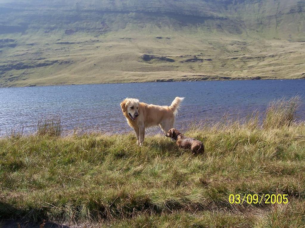
9 16 Left hand pic, the earthy bit on left is actually the path dropping down back to the lake. It looks steep and is. Back at the lake, the dogs have a much needed swim and cool-down. Returning now the way we came, following the stream down to the road, waterfall on our right half way down. Another area the dogs can swim in. You can just make out the road in the pic on right.


10 17 Waterfall and stream. We follow path down to the road, walking with the stream on our right on way down. And so back to our car, parked off the road a few yards up from the bridge. Pictures taken on 08/08/2008: With this walk we started from a parking area higher up the mountain, on the left an area that will take about four cars. It is virtually at the highest point so if you continue up the Trecastle road, you will come to it. If you start descending down the other side, you have gone too far. This walk involves less of a climb and a shorter walk slightly to the lake, but you do still need to know the direction to go in. You will join the lake at the far west end, unlike the first path which joins the lake at the east end. (Last picture in the sequence for this date shows parking area note the blue walkers symbol on a post and the line of the stream to follow).


11 18 Already at the lake in the second picture (above right) so use the return journey to see the path you go up to get to the lake. Here we are walking clockwise from the western end, round to the eastern end and back round the lake. Second picture below shows the return path not very well defined but you will soon be following stream. Note the beginnings of the stream in the picture on right. Follow this back to car. Always note where you joined the lake as otherwise you could take the wrong path down. Not the end of the world if you do, as you would probably just end up on the Trecastle road along which you drove, just a bit further down.


12 19 In this picture, one of our number has got ahead and is descending via the ill-defined path (there IS a path to follow) back down to the car. Lower down the stream has a succession of small water falls; I took loads of pics so though you have several the same, there has been some editing.


13 20 Now back at the car. Note the stream to the right of the picture. Follow the path along this to the top and the lake. Make a note of where you join the lake so you can find the right path down again, as in places it is not a well defined path.

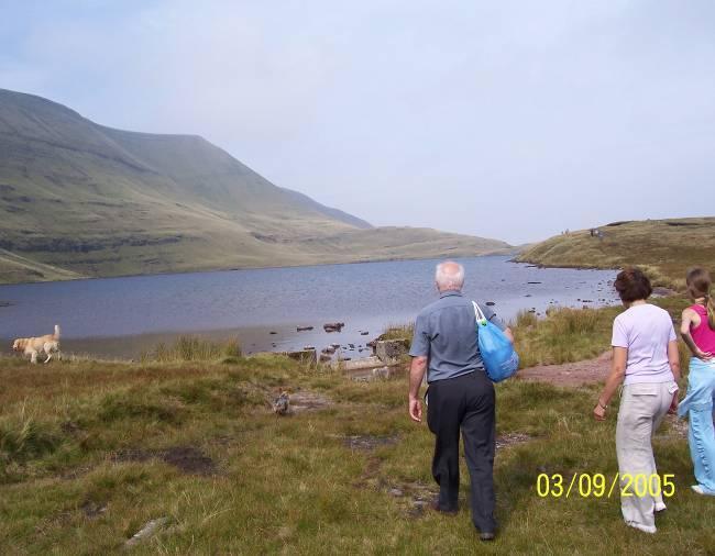
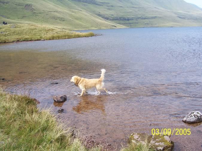
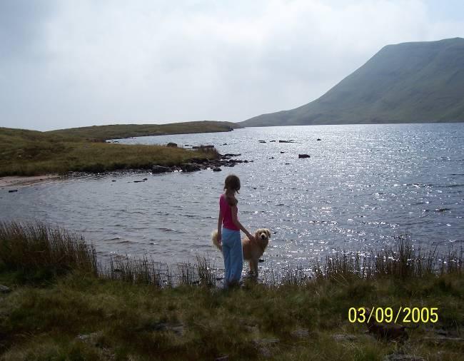
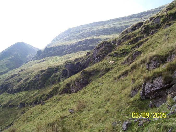
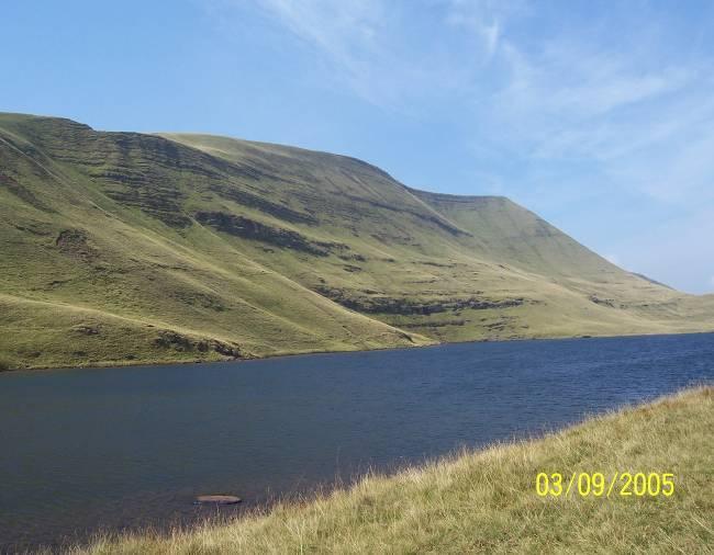
14 Pictures taken on 03/09/2005 (when introduced to this walk by our computer programmer, Jim Moore): 21
15 22
Walk: NOC 08 Location: Cym Glyn near Brecon
 33 Walk: NOC 08 Location: Cym Glyn near Brecon Directions: Not easy to find at all. Go to Libanus, then head towards Brecon on the A470. Take minor C road single track lane first right as you come out
Walk WOC 02 Location: Usk Reservoir
 5 Walk WOC 02 Location: Usk Reservoir Directions: Right out of castle, first left opposite Tafan y Garreg pub, over the mountain on single track roads for about 8 miles. At first T junction you come to,
Hammer Vale and Linchmere Common
 point your feet on a new path Hammer Vale and Linchmere Common Distance: 9 km=5½ miles or 6 km=3¾ miles easy walking with one steep section Region: Hampshire, West Sussex Author: Botafuego Refreshments:
HARDMOORS 26.2 WHITE HORSE HALF ROUTE DESCRIPTION - 018
 HARDMOORS 26.2 WHITE HORSE HALF ROUTE DESCRIPTION - 018 Follow Cleveland Way, keeping to the left hand path (right path is a bike trail) Ignoring any turnings to the left or right At path junction (after
Welsh Newton and Woodland
 Welsh Newton and Woodland This is a 8.2km miles (approx) walk which will take about 2.5 hours at a relaxed and leisurely pace. There are a few hills but no steep inclines. Start at Llangrove bus stop and
Footpaths and walks in the Leckhampton Fields
 APPENDIX 5 Footpaths and walks in the Leckhampton Fields Because of its network of footpaths, the Leckhampton Fields have many different walks. The rich diversity of landscape, hedgerows, trees, streams,
Beautiful Walks from the Blue Ball Inn
 Walk No. 7 COAST AND VALLEY WALK Countisbury, Glenthorne, County Gate, Brendon, Rockford and Wilsham 10 MILES APPROX. Walking time 5 hours approx. (not including breaks)> OS Sheet 64/74 Lynton and Lynmouth.
Lincolnshire Walks. Ancaster. Three cir cular walks of2 3/4,4or 6km (11/3, 21/2 or 33/4 miles)
") Lincolnshire Walks Ancaster Three cir cular walks of2 3/4,4or 6km (11/3, 21/2 or 33/4 miles) Introduction These walks are set in the attractive countryside around the historic town of Ancaster. The town
Lincolnshire Walks Ancaster Three cir cular walks of2 3/4,4or 6km (11/3, 21/2 or 33/4 miles) Introduction These walks are set in the attractive countryside around the historic town of Ancaster. The town
ST. AGNES. you cannot put a time limit on beauty.
 ST. AGNES CIRCULAR WALKS AROUND There are many enjoyable and picturesque walks around St. Agnes most are signposted and are featured on the St. Agnes Mini-guide map. Because most of our footpaths are in
Popes Glen, Pulpit Rock, Govetts Leap and Braeside Walk
 Popes Glen, Pulpit Rock, Govetts Leap and Braeside Walk 8 hrs Hard track 13.6 km Circuit 4 1068m This large circuit walk, from Popes Glen to Pulpit Rock, Govetts leap and along the Braeside Track, passes
Waterhead Pier to Orrest Head, Windermere and Bowness
 Waterhead Pier to Orrest Head, Windermere and Bowness A 4 1 2 hour walk through Woodlands and the Troutbeck Valley with spectacular Lake and Mountain views and a lakeshore path. Walk 10 Walk 11 Walk 12
Although the majority of these walks are around country lanes you should still follow the Country Code:-
 With the update of the Parish Plan was a request for details of any Walks around Pillaton The following pages give several walks that I and my wife have done for many years. Please be aware that NONE OF
8 Miles Circular 4 hours
 VISIT RYEDALE HELMSLEY AND RICCAL DALE 8 Miles Circular 4 hours 090616 Challenging Terrain An 8 mile (13km) circular walk from the market town of Helmsley in Ryedale. The route heads out across sheep pastures
Approximate distance: 5.5 miles For this walk we ve included OS grid references should you wish to use them. Start. End
 Approximate distance: 5.5 miles For this walk we ve included OS grid references should you wish to use them. End 4 1 Start 3 2 N W E S Reproduced by permission of Ordnance Survey on behalf of HMSO. Crown
This walk description is from happyhiker.co.uk
 This walk description is from happyhiker.co.uk Pendle Hill Walk From Barley Starting point and OS Grid reference Ordnance Survey map Distance Traffic light rating Barley village honesty box car park OS
Warn of danger. Instruct to keep well back and warn others if a snake is seen.
 Generic Risk Assessment for Guided Walks (Page of 4 ) HAZARD POTENTIAL HARM PEOPLE AT RISK PRECAUTIONS RISK RATING NOTES AND ACTIONS Traffic e.g. Crossing roads; Walking along roads; Walking through car
THE BECK STONE Backstone Beck on Ilkley Moor
 THE BECK STONE Backstone Beck on Ilkley Moor 1 Three different routes which take in the best of the lower slopes of Ilkley Moor, with bracken, heather, a tarn (a small mountain lake) and rushing streams.
9.5 km Circular 3 hours
 MEDIEVAL WAVERLEY Challenging Terrain A 6 mile (9.5km) undulating circular walk from Tilford village passing close to The Sands village and the historic ruins of Waverley Abbey. From the top of Crooksbury
10 Miles Circular 5 hours
 VISIT RYEDALE PICKERING AND CAWTHORN CAMPS 10 Miles Circular 5 hours Moderate Terrain 120616 A 10 mile (16km) there and back walk from the market town of Pickering in Ryedale. The route heads north through
COSTA BLANCA MOUNTAIN WALKERS - WALK DESCRIPTION. Visit for more walks descriptions in Spain
 COSTA BLANCA MOUNTAIN WALKERS - WALK DESCRIPTION Visit www.walksinspain.org for more walks descriptions in Spain Walk description originally prepared by:- Ralph Phipps Last Updated 18 th April 2015 Title
No. 1 By River Ribble & Brungerley Park 3¼ Miles,
 RVRNEWS 102 No. 1 By River Ribble & Brungerley Park 3¼ Miles, Approx 2 Hours This walk starts at the gate on platform 2 of Clitheroe station. Leaving the station turn left making towards Kirkmoor Rd and
Masson Hill. Walk. Approximately 4 km. Moderate Walk Begins from Matlock Railway Station
 Masson Hill Walk Approximately 4 km Moderate Walk Begins from Matlock Railway Station TOWN WALKS Masson Hill walk is approx. 4 km. It can be walked in a couple of hours or so. Enjoy your walk and the beautiful
Hexham Abbey to the Racecourse Road
 Hexham Abbey to the Racecourse Road The Yarridge Road, or Racecourse Road as it is often known, runs along the ridge line to the south of Hexham and provides wonderful views of the river valley and fells
Wentworth Falls Conservation Hut Loop
 Wentworth Falls Conservation Hut Loop 3 hrs Hard track 6.7 km Circuit 4 341m This scenic walk from Wentworth Falls Station, winds along the Nature Trail to Conservation Hut, then drops into the magnificent
RILLINGTON TO MALTON by Tania Dickinson
 RILLINGTON TO MALTON by Tania Dickinson This walk takes you from the Vale of Pickering up on to the Wold scarp, before dropping down again through the pretty village of Settrington and joining the Centenary
9.5 km Circular 3 hours
 RANMORE CIRCULAR A 6 mile (9.5km) circular walk from Boxhill and Westhumble Station in the village of Westhumble, passing through part of the Polesden Lacey Estate, Ranmore Common and Denbies Vineyard.
Angel Drove carpark 3/day
 GETTING TO ELY ( A on the map below marks the city centre; for a larger scale see the map at the end of the directions, where there are also details of car parking and pedestrian access to the venue) Angel
1. Kala Nera Milies Kala Nera
 1. Kala Nera Milies Kala Nera A beautiful and varied walk from Kala Nera, a tourist seaside village, to Milies which lies 400 metres higher up. From there it proceeds back down to Kala Nera along another
Site Working Information Card: River Chess, Chesham Lawn Tennis and Squash club, Pednormead End, Chesham, Bucks HP5 2JU Grid Ref: SP
 Site Working Information Card: River Chess, Chesham Lawn Tennis and Squash club, Pednormead End, Chesham, Bucks HP5 2JU Grid Ref: SP 955 013 Chesham Lawn Tennis and Squash Club Pednormead End Chesham,
THE WELLDIGGERS ARMS, HESWORTH AND FITTLEWORTH TRAIL
 THE WELLDIGGERS ARMS, HESWORTH AND FITTLEWORTH TRAIL 5.5 miles Circular 3 hours 041017 Challenging Terrain A 300-year-old pub turned country-inn on the edge of the South Downs National Park, The Welldiggers
Walk 2: Beamsley Beacon and Bolton Abbey
 Walk 2: Beamsley Beacon and Bolton Abbey Start and Finish: The Memorial Hall, Main Street, Addingham, LS29 0LZ, SE 079 497 The shortest walk is about 5½ miles (8.8km) The medium Walk is about 8¼ miles
Dorridge & District Residents Association A Walk Along The Green Belt From Dorridge to Catherine-de-Barnes
 Dorridge & District Residents Association A Walk Along The Green Belt From Dorridge to Carine-de-Barnes The starting section of this walk through open fields would be destroyed by building of motorway
The Mendip Way. Route Directions and Maps Wells to Frome
 The Mendip Way Route Directions and Maps Wells to Frome Website: www.mendiphillsaonb.org.uk Email: mendip@mendiphillsaonb.org.uk Facebook & Twitter: @MendipHillsAONB Phone: 01761462338 1 Wells to Shepton
F R E E R E s E R v o i R WA L K s REsERvoiR WALKs To BLoW AWAY THE CoBWEBs BRougHT To You BY
 F R E E r e s e r v o i r WALKS reservoir WALKS TO BLOW AWAY THE COBWEBS Brought to you by Only available in Yorkshire. We look after 72,000 acres of land in Yorkshire, spanning the North York Moors, the
Cleeve Common Self-Guided Walk 1 Family Circular
 Cleeve Common Self-Guided Walk 1 Family Circular Start point: Quarry Car Park Nearest postcode: GL52 3PW please note this is for the golf club. To find the quarry car park drive past the golf club car
Lincolnshire Walks. Grainthorpe. Three circular walks of 2 ¾, 9 and 9 ½ km (1 ¾, 5 ½ and 6 miles)
") Lincolnshire Walks Grainthorpe Three circular walks of ¾, 9 and 9 ½ km (1 ¾, ½ and 6 miles) Introduction Explore the coastal marshes, arable hinterland, Louth Navigation canal and the village of Grainthorpe
Lincolnshire Walks Grainthorpe Three circular walks of ¾, 9 and 9 ½ km (1 ¾, ½ and 6 miles) Introduction Explore the coastal marshes, arable hinterland, Louth Navigation canal and the village of Grainthorpe
Start / Finish. Version 2
 Start / Finish Version 2 Gosford (Start) to Woy Woy Head South down Etna Street, crossing Henry Parry Drive, then Mann St, Gosford, where Etna St becomes Racecourse Road. Follow this road all the way
Walk Description. Directions
 Title: East Hanningfield Distance: 8 miles / 9 miles Time taken: 3-3½ hours Location: 5 miles south east of Chelmsford Parking: Free car park off The Tye, East Hanningfield, next to the primary school
Tenerife Sur: Short Walks Under 10 km. Santiago del Teide Almond Blossom
 Tenerife Sur: Short Walks Under 10 km Santiago del Teide Almond Blossom Route Summary This delightful circular walk is especially beautiful when the almond trees are in flower during January and February
A mainly flat walk along the Peak Forest Canal to Castle Hill and returning along the River Tame via Hulmes Wood and Haughton Dale.
 Walk 9 Haughton Green, Peak Forest Canal, Castle Hill, Hulmes Wood, River Tame, Haughton Dale Circular Miles: 3.9 Time: 1 Hour 30 Minutes Grade: Easy To Moderate Starting Point: Junction Of Gibraltar Lane/Newport
Follow the road to Figueira and once there turn left at the road junction. 30 Minutes
 Follow the road to Figueira and once there turn left at the road junction. 30 Minutes Continue along this road, before the bridge turn right into Largo 1 st Maio and keeping left turn into Rua do Meia
VELINDRE VALLEYS WALK FOR STEFFAN
 VELINDRE VALLEYS WALK FOR STEFFAN IMPORTANT INFORMATION FOR WALKERS AND MARSHALS 1 Table of Contents Key Contact Numbers:... 3 Timetable and locations... 4 T-shirts... 4 Important Advice for Walkers...
Uif!Sfe!Mjpn-!Mpnhepn! bne!dbnnpdl!dibtf-! Tubggpsetijsf
 Uif!Sfe!Mjpn-!Mpnhepn! bne!dbnnpdl!dibtf-! Tubggpsetijsf 7/6!njmft! Djsdvmbs!!!!!!! 4!up!4/6! ipvst Strenuous Terrain Uif!Sfe!Mjpn!jt!b!dmbttjd!wjmmbhf!qvc-!b! hsfbu!qmbdf!up!tbujtgz!zpvs!ivnhfs!bgufs!b!
Dyrham and Hinton Parish Walks
 Dyrham and Hinton Parish Walks A series of five walks in the parish, exploring most of the public footpaths. By John Miller Each walk is described in detail, with a complete map, to provide a handy guide
Tideswell to Castleton
 Tideswell to Castleton 1 Walk summary Length: 14 km, 8.5 miles Maps: OS Explorer OL1 The Peak District - Dark Peak Area, OS Explorer OL24 The Peak District - White Peak Area, OS Landranger 110 Sheffield
Mud Bath Event Information
 Mud Bath Event Information Pipley Wood, Bath, BA1 9BZ 10 th Feb 2019 On the Day Registrations 10km - 30 (min age 14) 5km - 23 (min age 12) 5km - 23 (min age 10 adult accompanied) 2km - 12 (min age 3, children
THE DOG AND DUCK HAREWOODS ESTATE TRAIL. 6 Miles Circular 3 hours. Getting there. Walk Sections
 THE DOG AND DUCK HAREWOODS ESTATE TRAIL Moderate Terrain A 6 mile circular pub walk from the Dog and Duck in Outwood, Surrey. The Dog and Duck is a delightful pub where everyone is made welcome. From walkers
BALCOMBE AND ARDINGLY RESERVOIR, WEST SUSSEX
 BALCOMBE AND ARDINGLY RESERVOIR, WEST SUSSEX 7 miles Circular 4 hours 080816 Challenging Terrain Hi, I'm Luke and this is my West Sussex Weekends walk It's a 7 mile loop from Balcombe rail station, taking
LOCAL CIRCUIT EM1: EAST MALLING & BARMING HEATH. N 2m ROADS: Significant roads PATHS: Starting direction Barming Longsole Mission Church
 Ditton Church Scott Close LOCAL CIRCUIT EM1: EAST MALLING & BARMING HEATH 6 Community Centre F Open fields (see 'Introductory Notes') 1m 88 Direction label (as in the walk notes) East Malling Church -
Currie Rd to Davidson Park
 Currie Rd to Davidson Park 3 hrs 7.2 km One way Moderate track 28m Starting at Currie Rd in Forestville, this walk follows Middle Harbour to Davidson Park, under Roseville Bridge. There are two optional
Harlington - Sharpenhoe - Pulloxhill
 Harlington - Sharpenhoe - Pulloxhill ID: 3676, Distance: 8 miles, Height gain: 140 Metres, Map: Explorer 193 Luton & Stevenage, Contributor: Dennis Jeanes Duration: 3 Hours 27 Mins Features Church,Great
Govetts Leap Loop. 1065m. 909m Blue Mountains National Park. 4 hrs 30 mins 8.7 km Circuit. Hard track 380m
 Govetts Leap Loop 4 hrs 30 mins 8.7 km Circuit Hard track 380m This walk, from Blackheath Train Station, is a fantastic way to see some of the iconic areas of the Blue Mountains in the Blackheath area.
Where did it all go wrong, George?
 Where did it all go wrong, George? Those readers of a certain age will recognise the above quotation. Uttered by the waiter on room service, as he entered George Best s hotel bedroom, to see him in bed
YEARS 2 & 3 RACE INFORMATION. Saturday 9 th June 2018 LES QUENNEVAIS SPORTS AND LEISURE CENTRE
 1 YEARS 2 & 3 RACE INFORMATION Saturday 9 th June 2018 LES QUENNEVAIS SPORTS AND LEISURE CENTRE RACE DAY CLOTHING & TRANSITION AREAS The changeover between sports on triathlon is known as the transition
Lacock Road Races - 10th June 2018, from 09:00 Lacock Playing Fields, Lacock, SN15 2LG.
 Lacock Road Races - 10th June 2018, from 09:00 Lacock Playing Fields, Lacock, SN15 2LG. Important Notices This is a Closed Roads event. As always, an event never occurs in isolation, and we must work with
NETTLESTEAD & YALDING
 NETTLESTEAD & YALDING ULL CIRCUIT - Sheet 1 (first and last sections) Open fields (see 'Introductory Notes') 88 Direction label (as in the walk notes) ROADS: 81 10m Significant roads Redhill arm North
Weatherman Walking Sully to Penarth Approximate distance: 5 miles End Start
 Approximate distance: 5 miles For this walk we ve included OS grid references should you wish to use them. 4 End Start 2 3 N W E 1 S Reproduced by permission of Ordnance Survey on behalf of HMSO. Crown
Wattamolla to Big Marley Beach
 Wattamolla to Big Marley Beach 4 hrs 10.4 km Circuit Moderate track 4m This walk is an excellent loop which takes in both the coast and the heathy inland of Royal National Park. Nearly the whole walk has
Distance: 14 km=8½ miles or 7 km=4½ miles easy-to-moderate walking
 point your feet on a new path Normandy Distance: 14 km=8½ miles or 7 km=4½ miles easy-to-moderate walking Region: Surrey Author: Botafuego Refreshments: Pirbright, Ash date written: 20-feb-2012 date revised:
Green Man Ultra Route Directions 2018
 Green Man Ultra Route Directions 2018 Start-CP1 (9 miles) Community Forest Path (CFP) Frome Valley Way (FVW) From the starting line cross the playing fields diagonally to the metal gates in the hedge lined
Walk Description. Directions
 Title: Saffron Trail: Battlesbridge to Chelmsford Distance: 14¾ miles Time taken: 6 hours Start Point: Outside the Barge Inn, Battlesbridge OS Explorer Map: 175 & 183 Grid Ref.: TQ 780 947 Transport: Rail:-
Countryside Walks. 1) Highclere Park Public Walk.
 Highclere Park Public Walk.") 1) Highclere Park Public Walk. Access: From Highclere Estate Main Entrance at Whitway, please note there is no parking on site or access for vehicles. Open: Throughout the year. Description: This footpath
1) Highclere Park Public Walk. Access: From Highclere Estate Main Entrance at Whitway, please note there is no parking on site or access for vehicles. Open: Throughout the year. Description: This footpath
LDWA SOUTH DOWNS MARATHON
 AHD ahead SDW South Downs Way BL/BR bear left/bear right TL/TR turn left/turn right SP signpost/fingerpost X cross LEG 1 - EAST DEAN to WP1 NORTON GR 470019. Open 1030 to 1300. 9.6 miles. 1.1 From village
Husthwaite to Byland Abbey
 Husthwaite to Byland Abbey This walk begins with a loop round the village of Husthwaite and continues towards Coxwold along a disused railway line, which is now a right of way. It passes through Coxwold
NEWLANDS CORNER AND ST MARTHAS
 NEWLANDS CORNER AND ST MARTHAS 10k CIRCULAR ROUTE 2½-3HRS GU4 8SE From Newlands Corner on the North Downs just outside Guildford, you can enjoy one of the most beautiful panoramas of quintessential English
Heartwood Forest, in Sandridge, Hertfordshire, is a place where everyone can find space, peace, wildlife and miles of beautiful woodland to explore.
 Heartwood Forest Accessibility Statement September 2016 Purpose: This accessibility statement outlines the available facilities and access information for Heartwood Forest. Welcome We, the Woodland Trust,
A Walk around Holmes Chapel starting & finishing at Holmes Chapel Railway Station. by Tony & Lindsay Wright (2016)
") A Walk around Holmes Chapel starting & finishing at Holmes Chapel Railway Station. by Tony & Lindsay Wright (2016) Introduction Holmes Chapel Railway Station is on the Crewe to Manchester line. The station
A Walk around Holmes Chapel starting & finishing at Holmes Chapel Railway Station. by Tony & Lindsay Wright (2016) Introduction Holmes Chapel Railway Station is on the Crewe to Manchester line. The station
Thornton le Dale Walks
 Thornton le Dale Walks A collection of circular walks in, and around, the village www.visitthorntonledale.co.uk Thornton-le-Dale Traders Forum and Thornton le Dale Parish Council 1 Thornton le Dale Circular
Heathcote to Engadine via Audley
 Heathcote to Engadine via Audley 6 hrs 3 mins 5 km One way Hard track 4 635m Covering a large section of central Royal National Park, this walk goes through the heath and scrub along a well managed and
Walking Pembrokeshire.
 Walking Pembrokeshire Canaston Woods Walk It s good to walk, so why not step out and sample some of the walks your neighbourhood has to offer. This pleasant and interesting walk which starts and finishes
Skyline 10km Series Race Information Saturday 12th Jan, 18:00 University of Bath, Bath, BA2 7JY.
 Skyline 10km Series Race Information Saturday 12th Jan, 18:00 University of Bath, Bath, BA2 7JY. On the Day Registrations Assuming we have not sold out, on the night prices will be follows. 5km - 17 all
Morgans Creek to Padstow
 Morgans Creek to Padstow 2 hrs 45 mins 8 km One way Moderate track 3 144m This pleasant walk starts from the Morgans Creek park, at Henry Lawsons Drive, and follows the Georges River past the Boomerang
Follow the Lantern Way clockwise from Dursley Town Hall through Cam & Coaley to Uley and back to Dursley (about 14 miles)
") According to the Rev Kilvert's diary of 1873, couples on their way to evening services in winter followed a practical though unusual local tradition: "My Mother says that at Dursley, when ladies and gentlemen
According to the Rev Kilvert's diary of 1873, couples on their way to evening services in winter followed a practical though unusual local tradition: "My Mother says that at Dursley, when ladies and gentlemen
Canoe Route. Dogtooth Lake-Highwind Lake-Dryberry Lake- Lake of the Woods-Blindfold Lake
 1 Canoe Route Dogtooth Lake-Highwind Lake-Dryberry Lake- Lake of the Woods-Blindfold Lake This is an interesting and challenging route starting and ending at Rushing River Provincial Park. It passes over
Rhossili - Tears Point - Mewslade Bay - Talgarth's Well - Rhossili - ID: 148. Walk description:
 Walk description: A glorious walk combining thrilling cliffs with beautiful wild beaches and a bird's-eye view of the Gower peninsula from Rhossili Down. The adventurous can walk out to the Worm's Head
APPI PPG LECTURE 5: FURTHER METEOROLOGY
 LECTURE 5: FURTHER METEOROLOGY Introduction: This lecture covers Further Meteorology and aims to give you more of an understanding of advanced weather conditions and patterns. However Meteorology is a
LDWA SOUTH DOWNS MARATHON 13 th MAY 2018
 AHD ahead SDW South Downs Way BL/BR bear left/bear right TL/TR turn left/turn right X cross LEG 1 - EAST DEAN to WP1 NORTON GR 470019. Open 1030 to 1300. 9.7 miles. 1.1 From village hall TL and walk to
Thank you for signing up to the 30 Bays in 30 Days Challenge!
 Introduction Thank you for signing up to the 30 Bays in 30 Days Challenge! The challenge takes place in July when everyone is invited to swim in 30 bays throughout the month. It s a fantastic way to explore
Bonnie Prince Charlie Walk
 Bonnie Prince Charlie Walk A waymarked route from Ashbourne to Derby to celebrate the 60th anniversary (1995) of the formation of the Ramblers' Association. This route follows the general direction of
KYLE OF SUTHERLAND ANGLING ASSOCIATION.
 KYLE OF SUTHERLAND ANGLING ASSOCIATION. VIRTUAL GHILLIE SALMON The Kyle of Sutherland offers some of the finest Salmon estuary fishing in the country. when the weather is dry, and the rivers are low, salmon
Calaveras Big Trees State Park--South Grove Loop
 Copyright 1999 by Jeff Robinson. You are free to use and reproduce this description for personal, not-for-profit, and not-forbusiness use. Any reproduction other than for personal use, including businesses,
BOOKING FORM WALKING WEEKENDERS 2018 Dates Location Price Book your place 13th - 15th April 2018 Osmotherley, North York Moors 70 per person
 BOOKING FORM 2018 Thank you for choosing TeamWalking. I am really looking forward to meeting you and I am sure we will have an enjoyable and memorable walking weekend in the Great Outdoors! WALKING WEEKENDERS
The Alice Lisle Walking Guide
 The Alice Lisle Walking Guide Using some local knowledge we have been able to design some great walks starting and finishing at the Alice Lisle. If you re planning a group walk, please get in contact with
Lacock Road Races - 18th June 2017, from 09:00 Lacock Playing Fields, Lacock, SN15 2LG.
 Lacock Road Races - 18th June 2017, from 09:00 Lacock Playing Fields, Lacock, SN15 2LG. Important Notices This is a Closed Roads event. As always, an event never occurs in isolation, and we must work with
Muizenberg Accessibility: Removing barriers to public spaces.
 Muizenberg Accessibility: Removing barriers to public spaces. Refer to SANS 10400-S:2011 Edition 3 of the building code. Note: Facilities that are not in accordance with the requirements of this part of
HURL ELKHORN 50K RUN AID STATIONS COURSE MARKINGS
 HURL ELKHORN 50K RUN AID STATIONS The race starts and finishes at Crystal Creek Campground, where primitive camping is available. The race starts at 7:00 am. The finish cut off time is 9:00 pm. No drop
Skyline Day Race Information Sunday 13th Jan, from 10:00am University of Bath, Bath, BA2 7JY.
 Skyline Day Race Information Sunday 13th Jan, from 10:00am University of Bath, Bath, BA2 7JY. On the Day Registrations Assuming we have not sold out, on the day prices will be follows. 500m - 5 (Even if
SUMMER WALK 10. The Chairmakers, Worlds End
 SUMMER WALK 10 The Chairmakers, Worlds End Tuesday 10 th June 7.30pm This is a very short walk made so due to the majority of the footpaths in the area around the Chairmakers being overrun with high nettles
Falls Lake Trail (A part of the NC Mountains-to-Sea Trail) East to West
 East to West") Falls Lake Trail (A part of the NC Mountains-to-Sea Trail) East to West Section 1 (Falls of the Neuse Rd to Raven Ridge Rd) 0.0 mi Parking area of the Tailrace Fishing Area, just below the dam, off Falls
Falls Lake Trail (A part of the NC Mountains-to-Sea Trail) East to West Section 1 (Falls of the Neuse Rd to Raven Ridge Rd) 0.0 mi Parking area of the Tailrace Fishing Area, just below the dam, off Falls
2018 Kathmandu Coast to Coast - Race Safety Briefing (Compulsory Section to attend)
") 2018 Kathmandu Coast to Coast - Race Safety Briefing (Compulsory Section to attend) These notes are current at time of email additional safety messages will be given at the pre-race safety briefings at
2018 Kathmandu Coast to Coast - Race Safety Briefing (Compulsory Section to attend) These notes are current at time of email additional safety messages will be given at the pre-race safety briefings at
Proposed Development by Cala Homes in Dollicott - Report o n Roads and Traffic
 Proposed Development by Cala Homes in Dollicott - Report o n Roads and Traffic Dolicott Development - Traffic report v1.0 compressed.docx Page 1 of 10 Proposed Development by Cala Homes in Dollicott Report
Winterfold Wood. point your feet on a new path. In Brief
 point your feet on a new path Winterfold Wood Distance: 8½ km=5¼ miles Region: Surrey Author: Schwebefuss Refreshments: Windmill Inn, Peaslake after the walk moderate walking with many gradients Date written:
West Africa Desertification in West Africa
 Non-fiction: West Africa Desertification in West Africa West Africa Desertification in West Africa In Arabic, Sahel means shore, or coast. The Sahel is the place where the waves of the ocean crash onto
Traffic Signs and Signals
 CHAPTER FOUR Traffic Signs and Signals Traffic signs control traffic flow, making streets and highways safer for drivers, bicyclists and pedestrians. These signs, which are posted by the Indiana Department
Great Barford and The River Great Ouse
 Great Barford and The River Great Ouse A riverside route which follows the River Great Ouse, with historic sites at Barford Bridge, Danish Camp and Willington Dovecote Essential Facts Route distance: Approximate
EAST GRINSTEAD AND THE HIGH WEALD, WEST SUSSEX
 EAST GRINSTEAD AND THE HIGH WEALD, WEST SUSSEX 7 miles Circular 3.5 hours 301015 Challenging Terrain Hi, I'm Tom and this is my West Sussex Weekends walk. I live and work in London but often head out of
Tulsa Triathlon. Olympic Distance Course 2017
 Race Location Birch Lake in Barnsdall, OK, Twin Coves Area - Google Map Location Driving Directions from Tulsa: Take HWY 75N to OK-20 Collinsville/Skiatook exit Turn left onto OK-20 W/ E 146th St N (signs
Wallarah Coastal Walk
 Wallarah Coastal Walk 3 hrs 8.3 km Return Hard track 247m This walk starts at Caves Beach and travels south along the coastline, until reaching the Pinney s Headland Lookout. There are many opportunities
holly tree Wellhill Farm Woodyard Bramham House red kites Round House ha-ha
 This 6.4 mile walk around the magnificent Bramham Park Estate has been made possible with the active support of the owner of the Estate, Nick Lane Fox, with funding from Natural England, as part of Defra
Hardman Triathlon Route: Bike (180km)
") Hardman Triathlon Route: Bike (180km) Outline map of the Ring of Kerry Starting from Transition 1 in the Killarney Golf & Fishing Club you will make your way up the road towards the exit. At the exit from
Hardman Triathlon Route: Bike (180km) Outline map of the Ring of Kerry Starting from Transition 1 in the Killarney Golf & Fishing Club you will make your way up the road towards the exit. At the exit from