Low Carbon Cities. Principles and Practices for China s Next Generation of Growth
|
|
|
- Shonda Goodwin
- 5 years ago
- Views:
Transcription
1 Low Carbon Cities Principles and Practices for China s Next Generation of Growth
2 Low Carbon City Currently the trends throughout China show a drama cally increasing dependence on auto use. This is more than the manifesta on of a simple market preference; it is the result of landuse pa erns and street network design that makes alterna ves to the car less and less desirable. As walking and biking become more dangerous and inconvenient, and as transit becomes less accessible, city districts naturally become more auto-oriented. But at the densi es of Chinese ci es, such dependence quickly becomes unsustainable; conges on, air quality impacts, infrastructure and costs rise drama cally. Transporta on now represents 85% and 42% of China s petroleum and diesel consump on respec vely, and is its fastest growing sector. As the country s urban pa erns reinforce auto use through more freeways, large arterials and superblocks, walking, biking and transit are declining. In Beijing since 1986 auto use has increased six fold while bike use has been cut almost in half, from nearly 60% of all trips to just 16.7% in The conges on, air quality, and greenhouse gas impacts of such a shi are massive. Studies in Jinan show that there is a fivefold increase in household vehicle kilometers traveled (VKT) between a mixed-use tradi onal street grid neighborhood and a newer single-use superblock configura on. The current pa ern of development in China is the Superblock Model. Based on a network of wide arterial streets, it features large development blocks, o en 500 m by 500 m in size. The Superblock Model a empts to move cars efficiently with ever-wider streets, o en at the expense of pedestrian safety and bike movement. To compound the impacts of wider streets, building setbacks further separate uses and distance pedestrians. This combina on of factors hinders pedestrian convenience and bike safety which in turn affects retail ac vity and transit usage. The main design criteria for ac ve, vibrant urban communi es is to design around the pedestrian, bike and transit, not the car - in other words, design using narrower streets and smaller blocks, with ac ve, useful and interes ng edges. This pamphlet lays out some simple design tools and prac ces to make China s development pa erns more sustainable, resilient, and energy efficient by designing for transit, biking and pedestrian mobility. 1
3 Design The principles introduced here represent what some of the world s leading experts believe to be best prac ces in urban design. Ci es are gradually adop ng these measures, but those that have embraced them are the most livable and economically secure ci es in the world. These principles support each other. Blocks with mixed uses encourage walking, and walkable ci es create customers for local businesses. Smaller block sizes encourage bike and pedestrian use, which cuts down on traffic, allowing public transit and automobile traffic to run be er and so on. Enac ng all eight principles is the key to a sustainable, livable city. While these principles are a synthesis of interna onal best prac ces, China s challenges and opportuni es are unique. Many of these recommenda ons are not consistent with current planning rules and regula ons. It is me to apply cu ng-edge scien fic thought about what makes ci es successful and to reexamine our ci es in light of this most recent understanding. China has the resources and vision to leapfrog over the rest of the world and create the best ci es of the future. Now is the me to seize this opportunity and lay the founda on for a healthy future. The eight design principles are: 1 Develop neighborhoods that promote walking 2 Priori ze bicycle networks 3 Create dense networks of streets and paths 4 Support high-quality transit 5 Zone for mixed-use neighborhoods Match density to transit capacity Create compact regions with short commutes Increase mobility by regula ng parking and road use 2


4 1 Ground-floor DEVELOP NEIGHBORHOODS THAT PROMOTE WALKING Walkable streets and neighborhoods are the founda on of every great city. Walking reduces auto-dependence, supports public transit, improves health, and promotes community. Simple measures - such as limi ng road width, block lengths and setbacks between buildings and sidewalks - encourage walking. Sidewalks that feature ameni es like shade, benches, and street ligh ng also encourage foot traffic. Designing streets that are safe to cross and providing comfortable, interes ng places to walk should be the first priori es for establishing livable, low-carbon ci es. retail encourages walking Pedestrian-friendly streets in New York city A] Shorten street crossings and emphasize pedestrian safety and convenience Limit street widths to 45 meters for through traffic (50 meters with BRT) and 25 meters for local access. Create direct routes and permeable blocks by limi ng average block length to 150 meters in new development and crea ng public paths through exis ng superblocks. Provide safe, well-defined and uninterrupted pedestrian zones at least 3 meters wide on each side of every major street. B] Encourage ground-level ac vity and direct pedestrian access along every street 3 To encourage sidewalk ac vity, visibility and safety, buildings with public uses and shops should front the sidewalk and residen al developments should have mul ple access points. Perimeter security walls should be set back from the street fron ng buildings or be replaced by seethrough fences. The distance between buildings and the sidewalk should be limited to the following averages: retail: 1 meter; offices and businesses: 3 meters; homes and apartments: 5 meters. Pedestrian ac vity, as shown here in Chongqing, China, creates community and supports business Design features in Hong Kong slow traffic and keep pedestrians safe


![lanes should be protected from car traffic Where possible, bike parking should be included at transit sta ons A] Design streets that emphasize bike safety and convenience Create dedicated and](/docs-images/94/119595778/images/5-2.jpg "protected bike lanes, at least 3 meters wide in each direc on, on all streets except low-speed local streets. Provide secure bike parking in buildings, on streets and at transit sta ons.")
5 2 Bike PRIORITIZE BICYCLE NETWORKS In the 1980s, millions of Chinese people depended on bicycling as their primary mode of transporta on. Bicycling is no longer safe or convenient in many Chinese ci es. In recent years, ci es across the globe have been working to reintroduce bicycles as an integral part of city life because they are a simple, inexpensive, and low-carbon way for city residents to travel between des na ons, including transit sta ons. To ease conges on, Chinese ci es must once again encourage cyclists by providing safe condi ons, including bike lanes and secure bicycle parking. lanes should be protected from car traffic Where possible, bike parking should be included at transit sta ons A] Design streets that emphasize bike safety and convenience Create dedicated and protected bike lanes, at least 3 meters wide in each direc on, on all streets except low-speed local streets. Provide secure bike parking in buildings, on streets and at transit sta ons. B] Create auto-free streets and greenways to encourage non-motorized travel Establish car-free corridors across the city grid, no more than 800 meters apart. When combined with transit and pedestrian-only streets, bike lanes should be protected. The Hongshou bike-sharing system is the largest in the world 4
6 3 DISCOURAGED: Arterial-dominant Superblock network - Priori zes cars over people - Discourages pedestrian ac vity CREATE DENSE NETWORKS OF STREETS AND PATHS It is a common misconcep on that wide streets are more efficient and improve traffic flow. In fact, gated superblocks divided by wide roads actually contribute to China s traffic conges on. Case studies show that a denser network of narrower streets be er op mizes traffic flow while crea ng more direct routes and improving safety for pedestrians. Road design should maximize human mobility rather than vehicle throughput. Narrow streets that allow one-way motor traffic as well as bicycles and pedestrians will significantly reduce conges on and fuel use in Chinese ci es by minimizing signal delays. RECOMMENDED: Urban Network of smaller blocks - Priori zes people over cars - Supports pedestrian and economic ac vity A] Create dense street networks that enhance walking, bicycling and vehicle traffic flow Plan for a minimum of 50 intersec ons per square kilometer. Limit traffic speeds on local streets to 40 kilometers per hour. Design local streets with traffic-calming features to help enforce speed limits. B] Disperse high traffic volumes over narrow, parallel routes rather than concentra ng on major arterials Create a grid of varied street types to provide mul ple parallel routes for all types of traffic. Incorporate through-roads that connect adjacent neighborhoods at least every 300 meters. Replace major arterials wider than 45 meters with efficient one-way couplets (two narrower one-way thoroughfares). Comparison of a typical Superblock grid with arterial streets with the recommended Urban Network grid of smaller blocks and a dense network of narrower streets 5


![A] Ensure frequent and direct transit service Establish a grid of high-capacity, high-speed transit corridors approximately every 1000 meters with dedicated transit lanes.](/docs-images/94/119595778/images/7-2.jpg "Provide an integrated mul -modal system and ensure seamless transfers to all available transit op ons. Minimize the number of transfers needed for most passengers.")
7 4 SUPPORT HIGH QUALITY TRANSIT Hong Kong, New York City, Singapore and other affluent ci es have the densest public transit networks in the world. While metro can be an integral part of a transit network, a growing number of ci es are turning to bus rapid transit for its low cost, quick implementa on, and flexible routes. Each Chinese city will need to determine the appropriate mix of transit solu ons for its condi ons, but ci es can guarantee the overall success of their transit by providing frequent, fast and direct service in easily accessible loca ons. Modern BRT systems, like this one in Jinan, China, feature all the conveniences of metro systems. A] Ensure frequent and direct transit service Establish a grid of high-capacity, high-speed transit corridors approximately every 1000 meters with dedicated transit lanes. Provide an integrated mul -modal system and ensure seamless transfers to all available transit op ons. Minimize the number of transfers needed for most passengers. B] Locate transit sta ons within walking distance of homes, jobs and services All major housing and job centers should be within 400 meters of a local transit sta on and 1000 meters of regional transit service. Increase density and ground floor services adjacent to major sta ons. Guangzhou before BRT (above) and a er the BRT system opened in February 2010 (below) The Guangzhou BRT system moves 27,000 passengers per hour per direc on during peak commute hours and integrates with bike lanes, bike sharing sta ons, metro lines and other feeder bus systems 6


![Every city should feature many parks A] Encourage an optimal balance of housing and services through zoning codes Housing options should accommodate a mix of income levels and age groups.](/docs-images/94/119595778/images/8-2.jpg "Shops and local services should line the ground floor of most streets fronts within easy walking distance of housing and jobs.")
8 5 ZONE FOR MIXED-USE NEIGHBORHOODS Tradi onal Chinese neighborhoods had lively streets where children played sports and the elderly played mah-jongg. These neighborhoods had problems too, but it was the lively mix of shops and services near homes and jobs that gave these areas their charm and iden ty. By trading tradi onal housing for modern apartments, the Chinese people are losing their communi es unique sense of place and the efficiency of compact neighborhoods. China s ci es of tomorrow need to combine the benefits of modern housing with the best quali es of tradi onal urban neighborhoods. Every city should feature many parks A] Encourage an optimal balance of housing and services through zoning codes Housing options should accommodate a mix of income levels and age groups. Shops and local services should line the ground floor of most streets fronts within easy walking distance of housing and jobs. Mix housing, shops and services within commercial districts to create 24-hour communities. B] Provide a variety of accessible parks, civic clusters and open space Neighborhood parks should be located within 400 meters of housing; large regional parks within 1 kilometer. Clusters of schools and civic destinations should form neighborhood centers within 400 meters of residential buildings. This includes age-specific services, such as day care. Unique natural environments and local cultural and historical assets should be preserved and creatively reused. Jing an Metro Sta on (above and below) is a good example of transit-oriented mixed-use development 7


9 6 MATCH DENSITY TO TRANSIT CAPACITY High density is crucial to low-carbon ci es, but density alone is not enough. In order to avoid conges on, housing must be located close to public transit and jobs. Density also needs to be related to the capacity of all modes of transporta on. If roads are designed as suggested in this guide - with bike and pedestrian-friendly corridors, transit priority lanes on major arterials, and one-way arterial couplets - ac vi es can be concentrated to make walking, cycling, and mass transit more convenient than driving. This will shorten trip distances, save travel me, and preserve millions of square kilometers of arable land. In Guangzhou, density is focused around the BRT corridor. The system s capacity matches commute-hour transit demand A] Match density to the maximum peak-hour capacity of a transit system Both residen al and commercial density should be designed to match the area s peak-hour transit, walk and bike capacity. Major job centers should only be located where high-volume transit services are available. B] In key employment areas, zone for mixed-use districts that combine every day uses A mix of recrea on, services, and retail should be located in employment areas to provide for daily worker needs on foot. Use TOD Center standards for minimum employment and popula on densi es at sta ons to reinforce demand for services, transit and mixed-use environments. In Curi ba, Brazil, high-rise development is focused within 200 m of transit 8
10 7 CREATE COMPACT REGIONS WITH SHORT COMMUTES Kunming Regional Growth Community loca on has a long-term impact on sustainability. New city centers placed far from exis ng ci es are inconvenient and rarely thrive. City planners can avoid this by loca ng compact new sub-centers within or adjacent to exis ng ci es. In addi on to protec ng arable land, this strategy significantly decreases the cost of providing transit, u li es, and other services to these new loca ons, while reducing most residents daily commute. Decentralizing employment in loca ons that encourage reverse commutes will reduce peak-hour conges on on roads and transit systems. A] Reduce sprawl by focusing development in areas close to or within exis ng ci es Regional development should seek a compact footprint through preserva on, reuse and infill of exis ng areas, balanced with dense areas of new growth. New development should avoid agricultural lands and other environmental assets. B] Create a jobs/ housing balance within a short commute distance Create mul ple high capacity transit connec ons to all new development areas. Locate job centers to limit commutes to approximately 5 kilometers or 15 minutes on transit. Create smaller decentralized job centers that encourage reverse commutes. Metro line (various colors) BRT High speed rail Metro line (various colors) High speed rail Railway R il 20 km BRT 10 km 5 km Lake Dian Regional planning in Kunming, China aimed at reducing sprawl and crea ng a jobshousing balance 9


11 8 INCREASE MOBILITY BY REGULATING PARKING AND ROAD USE Avoiding gridlock requires limi ng the use of vehicles to levels that the road network can support. Peak commute-hour car trips are o en unnecessary and should be discouraged. There are many ways to discourage driving. London, Hamburg and Zurich, for example, restrict parking in popular des na ons served by public transit. Singapore and Stockholm have implemented road-use charges. Chinese ci es should consider these strategies which complement the above principles to help relieve their conges on problems. A] Limit parking in key employment districts to discourage driving during peak traffic periods Limit parking ra os in employment areas to 0.2 stalls per worker. Eliminate long-term street parking to ease conges on and reduce street width. Remove all parking-space minimums for residen al buildings and establish city-wide parking-space maximums consistent with targets for private car use. B] Adjust car fees by me of day and des na on Ins tute a conges on-management system that limits auto use in key urban and employment districts at peak traffic hours. Charge tolls for use of overloaded roads and bridges and use the fees to support transit. Vary parking charges by me of day and loca on to ensure high turnover. Road Pricing reduces conges on and raises money for local government. Some facts from Singapore and London: 80,000 kilograms of CO2 emissions reduced in Singapore s traffic conges on zone Annual revenue raised by Singapore s traffic conges on program 330 million yuan Annual opera on cost for Singapore s traffic conges on program 65 million yuan Ci es may choose to charge tolls for use of overloaded streets. Singapore s Electronic Road Pricing (ERP) system has cut conges on and raised money for public transit and other uses 37 percent more Londoners riding buses during toll mes than before conges on pricing 50 percent decline in bus delays in London 85 percent of people commu ng to London during toll mes now taking transit 20 percent increase in Singapore public transit use since Singapore started conges on pricing 30 percent decrease in conges on since London started conges on pricing 10
12 Designing Low Overall Chinese Ci es must rezone key areas into mixed-use, walkable and transit oriented districts (TODs). This simple act would create a new DNA for city development: one that would limit the growth in auto mode split and kilometers driven per capita naturally by providing alternates that are safe, convenient, and cost effec ve. Planning for TODs involves a linked set of strategies. First is crea ng land-use pa erns that shorten trip lengths while crea ng the kinds of environments that foster linking mul ple des na ons into one trip effec vely crea ng mixed-use and walkable districts. This then results in increasing pedestrian convenience, which then makes transit trips more a rac ve, accessible and mely. Second is to cluster major commercial districts around high capacity transit service and decentralize these employment nodes throughout the city. This disperses trips on the transit network in mul ple direc ons making it more efficent and less congested. movement. Areas without major transit investment that are dedicated to low intensity, single uses such as manufacturing, warehousing, light industrial or ins tu onal uses should not be designated as TODs. These TODs are then zoned with three mixeduse types of Centers keyed to the specific level of transit service. The higher the transit capacity, the denser and more commercial the land-use of the TOD Center. For example an area with two metro lines crossing would have the highest urban designa on with a focus on office jobs, intensive housing and regional-serving retail. In contrast, an area served by a single BRT line would primarily be residen al with local serving commercial uses mixed in. To accomplish these simple strategies, changes should be made in China s Master Plan and the Regulatory Plan process. At the City Master Plan level key areas should be iden fied that, because of a high level of transit capacity and appropriate land uses, are redesigned into Transit Oriented Districts (TODs). Such areas logically must provide environments designed for easy pedestrian 11
 within the City s Master Plan based on levels of transit investment and type of land use Industrial Bus Rapid Transit Transit Oriented Districts B Within")
13 Carbon Cities Commercial Center Town Center Centers The new planning methodology involves the following steps: Urban Center Expressways Ins tu onal Industrial Transit Oriented Districts A Iden fy poten al Transit Oriented Districts ( TODs ) within the City s Master Plan based on levels of transit investment and type of land use Industrial Bus Rapid Transit Transit Oriented Districts B Within each of these TODs, zone for three types of mixed-use Centers keyed to their adjacent transit Metro Metro City Transit Map capaci es C Within the Regulatory Plan, modify the circula on system for the TODs into an Urban Network configura on to be more pedestrian, bike and transit friendly City Circula on Plan City Master Plan D Finally, employ new mixed-use Small Block zoning with specific land-use and urban design standards to create more walkable urban environments 12


14 DESIGNING TRANSIT ORIENTED DISTRICTS Individual Regulatory Plans would then redesign each TOD with a street network designed to accommodate more pedestrian, bike and transit ac vity. This modified street system is called the Urban Network and involves a denser grid of narrower streets resul ng in smaller city blocks places that are inherently easier to walk and bike through. Finally, the TOD urban design standards are modified to create more integrated and mixed-use areas. This is accomplished by a zoning system using a menu of mixed-use Small Blocks rather than the typical single-use zones. Each small block type has a range of uses and intensi es and has a set of urban design controls to ensure that streets are ac vated and well defined as useable public space. Exis ng Development TOD Ins tu onal Bus Rapid Transit 600 m radius Industrial TOD Dianchi Lake Open Space TOD Dianchi Lake TOD Metro Commercial Center Urban Centers 400 m radius Dianchi Lake Town Centers 400 m radius Exis ng New Town Master Plan for Chenggong New Town with superblocks and isolated land uses The Master Plan is then zoned into Transit Oriented Districts as defined by appropriate land use and transit services Within each TOD Commercial, Urban, and Town Centers are located 13

15 D Zoning for mixed-use with Small Blocks C Developing a new Circula on System B Concentra ng density at Transit Sta ons A Loca ng Transit Oriented Districts TRANSFORMATION OF A SUPERBLOCK PLAN 14
16 A LOCATING TRANSIT ORIENTED DISTRICTS Iden fying and redesigning key areas within an exis ng Master Plan framework is straigh orward. The process begins with two steps; first designa ng and mapping poten al TOD Districts and second zoning these areas with one of three mixed-use TOD types that are ed to its level of regional transit service. The following are the criteria for iden fying TODs: TOD Land-use Criteria: Generally mid to high density residen al, commercial, office, services and retail. Low intensity uses such as manufacturing, light industrial, warehousing and a range of large ins tu onal uses are not appropriate for TOD. TOD Transit Criteria: Minimum of Bus Rapid Transit level trunk-line service and/or at least one metro sta on. It is typical that a TOD will have a regional transit line and several feeder transit systems. TOD Required Density: Minimum of 300 people and jobs combined per gross hectare. The mix will vary dependent on the level of transit service. TOD Required Circula on System: Defined as an Urban Network or equivalent, a circula on network that distributes traffic over parallel routes, creates small human-scaled blocks; and provides generous pedestrian spaces and secure bike lanes. TOD Boundary Criteria: Having met the other criteria, the extent of a new TOD will extend to the following boundaries: any open space or natural feature that creates a significant edge; a change in landuse to a non-pedestrian orientated use; and an expressway or major arterial throughway. TOD Distance Criteria: Land within 800 meters of a major transit stop or sta on. Areas further than 800 meters may be included in order to consolidate consistent land uses not isolated by major roads or open space areas. 15
 transformed into")

17 (A) (B) Industrial TOD 1 TOD 2 Open Space Ins tu onal TOD 3 Industrial Exis ng Exis ng city Master Plan (A) transformed into TODs (B) on the basis of transit service and capacity. Areas of low intensity uses or exis ng development are not designated TODs 16

18 B CONCENTRATING DENSITY AT TRANSIT STATIONS Within these new TODs the loca on and type of regional transit facili es becomes key to the next level of zoning. The concept is that areas closest to major transit sta ons should increase in density and, in the case of mul ple regional lines converging, should be planned as sub-regional employment hubs. Areas within meters of a significant sta on should be zoned in rela on to the capacity of the transit system; the higher the capacity the higher the density and mix of services. Town Centers are primarily medium density housing areas but will include a complete range of services. They are located at a single regional transit sta on. Bus Rapid Transit Town Center Urban Center Within the TOD and directly adjacent to sta on areas, there are three types of Centers varying in density and mix. These are Commercial Centers, Urban Centers and Town Centers, each with a different density and mix of housing and commercial uses. Commercial Centers create a mixed-use, high density environment, and are primarily oriented as a regional job center. They are associated with the intersec on of two regional transit lines or more. Commercial Center Metro Urban Centers develop a more balanced mix of both commercial and residen al uses at a high density. They are located within walking distance of a regional sta on that serves as a transfer point for several feeder transit lines. Centers allocated on the basis of transit service and capacity 17

 = 500 Population density (Pop/Ha gross) = 200 Minimum Land Allocation (Percentage): Parks:")

 =300 Population density (Pop/Ha gross) = 200")

 =50 Population density (Pop/Ha gross) = 300 Minimum Land Allocation (Percentage): Parks: 10% Civic:")
19 COMMERCIAL CENTER Definition: The highest-density commercial area with mixed-use that acts as regional employment, retail and civic/ cultural hub; with a variety of high-density housing Location Criteria: Located within 600 meters of the intersection of at least two metro transit stops or a major BRT hub Minimum Density/Use Criteria: Employment density (Jobs/Ha gross) = 500 Population density (Pop/Ha gross) = 200 Minimum Land Allocation (Percentage): Parks: 10% Civic: 5% Typical massing - Commercial Center URBAN CENTER Definition: A high-density mixed-use district that acts as sub-regional employment, retail and civic/ cultural center; with a variety of high and mid-density housing Location Criteria: Located within 400 meters of a regional transit station that is a hub for several local transit lines Minimum Density/Use Criteria: Employment density (Jobs/Ha gross) =300 Population density (Pop/Ha gross) = 200 Minimum Land Allocation (Percentage): Parks: 10% Civic: 5% Typical massing - Urban Center TOWN CENTER Definition: A high density housing area with retail, civic and open space amenities; with a mix of high and mid-rise buildings Location Criteria: Served by a single regional transit station Minimum Density/Use Criteria: Employment density (Jobs/Ha gross) =50 Population density (Pop/Ha gross) = 300 Minimum Land Allocation (Percentage): Parks: 10% Civic: 5% Typical massing - Town Center 18
20 C DEVELOPING A NEW CIRCULATION SYSTEM Within each TOD a new circula on strategy that compliments mixeduse development is essen al. Such a street network will balance the needs of pedestrians, bikes, transit, cars and trucks in a system of mul -modal rights of way. Key to the system is a grid that increases the number of through-roads and thereby disperses traffic. The circula on system must encourage and support alternate modes to the auto by making transit ubiquitous, walking and biking safe and convenient, and bringing des na ons closer to home and transit sta ons. The alternate fine-grained circula on system is called the Urban Network and the current arterial system the Superblock system. The Urban Network is appropriate for mixed-use and dense residen al and commercial districts, called TODs, while the Superblock system is appropriate for large areas of manufacturing, industrial, warehousing or ins tu onal use. The Urban Network is built out of a range of street types and produces a rela vely small block pa ern. Major through-traffic is handled with mul ple minor arterials or by pairs of one-way streets. These through roadways would also provide space for transit systems from local buses to BRT lines. Auto-free streets that accommodate bikeways, pedestrian shopping areas, and dedicated transit lanes complement the through-streets. Finally a network of local streets providing local access to parcels with bike lanes and generous sidewalks completes the network. The diagram on the facing page illustrates the step-bystep process. Superblock Grid A C B 712 m 693 m D Urban Network Grid A C B D 400 m 382 m Comparison of pedestrian travel distance in a Superblock grid (500 m) and an Urban Network grid at the same scale - lack of street permeability, fewer pedestrian crossings and wider intersec on crossing distances in a Superblock result in the pedestrian having to walk almost twice the distance to get from one point to another as compared to an Urban Network grid 19


21 Superblock Grid Local Streets Auto-Free Streets Urban Network Grid One-Way Couplets Exis ng Arterials TRANSFORMATION OF AN ARTERIAL GRID INTO AN URBAN NETWORK Comparison of building massing in a Superblock and an Urban Network grid: The Urban Network accommodates a larger number of dwelling units and more varied urban form using smaller blocks 20
22 C DEVELOPING A NEW CIRCULATION SYSTEM The advantages of the Urban Network are: 1. The network disperses traffic over mul ple routes reducing loads and pedestrian crossing dimension on most streets 2. It allows short trips more direct routes on local roads with mid-block le turns into parcels 3. In case of blockage or emergency, traffic can be easily diverted to alternate routes 4. With more frequent intersec ons and shorter street crossings pedestrians have shorter, safer routes 5. Smaller street sec ons make transit systems more accessible to pedestrians 6. Smaller blocks provide for more adaptable urban forms, higher flexibility of use, and opportuni es for smaller developers 8. One way couplets eliminate le turn phases allowing signal synchroniza on and op mal traffic platooning resul ng in be er traffic flow on major routes. In comparison, the Superblock system has been demonstrated incapable of handling the volumes of traffic China s high-density ci es generate. Even with 8 and 10 lane arterials conges on o en results from delays at slow, complicated intersec ons and, given a lack of alterna ve routes, massive delays from accidents. In fact, the system generates its own debilita ng feedback loop; the large street sec ons discourage pedestrian, biking and transit mobility, which leads to more vehicle traffic and therefore wider streets. This then creates an environment even more inhospitable to alternate travel modes. The block plans on the next page demonstrate the use of an Urban Network with small blocks in famous ci es throughout the world in comparison to Beijing s superblock configura on. 7. Emergency vehicles have mul ple means of access to any des na on 21


23 Vancouver New York San Francisco Philadelphia Portland Barcelona Beijing Shanghai Figure-ground studies demonstra ng the use of an Urban Network in famous ci es throughout the world Tokyo m 22
24 D ZONING FOR MIXED-USE WITH SMALL BLOCKS Small blocks zoning provides a fundamentally different approach to development in China. Rather than superblocks with largely iden cal buildings and uses, it provides for smaller blocks that can be developed with a variety of building types and uses. Some of the significant design goals are: 1. Mix uses and add street-side retail where possible This can reinforce the pedestrian realm with easily accessible convenience ac vi es and local shops. Lining the street with ac ve uses and mul ple entries adds life and safety to the sidewalk. 2. Mix building scales, configura ons, and heights within each block Rather than repea ng one or two iden cal building forms over a superblock, a variety of building forms and heights adds to the iden ty of each place and provides more residen al choices within one community. 3. Respect southern orienta on and solar access Even on small blocks the vast majority of units can and should face south and building height can be adjusted to accommodate appropriate shadow setbacks. 4. Develop private courtyard configura ons By closing all sides of the blocks with retail and/or low-rise residen al buildings, a semi private courtyard develops a dis nct and useful iden ty. Transparent but secure fences can complete the block s perimeter. Superblock Grid Urban Network Grid Comparison of land use zoning in a Superblock grid and an Urban Network with Small Blocks 23


25 Applica on of development standards to residen al and commercial small blocks, of both typical and irregular configura ons 24

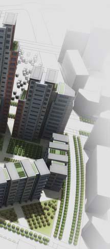
26 Exis ng Superblock Grid APPLYING THE PRINCIPLES IN CHENGGONG, A LOW-CARBON NEW TOWN New Urban Network Grid Chenggong is a new town of 1.5 million planned for Kunming s next genera on of growth. It is currently the administra ve center for the greater Kunming region and includes Yunnan University, a major new center for educa on and research, and a high speed rail sta on. While its original plan embraced many best prac ces for ecological design, its urban form followed typical superblock pa erns with large singleuse areas. Its central district, projected to house 230,000 residents and approximately 200,000 jobs, has been redesigned according to the eight principles for Low Carbon Ci es. The design followed the four step process outlined in this document. Comparison of land use plans for Chenggong: original Superblock grid (above) and redesigned Urban Network grid (below) 25

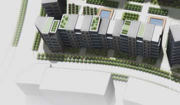
27 The plan for Chenggong: The principles have been combined to create a mixed-use, walkable and livable town Mixed use and small blocks Small blocks and mixed use replace typical Superblocks to create a more walkable community. The greater street density improves pedestrian access and disperses traffic Walkable neighborhoods Each neighborhood has a walking radius of approximately 500 meters, centered on local parks, schools, and other civic uses Auto-free streets A network of car-free streets, some with bus access, others for bikes and pedestrians, are spaced no more than 800 meters apart throughout the town Accessible parks Linear greenways, neighborhood parks and larger community parks are located throughout the plan and are easily reached by car-free streets and quiet local roads Paired one-way streets and narrow arterials Through-traffic is carried on streets no wider than 45 meters. Highervolume traffic is diverted onto pairs of one-way streets, no more than 30 meters wide in each direc on to allow easy pedestrian crossing Transit-oriented development Areas with high levels of transit service, such as the crossing of two metro or BRT lines, have higher density, more commercial development, and a greater mix of uses 26
28 ADVANTAGES OF TRANSIT ORIENTED DISTRICTS In sum, zoning for Transit Oriented Districts and mixed-use developments will create posi ve environments for pedestrians, bikes and transit and help solve many of China s most intractable urban growth challenges. Mobility can be improved through a coordinated approach of new land-use policies and new circula on systems. This then can help reduce carbon emissions, foreign oil imports while it improves air quality. Most important, it can produce the kind of healthy, vital city districts that a ract and support economic growth and cultural depth. TODs also create vital urban environments that o en leverage social capital. Ci es o en create economic ac vity through proximity and the social networks that evolve in mixed-use areas. There is much research and evidence of the posi ve economic impacts of commercial clusters and mixed-use urban environments. Finally walkable residen al TOD areas are more livable and less costly for average households. Time and expense lost to auto use is mi gated and the social benefits of lively streets and strong local communi es are well documented throughout the world. A Master Plan that employs TODs offers several advantages for a growing metropolis. Foremost it creates a logical and balanced distribu on of jobs that are appropriately decentralized along transit corridors. This then avoids the conges on of the one-direc onal commu ng pa erns associated with major CBDs. Jobs and housing are more balanced in each TOD allowing more walking and biking to work. In addi on, commuter transit trips become shorter and mul -direc onal when jobs are decentralized. Peak hour transit trips are therefore more efficiently distributed. Vehicle conges on is also mi gated as trips are shorter, bi-direc onal, and vastly reduced in the peak hour as the alternates of walking, biking and transit become more convenient and mely. 27
29 28
30
Planning Cities for People. A Guide to Prosperous, Low-Carbon Urbanization
 Planning Cities for People A Guide to Prosperous, Low-Carbon Urbanization The world s next generation of cities will need to overcome extreme challenges posed by population growth, congestion, and energy
Dra Design and Land Use Op ons Booklet
 Dra Design and Land Use Op ons Booklet March, 2015 This page was inten onally le blank. 2 Commercial-Vista Corridor Plan This booklet summarizes the street design and land use alterna ves for the Commercial
Overview Introduc on Project Process Key Issue:
 Overview Introduc on The purpose of the Commercial Vista Corridor Plan is to develop a detailed street design and land use plan that can be adopted and advanced as capital improvement projects for engineering
Transportation Master Plan Advisory Task Force
 Transportation Master Plan Advisory Task Force Network Alternatives & Phasing Strategy February 2016 BACKGROUND Table of Contents BACKGROUND Purpose & Introduction 2 Linking the TMP to Key Council Approved
Pedestrian Facili es. Sidewalks. Chapter 3 Design Elements BICYCLE/PEDESTRIAN
 Pedestrian Facili es Pedestrian facili es serve as the very founda on of the mul modal transporta on system. The AASHTO Guide for the Planning, Design, and Opera on of Pedestrian Facili es states that
INFRASTRUCTURE & AMENITIES. Bicycle Parking. Chapter 3 Design Elements INFRASTRUCTURE & AMENITIES BICYCLE PARKING
 Bicycle Parking Parking is an essen al feature to the accessibility of all land use types. Just like parking a car, people need a safe, secure, and convenient loca on to store their bicycle once they get
2014 STATE OF THE SYSTEM REPORT
 2014 STATE OF THE SYSTEM REPORT March 2016 This page intentionally left blank System Performance Monitoring This page intentionally left blank System Performance Monitoring State of the System Performance
Concept of Sustainable Transport and integrated Land Use Planning- An Overview. Manfred Breithaupt GIZ Water, Energy, Transport
 Concept of Sustainable Transport and integrated Land Use Planning- An Overview Manfred Breithaupt GIZ Water, Energy, Transport The adverse impacts of growth in motorization - in economic, environmental
Chapter 7. Transportation. Transportation Road Network Plan Transit Cyclists Pedestrians Multi-Use and Equestrian Trails
 Chapter 7 Transportation Transportation Road Network Plan Transit Cyclists Pedestrians Multi-Use and Equestrian Trails 7.1 TRANSPORTATION BACKGROUND The District of Maple Ridge faces a number of unique
Shared Use Facili es. Mul -Use Trails. Chapter 3 Design Elements BICYCLE/PEDESTRIAN MULTI USE TRAILS
 Shared Use Facili es "Shared Use" or "Mul -Use" facili es are those where bicyclists share a facility with pedestrians and other non-motorized modes of travel such as equestrians, cross country skiers,
CONNECTING PEOPLE TO PLACES
 CONNECTING PEOPLE TO PLACES 82 EAST BENCH MASTER PLAN 07 Introduction The East Bench transportation system is a collection of slow moving, treelined residential streets and major arteries that are the
Solana Beach Comprehensive Active Transportation Strategy (CATS)
") Solana Beach Comprehensive Active Transportation Strategy (CATS) 3.0 Goals & Policies The Solana Beach CATS goals and objectives outlined below were largely drawn from the Solana Beach Circulation Element
Solana Beach Comprehensive Active Transportation Strategy (CATS) 3.0 Goals & Policies The Solana Beach CATS goals and objectives outlined below were largely drawn from the Solana Beach Circulation Element
Roadways. Roadways III.
 Introduction 97 Roadway Design Principles 98 Safe Speeds 99 Optimizing of Street Space 00 Minimum Lane Widths in the City of Boston 02 Design Features that Reduce Operating Speeds 05 Travel Lanes Transit
Living Streets Policy
 Living Streets Policy Introduction Living streets balance the needs of motorists, bicyclists, pedestrians and transit riders in ways that promote safety and convenience, enhance community identity, create
Welcome. Background. Goals. Vision
 Welcome The formal Public Information Centre (PIC) for the Transportation Master Plan How We GO will be held in early 2017. At that time we will present the recommended transportation system for Niagara
ATTACHMENT 4 - TDM Checklist. TDM Checklist Overview
 ATTACHMENT 4 - TDM Checklist TDM Checklist Overview The proposed checklist rates developments on the degree to which they are TDM and transit supportive. Points are assigned based on the level of transit
In station areas, new pedestrian links can increase network connectivity and provide direct access to stations.
 The Last Mile Planning for Pedestrians Planning around stations will put pedestrians first. Making walking to stations safe and easy is important; walking will be a part of every rapid transit Accessible
Exceeding expectations: The growth of walking in Vancouver and creating a more walkable city in the future through EcoDensity
 Exceeding expectations: The growth of walking in Vancouver and creating a more walkable city in the future through EcoDensity Melina Scholefield, P. Eng. Manager, Sustainability Group, City of Vancouver
Circulation in Elk Grove includes: Motor vehicles, including cars and trucks
 Circulation, as it is used in this General Plan, refers to the many ways people and goods move from place to place in Elk Grove and the region. Circulation in Elk Grove includes: Motor vehicles, including
5 CIRCULATION AND STREET DESIGN
 5 CIRCULATION AND STREET DESIGN This chapter describes circulation and streetscape improvements proposed for the Northwest Chico Specific Plan Area. It includes detailed design specifications for existing
MCTC 2018 RTP SCS and Madera County RIFP Multi-Modal Project Eval Criteria GV13.xlsx
 MCTC 8 RTP SCS and Madera County RIFP Multi-Modal Project Eval Criteria GV.xlsx Madera County Transportation Commission Regional Transportation Plan / Sustainable Communities Strategy Multi-Modal Project
Planning Regionally With Transit
 Planning Regionally With Transit Nathan Coats Director of Operations CTAA Expo 2015 Tampa Began 1992. Serves eastern Cache County to Preston, ID. Population- 115,000 34 bus fleet, 26 fixed route buses;
Rail Sta ons. Transporta on Centers. Chapter 3 Design Elements PUBLIC TRANSPORTATION
 Rail Sta ons & Transporta on Centers Rail sta ons and transporta on centers serve as the intermodal hubs of the public transporta on system in Chester County. They are the primary loca ons for where Chester
2. Context. Existing framework. The context. The challenge. Transport Strategy
 Transport Strategy Providing quality connections Contents 1. Introduction 2. Context 3. Long-term direction 4. Three-year priorities 5. Strategy tree Wellington City Council July 2006 1. Introduction Wellington
Performance Criteria for 2035 Long Range Transportation Plan
 Minimizing Impacts on Natural, Historic, Cultural or Archeological Resources 2035 LRTP Weighting Factor: 7% Objective 1.1: Use appropriate planning and design criteria to protect and enhance the built
How To Encourage More Efficient Transportation in Brazilian Cities
 How To Encourage More Efficient Transportation in Brazilian Cities Todd Litman Victoria Transport Policy Institute Presented Seminar on Discouraging The Use Of Cars São Paulo, Brazil 3 September 2013 Creating
City of Wayzata Comprehensive Plan 2030 Transportation Chapter: Appendix A
 A1. Functional Classification Table A-1 illustrates the Metropolitan Council s detailed criteria established for the functional classification of roadways within the Twin Cities Metropolitan Area. Table
Multimodal Through Corridors and Placemaking Corridors
 68 Multimodal Through Corridors and Placemaking Corridors Corridors have different functions in a region. Some corridors are used to get smoothly and rapidly through a region or to get quickly to major
T1-A - Service Reduction (Re-sizing)
") Key T1-A Choice A Key T1-B Choice B Key T1-C Choice C Key T1-D Choice D Key T1-E Choice E Key T1-F Choice F Key Choice G T2 T1-A - Service Reduction (Re-sizing) Description This key choice would represent
Key T1-A Choice A Key T1-B Choice B Key T1-C Choice C Key T1-D Choice D Key T1-E Choice E Key T1-F Choice F Key Choice G T2 T1-A - Service Reduction (Re-sizing) Description This key choice would represent
DON MILLS-EGLINTON Mobility Hub Profile
 Mobility Hub Profile Dundas Don Mills-Eglinton West-Bloor Anchor Hub Gateway Hub N MOBILITY HUBS: Places of connectivity between regional and rapid transit services, where different modes of transportation
Transportation Assessment
 Transportation Assessment Midtown Open House February 10, 2018 Overview Midtown in Focus Overview & Purpose of Today Transportation Assessment overview Summary of Transportation work to date Review & Analysis
Perryville TOD and Greenway Plan
 Perryville TOD and Greenway Plan Greenway Glossary Pathway: A bicycle and pedestrian path separated from motorized vehicular traffic by an open space, barrier or curb. Multi-use paths may be within the
Proposed. City of Grand Junction Complete Streets Policy. Exhibit 10
 Proposed City of Grand Junction Complete Streets Policy Exhibit 10 1 City of Grand Junction Complete Streets Policy Vision: The Complete Streets Vision is to develop a safe, efficient, and reliable travel
Sixth Line Development - Transit Facilities Plan
 Memorandum Date: November 13, 2012 To: From: c.c. Subject: Rob Freeman (Freeman Planning) Kevin Phillips Sixth Line Development - Transit Facilities Plan 33016631 This memo was prepared to review the transit
Table #6 VISION CHARACTERISTICS
 Table #6 VISION White Flint is a place to live, work, play, shop, and walk with sufficient density to encourage quality redevelopment. Vibrant streets and consistent streetscapes are important. CHARACTERISTICS
Land Use and Urban Design
 35th ST 36th ST 37th ST 39th ST 40th ST 41st ST 34th ST 35th ST 36th ST 37th ST 38th ST 39th ST 40th ST Land Use and Urban Design Map 3: Corridors Land uses have evolved over many decades to accommodate
PEDALING FORWARD. A Glance at the SFMTA s Bike Program for SFMTA.COM
 PEDALING FORWARD A Glance at the SFMTA s Bike Program for 2017-2021 SFMTA.COM INTRODUCTION About This Booklet More people from all walks of life see their bicycle as a more convenient way to get where
7th Edi on, Update 6 November 2017 Roadway Conges on & System Reliability
 Where We Stand tracks the health of the St. Louis region among the 50 most populous MSAs. 1 These metro areas, known as the peer regions, are our domes c compe on and provide a consistent yards ck to gauge
WELCOME TO OPEN HOUSE # 1 June 14, 2017
 Langstaff Road Weston Road to Highway 7 Class Environmental Assessment Study WELCOME TO OPEN HOUSE # 1 June 14, 2017 Please sign in and join our mailing list Purpose of Open House #1 & Study Area York
Building Community Partnerships for Mobility:
 Building Community Partnerships for Mobility: San Francisco 2008 Presented by: Cynthia Hoyle, AICP Transportation Planning Consultant Champaign-Urbana Mass Transit District Background The Heartland Champaign-Urbana,
NEWMARKET CENTRE Mobility Hub Profile
 Mobility Hub Profile Dundas Newmarket West-Bloor Centre Anchor Hub Gateway Hub N MOBILITY HUBS: Places of connectivity between regional and rapid transit services, where different modes of transportation
City of Novi Non-Motorized Master Plan 2011 Executive Summary
 City of Novi Non-Motorized Master Plan 2011 Executive Summary Prepared by: February 28, 2011 Why Plan? Encouraging healthy, active lifestyles through pathway and sidewalk connectivity has been a focus
ACTIVE TRANSPORTATION
 ACTIVE TRANSPORTATION Mobility 2040 Supported Goals Improve the availability of transportation options for people and goods. Support travel efficiency measures and system enhancements targeted at congestion
Appendix A-K Public Information Centre 2 Materials
 Appendix A-K Public Information Centre 2 Materials Our Rapid Transit Initiative Make an impact on the future of transit Join the discussion on Rapid Transit in London You re invited to a Public Information
WHITE PAPER: TRANSIT SERVICE FOR SOUTH SHAGANAPPI
 9/27/2012 TRANSIT PLANNING WHITE PAPER: TRANSIT SERVICE FOR SOUTH SHAGANAPPI 2012 Calgary Transit 1 Table of Contents Purpose... 3 Area of Change... 3 Background... 3 Access to destinations... 5 Connecting
Gerald Ollivier Lead Transport Specialist World Bank, New Delhi. Transforming Cities through Integrated Planning Corridor Scale
 Gerald Ollivier Lead Transport Specialist World Bank, New Delhi Transforming Cities through Integrated Planning Corridor Scale JOB ACCESSIBILITY: ZHENGZHOU A: LINE 1, 2, AND 3 AND WALKING: 12% B. SCENARIO
Purpose and Need. Chapter Introduction. 2.2 Project Purpose and Need Project Purpose Project Need
 Chapter 2 Purpose and Need 2.1 Introduction The El Camino Real Bus Rapid Transit (BRT) Project (Project) would make transit and other transportation improvements along a 17.6-mile segment of the El Camino
TRANSPORTATION ASSESSMENT
 TRANSPORTATION ASSESSMENT Traffic Modeling The mobility findings analysis for Dallas was based on the methodology of the North Central Texas Council of Government s Regional travel demand model. This model
Illustrated Principles of Good Planning
 Illustrated Principles of Good Planning The Miami 21 Zoning Code incorporates time-tested planning principles into the zoning regulations of our City. These are principles that make for better neighborhoods,
Classification Criteria
 SCHEDULE D TO RECOMMENDED OFFICIAL PLAN AMENDMENT NO. 40 SCHEDULE C-4 Road Criteria Criteria Traffic Service Objective Land Service/Access Typical Daily Traffic Volume Flow characteristics Travel Speed
Chapter 5. Complete Streets and Walkable Communities.
 Chapter 5. Complete Streets and Walkable Communities. 5.1 Description of Complete Streets. Cities throughout the world, and specifically the United States, are coming to embrace a new transportation and
MOBILITY RESULTS AREA. Budgeting For Outcomes Council Presentation January 12, 2007
 MOBILITY RESULTS AREA Budgeting For Outcomes Council Presentation January 12, 2007 Mobility Results Team Members 2 Hammond Perot, OED, Co-Team Leader Bonnie Meeder, DEV (returning), Co-Team Leader Peer
DON MILLS-SHEPPARD Mobility Hub Profile
 DON MILLS-SHEPPARD Mobility Hub Profile Dundas Don Mills-Sheppard West-Bloor Anchor Hub Gateway Hub N MOBILITY HUBS: Places of connectivity between regional and rapid transit services, where different
Chapter 14 PARLIER RELATIONSHIP TO CITY PLANS AND POLICIES. Recommendations to Improve Pedestrian Safety in the City of Parlier (2014)
") Chapter 14 PARLIER This chapter describes the current status and future plans for biking and walking in the City of Parlier. RELATIONSHIP TO CITY PLANS AND POLICIES The Parlier General Plan is the primary
Chapter 14 PARLIER This chapter describes the current status and future plans for biking and walking in the City of Parlier. RELATIONSHIP TO CITY PLANS AND POLICIES The Parlier General Plan is the primary
Berkeley Strategic Transportation Plan A-76
 Berkeley Strategic Transportation Plan A-76 Appendices 1. A Team Effort 2. Where We ve Been A-11 Berkeley Strategic Transportation Plan Alameda County Transportation Plan Alameda County will be served
Integrated Corridor Approach to Urban Transport. O.P. Agarwal World Bank Presentation at CODATU XV Addis Ababa, 25 th October 2012
 Integrated Corridor Approach to Urban Transport O.P. Agarwal World Bank Presentation at CODATU XV Addis Ababa, 25 th October 2012 What is the Integrated Corridor Approach for Urban Transport Public? Why
Ann Arbor Downtown Street Plan
 1 Ann Arbor Downtown Street Plan Public Workshop #1 We know that. 2 Public right-of-way (streets, sidewalks, and alleys) make up 30% of the total District area of downtown. Streets need to provide mobility
Access BART: TOD and Improved Connections. October 29, 2008
 Access BART: TOD and Improved Connections October 29, 2008 1 Access BART Study Goals Evaluate at the system-level land use and access scenarios to optimize ridership Identify station clusters that provide
Vision: Traditional hamlet with an attractive business/pedestrian friendly main street connected to adjacent walkable neighborhoods
 N D. Focus Area II Vision: Traditional hamlet with an attractive business/pedestrian friendly main street connected to adjacent walkable neighborhoods Transit Road Focus Area II is located in the Hamlet
Cities Connect. Cities Connect! How Urbanity Supports Social Inclusion
 Cities Connect! How Urbanity Supports Social Inclusion Todd Litman Victoria Transport Policy Institute Metropolis Toronto, Canada - 14 June 2006 Cities Connect People with people. People with jobs. People
TRAVEL PLAN: CENTRAL EUROPEAN UNIVERSITY CAMPUS REDEVELOPMENT PROJECT TRAVEL PLAN. Central European University Campus Redevelopment Project.
 TRAVEL PLAN Central European University Campus Redevelopment Project Page 1 Table of Contents Introduction... 3 Background... 7 Building Users... 7 Transportation in Community Consultation... 7 Summary
Creating walkable, bikeable and transit-supportive communities in Halton
 Creating walkable, bikeable and transit-supportive communities in Halton By presenting current research and best practices, the information in this paper is meant to support and broaden discussion on how
EXECUTIVE SUMMARY: TRANSIT-ORIENTED DEVELOPMENT IN SMITHS FALLS, ONTARIO; A COMPARISON BETWEEN TWO SITES
 EECUTIVE SUMMARY: TRANSIT-ORIENTED DEVELOPMENT IN SMITHS FALLS, ONTARIO; A COMPARISON BETWEEN TWO SITES Topic and Purpose In 2007, the Mayor of Ottawa s Task Force on Transportation suggested adding a
Cluster 5/Module 2 (C5/M2): Pedestrians and Transit Oriented Development (TOD)
: Pedestrians and Transit Oriented Development (TOD)") 1 Cluster 5/Module 2 (C5/M2): Pedestrians and Transit Oriented Development (TOD) This presentation is one of the support materials prepared for the capacity building program Building Leaders in Urban Transport
1 Cluster 5/Module 2 (C5/M2): Pedestrians and Transit Oriented Development (TOD) This presentation is one of the support materials prepared for the capacity building program Building Leaders in Urban Transport
Exhibit 1 PLANNING COMMISSION AGENDA ITEM
 Exhibit 1 PLANNING COMMISSION AGENDA ITEM Project Name: Grand Junction Circulation Plan Grand Junction Complete Streets Policy Applicant: City of Grand Junction Representative: David Thornton Address:
Public Engagement Session
 Public Engagement Session Valley Line West LRT will play an essen al role in connec ng Edmonton s communi es, and we are working to have it ready to go as soon as funding becomes available for construc
Executive Summary #GPC IV-18 Safe Routes to School Plans 2011
 Executive Summary #GPC IV-18 Safe Routes to School Plans 2011 August 2012 040829024.1.503_M-D MPO ExecSum Aug2012.indd [WPB Mktg] M I A M I - D A D E M P O Executive Summary #GPC IV-18 Safe Routes to School
Nomination. Halton Region in Context
 Transportation Association of Canada Sustainable Urban Transportation Award Nomination of: Region of Halton Regional Transportation Master Plan Study March 2005 Nominated by: Nomination The TAC Sustainable
summary of issues and opportunities
 1 summary of issues and opportunities EXECUTIVE SUMMARY CHAPTER 2: HISTORY - 3: LAND USE This first chapter is an overview of lessons learned from analysis of the existing conditions on El Camino as well
Exit 13/Golden Triangle Study FREQUENTLY ASKED QUESTIONS
 FREQUENTLY ASKED QUESTIONS How will you improve traffic in the Golden Triangle? One main goal of this study is to examine the current traffic patterns of the area and propose ways to improve the traffic.
How to Develop a Pedestrian Safety Action Plan
 How to Develop a Pedestrian Safety Action Plan Course Introduction Presented by: Peter Eun FHWA RC Safety Engineer Ryan Snyder President, Ryan Snyder Associates, LLC Paul Zykofsky Director, Land Use and
Extracting Maximum Benefit from Parking Policy - 10 Years Experience in Perth, Australia. By Emmerson Richardson Sinclair Knight Merz
 Extracting Maximum Benefit from Parking Policy - 10 Years Experience in Perth, Australia By Emmerson Richardson Sinclair Knight Merz Snapshot of Perth > Metropolitan Area Population 1.7 million > 3.5 million
Anniedale- Tynehead NCP Best Practices in Transportation Planning Summary
 Anniedale- Tynehead NCP Best Practices in Transportation Planning Summary The City of Surrey Anniedale-Tynehead NCP Best Practices Transportation Summary This document provides a summary of the Bunt &
June 2015 REGIONAL TRANSPORTATION SNAPSHOT
 June 2015 REGIONAL TRANSPORTATION SNAPSHOT THE REGION Who are we? The Greater Toronto and Hamilton Area (GTHA), consisting of Durham Region, Halton Region, the City of Hamilton, Peel Region, the City of
Highway 217 Corridor Study. Phase I Overview Report
 Highway 217 Corridor Study Phase I Overview Report November 3, 24 BACKGROUND AND OVERVIEW Study purpose The Highway 217 Corridor Study is developing multi-modal transportation solutions for traffic problems
Active Transportation Facility Glossary
 Active Transportation Facility Glossary This document defines different active transportation facilities and suggests appropriate corridor types. Click on a facility type to jump to its definition. Bike
INFRASTRUCTURE: Using the Grid to Create a more Self-Sustaining Downtown. Studio Spring 2013
 EMERGENT FUTURES The San Diego Section of the American Society of Civil Engineers (ASCE) released a new report, the 2012 San Diego County Infrastructure Report Card. Since the last San Diego Report Card
Better Market Street Project Update. Urban Forestry Council September 17, 2014
 Better Market Street Project Update Urban Forestry Council September 17, 2014 Project Area Limits Better Market Street Schedule Market Street City s busiest transit corridor Over 85 buses per hour 14 surface
Transportation, Parking & Roads
 Transportation, Parking & Roads Design Carolina North as a walkable community Design the transportation system and development patterns (i.e., urban design elements such as density, building design, mix
Corporate. Report COUNCIL DATE: June 26, 2006 NO: C012 COUNCIL-IN-COMMITTEE. TO: Mayor & Council DATE: June 22, 2006
 Corporate NO: C012 Report COUNCIL DATE: June 26, 2006 COUNCIL-IN-COMMITTEE TO: Mayor & Council DATE: June 22, 2006 FROM: General Manager, Engineering FILE: 0410-20(MoT/Gate) SUBJECT: Surrey Response on
Appendix C 3. Bicycle / Pedestrian Planning
 Appendix C 3. Bicycle / Pedestrian Planning BICYCLE/PEDESTRIAN PLANNING 2005 Master Plan GOAL: Provide for safe and convenient bicycle and pedestrian circulation throughout the City. Develop a city-wide
Advanced Transit Oriented Developments (ATODs) - Defined
 - Defined") Advanced Transit Oriented Developments (ATODs) - Defined Work previously undertaken at Florida International University (FIU) in the Lehman Center for Transportation Research (LCTR), the School of Architecture
Advanced Transit Oriented Developments (ATODs) - Defined Work previously undertaken at Florida International University (FIU) in the Lehman Center for Transportation Research (LCTR), the School of Architecture
Bikeway action plan. Bicycle Friendly Community Workshop March 5, 2007 Rochester, MN
 Bikeway action plan Summary The was held on March 5, 2007 at the Rochester Mayo Civic Center. The workshop was hosted by Rochester-Olmsted County Planning Department in collaboration with the League of
A CHANGING CITY. of Edmonton, it is essential that it reflects the long-term vision of the City.
 A CHANGING CITY By the year 2040, Edmonton will be home to more than 1 million people. To accommodate growth and support a healthy and compact city, we need a new approach to development/redevelopment
THE PHILADELPHIA COMPLETE. an overview
 THE PHILADELPHIA COMPLETE STREETS DESIGN HANDBOOK an overview WHAT ARE COMPLETE STREETS? Complete Streets are streets designed to accommodate all users, from pedestrians to drivers Complete Streets provide
Mainstreet Master Plan Land Use
 Mainstreet Master Plan 04 Land Use Top Recommendations Active Uses: Promote active ground-floor uses such as retail, restaurants, galleries and personal services with interactive storefronts for Mainstreet
Chapter 5 Future Transportation
 Chapter 5 Future Transportation The Future Land Use Plan identifies the desired land use designations. The land uses desired for Crozet depend, in large part, on the success of the transportation system,
CPC Parking Lot Riverside Drive. Transportation Rationale
 CPC Parking Lot Transportation Rationale Prepared By: NOVATECH Suite 200, 240 Michael Cowpland Drive Ottawa, Ontario K2M 1P6 September 2015 Novatech File: 114093 Ref: R-2015-153 Table of Contents 1.0 INTRODUCTION...
Regional Transportation Needs Within Southeastern Wisconsin
 Regional Transportation Needs Within Southeastern Wisconsin #118274 May 24, 2006 1 Introduction The Southeastern Wisconsin Regional Planning Commission (SEWRPC) is the official areawide planning agency
EXECUTIVE SUMMARY. Vision
 Vision Walking and bicycling in Salt Lake City will be safe, convenient, comfortable, and viable transportation options that connect people to places, foster recreational and economic development opportunities,
Intersec ons. Alignment. Chapter 3 Design Elements. Standards AASHTO & PennDOT: As close to 90 as possible, but a minimum of 60.
 Intersec ons Intersec ons pertains to mul ple design elements concerning intersec- ons, including: alignment, channeliza on, grades, off set, radii, sight distance, signaliza on, spacing, and traffic control
Executive Summary Route 30 Corridor Master Plan
 Route Corridor Master Plan Project Overview The Route Corridor Master Plan is a coordinated multimodal transportation and land use plan for the entire stretch of Route through East Whiteland Township,
PEDESTRIAN ACTION PLAN
 ATTACHMENT 2 CITY OF SANTA MONICA PEDESTRIAN ACTION PLAN CITY OF SANTA MONICA PEDESTRIAN ACTION PLAN This page intentionally left blank EXECUTIVE SUMMARY CHAPTER 1 EXECUTIVE SUMMARY Setting the Stage
SECTION 1 - TRAFFIC PLANNING
 SECTION 1 - TRAFFIC PLANNING 1.1 TRAFFIC OPERATIONS 1.1.1 Roadway Functional Classification The Multnomah County Comprehensive Framework Plan s Policy 34: Trafficways and the Functional Classification
Public Consultation Centre For. Transportation Master Plan Update. Information Package
 Public Consultation Centre For Transportation Master Plan Update Information Package Date Location Hours Tuesday, September 12, 2017 Wednesday, September 13, 2017 Tuesday, September 19, 2017 Cambridge
Uniting Cleveland through the Euclid Corridor Transportation Project
 Zhang 1 Uniting Cleveland through the Euclid Corridor Transportation Project Jinmeng Zhang As a bus passenger takes a ride to downtown Cleveland through Euclid Avenue, constructions can be seen along the
Urban planners have invested a lot of energy in the idea of transit-oriented
 DOES TRANSIT-ORIENTED DEVELOPMENT NEED THE TRANSIT? D A N I E L G. C H AT M A N Urban planners have invested a lot of energy in the idea of transit-oriented developments (TODs). Developing dense housing
Capital and Strategic Planning Committee. Item III - B. April 12, WMATA s Transit-Oriented Development Objectives
 Capital and Strategic Planning Committee Item III - B April 12, 2018 WMATA s Transit-Oriented Development Objectives Page 24 of 76 Washington Metropolitan Area Transit Authority Board Action/Information
THE I-81 CHALLENGE THE I-81 CHALLENGE. Highlights from Technical Memo #1: Physical Conditions Analysis. Physical Conditions Analysis Highlights
 THE I-81 CHALLENGE Physical Conditions Analysis Highlights THE I-81 CHALLENGE Highlights from Technical Memo #1: Physical Conditions Analysis Prepared by the Metropolitan Transportation Council in conjunction
WALK- AND bike-friendly TURLOCK
 WALK- AND bike-friendly TURLOCK Ideas to Encourage Walking and Biking Benefits to the COMMUNITY Get Connected People who walk and bike have many more opportunities for casual interactions with friends