Transport Interchange as city centres of activity. Planning approach Case Study Naya Raipur Chhattisgarh, India. Winter University 2015 IRKUTSK
|
|
|
- Grace Chambers
- 5 years ago
- Views:
Transcription
1 Transport Interchange as city centres of activity Planning approach Case Study Naya Raipur Chhattisgarh, India Winter University 2015 IRKUTSK Dilip Shekdar Architect and Planner, Consultant Naya Raipur development Authority

2 Contents Naya Raipur in brief Multi Modal Transportation TOD Planning Snap shots of Naya Raipur


3 CHHATTISGARH SNAPSHOT Born On 1 st Nov million people Mineral Rich State Rice bowl of India Surplus Power Growing rapidly


4 Naya Raipur RAIPUR NAYA RAIPUR RAIPUR Bhilai -Durg NAYA RAIPUR LOCATION
5 Vision Naya Raipur to be developed as a modern but green and smart city conservation of the environment and existing landscape, a citizen friendly and visitor friendly city. sense of security and comfort among its citizens, especially women, children and the physically challenged.


 9 fully and 19 partly 3 Layer- III (Airport Zone)")
6 Naya Raipur Planning Area The Development Plan-2031 consists of three layers- Sr. No. Layer Area Included Villages included 1 Layer-I Area sq.km. 10 fully and 22 partly 2 Layer- II (Naya Raipur Area Peripheral sq.km. Region ) 9 fully and 19 partly 3 Layer- III (Airport Zone) Area sq.km. 2 fully and 1 partly 13 Abadi areas have been included in layer -I


7 Proposed Land Use Land Use % distribution Residential Commercial - Retail 1.81 Commercial - Wholesale 1.63 Industrial 2.42 Special Industry 3.28 Public & Semi Public Recreational Transport 12.55
8 Demographic Data Naya Raipur would be taking functions from the Raipur city and also would have impact in the region. Naya Raipur would attract population from population from Raipur, Durg Bhilai Urban Agglomeration and various parts of Chhattisgarh. Naya Raipur is to be developed in three phases within a period of 30 years for a population of 5.60 lakh i.e 0.56 millions Phase I 2011 Phase II 2021 Phase III 2031 Projected Population Natural Growth of the Existing Population Additional Population 150,000(0.15 m) 365,000 (0.36 m) 560,000 (0.56 m) 22,400 40, , ,200

9 Work areas Activity/Use Zone Number of employees CBD Institutional areas Capitol Complex Light Industries /Composite use zone Planning Unit Centres Other Govt offices Construction Industry Residential Area Wholesale Trade CBD Capital Complex Software technology park 8918 Transport Hub 6688 Total 222,950 Institutional area Jobs in all sectors of Economy 0.22 million Major work areas in Naya Raipur: CBD, Institutional area and Capital complex
10 Transportation Priorities NMT :Pedestrian & Cycles Public Transport System Private vehicles


11 NMT Planning Green corridors within the sectors Green corridors at the city level

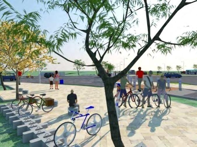
12 NMT Planning Cycle & Pedestrian tracks along roads Map showing Final Strip Plan Proposed BRTS Both Sides - Segregated Both Sides - Common One Side - Segregated One Side - Common Pedestrian & Cycle tracks along Roads NMT Routes


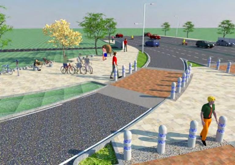
13 NMT at Junction

14 NMT at Road
")
 Railways Source: Bus Service Plan")
15 Public Transportation Public Mass Transport System Bus Rapid Transit system (BRTS) Corridor III Light Rail Transit System (LRTS) Railways Source: Bus Service Plan Report by EMBARQ
16 Connectivity Bus Rapid Transit Corridors RAIPUR NAYARAIPUR

17 Connectivity Rail And LRT Rail Project being implemented Jointly by Indian railways And NRDA LRT
18 Transit Stations Level-1 Naya Raipur Railway Station Modes: Rail connecting to nation Interstate bus BRTS Autos/Taxies NMT Private vehicles

19 Naya Raipur Station : Mobility Rail BRT ISBT Tax i BRT LRT PVT Taxi/ Auto Movement Pedestrian Movement
20 Transit Stations Level-2 Railway Stations at the city level Modes: Rail connectivity BRTS Autos/Taxies NMT Private vehicles


21 Transit Stations Level-3 BRTS Station Modes: BRTS Autos/Taxies NMT
22 Transit Oriented Development What is TOD? This is a form of urban development that clusters a greater mixture of land uses around a high quality transport service. The transport node, either train, light rail or bus terminus is designed to be the focus for the development and ideally becomes the community 'heart'. It is where people shop, work, meet, relax and live. Source: Department of Sustainability and Environment, State of Victoria, Australia.
23 GOALS OF TOD: The Primary Goals of TOD are to: oprevent/discourage private automobile dependency and encourage public transportation use by making it more accessible and attractive. o Encourage higher density and diversity within walking distance of public transportation - creating attractive and vibrant places. oprovide enhanced connectivity by offering a greater choice of motorized and non-motorized transportation modes.

24 How TOD works? BEFORE TOD AFTER TOD

25 Demarcation of TOD Station Station Areas are defined by a 800m / 10 minute walk distance. This is the maximum comfortable distance a pedestrian is willing to walk. This Station Area is further comprised of multiple zones with their own transportation and land use characteristics and a catchment area
26 TOD Station Area Zones TOD Zone Primary Station Area Secondary Area Catchment Area Radius 0-400m / 5 minute walk m / 10 minute walk 800m-2km Description The primary zone includes the rapid transit station and associated facilities as well the immediately surrounding area. The secondary zone extends between 400 and 800 metres from the rapid transit station. The catchment area is the broader area of influence outside of the station area. Most of the people who access the regional rapid transit system will come from the catchment area.
27 TOD Station Area Zones TOD Zone Primary Station Area Radius 0-400m / 5 minute Transportation Considerations walk Prioritize high levels of pedestrian, NMT activity other modes of access to the stations e.g. IPT, MVs, cellphone waiting etc. Reduction in parking Secondary Area m / 10 minute walk Prioritize direct & safe walking & cycling connections to the rapid transit station Heavy reliance on nonmotorized IPT as walking distance increases. Catchment Area 800m-2km Prioritize direct & quick connections for motorized IPT. Reliance on transit feeder services as distance increases.
28 TOD Zone Primary Station Area Secondary Area Radius 0-400m / 5 minute walk m / 10 minute walk Land Use Consideration s TOD Station Area Zones Highest Density & Mixed Uses to encourage high ridership & provide a mixed-use, vibrant activity spine High level of amenities retail, bike parking, businesses, traffic calming etc. Medium densities & mix of uses to benefit from the high level of transit accessibility Density & height of development should be stepped down gradually towards the periphery. Catchment Area 800m-2km Medium lower density developments Create open space linkages & green connections.
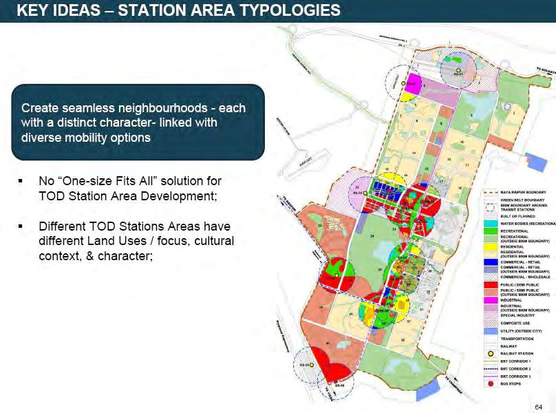
29 Redefining Naya Raipur for TOD BASE LINE STUDY Data collection AND ANYLYSIS Critical analysis of NRDP with respect to TOD Study national and international case studies Formulation of Draft TOD principles, policies, implementation strategy EVALUATION Charrette with the experts Visiting the successful examples FINAL POLICY Refining the Draft TOD policy Capacity building for implementation.


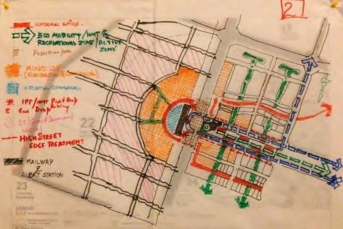
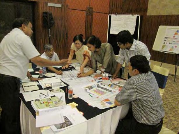
30 Inputs From Experts INTERNATIONAL CHARRETTE


31 1 Multimodal Transit Station Principles Of Tod Principle Transit is at the heart of transit oriented development. People should have their choice of transportation modes including cars, bicycles, BRT, LRT, two wheelers, cycle rickshaws, and auto rickshaws. Strategies: Create clear, direct, and short transfers between transit modes seamless connectivity between local, regional, and rapid transit services by reducing waiting times. Create prioritized, safe and direct pedestrian and cycling routes to rapid transit stations from major. Adopt transit priority measures to ensure the efficient movement of surface transit to and from the station area, including measures such as signal priority and dedicated transit lanes. Provide clearly marked and protected access for pedestrians and cyclists at station areas to minimize conflicts, particularly at passenger pick-up and drop-offs (PPUDO), bus facilities, and parking access points.


32 2 Principles Of Tod Interconnected Street Pattern 2 Principle An interconnected street pattern is a traditional urban design technique that reduces congestion, encourages travel choice, and supports mixed use development. Block lengths should not exceed 200m. Strategies: Streets and blocks networks should provide shortest routes to pedestrians and cyclists so that it s faster to walk or cycle than to drive. Regulate maximum block widths, minimum frontages. Remove setbacks, build sidewalks, and require entries on sidewalks. Pedestrian Connectivity and increase driver awareness.


33 3 Principles Of Tod Mixed Use Development 3 Principle A mix of diverse and complimentary land uses in a compact pattern allows residents and workers to walk to work or to shop rather than driving for all daily needs. Strategies: Provide a diverse mix of uses, including mainly Residential and commercial High transit-supportive densities at, and around transit stations to create a compact built form Vertical type of mixed use development like residential land use over the commercial places so that the distances between the activities is decreased and accessibility between different activities is increased. Discourage land uses which encourage car usage.


34 Principles Of Tod 4 Walkability Principle Pedestrian-friendly environments allow walking to be a pleasant, safe, and efficient alternative to the automobile. This includes design features such as safe crossing points near transit stations, shaded pedestrian routes, and continuous sidewalks and paths. Strategies: Create convenient, comfortable, direct and safe pedestrian linkages to promote the use of transit. Provide an attractive and safe pedestrian environment Adopt road design standards that ensure safe movement of all road users. Identify pedestrian priority routes linking transit stations with nearby destinations Design and plan pedestrian networks to provide attractive, direct routes between the transit station and other area destinations
.")


35 5 Principles Of Tod Compact Development 5 Principle The scale of transit oriented development approximates the scale of the pedestrian. The extent of these neighborhoods is based on a comfortable walking distance from edge to centre (approximately 400 to 800 meters in radius). Strategies: The highest employment and residential densities and building intensities should be located in the closest proximity to the transit station and decrease as we move away from the station. Increase density around all transit stations to support Rapid Transit service a vibrant station area Along local bus routes, buildings should be oriented primarily towards streets,. Encourage a variety of building types and scales at different locations throughout the station area tallest buildings near the station and lower buildings as we move further away from the station area.

36 6 Principles Of Tod 6 Street Facing Buildings Principle Buildings should be placed near streets, not behind parking areas, to better define the street. Street front retail should be provided to humanize the building wall and activate the sidewalk. Strategies: Surface parking lots should be located in the rear of buildings. By concentrating the floor area into larger horizontal forms instead of narrow towers, a more unified and consistent street wall is created, a more pedestrianoriented scale is maintained and the building s orientation to the street is strengthened. Mid-rise buildings provide a different character than high-rise building types and are typically more compatible with the character of adjacent communities

37 6 Principles Of Tod Street Facing Buildings (Contd) 6 Strategies: Tall buildings (greater than 8 storeys) should be oriented to maintain solar access to sensitive areas such as parks and residential neighborhoods. Employ a variety of building massing to accommodate higher densities and building intensities to avoid monolithic building masses. Mid-rise building forms should be located along the street edge of primary pedestrian connections to provide continuous building enclosure of the streetscape


38 7 Principles Of Tod 7 Urban Place Making Principle Transit oriented development is defined as much by its public realm as its private development. Public and semipublic spaces enable the neighborhood infrastructure to build community bonds, social interaction, and community participation. Strategies: Place making should build upon a neighbourhood s unique character through context-sensitive architecture and landscaping, while supporting convenient, direct and enjoyable pedestrian linkages to and from all transit stations. Provide a high quality and aesthetically pleasing public realm. Create Places, not gated developments. Mix of uses to provide people of varied social groups with options to live, work, shop and play within easy access to public transport and daily necessities.


39 8 Principles Of Tod 8 Streetscape Design Principle A highly connected street pattern with design elements coordinated to provide visual interest, pedestrian amenity, and sense of place improve the desirability of walking and shortens perception of distance Strategies: Provide trees and street furniture to dramatically improve the quality of the pedestrian experience and enhance safety by providing a physical and visible buffer between the pedestrian and the car, and encourage slower traffic speeds. Create a high-quality public realm and pleasurable pedestrian experience Shop and stroll along main street during both peak and off-peak travel times. Trees and vegetation help to reduce the urban heat island effect and decreases energy costs related to air temperatures.


40 9 Principles Of Tod 9 Bicycle Friendly Streets/ Parking Principle Bicycles are efficient ways to expand the service area of the station without relying on automobiles or bus service. Bike lanes, bike routes, and secure parking make the bicycle an easy option. Strategies: Create prioritized, safe and direct pedestrian and cycling routes to rapid transit stations Provide secure and plentiful bicycle parking at station entrances Ensure pedestrian and cycling facilities are designed to a high standard of safety, security, and comfort. Bicycle parking should be in well-lit and visible areas to increase security. Ensure bicycle parking does not conflict with vehicular traffic or pedestrians.


41 10 Principles Of Tod 10 Urban Parks and Plazas Principle A variety of public open spaces near transit stations contribute to a sense of place, foster healthy communities, and provides places for interaction. Strategies: Landscape and building design should maximize tree cover, reduce hard surfaces, and minimize heat retention and the urban heat island effect. Adopt waste management strategies that reduce the output of waste to landfills and increases recycling and the reuse of materials. Minimize the extent of impermeable surfaces by utilizing permeable pavers and soft landscaped areas. Reduce the urban heat island effect by minimizing the extent of paved surfaces. Set water efficiency standards for landscaping and reduce potable water consumption by using recycled water system for irrigation


.")
42 11 Principles Of Tod 11 Architectural Variety Principle Promoting an architectural style that is pedestrian friendly, contains visual variation and, with improved economics of higher density, higher quality building materials. Strategies: Create a variety of visually appealing building mass within the first 400m from the station area. Developments exceeding 10 storeys should have tall, slender towers, rather than bulkier, squat buildings. Locating buildings close to the street will help to create a sense of enclosure and comfort for pedestrians. Ensure height to width ratios that create a scale on thoroughfares that is comfortable to people and encourages walking (human scale). Buildings should be oriented towards the pedestrian, with active uses located along the sidewalk and not located behind parking lots or blank walls.


43 12 Principles Of Tod 12 Well-Designed Transit Station for a High Quality User Experience Principle The transit station will be a focal point and a gateway to the regional transit network. Its design will be paramount to ensure a seamless, accessible, and attractive customer environment and experience. Strategies: Encourage high-quality station architecture and public realm that is sensitive to the surrounding built context and community vision. Develop a station retail program that is responsive to customer demand, convenience, and market needs. Provide a minimum level of customer amenity to enhance customer comfort, safety, and information. legibility and permeability of the transit station.


44 Principles Of Tod 13 Reduced Parking Standards Principle By reducing parking standards to reflect increased transit use and walking, the amount of site area that can be used for active uses or public amenities increases. Strategies: Limit commuter parking expansion by prioritizing feeder transit services to the stations. Implement commuter parking pricing with incentives for carpooling and alternative fuel vehicles. Develop a short and long term area-wide parking strategy with maximum and minimum parking standards and shared use parking practices. Minimize surface parking and integrate parking within surrounding development and parking structures. Design parking facilities to a high level of architectural and landscape quality


45 14 Principles Of Tod Safety and Security Principle Developing the pedestrian environment to maximize safety and security will enhance patron experience and transit ridership. Strategies: Design the environment to optimize natural surveillance. Design strategies include: adequate site lighting; mixed-use development with retail at-grade and residential or office development above; avoiding blank walls; and low level fencing or vegetation that allows visual surveillance of semiprivate areas and parking lots. Defining clear boundaries declares ownership of space and increases recognition of public versus private space. The declared space may then be more easily defended. Locate vulnerable activities, such as waiting at night, in safe locations with good natural surveillance and street-level activity, such as along mixed-use streets or retail plazas


46 15 Principles Of Tod Market Acceptance and Successful Implementation Principle A TOD is successful when it attracts sufficient jobs and residents to create a vibrant, transit supportive place. In order to ensure success of a TOD, strategies should be flexible, designed to respond to the diverse nature of the station areas, their surrounding community contexts Strategies: Encourage development by providing developers incentives such as height and density exchange, flexible zoning and through mechanisms like Public Private Partnerships, Build-Operate-Transfer, and Design Build Finance and Manage models. Ensure flexible planning to accommodate growth and change.


47 16 Principles Of Tod Complete street Principle The Complete Streets design approach takes into account not only travel space for each mode but also edge treatments, intersection treatments, block size and connectivity, visual appeal, pedestrian comfort and safety, parking, emergency and service vehicle access and environmental consciousness. Strategies: Primary corridors including arterials should be planned as Complete Streets. should accommodate all types of street users, including pedestrians, non-motorized vehicles, private vehicles, public transport vehicles, goods vehicles, as well as informal street users. should be planned from building edge to building edge. Enhanced safety and universal accessibility should be provided for vulnerable street users such as pedestrians, and the differently abled. Traffic calming should be used to manage vehicle speeds
48

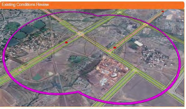
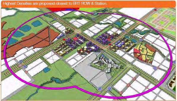
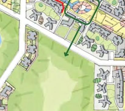
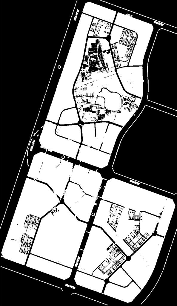
49 Approach for Transformation Case study: TOD zones Sector 31,33,34 Naya Raipur

50 Approach for Transformation
51 Approach for Transformation

52 Approach for Transformation

53 Approach for Transformation
54 Approach for Transformation
55 Approach for Transformation
56 Approach for Transformation
57 Approach for Transformation

58 Approach for Transformation

59 Approach for Transformation
60 Approach for Transformation
61 Approach for Transformation

62 Approach for Transformation

63 Approach for Transformation

64 Approach for Transformation

65 Approach for Transformation


66 Desirable Activities

67 Desirable activities
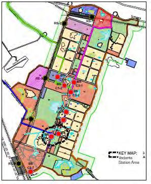


68 Implementation- Sector 7, 15 and 16 BRT BRT BRT


69 Sectors 7, 15 and 16 & TOD Principles Interconnected Street Pattern Compact Development Mixed Use Flatted Group housing Street Facing Buildings


70 Sectors 7, 15 and 16 & TOD Principles Urban Place-Making Mixed Use Flatted Group housing Streetscape Design Urban Plaza & Parks


71 Sectors 7, 15 and 16 & TOD Principles Mixed use Development Mixed Use Flatted Group housing Bicycle Friendly Streets Architectural Variety Well designed Transit station for high quality user experience Multimodal Transit


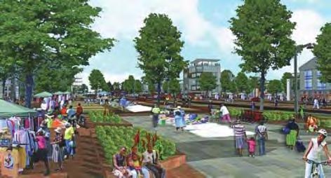
72 Sectors 7, 15 and 16: Public Spaces

73 SECTOR 7, 15 & 16

74 Capitol complex

75 Capitol complex
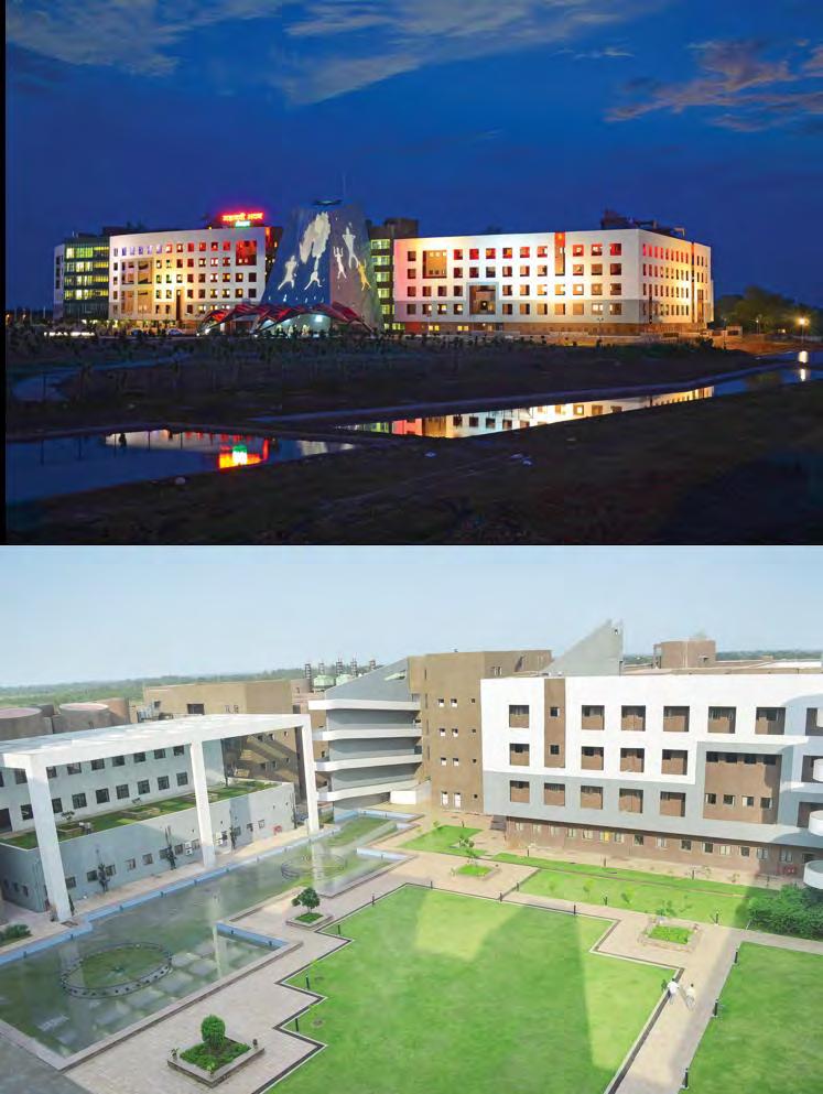
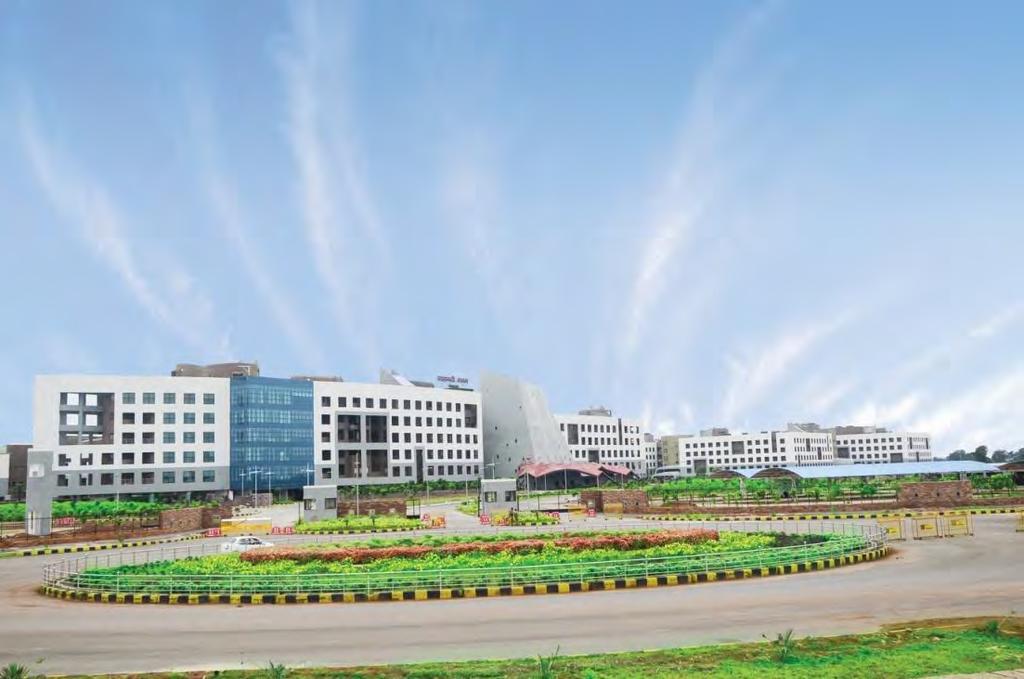
76 MANTRALAYA-Ministry

77 Road network


78 Road network

79 Road network

80 Housing sector developed

81 Housing
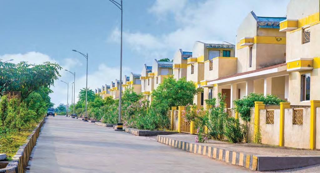
82 Housing

83 Housing

84 housing
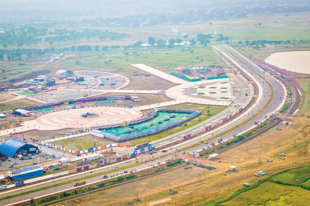
85 Exhibitition Ground
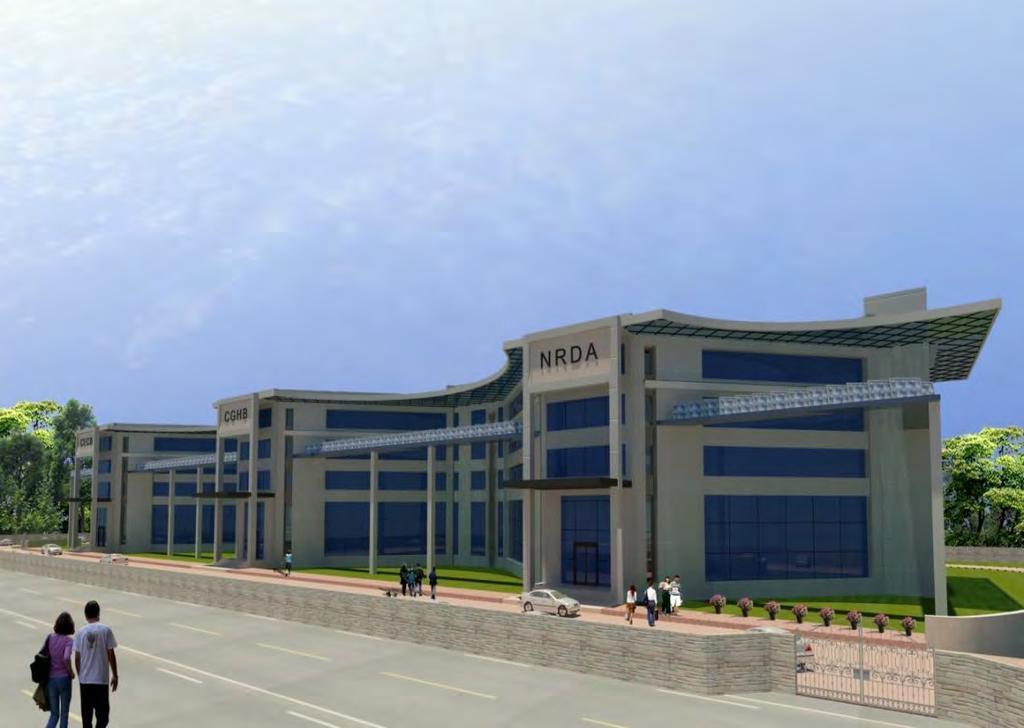
86 OFFICE COMPLEX NRDA+CGHB+CGECB


87 Shri Satya Sai Heart Hospital
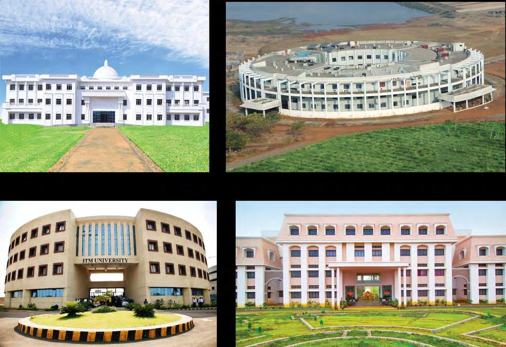
88 University area
89 THANKS Dilip Shekdar Architect and Planner, Consultant Naya Raipur development Authority For further details do visit www: nayaraipur.gov.in
Transportation Master Plan Advisory Task Force
 Transportation Master Plan Advisory Task Force Network Alternatives & Phasing Strategy February 2016 BACKGROUND Table of Contents BACKGROUND Purpose & Introduction 2 Linking the TMP to Key Council Approved
EXECUTIVE SUMMARY: TRANSIT-ORIENTED DEVELOPMENT IN SMITHS FALLS, ONTARIO; A COMPARISON BETWEEN TWO SITES
 EECUTIVE SUMMARY: TRANSIT-ORIENTED DEVELOPMENT IN SMITHS FALLS, ONTARIO; A COMPARISON BETWEEN TWO SITES Topic and Purpose In 2007, the Mayor of Ottawa s Task Force on Transportation suggested adding a
CONNECTING PEOPLE TO PLACES
 CONNECTING PEOPLE TO PLACES 82 EAST BENCH MASTER PLAN 07 Introduction The East Bench transportation system is a collection of slow moving, treelined residential streets and major arteries that are the
Exhibit 1 PLANNING COMMISSION AGENDA ITEM
 Exhibit 1 PLANNING COMMISSION AGENDA ITEM Project Name: Grand Junction Circulation Plan Grand Junction Complete Streets Policy Applicant: City of Grand Junction Representative: David Thornton Address:
ATTACHMENT 4 - TDM Checklist. TDM Checklist Overview
 ATTACHMENT 4 - TDM Checklist TDM Checklist Overview The proposed checklist rates developments on the degree to which they are TDM and transit supportive. Points are assigned based on the level of transit
How To Encourage More Efficient Transportation in Brazilian Cities
 How To Encourage More Efficient Transportation in Brazilian Cities Todd Litman Victoria Transport Policy Institute Presented Seminar on Discouraging The Use Of Cars São Paulo, Brazil 3 September 2013 Creating
complete streets design and construction standards public primer City of Edmonton
 complete streets design and construction standards public primer City of Edmonton introduction Complete Streets are streets for everyone: people who walk, wheel, bike, take transit, or drive. They are
CITY OF COCOA BEACH 2025 COMPREHENSIVE PLAN. Section VIII Mobility Element Goals, Objectives, and Policies
 CITY OF COCOA BEACH 2025 COMPREHENSIVE PLAN Section VIII Mobility Element Goals, Objectives, and Policies Adopted August 6, 2015 by Ordinance No. 1591 VIII MOBILITY ELEMENT Table of Contents Page Number
Vision: Traditional hamlet with an attractive business/pedestrian friendly main street connected to adjacent walkable neighborhoods
 N D. Focus Area II Vision: Traditional hamlet with an attractive business/pedestrian friendly main street connected to adjacent walkable neighborhoods Transit Road Focus Area II is located in the Hamlet
Proposed. City of Grand Junction Complete Streets Policy. Exhibit 10
 Proposed City of Grand Junction Complete Streets Policy Exhibit 10 1 City of Grand Junction Complete Streets Policy Vision: The Complete Streets Vision is to develop a safe, efficient, and reliable travel
In station areas, new pedestrian links can increase network connectivity and provide direct access to stations.
 The Last Mile Planning for Pedestrians Planning around stations will put pedestrians first. Making walking to stations safe and easy is important; walking will be a part of every rapid transit Accessible
Transportation Assessment
 Transportation Assessment Midtown Open House February 10, 2018 Overview Midtown in Focus Overview & Purpose of Today Transportation Assessment overview Summary of Transportation work to date Review & Analysis
Chapter 7. Transportation. Transportation Road Network Plan Transit Cyclists Pedestrians Multi-Use and Equestrian Trails
 Chapter 7 Transportation Transportation Road Network Plan Transit Cyclists Pedestrians Multi-Use and Equestrian Trails 7.1 TRANSPORTATION BACKGROUND The District of Maple Ridge faces a number of unique
A CHANGING CITY. of Edmonton, it is essential that it reflects the long-term vision of the City.
 A CHANGING CITY By the year 2040, Edmonton will be home to more than 1 million people. To accommodate growth and support a healthy and compact city, we need a new approach to development/redevelopment
NEWMARKET CENTRE Mobility Hub Profile
 Mobility Hub Profile Dundas Newmarket West-Bloor Centre Anchor Hub Gateway Hub N MOBILITY HUBS: Places of connectivity between regional and rapid transit services, where different modes of transportation
TRANSPORTATION NEEDS ASSESSMENT
 TRANSPORTATION NEEDS ASSESSMENT A travel demand analysis was carried out to determine the operational issues and the potential benefit that adding traffic capacity would have on the road network. All the
West Village Mobility & Integration
 West Village Mobility & Integration PRESENTED TO TOPCA Town Hall November 9, 2017 [7189-21] Port Credit 2 West Village + Mobility AWalkable Community A CompleteCommunity A SustainableCommunity 3 Mobility
Creating walkable, bikeable and transit-supportive communities in Halton
 Creating walkable, bikeable and transit-supportive communities in Halton By presenting current research and best practices, the information in this paper is meant to support and broaden discussion on how
Bicycle and Pedestrian Advisory Committee (BPAC) November 21, 2013
 November 21, 2013") Bicycle and Pedestrian Advisory Committee (BPAC) November 21, 2013 OVERALL LAND USE CONCEPT Overall Broadway Valdez District: 95.5 acres (35.1 acres right-of ways + 60.4 acres developable land) Plan Subareas:
Bicycle and Pedestrian Advisory Committee (BPAC) November 21, 2013 OVERALL LAND USE CONCEPT Overall Broadway Valdez District: 95.5 acres (35.1 acres right-of ways + 60.4 acres developable land) Plan Subareas:
DON MILLS-EGLINTON Mobility Hub Profile
 Mobility Hub Profile Dundas Don Mills-Eglinton West-Bloor Anchor Hub Gateway Hub N MOBILITY HUBS: Places of connectivity between regional and rapid transit services, where different modes of transportation
Welcome. Background. Goals. Vision
 Welcome The formal Public Information Centre (PIC) for the Transportation Master Plan How We GO will be held in early 2017. At that time we will present the recommended transportation system for Niagara
Solana Beach Comprehensive Active Transportation Strategy (CATS)
") Solana Beach Comprehensive Active Transportation Strategy (CATS) 3.0 Goals & Policies The Solana Beach CATS goals and objectives outlined below were largely drawn from the Solana Beach Circulation Element
Solana Beach Comprehensive Active Transportation Strategy (CATS) 3.0 Goals & Policies The Solana Beach CATS goals and objectives outlined below were largely drawn from the Solana Beach Circulation Element
City of Novi Non-Motorized Master Plan 2011 Executive Summary
 City of Novi Non-Motorized Master Plan 2011 Executive Summary Prepared by: February 28, 2011 Why Plan? Encouraging healthy, active lifestyles through pathway and sidewalk connectivity has been a focus
Transportation, Parking & Roads
 Transportation, Parking & Roads Design Carolina North as a walkable community Design the transportation system and development patterns (i.e., urban design elements such as density, building design, mix
Multimodal Through Corridors and Placemaking Corridors
 68 Multimodal Through Corridors and Placemaking Corridors Corridors have different functions in a region. Some corridors are used to get smoothly and rapidly through a region or to get quickly to major
Agenda. Overview PRINCE GEORGE S PLAZA METRO AREA PEDESTRIAN PLAN
 PRINCE GEORGE S PLAZA METRO AREA PEDESTRIAN PLAN May 28, 2008 Agenda Welcome and introductions Project overview and issue identification Planning context and strengths Design challenges and initial recommendations
2. Context. Existing framework. The context. The challenge. Transport Strategy
 Transport Strategy Providing quality connections Contents 1. Introduction 2. Context 3. Long-term direction 4. Three-year priorities 5. Strategy tree Wellington City Council July 2006 1. Introduction Wellington
Table #6 VISION CHARACTERISTICS
 Table #6 VISION White Flint is a place to live, work, play, shop, and walk with sufficient density to encourage quality redevelopment. Vibrant streets and consistent streetscapes are important. CHARACTERISTICS
STONY PLAIN ROAD STREETSCAPE
 Jasper Place Revitalization Strategy: Vision The people involved in the Jasper Place Revitalization Strategy envision: Goal 1: Feeling safe in our community Create a community where feeling safe is common--where
PRINCE GEORGE S PLAZA METRO AREA PEDESTRIAN PLAN
 PRINCE GEORGE S PLAZA METRO AREA PEDESTRIAN PLAN May 28, 2008 Agenda Welcome and introductions Project overview and issue identification Planning context and strengths Design challenges and initial recommendations
Circulation in Elk Grove includes: Motor vehicles, including cars and trucks
 Circulation, as it is used in this General Plan, refers to the many ways people and goods move from place to place in Elk Grove and the region. Circulation in Elk Grove includes: Motor vehicles, including
Tonight is for you. Learn everything you can. Share all your ideas.
 Strathcona Neighbourhood Renewal Draft Concept Design Tonight is for you. Learn everything you can. Share all your ideas. What is Neighbourhood Renewal? Creating a design with you for your neighbourhood.
Perryville TOD and Greenway Plan
 Perryville TOD and Greenway Plan Greenway Glossary Pathway: A bicycle and pedestrian path separated from motorized vehicular traffic by an open space, barrier or curb. Multi-use paths may be within the
DON MILLS-SHEPPARD Mobility Hub Profile
 DON MILLS-SHEPPARD Mobility Hub Profile Dundas Don Mills-Sheppard West-Bloor Anchor Hub Gateway Hub N MOBILITY HUBS: Places of connectivity between regional and rapid transit services, where different
21.07 TRANSPORT CONNECTIVITY AND INFRASTRUCTURE
 21.07 TRANSPORT CONNECTIVITY AND INFRASTRUCTURE 21.07-1 Connectivity and Choice Transport connectivity and mode choice are critical to achieving productive, sustainable and socially just cities. Travel
Mainstreet Master Plan Land Use
 Mainstreet Master Plan 04 Land Use Top Recommendations Active Uses: Promote active ground-floor uses such as retail, restaurants, galleries and personal services with interactive storefronts for Mainstreet
Stakeholder Meeting Handouts. January 2013
 January 2013 Stakeholder Meeting Handouts The Case FOR Parking Minimum Requirements Reduce street congestion around the development site Avoid parking spillover Create orderly development patterns Anticipate
Performance Criteria for 2035 Long Range Transportation Plan
 Minimizing Impacts on Natural, Historic, Cultural or Archeological Resources 2035 LRTP Weighting Factor: 7% Objective 1.1: Use appropriate planning and design criteria to protect and enhance the built
Illustrated Principles of Good Planning
 Illustrated Principles of Good Planning The Miami 21 Zoning Code incorporates time-tested planning principles into the zoning regulations of our City. These are principles that make for better neighborhoods,
Appendix A-K Public Information Centre 2 Materials
 Appendix A-K Public Information Centre 2 Materials Our Rapid Transit Initiative Make an impact on the future of transit Join the discussion on Rapid Transit in London You re invited to a Public Information
Corpus Christi Metropolitan Transportation Plan Fiscal Year Introduction:
 Introduction: The Safe, Accountable, Flexible, Efficient Transportation Equity Act: A Legacy for Users (SAFETEA-LU) has continued the efforts started through the Intermodal Surface Transportation Efficiency
DRAFT for a State Policy for Healthy Spaces and Places
 DRAFT for a State Policy for Healthy Spaces and Places 1 DRAFT State Policy for Healthy spaces and Places 1. Purpose To encourage the use and development of land that builds healthy communities through
CPC Parking Lot Riverside Drive. Transportation Rationale
 CPC Parking Lot Transportation Rationale Prepared By: NOVATECH Suite 200, 240 Michael Cowpland Drive Ottawa, Ontario K2M 1P6 September 2015 Novatech File: 114093 Ref: R-2015-153 Table of Contents 1.0 INTRODUCTION...
Develop a Multi-Modal Transportation Strategy (Theme 6)
") DEVELOP A MULTI-MODAL TRANSPORTATION STRATEGY (THEME 6) WHY IS THIS THEME ADDRESSED? Develop a Multi-Modal Transportation Strategy (Theme 6) Statement of Ideal Reduce resident and visitor reliance on single
DEVELOP A MULTI-MODAL TRANSPORTATION STRATEGY (THEME 6) WHY IS THIS THEME ADDRESSED? Develop a Multi-Modal Transportation Strategy (Theme 6) Statement of Ideal Reduce resident and visitor reliance on single
Access BART: TOD and Improved Connections. October 29, 2008
 Access BART: TOD and Improved Connections October 29, 2008 1 Access BART Study Goals Evaluate at the system-level land use and access scenarios to optimize ridership Identify station clusters that provide
CHAPTER 7.0 IMPLEMENTATION
 CHAPTER 7.0 IMPLEMENTATION Achieving the vision of the Better Streets Plan will rely on the ability to effectively fund, build and maintain improvements, and to sustain improvements over time. CHAPTER
Chapter 5 Future Transportation
 Chapter 5 Future Transportation The Future Land Use Plan identifies the desired land use designations. The land uses desired for Crozet depend, in large part, on the success of the transportation system,
Planning Regionally With Transit
 Planning Regionally With Transit Nathan Coats Director of Operations CTAA Expo 2015 Tampa Began 1992. Serves eastern Cache County to Preston, ID. Population- 115,000 34 bus fleet, 26 fixed route buses;
Omaha s Complete Streets Policy
 Omaha s Complete Streets Policy (Adopted August 2015) VISION To create great places and enhance our quality of life, the City of Omaha will provide safe, accessible streets for all users. Complete Streets
JOINT PARTNERSHIPS: Working Together To Support Light Rail in Santa Monica
 JOINT PARTNERSHIPS: Working Together To Support Light Rail in Santa Monica ITY OF ANTA MONICA RAIL-VOLUTION / OCTOBER 17, 2012 SARAH LEJEUNE, PRINCIPAL PLANNER, STRATEGIC + TRANSPORTATION PLANNING DIVISION
DUNDAS WEST-BLOOR Mobility Hub Profile
 Mobility Hub Profile Dundas West-Bloor Anchor Hub Gateway Hub N MOBILITY HUBS: Places of connectivity between regional and rapid transit services, where different modes of transportation come together
NORTH YORK CENTRE Mobility Hub Profile
 Mobility Hub Profile Dundas North York West-Bloor Centre Anchor Hub Gateway Hub N MOBILITY HUBS: Places of connectivity between regional and rapid transit services, where different modes of transportation
Classification Criteria
 SCHEDULE D TO RECOMMENDED OFFICIAL PLAN AMENDMENT NO. 40 SCHEDULE C-4 Road Criteria Criteria Traffic Service Objective Land Service/Access Typical Daily Traffic Volume Flow characteristics Travel Speed
Building a Liveable Ottawa 2031 Backgrounder 5: Barrhaven/Riverside South/Leitrim
 Building a Liveable Ottawa 2031 Backgrounder 5: Barrhaven/Riverside South/Leitrim Wards 3 and 22 Official Plan Transportation Master Plan Cycling Plan Pedestrian Plan October 2013 ottawa.ca/liveableottawa
Streetscape: Core Shopping District
 Streetscape: Core Shopping District DRAFT DRAFT DRAFT May 00 Core Shopping District: Phase Blue Island s Core Shopping District is located along Western Avenue, between Grove and Union Streets. Streetscape
COUNCIL POLICY NAME: COUNCIL REFERENCE: 06/119 06/377 09/1C 10llC 12/1C INDEX REFERENCE: POLICY BACKGROUND
 COUNCIL POLICY NAME: COUNCIL ADVISORY COMMITTEES - TERMS OF REFERENCE ISSUED: APRIL 3, 2006 AMENDED: NOVEMBER 27, 2006 NOVEMBER 23, 2009 JANUARY 11, 2010 DECEMBER 17, 2012 POLICY COUNCIL REFERENCE: 06/119
Complete Streets. Designing Streets for Everyone. Sarnia
 Complete Streets Designing Streets for Everyone Sarnia Complete Streets ~ Sarnia ~ 2018 Introduction Our City is made up of a network of streets that we use to go for a walk, cycle to work, drive to the
Ann Arbor Downtown Street Plan
 1 Ann Arbor Downtown Street Plan Public Workshop #1 We know that. 2 Public right-of-way (streets, sidewalks, and alleys) make up 30% of the total District area of downtown. Streets need to provide mobility
Cherry Creek Transportation and Land Use Forum September 25, 2013 Meeting Summary
 Cherry Creek Transportation and Land Use Forum September 25, 2013 Meeting Summary I. LEAD-IN TO SMALL GROUP DISCUSSION, POLLING AND STEERING COMMITTEE/TECHNICAL TASK FORCE DISCUSSION The meeting began
APPENDIX A: Complete Streets Checklist DRAFT NOVEMBER 2016
 APPENDIX A: Complete Streets Checklist DRAFT NOVEMBER 2016 Complete Streets Checklist MetroPlan Orlando s Complete Streets Checklist is an internal planning tool for staff to further implementation of
York Region Population and Employment Growth
 March 1, 2016 1 York Region Population and Employment Growth York Region needs to comply with The Provincial Growth Plan and new forecasts introduced to 2036 and 2041 2 Regional Official Plan Review York
Anniedale- Tynehead NCP Best Practices in Transportation Planning Summary
 Anniedale- Tynehead NCP Best Practices in Transportation Planning Summary The City of Surrey Anniedale-Tynehead NCP Best Practices Transportation Summary This document provides a summary of the Bunt &
Your views are important. Please fill in a form before you leave. Or alternatively
 Drum Property Group is delighted to welcome you to this exhibition which sets out our initial proposals for a mixed-use development at Stead s Place, Edinburgh. We are keen to hear the views of local people
Regional Transportation Needs Within Southeastern Wisconsin
 Regional Transportation Needs Within Southeastern Wisconsin #118274 May 24, 2006 1 Introduction The Southeastern Wisconsin Regional Planning Commission (SEWRPC) is the official areawide planning agency
Concept of Sustainable Transport and integrated Land Use Planning- An Overview. Manfred Breithaupt GIZ Water, Energy, Transport
 Concept of Sustainable Transport and integrated Land Use Planning- An Overview Manfred Breithaupt GIZ Water, Energy, Transport The adverse impacts of growth in motorization - in economic, environmental
TORONTO WALKING STRATEGY
 CITY OF TORONTO t TORONTO WALKING STRATEGY EVERYONE IS A PEDESTRIAN ItitiORONM TORONTO MAYOR DAVID MILLER Toronto's Walking Strategy is a vision for a more liveable, prosperous and sustainable city. It
T1-A - Service Reduction (Re-sizing)
") Key T1-A Choice A Key T1-B Choice B Key T1-C Choice C Key T1-D Choice D Key T1-E Choice E Key T1-F Choice F Key Choice G T2 T1-A - Service Reduction (Re-sizing) Description This key choice would represent
Key T1-A Choice A Key T1-B Choice B Key T1-C Choice C Key T1-D Choice D Key T1-E Choice E Key T1-F Choice F Key Choice G T2 T1-A - Service Reduction (Re-sizing) Description This key choice would represent
INTEGRATED MULTI-MODAL TRANSPORTATION IN INDIA
 INTEGRATED MULTI-MODAL TRANSPORTATION IN INDIA Tejas Rawal (Corresponding Author) Ph.D. Research Scholar, Dept. of Architecture & Planning, Indian Institute of Technology-Roorkee, Roorkee-247 667 Email:
Plant City Walk-Bike Plan
 Plant City Walk-Bike Plan Plant City Commute Mode Share 2.2% 1.4% 2.9% Drove alone 10.2% Carpooled Public transportation (0.1%) Walked Used a Bike (0.4%) 82.9% Taxicab, motorcycle, or other means Worked
Executive Summary Route 30 Corridor Master Plan
 Route Corridor Master Plan Project Overview The Route Corridor Master Plan is a coordinated multimodal transportation and land use plan for the entire stretch of Route through East Whiteland Township,
Chapter 2. Bellingham Bicycle Master Plan Chapter 2: Policies and Actions
 Chapter 2 Bellingham Bicycle Master Plan Chapter 2: Policies and Actions Chapter 2: Policies and Actions The Bicycle Master Plan provides a road map for making bicycling in Bellingham a viable transportation
o n - m o t o r i z e d transportation is an overlooked element that can greatly enhance the overall quality of life for the community s residents.
 N o n - m o t o r i z e d transportation is an overlooked element that can greatly enhance the overall quality of life for the community s residents. 84 Transportation CHAPTER 11 INTRODUCTION Transportation
Complete Streets for Niagara A working method to visualize the creation of a complete street June 20th, 2013
 Complete Streets for Niagara A working method to visualize the creation of a complete street June 20th, 2013 C O N T E N T S Introduction and background of the report What is a complete street? What can
7/23/2017 VIA . Michael Hanebutt City of Sacramento Community Development Department 300 Richards Boulevard, 3 rd Floor Sacramento, CA 95811
 7/23/2017 VIA EMAIL Michael Hanebutt City of Sacramento Community Development Department 300 Richards Boulevard, 3 rd Floor Sacramento, CA 95811 RE: 65 th Street Apartments (DR17-220) Dear Mr. Hanebutt:
Living Streets Policy
 Living Streets Policy Introduction Living streets balance the needs of motorists, bicyclists, pedestrians and transit riders in ways that promote safety and convenience, enhance community identity, create
summary of issues and opportunities
 1 summary of issues and opportunities EXECUTIVE SUMMARY CHAPTER 2: HISTORY - 3: LAND USE This first chapter is an overview of lessons learned from analysis of the existing conditions on El Camino as well
West Dimond Blvd Upgrade Jodhpur Street to Sand Lake Road
 West Dimond Blvd Jodhpur St to Sand Lake CSS Transportation Project Summary Municipality of Anchorage Project # 05 005 Project Manager: John Smith, P.E. (MOA PM&E) Project Administrator: Julie Makela,
A Guide to Great Streets: The Basics. September 25, 2009
 A Guide to Great Streets: The Basics September 25, 2009 Streets are more than connectors, they are the city 2 Streets are the glue that hold a city together 3 Streets are the means in which a city is perceived
NM-POLICY 1: Improve service levels, participation, and options for non-motorized transportation modes throughout the County.
 Transportation PRINCE WILLIAM COUNTY 2008 COMPREHENSIVE PLAN NON-MOTORIZED PLAN CONTENTS Goals, Policies, and Action Strategies Table 4 (Bike Facility Classifications and Descriptions) Table 5 (Bike Facility
Capital and Strategic Planning Committee. Item III - B. April 12, WMATA s Transit-Oriented Development Objectives
 Capital and Strategic Planning Committee Item III - B April 12, 2018 WMATA s Transit-Oriented Development Objectives Page 24 of 76 Washington Metropolitan Area Transit Authority Board Action/Information
Living Streets response to the Draft London Plan
 Living Streets response to the Draft London Plan Contents Living Streets response to the Draft London Plan... 1 About Living Streets... 2 Summary... 2 Consultation response... 3 Chapter 1: Planning London
WELCOME TO OPEN HOUSE # 1 June 14, 2017
 Langstaff Road Weston Road to Highway 7 Class Environmental Assessment Study WELCOME TO OPEN HOUSE # 1 June 14, 2017 Please sign in and join our mailing list Purpose of Open House #1 & Study Area York
5/7/2013 VIA . RE: University Village Safeway Expansion (P13-019)
") 5/7/2013 VIA EMAIL David Hung, Associate Planner Community Development Department, Current Planning Division City of Sacramento 300 Richards Boulevard, 3 rd Floor Sacramento, CA 95811 RE: University Village
5/7/2013 VIA EMAIL David Hung, Associate Planner Community Development Department, Current Planning Division City of Sacramento 300 Richards Boulevard, 3 rd Floor Sacramento, CA 95811 RE: University Village
Berkeley Strategic Transportation Plan A-76
 Berkeley Strategic Transportation Plan A-76 Appendices 1. A Team Effort 2. Where We ve Been A-11 Berkeley Strategic Transportation Plan Alameda County Transportation Plan Alameda County will be served
San Jose Transportation Policy
 San Jose Transportation Policy Protected Intersections in LOS Policies to Support Smart Growth Presented by: Manuel Pineda City of San Jose Department of Transportation Bay Area Map San Francisco Oakland
Presentation Starts at 5:30 PM
 Presentation Starts at 5:30 PM Public Meeting #1 September 22, 2016 Purpose of Study Conceptual Complete Streets Study on South Carson Street 5 th Street to Roland Drive Approximately 2.5 miles Consider
including infrastructure, transit and open space, Open Space changed approximately 50 to approximately 60
 Draft North Branch Framework Plan s The below table itemizes changes made to the North Branch Industrial Corridor Framework and Design Guidelines. The original draft was posted March 17, 2017. This table
Town of Babylon Sustainable Complete Streets Policy
 Town of Babylon Sustainable Complete Streets Policy Steve Bellone, Supervisor Adopted July 14, 2010 1 Table of Contents Vision... 3 Policy Statement... 3 Definition... 3 Road Users... 4 Network... 4 Roads...
South King County High-Capacity Transit Corridor Study
 HIGH-CAPACITY TRANSIT CORRIDOR STUDY South King County Corridor South King County High-Capacity Transit Corridor Study Corridor Report August 2014 South King County High Capacity Transit Corridor Report
North Coast Corridor:
 North Coast Corridor: Connecting People, Transportation & Environment Legislative Hearing: 11.8.10 1 North Coast Corridor Region s Lifeline A Regional Strategy Mobility, Economy & Environment North Coast
Purpose and Need. Chapter Introduction. 2.2 Project Purpose and Need Project Purpose Project Need
 Chapter 2 Purpose and Need 2.1 Introduction The El Camino Real Bus Rapid Transit (BRT) Project (Project) would make transit and other transportation improvements along a 17.6-mile segment of the El Camino
Canada s Capital Region Delegation to the Velo-City Global 2010 Conference
 Canada s Capital Region Delegation to the Velo-City Global 2010 Conference Report of Findings from Visits, Meetings & Presentations In Amsterdam-Den Haag, Utrecht, Berlin & Copenhagen The Itinerary Copenhagen
5 CIRCULATION AND STREET DESIGN
 5 CIRCULATION AND STREET DESIGN This chapter describes circulation and streetscape improvements proposed for the Northwest Chico Specific Plan Area. It includes detailed design specifications for existing
Building a Liveable Ottawa 2031 Backgrounder 4: Kanata/Stittsville
 Building a Liveable Ottawa 2031 Backgrounder 4: Kanata/Stittsville Wards 4, 6 and 23 Official Plan Transportation Master Plan Cycling Plan Pedestrian Plan October 2013 ottawa.ca/liveableottawa Building
S T A T I O N A R E A P L A N
 The Circulation and Access Plan describes vehicle, pedestrian, and transit improvements recommended within the Concept Plan. In order to create and sustain a vibrant business district that provides pedestrian-friendly
TRANSPORT AND MOVEMENT
 TRANSPORT AND MOVEMENT Movement Strategy Public Transport Cycling and Walking Road Network Parking Standards Transport Impact Assessments Traffic Management Policies DRAFT POOLBEG PLANNING SCHEME Movement
Vision. Goals and Objectives. Walking
 Vision Walking and biking is an accepted and valued part of everyday life in Portsmouth. People of all ages and abilities include walking and biking as part of their daily activities which helps to make
CITY OF BLOOMINGTON COMPLETE STREETS POLICY
 CITY OF BLOOMINGTON COMPLETE STREETS POLICY POLICY OBJECTIVE: The City of Bloomington will enhance safety, mobility, accessibility and convenience for transportation network users of all ages and abilities,
Approaches. Livable Neighborhood Design. Examples. Traditional neighborhood development. CE 594 University of Wisconsin- Milwaukee
 Approaches Livable Neighborhood Design CE 594 University of Wisconsin- Milwaukee Traditional neighborhood design (TND), new urbanism, transit friendly design, transit oriented development and walkable
Public Consultation Centre For. Transportation Master Plan Update. Information Package
 Public Consultation Centre For Transportation Master Plan Update Information Package Date Location Hours Tuesday, September 12, 2017 Wednesday, September 13, 2017 Tuesday, September 19, 2017 Cambridge