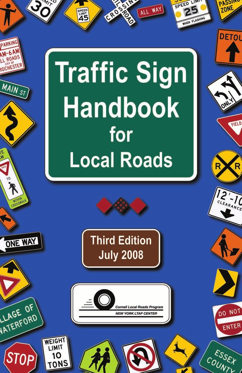
Traffic Sign Handbook for Local Roads. Third Edition. July 2008 CLRP Report 08-04
|
|
|
- Patience Powell
- 5 years ago
- Views:
Transcription
1

2 Traffic Sign Handbook for Local Roads Third Edition July 2008 CLRP Report Revised - March 2010


3 Published with the financial support of the New York State Department of Transportation, the Federal Highway Administration s Local Technical Assistance Program, and Cornell University. Additional funding provided by the National Highway Traffic Safety Administration via a grant from the New York State Governor s Traffic Safety Committee. Cornell University is an equal opportunity, affirmative action educator and employer. Printed on recycled paper.
4 Table of Contents Introduction...1 Definitions...1 About this Handbook...1 How to use this Handbook...2 Acknowledgments...3 General Information...5 Positive guidance...5 Meanings of Shall, Should, and May...5 Documentation and engineering judgment...5 Authority...6 Need for law, order, rule or regulation...6 Statutory mandates...6 Basic considerations...7 Types of signs...8 Retroreflectorization...9 Sign size Sign location Sign supports...17 Sign designations...17 Upgrading signs...18 Chapter I: Intersections...19 Chapter 2: Turns and Curves...35 Chapter 3: Bridges and Culverts...43 Chapter 4: Railroad Grade Crossings Chapter 5: Roadway Conditions...53 Chapter 6: Schools and Children...65 Chapter 7: Crossing Hazards...73 Chapter 8: Work Zones...79 Chapter 9: Speed Limits...87 Chapter 10: Pavement Markings...93 Chapter 11: Guide & Information Signs...99 Appendices Appendix A: Sign Index Appendix B: Where to Get Help Appendix C: References Cornell Local Roads Program i
5 List of Figures Figure 1: Sign placement with no or narrow shoulders...12 Figure 2: Sign placement with shoulders greater than 6 feet wide...12 Figure 3: Sign placement with curbs in residential or business districts...13 Figure 4: Sign height for single sign...13 Figure 5: Sign height with supplemental panels...14 Figure 6: Right and left designation of side road (W2-2) Sign...18 Figure 7: Yield vs. Stop determination...20 Figure 8: Placement of stop and yield signs...23 Figure 9: Use of intersection signs...32 Figure 10: Ball bank indicator...36 Figure 11: Use of curve, arrow, and chevron signs...42 Figure 12: Location of weight limit signs...44 Figure 13: Placement of NYW7-12 and NYW7-13 object markers...47 Figure 14: Railroad crossing signs and markings...50 Figure 15: Railroad grade crossing pavement markings...52 Figure 16: Signs on barricades...54 Figure 17: Placement of W14-1a sign with street name (D3-1) sign...60 Figure 18: Placement of W14-2a sign with street name (D3-1) sign...61 Figure 19: Example of school signs...68 Figure 20: General layout of a workzone...82 Figure 21: Types of longitudinal markings...95 Figure 22: Yield lines...96 Figure 23: Crosswalk markings...97 List of Tables Table 1: Minimum maintained retroreflectivity levels...10 Table 2: Guidelines for advance placement of warning signs...16 Table 3: Guide for stop or yield sign determination...21 Table 4: Visibility distances for stop or yield signs...27 Table 5: Guide for intersection warning sign use...30 Table 6: Horizontal alignment sign usage...36 Table 7: Safe ball bank indicator readings for various traveling speeds...37 Table 8: Size of supplemental plaques...64 Table 9: Spacing of advance warning signs...83 Table 10: Spacing of speed limit signs...88 ii Cornell Local Roads Program
6 Definitions The following terms are used in this Handbook to refer to specific documents. MUTCD - Manual on Uniform Traffic Control Devices. The term refers to the general concept of the Manual on Uniform Traffic Control Devices. When used in the Handbook, it refers to the combined requirements of the National MUTCD and the New York State Supplement. National MUTCD National Manual on Uniform Traffic Control Devices. Specifically refers to the nationwide set of standards published by the Federal Highway Administration (FHWA) under 23 Code of Federal Regulations (CFR), Part 655, Subpart F. New York State Supplement (NYS Supplement). Specifically refers to the New York State Supplement to the National Manual on Uniform Traffic Control Devices for Streets and Highways Edition 17B NYCRR - Title 17, Volume B, of the Official Compilation of Codes, Rules, and Regulations of the State of New York. Contains the official regulation on file with the New York Department of State and is published by Thomson Reuters/West. SHS - Standard Highway Signs and Markings Book. This book, published by the Federal Highway Administration, contains the actual sign layouts for specific traffic signs in the National MUTCD. Handbook - Traffic Sign Handbook for Local Roads, 3rd Edition. This book, published by the Cornell Local Roads Program. About this Handbook This 3rd edition of the Traffic Sign Handbook for Local Roads is based upon combined requirements of the National MUTCD and the New York State Supplement. The Traffic Sign Handbook for Low Volume Rural Roads was first published by the New York State Department of Transportation (NYSDOT) in Introduction Cornell Local Roads Program 1
7 Traffic Sign Handbook for Local Roads Section 1680 of the New York State Vehicle and Traffic Law requires the New York State Department of Transportation (NYSDOT) to adopt and maintain a Manual on Uniform Traffic Control Devices (MUTCD). As of September 2007, the official MUTCD for New York State is the National MUTCD combined with the New York State Supplement. The National MUTCD is maintained by the Federal Highway Administration (FHWA) and is updated on a regular basis. The official New York State Supplement is contained in 17B NYCRR. An unofficial version is available online from the New York State Department of Transportation. The official regulation is filed with the Department of State and published by Thomson Reuters/ West as 17B NYCRR. This Traffic Sign Handbook for Local Roads is meant to be a field companion to the National MUTCD and the New York State Supplement (NYCRR Volume 17B). It is a training manual, not a standard, specification, or regulation. It is adapted from the National MUTCD and the New York State Supplement (NYCRR Volume 17B) courtesy of the New York State Secretary of State and Thomson Reuters/West. The figures and tables in the Handbook are provided as guidance for the placing of traffic control devices, but should not take the place of a proper engineering study as required by the MUTCD. While every effort has been made to ensure the accuracy of this Handbook, the Cornell Local Roads Program (CLRP), the New York State Secretary of State, the New York State Department of Transportation, and Thomson Reuters/West do not guarantee the accuracy of the Traffic Sign Handbook for Local Roads, nor may it be read into evidence in the New York State courts. To ensure accuracy and for evidentiary purposes, reference should be made to the Official Compilation of Codes, Rules and Regulations of the State of New York (NYCRR). How to use this Handbook This Handbook provides guidance for solving many traffic problems encountered on two-lane, local roads. Cross-references to the National MUTCD and New York State Supplement are included herein, and those publications should be consulted whenever this Handbook does not describe the exact situation at hand. Refer to the National MUTCD and New York State Supplement for standards and guidance pertaining to multilane roads and streets, collectors, and arterials. The MUTCD describes all approved traffic control devices and their proper use. This fosters uniformity throughout the State and Nation. A driver who sees a particular traffic control device should expect the same conditions and be prepared to take the same action whether he or she is on a town road in the Finger Lakes Region of New York or on an expressway in Missouri. This is the goal of uniform traffic control devices. 2 Cornell Local Roads Program
8 To foster this uniformity, the Vehicle and Traffic Law of the State of New York [Section 1680 (c)] prohibits municipalities from purchasing or fabricating signs that do not conform to the current MUTCD or any amendments. Compliance dates for signs that are on hand, in place, or on order when a new revision is adopted are contained in the National MUTCD or New York State Supplement. Existing signage shall be brought into compliance with the MUTCD as part of a systematic upgrading and installation of traffic control devices. Since both documents are amended periodically, the newest version of each should be checked to make sure that material contained in this Handbook has not been changed. Every effort has been made to ensure that this Handbook is consistent with the MUTCD and other applicable state laws. However, in using only those parts of the MUTCD that have information that applies to normal situations on local roads, some situations have necessarily been left out. If the conditions in this Handbook do not fit your traffic situation, or if there is any question about the applicability of the Handbook to a particular situation, consult the MUTCD and/or a knowledgeable engineer. Assistance may be obtained through the New York State Department of Transportation Regional Office, the Cornell Local Roads Program, your County Highway Superintendent s office, or a traffic engineering consultant. English units are used for all measurements in this Handbook. Acknowledgments Introduction The Cornell Local Roads Program wishes to thank all who made this Handbook possible. This includes the New York State Department of Transportation for allowing us to use material from their Traffic Sign Handbook for Low Volume Rural Roads and the New York State Supplement, as well as the New York State Department of State, and also Thomson Reuters/West for permission to draw upon material from the 2001 revision to 17B NYCRR. Appreciation is also expressed to our Traffic Signs and Pavement Markings workshop advisory committee for reviewing and commenting on the draft manuscript. This Traffic Sign Handbook for Local Roads, Third Edition is published with the financial support of the New York State Department of Transportation, the Federal Highway Administration s Local Technical Assistance Program, and Cornell University. Additional funding was provided by the National Highway Traffic Safety Administration via a grant from the New York State Governor s Traffic Safety Committee. Cornell Local Roads Program 3
9 Traffic Sign Handbook for Local Roads 4 Cornell Local Roads Program
10 Positive guidance Positive guidance suggests that competent drivers can be given appropriate information about hazards in order to avoid errors. The concept of positive guidance was created by Garrison Alexander when he was Chief of Human Factors for FHWA. Simply stated, positive guidance means designing the road and its surroundings in such a way that drivers have the information they need when they need it in order to make the right decision. Too much or too little information, or information that is provided too soon or too late, can confuse drivers and cause safety problems. Positive guidance should be considered when determining the need for and placement of traffic control devices. Meanings of Shall, Should, and May As used in this Handbook, the words shall, should, and may have the following standard meanings: SHALL A mandatory condition. Requirements having shall stipulations are mandatory. No discretion in following them is allowed. Items marked as shall are typically included as a STANDARD in the MUTCD. SHOULD An advisory condition. Where should is used, the suggestion is recommended, and normally is to be followed, but is not mandatory. Deviation from such provision is permissible if, and to the extent that, there is justifiable cause to do so. The reasons for any deviation should be documented and filed for future reference. Items marked as should are typically included as GUIDANCE in the MUTCD. MAY A permissive condition. No requirement for design or application is intended. Items marked as may are typically included as an OPTION in the MUTCD. The MUTCD contains additional information and background details not included in this handbook. When available, the background information is usually included in a SUPPORT section. Documentation and engineering judgment Occasionally, it will be impossible to meet all of the requirements or recommendations when installing a General Information Cornell Local Roads Program 5
11 Traffic Sign Handbook for Local Roads traffic control device. If the MUTCD says shall, it is mandatory. Do everything you possibly can to meet the requirement. If you cannot meet the requirement, get advice from a registered professional traffic or civil engineer. If the MUTCD says should, come as close as you can to the recommendation. Exceptions are allowed, if circumstances warrant it. In every case, write down an explanation of the sign installation, what you did about it, and why. Be sure to document why you were unable to meet the requirements of a shall or should condition. Also document that you followed the MUTCD. This will be particularly helpful if a lawsuit arises years later involving the traffic control device. As a way of reinforcement, the following is taken directly from the National MUTCD: Section 1A.09 Engineering Study and Engineering Judgment Guidance: The decision to use a particular device at a particular location should be made on the basis of either an engineering study or the application of engineering judgment. Thus, while this Manual provides Standards, Guidance, and Options for design and application of traffic control devices, this Manual should not be considered a substitute for engineering judgment. Authority Section 1682 of the NYS Vehicle and Traffic Law authorizes local government to determine the need for, authorize, place and maintain traffic control devices necessary to satisfy legal requirements and to promote the safe, efficient flow of traffic. Traffic control devices placed under this authority must conform to other statutes and the MUTCD. See Title VIII of the NYS Vehicle and Traffic Law for the respective powers of state and local highway authorities. Need for law, order, rule or regulation All regulatory signs erected by a municipality must be sanctioned by a law, order, rule, or regulation of an authorized legal body. Any local traffic control legislation must be specifically authorized by the NYS Vehicle and Traffic or Highway Law. The authority to enact traffic ordinances depends on the type of municipality. Prior to authorizing and erecting a regulatory sign, local highway officials should consult with their municipal attorney. Statutory mandates State law requires that motorists shall be given notice of certain highway conditions. These New York State laws and the related sections of the MUTCD are: WEIGHT LIMITS. Vehicle and Traffic Law sections 1621(b), 1640(c), 1650(b), and 1660(b) require highway authorities to determine 6 Cornell Local Roads Program
12 safe load capacities for bridges and elevated structures under their jurisdiction. At any structure incapable of safely carrying legal loads permitted by Section 385 of the Vehicle and Traffic Law, signs must be erected to inform persons of the safe capacity. The MUTCD sections 2B.49, 2C.103 and 5B.04 and Handbook page 43 cover devices used to post load limits. LOW CLEARANCES. Vehicle and Traffic Law sections 1621(c), 1640(d), 1650(c), and 1660(c) require posting of signs informing persons of the legal overhead clearances of bridges and elevated structures when the measured clearance (the vertical distance between the traveled portion of the roadway and the overhead structure) is less than 14 ft. Legal clearance is one foot (1 ft) less than measured clearance. MUTCD sections 2B.108 and 2C.22 and Handbook page 45 describe devices and standards for posting overhead clearances. DEAD END HIGHWAYS. Section 125-a of the General Municipal Law requires municipalities to post signs giving notice of dead end streets and roadways. Sections 2C.21 and 5C.11 of the MUTCD and page 32 and 60 of the Handbook provide devices for this posting. RAILROAD GRADE CROSSINGS. Section 53 and 53-a of the Railroad Law require installation of warning and regulatory signs, as well as other devices, at locations where railroads cross highways at grade. MUTCD sections 5F.02, 5F.03, 8B.03, 8B.04, and 10C.15 and Handbook Chapter 4 provide standards for the design and use of these devices. ROAD CLOSURES. Highway Law sections 10, 42-a, 102, 104, 140, 230, and 231 require posting of signs, and provision of barricades and lights, when a road or bridge is closed to traffic. MUTCD sections 2B.48, 5B.04, and 6F.19 and Handbook page 60 cover these devices. Basic considerations General Information For a traffic control device to be effective, it should meet these basic principles: Fulfill a need Command attention Convey a clear, simple meaning Command respect Give adequate time for response If a traffic control device does not meet these basic needs, it might be ignored, misunderstood, overlooked, or otherwise not meet the need it is meant to fulfill. To this end, there are certain basic requirements for the use and placement of traffic control devices: Cornell Local Roads Program 7
13 Traffic Sign Handbook for Local Roads DESIGN. The features of standard road signs, such as color, contrast, shape, and legend, are intended to draw attention to the signs and make them easy to recognize. The legend and size of the sign need to make it legible from far enough away that the motorist can react in time. Minor modifications are permitted to fit a specific situation, as long as they do not alter the basic meaning of the sign or make it more difficult to read. When there is an equivalent symbol sign in the National MUTCD, it normally should be used. In many cases the text version of the sign shall not be used in New York State. PLACEMENT. A sign should be placed where it will attract attention. It should be placed in a location where a driver has enough time to see the sign, understand it, decide what to do, and perform that action. Signs should be placed where they do not create hazards or maintenance problems. OPERATION. Devices with moving parts, lights, etc. must operate as prescribed in the MUTCD. This ensures consistency with similar devices throughout the country. MAINTENANCE. Faded and damaged signs lose visibility, and might not be noticed or heeded. Retroreflectivity is often lost before the color has faded, so a sign that is legible by daylight may be illegible at night. Signs should be regularly inventoried and deficient signs should be replaced promptly. New standards on minimum retroreflectivity are discussed later in this section. UNIFORMITY. This is important so that a driver from anywhere in the country can come to your community and understand the intent of your traffic control devices. It is also important for members of your community when they travel. Signs that do not conform to the MUTCD should be replaced with ones that do. Signs that have been deleted or changed from previous editions of the MUTCD must be removed or replaced as prescribed in the MUTCD. Types of signs REGULATORY SIGNS inform road users of traffic regulations and laws. They are used to control vehicle, bicycle, and pedestrian movements. They include stop signs, parking signs, speed limits, etc. Regulations cannot be enforced unless the proper signs are in place. Regulatory signs can be used to remind drivers of statutory rules, but statutory rules do not need to be signed to be enforced. For example, it is illegal to park a vehicle in front of a fire hydrant, whether or not a sign prohibits it. If properly used and enforced, regulatory signs can promote smooth, orderly traffic flow. When they aren t used correctly, they can often cause more problems than they solve. For example, unneeded stop signs cause unnecessary air and noise pollution. Drivers often disobey regulations they 8 Cornell Local Roads Program
14 perceive to be unneeded. These drivers may develop a habit of disobeying traffic regulations, whether or not they are needed. Other roadway users may expect them to obey the regulation, and act accordingly. For example, a pedestrian may cross a street expecting an approaching driver to stop at the stop sign. If the driver does not stop, a serious injury could occur. Most regulatory signs are rectangles taller than they are wide. There are some exceptions, such as stop and yield signs. White, black and red are the most common colors used for regulatory signs. WARNING SIGNS are used to tell road users there is a need for caution because of a condition on or near the roadway. Warning signs are especially helpful to drivers who are not familiar with the road. Warning signs should only be used where needed, because overuse tends to cause disrespect for all warning signs and reduces their effectiveness. After you determine that a warning sign is needed, consider whether the hazard can be removed. Removal of the hazard is always preferable to adding signage. If it is impossible or not cost effective to remove the hazard, then a warning sign should be installed. If you plan to remove the hazard, but not immediately, a sign should be used to warn traffic of the condition until it is removed. Warning signs are usually diamond-shaped, with black text on a yellow background. When a sign warns of a condition caused by road work, it should have an orange background. An exception is the railroad crossing sign (W10-1). It is always round, and it always has a yellow background, even if used in a work zone. Certain warning signs may have fluorescent yellow-green backgrounds. These include pedestrian, handicapped, bicyclist, and school signs. The use of fluorescent yellow-green is optional on these signs. Warning signs for incident management may be coral in color. These new colors provide emphasis to the different nature of the warning provided by these particular signs. GUIDE AND INFORMATION SIGNS help drivers reach their destinations. They include route markers, destination signs, and information signs. They typically have green, blue or brown backgrounds and white legends. Temporary guide signs used in work zones shall be orange with black legends. Retroreflectorization General Information Permanent traffic signs shall be retroreflective so that they have essentially the same appearance day and night. Black portions of a sign face need not be retroreflectorized. Materials used for signs should provide nighttime visibility comparable to daytime visibility. Table 1 shows the minimal retroreflectivity levels from the FHWA. These standards will need to be followed for all ground mounted signs except street name signs by Cornell Local Roads Program 9
15 Traffic Sign Handbook for Local Roads Street name signs will need to be in compliance by When there are concerns about visibility of signs due to ambient light or other conditions, a higher level of retroreflectivity may be warranted. For more information, see the MUTCD or the CLRP workbook Traffic Signs and Pavement Markings. Table 1: Minimum maintained retroreflectivity levels Sign Color White on Red Black on Orange or Yellow Black on White Criteria Sheeting Type (ASTM D a) I II III VII VIII IX See Note 1 35 / 7 See Note 2 * n.a / 50 See Note 3 * n.a. / 75 n.a / 50 White on Green Overhead * / 7 * / 15 * / / 25 Shoulder * / / 15 NOTES: Levels in cells represent legend / background retroreflectivity (for positive contrast signs). Units are cd/lx/m2 measured at an observation angle of 0.2 and an entrance angle of Minimum Contrast Ratio 3:1 (white retroreflectivity red retroreflectivity). 2. For text signs measuring 48 inches or more and all bold symbol signs. Bold symbol warning signs are noted with each sign description later in the Handbook. 3. For text signs measuring less than 48 inches and all fine symbol signs. All symbol signs not listed in the bold category are considered fine symbol signs. * = Sheeting type should not be used. Special Case Signs W3-1 - Stop Ahead: Red retroreflectivity 7 W3-2 - Yield Ahead: Red retroreflectivity 7, White retroreflectivity 35 W3-3 - Signal Ahead: Red retroreflectivity 7, Green retroreflectivity 7 W No Passing Zone, W4-4p - Cross Traffic Does Not Stop, or W13-2, -3, -1, -5 - Ramp & Curve Speed Advisory Plaques: Use largest sign dimension to find proper category in above table 10 Cornell Local Roads Program
16 Sign size The standard size for signs on two-lane roads (two-lane conventional highways in MUTCD) is shown in the Cross Reference Index in Appendix A. For other permitted sign sizes see the MUTCD section shown in the Cross Reference Index. Smaller signs allowed on low-volume roads (fewer than 400 vehicles per day) are shown in parentheses in the Cross Reference Index. Where standard size signs have not had the desired effect, larger signs may be used for added emphasis. First, check to make sure the existing sign meets the basic considerations listed above. Sign location General Information GENERAL. Proper location of each sign is essential to obtain maximum visibility and effectiveness. The location of a sign must be compatible with the layout of the highway. If signs are placed in locations different than what is shown in the MUTCD or this Handbook, the reasons for this placement should be documented and filed for future reference. All sign locations should be carefully checked to ensure that nothing obstructs the motorist s view of the sign and that nighttime visibility will be adequate. Exercise care to avoid placing signs in dips, beyond hillcrests, or at other places where they would not be seen by motorists soon enough to allow perception and safe reaction. Make sure a new sign will not block the view of an existing sign. Always consider the possibility of a sign being obscured by parked cars or summer foliage, or being a hazard to pedestrians. Any requirements of the Americans with Disability Act (ADA) should be followed. ROADSIDE SIGNS. Ground-mounted signs should be located on the right side of the roadway facing approaching traffic, unless another location is required or permitted. Signs in any other position should be considered supplementary to those in the usual location. LATERAL PLACEMENT. Where conditions permit, signs on roads without curbs should have a lateral clearance of at least twelve feet (12 ) from the edge of the travel lane to the near edge of the sign (see Figure 1), or six feet (6 ) from the edge of the shoulder if the shoulder is more than six feet (6 ) wide (see Figure 2). When physical limitations or visibility problems prohibit such placement, signs shall be located as far from the travel lane as possible. On curbed roads, the edge of the sign should be at least two feet (2 ) from the face of the curb (see Figure 3). The sign should be further from the curb, if possible, to minimize the chance that it will be struck by vehicles. This is especially true on corners where trucks turn frequently. Take care to make sure the sign and sign post will not block a sidewalk or cause interference with pedestrians or bicyclists. Cornell Local Roads Program 11
17 Traffic Sign Handbook for Local Roads Guiderail will deflect when a vehicle hits it. Sign posts should be installed outside of the deflection distance of the guiderail type. This is especially important for large signs on heavy-duty posts. Information on deflection distances can be obtained from the NYSDOT or the Cornell Local Roads Program. Figure 1: Sign placement with no or narrow shoulders Figure 2: Sign placement with shoulders greater than 6 feet wide 12 Cornell Local Roads Program
18 General Information Figure 3: Sign placement with curbs in residential or business districts HEIGHT. Sign height is measured vertically from the edge of the nearest travel lane to the bottom of the sign. Single signs shall be at a height of at least five feet (5 ) above the edge of the travel lane (Figure 4). Where supplemental plaques are used, the height of the supplemental plaque shall be at least four feet (4 ) (Figure 5). Where parking or pedestrian movements occur, these minimum heights shall be seven feet (7 ) and six feet (6 ) above the edge of the sidewalk or curb, respectively. The bottom of any sign over a sidewalk shall be at least seven feet (7 ). Figure 4: Sign height for single sign Cornell Local Roads Program 13
19 Traffic Sign Handbook for Local Roads Figure 5: Sign height with supplemental panels LONGITUDINAL PLACEMENT AND ADVANCE POSTING DISTANCE. The distance along the road from a sign to the condition, regulation, or action to which it refers is the longitudinal placement. Placement of signs along the highway depends on the type of sign, the nature of the message, and, for many signs, the prevailing speed of traffic. The posted speed or the 85th percentile speed shall be used as one factor in determination of sign spacing. The placement of signs in relation to each other is affected by sign type and highway characteristics. Except for signs with supplementary panels, signs should be erected individually. Exceptions to this rule include route and direction signs grouped to clarify information to motorist and street name signs posted above a yield or stop sign. Signs requiring decisions by the motorist should be sufficiently separated to provide adequate response time. Motorists react best when they are only required to make one decision at a time. Spacing of signs in feet along a roadway should be at least 5 to 7 times the speed limit in mph where possible. At 55 mph, this would result in a spacing of 275 to 385 feet between signs. At 30 mph the spacing would be 150 to 210 feet. Signs at intersections and in built-up areas often cannot meet this spacing. On high-speed roads, longer spacing should be provided when possible. Situations will arise where more than one sign is warranted at the same location. The importance of the signs should be considered in resolving this problem. Warning signs and important regulatory signs (such as stop signs) should generally take precedence over other regulatory and guide signs. The message for a greater hazard should take priority over one for a lesser hazard. Next in importance are regulatory signs, with the sign 14 Cornell Local Roads Program
20 General Information posting the most important regulation having the priority. Guide signs have the most flexibility in placement, so they normally have the lowest priority on local roads. Where physical conditions limit visibility, the sign location should be suitably adjusted. For example, a ground-mounted sign placed immediately beyond an overpass may not be sufficiently visible. Placing the sign just before or well beyond the overpass could improve its visibility and effectiveness. The reason for adjusted locations should be documented and filed for future reference. Advance posting distance for warning signs is determined by the prevailing approach speed and the action required to respond to the condition. These factors govern the travel distance needed for the driver to understand and react to the sign message, and perform any necessary action. For purposes of determining advance posting distance, each highway warning sign is in one of two posting categories. Condition A concerns speed reduction and lane changing in heavy traffic while Condition B addresses the need for a motorist to decelerate from a posted or 85th percentile speed to an advisory speed that would be appropriate for the condition. The text accompanying each sign will specify its category and provide appropriate instructions for posting. PREVAILING SPEED. The speed at or below which vehicles generally travel at a particular location under optimum pavement, weather, visibility, and traffic volume conditions is called the prevailing speed. For the purpose of this Handbook, the prevailing speed is the same as the 85th Percentile speed as used in the MUTCD. Table 2 shows the minimum advanced posting distances based upon the prevailing and advisory speed for Condition B signs. All advanced placement distances in the Handbook refer to Condition B in the MUTCD. Information on which decelerated speed to use is provided with the information for each sign. For decelerated speeds greater than 60 mph, refer to Table 2C-4 in the NYS Supplement. No signs using Condition A from the MUTCD are listed in the Handbook. The advisory speed of 0 mph is used for signs where the driver may need to stop. Examples of signs in this category are stop ahead, flagger ahead, and intersection signs. For signs with conditions that require a driver not to exceed a recommended speed, the other columns in Table 2 should be used. Advisory speed signs supplement signs when the advisory speed is less than the legal speed limit or when engineering judgment indicates the supplemental plaque is needed to warn road users. Examples of such signs include Curve, Hill, and Rough Road signs. Cornell Local Roads Program 15
21 Traffic Sign Handbook for Local Roads Table 2: Guidelines for advance placement of warning signs Posted or 85th- Percentile Speed (mph) Advance Placement Distance (feet) Condition B: Deceleration to the listed advisory speed (mph) for the condition 0 (stopped) Cornell Local Roads Program
22 The values in Table 2 are suggested advance posting distances on essentially level approaches for various approach speeds and for various advisory speeds. Advance posting distances should be increased on downhill approaches to accommodate the greater braking distances involved. On steep upgrades the values may be decreased. For further information see Section 2C.05 of the NYS Supplement or contact the NYSDOT Traffic Engineering and Safety office for your region, the Cornell Local Roads Program, the county highway superintendent, or a traffic engineering consultant. Sign supports Traffic sign supports along the roadside sometimes present a hazard of injury or death to an errant driver who strikes the support. Sign posts that are installed on National Highway System roads or by Federal Aid contracts are required to meet a national crashworthiness standard found in National Cooperative Highway Research Program (NCHRP) Report 350. Signs within the clear zone on other roads shall also meet these standards. This will help municipalities reduce their liability risk. These sign post systems are designed to minimize the hazard to motor vehicle occupants in collisions. These supports have been tested to demonstrate that they are likely to break away in a controlled manner when hit, which is unlikely to cause injury to the occupants of the vehicle. Many have base stubs designed to be reusable after a collision, reducing the labor needed for repair. Lists of NCHRP 350 approved proprietary signpost systems are available from the New York State Department of Transportation Materials Bureau and the Federal Highway Administration. Web sites for these lists are given in Appendix C. A Guide to Small Sign Support Hardware, published by the American Association of State Highway and Transportation Officials (AASHTO), is a good source of information on proprietary and nonproprietary sign post systems. Sign designations General Information The first letter of the sign designation is used to classify the sign series. Examples include Regulatory ( R ), Warning ( W ), and Information ( I ). Signs contained only within the NYS Supplement start with the prefix NY ahead of the sign series letter. Signs that can be used in both a left or right orientation have a single alphanumeric designation in the MUTCD. As appropriate, the R or L suffix is added to specify the orientation. Figure 6 shows the two orientations for a side road intersection sign (W2-2) with the left and right orientation suffix shown below the sign. Cornell Local Roads Program 17

23 Traffic Sign Handbook for Local Roads Figure 6: Right and left designation of side road (W2-2) sign Upgrading signs Whenever there is a change in the MUTCD, there are usually requirements for upgrading some signs to meet new requirements and regulations. Specific signs have compliance dates listed in the introduction of the National MUTCD or NYS Supplement. These dates must be followed. Existing signs do not need to be replaced or upgraded unless they no longer meet a requirement in the MUTCD. Even devices that need upgrading may not need to be replaced immediately. Signs that no longer function properly, however, should be replaced as soon as possible. Existing devices shall be brought into compliance as part of a systematic upgrading and installation of traffic control devices. Having a plan for managing the signs in the highway system is critical. Signage on roads being upgraded using Federal Aid funds shall be brought up to compliance before the project is complete. 18 Cornell Local Roads Program
24 The intersection of two or more roads, where vehicles must cross the paths of other vehicles, is a location which offers a greater potential for traffic conflict. This chapter covers the devices used to make these locations safer for motorists and other roadway users including bicycles and pedestrians. A driver should have an unobstructed view of the intersection and enough of the intersecting road to allow time to stop or slow the vehicle and avoid a collision. The minimum sight distance considered safe under various conditions is directly related to vehicle speeds and the distances traveled, once the driver sees the situation, reacts, and brakes. Intersections of very low-volume rural roads can often operate satisfactorily under the basic rules of right-of-way for uncontrolled intersections, which are: 1. The vehicle that arrives at the intersection first has the right-of-way. 2. If two vehicles arrive at an intersection at the same time, the vehicle on the left must yield the right-ofway to the vehicle on the right. When these basic rules are not sufficient, the intersection should be controlled. Right-of-way should be assigned at the intersection of two roads if traffic volumes exceed 100 vehicles per hour 1, sight distance is restricted 2, approach speeds are high, or other factors cause confusion as to which vehicle has the right-of-way. The Vehicle and Traffic Law authorizes local authorities to use stop or yield signs and prescribes their power to do so (Articles 40 and 41, Sections 1651 and 1660). The installation of stop or yield signs modifies the basic right-of-way rules by assigning right-of-way. The following should be considered in determining how basic right-ofway rules should be modified: The highway with the heavier traffic volume should be given right-of-way. The higher-speed traffic should be given right-of-way. The highway that has the appearance of being the major road should be given right-of-way. 1 - Box, Paul C., Warrants For Traffic Control Devices at Low-Volume Urban Intersections. ITE Journal, Institute of Transportation Engineers, April A Policy on Geometric Design of Highway and Streets ( Green Book ), American Association of State Highway and Transportation Officials, Chapter I Intersections Cornell Local Roads Program 19
25 Traffic Sign Handbook for Local Roads Some intersections have unusual geometry, unexpected traffic conflicts, or both. A careful study should be conducted before a determination is made with respect to the assigned right-of-way The decision to use a stop or yield sign should be documented and filed for future reference. Stop/Yield Determination Once the assignment of right-of-way is deemed appropriate, sight distances across the intersection and the prevailing approach speeds on the intersecting highways are critical in determining whether a stop or yield sign is the correct treatment. If the driver on the minor road can see all potential traffic conflicts sufficiently to either pass through the intersection or stop safely, then a yield sign may be used instead of a stop sign. However, the following items should be kept in mind when evaluating the proper sight distance. 1. All obstructions at the intersection should be investigated. The one causing the shortest sight distance should be used for the stop/yield sign determination. Each side road approach should be evaluated separately. 2. Sight distance is measured between points 42 inches above the roadway. This is the average eye height of a driver in a passenger car. 3. If the highways intersect at an angle other than 90 degrees, the measurements for a and b should be parallel to the paths for the approaching vehicles, as shown in Figure Parked vehicles and seasonal changes such as snowdrifts or tall seasonal crops like corn should be kept in mind when sight obstructions are being located. 5. Many times sight distances can be improved by permanently removing brush or other obstructions from the areas adjacent to the approaches. Figure 7 - Yield vs. Stop determination 20 Cornell Local Roads Program
26 1 - Intersections Figure 7 and Table 3 are aids for making stop/yield determinations. They are general guides and should not take the place of an engineering study as prescribed by the MUTCD. After making the measurements for distances a and b, as shown in Figure 7, locate the value of b in the left column of Table 3. Then in the column for the appropriate prevailing speed for the major highway, compare the measured value of a with the distance shown in the column. If the measured value is greater than the Table value, then a yield sign may be used. If the measured a value is equal to or less than the Table value, a stop sign should be used. When using the table and figure, remember the distances are computed for essentially level terrain. If there is a significant slope approaching the intersection, contact the NYSDOT Traffic Engineering and Safety Office for your region, the Cornell Local Roads Program, the county highway superintendent, or a traffic engineering consultant for assistance. Table 3 - Guide for stop or yield sign determination (b = distance from centerline of critical lane to closest obstruction parallel to minor road) b (feet) Major Road Prevailing Speed 30 MPH 35 MPH 40 MPH 45 MPH 50 MPH 55 MPH 60 MPH a (feet) (Minimum distance to closest obstruction parallel to major road) Cornell Local Roads Program 21

27 Traffic Sign Handbook for Local Roads 22 Cornell Local Roads Program R1-1 Stop signs are to be used at intersections where it has been determined that a stop is necessary. They can improve safety by assigning right-ofway and reducing the number of right-angle collisions at an intersection. However, stop signs cause substantial inconvenience and delay to motorists. Excessive use of stop signs can lead to disregard for them. Many drivers will run a stop sign, or only come to a rolling stop. Stop signs should not be used for speed control. There is some evidence that frequent stop signs may actually increase traffic speed between the signs. On roads with high traffic volumes, stop signs may also increase the number of rear-end accidents. Stop signs should not be used on an approach to an intersection when the intersecting road is controlled by another stop sign, a yield sign, or a flashing red signal. This will help avoid problems when drivers don t know who has the right-of-way. Exceptions include all-way stop controlled intersections or unusual conditions such as poor sight distance. Stop signs shall not be used at intersections controlled by three-color traffic signals. This does not prevent using them to control separately channelized turn lanes. LOCATION. The stop sign shall be placed on the right side of the roadway. It should not be more than 50 feet from the near edge of the intersecting roadway. If the stop sign cannot be placed within 50 feet, be sure to document why the sign does not meet the Guidance in the NYS Supplement. Where there is a marked crosswalk at the intersection, the sign should be about four feet (4 ) in advance of the crosswalk. The stop sign needs to be visible to approaching traffic. Some steps that can increase the visibility of the sign include: Removing vegetation Moving the sign to a place where it is more visible Installing a second stop sign on the left side of the road Installing an oversized stop sign Adding a red retroreflective sleeve on the front of the sign post Installing a red flashing beacon on the sign or overhead
28 1 - Intersections When there is no crosswalk or stop line, place the stop sign at the location where traffic should stop before entering the intersection. If this would result in a stop sign in that location which will not be visible to approaching traffic, move the sign where it will be visible, and consider using a stop line to show drivers where to stop for a good view of opposing traffic. If visibility is restricted, a Stop Ahead (W3-1) sign shall be installed in advance of the stop sign. Where roads intersect at a sharp angle, the stop sign should be installed so that it is clear to the traffic on the other road that it does not apply to them. It can be moved back from the intersection or angled away from traffic on the other road. Figure 8: Placement of stop and yield signs More than one stop sign shall not be installed on the same support. A stop sign shall not be installed on the far side of any intersection or at midblock locations. Cornell Local Roads Program 23

29 Traffic Sign Handbook for Local Roads 24 Cornell Local Roads Program R1-2 Yield signs are used where the basic rules for right-of-way at an intersection have been modified but where it may be unnecessary to stop. A yield sign should not be used on an approach to an intersection when the intersecting road is controlled by another yield sign, a stop sign, or a flashing signal, except when required by unusual conditions. This will help avoid problems when drivers don t know who has the right-of-way. Yield signs shall not be used on all approaches to an intersection, or where traffic is controlled by a traffic signal except when assigning right-of-way for traffic entering a roundabout. This does not prevent their use to control separately channelized turn lanes. LOCATION. The yield sign shall be placed on the right side of the roadway. It should not be more than 50 feet from the near edge of the intersecting roadway. If the yield sign cannot be placed within 50 feet, be sure to document why the sign does not meet the Guidance in the NYS Supplement. Where there is a marked crosswalk at the intersection, the sign should be about four feet (4 ) in advance of the crosswalk. The yield sign needs to be visible to approaching traffic. Some steps that can increase the visibility of the sign include: Removing vegetation Moving the sign to a place where it is more visible Installing an oversized yield sign Adding a second yield sign on the left side of the road When there is no crosswalk or stop line, the yield sign should be near the location where vehicles should stop, if necessary, to yield to opposing traffic. If the yield sign in that location will not be visible to approaching traffic, place the sign where it will be visible, and consider using a yield line to show drivers where to stop, if necessary, to yield to opposing traffic. Where roads intersect at a sharp angle, the yield sign should be installed so that it is clear to the traffic on the other road that it does not apply to them. If necessary, it can be moved back from the intersection, or angled away from traffic on the other road. More than one yield sign shall not be installed on the same support. A yield sign shall not be installed on the far side of any intersection, or at mid-block locations.
30 1 - Intersections R1-4 All-way supplemental plaques shall be used where all approaches to an intersection are controlled by stop signs. The supplemental panel shall be placed beneath each stop sign where all-way stop control is used. They shall not be used unless all approaches to an intersection have stop signs. All-way stop control should not be used unless it is warranted. If the warrants contained in the MUTCD are not met, the disadvantages are likely to outweigh the benefits. Some disadvantages are increased delay to drivers, increased air and noise pollution, and disrespect for stop signs. All-way stop control may be warranted for the following reasons: As a quick, low cost, interim measure until an urgently needed traffic signal can be installed. As a safety measure where certain accident types occur regularly. If five or more left-turn or right-angle accidents have occurred in a twelve-month period, all-way stop control may help correct the problem at the expense of a possible increase in rear-end accidents. At intersections where traffic volumes meet certain minimum values. All-way stop control usually works best when all the approaches to the intersection carry similar amounts of traffic. See Section 2B.07 of the MUTCD for more information. LOCATION. Where used, the supplemental plaque goes immediately below the stop sign on all approaches to the intersection. W3-1 This sign is used to warn of a stop sign which is not clearly visible to approaching drivers for a sufficient distance (see Table 4 ). First, consider all measures to make the stop sign visible, such as relocating the stop sign or removing vegetation. If these measures will not get the desired results, a stop ahead sign shall be installed. This sign may also be used where stop signs are unexpected, or obedience to them is not satisfactory. The equivalent word message sign shall not be used in New York State. Cornell Local Roads Program 25
31 Traffic Sign Handbook for Local Roads LOCATION. The stop ahead sign assumes deceleration to an advisory speed of 0 mph (stopped). Advance posting distance should be measured from the stop sign. To avoid confusion, the stop ahead sign should not be placed in advance of an intersection preceding the one at which the stop sign is located, if such placement can be avoided. RETROREFLECTIVITY SYMBOL: Bold W3-2 This sign is used to warn of a yield sign that is not clearly visible to approaching drivers for a sufficient distance (see Table 4). First, consider all measures to make the yield sign visible, such as relocating the yield sign or removing vegetation. If these measures will not get the desired results, a yield ahead sign shall be installed. This sign may also be used where yield signs are unexpected or where obedience to them is not satisfactory. The word message equivalent sign shall not be used in New York State. LOCATION. The yield ahead sign assumes deceleration to an advisory speed of 0 mph (stopped). Advance posting distance should be measured from the yield sign. To avoid confusion, the yield ahead sign should not be placed in advance of an intersection preceding the one at which the yield sign is located, if such placement can be avoided. RETROREFLECTIVITY SYMBOL: Bold 26 Cornell Local Roads Program
32 Table 4: Visibility distances for stop or yield signs 1 - Intersections Posted or 85th-Percentile Speed (mph) Minimum visibility distance (ft) Level approach Note: If the stop or yield sign cannot be seen for the minimum distance shown, a W3-1 stop ahead or W3-2 yield ahead sign shall be used. This table assumes a relatively level approach to the intersection. If the approach grade is greater than 3 percent, the minimum visibility and advanced posting distances should be increased or decreased accordingly. W2-6 This sign is used to warn of a circular intersection such as a traffic circle, rotary, or roundabout, where entering traffic is normally required to yield the right-of-way. LOCATION. This sign assumes deceleration to an advisory speed of 0 mph (stopped). Advance posting should be measured from the near side of the traffic circle. A second sign is desirable in the median of a divided roadway or on the left side of a one-way road. RETROREFLECTIVITY SYMBOL: Bold Cornell Local Roads Program 27
33 Traffic Sign Handbook for Local Roads W2-1 W2-2L W2-2R W2-4 W2-3L W2-3R NYSW2-8L NYSW2-8R W2-5 NYSW2-10L NYSW2-10R W2-1 through W2-5 & NYSW2-8 and NYS2-10 intersection warning signs 28 Cornell Local Roads Program
34 1 - Intersections These signs are used to warn traffic on the major approach of a significant intersection ahead. They are usually unnecessary where sight distance is good, in residential or business districts, or on highways where intersections are frequent and to be expected. Accident experience or other factors, such as unusual layout, may indicate the need for intersection warning signs. Good judgment should prevail in determining the need for such signs. Use should be limited to intersections which are not visible to approaching traffic for a sufficient distance (see Table 5) or which otherwise require motorists to exercise more caution than is usual. These signs, except the W2-4 T intersection sign, should not be used on approaches to stop signs, yield signs, flashing red signals, or traffic control signals. Use the appropriate stop ahead, yield ahead, or signal ahead sign instead. The particular sign used should be that which best depicts the intersection. The legend is intended only as a symbolic representation. In all cases, the vertical line represents the highway on which the sign is posted. The NYSW2-10L and NYSW2-11R signs are used where two roads intersect from opposite sides and the distance between the two intersections is between 30 and 250 feet. Where the distance is less than 30 feet, the W2-1 sign should be used. Where the separation is more than 250 feet, the intersections should be considered independently and, if appropriate, signed separately. A W10-1 combination intersection/curve sign may be more appropriate if a curve occurs at the intersection. Advisory speed panels (W13-1, Page 42) should not be used with intersection warning signs. An advance street name plaque (Black on Yellow, see Section 2C.49 in the MUTCD) may be installed above or below the intersection warning sign. LOCATION. Intersection warning signs assumes deceleration to an advisory speed of 0 mph (stopped). Advance posting distance should be measured from the near (approach) side of the intersecting road. An intersection warning sign should not be placed in advance of another intersection before the one to which it applies. This may require substantial adjustment in advance posting distances. RETROREFLECTIVITY SYMBOL: Bold Cornell Local Roads Program 29

35 Traffic Sign Handbook for Local Roads Table 5: Guide for intersection warning sign use Notes: The divisions in Table 5 are as follows: Critical distance (Red): Sight distance less than stopping sight distance for vehicles on main road. Adequate sight distance (White): Sight distance is greater than the typical turning movement sight distance for trucks and the minimum passing sight distance from the MUTCD. The table assumes a relatively level intersection. Appropriate distances should be increased or decreased as grades and prevailing speeds warrant. W1-10 (Additional configurations are possible) This sign is used to combine an intersection and curve sign. Only single curves (W1-1 or W1-2) should be signed using this new sign. At most two intersecting roads may be indicated. This includes a cross intersection or two intersections on the same side of the highway. The minimum size of the sign is 36 by 36 inches. If the sign appears to be confusing, place separate signs for the intersection and the curve. Finally, the width of the line illustrating the side road may be narrowed slightly to indicate the relative traffic level. 30 Cornell Local Roads Program

36 1 - Intersections LOCATION. To establish the advance posting distance, determine the advance posting distance based upon the more critical of the intersection and the curve advanced posting distances. The intersection advance posting distance assumes a vehicle may have to stop to a deceleration speed of 0 mph and is based upon the distance to the near edge of the roadway. The curve advance posting is based upon the advisory speed around the curve and is located from the beginning of the curve. An advisory plate is required if the advisory speed is less than the posted speed. Generally the placement is based upon which posting location would be passed first for oncoming traffic. The type of sign (curve or turn) and any advisory plate should be determined using a ball bank indicator (see Chapter 2). W1-7 This sign is used to warn that traffic must turn either left or right. This sign may be used at a T intersection where the road forming the top of the T is two-way (see Figure 1-4). If a one-way road forms the top of the T, a W1-6L left arrow sign or a W1-6R right arrow sign should be used instead. Double arrow signs are used when there is evidence of problems with vehicles driving through the intersection, limited sight distance on the approach, or other unusual conditions or geometry indicate the need for this sign. LOCATION. Where used, it shall be placed on the far side of the T intersection in line with and facing traffic approaching on the stem. RETROREFLECTIVITY SYMBOL: Bold Cornell Local Roads Program 31


37 Traffic Sign Handbook for Local Roads Figure 9: Use of intersection signs 32 Cornell Local Roads Program NYW5-16, NYW5-17 These signs are used to supplement certain intersection signs where it is necessary to warn of driveway entrances or crossings. A driveway entrance assembly is the appropriate intersection sign, supplemented with a NYW5-16 or NYW5-17 sign. The NYW5-16 sign is for single-line legends such as: Driveway, Driveways, Hospital, Park, Plant, Trucks, etc. The NYW5-17 sign is for legends that require two lines, such as: Fire House or Shopping Center. The NYW5-16 or NYW5-17 sign shall not be used alone, and should not be used with signs other than a W2-1, W2-2, W2-3, NYW2-8 or NYW2-10 sign.
38 1 - Intersections A driveway entrance assembly should be used only where sight distance is critically limited and approaching drivers would not be expecting a traffic conflict. Where a series of driveways requires warning, a driveway entrance assembly should be used only in advance of the first driveway in the series. However, a plural legend (for example, driveways instead of driveway ) may be used. Alternative warning signs that may be more applicable can be found in the MUTCD. Some examples are also provided in Chapter 7: Crossing Hazards. LOCATION. The supplemental plaque goes directly beneath the sign it supplements. Cornell Local Roads Program 33
39 Traffic Sign Handbook for Local Roads 34 Cornell Local Roads Program
40 Turn and curve warning signs are used to inform drivers of unexpected bends or curves in the road. Three factors are considered when determining if a sign is needed at a particular location, and which sign or signs should be used (see Table 6, page 36) The first factor is the approach speed. This is either the speed limit or the speed at which vehicles normally travel on the road immediately before the curve. The normal travel speed is the prevailing speed (see page 15) on the approach roadway. The second factor is the maximum speed at which the curve can be traveled safely and comfortably. This speed, rounded down to the nearest 5 mph, is called the advisory speed. If the advisory speed is more than 5 mph greater than the legal speed limit, turn or curve signs normally should not be used. For lower advisory speeds, a turn or curve warning sign should be used. On turn and curve signs, an advisory speed plaque (W13-1) shall be used when an engineering study recommends notifying the traveling public of an advisory speed. Always use an advisory speed plaque when the recommended speed is less than the legal speed limit. If the difference between the advisory speed and the speed limit is 10 or more mph, a turn or curve sign shall be used. The third factor is the presence of closely spaced curves immediately after the first curve. This may dictate the use of reverse turn (W1-3L or W1-3R), reverse curve (W1-4L or W1-4R), or winding road signs (W1-5L, or W1-5R). For single curves, if the advisory speed is 30 mph or less, W1-1 turn signs are used. If the advisory speed is greater than or equal to 35 mph, W1-2 curve signs are used. Advanced posting distances for curve signs are based upon the approach speed and the advisory speed of the condition. Advance posting distance should be measured from the beginning of the individual curve, curve combination, or curve series. A curve sign can be misleading if it is located on a preceding curve, particularly when that curve is opposite in direction to the curve shown on the sign. Chapter 2 Turns and Curves Cornell Local Roads Program 35
, reverse curve (W1-4L or W1-4R), or winding road signs (W1-5L, or W1-5R).")
. The ball bank indicator will give results that provide an ample margin of safety against skidding.")
41 Traffic Sign Handbook for Local Roads Where possible, the curve sign should not be placed on or before a preceding curve. If this is unavoidable, consider using reverse turn (W1-3L or W1-3R), reverse curve (W1-4L or W1-4R), or winding road signs (W1-5L, or W1-5R). Table 6: Horizontal alignment sign usage (source: Table 2C-5 from the NYS Supplement) Advisory safe speed determination The advisory speed for a curve can be determined by a ball bank indicator, also known as a slope meter (see Figure 10). The ball bank indicator will give results that provide an ample margin of safety against skidding. The ball bank indicator should be mounted in a standard passenger car. Sports cars and trucks should not be used because their stiff suspensions may adversely affect the results. Figure 10: Ball bank indicator 36 Cornell Local Roads Program
42 2 - Turns and Curves Advisory speed measurements should be made on dry pavement. Consider each direction separately. First, load the car as it will be when speed measurements are taken. Park the vehicle on level ground, and make sure the ball is at zero. Two persons will be needed: a driver and an observer. The New York State Supplement uses the following ball bank readings for the determination of a safe curve advisory speed (Table 7). Traveling Speed (mph) Table 7: Safe ball bank indicator readings for various traveling speeds Maximum Ball Bank Reading (Degrees) 24 mph or less to 34 mph to 49 mph mph or more 10 The driver should keep the car centered in the lane, avoid driving towards the inside of the curve, and maintain a constant speed through the curve. An observer watches the ball, and records its highest deflection. Make several passes through the curve, increasing the speed with each pass, until the maximum allowable deflection is reached. Round this speed down to the nearest five (5) mph increment. This is the advisory speed for the curve. If a ball bank indicator is not readily available, contact your county highway superintendent or the New York State Department of Transportation office for your region. They have access to the proper equipment. Advisory speed signs (W13-1) shall supplement curve signs where the advisory speed is less than the legal speed limit. Where the advisory speed is greater than the legal speed limit, an advisory speed sign shall not be used. Where the advisory speed is more than 5 mph over the speed limit, a curve sign is usually not needed. Cornell Local Roads Program 37
43 Traffic Sign Handbook for Local Roads W1-1L, W1-1R W1-1L and W1-1R signs are used to warn of a single curve with an advisory speed of 30 mph or less. LOCATION. Advance posting distance is based upon the combination of advisory and approach speed (Table 2). Distance should be measured from the beginning of the curve. RETROREFLECTIVITY SYMBOL: Bold W1-2L, W1-2R W1-2L and W1-2R signs are used to warn of a single curve with an advisory speed of 35 mph or more. LOCATION. Advance posting distance is based upon the combination of advisory and approach speed (Table 2). Distance should be measured from the beginning of the curve. RETROREFLECTIVITY SYMBOL: Bold Signing for multiple curves Two curves in the same direction (both right-handed or left-handed) separated by less than 200 ft of straight road may be considered a single curve. The lower advisory speed of the two curves should be used. However, separate signing of the individual curves is preferable where the first curve is long and has an advisory speed higher than the second. Curves in the same direction separated by 200 ft or more should be signed separately. 38 Cornell Local Roads Program
44 2 - Turns and Curves If two curves in opposite directions are separated by less than 600 ft of straight road, they may be signed using a reverse curve (W1-3) or turn sign (W1-4). The lower advisory speed of the two curves should be used. If the first curve is long and has an advisory speed higher than the second curve, the curves should be signed separately. Where the lower advisory speed of the two curves is 30 mph or slower, a W1-3L or W1-3R sign shall be used. Where the lower advisory speed is 35 mph or higher, a W1-4L or W1-4R sign shall be used. W1-3L, W1-3R These signs are used to warn of two curves in opposite directions where the advisory speed of the slower curve is less than 30 mph. If the two curves are separated by more than 600 ft of straight road, they should be signed separately. LOCATION. Advance posting distance is based upon the combination of advisory and approach speed (Table 2). Distance should be measured from the beginning of the first curve. RETROREFLECTIVITY SYMBOL: Bold W1-4L, W1-4R These signs are used to warn of two curves in opposite directions where the advisory speed of both curves is 35 mph or more. If the two curves are separated by more than 600 ft of straight road, they shall be signed separately. Cornell Local Roads Program 39


45 Traffic Sign Handbook for Local Roads LOCATION. Advance posting distance is based upon the combination of advisory and approach speed (Table 2). Distance should be measured from the beginning of the first curve. RETROREFLECTIVITY SYMBOL: Bold W1-5L, W1-5R These signs are used to warn of a series of three or more curves, generally alternating in direction, separated by less than 600 ft of straight road. The advisory speed for the series should be the speed for the slowest curve in the series. Where there are four or more of curves in the series, additional W1-5L or W1-5R signs should be used. Use the W1-5L sign where the first curve is to the left and the W1-5R sign where the first curve is to the right. Within the series, appropriate W1-1 or W1-2 signs may be used for individual curves. LOCATION. Advance posting distance is based upon the combination of advisory and approach speed (Table 2). Distance should be measured from the beginning of the first curve. RETROREFLECTIVITY SYMBOL: Bold W1-6L, W1-6R These signs are used where there is evidence that drivers are having difficulty negotiating curves, and are used in conjunction with curve signs. They can also be used in highway work zones to emphasize alignment shifts. When used for this purpose, they should have orange backgrounds. At intersections with one-way roads, a W1-6L or W1-6R is used instead of the W1-7 double arrow. If the difference between the advisory speed and speed limit is 15 mph or more, arrows or chevrons shall be used. 40 Cornell Local Roads Program

46 2 - Turns and Curves LOCATION. When used at curves, these signs shall be placed on the outside of the curve in line with and facing traffic. If possible, they should be visible for at least 500 ft. Additional signs may be desirable along the outside of long curves. RETROREFLECTIVITY SYMBOL: Bold W1-8L, W1-8R These signs are used to provide additional emphasis and guidance at changes in horizontal alignment. They may be used as an alternate or supplement to the single arrow sign, particularly where curves are abrupt or there is evidence of driver difficulty in negotiating them. These signs can also be used in highway work zones. When used for this purpose, they should have orange backgrounds. LOCATION. When used at curves, at least two W1-8L or W1-8R signs shall be placed on the outside of the curve. The first should be in line with, and facing, approaching traffic. Additional signs should be suitably placed along the curve so that at least three are always visible throughout the curve. If possible, each sign should be visible for at least 500 ft. If the difference between the advisory speed and speed limit is 15 mph or more, arrows or chevrons shall be used. Table 2C-6 in the National MUTCD shows typical spacing of chevrons for various advisory speeds RETROREFLECTIVITY SYMBOL: Bold Cornell Local Roads Program 41


47 Traffic Sign Handbook for Local Roads Figure 11: Use of curve, arrow, and chevron signs Note: Similar signs should be used in the other direction on two-way roads. Arrows or chevrons shall be used if the difference between the advisory speed and the speed limit is 15 mph or more W13-1 This plaque is used to supplement certain warning signs where an advisory speed is appropriate. Advisory speeds should be realistic for the conditions. Posting an unrealistically low advisory speed to emphasize a warning sign is poor practice and is generally ineffective. Where added emphasis is needed, other means should be used, such as larger signs or supplemental flashing beacons. When the advisory speed is less than the legal speed limit, the W13-1 plaque should be used on curve signs. It shall be used where an engineering study indicates the need to advise the traveling public. It should not be used where the advisory speed exceeds the legal speed limit. The W13-1 plaque may be used to supplement any warning sign to indicate the advisory condition. The size of the plaque depends upon the size of the sign it supplements (see Table 8, Page 64). The W13-1 plaque shall not be used alone! Speeds shown on W13-1 plaques shall be in multiples of five mph. LOCATION. It shall be posted immediately beneath the warning sign it supplements. 42 Cornell Local Roads Program

48 Bridges and culverts that are narrower than the approach roadway or have weight restrictions violate the drivers expectations and can cause unsafe conditions. It is necessary to provide drivers with sufficient information to safely negotiate the narrowed roadway, low clearance, or weight restrictions of a bridge or culvert. State law requires that motorists be given notice of: WEIGHT LIMITS: Vehicle and Traffic Law sections 1621(b), 1640(c), 1650(b), and 1660(a); and LOW CLEARANCES: Vehicle and Traffic Law sections 1621(c), 1640(d), 1650(c) and 1660(c). R12-1 This sign shall be used to indicate the safe capacity of bridges or elevated structures. It shall also be used on highway sections where an order, ordinance, rule, or regulation prohibits vehicles in excess of a designated gross weight. LOCATION. The R12-1 sign shall be placed at or immediately before the bridge or highway section that has a restricted weight limit (see Figure 12, page 44). NYW3-19 This sign is used to warn of bridges which are posted with weight limits. Signs more than 1,000 ft from the bridge should be supplemented with a W16-2 or W16-3 distance plaque (page 63) stating the distance to the bridge. Chapter 3 Bridges and Culverts Cornell Local Roads Program 43
49 Traffic Sign Handbook for Local Roads This sign should not be used on intersecting roads. It should be placed at locations where traffic can detour or conveniently turn around. LOCATION. This sign assumes deceleration to an advisory speed of 0 mph (stopped). Advance posting should be measured from the near end of the bridge. Additional signs should be placed where traffic can detour or conveniently turn around. Figure 12: Location of weight limit signs 44 Cornell Local Roads Program

50 3 - Bridges and Culverts NYSR5-6, NYSR5-7 These signs are used to indicate legal overhead clearances at bridges. The Vehicle and Traffic Law requires posting when the measured overhead clearance is less than 14 ft and defines legal clearance as 1 ft less than the actual clearance. The NYSR5-6 sign is used when the clearance is essentially constant. The NYSR5-7 sign is used for arch bridges and other locations where the clearance varies from one lane to another. The clearance stated on the sign shall be the legal clearance in feet and inches to the nearest whole inch. LOCATION. The NYSR5-6 sign shall be placed on or immediately in advance of the bridge or elevated structure. The NYSR5-7 sign shall be mounted over the lane to which it applies. W12-2 This sign provides advance warning of overhead bridges or structures that are posted with low clearance signs. It should be used on the immediate approach to the bridge. Additional signs should be located where traffic can detour or turn around conveniently. Signs more than 1,000 ft from the structure should be supplemented with distance plaques (W16-2 or W16-3) stating the distance to the structure. This sign should not be used on intersecting roads. The clearance stated shall be the same as that on the NYSR5-6 or NYSR5-7 sign. LOCATION. This sign assumes deceleration to an advisory speed of 0 mph (stopped). Advance posting should be measured from the near end of the bridge. Additional signs should be placed where traffic can detour or conveniently turn around. Cornell Local Roads Program 45
51 Traffic Sign Handbook for Local Roads W5-2 The W5-2 sign should be used where any of the following pavement width conditions exist on a bridge: A two-lane, two-way bridge with a roadway 16 to 18 ft wide A two-way bridge with a roadway width of 18 ft or wider, but less than the width of the approach roadway LOCATION. This sign assumes deceleration to an advisory speed of 0 mph (stopped). Advance posting should be measured from the near end of the bridge. W5-3 The W5-3 sign shall be used on two-lane, two-way roads to warn of one lane bridges or culverts where traffic must alternate one way at a time. It should also be used to warn of two-lane, two-way bridges or culverts on which the traveled way is less than 16 ft wide. It should also be used where the traveled way is less than 18 ft with a large percentage of commercial traffic or where the sight distance is limited. LOCATION. This sign assumes deceleration to an advisory speed of 0 mph (stopped). Advance posting should be measured from the near end of the bridge. Additional signs may be placed where traffic can detour or conveniently turn around. 46 Cornell Local Roads Program

52 3 - Bridges and Culverts NYW7-12 nd NYW7-13 NYW7-12 and NYW7-13 object markers are used to mark obstructions close to the roadway or shoulder, such as underpass piers, bridge abutments, and headwalls. NYW7-12 marker is used where traffic must pass to the right of the marker. The NYW7-13 marker is used where traffic must pass to the left of the marker. The stripes on these signs shall slope downward toward traffic at approximately 45 degrees. LOCATION. These markers should be placed with the near edge of the marker in line with the edge or portion of the obstruction closest to traffic. Figure 13: Placement of NYW7-12 and NYW7-13 object markers Cornell Local Roads Program 47
53 Traffic Sign Handbook for Local Roads 48 Cornell Local Roads Program

54 The purpose of traffic control systems at railroadhighway grade crossings is to permit safe and efficient operation of rail and highway traffic over such grade crossings. They provide appropriate information and sufficient time for roadway users to make relatively uncomplicated decisions that will allow them to pass safely over the crossing. Various signals, signs, and pavement markings are used to convey traffic control messages at railroad crossings. The types, purpose, and application of these devices are discussed in this part of the Handbook. The uniform application of standard devices is essential. To ensure the safe operation of a traffic control system at a railroad highway grade crossing, it is important that each traffic control device look the same, have the same meaning, and be applied in the same manner, regardless of which highway agency or railroad company installs or maintains it. Local government is responsible only for the W10-1 advance warning signs and, if appropriate, pavement markings. Railroad crossing devices such as flashing light signals, automatic gates, and crossbuck signs are the responsibility of the railroad owner. If the need for additional protection becomes evident, notify the New York State Department of Transportation Regional Director in writing. R15-1 The railroad is responsible for the installation and maintenance of this sign. Section 53 of the Railroad Law requires that it be placed at all railroad-highway grade crossings, except where the Department of Transportation has authorized its omission or a different installation. Chapter 4 Railroad Grade Crossings Cornell Local Roads Program 49


55 Traffic Sign Handbook for Local Roads Figure 14: Railroad crossing signs and markings W10-1 This sign is required by Section 53-a of the Railroad Law, which specifies that authorities maintaining a highway that crosses a railroad at grade shall install and maintain a warning sign in advance of the crossing. The law also specifies that the Department of Transportation may authorize the omission of this sign where its installation is deemed infeasible. 50 Cornell Local Roads Program
56 4 - Railroad Grade Crossings LOCATION. Railroad crossing warning signs assume a deceleration speed of 0 mph (stopped). Advance posting distance should be measured from a point at least 15 ft from the nearest rail of the crossing. This location corresponds to the location of a stop line, if used. Railroad crossing pavement markings Railroad crossing pavement markings provide additional warning of railroad grade crossings. Railroad crossing pavement markings shall be used at railroad grade crossings when one or more of the following conditions are present: Crossings with railroad crossing gates or signals Crossings where the prevailing approach speed on the highway is 40 mph or higher Other locations where significant conflicts could occur between trains and motor vehicles LOCATION AND LAYOUT. The locations and layout of railroad markings are shown in Figure 15 (page 52). A portion of the X symbol on the pavement should be directly opposite the Advanced Warning Sign (W10-1). Where conditions require, this distance may be shortened if necessary, but should not be less than 50 ft from the stop line. Where there is no railroad crossing gate, the stop line, if used, should be perpendicular to the roadway, and 15 ft from the nearest rail at its closest point. Where there is a gate, the clearance line should be parallel to the gate, in its lowered position, and either 15 ft from the nearest rail or 8 ft from the gate, whichever places the line farther from the crossing. If pavement markings are used on two lane roads, passing shall be prohibited in advance of railroad grade crossings, as shown in Figure 15. Exact dimensions and details on the pavement markings can be found in Chapter 8 of the MUTCD. Cornell Local Roads Program 51
 52 Cornell Local Roads")
57 Traffic Sign Handbook for Local Roads Figure 15: Railroad grade crossing pavement markings (edited version of Figure 8B-6 from the National MUTCD) 52 Cornell Local Roads Program

58 This section deals with signs that warn motorists of unexpected obstacles which may impede or prevent the use of a section of roadway. These signs may be of a temporary nature, such as the road flooded sign, or permanent, such as hill signs and dead end signs. Temporary roadway condition signs should be promptly removed when the condition that required their use no longer exists. This encourages the motorist to pay strict attention to this type of warning sign. Do not tell drivers to expect a hazard that is not there! If you do, they may not believe other warning signs. R11-2 (Road), R11-2 (Bridge) These signs shall be used where a roadway or bridge is closed to all traffic except maintenance or construction equipment and officially authorized vehicles. They shall not be used where vehicular traffic is permitted beyond the sign. These signs should be placed on a Type III (three-rail) barricade in the roadway (see Figure 5-1B). Section 104 of the Highway Law requires the posting of signs and provisions of barricades and lights when a road is closed. These signs shall be preceded by the Advance Road Closed (W20-3) or Advance Bridge Closed (NYW8-4) warning sign (page 81) with the secondary legend AHEAD or appropriate distance, and, if applicable, an Advance Detour warning sign (W20-2) (page 83). LOCATION. At the point of closure. R11-3a (Road), R11-3a (Bridge) These signs shall be used where a bridge or highway section is closed some distance ahead, and traffic can continue on the highway to the point of closure. Chapter 5 Roadway Conditions Cornell Local Roads Program 53

59 Traffic Sign Handbook for Local Roads The words ROAD CLOSED, BRIDGE CLOSED, and BRIDGE OUT are all acceptable. Distances less than 1 mile should be stated to the nearest quarter mile Distances between 1 and 3 miles should be stated to the nearest half mile Distances more than 3 miles should be to the nearest whole mile LOCATION. These signs should be placed at the intersection where traffic must detour to reach points beyond the closed bridge or highway section. The sign should be placed on a Type III barricade in the roadway immediately beyond the intersection (see Figure 16). Where use of a barricade would leave insufficient travel width for local traffic, the sign should be placed on the right side of the roadway, just beyond the intersection. Figure 16: Signs on barricades 54 Cornell Local Roads Program

60 5 - Roadway Conditions NYR8-10 This sign shall be used to post highways that have been designated as seasonal limited use highways in accordance with Section 205-a of the Highway Law. Where the signs are installed on a seasonal basis, they should be displayed for a reasonable period of time before maintenance is discontinued, and should remain in place until it is resumed. LOCATION. This sign should be placed on the right side of the highway facing approaching traffic at each end of the designated section. Additional signs should be placed in both directions on the designated highway immediately beyond intersections with non-designated highways. NYW4-16 This sign is used to warn travelers that the road they are on receives a lower than normal level of maintenance. The standards for maintaining minimum maintenance roads are found in the Local Roads Research and Coordination Council s publication Guidelines for Rural Town and County Roads. The Guidelines may also be obtained from the Cornell Local Roads Program. The Guidelines must be formally adopted by the municipality before installing minimum maintenance roads signs. This sign should only be used where the following conditions are met: The road is in a rural area The average traffic volume is no more than fifty vehicles per day Road principally serves access to agricultural and/or recreational lands There is no year-round residence or business on the road when the road is designated as a minimum maintenance road Cornell Local Roads Program 55

61 Traffic Sign Handbook for Local Roads W7-3a mileage plaques (Page 63) may supplement the NYW4-16 sign, where the length of the minimum maintenance road is 1,000 ft or more. LOCATION. The NYW4-16 sign should be placed at each end of the minimum maintenance section facing approaching traffic. Additional signs should be placed just past intersecting roads. If the minimum maintenance road is over 2 miles long, signs should be added so that the NYW4-16 signs are no more than 2 miles apart. Note: A road may be designated as being either seasonal limited use or minimum maintenance, but it shall not be designated as both. W7-1, W7-2, W7-3 These signs should be used where it has been determined that a downgrade requires advance warning. Basic considerations in determining the need for hill signs are: The relative length and severity of the downgrade Accident experience Curves, intersections, traffic control devices and area characteristics on and immediately beyond the downgrade Section 2C.12 of the MUTCD Hill signs may be justified for the entire downgrade, or for only a portion of it. For example, in a location where a gentle grade becomes steeper, the hill sign may be needed only for the steeper portion. If a hill flattens out and then gets steeper again, an additional hill sign may be used to inform motorists that they have not reached the bottom of the hill. On longer grades, distance plaques (W7-3a) or combination distance/grade plaques (W7-3b) spaced at approximately 1 mile intervals should be considered. Only one advisory plaque should be used to supplement a given steep hill sign (W7-1). LOCATION. Place the hill sign assembly where drivers will have enough time to downshift before reaching the downgrade. As a guide when using Condition B spacing, use a minimum advance placement distance assuming a 15 mph reduction in speed is needed before reaching the downgrade. 56 Cornell Local Roads Program

62 5 - Roadway Conditions W7-6 This sign may be used in advance of a crest vertical curve to advise road users to reduce speed as they approach and traverse the hill as only limited stopping sight distance is available. When a HILL BLOCKS VIEW sign is used, it should be supplemented by an Advisory Speed (W13-1) plaque indicating the recommended speed for traveling over the hillcrest based on available stopping sight distance. LOCATION. Hill Blocks View signs assume deceleration to an advisory speed of 0 mph (stopped). Advance posting distance should be measured from first location where the sight distance is restricted. W8-1 (Bump) and W8-2 (Dip) These signs are to warn of isolated bumps or dips in the pavement, which are abrupt enough to cause discomfort, cargo shifting, or deviation of a vehicle from the driver s intended course. These signs may be supplemented with a W13-1 advisory speed sign. An object marker OM1-1 may be located at the bump or dip to alert the driver. These signs should be removed as soon as the bump or dip requiring them is fixed. These signs should not be used where the rough road sign is applicable. LOCATION. Condition B with proper combination of advisory and approach speed. The advisory speed should be one which would allow the driver to safely travel over the isolated bump or dip. Advance posting should be measured from the bump or dip. Cornell Local Roads Program 57

63 Traffic Sign Handbook for Local Roads OM1-1, OM1-2, OM1-3 The OM1-1 object marker is used to mark obstructions in the roadway. It can be used to mark the location of the bump or dip that a W8-1 or W8-2 sign refers to, and also to mark the ends of medians, raised islands, bridge piers, or other obstructions in the roadway. LOCATION. When used to mark a bump or dip, it should be installed on the right side, or both sides, of the road next to the bump or dip. When used to mark an island, it should be as close as feasible to the approach end. W8-3 This sign is used to warn of a change from a hard-surfaced pavement to an unpaved or earth roadway. This sign may be supplemented with a W13-1 advisory speed sign. LOCATION. Condition B with proper combination of advisory and approach speed. The advisory speed should be one which would allow the driver to safely travel from the paved to the unpaved section. Advance posting distance should be measured from the end of the hard-surfaced pavement. W Cornell Local Roads Program
64 5 - Roadway Conditions This sign is used to warn of roadway sections containing rough or broken pavement abrupt enough to cause discomfort, cargo shifting, or deviation of a vehicle from the driver s intended course. The W8-8 sign may be supplemented with either a W13-1 advisory speed sign or, if the section is longer than 1,000 ft, a W7-3a auxiliary mileage sign. This sign should not be used where the bump or dip sign applies. LOCATION. Condition B with proper combination of advisory and approach speed. The advisory speed should be one which would allow the driver to safely travel the section of rough road. Advance posting should be measured from the beginning of the rough section. W8-5 This sign is used to warn drivers that the pavement is unusually slippery when it is wet. All pavements are usually more slippery when wet than when dry. This sign is meant to be used where the skid resistance is well below average, or an unusual number of wet-weather accidents have occurred. If the road is slippery because of ice or snow, then the NYW4-10 icy pavement zone sign should be used instead (see Section 2C.108 of the NY State Supplement). When considering the need for this sign, try to figure out what is causing the problem and correct it as soon as possible. Check for problems such as poor drainage or cross-slope, polished aggregate, or bleeding asphalt. The sign should be removed once the problem is fixed. LOCATION. Condition B with proper combination of advisory and approach speed. The advisory speed should be one which would allow the driver to safely travel the slippery section. The posting distance should be measured from the point that the slippery pavement condition starts. On long stretches of slippery when wet pavement, W7-3a auxiliary mileage plaques should be used. Additional signs should be installed at suitable locations, such as just beyond intersections. Cornell Local Roads Program 59

65 Traffic Sign Handbook for Local Roads W14-1, W14-1a The dead end signs (W14-1 and W14-1a) are used where drivers are required to turn around and proceed in the opposite direction. The General Municipal Law, Section 125-a, requires posting of all dead end roadways. Roadways that end at an intersection are not considered dead end. LOCATION. There are two locations for the dead end sign to be applied. The first is at the end of the road, and is required under General Municipal Law. In this case, the W14-1 sign shall be placed either immediately beyond the end of the dead end roadway, or on the right side of the roadway within 100 ft of the end. Where used at the end of the roadway, it shall be placed in line with traffic and facing it. On a dead end road more than 300 ft long, or where appropriate, an additional dead end sign may be placed on the right side of the dead end roadway just beyond the intersection. The sign shall be posted to permit the road user to avoid the dead end by turning off, if possible, at the nearest intersecting street. The W14-1a sign may be used in combination with Street Name (D3-1) signs as shown in Figure 17. Figure 17: Placement of W14-1a sign with street name (D3-1) sign 60 Cornell Local Roads Program

 sign is used at the entrance of a road network that has no other exit.")
66 5 - Roadway Conditions OM4-1, OM4-2, OM4-3 The OM4 end of road markers are used to mark the end of a dead end roadway. They have no other use. LOCATION. It shall be placed at or immediately beyond the end of the roadway in line with and facing approaching traffic. If the W14-1 dead end sign is placed at the same location, the end of road marker may be placed beneath the dead end sign. The OM4 sign shall be mounted at a height of at least 4 ft above the edge of the pavement. W14-2, W14-2a The no outlet (W14-2) sign is used at the entrance of a road network that has no other exit. Its purpose is to warn drivers that the highway cannot be used for through travel. LOCATION. Where used, the W14-2 sign shall be posted to permit the road user to avoid the isolated network by turning off, if possible, at the nearest intersecting street. The W14-2a sign may be used in combination with Street Name (D3-1) signs as shown in Figure 18. Figure 18: Placement of W14-2a sign with street name (D3-1) sign Cornell Local Roads Program 61

67 Traffic Sign Handbook for Local Roads NYW4-9 This sign is used to warn of a passable roadway section, covered by water which obscures a significant length of pavement and/or requires a greatly reduced speed. Moving water has tremendous power, so this sign should only be used for standing water. Where a roadway is, or is expected to become, impassable, it should be closed. This sign should be displayed only as long as the flooded conditions exist. It should be removed when the water subsides. LOCATION. This sign assumes deceleration to an advisory speed of 0 mph (stopped). Advance posting distance should be measured from the beginning of the flooded section. W8-4, W8-9, NYW4-13 These signs are used to warn of shoulder conditions that may adversely affect the control of vehicles driven off the roadway. The sign most appropriate for the condition should be used. The signs should be removed promptly when the condition no longer exists. These signs should be supplemented with W7-3a auxiliary mileage plaques where the shoulder condition is longer than 1,000 ft. LOCATION. Place the shoulder condition signs where drivers will have enough time to decelerate before reaching the section of highway with the shoulder condition. As a guide when using Condition B spacing, assume a minimum advance placement distance assuming 15 mph reduction in speed is needed before reaching the area of concern. Advance posting distance should be measured from the beginning of the shoulder condition. 62 Cornell Local Roads Program


68 5 - Roadway Conditions NYW4-14, NYW4-15 These signs are used where fallen rocks or slides of soil, rock, or other material may obstruct the roadway or shoulder, or otherwise affect normal traffic flow. These signs should be removed as soon as the condition stabilizes or is corrected, and future incidents involving fallen rock are unlikely. W7-3a auxiliary mileage plaques should be used where the affected roadway section is longer than 1,000 ft. LOCATION. This sign assumes deceleration to an advisory speed of 0 mph (stopped). Advance posting is measured from the beginning of the fallen rock or slide zone. W7-3a, W16-4 W16-2, W16-3 The W7-3a and W16-4 plaques are used to indicate that the warning applies for the given distance. The W16-2 and W16-3 plaques are used to give the distance to the condition about which the sign warns the driver. Except in work zones, the W7-3a & W16-4 plaques should only be used with the following signs: Cornell Local Roads Program 63
69 Traffic Sign Handbook for Local Roads W1-5R and W1-5L Winding road signs W7-1 Hill sign W8-8 Rough road sign W8-5 Slippery when wet sign NYW4-9 NYW4-10 Road flooded sign Icy pavement sign W8-4 Soft shoulder sign W8-9 Low shoulder sign NYW4-13 NYW4-14 NYW4-15 NYW4-16 No shoulder sign Fallen rock zone sign Slides sign Minimum maintenance road sign W11-3 Deer crossing sign W11-14 Horse-drawn vehicle sign Except in work zones, the W16-2 and W16-3 plaques should only be used with the following signs: W7-1 Hill sign W5-2 Narrow bridge sign NYW3-19 Bridge weight limit ahead sign W12-2 Low clearance ahead sign NYW4-9 Road flooded sign LOCATION: The supplemental plaques are mounted directly beneath the signs they supplement. They shall never be used alone. Size of sign being supplemented Table 8: Size of supplemental plaques Size of plaque One line Two lines Arrow Square 30 x 30 or smaller 24 x x x x x 36 or larger 30 x x x x Cornell Local Roads Program
70 Traffic incidents involving the injury or death of pedestrians are one of the most critical problems confronting traffic safety officials. This issue arouses more emotion and public indignation when the pedestrians are school-age children. Parents and civic leaders are persistent in their demands for more and better applications of signs, markings, signals, and crossing protection in and around school areas and other locations that attract children. According to national statistics, pedestrians under 15 years of age have some of the highest overall accident rates. Moreover, pedestrian accidents generally are severe. Young pedestrians are more vulnerable than mature pedestrians because they lack experience and judgment in traffic situations. Added to this is a lack of perception and reading skills that can be expected of adult pedestrians. Accident statistics further indicate that children are more often involved in non-school related accidents. This may indicate that the standard treatments prescribed for traffic control around school facilities are effective. Adherence to these uniform standards and safety provisions are apparently a contributing factor in improving the overall pedestrian accident problem in school zones. The same fundamentals applicable to school areas are equally important near playgrounds and other areas that attract young pedestrians. The protection of school age pedestrians is the shared responsibility of parents, school administrators, traffic officials, civic leaders, and vehicle drivers. There is little doubt that programs in the home and school to train the child as a responsible pedestrian are an important factor in improving safety. With the 2009 National MUTCD, all warning signs associated with school buses and schools shall have a fluorescent yellow-green background. Chapter 6 Schools and Children Cornell Local Roads Program 65
")

71 Traffic Sign Handbook for Local Roads School speed limits S4-3/R2-1/NYR7-4, S4-3/R2-1/NYR7-13 NYR2-7/NYR7-4 (Ground Mounted) NYR2-8/NYR7-13a (Overhead Mount) Several other configurations are possible. See the NYS Supplement, Section 7B Cornell Local Roads Program
72 6 - Schools and Children School speed limit signs shall be used to inform motorists of part-time speed regulations established in the vicinity of schools. The Vehicle and Traffic Law specifies the places where school speed limits may be established (Sections 1620, 1622-a and 1643) and the times when the limits are in effect (Section 1180(c)). A school speed limit should be established only if all of the following conditions exist: The school has one or more grades below grade 12 (or a licensed child care facility in an institutional setting) Some of the children walk or bicycle to the school The zone contains a marked crosswalk The crosswalk is supervised There is no nearby traffic control signal, pedestrian overpass or underpass, or bridge suitable for pedestrian use. The numerical value of a school speed limit should be about 10 mph less than the prevailing speed on the highway. The Vehicle and Traffic Law prohibits school speed limits less than 15 mph. A school speed zone is not to exceed one quarter mile in length according to the V&T (Vehicle & Traffic Law). Examples of devices that are used to post a school speed limit are: An R2-1 maximum speed limit sign with a S4-3 school sign above it and an NYR7-4 supplementary regulatory sign below it. The NYR7-4 sign gives the times that the school zone speed limit is in effect. An R2-1 maximum speed limit sign and S4-3 school sign above it and an NYR7-13 supplementary regulatory sign below it. Above and below are flashing beacons 8 inches in diameter which are at least 12 inches from the top and bottom of the sign assembly. The NYR7-13 sign warns the motorist of flashing beacons which operate when the school speed limit is in effect. An NYR2-7 or NYR2-8 school speed limit sign with an NYR7-4 or NYR7-13a sign below. The NYR2-7 assembly is for roadside use, and the NYR2-8 assembly is for overhead use. Blackout versions of the regulatory speed limit signs may be used in each case. The speed limit number does not show when the speed limit is not in effect in these cases. LOCATION. School speed zones should be established at points 300 ft from the school property line or 200 ft from the first crosswalk, whichever would be encountered first by traffic. The signs should be placed at these points (see Figure 19, page 68). Locations may be slightly adjusted to meet field conditions. Cornell Local Roads Program 67

73 Traffic Sign Handbook for Local Roads Figure 19: Example of school signs 68 Cornell Local Roads Program


74 6 - Schools and Children School advance warning assembly S1-1 (with W16-9p), S1-1 (with W16-2a) The S1-1 sign with supplemental plaque provides advance warning of locations where school buildings or grounds are adjacent to the highway. The assembly shall be used in advance of any school crosswalk or school speed limit. The background of this sign shall be fluorescent yellow-green. An S1-1 sign is never used without a supplemental plaque. LOCATION. When marking a crosswalk, the sign assembly assumes deceleration to an advisory speed of 0 mph (stopped). An additional sign should be placed close to the near end of the reduced speed limit roadway section. S1-1 (with W16-7p) The S1-1 with diagonal arrow sign identifies crossing locations regularly used by a substantial number of school children. This sign should not be at the same location as another crossing sign. The school crosswalk warning assembly shall not be used unless preceded by a School Advance Warning Assembly. The background of this sign shall be fluorescent yellow-green. LOCATION. The sign should be placed at or immediately in advance of the crossing. Cornell Local Roads Program 69

75 Traffic Sign Handbook for Local Roads S3-1 This sign is to warn of locations where school buses are not visible for at least 500 ft when stopped to pick up school children. This sign is not intended for general use wherever school buses stop. It should be used only where terrain and roadway features limit approach sight distance, and it is impractical to move the school bus stop to a more visible location. The background of this sign shall be fluorescent yellow-green. LOCATION. School bus stop ahead signs assume deceleration to an advisory speed of 0 mph (stopped). Advance posting distance should be measured from the school bus stop location. NYW9-25 This sign is to warn of locations where school buses turn around. This sign is not intended for general use wherever school buses turn around. It should be used only where terrain and roadway features limit approach sight distance to less than 500 feet, and it is impractical to move the school bus turn around to a more visible location. The background of this sign shall be fluorescent yellow-green. LOCATION. School bus turn around signs assume deceleration to an advisory speed of 0 mph (stopped). Advance posting distance should be measured from the closest edge of the turn around location. 70 Cornell Local Roads Program
76 6 - Schools and Children NYW7-6, NYW7-7 These signs are used to warn motorists to be especially alert for a child, less than 18 years of age, who may be unable to hear normal traffic sounds and respond to audible warnings, or a child who may be unable to see approaching traffic. Neither sign should be used without the consent of the child s parent or legal guardian. The authority having jurisdiction should keep informed about the residences, areas of activity, and ages of the children involved, so that signs can be promptly removed when they are no longer needed. LOCATION. This sign assumes deceleration to an advisory speed of 0 mph (stopped). They should be located suitably in advance of the areas or locations for which warning is considered necessary. W15-1 This sign is used to inform motorists of the existence of a playground from which children might run into the highway. This sign should be limited to regularly used playgrounds next to the highway. The background of this sign may be standard yellow or fluorescent yellow-green. LOCATION. The playground sign assumes deceleration to an advisory speed of 0 mph (stopped). Advance posting distance should be measured from the beginning of the playground. Cornell Local Roads Program 71
77 Traffic Sign Handbook for Local Roads 72 Cornell Local Roads Program
78 This section deals with signs that warn of locations where motorists might encounter unexpected persons, animals, or vehicles crossing the road. It also alerts drivers that they may need to share the road with other types of traffic. The determining factor for use of these signs is the amount of time available for the driver to see the hazard and react properly. W16-7p If used as part of a crossing, warning signs shall be supplemented with a diagonal arrow (W16-7p) supplemental plaque. The size of the plaque depends upon the size of the sign it supplements (see Table 8, Page 64). Standard yellow or fluorescent yellow-green backgrounds may be used for pedestrian signs, handicapped signs, and bicycle signs. Fluorescent yellow-green is required for school signs. The color of the W16-7p plaque should match the sign it supplements. Fluorescent signs are highly visible during daylight, but fluorescent colors are not a substitute for reflectorization. W11-2, W11-2/W16-7p The W11-2 sign should be used only where pedestrian activity is substantial and usually unexpected, such as at a mid-block crossing or crossings in rural areas. When used with a W16-7p supplemental plaque, the assembly may be used to warn of a well-defined location, like a crosswalk. This sign should not be used in advance of crossings where traffic is controlled by a stop sign, yield sign, flashing red signal or a traffic control signal, or on the same approach with an intersection sign. Chapter 7 Crossing Hazards Cornell Local Roads Program 73
.")
79 Traffic Sign Handbook for Local Roads LOCATION. When used as an advance sign to a crossing, the sign assumes deceleration to an advisory speed of 0 mph (stopped). Advance posting distance should be measured from the near side of the crossing location. The sign may be supplemented with distance plaques (W16-2). Where it is used to warn of a section of road, posting distance should be measured from the near end of the section. When used at a crossing, the assembly should be placed at or immediately in advance of the crossing location. R1-6 The In-street Pedestrian Crossing Sign may be used to remind drivers of the laws regarding right of way at unsignalized pedestrian crossings. They shall not be used at signalized intersections. LOCATION. The signs should be placed in the road where they will not disrupt normal traffic flow. If there is an island, the signs should be placed on the island. The signs shall be breakaway. W11-9, W11-9/W16-7p 74 Cornell Local Roads Program

80 7 - Crossing Hazards The W11-9 sign provides advance warning of crossing locations used by handicapped persons. This sign should not be used on the same approach as another crossing sign, or where traffic is controlled by a stop sign, a yield sign, a flashing red signal, or a traffic control signal. LOCATION. When used in advance of a crossing, the sign assumes deceleration to an advisory speed of 0 mph (stopped). Advance posting distance should be measured from the near side of the crossing. The W11-9 with W16-7p assembly identifies crossing locations used by handicapped persons on a regular basis. This sign should not be used on an approach that is controlled by a stop sign, yield sign, or flashing red signal. LOCATION. Where used, the assembly should be placed at or immediately in advance of the crossing location. W11-1 and W11-1/ W16-7p The W11-1sign is used to provide advance warning of well-defined bicycle crossings. It is also used to alert motorists that bicycles may need to share a particular section of highway. As a crossing warning, the W11-1 sign should be used only where sight distance is limited or the crossing is used by an unusually large number of bicyclists. This sign should only be displayed during periods of the year when bicycle activity is significant. It should not be used for crossings at intersections, or when another crossing sign is used for the same crossing. LOCATION. The W11-1 sign assumes deceleration to an advisory speed of 0 mph (stopped). Advance posting distance should be measured from the near side of the crossing. The W11-1/W16-7p assembly is used to identify crossings regularly used by bicyclists. The sign assembly should not be used unless it is preceded by a W11-1 sign. This sign should only be displayed during periods of the year when bicycle activity is significant. It should not be used for crossings at intersections, or when another crossing sign is used for the same crossing. LOCATION. Where used, the assembly should be placed at or near the crossing location. Cornell Local Roads Program 75

81 Traffic Sign Handbook for Local Roads W11-6, NYW5-18, NYW5-19 Theses signs are used to warn of unexpected activity of snowmobile (W11-6), motocross (NYW5-18), or ATV (NYW5-19) activity along a road. When used as part of a crossing assembly, it should only be used where sight distance is limited or a crossing is used by an unusually large number of vehicles. The sign should only be displayed during periods of the year when activity is significant. These signs should not be used for crossings at intersections or in conjunction with another crossing sign. LOCATION. When used in advance of a crossing, the signs assume deceleration to an advisory speed of 0 mph (stopped). Advance posting distance should be measured from the near side of the crossing. When placed to mark the actual crossing, an assembly with the sign and a W16-7p supplemental plaque should be placed just in advance of the crossing location. 76 Cornell Local Roads Program W11-5 This sign is used to warn of unexpected farm vehicle activity along a given stretch of highway, an upcoming crossing of farm vehicles, or when used with a W16-7p diagonal arrow, a well-defined farm crossing or entrance where sight distance is limited. This sign should not be used for crossings or entrances at intersections, or in conjunction with another crossing sign. LOCATION. When used in advance of a crossing, the signs assume deceleration to an advisory speed of 0 mph (stopped). Advance posting distance should be measured from the near side of the crossing or entrance. When placed to mark the actual crossing, an assembly with the sign and a W16-7p supplemental plaque should be placed just in advance of the crossing location.

82 7 - Crossing Hazards W11-4, NYW5-11, W11-7, W11-7/W16-7p These signs are used to warn of unexpected animal activity along a given stretch of highway, an upcoming animal crossing or, when used with a W16-7p diagonal arrow, a well-defined animal crossing where sight distance is limited. This sign should not be used for crossings or entrances at intersections, or in conjunction with another crossing sign. The W11-4 sign is used to warn of cattle. The NYW5-11 sign is used to warn of driven or herded horses. The W11-7 sign is used to warn of ridden horses. These signs should not be used for crossings at intersections, or with other crossing signs at the same location. These signs should only be displayed during periods of the year when crossing activity is significant. LOCATION. When used in advance of a crossing, the signs assume deceleration to an advisory speed of 0 mph (stopped). Advance posting distance should be measured from the near side of the crossing or entrance. When placed to mark the actual crossing, an assembly with the sign and a W16-7p supplemental plaque should be placed just in advance of the crossing location. W5-13 This sign is used to warn of reasonably well-defined locations where deer tend to cross a highway, or on roadway sections that deer randomly cross at numerous locations. Cornell Local Roads Program 77
83 Traffic Sign Handbook for Local Roads This sign should be used only after deer crossing locations or sections have been carefully determined and there is evidence, such as deer accidents or local deer sightings, indicating a need to warn motorists. Where a deer crossing section is longer than 1,000 ft, a W7-3a or W16-4 auxiliary distance plaque should be used. LOCATION. The W5-13 sign assumes deceleration to an advisory speed of 0 mph (stopped). Advance posting should be measured from the near side of the deer crossing location, or the beginning of the roadway section. 78 Cornell Local Roads Program
84 This section covers signs used in maintenance, construction and utility work zones. A work zone is defined as a section of road where normal traffic operations or the permanent traffic controls have been affected by maintenance, construction or utility work. For more information on how to set up a work zone, see Part 6 of the MUTCD, and the Cornell Local Roads Program s Work Zone Safety and Flagger s Handbook pocket guides. Whenever work is done on or near the roadway, drivers are faced with changing and unexpected traffic conditions. These changes may be hazardous for drivers, workers, and pedestrians unless protective measures are taken. Construction, maintenance, and utility work areas can present the motorist with unexpected or unusual operational situations. Because of this, special care should be taken in applying traffic control techniques in these areas. Principles and procedures that have been shown to enhance the safety of motorists and workers in construction and maintenance work areas include the following: Traffic safety in maintenance, construction, and utility work zones should be an integral and high priority element of every project, from planning through design and construction Work should be planned and conducted with the safety of all roadway users kept in mind at all times. This includes motorists, pedestrians, cyclists, and workers. Remember to consider the needs of blind and mobility-handicapped pedestrians Traffic movement should be inhibited as little as possible Motorists should be guided in a clear and positive manner while approaching and traversing construction and maintenance work areas To ensure acceptable levels of operation, routinely inspect traffic control elements The maintenance of roadside safety requires constant attention during the life of the construction zone because of the potential increase in hazards Chapter 8 Work Zones Cornell Local Roads Program 79
85 Traffic Sign Handbook for Local Roads The following list of items can be used as general guidance for those involved with work zone traffic control activities. To keep the motorists respect and the agency s credibility, be honest with the public If work is not in progress or a hazard is not there, take down, turn, or cover signs If there is no need for channeling devices, remove them Do not tell drivers to expect a hazard that is not there. If you do, they may not believe other signs and devices used on the project Do not assume that drivers and pedestrians will see or recognize the workers or the hazards in the work area. Maintain traffic controls as if every driver were approaching the area for the first time Once you understand the philosophy of good work area traffic control, explain it to your workers and assistants so they will perform their work with a minimum of exposure to traffic, watch for problems, and report any damaged or missing devices. W21-1a This sign is used to warn of workers in or near the roadway. It is intended primarily for use in conjunction with roadside work, minor maintenance activities, and public utility operations. The sign should be displayed only while the work is underway. It should be promptly removed, covered, or faced away from traffic when work activity is stopped. LOCATION. Where used, these signs should be placed a suitable distance in advance of the work area. The W21-1a sign assumes deceleration to an advisory speed of 0 mph (stopped). When used as part of a series, the advance posting distances in Figure 20 and Table 9 should be followed. 80 Cornell Local Roads Program W20-1
86 8 - Work Zones These signs are the initial warning signs for a highway work zone ahead. They provide a general warning and may be followed by other, more specific, warning signs pertaining to conditions and traffic controls in the work zone. The term AHEAD may be used instead of a specific distance. LOCATION. When used as part of a series, the advance posting distances in Figure 20 and Table 9 should be followed. W21-5 This sign is used to warn of road work on the shoulder or roadside immediately adjacent to the shoulder. If the work is in the roadway, use the W20-1 sign. This may be the initial sign for some work zones. LOCATION. When used as part of a series, the advance posting distances in Figure 20 and Table 9 should be followed. W20-3 and NYW8-4 These signs are for advance warning of road and bridge closures. They should be used in advance of each location where the Road Closed, Bridge Closed (R11-2), Road Closed XX Miles Ahead Local Traffic Only (R11-3a) or Bridge Closed XX Miles Ahead Local Traffic Only (R11-3b) signs are used and there is no alternative travel path available. If there is an alternative travel path, a detour warning sign (W20-2) should be used instead. LOCATION. Where used, the sign should be placed in advance of the road or bridge closed sign it is highlighting. The W20-3 and NYW8-4 signs assume deceleration to an advisory speed of 0 mph (stopped). Cornell Local Roads Program 81

87 Traffic Sign Handbook for Local Roads Figure 20: General layout of a workzone 82 Cornell Local Roads Program
88 8 - Work Zones W20-2 This sign is for advance warning of detours which traffic must use to travel around a roadway section or bridge that is closed. The term AHEAD may be used instead of a specific distance. LOCATION. Where used, the sign should be placed at one or more locations in advance of the other signs associated with the detour or bypass roadway. Table 9: Spacing of advance warning signs Road Type Rural Urban > 45 MPH Urban MPH Urban < 30 MPH Freeway/Expressway Distance Between Signs 500 feet 350 feet 200 feet 100 feet See MUTCD W20-7a This sign is used to warn drivers that they are approaching a location where they will be controlled by a flagger. The sign should be displayed only while the flagger is directing traffic. It should be promptly removed, covered, or faced away from traffic when flagging activity is stopped. Cornell Local Roads Program 83

89 Traffic Sign Handbook for Local Roads LOCATION. The W20-7a sign assumes deceleration to an advisory speed of 0 mph (stopped). The advance posting distance should not be shortened unnecessarily. When used as part of a series, the advance posting distances in Figure 20 and Table 9 should be followed. W21-2, W8-7 These signs are used to warn of pavement resurfacing, which may cause a roadway to be temporarily slippery, result in objectionable splashing on vehicles, or produce pelting by loose stones. The W21-2 sign may be used in conjunction with the W8-7 sign when both conditions exist. These signs should be removed when the conditions they describe no longer exist. LOCATION. These signs should be placed at a suitable location in advance of the beginning of the resurfacing area. Where W21-2 and W8-7 signs are both used, the W21-2 sign normally should precede the W8-7 sign. 84 Cornell Local Roads Program G20-1 The G20-1 sign is used to provide general information about the presence and extent of work zones. This sign shall be used at the limits of any major job more than two miles long. It may also be useful on shorter projects. Distances on the G20-1 plaque should be listed as follows: Project lengths less than one mile should be stated to the nearest one-quarter mile Project lengths between one and three miles should be stated to the nearest one-half mile Project lengths more than three miles should be to the nearest whole mile


90 8 - Work Zones LOCATION. The G20-1 sign should be placed at or near the beginning of the work zone. G20-2 The G20-2 sign may be used at the ends of a work area for which road work signs are used. Its purpose is to inform motorists that they need no longer be concerned with work areas. The G20-2 end road work sign should be used if a G20-1 work zone length sign is used, or if drivers might not realize they have reached the end of the work zone. It should not be used if another work zone starts shortly downstream of the work zone to which it refers. LOCATION. This sign should be placed at or within 500 feet of the end of the work zones. M4-10L, M4-10R These signs are used to guide traffic around sections of highways that are closed or blocked by construction, major maintenance or traffic emergency. These signs shall be used at the beginning of a detour. These signs may also be used at subsequent turns on short-term detours. These signs are not intended for use at minor roadway alignment shifts within the highway boundaries to bypass a work area. Black on orange warning arrows or chevrons are appropriate for such situations. LOCATION. At the beginning of a detour, these signs should be mounted just below the road closed sign. Where used at turns in a detour route, they should be placed in the near right corner of the intersection. Cornell Local Roads Program 85
 arrows may be used on the M4-9 signs where appropriate.")
91 Traffic Sign Handbook for Local Roads M4-9L, M4-9, M4-9R, M4-8a The M4-9 and M4-8a signs are used in a manner similar to the M4-10 Detour signs. The M4-8a sign is used to indicate the end of the detour section. Diagonal arrows or turn (bent) arrows may be used on the M4-9 signs where appropriate. Street name signs may be placed above the signs to identify the detoured route. The street sign, if used, should be black on orange in color. LOCATION. M4-9 and M4-8a signs should be located in the near right corner of an intersection. M4-9 signs with turn arrows should be located in advance of the intersection. Where distances between turns in a route are long, M4-9 signs should be used at intermediate locations to assure motorists they are continuing to follow the route. The M4-8a sign should be placed at the last intersection on the detour route. Normally it would be placed on the highway that was detoured. 86 Cornell Local Roads Program
92 A properly set, properly signed speed limit can promote safe and orderly flow of traffic. An improperly signed speed limit may be difficult for police to enforce, and an unrealistically low or high speed limit can lead to disrespect of speed limits in general. Posted speed limits have been shown to have little effect on the overall speed of traffic, but appropriately set speed limits provide a sound basis for enforcement. Therefore, a speed limit should be enacted only with a proper engineering study. This chapter is not meant to be a complete reference on speed limits. Refer to Chapter 2B of the MUTCD for more information. Authority to set speed limits The New York State Vehicle and Traffic Law gives the authority to set speed limits to villages and cities. Towns with populations of 50,000 or more, or defined as suburban towns in section 3A of the Town Law, may also set their own speed limits. This authority extends to county roads within such towns. The New York State Department of Transportation has the authority to set speed limits on state highways maintained by the State. The New York State Department of Transportation has the authority to set speed limits on county and town roads that do not meet the requirements listed above. To change speed limits on these roads, the town board and the county highway superintendent must file a joint request with the Regional Office of the New York State Department of Transportation to conduct a speed limit study. Engineering considerations Speed limits should be set only where they are justified and reasonable. An engineering study should be performed to establish whether a speed limit is appropriate and what the speed should be. This study should be conducted under the supervision of an experienced traffic engineer following the guidelines in the MUTCD. Chapter 9 Speed Limits Cornell Local Roads Program 87
. LOCATION. An R2-1 sign should be placed at or as near as possible to the beginning of the speed limit.")
93 Traffic Sign Handbook for Local Roads R2-1 R2-1 signs are used to set linear speed limits. They are used to set a speed limit along the road between specified points named in the regulation. The speed limit must be at least 25 mph, except in school zones (V&TL, Sections 1622 and 1643). LOCATION. An R2-1 sign should be placed at or as near as possible to the beginning of the speed limit. Where the speed limit regulation takes effect at or just before an intersection, the first sign should be placed just beyond the intersection. Additional signs shall be placed at intervals for speed limits that are more than 1100 feet long. The second sign should be placed within 1100 feet of the first sign. The spacing of subsequent signs depends on the speed limit (see Table 10). At intersections, curves, or other locations where an advisory speed lower than the speed limit is posted, the speed limit sign should be placed after the location, rather than before it. Table 10: Spacing of speed limit signs Speed limit Distance between first two signs Distance between subsequent signs Cornell Local Roads Program


94 9 - Speed Limits NYR2-2 If no ordinance, official order, or regulation has set a lower speed limit, the 55 mph statewide speed limit applies. LOCATION. NYR2-2 state speed limit signs shall be placed at the end of linear and area speed limits, if the statewide speed limit applies. Where a highway subject to the statewide speed limit is within, or adjacent to, an area speed limit, NYR2-2 signs shall be placed at suitable locations on that highway to inform motorists leaving the area restriction that the statewide speed limit applies. They can also be used on other highways to inform or remind motorists of the state speed limit, such as near airports or on roads crossing the state line. Area speed limits NYR2-3, NYR2-4, NYR2-5, NYR2-6 Area speed limit signs are used when the speed limit of roads within a specific area is regulated. The area may be a city, village, or town, or a part of one. It can also be the grounds of a school, hospital, or other institution. The word AREA on the NYR2-3 sign may be replaced by CAMPUS, PARK, or some other generic term, if it would more clearly define the area. Area speed limits may not be less than 30 mph. If a higher or lower speed limit is appropriate for specific roads within the area, these roads can and should be excluded from the regulation. When a road is excluded from the area speed limit, area speed limit signs shall be placed on intersecting streets, facing traffic entering the area. Cornell Local Roads Program 89

95 Traffic Sign Handbook for Local Roads LOCATION. The appropriate area speed limit sign shall be posted at the speed limit boundary on each road that crosses the boundary. If the area speed limit boundary crosses at or near an intersection, the sign should be placed on the far side of the intersection. Additional signs may be posted within the area as reminders to motorists. For school zone speed limits, see Chapter 6. W3-5 These signs are used to warn drivers that they are approaching a lower speed limit. They should be used when the first sign for the lower speed limit cannot be seen in time to slow to the lower speed. They should also be used anytime the speed limit reduces by more than 15 mph. The speed limit shown shall match the speed limit on the subsequent Speed Limit sign. LOCATION. The sign should be placed assuming deceleration to a speed equal to the speed limit being approached. NYR2-11 This sign is used at the end of a linear or area speed limit if an NYR2-2 state speed limit 55 sign is undesirable. It is not to be used where the speed limit is changing from one speed to another that is not 55 mph. For example, if a 30 mph speed limit ends just before a 35 mph curve, an NYR2-2 state speed limit 55 sign might encourage drivers to exceed the safe speed for the curve. This is where the end speed limit sign is used. Another option may be to extend the speed limit past the curve. LOCATION. The NYR2-11 sign is placed as near as possible to the end of the linear or area speed limit. An NYR2-2 sign shall be placed at the first suitable location after the NYR2-11, unless another regulatory speed limit begins within one-quarter mile. 90 Cornell Local Roads Program

96 9 - Speed Limits NYW8-45 / R2-1 Work zone speed limits are used to slow traffic through a construction or maintenance work site. Used properly, they can help manage work zone traffic. State law doubles the minimum fines for speeding in work zones. As with any speed limit, the decision to post a work zone speed limit should not be taken lightly. If the speed limit is set too low, it probably will not be obeyed. The work zone speed limit may not be reduced by more than 20 mph from the normally posted limit, and shall not be less than 25 mph. Reducing the speed limit by 10 mph is usually reasonable and effective. There are three main causes for excessive speed in work zones: 1. Motorists are already exceeding the posted speed limit before the work zone and fail to slow sufficiently upon entering the work zone. 2. The posted speed limit on the approach is higher than the normally posted speed limit in the work area, such as the approach to a residential area, and traffic fails to slow sufficiently. 3. Physical and operational restrictions in the work zone require travel speeds slower than those in effect prior to the start of construction. The first two problems are often best addressed by police enforcement. It is likely that work zone speed limits on these projects will not be effective and may be counterproductive. A project with the third problem may be a good candidate for a work zone speed limit. If work zone speed limit signs are installed before work will start, or remain up after work is completed, they shall be covered. They should also be covered at night or during other non-work periods, unless there is a condition that presents a significant hazard to traffic, such as alternating one-way traffic or a deep drop-off next to the pavement. Otherwise, work zone speed limits will be viewed as meaningless and disobeyed when they are most needed. An agency that decides to use a work zone speed limit should document their decision to do so, including the reasons it was deemed necessary, the speed chosen, and the layout of the signs. This will help in case of a contested speeding ticket or a lawsuit against the municipality. Cornell Local Roads Program 91
97 Traffic Sign Handbook for Local Roads There are three main methods to set a work zone speed limit: 1. By following the normal procedures, the speed limit on a section of highway can be changed. This method is rarely applied to work zones because it does not permit flexibility in varying the speed limit to meet changing project conditions, and it remains in effect until rescinded by a subsequent filing. 2. Section 1625 of the Vehicle and Traffic Law and Section 104a of the Highway Law allow town and county highway superintendents and the State Department of Transportation to designate sections of road as restricted highways. By filing a restricted highway notice, state, county and town agencies are authorized to post traffic regulations that are necessary for the completion of the work, including speed limits, weight and dimension limits, and parking regulations This permits the agency to order the posting of speed limits as necessary to fit changing conditions on the project. Individual filing is not necessary for these changes once the restriction is filed. This procedure provides the most flexibility in establishing traffic regulations for construction zones. Town and County Highway Superintendents file notices in the town or county clerk s office. The Department of Transportation files the notice with the Department of State. 3. Section 1180(f) of the New York State Vehicle and Traffic Law provides the agency having jurisdiction over an affected street or highway with the authority to establish a reduced speed limit in construction or maintenance work areas. Work area speed limits established under this procedure can be no lower than 20 mph below the normally posted speed limits, and shall not be lower than 25 mph. LOCATION. Where used, the NYW8-45 supplemental plaque shall be placed immediately above the speed limit sign it supplements. Usually, a work zone speed limit extends from a point after the first advance warning sign to the end of the work zone. Signing work zone speed limits is done the same way as linear speed limits (see Table 9), except the NYW8-45 Work Zone panel should be placed above all speed limit signs in the work zone. At the end of the work zone, the appropriate speed limit sign should be installed to inform traffic of the speed limit change. 92 Cornell Local Roads Program
98 Pavement markings are used to guide and regulate traffic. They can improve the safety of a highway, and inform the driver without diverting attention from the roadway. This Handbook only covers the basics of pavement markings and a few specific applications. Consult the MUTCD for more detail. Pavement markings are useful for guiding traffic through sharp or multiple curves, delineating road width reductions, and marking no-passing zones. They are especially useful in addressing run-off-road and crossover accident problems. Centerline pavement markings are required: On paved urban arterials and collectors 20 feet or more in width with an average daily traffic (ADT) of more than 6,000 On paved roads with more than two lanes Centerline pavement markings are recommended: On paved urban arterials and collectors 20 feet or more in width with an average daily traffic (ADT) of more than 4,000 On paved rural arterials and collectors 18 feet or more in width with an average daily traffic (ADT) of more than 3,000 Centerline pavement markings are not recommended: On paved roads less than 16 feet in width without an engineering study due to the possibility of traffic encroaching in the opposite lane Maintenance Pavement markings must be re-applied as needed to maintain good visibility. Failure to do so can result in a liability risk to the municipality. Once the decision has been made to use pavement markings, maintenance must be continued to avoid the risk of liability, unless a formal engineering study shows the money is better spent elsewhere. The findings of the study should be documented and filed for future reference. The effectiveness of pavement markings decreases as the markings wear. New markings provide much better guidance than worn ones, especially at night. The nighttime reflectivity of pavement markings is often lost before wear is apparent during daylight. Chapter 10 Pavement Markings Cornell Local Roads Program 93
99 Traffic Sign Handbook for Local Roads Standardization Pavement markings, like any other traffic control device, must be standardized so the driver clearly understands the intent. A marking pattern should mean the same thing anywhere in the country that a motorist may travel. A lack of uniformity can cause confusion, and possibly a safety hazard. Colors and patterns shall be standardized to agree with the MUTCD. The two most common colors used are white and yellow. White is used for: Separating lanes of traffic moving in the same direction, including turn lanes and bicycle lanes Pavement edge lines to the right of traffic Delineating paved shoulder areas to the right of traffic Transverse lines such as stop lines and crosswalks Words and symbols Parking stall lines Yellow is used for: Centerlines and center islands on two-way roads Edge lines on the left side of one-way roads, and next to the median on divided highways Delineating paved shoulder areas to the left of traffic on divided or one-way roads For more information on pavement markings, including applications not included in this Handbook, see Chapter 3 of the MUTCD. Types of lines (see Figure 21) BROKEN LINES are used to divide traffic in locations where passing or lane changing is not prohibited. A broken line is a dashed line, with ten-foot (10 ) long line segments and 30 foot (30 ) gaps. The line segments are usually four inches wide on local roads. BARRIER LINES are used to prohibit passing or lane changing in both directions. They are usually composed of two, four-inch wide, solid yellow lines four inches apart. PARTIAL BARRIER LINES prohibit passing or lane changing in one direction, but not the other. A solid four-inch wide line is used on the side passing or lane changing is prohibited, and a broken line is used on the side where passing is allowed. TRANSVERSE LINES include stop lines, crosswalks, and railroad clearance lines. SOLID LINES are used to mark edges and delineate items such as shoulders and islands. Single solid lines shall not be used to mark no passing zones. 94 Cornell Local Roads Program

100 10 - Pavement Markings WORDS AND SYMBOLS are used to convey information to drivers. The most commonly used words and symbols are arrows and ONLY markings used in turning lanes. Other commonly used symbols are bicycle lane markings. Figure 21: Types of longitudinal markings Cornell Local Roads Program 95

101 Traffic Sign Handbook for Local Roads Stop and Yield lines Stop and yield lines are used to show drivers where they should stop or yield their vehicles. They are used with traffic control devices that require, or may require, traffic to stop, such as stop signs, traffic signals, and railroad crossing signals. They are especially useful when a stop or yield sign cannot be placed near where traffic should stop. Stop lines may be between 12 and 24 inches wide, with most being 18 inches wide. Yield lines consist of a row of white triangles pointing towards traffic as shown in Figure 22. At a skewed intersection, the triangles should be rotated to face traffic. LOCATION. At intersections, the stop or yield line should be between four and thirty feet from the near edge of the intersecting roadway. It need not be at the same location as the stop or yield sign. A location near the intersection that provides good visibility of oncoming traffic is preferred. If the stop line is too close to the intersection, stopped vehicles may interfere with left-turning traffic from the intersecting street. Where there is a marked crosswalk at the intersection, the stop or yield line should be four feet (4 ) in advance of the crosswalk. 96 Cornell Local Roads Program Figure 22: Yield lines See Chapter 4 for stop line locations at railroad crossings. Crosswalks Crosswalks are transverse pavement markings that are used to delineate pedestrian crossings. Crosswalks should be marked at intersections that have substantial conflicts between pedestrians and vehicles, and at places where motorists may not expect the crossing. Crosswalks should not be used indiscriminately. Where possible, crosswalks should be placed where there is enough sight distance for a driver to stop before hitting a crossing pedestrian. The sight distance to the crosswalk should not be in the red zone shown in Table 5 (page 30). Crosswalks should extend across the entire roadway width, including shoulders. They should be between 6 and 20 feet wide. If curb ramps are used to improve access for persons with disabilities, the crosswalk should be at least as wide as the ramps.

102 10 - Pavement Markings There are four general types of crosswalk markings: transverse, longitudinal, diagonal, and combination (see Figure 23). Transverse crosswalks consist of two parallel lines across the pavement. The lines shall be at least 6 inches wide, but they generally should not be more than 12 inches wide except where added emphasis is required. They may not be wider than 24 inches. Longitudinal markings, also called ladder or zebra markings, should be parallel to the flow of traffic. They should be between 12 and 24 inches wide, and between 12 and 24 inches apart. The markings can be spaced so that they are between the wheel paths of traffic to reduce wear on the markings. Diagonal markings should be at a 45-degree angle to the flow of traffic. They should be between 12 and 24 inches wide, and between 12 and 24 inches apart. Combination markings use transverse markings, with either longitudinal or diagonal markings between them. The combination of the longitudinal and transverse markings is easily seen by both pedestrians and drivers. Longitudinal or diagonal lines should be used at locations where added emphasis of the crosswalk is needed, such as unexpected or mid-block crossings, or uncontrolled crosswalks with high pedestrian traffic. Make sure that by emphasizing one crosswalk with longitudinal or diagonal lines, you are not de-emphasizing a nearby crosswalk that does not have them. When considering the use of diagonal or longitudinal markings, use care since pavement marking materials are often slippery when wet. Figure 23: Crosswalk markings Cornell Local Roads Program 97
103 Traffic Sign Handbook for Local Roads Center lines Center lines are used to divide traffic on two-way roads. Broken lines are used where passing is allowed. Barrier lines and partial barrier lines are used to mark no-passing zones. They should not be used on two-way roads less than 16 feet wide. At intersections, barrier centerlines are sometimes used to prohibit passing on the approaches, even if there is enough sight distance to pass. They can also be used to separate traffic approaching and departing from the intersection. LOCATION. Centerlines are placed between traffic streams moving in opposite directions. Where the decision has been made to prohibit passing on the approach to an intersection, passing should be prohibited for at least 400 feet in advance of the intersection. Edge lines Edge lines are solid lines used to delineate the edge of the traveled way. They are white, except yellow is used to delineate the left side of a oneway road or the median of a divided road. Edge lines are used for the following purposes: To guide traffic though transitions where the roadway narrows. The edge line should extend from a point 100 feet before the transition to 100 feet after it To guide traffic through sharp curves or abrupt alignment changes. The edge line should extend from a point 100 feet before the first curve to 100 feet past the end of the last curve To divide travel lanes from paved shoulders To guide traffic away from obstructions such as bridge abutments near the road. The edge line should extend from a point 100 feet before the transition to a point even with the far end of the object Railroad Crossing Markings: See Chapter Cornell Local Roads Program

104 Guide and information signs generally provide drivers with information about destinations and routes. As a general rule, they are the least critical signs along the highway. However, some guide signs can be very important in certain situations. An example of this is the Hospital H. When a medical emergency occurs, this particular guide sign becomes very important. This Handbook does not have room to cover even a small percentage of the available guide and information signs available in the MUTCD. However, this chapter provides information about a couple of commonly used guide and information signs on local roads. D3-1 The D3-1 sign is used to identify an intersecting street. Upper and lower-case letters shall be used for the name of the street. The lettering height shall be six inches (6 ) for the initial letters and four and one-half inches (4.5 ) for the remainder of the name. For roads with speed limits of 30 mph or less, the lettering height may be reduced to four (4 ) and three (3 ) inches respectively. The signs should have a white legend on a green background. The only other acceptable color combinations are a white legend on a blue or brown background, or a black legend on a white background. LOCATION. In business districts and on major roads, street name signs should be placed on diagonally opposite corners on the far right side for the more important street. In residential areas, a street name sign should be mounted at each intersection. The signs should be mounted as close as possible to the intersection as practicable. Chapter 11 Guide & Information Signs Cornell Local Roads Program 99

105 Traffic Sign Handbook for Local Roads Street name signs may be mounted on the same posts as stop signs as long as the street name sign will not distract the drivers on the road approaching the stop sign. NYI12-2a, NYI12-2b, NYI12-1 The NYI12-2a, NYI12-2b, NYI12-1 political boundary signs are used to provide information about the location of various boundaries of county, town, city, village, and hamlet boundaries. The NYI12-2a sign should be used on local roads to inform the motorist of a county boundary line. The NYI12-2b sign should be used on local roads to inform the motorist of a town, village or city boundary line. The NYI12-1 sign should be used on local roads to inform the motorist of a hamlet boundary line. LOCATION: These signs should be placed at the edge of the political boundary. In the case of a hamlet, the location should be placed at the general edge of the hamlet area. 100 Cornell Local Roads Program
106 Appendix A: Sign Index - Page 103 through 121 The Sign Index is a fast way to find the signs contained in this Handbook. When using the MUTCD Section, be sure to look at both the MUTCD and the NYS Supplement. The far righthand column contains the standard sizes for typical two lane roads covered by this Handbook. These sizes are considered conventional roads in the MUTCD. Other sign sizes are listed in the MUTCD, the NYS Supplement or Standard Highway Signs (SHS). The common sizes for regulatory and warning signs are listed in the MUTCD in Table 2B-1 and Table 2C-1 respectively. In the NYS Supplement and SHS, the conventional road sizes are marked with a C designation. Also listed in the far righthand column of this index are sizes for low-volume roads. Residential neighborhood streets are NOT considered low-volume by the MUTCD. Chapter 5 in the MUTCD contains information on different requirements that may be used for roads with fewer than 400 vehicles per day. As a quick rule of thumb, these are roads that will typically have fewer than one vehicle per minute during the busy periods in the morning and evening when people are going to and from work. Not all signs are covered by Chapter 5 however. Those signs that are in Chapter 5 have their typical size listed in parentheses (). Other possible sizes are listed in Table 5A-1 in the MUTCD. Signs with no parentheses may still be used on low-volume roads, but must meet the size standards of the MUTCD section listed. Appendices Cornell Local Roads Program 101
107 Traffic Sign Handbook for Local Roads The index is not in the same order as the rest of the Handbook, nor does it match the order in the MUTCD. Related signs have been grouped together. Warning signs that directly supplement a particular class of regulatory sign are included in the same group. Here is the general grouping used in the index. Stop and yield signs Speed limits Weight limits and overhead clearance Road and bridge closures Railroad crossings Turn and curve warning signs Intersection warning signs Other warning signs Work zone warning signs Guide and information signs Pavement markings Appendix B: Where to Get Help Page 122 Appendix C: References Page Cornell Local Roads Program
108 Appendix A: Sign Index Sign & Designation Description MUTCD Section Handbook Page Standard Size (Low-Volume) Stop 2B.04, 5B x 30 (30 x 30 ) R1-1 Yield 2B.08, 5B (30 ) R1-2 All Way Stop Plaque 2B x 6 R1-4 Stop Ahead 2C.29, 5C x 36 (30 x 30 ) W3-1 Yield Ahead 2C.29, 5C x 36 (30 x 30 ) W3-2 Speed Limit XX 2B.13, 5B x 30 (24 x 30 ) R2-1 State Speed Limit 55 2B x 30 NYR2-2 Cornell Local Roads Program 103
 7B.")
109 Traffic Sign Handbook for Local Roads Sign & Designation Description MUTCD Section Handbook Page Standard Size (Low-Volume) Area Speed Limit XX 2B x 30 NYR2-3 City Speed Limit XX 2B x 30 NYR2-4 Village Speed Limit XX 2B x 30 NYR2-5 Town Speed Limit XX 2B x 30 NYR2-6 School Speed Limit w/flasher (ground mounted) 7B x 54 NYR2-7 School Speed Limit w/flasher (overhead mount) 7B x 36 NYR2-8 School Speed Limit Assembly 236.2, 212.3, x 8 / 24 x 30 / 24 x 12 S4-3 + R2-1 + NYR Cornell Local Roads Program

110 Appendix A - Sign Index Sign & Designation Description MUTCD Section Handbook Page Standard Size (Low-Volume) Work Zone Speed Limit Assembly 6F.106 / 2B x 8 / 24 x 30 NYW R2-1 Speed Zone Ahead 2C x 36 W3-5 End XX MPH Limit 2B x 30 NYR2-11 Weight Limit XX Tons 2B.49, 5B x 30 (24 x 30 ) R12-1 Bridge Weight Limit XX Tons Ahead 2C x 30 NYW3-19 XX - XX Clearance 2B x 18 NYR5-6 XX - XX Clearance with Arrow 2B x 30 NYR5-7 Cornell Local Roads Program 105
111 Traffic Sign Handbook for Local Roads Sign & Designation Description MUTCD Section Handbook Page Standard Size (Low-Volume) XX - XX Low Clearance Ahead 2C x 36 W12-2 Road Closed 2B.48, 5B x 30 (48 x 30 ) R11-2 Bridge Out or Bridge Closed 2B.48, 5B x 30 (48 x 30 ) R11-2 R11-3a Road Closed XX Miles Ahead Local Traffic Only 2B.48, 5B x30 (60 x30 ) R11-3b Bridge Out XX Miles Ahead Local Traffic Only 2B.48, 5B x30 (60 x30 ) Road Closed XX FT 6F x 36 W20-3 Bridge Closed XX FT 6F x 36 NYW Cornell Local Roads Program
 Railroad Advance Warning 8B.04, 10C.15, 5F.03 50 36 Circle (24 Circle) W10-1 Turn Left 2C.06, 5C.")
112 Appendix A - Sign Index Sign & Designation Description MUTCD Section Handbook Page Standard Size (Low-Volume) Seasonal Limited Use Highway 2B x 36 NYR8-10 Minimum Maintenance Road 2C x 30 NYW4-16 Railroad Crossbuck 8B.03, 5F x 9 Panels R15-1 (48 x 9 Panels) Railroad Advance Warning 8B.04, 10C.15, 5F Circle (24 Circle) W10-1 Turn Left 2C.06, 5C x 30 (24 x 24 ) W1-1L Turn Right 2C.06, 5C x 30 (24 x 24 ) W1-1R Curve Left 2C.06, 5C x 30 (24 x 24 ) W1-2L Cornell Local Roads Program 107
113 Traffic Sign Handbook for Local Roads Sign & Designation Description MUTCD Section Handbook Page Standard Size (Low-Volume) Curve Right 2C.06, 5C x 30 (24 x 24 ) W1-2R Reverse Turn Left 2C.06, 5C x 30 (24 x 24 ) W1-3L Reverse Turn Right 2C.06, 5C x 30 (24 x 24 ) W1-3R Reverse Curve Left 2C.06, 5C x 30 (24 x 24 ) W1-4L Reverse Curve Right 2C.06, 5C x 30 (24 x 24 ) W1-4R Winding Road (Left) 2C.06, 5C x 30 (24 x 24 ) W1-5L Winding Road (Right) 2C.06, 5C x 30 (24 x 24 ) W1-5R 108 Cornell Local Roads Program
114 Appendix A - Sign Index Sign & Designation Description MUTCD Section Handbook Page Standard Size (Low-Volume) Arrow (Left) 2C.09, 5C x 24 (36 x 18 ) W1-6L Arrow (Right) 2C.09, 5C x 24 (36 x 18 ) W1-6R Chevron (Left) 2C.09, 5C x 24 (12 x 18 ) W1-8L Chevron (Right) 2C.09, 5C x 24 (12 x 18 ) W1-8R Combination Curve and Intersection 2C x 36 W1-10 Intersection (Cross) 2C.37, 5C x 30 (24 x 24 ) W2-1 Intersection (Left) 2C x 30 W2-2L Cornell Local Roads Program 109
115 Traffic Sign Handbook for Local Roads Sign & Designation Description MUTCD Section Handbook Page Standard Size (Low-Volume) Intersection (Right) 2C x 30 W2-2R Intersection (T) 2C.37, 5C x 30 (24 x 24 ) W2-4 Intersection (Angle up left) 2C x 30 W2-3L Intersection (Angle up right) 2C x 30 W2-3R Intersection (Angle back left) 2C x 30 NYW2-8L Intersection (Angle back right) 2C x 30 NYW2-8R Intersection (Y) 2C.37, 5C x 30 (24 x 24 ) W Cornell Local Roads Program
 2C.37 28 30 x 30 NYW2-10R Driveway Entrance Plaque (1 Line) 2C.126 32 24 x 12 NYW5-16 Driveway Entrance Plaque (2 Line) 2C.")
116 Appendix A - Sign Index Sign & Designation Description MUTCD Section Handbook Page Standard Size (Low-Volume) Offset Intersection (left then right) 2C x 30 NYW2-10L Offset Intersection (right then left) 2C x 30 NYW2-10R Driveway Entrance Plaque (1 Line) 2C x 12 NYW5-16 Driveway Entrance Plaque (2 Line) 2C x 18 NYW5-17 Circular Intersection 2C x 30 W2-6 Large Arrow (two directions) 2C.38, 5C x 24 W1-7 Hill 2C.12, 5C x 30 (24 x 24 ) W7-1 Cornell Local Roads Program 111
 W7-3 Narrow Bridge 2C.16, 5C.")
 W14-1 No Outlet 2C.21, 5C.11 61 30 x 30 (30 x 30 ) W14-2 End of Roadway Marker 2C.63, 2C.")
117 Traffic Sign Handbook for Local Roads Sign & Designation Description MUTCD Section Handbook Page Standard Size (Low-Volume) Use Low Gear 2C x 18 W7-2 X% Grade 2C.48, 5C x 18 (24 x 18 ) W7-3 Narrow Bridge 2C.16, 5C x 36 (30 x 30 ) W5-2 One Lane Bridge 2C.17, 5C x 36 (30 x 30 ) W5-3 Dead End 2C.21, 5C x 30 (30 x 30 ) W14-1 No Outlet 2C.21, 5C x 30 (30 x 30 ) W14-2 End of Roadway Marker 2C.63, 2C x 18 OM4-1, OM4-2, OM Cornell Local Roads Program
118 Appendix A - Sign Index Sign & Designation Description MUTCD Section Handbook Page Standard Size (Low-Volume) Type 1 Object Marker 2C.63, 2C x 18 OM1-1, OM1-2, OM1-3 Type 3 Object Marker left 2C x 36 NYW7-12 Type 3 Object Marker right 2C x 36 NYW7-13 Bump 2C x 30 W8-1 Dip 2C x 30 W8-2 Pavement Ends 2C.25, 5C x 36 (30 x 30 ) W8-3 Rough Road Figure 2C-4, 6F x 36 W8-8 Cornell Local Roads Program 113
119 Traffic Sign Handbook for Local Roads Sign & Designation Description MUTCD Section Handbook Page Standard Size (Low-Volume) Slippery when wet 2C x 30 W8-5 Road Flooded 2C x 30 NYW4-9 Soft Shoulder 2C x 36 W8-4 Low Shoulder 2C x 36 W8-9 No Shoulder 2C x 30 NYW4-13 Fallen Rock Zone 2C x 30 NYW4-14 Slides 2C x 30 NYW Cornell Local Roads Program
120 Appendix A - Sign Index Sign & Designation Description MUTCD Section Handbook Page Standard Size (Low-Volume) Hill Blocks View 2C x 30 W7-6 Pedestrian Symbol 2C.41, 5C x 30 (24 x 24 ) W11-2 Crosswalk Assembly 2C.41 / 2C x 30 / 24 x 12 W W16-7p Wheelchair 2C.41, 5C x 30 (24 x 24 ) W11-9 Wheelchair Crossing Assembly 2C.41 / 2C x 30 / 24 x 12 W W16-7p Bicycle Symbol 2C.40, 5C x 30 (24 x 24 ) W11-1 Bicycle Crossing Assembly 2C.40 / 2C x 30 / 24 x 12 W W16-7p Cornell Local Roads Program 115
121 Traffic Sign Handbook for Local Roads Sign & Designation Description MUTCD Section Handbook Page Standard Size (Low-Volume) Snowmobile Crossing Assembly 2C.41 / 2C x 30 / 24 x 12 W W16-7p ATV Crossing 2C x 30 NYW5-19 Farm Equipment Symbol 2C.40, 5C x 30 (24 x 24 ) W11-5 Farm Animal Symbol 2C.41, 5C x 30 (24 x 24 ) W11-4 Herded Horses Symbol 2C x 30 NYW5-11 Horse & Rider Crossing Assembly 2C.41 / 2C x 30 / 24 x 12 W W16-7p Deer Crossing Assembly 2C.41 / 2C x 30 / 24 x 12 W W16-7p 116 Cornell Local Roads Program

122 Appendix A - Sign Index Sign & Designation Description MUTCD Section Handbook Page Standard Size (Low-Volume) S1-1 School Advance Warning (always used with a supplemental plaque) 7B x 36 School Crosswalk Assembly 7B.08, 7B.09 / 2C x 36 / 30 x 18 S1-1 + W16-7p School Bus Stop Ahead 7B x 30 S3-1 Bus Turn 2C x 24 NYW9-25 Playground Symbol 2C x 30 W15-1 Deaf Child Area 2C x 30 NYW7-6 Blind Child Area 2C x 30 NYW7-7 Cornell Local Roads Program 117


123 Traffic Sign Handbook for Local Roads Sign & Designation Description MUTCD Section Handbook Page Standard Size (Low-Volume) Advisory Speed Plate XX MPH 6F.48, 5C x 18 or 24 x 24 (18 x 18 ) W13-1 Crossing Arrow Plaque 2C x 12 or 30 x 18 W16-7p XX Feet 2C.45, 6F.49, 5C x 18 or 30 x 24 (24 x 18 ) W16-2 XX Miles Ahead 2C x 18 or 30 x 24 W16-3 Next XX Feet 2C x 18 or 30 x 24 W16-4 Next XX Miles 2C x 18 or 30 x 24 W7-3a Road Work XX FT 6F.17, 5G x 36 W Cornell Local Roads Program
124 Appendix A - Sign Index Sign & Designation Description MUTCD Section Handbook Page Standard Size (Low-Volume) Shoulder Work 6F.35, 5G x 36 W21-5 Detour XX FT 6F x 36 W20-2 Work Ahead Symbol 6F.30, 5G x 36 W21-1a Flagger Symbol 6F.29, 5G x 36 W20-7a Fresh Oil 6F.32, 5G x 36 W21-2 Loose Gravel Figure 6F-4, 5G x 36 W8-7 Road Work Next XX Miles 6F x 18 G20-1 Cornell Local Roads Program 119
 End Road Work 6F.")

 6F.")
125 Traffic Sign Handbook for Local Roads Sign & Designation Description MUTCD Section Handbook Page Standard Size (Low-Volume) End Road Work 6F x 18 G20-2 Detour Left Arrow 6F x 18 M4-10L Detour Right Arrow 6F x 18 M4-10R Detour (with left arrow) 6F x 24 M4-9L Detour (with right arrow) 6F x 24 M4-9R Detour (with up arrow) 6F x 24 M4-9 End Detour 6F x 24 M4-8a 120 Cornell Local Roads Program
")
 D3-1 County Boundary 2D.")


126 Appendix A - Sign Index Sign & Designation Description MUTCD Section Handbook Page Standard Size (Low-Volume) Street Name 2D height (8 height) D3-1 County Boundary 2D height NYI12-12a Municipal Boundary 2D height NYI12-12b Hamlet 2D height NYI12-1 Railroad Crossings 8B see text Crosswalks 3B see text Longitudinal and Transverse Lines Chapter 3A & 3B 93 see text Cornell Local Roads Program 121
127 Traffic Sign Handbook for Local Roads Appendix B: Where to Get Help Cornell Local Roads Program: 416 Riley Robb Hall, Ithaca NY Telephone: (607) Fax: (607) New York State Department of Transportation (NYSDOT): Main Office - 50 Wolf Road, Albany, NY (518) Regional Offices: Region Address State Street, Schenectady, NY (518) Genesee Street, Utica, NY (315) E. Washington St, Syracuse, NY (315) Jefferson Road, Rochester, NY (716) Seneca Street, Buffalo, NY (716) Broadway, Hornell, NY (607) Washington Street, Watertown, NY (315) Burnett Boulevard, Poughkeepsie, NY (914) State Office Building 44 Hawley Street, Binghamton, NY (607) State Office Bldg, 250 Veterans Memorial Hwy Hauppauge, NY (516) Hunters Point Plaza st Street, Long Island City, NY (718) Cornell Local Roads Program
128 Appendix C: References Manual on Uniform Traffic Control Devices Published by the Federal Highway Administration, this manual is the nationwide standard for traffic control devices. The official version is available online at Printed copies are available through: AASHTO , ATSSA , ITE ext. 130, Volume 17B of the NY Codes, Rules And Regulations (NYS Supplement) Commonly known as the NYS Supplement, this volume contains Chapter V, entitled Uniform Traffic Control Devices. It is the standard for signs, pavement markings, traffic signals, and other traffic control devices in the state of New York. It is available from Thomson Reuters/West: , or online at NYSDOT maintains an unofficial online version of the NYS Supplement at transportation-systems/traffic-operations-section/mutcd Highway Law (McKinney s Consolidated Laws of New York, Book 24) This book covers the authority of state and local officials to build, maintain, and regulate highways in the State of New York. It is available from Thomson Reuters/ West: , Vehicle And Traffic Law of the State of New York Available from several sources, including: Gould Publications, 199/300 State Street, Binghamton NY (607) , Looseleaf Law Publications, Inc., nd Street, Flushing, NY (800) , Work Zone Safety, Guidelines for Construction, Maintenance and Utility Operations. Commonly referred to as the Work Zone Safety Pocket Guide, this convenient spiral-bound publication covers the requirements of the National MUTCD and the NYS Supplement to the National MUTCD. The emphasis is on small, short-term work zones in rural and small urban areas. It is available from the Cornell Local Roads Program. Cornell Local Roads Program 123
129 Traffic Sign Handbook for Local Roads Flagger s Handbook This pocket-sized booklet provides information on flagging techniques. It is available from the Cornell Local Roads Program. A Policy on Geometric Design of Highway and Streets American Association of State Highway and Transportation Officials (AASHTO) Commonly referred to as the Green Book, this publication contains the design practices in common use for highway geometric design. It is available from AASHTO at or from their website located at: A Guide To Small Sign Support Hardware This book contains details for many proprietary and non-proprietary sign post systems that have been tested for safety performance. It is available from AASHTO at or from their website located at: The Office of Town Highway Superintendent Association of Towns of the State of New York, Commonly referred to as the Red Book, this publication discusses the duties, responsibilities and authority of town highway superintendents. It is available from the Association of Towns of the State of New York, 146 State Street, Albany, NY Telephone: (518) Websites: Laws of the State of New York: National MUTCD: NYS Supplement to the National MUTCD (Unofficial version): transportation-systems/traffic-operations-section/mutcd NYSDOT approved products list: NCHRP 350 hardware: Cornell Local Roads Program

130 Published with the financial support of the New York State Department of Transportation, the Federal Highway Administration s Local Technical Assistance Program, and Cornell University. Additional funding provided by the National Highway Traffic Safety Administration via a grant from the New York State Governor s Traffic Safety Committee.
CHAPTER 1 STANDARD PRACTICES
 CHAPTER 1 STANDARD PRACTICES OBJECTIVES 1) Functions and Limitations 2) Standardization of Application 3) Materials 4) Colors 5) Widths and Patterns of Longitudinal Pavement Marking Lines 6) General Principles
(This page left intentionally blank)
") (This page left intentionally blank) 2011 Edition - Revision 1 Page 553 Section 5A.01 Function CHAPTER 5A. GENERAL 01 A low-volume road shall be defined for this Part of the Manual as follows: A. A low-volume
(This page left intentionally blank) 2011 Edition - Revision 1 Page 553 Section 5A.01 Function CHAPTER 5A. GENERAL 01 A low-volume road shall be defined for this Part of the Manual as follows: A. A low-volume
2009 Manual on Uniform Traffic Control Devices
 2009 Manual on Uniform Traffic Control Devices Tori Brinkly, PE Highway Safety Engineer WFL-FHWA April 20, 2010 Paragraphs are numbered. Standard Statements are bolded. Guidance statements are italicized.
TRAFFIC CONTROLS FOR BICYCLE FACILITIES
 PART IX. TRAFFIC CONTROLS FOR BICYCLE FACILITIES A. GENERAL 9A-1 Requirements for Bicyclist Traffic Control Devices Traffic control devices, whether they are intended for motorists or bicyclists, must
The 2009 Manual on Uniform Traffic Control Devices (MUTCD) (Brief) Highlights for Arizona Practitioners. Arizona Department of Transportation
 (Brief) Highlights for Arizona Practitioners. Arizona Department of Transportation") The 2009 Manual on Uniform Traffic Control Devices (MUTCD) (Brief) Highlights for Arizona Practitioners Arizona Department of Transportation New 2009 MUTCD 9 Parts (down from 10 in 2003) 816 pages (up
The 2009 Manual on Uniform Traffic Control Devices (MUTCD) (Brief) Highlights for Arizona Practitioners Arizona Department of Transportation New 2009 MUTCD 9 Parts (down from 10 in 2003) 816 pages (up
CHAPTER 6H. TYPICAL APPLICATIONS
 Section 6H.01 Typical Applications Support: CHAPTER 6H. TYPICAL APPLICATIONS Chapter 6G contains discussions of typical temporary traffic control activities. Chapter 6H presents typical applications for
Section 9A.07 Meaning of Standard, Guidance, Option, and Support
 2012 Edition Page 895 PART 9. TRAFFIC CONTROLS FOR BICYCLE FACILITIES CHAPTER 9A. GENERAL Section 9A.01 Requirements for Bicyclist Traffic Control Devices 01 General information and definitions concerning
DEFINITIONS Activity Area - Advance Warning Area Advance Warning Sign Spacing Advisory Speed Approach Sight Distance Attended Work Space
 DEFINITIONS Activity Area - that part of a TTC zone activity area where the work actually takes place. It consists of the work space, traffic space and one or more buffer spaces. Advance Warning Area -
Attachment No. 13. National Committee on Uniform Traffic Control Devices RWSTC RECOMMENDATION FOLLOWING SPONSOR COMMENTS
 1 2 3 4 Attachment No. 13 5 6 7 8 9 10 11 12 13 14 15 16 17 18 19 20 21 22 23 24 25 26 27 28 29 30 31 32 33 34 35 36 37 38 39 40 41 42 43 RWSTC agenda item IV. 2 June 2011 National Committee on Uniform
Traffic Control Devices
 533372 Highway Engineering Traffic Control Devices Traffic Control Devices o The media by which traffic engineers communicate with drivers o Every traffic law, regulation, or operating instruction must
PART 9. TRAFFIC CONTROLS FOR BICYCLE FACILITIES TABLE OF CONTENTS
 2006 Edition Page TC9-1 PART 9. TRAFFIC CONTROLS FOR BICYCLE FACILITIES TABLE OF CONTENTS SECTIONS CHAPTER 9A. Section 9A.01 Section 9A.02 Section 9A.03 Section 9A.04 Section 9A.05 Section 9A.06 Section
TRAFFIC CONTROL DEVICES FOR LOW VOLUME ROADS
 PART 5. TRAFFIC CONTROL DEVICES FOR LOW VOLUME ROADS TABLE OF CONTENTS Chapter 5A. GENERAL Page Section 5A.1 Function............................................................... 5A-1 5A.2 Application............................................................
Oregon Supplement to the Manual on Uniform Traffic Control Devices. Adopted July 2005 by OAR
 Oregon Supplement to the Manual on Uniform Traffic Control Devices Adopted July 2005 by OAR 734-020-0005 2003 Edition Oregon Supplement to the MUTCD Page 2 INTRODUCTION Traffic control devices installed
National Committee on Uniform Traffic Control Devices RWSTC RECOMMENDATION FOLLOWING SPONSOR COMMENTS
 1 2 3 ATTACHMENT NO. 1 RW No. 1, Jan 2012 4 5 6 7 8 9 10 11 12 13 14 15 16 17 18 19 20 21 22 23 24 25 26 27 28 29 30 31 32 33 34 35 36 37 38 39 40 41 National Committee on Uniform Traffic Control Devices
Fundamentals of Traffic Control Devices
 Fundamentals of Traffic Control Devices Traffic Engineering & Operations October 8, 2014 Raj Ponnaluri, Angela Wilhelm, and Christopher Lewis Agenda Agenda Signs Pavement Markings Signals Traffic Operations
Proposed changes to Massachusetts MUTCD Supplement
 Proposed changes to Massachusetts MUTCD Supplement John F. Carr National Motorists Association October 24, 2002 This document contains recommendations as to the contents of the Massachusetts MUTCD supplement
MUTCD Part 6: Temporary Traffic Control
 MUTCD Part 6: Temporary Traffic Control OMUTCD English units are preferred. OHIO MANUAL OF UNIFORM TRAFFIC CONTROL DEVICES TABLE OF CONTENTS PREFACE INTRODUCTION TABLE OF CONTENTS PART 1. GENERAL Chapter
PART 5. TRAFFIC CONTROL DEVICES FOR LOW-VOLUME ROADS TABLE OF CONTENTS
 2005 Edition Page TC5-1 PART 5. TRAFFIC CONTROL DEVICES FOR LOW-VOLUME ROADS TABLE OF CONTENTS CHAPTER 5A. Section 5A.01 Section 5A.02 Section 5A.03 Section 5A.04 CHAPTER 5B. GENERAL Page Function...5A-1
CHAPTER 6H. TYPICAL APPLICATIONS
 2006 Edition Page 6H-1 CHAPTER 6H. TYPICAL APPLICATIONS Section 6H.01 Typical Applications Support: Whenever the acronym TTC is used in this Chapter, it refers to temporary traffic control. Standard: The
MEMORANDUM. Date: 9/13/2016. Citywide Crosswalk Policy
 MEMORANDUM Date: 9/13/2016 Re: Citywide Crosswalk Policy Foreword Through the s Circulation Element and Complete Streets Policy, it is the City s goal to promote walking trips and provide safe facilities
MANUAL ON UNIFORM TRAFFIC CONTROL DEVICES INTRODUCTION
 2011 Edition Page I-1 MANUAL ON UNIFORM TRAFFIC CONTROL DEVICES INTRODUCTION 01 Traffic control devices shall be defined as all signs, signals, markings, and other devices used to regulate, warn, or guide
2003 Edition Page 2B-1
 2003 Edition Page 2B-1 CHAPTER 2B. REGULATORY SIGNS Section 2B.01 Application of Regulatory Signs Regulatory signs shall be used to inform road users of selected traffic laws or regulations and indicate
(This page left intentionally blank)
") (This page left intentionally blank) 2011 Edition- Revision 2 Page 813 CHAPTER 9A. GENERAL Section 9A.01 Requirements for Bicyclist Traffic Control Devices 01 General information and definitions concerning
(This page left intentionally blank) 2011 Edition- Revision 2 Page 813 CHAPTER 9A. GENERAL Section 9A.01 Requirements for Bicyclist Traffic Control Devices 01 General information and definitions concerning
PART 7. TRAFFIC CONTROLS FOR SCHOOL AREAS CHAPTER 7A. GENERAL
 2012 Edition Page 825 Section 7A.01 Need for Standards January 13, 2012 PART 7. TRAFFIC CONTROLS FOR SCHOOL AREAS CHAPTER 7A. GENERAL 01 Regardless of the school location, the best way to achieve effective
Traffic Signs (1 of 3)
") Traffic Signs (1 of 3) DESCRIPTION AND DEFINITION 5. Initiate Projects Implement sign upgrade projects and consider sign removal. In the analytical process to determine an agency s annual sign maintenance
Traffic Signs (1 of 3) DESCRIPTION AND DEFINITION 5. Initiate Projects Implement sign upgrade projects and consider sign removal. In the analytical process to determine an agency s annual sign maintenance
CHAPTER 2G. PREFERENTIAL AND MANAGED LANE SIGNS
 2011 Edition - Revision 2 Page 275 Section 2G.01 Scope CHAPTER 2G. PREFERENTIAL AND MANAGED LANE SIGNS 01 Preferential lanes are lanes designated for special traffic uses such as high-occupancy vehicles
TRAFFIC CONTROLS FOR BICYCLE FACILITIES
 Part 9. TRAFFIC CONTROLS FOR BICYCLE FACILITIES TABLE OF CONTENTS Chapter 9A. GENERAL Page Section 9A.1 Requirements for Bicyclist Traffic Control Devices............................. 9A-1 9A.2 Scope.................................................................
CHAPTER 2B. REGULATORY SIGNS, BARRICADES, AND GATES Section 2B.01 Application of Regulatory Signs Standard:
 2011 Edition Page 45 CHAPTER 2B. REGULATORY SIGNS, BARRICADES, AND GATES Section 2B.01 Application of Regulatory Signs 01 Regulatory signs shall be used to inform road users of selected traffic laws or
CHAPTER 3A. GENERAL PAGE CHAPTER 3B. PAVEMENT AND CURB MARKINGS PAGE
 Virginia Supplement to the 2009 MUTCD Revision 1 Page TC-3-1 PART 3. MARKINGS CHAPTER 3A. GENERAL PAGE Section 3A.01 Functions and Limitations Section 3A.02 Standardization of Application Section 3A.03
MUTCD Part 6D: Pedestrian and Worker Safety
 MUTCD Part 6D: Pedestrian and Worker Safety Section 6D.01 Pedestrian and Worker Safety The needs and control of all road users (motorists, bicyclists, and pedestrians) within the highway, including persons
Appendix Work Zone Traffic Control
 ppendix Work Zone Traffic Control The purpose of this appendix is to present basic guidelines for work zone traffic control and to supplement the Highway Work Zone Safety Checklist. This appendix presents
Developed by: The American Traffic Safety Services Association (ATSSA) 15 Riverside Parkway, Suite 100 Fredericksburg, VA
 15 Riverside Parkway, Suite 100 Fredericksburg, VA") Addendum Developed by: The American Traffic Safety Services Association (ATSSA) 15 Riverside Parkway, Suite 100 Fredericksburg, VA 22406-1022 800-272-8772 This material is based upon work supported by
Addendum Developed by: The American Traffic Safety Services Association (ATSSA) 15 Riverside Parkway, Suite 100 Fredericksburg, VA 22406-1022 800-272-8772 This material is based upon work supported by
TEMPORARY TRAFFIC CONTROL GUIDELINES FOR HIGHWAY-RAIL GRADE CROSSINGS
 TEMPORARY TRAFFIC CONTROL GUIDELINES FOR HIGHWAY-RAIL GRADE CROSSINGS 1.0 INTRODUCTION 1.1 Purpose The Southern California Regional Rail Authority (SCRRA) is the designated track owner of the Metrolink
PLACEMENT OF SIGNS RECOMMENDED PRACTICES SUB-SECTION
 Page 1 of 6 RECOMMENDED PRACTICES PART SECTION SUB-SECTION HIGHWAY SIGNS GENERAL General Proper positioning of signs is an important element in the overall control of traffic within a roadway network.
Traffic Signs and Signals
 CHAPTER FOUR Traffic Signs and Signals Traffic signs control traffic flow, making streets and highways safer for drivers, bicyclists and pedestrians. These signs, which are posted by the Indiana Department
CHAPTER 2B. REGULATORY SIGNS
 CHAPTER 2B. REGULATORY SIGNS Section 2B.01 Application of Regulatory Signs Regulatory signs shall be used to inform road users of selected traffic laws or regulations and indicate the applicability of
NCUTCD Proposal for Changes to the Manual on Uniform Traffic Control Devices
 1 2 3 4 5 6 7 8 9 10 11 12 13 14 15 16 17 18 19 20 21 22 23 24 25 26 27 28 29 30 31 32 33 34 NCUTCD Proposal for Changes to the Manual on Uniform Traffic Control Devices Attachment No. 2 Item No.: 15A.EC.01
MUTCD Part 6G: Type of Temporary Traffic Control Zone Activities
 MUTCD Part 6G: Type of Temporary Traffic Control Zone Activities 6G.01 Typical Applications Each temporary traffic control (TTC) zone is different. Many variables, such as location of work, highway type,
Figure 3B-1. Examples of Two-Lane, Two-Way Marking Applications
 Figure 3B-1. Examples of Two-Lane, Two-Way Marking Applications A - Typical two-lane, two-way marking with passing permitted in both directions B - Typical two-lane, two-way marking with no-passing zones
2017 Changes to the 2011 MMUTCD January 2017
 2017 Changes to the 2011 MMUTCD January 2017 The design for the Weight Limit symbol sign (R12-5) has been modified to show a threeunit vehicle as the third line of the regulatory weight limit sign. This
Minnesota Manual on Uniform Traffic Control Devices
 Minnesota Manual on Uniform Traffic Control Devices MN MUTCD January 2014 MINNESOTA MANUAL ON UNIFORM TRAFFIC CONTROL DEVICES MN MUTCD January 2014 Minnesota Department of Transportation Office of Traffic,
2003 Edition Page 6F-1
 2003 Edition Page 6F-1 CHAPTER 6F. TEMPORARY TRAFFIC CONTROL ZONE DEVICES Section 6F.01 Types of Devices Whenever the acronym TTC is used in this Chapter, it refers to temporary traffic control. The needs
SECTION TRAFFIC REGULATIONS
 SECTION 01550 TRAFFIC REGULATIONS PART 1 - GENERAL 1.01 OBJECTIVES A. The Contractor shall provide for safe movement of vehicular, bicycle and pedestrian traffic, including persons with disabilities in
Temporary Traffic Control for Highway Work Zones
 Temporary Traffic Control for Highway Work Zones MONTHLY DELMARVA MISS UTILITY MEMBER MEETING MARCH 20, 2014 PRESENTED BY: Adam Weiser, P.E. PTOE Safety Programs Manager Delaware Department of Transportation
Driveway Design Criteria
 Design Manual Chapter 5 - Roadway Design 5L - Access Management 5L-4 Driveway Design Criteria A. General For efficient and safe operations, access drives and minor public street intersections can be improved
MUNICIPALITY OF ANCHORAGE TRAFFIC CODE UPDATE MASTER RECOMMENDATION REPORT: 9.14, 9.16, 9.18
 MUNICIPALITY OF ANCHORAGE TRAFFIC CODE UPDATE MASTER RECOMMENDATION REPORT: 9.14, 9.16, 9.18 Report Date: Please send all recommendations for update to Shane Locke (343-8413, lockesr@muni.org) 8-Apr-09
California Manual on Uniform Traffic Control Devices
 California Manual on Uniform Traffic Control Devices FHWA s MUTCD 2009 Edition as amended for use in California 2012 Edition State of California Business, Transportation and Housing Agency Department of
General Design Factors
 Chapter 3: 3-1.0 Introduction General Design Factors Mn/DOT s goals include encouraging and accommodating safe bicycling. From a design perspective, these goals are achieved by first having an understanding
WORK ZONE TRAFFIC CONTROL & SAFETY
 WORK ZONE TRAFFIC CONTROL & SAFETY Purpose of Temporary Traffic Control 1. Warn motorists and pedestrians of hazards. 2. Advise proper travel path. 3. Delineate areas not to be used. 4. Separate the travel
2C-3 Placement of Warning Signs
 C. WARNING SIGNS 2C-1 Application of Warning Signs Warning signs are used when it is deemed necessary to warn traffic of existing or potentially hazardous conditions on or adjacent to a highway or street.
Chapter V TRAFFIC CONTROLS. Tewodros N.
 Chapter V TRAFFIC CONTROLS www.tnigatu.wordpress.com tedynihe@gmail.com Lecture Overview Traffic markings Longitudinal markings Transverse markings Object markers and delineator Traffic signs Regulatory
City of Albert Lea Policy and Procedure Manual 4.10 ALBERT LEA CROSSWALK POLICY
 4.10 ALBERT LEA CROSSWALK POLICY PURPOSE: Pedestrian crosswalks are an integral part of our transportation infrastructure. To be effective and promote safety, marked crosswalks must be installed after
November 2012: The following Traffic and Safety Notes were revised:
 CHANGE LIST for MDOT Traffic and Safety, TRAFFIC AND SAFETY NOTES Located at http://mdotcf.state.mi.us/public/tands/plans.cfm JANUARY 2014: The following Traffic and Safety Note was added: Note 705A Angled
CITY OF SASKATOON COUNCIL POLICY
 ORIGIN/AUTHORITY Clause 1, Report No. 1-1980 and Clause 4, Report No. 22-1990 of the Works and Utilities Committee; Clause 6, Report No. 17-2004 of the Planning and Operations Committee; and Clause D5,
Chapter 2B. REGULATORY SIGNS
 Chapter 2B. REGULATORY SIGNS TABLE OF CONTENTS Chapter 2B. Regulatory Signs Page Section 2B.1 Application of Regulatory Signs............................................ 2B-1 2B.2 Design of Regulatory
Appendix A: Crosswalk Policy
 Appendix A: Crosswalk Policy Appendix A: Crosswalk Policy Introduction This citywide Crosswalk Policy is aimed at improving pedestrian safety and enhancing pedestrian mobility by providing a framework
JCE 4600 Transportation Engineering. Traffic Control
 JCE 4600 Transportation Engineering Traffic Control Human Factors Primary Driving Tasks NAVIGATION GUIDANCE CONTROL What makes a Traffic Control Device Effective? Fulfill a need Command Attention Convey
Designing for Pedestrian Safety. Alabama Department of Transportation Pre-Construction Conference May 2016
 Designing for Pedestrian Safety Alabama Department of Transportation Pre-Construction Conference May 2016 1 Designing for Pedestrians Marking Crosswalks at Signalized intersections High Visibility Markings
Chapter #4 Traffic Control Devices and Laws
 Chapter #4 Traffic Control Devices and Laws Chapter #4 Overview Unit 4 will introduce the student to traffic control devices, including signs, signals and pavement markings, as well as traffic laws specific
Lives, including yours, could depend on it! Name
 Remember that you play a vital part in keeping the public and your co-workers safe. If you are unsure of any flagging procedure, ask your supervisor for further explanation. Lives, including yours, could
ADDENDUM NUMBER ONE (1) For
 For") ADDENDUM NUMBER ONE (1) For OCCOQUAN REGIONAL PARK MULTIPURPOSE TRAIL Recreation Trails Program (RTP) Federal Highway Administration (FHWA) CFDA Number: 20.219 State Project Number: VRT-301 In Lorton,
ADDENDUM NUMBER ONE (1) For OCCOQUAN REGIONAL PARK MULTIPURPOSE TRAIL Recreation Trails Program (RTP) Federal Highway Administration (FHWA) CFDA Number: 20.219 State Project Number: VRT-301 In Lorton,
Railroad Inspection Procedure Manual
 Railroad Inspection Procedure Manual Railroad Inspection Procedure Manual Table of Contents Introduction... 1 Inspection Report t For orm... 3 Instructions for Completing Inspection Report t For orms...
Ohio Department of Transportation Edition of the OMUTCD It s Here!
 Ohio Department of Transportation John R. Kasich, Governor Jerry Wray, Director 2012 Edition of the OMUTCD It s Here! June 6, 2012 Here are reasons why we have a Manual of Uniform Traffic Control Devices
TRAFFIC CONTROL DEVICES
 TRAFFIC CONTROL DEVICES SIGNS Temporary traffic control work zone signs include regulatory, warning and guide signs utilized to provide regulations, warnings and guidance information to road users impacted
Traffic Signs and Markings. Instructor: Dr. Yahya Sarraj Associate Prof. Of Transportation
 and Markings Instructor: Dr. Yahya Sarraj Associate Prof. Of Transportation Definition; A traffic sign is defined as a device mounted on a fixed or portable support whereby a specific message is conveyed
Appendix A. Knoxville TPO Greenway Signage Guidelines. Appendix A: Knoxville TPO Greenway Signage Guidelines Knox to Oak Ridge Greenway Master Plan
 Appendix A Knoxville TPO Greenway Signage Guidelines 75 Overview: Adequate signing and marking are essential on shared-use paths, especially to alert bicyclists to potential conflicts and to convey regulatory
WORK ZONE TRAFFIC CONTROL PROCEDURES
 WORK ZONE SETUP / REMOVAL WORK ZONE TRAFFIC CONTROL PROCEDURES When installing a work zone, install the advance warning signs on all approaches prior to installing the traffic control devices. Perform
CROSSING GUARD PLACEMENT CONSIDERATIONS AND GAP ASSESSMENT
 CROSSING GUARD PLACEMENT CONSIDERATIONS AND GAP ASSESSMENT Many factors contribute to the need for a Crossing Guard. General federal guidance, provided by the FHWA MUTCD, states that adult crossing guards
NOT TO SCALE PUBLIC WORKS STANDARD DETAILS CURB DETAILS DATE: MARCH 2013 FILE NAME: CURB.DWG
 NOT TO SCALE PUBLIC WORKS STANDARD DETAILS CURB DETAILS DATE: MARCH 2013 FILE NAME: CURB.DWG NOT TO SCALE PUBLIC WORKS STANDARD DETAILS SIDEWALK RAMPS DATE: MARCH 2013 FILE NAME: SIDEWALK RAMPS.DWG NOT
Document 2 - City of Ottawa Pedestrian Crossover (PXO) Program
 Program") 40 Document 2 - City of Ottawa Pedestrian Crossover (PXO) Program OVERVIEW The City of Ottawa Pedestrian Crossover (PXO) Program provides the basis for PXO implementation in Ottawa. The program s processes
40 Document 2 - City of Ottawa Pedestrian Crossover (PXO) Program OVERVIEW The City of Ottawa Pedestrian Crossover (PXO) Program provides the basis for PXO implementation in Ottawa. The program s processes
CHAPTER 2F. TOLL ROAD SIGNS. Table 2F-1. Toll Road Sign and Plaque Minimum Sizes
 2011 Edition Page 249 Section 2F.01 Scope CHAPTER 2F. TOLL ROAD SIGNS 01 Toll highways are typically limited-access freeway or expressway facilities. A portion of or an entire route might be a toll highway,
Traffic Signs Gregory J. Taylor, P.E.
 Traffic Signs by Gregory J. Taylor, P.E. INTRODUCTION This course discusses how to effectively use signs to guide roadway traffic, and thereby reduce your liability exposure. The contents of this course
ATTACHMENT NO. 11. RRLRT No. 2. Railroad / Light Rail Transit Technical Committee TECHNICAL COMMITTEE: Busway Grade Crossings STATUS/DATE OF ACTION
 ATTACHMENT NO. 11 RRLRT No. 2 TECHNICAL COMMITTEE: TOPIC: Railroad / Light Rail Transit Technical Committee Busway Grade Crossings STATUS/DATE OF ACTION RRLRT TC Draft: 06/23/2011 RRLRT TC Approval: 06/27/2014
An Overview of the 2009 MUTCD
 An Overview of the 2009 MUTCD CLRP Highway School June 7, 2010 Sally S. Olsen, P.E. New York State Department of Transportation solsen@dot.state.ny.us 518-457-5690 Goals for this Session Review the changes
STREET and UTILITY REPAIRS WORK AREA PROTECTION GUIDE
 STREET and UTILITY REPAIRS WORK AREA PROTECTION GUIDE May 2006 Street and Utility Repairs Work Area Protection Guide TABLE OF CONTENTS 1. Introduction... 1 2. Typical Applications... 11 2.1 Use of Hand-Signaling
Including Revision 1 dated May 2012 and Revision 2 dated May 2012
 Including Revision 1 dated May 2012 and Revision 2 dated May 2012 Page 634 2009 Edition Notes for Figure 6H-1 Typical pplication 1 Work eyond the Shoulder 1. If the work space is in the median of a divided
MINNEAPOLIS PARK & RECREATION BOARD DRAFT TRAIL DESIGN STANDARDS FOR: SIGNS AND PAVEMENT MARKINGS
 MINNEAPOLIS PARK & RECREATION BOARD DRAFT TRAIL DESIGN STANDARDS FOR: SIGNS AND PAVEMENT MARKINGS October 14, 2014 CHANGE LOG Additions and changes to this document should be summarized on this page and
Accommodating Pedestrians in the Work Zone
 Accommodating Pedestrians in the Work Zone Guidance for Section C Plan Preparers Some impacts cannot be avoided and those impacts apply to residents, businesses, motorists, and pedestrians alike. However,
UNCONTROLLED PEDESTRIAN CROSSING GUIDELINES
 City and County of Denver UNCONTROLLED PEDESTRIAN CROSSING GUIDELINES Prepared for: Prepared by: Adopted September 2016 This page is intentionally left blank. Contents for Denver Uncontrolled Pedestrian
Township Signing Practices
 Township Signing Practices The average Minnesota township has approximately 30 miles of roadway with an average of 6 total traffic signs per mile (both directions) 1 At a replacement cost of approximately
Section 3A.04 Colors. Section 3B.10 Approach Markings for Obstructions
 Section 3A.04 Colors Markings shall be yellow, white, red, or blue, or purple. The colors for markings shall conform to the standard highway colors. Black in conjunction with one of the above colors shall
Edison Electric Institute. Work Zone Safety October 4-7, 2009
 Edison Electric Institute Work Zone Safety October 4-7, 2009 1 Your Presenter Mike Kelly Fire Department Battalion Chief (Retired 7/05) Member NCUTCD (Chapter 6) Director/Owner of START Group Consultant
Attachment No. 4 Approved by National Committee Council
 Attachment No. 4 Approved by National Committee Council The Signals Technical Committee distributed a technical committee recommendation to sponsors concerning pedestrian hybrid beacons following the January
MANUAL OF TEMPORARY TRAFFIC CONTROL ON CITY STREETS
 MANUAL OF TEMPORARY TRAFFIC CONTROL ON CITY STREETS PUBLIC WORKS DEPARTMENT 2015 REVISION 1-2016 REVISION SUMMARY - MARCH 2016 Introduction 1.05 - Specifications for Traffic Control Devices Temporary Traffic
ADA on Construction. Guidance for Section C Plan Preparers
 ADA on Construction Guidance for Section C Plan Preparers Some impacts cannot be avoided and those impacts apply to residents, businesses, motorists, and pedestrians alike. However, good planning can minimize
Pedestrians and Bicyclists. Bruce Friedman and Scott Wainwright FHWA MUTCD Team
 Impact of the New MUTCD on Pedestrians and Bicyclists Bruce Friedman and Scott Wainwright FHWA MUTCD Team Development of the 2009 MUTCD NPA published in the Federal Register on January 2, 2008 Received
Appendix C. TRAFFIC CALMING PROGRAM TOOLBOX
 Appendix C. TRAFFIC CALMING PROGRAM TOOLBOX PHASE I...2 Do Not Enter Sign...3 One-Way Sign...4 Turn Prohibition...5 Pavement Markings...6 Speed Monitoring Trailer...7 Neighborhood Speed Watch...8 Police
WYDOT DESIGN GUIDES. Guide for. Non-NHS State Highways
 WYDOT DESIGN GUIDES Guide for Non-NHS State Highways 2014 GUIDE FOR Non-NATIONAL HIGHWAY SYSTEM (Non-NHS) STATE HIGHWAYS PRESERVATION REHABILITATION RECONSTRUCTION INTRODUCTION This Guide is directed to
Traffic Calming Policy
 Article I. Purpose and Goal. The purpose of this policy is to establish criteria and procedures the City will use to evaluate requests for, and if appropriate, implement traffic calming measures. Neighborhood
PUBLIC WORKS DEPARTMENT SIGN AND MARKING PROCEDURES AND GUIDELINES
 PUBLIC WORKS DEPARTMENT SIGN AND MARKING PROCEDURES AND GUIDELINES 2015 FORWARD The Revised Code of Washington (RCW) 47.36, Traffic Control Devices, requires the Washington State Department of Transportation
Manual on Uniform Traffic Control Devices II (MUTCD) Gregory J. Taylor, P.E.
 Gregory J. Taylor, P.E.") Manual on Uniform Traffic Control Devices II (MUTCD) by Gregory J. Taylor, P.E. INTRODUCTION This course discusses how to use the Manual on Uniform Traffic Control Devices for Streets and Highways (MUTCD)
Manual on Uniform Traffic Control Devices II (MUTCD) by Gregory J. Taylor, P.E. INTRODUCTION This course discusses how to use the Manual on Uniform Traffic Control Devices for Streets and Highways (MUTCD)
Chapter 28. Traffic Signs Overview Requirements
 Chapter 28 Traffic Signs 28.1 Overview Traffic control device is the medium used for communicating between traffic engineer and road users. Unlike other modes of transportation, there is no control on
Part 8. TRAFFIC CONTROL FOR RAILROAD AND LIGHT RAIL TRANSIT GRADE CROSSINGS
 Part 8. TRAFFIC CONTROL FOR RAILROAD AND LIGHT RAIL TRANSIT GRADE CROSSINGS TABLE OF CONTENTS MN Rev. 6 MN Rev. 6 MN Rev. 6 Chapter 8A. GENERAL Page Section 8A.1 Introduction............................................................
2003 Edition Page 2C-1
 2003 Edition Page 2C-1 CHAPTER 2C. WARNING SIGNS Section 2C.01 Function of Warning Signs Support: Warning signs call attention to unexpected conditions on or adjacent to a highway or street and to situations
Appendix T CCMP TRAIL TRAFFIC & TRANSPORTATION DESIGN STANDARD
 Appendix T CCMP 3.3.4 TRAIL TRAFFIC & TRANSPORTATION DESIGN STANDARD 3.3.4 Trail Traffic and Transportation Design Multi-use trails have certain design standards, which vary depending on the agency that
WYDOT DESIGN GUIDES. Guide for. NHS Arterial (Non-Interstate)
") WYDOT DESIGN GUIDES Guide for NHS Arterial (Non-Interstate) 2014 GUIDE FOR NATIONAL HIGHWAY SYSTEM (NHS) HIGHWAYS (NHS ARTERIALS, Non-Interstate) PRESERVATION REHABILITATION RECONSTRUCTION INTRODUCTION
WYDOT DESIGN GUIDES Guide for NHS Arterial (Non-Interstate) 2014 GUIDE FOR NATIONAL HIGHWAY SYSTEM (NHS) HIGHWAYS (NHS ARTERIALS, Non-Interstate) PRESERVATION REHABILITATION RECONSTRUCTION INTRODUCTION
2016 Edition Page 7 PART 2 SIGNS CHAPTER 2A. GENERAL
 2016 Edition Page 7 PART 2 SIGNS CHAPTER 2A. GENERAL Section 2A.01 Function and Purpose of Signs 01 This Manual contains Standards, Guidance, and Options for the signing of all types of highways, and private
CHAPTER 2C. WARNING SIGNS AND OBJECT MARKERS Section 2C.01 Function of Warning Signs
 2009 Edition Page 103 CHAPTER 2C. WARNING SIGNS AND OBJECT MARKERS Section 2C.01 Function of Warning Signs 01 Warning signs call attention to unexpected conditions on or adjacent to a highway, street,
TRANSMITTAL LETTER. Revision to Publication 149, Chapter 20 (Criteria for the Design of Traffic Signal Supports) - March 2009 Edition
 - March 2009 Edition") OS-299 (7-08) TRANSMITTAL LETTER PUBLICATION: Publication 149 - Traffic Signal Design Handbook DATE: 10/14/10 SUBJECT: Revision to Publication 149, Chapter 20 (Criteria for the Design of Traffic Signal
OS-299 (7-08) TRANSMITTAL LETTER PUBLICATION: Publication 149 - Traffic Signal Design Handbook DATE: 10/14/10 SUBJECT: Revision to Publication 149, Chapter 20 (Criteria for the Design of Traffic Signal
Acknowledgements. Mr. David Nicol 3/23/2012. Daniel Camacho, P.E. Highway Engineer Federal Highway Administration Puerto Rico Division
 Daniel Camacho, P.E. Highway Engineer Federal Highway Administration Puerto Rico Division Acknowledgements Mr. David Nicol Director, FHWA Office of Safety FHWA Office of Safety http://safety.fhwa.dot.gov/provencountermeasures/