ort of Ilwaco & Port of Chinook Washington Public Ports Association Port Report November 17, 2016 Guy Glenn, Manager
|
|
|
- Louisa Bradford
- 5 years ago
- Views:
Transcription
1 ort of Ilwaco & Port of Chinook Washington Public Ports Association Port Report November 17, 2016 Guy Glenn, Manager

2 Pacific & Grays Harbor Counties Public Port Marinas: Port of Grays Harbor Westport Port of Willapa Harbor Tokeland Bay Center Port of Peninsula Port of Ilwaco Port of Chinook


3 Our Coastal Community
 Distressed Rural County Poor Health Outcomes, 5 th highest Poverty Rate, 26% of earned income from outside the County.")

4 Our Coastal Community Pacific County Population 20,560 Unemployment Rate 7.8% (Aug. 2016) 10.0% (Dec. 2015) (King 4.0%; Thurston 5.7%; Clark 6.0%) Distressed Rural County Poor Health Outcomes, 5 th highest Poverty Rate, 26% of earned income from outside the County. Approximate Employment Breakdown: Marine & Related Industries - 28% Government (Fed, State & Local) - 31% Seasonal - natural resources/tourism Population Growth WA State positive 5% Pacific County negative 1.7% Similar in Grays Harbor and other coastal counties.
5 Pacific County years old and over INCREASED 11% Less than 45 years old King County 31% MORE and 8% MORE DECREASED 23% Pacific County % of total population over 45 years old 41% of total population under 45 years old King County 38% over 45 years old; 62% under 45 years old Pacific County Why do people live and work in Pacific County?
6 WHERE DO PEOPLE WHO LIVE IN PACIFIC COUNTY WORK? Inflow & Outflow of Earnings Pacific Inflow 131% Outflow 22% Clatsop (OR) Inflow 65% Outflow 117% Clatsop County More Outflow of Earnings Pacific County More Inflow of Earnings
7 Sources of Personal Income Growth Pacific County Snohomish County Non- Labor (Investment, Retirement, etc.) 82% of Households with retirement/ss income; 33% seasonal homes. Non-Services (Fishing, Farming, Forestry)

8 Port of Ilwaco Marina


9 Pacific County, WA 4 th Most Fishing Intensive Local Economy in the Nation.
 Fuel Dock Pump Out Station and Pump Out Barge")
 United States Coast Guard Cape")
10 PORT OF ILWACO Sustaining Coastal Fishing Communities is Job #1 Port Facilities 800 Slip Marina Self Service Boatyard & Haul Out Facility (50 ton) Fuel Dock Pump Out Station and Pump Out Barge Live Bait Facility (In Season) Dry Storage Commercial Seafood Processors and Landing Working waterfront (galleries, restaurants, hotels and charter offices) United States Coast Guard Cape Disappointment


11 Columbia River Bait Company BEACON CHARTERS & RV PARK 27 Land Based Tenants Bell Buoy Crab Company Chinook Coffee Company


12 E V E N T S
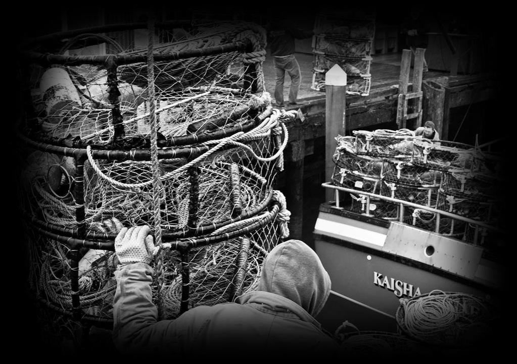


13 Commercial Fishing Dungeness Crab Salmo n Shrimp Albacore Tuna Pacific Whiting Bottom Fish Halibu Slime Fish Waste = Cat Food

14 Commercial Docks Roughly 140 Annual Commercial Moorage Boats
15 Commercial Fisheries Dungeness Crab (one example)


 Assess the feasibility of a CFA")
16 Community Fishing Association (CFA) Importance of Commercial Fishing Corps of Engineers Tonnage and Off Ship Value of Seafood Fishing Permits/Quota Access to supply Cost/Barrier of Entry National Fish & Wildlife Foundation Grant ($50k) Assess the feasibility of a CFA in Ilwaco
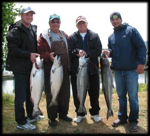
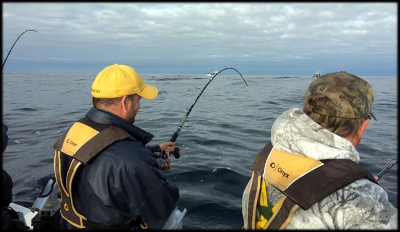


17 Recreational/Sport Fishing Halibut Salmon Albacore Tuna Dungeness Crab Sturgeon? Bottom Fish


18 Charter Boats Approximately 25 total boats 5 fishing charter businesses


19 Self service 23 concrete pads 5 indoor bays 50 ton Travelift Haul out boats up to 18 wide by 65 long Around 250 boats hauled out annually Port of Ilwaco Boatyard


20 Access to Boatyards & United States Coast Guard United States Coast Guard Station Cape Disappointment 450 to 500 Search and Rescue Annual Operations Port of Ilwaco - Harbor of Safe Refuge Boatyard Haul Out Facility for Distressed Vessels


21 Port of Ilwaco Airport FAA Identifier: 7W1 Runway Length 2,080 feet Single engine planes Several tie downs No revenue generated for Port


22 TRANSITI ONS
23 Over $100k in Newspaper at the RED in every meeting Marina silting in Packed September 2015 Two Dredge permit FALL 2015 Port of Commission Commissioners expired Chinook Meetings Community in turmoil Customers Resigning Third in two An emergency months Commissioner Maintenance upset looses to a write Poor governance, staff promoted in candidatelacking policy and No Master Plan to management procedures and poor financial
24 A few headlines from our local paper since Sept 2015 Port of Chinook Port of Chinook short of money - September 2015 Chinook port asks for state audit fees going up to help balance the books September 2015 Chinook port still plotting a course to solvency - October 2015 Ports of Chinook, Ilwaco approve interlocal agreement to manage Chinook January 2016 Chinook port installs new leadership, cleans up finances February 2016


25 Coastal Ports and Commissions Working Port of Ilwaco & Chinook Interlocal Agreement Agreement for Ilwaco to provide inclusive management services to Chinook. Separate Port Districts Commissions Finances Operational Efficiencies Together PORT OF ILWACO Port of Chinook


26 Port of Chinook Port Facilities Port of Chinook Marina 300 Slip Marina Boat Ramp Commercial Seafood Processor Fuel Dock Chinook School Event Center Chinook County Park


27 Chinook School Project School Building Gymnasium Building


28 Port of Chinook Management of Chinook County Park Fuel Transfer Line Replacement Project


29 Marina Challenges Aging Infrastructure Dredging Bulkheads Docks Public Hoists Fuel Dock Utilities


30 Marina Challenges Sea Lions Derelict Vessels Fish Cleaning Restrooms Public Wifi Storm Damage

31 October 15, 2016 Maximum Winds 60mph High Tide


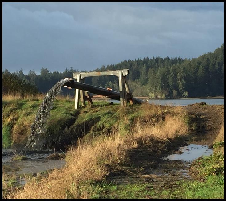
32 MARINA Maintenance Dredging Port of Ilwaco and Port of Chinook Operation of Dredge Disposal Site Maintenance of Dredge Permitting Agencies
33 10 Hydraulic Dredge - Purchase & Operation Costs Dredge X10 Barracuda $350, HDPE Pipe and Fittings $ 42,300 Stern Pontoon, Work Skiff, Winches $ 22,000 90hp Outboard $ 9,000 Mobilization/Demobilization $ 60,000 Total $479,000 Daily Operation: Average Cost: Commercial Rates: $2,500/10 hr. day $3-$5/CY $7-$12/CY + Mob/Demob

34 December 2015 Port of Ilwaco

35 October 2013 Ilwaco Upland Dredge Material Disposal Site


36 Entrance Channels Port of Ilwaco Port of Chinook Political Process Corps of Engineers Congressional Delegation Pacific Northwest Waterways Assoc. (PNWA)


37 Historic Channel Position and Depths 1887 Ilwaco Main Channel on North Side of River 1987 Ilwaco Main Channel on South Side of River Depths - up to 70 feet Depths Mudline to annual maintenance dredging to -16

38 EXAMPL Ilwaco E Channel Authorized: -16 feet deep 200 feet wide at this location March 2014 Condition Survey (USACE) as pictured: 70% of the channel width less than 3 feet deep Remaining 30% is about 60 feet wide Two boats could not pass and large boats would not attempt Failing pile Dikes less scouring

39 Success 2014 Entrance Channel Dredging 10% Harbor Maitenance Tax SMALL PORT SET ASIDE Also dredging in 2015, 2016 & included in 2017 work plan and President s budget


40 Columbia River at Baker Bay PILE DIKES Multi-Year Process with the Corps of Engineers and Congressional Delegation


41 Port Staff Essential for Our Operation Finance Director - Tricia Needham Administrative Nancy Beesely April Hawkinson Brianna Warfield Chinook Marina Manager - John Demase Operations Manager - Mark Elliot Jeff Haataja Jon Haataja Daryl Glasson Randy Johnson

42 Port Commissioners Dave Nichols, Chair Bob Hamilton Butch Smith Sustaining Coastal Fishing Communities is Job #1 Gary Kobes, Chair Kathy Colvin Jerry Cox Crab Pot Christmas Tree Lighting

43 COME VISIT the Long Beach Peninsula MOUTH OF THE COLUMBIA RIVER Summer 2015
Coastal Harbors and Waterways, NC (Shallow Draft Navigation) (O&M)
 (O&M)") Coastal Harbors and Waterways, NC (Shallow Draft Navigation) (O&M) Shallow draft coastal harbors include a subsistence harbor at Silver Lake CONGRESSIONAL DISTRICT: NC 3, 7 DATE: 23 April 2018 1. AUTHORIZATION:
Coastal Harbors and Waterways, NC (Shallow Draft Navigation) (O&M) Shallow draft coastal harbors include a subsistence harbor at Silver Lake CONGRESSIONAL DISTRICT: NC 3, 7 DATE: 23 April 2018 1. AUTHORIZATION:
HARBOR INFRASTRUCTURE INVENTORIES Oak Orchard Harbor, New York
 HARBOR INFRASTRUCTURE INVENTORIES Oak Orchard Harbor, New York Harbor Location: Oak Orchard Harbor is located on the southern shore of Lake Ontario at the mouth of Oak Orchard Creek in the village of Point
Coastal Harbors and Waterways, NC (Shallow Draft Navigation) (O&M)
 (O&M)") Coastal Harbors and Waterways, NC (Shallow Draft Navigation) (O&M) Shallow draft coastal harbors include a subsistence harbor at Silver Lake CONGRESSIONAL DISTRICT: NC 3 and 7 DATE: 23 February 2015 1.
Coastal Harbors and Waterways, NC (Shallow Draft Navigation) (O&M) Shallow draft coastal harbors include a subsistence harbor at Silver Lake CONGRESSIONAL DISTRICT: NC 3 and 7 DATE: 23 February 2015 1.
HARBOR INFRASTRUCTURE INVENTORIES Kenosha Harbor, Wisconsin
 HARBOR INFRASTRUCTURE INVENTORIES Kenosha Harbor, Wisconsin Harbor Location: Kenosha Harbor is on the west shore of Lake Michigan about 54 miles north of Chicago, Illinois. Authority: River & Harbor Acts
HARBOR INFRASTRUCTURE INVENTORIES Lorain Harbor, Ohio
 HARBOR INFRASTRUCTURE INVENTORIES Lorain Harbor, Ohio Harbor Location: Lorain Harbor is located on the southern shore of Lake Erie in the city of Lorain, OH about 45 miles west of Cleveland, OH. Authority:
PNWA Conference Update
 PNWA Conference Update COLONEL Jose Aguilar District Commander Portland District 2 October, 2014 US Army Corps of Engineers Projects Mouth of the Columbia (MCR) Jetties Columbia River Status Coastal Dredging
HARBOR INFRASTRUCTURE INVENTORIES Muskegon Harbor, Michigan
 HARBOR INFRASTRUCTURE INVENTORIES Muskegon Harbor, Michigan Harbor Location: Muskegon Harbor is located on the east shore of Lake Michigan, 114 miles northeast of Chicago, IL. Authority: River & Harbor
Commercial Anchovy Fishery Public Meeting
 Commercial Anchovy Fishery Public Meeting February 15, 2017 Astoria, Oregon Cyreis Schmitt Troy Buell Maggie Sommer 1 Northern Anchovy Anchovy Ecology and Life History Federal and State Anchovy Management
Redondo Beach Boat Launch Ramp Facility
 Redondo Beach Boat Launch Ramp Facility Feasibility Report for the California Department of Boating and Waterways 2015 Grant Cycle For the City of Redondo Beach Submitted by March 13, 2014 Table of Contents
APPENDIX D REAL ESTATE PLAN
 NAVIGATION IMPROVEMENTS SITKA HARBOR, ALASKA CHANNEL ROCK BREAKWATERS DRAFT DEFICIENCY CORRECTION EVALUATION REPORT APPENDIX D REAL ESTATE PLAN JANUARY 2011 REAL ESTATE PLAN FOR SITKA HARBOR, ALASKA CHANNEL
HARBOR INFRASTRUCTURE INVENTORIES Caseville Harbor, Michigan
 HARBOR INFRASTRUCTURE INVENTORIES Caseville Harbor, Michigan Harbor Location: Caseville Harbor is located at the mouth of the Pigeon River on the east shore of Saginaw Bay, about 17 miles southwest of
KANISA RUNGJANG UW - Madison
 Port cost comparisons and productivity from public funding: Port of Milwaukee and Port of Green Bay KANISA RUNGJANG UW - Madison National Center for Freight & Infrastructure Research & Education Port cost
DRIVING TOURS. Grays Harbor County is a fisherman s dream! Fish the bay, ocean, streams, rivers or lakes... the choice is yours!
 Grays County is a fisherman s dream! bay, ocean, streams, rivers or lakes... the choice is yours! Grays offers excellent fresh and saltwater fishing in all seasons. Fish in the open ocean for tuna, halibut,
HARBOR INFRASTRUCTURE INVENTORIES Marquette Harbor, Michigan
 HARBOR INFRASTRUCTURE INVENTORIES Marquette Harbor, Michigan Harbor Location: Marquette Harbor is located in Marquette Bay on the south shore of Lake Superior, 160 miles west of Sault Ste. Marie, MI and
WEST COAST FISHERIES AND MANAGEMENT
 WEST COAST FISHERIES AND MANAGEMENT Olympic Coast National Marine Sanctuary Advisory Council May 20, 2016 Heather Reed - WDFW Jessi Doerpinghaus - WDFW FISHING IS KEY TO WASHINGTON S ECONOMY Washington
Appendix G Coastal Demographic and Economic Trends Additional Figures
 Appendix G Coastal Demographic and Economic Trends Additional Figures Figure 1. Unemployment Rate in 1970-2004 18.0 16.0 14.0 12.0 10.0 8.0 6.0 4.0 1970 1972 1974 1976 1978 1980 1982 1984 1986 1988 1990
BookletChart. Intracoastal Waterway Matecumbe to Grassy Key NOAA Chart A reduced-scale NOAA nautical chart for small boaters
 BookletChart Intracoastal Waterway Matecumbe to Grassy Key NOAA Chart 11449 A reduced-scale NOAA nautical chart for small boaters When possible, use the full-size NOAA chart for navigation. Published by
Public Notice U.S. Army Corps In Reply to Application Number CENAB-OP-RMS (NATIONAL HARBOR (FORMERLY PORT Baltimore District AMERICA])
![Public Notice U.S. Army Corps In Reply to Application Number CENAB-OP-RMS (NATIONAL HARBOR (FORMERLY PORT Baltimore District AMERICA])](/thumbs/89/100795623.jpg "Public Notice U.S. Army Corps In Reply to Application Number CENAB-OP-RMS (NATIONAL HARBOR (FORMERLY PORT Baltimore District AMERICA])") Public Notice U.S. Army Corps In Reply to Application Number of Engineers CENAB-OP-RMS (NATIONAL HARBOR (FORMERLY PORT Baltimore District AMERICA]) 88-01361 PN 14-05 Comment Period: January 16, 2014 to
Public Notice U.S. Army Corps In Reply to Application Number of Engineers CENAB-OP-RMS (NATIONAL HARBOR (FORMERLY PORT Baltimore District AMERICA]) 88-01361 PN 14-05 Comment Period: January 16, 2014 to
Juneau Douglas Harbor
 Juneau Douglas Harbor Douglas Harbor Page 2 of 8 Condition of Improvements 31 December 2015 Douglas Harbor, Alaska (CWIS No. 072789, 180942) Authorization Rivers and Harbors Act, 3 July 1958 (House Doc.
HARBOR INFRASTRUCTURE INVENTORIES Cheboygan Harbor, Michigan
 HARBOR INFRASTRUCTURE INVENTORIES Cheboygan Harbor, Michigan Harbor Location: Cheboygan Harbor is located at the mouth of the Cheboygan River, emptying into western Lake Huron approximately 16 miles southeast
Report to the Monterey County Office of Economic Development. Caroline Pomeroy, Ph.D. 1. and. Michael Dalton, Ph.D. 2. June 2003
 SOCIO-ECONOMICS OF THE MOSS LANDING COMMERCIAL FISHING INDUSTRY Report to the Monterey County Office of Economic Development Caroline Pomeroy, Ph.D. 1 and Michael Dalton, Ph.D. 2 June 2003 1 Institute
30 DAY PUBLIC NOTICE MAINTENANCE DREDGING OF THE 8-FOOT CHANNEL OF THE FEDERAL NAVIGATION PROJECT IN KENNEBUNK RIVER KENNEBUNK & KENNEBUNKPORT, ME
 fr.iiif.i ~ US Anny Corps of Engineers New England District 696 Virginia Road Concord, MA 01742-2751 Public Notice In Reply Refer to: Mr. Jack Karalius nae-pn-nav@usace.army.mil Programs/Project Management
Mouth of the Columbia River Jetties Three-Phase Construction Plan
 Mouth of the Columbia River Jetties Three-Phase Construction Plan Project Overview October 9, 2012 US Army Corps of Engineers MCR Jetties Major Rehabilitation Sand Island pile dikes 1930-1935 Columbia
California s North Coast Fishing Communities Historical Perspective and Recent Trends
 California s North Coast Fishing Communities Historical Perspective and Recent Trends Appendix C: Methodological Detail Customization of PacFIN Landings Receipt Data to Characterize Commercial Fisheries
New Orleans Municipal Yacht Harbor
 New Orleans Municipal Yacht Harbor Marina Schematic Design Update 601 Poydras St., Suite 1860 New Orleans, LA, 70130 504-648-3560 Post-Katrina Municipal Yacht Harbor: Introduction The MYH was an approximate
Seafood Industry. The 2012 Juneau and Southeast Alaska Economic Indicators 11/1/12 Page 60
 Seafood Industry In 2011, fishermen in Southeast landed 395,628,268 pounds of fish with an ex vessel value of $391,091,684. This harvest resulted in 272.6 million pounds of product, with a wholesale value
Shoalwater Bay Shorline Erosion Dredging
 Shoalwater Bay Shorline Erosion Dredging ROSS ISLAND SAND & GRAVEL CO. Saving the Tokeland Penninsula Willapa Bay & Tokeland Penninsula Southwestern Washington Coast Shoalwater Bay Historic View Settlements
Nearshore Dredged Material Placement Pilot Study at Noyo Harbor, CA
 1 Nearshore Dredged Material Placement Pilot Study at Noyo Harbor, CA Noyo Cove N 2011 National Conference on Beach Preservation Technology 9-11, February 2011 Lihwa Lin, Honghai Li, Mitchell Brown US
Nome Harbor Page 2 of 12
 Nome Harbor Nome Harbor Page 2 of 12 Condition of Improvements 30 December 2015 Nome Harbor, Alaska (CWIS No. 010422, 012270, 072742, 087755) Authorization (1) Rivers and Harbors Act, 8 August 1917 (House
HARBOR INFRASTRUCTURE INVENTORIES Harbor Beach Harbor, Michigan
 HARBOR INFRASTRUCTURE INVENTORIES Harbor Beach Harbor, Michigan Harbor Location: Harbor Beach Harbor is located on the west shore of Lake Huron about 60 miles north of Port Huron, MI. Authority: Rivers
HARBOR INFRASTRUCTURE INVENTORIES Fairport Harbor, OH
 HARBOR INFRASTRUCTURE INVENTORIES Fairport Harbor, OH Harbor Location: Fairport Harbor is located at the mouth of the Grand River on the southern shore of Lake Erie in the city of Fairport, OH, approximately
Superyacht Seattle. Moorage Options
 Superyacht Seattle Moorage Options Terminal91 Terminal 91 2001 W Garfield St Seattle, WA 98199 206.787.3751 seaops@portseattle.org Terminal 91 is a secure facility located on Elliott Bay, at the north
Sport Fishing Expenditures and Economic Impacts on Public Lands in Washington
 Sport Fishing Expenditures and Economic Impacts on Public Lands in Washington For: Northwest Sportfishing Industry Association By: Southwick Associates Released June 2015 PO Box 6435 Fernandina Beach,
Humboldt Bay s Harbor
 Humboldt Bay s Harbor Humboldt Bay is the second largest natural bay in California The only deep water harbor along ~400 miles of coast between San Francisco, CA and Coos Bay, OR One of only 11 deep water
Commercial Dungeness Crab Newsletter
 Commercial Dungeness Crab Newsletter September 2, 2008 Oregon Department of Fish & Wildlife 2040 SE Marine Science Drive, Newport, OR 97365 541-867-4741 Contents Page Season summary.... 1 Rule changes.....
Good Mooring to You! Jensen Beach Mooring Field. Kathy Fitzpatrick, P.E. Coastal Engineer, Martin County
 Good Mooring to You! Kathy Fitzpatrick, P.E. Coastal Engineer, Martin County Penny Cutt Regional Manager, Coastal Systems International Mooring Field Advantages Provide a safe and secure anchorage at a
Planning Considerations for Nearshore Placement of Mixed Dredged Sediments
 Planning Considerations for Nearshore Placement of Mixed Dredged Sediments PURPOSE: Dredging planning and management decisions are based on a combination of engineering and economic factors tempered by
1-32 NOME HARBOR, ALASKA (CWIS NOS , 87755, 12270, & 10422) Condition of Improvement 30 September 2012
 Condition of Improvement 30 September 2012") NOME HARBOR 1-32 NOME HARBOR, ALASKA (CWIS NOS. 72742, 87755, 12270, & 10422) Condition of Improvement 30 September 2012 AUTHORIZATION: (1) Rivers and Harbors Act, 8 August 1917 (House Doc. 1932, 64th
NOME HARBOR 1-32 NOME HARBOR, ALASKA (CWIS NOS. 72742, 87755, 12270, & 10422) Condition of Improvement 30 September 2012 AUTHORIZATION: (1) Rivers and Harbors Act, 8 August 1917 (House Doc. 1932, 64th
Delta Clean (KDC) program. This program is lead by Contra Costa County and is implemented in
 program. This program is lead by Contra Costa County and is implemented in") Summary Notes The Pacific Oil Spill Prevention Education Team (POSPET) 2007 FALL MEETING 10/16/07 Washington Department of Ecology Attending: Eric Olsson, WA SeaGrant; Mary Ellen Voss, WA Department of
Summary Notes The Pacific Oil Spill Prevention Education Team (POSPET) 2007 FALL MEETING 10/16/07 Washington Department of Ecology Attending: Eric Olsson, WA SeaGrant; Mary Ellen Voss, WA Department of
Response of a Newly Created Marsh-Wetland Affected by Tidal Forcing, Upland Discharge, and Groundwater Interaction
 Response of a Newly Created Marsh-Wetland Affected by Tidal Forcing, Upland Discharge, and Groundwater Interaction Mouth of Columbia River, Cape Disappointment State Park, Washington 12 Hans R. Moritz
Commercial Net Pen Salmon Farming in Washington State
 Commercial Net Pen Salmon Farming in Washington State Icicle SeafoodsOverivew at a glance Icicle Seafoods Icicle is a leading harvester, producer and processor of diversified seafood products in North
Socioeconomic Impacts of Crab Rationalization on the Aleutian East Borough Communities of False Pass, Akutan, and King Cove
 Socioeconomic Impacts of Crab Rationalization on the Aleutian East Borough Communities of False Pass, Akutan, and King Cove Dr. Marie Lowe Dr. Gunnar Knapp Assistant Professor of Anthropology Professor
Making Waterfront Festivals Work: Successful Case Studies
 Making Waterfront Festivals Work: Successful Case Studies Seattle Maritime Festival - Ken Saunderson Tacoma Maritime Fest - Clare Petrich Olympia Harbor Days Tugboat Festival - Chuck Fowler Puget Sound
2015 Adult Returns and 2016 Expectations Columbia River Preliminary Draft December 14, 2015
 2015 Adult Returns and 2016 Expectations Columbia River Preliminary Draft December 14, 2015 Adult Returns 2015 Results 2016 Expectations Willamette Spring (includes jacks) 55,400 predicted return to CR
1-32 NOME HARBOR, ALASKA (CWIS NOS , 87755, & 10422) Condition of Improvement 30 September 2009
 Condition of Improvement 30 September 2009") NOME HARBOR 1-32 NOME HARBOR, ALASKA (CWIS NOS. 72742, 87755, & 10422) Condition of Improvement 30 September 2009 AUTHORIZATION: (1) Rivers and Harbors Act, 8 August 1917 (House Doc. 1932, 64th Congress,
NOME HARBOR 1-32 NOME HARBOR, ALASKA (CWIS NOS. 72742, 87755, & 10422) Condition of Improvement 30 September 2009 AUTHORIZATION: (1) Rivers and Harbors Act, 8 August 1917 (House Doc. 1932, 64th Congress,
Condition of Improvements 30 December 2014 Wrangell Harbors, Alaska (CWIS No , )
") Wrangell Harbors Condition of Improvements 30 December 2014 Wrangell Harbors, Alaska (CWIS No. 010435, 021500) Authorization (1) Rivers and Harbors Act, 22 September 1922 (House Doc. 161, 67th Congress,
Wrangell Harbors Condition of Improvements 30 December 2014 Wrangell Harbors, Alaska (CWIS No. 010435, 021500) Authorization (1) Rivers and Harbors Act, 22 September 1922 (House Doc. 161, 67th Congress,
Wexford Harbour. Yachting Guide. Navigation
 Wexford Harbour Yachting Guide Navigation This document supersedes all previous editions. Approvals: Yacht Club Committee April, 2015 Wexford Board of Directors April, 2015 # Date Section Revision 1 6.5.2015
TOWN OF DENNIS 10 YR COMPREHENSIVE DREDGE PERMIT SEPTEMBER 10, 2013
 TOWN OF DENNIS 10 YR COMPREHENSIVE DREDGE PERMIT SEPTEMBER 10, 2013 WHAT IS IT? ALL NECESSARY PERMITS FOR DREDGING FOR PORTIONS OF BASS RIVER, SWAN POND RIVER, SESUIT HARBOR AND CHASE GARDEN CREEK ONE
City Council Workshop Agenda Item #3
 City Council Workshop Agenda Item #3 July 11, 2016 Portland Street Pier At the request of Councilor Morgan, the City Council will be talking about the Portland Street Pier facility located in Ferry Village.
OR DUNGENESS CRAB FISHERY:
 E 55 OR DUNGENESS CRAB FISHERY: an economic analysis of productivity and profitability David S. Liao Joe B. Stevens OREGON STATE UNIVERSITY SEA GRANT COLLEGE PROGRAM Publication no. ORESU-T-75-005 AGRICULTURAL
HARBOR INFRASTRUCTURE INVENTORIES Port Sanilac Harbor, Michigan
 HARBOR INFRASTRUCTURE INVENTORIES Port Sanilac Harbor, Michigan Harbor Location: Port Sanilac Harbor is located on the west shore of Lake Huron, about 30 miles north of Port Huron, MI. Authority: Rivers
Ninilchik Harbor Page 2 of 11
 Ninilchik Harbor Ninilchik Harbor Page 2 of 11 Condition of Improvements 31 December 2017 Ninilchik Harbor, Alaska (CWIS No. 012640, 087345) Authorization Rivers and Harbors Act, 3 July 1958 (P.L. 85-500
The Economic Impacts of Carolina Beach Inlet Navigability
 The Economic s of Carolina Beach Inlet Navigability June 27, 2014 By: Chris Dumas, Ph.D. Department of Economics and Finance Cameron School of Business UNC-Wilmington 601 South College Road Wilmington,
Economic Impact Analysis BOONE DOCKS RESORT AND MARINA, LLC
 Economic Impact Analysis BOONE DOCKS RESORT AND MARINA, LLC Analysis conducted using the on-line Boating Economic Impact Model developed by Drs. Ed Mahoney (mahoneye@msu.edu), Dan Stynes (stynes@msu.edu)
Unalaska Navigation Channel Improvements
 1 237 237 237 255 255 255 0 0 0 Unalaska Navigation Channel Improvements 217 217 217 200 200 200 163 163 163 131 132 122 239 65 53 80 119 27 252 174.59 110 135 120 112 92 56 62 102 130 102 56 48 130 120
HARBOR INFRASTRUCTURE INVENTORIES West Harbor, OH
 HARBOR INFRASTRUCTURE INVENTORIES West Harbor, OH Harbor Location: West Harbor is located on the southern shore of Lake Erie in the township of Catawba Island, OH about 50 miles east of Toledo, OH. Authority:
Chapter I: Marine Resources
 NOTE TO READERS: This is a draft of the Kennebunk Comprehensive Plan. The Comprehensive Plan provides us with a description of the town today in a range of categories, and identifies issues and recommendations
Pre-Season Testing Protocol for the Tri-State Coastal Dungeness crab Commercial Fishery. Revised September 2013
 Pre-Season Testing Protocol for the Tri-State Coastal Dungeness crab Commercial Fishery Revised September 2013 I. Purpose The Washington Department of Fish and Wildlife (WDFW), Oregon Department of Fish
Agenda Item H.7.c Supplemental Public Comment MTC PowerPoint September Midwater Trawlers Cooperative
 Agenda Item H.7.c Supplemental Public Comment MTC PowerPoint September 2012 Midwater Trawlers Cooperative Why Status Quo was fair and equitable in 2008 Why Status Quo is the most fair and equitable option
Energy Consumption of Small Scale Fishing Vessel Operations in Indonesia A Case Study in Palabuhanratu, Indonesia
 Energy Consumption of Small Scale Fishing Vessel Operations in Indonesia A Case Study in Palabuhanratu, Indonesia Vita R KURNIAWATI Richard W BIRMINGHAM Alan J MURPHY School of Marine Science and Technology
Pacific Ocean Division. Navigation Program Overview. Association of Pacific Ports 2016 Winter Conference Waikaloa, Hawaii.
 Pacific Ocean Division Navigation Program Overview Association of Pacific Ports 2016 Winter Conference Waikaloa, Hawaii David Lau Pacific Ocean Division Chief, Civil Works Integration Division January
SUCCESSFUL GEAR RECOVERY Lessons from Puget Sound
 APEC MARINE DEBRIS SEMINAR SUCCESSFUL GEAR RECOVERY Lessons from Puget Sound Jeff June, Project Manager Joe Schmitt & Gary Wood JD Northwest Straits Commission Washington State, U.S. The Northwest Straits
Environmental Protection Agency s Waste Hierarchy. Recycling/Composting. Combustion with Energy Recovery
 Fishing Gear Recycling and Disposal Options and Guidelines prepared for West Coast Governor s Agreement on Ocean Health Derelict Fishing Gear Workshop March 2010 by Fran Recht, Pacific States Marine Fisheries
Fisheries Closures. Too many vacancies at the salmon hotels. Deborah Lyons Chinook Futures Coalition
 Fisheries Closures Too many vacancies at the salmon hotels Deborah Lyons Chinook Futures Coalition Chilkat Salmon Hotel 47% Occupancy June 12 Aug 9th 2017 Taku Salmon Hotel 28% Occupancy April August 9th
Cordova Harbor Page 2 of 9
 Cordova Harbor Cordova Harbor Page 2 of 9 Condition of Improvements 30 December 2017 Cordova Harbor, Alaska (CWIS No. 087136, 087186, 087711) Authorization Rivers and Harbors Act, 30 August 1935 (R & H
Oregon Fishing Industry Partnership to Restore Marine Habitat Project Update #2. 1,359 Derelict Crab Pots Recovered in 2009 Gearing Up For 2010
 Oregon Theodore R. Kulongoski Governor Department of Fish and Wildlife Marine Resources Program 2040 SE Marine Science Drive Newport, OR 97365 Voice: 541-867-4741 Fax: 541-867-0311 http://www.dfw.state.or.us
North Pacific Fishery Management Council. Community considerations in Federally-managed fisheries. April 2005
 North Pacific Fishery Management Council Community considerations in Federally-managed fisheries April 2005 Why are Fisheries Off Alaska so important to communities? Would rank in the top 10 producing
FOR SALE. 202 Pacific Avenue, Bremerton, WA Historic Bremerton Trust and Savings Building
 FOR SALE 202 Pacific Avenue, Bremerton, WA 98337 Historic Bremerton Trust and Savings Building PROPERTY INFORMATION PRICE $1,750,000 BUILDING SIZE LOT SIZE 10,080 sq. ft. 4,792 sq. ft. (0.11 Acres) # OF
Special projects are mainly capital equipment purchases and improvements to the inlet. Most improvements are cost shared with FDEP and FIND.
 Background In 1957 the Florida Legislature created the Hillsboro Inlet District. This is a special independent district that can levy taxes to finance the maintenance and improvements to the Inlet. The
March 11, Agenda Item I.3.c US-Canada Albacore Treaty: Recommendations for Future Negotiations
 Agenda Item I.3.c Supplemental Public Comment 3 (Includes Graphs) March 2013 AMERICAN ALBACORE FISHING ASSOCIATION www.americanalbacore.com 4364 Bonita Road, #311 Bonita, California 91902 Tel: (619) 941-2307
Grays Harbor O&M and Deepening Dredging
 Grays Harbor O&M and Deepening Dredging Elizabeth Chien Project Manager Seattle District 28 January 2016 US Army Corps of Engineers Grays Harbor Navigation Channel Inner Harbor O&M Dredging Summer 2015:
{ } Jack Holland Page 1 of DOC
 Background In 1957 the Florida Legislature created the Hillsboro Inlet District. This is a special independent district that can levy taxes to finance the maintenance and improvements to the Inlet. The
FEMA's new flood plain mapping could cost coastal Mainers dearly
 July 5 FEMA's new flood plain mapping could cost coastal Mainers dearly Some communities in York and Cumberland counties hire a consultant to challenge the agency's findings. By Tux Turkeltturkel@mainetoday.com
Grays Harbor Federal Project
 Grays Harbor Federal Project Elizabeth Chien Coastal Navigation Program Manager Seattle District 27 October 2016 US Army Corps of Engineers Grays Harbor Navigation Channel Inner Harbor Dredging Summer
UBCM Community Excellence Awards 2007 Submission
 UBCM Community Excellence Awards 2007 Submission Formatted: Left: 2.54 cm Category: Partnerships Project: Implementation of False Creek Anchoring Management System 1. A one-paragraph summary of the project/program
RESEARCH Massachusetts Recreational Boater Survey. Project Summary
 Coastal and Marine Spatial Planning RESEARCH Project Summary 2010 Massachusetts Recreational Boater Survey The 2010 Massachusetts Recreational Boater Survey gathered spatial and economic data relating
La Quinta Channel Extension Port of Corpus Christi Ingleside, Texas. Mark Coyle
 La Quinta Channel Extension Port of Corpus Christi Ingleside, Texas Mark Coyle Corpus Christi Navigation Channel PCCA La Quinta Expansion Project History Corpus Christi Ship Channel Improvement Projects
Southwest Washington Littoral Drift Restoration Project: Design, Construction, and Monitoring
 Southwest Washington Littoral Drift Restoration Project: Design, Construction, and Monitoring J Jessica i St Stokke kk USACE Portland District October 28, 2010 WEDA Pacific Meeting Monterey, CA US Army
Memorandum. To: City Council. cc: Tony Piasecki, City Manager Date: 3/3/2016. Introduction
 I Memorandum 211 To: City Council From: Joe Dusenbury, Harbormaster cc: Tony Piasecki, City Manager Date: 3/3/2016 Re: City Government 101 -The Marina Introduction Staff is presenting this material as
V. HARBOR DEPTHS, CHANNEL DESIGN AND PROPOSED CONSTRUCTION AND DREDGING
 V. HARBOR DEPTHS, CHANNEL DESIGN AND PROPOSED CONSTRUCTION AND DREDGING A. DISCUSSION: For the most part, projects that involve dredging and construction require a comprehensive design and review process
HARBOR INFRASTRUCTURE INVENTORIES Lexington Harbor, Michigan
 HARBOR INFRASTRUCTURE INVENTORIES Lexington Harbor, Michigan Harbor Location: Lexington Harbor is located on the west shore of Lake Huron about 20 miles north of Port Huron, MI. Authority: Rivers & Harbors
Norwalk Harbor: The Jewel of Long Island Sound. A Presentation by the Norwalk Harbor Management Commission
 Norwalk Harbor: The Jewel of Long Island Sound A Presentation by the Norwalk Harbor Management Commission 2018 State of the Harbor Meeting December 13, 2018 The City of Norwalk in Southwest Connecticut
Background on. Oregon's COOPERATIVE EXTENSION SERVICE OREGON STATE UNIVERSITY. Extension Circular 750 August 1970
 Background on Oregon's D COOPERATIVE EXTENSION SERVICE OREGON STATE UNIVERSITY Extension Circular 750 August 1970 BACKGROUND ON OREGON'S MARINE INDUSTRY Robert O. Coppedge and Frederick J. Smith Extension
Port Sections Guide Section 01
 s Guide 01 Cow Bay Marina Date 10/1/2016 Position (lat / lon) Minimum controlled water depth Chart datum Range of water densities Tidal range alongside Bottom type Dredging regime Distance pilot station
LoveladiesCottage--Classic and Relaxed Lagoon- Front Home, Dogs OK
 LoveladiesCottage--Classic and Relaxed Lagoon- Front Home, Dogs OK Summary Sweet house! Check the website or contact us for available dates and rates--our 2019 calendar is filling up. Description 3 bedrooms
North Shore of Long Island, Feasibility Study
 North Shore of Long Island, Asharoken New York Asharoken, Feasibility Study Asharoken, NY Public Meeting June 30, 2015 US Army Corps of Engineers US Army Corps of Engineers New York BUILDING STRONG BUILDING
Columbia River Navigation
 Columbia River Navigation HISTORY COMMITTEE Pat Brodin John Carpita Bob Moorhead Columbia River Navigation Columbia River Discovery & Exploration Columbia Bar Shipwrecks Graveyard of the Pacific Columbia
Socioeconomic Profile and Spatial Analysis of Fisheries in the three central California National Marine Sanctuaries
 Socioeconomic Profile and Spatial Analysis of Fisheries in the three central California National Marine Sanctuaries Overview and Assessment of CDFG Fisheries Data for use in the Joint Management Plan Review
BIG RIVER COALITION RED RIVER VALLEY ASSOCIATION Sean M. Duffy, Sr. Executive Director
 BIG RIVER COALITION RED RIVER VALLEY ASSOCIATION 22119 Sean M. Duffy, Sr. Executive Director sean.duffy@bigrivercoaltiion.org MARITIME NATION ENGINEER S WEEK 22217 MARITIME STATE MISSISSIPPI RIVER SHIP
POLICIES AND PROCEDURES FOR THE VALDEZ SMALL BOAT HARBOR VALDEZ, ALASKA SECTION 1 GENERAL PROVISIONS
 POLICIES AND PROCEDURES FOR THE VALDEZ SMALL BOAT HARBOR VALDEZ, ALASKA SECTION 1 GENERAL PROVISIONS 1.1 Purpose The purpose of the Policies and Procedures for the Valdez Small Boat Harbor is to protect
U.S. Army Corps of Engineers
 A. U.S. Army Corps of Engineers Kevin Parsons, Natural Resources Specialist 500 Resource Management Drive West Point, GA 31833 706-645-2937 Kevin.M.Parsons@usace.army.mil B. Underwater Structure Enhancement
Port Infrastructure to Support Floating Offshore Wind West Coast USA
 Port Infrastructure to Support Floating Offshore Wind West Coast USA Focus on California Figure: Principle Power Aaron Porter, P.E., & Shane Phillips, P.E. Mott MacDonald Seattle, WA BOEM Project Manager:
Future Global Trade Trends - Risks & Opportunities. Pulse of the Ports: Peak Season Forecast March 21, 2013
 1 Future Global Trade Trends - Risks & Opportunities Pulse of the Ports: Peak Season Forecast March 21, 2013 June 2012 Dr. Walter Kemmsies Chief Economist Summary Higher economic growth in 2013, possible
M. Takezawa & Y. Maeno Department of Civil Engineering, College of Science & Technology Nihon University, 1-8 Kandasurugadai Chiyodaku, Tokyo, Japan
 Survey of small fisheries in Japan M. Takezawa & Y. Maeno Department of Civil Engineering, College of Science & Technology Nihon University, 1-8 Kandasurugadai Chiyodaku, Tokyo, Japan Abstract The coast
Southeast Volusia Coastal Projects Update
 Southeast Volusia Coastal Projects Update Public Works Department Coastal Division August 15, 2016 2016 Dune Walkover Re-Decking Program Completed Dune Walkovers South End 8 th Ave. New Smyrna Beach* 12
About Rend Lake Marina:
 PRICE GREATLY REDUCED TO $1,495,000.00 For Sale: Rend Lake Marina plus 18 Contiguous Waterfront Acres for Development (Approved by the US Corp of Engineers). Rend Lake Marina 8955 West Dam Lane Benton
Florida Keys National Marine Sanctuary
 Florida Keys National Marine Sanctuary Review of the Marine Zones and Regulations [insert your name here] [insert your email here] Florida Keys National Marine Sanctuary 2900 nm 2 / 10,000 km 2 Jurisdiction
Riverside Rising Economic Outlook for the Region April 2015
 Analysis. Answers Riverside Rising Economic Outlook for the Region April 2015 Beacon Economics, LLC California fact versus fiction Looking back a few years (2009 / 2010) everyone was saying that CA would
CORPS FACTS. Harbor Dredging U.S. ARMY CORPS OF ENGINEERS BUILDING STRONG
 CORPS FACTS Harbor Dredging U.S. ARMY CORPS OF ENGINEERS BUILDING STRONG Disaster Response Sedimentation in the channel is caused by the normal cycle of silt movement, erosion from high water or heavy