burlington MobIlITY Hubs study Aldershot GO Mobility Hub
|
|
|
- Rosalind Spencer
- 5 years ago
- Views:
Transcription
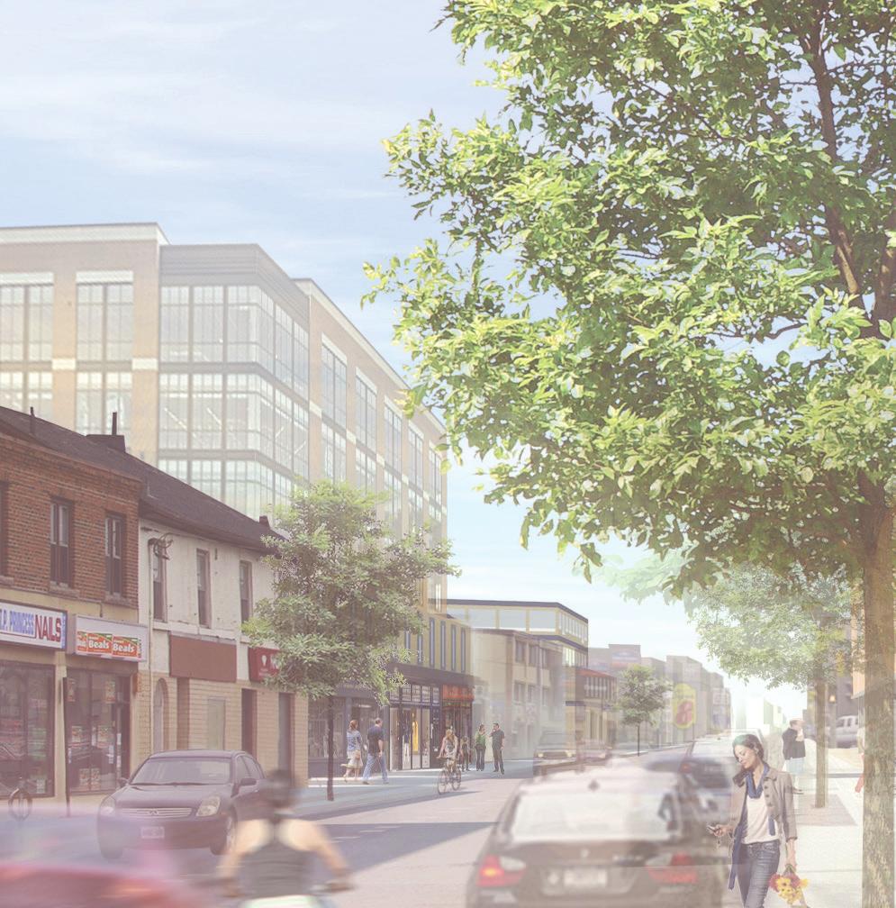

1 burlington MobIlITY Hubs study Aldershot GO Mobility Hub Public Consultation Summary June 2017
2 Table of Contents Introduction Participant Feedback i. Workshop ii. Coffee Shop Consultations and Stakeholder Open Houses Next Steps appendices i. Appendix A: Complete Consultation Notes ii. Appendix B: Feedback received from Coffee Shop consultations and Stakeholder Open Houses

3 Introduction On May 13th, 2017 the first public meeting for the Aldershot GO Mobility Hub was held at East Plains United Church in Burlington. Members of the public were invited to attend and bring forth their ideas and visions for the Mobility Hub. There were approximately 50 attendees. The event started with a presentation in which there was a voting exercise where the participants were asked to answer a few questions regarding the study area. A copy of the presentation and voting results are available at A workshop followed the presentation which included four stations: Public Spaces and Community Features, Private Spaces, Getting Around (Mobility), and a general What Else? station where participants were able to write down additional comments at any point throughout the evening. The attendees were asked to divide into groups and choose one of the aforementioned topics. After a fifteen minute discussion, the groups were guided to the next station. The outcome of these workshops is summarized in the following section. Along with the formal public consultation, three coffee shop consultations were held at a local Tim Horton s (29 Plains Rd W), where members of the public were encouraged to meet with City Planners and discuss their vision for the study area. Additionally, the City hosted two stakeholder open houses which were open to the public, landowners, and other interested parties to discuss their specific properties, interests, or concerns with staff one on one. Feedback from these conversations is outlined in the following section. 1

4 Participant Feedback WORKSHOP - MAY 13, 2017 Below is a summary of feedback provided during the public consultation for the Aldershot GO Mobility Hub held on May 13, See Appendix A for a complete list of feedback. Public Spaces & Community Features Promote walkability within the study area. Enhance greenspace. Consider implementing amenities that will attract younger generations. Some examples being, movie theatres, coffee shops, and recreational space. Implement urban design elements such as lighting features, street furniture, proper waste disposal bins, and landscape elements. Enhance safety measures of community spaces to increase utilization, by way of promoting visibility and lighting features. Encourage pedestrian connectivity between North and South sides of the rail tracks. Emphasis on preserving existing greenspace, Hidden Valley Park is a key feature. Ensure the implementation of amenities to support local residents. Consider implementing infrastructure that is accommodating to hosting events, community engagements, and recreational activities. Private Spaces (Private Buildings at Grade) Privacy is a key feature. Consider sustainability when designing infrastructure. Important to consider the quality of design features, creating distinct buildings will act as a wayfinding tool and create a sense of place. Implement more mixed-use developments at grade. Include local amenities such as grocery stores, coffee shops, and a variety of retail options. Consider the character of the existing area. 2

5 Getting Around (Mobility) Implement parking infrastructure. Consider a bike path within Aldershot Park. Increase the amount of walking trails. Implement safe and accessible bike lanes to and from the station. Concern surrounding the increasing traffic on Plains Road. Consider implementing designated biking infrastructure on Plains Road to increase the safety of both cars and cyclists. Consider expansion of transit routes, as there is an area within Aldershot that is entirely unserved by transit. Consider a North-South extension on Waterdown Road. What Else? (Additional Feedback) Consider improving boulevards, such as Cooke Boulevard. Consider mid-rise development along Waterdown Road. Consider employment opportunities. Implement designated bike lanes and create off road mixed-use trails for pedestrians and cyclists. Create the opportunity for long-term and temporary retail, an example being farmers markets in the summer months. Ensure that design concepts appeal to all ages. 3
 Coffee Consultation #2: Tim Horton s, 29 Plains Rd. W (Mon. May 29/2-4pm) Coffee Consultation #3: Tim Horton s, 29 Plains Rd. W (Wed.")
6 Coffee Shop Consultations & Stakeholder Open houses The following sessions were held to obtain additional feedback from the public: Coffee Consultation #1: Tim Horton s, 29 Plains Rd. W (Wed. May 17/9:30-11:30am) Coffee Consultation #2: Tim Horton s, 29 Plains Rd. W (Mon. May 29/2-4pm) Coffee Consultation #3: Tim Horton s, 29 Plains Rd. W (Wed. May 31/9:30-11:30am) Stakeholder Open House #1: Aldershot Library Program Room (Fri. May 26/2-4pm) Stakeholder Open House #2: Aldershot Arena Community Room (Thurs. June 1/6:30-8:30pm) Below is a summary of feedback provided during the Coffee Shop Consultations and Stakeholder Open Houses. See Appendix B for a complete list of feedback. Reserve land for retail uses, including a grocery store. Intregrate standards for cycling lanes in plan. Consider rumble strips and wider lanes. Lanes on Plains Road are sub standard. Create safe pedestrian and cycling access to station from Grove Park and Gallagher. Do not extend Masonry court through roadway; consider a multiuse path from Grove Park to the GO station. Create more amenities within the area, including a grocery store. Do not intensify area 3 identified within the voting exercise due to proximity to low rise neighbourhood. 4
7 NEXT STEPS The next steps of the Mobility Hubs Study for the Aldershot GO Mobility Hub include: Ongoing Site Analysis; Establish Land Use and Design Framework (March- September 2017); Draft Land Use Concepts (June - November 2017) ; and Aldershot Mobility Hub Land Use Concepts Public Meeting (September 2017) For additional information on the progress of the Mobility Hubs Study, please visit the project website: STAGE 1 PRELIMINARY STUDIES AND LAND USE CONCEPTS STAGE 2 AREA SPECIFIC PLANS Project Initiation Vision Workshops: Public Meeting #1 Land Use Concepts and Associated Reports Land Use Concepts Workshop: Public Mtg. #2 Develop Preferred Land Use Concept Policies and Recommendations Workshop: Public Mtg. #3 Policies and Recommendations Workshop: Council Workshop Delivery of Policy for New Official Plan Final Delivery of Area Specific Plans JAN 2017 we are here > > > BACKGROUND REVIEW & ANALYSIS ESTABLISH LAND USE & DESIGN FRAMEWORK PREPARE AREA SPECIFIC PLANS SEPT 2017 NOV 2017 JUN 2018 FINAL REPORT 5
8 APPENDICES APPENDIX A May 13th Aldershot GO Visioning Workshop - 4 corner workshop feedback The following notes are all of the comments received from consultations. PUBLIC SPACES and Community Features Plains Rd. Create appropriate building setbacks right now they are too shallow; wind concerns; buildings are too close to the street Lack of public space along Plains Rd. Public square surrounded by retail, bike racks Transit and bike friendly design; i.e.. Bike rental and bike share such as SOBI Encourage rental housing Unique village feeling for Aldershot with modern conveniences Festival spaces, community center, indoor gym spaces, multi-purpose rooms Retail/commercial to support residents The new Library is close enough to study area to be accessed by residents Consider 4-6 storeys along Plains, intensification near GO station Accessible public spaces are important, including parking access and servicing (i.e. Bathrooms, electrical for public events) Update servicing and programming in existing parks (i.e. Hidden Valley) Hidden Valley has splash pad that s well used (outside of the study area) Make better connections to Hidden Valley Park New development should include public spaces (i.e. development at Waterdown and Masonry) Protect existing parks, Aldershot High school and its pool No plazas, add small parkettes Walkability to school, parks, retail, quality restaurants Locate Coffee Shops within the study area Fruit and veg market, beer store, book stores small retail frontages Create destinations/ amenities that are walkable Create the opportunity for permanent and temporary retail uses (i.e.. Farmers market) Encourage more pedestrian connections between north and south sides of the rail tracks and outside the study area Preserve views south of Hidden Valley looking west add sidewalk (grade drop) Consider Section 37 and bonusing to contribute to public spaces (and quantify in the OP) Aldershot park is poorly used, adjacent to residential uses, needs more amenities and better programming and organization, spaces for community function (like Spencer Smith Park in the downtown) Community spaces to promote interaction, aid safety ensure visibility and provide good lighting Improve greenery/lack of street furniture and garbage cans Vacant properties and underutilized sites decrease safety and aesthetic appeal and walkability Consider features like movie theatre, hotel, mini golf, coffee shop, deli shops, fruit shops PRIVATE SPACES (Private Buildings At- Grade) ADI site needs green space with public access Detached at green houses path through Building at the road with setbacks Align a side to parking of road Need more mixed use at grade It s the market With more people - More businesses its driven by the market Keeping roads public for more control of aesthetics, set backs etc. More variety of retail 6
9 Need supermarket Like to see a hotel Why is Plains Rd. W. not included? Need to identify retail component in a building (clearly recognizable) Singles are not the solution for more peripheral sites. Probably 4 6 storeys Are you considering affordable housing? Consider safety Cooke Blvd. is not attractive for connecting, just one sidewalk - Something more Attractive trees both sides Provide lay-bys How to intensify and keep sense of place Plains Rd. already has an identity Intensity to bring people and then business will come Podium treatment Quality of design Issue of privacy, with balconies - push back the balconies Like to see more rental housing including high end Like the idea of a neighbourhood feel in buildings - Needs to have continuity Include store fronts Concern with integration of height, density and how density will respect the transition - already impacted in traffic Greater density equals better quality in the type of buildings Better quality of design, high-end buildings Sustainable approaches in design Include green features Trees and more greenery More garbage receptacles at grade High school and pool should stay to support future population and intensification Small retailers along Plains - are an issue Would like to see good restaurants Issues with parking on Plains Rd. (Lay by) ability to see where to park Privacy is a key element (Compared to Paradigm, Glass) Getting around Biking and walking should be planned from the start Set priorities for mobility Needs a way to get to the station from the south east Path through Grove Park to the station - should be along the rail line away from the homes St. Matthews and Masonry - pedestrian connectivity Planning area should go north of 403 & include interchange Need a parking structure at GO station Think about light pollution Dominion Lane used and pedestrian tunnel - would be nice to include a publicly accessible bike/ pedestrian tunnel - near Tim Horton s at Falcon Rd. Cycling path required through Aldershot Park Plains Rd. is uncomfortable for biking More cars on Plains Rd. than ever - When 403 is backed up especially Separated bike lanes on Plains for safety Options for getting traffic off Plains during HWY congestion Increase walking paths Buses only go to La Salle Rd. - Whole area in Aldershot not served by transit Population in west Aldershot is increasing North/ South extension west of Waterdown Rd. U/G - pedestrian/ cycling connection through Waterdown Rd Pedestrian connection along rail corridor with 30m setback - connection through Hidden Valley Formal pathway to station from Gallagher through Grove Park Look at whole area holistically Include White Oaks within Study Area Make St. Matthews more walkable - include sidewalks 7
10 Consider New Mobility - autonomous vehicles, electric cars etc More bus stops requires on Plains Rd. between St. Matthews and Plains Rd. Include stop sign at St. Matthew and Masonry St, Matthew s walk way is very useful Connections to any intensification is very important Cycling routes to and from station are not very good, except along Plains Rd. - Cycling connections in Hamilton are better Too bad walkway was removed from White Oaks Instead of making Plains Rd. more cycling friendly, make other routes the primary cycling area WHAT ELSE? (Additional feedback) Interchange development Pedestrian/ cycling bridge over hwy to GO station Protect bike lanes on road and off-road cycling and walking connections Green house site zoned park or low density Green space and trees on Plains Rd. Appropriate employment uses for neighbourhoods More sit-down quality restaurants Plowing walkway (St. Matthew s) and Fire hydrant Stigma around the tracks Access to Grove Park Ensure we consult with young people Burlington Hydro poles change from logs Satellite police station Solid Gold needs to go Retail along Waterdown Rd. (Mid-rise) Permeability Improve boulevards (Cooke) 8
11 APPENDIX B Feedback from Coffee Shop Consultations and Stakeholder Open Houses The following sessions were held to obtain additional feedback from the public: Coffee Consultation #1: Tim Horton s, 29 Plains Rd. W (Wed. May 17/9:30-11:30am) Coffee Consultation #2: Tim Horton s, 29 Plains Rd. W (Mon. May 29/2-4pm) Coffee Consultation #3: Tim Horton s, 29 Plains Rd. W (Wed. May 31/9:30-11:30am) Stakeholder Open House #1: Aldershot Library Program Room (Fri. May 26/2-4pm) more amenities in the area is great (such as grocery store!) Plains Rd. shouldn t be reduced traffic is a concern Appropriate connections over rail should be considered Grocery store is needed in the hub doesn t need to be a large scaled format; can be scaled down such as a neighbourhood IGA or Rabba Grove Park is a great community park with great trees Concern with growth in blob 3 (from voting exercise) Don t build over Grove Park; greenhouse is surrounded by sensitive uses (rail, low rise neighbourhood) Stakeholder Open House #2: Aldershot Arena Community Room (Thurs. June 1/6:30-8:30pm) Feedback received during the Coffee Shop Consultations and Stakeholder Open Houses include the following: Need to reserve space for retail once area does grow, including for grocery store Need to include standards for cycling lanes in plan. Disappointed with standard of those cycling lanes on Plains compared to York Blvd. in Hamilton. Aren t of provincial standard Need rumble strips (like Cannon in Hamilton) and cycling lanes need to be wider Need buffer access to station including walk/cycle route through Grove Park and connecting to Gallagher extension of Masonry Court (east toward Gallagher) should not be considered, nor development (such as buildings) instead a multiuse path to connect Gallagher (Aldershot Park) and the GO station, through Grove Park 9
Comments The Plan for Port Whitby
 Comments The Plan for Port Whitby April 24th, 2013 Community Meeting #2 Summary Report Prepared by GLPi April 29th, 2013 1 Introduction The purpose of the Port Whitby Secondary Plan Update, Community Improvement
A CHANGING CITY. of Edmonton, it is essential that it reflects the long-term vision of the City.
 A CHANGING CITY By the year 2040, Edmonton will be home to more than 1 million people. To accommodate growth and support a healthy and compact city, we need a new approach to development/redevelopment
Project Launch Community Meeting 1 Summary
 ConsumersNext: Planning for People and Business at Sheppard and Victoria Park Project Launch Community Meeting 1 Summary Participants Listening to the Overview Presentation Prepared for the City of Toronto
Creating walkable, bikeable and transit-supportive communities in Halton
 Creating walkable, bikeable and transit-supportive communities in Halton By presenting current research and best practices, the information in this paper is meant to support and broaden discussion on how
Tonight is for you. Learn everything you can. Share all your ideas.
 Strathcona Neighbourhood Renewal Draft Concept Design Tonight is for you. Learn everything you can. Share all your ideas. What is Neighbourhood Renewal? Creating a design with you for your neighbourhood.
Table #6 VISION CHARACTERISTICS
 Table #6 VISION White Flint is a place to live, work, play, shop, and walk with sufficient density to encourage quality redevelopment. Vibrant streets and consistent streetscapes are important. CHARACTERISTICS
DATE: June 22, General Release SUBMITTED BY: LAND DEVELOPMENT SERVICES. RE: City Centre Survey Results
 DATE: June 22, 2018 TO: General Release SUBMITTED BY: LAND DEVELOPMENT SERVICES RE: City Centre Survey Results The following is a summary of preliminary findings for the Community Identity and Vision survey.
Hamilton Transportation Master Plan Public Consultation. Public Information Centre One Summary
 Hamilton Transportation Master Plan Public Consultation Public Information Centre One Summary Table of Contents Introduction 1 Purpose 2 What Was Presented 2 Who Came to the Meeting 2 The Breakout Sessions
Clarkson Walkability Audit: Results and Recommendations Summary
 Clarkson Walkability Audit: Results and Recommendations Summary The following document was prepared by the Region of Peel and includes a summary of comments made by participants during our breakout discussion
CENTENNIAL NEIGHBOURHOODS SECONDARY PLAN STUDY CITY OF HAMILTON SPECIFIC MAP COMMENTS FROM DECEMBER 1st PUBLIC INFORMATION CENTRE #2
 OPTION #2 - MIXED USE MEDIUM DENSITY OPTION #3 - MIXED USE MEDIUM AND HIGH DENSITY Look at other uses besides industrial along Barton Street over the long term. Residential facing waterfront over long
Welcome. Background. Goals. Vision
 Welcome The formal Public Information Centre (PIC) for the Transportation Master Plan How We GO will be held in early 2017. At that time we will present the recommended transportation system for Niagara
STONY PLAIN ROAD STREETSCAPE
 Jasper Place Revitalization Strategy: Vision The people involved in the Jasper Place Revitalization Strategy envision: Goal 1: Feeling safe in our community Create a community where feeling safe is common--where
MASTER BICYCLE AND PEDESTRIAN PLAN
 VILLAGE OF NORTHBROOK MASTER BICYCLE AND PEDESTRIAN PLAN DRAFT PLAN OPEN HOUSE May 2, 2018 AGENDA 1. Community Engagement 2. Vision and Goals 3. General Structure of Plan 4. Recommendations Overview 5.
162 RESIDENTS ATTENDED 2 DAYS OF WORKSHOPS 15 TABLE DISCUSSIONS WHAT WE HEARD. Oakridge Municipal Town Centre Workshops PLANNING PROGRAM
 OAKRIDGE MTC WORKSHOP 2017 CAMBIE CORRIDOR Phase 3 STEP 3: 3: October June 2017 CAMBIE CORRIDOR PLANNING PROGRAM 2 DAYS OF WORKSHOPS 15 TABLE DISCUSSIONS 162 RESIDENTS ATTENDED WHAT WE HEARD Oakridge Municipal
Building a Liveable Ottawa 2031 Backgrounder 5: Barrhaven/Riverside South/Leitrim
 Building a Liveable Ottawa 2031 Backgrounder 5: Barrhaven/Riverside South/Leitrim Wards 3 and 22 Official Plan Transportation Master Plan Cycling Plan Pedestrian Plan October 2013 ottawa.ca/liveableottawa
Living Streets Policy
 Living Streets Policy Introduction Living streets balance the needs of motorists, bicyclists, pedestrians and transit riders in ways that promote safety and convenience, enhance community identity, create
Corridor Vision Workshop Summary James Madison Elementary February 22,2018
 Corridor Vision Workshop Summary James Madison Elementary February 22,2018 WHY DEVELOP THIS STUDY? Ogden City is planning for better connectivity and access to jobs and housing. Working with area partners,
Appendix A-K Public Information Centre 2 Materials
 Appendix A-K Public Information Centre 2 Materials Our Rapid Transit Initiative Make an impact on the future of transit Join the discussion on Rapid Transit in London You re invited to a Public Information
WELCOME! To the Centennial Neighbourhoods Secondary Plan and Transportation Management Plan Information Centre. City of Hamilton
 WELCOME! To the Centennial Neighbourhoods Secondary Plan and Transportation Management Plan Information Centre City of Hamilton Public Information Centre #2 Dec 1, 2015 CENTENNIAL NEIGHBOURHOODS SECONDARY
EXECUTIVE SUMMARY: TRANSIT-ORIENTED DEVELOPMENT IN SMITHS FALLS, ONTARIO; A COMPARISON BETWEEN TWO SITES
 EECUTIVE SUMMARY: TRANSIT-ORIENTED DEVELOPMENT IN SMITHS FALLS, ONTARIO; A COMPARISON BETWEEN TWO SITES Topic and Purpose In 2007, the Mayor of Ottawa s Task Force on Transportation suggested adding a
How walk, bike, and transit friendly is your neighbourhood?
 How walk, bike, and transit friendly is your neighbourhood? What is an 8-80 City? 8-80 Cities are communities built for everyone regardless of age or ability. These communities reflect social equality
Exhibit 1 PLANNING COMMISSION AGENDA ITEM
 Exhibit 1 PLANNING COMMISSION AGENDA ITEM Project Name: Grand Junction Circulation Plan Grand Junction Complete Streets Policy Applicant: City of Grand Junction Representative: David Thornton Address:
UPTOWN REGIONAL BIKE CORRIDORS PROJECT SAN DIEGO ASSOCIATION OF GOVERNMENTS
 UPTOWN REGIONAL BIKE CORRIDORS PROJECT SAN DIEGO ASSOCIATION OF GOVERNMENTS SUMMARY REPORT: COMMUNITY UPDATE MEETING February 6, 2014 6 8:30 p.m. Roosevelt Middle School Library 3366 Park Blvd, San Diego
Centennial Neighbourhoods Transportation Management Plan Summary of Phase 1 Consultation. Overview of Issues
 1 Centennial Neighbourhoods Transportation Management Plan Summary of Phase 1 Consultation The Centennial Neighbourhoods Transportation Management Plan (CNTMP) is being undertaken to support the Secondary
Executive Summary Route 30 Corridor Master Plan
 Route Corridor Master Plan Project Overview The Route Corridor Master Plan is a coordinated multimodal transportation and land use plan for the entire stretch of Route through East Whiteland Township,
City of Wilsonville 5 th Street to Kinsman Road Extension Project
 City of Wilsonville 5 th Street to Kinsman Road Walking Tour & Neighborhood Workshop Summary Report Public Outreach Overview On July 18 th, 2017, the City of Wilsonville hosted a neighborhood walking tour
TRANSPORTATION NEEDS ASSESSMENT
 TRANSPORTATION NEEDS ASSESSMENT A travel demand analysis was carried out to determine the operational issues and the potential benefit that adding traffic capacity would have on the road network. All the
Complete Streets for Niagara A working method to visualize the creation of a complete street June 20th, 2013
 Complete Streets for Niagara A working method to visualize the creation of a complete street June 20th, 2013 C O N T E N T S Introduction and background of the report What is a complete street? What can
Austin Avenue Bridges Project. Public Meeting Summary
 Austin Avenue Bridges Project Public Meeting Summary June 29, 2016 Red Table Safety and Connectivity Notes: 1. Would like to see forensic report evaluations 2. What is the lifespan? 3. Extend safety considerations
CHAPTER 3: Vision Statement and Goals
 Davidson Walks & Rolls: Active Transportation Master Plan CHAPTER 3 Contents: Overview Vision Statement Measurable Goals Public Outreach CHAPTER 3: Vision Statement and Goals Overview The vision statement
Chapter 7. Transportation. Transportation Road Network Plan Transit Cyclists Pedestrians Multi-Use and Equestrian Trails
 Chapter 7 Transportation Transportation Road Network Plan Transit Cyclists Pedestrians Multi-Use and Equestrian Trails 7.1 TRANSPORTATION BACKGROUND The District of Maple Ridge faces a number of unique
CITY OF BLOOMINGTON COMPLETE STREETS POLICY
 CITY OF BLOOMINGTON COMPLETE STREETS POLICY POLICY OBJECTIVE: The City of Bloomington will enhance safety, mobility, accessibility and convenience for transportation network users of all ages and abilities,
COUNCIL POLICY NAME: COUNCIL REFERENCE: 06/119 06/377 09/1C 10llC 12/1C INDEX REFERENCE: POLICY BACKGROUND
 COUNCIL POLICY NAME: COUNCIL ADVISORY COMMITTEES - TERMS OF REFERENCE ISSUED: APRIL 3, 2006 AMENDED: NOVEMBER 27, 2006 NOVEMBER 23, 2009 JANUARY 11, 2010 DECEMBER 17, 2012 POLICY COUNCIL REFERENCE: 06/119
CONNECTIVITY PLAN. Adopted December 5, 2017 City of Virginia Beach
 CONNECTIVITY PLAN Adopted December 5, 2017 City of Virginia Beach CONTENTS 1.0 Background & Purpose... 2 2.0 Existing Inventory & Analysis... 3 ViBe District Existing Walking Conditions... 4 3.0 ViBe District
Frome Street Bicycle Route
 The Adelaide City Council invites engagement from the community about Frome Street Bicycle Route Project Summary Adelaide City Council is seeking feedback on design options to construct bicycle facilities
Toronto Complete Streets Guidelines
 88 90 5.1 Cycling Design Principles 92 5.2 Context-sensitive Cycling Facilities 96 5.3 Key Cycling Elements Cycling infrastructure provides choice in how people are able to move around the city. Cyclists
GLEN EIRA CITY COUNCIL. MURRUMBEENA Transforming our neighbourhood together our concepts based on your ideas
 GLEN EIRA CITY COUNCIL MURRUMBEENA Transforming our neighbourhood together our concepts based on your ideas 1 WHAT HAVE WE HEARD? WHAT NOW? Stage one Tell us what you love about your shopping strip November
City of Davis East Covell Corridor Plan
 Community Open House #2 January 22, 2014 6:00 8:00 p.m. Veterans Memorial Center, Club Room City of Davis Introduction The (ECCP) is a taking a comprehensive look at the existing transportation systems
Welcome. If you have any questions or comments on the project, please contact:
 Welcome This drop-in public open house is intended to provide information about the Bay Street bike lanes project. This project proposes a dedicated cycling facility along Bay Street between Aberdeen Avenue
KEARNY MESA COMMUNITY PLAN UPDATE
 KEARNY MESA COMMUNITY PLAN UPDATE January 18, 2018 SUBCOMMITTEE MEETING Mobility Concepts and Urban Design Presentation Outline Mobility Concepts: Multimodal Planning Toolbox Presentation and Activities
DRAFT for a State Policy for Healthy Spaces and Places
 DRAFT for a State Policy for Healthy Spaces and Places 1 DRAFT State Policy for Healthy spaces and Places 1. Purpose To encourage the use and development of land that builds healthy communities through
TRAVEL PLAN: CENTRAL EUROPEAN UNIVERSITY CAMPUS REDEVELOPMENT PROJECT TRAVEL PLAN. Central European University Campus Redevelopment Project.
 TRAVEL PLAN Central European University Campus Redevelopment Project Page 1 Table of Contents Introduction... 3 Background... 7 Building Users... 7 Transportation in Community Consultation... 7 Summary
Bikeway action plan. Bicycle Friendly Community Workshop March 5, 2007 Rochester, MN
 Bikeway action plan Summary The was held on March 5, 2007 at the Rochester Mayo Civic Center. The workshop was hosted by Rochester-Olmsted County Planning Department in collaboration with the League of
CITY OF COCOA BEACH 2025 COMPREHENSIVE PLAN. Section VIII Mobility Element Goals, Objectives, and Policies
 CITY OF COCOA BEACH 2025 COMPREHENSIVE PLAN Section VIII Mobility Element Goals, Objectives, and Policies Adopted August 6, 2015 by Ordinance No. 1591 VIII MOBILITY ELEMENT Table of Contents Page Number
Mumford Terminal Replacement Opportunities Neighbourhood Open House. we are here. PHASE 2 Identifying and Evaluating Candidate Sites
 Welcome Replacement Opportunities Neighbourhood Open House. AGENDA PURPOSE 1. REVIEW the information boards 2. DISCUSS aspects of the project with the project team 3. SHARE your thoughts on replacement
In station areas, new pedestrian links can increase network connectivity and provide direct access to stations.
 The Last Mile Planning for Pedestrians Planning around stations will put pedestrians first. Making walking to stations safe and easy is important; walking will be a part of every rapid transit Accessible
Pattullo Bridge Replacement Project Community Connections Phase 2 Consultation. Appendix 3: Open House Display Boards
 Replacement Project Community Connections Phase 2 Consultation Appendix 3: Open House Display Boards November 2016 Welcome! Welcome to the Replacement Project Public Open House We Want to Hear from You
UNIVERSITY AVENUE CORRIDOR REDESIGN. January 8, 2017 PUBLIC OPEN HOUSE
 January 8, 2017 PUBLIC OPEN HOUSE COLLABORATIVE COMMUNITY-BASED DESIGN IS THE FOUNDATION TO A SUCCESSFUL PROJECT AGENDA FOR TONIGHT 1 INTRODUCTIONS 2 WHY ARE WE HERE PROJECT NEED 3 SCHEDULE & GOALS 4 OPEN
Perryville TOD and Greenway Plan
 Perryville TOD and Greenway Plan Greenway Glossary Pathway: A bicycle and pedestrian path separated from motorized vehicular traffic by an open space, barrier or curb. Multi-use paths may be within the
Nanaimo Transportation Master Plan. Phase 1 Consultation Summary
 Nanaimo Transportation Master Plan Phase 1 Consultation Summary Transportation Advisory Committee Meeting Wednesday December 12, 2012 Agenda Study Update Phase 1 Consultation Process Phase 1 Consultation
Pre-Plan Consultation Summary
 Transportation Master Plan Pre-Plan Consultation Summary Thursday July 7, 2011 Presentation ti Outline Consultation Objectives Scope of Consultation Who Responded? What did we hear? How well did we connect?
Shifting Gears for a Healthier City.
 Shifting Gears for a Healthier City. Mississauga s Cycling Master Plan is an ambitious strategy that sets out to transform Mississauga into a city that is conducive to cycling for daily transportation
APPENDIX A: Complete Streets Checklist DRAFT NOVEMBER 2016
 APPENDIX A: Complete Streets Checklist DRAFT NOVEMBER 2016 Complete Streets Checklist MetroPlan Orlando s Complete Streets Checklist is an internal planning tool for staff to further implementation of
EXECUTIVE SUMMARY. Vision
 Vision Walking and bicycling in Salt Lake City will be safe, convenient, comfortable, and viable transportation options that connect people to places, foster recreational and economic development opportunities,
WEST AND SOUTH WEST RING ROAD DOWNSTREAM TRAFFIC IMPACTS
 Page 1 of 9 EXECUTIVE SUMMARY Alberta Transportation ( AT ) is preparing to construct the final sections of the Calgary Ring Road. This includes the South West Ring Road ( SWRR ) (from Lott Creek Blvd
Lee s Summit Road Improvement Study Public Open House June 7, 2007 Summary of Comment Card Responses
 Lee s Summit Road Improvement Study Public Open House June 7, 2007 Summary of Comment Card Responses Introduction At the Lee s Summit Road Improvement Study Public Open House held Thursday, June 7, 2007
Vision: Traditional hamlet with an attractive business/pedestrian friendly main street connected to adjacent walkable neighborhoods
 N D. Focus Area II Vision: Traditional hamlet with an attractive business/pedestrian friendly main street connected to adjacent walkable neighborhoods Transit Road Focus Area II is located in the Hamlet
Building a Liveable Ottawa 2031 Backgrounder 4: Kanata/Stittsville
 Building a Liveable Ottawa 2031 Backgrounder 4: Kanata/Stittsville Wards 4, 6 and 23 Official Plan Transportation Master Plan Cycling Plan Pedestrian Plan October 2013 ottawa.ca/liveableottawa Building
WalkShop. Highland Creek Village
 On June 5, 2014, 15 people participated in a for the Transportation Master Plan. The purpose of the was to receive feedback from a diverse range of local stakeholders and document existing transportation
City of Hamilton s Transportation Master Plan (TMP) Public Consultation 3 December 2015
 Public Consultation 3 December 2015") City of Hamilton s Transportation Master Plan (TMP) Public Consultation 3 December 2015 McPhail Transportation Planning Services Ltd. AGENDA 6:00 7:00 pm Viewing Boards / Q & A with the Team 7:00 7:50
City of Hamilton s Transportation Master Plan (TMP) Public Consultation 3 December 2015 McPhail Transportation Planning Services Ltd. AGENDA 6:00 7:00 pm Viewing Boards / Q & A with the Team 7:00 7:50
50 Avenue S.W. Corridor Study Glenmore Aquatic Centre Drop-In Event
 Project overview The City of Calgary is conducting a transportation corridor study of 5 Avenue S.W., between Crowchild Trail and 4A Street S.W. In 29, it was reclassified as a Parkway under the Calgary
Transportation Master Plan Advisory Task Force
 Transportation Master Plan Advisory Task Force Network Alternatives & Phasing Strategy February 2016 BACKGROUND Table of Contents BACKGROUND Purpose & Introduction 2 Linking the TMP to Key Council Approved
APPENDIX E Needs Assessment
 APPENDIX E Needs Assessment Active Transportation Needs Assessment Technical Background This appendix provides the technical background supporting the findings presented in Section 3 of the report. Developed
Healthy Corridor Audit Tool
 Healthy Corridor Audit Tool How to Use:»» Complete the first section for the entire study area. Many indicators can be collected from existing data; they do not have to be collected on site.»» To assess
FOCUS AREA 1 - Alberta Avenue Pocket Park 3 (121 Ave and 92 St)
") FOCUS AREA 1 - Alberta Avenue Pocket Park 3 (121 Ave and 92 St) New benches Plant evergreen trees Widen existing sidewalk from 1.5m to 1.8m Marked crosswalk 1.8m wide sidewalk Add pedestrian oriented lights
FOCUS AREA 1 - Alberta Avenue Pocket Park 3 (121 Ave and 92 St) New benches Plant evergreen trees Widen existing sidewalk from 1.5m to 1.8m Marked crosswalk 1.8m wide sidewalk Add pedestrian oriented lights
University of Victoria Campus Cycling Plan Terms of Reference. 1.0 Project Description
 University of Victoria Campus Cycling Plan Terms of Reference 1.0 Project Description The Campus Cycling Plan, a first for the University, will provide a comprehensive and coordinated approach to support
complete streets design and construction standards public primer City of Edmonton
 complete streets design and construction standards public primer City of Edmonton introduction Complete Streets are streets for everyone: people who walk, wheel, bike, take transit, or drive. They are
Grow Bold Burlington
 PB-47-17 APPENDIX B: Draft New Official Plan Public Engagement Data Analysis Grow Bold Burlington Draft New Official Plan Public Engagement Data Analysis burlington.ca/growbold Table of Contents Section
Light Rail Transit in North Central Calgary Open House and Workshop Summary. Summer 2013
 Light Rail Transit in North Central Calgary Open House and Workshop Summary Summer 2013 Engaging Calgarians on NC LRT The City of Calgary is working to improve transportation choices that will connect
WELCOME. City of Greater Sudbury. Transportation Demand Management Plan
 WELCOME City of Greater Sudbury Transportation Demand Management Plan Public Consultation Session St. Andrew s Place, Activity Hall 111 Larch Street Wednesday September 13, 2017 6:00 to 8:00 pm Welcome
ALBERTA AVENUE WHAT WE HEARD REPORT BUILDING GREAT NEIGHBOURHOODS
 ALBERTA AVENUE WHAT WE HEARD REPORT BUILDING GREAT NEIGHBOURHOODS FEBRUARY 2019 EXECUTIVE SUMMARY Starting in 2019, Alberta Avenue will see the replacement and enhancement of its aging collector and local
Workshop Feedback Report
 Page 1 of 7 Workshop Feedback Report Stakeholder Workshop #1 Wednesday, August 19, 2015 Workshop Feedback Report This report outlines the key messages and input from the Stakeholder Workshop held on August
Classification Criteria
 SCHEDULE D TO RECOMMENDED OFFICIAL PLAN AMENDMENT NO. 40 SCHEDULE C-4 Road Criteria Criteria Traffic Service Objective Land Service/Access Typical Daily Traffic Volume Flow characteristics Travel Speed
Your views are important. Please fill in a form before you leave. Or alternatively
 Drum Property Group is delighted to welcome you to this exhibition which sets out our initial proposals for a mixed-use development at Stead s Place, Edinburgh. We are keen to hear the views of local people
Illustrated Principles of Good Planning
 Illustrated Principles of Good Planning The Miami 21 Zoning Code incorporates time-tested planning principles into the zoning regulations of our City. These are principles that make for better neighborhoods,
DEFINING THE STREETSCAPE DRAFT
 3 DEFINING THE STREETSCAPE Context Sensitive Design Context Sensitive Design The structuring elements of streetscapes for the City of Vaughan are road classifi cation, streetscape type and level of service.
PEDESTRIAN ACTION PLAN
 ATTACHMENT 2 CITY OF SANTA MONICA PEDESTRIAN ACTION PLAN CITY OF SANTA MONICA PEDESTRIAN ACTION PLAN This page intentionally left blank EXECUTIVE SUMMARY CHAPTER 1 EXECUTIVE SUMMARY Setting the Stage
Southwest Bus Rapid Transit (SW BRT) Functional Planning Study - Executive Summary January 19 LPT ATTACHMENT 2.
 Functional Planning Study - Executive Summary January 19 LPT ATTACHMENT 2.") Southwest Bus Rapid Transit (SW BRT) Functional Planning Study - Executive Summary 2011 January 19 1 of 19 Introduction This executive summary presents the results of the Southwest Bus Rapid Transit (SW
Southwest Bus Rapid Transit (SW BRT) Functional Planning Study - Executive Summary 2011 January 19 1 of 19 Introduction This executive summary presents the results of the Southwest Bus Rapid Transit (SW
NEWMARKET UPHAM S CORNER
 SOUTH STATION Planning Initiative NEWMARKET UPHAM S CORNER COLUMBIA ROAD (P) FOUR CORNERS/GENEVA Working Advisory Group (WAG) Meeting #5 TALBOT AVENUE MORTON STREET BLUE HILL AVE/CUMMINS HWY (P) RIVER
Rock Spring Kick-Off Meeting 09/01/15 Walter Johnson High School Break Out Table Summaries. Rock Spring Break Out Table Comments. Table 1: Strengths:
 Rock Spring Break Out Table Comments Table 1: Strengths: Trees, open areas 1 Medical Care, Offices Parking at Medical important Mall access Good access to emergency services/police/ambulance/fire Weaknesses:
Appendix B - Street Sections
 Appendix B - Street Sections 6TH STREET CORRIDOR PLAN STREET SECTIONS The street sections in Appendix B include recommended improvements to streets for North Glenwood. They include existing conditions
Obey Creek PEDESTRIAN CIRCULATION EAST WEST PARTNERS PEDESTRIAN CIRCULATION CREEK SIDE LANE SLIP STREET SCOTT MURRAY MAIN STREETS EAST/WEST
 THE VILLAGE AT PEDESTRIAN CIRCULATION MAIN STREETS NORTH/SOUTH MAIN STREETS EAST/WEST SLIP STREET CREEK SIDE LANE PEDESTRIAN CIRCULATION DESCRIPTION: Circulation through the downtown of is organized by
12/13/2018 VIA
 12/13/2018 VIA EMAIL Daniel Abbes, Assistant Planner City of Sacramento community Development Department 300 Richards Blvd., 3 rd Floor Sacramento, CA 95811 RE: Bruceville Apartments (P18-073) Dear Mr.
General Plan Circulation Element Update Scoping Meeting April 16, 2014 Santa Ana Senior Center, 424 W. 3rd Street, Santa Ana, CA 92701
 General Plan Circulation Element Update Scoping Meeting April 16, 2014 Santa Ana Senior Center, 424 W. 3rd Street, Santa Ana, CA 92701 Meeting Agenda 1. Purpose of Scoping Meeting 2. Project Overview 3.
Characteristics from these programs were used to compare to and evaluate existing conditions in Howard County.
 EXECUTIVE SUMMARY Bike share is a mobility option that allows users to access a fleet of public bicycles throughout a community. Bike share systems have successfully been implemented in communities throughout
TRANSPORTATION COMMISSION Agenda Staff Report
 TRANSPORTATION COMMISSION Agenda Staff Report Agenda Item No. 5.a DATE: JULY 31, 2014 TO: FROM: SUBJECT: TRANSPORTATION COMMISSION COMMUNITY DEVELOPMENT DEPARTMENT - PLANNING DRAFT OLYMPIC CORRIDOR PREFERRED
VAN AKEN DISTRICT CONNECTIONS PLAN COMMUNITY MEETING #1 June 20, 2016 SMITHGROUP JJR WSP PARSONS BRINCKERHOFF STUDIO GRAPHIQUE
 VAN AKEN DISTRICT CONNECTIONS PLAN COMMUNITY MEETING #1 June 20, 2016 SMITHGROUP JJR WSP PARSONS BRINCKERHOFF STUDIO GRAPHIQUE 01 02 03 04 05 06 Project Overview + Goals RMS Development District-wide Connections
Public Workshop #2. September 14, 2016
 Public Workshop #2 September 14, 2016 Agenda Welcome Project Overview Where We Have Been Alternatives for State Street Land Use Street Design Next Steps 2 Project Overview Create a Vibrant State Street
San Jose Transportation Policy
 San Jose Transportation Policy Protected Intersections in LOS Policies to Support Smart Growth Presented by: Manuel Pineda City of San Jose Department of Transportation Bay Area Map San Francisco Oakland
COMMUNITY CHOICES EVENTS High Schools. February 13-22, 2014
 COMMUNITY CHOICES EVENTS High Schools February 13-22, 2014 In February 2014, the City held a series of events to gain public input on the Arvada Comprehensive Plan Update. Outreach included engaging approximately
CONNECTING PEOPLE TO PLACES
 CONNECTING PEOPLE TO PLACES 82 EAST BENCH MASTER PLAN 07 Introduction The East Bench transportation system is a collection of slow moving, treelined residential streets and major arteries that are the
CHIEF PEGUIS TRAIL EXTENSION WEST
 1 PRELIMINARY DESIGN OF THE CHIEF PEGUIS TRAIL EXTENSION WEST Public Information Session June 6, 2017 Welcome 1 Thank you for attending today s public information session. The following boards provide
IBI Group November 5, 2012
 IBI Group Agenda Session 1 3:00 PM Welcome / Sign in 3:10 PM Presentation 3:30 PM Questions? 3:35 PM World Café Discussion 4:45 PM Report on top 3 ideas 4:50 PM Next Steps 5:00 PM Adjourn 2 Agenda Session
City of Novi Non-Motorized Master Plan 2011 Executive Summary
 City of Novi Non-Motorized Master Plan 2011 Executive Summary Prepared by: February 28, 2011 Why Plan? Encouraging healthy, active lifestyles through pathway and sidewalk connectivity has been a focus
Shifting Gears for a Healthier City
 Shifting Gears for a Healthier City Mississauga s Cycling Master Plan is an ambitious strategy that sets out to transform Mississauga into a city that is conducive to cycling for daily transportation needs.
NUMBER PROJECT TITLE ESTIMATED COST
 NUMBER PROJECT TITLE ESTIMATED COST PROJECT CATEGORY DESCRIPTION TBD= To be determined 1 Art in Pedestrian Underpass $70,000 Culture and Recreation A public art mural in accordance with the Public Art
Speed Limits Study and Proposal. Public Input Session: 8/14/13
 Speed Limits Study and Proposal Public Input Session: 8/14/13 Why is Decatur a unique place for this project? First Community Transportation Plan in the nation with a Health Impact Assessment. Strong sense
Byron Avenue. Public Meeting. Thursday June 16, Traffic Calming Design Sherbourne Road to Island Park Drive
 Byron Avenue Traffic Calming Design Sherbourne Road to Island Park Drive Public Meeting Thursday June 16, 2016 Our Lady of Fatima Parish 153 Woodroffe Avenue 6 9pm 1 Project Summary Area Projects Background
Saskatchewan Drive Roadway Rehabilitation and Shared-Use Path Widening
 Saskatchewan Drive Roadway Rehabilitation and Shared-Use Path Widening We are here today to present the draft plan for the Saskatchewan Drive Roadway Rehabilitation and Shared-Use Path Widening project
83 AVENUE PRE-CONSTRUCTION MEETING
 83 AVENUE PRE-CONSTRUCTION MEETING April 6, 2017 5-8PM Please visit displays for project information Talk to staff, ask questions, visit website at: www.edmonton.ca/bike83avenue Pre-Construction Meeting