DeLand. DeBary. Sanford/SR 46. Lake Mary. Longwood Altamonte Springs. Maitland. Winter Park/Park Avenue
|
|
|
- Anis Hardy
- 5 years ago
- Views:
Transcription
1

2

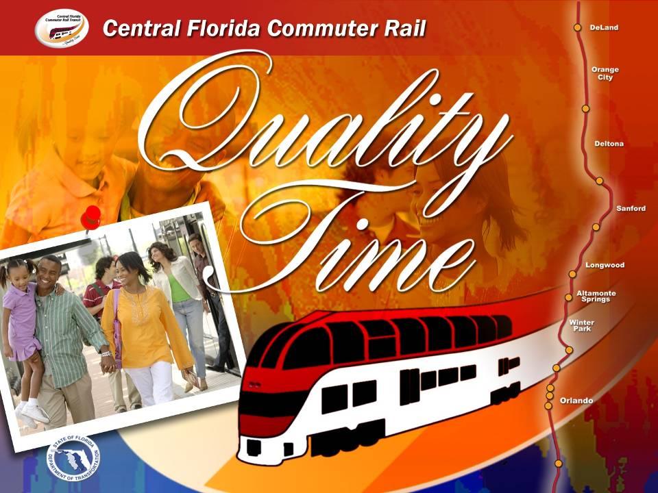
3 P DeLand system map 2-hour off-peak service in each direction Up to 3-car train set 30-minute peak service in each direction from: 5:30 am 8:30 am 3:30 pm 6:30 pm P DeBary P PHASE 2 Sanford/SR 46 P Lake Mary PHASE 1 P P Longwood Altamonte Springs P Maitland Winter Park/Park Avenue L Florida Hospital Lynx Central Church Street Orlando Health/Amtrak P Sand Lake Road P P MeadowWoods Osceola Parkway PHASE 2 Poinciana P L P Kissimmee Amtrak


4 project status Approved by Federal Transit Administration for entry into Final Design in August 2008 Full Funding Grant Agreement expected in Summer/Fall 2009 Unanimous votes by local funding partners in four counties and the City of Orlando for $615 million capital costs Costs split 25 percent local and state; 50 percent federal gas taxes FDOT pays all operations and maintenance costs for first 7 years Operating agreements approved Governance agreements approved

5 project status CSXT Agreements State purchase of 61.5 miles of track State dispatches all trains in corridor 24/7 Local government responsibility in year 8 State maintains corridor Local government responsibility in year 8 Unfettered passenger rail access 19 hours daily Exclusive passenger rail 12 hours daily no freight allowed Amtrak Agreements Co-locating at four stations total (2 in IOS) Signed memorandum of understanding July 2008 Operations agreement nearly complete Bus Agreements CRT budget include O&M costs for 13 Lynx and 3 Votran buses State pays half of bus capital costs

6 transit-oriented development Introduced TOD concepts to local partners and station hosts on Dec. 12, 2006 PB Placemaking presented national TOD concepts, and examples of successful public-private partnerships PB Placemaking led group mapping session of TOD potential at each station Followed up with half-day meetings at each station site in February 2007 PB Placemaking, FDOT, local planners, engineers, architects and designers attended Developed TOD concepts for each station, resulting in TOD sketchbook Today, local governments have embraced TOD concepts to maximize taxpayer return on Commuter Rail investment


7 deland station DeLand DeBary Sanford Lake Mary Longwood Altamonte Spgs Maitland Winter Park Florida Hosp Lynx Central Church St Orlando Health Sand Lake Rd Meadow Woods Osceola Pkwy Kissimmee Poinciana

8 central florida commuter rail deland station Adjacent to historic DeLand Amtrak station 184-space park-n-ride lot with bus drop off area 7.8 acres Projected 2030 population within 3-mile radius: 39,776 Projected 2030 employment within 3-mile radius: 11,319 Pelham Square residential development planned adjacent to station


9 debary station DeLand DeBary Sanford Lake Mary Longwood Altamonte Spgs Maitland Winter Park Florida Hosp Lynx Central Church St Orlando Health Sand Lake Rd Meadow Woods Osceola Pkwy Kissimmee Poinciana

10 central florida commuter rail debary station 286-space park-n-ride lot with bus drop off area 7.3 acres Projected 2030 population within 3-mile radius: 16,847 Projected 2030 employment within 3-mile radius: 10,266 New City of DeBary downtown commercial/retail corridor planned adjacent to station


11 sanford station DeLand DeBary Sanford Lake Mary Longwood Altamonte Spgs Maitland Winter Park Florida Hosp Lynx Central Church St Orlando Health Sand Lake Rd Meadow Woods Osceola Pkwy Kissimmee Poinciana

12 central florida commuter rail sanford station 256-space park-n-ride lot with bus drop off area 6.2 acres Projected 2030 population within 3-mile radius: 48,838 Projected 2030 employment within 3-mile radius: 49,233 New residential development on east side of tracks with proposed pedestrian access City developing new transitoriented development zoning overlay for the S.R. 46 corridor


13 lake mary station DeLand DeBary Sanford Lake Mary Longwood Altamonte Spgs Maitland Winter Park Florida Hosp Lynx Central Church St Orlando Health Sand Lake Rd Meadow Woods Osceola Pkwy Kissimmee Poinciana

14 central florida commuter rail lake mary station 264-space park-n-ride lot with bus drop off area 7.1 acres Projected 2030 population within 3-mile radius: 70,272 Projected 2030 employment within 3-mile radius: 80,117 Lake Mary Downtown redevelopment plan includes commuter rail station


15 longwood station DeLand DeBary Sanford Lake Mary Longwood Altamonte Spgs Maitland Winter Park Florida Hosp Lynx Central Church St Orlando Health Sand Lake Rd Meadow Woods Osceola Pkwy Kissimmee Poinciana

16 central florida commuter rail longwood station 332 space park-n-ride lot with bus drop off area 5.4 acres Projected 2030 population within 3-mile radius: 76,595 Projected 2030 employment within 3-mile radius: 73,163 Multi-use transit-oriented development planned for station area

17 altamonte springs station DeLand DeBary Sanford Lake Mary Longwood Altamonte Spgs Maitland Winter Park Florida Hosp Lynx Central Church St Orlando Health Sand Lake Rd Meadow Woods Osceola Pkwy Kissimmee Poinciana

18 central florida commuter rail altamonte springs station 402-space park-n-ride lot with bus drop off area 7.8 acres Projected 2030 population within 3-mile radius: 96,241 Projected 2030 employment within 3-mile radius: 119,045 Located adjacent to Altamonte Springs Government Complex


19 maitland station DeLand DeBary Sanford Lake Mary Longwood Altamonte Spgs Maitland Winter Park Florida Hosp Lynx Central Church St Orlando Health Sand Lake Rd Meadow Woods Osceola Pkwy Kissimmee Poinciana

20 central florida commuter rail maitland station 150-space park-n-ride lot with bus drop off area provided by city and developers Projected 2030 population within 3-mile radius: 96,241 Projected 2030 employment within 3-mile radius: 119,045 Two multi-use transit oriented developments planned adjacent to station, with residential, retail and office space Pedestrian access to adjacent neighborhood provided by City of Maitland Trolley service planned to connect to downtown Maitland core


21 winter park station DeLand DeBary Sanford Lake Mary Longwood Altamonte Spgs Maitland Winter Park Florida Hosp Lynx Central Church St Orlando Health Sand Lake Rd Meadow Woods Osceola Pkwy Kissimmee Poinciana

22 central florida commuter rail winter park station Connects to existing Amtrak building New platform for Amtrak passengers Projected 2030 population within 3-mile radius: 100,409 Projected 2030 employment within 3-mile radius: 133,212 Adjacent to existing: - Central Park retail and commercial corridor - Morse Museum of American Art - High density residential housing Walking distance to: - Rollins College - Winter Park Welcome Center - City offices


23 florida hospital station DeLand DeBary Sanford Lake Mary Longwood Altamonte Spgs Maitland Winter Park Florida Hosp Lynx Central Church St Orlando Health Sand Lake Rd Meadow Woods Osceola Pkwy Kissimmee Poinciana

24 central florida commuter rail florida hospital station Projected 2030 population within 3-mile radius: 103,070 Projected 2030 employment within 3-mile radius: 238,913 Florida Hospital Master Plan includes: - 20,000 employees - 1,500 additional beds and 1.5 million square feet of development - CRT Station linked to planned Health Village Florida Hospital will invest $230 million in new facility within 5 years Major cultural and recreational uses located nearby include: - Orlando Museum of Art - Orlando Science Center - Edyth Bush Theatre - Mennello Museum of American Art - Orlando Children s Theatre - Orlando Loch Haven Park


25 lynx central station DeLand DeBary Sanford Lake Mary Longwood Altamonte Spgs Maitland Winter Park Florida Hosp Lynx Central Church St Orlando Health Sand Lake Rd Meadow Woods Osceola Pkwy Kissimmee Poinciana
 18,000 sq ft of bus terminal 2,400 sq ft of retail space Projected 2030 population within 3-mile radius: 109,809 Projected 2030 employment within 3-mile radius: 258,244 Major developments")
26 central florida commuter rail lynx central station Bus terminal designed to accommodate commuter rail Intermodal terminal with 24 covered bus bays and connection to LYMMO (downtown Orlando s free BRT circulator) 18,000 sq ft of bus terminal 2,400 sq ft of retail space Projected 2030 population within 3-mile radius: 109,809 Projected 2030 employment within 3-mile radius: 258,244 Major developments nearby include: - Orange County Courthouse complex - Federal courthouses - Amway Arena - FAMU School of Law Potential development adjacent to station includes: - 80 residential units - 900,000 sq ft of office space - 80,000 sq ft of retail space


27 church street station DeLand DeBary Sanford Lake Mary Longwood Altamonte Spgs Maitland Winter Park Florida Hosp Lynx Central Church St Orlando Health Sand Lake Rd Meadow Woods Osceola Pkwy Kissimmee Poinciana

28 central florida commuter rail church street station Adjacent to historic Church Street train station Walking distance to: - New $480 million events center - New $376 million performing arts center - Multiple high-rise jresidenttial condominium projects - CNL Center I and II - Signature Plaza - SunTrust Tower - Citrus Center - Premiere Trade Towers Projected 2030 population within 3-mile radius: 115,867 Projected 2030 employment within 3-mile radius: 248,832


29 orlando health station DeLand DeBary Sanford Lake Mary Longwood Altamonte Spgs Maitland Winter Park Florida Hosp Lynx Central Church St Orlando Health Sand Lake Rd Meadow Woods Osceola Pkwy Kissimmee Poinciana

30 central florida commuter rail orlando health station Adjacent to historic Amtrak station Adjacent to Orlando Regional Healthcare System (ORHS) campus, which includes: - Orlando Regional Medical Center - M.D. Anderson Cancer Center - Ambulatory Care Center - Arnold Palmer Children s Hospital - Winnie Palmer Hospital for Women and Babies - The Lucerne Hospital ORHS projected to have more than 2,000 beds, 19,000 employees over the next 25 years Projected 2030 population within 3-mile radius: 127,144 Projected 2030 employment within 3-mile radius: 224,868


31 sand lake road station DeLand DeBary Sanford Lake Mary Longwood Altamonte Spgs Maitland Winter Park Florida Hosp Lynx Central Church St Orlando Health Sand Lake Rd Meadow Woods Osceola Pkwy Kissimmee Poinciana

32 central florida commuter rail sand lake road station 439-space park-n-ride lot with bus drop off area 7.2 acres Projected 2030 population within 3-mile radius: 60,589 Projected 2030 employment within 3-mile radius: 99,399 Expanding residential and business hub in south Orlando Nearby amenities include: - Florida Mall - International Drive attractions area - Orlando International Airport Pending mixed-use development on the northeast side Local government creating transitoriented development zoning overlay for entire area


33 meadow woods station DeLand DeBary Sanford Lake Mary Longwood Altamonte Spgs Maitland Winter Park Florida Hosp Lynx Central Church St Orlando Health Sand Lake Rd Meadow Woods Osceola Pkwy Kissimmee Poinciana

34 central florida commuter rail meadow woods station 390-space park-n-ride lot with bus drop off area 6.8 acres Projected 2030 population within 3-mile radius: 62,487 Projected 2030 employment within 3-mile radius: 60,935 High concentration of affordable housing adjacent to station Local government creating transitoriented development zoning overlay for the area


35 osceola parkway station DeLand DeBary Sanford Lake Mary Longwood Altamonte Spgs Maitland Winter Park Florida Hosp Lynx Central Church St Orlando Health Sand Lake Rd Meadow Woods Osceola Pkwy Kissimmee Poinciana

36 central florida commuter rail osceola parkway station 254-space park-n-ride lot with bus drop off area 7.8 acres Projected 2030 population within 3-mile radius: 69,745 Projected 2030 employment within 3-mile radius: 33,821 Adjacent to large scale retail and commercial development Property owner working with local government to establish new mixed-use transit-oriented development on west side of station


37 kissimmee station DeLand DeBary Sanford Lake Mary Longwood Altamonte Spgs Maitland Winter Park Florida Hosp Lynx Central Church St Orlando Health Sand Lake Rd Meadow Woods Osceola Pkwy Kissimmee Poinciana

38 central florida commuter rail kissimmee station Adjacent to historic Kissimmee Amtrak station Projected 2030 population within 3-mile radius: 24,709 Projected 2030 employment within 3-mile radius: 14,636 Walking distance to: - Downtown Kissimmee retail - Osceola County Courthouse - Osceola County Government Center - Osceola Regional Medical Center - Lake Tohopekaliga shore and Lakefront Park Included in Kissimmee Intermodal Center Concept Plan with 379 parking spaces Integral part of Downtown Kissimmee redevelopment master plan, including mixed-use residential, commercial and retail development adjacent to the station


39 poinciana station DeLand DeBary Sanford Lake Mary Longwood Altamonte Spgs Maitland Winter Park Florida Hosp Lynx Central Church St Orlando Health Sand Lake Rd Meadow Woods Osceola Pkwy Kissimmee Poinciana

40 central florida commuter rail poinciana station 255-space park-n-ride lot with bus drop off area 8.4 acres Projected 2030 population within 3-mile radius: 20,353 Projected 2030 employment within 3-mile radius: 4,964 Potential transit-oriented development eclipsing traditional land-use proposals

41 Questions?
Central Florida Commuter Rail Commission Technical Advisory Committee. Meeting Minutes
 DRAFT Central Florida Commuter Rail Commission Technical Advisory Committee Meeting Minutes Date: Wednesday, February 4, 2015 Time: 1:30 p.m. Location: Florida Department of Transportation Orlando Urban
MAKING THE CONNECTION: TOD A BLUEPRINT FOR SUCCESS
 MAKING THE CONNECTION: TOD A BLUEPRINT FOR SUCCESS NJ TRANSIT s s PERSPECTIVE NYU Wagner Rudin Center for Transportation Policy and Management Presented by Rich Roberts, NJ TRANSIT November 14, 2008 Key
New Park Avenue Corridor West Hartford
 New Park Avenue Corridor West Hartford Current TOD Investment in the Corridor Mixed-use building currently under development by the Trout Brook Realty Advisors: a separate non-profit corporation, established
Fitting Light Rail through Well-established Communities
 Fitting Light Rail through Well-established Communities San Francisco 2008 Michael D. Madden Chief, Project Development, Maryland Transit Administration Project Setting Located inside the Capital Beltway
Broward Boulevard Gateway Implementation Project, Downtown Walkability Analysis, & Joint Development Initiative (JDI)
") Broward Boulevard Gateway Implementation Project, Downtown Walkability Analysis, & Joint Development Initiative (JDI) City of Fort Lauderdale ~ Commission Conference July 10, 2012 Page 1 of 15 A Multi-Agency
Broward Boulevard Gateway Implementation Project, Downtown Walkability Analysis, & Joint Development Initiative (JDI) City of Fort Lauderdale ~ Commission Conference July 10, 2012 Page 1 of 15 A Multi-Agency
Metropolitan Council Transportation Committee
 Nicollet-Central Transit Alternatives Metropolitan Council Transportation Committee August 2013 Project Purpose (approved by Policy Advisory Committee 10/25/2012) The purpose is to improve transit connectivity,
Project Narrative. Albuquerque, NM. July 31, 2015
 Project Narrative Albuquerque, NM July 31, 2015 1 Project Identification As the first bus rapid transit (BRT) project in New Mexico, the Albuquerque Rapid Transit (ART) line will run through the heart
Technical Report #:5 Transit Element Final Adopted Plan
 2040 Long Range Transportation Plan Technical Report #:5 Transit Element Final Adopted Plan January 2016 250 South Orange Avenue, Suite 200, Orlando, FL 32801 407-481-5672 www.metroplanorlando.com MetroPlan
MEETING Agenda. Introductions. Project Overview. Key Study Components. Alternative Station Concepts. Preferred Station Concept. Next Steps.
 City GARLAND Council ROADVISION Briefing STUDY VISION STUDY Dallas, TX April 8, 2010 1 1 MEETING Agenda Introductions Project Overview Key Study Components Alternative Station Concepts Preferred Station
Rehabilitating First- and Last- Mile Connections
 Rehabilitating First- and Last- Mile Connections Sept 18, 2017 Rail~ Volution Jeff Owen Senior Planner Active Transportation TriMet, Planning & Policy Portland, Oregon owenj@trimet.org 503-962-5854 Outline
About the Wilmington Downtown Circulation Study
 About the Wilmington Downtown Circulation Study Part of the Wilmington i Initiatives partnership Wilmington Area Planning Council City of Wilmington Delaware Department of Transportation Delaware Transit
Cherry Creek Transportation and Land Use Forum September 25, 2013 Meeting Summary
 Cherry Creek Transportation and Land Use Forum September 25, 2013 Meeting Summary I. LEAD-IN TO SMALL GROUP DISCUSSION, POLLING AND STEERING COMMITTEE/TECHNICAL TASK FORCE DISCUSSION The meeting began
Dolphin Station Park & Ride to be done by March
 Page 1 of 5 The Newspaper for the Future of Miami Connect with us: SUBSCRIBE PRODUCTS CLASSIFIEDS ADVERTISE ABOUT JOBS CONTACT Dolphin Station Park & Ride to be done by March Written by Rebecca San Juan
REGIONAL PRIORITIES Presentation to the Tampa Bay Regional Collaboration Committee September 10, 2012
 WEST CENTRAL FLORIDA MPO CHAIRS COORDINATING COMMITTEE REGIONAL PRIORITIES Presentation to the Tampa Bay Regional Collaboration Committee September 10, 2012 TRANSPORTATION REGIONAL INCENTIVE PROGRAM (TRIP)
A Selection Approach for BRT Parking Lots Nicolls Road Corridor Parking Study
 A Selection Approach for BRT Parking Lots Nicolls Road Corridor Parking Study Chirantan Kansara, P.E. Engineering Construction Design Planning 2018 ITE Northeastern District Annual Meeting Lake George,
Orange County s Transportation Planning and Multimodal Corridor Plan
 Orange County Transportation Planning Division Orange County s Transportation Planning and Multimodal Corridor Plan Presentation to UCF LIFE November 11, 2014 Alissa Barber Torres, Ph.D., AICP, PLS Presentation
Final Study Recommendations AMES TRANSIT FEASIBILITY STUDY. For Public Review and Comment. October Ames Transit Feasibility Study
 AMES TRANSIT FEASIBILITY STUDY Final Study Recommendations For Public Review and Comment October 2007 Meeting Agenda Existing Service Future Service Transit Feasibility Study Study Purpose/Goals Methodology
FOR SALE. 202 Pacific Avenue, Bremerton, WA Historic Bremerton Trust and Savings Building
 FOR SALE 202 Pacific Avenue, Bremerton, WA 98337 Historic Bremerton Trust and Savings Building PROPERTY INFORMATION PRICE $1,750,000 BUILDING SIZE LOT SIZE 10,080 sq. ft. 4,792 sq. ft. (0.11 Acres) # OF
Community Transit Solutions for the Suburbs APTA Annual Meeting Steve Fittante, New Jersey Transit Corporation September 30, 2013
 Community Transit Solutions for the Suburbs APTA Annual Meeting Steve Fittante, New Jersey Transit Corporation September 30, 2013 New Suburban Challenges Lower density development patterns Where is the
JOINT PARTNERSHIPS: Working Together To Support Light Rail in Santa Monica
 JOINT PARTNERSHIPS: Working Together To Support Light Rail in Santa Monica ITY OF ANTA MONICA RAIL-VOLUTION / OCTOBER 17, 2012 SARAH LEJEUNE, PRINCIPAL PLANNER, STRATEGIC + TRANSPORTATION PLANNING DIVISION
In station areas, new pedestrian links can increase network connectivity and provide direct access to stations.
 The Last Mile Planning for Pedestrians Planning around stations will put pedestrians first. Making walking to stations safe and easy is important; walking will be a part of every rapid transit Accessible
VIRGINIA RAILWAY EXPRESS
 PREPARING FOR THE NEXT QUARTER-CENTURY Arlington County Board Work Session June 28, 2017 1 TODAY S PRESENTATION VRE Overview VRE in Arlington County VRE System 2040 Plan Future Vision for Crystal City
ALTERNATIVES TO BE CONSIDERED
 ALTERNATIVES TO BE CONSIDERED EXISTING CONDITIONS (BASE CASE) In order to evaluate and understand the potential benefits and impacts of introducing downtown transit improvements in Providence, a Base Case
Southwest Bus Rapid Transit (SW BRT) Functional Planning Study - Executive Summary January 19 LPT ATTACHMENT 2.
 Functional Planning Study - Executive Summary January 19 LPT ATTACHMENT 2.") Southwest Bus Rapid Transit (SW BRT) Functional Planning Study - Executive Summary 2011 January 19 1 of 19 Introduction This executive summary presents the results of the Southwest Bus Rapid Transit (SW
Southwest Bus Rapid Transit (SW BRT) Functional Planning Study - Executive Summary 2011 January 19 1 of 19 Introduction This executive summary presents the results of the Southwest Bus Rapid Transit (SW
Bus Rapid Transit Plans
 Twin Cities Region Bus Rapid Transit Plans ULI Minnesota Workshop Connecting Bus Rapid Transit to the Community December 15, 2009 John Levin Director of Service Development Metro Transit Metropolitan Area
CONNECTING PEOPLE TO PLACES
 CONNECTING PEOPLE TO PLACES 82 EAST BENCH MASTER PLAN 07 Introduction The East Bench transportation system is a collection of slow moving, treelined residential streets and major arteries that are the
D O W N T O W N B A S E B A L L
 D O W N T O W N B A S E B A L L 1 Urban THREE GENERATIONS 2 Multipurpose 3 Revitalized Urban Bring out the best of San Jose 4 4 th GENERATION BUILDING A CITY PETCO Park San Diego, California THE BEST URBAN
What Are The Benefits? How RIDERSHIP + Can Help You. Select RIDERSHIP + Projects
 Ridership + is a suite of regression-based direct ridership forecasting tools that harness station area built environment variables to estimate ridership on a wide variety of transit modes. What Are The
Capital and Strategic Planning Committee. Item III - B. April 12, WMATA s Transit-Oriented Development Objectives
 Capital and Strategic Planning Committee Item III - B April 12, 2018 WMATA s Transit-Oriented Development Objectives Page 24 of 76 Washington Metropolitan Area Transit Authority Board Action/Information
APPENDIX D: SACRAMENTO URBAN AREA TRANSPORTATION PRIORITIES
 1 County County County County 2 Yolo Arterial Roadway Collector Roadway Urban Residential Street Rural Residential Roadway I-80 / U.S. 50 Bus/Carpool Lanes in both directions Richards Blvd PM Yol 80 0.237
Pocatello Regional Transit Master Transit Plan Draft Recommendations
 Pocatello Regional Transit Master Transit Plan Draft Recommendations Presentation Outline 1. 2. 3. 4. What is the Master Transit Plan? An overview of the study Where Are We Today? Key take-aways from existing
1 PROJECT DESCRIPTION PROBLEM STATEMENT PROJECT PURPOSE AND NEED Study Purpose Study Need... 4
 January 2014 Table of Contents 1 PROJECT DESCRIPTION... 1 2 PROBLEM STATEMENT... 2 3 PROJECT PURPOSE AND NEED... 3 3.1 Study Purpose... 3 3.2 Study Need... 4 4 GOALS AND OBJECTIVES... 9 4.1 Short-term
City of San Bernardino
 City of San Bernardino Population 204,800 City Overview The City of San Bernardino is the largest City and the county seat of San Bernardino County, California. The City encompasses approximately 81 square
Sacramento Intermodal Transportation Facility
 Sacramento Intermodal Transportation Facility Working Paper #2: Armchair Tour of Multi-modal Terminals and Downtown Transit-Oriented Development 14 August 2003 City of Sacramento 730 I Street Sacramento,
Waterford Lakes Small Area Study
 Waterford Lakes Small Area Study Existing Traffic Conditions PREPARED FOR: ORANGE COUNTY PUBLIC WORKS DEPARTMENT TRAFFIC ENGINEERING DIVISION ORLANDO, FLORIDA PREPARED WITH: INWOOD CONSULTING ENGINEERS
Central Harlem Avenue Corridor Study
 Attendees Central Harlem Avenue Corridor Study Steering Committee Meeting #2 Corridor Tour February 27, 2018 First Name Last Name Organization Jacob Connor CTA Nicole Campbell City of Berwyn Tomohiko Music
REDWOOD CITY STREETCAR - ALTERNATIVES ANALYSIS
 REDWOOD CITY STREETCAR - ALTERNATIVES ANALYSIS The purpose of this document is to ennumerate the analysis of alternatives for a streetcar along the Broadway Corriodor of Redwood City. The six alternatives
162 RESIDENTS ATTENDED 2 DAYS OF WORKSHOPS 15 TABLE DISCUSSIONS WHAT WE HEARD. Oakridge Municipal Town Centre Workshops PLANNING PROGRAM
 OAKRIDGE MTC WORKSHOP 2017 CAMBIE CORRIDOR Phase 3 STEP 3: 3: October June 2017 CAMBIE CORRIDOR PLANNING PROGRAM 2 DAYS OF WORKSHOPS 15 TABLE DISCUSSIONS 162 RESIDENTS ATTENDED WHAT WE HEARD Oakridge Municipal
VTA Development Review Program Annual Report for 2015
 VTA Development Review Program Annual Report for 2015 Web Version May 13, 2016 Presentation Outline I. Background II. Data Snapshot a. Development Review Activity for 2015 b. Select Projects Under Construction
North Coast Corridor:
 North Coast Corridor: Connecting People, Transportation & Environment Legislative Hearing: 11.8.10 1 North Coast Corridor Region s Lifeline A Regional Strategy Mobility, Economy & Environment North Coast
Rochester Area Bike Sharing Program Study
 roc bike share Rochester Area Bike Sharing Program Study Executive Summary ~ January 2015 JANUARY 2015 8484 Georgia Avenue, Suite 800 Silver Spring, MD 20910 3495 Winton Pl., Bldg E, Suite 110 Rochester,
Purpose + Need. Connect: Thrive: Develop: < Strengthen the spine of our regional transportation system
 Purpose + Need I-29 NW Barry Road 64/68/72 MAIN STREET Connect: < Strengthen the spine of our regional transportation system Leavenworth Road Parallel Parkway State Avenue 18th Street Expressway Shawnee
Perryville TOD and Greenway Plan
 Perryville TOD and Greenway Plan Greenway Glossary Pathway: A bicycle and pedestrian path separated from motorized vehicular traffic by an open space, barrier or curb. Multi-use paths may be within the
State Road 54/56 Tampa Bay s Northern Loop. The Managed Lane Solution Linking I-75 to the Suncoast Parkway
 State Road 54/56 Tampa Bay s Northern Loop The Managed Lane Solution Linking I-75 to the Suncoast Parkway SUNCOAST PARKWAY Both I 75 and the Suncoast Parkway are planning, or in the process of constructing,
Capital Improvement Project Application: Bike Racks, Bus Stop Shelters, Sidewalks in Kings Canyon/Ventura Corridor Page 1 of 10
 Bike Racks, Bus Stop Shelters, Sidewalks in Kings Canyon/Ventura Corridor Page 1 of 10 Project Summary 1. Project Title: Bike Racks, Bus Stop Shelters, Sidewalks in Kings Canyon/Ventura Corridor 2. Project
Transit Workshop with MPO Board
 Transit Workshop with MPO Board Overview of Workshop What is a TDP? Historical trends Existing bus service 2028 Recent public outreach Future direction Policy Questions 1 What TDP is Not Not a budget Not
BICYCLE/PEDESTRIAN ACCESS TO TRANSIT SAFETY ASSESSMENT FOR EXISTING AND PLANNED SECTIONS OF US 19
 BICYCLE/PEDESTRIAN ACCESS TO TRANSIT SAFETY ASSESSMENT FOR EXISTING AND PLANNED SECTIONS OF US 19 Project Advisory Committee Meeting January 27, 2016 A JOINT EFFORT OF THE PINELLAS METROPOLITAN PLANNING
Decision on North Waterloo Routing
 Next Steps Decision on North Waterloo Routing Two route variations remain in north Waterloo. The final preferred route will include only one of the two variations. Please consider these two variations
414 E GOLF RD DES PLAINES, IL
 NORTHWEST HWY NEW ACCESS ROAD PLANNED GOLF RD WOLF RD 414 E GOLF RD DES PLAINES, IL Focal point of Des Plaines Transit-Oriented Development (TOD) Plan Adjacent to Cumberland Metra Station (Renovation/Expansion
Feasibility Study for Intermodal Facility in Anchorage, Alaska
 Feasibility Study for Intermodal Facility in Anchorage, Alaska Jeanne Bowie, Randy Kinney Abstract The Dimond Transit Center, operated by People Mover, is located in south Anchorage at the Dimond Center,
Sacramento Grid 2.0. The Downtown Transportation Study
 Sacramento Grid 2.0 The Downtown Transportation Study April 20, 2016 The Grid 4.25 square miles Street grid defined at birth of City Lettered and numbered streets spaced every 400 ft East-west alleys halfway
David Jickling, Public Transportation Director Regional Transportation Commission, Washoe County
 David Jickling, Public Transportation Director Regional Transportation Commission, Washoe County Virginia Street Resort corridor connecting University of Nevada, Reno Downtown Truckee River Strip Casinos
414 E GOLF RD DES PLAINES, IL
 NORT HWES T HW Y CCESS NEW A NNED PLA ROAD D FR OL RD W GOLF 414 E GOLF RD DES PLAINES, IL Focal point of Des Plaines Transit-Oriented Development (TOD) Plan Adjacent to Cumberland Metra Station (Renovation/Expansion
Transportation, Parking & Roads
 Transportation, Parking & Roads Design Carolina North as a walkable community Design the transportation system and development patterns (i.e., urban design elements such as density, building design, mix
NEWMARKET CENTRE Mobility Hub Profile
 Mobility Hub Profile Dundas Newmarket West-Bloor Centre Anchor Hub Gateway Hub N MOBILITY HUBS: Places of connectivity between regional and rapid transit services, where different modes of transportation
7 NE 145TH STREET STATION TOD POTENTIAL
 7 NE 145TH STREET STATION TOD POTENTIAL Key Findings The 145th Street Station area has limited TOD potential, primarily because of its location in an area that is currently zoned predominantly single-family
Downtown BRT Corridor Alternatives Review: 1 st, 2 nd, 3 rd and 4 th Avenue. Bus Rapid and Conventional Transit Planning and Design Services
 Downtown BRT Corridor Alternatives Review: 1 st, 2 nd, 3 rd and 4 th Avenue Bus Rapid and Conventional Transit Planning and Design Services City of Saskatoon February 2018 Project Team HDR Corporation
APPENDIX D: Southwest Volusia Regional Transportation Study. Evaluation Criteria FINAL
 D: PROJECT PRIORITIZATION Prioritization of the improvements proposed in the Multimodal Improvement Plan is required in order to determine which projects should be funded first, where the transportation
tattersall park RBY EBSCO RETAIL PROPERTIES
 tattersall park EBSCO PROPERTIES RBY RETAIL the case for tattersall park... The 75-acre site OWNED by the developer (EBSCO) has a unique history. It is one of the most attractive multi use sites in the
Existing Transportation System
 < Please Open Page for Additional Text Transportation System Existing Transportation System This section describes vehicular transportation associated with Children s. Pedestrian and other nonmotorized
Overview: Phase 3 Draft Development and Circulation Plans, White Bear Station
 Overview: Phase 3 Draft Development and Circulation Plans, White Bear Station This overview explains how to get more involved and provides information on the Phase 3 draft circulation and development plans
COMPLETE STREETS A STEP FORWARD ITE District 10/FSITE Annual Meeting November 3, 2015
 COMPLETE STREETS A STEP FORWARD 2015 ITE District 10/FSITE Annual Meeting November 3, 2015 About Lakeland Incorporated: 1885 Population: 100,728 Area: Approx. 75 sq. mi Major Employers: Publix, Lakeland
Uniting Cleveland through the Euclid Corridor Transportation Project
 Zhang 1 Uniting Cleveland through the Euclid Corridor Transportation Project Jinmeng Zhang As a bus passenger takes a ride to downtown Cleveland through Euclid Avenue, constructions can be seen along the
CITY OF COCOA BEACH 2025 COMPREHENSIVE PLAN. Section VIII Mobility Element Goals, Objectives, and Policies
 CITY OF COCOA BEACH 2025 COMPREHENSIVE PLAN Section VIII Mobility Element Goals, Objectives, and Policies Adopted August 6, 2015 by Ordinance No. 1591 VIII MOBILITY ELEMENT Table of Contents Page Number
City of Bartow Comprehensive Plan. Transportation Element
 City of Bartow 2030 Comprehensive Plan Amended through January 7, 2013 TRANSPORTATION ELEMENT GOAL: IT SHALL BE A GOAL OF THE CITY OF BARTOW TO PROVIDE A SAFE AND EFFICIENT MULTI-MODAL TRANSPORTATION SYSTEM
ATTACHMENT 4 - TDM Checklist. TDM Checklist Overview
 ATTACHMENT 4 - TDM Checklist TDM Checklist Overview The proposed checklist rates developments on the degree to which they are TDM and transit supportive. Points are assigned based on the level of transit
Topics To Be Covered. Summarize Tier 2 Council Direction Discuss Mill and Ash Alternatives Next Steps
 Topics To Be Covered Summarize Tier 2 Council Direction Discuss Mill and Ash Alternatives Next Steps Tier 2 Council Direction Dismiss Bus Rapid Transit along the Union Pacific Railroad Dismiss Bus Rapid
(This page intentionally left blank.)
") (This page intentionally left blank.) LYNX 2030 VISION FINAL Technical Memorandum #5: Supporting and Circulator Networks Prepared for Central Florida Regional Transportation Authority (LYNX) 455 N. Garland
(This page intentionally left blank.) LYNX 2030 VISION FINAL Technical Memorandum #5: Supporting and Circulator Networks Prepared for Central Florida Regional Transportation Authority (LYNX) 455 N. Garland
Afeasibility study to evaluate bus rapid transit service in the East-West Corridor connecting major employment and activity centers between downtown
 East-West Bus Rapid Transit Feasibility Study Update and Recommended Locally Preferred Alternative (LPA) Summary City of Wauwatosa, Transportation Affairs Committee June 2016 Afeasibility study to evaluate
THIRD&GRAND. Public Workshop #1. Transportation Hub Area Plan. June 12, 2013
 Transportation Hub Area Plan Public Workshop #1 June 12, 2013 Agenda Study Background Who is Involved Process and Schedule Planning Area and Project Site The Opportunity Site Analysis Land Use/Zoning Transportation
Corpus Christi Metropolitan Transportation Plan Fiscal Year Introduction:
 Introduction: The Safe, Accountable, Flexible, Efficient Transportation Equity Act: A Legacy for Users (SAFETEA-LU) has continued the efforts started through the Intermodal Surface Transportation Efficiency
Intermodal Connections with Light Rail in Phoenix, AZ Wulf Grote, P.E. Director, Planning & Development
 Intermodal Connections with Light Rail in Phoenix, AZ Wulf Grote, P.E. Director, Planning & Development 12th National LRT Conference Salt Lake City, UT November 12, 2012 Outline METRO Light Rail Overview
S T A T I O N A R E A P L A N
 The Circulation and Access Plan describes vehicle, pedestrian, and transit improvements recommended within the Concept Plan. In order to create and sustain a vibrant business district that provides pedestrian-friendly
FROM: CITY MANAGER DEPARTMENT: PLANNING AND COMMUNITY ENVIRONMENT DATE: OCTOBER 4, 2004 CMR:432:04
 TO: HONORABLE CITY COUNCIL FROM: CITY MANAGER DEPARTMENT: PLANNING AND COMMUNITY ENVIRONMENT DATE: OCTOBER 4, 2004 CMR:432:04 SUBJECT: FINANCE COMMITTEE RECOMMENDATION TO ADOPT TRANSPORTATION STRATEGIC
Appendix B. Transportation Analysis. B.1 Summary. East Nassau Employment Center DSAP
 Appendix B Transportation Analysis B.1 Summary This report presents the transportation analysis completed for the East Nassau Community Planning Area (ENCPA). The ENCPA is defined as 24,000 acres in Nassau
Changing Commuting Patterns and Impacts on Planning & Infrastructure. William E. Frawley, AICP Texas A&M Transportation Institute October 3, 2013
 Changing Commuting Patterns and Impacts on Planning & Infrastructure William E. Frawley, AICP Texas A&M Transportation Institute October 3, 2013 Change is Constant... Various studies and data sources 1960
Aurora Corridor to E Line
 Aurora Corridor to E Line Jack Whisner Transit Planner, Service Development King County Metro Transit Seattle, Washington jack.whisner@kingcounty.gov 206-477-5847 King County Metro Transit Part of general
Tigard Tigard Transit Center
 Tigard Tigard Transit Center Tigard Transit Center Tigard The Tigard Transit Center focus area is located in the City of Tigard. It is situated in the City of Tigard s downtown and is 4.5 miles from the
Traffic Impact Memorandum. May 22, 2018
 BISHOP PROFESSIONAL DEVELOPMENT BUILDING Proposed Land-use Change & Parking Modification 3601 SW 31st Street Topeka, Kansas 66614 CFS Project No. 185077 Traffic Impact Memorandum May 22, 2018 Prepared
CUSTOMER ADVISORY COMMITTEE
 CUSTOMER ADVISORY COMMITTEE January 25, 2017 TITLE VI This meeting, project, or study is being conducted without regard to race, color, national origin, age, sex, religion, disability or family status.
20 YEARS OF LEADERSHIP
 20 YEARS OF LEADERSHIP REPORT TO THE COMMUNITY SUMMER 2017 TABLE OF CONTENTS DECADES OF COMMITMENT Many things change in 20 years but not MetroPlan Orlando s commitment to efficient, safe, technologically
Planning Transit Operations and Bike Sharing Denver RTD. Bill Van Meter, Assistant General Manager, Planning March 23, 2012
 Planning Transit Operations and Bike Sharing Denver RTD Bill Van Meter, Assistant General Manager, Planning March 23, 2012 1 Overview RTD Background RTD Bike-n-Ride Program RTD - Bike Share Coordination:
METRO Light Rail: Changing Transit Markets in the Phoenix Metropolitan Area
 METRO Light Rail: Changing Transit Markets in the Phoenix Metropolitan Area Abhishek Dayal, AICP Planner III, METRO Light Rail Phoenix, AZ BACKGROUND Transit in the Phoenix Region Transit services in the
TRANSIT-ORIENTED DEVELOPMENT POLICY. City Planning and Development Department Kansas City, Missouri
 TRANSIT-ORIENTED DEVELOPMENT POLICY City Planning and Development Department Kansas City, Missouri TOD Framework Connectivity: Expand transit access, increase mobility options Integrated system of pedestrian,
ROUTES 55 / 42 / 676 BUS RAPID TRANSIT LOCALLY PREFERRED ALTERNATIVE
 ROUTES 55 / 42 / 676 BUS RAPID TRANSIT LOCALLY PREFERRED ALTERNATIVE April, 2012 1 INTRODUCTION The need for transit service improvements in the Routes 42/55/676 corridor was identified during the Southern
Transportation 6. A. Transit Center Circulation and Access. 1. Transit Center Circulation
 Transportation 6 This chapter describes the transportation system in and around the Hillsdale Station Area, with a focus on the Transit Center at the relocated Hillsdale Caltrain Station. The transportation
Kennedy Plaza and Providence Downtown Transit Connector PUBLIC MEETING. Stakeholder Meeting #1 October 24, 2016
 Kennedy Plaza and Providence Downtown Transit Connector PUBLIC MEETING Stakeholder Meeting #1 October 24, 2016 May 2017 1 WHAT IS THE DTC? 1.5 mile corridor between Providence Station and the Hospital
Circulation in Elk Grove includes: Motor vehicles, including cars and trucks
 Circulation, as it is used in this General Plan, refers to the many ways people and goods move from place to place in Elk Grove and the region. Circulation in Elk Grove includes: Motor vehicles, including
Albuquerque Rapid Transit
 Albuquerque Rapid Transit Congressional Staff Briefing City of Albuquerque, New Mexico Agenda Introductions Project Status Schedule Alignment and Station Renderings Public Outreach Financial Plan Transit
Employment 8,881 17,975 9,094. Households 18,990 31,936 12,946
 This section describes the future transportation environment of the UW Tacoma campus and surrounding area. A description of the future conditions on campus in terms of the street system, traffic and intersection
Table #6 VISION CHARACTERISTICS
 Table #6 VISION White Flint is a place to live, work, play, shop, and walk with sufficient density to encourage quality redevelopment. Vibrant streets and consistent streetscapes are important. CHARACTERISTICS
APPENDIX A: Complete Streets Checklist DRAFT NOVEMBER 2016
 APPENDIX A: Complete Streets Checklist DRAFT NOVEMBER 2016 Complete Streets Checklist MetroPlan Orlando s Complete Streets Checklist is an internal planning tool for staff to further implementation of
MOUNTAIN HOUSE SPECIFIC PLAN I 9.1 INTRODUCTION ASSUMPTIONS TRANSPORTATION FACILITIES TRANSPORTATION IMPROVEMENTS PHASING 9.
 CHAPTER NINE: TRANSPORTATION AND CIRCULATION 9.1 INTRODUCTION 9.1 9.2 ASSUMPTIONS 9.1 9.3 TRANSPORTATION FACILITIES 9.1 9.4 TRANSPORTATION IMPROVEMENTS PHASING 9.3 LIST OF FIGURES LIST OF TABLES Figure
our pedestrian future Lance Schulte
 A way to fund our pedestrian future Lance Schulte Transit Oriented District Community Facility District i t Focused on funding walking/biking/transit Lower development costs Shift auto costs to more cost
Orlando International Airport (MCO) transfers
 transfers") Orlando International Airport (MCO) transfers The following are a list of the towns that are within the allowable radius of 50 miles to/from Orlando International Airport. Pricing for additional miles
Orlando International Airport (MCO) transfers The following are a list of the towns that are within the allowable radius of 50 miles to/from Orlando International Airport. Pricing for additional miles
THE NATION S PREMIER YOUTH SOCCER COMPLEX + MIXED USE DEVELOPMENT
 THE NATION S PREMIER YOUTH SOCCER COMPLEX + MIXED USE DEVELOPMENT FOR MORE INFORMATION: BEN SHORT D 816.876.2525 E BSHORT@OPENAREA.COM MAJOR SHOPPING CENTERS THE LEGENDS AT VILLAGE WEST WYANDOTTE PLAZA
NEWMARKET UPHAM S CORNER
 SOUTH STATION Planning Initiative NEWMARKET UPHAM S CORNER COLUMBIA ROAD (P) FOUR CORNERS/GENEVA Working Advisory Group (WAG) Meeting #5 TALBOT AVENUE MORTON STREET BLUE HILL AVE/CUMMINS HWY (P) RIVER
I-35W Solutions Alliance Project Update July 13, 2017
 Title I-35W Solutions Alliance Project Update July 13, 2017 Evaluating the potential for Bus Rapid Transit and MnPASS Express Lanes in the southwest Metro, Investigating options for improved bus service
Planning Regionally With Transit
 Planning Regionally With Transit Nathan Coats Director of Operations CTAA Expo 2015 Tampa Began 1992. Serves eastern Cache County to Preston, ID. Population- 115,000 34 bus fleet, 26 fixed route buses;
 MEMORANDUM - CITY OF PASADENA Department Of Transportation DATE: OCTOBER 21, 2008 TO: ENVIRONMENTAL ADVISORY COMMISSION FROM: ~ FRED C. DOCK, DIRECTOR OF TRANSPORTATION SUBJECT: UPDATE ON DEPT. OF TRANSPORTATION