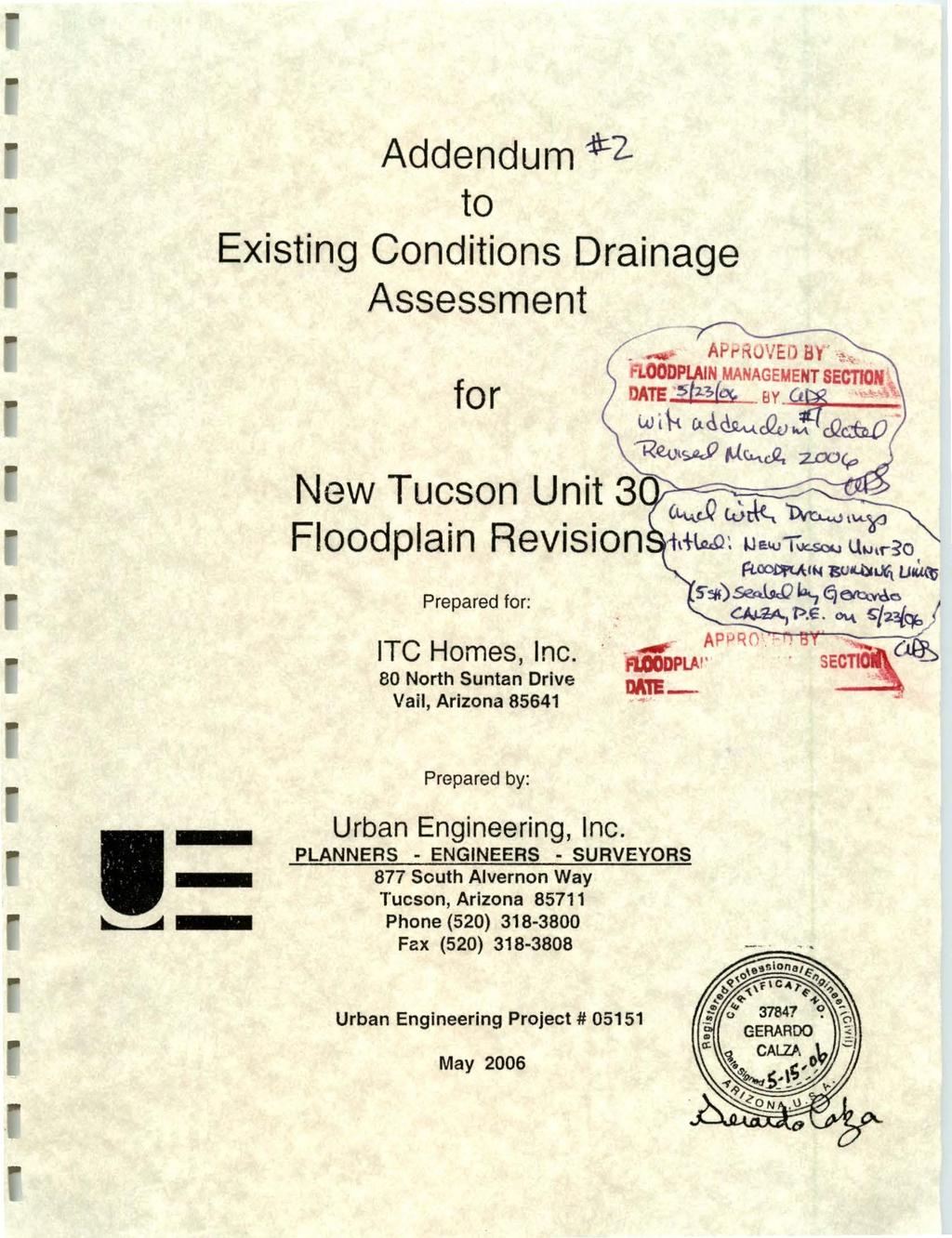
fjj. p... D For approval D Approved as submitted D Resubmit copies for approval
|
|
|
- Kristopher Grant
- 6 years ago
- Views:
Transcription
1

2
3 TO: URBAN ENGINEERING, INC. 877 South Alvernon Way Tucson, AZ (52) Fax (52) Pima County Regional Flood Control District 21 N. Stone Ave., 4'" Floor Tucson, AZ I[ [C:::'l_''l["[~fcc'. (_(_'. _..:[~ \ _, ~,,I,.G.:J \'., J DATE: 5166 I JOB NO.: 5151 ATTENTION: Andy Seiger, P.E. RE: New Tucson Unit 3, Floodplain Revisions SENT VIA: IQ I 5166 WE ARE SENDING YOU Attached D Under separate cover via the following items: D Shop drawings D Prints D Plans D Samples D Copy of letter D Change order D D Specifications COPIES DATE NO. DESCRIPTION 1 Addendum to Existing Conditions Drainage Assessment (HECRAS electronic files enclosed) 1 Response to Review Comments THESE ARE TRANSMITTED as checked below: D For approval D Approved as submitted D Resubmit copies for approval D As requested D Returned for corrections D Return corrected prints D For review and comment D D For your use D Approved as noted D Submit copies for distribution REMARKS D FOR BIDS DUE 2 D PRINTS RETURNED AFTER LOAN TO US COPY TO: SIGNED: ~ fjj. p Gerardo Calza, P.E~ If endosures are not as noted, kindly notify us at once.
4 May 15,26 l'l,lllnin;.: Andrew Seiger, P.E. Pima County Regional Flood Control District 21 North Stone Avenue, Fourth Floor Tucson, Arizona 857 I :'l!n1 ~in;.: RE: Dear Andy: Response to Review Comments (April17, 26)3rd Submittal Addendum to Existing Conditions Drainage Assessment for New Tucson Unit 3 SR 5165 I. Previously Addressed. 2. Addressed.. l'luo~w.l:2li '{I!LH\1HI LJli,Jil inloll IJriJarwnl'ino J ring.i IJIII l'h wrji\ 3. Partially Addressed: The provided information is insufficient to demonstrate that flow split will not occur. a. Please provide road elevation data which shows that Slate Drive is sufficiently elevated to return the right overbank (ROB) flows to the Wash B channel. RESPONSE: Slate drive is not sufficiently elevated to return ROB flows to the Wash B channel. Therefore, a "Diversion Channel" will be designed parallel to the existing platted channel in order to provide additional conveyance which will contain and return the ROB flows to the Wash B channel. A 67' Drainage easement on Lots: 3, 4, and 7 has been prepared for recordation. A Floodplain Use Permit will be required in order to construct said Diversion Channel. b. It appears that ROB flow will extend to Atrisco Drive. If so, please show the floodplain extending to Atrisco Drive. RESPONSE: The hydraulic section 14 for A/risco Drive has been adjusted to reflect the actual road profile; the road has sufficient elevation to return the ROB flows to the Wash B channel. Page I of3
5 Urban Engineering 4. c. If breakout flow does not flow across Slate Drive, and if Atrisco Drive is not raised high enough to return the right overbank (ROB) flows to the Wash B channel, then it appears from the contour information presented on Figure 2 that the ROB flow evident on hydraulic section 15 will continue to flow in the ROB of hydraulic cross sections 7 through 14. If this is the case, and if this possibly isolated flow path is regulatory, please expand the floodplain limits to include these ROB flows. RESPONSE: Gerardo Calza, Urban Engineering and Andy Seiger, Pima County conducted a walkthrough inspection on May 1, 26 of the subject area. It was confirmed that Atrisco Drive is sufficiently elevated to return ROB flows to the Wash B channel. d. If modeling with elevation data on Slate Drive does not show that the road will prevent the breakout flow, and this flow is found to be regulatory, then please provide a separate model reach to follow this breakout flow downstream. RESPONSE: Please refer to the response for Item 3. a above. Previously Addressed Addressed. Previously Addressed. Addressed. Previously Addressed. Previously Addressed. Addressed. Addressed. Previously Addressed. Addressed. Addressed. Page 2 of3
6 Urban Engineering 15. New Comment: Sheet 3 of the 1"=8' scale sheets shows lot 26 as lot 28. Please correct. RESPONSE: Complied If you have any questions regarding the above response to comments, or reqmre further clarification of our responses, please call at Sincerely, URBAN ENGINEERING, INC. ~=E~ Vice PresidentEngineering Page 3 of3
7 LEGAL DESCRIPTION May 12, 26 U/E Project No A 67 foot wide drainage easement over a portion of Lot 7, Block 27 of New Tucson Unit 3, Blocks 22 thru 27, a subdivision as recorded in Book 17 of Maps and Plats at Page 86, Pima County, Arizona, more particularly described as follows: The southwest 67 feet of said Lot 7 as measured perpendicular to the southwest line of said Lot 7, being parallel and adjacent to the alley as shown on said plat. Prepared by URBAN ENGINEERING, INC.
8 I I I I I I I I I I I I I I I I I I I N L=61.9' Ra268.' D. =13'3'38" 6 ""' \ \ SCALf: I" 6' L=45.82' R=21.' 6.=13'3'38" \ \ \ \ \ \ \ \ \ \ \ \ L=36.7~ R=54.' D. =38'58'16" ""' =Urban.=.~Engineering 877 S. Alvemon WayTucson, AZ I t ". NEW TUCSON UNIT 3 BK. 17, PG. 86 EXHIBIT PREPARED: DRT DRAIIN: AMC CHECK: DRT DAlE: 5/12/5 JOB No 5151 SHEET_!_ of _1_ FIL[PATH: \5: \5\5151 \DWC\fXH/8/Tl.OWG
9 May 12, 26 U/E Project No LEGAL DESCRIPTION A 67 foot wide drainage easement over a portion of Lot 3, Block 27 of New Tucson Unit 3, Block 22 thru 27, a subdivision as recorded in Book 17 of Maps and Plats at Page 86, Pima County, Arizona, more particularly described as follows: The southwest 67 feet of said Lot 3 as measured perpendicular to the southwest line of said Lot 3, being parallel and adjacent to the alley as shown on said plat. Prepared by URBAN ENGINEERING, INC.
10 N 4 & t;t "i.,.!it!, ~ 3 NEW TUCSON UNIT 3 BK. 17, PG ~SCAL c I"= 6' \ =Urban,.;:::;.,~Engineering 877 S. Alvemon WayTucson, AZ /././ /"././././././././././././ L=62.57'././ R=26B.OO'././././ ~=13'22'39'././././././././././././ PREPARED: DRT DATE: 5/12/5 EXHIBIT DRA'MI:_""A"'MC='CHECK: cd~r.!!t JOB No SHEET_1_ of _1_ FIL PA THe \Sc \5\5151 \OIIG\ XH18tTJ.OWG
11 LEGAL DESCRIPTION May 12,26 U/E Project No A Drainage easement over a portion of Lot 4, Block 27 of New Tucson Unit 3, Blocks 22 thru 27, a subdivision as recorded in Book 17 of Maps and Plats at Page 86, Pima County, Arizona, more particularly described as follows: COMMENCING at the southwest corner of said Lot 4; THENCE along the south line of said Lot 4 South 59 1 '45" East a distance of feet to the POINT OF BEGINNING; THENCE continuing South 59 1 '45" East a distance of feet to a point on a line 67. feet north of and parallel with the south line of said Lot 4; THENCE along said parallel line South 47 1 '" East a distance of 13.2 feet to a point on the east line of said Lot 4; THENCE along said east line South 18 49'4" West a distance of feet to the southeast corner of said Lot 4; THENCE along the south line of said Lot 4 North 47 1 '" West a distance of 8. feet to the beginning of a tangent curve concave to the northeast having a radius of 54. feet and a central angle of 18 53'48"; THENCE continuing along said south line and arc of said curve to the right a distance of feet to a point of tangency; THENCE continuing along said south line North 28 7'12" West a distance of feet to the POINT OF BEGINNING. Prepared by URBAN ENGINEERING, INC.
12 N SCALE: t" 2 6". NEW TUCSON UNIT 3 BK. 17, PG. 86 l=17.81' R=S4.' (R) 6=18'53'48" \ =Urban ~Engineering 877 S. Alvemon WayTucson, AZ PREPARED: DRT DATE: 5/12/5 EXHIBIT DRAv.N: AMC CHECK:~D~Rc!T _ Joe No SHEET_1_ of _1_ FIL[PATH: \S: \5\5151\WC\[XH181T4.WC
13 / / / 1'o / '21 :~artial GIS datatl
.6753 Area (sq It) 229.4 242.45 164.54 a Total (cis) 332. Flow (cis) 861.92 27.54 369.54 Top Width (It) 381.8 Top Width (It) 177.12 63.3 141.64 Vel Total (fils) 5.")
 3648.6 Shear (lblsq It).54 1.61.49 Alpha 1.85 Stream Power (lblft s) 2.5 13.79 1.1 Frctn Loss (It) 1.1 Cum Volume (acreit) 2.2 7.39 1.63 c & E Loss (It).3 Cum SA (acres) 1.")
14 Plan Plan 1 Wash B 1 AS 19 Profile PF 1 E.G. Elev (It) Element Left OB Channel RightOB Vel Head (It).78 Wt.nVal..43 O.Q35.6 W.S. Elev (It) Reach Len. (It) Crit W.S. (It) Flow Area (sq It) E.G. Slope (!Vft).6753 Area (sq It) a Total (cis) 332. Flow (cis) Top Width (It) Top Width (It) Vel Total (fils) 5.19 Avg. Vel. (fils) Max Chi Dpth (It) 4.43 Hydr. Depth (It) Conv. Total (cis) Conv. (cis) Length Wtd. (It) Wetted Per. (It) Min Ch El (It) Shear (lblsq It) Alpha 1.85 Stream Power (lblft s) Frctn Loss (It) 1.1 Cum Volume (acreit) c & E Loss (It).3 Cum SA (acres) Plan: Plan 1 Wash B 1 AS 18 Profile PF 1 E.G. Elev (ft) Element LeftOB Channel RightOB Vel Head (ft) 1.3 Wt. nval..2 O.Q35.35 W.S. Elev (ft) Reach Len. (ft) Crit W.S. (ft) Flow Area (sq ft) E.G. Sloi>e (ftlft).1123 Area (sq ft) a Total (cis) 332. Flow (cis) Top Width (ft) Top Width (ft) Vel Total (ft/s) 8.12 Avg. Vel. (fils) Max Chi Dpth (ft) 3.76 Hydr. Depth (It) Conv. Total (cis) Conv. (cis) Length Wtd. (ft) Wetted Per. (It) Min Ch El (ft) Shear (lblsq ft) Alpha 1.1 Stream Power (lblft s) Frctn Loss (It) 1.19 Cum Volume (acreit) C & E Loss (ft).1 Cum SA (acres) Plan Plan 1 Wash B 1 AS 17 Profile PF 1 E.G. Elev (ft) Element Left OB Channel RightOB Vel Head (ft).99 Wt. nval..21 O.Q35.37 W.S. Elev (It) Reach Len. (It) Crit W.S. (It) Aow Area (sq It) E.G. Slope (!Vft).1477 Area (sq ft) a Total (cis) 332. Flow (cis) Top Width (It) Top W idth (It) Vel Total (fils) 7.84 Avg. Vel. (fils) Max Chi Dpth (It) 3.21 Hydr. Depth (It) Conv. Total (cis) Conv. (cis) Length Wtd. (ft) Wetted Per. (It) Min Ch El (It) Shear (lblsq It) Alpha 1.4 Stream Power (lblft s) Frctn Loss (It) 1.48 Cum Volume (acreit) C & E Loss (ft).2 Cum SA (acres)
 86.18 342.33 8.62 E.G. Slope (tuft).8713 Area (sq It) 86.18 342.33 8.62 a Total (cfs) 332. Flow (cfs) 87.33 2457.44 37.23 Top Width (It) 216.4 Top W idth (It) 68.79 14.41 7.")
15 Plan: Plan 1 Wash B 1 AS 16 Profile PF 1 E.G. Elev (It) Element LeftOB Channel RightOB Vel Head (It).93 Wt. nval W.S. Elev (It) Reach Len. (It) Crit W.S. (ft) Flow Area (sq It) E.G. Slope (tuft).8713 Area (sq It) a Total (cfs) 332. Flow (cfs) Top Width (It) Top W idth (It) Vel Total (tvs) 7.55 Avg. Vel. (IVs) Max Chi Dpth (It) 2.52 Hydr. Depth (It) Conv. Total (cis) Conv. (cis) Length Wtd. (It) Wetted Per. (It) Min Ch El (It) Shear (lblsq ft) Alpha 1.5 Stream Power (lblft s) F rctn Loss ( ft) 1.66 Cum Volume (acreft) C & E Loss (ft).1 Cum SA (acres) Plan: Plan 1 Wash B 1 AS 15 Profile PF 1 E.G. Elev (ft) Element Left OB Channel RightOB Vel Head {ft) 1.6 Wt. nval W.S. Elev (It) Reach Len. (It) Crit W.S. {ft) Aow Area (sq ft) E.G. Slope (ftlft) Area (sq ft) a Total (cfs) 332. Flow (cfs) Top Width (It) Top Width {It) Vel Total (tvs) 8.21 Avg. Vel. (tvs) Max Chi Dpth (It) 3.1 Hydr. Depth (It) Conv. Total (cfs) Conv. (cis) Length Wtd. (It) Wetted Per. {ft) Min Ch El (It) Shear (lblsq It) Alpha 1.1 Stream Power (lb/ft s) Frctn Loss (ft).86 Cum Volume (acreft) C & E Loss {ft).11 Cum SA (acres) Plan: Plan 1 Wash B 1 AS: 14 Profile: PF 1 E.G. Elev (It) Element Left OB Channel RightOB Vel Head (It).7 Wt. nval W.S. Elev {ft) Reach Len. (ft) Crit W.S. (ft) Flow Area (sq ft) E.G. Slope (ftlft).312 Area (sq ft) a Total (cfs) 332. Flow (cfs) Top Width (It) Top Width (It) Vel Total (tvs) 6.1 Avg. Vel. (tvs) Max Chi Dpth (It) 2.73 Hydr. Depth {It) Conv. Total (cfs) Conv. (cfs) Length Wtd. (It) Wetted Per. (ft) Min Ch El (It) Shear (lblsq ft) Alpha 1.25 Stream Power (lblft s) Frctn Loss (It).7 Cum Volume (acreit) C & E Loss (ft).1 Cum SA (acres)
. 18554 Area (sq It} 155.4 26.53 a Total (cfs) 332. Flow (cfs} 866.71 2435.29 Top Width (11) 14.83 Top Width (11} 71.8 69.4 Vel Total (ft/s} 9.13 Avg. Vel. (ft/s) 5.59 11.")
 13.81 39.77 Frctn Loss (11) 1.59 Cum Volume (acreft).64 1.43.46 C & E Loss (It).9 Cum SA (acres).17.16.6 Plan: Plan 1 Wash B 1 AS: 12 Profile: PF 1 E.G.")
16 Plan: Plan 1 Wash B 1 AS 13 Profile PF 1 E.G. Elev (11) Element LeftOB Channel RightOB Vel Head (11} 1.72 Wt. nval W.S. Elev (11} Reach Len. (11} Crit W.S. (11} Flow Area (sq 11) E.G. Slope (fvft) Area (sq It} a Total (cfs) 332. Flow (cfs} Top Width (11) Top Width (11} Vel Total (ft/s} 9.13 Avg. Vel. (ft/s) Max Chi Dpth (11) 4.61 Hydr. Depth (11) Conv. Total (cfs) Conv. (cfs) Length Wtd. (11) Wetted Per. (It) Min Ch El (11) Shear {lblsq 11) Npha 1.33 Stream Power (lb/11 s) Frctn Loss (11) 1.59 Cum Volume (acreft) C & E Loss (It).9 Cum SA (acres) Plan: Plan 1 Wash B 1 AS: 12 Profile: PF 1 E.G. Elev (ft) Element Left OB Channel RightOB Vel Head (ft) 1.43 Wl nval W.S. Elev (ft) Reach Len. (ft) Crit W.S. (ft) Flow Area (sq ft) E.G. Slope (ftlft).1137 Area (sq ft) a Total (cis) 332. Flow (cis) Top Width (ft) Top Width (ft) Vel Total (ft/s) 7.43 Avg. Vel. (ft/s) Max Chi Dpth (ft) 5.8 Hydr. Depth {ft) Conv. Total (cfs) Conv. (cfs) Length Wtd. (ft) 154. W etted Per. (ft) Min Ch El (ft) Shear (lblsq ft) Npha 1.67 Stream Power (lb/ft s) Frctn Loss (ft) 1.54 Cum Volume (acreft) C & E Loss (ft).6 Cum SA (acres)
)~1(.")

17 ~) 1~ NewTuc3 Plan: Plan 2 5/11 /26 XS19 ( ))~1(.6 1 ~ Legend EG PF1 WSPF 1 Crit PF 1 Ground Bank Sta g c ~ <D iii Station (ft)
~l(.2+.35+i)lo((.")

18 3651 NewTuc3 Plan: Plan 2 5/11/26 XS18 k.6'jo)~l( i)lo((.6'jol Legend EG PF 1 WS PF 1 Crit PF 1 Ground Levee Bank Sta g c.q ~ Cll w Station (ft) 5
).;,cf(,.")

19 NewTuc3 Plan: Plan /26 XS 17.o6 f.o2~+ot.35 )).;,cf(,..6, Legend EG PF 1 WS PF 1 Crit PF 1 Ground Bank Sta g c: i w Station (ft) 6
)fol,~f")

20 NewTuc3 Plan: Plan 2 5/11 /26 XS16 I ))fol,~f.35+!~.6 ~ Legend EG PF 1 WS PF 1 Crit PF 1 Ground Levee Bank Sta g c:.q ~ iij Station (It)


21 .6+.2))j.,(f.35 NewTuc3 Plan: Plan 2 5/11/26 XS15 l)>fo(,(.6, Legend EG PF 1 WS PF 1 Crit PF 1 Ground Bank Sta g c.q ~ w Station (It) 5


22 NewTuc3 Plan: Plan 2 5/11/26 XS14.6 ~.2 ~r.2 Legend EG PF 1 WS PF 1 Ground Bank Sta : c:.q ~ CD iii Station (ft)
olof l(.6,.")

23 NewTuc3 Plan: Plan 2 5/11/26 XS13 ~.6 ~;.35 ~)olof l(.6,._ Legend EG PF 1 WS PF 1 Crit PF Ground Bank Sta g c.q ~ w Station (ft) 25
k, l(.")

24 NewTuc3 Plan: Plan 2 5/11/26 XS12 ~.6*.35 ~)k, l(.6 ~)1 ~~ f Legend EG PF 1 WS PF 1 Crit PF 1 Ground Bank Sta g c.q ~ iii Station (tt)
25 . WashBRevFloodplain2.rep HECRAS Version May 25 U.S. Army Corp of Engineers Hydrologic Engineering Cente~ 69 Second Street Davis, California X X X XXX XX xxxx xxxx XX X X X X X X X X X X X X X X X X X xxxxxxx xxxx X XXX xxxx XXX XXX X X X X X X X X X X X X X X X X X X X xxxxxx xxxx X X X X PROJECT DATA Project Title: NewTuc3 Project File WashBRevFloodplain2.prj Run Date and Time: 5/15/26 11:44:59 AM Project in English units Project Description: Wash B&C Floodplain Revision Wash B and Wash C Revised Floodplain PLAN DATA Plan Title: Plan 2 Plan File h:\os\5151\washbrevfloodplain2.p2 xxxx X X xxxx xxxxx Geometry Title: Geom 1 Geometry File h:\5\s151\washbrevfloodplain2.g1 Flow Title Flow File Plan Summary Information: Number of: cross Sections Culverts Bridges Computational Information Water surface calculation tolerance Critical depth calculation tolerance Maximum number of iterations Maximum difference tolerance Flow tolerance factor Flow 1 h:\5\5151\washbrevfloodplain2.f1 34 Multiple Openings Inline Structures Lateral Structures Computation Options Critical depth computed only where necessary Conveyance Calculation Method: At breaks in n values only Friction Slope Method: Average Conveyance Computational Flow Regime: Subcritical Flow FLOW DATA Flow Title: Flow 1 Flow File h:\os\5151\washbrevfloodplain2.f1 Flow Data (cfs) River Wash B Wash B Reach 1 2 RS PF Page 1 X X
26 TrJash c 1 Boundary Conditions River Wash B 1 Wash B 2 Wash c 1 GEOMETRY DATA Reach WashBRevFloodplaln2.rep Profile PF 1 PF 1 PF 1 Geometry Title: Geom 1 Geometry File : h:\5\5151\washbrevfloodplain2.g1 Reach Connection Table River Wash B 1 Wash B 2 Wash c 1 Reach Upstream Jn1 Boundary Upstrearn Critical Critical Downstream Boundary Jn1 Jn1 Downstream Critical JUNCTION INFORMATION Name: Jnl Description: Wash C confluence Energy computation Method Length across Junction River Reach Wash B 1 Wash C 1 Tributary River to Wash B to Wash B 2 2 Reach Length Angle CROSS SECTION RIVER: Wash B REACH: 1 RS: 23 Description: XS23 Station Elevation Data Sta Elev Sta nurn= Elev Manning's n Values num= Sta n Val Sta n Val Sta Elev Sta Sta n Val Sta Bank Sta: Left Right Lengths: Left Channel Right CROSS SECTION RIVER: Wash B Page 2 Elev n Val.2 Coeff Sta Elev Sta n Val Contr. Expan..1.3
27 WashBRevFloodplaLn2.rep CROSS Bank RIVER: REACH: l RS: 22 Description: XS22 Station Elevation Data num= 81 Sta Elev Sta Elev Sta Elev Sta Elev Sta Elev Manning's n Values num= 4 Sta n Val sta n Val Sta n Val Sta n Val Bank Sta: Left Right Lengths: Left Channel Right Coeff Contr. Expan SECTION RIVER: Wash B REACH: 1 RS: 21 Description: XS21 Station Elevation Data num= 15 Sta Elev Sta Elev Sta Elev Sta Elev Sta E1ev Manning's n Values nurn= 5 Sta n Val Sta n Val Sta n Val Sta n Val Sta n Val Sta: Left Right Lengths: Left Channel Right Coeff Contr. Expan Ineffective Flow num= 1 Sta L Sta R Elev Permanent F CROSS SECTION Wash B REACH: I RS: 2 Page 3
28 CROSS Manning's WashBRevFloodplain2.rep Description: XS2 Statlon Elevation Data nuro=: 131 Sta Elev Sta Elev Sta Elev Sta Elev Sta Elev OS Manning's n Values num= 6 Sta n Val Sta n Val Sta n Val Sta n Val Sta n Val Bank Sta: Left Right Lengths: Left Channel Right Coeff Contr. Expan SECTION RIVER: wash B REACH: 1 RS: 19 Description: XS19 Station Elevation Data num= 93 Sta Elev Sta Elev Sta Elev Sta E1ev Sta Elev n Values num= 5 Sta n Val Sta n Val Sta n val Sta n Val Sta n Val Bank Sta: Left Right Lengths: Left Channel Right Coeff Contr. Expan Page 4
29 RIVER: CROSS REACH: Sta Manning's RIVER: CROSS SECTION Wash B REACH: 1 RS: 18 ltlashbrevfloodplain2. rep Description: XS18 Station Elevation Data nurn= 88 Sta Elev Sta Elev Sta Elev Sta Elev Sta Elev OS Manning's n Values nurn= 4 Sta n Val Sta n Val Sta n Val Sta n Val Bank Sta: Left Right Lengths: Left Channel Right Coeff Contr. Expan Right Levee Station= Elevation= SECTION RIVER: wash B 1 RS: 17 Description: XS17 Station Elevation Data nurn= 89 Elev Sta Elev Sta Elev Sta Elev Sta Elev OS n Values nurnc:o 4 Sta n val Sta n Val Sta n Val Sta n Val Bank Sta: Left Right Lengths: Left Channel Right Coeff Contr. Expan CROSS SECTION wash B REACH: 1 RS: 16 Page 5
30 WashBRevFloodplain2.rep CROSS REACH: Sta CROSS Description: XS16 Station Elevation Data nurn= 88 Sta Elev Sta Elev Sta Elev Sta Elev Sta Elev Manning's n Values nurn= 4 Sta n Val Sta n Val Sta n val Sta n Val Bank Sta: Left Right Lengths: Left Channel Right Coeff Contr. Expan Right Levee Station= Elevation= SECTION RIVER: Wash B 1 RS: 15 Description: XS15 Station Elevation Data nurn= 55 Elev Sta Elev Sta Elev Sta Elev Sta Elev Manning's n Values nurn= 4 Sta n Val Sta n Val Sta n Val Sta n Val Bank Sta: Left Right Lengths: Left Channel Right Coeff Contr. Expan SECTION RIVER: Wash B REACH: 1 RS: 14 Description: XS14 Station Elevation Data nurn= 37 Sta Elev Sta Elev Sta Elev Sta Elev Sta Elev Page 6
31 ':.'ashbrevf'loodplain2. Hanning's RIVER: Station Bank RIVER: Bank RIVER: Page n Values nurn= Sta n val Sta n Val Sta n Val rep Bank Sta: Left Right Lengths: Left Chdnnel Right Coeff Cant::. Expan CROSS SECTION Wash B REACH: 1 RS: 13 Description: XS13 Elevatlon Data num= 73 Sta Elev Sta Elev Sta Elev Sta Elev Sta Elev Manning's n Values nurn= 3 Sta n Val Sta n Val Sta n Val Sta: Left Right Lengths: Left Channel Right Coeff Contr. Expan CROSS SECTION Wash B REACH: 1 RS: 12 Description: XS12 Station Elevation Data nurn= 6 Sta Elev Sta Elev Sta Elev Sta E1ev Sta Elev Manning's n Values nurn= 3 Sta n Val Sta n Val Sta n Val Sta: Left Right Lengths: Left Channel Right Coeff Con':r. Expan CROSS SECTION Wash B REACH: 2 RS: 11 7
32 WashBRevFloodplain2.rep Description: Manning's RIVER: Station Manning's Bank RIVER: Descript~on: XSll Station Elevati:)[1 Data n'.lm= 83 Sta Elev Sta Elev Sta Elev Sta Elev Stc. Elev n Values num= 5 Sta n Val Sta n Val Sta n Val Sta n Val Sta n Val Bank Sta: Left Right Lengths: Left Channel Right Coeff Contr. Expan CROSS SECTION \'lash 8 REACH: 2 RS: 1 Description: XS1 Elevation Data numo:= 61 Sta Elev Sta Elev Sta Elev Sta Elev Sta Elev n Values nurn= 3 Sta n Val Sta n Val Sta n Val Sta: Left Right Lengths: Left Channel Right Coeff Contr. Expan CROSS SSCTION ;, ;ash 8 REACH: 2 RS: 9 XS9 Station Elevation Data num= 63 Sta Elev Sta Elev Sta Elev Sta Elev Sta Elev " " l S Pa9<:" 8
33 Manning's Bank RIVER: Description: CROSS Sta CROSS REACH: ~ lashbrevfloodplail2. rep Q.Sil 3621 i 12') & ) ;) ? n Values r.r_l!ti= 3 Sta n Val Sta n Val Sta n val OJ Sta: Left Right Lengt~s: Left Channel Right Coeff Contr. Expan '1.3 CROSS SECTION Wash 8 REACH: 2 RS: 8 XS8 Station Elevation Data num= 49 Sta Elev Sta Elev Sta Elev Sta Elev Sta Elev Manning's n Values num= 3 Sta n Val Sta n Val Sta n val Bank Sta: Left Right Lengths: Left Channel Right Coeff Contr. Expan SECTION RIVER: wash 8 REACH: 2 RS: 7 Description: XS7 Station Elevation Data nurn= 62 Sta Elev Sta Elev Sta Elev Sta Elev Sta Elev Manning's n Values num= 5 n Val Sta n Val Sta n Val Sta n Val Sta n Val Bank Sta: Left Right Lengths: Left Channel Right Coeff Contr. Expan SECTION RIVER: wash 8 2 RS: 6 Page 9
34 \.:.~shbre ;f Station Manning's Bank RIVER: Description: l l)odplain2. rep Description: XS6 Elevatcon Data num= 86 Sta Elev Stil Elev Sta Elev Sta Elev s a Ele\r ,: l L n Values num= 7 Sta n Val Sta n Val Sta n Val Sta n Val Sta n Val Sta: Left Right Lengths: Left Channel Right Coeff Contr. Expan CROSS SECTION Wash B REACH: 2 RS: 5 XS5 Station Elevation Data num: 11 Sta Elev Sta Elev Sta Elev Sta Elev Sta Elev : Manning's n Values num= 5 Sta n Val Sta n Val Sta n Val Sta n Val S:.a n Val RIVER: PCF,<e Bank Sta: Left Right Lengths: Left Channel R1ght Coeff Cant:. Expan l.3 CROSS SECTION Wash 8 REACH: 2 RS: 4 Description: XS4 1
35 1tiCJshBRevFloodplain Manning's Bank RIVER: CROSS Page rep Stat1on Elevation Data nuin= 99 Sta Elev Sta Elev Stc. E:lev Sta Elev Sta Elev l 11..: C : l<:l l.J n Values num= 7 Sta n Val Sta n Val Sta n Val Sta n Val Sta n Val Sta: Left Right Lengths: Left Channel Right Coeff Contr. Expan CROSS SECTION Wash B REACH: 2 RS: 3 Description: XS3 Station Elevation Data nurn= 95 Sta Elev Sta Elev Sta Elev Sta Elev Sta Elev Manning's n Values nl.:in= 5 Sta n Va""_ Sta n Val Sta n Val Sta n Val Sta n Val Bank Sta: Left Right Lengths: Left Channel Right Coeff Contr. Expan SECTION RIVER: Wash B REACH: 2 RS: 2 Oeser ipt ~on: XS2 Station Elevation Data r,urn= 93 Sta Elev Sta Elev St o;. Elev sr:.a Elev Sta Elev ll
36 tdas:~brevfloodplain CROSS REACH: Sta Bank RIVER: Sta rep , , :! Manning's n Values nurn= 6 Sta n Val Sta n Val Sta n Val Sta n Val Sta n Val Bank Sta: Left Right Lengths: Left channel Right Coeff Contr. Expan SECTION RIVER: Wash B 2 RS: 1 Description: XSl Station Elevation Data nurn= 71 Elev Sta Elev Sta Elev Sta Elev Sta Elev Manning's n Values num= 5 Sta n val Sta n Val Sta n Val Sta n Val Sta n Val Sta: Left Right Lengths: Left Channel Right Coeff Contr. Expan CROSS SECTION Wash B REACH: 2 RS: Description: xso Station Elevation Data num= 17 Sta E1ev Sta Elev Sta Elev Sta Elev St. a Elev Manning's n Values nurn= 3 n Val Sta n Val Sta n 'Jal Page 12
PENNDRAIN.rep. HEC-RAS Version May 2005 U.S. Army Corp of Engineers Hydrologic Engineering Center 609 Second Street Davis, California
 HEC-RAS Version 3.1.3 May 2005 U.S. Army Corp of Engineers Hydrologic Engineering Center 609 Second Street Davis, California X X XXXXXX XXXX XXXX XX XXXX X X X X X X X X X X X X X X X X X X X XXXXXXX XXXX
JACKTOWN ACRES FLOOD MITIGATION IMPROVEMENTS ANALYSIS
 JACKTOWN ACRES FLOOD MITIGATION IMPROVEMENTS ANALYSIS SITUATE IN: NORTH HUNTINGDON TOWNSHIP WESTMORELAND COUNTY, PENNSYLVANIA PREPARED FOR: North Huntingdon Township 11279 Center Highway North Huntingdon,
Technical Report Culvert A Hydraulic Analysis
 DATE: November 3, 2011 Technical Report Culvert A Hydraulic Analysis TO: FROM: RE: Jim Reiser, P.E. Project Manager Parsons Brinckerhoff, Inc. Kurt Killian, P.E., CFM Parsons Brinckerhoff, Inc. Design
EXHIBIT A LEGAL DESCRIPTION OF PROPERTY TO BE INCLUDED IN THE DISTRICT
 - - - - EXHIBIT A LEGAL DESCRIPTION OF PROPERTY TO BE INCLUDED IN THE DISTRICT COMMUNITY FACILITIES DISTRICT FOR QUAILWOOD AND ROUWENHORST LEGAL DESCRIPTION JULY 28, 2004 A PORTION OF LAND LYING WITHIN
CHAPTER House Bill No. 1495
 CHAPTER 2000-419 House Bill No. 1495 An act relating to Acme Improvement District, Palm Beach County; amending chapter 28557, Laws of Florida, 1953, as amended; expanding the boundaries of said district,
CHAPTER House Bill No. 1213
 CHAPTER 2015-198 House Bill No. 1213 An act relating to the West Palm Beach Water Catchment Area, Palm Beach County; amending chapter 67-2169, Laws of Florida, as amended; revising boundaries; providing
EXHIBIT A LEGAL DESCRIPTION OF AVIGATION EASEMENT Being that certain real property situate in the unincorporated area of the County of Monterey, State
 EXHIBIT A LEGAL DESCRIPTION OF AVIGATION EASEMENT Being that certain real property situate in the unincorporated area of the County of Monterey, State of California, described as follows: Being a portion
APPENDIX J HYDROLOGY AND WATER QUALITY
 APPENDIX J HYDROLOGY AND WATER QUALITY J-1 Technical Report on Airport Drainage, Northern Sector Airport and Ordinance Creek Watershed / Preliminary Creek Constructed Natural Channel Culvert J-2 Preliminary
Planning & Zoning Commission
 Preliminary Plat Westwood, Section 3 Planning & Zoning Commission Planning & Development Department March 21, 2016 Request Subdivide approximately 38.1 acres of previously unplatted property to create
FEASIBILITY REPORT STORM DRAINAGE IMPROVEMENTS TERRACE AND METCALF CITY OF OVERLAND PARK JOHNSON COUNTY, KANSAS
 March 2, 2011 FEASIBILITY REPORT STORM DRAINAGE IMPROVEMENTS STANLEY STORM DRAINAGE IMPROVEMENTS, 151sT TERRACE AND METCALF CITY OF OVERLAND PARK JOHNSON COUNTY, KANSAS DESCRIPTION: This report relates
Skagit River Historical Flood Elevations and Peak Flow Estimates
 Skagit River Historical Flood Elevations and Peak Flow Estimates to be presented at Skagit River GI H&H Technical Workshop Wednesday, June 17, 2009 Background Corps of Engineers began a General Investigation
 Dam Modification Report Stingy Run Fly Ash Reservoir Appendix E Spillway System Design Calculations E1: Spillway/Energy Dissipater Design for 100-year Event CHE8273 8 September 4, 2014 Written by: CJW
MAPPING DESCRIPTIONS AND DRAFTING PARCEL BOUNDARIES FOR CADASTRAL MAPPING
 MAPPING DESCRIPTIONS AND DRAFTING PARCEL BOUNDARIES FOR CADASTRAL MAPPING Chapter 6 2015 Cadastral Mapping Manual 6-0 Another method of describing land, aside from the fractional section method, is called
CHAPTER House Bill No. 1509
 CHAPTER 2006-358 House Bill No. 1509 An act relating to Flagler Estates Road and Water Control District, St. Johns County; amending chapter 98-529, Laws of Florida; providing additional powers of the district
Village of Bedford Park ) ) SS County of Cook ) REVISED NOTICE TO SOLICIT PROPOSALS
 ) SS County of Cook ) REVISED NOTICE TO SOLICIT PROPOSALS") Village of Bedford Park ) ) SS County of Cook ) REVISED NOTICE TO SOLICIT PROPOSALS Notice is hereby given the Village of Bedford Park, Cook County, Illinois is soliciting proposals for the sale of real
Village of Bedford Park ) ) SS County of Cook ) REVISED NOTICE TO SOLICIT PROPOSALS Notice is hereby given the Village of Bedford Park, Cook County, Illinois is soliciting proposals for the sale of real
HY-8 Version 7.2 Build Date January 17, Federal Highway Administration.
 HY-8 Version 7.2 Build Date January 17, 2012 Federal Highway Administration http://www.fhwa.dot.gov/engineering/hydraulics/software/hy8/index.cfm SIMPLE Simple to use Use for simple culverts and bridges
SPECIAL USE PERMIT - SUP Metcalf Avenue
 NOTICE OF PUBLIC HEARING CITY PLANNING COMMISSION CITY OF OVERLAND PARK, KANSAS Notice is hereby given that the City Planning Commission of Overland Park, Kansas, will hold a public hearing Monday, March
Water surface slope extending up to 20 channel widths up and downstream of crossing.
 Site Evaluations Site Information Site Location: Mt ood NF, Forest Road 7 Year Installed: Pre-987 Lat/Long: 8 W Watershed rea (mi ): N Stream Slope (ft/ft) : Channel Type: Step-pool ankfull Width (ft):
Plan B Dam Breach Assessment
 Plan B Dam Breach Assessment Introduction In support of the Local Sponsor permit applications to the states of Minnesota and North Dakota, a dam breach analysis for the Plan B alignment of the Fargo-Moorhead
All of Lot 5, Except the North 783 feet, Wolf Creek Acres, a subdivision of land in the City of Overland Park, Johnson County, Kansas.
 NOTICE OF PUBLIC HEARING CITY PLANNING COMMISSION CITY OF OVERLAND PARK, KANSAS Notice is hereby given that the City Planning Commission of Overland Park, Kansas, will hold a public hearing Monday, January
RESOLUTION OF ADVISABILITY AND AUTHORIZATION NO. 7841
 1 2 3 4 5 6 7 8 9 10 11 12 13 14 15 16 17 18 19 20 21 22 23 24 25 26 27 28 29 30 31 32 33 34 35 (Published in the Topeka Metro News August 9, 2006) RESOLUTION OF ADVISABILITY AND AUTHORIZATION NO. 7841
HEC 26 Aquatic Organism Passage Design Manual Evolution & Application
 HEC 26 Aquatic Organism Passage Design Manual Evolution & Application Sven Leon, P.E., Hydraulics Engineer Federal Highway Administration 2015 Alaska Fish Passage Meeting October 13 14, 2015 VTRC, Juneau,
Washington State Fish Passage Barrier Removal Projects. Casey Kramer, PE WSDOT State Hydraulics Engineer
 Washington State Fish Passage Barrier Removal Projects Casey Kramer, PE WSDOT State Hydraulics Engineer 2014 National Hydraulic Engineering Conference Iowa City, IA August 20 th, 2014 WSDOT Fish Passage
Starting Bid: $15,000
 Starting Bid: $15,000 Parcel # 12.00593.00 Garage Legal Description Information Lot-005 Block-006 FOREST EDGE ADDITION Eckles Township 20 147 34 Forfeited: 06-222018 Deeded acres: 1.33 Appraised Value
A G E N D A OKLAHOMA COUNTY PLANNING COMMISSION. November 16, Approval of Minutes of the Previous Meeting: (October 19, 2006)
") A G E N D A OKLAHOMA COUNTY PLANNING COMMISSION ROOM 103 1:30 p.m. November 16, 2006 1. Notice of meeting posted November 9, 2006. 2. Call to Order. 3. Roll Call. 4. Approval of Minutes of the Previous
A G E N D A OKLAHOMA COUNTY PLANNING COMMISSION ROOM 103 1:30 p.m. November 16, 2006 1. Notice of meeting posted November 9, 2006. 2. Call to Order. 3. Roll Call. 4. Approval of Minutes of the Previous
ORDINANCE NO. SB-3131
 ORDINANCE NO. SB-3131 AN ORDINANCE MAKING FINDINGS AND ESTABLISHING A STAR BOND PROJECT DISTRICT WITHIN THE CITY OF OVERLAND PARK, KANSAS PURSUANT TO K.S.A. 12-17,160 ET SEQ., AS AMENDED (BLUHAWK STAR
Zoning District Minimum Minimum MINIMUM SETBACKS Maximum Maximum % Lot Area Lot Width Front Yard Rear Yard Side Yard Corner Lot (street side yard)
") GR (General Rural) R1-43 (Conventional Single Family 1-1/4 gross acres; lots recorded prior to 11/18/74 are okay as is. 1-1/4 gross acres in areas with FPEs; 1 acre in areas w/o FPEs. 100 ft.; lots recorded
GR (General Rural) R1-43 (Conventional Single Family 1-1/4 gross acres; lots recorded prior to 11/18/74 are okay as is. 1-1/4 gross acres in areas with FPEs; 1 acre in areas w/o FPEs. 100 ft.; lots recorded
SUMMARY: The Principal Deputy Assistant Secretary- Indian Affairs made a final agency
 (4337-15-P) DEPARTMENT OF THE INTERIOR Bureau of Indian Affairs [178A2100DD/AAKC001030/AOA501010.999900 253G] Land Acquisitions; Wilton Rancheria AGENCY: ACTION: Bureau of Indian Affairs, Interior. Notice.
Arthrex, Inc Creekside Boulevard Naples FL Creekside Commerce Park CPUD
 Arthrex, Inc. 1370 Creekside Boulevard Naples FL 34108 239.403.6804 dgenson@barroncollier.com 27 48S 25E Please see Exhibit 2 Please see Exhibit 3 X X Please see Exhibit 5 Exhibit 2 Legal Description
WMS 8.4 Tutorial Hydraulics and Floodplain Modeling HY-8 Modeling Wizard Learn how to model a culvert using HY-8 and WMS
 v. 8.4 WMS 8.4 Tutorial Hydraulics and Floodplain Modeling HY-8 Modeling Wizard Learn how to model a culvert using HY-8 and WMS Objectives Define a conceptual schematic of the roadway, invert, and downstream
CITY OF ROSEVILLE DESIGN STANDARDS
 CITY OF ROSEVILLE DESIGN STANDARDS Section 1 Purpose and Definitions 1-1 Purpose PD 1 1-2 Design Practice PD 1 1-3 Definitions PD 1 Section 2 General Requirements 2-1 Plans by an Appropriate Engineer GR
M I N U T E S OKLAHOMA COUNTY PLANNING COMMISSION
 M I N U T E S OKLAHOMA COUNTY PLANNING COMMISSION September 21, 2000 1:30 P.M. The meeting of the Oklahoma County Planning Commission convened and was called to order by Ms. Cheryl Dorrance, at 1:30 P.M.,
Stormwater Level of Service Study - Phase 2 Flooding Adjacent to Rock Creek
 Stormwater Level of Service Study - Phase 2 Flooding Adjacent to Rock Creek City of Fairway, Kansas Fairway Stormwater Level of Service Study - Phase 2 Project No. 108200 Revision 1 12/6/2018 Stormwater
CHAPTER 4 SPALDING COUNTY, GEORGIA 4.0 CULVERT DESIGN
 SPALDING COUNTY, GEORGIA CHAPTER 4 4.0 CULVERT DESIGN... 4-1 4.1 INTRODUCTION... 4-1 4.2 SYMBOLS AND DEFINITIONS... 4-1 4.3 ENGINEERING DESIGN CRITERIA... 4-2 4.3.1 FREQUENCY FLOOD... 4-2 4.3.2 VELOCITY
CHAPTER House Bill No. 1311
 CHAPTER 2017-216 House Bill No. 1311 An act relating to the Lehigh Acres Municipal Services Improvement District, Lee and Hendry Counties; amending chapter 2015-202, Laws of Florida; expanding the territorial
COUNCIL COMMUNICATION
 Meeting Date: March 20, 2018 COUNCIL COMMUNICATION Agenda Item: Agenda Location: Action Items Work Plan # Legal Review: 1 st Reading 2 nd Reading Subject: A resolution approving the final design for the
FINAL DRAINAGE REPORT Road Improvements (MP 0.6)
") FINAL DRAINAGE REPORT 17-03109 45.5 Road Improvements (MP 0.6) Prepared for: Prepared by: Mesa County Engineering Department 200 S. Spruce Street Grand Junction, CO 81501 DOWL 222 South Park Avenue Montrose,
FINAL DRAINAGE REPORT 17-03109 45.5 Road Improvements (MP 0.6) Prepared for: Prepared by: Mesa County Engineering Department 200 S. Spruce Street Grand Junction, CO 81501 DOWL 222 South Park Avenue Montrose,
Appendix G. Alternative Solutions Details. Krosno Creek Flood Reduction Project PROJECT FILE REPORT CITY OF PICKERING
 Krosno Creek Flood Reduction Project PROJECT FILE REPORT CITY OF PICKERING Appendix G Alternative Solutions Details TMIG THE MUNICIPAL INFRASTRUCTURE GROUP LTD Krosno Creek Flood Reduction Project PROJECT
Downum Title Services, Inc. TITLE REPORT Work Order #6581
 17030 Main Street South Blountstown, Florida 32424 Downum Title Services, Inc. JUDY DOWNUM Telephone: (850) 674-3533 Fax: (850) 674-1343 TITLE REPORT Work Order #6581 FOR GULF COUNTY TAX COLLECTOR 1000
Enclosed please find an executed and notarized Certificate of Completion regarding North Center Senior Housing at 2324 West Irving Park Road.
 May 14,2008 City of Chicago Richard M. Daley, Mayor Department of Planning and Developme.nt Arnold L. Randall Commissioner City Hall, Room 1000 121 North LaSalle Street Chicago, Illinois 60602 312 744-4190
ORDINANCE NO AN ORDINANCE MAKING CERTAIN FINDINGS AND ESTABLISHING THE MALL REDEVELOPMENT DISTRICT
 Introduced: January 20, 2015 Passed: January 20, 2015 Published: January 23, 2015 ORDINANCE NO. 2015-2 AN ORDINANCE MAKING CERTAIN FINDINGS AND ESTABLISHING THE MALL REDEVELOPMENT DISTRICT WHEREAS, K.S.A.
Hard Hat Services ph: hardhatinc.com 932 N. Wright St., Suite 160 Naperville, IL 60563
 Interstate Power and Light Company Ottumwa Generation Station CCR Surface Impoundment Annual Inspection Report 154.018.015.003 Report issued: July 03, 2017 Hard Hat Services ph: 877-630-7428 hardhatinc.com
HYDRAULIC JUMP AND WEIR FLOW
 HYDRAULIC JUMP AND WEIR FLOW 1 Condition for formation of hydraulic jump When depth of flow is forced to change from a supercritical depth to a subcritical depth Or Froude number decreases from greater
STREAM SURVEY File form No..
 scanned for KRIS THE RESOURCES AGENCY OF CALIFORNIA California Department of Fish and Game STREAM SURVEY File form No.. Date: September 4, 1969. NAME: North Fork Schooner Gulch Creek COUNTY: Mendocino.
OFFICE OF STRUCTURES MANUAL FOR HYDROLOGIC AND HYDRAULIC DESIGN CHAPTER 11 APPENDIX B TIDEROUT 2 USERS MANUAL
 OFFICE OF STRUCTURES MANUAL FOR HYDROLOGIC AND HYDRAULIC DESIGN CHAPTER 11 APPENDIX B TIDEROUT 2 USERS MANUAL APRIL 2011 APRIL 2011 Page 1 Preface TIDEROUT 2, Build 1.22 dated June 29, 2006 is the current
General Notes. Project No /15/2018 Page 1 of 1
 5081 Page 1 of 13 General Notes 5/15/2018 Page 1 of 1 Project No. 82 183-82 KA D 5081-01 0309-19 1 2 Note The contractor is responsible for establishing and maintaining centerline of the traveled way for
EXHIBIT 314B TRACT I
 - 2878 EXHIBIT 314B 122312 PRESTON CENTER SPECIAL PURPOSE DISTRICT TRACT BOUNDARY DESCRIPTIONS TRACT I BEING all of City Block 1/5625 and is further described as being a tract of land beginning at a point
QUIT-CLAIM DEED. STONE CLIFF, LC, a Utah limited liability company, and TRAVELLER/STONE CLIFF,
 Recorded at Request of: Stone Cliff Owners Association c/o John D. Richards III Richards Kimble & Winn, PC 2040 E. Murray-Holladay Rd., Suite 102 Salt Lake City, UT 84117 Mail tax notice to: Stone Cliff
Indiana LTAP Road Scholar Core Course #10 Culvert Drainage. Presented by Thomas T. Burke, Jr., PhD, PE Christopher B. Burke Engineering, Ltd.
 Indiana LTAP Road Scholar Core Course #10 Culvert Drainage Presented by Thomas T. Burke, Jr., PhD, PE Christopher B. Burke Engineering, Ltd. Objectives Review culvert shapes, end sections, and materials
GENERAL LEGEND 12"CMP
 PLANS FOR X-REFS: west branch_ci FILE PATH: Z:\WEST BRANCH 36863 SIDEWALK IMPROVEMENTS 212 - SRTS - OLIPHANT\DRAWINGS\_PRODUCTION DRAWINGS\A.1 COVER PLOTTED: Monday, July 23, 212 2:44:13 PM OLIPHANT STREET
Information for File # SEW
 Information for File #2014-02744-SEW Applicant: Minnesota Department of Transportation (MnDOT), District 3; c/o Mr. Robert Nibbe Corps Contact: Sarah Wingert, U.S. Army Corps of Engineers, 180 5 th Street
ORDINANCE NO. ASMT-3189
 ORDINANCE NO. ASMT-3189 AN ORDINANCE LEVYING ASSESSMENTS ON LOTS, PIECES AND PARCELS OF GROUND FOR THE PURPOSE OF PAYING THE COST FOR THE CONSTRUCTION OF A FLOOD CONTROL PROJECT ALONG NEGRO CREEK BETWEEN
CHAPTER 5 CULVERT DESIGN
 CHAPTER 5 CULVERT DESIGN HYDRAULICS OF CULVERTS There are two major types of culvert flow: 1) flow with inlet control, and 2) flow with outlet control. For each type, different factors and formulas are
SEWER CONNECTION FEES
 100.01 Connection Fees Required 100.04 Establishment of Sewer Districts 100.02 East Sanitary Sewer District 100.05 East Southside Drive Sewer Connection District 100.03 West Sanitary Sewer District 100.01
ANSWERS TO QUESTIONS IN THE NOTES AUTUMN 2018
 ANSWERS TO QUESTIONS IN THE NOTES AUTUMN 2018 Section 1.2 Example. The discharge in a channel with bottom width 3 m is 12 m 3 s 1. If Manning s n is 0.013 m -1/3 s and the streamwise slope is 1 in 200,
NOTICE OF PUBLIC HEARING
 NOTICE OF PUBLIC HEARING Notice is hereby given that the first and second public hearing of a proposed annexation area described below will be held by the City Council of the City of Rockport, Texas, at
Annex E Bridge Pier Protection Plan
 Annex E Bridge Pier Protection Plan Table E1 Bridge Types and Locations Table E2 Flow Conditions For River Sections Figure E1 Bridge Abutment Protection Figure E2 Bridge Pier Protection Figure E3 Central
APPENDIX A STRUCTURE DESCRIPTIONS AND RATING CURVES
 3 4 5 6 7 8 9 0 3 APPENDIX A STRUCTURE DESCRIPTIONS AND RATING CURVES Kissimmee River Vol December 005 Version Draft 4 3 4 5 6 7 8 9 0 3 4 5 6 7 8 9 0 3 4 5 6 7 8 9 30 3 3 33 34 35 36 37 38 39 40 4 4 43
Hard Hat Services ph: hardhatinc.com 932 N. Wright St., Suite 160 Naperville, IL 60563
 Interstate Power and Light Company Ottumwa Generation Station CCR Surface Impoundment Annual Inspection Report 154.018.012.003 Report issued: December 21, 2016 Hard Hat Services ph: 877-630-7428 hardhatinc.com
AGENDA BILL. Beaverton City Council Beaverton, Oregon FOR AGENDA OF: ~1-8 BILL NO: BUDGET IMPACT
 AGENDA BILL SUBJECT: An Ordinance Withdrawing Territory From The Tualatin Valley Water District and Declaring An Emergency Beaverton City Council Beaverton, Oregon 3-27-18 FOR AGENDA OF: ~1-8 BILL NO:
Developed by: The American Traffic Safety Services Association (ATSSA) 15 Riverside Parkway, Suite 100 Fredericksburg, VA
 15 Riverside Parkway, Suite 100 Fredericksburg, VA") Addendum Developed by: The American Traffic Safety Services Association (ATSSA) 15 Riverside Parkway, Suite 100 Fredericksburg, VA 22406-1022 800-272-8772 This material is based upon work supported by
Addendum Developed by: The American Traffic Safety Services Association (ATSSA) 15 Riverside Parkway, Suite 100 Fredericksburg, VA 22406-1022 800-272-8772 This material is based upon work supported by
Picture Spring Branch Hydrologic and Hydraulic Analysis Report. Prepared for: Anne Arundel County. Final
 Picture Spring Branch Hydrologic and Hydraulic Analysis Report Prepared for: Anne Arundel County Final Date: November 30, 2017 Picture Spring Branch Hydrologic and Hydraulic Analysis Report November 30,
ORDINANCE NO AMENDMENT TO THE CITATION ESTATES MPD DEVELOPMENT AGREEMENT
 ORDINANCE NO. 2015- AMENDMENT TO THE CITATION ESTATES MPD DEVELOPMENT AGREEMENT AN ORDINANCE OF THE CITY COUNCIL OF THE CITY OF PALM COAST, FLORIDA, PROVIDING FOR THE SECOND AMENDED AND RESTATED MASTER
HISTORY OF CONSTRUCTION
 HISTORY OF CONSTRUCTION CFR 257.73(c)(1) West Boiler Slag Pond Clifty Creek Plant Madison, Indiana October, 2016 Prepared for: Indiana Kentucky Electric Corporation Prepared by: American Electric Power
Information for File #MVP MVM
 Information for File #MVP-2018-00168-MVM Applicant: City of Lino Lakes Corps Contact: Marissa Merriman Address: 180 Fifth Street East, Suite 700, St. Paul, Minnesota 55101-1678 E-Mail: Marissa.V.Merriman@usace.army.mil
DANE COUNTY ORDINANCE AMENDMENT NO: Internal Tracking Number: RECU25760
 DANE COUNTY ORDINANCE AMENDMENT NO: 10246 Internal Tracking Number: RECU25760 Amending Section 10.03 relating to Zoning Districts in the Town of Vienna. The Dane County Board of Supervisors does ordain
Ellis Y. Byeon, PE Bryan VanderGheynst, PE 1
 Ellis Y. Byeon, PE Bryan VanderGheynst, PE 1 Background Information: City of Trenton, Mercer County Assunpink Creek, Pond Run and Delaware River Lower 2.5 miles of the Assunpink Creek Lower 0.6 miles of
BEFORE THE BOARD OF COUNTY COMMISSIONERS FOR THE COUNTY OF TILLAMOOK IN THE STATE OF OREGON ) )
 )") COUN1Y COOID'JOlJIINAI_ AFTER RECORDING RETURN TO AND SEND ALL TAX STATEMENTS TO: Tillamook County 201 Laurel Avenue Tillamook, OR 97141 Tillamook County, Oreqon 2014 002077 051091201408:17:08AM - DEED-ORDER
COUN1Y COOID'JOlJIINAI_ AFTER RECORDING RETURN TO AND SEND ALL TAX STATEMENTS TO: Tillamook County 201 Laurel Avenue Tillamook, OR 97141 Tillamook County, Oreqon 2014 002077 051091201408:17:08AM - DEED-ORDER
September 18, Mr. Matthew Morris Kolter Acquisitions, LLC 6981 Professional Parkway E. Sarasota, Florida Dear Mr.
 JIM C. STUDIALE Director Community Development Department September 18, 2014 Mr. Matthew Morris Kolter Acquisitions, LLC 6981 Professional Parkway E. Sarasota, Florida 34240 RE: Minor Modification of PUD
Simulating Streams Through Culverts in Mat-Su, Alaska
 Simulating Streams Through Culverts in Mat-Su, Alaska Project Managers Bill Rice, P.E., USFWS Hydrologist Mary Price, USFWS Fishery Biologist The Team Approach US Fish and Wildlife Service Bill Rice, P.E.,
Summary of HEC 18, Evaluating Scour at Bridges FHWA NHI Should really follow HEC 18, but this summary will get you the main points.
 Summary of HEC 18, Evaluating Scour at Bridges FHWA NHI 01-001 Should really follow HEC 18, but this summary will get you the main points. 1: Determine scour analysis variables 2: Analyze long-term bed
Year GRANITE RIDGE. City of Fishers Planned Development Ordinance # v
 GRANITE RIDGE v.03.09.15 City of Fishers Planned Development Ordinance # 020215 1.01 Declaration, Purpose and Intent, and Permitted Uses Declaration Ordinance No. 020215 ("this Ordinance") Adopted: The
Chapter 11. Culverts and Bridges Design Checklist for Culvert Design
 Yes No N/A Design Requirements I. GENERAL DESIGN GUIDELINES Chapter 11. Culverts and Bridges A. Culvert design is in accordance with the Culverts chapter of Volume 2 of the UDFCD Manual for additional
CITY OF GAYLORD RESOLUTION NUMBER TOWN OF DRYDEN SIBLEY COUNTY, MINNESOTA CITY OF GAYLORD SIBLEY COUNTY, MINNESOTA
 CTY OF GAYLORD RESOLUTON NUMBER TOWN OF DRYDEN SBLEY COUNTY, MNNESOTA CTY OF GAYLORD SBLEY COUNTY, MNNESOTA N THE MATTER OF THE ORDERLY ANNEXATON BETWEEN THE CTY OF GAYLORD DRYDEN TOWNSHP PURSUANT TO MNNESOTA
Stream Assessment Cut-block: For: Island Timberlands Limited Partnership, Cameron Operation
 Stream Assessment Cut-block: 171214 For: Island Timberlands Limited Partnership, Cameron Operation Tony Norris Area Engineer Island Timberlands Cameron Operation Port Alberni D.G. Rigets E.I.A. CTech.
Stream Assessment. Date. Data Collected by. Location. Name of Stream and River Basin. Stream Order. Streambank Materials. Streambank Vegetation
 Stream Assessment Date Data Collected by Location Name of Stream and River Basin Stream Order Streambank Materials Streambank Vegetation Floodplain Soils Floodplain Vegetation Valley Type Valley Constraints
Whitewater Valley Station Surface Impoundment Coal Combustion Residual Annual Report
 Whitewater Valley Station Wayne County, Indiana GAI Project Number: C151119.07 July 2017 Prepared by: GAI Consultants, Inc. Murrysville Office 4200 Triangle Lane Export, Pennsylvania 15632-1358 Prepared
City of East Moline Committee of the Whole
 City of East Moline Committee of the Whole City Council Chambers 915 16 th Avenue East Moline, IL 61244 DATE: Monday, May 5 th, 2014 TIME: Immediately Following the Regular Council Meeting 1 Enterprise
when the following proceedings, among others were held and done, to-wit:
 STATE OF COLORADO ) COUNTY OF ADAMS ) At a regular meeting of the Board of County Commissioners for Adams County, Colorado, held at the Administration Building in Brighton, Colorado on the 22 nd day of
CLAIBORNE LOCK AND DAM PERTINENT DATA
 CLAIBORNE LOCK AND DAM PERTINENT DATA GENERAL Location Clarke, Monroe, & Wilcox Counties, Alabama; Alabama River, river mile 72.5 Drainage area Millers Ferry to Claiborne sq. mi. 836 Total drainage area
Quantifying Performance of Stream Simulation Culverts in the Chehalis Basin, WA
 Quantifying Performance of Stream Simulation Culverts in the Chehalis Basin, WA AUTHORS: Joe Richards, Environmental Science Associates Jane Atha, Washington Department of Fish & Wildlife Colin Thorne,
Mr. Michael Malone CPS Energy 145 Navarro Street, Mail Drop San Antonio, Texas Project No
 October 17, 2016 Mr. Michael Malone CPS Energy 145 Navarro Street, Mail Drop 100406 San Antonio, Texas 78296 Project No. 0352436 Subject: Compilation of Construction History Calaveras Power Station San
HYDROLOGIC AND HYDRAULIC REPORT PROPOSED CULVERT STRUCTURES SR 194, SECTION 10
 HYDROLOGIC AND HYDRAULIC REPORT PROPOSED CULVERT STRUCTURES SR 194, SECTION 10 RACETRACK ROAD CULVERT OVER THE SPRING RUN & GREEN SPRINGS ROAD CULVERT OVER AN UNNAMED TRIBUTARY TO SPRING RUN BERWICK TOWNSHIP
Designing Labyrinth Spillways for Less than Ideal Conditions Real World Application of Laboratory Design Methods
 Designing Labyrinth Spillways for Less than Ideal Conditions Real World Application of Laboratory Design Methods Gregory Richards, P.E., CFM, Gannett Fleming, Inc. Blake Tullis, Ph.D., Utah Water Research
Paul Huston, P.E., Design-Build Coordinator Chuck Gonderinger, HDR Engineering. Minnesota Department of Transportation (the Department)
") To: From: Paul Huston, P.E., Design-Build Coordinator Chuck Gonderinger, HDR Engineering Date: March 20, 2001 Subject: Roadway Geometric Design Criteria Project: TH 14/218 Design-Build Project, SP 7408-29,
To: From: Paul Huston, P.E., Design-Build Coordinator Chuck Gonderinger, HDR Engineering Date: March 20, 2001 Subject: Roadway Geometric Design Criteria Project: TH 14/218 Design-Build Project, SP 7408-29,
Stormwater Management Pond Design Brief. Greely Village Centre - Commercial Phase - Ultimate Conditions - - City of Ottawa -
 Stormwater Management Pond Design Brief Greely Village Centre - Commercial Phase - Ultimate Conditions - - City of Ottawa - December 2008 Ref: 647-07 J.F. Sabourin and Associates Inc. Water Resources and
Introduction to Roadway Design
 Chapter Introduction to Roadway Design 1 This chapter lays the foundation for the Roadway Design course. You examine the roadway design workflow and the completed drawing files and review the project scope,
JEFFERSON COUNTY, ARKANSAS AND INCORPORATED AREAS
 JEFFERSON COUNTY, ARKANSAS Community Name Community Number ALTHEIMER, CITY OF 050107 HUMPHREY, CITY OF 050108 JEFFERSON COUNTY 050440 (UNINCORPORATED AREAS) PINE BLUFF, CITY OF 050109 REDFIELD, CITY OF
Progress Report on the Design and Planning of an Infrastructure Improvement Project for the Sunnyside TIF District (Phase II)
") Presentation to the CNRC Board of Directors Regular Meeting March 11, 2015 1 Agenda Preferred Alternate Refinement for University Avenue, 3rd Street, and Beverly Avenue Intersection Improvements validate
Presentation to the CNRC Board of Directors Regular Meeting March 11, 2015 1 Agenda Preferred Alternate Refinement for University Avenue, 3rd Street, and Beverly Avenue Intersection Improvements validate
DISTRIBUTION: Electronic Recipients List TRANSMITTAL LETTER NO. (13-01) MINNESOTA DEPARTMENT OF TRANSPORTATION. MANUAL: Road Design English Manual
 MINNESOTA DEPARTMENT OF TRANSPORTATION. MANUAL: Road Design English Manual") DISTRIBUTION: Electronic Recipients List MINNESOTA DEPARTMENT OF TRANSPORTATION DEVELOPED BY: Design Standards Unit ISSUED BY: Office of Project Management and Technical Support TRANSMITTAL LETTER NO.
DISTRIBUTION: Electronic Recipients List MINNESOTA DEPARTMENT OF TRANSPORTATION DEVELOPED BY: Design Standards Unit ISSUED BY: Office of Project Management and Technical Support TRANSMITTAL LETTER NO.
Wind Analysis. Technical Memorandum. Wind Direction and Fetch Length. Water Depth
 standardized to a 10m observation level and corrected for increased overwater wind speed. The CEM procedures for adjusting observed winds were used to correct for the elevation of the CIMIS weather station
Culvert Design for Low and High Gradient Streams in the Midwest. Dale Higgins, Hydrologist Chequamegon-Nicolet National Forest
 Culvert Design for Low and High Gradient Streams in the Midwest Dale Higgins, Hydrologist Chequamegon-Nicolet National Forest Overview Culvert Design Considerations Hydraulic Terms Culvert Impacts Low
APPROVED BY REVIEW COMMITTEE April 13, 2015
 APPROVED BY REVIEW COMMITTEE April 13, 2015 CARLTON LANDING ECONOMIC DEVELOPMENT PROJECT PLAN PREPARED BY: THE TOWN OF CARLTON LANDING, OKLAHOMA JOANNE CHINNICI, MAYOR JEFF CLICK, TOWN TRUSTEE RICHARD
2O-2 Open Channel Flow
 Iowa Stormwater Management Manual O- O- Open Channel Flow A. Introduction The beginning of any channel design or modification is to understand the hydraulics of the stream. The procedures for performing
Figure 1: Graphical definitions of superelevation in terms for a two lane roadway.
 Iowa Department of Transportation Office of Design Superelevation 2A-2 Design Manual Chapter 2 Alignments Originally Issued: 12-31-97 Revised: 12-10-10 Superelevation is the banking of the roadway along
City of Roseville Section 13 Design Standards. _Bikeways January 2016 SECTION 13 BIKEWAYS
 SECTION 13 BIKEWAYS 13-1 GENERAL The City of Roseville bikeway standards are designed to insure that transportation and recreational bikeways are constructed in a manner that would provide a safe and comfortable
Minnesota Department of Natural Resources Division of Fish and Wildlife Section of Fisheries. Stream Survey Report. Luxemburg Creek.
 Minnesota F-29-R(P)-24 Area 315 Study 3 March 2016 Minnesota Department of Natural Resources Division of Fish and Wildlife Section of Fisheries Stream Survey Report Luxemburg Creek 2015 Mark Pelham Sauk
ATTACHMENT 5 8, 2013, CESPK-ED-HD
 ATTACHMENT 5 October 8, 2013, CESPK-ED-HD Memorandum for Record, HEC-RAS Modeling of the Cumulative Impact of the Corp s Tentatively Selected Project (TSP) and the Proposed SouthEast Connector, Truckee
ADDENDA B Hydrologic and Hydraulic (H&H) Study Guidance 2019
 Study Guidance 2019") 09/25/2018 DRAFT FEMA Region I PA H&H Study ADDENDA B Hydrologic and Hydraulic (H&H) Study Guidance 2019 Region I Federal Emergency Management Agency (FEMA) Public Assistance Hydrologic and Hydraulic (H&H)
09/25/2018 DRAFT FEMA Region I PA H&H Study ADDENDA B Hydrologic and Hydraulic (H&H) Study Guidance 2019 Region I Federal Emergency Management Agency (FEMA) Public Assistance Hydrologic and Hydraulic (H&H)
January 25, Franklin Pasture Sanitary Sewer Cure-In-Place Pipe Lining Bid No Bid Date: 2/7/17 ADDENDUM NO 1
 PUBLIC WORKS DEPARTMENT David A. Jones, P.E., Director January 25, 2017 Franklin Pasture Sanitary Sewer Cure-In-Place Pipe Lining Bid. 2017-005 Bid Date: 2/7/17 ADDENDUM NO 1 SPECIFICATION REVISIONS: QUESTIONS