Work Sample. Terry INTRODUCTION
|
|
|
- Clyde Lambert
- 6 years ago
- Views:
Transcription
1
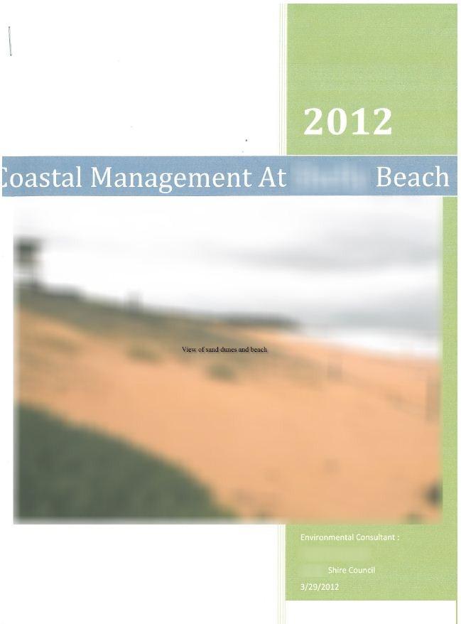
2 INTRODUCTION As an environmental consultant, I will be conducting an investigation into the effectiveness of the coastal management strategies currently being undertaken at XXX beach. Here I will be looking at the natural and human impacts on the beach, the current coastal management strategies and their effectiveness and to recommend improvements to the current or to new strategies. ' Clearly state reason for study The Natural And Human Impacts At XXX Beach Human Impacts At XXX Beach, the impacts humans have made is clear to see. Where use tobe larger fordunes and backdunes there now sits a car park and surf club. Designated walkways down to the beach dune fencing, signs and bins are coastal management strategies but are also a result of human impact to the beach. Other human impacts include; Public toilets, the surf life saving tower, picnic areas and taps. Humans can have both good and bad impacts on the beach for eg. Humans have brought in a car park and surf club, meaning that the beach has lost part of its backdunes. However, humans have put in place Coastal Management strategies to help the beach from threats such as erosion. Sound overview of a range of impacts and use of geographical terminology The natural impacts that can be seen at XXX Beach include a tombolo. Rock cut platform, Sand dunes, Cliff and Headlands.


3 Current Coastal Management Strategies & Their Effectiveness At XXX Beach The Coastal management strategies that are being used at XXX Beach at the present time include Dune fencing, bins, vegetation, signs and manmade walkways down to the beach. The most effective of these strategies include dune fencing, vegetation and the designed walkways to the beach. Dune fencing is the construction of fences along and outlining the primary dunes. This reduces the trampling by people by restricting the access to the deunes and protects existing or transplanted vegetation on the dune. At XXX beach dune fencing is one of the most effective coastal management strategies being used. Applies knowledge collected in the field to draw conclusions The planting of vegetation on the primary dunes are also one of the more effective of the coastal management strategies being used at XXX Beach. The planting of vegetation helps to protect the dunes from the threat of erosion by plants such as spinifex that act as sand stabilizers. The spinifex catches the sand and it sticks to the plant instead of blowing/ eroding away. As well as dune fencing and the planting of vegetation, designed walkways down to the beach are also an important and effective coastal management strategy. The walkways are designed to help reduce the impact that people have on the dunes when making their way down to the beach. It is important that we have these walkways so that when people do go don to the beach they are making as little impact on the dunes and vegetation as possible. Use of clearly labelled photographs Sound explanation of several specific examples of management strategies and evidence of use of primary data

4 A coastal management strategy that is in use at XXX Beach, that is less effective that the others, is the use of bins. Bins at the beach are very important so that people have a place to put their rubbish instead of littering. The bins at XXX Beach seem to be less effective because there was still rubbish seen on the ground. This could be because there weren't enough there and people couldn t find them or they were full. Another coastal management strategy in use at XXX Beach that is less effective than the others are the use of signs on the beach. Although this is still a good strategy it seemed to be less effective because some people don t notice them or just don t care. Although, most of the signs at XXX Beach were clear and easy to read. Adequate discussion of improvements necessary for better management of the beach Recommended Improvements To Current Strategies & New Strateges To Help Manage the Coastal Environment at XXX Beach While the current coastal management strategies at XXX Beach are good and for the most part, fairly effective, there is definitely room for improvement in both current and new strategies. To add to and improve the current strategies being used at XXX Beach I recommend that the council bring in more bins to be spread out and that unlike the old bins, have lids on them to stop the rubbish from flying out when there are strong winds, This would reduce the amount of litter on the beach. Also, bringing in the bins that have different categories for recyclable, glass and general waste would be better for the environment in that it also recycles the rubbish instead of just dumping it into the general waste. Clear management recommendations Making the signs at the beach more noticeable would also improve their effectiveness. At the moment the signs at XXX Beach are in plain colours ( as seen in the picture to the left) and less noticeable than others signs that have used brighter colours to get the public s attention. Improving these signs by making them bigger and brighter to draw the public s attention would make the use of signs a more effective coastal management strategy at XXX Beach.

5 The dune fencing a XXX Beach was good, but could still be improved by fencing off the entire dine and not just at the bottom and top. Most beaches that fence off the dunes completely find that people are less likely to slide down, trample on or walk across the dunes this way. Good use of evidence from the field and possible solutions to issues discussed Bibliography Websites: Books: Geography Excursion Booklet Geography work book Pictures: My own pictures from the excursion to XXX Beach WEBSITE - hi=en&q=bins+at+beach&bav+0n.2,or.r_gc.r_qf.,cf.osb&biw=1280&b ih=683&wrapid=tlif &um=1&ie=utf- 8&tbm=isch&source=og&sa=N&tab=wi&ei=OW9zT5PIMYuTiQfnIL 3kDw Grade Commentary demonstrates sound knowledge of the key impacts and management strategies employed on the coast. Specific examples of management strategies and their effectiveness have been explained and evaluated using evidence showing an adequate understanding of the key issues. Some appropriate photographs are used but other geographical tools such as maps and sketches would improve this report. The report uses sophisticated language and presents in a logical manner. This work sample demonstrates characteristics of work typically produced by a student performing at C grade standard.
Coastal Management at XXX Beach
 Natural and Human Impacts Coastal Management at XXX Beach Natural Headland Erosion - the small headland closest to the lookout has over time eroded leaving a rock platform along with rubble (see figure
Site: London Bridge. Some further information about London Bridge can be found at the Parks Victoria website
 Site: London Bridge About London Bridge London Bridge is located at the Portsea Back Beach which is approximately 3 kilometres south of Portsea. This site provides students with excellent examples of coastal
RAINBOW BAY FIELD REPORT
 RAINBOW BAY FIELD REPORT Contents Page Abstract 1.0 Introduction.. 2.0 Methodology 2.1 Limitations.. 3.0 Statement of Findings. 3.1 History. 3.2 Data Collection. 3.2.1 Observations. 3.2.2 Management Strategies
Exemplar for Internal Assessment Resource Geography Level 3. Resource title: The Coastal Environment Kaikoura
 Exemplar for internal assessment resource Geography 3.5A for Achievement Standard 91430 Exemplar for Internal Assessment Resource Geography Level 3 Resource title: The Coastal Environment Kaikoura This
Site The fieldwork should be completed at a localised site on the Victorian coast (or elsewhere).
.") Coastal fieldwork Studying the coast provides the opportunity to conduct fieldwork in coastal regions. This fieldwork could investigate the geographic characteristics of the coast and how they change over
Coastal fieldwork Studying the coast provides the opportunity to conduct fieldwork in coastal regions. This fieldwork could investigate the geographic characteristics of the coast and how they change over
Identify one factor which influences wave strength (1 Mark) Factors which affect wave strength
 Factors which affect wave strength") Coasts revision Identify one factor which influences wave strength (1 Mark) Factors which affect wave strength Identify one factor which influences wave strength (1 Mark) Factors which affect wave strength
Coasts revision Identify one factor which influences wave strength (1 Mark) Factors which affect wave strength Identify one factor which influences wave strength (1 Mark) Factors which affect wave strength
Coastal Processes and Landforms
 Coastal Processes and Landforms These icons indicate that teacher s notes or useful web addresses are available in the Notes Page. This icon indicates that the slide contains activities created in Flash.
GCSE 4241/02 GEOGRAPHY SPECIFICATION B HIGHER TIER UNIT 1
 Surname Other Names Centre Number 0 Candidate Number GCSE 4241/02 GEOGRAPHY SPECIFICATION B HIGHER TIER UNIT 1 P.M. TUESDAY, 4 June 2013 1 hour For examiner s use Question 1 Question 2 Total Marks 30 30
Cambridge International Examinations Cambridge International General Certificate of Secondary Education
 Cambridge International Examinations Cambridge International General Certificate of Secondary Education *4574868004* GEOGRAPHY 0460/43 Paper 4 Alternative to Coursework October/November 2017 Candidates
COASTS (P.38-45) Management: Hard engineering: Groynes Sea walls Gabions Soft Engineering: Beach replenishment Dune regeneration
 Management: Hard engineering: Groynes Sea walls Gabions Soft Engineering: Beach replenishment Dune regeneration") COASTS (P.38-45) Processes: Types of wave Weathering Mass Movement Erosion Transport Deposition Landforms: Cracks Caves Arches Stacks/stumps Headlands/bays Coves Spits Tombolos Beaches Sand dunes Management:
COASTS (P.38-45) Processes: Types of wave Weathering Mass Movement Erosion Transport Deposition Landforms: Cracks Caves Arches Stacks/stumps Headlands/bays Coves Spits Tombolos Beaches Sand dunes Management:
Coastal Processes and Landforms
 Coastal Processes and Landforms These icons indicate that teacher s notes or useful web addresses are available in the Notes Page. This icon indicates that the slide contains activities created in Flash.
Natural Bridges Field Trip Activity
 Natural Bridges Field Trip Activity This is due in class on MONDAY- March 1 - not in sections! Name TA: NOTE ON THE GRADING OF THIS ASSIGNMENT: Many of the questions below (especially in the tidepool part)
Formation and characteristics of different types of beaches
 Activity Title: Formation and characteristics of different types of beaches Focusing questions What different types of beaches are there in New Zealand? How are estuaries different to open coastal sandy
RI Regulatory Setbacks & Buffers: Coastal Management Issues
 RI Regulatory Setbacks & Buffers: Coastal Management Issues New England Onsite Wastewater Training Program @ URI OWT 155 - November 29, 2012 James Boyd - Coastal Policy Analyst Photo: October 30, 2012
WJEC Eduqas GCSE (9-1) Geography Mitigating Risk. (for assessment in 2019) Andy Owen
 Geography Mitigating Risk. (for assessment in 2019) Andy Owen") WJEC Eduqas GCSE (9-1) Geography Mitigating Risk (for assessment in 2019) Andy Owen An investigation of risk Your students need to investigate the concept that risks in our environment can be managed and
WJEC Eduqas GCSE (9-1) Geography Mitigating Risk (for assessment in 2019) Andy Owen An investigation of risk Your students need to investigate the concept that risks in our environment can be managed and
Label the diagram below with long fetch and short fetch:
 Coastal Processes Coasts are shaped by the sea and the action of waves. The processes that take place are erosion, transportation and deposition. The power of waves is one of the most significant forces
Chesil Beach, Dorset UK High energy, shingle coastline. Brighton Beach, Sussex UK Pebble beach
 Beaches: Depositional landform Extends from the highest high tide to the lowest low tide. Very important temporary store in coastal system. Accretion: sediment returning to the visible portion of a beach
OIMB GK12 CURRICULUM
 2 nd Grade 45 minutes SAND DUNES Oregon Science Content Standards: 2.1 Structure and Function: Living and non-living things vary throughout the natural world. 2.2 Interaction and Change: Living and non-living
MAPS AND AERIAL PHOTOS REVISION
 MAPS AND AERIAL PHOTOS REVISION IF THE FOLLOWING COMES UP IN THE SHORT QUESTIONS REMEMBER SCALE OF 1:1,100,000,000 MAP FROM A WORLD ATLAS LARGE AREAS WITH LITTLE DETAIL 1:250,000 SCALE OF CAR ATLAS MAP
/50. Physical Geology Shorelines
 Physical Geology Shorelines Multiple Guess: (You know the drill 2 points each) 1. The path of movement of a water particle in a wave at sea is 1. circular 2. horizontal 3. vertical 4. elliptical 5. none
GONE! Coastal Erosion Happens During Storms! Why Worry About Coastal Setbacks? Goals for Today
 RI Regulatory Setbacks & Buffers: Coastal Zone Management Issues New England Onsite Wastewater Training Program @ URI OWT 155 November 21, 2013 Goals for Today Understand the impacts of storms, coastal
NAME: DATE: Geography: Sea Action. Geography. Sea Action
 Geography Sea Action It is not necessary to carry out all the activities contained in this unit. Please see Teachers Notes for explanations, additional activities, and tips and suggestions. Theme All students:
Name: Form: 2.To know the difference between Constructive and Destructive wave # $
 Name: Form: Landforms and landscape processes: COASTS 1. To know what factors affect the strength of waves # $ 2.To know the difference between Constructive and Destructive wave # $ 3. To be able to draw
COASTAL SYSTEMS WAVE ENERGY
 WAVE ENERGY The energy of a wave determines its ability to erode and transport material on the coast Wave energy depends on the fetch, the distance the wind has blown the wave Wind strength and wind duration
General Coastal Notes + Landforms! 1
 General Coastal Notes + Landforms! 1 Types of Coastlines: Type Description Primary Coast which is essentially in the same condition when sea level stabilized Coastline after the last ice age, younger.
SHOREHAM BEACH LOCAL NATURE RESERVE
 SHOREHAM BEACH LOCAL NATURE RESERVE Coastal Geography Education Programme 2014-15 S. Savage 2014 COASTAL GEOGRAPHY OPPORTUNITIES Shoreham Beach Shoreham Beach is a shingle spit formed over many centuries
Coastal Change and Conflict
 Coastal Change and Conflict Outline of the Topic Contrasting Coasts why do all coasts not look the same? Geology of the coast the impact rock structure has on the coastline Waves Constructive and destructive
Earth Science Chapter 16 Section 3 Review
 Name: Class: Date: Earth Science Chapter 16 Section 3 Review Multiple Choice Identify the choice that best completes the statement or answers the question. 1. The movement of water that parallels the shore
TITLE: North Carolina s Changing Shorelines. KEYWORDS: erosion - shorelines - mapping - sustainability
 UNC Coastal Studies Institute Teacher Resources 1 TITLE: North Carolina s Changing Shorelines KEYWORDS: erosion - shorelines - mapping - sustainability Changing shorelines impact coastal infrastructure.
Event Address: Bondi (Notts Avenue) to Tamarama Beach Coastal Walk, NSW 2026
 to Tamarama Beach Coastal Walk, NSW 2026") Event Address: Bondi (Notts Avenue) to Tamarama Beach Coastal Walk, NSW 2026 Postal Address: Phone: (02) 8399 0233 Fax: (02) 8399 2322 Website: Contact: Email: Suite 302, 61 Marlborough Street Surry Hills
Event Address: Bondi (Notts Avenue) to Tamarama Beach Coastal Walk, NSW 2026 Postal Address: Phone: (02) 8399 0233 Fax: (02) 8399 2322 Website: Contact: Email: Suite 302, 61 Marlborough Street Surry Hills
Ocean Beaches Strategy Version 1.0 August 2013
 Ocean Beaches Strategy 2013 2023 Version 1.0 August 2013 Contents Foreword 3 Introduction 5 Executive Summary 7 Strategy Background 9 Gold Coast City 9 Background 9 Current Services to the community 10
Define the key terms: - Abrasion - Attrition - Hydraulic action - Solution. Y11 Coasts
 Define the key terms: - Abrasion - Attrition - Hydraulic action - Solution Abrasion caused by waves picking up material which is forced against the cliff face wearing it away Attrition where stones and
Trends in Shoreline Change and Hazard Impacts: Hot Spots and Management Challenges. Greg Berman CAPE COASTAL CONFERENCE.
 CAPE COASTAL CONFERENCE Linking Science with Local Solu1ons and Decision- Making Trends in Shoreline Change and Hazard Impacts: Hot Spots and Management Challenges Presented By Greg Berman (WHOI Sea Grant
COASTAL MANAGEMENT AND PROTECTION METHODS! 1
 COASTAL MANAGEMENT AND PROTECTION METHODS! 1 Strategy What it does Cons Pros Examples SOFT ENGINEERING: The use of ecological principles and practices to reduce erosion and achieve the stabilization and
Bouddi Coastal Walk. 5 hrs. Hard track 8.1 km One way. 364m
 Bouddi Coastal Walk 5 hrs Hard track 8.1 km One way 4 364m This is one of the longer walks in the Bouddi National Park and it is rich in scenery. The walk follows the coastline with many side trips to
Environmental Protection on the Gold Coast of Queensland, Australia. 1. What is the appeal of the Gold Coast to tourists?
 Environmental Protection on the Gold Coast of Queensland, Australia Sections 1. What is the appeal of the Gold Coast to tourists? 2. How are Gold Coast visitor trends changing? 3. How can the impacts of
The Sea Geography Notes JC-Learn. JC-Learn. Geography Notes The Sea. 1 P a g e
 JC-Learn Geography Notes The Sea 1 P a g e The Sea *Here, you can choose to study the chapter on glaciation or the one on the sea, or even both, because whenever these topics come up in the Junior Cert
Neighbourhood Walkability Checklist How walkable is your community?
 Template letter This template is a guide to writing to your local council. You can change it in any way you feel necessary. Don t forget to attach the checklist and any photographs, maps or sketches you
Studland Bay Context and Learning Aims
 Studland Bay Enquiry 7: How are coastal processes affecting Studland Bay? Context and Learning Aims Pupils will be supported in and outside of the classroom to: Identify; describe and explain the physical
Beach Buckets. Lawrence Hall of Science
 Beach Buckets This activity outline was developed for use in a variety of informal venues. By design, it provides the content, pedagogy and strategy necessary for implementation by both the novice and
Wallarah Coastal Walk
 Wallarah Coastal Walk 3 hrs 8.3 km Return Hard track 247m This walk starts at Caves Beach and travels south along the coastline, until reaching the Pinney s Headland Lookout. There are many opportunities
Apostle Islands National Seashore
 Apostle Islands National Seashore David Speer & Phillip Larson October 2 nd Fieldtrip Report Table of Contents Introduction 1 Stop 1: Apostle Island Boat Cruise 1 Stop 2: Coastal Geomorphology 5 Stop 3:
There are many different kinds of beaches which are generally characterized by the dominance of waves, tides, rivers and currents, and in particular
 Fig. 11-11, p. 253 There are many different kinds of beaches which are generally characterized by the dominance of waves, tides, rivers and currents, and in particular differ by the amount of energy, which
Map 8: Ayrshire Coast: Ardrossan North Bay to Stevenston Pier Map Content Descriptions
 Map 8: Ayrshire Coast: Ardrossan North Bay to Stevenston Pier Map Content Descriptions 1. Built Heritage and Archaeology A total of twenty four sites were recorded in the area covered by Map 8. Of these
Campbell Drive to Snapper Point
 Campbell Drive to Snapper Point 1 hr 45 mins 4.2 km One way Experienced only 135m This walk follows the Coast Track to Frazer Beach, along the Geebung and (overgrown) Grass Tree Tracks. From the northern
Nearshore Sediment Transport What influences the loss of sediment on Beaches? - Waves - Winds - Tidal Currents - River discharge - Runoff
 Tides & Beaches Nearshore Sediment Transport What influences the loss of sediment on Beaches? - Waves - Winds - Tidal Currents - River discharge - Runoff Oceans Ocean Topography Physical Structure of the
lit to ral (lĭt ər-əl) Last year:
 Last year:") 1 lit to ral (lĭt ər-əl) Of or on a shore, especially a seashore 1. A coastal region; a shore. 2. The region or zone between the limits of high and low tides. Last year: 2 Outline: Article 10 are calling
1 lit to ral (lĭt ər-əl) Of or on a shore, especially a seashore 1. A coastal region; a shore. 2. The region or zone between the limits of high and low tides. Last year: 2 Outline: Article 10 are calling
Beach Profiles: Monitoring Sea Level Rise. Student Activity Sheet. Name Date Class
 Beach Profiles: Monitoring Sea Level Rise Student Activity Sheet Name Date Class A shoreline is the area where the water and land meet. This is where we find beach: areas where sediments (sand or other
Chapter. The Dynamic Ocean
 Chapter The Dynamic Ocean An ocean current is the mass of ocean water that flows from one place to another. 16.1 The Composition of Seawater Surface Circulation Surface Currents Surface currents are movements
The Physical and Human Causes of Erosion. The Holderness Coast
 The Physical and Human Causes of Erosion The Holderness Coast By The British Geographer Situation The Holderness coast is located on the east coast of England and is part of the East Riding of Yorkshire;
COASTAL EROSION. 1 Getting Oriented
 COASTAL EROSION Many people dream of building their home on the California Coastline with its picturesque vistas of the setting sun and the gentle sounds of waves breaking. However, these waves are not
Wattamolla to Big Marley Beach
 Wattamolla to Big Marley Beach 4 hrs 10.4 km Circuit Moderate track 4m This walk is an excellent loop which takes in both the coast and the heathy inland of Royal National Park. Nearly the whole walk has
Unit2L.4: Care of the environment (Habitats)
") Unit2L.4: Care of the environment (Habitats) Care of the environment Industry and the environment Science skills: Observing Inferring Collecting and interpreting data (record) By the end of this unit you
Unit2L.4: Care of the environment (Habitats) Care of the environment Industry and the environment Science skills: Observing Inferring Collecting and interpreting data (record) By the end of this unit you
PUBLIC EXHIBITION OF COASTAL ZONE MANAGEMENT PLAN FOR COLLAROY-NARRABEEN BEACH AND FISHERMANS BEACH
 ITEM 8.3 REPORTING MANAGER TRIM FILE REF 2014/110936 ATTACHMENTS PUBLIC EXHIBITION OF COASTAL ZONE MANAGEMENT PLAN FOR COLLAROY-NARRABEEN BEACH AND FISHERMANS BEACH GROUP MANAGER NATURAL ENVIRONMENT 1
* Appalachian Mountains -the mountain range in the Eastern U.S. which terminates in north-central Alabama
 MR. SAND TEACHER'S MANUAL INTRODUCTION: Although Mr. Sand is a cartoon presentation that is attractive to children (of all ages), the material is technically accurate and quite significant to our understanding
Chapter - Oceans and Coasts
 Chapter - Oceans and Coasts Discussion: What do oceans contribute to the environment of Earth? How do Earth s major systems relate to the oceans? Oceans and Coasts Oceans are important - Thermal regulation
WHAT ARE THE MAJOR COASTLINE FEATURES AND WAVE CHARACTERISTICS WHICH INDICATE THAT MARINE EROSION IS ACTIVE ON THE EASTERN SIDE OF THE
 WHAT ARE THE MAJOR COASTLINE FEATURES AND WAVE CHARACTERISTICS WHICH INDICATE THAT MARINE EROSION IS ACTIVE ON THE EASTERN SIDE OF THE ENTRANCE TO DISCOVERY BAY HARBOUR IN JAMAICA? JEFFREY JOHNSON YORK
Eco Barge Clean Seas Inc. Activity Book. Colour me in!
 Eco Barge Clean Seas Inc. Activity Book Colour me in! For Parents, Caregivers and Teachers Marine litter is one of the most threatening, but also the most solvable pollution issues currently affecting
TITLE: COASTAL EROSION AND LANDFORMS.
 TITLE: COASTAL EROSION AND LANDFORMS. AIM: What are the factors that influence the formation of coastal features along Fishing Pond beach Trinidad? LOCATION OF FIELD STUDY: The study was carried out in
Hunters Hill to Epping Road
 Hunters Hill to Epping Road 2 hrs 30 mins 5.5 km One way Moderate track 154m An enjoyable walk through lower sections of the Lane Cove National Park, this walk features plenty of mangroves next to the
Australian Coastal Councils Conference
 Australian Coastal Councils Conference Kiama March 2019 Where Has My Beach Gone? (and what can I do about it?) Dr Andrew McCowan Water Technology Where Has My Beach Gone? Where Has My Beach Gone? Where
Balmoral Beach to The Spit
 Balmoral Beach to The Spit 2 hrs 30 mins.3 km One way Hard track 85m This walks follows the coast from Balmoral to the Spit and across Spit Bridge. There are some alternate tracks to consider at high-tides,
Beach profile surveys and morphological change, Otago Harbour entrance to Karitane May 2014 to June 2015
 Beach profile surveys and morphological change, Otago Harbour entrance to Karitane May 2014 to June 2015 Prepared for Port Otago Ltd Martin Single September 2015 Shore Processes and Management Ltd Contact
Chapter 10 Lecture Outline. The Restless Oceans
 Chapter 10 Lecture Outline The Restless Oceans Focus Question 10.1 How does the Coriolis effect influence ocean currents? The Ocean s Surface Circulation Ocean currents Masses of water that flow from one
The Sand Beaches of New Hampshire and Maine
 The Sand Beaches of New Hampshire and Maine Beach Preservation and Erosion Control Photographs provided by Joe Kelly and Steve Adams Cover photo: Reid State Park, ME Introduction The sand beaches of New
Risk Assessment Fieldwork Techniques (covering all techniques used in field studies, excursion and science-based modules)
") Fieldwork Techniques Assessment Form Issued: 05/01/2018 v.2018.1.0 Ref: PROG-BRA-016 Assessment Fieldwork Techniques (covering all techniques used in field studies, excursion and science-based modules)
Fieldwork Techniques Assessment Form Issued: 05/01/2018 v.2018.1.0 Ref: PROG-BRA-016 Assessment Fieldwork Techniques (covering all techniques used in field studies, excursion and science-based modules)
FINAL BULLETIN U14-U15 JUNIOR TEAMS
 FINAL BULLETIN U14-U15 JUNIOR TEAMS SUNDAY 22nd OCTOBER 2017 @ GENERAL CONDITIONS CONDITIONS OF ENTRY This carnival will be conducted in accordance with the current edition of the Surf Sports Manual including
WINDING BACK THE CLOCK IN DUNE MANAGEMENT AT WOLLONGONG
 WINDING BACK THE CLOCK IN DUNE MANAGEMENT AT WOLLONGONG A Beardsmore 1, P Gangaiya 12, T Miskiewicz 1 1 Wollongong City Council, Wollongong, NSW 2 University of Wollongong, Wollongong, NSW Abstract The
NORTHERN CELL OPTIONS SHORTLIST RECOMMENDATIONS
 OPTIONS SHORTLIST RECOMMENDATIONS Coastal Unit C: Bayview Options recommended for MCDA scoring. Status quo. Planting 3. Renourishment (gravel) 6. Beach-scraping 7. Restore shingle crest. Inundation accommodation
O U T D O O R E D U C A T I O N :
 O U T D O O R E D U C A T I O N : Jonginenge offers safe, exciting and educational experiences for schools. Learners work in small groups and participate in practical tasks, environmental education and
Cambridge International Examinations Cambridge International General Certificate of Secondary Education
 Cambridge International Examinations Cambridge International General Certificate of Secondary Education *1089858088* GEOGRAPHY 0460/43 Paper 4 Alternative to Coursework May/June 2016 Candidates answer
Sustainable Decision Making (SDM) (Foundation and Higher Tier)
 (Foundation and Higher Tier)") GENERAL CERTIFICATE OF SECONDARY EDUCATION GEOGRAPHY B Sustainable Decision Making (SDM) (Foundation and Higher Tier) B561/01/02/RB RESOURCE BOOKLET *B523590611* This resource booklet should be available
GENERAL CERTIFICATE OF SECONDARY EDUCATION GEOGRAPHY B Sustainable Decision Making (SDM) (Foundation and Higher Tier) B561/01/02/RB RESOURCE BOOKLET *B523590611* This resource booklet should be available
page - Laboratory Exercise #5 Shoreline Processes
 page - Laboratory Exercise #5 Shoreline Processes Section A Shoreline Processes: Overview of Waves The ocean s surface is influenced by three types of motion (waves, tides and surface currents). Shorelines
Photo Interpretation The Issues, Values, and Relationships
 sprat Photo Interpretation The Issues, Values, and Relationships Task: People use and abuse the coast in a variety of ways. Use the key questions and/or the extension/complementary activities below for
All Season Age Friendly Pedestrian Safety and Walkability Checklist *
 FOSTERING AGE FRIENDLY, WALKABLE NEIGHBOURHOODS Walkability is a key component of optimal aging in Age Friendly cities. Walkable neighbourhoods promote physical and mental health and well-being, support
Future Condi,ons coastal hazard modeling and mapping
 Future Condi,ons coastal hazard modeling and mapping Presented by Bob Ba:alio, PE Environmental Science Associates, Inc. (ESA) On behalf of the physical processes team (USGS, TerraCosta- Scripps, ESA)
Coasts. 1. Coastal Processes. 1.1 Coastal erosion. 1.2 Sediment transport. Coastal Processes and Landforms. i. Hydraulic action
 Coasts Coastal Processes and Landforms 1. Coastal Processes 1.1 Coastal erosion i. Hydraulic action When waves strike against a rock surface, the waves trap air in the rock joints. This air is compressed
SANDBANKS COAST PROTECTION
 SANDBANKS COAST PROTECTION David Robson, Senior Engineer, Coastal & Drainage Team Borough of Poole Leisure Services (T) 01202 265265 (E) d.robson@poole.gov.uk May 2003 SANDBANKS COAST PROTECTION Introduction
2018 Beach Preservation Project Information
 QUICK FACTS Beach Renourishment to begin late April 2018 o U.S. Army Corps of Engineers project o Project Area: 8 th St. E. to end of E. Ashley Ave. o Project Length: 2 miles o Cost: $10,900,000 o Funding:
SLSNZ EST Sand Dune Restoration Program. Protecting our Beach Environment into The Future For the next 100 Years +
 SLSNZ EST 1910 Sand Dune Restoration Program Protecting our Beach Environment into The Future For the next 100 Years + We have all been told about the effects of sea level rise due to global warning! But
Climate Change Impacts to KSC Launch Complex
 Climate Change Impacts to KSC Launch Complex Presented to: 2010 International Workshop on Environment and Energy By: John Shaffer NASA Environmental Management Branch Kennedy Space Center Hurricane Season
Coastal management has lagged behind the growth in population leading to problems with pollution
 Fifty percent of the population of the industrialized world lives within 100 km of a coast. Coastal management has lagged behind the growth in population leading to problems with pollution and natural
Walking Audit Supporting Information
 Walking Audit Supporting Information Planning to do a walking audit of your streets? Here s some helpful suggestions to help get you started. 1. Preparing for your audit Decide where you want to walk.
Lecture Outlines PowerPoint. Chapter 15 Earth Science, 12e Tarbuck/Lutgens
 Lecture Outlines PowerPoint Chapter 15 Earth Science, 12e Tarbuck/Lutgens 2009 Pearson Prentice Hall This work is protected by United States copyright laws and is provided solely for the use of instructors
N NE E SE S SW W NW N/A. onshore offshore sideshore side-on side-off
 COASTAL SITE SURVEY Survey Guidelines: Complete one Coastal Litter survey form per site and one transect data form for each transect at the site. Record all coordinates in WGS84 datum only. Minimum of
Information on the Solid Waste Services commencing February 2014:
 Information on the Solid Waste Services commencing February 2014: Q: What is the new kerbside collection service and when does it start? A: Buller District Council is introducing a new kerbside collection
Success Criteria: Ch. 7 China
 Log in to Geography of China ppt Success Criteria: Ch. 7 China Last Name 1. Identify China, the Huang He River, the Gobi Desert, and the Plateau of Tibet on any map. 2. Identify where the first civilization
Appendix C Projected Outputs and Progress
 Greenlink Final Report November 2001. 58 Appendix C Projected Outputs and Progress Greenlink Final Report November 2001. 59 1. Collection of Propagules were collected for several of the sites in the propagules
Red Rocks Pari-whero. Red Rocks/Pari-Whero. Quarry. Owhiro Bay Quarry. Owhiro Bay Parade. Taputeranga Marine Reserve ISSUES AND OPPORTUNITIES ANALYSIS
 Red Rocks Pari-whero Wild coastal environment Shared path with WD vehicles Red Rocks/Pari-Whero Owhiro Bay Parade Owhiro Bay Quarry Quarry Taputeranga Marine Reserve 2 PART Potential future links Makara
Overview. Beach Features. Coastal Regions. Other Beach Profile Features. CHAPTER 10 The Coast: Beaches and Shoreline Processes.
 Overview CHAPTER 10 The Coast: Beaches and Shoreline Processes Coastal regions constantly change. The beach is a dominant coastal feature. Wave activity continually modifies the beach and coastal areas.
An Update of Coastal Erosion in Puerto Rico
 Jack Morelock and Maritza Barreto An Update of Coastal Erosion in Puerto Rico Department of Marine Sciences, University of Puerto Rico at Mayagüez and Geography Department, University of Puerto Rico at
New Jersey Coastal Zone Overview. The New Jersey Beach Profile Network (NJBPN) 3 Dimensional Assessments. Quantifying Shoreline Migration
 3 Dimensional Assessments. Quantifying Shoreline Migration") New Jersey Coastal Zone Overview The New Jersey Beach Profile Network (NJBPN) Objectives Profile Locations Data Collection Analyzing NJBPN Data Examples 3 Dimensional Assessments Methodology Examples Quantifying
New Jersey Coastal Zone Overview The New Jersey Beach Profile Network (NJBPN) Objectives Profile Locations Data Collection Analyzing NJBPN Data Examples 3 Dimensional Assessments Methodology Examples Quantifying
ALTERNATIVES FOR COASTAL STORM DAMAGE MITIGATION
 ALTERNATIVES FOR COASTAL STORM DAMAGE MITIGATION Dave Basco Old Dominion University, Norfolk, Virginia, USA National Park Service Photo STRUCTURAL (changes to natural, physical system) hardening (seawalls,
FASTER, HIGHER, STRONGER LEVEL 4 - Year 5/6 THE BENEFITS OF THE OLYMPIC GAMES
 LEVEL 4 - Year 5/6 THE BENEFITS OF THE OLYMPIC GAMES 1 LEVEL 4 YEAR 5/6 KEY CONCEPT The Olympic Games benefit people, society, countries and the world. FOCUSING QUESTIONS 1. How is a country chosen to
3 Maps and Charts In order to navigate we need to use some form of map. The two choices are nautical charts, or land maps.
 13 3 Maps and Charts In order to navigate we need to use some form of map. The two choices are nautical charts, or land maps. Charts Nautical Charts only show the land detail that is visible from the sea.
Vieques Munitions Response: Current Issues
 Vieques Munitions Response: Current Issues NAOC General Membership Meeting December 7, 2016 Agenda Project Overview Surface Clearance Subsurface Clearance Remote Controlled Equipment Underwater MEC Open
Station 1: Solar Radiation on Earth
 Station 1: Solar Radiation on Earth Activity Procedures 1. Choose one person to be the Sun. 2. Standing an arm s length away from the globe, have the Sun classmate hold the flashlight level with the equator,
Delaware Chapter Surfrider Foundation - Indian River Inlet Monitoring
 Delaware Chapter Surfrider Foundation - Indian River Inlet Monitoring In 2012, the Delaware Surfrider Foundation Chapter formed the Surf Quality and Access Committee to focus on issues such as surf spot
AQA(B) GCSE GEOGRAPHY REVISION BOOKLET
 GCSE GEOGRAPHY REVISION BOOKLET") Name: Form: Geography Teacher: AQA(B) GCSE GEOGRAPHY REVISION BOOKLET UNIT 1 THE COASTAL ENVIRONMENT Dr K Hutchinson (Chesterton Community College, Cambridge) Miss E Johns (Hitchin Girls School, Hitchin)
Name: Form: Geography Teacher: AQA(B) GCSE GEOGRAPHY REVISION BOOKLET UNIT 1 THE COASTAL ENVIRONMENT Dr K Hutchinson (Chesterton Community College, Cambridge) Miss E Johns (Hitchin Girls School, Hitchin)
FRESHWATER COASTAL OPEN SPACE STAGE ONE ENGAGEMENT. Area 1 - Freshwater View - comments from community drop in sessions March 2017
 FRESHWATER COASTAL OPEN SPACE STAGE ONE ENGAGEMENT Area 1 - Freshwater View - comments from community drop in sessions March 2017 What do you love about this space? Secluded hidden gem The view, the path