Local Comprehensive Beach Management Plan City of Isle of Palms, South Carolina Local Adoption - February 22, 2008 State Approval April 7, 2008
|
|
|
- Marlene Lambert
- 5 years ago
- Views:
Transcription


1 Local Comprehensive Beach Management Plan City of Isle of Palms, South Carolina Local Adoption - February 22, 2008 State Approval April 7, 2008 Blue Wave
2
3
4
5
6
7 Cover Photo Credits: Lower left photo by Barbara Bergwerf; other photos by Chris Jones. TABLE OF CONTENTS 1. Introduction Local Comprehensive Beach Management Plan Purpose History Goals Description of Isle of Palms Local History and Background Storm History Population and Demographics Major Roads and Bridges Land Use Patterns DHEC OCRM Shoreline Classification, Baseline and 40-Year Setback Line Local Beach Management Issues Prior Reports and Studies City Beach Management Policies Inventory of Existing Conditions The Isle of Palms Beach Beach Characteristics Shoreline Change Erosion Rates Tidal Inlet Effects Sediment Budgets Beach Use and Safety Benefits and Value of Beach Beachfront Development Land Use Natural Resources and Ecological Habitats Threatened and Endangered Species Existing Public Access and Map Beachfront Structural Inventory and Map Beachfront Drainage Erosion Control and Management Discussion of Erosion Control Alternatives Emergency Protective Measures Beach Renourishment Other Measures Beach Management and Authorities Public Trust Doctrine Agencies and Jurisdiction Federal i
8 State City City Regulation and Management City Comprehensive Plan Land Use, Development and Zoning Beach Management Hazard Mitigation Plan Stormwater Management Plan Floodplain Management Local Enforcement Public Outreach and Education Shoreline Retreat Policy State Mandated Beachfront Setback City-Mandated Beachfront Setback and Protection Regulations Disaster Recovery and Mitigation Preparedness and Evacuation Response and Recovery Mitigation Beach Management Needs, Goals, and Implementation Strategy Strategy for achieving goals of State 40-Year Retreat Policy Strategy for preserving and enhancing public beach access City Beach Management Policies References Appendices (Overlay Maps, Structure Inventories and Beach Access Inventories) ii
9 1. Introduction 1.1. Local Comprehensive Beach Management Plan In accordance with the State Beachfront Management Act, the City of Isle of Palms has prepared this local comprehensive beach management plan in coordination with the South Carolina Department of Health and Environmental Control s Office of Ocean and Coastal Resource Management (DHEC OCRM). The City s local comprehensive beach management plan represents considerable effort, inventory, and deliberation on the part of the City, and establishes a strategy for the management of the Isle of Palms beach for the sustainable enjoyment by residents and visitors. This local beach management plan is intended for incorporation into the State Beachfront Management Plan in accordance with the provisions of the State Beachfront Management Act. The State Beachfront Management Act became law in 1988 with revisions in 1990 and is intended to protect both life and property, protect unique ecological habitats, and preserve the beach for future use by all citizens of South Carolina. The Act addresses preservation of a drysand beach, public access opportunities, measures for renourishment on eroding beaches, and the protection of natural vegetation within the beach and dune system. The Act rejects the construction of new erosion control devices and adopts retreat and renourishment as the basic state policy for preserving and restoring oceanfront beaches in South Carolina. The Act also directs DHEC OCRM to implement the forty-year retreat policy by designating a baseline and setback line on all oceanfront properties, and to develop a long-range comprehensive State plan for management of the beach and dune resources. One of the most important provisions of the Act requires local beachfront counties and municipalities to develop and adopt local comprehensive beach management plans which refine the State s beach management strategy to address local conditions and issues. The Act requires that these local plans be long-range, comprehensive, and consistent with the State Beachfront Management Act. Once adopted locally, DHEC OCRM reviews the plan for approval, and approved local plans become part of the State Beachfront Management Plan. Once approved, the local plan is required to be updated every five years in coordination with DHEC OCRM. Local beach management plans are required to include a minimum of ten elements: 1. an inventory of beach profile data and historic erosion rate data; 2. an inventory of public beach accesses along with a plan for enhancing public access and parking; 3. an inventory of all structures located in the area seaward of the setback line; 4. an inventory of turtle nesting and important habitats of the beach/dune system and a protection and restoration plan if necessary; 5. a conventional zoning and land use plan consistent with the purposes of the Act for the area seaward of the setback line; 6. an analysis of beach erosion control alternatives, including renourishment of the beach under the local government's jurisdiction; 7. a drainage plan for the area seaward of the setback zone; 1
10 8. a post disaster plan including plans for cleanup, maintaining essential services, protecting public health, emergency building ordinances, and the establishment of priorities, all of which must be consistent with the Act; 9. a detailed strategy for achieving the goals of this chapter by the end of the forty-year retreat period. Consideration must be given to relocating buildings, removal of erosion control structures, and relocation of utilities; and 10. a detailed strategy for achieving the goals of preservation of existing public access and the enhancement of public access to assure full enjoyment of the beach by all residents of this State. The City of Isle of Palms has coordinated with DHEC OCRM to fully inventory, analyze, and document each of the ten required elements for an approvable local comprehensive beach management plan. The plan also identifies and discusses the economic and social benefits, issues and opportunities, and local, state, and federal policies and authorities related to the management and protection of the Isle of Palms beach. This local beach management plan represents the foundation for a comprehensive, long-range, and enforceable local management strategy for the beachfront area of the City of Isle of Palms Purpose The City of Isle of Palms has written and adopted this Plan for two principal reasons: To identify and collect information relevant to the management of the City s ocean and inlet shorelines To become eligible for State beach management funding History The City first initiated drafting its Local Comprehensive Beach Management Plan in A Plan was submitted to the South Carolina Coastal Council (SCCC) and the City received SCCC comments in March Subsequent efforts by the City to address the comments were not entirely successful, and the City set aside its work on the plan, concentrating on other matters. In July 2006, the City reactivated its efforts to create and adopt a Plan. The City Council adopted the Plan in March 2007 and the Plan was submitted to DHEC OCRM in April DHEC OCRM provided informal comments to the City in November 2007, revisions were made to the Plan and the City adopted the revised Plan in Goals The City hopes to realize the beach management vision articulated by its Long Term Beach Management Advisory Group in October 2007: a dry sand beach at all stages of the tide, capable of providing recreational opportunities for residents and visitors, protecting upland development and sustaining our natural resources elimination of the chronic and periodic erosion problems that threaten buildings and loggerhead nesting habitat along the shoreline 2
11 minimizing the need for emergency protection of upland structures and development avoiding future shoreline development practices which perpetuate or exacerbate problems of the past, where some buildings were sited close to a dynamic inlet shoreline cooperation between all City residents to ensure that this vision is implemented and that generations to come can enjoy the beach on Isle of Palms 1.2. Description of Isle of Palms The Isle of Palms is a seven-mile long barrier island located eight miles east of Charleston on the South Carolina coast (see Figure 1). This long and relatively narrow island varies in width from.35 miles to 1.6 miles and its slightly curving shoreline has an orientation of southwest to northeast. The total area of the island is approximately four and one-half square miles, or 2,880 acres (Isle of Palms Planning Commission, 2004). The island is bounded on the north by Hamlin Creek and the Atlantic Intracoastal Waterway, on the east by Dewees Inlet and Dewees Island, on the south by the Atlantic Ocean, and on the west by Breach Inlet and Sullivan s Island. Ground elevations on the island range from 17 feet above mean sea level (MSL) at points along a ridge on the ocean side of the island to sea level. However, the topography of the island is relatively flat with an average ground elevation above mean sea level of only eight (8) to ten (10) feet. The mean tide range, low tide to high tide, is 5.2 feet with the spring tide range increasing to 6.1 feet. Tides can be considerably higher during hurricanes and other severe storms. Wave energy along the shoreline tends to be mild, with a mean significant wave height of 2.4 ft and a mean wave period of 5.7 seconds (Jensen, 1983). Winds and waves tend to approach from the south and southeast during the summer months and from the northeast during the winter. The south/southeast direction of approach is more frequent, but the northeast winds and waves are usually stronger. The Isle of Palms beach has been designated as a Blue Wave Beach by the Clean Beaches Council, a national not-for-profit organization devoted to increasing public awareness and volunteer participation in beach sustainability. The Blue Wave designation is America s first environmental certification for ocean beaches, and the conferees voluntarily pledge to uphold responsible beach management practices related to water quality, beach and intertidal conditions, hazards, services, habitat conservation, public information and outreach, and erosion management. The Isle of Palms beach is the only Blue Wave certified beach in South Carolina a a see and 3
12 Figure 1. Isle of Palms Location Map 4
13 Local History and Background Originally known as Hunting Island and then, between the mid 18 th century and 1898, as Long Island, the Isle of Palms served for many years as a place of refuge and recreation. By the early 1900s, the name of the island was changed to Isle of Palms and the first overland access began by means of a trolley rail line running from Mount Pleasant across Sullivan s Island to Isle of Palms. Local entrepreneurs attempted to create a holiday resort on the island including the opening of a restaurant and Ferris wheel and the construction of the Seashore Hotel in As the island s popularity continued to increase, a long, covered pavilion, which stood until the late 1930s, was constructed along the beach. However, in 1924, Isle of Palms was effectively closed when the ferry service from Charleston to Mount Pleasant was discontinued due to financial difficulties. In 1926, a wooden bridge replaced the trolley trestle enabling visitors to come by car. With the opening of the Grace Memorial Bridge in 1929, linking Charleston and Mount Pleasant, and the advent of other road and bridge improvements, it soon became even easier to reach the Isle of Palms by automobile. Development was modest during the 1930s and increased in the 1940s and through the post-war era. In 1953, the island was incorporated as the City of Isle of Palms by an Act of the South Carolina Legislature Storm History The Isle of Palms has experienced many storms and hurricanes but none as devastating as Hurricane Hugo a Category 4 hurricane which hit the South Carolina coast at midnight on September 21, The storm surge covered most of the island with peak water levels ranging between 15.5 feet above MSL along the beach and 12.5 feet above MSL along the back of the island. Hurricane Hugo damaged nearly every structure on the island and destroyed more than 200 structures. Several important reports describe historic storm impacts in the Isle of Palms area. Information about hurricanes and tropical storms that have affected the area is contained in several references (Ludlum, 1963; Purvis and Landers, 1973; Myers, 1975; Federal Emergency Management Agency, 2004) b. Descriptions of some of the more significant storms are taken from the 2004 Flood Insurance Study for Charleston County (FEMA, 2004) and are included below: August 27, 1813: This storm passed near Charleston causing a large loss of lives and property. This hurricane rates a position close to the top of Charleston's meteorological list for its combination of severe winds, heights of flood tide and general destruction. b Additional, up-to-date information on hurricanes affecting South Carolina can be found at the State Climatologist web site: 5
14 September 27, 1822: This small destructive hurricane passed inland between the City of Georgetown and Charleston on September 27. This hurricane caused unprecedented tides at Georgetown and several hundred deaths in Charleston, the Town of Sullivan's Island, Georgetown and North Island. August 25, 1855: This hurricane, which originated in the Bahamas, moved inland north of Savannah on a northeasterly course and passed to the west of Wilmington, North Carolina. This hurricane is said to have damaged 90 percent of the houses in Charleston and swept some away completely. This extreme hurricane severely damaged the entire South Carolina coast. Damage in Charleston alone was $1.7 million. As a result of this destructive storm, it was proposed that a weather reporting network be set up in the West Indies and Mexico. Twenty-one lives were lost in Charleston as a result of this storm. August 27, 1893: This severe hurricane penetrated the Georgia and lower South Carolina coasts on August 27. It is estimated that more than 1,000 people lost their lives on the coastal islands and in the lowlands between the City of Tybee Island, Georgia and Charleston. The highest tide in this storm was estimated to have ranged from 17.0 to 19.5 feet msl at Savannah Beach, Georgia. At Charleston, the tide was 8.9 feet msl. Extensive property damage was caused along the Georgia and South Carolina coasts. August 23-30, 1911: The center of this hurricane crossed the coast between the City of Savannah and Charleston on August 28. This storm is considered in the same category as the storm of At Charleston, the barometer fell to 992 millibars (mb) (29.30 inches). The wind at the weather bureau office reached 81 mph from the southeast. Seventeen lives were lost, and damage totaled about $1 million. The storm passed into the piedmont section of South Carolina and then again curved to the northeast. At Charleston, the tide reached 7.5 feet msl. August 11, 1940: This hurricane entered the coast from the southeast, between Savannah, Georgia and Beaufort County, South Carolina, at about 4 p.m. on August 11. Near Beaufort County, the tide is estimated to have reached 14.2 feet msl. Near the southern tip of Edisto Island, a high-water mark indicated a tide of 13.6 feet msl on the open coast. About 175 cottages were destroyed on Edisto Island. On Folly Island, the maximum tide determined from a National Ocean Survey benchmark was 8.3 feet msl. The entire beachfront eroded an average of 75 feet. At Charleston, most of the damage was to buildings, wharfs and boats along the waterfront. Large areas of the waterfront perimeter in the city were inundated and many automobiles were damaged by the storm tide, which reached an elevation of 8.0 feet msl. Estimated damage to the city was $1 million. Sullivan's Island, the City of Isle of Palms, and Pawley's Island suffered minor damage. Overall, this hurricane was responsible for 34 deaths and caused damage estimated at $6.6 million. 6
15 September 29, 1959 (Hurricane Gracie): Hurricane Gracie moved inland on September 29. The center passed over the South Carolina coast at St. Helena about 10 miles east of the City of Beaufort. Damage of disaster proportions occurred in the coastal region from Beaufort to Charleston, and considerable additional damage occurred in the area of Walterboro. An enormous number of trees were felled, causing considerable random damage. There was a great deal of crop damage, especially to unpicked cotton. A barometric pressure of 950 mb (28.06 inches) was reported at Beaufort. The total damage inflicted by the storm was estimated at $14 million. High water marks, which were reported near the Town of Edisto Beach, South Carolina, ranged from 7.3 to 11.9 feet msl. August 25-September 7, 1979 (Hurricane David): At its time, Hurricane David was the most intense storm of the century to affect the islands of the eastern Caribbean. However, the storm was not a major hurricane when it struck the United States. David struck just north of the Town of Palm Beach, Florida, on September 3rd and made a second landfall about 24 hours later near Savannah Beach, Georgia. In the U. S., hurricane David was responsible for five deaths and about $300 million in damages. September 21, 1989 (Hurricane Hugo): Hurricane Hugo crossed the coast at Charleston at midnight on September 21. The hurricane was one of the most severe to strike the United States, and caused an estimated $7 billion in damages. Beach erosion and wash over were extensive from Folly Beach to the North Carolina line, as were flooding and damage to structures. The storm tide on Isle of Palms reached 16 ft above mean sea level during the storm (USGS. 1990), several feet higher than the level at Charleston, 10.5 ft. A barometric pressure of approximately 934 mb (27.60 inches) was reported at Charleston. Damage to dunes and structures along Isle of Palms shoreline was extensive. Miller (1990) reported that a claim was assigned to each of the 576 windstorm insurance policies in force on Isle of Palms at the time of Hugo. Figure 2 shows hurricanes and tropical storms affecting South Carolina between 1975 and 2005 c. It is apparent from the figure that relatively few storms make landfall d ; most travel offshore of South Carolina, parallel to the coast. Fortunately, storms that parallel the coast or exit from land to sea will not cause as much damage as those making landfall. Ho, et al. (1987) describes in detail the tropical storm and hurricane climatology for the gulf and east coasts of the United States. Selected information concerning storms affecting the Isle of Palms area have been extracted from the report and are included in Table 1. c An interactive storm track viewer is available at d Additional data on landfalling storms affecting the SE United States, South Carolina and Charleston County can be obtained from the United States Landfalling Hurricane Probability Project, see 7


16 Figure 2. A -- Hurricanes and Tropical Storms Passing within 100 Miles of South Carolina, B -- Hurricanes and Tropical Storms Affecting South Carolina, (SCEMD, 2005). 8
17 A series of maps delineating anticipated flooding during various storm conditions (category 1, 2, 3, 4 and 5 hurricanes) is also available as part of the South Carolina hurricane evacuation study that was completed in 1986 (S. C. Water Resources Commission, 1986). The maps depict anticipated storm surge stillwater levels for hurricanes arriving or passing by the area at mid-tide. Table 1. Climatological Characteristics of Hurricanes and Tropical Storms affecting the Charleston Area (Ho, et al., 1987). Frequency of Occurrence, Landfalling, Exiting and Offshore Storms Number of landfalling tropical storms and hurricanes per 10 nmi per 100 years 1.3 Number of exiting tropical storms and hurricanes per 10 nmi per 100 years 0.5 Number of along shore tropical storms and hurricanes passing within 30 nmi offshore per 100 years 6 Probability that a landfalling storm will have a central pressure less than or equal to: 980 mb (Category 2) 50% 965 mb (Category 3) 23% 945 mb (Category 4) 7% 920 mb (Category 5) <1% Many northeast storms have also affected the Isle of Palms shoreline, although they have not been documented as well as hurricanes and tropical storms. One exception is the January 1987 northeaster that affected the entire coastline of South Carolina. The storm occurred near the time of monthly spring tides and caused extensive damage to seawalls, pools and decks in the Grand Strand, but limited damage elsewhere. Tides in Charleston during the storm were as much as 3.3 ft above normal levels, but had relatively little impact on Isle of Palms beach Population and Demographics The year-round population of Isle of Palms was recorded as 4,583 in the 2000 Census and 4,643 in the 2006 Census Bureau estimate. During the summer beach season, the island s population rises to 12,000 people and may increase to as many as 20,000 people during peak weekends such as Memorial Day, Fourth of July and Labor Day, based on City Police Department estimates. The demographics of Isle of Palms were reported for the year-round population as part of the 2000 Census. The gender of residents of the Isle of Palms were evenly mixed between 2,312 male (50.4%) and 2,271 female (49.6%). Roughly 98% of the population identified in the 2000 Census was white with 1.2% Hispanic or Latino, less than 0.3% black or African American, less than 0.2% American Indian, and 0.5% Asian. The number of residents under the age of 18 was 873, or 19% of the total population. Residents 60 and older totaled % of the population. According to the City s Comprehensive Plan, these trends were expected to continue. 9
18 Major Roads and Bridges The Isle of Palms is accessible from the mainland via the SC 517 (Clyde M. Dangerfield Highway), also known as the Isle of Palms Connector. The Connector opened in 1993 and is a fixed span bridge providing direct connection between Isle of Palms, Mount Pleasant and US Highway 17. The Isle of Palms is also connected to Sullivan s Island to the southwest by way of the Breach Inlet Bridge on SC 703. Major local roads on the island include Palm Boulevard (SC 703), Ocean Boulevard, Waterway Boulevard, Palmetto Drive, and Back Bay Drive. Palm Boulevard is the longest shore-parallel road on the island, extending from Breach Inlet to 57 th Avenue, a distance of almost five miles. Ocean Boulevard is the shore-parallel road closest to the beach between Breach Inlet and 14 th Avenue. Palm Boulevard is the shore-parallel road closest to the beach between 21 st Avenue and 57 th Avenue. Palmetto Drive is the major road closest to the beach within the gated community of Wild Dunes, although there are several neighborhood roads closer to the shoreline (e.g., Grand Pavilion Boulevard, Beachwood East and Dunecrest Lane). Palmetto Drive begins near the Wild Dunes entrance at 46 th Avenue, and extends approximately 2.3 miles toward the east end of the island, where the road turns into Back Bay Drive and loops back for approximately 1.3 miles to the 57 th Avenue vicinity along the marsh side of the island. Waterway Boulevard extends along the Intracoastal Waterway side of the island from the City Marina (41 st Avenue) to 21 st Avenue. The total length of roads on the island is estimated to be approximately 34 miles, with approximately 22 miles of roads outside Wild Dunes and under the jurisdiction of the SCDOT. Maintenance for roads within the State system is provided through an agreement between Charleston County and the SCDOT. Roads within the Wild Dunes community total approximately 12 miles and are privately owned and maintained. The City has accepted maintenance responsibility for all or sections of some roads: Ocean Boulevard between 10 th and 14 th Avenues, part of Hartnett Boulevard, most of Forest Trail, the cul-de-sac on Pavilion Boulevard and 27 th, 28 th, and 29 th Avenues between Hartnett and Waterway Boulevards. SCDOT and the City are responsible for maintaining the rights-of-way along public roads; however, in the past, the City has undertaken maintenance along some State roads to expedite mowing and upkeep Land Use Patterns Land use on the Isle of Palms is primarily residential in the form of single and multiple-family dwelling units, including those located within the gated community of Wild Dunes. Residential development on Isle of Palms began on the western end of the island where many of the remaining homes date back to the 1940s. Residential subdivision and construction continued through the 1950s and into the 1960s. In 1975, the City approved plans for the development of a 10
19 recreational-oriented residential community at the eastern end of the island. This private gated development by the Sea Pines Company soon became known as Wild Dunes. The Sea Cabin condominiums, used mainly for seasonal occupancy, opened in 1980 and More recently, 88 residential lots were platted in 1986 on accreted land along Ocean Boulevard between Breach Inlet and 10 th Avenue. The Census indicated that there were 3,881 total housing units in the City in 2000, and that 1,942 (50%) were occupied and 1,939 (50%) were vacant housing units, including those under construction, not occupied year-round, or occupied by persons with primary residences elsewhere. The Census also reported that 1,442 (37%) of the total housing units in the City were owner-occupied single-family homes and the median value of these houses was $423,100 in Renter-occupied units comprised 9.6% of the total housing units and roughly 3% were owner-occupied but were not single-family units (Isle of Palms Planning Commission, 2004). Isle of Palms also hosts a relatively large commercial base when compared to most other barrier islands in the area. Of the approximately 2,880 acres on the island, approximately 40.6 acres or 1.4% of the island is zoned commercial, excluding resort amenities within the gated section of Wild Dunes. The commercial development on the island was originally centered on Ocean Boulevard between 10 th and 14 th Avenues, known as the Front Beach area. The commercial area now includes Palm Boulevard as well. Over the years, the type of buildings has changed from open-air pavilions for seasonal activities to more substantial enclosed buildings and shopping centers housing businesses which operate year-round. The Island Center on Palm Boulevard opened in 1959, followed by the Ocean Park shopping center in The Pavilion Shops on Ocean Boulevard opened in The island has had two hotels and several multifamily developments built since the late 1990s. Only a small portion of the commercially zoned land remains undeveloped. The gated community of Wild Dunes also includes resort, conference, education and outreach, golf and tennis facilities. Two 18-hole championship golf courses are located on the island within the Wild Dunes gated community, the Wild Dune Links course and the Harbor course. The green for hole 18 on the Links course is located adjacent to the Atlantic Ocean, and the green for hole 17 is located adjacent to Dewees Inlet. The Charleston County Parks and Recreation Commission (PRC) owns and operates a regional park on a nine-acre tract located off 14 th Avenue along the Atlantic Ocean known as Isle of Palms County Park. The Park has over 350 parking spaces with restroom, shower, changing, picnic and volleyball facilities, lifeguard services, children s play area and beach access for the handicapped. Limited food and beverages are available for sale and chairs and umbrellas can be rented. 11
20 DHEC OCRM Shoreline Classification, Baseline and 40-Year Setback Line DHEC OCRM, in accordance with the requirements of the State s Beachfront Management Act (BMA), establishes a baseline and 40-year setback line at approximate 10-year intervals. Preliminary lines were established on the Isle of Palms by DHEC OCRM in 1989/90, final lines were established in 1991, and the current lines were established on March 29, 1999 (OCRM, 1999). The Beachfront Management Act strictly regulates construction and reconstruction along the ocean shoreline seaward of the DHEC OCRM 40-year setback line. The Beachfront Management Act differentiates between shorelines impacted by tidal inlets (inlet erosion zones) and those shorelines not directly affected by tidal inlets (standard erosion zones). The Act requires that different procedures be used to establish baselines in the two zones. In standard erosion zones, the baseline is set along the crest of the primary sand dune; in unstabilized inlet erosion zones, the baseline is set along the most landward point of erosion (taken by DHEC OCRM to be the most landward vegetation line) during the past forty years, unless detailed studies show the shoreline is unlikely to return to its former position. Figure 3 shows the locations and boundaries of the Isle of Palms erosion zones designated by DHEC OCRM, along with DHEC OCRM beach profile survey stations. The shoreline between Breach Inlet and 6th Avenue (DHEC OCRM Sta. 3115) is designated as an unstabilized inlet erosion zone (Iu), but the baseline was not set along the most landward shoreline -- near continuous accretion in this area allowed setting of the baseline along the 1998 primary dune crest. The shoreline between 6th Avenue and DHEC OCRM Sta (near 47th Avenue) is designated a standard erosion zone (S) and the baseline was set along the crest of the 1998 primary dune (i.e., as shown on the DHEC OCRM orthophoto maps). The shoreline between DHEC OCRM Sta and Dewees Inlet is designated an unstabilized inlet erosion zone (Iu); the baseline in this region was set along the most landward shoreline between 1959 and 1998, in recognition of the unstable nature of the shoreline. The 40-year setback line was established 20 ft landward of the baseline along all of Isle of Palms, in recognition of the long-term accretional trends along the entire island. 12
21 Figure 3. DHEC OCRM Erosion Zone Designations and Beach Survey Monuments (OCRM, 2006) Local Beach Management Issues The most significant local beach management issue facing Isle of Palms is the erosion threat to buildings and infrastructure, particularly along the eastern third of the island which is affected by Dewees Inlet shoal migration and attachment. The erosion problem is episodic in nature, and the area threatened by erosion varies, depending on the location and size of a particular shoal attachment, but the erosion threat in this general region occurs frequently. Emergency protection of threatened buildings and infrastructure goes hand-in-hand with the episodic erosion threat, and has been a challenging issue on Isle of Palms. Until recently, both the State and the City limited emergency sand bags to 5 gallons in size (DHEC OCRM, seaward of their 40-year setback line; the City, landward of the 40-year setback line), but widespread scattering of these small sand bags during 2007 proved to do more harm than good, so both DHEC OCRM and the City allowed larger sand bags to be placed. It is expected the bags will be removed in conjunction with a $10 million beach nourishment project planned for Sand scraping to alleviate erosion associated with inlet shoal attachment has also been a subject of controversy on the island. A previous DHEC OCRM permit for scraping was challenged and is currently (February 2008) under appeal. 13
22 Finally, cost-sharing for projects to address erosion problems along the Wild Dunes section of the City s shoreline has been controversial. Lack of full and complete public access (according to current DHEC OCRM guidelines) has made the expenditure of public funds a controversial issue which is still being finalized (on January 10, 2008, City Council voted to fund approximately 20% of a proposed $10 million beach nourishment project). The City recently convened a Long Term Beach Management Advisory Group which provided recommendations on each of these issues to the City in October The City is reviewing the findings and recommendations of the Advisory Group at this time (January 2008). The City has been able to successfully address other beach management issues, e.g., protection of marine turtle nesting (through its turtle team), providing public beach access and parking along most of the ocean shoreline (far in excess of DHEC OCRM guidelines), controlling new oceanfront development, and providing for public safety (including evacuation and disaster planning), etc Prior Reports and Studies There have been a number of studies and reports documenting shoreline conditions along the Isle of Palms -- the more significant reports are summarized below: Isle of Palms, Sullivan s Island and Charleston, South Carolina, April 1966, by U.S. Army Corps of Engineers. This report summarized historic hurricane damage to the area and proposed a 50-ft wide berm and artificial dune for storm protection. Beach Erosion Inventory of Charleston County, South Carolina - A Preliminary Report, March 1975, by M.F. Stephen, P.J. Brown, D. M. FitzGerald, D.K. Hubbard and M.O. Hayes. This report provided the first assessment of historic shoreline changes along the Isle of Palms using aerial photographs during the period 1939 to Based on the analysis of these photos, the report generally classified the northern half of the island's ocean shoreline as unstable (i.e., shoreline fluctuations exceeding 50 ft during the study period), and classified the southern half of the island as accretional, with small segments of the shoreline classified as long-term erosional or stable (see Figure 4). Beaches and Barriers of the Central South Carolina Coast, 1977, D. Nummedal, ed. This report contains several papers concerning Isle of Palms or surrounding islands, including: Longshore Sediment Transport Rates in South Carolina, by T.W. Kana and J.S. Knoth; Ebb-Tidal Delta of Breach Inlet, South Carolina: Morphology, Bed-Forms and Recent Changes, by A. Wojtal; Vegetation Patterns and Succession on the Isle of Palms, South Carolina, by P.E. Hosier; Potential for Hurricane Damage to the Isle of Palms, by D. Nummedal; Shoreline History of Sullivan's island and the Isle of Palms, by T.T. Morgan. 14
23 Breach Inlet Figure 4. Shoreline Stability Classification by Stephen et al (1975) Dewees Inlet 15
24 Shoreline Changes Along Wild Dunes, Isle of Palms, , by Coastal Science and Engineering. A series of reports were produced for Wild Dunes Beach and Racquet Club Company and Wild Dunes Associates, summarizing the results of shoreline monitoring during the following periods: May 1982 through May 1983; May 1983 through May 1984; June 1984 through June 1985; June 1985 through May 1986; May 1986 through May Managing Shoreline Changes in the Presence of Nearshore Shoal Migration and Attachment, 1985, by T.W. Kana and M.L. Williams. This paper, contained in the proceedings from the ASCE Coastal Zone 185 Conference, summarizes the history and shoreline changes associated with a shoal attachment at Wild Dunes during the period. Shoreline Assessment of Southern Isle of Palms, South Carolina, December 1986, By C.P. Jones. This report, prepared for an upland property owner, documented historic shoreline changes and storm vulnerability for the shoreline between Breach Inlet and 10th Avenue. The report utilized aerial photographs, historic MHW surveys and recent beach profiles to document persistent accretion in the study area. Inlet Shoal Attachment and Erosion at Isle of Palms, South Carolina: A Replay, 1987, by M. L. Williams and T.W. Kana. This paper, contained in the proceedings from the ASCE Coastal Sediments 1987 Conference, summarizes the history and shoreline changes associated with a shoal attachment at Wild Dunes during the period. Calculation of Interim Baselines and 40-Year Setback Lines, 1988, by. C.P. Jones, D. M. Scaturo, T.W. Kana and W.C. Eiser. This report, prepared for the South Carolina Coastal Council, established the June 1988 locations of the interim baselines and setback lines for 11 islands along South Carolina, including the Isle of Palms. Locations of the interim lines were later revised by DHEC OCRM when final lines were adopted. Determination of Baseline and 40-Year Setback Line for Southern Isle of Palms, South Carolina, November 1988, by Applied Technology and Management, Inc. This report summarized the results of a study to determine the appropriate location for the final DHEC OCRM baseline and setback line along western Isle of Palms. The study recommended that the interim baseline along the southern shoreline be shifted from its interim location (along the 1963 dune line) to a more seaward location. This revision was accepted by DHEC OCRM when final lines were later adopted. Calculation of South Carolina Coastal Council Jurisdictional Baselines and Setback Lines -- Isle of Palms, May DHEC OCRM produced a series of reports documenting the rationale and data used to establish baselines and 40-year setback lines along the SC coastline, including this report for the Isle of Palms. The report found the entire ocean shoreline to be accretional over the long term, although a significant portion of the shoreline (between 47th Avenue and Dewees Inlet) was found to be unstable. Determination of Baseline and Setback Line for Wild Dunes, 1990, by Applied Technology and Management, Inc. This report presented the results of a detailed analysis of long and short-term shoreline changes along the Wild Dunes section of the Isle of Palms shoreline. Revisions to the 16
25 DHEC OCRM baseline and setback line were recommended for portions of the Wild Dunes shoreline, but were not adopted by DHEC OCRM. Shoreline Movements - Report 2 - Tybee Island, Georgia to Cape Fear, North Carolina, , May 1990, by F.J. Anders, D.W. Reed and E P. Meisburger. This report, produced by the U S. Army Corps of Engineers (Technical Report CERC-83-1), tabulates historic shoreline changes for the Isle of Palms, based on NOS/CERC shoreline change maps published in The report found the Isle of Palms shoreline to be accretional over the period , at an average rate of approximately 4 ft/yr. Isle of Palms Beach Line Revisions, December 21, 1998, by SCDHEC, OCRM. This report summarizes changes made to the baseline and 40-year setback line adopted in March Short and Long-Term Variability of Ebb-Tidal Deltas: Management Implications, 1999 by M. Hansen and P. Work e. The paper concludes, The use of ebb-tidal delta sediment as a source for beach nourishment material has and will be controversial. However, this study indicates that there is a natural variability to these inlets systems, and if artificially bypassing practices mimic the natural processes by removing a small percent of the delta on an annual basis, there is likely to be minimal adverse impact to adjacent shorelines. Mining the seaward edge of the delta over a large area would maintain the inlets overall geomorphology and would reduce the possibility of severely altering nearshore refraction and sediment transport patterns. Shoal Bypassing in Mixed Energy Inlets: Geomorphic Variables and Empirical Predictions for Nine South Carolina Inlets, 2001, by D.J. Gaudiano and T.W. Kana. This paper summarizes shoal bypassing trends at nine inlets, including Dewees Inlet. The paper estimated that shoals averaging 412,000 cy in size detach from Dewees Inlet and attach at the east end of Isle of Palms every 6.6 years, on average, and contribute approximately 63,000 cubic yards (cy) annually to the Isle of Palms. South Carolina s Annual State of the Beaches Report, March 2006, by SCDHEC, Ocean and Coastal Resource Management f. The report summarizes recent shoreline changes along the Isle of Palms and other South Carolina shorelines. The report also shows the locations of beach monitoring stations and the unstabilized inlet erosion zones (Iu) and standard erosion zone (S) on Isle of Palms (see Figure 3). Erosion Assessment and Beach Nourishment Plan, Isle of Palms, South Carolina, April 2006, by Applied Technology & Management, Inc. This report summarizes shoreline changes, shoal attachment effects and protection measures undertaken along the Wild Dunes section of the Isle of Palms shoreline. The report recommends short- and long-term remedial measures to address the erosion problems along the Wild Dunes shoreline. e This paper is published by the USGS Center for Coastal Geology, and is available at f This report is the latest in a series of reports published by DHEC OCRM, and is available at: 17
26 Isle of Palms Long-Term Beach Management Advisory Group, Findings and Recommendations, October 7, This report summarizes seven months of work by an advisory group. The report includes a beach management vision and findings and recommendations related to the following issues: erosion control, emergency protection, retreat, funding and implementation. The advisory group report is published as an appendix in the report by Jones (2008). Feasibility Report: Shoreline Assessment and Long-Range Plan for Beach Restoration along the Northeast Erosion Zone, Isle of Palms, South Carolina, by Coastal Science & Engineering (2007). This report reviews erosion data, includes an updated beach/offshore survey, and proposes an 885,000 cy beach nourishment project between 53 rd Avenue and Dewees Inlet. Report on Isle of Palms Long-Term Beach Management, February 2008, by Christopher Jones. Jones chaired the City s long-term beach management advisory group, and prepared a report for the City, building upon the work of the advisory group. The report provides recommendations to the City on erosion control, emergency protection, retreat, funding and implementation City Beach Management Policies The City of Isle of Palms manages its oceanfront beach as one contiguous stretch of sand, and its beach regulations apply uniformly along the entire oceanfront. These regulations are summarized in section 4.3 of this Plan. It should be mentioned that the City does not attempt to exert duplicate jurisdiction over some activities seaward of the 40-year setback line that are regulated by DHEC OCRM (e.g., erosion control devices, emergency sand bagging, etc.), but does exert jurisdiction over these activities landward of the 40-year setback line. Buildings constructed seaward of the 40-year setback line must comply with City requirements (e.g., zoning, building code, NFIP, etc.) and with DHEC OCRM requirements. 2. Inventory of Existing Conditions 2.1. The Isle of Palms Beach The Isle of Palms beach is a continuous strip of sand, extending approximately seven miles from Breach Inlet to Dewees Inlet. Details are provided in the following sections Beach Characteristics The beach tends to be wide and flat (intertidal slopes are approximately 1:40 [V:H]), and backed by one or more low dunes which are vegetated with sea oats and other native grasses and ground covers. The beach width can be narrower and the beach slope can be steeper in the vicinity of the inlets, depending upon the proximity of inlet channels. Beaches along Isle of Palms are composed of fine-to-medium sized sand. Beach sand samples collected in 2007 (CSE, 2007) show the median grain size is 0.25 mm, with approximately 5% of 18
27 the sediment coarser than 2 mm in size (shell fragments). Sediments on Isle of Palms beaches are generally similar to sediments on other Charleston County beaches. Repetitive beach profiles measured from fixed starting points provide the best means of quantifying beach profile changes. These data allow changes in beach width (in feet) and beach volume (expressed in cubic yards per foot of shore length) to be assessed. At least three separate sets of beach profile monuments have been installed along the Isle of Palms: temporary monuments set by DHEC OCRM in 1986 (surveyed in 1986 and 1987) a permanent set of monuments set by DHEC OCRM in 1987 and surveyed by DHEC OCRM, College of Charleston, and Coastal Carolina University. These monuments begin with station 3100 at Breach Inlet and end at station 3190 at Dewees Inlet. (Note that many of these monuments were lost during hurricane Hugo and were replaced. The numbering for the replacement monuments includes a 'B' following the original monument numbers). a set of monuments established by Wild Dunes to provide profile data specific to the Wild Dunes section of the Isle of Palms shoreline (surveyed beginning in 1982) The permanent DHEC OCRM monuments have been surveyed approximately annually between 1987 and the present and provide the best island-wide basis for monitoring beach changes (see Figure 12 for monument locations) g. Figures 5 through 7 show beach profile changes between 1997 and 2005 at stations 3110 (3 rd Avenue), 3140 (31 st Avenue) and 3170 (Beachwood East) h. Examination of these plots shows several things: 1. Beaches in the eastern unstabilized inlet erosion zone show the most variability over time, due largely to the emergence, migration and attachment of Dewees Inlet shoals along the Wild Dunes section of the Isle of Palms shoreline. Dunes there are low, with crest elevations less than 10 ft above the North Atlantic Vertical Datum (NAVD), a survey datum lying near mean sea level. 2. The dunes in the center and western portions of the island are stable-to-accretional over the period shown, with crest elevations of 12 ft NAVD. Beaches at the center of the island are stable, while beaches in the western unstabilized inlet erosion zone have experienced minor erosion during the period 1997 to 2004 (although they tend to be accretional over the long term). g Description sheets for the monuments are contained in OCRM (1999) and are available at the following electronic link: h These plots were created using the on-line tool available at. 19

28 Figure 5. Beach Profiles in the Breach Inlet Unstabilized Inlet Erosion Zone at DHEC OCRM Station 3110 (3 rd Avenue), created at 20
29 Figure 6. Beach Profiles Near the Midpoint of Isle of Palms in the Standard Erosion Zone at DHEC OCRM Station 3140 (31 st Avenue), created at 21
30 Figure 7. Beach Profiles in the Dewees Inlet Unstabilized Inlet Erosion Zone at DHEC OCRM Station 3170 (Beachwood East), created at 22
31 Shoreline Change There are two principal sources of historic shoreline change information: 1) historic maps and charts, and 2) historic aerial photographs. Both are available for Isle of Palms, and both have been used to determine shoreline changes. High water shoreline change maps covering the South Carolina coast were produced by the U. S. Department of Commerce, National Ocean Service (NOS, 1984). The maps show shorelines for the years 1875, 1921, 1933/34, 1962/64, and DHEC OCRM reviewed aerial photographs for the establishment of its baseline and 40-year setback line along Isle of Palms. DHEC OCRM used 1954, 1958, 1963, 1973, 1988 and 1993 aerial photographs in its analysis, and will be using later aerial photographs when it updates its baseline and setback line sometime between 2008 and Figure 8 is taken from the NOAA (1984) historic Mean High Water (MHW) chart for western Isle of Palms. It shows the high water shorelines for the region between Breach Inlet and the commercial district, and shows the region is almost uniformly accretional over time. Shoreline change patterns along the eastern section of the island are quite different, owing in large part to the influence of attaching sand shoals from Dewees Inlet. Shorelines near the east end of the island have advanced and receded hundreds of feet in just a few years time. Figure 9 shows an example of this shoreline change pattern Erosion Rates Long-term erosion rates (measured over several decades or longer) have been calculated by three sources. Stephen, et al. (1975) calculated high water mark changes and change rates using aerial photographs for the period 1939 to Anders, et al. (1990) calculated shoreline change rates for the period 1921 to 1983 using the NOS (1984) shoreline change maps. DHEC OCRM calculated change rates for the period 1949 to 1988 using aerial photographs. Anders, et al. (1990) found shoreline changes between -2 ft/yr. and +12 ft/yr. (averaging +4 ft/yr. accretion) for the island's mean high waterline during the period 1875 to Stephen, et al. (1975) documented long-term mean high water mark changes between -18 ft/yr. and +12 ft/yr. However, upland changes are usually less dramatic than high waterline changes due to rapid and large-scale mean high waterline changes associated with inlet effects. 23
32 Figure 8. Historic shoreline Changes along Western Isle of Palms (Jones, 1986) 24
33 Figure 9. Example of Shoreline Changes Resulting from Nearby Shoal Attachments: Historical Vegetation Lines Superimposed on Oceanfront Lots along Beachwood East DHEC OCRM found long-term accretion along the entire ocean shoreline, as follows: +2.0 ft/yr. inside the northern unstabilized inlet erosion zone; + (unspecified accretion rate) along the standard erosion zone; up to +8.9 ft/yr. inside the southern unstabilized inlet erosion zone. These accretion rates were adopted by DHEC OCRM and used to set the 40-year setback line. It should be pointed out that despite long-term accretion trends, short-term erosion and accretion trends (measured over a few years time) can deviate substantially from the long-term, especially near the east end of Isle of Palms. Short-term erosion rates as high as 45 ft/yr have been documented in some areas along the Wild Dunes section of the Isle of Palms shoreline (Applied Technology & Management [ATM], 2006) Tidal Inlet Effects The overall condition of the Isle of Palms shoreline depends primarily on two factors: the incidence of storms and the supply of sediment bypassing Dewees Inlet onto the east end of Isle of Palms. As such, channel and shoal changes at Dewees Inlet can have a significant impact on 25
34 the Isle of Palms shoreline, particularly along the eastern portion of the island where shoal attachments can lead to significant short-term erosion. Breach Inlet plays a lesser role, since it acts to impound longshore sediment transport and leads to accretion along the western Isle of Palms shoreline. Inlet channel and shoal changes at Breach Inlet may cause short-term erosion locally, but this effect is generally masked by the long-term accretional trend. Dewees Inlet can affect the Isle of Palms in four ways: 1. Migration of the inlet channel between Dewees Island and the Isle of Palms may lead to accretion or erosion along the inlet shoreline. Historical records indicate that the Isle of Palms shoreline along Dewees Inlet has changed relatively little since the mid-1850s; the inlet channel between Isle of Palms and Dewees Island has widened, principally through erosion along the Dewees Island inlet margin. Based on the historical record, it appears that the potential for Isle of Palms erosion due to down-shore channel migration is low. 2. Wave Penetration through gaps in the shoals adjacent to the main ebb channel of Dewees Inlet can allow northeast waves to penetrate through the inlet and attack the inlet shoreline (i.e., the 17th and 18th fairways of the Wild Dunes Links Course). These impacts are localized and do not tend to affect the ocean shoreline of Isle of Palms. 3. Inlet shoal detachment from the ebb tidal delta complex and attachment onto the ocean shoreline of Isle of Palms has and will continue to cause the greatest erosion threat to upland development. Figure 10 shows a conceptual model for a typical shoal attachment at the east end Isle of Palms: stage 1 of the process begins when the shoal is driven toward and begins to distort the shoreline (accretion begins to occur in the lee of the shoal); stage 2 occurs as the shoal emerges and moves closer to the shoreline -- hundreds of feet of accretion can take place immediately landward of the shoal while substantial erosion will occur on either side of the accretional zone; stage 3 occurs as the shoal sediments spread laterally from the point of attachment. Shoal attachments have been documented through the analysis of aerial photographs. Figure 11 shows some of the locations of shoal attachments between the period 1941 and 1995, with an anticipated 2008 shoal attachment shown. Most of the attachments have taken place along the Wild Dunes ocean shoreline between the Beach Club Villas and Summer House developments; however, shoal attachments have been observed west of Seagrove Villas and along the 18th fairway of the Links Course. 4. Sediment trapping by Dewees Inlet can prevent the "release" of sediment to Isle of Palms beaches. If an unusually long period of time elapses with no shoal attachments, the eastern and central portions of the ocean shoreline can retreat in the absence of new sediment input. While over the long term the shoreline tends to be accretional, short term erosional periods can result due to the absence of shoal attachments and subsequent sand spreading. The area between 41st Avenue and 57th Avenue seems to be most susceptible to this effect. 26
35 Figure 10. Typical Shoal Attachment Process (from Kana and Williams, 1985) 27
36 Figure 11. Approximate Locations of Selected Shoal Attachments,
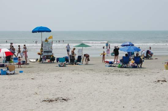
37 Sediment Budgets A sediment budget is an accounting of all the sediment that moves into and out of a defined system. A positive sediment budget means the system receives more sediment than it loses; a negative sediment budget means the system is losing more sediment than it gains. A positive sediment budget usually results in shoreline accretion; a negative sediment budget usually results in shoreline erosion. Isle of Palms has a positive sediment budget, with sediments bypassing Dewees Inlet and moving onto the east end of the Isle of Palms shoreline (i.e., the Wild Dunes area) in the form of large sand shoals. Once the shoals attach to the beach, the sediment shifts laterally along the shoreline, with the majority moving along the island's beaches in the direction of Breach Inlet; some of the sediment moves in the opposite direction, onto the Dewees Inlet shoreline. The Isle of Palms shoreline closer to Dewees Inlet tends to exhibit unstable characteristics, due to the episodic nature of shoal attachment and sediment redistribution. Sediment that moves down the shore accumulates along the southern 1.5 miles of the Isle of Palms shoreline, where long-term accretion rates average approximately 5 feet per year (ft/yr). Some of the moving sediment bypasses Breach Inlet in the form of sand bars that ultimately attach to Sullivan's Island Beach Use and Safety Like most South Carolina beaches, the Isle of Palms beach is used for a wide variety of recreational activities, including sunbathing, beachcombing, walking/jogging, cycling, fishing, surfing, sand sculpting, etc. Bonfires and overnight sleeping are not permitted on the beach, nor are motorized vehicles. Generally, no commercial activities are allowed on the beach. Boats (including sail and motor) and jet skis are permitted to be used in the waters off Isle of Palms, except within designated swimming areas (e.g., between 10 th and 14 th Avenues). Motorboats and jet skis cannot be beached, except in case of emergency. Records are not kept regarding the number of visitors to the Isle of Palms beach. However, some data are available and support the notion that the beach is highly accessible and used by the public: Unpublished data collected by the City indicate that 38,000 vehicles parked in the two City parking lots (combined capacity of 435 +/- spaces) off Pavilion Drive between mid-march and mid-september The lots were estimated to be at 90% occupancy, or greater, for 40 days during Unpublished City data also show the 141 metered parking spaces along the front beach area were 100% occupied during an estimated 180 days in While records are not kept regarding numbers of visitors per vehicle, or number of parked visitors accessing the beach, it is safe to say that hundreds of thousands of visitors accessed the beach and/or Front Beach related businesses in
38 Data from the Isle of Palms County Park indicate that 54,000 vehicles parked there between March and October 2007, and that an estimated 150,000 people visited the park during that period. The figures above do not count visitors parked at an estimated 1,000 additional beach access parking spaces along road rights-of-way (between Breach Inlet and 10 th Avenue and between 21 st Avenue and 57 th Avenue), or visitors accessing the beach while staying at accommodations such as vacation rental homes, hotels and rental condominiums on the island. The City routinely monitors weather and surf conditions, and receives notification of impending dangerous coastal conditions (high surf, rip currents, etc.) from the National Weather Service. Warnings are posted on the Connector Board at the Hwy. 517 entrance to the island and on the Breach Inlet information board, and warning flags are posted at guarded beaches (e.g., the County Park). Warnings are also passed along by the City to Wild Dunes. The City has posted signs at Breach Inlet warning people of swift currents and prohibiting wading or swimming in the inlet, in accordance with Sec of the City Code. Beach access for emergency vehicles is available at 5 th Avenue, 14 th Avenue, 25 th Avenue, 42 nd Avenue, 53 rd Avenue and at the Property Owners Beach House (Wild Dunes). The City has two wave runners and larger watercraft which can be used in emergencies. City police and Fire Department personnel have, on occasion, had to warn or rescue waders and swimmers who visited attaching Dewees Inlet sand shoals at low tide, some of whom became trapped on a rising tide Benefits and Value of Beach Isle of Palms is primarily a residential community with world-class resort amenities and a modest commercial base that influence the local economy. The City s Comprehensive Plan (2004) clearly states that the island s ocean beach, tidal marshland, and marinas constitute its most important economic assets. The desirability of living near these natural resources has created relatively high property values which, in turn, have raised the tax base. Tourists spend an estimated $130 million annually on Isle of Palms (Council Member Cronin s calculations, based on Accommodations Tax data and on information contained in a recent Clemson University report [Oh, et al., 2006]). The City estimates that there are approximately 2,500 rental units on the island (rental properties and second homes), and it is reasonable to expect that the existence of these units is due in large part to the beach and related amenities that exist on Isle of Palms. These rental units bring the City over $2 million annually in property taxes. These units also generate a large part of the +/- $1.3 million in Accommodations Taxes received by the City annually. Tourism is the City s main industry, and the prosperity of the City is tied closely to the health of the beach. If the beach is in jeopardy, the City suffers. The sense of community and social well- 30
39 being on Isle of Palms is also tied to the beach. Without the beach, the City would exist, but it would be much different than it is at present Beachfront Development Present day development along the ocean shoreline of Isle of Palms can be divided and described as follows: Ocean Boulevard, between Breach Inlet and 10 th Avenue (approximately 1.5 miles) single family homes Ocean Boulevard, between 10 th Avenue and 14 th Avenue (approximately 0.3 mile) condominiums, hotels and commercial (this area is referred to locally as the Front Beach or commercial district) Isle of Palms County Park east of 14 th Avenue, with approximately 400 ft of ocean frontage i. Palm Boulevard, between the County Park and 57 th Avenue (approximately 2.8 miles) single family homes Wild Dunes, between 57 th Avenue and the Links (Golf) Course (approximately 1.4 miles) a mixture of single family homes and condominiums (named from west to east as follows: Grand Pavilion, Seagrove, Beachwood East, Dunecrest Lane, Beach Club, Property Owner s Beach House, Mariner s Walk, Shipwatch, Summer House, Summer Dunes Lane, Port O Call, Seascape and Ocean Club) Wild Dunes Links Course at the eastern end of the island and along the Dewees Inlet shoreline (approximately 0.6 miles) A review of the existing development along the Isle of Palms reveals the following: 1. Approximately 300 oceanfront parcels have been platted for residential or commercial use along almost seven miles of the ocean shoreline. 2. Unlike many coastal communities, the majority of the oceanfront development on Isle of Palms is set back a reasonable distance from the shoreline, and the area at greatest risk to erosion is confined to the northeastern third of the island (generally, from 55th Avenue to Dewees Inlet). Unfortunately, the northeastern end of the island is also the area where the oceanfront development density is greatest, the buildings are the largest and public beach access is limited. 3. A review of 2004 aerial photography and limited 2006 field inspections showed a total of 73 single family or condominium buildings, several swimming pools, two recreational cabanas/pavilions, one private pier, several buried rock revetments and two golf course holes lie at or seaward of the 1999 DHEC OCRM setback line. Sixty-seven of the 73 buildings lie seaward of the 1999 DHEC OCRM baseline. Structures seaward of the setback line are shown on the overlay maps and in the structure inventory tables in Section 10 of this Plan. i see 31
40 4. Construction of additional buildings seaward of the setback line is unlikely, given the fact that the ocean shoreline of Isle of Palms is essentially built-out Land Use The City of Isle of Palms has regulated coastal development since August, In 1997, the ordinances regulating coastal development were incorporated into the city's zoning regulations following a review of shoreline development and regulatory issues initiated as part of the creation of a new Comprehensive Plan. Zoning amendments were adopted to eliminate previously occurring overlaps and inconsistencies between state and local regulatory jurisdiction. The City s zoning map is shown in Figure 12. Specific development standards, permitted uses and other uses (accessory, conditional, temporary, etc.) are listed in Title 5, Chapter 4 (Zoning) of the City Code. Since 1989, a Conservation District Overlay Zone has been established along the ocean, inlet and marsh shorelines, within which permitted activities include open air recreational uses, public utility lines and beach renourishment (see Figure 12). In 1990 the City established a Preservation Overlay Zone (P-1) along the ocean shoreline between 21 st Avenue and 41 st Avenue. The overlay zone was established to preserve natural barriers against natural forces from the ocean; to preserve adequate light, air and open space; and to preserve scenic, historic and ecologically sensitive areas. In 2006, a second Preservation Overlay Zone (P-2) was established along the ocean shoreline between Breach Inlet and 10 th Avenue. These overlay zones establish the following seaward limits for construction: Overlay Zone P-1, Palm Blvd. between 21 st Avenue and 41 st Avenue: 130 ft from the Palm Blvd. right-of-way j. Overlay Zone P-2, Ocean Blvd. between Breach Inlet and 10 th Avenue: along the Maximum Building Line shown on the January 8, 1988 final plat by E.M. Seabrook Activities permitted by the City seaward of the construction limit are as follows: Overlay Zone P-1: one dune walkover per lot, as permitted by the City Code and DHEC OCRM regulations; one open air gazebo per lot, as permitted by the City Code and DHEC OCRM regulations, not to exceed 100 square feet in floor area or 16 feet in height. Overlay Zone P-2: one dune walkover per lot, as permitted by the City Code and DHEC OCRM regulations; one swimming pool per lot, as permitted by the City Code and DHEC OCRM regulations. j Structures and their stairs must comply with the 130 ft restriction; however, permitted underground onsite waste disposal systems may be located more than 130 ft from the Palm Blvd. right-of-way. 32

41 General Commercial District General Commercial District General Commercial District Limited Commercial District Planned Development District Single Family Residential Single Family Residential IOP Connector, Hwy 517 Breach Inlet Figure 12. City of Isle of Palms Zoning Map, showing the two entrances onto the island (Breach Inlet bridge and Hwy 517 Connector) 33
42 2.5. Natural Resources and Ecological Habitats Isle of Palms, like most South Carolina barrier islands, is characterized by a beach and dune ridge system, with an extensive tidal marsh along the northern side of the island. The island is surrounded by navigable waters and provides some opportunities for access by boat and numerous beach access points. Prior to development, the island was covered by maritime forest. A main concern in managing South Carolina s ocean beaches is the protection and conservation of coastal natural resources and ecological habitats. As part of a coastal barrier island, the Isle of Palms beachfront exhibits a variety of natural resources due to the diversity of ecotypes and habitats that occur. The interaction between shifting terrestrial sand dune and beach habitats, shallow coastal waters, and the open ocean result in a dynamic landscape that is utilized by various organisms. Three terrestrial habitats are found around the Isle of Palms beachfront, namely the beach community, maritime shrub thickets, and maritime forest. The beach community generally includes the open beach and dune habitats, as well as the foreshore zone that is frequently inundated by the tides. Maritime shrub thicket communities commonly grow in older dunes, behind the primary dunes, and include salt tolerant shrubs such as wax myrtle, yaupon holly, and red cedar. Maritime forests are upland communities typified by live oak, cabbage palmetto, and loblolly pine, and remnant patches of this habitat are scattered throughout the island. Each ecological community provides benefits to plants and animals that use the habitat to forage, as shelter, for nesting, or for a combination of these uses. The importance of barrier islands like Isle of Palms as habitat for plants and animals is significant. Many animals are dependent on smaller prey available on open beach habitats as part of complex food webs. Some animals also require the sands of primary dunes on barrier islands for nesting sites and are unable to successfully reproduce without access to this habitat. In the water, nearshore subtidal bars and sand flats can support large numbers and species of marine invertebrates and fish that cannot thrive in the open ocean. Long-term or permanent alteration to these habitats can affect the type, health, and vitality of the flora and fauna. Natural habitats and resources are also recognized for the social and economic benefits that they provide. Protection of natural resources is identified in the City s Comprehensive Plan as essential to maintaining the high quality of life on the Isle of Palms. Residents indicate that the attributes of coastal ecosystems, including marshes, mature trees, marine waters, and sandy beaches influenced their decision to purchase property on Isle of Palms. In addition, the accessible ocean beach is a predominant factor in the local tourism and vacation rental economy. Eco-tourism has also increased in recent years as an economic market around Charleston and on Isle of Palms. 34
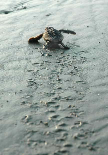
43 Threatened and Endangered Species Discussions with South Carolina Department of Natural Resources (SCDNR) staff revealed there is no island-specific listing of threatened, endangered or rare species for Isle of Palms. A list does exist for Charleston County k, but not for the island. However, limited island-specific information exists in the Comprehensive Plan: There are at least three species of birds that are listed on federal or state endangered or threatened lists which may be found in the area. The wood stork is listed as a state and federally endangered species. The piping plover is listed as both state and federally threatened and the peregrine falcon is listed as stateendangered. The loggerhead sea turtle, a threatened species, visits the island to lay her eggs along the beach. While visits have declined over the years as the island has become more developed, South Carolina beaches have the largest number of nest sites in the population tracked between North Carolina and Central Florida. In recent years the nests have numbered between 10 and 50 on the beaches of the Isle of Palms. It is thought that individual turtles return to the historical nesting site every two years, accounting for the wide fluctuation in the number of nests from year to year. Green, Leatherback and Kemp s ridley turtles can nest on South Carolina beaches, but nesting on Isle of Palms is rare. The last Green turtle nest on Isle of Palms was in 1998; there has been one Kemp s ridley nest since The Hawksbill turtle does not nest in South Carolina (personal communication, DuBose Griffin, SCDNR Marine Turtle Conservation Program). The City of Isle of Palms participates in the Turtle Team, a group of volunteers that monitors the critical habitat and nesting of loggerhead turtles on Isle of Palms and Sullivan s Island, and posts current nesting information on their web site l. Team members identify nest locations, mark and safeguard the nests, and relocate nests where required. Turtle nesting statistics for 2000 through 2007 are shown in Table 2. The eastern section of the island -- which is most subject to erosion -- typically accounts for approximately 1/4 th of marine turtle nesting on the island (personal communication, DuBose Griffin, SCDNR Marine Turtle Conservation Program). k see l see 35
44 Table 2: Marine Turtle Nesting Data for Isle of Palms and Sullivan s Island; Stranding Data for Isle of Palms. Source: Isle of Palms Turtle Team and SCDNR Marine Turtle Conservation Program Number of Nests 42* 23* 41* 35* 10* 56* False Crawls Nests Relocated Nest Success** Hatch Success*** 3,354 2,137 3,142 2, ,144 1,337 2,348 Hatch Success^ 72% 83% 78% 67% 63% 69% 75% 85% Strandings (IOP) * approximately 90% of the nesting is estimated to occur on Isle of Palms; all nests in 2006 were on Isle of Palms; 23 of 26 nests in 2007 were on Isle of Palms ** number of nests with at least 10% hatch success *** number of hatchlings that emerged ^ (number of hatchlings that emerge from nests/number of eggs laid) x 100 According to SCDNR statistics, there have been an average of approximately 11.6 strandings annually on Isle of Palms since 1980 (9.8/yr Loggerhead; 0.6/yr Leatherback; 0.6/yr Kemp s ridley; 0.3/yr Green; 0.3/yr unknown species). However, these figures must be interpreted carefully: studies have shown approximately 20% of the actual number of mortalities strand on the beach; strandings on Isle of Palms could have died elsewhere; mortalities occurring off the Isle of Palms beach could strand on another beach (personal communication, DuBose Griffin, SCDNR Marine Turtle Conservation Program) to 2007 stranding data (approximately 10.2/yr) are included in Table 2. In August 2006 the City Council adopted a resolution approving and supporting the findings of the Isle of Palms Beach Advisory Committee regarding beach vitex (Vitex rotundifolia), an invasive woody shrub native to the Pacific Rim that colonizes dune habitats and displaces native plant species and may adversely impact turtle nesting. The Council has prohibited the planting of beach vitex and efforts to eradicate beach vitex on Isle of Palms are ongoing. The City of Isle of Palms is also home to the Shore Bird Rescue Center, a facility where injured birds can be taken for rehabilitation and nurturing until they are released back to the wild. 36
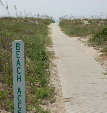
45 2.6. Existing Public Access and Map This Local Comprehensive Beach Management Plan serves as the repository of public beach access and parking information, details of which are provided below. Beach access and parking information will also be posted on the City s web site A total of fifty-six (56) public beach access points lie along the shoreline between Breach Inlet and 57th Avenue, with an average distance between access points of approximately 400 ft. Three of the public access points along Palm Blvd. (between 54 th Avenue and 57 th Avenue) are actually owned and maintained by the Wild Dunes Community Association, but have no use restrictions and are available to the general public as well. The Wild Dunes section of the Isle of Palms shoreline between 57 th Avenue and Seagrass Lane (Dewees Inlet) does not have public beach access points, per se, but has a total of 13 community access points owned and maintained by the Wild Dunes Community Association or homeowners associations (at an average spacing of approximately 950 ft). Isle of Palms public access points are marked with 'Beach Access' signs, and annual maintenance occurs to replace lost or damaged signs. The access points also have beach regulation signs and trash receptacles, and many have dog waste collection and disposal containers. Beach access for emergency vehicles is available at 5 th Avenue, 14 th Avenue, 25 th Avenue, 42 nd Avenue, 53 rd Avenue and at the Property Owners Beach House (Wild Dunes). Public and community beach access points are shown on the overlay maps and in the access inventory tables in the Section 10 of this Plan. Public parking is available in close proximity (i.e., 500 ft) to the landward termination of beach access points between Breach Inlet and 57 th Avenue. Parking spaces are in the form of either paved parking spaces, unpaved spaces (gravel or grass surface), and parking along public road rights-of-way ( on-street parking) on the Isle of Palms. Public parking along the rights-of way of one of the City s main roads, Palm Boulevard is permitted by the City as long as parked vehicles are not within 4 feet of the pavement, per City Code, section (r). The City has posted street signs indicating where parking is not allowed, and takes the position that public parking is allowed wherever it is not prohibited. Beach visitors are accustomed to this convention and the need to post signs stating where parking is allowed has not been necessary. In practice, public beach goers park along the north and south sides of Palm Boulevard between 21 st Avenue and 41 st Avenues, and along the north side of Palm Boulevard between 41 st and 57 th Avenues. Note that public parking along Palm Boulevard between 54 th and 57 th Avenues is located more than 500 feet away from the sand beach. In this area, public access is provided 37
46 from Palm Boulevard by means of wood walkways across property owned and maintained by the Wild Dunes Community Association. The City maintains a public access indication sign, as it does with all other access points, and a trash receptacle at the Palm Boulevard entrances. Public access to this section of the beach is limited, and promoting opportunities to increase access is consistent with the objectives of the State Beachfront Management Act. In addition, establishing public parking closer to the beach would be infeasible due to infrastructure and development constraints. Based on these considerations, DHEC OCRM has agreed to allow public parking greater than 500 feet away from the sand beach at these specific locations to be a factor in classifying this section as achieving full and complete public access in accordance with the guidance established in the State Beachfront Management Plan. Work conducted for this Beach Management Plan in September 2006 (and verified by the City Police Department) and December 2007 has documented 1,582 public vehicle parking spaces on the Isle of Palms within +/- 500 ft of beach access points, including 630 on-street spaces and 952 spaces in parking lots, metered spaces or other paved and marked spaces (some marked specifically for handicap parking). The numbers and distribution of public parking spaces are listed below and are shown in Table 4: 10 paved spaces at Breach Inlet (1 of which is designated as a handicap space) not counted for beach access credit purposes +/- 71 on-street spaces along 2 nd Avenue through 9 th Avenue 2 paved spaces for handicap parking on Ocean Blvd. at 9 th Avenue 141 paved and metered spaces along Ocean Blvd. between 10 th Avenue and 14 th Avenue (6 of which are designated as handicap spaces) 115 spaces (gravel surface) in the City-owned parking lot between Pavilion Dr. and J.C. Long Blvd. 320 spaces (gravel surface) in the City-owned parking lot between Pavilion Dr. and 14 th Avenue. 362 spaces at Isle of Palms County Park (119 paved [includes 5 handicap spaces] and 243 overflow parking spaces on grass) 2 paved spaces for handicap parking on Palm Blvd. at 21 st Avenue +/- 384 on-street parking spaces in the right-of-way along Palm Blvd. between 21 st Avenue and 41 st Avenue. +/- 25 on-street parking spaces at the seaward street end and in the right-ofway of 42 nd Avenue +/- 11 on-street parking spaces at the seaward street end and in the right-ofway of 43 rd Avenue 38
47 +/- 9 on-street parking spaces at the seaward street end and in the right-ofway of 44 th Avenue +/- 11 on-street parking spaces at the seaward street end and in the right-ofway of 45 th Avenue +/- 4 on-street parking spaces at the seaward street end and in the right-ofway of 46 th Avenue +/- 13 on-street parking spaces at the seaward street end and in the right-ofway of 49 th Avenue +/- 9 on-street parking spaces at the seaward street end and in the right-ofway of 50 th Avenue +/- 8 on-street parking spaces in the right-of-way of 51 st Avenue +/- 10 on-street parking spaces in the right-of-way of 52 nd Avenue +/- 16 on-street parking spaces at the seaward street end and in the right-ofway of 53 rd Avenue +/- 18 on-street parking spaces in the north right-of-way of Palm Blvd. within +/- 500 ft of the entrance to the beach access path between 54 th Avenue and 55 th Avenue +/- 23 on-street parking spaces in the north right-of-way of Palm Blvd. within +/- 500 ft of the entrance to the beach access path between 55 th Avenue and 56 th Avenue +/- 18 on-street parking spaces in the north right-of-way of Palm Blvd. within +/- 500 ft of the entrance to the beach access path between 56 th Avenue and 57 th Avenue The on-street parking count procedure used involved measurement of distances along the rights-of-way where parking would be possible (not prohibited by City; not blocking driveways or sidewalks, not precluded by vegetation/landscaping, not precluded by property owner obstructions); where parking is parallel to the road, each parking space was assumed to require 30 ft of right-of-way; where parking is perpendicular to the road or at a street-end, parking space widths were assumed to be approximately ft. In addition to the above, the City has provided space for three golf carts to park along the 25 th Avenue beach access path. The Property Owners Beach House in Wild Dunes provides the following parking for Wild Dunes residents and guests: +/- 50 paved vehicle parking spaces, and space for approximately 30 golf carts along the access path. The number and distribution of public access points are excellent, and sufficient access facilities and parking exist to classify 69% of the Isle of Palms beach as having full and 39
48 complete access per the State guidelines (SCCC, 1995; see Table 3). DHEC OCRM recognizes that full and complete public access is provided along approximately 4.6 miles of the 6.7 mile beach, from a point 1/8 mile (660 feet) west of the public beach access at 2 nd Avenue m to a point ¼ mile (1,320 feet) east of the public beach access between 56 th and 57 th Avenue (see Figure 13). Table 3. DHEC OCRM Public Beach Access Facility Classification (SCCC, 1995). Type of Facility Distance on Either Side of Access Point Which Will be Considered as Having Full and Complete Access Minimum Facilities Public Access Point 1/8 mile Trash receptacle, walkover/improved surface access; signage; on-street parking for 6 vehicles Local Public Access Park Neighborhood Public Access Park Community Public Access Park Regional Public Access Park 1/4 mile As above, parking for 10 vehicles 1/2 mile As above, showers, restrooms, parking for 25 vehicles 3/4 mile As above, showers, lifeguards, concession, handicapped access and parking; parking for 75 vehicles 1 mile As above, parking for 150 vehicles and greater Table 4 shows how the public access points along Isle of Palms are classified based on available parking and facilities (see white squares to the right of the listed public access locations squares indicate the type of access facility at each access point, according to Table 3). The shaded areas above and below the white squares indicate the lateral extent of full and complete access based on the available parking and facilities. The Beach Access Tables and Overlays in the Section 10 of this Plan provide additional information for each beach access point. Public access paths are shown on plats of the island, and the City will not permit any development or encroachments on the paths, since this would reduce or eliminate public m There are 10 parking spaces at the Breach Inlet public access point, but these are not counted for access credit purposes -- there is no swimming permitted there. 40

49 beach access. The City routinely inspects public access paths and notifies adjacent property owners if their vegetation or property uses encroach into the public access paths, and the City requires those owners to correct the situation. The City also inspects rightsof-way upon which public beach access parking is allowed (i.e., where it is not prohibited), and prohibits any new encroachments. Some long-established encroachments persist due to complex legal issues, but those encroachments have been accounted for in the parking counts in this Plan. Figure 13. Region of Full and Complete Beach Access per SCCC (1995) on Isle of Palms (from 660 feet west of the 2 nd Avenue beach access to 1,320 feet east of the beach access between 56 th and 57 th Avenues [approximately the east boundary of Grand Pavilion], a total length of 4.6 miles). The remaining 2.1 miles of ocean beach is accessible to the public but does not meet SCCC (1995) parking/facility guidelines. 41
UPPER BEACH REPLENISHMENT PROJECT RELATED
 ASSESSMENT OF SAND VOLUME LOSS at the TOWNSHIP of UPPER BEACH REPLENISHMENT PROJECT RELATED to the LANDFALL OF HURRICANE SANDY - PURSUANT TO NJ-DR 4086 This assessment is in response to Hurricane Sandy
RE: Hurricane Matthew Beach Damage Assessment and Recommendations [CSE 2416]
![RE: Hurricane Matthew Beach Damage Assessment and Recommendations [CSE 2416]](/thumbs/83/87675702.jpg "RE: Hurricane Matthew Beach Damage Assessment and Recommendations [CSE 2416]") October 25, 2016 Iris Hill Town Administrator Town of Edisto Beach 2414 Murray St Edisto Beach SC 29438 RE: Hurricane Matthew Beach Damage Assessment and Recommendations [CSE 2416] Dear Iris, Hurricane
October 25, 2016 Iris Hill Town Administrator Town of Edisto Beach 2414 Murray St Edisto Beach SC 29438 RE: Hurricane Matthew Beach Damage Assessment and Recommendations [CSE 2416] Dear Iris, Hurricane
Volume and Shoreline Changes along Pinellas County Beaches during Tropical Storm Debby
 Volume and Shoreline Changes along Pinellas County Beaches during Tropical Storm Debby Ping Wang and Tiffany M. Roberts Coastal Research Laboratory University of South Florida July 24, 2012 Introduction
FINDING OF NO SIGNIFICANT IMPACT
 DEPARTMENT OF THE ARMY CHARLESTON DISTRICT, CORPS OF ENGINEERS 69A HAGOOD AVENUE CHARLESTON, SOUTH CAROLINA 29403-5107 FINDING OF NO SIGNIFICANT IMPACT EDISTO BEACH COASTAL STORM DAMAGE REDUCTION GENERAL
New Jersey Coastal Zone Overview. The New Jersey Beach Profile Network (NJBPN) 3 Dimensional Assessments. Quantifying Shoreline Migration
 3 Dimensional Assessments. Quantifying Shoreline Migration") New Jersey Coastal Zone Overview The New Jersey Beach Profile Network (NJBPN) Objectives Profile Locations Data Collection Analyzing NJBPN Data Examples 3 Dimensional Assessments Methodology Examples Quantifying
New Jersey Coastal Zone Overview The New Jersey Beach Profile Network (NJBPN) Objectives Profile Locations Data Collection Analyzing NJBPN Data Examples 3 Dimensional Assessments Methodology Examples Quantifying
A REVIEW OF THE CONDITION OF THE MUNICIPAL BEACHES AS A RESULT OF HURRICANE SANDY IN THE BOROUGH OF STONE HARBOR, CAPE MAY COUNTY, NEW JERSEY
 A REVIEW OF THE CONDITION OF THE MUNICIPAL BEACHES AS A RESULT OF HURRICANE SANDY IN THE BOROUGH OF STONE HARBOR, CAPE MAY COUNTY, NEW JERSEY View along the dune scarp from 103 rd Street on October 31,
Impact of Hurricane Matthew on the Atlantic Coast of Florida
 Impact of Hurricane Matthew on the Atlantic Coast of Florida A coastal engineer was driving across country and his jeep broke down in front of a monastery. It was late in the day and the monks invited
ATLANTIC COUNTY 2006 to 2008
 ATLANTIC COUNTY 2006 to 2008 The Atlantic County oceanfront shoreline consists of three barrier islands where the northern one, Little Beach Island and a third of the second, Brigantine Island, are undeveloped
Delaware Chapter Surfrider Foundation - Indian River Inlet Monitoring
 Delaware Chapter Surfrider Foundation - Indian River Inlet Monitoring In 2012, the Delaware Surfrider Foundation Chapter formed the Surf Quality and Access Committee to focus on issues such as surf spot
Cherry Grove Waties Island Island Myrtle Beach Pawleys Island Island
 25 Yrs of Beachfront Management Act in South Carolina: Ebbs and Flows of the shoreline, structures and development Paul T. Gayes Center for Marine and Wetland Studies Coastal Carolina University NC Coastal
Coastal Hazards and Management in North Carolina. Braxton Davis April 14, 2015
 Coastal Hazards and Management in North Carolina Braxton Davis April 14, 2015 Coastal Facts and Figures 320 miles of ocean beaches 12,000+ miles of estuarine shoreline 2 million + acres of sounds, creeks,
FINAL ENVIRONMENTAL IMPACT STATEMENT ON BROWARD COUNTY SHORE PROTECTION PROJECT SEGMENTS II AND III BROWARD COUNTY, FLORIDA
 FINAL ENVIRONMENTAL IMPACT STATEMENT ON BROWARD COUNTY SHORE PROTECTION PROJECT SEGMENTS II AND III BROWARD COUNTY, FLORIDA 1. PROJECT PURPOSE AND NEED 1.1. PROJECT AUTHORITY. 1.1.1. INITIAL AUTHORIZATION.
Inlet Management Study for Pass-A-Grille and Bunces Pass, Pinellas County, Florida
 Inlet Management Study for Pass-A-Grille and Bunces Pass, Pinellas County, Florida Final Report Submitted By Ping Wang, Ph.D., Jun Cheng Ph.D., Zachary Westfall, and Mathieu Vallee Coastal Research Laboratory
Figure79. Location map for the 10 NJBPN profile sites in Atlantic County, NJ 155
 154 Figure79. Location map for the 10 NJBPN profile sites in Atlantic County, NJ 155 ATLANTIC COUNTY SPRING 2009 to FALL 2010 The Atlantic County coastline consists of three barrier islands. Between Little
US Beach Nourishment Experience:
 Beach Nourishment: Introduction of new sand to the beach by truck or dredge Large beach >1 million cubic yards (100,000 dump truck loads) Funding is a combination of federal, state, local & private Also
HURRICANE SANDY LIMITED REEVALUATION REPORT UNION BEACH, NEW JERSEY DRAFT ENGINEERING APPENDIX SUB APPENDIX D SBEACH MODELING
 HURRICANE SANDY LIMITED REEVALUATION REPORT UNION BEACH, NEW JERSEY DRAFT ENGINEERING APPENDIX SUB APPENDIX D SBEACH MODELING Rev. 18 Feb 2015 1 SBEACH Modeling 1.0 Introduction Following the methodology
New Jersey Beach Profile Network Atlantic County Profile Site Locations
 215 RICHARD STOCKTON COLLEGE OF NEW JERSEY New Jersey Beach Profile Network Atlantic County Profile Site Locations COASTAL RESEARCH CENTER Figure 128 There are nine NJBPN survey sites on the Atlantic County
SACO RIVER AND CAMP ELLIS BEACH SACO, MAINE SECTION 111 SHORE DAMAGE MITIGATION PROJECT APPENDIX F ECONOMIC ASSESSMENT
 SACO RIVER AND CAMP ELLIS BEACH SACO, MAINE SECTION 111 SHORE DAMAGE MITIGATION PROJECT APPENDIX F ECONOMIC ASSESSMENT Department of the Army New England District, Corps of Engineers 696 Virginia Road
ST. JOSEPH PENINSULA, GULF COUNTY, FLORIDA Beach Re-Nourishment and Environmental Enhancement Project RECOMMENDATIONS
 ST. JOSEPH PENINSULA, GULF COUNTY, FLORIDA Beach Re-Nourishment and Environmental Enhancement Project RECOMMENDATIONS January 23, 2018 543 Harbor Boulevard, Suite 204 Destin, Florida 32541 850.654.1555
SPO Regional Challenge Grant Creation of a Sea Level Adaption Working Group for Biddeford, Saco, OOB and Scarborough J.T. Lockman, AICP, Planning
 SPO Regional Challenge Grant Creation of a Sea Level Adaption Working Group for Biddeford, Saco, OOB and Scarborough J.T. Lockman, AICP, Planning Director Southern Maine Regional Planning Commission jlockman@smrpc.org
DUNE STABILIZATION AND BEACH EROSION
 DUNE STABILIZATION AND BEACH EROSION CAPE HATTERAS NATIONAL SEASHORE NORTH CAROLINA ROBERT DOLAN PAUL GODFREY U. S. DEPARTMENT OF INTERIOR NATIONAL PARK SERVICE OFFICE OF NATURAL SCIENCE WASHINGTON, D.
Photo by: Darryl Hatheway, 2011
 Photo by: Darryl Hatheway, 2011 September 11, 2015 Presentation Discussion Examine PFD V-Zone Mapping in Wave Runup Dominated West Coast Application of PFD V-Zone Mapping Criteria in Pacific G&S PFD V-Zone
Beach Nourishment Impact on Beach Safety and Surfing in the North Reach of Brevard County, Florida
 Beach Nourishment Impact on Beach Safety and Surfing in the North Reach of Brevard County, Florida Prepared by John Hearin, Ph.D. Coastal Engineering Vice Chairman Cocoa Beach Chapter Port Canaveral Patrick
Fact Sheet Ordinance Regulating Erosion Threatened Structures
 Fact Sheet Ordinance Regulating Erosion Threatened Structures Town of Duck, North Carolina August 15, 2011 What is being considered? The Town of Duck Council is considering an ordinance to limit the encroachment
Figure 4, Photo mosaic taken on February 14 about an hour before sunset near low tide.
 The Impact on Great South Bay of the Breach at Old Inlet Charles N. Flagg and Roger Flood School of Marine and Atmospheric Sciences, Stony Brook University Since the last report was issued on January 31
SPECIAL SPRING 2018 STORM REPORT ON THE CONDITION OF THE MUNICIPAL BEACHES FOR THE BOROUGH OF STONE HARBOR, CAPE MAY COUNTY, NEW JERSEY
 SPECIAL SPRING 2018 STORM REPORT ON THE CONDITION OF THE MUNICIPAL BEACHES FOR THE BOROUGH OF STONE HARBOR, CAPE MAY COUNTY, NEW JERSEY Aerial photograph taken April 21, 2018 showing the view up the beach
2014 ANNUAL REPORT - TO THE CITY OF NORTH WILDWOOD ON THE CONDITION OF THE CITY BEACHES
 2014 ANNUAL REPORT - TO THE CITY OF NORTH WILDWOOD ON THE CONDITION OF THE CITY BEACHES View on September 25, 2014 looking northwest into Hereford Inlet. Considerable southerly expansion of the tip of
CHAPTER 281 INFLUENCE OF NEARSHORE HARDBOTTOM ON REGIONAL SEDIMENT TRANSPORT
 CHAPTER 281 INFLUENCE OF NEARSHORE HARDBOTTOM ON REGIONAL SEDIMENT TRANSPORT Paul C.-P. Lin, Ph.D., P.E. 1 and R. Harvey Sasso, P.E. 2 ABSTRACT The influence of nearshore hardbottom on longshore and cross-shore
Long Beach Island Holgate Spit Little Egg Inlet Historical Evolution Introduction Longshore Transport Map, Survey and Photo Historic Sequence
 Appendix B Long Beach Island Holgate Spit Little Egg Inlet Historical Evolution Introduction The undeveloped southern end of Long Beach Island (LBI) is referred to as the Holgate spit as it adjoins the
2018 Annual Beach Monitoring Report
 May 1, 218 Town of Hilton Head Island, SC 218 Annual Beach Monitoring Report Submitted to: Town of Hilton Head Island, SC November 15, 217 Prepared by: Olsen Associates, Inc. 2618 Herschel Street Jacksonville,
Atlantic Coast of Long Island, Jones Inlet to East Rockaway Inlet, Long Beach Island, NY Construction Update
 Atlantic Coast of Long Island, Jones Inlet to East Rockaway Inlet, Long Beach Island, NY Construction Update June 2016 US Army Corps of Engineers Project Purpose Three specific damage mechanisms of coastal
DELAWARE S VULNERABLE COASTAL AREAS. DELAWARE INLAND BAYS and DELAWARE BAY RECONNAISSANCE STUDY
 DELAWARE S VULNERABLE COASTAL AREAS and the DELAWARE INLAND BAYS and DELAWARE BAY RECONNAISSANCE STUDY Kimberly K. McKenna, PG Delaware Dept. of Natural Resources & Environmental Control Division of Watershed
Montserrat. Wise practices for coping with. i b bea n Se a
 Wise practices for coping with Montserrat Car i b bea n Se a Fisheries Division, Montserrat Physical Planning Department, Montserrat University of Puerto Rico, Sea Grant College Program Caribbean Development
STATUS REPORT FOR THE SUBMERGED REEF BALL TM ARTIFICIAL REEF SUBMERGED BREAKWATER BEACH STABILIZATION PROJECT FOR THE GRAND CAYMAN MARRIOTT HOTEL
 August 23 STATUS REPORT FOR THE SUBMERGED REEF BALL TM ARTIFICIAL REEF SUBMERGED BREAKWATER BEACH STABILIZATION PROJECT FOR THE GRAND CAYMAN MARRIOTT HOTEL performed by Lee E. Harris, Ph.D., P.E. Consulting
Protecting our Beaches
 Protecting our Beaches South Amelia Island Shore Stabilization Project Nassau County, FL Mr. Drew Wallace President South Amelia Island Shore Stabilization Association (SAISSA) Mr. Bill Moore, AICP Project
Coastal Inundation. An Overview for TCDC
 Coastal Inundation An Overview for TCDC Rick Liefting Team Leader Regional Hazards and Environmental Compliance Integrated Catchment Management Waikato Regional Council Photo: Sugar Loaf Wharf, Coromandel.
Assateague Island National Seashore North End Restoration Project Timeline
 Assateague Island National Seashore North End Restoration Project Timeline Date Event Some information provided in the Project Introduction document. Detailed events are available in a timeline compiled
23- Year Sand Volume Changes at Site 132, 15th Street, Brigantine
 149 Figure75. Location map for the 9 NJBPN profile sites in Atlantic County, NJ ATLANTIC COUNTY SPRING 2008 to FALL 2009 150 The Atlantic County oceanfront shoreline consists of three barrier islands.
LOCAL COASTAL PROGRAM UPDATE
 LOCAL COASTAL PROGRAM UPDATE Agenda Meeting #1 General Information (1 1:45 pm) Introductions and Background Grants involved What is a Local Coastal Program? What is required? LCP Update tasks and schedule
The purpose and needs of the Figure Eight Island Inlet and Shoreline Management Project are as follows:
 Chapter 2 PURPOSE AND NEEDS 1. What are the purpose and needs of this project? The main concern of residents and owners at Figure Eight Island are economic losses resulting from damages to structures and
Shorelines Earth - Chapter 20 Stan Hatfield Southwestern Illinois College
 Shorelines Earth - Chapter 20 Stan Hatfield Southwestern Illinois College The Shoreline A Dynamic Interface The shoreline is a dynamic interface (common boundary) among air, land, and the ocean. The shoreline
North Shore of Long Island, Feasibility Study
 North Shore of Long Island, Asharoken New York Asharoken, Feasibility Study Asharoken, NY Public Meeting June 30, 2015 US Army Corps of Engineers US Army Corps of Engineers New York BUILDING STRONG BUILDING
Figure 262. Location map for the 10 NJBPN profile sites in Atlantic County, NJ 279
 278 Figure 262. Location map for the 10 NJBPN profile sites in Atlantic County, NJ 279 ATLANTIC COUNTY SUMMARY The Atlantic County coastline consists of three barrier islands. The island of Little Beach
2015 ANNUAL REPORT - TO THE CITY OF NORTH WILDWOOD ON THE CONDITION OF THE CITY BEACHES
 2015 ANNUAL REPORT - TO THE CITY OF NORTH WILDWOOD ON THE CONDITION OF THE CITY BEACHES Ariel view of North Wildwood looking south from the Hereford Inlet perspective on June 24, 2015. The main channel
Beach, dune and development in the Borough of Mantoloking as of January Prepared for The Borough of Mantoloking: April 2, 2008
 Summary of 20-years of Shoreline Monitoring Between Maryland Avenue, Point Pleasant Beach, Bay Head, Mantoloking, Brick Township, to 1 st Avenue in Normandy Beach, Ocean County, New Jersey & an Evaluation
Bay County, MI Coastal Hazard Analysis Flood Risk Review Meeting. May 14, 2018
 Bay County, MI Coastal Hazard Analysis Flood Risk Review Meeting May 14, 2018 Agenda Introductions Coastal Flood Risk Study and Mapping Program Current Status Technical Overview of Study and Mapping Floodplain
The Sand Beaches of New Hampshire and Maine
 The Sand Beaches of New Hampshire and Maine Beach Preservation and Erosion Control Photographs provided by Joe Kelly and Steve Adams Cover photo: Reid State Park, ME Introduction The sand beaches of New
FINAL REPORT FOR 2013 ON THE CONDITION OF THE MUNICIPAL OCEANFRONT BEACHES THE BOROUGH OF AVALON, CAPE MAY COUNTY, NEW JERSEY
 FINAL REPORT FOR 2013 ON THE CONDITION OF THE MUNICIPAL OCEANFRONT BEACHES THE BOROUGH OF AVALON, CAPE MAY COUNTY, NEW JERSEY View from 12 th Street to the south taken February 28, 2013, following completion
PUBLIC EXHIBITION OF COASTAL ZONE MANAGEMENT PLAN FOR COLLAROY-NARRABEEN BEACH AND FISHERMANS BEACH
 ITEM 8.3 REPORTING MANAGER TRIM FILE REF 2014/110936 ATTACHMENTS PUBLIC EXHIBITION OF COASTAL ZONE MANAGEMENT PLAN FOR COLLAROY-NARRABEEN BEACH AND FISHERMANS BEACH GROUP MANAGER NATURAL ENVIRONMENT 1
Dune Monitoring Data Update Summary: 2013
 Dune Monitoring Data Update Summary: 13 Shoreline Studies Program Virginia Institute of Marine Science College of William & Mary Gloucester Point, Virginia September 13 Dune Monitoring Data Update Summary:
Performance of Upham Beach T-Groin Project and Its Impact to the Downdrift Beach
 Performance of Upham Beach T-Groin Project and Its Impact to the Downdrift Beach Progress Report for the Period of October 2008 to April 2009 Submitted by Ping Wang, Ph.D., and Tiffany M. Roberts Department
Nevis. Wise practices for coping with
 Wise practices for coping with Nevis Caribbean Sea Nevis Historical and Conservation Society Department of Physical Planning, Natural Resources and Environment, Fisheries Division University of Puerto
Lecture Outlines PowerPoint. Chapter 15 Earth Science, 12e Tarbuck/Lutgens
 Lecture Outlines PowerPoint Chapter 15 Earth Science, 12e Tarbuck/Lutgens 2009 Pearson Prentice Hall This work is protected by United States copyright laws and is provided solely for the use of instructors
FINAL REPORT FOR 2013 ON THE CONDITION OF THE MUNICIPAL BEACHES IN THE TOWNSHIP OF UPPER, CAPE MAY COUNTY, NEW JERSEY
 FINAL REPORT FOR 2013 ON THE CONDITION OF THE MUNICIPAL BEACHES IN THE TOWNSHIP OF UPPER, CAPE MAY COUNTY, NEW JERSEY Aerial photograph at Corson s Inlet showing conditions on December 1, 2013 of the north
Figure 38. Locations of the 28 NJBPN profile stations in Ocean County, NJ.
 55 Figure 38. Locations of the 28 NJBPN profile stations in Ocean County, NJ. 56 Individual Site Descriptions: Northern Ocean County recovered its beaches approaching pre-hurricane Sandy elevation or width,
Long Term Success and Future Approach of the Captiva and Sanibel Islands Beach Renourishment Program
 2017 National Conference on Beach Preservation Technology February 8-10, 2017; Stuart, Florida Long Term Success and Future Approach of the Captiva and Sanibel Islands Beach Renourishment Program Thomas
GONE! Coastal Erosion Happens During Storms! Why Worry About Coastal Setbacks? Goals for Today
 RI Regulatory Setbacks & Buffers: Coastal Zone Management Issues New England Onsite Wastewater Training Program @ URI OWT 155 November 21, 2013 Goals for Today Understand the impacts of storms, coastal
Chapter 10 Lecture Outline. The Restless Oceans
 Chapter 10 Lecture Outline The Restless Oceans Focus Question 10.1 How does the Coriolis effect influence ocean currents? The Ocean s Surface Circulation Ocean currents Masses of water that flow from one
April 7, Prepared for: The Caribbean Disaster Emergency Response Agency Prepared by: CEAC Solutions Co. Ltd.
 April 7, 2006 Prepared for: The Caribbean Disaster Emergency Response Agency Prepared by: Introduction CEAC Solutions Co. Ltd was commissioned in May 2005 to prepare coastal beach erosion hazard maps for
2013 ANNUAL REPORT - TO THE CITY OF NORTH WILDWOOD ON THE CONDITION OF THE CITY BEACHES
 2013 ANNUAL REPORT - TO THE CITY OF NORTH WILDWOOD ON THE CONDITION OF THE CITY BEACHES View on June 18, 2013 from the 2 nd Avenue jetty looking south while the 2013 beach nourishment project was under
Climate Change Impacts to KSC Launch Complex
 Climate Change Impacts to KSC Launch Complex Presented to: 2010 International Workshop on Environment and Energy By: John Shaffer NASA Environmental Management Branch Kennedy Space Center Hurricane Season
NORTHERN CELL OPTIONS SHORTLIST RECOMMENDATIONS
 OPTIONS SHORTLIST RECOMMENDATIONS Coastal Unit C: Bayview Options recommended for MCDA scoring. Status quo. Planting 3. Renourishment (gravel) 6. Beach-scraping 7. Restore shingle crest. Inundation accommodation
Town of Duck, North Carolina
 Tracking No. 00.00.2010 Erosion Mitigation And Shoreline Management Feasibility Study Town of Duck, North Carolina Coastal Planning & Engineering of North Carolina August 15, 2012 Tom Jarrett Robert Neal
RI Regulatory Setbacks & Buffers: Coastal Management Issues
 RI Regulatory Setbacks & Buffers: Coastal Management Issues New England Onsite Wastewater Training Program @ URI OWT 155 - November 29, 2012 James Boyd - Coastal Policy Analyst Photo: October 30, 2012
EVALUATION OF BEACH EROSION UP-DRIFT OF TIDAL INLETS IN SOUTHWEST AND CENTRAL FLORIDA, USA. Mohamed A. Dabees 1 and Brett D.
 EVALUATION OF BEACH EROSION UP-DRIFT OF TIDAL INLETS IN SOUTHWEST AND CENTRAL FLORIDA, USA Mohamed A. Dabees 1 and Brett D. Moore 1 The paper discusses the analysis of up-drift beach erosion near selected
Construction and performance of six template groins at Hunting Island, South Carolina
 Construction and performance of six template groins at Hunting Island, South Carolina By Steven B. Traynum Coastal Science & Engineering P.O. Box 8056, Columbia, SC 29202 straynum@coastalscience.com Timothy
Impacts of breakwaters and training walls
 Across the eastern seaboard of Australia, breakwaters and training walls have instigated fundamental perturbations to coastal and estuary processes. This has induced long-term changes to foreshore alignments,
Coastal Hazards Study
 Coastal Hazards Study 2212 Beach Boulevard, Pacifica Prepared for: EXECUTIVE SUMMARY City of Pacifica 170 Santa Maria Ave Pacifica, CA 94044 Prepared by: moffatt & nichol 2185 N. California Blvd. Walnut
St Kitts. Wise practices for coping with
 Wise practices for coping with St Kitts Caribbean Sea Department of the Environment, St Kitts Fisheries Division, St Kitts Physical Planning and Development Division, St Kitts University of Puerto Rico,
Building Coastal Resiliency at Plymouth Long Beach
 Building Coastal Resiliency at Plymouth Long Beach Department of Marine and Environmental Affairs March 30, 2017 Introducing Green Infrastructure for Coastal Resiliency Plymouth Long Beach & Warren s Cove
2016 NC Coastal Local Governments Annual Meeting
 2016 NC Coastal Local Governments Annual Meeting Coastal Flood Study Modeling and Mapping 101 April 21, 2016 Tom Langan, PE, CFM Engineering Supervisor NCEM Floodplain Mapping Program FEMA Coastal Flood
Part 9 Specific Land Uses - Foreshore & Waterway Development
 7 FORESHORE AND WATERWAY DEVELOPMENT This section applies to the following development uses proposed within the foreshore area (defined by LM LEP 2014), and contains Council s specific requirements for
Coastal management has lagged behind the growth in population leading to problems with pollution
 Fifty percent of the population of the industrialized world lives within 100 km of a coast. Coastal management has lagged behind the growth in population leading to problems with pollution and natural
Chapter 15 SEASONAL CHANGES IN BEACHES OP THE NORTH ATLANTIC COAST OF THE UNITED STATES
 Chapter 15 SEASONAL CHANGES IN BEACHES OP THE NORTH ATLANTIC COAST OF THE UNITED STATES By John M. Darling Hydraulic Engineer, Research Division U. S. Army Coastal Engineering Research Center Corps of
Table 4. Volumetric Change Rates Pre-Project and Post-Project for the Town of Duck
 V. VOLUMETRIC CHANGES General Volumetric changes measured over the entire monitoring area for various time periods are provided in Table 4. The volume changes are given in terms of cubic yards/foot of
Evaluation of June 9, 2014 Federal Emergency Management Agency Flood Insurance Study for Town of Weymouth, Norfolk, Co, MA
 Evaluation of June 9, 2014 Federal Emergency Management Agency Flood Insurance Study for Town of Weymouth, Norfolk, Co, MA Prepared For: Woodard & Curran 95 Cedar Street, Suite 100 Providence, RI 02903
Redondo Beach Boat Launch Ramp Facility
 Redondo Beach Boat Launch Ramp Facility Feasibility Report for the California Department of Boating and Waterways 2015 Grant Cycle For the City of Redondo Beach Submitted by March 13, 2014 Table of Contents
ECONOMIC DEVELOPMENT ELEMENT
 ECONOMIC DEVELOPMENT ELEMENT Background The Economic Development Element considers labor force and labor force characteristics, employment by place of work and residence, and analysis of the community
FINAL REPORT FOR 2011 ON THE CONDITION OF THE MUNICIPAL BEACHES IN THE CITY OF BRIGANTINE BEACH, ATLANTIC COUNTY, NEW JERSEY
 FINAL REPORT FOR 2011 ON THE CONDITION OF THE MUNICIPAL BEACHES IN THE CITY OF BRIGANTINE BEACH, ATLANTIC COUNTY, NEW JERSEY Photograph was taken October 10, 2011 from 10 th Street North looking south
Figure 106. Locations of the 28 NJBPN profile stations in Ocean County, NJ.
 130 Figure 106. Locations of the 28 NJBPN profile stations in Ocean County, NJ. 131 2016-2017 Beach Fills in Ocean County: The federal/state/local storm damage reduction project (beachfill) between Manasquan
Anguilla. Wise practices for coping with. i b bea n Se a
 Wise practices for coping with Anguilla Car i b bea n Se a Department of Fisheries and Marine Resources, Anguilla Department of Physical Planning, Anguilla University of Puerto Rico, Sea Grant College
CITY OF FOLLY BEACH 2015 LOCAL COMPREHENSIVE BEACH MANAGEMENT PLAN
 CITY OF FOLLY BEACH 2015 LOCAL COMPREHENSIVE BEACH MANAGEMENT PLAN In accordance with the State Beachfront Management Act, the City of Folly Beach has prepared this updated Local Comprehensive Beachfront
INTRODUCTION TO COASTAL ENGINEERING
 The University of the West Indies Organization of American States PROFESSIONAL DEVELOPMENT PROGRAMME: COASTAL INFRASTRUCTURE DESIGN, CONSTRUCTION AND MAINTENANCE A COURSE IN COASTAL DEFENSE SYSTEMS I CHAPTER
The 2017 Panama City Beaches Beach Interim Renourishment Project. Answers to Common Questions
 The 2017 Panama City Beaches Beach Interim Renourishment Project The fourth renourishment of the Panama City Beaches will be under construction during March and April 2017, with a planned completion by
CLAM PASS RESTORATION AND MANAGEMENT PLAN BATHYMETRIC MONITORING REPORT NO. 7 Including Interior Bay Dredge Cuts and Tidal Data
 CLAM PASS RESTORATION AND MANAGEMENT PLAN BATHYMETRIC MONITORING REPORT NO. 7 Including Interior Bay Dredge Cuts and Tidal Data Submitted to: Florida Department of Environmental Protection DEP File No.
ATLANTIC COAST OF LONG ISLAND, JONES INLET TO EAST ROCKAWAY INLET, LONG BEACH ISLAND, NY. Contract #2 Construction Scope. April 18th-19th 2018
 ATLANTIC COAST OF LONG ISLAND, JONES INLET TO EAST ROCKAWAY INLET, LONG BEACH ISLAND, NY Contract #2 Construction Scope April 18th-19th 2018 New York District PLAN COMPONENTS Length of Beachfill 35,000
4/20/17. #31 - Coastal Erosion. Coastal Erosion - Overview
 Writing Assignment Due Monday by 11:59 pm #31 - Coastal Erosion Beach front property! Great View! Buy now at a great price! See main class web pages for detailed instructions Essays will be submitted in
Figure 1. Schematic illustration of the major environments on Mustang Island.
 STOP #1: PACKERY CHANNEL BEACH TO BAY We will start this field guide near the north jetty of Packery Channel and hike across the island to Corpus Christi Bay (fig. 1). The island emerges from the Gulf
Beach profile surveys and morphological change, Otago Harbour entrance to Karitane May 2014 to June 2015
 Beach profile surveys and morphological change, Otago Harbour entrance to Karitane May 2014 to June 2015 Prepared for Port Otago Ltd Martin Single September 2015 Shore Processes and Management Ltd Contact
Beach Scraping at Popham Beach State Park. Phippsburg, Maine
 Maine Geologic Facts and Localities February, 2012 Phippsburg, Maine 43 o 44 2.36 N, 69 o 47 39.29 W Text by Stephen M. Dickson, Department of Agriculture, Conservation & Forestry 1 Photo by J. Picher,
Boothbay Harbor Rotary Club May 12, 2016
 Mapping Potential Sea Level Rise and Storm Surge in Boothbay Harbor, ME Boothbay Harbor Rotary Club May 12, 2016 Peter A. Slovinsky, Marine Geologist Maine Geological Survey S.M. Dickson, MGS Quickly,
USE OF SEGMENTED OFFSHORE BREAKWATERS FOR BEACH EROSION CONTROL
 .. CETN-III-22 4/84 PURPOSE: USE OF SEGMENTED OFFSHORE BREAKWATERS FOR BEACH EROSION CONTROL To provide information on the functional application of and general design considerations for using offshore
3/9/2013. Build house on cliff for a view of the ocean - be one with said view Pearson Education, Inc. Shorelines: summary in haiku form
 Introduction to Environmental Geology, 5e Edward A. Keller Shorelines: summary in haiku form Chapter 11 Coastal Processes Lecture Presentation prepared by X. Mara Chen, Salisbury University Build house
Chapter 20 Lecture. Earth: An Introduction to Physical Geology. Eleventh Edition. Shorelines. Tarbuck and Lutgens Pearson Education, Inc.
 Chapter 20 Lecture Earth: An Introduction to Physical Geology Eleventh Edition Shorelines Tarbuck and Lutgens The Shoreline: A Dynamic Interface The Coastal Zone The shoreline is constantly modified by
Final Waterways Assets and Resources Survey Master Plan for Dredging and Beach Nourishment
 Final Waterways Assets and Resources Survey Master Plan for Dredging and Beach Nourishment For, Massachusetts Prepared For: Dennis Town Hall P.O. Box 2060 485 Main Street Dennis, MA 02660 Prepared By:
TITLE: North Carolina s Changing Shorelines. KEYWORDS: erosion - shorelines - mapping - sustainability
 UNC Coastal Studies Institute Teacher Resources 1 TITLE: North Carolina s Changing Shorelines KEYWORDS: erosion - shorelines - mapping - sustainability Changing shorelines impact coastal infrastructure.
CHAPTER 8 ASSESSMENT OF COASTAL VULNERABILITY INDEX
 124 CHAPTER 8 ASSESSMENT OF COASTAL VULNERABILITY INDEX 8.1 INTRODUCTION In order to assess the vulnerability of the shoreline considered under this study against the changing environmental conditions,
ST. LUCIE COUNTY, FLORIDA
 ST. LUCIE COUNTY, FLORIDA COASTAL STORM RISK MANAGEMENT STUDY Draft Feasibility Study & Integrated Environmental Assessment Public Meeting Presented by U.S. Army Corps of Engineers Jacksonville District
Appendix E Cat Island Borrow Area Analysis
 Appendix E Cat Island Borrow Area Analysis ERDC/CHL Letter Report 1 Cat Island Borrow Area Analysis Multiple borrow area configurations were considered for Cat Island restoration. Borrow area CI1 is located
KEYNOTE PRESENTATION FSBPA olsen
 AMELIA ISAND, FLORIDA BEACH MANAGEMENT PARTNERING AND PERSERVERENCE Erik Olsen, PE associates, inc. KEYNOTE PRESENTATION FSBPA 2009 IN ORDER TO ADDRESS SHORE PROTECTION TODAY LOCAL INTERESTS PARTNER WITH: