Recommendations to Improve Pedestrian & Bicycle Safety for the Arden-Arcade Community
|
|
|
- Duane Fleming
- 5 years ago
- Views:
Transcription


1 Recommendations to Improve Pedestrian & Bicycle Safety for the Arden-Arcade Community June 2018
2
3 Acknowledgements Planning Committee Joelle Orrock Gail Kelly Molly Patterson Dan Allison Heather Yee Molly Wagner Jennifer Rubin Sacramento County Office of Education Safety Center Incorporated Safety Center Incorporated San Juan Unified School District Sacramento County Department of Transportation WALKSacramento Safe Kids Greater Sacramento We would like to thank the planning committee for inviting us into their community and for planning and hosting the Community Pedestrian and Bicycle Safety Training in Arden-Arcade. We also thank Safety Center Incorporated for providing dinner and the El Camino Recreation & Parks District for providing the venue and equipment for this workshop. Funding for this program was provided by a grant from the California Office of Traffic Safety, through the National Highway Traffic Safety Administration. 1
4 Table of Contents Acknowledgements... 1 Planning Committee... 1 Introduction... 3 Background... 4 Planning Process... 4 Existing Conditions... 5 Pedestrian & Bicycle Collision History... 5 Equity Concerns... 7 Walkability & Bikeability Assessment Reflections... 9 Key Opportunities to Improve Walking and Biking Safety Community Recommendations Cal Walks/SafeTREC Recommendations Appendix A Appendix B
5 Recommendations to Improve Pedestrian & Bicycle Safety for the Arden- Arcade Community By Mihaela Tomuta, Tony Dang, California Walks; Jill Cooper, Katherine Chen, Ana Lopez, Amanda Reynosa, UC Berkeley Safe Transportation Research & Education Center Introduction At the invitation of Safety Center Incorporated, California Walks (Cal Walks), the University of California at Berkeley s Safe Transportation Research and Education Center (SafeTREC), and the planning committee collaboratively planned and facilitated a Community Pedestrian and Bicycle Safety Training (CPBST) in Arden-Arcade. The workshop is a community-driven pedestrian and bicycle safety action-planning workshop to improve pedestrian safety, bicycle safety, walkability, and bikeability across the community. Safety Center Incorporated requested a workshop to 1) provide San Juan Unified School District students from Arden Middle School and Thomas Edison Language Institute with an opportunity to assess walking and biking safety in their school communities and provide recommendations to improve safety for students walking to and from school; 2) strengthen working relationships between various agencies and organizations and other stakeholders to ensure the best outcomes for the residents of Arden-Arcade; and 3) develop consensus regarding pedestrian and bicycle safety priorities and actionable next steps. Cal Walks and SafeTREC (Project Team) facilitated the workshop on May 6, 2018 at the Richard T. Conzelmann Community Center in Howe Community Park. Ten (10) individuals attended the workshop, including representatives from the Sacramento Department of Transportation, Sacramento County Office of Education, San Juan Unified School District, Fulton-El Camino Recreation & Park District, Arden Middle School, Safety Center Incorporated, Sacramento County Board of Supervisors District 3, and the neighborhood. 3
 an overview of multidisciplinary approaches to improve pedestrian and bicycle safety using the intersectional 6 E s framework including: Equity & Empowerment,")
6 Workshop participants discuss pedestrian and bicycle safety concerns in Arden-Arcade. The three-hour workshop consisted of: 1) an overview of multidisciplinary approaches to improve pedestrian and bicycle safety using the intersectional 6 E s framework including: Equity & Empowerment, Evaluation, Engineering, Education, Encouragement, and Enforcement; 2) a crowd sourcing walkability and bikeability assessment; and 3) small group action-planning discussion to develop priority recommendations to support the community s active transportation efforts. This report summarizes the workshop proceedings, as well as recommendations for projects and programs for pedestrian and bicycle safety in Arden-Arcade. Background The CPBST is a joint project of Cal Walks and UC Berkeley SafeTREC that aims to leverage a community s existing strengths to develop a community-driven pedestrian and bicycle safety action plan and to identify pedestrian and bicycle safety priorities and actionable next steps in collaboration with community partners. For each training, the program convenes a local multi-disciplinary planning committee to tailor and refine the training s curriculum and focus to meet the community s needs. Cal Walks and SafeTREC conduct pre-training site visits to collect on-the-ground observations of existing walking and biking conditions to adapt the CPBST curriculum and to provide context-specific strategies for the community s existing conditions. Planning Process The Arden-Arcade CPBST planning process was initiated in December The planning process consisted of: Community Plans and Policies Review: Cal Walks conducted a review of current community planning documents to inform the training with local context and prepare to build off existing efforts. The following documents were reviewed: o Sacramento County Pedestrian Master Plan, November 2017 o Sacramento County Bicycle Master Plan, April 2011 o San Juan Unified School District Assessments for Howe Avenue Elementary, Arden Middle School, Thomas Edison Language Institute, and Encina Preparatory High School 4
7 Analysis and Mapping of Pedestrian and Bicycle Injury Data: UC Berkeley SafeTREC used the Statewide Integrated Traffic Records System (SWITRS) data and the Transportation Injury Mapping System (tims.berkeley.edu) to analyze and present injury data in Arden-Arcade, as well as census data to create rates of collisions based on population. Patterns of pedestrian and bicycle injury collisions and victim demographics were analyzed and presented initially to the Planning Committee to help inform the development of the CPBST workshop. Identification of Priority Discussion Topics for Training: Safety Center has worked on Safe Routes to School education and encouragement programs with Arden-Arcade schools for a number of years and approached the Project Team to: o Help address community safety concerns around students getting to and from school; o Involve students in the assessment of safety concerns and development of recommendations to improve safety for walking and biking in their school communities; and o Support and build on their existing Safe Routes to School education and encouragement efforts in Arden-Arcade. Site Visit: The Project Team facilitated an in-person site visit on February 16, 2018 with the Planning Committee at the Richard T. Conzelmann Community Center to 1) review existing pedestrian and bicycle collision data 2) collect qualitative data based on in-person observations of existing conditions and travel behaviors and; 3) conduct a preliminary walk assessment of the focal area. Photos and notes were taken of relevant road safety challenges and opportunities around Howe Avenue Community Park and Howe Avenue Elementary School. The site visit findings were used to develop the workshop presentation, including providing local infrastructure examples and developing the walk/bike assessment route map. During the site visit, the Planning Committee identified local businesses, churches, parents, and the Sacramento County Board of Supervisors, District 3, Supervisor Peters office as key stakeholders to invite to the CPBST. Existing Conditions Pedestrian & Bicycle Collision History Between , there were 363 pedestrian collisions, including 32 fatalities and 66 severe injuries in Arden-Arcade. Collisions in this time period are concentrated along major arterials, including Howe Avenue, Munroe/Fulton Avenue, Watt Avenue, Marconi Avenue, El Camino Avenue, and Arden Way 1. The top two primary collision factors for collisions involving pedestrians were pedestrians failing to yield to drivers when crossing outside a marked or unmarked crosswalk 2 (33.3%), and drivers failing to yield to a pedestrian with the right-of-way in a crosswalk (18.5%). Over the 10-year period, pedestrian collisions appear to be on an upward trajectory (Source: SWITRS, ). 1 SWITRS, ; The data from 2015 and 2016 are provisional as of November Pedestrians have the right-of-way in marked and unmarked crossings, and drivers are legally required to yield to pedestrians in these instances. However, when pedestrians cross outside of marked or unmarked crossings, pedestrians must yield the right-of-way to drivers. A pedestrian is legally able to cross outside of a marked or unmarked crossing between two intersections where one or none of the intersections is signalized but only if the pedestrian yields the right-ofway to oncoming drivers. This is not the same as the term jaywalking, which refers to crossing outside of a marked or unmarked crossing between two signalized intersections. 5

 and unsafe turn with or without signaling by the bicycle or driver (14.1%) 3. Over the 10-year period, bicycle collisions appear to be on a downward trajectory.")
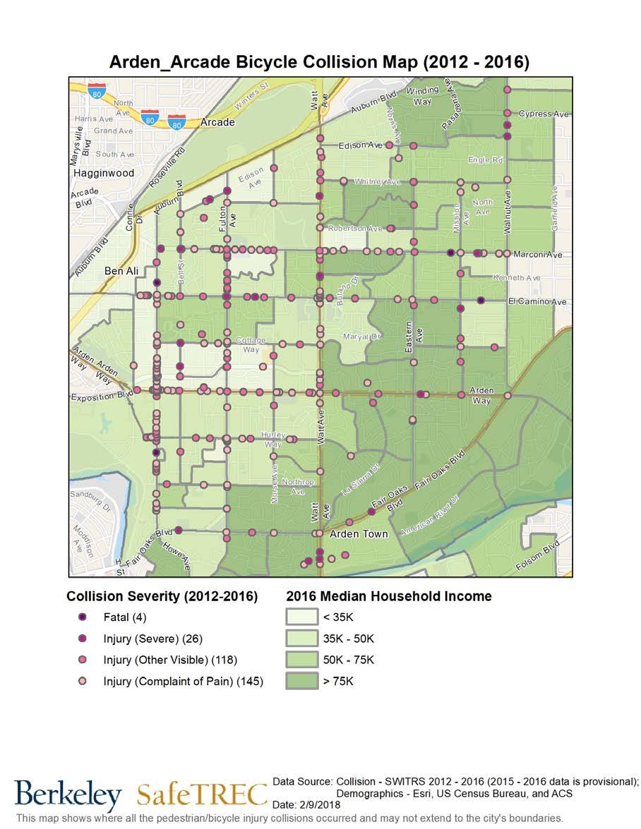
8 Pedestrian Collisions Trends with 3-year moving average Between , there were 552 bicycle collisions, including 11 fatalities and 46 severe injuries in Arden-Arcade. Collisions in this time period are concentrated on along major arterials, including Howe Avenue, Munroe/Fulton Avenue, Watt Avenue, Marconi Avenue, El Camino Avenue, and Arden Way. The top two primary collision factors for collisions involving bicycles were failure by the bicycle or driver to drive on the right half of the roadway (47.1%) and unsafe turn with or without signaling by the bicycle or driver (14.1%) 3. Over the 10-year period, bicycle collisions appear to be on a downward trajectory. Bicycle Collisions Trends with 3-year moving average 3 According to California Vehicle Code 21200, bicycles are considered vehicles, therefore; bicyclists on public streets have the same rights and responsibilities as automobile drivers. This makes it difficult to discern whether a bicyclist or driver is at fault. 6
9 A full discussion of pedestrian and bicyclist collision data prepared by UC Berkeley SafeTREC can be found in Appendix A. Equity Concerns A 2014 Governing Study found that nationwide, pedestrian fatality rates in lower-income communities were more than twice that of higher income communities 4. Pedestrian collisions in Arden-Arcade between mirror similar patterns found at the national level. Of the 184 pedestrian collisions geocoded on the Pedestrian Collisions map, 51 were concentrated in the area or on the border of neighborhoods where the median household income is less than $35,000 per year. Of the 293 bicycle collisions geocoded on the Bicycle Collisions map, 91 were concentrated in an area or on the border of neighborhoods where the median household income is less than $35,000 per year. State funding programs generally define Census tracts at or below 80% of the statewide median household income ($51,026) as disadvantaged communities. In the Arden-Arcade community, data shows a similar trajectory where rates of pedestrian and bicycle collisions and collision severity are disproportionately higher along corridors and in neighborhoods with lower median household income. Furthermore, the majority of pedestrian and bicycle collisions were geocoded on large arterials including Howe Avenue, Munroe Street/Fulton Avenue, Watt Avenue, Arden Way, El Camino Avenue, and Marconi Avenue, supporting the community s concerns with these roadways. 4 Pedestrian Deaths in Poorer Neighborhoods Report," Governing, August Available at 7


10 According to workshop participants, many residents walk and bike to and from work, school, and other community resources as their primary mode of transportation. People using the public right-of-way without the appropriate pedestrian and bicycle facilities increases the chances of collisions with vehicular traffic. Although Sacramento County has worked with local community-based organizations and the San Juan Unified School District to address roadway safety concerns and to install pedestrian and bicycle infrastructure near schools in Arden-Arcade, the demographics of the community are rapidly changing, resulting in more residents walking and biking as their primary transportation mode. Workshop participants shared that over the last few years the community has experiences a significant increase in Arabic- and Farsi-speaking refugee and immigrant families, particularly in school neighborhoods. Many of the families are single-vehicle or no-vehicle households and rely on walking and biking to get around, especially to and from school. Participants also noted that unsafe walking and biking behaviors might be attributed to a difference in infrastructure and differences in walking and biking behaviors between native countries and the U.S. Participants also noted there is a high income inequality in Arden-Arcade, with strong income disparities from one side of a street to the other. A recent Sacramento Bee article noted a significant rise in low-income residents, including families moving into apartments on the west side of the community, where the majority of low income residents reside. The estimated poverty rate in Arden- Arcade increased from 19.9% in 2015 to 27.7% in 2016, the largest of any city or census-designed 8

11 community in the state. 5 Changing community demographics, a lack of walking and biking safety education, and an increase in walking and biking in the community could account for the high rates of pedestrian and bicycle collision the community. Walkability & Bikeability Assessment Reflections Workshop participants conducted a community mapping exercise using a map of the Arden-Arcade community, they were asked to 1) recall and share infrastructure conditions and the behavior of all road users in the community; and 2) apply strategies learned from the presentation that could help overcome infrastructure concerns and unsafe driver, pedestrian, and bicyclist behavior, and 3) identify positive community assets and strategies which can be built upon. Aerial map of Arden-Arcade with participant walking and biking safety concerns. Following the community mapping exercise, the participants shared the following reflections: High Rates of Traffic Collisions: Collisions in the community are concentrated along north to south arterials and collector streets Howe Avenue, Fulton Avenue, Watt Avenue which have higher traffic volumes and higher speeds. These streets also serve as connectors to Interstate 80, Capital City Freeway (Interstate 80 Business), and US Highway 50. Participants suggested the high rates of collisions 5 9

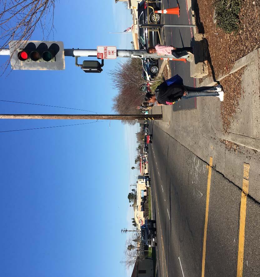
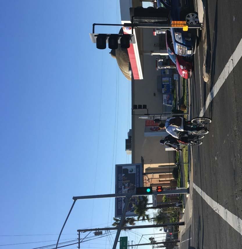
12 on Fulton Avenue might be due to the many business driveways and high concentration of car dealerships. High Vehicle Speeds and Wide Roads: The posted speed limit along the arterial roads that run through the community - Howe Avenue, Fulton Avenue, Watt Avenue, Arden Way, El Camino Avenue, Marconi Avenue - is 35 or 40 miles per hour (MPH); however, workshop participants shared their experiences of drivers traveling at much higher speed. Many of these roads are characterized by two to three wide lanes in each direction with a striped center left turn lane or dedicated left turn lane. Due to large school catchment areas and discontinuous residential streets, students now have to cross these large arterials to get to and from school. Research has demonstrated that wide streets and wide travel lanes are associated with higher vehicle speeds, which affect the safety of people walking and bicycling. Cal Walks staff observed bicyclists riding on the sidewalk, likely due to their discomfort with traveling next to fast moving vehicles along these roads 6. A Howe Avenue Elementary School student waits to cross Howe Avenue in front of the school. Missing and Sidewalks and Sidewalk Gaps: Sidewalk widths and conditions throughout the Arden- Arcade community vary. Sidewalks are present along most arterials streets especially near commercial areas but are absent along some segments of arterials, collectors, and along most residential streets. The majority of residential streets in Arden-Arcade have rolled curbs and no sidewalks. Workshop participants noted that sidewalks are missing along some segments of: 6 See Kay Fitzpatrick, Paul Carlson, Marcus Brewer, and Mark Wooldridge, Design Factors That Affect Driver Speed on Suburban Arterials": Transportation Research Record 1751 (2000):


13 Watt Avenue in the Arden Manor neighborhood; Howe Avenue north of the Howe Avenue Community Center; o The County informed participants there is a project underway to address this concern. Hurley Way; o The County informed participants that sidewalk infill projects is underway and will be in the design phase in 2019 with excepted construction beginning in Fair Oaks Boulevard; and Eastern Avenue. Missing sidewalks and wide travel lanes along a stretch of Howe Avenue between Cottage Way and El Camino Avenue, across from the Howe Community Park. Bicycle Network Gaps and Bicyclist Behaviors: Bicycle lanes appear to be limited to some arterials and are identified by road markings or traditional signage. These bicycle lanes can be difficult to see in areas with high vehicle traffic and speeding cars often drive dangerously close or into the bicycle lane. Participants noted that bicyclists are often seen riding on the sidewalk or riding in the bike lane against traffic. Community members noted that a main safety concern for residents who bike along arterials and collector streets is the high speed of vehicles, which results in many bicyclists riding on the sidewalk instead of in the street even when bike lanes are present. A bicyclist rides on the sidewalk and waits to cross Howe Avenue at El Camino Avenue. 11


14 Prior to the workshop, middle school students from Arden Middle School and Thomas Edison Language Institute performed observations and walk assessments around their schools to identify barriers and opportunities to walking to and from school. Thomas Edison Language Institute Student Observations Sidewalks are missing on the south side of Hurley Way near the school entrance. Sidewalks along the school driveway from Hurley Way to the bike racks are found only on the west side and have rolled curbs. Students noted that vehicles are parking onto the sidewalks during pick-up and drop-off times, narrowing the sidewalk space and forcing students to walk onto the grass. In the school parking lot, students noted a missing sidewalk from the sidewalk on the west side leading into the school and connecting to the area by the front office and cafeteria. No Parking signage is missing from the driveway leading into the school. Vehicles often park onto the sidewalk on the west side or double park in the drive aisle causing congestion and an unsafe environment for students walking and biking to and from the school and through the parking lot. Source: Joelle Orrock 12


15 Arden Middle School Student Observations Students shared that the intersection of Arden Way and Watt Avenue experiences a high volume of vehicles crossing during school pick-up and drop-off times. Although a crossing guard is present to help students cross the street safely, students felt that additional signage was needed to signal to drivers that a school is nearby. At the rear of the school, a paved path extends onto El Rincon Way and is used by students to enter and exit campus. El Rincon Way has no sidewalk where the path ends and students walk and bike on the path into the street. Arden Middle School students noted that trees and overgrown vegetation blocks visibility for students looking to cross at El Rincon Way. Additionally, although the path opens onto a residential street with a 25 MPH speed limit, vehicles driving by the path have limited visibility of students walking and biking to and from the path. Source: Joelle Orrock Key Opportunities to Improve Walking and Biking Safety Following the crowdsourcing activity and the walkability and bikeability assessments, the Project Team facilitated a small-group action planning discussion. Workshop participants discussed and prioritized infrastructure improvements for reducing the number of injuries and fatalities, as well as education and encouragement programs aimed at increasing the number of people and the frequency of walking and biking in Arden-Arcade. The first set of questions focused on identifying and prioritizing non-infrastructure communityled education and encouragement projects. The second set of questions focused identifying and prioritizing infrastructure improvements for reducing the number of injuries and fatalities. 13
16 Workshop participants provided the following recommendations and next steps for overall pedestrian and bicyclist safety improvements: Community Recommendations Community Education Programs School-Focused Education Campaign: Participants were interested in a safe walking and biking education campaigns that involved coordination between San Juan Unified School District, Sacramento County, and the City of Citrus Heights. Youth-focused education is needed to encourage students to walk and bike to and from school. Except for Encina Middle School and Arden Middle School, the San Juan Unified School District Safe Schools Coordinator noted low rates of biking to and from school across the District. The low rates of biking to school might be due to discontinuous residential streets which force students to ride on high-speed arterial and collector streets. Participants also identified the need for culturally- and linguistically-competent walking and biking education for youth and parents to reach the growing immigrant and refugee families who rely on active transportation to get around in the community. Also, with expanding school catchment areas, parents and students travel longer distances to get to and from school and need to cross arterials and connector streets. Alternative Bike Routes Education Campaign: Although there are streets with bike lanes in the community, Sacramento County is working to create a comprehensive bicycle network that would support bicyclists at all comfort levels riding with traffic. A well-connected bicycle network provides routes between desired destinations and does not limit bicyclists to routes that exceed their comfort levels or require undue detours or accommodations. In Arden-Arcade, the majority of bicycle collisions occur on arterials and collector streets, but there are existing low-stress alternative routes available to the public. A general public education campaign can help to raise awareness of safe bicycling behaviors and alternatives to high-speed roads. Infrastructure Priorities Daylighting is a cost-effective strategy to improve pedestrian safety by removing visual barriers near a crosswalk or intersection. Workshop participants recommended daylighting, especially near school intersections and crossings to improve visibility for walking to and from school as well as the visibility of students by drivers. Low-Cost Strategies: Signage, paint, and speed humps were recommended as incremental solutions to improve walking and biking safety in the community. These strategies were specifically recommended along Bell Street from Cottage Way to Santa Anita Drive. Community Sidewalk Inventory: Participants noted there is currently no countywide inventory of sidewalks. They recommended a sidewalk inventory to help prioritize sidewalk infill projects in Arden-Arcade. Thomas Edison Language Institute Student Recommendations Install sidewalks on the south side of Hurley Way near the school entrance. 14
17 Widen sidewalks leading into the school along the drive aisle and install a barrier between vehicles and the sidewalk to prevent vehicles parking on the sidewalk. In the school parking lot, install a crosswalk from the sidewalk on the west side leading into the school and connecting to the area by the front office and cafeteria. Install No Parking signage along the driveway leading into the school. Arden Middle School Student Recommendations Install a School Crossing sign at the intersection of Watt Avenue and Arden Way near the corner of the school to signal to drivers that students may be crossing. Install sidewalks along El Rincon Way near the path leading to the back entrance of the school. Ask residential neighbor to trim trees and bushes along path to improve visibility for and of students using the path. If needed, involve Sacramento County Code Enforcement. Install a marked crosswalk on El Rincon Way at the path near the rear of the school to signal to drivers to expect pedestrians and bicyclists to cross. Currently, there are only two crossing signs posted on either side of the path. Cal Walks/SafeTREC Recommendations California Walks and SafeTREC also submit the following recommendations for consideration by the Planning Committee: Multi-Language Adult Pedestrian and Bicycle Education Campaign: Participants noted that changing demographics in the Arden-Arcade community has resulted in an increase in walking and bicycling activity, especially among recently arrived refugees and immigrants. Participants noted it is common to see adults in the community riding against traffic in a bike lane or on the sidewalk. Although it is difficult to know if refugees and immigrants are exhibiting these behaviors, workshop participants expressed a need for targeted language-specific pedestrian and bicycle education to support this community as many rely on walking and biking to access employment and amenities. Participants also stated that refugee and immigrant mothers primarily walk their children to and from school since they do not drive or are single-vehicle households. The Project Team recommends targeted language-specific bicycle education to address wrongway riding and other unsafe bicycling behaviors observed in the community. The San Juan Unified Safe School Coordinator shared two pedestrian safety resources available in English, Spanish, Farsi, and Arabic that can serve as a starting point for a community education campaign. o Safe Walking Information for Parents o Drivers Helping Pedestrians The Project Team recommends lower-cost printed education campaigns on benches and flyers posted at residential hubs, restaurants, markets, religious institutions, and other locations frequented by these community members. Arden-Arcade SRTS Plan: The Project Team recommends the development of a Safe Routes to School (SRTS) Plan specific to Arden-Arcade to address the main infrastructure barriers and student behaviors to safe walking and biking. Workshop participants noted that the current County and School District approach has been to focus on individual schools and school 15
18 community needs, but with the large number of schools in the community and large school catchment areas, the community will benefit from a more focused community-wide approach. Community Lighting Assessment: The Project Team recommends CPBST participants collaborate and perform a citywide street lighting assessment focused on pedestrian- and bicycle-oriented lighting needs around schools, parks, businesses, and along key pedestrian and bicycle corridors. Workshop participants noted a lack of street lighting and pedestrian-scale lighting around schools, parks, and community amenities, particularly at crosswalks leading. Proper street lighting provides safety and security and improves the overall well-being of road users. Lighting should be uniform, consistent, and reduce glare and light pollution. Adopt a Standardized Daylighting Policy: Workshop participants expressed concern for students safety while crossing at school intersections. In addition to increasing daylighting near schools, the Project Team recommends daylighting for all marked crosswalks to increase pedestrian visibility. Policies regarding daylighting support implementation and provide direction to city traffic engineers. 16
19 Appendix A Pedestrian and Bicycle Collision Data Analysis 17

20 ARDEN-ARCADE DATA ANALYSES Community Pedestrian and Bicycle Safety Training Workshop March 6, 2018 The goal of the Community Pedestrian and Bicycle Safety Training (CPBST) is to make communities safer and more pleasant for walking and bicycling. This workshop will train local residents and safety advocates in pedestrian and bicycle safety as well as create opporutnies for collaboration with local officials and agency staff. This fact sheet highlights pedestrian and bicycle collision data available to help your community better prioritize recommendations that emerge from this workshop. PEDESTRIANS 400 people were killed or injured in 363 pedestrian collisions in the last 10 years ( ). The three-year moving average line shows an upward trend in pedestrian collisions.* There were 36 pedestrian collisions in 2015, but an average of 38 pedestrian collisions per year for the 3-year rolling average between 2014 and * This line is useful for tracking change over time, especially when the number of collisions changes a lot between years. Data points are at the midpoint of the three years of data specified. 43.4% driver violations VS. 45.5% pedestrian violations * Unclear violations were committed either by the driver, pedestrian or bicyclist. 60.5% of victims were male 22.0% of victims were under age % of victims were age % of victims (or 55 people) were KILLED or SEVERELY INJURED Data Source: California Statewide Integrated Traffic Records System (SWITRS). Collision data for 2015 and 2016 are provisional at this time. Funding for this program was provided by a grant from the California Office of Traffic Safety through the National Highway Traffic Safety Administration.


 KILLED or SEVERELY INJURED Yearly Population Rate of Fatalities & Injuries per 100,000 Population Calculated Over a 5-year Period*")
21 566 people were killed or injured in 552 bicycle collisions in the last 10 years ( ). BICYCLES The three-year moving average line shows a downward trend in bicycle collisions.* There were 44 bicycle collisions in 2015, but an average of 52.7 bicycle collisions per year for the 3-year rolling average between 2014 and * This line is useful for tracking change over time, especially when the number of collisions changes a lot between years. Data points are at the midpoint of the three years of data specified. Bicycles must follow all the same rules of the road as vehicles. As a result, we cannot break down violations by driver vs. bicyclist pedestrian fatalities & injuries per 100,000 population over the last five years, which is 28.0% more than Sacramento County and 20.9% more than California 64.7 bicyclist fatalities & injuries per 100,000 population over the last five years, which is 57.0% more than Sacramento County and 94.3% more than California 76.6% of victims were male 23.2% of victims were under age % of victims were age 65+ SUMMARY 10.7% of victims (or 32 people) KILLED or SEVERELY INJURED Yearly Population Rate of Fatalities & Injuries per 100,000 Population Calculated Over a 5-year Period* Pedestrian Bicyclist Arden-Arcade Sacramento County California Source: U.S. Census Bureau, Population Division (2010 population data). * The rate per population is calculated by adding the number of fatalities and injuries of pedestrian or bicyclist victims from 2012 to 2016 divided by five times the population in 2010 CALIFORNIA OFFICE OF TRAFFIC SAFETY

22 Pedestrian Collisions of 189 collisions mapped in Arden Arcade, CA. Note: 2015 and 2016 SWITRS data are provisional as of November 2017.
23 Bicyclist collisions of 297 collisions mapped in Arden-Arcade, CA. Note: 2015 and 2016 SWITRS data are provisional as of November 2017.
24 Appendix B Pedestrian and Bicycle Collision Data Analysis Site Visit Presentation 22

25 Note: 2015 and 2016 Statewide Integrated Traffic Records System (SWITRS) data are provisional as of November Community Pedestrian and Bicycle Safety Workshop Site Visit Arden-Arcade, CA 2/16/18 Pedestrian Injury Collision Trend with 3-year moving average
26 Bicycle Injury Collision Trend with 3-year moving average Note: 2015 and 2016 SWITRS data are provisional as of November 2017.
27 Pedestrian Injury Collisions Only 184 of 189 collisions are mapped. Note: 2015 and 2016 SWITRS data are provisional as of November 2017.
28
 Total: 189 collisions CVC No. Description No. % 21954 Pedestrian failure to yield right-of-way to vehicles 63 33.")
29 Pedestrian Injury Collisions by Time of Day and Day of Week Total: 189 collisions *The colors in this graph refer to how frequently a collision occurs at that time & day. Top 10 Violations in Pedestrian Injury Collisions (with # and %) Total: 189 collisions CVC No. Description No. % Pedestrian failure to yield right-of-way to vehicles % Failure to yield right-of-way to pedestrians at a crosswalk % Failure to stop at a limit line or crosswalk at a red light. Failure to yield right-of-way to pedestrian when turning on a red light % Unsafe turning with or without signaling % Failure to yield right-of-way to pedestrians on sidewalks 9 4.8% 0 Unknown 8 4.2% Failure to yield right-of-way when entering/crossing a highway 8 4.2% Unsafe starting or backing of vehicle 8 4.2% Pedestrian must cross at crosswalks between adjacent traffic signal controlled intersections 7 3.7% Speeding on the highway 7 3.7%
 Total: 210 victims Note: 2015 and 2016 SWITRS data are provisional as of")
30 Pedestrian Victim Injury Severity 38.6% (81) 9.1% (19) 34.3% (72) 18.1% (38) Total: 210 victims Note: 2015 and 2016 SWITRS data are provisional as of November 2017.

31 Pedestrian Victims by Age and Gender Note: 2015 and 2016 SWITRS data are provisional as of November Total: 210 victims
32 Bicycle Injury Collisions Only 293 of 297 collisions are mapped. Note: 2015 and 2016 SWITRS data are provisional as of November 2017.
33
 CVC No. Description No. % 21650 Failure to drive on right half of the roadway (with some exceptions) 140 47.")
34 Bicycle Injury Collisions by Time of Day and Day of Week Total: 297 collisions *The colors in this graph refer to how frequently a collision occurs at that time & day. Top 10 Violations in Bicycle Collisions (with # and %) CVC No. Description No. % Failure to drive on right half of the roadway (with some exceptions) % Unsafe turning with or without signaling % Bicyclist failure to ride on right edge of roadway (with some exceptions) % Failure to stop at a limit line or crosswalk at a red light. Failure to yield right-of-way to pedestrian when turning on a red light % Failure to yield right-of-way when making a left turn or U-turn % Speeding on the highway % 0 Unknown 9 3.0% Failure to yield right-of-way when entering/crossing a highway 8 2.7% Failure to stop or yield right % Failure to stop at a limit line or crosswalk at a stop sign 5 1.7% Total: 297 collisions
35 Bicycle Victim Injury Severity 49.0% (149) 2.0% (6) 9.2% (28) 39.8% (121) Total: 304 victims Note: 2015 and 2016 SWITRS data are provisional as of November 2017.
36 Bicycle Injury Victims by Age and Gender Note: 2015 and 2016 SWITRS data are provisional as of November Total: 304 victims

37 Arden Middle 1640 Watt Avenue Sacramento Sacramento County CDS:
38 Thomas Edison Language Institute K Hurley Way Sacramento Sacramento County CDS: *The colors in this graph refer to how frequently a collision occurs at that time & day.
. To further explore collision data, register for a free account to access the tools and resources on TIMS. https://tims.berkeley.")
39 The Transportation Injury Mapping System (TIMS) is a web-based tool that allows users to analyze and map data from California's Statewide Integrated Traffic Records System (SWITRS). To further explore collision data, register for a free account to access the tools and resources on TIMS. Berkeley SafeTREC
Recommendations to Improve Pedestrian & Bicycle Safety for the Missouri Flat Area (El Dorado County)
") Recommendations to Improve Pedestrian & Bicycle Safety for the Missouri Flat Area (El Dorado County) October 2017 Recommendations to Improve Pedestrian & Bicycle Safety for the Missouri Flat Area (El Dorado
Recommendations to Improve Pedestrian & Bicycle Safety for the Missouri Flat Area (El Dorado County) October 2017 Recommendations to Improve Pedestrian & Bicycle Safety for the Missouri Flat Area (El Dorado
Recommendations to Improve Pedestrian & Bicycle Safety for the City of Arvin
 Recommendations to Improve Pedestrian & Bicycle Safety for the City of Arvin July 2018 1 Acknowledgements Planning Committee Jack Becker Tammy Fisher Pat Ebel Peter Smith Carlos Bello Christine Viterelli
Recommendations to Improve Pedestrian & Bicycle Safety for the Zane Middle School Community
 Recommendations to Improve Pedestrian & Bicycle Safety for the Zane Middle School Community October 2018 1 Acknowledgements Planning Committee Nicole Sager Jesse Willor Jenny Weiss Emily Sinkhorn Scott
RECOMMENDATIONS TO IMPROVE PEDESTRIAN & BICYCLE SAFETY IN THE COMMUNITY OF FLORENCE-FIRESTONE
 RECOMMENDATIONS TO IMPROVE PEDESTRIAN & BICYCLE SAFETY IN THE COMMUNITY OF FLORENCE-FIRESTONE September 2017 By Miha Tomuta, Wendy Ortiz, California Walks; Jill Cooper, Katherine Chen, UC Berkeley SafeTREC
Recommendations to Improve Pedestrian & Bicycle Safety in the Azusa Unified School District
 Recommendations to Improve Pedestrian & Bicycle Safety in the Azusa Unified School District October 2017 Recommendations to Improve Pedestrian & Bicycle Safety in the Azusa Unified School District By Mihaela
Recommendations to Improve Pedestrian & Bicycle Safety for the Community of North Shore
 Recommendations to Improve Pedestrian & Bicycle Safety for the Community of North Shore October 2017 Recommendations to Improve Pedestrian & Bicycle Safety for the Community of North Shore By Tony Dang,
Recommendations to Improve Pedestrian & Bicycle Safety for the Community of Southwest Fresno
 Recommendations to Improve Pedestrian & Bicycle Safety for the Community of Southwest Fresno October 2017 Recommendations to Improve Pedestrian & Bicycle Safety for the Community of Southwest Fresno By
Recommendations to Improve Pedestrian & Bicycle Safety for the City of Lemon Grove
 Recommendations to Improve Pedestrian & Bicycle Safety for the City of Lemon Grove October 2018 1 Acknowledgements Planning Committee Anita Lopez Rosa Carney Steve Browne Angeles Nelson Lemon Grove Healthy
Recommendations to Improve Pedestrian & Bicycle Safety for the Clegg Elementary School & Stacey Middle School Community
 Recommendations to Improve Pedestrian & Bicycle Safety for the Clegg Elementary School & Stacey Middle School Community (Westminster School District) October 2018 1 Acknowledgements Planning Committee
Recommendations to Improve Pedestrian & Bicycle Safety for the City of Bakersfield
 Recommendations to Improve Pedestrian & Bicycle Safety for the City of Bakersfield August 2018 1 Acknowledgements Planning Committee Jack Becker Bike Bakersfield Cindy Parra Bike Bakersfield Christopher
Recommendations to Improve Pedestrian & Bicycle Safety for the City of Hayward: Tennyson Road Corridor
 Recommendations to Improve Pedestrian & Bicycle Safety for the City of Hayward: Tennyson Road Corridor October 2018 1 Acknowledgments Planning Committee Charmine Solla Steven Chang Patty Garcia Sergio
Recommendations to Improve Pedestrian & Bicycle Safety for the Community of Palermo
 Recommendations to Improve Pedestrian & Bicycle Safety for the Community of Palermo September 2017 Recommendations to Improve Pedestrian & Bicycle Safety for the Community of Palermo By Wendy Ortiz, Jaime
RECOMMENDATIONS TO IMPROVE PEDESTRIAN & BICYCLIST SAFETY IN LOS ANGELES CHINATOWN
 RECOMMENDATIONS TO IMPROVE PEDESTRIAN & BICYCLIST SAFETY IN LOS ANGELES CHINATOWN October 2016 By Tony Dang, Caro Jauregui, Jaime Fearer, Wendy Alfsen, California Walks; Jill Cooper, Katherine Chen, UC
PEDESTRIAN ACTION PLAN
 ATTACHMENT 2 CITY OF SANTA MONICA PEDESTRIAN ACTION PLAN CITY OF SANTA MONICA PEDESTRIAN ACTION PLAN This page intentionally left blank EXECUTIVE SUMMARY CHAPTER 1 EXECUTIVE SUMMARY Setting the Stage
RECOMMENDATIONS TO IMPROVE PEDESTRIAN & BICYCLIST SAFETY FOR THE MOUNTAIN VIEW SCHOOL DISTRICT (EL MONTE/SOUTH EL MONTE)
") RECOMMENDATIONS TO IMPROVE PEDESTRIAN & BICYCLIST SAFETY FOR THE MOUNTAIN VIEW SCHOOL DISTRICT (EL MONTE/SOUTH EL MONTE) August 2016 By Caro Jauregui, Jaime Fearer, Tony Dang, Wendy Alfsen California Walks;
RECOMMENDATIONS TO IMPROVE PEDESTRIAN & BICYCLIST SAFETY FOR THE MOUNTAIN VIEW SCHOOL DISTRICT (EL MONTE/SOUTH EL MONTE) August 2016 By Caro Jauregui, Jaime Fearer, Tony Dang, Wendy Alfsen California Walks;
RECOMMENDATIONS TO IMPROVE PEDESTRIAN & BICYCLE SAFETY IN ROSEMONT
 RECOMMENDATIONS TO IMPROVE PEDESTRIAN & BICYCLE SAFETY IN ROSEMONT SEPT 2017 By Tony Dang, Jaime Fearer, Miha Tomuta, Wendy Ortiz, California Walks; Jill Cooper, Jessica Rosas, UC Berkeley SafeTREC Recommendations
CONNECTING PEOPLE TO PLACES
 CONNECTING PEOPLE TO PLACES 82 EAST BENCH MASTER PLAN 07 Introduction The East Bench transportation system is a collection of slow moving, treelined residential streets and major arteries that are the
5/7/2013 VIA . RE: University Village Safeway Expansion (P13-019)
") 5/7/2013 VIA EMAIL David Hung, Associate Planner Community Development Department, Current Planning Division City of Sacramento 300 Richards Boulevard, 3 rd Floor Sacramento, CA 95811 RE: University Village
5/7/2013 VIA EMAIL David Hung, Associate Planner Community Development Department, Current Planning Division City of Sacramento 300 Richards Boulevard, 3 rd Floor Sacramento, CA 95811 RE: University Village
Chapter 14 PARLIER RELATIONSHIP TO CITY PLANS AND POLICIES. Recommendations to Improve Pedestrian Safety in the City of Parlier (2014)
") Chapter 14 PARLIER This chapter describes the current status and future plans for biking and walking in the City of Parlier. RELATIONSHIP TO CITY PLANS AND POLICIES The Parlier General Plan is the primary
Chapter 14 PARLIER This chapter describes the current status and future plans for biking and walking in the City of Parlier. RELATIONSHIP TO CITY PLANS AND POLICIES The Parlier General Plan is the primary
Recommendations to Improve Pedestrian & Bicycle Safety for the Valley West Community in Arcata
 Recommendations to Improve Pedestrian & Bicycle Safety for the Valley West Community in Arcata October 2018 1 Acknowledgements Planning Committee Netra Khatri Julie Neander Emily Sinkhorn Jennifer Weiss
City of Novi Non-Motorized Master Plan 2011 Executive Summary
 City of Novi Non-Motorized Master Plan 2011 Executive Summary Prepared by: February 28, 2011 Why Plan? Encouraging healthy, active lifestyles through pathway and sidewalk connectivity has been a focus
SAFE ROUTES TO SCHOOL
 SAFE ROUTES TO SCHOOL Forest Ridge Elementary School Existing Conditions and ACTION PLAN > Oak Creek - Franklin Joint School District Table of Contents CONTEXT Enrollment Boundaries
RECOMMENDATIONS TO IMPROVE PEDESTRIAN SAFETY IN MCKINLEYVILLE
 RECOMMENDATIONS TO IMPROVE PEDESTRIAN SAFETY IN MCKINLEYVILLE May 2015 By Tony Dang, Jaime Fearer, Wendy Alfsen, California Walks; Jill Cooper, UC Berkeley SafeTREC Recommendations to Improve Pedestrian
8. Collisions INTRODUCTION
 8. Collisions INTRODUCTION While traffic collisions can affect anyone, they have a disproportionate impact on bicyclists, who along with pedestrians are the most vulnerable users of the transportation
July 5, Arthur R. Ware, Jr. Elementary School 2017 Safe Routes to School Walkabout Report
 July 5, 2017 Arthur R. Ware, Jr. Elementary School 2017 Safe Routes to School Walkabout Report 1 Walkabout Report Introduction On April 28, 2017, City, School, and SAWMPO staff met to conduct a Safe Routes
Pedestrian injuries in San Francisco: distribution, causes, and solutions
 Pedestrian injuries in San Francisco: distribution, causes, and solutions Presentation to the San Francisco Health Commission RAJIV BHATIA, MD, MPH DIRECTOR OF OCCUPATIONAL AND ENVIRONMENTAL HEALTH, SAN
SANTA CLARA COUNTYWIDE BICYCLE PLAN August 2008
 SANTA CLARA COUNTYWIDE BICYCLE PLAN August 2008 To assist VTA and Member Agencies in the planning, development and programming of bicycle improvements in Santa Clara County. Vision Statement To establish,
Bicycle Master Plan Goals, Strategies, and Policies
 Bicycle Master Plan Goals, Strategies, and Policies Mobilizing 5 This chapter outlines the overarching goals, action statements, and action items Long Beach will take in order to achieve its vision of
Vision Zero Task Force February 28, Collision Landscape Analysis
 Vision Zero Task Force February 28, 2017 Collision Landscape Analysis Welcome! What happened since our last Task Force meeting: City Council adopted the Vision Zero Resolution Applied for an OTS grant
8/31/2016 VIA . RE: Freeport Arco Fuel Station (P16-039)
") 8/31/2016 VIA EMAIL Garrett Norman, Assistant Planner City of Sacramento Community Development Department 300 Richards Boulevard, 3 rd Floor Sacramento, CA 95811 RE: Freeport Arco Fuel Station (P16-039)
8/31/2016 VIA EMAIL Garrett Norman, Assistant Planner City of Sacramento Community Development Department 300 Richards Boulevard, 3 rd Floor Sacramento, CA 95811 RE: Freeport Arco Fuel Station (P16-039)
7/23/2017 VIA . Michael Hanebutt City of Sacramento Community Development Department 300 Richards Boulevard, 3 rd Floor Sacramento, CA 95811
 7/23/2017 VIA EMAIL Michael Hanebutt City of Sacramento Community Development Department 300 Richards Boulevard, 3 rd Floor Sacramento, CA 95811 RE: 65 th Street Apartments (DR17-220) Dear Mr. Hanebutt:
City of San Diego Vision Zero Draft Strategic Plan FY 2017
 City of San Diego Vision Zero Draft Strategic Plan FY 2017 Engineering Objective: To develop and implement a strategy that employs best planning, design and engineering practices. Background: Over the
9/22/2014 VIA . RE: Butano Apartments Pre App (PAMP )
") 9/22/2014 VIA EMAIL Surinder Singh, Senior Planner Planning and Environmental Review Division Sacramento County 827 7th Street, Second Floor RE: Butano Apartments Pre App (PAMP2014-00012) Dear Mr. Singh:
9/22/2014 VIA EMAIL Surinder Singh, Senior Planner Planning and Environmental Review Division Sacramento County 827 7th Street, Second Floor RE: Butano Apartments Pre App (PAMP2014-00012) Dear Mr. Singh:
Existing Pedestrian Conditions. PSAC February 8, 2011
 Existing Pedestrian Conditions PSAC February 8, 2011 Contents 1. Project Background & Goals 2. Pedestrian Activity: Where people walk 3. Pedestrian Safety: The conditions people face Project Background
9/21/2016 VIA . RE: The Knot (DR16-270)
") 9/21/2016 VIA EMAIL Garrett Norman, Assistant Planner City of Sacramento Community Development Department 300 Richards Boulevard, 3 rd Floor Sacramento, CA 95811 RE: The Knot (DR16-270) Dear Mr. Norman:
9/21/2016 VIA EMAIL Garrett Norman, Assistant Planner City of Sacramento Community Development Department 300 Richards Boulevard, 3 rd Floor Sacramento, CA 95811 RE: The Knot (DR16-270) Dear Mr. Norman:
PRINCE GEORGE S PLAZA METRO AREA PEDESTRIAN PLAN
 PRINCE GEORGE S PLAZA METRO AREA PEDESTRIAN PLAN May 28, 2008 Agenda Welcome and introductions Project overview and issue identification Planning context and strengths Design challenges and initial recommendations
REGIONAL BICYCLE AND PEDESTRIAN DESIGN GUIDELINES
 REGIONAL BICYCLE AND PEDESTRIAN DESIGN GUIDELINES November 16, 2011 Deb Humphreys North Central Texas Council of Governments Bicycle and Pedestrian Advisory Committee Snapshot of the Guide 1. Introduction
Safe Streets. City of Lake Forest Park. March 21, 2017
 Safe Streets City of Lake Forest Park March 21, 2017 1 01 WELCOME 2 Agenda WELCOME WHAT IS THIS PROJECT? CONTEXT DRAFT CITYWIDE PROJECTS EXERCISE INTRODUCTION 3 02 WHAT IS THIS PROJECT? 4 WHAT IS THIS
Perryville TOD and Greenway Plan
 Perryville TOD and Greenway Plan Greenway Glossary Pathway: A bicycle and pedestrian path separated from motorized vehicular traffic by an open space, barrier or curb. Multi-use paths may be within the
TRAFFIC ACTION PLAN. North Central Neighborhood CITY OF SAN MATEO
 TRAFFIC ACTION PLAN North Central Neighborhood CITY OF SAN MATEO Draft February 2017 Table of Contents Introduction... 1 The Traffic Forum Process... 4 Neighborhood Traffic Issues... 6 Neighborhood Recommendations
Chapter 2. Bellingham Bicycle Master Plan Chapter 2: Policies and Actions
 Chapter 2 Bellingham Bicycle Master Plan Chapter 2: Policies and Actions Chapter 2: Policies and Actions The Bicycle Master Plan provides a road map for making bicycling in Bellingham a viable transportation
Bikeway action plan. Bicycle Friendly Community Workshop March 5, 2007 Rochester, MN
 Bikeway action plan Summary The was held on March 5, 2007 at the Rochester Mayo Civic Center. The workshop was hosted by Rochester-Olmsted County Planning Department in collaboration with the League of
NM-POLICY 1: Improve service levels, participation, and options for non-motorized transportation modes throughout the County.
 Transportation PRINCE WILLIAM COUNTY 2008 COMPREHENSIVE PLAN NON-MOTORIZED PLAN CONTENTS Goals, Policies, and Action Strategies Table 4 (Bike Facility Classifications and Descriptions) Table 5 (Bike Facility
SAFE ROUTES TO SCHOOL
 SAFE ROUTES TO SCHOOL Edgewood Elementary School Existing Conditions and ACTION PLAN > Oak Creek - Franklin Joint School District Table of Contents CONTEXT Enrollment Boundaries Enrollment
11/3/2014 VIA . WALKSacramento has reviewed the Stockton and T Mixed-Use project at 3675 T Street in the
 11/3/2014 VIA EMAIL Antonio Ablog Planning Department City of Sacramento 300 Richards Boulevard Sacramento, CA 95811 RE: Design Review for Stockton and T Mixed-Use (P14-042) Dear Mr. Ablog: WALKSacramento
Executive Summary Route 30 Corridor Master Plan
 Route Corridor Master Plan Project Overview The Route Corridor Master Plan is a coordinated multimodal transportation and land use plan for the entire stretch of Route through East Whiteland Township,
11/28/2016 VIA
 11/28/2016 VIA EMAIL Ethan Meltzer, Assistant Planner City of Sacramento Community Development Department 300 Richards Blvd., 3 rd Floor Sacramento, Ca 95811 RE: Natomas Corporate Center Commercial Building
TRAFFIC ACTION PLAN. Laurie Meadows Neighborhood CITY OF SAN MATEO
 TRAFFIC ACTION PLAN Laurie Meadows Neighborhood CITY OF SAN MATEO Draft January 2017 Table of Contents Introduction... 2 The Traffic Forum Process... 5 Neighborhood Traffic Issues... 7 Neighborhood Recommendations
CITY OF BLOOMINGTON COMPLETE STREETS POLICY
 CITY OF BLOOMINGTON COMPLETE STREETS POLICY POLICY OBJECTIVE: The City of Bloomington will enhance safety, mobility, accessibility and convenience for transportation network users of all ages and abilities,
RESOLUTION NO ?? A RESOLUTION OF THE CITY OF NEPTUNE BEACH ADOPTING A COMPLETE STREETS POLICY
 RESOLUTION NO. 2018-?? A RESOLUTION OF THE CITY OF NEPTUNE BEACH ADOPTING A COMPLETE STREETS POLICY WHEREAS, safe, convenient, and accessible transportation for all users is a priority of the City of Neptune
FINAL PLAN APPENDIX D CITY OF BERKELEY BIKE PLAN D-1
 CITY OF BERKELEY BIKE PLAN D-1 . Proposed Programs D.1. EDUCATION This appendix presents the recommended bicycle-related programs for the City of Berkeley. The recommendations are organized in four E s:
Bringing together community and health. Physical Activity and Nutrition Unit Office of Statewide Health Improvement Initiatives
 Bringing together community and health. Physical Activity and Nutrition Unit Office of Statewide Health Improvement Initiatives Physical Activity and Nutrition Unit Office of Statewide Health Improvement
Goodlettsville Bicycle and Pedestrian Plan Executive Summary
 Goodlettsville Bicycle and Pedestrian Plan July 2010 In Cooperation with the Nashville Area Metropolitan Planning Executive Organization Summary Introduction Progressive and forward thinking communities
City of Charlottesville Bicycle and Pedestrian Master Plan Update
 City of Charlottesville Bicycle and Pedestrian Master Plan Update September 17, 2014 I. Welcome and meeting overview II. Project status update III. Network overview IV. Break-out groups Pedestrian Network
CHAPTER 3: Vision Statement and Goals
 Davidson Walks & Rolls: Active Transportation Master Plan CHAPTER 3 Contents: Overview Vision Statement Measurable Goals Public Outreach CHAPTER 3: Vision Statement and Goals Overview The vision statement
Agenda. Overview PRINCE GEORGE S PLAZA METRO AREA PEDESTRIAN PLAN
 PRINCE GEORGE S PLAZA METRO AREA PEDESTRIAN PLAN May 28, 2008 Agenda Welcome and introductions Project overview and issue identification Planning context and strengths Design challenges and initial recommendations
Madison Urban Area and Dane County. Bicycle Transportation Plan Summary. September Introduction. Bicycle Plan Scope and Planning Process
 Bicycle Transportation Plan Summary Madison Urban Area and Dane County Introduction September 2000 Bicycling is an important mode of transportation in the Madison urban area and countywide that is available
AMENDING MOTION: Mobility Plan - Pedestrians and Disadvantaged Communities
 I MOVE that the Council: AMENDING MOTION: Mobility Plan - Pedestrians and Disadvantaged Communities 1. INSTRUCT the Department of City Planning to amend the proposed Mobility Plan to include the following;
ABOUT THIS STUDY The Tenderloin-Little Saigon Community-Based Transportation Plan
 ABOUT THIS STUDY The Tenderloin-Little Saigon Community-Based Transportation Plan The Greater Tenderloin Community Study Milestones October Community based organizations (Tenderloin Housing Clinic and
Corpus Christi Metropolitan Transportation Plan Fiscal Year Introduction:
 Introduction: The Safe, Accountable, Flexible, Efficient Transportation Equity Act: A Legacy for Users (SAFETEA-LU) has continued the efforts started through the Intermodal Surface Transportation Efficiency
5/31/2016 VIA . Arwen Wacht City of Sacramento Community Development Department 300 Richards Blvd., 3 rd Floor Sacramento, CA 95811
 5/31/2016 VIA EMAIL Arwen Wacht City of Sacramento Community Development Department 300 Richards Blvd., 3 rd Floor Sacramento, CA 95811 RE: El Pollo Loco (P16-028) Dear Ms. Wacht: WALKSacramento has reviewed
o n - m o t o r i z e d transportation is an overlooked element that can greatly enhance the overall quality of life for the community s residents.
 N o n - m o t o r i z e d transportation is an overlooked element that can greatly enhance the overall quality of life for the community s residents. 84 Transportation CHAPTER 11 INTRODUCTION Transportation
ADOT Statewide Bicycle and Pedestrian Program Summary of Phase IV Activities APPENDIX B PEDESTRIAN DEMAND INDEX
 ADOT Statewide Bicycle and Pedestrian Program Summary of Activities APPENDIX B PEDESTRIAN DEMAND INDEX May 24, 2009 Pedestrian Demand Index for State Highway Facilities Revised: May 29, 2007 Introduction
12/4/2016 VIA . RE: Grocery Outlet Del Paso (DR16-328)
") 12/4/2016 VIA EMAIL Ethan Meltzer, Assistant Planner City of Sacramento Community Development Department 300 Richards Blvd, 3 rd Floor Sacramento, CA 95811 RE: Grocery Outlet Del Paso (DR16-328) Dear Mr.
12/4/2016 VIA EMAIL Ethan Meltzer, Assistant Planner City of Sacramento Community Development Department 300 Richards Blvd, 3 rd Floor Sacramento, CA 95811 RE: Grocery Outlet Del Paso (DR16-328) Dear Mr.
CITY OF COCOA BEACH 2025 COMPREHENSIVE PLAN. Section VIII Mobility Element Goals, Objectives, and Policies
 CITY OF COCOA BEACH 2025 COMPREHENSIVE PLAN Section VIII Mobility Element Goals, Objectives, and Policies Adopted August 6, 2015 by Ordinance No. 1591 VIII MOBILITY ELEMENT Table of Contents Page Number
The DC Pedestrian Master Plan
 The DC Pedestrian Master Plan September 28, 2010 George Branyan Pedestrian Program Coordinator District Department of Transportation Presentation Agenda Scope of the Plan Methodology Recommendations Implementation
2. Vision & Goals. Vision. Santa Rosa is a community where walking and bicycling are comfortable and convenient for people of all ages and abilities.
 2. Vision & Goals Overview The goals of the Santa Rosa Bicycle and Pedestrian Master Plan Update reflect the priorities expressed by the community throughout the public outreach phase of this Plan Update.
Residential Traffic Calming Program Guide. Town of Ashland, Virginia
 Residential Traffic Calming Program Guide Town of Ashland, Virginia August 1, 2006 TABLE OF CONTENTS A. INTRODUCTION... 1 B. GOALS... 1 C. CRITERIA... 1 D. IDENTIFYING NEIGHBORHOOD TRAFFIC CONCERNS...
Pedestrian Safety Action Plan Bicycle Safety Action Plan
 Pedestrian Safety Action Plan Bicycle Safety Action Plan January 24, 2017 VISION: Safe travel for all MISSION STATEMENT: Partner with the community to plan and fund transportation projects and programs
6/14/2013 VIA . Evan Compton, Associate Planner Community Development Department City of Sacramento 300 Richards Blvd Sacramento, CA 95814
 6/14/2013 VIA EMAIL Evan Compton, Associate Planner Community Development Department City of Sacramento 300 Richards Blvd RE: Sacramento Natural Foods Co-Op (P13-025) Dear Mr. Compton: WALKSacramento appreciates
How to Develop a Pedestrian Safety Action Plan
 How to Develop a Pedestrian Safety Action Plan Course Introduction Presented by: Peter Eun FHWA RC Safety Engineer Ryan Snyder President, Ryan Snyder Associates, LLC Paul Zykofsky Director, Land Use and
Physical Implications of Complete Streets Policies
 Presentation Overview Physical Implications of Complete Norm Cox, ASLA, LLA Landscape Architect Ann Arbor, Michigan, 10:45 to Noon What Are Complete Streets? What Matters to Bicyclists and Pedestrians
ACTIVE TRANSPORTATION
 ACTIVE TRANSPORTATION Mobility 2040 Supported Goals Improve the availability of transportation options for people and goods. Support travel efficiency measures and system enhancements targeted at congestion
Multimodal Through Corridors and Placemaking Corridors
 68 Multimodal Through Corridors and Placemaking Corridors Corridors have different functions in a region. Some corridors are used to get smoothly and rapidly through a region or to get quickly to major
This page intentionally left blank.
 This page intentionally left blank. COMMUNITY Coweta Community Overview Coweta Coweta, a residential community located in Wagoner County, is a suburb of Tulsa situated southeast of the metropolitan area
Living Streets Policy
 Living Streets Policy Introduction Living streets balance the needs of motorists, bicyclists, pedestrians and transit riders in ways that promote safety and convenience, enhance community identity, create
This page intentionally left blank.
 This page intentionally left blank. COMMUNITY Glenpool Community Overview Glenpool Glenpool is a city of nearly 12,000 residents located in Tulsa County southwest of Tulsa and Jenks. The city is growing
NYC Pedestrian Safety Study & Action Plan. NYTMC Brown Bag Lunch Presentation December 15, 2010
 NYC Pedestrian Safety Study & Action Plan NYTMC Brown Bag Lunch Presentation December 15, 2010 1 Introduction DOT Safety Goal Strategic Plan: Reduce Fatalities by 50% by 2030 From 274 (2007) to 137 (2030)
S A F E R O U T E S T O S C H O O L H E R M A N TOW N S C H O O L S A N D P R O C TO R S C H O O L S P L A N A P P R OVA L S
 S A F E R O U T E S T O S C H O O L H E R M A N TOW N S C H O O L S A N D P R O C TO R S C H O O L S P L A N A P P R OVA L S WHAT IS SAFE ROUTES TO SCHOOL? In 1969, nearly 50% of children walked or rode
TABLE OF CONTENTS. Executive Summary
 Executive Summary Background... ES-1 Pedestrian Network... ES-2 Bikeway Network... ES-2 Collision History... ES-2 Public Input... ES-4 Conclusions and Recommendations... ES-4 1. Introduction and Setting
Pedestrian Safety Workshop SAN FRANCISCO, CALIFORNIA
 Pedestrian Safety Workshop 02 15 2011 SAN FRANCISCO, CALIFORNIA 1 Agenda Walking in San Francisco Accomplishments and Current Pedestrian Activities Mayor s Pedestrian Safety Executive Directive Next Steps
10/30/2012 VIA
 10/30/2012 VIA EMAIL David Hung, Associate Planner Community Development Department, Current Planning Division City of Sacramento 300 Richards Blvd., 3 rd Floor Sacramento, CA 95811 RE: The Cannery On-Site
Transportation Assessment
 Transportation Assessment Midtown Open House February 10, 2018 Overview Midtown in Focus Overview & Purpose of Today Transportation Assessment overview Summary of Transportation work to date Review & Analysis
Traffic Safety Barriers to Walking and Bicycling Analysis of CA Add-On Responses to the 2009 NHTS
 Traffic Safety Barriers to Walking and Bicycling Analysis of CA Add-On Responses to the 2009 NHTS NHTS Users Conference June 2011 Robert Schneider, Swati Pande, & John Bigham, University of California
DRAFT. Table of Contents. Background
 Douglas County Table of Contents Existing Infrastructure 86 Funding 89 Policy and Program Recommendations 90 Infrastructure Recommendations 92 Conclusion 95 Background Home to 4,500 residents and Baker
COMMUNITY PEDESTRAIN SAFETY TRAINING. Long Beach June 5 th, 2010
 COMMUNITY PEDESTRAIN SAFETY TRAINING Long Beach June 5 th, 2010 Long Beach The City of Long Beach is located in Los Angeles County, Southern California. Long Beach is currently home to 462,604 persons
Bicycle Boulevards and Neighborhood Greenways
 Bicycle Boulevards and Neighborhood Greenways Traffic Safety is Improving for Everyone 90 80 70 60 50 40 30 20 10 0 PORTLAND: TOTAL TRAFFIC FATALITIES 1986-2008 1986 1987 1988 1989 1990 1991 1992 1993
Solana Beach Comprehensive Active Transportation Strategy (CATS)
") Solana Beach Comprehensive Active Transportation Strategy (CATS) 3.0 Goals & Policies The Solana Beach CATS goals and objectives outlined below were largely drawn from the Solana Beach Circulation Element
Solana Beach Comprehensive Active Transportation Strategy (CATS) 3.0 Goals & Policies The Solana Beach CATS goals and objectives outlined below were largely drawn from the Solana Beach Circulation Element
Streets. Safe for Pedestrians 20% 2nd 5,000. Are We People-Friendly?
 Streets Safe for Pedestrians 20% Pedestrian deaths account for more than of all traffic-related fatalities in California each year. 600 More than people are killed and another 13,000 are injured every
PRESS RELEASE San Joaquin Council of Governments
 PRESS RELEASE San Joaquin Council of Governments For Immediate Release February 23, 2018 Contact: Nicole Gorham, 235-0582 gorham@sjcog.org SJCOG Board Awards $19.63 Million in Measure K Bicycle, Pedestrian,
SAN FRANCISCO MUNICIPAL TRANSPORTATION AGENCY
 THIS PRINT COVERS CALENDAR ITEM NO. : 10.2 DIVISION: Sustainable Streets BRIEF DESCRIPTION: SAN FRANCISCO MUNICIPAL TRANSPORTATION AGENCY Adopting Conceptual Proposal for Streetscape Improvements to Broadway,
COMMUNITY PEDESTRAIN SAFETY TRAINING. Santa Ana June 27 th 2009
 COMMUNITY PEDESTRAIN SAFETY TRAINING Santa Ana June 27 th 2009 Santa Ana Santa Ana is the heart of Orange County located in Southern California. The estimated population of Santa Ana is 339,130 in 2008,
City of Wayzata Comprehensive Plan 2030 Transportation Chapter: Appendix A
 A1. Functional Classification Table A-1 illustrates the Metropolitan Council s detailed criteria established for the functional classification of roadways within the Twin Cities Metropolitan Area. Table
RECOMMENDATIONS TO IMPROVE PEDESTRIAN & BICYCLIST SAFETY IN THE CITY OF SHASTA LAKE
 RECOMMENDATIONS TO IMPROVE PEDESTRIAN & BICYCLIST SAFETY IN THE CITY OF SHASTA LAKE October 2016 By Tony Dang, Jaime Fearer, Wendy Alfsen, California Walks; Jill Cooper, Jesus Barajas, UC Berkeley SafeTREC
CONNECTIVITY PLAN. Adopted December 5, 2017 City of Virginia Beach
 CONNECTIVITY PLAN Adopted December 5, 2017 City of Virginia Beach CONTENTS 1.0 Background & Purpose... 2 2.0 Existing Inventory & Analysis... 3 ViBe District Existing Walking Conditions... 4 3.0 ViBe District
Department of Transportation
 Department of Transportation I. Internal Scan The number of older drivers in the United States will double over the next 30 years. By 2030 one in five Americans will be age 65 or older. On a licensed-driver
Environmental Assessment Findings & Recommendations. Public Hearing November 13, 2014
 Environmental Assessment Findings & Recommendations Public Hearing November 13, 2014 Welcome! Welcome and Introductions Project and Environmental Assessment Overview Public Comments Adjourn Purpose of
Bicycle and Pedestrian Advisory Committee (BPAC) November 21, 2013
 November 21, 2013") Bicycle and Pedestrian Advisory Committee (BPAC) November 21, 2013 OVERALL LAND USE CONCEPT Overall Broadway Valdez District: 95.5 acres (35.1 acres right-of ways + 60.4 acres developable land) Plan Subareas:
Bicycle and Pedestrian Advisory Committee (BPAC) November 21, 2013 OVERALL LAND USE CONCEPT Overall Broadway Valdez District: 95.5 acres (35.1 acres right-of ways + 60.4 acres developable land) Plan Subareas:
Chapter 13 ORANGE COVE
 Chapter 13 ORANGE COVE This chapter describes the current status and future plans for biking and walking in the City of Orange Cove. RELATIONSHIP TO CITY PLANS AND POLICIES The Orange Cove General Plan
5. Pedestrian System. Accomplishments Over the Past Five Years
 5. Pedestrian System Accomplishments Over the Past Five Years The Alamo Area Metropolitan Planning Organization (MPO) and its partner agencies recognize the importance of improving pedestrian mobility.