Downtown Amherst, Virginia
|
|
|
- Leslie Baldwin
- 5 years ago
- Views:
Transcription

1 Downtown Amherst, Virginia Pedestrian Safety and Walkability Study Study Partners: Region 2000 Local Government Council Town of Amherst Central Virginia MPO Virginia Department of Transportation EPR PC Renaissance Planning December 2016
2 Table of Contents Executive Summary...4 Part I: Project Description...5 Introduction... 5 Previous Studies... 5 Study Purpose... 6 Part II: Existing Conditions...7 Public Meetings... 7 Traffic Data Analysis...13 Accessibility Study...14 Part III: Recommended Improvements Phase Phase Phase Long Term Considerations...23 Part IV: Implementation...24 Implementation Strategies...24 Cost Estimates...25 Funding Sources Summary...26 Technical Appendices...31 Appendix 1: Phase 2 Improvement Plan...32 Appendix 2: Phase 3 Improvement Plan...37 Appendix 3: Steering Committee Meeting #1 Summary...42 Appendix 4: Steering Committee Meeting #2 Summary...47 Appendix 5: Public Meeting Summary...49 Appendix 6: Traffic Data Summary Graphs...52 Appendix 7: Raw Traffic Speed Data...56 Appendix 8: Raw Traffic Gap Data...62 Appendix 9: Opinion of Probable Costs...71 Appendix 10: Sample Streetscape Element Themes...73 Appendix 11: VDOT Pavement Markings Information Memo
3 List of Figures Figure 1: Main St Study Corridor... 7 Figure 2: Main St Walking Tour Notes... 9 Figure 3: Desired Sidewalk Network Improvements...10 Figure 4: Potential Downtown Connections...11 Figure 5: Traffic Data Collection Results...13 Figure 6: Mid-Block Crossing Illustration...13 Figure 7: Extensions Analyzed by Accessibility Study...14 Figure 8: Phase 1 Summary Graphics...16 Figure 9: Recommended Phase 2 Street Markings...18 Figure 10: Recommended Phase 3 Sidewalk Improvements...20 Figure 11: Phase 3B Summary Graphics...22 Figure 12: Opinion of Probable Costs
4 Executive Summary The ability to safely and easily walk between stores, restaurants, businesses, and government offices is a defining feature of most successful downtown areas. As part of ongoing efforts to enhance the vitality of its downtown, the Town of Amherst, Virginia turned its attention to walkability in response to both citizen concerns and the recommendations of its Town Development Area study, which was completed in the summer of The primary focus of the was the South Main St (Route 29 Business) corridor between Second St and Route 60. The purpose of this study was to identify practical and effective improvements that could be made to the street corridor to better facilitate pedestrian travel in the downtown area. The study process included multiple meetings of a citizen steering committee, a general public meeting, traffic data collection and analysis, and an accessibility analysis. The primary concerns that were identified through these efforts included limited pedestrian and crosswalk visibility, high vehicle speeds in the downtown, missing and deficient sidewalk ramps, and numerous sidewalk obstructions. These and other issues are addressed by the study s improvement recommendations, which have been broken into three phases. Phases 1 and 2 can be implemented in conjunction with the Virginia Department of Transportation (VDOT) Main St repaving project, which is scheduled to occur in mid The improvements of Phase 3, which can potentially be further subdivided into multiple parts, would occur later in the future and require a separate funding source(s). The study recommendations are summarized below: Phase 1: Installation of Missing Sidewalk Ramps Cost: Expenses paid by VDOT general maintenance fund Phase 2: Pavement Marking Improvements Cost: Expenses paid by VDOT general maintenance fund Phase 3: Sidewalk Enhancements and Streetscape Improvements Estimated Cost: $1,700,000 Phase 3A: Part 1- Traffic Circle Sidewalk Improvements Estimated Cost: $150,000 Phase 3A: Part 2- Corridor Sidewalk Improvements Estimated Cost: $1,325,000 Phase 3B: Streetscape Features Estimated Cost: $225,000

5 Part I: Project Description Introduction The Town of Amherst is the economic hub of Amherst County. Downtown Amherst is the heart of the town and is the location of the county seat, town hall, and several key businesses and institutions. It is a unique and authentic place with small town charm and a compact network of streets that allow people to easily walk between their homes, stores, jobs, and other daily needs. Downtown is also endowed with several historic buildings that front a classic American Main Street. As Amherst competes with other towns in the Lynchburg region to attract new jobs and housing, it increasingly sees downtown as a major competitive advantage. As the Downtown Economic Restructuring Plan and Physical Improvement Strategy properly states, Amherst exists as the only quaint downtown within the region that can also act as a retail center. Efforts to make this a more pedestrian friendly district, thus attracting new investments, depend on both improving the infrastructure, such as widening sidewalks and shortening crosswalks, and reducing the speed of traffic on Main Street using traffic calming strategies. South Main St in downtown Amherst, VA One of the important advantages for Main St is that it is no longer the main north-south traffic artery through the county. For several decades, the Route 29 bypass has diverted traffic from the town center. While this once drew retail business out of the downtown area, it now provides the opportunity to bring business back by allowing more space for pedestrians and taking steps to reduce traffic speeds in the area. As pedestrian accommodations increase, more people will be encouraged to visit and enjoy downtown. Therefore, this study is about more than making it safer and easier to walk; it is ultimately about the economic development and revitalization of downtown. Previous Studies This study builds upon the Town Development Area study completed earlier in 2016 by the Town of Amherst. The Town conducted that study to designate Town Development Areas (TDAs) as the focus of compact and mixed use development that embodies traditional town design principles. The Town s aging population and declining average household size is expected to increase demand for different types of housing rather than the traditional singlefamily detached house, which accounted for more than two-thirds of the town s housing stock in In many towns across Virginia, these trends are leading to the development or revitalization of walkable neighborhoods with a variety of housing types that have easy access to shops, jobs, and entertainment. Enabling this type of development in Amherst supports economic development. Through the study, Amherst determined that portions of the South Main St and Route 60 corridors, including the downtown area, are most appropriate for the TDA designation. During the TDA study, the Town carefully examined the challenges and opportunities for attracting more investment in the downtown area. Among the most substantial challenges to new development identified through the study are poor walkability, especially near the traffic circle at Route 60 and along portions of South Main St and Second St. Potential walkability improvements called for in the TDA study were: 5
6 Enhanced crosswalks with textured paving at Main and Second St New sidewalks on Second St New pedestrian scale lighting throughout downtown A one-way alley and parking area along Kent St New landscaping, particularly in the deep setback at Second and Main St Connecting the sidewalks along North and South Main St through the addition of sidewalks and safe crosswalks at the town traffic circle Curb extensions on Main St to reduce crossing distance at key intersections Wider sidewalks on Main St Pedestrian signals at Second and Main St Accessible curb ramps These walkability improvements would not only signal to motorists that they are entering a pedestrian district where they should drive more slowly, but also invite them to stop and explore the area. By creating interest in the downtown, ultimately these concepts could lead to new investment in businesses and development of new residential units. These concepts were also a starting point for this study, which sought to further develop these ideas with refined plans and cost estimates. The town also conducted a wayfinding study in 2016 with support from Region 2000 (a regional planning organization that is responsible for transportation planning in the Lynchburg region). Amherst has several amenities that attract visitors from the broader region and beyond. A system of wayfinding signs with a distinct look that reflects the history and culture of Amherst would help raise awareness of the downtown and other major attractions. The signs can contribute to the town s identity and tell visitors that they have entered a special place in which they might want to linger and explore. The recommendations from the wayfinding study complement the recommendations from this study. Study Purpose Walkability is a critical ingredient of a successful downtown. Amherst has many of the components necessary for success, including historic buildings, a mix of uses, and a dense development pattern. But the perception of poor pedestrian safety and lack of connections for pedestrians to residential areas are issues that hold downtown Amherst back from realizing its full potential. This study tackles these issues with concrete recommendations that will not only make downtown more pedestrian friendly, but support its economic development. This study takes the issues and concepts introduced through the TDA study and translates them into implementable projects. The timing for this study is perfect. Amherst is replacing a water main along Main Street in Following this project, the street will be repaved by the Virginia Department of Transportation (VDOT). This presents an opportunity to restripe Main Street, narrowing the travel lanes to reduce traffic speed, stripe a bike lane or sharrow (share the lane) markings along the length of Main Street, and fix the accessibility issues at crosswalks. This study provides recommendations that VDOT can implement as part of the repaving. But it goes beyond this relatively short term project and offers recommendations for how the town could transform downtown over time through investments in the streetscape, such as wider sidewalks, curb extensions to cut down on crossing distance, and landscaping. And it also provides a high-level analysis of long-term extension to the town s network of sidewalks. Through these components the study provides the town with a detailed roadmap for improving the walkability of downtown. 6
 of 5,000 vehicles.")
7 Part II: Existing Conditions The primary focus of this study was the South Main St (Route 29 Business) corridor between Second St and Richmond Highway (Route 60). VDOT has classified this corridor as a minor arterial and reports an Annual Average Daily Traffic (AADT) of 5,000 vehicles. Figure 1: Main St Study Corridor Several methods were used to assess the existing conditions along this study corridor. These included public meetings, traffic data analysis, and an accessibility study. Public Meetings Public input and recommendations were gathered through two citizen steering committee meetings and one general public meeting. Steering Committee Meetings The citizen steering committee was comprised primarily of downtown merchants and residents who participate in organizations or committees that are active in the Town of Amherst. Two steering committee meetings were organized during the study effort the first in August 2016 and the second in September The primary study corridor, defined as S Main St between Second St and Route 60, is highlighted in yellow. Steering Committee Meeting One: Summary The first steering committee meeting was held on August 26, 2016 in the Town of Amherst s Town Hall. The meeting began with a presentation that explained the purpose and goals of the study, reviewed background information and prior studies relevant to the study effort, and discussed key elements and ideas pertaining to walkability and pedestrian safety. Following the presentations, steering committee members were asked to participate in three exercises that were designed to identify key issues and improvement needs that could enhance the pedestrian experience in downtown Amherst. First, participants were led on a walking tour of Main St., during which they could make notes regarding the conditions that they observed directly along the street corridor. Next, the committee returned to the Town Hall and was asked to provide input regarding the conditions of the sidewalk network in the wider downtown area. Finally, the committee was asked to identify neighborhoods and districts in the areas surrounding the central business district that could potentially benefit from enhanced connections to and from the downtown area. The feedback collected through these exercises is documented in Figures 2-4 on pages Some of the key issues and concerns that were identified in this meeting included: 7
8 Second St and Main St: Several issues of concern were noted regarding the intersection of Second St and Main St, including several missing sidewalk ramps, missing pedestrian signal heads, limited crosswalk visibility, the lack of sidewalks on the south side of Second St, and the high rate of speed with which many northbound vehicles make the turn from Main St onto Second St. Traffic Circle Accessibility (Main St. and Route 60): Several issues of concern were also noted regarding the traffic circle intersection of Main St and Route 60, including the lack of sidewalks and the problematic arrangement of driveways providing access to the commercial property on the southwest corner of the intersection. Pedestrian Visibility: Several committee members expressed the concern that drivers on Main St seem to have a low awareness of pedestrians and often fail to yield to those crossing the street. Sidewalk Obstructions: Concerns were shared regarding the number of obstacles present on the existing sidewalks particularly utility poles and trash cans that obstruct pedestrian movements and render the sidewalks too narrow for disability access (typically defined as a 4ft minimum width). Sidewalk Ramps: Participants noted that numerous sidewalk access ramps were missing at street crossings throughout the corridor. Connections to Second St: In discussions of the broader sidewalk network in the central business district, several comments were made about the sidewalks on Second St, including large sections of missing sidewalk and the need to enhance connections between Second St and both the shopping center on Route 60 and the Depot St. neighborhood. Steering Committee Meeting Two: Summary The second steering committee meeting was held on September 26, 2016 in the Town of Amherst s Town Hall. The meeting began with a presentation that briefly reviewed the purpose, goals, and background of the study. After this introduction, the study team presented a toolkit of road designs and street elements that are commonly used to slow traffic and enhance pedestrian safety. Following the presentations, the steering committee was given the opportunity to review the draft improvements recommendations that were being proposed by the study for Main St. Two other concerns that were raised during the meeting included: Crosswalk Design: Some steering committee members expressed interest in using artistic or creative crosswalk markings in order to both enhance their visibility and to add aesthetic decoration to the downtown. The study team explained that these designs were restricted to neighborhood or local roads, but that new federal regulations did allow for some limited design variations on primary roads like Main St. Additional information about crosswalk design standards can be found in Appendix 11, with specific design guidelines provided on pages Utility Pole Relocation: Several steering committee members voiced an interest in relocating utility poles or burying utility lines, which both create a sense of visual clutter along Main St. and present obstacles to movement on the sidewalks. Study team representatives explained that efforts to bury utility lines are likely to be too expensive to be a viable solution, but that the Town of Amherst could call American Electric Power (AEP) in order to make them aware of their desire to move the utility poles to less obstructive locations on the sidewalk. Some localities have had success with this action in the past. 8
 Great area")
9 Figure 2: Main St Walking Tour Notes Downtown Amherst Pedestrian Safety and Walkability Study Steering Committee Meeting #1 Walking Tour: Participant Notes Add sidewalk Dirt goat trail where pedestrians lack sidewalk Wide driveway crossing No sidewalk Bad driveway entrance Section not included in upcoming sidewalk extension Poor sidewalk condition Sidewalks too narrow (3-4ft) Great area for a park! Obstucting utility pole Potential curb extension Ramps don t line up Need curb-cuts and ramps Ped crosswalk button does not work? Lack of curb cuts and ramps Potential curb extension Wide turning radius encouraging high speed turns Wide sidewalks in this section Ped heads, crosswalk don t line up No pedestrian signal- add after ADA improvements No sidewalk No walking path The notes highlighted in blue are a compilation of observations recorded by walking tour participants. 9

10 Figure 3: Desired Sidewalk Network Improvements Steering Committee Meeting #1 Notes: Desired Improvements for Downtown Sidewalk Network Need to acquire right of way to complete sidewalk network connectivity at roundabout after upcoming sidewalk extension project. Improve pedestrian connection between 2nd St and shopping center Sidewalk not available on south side of 2nd St immediately east of Main St. Possible enhancements to connection from Depot St. neighborhood to 2nd St. Enhance visibility of 2nd St crossing The notes recorded in the blue boxes are observations made by steering committee members regarding desired improvements to the wider downtown sidewalk network. Existing sidewalks are shown as solid yellow lines. 10

11 Figure 4: Potential Downtown Connections Steering Committee Meeting #1 Notes: Neighborhoods or Destinations to Connect to Downtown Neighborhoods on North Main St, including Amherst Elementary School. Historic train depot, soon to be visitors center. Note potential connection to downtown along Depot St. Brockman Business and Industrial Park. (Consider adding bike and ped features within park as well) Sweet Briar College. Note potential upcoming trail project with park service. School complex and adjacent apartment development. The notes recorded in the blue boxes are observations made by steering committee members regarding neighborhoods or destinations that could benefit from enhanced multimodal connections to downtown. 11

12 General Public Meeting A general public meeting was held on October 18, 2016 in the Town of Amherst s Town Hall. The meeting had an open house format, during which attendees could review poster boards that explained the project recommendations. These recommendations are described in detail in Part III of this report, which begins on page 15. Public feedback from the meeting was positive. Some concerns were voiced, however, including: Ensuring that the sidewalk extensions proposed in Phase 3 do not interfere with the loading zones of downtown businesses. Moving utility poles to less-obstructive locations during the sidewalk enhancements proposed during Phase 3, if not before. The desire for the town to explore the full range of funding sources for the streetscape improvements proposed for Phase 3, including possible publicprivate partnerships. Members of the public review the study s proposed recommendations at the October public meeting. 12


13 Traffic Data Analysis As part of the study effort, 72 hours of bi-directional hourly traffic counts were taken in the middle of the study corridor. Counting equipment was placed 100 north of Star St, just north of the Town Hall building. The counts were taken on a Thursday, Friday, and Saturday-- October 13th through October 15th, The counts were recorded in a manner that also provided speed and traffic gap information by direction. This information was used to assess mid-block pedestrian crossing possibilities. When examining if mid-block crosswalks should be provided, the primary considerations are the traffic volume and vehicle speeds in each direction, and the number of gaps in the vehicle flow during each hour that offer a sufficient time duration to allow a pedestrian to cross the street. The results of the data collection effort are as summarized in Figure 5 below: Figure 5: Traffic Data Collection Results Per the results, it can be seen that traffic volumes vary considerably from day to day. Overall, however, the volumes are approximately 6,500 vehicles per day or lower. The 85th percentile speeds (that is, the speed that 85 percent of the vehicles travel at or under) are higher than the 25mph speed limit for southbound vehicles entering the downtown, though for the vehicles traveling north out of town the speeds are at or near the posted speeds. By inspection of the gap data (provided in the appendix), there appear to be ample gaps in traffic that exceed the 10 seconds of walk time required to cross Main St. This is based on a 40 wide street and traveling at 4.0 feet per second, a standard walk rate for adults. Considering the travel speeds, gaps, and volume, it appears that mid-block crossings are acceptable. It is recommended, however, that in the future crosswalk signage be provided and the crossings marked using the high emphasis style pavement crosswalk markings, as illustrated in Figure 6 below. Figure 6: Mid-Block Crossing Illustration This image illustrates a proposed mid-block crossing with high emphasis pavement markings. 13

14 Accessibility Study The focus of this study is walkability and pedestrian safety in downtown Amherst. The study also, however, identified potential extensions to the sidewalk network that the town could consider after the recommended downtown improvements. The consulting team analyzed four potential extensions (see Figure 7 below): A trail from Sweet Briar College to Ambriar Shopping Center (the exact path would require further study), a sidewalk on Depot St from Second St to Central Elementary School, improving pedestrian safety at the Route 60 Traffic Circle by connecting the North and South Main St sidewalks, and a sidewalk on Route 60 from Washington St to Rutledge Hill Apartments. The consulting team used a Geographic Information Systems (GIS)-based tool that calculates multimodal accessibility (MMA) to examine the benefits of each extension. The MMA tool is used to study how well a transportation project improves access to job centers, such as downtown Amherst. The findings for each extension are listed below. The results indicate the percent increase of total jobs in the town that could be reached on foot by residents within a 30 minute walk after the proposed improvements. 1. Depot St: More than a 30% increase 2. Traffic Circle: 15 to 30% increase 3. Richmond Hwy Extension: Less than a 5% increase 4. Sweet Briar Connection: Less than a 5% increase Figure 7: Extensions Analyzed by Accessibility Study This map illustrates the four sidewalk network extensions analyzed by the Accessibility Study. Extensions are coded by color, as defined in the map legend. 14
15 Part III: Recommended Improvements Using the information gathered during the study and best practices of transportation design, concepts were developed to enhance the ability to walk and bicycle along Main St in the study corridor. The improvement recommendations are organized into three phases that allow for both short term, low cost improvements, and also longer term, higher cost improvements. Each successive phase builds on the preceding phase. The two initial phases identify improvements that can occur with the pending VDOT repaving project estimated to commence in mid These will incur no costs to the town. The final phase(s) may be five or more years into the future per required time to procure funding, finalize designs, and complete construction. A description of each phase is as follows: Phase 1 Pedestrian signalization improvements to the intersection of Second St and Main St (completed during study phase) and sidewalk ramp improvements along Main St This phase will be completed in coordination with the pending VDOT repaving effort for Main St. During the study phase the project steering committee conducted a walking tour along the sidewalks on Main St in an effort to identify issues and concerns relative to walkability, as well as to identify opportunities to make the downtown environment more inviting for pedestrians and bicyclists. During this walk it was noted that the intersection at Second St and Main St did not provide pedestrian signal heads or curb ramps for handicap accessibility to the crosswalk. This concern was communicated to VDOT and in November of 2016 the pedestrian signal equipment was improved to include the pedestrian signal heads. The addition of the missing curb ramps at this intersection and other locations along the study corridor will occur in coordination with the pending VDOT repaving effort in The Phase 1 improvements are illustrated on the following page in Figure 8, which is a summary graphic that was presented in the project community meeting. The cost for these improvements are included in the VDOT maintenance funds to be utilized for the repaving effort. As such, these changes will be made at no cost to the Town. 15


16 Figure 8: Phase 1 Summary Graphics S. Main St at 2nd St Missing Sidewalk Ramps S. Main St at Court St S. Main St (Bank of the James driveway) Missing Pedestrian Signals S. Main St at 2nd St These graphics were used during the public meeting to illustrate the location of sidewalk ramp and pedestrian signal improvements that are proposed in Phase 1. The missing pedestrian signals were subsequently added in November
17 Phase 2 Pavement marking improvements from the traffic circle at Route 60 to just beyond Second St During Phase 2 of the project, the study concept will inform the placement of new pavement markings within the project limits. These improvements will also be made in coordination with the upcoming VDOT repaving effort. At present there are minimal pavement markings in the downtown. This creates an environment where motorists may travel at higher speeds due to what are perceived to be wide travel lanes. The new markings will provide bicycle lanes, formalized parking locations, and 11 wide lanes for vehicular travel. These enhanced markings will help create an environment that is more inviting to bicyclists, while also helping to slow vehicles due to narrower travel lanes. Access to existing fire hydrants will be maintained as required. At Second St, the northbound turn radius from Main St will be re-marked in a manner that gives a sense of a tighter turning radius in an effort to slow down the turning vehicles. Two loading zones on Main St just north of Second St are preserved. Overall, there is a small impact to the on-street parking supply-- estimated to be a loss of approximately 4 spaces town-wide. Additional markings are shown at the traffic circle to take space that could be used for future sidewalk improvements (shown in Phase 3) while still providing sufficient pavement widths for vehicular movements. The Phase 2 marking concept is illustrated in Figure 9 on the following page. These images can also be viewed at a larger scale in Appendix 1. The cost for these improvements are included in the VDOT maintenance funds to be utilized for the repaving effort. As such, there will again be no cost to the Town. Phases 1 and 2 will occur in coordination with the pending VDOT Main St (Route 29 Business) repaving effort. It is important to know that the study corridor constitutes only one portion of this repaving project. The full project will extend from the Route 29 Bypass overpass in the north to approximately Nicewood Pl in the south. As a further improvement to the ability to bicycle along Business Route 29, VDOT is creating pavement marking plans for bicycle lanes to both the north and south of the project study limits. These improvement will create contiguous bicycle lanes from Grandview Dr to the traffic circle along North Main St, and from just south of Second St to the library along South Main St. South of the library, the posted speed limit increases to 45mph. Due to safety considerations, bicycle lanes are typically not provided on roads with these vehicular speeds. As a result, bicycle lanes will not be provided south of the library, though share the road signs will be erected. 17
18 LZ LZ 3' 12' 12' 3' Downtown Figure 9: Recommended Amherst Main Phase Street 2 Street Pedestrian Markings Enhancements Phase 2 40' Main Street Kent Street 40' 6'12' 36' 1 46' 1 1 Court Street 46' Fire Hydrant 1 1 Fire Hydrant 40' 40' Fire Hydrant 40' Fire Hydrant Main Street ft. N Court Street 2nd Street ft. N Hwy 60 Hanger Rd 40' 2 42' 12' 12' 20' 40' 27' 22' Main Street Fire Hydrant Main Street Fire Hydrant Hwy 60 This graphic illustrates the pavement markings that are recommended for the study corridor following the upcoming repaving project. The southern half of the corridor is shown in the top image, while the northern half is shown below it. The existing right of way is marked by red lines, and the existing sidewalks are shown in beige. 18
19 Phase 3 Curb extensions, traffic circle pedestrian crossing improvements, and streetscaping Phase 3 is the most transformative and cost intensive phase of the overall plan. Due to cost implications, Phase 3 is broken into a Phases 3A and 3B. Phase 3A includes sidewalk improvements and curb modifications, while Phase 3B includes the addition of streetscaping hardware and landscaping. Phase 3A In Phase 3A, the sidewalks will be rebuilt to improve the sidewalk ramps, walking surfaces, and driveway aprons. Where parking does not exist in proximity to intersections, curbs will be extended to create more space for people to gather or walk, while also providing space for streetscape hardware (benches, bicycle racks, trash cans). The curb extensions also create a more inviting place for crosswalks due to the resulting shortened crossing distances and improved sight-lines between pedestrians and drivers. The design of these improvements will be heavily driven by community input. Typical issues to consider may include: 1. Sidewalk finish (options range from typical sidewalk color, brick banding, pattern stamped red concrete, pavers, etc.) 2. Final locations of curb extensions (considers locations of loading zones and additional widened sidewalk sections for features such as café space) As discussed in the implementation section of this document, it may be advantageous to break out the improvements at the traffic circle as an initial effort in order to compete for federal safety funds. The larger street scape project may require funding from a different VDOT funding source. Funding sources are further discussed in the implementation section of this document. 3. Opportunities to underground utilities (cost intensive but desired by the community) 4. Planning for underground conduits and junction boxes for future lighting (added as Phase 3B) 5. Space for landscaping and street trees (added as Phase 3B) Another important discussion that will need to be conducted as part of more detailed Phase 3 planning effort pertains to the potential to reduce or remove the presence of overhead utilities from the downtown environment. Removal of overhead utility lines from Main St is a highly desirable enhancement. It would improve walkability by eliminating utility poles from the sidewalk while also improving the appearance of the town by removing the visual clutter. There are multiple strategies for this type of improvement, including consolidation of the overhead electric and communications lines onto one side of the road, relocation of all of the utility poles to positions behind the buildings or on adjacent blocks, and/or building conduit duct banks for undergrounding of the utilities. Undergrounding and/or relocation of utilities is very expensive and would require a separate study to fully evaluate the options and costs. The Phase 3 improvements are illustrated in Figure 10 on the following page. These images can also be viewed at a larger scale in Appendix 2. There are several options and strategies that the Town may pursue to obtain funding for this work, which is initially estimated on a planning level to be in the order of $1,475,000. This cost does not include the undergrounding of utilities, or other unforeseen utility work that may be conducted in coordination with the streetscape project. 19
20 LZ LZ 3' 12' 12' 3' Downtown Figure 10: Recommended Amherst Main Phase Street 3 Sidewalk Pedestrian Improvements Enhancements Phase 3 40' Main Street Kent Street 40' 6' 12' 36' 1 46' 1 1 Court Street Fire Hydrant 46' 1 40' 1 Fire Hydrant 40' Fire Hydrant 40' Fire Hydrant Main Street ft. N Court Street 2nd Street ft. N Hwy 60 Hanger Rd 40' 2 12' 42' 12' 20' 40' 27' 22' Main Street Fire Hydrant Main Street Fire Hydrant Hwy 60 This graphic illustrates the sidewalk improvements that are recommended for the study corridor in Phase 3. The southern half of the corridor is shown in the top image, while the northern half is shown below it. New sidewalks and curb extensions are shown in red, but final sidewalk material selections may change in the design process. 20
21 Phase 3B Phase 3B includes the addition of streetscape features to the improvements discussed in Phase 3A. In the study effort s community meeting, various options for hardware styles were presented. Examples ranged from architectural, utilitarian, minimalistic, modern, contemporary, and historical. Representative examples of options are included in Appendix 10 of this document. Typically in historical towns in Virginia, the historical themed streetscape elements are used. It was noted, however, that there could be mix of styles-- such as using a more modern style for bicycle racks-- if this expressed as a preference by the community through the final design process. Final selection of specific streetscape hardware specifications (type and color) will be addressed during the final design phase. A discussion of implementation strategies is presented in the implementation section of the document. The Phase 3 improvements are illustrated in Figure 11 on the following page, which was also presented in the project community meeting. There are several options and strategies for the Town to pursue to obtain funding for this work, which is initially estimated on a planning level to be on the order $225,
 Existing Conditions Downtown Amherst Rendering 1 -")


22 Figure 11: Phase 3B Summary Graphics S. Main St at 2nd St (Facing North) Near S. Main St at Star St (Facing South) Existing Conditions Downtown Amherst Rendering 1 - Scenario 1 Downtown Amherst Rendering 2 - Scenario 1 Phase Three Downtown Amherst Rendering 1 - Scenario 2 Downtown Amherst Rendering 2 - Scenario 2 Phase Three B The Amherst Town Development Area Study, which was completed in June 2016, included several renderings of possible improvements to the intersection of Main St and 2nd St. These renderings, which are shown below, include many of the same features recommended in Phase Three. Once again, these images are provided for illustrative purposes only. These graphics were used during the public meeting to illustrate the appearance of Main St with streetscape elements such as benches, landscaping, and pedestrian-scale lighting that are recommended in Phase 3B. The top renderings were created during this study, while those in the blue box at the bottom were created for the Town Development Area study that was completed earlier in the year. 22
23 Long Term Considerations In order to create a truly walkable environment, attention should not only be given to enhancing pedestrian features in destination areas such as downtown Amherst, but also to improving the pedestrian infrastructure along street corridors that connect the downtown area to surrounding neighborhoods and districts. These changes will allow people to safely and comfortably walk from their homes or offices to the downtown for a full pedestrian trip, rather than being required to drive and park before enjoying the walkable downtown environment. Though the planning of specific improvements of this nature is beyond the scope of this study, there are four project recommendations or endorsements that are made here as considerations for future study and planning by the Town of Amherst. These recommendations are based on public comments and the aforementioned accessibility study described on page 14 of this report. Second Street As is shown in Figure 3, several comments were made by residents during the study about the desire to see pedestrian improvements along Second St. These include the addition of missing sidewalks, the enhancement of crosswalk visibility, and the improvement of connections to Depot St and the shopping center. Given the importance of this street in providing access to and between destinations in the downtown area, these improvements are recommended as priorities for the Town of Amherst. Depot Street Public comments and the accessibility analysis both indicated that Depot St is an in important corridor for providing access to and from downtown Amherst. It connects the downtown with numerous homes, the Town s future Visitor s Center, Central Elementary School, and Amherst Middle School. The accessibility study indicated that multimodal improvements to Depot St would increase the number of jobs accessible within a 30 minute walk by over 30%, which was the largest gain of the four potential connections that were studied. This study strongly recommends the future planning and addition of bicycle and pedestrian infrastructure along this corridor. Richmond Highway (Route 60) Improvements to Richmond Highway (Route 60) could enhance multimodal connections to downtown Amherst from several destinations on the east side of town, including the Brockman Business and Industrial Park and the Rutledge Hills Apartments. In particular, this study endorses the proposed addition of sidewalks to the bridge over the Route 29 Bypass if and when it is reconstructed. Sweet Briar College Trail This study also endorses the proposed multi-use trail that would connect Sweet Briar College to the Ambriar Shopping Center on South Main St. Though not creating a direct connection between the college and the downtown, the trail would provide safer and more direct access from the College to Main St, as well as increasing the level of multimodal travel in the Town in general. 23
24 Part IV: Implementation Implementation Strategies Phase 1 Phase 1 recommendations are expected to be implemented immediately preceding or during VDOT s Main St. repaving project that is scheduled for mid The missing ADA sidewalk ramps will be added to the street as part of this road maintenance project. As noted previously, the missing pedestrian signal heads were added during the study period. Phase 2 The new pavement markings recommended by Phase 2 of this study are expected to be added to the road immediately following the Main St. repaving project in mid The official marking plans will be finalized by VDOT, but are expected to be very similar, if not identical, to the concept proposed here. In addition to providing guidance for the new marking scheme, this study has facilitated and satisfied requirements for public review and official Town approval, both of which are required by VDOT for these changes. Phase 3 The recommendations proposed in Phase 3 will require the Town of Amherst to obtain funding beyond that provided by routine road maintenance. In order to minimize direct costs to the Town itself, it is suggested that the Town pursue transportation improvement grants offered by state and federal funding sources. Due to the size of the overall project, the most feasible funding source may be SMARTSCALE through VDOT (described in greater detail on page 26). Considering the entire Phase 3 effort, the opinion of costs is approximately $1,700,000, inclusive of the streetscaping elements described as Phase 3B. The fact that the Town of Amherst has conducted this study and has identified specific strategic improvements will allow this project to be more competitive for these grants. Furthermore, the completed Town Development Area study ensures that the project will be eligable for SMARTSCALE funding. Depending on the availability of funding and the scope of improvements supported by the grant programs, it may benefit the Town to implement Phase 3 in multiple steps. Phase 3A: Sidewalk Improvements The core element of Phase 3 is the enhancement of the sidewalks on Main St. This will primarily include improving the sidewalk surfaces and adding curb extensions at strategic locations. Part 1: Traffic Circle Improvements Phase 3A could potentially be further divided by pursuing funding for the sidewalk and crossing improvements proposed for the traffic circle intersection of Main St. and Route 60 as a seperate project from the sidewalk improvements suggested for the rest of the study corridor. This both reduces the cost of each grant request and could allow the Town to access funding sources that specifically address the context of that intersection, including safety and access improvements to an economic center. The Highway Safety Improvement Program (HSIP) is a potential funding source and is the same used for the soon to be constructed sidewalk along Route 60. Another option could be to use the Transportation Alternatives Program (TAP) which is specifically aimed at enhancing sidewalk and trail connectivity. TAP includes the Safe Routes to School funding, which may be particularly applicable due to the proximity of the elementary school to the north 24
25 of the roundabout. Finally, the project could also be submitted for SMARTSCALE funding in the 2018 grant cycle. The recommended funding path is through either HSIP of TAP. Coordination with VDOT should occur as soon as possible in order to line up the necessary grant applications. If using the Safe Routes to School (TAP) funding, coordination with Region 2000 s Local Government Council and Central Virginia Metropolitan Planning Organization should occur as the CVMPO often assists with the TAP grants. A critically important step in the funding application process will be the determination if all improvements can be made within existing right-of-way. If right-of-way is needed, such as in northwest quadrant where the existing landscape islands will need to be converted to sidewalk and a crosswalk landing area, advance discussion and coordination with that landowner is advisable. Assuming that there is currently insufficient right-of-way for the improvements, a sidewalk easement or right-of-way as needed for the proposed improvements should be arranged. An opinion of probable costs was developed based on the planning level work performed to date. Without right-of-way and utility relocations, the investment needed to design and construct the project is approximately $150,000. Phase 3B: Streetscaping Phase 3B includes the addition of streetscape elements such as landscaping, street furniture, and pedestrian scale lighting. These elements can be included in the curb extension effort or added after the initial sidewalk improvements made in Phase 3A. If this work is done as a later phase, the conduits and junction boxes for the lighting should be included in the initial sidewalk work. The Town may possibly utilize revenue share funding as well as explore potential public-private funding arrangements that allow downtown merchants to contribute money to these improvements. The opinion of costs for just the streetscape hardware elements such as benches, lighting, trash receptacles, bicycle racks, and landscaping is estimated at approximately $225,000. Undergrounding of Utilities The idea of undergrounding the existing overhead utilities was discussed in the community meeting and among the project steering committee. Undergrounding of utilities is a complex and expensive effort, and estimating a cost to do so is difficult without information regarding other underground utility conflicts. However, a rule of thumb cost (order of magnitude), which includes relocating the overhead utilities to underground duct banks and access vaults, and also running new service to existing businesses, is approximately $1,000 per linear foot. The project area from just south of Second St to Route 60 is approximately 1,500 feet. Thus, a cost of approximately $1,500,000 is estimated for this work. Cost Estimates Figure 12: Opinion of Probable Opinion Costsof Probable Costs Phase 3 Phase 3A $1,475,000 Phase 3A- Roundabout Improvements $150,000 Phase 3A- Remaining Improvements $1,325,000 Phase 3B $225,000 Phase 3 Total $1,700,000 Other Undergrounding of Utilities $1,500,000 25
26 Funding Sources Summary SMART SCALE Purpose Funding Eligible Projects Eligible Applicants Evaluation Criteria Website SMART SCALE is a statewide program that intends to distribute funding based on a standard and objective evaluation of projects that will determine to how effectively they help the state achieve its transportation goals. There are two main pathways to funding within the SMART SCALE process the construction District Grant Program (DGP) and the High Priority Projects Program (HPPP). A project applying to funds from the DGP is prioritized with projects from the same construction district. A project applying for funds from the HPPP is prioritized with projects statewide. The CTB then makes a final decision on which projects to fund. Projects must address improvements to a Corridor of Statewide Significance, Regional Network, or Urban Development Area (UDA). The Town of Amherst's Town Development Area study qualifies the study area as a UDA. Project types can include highway improvements such as widening, operational improvements, access management, and intelligent transportation systems, transit and rail capacity expansion, and transportation demand management including park and ride facilities. Projects may be submitted by regional entities including MPOS and PDCs, along with public transit agencies, counties, cities, and towns that maintain their own infrastructure. Projects pertaining to UDAs can only be submitted by localities. There are five factors evaluated for all projects: Safety, Congestion Mitigation, Accessibility, Environmental Quality, and Economic Development. MPOs with a population greater than 200,000 are also evaluated by land use policy consistency. 26
27 Purpose Funding Eligible Projects Eligible Applicants Highway Safety Improvements Program (HSIP) Established by the federal transportation legislation MAP-21, this program is structured and funded to make significant progress in reducing highway fatalities and injuries on all public roads. The Federal share for highway safety improvements is 90%, with certain types of projects (including, as relevant to this study, maintaining retro-reflectivity of pavement markings and the installation of traffic signs) eligible to be funded at 100%. If project cost is higher than what was originally submitted, the project manager and sponsor will be responsible for identifying sources for funding those estimates. Projects involve the identification of high-crash spots or corridor segments, an analysis of crash trends and existing conditions, and the prioritization and scheduling of improvement projects Local governments, VDOT District and Regional Staff Evaluated on a statewide basis rather than on a local or district basis Evaluation Criteria Website Locations or corridors where a known substantive safety problem exists as indicated by location-specific data on severe crashes, and where it is determined that the specific project action can with confidence produce a measurable and significant reduction in the number and/or consequences of severe crashes To achieve the maximum benefit, the focus of the program is on costeffective use of funds allocated for safety improvements Priority will be given to projects having higher total number of deaths and serious injuries 27
28 Transportation Alternatives Program Purpose Funding Eligible Projects Eligible Applicants Evaluation Criteria Website This program is intended to help local sponsors fund community based projects that expand non-motorized travel choices and enhance the transportation experience by improving the cultural, historical, and environmental aspects of transportation infrastructure. It focuses on providing pedestrian and bicycle facilities and other community improvements. TAP is not a traditional grant program and funds are only available on a reimbursement basis. It is therefore important to have the necessary funding available to pay for services and materials until appropriate documentation can be submitted and processed for reimbursement. The program will allow a maximum federal reimbursement of 80% of the eligible project costs and requires a 20% local match. Pedestrian and bicycle facilities such as sidewalks, bike lanes, and shared use paths Pedestrian and bicycle safety and educational activities such as classroom projects, safety handouts and directional signage for trails (Safe Routes to School) Preservation of abandoned railway corridors such as the development of a rails-to-trails facility Any local governments, regional transportation authorities, transit agencies, natural resource or public land agencies, school districts, local educational agencies, or school, tribal government, and any other local or regional government entity with responsibility for oversight of transportation or recreation trails Number of federal enhancement categories Inclusion in a state, regional, or local plan Public/private venture-cooperation (multi-jurisdictional) Total cost and matching funds in excess of minimum Demonstrable need, community improvement Community support and public accessibility Compatibility with adjacent land use Environmental and ecological benefits Historic criteria met, significant aesthetic value to be achieved and visibility from a public right of way Economic impact and effect on tourism 28
29 VDOT Revenue Share Program Purpose Funding Eligible Projects Eligible Applicants Evaluation Criteria Website This program provides additional funding for use by a county, city, or town to construct, reconstruct, improve, or maintain the highway systems within such county, city, or town and for eligible rural additions in certain counties of the Commonwealth. Locality funds are matched, dollar for dollar, with state funds, with statutory limitations on the amount of state funds authorized per locality. Application for program funding must be made by resolution of the governing body of the jurisdiction requesting funds. Project funding is allocated by resolution of the CTB. Project costs are divided equally between the Revenue Share Fund and locality funding. Supplemental funding for projects listed in the adopted in the six-year plan Construction, reconstruction, or improvement projects not including in the adopted six-year plan Improvements necessary for the specific subdivision streets otherwise eligible for acceptance into the secondary system for maintenance (rural additions) Maintenance projects consistent with the department s operating policies New hardsurfacing (paving) New roadway Deficits on completed construction, reconstruction, or improvement projects Any county, city, or town in the Commonwealth Priority 1: Construction projects that have previously received Revenue Sharing funding Priority 2: Construction projects that meet a transportation need identified in the Statewide Transportation Plan or projects that will be accelerated in a loclity s capital plan Priority 3: Projects that address deficient pavement resurfacing and bridge rehabilitation Priority 4: All other projects 29
30 VDOT Road Maintenance The VDOT Road Maintenance category of funding covers a wide variety of maintenance and operations activities. Road maintenance funds comprise the majority of VDOT s scheduled funding (versus new construction). Road maintenance funding addresses needs having to do with pavement management, signals, pavement markings, signs, stripes, guardrails, and ITS (Intelligent Transportation Systems) assets that are considered to be of critical safety and operational importance. Maintenance funding also addresses operation services comprising ordinary and preventative maintenance work such as cleaning ditches, washing bridge decks, patching pot-holes, debris removal, snow and ice removal, emergency response, incident management, mowing, and equipment management. Development Proffer Purpose Funding Eligible Projects Eligible Applicants Developer contributions, known as proffers, provide one source of funding for capital facilities. Proffers are typically cash amounts, dedicated land, and/or in-kind services that are voluntarily granted to the locality to partially offset future capital facility costs associated with specific land developments. Recent legislation has limited the ability of local governments to receive proffers, but through the rezoning process developers may still consider providing infrastructure improvements. The cost of the program can be financed with developer contributions -- Rezoning requests that permit residential and/or commercial uses in accordance with this policy - Limited to offsetting impacts that are directly attributable to new development - To "require" a proffer, a county must have completed an exhaustive study to document the real project costs Any land developers seeking a rezoning 30
31 Technical Appendices Appendix 1: Phase 2 Improvement Plan...32 Appendix 2: Phase 3 Improvement Plan...37 Appendix 3: Steering Committee Meeting #1 Summary...42 Appendix 4: Steering Committee Meeting #2 Summary...47 Appendix 5: Public Meeting Summary...49 Appendix 6: Traffic Data Summary Graphs...52 Appendix 7: Raw Traffic Speed Data...56 Appendix 8: Raw Traffic Gap Data...62 Appendix 9: Opinion of Probable Costs...71 Appendix 10: Sample Streetscape Element Themes...73 Appendix 11: VDOT Pavement Markings Information Memo
32 LZ LZ 3' 12' 12' 3' Appendix 1: Phase 2 Improvement Plan Downtown Amherst Main Street Pedestrian Enhancements Phase 2 40' Main Street Kent Street 40' 6'12' 36' 1 Court Street ' ' Fire Hydrant 1 1 Fire Hydrant 40' 40' Fire Hydrant 40' Fire Hydrant Main Street ft. N 2nd Street Court Street ft. N Hwy 60 Hanger Rd 40' 2 42' 12' 12' 20' 40' 27' 22' Main Street 3 4 Fire Hydrant Main Street Fire Hydrant Hwy 60 This graphic illustrates the pavement markings that are recommended for the study corridor in Phase 2. The four following pages display this image at a larger scale by dividing it into seperate pages corresponding to the numbered red boxes. 32
33 LZ LZ Phase 2 Improvement Plan: Page 1 Downtown Amherst Main Street Pedestrian Enhancements Phase 2 40' Main Street Kent Street 40' 46' 1 1 Court Street 6'12' 36' ft. N Court Street 2nd Street ft. N 33
34 Phase 2 Improvement Plan: Page 2 Phase 2 Court Street Fire Hydrant 40' 40' 1 40' 46' 1 Fire Hydrant Fire Hydrant Main Street Fire Hydrant Court Street 34 Hwy 60
35 12' 3' 3' 40' 12' 42' 12' 12' ft. N 40' Phase 2 Improvement Plan: Page ft. Main Street Fire Hydrant 2nd Street Fire Hydrant Hanger Rd Court Street 35
36 12' Hwy 60 Hwy 60 Main Street 27' 22' 20' 2 Court Street Phase 2 Improvement Plan: Page 4 3' 40' 12' 3' 36 Rd


37 LZ LZ 3' 12' 12' 3' Appendix 2: Phase 3 Improvement Plan Downtown Amherst Main Street Pedestrian Enhancements Phase 3 40' Main Street Kent Street 40' 46' 1 Court Street ' 1 40' 1 6' 12' 36' 1 1 Fire Hydrant Fire Hydrant 40' Fire Hydrant 40' Fire Hydrant Main Street ft. N 2nd Street Court Street ft. N Hwy 60 Hanger Rd 40' 2 12' 42' 12' 20' 40' 27' 22' Main Street 3 4 Fire Hydrant Main Street Fire Hydrant Hwy 60 This graphic illustrates the pavement markings that are recommended for the study corridor in Phase 3. The four following pages display this image at a larger scale by dividing it into seperate pages corresponding to the numbered red boxes. 37
38 LZ LZ Phase 3 Improvement Plan: Page 1 Downtown Amherst Main Street Pedestrian Enhancements Phase 3 40' Main Street Kent Street 40' 46' 1 1 Court Street 6' 12' 1 36' ft. N Court Street 2nd Street ft. N 38
39 Phase 3 Improvement Plan: Page 2 Phase 3 Court Street Fire Hydrant 40' 40' 46' 1 40' 1 Fire Hydrant Fire Hydrant Main Street Fire Hydrant Court Street 39 Hwy 60
40 12' 3' 3' 40' 12' 12' 42' 12' ft. N 40' Phase 3 Improvement Plan: Page ft. Main Street Fire Hydrant 2nd Street Fire Hydrant Hanger Rd Court Street 40

41 12' 3' Hwy 60 Hwy 60 Main Street 27' 22' 20' 2 Court Street Phase 3 Improvement Plan: Page 4 3' 40' 12' 41 Rd
42 Appendix 3: Steering Committee Meeting #1 Summary WALKABILITY AND MAIN ST. TRAFFIC CALMING STUDY Town of Amherst Steering Committee Meeting- Friday, August 26, 2016 Meeting Summary The first steering committee meeting for the Town of Amherst s Walkability and Main St. Traffic Calming Study was held from 2:00-5:00pm on Friday, August 26, It was held in the Council Chambers at the Town of Amherst s town hall. The meeting was attended by eight members of the public, as well as representatives from the Town of Amherst, the Virginia Department of Transportation (VDOT), and the Region 2000 Local Government Council. The Town of Amherst s Town Manager, Jack Hobbs, opened the meeting by describing the purpose and goals of the study. Bill Wuensch of EPR then introduced the project consulting team and asked the meeting attendees to briefly introduce themselves to the group as well. After Mr. Wuensch reviewed the project schedule, Matthew Rehnborg of EPR led a short presentation of background information about the project study area. This was followed by a longer presentation by Mike Callahan of Renaissance Planning Group (RPG) that explained the principles and key elements of walkability and pedestrian safety. Walking Tour Following these initial presentations, the consulting team led meeting attendees on a walking tour of Main St from the intersection at 2 nd St to the roundabout intersection with US 60. Participants were provided with maps, clipboards, and pens, and were asked to record their observations during the tour. Site-specific observations have been documented in Figure 1 on the following page. Three locations or elements along the corridor received comments from multiple parties. First, many participants noted that the ADA access ramps at the intersections with both Court St and 2 nd St needed to be rebuilt some were poorly aligned with the crosswalks, while others simply were not available. Secondly, numerous comments were made about the pedestrian crossing buttons for the traffic signal at the intersection of Main St and 2 nd St. It was observed that there are no pedestrian signals to indicate when pedestrians should cross after they have pressed the button. Additionally, some participants expressed their doubts as to whether the activation of the pedestrian button did anything to change the signal phasing itself. Finally, several comments were made about the area around the roundabout intersection of Main St and US 60. These were primarily concerned with the lack of sidewalks on the west and south sides of the roundabout, and the connectivity problems that this presents for pedestrians approaching downtown from the neighborhoods on N Main St. 1 42

43 Figure 1: Walking Tour Notes 2 43
44 In addition to these notes, several participants recorded general observations about the corridor. These included: Need for handicapped parking spots Need for signage on Main St. with directions to courthouse parking Deteriorated sidewalk surfaces Sidewalks are too narrow throughout Utility poles present obstacles Bike lanes desired Attention to aesthetics/appearance needed Utility poles and powerlines are so unattractive Disability access is difficult Lack of street trees all around Trash cans encroach on sidewalks No respect given to pedestrians in crosswalks Sidewalk Network Connectivity Following the conclusion of the walking tour and a debriefing discussion during which participants shared their observations from the field, the meeting continued with a discussion about the downtown sidewalk network. Enhancements to walkability on Main St will be most effective if pedestrians can access other destinations nearby the corridor in the town center area. Participants, therefore, were asked to identify sidewalk network deficiencies in the area bounded by Main St, US 60, Washington St, and 2 nd St. These responses are documented in Figure 2 on page 4. Surrounding Destinations The meeting concluded with a brief discussion about destinations in the Town of Amherst that are not in the downtown area but could benefit from enhanced bicycle and pedestrian connections to the downtown. The study team noted that any specific improvement recommendations beyond the downtown area would be outside the scope of this current study, but would be documented for future consideration in the final report. Participant responses are documented in Figure 3 on page

45 Figure 2: Sidewalk Network Notes 4 45

46 Figure 3: Potential Surrounding Destinations 5 46
47 Appendix 4: Steering Committee Meeting #2 Summary WALKABILITY AND MAIN ST. TRAFFIC CALMING STUDY Town of Amherst Steering Committee Meeting- Monday, September 26, 2016 Meeting Summary Meeting Summary The second steering committee meeting for the Town of Amherst s Walkability and Main St. Traffic Calming Study was held from 3:00-5:00pm on Monday, September 26, It was held in the Council Chambers at the Town of Amherst s town hall. The meeting was attended by five members of the public, as well as representatives from the Town of Amherst, the Virginia Department of Transportation (VDOT), and the Region 2000 Local Government Council. Bill Wuensch of EPR opened the meeting by briefly reintroducing the purpose and goals of the project, as well as reviewing the schedule of project events. Matthew Rehnborg, also of EPR, then presented background information about the Urban Development Area (UDA) study that preceded this project, followed by a report of the comments and ideas that were shared during the first stakeholder meeting and walking tour. Bill Wuensch then resumed the presenting role to discuss the primary topic of the day s meeting: pedestrian safety and traffic calming measures. He began by walking the group through a toolkit of roadway design modifications that are commonly used to slow traffic and enhance pedestrian safety. These included both vertical elements, such as speed humps and speed tables, and horizontal elements such as curb extensions and median islands. After this, Mr. Wuensch concluded his materials by presenting the draft improvement proposals that have been produced by the study team. The proposed recommendations would occur in three phases. Phase I would include improvements to all the ADA ramps along Main St between 2 nd St. and US 60, as well as the addition of pedestrian signal-heads at the signalized intersection of Main St. and 2 nd St. Phase II would then consist of new pavement markings along the same section of the corridor, including, most notably, the addition of bike lanes in both directions. Phases I and II would both be completed by VDOT during the next repaving of the corridor, which is scheduled to occur in the summer of Phase III of the recommendations primarily concerns the addition of curb extensions for crosswalks that cross Main St. Phase III could potentially include a Phase III-B that rehabilitates sidewalks, curbs, and drainage structures, and also adds landscaping, street lighting, and signage. Phase III-B elements would be completed as funding was available, but can be pursued independently and later than those in Phase III if necessary. Following the presentation, attendees were invited to review the proposal graphics, as well as a variety of potential streetscape themes that could be recommended in Phase III-B of the project. 1 47
48 Points of Discussion Crosswalk Design: One attendee brought several images of artistic crosswalk designs to share with the group as potential alternatives to standard white striping markings. These artistic designs, it was argued, would be more effective in capturing the attention of motorists, as well as adding aesthetic beauty to the downtown. The project team explained that these types of creative crosswalk designs are used on local or neighborhood streets, but are not permitted on state-maintained roads such as Main St. David Cook, of VDOT, explained that new federal regulations permit some variations on crosswalk designs, such as stamped and textured pavements. He offered to bring examples of these alternatives to the next meeting. Business Community Outreach: A merchant who owns properties in downtown Amherst expressed concerns regarding the lack of participation from other downtown business owners. The study team explained that the businesses had been notified of the meeting, but the participant argued that the time of meetings made it difficult for these owners to participate. In response to this concern, the Town and the project team agreed to display the improvement proposal renderings in the lobby of the Town Hall and to invite the public (and downtown merchants, in particular) to view and comment on the recommendations at their convenience. Utility Pole Relocation: Several comments were made about the utility poles that obstruct movement on the Main St. sidewalks. The suggestion to bury the utilities underground in conjunction with upcoming road work was offered, but officials explained that the effort required for this task was far beyond any of the upcoming road improvement projects. Additionally, it was explained that the expense of burying utilities is so high that many external funding programs no longer pay for these improvements. Some alternative improvements were suggested to address the utility poles. An example from the town of Bedford was provided, in which utility lines were moved to streets and alleys behind the buildings in the central business district. It was also explained that AEP, which owns the utility poles, has been cooperative with other localities in past with efforts to move their utility poles to a less obstructive positions along sidewalks. The project team agreed to make further inquiries regarding which public entity would be best positioned to initiate this process and who they would need to contact within AEP. Project Implementation: A question was asked of how the recommendations of the project were going to be implemented; in particular, how would this project be different than previous studies whose recommendations were never completed. The project team explained that Phases I and II of the recommendations were likely to be implemented in 2017 by VDOT during the scheduled repaving of Main St. The recommendations would inform the final project design implemented by VDOT and are likely to be followed closely due to the participatory public process that is being used to inform and review the proposals. The recommendations of Phase III are likely to require independent financial support through grants or revenue sharing, but the final report will provide detailed information sheets that will provide the Town of Amherst much of the data and materials that will be needed to apply for this assistance. Sharrows on 2 nd St: In conjunction with the proposed bike lanes on Main St, a suggested addition of sharrows on 2 nd St was also recommended by an attendee. 2 48

, and the Region 2000 Local Government")
49 Appendix 5: Public Meeting Summary WALKABILITY AND MAIN ST. TRAFFIC CALMING STUDY Town of Amherst Public Meeting- Tuesday, October 18, 2016 Meeting Summary Meeting Summary A public meeting for the Town of Amherst s Walkability and Main St. Traffic Calming Study was held from 4:00-6:00pm on Tuesday, October 18, It was held in the Council Chambers at the Town of Amherst s town hall. The meeting was attended by members of the public, as well as representatives from the Town of Amherst, the Virginia Department of Transportation (VDOT), and the Region 2000 Local Government Council. The meeting was structured in an open-house format with no formal presentations. The purpose of the meeting was to allow members of the public to review to the proposed project recommendations and share questions, concerns, or comments with the study team. Project information was presented in a series of eight poster boards. These included: Board 1: Project Introduction Board 2: Phase 1 Description Board 3: Phase 2 Description and Plan View Board 4: Phase 3 Description and Plan View Board 5: Phase 3 Improvement Renderings (Street View) Board 6: Accessibility Analysis Description and Results Board 7: Potential Streetscape Element Themes Board 8: Potential Streetscape Element Themes, continued Study members were available in the room to answer questions about the study recommendations and record public comments. 49
50 Public Comments The full, unedited record of public comments recorded during the meeting is provided on page three of this meeting summary. Some of the major issues that emerged out of these comments included: Loading Zones: In the event of Phase 3 Implementation, project engineers need to verify that curb extensions do not interfere with the loading zones of businesses on Main St. The loading zone in front of the antiques store at 2 nd St and Main St was specifically identified as one place where this was projected to occur. 2 nd St Intersection: In addition to the interference of the proposed curb extensions with the loading zone in front of the antiques store located at this intersection, concern was also expressed regarding the ability of large trucks to successfully complete turns onto and off of 2 nd St within the proposed new street dimensions. Utilities: The interference of utility poles on sidewalks was identified by multiple people as a major concern. Efforts to move the utility poles to less obstructive locations or to consolidate utilities on one side of the street were both suggested as desired improvements. Phase 3 Funding Sources: Some attendees expressed concern regarding the appropriateness of public funding for the sidewalk improvements recommended in Phase 3, suggesting that the improvements should be financed by town residents themselves. Another attendee cited examples of public-private partnerships in which public funding was used to improve sidewalks, while private businesses funded the purchase of streetscape elements such as lamps, benches, and landscaping. Fire Hydrants: Comments were made indicating that the Phase 2 and 3 plan-view renderings failed to account for at least one fire hydrant zone in its projected street parking depictions. 50
51 Public Comments Public comments were recorded on a large flip-board note pad, either by study team members or the attendees themselves. A direct record of the comments is provided below: Page 1 Page 2 Streetscaping should remain a priority Great project for the town Looking forward to bike lanes Historical- preference for streetscape elements Consider loading zones in the curb extension plan shown in Phase 3 Check tractor-trailer movements out of 2 nd St Rework overhead utilities- one side only? When US 60 bridge over US 29 Bypass is rebuild, sidewalks should be added (recommended in UDA study, should support in this study also) Realign Sweet Briar Connector in graphic to run from Hardees to Dairy Rd, then to campus Phase 3 needs to be funded by the local community; ie. fundraisers, private donations, etc. Check/verify location of fire hydrants (for parking) Encroachment on property with sidewalk expansion? Loss of parking with sidewalk or bike lane? Identify obstructions that should be relocated. Use textured or highly visible crosswalks. Fire hydrants- missed some Would like sidewalk lighting Private funding opportunities for streetscape elements? Potential SRTS funding for roundabout improvements and Depot St. improvements. 51
52 Appendix 6: Traffic Data Summary Graphs Downtown Amherst Main Street Northbound Traffic Volume and Median Speed Thursday Friday Saturday Volumes Median Speed
53 Downtown Amherst Main Street Southbound Traffic Volume and Median Speed Thursday Friday Saturday Volumes Median Speed
54 Downtown Amherst Main Street Northbound Gap 100% 100%100%100%100% 100%100%100%100%100%100% 100%100%100% 90% 90% 91% 89% 90% 90% 87% 83% 83% 84% 80% 80% 80% 78% 76% 70% 68% 68% 68% 67% 65% 65% 61% 61% 60% 58% 57% 56% 55% 56% 56% 54% 51% 50% 50% 47% 46% 46% 47% 45% 43% 42% 42% 42% 42% 41% 40% 40% 39% 39% 38% 38% 39% 36% 30% 20% 10% 0% Thursday Friday Saturday Percentage of Gap > 10 Seconds 44% 42% 55% 49% 57% 56% 71% 74% 75% 85% 100% 54
55 Downtown Amherst Main Street Southbound Gap 100% 100%100%100%100%100% 100%100%100%100%100%100% 100% 100%100%100% 96% 94% 93% 92% 92% 92% 90% 90% 90% 90% 88% 82% 84% 82% 80% 76% 73% 71% 70% 67% 65% 60% 50% 61% 59% 59% 57% 56% 55% 54% 53% 54% 52% 52% 51% 50% 50% 51% 50% 49% 49% 48% 48% 48% 47% 45% 42% 41% 40% 40% 38% 30% 20% 10% 0% 0% Thursday Friday Saturday Percentage of Gap > 10 Seconds 53% 58% 65% 66% 60% 73% 81% 77% 87% 91% 93% 55
56 Appendix 7: Raw Traffic Speed Data Data Collection Group Page 1 SB Site Code: 2222 Station ID: Main St Approx 100' north of Star St Latitude: 0' Undefined Start Time Total 10/13/ : : : : : : : : : : : PM : : : : : : : : : : : Total
57 Data Collection Group Page 2 SB Site Code: 2222 Station ID: Main St Approx 100' north of Star St Latitude: 0' Undefined Start Time Total 10/14/ : : : : : : : : : : : PM : : : : : : : : : : : Total
58 SB Data Collection Group Page 3 Site Code: 2222 Station ID: Main St Approx 100' north of Star St Latitude: 0' Undefined Start Time Total 10/15/ : : : : : : : : : : : PM : : : : : : : : : : : Total Gr. Total Stats 15th Percentile : 19 MPH 50th Percentile : 23 MPH 85th Percentile : 27 MPH 95th Percentile : 30 MPH Mean Speed(Average) : 24 MPH Number of Vehicles > 25 MPH : 2863 Percent of Vehicles > 25 MPH : 35.9% 58
59 Data Collection Group Page 4 NB Site Code: 2222 Station ID: Main St Approx 100' north of Star St Latitude: 0' Undefined Start Time Total 10/13/ : : : : : : : : : : : PM : : : : : : : : : : : Total
60 Data Collection Group Page 5 NB Site Code: 2222 Station ID: Main St Approx 100' north of Star St Latitude: 0' Undefined Start Time Total 10/14/ : : : : : : : : : : : PM : : : : : : : : : : : Total
61 NB Data Collection Group Page 6 Site Code: 2222 Station ID: Main St Approx 100' north of Star St Latitude: 0' Undefined Start Time Total 10/15/ : : : : : : : : : : : PM : : : : : : : : : : : Total Gr. Total Stats 15th Percentile : 17 MPH 50th Percentile : 22 MPH 85th Percentile : 25 MPH 95th Percentile : 28 MPH Mean Speed(Average) : 22 MPH Number of Vehicles > 25 MPH : 2060 Percent of Vehicles > 25 MPH : 22.4% 61
62 Appendix 8: Raw Traffic Gap Data Data Collection Group Page 1 Site Code: 2222 Station ID: Main St Approx 100' N of Star St Latitude: 0' Undefined SB Start Time /13/ : : : : : : : : : : : PM : : : : : : : : : : : Total
63 Data Collection Group Page 2 Site Code: 2222 Station ID: Main St Approx 100' N of Star St Latitude: 0' Undefined SB Start Time /14/ : : : : : : : : : : : PM : : : : : : : : : : : Total
64 Data Collection Group Page 3 Site Code: 2222 Station ID: Main St Approx 100' N of Star St Latitude: 0' Undefined SB Start Time /15/ : : : : : : : : : : : PM : : : : : : : : : : : Total Grand Total Statistics Number of Gaps > 10 Secs. : 4451 Percent of Gaps > 10 Secs. : 55.9% 64
65 Data Collection Group Page 4 Site Code: 2222 Station ID: Main St Approx 100' N of Star St Latitude: 0' Undefined NB Start Time /13/ : : : : : : : : : : : PM : : : : : : : : : : : Total
66 Data Collection Group Page 5 Site Code: 2222 Station ID: Main St Approx 100' N of Star St Latitude: 0' Undefined NB Start Time /14/ : : : : : : : : : : : PM : : : : : : : : : : : Total
67 Data Collection Group Page 6 Site Code: 2222 Station ID: Main St Approx 100' N of Star St Latitude: 0' Undefined NB Start Time /15/ : : : : : : : : : : : PM : : : : : : : : : : : Total Grand Total Statistics Number of Gaps > 10 Secs. : 4649 Percent of Gaps > 10 Secs. : 50.5% 67
68 Data Collection Group Page 7 Site Code: 2222 Station ID: Main St Approx 100' N of Star St Latitude: 0' Undefined COMBINED Start Time /13/ : : : : : : : : : : : PM : : : : : : : : : : : Total
69 Data Collection Group Page 8 Site Code: 2222 Station ID: Main St Approx 100' N of Star St Latitude: 0' Undefined COMBINED Start Time /14/ : : : : : : : : : : : PM : : : : : : : : : : : Total
70 Data Collection Group Page 9 Site Code: 2222 Station ID: Main St Approx 100' N of Star St Latitude: 0' Undefined COMBINED Start Time /15/ : : : : : : : : : : : PM : : : : : : : : : : : Total Grand Total Statistics Number of Gaps > 10 Secs. : 5713 Percent of Gaps > 10 Secs. : 33.3% 70
71 Appendix 9: Opinion of Probable Costs Phase 3A Opinion of Probable Costs for Construction of the Amherst Walkability Improvements EPR, P.C. Oct-16 ITEM UNIT # DESCRIPTION UNIT QTY. PRICE TOTAL Notes: 1 Mobilization LS 1 $10, $10, Maintenance of Traffic LS 1 $50, $50, Construction Survey LS 1 $20, $20, Demo Existing Concrete Combination Curb and Gutter LF 4675 $22.00 $102, Sawcut pavement (full depth) LF 5075 $5.00 $25, Demo Sidewalk/Curbramps/Driveway SY 5638 $25.00 $140, Demo Of Pavement (ashpalt in road) CY 589 $15.00 $8, Eradicate of Existing Linear pavement Markings LF 3437 $2.00 $6, Haul Concrete/Debris/asphalt LS 1 $14, $14, Earthwork LS 1 $6, $6, Utility adjustmnets EA 10 $ $8, Utility adjustmnets (Fire Hydrant) EA 3 $2, $7, Inlet Protection EA 30 $ $8, Detectable Warning Panel with truncated dome (new construction) SY 31 $ $9, New Concrete Handicap Ramp SY 93 $95.00 $8, New Concrete Sidewalk 4" Thick SY 2828 $ $308, New Concrete Sidewalk 7" Thick (through driveway) SY 281 $ $35, Install Std. Driveway Apron (concrete) SY 1125 $55.00 $61, Install Std. concrete combination curb and gutter LF 5175 $35.00 $181, " Top Soil, Seed and Mulch SY 738 $6.08 $4, Permanent Seed/Straw LB 20 $15.00 $ Relocate Existing Street Name Sign EA 10 $ $2, Type B, Class 1 thermoplastic pavement line markings, 24" white 22 (crosswalks) LF 1140 $10.50 $11, Type B, Class 1 thermoplastic pavement line markings, 4" white (parking 23 markings) LF $2.00 $20, Sub-Total $1,054, Engineering & CEI (25%) $263, Contingency (10%) $105, Gr and Total $1,422,
72 Phase 3A: Traffic Circle Improvements Only Opinion of Probable Costs for Construction of the Amherst Walkability Improvements EPR, P.C. Nov-16 ITEM UNIT # DESCRIPTION UNIT QTY. PRICE TOTAL Notes: 1 Mobilization LS 1 $8, $8, Maintenance of Traffic LS 1 $12, $12, Construction Survey LS 1 $4, $4, Sawcut pavement (full depth) LF 116 $5.00 $ Demo Of Pavement (ashpalt in road) CY 15 $15.00 $ Demo Existing Concrete Curb/raised areas LF 218 $22.00 $4, Demo Sidewalk/Curbramps/Driveway SY 19 $25.00 $ Haul Concrete/Debris/asphalt LS 1 $7, $7, Detectable Warning Panel with truncated dome (new construction) SY 18 $ $5, New Concrete Handicap Ramp SY 53 $95.00 $5, New Concrete Sidewalk 4" Thick SY 230 $ $25, Install Std. concrete combination curb and gutter LF 366 $35.00 $12, Type B, Class 1 thermoplastic pavement line markings, 24" white 13 (crosswalks) LF 352 $10.50 $3, Sub-Total $89, Engineering & CEI (25%) $22, Contingency (10%) $8, Gr and Total $120, Phase 3B Opinion of Probable Costs for Construction of the Amherst Walkability Improvements - Add-Ons EPR, P.C. Oct-16 ITEM UNIT # DESCRIPTION UNIT QTY. PRICE TOTAL Notes: 1 Park bench, cast iron, wood slats, long EA 10 $1, $15, Trash receptacles, galvanized steel street basket EA 4 $ $1, Bike Rack, permanent EA 4 $ $3, ' Ornamental light poles, cast aluminum, w/ multiple arms EA 30 $3, $90, Decorative 22" globe luminaire, LED 32 watt, incl. ballast and lamp, excl 5 pole EA 30 $ $27, Trees Allowance EA 20 $ $8, Shrubs Allowance EA 30 $ $3, Groundcover Allowance EA 100 $35.00 $3, Sub-Total $151, Engineering & CEI (25%) $37, Contingency (10%) $15, Gr and Total $204,


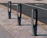
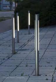


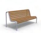


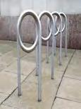


73 Appendix 10: Sample Streetscape Element Themes Benches Modern Contemporary Historical Streetlights Bike Racks Bollards Trashcans 73


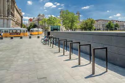


74 Benches Streetlights Bike Racks Bollards Trashcans Utility Artistic Minimalist 74
75 Appendix 11: VDOT Pavement Markings Information Memo VIRGINIA DEPARTMENT OF TRANSPORTATION TRAFFIC ENGINEERING DIVISION INSTRUCTIONAL & INFORMATIONAL MEMORANDUM GENERAL SUBJECT: Pavement Markings Signs Pedestrians SPECIFIC SUBJECT: Pedestrian Crossing Accommodations at Unsignalized Locations DIRECTED TO: District Location & Design Engineers Regional Operations Engineers/Directors Regional Traffic Engineers District Transportation & Land Use Directors Regional Operations Maintenance Managers Regional Traffic Operations Managers CONTENTS APPROVAL: NUMBER: IIM-TE SUPERSEDES: None DATE: July 18, 2016 SUNSET DATE: None /original signed by/ Raymond J. Khoury, P.E. State Traffic Engineer Richmond, VA July 21, 2016 Traffic Engineering Division Memorandum IIM-TE-384 Attachments... 1 Purpose and Need.. 1 Effective Date.. 3 ATTACHMENTS Attachment A Unsignalized Marked Crosswalk Standards Attachment B Code Signing and Marking Criteria Attachment C Process Flow Charts for Determining Appropriate Pedestrian Crossing Accommodations at Unsignalized Locations Attachment D Data Collection Sheets for Pedestrian Crossing Accommodation Studies at Unsignalized Locations PURPOSE AND NEED The Commonwealth Transportation Board (CTB) adopted the Virginia Department of Transportation (VDOT) Policy for Integrating Bicycle and Pedestrian Accommodations in March That policy establishes that, Bicycling and walking are fundamental travel modes and integral components of an efficient transportation network. As such, the CTB s adopted policy I&I Memorandum Pedestrian Crossing Accommodations at Unsignalized Locations Page 1 of 3 July 18,
76 requires that all VDOT highway construction projects shall be initiated with the presumption that the facilities will include accommodations for pedestrians, including pedestrians with disabilities, along with motorized transportation modes in the planning, funding, design, construction, operation, and maintenance of Virginia s transportation network to achieve a safe, effective, and balanced multimodal transportation system. Currently there is significant variation in how crosswalks are utilized in different locations throughout Virginia. This Memorandum provides consistent, uniform guidance to designers for determining when to install marked crosswalks, what type of crosswalk to install, and what other traffic control devices or geometric improvements should potentially be considered in conjunction with the marked crosswalk at unsignalized locations. Pedestrians typically account for percent of total highway fatalities in Virginia each year. An assessment of Virginia pedestrian crashes determined that 86% of pedestrian fatalities occurred at locations without a marked crosswalk 1. Additionally, about half of Virginia s pedestrian fatalities occur on Primary system roadways. Some of Virginia s road segments lack adequate pedestrian accommodations for crossing the road, despite being located in areas where the surrounding land use generates (or has the potential to generate) crossing pedestrian traffic. Pedestrian accommodations include marked crosswalks as well as any facility, design feature, operational change, or maintenance activity that improves the environment in which bicycles and pedestrians travel. Marked crosswalks, by themselves or in conjunction with other traffic control devices and pedestrian accommodations, can provide important safety benefits for crossing pedestrians. However, studies 2 have demonstrated that marked crosswalks placed alone at uncontrolled locations, and not in conjunction with geometric pedestrian safety improvements or other traffic control devices, are not always recommended. High-visibility crosswalks (crosswalks marked using longitudinal lines or bar pairs) perform better than standard crosswalks, but often are not used in every situation due to higher installation and maintenance costs. This Memorandum and the attached Standards replace the previous 2005 Guidelines for the Installation for Marked Crosswalks document and the companion 2005 Guidelines for the Installation of In-Roadway Warning Lights document, both of which were developed by the Virginia Transportation Research Council (VTRC) for use by VDOT. It provides additional guidance beyond what is in the 2009 Manual on Uniform Traffic Control Devices (MUTCD) and the 2011 Virginia Supplement to the MUTCD, latest version. This document focuses on pedestrian crossing guidance for unsignalized intersection crossings and mid-block crossings, and should be used in conjunction with a separate I&IM (currently under development) which will establish guidance for pedestrian accommodations at signalized intersections. 1 Cole, Mark A., et. al. Virginia Pedestrian Crash Assessment (VDOT: 2015). 2 Zegeer, Charles V., et. al. Safety Effects of Marked Versus Unmarked Crosswalks at Uncontrolled Locations (FHWA: 2009), I&I Memorandum Pedestrian Crossing Accommodations at Unsignalized Locations Page 2 of 3 July 18,
77 EFFECTIVE DATE Future contracts: This Memorandum shall be effective for all contracts with an advertisement on or after December 1, The designer may also elect to apply this Memorandum to projects with an advertisement before that date. Existing contracts: This Memorandum may be applied to projects constructed under existing contracts if the change is approved by the Project Engineer. Land use permit for private developments: This Memorandum shall be effective for all projects where the final permit plans have not yet been submitted to VDOT. If agreed to by the permittee and VDOT, this Memorandum may also be applied to a previously-approved permit or to a permit currently under review. Design-Build or PPTA projects: This Memorandum shall be effective for projects in which the design criteria package has not been completed for advertisement as of December 1, For current Design-Build or PPTA projects, this Memorandum should be implemented where feasible. Existing marked crosswalks: Existing crosswalks may remain until the end of their useful service life. This Memorandum should be consulted when planning is underway for the roadway s next resurfacing or reconstruction. This Memorandum should also be used when there is a need to prepare a safety evaluation of existing marked crosswalks. Existing locations without marked crosswalks: Regions should conduct a review of pedestrian accommodations and determine whether new marked crosswalks are needed in accordance with this Memorandum in conjunction with resurfacing or reconstruction projects. This Memorandum should also be used if the need arises to prepare a safety evaluation of a location not scheduled for resurfacing. CC: Mohammad Mirshahi, P.E. Deputy Chief Engineer Bart Thrasher, P.E. L&D Division Administrator Marsha Fiol Transportation Mobility & Planning Division Administrator Juliet Brown Local Assistance Division Administrator JoAnne Maxwell Policy Division Administrator District Engineers/Administrators Residency Engineers/Administrators Regional Operations and Maintenance Managers (ROMMs) Regional Transportation Operations Managers (RTOMs) Dr. Jose Gomez, P.E. VTRC Director Irene Rico FHWA Virginia Division Administrator Wayne Fedora FHWA Virginia Division Acting Administrator I&I Memorandum Pedestrian Crossing Accommodations at Unsignalized Locations Page 3 of 3 July 18,
78 ATTACHMENT A Unsignalized Marked Crosswalk Standards ATTACHMENT CONTENTS 1.0 Summary of Revisions. A1 2.0 Background... A1 3.0 Relationship to Americans with Disabilities Act Requirements. A2 3.1 Guidance.. A2 3.2 Maintenance Activities... A2 3.3 Alterations... A2 4.0 Applicable Sections of the Code of Virginia. A3 5.0 When to Install Marked Crosswalks at Unsignalized Intersections.. A4 5.1 General Guidance... A4 5.2 When to Install Marked Crosswalks Across Stop Controlled or Yield-Controlled Approaches.... A5 5.3 When to Install Mid-Block Marked Crosswalks or Marked Crosswalks Across Uncontrolled Approaches.. A5 6.0 Crosswalk Design. A9 6.1 Crosswalk Width and Location. A9 6.2 Crosswalk Marking Patterns A9 6.3 Aesthetic Treatments Between Crosswalk Lines.. A Other Pedestrian Crossing Safety Treatments A Pedestrian or School Regulatory and Warning Signs.. A Geometric/Traffic Calming Improvements.. A Midblock Pedestrian Signals and Pedestrian Hybrid Beacons... A Rectangular Rapid Flashing Beacons (RRFBs) A Visibility... A Speed.. A In-Roadway Warning Lights (IRWLs).. A Unconventional Locations.. A T and Offset Intersections.... A Roundabouts... A Interchanges... A Reference.. A18 78
79 IIM-TE-384 Attachment A Unsignalized Marked Crosswalk Standards SUMMARY OF REVISIONS The list below summarizes the major changes to the previous 2005 Guidelines for the Installation for Marked Crosswalks document and the companion 2005 Guidelines for the Installation of In-Roadway Warning Lights document. Establishes additional guidance on when marked crosswalks should or shall be installed at controlled or uncontrolled approaches (e.g. not controlled by a stop sign, yield sign, pedestrian hybrid beacon, or traffic signal) to unsignalized intersections, and at mid-block locations. o A separate I&IM (currently under development) details when pedestrian accommodations should be provided at signalized intersections. Establishes guidance/standards on when standard or high-visibility crosswalks (longitudinal lines or bar pairs) should be installed. Provides guidance on allowable high-visibility crosswalk marking styles. Establishes recommended crosswalk widths. Removes most guidance for In-Roadway Warning Lights due to their limited use by VDOT. Adds discussions on use of Rectangular Rapid Flashing Beacons (RRFBs) and Pedestrian Hybrid Beacons (PHBs). 2.0 BACKGROUND A crosswalk is generally defined as the portion of roadway designated for pedestrians to use in crossing the street. Crosswalks may be marked or unmarked, as defined in the Code of Virginia At intersections, a sidewalk or pedestrian walkway extension across a street can define a crosswalk in addition to crosswalks defined by marked lines in the roadway. A pedestrian facility is a general term denoting locations made to accommodate or encourage pedestrian travel outside the vehicle travelway between road crossings. It typically refers to sidewalks, shared use paths, and curb cuts. It can also refer to wide paved shoulders, or unpaved traversable areas adjacent to the road with a prepared surface, that can be used by pedestrians. An unpaved shoulder with worn-out path in the grass/soil due to pedestrian activity is generally considered a pedestrian facility. There are both advantages and disadvantages of marking crosswalks. Potential advantages of properly marked crosswalks include: Helping pedestrians find their way across complex intersections, Providing a visible reminder to motorists that pedestrians may be present, Directing pedestrians to the location of the recommended crossing path, Establishing the legal crosswalk where an unmarked crosswalk does not already exist, Reducing the likelihood that drivers will encroach the intersection or block pedestrian traffic when stopping for a STOP or YIELD sign, and/or Designating the location of approved school crossings or crossings along recommended school routes. I&I Memorandum Ped Crossing Accommodations at Unsignalized Locations ATTACHMENT A July 18, 2016 Page A1 of A18 79
80 IIM-TE-384 Attachment A Unsignalized Marked Crosswalk Standards A potential disadvantage of marked crosswalks is that they may create a false sense of security for pedestrians (cause the pedestrian to assume that the motorist can and will stop in all cases). If unnecessary and unwarranted marked crosswalks are installed, drivers may not expect them and may ignore or disregard them, which diminishes the effectiveness of marked crosswalks. Excessive marked crosswalk installation can also lead to increased installation and maintenance costs. 3.0 RELATIONSHIP TO AMERICANS WITH DISABILITIES ACT REQUIREMENTS 3.1 Guidance The 1990 federal Americans with Disabilities Act (ADA) requires that pedestrians with disabilities be accommodated in the design, planning, and maintenance of pedestrian facilities. The ADA requirements are based on the understanding that a wide range of people, including people with disabilities, will be using the pedestrian facilities and relying on them for their daily travel. The need for ADA improvements to be programmed or constructed in conjunction with marked crosswalk improvements depends on whether the action is a maintenance activity or an alteration, as defined in the latest effective version of IIM-TE Maintenance Activities Examples of maintenance activities related to crosswalks include: Striping a marked crosswalk at an unsignalized intersection if the crossing is already a crosswalk (albeit an unmarked one) as defined by the Code of Virginia, Changing the striping pattern of an existing marked crosswalk, and Signing improvements. There is no requirement for ADA assessments or improvements when maintenance activities are performed. When an existing unmarked crosswalk is converted to a marked crosswalk, it is recommended that the Region or District assess and functionally rate the existing curb ramps (if present) in accordance with IIM-TE-376. At locations where curb ramps are not present (Grade D) or are not fully functional (Grades B or C), future upgrades should be considered based on funding availability in accordance with the latest effective version of IIM-TE Alterations Examples of alterations related to crosswalks at unsignalized locations include: Rectangular Rapid Flashing Beacon (RRFB) or Pedestrian Hybrid Beacon (PHB) installation, Resurfacing of the crosswalk area, and I&I Memorandum Ped Crossing Accommodations at Unsignalized Locations ATTACHMENT A July 18, 2016 Page A2 of A18 80
81 IIM-TE-384 Attachment A Unsignalized Marked Crosswalk Standards Establishing marked crosswalks at a location that would not currently be considered an unmarked crosswalk, such as at a midblock location. When an alteration is being performed, the procedures required by IIM-TE-376 shall be followed. 4.0 APPLICABLE SECTIONS OF THE CODE OF VIRGINIA Section of the Code of Virginia defines a crosswalk as that part of a roadway at an intersection included within the connections of the lateral lines of the sidewalks on opposite sides of the highway measured from the curbs or, in the absence of curbs, from the edges of the traversable roadway; or any portion of a roadway at an intersection or elsewhere distinctly indicated for pedestrian crossing by lines or other markings on the surface. Note that the definition of crosswalk encompasses both marked and unmarked crosswalks. At locations where an unmarked crosswalk would not otherwise exist, and a crosswalk is present as a result of markings, the crosswalk only exists when the markings distinctly indicate the location of such crosswalk. This means that when such a marked crosswalk has degraded to the point where it is not sufficiently visible to the approaching motorist, it would no longer be considered a legal crosswalk. Moreover, marked crosswalks must meet the minimum requirements of the MUTCD (e.g., crosswalk width, line thickness, color) in order to be considered a marked crosswalk in Virginia. Section states that bicyclists have all of the same rights and responsibilities as pedestrians within crosswalks. Section states that pedestrians shall cross, wherever possible, only at intersections or marked crosswalks and shall not carelessly or maliciously interfere with traffic. If no marked crosswalks are available at an intersection, then pedestrians are not negligent if they cross by the most direct route at such an intersection. Section A states that drivers must yield the right-of-way to pedestrians at: Any clearly marked crosswalks, Any unmarked crosswalks at the prolongation of the lateral boundary lines of the adjacent sidewalk at the end of the block, or Any intersection where the approach has a speed limit of 35 mph or below. Section B sets forth the responsibilities of drivers and pedestrians. Pedestrians have the responsibility to avoid entering or crossing an intersection in disregard of approaching traffic, however they have the right-of-way over vehicles making turns. Drivers are required to change their course, slow down, or stop if necessary to permit pedestrians to cross. Section C allows certain localities in Northern Virginia to establish ordinances imposing fines on drivers who fail to yield the right-of-way to pedestrians at locations where signs are installed and requires VDOT to establish criteria for this required signage in order to establish those fines. VDOT s signing criteria is included as Attachment B to this Memorandum. I&I Memorandum Ped Crossing Accommodations at Unsignalized Locations ATTACHMENT A July 18, 2016 Page A3 of A18 81
82 IIM-TE-384 Attachment A Unsignalized Marked Crosswalk Standards WHEN TO INSTALL MARKED CROSSWALKS AT UNSIGNALIZED INTERSECTIONS 5.1 General Guidance As with any installation of traffic control devices, engineering judgment should be used for determining when installation of a crosswalk is justified. When considering whether to mark a crosswalk, the land uses adjacent to the roadway provide invaluable information to help indicate if the crosswalk is needed. Pedestrian-oriented land uses and transit stops will generate pedestrian crossings regardless of whether a marked crosswalk exists or not. When pedestriangenerating land uses exist adjacent to roadways where pedestrian crossings are legal, it is VDOT s responsibility to provide adequate safe pedestrian crossing opportunities and to direct pedestrians to those locations. The presence of shared use paths can justify the installation of a marked crosswalk even if the adjacent land uses are not pedestrian-oriented. Marked crosswalks should not be installed at the intersection of two low-speed roadways functionally classified as local, such as at the intersection of two subdivision streets. In addition, marked crosswalks should not be installed where neither pedestrian facilities (defined previously) nor pedestrian-oriented attractors/generators are present on both sides of the crossing. Examples of pedestrian attractors/generators include schools, university campuses, libraries, hospitals, senior centers, major shopping centers, recreational areas, large employment centers, rail stations, bus transfer centers, hotels, residential developments of at least moderate density, parking garages or large parking lots, etc. Pedestrian attractors/generators should be considered as a factor if they are within reasonable walking distance of the crossing. If neither pedestrian facilities nor pedestrian-oriented land uses currently exist on both sides of the crossing, the designer should consult with the District Planner or locality to assess whether there is a potential for pedestrian activity in the near future, and if so design the location to allow for future crosswalk installation to the extent possible (such as by setting the marked stop line or yield line, if present, at a location where it won t conflict with a future marked crosswalk). Installing marked crosswalks in areas where there is minimal likelihood of existing or future pedestrian activity (based on adjacent land uses) is not recommended. To the extent possible, marked crosswalks should match pedestrian desire lines by connecting pedestrian generators and attractors. In some rare circumstances, an unusually heavily used unsignalized crosswalk can adversely impact a roadway s vehicular capacity. In these rare cases, engineering judgment should be used to balance locating the crosswalk along pedestrian desire lines while avoiding a substantial impact to roadway vehicular capacity. A flow chart illustrating the general decision-making process for installation of crosswalks at unsignalized locations is shown in Figure C1 of Attachment C. Note that if there is a STOP sign or YIELD sign immediately downstream of the crossing (for example, where a Shared Use Path (SUP) runs parallel to the main road and crosses the side I&I Memorandum Ped Crossing Accommodations at Unsignalized Locations ATTACHMENT A July 18, 2016 Page A4 of A18 82
83 IIM-TE-384 Attachment A Unsignalized Marked Crosswalk Standards road such that drivers on the side road have the stop sign immediately downstream of the SUP), the approach is considered a controlled approach for the purposes of this IIM. 5.2 When to Install Marked Crosswalks Across Stop-Controlled or Yield- Controlled Approaches Marked crosswalks should be installed if pedestrian facilities or pedestrian-oriented attractors/generators exist on both sides of the crossing and any of the following statements are true, unless precluded by the recommendations in Section 5.1 or the Regional Traffic Engineer approves an exception to this recommendation: The crossing is part of a walking route approximately ¼ mile or less between a residential development of moderate or heavy density and a school or recreational area, The crossing is connected by pedestrian facilities to a rail transit stop or major bus transfer station within walking distance of approximately ¼ mile or less, The crossing is part of a shared use path or trail, The crossing is across a yield-controlled approach at an off-ramp junction or channelized right turn lane, or The crossing is within a downtown Central Business District area, and/or is in an area of known pedestrian activity and pedestrian-oriented land-use. A flow chart illustrating the decision-making process for crosswalks at stop or yield-controlled locations is shown in Figure C2 of Attachment C. 5.3 When to Install Mid-Block Marked Crosswalks or Marked Crosswalks Across Uncontrolled Approaches An engineering study shall be performed before crosswalk markings are installed across uncontrolled locations (which includes both crosswalks at mid-block locations and crosswalks across uncontrolled intersection approaches). Data collection templates to facilitate crosswalk engineering studies are provided in Attachment D of this memorandum. The satisfaction of the criteria within this section does not in and of itself require the installation of a marked crosswalk across an uncontrolled location. Crossings of uncontrolled roadway approaches shall not be marked unless all of the following are met: 1) The crossing is on a direct route between significant pedestrian generator(s) and attractor(s), where engineering judgment determines that the crosswalk would likely see a minimum of 20 pedestrians/bicyclists using the crosswalk in an hour. That threshold may be reduced to 10 pedestrians per hour if the crossing is expected to be used by a high number of vulnerable pedestrians (pedestrians who are disabled, age 65 and over, or age 15 and under), or if the reduced volume is met for three consecutive hours. 2) The location is 300 feet or more from another marked crosswalk across the same road, or engineering judgment determines that sufficient demand and pedestrian desire lines exist to justify both crosswalks. I&I Memorandum Ped Crossing Accommodations at Unsignalized Locations ATTACHMENT A July 18, 2016 Page A5 of A18 83
84 IIM-TE-384 Attachment A Unsignalized Marked Crosswalk Standards ) Drivers will have an unrestricted view of the entire length of the crosswalk, including the waiting areas at either end of the crosswalk. If possible, this unrestricted view should be equal to or exceeding the Stopping Sight Distance (SSD) requirements shown in Table 1 and as per the latest effective version of VDOT s Road Design Manual. If the SSD requirements cannot be met and the crosswalk cannot be relocated to a place where SSD requirements will be met, warning signs shall be used. (Warning signs may be omitted on downtown urban streets with speed limit < 35 mph if justified by documented engineering judgment.) 4) The required engineering study determines that the introduction of a marked crosswalk will not produce an unacceptable safety hazard. A flow chart illustrating the decision-making process for crosswalks at uncontrolled locations is shown in Figure C3 of Attachment C. Marked crosswalks across uncontrolled approaches should be avoided at locations that are unlit (roadway lighting not present) and higher speed (40 mph or greater) unless a high visibility crosswalk marking style and appropriate advance warning devices are utilized. Table 1 Stopping Sight Distance Requirements Approaching Mid-Block Crosswalks or Crosswalks at Uncontrolled Intersection Approaches (feet) Operating Level Downgrades Upgrades Speed * Grade -3% -6% -9% +3% +6% +9% 25 mph mph mph mph mph mph mph Crosswalks should not be marked across uncontrolled approaches with operating speed of 55 mph or greater. (Source: VDOT Road Design Manual, Chapter 2D. This table is provided for convenience and is current as of June Any subsequent revisions to the Road Design Manual override the values provided in this table. ) *Operating speed can refer to actual 85 th percentile speed, if speed data is available. Otherwise, operating speed can be estimated as the posted speed limit plus 7 mph, or based on documented engineering judgment. For operating speeds not in 5 mph increments, users should interpolate from this table to find the minimum SSD requirements. As per Section 3B.18 of the 2009 MUTCD, if a marked crosswalk is installed, pedestrian crossing warning signs should be installed in advance of non-intersection crosswalks and onstreet parking should be prohibited where it will impede adequate visibility of the crosswalk and waiting areas. The R1-5 Yield Here to Pedestrians sign may be used in advance of a marked mid-block crosswalk across a multi-lane (i.e. two or more travel lanes per direction) uncontrolled approach to direct vehicles to yield in advance of the crosswalk. This is done to minimize the risk of a vehicle in one lane from blocking the view of a crossing pedestrian from a vehicle approaching in the other lane. If used, the R1-5 sign should be placed 20 to 50 feet in advance of the I&I Memorandum Ped Crossing Accommodations at Unsignalized Locations ATTACHMENT A July 18, 2016 Page A6 of A18 84
85 IIM-TE-384 Attachment A Unsignalized Marked Crosswalk Standards crosswalk as per Section 2B.11 of the 2009 MUTCD and FHWA s Official Interpretation 2(09)- 86I. Yield line ( shark s teeth ) pavement markings may be used in conjunction with the R1-5 sign, as per Section 3B.16 of the 2009 MUTCD. If a marked crosswalk is to be installed across an uncontrolled approach, Table 2 should be used to determine if additional enhancements may be necessary to facilitate safe crossing at uncontrolled locations. A flow chart illustrating the use of Table 2 is shown in Figure C4 of Attachment C. Treatments to inhibit pedestrian crossings (such as landscaping or fences) should only be considered where existing crosswalks are located within 300 feet and an additional crossing would create an unsafe condition, or where pedestrian demand exists but the natural pedestrian desire line results in unsafe crossings, such as locations where visibility (for pedestrians or motorists) is obstructed and the obstruction cannot be reasonably removed. I&I Memorandum Ped Crossing Accommodations at Unsignalized Locations ATTACHMENT A July 18, 2016 Page A7 of A18 85
86 IIM-TE-384 Attachment A Unsignalized Marked Crosswalk Standards Table 2. Recommendations for Considering Marked Crosswalks and Other Needed Pedestrian Improvements Across Uncontrolled Approaches Roadway Configuration 2 Lanes (undivided two-way street or two-lane one-way street) 3 Lanes with refuge island OR 2 Lanes with raised median* 3 Lanes (center turn lane) 4 Lanes (twoway street with no median) 5 Lanes with refuge island OR 4 lanes with raised median* 5 Lanes (center turn lane) 6 Lanes (twoway street with* or without median) MPH Roadway ADT and Speed Limit 1,500 to 9,000 VPD 9,000 to 12,000 VPD 12,000 to 15,000 VPD More than 15,000 VPD 35 MPH 40 MPH 45 MPH 30 MPH 35 MPH 40 MPH 45 MPH 30 MPH 35 MPH 40 MPH 45 MPH 30 MPH 35 MPH 40 MPH A A B B A A B B A A B B B B B C A A B B A B B B A A B B B B B C A A B B A B B B A B B C B C C C A B C C B B C C B C C D C C C D A A B B A B B C B B C C B B C D A B C C B B C C C C C D C C C D A B D D B B D D D D D D D D D D Source: Guidance for Installation of Pedestrian Crosswalks on Michigan State Trunkline Highways (Michigan Department of Transportation, 2014) Condition A Condition B Condition C Condition D Candidate site for marked crosswalk alone (standard if speed limit is 30 MPH or less, high-visibility if speed limit is 35 MPH or greater). Evaluate need for advance signing Potential candidate site for marked crosswalk. Location should be monitored & consideration given to providing a high-visibility crosswalk and/or warning signs (see Section 7.2) Marked crosswalks alone are insufficient. The crosswalk shall use a highvisibility pattern and other improvements (warning signs and/or geometric/ traffic calming improvements) (see Section 7.2) will likely be necessary. Marked crosswalks shall not be installed 45 MPH I&I Memorandum Ped Crossing Accommodations at Unsignalized Locations ATTACHMENT A July 18, 2016 Page A8 of A18 86
87 IIM-TE-384 Attachment A Unsignalized Marked Crosswalk Standards * The pedestrian walkway through a refuge island shall be at least 5 feet wide (6 feet width or greater is preferred) and at least 6 feet long to be considered a safe refuge area (see detail on the bottom right from VDOT Standard Drawing CG-12). A raised median generally provides greater pedestrian-vehicle crash reduction benefit than a flush (painted) median, however the presence of a painted median can also provide advantages to the crossing pedestrian over an undivided road. Pedestrian Refuge Detail 6.0 CROSSWALK DESIGN 6.1 Crosswalk Width and Location In general, crosswalks should be the same width as the pedestrian facility on either side of the roadway, subject to the following requirements: Crosswalks shall be at least six feet wide as per the MUTCD, and Crosswalks should be at least seven feet wide in order to allow two wheelchairs, parents with strollers, etc. to pass each other. Wider crosswalks than described above should be provided at locations with heavy pedestrian volumes during peak periods, to avoid creating situations where pedestrians are crowded out of the crosswalk. The width should not exceed 10 feet except when necessary to accommodate peak pedestrian periods at locations with exceptionally high pedestrian activity. Crosswalks that are part of a shared use path should be at least as wide as the path (ten feet recommended) to accommodate bicyclists passing in both directions. Unnecessarily wide crosswalks can result in the stop lines having to be placed further back from the intersection which in turn can have an adverse impact on driver s sight distance. Crosswalks shall start and end at curb ramps where curb is present. Crosswalks shall be straight and not kinked, except that crosswalks may change direction from within a refuge island. If existing curb ramps are present on a project involving alterations, then it might be necessary to reconstruct/relocate existing curb ramps and/or modify existing raised medians in order to provide crosswalks at a logical location. 6.2 Crosswalk Marking Patterns Marked crosswalk patterns can be divided into two basic categories: standard and high-visibility. Standard crosswalks use the transverse lines (two parallel lines) pattern. High-visibility crosswalks have bar-pairs, ladder, longitudinal lines, or zebra patterns. Permissible crosswalk marking patterns that may be used on VDOT-maintained roadways are shown in Table 3. I&I Memorandum Ped Crossing Accommodations at Unsignalized Locations ATTACHMENT A July 18, 2016 Page A9 of A18 87
88 IIM-TE-384 Attachment A Unsignalized Marked Crosswalk Standards According to an FHWA study 3, high-visibility crosswalks can have up to double the detection distance (for drivers approaching the crosswalk) compared to standard crosswalks - an 8 second increase in detection distance for a 30 mph approach. However, high-visibility crosswalks are also more expensive (as much as five times the cost) - both for initial installation and future maintenance. Some high-visibility crosswalk marking materials can also become slick when wet, potentially resulting in a loss of traction for vehicles (particularly motorcyclists and bicyclists) in the travel lanes as well as for pedestrians crossing the crosswalk. High-visibility crosswalks can lose some of their enhanced effectiveness if they are used too often. Standard crosswalks should be used for all marked crosswalks except at locations meeting the below criteria. A high-visibility crosswalk pattern shall be utilized where any of the following conditions exist: The crossing is at an uncontrolled roadway approach and meets Condition C (orange area) of the selection chart in Table 2, The crossing is located across a multilane roundabout approach or exit from a multi-lane roundabout, The crossing is part of a shared use path and crosses an uncontrolled roadway approach with a speed limit > 25 mph, or The crosswalk is part of a Pedestrian Hybrid Beacon (PHB) crossing. High-visibility marked crosswalks should be installed at locations where all of the following conditions exist: The speed limit is > 25 mph, The crossing is across an uncontrolled roadway approach, and One or more of the following special conditions apply: o The crossing meets Condition B (yellow area) of the selection chart in Table 2, o The crossing is not illuminated by nearby roadway lighting, o Engineering judgment determines that the pedestrian crossing volume is expected to be very high 4, o The crossing is part of a walking route approximately ¼ mile or less between a residential development of moderate or heavy density and a school or recreational area, o The crossing is connected by pedestrian facilities to a rail transit stop or major bus transfer station within walking distance of approximately ¼ mile or less, o The crosswalk is within a downtown Central Business District area, or o The crosswalk is in a location where the surrounding land use is indicative of walking as a transportation mode. 3 Fitzpatrick, K., et al. Crosswalk Marking Field Visibility Study (FHWA: 2010), 4 The designer should use local knowledge and site context to determine if current or anticipated pedestrian crossing volume could be considered very high. A crossing with very high pedestrian volume usually is expected to have pedestrian activity during most 15 minute daytime periods when weather conditions are conducive to walking. [EXPLANATION FOR MY EDIT: even in areas with tons of pedestrian movements like, say, right in front of the Metro stop, you probably have fairly light pedestrian volumes at certain hours. For example, 7:15 on a Sunday morning] I&I Memorandum Ped Crossing Accommodations at Unsignalized Locations ATTACHMENT A July 18, 2016 Page A10 of A18 88
89 IIM-TE-384 Attachment A Unsignalized Marked Crosswalk Standards In addition, marked crosswalks across single-lane roundabout approaches and exits should use a high-visibility marking pattern. High-visibility crosswalks may also be installed where engineering judgment determines that they are necessary to increase driver recognition distance to help compensate for other factors such as roadway geometry, visual clutter in the surrounding environment, crash history, and/or traffic and pedestrian volume patterns. Table 3 Permissible Crosswalk Types on VDOT-maintained Roadways Type Class Design details Sketch Transverse Standard The transverse lines shall be Lines (two between 6 and 12 in width. parallel lines) Typically, VDOT uses 6 width, however 8, 10, or 12 widths can be used to increase the visibility of the lines as they become worn over time. Longitudinal Lines ( continental ) High- Visibility Refer to PM-3 standards for details of longitudinal line widths and placement. Longitudinal lines should be spaced to avoid the wheel paths of through vehicles Bar Pairs High- Visibility Identical to Longitudinal Lines crosswalk, but uses pairs of 8 lines with 8 gap (8/8/8 pattern) in lieu of a 24 longitudinal line. Spacing between the 8/8/8 bar pairs shall be the same as the requirements of PM-3 for spacing between Longitudinal Lines. The bar pairs should be spaced to avoid the wheel paths of through vehicles. Source: 2008 VDOT Road and Bridge Standards, Section I&I Memorandum Ped Crossing Accommodations at Unsignalized Locations ATTACHMENT A July 18, 2016 Page A11 of A18 89

90 IIM-TE-384 Attachment A Unsignalized Marked Crosswalk Standards Other high-visibility marking patterns, such as ladder or zebra markings, should not be used except when necessary to match the pattern of other adjacent marked crosswalks. Bar Pairs crosswalks have several advantages over Longitudinal Lines crosswalks: An FHWA study of the Bar Pairs pattern concluded that it behaves comparably with the Longitudinal Lines pattern in terms of driver recognition and behavior, Similar cost as Longitudinal Lines crosswalks (although installation is slightly more complicated, the Bar Pairs crosswalk uses less marking material), Easier for motorcyclist/bicyclist traffic to avoid traveling over the pavement marking material, which may be slick when wet, and Easier for pedestrians to avoid stepping directly on the pavement marking material, which may be slick. If an existing standard crosswalk is upgraded to a high-visibility crosswalk independent of a roadway resurfacing project, the transverse lines may be retained to eliminate the need for pavement marking eradication. The transverse lines should not be restored when the roadway is resurfaced. 6.3 Aesthetic Treatments Between Crosswalk Lines Localities may request the use of aesthetic treatments, such as stamped concrete, brick pavers, or thermoplastic patterned inlays, between the crosswalk lines. Such requests will be evaluated as per the latest edition of L&D Instructional & Informational Memorandum IIM-LD-218. Such aesthetic treatments by themselves do not constitute a marked crosswalk; they must be edged by transverse white lines to legally establish the marked crosswalk and also to provide visual contrast between the pavement and the aesthetic treatment. As per Section 3G.01 of the 2009 MUTCD, aesthetic or colored pavement between crosswalk lines should not use colors or patterns that degrade the contrast of the white transverse crosswalk lines or that might be mistaken by road users as a traffic control application. 7.0 OTHER PEDESTRIAN CROSSING SAFETY TREATMENTS 7.1 Pedestrian or School Regulatory and Warning Signs Pedestrian/school regulatory and warning signs, when used, shall be located and installed in accordance with the MUTCD and the Virginia Supplement to the MUTCD. I&I Memorandum Ped Crossing Accommodations at Unsignalized Locations ATTACHMENT A July 18, 2016 Page A12 of A18 90

91 IIM-TE-384 Attachment A Unsignalized Marked Crosswalk Standards Geometric/Traffic Calming Improvements There are many options available to designers to modify or construct new roadway geometry to improve the safety of crossing pedestrians by achieving one or more of the following goals: Reducing the crossing distance length (which reduces the pedestrian s exposure to traffic), Increasing the visibility of pedestrians who are crossing or waiting to cross, or Encouraging drivers to drive at slower speeds. These options include: Installing corner or midblock bulb-outs, Installing median refuge islands and choker islands, Reducing corner radii, Increasing the intersecting angle of channelized turn lanes, Installing raised crosswalks, and/or Installing mini-roundabouts. These design elements should be designed in accordance with Appendix B(2) of the latest effective version of VDOT s Road Design Manual and DRPT s Multimodal System Design Guidelines. Traffic calming improvements on residential streets, such as raised crosswalks or choker islands, should be planned and designed in accordance with the latest effective version of VDOT s Traffic Calming Guide for Local Residential Streets. 7.3 Midblock Pedestrian Signals and Pedestrian Hybrid Beacons Vehicular traffic signals may be used to control a midblock pedestrian crossing if the traffic signal is warranted based on the Pedestrian Volume Warrant in Section 4C.05 of the 2009 MUTCD. Pedestrian Hybrid Beacons (PHBs) may be used to control a midblock pedestrian crossing if warranted, designed, and operated as per Chapter 4F of the 2009 MUTCD. As per Official Interpretation 4(09)-14(I), a red clearance interval is permissible and should be considered between the start of the steady red phase and the start of the pedestrian walk interval, and then again between the end of the pedestrian walk interval and the end of the alternating flashing red interval. The duration of the flashing yellow interval should be as per Official Interpretation 4(09)-32(I). PHBs shall not be installed where the crossing volume is less than 20 pedestrians per hour. I&I Memorandum Ped Crossing Accommodations at Unsignalized Locations ATTACHMENT A July 18, 2016 Page A13 of A18 91

92 IIM-TE-384 Attachment A Unsignalized Marked Crosswalk Standards Rectangular Rapid Flashing Beacons (RRFBs) If Condition B (yellow area) or C (orange area) is met in Table 2, RRFBs may be considered as an appropriate additional crossing treatment to supplement marked crosswalks. RRFBs, similar to In-Roadway Warning Lights (IRWLs), rely on lights that flash upon pedestrian activation to alert drivers to the likely presence of pedestrians within or waiting to cross the crosswalk. However, RRFBs are mounted on the sign posts (or, less often, overhead) and therefore have lesser long-term maintenance costs than the in-pavement IRWLs which are subjected to vehicular wear, snowplows, and pavement resurfacing. RRFBs are not currently included in the 2009 MUTCD and may only be used per the requirements of FHWA s Interim Approval. In 2011 VDOT received Interim Approval from FHWA to operate RRFBs on VDOT maintained roads. Localities that maintain their own roads must separately apply for and receive Interim Approval from FHWA prior to installing RRFBs. FHWA s MUTCD Interim Approval website lists several Official Interpretations that clarify and/or amend the initial RRFB approval. These interpretations shall be followed when planning, designing, and operating RRFB installations. This website should be monitored periodically for updated Interpretations. Note that existing installations do require retrofits should new requirements come out after initial activation. As of the date of this revised IIM, the following interpretation subjects include: Overhead Mounting, 2009 Flash Pattern, 2010, 2012, 2014 Use with W11-15 Sign, 2010 Light Intensity, 2012 Dimming during Daytime Hours, 2012 Flashing Extensions and Delays, 2013 Placement of Units above Sign, 2016 RRFBs should not be used indiscriminately. Overuse of RRFBs in the roadway environment could decrease not only the effectiveness of the RRFBs but those crossings without RRFBs Visibility The sign and light components of the RRFBs should be prominently visible to approaching vehicles, and the RRFBs should have side indication lights informing pedestrians when the flashers are activated. I&I Memorandum Ped Crossing Accommodations at Unsignalized Locations ATTACHMENT A July 18, 2016 Page A14 of A18 92
93 IIM-TE-384 Attachment A Unsignalized Marked Crosswalk Standards An RRFB assembly should be placed on the median or on an overhead mast arm at crossings with obstructed visibility for side-mounted traffic control devices (e.g. near side transit stops, trees, visual clutter, roadway geometry, large volume of heavy vehicles, and etc.). If a median is present and the RRFBs are post-mounted, both right hand and median mounted RRFBs should be installed. Advance RRFBs should be considered for any crossings that have excessive surrounding visual clutter, steep vertical and/or sharp horizontal roadway curvature Speed There may be conditions that necessitate the installation of pedestrian crossings where speeds are higher and special consideration is warranted (B and C Conditions in Table 2 where speed limit is > 35 mph). Consideration should also be given to installing advance RRFBs on higher speed (> 35 mph) roadways even if there is adequate SSD on both approaches. See Figures 1 and 2 for additional guidance on low speed ( 35 mph) and high speed (> 35 mph) roadways. Vehicle and Pedestrian/Bicycle Volume RRFBs should not be installed unless there are a minimum of 20 pedestrians/bicyclists using the crosswalk in an hour. That threshold may be reduced to 10 pedestrians per hour if the crossing is expected to be used by a high number of vulnerable pedestrians (pedestrians who are disabled, aged 65 and over, or aged 15 and under), or if the reduced volume is met for three consecutive hours. RRFBs shall not be installed if pedestrian and vehicular volumes fall outside the limit lines shown in Figures 1 and 2, unless approved by the Regional Traffic Engineer (RTE). RRFBs may not be appropriate in locations where there is a combination of both high traffic volumes and high pedestrian volumes (above the RRFB upper thresholds in the below figures). At such locations there may be an increase in crashes and/or traffic delay that make the use of RRFBs inappropriate. At such locations, PHBs, pedestrian traffic signals, or grade separated crossings should be considered. The colored lines in Figures 1 and 2 depict the warrant requirements for PHBs as per Section 4F.01 of the MUTCD. Engineering judgement should take into account the proximity of adjacent signals. If PHBs are considered, Section 4F of the 2009 MUTCD contains warranting guidelines that utilize traffic, automobile speeds, and pedestrian crossing distance. I&I Memorandum Ped Crossing Accommodations at Unsignalized Locations ATTACHMENT A July 18, 2016 Page A15 of A18 93
94 IIM-TE-384 Attachment A Unsignalized Marked Crosswalk Standards FIGURE 1 Installation of RRFBs and PHBs on Low Speed Roadways (speed limit 35 mph) FIGURE 2 Installation of RRFBs and PHBs on High Speed Roadways (> 35 mph) Source: 2009 MUTCD, Section 4F and Pedestrian Crossing Treatment Installation Guidelines, City of Boulder 7.5 In-Roadway Warning Lights (IRWLs) IRWLs rely on lights embedded in the pavement that flash upon pedestrian activation or detection to alert drivers to the likely presence of pedestrians within or waiting to cross the crosswalk. It is recommended that RRFBs or other treatments be considered in lieu of IRWLs due to their long-term maintenance costs. 8.0 UNCONVENTIONAL LOCATIONS 8.1 T and Offset Intersections At closely spaced T and offset intersections, it might not be prudent or necessary to mark all legal crosswalks. At T intersections, it may be appropriate to only mark one of the two crossings I&I Memorandum Ped Crossing Accommodations at Unsignalized Locations ATTACHMENT A July 18, 2016 Page A16 of A18 94
95 IIM-TE-384 Attachment A Unsignalized Marked Crosswalk Standards across the through road. This decision should be based on pedestrian demand volumes and the volume of left- and right-turning traffic from the stem of the T. 8.2 Roundabouts Pedestrian crossings at roundabouts should be located and designed as per the latest effective version of VDOT s Road Design Manual, Chapter 2D, Roundabouts: An Informational Guide, 2 nd Edition (NCHRP Report 672), and the 2009 MUTCD, Section 3C.05. The Code of Virginia s definition of where unmarked crosswalks exist at intersections does not necessarily apply to roundabout intersections. In order to establish that a crosswalk exists, and also for safety reasons, marked crosswalks shall be provided across all legs of a roundabout (both entrances and exits) where there are adjacent pedestrian facilities on both sides of the leg, unless the Regional Traffic Engineer or designee concurs that a significant operational or safety concern prevents their use. Marked crosswalks at single-lane roundabouts should use a high-visibility marking pattern. Marked crosswalks across multilane roundabout approaches or exits shall use a high-visibility marking pattern. Note that neighborhood traffic circles that do not meet the design criteria for a modern roundabout (e.g. lack of splitter islands) need not have marked crosswalks. Unmarked crosswalks are typically sufficient for neighborhood traffic circles and other subdivision streets. 8.3 Interchanges Due to high-speed merging and diverging traffic that may be present on the cross road at interchanges, it may be desirable to limit the pedestrian pathway through the interchange to just one side of the cross street. Pedestrian pathways through interchanges need to be carefully planned to take into account conflicts from merging and diverging traffic. At free-flowing or YIELD controlled ramps, the crosswalk should be installed perpendicular to the ramp at a location where sight distance is optimal, even if this location is further away from the parallel roadway. For interchanges with multiple merging and diverging ramps, such as cloverleaf interchanges and Diverging Diamond Interchanges (DDIs), it may be desirable to provide a pedestrian pathway through the median of the cross road to minimize pedestrian-vehicle conflict if space for a pedestrian facility in the median exists. I&I Memorandum Ped Crossing Accommodations at Unsignalized Locations ATTACHMENT A July 18, 2016 Page A17 of A18 95
96 IIM-TE-384 Attachment A Unsignalized Marked Crosswalk Standards REFERENCE VDOT Policy for Integrating Bicycle and Pedestrian Accommodations 2009 MUTCD with Revisions 2011 Virginia Supplement to the MUTCD With Revisions VDOT Road Design Manual (latest effective version) 2008 VDOT Road and Bridge Standards DRPT Multimodal System Design Guidelines Instructional & Informational Memorandum IIM-LD-218, Latest Revision Roundabouts: An Informational Guide, 2 nd Edition City of Boulder Pedestrian Crossing Treatment Installation Guidelines MDOT Guidance for Installation of Pedestrian Crosswalks on Michigan State Trunkline Highways FHWA Crosswalk Marking Field Visibility Study I&I Memorandum Ped Crossing Accommodations at Unsignalized Locations ATTACHMENT A July 18, 2016 Page A18 of A18 96
97 ATTACHMENT B Complete Section Virginia Code Signing and Marking Criteria 97


98 IIM-TE Memo 384 Attachment B Code Signing and Marking Criteria BACKGROUND: Virginia Code Section Part 3C states that certain localities in Northern Virginia District may impose a fine for drivers who fail to yield the right-of-way to pedestrians crossing or attempting to cross the highway, provided the following: o The fine is enacted by ordinance and the crosswalk is marked o There are standard highway signs informing drivers of their duty to yield to pedestrians at each and every crossing location covered by the higher fines ordinance This document provides VDOT s criteria for the design, location and installation of such signs as required by These criteria are based primarily on the FHWA Manual on Uniform Traffic Control Devices (MUTCD), the Virginia Supplement to the MUTCD and traffic engineering best practices. Localities that maintain their own roads shall still abide by these criteria and by the MUTCD. They may also choose to adopt the Virginia Supplement to the MUTCD. The current edition of the MUTCD and Virginia Supplement became effective January 1, 2012 and should be followed as outlined in both manuals. CRITERIA: The crosswalk marking pattern and dimensions shall be as per this IIM, preferably with highvisibility marking patterns. An R1-5 or R1-5A Yield Here to Pedestrians sign shall be placed approximately feet upstream of the near crosswalk edge in both directions, as per Section 2B.11 of the MUTCD. o Signs that read Stop for Pedestrians shall not be used, as the Code requires drivers to yield to pedestrians. A R2-6P Fines Higher or R2-6bP $XXX Fine sign shall be placed below the R1-5/R1-5a signs, as required by Section 2B.17 of the MUTCD. On multilane approaches, the R1-5/R1-5a sign should be coupled with yield line markings ( shark s teeth ) MUTCD Markings Requirements Section 3B.16, Figures 3B-16 and 3B-17, or other approved markings. Alternatively, the locality may modify the R1-6 State Law Yield to Pedestrians Within Crosswalk or overhead R1-9 State Law Yield to Pedestrians sign to add a Fines Higher or $XXX fine message, using black all-caps text on white background. o As per Section 2B.12 of the MUTCD, modified R1-6 signs shall not be post-mounted on the left or right side of the highway. Standard signs shall be erected and maintained by localities. On VDOT-maintained roads, the VDOT Regional Traffic Engineer or designee shall approve these sign locations. I&I Memorandum Ped Crossing Accommodations at Unsignalized Locations ATTACHMENT B July 12, 2016 Page B1 of B1 98
Lynchburg District Update
 Lynchburg District Update Virginia Statewide Bicycle and Pedestrian Advisory Committee Spring Meeting May 16 th, 2017 David Cook Transportation Planner, VDOT Lynchburg District Table of Contents Active
Agenda. Overview PRINCE GEORGE S PLAZA METRO AREA PEDESTRIAN PLAN
 PRINCE GEORGE S PLAZA METRO AREA PEDESTRIAN PLAN May 28, 2008 Agenda Welcome and introductions Project overview and issue identification Planning context and strengths Design challenges and initial recommendations
CONNECTIVITY PLAN. Adopted December 5, 2017 City of Virginia Beach
 CONNECTIVITY PLAN Adopted December 5, 2017 City of Virginia Beach CONTENTS 1.0 Background & Purpose... 2 2.0 Existing Inventory & Analysis... 3 ViBe District Existing Walking Conditions... 4 3.0 ViBe District
Complete Streets. Designing Streets for Everyone. Sarnia
 Complete Streets Designing Streets for Everyone Sarnia Complete Streets ~ Sarnia ~ 2018 Introduction Our City is made up of a network of streets that we use to go for a walk, cycle to work, drive to the
APPENDIX A: Complete Streets Checklist DRAFT NOVEMBER 2016
 APPENDIX A: Complete Streets Checklist DRAFT NOVEMBER 2016 Complete Streets Checklist MetroPlan Orlando s Complete Streets Checklist is an internal planning tool for staff to further implementation of
Perryville TOD and Greenway Plan
 Perryville TOD and Greenway Plan Greenway Glossary Pathway: A bicycle and pedestrian path separated from motorized vehicular traffic by an open space, barrier or curb. Multi-use paths may be within the
PEDESTRIAN ACTION PLAN
 ATTACHMENT 2 CITY OF SANTA MONICA PEDESTRIAN ACTION PLAN CITY OF SANTA MONICA PEDESTRIAN ACTION PLAN This page intentionally left blank EXECUTIVE SUMMARY CHAPTER 1 EXECUTIVE SUMMARY Setting the Stage
Proposed. City of Grand Junction Complete Streets Policy. Exhibit 10
 Proposed City of Grand Junction Complete Streets Policy Exhibit 10 1 City of Grand Junction Complete Streets Policy Vision: The Complete Streets Vision is to develop a safe, efficient, and reliable travel
Tonight is for you. Learn everything you can. Share all your ideas.
 Strathcona Neighbourhood Renewal Draft Concept Design Tonight is for you. Learn everything you can. Share all your ideas. What is Neighbourhood Renewal? Creating a design with you for your neighbourhood.
City of Novi Non-Motorized Master Plan 2011 Executive Summary
 City of Novi Non-Motorized Master Plan 2011 Executive Summary Prepared by: February 28, 2011 Why Plan? Encouraging healthy, active lifestyles through pathway and sidewalk connectivity has been a focus
Executive Summary Route 30 Corridor Master Plan
 Route Corridor Master Plan Project Overview The Route Corridor Master Plan is a coordinated multimodal transportation and land use plan for the entire stretch of Route through East Whiteland Township,
Bicycle and Pedestrian Advisory Committee (BPAC) November 21, 2013
 November 21, 2013") Bicycle and Pedestrian Advisory Committee (BPAC) November 21, 2013 OVERALL LAND USE CONCEPT Overall Broadway Valdez District: 95.5 acres (35.1 acres right-of ways + 60.4 acres developable land) Plan Subareas:
Bicycle and Pedestrian Advisory Committee (BPAC) November 21, 2013 OVERALL LAND USE CONCEPT Overall Broadway Valdez District: 95.5 acres (35.1 acres right-of ways + 60.4 acres developable land) Plan Subareas:
PRINCE GEORGE S PLAZA METRO AREA PEDESTRIAN PLAN
 PRINCE GEORGE S PLAZA METRO AREA PEDESTRIAN PLAN May 28, 2008 Agenda Welcome and introductions Project overview and issue identification Planning context and strengths Design challenges and initial recommendations
WELCOME. Purpose of the Open House. Update you on the project. Present a draft recommended plan. Receive your input
 WELCOME Purpose of the Open House The Town of Smiths Falls has initiated the Beckwith Street Redevelopment Plan that includes the preparation of a streetscape functional design for the renewal of Beckwith
EXECUTIVE SUMMARY. Vision
 Vision Walking and bicycling in Salt Lake City will be safe, convenient, comfortable, and viable transportation options that connect people to places, foster recreational and economic development opportunities,
Solana Beach Comprehensive Active Transportation Strategy (CATS)
") Solana Beach Comprehensive Active Transportation Strategy (CATS) 3.0 Goals & Policies The Solana Beach CATS goals and objectives outlined below were largely drawn from the Solana Beach Circulation Element
Solana Beach Comprehensive Active Transportation Strategy (CATS) 3.0 Goals & Policies The Solana Beach CATS goals and objectives outlined below were largely drawn from the Solana Beach Circulation Element
o n - m o t o r i z e d transportation is an overlooked element that can greatly enhance the overall quality of life for the community s residents.
 N o n - m o t o r i z e d transportation is an overlooked element that can greatly enhance the overall quality of life for the community s residents. 84 Transportation CHAPTER 11 INTRODUCTION Transportation
CONNECTING PEOPLE TO PLACES
 CONNECTING PEOPLE TO PLACES 82 EAST BENCH MASTER PLAN 07 Introduction The East Bench transportation system is a collection of slow moving, treelined residential streets and major arteries that are the
Omaha s Complete Streets Policy
 Omaha s Complete Streets Policy (Adopted August 2015) VISION To create great places and enhance our quality of life, the City of Omaha will provide safe, accessible streets for all users. Complete Streets
Broad Street Bicycle Boulevard Design Guidelines
 Broad Street Bicycle Boulevard Design Guidelines Building from the strategies introduced in the 2013 Bicycle Transportation Plan and community input received thus far, City Transportation Staff have identified
CITY OF BLOOMINGTON COMPLETE STREETS POLICY
 CITY OF BLOOMINGTON COMPLETE STREETS POLICY POLICY OBJECTIVE: The City of Bloomington will enhance safety, mobility, accessibility and convenience for transportation network users of all ages and abilities,
DRAFT. Table of Contents. Background
 Douglas County Table of Contents Existing Infrastructure 86 Funding 89 Policy and Program Recommendations 90 Infrastructure Recommendations 92 Conclusion 95 Background Home to 4,500 residents and Baker
7 Complete Streets & Roadway Aesthetics
 7 Complete Streets & Roadway Aesthetics 7.1 OVERVIEW Our streets lay the foundation for how we interface with travel needs, physical exercise, social exchanges and access to goods and services. They are
Corpus Christi Metropolitan Transportation Plan Fiscal Year Introduction:
 Introduction: The Safe, Accountable, Flexible, Efficient Transportation Equity Act: A Legacy for Users (SAFETEA-LU) has continued the efforts started through the Intermodal Surface Transportation Efficiency
NEWMARKET UPHAM S CORNER
 SOUTH STATION Planning Initiative NEWMARKET UPHAM S CORNER COLUMBIA ROAD (P) FOUR CORNERS/GENEVA Working Advisory Group (WAG) Meeting #5 TALBOT AVENUE MORTON STREET BLUE HILL AVE/CUMMINS HWY (P) RIVER
NM-POLICY 1: Improve service levels, participation, and options for non-motorized transportation modes throughout the County.
 Transportation PRINCE WILLIAM COUNTY 2008 COMPREHENSIVE PLAN NON-MOTORIZED PLAN CONTENTS Goals, Policies, and Action Strategies Table 4 (Bike Facility Classifications and Descriptions) Table 5 (Bike Facility
Non-Motorized Transportation 7-1
 Non-Motorized Transportation 7-1 Transportation facilities no longer mean just accommodating a vehicle powered by a combustion engine. Pedestrian and non-motorized facilities are important modes of travel
East Burke Transportation, Safety and Capacity Improvements
 East Burke Transportation, Safety and Capacity Improvements The purpose of this project is to increase mobility and improve safety for pedestrians, cyclists, and motor vehicles along VT Route 114 in the
Vision: Traditional hamlet with an attractive business/pedestrian friendly main street connected to adjacent walkable neighborhoods
 N D. Focus Area II Vision: Traditional hamlet with an attractive business/pedestrian friendly main street connected to adjacent walkable neighborhoods Transit Road Focus Area II is located in the Hamlet
Final Sidewalk Feasibility Study
 Garfield Drive From Anastasia Drive to Elizabeth Place City of South Daytona July 23, 2009 Final Sidewalk Feasibility Study Prepared for: Prepared by: Final Sidewalk Feasibility Study Garfield Drive 2
Chapter 7. Transportation. Transportation Road Network Plan Transit Cyclists Pedestrians Multi-Use and Equestrian Trails
 Chapter 7 Transportation Transportation Road Network Plan Transit Cyclists Pedestrians Multi-Use and Equestrian Trails 7.1 TRANSPORTATION BACKGROUND The District of Maple Ridge faces a number of unique
CITY OF SAINT JOHN TRAFFIC CALMING POLICY
 CITY OF SAINT JOHN TRAFFIC CALMING POLICY VERSION: 1.0 April 10, 2012 Pedestrians, Cyclists and Motorists Sharing Street Spaces CONTENTS INTRODUCTION... 3 POLICY GOAL... 3 POLICY OBJECTIVES... 3 GUIDING
INDOT Complete Streets Guideline & Policy
 INDOT Complete Streets Guideline & Policy INTRODUCTION The Complete Streets guidelines build upon multiple efforts and promote a multimodal transportation system that is integrated and sustains land use
Basalt Creek Transportation Refinement Plan Recommendations
 Basalt Creek Transportation Refinement Plan Recommendations Introduction The Basalt Creek transportation planning effort analyzed future transportation conditions and evaluated alternative strategies for
DEPARTMENT OF ENVIRONMENTAL SERVICES. North Harrison Street (Lee Highway to Little Falls Road) Comparative Analysis. Prepared for:
 Comparative Analysis. Prepared for:") DEPARTMENT OF ENVIRONMENTAL SERVICES North Harrison Street (Lee Highway to Little Falls Road) Comparative Analysis Prepared for: Arlington County Department of Environmental Services 2100 Clarendon Boulevard,
DEPARTMENT OF ENVIRONMENTAL SERVICES North Harrison Street (Lee Highway to Little Falls Road) Comparative Analysis Prepared for: Arlington County Department of Environmental Services 2100 Clarendon Boulevard,
Roadway Classification Design Standards and Policies. Pueblo, Colorado November, 2004
 Roadway Classification Design Standards and Policies Pueblo, Colorado November, 2004 Table of Contents Page Chapter 1. General Provisions 1.1 Jurisdiction 3 1.2 Purpose and Intent 3 1.3 Modification 3
5 CIRCULATION AND STREET DESIGN
 5 CIRCULATION AND STREET DESIGN This chapter describes circulation and streetscape improvements proposed for the Northwest Chico Specific Plan Area. It includes detailed design specifications for existing
MAG Town of Cave Creek Bike Study Task 6 Executive Summary and Regional Significance Report
 Page 1 MAG Town of Cave Creek Bike Study Task 6 Executive Summary and Regional Significance Report August 1, 2012 MAG Project #481 Page 2 Task 6 Executive Summary and Regional Significance Report Introduction
Appendix T CCMP TRAIL TRAFFIC & TRANSPORTATION DESIGN STANDARD
 Appendix T CCMP 3.3.4 TRAIL TRAFFIC & TRANSPORTATION DESIGN STANDARD 3.3.4 Trail Traffic and Transportation Design Multi-use trails have certain design standards, which vary depending on the agency that
CHAPTER 3: Vision Statement and Goals
 Davidson Walks & Rolls: Active Transportation Master Plan CHAPTER 3 Contents: Overview Vision Statement Measurable Goals Public Outreach CHAPTER 3: Vision Statement and Goals Overview The vision statement
What Is a Complete Street?
 Session 5 Charleen Zimmer, AICP, Zan Associates May 5-7, 2010 What Is a Complete Street? May 2010 5-1 Not a Complete Street More of a Complete Street May 2010 5-2 Benefits of Complete Streets Safety for
Living Streets Policy
 Living Streets Policy Introduction Living streets balance the needs of motorists, bicyclists, pedestrians and transit riders in ways that promote safety and convenience, enhance community identity, create
City of Darlington Beautification Report
 City of Darlington Beautification Report Approved by the City of Darlington Beautification Board February 2016 The New Downtown Darlington has seen many changes during the past decade with the rehabilitation
STEERING COMMITTEE MEETING June 17, Streetscape Overview Burlington Comprehensive Master Plan
 STEERING COMMITTEE MEETING June 17, 2015 Streetscape Overview Burlington Comprehensive Master Plan 1 Introduction Slide This slide show was presented to the Burlington Steering Committee on June 17, 2015
Exhibit 1 PLANNING COMMISSION AGENDA ITEM
 Exhibit 1 PLANNING COMMISSION AGENDA ITEM Project Name: Grand Junction Circulation Plan Grand Junction Complete Streets Policy Applicant: City of Grand Junction Representative: David Thornton Address:
Chapter 2: Standards for Access, Non-Motorized, and Transit
 Standards for Access, Non-Motorized, and Transit Chapter 2: Standards for Access, Non-Motorized, and Transit The Washtenaw County Access Management Plan was developed based on the analysis of existing
TRANSPORTATION NEEDS ASSESSMENT
 TRANSPORTATION NEEDS ASSESSMENT A travel demand analysis was carried out to determine the operational issues and the potential benefit that adding traffic capacity would have on the road network. All the
EXECUTIVE SUMMARY: TRANSIT-ORIENTED DEVELOPMENT IN SMITHS FALLS, ONTARIO; A COMPARISON BETWEEN TWO SITES
 EECUTIVE SUMMARY: TRANSIT-ORIENTED DEVELOPMENT IN SMITHS FALLS, ONTARIO; A COMPARISON BETWEEN TWO SITES Topic and Purpose In 2007, the Mayor of Ottawa s Task Force on Transportation suggested adding a
Active Transportation Facility Glossary
 Active Transportation Facility Glossary This document defines different active transportation facilities and suggests appropriate corridor types. Click on a facility type to jump to its definition. Bike
CITY OF COCOA BEACH 2025 COMPREHENSIVE PLAN. Section VIII Mobility Element Goals, Objectives, and Policies
 CITY OF COCOA BEACH 2025 COMPREHENSIVE PLAN Section VIII Mobility Element Goals, Objectives, and Policies Adopted August 6, 2015 by Ordinance No. 1591 VIII MOBILITY ELEMENT Table of Contents Page Number
Bicycle Master Plan Goals, Strategies, and Policies
 Bicycle Master Plan Goals, Strategies, and Policies Mobilizing 5 This chapter outlines the overarching goals, action statements, and action items Long Beach will take in order to achieve its vision of
Toward Zero Deaths. Regional SHSP Road Show Meeting. Virginia Strategic Highway Safety Plan. presented by
 Toward Zero Deaths Regional SHSP Road Show Meeting presented by Virginia Strategic Highway Safety Plan December 1, 2016 1 Welcome & Introductions Purpose of the Meeting Objectives & Key Outcomes Agenda»
CHAPTER 7.0 IMPLEMENTATION
 CHAPTER 7.0 IMPLEMENTATION Achieving the vision of the Better Streets Plan will rely on the ability to effectively fund, build and maintain improvements, and to sustain improvements over time. CHAPTER
RESOLUTION NO ?? A RESOLUTION OF THE CITY OF NEPTUNE BEACH ADOPTING A COMPLETE STREETS POLICY
 RESOLUTION NO. 2018-?? A RESOLUTION OF THE CITY OF NEPTUNE BEACH ADOPTING A COMPLETE STREETS POLICY WHEREAS, safe, convenient, and accessible transportation for all users is a priority of the City of Neptune
Bikeway action plan. Bicycle Friendly Community Workshop March 5, 2007 Rochester, MN
 Bikeway action plan Summary The was held on March 5, 2007 at the Rochester Mayo Civic Center. The workshop was hosted by Rochester-Olmsted County Planning Department in collaboration with the League of
ACTIVE TRANSPORTATION
 ACTIVE TRANSPORTATION Mobility 2040 Supported Goals Improve the availability of transportation options for people and goods. Support travel efficiency measures and system enhancements targeted at congestion
5. Pedestrian System. Accomplishments Over the Past Five Years
 5. Pedestrian System Accomplishments Over the Past Five Years The Alamo Area Metropolitan Planning Organization (MPO) and its partner agencies recognize the importance of improving pedestrian mobility.
Chapter 5 Future Transportation
 Chapter 5 Future Transportation The Future Land Use Plan identifies the desired land use designations. The land uses desired for Crozet depend, in large part, on the success of the transportation system,
West Dimond Blvd Upgrade Jodhpur Street to Sand Lake Road
 West Dimond Blvd Jodhpur St to Sand Lake CSS Transportation Project Summary Municipality of Anchorage Project # 05 005 Project Manager: John Smith, P.E. (MOA PM&E) Project Administrator: Julie Makela,
ALBERTA AVENUE WHAT WE HEARD REPORT BUILDING GREAT NEIGHBOURHOODS
 ALBERTA AVENUE WHAT WE HEARD REPORT BUILDING GREAT NEIGHBOURHOODS FEBRUARY 2019 EXECUTIVE SUMMARY Starting in 2019, Alberta Avenue will see the replacement and enhancement of its aging collector and local
Off-road Trails. Guidance
 Off-road Trails Off-road trails are shared use paths located on an independent alignment that provide two-way travel for people walking, bicycling, and other non-motorized users. Trails specifically along
AMATS Complete Streets Policy
 AMATS Complete Streets Policy Table of Contents: Section 1. Definition of Complete Streets Section 2. Principles of Complete Streets Section 3. Complete Streets Policy Section 4. Consistency Section 5.
Sandwich Pedestrian/Bicycle Planning
 Sandwich Pedestrian/Bicycle Planning Improved Pedestrian and Bicycle Connections with the Cape Cod Canal Multi-use Path February 2014 Table of Contents Introduction... 1 Background... 1 Study Goals...
Public Information Centre
 WELCOME Public Information Centre Father Tobin Road Lougheed Middle School - Library Wednesday November 7, 2012 7:00 p.m.to 9:00 p.m. Please sign in Neighbourhood Traffic Calming Guide Background The City
Town of Mooresville, North Carolina Neighborhood Traffic Calming and Control Device Policy
 Town of Mooresville, North Carolina Neighborhood Traffic Calming and Control Device Policy Adopted January 6, 2014 Town of Mooresville Development Services Department TOWN OF MOORESVILLE NEIGHBORHOOD TRAFFIC
DRAFT. Lecompton. Table of Contents. Background
 Lecompton Table of Contents Existing Infrastructure 98 Funding 100 Policy and Program Recommendations 102 Infrastructure Recommendations 104 Conclusion 109 Douglas County Lecompton Background Located at
Active Transportation Infrastructure Investment A Business Case
 Active Transportation Infrastructure Investment A Business Case In 2016, the Real Estate Foundation awarded the Capital Regional District a $50,000 grant for Shifting Gears: Land Use Change through Active
A CHANGING CITY. of Edmonton, it is essential that it reflects the long-term vision of the City.
 A CHANGING CITY By the year 2040, Edmonton will be home to more than 1 million people. To accommodate growth and support a healthy and compact city, we need a new approach to development/redevelopment
4 Goals, Objectives & Actions
 Chapter4 4 This chapter presents goals, objectives, and recommended actions to support the vision of making Overland Park a safer and easier place to ride a bicycle. 35 4.1 Recommendations Structure The
Austin Avenue Bridges Project. Public Meeting Summary
 Austin Avenue Bridges Project Public Meeting Summary June 29, 2016 Red Table Safety and Connectivity Notes: 1. Would like to see forensic report evaluations 2. What is the lifespan? 3. Extend safety considerations
Chapter 3: Multi-Modal Circulation and Streetscapes
 CHAPTER 3: MULTI-MODAL CIRCULATION AND STREETSCAPES Chapter 3: Multi-Modal Circulation and Streetscapes Overview Streetscape improvements have already been completed for Depot Street between Main Avenue
CHAPTER 16 PEDESTRIAN FACILITIES DESIGN AND TECHNICAL CRITERIA TABLE OF CONTENTS
 CHAPTER 16 PEDESTRIAN FACILITIES DESIGN AND TECHNICAL CRITERIA TABLE OF CONTENTS Section Title Page 16.1 General... 16-1 16.1.1 AASHTO Reference... 16-1 16.1.2 ADA Requirements... 16-1 16.2 Sidewalks...
Residential Traffic Calming Program Guide. Town of Ashland, Virginia
 Residential Traffic Calming Program Guide Town of Ashland, Virginia August 1, 2006 TABLE OF CONTENTS A. INTRODUCTION... 1 B. GOALS... 1 C. CRITERIA... 1 D. IDENTIFYING NEIGHBORHOOD TRAFFIC CONCERNS...
TRAVEL PLAN: CENTRAL EUROPEAN UNIVERSITY CAMPUS REDEVELOPMENT PROJECT TRAVEL PLAN. Central European University Campus Redevelopment Project.
 TRAVEL PLAN Central European University Campus Redevelopment Project Page 1 Table of Contents Introduction... 3 Background... 7 Building Users... 7 Transportation in Community Consultation... 7 Summary
S T A T I O N A R E A P L A N
 The Circulation and Access Plan describes vehicle, pedestrian, and transit improvements recommended within the Concept Plan. In order to create and sustain a vibrant business district that provides pedestrian-friendly
Pedestrian Project List and Prioritization
 To: Kyle Wagenschutz, City of Memphis CC: From: Anne Conlon and John Cock, Alta Planning + Design Date: December, 2014 Re: Project List Development (Task 3.1-3.2) and Project List Prioritization (Task
Bridgewater Complete Streets Prioritization Plan and Pedestrian Safety Assessment
 Bridgewater Complete Streets Prioritization Plan and Pedestrian Safety Assessment Presented by Luciano Rabito Manager of Complete Streets Presented to Bridgewater, MA Wednesday, April 26, 2017 6:30 P.M.
REGIONAL BICYCLE AND PEDESTRIAN DESIGN GUIDELINES
 REGIONAL BICYCLE AND PEDESTRIAN DESIGN GUIDELINES November 16, 2011 Deb Humphreys North Central Texas Council of Governments Bicycle and Pedestrian Advisory Committee Snapshot of the Guide 1. Introduction
TRAFFIC CALMING GUIDE FOR TORONTO CITY OF TORONTO TRANSPORTATION SERVICES DIVISION
 TRAFFIC CALMING GUIDE FOR TORONTO CITY OF TORONTO TRANSPORTATION SERVICES DIVISION CITY OF TORONTO TRANSPORTATION SERVICES DIVISION 2016 TRAFFIC CALMING GUIDE FOR TORONTO TABLE OF CONTENTS Introduction
Draft North Industrial Area-Wide Traffic Plan
 Summary of North Industrial and Hudson Bay Industrial Recommended Improvements Table 1. Summary of s Item Location 1 2 3 4 5 6 7 8 9 10 11 12 Millar Ave north of 51st St Super 8 Motel back lane 400 Block
 Phasing and Cost Estimate of Downtown Oxford Master Plan Prepared By: Phasing and Cost Estimate of Downtown Oxford Master Plan Purpose of the Study The primary objective of this study is to identify priority
Duwamish Way-finding and CTR Report
 V. North Tukwila When the North Tukwila Manufacturing and Industrial Center was designated in 1992 as part of the region s land use and transportation plan, the plan called for the area to set a light-rail
BETHEL ROAD AND SEDGWICK ROAD CORRIDOR STUDY
 DRAFT PLAN City Council Meeting August 14, 2017 STUDY AREA Sedgwick Corridor State Route 160, principal arterial with Class 3 access management designation, commuter and freight route, connection to SR
CONTENTS EXECUTIVE SUMMARY 1
 CONTENTS CHAPTER PAGE EXECUTIVE SUMMARY 1 1 ISSUES AND PURPOSE OF THE ANALYSIS 2 1.1 Background 2 1.2 Analysis Area 2 1.3 Issues and Observations 3 1.4 Project and Public Meetings 3 2 LIST OF PREFERRED
CURBSIDE ACTIVITY DESIGN
 5 CURBSIDE ACTIVITY DESIGN This chapter provides design guidance for separated bike lanes adjacent to curbside activities including parking, loading and bus stops. Typical configurations are presented
Caltrans Sloat Boulevard Pedestrian Safety Project Response to Community Questions, Comments & Concerns
 Caltrans Sloat Boulevard Pedestrian Safety Project Response to Community Questions, Comments & Concerns Revised: May 10, 2016 The California Department of Transportation (Caltrans) is planning various
COWETA HIGH SCHOOL AND EAST HIGHWAY 51
 COWETA HIGH SCHOOL AND EAST HIGHWAY 51 Lack of sidewalks along Ben Lumpkin Rd. Lack of crosswalks and ramps at intersection. Hwy 51 is wide to cross as a pedestrian. No ADA compliance or connection to
Implementation Matrix
 Downtown Delaware Parking Study Short Term Mid Term Long Term = Within one year = Within three years = More than three years The highlighted proposed enhancements will require a substantial amount of input
1.0 EXECUTIVE SUMMARY
 1.0 EXECUTIVE SUMMARY The Active Transportation Plan is a guide to accomplish the Town s vision for developing a network of sidewalks, on-road bicycle facilities, and trails that allow for safe and convenient
TOWN OF PORTLAND, CONNECTICUT COMPLETE STREETS POLICY
 TOWN OF PORTLAND, CONNECTICUT COMPLETE STREETS POLICY I. VISION, GOALS & PRINCIPLES VISION To improve the streets of Portland making them safer and more accessible for all users including pedestrians,
Long Island Rail Road Expansion Project Floral Park to Hicksville
 Long Island Rail Road Expansion Project Floral Park to Hicksville Final Environmental Impact Statement Appendix 1-D Complete Streets Policy Checklist April 2017 0902ML PIN: Project Location: 18A-4 Floral
14 TH STREET TRANSPORTATION & STREETSCAPE DESIGN STUDY PLAN B PLAN B TRANSPORTATION & STREETSCAPE RECOMMENDATIONS
 14 TH STREET TRANSPORTATION & STREETSCAPE DESIGN STUDY PLAN B PLAN B TRANSPORTATION & STREETSCAPE RECOMMENDATIONS 141 Symbols Recommendations - Southern End of 14th Street Study Area Streetscape Each icon
FONTAINE AVENUE STUDY Final Report
 FONTAINE AVENUE STUDY Final Report March 28, 2005 FONTAINE AVENUE STUDY City of Charlottesville March 28, 2005 Renaissance Planning Group Kenneth Schwartz, FAIA, AICP Director of Design Leigh Wilkerson,
HARRISON STREET/OAKLAND AVENUE COMMUNITY TRANSPORTATION PLAN
 HARRISON STREET/OAKLAND AVENUE Community Workshop #4: Draft Plan Review December 3, 2009 D E S I G N, C O M M U N I T Y & E N V I R O N M E N T INTRODUCTIONS Key Project Staff: Alisa Shen, Project Manager,
M-58 HIGHWAY ACCESS MANAGEMENT STUDY Mullen Road to Bel-Ray Boulevard. Prepared for CITY OF BELTON. May 2016
 M-58 HIGHWAY ACCESS MANAGEMENT STUDY Prepared for CITY OF BELTON By May 2016 Introduction Missouri State Highway 58 (M-58 Highway) is a major commercial corridor in the City of Belton. As development has
Planning Guidance in the 2012 AASHTO Bike Guide
 Planning Guidance in the 2012 AASHTO Bike Guide Presentation by: RJ Eldridge Peter Lagerwey August 22, 2012 WEBINAR 2: PLANNING GUIDANCE IN THE 2012 AASHTO BIKE GUIDE Today s Webinar Significant Updates
County of Greenville South Carolina. Traffic Calming Program Neighborhood Traffic Education Program and Speed Hump Program
 County of Greenville South Carolina Traffic Calming Program Neighborhood Traffic Education Program and Speed Hump Program (rev) August 2008 I. PURPOSE The potential negative impacts from vehicular traffic
FOCUS AREA 1 - Alberta Avenue Pocket Park 3 (121 Ave and 92 St)
") FOCUS AREA 1 - Alberta Avenue Pocket Park 3 (121 Ave and 92 St) New benches Plant evergreen trees Widen existing sidewalk from 1.5m to 1.8m Marked crosswalk 1.8m wide sidewalk Add pedestrian oriented lights
FOCUS AREA 1 - Alberta Avenue Pocket Park 3 (121 Ave and 92 St) New benches Plant evergreen trees Widen existing sidewalk from 1.5m to 1.8m Marked crosswalk 1.8m wide sidewalk Add pedestrian oriented lights
A. Arlington County Master Transportation Plan Pedestrian Element B. Arlington County Horizontal Standards H-3.1 Driveway Entrances
 GENERAL 1. Description This standard identifies minimum requirements that shall be met for all accessible ramps in the design and construction of elements for Arlington County Horizontal Design Standards.
Paoli Road Improvement Feasibility Study
 Paoli Road Improvement Feasibility Study & Public Participation Project March 24, 2015 Prepared for: Tredyffrin Township Prepared by: McMahon Associates, Inc. with Town Planning Partnership, LLC Glackin