Final Report. Wake County. Transportation Plan. Kimley-Horn and Associates, Inc. April 2003
|
|
|
- Wilfrid Maximilian Small
- 6 years ago
- Views:
Transcription


1 Final Report Wake County Transportation Plan Kimley-Horn and Associates, Inc. April 2003
2 Table of Contents Chapter 1 Introduction and Vision. Introduction Key Trends Prompting a New Transportation Plan Common Objectives Study Area Citizen Involvement Citizen Objectives A Transportation Planning Guide Next Steps. Chapter 2 Existing Conditions.. Introduction Transportation Corridors and Activity Centers Regional Access Major Thoroughfares Minor Thoroughfares Corridor Operations Traffic Safety and Crash History. Chapter 3 Future Conditions Introduction Growth Areas Journey to Work Travel Trends Programmed TIP Projects Natural Environment Making it all Fit Modeling and Forecasts Primary Travel Corridors Alternatives CAMPO Transportation Plan Chapter 4 Thoroughfare Plan.. Introduction Best Practices Recommended Thoroughfare Cross Sections Thoroughfares Collector Streets Interchanges and Grade Separations Chapter 5 Pedestrian and Bicycle Element Introduction Walking Bicycling Essential E's of Bicycle and Pedestrian Planning Definitions Facilities The Plan Chapter 6 Transit Element Introduction Challenges Vision Existing Services Future Services Centers and Corridors Recommendations Chapter 7 Implementation Plan.. Introduction Objective I-Safety, Efficiency, and Effectiveness Objective II-Thoroughfares Objective III-Collector Streets Objective IV-Existing and Planned Facilities Objective V-Mixed-Use Developments Objective VI-Connections to Open Space Objective VII-Paying for Growth Related Projects Objective VIII-Improve Service Delivery Objective IX-Plan Updates Table of Contents - 1 Wake County Transportation Plan
3 Table of Contents Table of Contents - 2 Appendices Appendix A- Definition of Terms Appendix B- Technical Appendix Appendix C- Interconnected Street System Report Appendix D- Corridor Profiles (under separate cover) Acknowledgements Figures Chapter 1 Figure 1.1-Study Area (southern Wake County) Figure 1.2-Study Area (northern Wake County) Chapter 2 Figure 2.1-Existing Average Daily Traffic (southern Wake County) Figure 2.2-Existing Average Daily Traffic (northern Wake County) Figure 2.3-AM Peak Hour Travel Speeds Figure 2.4-PM Peak Hour Travel Speeds Figure 2.5-High Crash Locations Chapter 3 Figure 3.1-Population and Employment Growth Figure 3.2-Environmental Features (overview) Figure Environmental Features (Western Wake area) Figure Environmental Features (Southern Wake area) Figure Environmental Features (Southeastern Wake area) Figure Environmental Features (Northeastern Wake area) Figure Environmental Features (Falls Lake area) Figure 3.3-Comparison of Three Plan Strategies Chapter 4 Figure 4.1-Recommended Thoroughfare Plan (overview) Figure Recommended Thoroughfare Plan (Western Wake area) Figure Recommended Thoroughfare Plan (Southern Wake area) Figure Recommended Thoroughfare Plan (Southeastern Wake area) Figure Recommended Thoroughfare Plan (Northeastern Wake area) Figure Recommended Thoroughfare Plan (Falls Lake area) Chapter 5 Figure 5.1-Pedestrian and Bicycle Element (overview) Figure Pedestrian and Bicycle Element (Western Wake area) Figure Pedestrian and Bicycle Element (Southern Wake area) Figure Pedestrian and Bicycle Element (Southeastern Wake area) Figure Pedestrian and Bicycle Element (Northeastern Wake area) Figure Pedestrian and Bicycle Element (Falls Lake area) Chapter 6 Figure 6.1-Existing Transit Services Figure 6.2-Corridors and Centers (overview) Figure Corridors and Centers (Western Wake area) Figure Corridors and Centers (Southern Wake area) Figure Corridors and Centers (Southeastern Wake area) Figure Corridors and Centers (Northeastern Wake area) Figure Corridors and Centers (Falls Lake area) Tables Table 2.1-AM Peak Hour Corridor Speed Summary Table 2.2-PM Peak Hour Corridor Speed Summwary Table 2.3-Intersection Ranked by Crash Frequency Table 2.4-Intersection Ranked by Crash Rate Table 3.1-Operations Analysis for CAMPO Transportation Plan Table 4.1-Recommended Cross Section Characteristics Table 4.2-Residential Collector Streets Table 6.1-CAT Operations Table 6.2-TTA Operations
4 Chapter 1 Introduction and Vision
5 Chapter 1 Introduction and Vision Introduction The Wake County Transportation Plan addresses mobility needs in unincorporated areas. Initially envisioned as a collector street plan, the study now encompasses thoroughfares, public transit, bicycle, and pedestrian needs. This effort builds on the 2025 CAMPO Plan that was adopted in Without new or increased revenues for transportation projects, the cost to build all of the recommendations made in this plan will take 30 or more years. Global economic changes have made a mark on the Triangle region workforce. The number of employed residents in the Triangle region increased 46 percent in the 1990s, growing from 456,000 to 667,000. A shift away from manufacturing toward service-oriented jobs follows a national trend. Projections used by State and regional agencies forecast a 70 percent increase in population in the next 20 years. Key Trends Prompting a New Transportation Plan During the last 20 years the population of Wake County more than doubled. The county s population as of July 2001 was 658,490 (Office of State Planning). Projections used by the Office of State Planning, the North Carolina Department of Transportation, and the Capital Area Metropolitan Planning Organization forecast a 70 percent increase in population in the next 20 years. Construction 5.5% Other 15% 1989 Triangle Region Jobs by Sector Services 23.5% Construction 6.1% Other 15.2% 1999 Services 30% 2,000,000 Population Trends and Projections Retail 17.7% Retail 16.9% 1,500,000 - Triangle Region - Wake County Government 20.1% 480,000 Employed Manufacturing 18.2% Government 17.4% 619,000 Employed Manufacturing 14.4% 1,000,000 Source: NC Employment Security Commission 500, , , , , , , , , , ,301 1,264, ,846 1,624, ,364 1,997,064 1,071,768 While growth provides many positive outcomes for citizens, it has promulgated problems ranging from traffic congestion to lost open space Source: US Census counts for April 1, 1950, 1960, 1970, 1980, 1990, and NC Office of State Planning projections for April 2010 and The counties in the State-defined Triangle J Region are Chatham, Durham, Johnston, Lee, Orange, and Wake Counties. Moore County was added in Chapter 1-1 Introduction and Vision
6 The average travel time to work in the Triangle region increased from 20.2 minutes in 1990 to 24.9 minutes according to the 2000 Census journey-to-work survey. Only three metropolitan areas in the United States had a higher increase in average commute travel times: Atlanta, Georgia and Miami and West Palm Beach, Florida. Respect the uniqueness of each community Greatest Increase in U.S. Commute Times Water and sewer facilities shall be planned rationally and shall not promote the premature conversion of open space, nor encourage development in environmentally sensitive or hazardous areas Average Travel Time to Work in Minutes Common Objectives To establish a context for addressing the county's growth, a Wake County Growth Management Task Force was created by the county. This task force developed a set of common objectives for the future of Wake County and ranked their importance. Relevant objectives (listed here in order of importance) include: Land use plans and growth management tools shall promote mixed-use centers with a diversity of non-residential and residential development types and costs The growth management plan shall endorse neighborhood/community schools as a critical building block in creating a sense of community Open space recommendations shall include buffers along streams, lakes, and infrastructure corridors and connect with transportation routes 10 A planned system of interconnected local roads designed for multimodal use shall be supported (see Appendix A Definition of Terms) Atlanta, GA Miami, FL W. Palm Beach, FL Raleigh-Durham, Chapel Hill, NC Charlotte, NC Source: US Census Bureau A successful strategy used by many metropolitan planning organizations is to diversify their transportation investments to provide choices for citizens and visitors to travel within the region. The goal of the Wake County Transportation Plan is to identify a diversified multimodal transportation investment program to provide safe, efficient, and effective mobility for all citizens and visitors. The Triangle region realized a significant increase in average commute times since Growth-induced demand and costs for infrastructure shall be borne by those primarily responsible for the increased demand and costs These objectives serve as the foundation for developing this Wake County Transportation Plan. Study Area The geographic area of Wake County is 860 square miles. The study area for the plan comprises the areas of the county that lie outside of the planning jurisdictions of the county's twelve municipalities. Generally, this is the area that falls within the jurisdiction of the county and is the area where the county can reasonably be anticipated to affect change. Figures 1.1 and 1.2 illustrate the study area in greater detail. The goal of the Wake County Transportation Plan is to identify a diversified multimodal transportation investment program to provide safe, efficient, and effective mobility for all citizens and visitors. 1-2 Wake County Transportation Plan

7 Chapter 1-3 Introduction and Vision

8 1-4 Wake County Transportation Plan

9 Citizen Involvement As part of the plan development, it was necessary to implement an inclusive process that builds on strong citizen involvement. Citizens have an intimate knowledge of the places where they live and travel as well as the problems they encounter along the way. Five Citizen Advisory Groups (CAG) were formed and engaged early and continuously through the planning process. The five CAGs represent the following areas: Northeast Wake County Southeast Wake County East Raleigh/Knightdale Fuquay-Varina/Garner Southwest Wake County Never doubt that a small group of thoughtful, committed citizens can change the world. Indeed, it is the only thing that ever has. To seek broader input, two charrettes and two open house sessions were held. In total, more than 150 citizens participated in this process. ~ Margaret Mead Introduction and Vision To embrace the concept of preservation, each CAG member listed his or her favorite roads in Wake County, as follows: Buffaloe Road Hilltop Road Lake Wheeler Road Lizard Lick Road Marshburn Road Old US 1 Olive Chapel Road Riley Hill Road Watkins Road Wendell Boulevard White Oak Road Public Involvement Chapter 1-5 Hilltop Road Photo by: Martha Fish Although diverse in geography, these roads share one common quality: scenic rural character. Most CAG members expressed a desire to preserve the rural character of these and other roadways in an effort to maintain a visual connection to the historic landscape of Wake County.
10 A Transportation Planning Guide The vision of a safe, multimodal, and interconnected transportation system for Wake County can become a reality. This plan is intended to serve as a tool and guide for the future success in the implementation of Wake County's transportation system. The plan includes the following chapters: Lake Wheeler Road Photo by: Roger Henderson Citizen Objectives Citizen Advisory Group members envision a future Wake County where growth continues and the transportation system is multimodal and connected, built with a respect for context. Stated objectives of the CAGs, in no particular order, include: Develop a plan compatible with future land use plans Create a plan that accommodates community growth and its related traffic increases Create a system of interconnected streets (thoroughfares, collector streets, and local streets) Preserve future transportation corridors Maintain and improve roadway safety Relieve existing congestion on key roadways Create interconnected bicycle and pedestrian networks Preserve the county's rural character Provide and plan for future public transit service expansions Minimize environmental impacts Implement roadway projects such as the Outer Loop and US 64 Bypass Support the implementation of long-range regional and commuter rail transit plans Chapter 1 Chapter 2 Chapter 3 Chapter 4 Chapter 5 Chapter 6 Chapter 7 Introduction and Vision Existing Conditions Future Conditions Thoroughfare/Connector Pedestrian/Bicycle Public Transit Implementation Plan Wake County intends to use an adopted transportation plan to: Provide decision-makers with better information on the transportation impacts of growth Reference in a forthcoming Unified Development Ordinance (UDO) Require developers to accept more of the financial burden for accommodating growth Submit requests for improvements to CAMPO and NCDOT Seek enabling legislation allowing the County tools to directly address its transportation needs Next Steps A tentative schedule shows the Wake County Planning Board discussion of the plan on January 15, 2003 and for the Board of Commissioners to consider adoption of the Transportation Plan in The level of detail provided in this plan constitutes phase 1 of the collector street plan. A more detailed study, referred to as phase 2, will be needed to identify existing residential collector streets that will be extended in the future. More detailed travel demand modeling will be conducted for collector streets in phase 2 as well as alignment studies using topographic maps. 1-6 Wake County Transportation Plan
11
12 Chapter 2 Existing Conditions

13 Chapter 2 Existing Roadway Conditions Of the many positive attributes of Wake County, one of the strongest is its ability to offer exceptional quality of life through access to excellent employment opportunities, good schools, recreation, cultural diversity, and a wide variety of lifestyles. Introduction Wake County is composed of twelve cities and towns, numerous crossroads communities, and unincorporated rural areas. Municipalities (cities and towns) in Wake County include Apex, Cary, Fuquay-Varina, Garner, Holly Springs, Knightdale, Morrisville, Raleigh, Rolesville, Wake Forest, Wendell, and Zebulon. Large lot residential subdivisions along with agricultural and forest lands are the predominant pattern of land use outside of Wake County municipalities. In the future, traffic increases in Wake County will originate both from within the county and from rapidly developing areas outside the county. Of the many positive attributes of Wake County, one of the strongest is its ability to offer exceptional quality of life through access to excellent employment opportunities, good schools, recreation, cultural diversity, and a wide variety of lifestyles. The varied nature of development and urbanization (or lack thereof) in the county invites the opportunity for people to make choices on how and where they live. Transportation Corridors and Activity Centers Regional Access Major Thoroughfares Minor Thoroughfares Corridor Operations Traffic Safety and Crash History Adding the growth of Wake County's employment and housing opportunities to an increasing number of popular destinations, traffic congestion continues to worsen in important corridors. Outside of the municipalities, the transportation network is made up of two-lane secondary road and multilane US and NC Routes. While the majority of the minor thoroughfares are relatively uncongested during peak commuting hours, major thoroughfares such as NC 55, NC 54, US 64, US 1, US 70, US 401, and I-40 all experience congestion during peak hours. Rural Market at Holleman s Crossing Photo by: Bill McLaurin Chapter 2-1 Existing Roadway Conditions The purpose of evaluating today's transportation system is to understand what improvements are needed now and what improvements will be needed in the future. Community profile data described in this chapter include the following: Transportation Corridors and Activity Centers Transportation is primarily focused on corridors and within activity centers. In the context of an area's land use plan, centers and corridors are the links between home, school, job, shopping, social, and recreational destinations. The extent to which these origins and destinations are blended into multi-purpose activity centers will have dramatic effects on the ability of people to choose whether to walk, bike, drive, or ride a bus, as well as how they perceive the community. Advanced Bicyclists
 Served by municipal water and sewer Residential densities")
14 Regional Activity Centers Large-scale, transit supportive center of employee-intensive land uses Core areas contain large-scale and high intensity urban land uses that are supported by and serve communities within the region Accessed by interstates/freeways, major thoroughfares, and public transportation (preferably regional transit) Served by municipal water and sewer Residential densities of 10 to 22 units per acre Residential/non-residential land use mix is approximately 30/70 Lizard Lick Photo by: David Whyte One of the unique challenges in creating a successful transportation system for Wake County is blending connectivity and access with preservation of natural resources and the character of individual communities. Each part of the county is different and will have different needs. While recognizing these differences, it is important not to lose focus of the practical concept of good connectivity. This concept is particularly relevant as it relates to people's desires to make safe and efficient trips not only by driving, but also by walking, bicycling, or taking public transportation. As a result of the ongoing Wake County land use planning process, three types of activity centers have been defined-regional, Community, and Neighborhood Activity Centers. Photo by: Larry Morgan Community Activity Centers Include a combination of retail, personal services, civic, educational, and social uses that serve needs of surrounding neighborhoods Core areas contain medium-scale development that is focused on serving the day-to-day needs and activities of the core area occupants as well as the greater needs of the surrounding neighborhoods Accessed by major thoroughfares and public transportation Served by municipal water and sewer Residential densities of 7 to 15 units per acre Residential/non-residential land use mix is approximately 50/50 Neighborhood Activity Centers Largely residential with a mixed-use core that serves as a focal point for the neighborhood and provides retail and service needs Residential densities of 4 to 10 units per acre 2-2 Wake County Transportation Plan
15 Regional Access Regional access in Wake County is provided by three important interstate highways and five major US Routes: I-40, I-440, and I-540 US 1, US 64, US 264, US 70, and US 401 I-40 is the primary east/west transportation corridor in North Carolina. It serves as the interstate backbone of the Triangle area, carrying travelers to destinations within and well beyond the boundaries of the region. I-40 has numerous cross sections throughout Wake County that range from a four-lane rural interstate in southeastern Wake County to an eightlane (with minimal median) urban freeway in northwestern Wake County. Currently, sixteen interchanges are available on I-40 in Wake County at the following locations (listed from east to west): 1. US Jones Sausage Road 3. I-440 (east) 4. Rock Quarry Road 5. Hammond Road 6. South Saunders Street 7. Lake Wheeler Road 8. Gorman Street 9. I-440 (west)/us 1/US Cary Towne Boulevard 11. NC 54 (Chapel Hill Road) 12. Wade Avenue 13. Harrison Avenue 14. Aviation Parkway 15. Airport Boulevard 16. I-540 (Outer Loop) I-440 is a freeway loop in Raleigh with cross sections that range from four to eight lanes. Currently, fourteen interchanges are available at the following locations: 1. I-40 (east) 2. Poole Road 3. US 64/New Bern Avenue 4. Yonkers Road 5. US 1/Capital Boulevard 6. Old Wake Forest Road 7. Six Forks Road 8. US 70/Glenwood Avenue 9. Lake Boone Trail 10. Wade Avenue 11. Hillsborough Street 12. Western Boulevard 13. Jones Franklin Road 14. I-40 (west), US 1/US 64 I-540 is the Triangle's newest interstate freeway. It is currently six lanes and extends from I- 40 (west) to US 1 (north). In the future, the Outer Loop is planned to encircle Cary, Raleigh, Garner, Apex, Holly Springs, and Morrisville in a more than 70-mile freeway loop. Chapter 2-3 Existing Roadway Conditions
 5. Leesville Road 6. NC 50 (Creedmoor Road) 7. Six Forks Road 8. Falls of the Neuse Road 9. US 1/Capital Boulevard 10.")


16 Bucolic Setting along Riley Hill Road Photo by: Wanda Poole Currently, ten interchanges are available on completed sections of the Outer Loop. Existing interchanges are located at: 1. I-40 (west) 2. Aviation Parkway 3. Lumley Road 4. US 70 (Glenwood Avenue) 5. Leesville Road 6. NC 50 (Creedmoor Road) 7. Six Forks Road 8. Falls of the Neuse Road 9. US 1/Capital Boulevard 10. Triangle Town Center Boulevard In addition to the three interstate highways, US 1, US 64, US 264, US 70, and US 401 are all multilane major thoroughfares and serve short distance as well as long distance travel. With the exception of US 264, each of these US routes experiences significant congestion during peak travel periods. Major Thoroughfares Major thoroughfares in Wake County include the network of streets that serve short, medium, and long distance travel and connect minor thoroughfares and collector streets to freeways and other higher type roadway facilities. For the most part, roadway improvements and maintenance on major thoroughfares are funded by NCDOT. Cross sections in these corridors vary from two lanes on roads such as NC 96 and NC 98 to as many as eight lanes on roads such as US 1 (Capital Boulevard) and US 64. Posted speed limits on major thoroughfares range from 35 mph to 55 mph. Minor Thoroughfares For the most part, minor thoroughfares are maintained by the state, but costs of improvement (upgrade) typically fall on local governments. These roads primarily serve short distance and local travel purposes, and typically connect to other minor Congested Road thoroughfares, to collector Photo by: Billy Smith streets, and to major thoroughfares. In Wake County, minor thoroughfares are primarily two-lane undivided roads with little or no paved shoulder and posted speed limits ranging from 35 mph to 55 mph. There is more to life than increasing its speed. ~ Gandhi A profile of each corridor is presented in Appendix D (under separate cover). Included for each corridor is a photograph, information on traffic volumes, and relevant roadway characteristics. Workhorse Roads in Wake County 2-4 Wake County Transportation Plan
-120,000 I-40 (south of US 70 east)-46,000 US 401 (south)-29,000 US 64 (east)-42,000")
17 Corridor Operations Corridor Traffic Volumes Figures 2.1 and 2.2 illustrate average daily traffic (ADT) volumes on study roadways in Wake County. Corridors that displayed noticeably high ADT's included sections of the following: I-40 (Aviation Parkway vicinity)-120,000 I-40 (south of US 70 east)-46,000 US 401 (south)-29,000 US 64 (east)-42,000 Poole Road (Hodge Road vicinity)-15,000 NC 55 (north of Holly Springs)-19,000 NC 98 (New Light Road vicinity)-16,000 NC 55 (north of US 1)-18,000 US ,000 Corridors listed include key thoroughfares within the study area as well as key interstate corridors outside the study area. Travel Time and Speed on Corridors The combination of explosive growth and an underfunded transportation system has manifested itself in Wake County in the form of peak hour traffic congestion on major roadways. Throughout weekday peak AM and PM travel periods, sections of primary travel corridors are frequently congested, in some cases reducing travel speed to a crawl. While every community defines congestion to fit local tolerances, the national standard is averaging below 50 mph on a freeway. On multilane roadways, travel speeds 40 mph and above generally describe acceptable operating conditions. Corridor travel speed is of less concern on minor thoroughfares, collector streets, and other local streets where lower speeds are desirable and enhance safety. Average travel speeds along corridors in Wake County were measured in April and early May 2002 by study team members driving and recording speed and delay during morning and afternoon commute hours. Results of travel speed studies conducted are presented in Tables 2.1 and 2.2 and Figures 2.3 and 2.4. Chapter 2-5 Existing Roadway Conditions The results summarized in Tables 2.1 and 2.2 do not reflect the top speeds that some motorists choose; rather, they show the average prevailing speed of vehicles on one trip in each direction using all lanes. Results indicate that delays occur primarily at signalized intersections, at locations where lanes are dropped, in areas with roadway construction, as a result of crashes, and at major roadway merge points. On corridors such as US 1/Capital Boulevard, US 64, and US 70, congestion reached levels such that the prevailing travel speed was less than the progression speed of the signal system, resulting in significant signal induced delay. Major thoroughfares in the study area that are the most heavily congested include sections of US 1 (Capital Boulevard), US 70, US 64, and NC 55. Falls of the Neuse Road, Holly Springs Road, Ten Ten Road, and US 401 (north) also experience heavy traffic and long delays in the morning and afternoon peak hours.
18 Table 2.1 AM Peak Hour Corridor Speed Summary p Table 2.2 PM Peak Hour Corridor Speed Summary Corridor Name Freeways Below 50 mph I-440 (north) US 1 (south) 50 mph and above I-40 (east) I-540 (north) PM Peak Hour Travel Speed Corridor Name Freeways I-440 (north) US 1 (south) 50 mph and above I-40 (east) I-540 (north) Thoroughfares US 1/Capital Boulevard (north) US 401 (north) US 401 (south) US 70 (east) US 64 (east) NC 55 Below 40 mph NC 42 Aviation Parkway Falls of the Neuse Road Holly Springs Road Six Forks Road/New Light Road Ten Ten Road US 64 (west) NC mph and above NC 50 (north) Durant Road Poole Road Source: Kimley-Horn and Associates Data Collection, April and May 2002 Thoroughfares US 1/Capital Boulevard (north) US 401 (north) US 64 (west) NC 55 Below 40 mph NC 50 (north) Aviation Parkway Falls of the Neuse Road Holly Springs Road Ten Ten Road US 401 (south) US 70 (east) US 64 (east) NC mph and above NC 42 Durant Road New Light Road/Six Forks Road Poole Road Source: Kimley-Horn and Associates Data Collection, April and May 2002 AM Peak Hour Travel Speed 2-6 Wake County Transportation Plan

19 Chapter 2-7 Existing Roadway Conditions

20 2-8 Wake County Transportation Plan
21 Chapter 2-9 Existing Roadway Conditions

22 2-10 Wake County Transportation Plan
23 Traffic Safety and Crash History Statistics provided by the North Carolina Department of Transportation, Traffic Safety Systems Management Unit show that from January 1999 to December 2001, the Wake County intersection with the highest crash frequency (calculated by dividing the number of crashes by the number of years studied) was NC 50/Baileywick Road. Although this intersection had the highest crash frequency, the installation of a traffic signal at this location has helped to mitigate conditions that contributed to crashes. A listing of the top twenty Wake County intersections ranked by crash frequency is shown in Table 2.3. These locations are also identified in Figure 2.5. The table ranks intersections by crash frequency. The summary of crash data shown in this table represents reported crashes at the specified locations from January 1, 1999 through December 31, 2001 (three full years). In general, intersections with higher crash rates did not have traffic signals. Locations identified with traffic signals and high crash frequency were also locations where congestion often exists. A direct relationship exists between traffic congestion and crash rates, providing impetus to ongoing efforts to provide adequate funding for transportation projects that minimize traffic congestion. Table 2.3 Intersection Ranked by Crash Frequency Rank Chapter 2-11 Existing Roadway Conditions Location NC 50/Baileywick Road Ten Ten Road/US 401 US 401/Donny Brook Road NC 50/Shooting Club Road Old Crews Road/Buffaloe Road Auburn-Knightdale Road/US 70 Old Stage Road/Ten Ten Road Poole Road/Hodge Road NC 50/NC 98 NC 98/Six Forks Road/New Light Road Poole Road/Bethlehem Road Burlington Mills Road/US 1 Wendell Bypass/Marshburn Road/Lizard Lick Road NC 96/ US 401 Auburn-Knightdale Road/East Garner Road Crash Frequency (Acc/Year) NC 50/I Ten Ten Road/Kildaire Farm 7 Road 18 Lake Wheeler 7 Road/Simpkins Road 19 Falls of the Neuse Road/Old 7 NC Falls of the Neuse 6 Road/Raven Ridge Source: NCDOT, Traffic Safety Systems Management Unit, January 1999-December 2001 Ranking intersections by crash frequency is one method of identifying high crash locations, yet it is also important to consider crash rates (number of crashes per 100 million entering vehicles) when searching for high crash locations. By taking into account the volume of vehicles in the time surveyed, a rate can be calculated. By using rates, new locations can be identified as high crash locations. Table 2.4 indicates the top twenty highest crash rate intersections studied in Wake County.
24 In addition to intersections with notably high crash frequencies and rates, several intersections experienced crashes that involved one or more fatalities. These included: Table 2.4 Intersection Ranked by Crash Rate Rank Location Old Crews Road/Buffaloe Road Lizard Lick Road/NC 97 Poole Road/Hodge Road Poole Road/Bethlehem Road Auburn-Knightdale Road/East Garner Road Old Stage Road/Ten Ten Road Forestville Road/Buffaloe Road Hilltop Road/NC 42 NC 50/Baileywick Road Poole Road/Smithfield Road Ten Ten Road/US 401 Burlington Mills Road/US 1 Forestville Road/US 401 NC 96/US 401 Poole Road/Clifton Road Burlington Mills Road/Ligon Mill Road NC 50/Shooting Club Road Hilltop-Needmoor Road/Sunset Lake Road Wendell Bypass/Marshburn Road/Lizard Lick Road Forestville Road/Mitchell Mill Road Crash Rate (Acc/100 MEV) 5,297 1, MEV = 100 Million Entering Vehicles (the intersection) Crash rates calculated reflect data from January 1999 to December 2001 In general, identifying locations by rate or frequency alone is not sufficient to truly identify the most problematic locations. A more reliable method for identifying these locations is to use both the rate and the frequency. Comparing Table 2.3 with Table 2.4, of the top twenty crash frequency and rate intersections, several intersections appear in both tables, which is an indication of a potential problem location. Intersections appearing in both tables are the following: Auburn-Knightdale Road/East Garner Road Burlington Mills Road/US 1/Capital Boulevard NC 50/Baileywick Road NC 50/Shooting Club Road NC 96/US 401 Old Crews Road/Buffaloe Road Poole Road/Bethlehem Road Poole Road/Hodge Road Ten Ten Road/US 401 Wendell Bypass/Marshburn Road/Lizard Lick Road Old Stage Road/Ten Ten Road Auburn-Knightdale Road/Battle Bridge Road 2 fatalities (1 crash) US 64/Marks Creek Road 2 fatalities (1 crash) Old Crews Road/Buffaloe Road 1 fatality Auburn-Knightdale Road/US 70 1 fatality Lake Wheeler Road/Ten Ten Road 1 fatality NC 42/Hilltop Road 1 fatality Although the fatalities at these intersections represent a small portion of all crashes and injuries reported at each location, the fact that they occurred at all warrants special attention as to whether countermeasures can be deployed to prevent future fatalities. The following are discussions of individual intersections appearing on the list of intersections in both the top twenty rate and frequency tables. Auburn Knightdale Road/East Garner Road (5th highest rate, 15th highest frequency) In the three years studied, this unsignalized intersection (STOP controlled on AuburnKnightdale Road) experienced 73% (16 of 22) of crashes as angle type collisions. In general, angle crashes are often the result of one driver turning mistakenly (either because of a misjudgment in speed or lack of recognition) into another driver's path. This crash type is prevalent at unsignalized intersections and where issues exist with sight distance. At this intersection sight distance is not ideal due to the encroachment of vegetation at the roadsides and upgrades immediately east and west of the intersection. Mitigation measures at this location could include: Trimming/removing bushes and trees to maintain adequate sight triangles Decreasing the speed limit to 35 mph on East Garner Road (decreases stopping distance and increases the time an oncoming driver has to react) Installing STOP signs on East Garner Road (eastbound and westbound), thereby creating a four-way STOP controlled intersection Installing a traffic signal (if signal warrants are met) 2-12 Wake County Transportation Plan
 of crashes as leftturn same road/left-turn different road type collisions.")
 for")
25 Burlington Mills Road/US 1 (12th highest rate, 12th highest frequency) While long-term plans call for an interchange at this location, in the three years studied, this signalized intersection experienced 46% (11 of 24) of crashes as leftturn same road/left-turn different road type collisions. In general, left-turn same road collisions occur at unsignalized intersections and signalized intersections with protected plus permitted or permitted only left-turn phasing. Left-turn same road crashes are often the result of one or more of the following: Photo courtesy of Wake County Planning Department Inadequate sight distance (due to obstructions or grades) for left-turning vehicles (turning on permissive green time) Driver misjudgment of oncoming traffic speed and distance Red light running Left-turn different roadway type crashes occur when drivers from the minor or major street turn into the path of the intersecting roadway's through or turning traffic. The causes of this type of crash are often related to red light running and general driver impatience. High instances of this crash type (as well as angle crashes) often point to and support the need for a traffic signal; however, one is already installed at this location. Other mitigation measures could include: Chapter 2-13 Existing Roadway Conditions Increased enforcement (to prevent red light running) Increased signal clearance intervals (increase yellow and/or all red time) Revised signal phasing to allow only protected left-turn movements from southbound US 1 NC 50/Baileywick Road (9th highest rate, 1st highest frequency) In the three years studied, this signalized intersection experienced 34% (17 of 50) of crashes as left-turn same road/left-turn different road type collisions. In the recent past this intersection was unsignalized, but with the completion of the Outer Loop (I540) in the vicinity of this intersection, it has since been reconstructed and signalized. It is very likely that a significant Photo courtesy of Wake County Planning Department portion of the crashes reported at this location stemmed from driver confusion related to the construction of the interchange immediately north of this intersection. With this in mind, no mitigation measures are recommended at this time; however, this intersection should be revisited in the future to reevaluate its crash frequency and rate. NC 50/Shooting Club Road (17th highest rate, 4th highest frequency) In the three years studied, this unsignalized intersection (STOP controlled on Shooting Club Road) experienced 59% (19 of 32) of crashes as rear-end slow or stop type collisions. In general, this type of crash occurs at locations that are congested, have poor site distance, and/or are located on steep inclines or declines. At this location, NC 50 is a rolling highway with typical running speeds above the posted speed limit of 55 mph. In this situation, drivers are more often unwilling or unable to slow and stop for slow or stopped turning vehicles in their travel lane. In response to crash history at this location, NCDOT will implement intersection improvements at this location that include:

 of crashes as left-turn same road or leftturn different road collisions. The second most common crash type at this location was the angle collision.")
26 Construction of an exclusive left-turn bay on northbound NC 50 to accommodate turning vehicles out of the stream of through traffic In support of NCDOT's efforts to mitigate crashes at this location, the following additional measures are recommended: Increased speed limit enforcement on NC 50 Construction of a right-turn bay on southbound NC 50 to accommodate turning vehicles out of the stream of through traffic Clearing and removal of vegetation and other obstructions that limit sight distance NC 96/US 401 (14th highest rate, 14th highest frequency) In the three years studied, this signalized intersection experienced 43% (9 of 21) of crashes as left-turn same road or leftturn different road collisions. The second most common crash type at this location was the angle collision. Since these crash types continue in number and frequency despite the signal, it is likely that drivers are either not seeing or not obeying the traffic signal. Two dramatically different measures can be undertaken to mitigate crashes at this location: Alternative 1 Install textured strips of pavement (more commonly known as rumble strips) on all intersection approaches to alert drivers to the presence of an upcoming intersection Increase signage Increase enforcement Increase the size of the signal heads Photo courtesy of Wake County Planning Department Photo courtesy of Wake County Planning Department 2-14 Wake County Transportation Plan
27 Alternative 2 Install a modern roundabout While the roundabout would have a higher initial and construction cost, long-term costs have the potential to be lower due to the reduced frequency and severity of crashes that would result. In addition, a roundabout would have the following benefits: Higher vehicle capacity at the intersection Increased safety No need for additional right-of-way Reduced vehicle speeds Poole Road/Hodge Road (3th highest rate, 8th highest frequency) In the three years studied, this signalized intersection experienced 23% (6 of 26) of crashes as rear-end collisions. This intersection already has exclusive left-turn lanes on Poole Road and appears to have reasonably good intersection alignment. A convenience store with gas pumps is located on the northeast corner of the intersection. Along Poole Road two driveways access this property and along Hodge Road there is a continuous access the length of the property. Control of access is important in preserving capacity and in some cases mitigating crashes. To minimize the points of conflict related to roadside businesses without completely cutting-off access, it is recommended that the property's two Poole Road driveways be reconfigured to create a single driveway that is farther from the intersection. Ten Ten Road/US 401 (11th highest rate, 2nd highest frequency) In the three years studied, this signalized intersection experienced 31% (15 of 48) of crashes as left-turn same road or left-turn different road collisions. A traffic signal is the most common countermeasure to mitigate these crash types; however, a signal is already installed at this location. To further reduce the frequency of left-turn crashes at this intersection, it is recommended that a signal phasing plan be implemented that provides for protected only left-turn phasing on US 401. Chapter 2-15 Existing Roadway Conditions Gas station at Ten Ten Road/US 401 intersection Photo courtesy of Wake County Planning Department Wendell Bypass (NC 97)/Marshburn Road/Lizard Lick Road (19th highest rate, 13th highest frequency) In the three years studied, this unsignalized intersection experienced 38% (9 of 24) of crashes as left-turn same road or left-turn different road type collisions. One way to mitigate crashes at this intersection would be to install a modern roundabout. A roundabout at this location would fit within existing right-of-way, reduce the frequency and severity of crashes, and provide the opportunity for a crossroads community feature in Lizard Lick, as well as attractive gateways to Wendell (on Lizard Lick Road/Marshburn Road) and Zebulon (on NC 97). Old Stage Road/Ten Ten Road (6th highest rate, 7th highest frequency) In the three years studied, this signalized intersection experienced 43% (12 of 28) of its crashes as angle collisions. For the most part, the traffic signal that exists at this intersection should mitigate this collision type adequately; however, to more effectively prevent this type of crash a protected only phasing scheme could be implemented. Disadvantages to implementing this phasing scheme include the need for longer left-turn lanes and reduced intersection capacity. Advantages include increased safety.

28 2-16 Wake County Transportation Plan
29
30 Chapter 3 Future Conditions
31 Chapter 3 Future Conditions Coming together is the beginning. Keeping together is progress. Working together is success. ~ Henry Ford Introduction Taking into consideration statistics from recent years, it is safe to say that both Wake County's population and employment bases will continue to grow. Adopted land use plans form the underlying assumptions for where growth will occur in the Triangle region. Existing open spaces will be developed into offices, shops, and residences, and developed areas will be redeveloped population forecasts for Wake County indicate a total population that will exceed 1 million people (Wake County Planning and Informed Decisions, Inc.). Growth to this level means that the current (2002) county population will nearly double, adding more than 440,000 people in the next 20 years. Inevitably, this kind of growth means that issues will arise and need to be given careful consideration in planning the changes to Wake County's transportation system. Important background information in this chapter includes the following: Growth Areas Journey to Work Programmed Transportation (TIP) Projects Natural Environment To address the issues arising from growth trends, travel behavioral trends, constraints due to the natural environment, and constraints due to already planned projects in the county, the Triangle Regional Travel Demand Model was used. From the model, projected future travel demand was developed, important key travel corridors were identified, and study alternatives were evaluated. Journey to Work Household travel surveys part of both the 1990 and 2000 Census summarize commuting characteristics for Wake County residents. The overwhelming majority more than 80% of all survey respondents reported traveling to work by driving alone. Over the last 10 years, a decline has occurred in the proportion of work trips made using transit, carpools, and means other than a personal automobile to travel to work. In 1990 the average travel time to work for a Wake County resident was 20 minutes by 2000 that time increased to 25 minutes. One encouraging statistic is that a larger percentage of work trips are not being made at all because a greater number of people have chosen to telecommute. Travel Trends With a few exceptions, people today drive more, make longer trips, and own more vehicles than ever before. While in 1969, households made an average of 3.83 trips per day, in 1995 that number rose to 6.36 trips per day an increase of 2½ trips per household or 66%.* This is despite the fact that average household size has decreased from 3.16 to 2.63 persons per household between 1969 and More car trips are being made by fewer people. 90% 80% 70% 60% 50% 80% 81% 1990 Percent 2000 Percent Growth Areas Population and employment growth in Wake County will not be uniformly distributed in the future. Population growth will primarily occur at the suburban/urban fringe and extend outward. Conversely, employment growth will primarily occur along busy transportation corridors and at the suburban/urban fringe and extend inward toward city and town centers. Figure 3.1 shows forecasted population and employment growth by traffic analysis zone (TAZ) for Wake County. *Source: 1995 Nationwide Personal Transportation Survey, Office of Policy Information, United States Department of Transportation (USDOT), 40% 30% 20% 10% 0% Personal Vehicle - Drove Alone 12% 11% Personal Vehicle - Rideshared 3.50% 2% 3% 4% 2.50% 1% Public Transportation Walked / Other Means Worked from Home Chapter 3-1 Future Conditions Journey to Work Summary

32 3-2 Wake County Transportation Plan
 The \"outer loop\" freeway will connect US 1 (south) with US 64 (west), I-40 (west), US 70 (west), US 1 (north), US 64 (east), and US 64 Bypass (east).")
 This freeway will be constructed on new location from I-440 to US 64 near Rolesville Road. The project is 10.2 miles in length and has an estimated cost of $213 million.")
33 Programmed TIP Projects The following road projects (illustrated on this page) are programmed (funded) in the State Transportation Improvement Program (TIP). I-540 Freeway (R-2000 and R-2635) The "outer loop" freeway will connect US 1 (south) with US 64 (west), I-40 (west), US 70 (west), US 1 (north), US 64 (east), and US 64 Bypass (east). According to the CAMPO 2025 Plan adopted in April 2002, an additional $525 million will be spent on the sections indicated above. US 64 Bypass (R-2547) This freeway will be constructed on new location from I-440 to US 64 near Rolesville Road. The project is 10.2 miles in length and has an estimated cost of $213 million. US 401 (R-2814) This project will widen US 401 to multilanes (four-lane median divided or five lanes) from north of Ligon Mill Road to NC 39 in Louisburg. The project is 18.5 miles long and has an estimated cost of $88 million. NC 55 (R-2905 and R-2907) This project will widen various sections of NC 55 to five lanes with curb-and-gutter. R-2905 is approximately 1.4 miles in length and has an estimated cost of $14 million. R-2907 is approximately 3.3 miles in length and has an estimated cost of $14.7 million. NC 98 Bypass (R-2809) This multilane facility will be constructed on new location from NC 98/Thompson Mill Road to Jones Dairy Road/East Wait Avenue. The project is 4.7 miles long and has an estimated cost of $62 million State Transportation Improvement Program for Division 5 Chapter 3-3 Future Conditions


34 Natural Environment Wake County is an urbanizing county. Despite the loss of open space, some natural features exist that must be maintained to satisfy state and federal environmental policies and agencies. Also, these resources should be maintained to satisfy residents' desire for a high quality of life that includes clean drinking water and open spaces. Figures 3.2, 3.2-1, 3.2-2, 3.2-3, 3.2-4, and illustrate important environmental features of Wake County. The maps show watersheds, wetlands, bodies of water, historic sites, and historic districts. (Sources: National Wetlands Inventory U.S. Fish and Wildlife Service, National Wetlands Inventory (1999); Hazardous Waste Sites and Facilities NC DENR Division of Waste Management (1998); State Parks NC Division of Parks and Recreation (1998); Water Supply Watersheds NC DENR Division of Water Quality, Water Quality Planning Section (2001); Gamelands NC DENR Wildlife Resources Commission (2001); Historic Sites and Districts NC DENR Division of Parks and Recreation, Natural Heritage Program (2002); Superfund Sites NC DENR Division of Waste Management, Superfund Section; Threatened and Endangered Species NC DENR Division of Parks and Recreation, Natural Heritage Program (2002); Parks and Open Space Wake County GIS 2002.) Paseo de Gracia, Barcelona, Spain Photo by: Nik Nikolaev Great streets do not just happen. Overwhelmingly, the best streets derive from a conscious act of conception and creation of the street as a whole. The hands of decision makers are visible. ~ Alan Jacobs Natural environment of Wake County 3-4 Wake County Transportation Plan
35 Chapter 3-5 Future Conditions

36 3-6 Wake County Transportation Plan
37 Chapter 3-7 Future Conditions

38 3-8 Wake County Transportation Plan

39 Chapter 3-9 Future Conditions

40 3-10 Wake County Transportation Plan
41 Chapter 3-11 Future Conditions

42 3-12 Wake County Transportation Plan
43 Chapter 3-13 Future Conditions

44 3-14 Wake County Transportation Plan


45 Drinking Water Drinking water in Wake County is supplied to residents and businesses from either a reservoir or well. For the most part, municipal water supplies rely on Jordan Lake and Falls Lake. Unincorporated areas rely on water from community and individual wells. The availability of water is a constraint on the pace of development. Planning a street system that supports the preservation of the countless streams and smaller bodies of water that ultimately feed the reservoirs and wells is paramount to the success and longevity of Wake County. Making it all Fit Other Road Improvements Sidewalks TIP Projects Greenways Employment Growth Open Space Areas of open space provide buffers around water resources as well as between land use and transportation facilities, serve as habitats for plants and animals, clean the air, and provide opportunities for recreation. Planning a transportation system that encourages, preserves, and provides for expanses of open space is important to the overall health of the environment and the community. Transit Natural Environment Population Growth Projected population and employment, planned and funded transportation improvements, existing and planned greenways and sidewalks, existing and future transit operation/plans, the natural environment, and a myriad of unfunded transportation improvements are all considered in the alternatives that have been developed for the Wake County Transportation Plan. Modeling and Forecast The Triangle Regional Model (TRM) is the primary tool for forecasting and evaluating future travel demand in the Triangle. The model relies on population, employment, and transportation system forecasts in three horizon years 2005, 2015, and 2025 to forecast future travel demand. While the model is not perfect, it is the accepted regional tool for projecting future travel demand. Travel demand on all major and minor thoroughfares serving Wake County has been projected for the year Recommendations in the Wake County Transportation Plan are influenced by these 2025 forecasts. Future traffic growth assumes that the county and region will continue to grow and increase in population as well as employment opportunities. Open Space Photo by: Nilous Hodge Chapter 3-15 Future Conditions
46 1,400,000 1,200,000 1,248,000 1,000,000 Population Currently, Wake County's population is estimated at 674,000. Forecasts in population (from socio-economic data in the TRM) indicate that the county's population may grow to more than 1.13 million people by the year 2025, which differs little from Wake County's population estimate of 1.25 million people. Similarly, employment (number of jobs in the county) is forecast to increase from 357,870 in 2001 to more than 594,871 by ,000, , , , , , , , ,000 Employment 500, Wake County Projected Population Growth 465, , ,000 0 The accuracy of traffic forecasts used in this study is based on the cumulative accuracy of supporting data, methods, and assumptions and is sufficient for planning at a corridor level. 360,000 Primary Travel Corridors In the future, Wake County will experience significant traffic growth, notwithstanding corridors that are already busy and congested. Corridors that are expected to carry significant traffic in the future include: 200, , Wake County Projected Employment Growth The Triangle Regional Model was developed by local agencies, the Capital Area Metropolitan Planning Organization (CAMPO), and the North Carolina Department of Transportation (NCDOT). The traffic forecasts developed for this study rely on the best available tools for predicting future travel demand. They reflect typical conditions on an average weekday and do not include special events, inclement weather, or non-recurring incidents such as accidents. Year 2025 travel forecasts based on the Triangle Regional Model can be found in Appendix D (under separate cover) of this plan. I-40 I-440 Outer Loop (I-540) US 1 (north and south) US 401 (north and south) US 64 (east and west) US 64 Bypass US 70 (east and west) NC 98 NC 55 NC 50 NC 42 Buffaloe Road Durant Road/Perry Creek Road Eagle Rock Road Falls of the Neuse Road Forestville Road Green Level West Road Lake Wheeler Road Poole Road Rock Quarry Road Rolesville Road Six Forks Road Ten Ten Road 3-16 Wake County Transportation Plan
47 Alternatives A number of alternatives were studied to determine the most appropriate strategy for accommodating future travel demand. Alternatives ranged from only considering the TIP projects and other committed roadway improvement projects, to adding the adopted CAMPO Transportation Plan, to developing a new interconnected streets alternative. After careful assessment, it is clear that the improvements programmed in the current TIP will not be enough to accommodate future travel demand in Wake County. Legend Vehicle Interconnected Street Analysis Network Existing Road Centroid Connector Proposed Road As a part of the transportation plan, the theory of creating an interconnected system of roadways in the county spaced approximately 1,200 to 1,500 feet apart, was tested using the Triangle Regional Model. The theory being tested in this exercise Study Area Disconected was that an interconnected system of narrower two- and three-lane roadways would be able to accommodate projected travel demand. 0 3,000 Study results from analysis indicated that the interconnected street plan has the potential to reduce congestion, reduce travel times, and improve overall connectivity and access. (Please refer to Appendix C for additional information regarding the benefits of interconnected street systems.) Analysis of model results for the study area are summarized in the following: Miles Traveled (VMT) 6% reduction on Arterials/Thoroughfares 37% reduction on Connector/Collector Streets Vehicle-Hours Traveled (VHT) 10% reduction on Arterials/Thoroughfares 37% reduction on Connector/Collector Streets In addition, results indicate that overall vehicle travel on congested corridors in the study area would be reduced by 19%, leading to the opportunity for an increased number of peak hour trips (1%) that were previously unable to be made due to traffic congestion. Legend Network Existing Road Centroid Connector Proposed Road 6,000 Feet Significant alterations to the traffic analysis zone structure and street network were made to the existing Triangle Regional Model to better reflect conditions with the interconnected street network. Existing street patterns in the study area were evaluated and in some cases streets were connected where opportunities exist, in others new roadways were created to complete the interconnected plan. 0 Study Area Interconnected Street Network Chapter 3-17 Future Conditions 3,000 6,000 Feet
 and a longrange transportation plan (a minimum 20-year forecast of projects and programs).")
48 CAMPO Transportation Plan CAMPO is a federally-mandated organization of local governments in Wake County responsible for carrying out an annual work program which must address updating the Metropolitan Transportation Improvement Program (a 7-year project programming schedule) and a longrange transportation plan (a minimum 20-year forecast of projects and programs). Wake County is a member of CAMPO and has representatives who serve on the Transportation Advisory Committee (comprised of elected officials) and a Technical Coordinating Committee (composed of professional planning and engineering staff). A Wake County Transportation Plan that is adopted by the Wake County Board of Commissioners would be considered by the CAMPO committees for adoption and incorporation into the Metropolitan Transportation Plan, thus serving as a source for potential projects for future updates of the Metropolitan Transportation Improvement Program. Once the analysis was completed on the ten transportation options, a report was released to describe the quantitative and qualitative impacts (Expert Peer Review Panel), the Optional Analysis Report 4.1. This report introduced the issues of the Capital Area MPO and presented the initial findings of the analysis procedures. From this point, district meetings were held with CAMPO's member agencies to help determine adjustments to three strategies: the Capacity Focus (similar to Highway Intensive), Choice Focus (similar to Current Trends and Managed Lanes/Rail), and Managed Choice (similar to Intensive Management and Rail option). These three options were compared to the Baseline 2025 option in a newsletter released in November of 2001, which included the following comparison of these four alternate strategies shown in Figure 3.3 below. In the Transportation Plan 2025, CAMPO created initial transportation plan options based upon a review of the goals and objectives, a public survey stating the needs and problems of our area, and collaboration of the professional staff across the capital area. According to the CAMPO plan, there were ten options in the beginning: five transportation options, including one "trends" scenario; and five more land use options, each of which uses the same "Managed Lanes and Transit/Rail" transportation system option. CAMPO modeled different land use scenarios to get an idea of whether or not there was a difference in transportation system performance if our population and job growth occurred in patterns other than our current trend, which is fairly sprawling, decentralized, and low-density. Each of the transportation options assumes a somewhat different philosophy as well, adding new roadways, more careful management of the future system, or more emphasis on transit, including passenger rail in some corridors. All of these options were approved by CAMPO for testing, shown in Table 3.1. Figure 3.3 Comparison of Three Plan Strategies The four strategies kept the same range of philosophies as the original ten options, but these became more specific and included preliminary cost estimates (excluding operations) Wake County Transportation Plan
49 Table 3.1 Options Analysis for CAMPO Transportation Plan 2025 Transportation Options (4+1 baseline scenario) Land Use Options (5 using the M1 Transportation Option) H1: Current Trends and Update (2025 Baseline) This plan will be used to establish a baseline for comparison of the other alternatives. This is not a "Do Nothing" alternative, however; this plan contains many roadway improvements, the first phase of a regional rail system, and projected local transit improvements. M1a. Mixed-Use Suburban Employment Centers Employment/activity centers achieve 30 percent more growth than under current trends. Growth in all other areas slightly reduced. Slightly higher localized densities in employment centers. Residential development continues to occur at same density as present. H2: Intensive Highway This plan contains the most highway alternatives, with minimal attention given to additional rail system improvements beyond the first phase of the regional rail system. Some planned Intelligent Transportation System (ITS) and travel demand management activities are assumed to occur, but are not emphasized. M1b. Concentrate Employment Growth in Corridors and Nodes Corridors achieve 30 percent more growth than under current trends. Growth in all other areas slightly reduced. Density of development along corridors increases slightly. Approximately one-third of the region's employment growth occurs along these corridors. M1: Managed Lanes and Transit/Rail System New High-Occupancy Vehicle lanes and an extensive regional rail system are combined with direct transit service to provide the most substantial focus on transit improvements to accommodate forecasted travel demand. M1c. Compact Cities: Flexible Growth Boundary Most employment and residential growth would occur inside a growth boundary. Residential development would be slightly greater than twice current development densities. Employment densities would also be significantly higher. M2: Current Trends and Update + Managed Lanes/Rail M1d. Compact Cities: Adequate Public Facilities The roadway improvements contained in the Current Trends Plan (2025 Baseline) are used with the Managed A level-of-service based roads test would be used to determine the amount of employment and residential Lanes + Rail System model to provide a more balanced set of improvements. development permitted in the study area (including Wake, Johnston, and Granville Counties). Ambiguous effect on development density. M3: Intensive Management and Rail System This plan cuts back substantially on the Intensive Highway improvements, and replaces it with substantial new rail and regional transit service. Increased and widespread demand management and ITS improvements are also envisioned. Chapter 3-19 Future Conditions M1e. Increase in Neotraditional and Infill Development Approximately 40 percent of new housing and 35 percent of employment growth in neotraditional/infill nodes. Residential density is roughly twice current standards within these nodes. Employment density is somewhat higher (approximately 30 percent). Effort to improve mixture of housing and employment within selected TAZs.
50 From these three, the Managed Choice strategy was selected as the draft preferred alternative, with some modifications and additional detail, such as adding managed lanes on I-40 between NC 147 and Wade Avenue, as well as specifying programmatic elements. The preferred strategy and how to implement the projects and programs contained in the longrange transportation plan are described in the Transportation Plan Unlike the CAMPO Transportation Plan 2025, the Wake County Transportation Plan is not financially constrained (budget restricted). Instead, it builds on the recommendation from CAMPO to seek new revenue sources and thus identifies an expanded vision of the needs of an urbanizing county. The original vision of an interconnected collector street plan is retained while other transportation issues are raised and addressed as well. This plan identifies spot safety and roadway capacity improvements as well as conceptual new roadway corridors. The CAMPO Transportation Plan 2025, adopted in April 2002, presents a financial plan to demonstrate the consistency of proposed transportation investments with already available and projected revenue sources for the period 2002 to The finding of the CAMPO financial plan is that "funding sources are inadequate and are not effectively or efficiently meeting the needs for transportation improvements and maintenance. There is too much reliance on state and federal funds. There is too little promotion of innovative funding sources. There is a need for additional funding sources to handle the tremendous amount of traffic that is increasing in the metropolitan area. These new funding sources can come from the users of the facility, locally added revenues, statewide and regional efforts, and private initiatives. There is a need to research the various methods used to fund new facilities, programs, and transportation system management tools." This plan identifies spot safety and roadway capacity improvements as well as conceptual new roadway corridors Wake County Transportation Plan

51 Intelligent Transportation We live in an age where government is expected to provide increased service with limited resources. The cost and impact of building and widening major roadways is high. Government agencies have responded by integrating new technologies, many of which were developed originally for military purposes, into transportation facilities and services. For example, updated warnings can be provided to motorists through the use of large changeable message signs along major highways where the message can be changed from a remote computer terminal. Another innovation is the use of dynamic messaging provided to transit patrons to notify them about the schedule and location status of a specific bus route or train. Chapter 3-21 Future Conditions
52 Chapter 4 Thoroughfare Plan
53 Chapter 4 Recommended Thoroughfare Plan The Wake County Transportation Plan represents a synthesis of the programmed State Transportation Improvement Program (TIP) projects, the adopted CAMPO Transportation Plan, and an interconnected streets element. Chapter 4-1 Thoroughfare Plan Introduction The recommended thoroughfare plan for Wake County shown in Figures 4.1, 4.1-1, 4.1-2, 4.1-3, 4.1-4, and considers transportation plans available from towns. Other information used in the creation of the thoroughfare plan were existing and planned land uses, existing and planned development, environmental constraints, and projected future traffic volumes. It includes recommendations for major and minor thoroughfares and connector streets outside of the planning areas of the twelve municipalities. While the plan shows numerous new roadway facilities, it is important to note that these do not represent specific roadway alignments. Instead, they represent a series of connections. As Wake County continues to urbanize and new roads are considered, these alignments will need to be studied in greater detail. The Wake County Transportation Plan represents a synthesis of the programmed State Transportation Improvement Program (TIP) projects, the adopted CAMPO Transportation Plan, and an interconnected streets element. Wide Outside Lane Best Practices Lane Width The current roadway design standard for lane width is 12 feet. To better facilitate non-vehicular modes, it is recommended to construct new two-lane streets with wider outside lanes that can be shared by vehicular and non-vehicular modes of travel. Examples of the new standards in lanes follow: Two lanes undivided 15 feet Three lanes 12 feet Two lanes with a median 15 feet Five lanes 12 feet Four lanes with a median 12 feet Median Treatments Two types of medians are typically constructed on roadways: Two-way left-turn lanes (TWLTL) Raised medians TWLTLs and medians improve traffic operations and safety by removing left-turning vehicles from through travel lanes. TWLTLs provide greater access, greater operational flexibility, and require five to ten feet less right-of-way. Raised medians provide greater access control, less risk of vehicular crashes, and better pedestrian refuge. Median design requires careful consideration for left turns and U-turns to avoid issues associated with concentrating these movements at signalized intersections. Crash statistics maintained by NCDOT summarize crash rates for various cross sections statewide. A summarized total crash comparison of statewide data from 1996 to 1998 between undivided roadways, those roadways incorporating TWLTLs and those having raised medians is shown below. Undivided 377 crashes per 100 million vehicle miles traveled TWLTL 378 crashes per 100 million vehicle miles traveled Raised Median 295 crashes per 100 million vehicle miles traveled
54 While the comparison shown above shows little contrast between statistics for total crashes for the three roadway types, a comparison between fatal crashes in the same groups yields far more contrast. Median Openings Median openings are identified as one of two categories full or directional. A full median opening accommodates all turning movements whereas a directional opening accommodates only specific movements through channelization. Undivided 3.00 crashes per 100 million vehicle miles traveled TWLTL 0.99 crashes per 100 million vehicle miles traveled Raised Median 0.67 crashes per 100 million vehicle miles traveled The North Carolina Department of Transportation's Access Management Policy requires that full median openings are spaced a minimum of 1,500 feet apart when the posted speed is 45 mph. Signal Spacing To facilitate good signal coordination, traffic signal spacing at multiples of ¼ mile is recommended for roadways with a 45 mph speed limit, although this does not mean that a signal is warranted at every ¼ mile interval. Crash Rate Number of Reported Crashes Every 100 Million vehicles-miles traveled Fatal Crashes - All Reported Crashes No Median Double Yellow Line.99 Two-Way Left-Turn Lane.67 Raised Curb Median 4-2 Wake County Transportation Plan
55 Sidewalks, Multi-Use Paths, and Verges Adequate verge (planting strip) and sidewalk widths are important in creating a desirable pedestrian space at the roadside. The minimum recommended width for both sidewalks and verges is five feet where curb and gutter is present. The recommended width for a multi-use path is 10 feet; however, 8 feet is acceptable. In areas where curb and gutter will not be constructed and sidewalks and multiuse paths are desired, the recommended width for the verge area depends on slopes adjacent to the roadway, but is typically 15 to 20 feet (to accommodate a ditch section). Recommended Thoroughfare Cross Sections Recommendations on roadways throughout Wake County primarily include the following cross sections: Two-lane rural roads 36-foot roads Five-lane roads Four-lane parkways Table 4.1 indicates important characteristics of each section. The two-lane rural road, five-lane road, and 4-lane boulevard/parkway are standard roadway cross sections for thoroughfare plans. The 36-foot cross section, while also standard, is intended to be flexible in this transportation plan. Without additional roadway widening, this cross section can be configured as a three-lane roadway (two-lanes with a TWLTL) or as a two-lane roadway with wide outside lanes and left-turn bays/lanes. Centerline C L Path behind a ditch Photo By:Phil Hinton Sidewalk In areas where high levels of pedestrian activity are anticipated, sidewalks should be evaluated on a case by case basis for the provision of additional width. Walking is a social affair; sidewalks less than 5 feet wide do not allow people to walk side-by-side, nor do they allow people to pass one another. A 5-foot verge is essential because it provides space for grass and street trees to grow as well as space for utilities, fire hydrants, newspaper boxes, mailboxes, and numerous other necessary street-related elements that would otherwise block and effectively narrow a sidewalk. Chapter 4-3 Thoroughfare Plan Sidewalk 34 ft
56 Table 4.1 Recommended Cross Section Characteristics Typical Characteristics CROSS SECTION DESIGN SPEED RIGHT -ofway PAVEMENT WIDTH LEFT-TURN LANES/BAYS Drainage Sidewalks Bikeways Two-Lane Rural Road mph 60 feet 22 feet (unimproved) Left-turn bays at Intersections, major driveways, and subdivision entrances Graded Shoulder Case by case basis Paved shoulder and/or multi-use path 36-foot Roads mph 70 feet 40 feet Left-turn bays at Intersections, major driveways, and subdivision entrances Graded Shoulder Case by case basis Shared lane and/or multi-use path Five-lane Road mph 100 feet 64 feet Two-way left-turn lane (TWLTL) Graded Shoulder Case by case basis Shared lane and/or multi-use path Four-lane Boulevard/ Parkway (landscaped median) mph 110 feet 52 feet Left-turn bays at appropriate locations Graded Shoulder Case by case basis Shared lane and/or multi-use path 4-4 Wake County Transportation Plan
57 Chapter 4-5 Thoroughfare Plan

58 4-6 Wake County Transportation Plan
59 Chapter 4-7 Thoroughfare Plan

60 4-8 Wake County Transportation Plan
61 Chapter 4-9 Thoroughfare Plan

62 4-10 Wake County Transportation Plan
63 Chapter 4-11 Thoroughfare Plan

64 4-12 Wake County Transportation Plan

65 Chapter 4-13 Thoroughfare Plan

66 4-14 Wake County Transportation Plan
67 Chapter 4-15 Thoroughfare Plan As a complete package, the following recommendations are integral in creating a successful transportation system for Wake County. However, a few negative impacts will be associated with some of the projects identified in the plan. Impacts may affect citizens, their property, and the environment. Further studies to determine the appropriateness of individual projects are anticipated. Interstates I-40 is a busy interstate that traverses the Triangle region and will continue to be a key transportation facility in the future. Future forecasts indicate that traffic volumes will increase, necessitating expensive freeway widening throughout the length of I-40. In addition to widening-related improvements, two new interchanges are planned one at White Oak Road and one at the southern Wake Expressway/Clayton Bypass. Outer Loop (I-540) currently extends from I-40 (near RDU) to US 1 (Capital Boulevard). By 2025, this freeway facility will encircle parts of Raleigh, Apex, Cary, Garner, Holly Springs, Morrisville, and Knightdale. In its busiest sections, near RTP, traffic volumes are forecast to be in excess of 100,000 vehicles per day (vpd). Figure 4.1 shows locations where interchanges are planned and proposed on the freeway. As future sections of the freeway are studied in detail and designed for construction, it will be of paramount importance to work closely with NCDOT to ensure that desired roadway and greenway crossings are provided. Early interaction and coordination with NCDOT has the potential to prevent the freeway from becoming a barrier to the communities through which it will pass. Although right-of-way has been protected and in some cases purchased by NCDOT to construct western, eastern, and southern sections of the Outer Loop, right-of-way for portions of the Outer Loop between I-40 (south) and US 64 Bypass (east) is largely unprotected. To preclude development in this important transportation corridor, it is recommended to make right-of-way protection and procurement a priority. Thoroughfares A discussion of key corridors is presented in this section. Recommendations for other roadways can be found in Figures 4.1, 4.1-1, 4.1-2, 4.1-3, 4.1-4, 4.1-5, and Appendix D (under separate cover). Appendix D contains the following information: Existing pavement width Existing right-of-way width A picture of the existing roadway Existing daily traffic volume (ADT) Existing cross section Recommended cross section, pavement width, and right-of-way width Future traffic volume US 1 (north/south) US 1 north is currently a multilane divided roadway from I-440 to the Wake/Franklin County line. To accommodate projected travel demand, CAMPO has recommended that this roadway be converted to a freeway from the Outer Loop to NC 98 in Wake Forest. Interchanges for the freeway facility are currently planned at the Outer Loop, Durant Road/Perry Creek Road, Burlington Mills Road, New Falls of the Neuse Road/US 1A/South Main Street, NC 98 Bypass, and NC 98. US 1 south is already a freeway from I-40 to the Wake/Chatham County line as a result of past major improvements. It is recommended that the existing cross section from the Wake/Chatham County line to the planned Outer Loop be retained. However, from the planned Outer Loop to the US 1/64 merge, it will be necessary to widen the freeway to six lanes to accommodate future travel demand. In addition to widening improvements, new interchanges are recommended at Friendship Road, the Outer Loop, and the planned Jessie Drive extension. US 64 (east/west) US 64 east is a multilane arterial roadway from I-440 to NC 97. From NC 97 to the Wake/Franklin County line, it transitions into a four-lane freeway. To alleviate existing traffic congestion and accommodate future travel demand, NCDOT is designing a bypass that will extend from a new interchange with I-440 to the current end of the freeway facility at NC 97. To accommodate increases in traffic from NC 97 to US 264, it will be necessary to improve US 64 to a minimum of six lanes in the future.
68 US 64 west is a four-lane divided major roadway. The corridor is a part of a continuous route (joining with NC 49) that parallels the I-40/I-85 corridor connecting the Triangle region with the Charlotte Metro Area. Recognizing the importance of this corridor today and in the future, NCDOT has developed a long-term vision to upgrade the facility to a freeway. To institute strategies that support this vision, it is recommended that Wake County support plans to reserve right-of-way along this corridor. Additionally restricting access, constructing grade separations, developing frontage roads where necessary, and revising existing access points are recommended to support this envisioned freeway conversion. US 64 Bypass Currently under design by NCDOT, this freeway facility will alleviate existing traffic congestion on sections of Poole Road and US 64. Future traffic forecasts indicate that this facility will need a minimum of six lanes to accommodate future travel demand. Interchanges are currently planned at I-440, New Hope Church Road, Hodge Road, the Outer Loop, Smithfield Road, South Wendell Bypass, Eagle Rock Road, and NC 97. US 264 This four-lane freeway is not anticipated to require widening to accommodate future travel demand within the 25-year horizon of this plan. US 401 (north/south) US 401 north is a two-lane undivided highway from Ligon Mill Road to the Wake/Franklin County line. TIP project R-2814 involves the widening of US 401 to a multilane facility from Ligon Mill Road to NC 39. As a part of this project, US 401 through Rolesville will be relocated on new alignment southeast of the town. Improvements planned as part of this project are expected to accommodate future travel demand. US 401 south is a four-lane divided roadway from Garner to Fuquay-Varina. With increasing levels of development and activity in southern Wake County, as well as the need for a connection with the planned Outer Loop, this corridor will become increasingly important. To accommodate future travel demand, it is expected that US 401 will need to be upgraded to include intelligent transportation system (ITS) related improvements. Throughout this section of the corridor it is recommended to install an automated gate system that prevents left turns at left-over median crossovers during peak hours. In addition, it is likely that US 401 will need to be widened in the vicinity of the Outer Loop to accommodate interchange traffic. Southwest Wake County (Figures 4.1-1, 4.1-2) Holly Springs New Hill Road is currently a two-lane undivided road, unpaved in sections. In the future this road will become increasingly important as Holly Springs continues to grow along with the desire for east/west travel. In addition, an activity node is planned in the vicinity of Friendship Road/Holly Springs New Hill Road. With the numerous environmental constraints that exist west of Holly Springs, new routes will be difficult to identify. To accommodate future travel demand, the following are recommended: Widen to a 36-foot cross section Acquire 100 feet of right-of-way to more easily facilitate long-term improvements New Hill Holleman Road/New Hill Olive Chapel Road is currently a two-lane undivided corridor running north/south on the western edge of Wake County. Currently, two major activity nodes are found along the corridor the Shearon Harris Nuclear Power Plant (Progress Energy) and Harris Lake County Park. As the Triangle region continues to urbanize and its power demands grow, inevitably Progress Energy will need to expand current plant operations. In addition, Wake County expects that Harris Lake Park will someday attract as many as 400,000 visitors each year. These two activity nodes, coupled with the potential for major residential development in southwestern Wake County, will invariably result in significant increases in traffic. With environmental constraints on both the north (Jordan Lake Army Corps Land) and the south (Harris Lake), future roadway improvement projects have the potential to be challenging. The following are recommended: Widen to four lanes with a landscaped median and wide outside lanes from Old US 1 to Shearon Harris Road Widen to a 36-foot cross section from Shearon Harris Road to Avent Ferry Road Provide left-turn lanes at all major developments and intersections and an exclusive rightturn lane at the entrance to Harris Lake County Park Implement access management policies that restrict the number and frequency of driveways along the corridor 4-16 Wake County Transportation Plan
69 Olive Chapel Road is currently a two-lane rural road running parallel to US 64. Olive Chapel Road has already started to undergo significant changes in character due to new large residential developments that continue to develop along the road. Despite these changes that have turned a quiet country road into a busier suburban corridor, cyclists heavily use this route as they ride from urbanized Wake County to the relative safety of the quieter rural roads of rural Wake and Chatham Counties. Both development and multimodal use will undoubtedly continue on and along Olive Chapel Road. When the American Tobacco Trail is complete, the corridor will be one of a few in the immediate area that will cross the trail. The following are recommended: Widen to five lanes with wide outside lanes from NC 55 to Kelly Road Widen to a 36-foot cross section from Kelly Road to New Hill Holleman Road Provide a multi-use path along one side and a sidewalk along the other side from NC 55 to the American Tobacco Trail Provide a grade separation with the American Tobacco Trail Fuquay-Varina/Garner Area (Figures 4.1-2, 4.1-3) East Garner Road is a two-lane undivided corridor that runs parallel to US 70 on the north side between Clayton and Garner. Land uses along the corridor are dominated by low-density residential and agricultural uses. There is also an active rock quarry along this road that generates significant heavy vehicle traffic on weekdays. In the future, it is likely that residential uses will continue to dominate the roadside as farms and agricultural lands are sold. Fueling this development will be the planned Outer Loop that is planned to cross East Garner Road between Auburn-Knightdale Road and Rock Quarry Road. Currently, commuters trying to avoid traffic congestion on US 70 use East Garner Road. This trend is anticipated to continue as traffic congestion worsens on US 70. To support forecasted traffic volumes, the following are recommended: Widen to four lanes with a landscaped median and wide outside lanes from the Wake/Johnston County line to Rock Quarry Road Realign or identify a new connector roadway to emphasize the movement of vehicles from East Garner Road to Rock Quarry Road Widen to a 36-foot cross section from Rock Quarry Road to I-40 Signalize the intersections of East Garner Road/Rock Quarry Road and East Garner Road/Auburn- Knightdale Road Lake Wheeler Road/Hilltop Road/Kennebec Road is currently a two-lane undivided corridor that serves as an alternative to traveling on periodically congested sections of US 401. This discontinuous corridor carries commuters from agricultural and very low-density residential land uses to employment centers in Raleigh and to make connections to travel to Research Triangle Park (RTP). Today the twolane cross sections of these roads function adequately; however, with increases in development, the planned Outer Loop interchange, and forecasted high traffic volumes on US 401, this route will become increasingly popular for commuters looking for an alternative route to get to work. To accommodate future travel demand while minimizing physical impacts, the following are recommended: Widen Kennebec Road to four lanes with a landscaped median and wide outside lanes from NC 42 to Dwight Rowland Road Construct on new location four-lane landscaped median roadway between Dwight Rowland Road and Hilltop Road Realign and widen Hilltop Road to align with Lake Wheeler Road Widen Lake Wheeler Road to four lanes with a landscaped median and wide outside lanes from US 401 to Optimist Farm Road Widen Lake Wheeler Road to five lanes from Optimist Farm Road to Penny Road Realign Lake Wheeler Road in the vicinity of Simpkins Road to improve/correct horizontal/vertical alignment issues Chapter 4-17 Thoroughfare Plan
70 NC 42 is a two-lane undivided highway with a mixture of signalized and unsignalized intersections. With anticipated residential growth along the corridor as well as growth in adjacent Johnston and Harnett Counties, this corridor will become increasingly important for local and regional traffic. To accommodate future travel demand, the following are recommended: Widen to four lanes with a landscaped median and wide outside lanes from the Wake/Johnston County line to NC 55 Coordinate roadway widening with Johnston County to ensure continuity of the future cross section to I-40 As development occurs along the corridor, require the installation of sidewalks NC 50 (Benson Road) south is a rural two-lane undivided roadway with occasional left-turn lanes and signalized intersections that runs parallel to I-40 between Garner and Benson. Before I-40 was complete, NC 50 served as a part of the primary travel route between Raleigh and Wilmington. NC 50 still carries significant traffic volumes. However, trips are now more locally-oriented. As future growth occurs, traffic volumes are expected to increase significantly in this corridor. In addition, current plans indicate that NC 50 will have an interchange with the planned Outer Loop. Recommendations for this corridor are the following: Widen to four lanes with a landscaped median and wide outside lanes from Rand Road to the planned Outer Loop interchange Widen to a 36-foot cross section from the planned Outer Loop to the Wake/Johnston County line As development occurs along the corridor, require the installation of sidewalks NC 55 is a busy corridor that serves as the historic main street of many of western and southern Wake County's towns. Under the pressure of increasing regional and local traffic, NC 55 has been improved, bypassed, and realigned in many sections. The current TIP includes projects to improve the corridor from Durham to Fuquay-Varina to a multilane divided facility, but does not address the section south of Fuquay-Varina. This section of NC 55 is a rural two-lane undivided highway and is one of Fuquay-Varina's primary connections to Angier and Harnett County. With the expectation of continued growth in areas south of Fuquay-Varina, this corridor will become increasingly important. To accommodate the expected increases in traffic, the following improvements are recommended: Widen to four-lanes with a landscaped median and wide outside lanes from US 401 to the Wake/Harnett County line As development occurs along the corridor, require the installation of sidewalks Old Stage Road is currently a two-lane undivided rural road that extends from US 401 to the Wake/Johnston County line. This corridor has a mixture of signalized and unsignalized intersections and varying land uses. Old Stage Road is a likely alternate route for either NC 50 or US 401 travelers. As Garner continues to grow and the planned Outer Loop spurs development, traffic will increase on Old Stage Road. In addition, there is an interchange planned between Old Stage Road and the Outer Loop, which will significantly increase traffic volumes along adjacent sections of the corridor. Recommendations for the corridor are the following: Widen to three lanes with wide outside lanes from Vandora Springs Road to Ten Ten Road Widen to four lanes with a landscaped median from Ten Ten Road to Rock Service Station Road Widen to three lanes from Rock Service Station Road to NC 42 Provide left-turn lanes at intersections and major driveways from NC 42 to the Wake/Harnett County Line Provide a two-way multi-use path along one side of the roadway from Vandora Springs Road to the planned Middle Creek Greenway As development occurs along the corridor, require the installation of sidewalks 4-18 Wake County Transportation Plan
71 Ten Ten Road is currently a two-lane undivided corridor with occasional left-turn lanes at intersections and a mixture of signalized and unsignalized intersections. Land uses along the corridor are dominated by suburban and rural residential uses, although active agriculture is located in isolated pockets along the corridor. Ten Ten Road is a primary route that connects Garner and Apex. In the future, the Outer Loop will parallel Ten Ten Road to the south, bringing with it new commercial and residential development. Anticipation of the freeway has already sparked new areas of development along the corridor, bringing with it more traffic. Prior to the completion of southern portion of the Outer Loop, Ten Ten Road will be the primary east/west corridor in southern Wake County. Understanding this, the following are recommended: Widen to four lanes with a landscaped median and wide outside lanes from Penny Road to Old Stage Road Widen to a 36-foot cross section from Old Stage Road to NC 50 As development occurs along the corridor, require the installation of sidewalks In addition to improvements to the existing corridor, it is proposed to extend a 36-foot roadway aligning with Ten Ten Road from NC 50 to New Bethel Church Road to tie into existing Clifford Road. With the potential for adverse wetland and floodplain impacts, a bridge over Swift Creek will be necessary with this extension. East Wake County Figures (4.1-3, 4.1-4) Auburn-Knightdale Road is currently a two-lane undivided rural road that runs along the eastern edge of Raleigh and Garner. Land uses along the corridor include residential uses and agriculture. Current land use plans support growth along the corridor and an interchange is planned with Auburn-Knightdale Road and the Outer Loop. However, due to the proximity of Neuse River and associated environmentally sensitive areas, no activity node is planned at this interchange. To protect against strip development in the vicinity of freeway interchanges, zoning and other protective measures should be implemented to restrict development at the planned interchange. Recommendations for this corridor are the following: Widen to a 36-foot cross section from Garner Road to Grasshopper Road Realign/extend a 36-foot roadway at the northern end of Auburn-Knightdale Road to create a direct connection with Bethlehem Road Widen Bethlehem Road to a 36-foot cross section from the Auburn-Knightdale Road extension to Poole Road As development occurs along the corridor, require the installation of sidewalks Acquire 100 feet of right-of-way for the corridor from US 70 to Poole Road Buffaloe Road is currently a busy two-lane undivided rural road that runs along the north side of Knightdale connecting communities in eastern Wake County with Raleigh. In the future, parts of this road are likely to be under Raleigh and Knightdale jurisdiction. Current land uses along this corridor are primarily rural residential and agricultural. However, it is likely that this will change as the Outer Loop is completed through this area. Buffaloe Road is already choked at times with commuter traffic and is expected to see increases in traffic as land use patterns change, its interchange with the Outer Loop is constructed, and nearby parallel facilities experience increased traffic and congestion. Recommendations for this corridor are the following: Widen to four lanes with a landscaped median and wide outside lanes from Forestville Road to Horton Road Realign/extend a four-lane cross section with a landscaped median and wide outside lanes from Horton Road to Rolesville Road Emphasize north/west and south/east Buffaloe Road/Rolesville Road as the through movement at the new intersection with Rolesville Road Provide a 10-foot two-way multi-use path on one side from Forestville Road to Rolesville Road As development occurs along the corridor, require the installation of sidewalks Eagle Rock Road is currently a two-lane undivided corridor that extends from the Wendell Boulevard to the Wake/Johnston County line. Although increases in traffic are likely to come from changes in land use along and adjacent to Eagle Rock Road, the majority of the increase in traffic is expected to result from growth in nearby communities in Johnston County. Chapter 4-19 Thoroughfare Plan
72 With its direct connection to US 64 as well as its proximity to Wendell, Knightdale, Rolesville, and Raleigh, it is and will continue to be an attractive route for commuters in Johnston County. Recommendations for Eagle Rock Road are the following: Widen to four lanes with a landscaped median and wide outside lanes from the Wake/Johnston County line to Wendell Boulevard Provide a 10-foot two-way multi-use path on one side from Poole Road to Wendell Boulevard As development occurs along the corridor, require the installation of sidewalks Forestville Road is a two-lane rural road that connects Wake Forest with Knightdale and runs along the eastern edge of Raleigh. Development along this corridor primarily consists of suburban and rural residential uses in addition to steadily declining agricultural uses. Land use plans support growth along Forestville Road and neighborhood activity nodes are planned at US 401 and Burlington Mills Road. Although not in close proximity, Forestville Road runs parallel to US 1 (north of I-440) and is a direct route between rapidly growing areas in both Knightdale and Wake Forest. With forecasted increases in traffic along this corridor, improvements will be necessary to maintain acceptable operating conditions. Recommendations are the following: Restrict new development access to major driveways spaced at least 1,500 feet apart and aligned with major driveways on opposite sides of the street, facilitating future median openings Widen to four lanes with a landscaped median and wide outside lanes from Rogers Road in Wake Forest to Old Crews Road in Knightdale Realign Forestville Road in the vicinity of the Skycrest Road Extension to emphasize the north/west and south/east movements of Skycrest Road/Forestville Road Extend a 36-foot cross section from Old Knight Road to the planned US 64 Bypass Provide a 10-foot, two-way multi-use path on one side from Rogers Road to the planned US 64 Bypass As development occurs along the corridor, require the installation of sidewalks NC 96 is a two-lane rural corridor that runs along the northeastern edge of Wake County between Wake Forest and Zebulon. Land uses along the corridor are predominantly agricultural with homes interspersed throughout. To the west of NC 96 is the Little River and in the future, the Little River Reservoir. Because of the planned water supply reservoir, since 1987 the land surrounding NC 96 has been zoned at very low residential densities. Only three small activity nodes are planned for this area and are located at NC 96 at NC 98, at US 401, and at Mitchell Mill Road. A measurable percentage of the traffic using this corridor today can be attributed to tank trucks hauling petroleum products between the Smithfield/Selma areas and the Oxford/Henderson areas. With low development densities expected, relatively small activity nodes planned, a protected watershed, and minimal increases in regional traffic, recommendations for NC 96 are the following: Enforce good access management practices along NC 96 that restrict new commercial and residential driveways along the corridor Provide left-turn lanes at all intersections Within and adjacent to activity nodes, require the construction of sidewalks Poole Road is a very busy two-lane corridor that is a popular commuter route for people who want to avoid traffic congestion on US 64. Poole Road frequently experiences stop-and-go traffic in the morning and afternoon commute hours. In the future, this corridor will experience significant traffic growth from both increased land use intensity and growth in commuter traffic. In addition, Poole Road is planned to have an interchange with the Outer Loop where a community activity node will also be located. Recommendations are the following: Widen to four lanes with a landscaped median and wide outside lanes from Eagle Rock Road to Barwell Road Provide a 10-foot, two-way multi-use path on one side from Eagle Rock Road to Barwell Road in Raleigh Establish access management policies that limit the number of commercial and residential driveways along the corridor As development occurs along the corridor, require the installation of sidewalks 4-20 Wake County Transportation Plan
73 Riley Hill Road is a two-lane undivided scenic rural road that runs between Rolesville Road and the town of Zebulon. This corridor is bordered by low-density residential uses, a school, small community businesses, and farmland. A community activity node is planned near Riley Hill School Road. Forecasts indicate that increases in traffic will be minimal in the future. Recommendations are the following: Work with NCDOT to prohibit through trucks from using Riley Hill Road Add signage throughout the corridor to indicate truck prohibitions Construct left-turn lanes at intersections and major driveways throughout the corridor Provide a 10-foot, two-way multi-use path on one side from Broughton Road to Edgemont Road Rolesville Road is a rural two-lane undivided corridor that connects US 401 in Rolesville to US 64 near Wendell. Currently, agricultural and rural residential are the dominant land uses along the corridor. Two activity nodes are planned along the corridor-a regional activity node at US 64 and a neighborhood activity node at Marks Creek Road. These types of activity nodes will include commercial, community oriented, and residential land uses. The additional traffic generated by these activity nodes alone will add significant volumes of vehicles to the corridor in the peak hour. However, commuter oriented traffic movements between both US 64 and Raleigh and Johnston County and Raleigh are the more likely causes of future traffic growth. Recommendations are the following: Widen to four lanes with a landscaped median and wide outside lanes from Wendell Boulevard to the proposed Buffaloe Road extension Widen to a 36-foot cross section with wide outside lanes from the proposed Buffaloe Road Extension to the planned US 401 Bypass Provide a 10-foot, two-way multi-use path on one side from Wendell Boulevard to the planned US 401 Bypass As development occurs along the corridor, require the installation of sidewalks North Wake County (Figure 4.1-5) All of the corridors to be discussed in this section are either entirely or mostly within the Falls Lake water supply watershed area. The following recommendations are made with an understanding of the consequences of increasing overall impervious surface area within this important water collection and protection area. Durant Road is currently a two-lane undivided roadway between Falls of the Neuse Road and Six Forks Road. Land uses along the corridor consist of large lot residential subdivisions, individual single family homes, and a recently completed suburban retail center at the intersection of Falls of the Neuse Road/ Durant Road. The recent completion of the Outer Loop from Capital Boulevard to RTP has diverted a significant number of vehicles away from Durant Road that were using the corridor to connect to the Falls of the Neuse Road/Outer Loop interchange. Despite reductions in through traffic, improvements will be necessary to accommodate increases in travel demand. Primary bottlenecks in the corridor will likely continue to be points of congestion. These include: Durant Road/Six Forks Road (signalized) Durant Road/Honeycutt Road( four-way STOP) Durant Road/Falls of the Neuse Road (signalized) To continue to accommodate travel demand in the future the following are recommended: Widen to a 36-foot cross section from Six Forks Road to Falls of the Neuse Road Durant Road/Six Forks Road-provide an exclusive right-turn lane on northbound (Six Forks Road) and westbound (Durant Road) Durant Road/Brassfield Road-provide an exclusive westbound (Durant Road) right-turn lane and an exclusive eastbound (Durant Road) left-turn lane Chapter 4-21 Thoroughfare Plan
74 NC 50 (Creedmoor Road) north is a two-lane undivided highway between the Outer Loop and the Wake County/Granville County line. It connects urban areas of Raleigh to suburban and rural areas of North Raleigh and Granville County. High volumes of traffic travel each day between areas north of Wake County and within northern Wake County to Raleigh, RTP, and other major employment centers of the Triangle. Throughout the corridor are residential land uses, consisting mostly of large lot subdivisions and individual single-family homes. Travel demand and traffic are projected to increase in this corridor due to pressures both within and outside of Wake County. To accommodate these increases and to promote a safe driving environment, the following are recommended: Provide exclusive right- and left-turn lanes at major intersections and busy driveways throughout the corridor Short-term Construct a southbound (NC 50) right-turn lane at Shooting Club Road and a northbound (NC 50) left-turn lane at Shooting Club Road Long-term Realign Nipper Road to align with Shooting Club Road at the NC 50/Shooting Club Road intersection NC 98 is a two-lane undivided corridor that is the primary east/west travel route in northern Wake County. This connects northeastern Wake County communities with RTP and Durham. As Wake Forest, Rolesville, and other parts of northeastern Wake County grow, so will traffic in this corridor. Currently, during peak hours, traffic flows continuously in this corridor with slowdowns occurring mostly around Six Forks Road/New Light Road and in areas immediately around US 1 in Wake Forest. As travel demand grows in this corridor in the future the following are recommended: Widen to four lanes with a landscaped median and wide outside lanes from the NC 98 Bypass to the Wake County/Durham County line Norwood Road is a two-lane undivided road that connects parts of North Raleigh with the easternmost edge of RTP. Prior to the completion of the Outer Loop between I-40 and Six Forks Road, this road was heavily congested during peak hours. Traffic volumes since then have decreased as through traffic has shifted to the Outer Loop, leaving the corridor with mostly local traffic. Although traffic volumes have decreased, traffic volumes in the corridor will increase as development continues and parallel routes become congested necessitating improvements. The following are recommended: Provide exclusive right- and left-turn lanes at intersections with major roadways Provide exclusive left-turn lanes at intersections with other intersections, major driveways, and subdivision entrances As street maintenance occurs and overall road improvements are made, provide additional road width (widen to 30 feet) for cyclists Six Forks Road/New Light Road is one of North Raleigh's primary thoroughfare routes. This two-lane undivided corridor is often congested during peak hours approaching the Outer Loop interchange, Durant Road, and Mt. Vernon Church Road. Development along the corridor consists mostly of large lot residential subdivisions and single-family homes, although three small convenience/service retail businesses are located along the corridor. The majority of traffic on Six Forks Road can be attributed to people traveling between home and work, although a significant number of trips are made daily to convenience retail outside the Falls Lake watershed along Strickland Road. To accommodate travel demand in this corridor the following are recommended: Widen to a combination four- and five-lane cross section (provide medians where major driveways will not be significantly impacted) with wide outside lanes between the Outer Loop and Durant Road Widen to two lanes with left-turn lanes and wide outside lanes between Durant Road and Mt. Vernon Church Road Provide right- and left-turn lanes at intersections and major driveways between Mt. Vernon Church Road and Honeycutt Road Provide left-turn lanes at intersections between Possum Track Road and the Wake/Granville County line 4-22 Wake County Transportation Plan
75 Connector Streets Connector steets provide the backbone for a more intricate network of smaller streets. The City of Raleigh defines connector streets as more than one-half mile in length and collecting more than 350 dwelling units. Figure 4.1 shows where connector streets are proposed. The development of an effective connector street plan is essential in order to be able to provide exceptional mobility throughout Wake County. Table 4.2 shows design guidelines to be incorporated into new collector streets. Table 4.2 Residential Collector Streets Implementing an interconnected street system presents significant challenges and constraints. The connector street network shown in the Wake County Transportation Plan is a starting point and is intended to serve as a framework of connections rather than a network of specific alignments. Collector Streets The primary purpose of collectors are to serve local access and circulation functions. The City of Raleigh defines residential collector streets as collecting traffic from more than 150 dwelling units but less than 350 dwelling units. Collector streets are not planned or designed to serve as relievers, equivalent parallel routes, or other such designations that would encourage or promote cut-through traffic. They are not thoroughfares and are not intended to carry regional or other travelers over long distances at high speeds. However, as stated above, collector streets are intended to provide access and connectivity for short distance travel. More information about collector streets can be found in Appendix C, which includes information prepared by Dan Howe, AICP, and Ed Johnson, P.E. with the City of Raleigh. Characteristic Design Speed Right-of-Way Pavement Width Curb Radius Drainage On Street Parking Street Trees Guideline mph 50 to 54 feet 29 feet (plus 5 feet if curb and gutter) 15 feet or less Shoulder section or curb and gutter Yes Yes C L Centerline Sidewalk Sidewalk 34 ft Chapter 4-23 Thoroughfare Plan Collector Street-Typical Section
76 Interchanges and Grade Separations Freeways can either be made to fit as well as possible into the communities through which they are constructed or they can become obstacles and barriers to integrated communities. Figure 4.1 illustrates the various freeway and controlled access facilities envisioned as a part of the Wake County Transportation Plan. Also shown in this figure are planned roadway grade separations and interchanges. Interchanges With good reason, freeway interchanges are typically a minimum of one mile apart in urban areas such as on I-440 and a minimum of two-miles apart in rural areas such as on US 1 in southwestern Wake County. The following are locations where new interchanges should be considered as these facilities are improved and upgraded: US 1 (north) Durant Road/Perry Creek Road Burlington Mills Road New Falls of the Neuse Road/US 1A/South Main Street NC 98 Bypass Purnell Road US 1 (south) NC 55 Bypass Outer Loop Friendship Road Extension US 64 (east) US 64 Bypass Siemens Road/Robertson Pond Road US 64 Bypass Hodge Road Outer Loop Smithfield Road Wendell Bypass US 64 US 64 (west) Green Level Church Road Outer Loop Richardson Road Extension NC 751 Outer Loop Green Level West Road US 64 (west) Apex Barbecue Road US 1 (south) NC 55 Bypass Kildaire Farm Road Bells Lake Road Lake Wheeler Road US 401 Old Stage Road NC 50 I-40/Clayton Bypass White Oak Road US 70 Rock Quarry Road Auburn-Knightdale Road Poole Road US 64 Bypass US 64 (east) Skycrest Road Buffaloe Road US Wake County Transportation Plan
77 Grade Separations Grade separations over or under freeways or railroad corridors serve as connection points between a community segmented by a freeway or railway. Although no minimum spacing requirements exist for these types of crossings, the cost of construction is prohibitive for an excessive number of crossings along freeways. In general, a guideline is to have at least one grade separation between each interchange. In this plan, with the majority of new freeways being planned in rural areas, in all but a few cases, future interchange spacing will be two or more miles. Because of this condition, in many situations, more than one grade separation is recommended between interchanges. Grade separations at railways must be coordinated with the railroad company and the NCDOT Rail Division. If a Corridor Traffic Separation Study shows justification and feasibility for a grade separation, then plans can be developed and funding sought to build it. Streets and driveways should be located a minimum of 1000 feet from existing or planned railroad tracks so as to minimize the impact of grade separations. US 1 (north) Wake Union Church Road Stadium Drive US 1 (south) Tingen Road Extension US 64 (west) Green Level Road Outer Loop Roberts Road Jenks Road Olive Chapel Road Old US 1 Old Holly Springs Road NC 55 Sunset Lake Road (two crossings) Pierce Olive Road West Lake Road Johnson Pond Road Fanny Brown Road Holland Church Road Sauls Road Hebron Church Road East Garner Road Battle Bridge Road Old Milburnie Road Southall Road US 64 Bypass Clifton Road Bethlehem Road Knightdale-Eagle Rock Road Chapter 4-25 Thoroughfare Plan
78 Chapter 5 Pedestrian and Bicycle Element

79 Chapter 5 Pedestrian and Bicycle Element Introduction Accommodating population growth by improving the roadway system is critical to addressing the anticipated growth in travel demand. However, not all Wake County residents have cars some rely on walking and bicycling. Pedestrians and cyclists have particulair needs that cannot be addressed by solely improving transit options or building new roads. Both of these elements require specific improvements that need to be considered for the future well-being of Wake County as a whole. The wisdom of age: don t stop walking. 9% ~ Mason Cooley Percentage of Triangle households without a vehicle 8% Triangle households with no car 8.0 7% 6.3 5% 4% 3% 2% 1990 Pedestrian and Bicycle Element Current zoning and development ordinances give the county limited control over whether a new development installs and plans for sidewalks. However, the near-term completion of the Unified Development Ordinance (UDO), merging the county's development and zoning ordinances into a single set of regulations, may incorporate ordinances that require developers to install and fund sidewalk improvements. Maintenance agreements must also be established since NCDOT typically does not maintain sidewalks and many subdivisions in Wake County do not have homeowners associations. In addition to the potential for the creation of a sidewalk network within developments and along secondary roads, Wake County's abundant natural corridors such as streams, rivers, parklands, and utility easements lend themselves well to the creation of an interconnected offstreet pedestrian network. 1% Chapter 5-1 Walking Pedestrian can be defined as "undistinguished, ordinary" and "going on foot." Considering both definitions, travel by foot should be ordinary and commonplace. However, most areas in Wake County's jurisdiction do not have sidewalks or even a paved shoulder. While sidewalks have been installed to serve the immediate development in a few larger commercial developments, they are largely absent in rural and sparsely populated and developed areas. Stating this condition of little to no developed pedestrian network does not preclude this plan from recommending a pedestrian network it simply establishes a starting point from which to work. 2000


80 Cape Fear Run (NC Bike Route 5) Of the three routes, the Cape Fear Run is the only bike route to have a terminus point in Wake County. This route has an endpoint in the Town of Apex, where it intersects the Carolina Connection bike route and is in reasonably close proximity to the Mountains to Sea route, about 30 miles away. Travelling south in Wake County, this route passes through both Holly Springs and Fuquay-Varina. This 160-mile route runs approximately parallel to the Cape Fear River and I-40 on its journey from Wake County to New Hanover County on the Carolina coast. Within Wake County this route uses sections of the following roads: Ten Ten Road Kildaire Farm Road Holly Springs Road Sunset Lake Road NC 55 Photo by: Kimley-Horn and Associates, Inc. Bicycling Grade school youth can pedal for a substantial amount of time and distance at 10 mph on a bike. Recreational and competitive adult cyclists ride at higher speeds and have the ability to travel greater distances. Destinations within a 5-mile radius are achievable for normal citizens while more adept cyclists can reach greater distances with relative ease. Throughout the state, the North Carolina Department of Transportation (NCDOT) has designated a system of bicycling highways that serve as long-distance travel and recreation routes for cyclists. While some of the designated bicycling highways are spurs that provide for connector routes and run through several counties before terminating at another bicycling highway, others are continuous north/south and east/west routes. Three of the state's designated bicycling highways pass through or begin in Wake County. Wake County sections of these routes are listed below: The Cape Fear Run The Carolina Connection The Mountains to Sea Route Carolina Connection (US Bike Route 1) The Carolina Connection is a north/south route more than 200 miles long that runs from Virginia to South Carolina, through the eastern Piedmont and southwestern Sandhills regions of the state. This route is an important part of the national system of bicycling highways and is designated as US Bike Route 1, which runs continuously from Maine to Florida along the eastern seaboard. In Wake County this route runs sections of the following roadways: Old US 1 Davis Drive Morrisville Carpenter Road Aviation Parkway (current bikeway is disrupted due to construction) Westgate Road Leesville Road Norwood Road Six Forks Road New Light Road 5-2 Wake County Transportation Plan

81 Mountains to Sea (NC Bike Route 2) The Mountains to Sea bike route runs from Murphy in the North Carolina mountains to Manteo on the North Carolina coast. The route is more than 700 miles long and passes through the mountains, the Piedmont, and the coastal plain on its journey from west to east. In Wake County this route runs on sections of the following roads: Green Level West Road Davis Drive Morrisville-Carpenter Road Aviation Parkway (current bikeway is disrupted due to construction) Westgate Road Leesville Road Norwood Road Six Forks Road NC 98 Stoney Hill Road Advanced cyclists on rural road The Essential E s of Bicycle and Pedestrian Planning Four important components contribute to the success of a non-vehicular transportation system. Throughout North Carolina and Wake County, the system of bicycling highways is marked with signs. While these routes are recognized and designated as bicycling highways (routes), there is no assurance of a cyclist's safety in travel. Cyclists choosing to use these routes must be conscious of traffic and road conditions throughout their journeys. Engineering Education Encouragement Enforcement In addition to the state and national network of bicycling highways, several municipalities throughout the county have adopted bikeway and greenway plans or are in the process of creating bikeway and greenway plans. Engineering Before there can be facilities for walking and riding bicycles, a network of pathways must be planned and designed. Good design and route choices are essential parts of a successful pathway network. Education Once pathway systems are developed and in-place, new and experienced cyclists need to be made aware of where these systems are and what destinations can be accessed. Motorists, pedestrians, and cyclists need to understand the "rules of the road" to keep themselves safe while operating not only on but also adjacent to these facilities. Chapter 5-3 Pedestrian and Bicycle Element
82 Encouragement The most nebulous of the four components, people need to be encouraged to walk and bicycle. The more desirable Wake County becomes for pedestrians and cyclists (by providing more destinations oriented for them), the more successful these modes will become. Setting a county goal to be widely recognized as bicycle friendly is a worthy idea. Enforcement It is critical to make sure that laws pertaining to the interaction between motorists and pedestrians/cyclists are heeded by all to ensure safety. Definitions Basic Cyclists These cyclists are casual or new adult and teenage riders less secure in their ability to ride in traffic without special accommodations. They typically prefer bike paths and bike lanes on collector or arterial streets with less exposure to fast-moving and heavy traffic. Surveys of the cycling public indicate that 80 percent of cyclists can be categorized as basic cyclists. Advanced Cyclists These are usually experienced cyclists who have the ability to safely ride under more typical thoroughfare conditions of traffic volume and speed. This group of cyclists generally prefers shared roadways as opposed to striped bike lanes and paths. Although surveys show that this group represents only about 20 percent of all cyclists, they also show that these cyclists ride about 80 percent of the bicycle miles traveled yearly. Child Cyclists This group includes children (aged 12 and under) on bicycles who do not fit into either classification. This group generally keeps to neighborhood streets, sidewalks, and greenways. When children venture out onto busier roadways, they typically stay on sidewalks or bicycle facilities that keep them safely away from traffic. Given the comfort level of these cyclists as well as the current availability of bike lanes, it is recommended that Wake County allow children and other cyclists who are uncomfortable riding in traffic to ride on sidewalks with the requirement that they yield to pedestrians. In general, cyclists, not unlike drivers, become more experienced over time and miles of riding. As cyclists ride and gain more experience operating in traffic, they eventually graduate from the classification of a basic cyclist to an advanced cyclist more capable of operating under typical roadway conditions. Facilities Shared Lane This type of facility is often referred to as a "wide outside lane," a "shared lane," or a "wide curb lane." These facilities provide extra width in the outermost travel lane on either single- or multi-lane roadways to accommodate cyclists. Typically, shared lane facilities have an outer lane width of 14 feet on multilane roadways and 15 feet on single-lane roadways. It is important to note that the lane width that is measured on this facility type does not include any substandard paved shoulders adjacent to the travel lane. This facility is most appropriate on travel routes with moderate traffic volumes and is suitable for cyclists who are comfortable riding with the flow of regular traffic. While basic cyclists can ride these routes, advanced cyclists most often prefer them. Striped Lanes This type of facility consists of an exclusive-use area adjacent to the outermost travel lane. The area delineated for cyclists is a minimum of 4 feet wide and is marked by a solid white line on the left side. Also, frequent signs and stenciled pavement markings that indicate either "Bike Only" or another such message are used to deter vehicles other than bicycles from using the lane for travel. In situations where a striped lane encounters on-street parking, extra lane width is required, most often a minimum of 1 additional foot (5-foot total lane width). As with the shared-lane facility, delineated bike lane minimum widths do not include any substandard paved shoulders that may exist, as these areas are unsuitable for bicycle travel. Striped bike lanes are one of the facilities of choice for basic and child cyclists because they offer a measure of security (separation from vehicles) not found in all other facilities. Shared Parallel Multi-Use Paths (one side of street) This type of facility is typically a 10foot-wide asphalt path that serves two-way bicycle and pedestrian travel parallel to the street. These paths are set back from the curb by a planted verge area that is a minimum of 5 feet wide. It is generally unacceptable to construct this type of facility where frequent driveway cuts and intersections exist because the chance for conflicts between pedestrians, cyclists, and vehicles is dramatically increased. This facility type is generally suitable for all levels of cyclists, but is most often preferred by basic and child cyclists. 5-4 Wake County Transportation Plan
83 Signed Routes This type of route is created in cases where there is no room or need to create additional space for cyclists. Often, signed routes lead cyclists through the "quieter" streets of a city, using neighborhood streets where traffic speeds and volumes are low. This type of route is good for cyclists of any level, provided that it is planned on streets that have low traffic volume and speed. Completing the sidewalk network in Wake County in the future will require coordination with new development as well as careful review of new roadway construction, widening, and improvement projects. The Unified Development Ordinance (UDO) for Wake County should address development-related coordination concerns. However, making sure that other roadway widening and improvement projects include sidewalk provisions will require coordination not only with county municipalities but also the North Carolina Department of Transportation. A frequently overlooked component is that of sidewalk ramps necessary to satisfy the Americans with Disabilities Act of A program of ramp installation should be adopted to retrofit existing sidewalks at appropriate locations and make sure that any new sidewalk that is installed meets design standards. Pedestrian bridge over a freeway The Plan Sidewalks It is recommended that all thoroughfares, connector streets, and collector streets (except in unusual situations) in Wake County eventually have a sidewalk or multi-use path on at least one side of the street. This is an ambitious goal and is unlikely to be realized in the 25-year horizon of this plan. However, as the county develops in the next 100 years, it should remain as a goal. Chapter 5-5 Pedestrian and Bicycle Element Installing a multi-use path along a roadway entails the construction of a 10-foot wide strip of asphalt, set back from the edge of the travel way by either a drainage ditch or curb and gutter and verge area. Installing sidewalks along a roadway is similar and entails the construction of a strip of concrete five feet wide along one or both sides of the street, set back from the back of the curb by either a drainage ditch or curb and gutter and verge area. In addition, the construction of sidewalk and greenway connections throughout the county between neighborhoods and schools, libraries, parks, and other county and community facilities should be made a high priority. To determine specific pedestrian improvements that will be needed to provide safe routes and crossings at and near schools, schools throughout the county should be evaluated on a coordinated and comprehensive basis to address promote and connectivity issues. Figures 5.1, 5.1-1, 5.1-2, 5.1-3, 5.1-4, and identify schools, county parks, and libraries throughout the county.

84 Bikeways Currently, bikeways and bikeway plans for Wake County are primarily associated with incorporated areas, although Wake County is in the final stages of adopting a countywide greenway and open space system plan. Wake County's open space and greenways plan will create an interconnected network of trails and undeveloped land throughout the county. By itself, however, the plan will not be able to serve the majority of destinations to which people would like to travel. In our automobile-oriented environment, the majority of destinations people want to access are at the roadside. To be able to serve these destinations without the use of a personal automobile requires an interconnected system of pathways that utilize the natural corridors (greenways) as well as the many built and planned roadways throughout the county. The bikeway plan presented is intended to complement the countywide greenway plan as well as to add additional pedestrian and bicycle links to the non-vehicular network. Facilities in the bike plan include wide outside lanes, multi-use paths, paved shoulders, and signed routes. Where wide outside lane facilities are planned on multilane roadways threelane, four-lane, and five-lane facilities the intent is not to restrict cyclists to the additional width provided in the outermost travel lanes. Instead, the additional lane width is intended to accommodate an improved passing facility for vehicles to safely pass cyclists. Rough stones affect bicycling Photo by: Roger Henderson When implemented, the bikeway element (Figures 5.1, 5.1-1, 5.1-2, 5.1-3, 5.1-4, and 5.1-5) will form a network that serves advanced, basic, and child cyclists for both recreation and transportation. In addition to roadway specific bikeway improvements recommended in this plan, it is also recommended to address the issue of gravel from unpaved driveways and roadways scattered on major roadway surfaces. While these materials generally do not present a hazard to automobiles, they create significant safety issues for cyclists including: Reducing the safe area for cyclists to ride Causing tire punctures Causing a cyclist to loose control Path behind ditch Roadway surfaces, except under extenuating circumstances, should be kept free of loose materials, especially those not attributed to the roadway itself. To address this issue, a program of regular road maintenance that includes the removal of gravel and other loose materials from roadway surfaces needs to be initiated. Furthermore, the paving of minor roads should proceed at least for the initial 200 feet nearest intersections with major roads (please see Chapter 7, Objective I, Strategy 8). 5-6 Wake County Transportation Plan
85 Chapter 5-7 Pedestrian and Bicycle Element

86 5-8 Wake County Transportation Plan
87 Chapter 5-9 Pedestrian and Bicycle Element

88 Chapter 5-10 Pedestrian and Bicycle Element
89 Chapter 5-11 Pedestrian and Bicycle Element

90 5-12 Wake County Transportation Plan
91 Chapter 5-13 Pedestrian and Bicycle Element

92 Chapter 5-14 Pedestrian and Bicycle Element

93 Chapter 5-15 Pedestrian and Bicycle Element

94 5-16 Wake County Transportation Plan

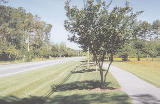

95
96 Chapter 6 Transit Element

97 Chapter 6 Transit Element Introduction A fallacy in civic debate is to think that public transportation is a solution to traffic congestion. Another fallacy is that transit should "pay for itself" through fare box collections. Adequate public transportation offers a choice in the way we travel. Transit cannot and should not be expected to remedy our lengthening commute times, worsening traffic congestion, or diminishing air quality. However, frequent and reliable transit service will give travelers a choice and provide a service that will help the region remain competitive economically. Transit riders are generally categorized in one of two groups: captive or choice. Captive transit riders use transit because they must, due to lack of access to a personal vehicle or because of a physical challenge. On the other hand choice transit riders leave their vehicle at home to use their travel time more wisely and perhaps spare the operational and parking costs of driving. This choice is particularly important as we consider the mobility needs of society's youth, the elderly, and the disabled. Vision The following vision of transportation in Wake County was adopted by the Transportation Advisory Board (TAB): "Transportation will be an asset to citizens rather than a barrier to having their needs met. Transportation services will become a part of the growth pattern and societal changes of our region in the future. Meeting people's basic needs and ensuring quality of life will be the guiding factor in how we design, maintain, and implement transportation services." Existing Services To help fulfill the vision, a number of agencies and services are already available to Wake County's residents. Current services provided by Wake County (Wake Coordinated Transportation Services), TTA (Triangle Transit Authority), C-Tran (Town of Cary), and CAT (Capital Area Transit) are described below. Figure 6.1 illustrates coverage areas and routes for each of the described services. The development and implementation of a successful transit initiative for Wake County will require the cooperation and attention of numerous agencies at the local, regional, and state level. Challenges A number of challenges need to be addressed to effectively plan and operate a successful transit system in Wake County. These challenges include: Population Wake County has the highest rural population of any urbanized county in North Carolina, making it expensive to provide easily accessible transit to all Wake County citizens. Education Current and potential riders need to be made aware that services are available for daily trips of all types, not only when other arrangements fall through. Encouragement Riders should be encouraged to take transit for recreation, entertainment, and shopping activities in addition to work and medical activities. Funding Current funding is insufficient to meet the demand for transit related services. Chapter 6-1 Transit Element Photo from: TTA website


98 Wake Coordinated Transportation Services (WCTS) WCTS offers coordinated subscription transportation services to more than 20 county agencies and non-profit organizations serving elderly, disabled, and low-income patrons. WCTS also offers a demand responsive shuttle service for the rural general public operated through contractual partnerships with private sector operators. Trip purposes can include medical appointments, employment, job training, nutrition, dialysis, social services appointments, and various support groups. Through the use of real-time vehicle tracking technologies and service expansions, TRACS hopes to be able to provide service to customers within twenty minutes of a ride request. Future expansions of service are planned and may include southern and/or northeastern Wake County on Thursdays and Saturdays. Additionally, TRACS will be working with CAT and TTA to provide riders with coordinated transfers at reduced fares. TRACS will eventually need to expand its operations to six days a week to provide a real transportation option to those that depend on the service for mobility. TRACS currently operates only in eastern Wake County on Wednesdays and Saturdays using lift equipped conversion vans. Both TRACS and WCTS use global positioning system (GPS) based technologies to track vehicles and provide real-time system information, which they anticipate to provide to the public through the Internet in the future. C-Tran The Town of Cary operates a demand responsive transit service. The service operates doorto-door (based on reserved ride requests a minimum of one day in advance) throughout the town and to qualifying destinations (medical or employment) outside of the local Cary service area in Wake, Orange, and Durham Counties. Photo by: Larry Morgan 6-2 Wake County Transportation Plan

99 Chapter 6-3 Transit Element

100 Capital Area Transit (CAT) Capital Area Transit is the City of Raleigh's transit system. It is primarily intended to serve the City of Raleigh; however, an extension on Route 7-South Saunders serves the Town of Garner as well. Capital Area Transit operates eighteen fixed bus routes, six fixed catconnector routes, and has three demand responsive service zones. Table 6.1 shows operational information about the transit system. Table CAT Operations REVENUE PASSENGERS TOTAL PASSENGERS WEEKDAY RIDERSHIP 8, ,0 0 0 REVENUE HOURS OF SERVICE WEEKDAY WEEKEND REVENUE MILES OF SERVICE 7, ,3 2 5 SOURCE: CAPITAL AREA TRANSIT, APRIL 2002 WEEKDAY WEEKEND Triangle Transit Authority TTA currently operates regional bus service throughout the Triangle on sixteen fixed routes, none of which serve unincorporated areas of Wake County. Table 6.2 shows operational statistics of TTA's Regional Bus service. Table TTA Operations Weekday Ridership total passengers Revenue Hours of Service weekday 2, Revenue Miles of Service weekday 3,746 Source: Triangle Transit Authority, April 2002 To serve areas outside of the range of existing fixed route service, TTA operates an extensive vanpool service. Currently, fifty vanpools are in operation, five of which originate in Wake County. Vanpools originate in Cary, Holly Springs, Zebulon, North Raleigh, and Wake Forest. Eleven new vanpools are in formation (throughout TTA's service area), of which two are in Apex and one each in Garner and North Raleigh. Vanpool fares are charged by the month at variable rates depending on the number of daily miles the vanpool travels. Future Services Service expansions are envisioned by TRACS, C-Tran, and CAT, but none are more dramatic than those proposed by TTA. A passenger rail system is planned to open in late 2007/early It will be 35 miles long and will connect Raleigh, Cary, Morrisville, RTP, and Durham. The service will share the active freight (Norfolk Southern and CSX) and passenger rail (AMTRAK) corridor owned by the North Carolina Railroad (NCRR) and will use diesel multiple units (DMU) to carry passengers. Regional rail service is planned to run in both directions, 18 hours a day, 7 days a week on 15-minute peak hour and 30-minute off-peak hour headways. Ridership is estimated to be between 25,000 and 35,000 riders per day. 6-4 Wake County Transportation Plan
 8.")
101 Station Locations In Phase I of the Regional Rail service, stations are planned for the following locations: 1. Duke Medical Center (station location yet to be determined) 2. 9th Street/Duke East 3. Downtown Durham 4. Alston Avenue/NC Central University 5. North Research Triangle Park 6. South Research Triangle Park 7. Morrisville or West Cary (station location yet to be determined) 8. Downtown Cary 9. West Raleigh 10. State Fairgrounds 11. NC State University 12. Downtown Raleigh 13. State Government Center 14. Six Forks Road 15. Millbrook Road 16. Spring Forest Road TTA Schedule As the Regional Transit Plan continues with implementation, it is following the federally (FTA) mandated project development process. Future steps to this process include: Complete Final Design 2001 to 2003 Start Construction 2003 to 2007/2008 Start Operation 2007/2008 Source: Triangle Transit Authority, Regional Rail System Draft Environmental Impact Statement (DEIS), Fall 2000 Chapter 6-5 Transit Element Although the regional rail component of the Regional Transit Plan is the most widely understood and publicized portion of this plan, it also includes the addition of local feeder bus services and the alteration of regional bus service to better accommodate the transit patrons of the Triangle area. Feeder bus routes will collect and shuttle patrons to rail stations for dispersion throughout the system. As final plans are developed, appropriate feeder bus routes, some utilizing existing transit services, will be planned. Eastrans Community leaders in Knightdale, Wendell, Zebulon, and Garner have endorsed a vision to initiate passenger rail service along little used railways connecting these communities with downtown Raleigh. Further extensions to communities in Johnston and Nash Counties would link these emerging residential growth centers with jobs in Wake County. Discussions and decisions concerning train frequencies, station locations, partners, funding, implementation schedule, and a system operator are forthcoming. Centers and Corridors The diverse nature of growth and development throughout the county has prompted the identification of prominent activity centers and major transportation corridors. Currently, Wake County has both large and small municipalities, large and small communities, and urban and rural areas. In the future some attributes of Wake County will change, while others will remain the same. Identifying areas critical to maintaining a sense of community within the county as well as the corridors (broad areas) that will connect them will be increasingly important as the focus of development is shifted toward transit supportive densities and designs. Supporting the idea of expanded transit services, the most recent Community Transportation Services Plan for Wake County (completed by NCDOT) and the Community Assessment Study of Wake County (completed by Wake County Human Services) found that a significant need already exists for transportation alternatives throughout rural Wake County.
102 Centers Wake County has identified numerous activity centers (both existing and planned) throughout the unincorporated areas of the county. Many of these activity centers are located at major crossroads, along major arterials, and at freeway interchanges. The centers identified in this plan do not always coincide with these activity centers. The centers identified by this plan are the growing municipalities throughout the county that currently do not have significant or any transit service Apex, Holly Springs, Fuquay-Varina, Garner, Knightdale, Wendell, Zebulon, Rolesville, and Wake Forest. In addition, centers include points where significant activity centers are planned and where major roadway facilities intersect or are in close proximity to transit corridors. However, these activity centers serve as gathering points for many Wake County citizens, and are projected to play prominent roles in the future of Wake County. For these centers to remain vibrant they must be considered in the transit element of this plan. Corridors The plan recommends that major transit routes be focused in ten corridors to serve the primary centers identified here. Special attention should be given these as priority transit corridors. Figures 6.2, 6.2-1, 6.2-2, 6.2-3, 6.2-4, and illustrate the corridors that include: TTA Phase I Regional Rail corridor is the corridor currently under design for Regional Rail service that is planned to begin operation by 2008 using self-propelled diesel rail cars. The corridor uses existing railroad rights-of-way to connect Spring Forest Road in North Raleigh through downtown Raleigh, Cary, Morrisville, and RTP before ending west of downtown Durham. US 1/CSX corridor is a candidate for a future extension of TTA regional service. It extends from Spring Forest Road to downtown Wake Forest. Before any rail extensions are completed, service could initially be provided by bus along US 1. As ridership and demand grow, the service could transition to a rail transit operation using the existing railroad corridor. This corridor has also been designated as the preferred route for the Southeast High Speed Rail service, planned to run between Washington, D.C. and Charlotte. Wake Forest/Rolesville corridor would connect Wake Forest with Rolesville using Rogers Road and a potential station near Rogers Road/South Main Street. The specific route would be determined at a later time. It is likely that buses would be used to serve this corridor. Rolesville/Wendell/Knightdale corridor is proposed to extend from Rolesville to west of Wendell using existing and planned streets. The specific route would be determined at a later time, but could include (parts of) Louisburg Road, Rolesville Road, Eagle Rock Road, and Wendell Boulevard. Buses would likely be used in this corridor. EASTRANS-US 64/US 70/Norfolk Southern Railway/North Carolina Railroad is a 97-mile long, little used, freight rail corridor that extends from Wilson and Goldsboro to Raleigh. These lines would link communities such as Clayton, Knightdale, Garner, Wendell, Zebulon, Wilson's Mills, and Selma. Currently, NCDOT and CAMPO funding and commitments are unavailable. However, communities along the rail line have a resolution of support. The North Carolina Railroad is cooperating with efforts in this corridor. As ridership grows and funding becomes available, expanded transit services are envisioned. Buses could be used in some corridors, whereas in others rail transit could be implemented where rail corridors exist and an operating agreement with the railroads can be negotiated. Potential corridors for bus and long-term rail transit extensions include (in no particular order): US 401/Norfolk Southern corridor NC 55 corridor NC 55/Davis Drive/CSX Railroad corridor Apex to Cary corridor Wake Forest/Rolesville area to RTP and Durham In addition to the ten transit corridors identified, the transportation plan also recommends the accommodation for high occupancy vehicle lanes on sections of the Outer Loop between NC 55 in Holly Springs and US 401 South. Furthermore, two potential park-and-ride locations one in Wake Forest and one at the US 64/US 64 Bypass interchange have been identified to serve as collection points for proposed transit services. 6-6 Wake County Transportation Plan
103 Recommendations Residents of Wake County have expressed the desire for expanded transit services to areas outside the range of existing services. Upcoming studies, including the current update to the Raleigh Transit Plan, will recommend actions that will expand and enhance existing Raleigh transit services as well as ways that it will complement regional transit efforts. Continued cooperative efforts between NCDOT, CAMPO, and TTA on intraregional transit initiatives such as Phases I and II of the Regional Transit Plan will be paramount in providing real transportation choices for the Triangle's residents. Action Plan Transit ridership has steadily increased and will need to continue to grow in order to fulfill the goals of the urban area's transportation plan. As new and expanded transit services are considered, it will be important to provide a variety of transportation choices for travelers. Wake County will continue to have a diverse cross-section of lifestyles and communities, and no single service will be able to accommodate everyone at equal levels of service. A mixed strategy that includes buses, rail transit, carpools, vanpools, HOV/HOT facilities/lanes, and other specialized transit services is recommended to address the needs of Wake County's diverse citizenry. Action items recommended to enhance public transportation options in Wake County in the future include: Promote coordination and collaborative partnerships between urban and rural transportation providers Promote specific technologies such as global positioning system (GPS) base scheduling and dispatch software Coordinate demand responsive van services in rural areas, specifically as one way of addressing the needs of the county's diverse citizenry Enhancing the existing bus system through innovative alternatives, such as connector shuttle services Focusing on increasing passenger amenities, such as sidewalks, shelters, and benches Preparing for future transit services by preserving/planning the major corridors in the Regional Transit Plan and this transportation plan Increasing ridership by identifying and encouraging new development and redevelopment opportunities that support future transit plans Promoting transit use by encouraging transit-supportive design features in areas targeted (true compact mixed use developments) for transit service, such as the centers identified in this plan as well as medium- to large-sized activity centers Developing coordinated park-and-ride and feeder/express bus services to support the future regional transit system** Coordinating roadway improvement projects that support rather than complicate and/or compete with regional transit service** Investigating and supporting transit technologies such as bus rapid transit, regional rail, commuter rail, express bus, and light rail that are appropriate for specific markets and corridors in conjunction with regional partners** **Accomplished through coordination between NCDOT, Wake County, TTA, and CAMPO Chapter 6-7 Transit Element

104 Measures of Success For overall success to be achieved, Wake County must make a commitment to provide and support alternative modes of travel. Efforts independent of NCDOT and TTA must be initiated to promote mobility choices throughout the county. These include: Constructing bikeways, greenways, and sidewalks Compiling an inventory of short and long-term transit service needs Investigating the feasibility of adding/enhancing transit centers in town centers/downtown areas, at hospitals, universities, community focus areas, sports venues, regional shopping destinations, and concentrated residential areas Photo by: Roger Henderson Establishing land development policies that support and encourage transit use. From the Wake County Growth Management Task Force, it is recommended that "land use plans and growth management tools shall promote mixed use centers of various scales and densities as appropriate to their location in each city, town, or unincorporated area. Such mixed use centers shall include a diversity of both non-residential and residential development types and costs. The location of such mixed use centers shall be carefully coordinated with plans for infrastructure, including transportation and transit, water and sewer services, schools, and parks and open space." 6-8 Wake County Transportation Plan
105 Chapter 6-9 Transit Element

106 6-10 Wake County Transportation Plan
107 Chapter 6-11 Transit Element

108 6-12 Wake County Transportation Plan
109 Chapter 6-13 Transit Element

110 6-14 Wake County Transportation Plan
111 Chapter 6-15 Transit Element

112 6-16 Wake County Transportation Plan

113 Chapter 6-17 Transit Element

114 6-18 Wake County Transportation Plan


115
116 Chapter 7 Implementation Plan
117 Chapter 7 Implementation Plan Sometimes you gotta create what you want to be part of. ~ Geri Weitzman Introduction While most county governments in North Carolina do not have a mechanism to construct roads and are not associated with maintenance responsibilities for transportation infrastructure, urbanizing counties can play an instrumental part in setting transportation priorities. As a member of the Capital Area Metropolitan Planning Organization (CAMPO) and the Triangle Transit Authority (TTA), county participants are well-positioned to communicate and foster a vision that strategically expands the region's transportation infrastructure. Equally important is the acknowledgment that traffic and congestion know no jurisdictional boundaries. For this reason, Wake County (working with CAMPO, TTA, and NCDOT) can assist with efforts to coordinate a cooperative strategy to deal with growing transportation demand and the increased competition for transportation resources. Common objectives drafted by the Wake County Growth Management Task Force in 2001 will be presented to the Board of Commissioners for adoption in late 2002 or To maintain consistency, the implementation plan is linked to these draft policy statements, as outlined below: Objective Topic I. Safety, efficiency, and Effectiveness II. Thoroughfares III. Collector streets IV. Travel demand management V. Activity centers VI. Connections to open space VII. Paying for growth-related Projects VIII. Improve service delivery IX. Plan updates Objective I: Create and Maintain a Safe, Efficient, and Effective Transportation System Strategies 1. Submit candidate improvements for the spot safety program used by NCDOT to allocate funds for intersection-type safety projects. Use the fifty-nine specific safety improvements listed on Figure 4.1 of the transportation plan and in the Existing Conditions chapter to develop candidate improvements. 2. Create a hotline phone number to receive citizen requests for tree limb/bush trimming in the vicinity of unsignalized intersections where restricted sight distance may contribute to traffic crashes. 3. Conduct a feasibility study of developing a new capital improvement program to systematically reduce the backlog of unfunded needs to build sidewalks and bike paths to serve schools, libraries, parks, and other community facilities frequented by children, the elderly, and other citizens with limited access to a personal vehicle. The "Safe Routes to Schools" program should consider funding levels that would complete at least one major school-area improvement each year. 4. Coordinate with NCDOT to develop a "Community Access Road Safety" program. As proposed, existing state secondary rural roads would be eligible for safety-oriented improvements to widen from existing 18- to 24-foot wide pavements to provide up to a 36-foot wide pavement. The additional width will allow for exclusive left-turn lanes at driveways and intersections. Between intersections, the community access road would be striped for two wide lanes. Safety will be enhanced for motorists, trucks, and bicyclists. Criteria for eligibility and prioritization should include crash history, routes on the bicycle network, cost to minimize and mitigate environmental impacts, and availability of right-of-way. Chapter 7-1 Implementation Plan
118 5. Coordinate with the North Carolina Department of Transportation (NCDOT) and the North Carolina Department of the Environment and Natural Resources (NCDENR) to evaluate the most cost-effective way to implement emerging environmental regulations that seek to widen and flatten drainage ditches alongside roadway corridors in North Carolina. The additional width may exceed existing public rights-of-way in some corridors. 6. Work with local communities through a coordinated and comprehensive public outreach program to determine candidate corridors where multi-use paths built on easements would be supported by a majority of affected homeowners. 7. Work with NCDOT to study the feasibility of initiating red-light running camera enforcement at signalized intersections in unincorporated Wake County. 8. The county should coordinate with CAMPO's Bicycle and Pedestrian Committee to develop a list and map showing high priority bicycle routes. The county should use the list and map to coordinate with NCDOT to pave all intersections along high priority bicycle routes including, but not limited to, all intersecting streets and driveways for an appropriate distance. The intent is to significantly reduce the amount of gravel in the area where most bicyclists travel along major bicycle routes. This strategy is not intended to pave long stretches of unpaved roadways. RECOMMENDATION 59 specific spot safety projects (1) Initiate hotline for citizens to request tree/shrub trimming to improve sight distance at intersections (2) Safe Routes to Schools Program (3) Widen community access roads (4) Acquire more right-ofway for ditches and multi-use paths (5) Seek property owner consensus to build continuous multi-use paths along community access roads (6) Study red-light running program (7) Pave gravel drives on bike routes (8) IMPLEMENTATION PARTNERS NCDOT TIME FRAME Wake County Wake County NCDOT NCDOT Wake County NCDOT 2008 NCDOT Objective II: Complete Regional Thoroughfares Thoroughfare planning shall emphasize the completion of regional linkages through state and inter-local agreement upon the identification, dedication, preservation, and acquisition of necessary transportation corridors. Governments shall expedite the completion of important transportation linkages through public involvement, consensus building, and early commitment during the preparation of local land use or other related plans. Strategies 9. Seek biannual public input to develop a list of thoroughfare improvements eligible for state and federal funds. Prepare a technical study to identify cost, pros and cons, and anticipated CAMPO project score. Present the results of public input and the technical study to the Planning Board and Board of Commissioners for their use in prioritizing candidate projects prior to submittal to CAMPO. 10. Participate with NCDOT and CAMPO in a study to determine the benefits of building the southern and southeastern segments of the Outer Loop (I-540). Following the study if applicable initiate "Official Map Act" proceedings to preserve right-of-way in the southeastern corridor segment. 11. Prepare a map showing interconnected greenway, sidewalk, and bikeway plans for Wake County and all municipalities with adopted plans. Present the map to the NCDOT Highway Administrator with a request to design all future segments of the I-540 Outer Loop to include suitable facilities to link existing and future greenways, sidewalks, and bikeways across or beneath the new freeway. 12. Conduct feasibility and alternative alignment studies for planned thoroughfares on new alignments. 13. Avoid capacity-increasing transportation projects in environmentally sensitive areas unless a compelling purpose and need for the project can be established, based on welldocumented observed conditions. 7-2 Wake County Transportation Plan
119 RECOMMENDATION Seek biannual public public input to input develop to a develop list of a thoroughfare improvements; list of thoroughfare prepare a technical improvements; study to identify cost, prepare pros and a technical cons, and anticipated study to CAMPO identify project score; present the results cost, to pros the Planning and cons, Board and anticipated and Board of Commissioners CAMPO project (9) score; present the results to the Planning Board and Board of Commissioners (9) Determine the benefits of building the southern and southeastern segments of the Outer Loop (I-540); if applicable, initiate Official Map Act proceedings to preserve right-of-way in the southeastern corridor segment (10) Prepare map showing planned and proposed greenway, stream, and road crossings of I-540 Outer Loop (11) Conduct feasibility and alternative alignment studies for planned thoroughfares on new alignments (12) Delay capacity-increases on roads in environmentally sensitive areas (13) Prepare access management plans; comprehensive corridorwide planning prior to additional subdivision application review; build major subdivision entrances across from each other at a location on a thoroughfare where a future median opening will be provided (14) IMPLEMENTATION PARTNERS TIME FRAME CAMPO, Wake County 2003 CAMPO, Wake County every 2 years NCDOT, Wake County County, CAMPO CAMPO NCDOT Wake County NCDOT, Wake County Wake County By ongoing 14. Prepare access management plans to show locations for future median openings along thoroughfares where the transportation plan indicates a future multilane divided facility. Comprehensive corridor-wide planning that occurs prior to additional subdivision application review will reduce the number of complaints during roadway design. Build major subdivision entrances across from each other at a location on a thoroughfare where a future median opening will be provided. Secondary subdivision entrances would be designated in the conditions of approval as a "right-turn only driveway." Objective III: Interconnect Local Collector Roads A planned system of interconnected local roads, designed for multimodal use, shall be supported. These will connect residential areas with jobs, services, and transit; reduce reliance on and relieve congestion on major thoroughfares; and provide opportunities for pedestrian, bicycle, and other modes of transportation away from major roads. Strategies 15. The county should publish a map showing existing stub-out streets within subdivisions and commercial areas that will be extended and connected when future development occurs on adjacent parcels. A file search of adopted conditions of approval is needed. The level of detail provided in this plan constitutes phase 1 of the collector street plan. A more detailed study, referred to as phase 2, will be needed to identify existing residential collector streets that will be extended in the future. More detailed travel demand modeling will be conducted for collector streets in phase 2 as well as alignment studies using topographic maps. 16. The transportation plan identifies a system of planned interconnected local roads (collector streets) that are designed to include sidewalk on at least one side and shared use with bicycles. The recommended width of collector streets is 34 feet that could be striped to provide a four-foot wide bicycle lane on both sides of the roadway, leaving 21 feet of pavement for two-way travel. This design will maintain reasonable average speeds consistent with neighborhood quality of life while providing multiple outlet connections to more than one thoroughfare. The cost of right-of-way and construction of the collector streets should be borne by the new homeowners. The cost of right-of-way, construction, and maintenance of the sidewalk should be borne by the new homeowners. Chapter 7-3 Implementation Plan
120 17. The county should coordinate with NCDOT to prepare a sample two-party sidewalk/multiuse pathway maintenance agreement that is intended for developers and homeowners where no homeowners association exists. 18. The county should consider a Unified Development Ordinance (UDO) update that requires developers to submit a visual, environmental, and transportation (VET) analysis with all new development applications. The environmental element would include illustrations and best management practices showing how streams will be crossed to create an interconnected collector street network. RECOMMENDATION Publish map of existing Publish map of stub-out streets that will existing stub-out be extended (15) streets that will be extended (15) Adopt UDO that requires collector streets and multiple street connections for subdivisions (16) Prepare sample maintenance agreement for homeowner payment of sidewalk maintenance costs (17) Prepare a district-wide visual, environmental, and transportation (VET) analysis (18) Establish stream crossing reimbursement program (19) Build stub-out streets to the edge of property lines to facilitate eventual extension and connection to neighboring subdivisions (20) IMPLEMENTATION PARTNERS Wake County TIME FRAME By 2004 Wake County By 2004 Wake County By 2005 Developer By 2005 Wake County Developer ongoing 19. To facilitate construction of collector street connections across streams that divide subdivisions, the county should consider funding a new program to reimburse developers for a portion of the incremental cost of using best management practices in crossing streams and buffers. 20. Where prudence dictates that the actual stream crossing should be built when and if an adjacent parcel is subdivided, then the developer of the initial subdivision should build a stubout street to the edge of the property line of the initial subdivision. The developer should also send written notice to NCDOT and NCDENR that the street is planned to be extended when and if adjacent parcels across the stream are developed. Objective IV: Maximize the Use of Existing and Planned Facilities Transportation Demand Management (TDM) shall be supported as a cost effective means to maximize the use of existing and planned transportation facilities. Such methods may include: High Occupancy Vehicle (HOV) lanes Intelligent Transportation Systems (ITS) Toll roads Van and carpooling Reversible lanes Signal timing Flexible work hours Telecommuting Strategies 21. Submit a list of candidate improvements that include corridor signal coordination projects in addition to HOV, ITS, toll roads, ridesharing, flextime, and telecommuting initiatives eligible for federal funding through the congestion management/air quality (CMAQ) program. 22. Study the feasibility of expanding existing Wake Coordinated Transit Service (WCTS) to serve patrons in additional unincorporated areas of Wake County. Identify strategies to use a portion of Wake County's allocation of Transit Operating Funds as well as Capital Funds provided by the federal government. 23. Study the benefits of implementing service design improvements to WCTS using technologies such as geographic information systems and global positioning systems. RECOMMENDATION Pursue funding for TDM Pursue funding for measures and programs TDM measures and (21) programs (21) Expand WCTS transit service countywide (22 and 23) IMPLEMENTATION PARTNERS NCDOT Wake County TIME FRAME 2003ongoing 2004ongoing 7-4 Wake County Transportation Plan
121 Objective V: Encourage Mixed-Use Developments Planned concentrations of mixed-use development shall be encouraged. This will bring housing closer to jobs and services; reduce commuting distances, travel demand, and automobile dependency; provide opportunities for coordinated transit services; reduce air pollutant emissions relative to area growth; and improve access to services and the mobility of the elderly, disabled, or others who may not own an automobile. Strategies 24. Submit a list of bicycle and pedestrian improvements eligible for funding through the state's bicycle program and the federal enhancements program. 25. Thoroughly evaluate all requests for driveway access that is within 1,000 feet of an existing at-grade crossing of a major thoroughfare with an active railway. Consultation with the NCDOT Rail Division and the railroad company owning the railway should consider the potential for a grade separation based on the exposure index, which is the combination of daily roadway traffic and the number of trains per day. Construction of a grade separation in the future could more easily be facilitated if no driveways are located within 1,000 feet of the tracks. 26. Coordinate with NCDOT Rail Division to commission traffic separation studies along all active rail corridors. The studies will identify where grade separations should be planned, as well as where crash rates suggest a discussion of installing safety devices or closing crossings. RECOMMENDATION Submit bikeway projects to projects CAMPO to (24) CAMPO (24) Avoid new driveway permits proximate to planned grade separations at railroad crossings (25) Prepare traffic separation studies to identify future grade separations (26) IMPLEMENTATION PARTNERS CAMPO, Wake County Wake County NCDOT TIME FRAME 2003-every 2 years ongoing Objective VI: Provide Access and Connections to Open System The Wake County Transportation Plan recommendations should take advantage of access and connections to the recommended open space system. Strategies 27. Create opportunities for greenway and trail development. 28. The county should consider a UDO update that requires developers to maintain a 50-foot natural buffer between the roadway right-of-way and adjacent residential development. Restrictions are already in place for landscape buffers adjacent to non-residential development. RECOMMENDATION Create opportunities to develop to develop greenways and trails greenways (27) and trails (27) Identify urban limit lines along thoroughfares where curb and gutter will end and ditch sections begin; maintain rural character by avoiding the use of curb and gutter roadway sections; maintain natural buffers along thoroughfares (28) Prepare a district-wide visual, environmental, and transportation (VET) analysis (29) IMPLEMENTATION PARTNERS Wake County Wake County, NCDOT, Developers Developers TIME FRAME ongoing By The county should consider a UDO update that requires developers to submit a visual, environmental, and transportation (VET) analysis with all new development applications. The visual element would illustrate before and anticipated "after" images from the perspective of adjacent thoroughfares, railways, and greenways, showing the retention of natural buffers. Chapter 7-5 Implementation Plan
122 Objective VII: Growth Should Pay Its Own Growth-induced demand and costs for infrastructure, facilities, and services shall be borne by those primarily responsible for the increased demand and costs. The effect of this policy may be to reduce reliance on property taxes to pay for growth. 33. The county should consider a UDO update that requires developers to fund the construction of left-turn lanes on thoroughfares at major subdivision entrances. Strategies 30. Evaluate methods by which the costs of growth may be addressed. Such methods may include impact fees and taxes, special tax districts, user fees and tolls, developer installed facilities, property taxes, dedicated sales tax proceeds, public/private partnerships, adequate public facilities (APF) ordinances, and privatization of services. Objective VIII: Improve Service Delivery: A well-planned system of local roads will allow for a higher level and greater efficiency of service delivery, where responsibilities are clearly defined from the initial planning stage through construction to long-term maintenance. RECOMMENDATION 31. The county should adopt a level of service standard that establishes a threshold for acceptable transportation level of service based on the most recent version of the Highway Capacity Manual (HCM). Wake to to WakeCounty County cooperate with others to cooperate with research new revenue others to research sources; developers pay new revenue fair share of the cost for sources; developers off-site transportation pay fair share improvements (30)of the IMPLEMENTATION PARTNERS Wake County, Developers 34. Coordinate the timing, rate, and location of major thoroughfare improvements to be consistent with water and sewer service extensions so that urban development occurs in an orderly manner. RECOMMENDATION Strategies TIME FRAME Develop alternative subdivision road design standards (35) Wake County, NCDOT TIME FRAME Note maintenance responsibilities on subdivision plats (36) Wake County By Develop alternative road design standards for subdivisions. 36. Note prominently on subdivision plats that private roads are to be maintained by developers or homeowners association. Objective IX: Plan Updates Update the Wake County Transportation Plan on a regular basis. cost for off-site transportation improvements (30) Adopt UDO with a LOS standard (31) Adopt with requirement AdoptUDO UDO with for developers to requirement forsubmit a developers to submit visual, environmental, anda visual,(vet) environmental, traffic analysis (32) and traffic analysis (32) Adopt UDO requirement for developers to construct left-turn lanes at major subdivision entrances (33) Coordinate the timing of major thoroughfare improvements consistent with water and sewer extensions (34) IMPLEMENTATION PARTNERS Wake County 32. The county should Wake County consider a UDO update that requires developers to submit a visual, environmental and Wake County transportation (VET) analysis with all new development applications. The NCDOT transportation element would include a traffic impact analysis as well as mapped alignments showing how and where collector streets for each subdivision will be extended to intersect two or more troughfares. By 2005 Strategies VET by 2005 TIA in The county should coordinate the recommendations of the transportation plan with the Growth Management Plan, Watershed Management Plan, Open Space/Greenway Plan, and the Unified Development Ordinance. By ongoing 38. The county should participate in CAMPO and coordinate with municipalities to facilitate implementation of interjurisdictional aspects of the transportation plan. 39. The county should work with CAMPO to periodically monitor and document peak hour travel times to develop trend analyses of levels-of-service on major thoroughfares. 40. The county should initiate an annual review of the implementation plan recommendations and report results to the Planning Board. 7-6 Wake County Transportation Plan
123 RECOMMENDATION Coordinate the recommendations of the transportation plan with the Growth Management Plan, Watershed Management Plan, Open Space/Greenway Plan, and the Unified Development Ordinance (37) IMPLEMENTATION PARTNERS Wake County TIME FRAME 2003-ongoing 41. The county should initiate small area plans for each activity center, beginning with those located along major thoroughfares undergoing construction or widening. 42. The county should participate in future efforts to update the Triangle Regional Model to ensure that reliable traffic forecasts are produced for unincorporated areas. Coordinate with municipalities to facilitate implementation of inter-jurisdictional aspects of the transportation plan (38) Wake County 2003-ongoing 43. The county should initiate small area plans for each activity center, beginning with those located along major thoroughfares undergoing construction or widening. "A billion here, a billion there, sooner or later it adds up to real money. ~ from the late U.S. Senator Everett Dirksen Periodically monitor and document peak hour travel times to develop trend analyses of levels-of-service on major thoroughfares (39) Initiate an annual review of the implementation plan recommendations and report results to the Planning Board (40) Wake County Wake County 2006 every 2 years 2004 ongoing 44. The county should participate in future efforts to update the Triangle Regional Model to ensure that reliable traffic forecasts are produced for unincorporated areas. Program Cost Initiate small area plans for each activity center, beginning with those located along major thoroughfares undergoing construction or widening (41) Participate in future efforts to update the Triangle Regional Model to ensure that reliable traffic forecasts are produced for unincorporated areas (42) Initiate a review of the transportation plan following the next major update to the Triangle Regional Model and inherent socio-economic forecasts (43) Initiate an update of the Transportation Plan within five years of adoption (44) Wake County Wake County 2003 ongoing Wake County Wake County 2008 The recommendations in this report are in addition to those contained in the budget-constrained Transportation Plan 2025 prepared by CAMPO. As such, it is appropriate to indicate an order-of-magnitude estimate for how much additional funding would be required. CAMPO forecasts indicate that more than $6 billion in revenue will be available from 2002 to 2025, however, this is only enough to fund the projects that are included in the CAMPO Plan. Also, not all funds can be used for all types of projects. For example, Powell Bill funds represent 6% of forecasted revenue, but can only be used for local maintenance and sidewalk construction on state-system streets. The following opinion of probable cost covers only the study area for the Wake County Transportation Plan and does not include projects already in the CAMPO Plan. Figures do not account for inflation or increases in annual operating and maintenance costs. Chapter 7-7 Implementation Plan Pedestrian Enhancements Transit Extensions Community Access Roads Multi-lane Roads New Collector Streets New Community Access Roads New Multi-lane Thoroughfares Bridges and Interchanges Stream Crossings & Mitigation Total $25 Million 750 Million 650 Million 150 Million 350 Million 125 Million 100 Million 500 Million 50 Million $2.7 Billion
124 New revenues are needed to pay for projects recommended in this plan. State funds are oversubscribed as shown in the table below. The Regional Transportation Alliance, a group of business leaders and elected officials organized by the Greater Raleigh Chamber of Commerce, has also recently performed a financial analysis of the transportation system and needs in Their initial report indicated that an additional $10.1 billion dollars would be needed to maintain current levels of traffic congestion and delay in 2025 while still increasing travel choices for the region s residents. The report was signed by the then-mayors of Chapel Hill, Durham, Raleigh, and Cary. CAMPO subsequently endorsed the findings of this report in May of While several towns and cities in CAMPO (Raleigh, Cary, Knightdale, and Rolesville) have enabling legislation to exact traffic impact fees, other municipalities are still pursuing the enabling legislation from the State General Assembly to have this funding option. CAMPO has supported equitable and well-crafted impact fee mechanisms in the recent past (1997). Fiscal Year (est.) Year Funding $518,561 $441,921 $431,845 $497,976 $528,605 $507,423 $516,817 $718,895 $679,932 Avg. Yearly Funding $74,080 $63,131 $61,692 $71,139 $75,515 $67,179 $64,544 $102,699 $97,133 Like all counties in North Carolina, state law does not allow Wake County to build, own, operate, or maintain roads. Therefore, enabling legislation is needed in order to increase revenue for transportation in Wake County that will address the many recommendations in this plan. Post-Year $563,369 $608,598 $989,172 $941,538 $907,727 $831,786 $963,326 $1,379,810 $1,106,973 Historic Funding Levels, Federal/State (State TIP) (source: Metropolitan TIPs. Transit funding not shown; constant year 2000 dollars.) 7-8 Wake County Transportation Plan


125
126 Appendix A Definition of Terms
127 Appendix A Definition of Terms term (verb) call, christen, denominate, designate, dub, entitle, style, title. Appendix A - 1 Definition of Terms ~ Merriam-Webster s Collegiate Dictionary Average Daily Traffic (ADT) The average number of vehicles that travel on a given section of roadway in a 24-hour period. CAMPO Transportation Plan 2025 An official plan with a map of existing and future thoroughfares (major and minor) designated within Wake County (incorporated and unincorporated areas). CAMPO is an acronym for the Capital Area Metropolitan Planning Organization, which is a federally-mandated committee with one representative from each of the municipalities in Wake County who also serves on the elected board or council for that municipality. The Wake County Transportation Plan will be incorporated into the CAMPO plan after thorough review and discussion. Capacity The maximum number of vehicles that can pass a point on a roadway or intersection during the peak (busiest) hour of the day. Residential Collector Street A street that serves as the connecting street between local residential subdivision streets and the thoroughfare system. Collector streets carry traffic between neighborhoods and typically have two lanes with an exclusive left-turn lane at intersections with major roads. The typical width is 34 feet from the face-of-curb to the opposite face-of-curb. Traffic calming devices or designs may be built to slow traffic speeds and reduce some of the negative effects of cars in the neighborhood environment. Connector Streets As shown on Figure 4.1, connector streets link thoroughfares but typically do not extend beyond them. Connector streets support the thoroughfares with short, direct, and relatively fast access. Typically, connector streets have no homes with direct frontage. Access to adjacent land is ideally provided at intersections rather than direct driveways. Connector streets may be added to the state secondary roadway system, but constructed by developers. Cross-Section An illustration of the horizontal roadway features that may include lanes, parking, median, verge or planting strip, sidewalks, and bikeways. Dimensions for each roadway feature are illustrated. Greenway A recreational and transportation route that follows a green (non-roadway) corridor. It is shared by bicyclists and pedestrians. HOV Lanes High Occupancy Vehicle (HOV) lanes are roadway lanes designated for use only by vehicles with two or more occupants (including the driver) during peak travel periods. HOT Lanes High Occupancy Toll (HOT) lanes allow vehicles with more than one occupant to travel for free while single-occupant vehicles (drivers only) buy the use of lanes. Interconnected Street System A network of public streets in an urban area that provides each neighborhood with more than one street entering and leaving the neighborhood. From a bird's eye view, the streets interconnect every one-fourth to one-half mile. Included in an interconnected street system are several types of streets, including: major and minor thoroughfares, commercial and residential collector streets, and connector streets. The streets are not necessarily straight and direct; that is, curves and turns from one street to another adequately provide multiple routes for residents of the immediate area. Level of Service (LOS) A rating system (A to F) used to describe the operating conditions of an intersection. As with school grades, an "A" indicates little or no delay. Level of Service "F" indicates average delay that exceeds 85 seconds per vehicle. Evidence of "stop and go" traffic indicates Level of Service F. Local Residential Subdivision Street A two-lane street that provides access to abutting properties. Examples are any street in a residential subdivision except a collector street, including cul-de-sacs, loop roads, and roads that do not connect thoroughfares or serve major traffic generators. The width of local residential streets should be 26 feet from face-of-curb to the opposite face-of-curb. Major Thoroughfare A roadway that carries traffic from one town to another, often through several other communities. These include interstate, other freeways, expressways, or parkway roads and major streets that provide for the expeditious movement of high volumes of traffic within and through urbanized areas. Examples include Main Street in Rolesville and Capital Boulevard in Raleigh. A critical fact about major thoroughfares is they are eligible to use state and federal transportation funds to offset some of the cost of widening, extensions, and bypasses. In most places, they are multi-laned (or planned to be multi-lane) with posted speed limits of 45 mph or greater. Minor Thoroughfare A roadway that carries traffic from one area to another. Minor thoroughfares are not typically eligible for state or federal funding, except for pavement overlays and other maintenance. Minor thoroughfares, typically two lanes with exclusive turn lanes in some locations, are used to supplement the major thoroughfare system by facilitating minor through movements and may also serve abutting property.
128 Multimodal A transportation system that serves different modes of travel including bus transit, rail, bicycling, walking, and driving a vehicle with convenient connections from one mode of travel to another. Multiuse Path An 8- to 10-foot-wide pathway that is shared by bicyclists and pedestrians, typically parallel to, but separated from, a roadway. Regional Traffic In the context of a transportation plan, the term regional traffic is used to describe traffic between cities that travels through your planning area on major and minor thoroughfares. While it would be nice if all regional traffic used the freeways, little can be done to prevent regional traffic from using major thoroughfares. For this reason, major thoroughfares are eligible for state and federal funding for widening and the construction of extensions. Visual, Environmental, and Transportation (VET) Analysis This analysis is a short report to be prepared by developers and submitted for county review at the time of application for new development. The VET analysis will photographically document changes to the visual environment from the perspective of public roadways, railways, and greenways adjacent to the site showing existing and proposed development. The environmental analysis will map the area bounded by the nearest major thoroughfare(s) in all directions to show existing natural features such as streams, creeks, ponds, lakes, rivers to illustrate the extent of buffer requirements as well as where future roadway connections will be made across these buffers. The VET will incorporate separate county requirements for submitting a traffic impact analysis and will show the ultimate roadway system for thoroughfares and collector streets within the area bounded by the nearest major thoroughfare(s) in all directions. Roundabouts Circular intersections with carefully designed features to slow traffic, without the long delays that are typical of traffic signals. Traffic Calming Physical devices that reduce the negative effects of cars and trucks in a residential neighborhood. By altering driver behavior, they improve conditions for residents, pedestrians, bicyclists, pets, and animals. Thoroughfare Thoroughfare Verge The grass or planted area that separates the roadway from the sidewalk (also known as a planting or utility strip). Thoroughfare Cr ee k Thoroughfare Thoroughfare Cr ee k Thoroughfare TIP An acronym for Transportation Improvement Program. The TIP is the seven-year schedule for how state and federal transportation funds will be allocated among competing cities for transportation projects such as thoroughfare widening and extensions. View the current version of North Carolina's TIP at the following web site: Thoroughfare Transit Any type of local public transportation (i.e., bus system, passenger rail, shuttle services, etc.). Thoroughfare SOURCE: Highway Capacity Manual 1997, Transportation Research Board Appendix A - 2 Wake County Transportation Plan


129
130 Appendix B Technical Appendix
 call, christen, denominate, designate, dub, entitle, style, title.")

131 Appendix B Technical Appendix Examples of Level of Service (LOS) Conditions on Typical Freeway Definition of Terms Capacity A measure of the maximum number of vehicles that can pass a point in a given amount of time. term (verb) call, christen, denominate, designate, dub, entitle, style, title. ~ Merriam-Webster s Collegiate Dictionary Level of Service A term used by transportation professionals to define the operating characteristics of a facility or system uses qualitative measures determining a letter grade of A through F rating how well a facility is functioning, where A is the best and F is the worst. Level of service measures can be based on delay, speed, travel time, density, or other measures that are relative to specific analyses. Signalized intersection level of Control Delay service calculations use the following Level-of-Service (Seconds/Vehicle) criteria to determine level of service. A <10 The use of a universal measure allows better communication of results. Shown on the following page are examples of level of service conditions on freeway segments. LOS A B >10 and < 20 C >20 and < 35 D >35 and < 55 E >55 and < 80 F >80 Source: Highway Capacity Manual 2000 Committed Projects Transportation improvements with funding agreements that are already being secured. Congestion For the purposes of this plan, roadway congestion is defined as segments at levels-of-service E or F. Traffic Signal Synchronization/Coordination Advanced technology that allow the controllers (computers) operating individual intersection signals to communicate with each other, sending data about traffic volume and signal timing. The purpose is to minimize the number of stops and length of delays due to red lights. Appendix B - 1 Technical Appendix LOS B


132 LOS C LOS E LOS D LOS F SOURCE: Highway Capacity Manual 1997, Transportation Research Board Appendix B - 2 Wake County Transportation Plan
133 Triangle Regional Model For this study, Kimley-Horn used a mathematical model of the Triangle region developed by local agencies, CAMPO, and the NCDOT. The model uses forecasts of increases in population and jobs and translates them into the number of vehicles on the roadways. Traffic volumes are assigned to specific roadways, which can then be evaluated in terms of future need for widening. The Triangle region is split into 2,471 traffic zones in which population and jobs are forecasted. The model assigns traffic to all available roadways, not just the closest one. As with any model, there are limitations in accuracy. First, given the long-range horizon of 2025, population forecasts can be off by as much as 15 percent for the Triangle region. For communities and zones within each individual community, the forecasts can be off by much more. Second, the relationship between population, jobs, and trip making can change over time. For example, the number of vehicle-miles traveled in the last 10 years has increased significantly faster than the growth in population and employment with one reason being that people are driving more than they used to. Lastly, the model is based on historical information that reflects our auto-oriented society. It must be emphasized, however, that the Triangle Regional Model is the best available tool to forecast traffic in the Triangle region. Commonly Used Modeling Terms Link The term link is used to describe a road in a model. Encoded in each link is information such as free-flow speed, capacity, and distance. Node Nodes are points at which two links connect. A node can be an intersection of a link and a link or a link and a centroid connector. Centroids and Centroid Connectors Centroids are the center of activity within the zone that generate and attract traffic. Each centroid has specific characteristics ranging from the number of jobs to the number of dwelling units. Trips A one-way trip. Internal and External Trips There are two primary types of trips used in modeling. The first is the internal trip. This is a trip that occurs from inside the modeled area and ends inside the modeled area. Trips that begin inside the modeled area and end outside the modeled area are external trips. External trips can also begin outside the modeled area, pass through the modeled area, and then exit the modeled area without ever getting off of the road network. Appendix B - 3 Technical Appendix
134 The Modeling Process The modeling process is based on mathematical equations tailored through calibration for the Triangle region. The modeling process for Wake County uses four steps: trip generation, trip distribution, assignment, and mode choice. Trip Generation A process in which a mathematical model is run to create trips based on population and jobs data in each zone. Three trip purposes are used: home based work (HBW), home based other (HBO), and non-home based (NHB). These trips can either be produced by or attracted to a zone. Assignment The modeling process continues after trip distribution and mode choice with the reassignment of trips that have been split into various modes based on theoretical choices made by trip makers. Through another mathematical model, trips are assigned to specific links, which is where model volumes begin to show up for analysis. Through an iterative process, trips are assigned to specific links at specific times of day. Throughout the assignment process various measures are tabulated including volumes, speeds on specific links, times on specific links, and other calculated properties. As links become congested, the travel time begins to lengthen. Assignment The modeling process continues after trip generation with the assignment process. Through another mathematical model, trips are assigned to specific links, which is where model volumes begin to show up for analysis. Through an iterative process, trips are assigned to specific links at specific times of day. Throughout the assignment process various measures are tabulated including volumes, speeds on specific links, times on specific links, and other calculated properties. As links become congested, the travel time begins to lengthen. Mode Choice The next stage of the modeling process is mode choice. Mode choice is the stage where the model determines modes of travel for various trips. The modes most commonly found in models fully utilizing mode choice include rail transit, bus transit, and automobile travel. The modeling process concludes by producing data by link and node for each of the appropriate modes. Trip Distribution In this stage of the modeling process, trips that are produced and attracted are changed into origins and destinations. Trips are given definite ends. This means that a trip that was produced as a home based work trip in zone 1 is going to be attracted as a home based work trip in another specific zone. Appendix B - 4 Wake County Transportation Plan
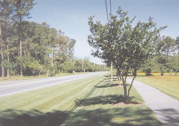
135

136 Appendix C Report


137 Appendix C Interconnected Street Systems This report was prepared by Dan Howe, AICP and Ed Johnson, P.E., with the City of Raleigh. Is this a legitimate public policy issue? It seems logical that a grid street pattern should be able to allow efficient municipal services and other governmental and quasi-governmental functions such as school transportation, mail and package delivery, but does it really make a difference? Evidence shows that if a reasonable grid of streets is maintained, the vehicle trips on all residential streets can be held down to a modest, safe traffic load, made up almost entirely of local trips (not "cut-through" trips") and that this can be done at a level which is no more costly to the developer than the more common collector-and-cul-de-sac pattern. Many argue that connected streets mean more interaction between neighbors, create a design framework that fosters quality urban architecture and spaces, and can reduce response time for emergency service providers. It seems to make sense that the public encourage streets to connect in a relatively dense grid pattern, no? For some...that's the answer: No. Not my street, Buster... This issue is a classic planning decision-making conundrum. A lot of evidence can be brought to bear that long-term costs of providing municipal services such as fire protection, refuse collection, thoroughfare widenings and EMS services are affected by residential street patterns and that some level of interconnectivity needs to be maintained. At the same time, the prospect of implementing a connection to an existing residential neighborhood is invariably met with staunch opposition by those already living there, who are concerned about the safety and livability of their immediate environment. How much interconnectivity is too much? Is there such a thing? New Urbanists are major supporters of more interconnected street systems on a very tight grid akin to that established in the early 20thcentury neighborhoods of the US. This model for new developments is becoming popular, and is certainly driving debate about city design. Environmentalists, on the other hand, may find fewer streets in general Typical Suburban Street Hierarchy to be better. Classic collector-and-cul-de-sac systems (termed by New Urbanist guru Andres Duany as "the dead worm") require less street and follow the contours of the land more closely, requiring less land disturbance to construct. It can be shown that dead-end systems can be efficient from a development point of view, serving more units with less linear footage of pavement. Appendix C - 1 It all comes down to what sort of city we want to create. If folks don't mind paying higher taxes for refuse collection, and don't mind sitting in traffic at collector street intersections, should they not be able to live at the end of the cul-de-sac? Maybe so. Should the citizen dwelling in an interconnected neighborhood which is efficient, pleasant and safe have to pay extra taxes and suffer suburban traffic gridlock in order for others to live The Grid taken to extremes - Plan for Savannah, GA at the end of the cul-de-sac? Maybe not. Like most democratic solutions, the right answer is probably somewhere in the middle. Whatever the ultimate level of interconnectivity in a local street pattern, we argue that the maintenance of a generalized grid of residential streets is a legitimate public policy issue that local government should establish a set of standards for. We also argue that there are a variety of solutions that establish a reasonable grid of residential streets, continue to allow for some dead-end streets, protect the environment and still allow the fire truck to get to the fire. The "Dead Worm"


138 Historical Trends in Street System Design A Short History of the Grid The grid made sense to the early town-builders in this country, primarily because it was a paradigm for convenient and efficient land sales. Simple, easy to measure, easy to know where your Monticello ended and the next man's began, the grid layout of lots divided by streets was the design of choice whether on the flat plains of Kansas or the tortured geology of riverine western Pennsylvania. Streets, in the days where the grid marched unchallenged across the landscape of town planning, were mostly the spaces between saleable lots. Unimproved for the most part and subject to utilization primarily by horse hooves and wagon wheels, streets which would become the skeleton of modern city form were laid out strictly for utilitarian access to property. With a few exceptions, very little thought was given to how this particular form would affect privacy, "traffic" (not really on the radar screen in the 19th century), interaction between and among communities, or even the efficient provision of services. It was a real estate tool first and foremost. Around the turn of the 20th century town planners began to nudge the grid, bend it and slice it apart diagonally. Pierre L'Enfant and Daniel Burnham loved the urban design potential of the grid, particularly when it was enhanced with broad diagonal boulevards that provided views and a hierarchy of importance to streets that was less apparent in the layout of the traditional grid. Spice that liberally with voids... plazas and squares, and the City Beautiful designs of Chicago and Washington DC are the result. Much of this conscious urbanism that has now spawned the nostalgic return to these concepts in the guise of Plan for Pittsburgh. The rectilinear grid assaults a topographicallythe "new" urbanism reflect Burnham's, L'Enfant's challenged site. and Raymond Unwin's attraction to this "enhanced" grid of streets. Topography, natural features, hydrology played little role in shaping this emerging urbanism. The form itself was primary. In fact, the conflict between the grid and natural topography actually enhanced the rectilinear grid by adding a third dimension and a creative foil to the monotony of evenly-spaced blocks marching across the landscape. All this began to change in the first couple of decades of this century, when designers of streetcar suburbs began to find it cheaper and easier to build with the land rather than against it. More importantly, buyers of suburban homes seemed to actually enjoy the closer connection to the topographic underlayment of their communities, its contrast to the stiff urbanity of downtown's grid. The grid began to bend around the contours of the hills it was laid upon. The "curvilinear" streets were aesthetically satisfying in their own right, still afforded a generally efficient means of selling residential property, and reduced the cost of development by reducing earthwork in general. But it was still a grid. There were few or no dead-end streets even in these curvilinear designs. The San Francisco Civic Center Plan, 1905 design of Radburn NJ is generally credited as the progenitor of the "cluster" subdivision, with discrete clusters of dead-end "streets" (both vehicular and pedestrian) that existed within a more traditional grid. It didn't turn a lot of heads at the time, but its grandchildren are all around us today. Its real value wasn't made apparent until later in the century. As with all else urban in this country, as automobiles began filling up garages across the land, everything changed. It's not that the grid went away. It just got bigger. And the spaces between began to be filled up by newer, more efficient and more environmentally sensitive patterns of access to residential properties. Appendix C - 2 Wake County Transportation Plan


139 Appendix C - 3 The automobile made possible the development of tract housing in the 50's and 60's. Large areas of land on the far fringes of the existing city could be planned and developed at one time as discrete communities, not simply extensions of the existing urbanism. They were connected to the grid, but not of it. In fact, it made sense to distinguish one's development from the rest of the community to be able to market it as a new, better kind of place to live. Even these pioneering developments continued to use the curvilinear grid as the basic buildingthe grid bends Boylan Heights, an early 20th-Century Raleigh block, even though the edges of the development Neighborhood were effectively sealed, but for a few carefully planned connections to the wider grid of major streets. As cities grew rapidly further and further from the old densely-gridded centers, the only remnant of the grid became a large network of old cow-path traditional rural highways, gentrified into suburban thoroughfares. These became the "superblock" suburban grid. Beginning in the 1970's we began to fill it in with what we learned from Ian McHarg. They could, and still do, demand a premium for residential lots that front on dead-end streets. McHarg's seminal 1972 work, Design With Nature, showed compellingly how the natural form and systems of the landscape are not impediments to be overcome and engineered into obscurity in our communities. Nature is the basic building block of city form, and when analyzed carefully for a variety of clues to where urbanism and natural form can co-exist, it will tell us what form our community is to take. Instead of engineering complex structures to allow us to overcome natural systems and impose our rectilinear grid upon it, McHarg taught us to design around sensitive natural areas, respecting what they tell us about where streets and buildings should go. Landscape architects and planners across the country embraced the elegant logic of this theory, and began designing urban areas that fit the land, aided ably by development advocacy organizations who began to publish how-to manuals extolling common open space, clustering of housing on smaller lots, and the use of dead-end streets. Designers began to realize that "cul-de-sacs" made possible an overall reduction in the amount of street infrastructure necessary to serve a fixed number of units and eliminated the need for most expensive stream crossings. On top of all this cost reduction, the marketing people realized that this pattern had revenue benefits as well to the developer. So Why Go To Grid? Does it make sense today? Streets in this country in urban areas are now paved (for the most part), carry automobiles at sometimes breakneck speed, are generally wider, more dangerous, and used by far more entities from utility companies to kids on skateboards than their 18th and 19th century ancestors. 19th century streets were the negative spaces between valuable land. 20th century streets are the creators of land value. They are expensive to build and maintain but carry all the nectar of land value to the target...water, often sewer, electricity, buyers. Without these things land at the fringe of urban areas is just land. With it, the land becomes wealth. But why a grid? Convenient in a time of limitless cheap land, the grid has become somewhat inefficient from the point of view of land The "Design with Nature" movement encouraged clustering and curvilinear streets that followed contours and avoided sensitive development now. Land sells by the square foot. Wow, this all seemed like a win-win arrangement for quite a while. Not only were we being environmentally aware, but we were generating urban forms that were unique...we were making our own statement in the latter half of the 20th century. This was a new thing...almost a rejection of the City Beautiful insistence on geometry as the determining form of a city. We were designing "new towns" around these principles in Reston, VA and Columbia, MD. We were giving people privacy and a connection to the land within commuting distance from their source of work and wealth. We were doing it all in a context that was in the developers interest, and the whole program seemed so much more sophisticated than the Levittowns of the 50's and 60's. The first cul-de-sac? Radburn, NJ natural areas.


140 Streets don't sell for anything. They just make possible sales on adjacent property. Why run streets north and south if you can provide access to your property by the east or west only? Why make streets continue through the entire development if they need only go part way through to provide access to all the property? Why not maximize the square footage of marketable land by providing the absolute minimum in access to residential property in particular? This excerpt from an Urban Land Institute publication form the 1970's encourages the use of dead-end streets and clustering. Proponents of New Urbanism counter that, even if you discount all the obvious efficiency advantages of providing municipal services on a grid system of streets, the grid is still better as a framework for successful urbanism. The New Urbanism is gaining in popularity because it speaks to a living style that otherwise seems unreachable in our typical suburbs. Oft dismissed as an architectural solution to a planning problem, it is, like City Beautiful, like Frank Lloyd Wright's Broadacre City, like Levittown, a paradigm of planning meant to alter the social character of community. Essential to true New Urbanism is a mixture of uses, a mixture of housing types and sizes The "Dead Worm" and above all, connectivity not separation. The grid unites where the cul-de-sac divides. The New Urban city is a community. The suburbs are enclaves. This separation is reinforced by the street pattern New Urban guru Andres Duany calls the "dead worm". New Urbanists champion the classic rectilinear grid for the center of a community, and allow it to evolve into a more curvilinear grid with distance from a center. The grid is dense. The narrowest street, they argue, consistently has the highest land value. Traffic, when distributed through many, smaller, interconnected streets, is naturally calmed but still flows. Why destroy real estate "New Urbanism" project from Memphis harkens back to San Francisco and values building wide, high-speed roads when Pittsburgh grid plans you can build a network of boulevards and residential blocks? Designers working with this theory often use diagonal streets like L'Enfant and Burnham. In the model the street is a positive space, a contributor to the connections between people, not just a conduit for water, trash collection and vehicles. The ever-expanding web of major streets is going to be the model for transportation systems in the future. Because jobs are spread much more widely, the old radial forms (spokes of a wheel) for thoroughfares and transit corridors do not make sense. Whether we choose to infill this grid of major streets with a denser grid of residential streets, or with the "dead worm", is in great measure determined by what sort of a city we wish to build, how connected we wish to make our neighborhoods both functionally and socially, and how much future taxpayers may be willing to pay in additional costs for urban service for the luxury of privacy and exclusivity. Appendix C - 4 Wake County Transportation Plan
141 Neighborhood Protection It may make perfect sense to planners to work toward connecting up the residential street network in their communities, but it doesn't to everybody, and sometimes when the dots get connected the political atmosphere gets charged. Tripp Johnson is one of the folks in the middle of this combustion chamber, and his point of view is unequivocal. "The biggest thing about this is it doesn't serve any purpose," Johnson says. "There are probably 35 kids on this section of street. We can get around out to the thoroughfares now. It's a natural cut-through. It just doesn't make any sense." Johnson and his neighbors have petitioned the City Council to reconsider a request by the adjacent neighborhood to pave their existing unpaved streets. In the process, a stub street from Johnson's early-90's-era subdivision will connect with Hinton Street, a gravel road in an old neighborhood of small houses that far pre-dates Johnson's. This older, predominantly African-American neighborhood is a classic "donut-hole", a forgotten oasis of rural living which has been surrounded by suburban development in northwest Raleigh. The development of a soccer field on a vacant tract spurred the Council to consider a petition project to improve all the streets in the neighborhood to City standards. One part of this paving project would connect them, as long planned, to the Hinton Street stub. The more streets that are cut off, the more residential traffic internal to a major block must be diverted to "collectors", which in many communities become de facto thoroughfares themselves. This makes life miserable for the folks who reside directly on these through streets. Educated Councils understand that appeasing an angry crowd now may simply result in a larger, angrier crowd of collector street residents later, calling for traffic calming and more interconnectivity, after the traffic on their streets reaches beyond the limit of tolerance. Issues like this one create a considerable conundrum for elected officials. For years Raleigh's policy has been to connect street systems wherever possible. A relatively conservative City Council passed regulations requiring stub-outs in new subdivisions to create blocks of approximately 1500 feet on a side. The text change was not controversial. But when the issue strikes home, the tone of the discussion changes. Visions of small children squashed on the pavement and NASCAR traffic speeds on residential streets spur neighbors to print flyers and buttons and show up in the Council chambers in numbers. If considered on a strictly political basis, there is no question about the result. Why anger so many over so little? Why not let them control their own neighborhoods access? The more you know, the more difficult this is. Political salve in this case, and the next, and the next may eventually end up in a tax increase to support the inefficiencies created for municipal service delivery. Elected officials must worry about response time for emergency service providers. They also realize that from a traffic standpoint this is a zero-sum game. Traffic that cannot use this particular stub will use another street to get to the same place, perhaps unnecessarily going through one or two major thoroughfare intersections to get there. Appendix C - 5

142 Public Policy Trade-offs Public Services The Neuse River...Raleigh's primary water source. Garbage One of the basic services provided by municipalities is trash collection. No one has yet figured out a better way of serving single-family residences than driving a large truck around town to every single home, picking up the refuse either by hand or mechanically, going on to the next house and eventually to the landfill to dump it. Like many municipal refuse collection systems, Raleigh workers have a set route. If they go fast they get done early and can cut their day short. The wise ones vie for routes in the older parts of town where the city is organized in a grid or curvilinear grid. One reason for this is to avoid dead-heading. On a dead-end street the truck works its way down to the end, picking up trash at each residence. Once at the turnaround, everybody hops on the truck and drives back down the street, "dead-heading", until the crew gets to the next street. While they are riding they Garbage Truck are burning gas, time and vehicle wear-and-tear and are picking up nobody's refuse. This costs money. Interconnected residential street networks mean you never back up. If the grid is a dense one with houses close to the street, even expensive back-yard pickup can be reasonably efficient. In the cul-de-sac friendly suburbs, workers have to use a lot of fuel and shoe leather to serve the same number of homes. Water Though water flows from a dendritic drainage system (little creeks flow into bigger ones which flow into rivers, etc.) into our municipal water systems, it does not work to distribute it back out that way after treatment. Dead-end (dendritic) water systems suffer from chronic lack of water pressure. Water is continually drawn off along the pipes until by the end, just like the Colorado River as it slowly trickles across the desert in Mexico trying desperately to get to the sea, there is very little left at the end of the pipe. Water systems work far more effectively when the pipes can be looped and interconnected, allowing even pressure to be distributed throughout the network. Because municipal water pipes are typically built within streets, Cary, North Carolina, a fast-growing and affluent neighbor of Raleigh's, enacted street interconnectivity standards in 1999 based in great measure on the need to interconnect the water system (which is typically built in public street rights-of-way). That was enough for the Town Council to buy the whole idea, but it is not the only service provision issue. Appendix C - 6 Wake County Transportation Plan


143 Environmental Issues Some of the most powerful barriers to a regularly-connected grid of streets are erected by planners...environmental planners, and their issues are no less valid than those of street interconnectivity proponents. John Dorney is one of them. Dorney is head of the wetlands division in the Division of Water Quality (DWQ), a powerful subsection of the NC Department of Environment and Natural Resources, whose daunting task is to address the severe water quality issues the state has experienced in recent years. Fish kills and pfisteria scares in the Neuse River have resulted in a basin-wide management plan that enforces vegetated riparian buffers 50' in width from the stream banks of every blue-line stream that shows up on the USGS quad maps in the Neuse River Basin. This area covers the entire City of Raleigh, large parts of Durham, Smithfield, Kinston, New Bern and thousands of acres of rural and farmland from the Piedmont to the coast. This map shows riparian buffers in a developing area of Raleigh. These corridors are regulated by the NC Division of Quality, which can deny a permit for road crossings of these riparian areas, no matter what Raleigh's development regulations require "We understand that there are good planning reasons to connect these streets." Says Dorney. "For a lot of developers access is important. These rules give us the power to deny a permit to fill in the buffer zones to cross a stream, thus limiting access. We know that, but I tell you...we don't really care. Our job is to fix the water quality issue, and there is a lot of evidence in the literature that buffers work." Dorney is not being arrogant about this. He's a scientist. This is an issue of substantial concern in North Carolina, with rural farming interests blaming urban regions and vice versa for the Neuse River water quality problems. And buffers work. Appendix C - 7 The 50' buffer imposed by the State of NC (30' of which is undisturbed) removes 70-80% of the sediment in stormwater runoff, 50% of the phosphorus and 75% of the nitrogen. More stream crossings mean more impervious surface draining directly into the streams and less buffer area. But the real reason stream crossings are bad from an environmental standpoint is biological, not chemical. Under a typical road culvert the stream is dead. There is no light and no natural stream bed. The fill necessary for the road and culvert creates a barrier to the migration of animals along the stream corridor. These corridors are essential for wildlife to find new food sources and mates in a protected environment. Bridges are far better from a biological standpoint, but right now they cost about 3 times the cost of a standard culvert. Even if a clever engineer figures out how to reduce the cost by half, a bridge will still be more costly than a culvert.


144 Public Safety How do interconnected street systems affect public safety? Well, if response time is the major concern, the Fire Response Research Project noted on this site makes a strong case for interconnectivity. Overall acreage covered from a single point is roughly double in interconnected street networks when compared to a collector and cul-de-sac system. For emergency services like fire protection and EMS service, the value of an interconnected street network in getting the provider to the emergency appears to have validity. But that is not the only criteria for public safety when it comes to community policing. The nature of crime in a city, the nature of neighborhoods and the frequency and seriousness of the crime problem vary across communities. Techniques of using street layout to address this issue will vary as well. Oscar Newman, an architect whose "Defensible Space" concepts have been used since the 1970's to address crime problems through better design, is an advocate for defensible neighborhoods. Many crime-problem areas in the US are in urban neighborhoods wherein streets are often part of the original grid that characterizes most older cities. Newman believes that establishing defined neighborhoods by breaking up the grid can This sketch, from "Creating Defensible Space" by Oscar Newman, shows contribute to a feeling of safety and ownership how to retrofit an existing grid to establish "mini-neighborhoods" where access is limited to a single point, and through connections between of the streets by the residents. The illustration neighborhoods are controlled by locked gates. to the right shows how he suggests the grid ought to be broken down, by gates and physical disconnections, into defensible neighborhoods. Police departments generally endorse the idea of self-policing through techniques like this and community watch programs, but these techniques form a doubleedged sword. Connections between neighborhoods are controlled by locked gates. Russell Higgins lives in the older Chicago suburb of North Beverly. His community embarked on a safety and defensibility program by following the Newman model and creating "diverters", disconnections in the middle of formerly-through grid streets that either force the driver to turn around or to make a left or right turn. Mr. Higgins, who unfortunately lived on one of the streets that were left as through streets, saw the traffic on his street go from 350 vehicle trips per day to 2000 after the diverters were constructed. He also related two incidences where emergency service providers were foiled in their attempt to respond to a call. The first was a robbery where the suspect simply hopped out of his vehicle and ran across a diverter into the next block. The police cruisers who were following attempted to cut him off, but the diverters effectively ensured his getaway. Also, Mr. Higgins relates a story of an ambulance driver sent to a life-threatening emergency who got to the correct street, but because of the diverters, became lost and had to call for help, substantially delaying response to the call. As long as the primary mode of patrolling is by police cruiser, the advantages of community surveillance and access limitation inherent in the "defensible neighborhoods" concept may be outweighed by the inability of the good guys to get to the crime when it does occur, or at least to have a presence through regular patrols. Appendix C - 8 Wake County Transportation Plan


145 Fire Response Research Project Methodology: This project required a GIS analysis of fire response areas based on a 1.5 mile access reach. Streets were mapped using a GIS network analysis program to 1.5 miles from the station, and were buffered to capture abutting parcels. The Wake County data records were then analyzed for these parcels to determine the acreage of non-residentially zoned property and the number of dwelling units abutting streets within 1.5 miles of the fire station. 6 fire stations were chosen. Two (stations 1 and 6) were located in an older part of the city where the street pattern was quite well interconnected, where the utilization of dead-end streets was essentially non-existent, and where the grid was relatively dense. Station 4 is in the center of the 1970's-1980's development area of Raleigh, an area essentially built-out but with some vacant land remaining. The street interconnectivity pattern here is not as consistent as 1 and 6, and many more dead-end streets were constructed. Areas 21, 22 and 23 are in the area of the city where development is currently active, with most existing development having been constructed in the late 80's and early 90's. Street interconnectivity is limited around these stations. Many dead-end streets have been utilized. Land within the response areas for stations 1 and 6 is essentially built-out, though some un-developed or under developed property still exists in these Cul-de-sac Density Map showing locations of Fire stations used for response area test. Stations 1 and 6 are located in a relatively dense grid of streets established prior response areas. Land in response area 4 to Stations are in outlying areas in a relatively disconnected network of includes more vacant land than 1 and 6, streets. Station 4 is in a typical collector and cul-de-sac network established in the 1970's and 80's. but less than stations 21, 22 and 23, which are located in actively-developing areas of town. The vacant tracts were removed from the analysis of land use for these stations. To account for relative areas of developable land a factor of 1.6 was applied to the underdeveloped fire response areas 21, 22 and 23, and a factor of 1.3 applied to fire response area 4 based on an estimate of the potential further development within 1.5 miles. Appendix C - 9 Results: In all cases, even after factoring for potential future development, the coverage of areas 1 and 6 (high degree of interconnectivity and a relatively dense grid) far exceeded the coverage of fire response areas that had a less-interconnected street network (more than double from least to most covered). Even discounting the density of development in these areas, the raw acreage covered in each case confirmed the greater efficiency in fire response coverage for areas with better street interconnectivity.
 to similar residential neighborhoods built in the 70's and 80's on a typical collector / cul-desac")

146 How Dense a Grid? Some Research... Some interesting facts comparing older Raleigh neighborhoods with interconnected streets (A) to similar residential neighborhoods built in the 70's and 80's on a typical collector / cul-desac pattern (B): Typical acreage circumscribed by through streets: A 14 acres B 45 acres Results: Reducing grid size gets traffic to adjacent thoroughfares faster, resulting in lower and more balanced internal street loads. Linear feet of connected street relative to linear feet of non-connected street: A 9:1 B 1.5:1 In both cases a grid exists. Reasonable traffic flow demands some sort of east-west and north-south connectivity. The real question is how much? How dense should the grid be? Raleigh Department of Transportation staff attempted to analyze this by using a TRANPLAN model to distribute traffic on theoretical grids as follows: 6000' x 6000' (about 1 Square Mile) Bounded externally by thoroughfares Typical suburban density (~4 DUs / acre) Subdivided into 64 TAZ's (8 x 8), 10 acres each, 40 DU =400 trips per day 4 grid sizes (750', 1500', 3000', "Typical") Several variants of each size tested Reducing grid size from 3,000' to 1,500' achieves significant benefit, reduction to 750' is not worth the added construction cost. External trips were distributed as follows: External Trip Attractions: Balanced: 12.5% to each cordon point Unbalanced: 60% to south, 40% to north No External - External "Through" Trips 100% Minimum Path Assignment Appendix C - 10 Wake County Transportation Plan
Chapter 5 Future Transportation
 Chapter 5 Future Transportation The Future Land Use Plan identifies the desired land use designations. The land uses desired for Crozet depend, in large part, on the success of the transportation system,
Basalt Creek Transportation Refinement Plan Recommendations
 Basalt Creek Transportation Refinement Plan Recommendations Introduction The Basalt Creek transportation planning effort analyzed future transportation conditions and evaluated alternative strategies for
ACTIVE TRANSPORTATION
 ACTIVE TRANSPORTATION Mobility 2040 Supported Goals Improve the availability of transportation options for people and goods. Support travel efficiency measures and system enhancements targeted at congestion
Clackamas County Comprehensive Plan
 ROADWAYS The County s road system permits the movement of goods and people between communities and regions, using any of a variety of modes of travel. Roads provide access to virtually all property. They
JONESBORO HIGHWAY 63 HIGHWAY 18 CONNECTOR STUDY
 JONESBORO HIGHWAY 63 HIGHWAY 18 CONNECTOR STUDY Craighead County May 2007 JONESBORO HIGHWAY 63 HIGHWAY 18 CONNECTOR STUDY Craighead County May 2007 Prepared by Planning and Research Division Arkansas State
Highway 49, Highway 351 and Highway 91 Improvements Feasibility Study Craighead County
 Highway 49, Highway 351 and Highway 91 Improvements Feasibility Study Craighead County Executive Summary March 2015 Highway 49, Highway 351 and Highway 91 Improvements Feasibility Study Craighead County
City of Wayzata Comprehensive Plan 2030 Transportation Chapter: Appendix A
 A1. Functional Classification Table A-1 illustrates the Metropolitan Council s detailed criteria established for the functional classification of roadways within the Twin Cities Metropolitan Area. Table
University of Victoria Campus Cycling Plan Terms of Reference. 1.0 Project Description
 University of Victoria Campus Cycling Plan Terms of Reference 1.0 Project Description The Campus Cycling Plan, a first for the University, will provide a comprehensive and coordinated approach to support
Exhibit 1 PLANNING COMMISSION AGENDA ITEM
 Exhibit 1 PLANNING COMMISSION AGENDA ITEM Project Name: Grand Junction Circulation Plan Grand Junction Complete Streets Policy Applicant: City of Grand Junction Representative: David Thornton Address:
APPENDIX G: INTERSECTION NEEDS AT OKEECHOBEE BOULEVARD
 APPENDIX G: INTERSECTION NEEDS AT OKEECHOBEE BOULEVARD INTERSECTION NEEDS AT SR 7 and OKEECHOBEE BOULEVARD SR 7 Extension Project Development and Environment (PD&E) Study From Okeechobee Boulevard (SR
City of Homewood Transportation Plan
 City of Homewood Transportation Plan Prepared for: City of Homewood, Alabama Prepared by: Skipper Consulting, Inc. May 2007 TABLE OF CONTENTS INTRODUCTION... 1 BACKGROUND INFORMATION... 1 EXISTING TRANSPORTATION
Transportation Master Plan Advisory Task Force
 Transportation Master Plan Advisory Task Force Network Alternatives & Phasing Strategy February 2016 BACKGROUND Table of Contents BACKGROUND Purpose & Introduction 2 Linking the TMP to Key Council Approved
2045 Long Range Transportation Plan. Summary of Draft
 2045 Long Range Transportation Plan Summary of Draft Fredericksburg Area Metropolitan Planning Organization The George Washington Region includes the City of Fredericksburg and the counties of Caroline,
West Dimond Blvd Upgrade Jodhpur Street to Sand Lake Road
 West Dimond Blvd Jodhpur St to Sand Lake CSS Transportation Project Summary Municipality of Anchorage Project # 05 005 Project Manager: John Smith, P.E. (MOA PM&E) Project Administrator: Julie Makela,
SANTA CLARA COUNTYWIDE BICYCLE PLAN August 2008
 SANTA CLARA COUNTYWIDE BICYCLE PLAN August 2008 To assist VTA and Member Agencies in the planning, development and programming of bicycle improvements in Santa Clara County. Vision Statement To establish,
City of Elizabeth City Neighborhood Traffic Calming Policy and Guidelines
 City of Elizabeth City Neighborhood Traffic Calming Policy and Guidelines I. Purpose: The City of Elizabeth City is committed to ensure the overall safety and livability of residential neighborhoods. One
TRANSPORTATION NEEDS ASSESSMENT
 TRANSPORTATION NEEDS ASSESSMENT A travel demand analysis was carried out to determine the operational issues and the potential benefit that adding traffic capacity would have on the road network. All the
Executive Summary Route 30 Corridor Master Plan
 Route Corridor Master Plan Project Overview The Route Corridor Master Plan is a coordinated multimodal transportation and land use plan for the entire stretch of Route through East Whiteland Township,
M-58 HIGHWAY ACCESS MANAGEMENT STUDY Mullen Road to Bel-Ray Boulevard. Prepared for CITY OF BELTON. May 2016
 M-58 HIGHWAY ACCESS MANAGEMENT STUDY Prepared for CITY OF BELTON By May 2016 Introduction Missouri State Highway 58 (M-58 Highway) is a major commercial corridor in the City of Belton. As development has
Regional Transportation Needs Within Southeastern Wisconsin
 Regional Transportation Needs Within Southeastern Wisconsin #118274 May 24, 2006 1 Introduction The Southeastern Wisconsin Regional Planning Commission (SEWRPC) is the official areawide planning agency
RESOLUTION NO ?? A RESOLUTION OF THE CITY OF NEPTUNE BEACH ADOPTING A COMPLETE STREETS POLICY
 RESOLUTION NO. 2018-?? A RESOLUTION OF THE CITY OF NEPTUNE BEACH ADOPTING A COMPLETE STREETS POLICY WHEREAS, safe, convenient, and accessible transportation for all users is a priority of the City of Neptune
Chapter 4 Traffic Analysis
 Chapter 4 Traffic Analysis PURPOSE The traffic analysis component of the K-68 Corridor Management Plan incorporates information on the existing transportation network, such as traffic volumes and intersection
DEPARTMENT OF ENVIRONMENTAL SERVICES. North Harrison Street (Lee Highway to Little Falls Road) Comparative Analysis. Prepared for:
 Comparative Analysis. Prepared for:") DEPARTMENT OF ENVIRONMENTAL SERVICES North Harrison Street (Lee Highway to Little Falls Road) Comparative Analysis Prepared for: Arlington County Department of Environmental Services 2100 Clarendon Boulevard,
DEPARTMENT OF ENVIRONMENTAL SERVICES North Harrison Street (Lee Highway to Little Falls Road) Comparative Analysis Prepared for: Arlington County Department of Environmental Services 2100 Clarendon Boulevard,
Town of Bethlehem. Planning Assessment. Bethlehem Town Board
 Town of Bethlehem US 9W Corridor Transportation Planning Assessment Presented e to: Bethlehem Town Board June 2009 Overview Study Background Route 9W Corridor Conditions and Improvements Selkirk Bypass
2.0 Existing Conditions
 20 2.0 Existing Conditions 2.1 Land Use, Future Growth Patterns, Physical Barriers Geographic Overview Sutter County s land use pattern is characterized by extensive agricultural areas, significant natural
City of Novi Non-Motorized Master Plan 2011 Executive Summary
 City of Novi Non-Motorized Master Plan 2011 Executive Summary Prepared by: February 28, 2011 Why Plan? Encouraging healthy, active lifestyles through pathway and sidewalk connectivity has been a focus
Intersection Traffic Control Feasibility Study
 Intersection Traffic Control Feasibility Study CSAH 9 at CSAH 60 (185th Avenue) Prepared For: Dakota County Transportation Department Western Service Center 14955 Galaxie Avenue, 3rd Floor Apple Valley,
WELCOME Public Information Centre
 WELCOME Public Information Centre Fernforest Drive Brampton Soccer Centre Community Room #2 Tuesday January 19, 2016 6:30 p.m.to 9:00 p.m. Please sign in Neighbourhood Traffic Calming Guide Background
TRAFFIC IMPACT ANALYSIS
 TRAFFIC IMPACT ANALYSIS FOR THE CHAMPAIGN UNIT#4 SCHOOL DISTRICT PROPOSED HIGH SCHOOL (SPALDING PARK SITE) IN THE CITY OF CHAMPAIGN Final Report Champaign Urbana Urbanized Area Transportation Study 6/24/2014
Public Information Centre
 WELCOME Public Information Centre Father Tobin Road Lougheed Middle School - Library Wednesday November 7, 2012 7:00 p.m.to 9:00 p.m. Please sign in Neighbourhood Traffic Calming Guide Background The City
Corpus Christi Metropolitan Transportation Plan Fiscal Year Introduction:
 Introduction: The Safe, Accountable, Flexible, Efficient Transportation Equity Act: A Legacy for Users (SAFETEA-LU) has continued the efforts started through the Intermodal Surface Transportation Efficiency
Vision: Traditional hamlet with an attractive business/pedestrian friendly main street connected to adjacent walkable neighborhoods
 N D. Focus Area II Vision: Traditional hamlet with an attractive business/pedestrian friendly main street connected to adjacent walkable neighborhoods Transit Road Focus Area II is located in the Hamlet
Multimodal Through Corridors and Placemaking Corridors
 68 Multimodal Through Corridors and Placemaking Corridors Corridors have different functions in a region. Some corridors are used to get smoothly and rapidly through a region or to get quickly to major
Access Management in the Vicinity of Intersections
 Access Management in the Vicinity of Intersections FHWA-SA-10-002 Technical Summary Photo: Ralph Bentley (used with permission) 0 Access Management is: The design, implementation and management of entry
Purpose and Need. Chapter Introduction. 2.2 Project Purpose and Need Project Purpose Project Need
 Chapter 2 Purpose and Need 2.1 Introduction The El Camino Real Bus Rapid Transit (BRT) Project (Project) would make transit and other transportation improvements along a 17.6-mile segment of the El Camino
Chapter 7. Transportation. Transportation Road Network Plan Transit Cyclists Pedestrians Multi-Use and Equestrian Trails
 Chapter 7 Transportation Transportation Road Network Plan Transit Cyclists Pedestrians Multi-Use and Equestrian Trails 7.1 TRANSPORTATION BACKGROUND The District of Maple Ridge faces a number of unique
ADOT Statewide Bicycle and Pedestrian Program Summary of Phase IV Activities APPENDIX B PEDESTRIAN DEMAND INDEX
 ADOT Statewide Bicycle and Pedestrian Program Summary of Activities APPENDIX B PEDESTRIAN DEMAND INDEX May 24, 2009 Pedestrian Demand Index for State Highway Facilities Revised: May 29, 2007 Introduction
PEDESTRIAN ACTION PLAN
 ATTACHMENT 2 CITY OF SANTA MONICA PEDESTRIAN ACTION PLAN CITY OF SANTA MONICA PEDESTRIAN ACTION PLAN This page intentionally left blank EXECUTIVE SUMMARY CHAPTER 1 EXECUTIVE SUMMARY Setting the Stage
CONNECTING PEOPLE TO PLACES
 CONNECTING PEOPLE TO PLACES 82 EAST BENCH MASTER PLAN 07 Introduction The East Bench transportation system is a collection of slow moving, treelined residential streets and major arteries that are the
Giles Run Connector Road
 Giles Run Connector Road Laurel Hill Adaptive Reuse Area to Laurel Crest Drive South County Federation Meeting June 14, 2016 History Connector road included in the Laurel Hill Comprehensive Plan amendment
PRINCE GEORGE S PLAZA METRO AREA PEDESTRIAN PLAN
 PRINCE GEORGE S PLAZA METRO AREA PEDESTRIAN PLAN May 28, 2008 Agenda Welcome and introductions Project overview and issue identification Planning context and strengths Design challenges and initial recommendations
BIKE PLAN CONTENTS GATEWAY
 CONTENTS Acknowledgments...vii Great Rivers Greenway District Board of Directors... vii Great Rivers Greenway District Staff... vii Project Consultants... vii Committees... viii Citizens Advisory Committee
o n - m o t o r i z e d transportation is an overlooked element that can greatly enhance the overall quality of life for the community s residents.
 N o n - m o t o r i z e d transportation is an overlooked element that can greatly enhance the overall quality of life for the community s residents. 84 Transportation CHAPTER 11 INTRODUCTION Transportation
METHODOLOGY. Signalized Intersection Average Control Delay (sec/veh)
") Chapter 5 Traffic Analysis 5.1 SUMMARY US /West 6 th Street assumes a unique role in the Lawrence Douglas County transportation system. This principal arterial street currently conveys commuter traffic
Chapter 5 Traffic Analysis 5.1 SUMMARY US /West 6 th Street assumes a unique role in the Lawrence Douglas County transportation system. This principal arterial street currently conveys commuter traffic
ACTIVE TRANSPORTATION/NONMOTORIZED TRANSPORTATION
 ACTIVE TRANSPORTATION/NONMOTORIZED TRANSPORTATION BACKGROUND Active transportation, also known as nonmotorized transportation, is increasingly recognized as an important consideration when planning and
INTERMODAL TRANSPORTATION PLAN
 INTRODUCTION INTERMODAL TRANSPORTATION PLAN Effective intermodal transportation implies a public policy for actively decreasing the demand for automobile trips and consequently reducing automobile related
Tulsa Metropolitan Area LONG RANGE TRANSPORTATION PLAN
 Tulsa Metropolitan Area LONG RANGE TRANSPORTATION PLAN Indian Nations Council of Governments August 2005 CONTACTING INCOG In developing the Destination 2030 Long Range Transportation Plan, INCOG s Transportation
CITY OF COCOA BEACH 2025 COMPREHENSIVE PLAN. Section VIII Mobility Element Goals, Objectives, and Policies
 CITY OF COCOA BEACH 2025 COMPREHENSIVE PLAN Section VIII Mobility Element Goals, Objectives, and Policies Adopted August 6, 2015 by Ordinance No. 1591 VIII MOBILITY ELEMENT Table of Contents Page Number
WELCOME TO OPEN HOUSE # 1 June 14, 2017
 Langstaff Road Weston Road to Highway 7 Class Environmental Assessment Study WELCOME TO OPEN HOUSE # 1 June 14, 2017 Please sign in and join our mailing list Purpose of Open House #1 & Study Area York
EXECUTIVE SUMMARY OF CALEDON TRANSPORTATION NEEDS STUDY
 EXECUTIVE SUMMARY OF CALEDON TRANSPORTATION NEEDS STUDY The Caledon Transportation Needs Study has been undertaken as a joint project by the Town of Caledon and the Region of Peel to determine the existing
Chapter 6 Transportation Plan
 Chapter 6 Transportation Plan Transportation Plan Introduction Chapter 6 Transportation Plan Transportation Plan Introduction This chapter describes the components of Arvada s transportation system, comprised
Traffic Impact Analysis Walton Acres at Riverwood Athletic Club Clayton, NC
 Traffic Impact Analysis Walton Acres at Riverwood Athletic Club Clayton, NC 1. TABLE OF CONTENTS INTRODUCTION...1 1.1. Site Location and Study Area...1 1.2. Proposed Land Use and Site Access...2 1.3.
EXECUTIVE SUMMARY... vii 1 STUDY OVERVIEW Study Scope Study Area Study Objectives
 Contents EXECUTIVE SUMMARY... vii 1 STUDY OVERVIEW... 1-1 1.1 Study Scope... 1-1 1.2 Study Area... 1-1 1.3 Study Objectives... 1-3 2 EXISTING CONDITIONS... 2-1 2.1 Existing Freeway Conditions... 2-4 2.1.1
Circulation in Elk Grove includes: Motor vehicles, including cars and trucks
 Circulation, as it is used in this General Plan, refers to the many ways people and goods move from place to place in Elk Grove and the region. Circulation in Elk Grove includes: Motor vehicles, including
Modal Interrelationships: A bicycle lane is proposed between Harrington Ave and Swanns Station Rd.
 DRAFT PROJECT PAGE July 12, 2007 Main St / Broadway Rd (SR 1579) Project Statement Project Recommendation: From Avent Ferry Rd (NC 42) to the Harnett County line, Broadway Rd/Main St is recommended to
Preliminary Transportation Analysis
 Preliminary Transportation Analysis Goals of a Robust, Multimodal Transportation Network Safe Accessible/Connected Efficient Comfortable Context-Sensitive Motor Vehicle: Continue to analyze the data to
This page intentionally left blank.
 This page intentionally left blank. COMMUNITY Coweta Community Overview Coweta Coweta, a residential community located in Wagoner County, is a suburb of Tulsa situated southeast of the metropolitan area
Highway 217 Corridor Study. Phase I Overview Report
 Highway 217 Corridor Study Phase I Overview Report November 3, 24 BACKGROUND AND OVERVIEW Study purpose The Highway 217 Corridor Study is developing multi-modal transportation solutions for traffic problems
4. ENVIRONMENTAL IMPACT ANALYSIS 9. TRANSPORTATION AND TRAFFIC
 4. ENVIRONMENTAL IMPACT ANALYSIS 9. TRANSPORTATION AND TRAFFIC 4.9.1 INTRODUCTION The following section addresses the Proposed Project s impact on transportation and traffic based on the Traffic Study
TRANSPORTATION ANALYSIS REPORT US Route 6 Huron, Erie County, Ohio
 TRANSPORTATION ANALYSIS REPORT US Route 6 Huron, Erie County, Ohio December 12, 2012 Prepared for: The City of Huron 417 Main Huron, OH 44839 Providing Practical Experience Technical Excellence and Client
EXECUTIVE SUMMARY. Vision
 Vision Walking and bicycling in Salt Lake City will be safe, convenient, comfortable, and viable transportation options that connect people to places, foster recreational and economic development opportunities,
Lee s Summit Road Improvement Study Public Open House June 7, 2007 Summary of Comment Card Responses
 Lee s Summit Road Improvement Study Public Open House June 7, 2007 Summary of Comment Card Responses Introduction At the Lee s Summit Road Improvement Study Public Open House held Thursday, June 7, 2007
Access Management Regulations and Standards
 Access Management Regulations and Standards Efficient highway operation Reasonable property access Concept of Access Management The way to manage access to land development while simultaneously preserving
INTRODUCTION THOROUGHFARE SYSTEM CLASSIFICATIONS
 INTRODUCTION The thoroughfare plan will assist public officials in the development of a specialized system for efficient and safe movement of vehicular traffic while minimizing potential conflicts with
Zebulon Multimodal Transportation Plan Update
 Zebulon Multimodal Transportation Plan 2035 Update March 2014 This page intentionally left blank. Table of Contents Section 1: Introduction... 1-1 Study Purpose: Updating the Existing Plan... 1-1 Study
3.0 PROJECT DESCRIPTION
 The following section of the Draft EIR contains a description of the proposed Elk Grove Boulevard/SR 99 Interchange Modification project, consistent with the requirements of CEQA Guidelines Section 15124.
Agenda. Overview PRINCE GEORGE S PLAZA METRO AREA PEDESTRIAN PLAN
 PRINCE GEORGE S PLAZA METRO AREA PEDESTRIAN PLAN May 28, 2008 Agenda Welcome and introductions Project overview and issue identification Planning context and strengths Design challenges and initial recommendations
CHAPTER 7 ACCESS MANAGEMENT. Background. Principles of Access Management. Hennepin County Transportation Systems Plan (HC-TSP)
") CHAPTER 7 ACCESS MANAGEMENT Background Principles of Access Management Hennepin County Transportation Systems Plan (HC-TSP) Chapter 7 Access Management 7.1 Background Access management has become an important
CHAPTER 7 ACCESS MANAGEMENT Background Principles of Access Management Hennepin County Transportation Systems Plan (HC-TSP) Chapter 7 Access Management 7.1 Background Access management has become an important
Terwillegar Drive Expressway Draft Concept Plan
 Terwillegar Drive Expressway Draft Concept Plan Anthony Henday Drive to Whitemud Drive November 28 5:00-8:00 p.m. December 1 10:00 a.m. - 3:00 p.m. Let s Talk Today you can: Learn about the new direction
Proposed. City of Grand Junction Complete Streets Policy. Exhibit 10
 Proposed City of Grand Junction Complete Streets Policy Exhibit 10 1 City of Grand Junction Complete Streets Policy Vision: The Complete Streets Vision is to develop a safe, efficient, and reliable travel
Overview. Existing Conditions. Corridor Description. Assessment
 Overview A study of the 23 rd Street corridor was undertaken to document the existing conditions, analyze traffic operations, and recommend remedies for deficient situations Although 23 rd Street is frequently
Executive Summary June 2015
 Executive Summary June 2015 Highway 112 Corridor Study Benton and Washington Counties Executive Summary June 2015 Prepared by Transportation Planning and Policy Division Arkansas State Highway and Transportation
ARTINSVILLE ENRY OUNTY REA RANSPORTATION TUDY
 ARTINSVILLE ENRY OUNTY REA RANSPORTATION TUDY DEVELOPED BY THE TRANSPORTATION AND MOBILITY PLANNING DIVISION OF THE VIRGINIA DEPARTMENT OF TRANSPORTATION IN COOPERATION WITH THE U.S. DEPARTMENT OF TRANSPORTATION,
MOUNTAIN HOUSE SPECIFIC PLAN I 9.1 INTRODUCTION ASSUMPTIONS TRANSPORTATION FACILITIES TRANSPORTATION IMPROVEMENTS PHASING 9.
 CHAPTER NINE: TRANSPORTATION AND CIRCULATION 9.1 INTRODUCTION 9.1 9.2 ASSUMPTIONS 9.1 9.3 TRANSPORTATION FACILITIES 9.1 9.4 TRANSPORTATION IMPROVEMENTS PHASING 9.3 LIST OF FIGURES LIST OF TABLES Figure
Transportation Planning Division
 Transportation Planning Division Presentation Outline Study Tasks Recap of Previous Meetings Data Collected Focus Areas within Study Limits Design Principles Tool Box Recommended Concepts Schedule Moving
Defining Purpose and Need
 Advanced Design Flexibility Pilot Workshop Session 4 Jack Broz, PE, HR Green May 5-6, 2010 Defining Purpose and Need In your agency s project development process, when do design engineers typically get
DRAFT BUENA VISTA 2020 TRANSPORTATION PLAN
 DRAFT BUENA VISTA 2020 TRANSPORTATION PLAN DEVELOPED BY THE TRANSPORTATION PLANNING DIVISION OF THE VIRGINIA DEPARTMENT OF TRANSPORTATION IN COOPERATION WITH THE U.S. DEPARTMENT OF TRANSPORTATION, FEDERAL
Living Streets Policy
 Living Streets Policy Introduction Living streets balance the needs of motorists, bicyclists, pedestrians and transit riders in ways that promote safety and convenience, enhance community identity, create
Goal 3: Foster an environment of partnerships and collaboration to connect our communities and regions to one another.
 Non-Motorized Transportation Plan (NMTP) Draft Vision, Goal and,, Tri-County Regional Planning Commission (TCRPC) Purpose The purpose of the Tri-County Regional Planning Commission (TCRPC) Non-Motorized
REGIONAL BICYCLE AND PEDESTRIAN DESIGN GUIDELINES
 REGIONAL BICYCLE AND PEDESTRIAN DESIGN GUIDELINES November 16, 2011 Deb Humphreys North Central Texas Council of Governments Bicycle and Pedestrian Advisory Committee Snapshot of the Guide 1. Introduction
CITY OF LOS ANGELES INTER-DEPARTMENTAL MEMORANDUM
 CITY OF LOS ANGELES INTER-DEPARTMENTAL MEMORANDUM Date: April 1, 219 To: Honorable City Council c/o City Clerk, Room 395, City Hall Attention: Honorable Mike Bonin, Chair, Transportation Committee From:
Route 7 Corridor Study
 Route 7 Corridor Study Executive Summary Study Area The following report analyzes a segment of the Virginia State Route 7 corridor. The corridor study area, spanning over 5 miles in length, is a multi
APPENDIX A: Complete Streets Checklist DRAFT NOVEMBER 2016
 APPENDIX A: Complete Streets Checklist DRAFT NOVEMBER 2016 Complete Streets Checklist MetroPlan Orlando s Complete Streets Checklist is an internal planning tool for staff to further implementation of
Solana Beach Comprehensive Active Transportation Strategy (CATS)
") Solana Beach Comprehensive Active Transportation Strategy (CATS) 3.0 Goals & Policies The Solana Beach CATS goals and objectives outlined below were largely drawn from the Solana Beach Circulation Element
Solana Beach Comprehensive Active Transportation Strategy (CATS) 3.0 Goals & Policies The Solana Beach CATS goals and objectives outlined below were largely drawn from the Solana Beach Circulation Element
CITY OF ALPHARETTA DOWNTOWN MASTER PLAN TRAFFIC EVALUATION
 CITY OF ALPHARETTA DOWNTOWN MASTER PLAN TRAFFIC EVALUATION June 2015 CITY OF ALPHARETTA DOWNTOWN MASTER PLAN TRAFFIC EVALUATION Introduction The Alpharetta Downtown Master Plan was developed in the fall
CHAPTER 3: Vision Statement and Goals
 Davidson Walks & Rolls: Active Transportation Master Plan CHAPTER 3 Contents: Overview Vision Statement Measurable Goals Public Outreach CHAPTER 3: Vision Statement and Goals Overview The vision statement
Key objectives of the survey were to gain a better understanding of:
 3 COMMUNITY INPUT Community input is an essential part of corridor studies. For the SR 87 corridor study, VTA staff conducted an extensive online survey of people living and commuting along the corridor.
Thank you for this opportunity to discuss with you how we can work together to make our streets more complete.
 Thank you for this opportunity to discuss with you how we can work together to make our streets more complete. 1 2 3 Thank you for this opportunity to discuss with you how we can work together to make
Welcome. Background. Goals. Vision
 Welcome The formal Public Information Centre (PIC) for the Transportation Master Plan How We GO will be held in early 2017. At that time we will present the recommended transportation system for Niagara
6.0 PEDESTRIAN AND BICYCLE FACILITIES 6.1 INTRODUCTION 6.2 BICYCLE DEMAND AND SUITABILITY Bicycle Demand
 6.0 PEDESTRIAN AND BICYCLE FACILITIES 6.1 INTRODUCTION Bicycle and pedestrian travel along and in the vicinity of the corridor is part of the vision of Somerset and Hunterdon counties and the integrated
Bay to Bay Boulevard Complete Streets Project
 Bay to Bay Boulevard Complete Streets Project Dale Mabry Highway to Bayshore Boulevard February 08, 2018 Photo Source: Tampa Bay Times Alessandra Da Pra Meeting Format Introduction Resurfacing Information
Tonight is for you. Learn everything you can. Share all your ideas.
 Strathcona Neighbourhood Renewal Draft Concept Design Tonight is for you. Learn everything you can. Share all your ideas. What is Neighbourhood Renewal? Creating a design with you for your neighbourhood.
The Route 29 Corridor Study was initiated at the request of Virginia s Commonwealth
 CHAPTER 2: Study Background and approach The Route 29 Corridor Study was initiated at the request of Virginia s Commonwealth Transportation Board in response to requests from members of the General Assembly
MOBILITY RESULTS AREA. Budgeting For Outcomes Council Presentation January 12, 2007
 MOBILITY RESULTS AREA Budgeting For Outcomes Council Presentation January 12, 2007 Mobility Results Team Members 2 Hammond Perot, OED, Co-Team Leader Bonnie Meeder, DEV (returning), Co-Team Leader Peer
SUMMARY OF TRANSPORTATION INVESTMENTS
 Santa Cruz County 2016 Measure D: Transportation Improvement Expenditure Plan - Approved by over 2/3 of Santa Cruz County voters on November 8, 2016 - Overview Measure D, the 2016 Transportation Improvement
County of Spartanburg South Carolina
 County of Spartanburg South Carolina Traffic Calming Program June 2012 (Revised/Program on Hold) PURPOSE The potential negative impacts from vehicular traffic on residential roads have been a longstanding
Route 28 (South Orleans Road)/Route 39 (Harwich Road)/Quanset Road Intersection
/Route 39 (Harwich Road)/Quanset Road Intersection") TRAFFIC FEASIBILITY STUDY Route 28 (South Orleans Road)/Route 39 (Harwich Road)/Quanset Road Intersection Orleans, Massachusetts Prepared for: Town of Orleans Prepared by: Fay, Spofford & Thorndike, LLC
TRAFFIC FEASIBILITY STUDY Route 28 (South Orleans Road)/Route 39 (Harwich Road)/Quanset Road Intersection Orleans, Massachusetts Prepared for: Town of Orleans Prepared by: Fay, Spofford & Thorndike, LLC
Welcome to the Open House
 Leslie Street Between 19 th Avenue and Stouffville Road Addendum to Class Environmental Assessment Study Welcome to the Open House Please sign in at the front desk. March 28, 2017 Richmond Green Sports
Traffic Impact Study. Westlake Elementary School Westlake, Ohio. TMS Engineers, Inc. June 5, 2017
 TMS Engineers, Inc. Traffic Impact Study Westlake Elementary School Westlake, Ohio June 5, 2017 Prepared for: Westlake City Schools - Board of Education 27200 Hilliard Boulevard Westlake, OH 44145 TRAFFIC
Sixth Line Development - Transit Facilities Plan
 Memorandum Date: November 13, 2012 To: From: c.c. Subject: Rob Freeman (Freeman Planning) Kevin Phillips Sixth Line Development - Transit Facilities Plan 33016631 This memo was prepared to review the transit