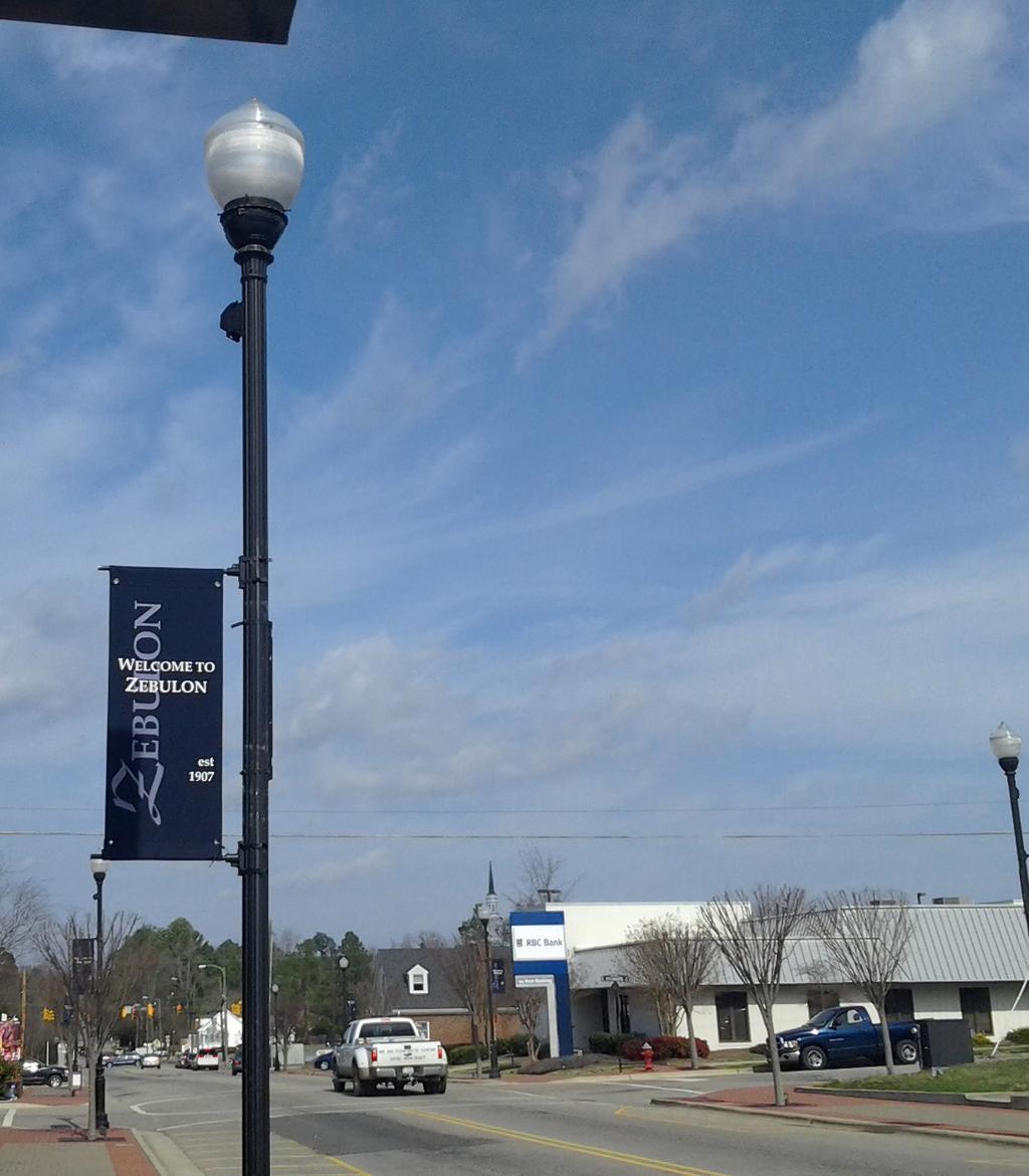
Zebulon Multimodal Transportation Plan Update
|
|
|
- Jocelyn Hill
- 5 years ago
- Views:
Transcription

1 Zebulon Multimodal Transportation Plan 2035 Update March 2014
2 This page intentionally left blank.
3 Table of Contents Section 1: Introduction Study Purpose: Updating the Existing Plan Study Participants Process Section 2: Needs Assessment Existing Document and Plan Review Travel Demand Modeling Section 3: Project Recommendations Projects Removed from the 2001 Plan Recommended Project List for 2013 Addendum Section 4: Plan Implementation Strategies for Implementation Applicability Appendix A: Project Map... A-1 Appendix B: Project Cross Sections... B-1 Appendix C: NC 96 Corridor Study... C-1 List of Tables Table 3-1: Projects to be Removed from the 2001 Plan Project List Table 3-2: New Zebulon Multi-modal Transportation Plan Project List List of Figures Figure 2-1: Daily Volume over Capacity Figure 2-2: PM Peak Period Volume over Capacity Town of Zebulon Thoroughfare Plan... A-2 DRAFT i
4 This page intentionally left blank.
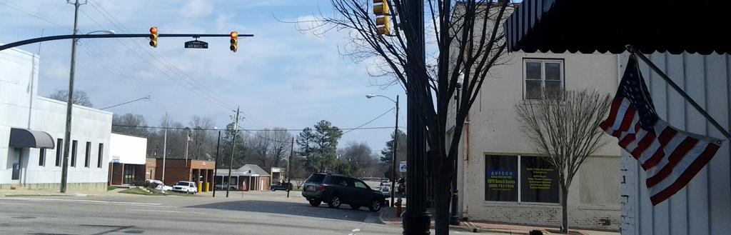
5 Section 1 Introduction The Town of Zebulon has undertaken an effort to update the town s existing transportation plan. This update takes into account recent developments in local and regional patterns of socioeconomic growth. Growth projected through 2035 in the Triangle region will continue to strain the existing transportation systems. Additional investment in the town s transportation system will be needed to accommodate future economic growth. The study area is the Zebulon Planning Jurisdiction, which extends beyond the Zebulon town limits. Encompassing approximately 13.4 square miles, the study area extends generally to the Johnston County line on the southeast, the Wendell Urban Service Area on the southwest, the Little River on the west and southwest, north of Pippin Road on the north, and the Franklin and Nash County lines on the east sides. Significant transportation facilities in the study area include U.S. 64, U.S. 264, and N.C. 96 (Arendell Avenue). The junction of U.S. 64 and U.S. 264 is located within the study area. Study Purpose: Updating the Existing Plan The purpose of this report is to recommend changes to the Zebulon Multimodal Transportation Plan. The previous transportation plan was developed by the town in It included sections on a Thoroughfare Plan, Pedestrian and Bicycle Plan, Transit Plan, and an Implementation Plan. Relevant supporting information was included to qualify results and assumptions made during the planning process. This addendum is the result of analyses of existing conditions, future travel demand projections, and overall transportation system conditions. It also takes into account the Capital Area Metropolitan Planning Organization s (CAMPO) recent Northeast Area Study effort which includes Zebulon and the surrounding communities. This report is meant to be an addendum to the older 2001 transportation plan and makes recommendations on what changes should be made to that plan. This plan combines the Thoroughfare Plan elements and portions of the Pedestrian and Bicycle Plan elements of the 2001 Zebulon Multimodal Transportation Plan into a new single Thoroughfare Plan. This new thoroughfare plan not only addresses changes to the roadway system throughout the study area, it also incorporates within those changes sidewalks and bicycle lanes when appropriate. This multi-modal approach seeks to provide an integrated solution to the town s transportation needs. The new thoroughfare plan also includes a couple of greenway projects. This study did not address the transit element of the 2001 plan. Future projections of travel demand are based on the Triangle Regional Model. The Triangle Regional Model Service Bureau, supported by local planning agencies and the North Carolina Department of Transportation (NCDOT), provided the future year traffic volumes to CDM Smith for this study. Study Participants The study was conducted and guided by a study working group. Individuals participating in the working group included members of the town s Board of Commissioners and technical staff employed by the town. CDM Smith, an international engineering and planning firm, assisted in developing the study on behalf of the town. The members of the working group are identified below: Robert Matheny-Mayor DRAFT 1-1
6 Section 1 Introduction Don Bumgarner Town Commissioner Curtis Strickland Town Commissioner Rick Hardin Town Manager Chris Ray Director of Public Works Mark Hetrick Planning Director Julie Spriggs Senior Planner Process Five working group meetings were held in a conference room in Town Hall. Presentations were made to the working group by the town s staff and the town s consultant. These presentations were followed by discussions and working sessions that involved all of the members of the working group. CDM Smith staff used their technical knowledge of transportation planning to present transportation needs and alternatives to the steering committee members who were then able to deliberate and provide the appropriate local context for the plan s project priorities. CDM Smith staff worked with the group to develop roadway cross sections that are in line with the Town s current desires, while continuing to provide sufficient capacity for future traffic and appropriate access management considering the various types of developments that may occur within the Town. As of this writing, this addendum has yet to go before the full Board of Commissioners or the general public. DRAFT 1-2
7 Section 2 Needs Assessment CDM Smith staff conducted an analysis of future forecast traffic for the study area. This analysis takes into account the latest assumptions concerning growth both in Zebulon and in the larger Research Triangle Region. Based on the findings of this analysis, CDM Smith made recommendations to the working group. This section discusses the analysis that was conducted. Existing Document and Plan Review CDM Smith gathered and reviewed existing documents and plans for the study area including: NCDOT traffic volume maps; Zebulon Town Codes; 2001 Zebulon Multimodal Transportation Plan; NC 96 Corridor Study; CAMPO Long Range Transportation Plan; and, CAMPO Northeast Area Study (preliminary documents). These documents were used to understand the greater context of transportation plan in the region as it might concern the Town of Zebulon. The information gleaned from these documents directly informed this addendum. Travel Demand Modeling CDM Smith modeling staff developed future traffic volume maps for the study area based on the current version of the Triangle Regional Model (TRM) available from Triangle Regional Model Service Bureau (maintained by the Institute of Transportation Research and Education at NC State University). No modifications were made to the roadway network or socioeconomic data within the TRM. For the purpose of this study, data from the TRM was used as provided by the Triangle Regional Model Service Bureau. The TRM is the travel demand model used by CAMPO for long range transportation planning and travel demand forecasting. The travel demand model indicated that in 2035 the vast majority of roads within the planning jurisdiction of the town will function acceptably as two-lane facilities. The lone exception is Arendell Avenue (NC 96) north of US 64, which will need to be a four-lane facility. Figure 2-1 shows the congestion in Zebulon from the 2035 model in terms of daily volume over capacity. The segment of Arendell Avenue north of US 64 shown in purple indicates a volume over capacity ratio of greater than 1.0. The picture looks a bit different when we concentrate on what is occurring during the evening peak period. Figure 2-2 is a map showing congestion in Zebulon in terms of 2035 PM peak volume over capacity. The PM peak hour forecast shows that additional congestion occurs during the peak period. While the segment of Arendell Avenue north of US 64 continues to be the only over capacity segment in Zebulon, it becomes apparent that Pearces Road, Shepard School Road, and Gannon Avenue approach capacity and could benefit from additional investment to improve access management and multi-modal opportunities. DRAFT 2-1

8 Section 2 Needs Assessment Figure 2-1: Daily Volume over Capacity DRAFT 2-2

9 Section 2 Needs Assessment Figure 2-2: PM Peak Period Volume over Capacity DRAFT 2-3
10 This page intentionally left blank.
11 Section 3 Project Recommendations The current Zebulon Multimodal Transportation Plan was developed in Since then significant growth has occurred throughout the Research Triangle region of North Carolina. Furthermore, the planning horizon of the Triangle Regional Model available in 2001 was The current Triangle Regional Model planning horizon is These changes affect how traffic is expected to flow through the study area in the future. As a result, certain projects that were included in the original plan may no longer be needed. Other projects that did not appear to be a concern then should now be added to the plan. This section will identify those projects from the 2001 plan that should be removed. This section will also discuss what the new project list looks like and which projects are to be included in this addendum. These recommendations are being made on the basis of the needs assessment conducted by CDM Smith as well as on the basis of thorough discussion with the study s working group. Toward the end of the section is a recommended project list and map for the Town of Zebulon. This final project list and map should be considered the Town of Zebulon s new Thoroughfare Plan and should replace the thoroughfare plan element, the pedestrian plan element, and the bicycle plan element from the 2001 Zebulon Multimodal Transportation Plan. Projects Removed from the 2001 Plan The following list in Table 3-1 identifies the projects that originally appeared in the 2001 Zebulon Multimodal Transportation Plan that should be removed from the transportation plan. These projects are no longer needed to advance the transportation goals of the town. Table 3-1: Projects to be Removed from the 2001 Plan Project List Project From To 2001 Plan Reference Arendell Ave. Vance St. Sycamore St. Page A8 Barbee St. Mack Todd Rd. Wakefield St. Page A13 Barbee St. Wakefield St. Chamblee Rd. Page A14 Chamblee Rd. Ext. Bunn Rd. Horton St. Page A15 Chamblee Rd. NS RR Tracks NC 39 Page A16 Gannon Ave. Little River Bridge Pineview Dr. Page A17 Gannon Ave. Rotary Dr. Shepard School Rd. Page A19 Green Pace Rd. Arendell Ave. Proctor St. Page A22 Hospital Rd. Mack Todd Rd. Pony Rd. Page A27 Judd St. Wakefield St. Arendell Ave. Page A28 NC 39 Johnston Co. Line US 264 Page A33 NC 39 US 264 Franklin Co. Line Page A32 Pippin / Debnam Rd. Gannon Ave. NC 39 Page A37 Temple -Johnson Rd. Gannon Ave. US 264 Page A44 US 264 US 64 NC 39 Page A45 DRAFT 3-1
12 Section 3 Project Recommendations Table 3-1: Projects to be Removed from the 2001 Plan Project List Project From To 2001 Plan Reference US 64 Little River Bridge NC 39 Page A46 Wakefield St. Gannon Ave. Judd St. Page A47 Water Plant Rd. Gannon Ave. Western Parkway Page A51 Western Parkway Arendell Ave., South Arendell Ave., North Page A52 Whitley St. Vance St. Gannon Ave. Page A53 Worth Hinton Rd. Gannon Ave. Green Pace Rd. Page A54 Recommended Project List for 2013 Addendum The existing Zebulon Transportation Plan included plans separated by use. These were the thoroughfare plan, the pedestrian plan, the bicycle plan, and the transit plan. The CDM Smith team focused on combining the thoroughfare plan, pedestrian plan, and bicycle plan into one cohesive map. This identifies proposed changes in the roadway cross section and considers the needs of all users. This method will better assist the town, public, and developers in understanding how the road will actually appear and will better define the dimensions of the roadway, which can then be incorporated into future development plans. Though not included as a project in this addendum, the Town of Zebulon is aware that a north-south NC 96 Bypass along an as of yet undetermined alignment may be needed at some point in the future. Table 3-2 contains the recommended project list that will make up the updated Zebulon Multi-modal Transportation Plan. This project list contains both projects which have been retained from the 2001 plan as well as new projects needed to address the town s transportation goals. The Map Number column in Table 3-2 corresponds to the project numbers that appear on the project map. The project map appears in Appendix A. Descriptions of individual cross sections are in Appendix B. The project configurations for NC 96 are shown in Appendix C. Table 3-2: New Zebulon Multi-modal Transportation Plan Project List Main Rd From To Project Description Arendell Ave., North Arendell Ave., North Arendell Ave., North Arendell Ave., North Arendell Ave., North Pippin Rd. Proctor St. Proctor St. US 64 2-lane with wide paved shoulders and sidewalk on one side of the roadway Consistent with the town s NC 96 Engineering Report (3/27/2012). Map Number At Judd St. Intersection improvement 4 Gannon Ave. Lee St. Lee St. US 64 3-lane curb and gutter with wide outside lanes, narrow center turn lane, and sidewalks on both sides of the road 3-lane curb and gutter with wide lanes and sidewalks on both sides of the roadway DRAFT 3-2
13 Section 3 Project Recommendations Table 3-2: New Zebulon Multi-modal Transportation Plan Project List Main Rd From To Project Description Map Number Arendell Ave., South Planning Jurisdiction Town Limits 2-lane with wide paved shoulders 10 Arendell Ave., South Town Limits Vance St. 2-lane with sharrows, on street parking, and sidewalks on one side of the roadway 3 Barbee St. Town Limits Five County Stadium Greenway / multi-use path 9 Gannon Ave., West Pineview Dr. Rotary St. 3-lane with wide paved shoulders and sidewalks on both sides of the roadway 2 Gannon Ave., East Arendell Ave miles east of Industrial Dr. 2-lane median divided with wide lanes and sidewalks on both sides of the roadway 22 Gannon Ave., East 0.20 miles east of Industrial Dr miles west of Old US lane median divided with narrow concrete median, wide lanes, and sidewalks on both sides of the roadway 23 Gannon Ave., East 0.16 miles west of Old US 264 US lane median divided with wide lanes and sidewalks on both sides of the roadway 24 Gannon Ave., East US miles west of Old Bunn Rd. 2-lane with wide paved shoulders 25 Ginger Lake Ct. Greenway / multi-use path 12 Green Pace Rd. East of River Ridge Rd. Arendell Ave. 2-lane with wide paved shoulders 5 Horton St. Arendell Ave. Whitley St. 2-lane curb and gutter with wide lanes and sidewalks on both sides of the roadway 20 Horton St. Whitley St. Planning Jursdiction 2-lane with wide paved shoulders 21 Judd St., East Arendell Ave. Shepard School Rd. 2-lane curb and gutter with wide lanes and sidewalks on both sides of the roadway 32 DRAFT 3-3
14 Section 3 Project Recommendations Table 3-2: New Zebulon Multi-modal Transportation Plan Project List Main Rd From To Project Description Map Number Mack Todd Rd. North of Barbee St. Gannon Ave. 2-lane with wide paved shoulders and sidewalk on one side of the roadway 6 Old Bunn Rd. Shepard School Rd. Karial Ct. 2-lane curb and gutter with wide lanes and sidewalks on both sides of the roadway 16 Old Bunn Rd. Karial Ct. Planning Jursdiction 2-lane with wide paved shoulders 14 Old US 264 Gannon Ave miles south of Gannon Ave. Pearces Rd. Arendell Ave. Proctor St. 2-lane with wide paved shoulders and sidewalk on one side of the roadway 2-lane curb and gutter with wide lanes and sidewalks on both sides of the roadway Pearces Rd. Proctor St. Beaver Dam Creek 2-lane with wide paved shoulders 27 Pony Rd. South of Shannon Dr. Gannon Ave. 2-lane with wide paved shoulds and sidewalk on one side of the roadway 11 Proctor. Arendell Ave. Shepard School Rd. 2-lane curb and gutter with wide lanes and sidewalks on both sides of the roadway 7 Riley Hill Rd. Planning Jurisdiction Arendell Ave. 2-lane rural roadway with wide paved shoulders 31 Shepard School Rd. Gannon Ave. Old Bunn Rd. 2-lane curb and gutter with wide lanes and sidewalks on both sides of the roadway 13 Shepard School Rd. Old Bunn Rd. Tippett Rd. 2-lane with wide paved shoulders 18 Wakefield St. Sir David Dr. Town Limits Wakefield St. Town Limits Gannon Ave. 2-lane with wide paved shoulders and sidewalk on one side of the roadway 2-lane with wide paved shoulders and sidewalk on one side of the roadway 29 8 DRAFT 3-4
15 Section 4 Plan Implementation A review of the Town of Zebulon ordinances indicates that there are very few ordinances pertaining to the requirement for transportation facilities as part of new developments, rezoning, or the upgrade of existing buildings to a higher use. The lone exception is section which requires the completion of a traffic impact analysis (TIA) for any new development that is anticipated to generate at least 100 trips in the AM or PM peak hour or redevelopment projects that are anticipated to generate at least 250 trips in the AM or PM peak hour. The recommendations included in the TIA are then considered by the Technical Review Committee for incorporation in the site plan. The current ordinances also allows for the waiver of the preparation of a TIA or certain elements of the TIA to be decided by the Board of Commissioners. Additionally the town has special legislation from the 1989 General Assembly (Ch. 606 HB 802) which allows the collection of a transportation fee. These transportation fees are subject to the following limitations: Used to fund transportation projects; No more than 50% of the capital costs of a given project can be paid for by these fees; The town must estimate the capital costs of each project included in the plan; The fee must be based on reasonable and uniform considerations of capital cost; The fee must be based on reasonable classifications and rates; and, That the money collect as fees must be spent within: - Six years for projects that the town provides on its own; or, - Ten years for projects provided in conjunction with other government agencies, such as the North Carolina Department of Transportation. Strategies for Implementation The town has several options to implement the recommendations included in this plan. They include: 1 Require the dedication of right-of-way This would only be applicable for situations for where the proposed cross section on the roadway exceeds the available right-of-way. However, during the completion of this plan, special care was given to fit the proposed improvements within the right of way, so that additional right-of-way needs would be minimal. 2 Require the construction of half of the roadway cross section within the road frontage limits of the proposed development This would accelerate the construction of the roadway facilities, but would result in a piecemeal approach to construction that would create inconsistencies in the roadway network. 3 Require the construction of pedestrian facilities for the road frontage limits of the proposed development This method would also create inconsistencies in the pedestrian DRAFT 4-1
16 Section 4 Plan Implementation network, but this would not be as obtrusive as the requirement for construction of half of the roadway cross section. This strategy could be combined with a requirement for right-ofway dedication. 4 Require only the improvements identified as part of a TIA This could be considered the do nothing approach as it would be consistent with the Town s current ordinances, would fix any site specific issues, but would not advance the construction of the roadway network consistent with the updated Transportation Plan. However, improvements required as part of this approach could be required to be constructed in a manner consistent with the updated Transportation Plan. 5 Fee in Lieu The town could assess a cash value to any of the previous three options and request that the developer provide a cash payment to the town in lieu of the developer constructing the required improvements. The town would then use the cash collected toward the construction of the improvements. This would ensure an orderly and rational construction of the transportation improvements as opposed to the piecemeal improvements that developers would make on their own. However, the legislative authority to accept fee in lieu payments is uncertain at this time and would require extra research to determine whether or not such a strategy would be legal. 6 Implement a transportation fee This would take advantage of the special legislation and would allow for faster and seamless construction of prioritized facilities within the town. However, this would also require that the town estimate capital costs for all roadway recommendations and develop a formula for applying the fee to specific developments. Applicability As currently written a TIA is required for any new developments that are expected to generate more than 100 trips in a peak hour or any re-development expected to generate more than 250 trips in the peak hour. This is a reasonable standard and is consistent with other municipalities in the area. This standard may be too high for strategies that require the dedication of right-of-way. If right-of-way dedication is used by the town, CDM Smith recommends that for any situation in which the town requires the review of a site plan a right-of-way dedication be identified as an option. Again, it is important to remember that opportunities for right-of-way dedication will be limited. The development thresholds for a TIA are also reasonable for the other implementation strategies listed above; however, if the construction of pedestrian facilities will be required, the town may wish to tie the construction of those facilities with certain land uses that may not generate much vehicular traffic but could generate significant amounts of pedestrian traffic. The transportation fee identified above as option 6 provides the most flexible and comprehensive approach to implementing a transportation plan of this scope. The legislation which enables the transportation fee is quite clear in the applications and limitations of the uses of such a fee. As such, the town would need to conduct a thorough review of the techniques employed by comparable municipalities around the region for transportation fee calculation before implementing such a strategy. A robust and defensible methodology will be based on forecast peak traffic, future development trip generation, and transportation project capital costs. The town should be sure to consult with its attorney prior to implementing any transportation plan to ensure compliance with state legislation. DRAFT 4-2
17 Appendix A Project Map Document Code A-1
18 This page intentionally left blank.

19 A-1 Document Code
20 This page intentionally left blank.

21 Appendix B Project Cross Sections 2-Lane with Sidewalk and Bicycles This cross section configuration includes two, 14 foot lanes with curb and gutter and sidewalks on both sides of the roadway. The wide lane width could be used to accommodate bicycles. The total width from side walk to sidewalk is 47 feet. Main Rd From To Map Number Proctor St. Arendell Ave. Shepard School Rd 7 Wakefield St. Town Limits Gannon Ave. 8 Shepard School Rd Gannon Ave. Old Bunn Rd. 13 Old Bunn Rd. Karial Ct. Planning Jurisdiction 16 Horton St. Arendell Ave. Whitley St. 20 Pearces Rd. Arendell Ave. Proctor St. 26 Judd St., East Arendell Ave. Shepard School Rd. 32 Document Code B-1

22 Appendix B Project Cross Sections Rural Roadway with Wide Paved Shoulders This cross section consists of two, 12 foot lanes with 4 foot paved shoulders that could accommodate bike lanes on both sides of the roadway. The total width of the pavement is 32 feet. Main Rd From To Map Number Green Pace Rd. East of River Ridge Rd. Arendell Ave. 5 Arendell Ave., South Planning Jurisdiction Town Limits 10 Old Bunn Rd. Shepard School Rd. Karial Ct. 14 Shepard School Rd. Old Bunn Rd. Tippett Rd. 18 Horton St. Whitley St. Planning Jurisdiction 21 Gannon Ave., East 0.16 miles west of Old US US 264 Pearces Rd. Proctor St. Beaver Dam Creek 27 Riley Hill Rd. Planning Jurisdiction Arendell Ave. 31 Document Code B-2

23 Appendix B Project Cross Sections Rural Roadway with Sidewalk and Bicycles This cross section consists of two, 12 foot lanes with 4 foot paved shoulders that could accommodate bicycle lanes. The cross section also features a side walk on one side that is separated from the road by a ditch. The distance of separation of the side walk is variable based on speed, volume, and the slope of the ditch. The total width of the pavement is 32 feet. Main Rd From To Map Number Mack Todd Rd. North of Barbee St. Gannon Ave. 6 Pony Rd. South of Shannon Dr. Gannon Ave. 11 Arendell Ave., Pippin Rd. Proctor St. 17 Wakefield St. Sir David Dr. Town Limits 29 Old US 264 Gannon Ave Miles south of Gannon Ave. 30 Document Code B-3

24 Appendix B Project Cross Sections Downtown Transition This cross section consists of two, 13 foot, 6 inch lanes with shared lane markings for bicycles, 8 foot on street parking lanes, and curb and gutters on both sides of the roadway. The cross section also has sidewalks on one side of the roadway. The total width from curb to curb is 43 feet. Main Rd From To Map Number Arendell Ave., South Planning Jurisdiction Town Limits 3 Document Code B-4

25 Appendix B Project Cross Sections Greenway / Multi-Use Path This cross section includes a 10 foot paved multi-use path that can accommodate pedestrian and bicycle traffic and 2 foot soft shoulders. Main Rd From To Map Number Barbee St. Town Limits Five County Stadium 9 Ginger Lake Ct. 12 Document Code B-5
26 Appendix B Project Cross Sections 2-Lane with Concrete Median This cross section includes two, 14 foot lanes with curb and gutter separated by a 4 foot concrete median. The wide lane width could be used to accommodate bicycles. The cross section also includes 5 foot sidewalks with 2 foot 6 inches of terrain on both sides. There are lamp posts posted along the sidewalks located within the far side terrain area. The total width of the cross section is 56 feet 2 inches. Main Rd From To Map Number Gannon Ave., East 0.20 miles east of Industrial Dr miles west of Old US Document Code B-6

27 Appendix B Project Cross Sections 3-Lane This cross section includes two 14 foot lanes and a 12 foot two-way center turn lane with curb and gutters. The wide lane width could be used to accommodate bicycles. The cross section also includes sidewalks on both sides of the roadway. The length from the edge of the sidewalk to the curb and gutter is 7 foot 6 inches. The total width from sidewalk to sidewalk is 59 feet. Main Rd From To Map Number Arendell Ave., North Lee St. US Document Code B-7

28 Appendix B Project Cross Sections 3-Lane with Narrow 2-way Left Turn Lane This cross section includes two 14 foot lanes and a narrow 9 foot two-way center turn lane. The wide lane width could be used to accommodate bicycles. The cross section also includes sidewalks on both sides of the roadway. The total width of the cross section from sidewalk to sidewalk is 56 feet. Main Rd From To Map Number Arendell Ave., North Gannon Ave. Lee St. 28 Document Code B-8

29 Appendix B Project Cross Sections 2-Lane Median Divided This cross section includes two 14 foot lanes with curb and gutter, divided by a 4 foot concrete median. The wide lane width could be used to accommodate bicycles. The cross section also includes 5 foot sidewalks with 2 foot 6 inches of terrain on both sides. There are lamp posts posted along the sidewalks located within the far side terrain area. The total width of the cross section is 56 feet 2 inches. Main Rd From To Map Number Gannon Ave., East Arendell Ave miles east of 22 Industrial Dr. Gannon Ave., East 0.16 miles west of Old US 264 US Document Code B-9

30 Appendix B Project Cross Sections 3-Lane with Ditch and Sidewalks This cross section includes two 12 foot lanes, a 12 foot two-way center turn lane, and 4 foot paved shoulders on both sides of the roadway that could accommodate bicycle traffic. The cross section also features sidewalks on both sides that are separated by a ditch. The distance of separation of the side walk is variable based on speed, volume, and the slope of the ditch. The total width of the paved section is 44 feet. Main Rd From To Map Number Gannon Ave., West Pineview Dr. Rotary St. 2 Document Code B-10

31 Appendix B Project Cross Sections Consistent with NC 96 Study The Town of Zebulon has recently conducted a corridor study of NC 96 / North Arendell Avenue. The preferred configuration developed as part of that study is attached to this plan. Please refer to Appendix C for the preferred configuration for this project. Main Rd From To Map Number Arendell Ave., North Pippin Rd. Proctor St. 1 Document Code B-11
32 This page intentionally left blank.
33 Appendix C NC 96 Corridor Study Document Code C-1
34 This page intentionally left blank.

35 Document Code C-1

36 Section "Click here to type section #" "Click here to type title of section" Document Code 1-2

37 Section "Click here to type section #" "Click here to type title of section" Document Code 1-3

38 Section "Click here to type section #" "Click here to type title of section" Document Code 1-4
39 This page intentionally left blank.
40
DRAFT. System Components. Greenway Trails. Introduction. Trail Types. Zebulon Greenway Master Plan
 5 System Components Wakefield Street Photo Simulation showing Sharrows Introduction The Master Plan identifies various system components that, together, create a comprehensive greenway system. These components
Chapter 5 Future Transportation
 Chapter 5 Future Transportation The Future Land Use Plan identifies the desired land use designations. The land uses desired for Crozet depend, in large part, on the success of the transportation system,
Basalt Creek Transportation Refinement Plan Recommendations
 Basalt Creek Transportation Refinement Plan Recommendations Introduction The Basalt Creek transportation planning effort analyzed future transportation conditions and evaluated alternative strategies for
This page intentionally left blank.
 This page intentionally left blank. COMMUNITY Coweta Community Overview Coweta Coweta, a residential community located in Wagoner County, is a suburb of Tulsa situated southeast of the metropolitan area
CITY OF COCOA BEACH 2025 COMPREHENSIVE PLAN. Section VIII Mobility Element Goals, Objectives, and Policies
 CITY OF COCOA BEACH 2025 COMPREHENSIVE PLAN Section VIII Mobility Element Goals, Objectives, and Policies Adopted August 6, 2015 by Ordinance No. 1591 VIII MOBILITY ELEMENT Table of Contents Page Number
APPENDIX 2 LAKESHORE ROAD TRANSPORTATION REVIEW STUDY EXECUTIVE SUMMARY
 APPENDIX 2 LAKESHORE ROAD TRANSPORTATION REVIEW STUDY EXECUTIVE SUMMARY Appendix 2 City of Mississauga Lakeshore Road FINAL REPORT Transportation Review Study December 2010 EXECUTIVE SUMMARY Study Purpose
TRASBURG RANSPORTATION
 TRASBURG RANSPORTATION LAN DEVELOPED BY THE TRANSPORTATION PLANNING DIVISION OF THE VIRGINIA DEPARTMENT OF TRANSPORTATION IN COOPERATION WITH THE U.S. DEPARTMENT OF TRANSPORTATION, FEDERAL HIGHWAY ADMINISTRATION
North Shore Transportation Improvement Strategy
 North Shore Transportation Improvement Strategy Preliminary, Near-term Recommendation 2016 April Transportation Improvement Strategy (TIS) Comprehensive and Analytical A multi-modal transportation strategy
INDOT Complete Streets Guideline & Policy
 INDOT Complete Streets Guideline & Policy INTRODUCTION The Complete Streets guidelines build upon multiple efforts and promote a multimodal transportation system that is integrated and sustains land use
Dr. M.L. King, Jr. Street North Complete Streets Resurfacing Opportunities HOUSING, LAND USE, AND TRANSPORTATION COMMITTEE MARCH 22, 2018
 Dr. M.L. King, Jr. Street North Complete Streets Resurfacing Opportunities HOUSING, LAND USE, AND TRANSPORTATION COMMITTEE MARCH 22, 2018 What s Happening The City plans to mill and resurface Dr. M.L.
Roadway Classification Design Standards and Policies. Pueblo, Colorado November, 2004
 Roadway Classification Design Standards and Policies Pueblo, Colorado November, 2004 Table of Contents Page Chapter 1. General Provisions 1.1 Jurisdiction 3 1.2 Purpose and Intent 3 1.3 Modification 3
MAG Town of Cave Creek Bike Study Task 6 Executive Summary and Regional Significance Report
 Page 1 MAG Town of Cave Creek Bike Study Task 6 Executive Summary and Regional Significance Report August 1, 2012 MAG Project #481 Page 2 Task 6 Executive Summary and Regional Significance Report Introduction
Street Paving and Sidewalk Policy
 City Commission Policy 600 Street Paving and Sidewalk Policy DEPARTMENT: Public Works DATE ADOPTED: June 7, 1995 DATE OF LAST REVISION: December 10, 2014 Policy No. 600.01 AUTHORITY: PASS City of Tallahassee-Leon
Appendix 3 Roadway and Bike/Ped Design Standards
 Appendix 3 Roadway and Bike/Ped Design Standards OTO Transportation Plan 2040 4/20/2017 Page A3-1 Adopted Standards The adopted OTO Design Standards and Major Thoroughfare Plan are contained herein.
CITY OF ALPHARETTA DOWNTOWN MASTER PLAN TRAFFIC EVALUATION
 CITY OF ALPHARETTA DOWNTOWN MASTER PLAN TRAFFIC EVALUATION June 2015 CITY OF ALPHARETTA DOWNTOWN MASTER PLAN TRAFFIC EVALUATION Introduction The Alpharetta Downtown Master Plan was developed in the fall
Railroad Crossings Report
 CAPITAL AREA Metropolitan Planning Organization Northeast Area Study Railroad Crossings Report September 18, 2013 PREPARED FOR: Capital Area MPO: Shelby Powell, AICP Senior Transportation Planner 127 W.
ARTINSVILLE ENRY OUNTY REA RANSPORTATION TUDY
 ARTINSVILLE ENRY OUNTY REA RANSPORTATION TUDY DEVELOPED BY THE TRANSPORTATION AND MOBILITY PLANNING DIVISION OF THE VIRGINIA DEPARTMENT OF TRANSPORTATION IN COOPERATION WITH THE U.S. DEPARTMENT OF TRANSPORTATION,
APPENDIX G: INTERSECTION NEEDS AT OKEECHOBEE BOULEVARD
 APPENDIX G: INTERSECTION NEEDS AT OKEECHOBEE BOULEVARD INTERSECTION NEEDS AT SR 7 and OKEECHOBEE BOULEVARD SR 7 Extension Project Development and Environment (PD&E) Study From Okeechobee Boulevard (SR
City of Wayzata Comprehensive Plan 2030 Transportation Chapter: Appendix A
 A1. Functional Classification Table A-1 illustrates the Metropolitan Council s detailed criteria established for the functional classification of roadways within the Twin Cities Metropolitan Area. Table
Third Street Bridge & Corridor Project
 Third Street Bridge & Corridor Project Preparation for the FY2018 budget to commence October 1, 2017, includes funding to address a project that has been considered since 1994. The Third Street bridge
Clackamas County Comprehensive Plan
 ROADWAYS The County s road system permits the movement of goods and people between communities and regions, using any of a variety of modes of travel. Roads provide access to virtually all property. They
Proposed White Flint Separated Bike Lane Network September 2015
 Proposed White Flint Separated Bike Lane Network September 2015 Abstract This report includes a proposed separated bike lane network for the White Flint Sector Plan area. Separated bike lanes create a
BETHEL ROAD AND SEDGWICK ROAD CORRIDOR STUDY
 DRAFT PLAN City Council Meeting August 14, 2017 STUDY AREA Sedgwick Corridor State Route 160, principal arterial with Class 3 access management designation, commuter and freight route, connection to SR
Goodlettsville Bicycle and Pedestrian Plan Executive Summary
 Goodlettsville Bicycle and Pedestrian Plan July 2010 In Cooperation with the Nashville Area Metropolitan Planning Executive Organization Summary Introduction Progressive and forward thinking communities
Proposed Action, Purpose and Need Technical Memorandum
 Proposed Action, Purpose and Need Technical Memorandum MoPac (State Loop 1) Intersections, Austin District From North of Slaughter Lane to South of La Crosse Avenue CSJ: 3136-01-015 Travis County, Texas
Active Transportation Facility Glossary
 Active Transportation Facility Glossary This document defines different active transportation facilities and suggests appropriate corridor types. Click on a facility type to jump to its definition. Bike
City of Gainesville Transportation/Roadway Needs PROJECT SUMMARY
 A1 Roadway Resurfacing $23,846,000 TYPE: Preservation of existing system Roadway resurfacing A2 Signal Replacement $6,000,000 TYPE: Preservation of existing system Replace traffic signals. B1 W 6th St
IMPLEMENTATION STRATEGIES
 GEORGETOWN SIDEWALK MASTER PLAN 34% of funding is dedicated to Downtown Overlay District sidewalks 28% of funding is recommended within 1/4 mile of Southwestern University 26% of funding is recommended
Modal Interrelationships: A bicycle lane is proposed between Harrington Ave and Swanns Station Rd.
 DRAFT PROJECT PAGE July 12, 2007 Main St / Broadway Rd (SR 1579) Project Statement Project Recommendation: From Avent Ferry Rd (NC 42) to the Harnett County line, Broadway Rd/Main St is recommended to
5 CIRCULATION AND STREET DESIGN
 5 CIRCULATION AND STREET DESIGN This chapter describes circulation and streetscape improvements proposed for the Northwest Chico Specific Plan Area. It includes detailed design specifications for existing
MASTER THOROUGHFARE PLAN
 MASTER THOROUGHFARE PLAN Master Thoroughfare Plan Update November 2015 Prepared for Town of Northlake AVO 30659 11/11/2015 1201 North Bowser Road Richardson, Texas 75081 Firm Registration No. 312 MASTER
Zlatko Krstulich, P.Eng. City of O9awa
 Zlatko Krstulich, P.Eng. City of O9awa 1. Introduction to the Ontario Traffic Manual Series 2. What is OTM Book 18: Bicycle Facilities? 3. Study / Committee Team Members 4. Brief overview of the content
DUNBOW ROAD FUNCTIONAL PLANNING
 DUNBOW ROAD FUNCTIONAL PLANNING Final Report August 3, 216 #31, 316 5th Avenue NE Calgary, AB T2A 6K4 Phone: 43.273.91 Fax: 43.273.344 wattconsultinggroup.com Dunbow Road Functional Planning Final Report
Gordon Proctor Director Policy on Accommodating Bicycle and Pedestrian Travel on ODOT Owned or Maintained Facilities
 Approved: Policy: 20-004(P) Responsible Office: Planning Gordon Proctor Director Policy on Accommodating Bicycle and Pedestrian Travel on ODOT Owned or Maintained Facilities I. POLICY STATEMENT: This policy
CITY OF VAUGHAN EXTRACT FROM COUNCIL MEETING MINUTES OF OCTOBER 30, 2012
 CITY OF VAUGHAN EXTRACT FROM COUNCIL MEETING MINUTES OF OCTOBER 30, 2012 Item 31, Report No. 39, of the Committee of the Whole, which was adopted without amendment by the Council of the City of Vaughan
Omaha s Complete Streets Policy
 Omaha s Complete Streets Policy (Adopted August 2015) VISION To create great places and enhance our quality of life, the City of Omaha will provide safe, accessible streets for all users. Complete Streets
Off-road Trails. Guidance
 Off-road Trails Off-road trails are shared use paths located on an independent alignment that provide two-way travel for people walking, bicycling, and other non-motorized users. Trails specifically along
Thank you for this opportunity to discuss with you how we can work together to make our streets more complete.
 Thank you for this opportunity to discuss with you how we can work together to make our streets more complete. 1 2 3 Thank you for this opportunity to discuss with you how we can work together to make
C C C
 C-012-001 Thank you for your support for the creation of new public space and nonmotorized access between downtown and the waterfront through the Overlook Walk, the East-West Connections, and the Promenade.
Moving Cambridge. City of Cambridge Transportation Master Plan Public Consultation Centre. March 7, :00 8:00 PM.
 City of Cambridge Transportation Master Plan Public Consultation Centre March 7, 2018 5:00 8:00 PM Region of Waterloo City of Cambridge Transportation Master Plan Public Consultation Centre March 7, 2018
TABLE OF CONTENTS. Executive Summary
 Executive Summary Background... ES-1 Pedestrian Network... ES-2 Bikeway Network... ES-2 Collision History... ES-2 Public Input... ES-4 Conclusions and Recommendations... ES-4 1. Introduction and Setting
Proposed Bridge Street East Bicycle Lanes Public Open House Thursday, April 27, 2017
 WELCOME Proposed Bridge Street East Bicycle Lanes Public Open House Thursday, April 27, 2017 Purpose of the Open House The purpose of this Open House is to gain public input on the bicycle lanes proposed
This page intentionally left blank.
 This page intentionally left blank. COMMUNITY Glenpool Community Overview Glenpool Glenpool is a city of nearly 12,000 residents located in Tulsa County southwest of Tulsa and Jenks. The city is growing
APPROVE A RESOLUTION ADOPTING A COMPLETE STREETS POLICY
 STAFF REPORT MEETING DATE: September 13, 2016 TO: FROM: City Council Bob Brown, Community Development Director Russ Thompson, Public Works Director Patrick Filipelli, Management Analyst 922 Machin Avenue
NORTH HIGHLAND LAKE ROAD PROJECT
 NORTH HIGHLAND LAKE ROAD PROJECT The purpose of this special newsletter is to inform the residents of Flat Rock about the facts concerning the proposed N. Highland Lake Road Project and clarify some misconceptions.
STREET AND HIGHWAY PLAN
 STREET AND HIGHWAY PLAN Introduction The street and highway system in the Winston-Salem Urban Area consists of thousands of miles of traffic carrying facilities, ranging from short local residential streets
Project Application. Project Location: Salem Drive (Federal Route 1101)
") Project Application General Information Municipality/Lead Agency: Hoffman Estates 1. Contact Person: Michael Hankey 2. Contact Phone: 847 252-5801 3. Contact Email: mike.hankey@hoffmanestates.org Project
Project Application General Information Municipality/Lead Agency: Hoffman Estates 1. Contact Person: Michael Hankey 2. Contact Phone: 847 252-5801 3. Contact Email: mike.hankey@hoffmanestates.org Project
Houma-Thibodaux Metropolitan Planning Organization STP<200K Funding Application APPLICATION
 APPLICATION HOUMA-THIBODAUX METROPOLITAN PLANNING ORGANIZATION (HTMPO) FOR SURFACE TRANSPORTATION PROGRAM (STP
TRAFFIC STUDY GUIDELINES Clarksville Street Department
 TRAFFIC STUDY GUIDELINES Clarksville Street Department 9/1/2009 Introduction Traffic studies are used to help the city determine potential impacts to the operation of the surrounding roadway network. Two
Defining Purpose and Need
 Advanced Design Flexibility Pilot Workshop Session 4 Jack Broz, PE, HR Green May 5-6, 2010 Defining Purpose and Need In your agency s project development process, when do design engineers typically get
City of Madison, East Johnson Street North Baldwin Street to First Street Local Street Dane County
 City of Madison, East Johnson Street North Baldwin Street to First Street Local Street Dane County Public Involvement Meeting Thursday, April 28, 2016 6 to 8 P.M. Lapham Elementary School 1045 E. Dayton
5.0 Roadway System Plan
 Southwest Boise Transportation Study Page 16 5.0 Roadway System Plan The Roadway System Plan outlines roadway improvements in the Initial Study Area. It forecasts future deficiencies on the arterial system,
Bike San Mateo County San Mateo County Bicycle Plan Recommendations August 30, 2010
 Policy and Procedures Develop and Implement a Complete Streets Policy to comply with DD-64-R1 and AB1358 Commencing January 1, 2011, AB1358 requires that the legislative body of a city or county, upon
RZC Appendix 8A Marymoor Subarea Street Requirements
 RZC Appendix 8A Marymoor Subarea Street Requirements For additional design details for Marymoor Subarea infrastructure, refer to the 2017 Marymoor Subarea Infrastructure Planning Report. STREET REQUIREMENTS
CITY OF BLOOMINGTON COMPLETE STREETS POLICY
 CITY OF BLOOMINGTON COMPLETE STREETS POLICY POLICY OBJECTIVE: The City of Bloomington will enhance safety, mobility, accessibility and convenience for transportation network users of all ages and abilities,
INTRODUCTION THOROUGHFARE SYSTEM CLASSIFICATIONS
 INTRODUCTION The thoroughfare plan will assist public officials in the development of a specialized system for efficient and safe movement of vehicular traffic while minimizing potential conflicts with
Terwillegar Drive Expressway Draft Concept Plan
 Terwillegar Drive Expressway Draft Concept Plan Anthony Henday Drive to Whitemud Drive November 28 5:00-8:00 p.m. December 1 10:00 a.m. - 3:00 p.m. Let s Talk Today you can: Learn about the new direction
Atwood Avenue Fair Oaks Avenue Cottage Grove Road
 Atwood Avenue Fair Oaks Avenue Cottage Grove Road Agenda Purpose Review project scope & goals Present design alternatives Gather feedback Answer Questions Format Open House Presentation Q&A Open House
Circulation in Elk Grove includes: Motor vehicles, including cars and trucks
 Circulation, as it is used in this General Plan, refers to the many ways people and goods move from place to place in Elk Grove and the region. Circulation in Elk Grove includes: Motor vehicles, including
Welcome. Background. Goals. Vision
 Welcome The formal Public Information Centre (PIC) for the Transportation Master Plan How We GO will be held in early 2017. At that time we will present the recommended transportation system for Niagara
Highway 111 Corridor Study
 Highway 111 Corridor Study June, 2009 LINCOLN CO. HWY 111 CORRIDOR STUDY Draft Study Tea, South Dakota Prepared for City of Tea Sioux Falls Metropolitan Planning Organization Prepared by HDR Engineering,
University of Victoria Campus Cycling Plan Terms of Reference. 1.0 Project Description
 University of Victoria Campus Cycling Plan Terms of Reference 1.0 Project Description The Campus Cycling Plan, a first for the University, will provide a comprehensive and coordinated approach to support
Madison Urban Area and Dane County. Bicycle Transportation Plan Summary. September Introduction. Bicycle Plan Scope and Planning Process
 Bicycle Transportation Plan Summary Madison Urban Area and Dane County Introduction September 2000 Bicycling is an important mode of transportation in the Madison urban area and countywide that is available
Chapter 3 DESIGN SPECIFICATIONS
 Brampton PathWays Planning and Design Guidelines 27 Chapter 3 DESIGN SPECIFICATIONS 3.1 CLASS 1 MULTI-USE PATH Off-road multi-use trails are the backbone of the Brampton PathWays Network. They are typically
PEDESTRIAN NETWORK PLAN
 GRAHAM PEDESTRIAN TRANSPORTATION PLAN Chapter 3 A 3.1 Overview new pedestrian network plan for the City of Graham has been developed based on an examination of the existing conditions (Chapter 2) and an
TABLE OF CONTENTS 7.0 THOROUGHFARE PLAN. Analysis of Future Conditions Thoroughfare Plan Proposed Cross-Sections.. 7.
 TABLE OF CONTENTS 7.0 THOROUGHFARE PLAN Analysis of Future Conditions.. 7.2 Thoroughfare Plan.. 7.3 Proposed Cross-Sections.. 7.4 Arterials Minor Arterials Collectors Local Streets Thoroughfare Plan Map
Balancing Operation & Safety for Motorized and Non-Motorized Traffic
 Balancing Operation & Safety for Motorized and Non-Motorized Traffic Brian Willham, PE, PTOE Iowa Director - MOVITE June 30, 2014 Learning Objectives: When & Why should we measure the performance of complete
APPENDIX L: COST ESTIMATING TOOLS
 APPENDIX L: COST ESTIMATING TOOLS Rural Arterial From LRE MOT * Mobilization * Subtotal Scope Contingency (25%) Total PE Design (15%) CEI (15%) Total Project ** New (2-Lane Roadway) with 5' Paved Shoulders
APPENDIX A: Complete Streets Checklist DRAFT NOVEMBER 2016
 APPENDIX A: Complete Streets Checklist DRAFT NOVEMBER 2016 Complete Streets Checklist MetroPlan Orlando s Complete Streets Checklist is an internal planning tool for staff to further implementation of
MnDOT Implementation of Complete Streets Policy. January 2014
 MnDOT Implementation of Complete Streets Policy January 2014 1 Prepared by Minnesota Department of Transportation 395 John Ireland Boulevard Saint Paul, Minnesota 55155-1899 Phone: 651-296-3000 Toll-Free:
Appendix A-2: Screen 1 Alternatives Report
 Appendix A-2: Screen 1 Alternatives Report SCREEN 1 ALTERNATIVES REPORT Western & Ashland Corridors Bus Rapid Transit (BRT) Project Prepared for Chicago Transit Authority 567 West Lake Street Chicago,
Alberta Infrastructure HIGHWAY GEOMETRIC DESIGN GUIDE AUGUST 1999
 Alberta Infrastructure HIGHWAY GEOMETRIC DESIGN GUIDE AUGUST 1999,1'(; A ACCELERATION Data on acceleration from stop D-29 Effects of grade D-35 Intersections D-97, D-99 Lanes D-97, F-5, F-7, F-15, F-21,
Hennepin County Transportation Department
 Hennepin County Transportation Department Complete Streets Design and Implementation Prepared for the Complete Streets Task Force Craig Twinem, P.E. Design Division Manager Tom Johnson, P.E. Transportation
BIKE PLAN CONTENTS GATEWAY
 CONTENTS Acknowledgments...vii Great Rivers Greenway District Board of Directors... vii Great Rivers Greenway District Staff... vii Project Consultants... vii Committees... viii Citizens Advisory Committee
City of Waterloo Complete Streets Policy
 City of Waterloo Complete Streets Policy Chris Hodgson P. Eng City of Waterloo Complete Streets Forum 2011 April 28-29 Toronto Waterloo context: Current population Major employers Universities and student
Building Great Neighbourhoods BELLEVUE AND VIRGINIA PARK
 Building Great Neighbourhoods BELLEVUE AND VIRGINIA PARK This is Meeting 2 Unfortunately, some residents in Bellevue and Virginia Park received the wrong information for this public open house (Meeting
Downtown Naples Mobility and Connectivity Study. Naples City Council Presentation January 2017
 Downtown Naples Mobility and Connectivity Study Naples City Council Presentation January 2017 Agenda 1. Introduction 2. Scope Review 3. Project Schedule 4. Existing Conditions 5. Public Charrette 6. Mobility
FONTAINE AVENUE STUDY Final Report
 FONTAINE AVENUE STUDY Final Report March 28, 2005 FONTAINE AVENUE STUDY City of Charlottesville March 28, 2005 Renaissance Planning Group Kenneth Schwartz, FAIA, AICP Director of Design Leigh Wilkerson,
ACTIVE TRANSPORTATION
 ACTIVE TRANSPORTATION Mobility 2040 Supported Goals Improve the availability of transportation options for people and goods. Support travel efficiency measures and system enhancements targeted at congestion
APPENDIX D COST SUMMARY TABLES
 APPENDIX D COST SUMMARY TABLES Section 1 Between Route 50 and Evergreen Mills Road 3850 linear feet of one 12 foot wide additional lane in southbound direction of Rte 606; from north side of Rte 50 to
ADA Transition Plan. City of Gainesville FY19-FY28. Date: November 5, Prepared by: City Of Gainesville Department of Mobility
 ADA Transition Plan FY19-FY28 Date: November 5, 2018 Prepared by: City Of Gainesville Department of Mobility 1.0 INTRODUCTION 1.1 BACKGROUND The federal statute known as the Americans with Disabilities
Chapter 6: Transportation
 Chapter 6: Transportation I. INTRODUCTION The purpose of the Transportation Plan element of the Comprehensive Plan is to provide guidance to the City of North Mankato, as well as existing and future landowners
Item No Halifax Regional Council January 16, 2018 January 30, 2018
 P.O. Box 1749 Halifax, Nova Scotia B3J 3A5 Canada Item No. 9.2.1 Halifax Regional Council January 16, 2018 January 30, 2018 TO: Mayor Savage and Members of Halifax Regional Council Original Signed SUBMITTED
Chapter 7. Transportation. Transportation Road Network Plan Transit Cyclists Pedestrians Multi-Use and Equestrian Trails
 Chapter 7 Transportation Transportation Road Network Plan Transit Cyclists Pedestrians Multi-Use and Equestrian Trails 7.1 TRANSPORTATION BACKGROUND The District of Maple Ridge faces a number of unique
2.0 LANE WIDTHS GUIDELINE
 2.0 LANE WIDTHS GUIDELINE Road Engineering Design Guidelines Version 2.0.1 May 2018 City of Toronto, Transportation Services City of Toronto Page 0 Background In early 2014, Transportation Services initiated
City of Moorhead Committee of the Whole Meeting
 City of Moorhead Committee of the Whole Meeting Corridor Study Limits Center Avenue (Red River to 8th Street) TH 10 (Red River to TH 336) TH 75 (20th Ave S to Main Avenue) 2 Study Need: Project Overview
Project Description Form 8EE
 Project Description Form 8EE Basic Project Information Submitting Jurisdiction/Agency: Town of Dumfries Project Title: Route 1 (Fraley Blvd) Widening: Brady's Hill Road to Dumfries Road Project Location:
DRAFT TRAFFIC STUDY BOULDER AVENUE BRIDGE REPLACEMENT CITY OF HIGHLAND SAN BERNARDINO COUNTY, CALIFORNIA
 DRAFT CITY OF HIGHLAND SAN BERNARDINO COUNTY, CALIFORNIA August 8, 2006 DRAFT CITY OF HIGHLAND SAN BERNARDINO COUNTY, CALIFORNIA Prepared for: City of Highland 27215 Baseline Highland, California 92346
PEDESTRIAN ACTION PLAN
 ATTACHMENT 2 CITY OF SANTA MONICA PEDESTRIAN ACTION PLAN CITY OF SANTA MONICA PEDESTRIAN ACTION PLAN This page intentionally left blank EXECUTIVE SUMMARY CHAPTER 1 EXECUTIVE SUMMARY Setting the Stage
M-58 HIGHWAY ACCESS MANAGEMENT STUDY Mullen Road to Bel-Ray Boulevard. Prepared for CITY OF BELTON. May 2016
 M-58 HIGHWAY ACCESS MANAGEMENT STUDY Prepared for CITY OF BELTON By May 2016 Introduction Missouri State Highway 58 (M-58 Highway) is a major commercial corridor in the City of Belton. As development has
Highway Project Scoring Worksheet Project Name: Ike Brooks Rd/Rives Chapel Church Rd Improvements (SPOT ID: H090571)
") Highway Project Scoring Worksheet Project Name: Ike Brooks Rd/Rives Chapel Church Rd Improvements (SPOT ID: H9571) COUNTY RANK SCORING (5% of total) Countywide Ranking (1 points maximum) Enter ranking
Highway Project Scoring Worksheet Project Name: Ike Brooks Rd/Rives Chapel Church Rd Improvements (SPOT ID: H9571) COUNTY RANK SCORING (5% of total) Countywide Ranking (1 points maximum) Enter ranking
In station areas, new pedestrian links can increase network connectivity and provide direct access to stations.
 The Last Mile Planning for Pedestrians Planning around stations will put pedestrians first. Making walking to stations safe and easy is important; walking will be a part of every rapid transit Accessible
Section 8. Partnerships and Funding
 This section discusses the potential partnership and funding options that the Town should consider in order to assist with the implementation of the recommendations provided in the Plan. Section 8. Partnerships
COWETA HIGH SCHOOL AND EAST HIGHWAY 51
 COWETA HIGH SCHOOL AND EAST HIGHWAY 51 Lack of sidewalks along Ben Lumpkin Rd. Lack of crosswalks and ramps at intersection. Hwy 51 is wide to cross as a pedestrian. No ADA compliance or connection to
In Collaboration with: City of Belton Cass County FHWA Johnson County KDOT MoDOT City of Olathe City of Overland Park
 In Collaboration with: City of Belton Cass County FHWA Johnson County KDOT MoDOT City of Olathe City of Overland Park I. Background During the Johnson County Board of County Commissioner s (JCBOCC) meeting
NM-POLICY 1: Improve service levels, participation, and options for non-motorized transportation modes throughout the County.
 Transportation PRINCE WILLIAM COUNTY 2008 COMPREHENSIVE PLAN NON-MOTORIZED PLAN CONTENTS Goals, Policies, and Action Strategies Table 4 (Bike Facility Classifications and Descriptions) Table 5 (Bike Facility
Municipal Class EA To Address Traffic Congestion On The Ontario Street Corridor (Grand Bend) Public Information Meeting June 4, 2018
 Public Information Meeting June 4, 2018") Municipal Class EA To Address Traffic Congestion On The Ontario Street Corridor (Grand Bend) Public Information Meeting June 4, 2018 Background Agenda Traffic Study Update Class EA Alternatives Bridge
Municipal Class EA To Address Traffic Congestion On The Ontario Street Corridor (Grand Bend) Public Information Meeting June 4, 2018 Background Agenda Traffic Study Update Class EA Alternatives Bridge
19 July 2016 OUR REF:
 19 July 2016 OUR REF: 602263-01000 194168 Ontario Ltd. 320 McRae Street Ottawa, ON K1Z 5R8 Attention: Brian Casagrande Dear Brian: Re: 320 McRae/1976 Scott Redevelopment CTS Addendum #1 This Addendum has
Multimodal Design Guidance. October 23, 2018 ITE Fall Meeting
 Multimodal Design Guidance October 23, 2018 ITE Fall Meeting Introductions Jessica Wilson TDOT Multimodal Division Office of Multimodal Planning Program Supervisor Jessica.L.Wilson@tn.gov Ali Hangul TDOT
10.0 CURB EXTENSIONS GUIDELINE
 10.0 CURB EXTENSIONS GUIDELINE Road Engineering Design Guidelines Version 1.0 March 2017 City of Toronto, Transportation Services City of Toronto Page 0 Background In early 2014, Transportation Services