Acknowledgements PROJECT MANAGEMENT TEAM (PMT) TECHNICAL ADVISORY WORKING GROUP (TAWG) CONSULTANT TEAM. Metropolitan Council
|
|
|
- Aron Allen
- 5 years ago
- Views:
Transcription
1 1
2 Acknowledgements PROJECT MANAGEMENT TEAM (PMT) Metropolitan Council Steven Elmer, Project Manager David Vessel Heidi Schallberg Jan Youngquist Michael Peterka Mai Thor Tara Osendorf Dan Marckel Minnesota Department of Transportation Gina Mitteco Mackenzie Turner Bargen TECHNICAL ADVISORY WORKING GROUP (TAWG) Karen Blaska, Anoka County Parks Jack Broz, City of Richfield Kurt Chatfield, Dakota County Matthew Dyrdahl, City of Minneapolis Jack Forslund, Anoka County Joe Gustafson, Washington County Jarrett Hubbard, Scott County Jon Jarosch, City of Maplewood Jordan Kocak, Hennepin County Joe Lux, Ramsey County Reuben Collins, City of Saint Paul Danny McCullough, Three Rivers Park District CONSULTANT TEAM Toole Design Group, LLC, Prime Consultant Greta Alquist, AICP Galen Omerso Ciara Schlichting, AICP Spencer Gardner, AICP Hannah Pritchard, PE, PTOE Brian Tang, EIT Mauricio Hernandez Jessica Treat, Transit for Livable Communities Steven Elmer, Metropolitan Council Jeff Hainlen, Bloomington Bicycle Alliance Gina Mitteco, MnDOT Sam Pertz, Carver County Nate Kabat, City of Chaska Craig Schlichting, City of New Brighton Michael Stralka, Ramsey County Parks Mackenzie Turner Bargen, MnDOT Jan Youngquist, Metropolitan Council HNTB Pamela Fincher, PTP, EIT Juana Sandoval, AICP, EIT
3 Contents Background and Purpose... 1 Stakeholders... 1 Technical Advisory Working Group... 1 Table 1: Technical Advisory Working Group Meeting Dates and Topics... 2 Project Management Team... 2 Focus Groups... 3 General Public... 3 Definition of Regional Barriers... 4 Identification of Barrier Crossing Analysis Points... 9 Plan-based Point Identification... 9 Barrier crossing Spacing Criteria...10 Table 2: Preferred Maximum Spacing of Barrier Crossing Opportunities by Thrive MSP 2040 Community Designation 11 Spacing Criteria Application...11 Evaluation of Barrier Crossing Points...13 Selection of Analysis Factors...13 Establishing Factor Weights...14 Table 3: Factor Weights...14 Identifying Factor measures...15 Network Connectivity...17 Bicycling Demand...18 Safety/Existing Conditions...19 Social Equity...20 Final Analysis Results...22 Final Score Calculations...22 Barrier crossing points Analysis Results...22 Appendices...25 Appendix A: BiCycling Focus Groups Summary...25 Appendix B: Crossing Point Scores Summary Table...25
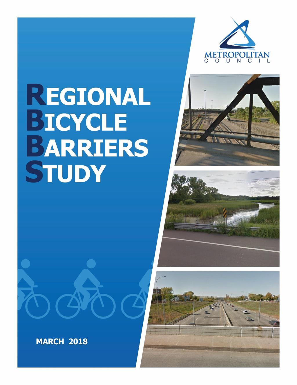
4 Background and Purpose In 2015, the Regional Bicycle Transportation Network (RBTN) was adopted into the Metropolitan Council s 2040 Transportation Policy Plan (TPP). The RBTN established the bicycle transportation corridor and alignment priorities for regional planning and investment in the Twin Cities. The RBTN s goal is to establish an integrated network of on-street bikeways and off-road trails to improve conditions for bicycle transportation at the regional level. The TPP will be updated to include results from this Regional Bicycle Barriers Study. The Metropolitan Council conducted the Regional Bicycle Barriers Study (Study) to examine the major physical barriers to bicycling in the seven-county Twin Cities region; these barriers include the region s freeways and expressways, rivers and streams, and rail corridors. From there, the Metropolitan Council prioritized points along these barriers where the potential need for new crossings (i.e., bridges and underpasses) or improved at-grade intersection crossings on planned bikeways is the greatest. In addition to the regional bikeway corridors and alignments identified in the RBTN, the Study considered local bikeway networks and their barrier crossing needs. These areas included locations where a barrier intersected with a local planned bikeway, a RBTN corridor or alignment, and/or a collector roadway. A series of potential barrier crossing points were identified and analyzed; the final point locations were determined with assistance from a technical advisory work group of bicycle transportation professionals and advocates, from input received from two focus group sessions with area cyclists representing a variety of backgrounds, and from results of an interactive, online map survey. This identification and prioritization process happened thanks to a robust, data-driven approach and coordination with city, county, state, and parks agency planning and engineering staff. The Study will be documented in the forthcoming 2040 Transportation Policy Plan Update, which sets policies for the region s transportation system used for planning and investment direction. The purpose of this final study report is to summarize the methodology used to prioritize barrier crossing improvement opportunities, and to explain and document the results of the prioritization process. The study analysis was informed by a methodology developed through the National Cooperative Highways Research Project 803 (NCHRP 803). The methodology uses weighted factors (e.g., bicycling demand and network connectivity) to determine overall priority score rankings of individual barrier crossing opportunity locations. Individual factors were assigned unique variables to quantify and tabulate overall factor scores, which were then compiled to produce overall priority scores for each analysis point. Stakeholders Project stakeholders included a Technical Advisory Work Group (TAWG), a Project Management Team (PMT), participants in two bicyclist focus groups, and members of the general public who weighed in via an online WikiMap survey. TECHNICAL ADVISORY WORKING GROUP The TAWG met six times during the Study s duration, providing invaluable discussion and feedback on the prioritization factors, measures and barrier crossing improvement points included for analysis. Table 1 lists the TAWG meeting dates and topics. March 2018 Regional Bicycle Barriers Study 1
5 Table 1: Technical Advisory Working Group Meeting Dates and Topics Date Topic November 2016 Study approach, analysis parameters, factors, and measures December 2016 Preferred spacing, intro. to evaluation factors and measures April 2017 Focus group results, factors, measures, and factor weights May 2017 Analysis point development, factor measures, and calculations July 2017 Draft barrier crossing points analysis results October 2017 Final barrier crossing points analysis results, final review process The TAWG included representation from: Counties Cities Anoka County Carver County Dakota County Hennepin County Ramsey County Scott County Washington County City of Chaska City of Maplewood City of Minneapolis City of New Brighton City of Richfield City of Saint Paul State and Regional Agencies Metropolitan Council Minnesota Department of Transportation Park Agencies Anoka County Parks Ramsey County Parks Three Rivers Park District Advocacy Organizations Transit for Livable Communities Bloomington Bicycle Alliance PROJECT MANAGEMENT TEAM The PMT consisted of Metropolitan Council and Minnesota Department of Transportation Metro District staff. This team provided ongoing direction to the consultant team throughout the project. March 2018 Regional Bicycle Barriers Study 2
6 FOCUS GROUPS To gain detailed and meaningful input from people who bicycle in the region, the Metropolitan Council hosted two focus groups with stakeholders from various demographic, racial, and ethnic groups. One focus group identified potential participants from the core cities and suburbs that self-identified as avid bicyclists who regularly used bicycling as a form of transportation. A second focus group recruited people from disadvantaged communities or underrepresented racial and ethnic groups with some bicycling experience. Both focus groups were slightly more than half female, and each helped review ways to measure each prioritization factor and weight its relative importance. The focus groups had many suggestions (additional details are included in Appendix A: Focus Groups Summary), but two notable ideas were about the significance of direct routing and the large impact of rail operations where roadways crossed with railways. One participant who commutes from Burnsville to Bloomington shared stories of coworkers who had to bicycle to work at 5:30 a.m. because they had no other options. For these commuters, the most direct route over the Minnesota River was on the I-35W bridge, a reality that emphasized the need for direct access over barriers. Another participant shared stories from their neighborhood about stopped/idling trains blocking three perpendicular roadway/rail crossings for long periods of time; this not only caused crossing delays, but sometimes resulted in unsafe behavior such as people carrying their bicycles between train cars to get through the crossing. In response to this observation, several existing roadway/rail crossings with known volumes of long and/or slow-moving trains were added to the analysis. Other feedback from focus group participants included an exercise to prioritize among four general analysis factors: network connectivity, safety/existing conditions, bicycling demand, and social equity. GENERAL PUBLIC Input from the general public and bicycling stakeholders, which came via an online interactive WikiMap (Figure 1, Regional Bicycle Barriers Study WikiMap), was used as a variable under the social equity and bicycling demand factors. Participants in the mapping exercise helped identify existing problem crossings of major barriers to identify potential sites where new crossings (bridges or underpasses) would be most beneficial. The more people that identified the same location as needing improvement, the higher its demand score. The online WikiMap survey produced 2,007 comments from 431 participants. The Metropolitan Council distributed the WikiMap survey through lists as well as through cycling-specific and neighborhood groups on Facebook. March 2018 Regional Bicycle Barriers Study 3

7 Figure 1: Regional Bicycle Barriers Study WikiMap Participants in the WikiMap survey were also asked to complete a short, optional demographic survey. This information was used to track participation, and later in the project some of the information was used to weight some of the analysis measures. This is detailed in the Identifying Variables section later in this report. Definition of Regional Barriers The first step of the analysis was to define the Study area and the segments of physical bicycle barriers to be analyzed. The Study area focuses on the Regional Bicycle Transportation Network (RBTN) coverage area, which includes parts of all seven counties. The Study area was defined to include locations within and between existing RBTN corridors and alignments, plus one mile added to the outer periphery of the network. The RBTN corridors and alignments are routes that the Metropolitan Council s earlier Regional Bicycle System Study found to have higher levels of existing and potential bicycling demand. The defined Study area is shown in Figure 2. March 2018 Regional Bicycle Barriers Study 4

8 Figure 2: Regional Bicycle Barriers Study Area The Study defined physical bicycle barriers to include second- and third-order rivers and streams, rail line corridors, and freeways and expressways. March 2018 Regional Bicycle Barriers Study 5
9 Freeways are highways with full access control, meaning motorists do not encounter any crossroad intersections. For the purpose of this study, expressways were defined to include the region s non-freeway principal arterials consisting of at least four lanes and divided by a median. In addition, minor arterial highway segments that shared these characteristics and were recommended for inclusion in the study by TAWG members were added to the expressways data layer. Expressways differ from freeways in that they have cross-road intersections with traffic signals and some partial stop sign-controlled intersections with rightturn-in/out-only access. Freeways and expressways included in the Study are shown in Figure 3. Figure 3: Freeways and Expressways March 2018 Regional Bicycle Barriers Study 6

10 The region s rail corridors are also included as barriers in this study. Rail corridors include Class I railroad mainlines, short line railroad corridors, rail yards, and rail lines with at-grade road crossings that experience long delays near rail yards due to switching operations (Figure 4). Figure 4: Rail Corridors March 2018 Regional Bicycle Barriers Study 7
11 Rivers and streams included the main tributaries of the region s primary rivers, which are categorized as second- and third-order rivers and streams (Figure 5). The region s primary rivers (the Mississippi, Minnesota, and Saint Croix) were not analyzed in this Study because of the large differences in approach and scale that would be required for these major rivers compared to the other barriers. However, this Study (based on discussions with the TAWG) recognizes these major rivers as highly significant, and possibly the most challenging physical barriers to bicycling in the Twin Cities region. As such, they will be addressed in the Metropolitan Council s forthcoming Transportation Policy Plan Update. Figure 5: Streams The composite of all regional bicycle barriers included in the Study is shown in Figure 6. March 2018 Regional Bicycle Barriers Study 8
12 Figure 6: Regional Bicycle Barriers Identification of Barrier Crossing Analysis Points PLAN-BASED POINT IDENTIFICATION The second step of the analysis was to identify points along barrier segments that represented barrier crossing opportunities. These points were identified as locations where a barrier intersected with a local planned bikeway, a Regional Bicycle Transportation Network (RBTN) corridor or alignment, and/or a collector roadway. Locations with existing bikeways (as identified in the Metropolitan Council s regional bicycle system inventory compiled from city and county data throughout the region) were excluded. Minor or principal arterials that intersect a barrier at-grade were only analyzed if on a local or regional planned bikeway. Because this Study primarily focused on identifying opportunities to bike across physical barriers, bicyclist comfort levels at roadway or road/rail intersections (and thus bicycle facility type) were not evaluated. In addition, the lack of detail in available data and the extraordinary resources that would be required to analyze facility types across the region were prohibitive to that level of analysis. As a result, existing bikeways or existing local roads that intersected with a bicycle barrier were assumed to provide an adequate bike crossing. In the third step of the analysis, additional barrier crossing opportunity locations were identified based on input from the public and the iterative TAWG reviews. To offer an opportunity for the cycling public to provide direct input to the study, an online, interactive WikiMap survey was developed, displaying all streets and highways in relation to the identified regional barriers. March 2018 Regional Bicycle Barriers Study 9
13 WikiMap survey respondents were invited to mark points where they desired new barrier crossings. All locations having at least two votes for a new barrier crossing were added to the potential barrier crossing points for analysis. BARRIER CROSSING SPACING CRITERIA The Metropolitan Council, with support from the PMT and TAWG, determined that there were areas where barrier crossing opportunities identified in the previous steps were spaced too far apart to achieve well-connected bicycle networks with regularly spaced barrier crossing locations. Through several discussions at TAWG meetings, criteria were developed to define preferred crossing spacing criteria; these were later used to add or adjust barrier crossing improvement points in the analysis. Bicyclist expectations and transportation networks vary with land use and density; therefore, preferred crossing frequencies should differ according to subregional context just as spacing of minor arterials and roadway bridges vary across the region. Figure 7: Thrive MSP 2040 Community Designations, Aggregated to Four Groups The eight community designations defined in the Metropolitan Council s Thrive MSP 2040 regional plan (Figure 7) were aggregated into four groups (as shown in Table 2) to allow for the varying levels of expectation and need in the region s subareas. Draft spacing criteria were reviewed and revised by the PMT and TAWG. Table 2 summarizes the final preferred maximum spacing criteria as developed by the TAWG and applied in the Study. March 2018 Regional Bicycle Barriers Study 10
14 Table 2: Preferred Maximum Spacing of Barrier Crossing Opportunities by Thrive MSP 2040 Community Designation Thrive Community Designations Urban Center Urban Suburban, Suburban Edge, Emerging Suburban Edge Diversified Rural, Rural Residential, Agricultural Preferred Maximum Spacing ½-mile ¾-mile 1 mile 2 miles Example Cities Minneapolis, Saint Paul, Richfield, Hopkins, South St. Paul Golden Valley, Roseville, Maplewood, Crystal, Edina Blaine, Woodbury, Maple Grove, Eagan, Lakeville Grant, Afton, Ham Lake, Lake Elmo, Independence Spacing Criteria Application The preferred maximum barrier crossing spacing criteria were used to identify additional points for analysis as potential connections across physical barriers. The frequency of barrier crossing opportunities identified in steps one through three did not always meet the preferred spacing criteria, which left significant crossing gaps along some of the barriers. These spacinggenerated points were advanced along with the other potential crossing improvement locations to the evaluation and prioritization stages of the analysis. This section details how the spacing criteria were applied to generate these additional analysis points. A routing process was used to identify spacing-generated points by applying specific origin and destination points on either side of the barrier. Origin and destination pairs were placed at equal intervals along barrier segments based on the spacing criteria set for each Thrive community group. Each pair was then evaluated for how far a bicyclist would need to travel to get from one side of the barrier to the other. If there was an existing or potential crossing nearby, the resulting travel distance would be relatively small, and the spacing-generated point was removed from consideration because the nearby crossing opportunity already provided an adequately spaced connection. The distance used to search for crossings near a spacinggenerated point origin/destination pair was dependent on the spacing criteria. The analysis was then repeated for additional locations along the barrier. The TAWG and Metropolitan Council staff reviewed the spacing-generated points identified through this analysis to determine if any were extraneous or in a non-intuitive location. March 2018 Regional Bicycle Barriers Study 11
15 A point was considered extraneous for any of several reasons, including: There was an existing or recently constructed barrier crossing, or one that was fully funded and scheduled for construction A grade-separated crossing was already in place at the barrier with a useable roadway (bike shoulder or local road included) crossing the barrier (these points were re-coded as an existing crossing) The point was over a stream that flows naturally underground or through a culvert Two points in very close proximity along the same barrier were to be considered one point for analysis Two points on two tightly spaced barriers where it would not be possible to develop separate crossings (e.g. an expressway parallel and adjacent to a rail line) such that only a single crossing of both barriers would be necessary Any other point that seemed to be non-intuitive (especially those points that were generated as conceptual points based on the spacing criteria) Based on this extensive process, many points were found to be extraneous and removed from consideration as potential barrier crossings. The remaining spacing-generated points and other potential crossing locations from steps one through three are shown in Figure 8. March 2018 Regional Bicycle Barriers Study 12

16 Figure 8: Barrier Crossing Points for Final Analysis Evaluation of Barrier Crossing Points SELECTION OF ANALYSIS FACTORS The Metropolitan Council involved the PMT and the TAWG in identifying the evaluation factors to be applied in the Study analysis. As a starting point, the National Cooperative Highways Research Project 803 (NCHRP 803) was referenced, which examined national best practices in prioritization. Based on input from the two cyclist focus groups and the TAWG, four evaluation factors were selected for application in the study analysis. These included: Social equity Network connectivity Bicycling demand Safety/existing conditions In the NCHRP 803 methodology, safety and existing conditions are discussed as two separate factors. The TAWG and Metropolitan Council staff collectively determined that available data inputs for safety and existing conditions were somewhat limited and recommended combining the two factors into a single category. Input from the focus groups and WikiMap survey respondents (described in Stakeholder Groups section) was also used to determine the weights for the scoring factors. March 2018 Regional Bicycle Barriers Study 13
17 ESTABLISHING FACTOR WEIGHTS Based on the methodology from the NCHRP 803 report, factor weights were applied on a scale of 0 to 10. Factor weights for the Study were determined through input generated at the two cyclist focus groups and during subsequent discussions with the TAWG and PMT. After the factors had been selected, the TAWG voted on priorities via a live poll to establish the factor preferences. As shown in Figure 9, the results of the poll identified network connectivity as the highest priority factor, followed by bicycling demand, safety/existing conditions, and social equity. Figure 9: TAWG poll on Factor Weights The results of the live poll, as summarized in Table 3, were then converted to the 10-point weighting scale to be compatible with the Active Transportation Prioritization Tool (APT) spreadsheet from the NCHRP 803 report used in the Study. Factor Table 3: Factor Weights Weight (0 to 10 scale) Network Connectivity Bicycling Demand Safety/Existing Conditions Social Equity March 2018 Regional Bicycle Barriers Study 14
18 IDENTIFYING FACTOR MEASURES Multiple measures were chosen for each evaluation factor. The outputs of these measures, or variables, were averaged to determine an overall priority factor score. For example, the safety/existing conditions factor included bicycle- and pedestrian-involved crashes, bicycling and walking mode share, existing population density, existing employment density, and WikiMapidentified problem areas. Raw scores for these items were calculated using a Geographic Information Systems (GIS) linked spreadsheet. Raw scores were normalized to account for the differences in units and disparities in value ranges. To address this, each variable was proportionately scaled to a range of 0 to 10. All variables within a factor were weighted equally by calculating an average; averages were then multiplied by the factor weights. The analysis point factor scores for each of the four factors (safety/existing conditions, bicycling demand, network connectivity, and social equity) were then summed and again normalized to a 0 to 10 scale to determine the analysis point overall priority score as shown in Figure 10. March 2018 Regional Bicycle Barriers Study 15

19 Figure 10: Analysis Point Scoring Scheme March 2018 Regional Bicycle Barriers Study 16
20 Network Connectivity The factor score for network connectivity is an average of the following five variable scores: 1. Proximity to Existing Local Bikeways Proximity to existing local bikeways was selected as a variable to measure connectivity because it indicates how much impact a barrier crossing improvement might have on the broader bicycle network s connectivity. Scores were calculated by taking the sum length in miles of existing local bikeways within.25 miles of the barrier crossing opportunity, then scaled to fit the 0 to 10 score range. Existing bikeways were determined from Metropolitan Council s regional bicycle system inventory data layer, compiled from data provided by each county in Proximity to Planned Local Bikeways Proximity to planned local bikeways was selected as a variable to measure connectivity because it indicates how much impact a barrier crossing improvement might have on the broader planned local bicycle network s connectivity. Scores were calculated by taking the sum length in miles of planned local bikeways within.25 miles of the potential barrier crossing, then scaled to fit the 0 to 10 score range. Existing bikeways were determined from the Metropolitan Council s regional bicycle system inventory. 3. Proximity to Regional Bicycle Transportation Network (RBTN) Corridor Centerline or Alignment Whether a barrier crossing improvement opportunity is located near an RBTN alignment or corridor centerline was selected as a variable to measure connectivity because it indicates the degree to which an improvement will serve a regional bicycle transportation connection. Scores were calculated by taking the sum length in miles within.5 miles of a potential barrier crossing improvement analysis point, then scaled to fit the 0 to 10 score range. 4. Proximity to Existing or Planned Regional Trail Whether a barrier crossing opportunity is aligned with an existing or planned Regional Trail was selected as a variable to measure connectivity because it indicates whether it will fill a gap in or make an improvement to a regional trail (as identified in the 2040 Regional Parks Policy Plan). Scores were calculated by taking the sum length in miles of existing or planned regional trail within a.5 miles of a potential barrier crossing, then scaled to fit the 0 to 10 score range. 5. Route Distance to Nearest Barrier Crossing Distance to the nearest existing barrier crossing was selected as a variable to measure connectivity because it indicates the degree to which a bicyclist must go out of their way to cross a barrier without an improvement. Scores were calculated by measuring the trail or on-street route distance (in meters) to the nearest existing crossing, then scaled to fit the 0 to 10 score range. Existing crossings were defined as an existing bikeway (defined in a local or regional plan) or a local road crossing of a regional bicycle barrier. March 2018 Regional Bicycle Barriers Study 17
21 Bicycling Demand The factor score for demand is an average of the following eight variable scores: 1. Point-type Score Point-type refers to how the analysis point was identified to be included in the Study. Point-types included planned barrier crossings (bikeway is in a local/regional plan and intersects with the barrier), TAWG or Metropolitan Council-added barrier crossing points, and spacing-generated points (based on spacing criteria from Table 2). Based on TAWG member input, project staff determined that potential barrier crossings generated by local and regional bicycle plans should be given a higher priority. As such, the prioritization analysis was amended to include a new variable for point-type. This new variable was scored on a 0 to 10 scale as follows: Planned barrier crossings 10 points TAWG/Metropolitan Council-added crossings 6 points Spacing-generated crossing locations 4 points Planned crossings were derived from planned bikeways identified in a local or regional plan. 2. Population Density (2040) Population density was selected as a variable to measure existing conditions because it indicates where a barrier crossing improvement would serve the most people near their homes. Scores were calculated as average 2040 population density (estimated by TAZ) within a.5 miles of a barrier crossing opportunity, then scaled to fit the 0 to 10 score range. 3. Employment Density (2040) Employment density projections for 2040 were selected as a variable to measure demand because these projections indicate where a barrier crossing improvement would serve the most people near their place of employment. Scores were calculated by using the average 2040 employment density (estimated by TAZ) within.5 miles of a potential barrier crossing, then scaled to fit the 0 to 10 score range. 4. Transit Ridership Transit ridership was selected as a variable to measure demand because it indicates where there may be bicycling demand for last mile connections to a transit stop. Scores were calculated by taking the sum of boardings and alightings within a.5 miles of a potential barrier crossing, then scaled to fit the 0 to 10 score range. 5. Proximity to Schools Proximity to schools was selected as a variable to measure demand because it indicates potential usage by students, guardians, and/or staff where a barrier crossing improvement could allow for better bicycle access. Scores were calculated by counting the number of schools within.5 miles of a potential barrier crossing, then scaled to fit the 0 to 10 score range. March 2018 Regional Bicycle Barriers Study 18
22 6. Proximity to Colleges and Universities Proximity to colleges and universities was selected as a variable to measure demand because it indicates potential usage by students, faculty, and/or staff where a barrier crossing improvement could allow for better bicycle access. Scores were calculated by counting the number of colleges within.5 miles of a potential barrier crossing, then scaled to fit the 0 to 10 score range. 7. Proximity to Regional Parks Proximity to existing regional parks (as identified in the 2040 Regional Parks Policy Plan) was selected as a variable to measure demand because it indicates potential usage at a regional resource where a barrier crossing project could facilitate improved bicycle access to a regional park. Scores were calculated by counting the number of regional parks within.5 miles of a potential barrier crossing, then scaled to fit the 0 to 10 score range. 8. Suggested New Crossings from WikiMap The project WikiMap online interactive tool provided participants the opportunity to suggest locations for new barrier crossings. The new crossing suggestions were selected as a measure of demand because they indicate public desire for a new barrier crossing. Scores were calculated by taking the sum of suggested new crossing responses on the WikiMap within.25 miles of a suggested barrier crossing, then scaled to fit the 0 to 10 score range. When these locations were scored for their point-type, they were categorized and scored as TAWG/Council-added points (in Demand section). Safety/Existing Conditions The factor score for safety/existing conditions is an average of the following five variable scores: 1. Proximity to Bicycle or Pedestrian Crashes Proximity to bicycle or pedestrian crashes was selected as a variable to measure safety/existing conditions because it indicates where there may be an opportunity to improve area conditions for non-motorized transportation. It may also indicate areas where people are walking or bicycling regardless of conditions. Scores were calculated by counting the number of crashes within 500 feet of a barrier crossing opportunity, then scaled to fit the 0 to 10 score range. Crash data were applied from MnDOT s non-motorized collisions database. 2. Bicycle or Pedestrian Mode Share Bicycle or pedestrian mode share was selected as a variable to measure safety/existing conditions because it indicates where people bike or walk to commute to work. Scores were calculated as average mode percent share within.5 miles of a barrier crossing point, then scaled to fit the 0 to 10 score range. Biking and walking mode shares were derived from the U.S. Census American Community Survey database. 3. Existing Population Density (2014) Population density was selected as a variable to measure existing conditions because it indicates where a barrier crossing improvement would serve the most people near their homes in existing conditions. Scores were calculated as average 2014 population density March 2018 Regional Bicycle Barriers Study 19
23 within.5 miles of a barrier crossing opportunity, then scaled to fit the 0 to 10 score range. 4. Existing Employment Density Employment density was selected as a variable to measure existing conditions because it indicates where a barrier crossing improvement would serve the most people near their place of employment in existing conditions. Scores were calculated as average 2014 employment density within.5 miles of a barrier crossing opportunity, then scaled to fit the 0 to 10 score range. 5. Problem Locations Identified through WikiMap Input Problem locations identified on the WikiMap were selected as a variable to measure existing conditions because they indicate public desire for an existing barrier crossing improvement based on where participants identified an improvement needed. Scores were calculated as a sum of improvement needed responses on the WikiMap survey within.25 miles of a barrier crossing opportunity, then scaled to fit the 0 to 10 score range. Social Equity The Metropolitan Council has adopted equity as one of the outcomes of Thrive MSP 2040, which defines equity as the following: Equity connects all residents to opportunity and creates viable housing, transportation, and recreation options for people of all races, ethnicities, incomes, and abilities so that all communities share the opportunities and challenges of growth and change. For our region to reach its full economic potential, all of our residents must be able to access opportunity. Our region is stronger when all people live in communities that provide them access to opportunities for success, prosperity, and quality of life. -Thrive MSP 2040 Each variable that contributes to the overall priority score for equity relates to the Metropolitan Council s equity goals and is described in this section. The factor score for equity is an average of the following eight variable scores: 1. Areas of Concentrated Poverty Areas of concentrated poverty (ACPs) were selected as a variable to measure equity because they provide a geographic-based metric for the degree to which people with lower incomes may be served by a barrier crossing opportunity. Scores were calculated by awarding 10 points to barrier crossing opportunities inside an ACP. 2. Areas of Concentrated Poverty with More Than 50% People of Color Areas of concentrated poverty with more than 50% people of color (ACP50s) were selected as a variable to measure equity because they provide a geographic-based metric for the degree to which people with lower incomes who are also people of color may be served by a potential barrier crossing improvement. March 2018 Regional Bicycle Barriers Study 20
24 Scores were calculated by awarding 10 points to barrier crossing opportunities inside an ACP Population Under 15 Years Old Percentage of population under 15 years old was selected as a variable to measure equity because this age group is not old enough to drive, but includes many people generally old enough to make some trips by bicycle. Scores were calculated as average percent of the population under 15 within.5 miles of a barrier crossing opportunity, then scaled to fit the 0 to 10 score range. Specific age group population data were derived from the U.S. Census American Community Survey database. 4. Population 65 Years and Older Percentage of population 65 years and older was selected as a variable to measure equity because this age group is less likely to drive than younger adults, and typically does not feel comfortable riding a bicycle without a designated facility. Scores were calculated as average percent of the population 65 and over within.5 miles of the barrier crossing opportunity, then scaled to fit the 0 to 10 score range. Specific age group data were derived from the U.S. Census American Community Survey database. 5. Zero-Car Households Percentage of households with zero-cars was selected as a variable to measure equity because people that do not own or have access to a car are more likely to rely on transit, walking, and/or bicycling to make transportation trips. Scores were calculated as average percent of households with no vehicle available within.5 miles of a barrier crossing opportunity, then scaled to fit the 0 to 10 score range. Specific household data were derived from the U.S. Census American Community Survey database. 6. People of Color Percentage of population people of color was selected as a variable to measure equity because it provides a geographic-based metric for the degree to which people of color may be served by a barrier crossing opportunity. It should be noted that this measure is different from ACP50 variable, but there may be some overlap. Metropolitan Council staff and the TAWG determined the overlap to be acceptable, since those areas indicate higher need. Sources were calculated as average percent of the population that is non-white (including Hispanic and Latino) within.5 miles of a barrier crossing opportunity, then scaled to fit the 0 to 10 score range. Specific population by race data were derived from the U.S. Census American Community Survey database. 7. WikiMap Input from Females WikiMap input from people who self-identified as female was selected as a variable to measure equity because the participation rates in bicycling for women are less than those for men. In addition, there is a higher proportion of men than women in the field of bicycle planning. Adding input from women to the equity score emphasizes the input from those typically underrepresented. March 2018 Regional Bicycle Barriers Study 21
25 Scores were calculated by counting the number of comments from WikiMap users selfidentifying as women within.25 miles of a barrier crossing opportunity, then scaled to fit the 0 to 10 score range. 8. WikiMap Input from Participants Self-Identifying as Any Race Other Than White WikiMap input from people who identified themselves non-white was selected as a variable to measure equity because typical participation rates in bicycle planning are higher for Caucasians than they are for many people self-identifying as non-white. Adding input from people of color to the equity score emphasizes the input from those typically underrepresented. Scores were calculated by counting the number of comments from WikiMap users selfidentifying as any race other than white within.25 miles of a barrier crossing opportunity, then scaled to fit the 0 to 10 score range. Final Analysis Results FINAL SCORE CALCULATIONS The raw factor scores were calculated as an average of each factor-specific variable score. Overall factor scores were then weighted, according to the factor weights previously described, and overall priority scores normalized to a 0 to 100 scale to arrive at a final score for each barrier crossing point analyzed (Figure 10: Analysis point scoring scheme). BARRIER CROSSING POINTS ANALYSIS RESULTS As described in this study report, and with the help of agency stakeholders represented by the TAWG and PMT, the initial set of nearly 1200 barrier crossing analysis points were refined through the Study process and winnowed down to 675 crossing points for the final analysis. The results of the barrier crossing points analysis are summarized in Appendix B with weighted factor scores, overall priority scores, and final normalized (scale of 1 to 100) scores displayed. Ultimately, the study converted the top 450 ranked points to a series of crossing improvement areas along regional bicycle barriers. These areas are displayed as circles and grouped into three equally distributed priority tiers in Figures 11 and 12 for freeways/expressways and railroad corridors/second-order streams, respectively. The area circle diameters shown in these figures vary by aggregated Thrive community designation and correspond to the preferred maximum spacing criteria previously described in Table 2. The circle diameters represent the actual barrier segments where a future crossing improvement project may be desired. March 2018 Regional Bicycle Barriers Study 22

26 Figure 21: Regional Barrier Crossing Improvement Areas: Freeways and Expressways March 2018 Regional Bicycle Barriers Study 23

27 Figure 32: Regional Barrier Crossing Improvement Areas: Railroads and Streams March 2018 Regional Bicycle Barriers Study 24
28 As there tend to be fewer roadways and planned bikeways in the region s suburban and rural areas, there are fewer opportunities to incorporate improved bikeway crossings in existing roadway projects compared to cities closer to the urban core. This can be a challenge when determining the ideal location for a crossing improvement. To help mitigate this reality, the mapping scheme presented in Figures 11 and 12 affords these outer region cities and counties more flexibility in siting specific barrier crossing projects by applying larger circles (consistent with the spacing criteria defined by aggregated Thrive community designation) to represent barrier crossing improvement areas. In more densely developed urban areas where there are a higher number of planned barrier crossings a and dense road network with many opportunities to develop barrier crossing improvement projects, the mapping scheme applies smaller improvement area circles. These smaller-diameter circles also correspond to the preferred maximum spacing between barrier crossings in these areas, as previously described. Each of the seven counties have multiple barrier crossing opportunities in the top 450 ranked locations. Hennepin County had the most crossing opportunity locations, followed by Ramsey County. The most common barriers with high scoring barrier crossing improvement locations were rail corridor and freeway and expressway barriers. Potential crossing points along the river and stream barriers did not rise to the top as priority locations for crossing improvements. The following appendices contain additional data and details about the Study. Note that the ID numbers in the crossing point scores table included in Appendix B directly correspond to a digitized dataset of points available via the following link: Pedestrian-Planning/Regional-Bikeway-Barriers-Study.aspx The complete final Active Transportation Prioritization Tool spreadsheet used to analyze potential crossing points in this study can be found via this link: Pedestrian-Planning/Regional-Bikeway-Barriers-Study.aspx Appendices APPENDIX A: BICYCLING FOCUS GROUPS SUMMARY APPENDIX B: CROSSING POINT SCORES SUMMARY TABLE March 2018 Regional Bicycle Barriers Study 25
Regional Bicycle Barriers Study
 Regional Bicycle Barriers Study Executive Summary Background and Purpose The 2040 Transportation Policy Plan (TPP) sets policies for planning and investment direction in the transportation system in the
Twin Cities Bicycle Barriers Study Technical Advisory Work Group December 19, 2016
 Twin Cities Bicycle Barriers Study Technical Advisory Work Group December 19, 2016 Regional Bicycle Barriers Overall Study Area Parameters Specific Barrier Parameters Rivers & streams Rail corridors Overall
Twin Cities Regional Bicycle System Study
 Twin Cities Regional Bicycle System Study Developing a Regional Bicycle Network Steven Elmer, Metropolitan Council Tony Hull, Toole Design Group LLC CTS Research Conference May 21, 2014 Introduction Study
ACTION TRANSMITTAL No
 Transportation Advisory Board of the Metropolitan Council of the Twin Cities ACTION TRANSMITTAL No. 2016-15 DATE: January 14, 2016 TO: TAC Planning Committee PREPARED BY: Steven Elmer (651) 602-1756 SUBJECT:
Metropolitan Council Transportation Committee. Twin Cities Regional Bicycle Barriers Study
 Metropolitan Council Transportation Committee Twin Cities Regional Bicycle Barriers Study June 27, 2016 Study Background Regional Bicycle Transportation Network Established in 2040 Transportation Policy
Bicycle and Pedestrian Chapter TPP Update Overview. TAB September 20, 2017
 Bicycle and Pedestrian Chapter TPP Update Overview TAB September 20, 2017 Bicycling & Walking in the Twin Cities Where are we now? The Bike-Pedestrian system Current trends New developments Where are we
Chapter 7: Bicycle And Pedestrian Investment Direction
 7.1 Chapter 7: Bicycle And Pedestrian Investment Direction 2040 7.2 Chapter 7: Bicycle and Pedestrian Investment CONTENTS Overview 7.3 Regional Bicycle Transportation Network 7.6 Regional Bicycle System
ADOT Statewide Bicycle and Pedestrian Program Summary of Phase IV Activities APPENDIX B PEDESTRIAN DEMAND INDEX
 ADOT Statewide Bicycle and Pedestrian Program Summary of Activities APPENDIX B PEDESTRIAN DEMAND INDEX May 24, 2009 Pedestrian Demand Index for State Highway Facilities Revised: May 29, 2007 Introduction
ACTION TRANSMITTAL No
 Transportation Advisory Board of the Metropolitan Council of the Twin Cities ACTION TRANSMITTAL No. 2016-15 DATE: January 14, 2016 TO: FROM: TAC TAC Planning PREPARED BY: Steven Elmer (651) 602-1756 SUBJECT:
2014 Bellingham Bicycle Master Plan
 2014 Bellingham Bicycle Master Plan Acknowledgements The City of Bellingham is honored by the commitment of the numerous community members and bicycling enthusiasts who participated in the development
2010 Pedestrian and Bicyclist Special Districts Study Update
 2010 Pedestrian and Bicyclist Special Districts Study Update Pedestrian and Bicyclist Special Districts Program Overview H-GAC s Special Districts Program aims to provide strategic investments in pedestrian
APPENDIX E BIKEWAY PRIORITIZATION METHODOLOGY
 APPENDIX E BIKEWAY PRIORITIZATION METHODOLOGY INTRODUCTION The network of bikeways recommended in the Bicycle Master Plan is extensive and is likely to be only partially completed during the 25-year life
WALKNBIKE DRAFT PLAN NASHVILLE, TENNESSEE EXECUTIVE SUMMARY NASHVILLE, TENNESSEE
 NASHVILLE, TENNESSEE EXECUTIVE SUMMARY Executive Summary A world-class multi-modal transportation system is essential to a vibrant city and better quality of life. -Mayor Barry The WalknBike plan aims
Bicycling & Walking in the Twin Cities TPP Bike/Ped Chapter Overview. Land Use Advisory Committee September 21, 2017
 Bicycling & Walking in the Twin Cities TPP Bike/Ped Chapter Overview Land Use Advisory Committee September 21, 2017 Presentation Outline Current TPP Purpose of bike/ped chapter New developments Bike/Ped
ACTIVE TRANSPORTATION
 ACTIVE TRANSPORTATION Mobility 2040 Supported Goals Improve the availability of transportation options for people and goods. Support travel efficiency measures and system enhancements targeted at congestion
SANTA CLARA COUNTYWIDE BICYCLE PLAN August 2008
 SANTA CLARA COUNTYWIDE BICYCLE PLAN August 2008 To assist VTA and Member Agencies in the planning, development and programming of bicycle improvements in Santa Clara County. Vision Statement To establish,
Appendix C. Corridor Spacing Research
 Appendix C. Corridor Spacing Research Task 3 of the Twin Cities Bicycle Study called for the development of bicycle corridor spacing guidelines. This section summarizes research of the spacing of planned
ACTION TRANSMITTAL No
 Transportation Advisory Board of the Metropolitan Council of the Twin Cities ACTION TRANSMITTAL No. 2016-15 DATE: February 5, 2016 TO: FROM: Transportation Advisory Board Technical Advisory Committee PREPARED
Goals, Objectives, and Policies
 Goals, Objectives, and Policies ADVISORY GROUP INPUT PUBLIC INPUT SNS PREVIOUS STUDIES RBPP Goals Vision Statement Southern Nevada will develop a safe, connected, and convenient walking and bicycling system
Spring Lake Park Mounds View North Oaks. Arden Hills. Shoreview. Roseville. Little Canada. Falcon Heights SNELLING. Lilydale. West Saint Paul 35E
 Coon Rapids Blaine Spring Lake Park Mounds View rth Oaks In 2011, Metro Transit embarked on the Arterial 494 Minnetonka Maple Grove Plymouth Hopkins Brooklyn Park New Hope Golden Valley Louis Park Edina
Bike Share Social Equity and Inclusion Target Neighborhoods
 Bike Share Social Equity and Inclusion Target Neighborhoods Target Neighborhoods West End/Visitation Park/Academy/Hamilton Heights Wellsgoodfellow/Kingsway West The Ville/Greater Ville Kingsway East/Fountain
Pedestrian Project List and Prioritization
 To: Kyle Wagenschutz, City of Memphis CC: From: Anne Conlon and John Cock, Alta Planning + Design Date: December, 2014 Re: Project List Development (Task 3.1-3.2) and Project List Prioritization (Task
Methodology. Reconnecting Milwaukee: A BikeAble Study of Opportunity, Equity and Connectivity
 Reconnecting Milwaukee: A BikeAble Study of Opportunity, Equity and Connectivity Released June 27, 2017 About BikeAble Rails-to-Trails Conservancy s (RTC s) BikeAble TM tool is a GIS-modeling platform
Chapter 7 Bicycle and Pedestrian Investment Direction
 Chapter 7 Bicycle and Pedestrian Investment Direction Overview Bicycling and walking have become increasingly important in the Twin Cities for commuting to work or school, running personal errands, and
2017 North Texas Regional Bicycle Opinion Survey
 2017 North Texas Regional Bicycle Opinion Survey Sustainable Development Program Kevin Kokes, AICP Public Meetings April, 2018 North Central Texas Council of Governments MPO for the Dallas-Fort Worth Region
Active Travel and Exposure to Air Pollution: Implications for Transportation and Land Use Planning
 Active Travel and Exposure to Air Pollution: Implications for Transportation and Land Use Planning Steve Hankey School of Public and International Affairs, Virginia Tech, 140 Otey Street, Blacksburg, VA
Midtown Corridor Alternatives Analysis
 Midtown Corridor Alternatives Analysis Ridership Forecast Methodology and Results December 2013 Prepared by the SRF Consulting Group Team for Table of Contents Introduction... 1 Methodology... 1 Assumptions...
Chapter 14 PARLIER RELATIONSHIP TO CITY PLANS AND POLICIES. Recommendations to Improve Pedestrian Safety in the City of Parlier (2014)
") Chapter 14 PARLIER This chapter describes the current status and future plans for biking and walking in the City of Parlier. RELATIONSHIP TO CITY PLANS AND POLICIES The Parlier General Plan is the primary
Chapter 14 PARLIER This chapter describes the current status and future plans for biking and walking in the City of Parlier. RELATIONSHIP TO CITY PLANS AND POLICIES The Parlier General Plan is the primary
Chapter 7. Transportation. Transportation Road Network Plan Transit Cyclists Pedestrians Multi-Use and Equestrian Trails
 Chapter 7 Transportation Transportation Road Network Plan Transit Cyclists Pedestrians Multi-Use and Equestrian Trails 7.1 TRANSPORTATION BACKGROUND The District of Maple Ridge faces a number of unique
Hennepin County Pedestrian Plan Public Comment Report
 Hennepin County Pedestrian Plan Public Comment Report On May 31, 2013, the draft Hennepin County Pedestrian Plan was released for a 45-day public comment period ending July 15, 2013. The county received
City of Wayzata Comprehensive Plan 2030 Transportation Chapter: Appendix A
 A1. Functional Classification Table A-1 illustrates the Metropolitan Council s detailed criteria established for the functional classification of roadways within the Twin Cities Metropolitan Area. Table
Bicycle and Pedestrian Investment Direction
 Chapter 7 Bicycle and Pedestrian Investment Direction Overview Bicycling and walking are becominghave become increasingly important in the Twin Cities for supporting the TPP s goal of providing access
Chapter 2. Bellingham Bicycle Master Plan Chapter 2: Policies and Actions
 Chapter 2 Bellingham Bicycle Master Plan Chapter 2: Policies and Actions Chapter 2: Policies and Actions The Bicycle Master Plan provides a road map for making bicycling in Bellingham a viable transportation
Bicycle Master Plan Goals, Strategies, and Policies
 Bicycle Master Plan Goals, Strategies, and Policies Mobilizing 5 This chapter outlines the overarching goals, action statements, and action items Long Beach will take in order to achieve its vision of
Regional Bicycle System Master Study. Preliminary Results Update
 Regional Bicycle System Master Study Preliminary Results Update Transportation Committee October 21, 2013 Introduction Study Goals Guiding Principles Bicycle Study System Elements Analysis Approach Proposed
I-105 Corridor Sustainability Study (CSS)
") I-105 Corridor Sustainability Study (CSS) Metro Streets and Freeways Subcommittee March 21, 2019 Gary Hamrick Cambridge Systematics, Inc. I-105 CSS Project History & Background Funded by Caltrans Sustainable
I-105 Corridor Sustainability Study (CSS) Metro Streets and Freeways Subcommittee March 21, 2019 Gary Hamrick Cambridge Systematics, Inc. I-105 CSS Project History & Background Funded by Caltrans Sustainable
Key objectives of the survey were to gain a better understanding of:
 3 COMMUNITY INPUT Community input is an essential part of corridor studies. For the SR 87 corridor study, VTA staff conducted an extensive online survey of people living and commuting along the corridor.
Tulsa Metropolitan Area LONG RANGE TRANSPORTATION PLAN
 Tulsa Metropolitan Area LONG RANGE TRANSPORTATION PLAN Indian Nations Council of Governments August 2005 CONTACTING INCOG In developing the Destination 2030 Long Range Transportation Plan, INCOG s Transportation
CHAPTER 7: TRANSPORTATION
 CHAPTER 7: TRANSPORTATION Chapter 7 includes the following information: 1. Introduction 2. Transportation Glossary 3. Summary of Regional Strategies 4. Existing Roadway System 5. Future Roadway System
METROPOLITAN TRANSPORTATION PLAN OUTREACH: INTERACTIVE MAP SUMMARY REPORT- 10/03/14
 METROPOLITAN TRANSPORTATION PLAN OUTREACH: INTERACTIVE MAP SUMMARY REPORT- 10/03/14 INTRODUCTION This document summarizes the results of the online interactive mapping exercise implemented by MIG for the
Introduction Overview This document summarizes the Gateway Gold Line Bus Rapid Transit (Gold Line BRT) health impact assessment (HIA) process and reco
 health impact assessment (HIA) process and reco") Gateway Gold Line Bus Rapid Transit: A Closer Look at Health and Land Use Project Summary May 2016 Introduction Overview This document summarizes the Gateway Gold Line Bus Rapid Transit (Gold Line BRT)
Gateway Gold Line Bus Rapid Transit: A Closer Look at Health and Land Use Project Summary May 2016 Introduction Overview This document summarizes the Gateway Gold Line Bus Rapid Transit (Gold Line BRT)
Hennepin County Bicycle and Pedestrian Planning
 Hennepin County Bicycle and Pedestrian Planning 1 Value of bicycle and sidewalk systems Safety Livability Mobility Health Personal Finances Economic Sustainability Clean Air Recreation Parking and congestion
MONROE COUNTY NEW YORK
 MONROE COUNTY NEW YORK Intersection Accident Database Enhancement Project (UPWP 4380) FINAL January 2008 Prepared By: Prepared For: Bergmann Associates 200 First Federal Plaza 28 East Main Street Rochester,
Overview of Report 803 Research Approach Case Studies Spreadsheet Tool Demo Question and Answer session. Photo by Michael Hintze
 Overview of Report 803 Research Approach Case Studies Spreadsheet Tool Demo Question and Answer session Photo by Michael Hintze NCHRP 07-17 Pedestrian and Bicycle Transportation along Existing Roads Project
Rochester Area Bike Sharing Program Study
 roc bike share Rochester Area Bike Sharing Program Study Executive Summary ~ January 2015 JANUARY 2015 8484 Georgia Avenue, Suite 800 Silver Spring, MD 20910 3495 Winton Pl., Bldg E, Suite 110 Rochester,
TABLE OF CONTENTS. Executive Summary
 Executive Summary Background... ES-1 Pedestrian Network... ES-2 Bikeway Network... ES-2 Collision History... ES-2 Public Input... ES-4 Conclusions and Recommendations... ES-4 1. Introduction and Setting
Rail Station Fact Sheet CentrePort/DFW Airport Station
 Rail Station Fact Sheet CentrePort/DFW Airport Station Station Overview CentrePort/DFW Airport Station is located by Statler Boulevard at Breezewood Drive in Fort Worth. Free shuttles connect the station
Rail Station Fact Sheet University of Dallas Station
 Rail Station Fact Sheet University of Dallas Station Station Overview University of Dallas Station is located on John Carpenter Freeway and west of Loop 12 across from the University of Dallas in Irving.
MnDOT Implementation of Complete Streets Policy. January 2014
 MnDOT Implementation of Complete Streets Policy January 2014 1 Prepared by Minnesota Department of Transportation 395 John Ireland Boulevard Saint Paul, Minnesota 55155-1899 Phone: 651-296-3000 Toll-Free:
Madison Urban Area and Dane County. Bicycle Transportation Plan Summary. September Introduction. Bicycle Plan Scope and Planning Process
 Bicycle Transportation Plan Summary Madison Urban Area and Dane County Introduction September 2000 Bicycling is an important mode of transportation in the Madison urban area and countywide that is available
DRAFT 04/18/2017. This transportation plan includes the following information:
 Appendix A: Transportation Introduction The City of Minnetrista s transportation system generally operates well today. The City s multimodal transportation system includes facilities for vehicles, walking,
Title. Metropolitan Council Transportation Committee December 12, Brad Larson Metro District MnDOT
 Title Metropolitan Council Transportation Committee December 12, 2016 Evaluating the potential for Bus Rapid Transit and MnPASS Express Lanes in the southwest Metro Brad Larson Metro District MnDOT Background
Travel and Rider Characteristics for Metrobus
 Travel and Rider Characteristics for Metrobus 040829040.15 Travel and Rider Characteristics for Metrobus: 2012-2015 Overview The Miami Dade County Metropolitan Planning Organization (MPO) conducted a series
Methodology for Linking Greenways and Trails with Public Transportation in Florida
 Methodology for Linking Greenways and Trails with Public Transportation in Florida Sara Hendricks, Senior Research Associate Center for Urban Transportation Research, University of South Florida CUTR Webcast,
5. Pedestrian System. Accomplishments Over the Past Five Years
 5. Pedestrian System Accomplishments Over the Past Five Years The Alamo Area Metropolitan Planning Organization (MPO) and its partner agencies recognize the importance of improving pedestrian mobility.
Update on Regional Bicycle, Pedestrian, & Trail Planning. Presented to TCC November 21, 2014
 Update on Regional Bicycle, Pedestrian, & Trail Planning Presented to TCC November 21, 2014 Survey Measure Assess Focus Area Performance- Driven Process Policy Policy Implement Plan Criteria Criteria Criteria
Memorandum. Drive alone
 Memorandum To: Cc: From: Kimberly Kerr, Assistant Chief Administrative Officer Natalie Porter, PE, TE Shawna Purvines Claudia Wade, PE Michael Schmitt, AICP CTP, PTP Re: Technical Memorandum #2: Model
Welcome! San Jose Avenue Open House August 25, 2015
 Welcome! San Jose Avenue Open House August 25, 2015 Vision Zero The City and County of San Francisco adopted Vision Zero San Francisco Vision Zero High Injury Network as a policy in 2014, committing an
Bike/Multipurpose Trail Study for Glynn County, Georgia MAY 16, 2016
 Bike/Multipurpose Trail Study for Glynn County, Georgia MAY 16, 2016 Agenda» Project Status Update» Draft Recommendations Overview» Next Steps» Questions/Discussion Project Overview» Comprehensive Bikeway
May 12, 2016 Metro Potential Ballot Measure Issue Brief: Local Return
 Summary: Local return is an important revenue source for cities to maintain their local transportation infrastructure. Most cities use their local return to operate small bus systems and repave streets,
RURAL HIGHWAY SHOULDERS THAT ACCOMMODATE BICYCLE AND PEDESTRIAN USE (TxDOT Project ) June 7, Presented by: Karen Dixon, Ph.D., P.E.
 June 7, Presented by: Karen Dixon, Ph.D., P.E.") RURAL HIGHWAY SHOULDERS THAT ACCOMMODATE BICYCLE AND PEDESTRIAN USE (TxDOT Project 0-6840) June 7, 2016 Presented by: Karen Dixon, Ph.D., P.E., TTI Team: Kay Fitzpatrick, Raul Avelar, & Subasish Das Project
RURAL HIGHWAY SHOULDERS THAT ACCOMMODATE BICYCLE AND PEDESTRIAN USE (TxDOT Project 0-6840) June 7, 2016 Presented by: Karen Dixon, Ph.D., P.E., TTI Team: Kay Fitzpatrick, Raul Avelar, & Subasish Das Project
Chapter PERFORMANCE MEASURES AND ACCOUNTABILITY. Introduction
 PERFORMANCE MEASURES AND ACCOUNTABILITY Introduction Performance measures are helpful in evaluating the progress being made toward achieving the goals and objectives of the Gateway Bicycle Plan. The Plan
APPENDIX D LEVEL OF TRAFFIC STRESS METHODOLOGY
 APPENDIX D LEVEL OF TRAFFIC STRESS METHODOLOGY 01 WHAT IS LEVEL OF TRAFFIC STRESS? When people bicycle on roadways, they encounter varying levels of stress from traffic. A quiet residential street with
MONTGOMERY COUNTY PLANNING DEPARTMENT THE MARYLAND-NATIONAL CAPITAL PARK AND PLANNING COMMISSION
 MONTGOMERY COUNTY PLANNING DEPARTMENT THE MARYLAND-NATIONAL CAPITAL PARK AND PLANNING COMMISSION MCPB Item No. 4 Date: 09-10-15 Scope of Work for the Bicycle Master Plan David Anspacher, Planner/Coordinator,
CHAPTER 3: Vision Statement and Goals
 Davidson Walks & Rolls: Active Transportation Master Plan CHAPTER 3 Contents: Overview Vision Statement Measurable Goals Public Outreach CHAPTER 3: Vision Statement and Goals Overview The vision statement
TR NEWS. Public Health and Transportation. Innovation, Intervention, and Improvements NUMBER 299 SEPTEMBER OCTOBER 2015
 TR NEWS NUMBER 299 SEPTEMBER OCTOBER 2015 Public Health and Transportation Innovation, Intervention, and Improvements Public Health and Transportation Measuring the Health Benefits of Walking and Bicycling
Non-motorized Transportation Planning Resource Book Mayor s Task Force on Walking and Bicycling City of Lansing, Michigan Spring 2007 pg.
 Non-motorized Transportation Planning Resource Book pg. 105 of 158 Non-motorized Transportation Planning Resource Book pg. 106 of 158 Non-motorized Transportation Planning Resource Book pg. 107 of 158
Nanaimo Transportation Master Plan. Phase 1 Consultation Summary
 Nanaimo Transportation Master Plan Phase 1 Consultation Summary Transportation Advisory Committee Meeting Wednesday December 12, 2012 Agenda Study Update Phase 1 Consultation Process Phase 1 Consultation
City of Seattle Edward B. Murray, Mayor
 City of Seattle Edward B. Murray, Mayor Department of Transportation Scott Kubly, Director Eastlake Community Council 117 E Louisa St. #1 Seattle, WA 98102-3278 January 28, 2016 RE: Roosevelt to Downtown
Classification Criteria
 SCHEDULE D TO RECOMMENDED OFFICIAL PLAN AMENDMENT NO. 40 SCHEDULE C-4 Road Criteria Criteria Traffic Service Objective Land Service/Access Typical Daily Traffic Volume Flow characteristics Travel Speed
Goal 3: Foster an environment of partnerships and collaboration to connect our communities and regions to one another.
 Non-Motorized Transportation Plan (NMTP) Draft Vision, Goal and,, Tri-County Regional Planning Commission (TCRPC) Purpose The purpose of the Tri-County Regional Planning Commission (TCRPC) Non-Motorized
and Rural Multimodal Networks 2017 ALTA PLANNING + DESIGN
 Small Town and Rural Multimodal Networks 2017 ALTA PLANNING + DESIGN SMALL TOWN AND RURAL MULTIMODAL NETWORKS GUIDE Why a Rural and Small Town Focused Guide? ONE SIZE DOES NOT FIT ALL. The new FHWA-endorsed
CITY OF BLOOMINGTON COMPLETE STREETS POLICY
 CITY OF BLOOMINGTON COMPLETE STREETS POLICY POLICY OBJECTIVE: The City of Bloomington will enhance safety, mobility, accessibility and convenience for transportation network users of all ages and abilities,
Multimodal Analysis in the 2010 Highway Capacity Manual
 Multimodal Analysis in the 2010 Highway Capacity Manual It s not just cars anymore! Jamie Parks, AICP HCAT Conference May 9-10, 2011 Multimodal LOS in the 2010 HCM History and background Overview of methods
Rail Station Fact Sheet DFW Airport North Station* (*station under construction with anticipated start of service in late 2018)
") Rail Station Fact Sheet DFW Airport North Station* (*station under construction with anticipated start of service in late 018) Station Overview DFW Airport North Station will be located on DFW nternational
Rail Station Fact Sheet DFW Airport North Station* (*station under construction with anticipated start of service in late 018) Station Overview DFW Airport North Station will be located on DFW nternational
Living Streets Policy
 Living Streets Policy Introduction Living streets balance the needs of motorists, bicyclists, pedestrians and transit riders in ways that promote safety and convenience, enhance community identity, create
Appendix B: Forecasting and Traffic Operations Analysis Framework Document
 Existing Conditions Report - Appendix Appendix B: Forecasting and Traffic Operations Analysis Framework Document This document defines the methodology and assumptions that will be used in the traffic forecasting
Comprehensive Bicycle Master Plan 2014 ITE-IMSA Spring Conference March 6, 2014
 Comprehensive Bicycle Master Plan 2014 ITE-IMSA Spring Conference March 6, 2014 Street Transportation Department Inventory of Bikeways (October 7, 2013) 22 bike bridges 20 bike tunnels 420 miles of bike
Basalt Creek Transportation Refinement Plan Recommendations
 Basalt Creek Transportation Refinement Plan Recommendations Introduction The Basalt Creek transportation planning effort analyzed future transportation conditions and evaluated alternative strategies for
Agency Advisory Group Meeting #3 and Walk Audit Anchorage Non-Motorized Plan
 Agency Advisory Group Meeting #3 and Walk Audit Anchorage Non-Motorized Plan Friday, May 18 th Walk Audit 10:00-11:30 AM Meeting 11:30 AM 1:00 PM Municipal Planning Department, 4700 Elmore Road, Training
SMART 1 Public Meeting #1. February 24, 2016
 SMART 1 Public Meeting #1 February 24, 2016 Agenda Who is the SMTC? SMART 1 project overview Syracuse Metropolitan Transportation Council An Introduction: Who we are & what we do What is an MPO? A Metropolitan
Public Works AGENDA ITEM D-2 STAFF REPORT
 AGENDA ITEM D-2 Public Works STAFF REPORT Transportation Master Plan Oversight and Outreach Committee Meeting Date: 10/30/2017 Staff Report Number: 17-001-TMP Regular Business: Provide feedback on Performance
WILMAPCO Public Opinion Survey Summary of Results
 Wilmington Area Planning Council WILMAPCO Public Opinion Survey Summary of Results Prepared by: 2955 Valmont Road, Suite 300 Boulder, Colorado 80301 t: 303-444-7863 f: 303-444-1145 www.n-r-c.com Table
RESOLUTION NO ?? A RESOLUTION OF THE CITY OF NEPTUNE BEACH ADOPTING A COMPLETE STREETS POLICY
 RESOLUTION NO. 2018-?? A RESOLUTION OF THE CITY OF NEPTUNE BEACH ADOPTING A COMPLETE STREETS POLICY WHEREAS, safe, convenient, and accessible transportation for all users is a priority of the City of Neptune
AAMPO Regional Transportation Attitude Survey
 AAMPO Regional Transportation Attitude Survey Traditionally Underserved Populations helping organizations make better decisions since 1982 2018 Submitted to the AAMPO By: ETC Institute 725 W. Frontier
Chapter 9: Pedestrians and Bicyclists
 Chapter 9: Pedestrians and Bicyclists Walking and bicycling are essential modes of transportation. These modes allow people to travel without contributing to congestion and air pollution, to access other
Transportation Master Plan Advisory Task Force
 Transportation Master Plan Advisory Task Force Network Alternatives & Phasing Strategy February 2016 BACKGROUND Table of Contents BACKGROUND Purpose & Introduction 2 Linking the TMP to Key Council Approved
San Mateo County Comprehensive Bicycle and Pedestrian Plan Open House
 San Mateo County Comprehensive Bicycle and Pedestrian Plan Open House October 28, 2010 Presented to San Mateo County residents and interested parties by Lauren Ledbetter, Alta Planning + Design Matt Haynes,
ENHANCED PARKWAY STUDY: PHASE 2 CONTINUOUS FLOW INTERSECTIONS. Final Report
 Preparedby: ENHANCED PARKWAY STUDY: PHASE 2 CONTINUOUS FLOW INTERSECTIONS Final Report Prepared for Maricopa County Department of Transportation Prepared by TABLE OF CONTENTS Page EXECUTIVE SUMMARY ES-1
Town of Superior. Superior Trails Plan
 Part 1 Base Information 1. Project Title US 36 Bikeway Extension 2. Project Start/End points or Geographic Area Provide a map with submittal, as appropriate 3. Project Sponsor (entity that will construct/
1999 On-Board Sacramento Regional Transit District Survey
 SACOG-00-009 1999 On-Board Sacramento Regional Transit District Survey June 2000 Sacramento Area Council of Governments 1999 On-Board Sacramento Regional Transit District Survey June 2000 Table of Contents
Access Management Regulations and Standards
 Access Management Regulations and Standards Efficient highway operation Reasonable property access Concept of Access Management The way to manage access to land development while simultaneously preserving
Multimodal Through Corridors and Placemaking Corridors
 68 Multimodal Through Corridors and Placemaking Corridors Corridors have different functions in a region. Some corridors are used to get smoothly and rapidly through a region or to get quickly to major
PEDESTRIAN ACTION PLAN
 ATTACHMENT 2 CITY OF SANTA MONICA PEDESTRIAN ACTION PLAN CITY OF SANTA MONICA PEDESTRIAN ACTION PLAN This page intentionally left blank EXECUTIVE SUMMARY CHAPTER 1 EXECUTIVE SUMMARY Setting the Stage
Guidelines for Providing Access to Public Transportation Stations APPENDIX C TRANSIT STATION ACCESS PLANNING TOOL INSTRUCTIONS
 APPENDIX C TRANSIT STATION ACCESS PLANNING TOOL INSTRUCTIONS Transit Station Access Planning Tool Instructions Page C-1 Revised Final Report September 2011 TRANSIT STATION ACCESS PLANNING TOOL INSTRUCTIONS
Hennepin/First Transportation Study
 CITY OF MINNEAPOLIS Hennepin/First Transportation Study NIEBNA Board Meeting November 10, 2016 11/10/2016 1 Study Overview Evaluate transportation system and alternatives Coordinate with County, Metro
A Matter of Fairness: ROCOG s Environmental Justice Protocol. What is Mobility Limitation?
 No Person Left Behind What is Mobility Limitation? What is the Access Limitation? Environmental Justice population should be provided adequate mobility & access to meet their needs; Identify acceptable
WELCOME TO OPEN HOUSE # 1 June 14, 2017
 Langstaff Road Weston Road to Highway 7 Class Environmental Assessment Study WELCOME TO OPEN HOUSE # 1 June 14, 2017 Please sign in and join our mailing list Purpose of Open House #1 & Study Area York
University of Victoria Campus Cycling Plan Terms of Reference. 1.0 Project Description
 University of Victoria Campus Cycling Plan Terms of Reference 1.0 Project Description The Campus Cycling Plan, a first for the University, will provide a comprehensive and coordinated approach to support
Chapter 13 ORANGE COVE
 Chapter 13 ORANGE COVE This chapter describes the current status and future plans for biking and walking in the City of Orange Cove. RELATIONSHIP TO CITY PLANS AND POLICIES The Orange Cove General Plan