SCARBOROUGH CENTRE TRANSPORTATION MASTER PLAN (SCTMP)
|
|
|
- Emil McBride
- 5 years ago
- Views:
Transcription
1 SCARBOROUGH CENTRE TRANSPORTATION MASTER PLAN (SCTMP) Public Consultation Meeting #2 May 10 th, 2017


2 Presentation Outline 1 Project Schedule and Background 2 Draft Evaluation of Alternatives 3 Preliminary Preferred Alternative 2
3 Project Schedule
4 Project Schedule
5 Project Background


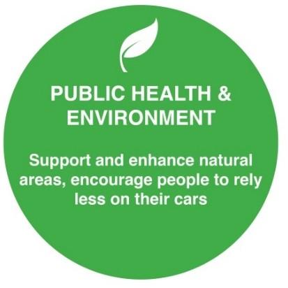
6 Constraints Coarse street network with large blocks and single-use buildings Lack of connections throughout the Centre No sense of place in the Centre Harsh, unpleasant, and fragmented pedestrian environment Auto-oriented, irregular intersections, ramps, channelized turning lanes, grade separations Highway 401 and its interchanges are barriers to pedestrians and cyclists


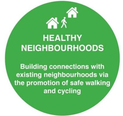
7 Opportunities Enhance the public realm Create a safe pedestrian environment Accommodate transit-oriented development Provide for pedestrians, cyclists, transit riders and drivers Leverage other public and private initiatives Enhance wayfinding


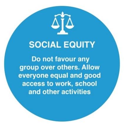
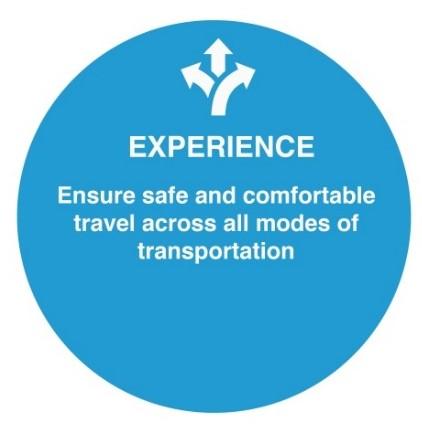
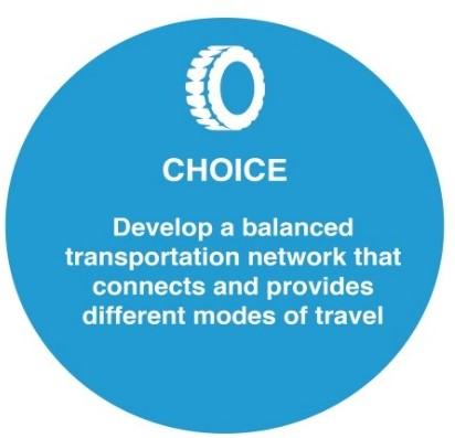
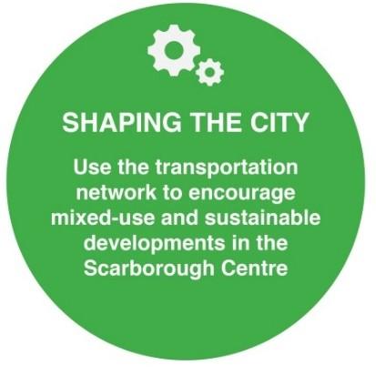
8 Guiding Values Establish a multi-modal hub that has a variety of reliable and connected transportation options Encourage mixed-use transitoriented development Support active modes of transportation with an emphasis on moving people Further the development of Transportation Demand Management (TDM) programs such as bike share and auto share Enhance safety, comfort and accessibility for pedestrians and cyclists
9 What We ve Heard Here is what we ve heard from the community through the study so far: Improve pedestrian experience Create a simplified grid street network and at-grade intersections Enhance highway interchanges for all users Reduce/improve transfers between transit routes Improve safety and accessibility Green Scarborough Centre Encourage safety through dedicated cycling facilities and parking Improve connectivity to the many amenities and assets of Scarborough Centre Enhance wayfinding and create a sense of place Provide improved transportation choices Develop a transportation network that accommodates all users and allows for efficient goods movement Provide a higher quality public realm
10 Transportation Network Alternatives
11 Transportation Network Alternatives The Scarborough Centre TMP has identified three transportation network alternatives that were evaluated to determine the preliminary preferred transportation network. The three alternatives outline the possible future scenarios for the study area and are presented in the slides to follow. The three alternatives are: Alternative 1: Existing Conditions Alternative 2: Current Policy Framework Alternative 3: Emerging Vision Note: Larger print versions of the alternatives are provided on display panels.


12 Alternative 1: Existing Conditions The Do Nothing alternative, which provides a baseline comparison of conditions without any significant improvements
13 Alternative 2: Current Policy Framework Based on future transportation conditions outlined in previous planning work including the Scarborough Centre Secondary Plan, the McCowan Precinct Plan, and the Scarborough Centre Public Space & Streetscape Master Plan
14 Alternative 3: Emerging Vision Includes planned improvements identified in Alternative 2 plus a series of additional proposed solutions that encourage multi-modal transportation within and surrounding Scarborough Centre
15 Draft Evaluation of Alternatives
16 Evaluation Principles: Serving People
17 Evaluation Principles: Strengthening Places
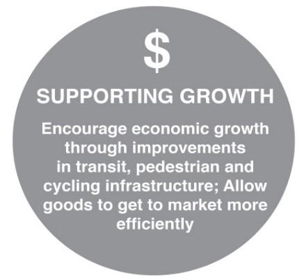

18 Evaluation Principles: Supporting Prosperity $

19 Draft Evaluation Summary
20 Preliminary Preferred Alternative
21 Preliminary Preferred Alternative (Alternative 3: Emerging Vision)
22 Preliminary Preferred Alternative (Alternative 3: Emerging Vision) Alternative 3 (Emerging Vision) was selected as the preliminary preferred alternative because it proposes: A new finer-grid street network for the entire Centre (within the Centre and to/from surrounding communities); Strong pedestrian and cycling connections to transit investments; and TDM measures, designated truck routes, a signage and wayfinding strategy, and transit-oriented policies The following slides present the transportation network layers for each mode of transportation. Note: Larger print versions of the transportation network layers are provided on display panels.

23 Preliminary Preferred Alternative: Street Network


24 Preliminary Preferred Alternative: Block Structure

25 Preliminary Preferred Alternative: Walking and Cycling Network

26 Preliminary Preferred Alternative: Transit Network

27 Thank You! Please pick-up a discussion guide and continue to share your thoughts online: Fill out the MetroQuest Survey #sconthemove your comments to sconthemove@toronto.ca
Scarborough Centre on the Move Transportation Master Plan January Public Consultation Meeting #3 November 22, 2017 What We Heard
 Scarborough Centre on the Move Transportation Master Plan January 2018 Public Consultation Meeting #3 November 22, 2017 What We Heard Table of Contents 1. Introduction 01 2. Meeting Notices 02 3. Public
Welcome. Background. Goals. Vision
 Welcome The formal Public Information Centre (PIC) for the Transportation Master Plan How We GO will be held in early 2017. At that time we will present the recommended transportation system for Niagara
Transportation Master Plan Advisory Task Force
 Transportation Master Plan Advisory Task Force Network Alternatives & Phasing Strategy February 2016 BACKGROUND Table of Contents BACKGROUND Purpose & Introduction 2 Linking the TMP to Key Council Approved
WELCOME TO OPEN HOUSE # 1 June 14, 2017
 Langstaff Road Weston Road to Highway 7 Class Environmental Assessment Study WELCOME TO OPEN HOUSE # 1 June 14, 2017 Please sign in and join our mailing list Purpose of Open House #1 & Study Area York
Sacramento Grid 2.0. The Downtown Transportation Study
 Sacramento Grid 2.0 The Downtown Transportation Study April 20, 2016 The Grid 4.25 square miles Street grid defined at birth of City Lettered and numbered streets spaced every 400 ft East-west alleys halfway
Transportation Assessment
 Transportation Assessment Midtown Open House February 10, 2018 Overview Midtown in Focus Overview & Purpose of Today Transportation Assessment overview Summary of Transportation work to date Review & Analysis
University of Victoria Campus Cycling Plan Terms of Reference. 1.0 Project Description
 University of Victoria Campus Cycling Plan Terms of Reference 1.0 Project Description The Campus Cycling Plan, a first for the University, will provide a comprehensive and coordinated approach to support
NOTES FROM JUNIOR COUNCIL ORIENTATION SESSION HELD ON MONDAY, JANUARY 22, 2018, AT 3:30 PM IN COUNCIL CHAMBERS, CITY HALL
 CITY OF KAMLOOPS Junior Council Meeting Agenda March 12, 2018, at 3:30 pm in Council Chambers, 7 Victoria Street West, Kamloops, BC Page 1. APPROVAL OF THE AGENDA 2. MINUTES Attachment Recommendation:
APPENDIX B. TDM Existing Conditions
 APPENDIX B TDM Existing Conditions SCARBOROUGH CENTRE TMP TRANSPORTATION DEMAND MANAGEMENT INTRODUCTION Scarborough Centre has grown into a mixed-use hub for population, transportation, and employment
TRANSPORTATION NEEDS ASSESSMENT
 TRANSPORTATION NEEDS ASSESSMENT A travel demand analysis was carried out to determine the operational issues and the potential benefit that adding traffic capacity would have on the road network. All the
Ajax: The Road to Complete Streets
 Ajax: The Road to Complete Streets Hubert Ng, Senior Transportation Planner Elysia Leung, Transportation Demand Management Coordinator Complete Streets Forum October 1, 2015 Overview 1 2 Introduction to
TRANSPORTATION STUDY REPORT DRAFT - APRIL 2015 A BLUEPRINT FOR HOW WE CAN GET AROUND GREATER SUDBURY, FROM NOW UNTIL 2031
 TRANSPORTATION STUDY REPORT DRAFT - APRIL 2015 A BLUEPRINT FOR HOW WE CAN GET AROUND GREATER SUDBURY, FROM NOW UNTIL 2031 A summary of what s there, what more is needed, how to find information about your
PEDESTRIAN ACTION PLAN
 ATTACHMENT 2 CITY OF SANTA MONICA PEDESTRIAN ACTION PLAN CITY OF SANTA MONICA PEDESTRIAN ACTION PLAN This page intentionally left blank EXECUTIVE SUMMARY CHAPTER 1 EXECUTIVE SUMMARY Setting the Stage
York Region Population and Employment Growth
 March 1, 2016 1 York Region Population and Employment Growth York Region needs to comply with The Provincial Growth Plan and new forecasts introduced to 2036 and 2041 2 Regional Official Plan Review York
City of Novi Non-Motorized Master Plan 2011 Executive Summary
 City of Novi Non-Motorized Master Plan 2011 Executive Summary Prepared by: February 28, 2011 Why Plan? Encouraging healthy, active lifestyles through pathway and sidewalk connectivity has been a focus
Access BART: TOD and Improved Connections. October 29, 2008
 Access BART: TOD and Improved Connections October 29, 2008 1 Access BART Study Goals Evaluate at the system-level land use and access scenarios to optimize ridership Identify station clusters that provide
Solana Beach Comprehensive Active Transportation Strategy (CATS)
") Solana Beach Comprehensive Active Transportation Strategy (CATS) 3.0 Goals & Policies The Solana Beach CATS goals and objectives outlined below were largely drawn from the Solana Beach Circulation Element
Solana Beach Comprehensive Active Transportation Strategy (CATS) 3.0 Goals & Policies The Solana Beach CATS goals and objectives outlined below were largely drawn from the Solana Beach Circulation Element
Sustainable Transportation Initiatives and Plans in Caledon
 Sustainable Transportation Initiatives and Plans in Caledon Arash Olia, P.Eng., PhD. Coordinator, Transportation Development Finance & Infrastructure Services Town of Caledon Eric Chan, P.Eng., PMP Manager,
City of Ottawa s Complete Streets Approach to Transportation Projects
 City of Ottawa s Complete Streets Approach to Transportation Projects Presentation to Stakeholders Date: May 5, 2015 Presentation Overview Purpose of the study Proposed definition of Complete Streets for
North Coast Corridor:
 North Coast Corridor: Connecting People, Transportation & Environment Legislative Hearing: 11.8.10 1 North Coast Corridor Region s Lifeline A Regional Strategy Mobility, Economy & Environment North Coast
MAYFIELD ROAD CORRIDOR MULTIMODAL TRANSPORTATION PLAN. Public Workshop
 MAYFIELD ROAD CORRIDOR MULTIMODAL TRANSPORTATION PLAN Public Workshop 06.06.18 AGENDA Project Process & Schedule Document Review Summary Project Goals Initial Findings Concept Development Next Steps PROJECT
Public Works and Infrastructure Committee. General Manager, Transportation Services. P:\2016\Cluster B\TRA\TIM\pw16009tim.docx
 Ten Year Cycling Network Plan Date: May 3, 2016 STAFF REPORT ACTION REQUIRED PW13.11 To: From: Wards: Reference Number: Public Works and Infrastructure Committee General Manager, Transportation Services
Exhibit 1 PLANNING COMMISSION AGENDA ITEM
 Exhibit 1 PLANNING COMMISSION AGENDA ITEM Project Name: Grand Junction Circulation Plan Grand Junction Complete Streets Policy Applicant: City of Grand Junction Representative: David Thornton Address:
Community Task Force July 25, 2017
 Community Task Force July 25, 2017 Welcome and Introductions Project Partners Regional Transportation District (RTD) Colorado Department of Transportation (CDOT) Denver Regional Council of Governments
Moving Cambridge. City of Cambridge Transportation Master Plan Public Consultation Centre. March 7, :00 8:00 PM.
 City of Cambridge Transportation Master Plan Public Consultation Centre March 7, 2018 5:00 8:00 PM Region of Waterloo City of Cambridge Transportation Master Plan Public Consultation Centre March 7, 2018
WELCOME! To the Centennial Neighbourhoods Secondary Plan and Transportation Management Plan Information Centre. City of Hamilton
 WELCOME! To the Centennial Neighbourhoods Secondary Plan and Transportation Management Plan Information Centre City of Hamilton Public Information Centre #2 Dec 1, 2015 CENTENNIAL NEIGHBOURHOODS SECONDARY
CITY OF BLOOMINGTON COMPLETE STREETS POLICY
 CITY OF BLOOMINGTON COMPLETE STREETS POLICY POLICY OBJECTIVE: The City of Bloomington will enhance safety, mobility, accessibility and convenience for transportation network users of all ages and abilities,
Durham Region Long Term Transit Strategy
 Durham Region Long Term Transit Strategy An adaptive, safe, reliable, frequent, accessible and desirable transit system that shapes and connects Durham Region and beyond in an economically and environmentally
STONY PLAIN ROAD STREETSCAPE
 Jasper Place Revitalization Strategy: Vision The people involved in the Jasper Place Revitalization Strategy envision: Goal 1: Feeling safe in our community Create a community where feeling safe is common--where
A Complete Streets Policy for Saratoga Springs. Presented By: Shared Access Saratoga
 A Complete Streets Policy for Saratoga Springs Presented By: Shared Access Saratoga April 17, 2012 Agenda 1. Introduction to Complete Streets (CS) 2. Shared Access Saratoga 3. Why is CS Important 4. What
Discussion Paper 1 June 2014 Current State of Transportation in Burlington
 Discussion Paper 1 June 2014 Current State of Transportation in Burlington www.burlington.ca/goyourway Discussion Paper 1: Current State of Transportation in Burlington The City of Burlington is developing
NEWMARKET UPHAM S CORNER
 SOUTH STATION Planning Initiative NEWMARKET UPHAM S CORNER COLUMBIA ROAD (P) FOUR CORNERS/GENEVA Working Advisory Group (WAG) Meeting #5 TALBOT AVENUE MORTON STREET BLUE HILL AVE/CUMMINS HWY (P) RIVER
WALKNBIKE DRAFT PLAN NASHVILLE, TENNESSEE EXECUTIVE SUMMARY NASHVILLE, TENNESSEE
 NASHVILLE, TENNESSEE EXECUTIVE SUMMARY Executive Summary A world-class multi-modal transportation system is essential to a vibrant city and better quality of life. -Mayor Barry The WalknBike plan aims
CPC Parking Lot Riverside Drive. Transportation Rationale
 CPC Parking Lot Transportation Rationale Prepared By: NOVATECH Suite 200, 240 Michael Cowpland Drive Ottawa, Ontario K2M 1P6 September 2015 Novatech File: 114093 Ref: R-2015-153 Table of Contents 1.0 INTRODUCTION...
City of Waterloo Complete Streets Policy
 City of Waterloo Complete Streets Policy Chris Hodgson P. Eng City of Waterloo Complete Streets Forum 2011 April 28-29 Toronto Waterloo context: Current population Major employers Universities and student
City of Hamilton s Transportation Master Plan (TMP) Public Consultation 3 December 2015
 Public Consultation 3 December 2015") City of Hamilton s Transportation Master Plan (TMP) Public Consultation 3 December 2015 McPhail Transportation Planning Services Ltd. AGENDA 6:00 7:00 pm Viewing Boards / Q & A with the Team 7:00 7:50
City of Hamilton s Transportation Master Plan (TMP) Public Consultation 3 December 2015 McPhail Transportation Planning Services Ltd. AGENDA 6:00 7:00 pm Viewing Boards / Q & A with the Team 7:00 7:50
Building a Liveable Ottawa 2031 Backgrounder 5: Barrhaven/Riverside South/Leitrim
 Building a Liveable Ottawa 2031 Backgrounder 5: Barrhaven/Riverside South/Leitrim Wards 3 and 22 Official Plan Transportation Master Plan Cycling Plan Pedestrian Plan October 2013 ottawa.ca/liveableottawa
Sustainable Mobility in Greater Sudbury NeORA Conference September 25, 2012
 Sustainable Mobility in Greater Sudbury NeORA Conference September 25, 2012 Presented by: David Shelsted, MBA, P.Eng., Director of Roads & Transportation Services The City s Transportation Network Approximately
Saskatchewan Drive Roadway Rehabilitation and Shared-Use Path Widening
 Saskatchewan Drive Roadway Rehabilitation and Shared-Use Path Widening We are here today to present the draft plan for the Saskatchewan Drive Roadway Rehabilitation and Shared-Use Path Widening project
Kitchener Integrated Transportation Master Plan
 Final Report Kitchener Integrated Transportation Master Plan TRANSPORTATION S ROLE IN A COMPLETE AND HEALTHY KITCHENER June 2013 Table of Contents Executive Summary: Implementation Measures... 1 1. Travel
FOCUS AREA 1 - Alberta Avenue Pocket Park 3 (121 Ave and 92 St)
") FOCUS AREA 1 - Alberta Avenue Pocket Park 3 (121 Ave and 92 St) New benches Plant evergreen trees Widen existing sidewalk from 1.5m to 1.8m Marked crosswalk 1.8m wide sidewalk Add pedestrian oriented lights
FOCUS AREA 1 - Alberta Avenue Pocket Park 3 (121 Ave and 92 St) New benches Plant evergreen trees Widen existing sidewalk from 1.5m to 1.8m Marked crosswalk 1.8m wide sidewalk Add pedestrian oriented lights
Appendix A-K Public Information Centre 2 Materials
 Appendix A-K Public Information Centre 2 Materials Our Rapid Transit Initiative Make an impact on the future of transit Join the discussion on Rapid Transit in London You re invited to a Public Information
Proposed. City of Grand Junction Complete Streets Policy. Exhibit 10
 Proposed City of Grand Junction Complete Streets Policy Exhibit 10 1 City of Grand Junction Complete Streets Policy Vision: The Complete Streets Vision is to develop a safe, efficient, and reliable travel
Scarborough Centre Transportation Master Plan Local Advisory Committee (LAC) Meeting #2 April 20, 2017 Meeting Notes
 Meeting #2 April 20, 2017 Meeting Notes") Scarborough Centre Transportation Master Plan Local Advisory Committee (LAC) Meeting #2 April 20, 2017 Meeting Notes LAC Members in Attendance: Iain McLeod Glen Andrew Community Association Ebun Lewis
Scarborough Centre Transportation Master Plan Local Advisory Committee (LAC) Meeting #2 April 20, 2017 Meeting Notes LAC Members in Attendance: Iain McLeod Glen Andrew Community Association Ebun Lewis
Land Use and Transportation Town Hall September 17, 2018
 Land Use and Transportation Town Hall September 17, 2018 Welcome! Tonight s Agenda: 7:00-7:30 OVERVIEW PRESENTATIONS 7:30-8:15 BREAKOUT SESSIONS 8:15 - End TOWN HALL CITIZEN S TIME Purpose of Tonight s
Beyond First First Last Last Mile Strategies. APA National Conference April 3, 2016 Chelsea Richer, AICP Fehr & Peers
 Beyond First First Last Last Mile Strategies APA National Conference April 3, 2016 Chelsea Richer, AICP Fehr & Peers 1 Beyond First Last Mile Strategies APA National Conference Jeremy Klop, AICP, Fehr
Public Event 1 Community Workshops
 Public Event 1 Community Workshops Nov. 24 & Dec. 3, 2016 Welcome Workshop Purpose We re looking to you for ideas and insights to help guide future transportation infrastructure planning in the Park Lawn
Bicycle and Pedestrian Chapter TPP Update Overview. TAB September 20, 2017
 Bicycle and Pedestrian Chapter TPP Update Overview TAB September 20, 2017 Bicycling & Walking in the Twin Cities Where are we now? The Bike-Pedestrian system Current trends New developments Where are we
Chapter 7. Transportation. Transportation Road Network Plan Transit Cyclists Pedestrians Multi-Use and Equestrian Trails
 Chapter 7 Transportation Transportation Road Network Plan Transit Cyclists Pedestrians Multi-Use and Equestrian Trails 7.1 TRANSPORTATION BACKGROUND The District of Maple Ridge faces a number of unique
Vision: Traditional hamlet with an attractive business/pedestrian friendly main street connected to adjacent walkable neighborhoods
 N D. Focus Area II Vision: Traditional hamlet with an attractive business/pedestrian friendly main street connected to adjacent walkable neighborhoods Transit Road Focus Area II is located in the Hamlet
Kelowna On the Move. Pedestrian and Bicycle Master Plan
 Kelowna On the Move Pedestrian and Bicycle Master Plan Executive Summary April 2016 Purpose of the Plan The Pedestrian and Bicycle Master Plan identifies infrastructure, planning, and policy requirements
Douglas Land Use and Transportation Strategy (DLUTS) Summary. August 2013
 Summary. August 2013") Douglas Land Use and Transportation Strategy (DLUTS) Summary August 2013 Background Douglas is a large and popular residential suburb of approximately 30,000 persons on the periphery of Cork City along
Douglas Land Use and Transportation Strategy (DLUTS) Summary August 2013 Background Douglas is a large and popular residential suburb of approximately 30,000 persons on the periphery of Cork City along
Environment and Public Works Committee Presentation
 Mixed Use Centers Complete Streets Guidelines Project Environment and Public Works Committee Presentation December 10, 2008 Project Objectives: Conduct an inter-departmental and agency process to study
Active Transportation Infrastructure Investment A Business Case
 Active Transportation Infrastructure Investment A Business Case In 2016, the Real Estate Foundation awarded the Capital Regional District a $50,000 grant for Shifting Gears: Land Use Change through Active
Bikeway action plan. Bicycle Friendly Community Workshop March 5, 2007 Rochester, MN
 Bikeway action plan Summary The was held on March 5, 2007 at the Rochester Mayo Civic Center. The workshop was hosted by Rochester-Olmsted County Planning Department in collaboration with the League of
STUDY ADVISORY COMMITTEE. October 8, 2015
 STUDY ADVISORY COMMITTEE October 8, 2015 Study Purpose evaluate the long-term transportation strategies and investments needed to sustain the county s economic health and quality of life in the coming
WELCOME. Purpose of the Open House. Update you on the project. Present a draft recommended plan. Receive your input
 WELCOME Purpose of the Open House The Town of Smiths Falls has initiated the Beckwith Street Redevelopment Plan that includes the preparation of a streetscape functional design for the renewal of Beckwith
AUTOMATED AND ZERO EMISSION VEHICLES HOW THEY MIGHT RESHAPE OUR STREETS
 AUTOMATED AND ZERO EMISSION VEHICLES HOW THEY MIGHT RESHAPE OUR STREETS STURT ST BALLARAT WATERGARDENS TAYLORS LAKES SIMPSON ST YARRAVILLE CHAPEL ST SOUTH YARRA RINGWOOD STATION MONASH FREEWAY SA NSW VIC
City of White Rock. Strategic Transportation Plan. May 16, 2005
 City of White Rock Strategic Transportation Plan May 16, 2005 1 Outline Scope of Plan & Approach Council input and direction Key issues based on existing conditions Range of strategies to consider? Next
January Project No
 January 13 2015 Project No. 5070.05 Neil Connelly, Director University of Victoria, Campus Planning and Sustainability PO Box 1700 STN CSC Victoria, BC V8P 5C2 Dear Neil: Re: UVic 2014 Traffic Final Report
Make Lincoln Highway an economically vibrant corridor that is safe, efficient, and beautiful for local residents and visitors.
 Lincoln Highway Streetscape Plan Stakeholder Workshop #2 Handout Contents Introduction and Project Vision Planning Principles Specific Recommendations including a Proposed Typical Roadway Section Renderings
Highway 56 Traffic Study Rymal Road to Cemetery Road
 January 31, 2018 6:00 pm 8:00 pm Highway 56 Traffic Study Rymal Road to Cemetery Road City of Hamilton Public Meeting 2 2 Purpose of Public Meeting To review and obtain public input and comments on the
Prepared For: Shieldbay Developments Inc. c/o Matson, McConnell Ltd. 2430A Bloor Street West Toronto, Ontario M6S 1P9.
 Prepared For: Shieldbay Developments Inc. c/o Matson, McConnell Ltd. 2430A Bloor Street West Toronto, Ontario M6S 1P9 Prepared By: URS Canada Inc. 4 th Floor, 30 Leek Crescent Richmond Hill, Ontario L4B
Welcome. Thank you for your interest in the Lewis & Clark Viaduct Concept Study
 Welcome Thank you for your interest in the Lewis & Clark Viaduct Concept Study Please use the arrows in the upper left hand corner to navigate through the presentation. Use the envelope icon to ask a question
Tonight is for you. Learn everything you can. Share all your ideas.
 Strathcona Neighbourhood Renewal Draft Concept Design Tonight is for you. Learn everything you can. Share all your ideas. What is Neighbourhood Renewal? Creating a design with you for your neighbourhood.
IBI Group November 5, 2012
 IBI Group Agenda Session 1 3:00 PM Welcome / Sign in 3:10 PM Presentation 3:30 PM Questions? 3:35 PM World Café Discussion 4:45 PM Report on top 3 ideas 4:50 PM Next Steps 5:00 PM Adjourn 2 Agenda Session
Transportation Master Plan
 Transportation Master Plan Final Report City of Toronto May 9, 2017 Contents 1 Introduction...11 1.1 Study Area and Background...11 1.2 TMP Purpose and EA Process...12 2 Planning Context...14 2.1 Local
1. Provide a dedicated westbound approach bus lane at the intersection;
 3. MODIFICATIONS AT HIGHWAY 417 WESTBOUND OFF-RAMP/PINCREST ROAD - PUBLIC HEARING COMMITTEE RECOMMENDATIONS Having held a public hearing, that Council approve the preliminary design for the proposed modifications
Transportation Master Plan
 City of Owen Sound Transportation Master Plan City of Owen Sound September 2010 HDR itrans 260 Holiday Inn Drive Suite 23, Building A Cambridge, ON N3C 4E8 Tel: (519) 651-8188 Fax: (519) 651-3374 www.hdring.com
APPENDIX 2 LAKESHORE ROAD TRANSPORTATION REVIEW STUDY EXECUTIVE SUMMARY
 APPENDIX 2 LAKESHORE ROAD TRANSPORTATION REVIEW STUDY EXECUTIVE SUMMARY Appendix 2 City of Mississauga Lakeshore Road FINAL REPORT Transportation Review Study December 2010 EXECUTIVE SUMMARY Study Purpose
Highland Creek Village Transportation Master Plan: Stakeholder #3 Meeting Summary
 Highland Creek Village Transportation Master Plan: Stakeholder #3 Meeting Summary Prepared by Maogosha Pyjor In cooperation with AECOM Meeting Date: May 28, 2015 Location: Royal Canadian Legion, 45 Lawson
Centennial Neighbourhoods Transportation Management Plan Summary of Phase 1 Consultation. Overview of Issues
 1 Centennial Neighbourhoods Transportation Management Plan Summary of Phase 1 Consultation The Centennial Neighbourhoods Transportation Management Plan (CNTMP) is being undertaken to support the Secondary
Corporate. Report COUNCIL DATE: June 26, 2006 NO: C012 COUNCIL-IN-COMMITTEE. TO: Mayor & Council DATE: June 22, 2006
 Corporate NO: C012 Report COUNCIL DATE: June 26, 2006 COUNCIL-IN-COMMITTEE TO: Mayor & Council DATE: June 22, 2006 FROM: General Manager, Engineering FILE: 0410-20(MoT/Gate) SUBJECT: Surrey Response on
How To Encourage More Efficient Transportation in Brazilian Cities
 How To Encourage More Efficient Transportation in Brazilian Cities Todd Litman Victoria Transport Policy Institute Presented Seminar on Discouraging The Use Of Cars São Paulo, Brazil 3 September 2013 Creating
Update June 2018 OUR 2017 PUBLIC ENGAGEMENT
 Update June 2018 Hi, Let s Get Wellington Moving (LGWM) is developing a Recommended Programme of Investment (RPI) that meets our programme objectives and supports the city s and region s growth. As part
Road Alterations - Wellington Street East, Church Street, and Front Street Intersection
 REPORT FOR ACTION Road Alterations - Wellington Street, Church Street, and Front Street Intersection Date: November 1, 2016 To: Toronto and York Community Council From: Director, Public Realm Section,
Background Report: Complete-Livable-Better (CLB) Streets
 Streets") Background Report: Complete-Livable-Better (CLB) Streets City of Hamilton COMPLETE-LIVABLE-BETTER STREETS POLICY AND FRAMEWORK Table of Contents 1.0 Introduction 4 1.1 What is A Complete Street? What
Background Report: Complete-Livable-Better (CLB) Streets City of Hamilton COMPLETE-LIVABLE-BETTER STREETS POLICY AND FRAMEWORK Table of Contents 1.0 Introduction 4 1.1 What is A Complete Street? What
Welcome. If you have any questions or comments on the project, please contact:
 Welcome This drop-in public open house is intended to provide information about the Bay Street bike lanes project. This project proposes a dedicated cycling facility along Bay Street between Aberdeen Avenue
PRINCE GEORGE S PLAZA METRO AREA PEDESTRIAN PLAN
 PRINCE GEORGE S PLAZA METRO AREA PEDESTRIAN PLAN May 28, 2008 Agenda Welcome and introductions Project overview and issue identification Planning context and strengths Design challenges and initial recommendations
REGIONAL BICYCLE AND PEDESTRIAN DESIGN GUIDELINES
 REGIONAL BICYCLE AND PEDESTRIAN DESIGN GUIDELINES November 16, 2011 Deb Humphreys North Central Texas Council of Governments Bicycle and Pedestrian Advisory Committee Snapshot of the Guide 1. Introduction
Moving Towards Complete Streets MMLOS Applications
 Moving Towards Complete Streets MMLOS Applications Transportation Education Series May 18 th, 2012 It s not just for cars! Presentation Overview The Complete Streets Movement What is Multi-Modal Level
El Centro Mobility Hub
 The El Centro drive shed comprises a major portion of the El Centro downtown area, which is well served by bus routes. The proposals intend to promote use of public transit through improvements and enhancements
We believe the following comments and suggestions can help the department meet those goals.
 The Honorable Secretary Anthony Foxx The Secretary of Transportation United States Department of Transportation 1200 New Jersey Avenue, SE Washington, DC 20590 August 30, 2013 Dear Secretary Foxx, Thank
County of Simcoe Transportation Master Plan
 FINAL REPORT County of Simcoe July 2008 PREPARED FOR: County of Simcoe County Administration Centre 1110 Highway #26 Midhurst, ON L0L 1X0 PREPARED BY: Earth Tech Canada Inc. 105 Commerce Valley Drive West
CITY OF SEATTLE RESOLUTION. WHEREAS, the Washington State Department of Transportation (WSDOT) led the Seattle
 led the Seattle") SDOT SR0 Design Refinements RES August, 0 Version #D 0 CITY OF SEATTLE RESOLUTION..title A RESOLUTION relating to the State Route 0, Interstate to Medina Bridge Replacement and High Occupancy Vehicle Project;
SDOT SR0 Design Refinements RES August, 0 Version #D 0 CITY OF SEATTLE RESOLUTION..title A RESOLUTION relating to the State Route 0, Interstate to Medina Bridge Replacement and High Occupancy Vehicle Project;
Washington Metropolitan Area Transit Authority Board Action/Information Summary
 Washington Metropolitan Area Transit Authority Board Action/Information Summary Action Information MEAD Number: 200242 Resolution: Yes No TITLE: MWCOG Strategic Investment Plan & TPB Priorities PRESENTATION
Rethinking Transportation
 Rethinking Transportation We have some innovative ideas about a local transportation sharing network. car share and a bike share could mean that future residents would not need to own either a car or a
Regional Transportation Needs Within Southeastern Wisconsin
 Regional Transportation Needs Within Southeastern Wisconsin #118274 May 24, 2006 1 Introduction The Southeastern Wisconsin Regional Planning Commission (SEWRPC) is the official areawide planning agency
Christchurch 3 years on: - growing resilience
 Christchurch 3 years on: - growing resilience Presentation to Road Controlling Authorities Forum 9 May 2014 Michael Blyleven Presentation Outline The Earthquakes The Damage The Recovery Plan An Accessible
Better Market Street Project. Project Update January 15, 2015
 Better Market Street Project Project Update January 15, 2015 Better Market Street Project Area Limits Market Street 2.2 Miles Mission Street Better Market Street Schedule Market Street City s busiest transit
19 July 2016 OUR REF:
 19 July 2016 OUR REF: 602263-01000 194168 Ontario Ltd. 320 McRae Street Ottawa, ON K1Z 5R8 Attention: Brian Casagrande Dear Brian: Re: 320 McRae/1976 Scott Redevelopment CTS Addendum #1 This Addendum has
MAG Town of Cave Creek Bike Study Task 6 Executive Summary and Regional Significance Report
 Page 1 MAG Town of Cave Creek Bike Study Task 6 Executive Summary and Regional Significance Report August 1, 2012 MAG Project #481 Page 2 Task 6 Executive Summary and Regional Significance Report Introduction
Shared Space/ Shared Zone in Private Estates and the Public Domain - what it means for pedestrians?
 Walk21-2014 Shared Space/ Shared Zone in Private Estates and the Public Domain - what it means for pedestrians? Wayne Johnson Wayne.johnson@gta.com.au Brigette Humphrey-Robinson Dick van den Dool Outline
Corpus Christi Metropolitan Transportation Plan Fiscal Year Introduction:
 Introduction: The Safe, Accountable, Flexible, Efficient Transportation Equity Act: A Legacy for Users (SAFETEA-LU) has continued the efforts started through the Intermodal Surface Transportation Efficiency
Urban Street Design and Development
 Urban Street Design and Development Ashok Bhattacharjee, Advisor, Clean Air and Sustainable Mobility, Centre for Science and Environment CSE Workshop on Safe Access and Parking - Lytton Hotel, Kolkata
WEST AND SOUTH WEST RING ROAD DOWNSTREAM TRAFFIC IMPACTS
 Page 1 of 9 EXECUTIVE SUMMARY Alberta Transportation ( AT ) is preparing to construct the final sections of the Calgary Ring Road. This includes the South West Ring Road ( SWRR ) (from Lott Creek Blvd
CONNECTING PEOPLE TO PLACES
 CONNECTING PEOPLE TO PLACES 82 EAST BENCH MASTER PLAN 07 Introduction The East Bench transportation system is a collection of slow moving, treelined residential streets and major arteries that are the
Having held a public hearing, that Council approve:
 3. MODIFICATIONS TO MERIVALE ROAD FROM FALLOWFIELD ROAD TO OLD HIGHWAY 16 TO ACCOMMODATE THE GROWTH WITHIN THE SOUTH MERIVALE BUSINESS PARK - PUBLIC HEARING COMMITTEE RECOMMENDATIONS Having held a public
Building a Liveable Ottawa 2031 Backgrounder 4: Kanata/Stittsville
 Building a Liveable Ottawa 2031 Backgrounder 4: Kanata/Stittsville Wards 4, 6 and 23 Official Plan Transportation Master Plan Cycling Plan Pedestrian Plan October 2013 ottawa.ca/liveableottawa Building
Public Event 1 Community Workshops
 Public Event 1 Community Workshops Nov. 24 & Dec. 3, 2016 Welcome Workshop Purpose We re looking to you for ideas and insights to help guide future transportation infrastructure planning in the Park Lawn