Rochford District Cycling Action Plan Highways/Transport Planning January 2018
|
|
|
- Maximilian Atkins
- 5 years ago
- Views:
Transcription

1 Cycling Action Plan Highways/Transport Planning January 2018
2 Contents 1 Introduction... 1 Preamble... 1 Background... 2 Aims of the Cycling Action Plan... 3 Report Structure Policy Review... 5 Introduction... 5 National Policy Context... 5 Regional Policy Context... 8 Local Policy Context Data Analysis Census Data Sport England Active People Survey DfT Count Data Collision Data Cycle Crime Topography Existing Network Provision and Barriers Introduction Existing infrastructure Key Barriers Rochford s Cycling Potential Introduction Commuter Flow Analysis MOSAIC Propensity to Cycle Summary of Potential Potential Infrastructure Improvements Background Potential cycle routes iii
3 Methodology Statement Joint Area Action Plan Proposals Construction Design and Management (CDM) Prioritisation and Costings of Potential Schemes Prioritising Schemes Deliverability Directness Extension of existing network Key attractors Overall prioritisation Estimated costs of potential schemes Flagship Routes Introduction Potential Flagship Routes in East/West Flagship Route (FR1) North/South Flagship Route (FR2) Prioritisation of Flagship Routes Smarter Travel Measures Introduction Marketing and promotion Potential Local Considerations Delivery and Funding Delivery Funding Options Funding for Rochford Key Recommendations iv
4 Tables Table 1.1: Active Essex priority aims... 2 Table 3.1: Personal Injury Collisions involving Cyclists, August 2012-July Table 3.2 Total reported Cycle Crime by District Table 4.1 Cycle parking supply at stations Table 7.1: Potential Rochford Cycle Routes with Costs and Prioritisation Figures Figure 1.1 Map... 3 Figure 2.1 Rayleigh Air Quality Management Area Figure 3.1 Census Cycling to Work by District Figure 3.2 % Cycling to Work by Origin in Rochford Figure 3.3 Sport England Propensity to cycle at least once per month Figure 3.4 Existing cycle infrastructure in Rochford Figure 3.5 Location of PICs (Personal Injury Collisions) in Rochford Figure 4.1 Shared segregated network along Ashingdon Road, Rochford and along Priory Chase, Rayleigh Figure 4.2 Cherry Orchard Jubilee Country Park and Sweyne Park Figure 4.3 Examples of cycle parking in Rayleigh and Rochford town centres 27 Figure 5.1 Predominant commuter flows for journey to work by bicycle in Rochford Figure 5.2: Predominant commuter flows for journey to work by car in Rochford Figure 5.3 Predominant commuter flows for journey to work by rail in Rochford Figure 5.4 MOSAIC Analysis Propensity to Cycle in Rochford Figure 6.1: Sustrans Segregation and traffic flow Figure 6.2 Existing and potential cycle routes in Rochford Figure 6.3 JAAP cycle routes in Rochford Figure 8.1 Existing and potential cycle routes in Rochford including flagship routes v
5 Executive Summary Essex Highways was commissioned by Essex County Council to produce a Cycling Action Plan (CAP) for, as part of a commitment in the Essex Cycling Strategy to create Cycling Action Plans for every Borough/ District. The purpose of the Essex Cycling Strategy is to set out the key elements of a long term plan that will lead to a significant and sustained increase in cycling in Essex, establishing it in the public s mind as a normal or regular mode of travel, especially for short A-to-B trips, and as a major participation activity and sport for all ages. To help achieve this, Essex is committed to establishing a coherent, comprehensive and advantageous cycle network in every major urban area, utilising a combination of on-carriageway and off-carriageway cycle facilities. To enable this, each Borough/ District in Essex will have an up to date Cycling Action Plan (renewed every five years). These are seen as key elements of a long term plan that will lead to a significant and sustained increase in cycling in Rochford District and in Essex. This CAP is targeted towards the specific needs of Rochford District s residents, which will assist Essex County Council (ECC) in tackling wider problems associated with poor health, pollution, traffic congestion and inequalities of opportunities for Rochford s youth population and people on low incomes. The aims of this Action Plan are to: Identify how cycling levels can be increased in the District; Prioritise funding for new cycling schemes in Rochford; Create a usable, high-quality cycle network that connects residential areas with key employment locations, railway stations, town centres and visitor attractions; and Create opportunities to increase recreational cycling in Rochford. Understanding current levels and conditions for cycling has been important in developing this CAP, which has involved analysis and consideration of 2011 Census data, the Active People Survey (by Sport England), Department for Transport count data, collision data, cycle crime statistics and topography. In order to create an environment where cycling is normal for the residents of Rochford, it will be necessary to remove existing barriers to cycling and a series of cycle routes provided, with the aim of creating a connected cycle network over vi
6 time. Cycling infrastructure should provide for both key utility journeys and encourage leisure cycling. The key recommendations and schemes are listed in Sections 6, 7 and 8 of this CAP and are summarised in Section 11 and below. Key Recommendations Taking into account the current barriers to cycling in, commuter flow analysis and locations of committed development, the following key recommendations have been made for cycle enhancements in the District: Review existing route signage and lighting; Improve maintenance of existing routes; Develop Flagship Routes through Feasibility Studies to Detailed Design; Prioritise North South and East-West Flagship routes, upgrading existing cycle network along Ironwell Lane and extension east to Ashingdon Road towards Rochford town centre, and west to Hockley, as well as providing a link to Southend Airport Business park; Provide new and improved cycle parking with a focus on satiating the demand for commuter trips at railway stations, and give consideration to provision in Hockley town centre; Fill obvious gaps in the existing cycle-route network (on alignments with cycle-friendly topography); Provide new infrastructure on key roads with cycle-friendly topography but no existing facilities; Update the existing cycle map every two years taking on board new innovation in cycle-map design, and promote it and disseminate it widely through a range of channels and outlets; Promote and market Flagship Routes with Cycle Superhighway style branding and disseminating techniques; Improve Connectivity to London Southend Airport from Rochford & surrounding areas (incorporate the Joint Area Action Plan (JAAP) scheme proposals); Improve access to railway stations for people who cycle; Begin to develop a cycle network in Rayleigh; and Develop cross boundary routes to Castle Point, Basildon, Chelmsford and Southend-on-Sea, primarily through the proposed National Cycle Network and JAAP routes. vii
7 To ensure the potential for cycling is fully realised, new infrastructure must be accompanied by high profile and targeted promotion of cycling to ensure the full cycling potential is realised in, particularly in urban areas. This should include the promotion of leisure cycling to take advantage of the green space within the District e.g. Hockley Woods. Next Steps This is a draft Action Plan and, although the potential schemes have been developed in discussion with Council representatives, further consultation is required before the overall Action Plan can be finalised. The character of the existing highway network has been taken into account, when developing potential cycle routes and schemes in particular existing traffic levels. Broad costs of schemes have been identified, as well as broadly prioritising schemes against deliverability, directness, extension of the existing network and proximity to key attractors. However, the potential routes and schemes have not been constrained to a set budget and the feasibility and the precise cost of the routes can only be established through further study. viii
8 1 Introduction Preamble As part of the county-wide Essex Cycling Strategy, Cycling Action Plans are being developed for individual Boroughs and Districts of Essex, including one for the District of Rochford. This document provides an opportunity to develop and promote cycling in Rochford through improved infrastructure, together with the wider promotion of cycling by Active Essex, Essex County Council (ECC) and Council (RDC), to establish it in the public s mind as a normal mode of travel, especially for short a-to-b trips, and as a major participation activity and sport for all ages. Two key commitments of the Essex Cycling Strategy are to: Establish a coherent, comprehensive and advantageous cycle network in every major urban area, utilising a combination of on-carriageway and offcarriageway cycle facilities; and Ensure each District has an up to date Cycling Action Plan (renewed every 5 years). The Cycling Action Plans should help to identify high quality and well planned infrastructure which will be vital in encouraging cycling and improving safety. ECC will ensure that every urban area has a well-planned cycle network that: Connects key destinations; Supports a network of recreational routes; and Caters for all users and abilities. Coherent cycle networks will ensure that: The physical barriers to cycling in many of Essex s urban areas are progressively broken down; and Cycling becomes a prioritised mode of transport in the mind of Essex residents. In addition, Active Essex (County Sports Partnership) priority aims and how cycling helps achieve these aims are included in Table
9 Table 1.1: Active Essex priority aims Active Essex priority aims Increase participation in sport and physical activity Encourage healthy and active lifestyles Develop sporting pathways Encourage lifelong learning and skills development How cycling helps achieve these aims Cycling is one of the most popular sports in Essex and can be enjoyed by people of all ages Cycling provides a means of active transport that can help to reduce the number of short car journeys Alex Dowsett, cycling world record breaker, is from Essex and benefited from Active Essex Sporting Ambassador funding and support when he was a talented young cyclist Bikeability courses help children and adults to acquire physical skills and road safety awareness Background The District of Rochford is situated on a peninsular between the River Thames and River Crouch and is bounded to the east by the North Sea, and to the west by the Basildon District and the City of Chelmsford. The District covers an area of 65 square miles, but has a distinctly differing character throughout. The southwest is an extension of urban areas of Southend and Castle Point, but the north and east is a sparsely populated rural coastal landscape. The District contributes significantly to development in South Essex with plans to enlarge London Southend Airport to cater for around two million passengers per annum by 2020, and build around 250 new homes across the district each year until at least The Core Strategy 2011 contained an Economic Development Objective to ensure the growth of local employment opportunities and deliver an additional net 3,000 local jobs by All of the above provide an opportunity to enhance and expand the cycle network across the District. 2

10 Figure 1.1 Map Crown Copyright All Rights Reserved The 2011 Census records the population in at 83,300 with most of the population living in Rayleigh, Hawkwell, Hockley and Rochford. The population has a higher proportion of older residents than national and regional averages. In addition, car ownership in the District, at an average of 1.47 vehicles per household is the third highest in Essex. A significant proportion of the population commutes out of the District for work with 30% working in Southend alone. Aims of the Cycling Action Plan Although Essex County Council (ECC) and Council (RDC) have been promoting and facilitating cycling for many years, the lack of a planned and justifiable list of interventions aimed at promoting cycling within the District means that cycling is not always prioritised. The aims of the Cycling Action Plan are to: Identify how cycling levels can be increased in the District; Prioritise funding for new cycling schemes in Rochford; 3
11 Create a usable, high-quality cycle network that connects residential areas with key employment locations, rail stations and town centres; and Create opportunities to increase recreational cycling in Rochford. This is a draft Action Plan and, although the potential schemes have been developed in discussion with Council representatives, further consultation is required before the overall Action Plan can be finalised. Report Structure The remainder of this Action Plan is set out as follows: Section 2 Policy Review; Section 3 Data Analysis; Section 4 Existing Network Provision and Barriers; Section 5 Rochford s Cycling Potential; Section 6 Potential Infrastructure Improvements; Section 7 Prioritisation and Costings of Potential Schemes; Section 8 Flagship Routes; Section 9 Smarter Travel Measures; Section 10 Delivery and Funding; and Section 11 Key Recommendations. 4
12 2 Policy Review Introduction This section provides a summary of the relevant national, regional and local policies related to cycling. Relevant National, Regional and Local Policy contexts have been examined through consideration of the following documents: the UK Government s Cycling and Walking Investment Strategy (CWIS, 2017), the Essex Transport Strategy (2011) and the Local Plan (2016). These documents indicate that there is a great deal of support for cycling at all levels. At a national level, there is a long term vision for cycling to become the normal mode of choice for short journeys or as part of a longer journey. At a regional level, there is a particular emphasis on providing sustainable access and travel choice for Essex residents. It is recommended that cycling will be promoted as a way to reduce congestion within urban areas, to encourage healthier lifestyles, and as a valuable leisure and tourism opportunity that is important to the local economy. At a local level, to support the planned growth in and to enable more existing journeys to be made by bike, extending and upgrading the cycle networks is a key objective, along with promoting their use. Evidence shows that future traffic growth in the district will lead to significant parts of the highway network operating at or above capacity, causing delay. National Policy Context Cycling and Walking Investment Strategy (CWIS) Under the Infrastructure Act 2015, the UK Government is required to set a Cycling and Walking Investment Strategy (CWIS) for England. A Draft First CWIS was published at the end of March 2016, which set out the UK Government's ambition for creating a walking and cycling nation, the targets and objectives they are working towards, the financial resources available to meet their objectives, the strategy for delivering the objectives, and the governance arrangements that will review this delivery. Following consultation, a final version of the Strategy was published in The final Cycling and Walking Investment Strategy states that the Government wants to make cycling and walking the natural choices for shorter journeys, or as part of a longer journey. The aim is for more people to have access to safe, attractive routes for cycling and walking by By 2040, the ambition is to deliver: 5
13 Better Safety (a safe and reliable way to travel for short journeys), through: Streets where cyclists and walkers feel they belong, and are safe; Better connected communities; Safer traffic speeds, with lower speed limits where appropriate to the local area; and Cycle training opportunities for all children. Better mobility (more people cycling and walking easy, normal and enjoyable), through: More high quality cycling facilities More urban areas that are considered walkable; Rural roads which provide improved safety for walking and cycling; More networks of routes around public transport hubs and town centres; with safe paths along busy roads; Better links to schools and workplaces; Technological innovations that can promote more and safer walking and cycling; Behaviour change opportunities to support increased walking and cycling; and Better integrated routes for those with disabilities or health conditions. Better streets (places that have cycling and walking at their heart), by: Places designed for people of all abilities and ages so they can choose to walk or cycle with ease; Improved public realm; Better planning for walking and cycling; More community-based activities, such as led rides and play streets where local places want them; and A wider green network of paths, routes and open spaces. The document recognises that great progress has been made on cycling in the past six years. Cycling rates have increased in areas where dedicated funding has been made available and spend on cycling has risen from around 2 per person in 2010 to 6 per person in England in The Government want to build on these successes and to help achieve this have made over 1 billion of Government funding available to local bodies that may be invested in walking and cycling over the next five years. The 1.2 billion is allocated as follows: 6
14 50 million to provide cycling proficiency training for further 1.3 million children; 101 million to improve cycling infrastructure and expand cycle routes between the city centres, local communities, and key employment and retail sites; 85 million to make improvements to 200 sections of roads for cyclists; 80 million for safety and awareness training for cyclists, extra secure cycle storage, bike repair, maintenance courses and road safety measures; million for councils to invest in walking and cycling schemes; and million from local growth funding to support walking and cycling. In addition, the government is investing an extra: 5 million on improving cycle facilities at railway stations; 1 million on Living Streets outreach programmes to encourage children to walk to school; and 1 million on Cycling UK s Big Bike Revival scheme which provides free bike maintenance and cycling classes. By 2020, the objectives of the CWIS are to: Increase cycling activity, where cycling activity is measured as the estimated total number of cycle stages made; Increase walking activity, where walking activity is measured as the total number of walking stages per person; Reduce the rate of cyclists killed or seriously injured on England s roads, measured as the number of fatalities and serious injuries per billion miles cycled; and Increase the percentage of children aged 5 to 10 that usually walk to school Cycling and Walking Infrastructure Plans (CWIP) A National CWIP is being developed to inform the CWIS. This will include the identification of nationally significant locations/infrastructure. Six outputs are currently being developed (three national and three local outputs): The national outputs focus on identifying criteria for national significance and developing a pipeline of potential schemes; and The local outputs are focused on developing a Level of Service tool, and guidance to Local Authorities on developing their own local CWIP. 7
15 Local Cycling and Walking Infrastructure Plans (LCWIPs), as set out in the Government s Cycling and Walking Investment Strategy, are a new, strategic approach to identifying cycling and walking improvements required at the local level. They enable a long-term approach to developing local cycling and walking networks, ideally over a 10 year period, and form a vital part of the Government s strategy to increase the number of trips made on foot or by cycle. While only focusing on cycling it is hoped that ECC s suite of Cycling Action Plans will contribute to the future development of an Essex CWIP by providing: A network plan for cycling which identifies preferred routes and core zones for further development; A prioritised programme of infrastructure improvements for future investment; and A report which sets out the underlying analysis carried out and provides a narrative which supports the identified improvements and network. Regional Policy Context Essex Transport Policy The Essex Transport Strategy (2011) will seek to achieve the following five broad outcomes: Provide connectivity for Essex communities and international gateways to support sustainable economic growth and regeneration; Reduce carbon dioxide emissions and improve air quality through lifestyle changes, innovation and technology; Improve safety on the transport network and enhance and promote a safe travelling environment; Secure and maintain all transport assets to an appropriate standard and ensure that the network is available for use; and Provide sustainable access and travel choice for Essex residents to help create sustainable communities. Policy 14 Cycling states that Essex County Council will encourage cycling by: Promoting the benefits of cycling; Continuing to improve the cycling facilities within the main urban areas of Basildon, Chelmsford, Colchester and Harlow; Developing existing cycling networks in other towns where cycling offers an appropriate local solution; Working with schools and employers to improve facilities for cyclists; 8
16 Improving access to local services by integrating the Public Rights of Way, walking and cycling networks to form continuous routes; and Providing training opportunities to school children and adults. Cycling will be promoted as a way to reduce congestion within urban areas, to encourage healthier lifestyles, and as a valuable leisure and tourism opportunity that is important to the local economy. Improving the safety of the cycling network is also a key concern within the Essex Transport Strategy. Policy 14 of the plan sets out Essex County Council s approach to encouraging cycling, which includes developing cycle networks within towns across Essex and improving access to local services and schools for cyclists. The Infrastructure Act 2015 includes a new legal requirement for the Government to produce a cycling and walking investment strategy. The DfT s Cycling Delivery Plan (2014) refers to a new national cycling target, to double the number of cycling stages (trips) nationally over a 10 year period. This new target will be adopted by Essex County Council as part of the Essex Cycle Strategy (2015). Additionally, the Government has introduced a 6bn Local Growth Fund for cycling and walking. It has also set a target of achieving an annual cycling spend of 10 to 20 per head of the population. In the District this could see between 0.8m and 1.7m per year spent on improving cycling provision Essex Cycle Strategy (2016) In response to the legal requirement, and also the requirements of the Essex Transport Strategy, the Essex Cycle Strategy has been prepared with the aim of setting out a strategy for providing coherent cycle networks. The purpose of the strategy is to set out the key elements of a long term plan that will lead to a significant and sustained increase in cycling in Essex, establishing it in the public s mind as a normal mode of travel, especially for short a-to-b trips, and as a major participation activity and sport for all ages. The strategy has been produced in conjunction with Essex County Council, the 12 Essex Boroughs/ Districts, the two Unitary Authorities (Southend-on-Sea and Thurrock) and other key stakeholders. It has taken account of current UK policy, data on cycling levels within Essex and best practice from around the world. Specifically, it commits to: I. Establishing a coherent, comprehensive and advantageous cycle network in every major urban area, utilising a combination of on-carriageway and off-carriageway cycle facilities; 9
17 II. Ensuring each Borough or District has an up to date cycling action plan (renewed every 5 years); III. Providing well placed and high quality cycle parking at key public destinations such as town centres, leisure facilities and railway stations; IV. Ensuring that all new housing includes secure and easily accessible cycle storage and that new secure cycle storage is facilitated in existing housing developments; V. Ensuring that cycling is prioritised over motorised transport in all new developments making it easier to carry out short trips by bicycle than by car. Cycle routes within commercial and residential developments will be more direct and convenient than car routes and will connect in to existing cycling infrastructure on leaving the site; VI. Prioritising more frequent and good maintenance of our cycle network; VII. Providing a clear and consistent standard of good quality, well placed cycle signage to an appropriate density, with provision of journey times as well as distances (to cater for all audiences) where possible; VIII. Continuing to improve cycle safety at sites with actual and perceived safety problems; and IX. Developing an improved mechanism for the reporting of safety issues. Local Policy Context New Local Plan (2016) The Council is in the process of preparing a new Local Plan, which will set the strategy for the future development of the District beyond 2025 (the current plan period for the adopted Core Strategy. The new Local Plan will be part of the Local Development Plan and on its adoption it will supersede a number of policies within the current adopted Local Development Plan. It will set out the Council s strategic vision, policies and land allocations, where necessary, for meeting future needs (including housing, employment, community facilities, transport and other infrastructure needed to support development). It will also identify areas for protection, such as sites that are important for wildlife and open space Rochford Local Development Framework- Core Strategy (2011) Rochford Local Development Framework (LDF) 2011, states that all new development sites must link and provide enhancements to the local pedestrian and cycling environment. The aim of Council is to make Rochford the place of choice in the county to live, work and visit, with 4,600 new homes required by
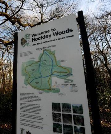
18 Various policies in the LDF seek to reduce the populations reliance on the private car through development in sustainable locations accessible by alternative transport method and the delivery of new infrastructure which enables alternatives such as walking and cycling. The framework also seeks to develop both formal and informal leisure facilities to which cycling could also be included as well as reducing the carbon footprint of the District. Council is particularly committed to providing for green tourism to help sustain the local economy, particularly in rural areas. The Wallasea Island Wild Coast Project where Crossrail tunnelling spoil is being used to create a new RSPB wetland reserve presents a particular new tourism opportunity. The formation of this new wetland reserve is a key part of Crossrail s sustainability strategy and so it is important that the reserve can be accessed by sustainable means in order to promote the underlying sustainability theme, as opposed to encouraging car access which will bring increased pollution to the area. Essex County Council in partnership with Council have been working with Essex Highways to identify options and approximate costs for the provision of two new cycle routes linking to Wallasea Island, one connecting Rochford Rail Station to Wallasea Island and another connecting Wallasea Island to Battlesbridge and National Cycle Network 135. Cherry Orchard Jubilee Country Park is situated within the Upper Roach Valley. The Upper Roach Valley is the large green lung bounded by the towns of Rayleigh, Hockley, Rochford and Southend and includes the SSSI of Hockley Woods, already popular with recreational cyclists. The Core Strategy states that the Upper Roach Valley will be protected from development which would undermine the area s role as a green space providing informal recreational opportunities. Also, it is important to note that an Air Quality Management Area (AQMA) has recently been declared in Rayleigh town centre in 2015, due to a marginal exceedance of the annual average level of nitrogen dioxide (NO2), a pollutant closely associated with vehicle exhaust emissions. This is in accordance with Part IV of the Environment Act 1995 Local Quality Management. The extent of the AQMA is shown in Figure 2.1 below. Potential routes 23, 25 and 30 pass through or across Rayleigh town centre. 11
 London Southend Airport, whilst modest in size compared to Stansted, is planned to grow into a successful regional airport with")
19 Figure 2.1 Rayleigh Air Quality Management Area London Southend Airport and Environs Joint Area Action Plan (JAAP) London Southend Airport, whilst modest in size compared to Stansted, is planned to grow into a successful regional airport with plans to deliver an additional 6,200 jobs to the area. The Southend Airport and Environs Joint Area Action Plan (JAAP) 2014 seeks to ensure good connectivity to the development area by all modes of transport, with appropriate improvements to sustainable transport and the highway network. Two reports have been prepared by Sustrans, which detail proposed cycling improvements in the area. The London Southend Airport and Environs Joint Area Action Plan Walking and Cycling Improvements document details a draft study undertaken on behalf of Southend-on-Sea Borough Council, Essex County 12
20 Council and Council (September 2014). In addition, the London Southend Airport and Environs Joint Area Action Plan Walking and Cycling Greenway Network - Linking the Community was a study undertaken on behalf of Southend Borough Council, Essex County Council and Council in December 2015, revised in February Both documents provide details of proposed cycle routes in the study area. The JAAP sets key targets that seek to ensure that the public transport mode share of air passengers should be at least 20% by 1.5million passengers per annum. It states that the staff transport mode share by car alone should not exceed 65% and the development of the wider cycle network is key to this objective National Cycle Network Route 135, Stock to Southend 2014 Sustrans undertook a feasibility study, for Rochford Local Highways Panel, to develop a new National Cycle Network (NCN) cycle route (NCR135) between Stock and Southend. In addition, neighbouring Southend Borough has been a high profile cycle town for a number of years and has been successful in both securing funding and providing new infrastructure. 13
21 Total Cyclists per day % Cycling Mode Share Cycling Action Plan 3 Data Analysis When planning for cycling infrastructure it is important to first understand current levels and conditions for cycling. This section includes analysis of: 2011 Census data; The Active People Survey (by Sport England); Department for Transport count data; Collision data; Cycle crime statistics; and Topography. Census Data As part of the 10 year national census, respondents are asked to state their main mode of travel to work by distance. The 2011 Census results for Essex are provided in Figure 3.1 below. Figure 3.1 Census Cycling to Work by District Total Cycling 2001 Total Cycling 2011 % Cycling 2011 Essex Average 4.5% 4.0% 3.5% 3.0% 2.5% 2.0% 1.5% 1.0% % 0 0.0% As shown above, according to the 2011 Census, Rochford has low levels of people cycling to work when compared with some Essex Districts, with 511 people cycling to work every day (1.3%). Cycling-to-work levels decreased marginally in the majority of Essex Districts between the 2001 and 2011 Census, with Rochford being an exception to this trend. Despite the number of people cycling to work growing by 90,000 between 2001 and 2011, the proportion remained the same at 2.8%. The decline in cycling to work in Essex and many other shire counties has been attributed to failures in local policy and a lack of 14
22 infrastructure 1. Whereas, in urban areas, cycling to work increased due to the implementation of improved infrastructure, thus balancing the decline experienced in rural areas. For residents of, 16% (6423) of journeys to work are made by train and with 4 rail stations in the District, trips to rail stations are important. Figure 3.2 shows the percentage of people cycling to work by origin in Rochford

23 Figure 3.2 % Cycling to Work by Origin in Rochford Existing Cycle Network as of March
24 Sport England Active People Survey Sport England carry out an Active People Survey annually, which involves interviewing 500 people from every District in England about their propensity to do physical activity. It is the largest survey of sport and active recreation in Europe. Figure 3.3 below shows average propensity to cycle at least once per month for any purpose based on the Sport England data. The results show that across Essex, Rochford has around average levels of residents cycling at least once a month in the county. Figure 3.3 Sport England Propensity to cycle at least once per month Uttlesford Thurrock Tendring Southend-on-Sea Rochford Maldon Harlow Epping Forest Colchester Chelmsford Castle Point Brentwood Braintree Basildon Essex Average Percentage cycling DfT Count Data The Department for Transport (DfT) collects vehicular flow data at various locations on the road network around the country. These counts record all vehicles using the carriageway, including cyclists. Of the 31 count sites located in Rochford, 10 sites record more than 50 cyclists per day. These figures indicate a fair amount of cycle use across the district. These are spread across a number of locations: Rayleigh Town Centre; Down Hall Road, Rayleigh; 17
25 B1013, Hockley; Ashingdon Road corridor; and Rocheway, Rochford. Consideration should be made to improving the cycling environment in these areas. Whilst none of the potential routes identified in this CAP pass through Rayleigh town centre directly, potential scheme 20 will improve conditions in one of the locations where high cycle flows have bene recorded, to the south east of the town. The high flows recorded to the south of Rayleigh town centre on the A129 could be accommodated on potential route 21, which will provide an alternative route northwards. High flows have also been recorded on the B1013, in Hockley. This is part of a proposed National Cycle Network Route (NCN Route), as well as being on the alignment of potential scheme 12. The existing cycle provision on the Ashingdon Road corridor will be extended by potential route 1. An alternative, parallel route, will also be provided by potential route 2, which could accommodate some of this demand. High cycle flows were recorded in a number of locations along the A127. Whilst this CAP does not propose any potential schemes on the A127 itself, it has considered a parallel route (potential schemes 16, 17, 18 and 19), which links Southend Airport with Rayleigh town centre and could provide an alternative route for local bike trips. The current cycle network (as at March 2015) along with count locations in Rochford is shown in Figure 3.4 below. 18

26 Figure 3.4 Existing cycle infrastructure in Rochford Existing Cycle Network as of March
27 Collision Data Fear of personal injury is often cited as a barrier to cycling but whilst this is an important issue, it is useful to use statistics rather than just perception to direct improvements to highway infrastructure to improve the cycling environment. The location of cycling personal injury collisions also serves to identify where cyclists are travelling in higher numbers which can be useful when deciding where to prioritise new infrastructure. Table 3.1 shows the number of recorded Personal Injury Collisions (PICs) involving cyclists by District for the 5 year period between August 2012 and July Figures below for Essex exclude the Unitary Authorities of Southend and Thurrock, figures for Greater Essex include these areas. Table 3.1: Personal Injury Collisions involving Cyclists, August 2012-July2017 % of Total cycle accidents in Greater Essex Number cycling to work 2 % of Total cycling to work in Greater Essex Grand Cycle Accidents Fatal Serious Slight Total BASILDON % % BRAINTREE % % BRENTWOOD % 320 2% CASTLE POINT % 631 4% CHELMSFORD % % COLCHESTER % % EPPING FOREST % 482 3% HARLOW % % MALDON % 548 3% ROCHFORD % 498 3% SOUTHEND % % TENDRING % % THURROCK % % UTTLESFORD % 433 3% ESSEX GREATER ESSEX % % 2 Source: ONS Cycling to Work Summary Table, taken from Census Table CT0015EW. 20
28 Rochford has relatively low rates of injury involving cyclists in Essex, with just 4% of total Greater Essex collisions. It has the 10 th highest number of cyclist collisions in the County but the 8 th highest amount of monthly cycling (from the Sport England survey) and 11 th highest amount of cycle commuting. Despite this however, two accident cluster sites exist at the following locations: 1. Crown Hill/High Road/Eastwood Road Rayleigh. Potential scheme 23 will provide an alternative, quieter parallel route along Love Lane, with an improved crossing of the High Street for people who cycle. Site 1 has no discernable accident pattern but provision of mini roundabouts are well known to impact on cycle safety. 2. Poynters Lane/Wakering Road south of Great Wakering Issues at site 2 are caused by poor visibility for vehicles pulling out of Wakering Road onto Poynters Lane. In addition there have been a number of serious collisions along Southend Road between Rochford and Southend Airport, with a cluster at the airport roundabout (in Southend) highlighting the priority for good quality cycle infrastructure along this corridor. Figure 3.5 shows the location of PICs in Rochford. 21
 in")
29 Figure 3.5 Location of PICs (Personal Injury Collisions) in Rochford Existing Cycle Network as of March
30 Cycle Crime Cycle crime (mainly theft) is reported both to Essex Police and British Transport Police, although it should be noted that cycle thefts are generally accepted as being under reported. Figures for both of these constabularies are combined by District in Table 3.2 below. Table 3.2 Total reported Cycle Crime by District Year Year All Essex Reported ending ending * Cycle Thefts June June % of all cycle thefts in Greater Essex (2017) Annual number of cycle thefts per cycle commuter 2 Basildon % 0.15 Braintree % 0.15 Brentwood % 0.23 Castle Point % 0.13 Chelmsford % 0.19 Colchester % 0.12 Epping Forest % 0.12 Harlow % 0.25 Maldon % 0.04 Rochford % 0.05 Southend-on-Sea % 0.22 Tendring % 0.10 Thurrock % 0.23 Uttlesford % 0.07 Essex Greater Essex % 0.16 *to Nov 20 th only 2. Based on 2017 thefts and ONS Census 2011 Journey to work by cycle total for District/ Borough/ City (ONS Cycling to Work Summary Table, taken from Census Table CT0015EW) Rochford has a relatively low level of recorded cycle crime, with just 1% of the total cycle thefts in Greater Essex and a rate of just 0.05 annual cycle thefts per commuter, which is the 2 nd lowest level in Essex. Statistics from British Transport Police show that none of the rail stations suffer from significant cycle theft. Topography There are a number of factors which determine the popularity of cycling in any given area. Of the geographical factors, by far the most significant is topography, as identified in many research studies and policy statements. These include 23
31 research carried out by Dr John Parkin who concluded; hilliness was found to be, by far, the most significant determiner of the proportion that cycled to work in a District 3. Rochford for the most part is a relatively flat District due to its low lying coastline, with most of the District under 30m above mean sea level, however the topography towards the west of the District is rolling in places. Whilst this is not significant enough to deter widespread cycling, there is a notable incline from Rayleigh railway station to the High Street, in particular. Figure 3.5 shows the topography of Rochford. 3 Parkin, J. Wardman, M and Matthew, P. (2008) Estimation of the determinents of bicycle mode share for the journey to work using census data. Transportation, 35 (1). pp


32 4 Existing Network Provision and Barriers Introduction The District of Rochford is situated on a peninsular between the River Thames and River Crouch and is bounded to the east by the North Sea, and to the west by the Basildon District and the City of Chelmsford. The District is served by a railway line, to which access is possible from stations at Rayleigh, Hockley, Rochford and London Southend Airport. This section provides a summary of the existing cycle infrastructure within as well as identifying various barriers and potential improvements. Existing infrastructure Cycle Routes Most of the current off-road provision for cycling is north and west of Rochford rail station and along the boundary with London Southend Airport (Figure 3.4). The majority of this has been provided through the development of London Southend Airport and further expansion of these facilities are recommended in the Joint Area Action Plan for the area. These existing routes provide a useful foundation for expanding infrastructure further in the area. A further small section of cycle network has also been provided as part of development around Priory Chase in North West Rayleigh. In addition, across the District s southern boundary there is a cycle route along most of the A127 and into Southend via Nestuda Way. However the A127 does present a barrier to a north-south movement due to limited crossing points. Figure 4.1 Shared segregated network along Ashingdon Road, Rochford and along Priory Chase, Rayleigh 25

 utilising various Byways and Bridleways. However these routes are incomplete and have inconsistent surfacing, though they have huge potential to form a greenway network in the District. Figure 4.")
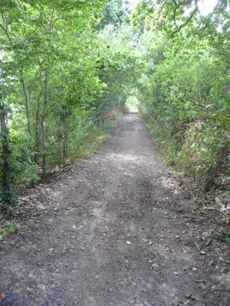
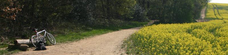
33 Of this existing cycle route provision, further improvements are needed to connect individual routes together to form a coherent core cycle network. There is also a general lack of route signing, compared to the neighbouring Borough of Southend-on-Sea, which could potentially pose a barrier to those wishing to cycle between Southend and Rochford. Along with the routes detailed above, various leisure cycle routes exist through Hockley Woods, Cherry Orchard Jubilee Country Park and Sweyne Park (Figure 4.2) utilising various Byways and Bridleways. However these routes are incomplete and have inconsistent surfacing, though they have huge potential to form a greenway network in the District. Figure 4.2 Cherry Orchard Jubilee Country Park and Sweyne Park The surface of these routes varies in quality with a number of areas suffering from drainage issues and some needing a more permanent surface. The further development of these greenways would increase their leisure use and in some cases even provide for utility cycling. Potential routes 13, 14 and 25 will provide improved cycle access to and through Hockley Woods and potential route 27 will improve access to Cherry Orchard Jubilee Country Park for people that cycle. Potential route 24 will provide improved cycle access to Sweyne Park. Furthermore, a new Sustrans National Cycle Network route 135 (NCR 135) is planned from Stock, Chelmsford in the west to Southend in the east, and passes through for about 7 miles, between Hullbridge in the north-west and Cherry Orchard Way in the south. This route mainly follows quieter roads and the September 2014 report Walking and Cycling Improvements: National Cycle Route 135, Stock to Southend details a large number of potential improvements to make the route cycle friendly. 26


34 The current cycle network in the is shown in Figure Cycle Parking Rayleigh High Street has a good spread of cycle parking provision along its length. All Sheffield stands are in uncovered locations. In Rochford town centre there is also relatively good provision with new stands recently added to the Market Square and where new development has occurred to the north. Figure 4.3 shows some examples of cycle parking in Rayleigh and Rochford town centres. Figure 4.3 Examples of cycle parking in Rayleigh and Rochford town centres The District has four railway stations on the Shenfield Southend line, located in Rayleigh, Hockley, Rochford and London Southend Airport. Each station has widely differing levels of cycle parking provision as shown in Table 4.1 below. Numbers have been taken from National Rail Enquiries website, and are up to date as of 24 th May


35 Table 4.1 Cycle parking supply at stations Station Cycle parking spaces (type) Hockley Rayleigh 80 (wheel racks) 110 (42 sheffield stand spaces and 68 2-tier racks). Cycle storage is sheltered with CCTV Rochford 40 4 sheltered double stack spaces, 6 sheltered Sheffield stands with CCTV London Southend Airport 10 Whilst there are no issues with cycle parking capacity at rail stations in Rochford, the quality of facilities varies widely. Some, but not all, of the cycle parking is covered. There is no provision of secure parking at all. Whilst the lack of cycle network leading to the stations is likely to be a key factor in supressing demand, a step change in the quality of parking facilities is also needed. Essex County Council has recently been successful in obtaining funding from the South East Local Enterprise Partnership (SELEP) and has improved facilities at Rochford and Rayleigh stations. Cycle access to railway stations in the area will be improved through potential routes 23 in Rayleigh, 29 in Hockley, 5/28 Rochford and 7 at London Southend Airport Station. Figure 4.4: Examples of cycle parking at Rayleigh and Rochford stations 4 Note, cycle parking facilities have recently been upgraded and improved at Rochford station, so this number of cycle parking is not yet shown on the National Rail Enquiries website 28
36 Key Barriers There are a number of barriers to cycling in the District. These include: Insufficient infrastructure to encourage cycling in certain areas of the District e.g. lack of cycle parking in Hockley Town Centre; and Lack of official and recognised cycle routes outside of Rochford Town Centre. A number of potential routes have been identified by this CAP, which will enable safer cycling within and between the urban areas of the district. A number of improvements in the district would assist in encouraging cycling demand. They include: Improved connectivity to London Southend Airport from Rochford. Potential routes 5, 7 and 28 will improve access between the airport and Rochford; Development of the cycle network in Rayleigh. Potential routes 20, 21, 23, 24 and 25 will improve cycle links in Rayleigh; Improved connectivity between urban areas and committed development sites. In combination, a number of routes will provide better connections between the urban areas of Rayleigh, Hockley and Rochford (potential routes 25, 13, 14, 15, 16, 3, 11, 12 and 13); Enhancement and provision of new leisure greenways utilising open space. Potential routes 25, 13, 15, 16, 17 and 18 will provide cycle facilities through open space and parkland; Development of cross boundary routes to Castle Point, Basildon, Chelmsford and Southend-on-Sea; and Provision of additional cycle parking at railway stations. 29
37 5 Rochford s Cycling Potential Introduction This section provides a summary of the existing travel behaviours within Rochford District as well as identifying the potential for cycling. Commuter Flow Analysis The 2011 Census records how residents choose to travel to work as well as the location of their workplace. The aim of analysing this information is to establish where the predominant local commuter movements exist that could feasibly be undertaken by bicycle. This data can then be used to assess the commuter cycle potential for an area. The predominant commuter flows for have been calculated based on travel between medium super output areas (MSOAs). As journeys to work take place to and from all MSOAs within the district, only the top 10 most popular commuter journeys per mode have been highlighted. It has been assumed that commuters would choose the same route and mode of travel to work (in the AM) as they do to return from work (in the PM) Cycle trips Although the numbers are relatively low, all of the 10 most popular District wide commuter journeys by bicycle were made within the urban areas of western Rochford. Figure 5.1 shows the predominant commuter flows for journeys to work by bike within Rochford. The highest current cycling origin/destination pairs are within Hockley and trips to the Purdeys Way industrial area. Potential route 6 and its onward connections (via potential routes 5 and 7), will improve cycle access to the Purdeys Way industrial area Car trips Cross district boundary analysis for car drivers has been excluded, as all the top 10 most popular origin / destination journeys to work by car occurred within the District. Figure 5.2 shows that despite the compact nature of the 3 urban areas, they all have a significant number of short internal commuting trips by car, with 723 people in Rayleigh, 362 in Hockley and 351 in Rochford driving to work locally. A 30
38 large proportion of these trips could potentially be made by bike if the right infrastructure was provided. Most other journeys were to three primary locations, Hockley/Hawkwell, Rochford town centre and Purdeys Way industrial area. All of these work journeys are less than 4 miles and so could be made by bike if appropriate infrastructure was provided. Potential route 6 and its onward connections (via potential routes 5 and 7), will improve cycle access to the Purdeys Way industrial area. Potential routes 3, 11 and 12 could capture part of the existing car driver demand between Hockley and Rochford. Potential route 1 could accommodate some of the high car driver demand between north Rochford and Purdeys Way. Within Rayleigh, potential routes 23 and 24 could accommodate some of the high car driver demand to the northern and south eastern areas of Rayleigh and may result in some car drivers switching mode to cycle. Of note is the lack of trips between Rayleigh and Hockley Rail In many cases, cycling can form a key part of commuter rail journeys. The 2011 Census only records main mode by distance, therefore assumptions must be made when analysing journeys that would be multi-modal. Where commuters have stated their main mode of travel to work to be by rail, it has been assumed that rail commuters would predominantly choose the closest station to them, unless a main line station is located within a similar proximity. In such a case, it is assumed the preference would be the main line station. An additional assessment has been made which excludes a percentage of rail commuters living within 1km of the rail station, as it is expected the majority of those people would walk to the rail station. Figure 5.3 shows that Rayleigh station has by far the highest potential in the for cycle journeys, with over 2,000 people commuting there from a relatively short distance away making improved access here a priority. Potential route 23 would accommodate some of this demand, providing a useful E-W link across Rayleigh and linking residential areas to the town centre and station. To a lesser extent, potential also exists to Rochford station along the N-S Ashingdon Road corridor. Potential route 28 would accommodate some of this demand. Whilst 853 commuters use Hockley station from the surrounding MSOA, the relatively short distances involved will make walking more attractive for most. 31

39 Figure 5.1 Predominant commuter flows for journey to work by bicycle in Rochford Existing Cycle Network as of March
40 Figure 5.2: Predominant commuter flows for journey to work by car in Rochford Existing Cycle Network as of March

41 Figure 5.3 Predominant commuter flows for journey to work by rail in Rochford Existing Cycle Network as of March
42 MOSAIC Propensity to Cycle Market segmentation is concerned with grouping together a diverse range of people to understand their current behaviour and the likelihood and triggers for maintaining or changing how they act in the future. The MOSAIC Cycling Segmentation was developed for TfL by Steer Davis Gleave as an aid to cycling policy development, planning, implementation and evaluation. This was required to help target areas of opportunity to best increase mode share and assist in increasing trips. The MOSAIC Cycling Segmentation classifies the population into seven segments, each with a different propensity to cycle e.g. those in the Urban Living segment are 4.6 times more likely to be a cyclist than those in the Comfortable Maturity segment. This can then be applied to postcodes and displayed on mapping as shown in Figure 5.4. The MOSAIC data for shows that areas of residents with a higher propensity to cycle are: north of Rochford town centre; along the Ashingdon Road corridor (where some infrastructure already exists); and the western side of Rayleigh. Future infrastructure improvements should take account of the demographic of these areas and be prioritised accordingly. Potential routes 23 and 24 will provide improved cycle access to/ from western Rayleigh. 35

43 Figure 5.4 MOSAIC Analysis Propensity to Cycle in Rochford Existing Cycle Network as of March
44 Summary of Potential As previously identified, there are a significant number of people driving short distances to access work (4 miles or less). The majority of these trips occur to the Purdeys industrial area. Therefore, providing improved cycle routes and marketing targeted towards car drivers who commute along these routes could provide the biggest gains in terms of mode shift towards cycling. Potential route 6 and onward links (for example, via potential routes 5 and 7) will greatly improve cycle access to this industrial area. Significant mode shift potential also exists for trips to Rayleigh rail station which although has a fair level of existing cycle use, would benefit from improved cycle infrastructure. This combined with west Rayleigh s higher propensity to cycle makes improvements in this vicinity a priority. Potential routes 23, 24, 28, 20 and 25 will improve cycle access in Rayleigh. The Ashingdon Road corridor also shows good potential from both rail commuters and the MOSAIC segmentation, so should also be further improved. This has been identified and potential scheme 28 will address this issues. 37
45 6 Potential Infrastructure Improvements Background In order to remove barriers to cycling and provide suitable infrastructure, it is essential that all new developments in the District have good quality, cycle friendly routes to key services, railway stations and areas of employment. To this end, all potential developments associated with the Rochford Local Plan should contribute towards creating a wider network of cycle-friendly routes with provision along key corridors and desire lines. A coordinated approach should be taken whereby development planning and highway scheme delivery in is linked with infrastructure provision, complemented by soft measures that promote cycling as part of a range of alternatives to single-occupancy car travel. This CAP is identifying a network of strategic cycle routes, which incorporate the JAAP proposals within Rochford, as well as identifying, within this, specific Flagship Routes. These Flagship Routes for the District of Rochford are described later in this report, in Section 8. Potential cycle routes Potential new cycle routes have been identified to help create a step-change in cycling conditions across the District. These might include signed routes (with journey times and surface markings), networks of interconnected cycle routes on quiet residential streets, filtered permeability (e.g. convenient cut-throughs and contraflows) and, where appropriate, 2 nd generation cycling infrastructure, such as Dutch, Danish or light segregation. Infrastructure improvements have been considered for the urban areas of Rayleigh, Hockley and Rochford, as well as linkages into London Southend Airport. These routes also incorporate JAAP route proposals. Methodology Statement The potential routes have not, at this stage, been subject to detailed scheme design or feasibility, they are the result of an initial scoping study which is recommending a strategic network. Local knowledge, obtained through Stakeholder Consultation, has been used to inform this process. Where possible, the Sustrans Design Manual has been used to inform provision, particularly with regard to the acceptable provision related to traffic speed and volume conditions in specific locations. 38
. Traffic volume and speed may influence the decision on the need to segregate cyclists from other traffic.")
46 Where traffic volume and speed data is available, the potential schemes have been subjected to Sustrans design principles, which recommend the type of scheme that should be considered under those conditions (Figure 6.1). Traffic volume and speed may influence the decision on the need to segregate cyclists from other traffic. For example, where low speeds and traffic volumes are evident, there is no need to segregate cycle and other traffic and a shared carriageway is acceptable. As traffic speeds and volumes increase, cycle lanes are found to be more desirable, until the threshold is reached whereby physical segregation is required. Beyond this point, where 85 percentile traffic speeds exceed 40mph, and/ or volumes exceed 9500 vehicles/ day (or 950 vehicles/ hour), conditions become unsuitable for cycling on the carriageway and physical segregation with a verge is necessary. Where traffic volume and speed data are not currently available, it may be necessary to undertake a traffic survey to determine the provision that is required. Figure 6.1: Sustrans Segregation and traffic flow 5 5 Sustrans Design Manual. Handbook for cycle-friendly design, Sustrans, April
47 In some locations, it has been noted that cycle-friendly crossings will be required. In most instances, further work and traffic surveys will be required to enable the exact type of crossing provision to be determined. There are some examples 6 * where footway/footpath conversions to shared use have been identified. The conversion of footpaths and footways to permit bicycle use is not regarded as a general or area wide remedy, but has been confined to specific links and locations. It is recommended that where footpath conversion and/or footway conversion to shared use is considered then further studies are undertaken to demonstrate that alternative options have been discounted and that clear benefits can be derived. In such situations it is vital that the benefits to the cyclist are balanced against the increased risk and inconvenience to pedestrians. ECC aims to limit the use of footway conversion/ shared use paths and Engineers and Designers should first consider alternative options. A full list of recommended schemes can be found in Table 7.1, the locations of these routes are shown in Figure 6.2 and the JAAP cycle proposals are shown in Figure 6.3, below. Joint Area Action Plan Proposals A number of cycle routes in the CAP area have been proposed in the London Southend Airport and Environs Joint Area Action Plan (JAAP) report. They are shown in Figure 6.3. Some of these proposed cycle routes have also been identified as potential routes in this CAP. For those that are not detailed in this CAP, further information about the detail of the JAAP schemes can be found in the London Southend Airport and Environs Joint Area Action Plan walking and cycling improvements document (September 2014), prepared by Sustrans on behalf of Southend on-sea Borough Council, Essex County Council and Council. Further details of JAAP cycle routes can also be found in the London Southend Airport and Environs Joint Area Action Plan Walking and Cycling Greenway Network -Linking the Community (December 2015, revised February 2016). This document was prepared by Sustrans on behalf of Southend Borough Council, Essex County Council and Council. In particular, it provides details about the subway described as part of potential scheme The asterisk refers to schemes with footway conversions, listed in Table
48 Construction Design and Management (CDM) The potential new cycle routes identified in this CAP all require further feasibility assessment before they can be finalised or confirmed. In some cases, the alignment of the routes may need to be amended to ensure that the safest scheme design, in terms of operation, construction design and management, is identified. In some cases, a route might need to be deleted entirely, if it is determined that CDM risks cannot be reasonably mitigated through early design stages. Some of the potential routes are alongside or cross features such as high speed roads, water courses or railway lines and may either require a new structure or widening of an existing structure in order to be implemented. It is recognised that these features raise the potential for significant risk (and indeed cost) during construction and operational management and they will need to be given particular consideration during the feasibility assessment. 41

49 Cycling Action Plan Figure 6.2 Existing and potential cycle routes in Rochford 42

50 Figure 6.3 JAAP cycle routes in Rochford 43
Maldon District Cycling Action Plan Highways/Transport Planning January 2018
 Cycling Action Plan Highways/Transport Planning January 2018 Contents 1 Introduction... 1 1.1 Preamble... 1 1.2 Background... 2 1.3 Aims of the Action Plan... 3 1.4 Report Structure... 4 2 Policy Review...
Uttlesford District Cycling Action Plan Highways/Transport Planning March 2018
 No Cycling Action Plan Highways/Transport Planning March 2018 Contents 1 Introduction... 10 1.1 Preamble... 10 1.2 Background... 11 1.3 Aims of the Action Plan... 12 1.4 Report Structure... 13 2 Policy
Epping Forest District Cycling Action Plan Highways/Transport Planning March 2018
 Epping Forest District Cycling Action Plan Highways/Transport Planning March 2018 i Contents Contents... ii Executive Summary... v 1 Introduction... 1 2 Policy Review... 5 3 Data Analysis... 13 4 Existing
Cycling and Walking Investment Strategy & Local Cycling and Walking Infrastructure Plans
 Cycling and Walking Investment Strategy & Local Cycling and Walking Infrastructure Plans 1 Investing in cycling and walking contributes to a broad range of cross-cutting policy objectives Cycling and walking
Harlow District Cycling Action Plan Highways/Transport Planning July 2018
 Harlow District Cycling Action Plan Highways/Transport Planning July 2018 Contents 1 Introduction... 1 1.1 Preamble... 1 1.2 Background... 2 1.3 Aims of the Action Plan... 3 1.4 Report Structure... 4 2
Chelmsford Cycling Action Plan Highways/Transport Planning March 2017
 Chelmsford Cycling Action Plan Highways/Transport Planning March 2017 Contents Introduction... 1 Policy Review... 7 Data Analysis... 15 Existing Network Provision and Barriers... 32 Cycling Potential...
A127/A130 Fairglen Interchange Improvement Schemes. Information Leaflet February 2017
 A127/A130 Fairglen Interchange Improvement Schemes Information Leaflet February 2017 1 2 Foreword By Councillor Kevin Bentley Essex is continuing to grow as a vibrant economic hub and as a fantastic place
WEST YORKSHIRE LTP CYCLE PROSPECTUS
 WEST YORKSHIRE LTP CYCLE PROSPECTUS The West Yorkshire Ambition: To be recognised as a great place for safe cycling, inspiring more people to cycle more often. INTRODUCTION Cycling is low cost, environmentally
Walking and Cycling Action Plan Summary. A Catalyst for Change The Regional Transport Strategy for the west of Scotland
 Walking and Cycling Action Plan Summary A Catalyst for Change The Regional Transport Strategy for the west of Scotland 2007-2021 Strathclyde Partnership for Transport Contents Purpose...2 Issues, Constraints
Living Streets response to the Draft London Plan
 Living Streets response to the Draft London Plan Contents Living Streets response to the Draft London Plan... 1 About Living Streets... 2 Summary... 2 Consultation response... 3 Chapter 1: Planning London
March Maidstone Integrated Transport Strategy Boxley Parish Council Briefing Note. Context. Author: Parish Clerk 2 March 2016
 Context. Author: Parish Clerk 2 The Draft Integrated Transport Policy (DITS) sets out a vision and objectives, and identifies a detailed programme of interventions to support the Maidstone Borough Local
Cycle traffic and the Strategic Road Network. Sandra Brown, Team Leader, Safer Roads- Design
 Cycle traffic and the Strategic Road Network Sandra Brown, Team Leader, Safer Roads- Design Highways England A Government owned Strategic Highways Company Department for Transport Road Investment Strategy
PERSONALISED TRAVEL PLANNING IN MIDLETON, COUNTY CORK
 PERSONALISED TRAVEL PLANNING IN MIDLETON, COUNTY CORK Elaine Brick Principal Transport Planner AECOM Abstract Smarter Travel funding was awarded to the Chartered Institute of Highways and Transportation
Active Travel Strategy Dumfries and Galloway
 Active Travel Strategy Dumfries and Galloway Our Active Travel Strategy The agreed Interventions for Dumfries and Galloway Council s Local Transport Strategy includes an action to Develop an Active Travel
This objective implies that all population groups should find walking appealing, and that it is made easier for them to walk more on a daily basis.
 Walking for life The Norwegian Walking Strategy Guro Berge Norwegian public Roads Administration "Walking for life" is the slogan for the National Walking Strategy that is now being formulated in Norway.
2. Context. Existing framework. The context. The challenge. Transport Strategy
 Transport Strategy Providing quality connections Contents 1. Introduction 2. Context 3. Long-term direction 4. Three-year priorities 5. Strategy tree Wellington City Council July 2006 1. Introduction Wellington
London Cycle Network Annual Report 2000
 London Cycle Network Annual Report 2000 A cycle network for London by 2005 A cycle network for London by 2005 The London Cycle Network will: provide local links between residential neighbourhoods, railway
Transport Workshop Dearbhla Lawson Head of Transport & Infrastructure Policy & Funding University of the Third Age.
 Transport Workshop Dearbhla Lawson Head of Transport & Infrastructure Policy & Funding University of the Third Age 30 th March 2015 1 Presentation Overview Roles and responsibilities Snapshot of Key Challenges
Contents Location Map Welcome and Introduction Travel Plan Management Science Park Accessibility Walking Cycling Bus Rail Car Sharing Contact Details
 Contents Contents Location Map Welcome and Introduction Travel Plan Management Science Park Accessibility Walking Cycling Bus Rail Car Sharing Contact Details 1 2 3 5 7 9 11 13 15 17 19 Thames Valley Science
Bristol City Council has produced a draft Bristol Transport Strategy document.
 Bristol Transport Strategy Summary Document Introduction Bristol City Council has produced a draft Bristol Transport Strategy document. The Strategy fills a gap in transport policy for Bristol. We have
9. Parking Supporting Statement
 9. Parking Supporting Statement Content 1. Setting the Scene 2. Vision 3. Parking and the Shared Priorities 4. Issues 5. Delivery Programme in the first Plan Period 2001/02 2005/06 6. Good Practice 7.
A future cycle route network for North Staffordshire mb/08/16 Need for a strategy. Existing cycle route network
 Need for a strategy 1. The government s aim is to double cycling levels nationally by 2025 [note 1]. This would bring significant health, environmental, economic and traffic benefits [note 2]. It is widely
Department for Transport
 Improving UK evidence on health and environmental (low carbon) behaviours John Cummings Department for Transport 4 th November, 2015 CYCLING AND WALKING POLICY TEAM, OFFICIAL, 1st DRAFT 1 Walking and cycling
PEDESTRIAN ACTION PLAN
 ATTACHMENT 2 CITY OF SANTA MONICA PEDESTRIAN ACTION PLAN CITY OF SANTA MONICA PEDESTRIAN ACTION PLAN This page intentionally left blank EXECUTIVE SUMMARY CHAPTER 1 EXECUTIVE SUMMARY Setting the Stage
Exhibit 1 PLANNING COMMISSION AGENDA ITEM
 Exhibit 1 PLANNING COMMISSION AGENDA ITEM Project Name: Grand Junction Circulation Plan Grand Junction Complete Streets Policy Applicant: City of Grand Junction Representative: David Thornton Address:
HAMILTON BIKING PLAN OUR VISION: A BIKE FRIENDLY CITY
 HAMILTON BIKING PLAN 2015-2045 OUR VISION: A BIKE FRIENDLY CITY INTRODUCTION Biking as a travel option is experiencing a resurgence internationally and in New Zealand, growing as a familyfriendly and healthy
What s the issue for transport in Cardiff?
 Demand for travel The number of commuters travelling to work in Cardiff has increased from 190,000 in 2001 to 198,000 in 2010, with some 124,000 Cardiff residents travelling across the city daily to their
GETTING WHERE WE WANT TO BE
 CAMBRIDGESHIRE & peterborough GETTING WHERE WE WANT TO BE A GREEN PARTY TRANSPORT POLICY CONTENTS Our Campaign Priorities 4 Bus Franchising 6 Supporting Active Transport 8 Workplace Parking Levy 9 Tackling
Speed Limit Policy Isle of Wight Council
 APPENDIX B Speed Limit Policy Isle of Wight Council 2009 Contents Section 1 Introduction 1.1 Links with the Local Transport Plan Section 2 Speed Limits on Urban Roads and Residential Areas 2.1 20mph Limits
Essex Cycling Strategy. Highways/Major Projects November 2016
 Essex Cycling Strategy Highways/Major Projects November 2016 2 Contents Introduction 4 The Purpose of the Strategy 4 Report Content 4 Section One: Why cycling is important to Essex 5 National Context 5
ANNEX1 The investment required to achieve the Government s ambition to double cycling activity by 2025
 ANNEX1 The investment required to achieve the Government s ambition to double cycling activity by 2025 May 2016 About Sustrans Sustrans makes smarter travel choices possible, desirable and inevitable.
Transportation Master Plan Advisory Task Force
 Transportation Master Plan Advisory Task Force Network Alternatives & Phasing Strategy February 2016 BACKGROUND Table of Contents BACKGROUND Purpose & Introduction 2 Linking the TMP to Key Council Approved
Launceston's Transport Futures. Greater travel options for the people of Launceston
 Launceston's Transport Futures Greater travel options for the people of Launceston Final Draft 13 Jan 2014 1 Page Number Executive summary 3 What is Transport Futures? 4 Vision 6 Economy, access and liveability
University of Leeds Travel Plan
 University of Leeds Travel Plan 2015-2018 Contents 1: Introduction 1.1 What is a Travel Plan? 1.2 Why do we need one? 1.3 Sustainability Strategy 2: Overview 2.1 The bigger picture 2.2 The City scale 2.3
Nottingham Cycle City Frequently Asked Questions
 Nottingham Cycle City Frequently Asked Questions About the scheme How much money is to be spent on cycling? And where is the money from? We have 6.1 million in Growth Fund which we will be investing directly
4. WIDER SOCIAL DETERMINANTS OF HEALTH
 4. WIDER SOCIAL DETERMINANTS OF HEALTH 4.6 Road Safety Road safety affects all road users; pedestrians, cyclists and vehicle drivers and passengers. This section describes the impact of road safety and
CAIRNGORMS NATIONAL PARK AUTHORITY FOR DECISION
 CAIRNGORMS NATIONAL PARK AUTHORITY FOR DECISION Title: Prepared by: A9 Dualling Project: Dalraddy to Slochd Murray Ferguson, Director of Planning and Rural Development and Gavin Miles, Head of Planning
Westminster s Joint Health and Wellbeing Strategy
 Westminster s Joint Health and Wellbeing Strategy 2013 2016 Response from Sustrans General comments From a strategic perspective, Sustrans welcomes the Health and Wellbeing Strategy s focus on encouraging
21.07 TRANSPORT CONNECTIVITY AND INFRASTRUCTURE
 21.07 TRANSPORT CONNECTIVITY AND INFRASTRUCTURE 21.07-1 Connectivity and Choice Transport connectivity and mode choice are critical to achieving productive, sustainable and socially just cities. Travel
Douglas Land Use and Transportation Strategy (DLUTS) Summary. August 2013
 Summary. August 2013") Douglas Land Use and Transportation Strategy (DLUTS) Summary August 2013 Background Douglas is a large and popular residential suburb of approximately 30,000 persons on the periphery of Cork City along
Douglas Land Use and Transportation Strategy (DLUTS) Summary August 2013 Background Douglas is a large and popular residential suburb of approximately 30,000 persons on the periphery of Cork City along
LEA BRIDGE ROAD - A STREET FOR EVERYONE Public consultation document
 LEA BRIDGE ROAD - A STREET FOR EVERYONE Public consultation document TELL US Bakers Arms to Leyton Green Road (Section D, E, F) Leyton Green Road to Whipps Cross Roundabout (Section G) YOUR VIEWS www.enjoywalthamforest.co.uk
Delivering the. Strategy 7.0
 7.0 Delivering the Strategy 7.1 Introduction This chapter presents a framework for the delivery of the strategy. Key challenges and opportunities are identified that will have an impact on the successful
Nottingham, the great cycle city
 Nottingham, the great cycle city Our vision for the city s cycling future Foreword Councillor Jon Collins Leader of the Council Nottingham has a world class public transport system which is essential to
MARKHOUSE ROAD IMPROVEMENTS
 MARKHOUSE ROAD IMPROVEMENTS www.enjoywalthamforest.co.uk Waltham Forest is changing and we want you to be part of it. Thanks to a funding pot of 27million from Transport for London, we re delivering the
CYCLING CHARTER ACTION PLAN EXECUTIVE SUMMARY
 CYCLING CHARTER ACTION PLAN EXECUTIVE SUMMARY THE VISION OF THE CYCLING CHARTER To realise the full potential of cycling s contribution to the health and wealth of the West Midlands creating more sustainable
1.5 On this basis it is fundamental that the Transport Strategy for the site focuses on the following key criteria,
 1.0 Introduction 1.1 The Transport Assessment has been prepared on behalf of Eon and Roger Bullivant Ltd in respect of the proposed mixed use sustainable urban extension of Drakelow Park. 1.2 The methodology
A1307 Haverhill to Cambridge: Approval to consult on transport improvement concepts
 Report To: Greater Cambridge City Deal Executive Board 3 March 2016 Lead Officer: Graham Hughes, Executive Director of Economy, Transport and Environment, Cambridgeshire County Council A1307 Haverhill
Birmingham Connected. Edmund Salt. Transportation Policy Birmingham City Council
 Birmingham Connected Edmund Salt Transportation Policy Birmingham City Council www.birmingham.gov.uk/connected Birmingham Connected the story so far Broadly following EU Guidance We ve done all of this
Public Consultation on Braintree Integrated Transport Package (ITP) HAVE YOUR. Consultation open from 24 September to 5 November 2018 SAY
 HAVE YOUR. Consultation open from 24 September to 5 November 2018 SAY") Public Consultation on Braintree Integrated Transport Package (ITP) HAVE YOUR SAY Consultation open from 24 September to 5 November 2018 Contents Introduction 3 Background 4 Springwood Drive Roundabout
Public Consultation on Braintree Integrated Transport Package (ITP) HAVE YOUR SAY Consultation open from 24 September to 5 November 2018 Contents Introduction 3 Background 4 Springwood Drive Roundabout
Regional Cycling Plan
 Adopted December 2008 Quality for Life Adopted December 2008 For more information, contact: Greater Wellington 142 Wakefield Street PO Box 11646 Manners Street Wellington 6142 T 04 384 5708 F 04 385 6960
University of Victoria Campus Cycling Plan Terms of Reference. 1.0 Project Description
 University of Victoria Campus Cycling Plan Terms of Reference 1.0 Project Description The Campus Cycling Plan, a first for the University, will provide a comprehensive and coordinated approach to support
CITY OF COCOA BEACH 2025 COMPREHENSIVE PLAN. Section VIII Mobility Element Goals, Objectives, and Policies
 CITY OF COCOA BEACH 2025 COMPREHENSIVE PLAN Section VIII Mobility Element Goals, Objectives, and Policies Adopted August 6, 2015 by Ordinance No. 1591 VIII MOBILITY ELEMENT Table of Contents Page Number
The Cabinet Member for Highways & Streetscene. Aurang Zeb - Head of Highways & Transport
 LONDON BOROUGH OF RICHMOND UPON THAMES Cabinet Member Decision DATE: January 2012 REPORT OF: LEAD OFFICER: SUBJECT: WARDS: The Cabinet Member for Highways & Streetscene Aurang Zeb - Head of Highways &
Blyth Estuary Green Travel Project
 Blyth Estuary Green Travel Project Green Infrastructure Case Study Creating the UK s first Active Travel Town The Connect 2 Blyth Estuary Green Travel Project shows how green infrastructure can enable
GD 0043/18 ACTIVE TRAVEL STRATEGY
 GD 0043/18 ACTIVE TRAVEL STRATEGY 2018-2021 May 2018 Minister s Introduction There is strong evidence that regular physical activity reduces the risk of a range of health conditions. The best way to increase
Draft Greater Sydney Region Plan
 Powered by TCPDF (www.tcpdf.org) Draft Greater Sydney Region Plan Submission_id: 31452 Date of Lodgment: 15 Dec 2017 Origin of Submission: Online Organisation name: UNSW Sydney Organisation type: Other
DOE Climate Change Proposals
 DOE Climate Change Proposals Sustrans response to Proposals for Taking Forward NI Climate Change Legislation January 2016 About Sustrans Sustrans makes smarter travel choices possible, desirable and inevitable.
Part 3: Active travel and public transport planning in new housing developments
 1 Linking active travel and public transport to housing growth and planning Part 3: Active travel and public transport planning in new housing developments Active Travel Toolkit Slide Pack July 2017 Linking
Local Sustainable Transport Fund
 I II III Sustainable travel in Greater Manchester: The journey to a low carbon economy Greater Manchester has a vision of sustainable commuting at the heart of its blueprint for a low carbon economy, as
Climate Change Action Plan: Transportation Sector Discussion Paper: Cycling
 Climate Change Action Plan: Transportation Sector Discussion Paper: Cycling ontario.ca/climatechange Contents 1. Minister of Transportation s message... 3 2. Introduction... 5 3. Sector Overview and Support
Wayfinding and Walking in London. Lilli Matson Transport for London May 2013
 Wayfinding and Walking in London Lilli Matson Transport for London May 2013 I want to make walking in London as attractive and enjoyable as possible by making walking count Mayor of London Boris Johnson
Regional Cycle Programme Update
 Agenda Item 10 (ii) Regional Cycle Programme Update Glossary Auckland Council Auckland Transport Cycle Action Auckland New Zealand Transport Agency Regional Cycle Network (AC) (AT) (CAA) (NZTA) (RCN) Executive
ENFIELD TOWN THE REVISED DESIGN
 TOWN THE REVISED DESIGN We re turning Enfield into a borough that encourages walking and cycling, a place that s easy for all of us to get around however we choose to travel. A greener place, with safer
Final Plan 20 December 2016
 Final Plan 20 December 2016 Introduction Aims of the Travel Plan How do we travel? Understanding travel behaviours? The University Master Plan and its implications Galway City sustainable transport policies
Appendix N(b): Portishead Station Outline Travel Plan
: Portishead Station Outline Travel Plan") Portishead Branch Lane (MetroWest Phase 1): Environment Impact Assessment Appendix N(b): Portishead Station Outline Travel Plan Prepared for West of England Councils September 2017 1 The Square Temple
Portishead Branch Lane (MetroWest Phase 1): Environment Impact Assessment Appendix N(b): Portishead Station Outline Travel Plan Prepared for West of England Councils September 2017 1 The Square Temple
Active travel and economic performance: A What Works review of evidence from cycling and walking schemes
 1 Making the economic case for active travel Active travel and economic performance: A What Works review of evidence from cycling and walking schemes Active Travel Toolkit Slide Pack July 2017 Active travel
Devonport City Cycling Network Strategy
 Devonport City Cycling Network Strategy 2010-2013 Devonport City Cycling Network Strategy Introduction In February 2010 a draft master plan for cycleways was presented to the community. The feedback received
LEEDS BECKETT UNIVERSITY. Transport Strategy
 LEEDS BECKETT UNIVERSITY Transport Strategy 2016-2021 2 3 Contents 1. Introduction 1. Introduction...3 Scope of the Document...3 Vision...3 Key Successes...3 2. Our Travel Behaviour...4 Staff and Student
Government transport policy
 Government transport policy and the implications for planning RTPI TPS Transport Planning Network James Harris P o l i c y a n d N e t w o r k s M a n a g e r R o y a l To w n P l a n n i n g I n s t i
KEY FINDINGS OF THE INTERIM EVALUATION OF THE SMARTER TRAVEL AREAS PROGRAMME
 Proceedings 1st - 2nd September 2016 BRICK, CANTWELL, SWIFT: Smarter Travel Areas KEY FINDINGS OF THE INTERIM EVALUATION OF THE SMARTER TRAVEL AREAS PROGRAMME Elaine Brick Associate Director AECOM Mairead
Our journey a 20 year Transport Manifesto for the North East
 Our journey a 20 year Transport Manifesto for the North East Sustrans submission to North East Combined Authority (NECA). March 2016 Summary Sustrans is a leading UK charity enabling people to travel by
Ormond & McKinnon Walks Response to Draft Glen Eira Community Plan
 Response to Draft Glen Eira Community Plan We would like to take this opportunity to thank Glen Eira City Council for the opportunity to comment on the Glen Eira Draft Community Plan. Below is an outline
Section 2 Strategic Alignment. Contents
 Section 2 Strategic Alignment Contents 2 Strategic Alignment... 2 2.1 General... 2 2.2 SmartGrowth Strategy and Implementation Plan... 2 2.3 Walking and Cycling Strategy... 3 2.4 Built Environment Strategy...
Joint Response to the Department for Transport Consultation on the Station Champions Report on Better Rail Stations. February 2010
 Joint Response to the Department for Transport Consultation on the Station Champions Report on Better Rail Stations Joint Response to the Better Rail Stations Consultation This response has been prepared
Loughborough University Travel Planning
 Document Ti tle Client Name Loughborough University Travel Planning Loughborough University Travel Plan Executive Summary 2015-2020 23 December 2015 Loughborough University Travel Planning Project no:
Strategy for Walking & Cycling Action Plan
 Strategy for Walking & Cycling Action Plan To achieve higher levels of walking and cycling activity, the destinations which people access have to be available within suitable distances and designed to
Supporting Tasmania s Road Users
 Supporting Tasmania s Road Users A MAJORITY LIBERAL GOVERNMENT WILL: Grow the Learner Driver Mentor Program Remove barriers to acquiring a Provisional Drivers Licence Continue to fund the valuable RYDA
WELCOME. City of Greater Sudbury. Transportation Demand Management Plan
 WELCOME City of Greater Sudbury Transportation Demand Management Plan Public Consultation Session St. Andrew s Place, Activity Hall 111 Larch Street Wednesday September 13, 2017 6:00 to 8:00 pm Welcome
Perryville TOD and Greenway Plan
 Perryville TOD and Greenway Plan Greenway Glossary Pathway: A bicycle and pedestrian path separated from motorized vehicular traffic by an open space, barrier or curb. Multi-use paths may be within the
CHAPTER 7.0 IMPLEMENTATION
 CHAPTER 7.0 IMPLEMENTATION Achieving the vision of the Better Streets Plan will rely on the ability to effectively fund, build and maintain improvements, and to sustain improvements over time. CHAPTER
CITY OF BLOOMINGTON COMPLETE STREETS POLICY
 CITY OF BLOOMINGTON COMPLETE STREETS POLICY POLICY OBJECTIVE: The City of Bloomington will enhance safety, mobility, accessibility and convenience for transportation network users of all ages and abilities,
Active Travel Towns Funding Scheme Project Proposal. Sligo. Sligo Local Authorities
 Active Travel Towns Funding Scheme 2014-2016 Project Proposal for Sligo by Sligo Local Authorities Introduction Over the last two years, Sligo Local Authorities have implemented years 1 & 2 of their 5
This report is PUBLIC [NOT PROTECTIVELY MARKED] WMCA Board. (1) To approve the adoption of the West Midlands Cycle Design Guidance.
![This report is PUBLIC [NOT PROTECTIVELY MARKED] WMCA Board. (1) To approve the adoption of the West Midlands Cycle Design Guidance.](/thumbs/94/121802829.jpg "This report is PUBLIC [NOT PROTECTIVELY MARKED] WMCA Board. (1) To approve the adoption of the West Midlands Cycle Design Guidance.") This report is PUBLIC [NOT PROTECTIVELY MARKED] WMCA Board Date 8 December 2017 Report title Portfolio Lead Accountable Chief Executive Accountable Employee Report has been considered by West Midlands
This report is PUBLIC [NOT PROTECTIVELY MARKED] WMCA Board Date 8 December 2017 Report title Portfolio Lead Accountable Chief Executive Accountable Employee Report has been considered by West Midlands
Lea Bridge Road A street for everyone Tell us
 Lea Bridge Road A street for everyone Tell us Public consultation document Section H your views 1 Lea Bridge Road: a street for everyone Introduction Mni-Holland is an exciting programme to improve walking
Comments on the Hailsham to Eastbourne Sustainable Transport Corridor
 Comments on the Hailsham to Eastbourne Sustainable Transport Corridor Version 1.1 25/01/2015 Paul Humphreys 1 Table of Contents Version Control... 2 Summary... 2 Rationale provided by ESCC... 3 The ESCC
Update June 2018 OUR 2017 PUBLIC ENGAGEMENT
 Update June 2018 Hi, Let s Get Wellington Moving (LGWM) is developing a Recommended Programme of Investment (RPI) that meets our programme objectives and supports the city s and region s growth. As part
SUSTAINABLE TRAVEL TOWNS: RESULTS AND LESSONS
 SUSTAINABLE TRAVEL TOWNS: RESULTS AND LESSONS Joe Finlay Sustainable Travel Team Department for Transport (UK) Introduction I will: Give brief background on the Sustainable Travel Towns and the projects
Cycle network linking Wolverhampton city centre and Bilston town centre with employment sites and residential areas:
 Context and Problems Corridor length 12.3 km; Population within 800m 59,922; Jobs within 800m 59,100; Unemployment 11%; Average Index of Multiple Deprivation 46; Households with no car 45%; Proportion
May 12, 2016 Metro Potential Ballot Measure Issue Brief: Local Return
 Summary: Local return is an important revenue source for cities to maintain their local transportation infrastructure. Most cities use their local return to operate small bus systems and repave streets,
Proposed. City of Grand Junction Complete Streets Policy. Exhibit 10
 Proposed City of Grand Junction Complete Streets Policy Exhibit 10 1 City of Grand Junction Complete Streets Policy Vision: The Complete Streets Vision is to develop a safe, efficient, and reliable travel
Cycle Route Networks Sustrans creates popular cycle routes through public involvement By Tony Russell, Sustrans, England
 ARTICLE FROM THE BOOK: Cyclists & Cycling Around the World Creating Liveable Cyclists and & Cycling Bikeable Around Cities the World Edited by Juan Carlos Dextre, Mike Hughes & Lotte Bech Published by
Report to Cabinet. 18 May 2016
 Agenda Item 8 Report to Cabinet 18 May 2016 Subject: Presenting Cabinet Member: Proposed CCTV Enforcement of Traffic Contraventions in a Bus Lane (Key Decision Ref. No. HE030) Highways and Environment
 Time of Change We Are Growing We Are An Attractive Place To Live We Are Age Diverse + Living Longer 50000 40000 30000 20000 10000 0 2010 Census Job Density Housing Sheds Transit Sheds The Project FUNDING
Cambridgeshire Local Transport Plan Policies and Strategy
 Cambridgeshire Local Transport Plan 2011 2026 Policies and Strategy John Onslow Acting Executive Director of Environment Services Cambridgeshire County Council Shire Hall Castle Hill Cambridge CB3 0AP
CONTENTS PREFACE 1.0 INTRODUCTION AND SCOPE 2.0 POLICY AND GOVERNANCE 3.0 SUMMARY OF PROGRESS 4.0 NATURE OF DEMAND 5.0 TRAVEL AND PARKING INITIATIVES
 CONTENTS PREFACE 1.0 INTRODUCTION AND SCOPE 2.0 POLICY AND GOVERNANCE 3.0 SUMMARY OF PROGRESS 4.0 NATURE OF DEMAND 5.0 TRAVEL AND PARKING INITIATIVES 6.0. TARGETS PREFACE The University of St Andrews has
Your views are important. Please fill in a form before you leave. Or alternatively
 Drum Property Group is delighted to welcome you to this exhibition which sets out our initial proposals for a mixed-use development at Stead s Place, Edinburgh. We are keen to hear the views of local people
Chapter 7. Transportation. Transportation Road Network Plan Transit Cyclists Pedestrians Multi-Use and Equestrian Trails
 Chapter 7 Transportation Transportation Road Network Plan Transit Cyclists Pedestrians Multi-Use and Equestrian Trails 7.1 TRANSPORTATION BACKGROUND The District of Maple Ridge faces a number of unique
Rural Economy and Connectivity Committee. Restricted Roads (20mph Speed Limit) (Scotland) Bill: Key Themes Arising from the Online Survey
 (Scotland) Bill: Key Themes Arising from the Online Survey") Rural Economy and Connectivity Committee Restricted Roads (20mph Speed Limit) (Scotland) Bill: Key Themes Arising from the Online Survey Introduction On Friday 9 November 2018, the Rural Economy and Connectivity
Rural Economy and Connectivity Committee Restricted Roads (20mph Speed Limit) (Scotland) Bill: Key Themes Arising from the Online Survey Introduction On Friday 9 November 2018, the Rural Economy and Connectivity
A cycling strategy for the Isle of Wight
 A cycling strategy for the Isle of Wight First version Autumn 2017 to Autumn 2019 Prepared for CYCLEWight by Robert John White, FIHE, MCIHT, MICE with the assistance of Martin Gibson, MIEnvSc, MInstF Tim
ACTIVE TRANSPORTATION
 ACTIVE TRANSPORTATION Mobility 2040 Supported Goals Improve the availability of transportation options for people and goods. Support travel efficiency measures and system enhancements targeted at congestion