Chelmsford Cycling Action Plan Highways/Transport Planning March 2017
|
|
|
- Emma Cameron
- 5 years ago
- Views:
Transcription

1 Chelmsford Cycling Action Plan Highways/Transport Planning March 2017
2 Contents Introduction... 1 Policy Review... 7 Data Analysis Existing Network Provision and Barriers Cycling Potential Potential Infrastructure Improvements Smarter Travel Measures Delivery and Funding Key Recommendations Tables Table 1.1: Active Essex priority aims... 1 Table 3.1: Cycle collisions statistics Table 3.2: Reported cycle crime by District Table 3.3: Cycle Crime at Essex Stations (British Transport Police) Table 6.1 All Chelmsford Schemes, Description and Additional Information Table 6.2 All Chelmsford Schemes, Indicative Costs and Prioritisation Table 6.4: List of Cycle Infrastructure Proposal/Schemes costing up to 100,000 in the Chelmsford Urban Area Table 6.5: List of Cycle Infrastructure Proposal/Schemes costing over 100,000 within the Chelmsford Urban Area Table 6.7: List of Cycle Infrastructure Proposal/Schemes located outside of the Chelmsford Urban Area with Rankings Figures Figure 1.1: Administrative Area of Chelmsford City Council (AAC) Map... 3 Figure 3.1: 2011 Census Cycling to Work by District Figure 3.2 Percentage of People Cycling to Work by Origin in Chelmsford (Census 2011) Figure 3.3: Sport England Active People Survey (average propensity to cycle between 2010 & 2013) ii
3 Figure 3.4: Essex Cycle Monitor Figure 3.5: Map of ECC cycle counts and DfT counts in Chelmsford Figure 3.6 Existing Cycle Infrastructure and Daily Cycle Flows Figure 3.7 Cycle Collisions (November 2010 October 2015) Figure 3.8: Topography of Chelmsford Urban Area Figure 3.9 Topography of the Administrative Area Figure 4.1: The existing cycle network in Chelmsford: Figure 4.2: Drainage issues in Central Park Figure 4.3: Examples of inconsistencies in signage provision Figure 4.4: On-Road cycle facility along New Street Figure 4.5: Cycle parking at Chelmsford Station Figure 4.6: Cycle parking examples in Chelmsford City Centre Figure 4.7: Existing Cycle Routes in South Woodham Ferrers Figure 5.1 Journey to Work by Bicycle (Census 2011) Figure 5.2 Journey to Work Data by Bicycle (Census 2011) Figure 5.3 Journey to Work by Car (Census 2011) Figure 5.4 Journey to Work by Car (Census 2011) Figure 5.5 Journey to Work by Train (Census 2011) Figure 5.6 MOSAIC Propensity to Cycle Figure 6.1 Proposed Cycle Schemes in Chelmsford Figure 6.5: Potential Cycle Parking Hub location in Bell Meadow Park Figure 6.6: Ealing Broadway Cycle Hub Figure 6.7: Examples of lack of parking enforcement and effect on cycle lanes Figure 6.8 Proposed Danbury and A414 Cycle Routes Figure 6.9 Proposed South Woodham Ferrers Cycle Route Figure 6.10 Proposed A131 Cycle Route Appendices Appendix A 2011 Census Cycling Rates Appendix B1 Urban Existing Cycle Infrastructure Appendix B2 District Existing Cycle Infrastructure Appendix C Cycle Collisions (November 2010 October 2015) Appendix D1 Urban Topography Appendix D2 District Topography Appendix E Journey to work by bicycle North Chelmsford Appendix E Journey to work by bicycle South Chelmsford Appendix E Journey to work by car North Chelmsford Appendix E Journey to work by car South Chelmsford Appendix E Journey to work by train iii
4 Appendix F Prioritisation Criteria Appendix G MOSAIC Propensity to cycle Appendix H1 Proposed cycle routes in Chelmsford Appendix H2 Proposed cycle routes A414 & Danbury Appendix H3 Proposed cycle routes in South Woodham Ferrers Appendix H4 Proposed cycle routes A131 Appendix I Case Studies iv
5 Executive Summary This document sets out the Cycling Action Plan (CAP) for the Administrative Area of Chelmsford City Council. It is hoped that CAPs will be developed for every Borough and District of Essex to deliver the Essex Cycling Strategy. This Chelmsford CAP is targeted towards the specific needs of Chelmsford residents, which will assist Essex County Council (ECC) in tackling wider problems associated with poor health, pollution, traffic congestion and inequalities of opportunity for Chelmsford s youth population and people on low incomes. This Chelmsford CAP has been prepared in parallel with the Chelmsford Bus Corridor study and has taken into account the Chelmsford Signage Strategy. In addition, understanding current levels and conditions for cycling has been important in developing this CAP, which has involved analysis and consideration of 2011 Census data, The Active People Survey (by Sport England), The Chelmsford Cycle Monitor database, Department for Transport count data, Collision data, Cycle Crime statistics and Topography. Stakeholder meetings, held in January 2016, were utilised to understand key issues, establish views on existing infrastructure and elicit ideas for improving cycling in Chelmsford. Attendees included representatives from a number of organisations including local cycling groups. Following these meetings, site visits were then undertaken to further inform route ideas and scheme development. Despite having one of the most extensive cycle networks within Essex, there are several gaps in the Chelmsford network that have been identified as restricting cycle access to key services from some residential areas. At present, the off-road cycle network connecting Chelmsford City Centre to the surrounding areas, though it connects to on-road sections or bridleways, is fragmented in its provision and signage is inconsistent. Maintenance of the cycle network is also required along some sections, for example repainting faded lines and works to alleviate drainage issues. These issues have been collated and will be shared with the Asset Management team at ECC informing future Cycle Route Condition Assessments.. Lighting infrastructure and signage is also inconsistent in provision and design, which could therefore be improved. A key gap in the network is the lack of a formal north-south/south-north route through the City Centre owing to the pedestrianisation of the High Street, where cyclists are required to dismount. In combination with one-way roads in the city centre, this pedestrianisation creates severance for cyclists and presents a significant barrier. This discourages cycling both to and through the City Centre from the south and east of Chelmsford in particular, as well as preventing longer cross City journeys by bike. Some case studies regarding cycling in v
6 pedestrianised areas have been considered and are included in the appendices. These Case Studies demonstrate different approaches that have been taken in other towns to successfully allow cycle access through pedestrianised areas. In order to create an environment where cycling is normal for the residents of Chelmsford, it will be necessary to remove existing barriers to cycling and a series of cycle routes provided, with the aim of creating a connected cycle network over time. Cycling infrastructure should provide for both key utility journeys and encourage leisure cycling. The key recommendations and schemes are ranked in Section 6 of this CAP. In addition to these, the following cycle enhancements are further recommended: A review of existing route signage and lighting Maintenance of existing routes Provision of off-road connected routes rather than isolated sections Provision of a North South route, similar to the National Cycle Network (NCN) Route 1 East West route, ideally through the City Centre Increased provision of cycle routes in Springfield & Great Baddow in particular A cycle parking hub in the City Centre Further cycle parking at the railway station : vi
7 Introduction Preamble As part of the county-wide Essex Cycling Strategy, Cycling Action Plans are being developed for individual Boroughs and Districts of Essex, including one for the Administrative Area of Chelmsford City Council. The document provides an opportunity to develop and promote cycling in Chelmsford through improved infrastructure, together with the wider promotion of cycling by Active Essex, Essex County Council (ECC) and Chelmsford City Council (CCC), to establish it in the public s mind as a normal mode of travel, especially for short a-to-b trips, and as a major participation activity and sport for all ages. Two key commitments of the Essex Cycling Strategy are to: Establish a coherent, comprehensive and advantageous cycle network in every major urban area, utilising a combination of on-carriageway and offcarriageway cycle facilities; and Ensure each District has an up to date Cycling Action Plan (renewed every 5 years). In addition, Active Essex (County Sports Partnership) priority aims and how cycling helps achieve these aims are included in Table 1.1. Table 1.1: Active Essex priority aims Active Essex priority aims Increase participation in sport and physical activity Encourage healthy and active lifestyles Develop sporting pathways Encourage lifelong learning and skills development How cycling helps achieve these aims Cycling is one of the most popular sports in Essex and can be enjoyed by people of all ages Cycling provides a means of active transport that can help to reduce the number of short car journeys Alex Dowsett, cycling world record breaker, is from Essex and benefited from Active Essex Sporting Ambassador funding and support when he was a talented young cyclist Bikeability courses help children and adults to acquire physical skills and road safety awareness 1
8 These action plans should identify high quality and well planned infrastructure which is vital in encouraging cycling and improving safety. We will ensure that every urban area has a well-planned cycle network that: Connects key destinations; Supports a network of recreational routes; and Caters for all users and abilities. Coherent cycle networks will ensure that: The physical barriers to cycling in many of Essex s urban areas are progressively broken down Cycling becomes a prioritised mode of transport in the mind of Essex residents. There are several funding options available to implement the schemes proposed in the Cycling Action Plans. Schemes below 100k could be funded by the LHP, whilst any schemes above that could be funded from a range / combination of sources including; Section 106 monies, ECC, Central Government Funding (through SELEP or DfT Access fund, for example). ECC have been awarded 15 million (subject to a final business case later in 2017) by the South East Local Enterprise Partnership (SELEP) as part of the Growth Deals programme, to spend on a variety of transport schemes in the Urban Area of Chelmsford over four years from Therefore, whilst this Cycling Action Plan will not ignore wider Chelmsford outside of the City, the focus will be on the Urban Area. For schemes and proposals that are not delivered by the Growth Package, funding can then be sought from elsewhere. Background The Administrative Area of Chelmsford City Council (AACC) illustrated in Figure 1.1 is situated in the centre of Essex, surrounded by seven neighbouring boroughs/districts. The largest settlement in the AAC is Chelmsford, the County Town of Essex and in 2012, it was elevated to City status as part of the Queen s Diamond Jubilee celebrations. Chelmsford itself is located at the confluence of the Can and Chelmer rivers and the topography is relatively flat. The City has a Cathedral, is the home of Anglia Ruskin University, has been the administrative heart of Essex since the early 13 th Century, and is a key regional employment centre. There are three other settlements in the AAC that are of significance - Writtle to the west of Chelmsford, 2
 Map In 2014 The Sunday Times poll placed Chelmsford in the top UK cities to live in, because of its proximity to London, affordable property")
9 South Woodham Ferrers to the south-east of Chelmsford and Danbury, located to the east of the City. Figure 1.1: Administrative Area of Chelmsford City Council (AAC) Map In 2014 The Sunday Times poll placed Chelmsford in the top UK cities to live in, because of its proximity to London, affordable property prices and good state schools. The Office of National Statistics (ONS) estimated the population of the Administrative Area of Chelmsford City Council (AAC) in 2014 to be 171,600, of which around 65% are resident in the urban area wards. The population is the third highest of any Essex district, whilst car ownership is 1.42 vehicles per household and average for Essex. 3
10 With a relatively compact but growing urban area, a large number of households are within 3km of the City Centre - ideal distances for cycling. Chelmsford rail station is located on the Great Eastern Mainline railway between London Liverpool Street and East Anglia, and is the second busiest in the region with 8.3 million passenger trips (entries and exits) per year 1. Chelmsford is served by frequent rail services to and from London, with many people accessing the station by bicycle. A new station is planned at Beaulieu Park in north-east Chelmsford, whilst South Woodham Ferrers is served twice per hour throughout a weekday by services to and from London via Wickford and Shenfield. There are no rail connections to Danbury, however residents can travel to Chelmsford by bus, or by car to Sandon and the Park and Ride in order to access Chelmsford Rail Station. According to the 2011 Census, 15.5% of the resident working population of Chelmsford commute to London. With limited car parking, cycling to the station is a popular choice amongst commuters. The popularity of cycling to the station is also evident by the cycling racks providing 878 spaces adjacent to the station, these are at or near capacity during weekdays as shown in Figure 4.5 Aims of the Cycling Action Plan Essex County Council (ECC) and Chelmsford City Council (CCC) have been promoting cycling for many years and Chelmsford has one of the most extensive cycle networks in Essex, however there are a number of gaps in the network. The aims of this Cycling Action Plan are to: Identify how cycling levels can be increased in Chelmsford; Prioritise funding for new local on-road and off-road cycle schemes in the Chelmsford Urban Area; Seek to create a usable high quality cycle network that connects residential areas, key employment locations, the rail station and the town centre; Create new opportunities to increase leisure cycling in the Chelmsford Urban Area; Review potential schemes generated by previous commissions; Prevent new sections of cycleway from being created in isolation; Ensure that the highest priority schemes are taken forward first; and 1 4
11 Provide a means to facilitate discussions with neighbouring authorities with regard to cross-border schemes and initiatives. Developing, monitoring and implementing a clear cycling action plan, that is targeted towards the specific needs of Chelmsford residents will help to tackle problems associated with poor health, pollution, traffic congestion and inequalities of opportunity for Chelmsford s youth population and people on low incomes. This is a draft Cycling Action Plan and, although the proposals have been developed through stakeholder meetings and site visits, further consultation is required before the overall Cycling Action Plan can be finalised. The character of the existing highway network has been taken into account when developing potential cycle routes and schemes in particular existing traffic levels, carriageway widths and verge constraints. However, the proposed routes and schemes have not been constrained to a set budget and the feasibility and the exact cost of the routes can only be established through further study. Preliminary costs have been included to inform the prioritisation of schemes going forward. Other studies This Chelmsford Cycling Action Plan has been prepared in parallel with the Chelmsford Bus Corridor study in order to holistically integrate the two modes and create sustainable transport corridors with the aim to induce modal shift. In addition, the Chelmsford Signage Strategy was also taken into account in preparing this Chelmsford Cycling Action Plan. CCC have started work on a new Local Plan that will provide the planning framework for the future growth and development of the AACC until See Section 2.4 below for more information. 5
12 Report Structure The remainder of this Action Plan is set out as follows: Section 2 Policy Review Section 3 - Data Analysis; Section 4 - Existing Cycling Infrastructure; Section 5 - Chelmsford s Cycling Potential; Section 6 - Potential Infrastructure Improvements; Section 7 Smarter Travel Measures; Section 8 Delivery and Funding; and Section 9 - Key Recommendations. 6
13 Policy Review Relevant National, Regional and Local Policy contexts have been examined in this section, through consideration of the following documents: the UK Government s Cycling and Walking Investment Strategy (CWIS, 2016), the Essex Transport Strategy (2011), the Chelmsford Local Plan, the North Chelmsford Area Action Plan (2011) and the Chelmsford Town Centre Area Action Plan (2008). These documents indicate that there is a great deal of support for cycling at all levels. At a national level, there is a long term vision for cycling to become the normal mode of choice for short journeys or a part of a longer journey. At a regional level, there is a particular emphasis on providing sustainable access and travel choice for Essex residents. It is recommended that cycling will be promoted as a way to reduce congestion within urban areas, to encourage healthier lifestyles, and as a valuable leisure and tourism opportunity that is important to the local economy. Chelmsford is specifically identified in Policy 14 (Cycling) of the Essex Transport Strategy as a main urban area where cycling facilities will continue to be improved. At a local level, to support the planned growth in Chelmsford, extending and upgrading the cycle networks is a key objective, along with promoting its use. The NCAAP has a vision for multiple methods of travel to be available to new neighbourhoods, whilst the TCAAP aims to improve cycling circulation within the town centre by making links with the surrounding urban area, completing gaps in the network. The Chelmer River Valley area is identified as having the potential to become key north-south and east-west cycling routes. Parkway and the Army and Navy junction are identified as barriers to safe cycling movement between the town centre, the Anglia Ruskin University, Waterloo Lane and the Bunny Walks. It is specifically noted that a north bound cycle route should be pursued, avoiding the pedestrianised High Street, to assist journeys to schools and workplaces. Introduction This section provides a summary of the relevant national and local policies related to cycling. National Policy Context Cycling and Walking Investment Strategy (CWIS) Under the Infrastructure Act 2015, the UK Government is required to set a Cycling and Walking Investment Strategy (CWIS) for England. A Draft First CWIS was published at the end of March 2016, which set out the UK Government's ambition for creating a walking and cycling nation, the targets and objectives they are working towards, the financial resources available to meet their objectives, the strategy for delivering the objectives, and the governance arrangements that will review this delivery. The CWIS will set out a long-term vision for walking and cycling to At the heart of the development of the CWIS is a desire for walking and cycling to 7
14 become the normal mode choice for short journeys or as part of a longer journey. This vision will be progressed through a series of CWIS documents, with the intention that new CWIS documents will be developed periodically up to Successive CWIS documents will incorporate learning from the first CWIS period (until March 2018) and knowledge gained from CWIS partners (cycling groups, local authorities, business and commerce, individuals and the wider public and private sector). The Draft Cycling and Walking Investment Strategy went out to consultation in March 2016 and feedback from this exercise is currently being analysed. The consultation sought: Suggestions and evidence of innovative projects and programmes which could be developed to further our goals of: increased cycling activity; reversing the decline in walking activity; and reducing the rate of cyclists killed or seriously injured; Views on how to increase cycling and walking in typically underrepresented groups; Views on the approach and actions set out in the strategy to meet our key objectives; Views on the potential roles of government and non-government bodies in delivering the strategy, including how they work together; Views on the assistance local authorities and local enterprise partnerships would find beneficial to support development of infrastructure plans; Views on our proposed activities for meeting our objectives of better safety, mobility and streets Cycling and Walking Infrastructure Plans (CWIP) A National CWIP is being developed to inform the CWIS. This will include the identification of nationally significant locations/infrastructure. Six outputs are currently being developed, three national and three local: The national outputs focus on identifying criteria for national significance and developing a pipeline of potential schemes. The local outputs are focused on developing a Level of Service tool, and guidance to Local Authorities on developing their own local CWIP. There is no duty on Local Authorities to develop and submit a local CWIP; however it is expected that this will be required to unlock funding. It is likely that use of a Level of Service tool will be encouraged, similar to the Transport for London Cycling Design Standards guidance, which sets out the requirements and 8
15 advice for cycle network planning and for the design of dedicated cycle infrastructure, cycle-friendly streets and cycle parking in London. Regional Policy Context Essex Transport Policy The Essex Transport Strategy (2011) will seek to achieve the following five broad outcomes: Provide connectivity for Essex communities and international gateways to support sustainable economic growth and regeneration; Reduce carbon dioxide emissions and improve air quality through lifestyle changes, innovation and technology; Improve safety on the transport network and enhance and promote a safe travelling environment; Secure and maintain all transport assets to an appropriate standard and ensure that the network is available for use; and Provide sustainable access and travel choice for Essex residents to help create sustainable communities. Policy 14 Cycling states that Essex County Council will encourage cycling by: Promoting the benefits of cycling; Continuing to improve the cycling facilities within the main urban areas of Basildon, Chelmsford, Colchester and Harlow; Developing existing cycling networks in other towns where cycling offers an appropriate local solution; Working with schools and employers to improve facilities for cyclists; Improving access to local services by integrating the Public Rights of Way, walking and cycling networks to form continuous routes; and Providing training opportunities to school children and adults. Cycling will be promoted as a way to reduce congestion within urban areas, to encourage healthier lifestyles, and as a valuable leisure and tourism opportunity that is important to the local economy. 9
16 Local Policy Context Chelmsford Local Plan Chelmsford City Council is in the process of preparing a new Local Plan which will form the development plan for the Administrative Area of Chelmsford County Council (AAC). The Local Plan is expected to be adopted in The new Local Plan will provide the planning framework for the future growth and development of the AAC until 2036 and will address the needs and opportunities for future development growth in the AAC as well as protect the acknowledged needs and interests of existing communities. This includes new housing and employment alongside community facilities and supporting infrastructure. By 2036, Chelmsford City Council are planning for 14,000 new homes and 13,500 new jobs in 50,000m 2 of office space and 13,400m 2 of retail, delivered via 1 of 3 distinct proposed options. There were three options consulted on in late 2015/early 2016, all centred on Chelmsford: Option 1 Urban Focus 10,000 homes, 49,000m 2 office space and 11,500m 2 retail in Chelmsford; Option 2 Urban Focus and Growth on Strategic Transport Corridor 9,500 homes, 49,000m 2 office space and 11,500m 2 retail in Chelmsford; and Option 3 Urban Focus and Growth in Key Villages 8,250 homes, 49,000m 2 office space and 11,500m 2 retail in Chelmsford. Currently the majority of the housing development will be centred on Chelmsford and almost all the employment developments will be in or around Chelmsford, except for a small proportion in South Woodham Ferrers. The vision, described in the Chelmsford Local Plan Issues and Options Consultation (2015), is for Chelmsford s transport system to become best in class offering enhanced connectivity and access to opportunities for residents, commuters, visitors and businesses to support the sustainable economic growth of the city. In order to achieve this vision the following objectives of the strategy are to: Reduce congestion and facilitate the improved reliability of journeys; Improve accessibility and connectivity into and within Chelmsford; Maintain and improve the public transport network; Extend and upgrade the Chelmsford cycle network and promote its use; 10
17 Facilitate and improve pedestrian routes into and around the city; Deliver transport improvements to support and accommodate future housing and employment growth; Encourage and assist economic growth; Develop long-term solutions to resolve gaps within the strategic network; Improve air quality and environment by providing and promoting the use of more sustainable forms of travel and improving the attractiveness of streets and public spaces Improve road safety by working to reduce the incidence and severity of road traffic collisions on roads in Essex; and Maintain our assets ensuring that the highways network (including roads, footways and cycleways) is resilient, safe to use, and fit for purpose. The overarching approach is to develop three strategic zonal focuses; each zone (outer, mid, central) will have its own aims and strategies and key projects will be identified and developed in order to meet the objectives. For the mid zone, the aim is to encourage trips originating within Chelmsford to be made by sustainable modes (Bus Strategy and Cycling Strategy). Development growth promoted through the new Local Plan will need to be supported by the appropriate transport infrastructure. The City Council will continue to work closely with ECC and other partners to improve roads and public transport and to promote cycling and walking, by enhancing the strategic cycleway and footpath network between Chelmsford and surrounding villages. Many people who visited either the online content provided for the Issues and Options Consultation, or who attended the information displays at Customer Service Centres and Libraries or the exhibitions held across the AAC, left comments, with many pertaining to cycling issues. These were collated and provided to Essex Highways by CCC, and the main messages that came across can be summarised as follows: Between Broomfield and Chelmsford, there is a lack of safe cycle routes (currently not segregated from parked and moving traffic), with poor surfacing, and cycle routes do not extend up to Broomfield Hospital Cycle path from Walthams/Broomfield to city centre should be improved by continuing the existing cycle path along the river from where it ceases at the end of the Avenues More cycle and walking paths would be very welcome, particularly to the North of Chelmsford Cycle crossings over Essex Regiment Way should be investigated 11
18 More cycle lanes on main roads, students from Chelmer Valley school won t ride on the main road, most go on the pavements to newsagents Cycle parking outside shops and services used by pupils and students The upkeep of (cycle) paths is poor in areas, some are in need of repair due to a lack of maintenance Any future Site Allocations should facilitate additions or extensions of cycle routes and allow cycle and pedestrian permeability through developments New suburbs must be connected to the city centre with cycle paths A number of existing cycle routes are perceived as unsafe due to a lack of adequate lighting More segregated safer cycling paths and improved design of routes, to make them attractive to women and children cyclists who are not such confident riders The Draft Local Plan-Preferred Options will be presented to the Development Policy Committee on the 9 th March 2017, followed by public consultation from late March to early May. The Preferred Options document will present a Spatial Option for how growth could be distributed and identify preferred sites for development. This timescale will enable the Government s Housing White Paper to be properly considered and reflected in the consultation document North Chelmsford Area Action Plan The NCAAP (2011)set out how Chelmsford Borough Council (now Chelmsford City Council) would manage development growth in North Chelmsford up to 2021, and then beyond. It sets out how the necessary growth will be achieved along with everything needed to support the new and existing communities such as transport links and community facilities, and, as importantly, areas for protection from development. With regards to transport, the NCAAP vision for the new neighbourhoods is to create places where there are multiple methods of travel available, which will ensure connectivity with Chelmsford City Centre. Major new facilities, such as Beaulieu Park station, a new secondary school and the existing New Hall School, are key destinations within NCAAP and must be accessible to both new and existing communities alike by travel modes other than the private car. The principal walking and cycling routes lie along the green corridors running south to north from within the existing built-up area of Springfield and west to east between Essex Regiment Way, north of New Hall, to the countryside beyond. From these a logical route network can be established permeating the development. 12
19 The Chelmer River Valley area has potential to become key to north-south and east-west walking and cycling routes. As well as improving connections within and between neighbourhoods, this will improve recreational access to the river valley countryside through: Enhancing existing and creating new footpath and cycle routes; Creating new links running north-south along the river valley and eastwards through the new neighbourhood; Linking Essex Wildlife Trust Sites Chelmsford Town Centre Area Action Plan The Chelmsford Town Centre Area Action Plan (TCAAP 2008) covers the town centre - an area roughly 1km radius from the Cathedral containing the shopping area, the West End and Moulsham neighbourhoods, Central Park, Anglia Ruskin University Campus and Chelmer Waterside. Its purpose is to set out a land use and urban design framework to direct development and public realm investment. It allocates land for development, makes proposals for infrastructure and public realm improvements and sets out steps to be taken to ensure delivery. The key objectives focusing on sustainable transport in the TCAAP included: Improve the attractiveness of bus and train as means of travel into the town centre, improve public transport viability and promote park and ride as an attractive way of getting to the town centre; Improve pedestrian and cycling circulation within the town centre by making new links with the surrounding urban area, completing gaps in the networks; Achieve a walkable town centre by providing direct and convenient walking routes, overcoming severances, a safe and high quality public realm with increased pedestrian priority areas, improving accessibility and ease of navigation around the town centre for all people with varying mobility; Provide excellent passenger facilities and a high standard of public realm around the rail and bus stations to assert the town s regional significance and importance to the economy of the town centre; and Improve air quality. Increased retail and residential development will generate more trips in and out of the town centre. Active encouragement of rail, bus, park and ride and cycling will reduce commuter car traffic, local car journeys and some shopping trips. However, the TCAAP notes that private transport will remain the choice of travel 13
20 for some shoppers and the objective is to strictly manage that traffic to avoid conflict with other modes and improve air quality. Specifically with regards to cycling, the TCAAP proposes that the cycle route network will be completed to connect surrounding urban neighbourhoods to the town centre, installing missing elements of existing cycle corridors to create a more complete and cohesive cycle network. This includes links from the Moulsham and Great Baddow areas where Parkway and the Army and Navy junction act as a barrier to safe cyclist movement to the town centre, and south to north links from Waterside through the shopping centre and towards the Anglia Ruskin University and along Victoria Road to link with Waterloo Lane and the Bunny Walk. Existing on-road cycle routes will be improved to complete dedicated cycle lanes and tracks on key network routes. A north bound cycle route through the shopping centre avoiding the pedestrianised High Street will be pursued in order to assist journeys to schools and workplaces. 14
21 Data Analysis Introduction When planning for cycling infrastructure it is important to first understand current levels and conditions for cycling. This section includes analysis of: 2011 Census data; The Active People Survey (by Sport England); The Chelmsford Cycle Monitor database; Department for Transport count data; Collision data; Cycle crime statistics; and Topography. Census Data As part of the 10 year national Census, respondents are asked to state their main mode of travel to work by distance. The 2001 and 2011 Census results for Essex are provided in Figure 3.1 below. Figure 3.1: 2011 Census Cycling to Work by District 4000 Total Cycling % Total Cyclists Total Cycling 2011 % Cycling 2011 Essex Average 4.0% 3.5% 3.0% 2.5% 2.0% 1.5% 1.0% % Cycling Mode Share % 0 0.0% 15
22 As shown above, based on 2011 Census data, Chelmsford has the second highest cycling numbers when compared with other Essex Boroughs/Districts, with 2,542 people cycling to work every day in In other words, 2.9% of the journeys to work in Chelmsford are made by bicycle which is higher than the Essex average of 2.1% and most of the other boroughs/districts in Essex, except Colchester, Southend-on-Sea and Tendring. Also according to this data, of the 360 District, Unitary or Metropolitan authorities in England, Chelmsford has the 41 st highest level of cycling. Between 2001 and 2011, there was a decrease of 9.9% (279 cyclists) of people cycling to work in Chelmsford; this reflects the general trend for the majority of Essex District. Recorded cycling to work levels have marginally fallen in the majority of Essex Boroughs/Districts between 2001 and 2011 Census and despite the number of people cycling to work in the UK growing by 90,000 between 2001 and 2011, the proportion remained the same at 2.8%. The decline in cycling to work in Essex and many other shire counties has been attributed to failures in local policy and a lack of infrastructure 2. Whereas, in urban areas, cycling to work increased due to the implementation of improved infrastructure, thus balancing the decline experienced in rural areas. Within Chelmsford City itself 7% of internal journeys to work are made by bicycle, equating to 1,794 cyclists per day (2011 Census), the second highest in the County after Colchester. Figure 3.2 shows the percentage of people cycling to work by origin in Chelmsford. This is also shown at a larger scale in Appendix A

23 Figure 3.2 Percentage of People Cycling to Work by Origin in Chelmsford (Census 2011) 17
24 Sport England Active People Survey Sport England carry out an Active People Survey annually, which involves interviewing 500 people from every District in England about their propensity to do physical activity. It is the largest survey of sport and active recreation in Europe. Figure 3.3 Figure 3.3: Sport England Active People Survey (average propensity to cycle between 2010 & 2013)shows the average propensity to cycle at least once per month for any purpose based on the Sport England data. During this period, Chelmsford recorded the highest average propensity to cycle in Essex with 18.5% of the people cycling at least once per month. Figure 3.3: Sport England Active People Survey (average propensity to cycle between 2010 & 2013) Uttlesford Thurrock Tendring Southend-on-Sea Rochford Maldon Harlow Epping Forest Colchester Chelmsford Castle Point Brentwood Braintree Basildon Percentage cycling 18
25 Essex Cycle Monitors Essex County Council has an established network of over 50 cycle monitor counters located across the five urban areas of Basildon, Braintree, Chelmsford, Colchester and Harlow. The count sites continuously record hourly total cycle flow data and have a baseline of Figure 3.4: Essex Cycle Monitor below shows May to October total 7-day flows by urban area. Figure 3.4: Essex Cycle Monitor May - Oct Cycle Flows Harlow Colchester Chelmsford Braintree Basildon The cycle monitor sites have observed a 17% increase between 2007 and 2015, most of this growth has occurred in Chelmsford and Colchester which have increased by 24% and 14% respectively. Chelmsford also has the highest recording sites with the over 700 average daily recorded cycle trips in Central Park east, the highest in the County. Chelmsford saw a peak in total flows recorded by the cycle monitors in 2014, after a fairly rapid increase of around 700 new trips recorded annually since It has had the fastest rate of growth in the number of cyclists of the five urban areas since Despite a slight dip in the total number of cyclists recorded in 2015, this trend is likely to continue as there have been several dips in the total number of cyclists in all the urban areas since
26 DfT & ECC Cycle Count Data The Department for Transport (DfT) collects vehicular flow data at various locations on the road network around the country. These counts record all vehicles using the carriageway, including cyclists. There are 26 DfT count sites located in Chelmsford, of which 12 sites record more than 100 cyclists per day, with half of those recording over 200. The highest number of cyclists recorded in Essex is on Victoria Road, just north of Duke Street, with an Annual Average Daily Flow (AADF) of 578 cyclists in Figure 3.5, below, shows the location of the EEC and DfT counts. Figure 3.6 shows the location of the counts and average daily flows recorded at each site. These also shown at a larger scale in Appendix B1. There are other significant flows on Victoria Road South, Victoria Road - east of New Street, Broomfield Road, Waterhouse Lane and Baddow Road. These are all on highly trafficked radial routes into the City Centre, many of which have little existing infrastructure. Consideration should be made to improving the cycling environment in these areas. 20
27 Figure 3.5: Map of ECC cycle counts and DfT counts in Chelmsford 21

28 Figure 3.6 Existing Cycle Infrastructure and Daily Cycle Flows 22
29 Collision Data Fear of personal injury is often cited as a barrier to cycling but whilst this is an important issue, it is useful to use statistics rather than just perception to direct improvements to highway infrastructure to improve the cycling environment. The location of cycling personal injury collisions also serves to identify where cyclists are travelling in higher numbers which can be useful when deciding where to prioritise new infrastructure. Table 3.1 shows the total number of recorded collisions involving cyclists by District for the 5 year period between January 2011 and December Also included are the number of casualties by severity and the annual number of collisions per thousand cycle to work trips, based on the number of people recorded as cycling to work from the 2011 Census. Table 3.1: Cycle collisions statistics 3 Cycle Collisions Pedal Cyclist Casualties Fatal Serious Slight Total collisions involving cyclists* Annual number of cycle collisions per thousand cycle to work trips (2011 JTW) Basildon Braintree Brentwood Castle Point Chelmsford Colchester Epping Forest Harlow Maldon Rochford Southend Tendring Thurrock Uttlesford Essex Greater Essex *Includes collisions without casualties 3 Data obtained from Essex Highways Road Safety team 23
30 Table 3.1 shows that Chelmsford has a fairly low number of collisions per cyclist (0.44 per thousand cycle to work trips) in comparison with the other districts. The number of collisions per thousand cycle trips would be much lower if it were to be compared with all cycle trips, as this figure is based on 2011 Journey to work data and does not include leisure trips, children cycling to school and people cycling part of their journey to work but not being recorded. The collision data available for the five year period between November 2010 and October 2015 reveals that there were 194 collisions involving casualties, one of which was fatal and 29 were serious in severity. As a result of the 194 collisions there were 199 casualties in total, of which: 195 were cyclists; Two were pedestrians; and Two were vehicle passengers. The vehicles involved in these collisions with cycles were overwhelmingly cars. In terms of manoeuvres, more than 50% of vehicles (including cycles) involved performed a no turn / going ahead manoeuvre. In terms of visibility, 80% of collisions occurred during daylight (with or without street lighting). In addition, 75% of collisions took place in dry road conditions. The collisions were plotted using GIS software to reveal specific sections of roads or clusters of collisions (see Figure 3.7 or Appendix C). 24

31 Figure 3.7 Cycle Collisions (November 2010 October 2015) 25
32 The specific clusters or route sections with four or more collisions are located at: A1114 London Road / B1007 Wood Street roundabout: four slight collisions, with the car driver at fault in all instances as cyclists were hit from behind. Junction of Baddow Road / Chelwater / Beehive Lane (mini roundabout): four slight collisions. Army and Navy roundabout (A1060 / Van Diemans Road / A1114 Essex Yeomanry Way / A138 Chelmer Road / B1009 Baddow Road): nine collisions of which one was serious and the rest slight. Collisions were caused by vehicles colliding with cyclists while negotiating the roundabout. In six of the nine collisions failure to look properly was a contributory factor. Odeon roundabout (1060 Parkway / A1099 High Bridge Road / Manor Road): eight collisions of which one was serious and the rest slight. Failure to look properly (cyclists, car drivers and pedestrians) and drivers inexperience or behaviour were the contributory factors in these collisions. Approach to Chelmsford rail station from the west: section of Rainsford Road and Duke Street between the junctions with A1016 Parkway and A1099 Victoria Road. Along this section, there were seven collisions, slight in severity; contributory factors include failure to look properly, failure to judge other person's path or speed, car passing too close to cyclist and a cyclist entering road from pavement. Along Colchester Road: Five severe collisions and three slight collisions; all but one were as a result of cars colliding with cyclists. Section of B1008 New Street and Rectory Lane, between the junctions with Victoria Road and Henry Road. Note that Rectory Lane and New Street provide access to the Anglia Ruskin University from the west and south. Along this section, contributory factors include injudicious action (cyclists entering road from pavement, following too closely, disobeying traffic signals), failure to look properly (cyclists, car drivers and pedestrians), poor turn or manoeuvre and passing too close to cyclist. Other clusters worth mentioning are: Near Chelmsford County High School, at the junction of Swiss Avenue and B1008 Broomfield Road three slight collisions involving cyclists. Near Kings Road Primary School, at the junction of North Avenue and Kings Road - three slight collisions involving cyclists. Junction of Patching Hall Lane and Broomfield Road three collisions of which two were serious in severity. 26
33 Many of the collisions recorded have occurred in areas that are not on recommended cycle routes e.g. Parkway (through Army & Navy and Odeon roundabouts on the surface). Therefore, is has not been entirely possible to provide potential improvements in some areas. However the analysis has been used to inform the development of a number of specific cycle proposals such as improved links at Odeon roundabout and Off-Road routes on New Street. Cycle Crime Cycle crime (mainly theft) is reported both to Essex Police and British Transport Police, though it should be noted that cycle thefts are generally accepted as being under reported. Figures for both of these constabularies are combined by District in Table 3.2 below. Note that the figures below for Essex exclude the Unitary Authorities of Southend and Thurrock, figures for Greater Essex include these areas. Table 3.2: Reported cycle crime by District All Essex Reported Cycle Thefts * Annual number of cycle thefts per thousand cycle to work trips (2011 JTW) Basildon Braintree Brentwood Castle Point Chelmsford Colchester Epping Forest Harlow Maldon Rochford Southend-on-Sea Tendring Thurrock Uttlesford Essex Greater Essex * to November 20 th only Chelmsford has the sixth highest incidence of cycle thefts per thousand cycle to work trips in Essex (0.52 thefts per thousand trips). Although this is nearly 50% below Southend, Thurrock and Brentwood which all have around 0.9 thefts per thousand cycle to work trips per year. As with cycle collisions, the number of thefts per thousand cycle trips would be much lower if it were to be compared 27
34 with all cycle trips, as this figure is based on 2011 Journey to work data and does not include leisure trips, children cycling to school and people cycling part of their journey to work but not being recorded. Chelmsford station used to experience high rates of cycle theft, as only half of the cycle parking available was in a semi-secure area that was locked during the main part of the day. The results of a survey of station users undertaken in 2012 indicated that 39% of respondents had been a victim of some form of cycle crime in the last year. Statistics from British Transport Police show that Chelmsford station has been a particular cycle crime hotspot. These levels of theft at Chelmsford station have been historically significantly and consistently higher of any station, as shown in Table 3.3 below. However, in 2013 Abellio (Greater Anglia) introduced an innovative new Cycle Hub to the station, providing improved security through the provision of a new secure facility with CCTV. As a result of this, cycle crime has dropped from 58 incidents in 2013 to 16 in This would indicate that providing CCTV and improving the quality of the cycle parking would likely reduce the number of cycle thefts at stations. Table 3.3: Cycle Crime at Essex Stations (British Transport Police) Station Chelmsford Colchester Leigh on sea Harlow town Billericay Basildon Grays Southend Victoria Stanford le Hope Audley End Topography There are a number of factors which determine the popularity of cycling in any given area. Of the geographical factors, by far the most significant is topography, 28
35 as identified in many research studies and policy statements. These include research carried out by Dr John Parkin who concluded; hilliness was found to be, by far, the most significant determiner of the proportion that cycled to work in a District 4. The city of Chelmsford is relatively flat; all of the urban area is below 30m elevation above mean sea level. The wider District is not quite so flat, particularly to the east, around Danbury, where the highest point is just over 110m above mean sea level. This does create a slight topographical barrier, because of elevation changes, for those wishing to cycle in the area between Chelmsford and Maldon where there is currently a National Cycle Network Route (#1). The topography of the Chelmsford Urban Area is shown in Figure 3.8 and Appendix D1, whilst the topography of the Administrative Area is shown in Figure 3.9 and Appendix D2. 4 Parkin, J. Wardman, M and Matthew, P. (2008) Estimation of the determinents of bicycle mode share for the journey to work using census data. Transportation, 35 (1). pp

36 Figure 3.8: Topography of Chelmsford Urban Area 30

37 Figure 3.9 Topography of the Administrative Area 31

38 Existing Network Provision and Barriers Existing Infrastructure Despite having one of the most extensive cycle networks within Essex, there are several gaps in the Chelmsford network that restrict access to key services from some residential areas. Figure 4.1, below, provides an overview of the extent of the existing cycle routes. A more detailed plan is provided in Appendix B1. Figure 4.1: The existing cycle network in Chelmsford: 32
 Route 1 provides east / west connectivity through the city centre and provides access to Writtle and Chelmer Village.")
39 At present, the off-road cycle network connecting Chelmsford City Centre to the surrounding residential areas and communities contains a number of gaps and is therefore incomplete. National Cycle Network (NCN) Route 1 provides east / west connectivity through the city centre and provides access to Writtle and Chelmer Village. In general, other off-road route sections connect to on-road sections or bridleways, but provision is fragmented and signage is inconsistent. Pleasant offroad cycling routes, such as NCN1 are provided alongside the river and in parks, with on-road routes provided in quieter roads. Overall, surface quality was found to be relatively good along most off-road routes but maintenance is required along some sections, for example repainting faded lines and works to alleviate drainage issues (ponding), an example of which is shown in Figure 4.2. Figure 4.2: Drainage issues in Central Park Some off-road routes are lit or partly lit, but lighting infrastructure is inconsistent in provision and design. Some routes are signed, with the signs displaying destination, distance or time required to get to the destination. However, where signage is provided, it is inconsistent in provision and design. Figure 4.3 includes two examples of inconsistent signage; the signs to the left include a journey time estimate and route number, whereas the signs to the right only provide the destination and route number provided separately on the lamp column. Signage 33


40 is also sometimes obscured by other infrastructure or signage, and difficult for cyclists to spot. Figure 4.3: Examples of inconsistencies in signage provision National Cycle Network Route 1 is a key east west route through the centre of Chelmsford and utilises pleasant green corridors along the River Can, River Chelmer and through Chelmsford s parks. Various improvements have been made to these routes to enhance their usability, improve maintenance and upgrade signage. There are lengthy sections of off-road routes shared with pedestrians, through newer housing estates such as Chelmer Village, Beaulieu Park and Newlands Spring. In many cases these routes provide a useful cut-through, however there are a number of instances where routes end abruptly creating gaps in the network. There are some examples of road space reallocation on Broomfield Road and New Street to create an on-road advisory cycle route (see Figure 4.4); however the cycle lanes are narrower than the 1.5 metres width recommended in the latest London Cycling Design Standards. Thus the existing advisory cycle lanes do not offer cyclists adequate space or protection from passing vehicles. 34

41 Figure 4.4: On-Road cycle facility along New Street Chelmsford Station In 2013 Chelmsford station s cycle parking was substantially upgraded and expanded through the provision of an innovative and high quality cycle hub with just under 1,000 spaces making it one of the largest facilities in the country. In an effort to meet the needs of different type of cyclists, various grades of secure cycle parking are provided; highly secure internal storage, gated secure parking and unsecure covered and uncovered spaces. However, cycling to Chelmsford station is being suppressed by the quantity of cycle parking available. Despite approximately a 50% increase in cycle parking, the cycle hub was at capacity within weeks, as shown in Figure 4.5. The oversubscribed cycle parking conditions shows the popularity of cycling to the station and potential for increasing cycling s modal share. Abellio are currently planning to provide additional spaces in Archway 23. Cycle parking is particularly lacking on the northern side of the station and despite the provision of a new cycleway through Mill Yard, improving access to the station from the North-East, Abellio has declined to encourage the provision of any cycle parking on the northern side of the station. 35

42 Figure 4.5: Cycle parking at Chelmsford Station City Centre In addition to the cycle hub, much improvement has been made to the cycle parking in Chelmsford City Centre. Through working with Chelmsford City Council to identify convenient and suitable locations, provision has been increased to allow for over 500 bicycles to be parked in and around the city centre. To aid in creating a recognisable brand, a single stainless steel fin design is used throughout the city. Where new cycle parking has been provided it has been well used but often demand still exceeds supply highlighting the need for continuous improvement. Abellio stated at a Cycle Forum meeting on 11 th March 2016 that, through undertaking surveys, not all of those utilising the cycle parking at the stations were rail users. They suggested that encouragement be given to local businesses to provide cycle parking at their offices. When determining new locations it is essential to take into account distance from High Street, location relative to the cycle network, opportunities for natural surveillance and provision of cover. One indicator which shows that parking is needed is the presence of cycles regularly attached to other street furniture, such as guardrailing, shown in Figure 4.6 (left photo). Figure 4.6 (right photos) also shows the typical stainless steel fin cycle parking design. 36


43 Figure 4.6: Cycle parking examples in Chelmsford City Centre South Woodham Ferrers & Danbury Danbury has no existing cycle infrastructure, however NCN1 does go to the north and so there is potential to connect with it. South Woodham Ferrers has a few sections of cycle route, as shown in Figure 4.7, below. However it was noted that there are a number of footways that have grass verges alongside which, if the pedestrian footfall was high, could be converted into shared or segregated paths. 37

44 Figure 4.7: Existing Cycle Routes in South Woodham Ferrers 38
45 Barriers to Cycling Though large parts of Chelmsford are well served by the cycle network, some areas are either devoid of infrastructure or are affected by natural or man-made barriers. An asset inventory was undertaken on parts of existing routes visited during the site visits. The information will be shared with the Asset Management team at ECC informing future Cycle Route Condition Assessments City Centre There is a lack of a north south/south-north route in the City Centre due to the pedestrianisation of the High Street, where cyclists are required to dismount. In combination with one-way roads in the town centre, the pedestrianisation creates severance for cyclists and presents a significant barrier. This discourages cycling both to and through the City Centre from the south and east of Chelmsford in particular, as well as preventing longer cross City journeys by bike. Various attempts have been made to resolve this previously. A number of local cycle campaigners favour removing the prohibition of cycling on High Street, however, this proposal has come up against opposition from both local businesses and pedestrians. In addition, allowing cycling during the period during which delivery vehicles are allowed (before 10am and after 6pm) has also been considered but has not yet gained the political support to implement it. In 2014, the Chelmsford LHP funded a feasibility study into this issue and it was reported at the September 2016 LHP that the study had been completed and was being reviewed by a Sub-Group of the Panel. We have liaised with those undertaking the feasibility study. Existing cycling initiatives, promotions and local cycling groups Cycling in Chelmsford is well established and many employment and leisure activities are based in the town. The profile and awareness of cycling has undoubtedly been enhanced by the District with outskirts of the City itself being included as part of Stage 3 of the Tour de France Building on the excitement and inspiration of the Tour De France, ECC and Chelmsford City Council are keen to encourage more people to get into cycling and are supporting various initiatives to provide a safe cycling environment. 39
46 Specifically, Chelmsford City Council provides or supports the following cycling related initiatives 5 : Learn to Ride course: for children up to 10 years old who cannot confidently ride unaided. The course takes place outside, in a traffic free environment; Bikeability training: is the government approved and nationally recognised award for cycle training. Bikeability is cycling proficiency for the 21st century, designed to give the skills and confidence needed to cycle safely on today s busy roads. Essex County Council provides free Bikeability (Level 1 to 3) training for all school children between school years Safer Cycling for Families: for parents (or other adults) and children who would like to become more confident riding on the road; The Council supports Cycling UK (formerly CTC), the cyclists champion and national cycling charity, which offers family-friendly cycle rides, bike maintenance and cycling sessions. The Council also tries to encourage women to get into cycling by supporting and sponsoring the WoMEn Time organisation; The Council, through the Essex Highways website 6, provides information for cycling to work, school or for leisure as well as general information about cycle training, safety and details of local cycling clubs and organisations; and The Council produces two cycling maps; one for the urban area of Chelmsford and another for the wider area of Chelmsford and Maldon with emphasis on leisure and riverside routes. Both maps provide information for key points of interest or attractions along these routes. In addition there are many local cycling clubs which organise activities or provide training, including: Chelmsford Cycling Action Group: promotes cycling and cycling improvements in Chelmsford for the benefit of both the local communities and environment; WoMEn Time: the organisation organises a variety of physical activities with emphasis on health, including women-only led rides (on- and off-road) and cycle training; 5 For more information about these activities, see:
47 Chelmer Cycling Club: based in Chelmsford, the club is just over 60 years old and has over 180 members of all ages. The club enters competitions, provides coaching & training, leisure & tour cycling, family rides and group training rides for cyclists of all abilities including beginners; and Forty Plus Cycling Club: various active sections in Essex, including Chelmsford. The club members are aged 40 and above but not exclusively, with varying degrees of cycling abilities. Most of the club rides are mid-week but some sections offer Sunday rides too. All of the above clubs aim to promote cycling, encourage people to learn to cycle or start again to cycle, as well as to improve cycle safety and infrastructure. 41
48 Cycling Potential Stakeholder Meetings Two initial stakeholder meetings were held on the 25 th and 26 th January 2016 to understand key issues, establish views on existing infrastructure and elicit ideas for improving cycling in Chelmsford. Attendees included representatives from the following organisations: Essex County Council: Strategy & Engagement Sustainable Travel Development Management Essex Highways: Transport Planning Design & Consultancy Highways Liaison Road Safety Chelmsford City Council: Planning Community Sport and Wellbeing Active Essex Sustrans Chelmsford Cycle Action Group Cycling UK (formally known as CTC) Chelmer Cycling Club Chelmsford Chainlinks. The stakeholder meetings raised many useful issues and ideas. The greatest needs were identified as: o Greater provision of safe, direct, off-road routes that connect to the City Centre from surrounding areas o Greater connectivity through the City Centre. o Maintenance of existing routes o Improvement to poor signage Following these initial workshops where problems, issues and potential options were identified, a further Officers Workshop was held on 5 th July 2016 to obtain views on the Draft CAP, the schemes that are being developed and provide input to formulate additional schemes. Issues raised included: 42
49 Ensuring responsibility for maintenance is identified when implementing new schemes; Abellio stated that they do not have land to provide additional cycle parking so options should be considered on Council land; High levels of non-rail users utilise station cycle parking, so there is a need to identify where cycle provision for these users would be useful; Mixed views regarding cycling on the High Street; Local Highways Panel is unlikely to provide any funding for delivery and does not like to fund feasibility/ design studies. The workshop identified a number of useful suggestions, including: Creation of more bridleways as opposed to cycle tracks; Promotion of cycle schemes and initiatives will be important; Potential use of footway along Longstomps Avenue to create a cycle route; Include in prioritisation criteria whether a scheme goes through green space and is near trip attractors; Consider how Chelmsford s parking strategy could be altered to encourage cycling; Investigate whether a cycle route along Writtle Road could be an option. This was later investigated but the limited footway width in this location would currently prohibit a cycle route; Consider measures to better connect the University to the City Centre and encourage more cycling to/ from the University. The Cycling Groups Workshop, held on 11 th July 2016, raised the following issues: Flooding on NCN1 near Chelmer Village; Existing roads are not designed with cyclists in mind; Parkway presents a major barrier to cycling; There is currently no link between Chelmer Village and Sandon School. Suggestions made by the workshop included: Consider Health & Wellbeing funding sources; Cycling infrastructure should cater to all types of cycling; 2008 Government Guidance states that shared use is not a quick win therefore consider all other options first before suggesting shared use; Consider looking at off-road network; Bikeability training should be promoted more; 43
50 A cycling lead, specifically for Chelmsford, should be considered. Potential economic benefits of a scheme should be included in the prioritisation tool; Fragmented parts of the existing network should not be included on cycle maps as this paints a negative picture; Finials strategy needs to be promoted; Differentiate between types of on / off road route in scheme list if possible; The priority should be 3-4 complete routes not small schemes. Off of these, key routes quietways should then be developed; Timings for how long it will take different transport modes to get to key destinations should be included in new homes pack; Consider a cycle hub at new Riverside Leisure Centre. Construction of the new facility, on the site of the existing centre is planned to start in July 2017, opening is scheduled for the end of 2018; Strategy needs to be working towards enabling people to cycle anywhere; The key thing is to make people feel like they can take part and make them feel safe make cycling available on a plate ; Focus marketing & promotion of cycling on Health and Wellbeing; and Undertake workplace and school engagement encourage group cycling to schools. These workshops provided useful feedback on the proposed Chelmsford CAP. All have been considered and, where feasible, have been addressed within the CAP, Chelmsford Growth Package and in other broader Council strategies. Local Plan Responses As with the stakeholder consultations, responses to the Local Plan Issues and Options Consultation undertaken in November 2015 January 2016, have also been considered in the development of this Cycling Action Plan. A summary of the key cycling issues raised is shown below: Not many are likely to cycle between Writtle and Chelmsford in the winter, due to the lack of a safe route. Encouraging people to cycle to the railway station is a good idea but safe cycle routes are required to encourage people to cycle greater distances. Cycle paths are currently in dire need of repair caused by years of lack of maintenance. 44
51 Chelmsford has a good network of cycle routes, any future Site Allocations should facilitate additions or extensions of such routes and allow cycle and pedestrian permeability through developments. As Chelmsford expands, new suburbs must be connected to the city centre with cycle paths. The provision of cycle paths is non-existent around Broomfield. Improve cycle path from Walthams/Broomfield to city centre by continuing cycle path along the river from where it ceases at the end of the Avenues. Cycling infrastructure along Broomfield Road is inadequate. Cyclists feel vulnerable on the road and conflict with pedestrians if they use the pavements. Segregated routes are required. Cycling requires much more emphasis. No planned cycle crossings over Essex Regiment Way. Cycling strategy should be supported as long as the routes are well lit and safe. Many of the existing routes are not safe after dark. More safe cycle routes are required to encourage women and children to cycle more. The existing Broomfield Road cycle routes should extend beyond the junction with Valley Road up to the hospital. Commuter Flow Analysis Detailed analysis of 2011 Census data was undertaken for the Urban Area of Chelmsford, whilst a broad analysis of the District can be found in Section 3.2 which provides an indication of the main commuting patterns outside of the urban area Cycle Trips Analysis of the 2011 Census data showed that the primary cycle to work flows from each Medium Super Output Area (MSOA) in Chelmsford were to the city centre (around 810 trips), whilst the primary flow from the city centre was to other areas within Chelmsford City Centre. The large proportion of the second highest cycling flows from each MSOA were generally to the area to the west of the city centre. It was found that 53% of people cycling to work in Chelmsford are from the north (Broomfield, Melbourne & Springfield). Springfield has by far the highest number of people cycling to work, followed by Great Baddow and Melbourne. Of those cycling to the city centre, 58% of people cycle from the North. A map of the Census analysis, showing Journey to Work trips by Bicycle can be found in Figure 5.1, Figure 5.2 and Appendix E1. 45
52 Figure 5.1 Journey to Work by Bicycle (Census 2011) 46
53 Figure 5.2 Journey to Work Data by Bicycle (Census 2011) 47
54 5.3.2 Car Trips As with cycle to work trips it was found that all the primary flows of people driving to work in Chelmsford, are to the city centre, with 55% of these from the north. Again the highest numbers of people driving to work and driving to the City Centre were in Springfield and Great Baddow. The second highest flows, again largely went to the area to the west of the city centre, however there were also a large proportion that went to Broomfield. A significant proportion of the car trips to the town centre are in-scope as potential cycling trips. If around 25% of the people currently driving to the town centre could be encouraged to cycle, it would double the number of cycle to work trips in north Chelmsford. A map of the Census analysis can be found in Figure 5.3, Figure 5.4 and Appendix E2. 48

55 Figure 5.3 Journey to Work by Car (Census 2011) 49

56 Figure 5.4 Journey to Work by Car (Census 2011) 50
57 5.3.3 Access to the rail station Unlike cycle and car trips, the majority of people accessing the rail station are coming from the city centre, Chelmer Village and the area to the west of the city centre, as opposed to the North of Chelmsford (Figure 5.5 and Appendix E3). Figure 5.5 Journey to Work by Train (Census 2011) 51
58 MOSAIC Propensity to Cycle Market segmentation is concerned with grouping together a diverse range of people to understand their current behaviour and the likelihood and triggers for maintaining or changing how they act in the future. The MOSAIC Cycling Segmentation was developed for TfL by Steer Davis Gleave as an aid to cycling policy development, planning, implementation and evaluation. This was required to help target areas of opportunity to best increase mode share and assist in increasing trips. This methodology is equally applicable for Essex. The MOSAIC Cycling Segmentation classifies the population into seven segments, each with a different propensity to cycle e.g. those in the Urban Living segment are 4.6 times more likely to be a cyclist than those in the Comfortable Maturity segment. This can then be applied to postcodes and displayed on mapping as shown in Figure 5.6 and Appendix G. 52

59 Figure 5.6 MOSAIC Propensity to Cycle 53
60 The segmentation analysis shows that propensity to cycle is high in Chelmsford, most notably in central areas, in the City Centre and Moulsham. However it should be noted, that from the census analysis, it is clear that walking takes a significant mode share in these areas and should also be further encouraged along with Cycling. Chelmer Village also has a fairly high propensity to cycle, whilst there are also isolated pockets of high propensity in Springfield, Melbourne and Great Baddow (near to the Army & Navy roundabout). South-eastern areas (Great Baddow & Sandon) and Galleywood and Writtle have a low propensity to cycle. Future infrastructure improvements should take account of the demographic of these areas and be prioritised accordingly. Summary of Potential It is evident from the Census analysis that there are several key areas in Chelmsford where cycling can be encouraged. Both existing cyclists and potential cyclists (car drivers) have a similar commuting pattern, from the north (largely Springfield) to the city centre; therefore improved links between these areas will not only benefit those already cycling, but provide incentive for those not cycling to do so. As the city centre is by far the most popular place to commute to and also accommodates the rail station and retail/leisure facilities, access to and through the City Centre should be further improved to help reduce the number of car trips. There are also a number of trips being made to the area to the west of the City Centre and so links to this area are likely to benefit a number of people, whilst the area will also be more accessible by bicycle if links through the City Centre are improved. 54
61 Potential Infrastructure Improvements Introduction In order to remove barriers to cycling and provide suitable infrastructure, it is essential that all new developments in the District include, where suitable, cycling and walking links to key services and areas of employment. To this end, all potential new developments should contribute towards creating a wider cycle network, connecting key cycle corridors and desire lines. A coordinated approach should be taken whereby development planning and highway scheme delivery in Chelmsford is linked with infrastructure provision, complemented by softer measures that promote cycling as part of wider publication of the local sustainable transport network. Chelmsford Urban Area A map of the cycle infrastructure proposals put forward in this Cycling Action Plan can be found in Figure 6.1 and Appendices H1-4, whilst the list of schemes including indicative costs and prioritisation score, can be found in Table 6.1 to Table

62 Figure 6.1 Proposed Cycle Schemes in Chelmsford 56
63 Table 6.1 All Chelmsford Schemes, Description and Additional Information Reference Name Scheme Description Additional Information 1 Crossing to Beaulieu / Mill lane 2 White Hart Lane - South Crossing over Essex Regiment Way connecting into proposed Beaulieu Primary cycle network. Likely that crossing will need land currently outside of the highway boundary. Provide on-road markings and signs along Mill Lane towards Broomfield. Opportunity to convert footpath (PROW 214) to a shared path in order to provide a connection to the Gt Waltham - City Centre route. This will require a conversion order under The Cycle Tracks Act Footpath is 2.6m wide at is narrowest and would require surfacing. Due to the traffic flows and speeds along Broomfield Road, Design Guidance suggests a Toucan Crossing will be required to cross Broomfield Road. There is already a signalised pedestrian crossing that could be relocated closer to the junction with Mill Lane and converted into a Toucan Crossing. Connection between Beaulieu Park and Avenues to City Centre. Toucan Crossing between Beaulieu Park and southern side of White Hart Lane is required. Minimum of 3m wide path along White Hart Lane to roundabout with Pump Lane. Crossing facilities required over Pump Lane and connect into existing path and proposed Lawn Lane route (see reference 56). Essex Regiment Way presents a barrier to a connection between Broomfield and Beaulieu Park. A crossing will provide a connection between the two locations. A significant number of people currently drive from Springfield to Broomfield (see Figure 5.3) - the crossing also provides them with the opportunity to cycle (requires additional schemes to connect Springfield to Beaulieu (see references 2 & 35). This provides a safe and reasonably quiet route that can connect into the Gt Waltham - City Centre route, Broomfield Road and any extension of the Avenues route. It could also link into a route alongside Chelmer Valley Road and then to the Avenues if an extension to the Avenues was not possible. Although Beaulieu Park will have an extensive internal cycle network, this scheme, along with the short term indirect route to New Nabbots Way (reference 35) and the proposed crossing of Essex Regiment Way are the only external connections being proposed. This scheme connects Beaulieu to Springfield and if other schemes such as Lawn Lane (reference 56) are delivered, to the City Centre as well. 57
64 Reference Name Scheme Description Additional Information 3 The Avenues Extension of the off - road cycle route up along the avenues. Ideal would be to provide a new lit 3-4m wide shared cycle/footway only over a distance of approximately 1.5km. It is suggested a feasibility study is undertaken to understand possible route options and further refine the cost. No route options could be within the highway boundary, therefore land acquisition may be required if not owned by ECC / CCC. 4 Patching Hall Lane 5 Melbourne Ave / Chignal Road Create on-road mandatory cycle lane, 1.5-2m wide. Would require traffic calming for length of Patching Hall Lane. Investigation into the feasibility is required. Extension of off - road segrated route on northern side of Melbourne Avenue between existing route on Partridge Ave and Chignal Road. Route then crosses Chignal Road and continues down western edge to Roxwell Road where it crosses to southern side via a toucan and connects into Beachs Drive and existing route there. Cost estimate to provide a new 3.5m wide segregated off road cycle route. However There are currently a lack of cycle links to Broomfield and the current Avenues route ends abruptly, not bringing the user to anywhere of interest. This would provide a direct connection between the City Centre and Broomfield with a scenic off-road route that is also relatively direct. Patching Hall Lane provides a direct link between Broomfield Road and Northern Melbourne. There is also a relatively large secondary school on the road with bus parking provision affecting current cycle lane.. Therefore investigation is required to understand if a cycle route can be implemented for the length of Patching Hall Lane as the current provision is limited. This should provide a more popular through route to Melbourne, a safer route and improved access for cyclists to the school. Melbourne currently has limited cycle provision. This link would provide a key route through the centre of the area, providing a link to shops, the sports centre and also a safe route from Melbourne to Central Park & Writtle. 58
65 Reference Name Scheme Description Additional Information excludes changes to traffic calming measures and stats diversions. If there are any issues with the delivery of Chignal Road, the alternative would be to sign cyclists down Pines Road as an On-Road quietway and then link into the proposed Toucan Crossing on Roxwell Road. 6 Pines Road Signs & on-road markings to Writtle Cheaper alternative to Chignal road, although would still require a Toucan Crossing on Roxwell Road to enable the connection to Writte. Not to be delivered if Chignal Road is delivered. 7 Anderson Sign existing route Currently no signs to indicate this is an on-road cycle Avenue 8 Langton Avenue Sign existing route route. Currently no signs to indicate this is an on-road cycle route. 9 Lodge Road Extension of on-road route with a sign Currently no signs to indicate this is an on-road cycle route. 10 Widford Extension of existing off-road route and improvement of cyclist movement around junction. Cost estimate to The route abruptly ends at what is currently an Indian restaurant. There is little scope for a route through the extend the 3m wide shared unsegregated car park and the footway alongside the car park is cycle/footway and provision of a new toucan crossing. Excludes any stats diversions. Would very narrow. However the central reservation is quite wide, so there may be scope to narrow this down and require widening of carriageway into central increase footway width to create a shared off-road reservation. cycle route. A shared route is suggested as there is likely to be limited pedestrian footfall in this area and it is unlikely the width for segregation could be achieved. There are currently uncontrolled crossing 59
66 Reference Name Scheme Description Additional Information 11 Galleywood Road 12 Galleywood Road 13 Beehive Lane South Cost estimate to provide a new 3.5m wide off road cycle route. Costs are similar whether the eastern side or western side are widened. However excludes changes stats diversions. There are a couple of pinchpoints where possibly only 3m can be achieved. Cost estimate to provide a new 3.5m wide off road cycle route. Costs are similar whether the eastern side or western side are widened. However excludes changes stats diversions. There are a couple of pinchpoints where possibly only 3m can be achieved. Cost estimate to provide a new 3.0m wide shared unsegregated off road cycle route. However excludes points on the roundabout, however investigation could be undertaken to understand if controlled crossings could be implemented. There is currently limited cycle route provision in Galleywood. This would provide a direct link to the City Centre. Due to traffic flows and speeds on Galleywood Road, Design Guidance suggests physical segregation is required. As pedestrian footfall along this link is also likely to be low, either a shared or segregated cycle route could be provided. This would require a footway conversion. Alternatively if the speed limit could be lowered to 30mph, it could be possible to implement on-road cycle lanes instead. There is currently limited cycle route provision in Galleywood. This would provide a direct link to the City Centre. Due to traffic flows and speeds on Galleywood Road, Design Guidance suggests physical segregation is required. As pedestrian footfall along this link is also likely to be low, either a shared or segregated cycle route could be provided. This would require a footway conversion. Alternatively if the speed limit could be lowered to 30mph, it could be possible to implement on-road cycle lanes instead. Beehive Lane is a direct route into the centre of Great Baddow from Galleywood. There are also two 60
67 Reference Name Scheme Description Additional Information 14 Beehive Lane North 15 Gt Baddow High changes stats diversions. Pinch point near junction with Galleywood Road so only 2m achievable. Cost estimate to provide a new unlit 3.0m wide shared unsegregated off road cycle route. However excludes changes stats diversions and assumes all widening work to be carried out within existing Highway verge. Only 2m can be achieved in some areas. Conversion of the footpath into a shared cycle/footway. Cost estimate to provide a new 3.0m shared unlit cycle/footway, will require widening from schools on the road. Traffic flows and speeds are known to be relatively high, therefore an off-road route is recommended. Due to the relatively narrow carriageway and pinch points along the route, traffic calming measures could be implemented to enable the creation of a cycle route. If not implemented it is likely that only a maximum of 3m in width could be achieved, although in some places it may only be possible to achieve 2m. Thus a shared off-road route is, according to design guidance, and with the constraints, the most appropriate option. Beehive Lane is a direct route into the centre of Great Baddow from Galleywood. There are also two schools on the road. Traffic flows and speeds are known to be relatively high, therefore an off-road route is recommended. Due to the relatively narrow carriageway and pinch points along the route, traffic calming measures could be implemented to enable the creation of a cycle route. If not implemented it is likely that only a maximum of 3m in width could be achieved, although in some places it may only be possible to achieve 2m. Thus a shared off-road route is, according to design guidance, and with the constraints, the most appropriate option. The park currently provides a severance in what could be a largely on-road east-west link in Great Baddow between Sandon and Longstomps Avenue. 61
68 Reference Name Scheme Description Additional Information 1m. The proposed route is along a PROW which will require conversion to a cycle track. Alternatively new 3m wide cycle only route could be built alongside PROW. 16 Ponds Road Signing & marking of on-road route between Galleywood & Gt Baddow/Sandon 17 Noakes Avenue 18 St Johns Road Signing of & marking of on-road route between Gt Baddow School route and off-road connection to Sandon via Rothmans Ave and New Road. Signed & on-road markings of route to station/town centre from south 19 Stock Road Cost estimate to provide a new 3.0m shared cycle/footway. This excludes relocation of overhead cables. 20 Manor Rd Ghost island for right turning northbound cyclists on Manor Road into Lynmouth Gardens and signs around to Rochford Road to connect to Odeon subway. 21 New London Install wheeling channels. Rd Subway If schemes 17 and 64 are delivered along with this then the route would provide a link to Sandon and to the five schools along the entirety of the 3 sections. There is currently limited cycle route provision in Galleywood. This would provide a relatively inexpensive link to eastern Great Baddow and also Sandon. Although not the most direct it would provide a quiet and scenic on-road route. Provides a connection between Great Baddow and Sandon along a relatively quiet on-road route. Could also form part of a larger east-west route in Great Baddow if schemes 15 and 66 are delivered. Provides an east-west link within Moulsham that is currently missing. Connecting residents to Great Baddow and Central Park via existing routes. Would form part of a long, direct route along Galleywood Road to the City Centre. Although no development is currently planned in the area, if there were to be any in the longer term, this could be an option. Currently not obvious how to reach Odeon subway when travelling northbound on Manor Road on NCN13. Short term fix to enable cyclists to continue on the same side of the road when passing through the 62
69 Reference Name Scheme Description Additional Information 22 Admirals Park Replacement of bridge 23 Victoria Road Investigate feasibility of a cycle route from off-road route in Chelmer Village along Springfield Park Rd/Trinity Road, Springfield Road and Victoria Road to Duke Street. Traffic flows and speeds on Victoria Road suggest physical segregation is required. There is currently some parking, however it is a PR1 route, and so as long as loading is maintained for businesses, the parking can be removed. Springfield Road / Victoria Road junction will require provision to allow cyclists to turn right into Victoria Road and left into Springfield Road. subway and to eliminate the need to carry their bike up/down the steps. The current bridge is narrow and requires cyclists to dismount creating a severance in the link. Given cycle flows are the highest of any monitored location in Chelmsford and that the pedestrian flows are also likely to be high, the bridge is a constant conflict point. Therefore replacing it with a wider bridge would reduce severance for cyclists and eliminate the conflict between pedestrians and cyclists. Route would provide a connection between City Centre and Chelmer Village. Alternative option if full route cannot be achieved would be to only go as far as the Riverside off-road cycle route from Chelmer Village, which would provide a slightly less direct route to the City Centre. Victoria Road is a popular cycle route already, particularly with commuters, and therefore provision of a formal cycle route would improve safety for the cyclists. 24 Glebe Road Sign to station & Town Centre Route provides a useful cut through from Broomfield Road to the Station, particularly once the Marconi Site and Mill Yard work are complete. 25 New Street Off-road 4m wide segregated/stepped cycle route (both sides). Cost estimate to provide a stepped cycle Route is a key link between the City Centre, the University and the northern areas of Chelmsford, along with new developments such as the Marconi 63
70 Reference Name Scheme Description Additional Information 26 Chelmer Village Way West 27 Chelmer Village Way East 28 Brook End Gardens 29 WHL - Springfield Baptist Church route, asphalt surface. Excludes stats diversion costs and ITS costs. Off-road segregated route on Northern/Western side extending to connect existing network together. Addition of signage for National route 1 Extension of off - road route on eastern side of Chelmer Village Way connecting to route through Park and National Cycle Route Upgrade of existing footpath to 3m wide from 2m or alternatively build 3m path alongside. Signing of on-road sections and upgrading of existing footpath. site along the route. The current on-road cycle lanes are narrow and design guidance recommends that with the traffic flows and speeds along New Street, physical segregation is required. The existing pavements and carriageway and quite wide so it could be possible to create a stepped or segregated route. This is a missing link which would connect existing cycle routes together and link to the retail park. The traffic speeds and flows along Chelmer Village Way are such that Design Guidance suggests physical segregation is required. This is a missing link which would connect existing cycle routes together, link to the school and the park. The traffic speeds and flows along Chelmer Village Way are such that Design Guidance suggests physical segregation is required. This would provide an alternative link from north-east Chelmer Village through to Chelmer Village Way. There is currently only one complete route from Springfield to the City Centre. This provides an alternative starting point to capture more Springfield residents. In the short term it could link into the existing route. Longer term, it could be part of a more direct route to the city centre if improvements along Pump Lane are made (part of scheme 31) and scheme 33 is also delivered. 64
71 Reference Name Scheme Description Additional Information 30 Bodmin Road Signing & marking of on - road route An alternative quiet on-road route through Springfield that links to a school and the city centre. Would be a feeder route to / from the proposed Pump Lane spinal route. 31 Pump Lane Widening of footway on both sides to create a shared use path. Cost estimate to widen from 2m to 3m width, 3.5m can be achieved in places. Section to WHL may require land acquisition to achieve 3m. 32 New Nabbots - Pump Lane Connection 33 Railway Route Off-Road extension of existing route on New Nabbots Way to connect to proposed shared route on Pump Lane. Will require alterations to bus stop to allow cycle route space to pass behind. Designate PROW 125 a cycle route, widen and surface. The path is approximately 1-1.5m wide at its narrowest. Therefore land acquisition will probably be required along with the relocation of the fenceline There is currently no North-South route in Springfield. This would provide a spinal route that other routes can feed into. It would connect to Beaulieu Park and Chelmer Village if schemes 2 and 34, respectively, were delivered also. The route would also provide safe cycle access to the primary school. Design Guidance recommends that physical segregation is implemented due to the traffic flows and speeds along Pump Lane. Due to the physical constraints, it is more likely that the width that can be achieved would facilitate a shared route as opposed to a segregated cycle route. The existing route along new Nabbots Way ends just before the bus stop. Therefore if ther bus stop were narrowed slightly then space could be made to allow a cycle route to continue behind the stop to Pump Lane. An alternative route, particularly for those wanting to travel south would be scheme 35. This would provide a link between two existing cycle routes and could also form part of a larger, direct route into the City Centre from Springfield if combined with scheme 29 and if improvements are made to the southern section of Pump Lane. 65
72 Reference Name Scheme Description Additional Information 34 Pump Lane Railway Bridge 35 New Nabbots Way - Beaulieu Park Connection 36 New Nabbots Way North that currently prevents the public from accessing the railway tracks. Creation of shared ped / cycle bridge alongside existing road bridge over railway line Connection from Beaulieu, new route on eastern side of White Hart Lane to connect to existing Toucan and ties into existing network on New Nabbots Way. Existing network then extended as off-road route via cut through onto Crocus Way. Toucan across Pump Lane to connect to existing network. Widening of existing footway on northern side using grass verge available to create 3m shared path. 37 WHL North Off-road 3m shared path on northern side connecting to Beaulieu Network. This would provide a link between the proposed route on Pump Lane and an existing cycle route that links to Chelmer Village. The existing bridge is fairly narrow with a small footway on one side, therefore a separate pedestrian / cycle bridge has been proposed. Alternatively if the bridge were to ever need replacing, consideration should be given to constructing a wider bridge with pedestrian and cycle facilities. Short term resolution to provide a connection to Beaulieu Park. Although not the most direct route, it should be reasonably easy to deliver, with only a short section of off-road route required along White Hart Lane where there is currently a wide grass verge. Design guidance used, recommends a toucan crossing on Pump Lane due to the traffic flows and speeds. Provides a link between the proposed route on Pump Lane and the proposed route on White Hart Lane, reducing the need for crossings if the existing route on New Nabbots Way were to remain as the only cycle route. This link may only be required for a short stretch depending on the location of a crossing from the southern side. However it is understood that there are 66
73 Reference Name Scheme Description Additional Information 38 City Centre Cycle Route(s) Investigate options in more detail following feasibility study for a cycle route through the city centre to address the severance currently in existence. Options include but are not limited to, allowing cycling on the High Street (Allow cycling in peak hours e.g. 6-8am, 5-7pm. Initially trial), allowing cycling on Cornhill when the market is not trading, contraflow on Duke Street, a one way cycle loop with Duke Street and Market Road linking through development to Station and an off-road route along Victoria Road South. 39 Writtle NCN1 Widening of existing route & implementation of lighting. Approximate cost for the provision of 40+ lighting columns to light the entire route. This however does not provide the cost of a new UKPN service feed. 40 Broomfield Road Investigate options to improve cycle provision along the Broomfield Road corridor from the hospital to the City Centre. Options could include combining improvements with a public transport scheme. It is concerns that a link here may encourage cars to stop on White Hart Lane and drop children off to the nearby school. Measures could be implemented to prevent this but it is understood this scheme would be preferred when White Hart Lane is downgraded following the opening of the Radial Distributor Road. There is currently a significant severance in the City Centre cycle network which also makes creating a North-South route challenging. The High Street is a key severance and there are many towns and cities across the UK where cycling on the High Street is allowed and there is little incident. It is therefore recommended that consideration is given to a trial and if successful, that cycling is allowed on the High Street. The existing route beyond the park is unlit and begins to narrow and is uneven in places. The lack of lighting, along with the narrowness is a safety issue, particularly in the winter months, and as a key route into the city centre, improvements would encourage further use. The current cycle provision on Broomfield Road does not cover the length of Broomfield Road and is also below design standards. Traffic flows and speeds along the road would suggest that physical 67
74 Reference Name Scheme Description Additional Information 41 Melbourne Sports Centre recommended that a feasibility study into possible options is undertaken as a number of pinch points are known. Remove barriers and sign route for access into Melbourne sports facilities 42 Oliver Way Cycle routes on both sides of the road, connecting new developments in the North West to Melbourne via Copperfield Way and Oliver Way to the junction with Patching Hall Lane. Traffic flows and speeds on this road are such that either cycle lanes or physical segregation could be implemented. Physical segregation is recommended given that the existing footways both have grass verges to create additional width and this would future proof the route in the event of an increase in traffic flows. Cost to widen both footways to provide a minimum 3.0m wide path. This does not include stats diversion costs and changes to ITS equipment. 43 Westway Between the Widford Roundabout and junction with Writtle Road, there is an existing path, approximately segregation is required, although if a public transport scheme were implemented, traffic flows and speeds could be reduced, thus changing the type of cycle provision required. There is currently a path running from Nickelby Road, north of the sports centre, however it is not a PROW and the barriers restrict easy cycle access. Investigation is required into who owns the path, but the barriers could be altered/removed to allow cycle access. The route could also be signed. It is currently shown as a cycle route on the Chelmsford Cycle Map, despite not appearing to be one currently. There is currently limited cycle route provision in North Melbourne. Route would provide an east - west link, creating opportunities to connect to the existing network, the proposed network to be delivered by committed developments in the area and potentially future developments as well. The route could be delivered in phases. This scheme would provide a strategic link to the City Centre, including links to employment, proposed 68
75 Reference Name Scheme Description Additional Information 1.75m wide and the verge including the path (within the Highway Boundary) is approximately 5.5m wide with the carriageway varying between 10-14m in width. The existing path would need replacing and widening to achieve a minimum of 3m shared path or alternatively a 4m segregated path. There is likely to be a requirement to relocate lighting columns and possibly the need to remove some trees. Beyond Writtle Road the path narrows to between 1.5-2m and the carriageway is between 6.6m and 8m in width. In front of the houses will be a pinch point where achieving 2.5m width may be possible but will require investigation due to varying carriageway widths. However beyond the houses there is verge / land behind the path which is outside of the highway boundary and therefore may need to be acquired to widen the path. This would need to be done for the stretch beyond the houses after the junction with Writtle Road to Ash Tree Crescent. Between Ash Tree Crescent and Beeches Road there is verge behind the existing footway which is within the Highway Boundary, therefore the existing footway could be widened into this verge to achieve a minimum of 3m in width. There is an existing route from Beeches Road onwards. This work could be phased to deliver different sections at different times - most appropriate would be from the north to south. development in the area and another link to Hylands Park. 69
76 Reference Name Scheme Description Additional Information 44 New Bowers - New Nabbots 45 Chelmer Valley Route South 46 Chelmer Valley Route North 47 Gt Waltham - CC 48 Central Park - Station 49 Springfield - Timsons Lane Designate existing PROW pathway bisecting estate a cycle route, remove barriers, improve links to houses either side. Cost to provide minor signage improvements and provide alternatives to barriers, e.g. bollards. Assumes no changes to street lighting, stats diversions & excludes cost of PROW conversion. High spec off road link on southern side between Essex Regt Way and existing Valley Bridge link. To provide a 4m wide shared unlit segregated cycle/footway. This does not include stats diversion costs. High spec off road link on northern side between Essex Regt Way and existing Valley Bridge link. Link into on-road route on Little Waltham Road. To provide a 4m wide shared unlit segregated cycle/footway. This does not include stats diversion costs. Route from Gt Waltham to City Centre Signing of route from Central Park via subway to Chelmsford Station Largely signed on road route but provision of safe crossing (cost is for toucan) over Springfield Road included. Route provides a north south link for residents in Springfield linking into existing routes to the north and south. Existing path at its narrowest is 2m wide, but for the most part is between m wide. Provides a high spec off-road route, connecting Beaulieu and north Springfield to the Avenues route and therefore a direct route into the City Centre. Provides a high spec off-road route, connecting Beaulieu and north Springfield to the Avenues route and therefore a direct route into the City Centre. Route provides a link from Broomfield to the City Centre using largely existing cycle network. Creation of new section of cycle route behind hospital creates a link between Melbourne and Broomfield that does not currently exist. There are no signs from central park that indicate how to get to the station. Provides a link between two sections of existing route and connects Chelmer Village to Springfield as there 70
77 Reference Name Scheme Description Additional Information 50 Gt Baddow Viaduct 51 Loftin Way Connection 52 City Centre Parking 53 Station Parking Off-road route, through new viaduct, connecting Great Baddow to City Centre Vegetation cutbacks, conversion of footpath to 3m wide cycle route and resurface Create a cycle parking hub or hubs in City Centre. Investigate exact location(s) for additional cycle parking. Increase cycle parking at Chelmsford Station. Investigate exact location(s) for additional cycle parking. are currently no links between the two areas of Chelmsford. Route would provide a safe, scenic, direct link between Great Baddow and the City Centre. There are known land ownership issues but the significant amount of development that is allocated to the east would indicate that there needs to be a renewed push to deliver this link. There is currently an existing cycle route from Baddow Road to Loftin Way, although it stops at Gunson Gate. This scheme is to open up the section from Loftin Way to Gunson Gate. Although the legality of the existing section requires investigation as it appears to still be technically a footpath. Therefore this will also require conversion. Existing path is 3m+, however section from Loftin Way appears to be nearer 2m and so the possibility of widening needs to be investigated. There is currently limited cycle parking spread across the city centre and a growing number of bicycles have been noticed chained to railings in the City Centre. Therefore clear signage to a hub or hubs in the city centre will encourage people to park their bikes there. It was noted that cycle parking at the station is currently at capacity. With the Marconi development and Mill Yard, there is likely to be increased cycle access to the station from the north and so cycle 71
78 Reference Name Scheme Description Additional Information 54 New London Rd 55 Beehive Lane Connection 56 Pump Lane - Waveney Drive On-road route in bus lane - would require subway improvements ideally Conversion of footpath to cycle route, probable resurfacing required. Utilises existing path which needs to be widened to 3m from 2m, to point where path curves round to connect to Downsway. Create new 3m path from point where path curves round to connect to Downsway along Lawn Lane to Waveney Drive - this section is currently outside of the highway boundary. Sign cyclists onto and along Waveney Drive to connect into the existing Avenues route, providing a safe crossing point (see LHP feasibility study for options). parking to the north of the station ought to be provided. During the stakeholder engagement it was noted that the existing route on New London Road finishes abruptly and should be continued. However there are a number of constraints, but if the bus lane were to be extended then the cycle route could utilise this. Ideally there would also be improvements to the subway to allow cyclists to pass through and remain on the same side of the road. Route was identified by PROW team as a potential footpath that could be converted to a cycle route as although widths vary, they are generally around 3m and it would provide a useful North - South route in Great Baddow linking to a number of residents and it could also link to the Loftin Way - Baddow Road link. The route provides a connection to / from North Springfield that does not currently exist. Longer term it could form part of a larger connection to Beaulieu Park. There are LHP design options in existence for crossing between Lawn Lane and Waveney Drive (ref. LCHE154001). 72
79 Reference Name Scheme Description Additional Information 57 Longstomps Avenue 58 Gt Baddow - City Centre Short term 59 Beehive Lane LHP 60 Warren Farm Connections East Widen western footway to create a 3m wide shared use path between junction with B1007 and Gloucester Avenue. Footway is shown as being outside highway boundary and there are a number of driveways that the path will have to cross. Current footway would need surfacing and converting to a shared path. Alternative option, due to the driveways, would be to narrow the 3.2m verge to an approximately 1.5m wide footway and have a 1.5m wide mandatory on-road cycle route, however traffic flows and speeds are such that physical segregation would be recommended. Short term previous S106 scheme, through Army & Navy Subway to City Centre from Meadgate Avenue. New path in park with blacktop surface and safe crossing over Beehive Lane Connections to Chignal Road through mix of off-road routes and on-road routes along Avon Road. Could be combined with a bus link to proposed development site. Provides a safe route from the Mildmay school area to the City Centre. Would also connect to the scheme along B1007 Galleywood Road. Short term solution to link Great Baddow and the City Centre. Addresses the severance issue caused by the Army & Navy roundabout. Currently this section is a specific severance point in NCN13 with cyclists unable to cross Beehive Lane and forced to cycle along Beehive Lane. Design guidance recommends physical segregation for any cycle route along Beehive Lane and a cyclists give way to traffic with central refuge crossing, based on traffic flows and speeds. Therefore this scheme addresses the current safety and severance issues. These options would provide connections into Melbourne from the proposed development site, encouraging sustainable travel to / from the development site. 73
80 Reference Name Scheme Description Additional Information 61 Warren Farm Connection South 62 Cycle Parking at Sandon P&R 63 Maldon Road - Essex Yeomanry Way 64 Linnet Drive - Gt Baddow High 65 Boreham Interchange Off-Road route on either, northern, southern or both sides of Roxwell Road. Crossing between two sides required to link into NCN1, either via Lawford Lane or Beachs Drive. If a complete route between new developments / Gt Baddow to City Centre cannot be secured, a short term solution could be to provide secure cycle parking at Sandon P&R. Cyclists could be offered free/discounted ticket. In order to identify those that are cyclists, technology currently in existence, such as pressure sensors in the cycle racks or SMART cards could be used to provide tickets. Two way off-road route on northern edge of Maldon Road and Essex Yeomanry Way. To be partially included in proposed development. Needs to link into Gt Baddow to City Centre route. Signs and on-road markings from Dove Lane, along Linnet Drive to Beehive Lane. Would require cyclists to give way at Beehive Lane, although a central refuge ought to be provided. Could then connect into Great Baddow School route. Investigate options to improve crossings for pedestrians & cyclists on Boreham Interchange, in particular across the slip roads as part of the Beaulieu This link would enable access to NCN1, allowing users to access Writtle and the City Centre, encouraging sustainable travel to / from the development site. Potentially a solution if a complete cycle route to the City Centre cannot be secured. This scheme is particularly linked to the planned development near to the Park & Ride. By providing access from the developments and cycle parking at the Park & Ride, the developments could reduce car trips. If a way to differentiate cyclists from car drivers, then the Park & Ride could be free or reduced cost to encourage uptake. It is noted that Sandon is already busy during the peak periods. Route would provide a safe, scenic, direct link between the proposed new developments / Sandon and the City Centre (if scheme 50 is delivered). This would complete an east-west link in Great Baddow between Sandon and NCN13 that combines this scheme with schemes 15 & 17. It is currently extremely difficult as a cyclist or pedestrian to safely cross Boreham Interchange. This was raised as an issue by numerous stakeholders but a definitive scheme could not be determined due to 74
81 Reference Name Scheme Description Additional Information 66 Sandon School Connection 67 NCN1 Connection Park / North-East bypass proposals to redevelop the junction. An unbroken, off-road cycle route from Maldon Road through the proposed development site is required. Route shown is indicative only. Off-Road route through proposed development site from Essex Yeomanry Way, connecting to NCN1. Route shown is indicative only. uncertainty over changes to the junction in the future. Therefore options to improve cycle / pedestrian crossings must be considered in any plans to improve the junction. Route is required to enable access to the School from within the development. Route must be safe and offroad to encourage children to cycle and reduce car trips to the school. If Scheme 63 is delivered, then this link is required to connect the development to that route and ultimately the City Centre. It would also form part of a much larger connection to NCN1. Table 6.2, below, shows the schemes in ranked order after the prioritisation has been carried out. The prioritisation is detailed in section and Appendix F. The table also includes a cost estimate for the majority of schemes. These are based solely on material costs alone, using costs correct as of April Aspects such as design fees, utilities diversions and surveys have not been included in the estimates. It should be noted, however, that where possible, an estimate for the relocation of street lighting has been included. It is acknowledged that some of these schemes have already been taken forward to the design stage and so cost estimates are likely to change. 75
82 Table 6.2 All Chelmsford Schemes, Indicative Costs and Prioritisation Reference Name Type Scheme Description City Centre Parking Maldon Road - Essex Yeomanry Way Admirals Park Cycle Parking Off-Road 43 Westway Off - Road 50 1 Gt Baddow Viaduct Crossing to Beaulieu via Mill lane from Broomfield Create a cycle parking hub or hubs in City Centre. Two way off-road route on northern edge of Maldon Road and Essex Yeomanry Way. To be partially included in proposed development. Needs to link into Gt Baddow to City Centre route. Area within Chelmsford Estimated length (km) Estimated Cost ( ) 76 Rank City Centre 250,000 1 Great Baddow 2 TBC 1 Off - Road Replacement of bridge. City Centre ,000 3 Off - Road On - Road Widening of existing footway on western side into existing grass verge to create a shared use path between Widford roundabout and Writtle Road. Off-road route, through new viaduct, connecting Great Baddow to City Centre. Crossing over Essex Regiment Way connecting into proposed Beaulieu Primary cycle network. Likely that crossing will need land currently outside of the highway boundary. Provide on-road markings and signs along Mill Lane towards Broomfield. Opportunity to convert footpath (PROW 214) to a shared path in order to provide a connection to the Gt Waltham - City Centre route. Footpath Moulsham ,000 3 Great Baddow Beaulieu Park , ,230,000 6
83 Reference Name Type Scheme Description 59 Beehive Lane LHP Off-Road 3 The Avenues Off - Road 62 Cycle Parking at Sandon P&R Cycle Parking 39 Writtle NCN1 Off - Road is 2.6m wide at is narrowest and would require surfacing. Design guidance indicates a Toucan Crossing would be required across Broomfield Road. There is a signalised crossing 50m to the north, this could potentially be relocated closer to the junction and changed to a toucan. New path in park with blacktop surface and safe crossing over Beehive Lane. Extension of the off - road cycle route up along the avenues. It is suggested a feasibility study is undertaken to understand possible route options and further refine the cost. If a complete route between new developments / Gt Baddow to City Centre cannot be secured, a short term solution could be to provide secure cycle parking at Sandon P&R. Cyclists could be offered free/discounted ticket. In order to identify those that are cyclists, technology such as pressure sensors in the cycle racks or SMART cards could be used to provide tickets. Widening of existing route & implementation of lighting. approx. cost for the provision of 40+ lighting columns to Area within Chelmsford Great Baddow Estimated length (km) Estimated Cost ( ) Rank ,000 6 Broomfield 1.54 TBC 8 Sandon TBC 8 Writtle ,
84 Reference Name Type Scheme Description 56 Lawn Lane - Waveney Drive Off-Road 25 New Street Off - Road Station Parking City Centre Cycle Route(s) Cycle Parking On-Road light the entire route. This however does not provide the cost of a new UKPN service feed. Provide cycle/footpath from Nabbots Roundabout to Lawn Lane / Waveney Drive. Includes crossing over Lawn Lane. Off-road 4m wide segregated/stepped cycle route (both sides). Cost estimate to provide a stepped cycle route, asphalt surface. Excludes stats diversion costs and ITS costs. Increase cycle parking at Chelmsford Station. Investigate options in more detail following feasibility study for a cycle route through the city centre to address the severance currently in existence. Options include but are not limited to, allowing cycling on the High Street (Allow cycling in peak hours e.g. 6-8am, 5-7pm. Initially trial), allowing cycling on Cornhill when the market is not trading, contraflow on Duke Street, a one way cycle loop with Duke Street and Market Road linking through development to Station and an off-road route along Victoria Road South. Area within Chelmsford Estimated length (km) Estimated Cost ( ) Rank Springfield 600, City Centre , City Centre 100, City Centre TBC 12 78
85 Reference Name Type Scheme Description 31 Pump Lane Off - Road 61 Warren Farm Connection South Off - Road 42 Oliver Way Off - Road 2 White Hart Lane South Off - Road 37 WHL North Off - Road 11 Galleywood Road Off - Road Widening of footway on both sides to create a shared use path. Cost estimate to widen from 2m to 3m width, 3.5m can be achieved in places. Section to WHL may require land acquisition to achieve 3m. Off-Road route on either, northern, southern or both sides of Roxwell Road. Crossing between two sides required to link into NCN1, either via Lawford Lane or Beachs Drive. Options include physical segregation or on-road cycle lanes. Cost is to widen both footways to provide a minimum 3.0m wide unsegregated shared cycle/footway. This does not include stats diversion costs and changes to ITS equipment. Off-road shared path on southern side connecting Beaulieu to proposed route along Lawn Lane, connecting to City Centre. Off-road 3m shared path on northern side connecting to Beaulieu Network. Cost estimate to provide a new 3.5m wide off road cycle route. Costs are similar whether the eastern side or western side are widened. However excludes changes stats diversions. There are a couple of Area within Chelmsford Estimated length (km) Estimated Cost ( ) Rank Springfield , Writtle 1.37 TBC 16 Melbourne , Beaulieu Park Beaulieu Park , , Galleywood ,
86 Reference Name Type Scheme Description Galleywood Road Chelmer Valley Route South Central Park - Station Melbourne Ave - Chignal Road Off - Road Off - Road Sign Off - Road pinchpoints where possibly only 3m can be achieved. Cost estimate to provide a new 3.5m wide off road cycle route. Costs are similar whether the eastern side or western side are widened. However excludes changes stats diversions. There are a couple of pinchpoints where possibly only 3m can be achieved. High spec off road link on southern side between Essex Regt Way and existing Valley Bridge link. To provide a 4m wide shared unlit segregated cycle/footway. This does not include stats diversion costs. Signing of route from Central Park via subway to Chelmsford Station Extension of off - road segregated route on northern side of Melbourne Avenue between existing route on Partridge Ave and Chignal Road. Route then crosses Chignal Road and continues down western edge to Roxwell Road where it crosses to southern side via a toucan and connects into Beachs Drive and existing route there. Cost estimate to provide a new 3.5m wide segregated off road cycle Area within Chelmsford Estimated length (km) Estimated Cost ( ) Rank Galleywood , Springfield , City Centre 10, Melbourne ,
87 Reference Name Type Scheme Description Chelmer Valley Route North Beehive Lane Connection Broomfield Road New London Rd Boreham Interchange Off - Road Off - Road Off - Road On-Road Off-Road route. However excludes changes to traffic calming measures and stats diversions. High spec off road link on northern side between Essex Regt Way and existing Valley Bridge link. Link into on-road route on Little Waltham Road. To provide a 4m wide shared unlit segregated cycle/footway. This does not include stats diversion costs. Conversion of footpath to cycle route, probable resurfacing required. Investigate options to improve cycle provision along the Broomfield Road corridor from the hospital to the City Centre. Options could include combining improvements with a public transport scheme. Recommended that a feasibility study is undertaken to understand options in more detail. On-road route in bus lane - would require subway improvements ideally Investigate options to improve crossings for pedestrians & cyclists on Boreham Interchange, in particular across the slip roads. Area within Chelmsford Estimated length (km) Estimated Cost ( ) Rank Springfield , Great Baddow , Broomfield 4.06 TBC 27 Moulsham 10, Springfield To be included in cost of upgrade to junction
88 Reference Name Type Scheme Description Melbourne Sports Centre New Bowers - New Nabbots Springfield - Timsons Lane Loftin Way Connection Gt Baddow High Sign Off - Road On-Road Off - Road Off - Road 20 Manor Rd On - Road Remove barriers and sign route for access into Melbourne sports facilities Designate existing pathway bisecting estate, remove barriers, improve links to houses either side. Cost to provide minor signage improvements and provide alternatives to barriers, e.g. bollards. Assumes no changes to street lighting, stats diversions & excludes conversion of PROW. Largely signed on road route but provision of safe crossing (cost is for toucan) over Springfield Road included. Vegetation cutbacks, conversion of footpath to 3m wide cycle route and resurface Conversion of the footpath into a shared cycle/footway. Cost estimate to provide a new 3.0m shared unlit cycle/footway, will require widening from 1m. The proposed route is along a PROW which will require conversion. Alternatively new 3m wide path could be built alongside PROW. Ghost island for right turning northbound cyclists on Manor Road into Lynmouth Gardens and signs around to Rochford Road to connect to Odeon subway. Area within Chelmsford Estimated length (km) Estimated Cost ( ) Rank Melbourne 8, Springfield , Springfield 298, Great Baddow , Gt Baddow , Moulsham TBC 34 82
89 Reference Name Type Scheme Description WHL - Springfield Baptist Church Warren Farm Connections East Linnet Drive - Gt Baddow High Chelmer Village Way West Brook End Gardens On / Off - road Off - Road On-Road Off - Road Off - Road Signing of on-road sections and upgrading of existing footpath. Connections to Chignal Road through mix of off-road routes and on-road routes along Avon Road. Could be combined with a bus link to proposed development site. Signs and on-road markings from Dove Lane, along Linnet Drive to Beehive Lane. Would require cyclists to give way at Beehive Lane, although a central refuge ought to be provided. Could then connect into Great Baddow School route. Off-road segregated route on Northern/Western side extending to connect existing network together. Addition of signage for National route 1 Upgrade of existing footpath to 3m wide from 2m or alternatively build 3m path alongside. Area within Chelmsford Estimated length (km) Estimated Cost ( ) 83 Rank Springfield , Writtle 0.44 TBC 37 Great Baddow Chelmer Village Chelmer Village 0.99 TBC , , Bodmin Road On - Road Signing & marking of on - road route Springfield , Pines Road On - Road Signs & on-road markings to Writtle Melbourne , Connection from Beaulieu, new route on New Nabbots eastern side of White Hart Lane to connect 35 Way - Off - Road Springfield , to existing Toucan and ties into existing Beaulieu network on New Nabbots Way. Existing
90 Reference Name Type Scheme Description Park Connection New London Rd Subway Beehive Lane North network then extended as off-road route via cut through onto Crocus Way. Toucan across Pump Lane to connect to existing network. Area within Chelmsford Estimated length (km) Estimated Cost ( ) Off - Road Install wheeling channels. City Centre 10, Off - Road 16 Ponds Road On - Road 33 Railway Route Off - Road Cost estimate to provide a new unlit 3.0m wide shared unsegregated off road cycle route. However excludes changes stats diversions and assumes all widening work to be carried out within existing Highway verge. Only 2m can be achieved in some areas. Signing & marking of on-road route between Galleywood & Gt Baddow/Sandon Designate PROW 125 a cycle route, widen and surface. Likely to require additional land. Rank Galleywood 1 300, Galleywood , Springfield , Glebe Road Sign Sign to station & Town Centre City Centre 15, Widening of existing footway on northern New Nabbots 36 Off - Road side using grass verge available to create Springfield , Way North 3m shared path. 13 Beehive Lane South Off - Road Cost estimate to provide a new 3.0m wide shared unsegregated off road cycle route. However excludes changes stats Galleywood ,
91 Reference Name Type Scheme Description Patching Hall Lane Anderson Avenue Langton Avenue Noakes Avenue New Nabbots - Pump Lane Connection Gt Waltham - CC Pump Lane Railway Bridge St Johns Road On - Road diversions. Pinch point near junction with Galleywood Road so only 2m achievable. Create on-road mandatory cycle lane, 1.5-2m wide. Would require traffic calming for length of Patching Hall Lane. Investigation required. Area within Chelmsford Estimated length (km) Estimated Cost ( ) Rank Melbourne , Sign Sign existing route Melbourne 5, Sign Sign existing route Melbourne 5, On - Road Off - Road Signing of & marking of on-road route between Gt Baddow School route and offroad connection to Sandon via Rothmans Ave and New Road. Off-Road extension of existing route on New Nabbots Way to connect to proposed shared route on Pump Lane. Will require alterations to bus stop to allow cycle route space to pass behind. Gt Baddow , Springfield 0.09 TBC 55 On-road Route from Gt Waltham to City Centre Melbourne , Off - Road On - Road Creation of shared ped / cycle bridge alongside existing road bridge over railway line. Signed & on-road markings of route to station/town centre from south Springfield ,500, Moulsham ,
92 Reference Name Type Scheme Description 19 Stock Road Off - Road 27 Chelmer Village Way East Off - Road Cost estimate to provide a new 3.0m shared cycle/footway. This excludes relocation of overhead cables. Extension of off - road route on eastern side of Chelmer Village Way connecting to route through Park and National Cycle Route Area within Chelmsford Estimated length (km) Estimated Cost ( ) 86 Rank Galleywood , Chelmer Village 0.45 TBC 60 9 Lodge Road Sign Extension of on-road route with a sign Writtle 5, Longstomps Create shared use path on western side of Off - Road Avenue the road and a new crossing. Moulsham 0.4 TBC 61 Investigate feasibility of a cycle route from off-road route in Chelmer Village along Springfield Park Rd/Trinity Road, Springfield Road and Victoria Road to Duke Street. Traffic flows and speeds on Victoria Road suggest physical 23 Victoria Road On - Road segregation is required. There is currently some parking, however it is a PR1 route, and so as long as loading is maintained for businesses, the parking can be removed. Springfield Road / Victoria Road junction will require provision to allow cyclists to turn right into Victoria Road and left into Springfield Road. City Centre 1.89 TBC Widford Off - Road Extension of existing off-road route and improvement of cyclist movement around junction. Cost estimate to extend the 3m Widford ,000 64
93 Reference Name Type Scheme Description Gt Baddow - City Centre Short term Sandon School Connection NCN1 Connection On-Road Off-Road Off-Road wide shared unsegregated cycle/footway and provision of a new toucan crossing. Excludes any stats diversions. Would require widening of carriageway into central reservation. Short term previous S106 scheme, through Army & Navy Subway to City Centre from Meadgate Avenue. An unbroken, off-road cycle route from Maldon Road through the proposed development site is required. Route shown is indicative only. Off-Road route through proposed development site from Essex Yeomanry Way, connecting to NCN1. Route shown is indicative only. Area within Chelmsford Great Baddow Sandon 0.7 Great Baddow Estimated length (km) Estimated Cost ( ) Rank 0.39 TBC To be included within development To be included within development N/A N/A 87
94 The proposals were informed through the initial data analysis (2011 Census, MOSAIC Propensity to Cycle, Commuter Flow Analysis, and Collision Analysis), Stakeholder engagement meetings, and site visits spread over 3 days to cover the whole of Chelmsford. The main findings were that the following aspects needed to be improved: Cycle Route Maintenance Signage Cycle Parking Enforcement Cycle Routes Key proposals: Undertake a holistic review of lighting and existing cycle route signage: o Improved signage will enable the routes to become more legible, increase safety of cyclists (as they will be guided to safer or lower speed roads). Improved legibility and wayfinding will make the city easier to navigate. o It is noted that existing cycle signs do not meet the design standards included in the Chelmsford Signage Strategy work. o A lighting review will identify routes that can be promoted as 24h routes and increase perception of safety. Cohesive and holistic signage (on street and on signs) o Improved signage will help to create a brand for cycling, improve visibility of cyclists and raise the profile of cycling in Chelmsford. Establish an east/west and north/south cycling corridor to improve connectivity Consider reallocating road space on sections of Broomfield Road and New Street to create an off-road cycle route because the existing advisory cycle lanes are narrow and do not offer cyclists adequate space or protection from passing vehicles. Improve access to Chelmsford rail station: o Access to the station from the northeast is being improved by providing a new cycleway through Mill Yard; however cycle parking is lacking on the northern side of the station. Carry out cycle parking surveys in order to establish cycle parking demand at the north side of the station and provide accordingly Cycle Parking The Cycle point at Chelmsford rail station is the only large cycle parking facility of significance in Chelmsford and, as noted earlier, is reported to be used by both 88

95 rail and non-rail users, thus indicating a greater provision of safe / secure cycle parking is needed at workplaces and elsewhere in Chelmsford. There is a clear lack of a single point cycle parking location in the City Centre and it was noticed during our site visit that there were a number of bicycles chained to railings around the High Street and Bell Meadow Park. Within the park itself there is already an existing location, shown in Figure 6.2, below that lends itself to the provision of a cycle parking hub. An example of the cycle parking hub in Ealing Broadway is shown in Figure 6.3, and this is also combined with a Brompton Bike Hire scheme. Something similar to this or an alternative Bike share scheme could be located in Bell Meadow Park in Chelmsford, due to its proximity to the City Centre and Central Park, thus encouraging leisure cycling. Figure 6.2: Potential Cycle Parking Hub location in Bell Meadow Park 89

96 Figure 6.3: Ealing Broadway Cycle Hub Along with cycle parking in Chelmsford City Centre, there is a lack of cycle parking on the northern side of Chelmsford Rail Station, and whilst it is appreciated that Abellio wish to keep all the cycle parking in one place, it is recommended that options for providing a cycle parking hub on the northern side of the station be explored. It is also recommended that workplaces be encouraged to provide safe / secure cycle parking, possibly through provision of some funding through grants or workplace travel planning Enforcement Improvements During site visits, it was observed that better car parking enforcement is needed. Illegally or awkwardly parked cars sometimes encroach on cycle lanes and thus reduce cycle lane width and then in turn create conflict between pedestrians and cyclists, as the cyclists are pushed on the footway. Lack of parking enforcement was observed in the town centre (e.g. near the station) and in quieter residential streets. Therefore, investigate ways to protect cycle lanes from cars encroaching onto the cycle lanes, for example by increasing parking patrols and/or fines for parking in a cycle lane, put in more parking restrictions, better parking signage and educating drivers. 90


97 Figure 6.4: Examples of lack of parking enforcement and effect on cycle lanes Barrow Chase, Springfield: awkwardly parked cars encroaching in cycle lane which disrupt flow of cyclists. The parked cars also force cyclists onto footway creating conflict with pedestrians West Hanningfield Road: car parked illegally on pavement which disrupts flow of cyclists and forces them onto footway creating conflict with pedestrians Chelmsford Scheme Lists Table 6.3, overleaf contains a summary list of the cycle infrastructure proposals costing up to 100,000 in the Chelmsford Urban Area in ranked order, and Table 6.4, the proposals costing over 100,
98 Table 6.3: List of Cycle Infrastructure Proposal/Schemes costing up to 100,000 in the Chelmsford Urban Area Reference Name Type Scheme Description Area within Chelmsford Estimated Cost ( ) Rank 53 Station Cycle Parking Parking Increase cycle parking at Chelmsford Station City Centre 100, Central Park - Signing of route from Central Park via subway to Sign Station Chelmsford Station City Centre 10, New London On-road route in bus lane - would require subway On-Road Rd improvements ideally Moulsham 10, Melbourne Remove barriers and sign route for access into Sign Sports Centre Melbourne sports facilities Melbourne 8, Designate existing pathway bisecting estate, remove barriers, improve links to houses either side. Cost to New Bowers provide minor signage improvements and provide - New Off - Road alternatives to barriers, e.g. bollards. Assumes no Nabbots changes to street lighting, stats diversions & excludes conversion of PROW. Springfield 35, Bodmin Road On - Road Signing & marking of on - road route Springfield 25, Pines Road On - Road Signs & on-road markings to Writtle Melbourne 20, New London Rd Subway Off - Road Install wheeling channels. City Centre 10, Ponds Road On - Road Signing & marking of on-road route between Galleywood & Gt Baddow/Sandon Galleywood 45, Glebe Road Sign Sign to station & Town Centre City Centre 15, Anderson Avenue Sign Sign existing route Melbourne 5, Langton Avenue Sign Sign existing route Melbourne 5,
99 Reference Name Type Scheme Description Area within Chelmsford Estimated Cost ( ) Rank 17 Noakes Avenue On - Road Signing of & marking of on-road route between Gt Baddow School route and off-road connection to Sandon via Rothmans Ave and New Road. Signed & on-road markings of route to station/town centre from south Gt Baddow 45, St Johns Road On - Road Moulsham 15, Lodge Road Sign Extension of on-road route with a sign Writtle 5,
100 Table 6.4: List of Cycle Infrastructure Proposal/Schemes costing over 100,000 within the Chelmsford Urban Area Reference Name Type Scheme Description Area within Chelmsford Estimated Cost ( ) Rank City Centre Parking Maldon Road - Essex Yeomanry Way Admirals Park Cycle Parking Off-Road 43 Westway Off - Road 50 1 Gt Baddow Viaduct Crossing to Beaulieu via Mill lane from Broomfield Create a cycle parking hub or hubs in City Centre. City Centre 250,000 1 Two way off-road route on northern edge of Maldon Road and Essex Yeomanry Way. To be partially included in proposed development. Needs to link into Gt Baddow to City Centre route. Great Baddow TBC 1 Off - Road Replacement of bridge City Centre 400,000 3 Off - Road On - Road Widening of existing footway on western side into existing grass verge to create a shared use path between Widford Roundabout and Writtle Road. Off-road route, through new viaduct, connecting Great Baddow to City Centre. Crossing over Essex Regiment Way connecting into proposed Beaulieu Primary cycle network. Likely that crossing will need land currently outside of the highway boundary. Provide on-road markings and signs along Mill Lane towards Broomfield. Opportunity to convert footpath (PROW 214) to a shared path in order to provide a connection to the Gt Waltham - City Centre route. Footpath is 2.6m wide at is narrowest and would require surfacing. Design guidance indicates a Toucan Crossing would be required across Broomfield Road. There is a signalised crossing 50m to the north, this could potentially Moulsham 800,000 3 Great Baddow Beaulieu Park 500, ,230,
101 Reference Name Type Scheme Description Area within Chelmsford Estimated Cost ( ) Rank 59 Beehive Lane LHP Off-Road 3 The Avenues Off - Road 62 Cycle Parking at Sandon P&R Cycle Parking 39 Writtle NCN1 Off - Road 56 Lawn Lane - Waveney Drive Off-Road 25 New Street Off - Road be relocated closer to the junction and changed to a toucan. New path in park with blacktop surface and safe crossing over Beehive Lane. Extension of the off - road cycle route up along the avenues. Estimated construction cost is to provide a new unlit 3m wide shared cycle/footway only over a distance of 1.5km. It is suggested a feasibility study is undertaken to understand possible route options and further refine the cost. If a complete route between new developments / Gt Baddow to City Centre cannot be secured, a short term solution could be to provide secure cycle parking at Sandon P&R. Cyclists could be offered free/discounted ticket. In order to identify those that are cyclists, technology such as pressure sensors in the cycle racks or SMART cards could be used to provide tickets. Widening of existing route & implementation of lighting. approx. cost for the provision of 40+ lighting columns to light the entire route. This however does not provide the cost of a new UKPN service feed. Provide cycle/footpath from Nabbots Roundabout to Lawn Lane / Waveney Drive. Includes crossing over Lawn Lane. Off-road 4m wide segregated/stepped cycle route (both sides). Cost estimate to provide a stepped cycle route, Great Baddow 250,000 6 Broomfield TBC 8 Sandon TBC 8 Writtle 350, Springfield 600, City Centre 530,
102 Reference Name Type Scheme Description Area within Chelmsford Estimated Cost ( ) Rank 38 City Centre Cycle Route(s) On-Road 31 Pump Lane Off - Road 61 Warren Farm Connection South Off - Road 42 Oliver Way Off - Road 2 White Hart Lane South Off - Road asphalt surface. Excludes stats diversion costs and ITS costs. Investigate options in more detail following feasibility study for a cycle route through the city centre to address the severance currently in existence. Options include but are not limited to, allowing cycling on the High Street (Allow cycling in peak hours e.g. 6-8am, 5-7pm. Initially trial), allowing cycling on Cornhill when the market is not trading, contraflow on Duke Street, a one way cycle loop with Duke Street and Market Road linking through development to Station and an off-road route along Victoria Road South. Widening of footway on both sides to create a shared use path. Cost estimate to widen from 2m to 3m width, 3.5m can be achieved in places. Section to WHL may require land acquisition to achieve 3m. Off-Road route on either, northern, southern or both sides of Roxwell Road. Crossing between two sides required to link into NCN1, either via Lawford Lane or Beachs Drive. Options include physical segregation or on-road cycle lanes. Cost is to widen both footways to provide a minimum 3.0m wide unsegregated shared cycle/footway. This does not include stats diversion costs and changes to ITS equipment. Off-road shared path on southern side connecting Beaulieu to proposed route along Lawn Lane, connecting to City Centre. City Centre TBC 12 Springfield 760, Writtle TBC 16 Melbourne 500, Beaulieu Park 700,
103 Reference Name Type Scheme Description Area within Chelmsford Estimated Cost ( ) Rank 37 WHL North Off - Road Galleywood Road Galleywood Road Chelmer Valley Route South Melbourne Ave - Chignal Road Off - Road Off - Road Off - Road Off - Road Off-road 3m shared path on northern side connecting to Beaulieu Network. Cost estimate to provide a new 3.5m wide off road cycle route. Costs are similar whether the eastern side or western side are widened. However excludes changes stats diversions. There are a couple of pinchpoints where possibly only 3m can be achieved. Cost estimate to provide a new 3.5m wide off road cycle route. Costs are similar whether the eastern side or western side are widened. However excludes changes stats diversions. There are a couple of pinchpoints where possibly only 3m can be achieved. High spec off road link on southern side between Essex Regt Way and existing Valley Bridge link. To provide a 4m wide shared unlit segregated cycle/footway. This does not include stats diversion costs. Extension of off - road segrated route on northern side of Melbourne Avenue between existing route on Partridge Ave and Chignal Road. Route then crosses Chignal Road and continues down western edge to Roxwell Road where it crosses to southern side via a toucan and connects into Beachs Drive and existing route there. Cost estimate to provide a new 3.5m wide segregated off road cycle route. However excludes changes to traffic calming measures and stats diversions. Beaulieu Park 350, Galleywood 400, Galleywood 400, Springfield 600, Melbourne 850,
104 Reference Name Type Scheme Description Area within Chelmsford Estimated Cost ( ) Rank Chelmer Valley Route North Beehive Lane Connection Broomfield Road Boreham Interchange Springfield - Timsons Lane Loftin Way Connection Gt Baddow High Off - Road Off - Road Off - Road Off-Road On-Road Off - Road Off - Road High spec off road link on northern side between Essex Regt Way and existing Valley Bridge link. Link into onroad route on Little Waltham Road. To provide a 4m wide shared unlit segregated cycle/footway. This does not include stats diversion costs. Conversion of footpath to cycle route, probable resurfacing required. Investigate options to improve cycle provision along the Broomfield Road corridor from the hospital to the City Centre. Options could include combining improvements with a public transport scheme. The cost estimate is for an off-road cycle route on both sides of Broomfield Road, the feasibility of which requires more detailed investigation as a number of pinch points are known. Investigate options to improve crossings for pedestrians & cyclists on Boreham Interchange, in particular across the slip roads. Largely signed on road route but provision of safe crossing (cost is for toucan) over Springfield Road included. Vegetation cutbacks, conversion of footpath to 3m wide cycle route and resurface Conversion of the footpath into a shared cycle/footway. Cost estimate to provide a new 3.0m shared unlit cycle/footway, will require widening from 1m. The Springfield 850, Great Baddow 450, Broomfield TBC 27 Springfield To be included in cost of upgrade to junction. 29 Springfield 298, Great Baddow 650, Gt Baddow 210,
105 Reference Name Type Scheme Description Area within Chelmsford Estimated Cost ( ) Rank 20 Manor Rd On - Road WHL - Springfield Baptist Church Warren Farm Connections East Linnet Drive - Gt Baddow High Chelmer Village Way West Brook End Gardens New Nabbots Way - Beaulieu On / Off - road Off - Road On-Road Off - Road Off - Road Off - Road proposed route is along a PROW which will require conversion. Alternatively new 3m wide path could be built alongside PROW. Ghost island for right turning northbound cyclists on Manor Road into Lynmouth Gardens and signs around to Rochford Road to connect to Odeon subway. Signing of on-road sections and upgrading of existing footpath. Connections to Chignal Road through mix of off-road routes and on-road routes along Avon Road. Could be combined with a bus link to proposed development site. Signs and on-road markings from Dove Lane, along Linnet Drive to Beehive Lane. Would require cyclists to give way at Beehive Lane, although a central refuge ought to be provided. Could then connect into Great Baddow School route. Off-road segregated route on Northern/Western side extending to connect existing network together. Addition of signage for National route 1 Upgrade of existing footpath to 3m wide from 2m or alternatively build 3m path alongside. Connection from Beaulieu, new route on eastern side of White Hart Lane to connect to existing Toucan and ties into existing network on New Nabbots Way. Existing network then extended as off-road route via cut through Moulsham TBC 34 Springfield 250, Writtle TBC 37 Great Baddow Chelmer Village Chelmer Village TBC , , Springfield 300,
106 Reference Name Type Scheme Description Area within Chelmsford Estimated Cost ( ) Rank Park Connection Beehive Lane North Railway Route New Nabbots Way North Beehive Lane South Patching Hall Lane New Nabbots - Pump Lane Connection Gt Waltham - CC Pump Lane Railway Bridge Off - Road Off - Road Off - Road Off - Road On - Road Off - Road onto Crocus Way. Toucan across Pump Lane to connect to existing network. Cost estimate to provide a new unlit 3.0m wide shared unsegregated off road cycle route. However excludes changes stats diversions and assumes all widening work to be carried out within existing Highway verge. Only 2m can be achieved in some areas. Designate PROW 125 a cycle route, widen and surface. Likely to require additional land. Widening of existing footway on northern side using grass verge available to create 3m shared path. Cost estimate to provide a new 3.0m wide shared unsegregated off road cycle route. However excludes changes stats diversions. Pinch point near junction with Galleywood Road so only 2m achievable. Create on-road mandatory cycle lane, 1.5-2m wide. Would require traffic calming for length of Patching Hall Lane. Investigation required. Off-Road extension of existing route on New Nabbots Way to connect to proposed shared route on Pump Lane. Will require alterations to bus stop to allow cycle route space to pass behind. Galleywood 300, Springfield 122, Springfield 250, Galleywood 150, Melbourne 250, Springfield TBC 55 On-road Route from Gt Waltham to City Centre Melbourne 500, Off - Road Creation of shared ped / cycle bridge alongside existing road bridge over railway line Springfield 1,500,
107 Reference Name Type Scheme Description Area within Chelmsford Estimated Cost ( ) Rank 19 Stock Road Off - Road Chelmer Village Way East Longstomps Avenue Off - Road Off - Road 23 Victoria Road On - Road 10 Widford Off - Road 58 Gt Baddow - City Centre Short term On-Road Cost estimate to provide a new 3.0m shared cycle/footway. This excludes relocation of overhead cables. Extension of off - road route on eastern side of Chelmer Village Way connecting to route through Park and National Cycle Route Create shared use path on western side of the road and a new crossing. Investigate feasibility of a cycle route from off-road route in Chelmer Village along Springfield Park Rd/Trinity Road, Springfield Road and Victoria Road to Duke Street. Traffic flows and speeds on Victoria Road suggest physical segregation is required. There is currently some parking, however it is a PR1 route, and so as long as loading is maintained for businesses, the parking can be removed. Springfield Road / Victoria Road junction will require some facility to allow cyclists to turn right into Victoria Road and left into Springfield Road. Extension of existing off-road route and improvement of cyclist movement around junction. Cost estimate to extend the 3m wide shared unsegregated cycle/footway and provision of a new toucan crossing. Excludes any stats diversions. Would require widening of carriageway into central reservation. Short term previous S106 scheme, through Army & Navy Subway to City Centre from Meadgate Avenue. Galleywood 360, Chelmer Village TBC 60 Moulsham TBC 61 City Centre TBC 63 Widford 400, Great Baddow TBC
108 Reference Name Type Scheme Description Area within Chelmsford Estimated Cost ( ) Rank Sandon School Connection NCN1 Connection Off-Road Off-Road An unbroken, off-road cycle route from Maldon Road through the proposed development site is required. Route shown is indicative only. Off-Road route through proposed development site from Essex Yeomanry Way, connecting to NCN1. Route shown is indicative only. Sandon Great Baddow To be included within developme nt To be included within developme nt N/A N/A 102
109 South Woodham Ferrers & Danbury There is potential to improve the surfacing of an existing Bridleway off Main Road in Danbury in order to connect into National Cycle Network (NCN) Route 1. Nearer to Sandford Mill, the surface also needs upgrading as an existing farm road turns into a dirt track (Figure 6.5). As mentioned earlier, South Woodham Ferrers has a number of relatively wide existing footways with further grass verge that could be converted in shared or segregated use paths. The existing off-road route along Ferrers Road could be extended, almost all the way around the town, connecting to the two major employment sites in the east, whilst there is also the possibility to connect to the station from the west by upgrading an existing footpath (Figure 6.6). However it appears the footpath uses an underpass to cross Ferrers Road and so to connect to the existing cycle route the levels difference would need to be addressed. There is also significant development proposed around the northern edge of the town. Consideration should be given to its internal cycle network and how it can link to the town and rail station. Strategic Routes There is potential for strategic cycle routes to the North and East connecting with Braintree and Danbury. To the North, there is the possibility of cycle lanes on either side of the A131 and A130, from London Road in Great Notley, connecting to White Hart Lane in North Chelmsford (Figure 6.7). To the east there is potential for a cycle route on the northern side of the A414 between the A12 and Danbury, however it is proposed that provision is made for the crossing of the A12 junction and connection to NCN1 at Sandford Mill (Figure 6.5). 103

110 Figure 6.5 Proposed Danbury and A414 Cycle Routes 104

111 Figure 6.6 Proposed South Woodham Ferrers Cycle Route 105

112 Figure 6.7 Proposed A131 Cycle Route 106
113 Schemes outside the Chelmsford urban area Alongside the maps of the cycle infrastructure proposals shown in Figure 6.5, Figure 6.6 and Figure 6.7, and the full list of schemes including indicative costs and prioritisation methodology in Table 6.2 below, shows the schemes in ranked order after the prioritisation has been carried out. The prioritisation is detailed in section and Appendix F. The table also includes a cost estimate for the majority of schemes. These are based solely on material costs alone, using costs correct as of April Aspects such as design fees, utilities diversions and surveys have not been included in the estimates. It should be noted, however, that where possible, an estimate for the relocation of street lighting has been included. It is acknowledged that some of these schemes have already been taken forward to the design stage and so cost estimates are likely to change. Table 6.2, Table 6.5, overleaf contains a summary list of the cycle infrastructure proposals located outside of the Chelmsford Urban Area, in Great Leighs, Danbury, Sandford Mill and South Woodham Ferrers respectively. 107
114 Table 6.5: List of Cycle Infrastructure Proposal/Schemes located outside of the Chelmsford Urban Area with Rankings Route ID ST 1 (68) ST 2 (69) DAN 1 (70) DAN 2 (71) SWF 1 (72) SWF 2 (73) Route Name A131 A414 NCN1 Upgrade NCN1 Extension Railway connection Ferrers Road Scheme Description Off-road cycle lanes alongside the A131 / A130 from Great Notley to White Hart Lane Off-road cycle lane along the northern side of the A414 connecting Sandford Mill to Danbury Upgrade dirt track to more suitable cycle surface Area within AAC Great Leighs Estimated Length (km) Indicative Cost Rank ,000,000 2 Danbury 4.74 TBC 3 Sandford Mill ,000 6 Upgrade existing bridleway surface Danbury ,800,000 5 Upgrade existing footpath and connecting to existing cycle route. There is a levels difference that will need addressing Extend existing shared footway round to the east of SWF South Woodham Ferrers South Woodham Ferrers 0.5 TBC ,
115 6.5.1 Scheme Prioritisation A cycle scheme prioritisation tool has been developed for Chelmsford and Essex, based on several guidance documents including the London Cycling Design Standards and Herefordshire Council s ranking process. The schemes were assessed and scored against the following criteria: Safety Potential for Modal Shift Social Inclusion Promotion Deliverability Route Benefits o Directness o Coherence o Adaptability o Comfort o Attractiveness Route Connections o Links to employment o Links to a school o Links to Town Centre o Links to Station Cost A more detailed breakdown of the scoring and definitions of each criteria can be found in Appendix F. 109
116 Smarter Travel Measures Introduction To ensure the potential for cycling is fully realised, new infrastructure must be accompanied by targeted promotion and events. Local promotion of cycling should be increased to convince residents that cycling is a normal and accessible activity for all as well as highlighting the health benefits of cycling. In addition, cycling has the potential to alleviate congestion by persuading people to replace a local car journey by cycling. This could include workplace travel planning in the town centres within the District. Marketing and promotion The Essex Cycling Strategy sets out a number of overarching themes for marketing and promoting cycling which are as follows: Cycle Essex ECC are committed to running high profile campaigns under the Cycle Essex umbrella which aim to change the image of cycling in Essex, break down perceptual barriers, communicate a safety message and tie in with existing organisations such as Active Essex High profile events Essex has been successful in attracting high profile cycling events to the County that have been well attended by the public, such as hosting Stage 3 of the 2014 Tour de France. ECC would like people to continue to support these events but also give cycling a try through further mass event, car free days in town centres and bike festivals Support for local initiatives ECC recognise that Local initiatives are particularly effective at engaging with people on a personal level. Therefore they aim to empower Boroughs / Districts to promote cycling locally, support community providers / charities, support cycling clubs and ensuring that secondary schools, large employers, large council offices and major hospitals have up to date travel plans. The local initiatives outlined in Section 4.3 should benefit from this support Cycling Maps Cycling maps (digital and on paper) aid in navigation and are an effective marketing tool for raising the profile of cycling. If the maps are legible, well designed and effectively disseminated, they can be the nudge that is needed to motivate the near market to start making some trips by bike. 110
117 In addition, in order to maximise the benefits of cycling maps, future cycling maps for Chelmsford should be designed with the following principles in mind: The maps should be prepared under the same design guidelines as the promotion of Cycle Essex. This will help to raise their profile and visibility; Information included in the maps should correspond with the signage by the roadside; Include more information about local points of interest. This might encourage leisure cycling, local tourism and increase patronage to local attractions; and Widely distribute the maps (if more than one) in a bundle and on as many online and physical outlets as possible. Furthermore, official and unofficial routes are also available through mobile phone apps, social media and specialised websites such as mapmyride.com and strava.com, which allows people to track their routes whilst cycling and share them on various platforms. For example, interest in cycling at a community level appears to be relatively high at Chelmsford, with the website mapmyride.com displaying over 5,300 routes recommended in the local area by its users. 111
118 Delivery and Funding Funding Options Current UK Government spending is approximately 2.50 per person per year; the aim is to increase this to at least 10 per person per year by 2020/2021. Essex will also aim to spend 10 per person per year, with an initial increase to 5 per person by In Essex this would equate to 17 million per year ( 10 per person) spent on cycling. There are a range of funding sources available for the schemes proposed in the Cycling Action Plans which are as follows: Local Highways Panels (LHPs) South East Local Enterprise Partnership (SELEP) funding DfT Access Fund Local Growth Funds (LGFs) Section 106 (S106) monies Funding for Chelmsford There is 15 million available for capital expenditure in Chelmsford of which a number of the schemes proposed in this action plan will be included. However the delivery of all these schemes, soft measures and smarter travel measures will require additional funding and so for this cycling strategy to be successful, it is imperative that funding is provided and sustained over a number of years. ECC Local Highway Panels are now the main source of capital funding for local highway schemes, and so are the most appropriate way for the majority of new cycle infrastructure to be funded. The Chelmsford Local Highways Panel (LHP) has approximately 800,000 per annum for all schemes, however in FY16/17 there is only 275,000 available for new schemes, whilst there are already potential cycle schemes totalling 590,000 on the LHP agenda. Whilst some of the proposed schemes can be fed into the LHP, it seems unlikely they will achieve funding in the immediate future. Planning contributions from new developments are an important source of finance and can either provide funding towards new or improved cycle infrastructure in Chelmsford or, if in the vicinity, actually construct schemes as part of the development. The Government has a 6 billion Local Growth Fund for cycling and walking and wishes to reduce the administrative budget Local Authorities have to use in bidding for funding. Other sources of funding also become available from time to time such as from the DfT, such as the recent announcement of the Access Fund. Therefore it is important 112
119 that there are schemes readily available to be put forward for funding, should such opportunities arise. In addition to the above, other possible funding options include: As part of road safety schemes; Sustrans; Network Rail and/or rail operating companies; Active Essex / Essex Health; European Union funding (e.g. European Regional Development Fund and Rural Development Programme); and Acquire and investigate corporate sponsorship opportunities for any high profile public schemes/events. 113
120 Key Recommendations In order to create an environment where cycling is normal for the residents of Chelmsford, existing barriers to cycling should be removed and a series of cycle routes provided with the aim of creating a connected cycle network over time. Cycling infrastructure should provide for both key utility journeys and encourage leisure cycling. Analysis was undertaken to assess existing travel patterns, not only for cyclists but rail and car commuters as well. Alongside this, the propensity to cycle was also analysed to assess whether there were similarities between those that commute by other methods of travel and the areas where there is a high propensity to cycle. Cycle collision data was reviewed to identify any collision hotspots or trends in cycle collisions. Prior to undertaking the site visits, two stakeholder engagement meetings were held to identify issues and to provide a forum for suggested improvements. The site visits were spread over 3 days to cover all areas of Chelmsford. These were undertaken to assess and identify proposals for new cycle routes. Where existing routes were cycled and issues identified these were recorded and will be shared with the Asset Management team at ECC informing future Cycle Route Condition Assessments. The existing cycle networks in Chelmsford should be developed and the following key recommendations can be made for cycle enhancements: A review of existing route signage and lighting Maintenance of existing routes Provision of off-road connected routes rather than isolated sections Provision of a North South route, similar to the National Cycle Network (NCN) Route 1 East West route, ideally through the City Centre Increased provision of cycle routes in Springfield & Great Baddow in particular A cycle parking hub in the City Centre Further cycle parking at the railway station 114
121 Appendices

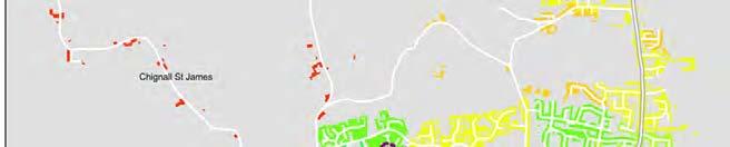
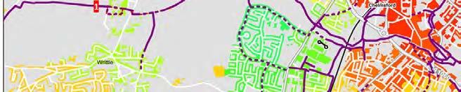

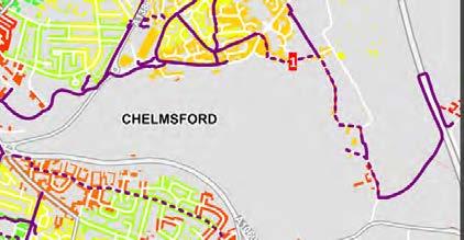

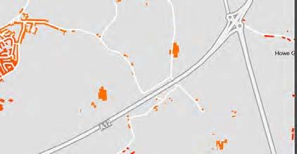
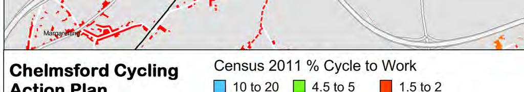
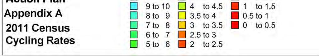
122
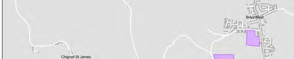

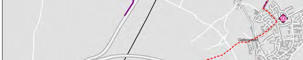
123
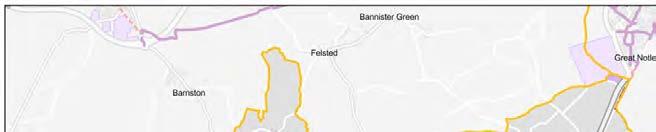
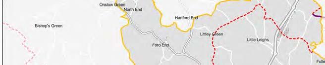
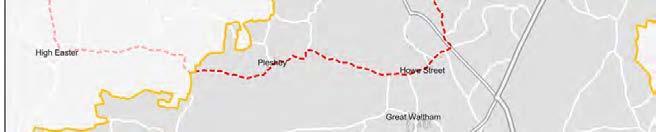
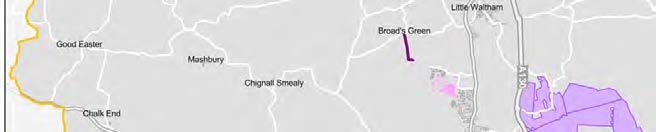
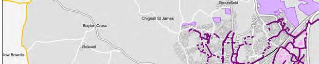
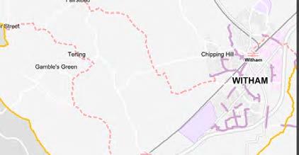
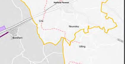
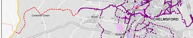
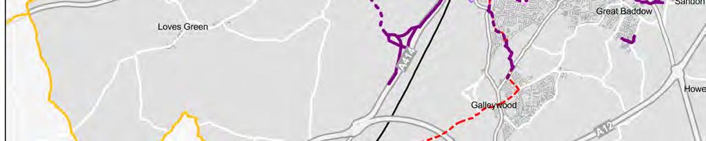
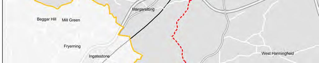
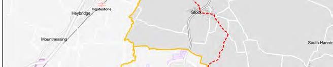
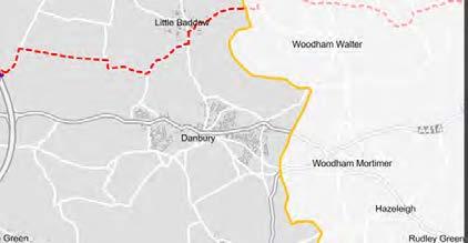
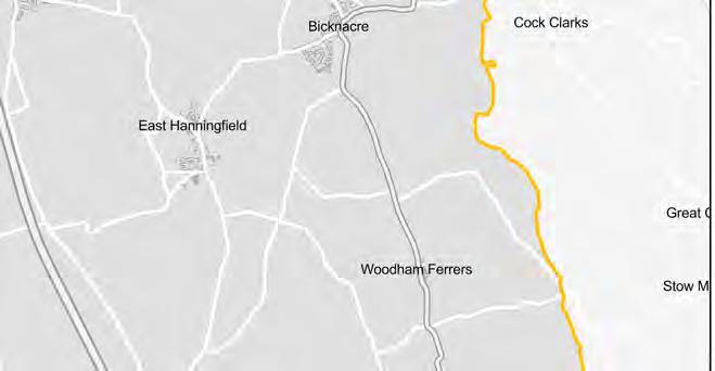
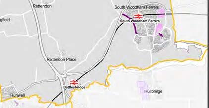
124
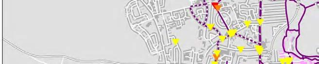
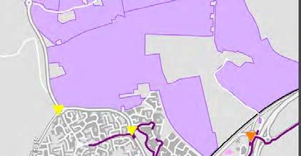
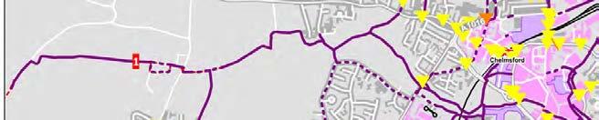
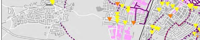
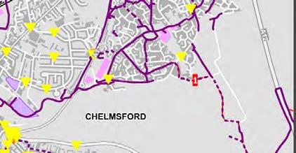
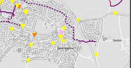

125

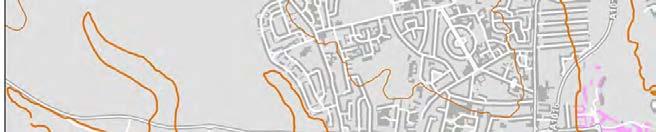
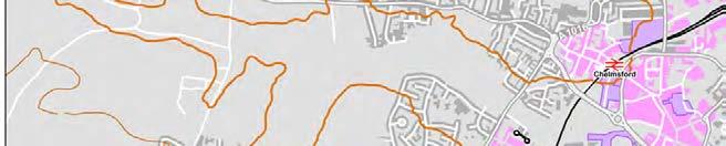
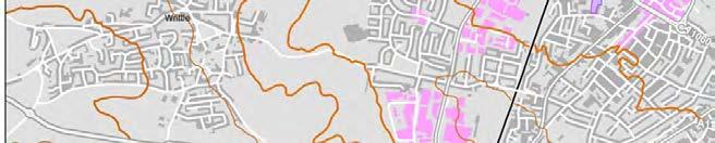
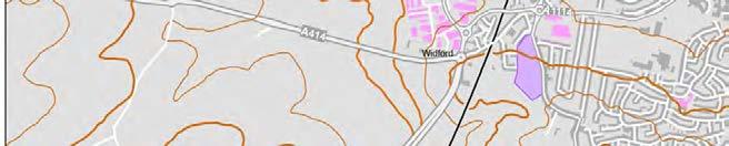
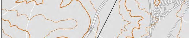
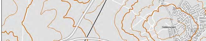
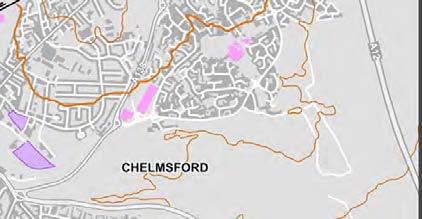
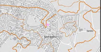
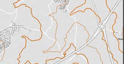
126
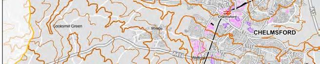
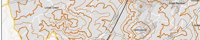
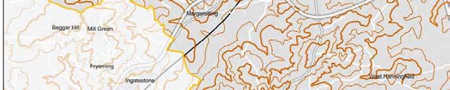
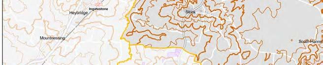
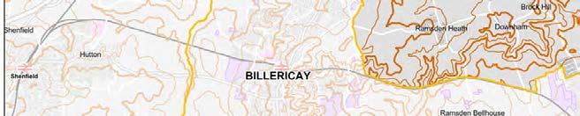
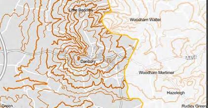

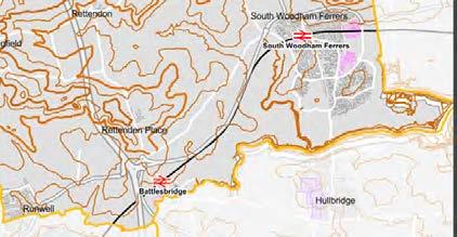
127


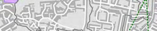


128


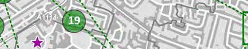


129


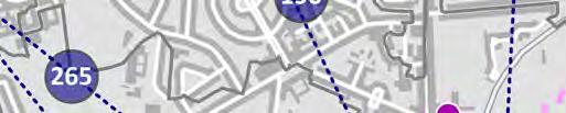


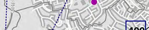

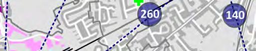


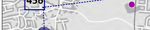


130


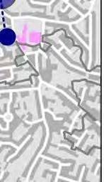


131

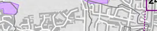
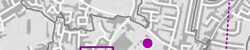

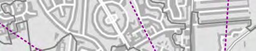


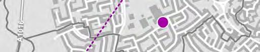

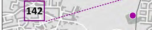

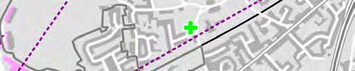


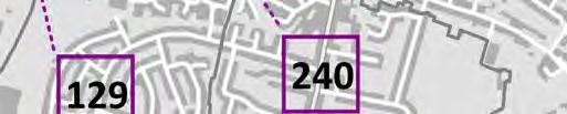


132
133 Appendix F - Prioritisation Criteria Route Benefits Route Connections Score 1. Safety 2. Modal Shift 3. Social Inclusion 4. Promotion 5. Deliverability 6.1. Directness 6.2. Coherence 6.3. Adaptibility 6.4. Comfort 6.5. Street Furniture 6.6.Attractiveness 7.1. Links to employment 7.2. Links a school 7.3. Links into the Town Centre 7.4. Links to a station 7.5. Links to Attractors 8. Cost Score 5 Sufficient Space, reduces negative perceptions, easy access through junctions Attracts both utility and recreational use Makes cycling Generates viable in areas awareness of the where there was scheme and no safe or practical encourages use route No land ownerhsip issues or phyical constraints Shortest route, logical, continuous, without obstacles and delays Legible, consistent, intuitive and understandable Designed to Smooth surface, accommodate no transition increasing problems, well numbers over time maintained No unecessary street clutter, should enhance urban realm Open green space Immediate vicinity In immediate vicinity Immediate vicinity Immediate vicinity Immediate vicinity 0-25k 4 Sufficient Space, reduces negative perceptions Attracts some utility and recreational use Connects to many new areas and provides a safe route Reasonable awareness of the scheme and encourages use No land ownerhsip issues but some physical constraints Minor deviation Designed to Legible, fairly accommodate consistent, intuitive some increase and understandable over time Smooth surface, no transition problems, reasonably well maintained No unecessary street clutter, reasonable urban realm enhancement Mostly Green Space within 2km within 1km within 2km within 2km within 2km 26-50k 3 Minimum amount of space or use of quiet on road route - reduces negative perceptions Attracts either utility orrecreational use Connects to some new areas and provides a safe route Some awareness of scheme and encourages reasonable use Some minor land ownerhsip issues or some physical constraints Deviation but without obstacles etc Legible, slghtly inconsistent, intuitive and understandable Designed to accommodate existing cyclists only Reasonably smooth surface, no transisition problems, reasonably well maintained Reduced unecessary street clutter, slight urban realm enhancement Mix of green space and pleasant urban surroundings within 3km within 2km within 3km within 3km within 3km k 2 Along a quiet road but an inadaquate amount of space Atrtracts some new cyclists Does not connect to many new areas but provides a safe route Some major land Little awareness of ownership issues schemes but some and some physical use constraints Deviation with some delay Reasonbaly legible, fairly inconsistent, mostly unintuitive Accomodates some existing cyclists Rough surface, some transition problems, poorly maintained Some unecessary street clutter and little urban realm enhancement Little green space and mostly pleasant urban surroundings within 5km within 3 km within 5km within 5km within 5km k 1 Along a busy road with inadequate amount of space Atrracts few new cyclists Land ownership Does not connect issues over most to many new areas Little awareness or of the route and or provide a safe use of scheme many physical route constraints Deviation with some obstacles, delay and discontinuous Larelgy illegible, inconsistent and unituitive Does not accommodate existing cyclists & poorly designed Uncomfortable surface, some transition problems, poorly maintained Unecessary Street Clutter and no urban realm enhancement No green space / some green space and pleasant surroundings / unpleasant surroundings within 8km within 4km within 8km within 8km within 8km k 0 Narrow cycle lane constrained by general traffic and guard railing Won't attract any new cyclists Does not connect any new areas or provide a safe route Doesn t generate any awareness or use Land ownership issues over entire route and physical constraints Unintuitve, illegible, Not on desire line, unexpected fragmented routes destinations No adaptability, lack of space, not designed for cyclists Uncomfortable transitions, conflict with other road users Unattractive, difficult and uncomfortable to use No green space, unpleasant surroundings none of above none of above none of above none of above none of above 501k + Weight
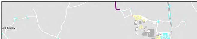
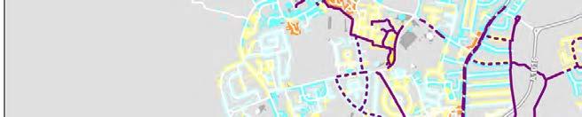
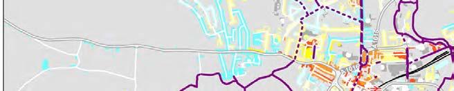
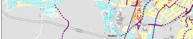
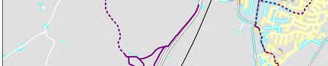
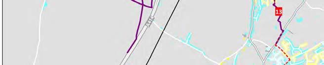
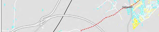
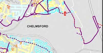

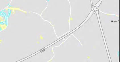
134
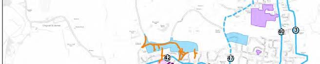
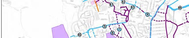

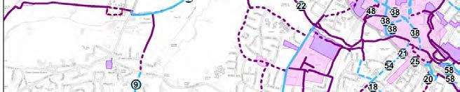
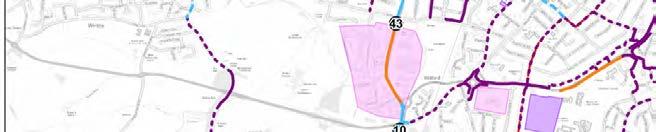
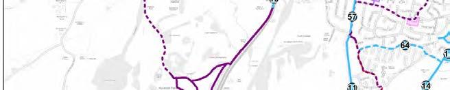
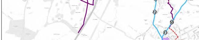
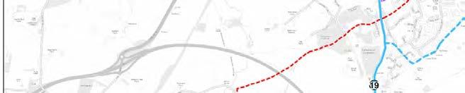
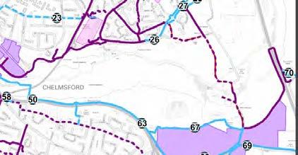
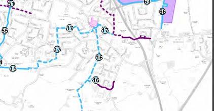
135
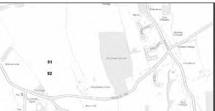


136

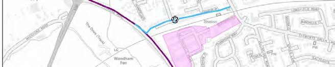

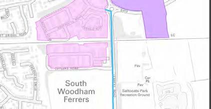
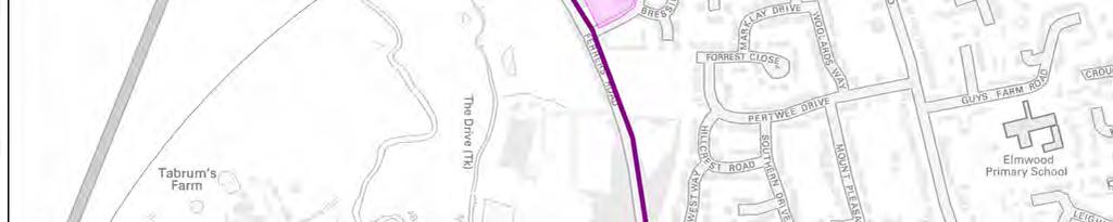
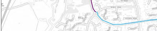
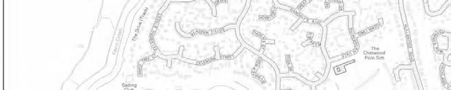
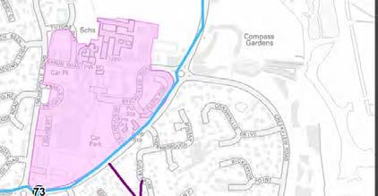
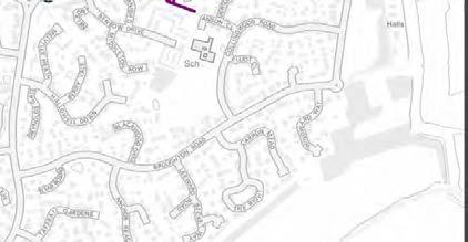
137
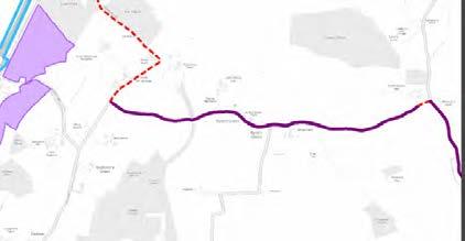

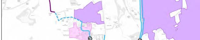
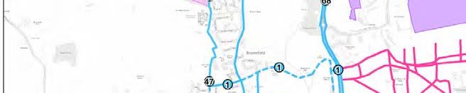
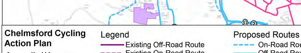
138
139 Appendix I Cycling Case Studies

140 Norwich Norwich Pedalways The Norwich cycle network was launched in June 2012 after consultation with cyclists. There are seven main routes called pedalways and each has a dedicated colour to help navigation. The seven pedalways cover 58 miles in total; five of these cross-city routes radiate out from the city centre and two more form an inner and outer orbital route around the city centre. The cycle network also provides connectivity to the University of East Anglia, Norwich Airport and some of the Park & Ride sites. Figure 1.1: Pedalways in Norwich City centre Each pedalway has sections that vary in provision (e.g. off- or on-road) but together, they make up an uninterrupted route. The overall focus of the cycling network is through the pedestrianised city centre, with five pedalways intersecting at St. Andrews Plain at the heart of Norwich s historic centre. Together with other neighbourhood cycling routes these offer an extensive and comprehensive network, connecting residential areas with employment clusters and leisure
141 facilities. Note that the red pedalway route forms part of the National Cycle Network Route 1, and locally it connects Drayton to Whitlingham. In terms of cycle access within and through pedestrianised streets, there are a variety of pedestrian zones with varying times of operations and exemptions. Some allow cyclists at any time, some at off-peak times or not all. Currently, the network signage for pedalways helps to direct cyclists to use the most appropriate route, in some cases avoiding pedestrianised areas where cycles are prohibited. In an effort to consolidate cycling restrictions and make cycle / pedestrian access less confusing, Norwich City Council will review the pedestrianised zone as a whole and include a review of loading hours. In addition, the Traffic Signs Regulations and General Directions 2016 guidance includes a provision for a new Pedestrian & Cycles Zone entry plate that will help to make it clearer for users. In respect of Chelmsford and cycle access within and through pedestrianised streets, developments in Norwich should be monitored closely and successful elements considered as to whether they could be adopted in Chelmsford as well. In addition, in order to improve quality of cycling facilities, Norwich City Council applied successfully for a Cycle City Ambition Grant in January The Council applied for 3.7m and added 1.8m of local transport and health money. The first wave of funding for the Cycle City Ambition saw work begin on 5.7 million of improvements to Norwich s eight-mile pink pedalway and the connections leading to it. It is one of seven routes in the city s cycle network and crosses the city from the Norfolk & Norwich University Hospital and UEA, through the city centre, to Heartsease and Broadland. The second wave of funding for the Cycle City Ambition saw the Council secure an additional 8.4m of funding to make further improvements to cycle routes across the city. Two of the other seven cycle routes benefit from this grant including the yellow pedalway between Norwich International Airport and Lakenham and the blue pedalway from Sprowston to Wymondham. The official cycling map does not provide the typical breakdown of routes by type (on-road, off-road, bridleway, advisory, etc) in the way that the Essex Cycling Maps of the major settlements do. Instead, the map categorises the routes as high quality, uninterrupted pedalways or neighbourhood routes. Through the use of color-coded routes, the map is highly legible and aids in navigation. The official map includes: Grid coordinates of key junctions to aid navigation using GPS or similar; One way streets;
142 Steep hills; Locations of secure cycle parking or cycle stands; Cycle sport venues (e.g. skate parks); Employment clusters; Local shopping centres; Sport facilities; Schools; and Bicycle shops Currently a strategy is being developed for Chelmsford that aims to provide a similar level of connectivity as Norwich s pedalways, with coloured routes identified on the ground with coloured posts and markers (known as finials ). It is anticipated that some of the schemes and improvements proposed in this Cycling Action Plan will form part of the finials strategy.
143 Ipswich Despite the severance caused by the railway lines and River Orwell, the Ipswich cycle network is extensive, with a mix of on / off-road routes, advisory routes and bridleways. Entire routes or sections of a route are then classified as local, regional or part of the National Cycle Network. The Ipswich cycle network caters for commuters as it connects residential areas with employment clusters (e.g. industrial estates), the town centre and rail station. The network also caters well for leisure cyclists by providing routes through green spaces / parks and connectivity to leisure activities in the periphery of Ipswich. In addition, National Cycle Network Routes 1 and 51 traverse Ipswich town centre, but also provide connectivity to smaller settlements around Ipswich, such as Westerfield and Nacton. The town centre has cycling restrictions, whereby cyclists should not cycle on footways unless signs are present to indicate that cycling is allowed. The Council also introduced the Safer Cycling scheme which allows cyclists to pedal across the town centre from both directions between the hours of 16:30 and 10:30 every evening/morning. Outside of these hours cyclists need to dismount and walk through the town centre areas. This scheme, amongst other streets, covers also the pedestrianised section of Princes Street. In respect of Chelmsford and cycle access within and through pedestrianised streets, the restrictions employed in Ipswich should also be looked at closely.

144 Brighton - Area Wide Cycling Contraflow As part of Brighton & Hove City Council s commitment to develop a balanced and sustainable transport system, one way streets in the North Laine area were reviewed to identify whether they could be made two-way for cyclists and, therefore, more accessible and easier to use. Cycle contraflow schemes utilise innovative signage to enable two-way cycling on one way streets, in accordance with national guidance from the Department for Transport. An example of the signing that will be used in Brighton & Hove is included in Figure 3.1. Cycle contraflows allows cyclists to avoid convoluted one way streets, reducing travel time and the likelihood of making illegal and dangerous short-cuts. Contraflows require very little hard engineering measures and provide important links in the city cycle network at very low costs. They are common in many northern European and UK cities. Figure 3.1 Contraflow Cycle Lane Signing in North Laine, Brighton Brighton and Hove City Council have produced plans to introduce contraflow cycle lanes in the North Laine area on 12 lightly used, narrow one-way streets to form the basis of a cohesive contraflow network through the North Laine. This will allow improved access for cyclists to and through North Laine, an historic retail and residential area. Contraflow facilities allow cyclists to travel in both directions on one-way streets. The scheme required only minor changes, including some signs and road markings. Low levels of traffic and low speeds meant that cycle lane markings were not required. The council chose to install repeater cycle markings along the contraflow streets to raise the visual awareness of contraflow cycling. When completed, cyclists will be able to go in both directions on Church Street, Foundry Street, Gloucester Road, Gloucester Street, Kemp Street, Kensington Place, Kensington Street, Over Street, Queen s Gardens, Robert Street, Tidy Street and the bottom of Trafalgar Street (Figure 3.2).

145 Figure 3.2 Contraflow Cycle Lanes through the North Laines area of Brighton There are contraflow facilities in several other streets in the city, including Campbell Road, Hampden Road, Preston Street, Ship Street and Trafalgar Street. New contraflow facilities have recently been installed in five streets in Richmond Heights, Brighton, as part of the extension to CPZ zoning.


146 Assen, Netherlands Assen is a municipality in the northeastern Netherlands and is the capital of the province of Drenthe. It is a small city, offering a good range of shops, as well as a market. In the 1970 s, Assen was full of motor vehicles. However, the city centre area is now a large pedestrian zone. Cyclists are allowed to travel through the area along a stripe on which cycling is permitted. This effectively provides easily recognisable areas for cyclists and pedestrians. Signage at each entrance to the pedestrian zone points out this status. Cycling and walking are the most popular means of transport for shoppers in Assen and these are the modes which are best catered for in the city centre. It is not just the city centre that has cycling infrastructure. There is an extensive network of high quality infrastructure across the entire city which makes cycling accessible to more people. Figure 4.1 Cycling through the pedestrian zone of Assen, Netherlands
.")
147 Newcastle upon Tyne, UK In 2016, a protected city centre cycleway was opened in Newcastle upon Tyne. The John Dobson Street cycleway runs parallel to Newcastle s main shopping highway (Northumberland Street is the former A1 but which had been pedestrianised for some years). The new-look street features a separated two-way cycleway, with dedicated signals at junctions. The work has also seen pavements widened and improved crossing points for pedestrians. By changing how the area is used along John Dobson Street will contribute to making the city centre safer and more accessible for everyone. It has been possible to free up space for people to walk and cycle in a safe and welcoming environment, whilst also achieving improvements for people who use public transport and drive. The improvements for cycling are dramatic. It is separated from the road and from the pavement by a kerb and is sufficiently wide enough to allow two people to ride alongside eachother or to overtake. The street has clear zones for different types of travellers: pedestrians on the pavement, cyclists in the cycle lane and cars and other motor vehicles on the road. Zebra style crossings make it clear to cyclists that pedestrians will be crossing at these points. They also make it clear to pedestrians (in combination with the different level of the lane) that cyclists have priority elsewhere in the cycle lane. Figure 5.1 John Dobson Street protected city centre cycleway in Newcastle upon Tyne.


148 Oxford, UK Oxford is a city in the South East region of England and the county town of Oxfordshire. It is home to the University of Oxford. The city is flat and compact. Much of the town centre is subject to access restrictions for motor vehicles. On the whole, local buses, taxis, pedal cycles and licensed private hire vehicles and emergency services are exempt from the city centre access restrictions, except in the case of Cornmarket and Queen Street where no cycling is allowed between 10am and 6pm. Outside of these times, cycling is permitted. Figure 6.1 New Inn Hall Street, approach to Queen Street, Oxford Figure 6.2 Queen Street, Oxford


149 Figure 6.3 Cornmarket Pedestrian zone, Oxford

150 York, UK York has a pedestrianised city centre, known as the footstreets ; closed to vehicles between 10:30 am and 5pm, seven days a week. The access restrictions apply to cyclists, who must dismount in these locations, meaning that footstreets are strictly for pedestrians at these times of the day. Outside of these times, during usual commuting hours, however, cycling is permitted.
Maldon District Cycling Action Plan Highways/Transport Planning January 2018
 Cycling Action Plan Highways/Transport Planning January 2018 Contents 1 Introduction... 1 1.1 Preamble... 1 1.2 Background... 2 1.3 Aims of the Action Plan... 3 1.4 Report Structure... 4 2 Policy Review...
Rochford District Cycling Action Plan Highways/Transport Planning January 2018
 Cycling Action Plan Highways/Transport Planning January 2018 Contents 1 Introduction... 1 Preamble... 1 Background... 2 Aims of the Cycling Action Plan... 3 Report Structure... 4 2 Policy Review... 5 Introduction...
Epping Forest District Cycling Action Plan Highways/Transport Planning March 2018
 Epping Forest District Cycling Action Plan Highways/Transport Planning March 2018 i Contents Contents... ii Executive Summary... v 1 Introduction... 1 2 Policy Review... 5 3 Data Analysis... 13 4 Existing
Uttlesford District Cycling Action Plan Highways/Transport Planning March 2018
 No Cycling Action Plan Highways/Transport Planning March 2018 Contents 1 Introduction... 10 1.1 Preamble... 10 1.2 Background... 11 1.3 Aims of the Action Plan... 12 1.4 Report Structure... 13 2 Policy
Harlow District Cycling Action Plan Highways/Transport Planning July 2018
 Harlow District Cycling Action Plan Highways/Transport Planning July 2018 Contents 1 Introduction... 1 1.1 Preamble... 1 1.2 Background... 2 1.3 Aims of the Action Plan... 3 1.4 Report Structure... 4 2
March Maidstone Integrated Transport Strategy Boxley Parish Council Briefing Note. Context. Author: Parish Clerk 2 March 2016
 Context. Author: Parish Clerk 2 The Draft Integrated Transport Policy (DITS) sets out a vision and objectives, and identifies a detailed programme of interventions to support the Maidstone Borough Local
Cycling and Walking Investment Strategy & Local Cycling and Walking Infrastructure Plans
 Cycling and Walking Investment Strategy & Local Cycling and Walking Infrastructure Plans 1 Investing in cycling and walking contributes to a broad range of cross-cutting policy objectives Cycling and walking
A127/A130 Fairglen Interchange Improvement Schemes. Information Leaflet February 2017
 A127/A130 Fairglen Interchange Improvement Schemes Information Leaflet February 2017 1 2 Foreword By Councillor Kevin Bentley Essex is continuing to grow as a vibrant economic hub and as a fantastic place
Active Travel Strategy Dumfries and Galloway
 Active Travel Strategy Dumfries and Galloway Our Active Travel Strategy The agreed Interventions for Dumfries and Galloway Council s Local Transport Strategy includes an action to Develop an Active Travel
Living Streets response to the Draft London Plan
 Living Streets response to the Draft London Plan Contents Living Streets response to the Draft London Plan... 1 About Living Streets... 2 Summary... 2 Consultation response... 3 Chapter 1: Planning London
PERSONALISED TRAVEL PLANNING IN MIDLETON, COUNTY CORK
 PERSONALISED TRAVEL PLANNING IN MIDLETON, COUNTY CORK Elaine Brick Principal Transport Planner AECOM Abstract Smarter Travel funding was awarded to the Chartered Institute of Highways and Transportation
Walking and Cycling Action Plan Summary. A Catalyst for Change The Regional Transport Strategy for the west of Scotland
 Walking and Cycling Action Plan Summary A Catalyst for Change The Regional Transport Strategy for the west of Scotland 2007-2021 Strathclyde Partnership for Transport Contents Purpose...2 Issues, Constraints
PEDESTRIAN ACTION PLAN
 ATTACHMENT 2 CITY OF SANTA MONICA PEDESTRIAN ACTION PLAN CITY OF SANTA MONICA PEDESTRIAN ACTION PLAN This page intentionally left blank EXECUTIVE SUMMARY CHAPTER 1 EXECUTIVE SUMMARY Setting the Stage
2. Context. Existing framework. The context. The challenge. Transport Strategy
 Transport Strategy Providing quality connections Contents 1. Introduction 2. Context 3. Long-term direction 4. Three-year priorities 5. Strategy tree Wellington City Council July 2006 1. Introduction Wellington
Chelmsford City Growth Package
 Chelmsford City Growth Package Public Consultation Document Volume 2 West Chelmsford July - August 2017 Chelmsford City Growth Package Public Consultation Document - Volume 2 - West Chelmsford Contents
Cycle traffic and the Strategic Road Network. Sandra Brown, Team Leader, Safer Roads- Design
 Cycle traffic and the Strategic Road Network Sandra Brown, Team Leader, Safer Roads- Design Highways England A Government owned Strategic Highways Company Department for Transport Road Investment Strategy
Transport Workshop Dearbhla Lawson Head of Transport & Infrastructure Policy & Funding University of the Third Age.
 Transport Workshop Dearbhla Lawson Head of Transport & Infrastructure Policy & Funding University of the Third Age 30 th March 2015 1 Presentation Overview Roles and responsibilities Snapshot of Key Challenges
Bristol City Council has produced a draft Bristol Transport Strategy document.
 Bristol Transport Strategy Summary Document Introduction Bristol City Council has produced a draft Bristol Transport Strategy document. The Strategy fills a gap in transport policy for Bristol. We have
HAMILTON BIKING PLAN OUR VISION: A BIKE FRIENDLY CITY
 HAMILTON BIKING PLAN 2015-2045 OUR VISION: A BIKE FRIENDLY CITY INTRODUCTION Biking as a travel option is experiencing a resurgence internationally and in New Zealand, growing as a familyfriendly and healthy
London Cycle Network Annual Report 2000
 London Cycle Network Annual Report 2000 A cycle network for London by 2005 A cycle network for London by 2005 The London Cycle Network will: provide local links between residential neighbourhoods, railway
9. Parking Supporting Statement
 9. Parking Supporting Statement Content 1. Setting the Scene 2. Vision 3. Parking and the Shared Priorities 4. Issues 5. Delivery Programme in the first Plan Period 2001/02 2005/06 6. Good Practice 7.
Launceston's Transport Futures. Greater travel options for the people of Launceston
 Launceston's Transport Futures Greater travel options for the people of Launceston Final Draft 13 Jan 2014 1 Page Number Executive summary 3 What is Transport Futures? 4 Vision 6 Economy, access and liveability
Douglas Land Use and Transportation Strategy (DLUTS) Summary. August 2013
 Summary. August 2013") Douglas Land Use and Transportation Strategy (DLUTS) Summary August 2013 Background Douglas is a large and popular residential suburb of approximately 30,000 persons on the periphery of Cork City along
Douglas Land Use and Transportation Strategy (DLUTS) Summary August 2013 Background Douglas is a large and popular residential suburb of approximately 30,000 persons on the periphery of Cork City along
WEST YORKSHIRE LTP CYCLE PROSPECTUS
 WEST YORKSHIRE LTP CYCLE PROSPECTUS The West Yorkshire Ambition: To be recognised as a great place for safe cycling, inspiring more people to cycle more often. INTRODUCTION Cycling is low cost, environmentally
GD 0043/18 ACTIVE TRAVEL STRATEGY
 GD 0043/18 ACTIVE TRAVEL STRATEGY 2018-2021 May 2018 Minister s Introduction There is strong evidence that regular physical activity reduces the risk of a range of health conditions. The best way to increase
University of Leeds Travel Plan
 University of Leeds Travel Plan 2015-2018 Contents 1: Introduction 1.1 What is a Travel Plan? 1.2 Why do we need one? 1.3 Sustainability Strategy 2: Overview 2.1 The bigger picture 2.2 The City scale 2.3
Nottingham Cycle City Frequently Asked Questions
 Nottingham Cycle City Frequently Asked Questions About the scheme How much money is to be spent on cycling? And where is the money from? We have 6.1 million in Growth Fund which we will be investing directly
Road Safety Partnership
 Cambridgeshire and Peterborough Road Safety Partnership Cambridgeshire and Peterborough Road Safety Partnership Introduction Road accidents can have a devastating impact not only for the people directly
LEA BRIDGE ROAD - A STREET FOR EVERYONE Public consultation document
 LEA BRIDGE ROAD - A STREET FOR EVERYONE Public consultation document TELL US Bakers Arms to Leyton Green Road (Section D, E, F) Leyton Green Road to Whipps Cross Roundabout (Section G) YOUR VIEWS www.enjoywalthamforest.co.uk
A1307 Haverhill to Cambridge: Approval to consult on transport improvement concepts
 Report To: Greater Cambridge City Deal Executive Board 3 March 2016 Lead Officer: Graham Hughes, Executive Director of Economy, Transport and Environment, Cambridgeshire County Council A1307 Haverhill
Active Travel Towns Funding Scheme Project Proposal. Sligo. Sligo Local Authorities
 Active Travel Towns Funding Scheme 2014-2016 Project Proposal for Sligo by Sligo Local Authorities Introduction Over the last two years, Sligo Local Authorities have implemented years 1 & 2 of their 5
What s the issue for transport in Cardiff?
 Demand for travel The number of commuters travelling to work in Cardiff has increased from 190,000 in 2001 to 198,000 in 2010, with some 124,000 Cardiff residents travelling across the city daily to their
Chelmsford City Growth Package
 Chelmsford City Growth Package Public Consultation Document Volume 5 South and East Chelmsford July - August 27 Chelmsford City Growth Package Contents Introduction 5 Army and Navy Roundabout Improvements:
A future cycle route network for North Staffordshire mb/08/16 Need for a strategy. Existing cycle route network
 Need for a strategy 1. The government s aim is to double cycling levels nationally by 2025 [note 1]. This would bring significant health, environmental, economic and traffic benefits [note 2]. It is widely
Westminster s Joint Health and Wellbeing Strategy
 Westminster s Joint Health and Wellbeing Strategy 2013 2016 Response from Sustrans General comments From a strategic perspective, Sustrans welcomes the Health and Wellbeing Strategy s focus on encouraging
IAN WHITE ASSOCIATES. Crawley Station Gateway Public Realm
 IAN WHITE ASSOCIATES Crawley Station Gateway Public Realm contents 1. objectives & client brief 2. site appraisal 3. best practice guidance 4. design concept 1. objectives & client brief Crawley Train
Report to Cabinet. 18 May 2016
 Agenda Item 8 Report to Cabinet 18 May 2016 Subject: Presenting Cabinet Member: Proposed CCTV Enforcement of Traffic Contraventions in a Bus Lane (Key Decision Ref. No. HE030) Highways and Environment
MARKHOUSE ROAD IMPROVEMENTS
 MARKHOUSE ROAD IMPROVEMENTS www.enjoywalthamforest.co.uk Waltham Forest is changing and we want you to be part of it. Thanks to a funding pot of 27million from Transport for London, we re delivering the
ANNEX1 The investment required to achieve the Government s ambition to double cycling activity by 2025
 ANNEX1 The investment required to achieve the Government s ambition to double cycling activity by 2025 May 2016 About Sustrans Sustrans makes smarter travel choices possible, desirable and inevitable.
Regional Cycle Programme Update
 Agenda Item 10 (ii) Regional Cycle Programme Update Glossary Auckland Council Auckland Transport Cycle Action Auckland New Zealand Transport Agency Regional Cycle Network (AC) (AT) (CAA) (NZTA) (RCN) Executive
21.07 TRANSPORT CONNECTIVITY AND INFRASTRUCTURE
 21.07 TRANSPORT CONNECTIVITY AND INFRASTRUCTURE 21.07-1 Connectivity and Choice Transport connectivity and mode choice are critical to achieving productive, sustainable and socially just cities. Travel
Department for Transport
 Improving UK evidence on health and environmental (low carbon) behaviours John Cummings Department for Transport 4 th November, 2015 CYCLING AND WALKING POLICY TEAM, OFFICIAL, 1st DRAFT 1 Walking and cycling
MILTON ROAD LLF PROJECT UPDATE
 Greater Cambridge City Deal MILTON ROAD LLF PROJECT UPDATE 9 th May 2017 Project objectives Comprehensive priority for buses in both directions wherever practicable; Additional capacity for sustainable
Essex Cycling Strategy. Highways/Major Projects November 2016
 Essex Cycling Strategy Highways/Major Projects November 2016 2 Contents Introduction 4 The Purpose of the Strategy 4 Report Content 4 Section One: Why cycling is important to Essex 5 National Context 5
Part 3: Active travel and public transport planning in new housing developments
 1 Linking active travel and public transport to housing growth and planning Part 3: Active travel and public transport planning in new housing developments Active Travel Toolkit Slide Pack July 2017 Linking
Nottingham, the great cycle city
 Nottingham, the great cycle city Our vision for the city s cycling future Foreword Councillor Jon Collins Leader of the Council Nottingham has a world class public transport system which is essential to
Sandwell General Hospital Travel Plan 2014
 Sandwell General Hospital Travel Plan 2014 Travel Plan Survey Dated 24 th June 2013 Travel plan finalised March 2014 Prepared by Michael Raynor, JMP Consultants Ltd Site Address Lyndon, West Bromwich,
1.5 On this basis it is fundamental that the Transport Strategy for the site focuses on the following key criteria,
 1.0 Introduction 1.1 The Transport Assessment has been prepared on behalf of Eon and Roger Bullivant Ltd in respect of the proposed mixed use sustainable urban extension of Drakelow Park. 1.2 The methodology
The Cabinet Member for Highways & Streetscene. Aurang Zeb - Head of Highways & Transport
 LONDON BOROUGH OF RICHMOND UPON THAMES Cabinet Member Decision DATE: January 2012 REPORT OF: LEAD OFFICER: SUBJECT: WARDS: The Cabinet Member for Highways & Streetscene Aurang Zeb - Head of Highways &
4. WIDER SOCIAL DETERMINANTS OF HEALTH
 4. WIDER SOCIAL DETERMINANTS OF HEALTH 4.6 Road Safety Road safety affects all road users; pedestrians, cyclists and vehicle drivers and passengers. This section describes the impact of road safety and
Delivering the. Strategy 7.0
 7.0 Delivering the Strategy 7.1 Introduction This chapter presents a framework for the delivery of the strategy. Key challenges and opportunities are identified that will have an impact on the successful
E4 Cycle Route Exeter University to Redhayes Bridge. - Recommendations from Exeter Cycling Campaign
 E4 Cycle Route Exeter University to Redhayes Bridge - Recommendations from Exeter Cycling Campaign 1.0 Introduction Exeter Cycling Campaign has prepared this report to provide recommendations for Devon
The Ramsey Market Town Transport Strategy 26 th April 2010
 The Ramsey Market Town Transport Strategy 26 th April 2010 Contents INTRODUCTION 2 BACKGROUND 3 Strategy Area 4 Travel to, from and within Ramsey 5 Transport problems in the town 6 Links with other policies
Determining bicycle infrastructure preferences A case study of Dublin
 *Manuscript Click here to view linked References 1 Determining bicycle infrastructure preferences A case study of Dublin Brian Caulfield 1, Elaine Brick 2, Orla Thérèse McCarthy 1 1 Department of Civil,
Contents Location Map Welcome and Introduction Travel Plan Management Science Park Accessibility Walking Cycling Bus Rail Car Sharing Contact Details
 Contents Contents Location Map Welcome and Introduction Travel Plan Management Science Park Accessibility Walking Cycling Bus Rail Car Sharing Contact Details 1 2 3 5 7 9 11 13 15 17 19 Thames Valley Science
CYCLING CHARTER ACTION PLAN EXECUTIVE SUMMARY
 CYCLING CHARTER ACTION PLAN EXECUTIVE SUMMARY THE VISION OF THE CYCLING CHARTER To realise the full potential of cycling s contribution to the health and wealth of the West Midlands creating more sustainable
Cycle network linking Wolverhampton city centre and Bilston town centre with employment sites and residential areas:
 Context and Problems Corridor length 12.3 km; Population within 800m 59,922; Jobs within 800m 59,100; Unemployment 11%; Average Index of Multiple Deprivation 46; Households with no car 45%; Proportion
Neighbourhood Development Plan: Ashtead INTRODUCTION 2 SUMMARY CONCLUSION CAR USE AND CONGESTION IN ASHTEAD 4
 CONTENTS Page INTRODUCTION 2 SUMMARY CONCLUSION 3 1.0 CAR USE AND CONGESTION IN ASHTEAD 4 1.1 Car Ownership and Methods of Travel to Work 4 1.2 Traffic Congestion in Ashtead 4 2.0 PARKING FACILITIES AND
Birmingham Connected. Edmund Salt. Transportation Policy Birmingham City Council
 Birmingham Connected Edmund Salt Transportation Policy Birmingham City Council www.birmingham.gov.uk/connected Birmingham Connected the story so far Broadly following EU Guidance We ve done all of this
CAIRNGORMS NATIONAL PARK AUTHORITY FOR DECISION
 CAIRNGORMS NATIONAL PARK AUTHORITY FOR DECISION Title: Prepared by: A9 Dualling Project: Dalraddy to Slochd Murray Ferguson, Director of Planning and Rural Development and Gavin Miles, Head of Planning
Public Consultation on Braintree Integrated Transport Package (ITP) HAVE YOUR. Consultation open from 24 September to 5 November 2018 SAY
 HAVE YOUR. Consultation open from 24 September to 5 November 2018 SAY") Public Consultation on Braintree Integrated Transport Package (ITP) HAVE YOUR SAY Consultation open from 24 September to 5 November 2018 Contents Introduction 3 Background 4 Springwood Drive Roundabout
Public Consultation on Braintree Integrated Transport Package (ITP) HAVE YOUR SAY Consultation open from 24 September to 5 November 2018 Contents Introduction 3 Background 4 Springwood Drive Roundabout
Transportation Master Plan Advisory Task Force
 Transportation Master Plan Advisory Task Force Network Alternatives & Phasing Strategy February 2016 BACKGROUND Table of Contents BACKGROUND Purpose & Introduction 2 Linking the TMP to Key Council Approved
Active travel and economic performance: A What Works review of evidence from cycling and walking schemes
 1 Making the economic case for active travel Active travel and economic performance: A What Works review of evidence from cycling and walking schemes Active Travel Toolkit Slide Pack July 2017 Active travel
DOE Climate Change Proposals
 DOE Climate Change Proposals Sustrans response to Proposals for Taking Forward NI Climate Change Legislation January 2016 About Sustrans Sustrans makes smarter travel choices possible, desirable and inevitable.
ONE SIZE DOESN T FIT ALL RECONCILING OVERLAPPING TRANSPORT NETWORKS IN A CONSTRAINED URBAN ENVIRONMENT
 One Size Doesn t Fit All S Corbett, C Chenery Page 1 ONE SIZE DOESN T FIT ALL RECONCILING OVERLAPPING TRANSPORT NETWORKS IN A CONSTRAINED URBAN ENVIRONMENT Authors/Presenters: Sam Corbett, Principal Transport
HISTON ROAD Have your say on better public transport, cycling and walking journeys
 HISTON ROAD Have your say on better public transport, cycling and walking journeys Have your say: Please complete the survey inside this leaflet or online at www.greatercambridge.org.uk/histonconsultation
Wayfinding and Walking in London. Lilli Matson Transport for London May 2013
 Wayfinding and Walking in London Lilli Matson Transport for London May 2013 I want to make walking in London as attractive and enjoyable as possible by making walking count Mayor of London Boris Johnson
Your views are important. Please fill in a form before you leave. Or alternatively
 Drum Property Group is delighted to welcome you to this exhibition which sets out our initial proposals for a mixed-use development at Stead s Place, Edinburgh. We are keen to hear the views of local people
Travel Planning WC & NWCD Cycling Group. Thursday 2 nd July Amanda Holden
 Travel Planning WC & NWCD Cycling Group Thursday 2 nd July Amanda Holden 1 Today s workshop What is Travel Planning? University Travel Plan NWCD Travel Plan Targets Cycling Initiatives Other Travel Plan
North West Non-Technical Summary of the Transport Assessment September 2011
 North West Non-Technical Summary of the Transport Assessment September 2011 Introduction This is a Non-Technical Summary of the findings of the Transport assessment work undertaken for the proposed North
DESIGN CODE. Enterprise West Harlow London Road North Design Code 21
 DESIGN CODE Enterprise West Essex @ Harlow London Road North Design Code 21 4 MAXIMUM BUILDING HEIGHTS 4.1 Table 4A sets out maximum building height standards for each character area within the LDO boundary.
City of Perth Cycle Plan 2029
 Bicycling Western Australia s response City of Perth Cycle Plan 2029 2012-2021 More People Cycling More Often ABOUT BICYCLING WESTERN AUSTRALIA Bicycling Western Australia is a community based, not-for-profit
September HAWKHURST PARISH COUNCIL Page 1 of 13 SPORTS STRATEGY FINAL
 September 2017 HAWKHURST PARISH COUNCIL Page 1 of 13 SPORTS STRATEGY FINAL Table of Contents EXECUTIVE SUMMARY 3 1. INTRODUCTION 4 2. LOCAL CONTEXT 5 3. OBJECTIVES 7 4. PRIORITIES 8 5. FUNDING OPTIONS
Supporting Tasmania s Road Users
 Supporting Tasmania s Road Users A MAJORITY LIBERAL GOVERNMENT WILL: Grow the Learner Driver Mentor Program Remove barriers to acquiring a Provisional Drivers Licence Continue to fund the valuable RYDA
Our journey a 20 year Transport Manifesto for the North East
 Our journey a 20 year Transport Manifesto for the North East Sustrans submission to North East Combined Authority (NECA). March 2016 Summary Sustrans is a leading UK charity enabling people to travel by
Speed Limit Policy Isle of Wight Council
 APPENDIX B Speed Limit Policy Isle of Wight Council 2009 Contents Section 1 Introduction 1.1 Links with the Local Transport Plan Section 2 Speed Limits on Urban Roads and Residential Areas 2.1 20mph Limits
Design Workshops Summary of all Feedback January 2017
 Histon Road Corridor Design Workshops Summary of all Feedback January 2017 CITY DEAL AND GROWTH Commitment to Growth: Government, County, City and District Emerging Local Plans: 33,000 new homes 45,000
Strategic Director for Environment. Enclosures Appendix A - Option drawings. Jamie Blake- Strategic Director for Environment
 Chipping Barnet Area Committee 9 July 2018 Title Report of Wards Status Urgent Key Cromer Road Request for 20mph Zone Strategic Director for Environment High Barnet Public No No Enclosures Appendix A -
Chapter 7. Transportation. Transportation Road Network Plan Transit Cyclists Pedestrians Multi-Use and Equestrian Trails
 Chapter 7 Transportation Transportation Road Network Plan Transit Cyclists Pedestrians Multi-Use and Equestrian Trails 7.1 TRANSPORTATION BACKGROUND The District of Maple Ridge faces a number of unique
CONNECTING PEOPLE TO PLACES
 CONNECTING PEOPLE TO PLACES 82 EAST BENCH MASTER PLAN 07 Introduction The East Bench transportation system is a collection of slow moving, treelined residential streets and major arteries that are the
Draft Greater Sydney Region Plan
 Powered by TCPDF (www.tcpdf.org) Draft Greater Sydney Region Plan Submission_id: 31452 Date of Lodgment: 15 Dec 2017 Origin of Submission: Online Organisation name: UNSW Sydney Organisation type: Other
Appendix N(b): Portishead Station Outline Travel Plan
: Portishead Station Outline Travel Plan") Portishead Branch Lane (MetroWest Phase 1): Environment Impact Assessment Appendix N(b): Portishead Station Outline Travel Plan Prepared for West of England Councils September 2017 1 The Square Temple
Portishead Branch Lane (MetroWest Phase 1): Environment Impact Assessment Appendix N(b): Portishead Station Outline Travel Plan Prepared for West of England Councils September 2017 1 The Square Temple
New Directions in Street Auditing: Lessons from the PERS Audits. David Allen, Transport Research Laboratory. Spencer Clark, Transport for London
 New Directions in Street Auditing: Lessons from the PERS Audits David Allen, Transport Research Laboratory Spencer Clark, Transport for London TRL (Transport Research Laboratory) and TfL, Transport for
Regional Cycling Plan
 Adopted December 2008 Quality for Life Adopted December 2008 For more information, contact: Greater Wellington 142 Wakefield Street PO Box 11646 Manners Street Wellington 6142 T 04 384 5708 F 04 385 6960
Kelowna On the Move. Pedestrian and Bicycle Master Plan
 Kelowna On the Move Pedestrian and Bicycle Master Plan Executive Summary April 2016 Purpose of the Plan The Pedestrian and Bicycle Master Plan identifies infrastructure, planning, and policy requirements
CONTENTS PREFACE 1.0 INTRODUCTION AND SCOPE 2.0 POLICY AND GOVERNANCE 3.0 SUMMARY OF PROGRESS 4.0 NATURE OF DEMAND 5.0 TRAVEL AND PARKING INITIATIVES
 CONTENTS PREFACE 1.0 INTRODUCTION AND SCOPE 2.0 POLICY AND GOVERNANCE 3.0 SUMMARY OF PROGRESS 4.0 NATURE OF DEMAND 5.0 TRAVEL AND PARKING INITIATIVES 6.0. TARGETS PREFACE The University of St Andrews has
NOTES FROM JUNIOR COUNCIL ORIENTATION SESSION HELD ON MONDAY, JANUARY 22, 2018, AT 3:30 PM IN COUNCIL CHAMBERS, CITY HALL
 CITY OF KAMLOOPS Junior Council Meeting Agenda March 12, 2018, at 3:30 pm in Council Chambers, 7 Victoria Street West, Kamloops, BC Page 1. APPROVAL OF THE AGENDA 2. MINUTES Attachment Recommendation:
Lea Bridge Road A street for everyone Tell us
 Lea Bridge Road A street for everyone Tell us Public consultation document Section H your views 1 Lea Bridge Road: a street for everyone Introduction Mni-Holland is an exciting programme to improve walking
Perryville TOD and Greenway Plan
 Perryville TOD and Greenway Plan Greenway Glossary Pathway: A bicycle and pedestrian path separated from motorized vehicular traffic by an open space, barrier or curb. Multi-use paths may be within the
Stepping up a gear. Our vision for cycling in Cardiff
 Stepping up a gear Our vision for cycling in Cardiff Cardiff is growing fast in fact, over the last 10 years its population has grown quicker than any UK city outside London and this rate of expansion
Cambridgeshire Local Transport Plan Policies and Strategy
 Cambridgeshire Local Transport Plan 2011 2026 Policies and Strategy John Onslow Acting Executive Director of Environment Services Cambridgeshire County Council Shire Hall Castle Hill Cambridge CB3 0AP
St Anthony s School Hampstead
 St Anthony s School Hampstead Travel Information Pack Version 1.1 Welcome......to St Anthony s School St. Anthony's aims to provide high quality education in a caring, supportive and Catholic environment.
WEST HATCH HIGH SCHOOL THE BEST THAT I CAN BE. School Travel Plan
 WEST HATCH HIGH SCHOOL THE BEST THAT I CAN BE School Travel Plan Policy reviewed June 2017 TABLE OF CONTENTS Context... 3 Purpose... 3 Scope... 3 1.0 Introduction... 4 2.0 Existing Conditions... 4 3.0
Ormond & McKinnon Walks Response to Draft Glen Eira Community Plan
 Response to Draft Glen Eira Community Plan We would like to take this opportunity to thank Glen Eira City Council for the opportunity to comment on the Glen Eira Draft Community Plan. Below is an outline
Space for Cycling. A guide for decision makers
 Space for Cycling A guide for decision makers Why create Space for Cycling? Imagine your area with considerably less traffic. Imagine safe streets and neighbourhoods, clean air, young and old alike able
UNDERSTANDING WALKING NETWORKS TO ENABLE SMARTER CHOICES IN TRANSPORT PLANNING IN DUNDEE. Gillian Iversen Atkins
 UNDERSTANDING WALKING NETWORKS TO ENABLE SMARTER CHOICES IN TRANSPORT PLANNING IN DUNDEE Gillian Iversen Atkins 1. INTRODUCTION 1.1. Smarter Choices, Smarter Places The Smarter Choices agenda encourages
EXECUTIVE SUMMARY. The primary challenges identified are:
 1 EXECUTIVE SUMMARY This report summarizes the recommendations for improving cycling infrastructure at the University of Saskatchewan. This report is a follow-up to the recommendations made in the 2013
Developing a Birmingham Transport Space Allocation policy. David Harris Transport Policy Manager Economy Directorate Birmingham City Council
 Developing a Birmingham Transport Space Allocation policy David Harris Transport Policy Manager Economy Directorate Birmingham City Council Birmingham s Sustainable Urban Mobility Plan Birmingham Connected
Section 2 Strategic Alignment. Contents
 Section 2 Strategic Alignment Contents 2 Strategic Alignment... 2 2.1 General... 2 2.2 SmartGrowth Strategy and Implementation Plan... 2 2.3 Walking and Cycling Strategy... 3 2.4 Built Environment Strategy...
ABERDEEN: CITY OF THE FUTURE
 ABERDEEN: CITY OF THE FUTURE A contribution towards discussions on a future transport strategy for Aberdeen and its Region Prepared by the Centre for Transport Research University of Aberdeen June 2010