Earth WEEK The Maumee Matters. Save Maumee Grassroots Organization. April 18 through April presents
|
|
|
- Deirdre Warner
- 6 years ago
- Views:
Transcription

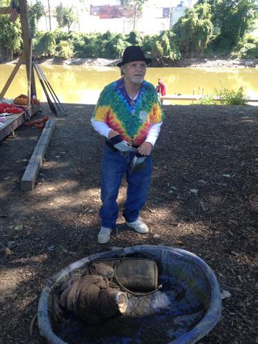
1 Save Maumee Grassroots Organization presents The Maumee Matters Earth WEEK 2014 April 18 through April because one day is just not long enough
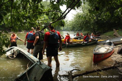
2 Everything Water:The Maumee Matters Earth Week Miles April 18 through April 26 Entire length of the Maumee River starting at the Continental Divide Cast Off: Continental Divide separating Great Lakes & Mississippi Watersheds Destination: Mouth of the Maumee River ~ Maumee Bay 9 Days Canoe trip for the hard-core members or BYOC for a day or 8! 8 Evenings! Create programming opportunities for beachcombers to join us at our land locations 2 States! Watershed Divide in Fort Wayne, Indiana to the mouth in Maumee Bay in Lake Erie

3 #1 Goal: GPS/GIS Mapping To assist the Upper Maumee Watershed Management Plan with intent to help implement the WMP which is due out to the public in April 2014 Coordinating assistance with Indiana University / Purdue University Fort Wayne and Upper Maumee Watershed Partnership Assist in solidifying GPS coordinates of straight-pipe drainage areas that appear unmapped on any State or County System. (i.e. tiles, pipes, bank erosion identification, potential areas for boat launching & large debris mapping)
4 Goal #2 Provide a destination for public outreach & education Provide the stage for public programing! 1) to highlight BMP s, successes for water quality & challenges faced 2) to provide an opportunity for experts to present information in-the(ir)-field; * to provide feedback, answer questions, encourage discussion and weigh-in-on complicated issues, rulings & law 3) Encourage stakeholders in the Maumee Watershed to visit another area along our waterways ~ (re) create the love of water Identified as a need for many government and nonprofit groups


5 Goal #3 Highlight U.S. ACE current practice indiscriminate removal of vegetation - 15ft on both sides of all levees in the U.S. Guidelines for landscape planting and vegetation management at levees, floodwalls, embankment dams and appurtenant structures (ETL )


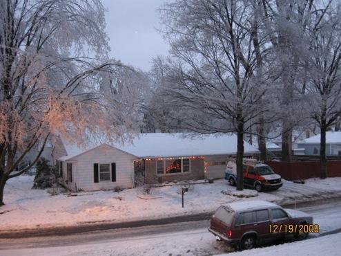
6 Why Save the Maumee? Largest Watershed to the entire Great Lakes Basin The confluence of the St. Joseph & St. Marys Rivers create the Maumee in downtown Fort Wayne, IN Remains on the 303(d) list of impaired waters and Abby bought a house on the Maumee in 2000

7
! * 7th Annual Seed Harvest (since 2007)! * Summer Monthly Eco-Walks (began in 2012)!")
8 ALL ON 100% VOLUNTEER HOURS Research began in 2001! Save Maumee projects began in 2005!! * 9th Annual Earth Day (since 2005)! * 8th Annual Canoe Clean-Up, Can YOU Clean-Up (since 2006)! * 7th Annual Seed Harvest (since 2007)! * Summer Monthly Eco-Walks (began in 2012)! 501 (c) 3 nonprofit filed with the IRS in December 2013

9 Purpose of Save Maumee Grassroots Organization is to preserve, protect and improve the ecosystems of the Upper Maumee River & Maumee Watershed by increasing public awareness through advocacy, collaboration, education and hands-on projects.


10 SUCCESS TO DATE Planted over 900 lbs of native DNR approved riparian seed and hundreds of plant plugs


11 SUCCESS TO DATE Planted over 2,000 trees along public riparian areas many are fruit and berry bearing


12 SUCCESS TO DATE Installed over 16,000 sq. ft. of GeoJute Mats erosion control mats hold seed down when violent riverbank flooding occurs


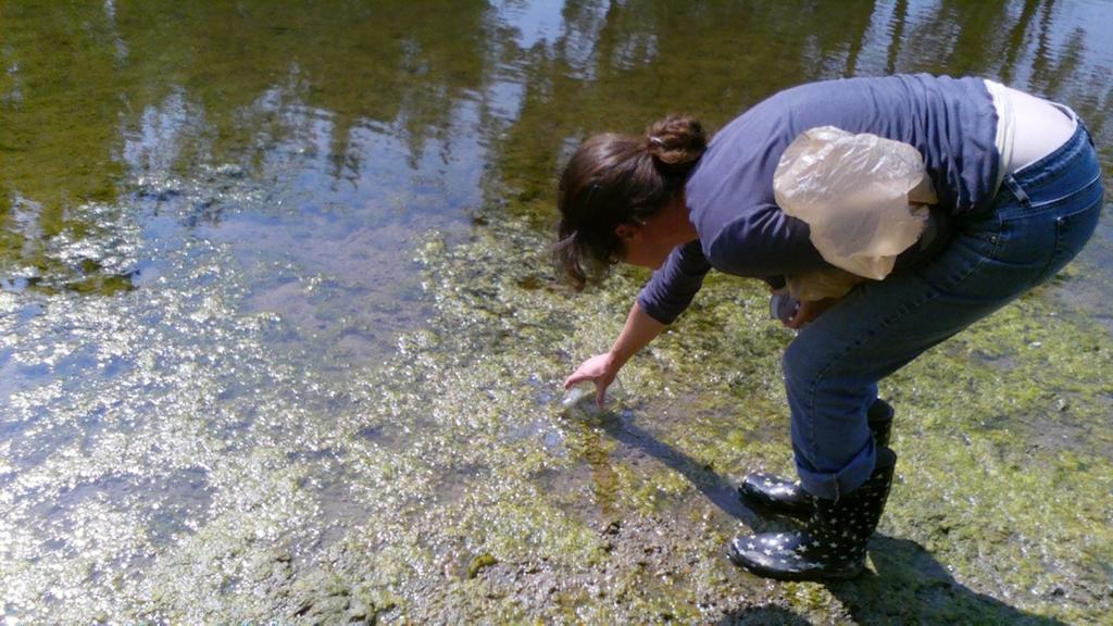
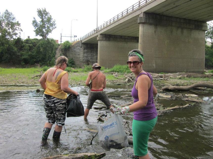
13 and removed over 26,200 pounds of river rubbish in & around Fort Wayne s Rivers

14 SUCCESS TO DATE continue to engage hundreds of unpaid participants encourage science based research on local rivers and best management practices share the information in a public forum for educational purposes Memberships keep our work 100% volunteer & community based
15
 Programing 3) Marketing 4) Food & Water 5) Finance / FunRaising 6) Film")
16 Committee Countdown to APRIL 17, 2014 Everything Water: The Maumee Matters Earth Week 1) Safety Plan / Medic Crew 2) Programing 3) Marketing 4) Food & Water 5) Finance / FunRaising 6) Film Production
17 How are we advertising the trip? NewsCenter 33 is to broadcast from the river Documentarian crew to assist in taking a snapshot of the Maumee; stories, problems, solutions, questions List of over 8,000 s collected from our work, will be sent Marcus Demery ~ Writer ~ will be capturing questions from participants for discussions

18 Significance of Launching Point Continental Divide between the Mississippi & Great Lakes Watershed Where the dreaded Silver Asian Carp have an opportunity to enter the Great Lakes via Eagle Marsh/St. Marys to the Maumee. Draw attention to the importance of invasive species crossing boundaries and the effects that invasives have on commerce.

19 April 19th (SATURDAY) Launch from Top Notch Tree Service 9am portage and drop heavy supplies at PORTAGE over Hosey Dam

20 April 19 Saturday Landing Programing Area New Haven North River Nature Area New Haven, Indiana

21 April 20 Easter Sunday Landing Programing Area ACRES Blue Cast Springs

22 April 21st ~ Monday Programing Area Riverside Park Antwerp, OH

23 x PROGRAMING AREA on April 22 Tuesday Earth Day Celebrations HERE! Dock boats at Old Fort Defiance Park, Defiance Ohio!

24 April 22 (Tuesday) Landing above Independence Dam GO to Earth Day Celebrations then grab your buddy boat and PORTAGE your canoes to the campsite

25 Haul boats by land OR YOU MUST TAKE BUDDY BOAT to camp after hand-portage Canoe Portage from Independence Dam Boat Launch to private property at 869 Coon Hallow Drive Napoleon, OH CAMPERS / CANOERS MUST BE AT CAMP BEFORE DARK ~April 22 Earth Day Tuesday~

26 April 23 (Wed) Programing Location Napoleon Municipal Park Napoleon, Ohio

27 WE WILL REASSESS RIVER CONDITIONS HERE: April 24 Thursday Landing Programing Camp Area Mary Jane Thurston State Park Riverbank restoration project with ODNR & Reassessing water conditions


28 ! April 25 CAMP & INFO LOCATION ALL DAY! On April 24, we will reach a democratic decision based on the Maumee River conditions, as to whether we launch or stay at Mary Jane Thurston

29 !!! DANGEROUS RAPIDS COULD BE between Mary Jane Thurston State Park & Perrysburg/Maumee due to flooding! Waterville is the half-way point between Grand Rapids/ MJT and Perrysburg/Maumee
 BUT we may stage another educational area")
30 April 25 (Friday) OPTION 1. EVERYONE stays at MJT and has a 2nd day of Programing Restoration work at MJT (canoes will be trailered but not moved) BUT we may stage another educational area OPTION 2. Canoe Crew may travel with Land Crew or decide to paddle to Programing Location at Blue Grass Island or Audubon Islands Nature Preserve


31 Saturday April 26 x Portage ALL to Maple Street Perrysburg, Ohio Maple Street ends at the Maumee River Launching Point 9AM

32 Saturday April 26 Bring your own canoe launch with us ~ 9AM FROM Maple Street boat launch in Perrysburg, Ohio

33 International Park, Toledo Ohio DESTINATION POINT REACHED SATURDAY APRIL 26, 2014

34 We all live downstream and the end of the line is Toledo Ohio for the Maumee River If we all pay it upstream, our waters win
35 Why should you promote? promote your own local interests, heritage & community that surrounds our water encourages interest in education regional & specific notoriety promote your own success stories create community in your own community encourage commerce to surrounding towns & cities invite the community to your own promotions & destinations in the watershed the more the merrier encourages mutual cooperation between political boundaries, government & water related groups ~ watersheds do not recognize these political boundaries
36 Bottom Line The Great Lakes currently generate over 1.5 million jobs and $60 billion in wages annually and provide the foundation for a $30 billion tourism economy. Projections for implementing Great Lakes restoration strategy will generate over $50 billion in long-term economic benefits. Great Lakes Commission, HOW, Great Lakes Fishery Commission, Council of Great Lakes Industries Great Lakes Metro Chambers Coalition, September 5, 2013
37 Historical Value Civilization began & centered around water Pass on lore to the next generation(s) Everyone has a story and natural love of water, we hope to capture this during the trip MANY historical sites to promote along the Maumee (Fort Meigs, General Anthony Wayne s Fort, Erie Canal) Waterways have historically been the heart of cities

38

39 looking west from Dr. Martin Luther King Jr. Bridge Combined Sewer Overflows happen on average 71 times per year in Fort Wayne alone & have the potential to overflow with as little as 1/10 inch of precipitation or snow melt
40 Indianapolis Star, 2009


41 SUCCESS STORY
The Spey Catchment Initiative
 The Spey Catchment Initiative Introducing the Spey Catchment Initiative The Spey Catchment Initiative is a new project which aims to help deliver the objectives of the River Spey Catchment Management Plan
Addressing the Threat of Asian Carp in the Great Lakes/Midwest Region
 Addressing the Threat of Asian Carp in the Great Lakes/Midwest Region Mike Weimer U.S. Fish and Wildlife Service Co-chair, Asian Carp Regional Coordinating Committee Asian Carp Regional Coordinating Committee
Management and Control of Asian Carps in the United States. Greg Conover Asian Carp Working Group, Chair USFWS, Carterville FRO
 Management and Control of Asian Carps in the United States Greg Conover Asian Carp Working Group, Chair USFWS, Carterville FRO Asian Carp 7 carps native to Asia introduced into U.S. Asian carps = bighead,
Salmon River Cooperative Noxious Weed Program (CNWP) Presented by the Salmon River Restoration Council
 Presented by the Salmon River Restoration Council") Salmon River Cooperative Noxious Weed Program (CNWP) Presented by the Salmon River Restoration Council Some of you may be thinking So where is Salmon River? Isn t it in Idaho, Washington, or Oregon? The
Salmon River Cooperative Noxious Weed Program (CNWP) Presented by the Salmon River Restoration Council Some of you may be thinking So where is Salmon River? Isn t it in Idaho, Washington, or Oregon? The
Conserving the Forests, Lakes and Streams of Northeast Michigan
 4241 Old US 27 South, Suite 2, Gaylord, Michigan 49735 (989) 448-2293 www.huronpines.org info@huronpines.org Prioritized Restoration Projects in the AuSable River Watershed Summer 2015 Update from Huron
Regulations. Grabbling season May 1 July 15; only wooden structures allowed.
 Arkabutla Reservoir 219 REEL FACTS Keith Meals, Arthur Dunn, Stanley Turner Fisheries Biologists keithm@wfp.ms.gov, ArthurD@wfp.ms.gov, StanleyT@wfp.ms.gov General Information: Arkabutla Reservoir is one
Of the following, which best describes you?
 Summary of Downtown Des Moines Dam Debate April 26 th, 2016 The following are the responses we heard from participants in the Dam Debate cohosted by the Register and the Des Moines Area Metropolitan Planning
Understanding Today s Environmental Issues and the Oregon Stewardship Guidelines. David Phipps GCSAA NW Field Staff
 Understanding Today s Environmental Issues and the Oregon Stewardship Guidelines David Phipps GCSAA NW Field Staff My Roots Northwest Landscape Industries 1986-1990 The Oregon Golf Club 1990-2000 Stone
OVERVIEW OF MID-COLUMBIA FISHERIES ENHANCEMENT GROUP
 Mid-Columbia Fisheries Enhancement Group MISSION STATEMENT The Mid-Columbia Fisheries Enhancement Group is a non-profit organization dedicated to restoring selfsustaining salmon and steelhead populations
Annual Report for Fiscal Year and Future Plans for the Tillamook Bay Watershed Council
 Annual Report for Fiscal Year 2012-2013 and Future Plans for the Tillamook Bay Watershed Council A report prepared for the Tillamook County Board of Commissioners August 2013 Table of Contents: Recently
Waikanae River Environmental Strategy. 12. Arapawaiti/Otaihanga Reach
 74 Waikanae River Environmental Strategy 12. Arapawaiti/Otaihanga Reach Figure 12: Arapawaiti/Otaihanga Reach 75 PART C: Protecting and Improving the River Corridor / Arapawaiti/Otaihanga Reach Waikanae
Searsville Dam Removal
 Searsville Dam Removal A unique opportunity for all Presented by the Beyond Searsville Dam Coalition San Francisquito Creek flows into the San Francisco Bay near the Palo Alto Airport and Golf Course seen
HISTORY OF CONSTRUCTION
 HISTORY OF CONSTRUCTION CFR 257.73(c)(1) West Boiler Slag Pond Clifty Creek Plant Madison, Indiana October, 2016 Prepared for: Indiana Kentucky Electric Corporation Prepared by: American Electric Power
Mid-Columbia Fisheries Enhancement Group Annual Report Fiscal Year 06: July 1, 2005 June 30, 2006
 Mid-Columbia Fisheries Enhancement Group Annual Report Fiscal Year 06: July 1, 2005 June 30, 2006 Mission Statement The mission of the Mid-Columbia Fisheries Enhancement Group is to restore self-sustaining
Great Lakes Governance and the Risk of Grass Carp
 Great Lakes Governance and the Risk of Grass Carp Dr. John Dettmers Fishery Management Program Director Great Lakes Fishery Commission for Northeast-Midwest Institute Congressional Briefing February 6,
RLRC COMMUNITIES EAST GRAND FORKS AREA CHARACTER THE RED LAKE RIVER & THE RED RIVER OF THE NORTH CONFLUENCE EAGLE POINT BOAT LAUNCH DESIGN
 AREA CHARACTER THE RED LAKE RIVER & THE RED RIVER OF THE NORTH CONFLUENCE EAGLE POINT BOAT LAUNCH DESIGN DESIGN DETAILS 135 AREA CHARACTER East Grand Forks a city of 7,501 people is located across the
2015 Annual Report. February 15, 2016
 2015 Annual Report February 15, 2016 2015 Round Lake Management Commission (RLMC) Annual Report Contents The Round Lake Mgt Commission 2015 Year in Review Huebner Fishery Mgt Foundation Shoreline Restoration
Asian Carp and Round Goby Status
 Asian Carp and Round Goby Status Participants will learn the current status of Asian carp and Round Goby in the region and Wisconsin, and what federal and state agencies are doing to prevent their expansion.
WELCOME Asian Carp Management and Control in the Ohio River and Upper Mississippi River Basins
 WELCOME Asian Carp Management and Control in the Ohio River and Upper Mississippi River Basins Thank you sponsors! Representative Mike Kelly (PA-3 rd ) Representative Ron Kind (WI-3 rd ) Collaborative
Lake Texoma Advisory Committee
 Lake Texoma Authorized by Flood Control Act of 1938 Construction of dam completed in 1944 89,000 surface acres Largest lake in capacity in the Tulsa District Operated by the U.S. Army Corps of Engineers
Caloosahatchee River Citizen s Association
 Caloosahatchee River Citizen s Association www.caloosahatchee.org Autumn 2002 Caloosahatchee Regional Park Plan Revised! Public Participation Pays off! Last fall the Lee County Parks & Recreation Department
Norwalk Harbor: The Jewel of Long Island Sound. A Presentation by the Norwalk Harbor Management Commission
 Norwalk Harbor: The Jewel of Long Island Sound A Presentation by the Norwalk Harbor Management Commission 2018 State of the Harbor Meeting December 13, 2018 The City of Norwalk in Southwest Connecticut
A BLUEPRINT FOR THE PENOBSCOT RIVER WATERSHED
 A BLUEPRINT FOR THE PENOBSCOT RIVER WATERSHED About this series 2 # for a healthy Penobscot watershed M aine rivers used to be full of fish swimming upstream from the ocean every year on their spawning
COMMUNITY WATERSHED PROJECT
 SABINE RED RIVER COMMUNITY WATERSHED PROJECT A Watershed Approach to Aquatic Resources Do you have a stake in the water, the wildlife, the use of the land? Help us do for fish what was done for ducks*.
Aquatic Invasive Species. September 30 th, 2014, NOFNEC
 Aquatic Invasive Species September 30 th, 2014, NOFNEC Overview Introduction Invasive Species of Concern Round Goby Phragmites Asian Carps How can you help? Decontamination Resources AOFRC 2 Introduction
Integrated Pest Management Program Final Report
 Integrated Pest Management Program Final Report Shoreline Stewardship Program: Be a Lake Pan Pal Joan Bradshaw Specialized Regional Programs for Natural Resource Citrus, Hernando, Pasco and Sumter Counties
Visitor Guidelines for WPC-owned Properties. Last revised 5/20/2010
 WESTERN PENNSYLVANIA CONSERVANCY Visitor Guidelines for WPC-owned properties 800 Waterfront Dr., Pittsburgh, PA 15222 412-288-2777, www.waterlandlife.org Visitor Guidelines for WPC-owned Properties Last
Site Tour, August 24, Fish Science - Big Lake Coho Salmon Migration and Habitat Use
 Matanuska-Susitna Basin Salmon Habitat Partnership Site Tour, August 24, 2015 Part 1 of Tour Big Lake watershed Fish Science - Big Lake Coho Salmon Migration and Habitat Use Presenter: Jon Gerken (U.S.
Reflections on a Decade of Habitat Restoration Efforts in the St. Clair Detroit Rivers System
 Reflections on a Decade of Habitat Restoration Efforts in the St. Clair Detroit Rivers System Jennifer Read University of Michigan Water Center & Ed Roseman US Geological Survey On behalf of the Reef Team
Restoring the Iconicc Lower Cache River
 Restoring the Iconicc Lower Cache River A new chapter holds promise of revitalizing cherished waters and woods The story of conservation in the lower Cache River and surrounding Big Woods of eastern Arkansas
Pickwick Lake 2018 REEL FACTS Trevor Knight Fisheries Biologist (662)
") Pickwick Lake 218 REEL FACTS Trevor Knight Fisheries Biologist trevork@mdwfp.state.ms.us (662) 84-5176 General Information: Covering 43,1 acres, Pickwick Lake, which borders Alabama, Tennessee, and Mississippi,
Pickwick Lake 218 REEL FACTS Trevor Knight Fisheries Biologist trevork@mdwfp.state.ms.us (662) 84-5176 General Information: Covering 43,1 acres, Pickwick Lake, which borders Alabama, Tennessee, and Mississippi,
GRAND RAPIDS RESTORATION GRAND RAPIDS REVITALIZATION
 GRAND RAPIDS RESTORATION RETURNING THE RAPIDS TO THE GRAND WHY IS THIS PLACE CALLED GRAND RAPIDS? We have been asking for over 100- years, where are the rapids? WHY IS THIS PLACE CALLED GRAND RAPIDS? compare
Module 2 Narration What is a watershed?
 Module 2 Narration What is a watershed? Timing Key Narrative Snapshots a) 00:10 Every living thing relies on water to exist. But where does our water come from? The most natural place to look is upstream
The Role of the Canal & River Trust Fisheries & Angling Team
 The Role of the Canal & River Trust Fisheries & Angling Team Britain s Canals Arteries of the world s first Industrial Revolution Most built 1770-1850 up to 4,000 miles at their peak Shaped British society,
Restoring the Kootenai: A Tribal Approach to Restoration of a Large River in Idaho
 Restoring the Kootenai: A Tribal Approach to Restoration of a Large River in Idaho Susan Ireland, Kootenai Tribe of Idaho Future of our Salmon Conference Technical Session August 2016 Healthy Floodplains,
Eastern Brook Trout. Roadmap to
 Eastern Brook Trout Roadmap to CONSERVATION Our Brook Trout heritage he wild Brook Trout is an American symbol of persistence, adaptability, and the pristine wilderness that covered North America prior
A Comparison of Western Watershed Councils. Presentation Prepared by Jeff Salt, Great Salt Lakekeeper
 A Comparison of Western Watershed Councils Presentation Prepared by Jeff Salt, Great Salt Lakekeeper Presentation Overview Introduction Jordan River Watershed Council Lower Boise Watershed Council Clackamas
Proposed Shuswap River Boating Regulations Open House
 Proposed Shuswap River Boating Regulations Open House Welcome, and thank you for attending this Open House regarding proposed boating regulations for the Shuswap River. A partnership of the Regional District
Columbia Lake Dam Removal Project
 Columbia Lake Dam Removal Project The Columbia Lake dam located 1/4 mile upstream of the Paulins Kill River's confluence with the Delaware River in Knowlton Township, Warren County has been proposed for
Aquatic Invasive Species : Update on AIS related efforts at Deep Creek Lake, Maryland
 Aquatic Invasive Species : Update on AIS related efforts at Deep Creek Lake, Maryland Presentation to the DCL Property Owners Association August 19, 2017 Julie Bortz Maryland Department of Natural Resources
1.Mill Creek Watershed Summary Description and Land Use
 1.Mill Creek Watershed Summary Description and Land Use Table xxx: Mill Creek Watershed Overview Watershed Size 31,435 acres/49.1 sq miles/ 127.1 sq km Elevation Range 5,594 feet [4,967-10,561] Stream
The Role of the Canal & River Trust Fisheries & Angling Team
 The Role of the Canal & River Trust Fisheries & Angling Team Britain s Canals Arteries of the world s first Industrial Revolution Most built 1770-1850 up to 4,000 miles at their peak Shaped British society,
For next Thurs: Jackson et al Historical overfishing and the recent collapse of coastal ecosystems. Science 293:
 For next Thurs: Jackson et al. 2001. Historical overfishing and the recent collapse of coastal ecosystems. Science 293: 629-637. Resource: means of supplying a want or deficiency, from French resourdre
COLUMBIA LAKE DAM REMOVAL PROJECT
 COLUMBIA LAKE DAM REMOVAL PROJECT Major Goals of the Columbia Lake Dam Removal: Reconnect 10 miles of the Paulins Kill River to the Delaware River, restoring natural flow regime and sediment transport.
Indian River Lagoon: Lessons, Challenges and Opportunities
 Indian River Lagoon: Lessons, Challenges and Opportunities Upper Chain of Lakes Lake Kissimmee Kissimmee River Indian River Lagoon Caloosahatchee Estuary Lake Okeechobee St. Lucie Estuary Mark Perry, Executive
PROGRAM OVERVIEW. Wednesday afternoon workshops 8/27, approximately 1-4 PM Cost: $25, which includes a snack
 PROGRAM OVERVIEW The first Indiana Walk Summit will take place August 27 & 28, 2014, at the Marten House Hotel and Lilly Conference Center in Indianapolis. The event will consist of trainings and mobile
The Joint Strategic Plan and its Role in Management of Invasive Fishes
 The Joint Strategic Plan and its Role in Management of Invasive Fishes John Dettmers, Great Lakes Fishery Commission November 7, 2018 Ann Arbor, Michigan 2 Un-successful attempts at cooperation Failed
Thank you for the opportunity to comment on the Draft Freshwater Fisheries Management Plan on behalf of Victoria s recreational fishing sector.
 Anthony Forster Inland Fisheries Manager Victorian Fisheries Authority By email: Anthony.Forster@vfa.vic.gov.au DRAFT FRESHWATER FISHERIES MANAGEMENT PLAN Dear Anthony, Thank you for the opportunity to
Estimated on-the-ground start and end dates: 1 June October 2018
 A. Applicant Information Name of Organization: U.S. Army Corps of Engineers, Carlyle Lake 801 Lake Road, Carlyle, IL 62231 Contact Information: Robert Wilkins, Operations Manager, (618) 594-2484, Robert.Wilkins@usace.army.mil
Highland Region MAP. No. 11 St. Marys River No. 12 West River No. 13 Wallace River No. 14 Toney River No. 15 Northumberland Strait
 Highland Region MAP No. 11 St. Marys River No. 12 West River No. 13 Wallace River No. 14 Toney River No. 15 Northumberland Strait 14 Route: No. 11 St. Marys River Rating: Intermediate Advanced Length:
Focus. Cumberland Whitewater Park. Cumberland Whitewater Park. Read 20 point Comic Sans MS from rear of room. A free flowing natural artificial course
 Cumberland Whitewater Park Cumberland Whitewater Park Focus Read 20 point Comic Sans MS from rear of room 1 Cumberland Whitewater Park by Robert B. Kauffman, Ph.D. Proposed site A free flowing natural
DALE HOLLOW LAKE TROOPER ISLAND IMPROVEMENT PROJECT Proposal for Reservoir Fisheries Habitat Partnership (RFHP)
") DALE HOLLOW LAKE TROOPER ISLAND IMPROVEMENT PROJECT Proposal for Reservoir Fisheries Habitat Partnership (RFHP) A. Applicant Information: US Army Corps of Engineers, Dale Hollow Lake POC: Gregg Nivens
DALE HOLLOW LAKE TROOPER ISLAND IMPROVEMENT PROJECT Proposal for Reservoir Fisheries Habitat Partnership (RFHP) A. Applicant Information: US Army Corps of Engineers, Dale Hollow Lake POC: Gregg Nivens
Profile of the Current Non-Asian Carp Commercial Fishing Industry on the Illinois River
 Profile of the Current Non-Asian Carp Commercial Fishing Industry on the Illinois River Rob Maher Illinois Department of Natural Resources Division of Fisheries Commercial Fishing Project Manager Historic
OPPORTUNITIES & CONSTRAINTS
 OPPORTUNITIES & CONSTRAINTS Grand Rapids Restoration August 2012 We have inherited the past; we can create the future Unknown TABLE OF CONTENTS ES-1 ES-1...... BACKGROUND CONCEPTUAL PLAN ES-2... OPPORTUNITIES
Tunica Cutoff 2018 REEL FACTS Keith Meals Fisheries Biologist
 Tunica Cutoff 218 REEL FACTS Keith Meals Fisheries Biologist keithm@mdwfp.state.ms.us General Information: Tunica Cutoff was created by the US Army Corps of Engineers (COE) in 1942 when a bend in the Mississippi
Crawford Reservoir. FISH SURVEY AND MANAGEMENT INFORMATION Eric Gardunio, Fish Biologist Montrose Service Center
 FISH SURVEY AND MANAGEMENT INFORMATION General Information: Crawford Reservoir is a popular fishery that provides angling opportunity for yellow perch, channel catfish, northern pike, rainbow trout, black
Chadbourne Dam Repair and Fish Barrier
 Chadbourne Dam Repair and Fish Barrier Final Report for the Western Native Trout Initiative Prepared by: Carol Endicott Yellowstone Cutthroat Trout Conservation Biologist Montana Fish, Wildlife & Parks
GREAT FALLS PORTAGE COMMORATIVE AWARD PATCH PORTAGE ROUTE CHAPTER LEWIS AND CLARK TRAIL HERITAGE FOUNDATION, INC.
 GREAT FALLS PORTAGE COMMORATIVE AWARD PATCH PORTAGE ROUTE CHAPTER LEWIS AND CLARK TRAIL HERITAGE FOUNDATION, INC. The mission of the LCTHF is: As Keepers of the Story Stewards of the Trail, the Lewis and
Table VI-Proj SITE-SPECIFIC MANAGEMENT MEASURES FOR THE ROOT RIVER WATERSHED
 00216268.DOC 300-1104 MGH/JEB/pk 01/31/14, 02/04/14 Table VI-Proj SITE-SPECIFIC MANAGEMENT MEASURES FOR THE ROOT RIVER WATERSHED LRC-01 Habitat Hoods Creek entire length Village of Mt. Various Reiterate
The Role of River Advisory Councils
 1 The Role of River Advisory Councils Within the Black River Watershed By Dick McDonald NYSDEC Aquatic Biologist June 8, 2016 2 3 Beaver River Advisory Council (BRAC-1) Established through the Offer of
Asian arowana. Dale Martin, Houston Zoo
 Asian arowana Dale Martin, Houston Zoo 26 www.aza.org November 2016 AZA-ACCREDITED FACILITIES TAKE ON THE INVADERS BY ALINA TUGEND November 2016 www.aza.org 27 reshwater habitats are under attack across
Black Sturgeon Regional Plan
 Black Sturgeon Regional Plan This is one of twenty Regional Plans that support implementation of the Lake Superior Biodiversity Conservation Strategy (Strategy). The Strategy, prepared and overseen by
NEVADA DEPARTMENT OF WILDLIFE STATEWIDE FISHERIES MANAGEMENT
 NEVADA DEPARTMENT OF WILDLIFE STATEWIDE FISHERIES MANAGEMENT FEDERAL AID JOB PROGRESS REPORTS F-2-49 213 RYE PATCH RESERVOIR WESTERN REGION NEVADA DEPARTMENT OF WILDLIFE, FISHERIES DIVISION ANNUAL PROGRESS
Strategic Plan Pennsylvania Council of Trout Unlimited
 Strategic Plan Pennsylvania Council of Trout Unlimited Purpose Multi-year strategic plans are necessary to achieve the long-term, generational TU vision. Previously TU National, councils, and chapters
ASK TURTLE: SELF CARE
 We would like to thank the supporters & volunteers for making this trip and the rest of our work possible WE COULD NOT DO THIS WITHOUT YOUR SUPPORT ASK TURTLE: SELF CARE YOU WANT NO INTENTIONAL CUTS/ABRASIONS
Little Calumet River Rapid Response Fish Identification and Enumeration Branch Summary Report
 Little Calumet River Rapid Response Fish Identification and Enumeration Branch Summary Report Introduction A rotenone rapid response was completed on a 2.6-mile section of the Little Calumet River immediately
VIDEO AUDIO Slide 1. Slide 2 Old timey 18 th century map of east coast
 VIDEO AUDIO Slide 1 1A Welcome to the Cooper River Rediversion Project at St. Stephen, Montage of exteriors of facility, South Carolina! Since 1985, this boating, fish runs, fishing, facility has served
NEVADA DEPARTMENT OF WILDLIFE STATEWIDE FISHERIES MANAGEMENT
 NEVADA DEPARTMENT OF WILDLIFE STATEWIDE FISHERIES MANAGEMENT FEDERAL AID JOB PROGRESS REPORTS F-20-48 2012 RYE PATCH RESERVOIR WESTERN REGION NEVADA DEPARTMENT OF WILDLIFE, FISHERIES DIVISION JOB PROGRESS
May 17, Dear Senator:
 Alaska Clean Water Advocacy * Alliance for the Great Lakes *Altamaha Riverkeeper * American Rivers *Bad River Watershed Association * BaySail * Black Warrior Riverkeeper * California Sportfishing Protection
Canal Dock Boathouse, Inc. (CDBi) Paddle-Sports Request for Proposal Q & A Posted to CDBi website 9/16/2017
 Paddle-Sports Request for Proposal Q & A Posted to CDBi website 9/16/2017") Canal Dock Boathouse, Inc. (CDBi) Paddle-Sports Request for Proposal Q & A Posted to CDBi website 9/16/2017 *(All responses below are subject to further scrutiny by the City of New Haven and could be updated
Canal Dock Boathouse, Inc. (CDBi) Paddle-Sports Request for Proposal Q & A Posted to CDBi website 9/16/2017 *(All responses below are subject to further scrutiny by the City of New Haven and could be updated
Big Spring Creek Habitat Enhancement and Fishery Management Plans
 Big Spring Creek Habitat Enhancement and Fishery Management Plans November 5, 2012 Big Spring Events and Activities Center Newville, PA Charlie McGarrell Regional Habitat Biologist Pennsylvania Fish and
Maryland Chapter Trout Unlimited Brook Trout Conservation Effort
 Maryland Chapter Trout Unlimited Brook Trout Conservation Effort Photo by Matt Kline Portfolio of Recent Work MDTU Brook Trout Conservation Coordinator: Scott C. Scarfone, ASLA sscarfone@oasisdesigngroup.com
Columbia Lake Dam Removal Project
 Columbia Lake Dam Removal Project Major Goals of the Columbia Lake Dam Removal: Reconnect 10 miles of the Paulins Kill River to the Delaware River, restoring natural flow regime and sediment transport.
FINAL Caples Lake Fisheries Management Plan. Version 4.0
 FINAL Caples Lake Fisheries Management Plan Version 4.0 August 15, 2008 Purpose The Caples Lake Fisheries Management Plan (Plan) outlines the stocking plan to reestablish a sport fishery in Caples Lake
1. Indicate the number of employees and supervisors who will be working on the site. 5-10
 28068 Site Description continued - Describe the natural vegetation --- ground cover, trees, shrubs --- and any proposed changes. Describe the location of any estuarine, riparian, or wetlands and any noticeable
Mill Creek/Rose Valley Watershed General Information Presented by Dr. Mel Zimmerman Lycoming College CWI
 Mill Creek/Rose Valley Watershed General Information Watershed Concerns Rose Valley Lake Areas of Interest Biodiversity of Interest in Rose Valley Lake Rose Valley Lake Bird Area Fishes of Rose Valley
Regulations. Grabbling season May 1 July 15; only wooden structures allowed.
 Grenada Reservoir 218 REEL FACTS Keith Meals, Arthur Dunn, Stanley Turner Fisheries Biologists keithm@mdwfp.state.ms.us, ArthurD@mdwfp.state.ms.us, StanleyT@mdwfp.state.ms.us General Information: Grenada
2010 Fishing Opener Prognosis. Central Region
 2010 Fishing Opener Prognosis Central Region Hinckley PINE COUNTY Pokegama, Cross, Island, Oak and North and South Big Pine Lakes are typically the best lakes for targeting walleye in Pine County. They
Okanagan Sockeye Reintroduction
 Okanagan Sockeye Reintroduction Backgrounder Elders accounts, and other forms of Traditional Ecological Knowledge (TEK) tell us that many species of salmon once came into the Okanagan Valley and tell us
Upstreampaddle 25.South arm of the Brunswick River, Simpson s Creek drains the freshwater swamp lands of Tyagarah Nature Reserve, 750 hectares. Furthe
 Upstreampaddle 24 The Brunswick River is a shorter length river on the coastal plain of Northern New South Wales. The areas of interest to canoeists are: the reach from the town of Mullumbimby down to
Eastern Brook Trout Joint Venture Annual Report The Nature Conservancy 2013
 Eastern Brook Trout Joint Venture Annual Report The Nature Conservancy 2013 2013 Annual Performance Report Enhancing Connectivity in the Ash-Black Rock Sub-basin of the West Branch Narraguagus River. Project
Rochester Area Bike Sharing Program Study
 roc bike share Rochester Area Bike Sharing Program Study Executive Summary ~ January 2015 JANUARY 2015 8484 Georgia Avenue, Suite 800 Silver Spring, MD 20910 3495 Winton Pl., Bldg E, Suite 110 Rochester,
NEWS RELEASE. Lake Tahoe experts share research and aquatic invasive species control programs on second visit to Lake George.
 Lake George Asian Clam Rapid Response Task Force NEWS RELEASE Steering Committee Adirondack Park Invasive Plant Program Darrin Fresh Water Institute FUND for Lake George Lake Champlain Basin Program Lake
TESTIMONY OF THE COLUMBIA RIVER TREATY TRIBES BEFORE PACIFIC FISHERIES MANAGEMENT COUNCIL
 Agenda Item E.2.f Supplemental Tribal Report April 2012 TESTIMONY OF THE COLUMBIA RIVER TREATY TRIBES BEFORE PACIFIC FISHERIES MANAGEMENT COUNCIL April 2, 2012 Seattle, WA Good day Mr. Chairman and members
Chagrin River TMDL Appendices. Appendix F
 Appendix F The following are excerpts from the Eastern Brook Trout Joint Venture s Conservation Strategy (Working Draft v.6), Conserving the Eastern Brook Trout: Strategies for Action Found at: http://www.easternbrooktrout.org/constrategy.html
Nechako white sturgeon are an Endangered Species
 Nechako white sturgeon are an Endangered Species There are likely less than 350 Nechako white sturgeon, and historically there were over 5000 in the Nechako Watershed. Endangered as per the Species at
Aquatic Invasive Species Outreach Program
 2014 2015 Aquatic Invasive Species Outreach Program Preventing the spread of aquatic invasive species through education and communication programs Created by: Kaila Schmidt Consultant for Missouri Department
Winnipeg. Urban Sport Fishing Stakeholders Report
 Urban Sport Fishing 1996 Stakeholders Report Urban Sport Fishing CONTENTS 2 Introduction 2 Strategic Goals Learn to Fish Program The learn to fish program introduces Winnipeggers to the world class sport
Brook Trout in Massachusetts: A Troubled History, A Hopeful Future
 Brook Trout in Massachusetts: A Troubled History, A Hopeful Future Brook trout are one of the most beautiful and beloved fish in the Eastern United States. In Massachusetts, anglers prize opportunities
Healthy River$ Economic Impact of the Huron River. Elizabeth Riggs Michigan Watershed Summit 28 March 2018
 Healthy River$ Economic Impact of the Huron River Elizabeth Riggs Michigan Watershed Summit 28 March 2018 Founded in 1965, HRWC protects and restores the river for healthy and vibrant communities. A
III BASIN DESCRIPTION
 III-1 III BASIN DESCRIPTION The Youghiogheny Basin covers 1768 sq mi and extends from northern Maryland to McKeesport, Pennsylvania. This report deals only with the 1,255 sq mi of the basin within Pennsylvania
STATE OF NEVADA BOARD OF WILDLIFE COMMISSIONERS
 STATE OF NEVADA BOARD OF WILDLIFE COMMISSIONERS Number: P-33 Title: Fisheries Management Program Commission Policy Number 33 References: NRS 501.105, 501.181 Effective Date: July 24, 1999 Reviewed Date:
PRESENTATION TO THE BRITISH COLUMBIA LEGISALTIVE STANDING COMMITTEE ON FINANCE September 26, 2013
 PRESENTATION TO THE BRITISH COLUMBIA LEGISALTIVE STANDING COMMITTEE ON FINANCE September 26, 2013 On behalf of its 40,000 plus members, The BC Wildlife Federation welcomes the opportunity to address the
North Park Ranch for Sale North Park Ranch for Sale. Double M Ranch Jackson County, CO
 Double M Ranch Jackson County, CO Professionally Developed Trout Fishery and Recreational Ranch Over 2 miles of trophy fishing on the Michigan River One hour from Steamboat Springs Resort Recreational
Full Spectrum Deer Management Services
 Full Spectrum Deer Management Services Wildlife Specialists, LLC, offers full spectrum custom deer management services designed to meet the specific project goals of our clients from individual landowners
Parks Canada + Boating = A Beautiful Thing! Darlene Upton Parks Canada
 Parks Canada + Boating = A Beautiful Thing! Darlene Upton Parks Canada 1 5 NATIONAL PARKS 2 37 NATIONAL HISTORIC SITES 1 WORLD HERITAGE SITE NATIONAL URBAN PARK 2 3 The Parks Canada Boating Offer 4 Partners
Earthen Embankments. turning into larger, more costly repairs. The following. The State Dam Safety Program has inspection
 TOPIC: COMMON PROBLEMS FOR SMALL DAMS WITH CONCRETE CHANNEL SPILLWAYS The State Dam Safety Program has inspection requirements for state regulated dams. A dam, like any man-made structure, will change
Huntington District. For More Information Contact (304)
") Zoar Levee & Diversion Dam are located in the Muskingum River Basin highlighted in green to left. The Muskingum River Basin is the site of Ohio s first multiple purpose water management and land conservation
Zoar Levee & Diversion Dam are located in the Muskingum River Basin highlighted in green to left. The Muskingum River Basin is the site of Ohio s first multiple purpose water management and land conservation
COA-F17-F-1343 YEAR END REPORT
 DAVE MARSHALL SALMON RESERVE RESTORATION, MAINTENANCE, AND UPGRADES YEAR END REPORT Prepared for: Fish and Wildlife Compensation Program Prepared by: Edith Tobe, RPBio, Executive Director Box 1791, Squamish,
Pascagoula River Marsh 2017 REEL FACTS Stephen Brown Fisheries Biologist
 Pascagoula River Marsh 217 REEL FACTS Stephen Brown Fisheries Biologist stephenb@mdwfp.state.ms.us General Information: The Pascagoula River marsh is 25 acres of tidal creeks, canals, bays, and streams