Baseline Assessment of the Use of a Small Missouri River Backwater by Fish at Ponca State Park in Dixon County, Nebraska
|
|
|
- Katherine Gilmore
- 5 years ago
- Views:
Transcription

1 University of Nebraska - Lincoln DigitalCommons@University of Nebraska - Lincoln US Army Corps of Engineers U.S. Department of Defense 2000 Baseline Assessment of the Use of a Small Missouri River Backwater by Fish at Ponca State Park in Dixon County, Nebraska A. Luke Wallace U.S. Army Corps of Engineers Follow this and additional works at: Part of the Civil and Environmental Engineering Commons Wallace, A. Luke, "Baseline Assessment of the Use of a Small Missouri River Backwater by Fish at Ponca State Park in Dixon County, Nebraska" (2000). US Army Corps of Engineers This Article is brought to you for free and open access by the U.S. Department of Defense at DigitalCommons@University of Nebraska - Lincoln. It has been accepted for inclusion in US Army Corps of Engineers by an authorized administrator of DigitalCommons@University of Nebraska - Lincoln.
2 Baseline Assessment of the Use of a Small Missouri River Backwater by Fish at Ponca State Park in Dixon County, Nebraska Prepared By A. Luke Wallace Environmental Resource Specialist U.S. Army Corps of Engineers December 2,000
3 INTRODUCTION Ponca State Park is located adjacent to the Missouri River near the town of Ponca in Dixon County, Nebraska between river miles and This portion of the river is a 59-mile, unchannelized segment that has been designated as the Missouri National Recreational River under the Wild and Scenic Rivers Act. The majority of the park is situated high on bluffs that overlook the Missouri River. Until recently, the park had only a small amount of easily accessible river frontage. In 1999, the Nebraska Game and Parks Commission (NGPC) acquired an additional 295 acres of river bottomland on the adjacent land to the north of Ponca State Park. This land, which is made up of abandoned river chutes, floodplain forest, grasslands, wetlands and a backwater, has now been added to the IOtal acreage of the park. Since this land was added to the park, The NGPC has asked the U.S. Army Corps of Engineers (Corps) to consider joining into a cost share partnership to restore this bottomland under Missouri National Recreational River authority. This would be accomplished by following the business process used for the Section 1135 Aquatic Habitat Restoration Program. This program involves a 75% federal 25% non-federal cost share agreement in which the total cost of the project cannot exceed 5 million dollars and the cost share sponsor must acquire all necessary real estate for the project. A preliminary restoration plan was developed for the property during the summer and fall of2000. Under this plan, approximately 2 miles of backwater and shallow water habitat of varying depths would be excavated and connected to the river at the location of the existing backwater. A portion of this backwater area would be excavated to a depth greater than 10 feet in order to create otf-channel overwintering habitat for fish. In addition, the fingers of the existing backwater area would be expanded, and several wetland depressions would be excavated within an adjacent high diversity native grass planting to create wet meadow habitat. Figure I in Appendix A shows a conceptual drawing of the proposed restoration features developed in the preliminary restoration plan. One of the primary benetits of the backwater restoration work at the park would be to increase the amount of shallow. slack water habitat for fish, and perhaps reconnect the Missouri River to a small amount of its historic f1oodplain. The created habitat should provide valuable spawning, rearing. and foraging habitat, as well as some deep-water overwintering habitat for a number of native riverine fish species. Prior to beginning detailed design and construction on a restoration project such as this, it is necessary to gather baseline biological data. This data is necessary to determine the quality of the existing habitat. and to tind out what species are utilizing this habitat prior to restoration activities. This data then serves as a baseline to be measured against post-construction data in order to measure the outputs of the restoration project. For this reason, personnel of the U.S. Army Corps of Engineers, with the assistance of the Ponca State Park Superintendent, collected baseline fishery data in the existing backwater located at the northern end of the newly acquired property on October 5,2000.
4 MATERIALS AND METHODS The fish survey was conducted using two types of collecting gear. This gear included 3 experimental gill nets and a bag seine. All three gill nets were 33 meters long and 1.5 meters deep. The nets were constructed of monofilament with mesh sizes of 2.54 cm, 3.18 cm, 5.08, and 6.35 cm. Mesh sizes changed horizontally along the nets. The bag seine was 6.66 meters long and 1.33 meters deep, and had a 1.3 x 1.3 meter bag. The net was constructed out of Y. inch ny Ion mesh. Sampling was conducted in four different locations in the backwater area (Fingers A, B, and C, and the mouth). Gill nets were placed perpendicular to the shoreline across the mouths of fingers B and C and the mouth of the of the main backwater area where it opens into the Missouri River. Due to time constraints, the gill nets were only left in place for 4 hours. Figure 2 in Appendix A is an aerial photograph showing the sampling locations. Figure 3 in Appendix A is a topographic map of the newly acquired bottomland at Ponca State Park. Seining was performed in each of the three fingers (A, B, and C) of the backwater area. Water in the three fingers ranged from 6 inches to 3 feet in depth. Each finger was sampled with a series of short seine hauls until a majority of the finger was sampled. No seining was performed in the main portion of the backwater, because the water was too deep (6 to 8 feet) in this area. The majority offish captured, and representatives of every species captured were kept for later identification in the lab. However, representatives of some of the species most commonly captured during this sampling effort were released. The majority of the fish released were representatives of anyone of three common species (Carpiodes carpio. Lepornis cyanellus. and Notropis atherinoides). Figure 2 depicts the locations of each sampling area. Because the fingers were not thoroughly sampled due to time constraints, the size of the fingers, and the fact that some of the fish most frequently caught were released, data collected from the seine can only be used qualitatively. No quantitative conclusions can be made based on the results of the samples collected with the seine. Most of the fish collected with the bag seine were preserved in 10% formalin solution. These tish will eventually be transferred to a 70% ethanol solution for final preservation and storage. They are currently being stored in the Ichthyology Lab at UNO. Fish collected with the gill nets were identified to species and recorded in the field. Representatives of each species were photographed and then released. Photographs were also taken of the sampling locations and some of the equipment used in the study (Appendix C). RESUL TS AND DISCUSSION Overall, 19 species of fish were identitied from a total of 273 fish collected during this sampling effort (see Table 1 in Appendix B). The most abundant species collected in the backwater was Carpiodes carpio, followed by Notropis atherinoides. The large 2
5 nwnbers of small fish captured with the bag seine seem to suggest that the backwater serves as an important nursery area for a number of fish species. The majority of the fish collected with the seine were collected in Finger A. Finger A is a very long, narrow, and shallow tinger with a lot of dense emergent vegetation along the fringes. There was also a very dense carpet of filamentous algae in parts of this finger. All of the Lepomis cyanellus (\ 2) and Etheostoma exile (\ 5) specimens were captured in these areas with a carpet of filamentous algae and the fringes surrounded with cattails. This portion of the finger also had water t10wing upstream, in the opposite direction of the river, on the day we sampled. Table 2 in Appendix B shows the number of species collected with the bag seine per sampling site. Eight different species were collected with the gill nets (see Table 3 in Appendix B). All but three of the species collected were large piscivorous fish. The two species most often captured were Slizostedion canadense. and Hiodon alosoides. The highest number of fish collected with the gill nets (2 I) occurred at the mouth of the backwater. Most of the fish collected at the mouth of the backwater had their heads facing into the backwater. This seems to suggest that large fish enter the backwater from the main river chajmel to forage on the abundant invertebrates, small fish, and plankton living in these productive, sheltered waters. The results of this brief sampling effort indicate that the existing backwater at Ponca State Park is a valuable and highly productive nursery and foraging area for native Missouri River Fish. Undoubtedly, if time was not a factor in this sampling effort, and the gill nets were left in place over night, a signiticantly larger number of fish and perhaps a few more species would have been collected. If the proposed addition of approximately 2 miles of similar connected backwater habitat is successful, the newly created habitat would add a significant amount of productivity and habitat diversity to this somewhat degraded portion of the Missouri River. In order to measure the value of the restored habitat, post-construction follow-up surveys should be conducted in the 1st, yd, 5 th and 10 th years after construction is complete. Future sampling efforts should also include the use offyke (hoop) nets, to increase the chances of capturing all species present, as well as larval tish sampling gear in order to better determine the value of the restored habitat as a nursery area. 3
6 APPENDIX A FIGURES 4

7 Figure 1 N PONCA STATE PARK RESTORATION PROJECT IMAGERY BAS D ON CLR. PHOTOGRAPHY DATEQI' PHOTOGRAPHY, 4 MAY "" CAVINS PQUiT DAM 1111 "AU DATA 4 MAY"", lull as APPROX SCAlJ!; I" ' [3' '* "I" -~

8 Figure 2 Aerial photograph showing newly acquired bonoml lljld o.nd SIlmpling ~t~'s.
9 / r \,J /./ ( " I T 31 N T 30 N I \\ I' -~'. Boat
10 APPENDIXB TABLES 8
11 T ota IS SpecIes C II SPECIES I. Lepomis cyanelius (green sunfish) 2. Stizostedion canadense (sauger) 3. Stizostedion vitreum (walleye) 4. Esox lucius (northern pike) 5. LepisosteusPl.atostomus (shortnose gar) 6. Hiodon alosoides (goldeye) 7. Dorosoma cepedianum (gizzard shad) 8. Cyprinus carpio (common carp) 9. Carpiodes cyprinus (quillback) 10. Carpiodes carpio (river carpsucker) II. lctiobus bubalus (smallmouth buffalo) 12. Etheostoma exile (Iowa darter) 13. Noturus gyrinus (tadpole madtom) 14. Ameiurus melas (black bullhead) IS. Pimephales promelas (fathead minnow) 16. Cyprinelia spiloptera (spotfin shiner) 17. Notropis atherinoides (emerald shiner) 18. Notropis stramineus (sand shiner) 19. Notropis dorsalis (bigmouth shiner) Total Table 1 o ecte d at a lis amplm2 r S Ites With all M et h 0 d s SEINE GILL NET I I I IS I 4 20 II TOTAL II I IS I 4 20 II Table 2 N urn b er of S species C o II ecte dw' It hs eme b ly S arnplm2 r L ocatlon SPECIES FINGER A FINGERB FINGERC I. Lepomis cyanellus Dorosoma cepedianum Cypril1us carpio 1 4. Carpiodes cyprinus 9 5. Carpiodes carpio 95 I 6. Icliobus bubalus I 7. Etheostoma exile IS 8. Noturus KYril1us I 9. Ameiurus melas Pimephales promelas 19 I I I. CyprineUa spiloptera Notropis alheril10ides Notropis stramil1eus Notropis dorsalis 2 Total
12 Table 3 N urn b ero fs species C o II ec t e dw' It hg"iin I et b oy S arnplmg r L ocatlon SPECIES FINGERB FINGERC MOUTH TOTAL 1. Stizostedion canadense Stizostedion vitreum I Esox lucius I I 2 4. Lepisosteus platostomus Hiodon alosoides Dorosoma cepedianum I I 2 7. Cyprinus carpio I I 8. Carpiodes cyprinus I 4 5 Total
13 APPENDIXC PHOTOGRAPHS 11

14 View lo"ldnk SOUlheasI at main body "fbadwal<,..,d Ih< optning to \he Missouri Ri... "

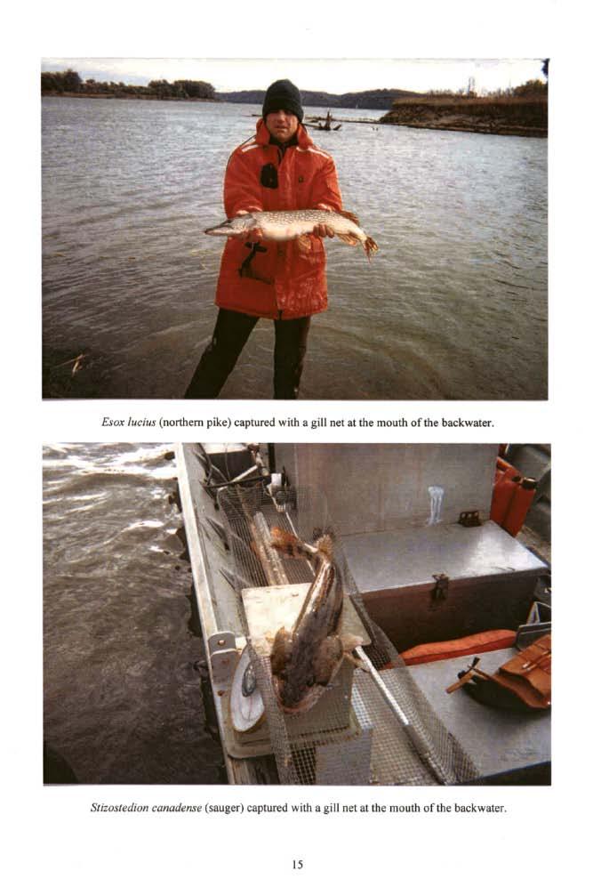
15 C""pioJu C}'PI'i... (quillbkk) ~... ill>,ill l>01ulh. mouth oflho bkkwmr. "

16 g..roz I~d"" (oortbem poo,) captund with.,ill net in Fin,.. D...
17
 taplu~ with _gill \"'\" the")
18 Sii:lJJlcdiOtJ.iln.", (... l l ey~) taplu~ with _gill "'" the mouth of me bodw~.
Fish Survey of Nathan s Lake, Boyer Chute National Wildlife Refuge. Corey Lee, Fisheries Technician William Davison, Fisheries Technician
 Fish Survey of Nathan s Lake, Boyer Chute National Wildlife Refuge Corey Lee, Fisheries Technician William Davison, Fisheries Technician U.S. Fish and Wildlife Service Columbia Fishery Resources Office
Fish Survey of Arctic Lake (ID # ), Scott County, Minnesota in 2012
, Scott County, Minnesota in 2012") Snapping Turtle from Arctic Lake, September 2012 Fish Survey of Arctic Lake (ID #70-0085), Scott County, Minnesota in 2012 Survey Dates: September 18-20, 2012 MnDNR Permit Number: 18362 Prepared for: Shakopee
Snapping Turtle from Arctic Lake, September 2012 Fish Survey of Arctic Lake (ID #70-0085), Scott County, Minnesota in 2012 Survey Dates: September 18-20, 2012 MnDNR Permit Number: 18362 Prepared for: Shakopee
CLASSIFICATION OF OKLAHOMA RIVERS AND PRELIMINARY DEVELOPMENT OF AN INDEX OF BIOTIC INTEGRITY
 CLASSIFICATION OF OKLAHOMA RIVERS AND PRELIMINARY DEVELOPMENT OF AN INDEX OF BIOTIC INTEGRITY Jeroen Gerritsen, T Michael T. Barbour, T Charles A. Potts, OKWR Oklahoma Streams (RF) Oklahoma Watersheds
I L L I N 0 PRODUCTION NOTE. University of Illinois at Urbana-Champaign Library Large-scale Digitization Project, 2007.
 I L L I N S UNIVERSITY OF ILLINOIS AT URBA-CHAMPAIGN PRODUCTION NOTE University of Illinois at Urbana-Champaign Library Large-scale Digitization Project, 7. Uf'HS cft, Natural History Survey Library Illinois
The relationship between the spatial distribution of common carp and their environmental DNA in a small lake
 The relationship between the spatial distribution of common carp and their environmental DNA in a small lake Jessica Eichmiller*, Przemyslaw Bajer, and Peter Sorensen Department of Fisheries, Wildlife,
Full Project Proposal
 PROJECT NAME: FIELD OFFICE: Full Project Proposal NFPP Phase I - Ferson-Otter Creek Dam Removal/Modification Project, Fox River Watershed, Illinois Carterville NFWCO PROJECT COORDINATOR: Nate Caswell FONS
Investigating reproduction and abundance of bighead carp (Hypophthalmichthys nobilis) and silver carp (H. molitrix) in the Greenup pool, Ohio River
 and silver carp (H. molitrix) in the Greenup pool, Ohio River") Investigating reproduction and abundance of bighead carp (Hypophthalmichthys nobilis) and silver carp (H. molitrix) in the Greenup pool, Ohio River Nathan Fleshman Dr. Thomas Jones Photo: USGS Photo: USGS
Investigating reproduction and abundance of bighead carp (Hypophthalmichthys nobilis) and silver carp (H. molitrix) in the Greenup pool, Ohio River Nathan Fleshman Dr. Thomas Jones Photo: USGS Photo: USGS
FACT SHEET MCGREGOR LAKE RESTORATION HABITAT PROJECT POOL 10, UPPER MISSISSIPPI RIVER, WISCONSIN ENVIRONMENTAL MANAGEMENT PROGRAM
 FACT SHEET MCGREGOR LAKE RESTORATION HABITAT PROJECT POOL 10, UPPER MISSISSIPPI RIVER, WISCONSIN ENVIRONMENTAL MANAGEMENT PROGRAM LOCATION McGregor Lake is located within a mid-river island in Pool 10
SUMMARY REPORT FOR LAKE ST. MALO FISHERIES ASSESSMENT. Prepared for the St. Malo and District Wildlife Association
 SUMMARY REPORT FOR LAKE ST. MALO FISHERIES ASSESSMENT Prepared for the St. Malo and District Wildlife Association Presented by August 25, 2014 Study dates thus far: Date Tasks February 16 Fishing derby;
Lake St. Clair Fish Community and Fishery
 Lake St. Clair Fish Community and Fishery Megan Belore Ontario Ministry of Natural Resources and Forestry Mike Thomas Michigan Department of Natural Resources Fish Community Fish Community Mixture of warm
Quemahoning Reservoir
 Pennsylvania Fish & Boat Commission Biologist Report Quemahoning Reservoir Somerset County May 2011 Trap Net, Gill Net and Electrofishing Survey Quemahoning Reservoir is an 899 acre impoundment located
MINNESOTA DEPARTMENT OF NATURAL RESOURCES DIVISION OF FISH AND WILDLIFE SECTION OF FISHERIES. Completion Report
 This document is made available electronically by the Minnesota Legislative Reference Library as part of an ongoing digital archiving project. http://www.leg.state.mn.us/lrl/lrl.asp Minnesota F-29-R(P)-26
Conewago Creek Initiative. Fish Survey Report for the Conewago Creek
 Conewago Creek Initiative Fish Survey Report for the Conewago Creek A compilation of historic fish survey data from 97, 973, 7, for three locations along the Conewago Creek Prepared by Kristen Kyler for
Thunder Bay River Assessment Appendix. Appendix 2
 Appendix 2 Known past and present fish distributions in the River system. Distribution of fishes were compiled from Bailey et al. (2003) and from records located at the Michigan Department of Natural Resources
INVASIVE CARP SAMPLING REPORT JANUARY DECEMBER 2016 MINNESOTA DEPARTMENT OF NATURAL RESOURCES DIVISION OF FISH AND WILDLIFE SECTION OF FISHERIES
 INVASIVE CARP SAMPLING REPORT JANUARY DECEMBER 2016 MINNESOTA DEPARTMENT OF NATURAL RESOURCES DIVISION OF FISH AND WILDLIFE SECTION OF FISHERIES UPPER MISSISSIPPI RIVER, POOLS 1-5 LOWER ST. CROIX RIVER,
Conewago Creek Initiative
 Conewago Creek Initiative The Conewago Creek Revisited Fish Survey Report A compilation of historic fish survey data from 197, 1973, 7, 1, and 15 for three locations along the Conewago Creek Prepared by
Caro Impoundment, Tuscola County
 Caro Impoundment is a 200 acre impoundment of the Cass River located one mile south of the Village of Caro in Tuscola County. Caro Dam, originally constructed in 1906 for water supply to Michigan Sugar
Little Calumet River Rapid Response Fish Identification and Enumeration Branch Summary Report
 Little Calumet River Rapid Response Fish Identification and Enumeration Branch Summary Report Introduction A rotenone rapid response was completed on a 2.6-mile section of the Little Calumet River immediately
MISSISSIPPI LEGISLATURE REGULAR SESSION 2007
 MISSISSIPPI LEGISLATURE REGULAR SESSION 2007 By: Representative Robinson (84th) To: Wildlife, Fisheries and Parks HOUSE BILL NO. 911 (As Sent to Governor) 1 2 3 4 5 6 7 8 9 10 11 12 13 14 15 16 17 18 19
Fish community assessment in the Harpeth River prior to the removal of the dam at Franklin, TN
 Fish community assessment in the Harpeth River prior to the removal of the dam at Franklin, TN Submitted to Dorie Bolze, Harpeth River Watershed Association By Frank Fiss and Nathan Singer, Tennessee Wildlife
Crooked Lake Oakland County (T4N, R9E, Sections 3, 4, 9) Surveyed May James T. Francis
 Surveyed May James T. Francis") Michigan Department of Natural Resources Status of the Fishery Resource Report No. 2004-1, 2004 Crooked Lake Oakland County (T4N, R9E, Sections 3, 4, 9) Surveyed May 2002 James T. Francis Environment Crooked
Michigan Department of Natural Resources Status of the Fishery Resource Report No. 2004-1, 2004 Crooked Lake Oakland County (T4N, R9E, Sections 3, 4, 9) Surveyed May 2002 James T. Francis Environment Crooked
Big Bend Lake Population Survey
 Big Bend Lake Survey Located in Des Plaines on East River Rd. just south of Golf Rd. This 27 acre body of water has a depth of 27.8 feet; however because it is connected to the Des Plaines River by a spillway,
Lake LeAnn 2018 Fish Survey
 Lake LeAnn 2018 Fish Survey June 21, 2018 Prepared for: Lake LeAnn Property Owners Association Prepared by: ADVANCED ECOLOGICAL MANAGEMENT 22071 7 Mile Road Reed City, MI 49677 Table of Contents 1.0 INTRODUCTION...
FISH PROTECTION ACTIVITIES AT PRADO DAM, CORONA, CA.
 San Marino Environmental Associates 560 South Greenwood Avenue, San Marino, CA 91108 (626) 792-2382 FAX (626) 792-8233 s FISH PROTECTION ACTIVITIES AT PRADO DAM, CORONA, CA. Prepared for: U. S. Army Corps
1165 S Hwy 191, Suite S 2350 W Moab, UT Vernal, UT
 COLORADO RIVER RECOVERY PROGRAM FY 2018 ANNUAL PROJECT REPORT RECOVERY PROGRAM PROJECT NUMBER: C29a/138 I. Project Title: Green River Canal Company (GRCC) Canal Salvage II. Bureau of Reclamation Agreement
Student Worksheet: River Health and Indicator Species
 1 Student Worksheet: River Health and Indicator Species Mink frogs (Lithobates septentrionalis). Credit: Allan G. Austin Activity 1: Biodiversity and Indicator Species Watch the videothe Importance of
LAKE DIANE Hillsdale County (T8-9S, R3W, Sections 34, 3, 4) Surveyed May Jeffrey J. Braunscheidel
 Surveyed May Jeffrey J. Braunscheidel") Michigan Department of Natural Resources Status of the Fishery Resource Report No. 2003-4, 2003 LAKE DIANE Hillsdale County (T8-9S, R3W, Sections 34, 3, 4) Surveyed May 2001 Jeffrey J. Braunscheidel Environment
Michigan Department of Natural Resources Status of the Fishery Resource Report No. 2003-4, 2003 LAKE DIANE Hillsdale County (T8-9S, R3W, Sections 34, 3, 4) Surveyed May 2001 Jeffrey J. Braunscheidel Environment
Arizona Game and Fish Department Region VI Fisheries Program
 Arizona Game and Fish Department Region VI Fisheries Program Saguaro Lake Fish Survey Report April 18 th 21 st, 2016 Author: Bryant Dickens Report Date: July 7, 2016 The Arizona Game and Fish Department
Fisheries Sampling Technical Memorandum
 Appendix C Fisheries Sampling Technical Memorandum 2016 Google MEMORANDUM TO: FROM: Tom Mahood, P.Eng., CH2M Arnie Fausto, M.Sc., and Erica Wilkinson, B.A., ERPG, Matrix Solutions Inc. SUBJECT: Fisheries
INVASIVE CARP SAMPLING REPORT JANUARY DECEMBER 2013 MINNESOTA DEPARTMENT OF NATURAL RESOURCES DIVISION OF FISH AND WILDLIFE SECTION OF FISHERIES
 INVASIVE CARP SAMPLING REPORT JANUARY DECEMBER 2013 MINNESOTA DEPARTMENT OF NATURAL RESOURCES DIVISION OF FISH AND WILDLIFE SECTION OF FISHERIES UPPER MISSISSIPPI RIVER, POOL 2 LOWER ST. CROIX RIVER, BELOW
I Region I Area I DOW Number / County I DOW Lake Name I Acreage I
 LAKE MANAGEMENT PLAN 814 Bp I Region I Area I DOW Number / County I DOW Lake Name I Acreage I I I # I f 2 Duluth F213 690036 St Louis Salo DOW:149 Plan: 137 Long Range Goal: Manage for walleye with a gillnet
Fish Phenology in an Urban Stream
 Summer (July) 2013 American Currents Fish Phenology in an Urban Stream Even under pristine conditions, streams and the life they support lead a dynamic existence. Woody snags come and go with windfall
Pennsylvania Fish & Boat Commission Biologist Report. Wilmore Dam. Cambria County. May 2011 Trap Net, Electrofishing and Hoop Net Survey
 Pennsylvania Fish & Boat Commission Biologist Report Wilmore Dam Cambria County May 2011 Trap Net, Electrofishing and Hoop Net Survey Wilmore Dam is a 195 acre impoundment located in central Cambria County
2014 Threatened and Endangered Fish Survey of. East Loon Lake and West Loon Lake. Lake County, Illinois
 2014 Threatened and Endangered Fish Survey of East Loon Lake and West Loon Lake Lake County, Illinois Prepared by Integrated Lakes Management 120 LeBaron St. Waukegan, IL 60085. Chris Ryan Chris Rysso
Rouge Fish Surveys
 Rouge Fish Surveys 2011-16 Friends of the Rouge January 2017 Partially funded by the Areas of Concern Program Office of the Great Lakes (OGL), DEQ Additional data provided by MDNR and MDEQ Fall 2016 Sampling
SKIATOOK LAKE MANAGEMENT PLAN
 SKIATOOK LAKE MANAGEMENT PLAN Background Skiatook Lake impounds Hominy Creek, 5 miles west of Skiatook in Osage County, Oklahoma (Figure 1). Skiatook Lake covers 10,540 surface acres and was constructed
Fish community assessment of the Harpeth River before and after a habitat restoration project in Franklin, Tennessee
 Fish community assessment of the Harpeth River before and after a habitat restoration project in Franklin, Tennessee Submitted to the Southeast Aquatic Resources Partnership and Harpeth River Watershed
Onondaga Lake Fishery: 2011 Fact Sheet
 October, 2011 Onondaga County Department of Water Environment Protection SUNY College of Environmental Science and Forestry Joanne M. Mahoney, County Executive Tom Rhoads, P.E., Commissioner Onondaga Lake
Introduction: JadEco, LLC PO BOX 445 Shannon, IL 61078
 Introduction: was contacted to collected data on the fishery for Lake Holiday. AC Electroshocking was conducted at 2 locations on September 28, 2015. Fish population data was collected for a total of 100
Fish Populations of the Middle Loup River, Nebraska
 University of Nebraska - Lincoln DigitalCommons@University of Nebraska - Lincoln Transactions of the Nebraska Academy of Sciences and Affiliated Societies Nebraska Academy of Sciences 1976 Fish Populations
Cedar Lake Comprehensive Survey Report Steve Hogler and Steve Surendonk WDNR-Mishicot
 Cedar Lake- 2006 Comprehensive Survey Report Steve Hogler and Steve Surendonk WDNR-Mishicot ABSTRACT Cedar Lake is a 142 acre lake located in the southwest corner of Manitowoc County. It is a seepage lake
FISHES OF THE KNIFE LAKE WATERSHED IN KANABEC AND MILLE LACS COUNTIES OF MINNESOTA. Konrad Schmidt, Vice-President
 Conservation Biology Research Grants Program Division of Ecological Services Minnesota Department of Natural Resources FISHES OF THE KNIFE LAKE WATERSHED IN KANABEC AND MILLE LACS COUNTIES OF MINNESOTA
Fish Survey of Goose Lake (ID # ), Ramsey County, Minnesota in 2012
, Ramsey County, Minnesota in 2012") Softshell Turtle from Goose Lake, July 2012 Fish Survey of Goose Lake (ID #62-0034), Ramsey County, Minnesota in 2012 Survey Dates: July 16-18, 2012 MnDNR Permit Number: 18362 Prepared for: VLAWMO and
Softshell Turtle from Goose Lake, July 2012 Fish Survey of Goose Lake (ID #62-0034), Ramsey County, Minnesota in 2012 Survey Dates: July 16-18, 2012 MnDNR Permit Number: 18362 Prepared for: VLAWMO and
Rolling Knolls Pond Population Survey
 Located near the town of Elgin on the west side of Rohrssen Rd. between Illinois Route 58 and U.S.- 20. This small 1.8 acre pond has a maximum depth of 7.5 feet and is occasionally influenced by Poplar
McGinty Slough Population Survey
 Located in Lemont, north of 131 st St and west of Will-Cook Rd. and is 38 acres with a depth of 8.2 feet. This lake is walk in access only, to access the lake walk the multi-use trail ether from 131 st
Penny Road Pond Population Survey
 Located in Barrington Hills on the south side of Penny Rd. west of Old Sutton Rd. This small 7 acre pond has a maximum depth of 4.6 feet and is connected to Spring Creek. The fish population of Penny Road
ATTACHMENT F. Minnesota Department of Natural Resources. Marsh Lake Ecosystem Restoration Project
 ATTACHMENT F Minnesota Department of Natural Resources Marsh Lake Ecosystem Restoration Project Mussel Rescue and Translocation Plan for Pomme de Terre River Restoration (Prepared June, 2016) Attachment
BA1 BA2 BA3 BA4 BA5 BA6 CP1 CP2 CP3 CP4 CP5 CP6
 Table 1: Results of fish collections within or adjacent to the Boyne Secondary Plan Area conducted by C. Portt and Associates. Station locations are provided in Figure 1. Stations BA1-BA6 were collected
Elk Lake, Antrim and Grand Traverse counties T. 28, 29 N., R. 8, 9 W., Sec. many. Lake surveys. began at 40 feet
 Elk Lake, Antrim and Grand Traverse counties T. 28, 29 N., R. 8, 9 W., Sec. many Physical and chemical data surveyed August 1931 Temperature ( F) Secchi disk (feet) 9. 6 Surface 74 Bottom 45 PH 8.0 Thermocline
Flint River Assessment Appendix
 14 Appendix 3 Distribution Maps of Fish Species This appendix contains maps of past and known present fish distributions within the River watershed. The distributions of fish species were compiled from
Estimated on-the-ground start and end dates: 1 June October 2018
 A. Applicant Information Name of Organization: U.S. Army Corps of Engineers, Carlyle Lake 801 Lake Road, Carlyle, IL 62231 Contact Information: Robert Wilkins, Operations Manager, (618) 594-2484, Robert.Wilkins@usace.army.mil
Bonita Creek Fish Monitoring September 29 October 2, 2015
 Bonita Creek Fish Monitoring September 29 October 2, 2015 Brittany M. Woodward, Kristen G. Humphrey, and Brian R. Kesner Marsh & Associates, LLC 5016 S. Ash Avenue, Suite 108 Tempe, Arizona 85282 Submitted
An Assessment of the Fish Community in Lake Acworth
 An Assessment of the Fish Community in Lake Acworth By John Damer Fisheries Biologist Georgia Department of Natural Resources Wildlife Resources Division Fisheries Section Calhoun, GA 30701 July 2008 Introduction
Columbia Lake Dam Removal Project
 Columbia Lake Dam Removal Project The Columbia Lake dam located 1/4 mile upstream of the Paulins Kill River's confluence with the Delaware River in Knowlton Township, Warren County has been proposed for
FACT SHEET I. LOCATION
 STEAMBOAT ISLAND HABITAT REHABILITATION AND ENHANCEMENT PROJECT (HREP) SCOTT COUNTY, IOWA, UPPER MISSISSIPPI RIVER RESTORATION-ENVIRONMENTAL MANAGEMENT PROGRAM ROCK ISLAND DISTRICT FACT SHEET I. LOCATION
Sag Quarry - West Population Survey
 Located in Lemont on RT 83 and Archer Ave. just north of 111 th St. Like Sag Quarry East, this lake is an old limestone quarry, 14 acres in size and with a maximum depth of 10.3 feet. The species found
Assessment of Nearshore Fish Populations in Lake Ripley, Jefferson County, Wisconsin
 Assessment of Nearshore Fish Populations in Lake Ripley, Jefferson County, Wisconsin 2012 Assessment of Nearshore Fish Populations in Lake Ripley, Jefferson County, Wisconsin Contributors: David Marshall,
Evaluation of Newbury Weirs (Rock Riffles) for Improving Habitat Quality and Biotic Diversity in Illinois Streams.
 for Improving Habitat Quality and Biotic Diversity in Illinois Streams.") Evaluation of Newbury Weirs (Rock Riffles) for Improving Habitat Quality and Biotic Diversity in Illinois Streams. Report submitted to The Wildlife Preservation Fund Illinois Department of Natural Resources
Evaluation of Newbury Weirs (Rock Riffles) for Improving Habitat Quality and Biotic Diversity in Illinois Streams. Report submitted to The Wildlife Preservation Fund Illinois Department of Natural Resources
Trip Report: Eagle Creek, Arizona
 Trip Report: Eagle Creek, Arizona 15-17 June 2009 Participants: Abraham Karam, Brian Kesner, and Mike Childs Native Fish Lab Marsh & Associates, LLC 5016 South Ash Avenue Suite 108 Tempe, Arizona 85282
BIG TWIN LAKE Kalkaska County (T28N, R05W, Section 18, and T28N, R06W, Section 13) Surveyed May 1999
 Surveyed May 1999") Michigan Department of Natural Resources Status of the Fishery Resource Report No. 2001-1, Year 2001 BIG TWIN LAKE Kalkaska County (T28N, R05W, Section 18, and T28N, R06W, Section 13) Surveyed May 1999
Michigan Department of Natural Resources Status of the Fishery Resource Report No. 2001-1, Year 2001 BIG TWIN LAKE Kalkaska County (T28N, R05W, Section 18, and T28N, R06W, Section 13) Surveyed May 1999
Upper/Lower Owl Creek Reservoir
 Upper/Lower Owl Creek Reservoir Schuylkill County 2018 Largemouth Bass Survey Upper Owl Creek Reservoir and Lower Owl Creek Reservoir are 67-acre and 26-acre impoundments, respectively, created by two
Standing Stocks of Fish in Some Iowa Streams, with a Comparison of Channelized and Natural Stream Reaches in the Southern Iowa Drift Plain
 Proceedings of the Iowa Academy of Science Volume 94 Number Article 8 1987 Standing Stocks of Fish in Some Iowa Streams, with a Comparison of Channelized and Natural Stream Reaches in the Southern Iowa
Bode Lake - South Population Survey
 Bode Lake - South Survey Located in Hoffman Estates on the north side of Bode Rd. 1 mile west of Barrington Rd. Bode Lake is made up of two lakes along Poplar Creek; the larger and deeper Bode Lake South
Bonita Creek Fish Monitoring November 4 6, 2015
 Bonita Creek Fish Monitoring November 4 6, 2015 Brittany M. Woodward, Kristen G. Humphrey, and Brian R. Kesner Marsh & Associates, LLC 5016 S. Ash Avenue, Suite 108 Tempe, Arizona 85282 Submitted to Bureau
Cast Net Report. As required by Minnesota Statutes, section 97C.345, subdivision 3a, paragraph (c) 03/01/2018. Cast Net Report 1
 03/01/2018. Cast Net Report 1") Cast Net Report As required by Minnesota Statutes, section 97C.345, subdivision 3a, paragraph (c) 03/01/2018 Cast Net Report 1 Report to the Minnesota Legislature Minnesota Department of Natural Resources
Cast Net Report As required by Minnesota Statutes, section 97C.345, subdivision 3a, paragraph (c) 03/01/2018 Cast Net Report 1 Report to the Minnesota Legislature Minnesota Department of Natural Resources
Michigan Dept. of Natural Resources Status of the Fishery Resource Report Page 1. Weber Lake Cheboygan County, T34N, R3W, Sec.
 Michigan Dept. of Natural Resources 2012-143 Status of the Fishery Resource Report Page 1 Weber Lake Cheboygan County, T34N, R3W, Sec. 31 Neal Godby, Fisheries Biologist Environment Weber Lake is a 28.5-acre
Great Lakes Coastal Wetland Communities: Vulnerabilities to Climate Change and Response to Adaptation Strategies
 Great Lakes Coastal Wetland Communities: Vulnerabilities to Climate Change and Response to Adaptation Strategies CCAF Wetlands Study Investigators: Susan Doka Fisheries & Oceans, Great Lakes Lab for Fisheries
Fish Assessment for Sanctuary Pond October 10, 2005
 83 Ambrogio Dr, Suite K Gurnee, IL 60030 8847-244-6662 847-244-0261 fax www.lakesmanagement.com Fish Assessment for Sanctuary Pond October 10, 2005 Prepared For: Dr. Mike Sands Executive Director Liberty
COLORADO RIVER RECOVERY PROGRAM RECOVERY PROGRAM FY 2015 ANNUAL PROJECT REPORT PROJECT NUMBER: 160
 COLORADO RIVER RECOVERY PROGRAM RECOVERY PROGRAM FY 215 ANNUAL PROJECT REPORT PROJECT NUMBER: 16 I. Project Title: Assessment of Stocked Razorback Sucker Reproduction in the Lower Green and Lower Colorado
STUDY PERFORMANCE REPORT
 STUDY PERFORMANCE REPORT State: Michigan Project No.: F-53-R-14 Study No.: 466 Title: Fish Community status in Saginaw Bay, Lake Huron Period Covered: April 1, 1997 to March 31, 1998 Study Objective: To
MISSISSIPPI MAKEOVER A Plan for Restoration, Just Around the Bend
 MISSISSIPPI MAKEOVER A Plan for Restoration, Just Around the Bend Interim Report Card 2013 Project coordinated by the Dakota County Soil and Water Conservation District and sponsored by the Minnesota Pollution
Restoration of Spawning Habitat for Native Fish in the Central Great Lakes
 Restoration of Spawning Habitat for Native Fish in the Central Great Lakes D. H. B E N N I O N 1, E. R O S E M A N 1, B. M A N N Y 1, G. K E N N E D Y 1, J. B O A S E 2, J C R A I G 1 1 U S G S - G R E
Fisheries Review with Respect to Stormwater Management for Milton/Navan Road Property
 Fax: 613.935.6295 Mr. Jean-Luc Rivard 3223701 CANADA INC. 98 rue Lois Gatineau, QC J8Y 3R7 July 23, 2014 Re.: Fisheries Review with Respect to Stormwater Management for Milton/Navan Road Property Mr. Rivard:
FISH COMMUNITIES AND FISHERIES OF THE THOUSAND ISLANDS AND MIDDLE CORRIDOR
 St. Lawrence River Discussion Paper FISH COMMUNITIES AND FISHERIES OF THE THOUSAND ISLANDS AND MIDDLE CORRIDOR Issues Below is a synopsis of fish community issues and proposed management approaches. More
Schiller Pond Population Survey
 Located in the town of Schiller Park on Irving Park Rd. just west of Cumberland Ave. This small 6 acre pond has a maximum depth of 6.3 feet. In addition to largemouth bass and bluegill, Schiller Pond is
Indiana Administrative Code Page IAC Aquaculture permit Authority: IC Affected: IC Sec. 17. (a) A person must not
 A person must not") Indiana Administrative Code Page 71 312 IAC 9-10-17 Aquaculture permit Affected: IC 14-22-27 Sec. 17. (a) A person must not import, raise, sell, or transport fish into or within Indiana without an aquaculture
Indiana Administrative Code Page 71 312 IAC 9-10-17 Aquaculture permit Affected: IC 14-22-27 Sec. 17. (a) A person must not import, raise, sell, or transport fish into or within Indiana without an aquaculture
Minnesota Department of Natural Resources
 Minnesota Department of Natural Resources Fisheries Management DRAFT VERSION - PRELIMINARY DATA (AS OF 7/7/) Lake Name: Bloody Survey Type: Standard Survey DOW Number: -4- Survey ID Date: 7// Lake Identification
Au Sable River Assessment Appendix
 54 Appendix 3 Appendix 3. Known past and present fish distributions in the Au Sable River system. Distributions of fishes were compiled from records located at the University of Michigan Museum of Zoology
Herring Highway A Study of a New Fish Passage for River Herring at Rock Creek National Park
 Bridging the Watershed An Outreach Program of the Alice Ferguson Foundation in Partnership with the National Park Service and Area Schools Herring Highway A Study of a New Fish Passage for River Herring
Fish By Dennis Skadsen
 Fish By Dennis Skadsen A total of 66 species of fish have been recorded as occurring in the lakes, streams and rivers located in the northeast South Dakota counties covered by this publication. This total
LAKE RIPLEY FISHERY REPORT AND MANAGEMENT RECOMMENDATIONS (2009)
") LAKE RIPLEY FISHERY REPORT AND MANAGEMENT RECOMMENDATIONS (2009) I. Value and Role of Fisheries Fisheries play a central role in maintaining a healthy lake ecosystem through their interactions with other
LAKE RIPLEY FISHERY REPORT AND MANAGEMENT RECOMMENDATIONS (2009) I. Value and Role of Fisheries Fisheries play a central role in maintaining a healthy lake ecosystem through their interactions with other
Green Lake Population Survey
 Located next to the Green Lake Aquatic Center in Calumet City on the north side of 159 th St, east of Torrence Ave. Size can be deceiving; this 5 acre lake is the deepest lake in the District with a maximum
NJ DIVISION OF FISH AND WILDLIFE Bureau of Freshwater Fisheries
 NJ DIVISION OF FISH AND WILDLIFE Bureau of Freshwater Fisheries 2015 Warmwater Reproduction Checks (Shoreline Seining) Alloway Lake (Salem) A seining survey was completed at Alloway Lake (120 acres) on
NEVADA DEPARTMENT OF WILDLIFE STATEWIDE FISHERIES MANAGEMENT
 NEVADA DEPARTMENT OF WILDLIFE STATEWIDE FISHERIES MANAGEMENT FEDERAL AID JOB PROGRESS REPORTS F-2-49 213 RYE PATCH RESERVOIR WESTERN REGION NEVADA DEPARTMENT OF WILDLIFE, FISHERIES DIVISION ANNUAL PROGRESS
Michigan Dept. of Natural Resources Status of the Fishery Resource Report Page 1
 Michigan Dept. of Natural Resources 2014-197 Status of the Fishery Resource Report Page 1 Otter Lake Lapeer and Genesee Counties, T9,10N/R8,9E/ Sections 1,6,7,36 Flint River Watershed, Last surveyed 2014
Tampier Lake Population Survey
 Located in Palos Park on 131 st St. between Wolf and Will-Cook Rd. s. Tampier Lake has 131 acres of fishable water, with a maximum depth of 9.4 feet. Walleye, northern pike, largemouth bass and channel
Annotated Checklist of the Fishes of the Rio Grande Drainage, Dona Ana, El Paso, and Hudspeth Counties
 Annotated Checklist of the Fishes of the Rio Grande Drainage, Dona Ana, El Paso, and Hudspeth Counties Laboratory for Environmental Biology, Centennial Museum, University of Texas at El Paso An Informal,
Larval razorback sucker and bonytail survival and growth in the presence of nonnative fish in the Baeser floodplain wetland of the middle Green River.
 Larval razorback sucker and bonytail survival and growth in the presence of nonnative fish in the Baeser floodplain wetland of the middle Green River. Ronald E. Brunson and Kevin D. Christopherson FINAL
Arrowhead Lake Population Survey
 Located in Palos Heights at 135 th St, east of Harlem Ave. Arrowhead Lake is a 13 acre body of water with a maximum depth of 12.6 feet. Fish species found in this lake include largemouth bass, bluegill,
HUBBARD LAKE Alcona County (T27N, R7E; T28N, R7E) Surveyed May and September Tim A. Cwalinski
 Surveyed May and September Tim A. Cwalinski") Michigan Department of Natural Resources Status of the Fishery Resource Report No. 2003-1, 2003 HUBBARD LAKE Alcona County (T27N, R7E; T28N, R7E) Surveyed May and September 1996 Tim A. Cwalinski Environment
Michigan Department of Natural Resources Status of the Fishery Resource Report No. 2003-1, 2003 HUBBARD LAKE Alcona County (T27N, R7E; T28N, R7E) Surveyed May and September 1996 Tim A. Cwalinski Environment
O Malley s Ponds Population Survey
 O Malley s Ponds Survey The newest fishing lake within the Forest Preserves of Cook County, O Malley Ponds were acquired by the District in 2005. Located in Sauk Village at the intersection of Sauk Trail
Rhode Island Department of Environmental Management Division of Fish and Wildlife American Shad Habitat Plan for the Pawcatuck River
 Rhode Island Department of Environmental Management Division of Fish and Wildlife American Shad Habitat Plan for the Pawcatuck River Prepared by: Phil Edwards, Rhode Island Department of Environmental
Report prepared for: Prepared by: January 2002 BEAK Ref
 AQUATIC ENVIRONMENTAL STUDY KANATA WEST CONCEPT PLAN Report prepared for: ROBINSON CONSULTANTS Prepared by: BEAK INTERNATIONAL INCORPORATED 14 Abacus Road Brampton, Ontario L6T 5B7 January 2002 BEAK Ref.
Methods for Evaluating Shallow Water Habitat Restoration in the St. Clair River
 Methods for Evaluating Shallow Water Habitat Restoration in the St. Clair River Objectives Document fish use of restoration sites Spawning Presence of larvae, juvenile, and adult fish Quantify differences
HURON RIVER WATERSHED
 Brown bullhead (Ameiurus nebulosus) feeding - larger streams and rivers, lakes and impoundments - clear cool water with little clayey silt - moderate amounts of aquatic vegetation - sand, gravel, or muck
Lake Butte des Morts Commercial Seining Project Report
 Lake Butte des Morts Commercial Seining Project Report Adam Nickel, Winnebago Gamefish (excluding sturgeon) Biologist, 22 December 2014 Conducting comprehensive fish surveys on the Upriver Lakes, including
Wampum Lake Population Survey
 Wampum Lake Survey Located in Thornton on Thornton-Lansing Rd. 1½ mile west of Torrence Ave. Wampum Lake is 35 acres is size and has a maximum depth of 14.1 feet. Northern pike, largemouth bass, bluegill,
Surveys of Sugar River Sloughs
 Surveys of Sugar River Sloughs River Planning G rant Study UPPE R SU G A R RI V E R W A T E RSH E D ASSO C I A T I O N (USR W A) November 2010 1 Prepared by David W. Marshall Underwater Habitat Investigations
Fisheries Survey of Saratoga Lake
 Fisheries Survey of Saratoga Lake 7- Mark D. Cornwell Kevin Poole State University of New York College of Agriculture & Technology Department of Fisheries & Wildlife Cobleskill, NY ABSTRACT: This survey
Busse Reservoir South Lateral Pool Population Survey
 Busse Reservoir South Lateral Pool Survey Located in Elk Grove Village south of Higgins Rd. between RT 53/I-290 and Arlington Heights Rd. Busse Reservoir is comprised of three pools making up a total of