GUIDE 2015 MARINAS & DESTINATIONS IN ATLANTIC CANADA
|
|
|
- Brandon Eaton
- 5 years ago
- Views:
Transcription


1 GUIDE 2015 MARINAS & DESTINATIONS IN ATLANTIC CANADA
2
3

4

5 Inside Navigator Contents Newfoundland & Labrador Featured marinas 12 Newfoundland and Labrador: An unrivalled cruising destination 14 Northumberland Strait & P.E.I. Featured marinas 22 Cruising the Northumberland Strait 26 Cape Breton Featured marinas 32 Boating in Cape Breton: Magic at every turn 34 Coastal Nova Scotia, Eastern Shore & South Shore Featured marinas 46 Nova Scotia s Eastern Shore: A sailor s wilderness 50 Gold rushes and capitals: Boating through history from Lunenburg to the LaHave River 54 New Brunswick St. John River Bay of Fundy Featured marinas 62 St. John River: A well-kept secret 66 Maps New Brunswick, St. John River & Bay of Fundy 42 Coastal Nova Scotia 42, 43 Northumberland Strait & P.E.I. 42, 43 Cape Breton 43 Newfoundland and Labrador 44 Cover: A catamaran sails near an iceberg outside Happy Adventure in Bonavista Bay near Terra Nova National Park. Photo: Kerri Wareham. Cover inset photos: Boating in Baddeck. Photos: Wendy Levy life s better with a boat! Boating is about building relationships with family and friends, and creating memories that last a lifetime. DiscoverBoating.ca offers free resources you can use to enjoy and share your boating life. Find your favourite destinations at BoatingInAtlanticCanada.com +DiscoverBoatingCa The-Great-Blue-North Atlantic Boating Guide

6 GUIDE 2015 Publisher Senior Editor Editor Patty Baxter Trevor J. Adams Suzanne Rent Published in partnership with Design Meghan Rushton Production Coordinator Paula Bugden Printing Advocate Printing & Publishing For advertising, contact: Zac Quinlan tel. (902) ext No part of this publication may be reproduced, stored in a retrieval system or transmitted, in any form or by any means, without the prior written consent of the publisher. While every effort has been made to ensure accuracy, the publisher cannot be held responsible for any errors or omissions that may occur. Contributors Steve Abbey Jocelyn Bethune Cathy McKelvey Pat Nelder Sara Spike and Paul Spike Mark Wareham 2882 Gottingen Street, Halifax, Nova Scotia B3K 3E2 Tel. (902) Fax (902) publishers@metroguide.ca


")

7 Because your boat s upholstery goes through a lot... At Atlantic Fabrics we know what family fun, sun and Maritime weather can do to your boat s upholstery and protective cover. If your boat s upholstery has seen better days, or if your boat cover was damaged or blew away during the last storm, come see us first. We have hundreds of materials and patterns to choose from, including marine vinyl in a wide variety of colours (in stock and special order) and sun and weather resistant fabrics, such as Sunbrella. Cape Breton atlanticfabrics.com Atlantic Boating Guide


8 Images for illustrative purpose only. THERE ARE SMART PHONES AND SMART CARS IT S ABOUT TIME WE GOT SMART BOATS Give your boat a boost with the added intelligence of lighthouse ii - now smarter than ever with turn-by-turn navionics autorouting navigation. lighthouse ii allows you to see clearly with multi function displays and steer easily with evolution 9 axis autopilot systems. smart boat? more like Genius boat. 8 Atlantic Boating Guide
, Metro Guide Publishing and Advocate Printing.")
9 welcome Welcome to our 2015 guide to marinas and yacht clubs in Atlantic Canada. This guide is jointly produced by the Atlantic Marine Trades Association (AMTA), Metro Guide Publishing and Advocate Printing. We hope it will be of use to you as you make your boating plans this season around New Brunswick, Nova Scotia, Prince Edward Island and Newfoundand and Labrador. Our region is a study in contrast, from the tranquil St. John River in New Brunswick to the incredible and rugged scenery and coastline of Newfoundland and Labrador. We have a bounty of sea life, great weather (sometimes) and a marine industry to look after boaters needs. Make sure to contact the marinas and yacht clubs of your choice to reserve a spot or to find out if they have the facilities you need. Welcome to our waters! Jason Craig President, AMTA info@boatinginatlanticcanada.com Important Cruising Information and Links Bringing your boat to cruise in Canada Recreational boaters must present themselves to the Canada Border Services Agency (CBSA) each time they arrive in Canada. When entering Canada by water, you must contact the CBSA by calling the telephone-reporting centre at after arriving at a designated marine site. If towing your vessel into Canada by trailer, you will report to the CBSA at a land Port of Entry. CANPASS and NEXUS programs streamline the border clearance process for pre-approved, lowrisk travellers into Canada and the United States. You are permitted to leave your vessel in Canada if you plan to make a series of visits to Canada throughout the boating season. You must advise the border services officer of your plans at the time of your initial arrival in Canada and provide the officer the anticipated date that the boat will leave Canada. Boats must be removed/leave Canada at the end of the originally declared date, or within 12 months from the date of importation, whichever is earlier. To find out more information, please visit The Canadian Border Services website at Charts and Publications The Canadian Hydrographic Service (CHS) has information about available charts, digital charts, sailing directions, tides and water levels with links to Chart Dealers at Notices to mariners can be viewed at Tides View information about tides at Boating Safety Transport Canada Marine Safety s Office of Boating Safety encourages boaters to explore Canada s waterways responsibly. All recreational boaters are expected to know the rules that govern their safe enjoyment of Canada s waters, including mandatory safety equipment, the safe operation of vessels and the protection of the environment. To operate a motorized boat in Canada, you need proof of competency to show that you have basic boating safety knowledge. The most common form of proof of competency is a Pleasure Craft Operator Card. You can get one by taking a boating safety course and/or passing a boating safety test from a Transport Canada accredited course provider. In addition, all recreational boats with a motor of 10 horsepower (7.5 kw) or more must have a pleasure craft licence. Pleasure craft licences are free and are valid for 10 years. For more information on recreational boating regulations, visit A copy of the latest Canadian Safe Boating Guide is available for download at Weather Links Atlantic Boating Guide
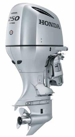
10 It s the Honda of Outboards. Literally. As a leader in 4-stroke technology, Honda delivers best-of-class features in marine outboards ranging from 2.3 to 250 hp. The same durability, quality and reliability that have made Honda an automotive legend are the same strengths found in every Honda outboard. Many outboards are designed and built on the same engine blocks used in Honda vehicles like the Odyssey, Accord and Fit vehicles that have proven themselves over great distance. No wonder Honda outboards have been a favourite for over 50 years. And to help ensure convenience, there are over 30 boat manufacturers to choose from when selecting a boat with the brand that offers over five decades of proven performance. Visit your local Honda Marine Dealer or learn more at marinehonda.ca


11 Bi g Power Bi g Fun
12 Region Newfoundland & Labrador Marina Map # Dockage Max Length Draft Power Admiral s Marina Harbour Grace Y U 10' Y Bay of Islands Yacht Club Corner Brook Y by appointment Bonavista Harbour Authority Bonavista jermouland@hotmail.com Y 75' 20' 30 Clarenville Rotary Marina Clarenville Y 100' 30-40' Y Dock Marina, Trinity Trinity Y 140' 20' Y Fogo Island Marine Information Center Fogo Island Facebook Y U U U Holyrood Marina/TerraNova YC Holyrood Y U U Y Lewisporte Marina Complex Lewisporte Y 60' 8' Royal Newfoundland Yacht Club Conception Bay Y 60' 9' 30 Veterans Quay Marina Bay Roberts bayroberts.com/marina.htm Y 50' 8' 15, 20, Atlantic Boating Guide 2015 Newfoundland & Labrador
13 Marina Listings Legend: Y=Yes N=No W=Washrooms S=Showers L=Laundry U=Unknown Moorings Launch R Fuel Water & Ice Pump Out Facilities Storage Lat Long N N N N N W/S/L N U U N Y Y arrangements can be made Water N W/S/L Y N W N Y Gas/Diesel Water N W/S/L N 48'39N 53.06w N Y N Water N W/S/L no storage sheds, only boat storage 48'.95N 53'.57.7W N N N Water/Ice N W/S/L N U U N N N Y N W/S/L N N U N N Gas/Diesel Water N W/S/L Y 47'.23.21''N 53'.07.53''W N Y Y Water N W/S/L Y 49' N 55' ''W N Y Gas/Diesel Water/Ice N W/S/L Y (boat storage) N Y N Water/Ice N W/S N U U Newfoundland & Labrador Atlantic Boating Guide
14 REGIONAL PROFILE Newfoundland and Labrador An unrivalled cruising destination By Mark Wareham 14 Atlantic Boating Guide 2015 Newfoundland & Labrador


15 The province of Newfoundland and Labrador is a cruising destination you won t soon forget. A rugged and rocky shoreline punctuated with hundreds of secluded coves, quaint communities with friendly faced locals happy to help with your lines. This is what you will experience when you come to Newfoundland and Labrador; one of the world s prime, but often overlooked, boating destinations. Thrust out into the North Atlantic, the province is home to the most easterly point in North America when you visit, you truly get away from it all. Imagine fresh sea breezes untainted by the smell of civilization, majestic icebergs thousands of years old slowly gliding along the coast; ungainly little puffins skipping across the water in a comical, part flying, part running attempt to get out of your way, too full of capelin to fly but still able to duck beneath the waves and swim to safety. These images are common for boaters in Newfoundland and Labrador and we would love to share them with you. With 17,540 kilometres of coastline and more than 7,000 smaller islands the opportunities for boating are limited only by the short season, which spans from June to September. Although you are still able to cruise earlier or later in the year, both you and your boat should be outfitted for temperatures in the single digits and be prepared for more frequent gales, especially in the fall. Being the 17th largest island in the world, Newfoundland is large enough to have considerable variations in weather. The west coast and central tend to have warmer temperatures but we still get warm weather in the east, too. The typical winds during the summer are southerly or southwesterly in the 10 to 15 knot range. Gales occur approximately two per cent of the time. Lion s Den, Terra Nova National Park Near The Bell of Bell Island in Conception Bay Near Happy Adventure, Bonavista Bay Photo: Dean Sullivan Photo: Kerri Wareham Photo: Kerri Wareham Newfoundland & Labrador Atlantic Boating Guide

16 With 17,540 kilometers of coastline and more than 7,000 smaller islands the opportunities for boating are limited only by the short season; spanning from June to September. Two major ocean currents converge off the coast of Newfoundland and Labrador, the cold Labrador Current and the warm Gulfstream, which, when they meet off the southeast coast, give cause to the famous Newfoundland peasoup fog. While you can experience fog at any time of the year, weather statistics indicate fog only occurs between 20 and 30 per cent of the time during the summer months. That being said, good radar goes a long way toward extending your cruising time and reducing anxiety. Air temperatures average near 20 degrees in the summer but easterly winds can make it feel considerably cooler especially on the water. Seawater temperatures range between four degrees on the northern coast to over 15 degrees as you get farther south. Among many of the unique attractions for the visiting boater are the icebergs that pass along our northeast coast. These majestic bergs are thousands of years old and an awe-inspiring sight to behold, especially from the water. Nowhere else in North America can you get as close to these ancient giants and still be warm and comfortable in shorts and tee shirt. Should you be fortunate enough to see one split apart or roll over, it is a sight you will remember for the rest of your life. As they melt and break up, there are often small pieces of ice called bergy bits that, once clear of the berg, can be easily picked up for your cooler and even better, used for ice in an evening cocktail. Picture yourself in a quiet moonlit anchorage, relaxing after a day exploring the ruins of a resettled community, not another boat within miles and your favorite drink popping and hissing as the thousand-year-old ice slowly dissolves. This is cruising in Newfoundland and Labrador. Newfoundland and Labrador is known as the seabird capital of North America with more then 35 million seabirds congregating around our coast each year. Our most well-known seabird colony is located at the Cape St. Mary s Ecological Reserve on the southern coast of the Avalon Peninsula. There you will find Bird Rock, a sea stack towering 100 metres and covered with thousands of murres, kittiwakes, gannets and other seabirds. Then there s the Witless Bay Ecological Reserve, the largest puffin colony in the world and the Baccalieu Island Ecological Reserve, home to the largest Leach s storm petrel colony in the world. Birdwatchers will have plenty to see. No description of boating in Newfoundland and Labrador would be complete without Lion s Den in Terra Nova National Park Photo: Dean Sullivan 16 Atlantic Boating Guide 2015 Newfoundland & Labrador


17 Traytown, Trinity Bay Photo: Mark Wareham highlighting the largest creatures in the ocean: whales. Feeding on capelin, krill and squid, 22 species of whales make Newfoundland and Labrador their home every summer. Minke, sperm, orca, pothead, blue and the largest population of humpbacks in the world almost guarantee you will come upon them during your trip. Humpbacks are one of the most common and the most exciting to see as they breach. Watching a humpback over 16 metres long rise vertically out of the water for almost its full length, slowly turn over and gently splash back down is a sight that never ceases to impress all who witness it. When planning a cruise to Newfoundland and Labrador, there are a number of publications worth checking out. First and foremost are the CHS Sailing Directions, ATL 101, ATL 102, ATL 103 for the island and ATL 120 and ATL 121 for Labrador. The Cruising Club of America publishes two cruising guides for the province, one for the island of Newfoundland and a second for Labrador. For the Notre Dame Bay region, a very good locally produced cruising guide is available in some stores or through Happy Adventure, Bonavista Bay Photo: Paula Armstrong Newfoundland & Labrador Atlantic Boating Guide
 has recently become available online.")

18 online order. There is also a guide by Rob Mills that, while a little outdated, still includes valuable information not found in the other publications. A new source of information helpful for boaters, Coastal Marine Informatics (CMI) has recently become available online. In addition to the material normally contained in a cruising guide, CMI searches a number of websites for the most current information for a local area and presents it in an easy to use format. The concept is being developed in the province and continues to be updated regularly. Whether you get as far as the south coast and enjoy the beautiful fjord-like bays or have the time to make it around to the northeast coast, you are bound to experience the cruise of a lifetime. There are so many idyllic cruising grounds around the province it s nearly impossible within the bounds of this article, to describe them all. Some general information supplemented with some of the highlights will entice those who are considering a visit to make the leap and come enjoy an unrivalled cruising experience. We would love to see you. AB Coming through the tickle between The Bell and Bell Island in Conception Bay Photo: Paula Armstrong Happy Adventure, Bonavista Bay Photo: Kerri Wareham 18 Atlantic Boating Guide 2015 Newfoundland & Labrador
19 CoastaL ATTRACTIONS & Boating Events St John s Easter Seals Regatta July BMW Race week August 18 27, Fogo Island Fogo Island Punt Race July 18, Trinity Trinity Rendezvous July 31 August 2, Gros Morne National Park A world heritage site located on the west coast of Newfoundland and the second largest national park in Atlantic Canada. Signal Hill National Historic Site, St. John s, N.L. The site was the reception point of the first transatlantic wireless signal by Guglielmo Marconi. Online Resource: activecaptain.com Boater Education BoatSmart! Recreational Fishing Regulations It s best to know the law when it comes to fishing in Canada: Managing Canada s recreational fisheries is a shared responsibility between federal, provincial and territorial governments. Roles vary between different provinces and territories. Generally, the federal government is responsible for all marine species with the exception of anadromous and catadromous species in inland waters in some regions; and provincial and territorial governments are responsible for freshwater species. Unless otherwise noted, the websites on the site below are managed by provincial and territorial governments. Consult anglers guides and information on fishing licenses and other regulations. peches-fisheries/rec/regs-eng.htm On-line cruising guide Dobson Yacht Club maintains a cruising guide for Cape Breton at cruising-cape-breton.info Links to cruising guides in print Puffin Press publishes guides for the Nova Scotia Coast, Newfoundland and Labrador. Updates can be found here: Yacht Pilot publishes a Cruising Guide to the Canadian Maritimes and a Cruising Guide to the Down East Circle Route: Visit a book store for these books Cruising Guide Notre Dame Bay, Newfoundland Harbours and Marinas of Prince Edward Island Newfoundland & Labrador Atlantic Boating Guide

20 20 Atlantic Boating Guide 2015
21 Atlantic Boating Guide
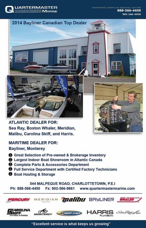
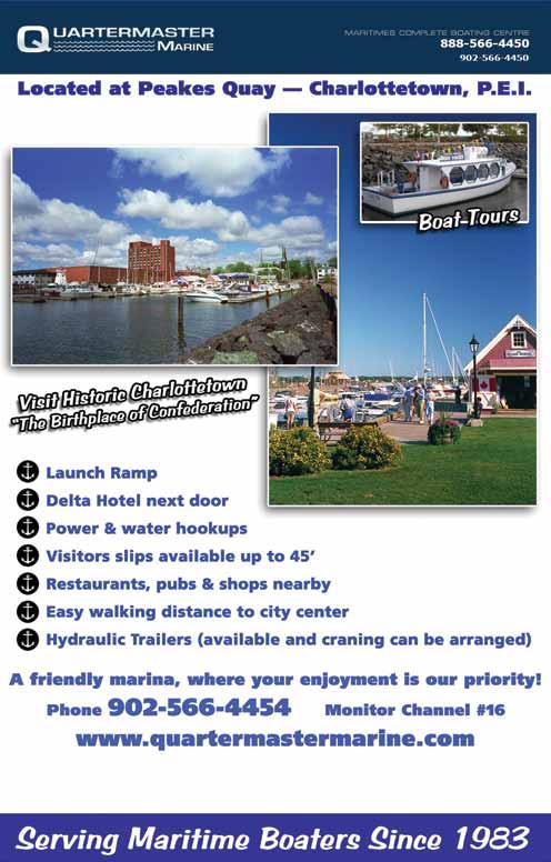
22 Region NORTHUMBERLAND STRAIT & P.E.I. Marina Map # Dockage Max Length Draft Power Bowdridge Landing Murray Harbour, P.E.I Y 50' 7' 15 Ballantyne s Cove Antigonish, N.S Y Brudenell Marina (Montague) Brudenell, P.E.I Y 60' 5-10' Caraquet Marina Bas Caraquet, N.B Y Cardigan Marina Cardigan Bay, P.E.I Y 50' 8' Charlottetown Yacht Club Charlottetown, P.E.I Y 200' 20' Cocagne Cape Marina Grande Digue, N.B Y Cocagne Marina Cocagne, N.B Y Crabbie J s Marina New Glasgow New Glasgow, N.S Y Cribbon s Point Antigonish, N.S Y Hector Quay Marina Pictou, N.S Y Miramichi Boating and Yacht Club Miramichi, N.B Y Montague Marina Montague, P.E.I Y 100' 12' Northport Pier Northport, P.E.I P.E.I. N.S. N.B. 28 Y 150' 9' Atlantic Boating Guide 2015 NORTHUMBERLAND STRAIT & P.E.I.
23 Marina Listings Legend: Y=Yes N=No W=Washrooms S=Showers L=Laundry U=Unknown Moorings Launch R Fuel Water & Ice Pump Out Facilities Storage Lat Long Y Y N Water/Ice N W/S N 46.00"N N N Y Gas/Diesel N Y W/S/L Y boats N W Y N N Water N W/S N 46.11'N 62.37'W Y Y Gas/Diesel Water N W/S/L N N W N Y Gas Water/Ice N W/S/L N 46.15'N 62.41'W N Y Gas/Diesel Water/Ice N W/S/L Y 46.15'N 63.8'23"W Y-2 Y N Water/Ice Y W/S/L N members only N W N Y Gas/Diesel Water/Ice Y W/S N N W Y Y Gas/Diesel Water/Ice N W/S N N W N Y N Water Y S/L Y N W N Y N Water/Ice N W/S/L N storage available down the road 100ft N W N Y Gas Water/Ice Y W/S Y N W N Y Gas/Diesel Water/Ice N W/S/L N 46.10'N 62.39'W Y Y Gas/Diesel Water/Ice Y W/S/L N 46.47'8"N 64.04'4"W NORTHUMBERLAND STRAIT & P.E.I. Atlantic Boating Guide
24 Region NORTHUMBERLAND STRAIT & P.E.I. Marina Map # Dockage Max Length Draft Power Pictou Marina Pictou, N.S Y 60 6 low tide Pointe de Chene Yacht Club Pointe de Chene, N.B Y Quartermaster Marine Charlottetown, P.E.I Y 56' 15' Richibucto Marina Richibucto, N.B Y Sawmill Point Boat Basin Bouctouche, N.B Y 50' 7.5' 30 Shediac Bay Marina Shediac, N.B Y 54' 6' Souris Marina Souris, P.E.I Y 60' 18' Stanley Bridge Marina Stanley Bridge, P.E.I Y 40' 6' 30 Station Wharf Marina Inc. Miramichi, N.B Y 50' 8' Summerside Yacht Club Marina Summerside, P.E.I Y 90' 10' Sunrise Shore Marina Tatmagouche, N.S Y Victoria Harbour Victoria, P.E.I Y 40' 5' 15 West Point Marina West Point, P.E.I P.E.I. N.S. N.B. 39 Y 36' 6' Atlantic Boating Guide 2015 NORTHUMBERLAND STRAIT & P.E.I.
25 Marina Listings Legend: Y=Yes N=No W=Washrooms S=Showers L=Laundry U=Unknown Moorings Launch R Fuel Water & Ice Pump Out Facilities Storage Lat Long N Y Gas/Diesel can be arranged Water N W/S Y N W N Y Gas/Diesel Water/Ice Y W/S/L N N W N Y N Water/Ice Y W/S/L Y 46.15'N 63.08'W N Y Gas/Diesel Water/Ice N W/S N N W N Y Gas Water/Ice Y W/S N 46.28'5"N 64.42'W N Y N Water/Ice Y W/S/L N 46.13'40"N 64.32'50"W Y Y Gas/Diesel Water/Ice Y W/S/L N 46.21'N 62.15'W N Y Gas Water/Ice N W N 46.28'N 63.27'W N Y Gas/Diesel Water/Ice Y W N 47.01'56"N 65.28'7"W N Y Gas/Diesel Water/Ice Y W/S/L Y 46.23'N 63.47'W N Y Gas Water/Ice N W/S/L Y N W N Y Diesel can be taken for gas (can get diesal from fishermen key) Water N W N 46.13'N 63.29'W Y Y Diesel Water/Ice N W/S/L N 46.37'N 64.23'W NORTHUMBERLAND STRAIT & P.E.I. Atlantic Boating Guide

26 Cruising the Northumberland Strait By Steve Abbey Delineated roughly by a line from Point Escuminac, N.B. to Cape North, P.E.I. on the western end and from Inverness, Nova Scotia to East Point, P.E.I. on the east, the Northumberland Strait has a length of about 175 nautical miles and encompasses all of the Maritimes. (CHS Chart #4023) Pleasure boating on the Strait features warm weather, a virtual absence of fog, prevailing westerly/southwesterly light to moderate breezes, unsurpassed sunsets and the warmest salt water in Canada making for excellent swimming. The bottom nearly everywhere consists of mud or coarsely packed sand and provides good holding at anchor. The Gulf of St. Lawrence sailing directions (Southwest portion, ATL 108E) is an excellent cruiser s reference for currents, tides and harbour approaches. There are few hazards and those that do exist are well charted. A short chop will likely build after a 24-hour-or-more period of consistent winds, but wave heights in the Strait are generally less than a metre and generally pleasant passage making is the rule. 26 Atlantic Boating Guide 2015 NORTHUMBERLAND STRAIT & P.E.I.


27 Boats ready for the start of the Shediac to Charlottetown Race Steve and Patti Abbey s boat Ever After Photo: Steve Abbey Photo: NSTYA Being relatively shallow, tides here are quite pronounced in the narrower areas with more than a two-metre range the norm. Currents are more powerful on the Prince Edward Island shore running over four knots in places, a nice bonus if you happen to be in the right place at the right time. As far as weather goes, May and June have been fairly chilly for sailing for the last couple of years, while July, August and September cruising offers the most pleasant boating weather-wise to be had on the Strait. The last two weeks of July and the first week of August see the most vessels travelling, many making their way to the Bras d Or Lake of Cape Breton Island. Hurricanes are rare with the relatively cold waters of the Atlantic Ocean providing a buffer for the entire region, but the odd post-tropical storm can occur here. The warm water of the Strait doesn t seem to have an appreciable effect in intensifying these storms. There are several marinas and harbours considered excellent for cruisers seeking refuge and each have their strengths and weaknesses depending on wind direction. Most marinas open for the season usually from the beginning of May and close in October. Harbours and marinas are plentiful and generally an easy day-sail apart, which makes for a relaxing cruising experience. Most marinas monitor VHF 16 or 68 for communication. Dual-watch monitoring of 16 and 68 is advisable when navigating on the Strait. The abundant fishing wharves along the Strait are generally friendly and most accommodating to pleasure boaters in addition to being an excellent source of local information and attractions. A sharp lookout is advised during the summer lobster season as pot buoys are numerous and a risk of propeller fouling exists. During the local lobster season the fishers are only too happy to sell their catch (usually $5 to $6 per pound depending on market price) over the side to NORTHUMBERLAND STRAIT & P.E.I. Atlantic Boating Guide

28 Charlettetown Race Week Photo: Steve Abbey cruising boats. Most boaters around here don t mind paying a little more to the folks actually doing the work. A fresher seafood treat couldn t be had! If you re unsure of how to cook or a tad squeamish about cooking lobster onboard, lobster festivals in Shediac, N.B. and Pictou, N.S. in early July are always very popular and marina reservations are encouraged well in advance of arriving. Snug anchorages are numerous, although wind and current conditions are factors that should be considered before setting the hook for the night. Having a tender greatly increases the possibilities of gunkholing while at anchor. An excellent online resource for cruisers is (free to join and use) with reviews from cruisers who have been tied alongside at the marinas as well as on the hook at anchorages, boaters can make their choices with the unbiased information provided by cruisers who have been there. Festivals and events abound in the region, highlighted by the Festival of Lights in Charlottetown with Canada Day fireworks in Charlottetown Harbour on July 1, in addition to a series of concerts on the waterfront. Marina reservations are a must as many cruisers (and racers) take in these events. For those who like to mix it up, there are several races throughout the summer governed by the Northumberland Strait Yachting Association. Charlottetown Race Week is held in the middle of July providing racers with three days of competition. One of the two possible concerns to skippers on the Strait is the Confederation Bridge (the longest bridge over ice-covered water in the world) connecting Cape Jourimain, N.B. and Borden-Carleton, P.E.I. The span is well charted and vessels with tall clearance requirements may wish to use the navigation span near the centre of the structure. The other is Northumberland Ferries between Wood Islands, P.E.I. and Caribou, N.S. The ferry captains are extremely courteous and will give pleasure boaters a wide berth unless constrained by draft when approaching their ports on either side. If any doubt arises as to your intentions, they will communicate with cruising vessels on VHF 16. AB Steve, Patti and Grace the ship s cat have logged over 18,000 miles on the Northumberland Strait since 1999 aboard Ever After, an Aloha 27 out of Barrachois Harbour Yacht Club near Tatamagouche N.S. 28 Atlantic Boating Guide 2015 NORTHUMBERLAND STRAIT & P.E.I.
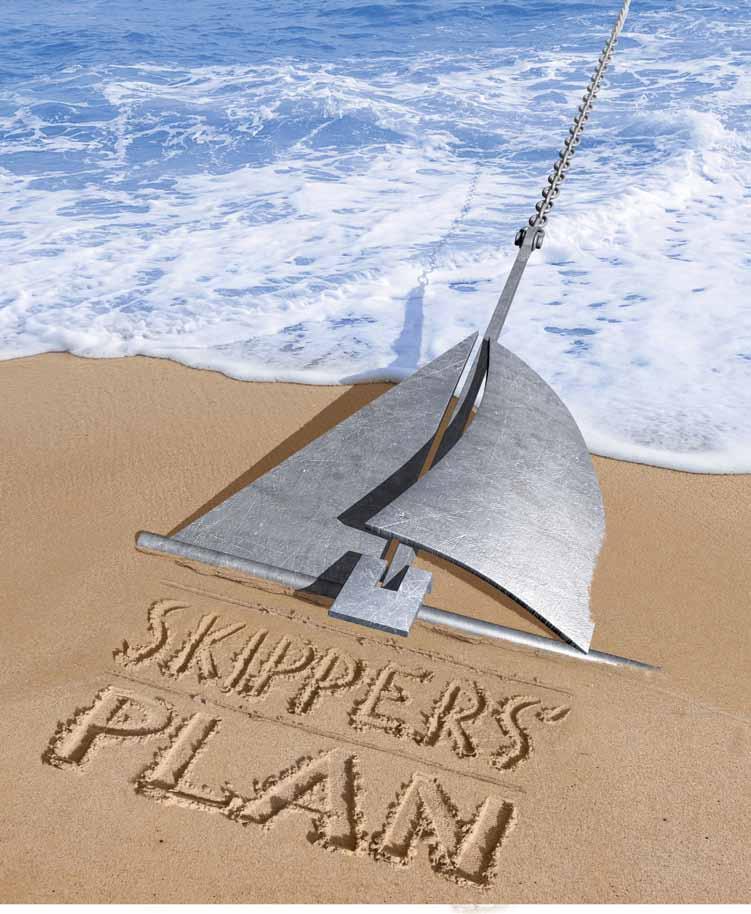
29 CoastaL ATTRACTIONS & Boating Events Charlottetown Race Week July 16 18, Northumberland Strait Sailing Association (NStYA) Schedule of Yacht Races and Events 2015 in Northumberland Strait North Lake Harbour The Canada Tunacup Challenge: September 10 13, Anne of Green Gables Lucy Maud Montgomery s story comes alive in Cavendish, P.E.I. Theatre production in Charlottetown PEI Boat & Motor Dealers, Chandlery & Service Adventure Motors, New Glasgow, N.S Antigonish Rent-all, Antigonish, N.S Pictou Marina, Pictou, N.S Quartermaster Marine, Charlottetown, P.E.I Insurance Fairway Insurance Services MacDonald Chisholm Trask Insurance Skippers Plan Boater Education BoatSmart! NORTHUMBERLAND STRAIT & P.E.I. Atlantic Boating Guide

30


31 introduce your inner explorer to canada s largest in-land sea cape breton island Bras d Or Lake Bras d Or Lake CANADA S LARGEST IN-LAND SEA The Bras d Or Lake provides an unparalleled sailing and boating experience Exceptional scenery, an In-land saltwater sea surrounded by land, a new adventure on every wave. EXPLORE CANADA S LARGEST IN-LAND SEA THE BRAS D OR LAKE toll free: tel: boatingcapebreton@gmail.com Atlantic Boating Guide
32 Region CAPE BRETON Marina Map # Dockage Max Length Draft Power Baddeck Marine Baddeck Y 50' 7' Barra Strait Marina Grand Narrows Y 100' 8-12' 15 Ben Eoin Ben Eoin Y 80' 11' Bras d Or Yacht Club Baddeck Y 35' 6' 30 Cape Breton Boat Yard Baddeck Y 60' 8' 30 Dobson Yacht Club Westmount Y 65' 9' Isle Madame Boat Club Arichat Y 47' 9' 30 Lennox Passage Yacht Club D Escousse Y 60' 10-12' 30 Northern Yacht Club North Sydney Y 60' 15' 30 limited Ross Ferry Marina Ross Ferry day time only 40' 16' N Strait of Canso Yacht Club Port Hawkesbury Y 40' 6' 30 St. Peter s Marina St Peters Y 150' 13' Whycocomagh Waterfront Centre Association Whycocomagh Y 40' 8' N 32 Atlantic Boating Guide 2015 Cape Breton
33 Marina Listings Legend: Y=Yes N=No W=Washrooms S=Showers L=Laundry U=Unknown Moorings Launch R Fuel Water & Ice Pump Out Facilities Storage Lat Long Y N Gas/Diesel Water/Ice Y W/S/L Y 46.6'N 60.44'52"W Y Y N Water/Ice Y W/S/L N 45.57'38" 60.47'67" N Y Gas/Diesel Water/Ice Y W/S/L Y N W Y Y N Water/Ice N W/S Y 46.6'W 60.47'55"W Y N N Water Y W/S/L Y 46.5'46"N 60.45'12"W N Y Gas/Diesel Water/Ice Y W/S/L Y 46.08'14"N 60.12'16'W N Y N arrangements can be made for fuel Water N W/S Y members only 45.30'N 61'2"W N Y N Water/Ice N W/S/L N 45.35'41"N 60.57'42"W N Y 30 ton lift N arrangements can be made for fuel Water/Ice Y W/S/L Y 46.11'20"N 60.15'56"W N Y N Water Y W/S N 46.07'N 60.35'W Y,2 more next year Y Gas/Diesel Water/Ice N W/S/L Y 45.36'51"N 51.21'53"W Y Y Gas/Diesel Water/Ice Y W/S/L Y 45.39'40"N 60.52'32"W Y Y N Water Y W/S/L N U U Cape Breton Atlantic Boating Guide

34 REGIONAL PROFILE Boating in Cape Breton: Magic at every turn By Jocelyn Bethune Such magnificent landlocked harbours I never imagined Every moment something new to please and enchant, to make the mere act of watching as the vessel rounds each curve a delight...this trip was a constant joy for us. Mabel Bell, wife of telephone inventor Alexander Graham Bell, describing a cruise on the Bras d Or Lakes in Atlantic Boating Guide 2015 Cape Breton


35 Imagine it. Mabel Bell and her husband, telephone inventor Alexander Graham, are on a sailboat, cruising Cape Breton s Bras d Or Lakes. It is August The telephone is 10 years old. Automobiles haven t been invented yet and planes are 40 years in the future. But boats have been bringing people to our shores for centuries. They are the preferred mode of travel, especially in this neck of the woods. The Bells are wealthy and world famous. And yet, when they could have gone anywhere, this is where they came to rejuvenate and get away from it all. While much in the world has changed since Mabel and Alexander Bell boated here, the magic of the Bras d Or has not. Photo: Alexander Graham Bell National Historic Site/Parks Canada Cape Breton Atlantic Boating Guide

36 The Bras d Or Lake, a vast 1,000-square kilometre inland sea seems to possess magical qualities: salt-air breezes, good winds and rarely any fog. There are hundreds of isolated harbours to explore, with communities nearby that offer amenities and cultural activities. Anchor in Baddeck Harbour during the first Sunday in August and you may soon find yourself a part of the sail past, the launch of the popular Bras d Or Yacht Club annual regatta, a century-old tradition in this historic town. Sailors come from all over the Maritimes to catch the winds here. Dance a jig or two at the Baddeck Gathering Ceilidh s on the main street, take a walk on the boardwalk and play a few rounds at Bell Bay Golf Course. Make sure to visit Parks Canada s Alexander Graham Bell National Historic Site. Bell lived here for almost 40 years and these very waters inspired him. He oversaw the construction of the Silver Dart, the first plane to fly in Canada (it flew over the frozen waters of the Bras d Or in 1909) and the Photo: Pat Nelder 36 Atlantic Boating Guide 2015 Cape Breton
37 Don t keep forever on the public road going only where others have gone leave the beaten path occasionally and enter the woods, every time you do, you re sure to discover something you have never seen before. massive HD-4, a 60-foot long hydrofoil boat that broke speed records in Not far from Baddeck is Maskells Harbour, an uninhabited anchorage that inspired sailors to create the Cruising Club of America in Eagles soar above the steeply sloping hills here. National Geographic Society s chairman ( ) Gil Grosvenor once described sailing into this sanctuary like stepping into a cathedral. Race the Cape: This challenging five-day race is an opportunity to experience the best inland and coastal sailing Cape Breton has to offer. With stops at scenic Ben Eoin, North Sydney, the Barra Strait, Baddeck and St. Peter s, you ll see lots of what makes Cape Breton Island special. The race blends five challenging point-to-point races with local hospitality, great seafood on shore and the camaraderie of fellow sailors. For more information (or to sign up to join a crew) visit Out on the Mira: This is Nova Scotia s longest river. The lush green riverbanks and 55 kilometers of calm waters make the Mira River ideal for boating with or without a motor. There are plenty of places to launch a canoe or kayak. Ocean Playground: Don t limit your experiences to Cape Breton s delightful rivers and magical lakes. Sail the ocean waters to Ingonish (like the Bell s did in 1919), take in Port Hood, Inverness, and Mabou on the western shores and the Northumberland Strait, which has some of the warmest ocean waters north of the Carolinas. Enter Louisbourg Harbour and watch the historic fortress town emerge out of the fog, just like sailors did three centuries ago. Visit Parks Canada s Fortress of Louisbourg National Historic Site, the largest reconstructed fortress in North America to step into the 18th century. Bell famously said: Don t keep forever on the public road going only where others have gone leave the beaten path occasionally and enter the woods, every time you do, you re sure to discover something you have never seen before. So make sure you take a side trip to Isle Madame. This island off Cape Breton Island has a number of villages and safe anchorages. Arichat Harbour is filled with history. It was raided by American naval hero John Paul Jones during the U.S. War for Independence. Explore the Lennox Passage, the channel that separates Isle Madame from Cape Breton. Along the way, you ll find the Lennox Passage Yacht Club in D Escousse. Visit the friendly folks here during the annual Harbourfest days and you will be sure to enjoy delicious home-cooked meals and discover at least one long-lost cousin! The waterways of Cape Breton Island are enchanting and there is so much to see. Cape Breton has a delightful mix of boating experiences, from river boating on the Mira River; sailing on the Bras d Or to kayaking in D Escousse. And just like Alexander & Mabel Bell, you will find magic at every turn. AB Cape Breton Atlantic Boating Guide
38 CoastaL ATTRACTIONS & Boating Events Race the Cape July 12 18, Baddeck Race Week August 2 8, Wallace MacAskill Cup August 7 9, Alexander Graham Bell Museum, Baddeck, N.S. This museum offers insight into the scientific mind of the great inventor of the telephone or grahambell/index.aspx Fortress Louisbourg, Louisbourg, N.S. This recreation of the 18th century French fortress is a National Historic Park. index.aspx Marconi Museum A National Historic Museum dedicated to Guglielmo Marconi, the first man to transmit wireless Morse Code or index.aspx Celtic Colours The largest celebration of Celtic heritage in North America. Music and more takes place at venues across the island. October Boat & Motor Dealers, Chandlery & Service Island Resources Baddeck, N.S Mackleys Equipment Sydney, N.S Boater Education BoatSmart! Insurance Fairway Insurance Services MacDonald Chisholm Trask Insurance Skippers Plan Atlantic Boating Guide 2015 Cape Breton


39 Cape Breton Atlantic Boating Guide
40

41
42 Quebec W MARITIME MARINAS N Maine New Brunswick 1 1 Valley Yacht Club at the Woodstock Marina 2 St Andrew s Market Wharf 3 Saint John Marina Ltd 4 Saint John Power Boat Club 5 Brundage Point River Centre 6 Evandale Resort 7 Gagetown Marina 8 Oromocto Boat Club 9 Regent Street Wharf 10 Centennial Park Sailboat Marina 11 Mactaquac Marina 12 Fredericton Yacht Club 13 Fredricton Yacht Club (Douglas Harbour) 14 Chipman Marine Wharf 15 Rothesay Yacht Club 16 Royal Kennebaccasis Yacht Club 17 Dalhousie Regional Marina 18 Bathurst Marina Marina Details: Page Nova Scotia 46 Venus Cove Marina 47 Guysborough Marina 48 Cape Canso Marina 49 Liscombe Lodge Marina 50 Petpeswick Yacht Club 51 Shearwater Yacht Club 52 Alderney Marina Ltd 53 Dartmouth Yacht Club 54 Bedford Basin Yacht Club 55 Waterfront Development S E New Brunswick Armdale Yacht Club 57 Royal Nova Scotia Yacht Squadron 58 Shining Waters 59 St Margaret Sailing Club 60 Marine Services East 61 Chester Yacht Club 62 South Shore Marine 63 Gold River Marina 64 Atlantica Marina Oak Island St. John River Bay of Fundy Northum Atlantic Boating Guide 2015
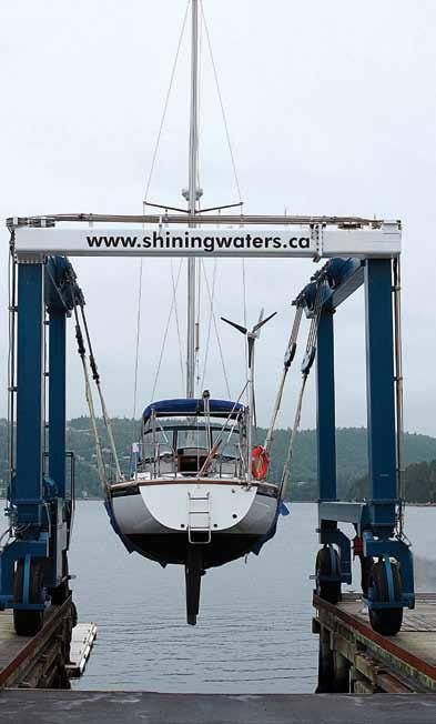
43 Northumberland Strait & P.E.I. 19 Caraquet Marina 20 Miramichi Boating and Yacht Club 21 Station Wharf Marina Inc. 22 Richibucto Marina 23 Cocagne Cape Marina 24 Cocagne Marina 25 Sawmill Point Boat Basin 26 Shediac Bay Marina 27 Pointe de Chene Yacht Club 28 Northport Pier 29 Stanley Bridge Marina 30 Montague Marina 31 Souris Marina 32 Cardigan Marina 33 Brudenell Marina 34 Bowdridge Landing 35 Quartermaster Marine 36 Charlottetown Yacht Club 37 Victoria Harbour 38 Summerside Yacht Club Marina 39 West Point Marina 40 Sunrise Shore Marina 41 Pictou Marina 42 Hector Quay Marina 43 Crabbie J s Marina New Glasgow 44 Ballantyne s Cove 45 Cribbon s Point Marina Details: PageS berland Strait PEI P.E.I Nova Scotia Coastal Nova Scotia Mahone Bay Civic Marina 66 Lunenburg Yacht Club 67 Lunenburg Zwicker Docks 68 Bridgewater Marina 69 LaHave River Yacht Club 70 Brooklyn Marina 71 Shelburne Harbour Yacht Club 72 Killam Bros., Marinas 73 Digby Marina Marina Details: PageS Cape Breton 81 Denotes Pump-out Station *Marina locations are approximate Cape Breton 74 Strait of Canso Yacht Club 75 Whycocomagh Waterfront Centre Association 76 Cape Breton Boat Yard 77 Baddeck Marine 78 Bras d Or Yacht Club 79 Ross Ferry Marine Park 80 Northern Yacht Club 81 Dobson Yacht Club 82 Barra Strait Marina 83 Ben Eoin 84 St. Peter s Marina 85 Lennox Passage Yacht Club 86 Isle Madame Boat Club Marina Details: PageS Atlantic Boating Guide


44 Labrador Newfoundland Nova Scotia Newfoundland Newfoundland & Labrador 87 Bay of Islands Yacht Club 88 Lewisporte Marina Complex 89 Fogo Island Marine Information Center 90 Clarenville Rotary Marina 91 Bonavista Harbour Authority 92 Dock Marina, Trinity 93 Admiral s Marina 94 Veterans Quay Marina 95 Holyrood Marina/TerraNova YC 96 Royal Newfoundland Yacht Club Marina Details: Page Atlantic Boating Guide 2015
45
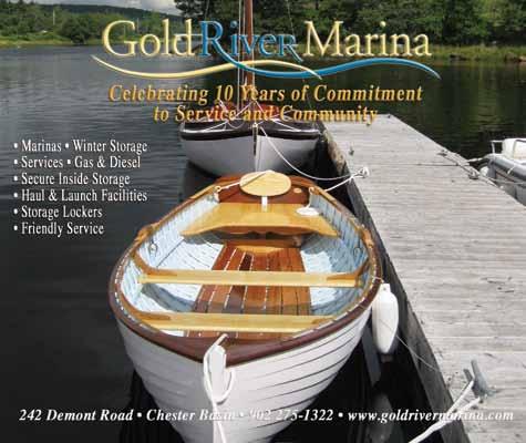
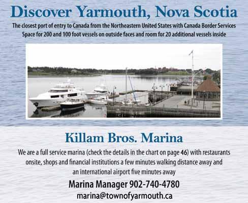
46 Region Coastal Nova Scotia: Eastern Shore & South Shore Marina Map # Dockage Max Length Draft Power Alderney Marina Ltd Dartmouth dube2@eastlink.ca Armdale Yacht Club Halifax Atlantica Marina Oak Island Western Shore Bedford Basin Yacht Club Bedford Bridgewater Marina Bridgewater Brooklyn Marina Brooklyn Cape Canso Marina Canso Y 35' 7' 56 Y 45' 10' 64 Y 48' 12' 54 Y 40' 8' 68 Y 40' 12' 70 Y 45' 6' 48 Y 50' 8' 30 15, Chester Yacht Club Chester N 60' 25' N Dartmouth Yacht Club Dartmouth Digby Marina Digby Gold River Marina Gold River Guysborough Marina Guysborough Killam Bros., Marinas Yarmouth killambrosmarina.com LaHave River Yacht Club LaHave Liscombe Lodge Marina Liscombe Mills Lunenburg Yacht Club Princess Inlet Lunenburg Zwicker Docks Lunenburg Y 44' 9' 73 Y 60' 9' 63 Y 46' 10' 47 Y 26' 20' 72 Y 200' 14' 69 Y 50' 7' 49 Y 100' 10' 66 Y 40' 6' 67 Y 110' 20' , 50, 80, Atlantic Boating Guide 2015 Coastal Nova ScotiA: Eastern Shore & South shore
47 Marina Listings Legend: Y=Yes N=No W=Washrooms S=Showers L=Laundry U=Unknown Moorings Launch R Fuel Water & Ice Pump Out Facilities Storage Lat Long Y Y N Water N W/S N 44.39'N 63.34'34"W Y Y Gas/Diesel N Y W/S Y 44.38'58"N 63.30'47"W Y N Gas Water/Ice N W/S/L N 44.31'3"N 64.18'2"W Y Y N Water/Ice N W/S Y 44.43'35.54"N 63.39'51.27"W N N N Water/Ice Y W/S/L Y U U 2 Y N Water N W/S Y limited 44.02'N 64.41'54"W Y Y N Water N W/S/L N 45.20'15"N 60.59'05"W Y N N Water/Ice N W N 44.32'12"N 64.31'W Y Y Gas/Diesel Water/Ice Y W/S Y 44.42'N 63.37'W Y Y Diesel N N N Y 44.39'N 65.49'W Y Y Gas/Diesel Water/Ice N can be done by appointment W/S/L Y 44.32'49"N 64.18'58"W Y Y Gas/Diesel Water Y W/S Y 45.23'40"N 61.29'58"W Y On waterfront Gas/Diesel Water N W/S/L N 43.50'N 66.7'W Y Y Gas/Diesel Water/Ice N W/S Y 44.18'43"N 64.24'34"W Y Y Gas/Diesel Water/Ice N W/S/L N 45.00'52"N 62.06'38"W Y Y Gas/Diesel Water/Ice N W/S On Trailer Only 44.24'30"N 64.19'30"W Y N N Water/Ice Y S/W Y 44.22'N 64.19'W Coastal Nova ScotiA: Eastern Shore & South shore Atlantic Boating Guide
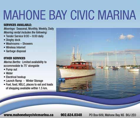
48 Region Coastal Nova Scotia: Eastern Shore & South Shore Marina Map # Dockage Max Length Draft Power Mahone Bay Civic Marina Town of Mahone Bay Marine Services East Chester Y 75' 16' 60 Y 100' 15' Petpeswick Yacht Club Musquoduboit Harbour Y 40' 4' low tide 20 Royal Nova Scotia Yacht Squadron Halifax Y 160' 16' Shearwater Yacht Club Shearwater N 40' N/A N Shelburne Harbour Yacht Club Shelburne Shining Waters Tantallon Y 55' 11' 58 Y 40' 10' town dock South Shore Marine Chester Service Dock 60' 10' at dock St. Margaret Sailing Club St Margaret s Bay Y 55' 8' Venus Cove Marina Mulgrave Y U U Y Waterfront Development Halifax Y 300' 25' 30, 50, 10O 48 Atlantic Boating Guide 2015 Coastal Nova ScotiA: Eastern Shore & South shore
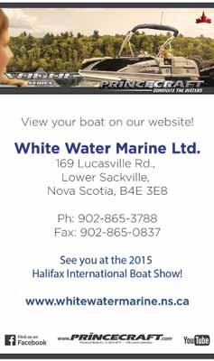
49 Marina Listings Legend: Y=Yes N=No W=Washrooms S=Showers L=Laundry U=Unknown Moorings Launch R Fuel Water & Ice Pump Out Facilities Storage Lat Long Y Y N Water/Ice Y W/S Y 44.26'88"N 64.22'45"W Y N N Water N W Y 44.34'N 64.10'19"W Y Y N Water/Ice N W Y 44.42'32"N 63.09'45"W Y Y Gas/Diesel Water/Ice Y W/S/L Y 44.37'16.90"N 63.34'49.8"W Y Y N Water/Ice N W/S/L Y 44.47'43"N 63.31'28"W Y Y Gas/Diesel Water/Ice N W/S/L N 43.45'29.36"N 65.19'21.32"W Y Y Gas/Diesel Water/Ice Y W/S/L Y 44.39'470"N 63.54'771"W Y N travel lift Gas/Diesel Water/Ice N W/S Y 44.33'35"N 64.17'W Y Y N Water/Ice N W/S N 44.38'1"N 63.55'1"W Y Y N Water N W N 45.36'W 61.22'N N N N can accommodate, trucked in Water/Ice N W N 44.38'N 63.34'W Coastal Nova ScotiA: Eastern Shore & South shore Atlantic Boating Guide


50 REGIONAL PROFILE Nova Scotia s Eastern Shore A Sailor s Wilderness By Sara Spike and Paul Spike The Eastern Shore offers wonderful opportunities for sailing in pristine wild and natural environments. Offshore island chains feature hidden gems like crescent white sand beaches and bird colonies, while the coastline is a series of deeply cut fingers extending out to green headlands and rocky seawalls. The Eastern Shore is a sailor s wilderness. This is not an area for marina-hopping and access to services is quite limited. Instead, pack what you ll need for a few days and take your time exploring the inlets, coves, and islands that dot the coastline. Anchor off your own secluded beach where you might not see another sail for days. You won t find any no trespassing signs here. There is more than enough room for everyone and all are welcome. Onshore, the Eastern Shore, which runs along Highway 7, is sparsely populated in long-settled fishing villages and small hamlets, but no major towns. The locals are friendly and happy to help out. Don t be shy to ask for a hand or a ride. (And if you anchor near Hartlin Settlement in Jeddore Harbour, don t be surprised if you wake up to muffins and the day s newspaper!) 50 Atlantic Boating Guide 2015 Coastal Nova ScotiA: Eastern Shore & South shore


51 The locals are friendly and happy to help out. Don t be shy to ask for a hand or a ride. (And if you anchor near Hartlin Settlement in Jeddore Harbour, don t be surprised if you wake up to muffins and the day s newspaper!) Coastal Nova ScotiA: Eastern Shore & South shore Atlantic Boating Guide


, or at Salmon River Bridge, where two restaurants (Salmon River House and Jeddore Lodge) are easily accessible by dinghy.")
52 Our family has been sailing the Eastern Shore out of Jeddore Harbour for more than 30 years. Our best advice is to explore! The coastal archipelagos between Clam Harbour and Liscombe are made up of hundreds of islands, creating an enchanting labyrinth just waiting to be discovered. This largely untouched seascape is green with boreal forest, grey with windswept rock, and home to ospreys, eagles, seabirds, mink, porpoises, and whales. Heading out from Halifax you pass the surfing mecca of Lawrencetown Beach and the longest sandy beach in the province, Martinique. Jeddore Harbour is a long inlet with a busy government and commercial wharves at its mouth. Beyond the channel the harbour opens into two wide arms. Good anchorage can be found at Brown Island (locals call it Bones Island ), or at Salmon River Bridge, where two restaurants (Salmon River House and Jeddore Lodge) are easily accessible by dinghy. At Oyster Pond visit the Fisherman s Life Museum, or ask for a ride to Memory Lane Heritage Village. Beyond the beach at Clam Harbour, where the annual sandcastle contests draws thousands of visitors in August, the real beauty of this coast emerges. The chain of islands between Clam Harbour and Mushaboom Harbour, known as the Bay of Islands, is currently the subject of a preservation caign by the Nova Scotia Nature Trust and local and provincial partners. This network of more than one hundred wild islands boasts diverse ecosystems including spruce forests, rocky outcrops, and wetlands, some of which are not represented anywhere else in the province. Here, as elsewhere when sailing along the Eastern Shore, consider the inside passage, meander through a maze of pristine natural settings, and find a secluded anchorage and an island all your own. Wolfe s Island is one of the larger islands in this chain. Good anchorage can be found at Long Creek, or off the beach at Big Sandy Cove, where the sand squeaks underfoot. One of our very favourite spots is Shelter Cove in Pope s Harbour. Anchor at the head of this handsome little cove where you ll find a footpath that leads to two back-to-back crescent beaches 52 Atlantic Boating Guide 2015 Coastal Nova ScotiA: Eastern Shore & South shore

53 and further paths to the headland. This area is also popular with kayakers; Coastal Adventures outfitters is located in nearby Tangier. Beyond the provincial beach park at Taylor s Head, which also offers pleasant anchorage and splendid hiking trails, make your way through The Gates into Malagash Cove and keep a lookout for the unofficial Mushaboom Yacht Club. It is a long way in to Sheet Harbour, but this is your best opportunity for supplies on the coast, including fuel, groceries, a liquor store, and restaurants (Henley House, Fairwinds) accessible from anchorages in the western arm. Hawbolt s Cove in Beaver Harbour offers a perfectly sheltered anchorage behind a natural spit. Spend the afternoon cruising between here and Marie Joseph through another remarkable chain of rugged, unspoiled islands. Tuck in north of Baptiste Island and skirt the coast before crossing Necum Teuch Bay to the islands of Mitchell Bay and Ecum Secum. These are part of the Eastern Shore Islands Wildlife Management Area, protected since the 1970s and home to seasonal colonies of nesting eider ducks, petrels, guillemots, and gulls. Outside the attractive harbour at Marie Joseph, the southern cove of Turner s Island is a nice quiet anchorage with a little beach. Nestled in amongst this extensive wilderness, and across the border into Guysborough, is Liscombe Lodge, one of Nova Scotia s most charming resorts and a highlight for anyone sailing the Eastern Shore. After a pleasant sail up the Liscombe River you reach the marina, under the management of the helpful Chester Rudolf, which offers berths and moorings. Included in the fee are access to hot showers and laundry, water and power, and other amenities, as well as a pool, sauna, and fitness centre. The restaurant is excellent the planked salmon is a must! and the facilities are top notch. Explore the nearby hiking trails, or rent a kayak. Liscombe is the perfect launching point for a trip that continues into Guysborough County and Cape Breton. The island chains of the Eastern Shore offer countless potential journeys. After 30 years we have only scratched the surface. We have suggested some of our favourites. What will be yours? AB Sara Spike is an historian, currently living in Montreal. She grew up on the Eastern Shore and has been sailing for more than 30 years, including, many years ago, an international tour as crew of Bluenose II. Paul Spike is her father, a Christmas tree grower and retired DNR forest ranger, who splits his time between the forest and ocean in Jeddore. He s been messing about in boats for way too long. For information about the island chains visit: Bay of Islands Eastern Shore Islands WMA eastern-shore-islands.asp Coastal Nova ScotiA: Eastern Shore & South shore Atlantic Boating Guide

54 REGIONAL PROFILE Gold rushes and capitals boating through history from Lunenburg to the LaHave River By Pat Nelder 54 Atlantic Boating Guide 2015 Coastal Nova ScotiA: Eastern Shore & South shore


55 Going by boat from Lunenburg to the LaHave River is an historic journey. Despite a few small well-marked hazards in Lunenburg Bay, Long shoal and the aptly named Shingles, once you are on the western side, the coastline is clear of obstructions. This allows a good view of what are known as The Ovens, a spectacular series of caves in low cliffs. Now a natural park and tourist attraction, the Ovens were home to more than 1,000 workers after gold was discovered in Visitors to the park can still pan for gold, but the rush was over in a couple of years and efforts to mine gold were over by the beginning of the 20th century. One of the larger stakeholders was William Cunard, son of Samuel Cunard, and the cove before Ovens Point is named Cunard Cove. If you decide to make the trip to the LaHave River remember it s ocean with open roadstead harbours until you reach the LaHave so choose your weather wisely. Cross Island is on your port side and Rose Bay opens on your starboard side once past Ovens Point and the landscape becomes stark and beautiful. Next is Rose Point and Kings Bay opens up with the community of Kingsburg settled in On the western side of Kings Bay is Hell Point followed by Hartling Bay, home of Hirtle Beach, a Nova Scotia Provincial Park. Just one more headland, Gaff Point, and the entrance to the LaHave River is visible, guarded by West Ironbound, Mosher, Spectacle and the LaHave Islands of which George, Bush, Jenkin and Bell Islands are connected with causeways and bridges from the mainland. The LaHave River is navigable Coastal Nova ScotiA: Eastern Shore & South shore Atlantic Boating Guide


56 from the Atlantic for 15 miles to the town of Bridgewater. The three-plus centuries of European settlement on the LaHave River is short compared to the 60 centuries of Mi kmaq settlement of Pitjinoiskog. The Europeans arrived with Samuel de Chlain, who is said to have initially mapped and named the river in Fort Point on the west side of the La Have River where the estuary narrows is where Commander Isaac de Razilly established the capital of New France with his Fort Ste. Marie de Grace at the request of the French King Louis XIII. Unfortunately, Commander Razilly died suddenly in 1636 and the capital was moved to Port Royal on the Annapolis River. The Lunenburg County Historical Society operates the Fort Point Museum at this Historic Site. Riverport on the east side of the River was a busy shipbuilding and fishing port in the 19th and 20th centuries and the cable ferry Brady E Himmelman connects the east to the west side of the river. The LaHave Bakery is a popular spot on the west side of the river where boats may tie up and two miles upstream is the LaHave Yacht Club in Pernettes Cove. Travelling up the river is peaceful and pastoral, although it becomes more populated at Conquerall Bank on the west side and Upper LaHave on the east. The river starts to narrow at Dayspring and navigable water stops in the town of Bridgewater at the first of two bridges. Bridgewater was an industrial port that shipped out lumber in the 19th and 20th centuries and is now the home of tire company Michelin. The town provides service to boaters with a launch r for trailer boats and the Bridgewater Marina is located on the east side of the River. AB LaHave Bakery LaHave Yacht Club Photos: Pat Nelder One of the LaHave Islands Photo: Wendy Levy 56 Atlantic Boating Guide 2015 Coastal Nova ScotiA: Eastern Shore & South shore
57
58 CoastaL ATTRACTIONS & Boating Events Sail Nova Scotia Association Keelboat and Dinghy races and events around Nova Scotia for 2015 schedule visit sailnovascotia.ca Small Mouth Bass fishing in Nova Scotia For a listing of associations, tournaments and schedules for 2015 visit Wedgeport Tuna Tournament and Festival wedgeporttuna.ca Stan Rogers Folk Festival, Canso, N.S. An annual tribute to folk singing icon Stan Rogers. July 3 to 5, Yarmouth Seafest July 15 25, Yarmouth County Museum & Archives A museum noted for its fine paintings of ships. The archives include information on the Atlantic Canadian history on rum running yarmouthcountymuseum.ca Liverpool Privateer Days June 26 28, Lunenburg Wooden Boat Reunion July 25 26, 2015 lunenburgwoodenboatreunion.com Mahone Bay Mahone Bay Pirate Festival and Regatta August 1 2, Schooner Race Week: August 2 8, Chester Classics Cup August 7 9, Chester Race Week August 12 15, 2015 chesterraceweek.com Sherbrooke Village, Sherbrooke, N.S. The recreation of a historial 19th century Nova Scotia village or sherbrookevillage.novascotia.ca St Margaret s Bay St Margaret s Bay Keel Boat Regatta August 7 9, Halifax and Dartmouth Halifax International Boat Show February 19 22, Marblehead-Halifax Ocean Race Departs Marblehead July 5, ARK Regatta July 11 12, Metro Regatta August 1 2, Halifax Nova Scotia International Tuna Tournament September 2015 bluefintournament.ca Maritime Museum of the Atlantic, Halifax, N.S. Explore seafaring history of the Maritimes, including a Titanic exhibit maritimemuseum.novascotia.ca 58 Atlantic Boating Guide 2015 Coastal Nova ScotiA: Eastern Shore & South shore
59 Boat & Motor Dealers, Chandlery & Service Boat and Motor Dealers Atlantic Winds Adventure, Dartmouth, N.S Canmac Watercraft, Elmsdale, N.S Iron Wind Marine, Bayside, N.S Mahone Marine, Mahone Bay, N.S NewStar Marine & Scooter, Eastern Shore, N.S New Wave Power Products, Waverley, N.S Schooner Cove Marine, Boutiliers Point, N.S Sealand Industries, Chester Basin, N.S Seamasters Services Ltd, Dartmouth, N.S Shining Waters Marine, Tanatallon, N.S Sunset Marine, Porters Lake, N.S White Water Marine, Sackville, N.S Yacht Brokers Ocean Yacht Sales, Halifax, N.S Sunnybrook Yachts, Chester Basin, N.S Dock Builders Bear River Plastic Welding Inc., Bear River, N.S Marine Services Conrad Marine Sales & Service, Mahone Bay, N.S Esterline-CMC Electronics, Dartmouth, N.S Gold River Marina, Gold River, N.S Sailmakers Michele Stevens Sailloft, Second Peninsula, N.S North Sails Atlantic, Lunenburg, N.S Chandlery The Binnacle, Halifax, N.S DSS Marine, Dartmouth, N.S North Sails Atlantic Yacht Shop, Halifax, N.S Boat Manufacturers Nova Scotia Boatbuilders Association, Halifax, N.S Rosborough Boats, Halifax, N.S Insurance Fairway Insurance Services MacDonald Chisholm Trask Insurance Skippers Plan Boater Education BoatSmart! Spirt of Canada Ocean Challenges Coastal Nova ScotiA: Eastern Shore & South shore Atlantic Boating Guide
60 For new boats, repairs, restorations, service or storage visit: 60 Atlantic Boating Guide 2015
61
62 Region New Brunswick: Bay of Fundy & St. John River Marina Map # Dockage Max Length Draft Power Bathurst Marina Bathurst Y 50' 7' 30 Brundage Point River Centre Westfield Y 35' 5' N Centennial Park Sailboat Marina Mactaquac mactaquacpark@gnb.ca Y 64' 30' Y at building, not on docks Chipman Marine Wharf Chipman Y 40' 10' 30 Dalhousie Regional Marina Dalhousie Y 40' 6' Evandale Resort Evandale Y U U U Fredericton Yacht Club Fredericton Y 40' 6' 15 Fredricton Yacht Club (Douglas Harbour) Douglas Harbour Y Gagetown Marina Gagetown Y 75' 10' Mactaquac Marina Keswick Ridge mactaquacpark@gnb.ca Y 48' 16' 30 Oromocto Boat Club Oromocto Y 90' 12' 30 Regent Street Wharf Fredericton Y 60' 16' 15, 30 Rothesay Yacht Club Rothesay Y 36' 4' Atlantic Boating Guide 2015 New Brunswick: Bay of Fundy & St. John River
63 Marina Listings Legend: Y=Yes N=No W=Washrooms S=Showers L=Laundry U=Unknown Moorings Launch R Fuel Water & Ice Pump Out Facilities Storage Lat Long N Y Gas/Diesel Water/Ice Y W/S Y 47.37'18"N 65.39'06"W Y Y N Water N W N 45.21'39"N 66.14'18"W Y Y N available at Mactaquac Marina Water N available at Mactaquac Marina W Y 45.56'57"N 66.52'54"W N Y N Water Y W N 46.10'25"N 65.53'13"W N Y Gas/Diesel Water/Ice N W/S N 48.6'59"N 66.38'45"W Y U Gas/Diesel Water/Ice U W/S/L N U U Y Y N Water Y W/S N 45.91'N 66.09'W Y Y N Water N W Y 54.57'N 66.36'W Y Y Gas/Diesel Water/Ice Y W/S/L Y 45.47'10"N 66.08'39"W N Y Gas Water/Ice Y W Y 45.56'57"N 66.52'54"W N Y Gas, high test only Water/Ice Y W/L/S N 45.51'2"N 66.28'9"W Y N N Water/Ice Y W/S N 45.58'N 66.38'W Y Y N Water/Ice Y W Y 45.23'37"N 65.59'56W New Brunswick: Bay of Fundy & St. John River Atlantic Boating Guide

64 Region New Brunswick: Bay of Fundy & St. John River Marina Map # Dockage Max Length Draft Power Royal Kennebaccasis Yacht Club Saint John Y 150' 6' 15 Saint John Marina Ltd Saint John Y 80' 6' 30 Saint John Power Boat Club Saint John Y 60' 6' 15 St. Andrew s Market Wharf St Andrew s Y limited 180' 13' N Valley Yacht Club at the Woodstock Marina Woodstock Y Atlantic Boating Guide 2015 New Brunswick: Bay of Fundy & St. John River

65 Marina Listings Legend: Y=Yes N=No W=Washrooms S=Showers L=Laundry U=Unknown Moorings Launch R Fuel Water & Ice Pump Out Facilities Storage Lat Long Y Y Gas/Diesel Water/Ice Y W/S Y 45.18'21"N 66.22'17"W N Y Gas/Diesel Water/Ice Y W/S/L Y 45.19'N 65.53'W N N N Water/Ice N W/S/L N 45.16'N 66.05'W Y Y N available locally Water ice available locally Y W/S N 45.04'11"N 67.03'W Y Y Gas (Hi test) Water/Ice Y W N U U New Brunswick: Bay of Fundy & St. John River Atlantic Boating Guide

66 REGIONAL PROFILE St. John River A well kept secret Photos: Tourism New Brunswick By Cathy McKelvey 66 Atlantic Boating Guide 2015 New Brunswick: Bay of Fundy & St. John River


67 On any weekday morning there are more eagles and ospreys than people. In a narrow channel called the Hole in the Wall that applies any day that s not in duck hunting season! The St. John River is a well-kept secret. Scorching hot in summer. Cooling fog from the Bay of Fundy stops at Evandale. Upriver tends to be hot and sunny with occasional rainy days. It s not unusual to see some impressive American eye candy. My favorite this year was a yardmaintained Hinkley 55 out of Boston. Recently, there has been commercial traffic on the river so the channels are well marked. There are old concrete paddleboat wharves all along the river that make terrific public access points for launching small boats. They are well marked on the charts. There are cable ferries at Quispamsis, Grand Bay, Bellisle, Evandale and Gagetown requiring some care in crossing their cable. Meeting the river in a ladder formation are four large navigable bodies of water Kennebecasis River, Bellisle Bay, Washedemoak Lake and Grand Lake with open water and good breezes for an afternoon sail. For kayaking I prefer the main river with its seemingly endless number of creeks to explore. You can walk on a sandy beach, Grimross or Ox Island, enjoy an afternoon sail, kayak in one of the many creeks while also having access to some of civilization s amenities. Have a meal in a pub, on the wharf in Evandale or Gagetown. Buy an ice cream cone at Ducey s up from Wickham Wharf, at a farmers market, including Jemseg on Saturdays, Gagetown on Sundays. Visit an interesting village such as Gagetown or take a pleasant walk down a country road or paddle up a creek may lead to the vineyard at Motts Landing, German sausages at Elke s BBQ up from Colwells Wharf), the ruins of historic Mount House in Mount Creek. New Brunswick: Bay of Fundy & St. John River Atlantic Boating Guide

68 And that s just in the summer. Come fall there are fewer people still on the river. The nights are cool for sleeping well and the winds steady. And, of course, there are the fall colours. Coming from Saint John direction, Purdy s and then Whepley s Coves are popular. From there, turning into the Bellisle, there is Kingston Creek also known as The Bedroom and Jenkins Cove. But keep an eye open for floatplanes. The Hole in the Wall in Lower Musquash Island is one of my favorite anchorages and one of my favorite spots to kayak. As the creek opens into a large lake the only signs of civilization are a few farms in the distance. Late in the year when the grass is high and the water low, it can be difficult to find the creek to exit the lake. If you go, be careful to note where the creek is as you enter. Big Cove is a popular anchorage in Washedemoak Lake. Across the lake is Motts Landing Vineyard. They have a mooring and some very good wine. Tuck yourself in between between Ox and Gilbert Island. This is a popular destination for boats coming from Oromocto or Fredericton for the weekend. The upriver ends of these islands have sandy beaches. Casey s restaurant on the opposite side of Gilbert Island is popular, particularly for breakfast. As you go up-river from Ox and Gilbert, the river narrows and the current is more apparent. Many boaters from Fredericton keep their boats in Douglas Harbour on Grand Lake. Douglas Harbour has a gas station with an adjacent vegetable stand (walk to the main road from the wharf then right) The upper side of Flowers Cove is a popular anchorage while Goat Island has a panoramic view with good swimming. Nice long tacks on the lake with no current make for attractive sailing. When the wind in Grand Lake is light, the bar running out to the buoy is a fun place to swim. Boats nose up to the bar on the leeward side, dropping anchor on the point and people jump off the bow onto the beach to swim on the opposite side. Have a look in Google maps satellite view. So what s so special about St. John River? I love its quirks. The reversing falls in Saint John. The freshet. Every spring the river floods, a lot. This means that nothing can be built near the water. Occasionally someone tries and Mother Nature sets them straight. I love how the current splits and goes around Lower Musquash Island both directions before entering the Washedemoak. I love how I can drift upriver with the current then back with the change in tide in my kayak. I love that it s a well kept secret. You don t believe any of this, right? AB Cathy McKelvey is an artist living in Dartmouth, N.S. Though she learned to swim in Lake Banook, she loves to spend time with a coffee at dawn on the St. John River. Photo: Tourism New Brunswick 68 Atlantic Boating Guide 2015 New Brunswick: Bay of Fundy & St. John River
69 2015 Whale Protection The waters surrounding Atlantic Canada and the Bay of Fundy in particular are known as great whale watching areas Marine Mammals and Sea Turtles Fisheries and Oceans Canada (DFO) is responsible for the conservation and protection of Canada s marine resources, including marine mammals and sea turtles. The Department is guided by the principles of sound scientific knowledge and effective management in developing regulations and policies to meet this responsibility. The Marine Mammal Regulations are in the process of being expanded to reduce human disturbance of marine mammals and the proposed regulations can be viewed here /html/reg2-eng.html Currently DFO provides the following guidelines: Do not hunt, chase, follow, disperse, drive, herd or encircle whales. Avoid any sudden changes of course or speed Avoid heading directly towards a whale If an area is known to be frequented by whales, be on the lookout to avoid collisions Travel parallel to whales The mammals may wish to come close to you; if they do, do not chase them and be wary of any individual whale that appears to be tame. Keep clear of flukes. If you are operating a sailboat with an auxiliary motor leave it on idle. Or turn on your depth sounder to signal your presence If it is impossible to detour around a whale or a pod of whales, slow down immediately and wait until you are more that 400 metres away before resuming speed. More information about Marine Mamals is available at mammals-mammiferes/index-eng.htm Two whale sanctuaries have been established in the Maritimes. One is in Grand Manan basin, northeast of Grand Manan Island in the Bay of Fundy. The other is in Roseway Basin off the southeastern tip of Nova Scotia. Information about these areas is available on the Annual Notices to Mariners, AB New Brunswick: Bay of Fundy & St. John River Atlantic Boating Guide
70 CoastaL ATTRACTIONS & Boating Events New Brunswick Sports Fishing Association (NBSFA) Information and Tournament Schedule for Northumberland Strait Sailing Association (NStYA) Schedule of Yacht Races and Events 2015 in Northumberland Moncton Moncton Boat Show March 27 29, Festival Acadien de Caraquet New Brunswick s largest annual celebration of Acadian culture August Irving Eco-Centre, Bouctouche, N.B. Preserved sand dunes for exploration on New Brunswick s east coast Canada s Irish Festival on the Miramichi Canadian Irish folk, and rock and roll festival July 16 19, or Boat & Motor Dealers, Chandlery & Service Boat and Motor Dealers Phil s Auto & Recreation, Lincoln, N.B SeaPro Services Saint John, N.B Marine Services SeaPro Services Saint John, N.B Dock Builders East Coast EZ Dock, Willow Grove, N.B Insurance Fairway Insurance Services MacDonald Chisholm Trask Insurance Skippers Plan Boater Education BoatSmart! Atlantic Boating Guide 2015 New Brunswick: Bay of Fundy & St. John River

71
72


73 Enter our Photo Contest online Shop the Show and Save! Check out new products at the show Atlantic Boating Guide
74

75

76


77 JOIN US JULY 12-18, 2015 International Sail Race through Cape Breton's Spectacular In-land Sea July 12Ð nautical miles point-to-point racing Five racing legs over six days Inshore and ocean components Spinnaker & non-spinnaker divisions Nightly awards and entertainment REGISTER ONLINE AT RACETHECAPE.COM
78
79


80 For whatever floats your boat. The way we see it if it floats it s a boat and if it s a boat, The Binnacle Boys more than likely have what you need to make it safe, comfy, and sound. As Atlantic Canada s largest marine chandlery, binnacle.com caters to those who prefer to sit on top of the water preferably holding a tiller or a refreshing beverage. Dinghy sailors, pleasure boat fanatics, cruisers, racers, and those who like to drop anchor and bob will find what they re looking for at our 8500 square foot Halifax store. Drop in for electronics, charts, rigging, deck wear, safety equipment, shoes and paint. Or, shop at your convenience online and get free shipping on most items over $99. Oh, and if for some reason your boat doesn t float... we can help with that too. That s just the kind of Boys we are. binnacle.com 80 Atlantic Boating Guide PURCELL S COVE ROAD HALIFAX NOVA SCOTIA
Monitoring for invasive tunicates in Nova Scotia, Canada ( )
") Aquatic Invasions (2011) Volume 6, Issue 4: 391 403 doi: 10.3391/ai.2011.6.4.04 2011 The Author(s). Journal compilation 2011 REABIC Open Access Proceedings of the 3rd International Invasive Sea Squirt
Aquatic Invasions (2011) Volume 6, Issue 4: 391 403 doi: 10.3391/ai.2011.6.4.04 2011 The Author(s). Journal compilation 2011 REABIC Open Access Proceedings of the 3rd International Invasive Sea Squirt
THE HISTORIC PORT OF SHELBURNE
 Welcome to THE HISTORIC PORT OF SHELBURNE portshelburne.com 1 WELCOME TO THE HISTORIC PORT OF SHELBURNE Historic Dock Street, Shelburne Photo credit: Chris Abbott A MESSAGE FROM THE MAYOR Welcome to Shelburne
PAUL BAGLOLE
 memories made here T here s something special about an island. Prince Edward Island will draw you into its comfortable, relaxed pace. Freed from the stresses of your regular routine, you ll soon find
Highland Region MAP. No. 11 St. Marys River No. 12 West River No. 13 Wallace River No. 14 Toney River No. 15 Northumberland Strait
 Highland Region MAP No. 11 St. Marys River No. 12 West River No. 13 Wallace River No. 14 Toney River No. 15 Northumberland Strait 14 Route: No. 11 St. Marys River Rating: Intermediate Advanced Length:
British Columbia s. Johnstone Strait & Blackfish Sound. Encounter Orcas, humpback whales, dolphins, porpoises, seals and sea lions
 British Columbia s Johnstone Strait & Blackfish Sound 6-days sailing with the spectacular marine mammal populations of Northern Vancouver Island One of the best places on the planet to observe killer whales
lot across from the Barrington Post Office, please do not use Woolen Mill Museum parking if there are more than 1 vehicle.
 BARRINGTON Launch Rating Moderate to difficult depending on your skills. Launch Description This launch is usable at high tide using proper skills to enter and exit your kayak. Put in just above the concrete
St. Martin, Antigua & Guadeloupe
 St. Martin, Antigua & Guadeloupe Yacht Charter in St. Martin and Antigua A sailboat holiday in the Leeward Islands - and especially by the many famous islands in the area such as St. Martin and Antigua,
Atlantic Pilotage Authority
 Atlantic Pilotage Authority Presentation to Whites Point Rock Quarry Project, Digby, NS. Digby, N.S. June 20, 2007 Captain Patrick Gates Director of Operations Atlantic Pilotage Authority Mandate To establish,
Ocean Light II Adventures
 Orca Explorer The northern tip of Vancouver Island is an incredibly rich and abundant wildlife area. During the summer months it is home to a wide variety of marine mammals as the Pacific Ocean delivers
DESTINATIONS BRISTOL, RI. Wickford, RI
 Bluenose Yacht Charter suggested destinations and itineraries Welcome to some of the most beautiful cruising grounds in the world. Historic, picturesque, easy sailing, reliable winds, excellent weather.
SEPTEMBER 23-29, 2018 for 7 days 6 NIGHTS
 CAPE COD, PLYMOUTH, BOSTON, MASSACHUSETTS & PORTLAND, BOOTHBAY HARBOR, MAINE SEPTEMBER 23-29, 2018 for 7 days 6 NIGHTS Featuring a Whale Watch Cruise, City Tour of Boston, and a Boothbay Harbor Cruise
Ste. Anne de Mont the seafood restaurant and the church.
 Ste. Anne de Mont the seafood restaurant and the church. Carl on tower overlooking Ste. Anne de Mont on the Gaspe Peninsula. Joyce in wood sculpture by marina in Ste. Anne du Mont. Running Free at the
Location, Location, location! Serenity awaits at this. Inn on the Intervale 134 Stoney Brook Rd., Little Judique Road, Little Judique, NS
 Proudly Presents Inn on the Intervale 134 Stoney Brook Rd., Little Judique Road, Little Judique, NS 128 Chain Lake Drive, Halifax, NS, B3S 1A2 t: (902) 450-5752 f: (902) 450-5753 Location, Location, location!
YOUR BOATING HEADQUARTERS. e GUIDE TO... TOURIST AND CONVENTION BUREAU. Jacksonville and surrounding area... docking facilities,
 YOUR BOATING HEADQUARTERS e GUIDE TO... Jacksonville and surrounding area... docking facilities, navigable waters and vacation entertainment. TOURIST AND CONVENTION BUREAU 307 Hogan Street Jacksonville,
Great Lakes Fleet CanDependence Cruise June 28 July 6, 2003
 Great Lakes Fleet CanDependence Cruise June 28 July 6, 2003 The images below are of various magnification and characteristics and should not be used in navigation. They are solely to be used in finding
Appendix 12: Marine Transportation Study. (Gartner Lee Ltd. 2008)
") Appendix 12: Marine Transportation Study (Gartner Lee Ltd. 2008) memorandum to: John Woods, Minas Basin Pulp and Power Co. Ltd from: Joseph Kozak date: ref: GLL 80308 re: FINAL Technical Marine Transportation
Appendix 12: Marine Transportation Study (Gartner Lee Ltd. 2008) memorandum to: John Woods, Minas Basin Pulp and Power Co. Ltd from: Joseph Kozak date: ref: GLL 80308 re: FINAL Technical Marine Transportation
Ocean Light II Adventures. marine mammal. explorer
 2018 marine mammal explorer Marine Mammal Explorer The northern tip of Vancouver Island is an incredibly rich and abundant wildlife area. During the summer months it is home to a wide variety of marine
COUNTRIES THAT CONTRAVENED SCIENTIFIC ADVICE BY HARVESTING MIXED POPULATIONS OF NORTH AMERICAN SALMON IN 2017
 SCIENTIFIC ADVICE The International Council for the Exploration of the Sea (ICES) advises: There is no surplus of multi-sea-winter salmon for a fishery at West Greenland for 2018, 2019, and 2020. ICES
Breakwater Wharf Encasement Hant s Harbour, Newfoundland
 ABSTRACT Breakwater Wharf Encasement Hant s Harbour, Newfoundland Jamie Downey Memorial University of Newfoundland St. John's, NL, Canada jdowney@mun.ca Hant s Harbour, a small fishing community located
Summer Visitors Play in Martha's Vineyard and Nantucket
 Summer Visitors Play in Martha's Vineyard and Nantucket Welcome to This Is America with VOA Learning English. This week on our program, we tell you about two islands in Massachusetts, in the New England
Dodger Channel. Chart 3671 Map 92C/ N W The southern section is the favoured anchoring area. Good holding. Settled weather only.
 Vancouver Island. West Coast. South to North Burlo Island Cove. Chart 3646. Map 92C/14 48 49N 125 08W At the head of Bamfield Inlet. Anchor on the west or east of Burlo Island. Drying flats. Good holding
Hockey Nova Scotia Minor Council Roll Call of Champions
 6300 Lady Hammond Road, Suite 200, Halifax, NS B3K 2R6 Phone: Fax: Website: (902) 454-9400 (902) 454-3883 www.hockeynovascotia.ca Hockey Nova Scotia Minor Council Roll Call of Champions Atom AAA 1975/76
Leg 1: Sucia Island to La Conner Marina ( Distance = 29.3 nm. La Conner Marina Contact Info:
 Double Southern Comfort Cruise Seattle Extension July 9 July 22, 2012 Leg 1: Sucia Island to La Conner Marina (www.portofskagit.com/la-conner-marina) Distance = 29.3 nm La Conner Marina Contact Info: Telephone:
Bay of Fundy Estuary Profile
 s The is a sub-basin of the Bay of Fundy along the northwestern shore of Nova Scotia and at the western end of the Annapolis Valley. The Annapolis River is the major water source flowing into the estuary.
KETCHIKAN SHORE EXCURSIONS
 KETCHIKAN SHORE EXCURSIONS Ketchikan is Alaska s Gateway City and is perhaps most famous for its reputation as the Salmon Fishing Capital of the World. It is also home to a large population of Alaska s
Visiting Lake Macquarie
 Visiting Lake Macquarie Lake Macquarie is the largest coastal salt water lake in Australia and is a prime boating destination for both small and large vessels. Many sailing regattas and fishing activities
SAILING INSTRUCTIONS BILLY RUN. Saturday 28 April The organising authority (OA) is the South of Perth Yacht Club
 is the South of Perth Yacht Club") SAILING INSTRUCTIONS BILLY RUN Saturday 28 April 2018 The organising authority (OA) is the South of Perth Yacht Club 1. RULES 1.1. The regatta will be governed by the rules as defined in The Racing Rules
SAILING INSTRUCTIONS BILLY RUN Saturday 28 April 2018 The organising authority (OA) is the South of Perth Yacht Club 1. RULES 1.1. The regatta will be governed by the rules as defined in The Racing Rules
Adventure Quest Outfitters is committed to providing outstanding Newfoundland guided hunts, success rates, services, and accommodations.
 Guided Hunting Adventures in the Pristine Wilds of Western Newfoundland, Canada WELCOME TO THE ADVENTURE OF A LIFETIME ABOUT ADVENTURE Adventure Quest Outfitters share your passion for big game hunting
Canadian Coast Guard s Role - SAR System in Atlantic Canada MASS15- October 13-15, 2015
 Canadian Coast Guard s Role - SAR System in Atlantic Canada MASS15- October 13-15, 2015 1 Canada and the Global SAR System Following the adoption of the 1979 SAR Convention, the International Maritime
Ocean Light II Adventures. marine mammal. explorer
 2019 marine mammal explorer Marine Mammal Explorer The northern tip of Vancouver Island is an incredibly rich and abundant wildlife area. During the summer months it is home to a wide variety of marine
Map Showing NAFO Management Units
 Map Showing NAFO Management Units Biology Are 6 species of seals in Atlantic Canadian waters, all of which occur in Newfoundland Two Arctic Species (Ringed, Bearded) Two temperate (Grey, Harbour) Two migratory
THE TALL SHIPS RACES SUNDERLAND 2018 CORPORATE HOSPITALITY OPPORTUNITIES
 THE TALL SHIPS RACES SUNDERLAND 2018 CORPORATE HOSPITALITY OPPORTUNITIES THE TALL SHIPS RACES The Tall Ships Races The Tall Ships Races are a unique extravaganza that encourage international friendship
Hockey Nova Scotia Roll Call of Champions
 Hockey Nova Scotia Roll Call of Champions Atom AAA 1975/76 SEDMHA 1976/77 Whitney Pier 1977/78 Strait Area 1978/79 Centennial 1979/80 SEDMHA 1980/81 Antigonish 1981/82 Strait Area 1982/83 SEDMHA 1983/84
SITKA SHORE EXCURSIONS
 SITKA SHORE EXCURSIONS A traditional Tlingit Native center, the capital of Russian America, and the first capital of the United States Territory of Alaska, Sitka retains the flavor of each of these historic
SAILROCK RESORT. Resort Excursions
 Resort Excursions For those looking to elevate their experience at Sailrock Resort, these excursions are the perfect adventure for individuals, couples or small groups. Advance notice is required and pricing
Southern Croatia (Dubrovnik)
") Southern Croatia (Dubrovnik) Yacht Charter in Dubrovnik The Republic of Croatia is overlooking the spectacular Adriatic Sea - east of Italy. Slovenia and Hungary lies to the north and Serbia to the northeast,
Southern Croatia (Dubrovnik) Yacht Charter in Dubrovnik The Republic of Croatia is overlooking the spectacular Adriatic Sea - east of Italy. Slovenia and Hungary lies to the north and Serbia to the northeast,
AN INCREDIBLE JOURNEY ACROSS MAINE 8-DAY SAMPLE ITINERARY ACROSS MAINE
 AN INCREDIBLE JOURNEY ACROSS MAINE 8-DAY SAMPLE ITINERARY ACROSS MAINE 8-DAY ITINERARY MAINE Day 1 PORTLAND A quick five miles from the International airport in Portland, board your charter yacht at DiMillo
The United States Power Squadrons. dedicated to making boating safer and more fun
 This title page provides an opportunity for the presenter to introduce him or herself (for a live presentation) and explain the purpose of the slide show. Note that during the slide show, the slides must
The Tall Ships Races. The Regatta Pg. 3. The Tall Ships Races. Aporvela Pg. 4. The Tall Ships Races. Our Mission Pg. 5
 Press Kit Index The Tall Ships Races. The Regatta Pg. 3 The Tall Ships Races. Aporvela Pg. 4 The Tall Ships Races. Our Mission Pg. 5 The Tall Ships Races. The Aporvela Jovens Programme Pg. 6 The Tall Ships
CALL FOR OFFERS - MONDAY, AUG. 31 st Redevelopment Opportunity PRIME ATLANTIC BEACH CORNER 3 BLOCKS TO THE OCEAN
 CALL FOR OFFERS - MONDAY, AUG. 31 st Redevelopment Opportunity PRIME ATLANTIC BEACH CORNER 3 BLOCKS TO THE OCEAN 104 ATLANTIC BEACH CAUSEWAY ATLANTIC BEACH, NORTH CAROLINA, 28512 Morehead City Atlantic
NYS Coastal Waters. Water Resources of NYS: THE NATURE of the COASTAL ZONE. NYS Coastal Waters. NYS Coastal Atlas. Coastal Zone Management 10/10/2014
 Water Resources of NYS: THE NATURE of the COASTAL ZONE NYS Coastal Waters NYS is the only state to border the Atlantic Ocean and the Great Lakes (Lakes Erie and Ontario). Great Lakes shoreline: 577 miles
WHITSUNDAY MULTIHULL RENDEZVOUS Itinerary. 27 August to 2 September Whitsunday Multihull Rendezvous - 27 August to 2 September
 WHITSUNDAY MULTIHULL RENDEZVOUS 2012 27 August to 2 September 2012 Itinerary PLEASE NOTE: This itinerary is subject to change due to unforeseen circumstances and prevailing weather conditions. 1 WELCOME
Hockey Nova Scotia Roll Call of Champions
 Hockey Nova Scotia Roll Call of Champions Atom AAA 1975/76 SEDMHA 1976/77 Whitney Pier 1977/78 Strait Area 1978/79 Centennial 1979/80 SEDMHA 1980/81 Antigonish 1981/82 Strait Area 1982/83 SEDMHA 1983/84
NStYA Strait Challenge
 July 25 29, 2016 Organizing Authority Northumberland Strait Yachting Association Racing completed in four legs in the warm waters of the scenic Northumberland Strait 1. RULES NOTICE OF RACE a. The race
COUNTRIES THAT CONTRAVENE SCIENTIFIC ADVICE BY HARVESTING MIXED-POPULATIONS OF NORTH AMERICAN SALMON
 SCIENTIFIC ADVICE A Backgrounder from Atlantic Salmon Federation P. O. Box 5200, St. Andrews, NB E5B 3S8 P. O. Box 807, Calais, ME USA 04619 0807 Tel: (506) 529 4581 www.asf.ca State of North American
British Columbia s Great Bear Rainforest
 British Columbia s Great Bear Rainforest 9-days searching for salmon, bears, whales, and wolves in the largest coastal temperate forest in the world One of National Geographic s 20 places to see in 2014
Canal Dock Boathouse, Inc. (CDBi) Paddle-Sports Request for Proposal Q & A Posted to CDBi website 9/16/2017
 Paddle-Sports Request for Proposal Q & A Posted to CDBi website 9/16/2017") Canal Dock Boathouse, Inc. (CDBi) Paddle-Sports Request for Proposal Q & A Posted to CDBi website 9/16/2017 *(All responses below are subject to further scrutiny by the City of New Haven and could be updated
Canal Dock Boathouse, Inc. (CDBi) Paddle-Sports Request for Proposal Q & A Posted to CDBi website 9/16/2017 *(All responses below are subject to further scrutiny by the City of New Haven and could be updated
The LA/LB Harbors handle more than 5,500 commercial vessel arrivals per year (excluding local coastwise and Catalina Island traffic).
.") X. SMALL CRAFT For the purpose of the Los Angeles and Long Beach Harbor Safety Plan, pleasure vessels, commercial fishing vessels and sportfishing boats are designated as small craft. A. BACKGROUND: The
X. SMALL CRAFT For the purpose of the Los Angeles and Long Beach Harbor Safety Plan, pleasure vessels, commercial fishing vessels and sportfishing boats are designated as small craft. A. BACKGROUND: The
Eastern Shore Islands Area of Interest Community Newsletter
 Eastern Shore Islands Area of Interest Community Newsletter Fall 2018 1ỊNTRODUCTION In addition to information on our Fisheries and Oceans Canada (DFO) website, we have now created a seasonal, community
BookletChart. Intracoastal Waterway Matecumbe to Grassy Key NOAA Chart A reduced-scale NOAA nautical chart for small boaters
 BookletChart Intracoastal Waterway Matecumbe to Grassy Key NOAA Chart 11449 A reduced-scale NOAA nautical chart for small boaters When possible, use the full-size NOAA chart for navigation. Published by
ROUTE 2. Bateau Channel. Topographic Map 31 C/8 Navigation Charts 1438/39 Reference Maps
 Topographic Map 31 C/8 Navigation Charts 1438/39 Reference Maps ROUTE 2 Bateau Channel The shoreline marshes of the Bateaux Channel team with life. Wetlands provide breeding habitat for amphibians, fish
NStYA Strait Challenge
 NStYA Strait Challenge July 27-31, 2015 Organizing Authority Northumberland Strait Yachting Association Racing completed in four legs in the warm waters of the scenic Northumberland Strait NOTICE OF RACE
HARBOR INFRASTRUCTURE INVENTORIES Caseville Harbor, Michigan
 HARBOR INFRASTRUCTURE INVENTORIES Caseville Harbor, Michigan Harbor Location: Caseville Harbor is located at the mouth of the Pigeon River on the east shore of Saginaw Bay, about 17 miles southwest of
Exploits of Captain Ginger (1-13 June 2018)
") Exploits of Captain Ginger (1-13 June 2018) Our three day stay in Preko Marina on the island of Ugljan had been a pleasant one. A time to catch up on domestics and boat maintenance. The accumulator tank
Exploits of Captain Ginger (1-13 June 2018) Our three day stay in Preko Marina on the island of Ugljan had been a pleasant one. A time to catch up on domestics and boat maintenance. The accumulator tank
SHARK SNORKELING. This magnificent creature can be spotted all year round, at any time and on any given day, however luck plays a big role.
 OPTIONAL EXCURSION SUNSET FISHING Going out to sea in the evening just before the sunsets, not only is a great time to patiently wait for your catch, but is also very relaxing as you find yourself in
Rabbit Lake. Recreational Trail. Tour Guide
 Rabbit Lake Recreational Trail Tour Guide Rabbit Lake Trail RABBIT LAKE RECREATIONAL TRAIL HISTORICAL WALKING TOUR The Rabbit Lake Trail system is partially inclusive, accessible and paved. This trail
RESEARCH Massachusetts Recreational Boater Survey. Project Summary
 Coastal and Marine Spatial Planning RESEARCH Project Summary 2010 Massachusetts Recreational Boater Survey The 2010 Massachusetts Recreational Boater Survey gathered spatial and economic data relating
Narrows West. Lots For Sale Overview
 Lots For Sale Overview Spring/Summer Sales Book 2017 My family has been living at the Lake Manitoba Narrows for approximately 100 years. One of my grandfathers settled on the west shore of the Narrows
WELCOME TO THE CLUB HERE, YOU WILL EXPERIENCE THE VERY ESSENCE OF THE FLORIDA KEYS AND BE IMMERSED IN THE TIMELESS BOATING TRADITIONS OF THE REEF.
 THE MARINA WELCOME TO THE CLUB HERE, YOU WILL EXPERIENCE THE VERY ESSENCE OF THE FLORIDA KEYS AND BE IMMERSED IN THE TIMELESS BOATING TRADITIONS OF THE REEF. The distinct Ocean Reef Club harbor leads
SALMON RIVERS OF NEWFOUNDLAND East Coast Notre Dame Bay to Conception Bay. from C.H. Palmer s 1928 book of the same name
 SALMON RIVERS OF NEWFOUNDLAND East Coast Notre Dame Bay to Conception Bay from C.H. Palmer s 1928 book of the same name Mobilewords Limited 2016 Publishing information Library and Archives Canada Cataloguing
Regatta Venue Information
 Regatta Venue Information For PORT DALRYMPLE YACHT CLUB At Beauty Point, Tasmania www.pdyc.yachting.org.au Contents Introduction Background Championship Headquarters Location of Host Club Race Area Maps
St. Lucia & Martinique. Yacht Charter in St. Lucia and Martinique
 St. Lucia & Martinique Yacht Charter in St. Lucia and Martinique Unrivalled sailing, with the possibility of longer open water passages, and the easy access to a versatile range of enchanting Caribbean
Nanaimo Ocean Swim and Newcastle SUP Race Safety Plan
 Nanaimo Ocean Swim and Newcastle SUP Race Safety Plan Use of this document Permission is granted to reproduce any information in this document; however, please notify the author (Matthew Lamb) if doing
Gulf Region Striped bass Recreational fishery questionnaire. November 8, 2018 January 6, 2019
 Gulf Region Striped bass Recreational fishery questionnaire November 8, 2018 January 6, 2019 Q. 5: Are you a Canadian Citizen? No 6% Yes 94% Q. 6: In which county do you mostly angle for Striped bass?
ASA Flotilla in the Greek Islands July 16-22, Imagine sailing the Greek Islands this summer on your very own private yacht!
 ASA Flotilla in the Greek Islands July 16-22, 2011 Imagine sailing the Greek Islands this summer on your very own private yacht! Book your 2011 flotilla now! Space is limited to 4 yachts. Join fellow ASA
The History of Commercial Fishing in Prince Edward Island
 The Open Suitcase Series Program Description The History of Commercial Fishing in Prince Edward Island This program explores the history of the second largest industry on Prince Edward Island and its origins,
Coastal and marine recreation in New England is ingrained in the region s economic and
 RECREATION Coastal and marine recreation in New England is ingrained in the region s economic and social fabric. Recreation on the ocean and coast includes many of New Englanders most time-honored and
Welcome to FACS spring Thaw Sail Plan, June 3 to June If any omissions or changes are requested please notify Bruce Powell
 Welcome to FACS spring Thaw Sail Plan, June 3 to June 8 2007. If any omissions or changes are requested please notify Bruce Powell We have one couple looking for experienced skipper to sail with them.
Extract from Cruising Guide to the Saint Lawrence, Editor Jim Evans, Puffin Press
 Visiting Murray Harbour by Boat Extract from Cruising Guide to the Saint Lawrence, Editor Jim Evans, Puffin Press Murray Harbour 46º 02.1N, 62º 27.1W Canadian Chart 4420 Jim Evans 2016 The photo above
U. S. Coast Guard Sector Boston Merrimack River Approach and Entrance, MA. Waterways Management Survey
 U. S. Coast Guard Sector Boston Merrimack River Approach and Entrance, MA. Waterways Management Survey The Waterways Analysis and Management Survey (WAMS) process is an essential component of both the
Cycling Tourism Growth Opportunities in Nova Scotia. Rum Runners Trail Team April 18, 2017
 Cycling Tourism Growth Opportunities in Nova Scotia Rum Runners Trail Team April 18, 2017 Cycling Tourism Insights Where did we gather cycling tourism information? 2015 Nova Scotia Visitor Exit Survey.
Canada Coldwater Shrimp
 Canada Coldwater Shrimp International Coldwater Prawn Meeting Copenhagen, Nov 12 th, 2015 Presented by: Dennis Coates & Keith Sullivan Content: Canadian Shrimp Fishery On Shore Processing Overview Processing
HARBOR INFRASTRUCTURE INVENTORIES Fairport Harbor, OH
 HARBOR INFRASTRUCTURE INVENTORIES Fairport Harbor, OH Harbor Location: Fairport Harbor is located at the mouth of the Grand River on the southern shore of Lake Erie in the city of Fairport, OH, approximately
Pirate s Haven. Adventures & chalets. January Pirate s Haven 1
 Pirate s Haven Adventures & chalets January 2011 - Pirate s Haven 1 Pirate s Haven Adventures & chalets layout by Hans van Klinken photographs by Hans and Ina van Klinken We offer three four star chalets
UBCM Community Excellence Awards 2007 Submission
 UBCM Community Excellence Awards 2007 Submission Formatted: Left: 2.54 cm Category: Partnerships Project: Implementation of False Creek Anchoring Management System 1. A one-paragraph summary of the project/program
TIANS Tourism Summit 2017
 Good afternoon everyone! My name is Joann Fitzgerald and I m Tourism Nova Scotia s Chief Marketing Officer. I am really excited to be here with you today to talk about the Nova Scotia s tourism brand what
ITINERARY FOR RÍAS OF GALICIA CRUISE 17 TH TO 24 TH AUGUST 2019
 ITINERARY FOR RÍAS OF GALICIA CRUISE 17 TH TO 24 TH AUGUST 2019 No sailing experience necessary! THE RIAS OF GALICIA AN INTRODUCTION This itinerary is, of course, dependent on the weather. The North West
Escape your world. Discover ours VANUATU ISLANDS The Big Fish Capital of the South Pacific
 Escape your world. Discover ours VANUATU ISLANDS The Big Fish Capital of the South Pacific The Lure of the Big Blue Pump, pump, bang! Dogtooth on! All rods buckled over a quadruple hook-up! Brent Delaney
ROYAL GEELONG YACHT CLUB
 ROYAL GEELONG YACHT CLUB 2018 FESTIVAL OF SAILS PARTNERSHIP OPPORTUNITIES www.festivalofsails.com.au @festivalofsails MESSAGE FROM THE FESTIVAL CHAIRMAN The Royal Geelong Yacht Club's Festival of Sails
After a round of introductions of all on the line, Rick Kelly of the Food Security Network provided some introductory comments and information on:
 Teleconference Summary Notes Sustainable Fisheries Teleconference Wednesday, Sept. 21, 2011 1. Participants Approximately 25 people joined in this teleconference presentation and discussion session. Participants
COMBINED OCEAN POINTSCORE SAILING INSTRUCTIONS 2018 / 2019
 COMBINED OCEAN POINTSCORE NEWCASTLE CRUISING YACHT CLUB LAKE MACQUARIE YACHT CLUB SAILING INSTRUCTIONS 2018 / 2019 1 1 RULES 1.1 The event will be governed by the rules as defined in The Racing Rules of
Croatia Flotilla, September 2014
 Croatia Flotilla, September 2014 Once again, we have another wonderful and adventure-filled flotilla planned. This two week cruise along the Croatian coastline will cover approximately 300nm as we take
GUIDE to FISH & FISHING on the NORTH YORK MOORS COAST
 GUIDE to FISH & FISHING on the NORTH YORK MOORS COAST HISTORY Fishing has always played an important part in North Yorkshire s maritime heritage. The industry still plays a significant role in everyday
ASA Flotilla in the Greek Islands June 9-16, 2012
 ASA Flotilla in the Greek Islands June 9-16, 2012 Imagine sailing the Greek Islands this summer on your very own private yacht! Book your 2012 flotilla now! Space is limited to 6 yachts. Join fellow ASA
ISLANDS. Movement leads to discovery, discovery leads to knowledge 7 DAY ITINERARY
 ISLANDS Movement leads to discovery, discovery leads to knowledge 7 DAY ITINERARY THE OPEN ARMS WELCOME OF Located in the heart of the South Pacific, Fiji is blessed with 333 tropical islands that are
Critical Habitat. Those who contributed to this research are:
 TRADITIONAL ECOLOGICAL KNOWLEDGE PORT MOUTON BAY TRADITIONAL ECOLOGICAL KNOWLEDGE PORT MOUTON BAY Critical Habitat The community of Port Mouton Bay NS has a sound economic base in the lobster fishery.
VISITING BOATS INFORMATION
 VISITING BOATS INFORMATION 2017 Seaham Harbour Marina is a joint venture between the Victoria Group and Durham County Council Marina Management Unit 10, The Waterside Seaham Harbour Marina, Seaham County
KETCHIKAN SHORE EXCURSIONS
 KETCHIKAN SHORE EXCURSIONS Ketchikan is Alaska s Gateway City and is perhaps most famous for its reputation as the Salmon Fishing Capital of the World. It is also home to a large population of Alaska s
*Sandy Point State Park Paddling Routes
 *Sandy Point State Park Paddling Routes *Paddleboards are crazy popular in Anne Arundel County creeks and rivers. The life guards on this park s beaches have paddleboards to use in recusing swimmers. Not
Cape to Cape 4 Day Highlights Detailed Itinerary
 Cape to Cape 4 Day Highlights Detailed Itinerary Experience the full diversity of the Track with an adventure of a lifetime on a Cape to Cape End-to-End Ultimate 4 Star Experience. Journey over 135km along
The Case of the Disappearing Shoreline
 Name The Case of the Disappearing Shoreline Humans change the earth's climate in many ways. One change is the increase of carbon dioxide in the atmosphere. As we burn more fossil fuels, we release more
beautiful people, beautiful yachts [CORPORATE PROFILE 2014]
![beautiful people, beautiful yachts [CORPORATE PROFILE 2014]](/thumbs/90/102628830.jpg "beautiful people, beautiful yachts [CORPORATE PROFILE 2014]") beautiful people, beautiful yachts [CORPORATE PROFILE 2014] COMPANY+VISION BAREBOAT+SKIPPERED CHARTERS CREWED YACHT CHARTERS SPECIAL CHARTER ARRANGEMENTS YACHTS SALES+MANAGEMENT YACHTING ACADEMY CATAMARANS
beautiful people, beautiful yachts [CORPORATE PROFILE 2014] COMPANY+VISION BAREBOAT+SKIPPERED CHARTERS CREWED YACHT CHARTERS SPECIAL CHARTER ARRANGEMENTS YACHTS SALES+MANAGEMENT YACHTING ACADEMY CATAMARANS
Spring in British Columbia s Great Bear Rainforest Edition. Explore the islands and beaches of the Great Bear Sea. Interact.
 Spring in British Columbia s Great Bear Rainforest 2017 Edition 8-days exploring the outer-islands, observe recovering sea otter populations, and spring bears as they emerge from hibernation. Explore the
WORDS BY CHRISTELLE HOLLER AND PHOTOGRAPHY BY RODOLPHE HOLLER
 WORDS BY CHRISTELLE HOLLER AND PHOTOGRAPHY BY RODOLPHE HOLLER An ex-japanese fisheries training vessel, a Super Falcon submarine and the pristine deep blue waters of French Polynesia s Toau; Tom Perkins,
Florida Waterfront Home
 Florida Waterfront Home Waterfront Home on the Withlacoochee River On Florida s Beautiful Nature Coast Single Family Home, Corporate Retreat or Joint Ownership Fishing Resort Dedicated Website: www.yankeetownrealestate.com
Superyacht Seattle. Moorage Options
 Superyacht Seattle Moorage Options Terminal91 Terminal 91 2001 W Garfield St Seattle, WA 98199 206.787.3751 seaops@portseattle.org Terminal 91 is a secure facility located on Elliott Bay, at the north
The Great Calusa Blueway
 The Great Calusa Blueway February 10-16, 2018 Start: Koreshan State Historic Site End: Pine Island Total Distance: 57 miles Trip Fee: Includes camping, meals, and shuttle. $700/adults $675/seniors (65+)
VIRGINIA BEACH. The perfect. of work and. play play. play
 VIRGINIA BEACH The perfect balance of work and play play play best place to live in america. -USA Today Weekend boston newark new york cleveland philadelphia pittsburgh baltimore washington, d.c. virginia
SECTION II NM 11/13 NAVIGATION PUBLICATIONS COAST PILOT CORRECTIONS. Chapter 4 Paragraphs 85 to 86; read: (85)
") NAVIGATION PUBLICATIONS COAST PILOT CORRECTIONS COAST PILOT 1 42 Ed 2012 Change No. 13 LAST NM 9/13 Chapter 4 Paragraph 9; read: (9) Round Rock, which uncovers, and The Boring Stone, 3 feet high and bare,
NAVIGATION PUBLICATIONS COAST PILOT CORRECTIONS COAST PILOT 1 42 Ed 2012 Change No. 13 LAST NM 9/13 Chapter 4 Paragraph 9; read: (9) Round Rock, which uncovers, and The Boring Stone, 3 feet high and bare,
ISLAND SHARK BAY WORLD HERITAGE AREA 4WD ADVENTURE NEW
 4WD TOURS DIRK HARTOG ISLAND SHARK BAY WORLD HERITAGE AREA BOOK YOUR 4WD ADVENTURE TODAY ON 08 9948 1765 NEW TOURS! oceanpark.com.au DIRK HARTOG ISLAND SHARK BAY WORLD HERITAGE AREA Dirk Hartog Island