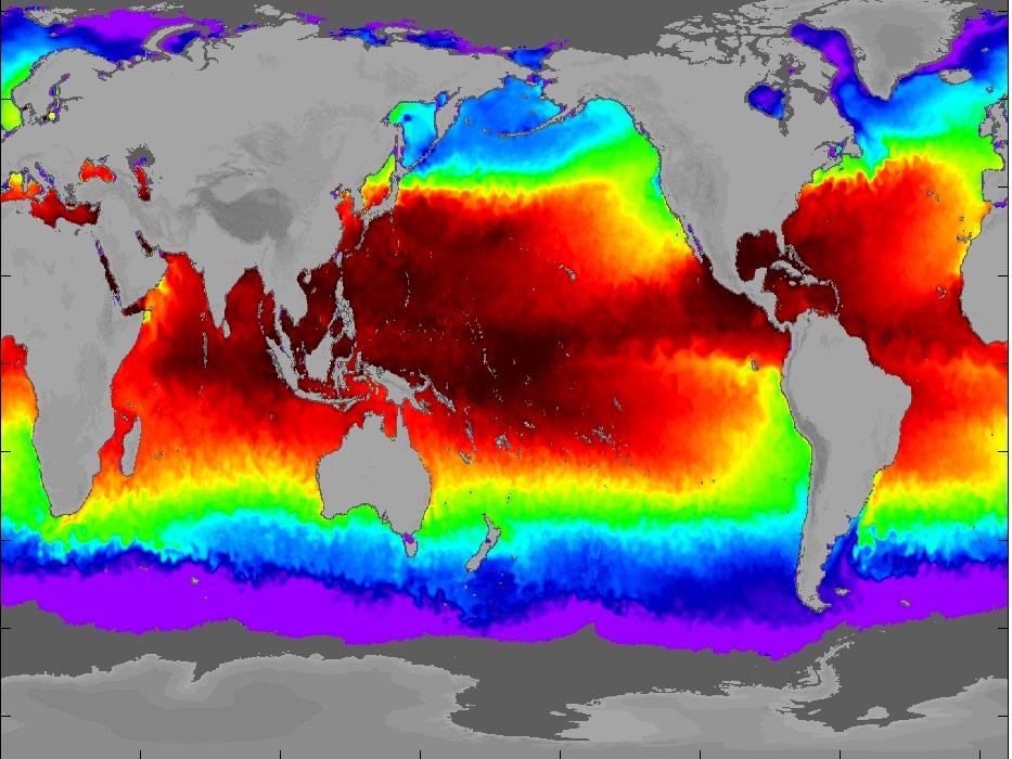
TRMM TMI and AMSR-E Microwave SSTs
|
|
|
- Theodore Lucas
- 5 years ago
- Views:
Transcription

1 TMI and AMSR-E Microwave SSTs Chelle Gentemann, Frank Wentz, & Peter Ashcroft TMI/AMSR-E MW SST algorithm development Validation Results Sensor Issues Useful for Climate research

2 Outline of Talk Current status of TMI & AMSR-E SSTs Sensor description RSS MW SST algorithm Validation Results Calibration problems Useful for Climate research


3 TRMM Orbit 50 km footprint Swath width: 760 km 5 channels: 10.7, 19.4, 21.3, 37, 85.5 GHz 35 inclination. Altitude of 350km. Full coverage in ~2 days.

4 TMI/AMSR-E Suite of Ocean Products Wind Speed SST Rain Rate Water Vapor Cloud
5 Algorithm Derivation Environmental Scenes 42,195 Radiosondes 5 Cloud Models SST Randomly Varied ±5ºC about climatology Wind Speed Randomly Varied from 0 to 25m/s Wind Direction Randomly Varied from 0 to 360º Truth: Ts, W, V, L Gaussian Noise Added Complete Radiative Transfer Model Simulated TMI TB s Algorithm Coefficients Withheld Data Set Derive Coefficients for Multiple Linear Regression Algorithm Evaluate Algorithm Performance Retrieved values for Ts, W, V, L Run Algorithm TMI, AMSR-E, AATSR coefficients calculated by regression to RTM generated TBs. AVHRR SST monthly coefficients calculated by blind regressions to insitu (drifters/buoys/ship) measurements. Performance and Cross Talk Statistics

6 TMI SST Validation Orbital Collocations TMI Buoy SST collocations Mean Dif. STD TAO PIRATA NDBC
 TMI SST (C) Buoy SST (C)")
7 AMSR-E/TMI Validation AMSR-E vs. Reynolds STD=0.67 C TMI vs. Buoy SSTs STD=0.57 C AMSR SST (C) TMI SST (C) Buoy SST (C)

8 Near real time AMSR-E SST Validation Using Buoys & Ship Measurements from NRL-Monterey Updated twice daily Figures show last 50 days bias/std and locations of previous day collocations Complete collocated dataset available

 #-,841.")
9 Land contamination in TMI & AMSR-E TMI-NLSST, January ,;04-807;, ,3/,110.90/-, ,3/ ( 1 C ) #-,841.4,89, $$%8


10 Initial Post-launch TMI inter-calibration TMI Ta SSMI Ta SSM/I Versus TMI Comparisons T a,tmi - T a,ssmi GHz V-Pole V-pol T a,ssmi 21.3 GHz V-P ole 8 T a,tmi - T a,ssmi T a,tmi - T a,ssmi V-pol T a,ssmi 37.0 GHz V-P ole T a,tmi - T a,ssmi V-pol T a,ssmi 85.5 GHz V-P ole 8 8 T a,tmi - T a,ssmi V-pol 19 H-pol T a,ssmi T a,tmi - T a,ssmi T a,tmi - T a,ssmi Ta SSMI Log of JPDF (K -2 ) GHz H-Pole T a,ssmi 35 H-pol 37.0 GHz H-P ole H-pol T a,ssmi 85.5 GHz H-P ole T a,ssmi Counts Counts TRMM Pitch-Over Hot load Scene Cold Mirror Scan Number Scene Cold Mirror Scan Number

11 On August 25, 2001 TRMM finished a maneuver to boost the altitude from 350 to 402 km. TRMM s attitude control system (ACS) controls yaw/pitch/roll based on onboard attitude estimates. Preboost ACS utilized an Earth horizon sensor for roll and pitch. The altitude increase resulted in the loss of the Earth horizon sensor, the ACS backup system uses a Kalman filter with weighted input from the gyros, sun sensor, magnetometer. Post-boost errors in the PR rain and TMI SST were immediately apparent. Independent estimates of errors in roll from GSFC PR team (Red) and RSS TMI SST team (Black) are in close agreement. Post-boost roll errors peaked at 0.5 degrees at the end of September -- these errors translate to 3 C errors in SST before correction. Using the RSS calibration developed, SST errors due to roll were reduced to < 0.2 C. TMI Amp TMI Post-orbital Boost Roll Error Estimate of Roll Error Yaw 0 Yaw 180 PR TMI TMI Corrected PR Amp ( )

12 Before and After SST Retrievals


 On-Orbit Calibration significantly")
13 On-Orbit Calibration of AMSR-E Hot Load SSM/I Solution for Effective Hot Load Temperature Earth Temperature from Satellite Network X X Deep Space Observation = 2.7 K X TMI AMSR-E AMSR-E Radiometer Observations (Counts) On-Orbit Calibration significantly improves accuracy of AMSR-E retrievals

14 Aqua Pitch Error

15 Global Difference : June 2001 October 2003 Bias = C STD = 0.67 C Bias = C STD = 0.66 C

16 Global Difference: June 2001 October 2003 Bias = 0.08 C STD = 0.66 C Bias = 0.05 C STD = 0.66 C

17 Better Coverage: IR/MW retrievals NPOESS requirement: 6-hour revisit

18 3-day average: Polar SST

19 Optimally Interpolated TMI & AMSR-E SSTs TRMM TMI AQUA AMSR-E Both TMI and AMSR-E SSTs are included in a daily, 25km OI SST with 1-day, 100 km decorrelation scales Combined Product September 26,2002
20 Conclusions: AMSR-E and TMI available in NRT Significant improvement in accuracy and coverage of polar SSTs Daily, high-resolution OI SSTs for TMI, AMSR-E, and TMI+AMSR-E available as research product in NRT STD 0.67 and 0.57 (AMSR-E and TMI)
21
22 TRMM The Next 20 Years Mission/Sensor Dates Comments ADEOS-2 AMSR + SeaWinds AQUA AMSR-E WindSat (Navy) GCOM B-1 AMSR + α-scat NPOESS CMIS Radiometer and Scatterometer Died: October 25, Complements ADEOS-2 Coverage Two-Look Polarimetric Radiometer (?) Radiometer and Scatterometer Single-Look Polarimetric Radiometer (?) Improved Performance 6.9, 10.7, 19, 23, 37, 90 GHz 2 meter antenna 50 km resolution, 1600 km swath Better Pre-launch Calibration Supplementary information on wind SST Accuracy 0.2 C for 3-day averages at 50-km resolution


23 TRMM
24
25 TRMM Wind Direction Effects 3 No Correction for Wind Direction 15 m/s TMI SST - Reynolds oc) SST ( m/s 5 m/s Relative Angle (o ) Effect of wind direction on SST retrievals. Reynolds SST, which should have no wind direction dependence, is subtracted from TMI SST. No correction for wind direction has been applied to the TMI SST. This difference is binned according to wind speed and is plotted versus the relative wind direction, which is the satellite s azimuthal viewing angle minus wind direction (from NCEP). The colored curves show the results for each wind speed bin from 0 to 15 m/s, in 1 m/s steps. At low wind speeds (< 5m/s) there is no appreciable error. Above 5 m/s the peakto-peak amplitude of the error increases to a maximum of 4ºC when winds are 15 m/s.
26 Wind effects on TMI SSTs Ocean MW emissivity changes at high winds due to increased sea roughness Wind correction needed for MW SST retrievals: no Bias but higher StDev TMI-REYNOLDS STD = 0.70 NLSST-REYNOLDS STD = 0.70 SST 1 0 STD = 0.72 Daytime retrieval STD = 0.73 Daytime retrieval -1 1 STD = 0.68 Night retrieval STD = 0.66 Night retrieval Wind (m/s)
 7 GHz 11 GHz 19 GHz 23 GHz 37 GHz 89A GHz 89B")
27 Effective Temperature of Hot Load (Versus Latitude and Month) 7 GHz 11 GHz 19 GHz 23 GHz 37 GHz 89A GHz 89B GHz
The RSS WindSat Version 7 All-Weather Wind Vector Product
 2010 International Ocean Vector Winds Meeting Barcelona, Spain May 18 20, 2010 The RSS WindSat Version 7 All-Weather Wind Vector Product Thomas Meissner Lucrezia Ricciardulli Frank Wentz Outline 1. Overview:
Reprocessed QuikSCAT (V04) Wind Vectors with Ku-2011 Geophysical Model Function
 Wind Vectors with Ku-2011 Geophysical Model Function") Reprocessed QuikSCAT (V04) Wind Vectors with Ku-2011 Geophysical Model Function Lucrezia Ricciardulli and Frank Wentz Introduction In April 2011, we reprocessed the QuikSCAT ocean wind vectors using a
Reprocessed QuikSCAT (V04) Wind Vectors with Ku-2011 Geophysical Model Function Lucrezia Ricciardulli and Frank Wentz Introduction In April 2011, we reprocessed the QuikSCAT ocean wind vectors using a
SENSOR SYNERGY OF ACTIVE AND PASSIVE MICROWAVE INSTRUMENTS FOR OBSERVATIONS OF MARINE SURFACE WINDS
 SENSOR SYNERGY OF ACTIVE AND PASSIVE MICROWAVE INSTRUMENTS FOR OBSERVATIONS OF MARINE SURFACE WINDS N. Ebuchi Institute of Low Temperature Science, Hokkaido University, N19-W8, Kita-ku, Sapporo 060-0819,
SEA SURFACE TEMPERATURE RETRIEVAL USING TRMM MICROWAVE IMAGER SATELLITE DATA IN THE SOUTH CHINA SEA
 SEA SURFACE TEMPERATURE RETRIEVAL USING TRMM MICROWAVE IMAGER SATELLITE DATA IN THE SOUTH CHINA SEA Mohd Ibrahim Seeni Mohd and Mohd Nadzri Md. Reba Faculty of Geoinformation Science and Engineering Universiti
CHANGE OF THE BRIGHTNESS TEMPERATURE IN THE MICROWAVE REGION DUE TO THE RELATIVE WIND DIRECTION
 JP4.12 CHANGE OF THE BRIGHTNESS TEMPERATURE IN THE MICROWAVE REGION DUE TO THE RELATIVE WIND DIRECTION Masanori Konda* Department of Geophysics, Graduate School of Science, Kyoto University, Japan Akira
Climate-Quality Intercalibration of Scatterometer Missions
 Climate-Quality Intercalibration of Scatterometer Missions Lucrezia Ricciardulli and Frank Wentz Remote Sensing Systems, Santa Rosa, California IOVWST meeting Sapporo, Japan, May 2016 Photo Courtesy: 1
An algorithm for Sea Surface Wind Speed from MWR
 An algorithm for Sea Surface Wind Speed from MWR Carolina Tauro 1, Yazan Heyazin 2, María Marta Jacob 1, Linwood Jones 1 1 Comisión Nacional de Actividades Espaciales (CONAE) 2 Central Florida Remote Sensing
The Cross-Calibrated Multi-Platform (CCMP) Ocean Vector Wind Analysis (V2.0)
 Ocean Vector Wind Analysis (V2.0)") The Cross-Calibrated Multi-Platform (CCMP) Ocean Vector Wind Analysis (V2.0) Carl A. Mears, L. Ricciardulli, J. Scott and F. J. Wentz Remote Sensing Systems Ross Hoffman, S. Mark Leidner Robert Atlas Atmospheric
The Cross-Calibrated Multi-Platform (CCMP) Ocean Vector Wind Analysis (V2.0) Carl A. Mears, L. Ricciardulli, J. Scott and F. J. Wentz Remote Sensing Systems Ross Hoffman, S. Mark Leidner Robert Atlas Atmospheric
High Resolution Sea Surface Roughness and Wind Speed with Space Lidar (CALIPSO)
") High Resolution Sea Surface Roughness and Wind Speed with Space Lidar (CALIPSO) Yongxiang Hu NASA Langley Research Center Carl Weimer Ball Aerospace Corp. 1 CALIPSO Mission Overview CALIPSO seeks to improve
High Resolution Sea Surface Roughness and Wind Speed with Space Lidar (CALIPSO) Yongxiang Hu NASA Langley Research Center Carl Weimer Ball Aerospace Corp. 1 CALIPSO Mission Overview CALIPSO seeks to improve
SIMON YUEH, WENQING TANG, ALEXANDER FORE, AND JULIAN CHAUBELL JPL-CALTECH, PASADENA, CA, USA GARY LAGERLOEF EARTH AND SPACE RESEARCH, SEATTLE, WA, US
 Applications of L-Band Scatterometry and Radiometry to Aquarius and SMAP SIMON YUEH, WENQING TANG, ALEXANDER FORE, AND JULIAN CHAUBELL JPL-CALTECH, PASADENA, CA, USA GARY LAGERLOEF EARTH AND SPACE RESEARCH,
WINDSAT is a conically scanning polar-orbiting multifrequency
 164 IEEE GEOSCIENCE AND REMOTE SENSING LETTERS, VOL. 3, NO. 1, JANUARY 2006 A Statistical Approach to WindSat Ocean Surface Wind Vector Retrieval Craig K. Smith, Member, IEEE, Michael Bettenhausen, Member,
Correction of the Effect of Relative Wind Direction on Wind Speed Derived by Advanced Microwave Scanning Radiometer
 Journal of Oceanography, Vol., pp. 39 to, Correction of the Effect of Relative Wind Direction on Wind Speed Derived by Advanced Microwave Scanning Radiometer MASANORI KONDA 1 *, AKIRA SHIBATA, NAOTO EBUCHI
J4.2 AUTOMATED DETECTION OF GAP WIND AND OCEAN UPWELLING EVENTS IN CENTRAL AMERICAN GULF REGIONS
 J4.2 AUTOMATED DETECTION OF GAP WIND AND OCEAN UPWELLING EVENTS IN CENTRAL AMERICAN GULF REGIONS Xiang Li*, University of Alabama in Huntsville Huntsville, AL D. K. Smith Remote Sensing Systems Santa Rosa,
A. Bentamy 1, S. A. Grodsky2, D.C. Fillon1, J.F. Piollé1 (1) Laboratoire d Océanographie Spatiale / IFREMER (2) Univ. Of Maryland
 Laboratoire d Océanographie Spatiale / IFREMER (2) Univ. Of Maryland") Calibration and Validation of Multi-Satellite scatterometer winds A. Bentamy 1, S. A. Grodsky2, D.C. Fillon1, J.F. Piollé1 (1) Laboratoire d Océanographie Spatiale / IFREMER (2) Univ. Of Maryland Topics
Calibration and Validation of Multi-Satellite scatterometer winds A. Bentamy 1, S. A. Grodsky2, D.C. Fillon1, J.F. Piollé1 (1) Laboratoire d Océanographie Spatiale / IFREMER (2) Univ. Of Maryland Topics
OAFlux: global, 0.25, daily
 Including ASCAT in OAFlux Global Vector Wind Analysis (1987 present) with programming support from Dr. Xiangze Jin July 1987 OAFlux: global, 0.25, daily QuikSCAT AMSRE SSMI (F08, F10, F11, F13, F14, F15,
Development of SAR-Derived Ocean Surface Winds at NOAA/NESDIS
 Development of SAR-Derived Ocean Surface Winds at NOAA/NESDIS Pablo Clemente-Colón, William G. Pichel, NOAA/NESDIS Frank M. Monaldo, Donald R. Thompson The Johns Hopkins University Applied Physics Laboratory
Updates of Aquarius CAP Ocean Surface Salinity and Wind Retrieval Algorithm
 Updates of Aquarius CAP Ocean Surface Salinity and Wind Retrieval Algorithm SIMON YUEH, WENQING TANG, ALEXANDER FORE, AKIKO HAYASHI November 14, 2013 Outline Introduction CAP V3.0 Flow Antenna Pattern
Deborah K. Smith, Frank J. Wentz, and Carl A. Mears Remote Sensing Systems
 JP 4.9 RESULTS OF QUIKSCAT HIGH WIND DATA VALIDATION Deborah K. Smith, Frank J. Wentz, and Carl A. Mears Remote Sensing Systems ABSTRACT Traditional validation of satellite-derived winds includes comparison
Institut Français pour la Recherche et l Exploitation de la MER
 Institut Français pour la Recherche et l Exploitation de la MER Laboratoire d'océanographie Physique et Spatiale Satellites Interface Air- Mer June 2017 Document IFREMER/LOPS/Long Time Series Satellite
Field assessment of ocean wind stress derived from active and passive microwave sensors
 Field assessment of ocean wind stress derived from active and passive microwave sensors Doug Vandemark, Marc Emond (UNH) Jim Edson (UCONN) Bertrand Chapron (IFREMER) Motivations Are there 1 st or 2 nd
An Ocean Surface Wind Vector Model Function For A Spaceborne Microwave Radiometer And Its Application
 University of Central Florida Electronic Theses and Dissertations Doctoral Dissertation (Open Access) An Ocean Surface Wind Vector Model Function For A Spaceborne Microwave Radiometer And Its Application
High resolution wind retrieval for SeaWinds
 High resolution wind retrieval for SeaWinds David G. Long and Jeremy B. Luke Brigham Young University, 459 Clyde Building, Provo, UT 84602, USA ABSTRACT The SeaWinds instrument on the QuikSCAT satellite
A 10-year intercomparison between collocated SSM/I oceanic surface wind speed retrievals and global analyses
 1 A 10-year intercomparison between collocated SSM/I oceanic surface wind speed retrievals and global analyses T. Meissner, D. Smith and F. Wentz Remote Sensing Systems, 438 First Street, Suite 200, Santa
A 10 year intercomparison between collocated Special Sensor Microwave Imager oceanic surface wind speed retrievals and global analyses
 JOURNAL OF GEOPHYSICAL RESEARCH, VOL. 106, NO. C6, PAGES 11,731 11,742, JUNE 15, 2001 A 10 year intercomparison between collocated Special Sensor Microwave Imager oceanic surface wind speed retrievals
An Updated Analysis of the Ocean Surface Wind Direction Signal in Passive Microwave Brightness Temperatures
 1230 IEEE TRANSACTIONS ON GEOSCIENCE AND REMOTE SENSING, VOL. 40, NO. 6, JUNE 2002 An Updated Analysis of the Ocean Surface Wind Direction Signal in Passive Microwave Brightness Temperatures Thomas Meissner,
Sea Surface Temperature Modification of Low-Level Winds. Dudley B. Chelton
 Sea Surface Temperature Modification of Low-Level Winds Dudley B. Chelton College of Oceanic and Atmospheric Sciences, 104 Oceanography Administration Building, Oregon State University, Corvallis, OR 97331-5503
HIGH RESOLUTION WIND RETRIEVAL FOR SEAWINDS ON QUIKSCAT. Jeremy B. Luke. A thesis submitted to the faculty of. Brigham Young University
 HIGH RESOLUTION WIND RETRIEVAL FOR SEAWINDS ON QUIKSCAT by Jeremy B. Luke A thesis submitted to the faculty of Brigham Young University in partial fulfillment of the requirements for the degree of Master
The potential of QuikSCAT and WindSat observations for the estimation of sea surface wind vector under severe weather conditions
 Click Here for Full Article JOURNAL OF GEOPHYSICAL RESEARCH, VOL. 112,, doi:10.1029/2007jc004163, 2007 The potential of QuikSCAT and WindSat observations for the estimation of sea surface wind vector under
WindSat Applications for Weather Forecasters and Data Assimilation
 WindSat Applications for Weather Forecasters and Data Assimilation Thomas Lee, James Goerss, Jeffrey Hawkins, Joseph Turk Naval Research Laboratory 7 Grace Hopper Avenue Monterey CA Zorana Jelenak, Paul
RapidScat wind validation report
 Ocean and Sea Ice SAF Technical Note SAF/OSI/CDOP2/KNMI/TEC/RP/228 25 and 50 km wind products (OSI-109) Anton Verhoef, Jur Vogelzang and Ad Stoffelen KNMI Version 1.1 March 2015 DOCUMENTATION CHANGE RECORD
Validation of 12.5 km and Super-High Resolution (2-5 km)
") Coastal and Orographic Wind Analyses from High Resolution QuikSCAT and SeaWinds Measurements M.H. Freilich, COAS/OSU D.B. Chelton, COAS/OSU D.G. Long, BYU Clive Dorman, SIO Barry Vanhoff, COAS/OSU OVWST
Coastal and Orographic Wind Analyses from High Resolution QuikSCAT and SeaWinds Measurements M.H. Freilich, COAS/OSU D.B. Chelton, COAS/OSU D.G. Long, BYU Clive Dorman, SIO Barry Vanhoff, COAS/OSU OVWST
Cross-Calibrating OSCAT Land Sigma-0 to Extend the QuikSCAT Land Sigma-0 Climate Record
 Cross-Calibrating OSCAT Land Sigma-0 to Extend the QuikSCAT Land Sigma-0 Climate Record David G. Long Department of Electrical and Computer Engineering Brigham Young University May 2013 0 Scatterometer
SMAP Radiometer-Only Tropical Cyclone Size and Strength
 SMAP Radiometer-Only Tropical Cyclone Size and Strength Alexander Fore, Simon Yueh, Wenqing Tang, Bryan SCles, Akiko Hayashi Jet Propulsion Laboratory, California InsCtute of Technology 218 California
Validation of 12.5 km Resolution Coastal Winds. Barry Vanhoff, COAS/OSU Funding by NASA/NOAA
 Validation of 12.5 km Resolution Coastal Winds Barry Vanhoff, COAS/OSU Funding by NASA/NOAA Outline Part 1: Determining empirical land mask Characterizing σ 0 near coast Part 2: Wind retrieval using new
First six months quality assessment of HY-2A SCAT wind products using in situ measurements
 Acta Oceanol. Sin., 2013, Vol. 32, No. 11, P. 27-33 DOI: 10.1007/s13131-013-0374-5 http://www.hyxb.org.cn E-mail: hyxbe@263.net First six months quality assessment of HY-2A SCAT wind products using in
Monitoring Conditions Offshore with Satellites
 Downloaded from orbit.dtu.dk on: Dec 15, 2017 Monitoring Conditions Offshore with Satellites Karagali, Ioanna; Hasager, Charlotte Bay; Badger, Merete; Bingöl, Ferhat; Ejsing Jørgensen, Hans Publication
Satellite information on ocean vector wind from Scatterometer data. Giovanna De Chiara
 Satellite information on ocean vector wind from Scatterometer data Giovanna De Chiara Why is Scatterometer important? The scatterometer measures the ocean surface winds (ocean wind vector). Ocean surface
PRELIMINARY STUDY ON DEVELOPING AN L-BAND WIND RETRIEVAL MODEL FUNCTION USING ALOS/PALSAR
 PRELIMINARY STUDY ON DEVELOPING AN L-BAND WIND RETRIEVAL MODEL FUNCTION USING ALOS/PALSAR Osamu Isoguchi, Masanobu Shimada Earth Observation Research Center, Japan Aerospace Exploration Agency (JAXA) 2-1-1
Evaluation of Marine Surface Winds Observed by SeaWinds and AMSR on ADEOS-II
 Journal of Oceanography, Vol. 62, pp. 293 to 301, 2006 Evaluation of Marine Surface Winds Observed by SeaWinds and AMSR on ADEOS-II NAOTO EBUCHI* Institute of Low Temperature Science, Hokkaido University,
Dynamics and variability of surface wind speed and divergence over mid-latitude ocean fronts
 Dynamics and variability of surface wind speed and divergence over mid-latitude ocean fronts Larry O Neill 1, Tracy Haack 2, and Simon de Szoeke 1 1 Oregon State University, Corvallis, OR 2 Naval Research
A Comparative Assessment of Surface Wind Speed and Sea Surface Temperature over the Indian Ocean by TMI, MSMR, and ERA-40
 JUNE 2007 P A R E K H E T A L. 1131 A Comparative Assessment of Surface Wind Speed and Sea Surface Temperature over the Indian Ocean by TMI, MSMR, and ERA-40 ANANT PAREKH Theoretical Studies Division,
Sea Surface Temperature of the Bay of Bengal Derived from the TRMM Microwave Imager*,+
 Page 1 of 9 «Back to Article View Databases selected: Multiple databases... What's New Sea Surface Temperature of the Bay of Bengal Derived from the TRMM Microwave Imager*,+ G S Bhat, G A Vecchi, S Gadgil.
On the Quality of HY-2A Scatterometer Winds
 On the Quality of HY-2A Scatterometer Winds W. Lin (ICM-CSIC) M. Portabella (ICM-CSIC) A. Stoffelen (KNMI) A. Verhoef (KNMI) Youguang Zhang (NSOAS) Mingsen Lin (NSOAS) Shuyan Lang (NSOAS) Juhong Zou (NSOAS)
Scatterometer-Based Assessment of 10-m Wind Analyses from the Operational ECMWF and NCEP Numerical Weather Prediction Models
 FEBRUARY 2005 C H E L T O N A N D F R E I L I C H 409 Scatterometer-Based Assessment of 10-m Wind Analyses from the Operational ECMWF and NCEP Numerical Weather Prediction Models DUDLEY B. CHELTON AND
Jackie May* Mark Bourassa. * Current affilitation: QinetiQ-NA
 Jackie May* Mark Bourassa * Current affilitation: QinetiQ-NA Background/Motivation In situ observations (ships and buoys) are used to validate satellite observations Problems with comparing data Sparseness
The emission and scattering of L-band microwave radiation from rough ocean surfaces and wind speed measurements from the Aquarius sensor
 The emission and scattering of L-band microwave radiation from rough ocean surfaces and wind speed measurements from the Aquarius sensor Thomas Meissner, Frank J. Wentz and Lucrezia Ricciardulli Remote
Observations of Coupling between Surface Wind Stress and Sea Surface Temperature in the Eastern Tropical Pacific
 1APRIL 2001 CHELTON ET AL. 1479 Observations of Coupling between Surface Wind Stress and Sea Surface Temperature in the Eastern Tropical Pacific DUDLEY B. CHELTON, STEVEN K. ESBENSEN, MICHAEL G. SCHLAX,
Analyses of Scatterometer and SAR Data at the University of Hamburg
 Analyses of Scatterometer and SAR Data at the University of Hamburg Wind, Waves, Surface Films and Rain ГАДЕ, Мартин Хорстович (aka Martin Gade) Institut für Meereskunde, Universität Hamburg, Германия
JET PROPULSION LABORATORY INTEROFFICE MEMORANDUM
 JET PROPULSION LABORATORY INTEROFFICE MEMORANDUM 3348-99-008 June 16, 1999 To: From: CC: Subject: Philip S. Callahan Young-Joon Kim SAPIENT, SVT Validation of the NOAA Processor through a comparison with
SeaWinds wind Climate Data Record validation report
 Ocean and Sea Ice SAF Technical Note SAF/OSI/CDOP2/KNMI/TEC/RP/221 SeaWinds wind Climate Data Record validation report 25 and 50 km wind products (OSI-151) Anton Verhoef, Jur Vogelzang and Ad Stoffelen
Sea Surface Temperature (SST) in South China Sea Retrieved from Chinese Satellite FY-3B VIRR Data
 in South China Sea Retrieved from Chinese Satellite FY-3B VIRR Data") Sea Surface Temperature (SST) in South China Sea Retrieved from Chinese Satellite FY-3B VIRR Data Chuqun CHEN*, Quanjun HE, Shilin TANG, Haibin YE State key Lab of Tropical Oceanography, South China Sea
Sea Surface Temperature (SST) in South China Sea Retrieved from Chinese Satellite FY-3B VIRR Data Chuqun CHEN*, Quanjun HE, Shilin TANG, Haibin YE State key Lab of Tropical Oceanography, South China Sea
Aquarius / SMAP Ocean Roughness and SSS
 Aquarius / SMAP Ocean Roughness and SSS Alex Fore, Simon Yueh, Wenqing Tang, Akiko Hayashi L2B and L3 data are available at: h2p://ourocean.jpl.nasa.gov 216 California InsItute of Technology, Government
ERS WAVE MISSION REPROCESSING- QC SUPPORT ENVISAT MISSION EXTENSION SUPPORT
 REPORT 8/2011 ISBN 978-82-7492-248-8 ISSN 1890-5218 ERS WAVE MISSION REPROCESSING- QC SUPPORT ENVISAT MISSION EXTENSION SUPPORT - Annual Report 2010 Author (s): Harald Johnsen (Norut), Fabrice Collard
ERS-1/2 Scatterometer new products: mission reprocessing and data quality improvement
 ERS-1/2 Scatterometer new products: mission reprocessing and data quality improvement Giovanna De Chiara (1), Raffaele Crapolicchio (1), Pascal Lecomte (2) (1) Serco SpA Via Sciadonna 22-24 Frascati (Roma),
Satellite Air Sea Fluxes
 Pan Ocean Remote Sensing Conference PORSEC 2008 Oceanic Manifestation of Global Changes Guangzhou China November 28 30 2008 Tutorial Satellite Air Sea Fluxes Abderrahim Bentamy Institut Français pour la
Systematic Errors in the Hydrographic Data and Their Effect on Global Heat Content Calculations
 Systematic Errors in the Hydrographic Data and Their Effect on Global Heat Content Calculations Titelmasterformat durch Klicken bearbeiten Viktor Gouretski KlimaCampus, University of Hamburg Frascati,
Evaluation of the HY-2A Scatterometer wind quality
 Evaluation of the HY-2A Scatterometer wind quality Wenming Lin, Marcos Portabella, Antonio Turiel ICM-CSIC Ad Stoffelen, Anton Verhoef KNMI Qingtao Song, Xingwei Jiang NOSAS Dudely B. Chelton OSU Typhoon
DEVELOPMENT AND VALIDATION OF A SAR WIND EMULATOR
 The Nansen Environmental and Remote Sensing Center a non-profit research institute affiliated with the University of Bergen Thormøhlensgate 47, N-5006 Bergen Norway NERSC Technical Report no. 304 DEVELOPMENT
The Wind Resource: Prospecting for Good Sites
 The Wind Resource: Prospecting for Good Sites Bruce Bailey, President AWS Truewind, LLC 255 Fuller Road Albany, NY 12203 bbailey@awstruewind.com Talk Topics Causes of Wind Resource Impacts on Project Viability
Satellite Observations of Equatorial Planetary Boundary Layer Wind Shear
 Satellite Observations of Equatorial Planetary Boundary Layer Wind Shear David Halpern and Michael Garay NASA / California Institute of Technology Jet Propulsion Laboratory Pasadena, California, USA Thanks
Aquarius Wind Speed Retrievals and Implica6ons for SMAP Ocean Vector Winds
 Aquarius Wind Speed Retrievals and Implica6ons for SMAP Ocean Vector Winds Alex Fore, Simon Yueh, Wenqing Tang, Julian Chaubell, Gregory Neumann, Akiko Hayashi, and Adam Freedman 214 California Ins6tute
Technical report. Ifremer, DRO/OS, Plouzané, FRANCE. NASA/Goddard Space Flight Center, Wallops Island, Virginia, USA.
 Technical report Satellite altimeter models for surface wind speed developed using ocean satellite crossovers J. Gourrion, D. Vandemark 2, S. Bailey 2, B. Chapron Ifremer, DRO/OS, Plouzané, FRANCE 2 NASA/Goddard
The Ice Contamination Ratio Method: Accurately Retrieving Ocean Winds Closer to the Sea Ice Edge While Eliminating Ice Winds
 The Ice Contamination Ratio Method: Accurately Retrieving Ocean Winds Closer to the Sea Ice Edge While Eliminating Ice Winds David Long Department of Electrical and Computer Engineering Brigham Young University
QuikScat/Seawinds Sigma-0 Radiometric and Location Accuracy Requirements for Land/Ice Applications
 Brigham Young University Department of Electrical and Computer Engineering 459 Clyde Building Provo, Utah 84602 QuikScat/Seawinds Sigma-0 Radiometric and Location Accuracy Requirements for Land/Ice Applications
Combining wind and rain in spaceborne scatterometer observations: modeling the splash effects in the sea surface backscattering coefficient
 Combining wind and rain in spaceborne scatterometer observations: modeling the splash effects in the sea surface backscattering coefficient F. Polverari (1,2,4), F. S. Marzano (1,2), L. Pulvirenti (3,1),
MISR CMVs. Roger Davies and Aaron Herber Physics Department
 MISR CMVs Roger Davies and Aaron Herber Physics Department Acknowledgements: MISR Science and Data Processing Team (especially Catherine Moroney and Mike Garay) From the AGU Fall Meeting 2009 MISR and
Coastal Scatterometer Winds Working Group
 Coastal Scatterometer Winds Working Group IOVWST Meeting 2015 Portland, Oregon, USA Melanie Fewings Julia Figa Saldaña Bryan Stiles Steve Morey Dmitry Dukhovskoy Larry O Neill if you want to be added to
Geophysical Model Functions for the Retrieval of Ocean Surface Winds
 Geophysical Model Functions for the Retrieval of Ocean Surface Winds Donald R. Thompson and Frank M. Monaldo Johns Hopkins University Applied Physics Laboratory 11100 Johns Hopkins Road, Laurel, MD 20708
3D Nacelle Mounted Lidar in Complex Terrain
 ENERGY 3D Nacelle Mounted Lidar in Complex Terrain PCWG Hamburg, Germany Paul Lawson 25.03.2015 1 DNV GL 125.03.2015 SAFER, SMARTER, GREENER Agenda Introduction and Project Background Lidar Specifications
Archimer
 Please note that this is an author-produced PDF of an article accepted for publication following peer review. The definitive publisher-authenticated version is available on the publisher Web site Journal
Wind Stress Working Group 2015 IOVWST Meeting Portland, OR
 Wind Stress Working Group 2015 IOVWST Meeting Portland, OR Summary of Research Topics, Objectives and Questions James B. Edson University of Connecticut SPURS Mooring, Farrar, WHOI Background Motivation
THE SEAWINDS scatterometer was flown twice, once on
 IEEE TRANSACTIONS ON GEOSCIENCE AND REMOTE SENSING 1 Land-Contamination Compensation for QuikSCAT Near-Coastal Wind Retrieval Michael P. Owen and David G. Long, Fellow, IEEE Abstract The QuikSCAT scatterometer
Singularity analysis: A poweful technique for scatterometer wind data processing
 Singularity analysis: A poweful technique for scatterometer wind data processing M. Portabella (ICM-CSIC) W. Lin (ICM-CSIC) A. Stoffelen (KNMI) A. Turiel (ICM-CSIC) G. King (ICM-CSIC) A. Verhoef (KNMI)
Differences in trends and anomalies of upper-air observations from GPS RO, AMSU, and radiosondes
 Differences in trends and anomalies of upper-air observations from GPS RO, AMSU, and radiosondes Florian Ladstädter Hallgeir Wilhelmsen Barbara Angerer Andrea K. Steiner Wegener Center and IGAM/Institute
Kelvin waves as observed by Radiosondes and GPS measurements and their effects on the tropopause structure: Long-term variations
 Kelvin waves as observed by Radiosondes and GPS measurements and their effects on the tropopause structure: Long-term variations M. Venkat Ratnam and T. Tsuda Research Institute for Sustainable Humanosphere
Constraining a global, eddying, ocean and sea ice model with scatterometer data
 Constraining a global, eddying, ocean and sea ice model with scatterometer data D. Menemenlis, H. Zhang, D. Moroni, and S. Hristova-Veleva IOVWST, Utrecht, Netherlands, 13 June 2012 QuikSCAT GRACE =? Jason
Modelled and observed winds in the Adriatic sea
 Modelled and observed winds in the Adriatic sea F. De Biasio, S.Zecchetto, A. della Valle ISAC-CNR Institute of Atmospheric Sciences and Climate Italian National Research Council http://www.esurge-venice.eu
MOTUS Wave Buoys. Powered By the Aanderaa MOTUS Directional Wave Sensor
 MOTUS Wave Buoys Powered By the Aanderaa MOTUS Directional Wave Sensor Two Buoys, One Brain The Aanderaa MOTUS directional wave sensor factory calibrated and currently available on two proven buoy platforms:
Characterization of ASCAT measurements based on buoy and QuikSCAT wind vector observations
 Ocean Sci., 4, 265 274, 2008 Author(s) 2008. This work is distributed under the Creative Commons Attribution 3.0 License. Ocean Science Characterization of ASCAT measurements based on buoy and QuikSCAT
Quantifying variance due to temporal and spatial difference between ship and satellite winds
 JOURNAL OF GEOPHYSICAL RESEARCH, VOL. 116,, doi:10.1029/2010jc006931, 2011 Quantifying variance due to temporal and spatial difference between ship and satellite winds Jackie C. May 1,2,3 and Mark A. Bourassa
Executive Summary of Accuracy for WINDCUBE 200S
 Executive Summary of Accuracy for WINDCUBE 200S The potential of offshore wind energy has gained significant interest due to consistent and strong winds, resulting in very high capacity factors compared
Advancements in scatterometer wind processing
 Advancements in scatterometer wind processing Ad.Stoffelen@knmi.nl Marcos Portabella Anton Verhoef Jeroen Verspeek Jur Vogelzang scat@knmi.nl www.knmi.nl/scatterometer Scatterometer work The scatterometer
The relevance of ocean surface current in the ECMWF analysis and forecast system. Hans Hersbach Jean-Raymond Bidlot
 The relevance of ocean surface current in the ECMWF analysis and forecast system Hans Hersbach Jean-Raymond Bidlot European Centre for Medium Range Weather Forecasts, Reading, U.K. hans.hersbach@ecmwf.int
Validation of SST and Windspeed from TRMM using North Indian Ocean Moored Buoy Observations
 Centre for Atmospheric and Oceanic Sciences INDIAN INSTITUTE OF SCIENCE BANGALORE 560 012 Validation of SST and Windspeed from TRMM using North Indian Ocean Moored Buoy Observations Retish Senan, Anitha
ADVANCES ON WIND ENERGY RESOURCE MAPPING FROM SAR
 ADVANCES ON WIND ENERGY RESOURCE MAPPING FROM SAR C.B. Hasager, M. Nielsen, M.B. Christiansen, R. Barthelmie, P. Astrup Risoe National Laboratory, Wind Energy Department, Frederiksborgvej 399, DK-4000
Water vapour : stratospheric variability - II
 Water vapour : stratospheric variability - II Karen H. Rosenlof NOAA Earth System Research Laboratory Chemical Sciences Division Boulder, CO 80305 Cargèse International School Water Vapour in the Climate
The development of high resolution global ocean surface wave-tidecirculation
 PICES Annual Meeting in Qingdao The development of high resolution global ocean surface wave-tidecirculation coupled model Fangli Qiao, Qi Shu and Bin Xiao First Institute of Oceanography, SOA, China Oct
GNSS Technology for the Determination of Real-Time Tidal Information
 GNSS Technology for the Determination of Real-Time Tidal Information Benjamin Kidder C-Nav Positioning Solutions European region Outline of Topics Covered Introduction to Tides Past and Present Methods
Examination of the Merged Sea Surface Temperature Using Wavelet Analysis
 Journal of Oceanography, Vol. 6, pp. 843 to 852, Examination of the Merged Sea Surface Temperature Using Wavelet Analysis KOHTARO HOSODA* and HIROSHI KAWAMURA Center for Atmospheric and Oceanic Studies,
Generalized Wave-Ray Approach for Propagation on a Sphere and Its Application to Swell Prediction
 Generalized Wave-Ray Approach for Propagation on a Sphere and Its Application to Swell Prediction D. Scott 1, D. Resio 2, and D. Williamson 1 1. & Associates 2. Coastal Hydraulic Laboratory, U.S. Army
Intersatellite Calibrated HIRS Upper Tropospheric Water Vapor
 Intersatellite Calibrated HIRS Upper Tropospheric Water Vapor Lei Shi and John J. Bates NOAA National Climatic Data Center Asheville, North Carolina, U.S.A. 1 NOAA National Climatic Data Center ITSC-XVI
Wind Project Siting & Resource Assessment
 Wind Project Siting & Resource Assessment David DeLuca, Project Manager AWS Truewind, LLC 463 New Karner Road Albany, NY 12205 ddeluca@awstruewind.com www.awstruewind.com AWS Truewind - Overview Industry
Analysis of Traditional Yaw Measurements
 Analysis of Traditional Yaw Measurements Curiosity is the very basis of education and if you tell me that curiosity killed the cat, I say only the cat died nobly. Arnold Edinborough Limitations of Post-
Aquarius Sca+erometer Calibra3on
 Aquarius Sca+erometer Calibra3on Fore, A., Neumann, G., Freedman, A., Chaubell, M., Tang, W., Hayashi, A., and Yueh, S. 217 California Ins3tute of Technology, Government Sponsorship acknowledged Aquarius
Introduction to NGSST and SST Application for Monitoring of Ocean Environment
 Introduction to NGSST and SST Application for Monitoring of Ocean Environment Kyung-Ae Park Dep. of Earth Science/RIO, Seoul National Univ., Korea Warming Island USGS Landsat Project 2 Global Warming IPCC
SeaWinds Validation with Research Vessels
 1 SeaWinds Validation with Research Vessels Mark A. Bourassa 1, David M. Legler 1,, James J. O'Brien 1, and Shawn R. Smith 1 Abstract. The accuracy of vector winds from the SeaWinds scatterometer on the
ON THE USE OF DOPPLER SHIFT FOR SAR WIND RETRIEVAL
 ON THE USE OF DOPPLER SHIFT FOR SAR WIND RETRIEVAL K-F. Dagestad 1, A. Mouche 2, F. Collard 2, M. W. Hansen 1 and J. Johannessen 1 (1) Nansen Environmental and Remote Censing Center, Thormohlens gt 47,
BRIGHAM YOUNG UNIVERSITY GRADUATE COMMITTEE APPROVAL of a thesis submitted by Stephen L. Richards This thesis has been read by each member of the foll
 A FIELD-WISE WIND RETRIEVAL ALGORITHM FOR SEAWINDS by Stephen L. Richards A thesis submitted to the faculty of Brigham Young University in partial fulllment of the requirements for the degree of Master
Statistics of wind and wind power over the Mediterranean Sea
 Conférence Méditerranéenne Côtière et Maritime EDITION 2, TANGER, MAROC (2011) Coastal and Maritime Mediterranean Conference Disponible en ligne http://www.paralia.fr Available online Statistics of wind
WeatherStation Monitoring for Industrial marine Applications
 WeatherStation Monitoring for Industrial marine Applications PB200 WeatherStation Instrument Applications: Industrial marine weather monitoring Features: True and Apparent Wind Speed and Direction Barometric