Cross-Calibrating OSCAT Land Sigma-0 to Extend the QuikSCAT Land Sigma-0 Climate Record
|
|
|
- Tobias Parks
- 6 years ago
- Views:
Transcription


1 Cross-Calibrating OSCAT Land Sigma-0 to Extend the QuikSCAT Land Sigma-0 Climate Record David G. Long Department of Electrical and Computer Engineering Brigham Young University May

 Conventional Resolution SIR Enhanced Resolution db Wind from σ 0")
 OSCAT ASCAT wind processing now operational OSCAT includes")
2 Scatterometer Resolution Enhancement σ 0 imaging SIR/AVE for OSCAT Beta version of OSCAT enhanced resolution land/ice products now available at the Scatterometer Climate Record Pathfinder ( Conventional Resolution SIR Enhanced Resolution db Wind from σ 0 Ultra-high resolution (UHR) (1.25 km/pixel) OSCAT ASCAT wind processing now operational OSCAT includes near-land, and sea-ice wind retrieval Conventional Resolution Ultra-High Resolution 1

3 Ice Contamination Mitigation for QuikSCAT and OSCAT Model: Ice Contribution Ratio (ICR) Monte Carlo simulation to set wind error threshold on ICR of each sigma0 measurement Wind speed/direction Ice backscatter intensity Cross-track location Sea ice prior probability map Discard high ICR sigma0s prior to retrieval 2
 W.J. Hullinger and D.G.")
4 Ice Contamination Wind Mitigation Eliminates ice winds and enables retrieval nearer to sea ice Similar to near-land approach, but using Bayes sea ice maps Both L2B and UHR winds available in BYU product Retrieves winds on average 30 km closer to sea-ice edge than conventional L2B winds (which are nominally 50 km from the ice edge) W.J. Hullinger and D.G. Long, Mitigation of Sea Ice Contamination in QuikSCAT Wind Retrieval, IEEE Transactions on Geoscience and Remote Sensing, to appear,


5 OSCAT SRF Estimates from Island targets H-pol Slices H-pol Egg V-pol Egg J.P. Bradley and D.G. Long, "Estimation of the OSCAT Spatial Response Function Using Island Targets", IEEE Transactions on Geoscience and Remote Sensing, to appear,


6 Scatterometer Climate Record Pathfinder (SCP) Standard Regions (OSCAT images) Lambert Equal Area, Polar Stereographic Projection EASE grid Compatible grids for ERS-1/2, NSCAT, SeaWinds/QuikSCAT, OSCAT, ASCAT1/2, SSM/I, AMSRE 5
7 OSCAT/QuikSCAT Differences for the Land/Ice Scatterometer Climate Record Orbit geometry Orbit revisit time (Q=4 day repeat, O=2 day repeat) Observation azimuth angles differ and vary with time Time of orbit ascending node differ QuikSCAT=6:30 am OSCAT=noon Measurement incidence angle H: QuikSCAT=46, OSCAT=48 V: QuikSCAT=54, OSCAT=56 Instrument azimuth gain variation Cross calibration parameters Incidence angle Azimuth angle Local time of day 6
8 Cross-calibration over Land & Ice Goal: Determine a correction factor to apply to OSCAT land/ice images to enable extension of QuikSCAT time series Correct azimuth prior to image formation Otherwise, use ocean-calibrated OSCAT sigma-0s Fixed calibration offset + incidence angle correction applied post-image formation Question: Is this simple cross-calibration scheme adequate for extending the land/ice scatterometer climate record? 7


9 Greenland & Scatterometer Calibration Evaluate locations within the dry snow zone of Greenland for calibrating scatterometers using the 10-year long QuikSCAT data set. K.R. Moon and D.G. Long, Considerations for Ku-band scatterometer calibration using the dry snow zone of the Greenland ice sheet, IEEE Geoscience and Remote Sensing Letters, to appear, Dry snow zone extent and average sigma-0. Note significant variability in spatial extent Seasonal cycle of sigma-0 within dry snow zone 8
 and C-band data (ASCAT=Blu). Land shows up as pink-grey. Deep melt is the green. Surface melt is red.")
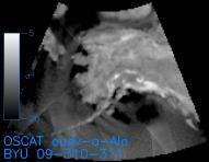
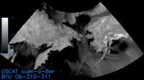
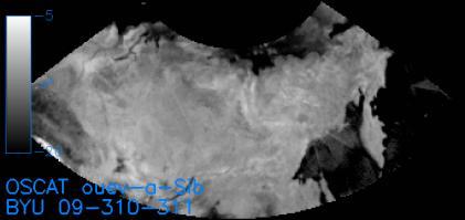
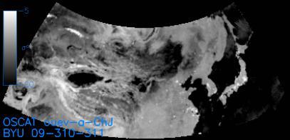
10 Greenland Summer Melt During the Summer of 2012, Greenland endured one of the largest areal melt cycle observed in the satellite record. The melt event was recorded by OSCAT and ASCAT. False color RGB images from a single day of Ku-band data (Oceansat-2 H=Red, V=Grn) and C-band data (ASCAT=Blu). Land shows up as pink-grey. Deep melt is the green. Surface melt is red. Refrozen melt is bright white. Unmelted firn is dark grey/blue. This event affects future calibration activities in this region. 9

11 Amazon Study Region Rain forest is a good calibration target (anisotropic), but exhibits spatial inhomogeneity Select homogenous region Time-of-day variation Sigma-0 varies with time of day as moisture moves up/down in canopy Several tenths of a db effect OSCAT and QuikSCAT observe at different local times Different incidence angles Select region that both QuikSCAT and OSCAT sigma-0 fall within narrow range 10
12 Amazon rainforest Egg Sigma-0 vs Azimuth Angle 11

13 Amazon rainforest Azimuth-Corrected Egg Sigma-0 vs Azimuth Angle 12
14 Comparison of Corrected Sigma-0 Distribution in Amazon Study Region H-pol bias 0 db V-pol bias 0.25 db 13
15 Amazon rainforest Slice Sigma-0 vs Azimuth Angle 14

16 Amazon rainforest Az-Corrected Slice Sigma-0 vs Azimuth Angle 15
17 Comparison of Corrected Slice Sigma-0 Distribution in the Amazon Study Region H-pol bias 0.2 db V-pol bias 0.35 db 16


18 Rainforest study regions Congo East Amazon West Amazon Homogenous study regions selected with narrow sigma-0 range, low temporal variation 17


19 Time/Location Dependence of Incidence Angle Difference East Amazon Congo West Amazon 18
20 Region Distributions different years 19
21 Region Distributions different years 20

22 Incidence Angle Bias Maps 21

23 Incidence Angle Bias Maps 22
24 Sigma-0 Region Distributions QuikSCAT and OSCAT trends generally follow each other. Differences are primarily due to weather differences between 2009 and 2012 Incidence angle response dependent on terrain, vegetation, as well as soil moisture and freeze-thaw (Gamma normalization applies only for perfectly rough surfaces) Notional plot of sigma-0 versus incidence angle Incidence angle 23
25 Conclusion QuikSCAT and OSCAT produce very similar land/ice sigma-0 distributions Azimuth angle dependent bias must be removed from OSCAT Mean sigma-0 offsets Egg: Hpol 0.0 db and Vpol 0.25 db Slice: Hpol 0.2 db and Vpol 0.35 db Incidence angle dependence makes it difficult to develop an incidence angle adjustment Get close 24

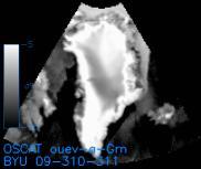
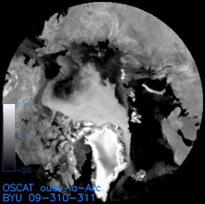
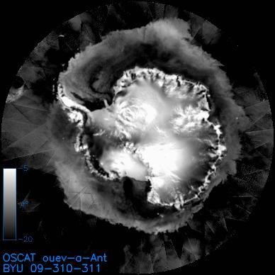
26 OSCAT Enhanced Resolution Antarctic Image Enhanced resolution OSCAT image, 2 Nov 2012 Selected major icebergs circled Daily tracking of icebergs using OSCAT data is continuing 25
27 BYU Summary David Long Paper on scatterometer calibration in Greenland accepted, IEEE Geoscience and Remote Sensing Letters Paper on OSCAT spatial response function estimation accepted, IEEE Trans. Geoscience and Remote Sensing Beta version OSCAT land, ice, & UHR wind processing running at BYU Have processed entire OSCAT data set available to images: Regularly extracting and reporting iceberg positions from OSCAT image data in Near Real Time (NRT) Enhanced resolution ASCAT1/2 and OSCAT UHR hurricane and NRT polar ice processing BYU code ported to NOAA. Installed and in use. 26
The Ice Contamination Ratio Method: Accurately Retrieving Ocean Winds Closer to the Sea Ice Edge While Eliminating Ice Winds
 The Ice Contamination Ratio Method: Accurately Retrieving Ocean Winds Closer to the Sea Ice Edge While Eliminating Ice Winds David Long Department of Electrical and Computer Engineering Brigham Young University
QuikScat/Seawinds Sigma-0 Radiometric and Location Accuracy Requirements for Land/Ice Applications
 Brigham Young University Department of Electrical and Computer Engineering 459 Clyde Building Provo, Utah 84602 QuikScat/Seawinds Sigma-0 Radiometric and Location Accuracy Requirements for Land/Ice Applications
High resolution wind retrieval for SeaWinds
 High resolution wind retrieval for SeaWinds David G. Long and Jeremy B. Luke Brigham Young University, 459 Clyde Building, Provo, UT 84602, USA ABSTRACT The SeaWinds instrument on the QuikSCAT satellite
Reprocessed QuikSCAT (V04) Wind Vectors with Ku-2011 Geophysical Model Function
 Wind Vectors with Ku-2011 Geophysical Model Function") Reprocessed QuikSCAT (V04) Wind Vectors with Ku-2011 Geophysical Model Function Lucrezia Ricciardulli and Frank Wentz Introduction In April 2011, we reprocessed the QuikSCAT ocean wind vectors using a
Reprocessed QuikSCAT (V04) Wind Vectors with Ku-2011 Geophysical Model Function Lucrezia Ricciardulli and Frank Wentz Introduction In April 2011, we reprocessed the QuikSCAT ocean wind vectors using a
Validation of 12.5 km and Super-High Resolution (2-5 km)
") Coastal and Orographic Wind Analyses from High Resolution QuikSCAT and SeaWinds Measurements M.H. Freilich, COAS/OSU D.B. Chelton, COAS/OSU D.G. Long, BYU Clive Dorman, SIO Barry Vanhoff, COAS/OSU OVWST
Coastal and Orographic Wind Analyses from High Resolution QuikSCAT and SeaWinds Measurements M.H. Freilich, COAS/OSU D.B. Chelton, COAS/OSU D.G. Long, BYU Clive Dorman, SIO Barry Vanhoff, COAS/OSU OVWST
ERS-1/2 Scatterometer new products: mission reprocessing and data quality improvement
 ERS-1/2 Scatterometer new products: mission reprocessing and data quality improvement Giovanna De Chiara (1), Raffaele Crapolicchio (1), Pascal Lecomte (2) (1) Serco SpA Via Sciadonna 22-24 Frascati (Roma),
Validation of 12.5 km Resolution Coastal Winds. Barry Vanhoff, COAS/OSU Funding by NASA/NOAA
 Validation of 12.5 km Resolution Coastal Winds Barry Vanhoff, COAS/OSU Funding by NASA/NOAA Outline Part 1: Determining empirical land mask Characterizing σ 0 near coast Part 2: Wind retrieval using new
THE SEAWINDS scatterometer was flown twice, once on
 IEEE TRANSACTIONS ON GEOSCIENCE AND REMOTE SENSING 1 Land-Contamination Compensation for QuikSCAT Near-Coastal Wind Retrieval Michael P. Owen and David G. Long, Fellow, IEEE Abstract The QuikSCAT scatterometer
Satellite information on ocean vector wind from Scatterometer data. Giovanna De Chiara
 Satellite information on ocean vector wind from Scatterometer data Giovanna De Chiara Why is Scatterometer important? The scatterometer measures the ocean surface winds (ocean wind vector). Ocean surface
Aquarius Sca+erometer Calibra3on
 Aquarius Sca+erometer Calibra3on Fore, A., Neumann, G., Freedman, A., Chaubell, M., Tang, W., Hayashi, A., and Yueh, S. 217 California Ins3tute of Technology, Government Sponsorship acknowledged Aquarius
SMAP Radiometer-Only Tropical Cyclone Size and Strength
 SMAP Radiometer-Only Tropical Cyclone Size and Strength Alexander Fore, Simon Yueh, Wenqing Tang, Bryan SCles, Akiko Hayashi Jet Propulsion Laboratory, California InsCtute of Technology 218 California
Development of SAR-Derived Ocean Surface Winds at NOAA/NESDIS
 Development of SAR-Derived Ocean Surface Winds at NOAA/NESDIS Pablo Clemente-Colón, William G. Pichel, NOAA/NESDIS Frank M. Monaldo, Donald R. Thompson The Johns Hopkins University Applied Physics Laboratory
A. Bentamy 1, S. A. Grodsky2, D.C. Fillon1, J.F. Piollé1 (1) Laboratoire d Océanographie Spatiale / IFREMER (2) Univ. Of Maryland
 Laboratoire d Océanographie Spatiale / IFREMER (2) Univ. Of Maryland") Calibration and Validation of Multi-Satellite scatterometer winds A. Bentamy 1, S. A. Grodsky2, D.C. Fillon1, J.F. Piollé1 (1) Laboratoire d Océanographie Spatiale / IFREMER (2) Univ. Of Maryland Topics
Calibration and Validation of Multi-Satellite scatterometer winds A. Bentamy 1, S. A. Grodsky2, D.C. Fillon1, J.F. Piollé1 (1) Laboratoire d Océanographie Spatiale / IFREMER (2) Univ. Of Maryland Topics
THE EFFECT OF RAIN ON ASCAT OBSERVATIONS OF THE SEA SURFACE RADAR CROSS SECTION USING SIMULTANEOUS 3-D NEXRAD RAIN MEASUREMENTS
 THE EFFECT OF RAIN ON ASCAT OBSERVATIONS OF THE SEA SURFACE RADAR CROSS SECTION USING SIMULTANEOUS 3-D NERAD RAIN MEASUREMENTS David E. Weissman Hofstra University Hempstead, New York 11549 Mark A. Bourassa
Global Ice and Land Climate Studies Using Scatterometer Image Data
 Global Ice and Land Climate Studies Using Scatterometer Image Data David G. Long Brigham Young University 459 Clyde Building Provo UT 84601 long@byu.edu Mark R. Drinkwater European Space Agency ESTEC,
On the Quality of HY-2A Scatterometer Winds
 On the Quality of HY-2A Scatterometer Winds W. Lin (ICM-CSIC) M. Portabella (ICM-CSIC) A. Stoffelen (KNMI) A. Verhoef (KNMI) Youguang Zhang (NSOAS) Mingsen Lin (NSOAS) Shuyan Lang (NSOAS) Juhong Zou (NSOAS)
CHANGE OF THE BRIGHTNESS TEMPERATURE IN THE MICROWAVE REGION DUE TO THE RELATIVE WIND DIRECTION
 JP4.12 CHANGE OF THE BRIGHTNESS TEMPERATURE IN THE MICROWAVE REGION DUE TO THE RELATIVE WIND DIRECTION Masanori Konda* Department of Geophysics, Graduate School of Science, Kyoto University, Japan Akira
Impact of the loss of QuikSCAT on National Hurricane Center operations: Current mitigation efforts and future plans
 Impact of the loss of QuikSCAT on National Hurricane Center operations: Current mitigation efforts and future plans Rick Danielson1 and Mike Brennan NOAA/NWS/NCEP National Hurricane Center 1 UCAR visiting
SENSOR SYNERGY OF ACTIVE AND PASSIVE MICROWAVE INSTRUMENTS FOR OBSERVATIONS OF MARINE SURFACE WINDS
 SENSOR SYNERGY OF ACTIVE AND PASSIVE MICROWAVE INSTRUMENTS FOR OBSERVATIONS OF MARINE SURFACE WINDS N. Ebuchi Institute of Low Temperature Science, Hokkaido University, N19-W8, Kita-ku, Sapporo 060-0819,
PRELIMINARY STUDY ON DEVELOPING AN L-BAND WIND RETRIEVAL MODEL FUNCTION USING ALOS/PALSAR
 PRELIMINARY STUDY ON DEVELOPING AN L-BAND WIND RETRIEVAL MODEL FUNCTION USING ALOS/PALSAR Osamu Isoguchi, Masanobu Shimada Earth Observation Research Center, Japan Aerospace Exploration Agency (JAXA) 2-1-1
ERGS are large expanses of sand in the desert. Aeolian
 1164 IEEE TRANSACTIONS ON GEOSCIENCE AND REMOTE SENSING, VOL. 45, NO. 5, MAY 2007 Spatial and Temporal Behavior of Microwave Backscatter Directional Modulation Over the Saharan Ergs Haroon Stephen, Member,
OCEAN vector winds from the SeaWinds instrument have
 IEEE GEOSCIENCE AND REMOTE SENSING LETTERS, VOL. 6, NO. 3, JULY 2009 413 Coastal Validation of Ultra-High Resolution Wind Vector Retrieval From QuikSCAT in the Gulf of Maine A. M. Plagge, Student Member,
TRMM TMI and AMSR-E Microwave SSTs
 TMI and AMSR-E Microwave SSTs Chelle Gentemann, Frank Wentz, & Peter Ashcroft Gentemann@remss.com www.remss.com TMI/AMSR-E MW SST algorithm development Validation Results Sensor Issues Useful for Climate
An algorithm for Sea Surface Wind Speed from MWR
 An algorithm for Sea Surface Wind Speed from MWR Carolina Tauro 1, Yazan Heyazin 2, María Marta Jacob 1, Linwood Jones 1 1 Comisión Nacional de Actividades Espaciales (CONAE) 2 Central Florida Remote Sensing
SIMON YUEH, WENQING TANG, ALEXANDER FORE, AND JULIAN CHAUBELL JPL-CALTECH, PASADENA, CA, USA GARY LAGERLOEF EARTH AND SPACE RESEARCH, SEATTLE, WA, US
 Applications of L-Band Scatterometry and Radiometry to Aquarius and SMAP SIMON YUEH, WENQING TANG, ALEXANDER FORE, AND JULIAN CHAUBELL JPL-CALTECH, PASADENA, CA, USA GARY LAGERLOEF EARTH AND SPACE RESEARCH,
Using several data sources for offshore wind resource assessment
 Author manuscript, published in ", Copenhagen : Denmark (2005)" Ben Ticha M. B., Ranchin T., Wald L., Using several data sources for offshore wind resource assessment, 2005, Using several data sources
Climate-Quality Intercalibration of Scatterometer Missions
 Climate-Quality Intercalibration of Scatterometer Missions Lucrezia Ricciardulli and Frank Wentz Remote Sensing Systems, Santa Rosa, California IOVWST meeting Sapporo, Japan, May 2016 Photo Courtesy: 1
SAR images and Polar Lows
 SAR images and Polar Lows Gunnar Noer, Birgitte Furevik, Johannes Röhrs Observing polar lows in 2012: AVHRR Polar orbiting satellite imagery Primary source of info Observations at cloud tops Synoptic observations
THE QUALITY OF THE ASCAT 12.5 KM WIND PRODUCT
 THE QUALITY OF THE ASCAT 12.5 KM WIND PRODUCT Jur Vogelzang, Ad Stoffelen, Maria Belmonte, Anton Verhoef, and Jeroen Verspeek Royal Netherlands Meteorological Institute, Wilhelminalaan 10, 3732 GK, De
Combining wind and rain in spaceborne scatterometer observations: modeling the splash effects in the sea surface backscattering coefficient
 Combining wind and rain in spaceborne scatterometer observations: modeling the splash effects in the sea surface backscattering coefficient F. Polverari (1,2,4), F. S. Marzano (1,2), L. Pulvirenti (3,1),
Wind Stress Working Group 2015 IOVWST Meeting Portland, OR
 Wind Stress Working Group 2015 IOVWST Meeting Portland, OR Summary of Research Topics, Objectives and Questions James B. Edson University of Connecticut SPURS Mooring, Farrar, WHOI Background Motivation
Monitoring Conditions Offshore with Satellites
 Downloaded from orbit.dtu.dk on: Dec 15, 2017 Monitoring Conditions Offshore with Satellites Karagali, Ioanna; Hasager, Charlotte Bay; Badger, Merete; Bingöl, Ferhat; Ejsing Jørgensen, Hans Publication
HIGH RESOLUTION WIND RETRIEVAL FOR SEAWINDS ON QUIKSCAT. Jeremy B. Luke. A thesis submitted to the faculty of. Brigham Young University
 HIGH RESOLUTION WIND RETRIEVAL FOR SEAWINDS ON QUIKSCAT by Jeremy B. Luke A thesis submitted to the faculty of Brigham Young University in partial fulfillment of the requirements for the degree of Master
Aquarius Wind Speed Retrievals and Implica6ons for SMAP Ocean Vector Winds
 Aquarius Wind Speed Retrievals and Implica6ons for SMAP Ocean Vector Winds Alex Fore, Simon Yueh, Wenqing Tang, Julian Chaubell, Gregory Neumann, Akiko Hayashi, and Adam Freedman 214 California Ins6tute
OAFlux: global, 0.25, daily
 Including ASCAT in OAFlux Global Vector Wind Analysis (1987 present) with programming support from Dr. Xiangze Jin July 1987 OAFlux: global, 0.25, daily QuikSCAT AMSRE SSMI (F08, F10, F11, F13, F14, F15,
Executive Summary of Accuracy for WINDCUBE 200S
 Executive Summary of Accuracy for WINDCUBE 200S The potential of offshore wind energy has gained significant interest due to consistent and strong winds, resulting in very high capacity factors compared
Advancements in scatterometer wind processing
 Advancements in scatterometer wind processing Ad.Stoffelen@knmi.nl Marcos Portabella Anton Verhoef Jeroen Verspeek Jur Vogelzang scat@knmi.nl www.knmi.nl/scatterometer Scatterometer work The scatterometer
RapidScat wind validation report
 Ocean and Sea Ice SAF Technical Note SAF/OSI/CDOP2/KNMI/TEC/RP/228 25 and 50 km wind products (OSI-109) Anton Verhoef, Jur Vogelzang and Ad Stoffelen KNMI Version 1.1 March 2015 DOCUMENTATION CHANGE RECORD
High Resolution Sea Surface Roughness and Wind Speed with Space Lidar (CALIPSO)
") High Resolution Sea Surface Roughness and Wind Speed with Space Lidar (CALIPSO) Yongxiang Hu NASA Langley Research Center Carl Weimer Ball Aerospace Corp. 1 CALIPSO Mission Overview CALIPSO seeks to improve
High Resolution Sea Surface Roughness and Wind Speed with Space Lidar (CALIPSO) Yongxiang Hu NASA Langley Research Center Carl Weimer Ball Aerospace Corp. 1 CALIPSO Mission Overview CALIPSO seeks to improve
SeaWinds wind Climate Data Record validation report
 Ocean and Sea Ice SAF Technical Note SAF/OSI/CDOP2/KNMI/TEC/RP/221 SeaWinds wind Climate Data Record validation report 25 and 50 km wind products (OSI-151) Anton Verhoef, Jur Vogelzang and Ad Stoffelen
Assimilation of Scatterometer Winds at Météo-France
 Assimilation of Scatterometer Winds at Météo-France Christophe Payan, Nathalie Boullot (1), Dominique Mékies (2) (1) CNRM and GAME, Météo-France and CNRS (2) LACy, La Réunion University, CNRS and Météo-France
Coastal Scatterometer Winds Working Group
 Coastal Scatterometer Winds Working Group IOVWST Meeting 2015 Portland, Oregon, USA Melanie Fewings Julia Figa Saldaña Bryan Stiles Steve Morey Dmitry Dukhovskoy Larry O Neill if you want to be added to
SEA SURFACE TEMPERATURE RETRIEVAL USING TRMM MICROWAVE IMAGER SATELLITE DATA IN THE SOUTH CHINA SEA
 SEA SURFACE TEMPERATURE RETRIEVAL USING TRMM MICROWAVE IMAGER SATELLITE DATA IN THE SOUTH CHINA SEA Mohd Ibrahim Seeni Mohd and Mohd Nadzri Md. Reba Faculty of Geoinformation Science and Engineering Universiti
ERS WAVE MISSION REPROCESSING- QC SUPPORT ENVISAT MISSION EXTENSION SUPPORT
 REPORT 8/2011 ISBN 978-82-7492-248-8 ISSN 1890-5218 ERS WAVE MISSION REPROCESSING- QC SUPPORT ENVISAT MISSION EXTENSION SUPPORT - Annual Report 2010 Author (s): Harald Johnsen (Norut), Fabrice Collard
Analyses of Scatterometer and SAR Data at the University of Hamburg
 Analyses of Scatterometer and SAR Data at the University of Hamburg Wind, Waves, Surface Films and Rain ГАДЕ, Мартин Хорстович (aka Martin Gade) Institut für Meereskunde, Universität Hamburg, Германия
The RSS WindSat Version 7 All-Weather Wind Vector Product
 2010 International Ocean Vector Winds Meeting Barcelona, Spain May 18 20, 2010 The RSS WindSat Version 7 All-Weather Wind Vector Product Thomas Meissner Lucrezia Ricciardulli Frank Wentz Outline 1. Overview:
ASCAT Level 2 Soil Moisture Reprocessing Phase 1 - Dataset Description
 ASCAT Level 2 Soil Moisture Reprocessing Phase 1 - Dataset Description Doc.No. : Issue : v3 Date : 4 November 2009 WBS : EUMETSAT Eumetsat-Allee 1, D-64295 Darmstadt, Germany Tel: +49 6151 807-7 Fax: +49
Constraining a global, eddying, ocean and sea ice model with scatterometer data
 Constraining a global, eddying, ocean and sea ice model with scatterometer data D. Menemenlis, H. Zhang, D. Moroni, and S. Hristova-Veleva IOVWST, Utrecht, Netherlands, 13 June 2012 QuikSCAT GRACE =? Jason
Synthetic Aperture Radar imaging of Polar Lows
 Oslo Polar Low workshop 21-22 May 2012 Extended abstract Synthetic Aperture Radar imaging of Polar Lows Birgitte Furevik, Gunnar Noer and Johannes Röhrs met.no Forecasting polar lows is to a large degree
EVALUATION OF ENVISAT ASAR WAVE MODE RETRIEVAL ALGORITHMS FOR SEA-STATE FORECASTING AND WAVE CLIMATE ASSESSMENT
 EVALUATION OF ENVISAT ASAR WAVE MODE RETRIEVAL ALGORITHMS FOR SEA-STATE FORECASTING AND WAVE CLIMATE ASSESSMENT F.J. Melger ARGOSS, P.O. Box 61, 8335 ZH Vollenhove, the Netherlands, Email: info@argoss.nl
Study of an Objective Performance Measure for Spaceborne Wind Sensors
 Final Report Study of an Objective Performance Measure for Spaceborne Wind Sensors Maria Belmonte Rivas Jos de Kloe Ad Stoffelen Weather Research Royal Netherlands Meteorological Institute De Bilt, November
Jackie May* Mark Bourassa. * Current affilitation: QinetiQ-NA
 Jackie May* Mark Bourassa * Current affilitation: QinetiQ-NA Background/Motivation In situ observations (ships and buoys) are used to validate satellite observations Problems with comparing data Sparseness
Geophysical Model Functions for the Retrieval of Ocean Surface Winds
 Geophysical Model Functions for the Retrieval of Ocean Surface Winds Donald R. Thompson and Frank M. Monaldo Johns Hopkins University Applied Physics Laboratory 11100 Johns Hopkins Road, Laurel, MD 20708
FULL-WAVEFORM INVERSION
 FULL-WAVEFORM INVERSION Overview & application to field data Mike Warner Imperial College London Topics Overview of full-waveform inversion Application to an OBC dataset Validation 2 Overview of FWI 3
First six months quality assessment of HY-2A SCAT wind products using in situ measurements
 Acta Oceanol. Sin., 2013, Vol. 32, No. 11, P. 27-33 DOI: 10.1007/s13131-013-0374-5 http://www.hyxb.org.cn E-mail: hyxbe@263.net First six months quality assessment of HY-2A SCAT wind products using in
Offshore wind resource mapping in Europe from satellites
 Offshore wind resource mapping in Europe from satellites Charlotte Bay Hasager Seminar at University of Auckland, Dept. of Physics 1 April 2015 Content DTU Wind Energy Offshore wind turbines New European
The Cross-Calibrated Multi-Platform (CCMP) Ocean Vector Wind Analysis (V2.0)
 Ocean Vector Wind Analysis (V2.0)") The Cross-Calibrated Multi-Platform (CCMP) Ocean Vector Wind Analysis (V2.0) Carl A. Mears, L. Ricciardulli, J. Scott and F. J. Wentz Remote Sensing Systems Ross Hoffman, S. Mark Leidner Robert Atlas Atmospheric
The Cross-Calibrated Multi-Platform (CCMP) Ocean Vector Wind Analysis (V2.0) Carl A. Mears, L. Ricciardulli, J. Scott and F. J. Wentz Remote Sensing Systems Ross Hoffman, S. Mark Leidner Robert Atlas Atmospheric
J4.2 AUTOMATED DETECTION OF GAP WIND AND OCEAN UPWELLING EVENTS IN CENTRAL AMERICAN GULF REGIONS
 J4.2 AUTOMATED DETECTION OF GAP WIND AND OCEAN UPWELLING EVENTS IN CENTRAL AMERICAN GULF REGIONS Xiang Li*, University of Alabama in Huntsville Huntsville, AL D. K. Smith Remote Sensing Systems Santa Rosa,
Modelled and observed winds in the Adriatic sea
 Modelled and observed winds in the Adriatic sea F. De Biasio, S.Zecchetto, A. della Valle ISAC-CNR Institute of Atmospheric Sciences and Climate Italian National Research Council http://www.esurge-venice.eu
Deborah K. Smith, Frank J. Wentz, and Carl A. Mears Remote Sensing Systems
 JP 4.9 RESULTS OF QUIKSCAT HIGH WIND DATA VALIDATION Deborah K. Smith, Frank J. Wentz, and Carl A. Mears Remote Sensing Systems ABSTRACT Traditional validation of satellite-derived winds includes comparison
Algorithm Theoretical Basis Document for the OSI SAF wind products. Ocean and Sea Ice SAF
 Algorithm Theoretical Basis Document for the OSI SAF wind products Ocean and Sea Ice SAF Version 1.0 August 2012 DOCUMENT SIGNATURE TABLE Prepared by : Name Date Signature O&SI SAF Project Aug 2012 Approved
MISR CMVs. Roger Davies and Aaron Herber Physics Department
 MISR CMVs Roger Davies and Aaron Herber Physics Department Acknowledgements: MISR Science and Data Processing Team (especially Catherine Moroney and Mike Garay) From the AGU Fall Meeting 2009 MISR and
Correction of the Effect of Relative Wind Direction on Wind Speed Derived by Advanced Microwave Scanning Radiometer
 Journal of Oceanography, Vol., pp. 39 to, Correction of the Effect of Relative Wind Direction on Wind Speed Derived by Advanced Microwave Scanning Radiometer MASANORI KONDA 1 *, AKIRA SHIBATA, NAOTO EBUCHI
IMPROVED OIL SLICK IDENTIFICATION USING CMOD5 MODEL FOR WIND SPEED EVALUATION ON SAR IMAGES
 IMPROVED OIL SLICK IDENTIFICATION USING CMOD5 MODEL FOR WIND SPEED EVALUATION ON SAR IMAGES H.KHENOUCHI & Y. SMARA University of Sciences and Technology Houari Boumediene (USTHB). Faculty of Electronics
Singularity analysis: A poweful technique for scatterometer wind data processing
 Singularity analysis: A poweful technique for scatterometer wind data processing M. Portabella (ICM-CSIC) W. Lin (ICM-CSIC) A. Stoffelen (KNMI) A. Turiel (ICM-CSIC) G. King (ICM-CSIC) A. Verhoef (KNMI)
Field assessment of ocean wind stress derived from active and passive microwave sensors
 Field assessment of ocean wind stress derived from active and passive microwave sensors Doug Vandemark, Marc Emond (UNH) Jim Edson (UCONN) Bertrand Chapron (IFREMER) Motivations Are there 1 st or 2 nd
IMPROVEMENTS IN THE USE OF SCATTEROMETER WINDS IN THE OPERATIONAL NWP SYSTEM AT METEO-FRANCE
 IMPROVEMENTS IN THE USE OF SCATTEROMETER WINDS IN THE OPERATIONAL NWP SYSTEM AT METEO-FRANCE Christophe Payan CNRM-GAME, Météo-France and CNRS, 42 avenue Gaspard Coriolis, Toulouse, France Abstract Significant
1 st Tidal and Water Level Working Group Meeting DHN, Niteroi, Brazil 31/03/09 02/04/09 Vertical Offshore Reference Framework (VORF) Chris Jones
 Chris Jones") 1 st Tidal and Water Level Working Group Meeting DHN, Niteroi, Brazil 31/03/09 02/04/09 Vertical Offshore Reference Framework (VORF) Chris Jones United Kingdom Hydrographic Office Presentation Structure
1 st Tidal and Water Level Working Group Meeting DHN, Niteroi, Brazil 31/03/09 02/04/09 Vertical Offshore Reference Framework (VORF) Chris Jones United Kingdom Hydrographic Office Presentation Structure
Sentinel-1A Ocean Level-2 Products Validation Strategy
 Sentinel-1A Ocean Level-2 Products Validation Strategy Sentinel-1 Mission Performance Centre ESL L2 Team and Ocean Data Lab G.Hajduch (1), A.Mouche (2), P.Vincent (1), R.Husson (1), H.Johnsen (3), F.Collard
SPATIAL AND TEMPORAL VARIATIONS OF INTERNAL WAVES IN THE NORTHERN SOUTH CHINA SEA
 SPATIAL AND TEMPORAL VARIATIONS OF INTERNAL WAVES IN THE NORTHERN SOUTH CHINA SEA Weigen Huang (1), Johnny Johannessen (2,3), Werner Alpers (4) Jingsong Yang (1), Xilin Gan (1) (1) Second Institute of
Satellite Observations of Equatorial Planetary Boundary Layer Wind Shear
 Satellite Observations of Equatorial Planetary Boundary Layer Wind Shear David Halpern and Michael Garay NASA / California Institute of Technology Jet Propulsion Laboratory Pasadena, California, USA Thanks
Remote sensing standards: their current status and significance for offshore projects
 Remote sensing standards: their current status and significance for offshore projects Peter J M Clive Technical Development Consultant SgurrEnergy Ltd 225 Bath Street Glasgow G2 4GZ E: peter.clive@sgurrenergy.com
A New Method for Suomi-NPP VIIRS Day Night Band (DNB) On-Orbit Radiometric Calibration
 On-Orbit Radiometric Calibration") A New Method for Suomi-NPP VIIRS Day Night Band (DNB) On-Orbit Radiometric Calibration Shihyan Lee, Jeff McIntire, Tom Schwarting and Hassan Oudrari, and Jack Xiong NASA VIIRS Characterization and Support
A New Method for Suomi-NPP VIIRS Day Night Band (DNB) On-Orbit Radiometric Calibration Shihyan Lee, Jeff McIntire, Tom Schwarting and Hassan Oudrari, and Jack Xiong NASA VIIRS Characterization and Support
ON THE USE OF DOPPLER SHIFT FOR SAR WIND RETRIEVAL
 ON THE USE OF DOPPLER SHIFT FOR SAR WIND RETRIEVAL K-F. Dagestad 1, A. Mouche 2, F. Collard 2, M. W. Hansen 1 and J. Johannessen 1 (1) Nansen Environmental and Remote Censing Center, Thormohlens gt 47,
Updates of Aquarius CAP Ocean Surface Salinity and Wind Retrieval Algorithm
 Updates of Aquarius CAP Ocean Surface Salinity and Wind Retrieval Algorithm SIMON YUEH, WENQING TANG, ALEXANDER FORE, AKIKO HAYASHI November 14, 2013 Outline Introduction CAP V3.0 Flow Antenna Pattern
Scatterometer-Based Assessment of 10-m Wind Analyses from the Operational ECMWF and NCEP Numerical Weather Prediction Models
 FEBRUARY 2005 C H E L T O N A N D F R E I L I C H 409 Scatterometer-Based Assessment of 10-m Wind Analyses from the Operational ECMWF and NCEP Numerical Weather Prediction Models DUDLEY B. CHELTON AND
Global Wind Speed Retrieval From SAR
 IEEE TRANSACTIONS ON GEOSCIENCE AND REMOTE SENSING, VOL. 41, NO. 10, OCTOBER 2003 2277 Global Wind Speed Retrieval From SAR Jochen Horstmann, Helmut Schiller, Johannes Schulz-Stellenfleth, and Susanne
Statistics of wind and wind power over the Mediterranean Sea
 Conférence Méditerranéenne Côtière et Maritime EDITION 2, TANGER, MAROC (2011) Coastal and Maritime Mediterranean Conference Disponible en ligne http://www.paralia.fr Available online Statistics of wind
Cryosphere Applications of NSCAT Data
 Cryosphere Applications of NSCAT Data David G. Long, Senior Member IEEE Electrical and Computer Engineering Dept. Brigham Young University, Provo, Utah 84602 long@ee.byu.edu (801) 378-4383 fax: (801) 378-6586
JET PROPULSION LABORATORY INTEROFFICE MEMORANDUM
 JET PROPULSION LABORATORY INTEROFFICE MEMORANDUM 3348-99-008 June 16, 1999 To: From: CC: Subject: Philip S. Callahan Young-Joon Kim SAPIENT, SVT Validation of the NOAA Processor through a comparison with
Algorithm Theoretical Basis Document for the OSI SAF wind products
 Algorithm Theoretical Basis Document for the OSI SAF wind products All scatterometer wind products in the ranges OSI-100 to OSI-113 and OSI-150 to OSI-159 Version: 1.6 Date: 15/05/2018 Ocean and Sea Ice
ANALYSIS OF TIME-SERIES BACKSCATTER OF ERS-2 C-BAND SCATTEROMETER OVER THE THAR DESERT IN INDIA
 ANALYSIS OF TIME-SERIES BACKSCATTER OF ERS-2 C-BAND SCATTEROMETER OVER THE THAR DESERT IN INDIA C. P. Singh a, D. G. Trivedi b, Shiv Mohan a *, Ajai a a Environment, Forestry and Microwave Applications
Vika Grigorieva and Sergey Gulev. Sea Atmosphere Interaction And Climate Laboratory P. P. Shirshov Institute of Oceanology, Russia
 Global Ocean Wave Statistics from VOS: a new dataset and associated Atlas Vika Grigorieva and Sergey Gulev Sea Atmosphere Interaction And Climate Laboratory P. P. Shirshov Institute of Oceanology, Russia
Mesoscale air-sea interaction and feedback in the western Arabian Sea
 Mesoscale air-sea interaction and feedback in the western Arabian Sea Hyodae Seo (Univ. of Hawaii) Raghu Murtugudde (UMD) Markus Jochum (NCAR) Art Miller (SIO) AMS Air-Sea Interaction Workshop Phoenix,
Polar Activities at DLR Maritime Security Lab Bremen in the Projects EISTAK and EMS
 Polar Activities at DLR Maritime Security Lab Bremen in the Projects EISTAK and EMS Susanne Lehner, Anja Frost, Rudolf Ressel German Aerospace Center Chart 2 Maritime Security Lab in Bremen German Aerospace
Azimuthal variations of X-band medium grazing angle sea clutter
 Azimuthal variations of X-band medium grazing angle sea clutter Z. Guerraou (1), S. Angelliaume (1), C.-A. Guérin (2) and L. Rosenberg (3) (1) : ONERA, the French Aerospace Lab France (2) : University
Assessment and Analysis of QuikSCAT Vector Wind Products for the Gulf of Mexico: A Long-Term and Hurricane Analysis
 Sensors 2008, 8, 1927-1949 sensors ISSN 1424-8220 2008 by MDPI www.mdpi.org/sensors Full Research Paper Assessment and Analysis of QuikSCAT Vector Wind Products for the Gulf of Mexico: A Long-Term and
Torrild - WindSIM Case study
 Torrild - WindSIM Case study Note: This study differs from the other case studies in format, while here another model; WindSIM is tested as alternative to the WAsP model. Therefore this case should be
Understanding How the Appearance of Optical Fiber Splices Relates to Splice Quality
 Understanding How the Appearance of Optical Fiber Splices Relates to Splice Quality Douglas Duke & David Mansperger Fusion Splicing Systems, AFL, Duncan, SC Doug.Duke@AFLglobal.com David.Mansperger@AFLglobal.com
Introduction EU-Norsewind
 Satellite winds in EU-Norsewind Charlotte Bay Hasager, Risø DTU, Denmark Alexis Mouche, CLS, France Merete Badger, Poul Astrup & Morten Nielsen, Risø DTU, Denmark Romain Husson, ESA Introduction EU-Norsewind
Intersatellite Calibrated HIRS Upper Tropospheric Water Vapor
 Intersatellite Calibrated HIRS Upper Tropospheric Water Vapor Lei Shi and John J. Bates NOAA National Climatic Data Center Asheville, North Carolina, U.S.A. 1 NOAA National Climatic Data Center ITSC-XVI
WP5 South African Extreme Wind Atlas (WASA)
") WP5 South African Extreme Wind Atlas (WASA) A Kruger South African Weather Service X Larsén DTU Wind Energy 1 Wind Atlas for South Africa project Why do we need extreme wind statistics? Origins of strong
WP5 South African Extreme Wind Atlas (WASA) A Kruger South African Weather Service X Larsén DTU Wind Energy 1 Wind Atlas for South Africa project Why do we need extreme wind statistics? Origins of strong
Current Progress in Ku-Band Model Functions
 Brigham Young University Department of Electrical and Computer Engineering 459 Clyde Building Provo, Utah 84602 Current Progress in Ku-Band Model Functions NSCAT Science Working Team Subcommittee on Model
Walker Circulation and El Niño / La Niña Sea Surface Temperature, Rainfall, and Zonal Wind
 Walker Circulation and El Niño / La Niña Sea Surface Temperature, Rainfall, and Zonal Wind David Halpern NASA / California Institute of Technology Jet Propulsion Laboratory Pasadena, CA 91109, USA Contents
Oceans and the Global Environment: Lec 2 taking physics and chemistry outdoors. the flowing, waving ocean
 Oceans and the Global Environment: Lec 2 taking physics and chemistry outdoors the flowing, waving ocean Peter Rhines 1 Eric Lindahl 2 Bob Koon 2, Julie Wright 3 www.ocean.washington.edu/courses/has221a-08
OBSERVATION OF HURRICANE WINDS USING SYNTHETIC APERTURE RADAR
 OBSERVATION OF HURRICANE WINDS USING SYNTHETIC APERTURE RADAR Jochen Horstmann 1, Wolfgang Koch 1,DonaldR.Thompson 2, and Hans C. Graber 3 1 Institute for Coastal Research, GKSS Research Center, Geesthacht,
Challenges in determining water surface in airborne LiDAR topobathymetry. Amar Nayegandhi, Dewberry 15 th Annual JALBTCX Workshop, June 11 th 2014
 Challenges in determining water surface in airborne LiDAR topobathymetry Amar Nayegandhi, Dewberry 15 th Annual JALBTCX Workshop, June 11 th 2014 Why topobathy LiDAR? Complements acoustic (multi-beam sonar)
Windcube FCR measurements
 Windcube FCR measurements Principles, performance and recommendations for use of the Flow Complexity Recognition (FCR) algorithm for the Windcube ground-based Lidar Summary: As with any remote sensor,
Aquarius / SMAP Ocean Roughness and SSS
 Aquarius / SMAP Ocean Roughness and SSS Alex Fore, Simon Yueh, Wenqing Tang, Akiko Hayashi L2B and L3 data are available at: h2p://ourocean.jpl.nasa.gov 216 California InsItute of Technology, Government
WindSat Applications for Weather Forecasters and Data Assimilation
 WindSat Applications for Weather Forecasters and Data Assimilation Thomas Lee, James Goerss, Jeffrey Hawkins, Joseph Turk Naval Research Laboratory 7 Grace Hopper Avenue Monterey CA Zorana Jelenak, Paul