Polar Activities at DLR Maritime Security Lab Bremen in the Projects EISTAK and EMS
|
|
|
- Claud Hodges
- 5 years ago
- Views:
Transcription
1 Polar Activities at DLR Maritime Security Lab Bremen in the Projects EISTAK and EMS Susanne Lehner, Anja Frost, Rudolf Ressel German Aerospace Center


2 Chart 2 Maritime Security Lab in Bremen German Aerospace Center Main activities develop and operate near real time services using SAR data Wind and sea state monitoring Oil spill detection Ship and wake detection TerraSAR-X Sentinel1 Iceberg detection Ice classification Support campaigns
3 Chart 3 Support campaigns Polarstern campaign in Antarctica Polarstern campaign in Antarctica Assist the Australian Maritime Safety Authority during the accident of the research vessel Akademik Shokalskiy in Antarctica Lance campaign off the Svalbard coast, Arctic Ocean Oden cruise at the marginal ice zone in Beaufort Sea, Arctic Ocean


4 DLR.de Chart 4 Maritime Security Labs Bremen and Neustrelitz - EOC s NRT Services provided by Neustrelitz - EOC is operating an international Ground Station Network for the reception of satellite data


5 Chart 5 Outline TerraSAR-X imaging modes and NRT iceberg detection Ice type classification Analysis of a TerraSAR-X image taken from the trapped Akademik Shokalskiy Algorithm for ice type classification Test results Conclusions source: guardianlv.com
6 Chart 6 First Tests on Near Real Time Ice Type Classification in Antarctica Anja Frost 18th July 2014 TerraSAR-X image acquisition in different modes Spotlight swath width: 10 km resolution: 1 m Stripmap swath width: 30 km resolution: 3 m ScanSAR swath width: 100 km resolution: 17 m Wide ScanSAR swath width: 200 km resolution: 34 m

7 Chart 7 First Tests on Near Real Time Ice Type Classification in Antarctica Anja Frost 18th July 2014 TerraSAR-X image acquisition in different modes Spotlight swath width: 10 km resolution: 1 m Stripmap swath width: 30 km resolution: 3 m ScanSAR swath width: 100 km resolution: 17 m Wide ScanSAR swath width: 200 km resolution: 34 m The minimum size of icebergs to be detected depends on the resolution. Stripmap mode ScanSAR WideScanSAR Bergy bits Small icebergs Medium icebergs

8 Iceberg detection within 20 minutes Section of a TerraSAR-X Stripmap image Disko Bay 23rd April km

9 Iceberg detection within 20 minutes Section of a TerraSAR-X ScanSAR image Grand Banks 26th June 2014 Thanks to Airbus 3 km
10 Chart 10 First Tests on Near Real Time Ice Type Classification in Antarctica Anja Frost 18th July 2014 Outline TerraSAR-X imaging modes and NRT iceberg detection Ice type classification Analysis of a TerraSAR-X image taken from the trapped Akademik Shokalskiy Algorithm for ice type classification Test results Conclusions source: guardianlv.com
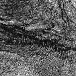
11 Chart 11 First Tests on Near Real Time Ice Type Classification in Antarctica Anja Frost 18th July 2014 Analysis of a TerraSAR-X image recorded on 30 th December 2013 ScanSAR ascending incidence angle HH polarisation 10 km


12 Chart 12 First Tests on Near Real Time Ice Type Classification in Antarctica Anja Frost 18th July 2014 Analysis of a TerraSAR-X image recorded on 30 th December 2013 ScanSAR ascending incidence angle HH polarisation Xue Long Akademik Shokalskiy 10 km
13 Chart 13 First Tests on Near Real Time Ice Type Classification in Antarctica Anja Frost 18th July 2014 Analysis of a TerraSAR-X image recorded on 30 th December 2013 ScanSAR ascending incidence angle HH polarisation Xue Long Akademik Shokalskiy 10 km fast ice pack ice ice edge open water
14 Chart 14 First Tests on Near Real Time Ice Type Classification in Antarctica Anja Frost 18th July 2014 Outline TerraSAR-X imaging modes and NRT iceberg detection Ice type classification Analysis of a TerraSAR-X image taken from the trapped Akademik Shokalskiy Algorithm for ice type classification Test results Conclusions source: guardianlv.com

15 Chart 15 First Tests on Near Real Time Ice Type Classification in Antarctica Anja Frost 18th July 2014 Ice type classification TerraSAR-X image (ScanSAR) Aim: Classify the ice in near real time Main steps of the algorithm: 1. Select texture features describing the most significant properties of different structures in ice e.g. GLCM features, Markov random fields, wavelet based features [1][2][3] [5] 2. Feed the features into a neural network [4] texture extraction feature a feature b feature c neural network 20 km ice chart [1] Bogdanov et al., 2005 [2] Clausi, 2001 [3] Zakhvatkina et al., 2013 [4] Nissen, 2003 [5] Lehner et al., IAHR 2014

16 Chart 16 First Tests on Near Real Time Ice Type Classification in Antarctica Anja Frost 18th July 2014 Ice type classification TerraSAR-X image (ScanSAR) Aim: Classify the ice in near real time Main steps of the algorithm: 1. Select texture features mean value, entropy and homogeneity texture features 20 km based on σ 0 -values of all the pixels in a limited window based on the frequency distribution of σ 0 -values of two neigboured pixels mean value entropy homogeneity
17 Chart 17 First Tests on Near Real Time Ice Type Classification in Antarctica Anja Frost 18th July 2014 Ice type classification TerraSAR-X image (ScanSAR) Aim: Classify the ice in near real time Main steps of the algorithm: 1. Select texture features mean value, entropy and homogeneity 2. Feed the features into a neural network 10 input neurons two hidden layers with 8 and 9 neurons feature a texture extraction feature b neural network 20 km feature c fast ice First year thick ice First year ice open water with <1/10 ice of unspecified SoD open water unknown


18 Chart 18 First Tests on Near Real Time Ice Type Classification in Antarctica Anja Frost 18th July th December 2013 Xue Long 9 th January km 5 km Akademik Shokalskiy


19 Chart 19 First Tests on Near Real Time Ice Type Classification in Antarctica Anja Frost 18th July 2014 Lance campaign TSX acquisitions during Lance campaign off the Svalbard coast

20 Chart 20 Lance campaign 20 km :09 UTC Photo: 05:10 UTC RV Lance (course: W)


21 Chart 21 Lance campaign 20 km :09 UTC 3:25 3:30 Photo: 03:33 UTC 4:00

22 Chart 22 Lance campaign 20 km :09 UTC Photo: 04:34 UTC 5:10 4:36

 Young ice")
23 Chart 23 Classification Result for 2014/03/20, 05:10 Ice classification Open Water (<1/10 ice of unspecified SoD) Young ice First year ice Land
 Young ice First year ice")
24 Chart 24 Comparison with modelling result Ice classification Open Water (<1/10 ice of unspecified SoD) Young ice First year ice Land
25 Chart 25 Comparison with AMSR2 based ice concentration charts of 2014/03/20 Ice classification Open Water (<1/10 ice of unspecified SoD) Young ice First year ice Land Source: University of Bremen, IUP
26 DLR.de Chart 26 > Björn Tings Oceanography on Sentinel-1 > SENTINEL 1, ice types, icebergs Antarktis W110 S75 S1A_IW_GRDH_1SDH_ T092719_ T092744_000445_000535_4DCF 20km


27 DLR.de Chart 27 > Björn Tings Oceanography on Sentinel-1 > ice types, icebergs S1A_IW_GRDH_1SDH_ T092719_ T092744_000445_000535_4DCF

28 DLR.de Chart 28 > Björn Tings Oceanography on Sentinel-1 > ice types, icebergs Anja Frost, DLR Bremen S1A_IW_GRDH_1SDH_ T092719_ T092744_000445_000535_4DCF
29 Chart 29 First Tests on Near Real Time Ice Type Classification in Antarctica Anja Frost 18th July 2014 Outline TerraSAR-X imaging modes and NRT iceberg detection Ice type classification Analysis of a TerraSAR-X image taken from the trapped Akademik Shokalskiy Algorithm for ice type classification Test results Conclusions source: guardianlv.com
 different structures in ice are")


30 Chart 30 Summary and Conclusions TerraSAR-X based ice type products have been delivered to ships By the selection of significant texture features (particularly GLCM features) different structures in ice are revealed. A neural network performs the classification. Iceberg Detection Service Established Product Delivery in NRT about 15 min - provide a new NRT service for ship routing in ice infested areas using ice products - participate in validation campaigns - Use SAR multisensor products - Use Meteo Marine Parameters, e.g., sea state as well in ice generated ice chart observed ice situation (manual interpretation) 20 km 20 km

31 DLR.de Chart 31 > Björn Tings Oceanography on Sentinel-1 > ice types glacier Greenland S1A_EW_GRDH_1SDH_ T085100_ T085200_002663_002F72_97D0 50km


32 DLR.de Folie 32 Kathrin Höppner > 15th IICWG Meeting > October 20-25, 2014 > Punta Arenas, Chile Campaign support for Chile and Brazil Example: Support of Chilean vessel Aquiles in January 09-17, 2014 Course from Punta Arenas to O Higgins Station and Mendel Station TSX sequence shows changes of the ice situation at the tip of the Antarctic Peninsula / 0831 UTC O Higgins Station Mendel Station TerraSAR-X Akquisition Low Resolution Quicklook ScanSAR mode
33 Chart 33 First Tests on Near Real Time Ice Type Classification in Antarctica Anja Frost 18th July 2014 Ice type classification TerraSAR-X image (ScanSAR) Aim: Classify the ice in near real time Main steps of the algorithm: 1. Select texture features mean value, entropy and homogeneity based on σ 0 -values of all the pixels in a limited window based on the frequency distribution of σ 0 -values of two neigboured pixels km frequency h window size 11 x 11 pixels σ 0,left
34 Chart 34 First Tests on Near Real Time Ice Type Classification in Antarctica Anja Frost 18th July 2014 Ice type classification TerraSAR-X image (ScanSAR) Aim: Classify the ice in near real time Main steps of the algorithm: 1. Select texture features mean value, entropy and homogeneity based on σ 0 -values of all the pixels in a limited window based on the frequency distribution of σ 0 -values of two neigboured pixels entropy = homogeneity = h(a,b) log(h(a,b)) a,b a,b h(a,b) 1+ a-b ² 20 km frequency h frequency h σ 0,left σ 0,left


35 > Lecture > Author Document > Date DLR.de Chart 35 MIZ recovery cruise (Norseman, Sep/Oct 2014) Sep, 26, 2014,16:58, TSX Stripmap VV


")


36 > Lecture > Author Document > Date DLR.de Chart 36 Oden Cruise (summer 2014) Sep, 20, 2014, TSX Stripmap, VV Aug, 23, 2014, TSX Stripmap, VV


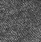
37 > Lecture > Author Document > Date DLR.de Chart 37 Support campaign Ice classification Pack ice Open water Precampaign analysis: Time series Svalbard, April 2013
38 StripMap Point Barrow 50m 62m

39 Section of a TerraSAR-X Stripmap image Disko Bay 23rd April 2013 Iceberg detection within 20 minutes 2 km

40 Section of a TerraSAR-X Stripmap image Disko Bay 23rd April 2013 Statistical analysis on individual icebergs 2 km

41 Section of a TerraSAR-X Stripmap image Disko Bay 23rd April 2013 Statistical analysis on iceberg frequency throughout Disko Bay frequency iceberg size [m] 2 km
HIGH RESOLUTION WIND AND WAVE MEASUREMENTS FROM TerraSAR-X IN COMPARISON TO MARINE FORECAST
 SAR Maritime Applications German Aerospace Center (DLR) Remote Sensing Technology Institute Maritime Security Lab HIGH RESOLUTION WIND AND WAVE MEASUREMENTS FROM TerraSAR-X IN COMPARISON TO MARINE FORECAST
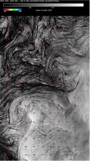
Analyses of Scatterometer and SAR Data at the University of Hamburg
 Analyses of Scatterometer and SAR Data at the University of Hamburg Wind, Waves, Surface Films and Rain ГАДЕ, Мартин Хорстович (aka Martin Gade) Institut für Meereskunde, Universität Hamburg, Германия
First studies with the high-resolution coupled wave current model CWAM and other aspects of the project Sea State Monitor
 First studies with the high-resolution coupled wave current model CWAM and other aspects of the project Sea State Monitor Jens Kieser, Thomas Bruns German Meteorological Service (Deutscher Wetterdienst,
The Ice Contamination Ratio Method: Accurately Retrieving Ocean Winds Closer to the Sea Ice Edge While Eliminating Ice Winds
 The Ice Contamination Ratio Method: Accurately Retrieving Ocean Winds Closer to the Sea Ice Edge While Eliminating Ice Winds David Long Department of Electrical and Computer Engineering Brigham Young University
On the assimilation of SAR wave spectra of S-1A in the wave model MFWAM
 On the assimilation of SAR wave spectra of S-1A in the wave model MFWAM Lotfi Aouf and Alice Dalphinet Météo-France, Département Marine et Océanographie,Toulouse 14 th wave forecasting and hindcasting,
Geophysical Model Functions for the Retrieval of Ocean Surface Winds
 Geophysical Model Functions for the Retrieval of Ocean Surface Winds Donald R. Thompson and Frank M. Monaldo Johns Hopkins University Applied Physics Laboratory 11100 Johns Hopkins Road, Laurel, MD 20708
ERS WAVE MISSION REPROCESSING- QC SUPPORT ENVISAT MISSION EXTENSION SUPPORT
 REPORT 8/2011 ISBN 978-82-7492-248-8 ISSN 1890-5218 ERS WAVE MISSION REPROCESSING- QC SUPPORT ENVISAT MISSION EXTENSION SUPPORT - Annual Report 2010 Author (s): Harald Johnsen (Norut), Fabrice Collard
Sentinel-1A Ocean Level-2 Products Validation Strategy
 Sentinel-1A Ocean Level-2 Products Validation Strategy Sentinel-1 Mission Performance Centre ESL L2 Team and Ocean Data Lab G.Hajduch (1), A.Mouche (2), P.Vincent (1), R.Husson (1), H.Johnsen (3), F.Collard
Flow separation and lee-waves in the marine atmosphere
 Flow separation and lee-waves in the marine atmosphere Det norske Videnskabs-Akademi 16 Oct. 2009 Bjørn Gjevik Universitetet i Oslo epost: bjorng@math.uio.no Flow separation and lee-waves in the marine
SAR images and Polar Lows
 SAR images and Polar Lows Gunnar Noer, Birgitte Furevik, Johannes Röhrs Observing polar lows in 2012: AVHRR Polar orbiting satellite imagery Primary source of info Observations at cloud tops Synoptic observations
Cross-Calibrating OSCAT Land Sigma-0 to Extend the QuikSCAT Land Sigma-0 Climate Record
 Cross-Calibrating OSCAT Land Sigma-0 to Extend the QuikSCAT Land Sigma-0 Climate Record David G. Long Department of Electrical and Computer Engineering Brigham Young University May 2013 0 Scatterometer
IMPROVED OIL SLICK IDENTIFICATION USING CMOD5 MODEL FOR WIND SPEED EVALUATION ON SAR IMAGES
 IMPROVED OIL SLICK IDENTIFICATION USING CMOD5 MODEL FOR WIND SPEED EVALUATION ON SAR IMAGES H.KHENOUCHI & Y. SMARA University of Sciences and Technology Houari Boumediene (USTHB). Faculty of Electronics
Development of SAR-Derived Ocean Surface Winds at NOAA/NESDIS
 Development of SAR-Derived Ocean Surface Winds at NOAA/NESDIS Pablo Clemente-Colón, William G. Pichel, NOAA/NESDIS Frank M. Monaldo, Donald R. Thompson The Johns Hopkins University Applied Physics Laboratory
RAPid Image Exploitation Resource (RAPIER ) Ship Detection System
 Ship Detection System") RAPid Image Exploitation Resource (RAPIER ) Ship Detection System Heidi L. Buck Head, Advanced Analysis Systems, Code 56220 SPAWAR Systems Center, Pacific Phone: 619-553-6626 NIPR: heidi.buck@navy.mil
RAPid Image Exploitation Resource (RAPIER ) Ship Detection System Heidi L. Buck Head, Advanced Analysis Systems, Code 56220 SPAWAR Systems Center, Pacific Phone: 619-553-6626 NIPR: heidi.buck@navy.mil
DEVELOPMENT OF A MANDATORY CODE FOR SHIPS OPERATING IN POLAR WATERS. Polar Waters Operating Manual. Submitted by Cruise Lines International (CLIA)
") E SUB-COMMITTEE ON SHIP DESIGN AND EQUIPMENT 57th session Agenda item 11 DE 57/11/22 25 January 2013 Original: ENGLISH DEVELOPMENT OF A MANDATORY CODE FOR SHIPS OPERATING IN POLAR WATERS Polar Waters Operating
E SUB-COMMITTEE ON SHIP DESIGN AND EQUIPMENT 57th session Agenda item 11 DE 57/11/22 25 January 2013 Original: ENGLISH DEVELOPMENT OF A MANDATORY CODE FOR SHIPS OPERATING IN POLAR WATERS Polar Waters Operating
ECO 40 is a CLASS 40 Main dimensions of the boat
 11 marzo 2015 I condizionamenti dell ambiente sulla performance sportiva: come si vince un Olimpiade Aula Magna - Politecnico di Torino Corso Duca degli Abruzzi 24 ROMA OCEAN WORLD Paolo DE GIROLAMO -
Using Satellite Spectral Wave Data for Wave Energy Resource Characterization
 Using Satellite Spectral Wave Data for Wave Energy Resource Characterization M. T. ontes 1,2, M. Bruck 3, S. Lehener 3, A. Kabuth 1,4 1 LNEG Estrada do aço do Lumiar 1649-038 Lisboa, ortugal teresa.pontes@lneg.pt
The RSS WindSat Version 7 All-Weather Wind Vector Product
 2010 International Ocean Vector Winds Meeting Barcelona, Spain May 18 20, 2010 The RSS WindSat Version 7 All-Weather Wind Vector Product Thomas Meissner Lucrezia Ricciardulli Frank Wentz Outline 1. Overview:
High Resolution Sea Surface Roughness and Wind Speed with Space Lidar (CALIPSO)
") High Resolution Sea Surface Roughness and Wind Speed with Space Lidar (CALIPSO) Yongxiang Hu NASA Langley Research Center Carl Weimer Ball Aerospace Corp. 1 CALIPSO Mission Overview CALIPSO seeks to improve
High Resolution Sea Surface Roughness and Wind Speed with Space Lidar (CALIPSO) Yongxiang Hu NASA Langley Research Center Carl Weimer Ball Aerospace Corp. 1 CALIPSO Mission Overview CALIPSO seeks to improve
IMPROVED BAYESIAN WIND VECTOR RETRIEVAL SCHEME USING ENVISAT ASAR DATA: PRINCIPLES AND VALIDATION RESULTS
 IMPROVED BAYESIAN WIND VECTOR RETRIEVAL SCHEME USING ENVISAT ASAR DATA: PRINCIPLES AND VALIDATION RESULTS Vincent Kerbaol (1), and the SAR Ocean Wind, Waves and Currents Team (1) BOOST Technologies, 115
Version 1.0 ICE CHART COLOUR CODE STANDARD. WMO/TD-No Originally Published 2004 Version 1 May JCOMM Technical Report No.
 WORLD METEOROLOGICAL ORGANIZATION INTERGOVERNMENTAL OCEANOGRAPHIC COMMISSION (OF UNESCO) ICE CHART COLOUR CODE STANDARD Version 1.0 WMO/TD-No. 1215 Originally Published 2004 Version 1 May 2014 JCOMM Technical
Floats in Polar Oceans. Olaf Boebel and Eberhard Fahrbach, AWI-Bremerhaven, Germany
 Floats in Polar Oceans Olaf Boebel and Eberhard Fahrbach, AWI-Bremerhaven, Germany Floats in Polar Oceans: Strategy Development of a system for bipolar use in the Antarctic because of easier conditions:
Comparison of the Dispersant Mission Planner 2 (DMP2) and Estimated Dispersant System Potential (EDSP) Calculators
 and Estimated Dispersant System Potential (EDSP) Calculators") Comparison of the Dispersant Mission Planner 2 (DMP2) and Estimated Dispersant System Potential (EDSP) Calculators The DMP2 was developed by Genwest Systems, Inc. in 2006 for the NOAA Office of Response
Comparison of the Dispersant Mission Planner 2 (DMP2) and Estimated Dispersant System Potential (EDSP) Calculators The DMP2 was developed by Genwest Systems, Inc. in 2006 for the NOAA Office of Response
The Sea surface KInematics Multiscale (SKIM)
") The Sea surface KInematics Multiscale () proposal for ESA EE9 the team : https://www.facebook.com/4ee9 http://tinyurl.com/onrg http://www.umr-lops.fr/projets/projets-actifs/ 14 years of Doppler oceanography:
The Sea surface KInematics Multiscale () proposal for ESA EE9 the team : https://www.facebook.com/4ee9 http://tinyurl.com/onrg http://www.umr-lops.fr/projets/projets-actifs/ 14 years of Doppler oceanography:
Global Wind Speed Retrieval From SAR
 IEEE TRANSACTIONS ON GEOSCIENCE AND REMOTE SENSING, VOL. 41, NO. 10, OCTOBER 2003 2277 Global Wind Speed Retrieval From SAR Jochen Horstmann, Helmut Schiller, Johannes Schulz-Stellenfleth, and Susanne
830 IEEE TRANSACTIONS ON GEOSCIENCE AND REMOTE SENSING, VOL. 48, NO. 2, FEBRUARY /$ IEEE
 830 IEEE TRANSACTIONS ON GEOSCIENCE AND REMOTE SENSING, VOL. 48, NO. 2, FEBRUARY 2010 Investigation of Ocean Surface Wave Refraction Using TerraSAR-X Data Xiaoming Li, Susanne Lehner, and Wolfgang Rosenthal
Predictability of Pacific saury fishing grounds in the Northwestern North Pacific using satellite remote sensing data
 PICES 14th 5 October 2005 Predictability of Pacific saury fishing grounds in the Northwestern North Pacific using satellite remote sensing data O Toshiyuki Konishi, Hidetada Kiyofuji and Sei-Ichi Saitoh
FUSION OF SYNTHETIC APERTURE RADAR AND OPTICAL SATELLITE DATA FOR UNDERWATER TOPOGRAPHY ESTIMATION IN COASTAL AREAS
 FUSION OF SYNTHETIC APERTURE RADAR AND OPTICAL SATELLITE DATA FOR UNDERWATER TOPOGRAPHY ESTIMATION IN COASTAL AREAS Andrey L. Pleskachevsky (1), Susanne Lehner (1) (1) German Aerospace Centre (DLR), Remote
SONAR MEASUREMENTS IN SHIP WAKES SYNCHRONOUS WITH TERRASAR-X OVERPASSES
 SONAR MEASUREMENTS IN SHIP WAKES SYNCHRONOUS WITH TERRASAR-X OVERPASSES ABSTRACT Alexander Soloviev (1), Mikhail Gilman (1), Kathryn Young (1), Stephan Brusch (2), and Susanne Lehner (2) (1) Nova Southeastern
Freeboard changes of Drygalski and Mertz ice tongues in east Antarctica using altimetry data
 Freeboard changes of Drygalski and Mertz ice tongues in east Antarctica using altimetry data XIANWEI WANG 1 and DAVID M. HOLLAND 1, 2 1. Center for Global Sea Level Change, New York University Abu Dhabi.
ROMA OCEAN WORLD Matteo MICELI Skipper - ECO40
 MODIMAR S.r.l. - Roma ROMA OCEAN WORLD Matteo MICELI Skipper - ECO40 Staff ECO40 Valerio BRINATI Cecilia ANGELELLI Alessandro ROMANO - University of Rome La Sapienza Alessandro PEZZOLI Politecnico di Torino
SEMDAC MSC support and surveillance in Chile s EEZ, Desventuradas Islands and Easter Island. Laura Fontan Bouzas Fisheries Analyst, OceanMind
 SEMDAC MSC support and surveillance in Chile s EEZ, Desventuradas Islands and Easter Island Laura Fontan Bouzas Fisheries Analyst, OceanMind INTRODUCTION Established in 2015 Supports fisheries Monitoring,
GNSS Technology for the Determination of Real-Time Tidal Information
 GNSS Technology for the Determination of Real-Time Tidal Information Benjamin Kidder C-Nav Positioning Solutions European region Outline of Topics Covered Introduction to Tides Past and Present Methods
The BASE-platform project: Deriving the bathymetry from combined satellite data
 The BASE-platform project: Deriving the bathymetry from combined satellite data Stefan WIEHLE, Bernat MARTINEZ, Knut HARTMANN, Martin VERLAAN, Tim THORNTON, Simon LEWIS, Dick SCHAAP Key words: Remote Sensing,
ASCAT Level 2 Soil Moisture Reprocessing Phase 1 - Dataset Description
 ASCAT Level 2 Soil Moisture Reprocessing Phase 1 - Dataset Description Doc.No. : Issue : v3 Date : 4 November 2009 WBS : EUMETSAT Eumetsat-Allee 1, D-64295 Darmstadt, Germany Tel: +49 6151 807-7 Fax: +49
WaMoS II Wave Monitoring System
 WaMoS II Wave Monitoring System - An application of WaMoS II at Duck - Katrin Hessner, K. Reichert, J. Dannenberg OceanWaveS GmbH, Germany Kent Hathaway, Don Resio Engineering Research Development Center
INTERNATIONAL HYDROGRAPHIC REVIEW MAY 2015
 OPERATION TIRÚA: HYDROGRAPHIC VISION N.A. Guzmán Montesinos Naval Hydrographic Engineer Head of the Information Technology Department Head of the Chilean Tsunami Warning Center, Chile Abstract On 6 October
Applications of Collected Data from Argos Drifter, NOAA Satellite Tracked Buoy in the East Sea
 Applications of Collected Data from Argos Drifter, NOAA Satellite Tracked Buoy in the East Sea Young-Sang Suh (yssuh@nfrdi.re.kr) Ocean Research Team, National Fisheries Research and Development Institute,
BOTTOM MAPPING WITH EM1002 /EM300 /TOPAS Calibration of the Simrad EM300 and EM1002 Multibeam Echo Sounders in the Langryggene calibration area.
 BOTTOM MAPPING WITH EM1002 /EM300 /TOPAS Calibration of the Simrad EM300 and EM1002 Multibeam Echo Sounders in the Langryggene calibration area. by Igor Kazantsev Haflidi Haflidason Asgeir Steinsland Introduction
High resolution wind fields over the Black Sea derived from Envisat ASAR data using an advanced wind retrieval algorithm
 High resolution wind fields over the Black Sea derived from Envisat ASAR data using an advanced wind retrieval algorithm Werner Alpers (1), Alexis Mouche (2), Andrei Yu. Ivanov (3), and Burghard Brümmer
Validation of 12.5 km Resolution Coastal Winds. Barry Vanhoff, COAS/OSU Funding by NASA/NOAA
 Validation of 12.5 km Resolution Coastal Winds Barry Vanhoff, COAS/OSU Funding by NASA/NOAA Outline Part 1: Determining empirical land mask Characterizing σ 0 near coast Part 2: Wind retrieval using new
Did you take part in the tour? - if yes, you can go to Question 4 - if no, do all Questions 1-4
 Your Name (last, first) Student Number Page 1:5 Arctic Change 2015 Homework 6 Due 11:30am Monday 18 th May 2015 / 50 Goals to familiarize you with Arctic research vessels, especially the USCGC Healy. -
PRELIMINARY STUDY ON DEVELOPING AN L-BAND WIND RETRIEVAL MODEL FUNCTION USING ALOS/PALSAR
 PRELIMINARY STUDY ON DEVELOPING AN L-BAND WIND RETRIEVAL MODEL FUNCTION USING ALOS/PALSAR Osamu Isoguchi, Masanobu Shimada Earth Observation Research Center, Japan Aerospace Exploration Agency (JAXA) 2-1-1
Feasibility of snow water equivalent retrieval by means of groundbased and spaceborne SAR interferometry
 Feasibility of snow water equivalent retrieval by means of groundbased and spaceborne SAR interferometry, Helmut Rott, Markus Heidinger ENVEO, Innsbruck, Austria Guido Luzi, Giovanni Macaluso, Daniele
IMO Polar Code. Industry Seminar: Operational conditions for ships on the NSR Busan. Håvard Nyseth 30 May 2016 MARITIME. Ungraded
 MARITIME IMO Polar Code Industry Seminar: Operational conditions for ships on the NSR Busan Håvard Nyseth 1 SAFER, SMARTER, GREENER Content 1. Background 2. IMO Polar Code General Introduction Part I-A
TRMM TMI and AMSR-E Microwave SSTs
 TMI and AMSR-E Microwave SSTs Chelle Gentemann, Frank Wentz, & Peter Ashcroft Gentemann@remss.com www.remss.com TMI/AMSR-E MW SST algorithm development Validation Results Sensor Issues Useful for Climate
Wind Direction Analysis over the Ocean using SAR Imagery
 Journal of Information & Computational Science 5: 1 (2008) 223-231 Available at http: www.joics.com Wind Direction Analysis over the Ocean using SAR Imagery Kaiguo Fan a,b,, Weigen Huang a, Mingxia He
SINGULAR WAVES, PROPAGATION AND PROGNOSIS. H. Günther, W. Rosenthal
 SINGULAR WAVES, PROPAGATION AND PROGNOSIS H. Günther, W. Rosenthal GKSS Research Center Geesthacht Institute for Coastal Research Geesthacht, Germany Within the last years a high number of large ships
FEATURES. Features. UCI Machine Learning Repository. Admin 9/23/13
 Admin Assignment 2 This class will make you a better programmer! How did it go? How much time did you spend? FEATURES David Kauchak CS 451 Fall 2013 Assignment 3 out Implement perceptron variants See how
 Siła-Nowicka, K. (2018) Analysis of Actual Versus Permitted Driving Speed: a Case Study from Glasgow, Scotland. In: 26th Annual GIScience Research UK Conference (GISRUK 2018), Leicester, UK, 17-20 Apr
Lifting satellite winds from 10 m to hub-height
 Lifting satellite winds from 10 m to hub-height Hasager, C.B., Badger, M., Peña, A., Hahmann, A., Volker, P. 23 May 2016 VindkraftNet meeting, DONG Energy, Skærbæk Motivation We have: Satellite wind maps
Performance of Fully Automated 3D Cracking Survey with Pixel Accuracy based on Deep Learning
 Performance of Fully Automated 3D Cracking Survey with Pixel Accuracy based on Deep Learning Kelvin C.P. Wang Oklahoma State University and WayLink Systems Corp. 2017-10-19, Copenhagen, Denmark European
High resolution wind retrieval for SeaWinds
 High resolution wind retrieval for SeaWinds David G. Long and Jeremy B. Luke Brigham Young University, 459 Clyde Building, Provo, UT 84602, USA ABSTRACT The SeaWinds instrument on the QuikSCAT satellite
Ocean Wave Parameters Retrieval from TerraSAR-X Images Validated against Buoy Measurements and Model Results
 Remote Sens. 2015, 7, 12815-12828; doi:10.3390/rs71012815 Article OPEN ACCESS remote sensing ISSN 2072-4292 www.mdpi.com/journal/remotesensing Ocean Wave Parameters Retrieval from TerraSAR-X Images Validated
Assessing the quality of Synthetic Aperture Radar (SAR) wind retrieval in coastal zones using multiple Lidars
 wind retrieval in coastal zones using multiple Lidars") Assessing the quality of Synthetic Aperture Radar (SAR) wind retrieval in coastal zones using multiple Lidars Tobias Ahsbahs Merete Badger, Ioanna Karagali, Xiaoli Larsen What is the coastal zone? Coastal
Assessing the quality of Synthetic Aperture Radar (SAR) wind retrieval in coastal zones using multiple Lidars Tobias Ahsbahs Merete Badger, Ioanna Karagali, Xiaoli Larsen What is the coastal zone? Coastal
Offshore wind resource mapping in Europe from satellites
 Offshore wind resource mapping in Europe from satellites Charlotte Bay Hasager Seminar at University of Auckland, Dept. of Physics 1 April 2015 Content DTU Wind Energy Offshore wind turbines New European
QuikScat/Seawinds Sigma-0 Radiometric and Location Accuracy Requirements for Land/Ice Applications
 Brigham Young University Department of Electrical and Computer Engineering 459 Clyde Building Provo, Utah 84602 QuikScat/Seawinds Sigma-0 Radiometric and Location Accuracy Requirements for Land/Ice Applications
Malta Survey activities
 Malta Survey activities Malta 19 September 2016 L. Facchin OGS National Institute of Oceanography and Experimental Geophysics Offshore Multibeam (MBES) Sub bottom profiling (SBP: Chirp or Boomer) Multichannel
Evaluation of MODIS chlorophyll algorithms in
 Evaluation of MODIS chlorophyll algorithms in Australian continental shelf waters: The IMOS match up data base Schroeder T, Lovell J,, Clementson L, King E, Brando V 9 July 2014 Australian Marine Science
Coast Guard Arctic Operations
 Coast Guard Arctic Operations Arctic Port Planning Charrette 16-17 May 2011 Captain Adam Shaw Chief of Prevention Seventeenth Coast Guard District, Alaska Cutters BEAR and CORWIN circa late-1800 s 1 There
Reprocessed QuikSCAT (V04) Wind Vectors with Ku-2011 Geophysical Model Function
 Wind Vectors with Ku-2011 Geophysical Model Function") Reprocessed QuikSCAT (V04) Wind Vectors with Ku-2011 Geophysical Model Function Lucrezia Ricciardulli and Frank Wentz Introduction In April 2011, we reprocessed the QuikSCAT ocean wind vectors using a
Reprocessed QuikSCAT (V04) Wind Vectors with Ku-2011 Geophysical Model Function Lucrezia Ricciardulli and Frank Wentz Introduction In April 2011, we reprocessed the QuikSCAT ocean wind vectors using a
SCREENING OF TOPOGRAPHIC FACTOR ON WIND SPEED ESTIMATION WITH NEURAL NETWORK ANALYSIS
 The Seventh Asia-Pacific Conference on Wind Engineering, November 8-12, 2009, Taipei, Taiwan SCREENING OF TOPOGRAPHIC FACTOR ON WIND SPEED ESTIMATION WITH NEURAL NETWORK ANALYSIS Fumiaki Nagao 1 Minoru
Polar storms and polar jets: Mesoscale weather systems in the Arctic & Antarctic
 Polar storms and polar jets: Mesoscale weather systems in the Arctic & Antarctic Ian Renfrew School of Environmental Sciences, University of East Anglia ECMWF-WWRP/Thorpex Polar Prediction Workshop 24-27
ADVANCES ON WIND ENERGY RESOURCE MAPPING FROM SAR
 ADVANCES ON WIND ENERGY RESOURCE MAPPING FROM SAR C.B. Hasager, M. Nielsen, M.B. Christiansen, R. Barthelmie, P. Astrup Risoe National Laboratory, Wind Energy Department, Frederiksborgvej 399, DK-4000
MISR CMVs. Roger Davies and Aaron Herber Physics Department
 MISR CMVs Roger Davies and Aaron Herber Physics Department Acknowledgements: MISR Science and Data Processing Team (especially Catherine Moroney and Mike Garay) From the AGU Fall Meeting 2009 MISR and
1. Functional description. Application program usage. 1.1 General. 1.2 Behavior on bus voltage loss and bus voltage. 1.
 Application program usage product family: Product type: Manufacturer: Name: Order-No.: Valve actuators Constant valve actuator Siemens Valve actuator AP 562/02 5WG1 562-7AB02 Commissioning For commissioning
Introduction EU-Norsewind
 Satellite winds in EU-Norsewind Charlotte Bay Hasager, Risø DTU, Denmark Alexis Mouche, CLS, France Merete Badger, Poul Astrup & Morten Nielsen, Risø DTU, Denmark Romain Husson, ESA Introduction EU-Norsewind
RIP CURRENTS. Award # N
 RIP CURRENTS Graham Symonds School of Geography and Oceanography University College, University of New South Wales, Australian Defence Force Academy, Canberra, 2600 AUSTRALIA Phone: 61-6-2688289 Fax: 61-6-2688313
AUSTRIAN RISK ANALYSIS FOR ROAD TUNNELS Development of a new Method for the Risk Assessment of Road Tunnels
 - 204 - ABSTRACT AUSTRIAN RISK ANALYSIS FOR ROAD TUNNELS Development of a new Method for the Risk Assessment of Road Tunnels Kohl B. 1, Botschek K. 1, Hörhan R. 2 1 ILF, 2 BMVIT In Austria, in the past
FORECASTING OF ROLLING MOTION OF SMALL FISHING VESSELS UNDER FISHING OPERATION APPLYING A NON-DETERMINISTIC METHOD
 8 th International Conference on 633 FORECASTING OF ROLLING MOTION OF SMALL FISHING VESSELS UNDER FISHING OPERATION APPLYING A NON-DETERMINISTIC METHOD Nobuo Kimura, Kiyoshi Amagai Graduate School of Fisheries
Ocean Currents Shortcut method by to learn faster
 Ocean Currents Shortcut method by to learn faster In our geography notes on the hydrosphere, we have seen the major movements of the ocean water. They are waves, tides and ocean currents. Having covered
Ocean Currents Shortcut method by to learn faster
 Ocean Currents Shortcut method by to learn faster In our geography notes on the hydrosphere, we have seen the major movements of the ocean water. They are waves, tides and ocean currents. Having covered
SIMON YUEH, WENQING TANG, ALEXANDER FORE, AND JULIAN CHAUBELL JPL-CALTECH, PASADENA, CA, USA GARY LAGERLOEF EARTH AND SPACE RESEARCH, SEATTLE, WA, US
 Applications of L-Band Scatterometry and Radiometry to Aquarius and SMAP SIMON YUEH, WENQING TANG, ALEXANDER FORE, AND JULIAN CHAUBELL JPL-CALTECH, PASADENA, CA, USA GARY LAGERLOEF EARTH AND SPACE RESEARCH,
Advanced PMA Capabilities for MCM
 Advanced PMA Capabilities for MCM Shorten the sensor-to-shooter timeline New sensor technology deployed on off-board underwater systems provides navies with improved imagery and data for the purposes of
JOURNAL OF GEOPHYSICAL RESEARCH. M. R. Cape, Department of Physical Oceanography, Woods Hole
 JOURNAL OF GEOPHYSICAL RESEARCH Supporting Information for Foehn winds link climate-driven warming to ice shelf evolution in Antarctica M. R. Cape, 1,2 Maria Vernet, 1 Pedro Skvarca, 3 Sebastián Marinsek
RIVET Satellite Remote Sensing and Small Scale Wave Process Analysis
 DISTRIBUTION STATEMENT A. Approved for public release; distribution is unlimited. RIVET Satellite Remote Sensing and Small Scale Wave Process Analysis Hans C. Graber RSMAS Department of Ocean Sciences
Neural Networks II. Chen Gao. Virginia Tech Spring 2019 ECE-5424G / CS-5824
 Neural Networks II Chen Gao ECE-5424G / CS-5824 Virginia Tech Spring 2019 Neural Networks Origins: Algorithms that try to mimic the brain. What is this? A single neuron in the brain Input Output Slide
WAVE FORECASTING FOR OFFSHORE WIND FARMS
 9 th International Workshop on Wave Hindcasting and Forecasting, Victoria, B.C. Canada, September 24-29, 2006 WAVE FORECASTING FOR OFFSHORE WIND FARMS Morten Rugbjerg, Ole René Sørensen and Vagner Jacobsen
III Code. TRACECA Maritime Safety and Security IMSAS workshop Kiev (Ukraine) III Code. Dr. Jens U. Schröder-Hinrichs
 III Code. Dr. Jens U. Schröder-Hinrichs") III Code III Code III Code TRACECA Maritime Safety and Security IMSAS workshop Kiev (Ukraine) Dr. Jens U. Schröder-Hinrichs IMSAS workshop Kiev Agenda 1 2 3 4 5 6 7 8 9 Introduction Background to IMSAS
III Code III Code III Code TRACECA Maritime Safety and Security IMSAS workshop Kiev (Ukraine) Dr. Jens U. Schröder-Hinrichs IMSAS workshop Kiev Agenda 1 2 3 4 5 6 7 8 9 Introduction Background to IMSAS
Poland is one of the new countries, which seems to have the potential of being a large market for wind energy projects in the near future.
 Wind atlas for Midnorth POLAND. EMD/Per Nielsen 2001-10-31 Poland is one of the new countries, which seems to have the potential of being a large market for wind energy projects in the near future. EMD
Spatial characteristics of ocean surface waves
 Ocean Dynamics (216) 66:125 15 DOI 1.7/s126-16-967-6 Spatial characteristics of ocean surface waves Johannes Gemmrich 1 Jim Thomson 2 W. Erick Rogers Andrey Pleskachevsky Susanne Lehner Received: 28 January
Universal Style Transfer via Feature Transforms
 Universal Style Transfer via Feature Transforms Yijun Li, Chen Fang, Jimei Yang, Zhaowen Wang, Xin Lu, Ming-Hsuan Yang UC Merced, Adobe Research, NVIDIA Research Presented: Dong Wang (Refer to slides by
THE QUALITY OF THE ASCAT 12.5 KM WIND PRODUCT
 THE QUALITY OF THE ASCAT 12.5 KM WIND PRODUCT Jur Vogelzang, Ad Stoffelen, Maria Belmonte, Anton Verhoef, and Jeroen Verspeek Royal Netherlands Meteorological Institute, Wilhelminalaan 10, 3732 GK, De
Central American Pacific Coast
 Overview The Pacific coast of Central America extends approximately 3700 km from central Mexico (20 o N, 106 o W) to the edge of South America (7 o N, 78 o W). A significant continental shelf exists from
UAV-based monitoring of pedestrian groups
 UAV-based monitoring of pedestrian groups Florian Burkert, Friedrich Fraundorfer Technische Universität München, 04.09.2013, UAV-g 2013, Rostock 1 Motivation 2 Overview State of the art UAV imagery for
Appendix A Bridge Deck Section Images
 Appendix A Bridge Deck Section Images 127 128 Figure A1. Bridge deck R13, fabricated at the FHWA NDE Validation Center. Figure A2. Bridge deck R12, fabricated at the FHWA NDE Validation Center. 129 Figure
A. Bentamy 1, S. A. Grodsky2, D.C. Fillon1, J.F. Piollé1 (1) Laboratoire d Océanographie Spatiale / IFREMER (2) Univ. Of Maryland
 Laboratoire d Océanographie Spatiale / IFREMER (2) Univ. Of Maryland") Calibration and Validation of Multi-Satellite scatterometer winds A. Bentamy 1, S. A. Grodsky2, D.C. Fillon1, J.F. Piollé1 (1) Laboratoire d Océanographie Spatiale / IFREMER (2) Univ. Of Maryland Topics
Calibration and Validation of Multi-Satellite scatterometer winds A. Bentamy 1, S. A. Grodsky2, D.C. Fillon1, J.F. Piollé1 (1) Laboratoire d Océanographie Spatiale / IFREMER (2) Univ. Of Maryland Topics
Synthetic Aperture Radar imaging of Polar Lows
 Oslo Polar Low workshop 21-22 May 2012 Extended abstract Synthetic Aperture Radar imaging of Polar Lows Birgitte Furevik, Gunnar Noer and Johannes Röhrs met.no Forecasting polar lows is to a large degree
THE ROADMAP TO NORWAY S ARCTIC POLICY SARiNOR MAIN FINDINGS
 THE ROADMAP TO NORWAY S ARCTIC POLICY SARiNOR MAIN FINDINGS Baltimore 2017 April 19 th Tor Husjord www.maritimt-forum.no www.maritimt-forum.no Arctic Mayday The Roadmap to Norway s Arctic Policy Content:
Sei Ichi SAITOH 1, 2 Robinson M. Mugo 1,3,
 Sei Ichi SAITOH 1, 2 Robinson M. Mugo 1,3, Mukti Zainuddin 4 and Fumihiro Takahashi 2 ssaitoh@salmon.fish.hokudai.ac.jp 1 Faculty of Fisheries Sciences. Hokkaido University 2 Green & Life Innovation, Inc.
Open Research Online The Open University s repository of research publications and other research outputs
 Open Research Online The Open University s repository of research publications and other research outputs Developing an intelligent table tennis umpiring system Conference or Workshop Item How to cite:
DEVELOPMENT AND VALIDATION OF A SAR WIND EMULATOR
 The Nansen Environmental and Remote Sensing Center a non-profit research institute affiliated with the University of Bergen Thormøhlensgate 47, N-5006 Bergen Norway NERSC Technical Report no. 304 DEVELOPMENT
EAGLE SKI CLUB ANTARCTICA EXPEDITION 2012
 EAGLE SKI CLUB ANTARCTICA EXPEDITION 2012 Expedition Overview This is a yacht- based mountaineering expedition to Marguerite Bay, which lies south of the Antarctic Circle on the Antarctic Peninsula. Being
Surface Wave Parameters Retrieval in Coastal Seas from Spaceborne SAR Image Mode Data
 PIERS ONLINE, VOL. 4, NO. 4, 28 445 Surface Wave Parameters Retrieval in Coastal Seas from Spaceborne SAR Image Mode Data Jian Sun 1,2 and Hiroshi Kawamura 1 1 Graduate School of Science, Tohoku University,
An algorithm for Sea Surface Wind Speed from MWR
 An algorithm for Sea Surface Wind Speed from MWR Carolina Tauro 1, Yazan Heyazin 2, María Marta Jacob 1, Linwood Jones 1 1 Comisión Nacional de Actividades Espaciales (CONAE) 2 Central Florida Remote Sensing
So You Want To Operate in the U.S. Arctic?
 1 Independent Maritime Consulting LLC 2425 Post Road, Suite 101, Southport, CT 06890 USA Tel: +1 203-256-1000 Fax: +1 203-256-1020 Email: head@independentmaritime.com www.independentmaritime.com So You
Aquarius / SMAP Ocean Roughness and SSS
 Aquarius / SMAP Ocean Roughness and SSS Alex Fore, Simon Yueh, Wenqing Tang, Akiko Hayashi L2B and L3 data are available at: h2p://ourocean.jpl.nasa.gov 216 California InsItute of Technology, Government
Variability of surface transport in the Northern Adriatic Sea from Finite-Size Lyapunov Exponents" Maristella Berta
 Variability of surface transport in the Northern Adriatic Sea from Finite-Size Lyapunov Exponents" Maristella Berta Marseille, 29 November 2011 Outline Geographical setting (winds and circulation of Adriatic
ON THE USE OF DOPPLER SHIFT FOR SAR WIND RETRIEVAL
 ON THE USE OF DOPPLER SHIFT FOR SAR WIND RETRIEVAL K-F. Dagestad 1, A. Mouche 2, F. Collard 2, M. W. Hansen 1 and J. Johannessen 1 (1) Nansen Environmental and Remote Censing Center, Thormohlens gt 47,
J4.2 AUTOMATED DETECTION OF GAP WIND AND OCEAN UPWELLING EVENTS IN CENTRAL AMERICAN GULF REGIONS
 J4.2 AUTOMATED DETECTION OF GAP WIND AND OCEAN UPWELLING EVENTS IN CENTRAL AMERICAN GULF REGIONS Xiang Li*, University of Alabama in Huntsville Huntsville, AL D. K. Smith Remote Sensing Systems Santa Rosa,