In collaboration with:
|
|
|
- Marilynn Barnett
- 6 years ago
- Views:
Transcription
1
2


3 In collaboration with: U.S. Department of Justice, Office of Justice Programs, Bureau of Justice Assistance Boys & Girls Clubs of America The National Geographic Society National Marine Sanctuary Program Institute of Museum and Library Services National Oceanic and Atmospheric Administration University of Rhode Island Mystic Aquarium & Institute for Exploration FirstPic Consulting, Inc Sea Research Foundation, Inc. All rights reserved. This document may not be reproduced or distributed without the express written permission of Immersion Presents 55 Coogan Boulevard Mystic, Connecticut The views and opinions expressed in this publication do not necessarily reflect those of all the partners highlighted above. This project was supported by Grant No MU-BX-K136 awarded by the Bureau of Justice Assistance. The Bureau of Justice Assistance is a component of the Office of Justice Programs, which also includes the Bureau of Justice Statistics, the National Institute of Justice, the Office of Juvenile Justice and Delinquency Prevention, and the Office for Victims of Crime. Points of view of opinions in this document are those of the author and do not represent the official position or policies of the U.S. Department of Justice.


4 We gratefully acknowledge the participation of our sponsors Sponsors U.S. Department of Justice, Office of Justice Programs, Bureau of Justice Assistance Dr. Scholl Foundation EDS Institute of Museum and Library Services National Oceanic and Atmospheric Administration (NOAA) U.S. Department of Energy VBrick Systems, Inc.

5 Immersion Presents Ocean Exploration i Table of Contents Leader Introduction iii Activity Summaries ix Activity 1: Above and Below the Waves Activity 2: Underwater Exploration Tools Activity 3: Fishing for Answers Activity 4: AUV Adventure Activity 5: Shipwrecks of Thunder Bay Activity 6: Searching With Sonar Activity 7: Okeanos Explorer Activity 8: Explore Your Environment Glossary Materials List Activity Goals and Science Topics Standards Correlations
6


7 Leader Introduction iii Immersion Presents Immersion Presents is a collaboration of government, private, and non-profit educational and youthserving organizations. Immersion Presents develops and implements high-quality multimedia programs that engage the public in a better understanding of research, exploration, and the natural environment. The Immersion Presents collection of Adventure Series has been developed in collaboration with Boys & Girls Clubs. It is designed to help youth succeed in science, mathematics, and literacy while using technology to explore the world s natural resources. The Immersion Presents collection includes: Adventures to the Black Sea and Eastern Mediterranean Life at the Extremes Titanic Live! Dolphins Ancient Eruptions! Secrets of the Gulf Monterey Bay Ocean Exploration Ocean Exploration Adventure Series What is included in this program? This Adventure Series introduces participants to the world of ocean exploration. The print curriculum consists of eight activities. Each activity is divided into two parts: Youth Pages and Leader Notes. Youth Pages consist of a background reading section and an activity section. Both sections are suitable for photocopying. The Leader Notes include instructions on how to best prepare, present, and facilitate the activity. They also offer extra background information that expands the leader s knowledge about the topics of each activity. Suppose I don t have enough time to do all eight activities. Which ones should I select? It depends. First, read the summaries of all eight activities on p. ix. Then look at the section of the Leader Notes that addresses difficulty, group size, time, and materials for each activity. Based on this information, you should be able to make the most appropriate decision for your group. Do I need to do the activities in order? The activities can be offered as stand-alone pieces, but they are arranged in their most effective sequence. Because many of them build on previous experiences, you will probably find it best to follow the sequence as much as possible.


8 iv Immersion Presents Ocean Exploration Leader Introduction A How are the Youth Pages organized? A B The Youth Pages begin with a Cool Fact that is related to the activity. The first page also includes words that might be new or difficult for participants. These words are highlighted in bold font the first time they appear in each activity. The definitions are listed in the area called Cool Words. B C C Pages 2 and 3 in each activity contain a background reading selection that offers an introduction to the activity. The reading selection often builds enthusiasm for the subsequent hands-on experience. D E The steps to the hands-on activity experience are presented after the reading selection. The activity pages include an activity summary, a simple materials list, and a list of steps to complete the activity. Each activity contains a feature called Taking It Further Activity that is an extension to the activity. D F Think About It is a question based on the activity or background reading selection. Often the question engages higher-level thinking. The answer to this question is found in the Leader Notes. E F


9 Immersion Presents Ocean Exploration Leader Introduction How are the Leader Notes organized? A The Leader Notes are a reference for the leader on how to best approach the activity. They are organized as follows: A B B The Leader Notes begin with a short activity Summary. D The first page also includes sections on Difficulty, Suggested Group Size, Time, and Goals. Remember that the time needed to complete an activity will vary widely depending on factors such as the resources available and the number, age, and ability range of participants. The goal statements identify the educational goals of each activity. You might want to share them with other educators and administrators to communicate the educational strategies and values of this program. C The first page also contains a Materials list. This list is more detailed than the list on the Youth Pages. It includes any special resources needed for the activity. D Cool Words are words that might be new or difficult for participants. These words are highlighted in bold font the first time they appear in each activity in the Youth Pages. A cumulative glossary is located on pp E Think About It includes the answer to the question posed in the Youth Pages. F Extra Background contains additional information on one or more of the activity topics. By reading this section prior to implementing the activity, you can develop a richer understanding of the content. Feel free to also share this information with participants. v E C G F H K J I G Set-Up tells you what you need to have ready for the activity. Read this section in advance so you have sufficient time to gather all of the materials and resources needed for the activity. H Activity Notes offer hints and strategies to help you guide participants through the activity. Read them in advance to prepare for the activity session.
10 vi Immersion Presents Ocean Exploration Leader Introduction I J K Taking It Further Activity provides additional information on the activity described in the Youth Pages. This section includes a description of the activity as well as tips on preparation and implementation. Materials needed for the Taking It Further Activity are listed in the Materials section on the first page of the Leader Notes. Discussion Questions cover topics in the background reading section and the handson activity. Each question includes a suggested answer. Additional Information provides related resources such as Books, Videos, and Web Sites. The URLs for all of the Web sites are available on the Ocean Exploration page of the Immersion Presents Web site at oceanexploration/links.html. How should I approach collecting and organizing materials? Read the materials list for each activity in advance so you can collect and organize all necessary materials prior to the activity session. You might want to create activity boxes stocked with basic supplies such as scissors, tape, crayons, markers, and rulers. A cumulative materials list is located on pp Most of the activities have been developed to use common household and inexpensive materials. When a required material is not commonly available, check the Set-Up section of the Leader Notes for hints on where to purchase the material. How should I approach working with groups? Most of the activities suggest group participation. Be aware of the special needs of groups. Review proper behavior. Encourage group members to exchange roles so everyone gets a chance to perform each task. How should I approach each activity? The best way to prepare yourself to lead an activity is to become very familiar with it. The following guide might help you organize your time before and during the activity sessions. Before the activity session: Read the entire activity (Youth Pages and Leader Notes). Decide if and how you will organize participants into groups. Collect the materials. Copy the Youth Pages for participants. Note any special needs for the room or materials. Organize the materials and room prior to the group s arrival. Read the Activity Notes and use them to organize your time. During the activity session: Distribute copies of the Youth Pages to participants. Discuss the Cool Fact. Have participants read the background reading selection on pages 2 and 3 of the Youth Pages (or read aloud as a group). Review the Cool Words and other new vocabulary words in the reading selection. Share some of the Extra Background information with participants. Present some of the Discussion Questions. Review the activity and its steps. Highlight any safety issues. Distribute the materials. Have participants do the activity. Review what participants have learned. Present additional Discussion Questions. Discuss the Think About It question. Offer the Taking It Further Activity.


11 Immersion Presents Ocean Exploration Leader Introduction vii Ocean Exploration Online Resources This printed Adventure Series is just one component of the Immersion Presents Ocean Exploration program. To view some of the multimedia resources that go along with the program, visit the Ocean Exploration page of the Immersion Web site at Interactives Also available on the Ocean Exploration page of the Immersion Web site are two interactive games that relate to topics in the print curriculum: My ROV and Mapping Shipwrecks! This interactive demonstrates the concepts of buoyancy and balance as players attempt to design their own ROV. Notable sections of the page include Mission Logs, Photos, Puzzles, People, Links, and Videos. Mission Logs are written by scientists who took part in the expeditions highlighted in the Ocean Exploration Adventure Series. They offer a look at what daily life is like on a scientific research expedition. Logs are available from the Newfoundland, Black Sea, and Thunder Bay expeditions. Photos are collections of images from the various expeditions. Each expedition has its own album. Puzzles are word searches and crossword puzzles related to the content of the Ocean Exploration Adventure Series. These puzzles are interactive and can be completed online or printed as PDFs. People includes profiles of the scientists who participated in each of the Ocean Exploration expeditions. Some of the profiles include extended interviews with the scientists. Links are the URLs of the Web sites referenced in the Additional Information section at the end of each activity. They are a great resource for participants who want to investigate an activity s topics in more depth. Videos include footage from the expeditions as well as related content. All of the videos are available on demand. General Resources This interactive illustrates how photomosaics are used to document and explore shipwrecks. Some of the general resources on the Immersion Web site also correspond to the Ocean Exploration program. You can access these resources from the Immersion home page. Message Boards cover a variety of topics related to all of Immersion s programs. Go to the Ocean Exploration message board to read and post suggestions and questions about the activities in this Adventure Series. Photo Albums include photos from Immersion scientists and staff members as well as Immersion program users. You can upload photos of your Immersion activities in the Member Galleries section of the photo albums. Anyone can view the content of the message boards and photo albums, but you will need to register on the Immersion Web site in order to post messages or upload photos. Registration is free and easy. Just click the Login link on the home page; then click Register and follow the directions. Please note that the registration process is designed for adult leaders and is not intended for youth.
12
13 Immersion Presents Ocean Exploration Activity Summaries ix Activity Summaries Activity 1: Above and Below the Waves Participants play a game to investigate some of the important people, places, and discoveries in the history of ocean exploration. Activity 2: Underwater Exploration Tools Participants design and build simple tools to retrieve a variety of samples from the bottom of a model ocean. Activity 3: Fishing for Answers Participants play a game to explore what it is like to share a common resource such as a fishery. Activity 4: AUV Adventure Participants build and test a model autonomous underwater vehicle (AUV). Activity 5: Shipwrecks of Thunder Bay Participants design and build a boat and see how long it can stay afloat when faced with challenges. Activity 6: Searching With Sonar Participants simulate exploration survey methods to locate shipwrecks. Activity 7: Okeanos Explorer Participants create a descriptive diorama of an uncharted area of the sea floor. Activity 8: Explore Your Environment Participants go on a scavenger hunt to explore their local environment.
14
15 Immersion Presents Ocean Exploration 1 Activity 1 Above and Below the Waves Cool Fact Ferdinand Magellan led the first expedition to sail around the world. He left Spain in 1519 with 250 sailors and five ships. Only 18 sailors and one ship completed the round-the-world journey in Magellan was not one of them he was killed in the Philippines in Cool Words inner space The world beneath the ocean surface oceanography (oh shuh NAH gruh fee) The scientific study of the ocean telepresence The use of technology to make people feel as if they are present at a distant site

16 2 Immersion Presents Ocean Exploration Activity 1: Above and Below the Waves Who was the first person to pull a fish from the ocean and cook it for dinner? Who was the first to collect a pearl from the sea floor? Who was the first to carve a canoe from a tree trunk and travel over the sea? Nobody knows. The names of these earliest ocean explorers are lost to history. Although we do not know their names, we know people have been exploring the ocean for thousands of years. Even in ancient times people explored above and below the waves. They traveled in boats to search for food, new lands, and adventure. They dove to the sea floor to collect sponges, shellfish, and sunken treasure. One goal of early ocean explorers was to figure out the size and shape of the ocean. Some people thought the ocean was bottomless and went on forever. Others thought the Earth was flat with a sudden drop-off at the end of the world. Many thought the entire ocean was filled with sea monsters. Ocean explorers bravely sailed into the unknown to search for the truth. Despite challenges such as violent storms, food and water shortages, and disease, ocean explorers did not give up. Over the years, they discovered new lands and secrets about the sea. They passed on their knowledge through stories, books, and maps. Eventually, the size and shape of the ocean was no longer a mystery. So ocean explorers began to focus more on the world beneath the surface of the sea, a world we now call inner space. Technologies to explore inner space really started to take off about 200 years ago. Scientists on the HMS Challenger made many important discoveries. In the 1800s, scientists invented new ways to study the sea floor and discovered underwater mountains and canyons. Divers used waterproof suits and submarines to explore marine life up close. In 1872, the British launched a scientific expedition to explore the sea on a ship called the HMS Challenger. During the four-year voyage, scientists took many measurements and samples from the ocean. They discovered deep-sea trenches, underwater volcanoes, and strange new species. Many think of the Challenger expedition as the start of modern oceanography (oh shuh NAH gruh fee), the scientific study of the ocean.


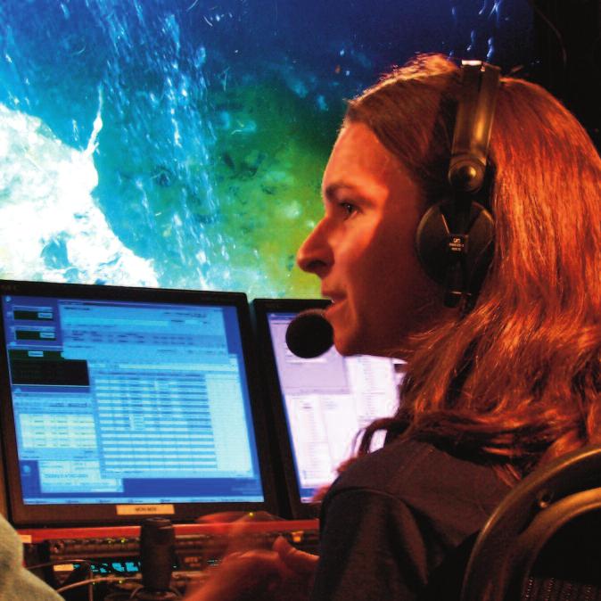
17 Immersion Presents Ocean Exploration Activity 1: Above and Below the Waves 3 The deep-sea ship Trieste is lifted out of the water. U.S. Navy you can explore shipwrecks, study marine life, and see discoveries as they happen. The future of telepresence is the Inner Space Center. This mission control center will let people interact with the NOAA ship Okeanos Explorer and other research ships year-round. People have been exploring the ocean for thousands of years, but there is still much more to learn. Only 5 percent of inner space has been explored in detail. Future explorers (like you!) are needed to make new discoveries and add to the exciting history of ocean exploration. Inn er space discoveries continued in the 1900s. In 1948, scientists found a point in the Pacific Ocean that is nearly 7 mi (11 km) deep. In 1960, two people traveled there in a deepsea ship called the Trieste. Seventeen years later, and thousands of miles away, scientists discovered deep-sea creatures that live off of chemicals something previously thought to be impossible. In the 21st century, explorer Dr. Robert Ballard and his team are using telepresence to bring the thrill of ocean exploration to the world. Telepresence is the use of technology to make people feel as if they are present at a distant site. Through telepresence, Students in Maryland use telepresence to watch a live ocean expedition. NOAA Now that you know the basics of ocean exploration history, follow the steps on the next page to learn more and separate fact from fiction!
18 4 Immersion Presents Ocean Exploration Activity 1: Above and Below the Waves Activity In this activity, you will play a game to learn about the history of ocean exploration. Materials 16 ocean exploration cards Ready to Begin? Steps 1. This game is called Two Facts and a Fiction. Your team will play the game against another team. 2. Your leader will give you 16 ocean exploration cards. Place them face down between your team and the other team. 3. Take turns picking up the cards one at a time, keeping them face down, until each team has eight cards. 4. Spend a few minutes looking over your team s cards. The title of each card is the name of an important thing, person, or group of people in the history of ocean exploration. Each card includes a brief description of the title along with three facts and three fictions about it. 5. Flip a coin to see which team goes first and take turns after that. 6. When it is your team s turn, choose a card and read aloud the title and brief description to the other team. Then read aloud two of the fact statements and one of the fiction statements. Mix up the order of the statements as you read them. 7. The members of the other team must guess which of the three statements you read is the fiction. If they guess correctly, they get a point. If they guess incorrectly, your team gets a point. 8. Play the game until each team has gone through all of its cards. 9. If time allows, play a second round by having each team go through its cards again (choosing a different set of three statements to read). In this round each guess is worth two points. 10. The team with the most points at the end of the game is the Ocean Exploration History champion! Taking It Further Activity: Ocean Exploration Time Line Use the descriptions and dates on all 16 cards to create a time line of the history of ocean exploration on a large piece of butcher paper. Search the Internet and look in books for pictures of the people, ships, and discoveries described on the cards. Add these pictures to your time line or create your own illustrations. Also feel free to add more people and events to the time line. Display your completed time line in a place where others will see it and learn about ocean exploration, too! Think About It Two hundred thirty-two of the sailors who left Spain with Ferdinand Magellan in 1519 did not come back on the only remaining ship in What happened to those sailors?
19 Immersion Presents Ocean Exploration Activity 1: Above and Below the Waves 5 Ocean Exploration Cards Part 1 Ancient Egyptians People living in Egypt more than 5,000 years ago Facts 1) They built many kinds of boats, including the first known sailboats. 2) A wooden boat built by ancient Egyptians was found buried near Egypt s Great Pyramid. 3) They used a long rope with a weight at the end to measure water depth. Fictions 1) They were the first people to sail from Africa to Australia. 2) They often buried kings with small boats made of reeds and rubber. 3) They were the first people to use a magnetic compass to sail on the Nile River. Greek Sponge Divers Divers from Greece who gathered sponges from the sea floor in a traditional way Facts 1) They used a heavy rock to dive to depths of more than 100 ft (30 m). 2) They usually dove naked. 3) They were tied to a rope that someone on the surface used to pull them up after each dive. Fictions 1) They put beeswax into their ears to keep water out during their dives. 2) They wore a pair of leather fins to help them reach the bottom faster. 3) They used gas-filled balloons to help them rise to the surface after each dive. Ama Divers Japanese divers who gather oysters from the sea floor in search of natural pearls Facts 1) The tradition of ama diving is more than 2,000 years old. 2) Most ama divers in history and in modern times are women. 3) Ama divers can dive more than 100 ft (30 m) deep on a single breath. Fictions 1) The word ama means breath holder. 2) Most modern-day ama divers are young boys. 3) Ama divers collect more than 90 percent of the world s natural pearls each year. Scyllias (SKIH lee us) and Cyana (si AN uh) A father-daughter diving team hired by a Persian king in about 500 BC Facts 1) They were hired as treasure divers. 2) One night they cut the anchor ropes of the Persian king s ships, causing them to sink. 3) They used reeds as breathing tubes during some of their dives. Fictions 1) They were hired to teach the king s children how to dive. 2) They gathered shellfish to supply the king s army with food during a war with the Greeks. 3) They started the first diving school in Persia.
20 6 Immersion Presents Ocean Exploration Activity 1: Above and Below the Waves Ocean Exploration Cards Part 2 Vikings Warriors and traders from Scandinavia who traveled widely from the 8th to 11th centuries Facts 1) Vikings used the North Star to determine how far north or south they were in the ocean. 2) The Vikings reached North America by boat around 1000 AD. 3) Vikings used weights covered with animal fat to pick up samples from the sea floor. Fictions 1) All Vikings wore helmets with two horns. 2) Viking boys had to learn English before they were allowed to sail with their fathers. 3) Vikings invented perfume so they would not smell so bad during their long voyages. Guglielmo de Lorena (gool YELL moh day loh RAY nuh) An Italian who built and used the first true diving bell in 1535 Facts 1) The barrel-shaped diving bell rested on the shoulders of the diver using it. 2) The diving bell provided enough air for a dive of about one hour. 3) De Lorena used the diving bell to locate two ancient shipwrecks near Rome. Fictions 1) The diving bell was rung underwater to tell scuba divers when to return to the surface. 2) The diving bell had room for up to four divers. 3) De Lorena used the diving bell to go 1,000 ft (300 m) below the ocean surface. Cornelius Drebbel A Dutch inventor who built the world s first submarine in 1620 Facts 1) Drebbel s submarine was made of wood and iron and covered with waterproof leather. 2) Twelve men used oars sticking out of the sides of the submarine to row it underwater. 3) There is a crater on the moon named after Drebbel. Fictions 1) Drebbel s submarine was made of steel and glass. 2) Drebbel first tested the submarine in the Atlantic Ocean. 3) The submarine traveled at a depth of more than 100 ft (30 m). James Cook A British ocean explorer who led three scientific voyages between 1768 and 1780 Facts 1) Cook led the first expedition to cross the Antarctic Circle. 2) Cook made sure his sailors ate pickled cabbage while at sea to prevent scurvy (a disease caused by lack of Vitamin C). 3) Cook died in Hawaii in a fight with native Hawaiians during his third voyage. Fictions 1) Cook created a detailed map of the sea floor of the Indian Ocean. 2) Cook traveled with dozens of cows on his ships to provide his crew with fresh milk. 3) Cook became a pirate after his third voyage.
21 Immersion Presents Ocean Exploration Activity 1: Above and Below the Waves 7 Ocean Exploration Cards Part 3 HMS Challenger A British ship used for the first modern deep-sea scientific expedition between 1872 and 1876 Facts 1) Expedition scientists discovered thousands of new species of marine life. 2) Only 144 of the original 216 crew members completed the entire expedition. 3) It took more than 20 years to write up the official results of the expedition. Fictions 1) HMS stands for Hollow Metal Ship. 2) More than 5,000 people sailed on the ship at some point during the expedition. 3) Expedition scientists were the first people to capture a giant squid alive. William Beebe and Otis Barton Explorers who traveled 3,028 ft (923 m) underwater in a round steel vessel called a bathysphere in 1934 Facts 1) They entered and exited the bathysphere through a round steel door. 2) They saw many light-producing fish during their voyage. 3) They used a telephone to communicate with the surface ship during the dive. Fictions 1) The depth record they set in 1934 was unbroken for more than 40 years. 2) They did not see anything during the voyage because the bathysphere had no windows. 3) They used walkie-talkies to communicate with the surface ship during the dive. Meteor A German ship that sailed around the Atlantic Ocean on a research expedition in 1925 Facts 1) Scientists on the ship used sound waves to measure the depth of the sea floor. 2) Data from the expedition was used to create a modern depth chart of the Atlantic Ocean. 3) After World War II, the Meteor was given to the USSR and was renamed Ekvator. Fictions 1) Scientists on the ship used cannonballs and cables to measure the depth of the sea floor. 2) The Meteor was named for a meteorite that hit the town where the ship was built. 3) The Meteor ran into an iceberg and sunk in the South Atlantic. Coelacanth (SEE luh kanth) A fish thought to have been extinct for 65 million years until one was caught alive in 1938 Facts 1) A second coelacanth was not identified for more than 14 years after the first one was found. 2) Coelacanths rest in underwater caves during the day. They come out at night to feed. 3) Coelacanths have been around for 400 million years. Fictions 1) Coelacanths make bright flashes of red light to scare away predators. 2) Coelacanths are normally found in shallow water. 3) Coelacanths have only two fins one on top of their body and the other on the bottom.
22 8 Immersion Presents Ocean Exploration Activity 1: Above and Below the Waves Ocean Exploration Cards Part 4 Jacques Piccard (ZHAHK pee KAHR) A Swiss explorer who dove nearly 7 mi (11 km) deep in a vessel called a bathyscaphe (BATH ih skaf) in 1960 Facts 1) Piccard helped his father build the bathyscaphe. 2) Piccard and his crewmate still hold the record for the deepest dive by humans. 3) The dive was to the bottom of the Mariana Trench in the Pacific Ocean. Fictions 1) The bathyscaphe was connected to a surface ship by a long, flexible cable. 2) Piccard did not have contact with anyone on the surface during the dive. 3) In 1975, Piccard built a 100-seat vehicle that could travel on land and under water. Jacques Cousteau (ZHAHK koo STOH) A French ocean explorer, inventor, and researcher who lived from 1910 to 1997 Facts 1) Cousteau improved scuba equipment to allow divers to stay underwater longer. 2) Cousteau spent a week 33 ft (10 m) below the surface in the first underwater habitat. 3) Cousteau s grandson designed a one-person shark-shaped submersible to study sharks. Fictions 1) Cousteau was the captain of a research ship called the Tango for more than 50 years. 2) Cousteau once traveled all the way around the world in a submarine without surfacing. 3) None of Cousteau s kids learned to scuba dive. Sylvia Earle An American oceanographer (oh shuh NAH gruh fer) and explorer born in 1935 Facts 1) Earle used a special diving suit to walk on the sea floor at a depth of 1,250 ft (380 m). 2) Earle led an all-female research expedition team that lived underwater for two weeks. 3) Nicknames for Earle include Her Deepness and the Sturgeon General. Fictions 1) Earle has been scuba diving since she was four years old. 2) Earle holds the world record for the deepest breath-hold dive by a woman. 3) Earle got married 50 ft (15 m) underwater in a submersible. Robert Ballard An American oceanographer (oh shuh NAH gruh fer) and explorer born in 1942 Facts 1) Ballard discovered deep-sea hydrothermal (hi druh THUR mul) vents that support giant tube worms and other life in complete darkness. 2) Ballard discovered the resting places of many shipwrecks, including the Titanic. 3) Ballard often names his underwater robots after characters from Greek mythology. Fictions 1) Ballard built the first underwater video camera. 2) Ballard spent 20 years in the Army before starting his ocean exploration career. 3) Ballard often names his research tools after characters from the Peanuts comic strip.
23 Leader Notes 9 Summary Activity 1 Above and Below the Waves In this activity, participants play a game to investigate some of the important people, places, and discoveries in the history of ocean exploration. Difficulty: Medium Suggested Group Size: 4 Time: 45 to 60 minutes Goals Participants will: A. describe several important events in the history of ocean exploration B. explain how the techniques and goals of ocean exploration have changed over time C. create an ocean exploration time line Materials For each group: 16 ocean exploration cards (need to be cut out) For the leader: optional: sandwich-size zippered plastic bags For the Taking It Further Activity, per group: 16 ocean exploration cards large sheet of butcher paper markers or colored pencils rulers Cool Words inner space The world beneath the ocean surface oceanography (oh shuh NAH gruh fee) The scientific study of the ocean telepresence The use of technology to make people feel as if they are present at a distant site Think About It Two hundred thirty-two of the sailors who left Spain with Ferdinand Magellan in 1519 did not come back on the only remaining ship in What happened to those sailors? Some left the voyage along the way, deserting at various ports. Others died in storms and fights. But the biggest killer was probably scurvy, a disease caused by a lack of vitamin C. Some estimate that scurvy killed about half of Magellan s crew. Scurvy was a problem for sailors on all long voyages before people linked it to nutritional deficiency. Between 1500 and 1800 AD, scurvy killed more sailors than all other diseases, disasters, and battles combined.
24 10 Immersion Presents Ocean Exploration Activity 1: Above and Below the Waves Set-Up Copy and cut out a complete set of ocean exploration cards for each group. For more durable cards, make the copies on cardstock. Consider putting each set of cards in a zippered plastic bag to keep them organized. Working With Groups This activity works best in groups of four, with two people on each team. However, it can also work in smaller or larger groups. Activity Notes Go over the rules of the game with each group before passing out the ocean exploration cards. Stress to participants that they should not look at the cards before starting the game. After participants pick up their cards, give them several minutes to look them over. This will give them a chance to choose the three statements to read in the first round and ask for help with unfamiliar words. Remind participants to mix up the order of the three statements they read. They should say each statement in the same way so the fiction does not stand out. Each team should keep its original eight cards for both rounds of the game. If participants want to continue playing the game, they can redistribute the cards. Their scores should improve as they begin to learn the facts on each card. Older participants might enjoy having the option of making up their own fictions instead of using the fictions on the cards. For younger participants, consider playing the game with just one fact and one fiction instead of two facts and one fiction. Optional: Have participants make their own ocean exploration cards. They can follow the format of the existing cards and play the game with their new cards in the mix. Taking It Further Activity: Ocean Exploration Time Line Have participants begin by organizing the events of the ocean exploration cards historically from the earliest to the latest. Supply participants with a large sheet of butcher paper, rulers, and markers or colored pencils to plot the events along a time line. Participants might need help positioning the events in the right place, especially if they are making the time line to scale. Encourage participants to use books and the Internet to look for pictures and find out more about each of the events on the cards. Consider having participants visit the Web sites listed in the Additional Resources section to identify additional important events in the history of ocean exploration to include on the time line. Discussion Questions 1. Who were the earliest ocean explorers? How did they explore? (The names of the earliest ocean explorers are unknown. Many ancient coastal cultures explored the sea. They dove into it, gathered food from it, and traveled over it in simple boats.) 2. If exploring the ocean was so dangerous in ancient times, why do you think people did it? (Answers will vary. Early on, people explored the ocean to find sources
25 Immersion Presents Ocean Exploration Activity 1: Above and Below the Waves 11 of food and other necessities. As explorers traveled farther from home and began to trade goods with people in other places, they became interested in finding better ways to get to those places. People also explored the ocean out of curiosity and a sense of adventure.) 3. Describe at least one important person, place, and discovery in the history of ocean exploration. (Answers will vary. Participants should use information from the reading selection, ocean exploration cards, and/or independent research in their answers.) 4. Which ocean exploration card is the most interesting to you? Explain. (Answers will vary.) 5. How have the techniques and goals of ocean exploration changed over time? (Answers will vary. The earliest explorers had no maps, dove without equipment, and used primitive boats. Over the years, the development of new technologies allowed ocean explorers to go faster, farther, and deeper than before. Maps became more accurate and scientists were able to add detailed outlines of land masses and ocean basins. Once the basic geography of the globe was no longer a mystery, some scientists began to focus more on the exploration of inner space the world beneath the ocean surface. The inventions of deep-sea submersibles and underwater robots have allowed explorers to study inner space more closely. The creation of telepresence has allowed many more people to be involved in ocean exploration.) 6. Would you like to have a career as an ocean explorer? Why or why not? (Answers will vary. Remind participants that since only 5 percent of inner space has been explored, there is a lot more for the current and next generations of explorers to discover!) Additional Information Books Adventures in Ocean Exploration: From the Discovery of the Titanic to the Search for Noah's Flood, by Robert D. Ballard and Malcolm McConnell. Dive: My Adventures in the Deep Frontier, by Sylvia Earle. The Eternal Darkness: A Personal History of Deep-Sea Exploration, by Robert D. Ballard and Will Hively. The Restless Sea: Exploring the World Beneath the Waves, by Robert Kunzig. Singing Whales and Flying Squid: The Discovery of Marine Life, by Richard Ellis. Videos The Blue Planet, produced by BBC Warner. NOAA s Ocean Explorer YouTube Channel [online] Web Sites BBC s Captain Cook and the Scourge of Scurvy Web site BoatSafeKids History of Navigation Web site Immersion Presents Web site
26 12 Immersion Presents Ocean Exploration Activity 1: Above and Below the Waves The Mariners Museum s Exploration Through the Ages Web site NOAA Ocean Explorer Web site NOAA Ocean Explorer s OceanAGE Careers: Dr. Robert Ballard Web page Sea and Sky s Ocean Exploration Timeline Web site University of Wisconsin Sea Grant Institute s Underwater Exploration Web site Woods Hole Oceanographic Institution s Dive and Discover Web site Note: Links to all Web resources can be found at oceanexploration/links.html.

27 Immersion Presents Ocean Exploration 13 Activity 2 Underwater Exploration Tools Cool Fact Alvin, a small research submarine, was once attacked by a 196-lb (90-kg) swordfish at the bottom of the sea. Part of the fish became trapped in Alvin s outer skin, so the sub had to surface. After removing the fish, the crew ate it for dinner! Woods Hole Oceanographic Institution Cool Words human occupied vehicle (HOV) An underwater exploration vehicle designed to carry one or more humans remotely operated vehicle (ROV) An underwater exploration vehicle controlled from a distance and connected to the surface autonomous (aw TAH nuh mus) underwater vehicle (AUV) An underwater exploration vehicle that can operate on its own sonar The use of sound waves to detect objects


28 14 Immersion Presents Ocean Exploration Activity 2: Underwater Exploration Tools Modern inner space explorers use many kinds of tools. They sometimes use scuba gear to explore the underwater world in person. Scuba divers breathe gas from tanks strapped to their backs. They explore coral reefs, shipwrecks, caves, and other areas. Compared to other underwater tools, scuba gear is not too bulky or expensive. However, there are limits to how long and how deep scuba divers can be under water. Scientists use underwater exploration vehicles to dive deeper, stay down longer, and cover larger areas than scuba divers. The vehicles are of three main types: human occupied vehicles, remotely operated vehicles, and autonomous (aw TAH nuh mus) underwater vehicles. Human occupied vehicles (HOVs) are designed to carry one or more humans under water. Alvin is a famous HOV owned by the U.S. Navy. Explorer Dr. Robert Ballard used Alvin when he A scuba diver prepares to enter the icy waters of the Arctic Ocean. NOAA discovered hydrothermal (hi druh THUR mul) vents in Dr. Ballard also used Alvin to visit the wreck of the Titanic in HOVs allow explorers to go deeper than scuba divers. But HOVs are limited in how long they can stay under water. They are also very expensive. ROV pilot Eric Martin and the ROV Hylas Todd Viola/Immersion Presents Remotely operated vehicles (ROVs) do not carry humans. While an ROV is under water, a pilot controls it from the surface. ROVs get power through a cable attached to a ship or another ROV. Dr. Ballard has used many ROVs over the years. In 2008, his team purchased a small ROV called Hylas. It has a mass of only 39 lb (18 kg) about the same as a five-year-old child. ROVs can stay under water longer than scuba divers and HOVs. They can go places that might be dangerous for humans and can send images to the surface right away. A disadvantage of ROVs is that they can travel only as far from a ship as their cables will allow.

29 Immersion Presents Ocean Exploration Activity 2: Underwater Exploration Tools 15 Like ROVs, autonomous underwater vehicles (AUVs) are not designed to carry humans. But unlike ROVs, AUVs can operate on their own. They do not need to be connected to the surface. AUVs can explore larger areas than ROVs since they are not attached to a ship. A disadvantage of AUVs is that they cannot transmit all of their data to scientists while they are working under water. All underwater exploration vehicles carry sensing equipment. For eyes, they often Scientists launch the AUV ABE over the side of the research vessel Thomas G. Thompson. have lights and cameras. For hands, some NOAA vehicles have manipulator (muh NIHP yoo lay tor) arms that can move objects and collect samples. For ears, they have sonar equipment. Sonar is a method of using sound waves to locate objects and sea floor features. A sonar device sends out sound waves and measures any waves that bounce back. Vehicles use sonar to measure depth and make maps of the sea floor. They use additional sensors to gather temperature, salinity, and other data about the ocean. Explorers often use several kinds of tools on the same expedition. They might use sonar on a ship or an AUV to make a map of the sea floor. Then they might send an ROV to take a closer look at anything unusual. This is a good way to locate small targets in the big ocean. Dr. Ballard and his team have used this method to find shipwrecks and make important discoveries about the sea floor. Now that you know about some of the tools used in modern underwater exploration, follow the steps on the next page to design and build your own tools!
30 16 Immersion Presents Ocean Exploration Activity 2: Underwater Exploration Tools Activity In this activity, you will design and build tools to collect samples from the bottom of a model ocean. Materials 2-L bottle with the top cut off 7 c (1.7 L) water deep-sea samples tool-making supplies scissors Ready to Begin? Steps Part 1: Design, Build, and Test Tools 1. To create your model ocean, pour 7 c (1.7 L) water into a 2-L bottle with the top cut off. If you want to make the ocean water salty, use a stirring rod to stir 3 Tbsp (45 ml) salt into the water. 2. Drop all of your deep-sea samples to the bottom of the ocean. Your leader will give you the samples which could include a dried bean, penny, paper clip, marble, a square of 2-ply tissue, or other items. All groups will get the same set of items. duct tape waterproof glue or rubber cement optional: 3 Tbsp (45 ml) salt optional: stirring rod 3. Use the available tool-making supplies to create one or more tools for retrieving all of the samples from the sea floor. Your goal is to retrieve the samples as fast as possible without damaging them. Use the guidelines below to design, build, and test your tools: You can build as many tools as you like, but only one tool can be in the water at a time. No part of your body can go below the surface of the water at any time. The model ocean must stay upright at all times.
31 Immersion Presents Ocean Exploration Activity 2: Underwater Exploration Tools 17 Part 2: Sample Collection Competition 1. Drop all of the samples back to the bottom of the ocean. If you are using any samples that soften in water (such as tissue squares), use a fresh sample for the competition. 2. When your leader says, go, collect all of the samples as fast as you can without damaging them. Remember to follow the guidelines from Part 1 of the activity. 3. When you are finished, tell your leader and record your time. 4. If more than one group retrieves all of the samples intact, the group with the fastest time wins the sample collection competition. If no group has kept all of the samples intact, the group whose samples have the least amount of damage wins. Good luck! Taking It Further Activity: Pile on the Sediment Try the activity again, but this time cover the samples at the bottom of your model ocean with 1 c (240 ml) sand. This represents sediment settling on the samples over time. Your new goal is to retrieve all of the samples and also collect a 1-tsp (5-mL) sediment sample from the sea floor. Feel free to design and build new tools to help with these tasks. As before, try to retrieve the samples as fast as you can while damaging them as little as possible. Think About It What kinds of samples do you think real inner space explorers collect from the sea floor?
32
33 Leader Notes 19 Summary Activity 2 Underwater Exploration Tools In this activity, participants design and build simple tools to retrieve a variety of samples from the bottom of a model ocean. Difficulty: Medium Suggested Group Size: 2 to 4 Time: 45 to 60 minutes Goals Participants will: A. describe several ways explorers use tools to investigate inner space B. compare and contrast three types of underwater exploration vehicles C. design and build simple tools and use them to retrieve samples from the bottom of a model ocean Materials For each group: 2-L bottle with the top cut off to create a wide mouth 7 c (1.7 L) water deep-sea samples (dried bean, paper clip, penny, marble, square of 2-ply tissue, etc.) tool-making supplies (pipe cleaners, string, magnets, nylons, popsicle sticks, twist ties, rubber bands, washers, paper cups, straws, film canisters, wax paper, plastic wrap, pencils, cotton balls, etc.) scissors duct tape waterproof glue or rubber cement optional: 3 Tbsp (45 ml) salt optional: stirring rod For the leader: clock or stopwatch For the Taking It Further Activity, per group: 1 c (240 ml) sand Cool Words human occupied vehicle (HOV) An underwater exploration vehicle designed to carry one or more humans remotely operated vehicle (ROV) An underwater exploration vehicle controlled from a distance and connected to the surface autonomous (aw TAH nuh mus) underwater vehicle (AUV) An underwater exploration vehicle that can operate on its own sonar A method of using sound waves to locate objects and sea floor features
34 20 Immersion Presents Ocean Exploration Activity 2: Underwater Exploration Tools Think About It What kinds of samples do you think real inner space explorers collect from the sea floor? Inner space explorers collect many kinds of samples, but most fall into one of three groups: biological samples, geological samples, or archaeological samples. Biological samples include algae, fish, microbes, corals, and other organisms. Often entire specimens are collected if they are new to science. Geological samples include sea floor sediment, rocks, and gases from hydrothermal vents. Archaeological samples include artifacts from shipwrecks or submerged areas that were once inhabited by people. The samples that explorers collect during a given expedition depend on the goals of the expedition and relevant collection permit rules and regulations. Set-Up Prepare a 2-L bottle in advance for each group. Cut off the top of each bottle to create a wide mouth with a diameter of at least 3 in. (7.6 cm). Cover the bottle rims with masking tape so participants do not cut themselves on the sharp plastic edges. If you have laboratory beakers or other wide-mouth, tall, clear containers that hold at least 8 c (2 L) water, feel free to use them in place of the 2-L bottles. Gather a set of deep-sea samples for each group. You can use whatever you like for the samples, but try to include objects that have a variety of shapes, materials, and textures. The suggested samples are a dried bean, a penny, a paper clip, a marble, and a square of 2-ply tissue. To make the squares of tissue, cut squares of 2-ply toilet paper into fourths or cut 2-ply tissues into 2-in. x 2-in. (5 cm x 5 cm) squares. If you supply groups with tissue squares or other objects that soften in water, be sure to provide them with extra samples in case they damage the originals. Provide groups with as wide a variety of tool-making supplies as possible. The supplies could include pipe cleaners, string, magnets, nylons, popsicle sticks, twist ties, rubber bands, washers, paper medicine cups, straws, film canisters, wax paper, plastic wrap, pencils, and cotton balls. If you include paper clips or anything else made of steel in the set of deep-sea samples, try to include magnets in the toolmaking supplies (cut-up advertising magnets work well). Do not offer spoons to participants because they make the activity too easy. Working With Groups This activity works best in small groups. To encourage the participation of all group members, consider making a rule that group members must take turns using tools in Part 2 of the activity. Activity Notes Distribute a 2-L bottle and water to each group. Adding salt to the water is optional. If participants add the listed amount of salt, they will be making the water the same salinity as seawater about 35 parts per thousand (ppt). After participants have created their model oceans, distribute a set of deep-sea samples to each group.
35 Immersion Presents Ocean Exploration Activity 2: Underwater Exploration Tools 21 Have participants drop all of their samples to the sea floor. If participants are using 2-ply tissue (or something similar), let them know that it might take awhile for the tissue to absorb enough water to sink. Participants can push gently on their tissue squares to help them sink, but pushing too hard will damage them. Because the tissue will become quite fragile after becoming waterlogged, participants will need to be creative in designing tools that will raise it out of the water intact. Supply participants with several squares of tissue to use as they test their tools in Part 1. Give groups minutes to design, build, and test their tools. Try to allow enough time for participants to be successful in Part 2 without getting bored in Part 1. While participants are testing their tools, remind them to use only one tool in the water at a time and to keep all body parts above the surface of the water. If you want to impose an additional challenge, tell participants that they are not allowed to trap items against the sides of the bottle. When time is up for Part 1, announce to groups that the competition is about to begin. Have all groups drop their samples back into their model oceans. Distribute new samples if necessary (for example, fresh tissue squares). Make sure all of the samples are resting on all of the sea floors before starting the competition with a Go! Use a clock or stopwatch to report the elapsed time to groups as they finish. If more than one group manages to retrieve all of the samples intact, the group with the fastest time wins. If no group has kept all of the samples intact, the group whose samples have the least amount of damage wins. Taking It Further Activity: Pile on the Sediment Give each group 1 c (240 ml) sand. Have participants drop their set of deep-sea samples back into the ocean and then cover them with the sand. Encourage participants to design new tools or think of new ways to use the tools they have already designed to collect the samples from the sand. Also have participants create a tool to collect a 1-tsp (5-mL) sample of the sand from the sea floor. Are they still able to retrieve all of the samples without damaging them? Ask participants to explain any changes they made to their tools and their collection strategies. Also ask them to discuss how this sort of artifact retrieval might compare to an archaeological dig on land. Discussion Questions 1. What are some of the tools explorers use to investigate inner space? (Explorers use tools such as scuba equipment, human occupied vehicles, remotely operated vehicles, and autonomous underwater vehicles. Some of these tools carry additional tools such as sonar and sensors to measure temperature, salinity, and other data about the ocean.) 2. What are the advantages and disadvantages of the three main types of underwater exploration vehicles? (An advantage of HOVs is that they allow explorers to see the underwater world with their own eyes. A disadvantage of HOVs is their expense and their need to surface eventually to replenish supplies, recharge batteries, etc.
36 22 Immersion Presents Ocean Exploration Activity 2: Underwater Exploration Tools An advantage of ROVs is that they can stay underwater for a long time since they get their power from a ship and do not carry any human passengers. They can also transmit data to scientists in real time. A disadvantage of ROVs is that their motion is limited to the area immediately around the ship since they cannot go farther than their cables will allow. An advantage of AUVs is that they can operate on their own and can conduct surveys over large areas. A disadvantage of AUVs is that they cannot communicate images, video, and other data while they are under water since they are not connected to a surface ship.) 3. Describe one method explorers use to look for shipwrecks and study unknown parts of the sea floor. Why do they use this method? (Explorers often use one set of tools to do broad surveys of the ocean floor and another set of tools to investigate interesting targets more closely. This is a more efficient exploration method than exploring the entire sea floor in great detail when time and resources are limited.) 4. What was the easiest part of this activity? What was the hardest part? (Answers will vary. Participants might say that collecting steel objects with magnetic tools was the easiest part. They might say that keeping fragile objects such as tissue squares intact during retrieval was the hardest part.) 5. How do you think explorers decide which tools to use on a given expedition? (Answers will vary. Explorers choose their tools based on the objectives of the expedition. For example, an expedition with a goal of surveying an unknown area of the sea floor will likely include sonar, whereas an expedition with a goal of finding out more about a known shipwreck in shallow water is more likely to make use of scuba equipment.) Additional Information Books Adventures in Ocean Exploration: From the Discovery of the Titanic to the Search for Noah's Flood, by Robert D. Ballard and Malcolm McConnell. Build Your Own Underwater Robot and Other Wet Projects, by Harry Bohm and Vickie Jensen. Underwater Exploration (The Restless Sea), by Carole Garbuny Web Sites Immersion Presents Web site Mystic Aquarium & Institute for Exploration s Deep Submergence Technology Web page NOAA Ocean Explorer s Technology Web page NOAA Undersea Research Program s Undersea Technology: Tools for Research Web page Woods Hole Oceanographic Institution s Dive and Discover: Underwater Research Vehicles Web page Woods Hole Oceanographic Institution s History of Alvin Web page Note: Links to all Web resources can be found at oceanexploration/links.html.

37 Immersion Presents Ocean Exploration 23 Cool Fact Female cod spawn once a year and produce several million eggs. Only about one out of every million eggs survives and eventually becomes an adult cod Activity 3 Fishing for Answers Sion Roberts Cool Words Grand Banks A group of flat, shallow, underwater landforms southeast of Newfoundland continental shelf An underwater ledge that extends from the shoreline to a point where the sea floor slopes down steeply overfishing Fishing a population so much that it cannot sustain itself moratorium (mor uh TOR ee um) A temporary ban of a specific activity

38 24 Immersion Presents Ocean Exploration Activity 3: Fishing for Answers Cold weather, high winds, icebergs, and fog have all threatened ships and sailors near Newfoundland, Canada. More than 3,250 shipwrecks are known to have sunk in the waters around the island. In the summer of 2008, explorers from the University of Rhode Island, the Institute for Exploration, and Memorial University of Newfoundland attempted to find more. Storms and high waves have caused many ships to wreck on the Grand Banks. The Mariners' Museum, Newport News, VA One goal of the explorers was to learn more about shipwrecks in the Grand Banks area. The Grand Banks are a group of flat, shallow, underwater landforms southeast of Newfoundland. They are part of the North American continental shelf, an underwater ledge that extends from the shoreline to a point where the sea floor slopes down steeply. Most of the banks are at depths of less than 650 ft (200 m). At the edge of the banks where the continental shelf ends the sea floor drops to more than 6,500 ft (2,000 m) deep. The Grand Banks have long been some of the most productive fishing grounds in the world. The cold waters of the Labrador Current and the warm waters of the Gulf Stream meet there. The mixing of their waters and the shape of the sea floor cause nutrients to rise to the surface. The nutrients feed tiny organisms that in turn feed cod, haddock, and other fish. These conditions have drawn fishermen to the area for hundreds of years. In 1497, explorer John Cabot arrived at the Grand Banks. His sailors reportedly dropped empty buckets into the water and pulled them up full of cod. Soon Portuguese, Basque, French, and English fishermen swarmed the waters in search of cod and other fish. They dried and salted their catches and brought them back to Europe.

39 Immersion Presents Ocean Exploration Activity 3: Fishing for Answers 25 A fisherman from Flatrock, Newfoundland, dries cod in the traditional way in the 1950s. Peter Dawe Fishing on the Grand Banks continued in much the same way for hundreds of years. In the early 1900s, some fishermen started using large, steam-powered ships to capture huge numbers of fish. In the 1960s and 1970s, several European and Asian countries began using even larger, factory-style ships. Because these ships could process fish on board, they could stay on the water longer and catch more fish than traditional boats. The cod population began to decline under these conditions. In 1977, Canada took control of all waters less than 200 mi (320 km) from shore. Most of the Grand Banks fall within this zone, and foreign factory boats had to stop fishing there. But Canada soon began using large boats of its own to fish for cod. Some limits were put in place, but they were not well enforced. The population of cod reached a crisis level in the 1990s. People were fishing so much cod that the fish could not sustain its population, a practice known as overfishing. In 1992, Canadian officials announced a moratorium (mor uh TOR ee um), or temporary ban, on cod fishing along Newfoundland s east coast. The ban was supposed to last only two years, but the cod population did not recover as quickly as people thought it would. In 1994, the moratorium was extended to cover more area and last another five years. More than 30,000 Newfoundlanders were put out of work. As of the printing of this curriculum, the moratorium is still in place. The explorers who mapped the sea floor of the Grand Banks in 2008 could not bring back the cod. But by locating historic fishing boat wrecks and studying them, they hoped to learn more about the culture of fishing during the 500 years that fishermen and cod were able to exist in balance. Many wonder whether something could have been done sooner to save the cod and the livelihoods of the Newfoundland fishermen. Nobody knows for sure. What people can do now is learn about what happened at the Grand Banks and try to prevent it from happening again. Now that you know what happened to the cod fishery at the Grand Banks, follow the steps on the next page to see how well you can share a fishery!
40 26 Immersion Presents Ocean Exploration Activity 3: Fishing for Answers Activity In this activity, you will play a game to explore what it is like to share a fishery. Materials bowl goldfish crackers chopsticks cup Ready to Begin? Steps Part 1: Fishing Game Rules 1. You are the head of a family that depends on fishing to survive. 2. Your family shares a small lake with a few other families. The lake can hold up to 20 fish. 3. Once a week, you and the heads of the other families go fishing in the lake. Each time you go, you can take as many fish as you want for your family. Use the information below to help make your decision: If you take zero fish or one fish, your family starves. If you take two fish, your family survives. If you take more than two fish, you can sell the extras for a profit (in this game, you can eat your profit!). The population of fish left at the end of every week doubles up to a maximum of 20 fish. 4. A bowl represents the lake; goldfish crackers represent the fish; and chopsticks represent your fishing equipment. copy of Data Sheet optional: chopsticks wrapper optional: rubber band 5. To take a fish from the lake, pick it up with your chopsticks and place it in your cup. You can take only one fish at a time. 6. If you have trouble using chopsticks, use a chopsticks wrapper and a rubber band to turn the chopsticks into tweezers. Roll the wrapper into a cylinder and place it between the two chopsticks. Wrap a rubber band under the roll to hold it in place. Then wrap the rest of the rubber band around the top of the chopsticks. chopsticks rolled chopsticks wrapper rubber band 7. Each round of the game lasts 30 seconds and represents one week. 8. You are not allowed to communicate with any of the other players during the game!
41 Immersion Presents Ocean Exploration Activity 3: Fishing for Answers 27 Part 2: Go Fishing 1. Use the rules in Part 1 to play the Fishing Game for one game of four rounds. 2. Your leader will double the fish in your lake (up to a maximum of 20 fish) after each round. If you have not caught enough fish for your family to survive, you cannot fish for the rest of the game. 3. Complete the appropriate row in the Game 1 section of the Data Sheet after each round. 4. After you have finished playing the game, discuss what happened with the other players in your group. Think about whether you want to change your strategy for the next game. 5. Play the game one more time. Use the Game 2 section of the Data Sheet to record the results. When all groups are finished, answer the discussion questions together. Taking It Further Activity: Team Fish Challenge Play the game once more, but this time try to catch as many fish as possible as a team. Your team is made up of the heads of all the families sharing your lake. If your team catches more fish than any other team in four rounds, you will win the Team Fish Challenge. If any member of your team starves by getting fewer than two fish in a round, your team will be disqualified. Try to agree on a strategy in advance that will help your team catch the maximum number of fish in four rounds. Would you use the same strategy if the game lasted five rounds? Think About It Besides sunken fishing boats, what other kinds of shipwrecks do you think explorers might find during a survey of the Grand Banks?
42 28 Immersion Presents Ocean Exploration Activity 3: Fishing for Answers Data Sheet Game 1 Round Number of Fish in Lake at Start of Round Number of Fish You Caught in Round Total Number of Fish Caught in Round Number of Fish Left in Lake Before Doubling Game 2 Round Number of Fish in Lake at Start of Round Number of Fish You Caught in Round Total Number of Fish Caught in Round Number of Fish Left in Lake Before Doubling Game 3 Round Number of Fish in Lake at Start of Round Number of Fish You Caught in Round Total Number of Fish Caught in Round Number of Fish Left in Lake Before Doubling
43 Leader Notes 29 Summary Activity 3 Fishing for Answers In this activity, participants play a game to explore what it is like to share a common resource such as a fishery. Difficulty: Easy to Medium Suggested Group Size: 4 Time: 30 to 45 minutes Goals Participants will: A. describe the history of the cod fishery in the Grand Banks area of Newfoundland B. explain why a moratorium on cod fishing was declared in Newfoundland C. explore some of the issues involved in sharing a common resource D. propose a few ways to control the problem of overfishing Materials For each group: bowl 20 goldfish crackers (to begin game) For each participant: chopsticks cup copy of Data Sheet optional: paper chopsticks wrapper optional: rubber band For the leader: several dozen goldfish crackers or other objects per group clock or stopwatch For the Taking It Further Activity, per group: optional: small prize for winning group members Cool Words Grand Banks A group of flat, shallow, underwater landforms southeast of Newfoundland continental shelf An underwater ledge that extends from the shoreline to a point where sea floor slopes down steeply overfishing Fishing a population so much that it cannot sustain itself moratorium (mor uh TOR ee um) A temporary ban of a specific activity
44 30 Immersion Presents Ocean Exploration Activity 3: Fishing for Answers Think About It Besides sunken fishing boats, what other kinds of shipwrecks do you think explorers might find during a survey of the Grand Banks? The explorers on the 2008 expedition to the Grand Banks were interested in finding wrecks of fishing boats, but they did not look exclusively for them. Instead they conducted a systematic survey and recorded information on all wrecks in the survey area. Other types of shipwrecks that could be found in the area include sailing ships used to carry early settlers from Europe to America, large steamships used in transporting people across the Atlantic Ocean, military vessels used in wars and conflicts from the past 500 years, and possibly older ships used to explore the area more than 500 years ago. Extra Background Expedition Research Tools: Explorers on the 2008 expedition to the Grand Banks used a variety of tools to conduct their survey work. Their research vessel, Endeavor, towed a sonar system to gather data about the sea floor. Atalanta, an autonomous underwater vehicle (AUV), traveled parallel to the ship to gather additional sonar data, record digital still images, and collect other oceanographic data. A magnetometer was used to collect magnetic data to help explorers identify objects on the sea floor that contain metal; such objects could be associated with shipwreck sites. Tragedy of the Commons: In 1968, environmentalists coined the term Tragedy of the Commons. The tragedy is the notion that any resource open to everyone such as the air or a part of the ocean will eventually be destroyed because everyone can use the resource but no one is responsible for preserving it. The Tragedy of the Commons results when people utilize resources for their own benefit rather than thinking of the future. Set-Up Purchase several bags of goldfish crackers. Consider using small, fish-shaped candies if you do not have crackers. Of course, you can use any small objects for the activity; however, the game works best when participants are motivated to collect fish, so try to use something that is appealing to participants. Aim to have about 50 objects on hand per group, per game. You might not need this many objects, but having too many objects is better than having too few. Supply a bowl for each group. Supply a cup and a set of chopsticks for each participant. Copy the Data Sheet for participants unless you want them to keep track of their data in a table of their own design. If you are working with participants who might have a hard time using chopsticks, show them how to use a paper chopsticks wrapper (or a piece of paper of similar size) and a rubber band to make them easier to use. Roll the strip of paper into a cylinder and place it in between the sticks about 3 4 in. (2 cm) from the top. Wind the rubber band underneath the roll and around the sticks once to keep it in place, and wrap the rest of the rubber band around the top of the sticks.
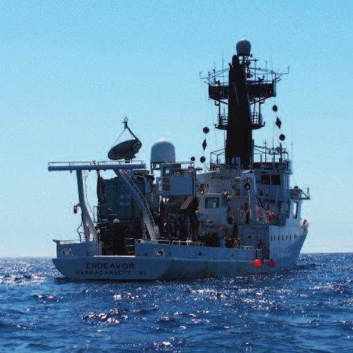
45 Immersion Presents Ocean Exploration Activity 3: Fishing for Answers 31 Working With Groups This activity works best in groups of four. For groups of three, reduce the starting (and maximum) number of fish in the bowl to 15. For groups of two, reduce the starting number of fish to 10. In the main part of the activity, each group member is the head of a family and acts alone. In the Taking It Further Activity, the group members work together as a team. Activity Notes Go over Part 1 of the activity with participants and answer any questions about the rules of the game. Emphasize that participants are not allowed to talk to one another before or during the first game. Time each round for 30 seconds. Be sure to give participants a clear signal to begin and end each round. At the end of each round, double the number of fish remaining in each group s bowl, up to a maximum of 20 fish. Each game lasts four rounds. After participants have played the game once, give them several minutes to talk about what happened. Ask them to think about any changes they will make when they play the game again. After the second game, encourage all groups to share their data and thoughts with one another. Taking It Further Activity: Team Fish Challenge In this version of the game, participants are rewarded for working together rather than trying to maximize individual gain. Tell participants that the team that collects the most fish in four rounds will earn a prize. Participants must cooperate in order to succeed. They might take turns collecting more than two fish in a round, or they might appoint one participant to collect extra fish and share them with the group. Participants will need to find a balance between collecting extra fish and ensuring there are enough fish to reproduce for the next round. Some teams might figure out that they can catch the maximum number of fish in four rounds by clearing out the lake in the last round of the game. Ask participants to think about what this might represent in real-world terms. (By maximizing shortterm profits, participants are leaving future generations in jeopardy.) Have participants discuss how playing the game cooperatively is different than playing it with only their own interests in mind. Also ask them how important the role of communication was to their success in this version of the game. Discussion Questions 1. Why have the Grand Banks of Newfoundland been so popular with fishermen over the past 500 years? (The Grand Banks are very productive fishing grounds. The mixing of waters from cold and warm currents, along with the shape of the sea floor, creates conditions that bring nutrients to the surface. Small organisms use these nutrients and then pass their energy through the food chain to fish, birds, and marine mammals. Fishermen have recognized the productivity of the Grand Banks for hundreds of years and have been willing to travel long distances to fish there.)
46 32 Immersion Presents Ocean Exploration Activity 3: Fishing for Answers 2. Why did the Canadian government declare a moratorium on cod fishing in the 1990s? What happened as a result of the moratorium? (The population of cod had been overfished to such a degree that it could no longer be fished commercially. The moratorium put tens of thousands of people associated with the fishing industry out of work. The hope was that the population of cod would recover in a few years and people would be able to go back to fishing for it. But that did not happen, and the moratorium is still in place more than 15 years after it was first announced.) 3. When you played the fishing game for the first time, did anyone in your group take too many fish? How did that make you feel? Did anyone sacrifice the number of fish they could catch in a round for the good of the community? Why or why not? (Answers will vary. Some groups might have exhausted the supply of fish in their lake after the first round. Other groups might have had several participants who took only as many fish as their families needed to survive, allowing the fish and fishers to survive into the next round.) 4. When you played the game the second time, did you or your group change strategies? If so, how? (Answers will vary. Some participants might have decided to fish less in order to make sure there were enough fish to reproduce after each round. Others might have taken as many fish as possible so their family could survive and they could have extra fish to eat.) 5. What common resources do you share in everyday life? Do you ever have any problems sharing the resources? Can you think of any ways to help prevent such problems? (Answers will vary. Participants might mention having to share a room, a swimming pool, or some other area. Some people sharing the resources might take up too much room, be too messy, or be too loud. One way to deal with such problems could be to have a conversation about how to make the experience better for everyone. If that does not work, an outsider could help with the conversation or create rules to follow. Having someone to enforce the rules and/or having consequences for breaking them might also help.) 6. How does this game relate to the problem of overfishing cod in Newfoundland? What are some ways overfishing could be controlled? (Answers will vary. In the game, several people had to share a common resource goldfish crackers. In the cod fishery of Newfoundland, fishermen also had to share a common resource cod. Both the game and reality illustrate that overfishing can lead to the destruction of a population. A few possible ways to help control the problem of overfishing include maintaining clear communications among everyone sharing a fishery, building a shared commitment to provide for future generations, devising catch quotas and regulations, and enforcing any quotas or regulations.) This activity was adapted, with permission, from Scarsdale High School teacher Jeremy Szerlip s lesson plan The Tragedy of the Commons, which was developed during Columbia University s Summer Research Program for Science Teachers.
47 Immersion Presents Ocean Exploration Activity 3: Fishing for Answers 33 Additional Information Books Between Sea and Sky: Strange and Unique Stories of the Sea, by Robert Parsons. Cod: A Biography of the Fish That Changed the World, by Mark Kurlansky. Cod: The Ecological History of the North Atlantic Fisheries, by George Rose. The Cod s Tale, by Mark Kurlansky, Eileen Spinelli, and S. D. Schindler. Servants of the Fish: A Portrait of Newfoundland After the Great Cod Collapse, by Myron Arms. Shipwrecks of Newfoundland and Labrador, edited by Frank Galgay and Mike McCarthy. Videos Canadian Broadcasting Corporation s Fished Out: The Rise and Fall of the Cod Fishery digital Archive [online] Web Sites The Canadian Encyclopedia s Grand Banks Web page Greenpeace s Overfishing Web page Immersion Presents Web site Marianopolis College s Newfoundland History Web site Marine Stewardship Council s Fish and Kids Web site Memorial University Libraries Management of the Northern Cod Fishery: A Guide to Information Sources Web site Newfoundland and Labrador Heritage s Cold Ocean Web page Newfoundland and Labrador Heritage s Fisheries Web page Note: Links to all Web resources can be found at oceanexploration/links.html. The Canadian Encyclopedia s Sunken Ships/Shipwrecks Web page Canadian Geographic s The Rise and Fall of the Atlantic Cod Fishery Web page Centre for Distance Learning and Innovation s History of the Northern Cod Fishery Web site Fisheries and Oceans Canada s Atlantic Cod Web page Fisheries and Oceans Canada s The Grand Banks and the Flemish Cap Web page
48

49 Immersion Presents Ocean Exploration 35 Activity 4 Cool Fact The many uses of autonomous underwater vehicles (AUVs) include mapping the ocean floor, exploring shipwrecks, photographing underwater tunnels, detecting mines, and recording whale songs. AUV Adventure Cool Words payload The group of scientific instruments carried by a vehicle buoyant (BOY unt) force The upward force on an object submerged in a fluid positively buoyant Having the tendency to rise when submerged in a fluid Dwight Coleman/IFE/URI negatively buoyant Having the tendency to sink when submerged in a fluid neutrally buoyant Having the tendency to neither rise nor sink when submerged in a fluid
, AUVs are not connected by cables to a ship. Instead, scientists program AUVs and send them overboard to explore on their own. Dr.")
50 36 Immersion Presents Ocean Exploration Activity 4: AUV Adventure Autonomous underwater vehicles (AUVs) are the newest kind of robot to play a role in ocean exploration. Unlike remotely operated vehicles (ROVs), AUVs are not connected by cables to a ship. Instead, scientists program AUVs and send them overboard to explore on their own. Dr. Robert Ballard and his team at the Institute for Exploration (IFE) have used several AUVs over the years. In the past, the team has worked with organizations that operate their own AUVs. But in the summer of 2008, IFE launched its own AUV. The team spent more than a year preparing for the launch. IFE team members researched many types of AUVs before choosing a design. They decided to buy an AUV with a pre-built nose cone, power section, and tail cone. All three sections play important roles. The rounded nose cone helps the AUV move smoothly through the water. The power section carries the batteries and electronics that turn the propeller and run the scientific instruments. The tail cone contains the propeller that thrusts the AUV forward. After buying the pre-built parts of their AUV, IFE engineers designed and built the vehicle s payload section, which fit between the nose cone and the rest of the vehicle. The payload is the group of scientific instruments carried by a vehicle. The IFE team included two sonar devices for mapping the sea floor, cameras for taking pictures of shipwrecks and other targets, and sensors for collecting data about the ocean. Engineers working on the AUV had to pay careful attention to the buoyant (BOY unt) force on the vehicle in sea water. The buoyant force is the upward force on an object submerged in a fluid. It is equal to the weight of the fluid that the object displaces. An object that does not weigh as much as the displaced fluid is positively Todd Gregory/IFE/URI buoyant, which means it rises to the top and floats. An object that weighs more than the fluid it displaces is negatively buoyant, which means it sinks. An object that weighs the same amount as the fluid it displaces is neutrally buoyant and neither rises nor sinks. IFE engineers made their AUV slightly positively buoyant in sea water so it would slowly rise to the surface in an emergency but could be kept at a given depth by moving forward pointed slightly downward.
 long and weighed about 500 lb (230 kg) out of the water. Dr.")
51 Immersion Presents Ocean Exploration Activity 4: AUV Adventure 37 Scientists launch Atalanta from the deck of their research vessel. Dwight Coleman/IFE/URI The finished AUV was 13 ft (4 m) long and weighed about 500 lb (230 kg) out of the water. Dr. Ballard and his team named the AUV Atalanta after the Greek goddess of travel and adventure. In July 2008, the IFE team and Atalanta set off on an expedition to the Grand Banks. Researchers programmed the AUV to travel back and forth over the sea floor. Atalanta used its sonar to map the area and identify possible shipwreck targets. After each of its first few dives, Atalanta came back to the ship so scientists could look at its data and charge its batteries. The AUV identified several interesting targets, and the scientists were eager to see what else it would find. But Atalanta did not return to the ship after its next dive. The scientists tried to contact Atalanta, but the AUV did not respond. Crew members wanted to send an ROV to the place where Atalanta was last seen, but the weather was too stormy. Atalanta had many built-in safety and emergency features, so something disastrous must have happened to cause it to disappear. Unfortunately, IFE team members could not spend too much time searching because they had to finish the rest of their expedition. Atalanta has yet to be found. The people who worked hard to design and build Atalanta were sad when it was lost. However, they know that accidents happen and that taking risks is a necessary part of ocean exploration. The good news is that Dr. Ballard and the rest of the IFE team still plan to use AUVs in future expeditions. They will use what they learned from Atalanta to make their next AUV even better. Now that you know more about AUVs, follow the steps on the next page to build and test your own AUV!
52 38 Immersion Presents Ocean Exploration Activity 4: AUV Adventure Activity In this activity, you will build and test a model autonomous underwater vehicle (AUV). Materials empty plastic water or soda bottle, about 20 oz (600 ml) needle-nose pliers small paper clip pipe cleaner piece of a plastic milk jug, about ½ in. x ½ in. (1 cm x 1 cm) scissors push pin wedge pencil cap eraser Ready to Begin? Steps Part 1: Build Your AUV 1. Use needle-nose pliers to form a small paper clip into the shape of a candy cane. Straighten the two biggest bends in the paper clip and leave the smallest bend in place. Be sure the straight part is as straight as possible! 2. Form a pipe cleaner into the shape of a candy cane by bending back 1 in. (2.5 cm) of one end. Hook the bent end of the pipe cleaner to the bent end of the paper clip. 3. Use the pipe cleaner to lower the paper clip into a plastic bottle. The bottom of the bottle should have a ⅛-in. (3-mm) hole in its center. Guide the straight end of the paper clip through the hole, leaving the bent end of the paper clip in the bottle. Remove the pipe cleaner from the bottle. plastic toy plane propeller, about 4 5 in. (10 13 cm) 3 rubber bands plastic ruler assorted floatation materials modeling clay, about 2 oz (60 g) duct tape towel optional: colored permanent markers 4. Cut a small piece of a plastic milk jug into a circle with a diameter of about ½ in. (1 cm). Use a push pin to poke a hole in the center of the circle. Then push the circle down the straight end of the paper clip until it rests on the bottom of the bottle. 5. Cut the top of a wedge pencil cap eraser into a cone shape. Use a push pin to poke a hole through the center of the eraser at the peak of the cone. Then push the eraser down the straight end of the paper clip until its base rests on the plastic circle.
53 Immersion Presents Ocean Exploration Activity 4: AUV Adventure Push a toy plastic propeller down the straight end of the paper clip until it rests on the peak of the eraser. 7. Use needle-nose pliers to bend the top ¼ in. (5 mm) of the paper clip backward so it hooks over the propeller. 8. Find your candy-cane-bent pipe cleaner from step 3. Hang two rubber bands from the bent end of the pipe cleaner. 9. Use the pipe cleaner to lower the rubber bands into the plastic bottle and loop their free ends around the bend in the paper clip. Pull up on the pipe cleaner to stretch the rubber bands from the paper clip toward the top of the bottle. 10. The cap of your bottle should have two ⅛-in. (3-mm) holes drilled in it. Push the free end of the pipe cleaner up through the center hole in the cap. 11. Pull the pipe cleaner through the hole until the rubber bands are stretched about halfway between their resting length and their maximum stretched-out length. Then bend the free end of the pipe cleaner backward and push it through the other hole in the cap. Leave about an inch (2.5 cm) of the pipe cleaner inside the bottle cap and cut off the rest. Screw the cap back onto the bottle. 12. Use a rubber band to attach a ruler across the midsection of the bottle. Loop a rubber band around the bottle and across the ruler diagonally. Then twist the rubber band underneath the bottle and loop it diagonally across the ruler the other way. The rubber band should make an X on top of the ruler. 13. Your AUV is now complete! Identify the nose, the power source, the thrust generator, and the stabilizing fins before moving on to Part 2.
54 40 Immersion Presents Ocean Exploration Activity 4: AUV Adventure Part 2: Make Your AUV Neutrally Buoyant 1. Place your AUV in a water-filled kiddie pool, large tub, or other container. Observe whether the AUV is positively or negatively buoyant when it is full of air. 2. Remove the cap from your AUV and fill the bottle with water from the container. When the bottle is completely full, screw the cap back on. Observe whether the AUV is positively or negatively buoyant when it is full of water. 3. Your first challenge is to modify your AUV until it is neutrally buoyant in the water. You will know it is neutrally buoyant when you submerge it in the water and it does not sink or rise. To make your AUV more positively buoyant, add floatation materials such as foam, bubble wrap, and air. To make it more negatively buoyant, add heavy materials such as modeling clay and water. Part 3: Send Your AUV on a Mission 1. Once your have gotten your AUV to be neutrally buoyant, your next challenge is to send it on a mission. To successfully complete the mission, your AUV must start at one end of the water-filled container, travel across the container on its own, and hit a target at the opposite end. 2. To make your AUV move, hold the body still while you wind the propeller at least 20 times. Then let the propeller go. If your AUV does not travel in a straight line, you might need to adjust the ruler or the materials you added in Part The target at the opposite end of the container represents the entrance to a tunnel for your AUV to explore. If the nose of your AUV hits the target, it can successfully enter the tunnel. If it does not hit the target, it crashes. Good luck! Taking It Further Activity: Speed It Up Time how long it takes for your AUV to get from one end of the container to the other. If your AUV travels in a straight line and you know the length of the container, you can also calculate the speed of your AUV. Your goal for this activity is to make your AUV go faster than in Part 3 of the activity. You can modify anything about your AUV except the size of its body and its propeller. Before you make any changes, write a paragraph or draw a picture to explain what you are going to do and why you think it will work. Then give it a try and see what happens. How much faster can you make your AUV go? Can you still get it to hit the target? Think About It How can scientists keep track of an AUV s location when it is in the water?
55 Leader Notes 41 Summary Activity 4 In this activity, participants build and test a model autonomous underwater vehicle (AUV). AUV Adventure Difficulty: Medium to Hard Suggested Group Size: 2 to 4 Time: 60 to 75 minutes Goals Participants will: A. describe what an AUV is and how it works B. compare and contrast AUVs and ROVs C. build a model AUV that is neutrally buoyant and able to travel forward in a straight line Materials For each group: empty plastic water or soda bottle, about 20 oz (600 ml) needle-nose pliers small paper clip pipe cleaner piece of a plastic milk jug, about ½ in. x ½ in. (1 cm x 1 cm) scissors push pin wedge pencil cap eraser plastic toy plane propeller, about 4 5 in. (10 13 cm) 3 rubber bands plastic ruler assorted floatation materials (Styrofoam trays, plastic drinking straws, bubble wrap, etc.) modeling clay, about 2 oz (50 g) duct tape towel optional: colored permanent markers For the leader: electric drill ⅛-in. (3-mm) drill bit safety glasses kiddie pool or large tub old CD, plastic Frisbee, or other waterproof disc duct tape or Velcro strips For the Taking It Further Activity, per group: additional rubber bands, pipe cleaners, floatation materials, and modeling clay plastic rulers of various shapes and sizes
56 42 Immersion Presents Ocean Exploration Activity 4: AUV Adventure Cool Words payload The group of scientific instruments carried by a vehicle buoyant (BOY unt) force The upward force on an object submerged in a fluid positively buoyant Having the tendency to rise when submerged in a fluid negatively buoyant Having the tendency to sink when submerged in a fluid neutrally buoyant Having the tendency to neither rise nor sink when submerged in a fluid Think About It How can scientists keep track of an AUV s location when it is in the water? Most AUVs are monitored in more than one way. For example, scientists had three ways to track Atalanta. The first was to use an acoustic navigation system in which a transducer on the AUV talks to a transducer on the ship acoustically (via sound). The system measures the time the sound takes to travel between the transducers and the angle at which the sound is coming in to the ship to compute the position of the AUV relative to the ship. This system works under water but not above water. The second tracking system is a GPS (global positioning system) that uses an antenna mounted forward of Atalanta s fins. This kind of antenna works when an AUV is on the surface. Finally, Atalanta has an acoustic communications module that scientists can use to find out how far away the AUV is from the ship at any given time. Unfortunately, none of these systems were able to help scientists locate Atalanta when it got lost because the vehicle was under water and for some reason the acoustic systems were not responding. Set-Up You will need to make advance preparations in order to do this activity successfully. With the exception of the plastic toy plane propellers, all of the materials should be available at Wal-Mart or similar stores. You can buy the propellers at a hobby store that sells model airplane parts or you can order them online from (from the Building Supplies dropdown menu, select Parts and Accessories, then click 4-in. plastic propeller ). A set of three 4-in. propellers costs about $2.20. If you do not have any plastic milk jugs, you can substitute any smooth, thin, flat, flexible plastic. For floatation materials, supply participants with bubble wrap, Styrofoam (for example, from carryout containers or packing material), or air-filled plastic drinking straws. To trap air inside the straws, seal the ends with duct tape or hot glue. For heavy materials (also known as ballast), supply each group with about 2 oz (60 g) non-toxic, waterproof modeling clay. This type of clay is available at Wal-Mart, drugstores, and arts and crafts stores. It is often sold in 1-lb boxes with four or five sticks per box. Do not use Play-Doh or similar clays that dissolve in water.
57 Immersion Presents Ocean Exploration Activity 4: AUV Adventure 43 You will need to drill three holes in each plastic bottle before participants begin the activity. Use an electric drill and a ⅛-in. (3-mm) drill bit. Be sure to wear safety glasses, and if possible, secure the bottles with a vice or clamp before you begin drilling. Hole 1: Drill a hole in the center of the bottom of the bottle. A paper clip, which will act as a propeller shaft, will go through this hole. Drilling the hole will be easier if you make an indentation in the bottom of the bottle with a push pin or other sharp tool before you begin. Holes 2 and 3: Drill a hole in the center of the bottle cap. Then drill another hole halfway between the center hole and the edge of the cap. A pipe cleaner, which will help hold rubber bands in place in the bottle, will go through these holes. You will also need to fill a kiddie pool, large tub, or other container with water before starting the activity. The container should be at least 1 ft (30 cm) deep, at least 2 ft (60 cm) across, and at least 3 ft (90 cm) long. Large plastic storage containers work well if a kiddie pool is not available. Fill the container with water at least 8 in. (20 cm) deep. If you have a large number of participants, you might want to use a larger container or have more than one container available. For the target in Part 3 of the activity, attach an old CD, plastic Frisbee, or other waterproof disc to one end of the container at least 1 in. (2.5 cm) below the water line. Use duct tape or Velcro strips to hold the disc in place. This will be the target that participants try to hit with the nose of their AUV. Working With Groups If you have enough supplies, allow participants to work in pairs rather than in groups of three or four. Encourage all group members to participate in building and testing the AUV. Activity Notes If you have a limited amount of time to do this activity with participants, you can do a few of the steps for them. Consider straightening the paper clips (step 1), preparing the milk-jug circles (step 4), and preparing the wedge pencil cap erasers (step 5) in advance. After groups finish Part 1, have them come up with a name for their AUV. If you like, supply participants with colored permanent markers to decorate their vehicles. Encourage groups that finish Part 1 early to assist other groups that might be having a harder time. In Part 2, participants modify their AUV to make it neutrally buoyant. To do this, they must add just the right balance of floatation materials and heavy materials to their AUV so it neither rises nor sinks when submerged in water. Air is a great floatation material, but participants will find that loose air bubbles in the body of the AUV tend to move around and make one end of the AUV more buoyant than the other.
58 44 Immersion Presents Ocean Exploration Activity 4: AUV Adventure Floatation materials that are more stable include strips of Styrofoam, bubble wrap, or air-filled drinking straws inserted into the bottle or attached to the outside with duct tape or rubber bands. Keeping the bottle full of water adds weight and helps to stabilize the AUV. If more weight is needed, participants can attach modeling clay to the nose or body of their AUV. After participants have made their AUV neutrally buoyant (or as close to neutrally buoyant as possible), have them move on to the challenge of Part 3. To complete the challenge successfully, a group s AUV must start at one end of the water-filled container, travel across it unassisted, and hit a target at the opposite end. Be sure to put the target in place before participants begin this part of the activity. Participants will probably need to adjust the pitch and tilt of their AUV to get it to travel in a straight line. To do this, they can move the ruler back and forth or move modeling clay around to balance the AUV. Remind participants that adding materials to or subtracting materials from their AUV will alter the buoyant nature of the vehicle, which might then need to be readjusted. Taking It Further Activity: Speed It Up In this extension activity, participants must figure out how to make their AUV go faster. To do this, they will need to supply their AUV with more thrust, less drag, and/or less mass. Participants could add more rubber bands inside their bottle, use stronger rubber bands, wind the rubber bands a greater number of times, make their vehicle more streamlined, use a smaller (less massive) stabilizing ruler, or do anything else to increase the thrust, decrease the drag, or decrease the mass of their vehicle. Remind participants to adjust a single variable at a time in order to isolate its effect on the vehicle s speed. Discussion Questions 1. How are AUVs similar to and different from ROVs? (AUVs and ROVs are both types of robotic underwater vehicles. ROVs are attached to a surface ship or other vehicle by a cable and are controlled by a pilot. AUVs are not attached to a surface ship and are preprogrammed to move underwater on their own.) 2. What are some of the parts of an AUV and what is the purpose of each part? (A nose cone helps keep an AUV streamlined. A power section contains the batteries and electronics that power an AUV s mechanical and electrical parts. A propeller generates thrust to drive an AUV forward. A payload section contains a suite of scientific instruments that an AUV can use to complete research tasks. Fins help to stabilize an AUV as it moves through the water.) 3. How and why did the IFE team customize Atalanta s payload section?(ife team members wanted their AUV s payload to include tools that would be helpful in their oceanographic and archaeological research expeditions. They added sonar devices for mapping the sea floor, cameras for taking pictures of shipwrecks and other interesting targets, and a series of sensors for collecting oceanographic data such as conductivity, oxygen concentration, temperature, and depth.)
59 Immersion Presents Ocean Exploration Activity 4: AUV Adventure What does it mean for something to be neutrally buoyant? How did you make your AUV neutrally buoyant? (Something that is neutrally buoyant neither rises nor sinks when submerged in a fluid. Participants might say they made their AUV neutrally buoyant by adding floatation materials and/or heavy materials until the vehicle neither sank nor floated in the water. Something that is neutrally buoyant in water displaces an amount of water equal to its own weight.) 5. How successful were you in getting your AUV to hit the target? Explain. (Answers will vary.) 6. Would you want to be an engineer who helps to design and build AUVs? Why or why not? How could engineers influence the future of ocean exploration? (Answers will vary.) This activity was adapted, with permission, from the Designing an Autonomous Underwater Vehicle (AUV) lesson plan developed by Dr. Mark Patterson, Susan Haynes, and Lawrence Carpenter of the Virginia Institute of Marine Science (VIMS). Additional Information Books Build Your Own Programmable Lego Submersible: Project: Sea Angel AUV (Autonomous Underwater Vehicle), by Harry Bohm and Vickie Jensen. Videos NOAA Ocean Explorer s AUVfest 2008: Photo and Video Log [online] Science of the Deep: Robots of the Deep, produced by Discovery Communications, Inc./The Science Channel. Web Sites Hydroid s REMUS AUV Web site Immersion Presents Web site Monterey Bay Aquarium Research Institute s Autonomous Underwater Vehicles Web page NOAA Ocean Explorer s AUVfest 2008 Web site University of Michigan s Perceptual Robotics Laboratory (PeRL) Web site Woods Hole Oceanographic Institution s Deep Submergence Laboratory: Vehicles Web page Woods Hole Oceanographic Institution s Dive and Discover: Underwater Research Vehicles Web page Woods Hole Oceanographic Institution s Oceanographic Systems Laboratory: Autonomous Underwater Vehicle, REMUS Web page Note: Links to all Web resources can be found at oceanexploration/links.html. Build Your Own Underwater Robot and Other Wet Projects, by Harry Bohm and Vickie Jensen.
60
 below the surface.")
61 Immersion Presents Ocean Exploration 47 Activity 5 Shipwrecks of Thunder Bay Cool Fact One of the deepest known shipwrecks in the Thunder Bay National Marine Sanctuary is the Isaac M. Scott. Large waves knocked the ship over during a storm on November 9, 1913, sinking the ship and all of her crew. The Scott now rests fully intact and upside-down about 175 ft (53 m) below the surface. Thunder Bay Sanctuary Research Collection Cool Words glacier (GLAY shur) A slowly moving mass of ice meltwater Water released by the melting of ice or snow canal An artificial waterway that connects natural waterways magnetometer (mag nuh TAH muh tur) An instrument that measures the strength and direction of magnetic fields

62 48 Immersion Presents Ocean Exploration Activity 5: Shipwrecks of Thunder Bay What makes the Great Lakes great? They are the largest group of freshwater lakes in the world. They contain more than 20 percent of the world s surface freshwater. For thousands of years, they have offered food, drinking water, and a transportation route to people living on their shores. The Great Lakes as we know them began forming about 10,000 years ago at the end of the last ice age. During the ice age, slowly moving masses of ice called glaciers covered many parts of North America. The weight and movement of the glaciers reshaped land in many areas. In the Great Lakes region, the glaciers deepened basins that an ancient river system had carved out. When the glaciers began to retreat, large amounts of meltwater water released by the melting ice filled the basins and formed the Great Lakes. 14,000 Years Ago 7,000 Years Ago 9,000 Years Ago 4,000 Years Ago U.S. Army Corps of Engineers, Detroit District Native Americans arrived in the Great Lakes region around the same time the glaciers left. They hunted and farmed in the area for thousands of years. When Europeans came to North America, they traded goods with Native Americans and one another. The lakes became a major waterway for moving grain, iron, and other resources across the region. In the 1800s and 1900s, people built many canals artificial waterways that connect natural waterways to connect the Great Lakes to other bodies of water. The Erie Canal opened in 1825, connecting Lake Erie to the Atlantic Ocean. This canal and others made it even easier for ships to carry goods and people to and from the Great Lakes. Sailing on the Great Lakes was not always smooth. Ships faced many hazards such as severe storms, underwater reefs, and crowded shipping lanes. Over the years, these hazards caused thousands of ships to wreck. One of the largest collections of shipwrecks in the Great Lakes is in Lake Huron near Thunder Bay. More than 100 shipwrecks have been found in this area known for its extreme weather and dense fog. The Thunder Bay National Marine Sanctuary was established in 2000 to protect the wrecks. It was the 13th national marine sanctuary to be established and is the only sanctuary in the Great Lakes. ICE ICE ICE

, an instrument that measures the strength and direction of magnetic fields. A magnetometer can detect magnetic metals above and below the sea floor.")

63 Immersion Presents Ocean Exploration Activity 5: Shipwrecks of Thunder Bay 49 The ship s wheel of the Cornelia B. Windiate is well preserved by the cold, low-oxygen waters at the bottom of Lake Huron. Rod Maxon In the summer of 2008, a group of scientists went on an expedition to look for more shipwrecks. They used autonomous underwater vehicles (AUVs) and a sonar system to survey the sea floor in and around the sanctuary. They also used a magnetometer (mag nuh TAH muh tur), an instrument that measures the strength and direction of magnetic fields. A magnetometer can detect magnetic metals above and below the sea floor. Since many ships have metal parts, a magnetometer is useful when looking for wrecks. A main goal of the 2008 expedition was to study the role that AUVs might play in the future. They could help the sanctuary save time and money when mapping the sea floor. Another goal was to explore the area outside the sanctuary s boundaries. Many more ships are known to have sunk close to but not within the existing boundaries. If the boundaries were larger, these wrecks could be protected, too. The sanctuary hopes to expand its boundaries eventually to include an area eight times larger than the current area. Thunder Bay sanctuary staff members are in charge of educating the public about the region and its shipwrecks. They are also in charge of exploring, researching, and preserving the wrecks. They get help from the lake itself. The dark, cold freshwater at the bottom of the lake has little to no oxygen and few wood-eating organisms. These conditions preserve ships very well. Existing TBNMS Boundary Proposed TBNMS Boundary TBNMS Now that you know about shipwrecks in Thunder Bay, follow the steps on the next page to build your own ship and try to keep it afloat!
64 50 Immersion Presents Ocean Exploration Activity 5: Shipwrecks of Thunder Bay Activity In this activity, you will design and build a boat and try to keep it afloat as long as possible. Materials 0.25-lb (110 g) modeling clay dishpan tub filled with water 1-oz (30-mL) medicine cup or graduated cylinder Ready to Begin? Steps Part 1: Build and Test Your Boat 1. Use the modeling clay to build a boat. Be sure the boat floats when you put it in a dishpan tub filled with water. 2. See how well your boat scores when faced with the two challenges below: Water Challenge Hole Challenge Description Use a medicine cup or a graduated cylinder to pour water into your boat 1 oz (30 ml) at a time. Use the end of a drinking straw to poke a hole through the floor of your boat. How to Score v = volume (in oz) your boat holds before it sinks Score = v x 10 t = time (in seconds) your boat stays afloat Score = t 3. Think about how you could modify the design of your boat to improve its score for each challenge. Make as many changes as you want to your boat and test it again. Keep working to improve your boat until your leader tells you it is time for Part 2. drinking straw clock or stopwatch Part 2: Take Your Boat to Thunder Bay 1. When your leader says to begin, place your boat in the dishpan tub and begin the Water Challenge. This challenge represents a severe storm in which heavy rain and large waves cause huge amounts of water to enter your boat. After your boat sinks, calculate your score for the Water Challenge. 2. When your leader says to begin, place your boat in the dishpan tub and begin the Hole Challenge. This challenge represents a collision with an underwater reef that breaks through the floor of your boat. After your boat sinks, calculate your score for the Hole Challenge. 3. The group whose boat has the best combined score wins the Thunder Bay boat-building challenge!
65 Immersion Presents Ocean Exploration Activity 5: Shipwrecks of Thunder Bay 51 Taking It Further Activity: Tell a Wreck Tale All ships have a story. They carry people, cargo, and ideas. When a ship sinks, some or all of these things might go down with the ship. Read the Shipwreck Stories sheet to learn about a few of the ships that have wrecked in Thunder Bay. Then make up a story for your clay boat. Is it a passenger boat, a cargo boat, a fishing boat, or some other kind of boat? Who and what is on board and where are they headed? Add details to your boat to match each part of your story. For example, you could use craft sticks to represent wooden masts and pebbles to represent a load of coal. After your boat is loaded, sink it in your dishpan tub. Then trade dishpan tubs with another group. Without removing anything from the water, observe the other group s wreck and come up with a story to explain it. When your group and the other group are done, compare stories. How close are the new stories to the original stories? Think About It When scientists find a shipwreck site, how do they learn about the ship and find out what caused it to wreck?
 New Orleans.")

.")
66 52 Immersion Presents Ocean Exploration Activity 5: Shipwrecks of Thunder Bay Shipwreck Stories New Orleans During the mid-1800s, thousands of immigrants and business people in the Midwest needed to get across the Great Lakes. Many traveled on side-wheel steamers like the 185-ft (56-m) New Orleans. The New Orleans passed Thunder Bay about four times per month on her regular trips between Lake Erie and the western shore of Lake Michigan. In a heavy fog on the morning of June 13, 1849, the New Orleans stranded when she ran into a reef between North Point and Sugar Island. Local fishermen saved the crew and passengers, but the ship was lost. It is the earliest known shipwreck in the Thunder Bay National Marine Sanctuary. The remains of the New Orleans rest in shallow waters of about 15 ft (4.6 m). Large sections of the hull are still preserved, which makes the shipwreck a popular site for snorkelers and kayakers to visit. John J. Audubon and Defiance During the 1850s, ships on the Great Lakes were expected to go harder and faster than ever before. The new push for speed led to many wrecks. Among them were the 139-ft (42-m) brig John J. Audubon and the 115-ft (25-m) wooden schooner Defiance. In October 1854, the brand-new Audubon was heading north from Chicago with a load of iron railroad track. The night was dark and foggy, but pressure for speed and profits drove the Audubon to keep going despite the risks. At 1:30 a.m., the southbound Defiance suddenly came out of the fog and struck the Audubon. The collision quickly sank the Audubon. The Defiance managed to travel a few more miles, but she also sank that night. Today, both shipwrecks rest in 170 ft (52 m) of water. The wrecks have been studied by explorers Dr. Robert Ballard and Jean-Michel Cousteau. Pewabic The 200-ft (61-m) wooden steamer Pewabic was built in She carried wealthy people and valuable goods such as copper. Along with her sister ship, the Meteor, the Pewabic made regular trips between Lake Erie and Lake Superior. The two ships often tried to pass very close to one another as they headed in opposite directions. These meetings allowed the crews of the ships to exchange news and mail. On a calm night in 1865, one such meeting turned deadly. The helmsman of the Pewabic turned his wheel suddenly, sending the Pewabic directly into the path of the Meteor. The Meteor crashed into the Pewabic and tore a hole into her bow. As the Pewabic began to sink, some passengers were able to leap to the deck of the Meteor, but at least 35 people drowned. During attempts to recover the ship s cargo of valuable copper from where it came to rest 170 ft (52 m) below the surface, eight more people lost their lives. The wreck site is now preserved as a memorial to all who died there. Cornelia B. Windiate The final voyage of the Great Lakes ghost ship Cornelia B. Windiate has long been a mystery. For over 100 years, the 136-ft (41-m) schooner was thought to have gone down in Lake Michigan, where it was last seen. In 1986, however, recreational divers claimed to have discovered the shipwreck in Lake Huron. The excellent condition of the wreck, including the perfectly readable inscription of the ship s name, made it clear that the Windiate had been found at last. In late November of 1875, the Windiate, filled to the brim with a cargo of wheat, left Milwaukee and headed into extreme cold and high winds. Spray from huge waves likely coated the ship with layers of ice, further weighing down the heavily loaded ship. Eventually the ship would have been impossible to handle. The ship s nine crew members were never found. Their lifeboat rests close to the wreck of the ship. Today the Windiate lies 180 ft (55 m) below the surface. It is a reminder of the countless ships lost while risking a late-season voyage on the Great Lakes. Text courtesy of the Thunder Bay National Marine Sanctuary Photo credits: Thunder Bay Sanctuary Research Collection (New Orleans, John J. Audubon, Pewabic); Rod Maxon (Cornelia B. Windiate lifeboat)
67 Leader Notes 53 Summary Activity 5 Shipwrecks of Thunder Bay In this activity, participants design and build a boat and see how long it can stay afloat when faced with challenges. Difficulty: Easy to Medium Suggested Group Size: 2 to 4 Time: 45 to 60 minutes Goals Participants will: A. describe how the Great Lakes formed B. explain why the Thunder Bay National Marine Sanctuary was established C. explore the concept of buoyancy by designing and building a boat to hold as much water as possible Materials For each group: 0.25-lb (110 g) modeling clay dishpan tub filled with water 1-oz (30-mL) medicine cup or graduated cylinder drinking straw clock or stopwatch For the leader: optional: towels optional: kiddie pool filled with water For the Taking It Further Activity, per group: copy of the Shipwreck Stories sheet pipe cleaners craft sticks fabric scraps plastic baggies modeling clay assorted small objects such as pebbles, pennies, and paper clips scissors duct tape Cool Words glacier (GLAY shur) A slowly moving mass of ice meltwater Water released by the melting of ice or snow canal An artificial waterway that connects natural waterways magnetometer (mag nuh TAH muh tur) An instrument that measures the strength and direction of magnetic fields

68 54 Immersion Presents Ocean Exploration Activity 5: Shipwrecks of Thunder Bay Think About It When scientists find a shipwreck site, how do they learn about the ship and find out what caused it to wreck? Scientists use historical and archaeological research techniques to discover what caused a ship to sink. Because the sinking of a ship was big news, researchers can often find the story of the ship s sinking in old newspaper reports, lighthouse keepers logs, insurance records, and other historic documents. Historic research is at the core of any shipwreck investigation. When scientists do not know the identity of the ship, or if there are no survivors from the sinking to tell the story to reporters or investigators, the ship itself gives clues as to how it wrecked. Archaeologists can sometimes recreate the vessel s last moments through careful documentation of the wreck site. For example, if they find only charred remains of the very bottom of a ship, they might hypothesize that the ship caught fire and burned to the waterline. Different types of hull damage can indicate a collision with another ship, ice or floating debris, or the bottom of the lake. Archaeologists act like detectives to piece together these clues to uncover the lost story. Extra Background The 2008 expedition in the Thunder Bay National Marine Sanctuary focused on two survey areas: A and B. Survey Area A is a 35-nautical-mi 2 (120- km 2 ) block extending from False Presque Isle (83 24'W) eastward to 83 17'W longitude, and from just south of Middle Island (45 11'N) northward to 45 18'N. The block is adjacent to one of the densest collections of intact deep-water shipwrecks known in the Great Lakes. The survey area ranges in depth from 15 to 200 ft (4.6 to 61 m) and consists mostly of sand bottom with exposed bedrock near Middle Island. Proposed sanctuary boundary expansion will include this area. Of the nearly 250 shipwrecks reported lost in northwestern Lake Huron, about 50 percent are likely located in the expansion area, most within historic shipping lanes. TBNMS Survey Area B is inside the existing sanctuary boundaries and extends from North Point Reef (83 15'W) eastward to 83 09'W, and from near the entrance buoy to Thunder Bay (45 00'N) northward approaching Thunder Bay Island (45 02'N). The area is approximately 9 nautical mi 2 (31 km 2 ), ranges in depth from 25 to 150 ft (7.6 to 46 m), and consists of sand and soft sediments, with bedrock and cobble shoals at North Point Reef and Thunder Bay Island. This area has a high potential for shipwreck remains based on historic record of losses.

69 Immersion Presents Ocean Exploration Activity 5: Shipwrecks of Thunder Bay 55 Survey area descriptions courtesy of the Thunder Bay National Marine Sanctuary. Go to click Ocean Exploration, then click Maps to download high-resolution versions of the survey maps. Set-Up TBNMS Gather the necessary materials for each group. If you do not have enough medicine cups or graduated cylinders for everyone, mark 1-oz (30-mL) lines on small paper cups such as Dixie cups. Non-toxic, waterproof modeling clay is available at Wal-Mart, in drugstores, and in arts and crafts stores. This kind of clay is often sold in 1-lb boxes with four or five sticks per box. Do not use Play-Doh or similar clays that dissolve in water. Consider filling each group s dishpan tub with water before the activity begins. You might want to have a few towels on hand in case there are any spills during the activity. If you choose to have all groups test their boats together in a kiddie pool in Part 2, fill up the pool with water before starting the activity. Working With Groups This activity works best in small groups. Each participant should help design, build, and test the boat. Encourage group unity by having each group name its boat and come up with a boat-specific cheer to say during the challenges. Activity Notes Go over each challenge with participants before they begin building their boats. Demonstrate how to do each challenge and answer any questions participants might have about them. Encourage groups to complete several tests of their boats in Part 1. Have them carefully observe what happens when their boat sinks and remind them to change their design to improve the boat before each new test. When all groups have had a chance to test their boats several times, announce that it is time to begin Part 2. If you want all groups to compete in the same container, use a kiddie pool and have participants place their boats in it and perform each challenge at the same time. If participants build a large boat with very thin walls or incorporate a sectioned hull or decks into their design, their boat might not sink at all when faced with one or both challenges. In this case, award the group a 500-point bonus.
70 56 Immersion Presents Ocean Exploration Activity 5: Shipwrecks of Thunder Bay After Part 2, have a group discussion about which characteristics the highest-scoring boats had in common. Participants might note that boats with a large-surface-area bottom and sides of a uniform height do well. Ask participants to think about ways they could design a boat to prevent it from sinking even if it gets a hole in the bottom or water comes in from the top. (They could build a sectioned hull so water entering a hole in the bottom of the boat would not flood the entire boat. They could build decks so water entering the boat from the top would not fill the entire boat.) Explore the concept of buoyancy with participants. (They already will have experienced the effects of buoyancy, but a focused discussion will help them better understand the concept.) Have participants place their boat in the water and use their fingers to push down gently on the floor of the boat. Ask them to describe what they feel. They should notice resistance from the water under the boat. Explain that they are feeling the buoyant force the upward force exerted on an object in a liquid. When they push down, the buoyant force pushes back. The boat floats because it displaces some of the water in the tub. The displaced water pushes up on the boat with a force equal to the weight of the displaced water. As long as this upward force is greater than or equal to the weight of the boat and its contents, the boat floats. When water enters the boat, the added weight displaces more water in the tub. When the weight of the displaced water drops below the combined weight of the boat and the interior water, the boat sinks. Taking It Further Activity: Tell A Wreck Tale Have participants read the Shipwreck Stories sheet and discuss each of the wrecks. After the discussion, have participants come up with a shipwreck story for their clay boat. They should include the answers to basic who, what, when, where, why, and how questions in their story. Supply participants with materials such as pipe cleaners, fabric scraps, modeling clay, and assorted small objects to use as props for their story. Encourage them to incorporate each part of the story into their boat s design or cargo. After participants build, outfit, and sink their boats, have them trade dishpan tubs with another group. Give groups several minutes to come up with a story to explain the who, what, when, where, why, and how of their new wreck. Remind them to use what they can observe to support their story. Then have all of the groups get back together and compare the new stories to the original stories. Ask participants to think about how scientists study shipwrecks and how they verify information about the ships. Use the Think About It question to generate further discussion. Discussion Questions 1. How did the Great Lakes form? (The Great Lakes formed about 10,000 years ago when glaciers that had been in the area during the last ice age retreated and filled the Great Lakes basins with meltwater. The Great Lakes basins had been carved by an ancient river system and then deepened by glaciers during the ice age.)
71 Immersion Presents Ocean Exploration Activity 5: Shipwrecks of Thunder Bay What is the Thunder Bay National Marine Sanctuary and why was it established? (The Thunder Bay National Marine Sanctuary was the 13th national marine sanctuary to be established. It is located in Lake Huron and incorporates the bay that gives it its name. It was established to grant federal protection to the many shipwrecks in its waters. Sanctuary staff members educate the public about the region and its shipwrecks and also explore, research, and preserve the wrecks.) 3. Why did so many ships wreck in the Thunder Bay area? (The Thunder Bay area is known for its severe weather and dense fog. Many ships went down in storms or collided with other ships in foggy conditions. Thunder Bay was also simply a hightraffic area for ships. Besides being the only safe harbor in its section of Lake Huron, Thunder Bay was close to many frequently-used shipping lanes. Any ship going to or from any port on Lake Michigan (such as Chicago, Milwaukee, or Green Bay) or Lake Superior (such as Duluth) would pass by Thunder Bay. Also, the geography and geology of the area includes many treacherous islands and shoals (shallow areas) that could cause ships to wreck, even when lighthouses and other navigational aids were being used.) 4. What role can a magnetometer play in a shipwreck survey expedition? (A magnetometer measures the strength and direction of magnetic fields. It can detect magnetic metals above and below the sea floor. Since many ships have metal parts or cargo, the instrument is useful when looking for wrecks. When combined with other kinds of data, magnetic data can help scientists identify possible shipwreck sites.) 5. How did your boat do the first time you did the Water Challenge? How did you change your boat to improve its score on the Water Challenge? (Answers will vary. Participants might say they made the body of their boat thinner or made the sides a more uniform height. They might also say they built a deck to trap some air in the bottom of the boat so water entering the boat from the top could not fill up the entire boat and sink it.) 6. How did your boat do the first time you did the Hole Challenge? How did you change your boat to improve its score on the Hole Challenge? (Answers will vary. Participants might say they made the body of their boat thinner or made the sides a more uniform height. They might also say they built a hull with one or more sections to contain the water entering the boat from the bottom so it could not fill up the entire boat and sink it.) 7. Would you want to be an explorer who looks for and studies shipwrecks? Why or why not? (Answers will vary.) Additional Information Books The 100 Best Great Lakes Shipwrecks: Volume I and Volume II, by Cris Kohl. Many a Midnight Ship: True Stories of Great Lakes Shipwrecks, by Mark Bourrie. Videos Deep Sea Detectives: Great Lakes Ghost Ship, distributed by A&E Television Networks. Great Lake Shipwrecks, produced by Discovery Channel.
72 58 Immersion Presents Ocean Exploration Activity 5: Shipwrecks of Thunder Bay Tragedies in the Mist, distributed by Thunder Bay National Marine Sanctuary & Underwater Preserve. Wrath of God: Shipwrecks of the Great Lakes, produced by A&E Home Video. Web Sites David Swayze s Great Lakes Shipwreck File: Total Losses of Great Lakes Ships, Web site Environmental Protection Agency s Great Minds: Great Lakes Web site Government of Canada and U.S. Environmental Protection Agency s Great Lakes Environmental Atlas Web site Great Lake Commission s Great Lakes Information Network Web site Immersion Presents Web site Jean Michel-Cousteau Ocean Adventures Thunder Bay National Marine Sanctuary Web page Michigan State University s Shipwrecks of Thunder Bay, Lake Huron Web site Shipwreck World s Shipwreck Stories Web page Thunder Bay National Marine Sanctuary Web site University of Wisconsin s Great Lakes Shipwrecks Web site University of Wisconsin s Maritime Trails Web site Note: Links to all Web resources can be found at oceanexploration/links.html.

73 Immersion Presents Ocean Exploration 59 Cool Fact Scientists from the Institute for Exploration named their new sidescan sonar system Diana after the Roman goddess of the hunt. Activity 6 Searching With Sonar Dan Davis Cool Words multibeam sonar system A set of tools that sends sound waves to the sea floor and measures how long it takes the waves to return; used for mapping the shape and depth of objects and sea floor features sidescan sonar system A set of tools that sends sound waves to the sea floor and measures the intensity of the waves that return; used for mapping the shape and hardness of objects and sea floor features

74 60 Immersion Presents Ocean Exploration Activity 6: Searching With Sonar On November 7, 1941, the Soviet hospital ship Armenia left port in the north central Black Sea. The ship was carrying more than 5,000 people, mostly World War II refugees and wounded soldiers. In a shocking attack, German planes launched torpedoes at the Armenia and sunk it within four minutes. Fewer than 10 people survived. More than 65 years after the sinking, the location of the Armenia wreck remains a mystery. In September 2008, researchers from many organizations took part in an expedition to search for the Armenia and other shipwrecks in the Black Sea. Katy Croff of the Institute for Exploration was co-chief scientist of the expedition. Part of her role was to decide where to look for the Armenia. Since nobody knows where exactly the ship sank, Croff and her partners used general exploration survey methods to look for the wreck. Several tools on board their research vessel, the U.S. Navy ship Pathfinder, helped them in the search. The 2008 Black Sea expedition took place off the coast of Ukraine. Katy Croff/Todd Viola The scientists started by using the ship s multibeam sonar systems to learn about the shape of the sea floor in the survey area. A multibeam sonar system sends sound waves toward the sea floor in a fan shape. When the sound waves hit something, they bounce back to the sonar system. The system measures how long it takes the waves to return. Then it converts the times into distances to create maps showing the shape and depth of objects and sea floor features. Croff and her partners made multibeam sonar maps along more than a thousand miles of sea floor. They carefully studied the maps to look for features that could be sunken ships. Then they used the Institute for Exploration s new sidescan sonar system Diana to take a closer look at some of the features.


75 Immersion Presents Ocean Exploration Activity 6: Searching With Sonar 61 Multibeam sonar units are usually attached to a ship whereas sidescan sonar units are usually towed by a ship. NOAA Like multibeam sonar systems, sidescan sonar systems send sound waves to the sea floor. But instead of measuring how long it takes the sound waves to return, a sidescan sonar system measures the intensity, or strength, of the returning waves. The system uses this information to create pictures of the sea floor. Harder objects such as steel and rocks reflect sound waves with more intensity and appear lighter in sidescan sonar images. Softer objects such as mud reflect sound waves with less intensity and appear darker. Because every kind of material reflects sound waves in a distinctive way, sidescan sonar images can tell scientists about the shape and hardness of objects and sea floor features. The images cannot, however, tell scientists about the depth of the features. Croff and her partners spent two weeks gathering multibeam and sidescan sonar data off the coast of Ukraine. From the data, they identified more than a dozen possible shipwreck targets. Would one of them turn out to be the sunken hospital ship Armenia? Croff helped select two of the targets to explore with Hylas, the Institute for Exploration s small remotely operated vehicle (ROV). The ROV collected video of both targets. The first turned out to be a German submarine called the U-18. The second was a Russian minelayer called the Prut. Time and bad weather kept scientists from carrying out additional ROV dives. Although scientists did not locate the Armenia, the expedition was still a success. Said Croff, We are very excited to have found so many other targets that are probably shipwrecks. We hope to return in the future to learn more about them. This sidescan sonar image shows a shipwreck located in the Black Sea. IFE/URI/IAO Now that you know how scientists use sonar to search for shipwrecks, follow the steps on the next page to see how well you can find wrecks!
76 62 Immersion Presents Ocean Exploration Activity 6: Searching With Sonar Activity In this activity, you will use exploration survey methods to search for the Armenia and other wrecks in the Black Sea. Materials 2 copies of Black Sea Map sheet 2 file folders Ready to Begin? Steps 1. The Black Sea Map is the game board for this activity. You will need two game boards one for your game pieces and one to keep track of your opponent s game pieces. Glue each Black Sea Map inside its own file folder. Make sure north on the map points toward the fold inside the file folder. 2. You will use colored candies as game pieces. The table below shows what each color represents. Color Object red yellow orange green rock U-18 Prut Armenia 3. Place your game pieces on your copy of the Black Sea Map. Record where you put each game piece in the table below your map. You cannot move your pieces once the game starts. 2 red candies, 1 yellow candy, 1 orange candy, 1 green candy glue stick 4. Your goal is to locate the Armenia on your opponent s map before your opponent locates the Armenia on your map. You have three tools to help you locate the ship. The table on the next page summarizes how each tool works. 5. On each of your turns you must choose whether to use the multibeam sonar system, the sidescan sonar system, or the ROV. Use the latitude and longitude markings on your map to let your opponent know where you want to use the tool you choose. The lines going from west to east are latitude lines. The lines going from south to north are longitude lines. 6. To describe the coordinate point where two lines intersect, say the latitude first and then say the longitude. For example, the northeast corner of the Black Sea Map is at the coordinate point (44 o 30', 34 o 30'). Say this as 44 degrees, 30 minutes latitude; 34 degrees, 30 minutes longitude. 7. When you use the sidescan sonar system or the ROV you need to say only one coordinate point. When you use the multibeam sonar system, you must say the starting and ending coordinate points for your survey line. You can survey up to 10 points in a straight line. For example, you could survey from (44 o 05', 33 o 05') to (44 o 05', 33 o 50').
77 Immersion Presents Ocean Exploration Activity 6: Searching With Sonar 63 Tool multibeam sonar system What You Can Survey up to 10 coordinate points in a straight line What You Can Find Out how many objects (could be rocks or shipwrecks) are along the survey line What You Tell Your Opponent starting coordinate point and ending coordinate point of the line you want to survey What Your Opponent Tells You the number of objects (0, 1, 2, 3, 4, or 5) along the survey line Number of Uses Allowed unlimited sidescan sonar system 1 coordinate point whether the point is sea floor, a rock, or a shipwreck coordinates of survey point sea bottom, rock, or shipwreck unlimited ROV 1 coordinate point whether the point is sea floor, a rock, the U-18, the Prut, or the Armenia coordinates of survey point sea bottom, rock, U-18, Prut, or Armenia two 8. The multibeam sonar system tells you how many objects (could be rocks or shipwrecks) there are along your survey line. The sidescan sonar system tells you whether a coordinate point is sea bottom, a rock, or a shipwreck. The ROV tells you the same thing as the sidescan sonar except it can identify any shipwrecks you find. Keep in mind that you can use the ROV only two times during the game. 9. Take turns with your opponent. Keep track of the areas you survey on the blank copy of the Black Sea Map. 10. The game ends when one player uses the ROV to successfully identify the Armenia. If both players run out of ROV turns without locating the Armenia, whichever player has found the most shipwrecks wins. Good luck! Taking It Further Activity: Model The Black Sea Floor The numbers on the Black Sea Map tell the water depth in meters at each coordinate point. You can use this information to make a rough model of the sea floor. Start by drawing contour lines on the map these are lines connecting points of equal depth. Draw lines for 0 m, 100 m, 200 m, 500 m, 1,000 m, 1,500 m, and 2,000 m. Then use modeling clay and your contour lines to make a three-dimensional model of the sea floor. Remember that the numbers on the map are depths, not heights. The highest part of your map should be Ukraine. Think About It Why are the longitude lines closer together than the latitude lines on the Black Sea Map?
78 64 Immersion Presents Ocean Exploration Activity 6: Searching With Sonar Black Sea Map Color Object Latitude Longitude red rock 1 red rock 2 yellow U-18 orange Prut green Armenia
79 Leader Notes 65 Summary Activity 6 In this activity, participants simulate exploration survey methods to locate shipwrecks. Searching With Sonar Difficulty: Medium Suggested Group Size: 1 to 2 Time: 45 to 60 minutes Goals Participants will: A. describe how a variety of tools are used to search for shipwrecks B. compare and contrast multibeam sonar and sidescan sonar systems C. use latitude and longitude to name coordinates on a map D. simulate exploration survey methods to locate shipwrecks Materials For each group: 2 copies of Black Sea Map sheet 2 file folders 2 red candies, 1 yellow candy, 1 orange candy, 1 green candy glue stick For the Taking It Further Activity, per group: modeling clay ruler Cool Words multibeam sonar system A set of tools that sends sound waves to the sea floor and measures how long it takes the waves to return; used for mapping the shape and depth of objects and sea floor features sidescan sonar system A set of tools that sends sound waves to the sea floor and measures the intensity of the waves that return; used for mapping the shape and hardness of objects and sea floor features Think About It Why are the longitude lines closer together than the latitude lines on the Black Sea Map? Latitude lines, also called parallels, are spaced evenly across the globe. The parallel at the Equator is 0 degrees. Parallels north of the Equator are noted with N or a positive number; the North Pole is at 90 degrees. Parallels south of the Equator are noted with S or a negative number; the South Pole is at -90 degrees. Adjacent degrees of latitude are always close to 1,852 m (1 nautical mile) apart there is slight variation due to the fact that Earth is not a perfect sphere.
80 66 Immersion Presents Ocean Exploration Activity 6: Searching With Sonar Longitude lines, also called meridians, are not spaced evenly. The Prime Meridian goes through Greenwich, England and has a value of 0 degrees. Meridians east of the Prime Meridian are noted with E or a positive number, up to 180 degrees. Meridians west of the Prime Meridian are noted with W or a negative number, up to -180 degrees. Meridians are spaced much farther apart near the Equator than near the poles. At the Equator, adjacent degrees of longitude are 1,852 m (1 nautical mile) apart the same as the distance between adjacent degrees of latitude. At the poles, however, where all meridians meet, there is no distance between them. Because the Black Sea is north of the Equator, the longitude lines in the region are closer together than the latitude lines. Set-Up Make two copies of the Black Sea Map for each team. Any kind of small candies such as M&M s, M&M s MINIS, or Skittles will work for this activity. Colored pieces of paper can also be used instead of candies. Working With Groups This activity should be done in teams. Each team of one or two people should play against another team of one or two people. All team members should participate equally. Activity Notes Show teams how to glue their maps into file folders and use the top flap of each folder as a privacy shield. If at all possible, arrange the seating so opposing teams can sit across from one another rather than next to one another. Go over the rules in steps 2 through 11 before participants begin the game. You might want to spend additional time reviewing latitude and longitude. Consider discussing the Think About It question if participants need more background information. You can also have teams quiz one another to practice naming and finding coordinates. One team can name a coordinate (44 o 15', 33 o 45'), for example and the other team can respond with the water depth at that point (125 m). Participants must be able to do this in order to play the game successfully. Encourage teams that finish early to play again or try the Taking It Further Activity. Taking It Further Activity: Model the Black Sea Floor Participants might need help drawing contour lines for this activity. Explain that the coast of Ukraine is an example of a contour line for 0 m. Help participants draw the contour line for 100 m before having them draw the contour lines for 200 m, 500 m, 1,000 m, 1,500 m, and 2,000 m on their own. Participants might find it easiest to build their three-dimensional model in layers from the highest point down to the lowest. They could start by making the Ukrainian coast 2,000 m above the lowest point in the model. Using a scale of 1 cm = 200 m, Ukraine would be 10 cm high, and the lowest contour line of 2,000 m would be 0 cm high. Participants could use layers of clay to assemble the rest of the map as follows: 200 m contour = 9 cm high;
81 Immersion Presents Ocean Exploration Activity 6: Searching With Sonar m contour = 7.5 cm high; 1,000 m contour = 5 cm high; 1,500 m contour = 2.5 cm high. Tell participants that contour lines are normally drawn with equal spacing between adjacent lines. This map does not include many data points between the contours of 200 m and 2,000 m, but participants can still add contour lines every 100 m if they want. The example contour line drawing below includes contours for only 100 m, 200 m, 500 m, 1,000 m, 1,500 m, and 2,000 m. Discussion Questions 1. What kinds of tools did scientists on the 2008 Black Sea expedition use to locate shipwrecks? (They used a research vessel, multibeam sonar systems, a sidescan sonar system, and an ROV.) 2. How are mutibeam sonar systems and sidescan sonar systems similar and different? (Both types of sonar systems use sound waves to tell scientists about the shape of objects and features on the sea floor. Multibeam sonar systems, which are usually mounted on ships, measure the time it takes for reflected sound waves to return to the source. The times are converted into distances which are used to make depth profiles of the sea floor. Sidescan sonar systems, which are usually towed by ships, measure the intensity of reflected sound waves. The intensities are used to make images that show the shape and hardness but not the depth of objects and sea floor features.) 3. What was your strategy for locating the Armenia in this activity? Was it successful? Why or why not? (Answers will vary.) 4. What do you think the most successful strategy would be for locating the Armenia in this activity? How would this strategy compare to the strategy scientists used during the 2008 Black Sea expedition? (Answers will vary. The most successful strategy would be to use the multibeam sonar first to figure out the approximate location of objects, the sidescan sonar next to figure out whether the objects are rocks or shipwrecks, and the ROV last to positively identify any shipwrecks. In theory, it would be possible to use the ROV to locate the Armenia on the first turn of the game, but choosing the correct coordinate to survey would be highly unlikely. Using the sonar systems to gather information first would be more efficient in the long run. The strategy of using sonar first and then using an ROV for ground truthing is the same strategy scientists used during the 2008 Black Sea expedition.) Additional Information Books Sonar (Communicating), by Karen Price Hossell. Underwater Exploration (The Restless Sea), by Carole Garbuny Vogel. Video NOAA Office of Coast Survey s Multibeam and Sidescan Sonar Animations [online]
82 68 Immersion Presents Ocean Exploration Activity 6: Searching With Sonar Web Sites Immersion Presents Web site NOAA Office of Coast Survey s Multibeam Echo Sounders Web page NOAA Office of Coast Survey s Sidescan Sonar Web page Texas A&M University s Virtual Museum of Nautical Archaeology Web site United States Department of the Interior s Latitude and Longitude Web page University of Delaware s The Treasures of an Ancient Sea Web page University of Rhode Island s Institute for Archaeological Oceanography Web site Woods Hole Oceanographic Institution s Dive and Discover: Oceanographic Tools: Sonar Web page Note: Links to all Web resources can be found at oceanexploration/links.html.

83 Immersion Presents Ocean Exploration 69 Activity 7 Okeanos Explorer Cool Fact The National Oceanic and Atmospheric Administration (NOAA) held a nation-wide contest to name its new ship of exploration. A group of high school students from Woodstock, Illinois, won the contest with the name Okeanos Explorer. The word Okeanos means ocean in Greek. NOAA Cool Words reconnaissance (rih KAHN uh zintz) The process of searching an unknown or little known area, looking for something new or unusual, and stopping to explore in more detail site characterization A scientific description of a location Internet2 A high-speed data network used for education and research

, site characterization, and water column sampling.")
84 70 Immersion Presents Ocean Exploration Activity 7: Okeanos Explorer Ocean exploration has come a long way from the days of tree-bark canoes and breathhold divers. Modern technology has made it easier to explore the deepest and darkest parts of the ocean. Yet 95 percent of the sea floor remains unexplored. NOAA hopes to learn more about these unknown areas. The new NOAA ship Okeanos Explorer will spend more than 200 days per year exploring uncharted parts of the ocean. The Okeanos Explorer will not operate as a standard research ship. Instead, it will operate as a ship of discovery. The ship s three main modes of operation are reconnaissance (rih KAHN uh zintz), site characterization, and water column sampling. The first mode of operation is reconnaissance. This is the process of searching an unknown or little known area, looking for something new or unusual, and stopping to explore in more detail. The mapping abilities of the Okeanos NOAA, with vehicle drawings by ROV builder Phoenix International After going through a series of field tests to make sure all if its systems are working, the Okeanos Explorer will spend its first two years exploring the Pacific Ocean. NOAA Explorer will help with reconnaissance. The ship has a multibeam sonar system for making high-quality maps of areas up to 3.7 mi (6 km) below the surface. As the ship travels, it will map previously uncharted areas of the sea floor. When scientists see something unusual on the maps, they will stop to explore. To take a closer look at the sea floor, scientists will use the ship s system of three remotely operated vehicles (ROVs). The first vehicle is a bell-shaped camera sled attached by a cable to the ship. It carries lights and a high-definition video camera, and its role is to keep an eye on the other ROVs. Attached to the camera sled is the main ROV. It has lights, a high-definition video camera, many sensors, and two robotic arms for collecting samples. The final vehicle is a small robot known as an xbot. Stored inside the main ROV, the xbot will come out to explore areas that are too small or dangerous for the larger ROV.

85 Immersion Presents Ocean Exploration Activity 7: Okeanos Explorer 71 All three ROVs will help with site characterization, the second mode of operation for the Okeanos Explorer. To characterize a site is to describe it in a scientific way. When the Okeanos Explorer is in site characterization mode, its ROVs will explore targeted areas of the sea floor. They will make detailed maps and collect video and samples. The ROVs will also help study the water column the volume of water above the target area and below the ocean surface. This portion of site characterization overlaps with the third mode of operation for the Okeanos Explorer: water column sampling. When traveling through poorly known areas, the ship will sample the water at various depths between the surface and the sea floor. Scientists will gather data about the salinity, temperature, and density of the water. Command consoles have plasma video screens and intercom systems for communicating with scientists at other consoles on shore and at sea. NOAA Few scientists will be on board the Okeanos Explorer to study data from the ship in person. But many will use telepresence to help make decisions when discoveries are made. The large sphere on top of the ship s mast holds a satellite dish that will transmit video, maps, and other data to the Inner Space Center (ISC) at the University of Rhode Island. Designed by Dr. Ballard and his Institute for Exploration, the ISC is a control center for inner space similar to NASA s Johnson Space Center for outer space. The ISC will use Internet2 a high-speed network used for education and research to transmit data from the Okeanos Explorer to command consoles on shore. Scientists at these consoles will view the data and communicate directly with the ship in real time. Most of the scientists will be on call. Like doctors on call, the scientists will be contacted only when their special skills and knowledge are needed. The ISC will also transmit data from the Okeanos Explorer to the World Wide Web, so anyone with an Internet connection will be able to see it. Allowing the public to view real-time video from America s ship of exploration is an important form of education and outreach. Nobody knows what the Okeanos Explorer will discover, but everyone curious about the ocean is invited to tune in and find out! Now that you know more about the Okeanos Explorer, follow the steps on the next page to imagine what discoveries the ship might make!
86 72 Immersion Presents Ocean Exploration Activity 7: Okeanos Explorer Activity In this activity, you will create a diorama of an uncharted area of the sea floor an area the Okeanos Explorer might explore. Materials shoe box or other empty box construction paper ruler scissors glue stick tape markers or colored pencils modeling clay or play dough thread assorted model-making materials Ready to Begin? Steps 1. Set a shoe box or other empty box on one of its sides so the opening faces you. 2. Cut out light-colored pieces of construction paper to cover the top and two outer sides of the box. Use words and pictures to illustrate the pieces of paper as follows: Top: Write down a name for the area of the sea floor your diorama will show. Explain where the area is located and why it is an important area to study. Right side: Describe the ocean exploration tools you would use to explore the area. Left side: Record important site characterization details. List the depth of the water and describe at least one creature and one sea floor feature in the area. 3. Glue the completed pieces of paper to the top and sides of your box. 4. On the inner walls and floor of the box, create a three-dimensional scene showing the uncharted sea floor area. Include the exploration tools, creatures, and sea floor features you described in step 3. Use thread to hang tools or creatures from the top of the box. Use clay to create sea floor features on the floor of the box. Taking It Further Activity: Discover a Real Exploration Site Go to the NOAA Ocean Explorer Web site at and click Explorations to read descriptions of NOAA s most recent expeditions. Choose the expedition that sounds the most interesting to you. Read the mission plan and browse the photos and mission logs. Then create another diorama, a poster, or a different kind of display to show what you have learned. Be sure to include a map, a summary of the expedition, illustrations of any ocean exploration tools used, and descriptions of any discoveries made. Also include a profile of at least one of the explorers who took part in the expedition. Think About It Why will most scientists be on call for the Okeanos Explorer instead of being on board?
87 Leader Notes 73 Summary Activity 7 Okeanos Explorer In this activity, participants create a descriptive diorama of an uncharted area of the sea floor. Difficulty: Easy to Medium Suggested Group Size: 1 to 4 Time: 60 to 75 minutes Goals Participants will: A. describe the three modes of operation for the NOAA ship Okeanos Explorer B. explain how technology will help the Okeanos Explorer fulfill its mission C. create a diorama to show what explorers might discover in an uncharted area of the sea floor Materials For each group: shoe box or other empty box construction paper ruler scissors glue stick tape markers or colored pencils modeling clay or play dough thread assorted model-making materials (poster paints, pipe cleaners, cotton balls, tooth picks, aluminum foil, etc.) For the Taking It Further Activity, per group: computer with Internet connection additional diorama or poster-making supplies Cool Words reconnaissance (rih KAHN uh zintz) The process of searching an unknown or little known area, looking for something new or unusual, and stopping to explore in more detail site characterization A scientific description of a location Internet2 A high-speed data network used for education and research Think About It Why will most scientists be on call for the Okeanos Explorer instead of being on board?
88 74 Immersion Presents Ocean Exploration Activity 7: Okeanos Explorer Having scientists on call is more efficient than having them on board. Because the Okeanos Explorer is a ship of discovery, nobody knows when it will find something interesting. Most scientists will need to be consulted only when something in their specific field of study has been discovered. Because telepresence makes it possible for people on shore to see exactly what people on the ship are seeing in terms of video, audio, and other data feeds, there is no need for all of the scientists to be on board. Scientists at command consoles will be able to communicate with one another and with people on the ship to analyze data and make decisions. The telepresence model creates a situation in which access to data in near real time is not limited by how many participants can fit on the ship. Set-Up Gather enough boxes so each group has its own. Shoe boxes are a nice size, but any empty box will work. If you use cardboard boxes with flaps, you can cut off the flaps or have participants illustrate them with more information about their dioramas. Be sure to supply each group with thread and either modeling clay or play dough. Supply as many additional model-making materials as possible. Poster paints, pipe cleaners, cotton balls, toothpicks, aluminum foil, and other arts-and-crafts supplies are all good choices. Working With Groups This activity works best in small groups. If you have larger groups, use larger boxes. Activity Notes Before starting this activity, read participants the passage below from Dr. Ballard s book, The Eternal Darkness: A Personal History of Deep-Sea Exploration. Explain to participants that Dr. Ballard is recounting an expedition in which he descended to the sea floor in the submersible Alvin to explore the Galápagos Rift. Have participants draw pictures of what is being described as they listen to the text. When my turn came again to dive and I entered the Rose Garden for the first time, I was overwhelmed. Never before or since have I seen so much strange and exotic life. While diving on the Mid-Atlantic Ridge several years earlier, I had grown used to its barren volcanic terrain. The freshest flows had a sugarlike coating of reflective glass that crunched like thousands of lightbulbs when the submersible landed. Life was sparse, with an occasional fish swimming by or a ghostly crab quickly disappearing into a tiny lava tube. At times the rift valley there resembled a Martian landscape a lifeless desert filled only with the frozen shapes of violent events, created when huge rocks split apart and lava emerged from eruptive fissures. excerpted from Eternal Darkness: A Personal History of Deep-Sea Exploration, by Robert D. Ballard and Will Hively (Princeton University Press, 2004) Ask participants to guess what Dr. Ballard saw in the Rose Garden. Then have them imagine what they might see if they went on an expedition to an uncharted area of the sea floor. Encourage participants to be creative and use their imaginations.
89 Immersion Presents Ocean Exploration Activity 7: Okeanos Explorer 75 Tell participants they will build a model of their imagined scene in their diorama. They should begin by illustrating their thoughts on the construction paper panels on the sides and top of their diorama box. For the site characterization panel of the diorama, participants might want to include additional data about their sea floor area. If possible, have them research the range of temperature, salinity, and density data for sea water. Encourage them to think about what values would be likely for the depth of the sea floor they have chosen to illustrate. A good source for this information is the Windows to the Universe: Deep Waters of the Ocean Web page. As participants begin making their threedimensional scenes, show them how to use thread to suspend items from the top of the box. Also show them how to use clay or play dough to add features to the sea floor. Participants can use paint, markers, or construction paper to decorate the back wall of their box. Optional: As an extension, have participants make a bird s-eye-view map to show what their area would look like from above. To help participants with this concept, ask them to think about what a bird s-eye-view map of their bedroom would look like. Explain that a bed, when viewed from above, would look like a rectangle. A round wastebasket would look like a circle. For participants maps, cracks in the sea floor might look like jagged lines and openings to underwater volcanoes might look like circles. Have participants add a scale and label major features on their maps. Consider having a diorama share fair in which participants explain their dioramas to one another, younger kids, or adults. Taking It Further Activity: Discover a Real Exploration Site After participants have completed their imaginary sea floor scenes, have them check out what is going on in the real world of ocean exploration. Allow them plenty of time to study their chosen expedition from the NOAA Ocean Explorer Web site. Encourage participants to be creative in how they represent what they learn. Participants might want to create another diorama, but let them know they can make a poster, design a PowerPoint presentation, or put together some other kind of display instead. After participants have completed this activity, have them discuss the differences between what they imagined discovering and what is currently being discovered on the deep-sea floor. Discussion Questions 1. Describe the three modes of operation for the Okeanos Explorer. (The three modes of operation are reconnaissance, site characterization, and water column sampling. Scientists will search unknown or little known areas, look for something new or unusual, and stop to explore in more detail (reconnaissance). They will collect many kinds of data about targeted exploration sites (site characterization). They will also sample water at various depths between the surface and the sea floor in unknown areas (water column sampling).)
90 76 Immersion Presents Ocean Exploration Activity 7: Okeanos Explorer 2. How will technology help the Okeanos Explorer fulfill its mission? (Technology will help the Okeanos Explorer with all three modes of operation. The ship s built-in multibeam sonar system will create maps that will assist with reconnaissance and site characterization efforts. The telepresence capabilities of the ship, the Inner Space Center, and Internet2 will allow scientists on shore to collaborate with personnel on the ship to make decisions in these efforts. Sensors on the ship and the ROVs will be utilized in all three modes of operation.) 3. How is the Okeanos Explorer different from a standard research ship? (The Okeanos Explorer will not have a specific research question to investigate, so it will be free to explore uncharted waters. Also, unlike a standard research ship, the Okeanos Explorer will have most of its scientists on shore rather than on the ship. It could be the first of a new breed of ocean exploration vessels that conduct the majority of their work via telepresence.) 4. What types of scientists might be interested in being on call with the Okeanos Explorer? How might working with the ship help their own research? (Answers will vary. Because oceanography is such an interdisciplinary field, many different types of scientists would likely be interested in working with the Okeanos Explorer. Some examples include physicists, chemists, biologists, mathematicians, geophysicists, engineers, archaeologists, and policymakers. For any of these scientists, being on call rather than being on a research vessel would free up more time for other research. Having the opportunity to jump in and participate in cutting-edge discoveries as they happen would also be attractive to the scientists.) Additional Information Books The Eternal Darkness: A Personal History of Deep-Sea Exploration, by Robert D. Ballard and Will Hively. The Silent Deep: The Discovery, Ecology, and Conservation of the Deep Sea, by Tony Koslow. Videos The Blue Planet, produced by BBC Warner. NOAA s Ocean Explorer YouTube Channel [online] Web Sites Immersion Presents Web site NOAA Marine Operations Okeanos Explorer Web site NOAA Ocean Explorer Web site NOAA Ocean Explorer s Okeanos Explorer Web site University Corporation for Atmospheric Research (UCAR) s Windows to the Universe: Deep Waters of the Ocean Web page Woods Hole Oceanographic Institution s Dive and Discover Web site Note: Links to all Web resources can be found at oceanexploration/links.html.

91 Immersion Presents Ocean Exploration 77 Activity 8 Cool Fact There can be as much to explore in your own backyard as in the ocean. A spoonful of soil and a spoonful of sea water can each contain more than a thousand different species! Explore Your Environment Cool Words observation Information that you gather with your senses hypothesis (hi PAH thuh sis) A tentative explanation for a set of observations that can be used as a basis for further investigation

92 78 Immersion Presents Ocean Exploration Activity 8: Explore Your Environment I mmersion founder Dr. Robert Ballard has been on more than 100 expeditions over the past 50 years. He has made many discoveries during those expeditions. He has discovered deep-sea creatures that live off chemicals instead of sunlight. He has found the final resting places of the Titanic, PT-109, Bismarck, and other famous 20th-century shipwrecks. He has located many underwater volcanoes and ancient shipwrecks. Dr. Ballard made some of these discoveries while exploring uncharted waters. He made others while looking at previously visited sites in new ways. What will be the next big discovery in the history of ocean exploration? Nobody knows. But it will probably be exciting, and it will definitely take place during your lifetime. Through telepresence, you might even be able to watch as it happens. In the meantime, there s no need to sit around waiting. Why not become an explorer yourself? There are plants, animals, and other living things all around you that you have probably never noticed before. Even if you live far from the ocean, you can use some of the methods of ocean exploration to explore your local environment. All you need is curiosity and a desire to learn new things. A group of teens explore a prairie. Argonne National Laboratory Start by choosing an area to explore. This could be a forest, a prairie, a pond, a schoolyard, or any other place you would like to learn more about. After you have chosen your location, spend some time making observations. An observation is information that you gather with your senses. What do you see, hear, feel, and smell at your site? Use exploration tools such as hand lenses and binoculars to take a closer look at areas of interest. Record your observations in a science journal, and include written descriptions and illustrations.

93 Immersion Presents Ocean Exploration Activity 8: Explore Your Environment 79 As you make your observations, look for any signs of stress at your site. Explorers at sea and on land have a responsibility to protect the environments they study. Think about what you can do to keep your site healthy so other explorers can enjoy it in the future. Giant tube worms living near a hydrothermal (hi druh THUR mul) vent on the sea floor. NOAA Sometimes explorers record observations that they do not understand. When this happens, they try to come up with a hypothesis (hi PAH thuh sis) to explain the observations. A hypothesis is a tentative explanation for a set of observations that can be used as a basis for further investigation. When Dr. Ballard found giant tube worms and other strange creatures living in complete darkness at the bottom of the ocean, he did not know how to explain them. So he recorded his observations and shared them with others. Eventually, scientists developed a hypothesis to explain what Dr. Ballard had seen. They proposed that the creatures were using chemicals rather than sunlight to support themselves. Later expeditions returned to test this hypothesis, which is now strongly supported. Dr. Ballard and other ocean explorers know that discovering something new is exciting whether or not you can explain it right away. Luckily, you do not need to go to the bottom of the ocean to experience the thrill of exploration. Try taking a closer look at a natural site in your neighborhood. What you find might surprise you! Follow the steps on the next page to get started exploring your environment!
Your web browser (Safari 7) is out of date. For more security, comfort and the best experience on this site: Update your browser Ignore
 is out of date. For more security, comfort and the best experience on this site: Update your browser Ignore") Your web browser (Safari 7) is out of date. For more security, comfort and the best experience on this site: Update your browser Ignore O CEAN EXPLO RATIO N: TIMEL INE Important s in Ocean Underwater Exploration
Your web browser (Safari 7) is out of date. For more security, comfort and the best experience on this site: Update your browser Ignore O CEAN EXPLO RATIO N: TIMEL INE Important s in Ocean Underwater Exploration
Ocean Exploration. Copyright 2012 LessonSnips
 Ocean Exploration Approximately 71 percent of the surface of the earth is covered by the ocean yet very little of the ocean has been explored. Once sailing ships capable of traversing the ocean were built,
Chapter 1. The Science of Marine Biology - Why is it important? Marine Biology. The scientific study of the organisms that live in the sea
 Chapter 1 The Science of Marine Biology - Why is it important? Marine Biology Marine Biology - The scientific study of the organisms that live in the sea 1 Practical Reasons to study marine biology Vast
Don t Drink the Water
 UNIT 6 WEEK 3 Read the article Don t Drink the Water before answering Numbers 1 through 5. Don t Drink the Water Cholera is a swift and terrible disease that infects the intestines. It is caused by bacteria.
Exploring the Prinz Eugen Indiana Jones Goes Underwater Lesson Plan
 Exploring the Prinz Eugen Indiana Jones Goes Underwater Lesson Plan Jonathan Bird travels to Kwajalein Atoll in the South Pacific to explore the sunken German Nazi heavy cruiser Prinz Eugen. The Eugen
Unit 1 Learning Goal: I will understand the history, technology, and scientific processes involved in Marine Science.
 Unit 1: Unit 1 Learning Goal: I will understand the history, technology, and scientific processes involved in Marine Science. Lesson 1.1: *Refer to Chapter 2 in your Textbook Lesson 1.1 Learning Targets:
Marine Science. Monday 17 September 2018
 Marine Science Monday 17 September 2018 Entry Task(s) What were the routes taken by the early explorers & navigators? Complete the map from last week. Draw lines to show the approximate paths sailed by
History/Explorers/Expeditions/Technology Webquest!
 Name Block History/Explorers/Expeditions/Technology Webquest! http://www.divediscover.whoi.edu/history-ocean/21st.html Click on: History of Oceanography (on the left side of the page) 1. Oceanography may
Literacy Lab #24 - Mariana Trench Dive Earth Science - Breed /2013
 Name Date Literacy Lab #24 - Mariana Trench Dive Earth Science - Breed - 2012/2013 Directions: Take a few minutes to read the article below either online (or on the back of this page.) Write responses
Reader. by Alice Cary. Scott Foresman Reading Street ì<(sk$m)=becdif< +^-Ä-U-Ä-U. Prefix sub-
=becdif< +^-Ä-U-Ä-U. Prefix sub-") Reader Exploring the Oceans with Alvin by Alice Cary Genre Build Background Access Content Extend Language Expository Nonfiction Ocean Exploration Technology Adventure Captions and Labels Historical Photographs
Reader Exploring the Oceans with Alvin by Alice Cary Genre Build Background Access Content Extend Language Expository Nonfiction Ocean Exploration Technology Adventure Captions and Labels Historical Photographs
Your web browser (Safari 7) is out of date. For more security, comfort and the best experience on this site: Update your browser Ignore
 is out of date. For more security, comfort and the best experience on this site: Update your browser Ignore") Your web browser (Safari 7) is out of date. For more security, comfort and the best experience on this site: Update your browser Ignore BATHYSCAPHE For the complete encyclopedic entry with media resources,
Your web browser (Safari 7) is out of date. For more security, comfort and the best experience on this site: Update your browser Ignore BATHYSCAPHE For the complete encyclopedic entry with media resources,
Introduction to Marine Science
 Chapter 1 Introduction to Marine Science Marine Science and Oceanography Marine Science: the process of discovering i the facts, processes, and unifying principals that explain the nature of the oceans
Overview. 70.8% of Earth covered by ocean 97.2% of surface water Interconnected global or world ocean
 Overview 70.8% of Earth covered by ocean 97.2% of surface water Interconnected global or world ocean Principal oceans Pacific Largest, deepest Atlantic Second largest Indian Mainly in Southern Hemisphere
SCI-5 MES_Lamb_Oceans Exam not valid for Paper Pencil Test Sessions
 SCI-5 MES_Lamb_Oceans Exam not valid for Paper Pencil Test Sessions [Exam ID:53S2JF 1 Two children are swimming and jumping in the waves at the beach. On which part of the ocean are they standing? A Abyssal
Teaching students about how technology enables science through building Aquarius Habitats.
 Lesson Plan Aquarius Technology: Building an Underwater Habitat Focus Teaching students about how technology enables science through building Aquarius Habitats. Focus Questions Why build an underwater
OCEAN AWARE: PART 2. Meeting Plan A N I N S T A N T M E E T I N G F O R B R O W N I E S F R O M T H E B C P R O G R A M C O M M I T T E E
 BRITISH COLUMBIA COUNCIL OCEAN AWARE: PART 2 A N I N S T A N T M E E T I N G F O R B R O W N I E S F R O M T H E B C P R O G R A M C O M M I T T E E The Ocean is an amazing place, something that everyone
Ocean. T he ocean covers about 71 percent of the earth. The shallow part of the ocean. 1 Photocopy pages Cut out all the pieces
 Flip open the pages of this mini-book to shed light on the layers of the ocean. Habitat Hallmarks T he ocean covers about 71 percent of the earth. The shallow part of the ocean lies above the continental
Blue Holes: Some of the Least Explored Areas on Earth
 30 November 2011 voaspecialenglish.com Blue Holes: Some of the Least Explored Areas on Earth Diving deep in a blue hole ngs.org (You can download an MP3 of this story at voaspecialenglish.com) BARBARA
Robo-Nemo. Educating youth about ocean research! sponsored by the. National Science Foundation
 Robo-Nemo Educating youth about ocean research! sponsored by the National Science Foundation created by Monique Chyba and Ryan N. Smith University of Hawaii at Manoa Department of Mathematics in conjunction
Tools of Oceanography Ocean Currents. Drift Bottles and Dyes: measures speed and direction of ocean currents.
 Tools of Oceanography Ocean Currents Drift Bottles and Dyes: measures speed and direction of ocean currents. Ekman Current Meters: measures speed and direction of currents in deep water. Ocean Water Sampling
Observe and describe filter-feeding in sponges and explore the ecological role of sponges on coral reefs
 Lesson Plan Filter-Feeding in Reef Sponges Focus Observe and describe filter-feeding in sponges and explore the ecological role of sponges on coral reefs Focus Questions What characterizes a sponge (Poriferan)?
#6 Lesson Emergency Rescue Vehicles Engineering Design Assessment
 #6 Lesson Emergency Rescue Vehicles Engineering Design Assessment The engineering design process has its own built in assessment phase as the students create their inventions, test them and improve them.
Our Council s Own: Oceanography Cadette/Senior/Ambassador Badge
 Our Council s Own: Oceanography Cadette/Senior/Ambassador Badge Oceanography: The science that deals with oceans, the delimitation of their extent and depth, the physics and chemistry of their water, marine
Engineering Design Challenge. Mapping the Ocean Floor
 Engineering Design Challenge Project Title: Project Source: Project Submitter: Mapping the Ocean Floor NOAA, http://tinyurl.com/boydlek STEM Improvement Lesson Development Team Grade Level/Subject: Math,
ACTION FIGURE DIVER. DESIGN CHALLENGE Construct a neutrally buoyant scuba diver who neither sinks to the bottom nor floats on the surface.
 Grades 3 5, 6 8 15 minutes ACTION FIGURE DIVER DESIGN CHALLENGE Construct a neutrally buoyant scuba diver who neither sinks to the bottom nor floats on the surface. SUPPLIES AND EQUIPMENT Plastic action
Pre-visit Package (2015 update) Fishy Business
 Fishy Business") Gulf of Georgia Cannery National Historic Site of Canada 12138 Fourth Ave. Richmond B.C. V7E 3J1 cannery.bookings@pc.gc.ca (604) 664-9234 Pre-visit Package (2015 update) Fishy Business Grade(s): 2-3 Duration:
Gulf of Georgia Cannery National Historic Site of Canada 12138 Fourth Ave. Richmond B.C. V7E 3J1 cannery.bookings@pc.gc.ca (604) 664-9234 Pre-visit Package (2015 update) Fishy Business Grade(s): 2-3 Duration:
World Explorers. By Sandy Tasker SAMPLE
 Ebook Code REAU 5053 World Explorers By Sandy Tasker Contents How the World Was Discovered... 4 Paths of Exploration... 5 The Vikings 793-1050... 6 Viking Navigation... 7 The Mongols: Early to Mid 1200s...
Deep-sea volcano a hotspot for mysterious life 16 September 2016, by Caleb Jones
 Deep-sea volcano a hotspot for mysterious life 16 September 2016, by Caleb Jones A deep sea shark and several eels are attracted to bait placed at the summit of the Cook seamount, seen from the Pisces
Focus Benthic habitats found at Gray s Reef National Marine Sanctuary
 NOAA Gray s Reef National Marine Sanctuary Acoustic Fish Tagging Project Activity: Discover Gray s Reef Habitats Grades 6-8 Developed by C.J. Carroll and Cathy Sakas 9/3/2009 Focus Benthic habitats found
Great Science Adventures
 Great Science Adventures What is a class one lever? Lesson 12 Tool Concepts: Class one levers consist of a rod, fulcrum, load arm, and effort arm. The fulcrum divides the lever into two sides. One side
Teacher Notes. black dog books 15 Gertrude Street Fitzroy Victoria The Shark Book. Fish with Attitude
 The Shark Book Fish with Attitude By Dr Mark Norman Sharks have been swimming around for hundreds of millions of years. A few are terrifying. Most are no more dangerous to humans than a puppy. Read The
2014 Global Underwater Discovery
 2014 Global Underwater Discovery The oceans make up 70% of the Earth's surface, yet our knowledge of the biodiversity and functioning of marine ecosystems is relatively scarce. A new relationship between
3.9 FROM ISLANDS TO ATOLLS
 3.9 1 3.9 FROM ISLANDS TO ATOLLS OBJECTIVES The students Listen to a description of the formation of volcanic islands, fringing reefs, barrier reefs, and atolls. Observe and participate in a simulation
OCEAN NAVIGATOR. Premium Worksheets For Children. Illustrations: Swathi Content: Marwah. For 8-12 Year olds
 OCEAN NAVIGATOR Premium Worksheets For Children For 8-12 Year olds Illustrations: Swathi Content: Marwah Index Activity Name Skills Acquired World Oceans Ocean Zones Where Are They Found? Trash Navigator
Nautical Chart Challenge
 Discover Your World With NOAA Nautical Chart Challenge For as long as anyone in his family could remember, Francis Beaufort wanted to make scientific observations from the deck of a ship. In 1789 at the
no-take zone 1 of 5 Channel Islands National Marine Sanctuary, California
 This website would like to remind you: Your browser (Apple Safari 4) is out of date. Update your browser for more security, comfort and the best experience on this site. Encyclopedic Entry no-take zone
Maritime Exploration THE EARLY MODERN WORLD ( )
") Maritime Exploration THE EARLY MODERN WORLD (1450 1750) An important theme of 1450 1750 (The Early Modern World) will be the effects of European exploration on the world. However, there were maritime expansions
Maritime Exploration THE EARLY MODERN WORLD (1450 1750) An important theme of 1450 1750 (The Early Modern World) will be the effects of European exploration on the world. However, there were maritime expansions
Filmmaker, Inventor, and Explorer: James Cameron
 This website would like to remind you: Your browser (Apple Safari 4) is out of date. Update your browser for more security, comfort and the best experience on this site. Profile ARTICLE Filmmaker, Inventor,
$ Course Price Includes: all materials, dive gear, instruction and 1 boat dive.
 Discover Scuba Diving: $140.00 If you ve never tried scuba diving or you ve tried but you are still not sure you re ready to pursue certification, this is the course for you. Often referred to as a resort
Students measure the change in pressure by varying the volume of trapped air in a syringe while:
 How Does a Trapped Gas Behave? Teacher Information Objective Students investigate the effect of changes in the volume of a confined gas on pressure at constant temperature. Using the pressure sensor, students
1 Fluids and Pressure
 CHAPTER 3 1 Fluids and Pressure SECTION Forces in Fluids BEFORE YOU READ After you read this section, you should be able to answer these questions: What are fluids? What is atmospheric pressure? What is
About Finish Line English Language Arts 5
 Table of COntenTS About Finish Line English Language Arts 5 Unit 1: Key Ideas and Details in Literary Text 7 Lesson 1 RL.1.1 Understanding Key Details 8 Lesson 2 RL.1.2 Understanding the Message 18 Lesson
Simulating Microgravity with Buoyancy A Space School Lesson Plan
 ASTRONAUT TRAINING...UNDERWATER Simulating Microgravity with Buoyancy A Space School Lesson Plan by Bill Andrake, Swampscott Middle School Swampscott, Massachusetts Science Lesson: Buoyancy - Based on
Magellan crosses the Atlantic Ocean
 Name: Date: Module 1, Lesson 1 Magellan crosses the Atlantic Ocean After Christopher Columbus found the New World in 1492, Spain and Portugal were eager to conquer and claim new lands. The two world powers
Who Was Amelia Earhart?
 Deep-Sea Search Library of Congress, Prints & Photographs Division (reproduction number LC-USZ62-20901) Amelia Earhart in 1928. David Jourdan and a team of explorers searched the floor of the Pacific Ocean
Green Room News Carnegie Mellon University Children s School March/April 2017 OCEAN
 Green Room News Carnegie Mellon University Children s School March/April 2017 OCEAN During the month of the Ocean Unit, we first focused on the what and where of the oceans. We learned the names of our
Introduction Chapter 1: Mutiny on the High Seas...6. Chapter 2: The Wreck of the Essex Chapter 3: The Lusitania Caught Off Guard...
 Contents Introduction... 4 Chapter 1: Mutiny on the High Seas...6 Chapter 2: The Wreck of the Essex...14 Chapter 3: The Lusitania Caught Off Guard...24 Chapter 4: SS St. Louis Turned Away.... 36 Chapter
Shark Biology Buoyancy by Bill Andrake
 Shark Biology Buoyancy by Bill Andrake Science Lesson: Buoyancy - Based on Webisode 45 - Shark Biology Grade Level: 6-8 Time: Four (45-50 minute) class periods Introduction Jonathan narrates an educational
Collect marine debris around the coral reef areas surrounding Ao Nang and Phi Phi National Park.
 Dive Against Debris Survey PROJECTS ABROAD THAILAND By: Diego Fernandez Raboso. Field Coordinator 1. Introduction 2. Study area 3. Methodology 4. Results 5. Conclusions 1.Introduction The aims of the Dive
Videoconferencing pre/post materials
 Dear Teacher, Videoconferencing pre/post materials We are looking forward to our interactive videoconference with you and your students. During the program your students will have the opportunity to explore
Build Your Own Zooplankton
 Build Your Own Zooplankton Grade Level: This specific lesson is geared towards grades 9-12, but it can be modified for older or younger students. Lesson Summary: Students will use their knowledge of zooplankton
Activity Title: Exploring the Ocean with Robots
 BEST OF COSEE HANDS-ON ACTIVITIES Activity Title: Exploring the Ocean with Robots Learning Objectives This lesson will introduce students to robotic submarines, called gliders, including basic properties
marine sanctuary 1 of 5
 This website would like to remind you: Your browser (Apple Safari 4) is out of date. Update your browser for more security, comfort and the best experience on this site. Encyclopedic Entry marine sanctuary
OCEAN AWARE: PART 1. Meeting Plan A N I N S T A N T M E E T I N G F O R B R O W N I E S F R O M T H E B C P R O G R A M C O M M I T T E E
 BRITISH COLUMBIA COUNCIL OCEAN AWARE: PART 1 A N I N S T A N T M E E T I N G F O R B R O W N I E S F R O M T H E B C P R O G R A M C O M M I T T E E The ocean is an amazing place, something that everyone
Lesson 6: Water, Water Everywhere
 Earth -> 6: Water, Water Everywhere Getting Started Lesson 6: Water, Water Everywhere? Big Ideas P How do living things depend on the Earth for survival? P What are examples of matter found on Earth? P
Fantastic Fish. Lesson 10. Leafy Sea Dragon
 Fantastic Fish Lesson 10 Fish are cold-blooded vertebrates that live in streams, lakes and oceans. They are abundant in both fresh and salt water. There are over 28,000 known species of fish on the planet.
EXPLORE THE DEEP SUBMERSIBLES OVERVIEW
 EXPLORE THE DEEP SUBMERSIBLES OVERVIEW A NEW HORIZON For centuries, mankind has explored and conquered the surface of the world s oceans. In more recent times we have started to unmask the mysteries beneath
Ocean Observing Systems Summer Teacher Institute August 10 August 14, 2009
 OOS? What s that?? COSEE-West 2008 Ocean Observing Systems Summer Teacher Institute Resources/Lesson Plans http://www.usc.edu/org/cosee-west/resources.html#aug08 Teacher created lesson plans from 2008
Fluids. James H Dann, Ph.D. Say Thanks to the Authors Click (No sign in required)
") Fluids James H Dann, Ph.D. Say Thanks to the Authors Click http://www.ck12.org/saythanks (No sign in required) To access a customizable version of this book, as well as other interactive content, visit
Fluids James H Dann, Ph.D. Say Thanks to the Authors Click http://www.ck12.org/saythanks (No sign in required) To access a customizable version of this book, as well as other interactive content, visit
EXPLORE THE DEEP SUBMERSIBLES OVERVIEW
 EXPLORE THE DEEP SUBMERSIBLES OVERVIEW A NEW HORIZON For centuries, mankind has explored and conquered the surface of the world s oceans. In more recent times we have started to unmask the mysteries beneath
Background: If people did not explore the world, we would not know as much as we do now. Background evidence #1 Back then, spices were very important.
 Student D CBEAR Outline ***(Hint: your claim should be able to be proved with research, evidence, and academic thinking.) Claim: During the 1400s people liked to explore the world. ***(Hint: What do you
Buoyancy and Density. Buoyant Force and Fluid Pressure. Key Concept Buoyant force and density affect whether an object will float or sink in a fluid.
 2 Buoyancy and Density Key Concept Buoyant force and density affect whether an object will float or sink in a fluid. What You Will Learn All fluids exert an upward buoyant force on objects in the fluid.
VIDEO TRANSCRIPT. A Proposal to Expand the Flower Garden Banks National Marine Sanctuary An interview with Sanctuary Superintendent, G.P.
 VIDEO TRANSCRIPT A Proposal to Expand the Flower Garden Banks National Marine Sanctuary An interview with Sanctuary Superintendent, G.P. Schmahl (Opening scene of Flower Garden Banks National Marine Sanctuary
Submarines. Great Britain, when not at sea. The largest of these weighs about 15,000 tons. A double-decker bus weighs about 4 tons.
 Submarines A submarine is a ship designed to travel below the surface of the water. It may be used to help us to understand the secrets of the oceans by scientists, by engineers checking underwater oil
Websites to Assist PBL
 Teacher Overview Websites to Assist PBL The following sites were chosen to support each project-based unit in this book. Take time at the beginning of each unit to tour the sites and familiarize yourself
Level: DRA: Genre: Strategy: Skill: Word Count: Online Leveled Books HOUGHTON MIFFLIN
 HOUGHTON MIFFLIN by Katrina Van Horn ILLUSTRATION CREDIT: Joe LeMonnier PHOTOGRAPHY CREDITS: Cover Getty Images. 1 (detail) C.3.c.8 f.371 North Carolina, titled Virginiae item et Floridae, from the Mercator
Your web browser (Safari 7) is out of date. For more security, comfort and the best experience on this site: Update your browser Ignore
 is out of date. For more security, comfort and the best experience on this site: Update your browser Ignore") Your web browser (Safari 7) is out of date. For more security, comfort and the best experience on this site: Update your browser Ignore Activityapply ADAPTING U NDER PRESSU RE What do an organism s physical
Your web browser (Safari 7) is out of date. For more security, comfort and the best experience on this site: Update your browser Ignore Activityapply ADAPTING U NDER PRESSU RE What do an organism s physical
EXPLORE THE DEEP SUBMERSIBLE PRODUCT OVERVIEW
 EXPLORE THE DEEP SUBMERSIBLE PRODUCT OVERVIEW A NEW HORIZON For centuries, mankind has explored and conquered the surface of the world s oceans. In more recent times we have started to unmask the mysteries
2014 summer. sailing and camp programs
 2014 summer sailing and camp programs summer camps & sailing programs d Summer Day Camps (ages 4-16) Monday, June 23-Friday, August 22 9 a.m.-3 p.m. Extended daycare provided Monday Thursday, 3-5 p.m.,
Volunteer and Internships Programs ECUADOR
 Volunteer and Internships Programs ECUADOR Equilibrio Azul is a non-for profit organization created in 2005 to protect the marine resources of Ecuador. Our mission is to integrate local communities, governmental
Unit 1. Animals: Two Big Cats
 Unit 1 Animals: Two Big Cats Fact File There are many kinds of cats, but some people think that there are only four big cats - the tiger, lion, leopard and jaguar. Other people include the cheetah, snow
TO GO TO ANY OF THE PAGES LISTED BELOW, CLICK ON ITS TITLE
 TO GO TO ANY OF THE PAGES LISTED BELOW, CLICK ON ITS TITLE CHAPTER 10 The Oceans 1 10-1 What is the world ocean? 2 10-2 How are the oceans explored? 3 Measuring Ocean Properties Enrichment Activity for
Vieques Underwater Demonstration Project
 Vieques Underwater Demonstration Project NOAA Office of Response and Restoration National Ocean Service 2006-2007 2007 University of New Hampshire Joint Hydrographic Center 2006 Science Application International
Module 2, Add on Lesson Depth Sensor. Teacher. 90 minutes
 Module 2, Add on Lesson Depth Sensor 90 minutes Teacher Purpose of this lesson Investigate the relationship between pressure and depth Construct a sensor to measure the depth of water Graph data and reason
The grade 5 English science unit, Speed, meets the academic content standards set in the Korean curriculum, which state students should:
 This unit deals with the speed of objects. Speed is a basic concept used to quantify an object s movement, which can be measured by positional changes over time. It is important to express an object s
Black Sea Bass Encounter
 Black Sea Bass Encounter Below is an adaptation of the Shark Encounter (Lawrence Hall of Science: MARE 2002) lesson plan to be about Black Sea Bass and to incorporate information learned from Dr. Jensen
Reefs reeling as ferocious lionfish invade Gulf of Mexico By Austin American-Statesman, adapted by Newsela staff Jun.
 Reefs reeling as ferocious lionfish invade Gulf of Mexico By Austin American-Statesman, adapted by Newsela staff Jun. 12, 2014 4:00 AM A lionfish in a picture taken at the Zoo Schnbrunn, Vienna, Austria.
Teacher Notes. Of the 22 known albatross species, 19 are now threatened with extinction.
 Lesson 10 That Sinking 2008 Teacher Notes 1. Lesson Outline During their voyages in around Antarctica both Dame Ellen MacArthur and the crew of HMS Endurance frequently encounter albatrosses. These magnificent
CARTESIAN DIVER (1 Hour)
") (1 Hour) Addresses NGSS Level of Difficulty: 2 Grade Range: K-2 OVERVIEW In this activity, students will build a Cartesian diver and discover how compression and changes in density cause the diver to mysteriously
(1 Hour) Addresses NGSS Level of Difficulty: 2 Grade Range: K-2 OVERVIEW In this activity, students will build a Cartesian diver and discover how compression and changes in density cause the diver to mysteriously
170 points. 38 points In your textbook, read about modern oceanography. For each item write the word that meets the description.
 Ch 15 Earth s Oceans SECTION 15.1 An Overview of Oceans 38 points In your textbook, read about modern oceanography. For each item write the word that meets the description. (5 points) 1. German research
Haitian Curriculum Fourth Grade Science Lesson Plan Coral Reefs in Haiti
 Haitian Curriculum Fourth Grade Science Lesson Plan Coral Reefs in Haiti Content/Theme: Coral Reefs in Haiti/Ecosystems Grade: Fourth Primary Benchmark: SC.4.L.17.4 Recognize ways plants and animals, including
Underwater excavation of a shipwreck. Bougianen Project (Menorca, Spain)
") Course 049 Underwater excavation of a shipwreck. Bougianen Project (Menorca, Spain) 1. General Information The Sanisera Archaeology Institute for International Field Schools offers annual programs in archaeology.
Course 049 Underwater excavation of a shipwreck. Bougianen Project (Menorca, Spain) 1. General Information The Sanisera Archaeology Institute for International Field Schools offers annual programs in archaeology.
Whale Sharks: Giant Fish. Whale Sharks: Giant Fish A Reading A Z Level R Leveled Book Word Count: 968 LEVELED BOOK R
 Whale Sharks: Giant Fish A Reading A Z Level R Leveled Book Word Count: 968 LEVELED BOOK R Whale Sharks: Giant Fish Connections Writing Whale sharks do not use their teeth for eating. Write a poem describing
COURSE PLAN KON-TIKI
 COURSE PLAN NOT A COMPLETE COURSE PLAN - FOR SAMPLE VIEWING PURPOSES ONLY KON-TIKI WEEK 1, published in 1950, is the non-fiction account of Thor Heyerdahl s journey across the Pacific Ocean. Heyerdahl
It s a Gas - Natural Gas
 Lesson Plan - Page 1 Topic Natural gas Source Oil and Natural Gas, pages 20-21, 22-23 Objective Students will learn that natural gas is a substance formed over millions of years from decaying ocean plants
UNIT 2 FLUIDS PHYS:1200 LECTURE 12 FLUIDS (1)
") 1 UNIT 2 FLUIDS PHYS:1200 LECTURE 12 FLUIDS (1) Lecture 12 is the first lecture on the new topic of fluids. Thus far we have been discussing the physics of ideal solid objects that do not change their
1 UNIT 2 FLUIDS PHYS:1200 LECTURE 12 FLUIDS (1) Lecture 12 is the first lecture on the new topic of fluids. Thus far we have been discussing the physics of ideal solid objects that do not change their
Deep Water Currents Lab
 Deep Water Currents Lab Background: Anyone visiting the seashore is struck by the constant motion of water traveling on the surface of the ocean in the form of waves. But beneath the ocean's surface, water
Tracking Juvenile Summer Flounder
 Tracking Juvenile Summer Flounder East Coast MARE Materials For the leader: Whiteboard Markers (different colors) For each group: Copies of student group packets Copies of student worksheet Overview Scientists
OHIO STATE UNIVERSITY EXTENSION
 April OHIO STATE UNIVERSITY EXTENSION Cloverbud Investigators: Career Detectives Background: Dolphins can t talk underwater or can they? Dolphins are mammals that spend their whole life in water and while
Air is Everywhere. Grade Level: K-2. Lesson Overview Objectives: Students will be able to Conceptualize what air is.
 Air is Everywhere Grade Level: K-2 Lesson Overview Objectives: Students will be able to Conceptualize what air is. Green and Healthy Kids - Home Topic 5: Healthy Indoor Air Indoor air quality (IAQ) implies
News English.com Ready-to-use ESL / EFL Lessons
 www.breaking News English.com Ready-to-use ESL / EFL Lessons The Breaking News English.com Resource Book 1,000 Ideas & Activities For Language Teachers http://www.breakingnewsenglish.com/book.html London
Name 1 Homework Monday. Directions: Read the article below.
 Name 1 Homework Monday Under The Sea Scientists make a splash with the discovery of new marine species. Scientists in Indonesia think they have found hidden treasure 52 new types of marine animals! The
Your web browser (Safari 7) is out of date. For more security, comfort and. the best experience on this site: Update your browser Ignore
 is out of date. For more security, comfort and. the best experience on this site: Update your browser Ignore") Your web browser (Safari 7) is out of date. For more security, comfort and Activityengage the best experience on this site: Update your browser Ignore Gearing Up with Robots How are gears used to change
Your web browser (Safari 7) is out of date. For more security, comfort and Activityengage the best experience on this site: Update your browser Ignore Gearing Up with Robots How are gears used to change
Tides Unit III: Real Tides (2 pts)
") T. James Noyes, El Camino College Tides Unit III: Real Tides (Topic 7A-3) page 1 Name: Section: Tides Unit III: Real Tides (2 pts) Real Tides Real tides can differ significantly from the predictions of
T. James Noyes, El Camino College Tides Unit III: Real Tides (Topic 7A-3) page 1 Name: Section: Tides Unit III: Real Tides (2 pts) Real Tides Real tides can differ significantly from the predictions of
Library founded at Alexandria 300 B.C.E
 Phonecians 1200 BC Origins begin as a mystery Located in western, costal part of fertile crescent Known for ships and manufacture of luxury and common goods Library founded at Alexandria 300 B.C.E *The
Resources Archive. Chapter 5: Get Moving
 Get Me Out of Here Materials for Testing Your Plan Compass or compass phone app Resources Archive Chapter 5: Get Moving Helmet with a blackened visor, folded sheet, or coat to put over trapped firefighter
Specific gravity: Everything you ever wanted to know about volume, pressure and more
 Specific gravity: Everything you ever wanted to know about volume, pressure and more Specific Gravity Part I: What is specific gravity? Grandpa, I kind of understand what gravity is, but what is specific
Land Survey. 1. Pick the two points (A and B) that you would like to measure. You must be able to see clearly between the two points.
 that you would like to measure. You must be able to see clearly between the two points.") Land Survey William Clark did most of the surveying and mapping for the Lewis and Clark Expedition. When he needed to measure the distance between two points that were far apart, he used a method called
Land Survey William Clark did most of the surveying and mapping for the Lewis and Clark Expedition. When he needed to measure the distance between two points that were far apart, he used a method called
staying around 37 F. The water pressure in this zone can be up to one thousand times as great as the pressure on the surface.
 The Last Frontier The area of the Earth is over 197,000,000 square miles. Of that, less than one-third is land while 71% of the planet is covered by water, most of which is salt water. Only 3% of the total
Build a Boat for Scientific Research
 Timeframe 1-2 Fifty minute class period Target Audience Middle School (6th- 8th) Materials Aluminum foil Tape Clay Straws Skewers Pipe cleaners Popsicle sticks Corks Cups Description Students will take