COMPENSATION LAKE DESIGN CONCEPTS AND CONSTRUCTION LESSONS LEARNED
|
|
|
- Christina Little
- 5 years ago
- Views:
Transcription
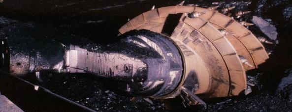
1 SMA Environmental Forum 2016 COMPENSATION LAKE DESIGN CONCEPTS AND CONSTRUCTION LESSONS LEARNED Month A Tale DD, of YYYY Two Lakes Pamela Kuipers, P.Eng., MSc EXPLORE the Depths of our Experience

2 Presentation Outline 1.Introduction: Compensation Lake Concepts, Site Selection and Design Objectives 2.Construction of Shell s Jackpine and MRMe Compensation Lakes with Lessons Learned 3.Lake Performance to date EXPLORE the Depths of our Experience 2
 of the Department of Fisheries and Oceans (DFO) Fisheries Act The two lakes were constructed under authorizations granted prior to 2010, which specified")
3 Compensation Lake Concept To maintain the productive capacity of fish habitats, DFO adopted an offeset policy based on Habitat Units (formerly No Net Loss ) Projects that will alter fish habitat required an authorization under Section 35(2) of the Department of Fisheries and Oceans (DFO) Fisheries Act The two lakes were constructed under authorizations granted prior to 2010, which specified a 2:1 HU offset Losses x 2 = GAINS EXPLORE the Depths of our Experience 3
 decision matrix analyses were completed at each stage EXPLORE the Depths of our Experience www.norwestcorp.")
4 Compensation Site Selection Process Background Inventory Site Scoping Detailed site investigations Multi-stage analyses were completed Numerical weighting(k-t) decision matrix analyses were completed at each stage EXPLORE the Depths of our Experience 4

5 Compensation Site Location Attributes Evaluation metrics included: stakeholder concerns: ecological viability: technical and construction feasibility economic feasibility accessibility EXPLORE the Depths of our Experience 5


6 JPM and MRMe Compensation Lakes TWP. 95 MRM Mine RGE. 9 W4M MRMe Compensation Lake Jackpine Compensation Lake Kearl Lake 15 km NE of Fort MacKay, AB Jackpine Mine EXPLORE the Depths of our Experience 6
 EXPLORE the Depths of our Experience www.norwestcorp.")
7 Design Objectives Creates fish habitat units (HU) required by DFO Authorization Made of natural materials Stable and permanent Supports target fish Inlet and outlet accessible to existing populations Supports existing terrestrial habitat Executed Safely and in accordance with all regulations JPM Compensation Lake Outlet (2013) EXPLORE the Depths of our Experience 7

8 Detailed Design Inputs Field investigations Geologic modeling Groundwater modeling Surface Water modeling Water quality modeling Flood modeling Iterative bathymetry and Suitability Index model process Consultation, First Nations and regulator review Fish surveys EXPLORE the Depths of our Experience 8
 South Basin Connecting narrows depth 0 to 2 m deep (littoral) 2 to 5 m deep > 5 m deep Habitat Units Created (based on 10 Target Fish species) 1.5 m 27 % 28")
9 JPM Compensation Lake Characteristics Parameter Mean water level Value masl Outlet and Oxbow Mean surface area Average water depth North basin depth South basin depth 47.3 ha 5.14 m 7 m 11 m (Closed) South Basin Connecting narrows depth 0 to 2 m deep (littoral) 2 to 5 m deep > 5 m deep Habitat Units Created (based on 10 Target Fish species) 1.5 m 27 % 28.3 % 44.7 % 2.76 million Narrows North Basin Inlet EXPLORE the Depths of our Experience 9

 43.")
 2.")
10 MRMe Compensation Lake Characteristics Mean water level Parameter Value masl Mean surface area 41.4 ha Average water depth Max depth Main Basin depth 5.7 m 12.2 m 11 m 0 to 3 m deep (littoral) 43.7 % Habitat Units Created (based on 10 Target Fish species) 2.61 million EXPLORE the Depths of our Experience 10


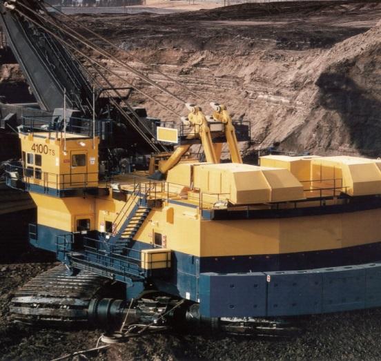
11 Early Works- Both Projects Tree clearing and salvage Access and Haul Roads Soil salvage plans Dump and stockpile designs and permitting Drainage network and sedimentation ponds EXPLORE the Depths of our Experience 11


12 Tree Clearing Both Projects Cleared area that was subject to reclamation JPM Compensation Lake reclaimed haul road MRMe Compensation Lake Harvestable Trees removed without grubbing, Lake Footprint maximized within cleared area (Lesson Learned) EXPLORE the Depths of our Experience 12


13 JPM CL Early Works- Drainage Network EXPLORE the Depths of our Experience 13

14 MRMe CL Early Works Drainage Network EXPLORE the Depths of our Experience 14
 doubles as littoral zone.")

15 Lake Bathymetry (Pit Geometry) Areas broken up into Cells for construction tracking purposes Inside Ring Road (L Cells) doubles as littoral zone. No external footprint disturbed Slopes constructed with GPS Equipment confirmed by frequent survey and placement mapping EXPLORE the Depths of our Experience 15


16 JPM Compensation Lake Liner Hydrocarbon bearing soils capped with high fines material or LOS and mineral soil for biological buffer zone LOS capped with mineral soil EXPLORE the Depths of our Experience 16


17 MRM Compensation Lake Liner 20:80 Peat:Mineral soil mix placed up to high water line to avoid migration of organics during storm events Lesson learned from Jackpine CL applied to MRMe CL Integration with Mine ops Design Adaptations for Construction Schedule and site constraints Liner extended to act as seepage barrier in overburden EXPLORE the Depths of our Experience 17
18 MRMe Compensation Lake Liner Hydrocarbon bearing soils capped with LOS and mineral soil EXPLORE the Depths of our Experience 18

19 MRMe Compensation Lake Liner Overburden soils below the water table capped with LOS and mineral soil Hydrocarbon bearing soils capped with LOS and mineral soil EXPLORE the Depths of our Experience 19

 as in Jackpine Lake (2015) EXPLORE the Depths of our Experience www.")
20 MRMe Compensation Lake Substrate Consultation with First Nations led to request to assign zone in MRMe Compensation Lake for rat root planting; a traditional medicinal species. Plans are for First Nations continued involvement in harvesting and planting of rat root in MRMe Compensation Lake (2017+) as in Jackpine Lake (2015) EXPLORE the Depths of our Experience 20

21 JPM Compensation Lake Substrate Secondary Inlet Overburden Disposal Area Reclamation Stockpiles Boulders in Narrows Shoreline Protection for Lake Filling and Habitat Complexing EXPLORE the Depths of our Experience 21


22 JPM Compensation Lake Substrate Boulders and tree clusters placed in shallow areas at JPM Compensation Lake were found to be an HSE navigation hazard during monitoring visits and blocked flow. EXPLORE the Depths of our Experience 22


23 MRMe Compensation Lake Habitat Features Large Rock clusters and series of smaller clusters create diversity at specific locations Channel protection for lake filling doubles as habitat features EXPLORE the Depths of our Experience 23


24 Habitat Features at Shoreline JPM Native grasses recolonizing JPM Adaptive revegetation MRMe Shoreline grasses recolonizing Weed species predominant in some areas. Adaptive reclamation planting of target species and willow may be required MRMe Habitat Mounds Adapted from project monitoring well installations EXPLORE the Depths of our Experience 24

25 JPM CL Inlet Construction and Lake Filling Boulder Clusters Sand bags slowly removed to avoid excessive filling erosion Rock Riffles Filling progressed smoothly until spring freshet braided nature of Muskeg Creek lifted matting and cut new channels. Maintenance was not required and inlet has since stabilized. Lessons learned are further ground truthing of complex stream networks to plan for secondary channels, hard armouring, insitu materials and minimize disturbance EXPLORE the Depths of our Experience 25


26 Outlet Channel Construction JPM Narrow, Low Flow Channel MRMe Large boulders placed for variable flow in meandering pattern Biodegradable Matting for Erosion Protection Insitu root mass, PMM, and trees placed in herringbone pattern for erosion protection Wide High Flow Channel EXPLORE the Depths of our Experience 26

27 MRMe CL Lake Filling Armoured Filling Channel Ponded water lead to erosion channels on exposed slopes Lake Partially filled Habitat Rock Clusters Filling progressed slowly through inlet channels Pooling of rainwater lead to concentrated flow and liner erosion Mitigation is ongoing, and includes temporary flow diversion infrastructure Lessons learned is more consideration to inactive filling periods at design phase, consider alternate sources EXPLORE the Depths of our Experience 27


28 Water Management- Both Lakes Both sites are located at the confluence of two streams where the water table is at or close to surface Lesson learned is to utilize in-pit sump and ditch networks, with lead time Use existing mine infrastructure where possible reduce pumping volumes by integrating design features (seepage barrier) and winter season construction MRMe Site flooded between Phase 1 and Phase 2 JPM CL Groundwater seepage EXPLORE the Depths of our Experience 28
 and quality sampling Lessons learned were burry your lines deep, have")


29 Winter Operations Challenges With maintaining continuous operation (frozen lines) and quality sampling Lessons learned were burry your lines deep, have repair parts on hand, and continuous operational oversite Challenges achieving compaction, especially on gravels Lessons learned were account for heating requirements assess haul lengths and cycle times be aware of supplier peaks schedule impacts EXPLORE the Depths of our Experience 29


 Lessons learned were")

30 Environmental and Regulatory Requirements Project is adjacent to MSL Boundary and next to environmentally sensitive buffer Migratory Bird and Nesting Bird Regulatory Constraints (Schedule Risk). Key Wildlife Biodiversity Zone restrictions apply (Schedule Risk, equipment size contraints) Lessons learned were communication Early Often Multiple Methods Boots on the ground EXPLORE the Depths of our Experience 30


31 JPM Compensation Lake Progress Comprehensive JPM Compensation Lake monitoring is indicating that the Lake is performing as designed. Fish populations and littoral zone vegetation area abundant. Natural revegetation is progressing well in tandem with adaptive revegetation. Terrestrial species are present at the Lake site EXPLORE the Depths of our Experience 31


32 MRMe Compensation Lake Progress Comprehensive monitoring will commence once filling is complete Interim monitoring is focussed on filling, basic revegetation, and erosion Natural revegetation is progressing Terrestrial species are present at the Lake site Ongoing mitigation against storm runoff erosion EXPLORE the Depths of our Experience 32


33 QUESTIONS? EXPLORE the Depths of our Experience 33


34 Thanks- Project Team EXPLORE the Depths of our Experience 34

35 Pie Chart Info EXPLORE the Depths of our Experience doming id quod mazim place rat facer possim assum. Typi non habent claritatem insitam; est usus legentis in iis qui facit eorum claritatem. EXPLORE the Depths of our Experience 35
Creation of Fish and Wildlife Habitat on the Closed Salmon Harbour Mine in Minto, NB
 Creation of Fish and Wildlife Habitat on the Closed Salmon Harbour Mine in Minto, NB M. Coleman 1, R. Rutherford 2, RA Currie 3 1 NB Power 2 Thaumas Environmental Consultants Ltd 3 RA Currie Ltd. Location
OKANAGAN RIVER RESTORATION INITIATIVE - FAQ
 OKANAGAN RIVER RESTORATION INITIATIVE - FAQ Initiative background: The health of the q awsitk w (Okanagan River) has been severely impacted by the channelization works that occurred in the mid-1950 s.
D.B. Wilson Station CCR Landfill
 D.B. Wilson Station CCR Landfill Disposal of Coal Combustion Residuals (CCR) from Electric Utilities Final Rule Closure and Post-closure Care Plan October 11, 2016 Prepared By: Project ID: 160030A Big
FINAL REPORT. Yonkers Creek Migration Barrier Removal Project Wonderstump Road Del Norte County. Submitted By:
 FINAL REPORT Yonkers Creek Migration Barrier Removal Project Wonderstump Road Del Norte County Submitted By: Del Norte County Community Development Department Yonkers Creek Migration Barrier Removal Project
Estimated on-the-ground start and end dates: 1 June October 2018
 A. Applicant Information Name of Organization: U.S. Army Corps of Engineers, Carlyle Lake 801 Lake Road, Carlyle, IL 62231 Contact Information: Robert Wilkins, Operations Manager, (618) 594-2484, Robert.Wilkins@usace.army.mil
Big Spring Creek Habitat Enhancement and Fishery Management Plans
 Big Spring Creek Habitat Enhancement and Fishery Management Plans November 5, 2012 Big Spring Events and Activities Center Newville, PA Charlie McGarrell Regional Habitat Biologist Pennsylvania Fish and
Hydraulic Modeling of Stream Enhancement Methods
 Hydraulic Modeling of Stream Enhancement Methods Matthew J. Curry John J. Levitsky Abstract Development within watersheds increases the amounts of runoff causing stream erosion and degradation of stream
City of Burnaby Environmental Review Committee (ERC) Guide for Applicants
 Guide for Applicants") City of Burnaby Environmental Review Committee (ERC) Guide for Applicants 2017-2018 This Guide summarizes the ERC process for project review including applications for a relaxation (variance) to the development
City of Burnaby Environmental Review Committee (ERC) Guide for Applicants 2017-2018 This Guide summarizes the ERC process for project review including applications for a relaxation (variance) to the development
CCR Landfill 2017 Annual Inspection Report NC1 Ash Disposal Area
 CCR Landfill 2017 Annual Inspection Report NC1 Ash Disposal Area Omaha Public Power District Nebraska City Station Nebraska City, Nebraska January 19, 2018 OPPD Nebraska City Station NC1 Ash Disposal Area
Steelhead Society of BC. Thompson River Watershed Restoration and Enhancement Project #4 Nicola River Bank Stabilization and Enhancement Project
 Steelhead Society of BC Presents: Thompson River Watershed Restoration and Enhancement Project #4 Nicola River Bank Stabilization and Enhancement Project Application for Funding December 2013 1.0 BACKGROUND
National Oceanic and Atmospheric Administration (NOAA)/ Mulberry Phosphate Trustee Council September 12, 2013
/ Mulberry Phosphate Trustee Council September 12, 2013") OYSTER REEF CREATION PROJECT DESIGN AND IMPLEMENTATION IN HILLSBOROUGH BAY, FLORIDA TAMPA BAY REGIONAL PLANNING COUNCIL AGENCY ON BAY MANAGEMENT MEETING National Oceanic and Atmospheric Administration
OYSTER REEF CREATION PROJECT DESIGN AND IMPLEMENTATION IN HILLSBOROUGH BAY, FLORIDA TAMPA BAY REGIONAL PLANNING COUNCIL AGENCY ON BAY MANAGEMENT MEETING National Oceanic and Atmospheric Administration
BMC Dragline Move Vegetation Clearing Procedure. 1 December 2016
 BMC Dragline Move Vegetation Clearing Procedure 1 December 2016 Table of Contents 1.0 Vegetation Clearing Procedure 1 1.1 Scope 1 1.2 Clearing Guidelines 1 1.3 Induction and Toolbox Notes 2 1.4 Inspections
Illinois Lake Management Association Conference March 23, 2018 By Trent Thomas Illinois Department of Natural Resources Division of Fisheries
 Illinois Lake Management Association Conference March 23, 2018 By Trent Thomas Illinois Department of Natural Resources Division of Fisheries Sources of Habitat Impairment Sedimentation Channelization
Low Gradient Velocity Control Short Term Steep Gradient Channel Lining Medium-Long Term Outlet Control Soil Treatment Permanent [1]
![Low Gradient Velocity Control Short Term Steep Gradient Channel Lining Medium-Long Term Outlet Control Soil Treatment Permanent [1]](/thumbs/80/80811988.jpg "Low Gradient Velocity Control Short Term Steep Gradient Channel Lining Medium-Long Term Outlet Control Soil Treatment Permanent [1]") Check Dams DRAINAGE CONTROL TECHNIQUE Low Gradient Velocity Control Short Term Steep Gradient Channel Lining Medium-Long Term Outlet Control Soil Treatment Permanent [1] [1] Though not generally considered
Check Dams DRAINAGE CONTROL TECHNIQUE Low Gradient Velocity Control Short Term Steep Gradient Channel Lining Medium-Long Term Outlet Control Soil Treatment Permanent [1] [1] Though not generally considered
Trout Unlimited Comments on the Scope of Environmental Impact Statement for the Constitution Pipeline Project, Docket No. PF12-9
 October 9, 2012 Kimberly D. Bose, Secretary Federal Energy Regulatory Commission 888 First Street, NE, Room 1A Washington, DC 20426 RE: Trout Unlimited Comments on the Scope of Environmental Impact Statement
FACT SHEET MCGREGOR LAKE RESTORATION HABITAT PROJECT POOL 10, UPPER MISSISSIPPI RIVER, WISCONSIN ENVIRONMENTAL MANAGEMENT PROGRAM
 FACT SHEET MCGREGOR LAKE RESTORATION HABITAT PROJECT POOL 10, UPPER MISSISSIPPI RIVER, WISCONSIN ENVIRONMENTAL MANAGEMENT PROGRAM LOCATION McGregor Lake is located within a mid-river island in Pool 10
TABLE OF CONTENTS LEGAL NOTICE
 Surface Impoundments Page No. i TABLE OF CONTENTS 1. INTRODUCTION... 1 2. PROPOSED CCR IMPOUNDMENT CLOSURE PROCEDURE... 3 3. PROPOSED COVER SYSTEM... 4 4. ESTIMATED MAXIMUM INVENTORY OF CCR... 4 5. ESTIMATED
Tips for Using & Printing Spreadsheets
 Key to Spreadsheets Spreadsheet # Type Description/Purpose a Development & Construction in Waterways b Debits Development & Construction in Other Aquatic Areas c Indirect Impacts to Waterways from Development
Environmental Management Strategy
 Appin Surface Gas Management Project Appin Mine Surface Gas Management Project Environmental Management Strategy Page 1 Appin Surface Gas Management Project Review History Revision Description of Changes
Annual CCR Landfill Inspection OML Existing Landfill OML Expansion Phase 1
 Annual CCR Landfill Inspection OML Existing Landfill OML Expansion Phase 1 Ottumwa-Midland Landfill Prepared for: Ottumwa-Midland Landfill 15300 130 th Street Ottumwa, Iowa 52501 Prepared by: SCS ENGINEERS
(Revised February,2005) CULVERTS, BRIDGES, AND FORDS
 CULVERTS, BRIDGES, AND FORDS") GUIDE TO STREAM CROSSINGS (Revised February,2005) CULVERTS, BRIDGES, AND FORDS Culverts, bridges, and fords are all methods used to cross-streams. Culverts are the most common stream crossing structure.
GUIDE TO STREAM CROSSINGS (Revised February,2005) CULVERTS, BRIDGES, AND FORDS Culverts, bridges, and fords are all methods used to cross-streams. Culverts are the most common stream crossing structure.
La Quinta Channel Extension Port of Corpus Christi Ingleside, Texas. Mark Coyle
 La Quinta Channel Extension Port of Corpus Christi Ingleside, Texas Mark Coyle Corpus Christi Navigation Channel PCCA La Quinta Expansion Project History Corpus Christi Ship Channel Improvement Projects
RULES OF THE OIL AND GAS PROGRAM DIVISION OF WATER RESOURCES CHAPTER DRILLING WELLS TABLE OF CONTENTS
 RULES OF THE OIL AND GAS PROGRAM DIVISION OF WATER RESOURCES CHAPTER 0400-52-06 DRILLING WELLS TABLE OF CONTENTS 0400-52-06-.01 Drilling Equipment 0400-52-06-.03 Casingheads 0400-52-06-.02 Blowout Prevention
TABLE OF CONTENTS LEGAL NOTICE
 Closure Plan for Existing CCR Revision: 1 Surface Impoundments Page No. i TABLE OF CONTENTS 1. INTRODUCTION... 1 2. PROPOSED CCR IMPOUNDMENT CLOSURE PROCEDURE... 3 3. PROPOSED COVER SYSTEM... 4 4. ESTIMATED
PROJECT TO INSTALL LARGE WOOD HABITAT STRUCTURES IN THE CARMEL RIVER USING CALIFORNIA DEPARTMENT OF FISH AND GAME GRANT FUNDS
 PROJECT TO INSTALL LARGE WOOD HABITAT STRUCTURES IN THE CARMEL RIVER USING CALIFORNIA DEPARTMENT OF FISH AND GAME GRANT FUNDS The Monterey Peninsula Water Management District (MPWMD), in cooperation with
Initial Annual CCR Landfill Inspection OML Existing Landfill OML Expansion Phase 1
 Initial Annual CCR Landfill Inspection OML Existing Landfill OML Expansion Phase 1 Ottumwa-Midland Landfill Prepared for: Ottumwa-Midland Landfill 15300 130 th Street Ottumwa, Iowa 52501 Prepared by: SCS
Study Update Tailrace Slough Use by Anadromous Salmonids
 Study Update Tailrace Slough Use by Anadromous Salmonids Goals and Objectives Identify what anadromous salmonids use the tailrace slough by: Life Stage (Juvenile, migrating and spawning adults) Timing
# Post Consultation and Submissions Resource Consent Conditions for Surfing Impact Mitigation August 2016
 # Post Consultation and Submissions Resource Consent Conditions for Surfing Impact Mitigation August 2016 Surf Mitigation Management Plan 1 1 Not less than 6 months prior to the commencement of the construction
COLUMBIA LAKE DAM REMOVAL PROJECT
 COLUMBIA LAKE DAM REMOVAL PROJECT Major Goals of the Columbia Lake Dam Removal: Reconnect 10 miles of the Paulins Kill River to the Delaware River, restoring natural flow regime and sediment transport.
1.Mill Creek Watershed Summary Description and Land Use
 1.Mill Creek Watershed Summary Description and Land Use Table xxx: Mill Creek Watershed Overview Watershed Size 31,435 acres/49.1 sq miles/ 127.1 sq km Elevation Range 5,594 feet [4,967-10,561] Stream
Winter Drawdown Issues of Concern
 Winter Drawdown Issues of Concern Wetland Connectivity Amphibians Fisheries Winter Drawdown Wetland Connectivity Wetland complex near Osprey Creek is not responsive to lake level Wetland at upper end of
P.O. Box 65 Hancock, Michigan USA fax
 This PDF file is a digital version of a chapter in the 2005 GWS Conference Proceedings. Please cite as follows: Harmon, David, ed. 2006. People, Places, and Parks: Proceedings of the 2005 George Wright
As temporary grade control facilities along waterways until final stabilization is established.
 Check Dams (CD) EC-12 Description Check dams are temporary grade control structures placed in drainage channels to limit the erosivity of stormwater by reducing flow velocity. Check dams are typically
JAP Additional Information Sheet
 JAP Additional Information Sheet Block 15: Purpose and Need The USACE purpose of the project is to provide a safe and reliable whitewater park for the recreational public in a city park, which will provide
Amendment to a Biological Assessment/Evaluation completed for the Coon Creek Land Disposal completed December Grand Valley Ranger District
 Amendment to a Biological Assessment/Evaluation completed for the Coon Creek Land Disposal completed December 2007 Grand Valley Ranger District Grand Mesa, Uncompahgre, Gunnison National Forests Prepared
REVETMENTS. Purposes and Operational Constraints. Purposes Erosion control o o. Revetment Design 4/5/2016. CE A676 Coastal Engineering
 REVETMENTS Ijsseldam, the Netherlands Orson P. Smith, PE, Ph.D. Instructor Purposes and Operational Constraints Purposes Erosion control o o Embankment Toe protection for a seawall, retaining wall or other
Mr. Michael Malone CPS Energy 145 Navarro Street, Mail Drop San Antonio, Texas Project No
 October 17, 2016 Mr. Michael Malone CPS Energy 145 Navarro Street, Mail Drop 100406 San Antonio, Texas 78296 Project No. 0352436 Subject: Compilation of Construction History Calaveras Power Station San
Suitable Applications Check dams may be appropriate in the following situations: To promote sedimentation behind the dam.
 Categories EC Erosion Control SE Sediment Control TC Tracking Control WE Wind Erosion Control Non-Stormwater NS Management Control Waste Management and WM Materials Pollution Control Legend: Primary Category
Mid-Columbia Fisheries Enhancement Group Annual Report Fiscal Year 06: July 1, 2005 June 30, 2006
 Mid-Columbia Fisheries Enhancement Group Annual Report Fiscal Year 06: July 1, 2005 June 30, 2006 Mission Statement The mission of the Mid-Columbia Fisheries Enhancement Group is to restore self-sustaining
Eastern Shore Islands Area of Interest Community Newsletter
 Eastern Shore Islands Area of Interest Community Newsletter Fall 2018 1ỊNTRODUCTION In addition to information on our Fisheries and Oceans Canada (DFO) website, we have now created a seasonal, community
Kootenai River Habitat Restoration Program. Kootenai Tribe of Idaho - January 27, 2014 Presentation for Kootenai Valley Resource Initiative
 Kootenai River Habitat Restoration Program Kootenai Tribe of Idaho - January 27, 2014 Presentation for Kootenai Valley Resource Initiative Decline of native species Kootenai River White Sturgeon ENDANGERED
Dry Hydrants. The installation of a non-pressurized pipe system into local water sources provides a ready means of supplying water to fire engines.
 Dry Hydrants What is a Dry Hydrant? A dry hydrant is a non-pressurized pipe system permanently installed in existing lakes, ponds and streams that provides a suction supply of water to a fire department
Don Pedro Project Relicensing
 Don Pedro Project Relicensing M ODESTO I RRIGATION D ISTRICT TURLOCK I RRIGATION D ISTRICT FERC PROJECT N O. 2299 Resident Fish in Don Pedro Reservoir Don Pedro Reservoir Fish Stocking (1971-Present) CDFG
Columbia Lake Dam Removal Project
 Columbia Lake Dam Removal Project The Columbia Lake dam located 1/4 mile upstream of the Paulins Kill River's confluence with the Delaware River in Knowlton Township, Warren County has been proposed for
Firth Creek Habitat Enhancement Project 1993
 Firth Creek Habitat Enhancement Project 1993 A. R. Langston December 1993 PWFWCP Report No. 77 The Peace/Williston Fish & Wildlife Compensation Program is a cooperative venture of BC Hydro and the provincial
Columbia Lake Dam Removal Project
 Columbia Lake Dam Removal Project Major Goals of the Columbia Lake Dam Removal: Reconnect 10 miles of the Paulins Kill River to the Delaware River, restoring natural flow regime and sediment transport.
Understanding Today s Environmental Issues and the Oregon Stewardship Guidelines. David Phipps GCSAA NW Field Staff
 Understanding Today s Environmental Issues and the Oregon Stewardship Guidelines David Phipps GCSAA NW Field Staff My Roots Northwest Landscape Industries 1986-1990 The Oregon Golf Club 1990-2000 Stone
Redd Dewatering and Juvenile Salmonid Stranding in the Lower Feather River,
 Redd Dewatering and Juvenile Salmonid Stranding in the Lower Feather River, 2005-2006 Interim Report for NOAA Fisheries Prepared by: California Department of Water Resources Division of Environmental Services
Lewis River Bull Trout Habitat Restoration Project Identification Assessment
 Lewis River Bull Trout Habitat Restoration Project Identification Assessment Jamie Lamperth 1, Bryce Michaelis 2, and Abi Groskopf 3 1 Washington Department of Fish and Wildlife, Fish Ecology and Life
Ninilchik Harbor Page 2 of 11
 Ninilchik Harbor Ninilchik Harbor Page 2 of 11 Condition of Improvements 31 December 2017 Ninilchik Harbor, Alaska (CWIS No. 012640, 087345) Authorization Rivers and Harbors Act, 3 July 1958 (P.L. 85-500
Brook Trout Life Cycle and Habitat
 Brook Trout Life Cycle and Habitat Directions: 1. As you watch this slide show, watch for vocabulary terms we learned today. The first time they appear, you will see them in RED! (not redd!) 2. At the
LIFE HISTORY DIVERSITY AND RESILIENCE
 LIFE HISTORY DIVERSITY AND RESILIENCE SPRING CHINOOK IN THE WILLAMETTE RIVER BASIN Kirk Schroeder Brian Cannon Luke Whitman Paul Olmsted Oregon Department of Fish and Wildlife Corvallis Research Lab Thanks
1. Distribute the activity sheet, and allow 20 minutes for the first use.
 A LOCAL WAY OF LEARNING Title: MISSING MANGROVE MESSAGE Author: Eulalie R. Rivera Elementary School Environmental Education Team Grade Level: 4-6 Concepts: 2.Ecosystem 6.Resources 9.Change Disciplines:
APPENDIX J HYDROLOGY AND WATER QUALITY
 APPENDIX J HYDROLOGY AND WATER QUALITY J-1 Technical Report on Airport Drainage, Northern Sector Airport and Ordinance Creek Watershed / Preliminary Creek Constructed Natural Channel Culvert J-2 Preliminary
Rehabilitation of Grimes Creek, a Stream Impacted in the Past by Bucket-lined Dredge Gold Mining, Boise River Drainage, July 2008 to August 2011.
 Rehabilitation of Grimes Creek, a Stream Impacted in the Past by Bucket-lined Dredge Gold Mining, Boise River Drainage, July 2008 to August 2011. Pam Harrington TU,1020 W. Main Street Suite 440, Boise,
Outlet Structures T-12
 Description This section provides guidance and details for outlet structures for use primarily with BMPs utilizing sedimentation, (i.e., extended detention basins (EDBs), retention ponds, and constructed
1.Warm Springs Creek (Anaconda) Watershed Description and Land Use
 Watershed Description and Land Use") 1.Warm Springs (Anaconda) Watershed Description and Land Use Table xxx: Warm Springs Watershed Overview Watershed Size 92,288 acres/144.2 sq miles/373.6 sq km Elevation Range 5,781 feet [4,800-10,581]
1.Warm Springs (Anaconda) Watershed Description and Land Use Table xxx: Warm Springs Watershed Overview Watershed Size 92,288 acres/144.2 sq miles/373.6 sq km Elevation Range 5,781 feet [4,800-10,581]
Klickitat County Shoreline Master Program Update. Open House March 15, 2017
 Klickitat County Shoreline Master Program Update Open House March 15, 2017 Agenda 6:00 6:10 Welcome 6:10 6:40 Presentation SMP Update Process Shoreline Analysis review 6:40 8:00 Open House Topics SMP Process
Marine Ecosystems. Aquatic Ecosystems Section 2
 Marine Ecosystems Marine ecosystems are located mainly in coastal areas and in the open ocean. Organisms that live in coastal areas adapt to changes in water level and salinity. Organisms that live in
MOREHEAD CITY HARBOR, NC. Dredged Material Management Plan (DMMP)
") MOREHEAD CITY HARBOR, NC Dredged Material Management Plan (DMMP) Public Meeting/Info Session 15 January 2014 US Army Corps of Engineers Morehead City Harbor DMMP Presentation Topics Morehead City Harbor
MOREHEAD CITY HARBOR, NC Dredged Material Management Plan (DMMP) Public Meeting/Info Session 15 January 2014 US Army Corps of Engineers Morehead City Harbor DMMP Presentation Topics Morehead City Harbor
Final Bull Trout Genetics Monitoring Plan for the Wallowa Falls Hydroelectric Project. (FERC No. P-308) June 2017
 June 2017") Final for the Wallowa Falls Hydroelectric Project (FERC No. P-308) June 2017 Prepared by: Jeremiah Doyle PacifiCorp 825 NE Multnomah Street Portland, OR 97232 June, 2017 Page 1 of 8 Table of Contents 1.0
Final for the Wallowa Falls Hydroelectric Project (FERC No. P-308) June 2017 Prepared by: Jeremiah Doyle PacifiCorp 825 NE Multnomah Street Portland, OR 97232 June, 2017 Page 1 of 8 Table of Contents 1.0
Notice of Intent to Close Inactive CCR Surface Impoundments
 Notice of Intent to Close Inactive CCR Surface Impoundments Virginia Electric and Power Company Possum Point Power Station Coal Combustion Residual Surface Impoundments A, B, C, D, and E Dumfries, Virginia
RESILIENCE THROUGH RESTORATION
 RESILIENCE THROUGH RESTORATION RECLAMATION DISTRICT NO. 1601 TWITCHELL ISLAND SAN JOAQUIN RIVER SETBACK LEVEE PROJECT TWITCHELL ISLAND BASICS Nearly 12 miles of levee Storm drainage facilities Protects
Warm-up # 7 A day 5/17 - B day 5/18 UPDATE YOUR TABLE OF CONTENTS
 Warm-up # 7 A day 5/17 - B day 5/18 UPDATE YOUR TABLE OF CONTENTS Question: List all examples of surface water on Earth. Answer: Rivers and streams, lakes and reservoirs, (ponds) wetlands, estuaries and
Eastern Brook Trout Joint Venture Completed Project Report Form
 Eastern Brook Trout Joint Venture Completed Project Report Form Project Title: Assessing the Efficacy of Remediating Episodic Low ph (and High Aluminum) Concentrations in Headwater Brook Trout Streams
Culvert Design for Low and High Gradient Streams in the Midwest. Dale Higgins, Hydrologist Chequamegon-Nicolet National Forest
 Culvert Design for Low and High Gradient Streams in the Midwest Dale Higgins, Hydrologist Chequamegon-Nicolet National Forest Overview Culvert Design Considerations Hydraulic Terms Culvert Impacts Low
Habitat Development: Habitat Boulders Lawson Pier Foreshore Enhancement
 Habitat Development: Habitat Boulders Improve the existing habitat by stabilising beach sediments. Increase biodiversity by creating new habitats and colonisation opportunities. Loose cobble is unstable;
Little Kern Golden Trout Status:
 Little Kern Golden Trout Status: The Little Kern Golden trout (LKGT) was proposed for federal listing as Threatened under the Endangered Species Act (ESA) on September 1, 1977 by the U. S. Fish and Wildlife
Rock Ramp Design Guidelines. David Mooney MS Chris Holmquist-Johnson MS Drew Baird Ph.D. P.E. Kent Collins P.E.
 Rock Ramp Design Guidelines David Mooney MS Chris Holmquist-Johnson MS Drew Baird Ph.D. P.E. Kent Collins P.E. Rock Ramp Design Guidelines OUTLINE Local and System Interactions with Rock Ramps Ramp Geometry
Ecology of Columbia River redband trout (Oncorhynchus mykiss gairdneri) in high desert streams
 in high desert streams") Ecology of Columbia River redband trout (Oncorhynchus mykiss gairdneri) in high desert streams Dry Creek October 2012 Chris A. Walser Ph.D., Professor of Biology Department of Biology and Environmental
Ecology of Columbia River redband trout (Oncorhynchus mykiss gairdneri) in high desert streams Dry Creek October 2012 Chris A. Walser Ph.D., Professor of Biology Department of Biology and Environmental
Annual CCR Landfill Inspection. Lansing Landfill. Interstate Power and Light Company. Prepared for:
 Annual CCR Landfill Inspection Lansing Landfill Prepared for: Interstate Power and Light Company Lansing Generating Station 2320 Power Plant Drive Lansing, Iowa 52151 Prepared by: SCS ENGINEERS 2830 Dairy
Okanagan Sockeye Reintroduction
 Okanagan Sockeye Reintroduction Backgrounder Elders accounts, and other forms of Traditional Ecological Knowledge (TEK) tell us that many species of salmon once came into the Okanagan Valley and tell us
Living Streets Policy
 Living Streets Policy Introduction Living streets balance the needs of motorists, bicyclists, pedestrians and transit riders in ways that promote safety and convenience, enhance community identity, create
Stevens Creek Corridor
 O F F I C E O F T H E D I R E C T O R O F P U B L I C W O R K S Stevens Creek Corridor Creek Restoration Project Volume Three Project Update: Creek Photos, Before & After BY GAIL SEEDS - PROJECT MANAGER,
Developing Back Bay. Pre-Handout. Scope and Background
 Developing Back Bay Pre-Handout Scope and Background This is your third project and substantially different from the first two. It is actually a large scale planning project and as such, it is open ended.
SUMMARY REPORT FOR LAKE ST. MALO FISHERIES ASSESSMENT. Prepared for the St. Malo and District Wildlife Association
 SUMMARY REPORT FOR LAKE ST. MALO FISHERIES ASSESSMENT Prepared for the St. Malo and District Wildlife Association Presented by August 25, 2014 Study dates thus far: Date Tasks February 16 Fishing derby;
Emergent Sandbar Habitat Program Middle Missouri River
 Emergent Sandbar Habitat Program Middle Missouri River Jeremiah Szynskie, P.E. Hydrologic Engineering Branch Introduction Main Stem System Dam Closures Fort Peck 1937 Fort Randall 1952 Garrison - 1953
TROUT CREEK WATERSHED (Second Year of Snowline Data)
") Extent of Snow Cover During the 2002 Spring Freshet For the TROUT CREEK WATERSHED (Second Year of Snowline Data) (Penticton Forest District) 1.0 INTRODUCTION The extent of snow cover over a watershed basin
Extent of Snow Cover During the 2002 Spring Freshet For the TROUT CREEK WATERSHED (Second Year of Snowline Data) (Penticton Forest District) 1.0 INTRODUCTION The extent of snow cover over a watershed basin
2017 Annual Inspection Report
 2017 Annual Inspection Report for Compliance with the Coal Combustion Residuals Rule (40 CFR Part 257) Comanche Station 2005 Lime Road Pueblo, Colorado 81006 January 18, 2018 Table of Contents Certification...
Restoring the Kootenai: A Tribal Approach to Restoration of a Large River in Idaho
 Restoring the Kootenai: A Tribal Approach to Restoration of a Large River in Idaho Susan Ireland, Kootenai Tribe of Idaho Future of our Salmon Conference Technical Session August 2016 Healthy Floodplains,
For more information or permission to reprint slides, please contact Donna Milligan at 1
 For more information or permission to reprint slides, please contact Donna Milligan at milligan@vims.edu 1 For more information or permission to reprint slides, please contact Donna Milligan at milligan@vims.edu
Yakima/Klickitat Fisheries Project
 Yakima/Klickitat Fisheries Project Lower Yakima River Supplementation and Research Project Operations and Maintenance Annual Report 2002-2003 March 2004 DOE/BP-00006677-1 This Document should be cited
Applying Engineering Solutions to the Science of Protection and Enhancement of Aquatic Environments. Bill Holman, P.E. Stanley Consultants
 Applying Engineering Solutions to the Science of Protection and Enhancement of Aquatic Environments Bill Holman, P.E. Stanley Consultants Project Development PHASE STAGE TASKS PURPOSE I II III Investigation
Aquatic Organism Passage at Road-Stream Crossings CHUCK KEEPORTS FOREST HYDROLOGIST ALLEGHENY NATIONAL FOREST WARREN, PENNSYLVANIA
 Aquatic Organism Passage at Road-Stream Crossings CHUCK KEEPORTS FOREST HYDROLOGIST ALLEGHENY NATIONAL FOREST WARREN, PENNSYLVANIA TOPICS COVERED Aquatic Organism Passage (AOP) Benefits of AOP Crossings
FISHERIES BLUE MOUNTAINS ADAPTATION PARTNERSHIP
 FISHERIES A warming climate, by itself, substantially affects the hydrology of watersheds in the Blue Mountains. Among the key hydrologic changes projected under all scenarios for the 2040s and beyond
Climate Change Adaptation and Stream Restoration. Jack Williams;
 Climate Change Adaptation and Stream Restoration Jack Williams; jwilliams@tu.org 1 Goals for this presentation Develop strategies for adapting streams to climate impacts by Thinking like a watershed Understanding
Fish Community. Fish Habitat, Streams and Rivers
 Clear, Ston(e)y and White Lake Plan Fish Community The lakes support a cool/warm water fishery including muskellunge, walleye, largemouth and smallmouth bass, yellow perch, pumpkinseed, rockbass, blue
Louisiana CPRA SJB Group, Baton Rouge Coastal Engineering Consultants U.S. Army Corps of Engineers Federal and State PDT Members
 Louisiana CPRA SJB Group, Baton Rouge Coastal Engineering Consultants U.S. Army Corps of Engineers Federal and State PDT Members Project Setting and Background Island Restoration Plans Pre-Screening Analysis
Nome Harbor Page 2 of 12
 Nome Harbor Nome Harbor Page 2 of 12 Condition of Improvements 30 December 2015 Nome Harbor, Alaska (CWIS No. 010422, 012270, 072742, 087755) Authorization (1) Rivers and Harbors Act, 8 August 1917 (House
COA-F17-F-1343 YEAR END REPORT
 DAVE MARSHALL SALMON RESERVE RESTORATION, MAINTENANCE, AND UPGRADES YEAR END REPORT Prepared for: Fish and Wildlife Compensation Program Prepared by: Edith Tobe, RPBio, Executive Director Box 1791, Squamish,
FISH PASSAGE IMPROVEMENT in California s Watersheds. Assessments & Recommendations by the Fish Passage Forum
 FISH PASSAGE IMPROVEMENT in California s Watersheds Assessments & Recommendations by the Fish Passage Forum FISH PASSAGE IMPROVEMENT in California s Watersheds The mission of the Fish Passage Forum is
Mesoscale modeling of the productive capacity of fish habitats in the littoral zone of reservoirs
 Mesoscale modeling of the productive capacity of fish habitats in the littoral zone of reservoirs Mesoscale modeling of the productive capacity of fish habitats in the littoral zone of reservoirs General
Assessing Ecosystem Impacts from Road Stream Crossings through Community Involvement
 Assessing Ecosystem Impacts from Road Stream Crossings through Community Involvement Background Why is the NH Fish and Game Department interested in culverts? Block fish migration Reduce opportunities
STUDY PERFORMANCE REPORT
 STUDY PERFORMANCE REPORT State: Michigan Project No.: F-80-R-4 Study No.: 702 Title: Effects of sediment traps on Michigan river channels Period Covered: October 1, 2002 to September 30, 2003 Study Objectives:
SECTION 41 Table of Contents
 SECTION 41 Table of Contents 41 San Poil Subbasin Inventory of Existing Programs Terrestrial...2 41.1 Current Management Directions...2 41.2 Existing and Imminent Protections...3 41.3 Inventory of Recent
Trail Proposal #1; May 14, 2005
 Trail Proposal #1; May 14, 2005 Dennis Kaltenbruner Bow Cycle Dean Cockshutt Mountain Toys Dave Sheridan GPS map Coord. Plus many others! Rocky Mountain Dirt Riders Association (RMDRA), on behalf of all
LaSalle Park Marina Wave Break
 LaSalle Park Marina Wave Break Federal and Municipal Environmental Assessment Background History of the Marina and LaSalle Park The LaSalle Park Marina is located in LaSalle Park at the foot of LaSalle
Bay of Fundy Estuary Profile
 s The is a sub-basin of the Bay of Fundy along the northwestern shore of Nova Scotia and at the western end of the Annapolis Valley. The Annapolis River is the major water source flowing into the estuary.
INTRODUCTION TO COASTAL ENGINEERING
 The University of the West Indies Organization of American States PROFESSIONAL DEVELOPMENT PROGRAMME: COASTAL INFRASTRUCTURE DESIGN, CONSTRUCTION AND MAINTENANCE A COURSE IN COASTAL DEFENSE SYSTEMS I CHAPTER
Fisheries and Oceans Canada Fisheries Protection Program
 Fisheries and Oceans Canada Fisheries Protection Program CN Milton Logistics Hub CEAA Panel Information Sessions Presentation March 2017 1 Presentation Outline Responsibilities under the Fisheries Act