Funding Application. Project Information. Contact Information. Project Description. 1 of 12. April 19th, :34 PM
|
|
|
- Reynard Stafford
- 6 years ago
- Views:
Transcription

1 1 of 12 Funding Application Competition Application Type Status Submitted: Prepopulated with screening form? Regional FHWA Designated Growth Centers submitted April 19th, :34 PM No Project Information 1. Project Title Downtown Bellevue Exceptional Intermodal Connections 2. Regional Transportation Plan ID No specific PSRC ID in Regional 2040 (). However, constructs work identified in the Bellevue Downtown Plan, Bellevue Grand Connection, Eastside Rail Corridor. Associated with Sound Transit T2040 #2523 (Link LRT Extension from downtown Seattle to Redmond (Overlake)) 3. Sponsoring Agency Bellevue 4. Cosponsors 5. Does the sponsoring agency have "Certification Acceptance" status from WSDOT? Yes 6. If not, which agency will serve as your CA sponsor? Contact Information 1. Contact name Mia Waters 2. Contact phone Contact Project Description 1. Project Scope Construct and install "Exceptional" intersection treatments at two intersections which bookend the Downtown Bellevue Transit Center. The intersections, NE 6th Street/110th Avenue NE and NE 6th Street/108th Avenue NE, connect the existing Transit Center to the new Bellevue Downtown Link light rail station located immediately to the east of 110th Avenue NE (currently under construction by Sound Transit) with the rest of the Downtown Bellevue Pedestrian Corridor / "Grand Connection" extending to the west of 108th Avenue NE. Intersection treatments will support increased activity within the center by providing and improving these locations through the installation of: Raised intersection surfaces to the level of adjoining sidewalks/plazas and include distinctive concrete pavement treatments (ADA compliant with coloration) within the footprint
2 distinctive concrete pavement treatments (ADA compliant with coloration) within the footprint 2 of 12 of the intersection; All Walk - scramble signal phase for pedestrian and bicycle priority across entire intersection, especially enabling diagonal movements (already exists at NE 6th Street/108th Avenue NE intersection); Expanded pedestrian queuing zones at intersection corners; Weather protection, offering rain cover for waiting pedestrian and bicyclists at intersection corners; Bollards to provide pedestrian safety and security at intersection corners; and Wayfinding kiosks to identify key Downtown Bellevue landmarks/destinations at approaches to intersection corners. Construct 2 features on 110th Ave NE, south of the NE 6th Street/110th Avenue NE intersection, mid-block: Vehicle pullout (kiss n ride) for at least two vehicles - for safer pedestrian pick-up and dropoff zone; and Mid-block pedestrian crossing (a matching mid-block crossing on 110th Avenue NE north of NE 6th Street will be constructed by others). 2. Project Justification, Need, or Purpose The NE 6th Street/110th Avenue NE and NE 6th Street/108th Avenue NE intersections serve as the virtual front door to the Downtown Bellevue Regional Growth Center for tens of thousands of commuting residents, workers, and visitors traveling to, from and through the Center every day. The Downtown Bellevue population fluctuates between approximately 14,000 residents at nighttime to well over 60,000 persons every workday. The existing arterial roadways and parking stall inventory provides nowhere near the capacity for all of the workers and visitors to arrive by single occupant or even shared vehicles. Land use and transportation planners in Bellevue have long anticipated this downtown growth and have developed a multimodal set of facility and service plans with our regional transit partners to accommodate it. Over 1,150 bus trips use the Bellevue Transit Center each weekday which leads to approximately 20,000 daily passenger boardings and arrivals. These transit riders become pedestrians and bicyclists upon stepping off the bus, or future train. Recent counts at the two intersections bookending the Transit Center confirm more than 19,000 pedestrian crossings daily. Sound Transit data presented in the East Link Project Final EIS estimate that there will be over 5,000 riders that get on and off light rail trains every weekday at the Bellevue Downtown Station as part of the ST2 program starting in 2022/23. Bus rapid transit between Lynnwood and Bellevue will be completed and open by 2024 and bring in over 7,900 riders by 2042; and finally, an additional 7-9,000 riders are projected to have access to this location when the second light rail line is connected between Issaquah and Redmond, stopping in Downtown Bellevue as part of ST3 in approximately The vast majority of these new pedestrians (and bicyclists) will traverse at least the NE 6th Street/110th Avenue NE intersection, located at the main Sound Transit entrance, as they come and go from the station. No dedicated parking stalls will be provided for the light rail station, so the facilitation of multimodal station access via walking, bicycling, and local/regional bus transit is critical. Also, just one stop east on the light rail line is the Overlake medical complex, a key destination. Downtown residents and workers will transition through the 108th and 110th exceptional intersections to access essential health care services. The Exceptional intersection treatments and safety enhancements provided by this project, consistent with adopted transportation plans, will emphasize the prioritization and safe environment intended for pedestrians and bicyclists at these two intersections and along the full NE 6th Street Pedestrian Corridor / Grand Connection through Downtown Bellevue and extend in the future to Meydenbauer Bay and the Eastside Rail Corridor. The improvements will also signal to vehicle drivers, both automobile and bus, that they are entering an area of pedestrian priority. Project Location 1. Project Location NE 6th Street & 108th Avenue NE, NE 6th Street & 110th Avenue NE; within the City of Bellevue, along the pedestrian / transit designated corridor of NE 6th Street 2. Please identify the county(ies) in which the project is located. King 3. Crossroad/landmark nearest the beginning of the project NE 6th Street/110th Avenue NE 4. Crossroad/landmark nearest the end of the project NE 6th Street/108th Avenue NE
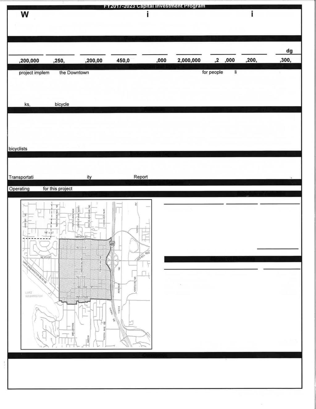
3 5. Map and project graphics Excptl_Intmd_Connctns_maps_and_graphics.pdf 3 of 12 Plan Consistency 1. Is the project specifically identified in a local comprehensive plan? Yes 2. If yes, please indicate the (1) plan name, (2) relevant section(s), and (3) page number where it can be found. The project is part of the City of Bellevue Downtown Transportation Plan Downtown Subarea Plan (DTP-DSP, AC). In December 2017, via Ordinance No. 6396, the Bellevue City Council adopted amendments to the Downtown Subarea Plan of the City's Comprehensive Plan with transportation and facility-related amendments resulting from the 2013 update of the Downtown Transportation Plan, a functional plan which supports and implements the Comprehensive Plan. Note: While the Downtown Subarea Plan amendment was adopted on Dec. 11, 2017, the inclusion of the amendments into the overall Comprehensive Plan document has not yet been finalized. The page references below relate to the version of the amended Downtown Subarea plan incorporated into the adopted Ordinance. The relevant section of the Downtown Subarea Plan is entitled "Downtown Mobility" (beginning on Page 20 of Ordinance 6396). Overarching goals of the section are: - To provide a multimodal transportation network with options for people to get around on foot, on bicycle, riding transit, or in a private or shared vehicle. - To identify and implement the multimodal transportation system improvements to support Downtown Bellevue as a dense, mixed-use urban center. The most relevant POLICIES, and where the Downtown Bellevue Exceptional Intersection treatments are specifically referenced in the Plan, can be found under the Pedestrian Corridor and Downtown Pedestrian Facilities subsections: PEDESTRIAN CORRIDOR (found on page 23 of Ordinance 6396) - The NE 6th Street Pedestrian Corridor is a high priority route for both walking and bicycling. Incremental improvements through private developments and public investments will upgrade the Corridor to provide exceptional pedestrian access to the light rail station and to the Grand Connection across I POLICY S-DT Develop and implement a concept design to better accommodate accessible travel through appropriate grades and the use of special paving treatments, wayfinding and widening. - POLICY S-DT Extend the Pedestrian Corridor designation along the sides of NE 6th Street between 110th Avenue NE and 112th Avenue NE to enhance non-motorized access to the light rail station and to the Grand Connection crossing of I-405. DOWNTOWN PEDESTRIAN FACILITIES (beginning on Page 26 of Ordinance No. 6396) - Walking should be the easiest way to get around in Downtown Bellevue. Walking is an increasingly important element of economic vitality, Downtown livability, and personal health. Pedestrians need places to walk that are safe and accessible, comfortable and convenient. New facilities will augment decades of improvements to the pedestrian environment through public and private investments. In Downtown Bellevue, 600-foot long superblocks present both challenges and opportunities for a safe, fine-grained and cohesive pedestrian environment. Breaking down the walk trip into its essential components defines the nature of specific enhancements to benefit walking: intersections and crosswalks designed to accommodate increasing numbers of pedestrians; mid-block crossings to facilitate pedestrian crossings of arterials between signalized intersections; sidewalks and curbside landscaping that form the fundamental pedestrian infrastructure, and through-block connections that provide walkable corridors through Downtown superblocks. The Downtown urban environment and the anticipated pedestrian demand dictate a context-sensitive design approach for each type of pedestrian facility. Intersections- Three types of Downtown intersections are intended to fit the needs of pedestrians: Standard Intersections; Enhanced Intersections; and Exceptional Intersections. Standard intersections have two parallel white bars that are spaced 8-feet apart and a pedestrian actuated signal that provides both audible and countdown indicators. The standard design may not be suitable at all intersections due to the high volume of pedestrians, the urban
4 may not be suitable at all intersections due to the high volume of pedestrians, the urban 4 of 12 design character, or the traffic conditions. At such locations the features of either Enhanced or Exceptional intersections are integrated. Enhanced intersections are used where there are high numbers of pedestrians or vehicles, or both, and where streetscape improvements can be carried through the intersection. Enhanced intersections are wider than Standard with special paving or striping, include neighborhood wayfinding and weather protection at corners, and curb bump outs or tighter radius to shorten crossing distance, calm traffic and provide pedestrian queuing areas. Intersections that merit "exceptional" treatment are along the Pedestrian Corridor [INCLUDES BOTH INTERSECTIONS ASSOCIATED WITH THIS APPLICATION: NE 6TH STREET/110TH AVE NE and NE 6TH STREET/108TH AVE NE] and in Old Bellevue. Exceptional intersections may include a pedestrian scramble signal phase, raised crossings, and significant/landmark wayfinding such as the popular kiosks that are located throughout Downtown. Exceptional intersections design features incorporated in the crossing of 110th Avenue NE at NE 6th Street will create a nearseamless connection between the Transit Center and the light rail station. - POLICY S-DT-159. Provide for intersections that incorporate "standard", "enhanced" or "exceptional" design components. 3. If no, please describe how the project is consistent with the applicable local comprehensive plan, including specific local policies and provisions the project supports. In addition, please describe how the project is consistent with a transit agency plan or state plan, if applicable. Federal Functional Classification 1. Functional class name 16 Urban Minor Arterial Support for Centers 1. Describe the relationship of the project to the center(s) it is intended to support. For example, is it located within a designated regional, countywide or local center, or is it located along a corridor connecting to one of these areas? This project is located at the center of the Downtown Bellevue Regional Growth Center. It promotes key provisions of Bellevue plans promoting safe, priority pedestrian access to transit services, downtown land uses and support for centers. Criteria: Regional Growth Center Development 1. Describe how the project will support the existing and planned housing/employment densities in the regional growth center. Downtown Bellevue population and housing densities have increased significantly since 2010, from about 7,100 residents and a residential unit/acre density of 11.3, to about 14,000 residents and a density of over 20 units/acre today. The population/housing boom is forecast to continue to a projected 22,000 residents and a residential units/acre density of 33.5 by Overall there has been an increase in residents and densities of about 200% since Downtown employment growth has also been significant and is projected to continue a steady climb. In 2010, Downtown employment numbers approached 40,000 jobs, and today jobs already exceed 50,000. The 2035 employment projections estimate over 70,000 jobs in the urban center. A vast majority of the existing and planned employment sites within the Downtown Bellevue Regional Growth Center are within ¼ mile of the Downtown Bellevue NE 6th Street Pedestrian Corridor. A lesser majority are within ¼ mile of the two Exceptional intersections covered by this application, and many large employment sites are located in the blocks adjacent to or across the street from the Bellevue Transit Center. All residential and employment sites within the Downtown Bellevue Regional Growth Center are less than ½ mile from the NE 6th Street Pedestrian Corridor. As described above, transit services already accommodate over 20,000 person trips to and from the Bellevue Transit Center every day. As the Downtown Bellevue East Link light rail station opens in 2022/2023, an additional 5,000 person trips are projected. Transit passengers are pedestrians or bicyclists before and after their ride on the bus, bike path, or roadway. Virtually every transit rider to the Bellevue Transit Center and Downtown light rail station will cross at least one of the two Exceptional intersections, if not both. 2. Describe how the project will support the development/redevelopment plans and
5 2. Describe how the project will support the development/redevelopment plans and5 of 12 activities (objectives and aims) of the center. Please provide a citation of the corresponding policies and/or specific project references in a subarea plan or in the comprehensive plan. As population and employment in Bellevue have grown, traffic volumes on Downtown Bellevue s arterial streets has held relatively steady. This has been accomplished through a transportation strategy that emphasizes walking, bicycling, and transit, coupled with growth focused in mixed use, transit-rich, walkable neighborhoods. The Exceptional intersections and the eight-block long NE 6th Street corridor (between 112th Avenue NE and NE Bellevue Way) provide the primary east-west pedestrian and transit corridor in Downtown Bellevue, and links millions of square feet of prime office and retail space and Convention Center to the Bellevue Transit Center and the under-construction Bellevue Downtown light rail station. Investment in the two Exceptional intersections directly implements/supports numerous specific Comprehensive Plan goals and policies. Specific to Downtown Bellevue, this project is supported by and helps to deliver the following Comprehensive Plan goals and policies: Overarching Goal of the Downtown Subarea Plan The Great Place Strategy: To be a great place for people, Downtown Bellevue must be viable, livable, memorable, and accessible. As the heart of the Eastside, Downtown Bellevue has cultural, commercial, entertainment, residential, and regional uses located in distinct, mixed-use neighborhoods connected by a variety of unique public places, great public infrastructure, and accessible mobility options. Land Use - POLICY S-DT-1. Emphasis shall be placed on Downtown livability with provisions for the needs, activities, and interests of residents, employees, shoppers, and visitors. - POLICY S-DT-4. The highest intensity development shall be located in the core of Downtown Urban Design - POLICY S-DT-35. Create a pedestrian environment with a sense of activity, enclosure, and protection. Downtown Streets - The streets in Downtown Bellevue are designed and managed based on their connectivity, cross-section, and current and future traffic and transit volume. The pedestrian-priority streets of NE 6th Street and the portion of Main Street in Old Bellevue are unique in Downtown Bellevue. The NE 6th Street Pedestrian Corridor morphs through a series of "rooms" from west to east from a limited auto-access street (street as plaza), to no auto access (garden hill climb), to a transit mall (transit central), and extends to the eastern edge of Downtown with a mix of modes in a new "civic center" segment. Eventually a "Grand Connection" will extend across I-405 and link Downtown and Wilburton. - POLICY S-DT Prioritize pedestrian activity, access, safety and comfort in the design and management of pedestrian priority streets. [i.e. NE 6th Street] - POLICY S-DT Prioritize the movement of people on buses, especially during peak commuting periods, in the design and management of transit priority streets. Signature Streets - POLICY S-DT-45. Continue to develop the NE 6th Street Pedestrian Corridor as a major unifying feature for Downtown Bellevue through public and private-sector investments. - POLICY S-DT Implement design components and wayfinding along the NE 6th Street Pedestrian Corridor to create an accessible connection. Downtown Mobility Goals: o To provide a multimodal transportation network with options for people to get around on foot, on bicycle, riding, transit, or in a private or shared vehicle. o To identify and implement the multimodal transportation system improvements to support Downtown Bellevue as a dense, mixed-use urban center. Downtown Transit Mobility Transit Passenger Access, Comfort and Information: Transit passengers are pedestrians or bicyclists before and after their ride on the bus or train. Context-appropriate components for transit stops are implemented by the city, the transit agencies, or incorporated into new projects through development review. Comfortable pedestrian and bicycle access to and from transit stops and light rail stations will enhance ridership. - POLICY S-DT-136. Support transit ridership by providing or encouraging others to provide passenger comfort, access and information as needed at each Downtown transit stop. - POLICY S-DT Improve the pedestrian and bicycle environment for access to the two light rail stations that serve Downtown, particularly between the Bellevue Transit Center and the nearby Bellevue Downtown station. Pedestrian Corridor The NE 6th Street Pedestrian Corridor is a high priority route for both walking and bicycling. Incremental improvements through private developments and public investments will upgrade the Corridor to provide exceptional pedestrian access to the light
6 investments will upgrade the Corridor to provide exceptional pedestrian access to the light 6 of 12 rail station and to the Grand Connection across I POLICY S-DT Develop and implement a concept design to better accommodate accessible travel through appropriate grades and the use of special paving treatments, wayfinding and widening. - POLICY S-DT Extend the Pedestrian Corridor designation along the sides of NE 6th Street between 110th Avenue NE and 112th Avenue NE to enhance non-motorized access to the light rail station and to the Grand Connection crossing of I-405. Downtown Pedestrian Facilities/Intersections Walking should be the easiest way to get around in Downtown Bellevue. Walking is an increasingly important element of economic vitality, Downtown livability, and personal health. Pedestrians need places to walk that are safe and accessible, comfortable and convenient. New facilities will augment decades of improvements to the pedestrian environmental through public and private investments. Three types of Downtown intersections are intended to fit the needs of pedestrians: Standard Intersections; Enhanced Intersections; and Exceptional Intersections Intersections that merit exceptional treatments are along the Pedestrian Corridor and in Old Bellevue. Exceptional intersections may include a pedestrian scramble signal phase, raised crossings, and significant/landmark wayfinding such as the popular kiosks that are located throughout Downtown. Exception intersections design features incorporated in the crossings of 110th Ave NE at NE 6th Street will create a near-seamless connection between the Transit Center and the light rail station. - POLICY S-DT-159. Provide for intersections that incorporate standard, enhanced or exceptional design components. 3. Describe how the project will support the establishment of new jobs/businesses or the retention of existing jobs/businesses including those in the industry clusters identified in the adopted regional economic strategy. The fulfillment of Bellevue s adopted goals, policies and plans for Downtown growth and mobility requires strategic investment in new types of projects like the Exceptional Intermodal Connections concept. This package of improvements at these two and other Downtown intersections will support the establishment of the projected 20,000 new jobs and the retention of over 50,000 existing jobs. Downtown Bellevue and immediately adjacent areas are home to businesses and organizations that provide high numbers of these existing and growth jobs in 10 of the top 15 industry clusters identified for the Puget Sound region in the regional economic strategy. The Exceptional Intermodal Connections project will serve employees working in the following industry clusters: 1. Local Health Services (the Bellevue Hospital/Medical District is located immediately across I- 405 from Downtown Bellevue 1 stop away on the new Sound Transit Light Rail line) 2. Local Hospitality Establishments (Over 120 restaurants and over 3,500 hotel rooms) 3. Local Real Estate, Construction, and Development 4. Local Commercial Services Local Retailing and Clothing and General Merchandise Software Publishers (Microsoft is the largest employer in Bellevue) 11. Computer Services Local Personal Services (non-medical) 14. Corporate Headquarters (e.g., Paccar, Eddie Bauer) 15. Electronic and Catalog Shopping Criteria: Benefit to the Regional Growth Center 1. Describe how the project remedies a current or anticipated problem (e.g. congestion, incomplete sidewalk system, inadequate transit service/facilities, modal conflicts and/or the preservation of essential freight movement)? The existing intersections at NE 6th & 108th Ave NE and NE 6th & 110th are the highest volume confluence of walk, bike, transit vehicle transition areas in Bellevue and arguably on the east side of Lake Washington. In their current condition the intersections lack the capacity and flexibility to accommodate the waiting, safe passage, and instructional facilities that a regionally critical intersection connecting multiple high capacity modes, in variable weather conditions, will need. This project will provide remedies to the following significant problems: 1. Problem: The extreme existing and projected increases in pedestrian volumes using these intersections results in overcrowding in the limited sidewalk corner spaces when pedestrians queue and wait for the all-walk signal. Solution: The project will expand corner queuing space at select corners (I.e. the southeast corner of NE 6th St. and 110th Ave NE where the new light rail station will be accessed.
7 2. Problem: Existing modal conflicts between cars, transit vehicles, pedestrians, and bicyclists. 7 of 12 Solution: Raised intersection at grade level with the sidewalk, by experiencing a physical change, alerts private and transit vehicles of the nonmotorized mode priority, reinforcing safety and reducing conflicts through increased driver attention and lower speeds. 3. Problem: Current infrastructure only moderately supports ADA / disabled and aging populations. At this time there are only curb access ramps and verbal messaging concurrent with walk signal in an area where up to 14 percent of the downtown residents have a disability and 11 to 20 percent are elderly. The number of aging and disabled users is expected to grow between now and Solution: Improve ADA features by eliminating curb transitions and installing an elevated intersection at-grade with connected sidewalks and plazas, install signal improvements at 110th with all-way pedestrian scramble. 4. Problem: Current facilities provide little to no Wayfinding information to unfamiliar business travelers and visitors. Solution: Install Wayfinding informational signs or kiosks at multiple locations, in multiple languages, readily accessible and visible to users of the intersections that provide direction to key destinations. 5. Problem: Provides no access to Weather Protection / Shelter along the outer perimeter of the intersections, especially during mass-outlet times for platoons of people leaving the convention center, lunch and afternoon rush, as well as approaching or exiting the soon to open light rail train station during peak transit periods. Solution: Install well-placed Weather Protection for standing groups waiting for the pedestrian walk-phase to traverse the intersections. 6. Problem: Cross-walk zones are wide-apart on many Downtown Bellevue "super-blocks", which promotes jay-walking and unsafe transitions across motorized streets. Solution: Install a mid-block crossing between NE 4th and NE 6th Streets on 110th. A midblock crossing to the north, between NE 6th and NE 8th Streets will be constructed by a developer. 7. Problem: Have no stop and transition zones for HOV or ride-sharing pickups and drop-offs; drivers stop and un/load passengers stop within active travel lanes causing congestion and unsafe conditions. Solution: Relieve congestion and improve safety by installing a curb-cut, pull out mid-block between NE 4th and NE 6th on 110th, sufficiently distant from the transit center, to avoid vehicular conflicts with buses entering and exiting the transit center. 2. Describe how the project will benefit a variety of user groups, including commuters, residents, and/or commercial users. A broad array of user groups will benefit from this project, including commuters, residents, commercial users, and visitors. The project location, including the existing and planned transit facilities/services the project connects to, are centrally located and readily accessible to the vast majority existing Downtown Bellevue population and jobs, as well as the exceptional growth projected for the numbers of both - described in previous sections. 3. Describe how the project will benefit minority and low-income populations as identified in the President s Order for Environmental Justice, seniors, people with disabilities, those located in highly impacted communities, and/or areas experiencing high levels of unemployment or chronic underemployment; please be specific and provide data where applicable. Upgrading these two intersections will benefit thousand of diverse / varied users (residents, visitors, commuters, business) that include senior, minority, and low-income populations in highly impacted communities each day. Downtown Bellevue s current population includes residents who are 14% disabled; 11 to 20% elderly; 42 to 58% minority many of whom rely on safe and accessible connections to transit to travel to and from work, access health care, and to meet their needs within daily life. Completion of this project will: Support job growth and equal opportunity employment by providing safer, weather protected, transitions for people accessing multiple transit modes especially for commuters and users who may need longer transition times to cross the intersections like the growing population more elderly and disabled workers, residents, families, children, and students. Provide exceptional pedestrian and bicycle access across two very busy intersections in Downtown Bellevue.
8 Downtown Bellevue. 8 of 12 Decrease congestion and improve air quality through reduction of conflict by a more orderly movement of larger groups (platoons of people) traversing from light rail train arrivals and group release times at the Convention Center. Having dedicated all-walk scramble will optimize transition times between pedestrians/bicyclists, transit, and other motorized vehicles through the intersections. This decrease in congestion benefits environmental justice populations through reduced vehicle idling and improved air quality. In addition, providing safer, more attractive access to transit promotes transitions out of single occupant vehicles or new employees, visitors, and residents never choosing to drive in the first place, thus providing an overall benefit to air quality, reduced congestion in Downtown Bellevue, and reduced transportation costs for EJ populations. Enhance physical activity by promoting use of dedicated walking and biking routes within the Downtown core and across I-405 as part of the Grand Connection. Decrease household and employer transportation costs (less paid parking by either employee or employer, reduce pressure on parking garages (making employer fleets less expensive to maintain), spurring jobs growth and economic vitality. Improve access to higher wage jobs by providing a more accessible and safer transition between transit and work places. Improve access to retail and services (which then provide jobs) by providing a more accessible and safer transition between transit, private vehicles, and retail stores, restaurants, and entertainments located in Downtown Bellevue for all hours with the 24-hour working day. Criteria: Circulation Within the Regional Growth Center 1. Describe how the project improves safe & convenient access to major destinations within the center, such as by completing a physical gap or providing an essential link in the transportation network for people and/or goods, or providing a range of travel modes or a missing mode. Improves Safe Access Exceptional intersection improvements including raising the level of the intersection to sidewalk grade with color/texturing, initiating an all-walk or pedestrian scramble phase in the signal timing, and the placement of bollards at all corners. These features visually and tactilely suggest to all modes, especially drivers of motorized vehicles, that the location is designated for pedestrian priority and safety. The intersection modifications and the drivers intended reaction to them serve as effective traffic calming measures in the vicinity of the intersections. Improves Convenient Access All destinations within Downtown Bellevue are less than ½ mile from the NE 6th Street Pedestrian Corridor. By design and consistent with the historical planning in the center, the density of land use is greatest at its core along and within the closest ¼ mile of NE 6th Street. Besides the Bellevue Transit Center and Downtown light rail station, this project will serve major and critical destinations including millions of square feet of office space, the Convention Center, the majority of hotels, restaurants, and retail (including Bellevue Square), the Bellevue Arts Museum, and the Bellevue Regional Library which all fall within that ¼ mile radius. Even workers who drive or ride in personal vehicles to get to work are likely to walk to lunchtime, after work, and other personal service destinations within the center throughout the day. The pedestrian all-walk signal phase also improves convenience and is a safe harbor for those pedestrians and bicyclists that need to traverse two legs of an intersection on their way to a destination, by allowing and even promoting a more efficient diagonal movement. 2. Describe how the project will improve circulation within the center and enhance opportunities for active transportation that can provide public health benefits through the following relevant areas: walkability, public transit access, public transit speed and reliability, bicycle mobility, bicycle facilities, streetscape improvements, traffic calming, etc. The specific justification, need, and purpose of the Downtown Bellevue Exceptional Intermodal Connections project is to improve circulation within the center, especially through walkability, public transit access, streetscape improvements, and traffic calming! Vehicular traffic within Downtown Bellevue has remained nearly constant through the past two decades despite significant growth. The growth in land use and trip-making has been accommodated primarily by transit and walking/biking trips. Since transit riders are becoming pedestrians and bicyclists before and after their rides, the public health benefits effect apply to a much larger percentage of travelers. The streetscape improvements, including the pedestrian weather protection at select intersection approaches and wayfinding kiosks, are intended to further enhance the walking and biking experience in all seasons for regular
9 intended to further enhance the walking and biking experience in all seasons for regular commuters and visitors alike. All of these amenities are also expected to encourage additional SOV travelers to consider their alternate travel options. 9 of 12 Bicycle mobility and connections to transit are also enhanced. The Bellevue Pedestrian and Bicycle Plan designates two north-south Priority Bicycle Corridors through Downtown Bellevue. One of those is 108th Avenue NE which is the cross-street in one of the two Exceptional intersections improved by this project. The other is 112th Avenue NE, on the east side of the new Downtown light rail station. Bicycle facility improvements to 108th Avenue, entirely through Downtown, will be under construction later this year. 3. Describe how the project addresses safety and security. Besides the traffic calming features described above, the project is expected to address multiple safety issues: Reduce risk of vehicle-pedestrian collisions, from the right turn on red and right turn on green movements due to the implementation of an all-walk/pedestrian-only signal phase. Reduce risk of vehicle-pedestrian collisions due to the installation of a formal mid-block crossings on 110th Avenue NE north and south of NE 6th Street as these currently illegal pedestrian movements are prevalent. Reduce risk of vehicle-vehicle rear end collisions, especially due to right turn on green movements conflicting with pedestrians. The kiss-n-ride pull-out will also reduce the risk of vehicle-vehicle rear end and sideswipe collisions as vehicles currently frequently stop in the curbside travel lanes for drop-offs. The installation of the bollards at the intersection corners will provide an element of pedestrian security. The bollards will protect queuing pedestrians from a wayward vehicle, especially since the vehicle travel lanes will be raised to the sidewalk level through the intersections. The availability of wayfinding can provide a higher sense of security and confidence for Downtown visitors to understand where they are going and how to get there. 4. If the project has a parking component, describe how it has been designed to be compatible with a pedestrian oriented environment, including any innovative parking management tools. The project does not have a parking component other than the very short-term kiss-n-ride pullout. The addition of this pullout on 110th Ave NE immediately south of NE 6th Street will allow for the safe drop-off/pick-up of personal or rideshare vehicle passengers transitioning to the transit services or pedestrian facilities so prevalent at this location. One of the expected indirect benefits of the project is that by serving and encouraging the use of transit and non-motorized modes the demand for parking, and thus the parking stallsto-employees ratio, may be reduced in newer developments. Air Quality and Climate Change: Element Selection 1. Please select one or more elements in the list below that are included in the project s scope of work, and provide the requested information in the pages to follow. Bicycle and Pedestrian Facilities Air Quality and Climate Change: Bicycle and Pedestrian Facilities 1. Describe the facilities being added or improved Two high-volume Downtown Bellevue intersections will be improved with pedestrian and bicycle-focused safety and mobility improvements and amenities. These improvements will further encourage an increase in pedestrian/bicycle connections to high capacity transit facilities and services. 2. What is the length of the proposed facility? approximately 800 feet (comprised of 2 nodes approximately 600 ft apart) 3. Describe the connections to existing bicycle/pedestrian facilities and transit. The intersections are along the Downtown Bellevue NE 6th Street Pedestrian Corridor. The intersections bookend the existing Bellevue Transit Center and the eastern intersection will be directly adjacent to the new Bellevue Downtown East Link light rail station. In addition, this project will integrate with two designated north-south Priority Bicycle Corridors through Downtown Bellevue as part of the Bellevue Pedestrian and Bicycle Plan th Avenue NE which is the cross-street in one of the two Exceptional intersections improved by this project th Avenue NE, on the east side of the new Downtown light rail station.
10 2. 112th Avenue NE, on the east side of the new Downtown light rail station. 10 of 12 Bicycle facility improvements to 108th Avenue, entirely through Downtown, will be under construction later this year (2018) and will exist at the time the Exceptional Intersection project is proposed to be constructed. 4. Describe the current bicycle/pedestrian usage in the project area. If known, provide information on the shift from single occupancy vehicles. There are currently over 19,000 pedestrian crossings of the two intersections daily. The Transit Center between the intersections facilitates over 1,100 transit trips and over 20,000 transit rider on and offs each week day. 5. What is the expected increase in bicycle/pedestrian usage from the project? If known, provide information on the shift from single occupancy vehicles The opening of the Downtown light rail station is projected to increase pedestrian/bicycle usage of the intersections by at least 5,000 crossings per day. 6. What is the average bicycle trip length? 2 to 15 miles, with the potential for bike share there could be many more very short trips to and from the transit center and the Bellevue Downtown light rail station. 7. What is the average pedestrian trip length? 1/2 mile 8. Please describe the source of the project data provided above (e.g., Environmental Impact Statement, EPA/DOE data, traffic study, survey, previous projects, etc.) Typical pedestrian travel-shed distances. PSRC Funding Request 1. What is the PSRC funding source being requested? STP 2. Has this project received PSRC funds previously? No 3. If yes, please provide the project's PSRC TIP ID Phase Year Alternate Year Amount construction $2,900, Total Request: $2,900, Total Estimated Project Cost and Schedule PE Funding Source Secured/Unsecured Amount Local Secured $510, Expected year of completion for this phase: 2020 Construction $510, Funding Source Secured/Unsecured Amount Local Secured $500, STP Unsecured $2,900, Expected year of completion for this phase: 2022 Summary 1. Estimated project completion date 4/2022 $3,400,000.00
11 2. Total project cost $3,910, of 12 Funding Documentation 1. Documents Excptnl_I-S_Financial_Documentation.pdf Please describe the secure or reasonably expected funds identified in the supporting documentation. For funds that are reasonably expected, an explanation of procedural steps with milestone dates for completion which will be taken to secure the funds for the project or program should also be included. The adopted City of Bellevue Capital Investment Program (CIP) Plan includes two sources of secure funding that are each eligible and sufficient to support the local/match funding commitments specified in this application. The two sources are titled: - CIP Plan No. PW-R-182-Downtown Transportation Plan/NE 6th Street Station Access - CIP Plan No. CD-44 Grand Connection Early Implementation. CIP Description Pages are attached. Project Readiness: PE 1. Are you requesting funds for ONLY a planning study or preliminary engineering? No 2. Is preliminary engineering complete? Yes 3. What was the date of completion (month and year)? 06/ Have preliminary plans been submitted to WSDOT for approval? No 5. Are there any other PE/Design milestones associated with the project? Please identify and provide dates of completion. You may also use this space to explain any dates above. 6. When are preliminary plans expected to be complete? 09/2020 Project Readiness: NEPA 1. What is the current or anticipated level of environmental documentation under the National Environmental Policy Act (NEPA) for this project? Categorical Exclusion (CE) 2. Has the NEPA documentation been approved? No 3. Please provide the date of NEPA approval, or the anticipated date of completion (month and year). 04/2020 Project Readiness: Right of Way 1. Will Right of Way be required for this project? No 2. How many parcels do you need? 3. What is the zoning in the project area? 4. Discuss the extent to which your schedule reflects the possibility of condemnation and the actions needed to pursue this. 5. Does your agency have experience in conducting right of way acquisitions of
12 5. Does your agency have experience in conducting right of way acquisitions of similar size and complexity? Yes 6. If not, when do you expect a consultant to be selected, under contract, and ready to start (month and year)? 7. In the box below, please identify all relevant right of way milestones, including the current status and estimated completion date of each. 12 of 12 Project Readiness: Construction 1. Are funds being requested for construction? Yes 2. Do you have an engineer's estimate? Yes 3. Engineers estimate document 4. Identify the environmental permits needed for the project and when they are scheduled to be acquired. To be identified and acquired within timely development of the project. This project is a very high priority for the City; all requirements will be expeditiously met as soon as supporting documentation is complete. 5. Are Plans, Specifications & Estimates (PS&E) approved? No 6. Please provide the date of approval, or the date when PS&E is scheduled to be submitted for approval (month and year). 09/ When is the project scheduled to go to ad (month and year)? 01/2021 Other Considerations 1. Describe any additional aspects of your project not requested in the evaluation criteria that could be relevant to the final project recommendation and decisionmaking process. Improvements on these Exceptional Intersections as well as completion of the Bellevue Downtown pedestrian and bicycle corridors and the Grand Connection will promote beneficial conditions for economic and health-related opportunities (e.g., enable walking and biking tours within the Downtown area, art walks, and conditions for additional civic events). 2. Describe any innovative components included in your project: these could include design elements, cost saving measures, or other innovations. None at this time. 3. Describe the process that your agency uses to determine the benefits of projects; this could include formal cost-benefit analysis, practical design, or some other process by which the benefits of projects are determined. With input from open houses, surveys, coordination with adjacent and overlapping jurisdictions, the City of Bellevue Planning and Community Development group works closely with the city's Transportation Department to anticipate and evaluate future transportation needs to best serve residents, business owners, visitors, and users of city infrastructure. All of these inputs were used in the development of the Downtown Bellevue Subarea Plan that specifically called out the need to address exceptional intersection treatment needs for the Downtown Pedestrian Corridor, specifically calling out treatments needed for the NE 6th St/110th Ave NE and NE 6th St/108 Ave NE locations. 4. Final documents
13 Downtown Bellevue Exceptional Intermodal Connections Location City of Bellevue Downtown Bellevue Project Location NE 6 th St/108 th Ave NE & NE 6 th St/110 th Ave NE Intersections
14 A TTH E H EA RTO FTH E B ELLEVUE REGIO NA L GRO W TH C ENTER TH ES E A REA S A RE EXC EP TIO NA LLY B US Y;A DD LIGH TRA IL IN 2022/23 TH EY W ILL B E O VERW H ELM ED
15 EXC EP TIO NA L FO C US O N O VER25,000 D A ILY A C C ES S IB LE,S A FE P ED ES TRIA N C RO S S ING (VIEW :NE 6 TH S T/110 TH A VE NE INTERS EC TIO N)
16 Direct Transit Connections to Multiple Centers Eastgate/ Factoria Ctrs

17


18


19
Funding Application. Project Information. Contact Information. Project Description. 1 of 10. April 19th, :11 AM
 1 of 10 Funding Application Competition Application Type Status Submitted: Prepopulated with screening form? Regional FHWA Designated Growth Centers submitted April 19th, 2018 11:11 AM No Project Information
Proposed. City of Grand Junction Complete Streets Policy. Exhibit 10
 Proposed City of Grand Junction Complete Streets Policy Exhibit 10 1 City of Grand Junction Complete Streets Policy Vision: The Complete Streets Vision is to develop a safe, efficient, and reliable travel
CITY OF COCOA BEACH 2025 COMPREHENSIVE PLAN. Section VIII Mobility Element Goals, Objectives, and Policies
 CITY OF COCOA BEACH 2025 COMPREHENSIVE PLAN Section VIII Mobility Element Goals, Objectives, and Policies Adopted August 6, 2015 by Ordinance No. 1591 VIII MOBILITY ELEMENT Table of Contents Page Number
CONNECTING PEOPLE TO PLACES
 CONNECTING PEOPLE TO PLACES 82 EAST BENCH MASTER PLAN 07 Introduction The East Bench transportation system is a collection of slow moving, treelined residential streets and major arteries that are the
ACTIVE TRANSPORTATION/NONMOTORIZED TRANSPORTATION
 ACTIVE TRANSPORTATION/NONMOTORIZED TRANSPORTATION BACKGROUND Active transportation, also known as nonmotorized transportation, is increasingly recognized as an important consideration when planning and
PEDESTRIAN ACTION PLAN
 ATTACHMENT 2 CITY OF SANTA MONICA PEDESTRIAN ACTION PLAN CITY OF SANTA MONICA PEDESTRIAN ACTION PLAN This page intentionally left blank EXECUTIVE SUMMARY CHAPTER 1 EXECUTIVE SUMMARY Setting the Stage
NM-POLICY 1: Improve service levels, participation, and options for non-motorized transportation modes throughout the County.
 Transportation PRINCE WILLIAM COUNTY 2008 COMPREHENSIVE PLAN NON-MOTORIZED PLAN CONTENTS Goals, Policies, and Action Strategies Table 4 (Bike Facility Classifications and Descriptions) Table 5 (Bike Facility
Exhibit 1 PLANNING COMMISSION AGENDA ITEM
 Exhibit 1 PLANNING COMMISSION AGENDA ITEM Project Name: Grand Junction Circulation Plan Grand Junction Complete Streets Policy Applicant: City of Grand Junction Representative: David Thornton Address:
CITY OF BLOOMINGTON COMPLETE STREETS POLICY
 CITY OF BLOOMINGTON COMPLETE STREETS POLICY POLICY OBJECTIVE: The City of Bloomington will enhance safety, mobility, accessibility and convenience for transportation network users of all ages and abilities,
Corpus Christi Metropolitan Transportation Plan Fiscal Year Introduction:
 Introduction: The Safe, Accountable, Flexible, Efficient Transportation Equity Act: A Legacy for Users (SAFETEA-LU) has continued the efforts started through the Intermodal Surface Transportation Efficiency
Regional Transportation Needs Within Southeastern Wisconsin
 Regional Transportation Needs Within Southeastern Wisconsin #118274 May 24, 2006 1 Introduction The Southeastern Wisconsin Regional Planning Commission (SEWRPC) is the official areawide planning agency
Bicycle Master Plan Goals, Strategies, and Policies
 Bicycle Master Plan Goals, Strategies, and Policies Mobilizing 5 This chapter outlines the overarching goals, action statements, and action items Long Beach will take in order to achieve its vision of
Perryville TOD and Greenway Plan
 Perryville TOD and Greenway Plan Greenway Glossary Pathway: A bicycle and pedestrian path separated from motorized vehicular traffic by an open space, barrier or curb. Multi-use paths may be within the
City of Novi Non-Motorized Master Plan 2011 Executive Summary
 City of Novi Non-Motorized Master Plan 2011 Executive Summary Prepared by: February 28, 2011 Why Plan? Encouraging healthy, active lifestyles through pathway and sidewalk connectivity has been a focus
ACTIVE TRANSPORTATION
 ACTIVE TRANSPORTATION Mobility 2040 Supported Goals Improve the availability of transportation options for people and goods. Support travel efficiency measures and system enhancements targeted at congestion
Item to be Addressed Checklist Consideration YES NO N/A Required Description Complete Streets Guidelines
 Passaic County Complete Streets Checklist - Concept Development Project Name Item to be Addressed Checklist Consideration YES NO N/A Required Description Complete Streets Guidelines Existing Plans Have
Omaha s Complete Streets Policy
 Omaha s Complete Streets Policy (Adopted August 2015) VISION To create great places and enhance our quality of life, the City of Omaha will provide safe, accessible streets for all users. Complete Streets
APPENDIX A: Complete Streets Checklist DRAFT NOVEMBER 2016
 APPENDIX A: Complete Streets Checklist DRAFT NOVEMBER 2016 Complete Streets Checklist MetroPlan Orlando s Complete Streets Checklist is an internal planning tool for staff to further implementation of
REGIONAL BICYCLE AND PEDESTRIAN DESIGN GUIDELINES
 REGIONAL BICYCLE AND PEDESTRIAN DESIGN GUIDELINES November 16, 2011 Deb Humphreys North Central Texas Council of Governments Bicycle and Pedestrian Advisory Committee Snapshot of the Guide 1. Introduction
Chapter 5 Future Transportation
 Chapter 5 Future Transportation The Future Land Use Plan identifies the desired land use designations. The land uses desired for Crozet depend, in large part, on the success of the transportation system,
Outreach Approach RENEW SF served as the primary liaison with the North Beach community; the Chinatown. Executive Summary
 Executive Summary Executive Summary The Columbus Avenue Neighborhood Transportation Study s objective is to identify changes to transportation infrastructure and policies that could enhance the livability
Solana Beach Comprehensive Active Transportation Strategy (CATS)
") Solana Beach Comprehensive Active Transportation Strategy (CATS) 3.0 Goals & Policies The Solana Beach CATS goals and objectives outlined below were largely drawn from the Solana Beach Circulation Element
Solana Beach Comprehensive Active Transportation Strategy (CATS) 3.0 Goals & Policies The Solana Beach CATS goals and objectives outlined below were largely drawn from the Solana Beach Circulation Element
Transportation Master Plan Advisory Task Force
 Transportation Master Plan Advisory Task Force Network Alternatives & Phasing Strategy February 2016 BACKGROUND Table of Contents BACKGROUND Purpose & Introduction 2 Linking the TMP to Key Council Approved
Broad Street Bicycle Boulevard Design Guidelines
 Broad Street Bicycle Boulevard Design Guidelines Building from the strategies introduced in the 2013 Bicycle Transportation Plan and community input received thus far, City Transportation Staff have identified
WELCOME TO OPEN HOUSE # 1 June 14, 2017
 Langstaff Road Weston Road to Highway 7 Class Environmental Assessment Study WELCOME TO OPEN HOUSE # 1 June 14, 2017 Please sign in and join our mailing list Purpose of Open House #1 & Study Area York
Living Streets Policy
 Living Streets Policy Introduction Living streets balance the needs of motorists, bicyclists, pedestrians and transit riders in ways that promote safety and convenience, enhance community identity, create
Bikeway action plan. Bicycle Friendly Community Workshop March 5, 2007 Rochester, MN
 Bikeway action plan Summary The was held on March 5, 2007 at the Rochester Mayo Civic Center. The workshop was hosted by Rochester-Olmsted County Planning Department in collaboration with the League of
5/7/2013 VIA . RE: University Village Safeway Expansion (P13-019)
") 5/7/2013 VIA EMAIL David Hung, Associate Planner Community Development Department, Current Planning Division City of Sacramento 300 Richards Boulevard, 3 rd Floor Sacramento, CA 95811 RE: University Village
5/7/2013 VIA EMAIL David Hung, Associate Planner Community Development Department, Current Planning Division City of Sacramento 300 Richards Boulevard, 3 rd Floor Sacramento, CA 95811 RE: University Village
SANTA CLARA COUNTYWIDE BICYCLE PLAN August 2008
 SANTA CLARA COUNTYWIDE BICYCLE PLAN August 2008 To assist VTA and Member Agencies in the planning, development and programming of bicycle improvements in Santa Clara County. Vision Statement To establish,
Environment and Public Works Committee Presentation
 Mixed Use Centers Complete Streets Guidelines Project Environment and Public Works Committee Presentation December 10, 2008 Project Objectives: Conduct an inter-departmental and agency process to study
Multimodal Through Corridors and Placemaking Corridors
 68 Multimodal Through Corridors and Placemaking Corridors Corridors have different functions in a region. Some corridors are used to get smoothly and rapidly through a region or to get quickly to major
9/25/2018. Multi-Modal Level of Service (MMLOS) Bianca Popescu, Transportation Planner
 Bianca Popescu, Transportation Planner") Multi-Modal Level of Service (MMLOS) Bianca Popescu, Transportation Planner 1 What is MMLOS? Is this a nice place to walk? Is this a nice place to bike? Is transit convenient? Bottom line - Are there options
Multi-Modal Level of Service (MMLOS) Bianca Popescu, Transportation Planner 1 What is MMLOS? Is this a nice place to walk? Is this a nice place to bike? Is transit convenient? Bottom line - Are there options
Bellevue Transportation: Challenges, Opportunities and Priorities Bellevue Downtown Association September 20, 2018
 Bellevue Transportation: Challenges, Opportunities and Priorities Bellevue Downtown Association September 20, 2018 Dave Berg Transportation Director City of Bellevue Traffic, traffic and more traffic!
Anne Arundel County BICYCLE, PEDESTRIAN, TRANSIT ASSESSMENT GUIDELINES
 Anne Arundel County BICYCLE, PEDESTRIAN, TRANSIT ASSESSMENT GUIDELINES December 2018 TABLE OF CONTENTS I. Executive Summary 3 II. When Is A Bicycle Pedestrian Transit Assessment (BPTA) Required? 4 III.
PURPOSE AND NEED SUMMARY 54% Corridor Need 1. Corridor Need 2. Corridor Need 3. Corridor Need 4. Corridor Need 5
 SUMMARY PURPOSE AND NEED Chapel Hill Transit ridership has increased Buses operate every 4 minutes and have standing room only Exceeding seated capacity by 12% Corridor Need 1 by more than 20 percent between
4 MOBILITY PLAN. Mobility Plan Objectives. Mobility Context. 1. Integrate with Local and Regional Transit Improvements
 Harbor Mixed Use CHAPTER Transit Corridor 4: Mobility Plan 4 MOBILITY PLAN Mobility Plan Objectives The Harbor Corridor Plan seeks to expand and improve the ways that people move along and through the
Funding Application. Project Information. Contact Information. Project Description. 1 of 8. September 20th, :48 PM
 1 of 8 Funding Application Competition Application Type Status Submitted: Regional TAP Bicycle and Pedestrian submitted September 20th, 2017 2:48 PM Project Information 1. Project Title Bell St Protected
Transportation Assessment
 Transportation Assessment Midtown Open House February 10, 2018 Overview Midtown in Focus Overview & Purpose of Today Transportation Assessment overview Summary of Transportation work to date Review & Analysis
Bicycle and Pedestrian Advisory Committee (BPAC) November 21, 2013
 November 21, 2013") Bicycle and Pedestrian Advisory Committee (BPAC) November 21, 2013 OVERALL LAND USE CONCEPT Overall Broadway Valdez District: 95.5 acres (35.1 acres right-of ways + 60.4 acres developable land) Plan Subareas:
Bicycle and Pedestrian Advisory Committee (BPAC) November 21, 2013 OVERALL LAND USE CONCEPT Overall Broadway Valdez District: 95.5 acres (35.1 acres right-of ways + 60.4 acres developable land) Plan Subareas:
5. RUNNINGWAY GUIDELINES
 5. RUNNINGWAY GUIDELINES These guidelines should be considered collectively when making runningway decisions. A runningway is the linear component of the transit system that forms the right-of-way reserved
Community Task Force July 25, 2017
 Community Task Force July 25, 2017 Welcome and Introductions Project Partners Regional Transportation District (RTD) Colorado Department of Transportation (CDOT) Denver Regional Council of Governments
EXECUTIVE SUMMARY. Vision
 Vision Walking and bicycling in Salt Lake City will be safe, convenient, comfortable, and viable transportation options that connect people to places, foster recreational and economic development opportunities,
12/4/2016 VIA . RE: Grocery Outlet Del Paso (DR16-328)
") 12/4/2016 VIA EMAIL Ethan Meltzer, Assistant Planner City of Sacramento Community Development Department 300 Richards Blvd, 3 rd Floor Sacramento, CA 95811 RE: Grocery Outlet Del Paso (DR16-328) Dear Mr.
12/4/2016 VIA EMAIL Ethan Meltzer, Assistant Planner City of Sacramento Community Development Department 300 Richards Blvd, 3 rd Floor Sacramento, CA 95811 RE: Grocery Outlet Del Paso (DR16-328) Dear Mr.
Chapter 2. Bellingham Bicycle Master Plan Chapter 2: Policies and Actions
 Chapter 2 Bellingham Bicycle Master Plan Chapter 2: Policies and Actions Chapter 2: Policies and Actions The Bicycle Master Plan provides a road map for making bicycling in Bellingham a viable transportation
Classification Criteria
 SCHEDULE D TO RECOMMENDED OFFICIAL PLAN AMENDMENT NO. 40 SCHEDULE C-4 Road Criteria Criteria Traffic Service Objective Land Service/Access Typical Daily Traffic Volume Flow characteristics Travel Speed
MCTC 2018 RTP SCS and Madera County RIFP Multi-Modal Project Eval Criteria GV13.xlsx
 MCTC 8 RTP SCS and Madera County RIFP Multi-Modal Project Eval Criteria GV.xlsx Madera County Transportation Commission Regional Transportation Plan / Sustainable Communities Strategy Multi-Modal Project
TRANSPORTATION NEEDS ASSESSMENT
 TRANSPORTATION NEEDS ASSESSMENT A travel demand analysis was carried out to determine the operational issues and the potential benefit that adding traffic capacity would have on the road network. All the
C C C
 C-012-001 Thank you for your support for the creation of new public space and nonmotorized access between downtown and the waterfront through the Overlook Walk, the East-West Connections, and the Promenade.
Cherry Creek Transportation and Land Use Forum September 25, 2013 Meeting Summary
 Cherry Creek Transportation and Land Use Forum September 25, 2013 Meeting Summary I. LEAD-IN TO SMALL GROUP DISCUSSION, POLLING AND STEERING COMMITTEE/TECHNICAL TASK FORCE DISCUSSION The meeting began
Chapter 7. Transportation. Transportation Road Network Plan Transit Cyclists Pedestrians Multi-Use and Equestrian Trails
 Chapter 7 Transportation Transportation Road Network Plan Transit Cyclists Pedestrians Multi-Use and Equestrian Trails 7.1 TRANSPORTATION BACKGROUND The District of Maple Ridge faces a number of unique
6.0 PEDESTRIAN AND BICYCLE FACILITIES 6.1 INTRODUCTION 6.2 BICYCLE DEMAND AND SUITABILITY Bicycle Demand
 6.0 PEDESTRIAN AND BICYCLE FACILITIES 6.1 INTRODUCTION Bicycle and pedestrian travel along and in the vicinity of the corridor is part of the vision of Somerset and Hunterdon counties and the integrated
Develop a Multi-Modal Transportation Strategy (Theme 6)
") DEVELOP A MULTI-MODAL TRANSPORTATION STRATEGY (THEME 6) WHY IS THIS THEME ADDRESSED? Develop a Multi-Modal Transportation Strategy (Theme 6) Statement of Ideal Reduce resident and visitor reliance on single
DEVELOP A MULTI-MODAL TRANSPORTATION STRATEGY (THEME 6) WHY IS THIS THEME ADDRESSED? Develop a Multi-Modal Transportation Strategy (Theme 6) Statement of Ideal Reduce resident and visitor reliance on single
Capital and Strategic Planning Committee. Item III - B. April 12, WMATA s Transit-Oriented Development Objectives
 Capital and Strategic Planning Committee Item III - B April 12, 2018 WMATA s Transit-Oriented Development Objectives Page 24 of 76 Washington Metropolitan Area Transit Authority Board Action/Information
CURBSIDE ACTIVITY DESIGN
 5 CURBSIDE ACTIVITY DESIGN This chapter provides design guidance for separated bike lanes adjacent to curbside activities including parking, loading and bus stops. Typical configurations are presented
RESOLUTION NO ?? A RESOLUTION OF THE CITY OF NEPTUNE BEACH ADOPTING A COMPLETE STREETS POLICY
 RESOLUTION NO. 2018-?? A RESOLUTION OF THE CITY OF NEPTUNE BEACH ADOPTING A COMPLETE STREETS POLICY WHEREAS, safe, convenient, and accessible transportation for all users is a priority of the City of Neptune
11/28/2016 VIA
 11/28/2016 VIA EMAIL Ethan Meltzer, Assistant Planner City of Sacramento Community Development Department 300 Richards Blvd., 3 rd Floor Sacramento, Ca 95811 RE: Natomas Corporate Center Commercial Building
NJDOT Complete Streets Checklist
 Background The New Jersey Department of Transportation s Complete Streets Policy promotes a comprehensive, integrated, connected multi-modal network by providing connections to bicycling and walking trip
Chapter 14 PARLIER RELATIONSHIP TO CITY PLANS AND POLICIES. Recommendations to Improve Pedestrian Safety in the City of Parlier (2014)
") Chapter 14 PARLIER This chapter describes the current status and future plans for biking and walking in the City of Parlier. RELATIONSHIP TO CITY PLANS AND POLICIES The Parlier General Plan is the primary
Chapter 14 PARLIER This chapter describes the current status and future plans for biking and walking in the City of Parlier. RELATIONSHIP TO CITY PLANS AND POLICIES The Parlier General Plan is the primary
COMPLETE STREETS PLANNER S PORTFOLIO
 COMPLETE STREETS PLANNER S PORTFOLIO ISSUE 3 APRIL 2016 PLANNER S PORTFOLIO COMPLETE STREETS 1 2 6 10 14 OVERVIEW MATURE NEIGHBORHOODS GROWING SUBURBS CENTRAL PLACES ACTIVITY CORRIDORS Planner s Portfolio
Performance Criteria for 2035 Long Range Transportation Plan
 Minimizing Impacts on Natural, Historic, Cultural or Archeological Resources 2035 LRTP Weighting Factor: 7% Objective 1.1: Use appropriate planning and design criteria to protect and enhance the built
Circulation in Elk Grove includes: Motor vehicles, including cars and trucks
 Circulation, as it is used in this General Plan, refers to the many ways people and goods move from place to place in Elk Grove and the region. Circulation in Elk Grove includes: Motor vehicles, including
East Burke Transportation, Safety and Capacity Improvements
 East Burke Transportation, Safety and Capacity Improvements The purpose of this project is to increase mobility and improve safety for pedestrians, cyclists, and motor vehicles along VT Route 114 in the
Mainstreet Master Plan Land Use
 Mainstreet Master Plan 04 Land Use Top Recommendations Active Uses: Promote active ground-floor uses such as retail, restaurants, galleries and personal services with interactive storefronts for Mainstreet
Bridgewater Complete Streets Prioritization Plan and Pedestrian Safety Assessment
 Bridgewater Complete Streets Prioritization Plan and Pedestrian Safety Assessment Presented by Luciano Rabito Manager of Complete Streets Presented to Bridgewater, MA Wednesday, April 26, 2017 6:30 P.M.
Eliminate on-street parking where it will allow for a dedicated bus only lane %
 Traffic Dashboard Priorities Survey Responses Introduction 1) Are you familiar with bus rapid transit (BRT)? a. No, BRT is new to me. 597 23.5% b. I ve heard of BRT, but I don t know much about it. 1,136
5 CIRCULATION AND STREET DESIGN
 5 CIRCULATION AND STREET DESIGN This chapter describes circulation and streetscape improvements proposed for the Northwest Chico Specific Plan Area. It includes detailed design specifications for existing
Stakeholder Meeting Handouts. January 2013
 January 2013 Stakeholder Meeting Handouts The Case FOR Parking Minimum Requirements Reduce street congestion around the development site Avoid parking spillover Create orderly development patterns Anticipate
Providence Downtown Transit Connector STAKEHOLDER MEETING #2. Stakeholder Meeting #1 October 24, 2016
 Providence Downtown Transit Connector STAKEHOLDER MEETING #2 Stakeholder Meeting #1 October 24, 2016 February 2017 1 AGENDA 1 DTC Goals and Expectations 2 Street Design Concepts 3 Potential Benefits and
o n - m o t o r i z e d transportation is an overlooked element that can greatly enhance the overall quality of life for the community s residents.
 N o n - m o t o r i z e d transportation is an overlooked element that can greatly enhance the overall quality of life for the community s residents. 84 Transportation CHAPTER 11 INTRODUCTION Transportation
Appendix A-K Public Information Centre 2 Materials
 Appendix A-K Public Information Centre 2 Materials Our Rapid Transit Initiative Make an impact on the future of transit Join the discussion on Rapid Transit in London You re invited to a Public Information
City of Gainesville Transportation/Roadway Needs PROJECT SUMMARY
 A1 Roadway Resurfacing $23,846,000 TYPE: Preservation of existing system Roadway resurfacing A2 Signal Replacement $6,000,000 TYPE: Preservation of existing system Replace traffic signals. B1 W 6th St
Chapter 6 Transportation Plan
 Chapter 6 Transportation Plan Transportation Plan Introduction Chapter 6 Transportation Plan Transportation Plan Introduction This chapter describes the components of Arvada s transportation system, comprised
INDOT Complete Streets Guideline & Policy
 INDOT Complete Streets Guideline & Policy INTRODUCTION The Complete Streets guidelines build upon multiple efforts and promote a multimodal transportation system that is integrated and sustains land use
Roadways. Roadways III.
 Introduction 97 Roadway Design Principles 98 Safe Speeds 99 Optimizing of Street Space 00 Minimum Lane Widths in the City of Boston 02 Design Features that Reduce Operating Speeds 05 Travel Lanes Transit
Contents. Champaign-Urbana Mass Transit District Stop Placement Guidelines
 Contents Champaign-Urbana Mass Transit District Introduction... 1 Stop Spacing... 2 Rural... 2 Low Density Suburban... 2 General Urban... 2 Urban Core... 2 Operational Safety... 3 Stop Placement... 4 Nearside
2025 Comprehensive Plan for the City of Temple Terrace Florida. Mobility Element. Adopted by City Council June 30, 2009
 2025 Comprehensive Plan for the City of Temple Terrace Florida Mobility Element Adopted by City Council June 30, 2009 Effective Date September 22, 2009 GOAL 2: To protect and promote the quality of life
EUCLID AVENUE PARKING STUDY CITY OF SYRACUSE, ONONDAGA COUNTY, NEW YORK
 EUCLID AVENUE PARKING STUDY CITY OF SYRACUSE, ONONDAGA COUNTY, NEW YORK CITY OF SYRACUSE DEPARTMENT OF PUBLIC WORKS 1200 CANAL STREET EXTENSION SYRACUSE, NEW YORK 13210 DRAFT REPORT DATE: November 13,
Purpose and Need. Chapter Introduction. 2.2 Project Purpose and Need Project Purpose Project Need
 Chapter 2 Purpose and Need 2.1 Introduction The El Camino Real Bus Rapid Transit (BRT) Project (Project) would make transit and other transportation improvements along a 17.6-mile segment of the El Camino
ROUTES 55 / 42 / 676 BUS RAPID TRANSIT LOCALLY PREFERRED ALTERNATIVE
 ROUTES 55 / 42 / 676 BUS RAPID TRANSIT LOCALLY PREFERRED ALTERNATIVE April, 2012 1 INTRODUCTION The need for transit service improvements in the Routes 42/55/676 corridor was identified during the Southern
Chapter 2: Standards for Access, Non-Motorized, and Transit
 Standards for Access, Non-Motorized, and Transit Chapter 2: Standards for Access, Non-Motorized, and Transit The Washtenaw County Access Management Plan was developed based on the analysis of existing
Chapter 9: Pedestrians and Bicyclists
 Chapter 9: Pedestrians and Bicyclists Walking and bicycling are essential modes of transportation. These modes allow people to travel without contributing to congestion and air pollution, to access other
Berkeley Strategic Transportation Plan A-76
 Berkeley Strategic Transportation Plan A-76 Appendices 1. A Team Effort 2. Where We ve Been A-11 Berkeley Strategic Transportation Plan Alameda County Transportation Plan Alameda County will be served
TRAVEL PLAN: CENTRAL EUROPEAN UNIVERSITY CAMPUS REDEVELOPMENT PROJECT TRAVEL PLAN. Central European University Campus Redevelopment Project.
 TRAVEL PLAN Central European University Campus Redevelopment Project Page 1 Table of Contents Introduction... 3 Background... 7 Building Users... 7 Transportation in Community Consultation... 7 Summary
Executive Summary Route 30 Corridor Master Plan
 Route Corridor Master Plan Project Overview The Route Corridor Master Plan is a coordinated multimodal transportation and land use plan for the entire stretch of Route through East Whiteland Township,
Southwest Bus Rapid Transit (SW BRT) Functional Planning Study - Executive Summary January 19 LPT ATTACHMENT 2.
 Functional Planning Study - Executive Summary January 19 LPT ATTACHMENT 2.") Southwest Bus Rapid Transit (SW BRT) Functional Planning Study - Executive Summary 2011 January 19 1 of 19 Introduction This executive summary presents the results of the Southwest Bus Rapid Transit (SW
Southwest Bus Rapid Transit (SW BRT) Functional Planning Study - Executive Summary 2011 January 19 1 of 19 Introduction This executive summary presents the results of the Southwest Bus Rapid Transit (SW
CITY OF KASSON TRANSPORTATION ALTERNATIVES KASSON SAFE ROUTES TO SCHOOL
 ve ha 8t G B A Mantorville Ave N 240th Ave 16th St NE 11th Ave NE K-M HIGH SCHOOL SUNRISE TRAIL TO MANTORVILLE MNTH 57 SUNSET TRAIL TO MANTORVILLE NE PARK 16TH ST NE TRAIL K-M ELEMENTARY SCHOOL K-M MIDDLE
In station areas, new pedestrian links can increase network connectivity and provide direct access to stations.
 The Last Mile Planning for Pedestrians Planning around stations will put pedestrians first. Making walking to stations safe and easy is important; walking will be a part of every rapid transit Accessible
Eastern PA Trail Summit October 1, 2018
 Eastern PA Trail Summit October 1, 2018 WHO WE ARE + WHY + WE RE * HERE * * * * * * Session Goals: Discuss how to coordinate planning and design in small, urbanized towns Consider how to develop alternative
BETHEL ROAD AND SEDGWICK ROAD CORRIDOR STUDY
 DRAFT PLAN City Council Meeting August 14, 2017 STUDY AREA Sedgwick Corridor State Route 160, principal arterial with Class 3 access management designation, commuter and freight route, connection to SR
Proposed White Flint Separated Bike Lane Network September 2015
 Proposed White Flint Separated Bike Lane Network September 2015 Abstract This report includes a proposed separated bike lane network for the White Flint Sector Plan area. Separated bike lanes create a
CHAPTER 7.0 IMPLEMENTATION
 CHAPTER 7.0 IMPLEMENTATION Achieving the vision of the Better Streets Plan will rely on the ability to effectively fund, build and maintain improvements, and to sustain improvements over time. CHAPTER
How To Encourage More Efficient Transportation in Brazilian Cities
 How To Encourage More Efficient Transportation in Brazilian Cities Todd Litman Victoria Transport Policy Institute Presented Seminar on Discouraging The Use Of Cars São Paulo, Brazil 3 September 2013 Creating
Development of Arlington County s Marked Crosswalk Guidelines. Jon Lawler, P.E. Design Engineer Arlington County, VA
 Development of Arlington County s Marked Crosswalk Guidelines Jon Lawler, P.E. Design Engineer Arlington County, VA April 13, 2015 Transportation System Users Residents Estimated 215,000 in 2014 Lowest
3/10/2016 VIA th Street, Suite 203 Sacramento, CA
 3/10/2016 VIA EMAIL Arwen Wacht, Associate Planner City of Sacramento Community Development Department 300 Richards Boulevard, 3 rd Floor Sacramento, CA 95811 RE: Natomas Fountains (P16-012) Dear Ms. Wacht:
Non-Motorized Transportation 7-1
 Non-Motorized Transportation 7-1 Transportation facilities no longer mean just accommodating a vehicle powered by a combustion engine. Pedestrian and non-motorized facilities are important modes of travel
7/23/2017 VIA . Michael Hanebutt City of Sacramento Community Development Department 300 Richards Boulevard, 3 rd Floor Sacramento, CA 95811
 7/23/2017 VIA EMAIL Michael Hanebutt City of Sacramento Community Development Department 300 Richards Boulevard, 3 rd Floor Sacramento, CA 95811 RE: 65 th Street Apartments (DR17-220) Dear Mr. Hanebutt:
Agenda. Overview PRINCE GEORGE S PLAZA METRO AREA PEDESTRIAN PLAN
 PRINCE GEORGE S PLAZA METRO AREA PEDESTRIAN PLAN May 28, 2008 Agenda Welcome and introductions Project overview and issue identification Planning context and strengths Design challenges and initial recommendations
CITY OF SEATTLE RESOLUTION. WHEREAS, the Washington State Department of Transportation (WSDOT) led the Seattle
 led the Seattle") SDOT SR0 Design Refinements RES August, 0 Version #D 0 CITY OF SEATTLE RESOLUTION..title A RESOLUTION relating to the State Route 0, Interstate to Medina Bridge Replacement and High Occupancy Vehicle Project;
SDOT SR0 Design Refinements RES August, 0 Version #D 0 CITY OF SEATTLE RESOLUTION..title A RESOLUTION relating to the State Route 0, Interstate to Medina Bridge Replacement and High Occupancy Vehicle Project;
West Dimond Blvd Upgrade Jodhpur Street to Sand Lake Road
 West Dimond Blvd Jodhpur St to Sand Lake CSS Transportation Project Summary Municipality of Anchorage Project # 05 005 Project Manager: John Smith, P.E. (MOA PM&E) Project Administrator: Julie Makela,
Simulation Analysis of Intersection Treatments for Cycle Tracks
 Abstract Simulation Analysis of Intersection Treatments for Cycle Tracks The increased use of cycle tracks also known as protected bike lanes has led to investigations of how to accommodate them at intersections.