Greater Harmony Hills Neighborhood Association Walkable Community Workshop Report June 30, 2012
|
|
|
- Charlotte Shelton
- 5 years ago
- Views:
Transcription
1
2
 has developed the Walkable Community Program (WCP).")
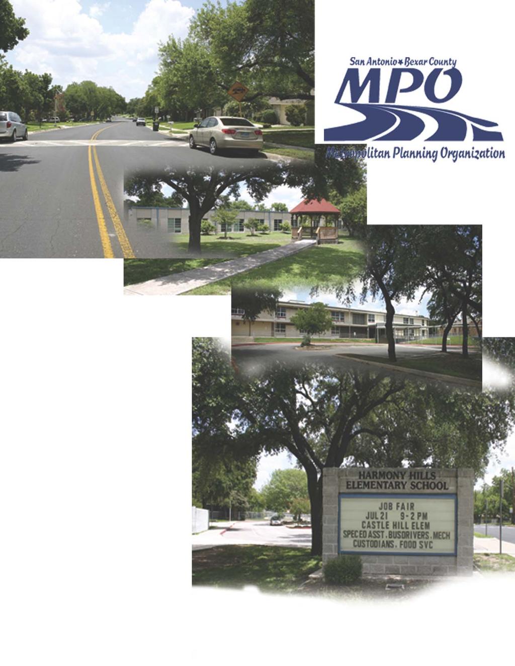
3 Greater Harmony Hills Neighborhood Association Walkable Community Workshop Report June 30, 2012 In support of a balanced and inclusive transportation system, the San Antonio-Bexar County Metropolitan Planning Organization (MPO) has developed the Walkable Community Program (WCP). The program recognizes the need to plan for everyone and all modes of travel, whether young or old, motorist or bicyclist, walker or wheelchair user or bus rider. A system that plans for pedestrians incorporates their safety as a natural process which, in the end, has been shown to benefit all roadway users. The WCP is modeled after a national program that encourages communities to design a comprehensive and coordinated transportation system that is safe and more welcoming to pedestrians and cyclists. The program is designed to engage the community in the planning process for their neighborhoods. Goals of our local Walkable Community Program are to: Educate the public, as well as public officials on the advantages of embracing walking and bicycling as viable modes of transportation. Assist the community in the identification of infrastructure improvements that encourage walking and cycling. Serve as a communication forum between the community, the MPO s Transportation Policy Board and MPO partner transportation agencies. The program specifically supports the MPO s goal to improve the opportunities for alternative means of transportation that diminish the growth in single occupancy vehicles and improve air quality by providing bicycle and pedestrian facilities. As the region s transportation planning organization, the MPO provides a foundation municipalities and counties can build on. The MPO s transportation partners are engaged and supportive of the process. They include but are not limited to: Alamo Area Council of Governments (AACOG), Bexar County, City of San Antonio (CoSA), Texas Department of Transportation (TxDOT), VIA Metropolitan Transit, and other municipalities in the region. There are three possible activities a community may apply for within the program. Each activity can be adapted to meet the particular needs of the community. The activities include a bicycle/pedestrian safety class for children and adults, support and/or facilitation of a bike rodeo and development and facilitation of a citizen workshop. Ms. Nina Nixon-Mendez applied for the workshop on behalf of the Greater Harmony Hills Neighborhood Association.
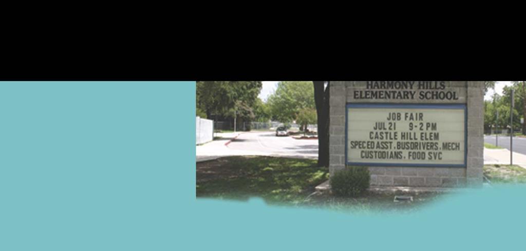
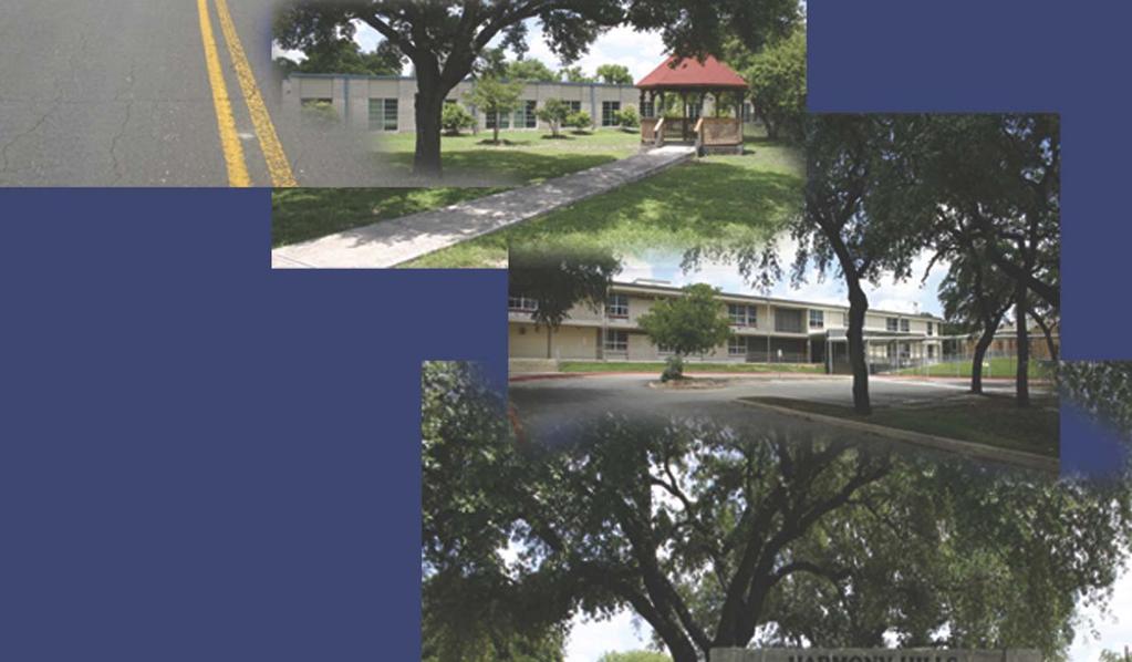
4 Study Area Description and Background Information Per the Walkable Community Program application, Ms. Nixon-Mendez explained the purpose of the workshop was to increase safety in the area for the children who walk and ride their bicycles to the schools in the area. Parents and staff from both Eisenhower Middle School and Harmony Hills Elementary School were invited to participate in the workshop. Members of the local Cabana Club were also invited. The workshop was held at the Cabana Club. The area is primarily residential with neighborhood commercial activities at major intersections. VIA transit service is provided along the boundary of the neighborhood. The boundary of the neighborhood association includes Rhapsody Drive to the North, San Pedro Avenue to the East, Lockhill-Selma Road to the South and West Avenue to the West. The study area is located within Bexar County Commissioner Court Precinct 3 (served by Commissioner Kevin Wolff) and City of San Antonio Council District 9 (served by Councilwoman Elisa Chan). The neighborhood is also included in the San Antonio International Airport Vicinity Land Use Plan. Figure 1 is a replica of the map used at the workshop. Figure 1. Map of the Study Area 2

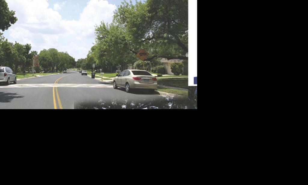
5 Community Outreach The MPO supported Ms. Nixon- Mendez outreach efforts by developing a flyer and an interactive imap online application which was available to the community for two weeks before the workshop and one week after for those who were unable to attend the meeting or wanted to make additional comments. The information gathered from the map is included in Table 1 of this report. Participants were also encouraged to call the MPO with additional concerns that may come to mind if they did not have access to a computer. Ms. Nixon-Mendez distributed the flyer within the neighborhood association and to the schools in the study area. She also posted the flyer throughout the area. To involve as many participants as possible a press release was developed as well as placing the information in the MPO s FastTrack Newsletter. Walkable Community Workshop The mapping exercise workshop was held at the neighborhood s local Cabana Club on Saturday, June 30, The location is centrally located and is used by the neighborhood association for other social events. This allowed for easy access to everyone within the boundaries. The workshop was attended by concerned residents of the area. Attendees were extremely engaged in the process and were encouraged by the opportunity to voice their concerns. A great deal of information came from a middle school student who walks and rides a bike to school regularly. As participants arrived they were able to provide input into the MPO s Safety Study as it pertains to their neighborhood. Information gathered from that discussion has been incorporated into Table 1 and shown in Appendix 1. A common thread during the safety discussion was that sidewalks and crosswalks make people feel safer. Most residents viewed the speed limits for highway travel about right, for residential streets about right or too high. Studies have shown that a lower speed limit on local, residential streets fosters a sense of safety and tends to encourage people into the community. 3
6 As part of the formal presentation, an MPO representative explained the benefits of a Walkable Community and the concept of Complete Streets. The benefits include, but are not limited to: Transportation Benefits: reduced traffic congestion, improved safety, calms traffic, preserves road infrastructure. Economic Benefits: increased retail sales (restaurants, lodging establishments, retail stores), job creation, and enhancement of nearby property values. Environmental Benefits: improved air quality and energy conservation. Social Benefits: quality-of-life benefits from living in communities with more open space and greenways and that provide more opportunities for walking and cycling. Health and Fitness Benefits: it is well recognized that individuals benefit in many ways from living in communities with more open space and greenways and that provide more opportunities for walking and cycling. The MPO s transportation partners supporting the workshop included members of the MPO s Pedestrian Mobility Advisory Committee: AACOG, Bexar County, the City of San Antonio and Texas Department of Transportation During the mapping exercise concerns were identified and possible solutions proposed for consideration by the respective agencies. Participants provided suggestions for improving the walkability and bikeability of the community. The overarching and common themes focused on the desire to improve connectivity throughout the area with increased pedestrian amenities such as sidewalks, more street lighting, improved drainage and traffic calming. These improvements would lessen the need for motorized vehicles as well as increase active mobility and improve the health of the community. Another common request was to incorporate concerns from this workshop into future implementation strategies such as the City of San Antonio Bond Program and the Infrastructure Management Program. Potential Funding Sources There are no guaranteed funding sources for projects identified through the Walkable Community Program. Nonetheless, good planning has its own rewards in that the affected community begins working together with transportation agencies to identify and prioritize their transportation needs for cars, buses, walking and bicycling. This report represents the community speaking with one voice to assist elected officials and potential funding entities in seeking solutions to their transportation needs. Sharing project costs among several funding sources may be the best opportunity for funding above mentioned projects. 4
7 Potential funding sources might include: Bexar County Special Road and Bridge Fund Farm to Market and Lateral Road Fund Future Capital Projects Bond Fund City of San Antonio Council Neighborhood Access Mobility Program Community Block Development Grant (CDBG) Program City Street Maintenance Program Advanced Transportation District (ATD) Program Future Capital Projects Bond Program Infrastructure Management Program San Antonio Bexar County Metropolitan Planning Organization Surface Transportation Program Metropolitan Mobility Texas Department of Transportation Statewide Transportation Enhancement Program District Discretionary Funds Category 2 Metropolitan Corridor Projects Safe Routes to School Funds Federal Enhancement Funds National and Private Funding (examples) Federal Rehabilitation Tax Credit National Trust Community Investment Corporation National Trust Loan Fund The Johanna Favrot Fund for Historic Preservation Texas Main Street Program The Meadows Foundation Robert Wood Johnson Foundation 5
8 Next Steps Copies of this report are provided to the following organizations and businesses: Greater Harmony Hills Neighborhood Association Bexar County Commissioner Precinct 3 Office and Bexar County Public Works Department City of San Antonio District 9 Office, Capital Improvements Management, Planning & Community Development, Parks & Recreation Departments and Public Works Departments Alamo Area Council of Governments HEB Grocery on West Avenue and Blanco Road Northeast Independent School District San Antonio-Bexar County MPO Transportation Policy Board Texas Department of Transportation VIA Metropolitan Transit This report is also available on the MPO s website at Planning for the future is a dynamic process. Planning for an environment that encourages safe and active transportation ensures a healthy community. The MPO supports the efforts of the cooperative endeavor that is taking place among the residents of the neighborhood association, the surrounding businesses and the schools in the area. This report highlights the public involvement process and can be used as a tool for the Greater Harmony Hills Neighborhood Association in discussions with the City of San Antonio, Bexar County, Texas Department of Transportation, VIA Metropolitan Transit, the Northeast Independent School District. MPO Contact Information: Lydia Kelly Bicycle/Pedestrian Transportation Planner San Antonio Bexar County Metropolitan Planning Organization 825 S. St. Mary s St. San Antonio, TX Phone: Fax: kelly@sametroplan.org Website: 6
9 Table 1 List of Community Concerns Identified Sidewalk: Harmony Hills Elementary School: no sidewalk access on the west and south sides of the campus; streets leading to all schools in the area require sidewalks to be built or better maintained to the property so students can have the option to walk to school Streets along the perimeter of the neighborhood boundary necessitate sidewalk gaps filled so residents can access the nearby businesses; streets include Rhapsody Drive, San Pedro Ave, Lockhill Selma Road and West Avenue Blanco Road, which bisects the neighborhood, has narrow sidewalks near West Avenue which makes it unnerving for pedestrians alongside fast moving traffic Limelight Drive: sidewalks needed from Ramsey Road to Patricia Drive Rendezvous Drive: sidewalks needed from Tango Drive to Fantasia Drive; this would allow better access to businesses Gap completion within the local/residential streets was a general concern with some having sidewalks and others not o Streets identified in particular included: Booth Drive: sidewalks needed Cabana Club: sidewalk access needed for pedestrians from Patricia Drive, Raindrop Drive, Fantasia Drive, Reverie Lane Firefly: south side of street/maintenance needed Lockhill-Selma Road: West Avenue to Blanco Road Lorene Lane: Ramsey Drive to Lockhill-Selma McCarty Road: Lockhill-Selma Road to San Pedro Avenue Moonglow: fill gaps leading to school and connection with Ramsey Road and Patricia Drive Mt. Boracho Drive: needs sidewalks for access to the track at Eisenhower Middle School Patricia Drive: from West Avenue to Mt. Perkins Drive Revere: sidewalk maintenance needed because of buckling from cactus overgrowth Sandman Street: Rhapsody Drive to Patricia Drive Silver Sands: from West Avenue to San Pedro Avenue Tammy: sidewalk maintenance needed West Avenue: Rhapsody Drive to Lockhill-Selma Road Connectivity: Alleys present an opportunity for safe connectivity if they could be used as hike & bike facilities; unfortunately they are being taken over and blocked by residents. Crosswalk access o Streets identified in particular identified: Mt. Perkins/Crestpark Drive: dangerous crossing for children San Pedro Avenue/Sahara is dangerous and confusing W Silver Sands Drive and Raindrop Drive 7
10 McCarty/Lorene: high rate of crashes in this area; crosswalk would make pedestrians more visible W. Ramsey/Moonglow Drive/Lorene Lane: confusing intersection for motorists and pedestrians; pedestrian crossing treatments requested W Ramsey/Blanco Road at Holy Spirit Catholic Church: confusing intersection for motorists and pedestrians; pedestrian crossing treatments and signage advising motorists the proper actions requested Street Lighting: There was consensus of the participants that additional lighting is needed in the study area. Residents do not feel safe walking in the morning, evening and at night with the limited lighting at the intersections. Transit Interest: The transit stops along Blanco Road were identified as good examples of the type of transit stop the residents would like throughout the area although they would like to see traffic calming to slow motorists down Bus stop on Blanco just before Lockhill Selma Road turn does not allow the bus driver sufficient time to cross three lanes of traffic to maneuver the left hand turn onto Lockhill-Selma Road Bus stops at Tammy and Blanco Road need a shelter; stop is frequently used by middle school children Drainage: Participants want to stress the need for sidewalks be included in the West Avenue Drainage Product in the 2012 Bond Drainage leading to Salado Creek needs improvements School: Heavy congestion around both Harmony Hills Elementary and Eisenhower Middle Schools, especially on Patricia Street to Memory and along Tammy and Mt. Perkins. Motorists hamper connectivity and neither area is safe for children walking or cycling to school Miscellaneous: Silver Sands: speed bumps are outdated; request updated traffic calming treatment Patricia and Tammy from San Pedro Avenue to West Avenue: traffic calming treatments requested other than speed bumps Holy Spirit Catholic Church: patrons use grass, sidewalks and street to park; consider partnership with Eisenhower Middle School s parking lot Bike Parking requested at the HEB located at West Avenue 200 Block of Patricia: pavement on the north side of the street is in poor condition Bicycle Accommodations: IH35 N. at Loop 410 N.E. to Potranco Road at Talley Road; area needs an east/west connection 8
11 Appendix 1 Greater Harmony Hills Neighborhood Association Transportation Safety Observations Summary June 30, 2012 Concerns from the residents include mobile phone use while driving, running red lights, ignoring speed limits and warning signs in school zones, concern when walking and/or biking to a destination, distracted driving, speeding, lack of sidewalks and bicycle facilities, potholes, poor lighting, faded roadway markings and drunk driving. Most residents viewed the speed limits at about right for highway and residential speed limits. School zones were also viewed at about right for speed but several comments expressing concern were made that school zone speed limits were often ignored by drivers. In addition, the lack of sidewalks along many of the streets within Harmony Hills was noted by many residents. The primary forms of transportation included use of a vehicle (including carpooling) and walking. Intersections with the highest safety concern noted by residents: Memory Lane at Patricia and Tammy Streets Silver Sands and Sandman West Avenue from Blanco to Rhapsody West Avenue and Blanco Road Loop 410 exit to San Pedro Written Comments: Hardly anyone actually stops at a stop signs Trees overhang too low over sidewalks and along curbs and are hazards for walkers and cyclists. Street pavement in some areas have potholes and shifting- hazard for cyclists. Aesthetics are very poor especially around Blanco/Eisenhower/Churchill and the commute in between. Rude drivers are often encountered when walking, maybe stop signs would be helpful for crossing the streets. Thankful for existing crosswalks. Improvement of crosswalks at Ramsey and Lorene, San Pedro Ave at Sahara and San Pedro Ave at Tammy Continuous sidewalk linkages to schools churches and major intersections are needed. Safety would be improved by adding a sidewalk along Raindrop. Speed humps need to be upgraded on Silver Sands. Sidewalks are overgrown with foliage and street signs are obstructed by tree limbs. 9


12 Resident Comments from the Crash Data Safety Map At the intersection of Patricia and Reverie there is a blind spot for motorists possibly caused by a combination of overgrown bushes and street design. During school pickup and drop off times at Harmony Hills Elementary there are too many parked cars on the street creating a very narrow passage. 10

13 Too much traffic on Patricia Street from Blanco to San Pedro: 11


14 The missing gaps of sidewalks on Rendezvous need to be constructed. People feel unsafe walking along San Pedro to get to the convenience store located at the corner of San Pedro and Rhapsody or to other locations. A complete network of sidewalks would provide a safer journey. Convenience store located at San Pedro and Rhapsody. 12
People Active in Community Effort Walkable Community Workshop Report May 1, 2008
 People Active in Community Effort Walkable Community Workshop Report May 1, 2008 In support of a balanced and inclusive transportation system, the San Antonio- Bexar County Metropolitan Planning Organization
The Pedestrian Safety Action Plan
 The Pedestrian Safety Action Plan Lydia Kelly Bicycle Pedestrian Transportation Planner The San Antonio Bexar County MPO Planning Area and Partners Northeast Partnership Greater Bexar County Council of
5. Pedestrian System. Accomplishments Over the Past Five Years
 5. Pedestrian System Accomplishments Over the Past Five Years The Alamo Area Metropolitan Planning Organization (MPO) and its partner agencies recognize the importance of improving pedestrian mobility.
City of Novi Non-Motorized Master Plan 2011 Executive Summary
 City of Novi Non-Motorized Master Plan 2011 Executive Summary Prepared by: February 28, 2011 Why Plan? Encouraging healthy, active lifestyles through pathway and sidewalk connectivity has been a focus
MASTER BICYCLE AND PEDESTRIAN PLAN
 VILLAGE OF NORTHBROOK MASTER BICYCLE AND PEDESTRIAN PLAN DRAFT PLAN OPEN HOUSE May 2, 2018 AGENDA 1. Community Engagement 2. Vision and Goals 3. General Structure of Plan 4. Recommendations Overview 5.
BIKE PLAN CONTENTS GATEWAY
 CONTENTS Acknowledgments...vii Great Rivers Greenway District Board of Directors... vii Great Rivers Greenway District Staff... vii Project Consultants... vii Committees... viii Citizens Advisory Committee
Chapter 5. Complete Streets and Walkable Communities.
 Chapter 5. Complete Streets and Walkable Communities. 5.1 Description of Complete Streets. Cities throughout the world, and specifically the United States, are coming to embrace a new transportation and
Bicycle Master Plan Goals, Strategies, and Policies
 Bicycle Master Plan Goals, Strategies, and Policies Mobilizing 5 This chapter outlines the overarching goals, action statements, and action items Long Beach will take in order to achieve its vision of
Chapter 2. Bellingham Bicycle Master Plan Chapter 2: Policies and Actions
 Chapter 2 Bellingham Bicycle Master Plan Chapter 2: Policies and Actions Chapter 2: Policies and Actions The Bicycle Master Plan provides a road map for making bicycling in Bellingham a viable transportation
CITY OF BLOOMINGTON COMPLETE STREETS POLICY
 CITY OF BLOOMINGTON COMPLETE STREETS POLICY POLICY OBJECTIVE: The City of Bloomington will enhance safety, mobility, accessibility and convenience for transportation network users of all ages and abilities,
EXECUTIVE SUMMARY. Vision
 Vision Walking and bicycling in Salt Lake City will be safe, convenient, comfortable, and viable transportation options that connect people to places, foster recreational and economic development opportunities,
Bikeway action plan. Bicycle Friendly Community Workshop March 5, 2007 Rochester, MN
 Bikeway action plan Summary The was held on March 5, 2007 at the Rochester Mayo Civic Center. The workshop was hosted by Rochester-Olmsted County Planning Department in collaboration with the League of
CONNECTING PEOPLE TO PLACES
 CONNECTING PEOPLE TO PLACES 82 EAST BENCH MASTER PLAN 07 Introduction The East Bench transportation system is a collection of slow moving, treelined residential streets and major arteries that are the
4 Goals, Objectives & Actions
 Chapter4 4 This chapter presents goals, objectives, and recommended actions to support the vision of making Overland Park a safer and easier place to ride a bicycle. 35 4.1 Recommendations Structure The
Goodlettsville Bicycle and Pedestrian Plan Executive Summary
 Goodlettsville Bicycle and Pedestrian Plan July 2010 In Cooperation with the Nashville Area Metropolitan Planning Executive Organization Summary Introduction Progressive and forward thinking communities
Safe Streets. City of Lake Forest Park. March 21, 2017
 Safe Streets City of Lake Forest Park March 21, 2017 1 01 WELCOME 2 Agenda WELCOME WHAT IS THIS PROJECT? CONTEXT DRAFT CITYWIDE PROJECTS EXERCISE INTRODUCTION 3 02 WHAT IS THIS PROJECT? 4 WHAT IS THIS
Corpus Christi Metropolitan Transportation Plan Fiscal Year Introduction:
 Introduction: The Safe, Accountable, Flexible, Efficient Transportation Equity Act: A Legacy for Users (SAFETEA-LU) has continued the efforts started through the Intermodal Surface Transportation Efficiency
2014/2015 BIKE ROUTE PLAN 83 AVENUE PROTECTED BIKE LANE
 About the Project 2014/2015 BIKE ROUTE PLAN The City of Edmonton is planning a major bike route on the south side of Edmonton. This bike route is one part of a plan to provide citizens with transportation
NM-POLICY 1: Improve service levels, participation, and options for non-motorized transportation modes throughout the County.
 Transportation PRINCE WILLIAM COUNTY 2008 COMPREHENSIVE PLAN NON-MOTORIZED PLAN CONTENTS Goals, Policies, and Action Strategies Table 4 (Bike Facility Classifications and Descriptions) Table 5 (Bike Facility
CHAPTER 3: Vision Statement and Goals
 Davidson Walks & Rolls: Active Transportation Master Plan CHAPTER 3 Contents: Overview Vision Statement Measurable Goals Public Outreach CHAPTER 3: Vision Statement and Goals Overview The vision statement
Proposed. City of Grand Junction Complete Streets Policy. Exhibit 10
 Proposed City of Grand Junction Complete Streets Policy Exhibit 10 1 City of Grand Junction Complete Streets Policy Vision: The Complete Streets Vision is to develop a safe, efficient, and reliable travel
Lee s Summit Road Improvement Study Public Open House June 7, 2007 Summary of Comment Card Responses
 Lee s Summit Road Improvement Study Public Open House June 7, 2007 Summary of Comment Card Responses Introduction At the Lee s Summit Road Improvement Study Public Open House held Thursday, June 7, 2007
Tonight is for you. Learn everything you can. Share all your ideas.
 Strathcona Neighbourhood Renewal Draft Concept Design Tonight is for you. Learn everything you can. Share all your ideas. What is Neighbourhood Renewal? Creating a design with you for your neighbourhood.
The Florida Bicycle and Pedestrian Partnership Council
 The Florida Bicycle and Pedestrian Partnership Council Input to the Update of the Florida Transportation Plan March 2015 This document presents input from the Florida Bicycle and Pedestrian Advisory Council
Perryville TOD and Greenway Plan
 Perryville TOD and Greenway Plan Greenway Glossary Pathway: A bicycle and pedestrian path separated from motorized vehicular traffic by an open space, barrier or curb. Multi-use paths may be within the
City of Davis East Covell Corridor Plan
 Community Open House #2 January 22, 2014 6:00 8:00 p.m. Veterans Memorial Center, Club Room City of Davis Introduction The (ECCP) is a taking a comprehensive look at the existing transportation systems
Agenda. Overview PRINCE GEORGE S PLAZA METRO AREA PEDESTRIAN PLAN
 PRINCE GEORGE S PLAZA METRO AREA PEDESTRIAN PLAN May 28, 2008 Agenda Welcome and introductions Project overview and issue identification Planning context and strengths Design challenges and initial recommendations
7 Complete Streets & Roadway Aesthetics
 7 Complete Streets & Roadway Aesthetics 7.1 OVERVIEW Our streets lay the foundation for how we interface with travel needs, physical exercise, social exchanges and access to goods and services. They are
Non-Motorized Transportation 7-1
 Non-Motorized Transportation 7-1 Transportation facilities no longer mean just accommodating a vehicle powered by a combustion engine. Pedestrian and non-motorized facilities are important modes of travel
Appendix C 3. Bicycle / Pedestrian Planning
 Appendix C 3. Bicycle / Pedestrian Planning BICYCLE/PEDESTRIAN PLANNING 2005 Master Plan GOAL: Provide for safe and convenient bicycle and pedestrian circulation throughout the City. Develop a city-wide
Vision: Traditional hamlet with an attractive business/pedestrian friendly main street connected to adjacent walkable neighborhoods
 N D. Focus Area II Vision: Traditional hamlet with an attractive business/pedestrian friendly main street connected to adjacent walkable neighborhoods Transit Road Focus Area II is located in the Hamlet
o n - m o t o r i z e d transportation is an overlooked element that can greatly enhance the overall quality of life for the community s residents.
 N o n - m o t o r i z e d transportation is an overlooked element that can greatly enhance the overall quality of life for the community s residents. 84 Transportation CHAPTER 11 INTRODUCTION Transportation
Chapter VISION, MISSION, AND GOALS AND OBJECTIVES. Vision. Mission. Goals and Objectives CONNECTING COMMUNITIES ACROSS THE ST.
 VISION, MISSION, AND GOALS AND OBJECTIVES Chapter 3 The Plan s vision, mission, and goals and objectives were developed through a series of interactive exercises with the Citizens Advisory Committee (CAC)
Best Southwest Transportation Committee. North Central Texas Council of Governments Transportation Department
 Best Southwest Transportation Committee North Central Texas Council of Governments Transportation Department The The Regional Regional Veloweb Veloweb Review Review NCTCOG Bicycle and Pedestrian Program
PEDESTRIAN ACTION PLAN
 ATTACHMENT 2 CITY OF SANTA MONICA PEDESTRIAN ACTION PLAN CITY OF SANTA MONICA PEDESTRIAN ACTION PLAN This page intentionally left blank EXECUTIVE SUMMARY CHAPTER 1 EXECUTIVE SUMMARY Setting the Stage
City of Wilsonville 5 th Street to Kinsman Road Extension Project
 City of Wilsonville 5 th Street to Kinsman Road Walking Tour & Neighborhood Workshop Summary Report Public Outreach Overview On July 18 th, 2017, the City of Wilsonville hosted a neighborhood walking tour
Winnipeg Walk Bike Projects Downtown Tire Talk - Summary
 Winnipeg Walk Bike Projects Downtown Tire Talk - Summary Downtown Projected Bike Lane System Connecting The Forks to the Exchange District (Fort Street, Garry Street & The Forks to Assiniboine Connection)
Bringing together community and health. Physical Activity and Nutrition Unit Office of Statewide Health Improvement Initiatives
 Bringing together community and health. Physical Activity and Nutrition Unit Office of Statewide Health Improvement Initiatives Physical Activity and Nutrition Unit Office of Statewide Health Improvement
City of Charlottesville Bicycle and Pedestrian Master Plan Update
 City of Charlottesville Bicycle and Pedestrian Master Plan Update September 17, 2014 I. Welcome and meeting overview II. Project status update III. Network overview IV. Break-out groups Pedestrian Network
Goal 3: Foster an environment of partnerships and collaboration to connect our communities and regions to one another.
 Non-Motorized Transportation Plan (NMTP) Draft Vision, Goal and,, Tri-County Regional Planning Commission (TCRPC) Purpose The purpose of the Tri-County Regional Planning Commission (TCRPC) Non-Motorized
Solana Beach Comprehensive Active Transportation Strategy (CATS)
") Solana Beach Comprehensive Active Transportation Strategy (CATS) 3.0 Goals & Policies The Solana Beach CATS goals and objectives outlined below were largely drawn from the Solana Beach Circulation Element
Solana Beach Comprehensive Active Transportation Strategy (CATS) 3.0 Goals & Policies The Solana Beach CATS goals and objectives outlined below were largely drawn from the Solana Beach Circulation Element
Hedgepeth Williams Middle School and Paul Robeson Elementary School Trenton, NJ. School Travel Plan
 Hedgepeth Williams Middle School and Paul Robeson Elementary School Trenton, NJ School Travel Plan Hedgepeth Williams Middle School Description: Hedgepeth-Williams Middle School is located at 301 Gladstone
WHAT CAN WE DO? SECTION 6
 WHAT CAN WE DO? SECTION 6 SATOMORROW MLTIMODAL TRANSPORTATION PLAN THE MLTIMODAL TRANSPORTATION PLAN What is a Multimodal Transportation Plan? The SA Tomorrow Multimodal Transportation Plan is the first
Living Streets Policy
 Living Streets Policy Introduction Living streets balance the needs of motorists, bicyclists, pedestrians and transit riders in ways that promote safety and convenience, enhance community identity, create
West Capitol Avenue Road Rehabilitation and Safety Enhancement Project
 West Capitol Avenue Road Rehabilitation and Safety Enhancement Project Stakeholder Focus Group Meeting #2 Tuesday, August 28, 2018 7:00 8:00 a.m. West Sacramento City Hall 1110 West Capitol Avenue, West
Bicycling in the Alamo Region
 Pg. 01 Bicycling in the Alamo Region \ Bicycling and walking are vital components of a transportation system. Riding a bike and walking can improve physical and mental health, curb air and water pollution,
Bicycle Lanes Planning, Design, Funding South Mountain Partnership Trails Workshop Roy Gothie PennDOT Statewide Bicycle Pedestrian Coordinator
 Bicycle Lanes Planning, Design, Funding 2018 South Mountain Partnership Trails Workshop Roy Gothie PennDOT Statewide Bicycle Pedestrian Coordinator Policy Changes: BOP Bicycle Policy Changes The OLD Way
Environment and Public Works Committee Presentation
 Mixed Use Centers Complete Streets Guidelines Project Environment and Public Works Committee Presentation December 10, 2008 Project Objectives: Conduct an inter-departmental and agency process to study
RESOLUTION NO ?? A RESOLUTION OF THE CITY OF NEPTUNE BEACH ADOPTING A COMPLETE STREETS POLICY
 RESOLUTION NO. 2018-?? A RESOLUTION OF THE CITY OF NEPTUNE BEACH ADOPTING A COMPLETE STREETS POLICY WHEREAS, safe, convenient, and accessible transportation for all users is a priority of the City of Neptune
Chapter 7. Transportation. Transportation Road Network Plan Transit Cyclists Pedestrians Multi-Use and Equestrian Trails
 Chapter 7 Transportation Transportation Road Network Plan Transit Cyclists Pedestrians Multi-Use and Equestrian Trails 7.1 TRANSPORTATION BACKGROUND The District of Maple Ridge faces a number of unique
Multimodal Transportation Plan
 Multimodal Transportation Plan The Multimodal Transportation Plan will accommodate MILLENIALS ARE DRIVING LESS. WE CANNOT BUILD OUR WAY all modes of transportation by keeping pedestrians, OUT OF CONGESTION.
The Wiggle Route in Context
 The Wiggle Route in Context In a city of hills, the Wiggle is an important route because it winds its way along the flattest streets from Market to the Panhandle, bringing residents to local parks and
Complete Streets. Designing Streets for Everyone. Sarnia
 Complete Streets Designing Streets for Everyone Sarnia Complete Streets ~ Sarnia ~ 2018 Introduction Our City is made up of a network of streets that we use to go for a walk, cycle to work, drive to the
PRINCE GEORGE S PLAZA METRO AREA PEDESTRIAN PLAN
 PRINCE GEORGE S PLAZA METRO AREA PEDESTRIAN PLAN May 28, 2008 Agenda Welcome and introductions Project overview and issue identification Planning context and strengths Design challenges and initial recommendations
Section 9. Implementation
 Section 9. Implementation The transportation system is just one of many aspects that must be carefully planned to maintain and enhance the quality of living in Cecil County. The Cecil County Bicycle Plan
Blue Ribbon Commission Report Recommendations on Pedestrian and Bicycle Infrastructure Improvements
 Recommendations on Pedestrian and Bicycle Infrastructure Improvements July 2017 Plan Development: Our committee consisted of seven individuals appointed by the Mayor and Village Board. Those members included:
A Complete Streets Policy for Saratoga Springs. Presented By: Shared Access Saratoga
 A Complete Streets Policy for Saratoga Springs Presented By: Shared Access Saratoga April 17, 2012 Agenda 1. Introduction to Complete Streets (CS) 2. Shared Access Saratoga 3. Why is CS Important 4. What
APPENDIX A. Outreach Summary
 APPENDIX A Outreach Summary COUNTYWIDE TRANSPORTATION PLAN Summary of Public Outreach and Engagement To gather an understanding of the transportation issues and priorities throughout the county, and inform
Richmond Connects Visioning Update
 Richmond Connects Visioning Update To date there have been four elements of the visioning process: Vision20 Night at Byrd Theatre on May 3rd Advisory Committee Meeting on May 12 th Public Visioning Workshop
TOWN OF PORTLAND, CONNECTICUT COMPLETE STREETS POLICY
 TOWN OF PORTLAND, CONNECTICUT COMPLETE STREETS POLICY I. VISION, GOALS & PRINCIPLES VISION To improve the streets of Portland making them safer and more accessible for all users including pedestrians,
ACTIVE TRANSPORTATION
 ACTIVE TRANSPORTATION Mobility 2040 Supported Goals Improve the availability of transportation options for people and goods. Support travel efficiency measures and system enhancements targeted at congestion
CHAPTER 1 INTRODUCTION
 CHAPTER 1 INTRODUCTION Chapter Table of Contents THE 2017 HOUSTON BIKE PLAN 1-1 HOUSTON BIKEWAYS PROGRAM 1-2 HISTORY OF BICYCLE PLANNING IN HOUSTON 1-3 BICYCLE LEVEL OF COMFORT 1-3 EXISTING PLANS, PROGRAMS
NJDOT Complete Streets Checklist
 Background The New Jersey Department of Transportation s Complete Streets Policy promotes a comprehensive, integrated, connected multi-modal network by providing connections to bicycling and walking trip
INDOT Complete Streets Guideline & Policy
 INDOT Complete Streets Guideline & Policy INTRODUCTION The Complete Streets guidelines build upon multiple efforts and promote a multimodal transportation system that is integrated and sustains land use
2014/2015 BIKE ROUTE PLAN 83 AVENUE PROTECTED BIKE LANE
 About the Project The City of Edmonton is planning a major bike route on the southside of Edmonton. The Strathcona Bike Route will connect the communities of Strathcona, Garneau and the University area,
Table of Contents Introduction. 2 Purpose of the Plan...2 The Benefits of Walking and Bicycling...3 Vision and Goals of the Plan...
 BICYCLE AND This plan was created through a grant from the Healthy Communities Program with the cooperation of the City of Cynthiana, Cynthiana Main Street, Cynthiana-Harrison County-Berry Joint Planning
Complete Streets Process and Case Study: Taft / McMillian Two-Way Street Conversion Cincinnati, Ohio. Traffic Engineering Workshop June 4, 2014
 Complete Streets Process and Case Study: Taft / McMillian Two-Way Street Conversion Cincinnati, Ohio Traffic Engineering Workshop June 4, 2014 Complete Streets Streets that enable safe access for users
MAG Town of Cave Creek Bike Study Task 6 Executive Summary and Regional Significance Report
 Page 1 MAG Town of Cave Creek Bike Study Task 6 Executive Summary and Regional Significance Report August 1, 2012 MAG Project #481 Page 2 Task 6 Executive Summary and Regional Significance Report Introduction
Outreach Approach RENEW SF served as the primary liaison with the North Beach community; the Chinatown. Executive Summary
 Executive Summary Executive Summary The Columbus Avenue Neighborhood Transportation Study s objective is to identify changes to transportation infrastructure and policies that could enhance the livability
Madison Urban Area and Dane County. Bicycle Transportation Plan Summary. September Introduction. Bicycle Plan Scope and Planning Process
 Bicycle Transportation Plan Summary Madison Urban Area and Dane County Introduction September 2000 Bicycling is an important mode of transportation in the Madison urban area and countywide that is available
Safe Routes to School Action Plan Aberdeen, Idaho
 Background Aberdeen, Idaho is a largely agricultural community of nearly 2,000 people and is located in the southeast portion of the state on the western edge of American Falls Reservoir. The community
CITY OF COCOA BEACH 2025 COMPREHENSIVE PLAN. Section VIII Mobility Element Goals, Objectives, and Policies
 CITY OF COCOA BEACH 2025 COMPREHENSIVE PLAN Section VIII Mobility Element Goals, Objectives, and Policies Adopted August 6, 2015 by Ordinance No. 1591 VIII MOBILITY ELEMENT Table of Contents Page Number
City of Birmingham Draft Multi-modal Transportation Plan
 City of Birmingham Draft Multi-modal Transportation Plan City Commission Public Hearing Monday, November 25, 2013 7:30 pm Norman Cox, PLA, ASLA The Greenway Collaborative, Inc. Ann Arbor, Michigan The
Welcome! Public Open House on UBC s Transportation Plan
 1 Welcome! Public Open House on UBC s Transportation Plan Public open house hours: to When it comes to on-campus transportation, what do you think is working well and what are some opportunities for improvement?
DRAFT. Table of Contents. Background
 Douglas County Table of Contents Existing Infrastructure 86 Funding 89 Policy and Program Recommendations 90 Infrastructure Recommendations 92 Conclusion 95 Background Home to 4,500 residents and Baker
Ann Arbor Downtown Street Plan
 1 Ann Arbor Downtown Street Plan Public Workshop #1 We know that. 2 Public right-of-way (streets, sidewalks, and alleys) make up 30% of the total District area of downtown. Streets need to provide mobility
Table #6 VISION CHARACTERISTICS
 Table #6 VISION White Flint is a place to live, work, play, shop, and walk with sufficient density to encourage quality redevelopment. Vibrant streets and consistent streetscapes are important. CHARACTERISTICS
SAN FRANCISCO MUNICIPAL TRANSPORTATION AGENCY
 THIS PRINT COVERS CALENDAR ITEM NO. : 10.2 DIVISION: Sustainable Streets BRIEF DESCRIPTION: SAN FRANCISCO MUNICIPAL TRANSPORTATION AGENCY Adopting Conceptual Proposal for Streetscape Improvements to Broadway,
SUMMARY OF TRANSPORTATION INVESTMENTS
 Santa Cruz County 2016 Measure D: Transportation Improvement Expenditure Plan - Approved by over 2/3 of Santa Cruz County voters on November 8, 2016 - Overview Measure D, the 2016 Transportation Improvement
AMATS Complete Streets Policy
 AMATS Complete Streets Policy Table of Contents: Section 1. Definition of Complete Streets Section 2. Principles of Complete Streets Section 3. Complete Streets Policy Section 4. Consistency Section 5.
Proposed Bridge Street East Bicycle Lanes Public Open House Thursday, April 27, 2017
 WELCOME Proposed Bridge Street East Bicycle Lanes Public Open House Thursday, April 27, 2017 Purpose of the Open House The purpose of this Open House is to gain public input on the bicycle lanes proposed
SAFE ROUTES TO SCHOOL (SR2S)
") SAFE ROUTES TO SCHOOL (SR2S) In partnership with Burbank Unified School District (BUSD) & City of Burbank George Washington Elementary School Thomas Jefferson Elementary School John Muir Middle School
SAFE ROUTES TO SCHOOL (SR2S) In partnership with Burbank Unified School District (BUSD) & City of Burbank George Washington Elementary School Thomas Jefferson Elementary School John Muir Middle School
Monument Elementary School Trenton, NJ School Travel Plan
 Monument Elementary School Trenton, NJ School Travel Plan Prepared by Greater Mercer TMA With Assistance from Alan M. Voorhees Transportation Center; Rutgers, The State University of New Jersey and NJ
APPENDIX A: Complete Streets Checklist DRAFT NOVEMBER 2016
 APPENDIX A: Complete Streets Checklist DRAFT NOVEMBER 2016 Complete Streets Checklist MetroPlan Orlando s Complete Streets Checklist is an internal planning tool for staff to further implementation of
NORTH HIGHLAND LAKE ROAD PROJECT
 NORTH HIGHLAND LAKE ROAD PROJECT The purpose of this special newsletter is to inform the residents of Flat Rock about the facts concerning the proposed N. Highland Lake Road Project and clarify some misconceptions.
Hennepin County Bicycle and Pedestrian Planning
 Hennepin County Bicycle and Pedestrian Planning 1 Value of bicycle and sidewalk systems Safety Livability Mobility Health Personal Finances Economic Sustainability Clean Air Recreation Parking and congestion
Residential Traffic Calming Program Guide. Town of Ashland, Virginia
 Residential Traffic Calming Program Guide Town of Ashland, Virginia August 1, 2006 TABLE OF CONTENTS A. INTRODUCTION... 1 B. GOALS... 1 C. CRITERIA... 1 D. IDENTIFYING NEIGHBORHOOD TRAFFIC CONCERNS...
COWETA HIGH SCHOOL AND EAST HIGHWAY 51
 COWETA HIGH SCHOOL AND EAST HIGHWAY 51 Lack of sidewalks along Ben Lumpkin Rd. Lack of crosswalks and ramps at intersection. Hwy 51 is wide to cross as a pedestrian. No ADA compliance or connection to
City of Seattle Edward B. Murray, Mayor
 City of Seattle Edward B. Murray, Mayor Department of Transportation Scott Kubly, Director Eastlake Community Council 117 E Louisa St. #1 Seattle, WA 98102-3278 January 28, 2016 RE: Roosevelt to Downtown
ACTIVE TRANSPORTATION/NONMOTORIZED TRANSPORTATION
 ACTIVE TRANSPORTATION/NONMOTORIZED TRANSPORTATION BACKGROUND Active transportation, also known as nonmotorized transportation, is increasingly recognized as an important consideration when planning and
LANCASTER CITY BICYCLE NETWORK
 LANCASTER CITY BICYCLE NETWORK Downtown Merchants Meeting Wednesday, July 19, 2017 http://www.lancasteratp. DOWNTOWN WALKABILITY ANALYSIS What changes can be made, in the least amount of time, and for
Project Narrative Old Durham Road/Old Chapel Hill Road Complete Streets Project
 Project Narrative Old Durham Road/Old Chapel Hill Road Complete Streets Project Prepared by the Durham-Chapel Hill-Carrboro MPO November 26, 2013 The Old Durham Road/Old Chapel Hill Road Complete Streets
COMPLETE STREETS PLANNER S PORTFOLIO
 COMPLETE STREETS PLANNER S PORTFOLIO ISSUE 3 APRIL 2016 PLANNER S PORTFOLIO COMPLETE STREETS 1 2 6 10 14 OVERVIEW MATURE NEIGHBORHOODS GROWING SUBURBS CENTRAL PLACES ACTIVITY CORRIDORS Planner s Portfolio
Governance and Priorities Committee Report For the July 2, 2015 Meeting
 CITY OF VICTORIA For the July 2, 2015 Meeting To: Governance and Priorities Committee Date: From: Subject: Brad Dellebuur, A/Assistant Director, Transportation and Parking Services Executive Summary The
Community Workshop on the Benefits of a Walkable & Bikeable Community
 Community Workshop on the Benefits of a Walkable & Bikeable Community Overview and Summary On March 12, 2012, the Town of Bethlehem hosted a community workshop to collect ideas and recommendations for
CTDOT Pedestrian and Bicycle Safety Initiatives
 CTDOT Pedestrian and Bicycle Safety Initiatives 2017 Northeast Transportation Safety Conference Mark F. Carlino, P.E. Traffic Engineering Division Chief Bureau of Engineering and Construction Connecticut
Downtown Naples Mobility and Connectivity Study. Naples City Council Presentation January 2017
 Downtown Naples Mobility and Connectivity Study Naples City Council Presentation January 2017 Agenda 1. Introduction 2. Scope Review 3. Project Schedule 4. Existing Conditions 5. Public Charrette 6. Mobility
This page intentionally left blank.
 This page intentionally left blank. COMMUNITY Coweta Community Overview Coweta Coweta, a residential community located in Wagoner County, is a suburb of Tulsa situated southeast of the metropolitan area
WELCOME. to the meeting for the. Westside Avenue Action Plan Gateway to Revitalization
 WELCOME to the meeting for the Columbia Road - Before and After Ridge Road - Before and After Before and After WAAP Bridge Sections Fountain Creek Before Retaining Wall for Roadway 30' Existing Fountain
A CHANGING CITY. of Edmonton, it is essential that it reflects the long-term vision of the City.
 A CHANGING CITY By the year 2040, Edmonton will be home to more than 1 million people. To accommodate growth and support a healthy and compact city, we need a new approach to development/redevelopment