FINAL REPORT Intersection Control Evaluation Planning Study for the Duluth Area
|
|
|
- Brianne O’Brien’
- 5 years ago
- Views:
Transcription


1 FINAL REPORT Intersection Control Evaluation Planning Study for the Duluth Area March 2013 E NGINEERS P LANNERS D ESIGNERS Consulting Group, Inc.

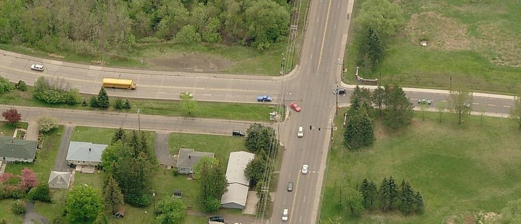
2 Intersection Control Evaluation Planning Study for the Duluth Area March 2013 Background The Arrowhead Regional Development Commission (ARDC), in partnership with St. Louis County and the Cities of Duluth and Hermantown, recently conducted a traffic study to evaluate various traffic control alternatives (e.g., stop signs, traffic signals, roundabouts, reduced conflict intersection, etc.) at eight problematic intersections in the Duluth area. The study included collecting traffic data, analysis of existing conditions, and review of appropriate traffic control alternatives using technical evaluation criteria. The primary goals of the study were to: Determine the optimal form of traffic control for each intersection to enhance both traffic operations and safety. Consider other multimodal users such as transit buses, pedestrians and bicyclists. Develop the framework for future planning and public education. A Study Advisory Committee (SAC) was formed to manage project scope, schedule, methodologies, progress, and deliverables. The SAC guided the study process and met four times in late Subsequently, presentations were made to the Duluth Superior Metropolitan Interstate Council Technical Advisory Committee and Policy Board at their February 2013 meetings. Intersection Control Evaluation (ICE) Reports were developed (under separate cover) that included detailed engineering analysis and recommendations for each of the study intersections. The following is a brief summary of the study. Study Intersections The following intersections were included in the study: 1) Skyline/Highland/Vinland/Getchell, 2) Skyline/Kenwood/ Martha, 3) College Street/Junction Avenue/19th Avenue East, 4) College Street/Kenwood Avenue/Lyons Street, 5) Martin Road/Rice Lake Road, 6) Maple Grove Road/Midway Road, 7) Maple Grove Road/LaVaque Road, 8) Stebner Road/ West Arrowhead Road Intersection Control Evaluation Planning Study for the Duluth Area - March


3 Scoping Phase The project began with a scoping phase that included collecting traffic data, crash history, and site specific information at each intersection. 20-year traffic forecast volumes were developed at each location based on historical growth data, and future traffic volumes published in the Duluth-Superior Long Range Transportation Plan. Various concept alternatives were developed and screened in an effort to identify prospective alternative(s) to be further evaluated in the next study phase. Alternative Evaluation Phase The prospective concept alternatives developed during the scoping phase were subsequently evaluated against selection criteria which included site specific considerations, including: current traffic patterns, pedestrian/bicycle needs, transportation system requirements, topography/sight distance issues, and current/future land uses. A more detailed traffic operations analysis was also performed using traffic analysis software to better understand the near- and long-term performance of each alternative. The following is a brief description of the study intersections, alternatives that were considered, and the basic rationale used to identify a preferred alternative at each location. Getchell Rd Skyline Pkwy 1) Skyline/Highland/Vinland/Getchell This low volume intersection lies in a natural setting and has a below average crash rate. However, poor geometry and sightlines cause driver and pedestrian confusion and frustration. Existing intersection control includes an all-way stop. Parking and pedestrian/ bicyclist accommodations are key issues at this location given its proximity to the Superior-Hiking-Trail. Vinland St Highland St Skyline Pkwy Viable traffic control alternatives studied at this location included stop control and roundabout control, as a traffic signal would not meet warrants. Two-way stop control coupled with geometric improvements was chosen as the preferred alternative because it will provide acceptable long-term operations, improve geometry and sightlines, and improve traffic flow and trailhead access. Martha St Kenwood Ave Skyline Pkwy 2) Skyline/Kenwood/Martha Similar to the previous intersection, poor geometry and sightlines cause confusion and hesitation; however, there is a below average crash rate with no predominate crash type. This intersection is located on the Duluth hillside near the colleges and has heavy pedestrian and bicycle volumes. From a traffic operations standpoint, the existing configuration is not acceptable long-term. Three traffic control alternatives were studied at this location including roundabout control, traffic signal control, and all-way stop control. The latter was Intersection Control Evaluation Planning Study for the Duluth Area - March
 College Street/Junction Avenue/19th Avenue E This intersection is located at the west entrance to the UMD campus and is currently controlled by a traffic signal.")

4 College St Junction Ave chosen along with geometric realignments and improvements that should provide acceptable long-term operations, improve geometry and sightlines, and enhance pedestrian accommodations. 3) College Street/Junction Avenue/19th Avenue E This intersection is located at the west entrance to the UMD campus and is currently controlled by a traffic signal. Heavy pedestrian and bicycle volumes are key issue as well as high crash rates, most of which are rear end crashes. Moreover, all legs of the intersection are designated on-street bike routes. This intersection is not operationally acceptable long-term without traffic control and geometric improvements. Kenwood Ave 19 th Ave E Lyons St College St It was determined that roundabout control would be preferred at this location because it would provide acceptable long-term operations, reduce intersection approach speeds, virtually eliminate right-angle crashes, and reduce pedestrian crossing exposure. A roundabout treatment could also provide an opportunity for a gateway feel into the UMD campus. 4) College Street/Kenwood Avenue/Lyons Street This busy intersection is located between the UMD and CSS campuses and has heavy pedestrian and bicycle volumes. The north, south, and east legs are designated on-street bike routes. Problems at this intersection include right-angle and rear-end crashes coupled with operational issues largely due to the Lyons Street connection. The existing traffic signal at this location is not operationally acceptable long-term without traffic control and geometric improvements. Roundabout control was evaluated at this location versus revising the traffic signal. While both alternatives would provide acceptable long-term operations, a roundabout would likely require a multi-lane design approach which would cause additional property impacts. Therefore, revising the traffic signal system, coupled with geometric improvements including a potential closure of the Lyons Street connection was identified as the preferred alternative. Intersection Control Evaluation Planning Study for the Duluth Area - March


5 Martin Rd Maple Grove Rd Maple Grove Rd Rice Lake Rd Midway Rd LaVaque Rd 5) Martin Rd/Rice Lake Rd This high-speed intersection has a high crash rate with mostly right-angle and rear-end crashes and is currently controlled by an all-way stop. The south, east, and west legs are designated on-street bike routes. The northbound approach experiences long traffic queues in the P.M. peak hour. The existing all-way stop control is not operationally acceptable long term. Three viable alternatives were analyzed at this location including roundabout control, traffic signal control, and an alternative intersection control known as a reduced conflict intersection. Ultimately, the roundabout alternative was chosen as it would provide the best long-term solution by improving operations and safety, reducing intersection approach speeds, virtually eliminating right angle crashes, and reducing crash severity. 6) Maple Grove Road/Midway Road Similar to the previous intersection, this location has high-speed approaches and a high crash rate with mostly right-angle and rear-end crashes. The north, south, and east legs are designated on-street bike routes. Long westbound approach queues are experienced in the P.M. peak-hour. Based on the analysis, the existing side-street stop control is not operationally acceptable long-term. Roundabout control, traffic signal control, and a reduced conflict intersection were considered at this location. Ultimately the roundabout alternative was chosen as it would provide the best long-term solution by improving operations and safety, reducing intersection approach speeds, virtually eliminating right-angle crashes, and reducing crash severity. 7) Maple Grove Road/LaVaque Road This intersection is currently controlled by an existing all-way stop which is not operationally acceptable long-term based on the analysis. Traffic volumes are unbalanced at this intersection with heavy westbound approach volumes in the P.M. peak hour. While the crash rate is fairly low, 64% are right-angle crashes. The east-leg and west-leg are designated on-street bike routes and there is an existing traffic signal one half mile to the east. Roundabout control and traffic signal control were analyzed at this location, both of which would provide Intersection Control Evaluation Planning Study for the Duluth Area - March

6 acceptable long-term operations. However, the traffic signal control with geometric improvements was determined as most appropriate because it should reduce the right-angle crash problem, require less right of way than a roundabout, and would be consistent with other nearby intersections. This intersection can continue to operate as an all-way stop until a traffic signal is warranted. Stebner Rd 8) Stebner Road/West Arrowhead Road Similar to the previous intersection, the current allway stop is not operationally acceptable long-term. This location also has a fairly low crash rate, however 67% are right-angle crashes. The south and west legs are designated on-street bike routes and there are nearby traffic signals to the north, south, and east. W Arrowhead Rd Again, the traffic signal control with geometric improvements was determined as most appropriate at this location because it should reduce the right angle crash problem, require less right of way than a roundabout, and would be consistent with other nearby intersections. Preferred Alternatives By thoroughly reviewing the study data, forecasts, and analysis, the SAC was able to make an informed recommendation as to a preferred traffic control alternative at each intersection. As noted above, three of the eight locations studied identified modern roundabouts as the best alternative to achieve the study goal. The following table summarizes the preferred intersection control at each study intersection. Study Intersection Existing All-Way Stop Roundabout Traffic Signal Reduced Conflict Intersection 1) Skyline/Highland/Vinland/Getchell All-way stop 2) Skyline/Kenwood/Martha All-way stop 3) College St./Junction Ave./19th Ave. E Traffic signal 4) College St./Kenwood Ave./Lyons St. Traffic signal 5) Martin Rd./Rice Lake Rd. All-way stop 6) Maple Grove Rd./Midway Rd. Side-street stop 7) Maple Grove Rd./LaVaque Rd. All-way stop 8) Stebner Rd./W Arrowhead Rd. All-way stop Two-Way Stop Intersection Control Evaluation Planning Study for the Duluth Area - March


7 Preliminary Roundabout Concepts For the intersections that yielded roundabout control as the preferred alternative, conceptual geometric layouts were developed to gauge their relative size/footprint, how large trucks and emergency vehicles move through them, and how pedestrian/bicyclist accommodations might work. Prior to implementing a roundabout, more extensive design work and analysis are required to better define geometrics and to quantify potential impacts and construction costs. Next Steps The project partners will utilize the study findings as a planning tool to aid in future planning and public improvement projects. Should a modern roundabout be considered for implementation, a proper public education outreach campaign should be deployed being that they are a relatively new forms of traffic control in the Twin Ports. The ARDC and their partners are currently developing a public education campaign so users can learn more about the inherent benefits of modern roundabouts and how to properly navigate them. Intersection Control Evaluation Planning Study for the Duluth Area - March
Project Report. South Kirkwood Road Traffic Study. Meadows Place, TX October 9, 2015
 Meadows Place, TX October 9, 2015 Contents 1 Introduction... 1 2 Data Collection... 1 3 Existing Roadway Network... 2 4 Traffic Volume Development... 2 5 Warrant Analysis... 3 6 Traffic Control Alternative
METHODOLOGY. Signalized Intersection Average Control Delay (sec/veh)
") Chapter 5 Traffic Analysis 5.1 SUMMARY US /West 6 th Street assumes a unique role in the Lawrence Douglas County transportation system. This principal arterial street currently conveys commuter traffic
Chapter 5 Traffic Analysis 5.1 SUMMARY US /West 6 th Street assumes a unique role in the Lawrence Douglas County transportation system. This principal arterial street currently conveys commuter traffic
Evaluation of M-99 (Broad Street) Road Diet and Intersection Operational Investigation
 Road Diet and Intersection Operational Investigation") Evaluation of M-99 (Broad Street) Road Diet and Intersection Operational Investigation City of Hillsdale, Hillsdale County, Michigan June 16, 2016 Final Report Prepared for City of Hillsdale 97 North Broad
Evaluation of M-99 (Broad Street) Road Diet and Intersection Operational Investigation City of Hillsdale, Hillsdale County, Michigan June 16, 2016 Final Report Prepared for City of Hillsdale 97 North Broad
Princeton Avenue and Spruce Street Transportation and Site Access Enhancements Project
 Princeton Avenue and Spruce Street Transportation and Site Access Enhancements Project Mercer County Planning Division AECOM Transportation (formerly DMJM Harris) January 29, 2009 Agenda Project Status
8 PROPOSED ROUNDABOUT DUFFERIN STREET AND KING VAUGHAN ROAD INTERSECTION CITY OF VAUGHAN
 8 PROPOSED ROUNDABOUT DUFFERIN STREET AND KING VAUGHAN ROAD INTERSECTION CITY OF VAUGHAN The Transportation Services Committee recommends the adoption of the recommendation contained in the following report
Route 7 Corridor Study
 Route 7 Corridor Study Executive Summary Study Area The following report analyzes a segment of the Virginia State Route 7 corridor. The corridor study area, spanning over 5 miles in length, is a multi
MEMORANDUM. DATE March 1, 2012 TO Town of Milton Mark Abbott, Seth Asante, and Efi Pagitsas Boston Region MPO Staff
 MEMORANDUM DATE March 1, 212 TO Town of Milton FROM RE Mark Abbott, Seth Asante, and Efi Pagitsas Boston Region MPO Staff FFY 211 Safety and Operations Analyses at Selected Boston Region MPO Intersections:
180 Grand Avenue, Suite x117 Dowling Associates, Inc.
 180 Grand Avenue, Suite 250 510.839.1742 x117 Oakland, CA 94612 510.839.0871 fax www.dowlinginc.com mbowman@dowlinginc.com Dowling Associates, Inc. Date: Memorandum To: CC: From: Ms. Leah Greenblat City
TRAFFIC IMPACT ANALYSIS
 TRAFFIC IMPACT ANALYSIS FOR THE CHAMPAIGN UNIT#4 SCHOOL DISTRICT PROPOSED HIGH SCHOOL (SPALDING PARK SITE) IN THE CITY OF CHAMPAIGN Final Report Champaign Urbana Urbanized Area Transportation Study 6/24/2014
I-95/Temple Avenue Improvements Project Colonial Heights, VA
 I-95/Temple Avenue Improvements Project Colonial Heights, VA Pardon Our Dust Informational Meeting February 3, 2016 Harold Dyson, P.E. Construction Manager, Richmond District Tom Heil, P.E. Allan Myers
Intersection Control Evaluation Report Project: Alternative: Location: Evaluator:
 Report Project: Alternative: Location: Evaluator: Franklin/Interstate-15 Interchange City of Lake Elsinore, 33 40'13.08"N 117 18'34.30"W Jeffrey Hsu 1 Introduction Policy Directive 13-02 calls for the
North Avenue Corridor Study
 North Avenue Corridor Study Transportation, Energy and Utilities Committee September 10, 2014 Presentation Outline Project Initiation: Why North Avenue? Existing Conditions + Issues Vision + Goals Improvement
Main-McVay Transit Study: Phase 2 Options Definition and High Level Constraints Evaluation
 Main-McVay Transit Study: Phase 2 Options Definition and High Level Constraints Evaluation APRIL 2016 A collaborative study between: For Additional Information or to Comment If you would like additional
Summary: Mercer County Princeton Avenue & Spruce Street Study January 2009
 Summary: Several recent studies have assessed potential development and redevelopment opportunities in the Mercer Crossing area of Trenton, Ewing, and Lawrence. This Princeton Avenue and Spruce Street
Preliminary Transportation Analysis
 Preliminary Transportation Analysis Goals of a Robust, Multimodal Transportation Network Safe Accessible/Connected Efficient Comfortable Context-Sensitive Motor Vehicle: Continue to analyze the data to
Route 28 (South Orleans Road)/Route 39 (Harwich Road)/Quanset Road Intersection
/Route 39 (Harwich Road)/Quanset Road Intersection") TRAFFIC FEASIBILITY STUDY Route 28 (South Orleans Road)/Route 39 (Harwich Road)/Quanset Road Intersection Orleans, Massachusetts Prepared for: Town of Orleans Prepared by: Fay, Spofford & Thorndike, LLC
TRAFFIC FEASIBILITY STUDY Route 28 (South Orleans Road)/Route 39 (Harwich Road)/Quanset Road Intersection Orleans, Massachusetts Prepared for: Town of Orleans Prepared by: Fay, Spofford & Thorndike, LLC
Highway 111 Corridor Study
 Highway 111 Corridor Study June, 2009 LINCOLN CO. HWY 111 CORRIDOR STUDY Draft Study Tea, South Dakota Prepared for City of Tea Sioux Falls Metropolitan Planning Organization Prepared by HDR Engineering,
Preliminary Engineering Study
 Preliminary Engineering Study Open House # 2 June 6, 2018 PREPARED FOR: PREPARED BY: Agenda Background and status of preliminary engineering study County Road 26 design summary County Road 63 design summary
WELCOME. Stakeholder Involvement Group Meeting #2 Round Lake Public Works October 24, 2018
 WELCOME Stakeholder Involvement Group Meeting #2 Round Lake Public Works October 24, 2018 MEETING AGENDA 1. Welcome and Introductions 2. Study Progress Update 3. Problem Statement 4. Technical Analysis
Low Level Road Improvements Traffic Analysis. Report
 Low Level Road Improvements Traffic Analysis Report June, 22 Table of Contents. INTRODUCTION.... LOW LEVEL ROAD PROJECT....2 STUDY AREA....2. West-End Corridor Improvements... 2.2.2 East-End Corridor Improvements...
INNOVATIVE INTERSECTION DESIGN
 INNOVATIVE INTERSECTION DESIGN J. Eddie Valtier, P.E. ELP TP&D Director Introduction Why Do We Need To Start Looking For Innovative Intersection Designs? Congestion is worsening and traffic volumes and
Edgemont Village Traffic and Parking Technical Report January 2014
 Edgemont Village Traffic and Parking Technical Report January 2014 In the fall of 2013, the District of North Vancouver engaged consultants to assess existing intersection and parking conditions in Edgemont
DRAFT. Corridor study. Honeysuckle Road. October Prepared for the City of Dothan, AL. Prepared by Gresham, Smith and Partners
 DRAFT Corridor study Honeysuckle Road October 2017 Prepared for the City of Dothan, AL Prepared by TABLE OF CONTENTS SECTION I... 1 STUDY SUMMARY... 1 INTRODUCTION... 1 CONCLUSIONS... 5 SECTION II... 7
Intersection Traffic Control Feasibility Study
 Intersection Traffic Control Feasibility Study CSAH 9 at CSAH 60 (185th Avenue) Prepared For: Dakota County Transportation Department Western Service Center 14955 Galaxie Avenue, 3rd Floor Apple Valley,
BETHEL ROAD AND SEDGWICK ROAD CORRIDOR STUDY
 DRAFT PLAN City Council Meeting August 14, 2017 STUDY AREA Sedgwick Corridor State Route 160, principal arterial with Class 3 access management designation, commuter and freight route, connection to SR
5858 N COLLEGE, LLC N College Avenue Traffic Impact Study
 5858 N COLLEGE, LLC nue Traffic Impact Study August 22, 2016 Contents Traffic Impact Study Page Preparer Qualifications... 1 Introduction... 2 Existing Roadway Conditions... 5 Existing Traffic Conditions...
Summary of Comments Public Information Meeting Wieuca Road at Phipps Boulevard Intersection Improvements June 7, 2017
 The Public Meeting for the Wieuca Road at Phipps Boulevard Intersection Improvement project was held on at the Wieuca Road Baptist Church, located at 3626 Peachtree Road, Atlanta, GA 30326. There were
TRANSPORTATION ANALYSIS REPORT US Route 6 Huron, Erie County, Ohio
 TRANSPORTATION ANALYSIS REPORT US Route 6 Huron, Erie County, Ohio December 12, 2012 Prepared for: The City of Huron 417 Main Huron, OH 44839 Providing Practical Experience Technical Excellence and Client
PROJECT OBJECTIVES. Improve vehicle capacity for the intersection. Improve pedestrian and bicycle access
 COMMUNITY MEETING Project Update March 15, 2010 Purcellville, Virginia OVERVIEW Project need / objectives Project recap Design elements Proposed improvements Summary of project benefits / next steps PROJECT
Public Information Meeting. Orange Camp Road. Dr. Martin Luther King Jr. Beltway to I-4. Presented by: Volusia County August 2, 2018
 Public Information Meeting Orange Camp Road Dr. Martin Luther King Jr. Beltway to I-4 Presented by: Volusia County August 2, 2018 1 Project Goals To improve the operations and safety for Orange Camp Road
RETREAT AGENDA ITEM MIDTOWN AREA TRANSPORTATION PLAN UPDATE
 October 17, 2017 RETREAT AGENDA ITEM MIDTOWN AREA TRANSPORTATION PLAN UPDATE STATEMENT OF ISSUE An update on the Midtown Area Transportation Plan will be provided including a discussion of preliminary
TECHNICAL MEMORANDUM VDOT Central Region On Call Task Order
 Kittelson & Associates, Inc. T R A N S P O R T A T I O N E N G I N E E R I N G / P L A N N I N G 1850 Centennial Park Drive, Suite 130, 20191 P 703-885-8970 F 703-885-8971 TECHNICAL MEMORANDUM VDOT Central
Traffic Circulation Study for Neighborhood Southwest of Mockingbird Lane and Airline Road, Highland Park, Texas
 ARIZONA TEXAS NEW MEXICO OKLAHOMA February 13, 2015 Mr. Meran Dadgostar P.E., R.S. Town of Highland Park 4700 Drexel Dr. Highland Park, Texas 75205 Re: Traffic Circulation Study for Neighborhood Southwest
Toronto and East York Community Council. Director, Transportation Services, Toronto and East York District
 No Turn on Red Regulations STAFF REPORT ACTION REQUIRED Date: June 1, 2010 To: From: Toronto and East York Community Council Director, Transportation Services, Toronto and East York District Wards: Trinity
Los Altos Hills Town Council - June 18, 2015 Palo Alto City Council June 22, AGENDA ITEM #2.B Presentation
 Los Altos Hills Town Council - June 18, 2015 Palo Alto City Council June 22, 2015 AGENDA ITEM #2.B Presentation Previous Presentations Los Altos Hills Town Council in May 2014 and February 2015 Palo Alto
MONTGOMERY COUNTY PLANNING DEPARTMENT THE MARYLAND-NATIONAL CAPITAL PARK AND PLANNING COMMISSION
 MONTGOMERY COUNTY PLANNING DEPARTMENT THE MARYLAND-NATIONAL CAPITAL PARK AND PLANNING COMMISSION SHA CTP Project No. MO891A21, US 29, Fairland Road to Musgrove Road Interchange Improvement, Design Review
Draft North Industrial Area-Wide Traffic Plan
 Summary of North Industrial and Hudson Bay Industrial Recommended Improvements Table 1. Summary of s Item Location 1 2 3 4 5 6 7 8 9 10 11 12 Millar Ave north of 51st St Super 8 Motel back lane 400 Block
North Avenue Corridor Study
 North Avenue Corridor Study City Council October 6, 2014 Presentation Outline Project Initiation & Process Corridor Conditions & Issues Vision & Goals Concept Development - Development/Evaluation Implementation
Brian McHugh, Buckhead Community Improvement District. SUBJECT: Wieuca Road at Phipps Boulevard Intersection Improvements Project
 MEMO TO: FROM: Brian McHugh, Buckhead Community Improvement District Jagan Kaja, AICP, WSP Parsons Brinckerhoff SUBJECT: Wieuca Road at Phipps Boulevard Intersection Improvements Project DATE: October
S A F E R O U T E S T O S C H O O L H E R M A N TOW N S C H O O L S A N D P R O C TO R S C H O O L S P L A N A P P R OVA L S
 S A F E R O U T E S T O S C H O O L H E R M A N TOW N S C H O O L S A N D P R O C TO R S C H O O L S P L A N A P P R OVA L S WHAT IS SAFE ROUTES TO SCHOOL? In 1969, nearly 50% of children walked or rode
Paris on the Grand Residential Development TIS Response to City of Brant Comments APPROACH LEFT MOE LEFT THROUGH RIGHT
 Project: 110650 Transportation Planning Transit Planning Glenn Scheels, MCIP, RPP GSP Group 201-72 Victoria Street South Kitchener ON N2G 4Y9 Dear : Traffic Engineering Parking Planning Re: Paris on the
STILLWATER AVENUE CORRIDOR STUDY Old Town, Maine
 Draft Study STILLWATER AVENUE CORRIDOR STUDY Old Town, Maine SUBMITTED TO: BANGOR AREA COMPREHENSIVE TRANSPORTATION SYSTEM SUBMITTED BY: I MAY 23, 2017 DRAFT STILLWATER AVENUE STUDY FINAL REPORT Table
Gateway Transportation Study
 Gateway Transportation Study Amherst, Massachusetts SUBMITTED TO University of Massachusetts Amherst Town of Amherst SUBMITTED BY Vanasse Hangen Brustlin, Inc. Watertown, Massachusetts March 213 Back of
BLOSSOM AT PICKENS SIGNALIZED INTERSECTION IMPROVEMENT STUDY
 BLOSSOM AT PICKENS SIGNALIZED INTERSECTION IMPROVEMENT STUDY Class Project Report for ECIV 542 Traffic Engineering Submitted by Omor Sharif Muchun Song Narges Kaveshgar Quyen Pham Chih-Yao Lin Submission
Display Boards Including Five Refined Design Concepts
 APPENDIX D Workshop Session 3 Sign-in sheets Agenda Booklet Display Boards Including Five Refined Design Concepts PowerPoint Presentation Questions Recorded Discussion of Preference Exercise AGENDA
PennDOT ICE Policy An Introduction
 PennDOT ICE Policy An Introduction January 2018 What is Intersection Control Evaluation (ICE)? Purpose: To consistently consider and screen among many proven combinations of geometry and traffic control
Fields of St. Croix HOA Meeting. October 27, 2016
 Fields of St. Croix HOA Meeting October 27, 2016 Welcome! Why are we here? Update on Manning Avenue Phase 2 Project: Project Design Schedule Project Background Importance of Manning Avenue: Primary north-south
RapidRide Roosevelt Seat Sea t t le t le Depa De r pa t r men men t of Sept T an r sp an or sp t or a t t a ion
 RapidRide Roosevelt Seattle Bicycle Advisory Board 1 Our mission, vision, and core values Mission: deliver a high-quality transportation system for Seattle Vision: connected people, places, and products
Colchester/Riverside/Barrett/ Mill Intersection Study. PAC Meeting #3 September 22, 2016
 Colchester/Riverside/Barrett/ Mill Intersection Study PAC Meeting #3 September 22, 2016 Tonight s Agenda Review Project Purpose and Need Describe short term and long improvements and changes since public
Gene Dillon Elementary School Traffic Study Division Street Site
 To: From: Dr. James Hess, Superintendent Jordan Schwarze, PE, Senior Engineer Matt Pacyna, PE, Senior Associate Date: March 30, 2016 Subject: Gene Dillon Elementary School Traffic Study reet Site Memorandum
TRAFFIC IMPACT STUDY CRITERIA
 Chapter 6 - TRAFFIC IMPACT STUDY CRITERIA 6.1 GENERAL PROVISIONS 6.1.1. Purpose: The purpose of this document is to outline a standard format for preparing a traffic impact study in the City of Steamboat
City of San Diego Vision Zero Draft Strategic Plan FY 2017
 City of San Diego Vision Zero Draft Strategic Plan FY 2017 Engineering Objective: To develop and implement a strategy that employs best planning, design and engineering practices. Background: Over the
INNOVATIVE INTERSECTION SOLUTIONS. Jay Bockisch, PE, PTOE Senior Associate
 INNOVATIVE INTERSECTION SOLUTIONS Jay Bockisch, PE, PTOE Senior Associate INNOVATIVE INTERSECTION SOLUTIONS Innovative intersection overview Case studies Continuous flow intersection Modern roundabouts
Figure 1: Vicinity Map of the Study Area
 ARIZONA TEXAS NEW MEXICO OKLAHOMA May 5, 2016 Mr. Anthony Beach, P.E. BSP Engineers 4800 Lakewood Drive, Suite 4 Waco, Texas 76710 Re: Intersection and Access Analysis along Business 190 in Copperas Cove
DUNBOW ROAD FUNCTIONAL PLANNING
 DUNBOW ROAD FUNCTIONAL PLANNING Final Report August 3, 216 #31, 316 5th Avenue NE Calgary, AB T2A 6K4 Phone: 43.273.91 Fax: 43.273.344 wattconsultinggroup.com Dunbow Road Functional Planning Final Report
TRAFFIC STUDY GUIDELINES Clarksville Street Department
 TRAFFIC STUDY GUIDELINES Clarksville Street Department 9/1/2009 Introduction Traffic studies are used to help the city determine potential impacts to the operation of the surrounding roadway network. Two
1. What is the Doran Street and Broadway/Brazil Grade Separation Project (Project)?
?") 1. What is the Doran Street and Broadway/Brazil Grade Separation Project (Project)? The Los Angeles County Metropolitan Transportation Authority (Metro) is evaluating the development of a grade separation
1. What is the Doran Street and Broadway/Brazil Grade Separation Project (Project)? The Los Angeles County Metropolitan Transportation Authority (Metro) is evaluating the development of a grade separation
FINAL Albertville Business Park AUAR Update Traffic Study
 FINAL Albertville Business Park AUAR Update Traffic Study Prepared for City of Albertville, MN July 20, 2017 SRF No. 10060.00 Table of Contents Introduction... 1 Existing Conditions... 1 Data Collection...
City of Wausau Wausau Center Urban Design and Transportation Master Plan. Design Workshop // October 18, 2018
 City of Wausau Wausau Center Urban Design and Transportation Master Plan Design Workshop // October 18, 2018 Design Workshops // October 15-18 Workshop Study Evaluate circulation and parking patterns around
Pearl Street / Prospect Street / Colchester Avenue Intersection Scoping Study. April 11, 2013 Steering Committee Meeting #3
 Pearl Street / Prospect Street / Colchester Avenue Intersection Scoping Study April 11, 2013 Steering Committee Meeting #3 Meeting Agenda Welcome & Introductions Review Project Purpose & Needs Results
MEMORANDUM. Our project study area included the following locations:
 MEMORANDUM Date: To: From: Subject: Najib O. Habesch Nick M. Fomenko, PE, PTOE Bushnell Park North Traffic Assessment BETA Project #: 4461 As part of our contract to undertake the design of the Bushnell
MEMORANDUM. Earl Haugen and UND Transportation and Traffic Coordination Committee
 SRF No. 7766 MEMORANDUM TO: FROM: Earl Haugen and UND Transportation and Traffic Coordination Committee Rick Lane, P.E. DATE: November 26, 2013 SUBJECT: UNIVERSITY AVE REVIEW Our review of the University
Traffic Study North Shore School District 112
 Traffic Study North Shore School District 112 Proposed Expansion of Northwood Junior High School Prepared By: May 1, 2015 1. Introduction Kenig, Lindgren, O Hara, Aboona, Inc. (KLOA, Inc.) has been retained
Simulating Street-Running LRT Terminus Station Options in Dense Urban Environments Shaumik Pal, Rajat Parashar and Michael Meyer
 Simulating Street-Running LRT Terminus Station Options in Dense Urban Environments Shaumik Pal, Rajat Parashar and Michael Meyer Abstract The Exposition Corridor transit project is a light rail project
A-1 Arcadia with Signal
 A-1 Arcadia with Signal Dakota St Variation: Half 3/4 with westbound left at Main 4 - Fewer downtown access points - Less efficient traffic operations - Highest project costs vanston. ote: traffic volumes
Chapter VISION, MISSION, AND GOALS AND OBJECTIVES. Vision. Mission. Goals and Objectives CONNECTING COMMUNITIES ACROSS THE ST.
 VISION, MISSION, AND GOALS AND OBJECTIVES Chapter 3 The Plan s vision, mission, and goals and objectives were developed through a series of interactive exercises with the Citizens Advisory Committee (CAC)
133 rd Street and 132 nd /Hemlock Street 132 nd Street and Foster Street MINI ROUNDABOUTS. Overland Park, Kansas
 133 rd Street and 132 nd /Hemlock Street 132 nd Street and Foster Street MINI ROUNDABOUTS Overland Park, Kansas September 1, 2017 TABLE OF CONTENTS 1. INTRODUCTION... 1 2. LITERATURE REVIEW... 1 3. CONCEPT
Roundabout Feasibility Memorandum
 Roundabout Feasibility Memorandum To From Gwen Pipkin Bill Howell Date June 18, 2013 Subject Roundabout Feasibility Study SR 29 PD&E Study From Oil Well Road to SR 82 Collier County, FL FPID 417540-1-22-01
1609 E. FRANKLIN STREET HOTEL TRAFFIC IMPACT STUDY EXECUTIVE SUMMARY
 1609 E. FRANKLIN STREET HOTEL TRAFFIC IMPACT STUDY EXECUTIVE SUMMARY Prepared for: The Town of Chapel Hill Public Works Department Traffic Engineering Division Prepared by: HNTB North Carolina, PC 343
WISCONSIN AVENUE EXTENSION SECOND PUBLIC INFORMATION MEETING. March 28, 2017
 WISCONSIN AVENUE EXTENSION SECOND PUBLIC INFORMATION MEETING March 28, 2017 STUDY AREA N MEETING AGENDA Introductions Study Background Alternatives Studied Recommended Alternative Discussion STUDY BACKGROUND
Bi-state metropolitan planning organization (MPO)
") Using a Variety of Data to Identify Locations of Concern in a Transportation Network 3 th Annual MN APA State Planning Conference September, 8 Robert Herling, Planner Duluth-Superior Metropolitan Interstate
Using a Variety of Data to Identify Locations of Concern in a Transportation Network 3 th Annual MN APA State Planning Conference September, 8 Robert Herling, Planner Duluth-Superior Metropolitan Interstate
Albany Shaker Road Corridor Study Public Meeting # 2
 Albany Shaker Road Corridor Study Public Meeting # 2 Scope / Meeting Purpose This project is a CDTC Linkage Study. The Linkage Program is designed to implement the adopted planning and investment principles
Comments EXECUTIVE SUMMARY
 Comments 1. Under any Alternatives, MCDOT should provide better at-grade pedestrian crossing of Georgia Avenue and Forest Glen Road, including improved crosswalks with wider medians and adequate signal
Introduction Roundabouts are an increasingly popular alternative to traffic signals for intersection control in the United States. Roundabouts have a
 HIGH-CAPACITY ROUNDABOUT INTERSECTION ANALYSIS: GOING AROUND IN CIRCLES David Stanek, PE and Ronald T. Milam, AICP Abstract. Roundabouts have become increasingly popular in recent years as an innovative
TRAFFIC ASSESSMENT River Edge Colorado
 TRAFFIC ASSESSMENT River Edge Colorado Submitted by: Fehr & Peers 621 17th Street, Ste. 231 Denver, CO 8293 (33) 296-43 December, 21 App. M-2 Traffic Assessment River Edge Colorado December 21 TABLE OF
Roundabouts. By: Nezamuddin, Valparaiso University. February 19, 2015
 Roundabouts By: Nezamuddin, Valparaiso University February 19, 2015 Outline 1. Background on Roundabouts 2. Silhavy Rd. Corridor Improvement Project in Valparaiso, IN 3. 5-points Roundabout in Valparaiso,
Frequently Asked Questions
 Frequently Asked Questions Business US 190 in Copperas Cove From Avenue D to Constitution Drive What is access management? A. Access Management is a growing effort by government agencies to improve how
TRAFFIC STUDY. Birch Bluff Road / Pleasant Avenue 01/15/2018. City of Tonka Bay 4901 Manitou Road Tonka Bay, MN WSB PROJECT NO.
 TRAFFIC STUDY Birch Bluff Road / Pleasant Avenue 01/15/2018 City of Tonka Bay 4901 Manitou Road Tonka Bay, MN 55331 WSB PROJECT NO. 10805-000 Birch Bluff Road/ Pleasant Avenue Traffic Study For: City of
LSC TRANSPORTATION CONSULTANTS, INC. 516 North Tejon Street Colorado Springs, CO (719) FAX (719)
 FAX (719)") LSC TRANSPORTATION CONSULTANTS, INC. 516 North Tejon Street Colorado Springs, CO 80903 (719) 633-2868 FAX (719) 633-5430 E-mail: lsc@lsccs.com May 15, 2009 Mr. Davis Farrar Western Slope Consulting, LLC
LSC TRANSPORTATION CONSULTANTS, INC. 516 North Tejon Street Colorado Springs, CO 80903 (719) 633-2868 FAX (719) 633-5430 E-mail: lsc@lsccs.com May 15, 2009 Mr. Davis Farrar Western Slope Consulting, LLC
J Street and Folsom Boulevard Lane Conversion Project (T ) Before and After Traffic Evaluation
 Before and After Traffic Evaluation") J Street and Folsom Boulevard Lane Conversion Project (T15125400) Before and After Traffic Evaluation Prepared by Transportation Division June 2014 Executive Summary On February 12, 2013, the City of Sacramento
J Street and Folsom Boulevard Lane Conversion Project (T15125400) Before and After Traffic Evaluation Prepared by Transportation Division June 2014 Executive Summary On February 12, 2013, the City of Sacramento
1 st and 2 nd Street Couplet FAQ s
 1 st and 2 nd Street Couplet FAQ s Q. Will the proposed roundabout at Flume/2nd/1 st Streets affect access to businesses nearby?... 2 Q. What if the project isn t received well by the community after construction?...
Offset Single Point Interchange I-25 at Rio Bravo Boulevard Albuquerque, New Mexico
 Offset Single Point Interchange I-25 at Rio Bravo Boulevard Albuquerque, New Mexico INSTITUTE OF TRANSPORTATION ENGINEERS 2016 WESTERN DISTRICT MEETING JULY 11, 2016 7/11/2016 1 Project Vicinity Map 7/11/2016
AGENDA REPORT. Issue: Discussion of potential improvements on Barnwell Road at Niblick Drive
 AGENDA REPORT To: From: By: Honorable Mayor and City Council Members Warren Hutmacher, City Manager Tom Black, Public Works Director Date: March 23, 2016 Agenda: March 28, 2016 WORK SESSION AGENDA: Barnwell
West Circle Drive (CSAH 22) Traffic Operations Study
 Traffic Operations Study") West Circle Drive (CSAH 22) Traffic Operations Study May 24, 2016 Open House Harriet Bishop Elementary School 6:45 8:00 p.m. Presentation at 7:00 p.m. Purpose of Tonight s Meeting Introductions Explain
West Circle Drive (CSAH 22) Traffic Operations Study May 24, 2016 Open House Harriet Bishop Elementary School 6:45 8:00 p.m. Presentation at 7:00 p.m. Purpose of Tonight s Meeting Introductions Explain
Agenda. Introduction to Roundabouts. Introduction to Roundabouts. Introduction to Roundabouts 6/6/2018
 PROPOSED PROJECT 161-003 SAFETY AND OPERATIONAL IMPROVEMENTS TO THE INTERSECTION OF ROUTE 106 (NEW CANAAN ROAD) AND BELDEN HILL ROAD Connecticut Department of Transportation Representatives Division of
CITY OF SLO SEEKS INPUT ON PREFERRED ALTERNATIVE FOR BROAD STREET BICYCLE BOULEVARD PROJECT
 City of San Luis Obispo, News Release DATE: August 1, 2017 RELEASE: Immediate CONTACT: Luke Schwartz (805) 781-7190 Transportation Planner-Engineer, Public Works CITY OF SLO SEEKS INPUT ON PREFERRED ALTERNATIVE
Omaha s Complete Streets Policy
 Omaha s Complete Streets Policy (Adopted August 2015) VISION To create great places and enhance our quality of life, the City of Omaha will provide safe, accessible streets for all users. Complete Streets
AGENDA. 5. Next Steps a. Survey Distribution b. Draft Action Plan/Recommendations c. Review at next meeting in advance of document preparation
 Congdon Elementary Safe Routes to School Plan Update SRTS Team Meeting #2-Walk Audit March 21, 2018, 3:00 p.m. Congdon Elementary School Art Room-Duluth, MN 1. Welcome and Introductions 2. SRTS Review
DEPARTMENT OF ENVIRONMENTAL SERVICES. North Harrison Street (Lee Highway to Little Falls Road) Comparative Analysis. Prepared for:
 Comparative Analysis. Prepared for:") DEPARTMENT OF ENVIRONMENTAL SERVICES North Harrison Street (Lee Highway to Little Falls Road) Comparative Analysis Prepared for: Arlington County Department of Environmental Services 2100 Clarendon Boulevard,
DEPARTMENT OF ENVIRONMENTAL SERVICES North Harrison Street (Lee Highway to Little Falls Road) Comparative Analysis Prepared for: Arlington County Department of Environmental Services 2100 Clarendon Boulevard,
Speed Management Action Plan
 Speed Management Action Plan National Selection Criteria Criteria Description Fatalities The number of fatalities resulting from speeding-related crashes. Percentage Compares total fatalities in each State
CITY OF LOS ANGELES INTER-DEPARTMENTAL MEMORANDUM
 CITY OF LOS ANGELES INTER-DEPARTMENTAL MEMORANDUM Date: April 1, 219 To: Honorable City Council c/o City Clerk, Room 395, City Hall Attention: Honorable Mike Bonin, Chair, Transportation Committee From:
Intersection Design. Leah Ness, Craig Hardy and Eric Sorensen
 Intersection Design Leah Ness, Craig Hardy and Eric Sorensen OVERVIEW TYPES OF INTERSECTIONS SCOPING COORDINATION INTERSECTION EVALUATION HORIZONTAL AND VERTICAL LAYOUTS DESIGN COORDINATION CONSTRUCTION
Highway 49, Highway 351 and Highway 91 Improvements Feasibility Study Craighead County
 Highway 49, Highway 351 and Highway 91 Improvements Feasibility Study Craighead County Executive Summary March 2015 Highway 49, Highway 351 and Highway 91 Improvements Feasibility Study Craighead County
You are invited to an... OPEN HOUSE. Recommended Approach for the Franklin Avenue / East River Parkway Intersection
 You are invited to an... OPEN HOUSE Recommended Approach for the Franklin Avenue / East River Parkway Intersection Tuesday, August 25, 2009 6:30 to 8:30 pm St. Frances Cabrini Catholic Church 1500 Franklin
HIGHBURY AVENUE/HAMILTON ROAD INTERSECTION IMPROVEMENTS PUBLIC INFORMATION CENTRE 1 MAY 14, 2015
 HIGHBURY AVENUE/HAMILTON ROAD INTERSECTION IMPROVEMENTS Municipal Class Environmental Assessment PUBLIC INFORMATION CENTRE 1 MAY 14, 2015 ACCESSIBILITY Under the Accessibility Standards 2015 for Customer
Markings Technical Committee Chapter 3H: Roundabout Markings APPROVED IN NCUTCD COUNCIL ON JANUARY 20, 2006
 ATTACHMENT NO. 30 Markings Technical Committee Chapter 3H: Roundabout Markings APPROVED IN NCUTCD COUNCIL ON JANUARY 20, 2006 Roundabouts are becoming an increasingly utilized form of intersection design
TRAFFIC IMPACT STUDY COMPREHENSIVE UPDATE TOWN OF THOMPSON S STATION, TENNESSEE PREPARED FOR: THE TOWN OF THOMPSON S STATION
 TRAFFIC IMPACT STUDY COMPREHENSIVE UPDATE TOWN OF THOMPSON S STATION, TENNESSEE PREPARED FOR: THE TOWN OF THOMPSON S STATION Transportation Consultants, LLC 1101 17 TH AVENUE SOUTH NASHVILLE, TN 37212
High Flow Multi-Lane Roundabouts
 High Flow Multi-Lane Roundabouts - Design Optimization - Project Examples Mark T. Johnson, P.E. MTJ Roundabout Engineering - City of Loveland CO 1994-1998 - Consulting Firm 1998-2001 - Key Contributor
Welcome. Thank you for your interest in the Lewis & Clark Viaduct Concept Study
 Welcome Thank you for your interest in the Lewis & Clark Viaduct Concept Study Please use the arrows in the upper left hand corner to navigate through the presentation. Use the envelope icon to ask a question
Framework for Assessing a oundabout near a School Zone. resented by: Dusadee Corhiran, Dr. Emelinda Parentela, and Michael Plotnik
 Framework for Assessing a oundabout near a School Zone resented by: Dusadee Corhiran, Dr. Emelinda Parentela, and Michael Plotnik ntroduction Driving through an intersection is one of the most difficult