SALINITY AND DISSOLVED OXYGEN IN THE MISSISSIPPI RIVER GULF OUTLET NAVIGATION CHANNEL AND IN ADJACENT SURFACE WATERS,
|
|
|
- Ralph Anderson
- 5 years ago
- Views:
Transcription
1 SALINITY AND DISSOLVED OXYGEN IN THE MISSISSIPPI RIVER GULF OUTLET NAVIGATION CHANNEL AND IN ADJACENT SURFACE WATERS, Southeast Louisiana Flood Protection Authority-East Coastal Advisory Committee Meeting January CHRISTOPHER SWARZENSKI US Geological Survey Louisiana Water Science Center, Baton Rouge
2 UNITED STATES GEOLOGICAL SURVEY LOUISIANA WATER SCIENCE CENTER (BATON ROUGE) - collect and disseminate groundwater and surface-water data (quality and quantity) - offices in all 50 states and Puerto Rico - support Federal, State and Local Agencies with data collection needs and sometimes interpretation 1/23/2014


3 REAL-TIME ACCESS TO DATA ON WWW 1/23/2014
4 MONITORING WATER QUALITY EFFECTS OF HYDROLOGIC MODIFICATIONS TO MRGO NAVIGATION CHANNEL Co-operator: US ARMY CORPS OF ENGINEERS, NOD (Barb Kleiss, Laura Lee Wilkinson) - two projects, related to construction of rock barrier and Hurricane Surge Risk Reduction complex (Borgne surge barrier, Seabrook gate) - used a combination of data logging sondes measuring temperature and salinity, and transects with depth-averaged profiles of dissolved oxygen, salinity, temperature Two reports: Swarzenski, Mize and Lovelace, 2012, Water-Quality, Bed-Sediment, and Discharge Data for the Mississippi River-Gulf Outlet and Adjacent Waterways, Southeastern Louisiana, August 2008 Through December 2009, USGS open file report Swarzenski and Mize, 2014 Effect of Hydrologic Modifications on Salinity and Formation of Hypoxia in the Mississippi River Gulf Outlet and Adjacent Waterways, Southeastern Louisiana, , in final review, ready for priniting 1/23/2014
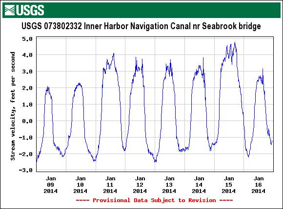
5 Discharge at IHNC at Seabrook bridge (negative flow into the Lake) DISCHARGE IN CUBIC FEET PER SECOND May 1 May 8 May 15 May 22 COMPUTER INSTANTANEOUS DISCHARGE IN THE INNER HARBOR NAVIGATION CHANNEL AT SEABROOK BRIDGE, MAY 2013


6 Rock Barrier Borgne Surge Barrier Seabrook Flood Complex

7 IHNC 10 ft Transect 6 Near GIWW 10 ft Transect 5AV Lake Borgne 7 ft Transect 5BV 6 Inbetween Transect 4 IHNC Near GIWW 10 ft 10 ft 10 ft 5A Lake Borgne 10 ft 5 Transect 3 Violet Canal Explanation Downstream Inbetween 10 ft Synoptic measurement 4 Explanation 10 and 20 ft Continuous Sonde 3 Downstream 10 ft 2 Transect 2 1 Transect 1 Barrier 1/23/2014
8 35 30 Rock barrier completed Surge barrier completed Period when there was a cofferdam across IHNC Salinity, in parts per thousand Jan. 1, 2009 Jan. 1, 2010 Jan. 1, 2011 Jan. 1, 2012 Jan. 1, 2013 SAMPLING SITES Industrial Canal at I-10 at New Orleans(site 21) MRGO near mile 59 near Michoud (site 11) MRGO near mile 46 near Yscloskey (site 8) Lake Pontchartrain at Seabrook bridge (site 20) Lake Borgne near MRGO near Violet (site 12) MRGO near mile 35 near Hopedale (site 5)

9 DEPTH-AVERAGED SALINITY CONTOURS IN THE MISSISSIPPI RIVER GULF OUTLET NAVIGATION CHANNEL, AUGUST 2008

10 DEPTH-AVERAGED SALINITY CONTOURS IN THE MISSISSIPPI RIVER GULF OUTLET NAVIGATION CHANNEL, AUGUST 2010
11 Depth in feet Depth in feet Salinity in parts per thousand August 15, 2008 Water temp degrees C Dissolved Oxygen in mg/l Salinity in parts per thousand June 10, 2009 Water temp degrees C Dissolved Oxygen in mg/l Depth in feet Depth in feet Salinity in parts per thousand March 11, 2009 Water temp degrees C Dissolved Oxygen in mg/l Salinity in parts per thousand Nov 3, 2009 Water temp 20 degrees C Dissolved Oxygen in mg/l GRAPHIC 4 TIME SERIES OF DISSOLVED OXYGEN AND SALINITY PROFILES AT TRANSECT 2 DOWNSTREAM OF AND CLOSEST TO BARRIER (ABOUT 2 MILES BELOW BARRIER) Dissolved oxygen Salinity 1/23/2014
12 Water depth, in feet Surge barrier Violet Canal Rock barrier mile EXTENT OF HYPOXIC CONDITIONS (IN DARK GREEN) IN THE MISSISSIPPI RIVER GULF OUTLET NAVIGATION CHANNEL, OCTOBER 2009
13 Timing and depth of hypoxic (D.O. < 2 mg/l) conditions in MRGO 2010 T4 T5BV T5AV T6 GIWW west May ok ok ns June ok ok July ns ok ok ok August ok ok Sept ns ok ok ok ok Oct ok ok ok ok ns 1/23/2014
14 Timing and depth (ft) of hypoxic (D.O. < 2 mg/l) conditions in MRGO 2011 T4 T5BV T5AV T6 GIWW west January ok ok ok ok ok March ok ok May ok ok ok ok ok June ns ns ok ns July August ok ok Sept ok Oct ok ok ok ok Dec ok ok ok ok ok 1/23/2014
15 Timing and depth of hypoxic (D.O. < 2 mg/l) conditions in MRGO 2012 T4 T5BV T5AV T6 GIWW west March ok ok ok ok ns May ns ok ns June ok ok ok ok July ok ok 1/23/2014

16 0.4 mg/l, 10/ mg/l, 7/ mg/l 7/ mg/l, 9/ mg/l, 6/12 Lowest dissolved oxygen measured at DEQ stations and date; At DEQ 13, hypoxic conditions extended along entire 5 ft channel depth; at DEQ 5 hypoxic conditions occurred more than once 1/23/2014
Inner Harbor Navigation Canal (IHNC) Basin 1% (100-yr) and 0.2% (500-yr) Surge and Wave Event Water Levels
 Basin 1% (100-yr) and 0.2% (500-yr) Surge and Wave Event Water Levels") Inner Harbor Navigation Canal (IHNC) Basin 1% (100-yr) and 0.2% (500-yr) Surge and Wave Event Water Levels Dr. John Grieshaber Hurricane Protection Office US Army Corps of Engineers Overview The IHNC basin
Inner Harbor Navigation Canal (IHNC) Basin 1% (100-yr) and 0.2% (500-yr) Surge and Wave Event Water Levels Dr. John Grieshaber Hurricane Protection Office US Army Corps of Engineers Overview The IHNC basin
Information for File # SEW
 Information for File #2014-02744-SEW Applicant: Minnesota Department of Transportation (MnDOT), District 3; c/o Mr. Robert Nibbe Corps Contact: Sarah Wingert, U.S. Army Corps of Engineers, 180 5 th Street
STRUCTURE S-65 PURPOSE SPILLWAY OPERATION
 STRUCTURE S-65 This structure is a reinforced concrete, gated spillway with discharge controlled by three cable operated, vertical lift gates, and a reinforced concrete lock structure with two pairs of
COASTAL MORPHODYNAMICS
 COASTAL MORPHODYNAMICS PATRICIA CHARDÓN-MALDONADO, PHD, EIT Miguel Canals, Jack A. Puleo, Alec Torres-Freyermuth & Jens Figlus March 9, 2017 OUTLINE INTRODUCTION Meteorological Phenomena Forcing Conditions
PROFILE OF SACRAMENTO RIVER, FREEPORT TO VERONA, CALIFORNIA,
 PROFILE OF SACRAMENTO RIVER, FREEPORT TO VERONA, CALIFORNIA, FLOOD OF FEBRUARY 1986 By J.C. Blodgett and J.B. Lucas U.S. GEOLOGICAL SURVEY Open-File Report 88-82 CO CM I m r-h CM Sacramento, California
CORPS FACTS. Harbor Dredging U.S. ARMY CORPS OF ENGINEERS BUILDING STRONG
 CORPS FACTS Harbor Dredging U.S. ARMY CORPS OF ENGINEERS BUILDING STRONG Disaster Response Sedimentation in the channel is caused by the normal cycle of silt movement, erosion from high water or heavy
I would like to welcome Parish President VJ St. Pierre, Councilwoman Carolyn Schexnaydre and Councilman Terry Authement who are here.
 IER 1, 2 and 3 Public Meeting Thursday, December 6, 2007 Location Time Attendees Format Handouts Facilitator Ramada New Orleans Airport 110 James Drive East St. Rose, LA 70087 6:00 p.m. Open House 7:00
Louisiana CPRA SJB Group, Baton Rouge Coastal Engineering Consultants U.S. Army Corps of Engineers Federal and State PDT Members
 Louisiana CPRA SJB Group, Baton Rouge Coastal Engineering Consultants U.S. Army Corps of Engineers Federal and State PDT Members Project Setting and Background Island Restoration Plans Pre-Screening Analysis
MEAN LOW TIDE (MLT) to MEAN LOWER LOW WATER (MLLW)
 to MEAN LOWER LOW WATER (MLLW)") MEAN LOW TIDE (MLT) to MEAN LOWER LOW WATER (MLLW) WEDA GULF COAST CHAPTER ANNUAL CONFERENCE Christopher Frabotta Deputy Chief, Operations Division Galveston District Southwestern Division November 16,
MEAN LOW TIDE (MLT) to MEAN LOWER LOW WATER (MLLW) WEDA GULF COAST CHAPTER ANNUAL CONFERENCE Christopher Frabotta Deputy Chief, Operations Division Galveston District Southwestern Division November 16,
Bridge Design for Marine Vessel Collision
 Bridge Design for Marine Vessel Collision Zolan Prucz, Ph.D., P.E. Modjeski and Masters, Inc. 2007 Louisiana Transportation Engineering Conference Baton Rouge, Louisiana Factors Involved Historical Developments
CALCASIEU SALINITY STRUCTURES. HYDRODYNAMIC MODELING (To Support Design of Salinity Barriers)
") CALCASIEU SALINITY STRUCTURES HYDRODYNAMIC MODELING (To Support Design of Salinity Barriers) Presentation Overview 1 2 3 4 5 Project Overview and CEA Circulation Modeling Vessel Hydrodynamics Modeling
CALCASIEU SALINITY STRUCTURES HYDRODYNAMIC MODELING (To Support Design of Salinity Barriers) Presentation Overview 1 2 3 4 5 Project Overview and CEA Circulation Modeling Vessel Hydrodynamics Modeling
natural low-water ' conditionson tamed Mississippi, new life springs, up Vl ' V ' ' - "
 When an experiment mimics natural low-water ' conditionson tjhe tamed Mississippi, new life springs, up in the \ backwaters. Vl ' V ' ' - " y *.»* ' ' ' - ' ' by JASON ABRAHAM Common map turtle Mississippi
WATERWAYS AND HARBORS DIVISION Proceedings of the American Society of Civil Engineers. EQUILIBRIUM FLOW AREAS OF INLETS ON SANDY COASTS a
 6405 February, 1969 WWl J oumal of the WATERWAYS AND HARBORS DIVISION Proceedings of the American Society of Civil Engineers EQUILIBRIUM FLOW AREAS OF INLETS ON SANDY COASTS a By Morrough P. O'Brien,!
OFFICE OF STRUCTURES MANUAL FOR HYDROLOGIC AND HYDRAULIC DESIGN CHAPTER 11 APPENDIX B TIDEROUT 2 USERS MANUAL
 OFFICE OF STRUCTURES MANUAL FOR HYDROLOGIC AND HYDRAULIC DESIGN CHAPTER 11 APPENDIX B TIDEROUT 2 USERS MANUAL APRIL 2011 APRIL 2011 Page 1 Preface TIDEROUT 2, Build 1.22 dated June 29, 2006 is the current
Causes and Monitoring of Hypoxia in Corpus Christi Bay
 Causes and Monitoring of Hypoxia in Corpus Christi Bay Publication CBBEP 59 Project Number 817 May 29 Final Report by Kevin Nelson, Ph.D. Candidate and Paul A. Montagna, Ph.D. Harte Research Institute
FIU Digital Commons. Florida International University. Henry O. Briceño Florida International University,
 Florida International University FIU Digital Commons SERC Research Reports Southeast Environmental Research Center 2015 Water Quality Monitoring Project for Demonstration of Canal Remediation Methods Florida
Lecture 1 Why Do We Have Levees in Louisiana? J. David Rogers, Ph.D., P.E., R.G.
 Lecture 1 Why Do We Have Levees in Louisiana? J. David Rogers, Ph.D., P.E., R.G. Karl F. Hasselmann Chair in Geological Engineering Missouri University of Science & Technology for the First Annual Levee
2017 Annual Report: Survey pf American Alligators (Alligator mississippiensis) in the Big Thicket National Preserve. Summary.
 in the Big Thicket National Preserve. Summary.") 2017 Annual Report: Survey pf American Alligators (Alligator mississippiensis) in the Big Thicket National Preserve Matthew I. Pyne Assistant Professor, Department of Biology, Lamar University, P.O. Box
2017 Annual Report: Survey pf American Alligators (Alligator mississippiensis) in the Big Thicket National Preserve Matthew I. Pyne Assistant Professor, Department of Biology, Lamar University, P.O. Box
STUDY PERFORMANCE REPORT
 STUDY PERFORMANCE REPORT State: Michigan Project No.: F-80-R-4 Study No.: 702 Title: Effects of sediment traps on Michigan river channels Period Covered: October 1, 2002 to September 30, 2003 Study Objectives:
HEC 26 Aquatic Organism Passage Design Manual Evolution & Application
 HEC 26 Aquatic Organism Passage Design Manual Evolution & Application Sven Leon, P.E., Hydraulics Engineer Federal Highway Administration 2015 Alaska Fish Passage Meeting October 13 14, 2015 VTRC, Juneau,
Modeling 3D circulation in the Choctawhatchee Bay and River System
 Modeling 3D circulation in the Choctawhatchee Bay and River System Rosemary Cyriac 1, Casey Dietrich 1, Arash Fathi 2, Clint Dawson 2, Kendra Dresback 3, Cheryl Ann Blain 4, Matthew Bilskie 5, Scott Hagen
Water Resources Report RKLD Annual Meeting July 30, 2016
 Water Resources Report RKLD Annual Meeting 2016 July 30, 2016 Topics Hydrology Report Indianford Dam trash rack cleanout performance Experimental Project update Review of PAS project Twin floods- 1 to
Modeling of Oxygen Injection Experiment in Savannah Harbor
 593 Modeling of Oxygen Injection Experiment in Savannah Harbor S. Davie 1, H. Moorer 2, H. Rodriguez 1, Y. Plis 1 1 Tetra Tech, Inc., 2110 Powers Ferry Road, Suite 202, Atlanta, GA 30339, PH (770) 850-0949;
HURRICANE NATE BRIEFING
 HURRICANE NATE BRIEFING 11:00 PM CDT Friday, October 6, 2017 Prepared by: NWS NWSNewOrleans www.weather.gov/neworleans Situation Overview Nate is now a hurricane with no significant change in the track
Properties. terc.ucdavis.edu 8
 Physical Properties 8 Lake surface level Daily since 1900 The lowest lake level on record was 6,220.26 feet on Nov. 30, 1992. Since 1900, lake level has varied by more than 10 feet. Lake level typically
Annex E Bridge Pier Protection Plan
 Annex E Bridge Pier Protection Plan Table E1 Bridge Types and Locations Table E2 Flow Conditions For River Sections Figure E1 Bridge Abutment Protection Figure E2 Bridge Pier Protection Figure E3 Central
JAP Additional Information Sheet
 JAP Additional Information Sheet Block 15: Purpose and Need The USACE purpose of the project is to provide a safe and reliable whitewater park for the recreational public in a city park, which will provide
Response of a Newly Created Marsh-Wetland Affected by Tidal Forcing, Upland Discharge, and Groundwater Interaction
 Response of a Newly Created Marsh-Wetland Affected by Tidal Forcing, Upland Discharge, and Groundwater Interaction Mouth of Columbia River, Cape Disappointment State Park, Washington 12 Hans R. Moritz
SURGE SUPPRESSION ACHIEVED BY DIFFERENT COASTAL SPINE (IKE DIKE) ALIGNMENTS. Bruce A. Ebersole, Thomas W. Richardson and Robert W.
 ALIGNMENTS. Bruce A. Ebersole, Thomas W. Richardson and Robert W.") SURGE SUPPRESSION ACHIEVED BY DIFFERENT COASTAL SPINE (IKE DIKE) ALIGNMENTS Abstract Bruce A. Ebersole, Thomas W. Richardson and Robert W. Whalin, Jackson State University, Jackson, Mississippi The primary
SURGE SUPPRESSION ACHIEVED BY DIFFERENT COASTAL SPINE (IKE DIKE) ALIGNMENTS Abstract Bruce A. Ebersole, Thomas W. Richardson and Robert W. Whalin, Jackson State University, Jackson, Mississippi The primary
CROSS-SHORE SEDIMENT PROCESSES
 The University of the West Indies Organization of American States PROFESSIONAL DEVELOPMENT PROGRAMME: COASTAL INFRASTRUCTURE DESIGN, CONSTRUCTION AND MAINTENANCE A COURSE IN COASTAL DEFENSE SYSTEMS I CHAPTER
HY-8 Version 7.2 Build Date January 17, Federal Highway Administration.
 HY-8 Version 7.2 Build Date January 17, 2012 Federal Highway Administration http://www.fhwa.dot.gov/engineering/hydraulics/software/hy8/index.cfm SIMPLE Simple to use Use for simple culverts and bridges
Presented to Idaho Washington Aquifer Collaborative February 11, Spokane River Project License
 Presented to Idaho Washington Aquifer Collaborative February 11, 2014 Spokane River Project License Contact Speed Fitzhugh, Spokane River License Manager Telephone - (509) 495-4998 Email - speed.fitzhugh@avistacorp.com
ELEVATIONS FOR DESIGN OF HURRICANE PROTECTION LEVEES AND STRUCTURES
 ELEVATIONS FOR DESIGN OF HURRICANE PROTECTION LEVEES AND STRUCTURES Lake Pontchartrain and Vicinity, Louisiana Project West Bank and Vicinity, Louisiana Project New Orleans to Venice, Louisiana Project
Hydrologic Feasibility of Storm Surge Barriers
 Hydrologic Feasibility of Storm Surge Barriers Malcolm J. Bowman, School of Marine and Atmospheric Sciences State University of New York, Stony Brook, NY. Presented at Against the Deluge: Storm Surge Barriers
HURRICANE NATE BRIEFING
 HURRICANE NATE BRIEFING 5:00 AM CDT Saturday, October 7, 2017 Prepared by: NWS NWSNewOrleans www.weather.gov/neworleans Situation Overview Nate is now a hurricane with no significant change in the track
ST. LOUIS SECTION PROJECT OF THE YEAR AWARD
 ST. LOUIS SECTION PROJECT OF THE YEAR AWARD Originality and Innovation The St. Louis Harbor Project is located in the Upper Mississippi River between the entrance to the Chain of Rocks Canal at River
CLAIBORNE LOCK AND DAM PERTINENT DATA
 CLAIBORNE LOCK AND DAM PERTINENT DATA GENERAL Location Clarke, Monroe, & Wilcox Counties, Alabama; Alabama River, river mile 72.5 Drainage area Millers Ferry to Claiborne sq. mi. 836 Total drainage area
Southeast Volusia Coastal Projects Update
 Southeast Volusia Coastal Projects Update Public Works Department Coastal Division August 15, 2016 2016 Dune Walkover Re-Decking Program Completed Dune Walkovers South End 8 th Ave. New Smyrna Beach* 12
N. Tay Evans Marine Fisheries Biologist & Technical Review Coordinator
 Massachusetts Division of Marine Fisheries Marine Fisheries Resource Recommendations: Time-of-Year Restrictions N. Tay Evans Marine Fisheries Biologist & Technical Review Coordinator Massachusetts Division
Bay County, MI Coastal Hazard Analysis Flood Risk Review Meeting. May 14, 2018
 Bay County, MI Coastal Hazard Analysis Flood Risk Review Meeting May 14, 2018 Agenda Introductions Coastal Flood Risk Study and Mapping Program Current Status Technical Overview of Study and Mapping Floodplain
LITTLE LAGOON & LITTLE LAGOON PASS: RESEARCH UPDATES & DIRECTIONS
 LITTLE LAGOON & LITTLE LAGOON PASS: RESEARCH UPDATES & DIRECTIONS Bret M. Webb, PhD, PE, DCE Professor Department of Civil, Coastal, and Environmental Engineering October 19, 2017 LLPS Meeting Acknowledgments
30 DAY PUBLIC NOTICE MAINTENANCE DREDGING OF THE 8-FOOT CHANNEL OF THE FEDERAL NAVIGATION PROJECT IN KENNEBUNK RIVER KENNEBUNK & KENNEBUNKPORT, ME
 fr.iiif.i ~ US Anny Corps of Engineers New England District 696 Virginia Road Concord, MA 01742-2751 Public Notice In Reply Refer to: Mr. Jack Karalius nae-pn-nav@usace.army.mil Programs/Project Management
Condition of Improvements 30 December 2014 Wrangell Harbors, Alaska (CWIS No , )
") Wrangell Harbors Condition of Improvements 30 December 2014 Wrangell Harbors, Alaska (CWIS No. 010435, 021500) Authorization (1) Rivers and Harbors Act, 22 September 1922 (House Doc. 161, 67th Congress,
Wrangell Harbors Condition of Improvements 30 December 2014 Wrangell Harbors, Alaska (CWIS No. 010435, 021500) Authorization (1) Rivers and Harbors Act, 22 September 1922 (House Doc. 161, 67th Congress,
The Ike Dike. A Coastal Barrier Protecting the. Hurricane Storm Surge. Protecting the Houston/Galveston Region from Hurricane Storm Surge
 The Ike Dike A Coastal Barrier Protecting the Houston/Galveston A Coastal Barrier Region from Hurricane Storm Surge Protecting the Houston/Galveston Region from Hurricane Storm Surge The Houston/Galveston
Staying in Tune with South Florida s Water Cycle for Scientists, Managers, and Policy Makers in 5 Minutes per Week
 Staying in Tune with South Florida s Water Cycle for Scientists, Managers, and Policy Makers in 5 Minutes per Week Robert Sobczak (Big Cypress Nat l Pres), Todd Hopkins (FWS), Kevin Kotun (Everglades National
Wave Transformation, Prediction, and Analysis at Kaumalapau Harbor, Lanai, Hawaii
 Wave Transformation, Prediction, and Analysis at Kaumalapau Harbor, Lanai, Hawaii Jessica H. Podoski, P.E. Coastal Engineer, USACE Honolulu District Christopher Goody, P.E. Sea Engineering, Inc. Thomas
NYS Coastal Waters. Water Resources of NYS: THE NATURE of the COASTAL ZONE. NYS Coastal Waters. NYS Coastal Atlas. Coastal Zone Management 10/10/2014
 Water Resources of NYS: THE NATURE of the COASTAL ZONE NYS Coastal Waters NYS is the only state to border the Atlantic Ocean and the Great Lakes (Lakes Erie and Ontario). Great Lakes shoreline: 577 miles
Citrus, Hernando, and Pasco Coastal Hazard Analysis. Flood Risk Review Meeting Citrus, Hernando, and Pasco Counties, Florida December 14, 2017
 Citrus, Hernando, and Pasco Coastal Hazard Analysis Flood Risk Review Meeting Citrus, Hernando, and Pasco Counties, Florida December 14, 2017 Introductions Risk MAP Project Team FEMA Region IV RAMPP (study
Long Term Success and Future Approach of the Captiva and Sanibel Islands Beach Renourishment Program
 2017 National Conference on Beach Preservation Technology February 8-10, 2017; Stuart, Florida Long Term Success and Future Approach of the Captiva and Sanibel Islands Beach Renourishment Program Thomas
PLAQUEMINES PARISH BARRIER ISLAND RESTORATION & SUSTAINABILITY. MVD/Gulf Coast Regional Dredging Meeting November 5, 2013
 PLAQUEMINES PARISH BARRIER ISLAND RESTORATION & SUSTAINABILITY MVD/Gulf Coast Regional Dredging Meeting November 5, 2013 OVERVIEW 1. Barrier Island Restoration Projects in Plaquemines Parish 2. Plaquemines
Developing Back Bay. Pre-Handout. Scope and Background
 Developing Back Bay Pre-Handout Scope and Background This is your third project and substantially different from the first two. It is actually a large scale planning project and as such, it is open ended.
Town of Duck, North Carolina
 Tracking No. 00.00.2010 Erosion Mitigation And Shoreline Management Feasibility Study Town of Duck, North Carolina Coastal Planning & Engineering of North Carolina August 15, 2012 Tom Jarrett Robert Neal
Illinois State Water Survey
 Illinois State Water Survey HYDROLOGY DIVISION SWS Contract Report 508 COMPARISON OF 1987 AND 1989 BED PROFILE SURVEYS OF THE LOWER CACHE RIVER by Richard Allgire Office of Sediment and Wetland Studies
OFFICE OF HOMELAND SECURITY & EMERGENCY PREPAREDNESS MISSISSIPPI RIVER LEVEE DISTRICTS DAILY COMMUNICATION & READINGS LOG
 OFFICE OF HOMELAND SECURITY & EMERGENCY PREPAREDNESS MISSISSIPPI RIVER LEVEE DISTRICTS DAILY COMMUNICATION & READINGS LOG ARMY Corps Adam Grandberry, Sector Commander Sector Commander Office: 504.862.2816
Minnesota Department of Natural Resources Division of Fish and Wildlife Section of Fisheries. Stream Survey Report. Luxemburg Creek.
 Minnesota F-29-R(P)-24 Area 315 Study 3 March 2016 Minnesota Department of Natural Resources Division of Fish and Wildlife Section of Fisheries Stream Survey Report Luxemburg Creek 2015 Mark Pelham Sauk
Little Spokane River Stream Gage Report: Deadman Creek, Dragoon Creek, and the West Branch of the Little Spokane River
 Little Spokane River Stream Gage Report: Deadman Creek, Dragoon Creek, and the West Branch of the Little Spokane River June 2010 Spokane County Conservation District N. 210 Havana St. Spokane, WA 99202
Advanced Hydraulics Prof. Dr. Suresh A. Kartha Department of Civil Engineering Indian Institute of Technology, Guwahati
 Advanced Hydraulics Prof. Dr. Suresh A. Kartha Department of Civil Engineering Indian Institute of Technology, Guwahati Module - 4 Hydraulic Jumps Lecture - 1 Rapidly Varied Flow- Introduction Welcome
FY-16 Ongoing Contracts FY-16 Scheduled Contracts
 FY-16 Ongoing Contracts FY-16 Scheduled Contracts Christopher Frabotta Deputy Chief, Operations Division / Chief, Navigation Branch Southwestern Division - Galveston District 8 October 2015 Galveston District
STRUCTURE 65-B PURPOSE SPILLWAY OPERATION
 STRUCTURE 65-B This structure is a reinforced concrete, gated spillway with discharge controlled by three cable operated vertical lift gates and a reinforced concrete lock structure with two pairs of sector
Ninilchik Harbor Page 2 of 11
 Ninilchik Harbor Ninilchik Harbor Page 2 of 11 Condition of Improvements 31 December 2017 Ninilchik Harbor, Alaska (CWIS No. 012640, 087345) Authorization Rivers and Harbors Act, 3 July 1958 (P.L. 85-500
Evaluation of Placement Alternatives for Matagorda Ship Channel Bottleneck Removal
 Evaluation of Placement Alternatives for Matagorda Ship Channel Bottleneck Removal James Rosati III Ashley E. Frey CPT Grays Harbor, WA Wood Wood chips Flour Other CMS Shark River Inlet, NJ US Army Corps
Figure 4, Photo mosaic taken on February 14 about an hour before sunset near low tide.
 The Impact on Great South Bay of the Breach at Old Inlet Charles N. Flagg and Roger Flood School of Marine and Atmospheric Sciences, Stony Brook University Since the last report was issued on January 31
Figure 1 GE image of the Costa Sur & EcoEléctrica power plants, located inside Guayanilla and Tallaboa bay.
 1 7 - STORM SURGES IN PUERTO RICO_Power Plants-Costa Sur & EcoElectrica Costa Sur & EcoEléctrica Figure 1 shows a GE image of the Costa Sur (Guayanilla) and EcoElectrica site. Figure 2 shows the topographic
STREAM SURVEY File form No..
 scanned for KRIS THE RESOURCES AGENCY OF CALIFORNIA California Department of Fish and Game STREAM SURVEY File form No.. Date: September 4, 1969. NAME: North Fork Schooner Gulch Creek COUNTY: Mendocino.
Technical Report Culvert A Hydraulic Analysis
 DATE: November 3, 2011 Technical Report Culvert A Hydraulic Analysis TO: FROM: RE: Jim Reiser, P.E. Project Manager Parsons Brinckerhoff, Inc. Kurt Killian, P.E., CFM Parsons Brinckerhoff, Inc. Design
Climate Change Impacts to KSC Launch Complex
 Climate Change Impacts to KSC Launch Complex Presented to: 2010 International Workshop on Environment and Energy By: John Shaffer NASA Environmental Management Branch Kennedy Space Center Hurricane Season
Atlantic Coast of Long Island, Jones Inlet to East Rockaway Inlet, Long Beach Island, NY Construction Update
 Atlantic Coast of Long Island, Jones Inlet to East Rockaway Inlet, Long Beach Island, NY Construction Update June 2016 US Army Corps of Engineers Project Purpose Three specific damage mechanisms of coastal
Instrumented Ballast Tank Studies to Examine Ballast Management Practices
 Instrumented Ballast Tank Studies to Examine Ballast Management Practices Tom Johengen, CILER-U.Michigan David Reid, NOAA-GLERL Phil Jenkins, Jenkins & Assoc. Hugh MacIsaac, U. Windsor Greg Ruiz, SERC
Municipal Adaptation to Sea Level Rise in Saco Bay, Ogunquit, and Seabrook
 Municipal Adaptation to Sea Level Rise in Saco Bay, Ogunquit, and Seabrook Changing Environments Symposium Bowdoin College October 24, 2009 Climate Change Adaptation Panel 1:45 to 3:00 PM Jonathan T. Lockman,
Site selection criteria. Stream selection criteria
 Duluth Urban Watersheds Project 2014-2016 Advisory Council 1-22, 2015 Stream selection criteria Impaired (MPCA/EPA) DNR Trout Stream designation Geographic distribution across Duluth Acceptable site available
Eastern Equatorial Pacific
 Overview The is the region of open ocean directly south of Mexico and Central America (between approximately 4 o to 16 o N, and 85 o to 105 o W) (Figure 1). Major bathymetric features include Guatemala
Grays Harbor Federal Project
 Grays Harbor Federal Project Elizabeth Chien Coastal Navigation Program Manager Seattle District 27 October 2016 US Army Corps of Engineers Grays Harbor Navigation Channel Inner Harbor Dredging Summer
Exercise (4): Open Channel Flow - Gradually Varied Flow
: Open Channel Flow - Gradually Varied Flow") Exercise (4): Open Channel Flow - Gradually Varied Flow 1) A wide channel consists of three long reaches and has two gates located midway of the first and last reaches. The bed slopes for the three reaches
Exercise (4): Open Channel Flow - Gradually Varied Flow 1) A wide channel consists of three long reaches and has two gates located midway of the first and last reaches. The bed slopes for the three reaches
Types of Estuaries and Mixing Patterns. Mrs. Stahl Marine Science Honors
 Types of Estuaries and Mixing Patterns Mrs. Stahl Marine Science Honors Coastal Plain Form between glacial periods, when water from melting glaciers raises the sea level and floods coastal plains and low
Redd Dewatering and Juvenile Salmonid Stranding in the Lower Feather River,
 Redd Dewatering and Juvenile Salmonid Stranding in the Lower Feather River, 2005-2006 Interim Report for NOAA Fisheries Prepared by: California Department of Water Resources Division of Environmental Services
Total Suspended Solids, Stable Flow, and Wet Weather Event Monitoring in the Unnamed Tributary to the Grand River Watershed.
 Total Suspended Solids, Stable Flow, and Wet Weather Event Monitoring in the Unnamed Tributary to the Grand River Watershed December 2004 The Cadmus Group, Inc. Grand Valley State University Annis Water
DEAD-ENDCHANNELFLUSHINGINHARBORS
 DEAD-ENDCHANNELFLUSHNGNHARBORS PURPOSE: The purpose of this technical note is to present some design con- siderations which benefit dead-end channel flushing. Some of these factors can also be used to
Hard Hat Services ph: hardhatinc.com 932 N. Wright St., Suite 160 Naperville, IL 60563
 Interstate Power and Light Company Ottumwa Generation Station CCR Surface Impoundment Annual Inspection Report 154.018.015.003 Report issued: July 03, 2017 Hard Hat Services ph: 877-630-7428 hardhatinc.com
Swimming against the tide gates. Paul Franklin
 Swimming against the tide gates Paul Franklin Introduction Flood & tide gates used worldwide Act as physical barriers Modify aquatic environment Impact on aquatic communities What are tide gates? How do
State of Texas Operations and Maintenance
 State of Texas Operations and Maintenance Barbour Terminal Ship Channel The Barbour Terminal Channel and Turning Basin is a 1.7-mile-long deep draft waterway that extends from the Houston Ship Channel
FINAL ENVIRONMENTAL IMPACT STATEMENT ON BROWARD COUNTY SHORE PROTECTION PROJECT SEGMENTS II AND III BROWARD COUNTY, FLORIDA
 FINAL ENVIRONMENTAL IMPACT STATEMENT ON BROWARD COUNTY SHORE PROTECTION PROJECT SEGMENTS II AND III BROWARD COUNTY, FLORIDA 1. PROJECT PURPOSE AND NEED 1.1. PROJECT AUTHORITY. 1.1.1. INITIAL AUTHORIZATION.
WMS 8.4 Tutorial Hydraulics and Floodplain Modeling HY-8 Modeling Wizard Learn how to model a culvert using HY-8 and WMS
 v. 8.4 WMS 8.4 Tutorial Hydraulics and Floodplain Modeling HY-8 Modeling Wizard Learn how to model a culvert using HY-8 and WMS Objectives Define a conceptual schematic of the roadway, invert, and downstream
Potomac River Water Quality: Current Status & Trends
 Potomac River Water Quality: Current Status & Trends Tom Parham Maryland Department of Natural Resources November 13 th, 2014 Presentation Overview 2014 Chesapeake Bay Dissolved Oxygen Conditions Historic
Barge MM 46 Response Natchez, MS Lower Mississippi River Mile Marker 363
 UNCLASSIFIED Barge MM 46 Response Natchez, MS Lower Mississippi River Mile Marker 363 UNCLASSIFIED RRT Activation: Type of Product & Amount spilled: Cause of Spill: None Catalytic Cracked Clarified Oil
Annual Meeting June 17, Research Stewardship Education
 Annual Meeting June 17, 2016 Research Stewardship Education 1 James Chandler, Intern from St. Lawrence University Christina Morrisett, Research Assistant Melissa Muradian, Post-Graduate Research Associate
OYSTER REEF RESTORATION; RESTORING ECOLOGICAL FUNCTION
 OYSTER REEF RESTORATION; RESTORING ECOLOGICAL FUNCTION Paul Jensen, David Buzan, and Ka-Leung Lee; Atkins Mark Dumesnil and Julie Sullivan; The Nature Conservancy Presentation Overview The Nature Conservancy
OPERATIONS Western Gulf Coast Edition TX DOT Ports & Waterways Conference 2009
 Click to edit Master title style 1 OPERATIONS Western Gulf Coast Edition TX DOT Ports & Waterways Conference 2009 Section 5 Click to edit Master title style 5.1 Towing 2 5.1 Towing Click to edit Master
Town of Duck, North Carolina
 Tracking No. 00.00.2010 Erosion Mitigation And Shoreline Management Feasibility Study Town of Duck, North Carolina Coastal Planning & Engineering of North Carolina February 28, 2013 Ken Willson 1 Tracking
SHOALING PREVENTION: AN ALTERNATIVE TO DREDGING
 SHOALING PREVENTION: AN ALTERNATIVE TO DREDGING AAPA DREDGING FOCUS GROUP Ponce, Puerto Rico December 4, 2008 About SedCon Technologies Inc. Leading provider of shoaling prevention systems Based in California
Sussex County, DE Preliminary Study Overview
 Sussex County, DE Preliminary Study Overview Coastal study scope: 102 miles of entire County shoreline Revised 102 panels for coastal study Riverine study scope: 14 streams, 67.1 miles, within the Nanticoke
Comparison of Predicted and Measured Shoaling at Morro Bay Harbor Entrance, California
 Comparison of Predicted and Measured Shoaling at Morro Bay Harbor Entrance, California by Edward F. Thompson, Inocencio P. DiRamos, and Robert R. Bottin, Jr. PURPOSE: This Coastal and Hydraulics Engineering
NEED FOR SUPPLEMENTAL BATHYMETRIC SURVEY DATA COLLECTION
 305 West Grand Avenue, Suite 300 Montvale, New Jersey 07645 Phone 201.930.9890 Fax 201.930.9805 www.anchorqea.com M EMORANDUM To: Caroline Kwan and Nica Klaber U.S. Environmental Protection Agency Region
Evaluation of June 9, 2014 Federal Emergency Management Agency Flood Insurance Study for Town of Weymouth, Norfolk, Co, MA
 Evaluation of June 9, 2014 Federal Emergency Management Agency Flood Insurance Study for Town of Weymouth, Norfolk, Co, MA Prepared For: Woodard & Curran 95 Cedar Street, Suite 100 Providence, RI 02903
CHAPTER 134 INTRODUCTION
 CHAPTER 134 NEW JETTIES FOR TUNG-KANG FISHING HARBOR, TAIWAN Chi-Fu Su Manager Engineering Department Taiwan Fisheries Consultants, Inc. Taipei, Taiwan INTRODUCTION Tung-Kang Fishing Harbor, which is about
SPO Regional Challenge Grant Creation of a Sea Level Adaption Working Group for Biddeford, Saco, OOB and Scarborough J.T. Lockman, AICP, Planning
 SPO Regional Challenge Grant Creation of a Sea Level Adaption Working Group for Biddeford, Saco, OOB and Scarborough J.T. Lockman, AICP, Planning Director Southern Maine Regional Planning Commission jlockman@smrpc.org
RESPONSE TO COMMENT: 45
 45 a. 45 b. RESPONSE TO COMMENT: 45 California State Lands Commission (Stephen L. Jenkins) 45-a: The comment states that the State Lands Commission will not require a lease at this time but may require
EVALUATION OF BEACH EROSION UP-DRIFT OF TIDAL INLETS IN SOUTHWEST AND CENTRAL FLORIDA, USA. Mohamed A. Dabees 1 and Brett D.
 EVALUATION OF BEACH EROSION UP-DRIFT OF TIDAL INLETS IN SOUTHWEST AND CENTRAL FLORIDA, USA Mohamed A. Dabees 1 and Brett D. Moore 1 The paper discusses the analysis of up-drift beach erosion near selected
FINAL REPORT APPENDIX A. Physical Description of the Shubenacadie River
 FINAL REPORT APPENDIX A Physical Description of the Shubenacadie River Smart Solutions for Engineering, Science and Computing Physical Description of the Shubenacadie River Martec Technical Report # TR-07-12
MIKE Release General product news for Marine software products, tools & features. Nov 2018
 MIKE Release 2019 General product news for Marine software products, tools & features Nov 2018 DHI 2012 MIKE 3 Wave FM New advanced phase-resolving 3D wave modelling product A MIKE 3 FM Wave model - why?
Oxbows and Sloughs: Wisconsin s Forgotten Lakes
 University of Massachusetts - Amherst ScholarWorks@UMass Amherst International Conference on Engineering and Ecohydrology for Fish Passage International Conference on Engineering and Ecohydrology for Fish