San Ramon Elementary School. Travel Plan
|
|
|
- Kelley Ramsey
- 5 years ago
- Views:
Transcription
1 San Ramon Elementary School Travel Plan
2 TABLE OF CONTENTS 1. PURPOSE SR2S PLANNING, IMPLEMENTATION AND MONITORING MARIN COUNTY MEASURE A SAN RAMON ELEMENTARY SCHOOL PROFILE SCHOOL LOCATION ENROLLMENT AND DEMOGRAPHICS SCHOOL LUNCH PROGRAM EXISTING CONDITIONS POLICIES PROGRAMS EDUCATION ENCOURAGEMENT EVALUATION ENGINEERING IMPLEMENTATION MATRIX... 7 APPENDIX A: ENGINEERING DESIGN CONCEPTS... 8 Tables Table 1: Enrollment by Grade, Table 2: Enrollment by Racial and Ethnic Subgroups, Table 3: How Students Got To School... 5 Figures Figure 1: How Children Got To School... 6 Figure 2: Traffic Calming on San Ramon Way, Sheet 1 of Figure 3: Traffic Calming on San Ramon Way, Sheet 2 of
3 This page intentionally left blank. 2
4 Purpose 1.1. SR2S Planning, Implementation and Monitoring The San Ramon Elementary School Travel Plan is the blueprint for identifying and prioritizing Safe Routes to School (SR2S) programs, resources, and capital improvements. The Travel Plan also documents program activities and impacts on school-related travel that can be used to assess the success of the SR2S program over time, and important school-specific transportation policies and operations. The Travel Plan differs from most plans in that it is not a snapshot in time but a living document; one that is repeatedly updated and modified to reflect school staff, community, and parent input along with technical information and lessons learned. This input is primarily captured by a SR2S task force that meets periodically to identify and address new concerns. For more information on Safe Routes to School partnerships in Marin County, visit Marin County Measure A The Transportation Sales Tax Measure Expenditure Plan approved by voters as Measure A in November 2004 dedicates an estimated $332 million in local sales tax revenues to transportation needs in Marin County. Approximately $36.5 million (11%) of the sales tax expenditure has been earmarked to reduce school related congestion and safer access to schools. These funds are allocated to three sub-strategies, or programs: o Safe Routes to School (SR2S) o Crossing Guards o Safe Pathways to School The Safe Pathways infrastructure program is integral to the success of the overall strategy; it is the capital improvement element of the Safe Routes to School program. As a stated policy in the Transportation Authority of Marin (TAM) Measure A Transportation Sales Tax Strategic Plan Update (2009), all projects eligible for Safe Pathways funding must be identified in Safe Routes plans. The San Ramon Elementary School Travel Plan qualifies as such a plan and identifies potential capital projects eligible for Safe Pathways funding. Page 1 of 13 Revised January 27, 2011
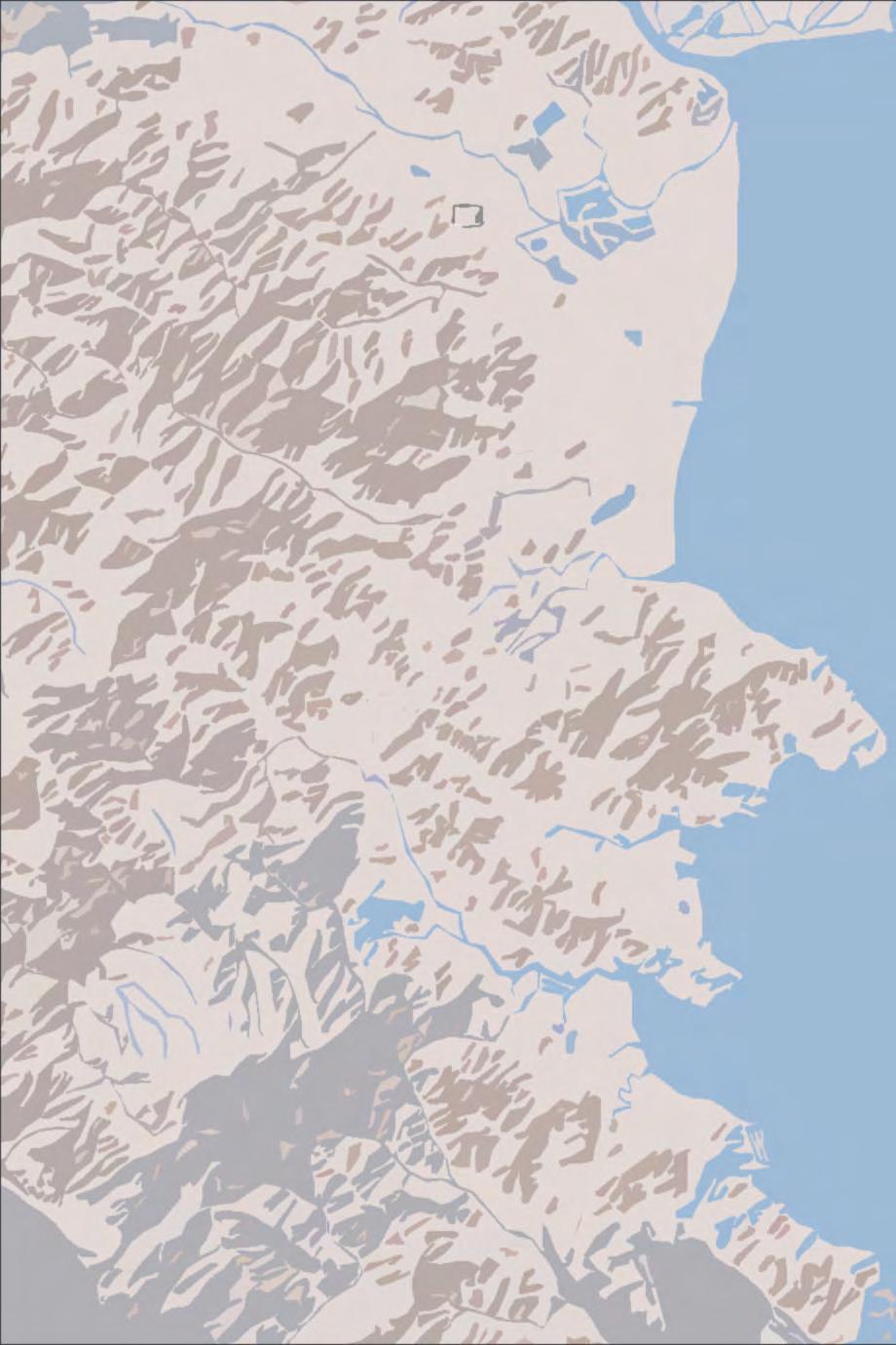
5 2. San Ramon Elementary School Profile 2.1. School Location 45 San Ramon Way Novato, CA Enrollment and Demographics Table 1 shows the enrollment by grade at San Ramon Elementary School for the school year. Table 2 shows the enrollment by ethnicity. Table 1: Enrollment by Grade, Grade Level Enrollment Kindergarten 77 Grade 1 64 Grade 2 86 Grade 3 76 Grade 4 74 Grade 5 86 Total 463 Source: California Department of Education Table 2: Enrollment by Racial and Ethnic Subgroups, Racial and Ethnic Subgroup Number of Students Percent of Students African American % American Indian or Alaska Native 0 0% Asian % Filipino 3 0.6% Hispanic or Latino % Pacific Islander 2 0.4% White (Not Hispanic) % Multiple or No Response % Source: California Department of Education 2.3. School Lunch Program Information not obtained. Page 2 of 13 Revised January 27, 2011
6 2.4. Existing Conditions Entrances to School o Primary School Entrance: All vehicular traffic must access the site at the San Ramon Way entrance. Cross Streets o San Juan Court and San Ramon Way Traffic Controls o San Ramon Way/San Juan Court: T-intersection, stop controlled on the San Ramon Court approach. o San Ramon Way/San Benito Way: T-intersection, all-way stop controlled. o San Ramon Way/San Felipe Way (north): Four-legged intersection, stop controlled on the San Felipe Way approaches. o San Ramon Way/San Marin Drive: Four-legged intersection, stop controlled on all approaches. o San Ramon Way/San Felipe Way (south): Four-legged intersection, stop controlled on the San Felipe Way. o San Ramon Way/San Carlos Way: T-intersection, stop controlled on all approaches. Crosswalks Marked crosswalks are provided at the following locations near the school: o San Ramon Way/San Juan Court: yellow transverse crosswalk on east leg. o San Ramon Way/San Benito Way: yellow transverse crosswalk on east and north legs. o San Ramon Way/San Felipe Way (north): yellow transverse crosswalk on east and west legs. o San Ramon Way/San Marin Drive: yellow transverse crosswalk on all legs. o San Ramon Way/San Felipe Way (south): yellow transverse crosswalk on east and west legs. o San Ramon Way/San Carlos Way: yellow transverse crosswalk on all legs. Page 3 of 13 Revised January 27, 2011
7 Crossing Guards o Location of TAM Crossing Guards: There are two TAM-funded crossing guards stationed at the intersections of San Ramon Way/San Marin Drive and San Ramon Way/San Benito Way. Transit o School Bus Availability: San Ramon School has bus service for students living over two miles from campus. o Public Transit Availability: The nearest public bus service is Golden Gate Transit Routes 51, 54, and 56, stopping at San Ramon Way and San Marin Drive. o Special Transit Needs Offered: Yes. Bike Racks o Location of Bike Racks: At the front of the school. o Number of Bike Spaces: Information not obtained. Pick Up and Drop Off o Location: Students are dropped-off on San Ramon Way and walk on to campus where there is a white curb. No students are dropped-off in parking lot (per sign) except students travelling in buses and day care vans. Parking o Staff parking: Staff parking is available in the school s parking area off of San Ramon Way. o General Public Parking. All visitors must park on streets adjacent to the school Policies Information not obtained. 3. Programs 3.1. Education San Ramon received the complete Safe Routes to Schools education program in 2008 including: o Stop Look and Listen (2 nd grade) Page 4 of 13 Revised January 27, 2011
8 o Walk Around the Block (2 nd grade) o Helmet Safety (4 th grade) o Traffic Safety Game Show (4 th grade) o Bicycle Rodeo (4 th grade) 3.2. Encouragement The school participates in the following encouragement programs: o Walk and Roll to School Days for selected grades o Frequent Rider Miles 3.3. Evaluation Student Surveys San Ramon Elementary has conducted spring and fall student surveys since the school year. With the exception of Spring 2006, students are asked by their teachers each fall and spring how they got to school that day. Table 3 shows the survey results. Blank entries indicate that the information was not collected. Table 3: How Students Got To School Fall Year Walk Bike Bus Transit Carpool Drive Alone % 5% 7% 12% 59% Other % 6% 14% 14% 51% 1% % 5% 12% 0% 14% 51% 0% % 2% 5% 1% 20% 55% 0% % 2% 3% 1% 16% 59% 1% Spring Year Walk Bike Bus Transit Carpool Drive Alone Other % 6% 10% 17% 47% 0% % 5% 11% 0% 15% 47% 0% % 2% 5% 0% 23% 51% 1% Page 5 of 13 Revised January 27, 2011

9 Figure 1 charts the information in Table 3. Over the course of the survey years, most children were driven alone in a family vehicle. The percentage of children walking has remained between 14 and 20 percent since the survey started, while the percentage bicycling has remained between two and six percent. For the surveys conducted during the , , and school years, transit and other were offered as travel choices. Figure 1: How Children Got To School Page 6 of 13 Revised January 27, 2011
10 Parent Survey San Ramon Elementary has not conducted parent surveys Walkabout Notes A walkabout was conducted in February 2007 with students, parents and school staff to identify potential safety improvements. The following issues were identified during the walkabout: o Motorists commonly run the San Ramon Way (north) stop sign and block the crosswalk. o Motorists commonly use the staff and bus only parking lot to pick up students. o Pedestrians commonly cross midblock, where crosswalks are not provided. o Crosswalks are transverse style and may be more visible as ladder style. 4. Engineering Engineering design concepts were developed based on the issues identified during the walkabout. These concepts are summarized below and illustrated in Appendix A: o Replace existing school area signage with updated fluorescent yellow-green signage. o Restripe existing crosswalks as high-visibility ladder style. o Construct bulb-outs at the intersections of San Ramon Way/San Benito Way and San Ramon Way/San Juan Court. o Paint ladder style crosswalk across south leg of San Ramon Way/San Juan Court intersection. o Repaint school area curbs. o Install permanent signs prohibiting motorists entering driveway entrance. o Widen sidewalk to ten feet in front of school. 5. Implementation Matrix Implementation plans for the Novato School District are summarized in the District Travel Plan. Please refer to that plan for implementation efforts. Page 7 of 13 Revised January 27, 2011
11 Appendix A: Engineering Design Concepts Page 8 of 13 Revised January 27, 2011
12 This page intentionally left blank Page 9 of 13 Revised January 27, 2011
13 Figure 2: Traffic Calming on San Ramon Way, Sheet 1 of 2 10
14 Figure 3: Traffic Calming on San Ramon Way, Sheet 2 of 2 11
Vallecito Elementary School. Travel Plan
 Vallecito Elementary School Travel Plan TABLE OF CONTENTS 1. PURPOSE... 1 1.1. SR2S PLANNING, IMPLEMENTATION AND MONITORING... 1 1.2. MARIN COUNTY MEASURE A... 1 2. VALLECITO ELEMENTARY SCHOOL PROFILE...
Venetia Valley Elementary School. Travel Plan
 Venetia Valley Elementary School Travel Plan TABLE OF CONTENTS 1. PURPOSE... 1 1.1. SR2S PLANNING, IMPLEMENTATION AND MONITORING... 1 1.2. MARIN COUNTY MEASURE A... 1 2. VENETIA VALLEY ELEMENTARY SCHOOL
Wellington Exempted Village School District SAFE ROUTES TO SCHOOL TRAVEL PLAN January 2014
 Wellington Exempted Village School District SAFE ROUTES TO SCHOOL TRAVEL PLAN January 2014 OHIO SAFE ROUTES TO SCHOOL WELLINGTON EXEMPTED VILLAGE SCHOOL DISTRICT TRAVEL PLAN SECTION 1: WELLINGTON EXEMPTED
C/CAG. Sunnybrae Elementary School Walking and Bicycling Audit. San Mateo-Foster City School District JUNE 2013
 Sunnybrae Elementary School Walking and Bicycling Audit JUNE 2013 San Mateo-Foster City School District C/CAG City/County Association of Governments of San Mateo County SUNNYBRAE ELEMENTARY SCHOOL WALKING
ARCADIA ELEMENTARY & MIDDLE SCHOOLS
 ARCADIA ELEMENTARY & MIDDLE SCHOOLS SAFE ROUTES TO SCHOOL TRAVEL August 2013 ARCADIA LOCAL SCHOOLS OHIO SAFE ROUTES TO SCHOOL SCHOOL TRAVEL Ohio Safe Routes to School Travel Plan Local Schools www.dot.state.oh.us/saferoutes
July 5, Arthur R. Ware, Jr. Elementary School 2017 Safe Routes to School Walkabout Report
 July 5, 2017 Arthur R. Ware, Jr. Elementary School 2017 Safe Routes to School Walkabout Report 1 Walkabout Report Introduction On April 28, 2017, City, School, and SAWMPO staff met to conduct a Safe Routes
PROSPECT ELEMENTARY GIRARD INTERMEDIATE GIRARD JUNIOR HIGH
 PROSPECT ELEMENTARY GIRARD INTERMEDIATE GIRARD JUNIOR HIGH SAFE ROUTES TO SCHOOL SCHOOL TRAVEL PLAN January 8, 2014 2 SECTION 1: OUR SCHOOLS School District School Name School Address Grades served Girard
School Travel Survey for District Superintendents/Board Chairs
 School Travel Survey for District Superintendents/Board Chairs 1. How do most of the elementary and middle school students in your district get to school in the morning? (Please select only one box) by
Implementing the Three Es of School Zone Traffic Calming
 Implementing the Three Es of School Zone Traffic Calming Use this evaluation tool as a guide to analyze the specific safety needs of your school. SCHOOL PROFILE School Name: School District: Address: Phone
Doull Elementary School
 Doull Elementary School Safe Routes to School Walking Audit and Recommendations WalkDenver Fall 2013 Doull Elementary School (ECE grade 5) 2520 South Utica Street, Denver 80219 This project was supported
THORNVILLE-GLENFORD STP
 THORNVILLE-GLENFORD STP SAFE ROUTES TO SCHOOL TRAVEL PLAN September 2013 OHIO SAFE ROUTES TO SCHOOL SCHOOL TRAVEL PLAN SECTION 1: OUR SCHOOL/S 1A. Identify Target Schools School District School Name School
SAFE ROUTES TO SCHOOL (SR2S)
") SAFE ROUTES TO SCHOOL (SR2S) In partnership with Burbank Unified School District (BUSD) & City of Burbank George Washington Elementary School Thomas Jefferson Elementary School John Muir Middle School
SAFE ROUTES TO SCHOOL (SR2S) In partnership with Burbank Unified School District (BUSD) & City of Burbank George Washington Elementary School Thomas Jefferson Elementary School John Muir Middle School
CHILLICOTHE CITY SCHOOLS. SAFE ROUTES TO SCHOOL TRAVEL PLANS for Allen, Mt. Logan, Tiffin & Worthington Elementary Schools January 2013
 CHILLICOTHE CITY SCHOOLS SAFE ROUTES TO SCHOOL TRAVEL PLANS for Allen, Mt. Logan, Tiffin & Worthington Elementary Schools January 2013 i Ohio s Safe Routes to School Travel Plan Template www.dot.state.oh.us/saferoutes
Sardis Elementary School Road Safety Plan. Produced by: Sardis Elementary School - Safer School Travel Team in cooperation with Safer City
 Sardis Elementary Road Safety Plan Produced by: Sardis Elementary - Safer Travel Team in cooperation with Safer City Plan completed in January 2016 1 Acknowledgements It takes commitment and community
AMHERST EXEMPTED VILLAGE SCHOOLS AND SAINT JOSEPH SCHOOL
 AMHERST EXEMPTED VILLAGE SCHOOLS AND SAINT JOSEPH SCHOOL SAFE ROUTES TO SCHOOL TRAVEL PLAN 12/11/18 DRAFT OHIO SAFE ROUTES TO SCHOOL SCHOOL TRAVEL PLAN Ohio s Safe Routes to School Travel Plan Template
School Travel Survey for Principals. 1. How do most of your students get to school in the morning? (Please select only one box)
") School Travel Survey for Principals 1. How do most of your students get to school in the morning? (Please select only one box) by school bus by public transportation (e.g., city bus) by other motor vehicle
School Travel Survey for Principals 1. How do most of your students get to school in the morning? (Please select only one box) by school bus by public transportation (e.g., city bus) by other motor vehicle
SAFE ROUTES TO SCHOOL
 SAFE ROUTES TO SCHOOL Edgewood Elementary School Existing Conditions and ACTION PLAN > Oak Creek - Franklin Joint School District Table of Contents CONTEXT Enrollment Boundaries Enrollment
WALKSacrame nto. Welcomes you to the 2009 Sacramento County Safe Routes to School Conference
 Sacramento County Department of Transportation Ron Vicari, Principal Civil Engineer In Partnership with: WALKSacrame nto Anne Geraghty, Terry Preston & Staff Welcomes you to the 2009 Sacramento County
Getting Your SRTS Project Funded. Ryan Snyder
 Getting Your SRTS Project Funded Ryan Snyder Steps in Submitting a Successful Application 1. Stakeholder outreach: create a SRTS coalition 2. Develop a comprehensive plan and program with all 5 Es 3. Conceive
CLEVELAND HEIGHTS STP
 CLEVELAND HEIGHTS STP SAFE ROUTES TO SCHOOL TRAVEL PLAN February 2014 OHIO SAFE ROUTES TO SCHOOL SCHOOL TRAVEL PLAN TEMPLATE SECTION 1: OUR SCHOOL(S) 1A. Identify Target Schools School District School
CITY OF KASSON TRANSPORTATION ALTERNATIVES KASSON SAFE ROUTES TO SCHOOL
 ve ha 8t G B A Mantorville Ave N 240th Ave 16th St NE 11th Ave NE K-M HIGH SCHOOL SUNRISE TRAIL TO MANTORVILLE MNTH 57 SUNSET TRAIL TO MANTORVILLE NE PARK 16TH ST NE TRAIL K-M ELEMENTARY SCHOOL K-M MIDDLE
Trip Generation for an averaged sized elementary school in Provo, Utah
 Trip Generation for an averaged sized elementary school in Provo, Utah Brigham Young University s ITE student chapter conducted a Trip Generation Study to determine the number of trips generated by an
Outreach Approach RENEW SF served as the primary liaison with the North Beach community; the Chinatown. Executive Summary
 Executive Summary Executive Summary The Columbus Avenue Neighborhood Transportation Study s objective is to identify changes to transportation infrastructure and policies that could enhance the livability
Dixie School District Travel Plan Marin County Safe Routes to Schools Program. Table of Contents. List of Tables 1. INTRODUCTION GOALS...
 Dixie School District Travel County Safe Routes to Schools Program Table of Contents 1. INTRODUCTION... 2 2. GOALS... 2 3. TASK FORCE MEMBERS... 3 4. TASK FORCE AREA INFORMATION... 3 4.1. Traffic Counts...
Arlington Public Schools Thomas Jefferson Site Evaluation Transportation Networks. Thomas Jefferson Working Group Meeting #6 November 10, 2014
 Arlington Public Schools Thomas Jefferson Site Evaluation Transportation Networks Thomas Jefferson Working Group Meeting #6 November 10, 2014 2 3 INTRODUCTION 4 Goal of our work: Identify and assess multi-modal
Safe Routes to School Comprehensive Plan
 Safe Routes to School Comprehensive Plan City of Apple Valley Dakota County, MN May 2010 Prepared by: Project Background The Statewide Health Improvement Program (SHIP) aims to help Minnesotans live longer,
FRANKLIN, ISHAM MEMORIAL, OVERLOOK & VALLEY VIEW ELEMENTARY SCHOOLS
 FRANKLIN, ISHAM MEMORIAL, OVERLOOK & VALLEY VIEW ELEMENTARY SCHOOLS SAFE ROUTES TO SCHOOL TRAVEL PLAN August 2013 OHIO SAFE ROUTES TO SCHOOL SCHOOL TRAVEL PLAN SECTION 1: OUR SCHOOL(S) School District
Arlington Public Schools New Elementary School at Thomas Jefferson Site Off-Site Transportation. Thomas Jefferson BLPC / PFRC Meeting July 27, 2016
 Arlington Public Schools New Elementary School at Thomas Jefferson Site Off-Site Transportation Thomas Jefferson BLPC / PFRC Meeting July 27, 2016 1.Review of Analysis 2.Key Transportation Issues 3.Recommendations
METROPOLITAN TRANSPORTATION PLAN OUTREACH: INTERACTIVE MAP SUMMARY REPORT- 10/03/14
 METROPOLITAN TRANSPORTATION PLAN OUTREACH: INTERACTIVE MAP SUMMARY REPORT- 10/03/14 INTRODUCTION This document summarizes the results of the online interactive mapping exercise implemented by MIG for the
Arlington Public Schools Abingdon Elementary School Site Evaluation Preliminary Transportation Findings
 Arlington Public Schools Abingdon Elementary School Site Evaluation Preliminary Transportation Findings Arlington County Public Facilities Review Committee (PFRC) November 19, 2014 SAN ANTONIO-BEXAR COUNTY
Hedgepeth Williams Middle School and Paul Robeson Elementary School Trenton, NJ. School Travel Plan
 Hedgepeth Williams Middle School and Paul Robeson Elementary School Trenton, NJ School Travel Plan Hedgepeth Williams Middle School Description: Hedgepeth-Williams Middle School is located at 301 Gladstone
TRAFFIC ACTION PLAN. North Central Neighborhood CITY OF SAN MATEO
 TRAFFIC ACTION PLAN North Central Neighborhood CITY OF SAN MATEO Draft February 2017 Table of Contents Introduction... 1 The Traffic Forum Process... 4 Neighborhood Traffic Issues... 6 Neighborhood Recommendations
CITY OF OTTAWA ROADWAY MODIFICATION APPROVAL UNDER DELEGATED AUTHORITY
 RMA-2015-ATM-038 CITY OF OTTAWA ROADWAY MODIFICATION APPROVAL UNDER DELEGATED AUTHORITY DATE: April 22, 2015 SUBJECT Approval of Roadway Modifications Recommended through an Area Traffic Management Study
Planning Committee STAFF REPORT October 5, 2016 Page 2 of 2 by a task force of local staff familiar with safe routes to school programs, projects and
 Planning Committee STAFF REPORT Meeting Date: October 5, 2016 Subject Contra Costa Safe Routes to School Program Report Summary of Issues Recommendations Financial Implications Options Attachments Changes
ASHTABULA AREA SCHOOLS STP
 ASHTABULA AREA SCHOOLS STP SAFE ROUTES TO SCHOOL TRAVEL PLAN April 2013 OHIO SAFE ROUTES TO SCHOOL SCHOOL TRAVEL PLAN SECTION 1: OUR SCHOOL/S 1A. Identify Target Schools School District School Name School
Abingdon Elementary School School Transportation Report
 Abingdon Elementary School School Transportation Report May 2015 Prepared for Arlington Public Schools by Toole Design Group, LLC 1 CONTENTS Executive Summary... 3 Introduction... 7 Existing Conditions
Rim Rock Elementary School Walking and Biking Audit
 Rim Rock Elementary School Walking and Biking Audit September 29, 2016 Rim Rock Elementary School Audit for Walking and Biking September 29, 2016 Audit Team Members: Sam Atkins, City Engineer, City of
CITY OF OAK CREEK SAFE ROUTES TO SCHOOL ACTION PLAN. East Middle School
 CITY OF OAK CREEK SAFE ROUTES TO SCHOOL ACTION PLAN East Middle School CITY OF OAK CREEK SAFE ROUTES TO SCHOOL ACTION PLAN East Middle School Why Safe Routes to School? Safe Routes to School ( SRTS ) is
TRAFFIC ACTION PLAN. Laurie Meadows Neighborhood CITY OF SAN MATEO
 TRAFFIC ACTION PLAN Laurie Meadows Neighborhood CITY OF SAN MATEO Draft January 2017 Table of Contents Introduction... 2 The Traffic Forum Process... 5 Neighborhood Traffic Issues... 7 Neighborhood Recommendations
SAFE ROUTES TO SCHOOL
 SAFE ROUTES TO SCHOOL Forest Ridge Elementary School Existing Conditions and ACTION PLAN > Oak Creek - Franklin Joint School District Table of Contents CONTEXT Enrollment Boundaries
LAUREL HEIGHTS/JORDAN PARK TRAFFIC CALMING PROJECT DECEMBER 2012
 LAUREL HEIGHTS/JORDAN PARK TRAFFIC CALMING PROJECT DECEMBER 2012 PREPARED BY: SAN FRANCISCO MUNICIPAL TRANSPORTATION AGENCY TRAFFIC CALMING PROGRAM 1 SOUTH VAN NESS AVENUE SAN FRANCISCO, CA 94103 Preparation
SECTION 1 - CONTACT INFORMATION
 SECTION 1 - CONTACT INFORMATION Please complete the information below. The person identified as the Project Contact Person will be the primary point of contact for Georgia DOT staff. Organization: (Please
Safe Routes to School Travel Plan 2011 Reading-Fleming Intermediate School (RFIS)
") Safe Routes to School Travel Plan 0 Reading-Fleming Intermediate School (RFIS) Reading Fleming Intermediate School 50 Court Street Flemington, NJ 088 Grades: 5-6 Introduction Reading-Fleming Intermediate
Safe Routes to School Travel Plan 0 Reading-Fleming Intermediate School (RFIS) Reading Fleming Intermediate School 50 Court Street Flemington, NJ 088 Grades: 5-6 Introduction Reading-Fleming Intermediate
Chapter 3.3 Horizon Elementary School. Volusia County MPO. June 2009
 Chapter 3.3 Horizon Elementary School Port Orange, FL Volusia County MPO June 2009 Volusia County MPO School Bicycle and Pedestrian Review Study, Phase 3C School Summary Horizon Elementary School is located
WalkSafe Vocabulary Matching. 1 pedestrian A marked place to cross the street. 2 intersection A person who is walking. 3 crosswalk. 4 curb.
 WalkSafe Vocabulary Matching Name Directions: Draw a line from the vocabulary word to its definition. 1 pedestrian A marked place to cross the street. 2 intersection A person who is walking. 3 crosswalk
Johnson Elementary School
 Johnson Elementary School Safe Routes to School Walking Audit and Recommendations WalkDenver Fall 2013 Johnson Elementary School 1850 South Irving Street, Denver 80219 This project was supported by Safe
Welcome to the Quebec Alternatives Analysis Public Meeting
 Welcome to the Public Meeting Please sign in. Public Comment Please fill out a comment card and tell us what you think. Check back or comment any time at: www.quebecalternatives.com Project Area Technical
Improvements Infrastructure Gap Assessment and Improvements Street Striping
 Infrastructure Project Proposal The federal-aid Safe Routes to School program funds infrastructure/engineering projects that fall into two categories: Design (available only to School Development Authority
NORTH UNION LOCAL SCHOOLS
 NORTH UNION LOCAL SCHOOLS SAFE ROUTES TO SCHOOL TRAVEL PLAN November 2015 OHIO SAFE ROUTES TO SCHOOL SCHOOL TRAVEL PLAN SECTION 1: OUR SCHOOL(S) 1A. Identify Target Schools School District School Name
Transportation Planning Division
 Transportation Planning Division Presentation Outline Study Tasks Recap of Previous Meeting Stakeholder Interviews Data Collection Design Principles Tool Box Recommendations Schedule Moving Forward North
CONNECTING PEOPLE TO PLACES
 CONNECTING PEOPLE TO PLACES 82 EAST BENCH MASTER PLAN 07 Introduction The East Bench transportation system is a collection of slow moving, treelined residential streets and major arteries that are the
BEXLEY CITY SCHOOL DISTRICT
 BEXLEY CITY SCHOOL DISTRICT SAFE ROUTES TO SCHOOL TRAVEL PLAN December 2012 OHIO SAFE ROUTES TO SCHOOL SCHOOL TRAVEL PLAN SECTION 1: OUR SCHOOLS 1A. Identify Target Schools School District School Name
Sebastopol Charter School Traffic Management Plan
 Sebastopol Charter School The serves as the working document in support of these essential goals: to ensure the safety and efficiency of student arrival to and departure from school to ensure the safety
ZANESVILLE CITY SCHOOLS STP. SAFE ROUTES TO SCHOOL TRAVEL PLAN February 2015
 ZANESVILLE CITY SCHOOLS STP SAFE ROUTES TO SCHOOL TRAVEL PLAN February 2015 SECTION 1: OUR SCHOOL(S) School District School Name School Address Grades served City Schools Average Daily Student Enrollment
San Francisco 2009 Collisions Report April 21, 2011
 San Francisco 29 Collisions Report April 21, 211 City and County of San Francisco San Francisco Municipal Transportation Agency 1 South Van Ness Avenue, 7 th Floor San Francisco CA 9413 CONTENTS About
Ross Valley Safe Routes to Schools Task Force Agenda Friday, May 19 th Ross Valley School District 110 Shaw Drive, San Anselmo Blue Room 10:00 am
 Ross Valley Safe Routes to Schools Task Force Agenda Friday, May 19 th Ross Valley School District 110 Shaw Drive, San Anselmo Blue Room 10:00 am Attendees: Karen Baigrie- Team Leader Hidden Valley, Sean
Windy Ridge Elementary School
 Windy Ridge Elementary School SCHOOL ROUTE PLAN For WINDY RIDGE ELEMENTARY SCHOOL LOCATION 54 ORANGE COUNTY Prepared for: ORANGE COUNTY SCHOOL ASSESSMENT PROGRAM ORANGE COUNTY PUBLIC WORKS Traffic Engineering
Project Status Update
 Project Status Update : Novato Boulevard, 4th & 3rd Streets, Sir Francis Drake Boulevard (3), and Miller Avenue Major roads projects target the most heavily traveled roads in Marin County for repairs,
Mineral Avenue Corridor Assessment. ITE 2017 Western District Annual Meeting San Diego, CA June 21 st
 Mineral Avenue Corridor Assessment ITE 2017 Western District Annual Meeting San Diego, CA June 21 st Biography - Aaron Heumann, PE, PTOE Currently City of Littleton Transportation Engineering Manager 24
Transportation Planning Division
 Transportation Planning Division Presentation Outline Study Tasks Recap of Previous Meetings Data Collected Focus Areas within Study Limits Design Principles Tool Box Recommended Concepts Schedule Moving
Polk Streetscape Project
 What is this project? The Polk Streetscape Project is an effort to improve safety for everyone traveling on Polk Street between Union and McAllister streets. Also included in this project are paving, sewer
Parent Survey Report: One School in One Data Collection Period
 Parent Survey Report: One School in One Data Collection Period School Name: Bilquist Elementary School Set ID: 15803 School Group: Clackamas County Month and Year Collected: December 2016 School Enrollment:
Transportation Authority of Marin Renew Existing ½-cent Transportation Sales Tax
 Transportation Authority of Marin Renew Existing ½-cent Transportation Sales Tax Request for Approval of the Final Sales Tax Renewal Expenditure Plan Town of Tiburon June 20, 2018 Request Council to Approve
Transportation Issues Poll for New York City
 2016-17 Transportation Issues Poll for New York City 82% support Vision Zero and reducing traffic deaths 72% on average, support more street space for children to play, protected bike lanes and other safety
Bremen Elementary. SAFE ROUTES TO SCHOOL TRAVEL PLAN October 9, 2012
 Bremen Elementary SAFE ROUTES TO SCHOOL TRAVEL PLAN October 9, 2012 Introduction The purpose of the Bremen Elementary Safe Route to School (SRTS) Plan is to encourage school age children to travel to school
Meadow Woods Elementary School
 Drag and drop pic and stretch/crop to the limits of the blue rectangle (delete this text box) Meadow Woods Elementary School Drag and drop pic and stretch/crop to the limits of the blue rectangle (delete
Bicycle and Pedestrian Advisory Council May 15, 2015
 Bicycle and Pedestrian Advisory Council May 15, 2015 Updates Spring Bike/Ped counts took place Tuesday May 12 Thursday, May 14 40 volunteers and locations counted across the region More than double the
SAN FRANCISCO MUNICIPAL TRANSPORTATION AGENCY
 THIS PRINT COVERS CALENDAR ITEM NO. : 10.2 DIVISION: Sustainable Streets BRIEF DESCRIPTION: SAN FRANCISCO MUNICIPAL TRANSPORTATION AGENCY Adopting Conceptual Proposal for Streetscape Improvements to Broadway,
11/28/2016 VIA
 11/28/2016 VIA EMAIL Ethan Meltzer, Assistant Planner City of Sacramento Community Development Department 300 Richards Blvd., 3 rd Floor Sacramento, Ca 95811 RE: Natomas Corporate Center Commercial Building
Summary of School Observations and Education and Encouragement Initiatives
 Rye Shared Committee Summary of School Observations and Education and Encouragement Initiatives Presented to the Rye City Council & The Rye City School District Board of Education April 9 th, 2011 1 Why
HOOPA DESIGN FAIR 4. IMPLEMENTATION PHASES & FUNDING
 4. IMPLEMENTATION PHASES & FUNDING HOOPA DESIGN FAIR 4-1 4. IMPLEMENTATION PHASES & FUNDING Phase One Development 1. Implementation The Conceptual Plan recommends five concept elements to revitalize downtown
Summary Report School Walking & Bicycling Audits. Mesa County Regional Transportation Planning Office
 Summary Report School Walking & Bicycling Audits Mesa County Regional Transportation Planning Office This page left blank intentionally WALKING & BICYCLING AUDIT SUMMARY 2 Executive Summary Background:
ATTACHMENT NO. 11. RRLRT No. 2. Railroad / Light Rail Transit Technical Committee TECHNICAL COMMITTEE: Busway Grade Crossings STATUS/DATE OF ACTION
 ATTACHMENT NO. 11 RRLRT No. 2 TECHNICAL COMMITTEE: TOPIC: Railroad / Light Rail Transit Technical Committee Busway Grade Crossings STATUS/DATE OF ACTION RRLRT TC Draft: 06/23/2011 RRLRT TC Approval: 06/27/2014
3 Silverton High School Report
 3 Silverton High School Report Principal: Justin Lieuallen Grades: 9-12 Enrollment: 1,277 Address: 1456 Pine Street First bell: 7:55 a.m. Silverton, OR 97381 Last bell: 3:05 p.m. Free & Reduced Lunch:
Aitkin School Routing Plan July 2010
 Aitkin School Routing Plan July 2010 Prepared by: Arrowhead Regional Development Commission Regional Planning Division Aitkin School Routing Plan July 2010 Aitkin School Routing Plan July 2010 Prepared
TRAFFIC MANAGEMENT PLAN
 292 84 140440 TRAFFIC MANAGEMENT PLAN The purpose of the Traffic Management Plan (TMP) is to have established procedures for traffic flow and circulation around the elementary school related to student
Traffic Circulation & Pedestrian Safety Study
 Lyons Township High School North Campus La Grange, Illinois Parking Lot Vaughan Building N Main Building Prepared for: Prepared by: July 23, 2015 Contents List of Figures, iii 1. Introduction...1 2. Existing
Safe Routes to School Novato Task Force Committee Wednesday, January 10, 2018 Meeting Notes
 Safe Routes to School Novato Task Force Committee Wednesday, January 10, 2018 Meeting Notes Attendance Wendi Kallins- Safe Routes to Schools, Peggy Clark- Safe Routes to Schools, Monica Leifer- Safe Routes
Chapter 3.9 Timbercrest Elementary School. Volusia County MPO. November 2008
 Chapter 3.9 Timbercrest Elementary School Deltona, FL Volusia County MPO November 2008 Volusia County MPO School Bicycle and Pedestrian Review Study, Phase 3B School Summary Timbercrest Elementary School
Safe Routes to School Action Plan Aberdeen, Idaho
 Background Aberdeen, Idaho is a largely agricultural community of nearly 2,000 people and is located in the southeast portion of the state on the western edge of American Falls Reservoir. The community
KEARNY MESA COMMUNITY PLAN UPDATE
 KEARNY MESA COMMUNITY PLAN UPDATE January 18, 2018 SUBCOMMITTEE MEETING Mobility Concepts and Urban Design Presentation Outline Mobility Concepts: Multimodal Planning Toolbox Presentation and Activities
Introduction.
 2307-1.0. Introduction. Delaware s Safe Routes to School (SRTS) Program was established September 10, 2002 when Governor Ruth Ann Minner signed Senate Bill 353 of the 141st General Assembly of Delaware
Chapter 3.5 Osteen Elementary School. Volusia County MPO. November 2008
 Chapter 3.5 Osteen Elementary School Osteen, FL Volusia County MPO November 2008 Volusia County MPO School Bicycle and Pedestrian Review Study, Phase 3B School Summary Osteen Elementary School is located
OCEAN DRIVE ELEMENTARY SCHOOL
 OCEAN DRIVE ELEMENTARY SCHOOL North Myrtle Beach, SC Safe Routes to School Travel Plan JANUARY 2017 SRTS Team Roster SRTS Team members represent key community stakeholders, share work of developing the
2 Mark Twain Elementary School Report
 2 Mark Twain Elementary School Report Principal: Greg Kaatz Grades: K-2 Enrollment: 323 Address: 425 N. Church Street First bell: 8:10 a.m. Silverton, OR 97381 Last bell: 2:30 p.m. Free & Reduced Lunch:
FREMONT CITY SCHOOLS STP
 FREMONT CITY SCHOOLS STP SAFE ROUTES TO SCHOOL TRAVEL PLAN February 2014 OHIO SAFE ROUTES TO SCHOOL SCHOOL TRAVEL PLAN SECTION 1: OUR SCHOOL(S) 1A. Identify Target Schools School District School Name School
A Safe Routes to School Survey in Hillsborough County
 A Safe Routes to School Survey in Hillsborough County Prepared for Florida Department of Transportation, District 7 Project Manager: Peter Hsu, P.E. Prepared by Huaguo Zhou, Ph.D., P.E. Senior Research
FOLSOM-HOWARD STREETSCAPE OVERVIEW
 FOLSOM-HOWARD STREETSCAPE OVERVIEW SoMa residents should have the same kinds of amenities that other neighborhoods have. The Folsom- Howard Streetscape Project will make SoMa more livable by making it
Orange Center Elementary School
 Drag and drop pic and stretch/crop to the limits of the blue rectangle (delete this text box) Orange Center Elementary School Drag and drop pic and stretch/crop to the limits of the blue rectangle (delete
INTRODUCTION. Specifically, the objectives are to:
 INTRODUCTION The River to Sea Transportation Planning Organization (TPO) conducts the Tell the TPO Transportation Trends Survey to better understand the transportation preferences and priorities for the
Bicycle and Pedestrian Advisory Committee (BPAC) November 21, 2013
 November 21, 2013") Bicycle and Pedestrian Advisory Committee (BPAC) November 21, 2013 OVERALL LAND USE CONCEPT Overall Broadway Valdez District: 95.5 acres (35.1 acres right-of ways + 60.4 acres developable land) Plan Subareas:
Bicycle and Pedestrian Advisory Committee (BPAC) November 21, 2013 OVERALL LAND USE CONCEPT Overall Broadway Valdez District: 95.5 acres (35.1 acres right-of ways + 60.4 acres developable land) Plan Subareas:
National Safe Routes to School Program: Initial Results
 National Safe Routes to School Program: Initial Results Lauren Marchetti National Center for Safe Routes to School 9 th Annual New Partners for Smart Growth Thursday, February 4, 2010 Seattle, WA August
HARRISON STREET/OAKLAND AVENUE COMMUNITY TRANSPORTATION PLAN
 HARRISON STREET/OAKLAND AVENUE Community Workshop #4: Draft Plan Review December 3, 2009 D E S I G N, C O M M U N I T Y & E N V I R O N M E N T INTRODUCTIONS Key Project Staff: Alisa Shen, Project Manager,
San Rafael School District. Task Force Meeting Notes. November 5, 2012
 San Rafael School District Task Force Meeting Notes November 5, 2012 Attendees (8) Wendi Kallins Program Director for Safe Routes to Schools; Laura Kelly Volunteer Liaison for Safe Routes to Schools; Leslie
FROM: CITY MANAGER DEPARTMENT: PLANNING AND COMMUNITY ENVIRONMENT DATE: OCTOBER 4, 2004 CMR:432:04
 TO: HONORABLE CITY COUNCIL FROM: CITY MANAGER DEPARTMENT: PLANNING AND COMMUNITY ENVIRONMENT DATE: OCTOBER 4, 2004 CMR:432:04 SUBJECT: FINANCE COMMITTEE RECOMMENDATION TO ADOPT TRANSPORTATION STRATEGIC
Safe Routes to School Guide
 Safe Routes to School Guide Steps to Creating a Safe Routes to School Program Created February 2007 SafeRoutes National Center for Safe Routes to School This guide was developed by the Pedestrian and Bicycle
Appendix C 3. Bicycle / Pedestrian Planning
 Appendix C 3. Bicycle / Pedestrian Planning BICYCLE/PEDESTRIAN PLANNING 2005 Master Plan GOAL: Provide for safe and convenient bicycle and pedestrian circulation throughout the City. Develop a city-wide
Hidden Oaks Elementary School
 Hidden Oaks Elementary School SCHOOL ROUTE PLAN For HIDDEN OAKS ELEMENTARY SCHOOL LOCATION 13 ORANGE COUNTY Prepared for: ORANGE COUNTY SCHOOL ASSESSMENT PROGRAM ORANGE COUNTY PUBLIC WORKS Traffic Engineering
Chapter 4.3 Enterprise Elementary. Volusia County MPO. March Page 7.0
 Chapter 4.3 Enterprise Elementary Enterprise, FL Volusia County MPO March 2008 Page 7.0 Volusia County MPO Bicycle and Pedestrian School Safety Review Study Introduction Enterprise Elementary School is
Background Planning Committee STAFF REPORT March 7, 2018 Page 2 of 2 On June 21, 2017, the Authority approved the programming of second cycle One Bay
 Planning Committee STAFF REPORT Meeting Date: March 7, 2018 Subject Summary of Issues Recommendations Financial Implications Options Attachments Approval of Resolution 18-11-G Appropriating Measure J TLC