Fulton Market Streetscape
|
|
|
- Mark Carr
- 5 years ago
- Views:
Transcription


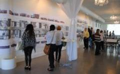
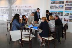
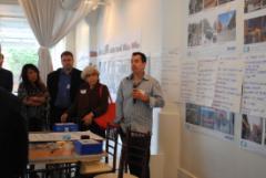
1 Fulton Market Streetscape Ogden Avenue to Halsted Street Public Meeting Recommended Improvements December 10th, 2014
2 Meeting Purpose and Goals Present Existing Conditions Community Input and Charrette Overview of Recommend Improvements Describe ADA Challenges Street Design Concepts by Typology Discuss Implementation Plan 2


3 Vaulted Sidewalks Existing Infrastructure - Unseen Remnants of the Freight Tunnel System Buried Private Utilities of All Types City Sewer, Water and Electricity Cobble Roadway Base 3


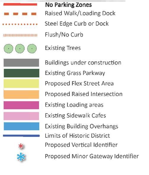
4 Existing Infrastructure and Uses - Visible Contemporary Pavement Type and Condition Light Poles Parkway Treatments Sidewalk and Brick Pavers Landscaping and Trees Sculptures Overhead Wires Sidewalk Cafés Loading Zones Parking Zones Historic Flush Curbs Building Canopies Raised Sidewalks Steel Curbs 4

5 Getting to Great Streets

6 Community/Stakeholder Issues and Concerns Upgrading existing infrastructure Parking Accommodation of existing loading needs Rationalize curbside uses Address pedestrian safety and accessibility Speeding during off-peak hours Need for flexibility in the street Rationalize traffic pattern Increase unique programming and activities Cultivate culture and community and celebrate unique district identity 6


7 Improvement Themes Maintain Market Integrity Corridor may change over time but want flavor of the market infrastructure to stay. Bring logic, clarity, and landscaping to Fulton. Safety Celebrate Technology and Food Market and innovation district should merge, accommodate, and celebrate historic uses with new technologies. Keep Fulton Flexible Transition from day to night / weekday to weekend. Balance curbside uses to reflect changes in use from day to night and weekday to weekend. Demand for flexibility increases toward east end of project. 7


8 Improvement Themes Pedestrian Friendly Use design elements to provide quality pedestrian experience while still allowing for other uses. Address pedestrian safety and ADA needs at higher vehicular volume streets Ogden, Racine, Halsted. Street as a Public Open Space The street could become community open space Activities and spaces that support activation, interaction. Temporal Flexible Fulton Street as Public Open Space 8


9 What is the Community s Vision for Fulton Market? Flexible Street from Green to Morgan Farmers Market Events All uses, including food distribution Treat Intersections as Important Nodes CTA access at Morgan Expressway access using May, Racine, and Ogden Gallery hub at Elizabeth Raise Intersections to Slow Traffic Green Sangamon Enhance Safety Pedestrian Safety Measures Along Fulton and at: Morgan, Carpenter & Aberdeen Traffic Signals at: Halsted and Fulton Ogden and Fulton Design For Changing Land Uses Concentration near Ogden Various parcels Carpenter to Green 9


10 Proposed Infrastructure Improvements Resurface deteriorated pavement Rebuild sidewalks and parkways Improve City Sewer and Water Install Traffic Signals at Fulton and Halsted Install new street and pedestrian lighting Provide ADA compliant access Along Fulton At intersections Around raised sidewalks To raised sidewalks Accommodate pedestrian movements for the entire length of Fulton Street Organize & Rationalize Loading Zones At active truck docks Organize & Rationalize Parking Zones Bury Most Overhead Wires Maintain/Permit Canopies Retain Most Steel Curbs Accommodate Sidewalk Cafés Fill Vaulted Sidewalks 10
11 Fulton-Randolph Traffic and Curbside Use Study Purpose: Inventory existing curbside uses Incorporates time of day and traffic Develop recommendations for curbside changes and improvements to pedestrian, bicycle and motor vehicle accommodations Project Boundaries: Carroll Ave (N), Randolph St. (S), Ogden Ave. (W), Halsted St. (E) Study Limits include Fulton Market Streetscape Project Timeline: Project Kickoff 10/15/2014 Data Collection Complete 5/1/2015 Study Completion 10/15/

12 Fulton-Randolph Traffic and Curbside Use Study: PRELIMINARY DATA COLLECTION Curbside Use Inventory created from field observations Preliminary Curbside Use Inventory 24-hour video footage collected from intersection and mid-block locations along Fulton Market Intersection cameras used to determine daily fluctuations in car, truck, bike, and pedestrian traffic Mid-block cameras used to determine parking utilization and turnover rate 12
: Type Typical Peak Period Pedestrian 11:00 AM 2:00 PM Car 6:00 PM 9:00 PM Volume of Traffic 120 100 80 60")
13 Fulton-Randolph Traffic and Curbside Use Study: PRELIMINARY OBSERVATIONS Frequent in-street loading blocks traffic and creates safety issues Majority of parking spaces have low turnover rate Video footage from the block between Peoria St and Green St Traffic Trends (5 intersections sample): Type Typical Peak Period Pedestrian 11:00 AM 2:00 PM Car 6:00 PM 9:00 PM Volume of Traffic Volume of Through Traffic at Peoria St & Fulton St (15-minute sample times) Cars Trucks Bikes Pedestrians Truck Various :00 AM 9:00 AM 12:00 PM 3:00 PM 6:00 PM 9:00 PM 12:00 AM 3:00 AM Preliminary data collected from intersection video footage 13
14 Traditional Streetscape Design Theme 14


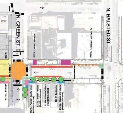
15 Transition Section Halsted to Green Standard Curb & Gutter Both Sides Halsted Street Recently resurfaced Traffic signal installation (by others) Gateway arch identifier just west Fill Sidewalk Vaults Issacson-Stein Fish John Morreale meats ADA Improvements at Stein Fish Curb extension northwest corner Fulton and Halsted to protect diagonal parking Split sidewalk, upper level for forklift and shopper access, lower level for street access Install stairs to door and longitudinal railing Flatten longitudinal slope to 5% Flatten cross slope to 1.5% or less Restore steel curb where possible 15
 6.4% to 9.8% longitudinal slopes (5% to 7.")
16 ADA Challenges Isaacson & Stein Fish Sidewalk conditions include: 5.6% to 8.4% cross slopes (1.5% is ADA standard) 6.4% to 9.8% longitudinal slopes (5% to 7.14% standard) 16

17 ADA Solution Isaacson & Stein Fish PARKING CHANGES: Loss of 1 stall on Fulton for Curb extension Possible loss of 1 stall on Fulton for ADA parking Gain of 3 to 4 stalls on Halsted due to bus stop relocation Conceptual design of ADA landing zone under development 17

18 Flexible Street Design Theme 18


19 Flexible Street Green to Morgan Parkway Reconstruction Street Resurfaced Flat Gutter - No Curb Both Sides Pedestrian Safety Enhancements At Green and Sangamon Streets Raised Intersection At Peoria and Morgan Streets Raised Intersection Vertical Identifier Watermain Improvements Along Sangamon from Randolph Street to Fulton Market Fill Sidewalk Vault Siam Meats Elsewhere as needed Bollards & Other Street Furniture to Delineate Pedestrian Zone ADA Improvements ADA ramps for raised sidewalk at Brooklyn Bowl and Aviary/Moto/Next 19

20 ADA Solution Brooklyn Bowl 20

21 ADA Solutions Aviary / Moto / Next Concept 1 Replace stairs with ramps 21

22 ADA Solutions Aviary / Moto / Next Concept 2 Keep stairs, ADA route on curb extension, parking loss on Morgan Street 22

23 ADA Solutions Aviary / Moto / Next Concept 3 Replace stairs with ramps and corner curb extension, ADA route on raised sidewalk, 23
24 Flexible Street Proposed Cross Sections 24


25 Flexible Street Longitudinal Section Peoria Street Green Street Halsted Street Morgan Street Sangamon Street Peoria Street 25

26 Rendering Raised Intersection Looking east on Fulton Street from west of Green Street 26

27 Traditional Streetscape Design Theme 27


 At May")

28 Traditional Streetscape Morgan to Racine Parkway Reconstruction Mix of Standard Curb & Gutter and Raised Curb Both Sides Provide ADA improvement at raised curbs Maintain steel curb face where possible Pedestrian Safety Enhancements At Carpenter, Aberdeen, and Racine Streets Curb extensions (to calm traffic) At May Street Curb extensions Vertical Identifier Bury Overhead Power Lines Fill Sidewalk Vault 1154 West Fulton 28

29 Traditional Streetscape Design Theme 29


30 Parkway Reconstruction Standard Curb & Gutter Pedestrian Safety Enhancements At Elizabeth Street Curb extensions Vertical Identifier Raised Intersection At Ada Street Consider curb extensions At Ogden Avenue Curb extensions Minor Gateway Identifier Traditional Streetscape Racine to Ogden 30


31 Next Steps in Design Development Historic Elements Street Lighting Style Victorian Contemporary Loading Zones Bollards Raised Sidewalk Railing 31


32 Next Steps in Design Development Streetscape Elements Trees Planters Benches Bicycle Racks Trash Receptacles 32


33 Next Steps in Design Development Traffic, Parking, and Loading Elements Traffic Flow Options Maintain current configuration Convert to one-way westbound Convert to two-way Parking Configuration Options Diagonal /Perpendicular/Parallel More, Less, Keep, Eliminate? How to provide flex street designated pedestrian way? Rationalize Loading and Parking Zones Match to building use and layout Permitted needs Impacts of providing designated pedestrian way 33


34 Next Steps in Design Development Safety Elements Flex Street Ribbed tiles Intersection Treatment Curb Extensions Crosswalk Markings Center Area Historic Cobble Paver Other? 34

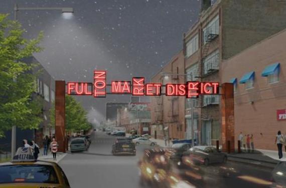
35 Gateway Arch Update 35


 Fulton Street Streetscape from")
36 Project Timeline Gateway Arch Fulton Street between Green and Halsted Foundation Construction - December 2014 Gateway Arch Construction - January 2015 Phase I (Construction in ) Fulton Street Streetscape from Carpenter to Halsted Sangamon Street Watermain from Randolph to Fulton Randolph Street - Various Intersections Identifiers Phase II (Construction in ) Fulton Street Streetscape from Ogden to Carpenter 36
Brooklyn Boulevard (County Road 152) Reconstruction Project Phase I. OPEN HOUSE June 20, 2017
 Reconstruction Project Phase I. OPEN HOUSE June 20, 2017") Brooklyn Boulevard (County Road 152) Reconstruction Project Phase I OPEN HOUSE June 20, 2017 Brooklyn Boulevard (County Road 152) Phase I Project Partners Project Lead Other Project Partners include Brooklyn
Brooklyn Boulevard (County Road 152) Reconstruction Project Phase I OPEN HOUSE June 20, 2017 Brooklyn Boulevard (County Road 152) Phase I Project Partners Project Lead Other Project Partners include Brooklyn
MARTIN LUTHER KING JR. WAY
 OCTOBER 2011 40 Vision and Goals The Martin Luther King, Jr. Way Illustrative Master Plan that follows has been developed through a process of community involvement. It expresses a long term vision for
14 TH STREET TRANSPORTATION & STREETSCAPE DESIGN STUDY PLAN B PLAN B TRANSPORTATION & STREETSCAPE RECOMMENDATIONS
 14 TH STREET TRANSPORTATION & STREETSCAPE DESIGN STUDY PLAN B PLAN B TRANSPORTATION & STREETSCAPE RECOMMENDATIONS 141 Symbols Recommendations - Southern End of 14th Street Study Area Streetscape Each icon
CONNECTIVITY PLAN. Adopted December 5, 2017 City of Virginia Beach
 CONNECTIVITY PLAN Adopted December 5, 2017 City of Virginia Beach CONTENTS 1.0 Background & Purpose... 2 2.0 Existing Inventory & Analysis... 3 ViBe District Existing Walking Conditions... 4 3.0 ViBe District
Item to be Addressed Checklist Consideration YES NO N/A Required Description Complete Streets Guidelines
 Passaic County Complete Streets Checklist - Concept Development Project Name Item to be Addressed Checklist Consideration YES NO N/A Required Description Complete Streets Guidelines Existing Plans Have
83 AVENUE PRE-CONSTRUCTION MEETING
 83 AVENUE PRE-CONSTRUCTION MEETING April 6, 2017 5-8PM Please visit displays for project information Talk to staff, ask questions, visit website at: www.edmonton.ca/bike83avenue Pre-Construction Meeting
Henderson Ave. Complete Streets Project
 Henderson Ave. Complete Streets Project Meeting Purpose To finalize conceptual components of project prior to proceeding with preliminary engineering www.dallascompletestreets.wordpress.com MeetingAgenda
Omaha s Complete Streets Policy
 Omaha s Complete Streets Policy (Adopted August 2015) VISION To create great places and enhance our quality of life, the City of Omaha will provide safe, accessible streets for all users. Complete Streets
S T A T I O N A R E A P L A N
 The Circulation and Access Plan describes vehicle, pedestrian, and transit improvements recommended within the Concept Plan. In order to create and sustain a vibrant business district that provides pedestrian-friendly
Pre-Construction Meeting
 Pre-Construction Meeting Wednesday, March 21 Drop-in from 5 9pm Please visit displays for project information, talk to staff, and ask questions! Edmonton.ca/SouthsideBikeRoutes Objectives & Project Scope
Typical Cross Section: DOWNTOWN (Observer Highway - 8th Street)
") Typical Cross Section: DOWNTOWN (Observer Highway - 8th Street) DRAFT SEPTEMBER 23, 14 1 Washington Street Typical Block Downtown Typical Block: DOWNTOWN (Observer Highway - 8th Street) New crosswalks
Typical Cross Section: DOWNTOWN (Observer Highway - 8th Street) DRAFT SEPTEMBER 23, 14 1 Washington Street Typical Block Downtown Typical Block: DOWNTOWN (Observer Highway - 8th Street) New crosswalks
Tonight is for you. Learn everything you can. Share all your ideas.
 Strathcona Neighbourhood Renewal Draft Concept Design Tonight is for you. Learn everything you can. Share all your ideas. What is Neighbourhood Renewal? Creating a design with you for your neighbourhood.
Community Meeting February 27, 2007 Dorchester Avenue Transportation & Streetscape Improvements Action Plan February 27, 2007
 Community Meeting Tonight s Agenda 6:00 Introductions South Boston/Dot Ave Improvement Study Background 6:15 Consultant Introductions Review of Scope and Schedule Review of Proposed Corridor Wide Guidelines
UDC Street Cross Sections
 UDC Street Cross Sections Local Street - Downtown Local Street Mountable Curb Local Street Vertical Curb Alley Major Arterial Minor Arterial Residential Lane Residential Collector Residential Collector
Executive Summary Route 30 Corridor Master Plan
 Route Corridor Master Plan Project Overview The Route Corridor Master Plan is a coordinated multimodal transportation and land use plan for the entire stretch of Route through East Whiteland Township,
BROOKLAND Multi-Modal Transportation & Streetscape Study* NE Washington, DC
 BROOKLAND Multi-Modal Transportation & Streetscape Study* NE Washington, DC The study s goal is to create a multi-modal transportation and streetscape design plan to increase transportation efficiency,
COWETA HIGH SCHOOL AND EAST HIGHWAY 51
 COWETA HIGH SCHOOL AND EAST HIGHWAY 51 Lack of sidewalks along Ben Lumpkin Rd. Lack of crosswalks and ramps at intersection. Hwy 51 is wide to cross as a pedestrian. No ADA compliance or connection to
Introduction. North 12 th Complete Street Project Overview
 Introduction On Wednesday, March 1, 2017, the City of Sacramento, in partnership with Sacramento Regional Transit District and the Sacramento Housing and Redevelopment Agency, hosted a community outreach
APPENDIX A: Complete Streets Checklist DRAFT NOVEMBER 2016
 APPENDIX A: Complete Streets Checklist DRAFT NOVEMBER 2016 Complete Streets Checklist MetroPlan Orlando s Complete Streets Checklist is an internal planning tool for staff to further implementation of
STONY PLAIN ROAD STREETSCAPE
 Jasper Place Revitalization Strategy: Vision The people involved in the Jasper Place Revitalization Strategy envision: Goal 1: Feeling safe in our community Create a community where feeling safe is common--where
RZC Appendix 8A Marymoor Subarea Street Requirements
 RZC Appendix 8A Marymoor Subarea Street Requirements For additional design details for Marymoor Subarea infrastructure, refer to the 2017 Marymoor Subarea Infrastructure Planning Report. STREET REQUIREMENTS
CURBSIDE ACTIVITY DESIGN
 5 CURBSIDE ACTIVITY DESIGN This chapter provides design guidance for separated bike lanes adjacent to curbside activities including parking, loading and bus stops. Typical configurations are presented
Clybourn Ave. Protected Bike Lane Study Halsted St. to Division St.
 Clybourn Ave. Protected Bike Lane Study Halsted St. to Division St. Nathan Roseberry, Senior Engineer Pam Broviak, Project Manager July 24, 2014 Agenda Project Goals Existing Roadway Conditions Traffic
Streetscape: Core Shopping District
 Streetscape: Core Shopping District DRAFT DRAFT DRAFT May 00 Core Shopping District: Phase Blue Island s Core Shopping District is located along Western Avenue, between Grove and Union Streets. Streetscape
UNIVERSITY AVENUE CORRIDOR REDESIGN. January 8, 2017 PUBLIC OPEN HOUSE
 January 8, 2017 PUBLIC OPEN HOUSE COLLABORATIVE COMMUNITY-BASED DESIGN IS THE FOUNDATION TO A SUCCESSFUL PROJECT AGENDA FOR TONIGHT 1 INTRODUCTIONS 2 WHY ARE WE HERE PROJECT NEED 3 SCHEDULE & GOALS 4 OPEN
Lawrence Avenue Streetscape Concepts August 30, 2011
 Lawrence Avenue Streetscape Concepts August 30, 2011 Neighborhood Context Phase II: River to Western Ave. Phase I: Western Ave. to Clark St. Key Map Lawrence Ave. Existing Streetscape Conditions East of
PUBLIC REALM MASTER PLAN
 WESTSHORE BUSINESS DISTRICT PUBLIC REALM MASTER PLAN MASTER PLAN COMMITTEE MEETING MARCH 20, 2013 WESTSHORE BUSINESS DISTRCT PUBLIC REALM MASTER PLAN MACRO-SCALE CONCEPT: A PUBLIC REALM FRAMEWORK DEFINED
Complete Streets. Designing Streets for Everyone. Sarnia
 Complete Streets Designing Streets for Everyone Sarnia Complete Streets ~ Sarnia ~ 2018 Introduction Our City is made up of a network of streets that we use to go for a walk, cycle to work, drive to the
WHITE STREET/ ENGLISH PLAZA STREETSCAPE IMPROVEMENT PROJECT
 WHITE STREET/ ENGLISH PLAZA STREETSCAPE IMPROVEMENT PROJECT 1 Project Goals 1 Improved Safety: Lighting, Multi-Modal Circulation, Emergency Access, Tripping Hazards; Stormwater 4 Environmental Performance:
Road Alterations - Wellington Street East, Church Street, and Front Street Intersection
 REPORT FOR ACTION Road Alterations - Wellington Street, Church Street, and Front Street Intersection Date: November 1, 2016 To: Toronto and York Community Council From: Director, Public Realm Section,
California Department of Transportation, District 4. Sloat Boulevard Project Skyline Blvd. to 19 th Ave. Community Update January 13, 2016
 California Department of Transportation, District 4 Sloat Boulevard Project Skyline Blvd. to 19 th Ave. Community Update January 13, 2016 Agenda Welcome and introductions Project overview, history and
Traffic Improvements for the Transit Oriented Development District (TODD) Meriden Public Library March 11, 2014
 Meriden Public Library March 11, 2014") Traffic Improvements for the Transit Oriented Development District (TODD) Meriden Public Library March 11, 2014 Project Overview Coordinate roadway improvements with other major projects HUB Flood Control
Traffic Improvements for the Transit Oriented Development District (TODD) Meriden Public Library March 11, 2014 Project Overview Coordinate roadway improvements with other major projects HUB Flood Control
Elm Street Business District: Streetscape and Signage Plan
 Winnetka Preliminary Streetscape & Signage Village Council Presentation 1 Elm Street Business District: Streetscape and Signage Plan VILLAGE OF WINNETKA DOWNTOWN MASTER PLAN VILLAGE COUNCIL PRESENTATION
Ocean Park Boulevard Streetscape Improvement Project Alternatives & Trade Offs
 City Council Study Session January 27, 2009 Ocean Park Boulevard Streetscape Improvement Project Alternatives & Trade Offs Scope of Work Purpose of Tonight s Meeting Review work to date and direct staff
Make Lincoln Highway an economically vibrant corridor that is safe, efficient, and beautiful for local residents and visitors.
 Lincoln Highway Streetscape Plan Stakeholder Workshop #2 Handout Contents Introduction and Project Vision Planning Principles Specific Recommendations including a Proposed Typical Roadway Section Renderings
Water Street Promenade Engineering and Design Services
 Preliminary Design Presentation Parking & Traffic Safety Committee Water Street Promenade Engineering and Design Services July 16,2014 November 3, 2016 Education / Infrastructure / Innovation 1 Project
Simulation Analysis of Intersection Treatments for Cycle Tracks
 Abstract Simulation Analysis of Intersection Treatments for Cycle Tracks The increased use of cycle tracks also known as protected bike lanes has led to investigations of how to accommodate them at intersections.
Off-road Trails. Guidance
 Off-road Trails Off-road trails are shared use paths located on an independent alignment that provide two-way travel for people walking, bicycling, and other non-motorized users. Trails specifically along
BETHEL ROAD AND SEDGWICK ROAD CORRIDOR STUDY
 DRAFT PLAN City Council Meeting August 14, 2017 STUDY AREA Sedgwick Corridor State Route 160, principal arterial with Class 3 access management designation, commuter and freight route, connection to SR
Water Street Promenade. Engineering and Design Services. Public Information Meeting No. 2. Education / Infrastructure / Innovation. Maplewood Avenue &
 Public Information Meeting No. 2 Water Street Promenade Maplewood Avenue & Engineering and Design Services Adjacent Areas July 16,2014Portsmouth, NH May 10, 2016 Education / Infrastructure / Innovation
A CHANGING CITY. of Edmonton, it is essential that it reflects the long-term vision of the City.
 A CHANGING CITY By the year 2040, Edmonton will be home to more than 1 million people. To accommodate growth and support a healthy and compact city, we need a new approach to development/redevelopment
42nd Ave N Reconstruction
 CITY OF MINNEAPOLIS 42nd Ave N Reconstruction Community Meeting #2 May 2016 6:00 7:30 p.m. 5/16/2016 1 Purpose of Meeting Inform: Provide an overview of project, identify anticipated scope of work, and
CHAPTER 16 PEDESTRIAN FACILITIES DESIGN AND TECHNICAL CRITERIA TABLE OF CONTENTS
 CHAPTER 16 PEDESTRIAN FACILITIES DESIGN AND TECHNICAL CRITERIA TABLE OF CONTENTS Section Title Page 16.1 General... 16-1 16.1.1 AASHTO Reference... 16-1 16.1.2 ADA Requirements... 16-1 16.2 Sidewalks...
FOLSOM-HOWARD STREETSCAPE OVERVIEW
 FOLSOM-HOWARD STREETSCAPE OVERVIEW SoMa residents should have the same kinds of amenities that other neighborhoods have. The Folsom- Howard Streetscape Project will make SoMa more livable by making it
Hennepin County Transportation Department
 Hennepin County Transportation Department Complete Streets Design and Implementation Prepared for the Complete Streets Task Force Craig Twinem, P.E. Design Division Manager Tom Johnson, P.E. Transportation
Observations and Ideas: Toomer s Corner Streetscape Improvements
 Observations and Ideas: Toomer s Corner Streetscape Improvements AUBURN DOWNTOWN MASTER PLAN planning downtown s future August 26, 2013 Observations: Vertical Clutter at Corners 6 3 7 5 9 2 8 4 1 Excess
5 CIRCULATION AND STREET DESIGN
 5 CIRCULATION AND STREET DESIGN This chapter describes circulation and streetscape improvements proposed for the Northwest Chico Specific Plan Area. It includes detailed design specifications for existing
Chicago Safe Routes to School Safe Routes to High School (SRTS/SRTHS)
") Chicago Safe Routes to School Safe Routes to High School (SRTS/SRTHS) Marshall Community High School and Faraday Elementary School Recommended Improvements Agenda Goals Related Programs Project Location/Area
Chicago Safe Routes to School Safe Routes to High School (SRTS/SRTHS) Marshall Community High School and Faraday Elementary School Recommended Improvements Agenda Goals Related Programs Project Location/Area
ALBERTA AVENUE WHAT WE HEARD REPORT BUILDING GREAT NEIGHBOURHOODS
 ALBERTA AVENUE WHAT WE HEARD REPORT BUILDING GREAT NEIGHBOURHOODS FEBRUARY 2019 EXECUTIVE SUMMARY Starting in 2019, Alberta Avenue will see the replacement and enhancement of its aging collector and local
Chapter 3: Multi-Modal Circulation and Streetscapes
 CHAPTER 3: MULTI-MODAL CIRCULATION AND STREETSCAPES Chapter 3: Multi-Modal Circulation and Streetscapes Overview Streetscape improvements have already been completed for Depot Street between Main Avenue
About the study. North Milwaukee Ave. Key goals of this study are to: Achieve Vision Zero* by. Harmonize the space and improve walkability
 About the study Key goals of this study are to: North Milwaukee Avenue is a local and regional street for multiple modes of transportation. It is officially zoned and functions as a pedestrian street southeast
Chapter 4: Funding and Implementation
 Chapter 4: Funding and Implementation 83 84 Cost Estimating Cost estimating is an iterative process. When a project is in the conceptual stage, preliminary cost estimates are also provided conceptually,
Ocean Park Boulevard Green Street Project Alternatives & Trade Offs
 Planning Commission March 4, 2009 Ocean Park Boulevard Green Street Project Alternatives & Trade Offs Purpose of Tonight s Meeting Review concept plans and options Provide input on alternatives and trade-offs
Figure 4-10: Pedestrian Improvements Types of Potential Station Area Improvements - Place-Making Improvements
 INCORPORATE FEATURE PAVIN IN CROSSWALK AND INTERSECTION FIELDS Identifies high-priority pedestrian areas and create a station identity through colorful and interesting patterns ADD CURB EXTENSIONS Extending
Memorandum. Sunday, July 13, Saturday, July 19, 2014
 Memorandum To: David Lowin, Brooklyn Bridge Park Corporation From: Daniel Schack, AICP, PTP Date: Re: Brooklyn Bridge Park Pier 5/6 Loop Road Traffic Study Project No: 14-01-2407 At the request of Brooklyn
Welcome and Introductions Overview of the Study to Date Community Involvement Intersection Improvement Concepts Bike-Ped Recommendations ITS
 Welcome and Introductions Overview of the Study to Date Community Involvement Intersection Improvement Concepts Bike-Ped Recommendations ITS Recommendations Transit Recommendations Next Steps Inventoried
Derby Street. Project Updates. Salem, Massachusetts
 Derby Street Project Updates Salem, Massachusetts September 13, 2017 Project Limits Derby Street Project Objectives 1. Improve complete streets elements on Derby Street 2. Improve sidewalks on finger streets
Neil Street Plaza Placemaking Plan
 Neil Street Plaza Placemaking Plan MARSHALL ST. SITE ORIENTATION VINE ST. COLUMBIA AVE. NEIL ST. HICKORY ST. WALNUT ST. MARKET ST. WASHINGTON ST. STATE ST. HILL ST. CHURCH ST. RANDOLPH ST. PLAZA SITE WALNUT
WHEREAS delivery trucks also pass through the Narrows, into the northern parking lot, to loading docks in the back of the building.
 CEDAR-ISLES-DEAN NEIGHBORHOOD ASSOCIATION ( CIDNA ) RESOLUTION OPPOSING A DRUG STORE DRIVE THRU, AND COMMENDING DORAN COMPANIES FOR PROPOSING MITIGATING AMENITIES INCLUDING NEW LANDSCAPING AND A DEDICATED
Chapter 3 BUS IMPROVEMENT CONCEPTS
 Chapter 3 BUS IMPROVEMENT CONCEPTS The purpose of this chapter is to describe potential bus improvement strategies and potential impacts or implications associated with BRT implementation within the existing
Appendix C. TRAFFIC CALMING PROGRAM TOOLBOX
 Appendix C. TRAFFIC CALMING PROGRAM TOOLBOX PHASE I...2 Do Not Enter Sign...3 One-Way Sign...4 Turn Prohibition...5 Pavement Markings...6 Speed Monitoring Trailer...7 Neighborhood Speed Watch...8 Police
Broad Street Bicycle Boulevard Design Guidelines
 Broad Street Bicycle Boulevard Design Guidelines Building from the strategies introduced in the 2013 Bicycle Transportation Plan and community input received thus far, City Transportation Staff have identified
Town Hall Meeting. June 13, 2018 PianoForte 1335 S. Michigan Ave.
 Town Hall Meeting June 13, 2018 PianoForte 1335 S. Michigan Ave. Stay connected! 5046 S. State St. Chicago, IL. (773) 373-9273 ward03@cityofchicago.org www.dowellforthirdward.com Facebook.com/aldermanpat.dowell
Community Task Force November 15, 2017
 Community Task Force November 15, 2017 Welcome and Introductions Project Partners Regional Transportation District (RTD) Colorado Department of Transportation (CDOT) Denver Regional Council of Governments
Better Market Street. Engineering, Maintenance & Safety Committee (EMSC) February 28, 2018
 February 28, 2018") Better Market Street Engineering, Maintenance & Safety Committee (EMSC) February 28, 2018 1 Market Street Market Street - San Francisco by rulenumberone2 2 Market Street is the... City s busiest pedestrian
Better Market Street Engineering, Maintenance & Safety Committee (EMSC) February 28, 2018 1 Market Street Market Street - San Francisco by rulenumberone2 2 Market Street is the... City s busiest pedestrian
Ocean Park Boulevard Green Street Project Community Workshop
 Ocean Park Boulevard Green Street Project Community Workshop 2.2.10 Project Objectives Community Priority: reclaim OPB for public open space. Build upon LUCE principles; neighborhood enhancement, connectivity,
Advancing Transportation Choices in Des Moines. MPO Environmental Roundtable January 9, 2018
 Advancing Transportation Choices in Des Moines MPO Environmental Roundtable January 9, 2018 Presented by Jennifer McCoy, PE, PTOE City Traffic Engineer Agenda Des Moines Area Transportation Planning Connect
Proposed. City of Grand Junction Complete Streets Policy. Exhibit 10
 Proposed City of Grand Junction Complete Streets Policy Exhibit 10 1 City of Grand Junction Complete Streets Policy Vision: The Complete Streets Vision is to develop a safe, efficient, and reliable travel
FOCUS AREA 1 - Alberta Avenue Pocket Park 3 (121 Ave and 92 St)
") FOCUS AREA 1 - Alberta Avenue Pocket Park 3 (121 Ave and 92 St) New benches Plant evergreen trees Widen existing sidewalk from 1.5m to 1.8m Marked crosswalk 1.8m wide sidewalk Add pedestrian oriented lights
FOCUS AREA 1 - Alberta Avenue Pocket Park 3 (121 Ave and 92 St) New benches Plant evergreen trees Widen existing sidewalk from 1.5m to 1.8m Marked crosswalk 1.8m wide sidewalk Add pedestrian oriented lights
Complete Streets Successes, Opportunities, and Challenges
 Complete Streets Successes, Opportunities, and Challenges Juliet Walker, Transportation Planner, City of Portsmouth Rob Houseman, Director of Planning and Development, Town of Wolfeboro Chris Parker, Director
PEDESTRIAN CIRCULATION & STREETSCAPE DESIGN
 CHAPTER 4 Chapter 4 Pedestrian Circulation & Trails PEDESTRIAN CIRCULATION & STREETSCAPE DESIGN In recent years, the City has constructed new sidewalks and enhanced existing ones in the downtown with brick
Pedestrian, Bicycle and Traffic Calming Strategic Implementation Plan. January 18, 2011
 Pedestrian, Bicycle and Traffic Calming Strategic Implementation Plan January 18, 2011 Tonight s Agenda Receive update on project Provide feedback on two policy issues Complete Streets Policy Project Prioritization
TRANSPORTATION & MOBILITY VISIONING MEETING. August 23 24, 2017
 TRANSPORTATION & MOBILITY VISIONING MEETING August 23 24, 2017 Project Team 1999 South Lakefront Framework Plan In 1999, the Chicago Park District authorized framework plans for three historic parks: Jackson,
Downtown Naples Mobility and Connectivity Study. Naples City Council Presentation January 2017
 Downtown Naples Mobility and Connectivity Study Naples City Council Presentation January 2017 Agenda 1. Introduction 2. Scope Review 3. Project Schedule 4. Existing Conditions 5. Public Charrette 6. Mobility
 Phasing and Cost Estimate of Downtown Oxford Master Plan Prepared By: Phasing and Cost Estimate of Downtown Oxford Master Plan Purpose of the Study The primary objective of this study is to identify priority
Small Area Study U.S. Route 220 and VA Route 615 Intersection. Bath County, Virginia
 Small Area Study U.S. Route 220 and VA Route 615 Intersection Bath County, Virginia Prepared by the Central Shenandoah Planning District Commission Final Report February 2018 Table of Contents 1. INTRODUCTION...
Technical Working Group November 15, 2017
 Technical Working Group November 15, 2017 Welcome and Introductions Project Partners Regional Transportation District (RTD) Colorado Department of Transportation (CDOT) Denver Regional Council of Governments
NEWMARKET UPHAM S CORNER
 SOUTH STATION Planning Initiative NEWMARKET UPHAM S CORNER COLUMBIA ROAD (P) FOUR CORNERS/GENEVA Working Advisory Group (WAG) Meeting #5 TALBOT AVENUE MORTON STREET BLUE HILL AVE/CUMMINS HWY (P) RIVER
Preliminary Design of Wayzata Boulevard Improvements(CSAH 112)
") Project Area Map 6 COUNTY 112 COUNTY Preliminary Design of Wayzata Boulevard Improvements(CSAH 112) Public Open House Open House To Do List: Sign in Visit with Hennepin County staff and design team Learn
Project Area Map 6 COUNTY 112 COUNTY Preliminary Design of Wayzata Boulevard Improvements(CSAH 112) Public Open House Open House To Do List: Sign in Visit with Hennepin County staff and design team Learn
El Camino Real Specific Plan. TAC/CAC Meeting #2 Aug 1, 2018
 El Camino Real Specific Plan TAC/CAC Meeting #2 Aug 1, 2018 Land Use Alternatives Goals and Tradeoffs Parks & open space Housing Retail & services Civic spaces Parking Community gathering spaces 3 Alternatives
WELCOME. Purpose of the Open House. Update you on the project. Present a draft recommended plan. Receive your input
 WELCOME Purpose of the Open House The Town of Smiths Falls has initiated the Beckwith Street Redevelopment Plan that includes the preparation of a streetscape functional design for the renewal of Beckwith
Improving intersections for people that walk in Minneapolis
 Matthew Dyrdahl, AICP, LCI Bicycle and Pedestrian Coordinator Minneapolis Public Works CITY OF MINNEAPOLIS Improving intersections for people that walk in Minneapolis Transportation Bonanza February 8,
STEERING COMMITTEE MEETING June 17, Streetscape Overview Burlington Comprehensive Master Plan
 STEERING COMMITTEE MEETING June 17, 2015 Streetscape Overview Burlington Comprehensive Master Plan 1 Introduction Slide This slide show was presented to the Burlington Steering Committee on June 17, 2015
TRAVEL PLAN: CENTRAL EUROPEAN UNIVERSITY CAMPUS REDEVELOPMENT PROJECT TRAVEL PLAN. Central European University Campus Redevelopment Project.
 TRAVEL PLAN Central European University Campus Redevelopment Project Page 1 Table of Contents Introduction... 3 Background... 7 Building Users... 7 Transportation in Community Consultation... 7 Summary
5. RUNNINGWAY GUIDELINES
 5. RUNNINGWAY GUIDELINES These guidelines should be considered collectively when making runningway decisions. A runningway is the linear component of the transit system that forms the right-of-way reserved
Living Streets Policy
 Living Streets Policy Introduction Living streets balance the needs of motorists, bicyclists, pedestrians and transit riders in ways that promote safety and convenience, enhance community identity, create
Blackfalds Downtown. Architectural Guidelines: Streetscape
 Blackfalds Downtown Architectural Guidelines: Streetscape Streetscape INTRODUCTION A variety of street furniture has been chosen for locations within the Town of Blackfalds Downtown and highway commercial
122 Avenue: 107 Street to Fort Road
 : 107 Street to Fort Road November 24, 2015 4:30 8:00 p.m. Meeting Purpose Summarize project work completed to date Share results of public input from Phase 1 Share the draft concept plan and proposed
City of Seattle Edward B. Murray, Mayor
 City of Seattle Edward B. Murray, Mayor Department of Transportation Scott Kubly, Director Eastlake Community Council 117 E Louisa St. #1 Seattle, WA 98102-3278 January 28, 2016 RE: Roosevelt to Downtown
Lincoln Neighborhood Corridor Plan The LiNC
 CITY OF SANTA MONICA Lincoln Neighborhood Corridor Plan The LiNC PLANNING COMMISSION September 2, 2015 COMMUNITY DESIGN + ARCHITECTURE TEAM: Community Design + Architecture Iteris Studio 111 Urban Place
SR 2108-A12 Forbes Avenue Betterment. March 1, 2018
 SR 2108-A12 Forbes Avenue Betterment March 1, 2018 Introductions Project Team PENNDOT Cheryl Moon-Sirianni, PE; District Executive Jason Zang, P.E.; Acting Assistant District Executive-Construction John
NJDOT Complete Streets Checklist
 Background The New Jersey Department of Transportation s Complete Streets Policy promotes a comprehensive, integrated, connected multi-modal network by providing connections to bicycling and walking trip
Outreach Approach RENEW SF served as the primary liaison with the North Beach community; the Chinatown. Executive Summary
 Executive Summary Executive Summary The Columbus Avenue Neighborhood Transportation Study s objective is to identify changes to transportation infrastructure and policies that could enhance the livability
Polk Streetscape Project
 What is this project? The Polk Streetscape Project is an effort to improve safety for everyone traveling on Polk Street between Union and McAllister streets. Also included in this project are paving, sewer
Option W: N. Washington Street Project
 Option W: N. Washington Street Project Location: one block of North Washington Street, between West Broad Street and Park Avenue Description: upgrades to existing lighting new brick sidewalk to replace
P E R A L T A S T R E E T
 EXISTING CONDITIONS Peralta s Three Zones Peralta Street, almost 2 miles in length, passes through several distinct zones with different attributes and character. The southern zone is predominantly residential
Public Works Committee Meeting Richard E. Mastrangelo Council Chamber November 20, 2017
 Public Works Committee Meeting Richard E. Mastrangelo Council Chamber November 20, 2017 Purpose of Meeting Why are we here? Project Recap/Updates Project Limits/Segments Road Diet Concept Lessons Learned
Building Great Neighbourhoods BELLEVUE AND VIRGINIA PARK
 Building Great Neighbourhoods BELLEVUE AND VIRGINIA PARK This is Meeting 2 Unfortunately, some residents in Bellevue and Virginia Park received the wrong information for this public open house (Meeting
Poor pavement condition Substandard Intersections. / Substandard bike/pedestrian/transit accommodations. Driveway access Environmental concerns
 Public Informational Meeting University Avenue (Allen Boulevard Segoe Road) March 23, 2011 City of Madison City of Middleton Village of Shorewood Hills Dane County Existing Roadway Conditions Poor pavement
WELCOME. Thank you for joining us at the Second Public Workshop for the Carlsbad Pedestrian Master Plan. We look forward to receiving your feedback.
 City of Carlsbad Pedestrian Master Plan: WELCOME WELCOME Please Sign In Provide Input at Flip Charts Review Boards Presentation of Draft Plan Thank you for joining us at the Second Public Workshop for