Draft Sustainable Transport Strategy
|
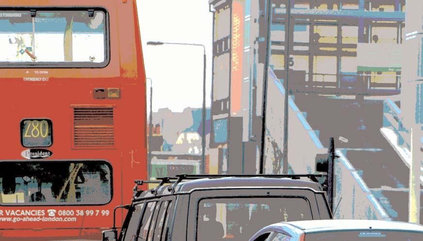
|
|
- Chastity Andrews
- 5 years ago
- Views:
Transcription


1 London Borough of Sutton Draft Sustainable Transport Strategy October 2014
2 Contents Foreword 1 1 Introduction 3 2 Sutton's Transport Context and Issues 4 3 Sutton's Transport Vision and Objectives 14 4 Action Plan 34 5 Indicators, Targets and Monitoring 48

3 Foreword The Sustainable Transport Strategy sets out the council's policies and proposals to improve Sutton's transport and environment over the next decade, and how these will contribute towards the delivery of the Mayor of London's Transport Strategy. Most of us want to live in places with clean air and safe streets. In addition to its core role of moving people and goods from A to B, transport has a crucial role to play in improving the quality of life at a local level, as well as improving the global environment and tackling climate change. Promoting sustainable transport, and in particular tackling congestion, also has immediate economic benefits through reducing costs to businesses in terms of time and money. Most importantly our travel choices can have a significant impact on health and air quality. Over 50% of car journeys in Sutton are less than 5km (3 miles). A considerable proportion of car journeys could therefore potentially be replaced with more active and sustainable forms of travel, such as walking and cycling, which are proven to improve health, levels of physical fitness and reduce rates of obesity, while reducing the consumption of fossil fuels and consequent carbon emissions. Sutton's reputation as a pioneering borough for sustainable transport paved the way for the Smarter Travel Sutton (STS) behavioural change project in partnership with Transport for London, which ran for three years from 2006 to The STS project achieved considerable success in changing residents' travel behaviour from the private car towards more sustainable modes such as walking, cycling and public transport. The success of the STS project was widely recognised, winning many national and international awards and attracting great interest within the UK and abroad. The council has decided that in order to maintain the momentum generated by the STS project, it needs to update its Sustainable Transport Strategy and ensure that these policies are applied across all its activities. 1

4 The Strategy takes account of the council's Core Planning Strategy, which sets out long term policies and proposals for the future development of the borough. The location of new development in relation to transport is crucial in ensuring that car dependency is reduced and sustainable transport use is maximised. Boosting use of sustainable transport is also one of the key commitments under the council's One Planet Sutton programme. Sutton aims to become London's most sustainable suburb - a place where people want to live and work for its excellent quality of life. Climate change is the single biggest challenge we face and here in Sutton we are determined to continue making a difference. The council looks forward to working with stakeholders and residents in implementing this Strategy and working towards a more sustainable Sutton. Councillor Jill Whitehead Chair of Environment and Neighbourhood Committee 2

5 1 Introduction 1.1 This new Sustainable Transport Strategy for Sutton sets out how the council will make it easier for people to travel around the borough and beyond by sustainable modes of transport, while seeking to reduce the need to travel and addressing the environmental problems caused by excessive traffic levels. 1.2 Over the last two decades Sutton has put sustainability at the heart of its policies and strategies and this approach was embodied in the council's first Sustainable Transport Strategy, published in This new Sustainable Transport Strategy (the Strategy) replaces that earlier strategy and complements the broader approach to sustainability that is embedded throughout the council and is reflected in its One Planet Sutton Action Plan, aimed at creating the UK's first sustainable suburb. 1.3 In summary, the Strategy: provides a comprehensive statement of the council's vision, objectives and proposals for sustainable transport sets out how the council intends to deliver the vision and objectives through a series of actions aimed at enabling more sustainable travel choices provides the basis for partnerships and co-operation between everyone affected by transport problems and interested in sustainable transport solutions builds on the work of the Smarter Travel Sutton project to raise awareness and promote greater use of sustainable transport. 3

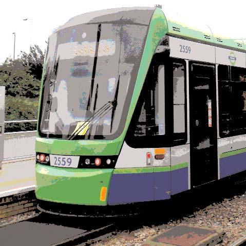
6 2 Sutton s Transport Context and Key Issues Roles and Responsibilities for Delivering Sustainable Transport 2.1 The delivery of the Sustainable Transport Strategy is a challenging task reflecting the breadth of transport networks and the different organisations involved in the planning, funding and delivery of these networks in Sutton. Transport covers all means of moving people and goods, including road transport and rail based public transport. Road transport includes cars, taxis and minicabs, motorbikes, bicycles, light and heavy goods vehicles, public service vehicles, as well as people on foot and in mobility scooters. Public transport encompasses buses and coaches, trams and trains. 2.2 As the Highway Authority, the Council is responsible for maintaining and approving changes to all roads in the borough except the Transport for London Road Network, which consists of the strategic 'red routes' (A217, A24, A232). The Council receives an annual financial settlement from Transport for London to maintain and enhance the transport network. Monies can also be secured from developers and other grant funders including the Greater London Authority. 2.3 Transport for London also procure and manage most of the public transport in the borough including buses and trams, and are also responsible for the London Underground and London Overground. Most rail services are procured and managed by the Department for Transport and operated by franchised Train Operating Companies (TOCs), while Network Rail own and manage the rail tracks and lease stations to TOCs. Public Transport 2.4 Although Sutton is reasonably well served by national rail routes, with links to three London termini, there is scope to improve the frequency and hours of operation on some routes and additional capacity is required to address peak-time crowding on commuter lines to central London. The borough is not served directly by the London Underground network, with its nearest 4

7 station the Northern Line terminus at Morden. There are two Tramlink stops in the north-eastern corner of the borough on the line between Croydon and Wimbledon. Orbital rail links and connections to neighbouring Surrey districts are relatively poor. 2.5 The borough is served by a reasonably comprehensive network of bus services and a number of council-initiated 'hail-and-ride' services have helped to improve accessibility to, from and within some of the poorly connected residential areas. 2.6 However, in terms of public transport accessibility, parts of the borough remain poorly served by the bus network, as shown in Figure 2.1 below which shows the areas of deficiency (more than 400 metres from a bus service) and those areas with low frequencies. Figure 2.1 Sutton Bus Network with Areas of Deficiency Figure 2.1 5
 map of the borough shows that, despite having some areas of higher public transport accessibility (levels 4-6), such as Sutton,")
8 2.7 Around 95% of the urban area of the borough is within 400 metres of a bus service. However, the most recent Public Transport Accessibility Levels (PTALs) map of the borough shows that, despite having some areas of higher public transport accessibility (levels 4-6), such as Sutton, Wallington and Carshalton, the majority of the residential areas and the major industrial areas in the borough fall within areas of relatively low public transport accessibility (levels 1 and 2) (see Figure 2.2). This is largely due to the relatively low frequency and density of public transport in the borough. Figure 2.2: Sutton Public Transport Accessibility Levels L B Sutton Public Transport Accessibility Levels PTALs

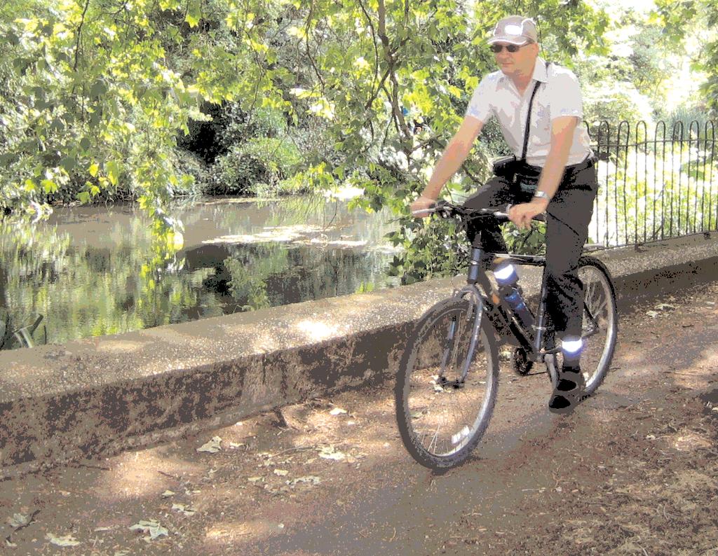
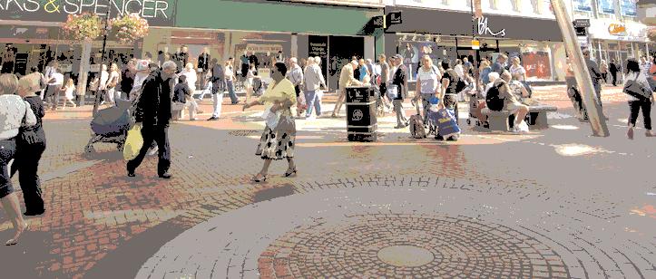
9 Walking 2.8 The borough has an extensive network of public rights of way, both within the built up areas of the borough and in the more rural green belt in the south of the borough where there are a number of pleasant countryside walks. A number of longer distance strategic walking routes form part of this network, including part of the London Outer Orbital Path (LOOP), Sutton Countryside Walk, Pyl Brook path and the Wandle Trail. 2.9 While a significant proportion of trips in Sutton are made on foot - 28% according to the 2001 census - there is scope to increase this further given the short nature of many car and bus trips. More recent data from the London Travel Demand Survey (2012/13) found that an average of 26% of trips in outer London are made on foot, less than in inner London and the London average. As well as trips made entirely on foot, walking is the main mode used by people to access public transport as part of a longer journey. Cycling 2.10 The borough has an extensive network of signed cycle routes (see Figure 2.3), much of which was created as part of the former London Cycle Network connecting Sutton with neighbouring boroughs Sutton has relatively low levels of cycling at present, with an average of 1% of journeys made by bicycle (2001 census). This is lower than the inner London average of 4% and the Greater London average of 2.5% (LTDS 2012/13). Given the short nature of many local trips there is considerable scope to increase the proportion made by cycling. 7

10 Figure 2.3 Sutton Cycle Route Network Car Ownership 2.12 One of the biggest transport challenges facing the borough is the high level of car ownership and usage and the consequential problems of traffic congestion, air pollution and contribution to climate change. Sutton has the sixth highest car ownership level in London and adjoins some of the more affluent parts of Surrey which also have high car ownership, and which contribute to traffic levels in the borough. The high levels of car ownership in the borough contribute to parking 'stress', particularly in streets of older housing stock with little or no off-street parking. High car ownership also contributes to relatively low levels of walking, cycling and public transport use, and related health issues. 8
11 2.13 Other factors contributing to high levels of car use in the borough include: car use is less constrained in outer London in comparison to Inner London (which has stricter parking controls and congestion charging) diverse, often orbital, journey patterns not easily made by public transport, combined with good road links to the M25 and neighbouring Surrey a relatively small proportion of the workforce commuting into central London compared to significant numbers commuting to adjoining boroughs The 2011 Census found that 77% of Sutton households owned at least one car or van compared to 58% across the London Region, but that car ownership has remained stable since the 2001 Census, suggesting it could have reached saturation point However, despite the high levels of car ownership in the borough, 23% of borough households do not own or have access to a car. Car ownership levels vary considerably between wards, with Sutton Central and the north and east wards having lower levels than the south and west wards (see Figure 2.4). In addition, lack of access to a car particularly affects the young and elderly. Figure 2.4: Car Ownership by Ward (2011 Census) WORCESTER PARK 81.6% NONSUCH 84.4% STONECOT 85.2% CHEAM 86.4% SUTTON WEST 76.1% SUTTON NORTH 77.0% SUTTON CENTRAL 62.6% BELMONT 79.6% SUTTON SOUTH 66.9% ST HELIER 66.9% WANDLE VALLEY 71.1% THE WRYTHE 76.7% CARSHALTON CENTRAL 79.7% WALLINGTON NORTH 76.7% WALLINGTON SOUTH 71.7% BEDDINGTON NORTH 82.7% BEDDINGTON SOUTH 76.3% Proportion of Car-Owning Households by Ward in London Borough of Sutton % + 80% - 84% 75% - 79% 70% -74% 65% - 69% 60% - 64% CARSHALTON SOUTH AND CLOCKHOUSE 86.6% 9
12 Traffic Levels 2.16 According to the Department for Transport's (DfT) National Road Traffic Survey data, overall traffic levels within the borough have decreased over the last decade, from 720 million vehicle-km in 2000 to 609 million vehicle-km in There has been a 4.8% reduction in traffic levels within the borough since 2008 and a 15.4% reduction since However, despite this downward movement which has in part been influenced by the depressed economic conditions, the borough still experiences congestion at busy times of the day and in certain locations. Road Safety Figure 2.5: Modal split of trips originating in Sutton Car / Motorcycle On Foot Bus / Tram Rail Underground Taxi Cycle 10% 28% 1% 1% 1% 5% 54% 2.17 In total 42 people were killed or seriously injured (KSI) in traffic collisions in the borough during 2012, down by 34.2% compared to the average of 73. There has been a decrease of 26.3% over the 4 year period in the number of KSI within the borough between 2009 and Sutton has performed better than both the South London Sub-region and London as a whole in terms of road safety. Travel Patterns and Modal Split 2.18 Figure 2.5 shows that 55% of trips originating in Sutton are by car, taxi or motorcycle, while 45% are made by sustainable modes. Furthermore, around 50% of economically active borough residents travel to work by car, compared to 34% across London. The remainder travel to work by train (18%), bus (10%), walk (8%), tube or tram (5%), bike (3%) and motorcycle (2%). Figure 2.6 shows that around 30% of the borough's working population work within the borough, with the majority of the remaining 70% split across the surrounding boroughs showing a strong orbital movement. 10
13 CAMDEN Figure 2.6: Workplace of Sutton Residents BRENT EALING HOUNSLOW RICHMOND UPON THAMES ELMBRIDGE MOLE VALLEY KINGSTON UPON THAMES 3488 EPSOM & EWELL 3785 KENSINGTON AND CHELSEA HAMMERSMITH AND FULHAM WANDSWORTH MERTON REIGATE & BANSTEAD WESTMINSTER SUTTON LAMBETH 1780 CITY SOUTHWARK 1608 THE SOUTH EAST TOWER HAMLETS 5850 LEWISHAM CROYDON BROMLEY Travel Methods of Sutton Residents Sutton 23,989 internal work trips Local Authorities with 500 or more work trips by Sutton residents Other Local Authority Greater London boundary Mode of transport Sutton residents use when commuting out of Sutton Train, underground, metro, light rail/ tram Bus, minibus / coach Private motor vehicle - car, motorcycle, passenger Bicycle On foot Other including taxi Source: 2001 Census 2.19 One of the challenges facing the borough is traffic congestion and making efficient use of the highway network. High car ownership contributes to a high level of car use and consequent traffic congestion. Congestion is identified as being a particular problem around Sutton town centre and along the key radial and orbital corridors, not only during the weekday peaks but also at weekends as a result of retail and leisure trips. The Mayor's Roads Task Force report (2013) predicts that journey times on Sutton's roads could increase by 19% by 2031 based on a scenario of road space reallocation to public transport and other sustainable modes. 11
14 Summary of the main transport challenges facing the borough High car ownership levels in parts of the borough, but large disparities between the wards High levels of car use and dependency Traffic congestion, mainly round town centres and schools Parking stress in some older residential areas with no off-street parking Traffic dominance and poor pedestrian environment in town centres Relatively low levels of walking, cycling and public transport use despite the fact that most journeys are relatively short Poor air quality and associated health issues, particularly along the main road network Relatively poor levels of public transport accessibility across large parts of the borough, and poor service levels on some routes, particularly off-peak While radial public transport is relatively good, orbital public transport is poor; yet many journeys are orbital in nature 2.20 Apart from the A217 Sutton bypass, which is dual carriageway for most of its length, and possibly the A24, Sutton's roads are not designed to carry large volumes of traffic quickly and efficiently. The main orbital road, the A232, passes through the historic centres of Cheam village, Sutton town centre and Carshalton village, which can be traffic bottlenecks. Traffic congestion and consequent air pollution is a particular problem in the borough's town centres including Sutton, Rosehill, Worcester Park, Cheam, Carshalton and Wallington. Congestion on main roads can result in rat-running through residential streets as well as traffic dominance and a poor pedestrian environment in town centres. School traffic is a particular problem, contributing to congestion and pollution around schools during term time. Population Growth and Traffic 2.21 In addition to the congestion problems currently being experienced, recent demographic forecasts suggest that London's population will grow at an increasingly high rate due to natural population growth and migration. London's population is expected to grow from around 8.2 million in 2011 to 9.2 million in 2021 and to 9.54 million in Over the period from 2011 to 2026 Sutton's population is projected to rise by around 30,000 (16%). This population increase is already being experienced in Sutton with an increase in the birth rate of 34% since London Boroughs will be required to each meet their share of this population growth in terms of providing more new homes in their areas, which will bring with it the need to provide new infrastructure, such as schools. This population growth could also have an impact in terms of public transport demand and traffic and congestion growth, potentially adversely affecting the economic functioning and quality of life of the area, unless there is greater investment in public transport infrastructure and services, and investment in promoting the use of other sustainable modes. Crowding on some rail and tram services at peak times/ weekends 12
15 The Way Forward 2.23 Many of the challenges above relate to a high level of car usage, either because cars are being used for journeys that could potentially be made by other modes or there is a lack of access to alternative sustainable modes. This leads to congestion at peak times and around key locations such as town centres and schools resulting in an unpleasant and unhealthy environment and has contributed to a low take up of cycling despite the fact that many current journeys made within the borough are relatively short. At the same time public transport is in need of substantial improvements to provide a suitably attractive alternative to the car for many journeys Therefore the focus of the strategy aims to: Include measures aimed at reducing the need to travel and the length of trips Create the conditions that will encourage walking and cycling for shorter journeys including creating a less car dominated environment and making town centres more attractive for pedestrians and cyclists Secure improvements to existing public transport to make it more attractive for relatively longer journeys both in terms of improvements to existing services and providing new or better services to areas with low public transport accessibility Focus on enhancing walking, cycling and public transport opportunities on areas of high car ownership and low public transport accessibility Secure strategic improvements to the public transport network to cater for radial and particularly orbital movement Review and reallocate road space to ensure that existing roads are used in a more sustainable, efficient and safer way for the benefit of both residents and businesses recognising not only the movement function of the road but also its role as a place. 13

16 3 Sutton s Transport Vision and Objectives 3.1 The council's Transport Vision: Transport policy and provision within the borough should contribute to a more sustainable future, a better and safer environment, economic prosperity, improved quality of life and greater equality. 3.2 The council's transport vision is underpinned by its commitment to sustainability and One Planet Living. In relation to transport this means creating safer and more 'liveable' streets that provide for movement, particularly by sustainable modes of transport, but also an enhanced 'place' function. 3.3 In order to realise this vision, the Strategy will seek to 're-balance' streets to reduce the dominance of motor vehicles and to give greater priority to pedestrians, cyclists, public transport users and local residents over through traffic, while maintaining an appropriate level of movement on main roads and taking account of the needs of all road users. 3.4 The council's vision includes an aspiration for a high quality, well-designed public realm and street environment, using a consistent approach while reflecting local identity. This involves creating attractive and functional public spaces that boost use of walking and cycling while also improving the image of the borough and supporting the local economy and well-being of the population. 3.5 In order to support the transport vision the council supports a 'modal hierarchy' which puts sustainable modes of transport above less sustainable modes and prioritises roads users accordingly. The hierarchy is set out in Figure 3.1, and will be used to inform transport scheme selection and design and influence the priority given to each of these modes. The council supports the aims of the Mayor of London's Roads Task Force (RTF) report 'The Vision and Direction for London's Streets and Roads' (2013) which sets out a vision for 'world class streets and roads for the capital, fit for the future'. 14
17 Figure 3.1: Road User Hierarchy Consider First Children, Elderly People, People with Sensory or Mobility Impairments Other Pedestrians Cyclists Public Transport Public Services and Emergency Vehicles Local Business Collection and Deliveries Consider Last Local Motor Traffic Non-local Motor Traffic The vision calls for a strategic approach that balances the need to move people and goods - the movement function - with the needs of people and businesses that use, live and work beside our streets - the place function. The RTF report identifies nine street types in a 'street family' classification matrix and a 'toolbox' of solutions to achieve a better trade-off between the competing needs of all road users. A key element of the report is increasing the use of more sustainable modes of travel and improving the street environment through rebalancing the road network and enhancing the 'place' function in areas where quality of life is particularly important. 3.6 The council has agreed the following transport objectives for achieving the aims of the Strategy. Each objective is followed by a summary of the measures or actions that will assist in the delivery of that objective. An Action Plan follows which lists a series of specific proposals to deliver the Strategy. 15

18 OBJECTIVE 1 Ensuring that the transport network supports the local economy and meets the current and future needs of the borough in a sustainable way 3.7 An efficient and effective transport system for people and goods is central to the Strategy. It is, therefore, important that the council and relevant partners continue to lobby for and invest in improvements to the borough's public transport network. Sutton is one of the boroughs in London that has benefited least from recent large scale investment in public transport such as Crossrail, the London Overground, Underground and National Rail upgrades. The council will therefore be making a strong case for investment in the borough's public transport network to ensure the necessary infrastructure is in place to serve the growing population and economy. 3.8 In addition, the road network is at the core of the borough's transport network, performing a dual function of providing for traffic movement and providing a place around which people live, work and shop. The council therefore needs to ensure the borough's road network is fit for purpose, particularly in terms of meeting the needs of the local economy and providing for sustainable transport, freight and deliveries. 16
19 Public Transport 3.9 The council will: Work with relevant partners to support strategic initiatives to develop the public transport network in and around the borough by: Working with TfL and the London Borough of Merton to extend Tramlink to Sutton town centre from Wimbledon via Morden and Rosehill, which would provide enhanced connectivity for the borough and improve access to labour markets and employment, assisting with economic growth. Continuing to lobby for an extension of the London Overground network from West Croydon to Sutton and potentially Wimbledon to improve orbital public transport Supporting the proposed Crossrail 2 project linking north-east and south-west London, favouring the regional option with a branch to Epsom stopping at Worcester Park. Work with TfL, bus and rail operators to secure improvements to public transport infrastructure and services by: Continuing to lobby the Department for Transport, Network Rail and the Train Operating Companies for rail capacity and frequency enhancements, including greater contrapeak flow capacity to support the Sutton employment market and enhanced frequency, particularly in the interpeak, evenings and weekends as well as the peak periods. Continuing to lobby for improvements to bus services in the borough, including links to neighbouring boroughs and Surrey and improved orbital and longer distance services such as the X26 route linking the borough to Heathrow. Work with the NHS and other strategic partners to mitigate the transport impacts of changes in their service provision and location through improved public transport links, including in neighbouring Surrey. 17

20 Road Network 3.10 The council will: Adopt the Roads Task Force (RTF) road classification system as the basis for the management and development of the borough road network. The RTF classification will identify measures for improving the performance of the road network, particularly for users of sustainable transport. Implement measures such as linking traffic signals to improve traffic flow, reduce congestion and improve journey times, particularly for bus users, while giving greater priority to pedestrians and cyclists. Ensure that roads, bridges, cycleways and footways are invested in and well-maintained to meet the current and future needs of the borough. Implement selective road improvement schemes to reduce congestion and benefit sustainable transport users. Implement schemes and measures to facilitate efficient freight movement while reducing its adverse impact on the environment. Implement improvements around the Beddington Strategic Industrial area to improve accessibility and circulation for industrial traffic, buses, cyclists and pedestrians. 18
21 OBJECTIVE 2 Reducing car use and the need to travel through the appropriate location of new development, and travel plans and awareness campaigns 3.11 Over recent decades, as an increasing proportion of the population has had access to a car, land-use patterns and decisions such as where to live and work, have become more dispersed and car-based. This has significantly increased the number and length of car journeys, contributing to air pollution and climate change, congestion, noise and increased demand for road space. It is now seen as crucial that this process is reversed so that the need to travel, and the distance travelled, is reduced. New Development 3.12 The council will: Continue to apply its existing planning policies to help reduce the need to travel and promote sustainable transport by: encouraging mixed residential/business use in both new and existing developments ensuring all major trip-generating developments are located in areas of higher public transport accessibility allowing higher residential densities and reduced car parking in areas of higher public transport accessibility such as town centres applying the council's restraint-based parking standards to ensure appropriate levels of parking are provided in new developments ensuring that all major new developments are accessible by, and make provision for, sustainable forms of transport, particularly walking and cycling as part of a review of the borough's Development Plan making sure policies are aimed at reducing the need to travel and increasing the use of sustainable modes. 19
22 Use monies from the Community Infrastructure Levy (CIL) collected from new developments for transport infrastructure. The council can use CIL income to fund transport projects but such schemes would have to be prioritised against other nontransport infrastructure requirements. Also S106 contributions can also be used to secure sustainable transport improvements directly related to new developments. However, the majority of transport funding will continue to come from TfL. Travel Plans 3.13 The council will: Require and promote travel plans to maximise use of sustainable transport. Travel plans are a mechanism to encourage people to make changes to the way they travel and are required for larger new developments through the planning process. Support schools in addressing their travel impacts and developing and implementing school travel plans. These plans are intended to reduce the number of pupils being driven to school and encourage greater use of sustainable modes. Travel Awareness 3.14 The council will: Implement travel awareness and smarter travel campaigns to increase use of sustainable transport. These campaigns aim to promote a better understanding of the environmental, social, and economic implications of travel choices, particularly car use; and increasing the use of sustainable forms of transport through a combination of educational and campaigning initiatives and the development of partnerships with the local community, business, schools and voluntary sectors. The long term aim of smarter travel campaigns is to change the way in which people travel in the borough, and in particular to reduce the proportion of journeys made by car and increase the proportion of journeys made by sustainable transport. Actions related to travel awareness can be found under both Objectives 2 and 3. 20
23 Car Clubs 3.15 The council will: Continue to support car clubs, which give members access to a pool of cars for flexible periods of time, as and when required, at rates lower than conventional car hire firms. The council has been involved in developing car clubs in the borough since 2002 and will continue to work with car club operators to develop and promote car clubs alongside alternative forms of transport to the car, to encourage people to think whether their journey is really necessary or could be made more sustainably. As the car club market evolves the council will consider new operators and business models carefully and work closely with them to ensure they prove a viable and sustainable option both commercially and for borough residents. Similarly the council will carefully consider the best way of securing car clubs or car sharing schemes as part of new developments. Parking 3.16 Parking policy is increasingly seen as a crucial element in transport strategies in relation to managing traffic levels and congestion. The availability of a parking space at the destination is often seen as a key determinant in the decision whether to use a car. The council has adopted a Parking Policy for Sutton (2013) which sets out how it will manage parking to meet the needs of residents and businesses while seeking to reduce unnecessary car use. This policy will be reviewed as and when necessary The council will: Use its Parking Policy to further its aims to: improve road safety throughout the borough promote the use of public transport and other sustainable transport and reduce the number of car journeys made improve facilities for disabled people, pedestrians and cyclists reduce the need to travel. 21
24 OBJECTIVE 3 Enabling smarter travel choices, particularly by improving and encouraging walking, cycling and public transport 3.18 There are opportunities to achieve further modal shift towards sustainable modes of transport and this is a key component of the Strategy. In particular, there are opportunities to convert many of the shorter local journeys from car to walking and cycling and some of the medium to longer distance journeys to public transport In order to attract more people out of their cars and onto sustainable modes of transport there is a need to improve conditions for users of these modes. In particular, there is scope to improve and extend the borough cycle network, creating segregated routes where possible, to encourage more cycling and to improve the walking environment and prioritise pedestrians to encourage walking. There is also scope to improve public transport services and infrastructure. Strategic public transport improvements have already been considered under Objective 1 while Appendix A includes more localised improvements to the public transport network. Walking 3.20 The council will: Implement measures to improve the walking environment and establish new routes. The council will encourage walking as a healthy, free and convenient mode of transport for short journeys and aim to increase the proportion of journeys made on foot through improvements to walking routes and the pedestrian environment. These will include the creation of new pedestrian routes and spaces, footway maintenance, improved standards of street design and landscaping, and better signing. Particular attention will be paid to the needs of people with disabilities and other mobility impairments. Improve pedestrian routes, signing and access to bus stops and rail stations. Improve street lighting and CCTV to improve pedestrian safety and security. 22

25 Provide new and improved controlled / uncontrolled pedestrian crossing facilities, with an emphasis on giving greater priority, convenience and safety to pedestrians. Ensure that priority is given to pedestrians in all new developments through good planning and design, and in all highway, traffic and public realm schemes. Cycling 3.21 The council will: Implement measures to improve the existing cycling environment and establish new routes. The council's vision for cycling is to create a cycle-friendly borough where cycling becomes the preferred mode of choice for an increasing proportion of journeys. In order to encourage more people to cycle and to make cycling safer the council will implement high quality cycle routes and measures, using best practice designs based on the latest London Cycling Design Standards. In developing its cycling proposals the council will consider the suggestions put forward by cycling groups, including the London Cycling Campaign in its 2014 'Space for Cycling' initiative. Wherever possible, cycle routes segregated from motorised traffic will be implemented, either alongside roads or through parks and open spaces. In parks, use will be made of existing paths, with the preference being for segregated paths where flows of pedestrians and cyclists are high, or shared paths where flows are low. On-road provision for cyclists will also be made where appropriate. All major highway and traffic schemes will have a cycle audit to ensure that they make good quality provision for cycling. Seek to increase the number and proportion of cycle journeys in the borough and encourage more people to cycle. The relatively low proportion of journeys made by bicycle in Sutton at present indicates the potential for considerably increasing cycling as a sustainable means of transport. In particular the council will work with sectors of the population that are currently under-represented in cycling, such as women, the less affluent, 23
26 older people and teenagers. In doing this the council will work closely with TfL to implement the Mayor's Vision for Cycling. The borough already has an extensive network of signed cycle routes, much of which was created as part of the former London Cycle Network connecting Sutton with neighbouring boroughs. There are no cycle superhighways (CS) in the borough - the nearest one, CS7, starts at South Wimbledon and goes to Bank in the City. It is understood that TfL are planning to extend this route to Morden and the council, in conjunction with the London Borough of Merton, will consider providing feeder routes to link up. In addition, the council will investigate introducing measures to promote the use of electric bicycles as a means of overcoming any possible barriers to cycling that may be caused by the topography of the borough. This could include provision of electric bicycle charging facilities in town centres, workplaces and other locations. Aim to achieve an orbital Cycle Superhighway / Priority Quietway linking Sutton to Kingston and Croydon, building on the existing orbital cycle route 75. Develop a Quietways network in conjunction with TfL and Sustrans to include all existing cycle routes in Sutton. The Mayor of London's focus is now on developing more commuter cycle routes such as cycle superhighways and other similar routes supported by Quietways which are less trafficked local roads available 24 hours a day (see Figure 3.2). Develop Safer Cycle Routes to schools across the borough in partnership with TfL (Cycle to School Partnership). 24


27 Figure 3.2: Proposed Quietway Cycle Routes Public Transport 3.22 The council will: Implement and lobby for improvements to local public transport services and infrastructure. (See Objective 1 for actions in relation to strategic transport improvements and Appendix A for local improvements.) 25
28 OBJECTIVE 4 Reducing the harmful effects of transport on health and the environment and its contribution to climate change 3.23 Transport has a significant and largely adverse impact on the environment, particularly road based motor transport. The council is committed to developing a cleaner, greener and less car-dominated environment throughout the borough and has adopted a 'One Planet Sutton' strategy and action plan to address these issues. Air Quality 3.24 The council will: Implement measures to improve air quality in the borough through reducing traffic levels, encouraging more fuel efficient driving techniques and greater use of zero and low emission vehicles. Emissions from motor vehicles account for a significant proportion of local air pollution within the borough, particularly in the vicinity of major roads. Within the London borough of Sutton, the main pollutants of concern are nitrogen dioxide (NO2) and particulates, which can be harmful to health. Concentrations of these pollutants at certain locations are at risk of exceeding Government air quality objectives, mainly due to road traffic pollution. Unlike emissions of carbon dioxide (CO2) emissions of air pollutants depend more on vehicle technology and the state of maintenance of the vehicle. Other factors, such as driving style, driving conditions and ambient temperatures also have an effect on emissions. In May 2013 the council declared the whole borough as an Air Quality Management Area, although pollution levels are highest along main roads. The council has an Air Quality Action Plan (AQAP) which includes a number of measures aimed at tackling air pollution and this is periodically revised to reflect changing circumstances. The council intends to work closely with employers and developers through the travel planning process to encourage them to provide electric charging points at existing and new developments, in order to encourage the take up of electric vehicles. 26
29 Noise 3.25 The council will: Implement measures to reduce the noise impact of road travel. Allthough noise from individual vehicles has generally declined in recent years due to improved engine technology the growth in the volume of traffic during certain periods of the day has meant that overall traffic noise levels have increased. Through the planning system the council can seek to mitigate traffic noise in the design and location of new developments and through measures to reduce the use of motor vehicles. The council will also continue to support the London Lorry Control Scheme (LLCS) which restricts heavy goods vehicle (HGV) movements to main roads during the night and at weekends to avoid noise disturbance in residential streets. Climate Change 3.26 The council will: Seek to reduce the adverse impact of transport on climate change by reducing greenhouse gas emissions from transport and introducing mitigating measures. Carbon dioxide (CO2) levels are now at their highest point in many years and there is considerable evidence that this is causing long term changes to the world's climate. Road transport contributes 20% of CO2 emissions in Sutton and therefore is a significant contributor to greenhouse gas emissions and climate change. The CO2 emissions of a car are directly proportional to the quantity of fuel consumed by the engine and there has been less progress in reducing CO2 emissions through improvements in engine efficiency than with air pollutants. Transport emissions are also responsible for other greenhouse gases including NOx (Oxides of Nitrogen). In order to address the impact of climate change there needs to be a reduction in greenhouse gases from transport, which can be brought about by a switch to more sustainable modes and greener vehicles. 27
30 Active and Healthy Travel 3.27 The council will: Reduce the adverse impact of transport on health by encouraging greater use of active travel modes, such as walking and cycling. The level of physical activity undertaken as part of daily life can have a profound effect on health and is closely linked to transport, with some modes being active and others passive. Active travel includes walking and cycling and to a lesser extent public transport, as this often involves walking or cycling at either end and frequently involves the use of stairs at stations. Freight Transport 3.28 The council will: Continue to work closely with businesses through its business networks and other travel planning and smarter travel work, in order to encourage use of sustainable modes of transport by employees and businesses. Freight transport issues will be considered through the planning system and the council will require Delivery and Servicing Plans and Construction Logistics Plans where appropriate, to encourage efficient and sustainable freight and servicing transport to new developments. The council works with the South London Partnership, the business community and the freight industry to improve freight transport operations and help them become more efficient and environmentally friendly. 28
31 OBJECTIVE 5 Improving the safety and security of road users, particularly pedestrians, cyclists and public transport users Road Safety 3.29 Although Sutton's roads are relatively safe compared to other boroughs, and casualty rates have fallen over recent years, collisions and perceived road danger are still a cause for concern. In addition, there remain concerns over safety in relation to walking, cycling and travel by public transport The council will: Implement road safety schemes, targeting casualty hotspots in particular and focussing on improving safety for vulnerable road users such as pedestrians and cyclists. In order to make the roads safer and reduce actual and perceived danger the council will continue to implement a range of road safety measures and campaigns. These include targeted remedial measures at casualty hotpots where a significant number of collisions have occurred. Implement a programme of corridor and neighbourhood schemes aimed at making streets safer for all road users, particularly users of sustainable transport, giving priority to pedestrians and cyclists. These schemes will be more wide-ranging, designed to make main road corridors and residential neighbourhoods safer and more convenient for users of sustainable transport. Further consideration will be given to developing a programme of area based self-enforcing traffic calming schemes aimed at giving priority to sustainable modes of travel and environmental improvements. As part of this systematic corridor and neighbourhood programme, a range of road safety and environmental improvement measures will be implemented including further 20mph zones where appropriate. 29
32 Implement new and innovative solutions to create safer and more liveable streets, including home zones, 20mph zones, play streets and bike streets. Continue to provide cycle training to schools and to adult learners, carry out road safety campaigns and initiatives in conjunction with the Safer Sutton Partnership, police and TfL and support the school crossing patrol service. Crime and the Fear of Crime 3.31 The council will: Improve personal security and reduce fear of crime in the public realm through better street design, improved lighting and sight lines, CCTV and police patrols. Sutton is a safe borough with relatively low levels of crime. Crime has been falling for the last nine years as has the fear of crime. Nonetheless, how safe people feel is the most important factor when judging how satisfied they are with the place where they live and work. The majority of issues that make people feel unsafe in Sutton are not associated with actual crime but with issues like groups of youths, speeding traffic, inconsiderate parking and littering. Clearly some of these are transport related, often round transport interchanges. Personal security concerns can deter some people from using the streets and public transport. Therefore reducing fear of crime is important in facilitating greater use of sustainable transport. The council will continue to play its part in reducing crime and fear of crime on the streets by improving street lighting and visibility, installing and monitoring CCTV cameras and improving the safety of the public realm using 'safer by design' guidelines. These include better street lighting on pedestrian and cycle routes and improved visibility by reducing overgrowth of foliage, reducing the heights of walls, removing blind corners and improved maintenance and landscaping. 30

33 Public Transport 3.32 The council will: Work with public transport operators to improve personal security and reduce fear of crime on public transport. As part of its Safer Sutton Plan the council's Safer Sutton Partnership will continue to work with transport operators and the British Transport Police to reduce crime and fear of crime on trains and buses and at stations and bus stops. In addition, the council liaises with bus and rail operators, Network Rail and TfL to address issues of safety and security on buses, trams, trains and at railway stations. Particular attention will be given to the safety of vulnerable travellers such as the elderly, disabled and children with learning difficulties The council would like to see all transport services and supporting infrastructure fully accessible and to transform streets and other public spaces to more attractive places with their own local identity that promote greater community interaction and are accessible by everyone. 31
34 OBJECTIVE 6 Enhancing transport accessibility for all and improving the public realm and street design Access to Services and Infrastructure 3.34 The council will: Work with operators to improve accessibility to public transport services and stations. The Disability Discrimination Act 1995 (now incorporated into the Equality Act 2010) stipulated standards of accessibility for public transport vehicles that have now largely been met. However there is still a need to improve access to some of the borough's stations and therefore the council will continue to lobby Network Rail and the TOCs for such improvements. The council will also continue to implement schemes around stations to improve access. Details of the access improvements required at each borough station are shown in Appendix A. Implement bus stop accessibility schemes. The council will continue to implement an ongoing programme to make all bus stops fully accessible to all passengers. By the end of % of the borough's bus stops were fully accessible, meaning buses can use their ramps effectively. Further improvements will also be carried out to improve facilities at bus stops and access to them for pedestrians, based on TfL s Accessible Bus Stop Design Guidance. Community Transport 3.35 The council will: Support and work with operators of community and accessible transport to improve their services. The council works closely with a range of charitable and voluntary organisations within the borough to maintain and expand the provision of accessible community transport services for local residents and groups, in particular disabled or elderly people and those with learning difficulties. These organisations include Sutton Seniors' Forum, Age UK, Sutton Centre for Independent 32
35 Sutton Seniors' Forum, Age UK, Sutton Centre for Independent Living and Learning (SCILL) and Sutton Community Transport and the council will continue to work closely with them to improve the mobility of those who cannot use conventional public transport, including confidence training. TfL's dial-a-ride and taxicard schemes also operate in Sutton providing services for the mobility-impaired. Public Realm 3.36 The council will: Implement improvements to the public realm to ensure it is fully accessible to all, especially users of mobility scooters and wheelchairs. This includes ensuring footways are of an adequate width for the level of pedestrian flow, well graded without steep cambers, with good quality flush dropped kerbs at appropriate gradient, cutting back overgrowing vegetation and removing unnecessary street clutter and obstructions. Ensure that the needs of the disabled and mobility impaired, elderly and infirm and young children are fully provided for in all new developments, transport and public realm schemes. Develop schemes to enhance the accessibility and attractiveness of the borough's high streets and local shopping centres, taking into account the principles of the Living Streets 'Speak up for your High Street' campaign. These principles include: Safe, people friendly high streets with 20mph limits where appropriate Connected - attractive, well-signposted walking routes to and from the high street Crossable - safe, convenient places to cross the high street Inviting - to walk and spend time in, with smooth, uncluttered pavements, greenery and good seating. Develop borough-specific public realm design guidance to ensure a high quality and consistent approach across the borough, using an agreed common palette of street furniture, materials and design principles. 33
36 4 Action Plan 4.1 The Action Plan overleaf sets out specific actions arising from the six borough transport objectives to be implemented over the next five years (2014/15 to 2018/19). This is a selection of key activities that the council will seek to deliver or lobby to be delivered within the next five years. Certain measures that are on-going are also listed. This is not an exhaustive list of all transport schemes proposed in the borough and the plan will be updated at regular intervals. 4.2 The Action Plan shows the partners that will be responsible for implementing each of the actions, along with the timescale and targets that the action will meet. * Abbreviations TfL BID SLP DfT NR TOCs LCC EA London Borough of Sutton Transport for London Business Improvement District South London Partnership Department for Transport Network Rail Train Operating Companies London Cycling Campaign Environment Agency ** Targets T1 Mode Share T2 Road Traffic Casualties T3 Bus Service Reliability T4 CO2 emissions T5 Air Quality T6 Children's Travel to School T7 Council Staff Travel T8 Council Fleet emissions 34
37 Objective 1 Ensuring that the transport network supports the local economy and meets the current and future needs of the borough in a sustainable way Action Delivery Mechanisms Purpose / Outcome Seek strategic improvements to public transport serving the borough e.g. (i) Tramlink extension (ii) London Overground * Continue to lobby DfT, TfL, TOCs and NR for strategic improvements to services and infrastructure, including: (i) Lobbying TfL for the approval of a Tramlink extension from Wimbledon to Sutton (ii) Lobbying TfL for extension of London Overground from West Croydon to Sutton/ Wimbledon. (iii) Supporting Crossrail 2 proposal and lobbying for stop at Worcester Park To encourage greater use of public transport and support employment and economic growth in Sutton Delivery Partners Timescale Targets ** *** DfT (i) T1 TfL T3 (ii)&(iii) ongoing NR T4 over a five year TOCs period T5 Implement selective road improvement schemes to reduce congestion and benefit all road users e.g. Beddington Lane Submit a major scheme bid to TfL for Beddington Lane. This will build upon the minor works that have been undertaken in recent years. To support economic activity, employment and growth and ensure safer, more efficient roads for all TfL TOCs Subject to funding to be completed in stages over next five years T1 T2 T3 T4 T5 T6 Adopt the Roads Task Force streets classification and develop a programme of schemes arising from this exercise Agree existing and future street classifications with TfL and identify potential interventions to address desired changes to classifications and street performance levels. Schemes will be developed to give greater priority to pedestrians, cyclists and public transport users and enhance the 'place' function TfL T1 T2 T3 T4 T5 T6 Maintain borough highway network, including footways and cycleways, to a satisfactory standard Ensure the council's limited resources are used efficiently to maintain good standards Provide good quality roads, cycle paths and footways to encourage use of sustainable transport Ongoing T1 T2 T6 T7 35
38 Objective 1 Ensuring that the transport network supports the local economy and meets the current (continued) and future needs of the borough in a sustainable way Action Delivery Mechanisms Purpose / Outcome Delivery Partners Timescale Targets * ** Review and where necessary improve facilities for deliveries and servicing in town centres and freight movement borough-wide Work with businesses to ensure goods can reach markets efficiently and sustainably while minimising adverse impacts To reduce the adverse environmental impact of freight vehicles while supporting the local economy BIDs SL Businesses and fleet operators T2 T4 T5 36
39 Objective 2 Reducing car use and the need to travel through the appropriate location of new development, travel planning and awareness campaigns Action Delivery Mechanisms Purpose / Outcome Develop and promote school travel plans for all schools and, where available, provide small grants to assist in the implementation of travel plans (i) Equip a further eight schools with TfLaccredited school travel plans: Amy Johnson, Cheam Fields, Culvers House, Devonshire, Robin Hood primary schools and St Philomena's, Stanley Park High and Sutton Grammar secondary schools. (ii) Engage and encourage participation by as many as possible of those remaining schools. To reduce the number of pupils being driven to school and encourage greater use of sustainable transport. Delivery Partners Timescale Targets * ** Schools TfL (i) (ii) T6 Introduce walking buses for primary school children Introduce a walking bus to Avenue Primary School and, subject to outcome, this could be rolled out to other schools focussing on those expanding primary schools. As above Schools TfL Avenue Primary School - Oct 2014 T6 Providing sustainable transport advice / training to schools and parents and encourage participation in campaigns, including walk to school week/ month, walk once a week (i) Continue to expand the number of schools attending workshops and participating in campaigns. (ii) Supply information to parents on sustainable transport as part of the schools admissions procedure. As above Schools Ongoing T6 Hold regular meetings with TfL to discuss planning issues Set up regular bi-annual liaison meetings with TfL to ensure borough development and school expansion plans are fully taken into account in TfL public transport planning To ensure that public transport is expanded and adapted to serve new developments and expanding schools to cater for growth in and changing demand TfL Ongoing T1 37
40 Objective 2 Reducing car use and the need to travel through the appropriate location of new (continued) development, travel planning and awareness campaigns Action Delivery Mechanisms Purpose / Outcome Delivery Partners Timescale Targets * ** Liaise with National Health Service on travel planning Work closely with Epsom and St. Helier NHS Trust to encourage greater use of sustainable transport and plan for improvements to buses to serve hospitals, along with providing direct support and advice, such as Dr Bike and walking campaigns for staff To ensure that maximum use is made of public and sustainable transport for travel to hospitals, especially by staff and visitors, and reduce car use and parking pressure NHS TfL 2014/ /17 T1 T5 Use the planning system to minimise the need to travel and use a private car In line with LDF policy, locate new tripgenerating developments in areas of good public transport accessibility, encourage mixed use developments and use parking standards appropriately To discourage car use and encourage greater use of sustainable transport Developers Ongoing T1 Require travel plans and transport assessments through the planning system Secure travel plans and transport assessments from developers as part of planning applications To minimise the transport impact of new development and maximise the use of sustainable transport Developers Ongoing T1 T4 T5 T6 Promote and facilitate car clubs Work with car club operators and developers to develop and encourage use of car clubs in the borough To provide an alternative to private car use and support greater use of sustainable transport Car club operators CarPlus Ongoing T1 T4 T5 T7 Review the Local Development Framework to reflect new transport policies and practice Use the proposed LDF review to update transport polices To ensure the council's planning policies facilitate and encourage sustainable transport 2016/17 T1 T4 T5 38
41 Objective 3 Enabling smarter travel choices, particularly by improving and encouraging walking, cycling and public transport Action Delivery Mechanisms Purpose / Outcome Lobby for priority improvements to local public transport in the borough e.g. enhanced frequency or bus route amendments Liaise with TfL and other partners (including through the Public Transport Liaison Group) to seek improvements to public transport services and infrastructure. The council has identified a long list of improvements to local bus services that it will be discussing with TfL and councillors to determine priorities and the feasibility of introducing such improvements within the timetable of the Action Plan (see Appendix A) To encourage and facilitate more journeys to be made by public transport through improvements to services and infrastructure Delivery Partners Timescale Targets * ** Ongoing T1 TfL T3 Bus and T6 rail operators Carry out pedestrian environment reviews and implement improvements to the walking environment Subject to funding, implement schemes through LIP programme and other transport projects to benefit and prioritise pedestrians, including: (i) Sutton Gyratory System Undertake a study to examine the feasibility of developing the Sutton gyratory system as a shared space scheme and subject to further funding and consultation undertake implementation (ii) Stanley Park Local Centre Undertake a scheme to improve pedestrian and cycle facilities, including de-cluttering street furniture and improving crossing points To encourage and facilitate more journeys to be made on foot through better and safer walking facilities involving a step change in design and priority TfL Living streets (i) 2016/17 (ii) 2015/16 T1 T2 T6 T7 39
42 Objective 3 Enabling smarter travel choices, particularly by improving and encouraging walking, (continued) cycling and public transport Action Delivery Mechanisms Purpose / Outcome Delivery Partners Timescale Targets * ** Implement improvements to the cycling environment and develop and enhance the borough cycle network Implement schemes through LIP programme and other transport projects to benefit and prioritise cyclists: (i) Continue implementation of the Quietway route between Worcester Park and Cheam Village (Cuddington section implemented) (ii) Implement the Worcester Park (Green Lane) to Sutton Quietway (alongside The Hamptons and Pyl Brook) (iii) Implement Green Wrythe Lane (from the borough boundary) to Carshalton Village Quietway (partially implemented) (iv) Improve northern route through Sutton Town Centre (including Greenford Road) (v) Implement a new route Carshalton- Woodmansterne (linking to New Stanley Park High School) To encourage and facilitate more journeys to be made by bicycle through better and safer cycling facilities involving a step change in design a priority TfL Cyclism LCC Sustrans (i)-(iv) 2014/16 (v) 2016/19 T1 T2 T6 T7 Introduce safer cycling routes to schools Subject to funding, initially develop a trial project based on a cluster of schools in the Carshalton area, including Carshalton High School for Girls and primary schools (Subject to success and further funding, this could be extended to other parts of the borough at a later date) To encourage more pupils to cycle to school TfL Sustrans LCC Initial project: T1 T4 T5 40
43 Objective 3 Enabling smarter travel choices, particularly by improving and encouraging walking, (continued) cycling and public transport Action Delivery Mechanisms Purpose / Outcome Install additional cycle parking provision where required e.g. in town centres and local shopping parades Identify sites for further public cycle parking and secure shelters in public housing estates To encourage and facilitate more journeys to be made by bicycle through providing adequate secure cycling parking facilities Delivery Partners * ** Timescale Targets Ongoing T1 T2 T6 T7 Promote the use of electric bicycles Promote the use of electric bikes as part of a promotion of cycling and consider how new electric bicycle charging points could be introduced into town centres To ensure that cycling is available to a wider section of the community, who may be less likely to take up cycling because of the topography of the borough 2015/16 T1 T4 T5 Undertake smarter travel campaigns and activities promoting sustainable transport Subject to funding, promote sustainable transport through campaigns, events and publicity material, including: (i) holding 1 event per week (April-Oct) in town centres focussed on and promoting cycling through 'Dr Bike' events as well as including 10 workplace events, including hospitals and other large employers; To inform the public about the benefits of sustainable transport and encourage a modal shift from cars (i) On-going (ii) 2014/15 (iii) 2015/16 (iv) start 2015/16 T1 T4 T5 T6 T7 (ii) Update and republish a cycling guide; (iii) Develop a walking guide; (iv) Hold an annual cycling event in an open space 41
44 Objective 4 Reducing the harmful effects of transport on health and the environment and its contribution to climate change Action Delivery Mechanisms Purpose / Outcome Delivery Partners Timescale Targets * ** Continue to monitor air quality and increase awareness of air pollution through working with adjoining south London boroughs and making this information available on an air quality website as well as working with local schools Data is collected in real time at automatic monitoring stations at Carshalton, Beddington, Wallington and Worcester Park (NO2 and PM10 which have respiratory effects) and, in monthly average data form, at 21 different locations across the borough. Increase awareness of air pollution and its impact on health and encourage the use of more sustainable modes of transport, greener driving techniques and cleaner vehicles and adjoining boroughs Annually T5 Implement measures to reduce the environmental impact of freight transport Launch (subject to feasibility) a free consultancy service to transport operators in the Beddington Industrial area on how to reduce emissions and achieve fuel savings Reduction in freight movements and emissions. Operators using less fuel and, therefore, reducing emissions TfL Businesses Launch 2014/15 T4 T5 T7 Implement measures to improve air quality and reduce pollution, particularly on main roads and in town centres Implement measures set out in the council's Air Quality Action Plan focussing on pollution 'hot spots' e.g. reduce speeds and congestion, smoother driving, cleaner vehicles. Reduction in concentrations of key pollutants, improved air quality and public health EA TfL Ongoing T5 Reduce pollution from council fleet and staff travel The council's One Planet Action Plan, Delivery and Servicing Plan and Staff Travel Plan will address these issues, along with the provision of facilities to promote cycling, such as cycle parking, changing facilities Reduction in pollutants and CO2 emissions from council activities, fleet and staff travel Ongoing T5 T7 T8 42
45 Objective 4 Reducing the harmful effects of transport on health and the environment and its (continued) contribution to climate change Action Delivery Mechanisms Purpose / Outcome Delivery Partners Timescale Targets * ** Promote the health benefits of active transport such as walking and cycling (i) The Smarter Travel and Public Health teams will undertake travel awareness campaigns to this effect (ii)undertake one organised, themed cycle tour of the borough for each year during the summer months Increase in uptake of active travel and improvement in public health as a result NHS TfL Cultural tour in 2015 T1 T4 T5 T6 T7 43
46 Objective 5 Improving the safety and security of road users, particularly pedestrians, cyclists and public transport users Action Delivery Mechanisms Purpose / Outcome Delivery Partners Timescale Targets * ** Implement measures to improve road safety and reduce road traffic casualty rates, targeting priority accident locations Implement road safety schemes through the LIP process and other funding mechanisms, including the following schemes: (i) Woodcote Green junction; (ii) Manor Road, Wallington; (iii) Malden Road; (iv) Brighton Road; (v) Cheam Common Road/Central Road; (vi) Bishopford Road; (vii) St Nicholas Way. Reduce road traffic casualty rates, particularly for pedestrians, cyclists and other vulnerable road users and make roads safer to encourage these modes TfL Police (i) 2014/15 (ii) 2015/16 (iii) 2015/16 (iv) - (vii) 2016/17 (subject to further investigation and funding) T2 T6 Develop an area-based programme of traffic calming and sustainable transport schemes (i) As part of the Roads Task Force work and through the LIP programme, develop a prioritised programme of area-wide reviews and improvements benefitting sustainable transport and road safety that could include self-enforcing traffic-calming measures, for example home zones and 20mph zones. (ii) Subject to funding, commence implementation of the programme. To ensure a co-ordinated and holistic approach to road safety and traffic management and to create safer, pleasanter and more liveable streets that prioritise sustainable modes (i) 2015/16 T1, (ii) 2016/17 T2, T5, T6, T7 Provide / commission cycle training for children and adults Continue to fund / commission cycle training through LIP at schools for children and at home or workplace for adults To enable children and novice adults to be confident and safe cyclists and encourage cycling Ongoing T2, T6, T7 44
47 Objective 5 Improving the safety and security of road users, particularly pedestrians, cyclists and (continued) public transport users Action Delivery Mechanisms Purpose / Outcome Provide / commission school crossing patrol officers Continue to fund / commission school crossing patrols outside primary schools and monitor the need for additional school patrols. Subject to the availability of funding, provide additional patrols or crossing facilities To enable school children and parents to cross roads safely outside schools at busy times Delivery Partners Timescale Targets * ** Schools TfL (i) (ii) T6 Provide safer urban driving training for council fleet drivers and other commercial drivers (i) Continue to fund / commission driver training in cycle awareness and safe / green driving techniques for the council's fleet. (ii) Undertake similar driver training within the Beddington area as a trial which could be rolled out to other areas, if successful To raise driving standards and awareness of vulnerable road users among fleet drivers and improve cyclist safety Schools TfL (i) Ongoing (ii) 2014/15 T2 T5 T8 Implement measures to reduce crime and fear of crime and address personal security concerns on streets and public transport Through the council's Safer Sutton Plan and the Safer Sutton Partnership, implement safety and security measures To reduce crime and fear of crime and increase personal security so as to encourage greater use of sustainable transport, especially at night Police TfL TOCs NR Ongoing T1 T6 T7 Measures to improve the driving of young adults Establish a programme aimed at the age group, based on earlier successful experiences at Carshalton College in Focuses on understanding and overcoming dangers and distractions for young drivers TfL 2015/16 T2 45
48 Objective 6 Enhancing transport accessibility for all and improving the public realm and street design Action Delivery Mechanisms Purpose / Outcome Delivery Partners Timescale Targets * ** Work with public transport operators and providers to improve accessibility of the public transport system e.g. station accessibility improvements. Liaise with and lobby relevant organisations to secure accessibility improvements to public transport e.g. station accessibility at Carshalton, Sutton, Carshalton Beeches, Wallington, West Sutton, Sutton Common and Worcester Park (see Appendix A for a list of measures) To provide a fully accessible public transport system for all, including stations, trains, trams and buses TfL, TOCs, NR, Bus Operators 2014/15 to 2018/19 and beyond T1 T3 T6 Complete bus stop accessibility programme and improve access to the bus network Complete all those remaining bus stops where it is feasible to introduce accessibility measures and improve access to and facilities at bus stops e.g. shelters To improve access to and at bus stops to provide a fully accessible public transport system TfL By 2018/19 T1 T3 T6 Ensure all transport and public realm schemes are fully accessible to all including the mobility impaired and improvement the pedestrian environment All transport and public realm schemes to enhance street and public realm design in a way that assists pedestrians and the mobility impaired To provide a fully accessible public realm and street environment for all, especially those with mobility impairments and users of mobility scooters / wheelchairs, prioritising pedestrians and disabled TfL Ongoing T1 T6 T7 Seek accessibility improvements through the planning system Work with developers to ensure all new developments are fully accessible and prioritise pedestrians and the mobility impaired To ensure all new developments are fully accessible and make good provision for pedestrian and Developers Ongoing T1 Support and work with operators of community and accessible transport to improve their services Continue to promote and support Sutton Community Transport, Dial and Ride, Taxicard, Shopmobility etc. Continue to promote and support Sutton Community Transport, Dial and Ride, Taxicard, Shopmobility etc., SCT SCILL Age UK SSF, TfL Ongoing T1 T6 T5 46
49 5 Indicators, Targets and Monitoring 5.1 In order to measure the success of the strategy in achieving its objectives, the following indicators will be monitored and reported on. Targets for each indicator have been adopted through the Sutton Transport Plan 2010 (LIP) and One Planet Strategy, and data on these is generally provided by TfL. Table 5.1 overleaf sets out details of all the targets. T1 Mode Share 5.2 This indicator monitors the proportion of personal travel made by each mode of transport and gives a broad indication of general travel behaviour of households within the borough. Proportion of a person's travel by the following modes is measured: Foot Cycle Powered two-wheeler (motorcycle) Car Taxi Bus / coach Rail / underground / tram 5.3 Where several modes are used for a journey, the longest leg of the journey is counted as the main mode e.g. walking to the station then catching the train to London would count as rail. 5.4 TfL will report annually on this indicator using data from the London Travel Demand Survey. This may be supplemented by additional local surveys. 5.5 The council has adopted targets for mode share for walking, cycling and public transport. T2 Road Traffic Casualties 5.6 This indicator monitors the total number of people killed or seriously injured (KSI) in road traffic collisions and total casualties including slight injuries. Figures are based on a three-year rolling average and include TLRN roads within the borough. Data is supplied by TfL based on statistical returns supplied by the London Road Safety Unit. 5.7 Borough road safety targets have been set based on national and Mayoral targets. 47

50 T3 Bus Service Reliability 5.8 This indicator is based on the Mayor's priority of improving public transport reliability, and is based on excess-wait time experienced by passengers over and above what might be expected if the service is on time. The indicator is measured across the whole route by TfL using ibus data based on a number of measurement points located within each borough. Only high frequency routes with five or more buses per hour are measured. T4 CO2 Emissions 5.9 This is a new indicator based on the Mayoral commitment to reduce emissions of CO2 in London by 60% of 1990 levels by This indicator will measure CO2 emissions (in tonnes) from ground-based transport per year, based on the GLA's London Energy and Greenhouse Gas Emissions Inventory. This indicator will be monitored and reported on by TfL. T5 Air Quality 5.10 This is a local indicator that has been selected due to the importance of air quality to public health and the significant contribution that transport makes to it. The council has a number of air quality monitoring stations that monitor a range of pollutants. Targets have been set for PM10 and NO2. Further details on these targets and other pollutants are set out in the council's Air Quality Action Plan. T6 Travel to School by Sustainable Transport 5.11 This is an additional borough indicator that has been selected by the council to monitor the impact of school travel plans in encouraging sustainable school travel. It will be monitored through 'hands up' and more formal surveys at schools as part of the school travel planning process, and will be reported by the council on an annual basis. A target has been set as part of the council's One Planet Strategy to increase the percentage of children travelling to school by sustainable transport. 48
Living Streets response to the Draft London Plan
 Living Streets response to the Draft London Plan Contents Living Streets response to the Draft London Plan... 1 About Living Streets... 2 Summary... 2 Consultation response... 3 Chapter 1: Planning London
2. Context. Existing framework. The context. The challenge. Transport Strategy
 Transport Strategy Providing quality connections Contents 1. Introduction 2. Context 3. Long-term direction 4. Three-year priorities 5. Strategy tree Wellington City Council July 2006 1. Introduction Wellington
GD 0043/18 ACTIVE TRAVEL STRATEGY
 GD 0043/18 ACTIVE TRAVEL STRATEGY 2018-2021 May 2018 Minister s Introduction There is strong evidence that regular physical activity reduces the risk of a range of health conditions. The best way to increase
Bristol City Council has produced a draft Bristol Transport Strategy document.
 Bristol Transport Strategy Summary Document Introduction Bristol City Council has produced a draft Bristol Transport Strategy document. The Strategy fills a gap in transport policy for Bristol. We have
Active Travel Strategy Dumfries and Galloway
 Active Travel Strategy Dumfries and Galloway Our Active Travel Strategy The agreed Interventions for Dumfries and Galloway Council s Local Transport Strategy includes an action to Develop an Active Travel
Central London Bus Services Review
 Central London Bus Services Review Sustrans response to Transport for London November 2018 About Sustrans Sustrans is the charity making it easier for people to walk and cycle. We are engineers and educators,
March Maidstone Integrated Transport Strategy Boxley Parish Council Briefing Note. Context. Author: Parish Clerk 2 March 2016
 Context. Author: Parish Clerk 2 The Draft Integrated Transport Policy (DITS) sets out a vision and objectives, and identifies a detailed programme of interventions to support the Maidstone Borough Local
University of Leeds Travel Plan
 University of Leeds Travel Plan 2015-2018 Contents 1: Introduction 1.1 What is a Travel Plan? 1.2 Why do we need one? 1.3 Sustainability Strategy 2: Overview 2.1 The bigger picture 2.2 The City scale 2.3
Why Westminster Needs 20mph
 Mobilising communities for lower speeds! Why Westminster Needs 20mph 12th March 2014 Who are 20 s Plenty For Us Road Danger in Westminster Benefits of 20mph Speed Limits 20mph Progress in London 20 s Plenty
GETTING WHERE WE WANT TO BE
 CAMBRIDGESHIRE & peterborough GETTING WHERE WE WANT TO BE A GREEN PARTY TRANSPORT POLICY CONTENTS Our Campaign Priorities 4 Bus Franchising 6 Supporting Active Transport 8 Workplace Parking Levy 9 Tackling
Launceston's Transport Futures. Greater travel options for the people of Launceston
 Launceston's Transport Futures Greater travel options for the people of Launceston Final Draft 13 Jan 2014 1 Page Number Executive summary 3 What is Transport Futures? 4 Vision 6 Economy, access and liveability
London Cycle Network Annual Report 2000
 London Cycle Network Annual Report 2000 A cycle network for London by 2005 A cycle network for London by 2005 The London Cycle Network will: provide local links between residential neighbourhoods, railway
Nottingham Cycle City Frequently Asked Questions
 Nottingham Cycle City Frequently Asked Questions About the scheme How much money is to be spent on cycling? And where is the money from? We have 6.1 million in Growth Fund which we will be investing directly
1 Road and HGV danger in London. Hannah White, Freight & Fleet Programme Manager November 2017
 1 Road and HGV danger in London Hannah White, Freight & Fleet Programme Manager November 2017 2 London and its transport networks London: 8.6m residents + 30m visitors 30m journeys per day 6.3m by bus
9. Parking Supporting Statement
 9. Parking Supporting Statement Content 1. Setting the Scene 2. Vision 3. Parking and the Shared Priorities 4. Issues 5. Delivery Programme in the first Plan Period 2001/02 2005/06 6. Good Practice 7.
What s the issue for transport in Cardiff?
 Demand for travel The number of commuters travelling to work in Cardiff has increased from 190,000 in 2001 to 198,000 in 2010, with some 124,000 Cardiff residents travelling across the city daily to their
WEST YORKSHIRE LTP CYCLE PROSPECTUS
 WEST YORKSHIRE LTP CYCLE PROSPECTUS The West Yorkshire Ambition: To be recognised as a great place for safe cycling, inspiring more people to cycle more often. INTRODUCTION Cycling is low cost, environmentally
Walking and Cycling Action Plan Summary. A Catalyst for Change The Regional Transport Strategy for the west of Scotland
 Walking and Cycling Action Plan Summary A Catalyst for Change The Regional Transport Strategy for the west of Scotland 2007-2021 Strathclyde Partnership for Transport Contents Purpose...2 Issues, Constraints
Building a sustainable world city: the role of transport and land use in London. London s relationship with transport
 Building a sustainable world city: the role of transport and land use in London Peter Wright Policy Manager, TfL Overview London s relationship with transport Past Current Future Questions? 1 London s
Westminster s Joint Health and Wellbeing Strategy
 Westminster s Joint Health and Wellbeing Strategy 2013 2016 Response from Sustrans General comments From a strategic perspective, Sustrans welcomes the Health and Wellbeing Strategy s focus on encouraging
Active travel and economic performance: A What Works review of evidence from cycling and walking schemes
 1 Making the economic case for active travel Active travel and economic performance: A What Works review of evidence from cycling and walking schemes Active Travel Toolkit Slide Pack July 2017 Active travel
Reflections on our learning: active travel, transport and inequalities
 Reflections on our learning: active travel, transport and inequalities Jill Muirie Glasgow Centre for Population Health Active travel definition Active travel refers to walking, cycling or using some other
The Cabinet Member for Highways & Streetscene. Aurang Zeb - Head of Highways & Transport
 LONDON BOROUGH OF RICHMOND UPON THAMES Cabinet Member Decision DATE: January 2012 REPORT OF: LEAD OFFICER: SUBJECT: WARDS: The Cabinet Member for Highways & Streetscene Aurang Zeb - Head of Highways &
Oxford Street West. 21 December https://consultations.tfl.gov.uk/roads/oxford-street/?cid=oxford-street
 Oxford Street West 21 December 2017 https://consultations.tfl.gov.uk/roads/oxford-street/?cid=oxford-street This consultation response is on behalf of the London Cycling Campaign (LCC), the capital s leading
DRAFT for a State Policy for Healthy Spaces and Places
 DRAFT for a State Policy for Healthy Spaces and Places 1 DRAFT State Policy for Healthy spaces and Places 1. Purpose To encourage the use and development of land that builds healthy communities through
LEA BRIDGE ROAD - A STREET FOR EVERYONE Public consultation document
 LEA BRIDGE ROAD - A STREET FOR EVERYONE Public consultation document TELL US Bakers Arms to Leyton Green Road (Section D, E, F) Leyton Green Road to Whipps Cross Roundabout (Section G) YOUR VIEWS www.enjoywalthamforest.co.uk
CYCLING CHARTER ACTION PLAN EXECUTIVE SUMMARY
 CYCLING CHARTER ACTION PLAN EXECUTIVE SUMMARY THE VISION OF THE CYCLING CHARTER To realise the full potential of cycling s contribution to the health and wealth of the West Midlands creating more sustainable
ABERDEEN: CITY OF THE FUTURE
 ABERDEEN: CITY OF THE FUTURE A contribution towards discussions on a future transport strategy for Aberdeen and its Region Prepared by the Centre for Transport Research University of Aberdeen June 2010
Speed Limit Policy Isle of Wight Council
 APPENDIX B Speed Limit Policy Isle of Wight Council 2009 Contents Section 1 Introduction 1.1 Links with the Local Transport Plan Section 2 Speed Limits on Urban Roads and Residential Areas 2.1 20mph Limits
Evening Seminar on Air Quality and the Government s NO 2 strategy
 Evening Seminar on Air Quality and the Government s NO 2 strategy In support of World Environmental Health Day 26 September 2017 Running Order Welcome and Introductions Brief speaker presentations Open
City of Toronto Complete Streets Guidelines
 Round One This is a summary of the Complete Streets Guidelines Survey posted on June 18 th, 2015 and live until July 2 nd, 2015. The survey was designed to solicit feedback on the draft Complete Streets
Douglas Land Use and Transportation Strategy (DLUTS) Summary. August 2013
 Summary. August 2013") Douglas Land Use and Transportation Strategy (DLUTS) Summary August 2013 Background Douglas is a large and popular residential suburb of approximately 30,000 persons on the periphery of Cork City along
Douglas Land Use and Transportation Strategy (DLUTS) Summary August 2013 Background Douglas is a large and popular residential suburb of approximately 30,000 persons on the periphery of Cork City along
Cambridgeshire Local Transport Plan Policies and Strategy
 Cambridgeshire Local Transport Plan 2011 2026 Policies and Strategy John Onslow Acting Executive Director of Environment Services Cambridgeshire County Council Shire Hall Castle Hill Cambridge CB3 0AP
Report to Cabinet. 18 May 2016
 Agenda Item 8 Report to Cabinet 18 May 2016 Subject: Presenting Cabinet Member: Proposed CCTV Enforcement of Traffic Contraventions in a Bus Lane (Key Decision Ref. No. HE030) Highways and Environment
PERSONALISED TRAVEL PLANNING IN MIDLETON, COUNTY CORK
 PERSONALISED TRAVEL PLANNING IN MIDLETON, COUNTY CORK Elaine Brick Principal Transport Planner AECOM Abstract Smarter Travel funding was awarded to the Chartered Institute of Highways and Transportation
Strategy for Walking & Cycling Action Plan
 Strategy for Walking & Cycling Action Plan To achieve higher levels of walking and cycling activity, the destinations which people access have to be available within suitable distances and designed to
Frequently asked questions (FAQ) about a borough-wide 20 mph speed limit
 about a borough-wide 20 mph speed limit") Frequently asked questions (FAQ) about a borough-wide 20 mph speed limit February 2013 1. Is it safer to drive at 20 mph? Yes. According the Royal Society for Prevention of Accidents (RoSPA) if a pedestrian
Frequently asked questions (FAQ) about a borough-wide 20 mph speed limit February 2013 1. Is it safer to drive at 20 mph? Yes. According the Royal Society for Prevention of Accidents (RoSPA) if a pedestrian
London s Bus Priority
 London s Bus Priority Presentation to NACTO Workshop Introducing Corridor Bus Priority in congested urban environments STEPHEN PALMER Head of Strategy, Transport for London 6th /7th April 2010 2 Presentation
TRANSPORT AND MOVEMENT
 TRANSPORT AND MOVEMENT Movement Strategy Public Transport Cycling and Walking Road Network Parking Standards Transport Impact Assessments Traffic Management Policies DRAFT POOLBEG PLANNING SCHEME Movement
Final Plan 20 December 2016
 Final Plan 20 December 2016 Introduction Aims of the Travel Plan How do we travel? Understanding travel behaviours? The University Master Plan and its implications Galway City sustainable transport policies
Transportation Master Plan Advisory Task Force
 Transportation Master Plan Advisory Task Force Network Alternatives & Phasing Strategy February 2016 BACKGROUND Table of Contents BACKGROUND Purpose & Introduction 2 Linking the TMP to Key Council Approved
ENFIELD TOWN THE REVISED DESIGN
 TOWN THE REVISED DESIGN We re turning Enfield into a borough that encourages walking and cycling, a place that s easy for all of us to get around however we choose to travel. A greener place, with safer
North West Non-Technical Summary of the Transport Assessment September 2011
 North West Non-Technical Summary of the Transport Assessment September 2011 Introduction This is a Non-Technical Summary of the findings of the Transport assessment work undertaken for the proposed North
High frequency bus services operating to Little Island; Creation of a new Park and Ride site and train station at North Esk;
 Cork County Council 7 th December 2018 Dear Adrian O Neill (aoneill@jbbarry.ie) The Transport and Mobility Forum, Cork (TMF) is a representative group of organisations who have a common interest in sustainable
British Road Safety: Presentation 28/10/2009 by Duncan Price, Deputy Head, Road User Safety Division
 British Road Safety: Presentation 28/10/2009 by Duncan Price, Deputy Head, Road User Safety Division New British Road Safety Strategy Vulnerable Road Users Driving During Business Delivery with Local Organisations
Delivering the. Strategy 7.0
 7.0 Delivering the Strategy 7.1 Introduction This chapter presents a framework for the delivery of the strategy. Key challenges and opportunities are identified that will have an impact on the successful
Transport Workshop Dearbhla Lawson Head of Transport & Infrastructure Policy & Funding University of the Third Age.
 Transport Workshop Dearbhla Lawson Head of Transport & Infrastructure Policy & Funding University of the Third Age 30 th March 2015 1 Presentation Overview Roles and responsibilities Snapshot of Key Challenges
HAMILTON BIKING PLAN OUR VISION: A BIKE FRIENDLY CITY
 HAMILTON BIKING PLAN 2015-2045 OUR VISION: A BIKE FRIENDLY CITY INTRODUCTION Biking as a travel option is experiencing a resurgence internationally and in New Zealand, growing as a familyfriendly and healthy
London Borough of Sutton. Cycling Strategy
 London Borough of Sutton Cycling Strategy November 2015 Contents Foreword 1 1 Introduction Delivering a step-change in cycling 3 Context and Objectives 3 2 Context Policy 6 Cycling in the London Borough
Joint Response to the Department for Transport Consultation on the Station Champions Report on Better Rail Stations. February 2010
 Joint Response to the Department for Transport Consultation on the Station Champions Report on Better Rail Stations Joint Response to the Better Rail Stations Consultation This response has been prepared
Section 2 Strategic Alignment. Contents
 Section 2 Strategic Alignment Contents 2 Strategic Alignment... 2 2.1 General... 2 2.2 SmartGrowth Strategy and Implementation Plan... 2 2.3 Walking and Cycling Strategy... 3 2.4 Built Environment Strategy...
20mph. We want to make Edinburgh a better and safer place to live, work and play.
 20mph CREATING A BETTER SAFER EDINBURGH We want to make Edinburgh a better and safer place to live, work and play. That s why on 13 January 2015 Councillors approved a new speed limit network for Edinburgh
Department for Transport
 Improving UK evidence on health and environmental (low carbon) behaviours John Cummings Department for Transport 4 th November, 2015 CYCLING AND WALKING POLICY TEAM, OFFICIAL, 1st DRAFT 1 Walking and cycling
Wayfinding and Walking in London. Lilli Matson Transport for London May 2013
 Wayfinding and Walking in London Lilli Matson Transport for London May 2013 I want to make walking in London as attractive and enjoyable as possible by making walking count Mayor of London Boris Johnson
Road Safety Partnership
 Cambridgeshire and Peterborough Road Safety Partnership Cambridgeshire and Peterborough Road Safety Partnership Introduction Road accidents can have a devastating impact not only for the people directly
Cycle traffic and the Strategic Road Network. Sandra Brown, Team Leader, Safer Roads- Design
 Cycle traffic and the Strategic Road Network Sandra Brown, Team Leader, Safer Roads- Design Highways England A Government owned Strategic Highways Company Department for Transport Road Investment Strategy
ANNEX1 The investment required to achieve the Government s ambition to double cycling activity by 2025
 ANNEX1 The investment required to achieve the Government s ambition to double cycling activity by 2025 May 2016 About Sustrans Sustrans makes smarter travel choices possible, desirable and inevitable.
Local Transport Plans and sustainable transport
 Local Transport Plans and sustainable transport Stephen Joseph, Director, Campaign for Better Transport Challenges Climate change: transport is responsible for a quarter of UK carbon dioxide emissions
Municipality of Sofia Traffic Master Plan. Intelligent Transport Systems Strategy Andrew Walsh
 Municipality of Sofia Traffic Master Plan Intelligent Transport Systems Strategy Andrew Walsh Introduction Presentation to describe an ITS Strategy for Sofia developed as part of the Sofia Traffic Master
Birmingham Connected. Edmund Salt. Transportation Policy Birmingham City Council
 Birmingham Connected Edmund Salt Transportation Policy Birmingham City Council www.birmingham.gov.uk/connected Birmingham Connected the story so far Broadly following EU Guidance We ve done all of this
4.1 Introduction. 4.2 Aspects of walkable communities
 4 Community walkability Community walkability Making communities walkable Urban form Feeling secure 4.1 Introduction Walkability describes the extent to which the built environment is walking-friendly.
This objective implies that all population groups should find walking appealing, and that it is made easier for them to walk more on a daily basis.
 Walking for life The Norwegian Walking Strategy Guro Berge Norwegian public Roads Administration "Walking for life" is the slogan for the National Walking Strategy that is now being formulated in Norway.
Ormond & McKinnon Walks Response to Draft Glen Eira Community Plan
 Response to Draft Glen Eira Community Plan We would like to take this opportunity to thank Glen Eira City Council for the opportunity to comment on the Glen Eira Draft Community Plan. Below is an outline
RESTRICTED ROADS (20 MPH SPEED LIMIT) (SCOTLAND) BILL. 1. Is reducing the speed limit to 20mph the best way of achieving the aims of the Bill?
 (SCOTLAND) BILL. 1. Is reducing the speed limit to 20mph the best way of achieving the aims of the Bill?") RURAL ECONOMY AND CONNECTIVITY COMMITTEE RESTRICTED ROADS (20 MPH SPEED LIMIT) (SCOTLAND) BILL SUBMISSION FROM CYCLE STIRLING Questions 1. Is reducing the speed limit to 20mph the best way of achieving
RURAL ECONOMY AND CONNECTIVITY COMMITTEE RESTRICTED ROADS (20 MPH SPEED LIMIT) (SCOTLAND) BILL SUBMISSION FROM CYCLE STIRLING Questions 1. Is reducing the speed limit to 20mph the best way of achieving
RIVER CROSSINGS: EAST OF SILVERTOWN CROSSINGS
 TRANSPORT FOR LONDON RIVER CROSSINGS: EAST OF SILVERTOWN CROSSINGS SUPPORTING TECHNICAL DOCUMENTATION TRAFFIC IMPACT REPORT Neil Georgeson July 2014 This report examines the traffic impacts that potential
Part 3: Active travel and public transport planning in new housing developments
 1 Linking active travel and public transport to housing growth and planning Part 3: Active travel and public transport planning in new housing developments Active Travel Toolkit Slide Pack July 2017 Linking
Local Sustainable Transport Fund
 I II III Sustainable travel in Greater Manchester: The journey to a low carbon economy Greater Manchester has a vision of sustainable commuting at the heart of its blueprint for a low carbon economy, as
Appendix N(b): Portishead Station Outline Travel Plan
: Portishead Station Outline Travel Plan") Portishead Branch Lane (MetroWest Phase 1): Environment Impact Assessment Appendix N(b): Portishead Station Outline Travel Plan Prepared for West of England Councils September 2017 1 The Square Temple
Portishead Branch Lane (MetroWest Phase 1): Environment Impact Assessment Appendix N(b): Portishead Station Outline Travel Plan Prepared for West of England Councils September 2017 1 The Square Temple
21.07 TRANSPORT CONNECTIVITY AND INFRASTRUCTURE
 21.07 TRANSPORT CONNECTIVITY AND INFRASTRUCTURE 21.07-1 Connectivity and Choice Transport connectivity and mode choice are critical to achieving productive, sustainable and socially just cities. Travel
Regional Cycling Plan
 Adopted December 2008 Quality for Life Adopted December 2008 For more information, contact: Greater Wellington 142 Wakefield Street PO Box 11646 Manners Street Wellington 6142 T 04 384 5708 F 04 385 6960
Cycling and Walking Investment Strategy & Local Cycling and Walking Infrastructure Plans
 Cycling and Walking Investment Strategy & Local Cycling and Walking Infrastructure Plans 1 Investing in cycling and walking contributes to a broad range of cross-cutting policy objectives Cycling and walking
MARKHOUSE ROAD IMPROVEMENTS
 MARKHOUSE ROAD IMPROVEMENTS www.enjoywalthamforest.co.uk Waltham Forest is changing and we want you to be part of it. Thanks to a funding pot of 27million from Transport for London, we re delivering the
Nottingham, the great cycle city
 Nottingham, the great cycle city Our vision for the city s cycling future Foreword Councillor Jon Collins Leader of the Council Nottingham has a world class public transport system which is essential to
MILTON ROAD LLF PROJECT UPDATE
 Greater Cambridge City Deal MILTON ROAD LLF PROJECT UPDATE 9 th May 2017 Project objectives Comprehensive priority for buses in both directions wherever practicable; Additional capacity for sustainable
E4 Cycle Route Exeter University to Redhayes Bridge. - Recommendations from Exeter Cycling Campaign
 E4 Cycle Route Exeter University to Redhayes Bridge - Recommendations from Exeter Cycling Campaign 1.0 Introduction Exeter Cycling Campaign has prepared this report to provide recommendations for Devon
Space for Cycling. A guide for decision makers
 Space for Cycling A guide for decision makers Why create Space for Cycling? Imagine your area with considerably less traffic. Imagine safe streets and neighbourhoods, clean air, young and old alike able
Chelmsford City Growth Package
 Chelmsford City Growth Package Public Consultation Document Volume 2 West Chelmsford July - August 2017 Chelmsford City Growth Package Public Consultation Document - Volume 2 - West Chelmsford Contents
A VISION... A city where it s normal for everyone to travel more sustainably every day, and the culture of sustainable travel is celebrated.
 A VISION... Imagine a city where everyone, no matter who they are, can get around easily. A city where it is enjoyable, easy, convenient and affordable for everyone to get from A to B and where the transport
Contents Location Map Welcome and Introduction Travel Plan Management Science Park Accessibility Walking Cycling Bus Rail Car Sharing Contact Details
 Contents Contents Location Map Welcome and Introduction Travel Plan Management Science Park Accessibility Walking Cycling Bus Rail Car Sharing Contact Details 1 2 3 5 7 9 11 13 15 17 19 Thames Valley Science
Your views are important. Please fill in a form before you leave. Or alternatively
 Drum Property Group is delighted to welcome you to this exhibition which sets out our initial proposals for a mixed-use development at Stead s Place, Edinburgh. We are keen to hear the views of local people
Sandwell General Hospital Travel Plan 2014
 Sandwell General Hospital Travel Plan 2014 Travel Plan Survey Dated 24 th June 2013 Travel plan finalised March 2014 Prepared by Michael Raynor, JMP Consultants Ltd Site Address Lyndon, West Bromwich,
New Directions in Street Auditing: Lessons from the PERS Audits. David Allen, Transport Research Laboratory. Spencer Clark, Transport for London
 New Directions in Street Auditing: Lessons from the PERS Audits David Allen, Transport Research Laboratory Spencer Clark, Transport for London TRL (Transport Research Laboratory) and TfL, Transport for
Developing a Birmingham Transport Space Allocation policy. David Harris Transport Policy Manager Economy Directorate Birmingham City Council
 Developing a Birmingham Transport Space Allocation policy David Harris Transport Policy Manager Economy Directorate Birmingham City Council Birmingham s Sustainable Urban Mobility Plan Birmingham Connected
IAN WHITE ASSOCIATES. Crawley Station Gateway Public Realm
 IAN WHITE ASSOCIATES Crawley Station Gateway Public Realm contents 1. objectives & client brief 2. site appraisal 3. best practice guidance 4. design concept 1. objectives & client brief Crawley Train
BOROUGH-WIDE SPEED LIMIT CONSULTATION
 BOROUGH-WIDE SPEED LIMIT CONSULTATION The Council proposes to reduce the speed limit on all roads to 20mph (except the A316 and A205 which are under Transport for London red route control) The aims of
Regional Cycle Programme Update
 Agenda Item 10 (ii) Regional Cycle Programme Update Glossary Auckland Council Auckland Transport Cycle Action Auckland New Zealand Transport Agency Regional Cycle Network (AC) (AT) (CAA) (NZTA) (RCN) Executive
Background. Caversham a vision for the future. Joint public meeting arranged by:
 Joint public meeting arranged by: Sharing our Streets Caversham a vision for the future and Caversham Traders Association This presentation followed a presentation by Simon Beasley, Network Manager for
RAA Submission to: The City of Adelaide Draft Integrated Movement Strategy Moving Adelaide
 RAA Submission to: The City of Adelaide Draft Integrated Movement Strategy 2012-22 Moving Adelaide May 2012 RAA Submission to the City of Adelaide Draft Integrated Movement Strategy 2012-22 Moving Adelaide
Safe Speed programme ATTACHMENT 1. Randhir Karma, Group Manager Network Management and Safety
 Safe Speed programme ATTACHMENT 1 Randhir Karma, Group Manager Network Management and Safety 1 Why Safe Speeds? AT s strategic context National guidance AT has embraced Vision Zero principles and recognises
Environment Committee 29 September 2016
 Environment Committee 29 September 2016 Title Cycling In Barnet Report of Wards Status Commissioning Director Environment All Public Urgent Key Enclosures Officer Contact Details No No Appendix 1 - Potentially
TOWARDS A BIKE-FRIENDLY CANADA A National Cycling Strategy Overview
 TOWARDS A BIKE-FRIENDLY CANADA A National Cycling Strategy Overview NationalCyclingStrategFrameworkv3.indd 1 Potential for this modal shift can be found in municipalities of all sizes, in every population
Evolution of Cycling in London
 1 OCT 2017 Evolution of Cycling in London Korak van Tuyl Design Manager TfL Outcomes Delivery 2 HISTORY AND EVOLUTION History Key Dates Off-Street Trials Cycle Superhighways On Street Monitoring 3 Cycling
ACTIVE TRANSPORTATION
 ACTIVE TRANSPORTATION Mobility 2040 Supported Goals Improve the availability of transportation options for people and goods. Support travel efficiency measures and system enhancements targeted at congestion
Using parking policy and parking levies to tackle transport and environmental issues
 Using parking policy and parking levies to tackle transport and environmental issues Stephen Joseph, Chief Executive Campaign for Better Transport Campaign for Better Transport Charitable trust promoting
CITY OF CARDIFF COUNCIL TRANSPORT STRATEGY REPORT OF DIRECTOR CITY OPERATIONS AGENDA ITEM: 6
 CYNGOR DINAS CAERDYDD CITY OF CARDIFF COUNCIL CABINET MEETING: 13 OCTOBER 2016 CITY OF CARDIFF COUNCIL TRANSPORT STRATEGY REPORT OF DIRECTOR CITY OPERATIONS AGENDA ITEM: 6 PORTFOLIO: TRANSPORT, PLANNING
Welcome. Background. Goals. Vision
 Welcome The formal Public Information Centre (PIC) for the Transportation Master Plan How We GO will be held in early 2017. At that time we will present the recommended transportation system for Niagara
Chapter 2. Bellingham Bicycle Master Plan Chapter 2: Policies and Actions
 Chapter 2 Bellingham Bicycle Master Plan Chapter 2: Policies and Actions Chapter 2: Policies and Actions The Bicycle Master Plan provides a road map for making bicycling in Bellingham a viable transportation
Building An Active Travel Future for Northern Ireland Consultation Response
 Building An Active Travel Future for Northern Ireland Consultation Response Belfast Healthy Cities welcomes the opportunity to comment on the Draft Active Travel Strategy. About Belfast Healthy Cities:
Our journey a 20 year Transport Manifesto for the North East
 Our journey a 20 year Transport Manifesto for the North East Sustrans submission to North East Combined Authority (NECA). March 2016 Summary Sustrans is a leading UK charity enabling people to travel by
A future cycle route network for North Staffordshire mb/08/16 Need for a strategy. Existing cycle route network
 Need for a strategy 1. The government s aim is to double cycling levels nationally by 2025 [note 1]. This would bring significant health, environmental, economic and traffic benefits [note 2]. It is widely