Transportation Demand Management Plan FALL 2009
|
|
|
- Sandra Hodges
- 5 years ago
- Views:
Transcription

1 Transportation Demand Management Plan FALL 2009
2 Executive Summary Introduction In October 2007, the City and County of San Francisco and San Francisco State University entered into a Memorandum of Understanding (MOU). The purpose of the MOU is to address the impact on the City and County of San Francisco from the implementation of the Campus Master Plan and subsequent increase in enrollment on the campus. The creation and implementation of a TDM plan are identified in the MOU as key steps that the University must take to address and minimize the transportation impacts the expanded enrollment will have. Purpose and Goal The primary goal of the TDM plan is to ensure that adequate measures are undertaken and maintained to minimize the transportation impacts of the increase in enrolled students and number of employees as set forth in the Final Campus Master Plan Environmental Impact Report (EIR). More specifically, the plan must outline a program that will minimize the daily AM and PM peak period vehicle trips to the campus. The plan includes two key elements: a TDM implementation plan and a Monitoring Plan. The TDM implementation plan provides a timeline, broken into one to two years, three to five years and six or more years, within which a number of programs and policies will be implemented to improve access to alternative transportation and to address the anticipated transportation impacts of the increase in enrolled students and number of employees planned for the long term. The Monitoring Plan will be utilized by the University to ensure that the TDM plan continues to address these issues over time and will be adjusted as needed to best meet evolving transportation needs. TDM Program The University will utilize a wide variety of TDM measures to reduce trip generation by students, staff, faculty and other university affiliates. The proposed measures expand and strengthen the existing programs offered by the University and introduce new programs that are not currently offered. While these measures can stand alone, they make a more significant impact when used together to create a package of options for those travelling to and from San Francisco State University. The University will work to implement the following measures with available funding and make every effort to identify external funding to address anticipated need. TDM Transportation Committee The University will create a Transportation Committee to serve as the central coordinating body for all transportation matters, including implementation of the University s TDM program. The committee will be composed of representatives from various campus departments concerned with Page i Nelson\Nygaard Consulting Associates
3 Shuttle transportation and will report to the Vice President for Administration and Finance and the Vice President for Student Affairs. Ride Match Program The University will strengthen the existing Ride Match program by increasing participation rates and provide staff and students with direct marketing about the Ride Match program. Marketing and Information The University will update and revamp its website and print materials to provide more comprehensive information on alternative transportation options to and from the University. Commuter Check Program The University will promote and expand participation in its current commuter check program, which offers faculty, staff and administrators the opportunity to purchase transit passes and van pool transit with their pre-tax salary. Car-share The University will promote and expand campus use of the existing Zipcar program, which provides self-service access to vehicles by the hour or day. Guaranteed Ride Home Program The University will seek funding to implement a Guaranteed Ride Home Program for those faculty, staff, and administrators who enroll in an alternative mode program. Work with BART, SFMTA, and SamTrans to relocate the San Francisco State University Shuttle stop at Daly City BART. Transit Improve existing shuttle service. Seek to replace current van conversion vehicles with low-floor transit buses. Seek to install GPS for real-time tracking. Universal Transit Pass The University will work with SFMTA, BART, and other public transportation agencies to evaluate the feasibility and funding options for a student universal transit pass program. NextBus Arrival Signage The University will install NextBus displays at two campus locations and work with SFMTA to assist with the installation of arrival signage at transit stops serving campus. Offer transit ticket purchase options The University will allow the City to install and maintain automated ticket vending machines and will continue to provide ticket sales services for FastPasses and BART tickets. Work to improve transit stop amenities (lighting, signage, shelter) Pedestrian/Bicyclists Bike Barn The University will evaluate Bike Barn hours and expand them as needed; install additional bike racks as needed; and explore the feasibility of relocating the Bike Barn and providing a full range of services at the Bike Barn facility. Page ii Nelson\Nygaard Consulting Associates
4 Parking Targets Bike/Pedestrian Paths The University will complete the initial phase of the north-south bicycle and pedestrian path, plan for an expanded bicycle network, including the final leg of the north-south path and an east-west path; and study the feasibility of the Valley bridge. Parking Fees The University will explore the feasibility of implementing gradual parking rate increases for daily and hourly rates. New Parking Facilities The University will seek to finance new perimeter parking structures, as feasible. The University will work to achieve the following targets and will use these targets as benchmarks throughout the monitoring process. 1. If average peak period, peak direction passenger loading exceeds 85 percent of combined seated and standing load capacity for shuttle service between the campus and the Daly City BART station, the campus will improve services during the peak period(s) until this standard is met. 2. If the number of auto trips in the PM peak hour of 4:00 PM to 5:00 PM are greater than 5 percent over the baseline of 1,173 vehicle trips, the University will conduct cordon counts annually until such trips fall below the 5 percent above the baseline for two years in a row. 3. If the number of peak period, 5:00 PM to 6:00 PM, transit trips on the M-line between the campus and West Portal Station are greater than 5 percent above the baseline of 134 inbound trips and 273 outbound trips, the University will extend campus shuttle service between the campus and West Portal Station during the peak period(s). Monitoring Plan San Francisco State University is committed to a comprehensive Monitoring Plan as part of the TDM Plan and the MOU with the City and County of San Francisco. The Monitoring Plan requires regular periodic evaluation to determine how the TDM Program is achieving the goal of reducing the number of drive alone trips to the campus and minimizing new peak hour trips. The following measures are recommended to ensure compliance with the Monitoring Plan: 1. Cordon Surveys Every three years but no later than the addition of each 1,000 students in enrollment by headcount, the University will conduct a statistically significant cordon survey of campus commuters during the PM peak hour. This Baseline established in comprehensive transportation survey conducted April Page iii Nelson\Nygaard Consulting Associates
5 survey will abide by the guidelines set forth in the MOU between the University and City and County of San Francisco. a. If the cordon surveys show that the PM peak period auto trips to and from campus are greater than 5 percent above the baseline, the cordon surveys will be conducted annually until such trips fall below the 5 percent above the baseline for two years in a row. 2. TDM Report to SFMTA The University transportation committee will report annually to SFMTA regarding the status of the implementation of the TDM programs described in the TDM Plan. 3. Shuttle Capacity The University will monitor peak hour utilization of Campus Shuttle buses. 4. The University will monitor peak period transit use on the M Line Page iv Nelson\Nygaard Consulting Associates
6 Table of Contents PAGE CHAPTER 1. INTRODUCTION BACKGROUND PURPOSE AND NEED FOR PLAN... 1 CHAPTER 2. EXISTING CONDITIONS TRAVEL MODES PARKING TRANSPORTATION DEMAND MANAGEMENT CHAPTER 3. TDM PROGRAM AND IMPLEMENTATION SCHEDULE YEARS ONE AND TWO YEARS THREE THROUGH FIVE SIX OR MORE YEARS POTENTIAL FUTURE MITIGATION MEASURES IMPLEMENTATION SCHEDULE CHAPTER 4. TARGETS AND MONITORING PLAN Cover photo credits: Top left photo by Julie Stupsker Middle and bottom left photo by Gino de Grandis Background photo by Oren Zebest Page v Nelson\Nygaard Consulting Associates
7 Chapter 1. Introduction 1.1 Background In November 2005, San Francisco State University began the planning process to develop a campus master plan. The creation of the campus master plan evolved over two years, with participation by both the on-campus community and neighbors. On November 14, 2007, the Board of Trustees of the California State University approved the final campus master plan and an increase in San Francisco State University s enrollment target from 20,000 full-time equivalent students (FTE) to 25,000 FTE, and certified the Final Environmental Impact Report (EIR). The plan establishes a long-term vision for the physical environment and identifies improvements to occur through the year 2020 that will help the university achieve its strategic vision to become "the nation's preeminent public urban university." The planning process involved the City and County of San Francisco, and various City agencies provided feedback on the Draft EIR regarding the identification and mitigation of off-campus impacts. Under the Marina decision (City of Marina v. Board of Trustees of the California State University, 2006 California Supreme Court), the University is required to negotiate with the City and seek funding for its fair share of mitigation costs to offset the public capital costs of providing City infrastructure. In order to address the environmental impacts resulting from the Campus master plan and determine the fair share contribution, the City and University began discussing the creation of a Memorandum of Understanding (MOU) in June Purpose and Need for Plan In October 2007, the City and County of San Francisco and the San Francisco State University entered into a MOU. The purpose of the MOU is to address the impact on the City and County of San Francisco from the implementation of the campus master plan and anticipated increase in enrollment on the campus. The MOU identifies a number of measures that the University must take. The creation of this Transportation Demand Management plan addresses requirement 1 in Section B of the MOU. Requirement 1, Section B, states that the University must implement a TDM program to minimize the daily AM and PM peak period vehicle trips to the campus. The objective of the program is to ensure that adequate measures are undertaken and maintained to minimize the transportation impacts of the increase in enrolled students and number of employees as set forth in the campus master plan. This plan serves to meet the MOU requirement of a TDM Plan and related monitoring plan. Page 1 Nelson\Nygaard Consulting Associates
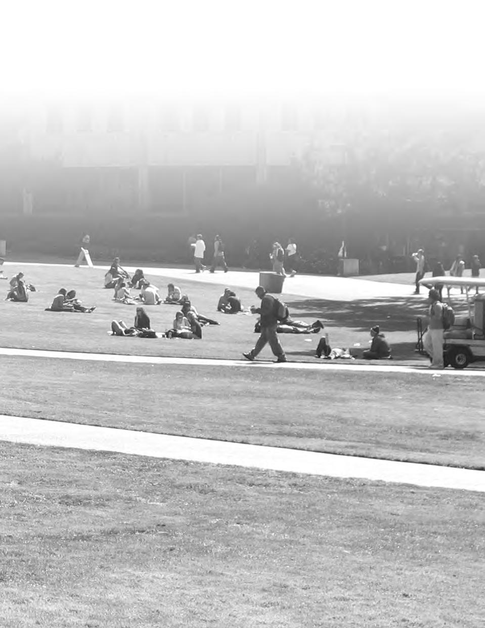
8 Chapter 2. Existing Conditions This chapter provides a discussion of the various travel modes used to access the San Francisco State University campus, including mode split, transit services, pedestrian and bike facilities, transportation demand management programs, and parking. In addition, the results of the April 2008 cordon count, intercept survey and online survey undertaken by the University are also discussed. 2.1 Travel Modes Commuters travel to campus from locations throughout the Bay Area using a wide variety of transportation modes. The following section reviews existing transportation options and services. Mode Split In April 2008, San Francisco State University conducted an online survey that asked University affiliates how they travelled to and from campus on Wednesday, April 30 th. A total of 4,386 University affiliates responded to the survey and out of the 4,386 total respondents, approximately 3,300 persons stated that they were on campus on Wednesday, April 30 th. For the purposes of survey analysis only those persons who stated they were on campus were included. To eliminate the possibility of bias, the online survey was supplemented with a complete hand cordon count of all persons entering and exiting the campus, and the cordon survey was supplemented by an intercept survey asking people a few questions about their mode choice that day. Using these data the mode spilt for persons travelling to San Francisco State University was determined. Muni was the most common mode used to arrive on campus, 31 percent, followed by driving, 26 percent. Seventeen percent of commuters arrive via the San Francisco State University shuttle. In comparison, only four percent of commuters arrive at campus via bicycle and 12 percent arrive on campus by foot. Figure 1 shows the last mode people used to arrive at campus. Figure 1: Mode of Arrival to Campus (N=3292) How Online Survey Respondents Get to San Francisco State University Percentage Muni 30.6% Drive alone 26.0% San Francisco State University Shuttle 16.9% Walk 12.3% Carpool 4.9% Bike 3.5% Dropped off 2.4% Other bus provider (AC Transit/Golden Gate Transit/SamTrans) 1.5% Other 1.1% Motorcycle/Moped 0.7% Total 100% Page 2 Nelson\Nygaard Consulting Associates
9 Approximately 40 percent of commuters rely on more than one mode to get to campus (Figure 2). Figure 2: Number of Legs in Journey to Campus (N=3292) Number of Legs Percentage of Respondents % % % 4 2.0% The majority of university affiliates, 59 percent, use only one mode to get to campus while a quarter use two modes. Only 2 percent have four legs in their journey to campus. Thirty six percent of respondents used Muni for a portion of the journey to campus. The second most common mode used was driving with 34 percent of respondents stating that they drove for a portion of their trip to San Francisco State University. Approximately 21 percent of respondents took BART and the San Francisco State University shuttle for one leg of their trip and 19 percent walked. Figure 3: All Modes Used to Get to Campus (N=3292) How Online Survey Respondents Get to San Francisco State University Percentage Muni 36.3% Drive alone 33.6% BART 21.3% San Francisco State University Shuttle 20.7% Walk 18.6% Carpool 6.8% Bike 5.5% Dropped off 4.2% Other bus provider (AC Transit/Golden Gate Transit/SamTrans) 3.2% Other 1.6% Caltrain 1.1% Motorcycle/Moped 1.0% Page 3 Nelson\Nygaard Consulting Associates
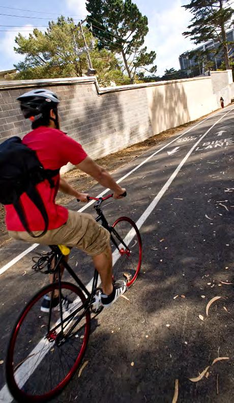
10 Baseline Auto Trips The data collected in the April 2008 online survey was used to establish a baseline number of auto trips for the entire campus population. 1 Figure 4: Peak Hour Auto Trips (N=total campus population) Time Peak Hour Auto Trips % of Total Daily Auto Trips Total Daily Auto Trips 4:00 PM 5:00 PM 1, % 14,723 Pedestrian Approximately 12 percent of university affiliates arrive on campus by foot and almost all internal trips are also on foot. On-Campus On the core campus, the University has established a pedestrian-oriented vehicle-free zone within the central area of the campus. This zone is defined by barrier gates at vehicle boundaries to the pedestrian zone, as well as outstanding landscaping which greatly enhances pedestrian amenity within the central core of the campus. Surrounding Area San Francisco State University is situated within walking distance of relatively intensive residential areas as well as active commercial areas such as Stonestown Shopping Mall and Ocean Avenue retail. The close proximity of these land uses provides opportunity for nonmotorized access to campus as well as positive pedestrian activity and campus-community interaction. The Campus Master Plan identifies investment strategies to further enhance pedestrian connectivity, particularly to University Park North and along Holloway Avenue. Bicycling Bicycle commuting currently constitutes a very small proportion of the transportation at San Francisco State University with only 3.5 percent of university affiliates commuting by bicycle. Relative to other university campuses with a high proportion of pedestrian and transit users, San Francisco State University s bicycle mode split is very low and highlights deficiencies in accommodating bicycle transportation in and around San Francisco State University. 1 The number of persons arriving by car at campus during the peak was calculated by looking at the last mode respondents took to campus and the mode they used to leave campus and correlating these trips to their arrival and departure time. By adding the to campus and from campus trips together for each hour segment, the vehicle peak hour was determined to be 4:00 p.m. to 5:00 p.m. Carpools were included in the vehicle trip calculation; however the total number of carpool trips for each hour was reduced by a factor of 2.4, the average number of persons in a carpool. Persons who drove and then walked 10 minutes or less to or from campus were also counted as vehicle trips rather than walk trips as required by the MOU. Page 4 Nelson\Nygaard Consulting Associates
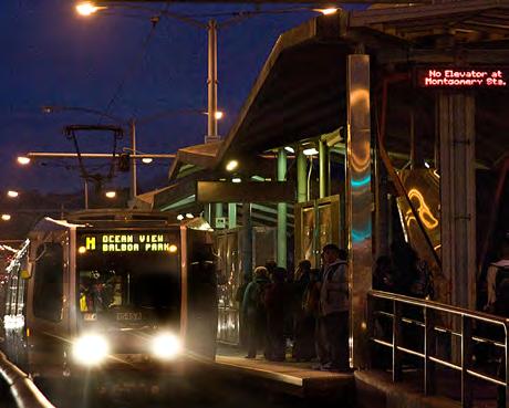
11 Bicycle Access Varied bicycle conditions exist within the 3 to 5 mile biking radius of campus, with discontinuities in the bicycle network highlighting potential improvements for bicycle access to campus. The main bicycle corridor providing bicycle access to San Francisco State University from the north is 20 th Avenue including bicycle connections through Golden Gate Park and Stern Grove. Bicycle routes providing access between San Francisco State University and places to the south of campus include a variety of streets through Parkmerced, as well as Bicycle Route 75, which accommodates bicycles in wide curb lanes along sections of Beverly Street, 19 th Avenue and St. Charles Avenue to Daly City BART station. To the east of campus, the main bicycle access route is along Holloway Avenue and portions of Ocean Avenue near Balboa Park station. Along this route a dedicated on-street bike lane provides excellent bicycle access along Holloway Avenue between Font Boulevard and 19 th Avenue. The bicycles lanes do not continue east of 19 th Avenue along Holloway, but the street is a fairly low-speed residential street. To the west of campus, bicycle access is provided along a dedicated off-street route along the perimeter of Lake Merced. This route provides excellent off-street service and is well used by recreational walkers and cyclists, though it has poor connectivity to surrounding streets and to the San Francisco State University campus. The campus master plan identifies opportunities to improve bicycle routes through and around the edges of campus. The ongoing San Francisco Bike Plan Update proposes new bicycle lanes in the short term on Holloway from 19 th Avenue to Junipero Serra with other bikeway improvements continuing east into the Mission District. In fall 2009, San Francisco State University completed construction of a bike path from 20 th and Buckingham south down the hillside to South State Drive. Bicycle Facilities Currently there are a number of bicycle racks located around the perimeter of the campus core and on-campus housing. Racks are provided at Mary Park Hall, Mary Ward Hall, A.S. Children s Center, The Village, Student Services, Fine Arts, HSS, and the Science building for a total capacity of approximately 60 bikes. The Bike Barn has capacity for 250 bikes. Transit The San Francisco Muni provides a number of routes that directly serve the San Francisco State University campus. Routes servicing the campus include the M, 17, 18, 28, 28 Limited (28L) and 29. The Daly City BART station is the closest BART stop to the campus and a campus-sponsored shuttle provides access from the station to the University. In addition to BART and Muni services, SamTrans provides service to the campus via Daly City and Colma via Route 122. The route originates at the South San Francisco BART Station and moves north via Serramonte Shopping Center and Seton Medical Center to the Colma BART Station. From there, it stops at Westlake Shopping Center and heads north on Lake Merced Boulevard past the western edge of San Francisco State University to terminate at Stonestown Shopping Center. Muni and BART are the most heavily utilized transit systems with 36 percent of San Francisco State University commuters riding Muni and 21 percent riding BART for some portion of their journey to campus. Page 5 Nelson\Nygaard Consulting Associates
12 The figure below shows the percentage of Muni trips that were taken to and from campus via the six Muni routes that directly serve campus. Of those commuters who ride Muni to campus, the most heavily traveled routes are bus route 28 and metro line M, with 32 percent and 45 percent respectively, using these routes for the last portion of their journey to campus. Figure 5: Daily Muni trips by Muni route (N = total campus population) Muni Route Number of trips % of all Muni Trips % % 28/28L 4, % 29 2, % % M 6, % For campus affiliates accessing campus via Muni, the peak hour of Muni trips occurs between 8 AM and 9 AM in the morning. In contrast, the Muni system wide peak occurs between 5 PM and 6 PM in the evening. Figure 6 shows the number of trips to and from campus on the routes serving campus during both the San Francisco State University Muni peak and the system wide Muni peak. Figure 6: Peak Hour Muni Trips (N = total campus population) Muni Route Number of trips 8:00 am 9:00 am Number of trips 5:00 pm 6:00 pm L M Total 1, Page 6 Nelson\Nygaard Consulting Associates
13 The peak hour trends are parallel to the daily trends in level of usage, as the M metro line and bus route 28 are the most heavily utilized. During the San Francisco State University Muni peak hour of 8:00 AM to 9:00 AM, the majority of trips on the M line are in the outbound direction while trips taken on routes 28 and 28L are the same in both directions. In the evening peak hour, approximately 140 more people are travelling outbound on the M line. Trips on the 28 and 28L are equal in the northbound and southbound directions. Figure 7: Peak Hour, Peak Direction Riders for M line and Bus Route 28 (N=total campus population) 2 M Line Bus Routes 28/28L Muni Route Inbound Trips Outbound Trips Northbound Trips Southbound Trips 8:00 am 9:00 am :00 pm 6:00 pm Transit Amenities San Francisco State University provides a limited number of transit amenities. The most visible are the red canopies located along 19 th Avenue at Holloway Avenue in front of the stops for Routes 17, 28, 28L, 29 and the San Francisco State University shuttle. They are easy to access by most users and clearly denote a transit waiting area. Benches are also provided underneath and adjacent to the canopies. Though visually appealing, the canopies offer little protection from rain and wind, and no route maps or schedules are posted in the area to provide information on the bus or shuttle services. For riders with visual impairments, there is no tactile wayfinding and it may be difficult to locate the appropriate bus stop pole when the area is crowded or when multiple bus lines pull into the stop together. San Francisco State University helped fund and maintains the transit shelter at the M-Line platform in the 19 th Avenue median. 2 Inbound and outbound trips for the M line during the AM peak hour were determined by applying a 40% inbound - 60% outbound ratio to the total number of M line trips, scaled to represent the campus population, during the AM peak hour. This ratio was determined by using the home zip codes of online survey respondents to determine their direction of travel and the number of trips in each direction. The same methodology was used in the PM peak and a ratio of 33% inbound 67% outbound was applied. For the 28/28L the same methodology was used and a ratio of 50% northbound 50% southbound was applied to both AM and PM peak trips. Page 7 Nelson\Nygaard Consulting Associates
14 2.2 Parking Approximately 26 percent of commuters drive alone to campus. Forty six percent of those who drive park on campus and 45 percent park near campus. The April 2008 online survey asked respondents who stated that they parked on or near campus to identify where they parked. Based on the responses received, and scaled to reflect the entire population of the University, Figure 9 provides a breakdown of parkers by location. The vast majority of on-campus parkers park in the main parking structure at the center of campus. Near campus, 500 university affiliates parked on 19 th Avenue and approximately 800 parked on Junipero Serra Boulevard, both of which are free and unpermitted. Survey respondents who stated that they drove to campus were also asked how much they paid to park. The majority of those who drove, 54 percent, had free parking. Twenty percent paid between $4 and $7 dollars and 14 percent have a San Francisco State University monthly parking pass. Given the large number of parkers on 19 th Avenue, Junipero Serra Boulevard, and the surrounding neighborhoods, it is not surprising that the majority of drivers do not pay for parking. Figure 8: Parking Costs (n=1,373) Cost Percentage of Respondents Free 53.8% Less than $1 0.7% $1-$2 3.9% $2-$4 6.5% $4-$7 20.0% $7-$10 0.5% More than $10 0.8% San Francisco State University Monthly Parking Pass 13.8% Page 8 Nelson\Nygaard Consulting Associates
15 Figure 9: Parking On and Near Campus Page 9 Nelson\Nygaard Consulting Associates
16 On-Campus Parking Currently 2,911 parking spaces excluding residential parking at the Villages, UPS, and UPN are supplied on campus including 73 parking spaces reserved for people with disabilities. Oncampus parking is divided among 6 separate parking lots. Lots 20 and 25 are available to students and visitors with the exception of Level 4l Orange to 4n Orange, which is restricted to staff and faculty between 7 AM and 5 PM Monday Friday. Lot 20 is open 24 hours per day while lot 25 is only available from 7 AM to 10 PM. Both lots charge $1 per hour with a $5 maximum per day for parking. Lots 1, 2, 6, and 19 (roof level of Lot 20) are restricted to use by faculty and staff with valid campus parking permits from 7 AM to 5 PM Monday Friday. Students with disabilities and visitors are allowed to park in any disabled parking space in any lot. Demand for on-campus parking is such that, on average, a maximum overall campus parking occupancy of 80 percent is reached between 11 AM and 2 PM. During certain periods of the day, particularly early afternoon, some small parking lots experience 100 percent occupancy. Off-Campus and Student Housing Parking Off-campus parking is also available, though much of this parking is subject to two-hour parking restrictions imposed by the City of San Francisco s residential parking permit program. Free, unrestricted on-street parking exists along both sides of 19 th Avenue on the east side of campus, along Junipero Serra Boulevard and along sections of Winston Drive and Lake Merced Boulevard. There is also metered on-street parking on Tapia and Holloway Avenue, some of which is reserved for motorcycle parking. Designated parking is available to on-campus residential students. At University Park North, parking is provided either in carports or on street. In total, there are 631 carport spaces and 106 reserved on-street parking spaces amounting to 737 spaces. Residents pay $50 a month for a parking space in addition to their housing costs. University Park South follows a similar configuration, with a total of 231 carport spaces for an extra $50 a month. The City of San Francisco issues Parking Permit E to those living in Parkmerced to park on street without time restriction for $60 a year. The Village parking lot houses 80 official spaces, with approximately seven additional unofficial spaces where vehicles can park in circulation areas. A space in the garage costs $100 a month. Additional vehicles may be accommodated in tandem spaces if valet service is provided. As the lot is currently operated by an attendant, valet parking may be a possibility. All on-campus residential students may purchase a $225 semester permit to park in Lot Transportation Demand Management Current TDM efforts include the San Francisco State University shuttle to Daly City BART, the attended Bike Barn facility, San Francisco State University Ride Match Program, commuter check program, Zipcar program, and information on alternative modes of transport provided by the San Francisco State University transportation website. A description of the programs currently offered is given below: Page 10 Nelson\Nygaard Consulting Associates
17 San Francisco State University Shuttle Buses For those who commute by BART and the various bus lines serving the station, the Department of Parking and Transportation provides a free shuttle service to and from the Daly City BART station, stopping at 19 th and Holloway on campus, with one shuttle making a loop through campus stopping at Creative Arts, the student housing on Font, the Library Annex, University Park North, 19 th Avenue, and Daly City BART. The direct shuttle operates 7:00 AM to 10:30 PM, Monday through Thursday and 7:00 AM to 7:15 PM on Friday, and the loop shuttle operates 7:00 AM to 5:30 PM, Monday through Friday. The shuttle is well utilized, with approximately 17 percent of survey respondents taking the shuttle for the last leg of their commute to campus. On a daily basis, the shuttle service has 2,800 to 3,200 rides with an average of three runs per hour per shuttle, and a total of 45 to 50 runs per shuttle per day. For 3,000 rides per day this translates to 66,000 rides per month or 594,000 rides per year (shuttle operates nine months out of the year). Currently, during the peak hours of 8:00 AM to 9:30 AM and 3:00 PM to 6:30 PM, San Francisco State University shuttles are over capacity, which is defined as 28 persons seated and 10 persons standing. During these time periods, demand is so high that there is a queue of riders waiting in line for a shuttle. In general, over the whole day, 75 percent of the time the shuttles are at 100 percent capacity. Information on the shuttle is provided on the San Francisco State University Parking and Transportation website. Under the Shuttle Buses link, stop locations and hours of operation are given. San Francisco State University, the City and BART are currently working to relocate the San Francisco State University shuttle stop at Daly City Station to be adjacent to the Muni 28/28L stop. Since the shuttle, 28 and 28L lines are all free to San Francisco State University affiliates between the station and campus, co-locating the stops will allow passengers to choose whichever line arrives first. San Francisco State University Ride Match Program The San Francisco State University Ride Match Program matches faculty, staff and students with others in their area to carpool to campus. If the Transportation Department is unable to create the match, it will work with other Bay Area agencies to find one. Currently, 111 participants are enrolled in the program. A number of marketing methods are used to inform students, staff and faculty about the Ride Match program. Marketing methods used include: Parking and Transportation Department website, campus bulletins, notices on shuttles, flyers in on-campus housing, and a notice in the new hires information packet. At the end of each semester persons who have enrolled in the program are notified by the University and are asked if they would like to remain in the database or be removed. Commuter Check Program The University Parking and Transportation Program and Human Resources, Safety & Risk Management have partnered together to administer a commuter check program that enables faculty, staff and administrators to purchase transit passes with their pre-tax salary. Via payroll deduction, up to $230 monthly of pre-tax salary can be used for public transportation or vanpool expenses. Participants enroll online through Commuter Check Direct, a nationwide service, and Page 11 Nelson\Nygaard Consulting Associates
18 may choose to have their transit passes mailed directly to them or receive commuter checks which they can then redeem at the Student Center for transit passes. Bike Barn and Information As bike parking is not permitted within the central core of the campus, the Department of Parking and Transportation provides an indoor bike parking area in Lot 6 under the gym. The Bike Barn provides secure bicycle parking and all day attendants at no cost to the bicycle rider. The facility is open Monday through Thursday from 7:30 AM to 10:00 PM and Friday from 7:30 AM to 5:00 PM. The Bike Barn is closed on weekends and when school is not in session. Some additional bicycle parking is available at a number of bicycle racks scattered around the campus. The San Francisco State University Parking and Transportation website provides a text summary of the bike routes in the Bay Area as well as bike laws and safety tips. Transit Information The San Francisco State University Parking and Transportation website offers information on how to get to campus by bus and shuttle, providing links to the transit providers and 511.org, the Bay Area transportation website. This information is provided on the Directions to Campus page. The San Francisco State University Parking and Transportation website is user-friendly, with icons and text to help the user navigate the links. Zipcar The University has partnered with Zipcar to provide the campus community with self-service access to vehicles by the hour or day at discounted rates, 24 hours a day, 7 days a week, 365 days a year. Reserved parking for the Zipcars is provided at the South State Drive entrance to the parking garage. Page 12 Nelson\Nygaard Consulting Associates
19 Chapter 3. TDM Program and Implementation Schedule The following chapter lays out a comprehensive TDM program that builds on and expands the TDM measures already in use by the University to adequately minimize and mitigate the transportation impacts the University s planned growth will have. San Francisco State University currently supports a number of TDM programs, including ride matching, bike barn, and shuttle services, as described in Chapter 2. However there is an opportunity to further strengthen and expand these programs to reduce a greater percentage of drive-alone trips. This program encompasses financial incentives such as subsidized transit passes and a Guaranteed Ride Home program to give employees the security to carpool or ride transit; and information and marketing efforts. While these programs can stand alone, they will make a more significant impact when used together to create a package of options for University affiliates. The mitigation measures and programs are organized by time of implementation: one to two years, three to four years, and five or more years. Figure 10 at the end of this chapter provides a comprehensive look at the timeline for all the measures. 3.1 Years One and Two The following section describes the measures that will be undertaken during the first two years of the implementation of the TDM plan. The measures described in this section are changes that can be undertaken right away. Establish a Transportation Committee Strategy: The University will create a Transportation Committee. Description: The University will create a Transportation Committee, composed of representatives from campus departments involved with transportation and reporting to the Vice President for Administration and Finance and the Vice President for Student Affairs. The committee, co-chaired by the Associate Director of Community Relations and the Campus Planner, will serve as the central coordinating body for all transportation matters, including developing, implementing, evaluating, and managing the University s TDM programs. The committee will oversee coordination and marketing of mobility programs for university affiliates as well as direct marketing to as many staff and students as possible to increase the potential for each of the programs. The committee will also oversee the Monitoring Plan (Chapter 4). The Associate Director of Community Relations / committee co-chair will serve as the University s liaison with the SFMTA. Page 13 Nelson\Nygaard Consulting Associates
20 Ride Match Program Strategy: The University will strengthen its existing Ride Match program by, 1) Increasing participation rates and 2) Providing all staff and students with direct marketing about the Ride Match program. Description: Ridesharing is one of the most common and cost-effective alternative modes of transportation and one which commuters can adopt part-time. There are numerous benefits to ridesharing. Ridesharing can reduce peak-period vehicle trips and increase commuters travel choices. It reduces congestion, road and parking facility costs and pollution emissions. Ridesharing tends to have the lowest cost per passenger-mile of any motorized mode of transportation, since it makes use of a vehicle seat that would otherwise be empty. Ridesharing also provides consumer financial savings. Ridesharing tends to experience economies of scale: as more people use the service the chances of finding a suitable carpool or vanpool increase significantly. Typical conditions for ridesharing success include: Corridors that offer a time and/or cost savings, such as avoiding bridge tolls or taking advantage of carpool lanes. Locations far enough from campus that driving is a hassle, and where transit service is limited. Locations with a significant concentration of San Francisco State University commuters within close proximity of each other. Commuters with regular schedules, particularly staff. Taking all of these factors into account, priority locations for marketing ridesharing include: Western Alameda County, where 11% of campus commuters live, including significant concentrations of staff. So many commuters live in this area that there may be a strong vanpool market. Additionally, carpoolers receive the benefit of toll free access to the Bay Bridge. Portions of San Francisco relatively far from campus, yet without direct transit service. This would include much of southeastern San Francisco and many of the northernmost portions of the city. While there are few commuters coming from the North Bay, South Bay and far East Bay, the commute distances are so long that there is a strong incentive to carpool Measures that can increase participation and should be implemented include providing real-time rideshare matching. This service could be provided on the Parking and Transportation Department website or an existing service such as Ridespring.com could be utilized. An expanded marketing program that will be implemented should include the promotion of the formation of vanpools at specific locations where a concentration of university affiliates reside along with the use of the commuter check program to reimburse vanpool charges with pre-tax dollars. San Francisco State University should seek to use home address information from the Page 14 Nelson\Nygaard Consulting Associates
21 University payroll system to map home address information geographically and do targeted s or mailings to employees in locations most suitable for carpooling and vanpooling. Another potential program that will be explored within this 2-year timeframe is provision of preferred parking for carpools and automatic enrollment of participants in the Guaranteed Ride Home program. Free parking may also be provided for vanpools. Marketing and Information on Alternative Transportation Options Strategy: The University will 1) update and revamp its website and print materials to provide more comprehensive information on alternative transportation options to the University; and 2) actively promote the commuter check program and Zipcar. Description: A review of the existing Parking and Transportation Department website as well as feedback provided from students and staff indicates that currently the University is not providing the most comprehensive information on transportation alternatives. Updates to the website are needed to reflect changes in programs and services. This should include the following: A direct and prominent link on the SF State homepage to a comprehensive list of alternative transportation services, including the commuter check program and Zipcar. Adding San Francisco or Bay Area bike route maps to the website can promote bicycle commuting. Adding shuttle maps, with route and stop locations, and shuttle schedules will reduce the ambiguity of riding the shuttles. A direct link to the 511 TakeTransit Trip Planner helps students new to transit identify the best transit route to take from their point of origin to campus. Locations where fare media and bus maps can be purchased. Guaranteed Ride Home Program Strategy: The University will seek grant funding to implement a Guaranteed Ride Home program for all students, faculty and staff who are registered in the alternative mode program (ridesharing, transit, biking, walking). Description: The Guaranteed Ride Home (GRH) program is an important component of ridesharing and alternative transportation programs as the fear of needing a ride home in case of an emergency during the work day is one of the most cited obstacles to ridesharing or transit use. Many commuters say they are much more likely to use alternative transportation if they have access to an emergency ride home. Guaranteed Ride Home programs provide an occasional subsidized ride to commuters who use alternative modes, for example, if a bus rider must return home in an emergency, or a carpooler must stay at work later than expected. GRH programs may use taxis, university vehicles or rental cars. GRH trips may be free or they may require a modest co-payment. Commuters Page 15 Nelson\Nygaard Consulting Associates
22 would be allowed a limited number of times they could use the program each year perhaps four. The cost of offering this service tends to be low because it is seldom actually used. Persons who are planning on using alternative modes of transportation occasionally, part-time, or full-time would register in the GRH program online or using a paper form. Universal Transit Pass Program for Students Strategy: The University will evaluate the feasibility and pursue options for funding a universal student transit pass program. Description: In recent years, growing numbers of transit agencies have partnered with universities to provide universal transit passes. These passes typically provide unlimited rides on local or regional transit providers for low monthly fees, often absorbed by the school and students. The advantage of implementing a universal pass system, one where all students participate, is that schools can negotiate a bulk rate with the transit providers. Free transit passes are usually extremely effective means to reduce the number of car trips in an area. By removing any cost barrier to using transit, including the need to search for spare change for each trip, people become much more likely to take transit to school or for non-school trips. Given the high percentage of students who already use public transit, and in particular Muni, the cost of such a program will be significant and will require a student referendum and administrative approval to increase their student fees to fund the program. As stated in the MOU, the University will work with Muni and BART on establishing a Universal Transit Pass program for students (undergraduate/graduate or both). The price of the passes will be such that the entire program is revenue-neutral for the City and County of San Francisco. Given the concentration of San Francisco State University commuters in San Francisco and northern San Mateo Counties, the program would ideally include Muni, Samtrans and the BART system between Embarcadero and Millbrae stations. If funding is not available for such a program, including Muni only or BART plus Muni within San Francisco, like the FastPass would be a valuable start. If additional money is available, and a fare instrument could be found, including BART through northern Alameda County would be highly useful for the 11% of commuters who live there. The University will also work with student groups to gain support for the program, as a student fee would need to be approved by a vote of students in order for the program to be implemented. In the April 2008 online travel survey, university affiliates were asked what was the most they would be willing to pay for unlimited Muni access and unlimited BART access within San Francisco. Page 16 Nelson\Nygaard Consulting Associates
23 Figure 11: Willingness to Purchase a Universal Transit Pass Price per Semester Percentage of Respondents $26 - $ % $51 - $ % $75 - $ % $101 - $ % $126 - $ % I am not interested in a transit pass 22.8% While 80 percent of respondents would be willing to pay some amount of money to receive a universal transit pass the majority are only willing to pay $75 or less per semester for one. Given that Muni passes currently cost $45 a month or about $180 a semester, some subsidy from the parking fund may be necessary to garner the support of the student population as a whole to implement a universal transit pass program. Transit Strategy: The University will offer transit ticket purchase options and amenities. The University will allow the City and County of San Francisco to locate and maintain automated ticket vending machines and ticket sales services for FastPasses and BART tickets. The appropriate locations for the machines will be determined by the University, but should include one in the immediate vicinity of the M Platform and 28/28L bus stops. The University will continue to provide ticket sales services for FastPasses and BART tickets on campuses. Shuttle Service Strategy: The University will: 1) Work with BART, Muni, and SamTrans to shift the San Francisco State University shuttle stop at Daly City BART station, 2) Seek funding to replace current van conversion vehicles with low-floor transit buses, 3) Evaluate extending shuttle service to operate during the summer break, and 4) Improve mapping and schedule information for the shuttle at key shuttle stops, in print materials, and on the Parking and Transportation Department website. Description: The San Francisco State University shuttle service from Daly City BART is an important component of the University s alternative transportation program and is heavily utilized by persons travelling to and from the campus. The main area of concern with respect to the San Francisco State University shuttles is that of capacity. Queues and overcrowding are a daily occurrence as shuttles operate at 100 percent capacity three quarters of the time and during the peak hours of 8:00 AM to 9:30 AM and 3:00 PM to 6:30 PM, San Francisco State University shuttles are over capacity. At 19 th Avenue, a long queue forms and people often have to wait for more than one shuttle as the first one reaches capacity before they are able to board. Currently, the University utilizes van conversion vehicles for its shuttle service. The passenger occupancy of these vehicles is 28 persons seated and 10 persons standing. In order to address Page 17 Nelson\Nygaard Consulting Associates
24 capacity constraints the University should identify funding to purchase or lease low-floor buses which can transport approximately 35 seated persons for a 30 ft. bus and 40 persons seated in a 40 ft. bus, or arrange for such vehicles through a turnkey shuttle operations contract. In addition, low-floor vehicles enable a greater ease of access for persons with mobility limitations. New transit vehicles should have multiple doors to ease boarding, since no fares are collected. The University will evaluate the demand for shuttle service during summer months and the related cost to determine whether the benefit e.g., attracting more students during summer session warrants the added expense. During this time, the shuttle could operate at a lower frequency and only during the peak commute times. Currently, at the Daly City BART station the spacing of the San Francisco State University shuttle stop and Muni Route 28 stop make it impossible for persons travelling to campus to see both stops at the same time and take whichever bus/shuttle arrives first. Moreover, switching to standard transit vehicles requires relocating the shuttle stop at the Daly City BART station, since a portion of the current shuttle route under the BART guideway is too low to allow larger transit vehicles. These problems could be addressed by shifting the San Francisco State University shuttle stop to the area currently occupied by Muni Route 54, an arrangement already being pursued by Muni, BART and San Francisco State University. Shuttle stops currently lack clear route information, schedule information and poles indicating the stops and should be updated to provide this information. Improvements can be made to the Parking and Transportation Department website and materials could be printed to clearly convey shuttle routes and schedules. Bicycle Facilities Strategy: The University will upgrade existing bicycle facilities by 1) Evaluating the hours of the bike barn and expanding as needed 2) Installing additional bike racks, 3) Completing phase 1 of the north-south bike path, and 4) Studying phase two of the north-south bike path, including a field trip to UC Davis, Stanford, and UC Santa Barbara. Description: The University has taken significant steps to encourage bicycling to campus. The Bicycle Working Group has been established and meets about once every two months. It is comprised of students, faculty, staff, administrators, University Police, SFMTA, and the Bicycle Coalition. This group has been critically important in assisting with bike rack choice and locations, as well as in coordinating all campus offices with any involvement with bikes or related issues. The Bicycle Working Group has identified a number of locations throughout the core campus where 100 bike racks should be installed. A grant from the Bay Area Air Quality Management District will be used to fund this endeavor. The University will install approximately 100 bike racks during the first two years of the TDM plan, based on the recommendations of the Bicycle Working Group. Bike Barn hours should be evaluated and expanded as needed to further encourage bicycling to campus, particularly extending the hours on Friday evening. At similar bicycle stations around the country, 24-hour access is granted by card key to members. Video cameras and restricted access minimize the risk of theft. The campus master plan calls for a north-south bicycle/pedestrian route from Buckingham Way to Holloway Avenue that would provide campus access to cyclists approaching campus from the Page 18 Nelson\Nygaard Consulting Associates
Transportation-Demand Management Community Presentation
 Transportation-Demand Management Community Presentation American University Office of Risk, Safety and Transportation programs Thursday, June 7, 2018 Program Objectives Improve transportation options for
Sustainable Transportation Plan Draft 4/24/2012
 Sustainable Transportation Plan 2011-2012 Draft 4/24/2012 Contents I. Purpose... 3 II. Background... 3 III. Recent Accomplishments... 6 IV. Anticipated Changes... 8 V. Planning Process... 8 VI. Priorities...
Solana Beach Comprehensive Active Transportation Strategy (CATS)
") Solana Beach Comprehensive Active Transportation Strategy (CATS) 3.0 Goals & Policies The Solana Beach CATS goals and objectives outlined below were largely drawn from the Solana Beach Circulation Element
Solana Beach Comprehensive Active Transportation Strategy (CATS) 3.0 Goals & Policies The Solana Beach CATS goals and objectives outlined below were largely drawn from the Solana Beach Circulation Element
June 3, Attention: David Hogan City of San Mateo 330 W. 2oth Avenue San Mateo, CA 94403
 June 3, 2015 Attention: David Hogan City of San Mateo 330 W. 2oth Avenue San Mateo, CA 94403 Regarding: PA # 15-030, Bridgepointe Shopping Center 2202 Bridgepointe Parkway, APN 035-466-10 Dear David: Enclosed
GOALS, OBJECTIVES, AND RECOMMENDATIONS
 GOALS, OBJECTIVES, AND RECOMMENDATIONS GOALS, OBJECTIVES, AND RECOMMENDATIONS ASSESSMENT CRITERIA Notes Status BIKES Goal 1: Increase the use of bikes as a clean and healthy method of transportation by
PARKMERCED. San Francisco Municipal Transportation Agency Board Meeting September 7, 2010
 PARKMERCED San Francisco Municipal Transportation Agency Board Meeting September 7, 2010 Project Team OEWD: Overview Project Sponsor: Parkmerced Highlights SFMTA: Transportation Highlights, Process and
University of Victoria Campus Cycling Plan Terms of Reference. 1.0 Project Description
 University of Victoria Campus Cycling Plan Terms of Reference 1.0 Project Description The Campus Cycling Plan, a first for the University, will provide a comprehensive and coordinated approach to support
Cabrillo College Transportation Study
 Cabrillo College Transportation Study Planning and Research Office Terrence Willett, Research Analyst, Principle Author Jing Luan, Director of Planning and Research Judy Cassada, Research Specialist Shirley
Outreach Approach RENEW SF served as the primary liaison with the North Beach community; the Chinatown. Executive Summary
 Executive Summary Executive Summary The Columbus Avenue Neighborhood Transportation Study s objective is to identify changes to transportation infrastructure and policies that could enhance the livability
TRAVEL PLAN: CENTRAL EUROPEAN UNIVERSITY CAMPUS REDEVELOPMENT PROJECT TRAVEL PLAN. Central European University Campus Redevelopment Project.
 TRAVEL PLAN Central European University Campus Redevelopment Project Page 1 Table of Contents Introduction... 3 Background... 7 Building Users... 7 Transportation in Community Consultation... 7 Summary
Welcome! Public Open House on UBC s Transportation Plan
 1 Welcome! Public Open House on UBC s Transportation Plan Public open house hours: to When it comes to on-campus transportation, what do you think is working well and what are some opportunities for improvement?
1999 On-Board Sacramento Regional Transit District Survey
 SACOG-00-009 1999 On-Board Sacramento Regional Transit District Survey June 2000 Sacramento Area Council of Governments 1999 On-Board Sacramento Regional Transit District Survey June 2000 Table of Contents
Magnolia Place. Traffic Impact Analysis. Prepared for: City of San Mateo. Prepared by: Hexagon Transportation Consultants, Inc.
 Magnolia Place Traffic Impact Analysis Prepared for: City of San Mateo Prepared by: Hexagon Transportation Consultants, Inc. Updated January 4, 2010 Table of Contents 1. Introduction...1 2. Existing Conditions...6
Memorandum. Fund Allocation Fund Programming Policy/Legislation Plan/Study Capital Project Oversight/Delivery Budget/Finance Contract/Agreement Other:
 Memorandum Date: November 20, 2017 To: Transportation Authority Board From: Eric Cordoba Deputy Director Capital Projects Subject: 12/5/17 Board Meeting: San Francisco Freeway Corridor Management Study
SAN FRANCISCO MUNICIPAL TRANSPORTATION AGENCY
 THIS PRINT COVERS CALENDAR ITEM NO. : 11 DIVISION: Sustainable Streets BRIEF DESCRIPTION: SAN FRANCISCO MUNICIPAL TRANSPORTATION AGENCY Approving traffic modifications on Twin Peaks Boulevard between Christmas
COLUMBUS AVENUE NEIGHBORHOOD TRANSPORTATION STUDY
 COLUMBUS AVENUE NEIGHBORHOOD TRANSPORTATION STUDY Pedestrian Survey Findings Survey Main Findings: Transit and walking are the main two modes used by both visitors and residents of the area, regardless
EXECUTIVE SUMMARY... vii 1 STUDY OVERVIEW Study Scope Study Area Study Objectives
 Contents EXECUTIVE SUMMARY... vii 1 STUDY OVERVIEW... 1-1 1.1 Study Scope... 1-1 1.2 Study Area... 1-1 1.3 Study Objectives... 1-3 2 EXISTING CONDITIONS... 2-1 2.1 Existing Freeway Conditions... 2-4 2.1.1
Purpose and Need. Chapter Introduction. 2.2 Project Purpose and Need Project Purpose Project Need
 Chapter 2 Purpose and Need 2.1 Introduction The El Camino Real Bus Rapid Transit (BRT) Project (Project) would make transit and other transportation improvements along a 17.6-mile segment of the El Camino
BALBOA AREA: TRANSPORTATION PROJECTS & PLANNING
 BALBOA AREA: TRANSPORTATION PROJECTS & PLANNING TRANSPORTATION FOR ALL AGES, ABILITIES & MEANS CHANGING PATTERNS: TRENDING TO WALKING, BIKING, TRANSIT San Francisco s Change in Number of Commuters by Mode
 MEMORANDUM - CITY OF PASADENA Department Of Transportation DATE: OCTOBER 21, 2008 TO: ENVIRONMENTAL ADVISORY COMMISSION FROM: ~ FRED C. DOCK, DIRECTOR OF TRANSPORTATION SUBJECT: UPDATE ON DEPT. OF TRANSPORTATION
Central Freeway and Octavia Circulation Study
 Central Freeway and Octavia Circulation Study Final Report Plans and Programs Committee San Francisco County Transportation Authority September 18, 2012 Presentation Outline Background and Study Purpose
January Project No
 January 13 2015 Project No. 5070.05 Neil Connelly, Director University of Victoria, Campus Planning and Sustainability PO Box 1700 STN CSC Victoria, BC V8P 5C2 Dear Neil: Re: UVic 2014 Traffic Final Report
Exhibit 1 PLANNING COMMISSION AGENDA ITEM
 Exhibit 1 PLANNING COMMISSION AGENDA ITEM Project Name: Grand Junction Circulation Plan Grand Junction Complete Streets Policy Applicant: City of Grand Junction Representative: David Thornton Address:
BIKE PLAN CONTENTS GATEWAY
 CONTENTS Acknowledgments...vii Great Rivers Greenway District Board of Directors... vii Great Rivers Greenway District Staff... vii Project Consultants... vii Committees... viii Citizens Advisory Committee
TRAFFIC IMPACT STUDY CRITERIA
 Chapter 6 - TRAFFIC IMPACT STUDY CRITERIA 6.1 GENERAL PROVISIONS 6.1.1. Purpose: The purpose of this document is to outline a standard format for preparing a traffic impact study in the City of Steamboat
Dartmouth College Parking, Traffic, & Pedestrian Circulation. Master Plan 2001
 Dartmouth College Parking, Traffic, & Pedestrian Circulation Master Plan 2001 Goals & Objectives of the Study Identify Existing and Projected Parking Demand & Supply Identify Existing Pedestrian & Traffic
PEDESTRIAN ACTION PLAN
 ATTACHMENT 2 CITY OF SANTA MONICA PEDESTRIAN ACTION PLAN CITY OF SANTA MONICA PEDESTRIAN ACTION PLAN This page intentionally left blank EXECUTIVE SUMMARY CHAPTER 1 EXECUTIVE SUMMARY Setting the Stage
4.5 TRANSPORTATION. SF State Creative Arts & Holloway Mixed-Use Project 9547 March
 4.5 TRANSPORTATION This section of the Focused Tiered Final EIR presents potential transportation impacts of the proposed Creative Arts and Holloway Mixed-Use Project (Project). Preparation of this Focused
SANTA CLARA COUNTYWIDE BICYCLE PLAN August 2008
 SANTA CLARA COUNTYWIDE BICYCLE PLAN August 2008 To assist VTA and Member Agencies in the planning, development and programming of bicycle improvements in Santa Clara County. Vision Statement To establish,
Rochester Area Bike Sharing Program Study
 roc bike share Rochester Area Bike Sharing Program Study Executive Summary ~ January 2015 JANUARY 2015 8484 Georgia Avenue, Suite 800 Silver Spring, MD 20910 3495 Winton Pl., Bldg E, Suite 110 Rochester,
Bicycle Master Plan Goals, Strategies, and Policies
 Bicycle Master Plan Goals, Strategies, and Policies Mobilizing 5 This chapter outlines the overarching goals, action statements, and action items Long Beach will take in order to achieve its vision of
Bike San Mateo County San Mateo County Bicycle Plan Recommendations August 30, 2010
 Policy and Procedures Develop and Implement a Complete Streets Policy to comply with DD-64-R1 and AB1358 Commencing January 1, 2011, AB1358 requires that the legislative body of a city or county, upon
February 4, Community Meeting August 2, :30 6:10 Presentation
 5:30 6:10 Presentation OSU-Cascades Long Range Development Plan Bend, Oregon Community Meeting August 2, 2016 6:10 6:55 Group Exercise 6:55 7:10 Report Back 7:10-7:25 Public Comment 7:25-7:30 Next Steps
Chapter 2. Bellingham Bicycle Master Plan Chapter 2: Policies and Actions
 Chapter 2 Bellingham Bicycle Master Plan Chapter 2: Policies and Actions Chapter 2: Policies and Actions The Bicycle Master Plan provides a road map for making bicycling in Bellingham a viable transportation
Millbrae Serra Station Development Millbrae, California
 Millbrae Serra Station Development Millbrae, California Transportation Demand Management Plan Prepared for: Mr. Vincent A. Muzzi, Millbrae Serra Station, LLC June 15, 2016 Hexagon Transportation Consultants,
Guidelines for Providing Access to Public Transportation Stations APPENDIX C TRANSIT STATION ACCESS PLANNING TOOL INSTRUCTIONS
 APPENDIX C TRANSIT STATION ACCESS PLANNING TOOL INSTRUCTIONS Transit Station Access Planning Tool Instructions Page C-1 Revised Final Report September 2011 TRANSIT STATION ACCESS PLANNING TOOL INSTRUCTIONS
PEDALING FORWARD. A Glance at the SFMTA s Bike Program for SFMTA.COM
 PEDALING FORWARD A Glance at the SFMTA s Bike Program for 2017-2021 SFMTA.COM INTRODUCTION About This Booklet More people from all walks of life see their bicycle as a more convenient way to get where
Tulsa Metropolitan Area LONG RANGE TRANSPORTATION PLAN
 Tulsa Metropolitan Area LONG RANGE TRANSPORTATION PLAN Indian Nations Council of Governments August 2005 CONTACTING INCOG In developing the Destination 2030 Long Range Transportation Plan, INCOG s Transportation
Balboa Area Transportation Demand Management
 Balboa Area Transportation Demand Management April 2016 Presented by: Jeff Tumlin What Are We Aiming For? Transportation is not an end in itself. It is merely a means by which we support the community.
PURPOSE AND NEED SUMMARY 54% Corridor Need 1. Corridor Need 2. Corridor Need 3. Corridor Need 4. Corridor Need 5
 SUMMARY PURPOSE AND NEED Chapel Hill Transit ridership has increased Buses operate every 4 minutes and have standing room only Exceeding seated capacity by 12% Corridor Need 1 by more than 20 percent between
Capital and Strategic Planning Committee. Item III - B. April 12, WMATA s Transit-Oriented Development Objectives
 Capital and Strategic Planning Committee Item III - B April 12, 2018 WMATA s Transit-Oriented Development Objectives Page 24 of 76 Washington Metropolitan Area Transit Authority Board Action/Information
Transportation, Parking & Roads
 Transportation, Parking & Roads Design Carolina North as a walkable community Design the transportation system and development patterns (i.e., urban design elements such as density, building design, mix
ALTERNATIVES SCREENING REPORT
 VAN NESS AVENUE BUS RAPID TRANSIT (BRT) ALTERNATIVES SCREENING REPORT Revised Draft, 3/28/08 San Francisco County Transportation Authority 1 Introduction The San Francisco County Transportation Authority
Pocatello Regional Transit Master Transit Plan Draft Recommendations
 Pocatello Regional Transit Master Transit Plan Draft Recommendations Presentation Outline 1. 2. 3. 4. What is the Master Transit Plan? An overview of the study Where Are We Today? Key take-aways from existing
SF Transportation Plan Update
 SF Transportation Plan Update CAC Meeting #11 Existing Conditions and Future Baseline Needs Revised, Part I www.sfcta.org/movesmartsf twitter.com/sanfranciscota www.facebook.com/movesmartsf January 30,
Corpus Christi Metropolitan Transportation Plan Fiscal Year Introduction:
 Introduction: The Safe, Accountable, Flexible, Efficient Transportation Equity Act: A Legacy for Users (SAFETEA-LU) has continued the efforts started through the Intermodal Surface Transportation Efficiency
LOUISIANA STATE UNIVERSITY COMPREHENSIVE & STRATEGIC CAMPUS MASTER PLAN. APPENDIX L - Mobilitiy Component Implementation Matrix
 LOUISIANA STATE UNIVERSITY COMPREHENSIVE & STRATEGIC CAMPUS MASTER PLAN APPENDIX L - Mobilitiy Component Implementation Matrix TRANSPORTATION DEMAND MANAGEMENT (TDM) TRANSIT/TIGER TRAILS/ TRAMLINK Staff/Faculty
Traditional Public Transport Priority. Priority/Traffic Management? What is Integrated Public Transport Priority/Traffic management? Why? How?
 Integrated Public Transport Priority & Traffic Management Sam Zimmerman What is Integrated Public Transport Priority/Traffic management? Why? How? Integrated Public Transport Priority/Traffic Management?
Roads and Vehicular Traffic Design Principles. Roads and Vehicular Traffic Recommendations
 CIRCULATION AND PARKING roads and vehicular traffic The Campus Master Plan updates the campus transportation network through a multi-modal approach that encourages walking and biking while improving vehicular
C C C
 C-012-001 Thank you for your support for the creation of new public space and nonmotorized access between downtown and the waterfront through the Overlook Walk, the East-West Connections, and the Promenade.
SAN FRANCISCO MUNICIPAL TRANSPORTATION AGENCY
 THIS PRINT COVERS CALENDAR ITEM NO. : 10.2 DIVISION: Sustainable Streets BRIEF DESCRIPTION: SAN FRANCISCO MUNICIPAL TRANSPORTATION AGENCY Adopting Conceptual Proposal for Streetscape Improvements to Broadway,
SAN FRANCISCO MUNICIPAL TRANSPORTATION AGENCY
 THIS PRINT COVERS CALENDAR ITEM NO.: 11 DIVISION: Transit Services BRIEF DESCRIPTION: SAN FRANCISCO MUNICIPAL TRANSPORTATION AGENCY Approving the installation of traffic and parking modifications along
Transportation Master Plan Advisory Task Force
 Transportation Master Plan Advisory Task Force Network Alternatives & Phasing Strategy February 2016 BACKGROUND Table of Contents BACKGROUND Purpose & Introduction 2 Linking the TMP to Key Council Approved
Memorandum HEARING DATE: MAY 22, 2014
 Memorandum HEARING DATE: MAY 22, 2014 Project Name: 19 th Avenue Transit Study Final Report Staff Contact: Alexis Smith, 415 575 9131 alexis.smith@sfgov.org Reviewed by: Joshua Switzky, 415 575 6815 joshua.switzky@sfgov.org
S T A T I O N A R E A P L A N
 The Circulation and Access Plan describes vehicle, pedestrian, and transit improvements recommended within the Concept Plan. In order to create and sustain a vibrant business district that provides pedestrian-friendly
FROM: CITY MANAGER DEPARTMENT: PLANNING AND COMMUNITY ENVIRONMENT DATE: OCTOBER 4, 2004 CMR:432:04
 TO: HONORABLE CITY COUNCIL FROM: CITY MANAGER DEPARTMENT: PLANNING AND COMMUNITY ENVIRONMENT DATE: OCTOBER 4, 2004 CMR:432:04 SUBJECT: FINANCE COMMITTEE RECOMMENDATION TO ADOPT TRANSPORTATION STRATEGIC
Van Ness Avenue BRT Overview and Scoping Process. Geary BRT CAC January 8, 2009
 Van Ness Avenue BRT Overview and Scoping Process Geary BRT CAC January 8, 2009 VAN NESS AVENUE S ROLE Identified in Prop K for BRT treatment Muni 47 and 49; 19 operates on Polk 20,000 daily riders on Van
Beyond First First Last Last Mile Strategies. APA National Conference April 3, 2016 Chelsea Richer, AICP Fehr & Peers
 Beyond First First Last Last Mile Strategies APA National Conference April 3, 2016 Chelsea Richer, AICP Fehr & Peers 1 Beyond First Last Mile Strategies APA National Conference Jeremy Klop, AICP, Fehr
BUILDING THE CASE FOR TRAVEL OPTIONS IN WASHING TON COUNTY. Image: Steve Morgan. Image: Steve Morgan
 BUILDING THE CASE FOR TRAVEL OPTIONS IN WASHING TON COUNTY Image: Steve Morgan Image: Steve Morgan Image: TriMet Image: TriMet WHAT ARE TRAVEL OPTIONS PROGRAMS? Travel options programs encourage residents,
ATTACHMENT 4 - TDM Checklist. TDM Checklist Overview
 ATTACHMENT 4 - TDM Checklist TDM Checklist Overview The proposed checklist rates developments on the degree to which they are TDM and transit supportive. Points are assigned based on the level of transit
Northbound San Jose Avenue & I-280 Off-Ramp Road Diet Pilot Project
 Project Overview Fed by a two-lane Interstate-280 (I-280) off-ramp, high vehicular volumes and speeds are longstanding issues along San Jose Avenue. Residents in the surrounding neighborhoods have expressed
Table #6 VISION CHARACTERISTICS
 Table #6 VISION White Flint is a place to live, work, play, shop, and walk with sufficient density to encourage quality redevelopment. Vibrant streets and consistent streetscapes are important. CHARACTERISTICS
University of Leeds Travel Plan
 University of Leeds Travel Plan 2015-2018 Contents 1: Introduction 1.1 What is a Travel Plan? 1.2 Why do we need one? 1.3 Sustainability Strategy 2: Overview 2.1 The bigger picture 2.2 The City scale 2.3
CONNECTING PEOPLE TO PLACES
 CONNECTING PEOPLE TO PLACES 82 EAST BENCH MASTER PLAN 07 Introduction The East Bench transportation system is a collection of slow moving, treelined residential streets and major arteries that are the
Camosun College Modal Split
 2010 Camosun College Modal Split How Does the College Community Get to Campus? Shannon Craig & Julie Higginson Camosun College 1/21/2011 Contents Introduction... 3 Methodology... 3 Results... 6 Mode Share
EMU Procurement Seats/Standees/Bikes/Bathroom
 EMU Procurement Seats/Standees/Bikes/Bathroom Board of Directors June 4, 2015 Agenda Item 7b Purpose Seats / standees / bikes / bathroom balance Develop framework for Draft EMU RFP Feedback on car configuration
CURBSIDE ACTIVITY DESIGN
 5 CURBSIDE ACTIVITY DESIGN This chapter provides design guidance for separated bike lanes adjacent to curbside activities including parking, loading and bus stops. Typical configurations are presented
SETTINGS AND OPPORTUNITIES MOBILITY & ACCESS
 7 mobility & access how do people use el camino what is it like to drive on el camino/to park along el camino what is the pedestrian experience like what is the role of transit along the corridor what
Better Market Street Project Update. Urban Forestry Council September 17, 2014
 Better Market Street Project Update Urban Forestry Council September 17, 2014 Project Area Limits Better Market Street Schedule Market Street City s busiest transit corridor Over 85 buses per hour 14 surface
Data Analysis February to March Identified safety needs from reported collisions and existing travel patterns.
 Welcome! Thank you for participating in today s Valencia Bikeway Improvements workshop. Data Analysis February to March Identified safety needs from reported collisions and existing travel patterns. Initial
CITY OF COCOA BEACH 2025 COMPREHENSIVE PLAN. Section VIII Mobility Element Goals, Objectives, and Policies
 CITY OF COCOA BEACH 2025 COMPREHENSIVE PLAN Section VIII Mobility Element Goals, Objectives, and Policies Adopted August 6, 2015 by Ordinance No. 1591 VIII MOBILITY ELEMENT Table of Contents Page Number
Exit 13/Golden Triangle Study FREQUENTLY ASKED QUESTIONS
 FREQUENTLY ASKED QUESTIONS How will you improve traffic in the Golden Triangle? One main goal of this study is to examine the current traffic patterns of the area and propose ways to improve the traffic.
City of Novi Non-Motorized Master Plan 2011 Executive Summary
 City of Novi Non-Motorized Master Plan 2011 Executive Summary Prepared by: February 28, 2011 Why Plan? Encouraging healthy, active lifestyles through pathway and sidewalk connectivity has been a focus
TRANSIT & NON-MOTORIZED PLAN DRAFT FINAL REPORT Butte County Association of Governments
 1 INTRODUCTION Maintaining a high quality of life is the essence of this plan for transit and non-motorized transportation in Butte County. Curbing greenhouse gas emissions (GHG) by reducing congestion,
TRANSPORTATION NEEDS ASSESSMENT
 TRANSPORTATION NEEDS ASSESSMENT A travel demand analysis was carried out to determine the operational issues and the potential benefit that adding traffic capacity would have on the road network. All the
Executive Summary Route 30 Corridor Master Plan
 Route Corridor Master Plan Project Overview The Route Corridor Master Plan is a coordinated multimodal transportation and land use plan for the entire stretch of Route through East Whiteland Township,
San Mateo County Comprehensive Bicycle and Pedestrian Plan Open House
 San Mateo County Comprehensive Bicycle and Pedestrian Plan Open House October 28, 2010 Presented to San Mateo County residents and interested parties by Lauren Ledbetter, Alta Planning + Design Matt Haynes,
Vision to Action Community Coalition February 14, 2014 Briefing
 Vision to Action Community Coalition February 14, 2014 Briefing Transportation and Transit Planning & Mass Transit Operations Strategic Growth Area Office Brian S. Solis Transportation & Transit Manager
Chapter 2: Standards for Access, Non-Motorized, and Transit
 Standards for Access, Non-Motorized, and Transit Chapter 2: Standards for Access, Non-Motorized, and Transit The Washtenaw County Access Management Plan was developed based on the analysis of existing
North Coast Corridor:
 North Coast Corridor: Connecting People, Transportation & Environment Legislative Hearing: 11.8.10 1 North Coast Corridor Region s Lifeline A Regional Strategy Mobility, Economy & Environment North Coast
Modal Shift in the Boulder Valley 1990 to 2009
 Modal Shift in the Boulder Valley 1990 to 2009 May 2010 Prepared for the City of Boulder by National Research Center, Inc. 3005 30th Street Boulder, CO 80301 (303) 444-7863 www.n-r-c.com Table of Contents
1.0 EXECUTIVE SUMMARY
 1.0 EXECUTIVE SUMMARY The Active Transportation Plan is a guide to accomplish the Town s vision for developing a network of sidewalks, on-road bicycle facilities, and trails that allow for safe and convenient
Introduction. Using the Checklist. TDM Measures Checklist Version 1.0 (30 June 2017) City of Ottawa
 City of Ottawa") Introduction The s Transportation Impact Assessment (TIA) Guidelines (specifically Module 4.3 Transportation Demand Management) requires proponents of qualifying developments to assess the context, need
Introduction The s Transportation Impact Assessment (TIA) Guidelines (specifically Module 4.3 Transportation Demand Management) requires proponents of qualifying developments to assess the context, need
Better Market Street Project. Project Update January 15, 2015
 Better Market Street Project Project Update January 15, 2015 Better Market Street Project Area Limits Market Street 2.2 Miles Mission Street Better Market Street Schedule Market Street City s busiest transit
BICYCLE INFRASTRUCTURE COMPONENT REMOVE II PROGRAM GUIDELINES, POLICIES, AND PROCEDURES
 BICYCLE INFRASTRUCTURE COMPONENT REMOVE II PROGRAM GUIDELINES, POLICIES, AND PROCEDURES SECTION I INTRODUCTION T he San Joaquin Valley Air Pollution Control District (SJVAPCD) is seeking applications for
Title VI Fare Change Equity Analysis
 Title VI Fare Change Equity Analysis Evaluation Report Submitted to Dallas Area Rapid Transit Submitted by TranSystems June 2012 Title VI Fare Change Equity Analysis Introduction DART has proposed a schedule
Data Analysis February to March Identified safety needs from reported collisions and existing travel patterns.
 Welcome! Thank you for participating in today s Valencia Bikeway Improvements workshop. Data Analysis February to March Identified safety needs from reported collisions and existing travel patterns. Initial
1.0 INTRODUCTION 1.1 PURPOSE OF THIS REPORT
 1.0 INTRODUCTION This chapter provides an overview of the purpose, authorization and focus of this Recirculated Draft Environmental Impact Report (EIR), an identification of the Lead Agency, an outline
3.0 PROJECT DESCRIPTION
 The following section of the Draft EIR contains a description of the proposed Elk Grove Boulevard/SR 99 Interchange Modification project, consistent with the requirements of CEQA Guidelines Section 15124.
2045 Long Range Transportation Plan. Summary of Draft
 2045 Long Range Transportation Plan Summary of Draft Fredericksburg Area Metropolitan Planning Organization The George Washington Region includes the City of Fredericksburg and the counties of Caroline,
Summary of Feedback Received during Speak Up Broward s 22 Speakers Bureau Engagements from December 10, 2013 through April 2, 2014
 Summary of Feedback Received during Speak Up Broward s 22 Speakers Bureau Engagements from December 10, 2013 through April 2, 2014 Broward County Transit (BCT): Concerns for the safety of children particularly
Grove Hall Business District Parking Analysis
 Grove Hall Business District Parking Analysis February 2014 Prepared for The Roxbury Great Neighborhoods Partnership Nuestra Comunidad Development Corporation Dudley Square Main Streets Greater Grove Hall
Proposed. City of Grand Junction Complete Streets Policy. Exhibit 10
 Proposed City of Grand Junction Complete Streets Policy Exhibit 10 1 City of Grand Junction Complete Streets Policy Vision: The Complete Streets Vision is to develop a safe, efficient, and reliable travel
Breaking the Cycle of Automobile Dependency
 201 City Centre Dr., Suite 800 - Mississauga, Ontario - L5B 2T4 - (905) 896 5941 Breaking the Cycle of Automobile Dependency An Analysis of Meadowvale Business Park in the City of Mississauga Executive
Improving Mobility Without Building More Lanes
 Improving Mobility Without Building More Lanes By Mike Salisbury and Will Toor July 2017 Copyright 2017 by Southwest Energy Efficiency Project. All rights reserved. Photo: Courtesy of the Denver Post Anyone
UBC Vancouver Transportation Status Report Fall 2014
 UBC Vancouver Transportation Status Report Fall 2014 July 2015 1. Introduction... 1 1.1. Context... 1 1.2. Transportation Monitoring Program... 2 1.3. Changes at UBC Affecting Travel Patterns... 4 1.4.
Mission-Geneva Transportation Study Community Workshop 2 July 8, 2006
 Community Workshop 2 July 8, 2006 Small Group Workbook 1 Basic Improvements on Mission Street Streetscape. Pedestrian-scale lighting; landscaping; community art on utility boxes; more (possibly unique)
Appendix C 3. Bicycle / Pedestrian Planning
 Appendix C 3. Bicycle / Pedestrian Planning BICYCLE/PEDESTRIAN PLANNING 2005 Master Plan GOAL: Provide for safe and convenient bicycle and pedestrian circulation throughout the City. Develop a city-wide
Climate Change Action Plan: Transportation Sector Discussion Paper: Cycling
 Climate Change Action Plan: Transportation Sector Discussion Paper: Cycling ontario.ca/climatechange Contents 1. Minister of Transportation s message... 3 2. Introduction... 5 3. Sector Overview and Support
summary of issues and opportunities
 1 summary of issues and opportunities EXECUTIVE SUMMARY CHAPTER 2: HISTORY - 3: LAND USE This first chapter is an overview of lessons learned from analysis of the existing conditions on El Camino as well