Lake Sturgeon Stewardship and Enhancement Program
|
|
|
- Lynette Mason
- 6 years ago
- Views:
Transcription
1
2

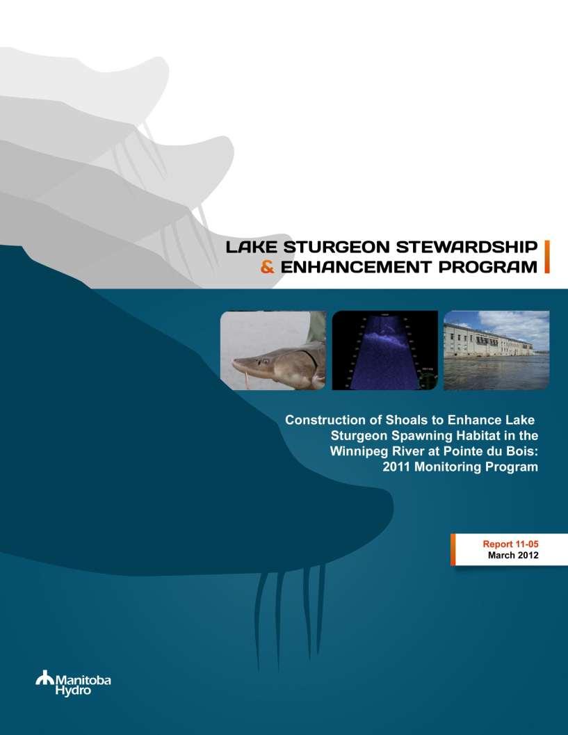
3 Lake Sturgeon Stewardship and Enhancement Program Report # Construction of Shoals to Enhance Lake Sturgeon Spawning Habitat in the Winnipeg River at Pointe du Bois: 2011 Monitoring Program Report Prepared for March 2012 By Lee Murray and Don MacDonell
4
5 STUDY TEAM Allan Schmidt Dave Szczepanski Kim Mandzy Brianna Wyn Don MacDonell Laura Henderson Cam Barth Ginger Gill Lee Murray Christian Lavergne James Aiken Lindsay Walker Claire Hrenchuk Kasia Dyszy Mark Gillespie Craig McDougall Kevin Doerksen Nat Waldner ACKNOWLEDGMENTS North/South Consultants would like to thank, Shelley Matkowski, Marilynn Kullman and Rob Tkach from Manitoba Hydro for their assistance with this project. We would also like to thank Garth Ferguson, Doug Krampetz, Jason Lamb, Scott Richards and the staff at the Pointe du Bois Generating Station for their assistance throughout the study. Pointe du Bois i Draft Report # Technical Report 2012
6 TABLE OF CONTENTS Page 1.0 INTRODUCTION POINTE DU BOIS GENERATING STATION CONSTRUCTED SPAWNING SHOAL MONITORING METHODS RESULTS Discharge and Unit Operation Spawning Period and Locations DIDSON Acoustic Camera Monitoring Results Egg Mat Monitoring Results Egg Deposition Prior to and Following Shoal Construction SUMMARY REFERENCES Draft Report # ii Pointe du Bois 2012 Technical Report
7 LIST OF TABLES Page Table 1. Summary of the number of egg mats and eggs located on or within 10 meters of the constructed shoals located downstream of the Pointe du Bois GS, spring Pointe du Bois iii Draft Report # Technical Report 2012
8 LIST OF FIGURES Page Figure 1. Lake Sturgeon spawning areas identified below the Pointe du Bois generating station and spillway...9 Figure 2. Location of spawning shoals constructed in 2009 (Unit 16) and 2010 (units 1, 5, and 13) downstream of the Pointe du Bois GS Figure 3. DIDSON acoustic camera and pole mount used to monitor the constructed shoals Figure 4. Location of the Unit 13 spawning shoal DIDSON monitoring station Figure 5. Location of the Unit 5 spawning shoal DIDSON monitoring station Figure 6. Location of the Unit 1 spawning shoal DIDSON monitoring station Figure 7. Egg collection mat used to monitor spawning on and near the constructed shoals Figure 8. Figure 9. Figure 10. Figure 11. Figure 12. Figure 13. Figure 14. Summary of Lake Sturgeon egg collection mat results from below Pointe du Bois for spring 2011 with daily water temperature indicated Frequency of Lake Sturgeon observed within the monitoring areas for each constructed shoals. Water temperature during the monitoring period is indicated on the secondary vertical axis. Note: Monitoring of the Unit 5 spawning shoal was conducted from May 30 to June 1, June 4 and June Screen captures from DIDSON camera footage for the Unit 5 spawning shoal. Both upper and lower panel show multiple large Lake Sturgeon swimming onto spawning shoal substrate in close proximity to each other during peak spawning period (30 May) Screen captures from DIDSON camera footage for the Unit 5 spawning shoal. Upper and lower panel are sequential scenes from multiple large Lake Sturgeon moving together on the spawning shoal during peak spawning period (31 May) Screen captures from DIDSON camera footage for the Unit 13 spawning shoal. Upper panel shows a large number of non Lake Sturgeon moving together adjacent to the spawning shoal around a king anchor on 29 May. Lower panel shows large boulders at front of spawning shoal and a large Lake Sturgeon swimming over them on 31 May Lake Sturgeon egg mats located within 10 metres of the constructed spawning shoals in 2011 indicating presence, absence, and abundance of eggs along with unit operation status (on/off) during peak spawning Lake Sturgeon egg mats in 2008 located within 10 metres of the spawning shoals prior to their construction indicating presence, absence, and abundance of eggs along with unit operation status (on/off) during peak spawning Draft Report # iv Pointe du Bois 2012 Technical Report
9 Figure 15. Figure 16. Figure 17. Figure 18. Lake Sturgeon egg mats in 2009 located within 10 metres of the spawning shoals prior to their construction indicating presence, absence, and abundance of eggs along with unit operation status (on/off) during peak spawning. Note: Unit 16 shoal constructed in Lake Sturgeon egg mats located within 10 metres of the constructed spawning shoals in 2010 indicating presence, absence, and abundance of eggs along with unit operation status (on/off) during peak spawning Lake Sturgeon egg mat locations from 2011 indicating presence, absence, and abundance of eggs along with unit operation status (on/off) during peak spawning Location of Lake Sturgeon egg mats and constructed spawning shoals within the Pointe du Bois powerhouse tailrace area for Pointe du Bois v Draft Report # Technical Report 2012
10
11 1.0 INTRODUCTION Manitoba Hydro has developed a province wide Lake Sturgeon Stewardship and Enhancement Program with a goal to maintain and enhance Lake Sturgeon populations in areas affected by their developments and operations. The Program sets out several strategies to achieve this goal including researching, developing and evaluating potential recovery actions. Lake Sturgeon typically spawn in swift turbulent water in rapids or at the base of falls. Hydroelectric developments also typically target these areas to take advantage of the hydraulic head for power generation. Consequently, loss or alteration of spawning habitats is one of the most significant impacts that hydro development can have on Lake Sturgeon populations. In 2009, a study was initiated by Manitoba Hydro to determine if rock shoals constructed in an existing hydroelectric generating station tailrace would provide suitable spawning habitat for Lake Sturgeon. The study was conducted downstream of the Pointe Du Bois GS on the Winnipeg River (Figure 1) because: the presence of a relatively abundant Lake Sturgeon population downstream of the Pointe du Bois GS would maximize chances for immediate evaluation of study success; and three years of baseline information on spawning had already been collected at the site as part of the environmental studies for the Pointe du Bois Spillway Replacement Project which would assist in site selection and evaluating study success (McDougall et al. 2008a, McDougall et al. 2008b, McDougall 2009). The spawning surveys at Pointe du Bois identified several areas downstream of the powerhouse that had suitable depths and velocities for Lake Sturgeon spawning but were not targeted by spawning Lake Sturgeon presumably because of the lack of suitable substrates (i.e., substrates that provides sufficient interstitial spaces for egg deposition and incubation) and/or turbulence. Rock shoals were constructed within these sites to enhance conditions for Lake Sturgeon spawning. A description of the rationale for site selection and construction is provided in North/South Consultants (2011a). The first Lake Sturgeon spawning shoal in Manitoba was constructed approximately 40 m downstream of Unit 16 of the Pointe du Bois powerhouse in late April 2009 (Figure 2). Subsequent monitoring of the shoal began that spring in conjunction with Lake Sturgeon spawning studies conducted as part of the Pointe du Bois Spillway Replacement Project (Koga and MacDonell 2009). Although Lake Sturgeon were observed moving near the constructed shoal, results indicated that Lake Sturgeon did not spawn over the shoal, but instead selected areas closer to the powerhouse where higher water velocities and more complex flows existed. Based on the monitoring results, three additional spawning shoals were constructed closer to the powerhouse, immediately downstream of units 1, 5 and 13 during April 2010 (Figure 2). Monitoring in 2010 found evidence of Lake Sturgeon spawning in the powerhouse tailrace area mostly between units 2 and 4, however some egg deposition was observed between units 11 and 12 and between units 5 and 10 (North/South Consultants 2011a). It appeared that sturgeon were attracted to the high flows exiting the turbines, and were keying in on the current edges adjacent to the main flow. Large numbers of eggs were collected in close proximity to the shoals downstream of units 5, 13, and 1 suggesting that spawning occurred near the shoals. A DIDSON (Dual Identification Sonar) acoustic camera (Soundmetrics Corp., Lake Forest Park, Washington, USA) showed large numbers of inactive sturgeon present near the Unit 1 shoal prior to the spawning period. As peak spawning approached, the number of sturgeon present near Unit 13 increased rapidly. The shoal near Unit 5 could not be monitored with the DIDSON camera in 2010 due to turbulent flows. Egg mat results suggested that this Pointe du Bois 1 Draft Report # Technical Report 2012
12 area may have been an important location for spawning within the tailrace. The shoal downstream of Unit 16 attracted few Lake Sturgeon during the monitoring period and egg mats set in the vicinity of the shoal did not capture any eggs. Monitoring of the constructed shoals at Pointe du Bois GS was continued during the Lake Sturgeon spawning period in spring This report provides the results of that program. 2.0 POINTE DU BOIS GENERATING STATION Construction of the Pointe du Bois Generating Station (GS) began in 1909 with the station becoming operational in Upon completion of the Pointe du Bois GS in 1926, the powerhouse was comprised of 16 horizontal twin reaction Francis turbines with discharge ratings of 33 cms (units 2, 3, 4 and 7), 43 to 44 cms (units 5, 6, 8, 9, 10 and 11), 46 cms (units 12, 13 and 14) and 51 cms (units 15 and 16) plus two small Francis units, each with 5 cms ratings (North/South Consultants 2011b). In 1999, the eastern most Francis unit was replaced with a StrafloTM unit which had an increased capacity of approximately 69 cms. The maximum powerhouse capacity is about 712 cms. Flows in excess of powerhouse capacity are passed through the existing spillway, such that the outer forebay is controlled at or near the target Full Supply Level elevation of m. The station is capable of generating 78 MW when fully operational producing an average annual generation of 599 million kwh. In recent years, several generating units have been inoperable on a rotating basis and, therefore, the station has generally operated below its full capacity. The Pointe du Bois GS is the most upstream of six hydroelectric stations currently in operation on the Manitoba portion of the Winnipeg River. Along with the Slave Falls GS (located approximately 7.8 km downstream of the Pointe du Bois GS), it operates primarily as a run-of-the-river plant with little storage. Powerhouse and spillway flows are primarily manipulated in response to regulated flows received from Ontario (North/South Consultants 2011b). 3.0 CONSTRUCTED SPAWNING SHOAL MONITORING METHODS Monitoring of spawning activity in relation to the constructed shoals was conducted concurrently with egg deposition monitoring conducted as part of the Pointe du Bois Spillway Replacement Project (Koga and MacDonell 2012). Lake Sturgeon activity on and around the shoals was monitored with a DIDSON acoustic camera and egg deposition on and adjacent to the shoals was monitored with egg mats. DIDSON Acoustic Camera The DIDSON monitoring setup consisted of a camera unit attached to a X 2 pan & tilt rotator (Soundmetrics Corp., Lake Forest Park, Washington, USA) mounted on a swiveling pole mount (constructed by Anything Custom Ltd, Winnipeg, Canada) (Figure 3). A custom built mounting bracket (also constructed by Anything Custom Ltd., Winnipeg, Manitoba) was bolted to the seat of the boat and the pole, rotator, and camera were attached to it. The setup allowed the camera to be lowered approximately 1 m below the water surface for monitoring and raised for travelling. The boat was moored differently at each of the constructed shoal locations for optimal camera operation. To monitor the constructed shoal downstream of Unit 16, the boat was moored immediately downstream of the shoal and the camera was pointed upstream. At the Unit 13 shoal, the boat was tied directly to the powerhouse and the camera was pointed downstream at the shoal (Figure 4). A large king anchor with 10 to 15 m of line attached to a buoy was deployed at the upstream end of the Unit 5 constructed shoal Draft Report # Pointe du Bois 2012 Technical Report
13 to make a more permanent and stable monitoring station. The boat was tied to the king anchor in a location immediately downstream of the constructed shoal (Figure 5). The constructed shoal downstream of Unit 1 was monitored by mooring the boat in the calmer water east of the shoal (Figure 6). To decrease boat sway and enhance the video quality two drift socks were attached to the rear corners of the boat at the Unit 5 and Unit 1 monitoring stations. Each constructed shoal was monitored throughout the spawning period for approximately 1 to 2 hours each day, and the time of day that each shoal was monitored was changed daily. Digital images were recorded whenever there was evidence of fish use. The digital data were reviewed and summarized at a later date to describe the frequency of Lake Sturgeon observations and spawning behaviour. Egg Collection Mats Egg collection mats were placed on and around the constructed shoals to monitor egg deposition. Each egg mat consisted of a 30 x 90 cm portion of furnace filter material wrapped around a 39 x 19 x 9 cm cinder block and held in place with bungee cords (Figure 7). Lake Sturgeon eggs readily adhere to furnace filter material and the presence of eggs on the mats provides an indication that spawning has occurred in close proximity. The mats were either deployed as transects running parallel to the river flow, with mats located at approximate 20 m intervals, or as individual mats. The majority of transects consisted of four to five egg collection mats, with some transects consisting of only two mats. A large anchor was attached to the upstream end of most transects and a float was attached to the downstream end to facilitate retrieval. The egg collection mats were lifted every two to three days to inspect the filter material for eggs and subsequently replaced. GPS coordinates, depth, and velocity were recorded at each mat location. It should be noted that GPS coordinates for each egg mat were determined at the surface of the water and, while providing a general location, do not necessarily represent the exact location of each mat. Egg mats with GPS locations within 10 m of the constructed shoal were used to assess egg deposition in relation to each shoal. 4.0 RESULTS Discharge and Unit Operation Winnipeg River discharge was relatively high during spring 2011 and a spill occurred throughout the Lake Sturgeon spawning period. Nine of the 16 powerhouse generating units were operational during this time including units 1-4 (easternmost units), 6-9 and 12 (western-most unit). Mean daily discharge from the powerhouse ranged from cms from May 19 to June 14. Spillway discharge was 1202 cms on May 26 and remained between cms through mid-june. Although there was no discharge from Unit 5, discharges from units 4 and 6 remained strong creating substantial turbulence and velocities over the Unit 5 shoal. Velocities recorded near eggs mats located below Unit 5 ranged from 0.57 to 0.64 m/sec and ranged from 0.57 to 0.88 m/sec below Unit 4. Velocities directly in front of units 4 and 6 ranged from m/sec Spawning Period and Locations The Pointe du Bois Spillway Replacement Project egg mat monitoring program results (Koga and MacDonell 2012) suggested that Lake Sturgeon spawning commenced just prior to 24 May in Peak egg collections occurred from 27 to 30 May and eggs continued to be detected in large numbers Pointe du Bois 3 Draft Report # Technical Report 2012
14 until 4 June (Figure 8). A secondary spawning event was detected on 13 June when eggs were collected on several mats in the powerhouse tailrace. Egg mat data indicated that spawning occurred both below the powerhouse tailrace and spillway areas; however, the majority of eggs were collected from the powerhouse tailrace. 4.3 DIDSON Acoustic Camera Monitoring Results Monitoring with the DIDSON acoustic camera was conducted from 24 May to 7 June. Water temperature at the onset of monitoring was 8 o C and increased to 11 o C by the end of the monitoring program (Figure 8). Few Lake Sturgeon were observed on or near the constructed shoals at the start of the monitoring period (24 May) (Figure 9). Several Lake Sturgeon were observed staging downstream of the unit 1 and 13 shoals on 26 May. Lake Sturgeon observations on or near the shoals peaked from 29-31May, particularly below Unit 5 where the number of Lake Sturgeon present during these dates were too numerous to effectively count. Sturgeon were also abundant near Unit 13 during this period The number of Lake Sturgeon observations decreased steadily in early June; however, some individuals were observed up until the end of the monitoring period on 7 June. Unit 1 Shoal Monitoring at the Unit 1 shoal occurred from 24 May to 4 June and then again on 7 June (Figure 9). Overall fewer Lake Sturgeon were observed on or near the Unit 1 shoal in 2011 than in 2010 (North/South Consultants Inc. 2011). Lake Sturgeon were first observed on the shoal on 26 May and the highest number of Lake Sturgeon observed on and near the shoal occurred on May 27 (n=15) (Figure 9). As the number of Lake Sturgeon increased at the unit 5 and 13 shoals the number decreased at Unit 1 similar to what was observed in The DIDSON camera did not detect any behaviour or activity by Lake Sturgeon that would suggest that spawning occurred on the Unit 1 shoal in Unit 5 Shoal Due to mooring difficulties DIDSON monitoring of the Unit 5 shoal did not commence until 30 May. Monitoring continued for three consecutive days and then again on 4 and 6 June. At the onset of monitoring, Lake Sturgeon were present in relatively large numbers both on and adjacent to the Unit 5 shoal (Figure 9). Groups of sturgeon were observed moving up and down in the water column and for several seconds just above the substrate. Attempts were made to zoom in on the sturgeon congregations but turbulent surface water conditions prevented capturing a clearer image. Groups of Lake Sturgeon were observed for several minutes and then would move out of detection range for a short period of time before returning the shoal area. The number of Lake Sturgeon observed on the Unit 5 shoal on 4 June and 6 June was significantly lower than during the peak period. However, Lake Sturgeon remained more abundant into June at the Unit 5 shoal than at the other three shoals (Figure 9). Screen captures for some of the footage recorded at the Unit 5 shoal are presented in figures 10 and 11. Unit 13 Shoal Monitoring at the Unit 13 shoal occurred daily from 24 May to 3 June and then again on 6 June (Figure 9). Lake Sturgeon were first observed on the shoal on 25 May and the highest number of Lake Sturgeon observed on and near the shoal occurred on May 31 (n=15) (Figure 9). Initially, numbers of Lake Sturgeon near the Unit 13 shoal were lower than at the Unit 1 shoal. However, as water temperature increased, Lake Sturgeon numbers and activity levels increased near Unit 13. Lake Sturgeon observations on the shoal peaked from May 29 to June 3. Lake Sturgeon were frequently observed Draft Report # Pointe du Bois 2012 Technical Report
15 utilizing the boulders at upstream end of the shoal (Figure 12, lower panel), entering the non-operable unit openings, and near bedrock outcrops west of the shoal. Although large congregations of actively swimming Lake Sturgeon were observed on the shoal, no distinct spawning behavior was observed. Several other fish species (non-lake Sturgeon) also were observed orienting to this shoal (Figure 12, upper panel). Unit 16 Shoal Monitoring at the Unit 16 shoal occurred daily from 26 May to 1 June (Figure 9). Similar to 2010, the Unit 16 shoal had the lowest frequency of Lake Sturgeon observations of all constructed shoals. Only three Lake Sturgeon were detected on or near the shoal throughout the monitoring period. No evidence of spawning activity was observed on or near the shoal. 4.4 Egg Mat Monitoring Results A total of 87 egg mat sets were conducted within 10 m of the five constructed shoals at Pointe du Bois during the 2011 Lake Sturgeon spawning period: 19 near the Unit 1 shoal; 22 near the Unit 5 shoal; 37 near the Unit 13 shoal; and nine near the Unit 16 shoal (Table 1). Large numbers of Lake Sturgeon eggs (n=1863) were found immediately on and/or downstream of the Unit 5 shoal indicating that spawning occurred in this area in 2011 (Figure 13). No eggs were found on mats set in close proximity to the shoal near Unit 13 and only one egg was found near Unit 16 shoal suggesting that spawning (n=112) did not occur in proximity to these shoals in Eggs found downstream of the Unit 1 shoal may be indicative of spawning that occurred further upstream, but may have originated in the vicinity of units Egg Deposition Prior to and Following Shoal Construction Egg deposition on egg mats located within 10 m of shoal locations for years prior to (2008) and following shoal construction ( ) are provided in figures 13 to 16. Spawning occurred adjacent to the Unit 5 shoal in front of Unit 4 in all four years of study, both in years when the unit was on (2009 and 2011) and in years when the unit was off (2008, 2010). In years when Unit 4 was on, there was one year when an adjacent unit was off (i.e., Unit 5 in 2011) and one year when both adjacent units were on (i.e., 2009). These data suggest that spawning Lake Sturgeon below the Pointe du Bois Powerhouse were not keying in on specific micro-hydraulic features as these would have differed in front of Unit 4 in all four years of study. Alternatively, substrates in the vicinity of Unit 4 are more diverse (higher density of boulders) than elsewhere across the face of the powerhouse and it may be that this substrate in combination with the high flows associated with Unit 1 makes this area desirable for spawning sturgeon. Although egg deposition data from 2010 suggested that the Unit 5 shoal did not attract additional spawning activity, the data from 2011 suggest that sturgeon shifted some spawning activity in a more westerly direction in front of Unit 5, which had not been observed in previous years. Spawning has not occurred in the area of the Unit 13 shoal in any of the four years of study from However, there has been little in the way of attraction flow near the Unit 13 shoal since it was constructed. Unit 13 was not in operation in 2010 or 2011 and in 2011 all units west of Unit 10, with the exception of Unit 12, were off. The shoal did attract a number of sturgeon staging prior to spawning in 2011 (see Section 3.3), but all spawning occurred to the east of Unit 12 where flows were concentrated. Egg mats have yielded few Lake Sturgeon eggs immediately downstream of Unit 1 or on the Unit 1 shoal over the four years of study. This may be partially attributable to the high water velocities affecting sampling efficiencies in this area. However, the data that have been collected suggest that Pointe du Bois 5 Draft Report # Technical Report 2012
16 sturgeon are selecting turbulent areas adjacent to the high water velocities emanating from Unit 1 rather than the jet of high velocity water passing directly over the Unit 1 shoal (water velocity of ~1.3 m/sec). No spawning activity has been observed or detected in the vicinity of the Unit 16 shoal over the four years of study. It is surmised that spawning Lake Sturgeon are attracted to the origin of flow at the Powerhouse and, therefore, not attracted to the Unit 16 shoal which is located more than 50 m downstream. 5.0 SUMMARY In 2011, Lake Sturgeon spawning occurred in both the powerhouse tailrace and spillway areas, with the highest concentration of egg deposition occurring between units 2 and 6 below the powerhouse (Figure 17). Additional egg deposition was observed between units 11 and 12 and to a lesser extent between units 7 and 10 (Figure 18). Large numbers of sturgeon observed on and adjacent to the Unit 5 shoal during the peak spawning period and large numbers of Lake Sturgeon eggs located near the shoal during this period suggest that sturgeon spawned on the Unit 5 shoal in The absence of observed spawning behavior and the small number of eggs collected in association with the Unit 1 shoal suggest that spawning did not occur on this shoal in Although the DIDSON camera showed sturgeon to be congregating near the Unit 13 shoal, egg mat results suggest that spawning did not occur in this location in It is likely that water velocities on the Unit 13 shoal (downstream of a unit that was not operating) were suboptimal compared to velocities further east along the powerhouse. The data suggest that sturgeon may have been congregating in areas of lower velocity east of Unit 1 and downstream of inoperable units (e.g., Unit 13) during the pre-spawning period. During the spawning period activity increased in proximity to the spawning locations (between Units 2-6, and units 11 and 12) where Lake Sturgeon may have been attracted to the flows exiting turbines (1-4, 6-9 and 12). Egg deposition in front of Unit 4 and adjacent to the Unit 5 shoal during different hydraulic conditions in each of the four years of study suggest that spawning Lake Sturgeon may be selecting more for macro-habitat features (e.g., adjacent to maximum flow, turbulence) rather than specific micro-habitat features (e.g., water velocity). Draft Report # Pointe du Bois 2012 Technical Report
17 6.0 REFERENCES DUMONT, P., J. D AMOURS, S. THIBODEAU, R. VERDON, S. GARCEAU, P. BILODEAU, Y. MAILHOT, and R. FORTIN Effects of the implantation of a newly created spawning ground in the Des Prairies River (Quebec, Canada) on the reproductive success of Lake Sturgeon (Acipenser fulvescens). 6th International Symposium on Sturgeon, Oct 25-31, 2009, Wuhan, Hubei Province China. Book of Abstracts: DUMONT, P., J. D AMOURS, S. THIBODEAU, N. DUBUC, R. VERDON, S. GARCEAU, P. BILODEAU, Y. MAILHOT, and R. FORTIN Effects of the development of a newly created spawning ground in the Des Prairies River (Quebec, Canada) on the reproductive success of Lake Sturgeon (Acipenser fulvescens). Journal of Applied Ichthyology. 27: KOGA, E. and D.S. MacDONELL Results of Lake Sturgeon Studies on the Winnipeg River in the Vicinity of Pointe du Bois Generating Station A report prepared for Manitoba Hydro by North/South Consultants Inc., Winnipeg, Manitoba. 195 pp. # KOGA, E. and D.S. MacDONELL Results of Lake Sturgeon Studies on the Winnipeg River in the Vicinity of Pointe du Bois Generating Station A report prepared for Manitoba Hydro by North/South Consultants Inc., Winnipeg, Manitoba. 104 pp. # KOGA, E. and D.S. MacDONELL Results of Lake Sturgeon Studies on the Winnipeg River in the Vicinity of Pointe du Bois Generating Station A report prepared for Manitoba Hydro by North/South Consultants Inc., Winnipeg, Manitoba. In Prep. McDOUGALL, C.A Results of Lake Sturgeon Studies in the Slave Falls Reservoir and Pointe du Bois Forebay A report prepared for Manitoba Hydro by North/South Consultants Inc. 255 pp. # McDOUGALL, C.A., P. GRAVELINE and D.S. MacDONELL. 2008a. Preliminary Investigations of Lake Sturgeon Spawning and Habitat Utilization in the Slave Falls Reservoir and Pointe du Bois Forebay A report prepared for Manitoba Hydro by North/South Consultants Inc. 88 pp. # McDOUGALL, C.A., D.S. MacDONELL, D. HUDD and L. MURRAY. 2008b. Results of Lake Sturgeon Studies in the Slave Falls Reservoir and Pointe du Bois Forebay A report prepared for Manitoba Hydro by North/South Consultants Inc. 236 pp. # NORTH/SOUTH CONSULTANTS INC. 2011a. Lake Sturgeon Spawning Habitat Enhancement: Construction of Spawning Shoals in the Pointe du Bois Tailrace, Winnipeg River, Manitoba, A report prepared for Manitoba Hydro by North/South Consultants Inc., Winnipeg, Manitoba. 33 pp. # NORTH/SOUTH CONSULTANTS INC. 2011b. Spawning Habitat Suitability Modeling Focusing on Lake Sturgeon. A report prepared for Manitoba Hydro by North/South Consultants Inc., Winnipeg, Manitoba. 117 pp. # Pointe du Bois 7 Draft Report # Technical Report 2012
18 Table 1. Summary of the number of egg mats and eggs located on or within 10 meters of the constructed shoals located downstream of the Pointe du Bois GS, spring Constructed Number of Number of Eggs Shoal Area Egg Mats Collected Present Within Area on Unit 1 SS 0 0 on Unit 5 SS 0 0 on Unit 13 SS 5 0 on Unit 16 SS 0 0 within 5 m of Unit 1 SS 3 0 within 5 m of Unit 5 SS within 5 m of Unit 13 SS 11 0 within 5 m of Unit 16 SS 3 0 within 10 m of Unit 1 SS within 10 m of Unit 5 SS within 10 m of Unit 13 SS 21 0 within 10 m of Unit 16 SS 6 1 Grand Total Draft Report # Pointe du Bois 2012 Technical Report

19 Figure 1. Lake Sturgeon spawning areas identified below the Pointe du Bois generating station and spillway. Pointe du Bois 9 Draft Report # Technical Report 2012
 and 2010 (units 1, 5, and 13) downstream of")
20 Figure 2. Location of shoals constructed in 2009 (Unit 16) and 2010 (units 1, 5, and 13) downstream of the Pointe du Bois GS. Draft Report # Pointe du Bois 2012 Technical Report


21 Figure 3. DIDSON acoustic camera and pole mount used to monitor the constructed shoals. Figure 4. Location of the Unit 13 shoal DIDSON monitoring station. Pointe du Bois 11 Draft Report # Technical Report 2012


22 Figure 5. Location of the Unit 5 shoal DIDSON monitoring station. Figure 6. Location of the Unit 1 shoal DIDSON monitoring station. Draft Report # Pointe du Bois 2012 Technical Report

23 Figure 7. Egg collection mat used to monitor spawning on and near the constructed shoals. Pointe du Bois 13 Draft Report # Technical Report 2012
24 Figure 8. Summary of Lake Sturgeon egg collection mat results from below Pointe du Bois for spring 2011 with daily water temperature indicated. Draft Report # Pointe du Bois 2012 Technical Report
25 Figure 9. Frequency of Lake Sturgeon observed within the monitoring areas for each constructed shoals. Water temperature during the monitoring period is indicated on the secondary vertical axis. Note: Monitoring of the Unit 5 shoal was conducted from May 30 to June 1, June 4 and June 6. Draft Report # Pointe du Bois 2012 Technical Report

.")
26 Figure 10. Screen captures from DIDSON camera footage for the Unit 5 shoal. Both upper and lower panel show multiple large Lake Sturgeon swimming onto shoal substrate in close proximity to each other during peak spawning period (30 May). Draft Report # Pointe du Bois 2012 Technical Report

27 Figure 11. Screen captures from DIDSON camera footage for the Unit 5 shoal. Upper and lower panel are sequential scenes from multiple large Lake Sturgeon moving together on the shoal during peak spawning period (31 May). Draft Report # Pointe du Bois 2012 Technical Report


28 Figure 12. Screen captures from DIDSON camera footage for the Unit 13 shoal. Upper panel shows a large number of non-lake Sturgeon moving together adjacent to the shoal around a king anchor on 29 May. Lower panel shows large boulders at front of shoal and a large Lake Sturgeon swimming over them on 31 May. Draft Report # Pointe du Bois 2012 Technical Report
29 Figure 13. Lake Sturgeon egg mats in 2011 located within 10 metres of the constructed shoals indicating presence, absence, and abundance of eggs along with unit operation status (on/off) during peak spawning. Draft Report # Pointe du Bois 2012 Technical Report
30 Figure 14. Lake Sturgeon egg mats from 2008 (prior to shoal construction) showing presence, absence, and abundance of eggs along with unit operation status (on/off) during peak spawning. Draft Report # Pointe du Bois 2012 Technical Report
")
31 Figure 15. Lake Sturgeon egg mats from 2009 showing presence, absence, and abundance of eggs along with unit operation status (on/off) during peak spawning. Note: Unit 16 shoal constructed in Pointe du Bois 21 Draft Report # Technical Report 2012
32 Figure 16. Lake Sturgeon egg mats located within 10 metres of the constructed shoal sites in 2010 showing presence, absence, and abundance of eggs along with unit operation status (on/off) during peak spawning. Draft Report # Pointe du Bois 2012 Technical Report

33 Figure 17. Lake Sturgeon egg mat locations from 2011 indicating presence, absence, and abundance of eggs along with unit operation status (on/off) during peak spawning. Pointe du Bois 23 Draft Report # Technical Report 2012

34 Figure 18. Location of Lake Sturgeon egg mats and constructed spawning shoals within the Pointe du Bois powerhouse tailrace area for Draft Report # Pointe du Bois 2012 Technical Report
NUMERICAL AND PHYSICAL MODELING
 POINTE DU BOIS GENERATING STATION SPILLWAY REPLACEMENT PROJECT NUMERICAL AND PHYSICAL MODELING Kara Hurtig, Northwest Hydraulic Consultants, North Vancouver, BC, Canada David S. Brown, KGS Group, Winnipeg,
Upstream Passage Assessment of American Shad Using 3D Acoustic Telemetry
 Upstream Passage Assessment of American Shad Using 3D Acoustic Telemetry Timothy Hogan, Alden Research Laboratory Corey Wright, Blue Leaf Environmental Skip Medford, Enel Green Power North America Abstract
4.6 LAKE STURGEON SPAWNING HABITAT DOWNSTREAM OF POWERHOUSE
 Sand Blanket Material Shields curves related to sand particle size and depth-averaged velocities in the post-project reservoir environment obtained from MIKE21 modeling were used to model the erosion potential
Packwood Lake Intake Screen Velocity Test Report for Energy Northwest's Packwood Lake Hydroelectric Project FERC No Lewis County, Washington
 for Energy Northwest's Packwood Lake Hydroelectric Project FERC No. 2244 Lewis County, Washington Submitted to P.O. Box 968 Richland, Washington 99352-0968 Submitted by EES Consulting 1155 North State
APPENDIX 2.1 Lake Sturgeon - Mitigation and Enhancement
 APPENDIX 2.1 Lake Sturgeon - Mitigation and This page is intentionally left blank. Lake Sturgeon Mitigation and As a provincial crown corporation providing electric energy and natural gas service, Manitoba
Session C9: Priest Rapids Fish Bypass: A Case Study from Start to Finish
 University of Massachusetts - Amherst ScholarWorks@UMass Amherst International Conference on Engineering and Ecohydrology for Fish Passage International Conference on Engineering and Ecohydrology for Fish
Near-Field Sturgeon Monitoring for the New NY Bridge at Tappan Zee. Quarterly Report July 1 September 30, 2014
 Near-Field Sturgeon Monitoring for the New NY Bridge at Tappan Zee Quarterly Report July 1 September 30, 2014 Prepared by AKRF, Inc. 7250 Parkway Drive, Suite 210 Hanover, MD 21076 for New York State Thruway
Dave Clugston U.S. Army, Corps of Engineers, Portland District. Tami Clabough, Eric Johnson, Dan Joosten, and Chris Peery
 College of Natural Resources Department of Fish and Wildlife Resources P.O. Box 443141 Moscow, Idaho 83844-3141 Phone: 8-885-64 Fax: 8-885-98 To: From: RE: Dave Clugston U.S. Army, Corps of Engineers,
Design and Installation of two Permanent Booms at La Romaine-2 to resist Ice, retain Debris and serve as Safety Booms.
 CGU HS Committee on River Ice Processes and the Environment 18 th Workshop on the Hydraulics of Ice Covered Rivers Quebec City, QC, Canada, August 18-20, 2015 Design and Installation of two Permanent Booms
EXPERIMENTAL STUDY ON THE DISCHARGE CHARACTERISTICS OF SLUICE FOR TIDAL POWER PLANT
 EXPERIMENTAL STUDY ON THE DISCHARGE CHARACTERISTICS OF SLUICE FOR TIDAL POWER PLANT Sang-Ho Oh 1, Kwang Soo Lee 1 and Dal Soo Lee 1 The discharge characteristics of sluice caisson for tidal power plant
SPILLWAY REPLACEMENT PROJECT NUMERICAL AND PHYSICAL MODELING. Kara Hurtig, Water Resources Engineer, Northwest Hydraulic Consultants, BC, Canada
 POINTE DU BOIS GENERATING STATION SPILLWAY REPLACEMENT PROJECT NUMERICAL AND PHYSICAL MODELING Kara Hurtig, Water Resources Engineer, Northwest Hydraulic Consultants, BC, Canada David S. Brown, Senior
Dave Clugston U.S. Army, Corps of Engineers, Portland District. Tami Clabough, Eric Johnson, Dan Joosten, and Chris Peery
 College of Natural Resources Department of Fish and Wildlife Resources P.O. Box 443141 Moscow, Idaho 83844-3141 Phone: 28-885-64 Fax: 28-885-98 To: From: Dave Clugston U.S. Army, Corps of Engineers, Portland
KEEYASK FISH PASSAGE IDENTIFICATION OF DESIGN CONCEPTS
 KEEYASK FISH PASSAGE IDENTIFICATION OF DESIGN CONCEPTS NOVEMBER 29 TH, 2012 Executive Summary A Keeyask fish passage feasibility study was undertaken with the goal of developing and evaluating a suite
Within Phase I, researchers have identified four tasks that they think are essential for designing the most informative study.
 Revised Study Plan June 30, 2005 I. Introduction The Merwin upstream fish passage facility was originally completed with construction of the Merwin Dam. This trapping facility historically operated with
Technical Report 99-4 EFFECTS OF A SHAD FISHERY ON PASSAGE OF ADULT CHINOOK SALMON THROUGH THE OREGON-SHORE FISHWAY LADDER AT THE DALLES DAM
 Technical Report 99-4 EFFECTS OF A SHAD FISHERY ON PASSAGE OF ADULT CHINOOK SALMON THROUGH THE OREGON-SHORE FISHWAY LADDER AT THE DALLES DAM - 1996 A report for Project MPE-P-95-1 by C.A. Peery, T.C. Bjornn,
Gas Gathering System Modeling The Pipeline Pressure Loss Match
 PETROLEUM SOCIETY CANADIAN INSTITUTE OF MINING, METALLURGY & PETROLEUM PAPER 2005-230 Gas Gathering System Modeling The Pipeline Pressure Loss Match R.G. MCNEIL, P.ENG. Fekete Associates Inc. D.R. LILLICO,
Development and Investigation of Downstream Passage Alternatives for Cougar Dam, South Fork McKenzie River, OR
 Development and Investigation of Downstream Passage Alternatives for Cougar Dam, South Fork McKenzie River, OR Mike Langeslay Supervisory Fish Biologist Portland District March 18 th, 2014 US Army Corps
SOUTH CAROLINA ELECTRIC & GAS COMPANY COLUMBIA, SOUTH CAROLINA
 SOUTH CAROLINA ELECTRIC & GAS COMPANY COLUMBIA, SOUTH CAROLINA SALUDA HYDROELECTRIC PROJECT FERC NO. 516 DOWNSTREAM TEMPERATURE STUDY DRAFT REPORT MAY 28 Prepared by: SOUTH CAROLINA ELECTRIC & GAS COMPANY
Keeyask Generation Project Request to Install Additional Ice Boom Sections Description of Construction and Potential Environmental Effects
 Keeyask Generation Project Request to Install Additional Ice Boom Sections Description of Construction and Potential Environmental Effects The Keeyask Environmental Impact Statement indicated there would
Qualark Creek. History
 Qualark Creek Dept. Fisheries & Oceans Canada Applied Technologies George Cronkite, Hermann J Enzenhofer, John Holmes & Jim Krivanek History Originally used split-beam technology (1993-1998) Ideal site
Jason Blackburn, Paul Hvenegaard, Dave Jackson, Tyler Johns, Chad Judd, Scott Seward and Juanna Thompson
 Alberta Conservation Association (ACA) Date: 2014-2015 Project Name: Owl River Walleye and Aquatic Habitat Assessment Fisheries Program Manager: Peter Aku Project Leader: Tyler Johns Primary ACA staff
Qualark Creek. Split-beam system. History. Using split-beam technology. Single beam system (fish finder) What is a Sonar (Hydroacoustic) system?
 What is a Sonar (Hydroacoustic) system?") Single beam system (fish finder) Qualark Creek Not particularly good for counting fish! How far away YES! How big.no! Which way it s going..no! Dept. Fisheries & Oceans Canada Applied Technologies George
Single beam system (fish finder) Qualark Creek Not particularly good for counting fish! How far away YES! How big.no! Which way it s going..no! Dept. Fisheries & Oceans Canada Applied Technologies George
Video-Based Mapping of Oyster Bottom in the Upper Piscataqua River, Sturgeon Creek, and Spruce Creek
 University of New Hampshire University of New Hampshire Scholars' Repository PREP Reports & Publications Institute for the Study of Earth, Oceans, and Space (EOS) 1-21-2009 Video-Based Mapping of Oyster
Study Update Tailrace Slough Use by Anadromous Salmonids
 Study Update Tailrace Slough Use by Anadromous Salmonids Goals and Objectives Identify what anadromous salmonids use the tailrace slough by: Life Stage (Juvenile, migrating and spawning adults) Timing
Mesoscale modeling of the productive capacity of fish habitats in the littoral zone of reservoirs
 Mesoscale modeling of the productive capacity of fish habitats in the littoral zone of reservoirs Mesoscale modeling of the productive capacity of fish habitats in the littoral zone of reservoirs General
Admiralty Inlet Pilot Tidal Project FERC No Appendix C. Derelict Gear Monitoring Plan
 Appendix C Derelict Gear Monitoring Plan ADMIRALTY INLET PILOT TIDAL PROJECT FERC PROJECT NO. 12690 DERELICT GEAR MONITORING PLAN (submitted with the Final Application for a New Pilot Project License)
Fish Use of Canals as Dry-Season Refuges in a Seasonally-Variable Freshwater Wetland
 Fish Use of Canals as Dry-Season Refuges in a Seasonally-Variable Freshwater Wetland Ann C. Hijuelos and Joel Trexler Department of Biological Sciences Florida International University Miami, FL How might
Susitna-Watana Hydroelectric Project (FERC No ) Salmon Escapement Study Study Plan Section 9.7
 Salmon Escapement Study Study Plan Section 9.7") (FERC No. 14241) Salmon Escapement Study Study Plan Section 9.7 Part D: Supplemental Information to June 2014 Initial Study Report Prepared for Prepared by LGL Alaska Research Associates, Inc. & Alaska
(FERC No. 14241) Salmon Escapement Study Study Plan Section 9.7 Part D: Supplemental Information to June 2014 Initial Study Report Prepared for Prepared by LGL Alaska Research Associates, Inc. & Alaska
Side-scan Sonar Surveys of Potential White Sturgeon (Acipenser transmontanus) Spawning Areas in the Lower Fraser River, 2015
 Spawning Areas in the Lower Fraser River, 2015") Side-scan Sonar Surveys of Potential White Sturgeon (Acipenser transmontanus) Spawning Areas in the Lower Fraser River, 2015 Prepared for: Habitat Conservation Trust Fund 107 19 Dallas Rd Victoria BC V8V
Side-scan Sonar Surveys of Potential White Sturgeon (Acipenser transmontanus) Spawning Areas in the Lower Fraser River, 2015 Prepared for: Habitat Conservation Trust Fund 107 19 Dallas Rd Victoria BC V8V
Packwood Hydroelectric Project Barrier Analysis December 12, 2006
 Packwood Hydroelectric Project Barrier Analysis December 12, 2006 Study Area Natural barriers to upstream fish passage on Lake Creek at RM 1.03 and RM 1.95 Snyder Creek culvert under the Project tailrace
Date: 25 September Introduction
 To: David Clugston, USACE Portland District From: Matt Keefer, Eric Johnson, Tami Clabough, Mike Jepson, Chris Caudill, Mary Moser RE: Preliminary evaluation of radiotelemetry and half-duplex PIT tag data
ENTRANCES USED AND PASSAGE THROUGH FISHWAYS FOR ADULT CHINOOK SALMON AND STEELHEAD
 ENTRANCES USED AND PASSAGE THROUGH FISHWAYS FOR ADULT CHINOOK SALMON AND STEELHEAD Part III of Final Report for MIGRATION OF ADULT CHINOOK SALMON AND STEELHEAD PAST DAMS AND THROUGH RESERVOIRS IN THE LOWER
SEA GRANT PROGRESS REPORT
 SEA GRANT PROGRESS REPORT Project Title: The relationship between seasonal migrations of berried female lobster Homarus americanus, egg development and larval survival. Principal Investigator: Winsor H.
Imaging Fall Chinook Salmon Redds in the Columbia River with a Dual-Frequency Identification Sonar
 North American Journal of Fisheries Management 24:1421 1426, 2004 Copyright by the American Fisheries Society 2004 Imaging Fall Chinook Salmon Redds in the Columbia River with a Dual-Frequency Identification
Green Sturgeon Feeding Observations in Humboldt Bay, California
 Green Sturgeon Feeding Observations in Humboldt Bay, California Matt Goldsworthy 1, Bill Pinnix, Miles Barker 1, Liz Perkins 1, Aaron David, Jeffrey Jahn 1 Introduction Understanding the distribution,
COMPARISON OF DEEP-WATER ADCP AND NDBC BUOY MEASUREMENTS TO HINDCAST PARAMETERS. William R. Dally and Daniel A. Osiecki
 COMPARISON OF DEEP-WATER ADCP AND NDBC BUOY MEASUREMENTS TO HINDCAST PARAMETERS William R. Dally and Daniel A. Osiecki Surfbreak Engineering Sciences, Inc. 207 Surf Road Melbourne Beach, Florida, 32951
Final Bull Trout Redd Monitoring Report for the Wallowa Falls Hydroelectric Project
 Final for the Wallowa Falls Hydroelectric Project East Fork Wallowa River barrier to upstream fish migration, photo courtesy of Kendrick Moholt (FERC No. P-308) December 18, 2017 Prepared by: Jeremiah
Spilling Water at Hydroelectric Projects in the Columbia and Snake Rivers How Does It Benefit Salmon?
 Spilling Water at Hydroelectric Projects in the Columbia and Snake Rivers How Does It Benefit Salmon? Hydropower development in the Columbia and Snake rivers has left its mark on salmonid populations,
Eastern Georgian Bay Stewardship Council
 Eastern Georgian Bay Stewardship Council Who / What is the Eastern Geo. Bay Stewardship Council? MNR s community, volunteer, environmental program called the Ontario Stewardship Program Supported by but
CHAPTER 134 INTRODUCTION
 CHAPTER 134 NEW JETTIES FOR TUNG-KANG FISHING HARBOR, TAIWAN Chi-Fu Su Manager Engineering Department Taiwan Fisheries Consultants, Inc. Taipei, Taiwan INTRODUCTION Tung-Kang Fishing Harbor, which is about
Fine-Scale Survey of Right and Humpback Whale Prey Abundance and Distribution
 DISTRIBUTION STATEMENT A. Approved for public release; distribution is unlimited. Fine-Scale Survey of Right and Humpback Whale Prey Abundance and Distribution Joseph D. Warren School of Marine and Atmospheric
Firth Creek Habitat Enhancement Project 1993
 Firth Creek Habitat Enhancement Project 1993 A. R. Langston December 1993 PWFWCP Report No. 77 The Peace/Williston Fish & Wildlife Compensation Program is a cooperative venture of BC Hydro and the provincial
Klamath Lake Bull Trout
 Klamath Lake Bull Trout Existing Populations The Klamath Lake Bull Trout SMU is comprised of seven existing populations and four populations classified as extinct or functionally extinct (Table 189). Populations
Adopted Regulation Strategy LWCB Regulation Meeting - March 22, 2010
 Adopted Regulation Strategy LWCB Regulation Meeting - March 22, 2010 The Lake of the Woods Control Board held a Regulation Meeting in Kenora on March 25, 2010 and adopted the following strategy. The strategy
Redd Dewatering and Juvenile Salmonid Stranding in the Lower Feather River,
 Redd Dewatering and Juvenile Salmonid Stranding in the Lower Feather River, 2005-2006 Interim Report for NOAA Fisheries Prepared by: California Department of Water Resources Division of Environmental Services
Preliminary survival estimates for the passage of spring-migrating juvenile salmonids through Snake and Columbia River dams and reservoirs, 2018
 UNITED STATES DEPARTMENT OF COMMERCE National Oceanic and Atmospheric Administration NATIONAL MARINE FISHERIES SERVICE Northwest Fisheries Science Center Fish Ecology Division 2725 Montlake Boulevard East
Rivers Inlet Salmon Initiative
 Rivers Inlet Salmon Initiative 5-YEAR BUSINESS PLAN C AS E F O R S U P P O R T M AR C H 2 0 1 5 Dedication Rick Hansen had been inspired to go to Rivers Inlet in July 2010 by his good friend, and fellow
Adopted Regulation Strategy Lake of the Woods Control Board Regulation Meeting March 12, 2013
 Adopted Regulation Strategy Lake of the Woods Control Board Regulation Meeting March 12, 2013 The Lake of the Woods Control Board held a Regulation Meeting March 12, 2013 in Kenora. The strategy was formulated
Preliminary survival estimates for the passage of spring-migrating juvenile salmonids through Snake and Columbia River dams and reservoirs, 2016
 UNITED STATES DEPARTMENT OF COMMERCE National Oceanic and Atmospheric Administration NATIONAL MARINE FISHERIES SERVICE Northwest Fisheries Science Center Fish Ecology Division 2725 Montlake Boulevard East
The Impact on Great South Bay of the Breach at Old Inlet Charles N. Flagg School of Marine and Atmospheric Sciences, Stony Brook University
 The Impact on Great South Bay of the Breach at Old Inlet Charles N. Flagg School of Marine and Atmospheric Sciences, Stony Brook University The previous report provided a detailed look at the conditions
Restoration of Spawning Habitat for Native Fish in the Central Great Lakes
 Restoration of Spawning Habitat for Native Fish in the Central Great Lakes D. H. B E N N I O N 1, E. R O S E M A N 1, B. M A N N Y 1, G. K E N N E D Y 1, J. B O A S E 2, J C R A I G 1 1 U S G S - G R E
Technical Report 99-6 EVALUATION OF RUNNING TURBINE 1 AT MAXIMUM CAPACITY ON PASSAGE OF ADULT SALMON AND STEELHEAD AT JOHN DAY DAM
 Technical Report 99-6 EVALUATION OF RUNNING TURBINE 1 AT MAXIMUM CAPACITY ON PASSAGE OF ADULT SALMON AND STEELHEAD AT JOHN DAY DAM - 1997 A report for Project MPE-P-95-1 by T.C. Bjornn, C.A. Peery, K.R.
EFFECTIVE DESIGN OF CONVERTER HOODS. 111 Ferguson Ct. Suite 103 Irving, Texas U.S.A. 400 Carlingview Dr. Toronto, ON M9W 5X9 Canada.
 EFFECTIVE DESIGN OF CONVERTER HOODS Paykan Safe 1, Sam Matson 1, and John Deakin 2 1 Gas Cleaning Technologies 111 Ferguson Ct. Suite 103 Irving, Texas 75062 U.S.A. 2 H.G. Engineering, Ltd. 400 Carlingview
Deschutes Bull Trout
 Deschutes Bull Trout Existing Populations The Deschutes Bull Trout SMU is comprised of eight populations, three of which are classified as extinct (Table 1). Populations are identified according to those
Preliminary survival estimates for the passage of spring-migrating juvenile salmonids through Snake and Columbia River dams and reservoirs, 2017
 UNITED STATES DEPARTMENT OF COMMERCE National Oceanic and Atmospheric Administration NATIONAL MARINE FISHERIES SERVICE Northwest Fisheries Science Center Fish Ecology Division 2725 Montlake Boulevard East
Study Update Fish Distribution and Species Composition
 Study Update Fish Distribution and Species Composition Goals and Study Area Gain a better understanding of fish species composition and abundance in waters associated with the Packwood Lake Hydroelectric
Hydroacoustic surveys of Otsego Lake s pelagic fish community,
 Hydroacoustic surveys of Otsego Lake s pelagic fish community, 2010 1 Holly A. Waterfield 2 and Mark Cornwell 3 INTRODUCTION Hydroacoustic surveys were conducted in May and November 2010 to estimate pelagic
NEVADA DEPARTMENT OF WILDLIFE STATEWIDE FISHERIES MANAGEMENT
 NEVADA DEPARTMENT OF WILDLIFE STATEWIDE FISHERIES MANAGEMENT FEDERAL AID JOB PROGRESS REPORTS F-20-52 2016 Lake Tahoe Rainbow Trout Study WESTERN REGION NEVADA DEPARTMENT OF WILDLIFE, FISHERIES DIVISION
Clowhom Project Water Use Plan
 Clowhom Project Water Use Plan Fish Productivity Monitoring Implementation Year 4 Reference: COMMON-2 Fish Productivity Monitoring Year 4 Data Summary 2010 Study Period: September 16 to October 6, 2010
Fish Habitat Restoration and Monitoring in Southeast Washington. Andy Hill Eco Logical Research, Inc.
 Fish Habitat Restoration and Monitoring in Southeast Washington Andy Hill Eco Logical Research, Inc. Fish Habitat Restoration and Monitoring in Southeast Washington Talk overview: Restoration projects
Request Number IR1-12: Flow Passage. Information Request
 Request Number IR1-12: Flow Passage Information Request Provide additional information about the 100 metre flow passage channel scenario between the Westshore Terminals and the proposed Project terminal
Nearshore Habitat Mapping in Puget Sound Using Side Scan Sonar and Underwater Video
 Nearshore Habitat Mapping in Puget Sound Using Side Scan Sonar and Underwater Video Dana Woodruff, Paul Farley, Amy Borde, John Southard, Ron Thom Battelle Marine Sciences Laboratory Jim Norris Marine
Hydraulic Modeling of Stream Enhancement Methods
 Hydraulic Modeling of Stream Enhancement Methods Matthew J. Curry John J. Levitsky Abstract Development within watersheds increases the amounts of runoff causing stream erosion and degradation of stream
LAKE TANEYCOMO 2011 ANNUAL LAKE REPORT
 LAKE TANEYCOMO 211 ANNUAL LAKE REPORT Shane Bush Fisheries Management Biologist Missouri Department of Conservation Southwest Region March 1, 212 EXECUTIVE SUMMARY Lake Taneycomo was formed by the construction
DAIVÕES DAM SPILLWAY: A NOVEL SOLUTION FOR THE STILLING BASIN
 DAIVÕES DAM SPILLWAY: A NOVEL SOLUTION FOR THE STILLING BASIN Elsa Alves *, Felix Hernando and Rafael Chacón * Laboratório Nacional de Engenharia Civil (LNEC) Av. do Brasil, 101, 1700-066 Lisboa, Portugal
STUDY PERFORMANCE REPORT
 STUDY PERFORMANCE REPORT State: Michigan Project No.: F-81-R-3 Study No.: 491 Title: Evaluation of lake sturgeon Acipenser fulvescens populations in the St. Clair River and Lake St. Clair Period Covered:
I. Project Title: Upper Yampa River northern pike management and monitoring
 COLORADO RIVER RECOVERY PROGRAM FY 217 ANNUAL PROJECT REPORT RECOVERY PROGRAM PROJECT NUMBER: 98b I. Project Title: Upper Yampa River northern pike management and monitoring II. Bureau of Reclamation Agreement
Fraser River. FISH SURVEY AND MANAGEMENT INFORMATION Jon Ewert - Aquatic Biologist (Hot Sulphur Springs)
") Fraser River FISH SURVEY AND MANAGEMENT INFORMATION Jon Ewert - Aquatic Biologist (Hot Sulphur Springs) General Information: The Fraser River is a highly diverse river offering many transitions in habitat
Fraser River FISH SURVEY AND MANAGEMENT INFORMATION Jon Ewert - Aquatic Biologist (Hot Sulphur Springs) General Information: The Fraser River is a highly diverse river offering many transitions in habitat
An ecological framework for fish habitat restoration in the Huron-Erie Corridor
 An ecological framework for fish habitat restoration in the Huron-Erie Corridor Darryl W. Hondorp, Bruce A. Manny, David Bennion, & Edward F. Roseman March 16, 2011 Questions & scenarios How does the bathymetric
2017 Lake Winnebago Bottom Trawling Assessment Report
 217 Lake Winnebago Bottom Trawling Assessment Report Adam Nickel, Winnebago System Gamefish Biologist, March 218 There were several highlights from the 217 Lake Winnebago bottom trawling survey, including
Can we attract lake sturgeon to a fishway?
 University of Massachusetts - Amherst ScholarWorks@UMass Amherst International Conference on Engineering and Ecohydrology for Fish Passage International Conference on Engineering and Ecohydrology for Fish
Susitna-Watana Hydroelectric Project (FERC No ) Salmon Escapement Study Study Plan Section 9.7
 Salmon Escapement Study Study Plan Section 9.7") (FERC No. 14241) Salmon Escapement Study Study Plan Section 9.7 Initial Study Report Part C: Executive Summary and Section 7 Prepared for Prepared by LGL Alaska Research Associates, Inc. & Alaska Department
(FERC No. 14241) Salmon Escapement Study Study Plan Section 9.7 Initial Study Report Part C: Executive Summary and Section 7 Prepared for Prepared by LGL Alaska Research Associates, Inc. & Alaska Department
Job 1. Title: Estimate abundance of juvenile trout and salmon.
 STUDY PERFORMANCE REPORT State: Michigan Project No.: F-53-R-13 Study No.: 461 Title: Population dynamics of juvenile rainbow trout and coho salmon in Lake Superior tributaries Period Covered: April 1,
STUDY PERFORMANCE REPORT
 STUDY PERFORMANCE REPORT State: Michigan Project No.: F-53-R-14 Study No.: 486 Title: Assessment of lake trout populations in Michigan s waters of Lake Michigan. Period Covered: April 1, 1997 to March
Appendix D Spring Fisheries Investigations - Data Report (Hatch, 2012d)
") Appendix D5 2012 Spring Fisheries Investigations - Data Report (Hatch, 2012d) Hatch 2012/10 Horizon Hydro Inc. 2012 Spring Fisheries Investigations - Data Report Trout Lake River Hydro Project 327203.201.17
Appendix D5 2012 Spring Fisheries Investigations - Data Report (Hatch, 2012d) Hatch 2012/10 Horizon Hydro Inc. 2012 Spring Fisheries Investigations - Data Report Trout Lake River Hydro Project 327203.201.17
Kenai River Sockeye Escapement Goals. United Cook Inlet Drift Association
 Kenai River Sockeye Escapement Goals United Cook Inlet Drift Association 2014 Evaluating Sockeye Escapement Goals in the Kenai River Utilizing Brood Tables and Markov Tables This presentation pertains
Chinook Salmon Spawning Study Russian River Fall 2005
 Chinook Salmon Spawning Study Russian River Fall 2005 Sonoma County Water Agency 2150 West College Avenue Santa Rosa, California 95401 Prepared by David Cook - Senior Environmental Specialist March 27,
Time Will Tell: Long-term Observations of the Response of Rocky-Habitat Fishes to Marine Reserves in Puget Sound
 Time Will Tell: Long-term Observations of the Response of Rocky-Habitat Fishes to Marine Reserves in Puget Sound Wayne A. Palsson, Robert E. Pacunski, and Tony R. Parra Washington Department of Fish and
Session B4: Movement Patterns of Several Fish Species Approaching and Passing a Vertical Slot Fishway
 University of Massachusetts - Amherst ScholarWorks@UMass Amherst International Conference on Engineering and Ecohydrology for Fish Passage International Conference on Engineering and Ecohydrology for Fish
Annex C Temporary Fish Passage Plan
 Annex C Temporary Fish Passage Plan Table C1 Figure C1 Figure C2 Figure C3 Figure C4 Figure C5 Figure C6 Figure C7 Figure C8 Figure C9 Figure C10 Figure C11 Figure C12 Figure C13 Options Considered in
Appendix F: Ecology F-6 Methodology for Estimating Potential Hydroacoustic Impacts to Abundant Hudson River Fish Species and Shortnose Sturgeon from
 Appendix F: Ecology F-6 Methodology for Estimating Potential Hydroacoustic Impacts to Abundant Hudson River Fish Species and Shortnose Sturgeon from Pile-driving Activities during Construction of the Tappan
Columbia River Project Water Use Plan
 Columbia River Project Water Use Plan Lower Columbia River Reference: CLBMON #28 (Year 8) Lower Columbia River Adult White Sturgeon Monitoring Program: 2015 Investigations Data Report Study Period: January
Steve Hemstrom Sr. Fisheries Biologist Chelan PUD Natural Resources Desk: Cell:
 From: To: Cc: Subject: Date: Attachments: Hemstrom, Steven "Lewis, Stephen" Sokolowski, Rosana 2014 Rocky Reach Bull Trout Report Wednesday, June 18, 2014 3:01:07 PM Final 2014 Rocky Reach Bull Trout Observations
Cove Point Beach Restoration: Utilization of a Spawning Habitat by Horseshoe Crabs (Limulus polyphemus)
") Cove Point Beach Restoration: Utilization of a Spawning Habitat by Horseshoe Crabs (Limulus polyphemus) Paul Bushmann, Jessica Peterson, Bethany Enyeart and Deborah Smith Anne Arundel Community College
Cove Point Beach Restoration: Utilization of a Spawning Habitat by Horseshoe Crabs (Limulus polyphemus) Paul Bushmann, Jessica Peterson, Bethany Enyeart and Deborah Smith Anne Arundel Community College
Lake Merwin and Swift Creek Reservoir Tributaries. Bull Trout Limiting Factors Analysis
 Lake Merwin and Swift Creek Reservoir Tributaries Bull Trout Limiting Factors Analysis Study Objectives Answer Key? s Do other tributaries to Swift Creek Reservoir and Lake Merwin not known to support
APPROACH RUN VELOCITIES OF FEMALE POLE VAULTERS
 APPROACH RUN VELOCITIES OF FEMALE POLE VAULTERS Peter M. McGinnis, Physical Education Department, SUNY College at Cortland, Cortland, New York INTRODUCTION Running speed is an important determinant of
2016 Annual Work Plan
 Rocky Reach Hydroelectric Project FERC No. 2145 2016 Annual Work Plan 2015 Progress Report d per Rocky Reach Settlement Agreement, Sections 15.1.1 & 15.6.5 Reports provided by Chelan PUD Leads: Ray Heit
Applying Engineering Solutions to the Science of Invasive Aquatic Species Control Asian Carp and Sea Lamprey. Bill Holman, P.E. Stanley Consultants
 Applying Engineering Solutions to the Science of Invasive Aquatic Species Control Asian Carp and Sea Lamprey Bill Holman, P.E. Stanley Consultants Sea Lamprey: Great Lakes Invader Lake Superior Sea Lamprey
GEOTHERMAL WELL COMPLETION TESTS
 GEOTHERMAL WELL COMPLETION TESTS Hagen Hole Geothermal Consultants NZ Ltd., Birkenhead, Auckland, New Zealand. ABSTRACT This paper reviews the measurements that are typically made in a well immediately
Technical Report
 Technical Report 2003-04 Effects of the Shad Fishery on Passage of Adult Chinook Salmon through the Oregon-shore Fishway Ladder at The Dalles Dam 2002 M. A. Jepson, C.L. Williams, and C.A. Peery Idaho
Yale Reservoir Kokanee (Oncorhynchus nerka) Escapement Report 2016
 Escapement Report 2016") Yale Reservoir Kokanee (Oncorhynchus nerka) Escapement Report 2016 North Fork Lewis River Hydroelectric Project Yale FERC No. 2071 Prepared by: Jeremiah Doyle, PacifiCorp April 4, 2017 1.0 INTRODUCTION
Yale Reservoir Kokanee (Oncorhynchus nerka) Escapement Report 2016 North Fork Lewis River Hydroelectric Project Yale FERC No. 2071 Prepared by: Jeremiah Doyle, PacifiCorp April 4, 2017 1.0 INTRODUCTION
Go Home Bay Walleye Re-introduction Project
 Eastern Georgian Bay Stewardship Council www.helpourfisheries.com Go Home Bay Walleye Re-introduction Project Eastern Georgian Bay Stewardship Council July 27, 2010 Walleye summer fingerlings planted in
Computational analysis of fish survival at the John Day Powerhouse
 Computational analysis of fish survival at the John Day Powerhouse Jim Kiel Laurie Ebner Introduction Design a CFD model that can be used to predict the pressures in the turbine runner environment. What
Fish Passage Culvert Assessment for Cahilty Creek Watershed FIA Project #
 Fish Passage Culvert Assessment for Cahilty Creek Watershed FIA Project # 4602004 Prepared for Weyerhaeuser Company Ltd. Jason Ladyman R.P.F. 1550 Mission Flats Road PO Box 40 Kamloops BC V2C 5K3 Prepared
Confederated Tribes of the Warm Springs Reservation
 Confederated Tribes of the Warm Springs Reservation PACIFIC LAMPREY STUDIES Cyndi Baker Jen Graham Joel Santos Matt Fox Lamprey Program History 1997: Member of lamprey working group 2002: First lamprey
EXECUTIVE SUMMARY FISH COMMUNITY AND HABITAT EXISTING CONDITIONS REPORT
 EXECUTIVE SUMMARY FISH COMMUNITY AND HABITAT EXISTING CONDITIONS REPORT First Mining Gold (First Mining) has completed a comprehensive Fish Community and Habitat Existing Conditions Report which has utilized
Discussion on the Selection of the Recommended Fish Passage Design Discharge
 Discussion on the Selection of the Recommended Fish Passage Design Discharge Introduction The provision of fish passage is a requirement for most proposed culvert and bridge installations in Alberta, depending
This paper not to be cited withou..!.-prior reference to the authors. Fish behaviour in relation to long lines observed by TV
 -------------------- ---- J ~ This paper not to be cited withou!.-prior reference to the authors International Council for the. Exploration of the Sea c. M. 1976/B:38 Gear and Behaviour Committee Fish
Sixth Line Development - Transit Facilities Plan
 Memorandum Date: November 13, 2012 To: From: c.c. Subject: Rob Freeman (Freeman Planning) Kevin Phillips Sixth Line Development - Transit Facilities Plan 33016631 This memo was prepared to review the transit
REVISED DRAFT HABITAT SUITABILITY CURVES and COHO SALMON and STEELHEAD TROUT. Sawmill Creek Alaska
 REVISED DRAFT HABITAT SUITABILITY CURVES and COHO SALMON and STEELHEAD TROUT Sawmill Creek Alaska Blue Lake Hydroelectric Project, FERC No. 2230, Relicensing Prepared by: City and Borough of Sitka ( City