Oxbows and Sloughs: Wisconsin s Forgotten Lakes
|
|
|
- Rodney Shields
- 5 years ago
- Views:
Transcription
1 University of Massachusetts - Amherst ScholarWorks@UMass Amherst International Conference on Engineering and Ecohydrology for Fish Passage International Conference on Engineering and Ecohydrology for Fish Passage 2014 Jun 11th, 11:40 AM - 12:00 PM Oxbows and Sloughs: Wisconsin s Forgotten Lakes D. Marshall University of Wisconsin - Madison Follow this and additional works at: Marshall, D., "Oxbows and Sloughs: Wisconsin s Forgotten Lakes" (2014). International Conference on Engineering and Ecohydrology for Fish Passage This Event is brought to you for free and open access by the The Fish Passage Community at UMass Amherst at ScholarWorks@UMass Amherst. It has been accepted for inclusion in International Conference on Engineering and Ecohydrology for Fish Passage by an authorized administrator of ScholarWorks@UMass Amherst. For more information, please contact scholarworks@library.umass.edu.

2 Oxbows and Sloughs: Wisconsin s Forgotten Lakes The Spring Slough was the magnet which drew me afternoons and evenings in the spring Quote from late author August Derleth, Walden West

3 15,000 lakes
4
5 Floodplain Lake Surveys SP River PAL River Grant 2008 Sauk County LCD - Lakes Grant 2009 Dane Co. Dept. LWR - Lakes Grant 2009 Crawford Co. LCD - Lakes Grant USRWA River Grant 2010 Richland Co LCD Lakes Grant 2010 River Alliance Lakes Grant State Wildlife Grant - ER (2) State Wildlife Grants - ER

6 Floodplain River Surveys
 State")
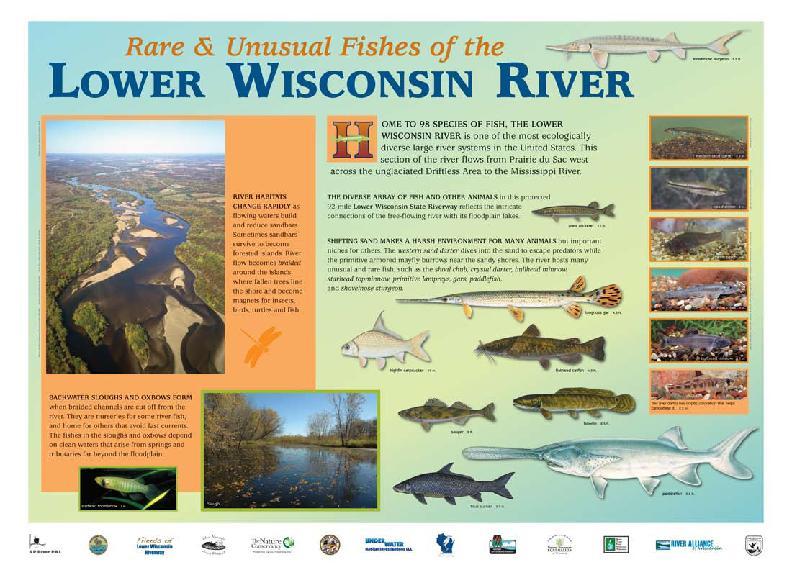
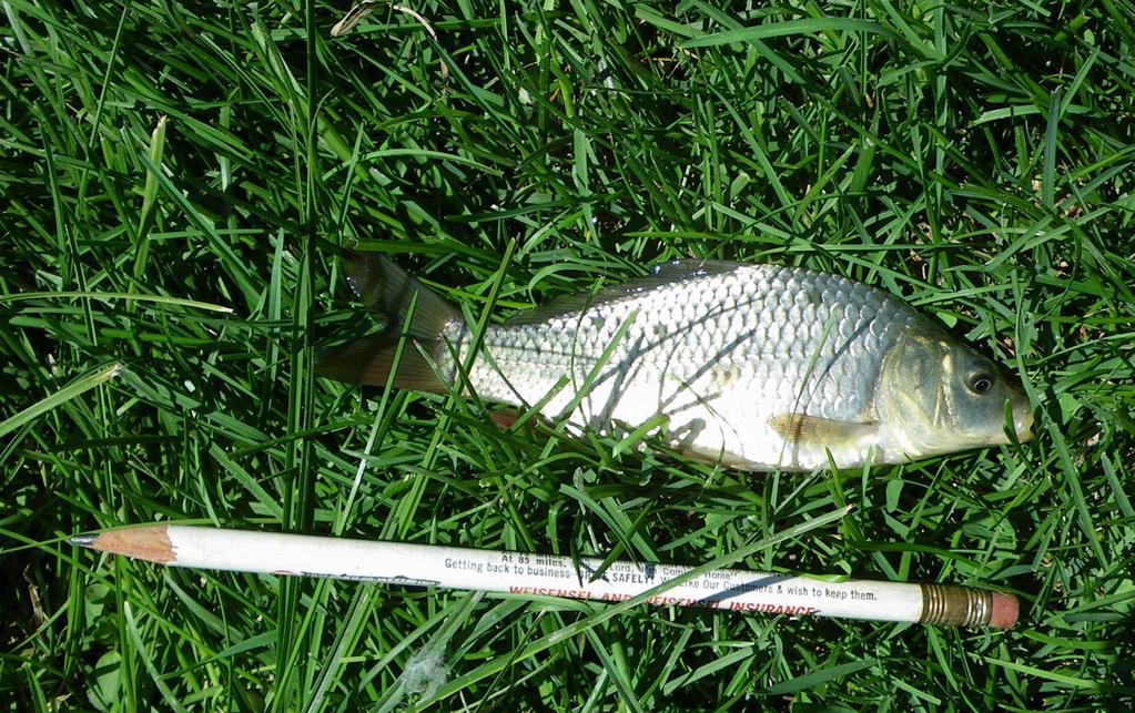
7 Starhead topminnow (Fundulus dispar) State Endangered

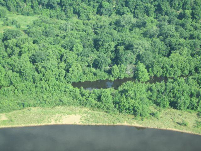
8 Lower Wisconsin River
9
10
11
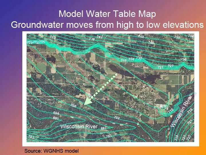
12 Low Flow Modified from Amoros and Bornette 2002 Upland groundwater river oxbow river High flow oxbow Low oxbow dissolved oxygen occurs during summer high flows, (> 1-year storm) and reduced upland groundwater flow Alluvial seepage Flood river oxbow Cutoff channel oxbows become active flowing channels and scouring occurs
13 Depth (m) August Temperature C Profile of Jones Slough

14 Cut-off Channel Oxbow


15 Largemouth bass Bluegill 2 Bluegill Largemouth bass 3 Grass pickerel Mudminnow 4 Mudminnow Grass pickerel 5 Mud darter Starhead t. m. 6 Starhead t. m. Yellow bullhead 7 Warmouth Mud darter 8 Yellow bullhead Tadpole madtom 9 Green sunfish Warmouth 10 Tadpole madtom Green sunfish 1 Bluegill Bluegill 2 Largemouth bass Largemouth bass 3 Grass pickerel Mudminnow 4 Pirate perch Grass pickerel 5 Mudminnow Green sunfish 6 Warmouth Pirate perch 7 Starhead t. m. Starhead t. m. 8 Green sunfish Pumpkinseed 9 Warmouth Yellow bullhead 10 Yellow bullhead Brook silverside 1 Largemouth bass Bluegill 2 Bluegill Largemouth bass 3 Grass pickerel Mudminnow 4 Pirate perch Grass pickerel 5 Mudminnow Pirate perch 6 Mud darter Mud darter 7 Warmouth Warmouth 8 Yellow bullhead Green sunfish 9 Lake chubsucker Yellow bullhead 10 Johnny darter Lake chubsucker Floodplain lakes associate species Pirate perch Mud darter Starhead topminnow
16 Low Flow Modified from Amoros and Bornette 2002 Upland groundwater river oxbow river High flow oxbow Low oxbow dissolved oxygen occurs during summer high flows, (> 1-year storm) and reduced upland groundwater flow Alluvial seepage Flood river oxbow Cutoff channel oxbows become active flowing channels and scouring occurs
17 6/1/2013 6/2/2013 Water Levels and Norton Slough Dissolved Oxygen Levels 6/3/2013 6/4/2013 6/5/2013 6/6/2013 6/7/2013 6/8/2013 6/9/2013 6/10/2013 6/11/2013 6/12/2013 6/13/2013 6/14/2013 6/15/2013 6/16/2013 6/17/2013 6/18/2013 6/19/2013 6/20/2013 6/21/2013 6/22/2013 6/23/2013 6/24/2013 6/25/2013 6/26/2013 6/27/2013 6/28/2013 6/29/2013 6/30/2013 7/1/2013 7/2/2013 7/3/2013 7/4/ ft. 4 8 mg/l W. Q. Criterion River 0 0 Norton D.O.

18 groundwater contamination score = > 30 = HIGHLY Susceptible HIGH MODERATE LOW

19 Norton Slough 2008

20 Norton Slough 2011

21 Sediment deposition was minimal, suggesting scouring during floods and no internal loading.
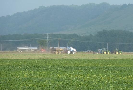
22
23 mg/l NO x Levels /9/2013 5/19/2013 6/1/2013 7/29/2013 8/13/2013 8/20/2013 8/30/2013 0
24 14 SLOH - YSI NO 3 Concentrations mg/l SLOH Meter Minn. NO3 Camargo NO3 USEPA T.N. USGS T.N.

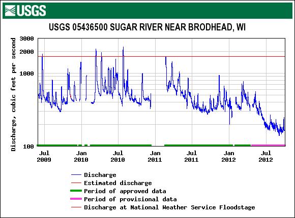
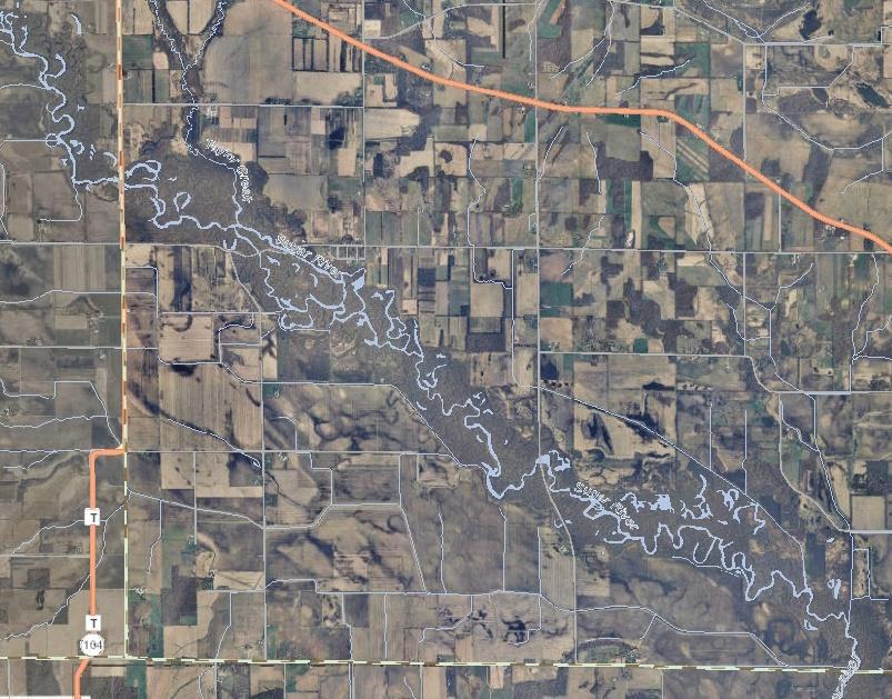
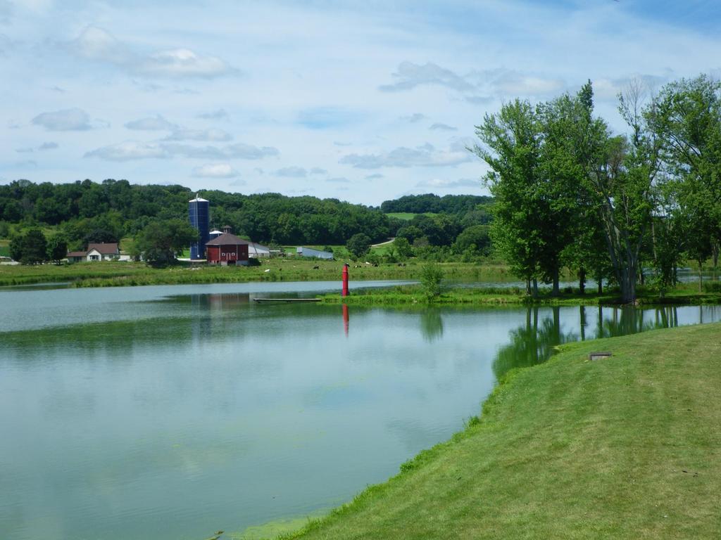
25 Sugar River
26
27
28 Mean Summer Monthly Sugar River Flows and Starhead topminnow Collections Sept. Flow Aug. Flow July Flow June Flow Starhead t. m

29 2010 Shallow wildlife scrape

30 2012 Sugar River oxbow restoration was unsustainable due to shallow depth perched above groundwater.

31 Baraboo River Fish Migration Restored 120 mile long Baraboo River
32
33
34 100 La Valle Slough Chlorophyll and Phosphorus TSI hypereutrophic 60 Chl a 40 TP 20 0 July 2012 Aug 2012 July 2013 Aug 2013
35 La Valle Secchi Data and TSI ft TSI
36 Conclusions I propose that floodplain lakes are the most endangered class of lakes in Wisconsin Their ecosystem functions and lateral connections with rivers are too important to ignore any longer. The Lower Wisconsin River is an example of floodplain lake degradation linked to groundwater contamination The Sugar River is an example of off-channel habitat loss due to floodplain aggradation. Future restorations should consider the importance of groundwater connectivity and quality.
Surveys of Sugar River Sloughs
 Surveys of Sugar River Sloughs River Planning G rant Study UPPE R SU G A R RI V E R W A T E RSH E D ASSO C I A T I O N (USR W A) November 2010 1 Prepared by David W. Marshall Underwater Habitat Investigations
2014 Threatened and Endangered Fish Survey of. East Loon Lake and West Loon Lake. Lake County, Illinois
 2014 Threatened and Endangered Fish Survey of East Loon Lake and West Loon Lake Lake County, Illinois Prepared by Integrated Lakes Management 120 LeBaron St. Waukegan, IL 60085. Chris Ryan Chris Rysso
Advancing Fish Passage in the Menomonee River Watershed
 University of Massachusetts - Amherst ScholarWorks@UMass Amherst International Conference on Engineering and Ecohydrology for Fish Passage International Conference on Engineering and Ecohydrology for Fish
Warm Stream. A Brief Ecological Description of this Michigan River Type
 Warm Stream A Brief Ecological Description of this Michigan River Type Warm Stream segments are defined (by the Michigan Department of Natural Resources, Fisheries Division) as typically having drainage
Stream Crossings I: Does Light in Culverts Affect Movement of Topeka Shiner and Other Fishes?
 University of Massachusetts - Amherst ScholarWorks@UMass Amherst International Conference on Engineering and Ecohydrology for Fish Passage International Conference on Engineering and Ecohydrology for Fish
Caro Impoundment, Tuscola County
 Caro Impoundment is a 200 acre impoundment of the Cass River located one mile south of the Village of Caro in Tuscola County. Caro Dam, originally constructed in 1906 for water supply to Michigan Sugar
Crooked Lake Oakland County (T4N, R9E, Sections 3, 4, 9) Surveyed May James T. Francis
 Surveyed May James T. Francis") Michigan Department of Natural Resources Status of the Fishery Resource Report No. 2004-1, 2004 Crooked Lake Oakland County (T4N, R9E, Sections 3, 4, 9) Surveyed May 2002 James T. Francis Environment Crooked
Michigan Department of Natural Resources Status of the Fishery Resource Report No. 2004-1, 2004 Crooked Lake Oakland County (T4N, R9E, Sections 3, 4, 9) Surveyed May 2002 James T. Francis Environment Crooked
NJ DIVISION OF FISH AND WILDLIFE Bureau of Freshwater Fisheries
 NJ DIVISION OF FISH AND WILDLIFE Bureau of Freshwater Fisheries 2015 Warmwater Reproduction Checks (Shoreline Seining) Alloway Lake (Salem) A seining survey was completed at Alloway Lake (120 acres) on
Lake St. Clair Fish Community and Fishery
 Lake St. Clair Fish Community and Fishery Megan Belore Ontario Ministry of Natural Resources and Forestry Mike Thomas Michigan Department of Natural Resources Fish Community Fish Community Mixture of warm
Thunder Bay River Assessment Appendix. Appendix 2
 Appendix 2 Known past and present fish distributions in the River system. Distribution of fishes were compiled from Bailey et al. (2003) and from records located at the Michigan Department of Natural Resources
Can we attract lake sturgeon to a fishway?
 University of Massachusetts - Amherst ScholarWorks@UMass Amherst International Conference on Engineering and Ecohydrology for Fish Passage International Conference on Engineering and Ecohydrology for Fish
THE LONG-TERM ILLINOIS RIVER FISH POPULATION MONITORING PROGRAM
 T E C H N I C A L R E P O R T THE LONG-TERM ILLINOIS RIVER FISH POPULATION MONITORING PROGRAM Project F-101-R-20 Annual Report to the Illinois Department of Natural Resources Michael A. McClelland and
Assessment of Nearshore Fish Populations in Lake Ripley, Jefferson County, Wisconsin
 Assessment of Nearshore Fish Populations in Lake Ripley, Jefferson County, Wisconsin 2012 Assessment of Nearshore Fish Populations in Lake Ripley, Jefferson County, Wisconsin Contributors: David Marshall,
Fish Communities in Five West Coast Spring-fed Rivers. Brandon Simcox, Eric Johnson, Amanda Schworm, Bill Pouder
 Fish Communities in Five West Coast Spring-fed Rivers Brandon Simcox, Eric Johnson, Amanda Schworm, Bill Pouder Project Overview FWC/SWFWMD partnership 3-yr funded project (thru June 2017) 5 spring-fed
Delaware River Seine Survey: 2012 Sampling Summary
 Delaware River Seine Survey: 2012 Sampling Summary Fish and Wildlife employees pull in the seine net From June 18 to November 21, 2012, biologists conducted the Delaware River Seine Survey. Over the course
HURON RIVER WATERSHED
 Brown bullhead (Ameiurus nebulosus) feeding - larger streams and rivers, lakes and impoundments - clear cool water with little clayey silt - moderate amounts of aquatic vegetation - sand, gravel, or muck
Archer Lake 2011 Survey Report Prepared by Brian Gunderman
 Archer Lake 211 Survey Report Prepared by Brian Gunderman Introduction Archer Lake is a 64 acre lake located about miles southeast of the city of Coldwater. Archer Lake is part of the Coldwater-Marble
The effects of visual and acoustic deterrents to prevent the upstream movement of Asian carps
 University of Massachusetts - Amherst ScholarWorks@UMass Amherst International Conference on Engineering and Ecohydrology for Fish Passage International Conference on Engineering and Ecohydrology for Fish
Great Lakes Coastal Wetland Communities: Vulnerabilities to Climate Change and Response to Adaptation Strategies
 Great Lakes Coastal Wetland Communities: Vulnerabilities to Climate Change and Response to Adaptation Strategies CCAF Wetlands Study Investigators: Susan Doka Fisheries & Oceans, Great Lakes Lab for Fisheries
O Malley s Ponds Population Survey
 O Malley s Ponds Survey The newest fishing lake within the Forest Preserves of Cook County, O Malley Ponds were acquired by the District in 2005. Located in Sauk Village at the intersection of Sauk Trail
Follow this and additional works at:
 University of Massachusetts Amherst ScholarWorks@UMass Amherst International Conference on Engineering and Ecohydrology for Fish Passage International Conference on Engineering and Ecohydrology for Fish
Target Fish Communities and the MA Water Policy
 Target Fish Communities and the MA Water Policy Todd Richards MA Division of Fisheries and Wildlife Todd.Richards@state.ma.us MA Water Policy (2004) Principle: Protect Fish and Wildlife Habitat Recommendation:
Minnesota Department of Natural Resources Division of Fish and Wildlife Section of Fisheries. Stream Survey Report. Three Mile Creek 2011
 Minnesota Department of Natural Resources Division of Fish and Wildlife Section of Fisheries Stream Survey Report Three Mile Creek 2011 By Joseph D. Stewig Montrose Area Fisheries Office TABLE OF CONTENTS
Salmon and Steelhead in the American River Tim Horner, PhD Geology Department California State University, Sacramento
 Salmon and Steelhead in the American River Tim Horner, PhD Geology Department California State University, Sacramento What kind of fish are in the American River? The American River provides habitat for
MISSISSIPPI MAKEOVER A Plan for Restoration, Just Around the Bend
 MISSISSIPPI MAKEOVER A Plan for Restoration, Just Around the Bend Interim Report Card 2013 Project coordinated by the Dakota County Soil and Water Conservation District and sponsored by the Minnesota Pollution
Elk Lake, Antrim and Grand Traverse counties T. 28, 29 N., R. 8, 9 W., Sec. many. Lake surveys. began at 40 feet
 Elk Lake, Antrim and Grand Traverse counties T. 28, 29 N., R. 8, 9 W., Sec. many Physical and chemical data surveyed August 1931 Temperature ( F) Secchi disk (feet) 9. 6 Surface 74 Bottom 45 PH 8.0 Thermocline
Michigan Dept. of Natural Resources Status of the Fishery Resource Report Page 1
 Michigan Dept. of Natural Resources 2014-197 Status of the Fishery Resource Report Page 1 Otter Lake Lapeer and Genesee Counties, T9,10N/R8,9E/ Sections 1,6,7,36 Flint River Watershed, Last surveyed 2014
Columbia Lake Dam Removal Project
 Columbia Lake Dam Removal Project The Columbia Lake dam located 1/4 mile upstream of the Paulins Kill River's confluence with the Delaware River in Knowlton Township, Warren County has been proposed for
Waubee Lake Kosciusko County Fish Management Report 2006
 Waubee Lake Kosciusko County Fish Management Report 2006 Jed Pearson, fisheries biologist Fisheries Section Indiana Department of Natural Resources Division of Fish and Wildlife I.G.C.-South, Room W273
Onondaga Lake Fishery: 2011 Fact Sheet
 October, 2011 Onondaga County Department of Water Environment Protection SUNY College of Environmental Science and Forestry Joanne M. Mahoney, County Executive Tom Rhoads, P.E., Commissioner Onondaga Lake
Passive sorting of invasive sea lamprey in the Great Lakes basin
 University of Massachusetts Amherst ScholarWorks@UMass Amherst International Conference on Engineering and Ecohydrology for Fish Passage International Conference on Engineering and Ecohydrology for Fish
Session C9: Priest Rapids Fish Bypass: A Case Study from Start to Finish
 University of Massachusetts - Amherst ScholarWorks@UMass Amherst International Conference on Engineering and Ecohydrology for Fish Passage International Conference on Engineering and Ecohydrology for Fish
Session B8- Monitoring changes in diadromous populations resulting from fish passage improvements on the Acushnet River, Massachusetts
 University of Massachusetts - Amherst ScholarWorks@UMass Amherst International Conference on Engineering and Ecohydrology for Fish Passage International Conference on Engineering and Ecohydrology for Fish
Cedar Lake Comprehensive Survey Report Steve Hogler and Steve Surendonk WDNR-Mishicot
 Cedar Lake- 2006 Comprehensive Survey Report Steve Hogler and Steve Surendonk WDNR-Mishicot ABSTRACT Cedar Lake is a 142 acre lake located in the southwest corner of Manitowoc County. It is a seepage lake
Little Calumet River Rapid Response Fish Identification and Enumeration Branch Summary Report
 Little Calumet River Rapid Response Fish Identification and Enumeration Branch Summary Report Introduction A rotenone rapid response was completed on a 2.6-mile section of the Little Calumet River immediately
Follow this and additional works at:
 University of Massachusetts - Amherst ScholarWorks@UMass Amherst International Conference on Engineering and Ecohydrology for Fish Passage International Conference on Engineering and Ecohydrology for Fish
Electrofishing Surveys Shed Light on Dynamic Millstone River Fishery. By Shawn Crouse, Principal Fisheries Biologist
 Electrofishing Surveys Shed Light on Dynamic Millstone River Fishery By Shawn Crouse, Principal Fisheries Biologist It is June, 2018 and American Shad have been on the move! Great efforts are being made
Inventory # Perch Lake
 Inventory # 9-036 Perch Lake Perch Lake is a double-basin lake. The southern, shallow portion of the lake is 414 acres, making it the largest wild rice lake on the Reservation. The fish communities sampled
Fisheries Survey of Saratoga Lake
 Fisheries Survey of Saratoga Lake 7- Mark D. Cornwell Kevin Poole State University of New York College of Agriculture & Technology Department of Fisheries & Wildlife Cobleskill, NY ABSTRACT: This survey
Bode Lake - South Population Survey
 Bode Lake - South Survey Located in Hoffman Estates on the north side of Bode Rd. 1 mile west of Barrington Rd. Bode Lake is made up of two lakes along Poplar Creek; the larger and deeper Bode Lake South
Concurrent Sessions B: Columbia River Passage - Hydroturbine Passage Related Barotrauma Research in the Columbia River Basin: How Far Have We Come?
 University of Massachusetts - Amherst ScholarWorks@UMass Amherst International Conference on Engineering and Ecohydrology for Fish Passage International Conference on Engineering and Ecohydrology for Fish
FACT SHEET I. LOCATION
 STEAMBOAT ISLAND HABITAT REHABILITATION AND ENHANCEMENT PROJECT (HREP) SCOTT COUNTY, IOWA, UPPER MISSISSIPPI RIVER RESTORATION-ENVIRONMENTAL MANAGEMENT PROGRAM ROCK ISLAND DISTRICT FACT SHEET I. LOCATION
HOT SPRINGS VILLAGE LAKES
 HOT SPRINGS VILLAGE LAKES BILL STAGGS PUBLIC WORKS DIRECTOR BRADLEY J. MEREDITH LAKES ECOLOGY & FISHERIES MANAGER Photos by Bradley J. Meredith and Katy Harmon LAKES IMPROVEMENT PLAN STAFFING CAPITAL IMPROVEMENTS
NURSERY POND Fish Management Report. Jason C. Doll Assistant Fisheries Biologist
 NURSERY POND 2004 Fish Management Report Jason C. Doll Assistant Fisheries Biologist FISHERIES SECTION INDIANA DEPARTMENT OF NATURAL RESOURCES DIVISION OF FISH AND WILDLIFE I.G.C. South, Room W273 402
Installation of Successful Combined Denil Fishway and Eelway at Upper Mystic Lake, MA
 University of Massachusetts Amherst ScholarWorks@UMass Amherst International Conference on Engineering and Ecohydrology for Fish Passage International Conference on Engineering and Ecohydrology for Fish
Fish Survey of Goose Lake (ID # ), Ramsey County, Minnesota in 2012
, Ramsey County, Minnesota in 2012") Softshell Turtle from Goose Lake, July 2012 Fish Survey of Goose Lake (ID #62-0034), Ramsey County, Minnesota in 2012 Survey Dates: July 16-18, 2012 MnDNR Permit Number: 18362 Prepared for: VLAWMO and
Softshell Turtle from Goose Lake, July 2012 Fish Survey of Goose Lake (ID #62-0034), Ramsey County, Minnesota in 2012 Survey Dates: July 16-18, 2012 MnDNR Permit Number: 18362 Prepared for: VLAWMO and
The relationship between the spatial distribution of common carp and their environmental DNA in a small lake
 The relationship between the spatial distribution of common carp and their environmental DNA in a small lake Jessica Eichmiller*, Przemyslaw Bajer, and Peter Sorensen Department of Fisheries, Wildlife,
Methods for Evaluating Shallow Water Habitat Restoration in the St. Clair River
 Methods for Evaluating Shallow Water Habitat Restoration in the St. Clair River Objectives Document fish use of restoration sites Spawning Presence of larvae, juvenile, and adult fish Quantify differences
LAKE PLEASANT Steuben County 2006 Fish Management Report. Larry A. Koza Assistant Fisheries Biologist
 LAKE PLEASANT Steuben County 2006 Fish Management Report Larry A. Koza Assistant Fisheries Biologist Fisheries Section Indiana Department of Natural Resources Division of Fish and Wildlife I.G.C.-South,
Follow this and additional works at:
 University of Massachusetts - Amherst ScholarWorks@UMass Amherst International Conference on Engineering and Ecohydrology for Fish Passage International Conference on Engineering and Ecohydrology for Fish
Quillback (Carpoides cyprinus)
") t. Joseph Assessment Appendix Quillback (Carpoides cyprinus) feeding - clear to turbid water - Michigan - sand, sandy gravel, sandy silt, or clay-silt substrate - medium- to low-gradient rivers and streams;
t. Joseph Assessment Appendix Quillback (Carpoides cyprinus) feeding - clear to turbid water - Michigan - sand, sandy gravel, sandy silt, or clay-silt substrate - medium- to low-gradient rivers and streams;
Big Bend Lake Population Survey
 Big Bend Lake Survey Located in Des Plaines on East River Rd. just south of Golf Rd. This 27 acre body of water has a depth of 27.8 feet; however because it is connected to the Des Plaines River by a spillway,
Session B7 - Santee-Cooper: A Lock on Fish Passage Success
 University of Massachusetts - Amherst ScholarWorks@UMass Amherst International Conference on Engineering and Ecohydrology for Fish Passage International Conference on Engineering and Ecohydrology for Fish
SUMMARY REPORT FOR LAKE ST. MALO FISHERIES ASSESSMENT. Prepared for the St. Malo and District Wildlife Association
 SUMMARY REPORT FOR LAKE ST. MALO FISHERIES ASSESSMENT Prepared for the St. Malo and District Wildlife Association Presented by August 25, 2014 Study dates thus far: Date Tasks February 16 Fishing derby;
Unintended Fishway Passage and Transport of Native and Non-Native Lampreys (Petromyzontidae)
") University of Massachusetts - Amherst ScholarWorks@UMass Amherst International Conference on Engineering and Ecohydrology for Fish Passage International Conference on Engineering and Ecohydrology for Fish
University of Massachusetts - Amherst ScholarWorks@UMass Amherst International Conference on Engineering and Ecohydrology for Fish Passage International Conference on Engineering and Ecohydrology for Fish
Fisheries Survey of White Rapids Flowage, Marinette County Wisconsin during Waterbody Identification Code
 Fisheries Survey of White Rapids Flowage, Marinette County Wisconsin during 25 Waterbody Identification Code 6343 Michael Donofrio Fisheries Supervisor Wisconsin Department of Natural Resources Peshtigo,
DOW# West Twin Lake
 DOW# 69-0696 West Twin Lake West Twin Lake has a surface area of 120.4 acres and is located on the east side of St. Louis County Road 31, south of Highway 2. West Twin Lake has a maximum depth of 18 feet
Tahquamenon River Assessment Appendix
 DNR DEPARTMENT OF NATURAL RESOURCES MICHIGAN STATE OF MICHIGAN DEPARTMENT OF NATURAL RESOURCES SR45 Appendix February 2008 Tahquamenon River Assessment Appendix James R. Waybrant and Troy G. Zorn www.michigan.gov/dnr/
Fisheries and Lake Management Planning. CAP Mtg Nov21,2012 Brett Tregunno Aquatic Biologist, Kawartha Conservation
 Fisheries and Lake Management Planning CAP Mtg Nov21,2012 Brett Tregunno Aquatic Biologist, Kawartha Conservation Outline Aquatic Habitat Types Fish Communities Significance of Resource Current Management
Fish Passage Studies I: Evaluation of Lake Sturgeon Passed through the Whooshh Fish Transport System
 University of Massachusetts - Amherst ScholarWorks@UMass Amherst International Conference on Engineering and Ecohydrology for Fish Passage International Conference on Engineering and Ecohydrology for Fish
Pennsylvania Fish & Boat Commission Biologist Report. Wilmore Dam. Cambria County. May 2011 Trap Net, Electrofishing and Hoop Net Survey
 Pennsylvania Fish & Boat Commission Biologist Report Wilmore Dam Cambria County May 2011 Trap Net, Electrofishing and Hoop Net Survey Wilmore Dam is a 195 acre impoundment located in central Cambria County
Alcona Dam Pond Alcona County (T25N, R5E, Sections various) Surveyed June 6-12 and September 16, 2003
 Surveyed June 6-12 and September 16, 2003") Michigan Department of Natural Resources Status of the Fishery Resource Report No. 2004-6, Year 2004 Alcona Dam Pond Alcona County (T25N, R5E, Sections various) Surveyed June 6-12 and September 16, 2003
Michigan Department of Natural Resources Status of the Fishery Resource Report No. 2004-6, Year 2004 Alcona Dam Pond Alcona County (T25N, R5E, Sections various) Surveyed June 6-12 and September 16, 2003
 example, the abundance of a given fish species in a basin can be validly estimated using the MBSS design. Because first, second, and third order streams represent about 90% of the tidal and non-tidal stream
Preakness Brook - FIBI098
 Preakness Brook - FIBI098 Preakn ess B rook Preakness " ( FIBI098 Naachtpunkt Brook 202 80 IBI Ratings FIBI Sampling Location Excellent Small Streams (1st and 2nd Order) Good Fair Large Streams (3rd Order
Successful downstream passage of juvenile salmonids at a run-of-river hydro project in the Pacific Northwest
 University of Massachusetts Amherst ScholarWorks@UMass Amherst International Conference on Engineering and Ecohydrology for Fish Passage International Conference on Engineering and Ecohydrology for Fish
Cool (or Warm-transitional) Stream
 Stream") Cool (or Warm-transitional) Stream A Brief Ecological Description of this Michigan River Type Cool Stream segments are defined (by the Michigan Department of Natural Resources, Fisheries Division) as typically
Cool (or Warm-transitional) Stream A Brief Ecological Description of this Michigan River Type Cool Stream segments are defined (by the Michigan Department of Natural Resources, Fisheries Division) as typically
Bear Lake. Final Results Portage County Lake Study. March 31, University of Wisconsin-Stevens Point, Portage County Staff and Citizens
 Bear Lake Final Results Portage County Lake Study March 31, 2005 University of Wisconsin-Stevens Point, Portage County Staff and Citizens What can you learn from this study? You can learn a wealth of valuable
Penny Road Pond Population Survey
 Located in Barrington Hills on the south side of Penny Rd. west of Old Sutton Rd. This small 7 acre pond has a maximum depth of 4.6 feet and is connected to Spring Creek. The fish population of Penny Road
LAKE DIANE Hillsdale County (T8-9S, R3W, Sections 34, 3, 4) Surveyed May Jeffrey J. Braunscheidel
 Surveyed May Jeffrey J. Braunscheidel") Michigan Department of Natural Resources Status of the Fishery Resource Report No. 2003-4, 2003 LAKE DIANE Hillsdale County (T8-9S, R3W, Sections 34, 3, 4) Surveyed May 2001 Jeffrey J. Braunscheidel Environment
Michigan Department of Natural Resources Status of the Fishery Resource Report No. 2003-4, 2003 LAKE DIANE Hillsdale County (T8-9S, R3W, Sections 34, 3, 4) Surveyed May 2001 Jeffrey J. Braunscheidel Environment
Stream Crossings I: Engineering and Design Approaches to Provide Fish Passage at Culvert Slipline Projects in Connecticut
 University of Massachusetts - Amherst ScholarWorks@UMass Amherst International Conference on Engineering and Ecohydrology for Fish Passage International Conference on Engineering and Ecohydrology for Fish
Michigan Department of Natural Resources Status of the Fishery Resource Report Page 1
 Michigan Department of Natural Resources 29-72 Status of the Fishery Resource Report Page 1 Hart's Lake Calhoun County, T2S R8W S7 Surveyed June and August 28 Kregg Smith, Fisheries Biologist Environment
Penobscot II: Penobscot Indian Nation: Land Management and Stream Connectivity
 University of Massachusetts Amherst ScholarWorks@UMass Amherst International Conference on Engineering and Ecohydrology for Fish Passage International Conference on Engineering and Ecohydrology for Fish
Michigan Department of Natural Resources Status of the Fishery Resource Report Page 1
 Michigan Department of Natural Resources 2008-59 Status of the Fishery Resource Report Page 1 Bowens Manistee County, (T24N R16W Sec. 11, 12, 13, 14, 15, 24, and 30). Last surveyed 2008 Mark A. Tonello
Wampum Lake Population Survey
 Wampum Lake Survey Located in Thornton on Thornton-Lansing Rd. 1½ mile west of Torrence Ave. Wampum Lake is 35 acres is size and has a maximum depth of 14.1 feet. Northern pike, largemouth bass, bluegill,
Potomac River Water Quality: Current Status & Trends
 Potomac River Water Quality: Current Status & Trends Tom Parham Maryland Department of Natural Resources November 13 th, 2014 Presentation Overview 2014 Chesapeake Bay Dissolved Oxygen Conditions Historic
An Assessment of the Fish Community in Lake Acworth
 An Assessment of the Fish Community in Lake Acworth By John Damer Fisheries Biologist Georgia Department of Natural Resources Wildlife Resources Division Fisheries Section Calhoun, GA 30701 July 2008 Introduction
Minnesota Department of Natural Resources Division of Fish and Wildlife Section of Fisheries. Stream Survey Report. St. Francis River 2004
 Minnesota F-29-R(P)-17 Area 315 Study 3 April 2005 Minnesota Department of Natural Resources Division of Fish and Wildlife Section of Fisheries Stream Survey Report St. Francis River 2004 By Eric R. Altena
Refined Designated Uses for the Chesapeake Bay and Tidal Tributaries
 A-1 appendixa Refined Designated Uses for the Chesapeake Bay and Tidal Tributaries BACKGROUND Federal water quality standards regulations establish that states must specify appropriate water uses to be
Maple Lake Population Survey
 Maple Lake Survey Located in Willow Springs approximately 1 mile west of Willow Springs Rd. (104 th Ave.) at Wolf Rd. and 95 th St. Constructed in the 1920 s this 60 acre lake drops down to 20.4 feet in
LAKE MANAGEMENT PLAN
 LAKE MANAGEMENT PLAN Region Area DOW Number County DOW Lake Name Acreage 2 Duluth F213 69-0041 St. Louis Bassett DOW: 436 Plan: 442 Long Range Goal: Manage for walleye with a gillnet catch rate greater
Tittabawassee River Assessment. Miles. Gladwin Smallwood Impoundment. Harrison. Clare. Midland. Mt. Pleasant. St. Louis. Saginaw.
 Warmouth Lepomis gulosus feeding - clear lakes and impoundments and very low-gradient streams - abundant aquatic vegetation - silt-free water - mucky substrate often covered with organic debris spawning
Sag Quarry - West Population Survey
 Located in Lemont on RT 83 and Archer Ave. just north of 111 th St. Like Sag Quarry East, this lake is an old limestone quarry, 14 acres in size and with a maximum depth of 10.3 feet. The species found
SUMMARY OF RESULTS FIBI054
 SUMMARY OF RESULTS FIBI054 1. Stream Name: Lamington River 2. Sampling Date: 7/10/2007 3. Sampling Location: McCann Mill Road 4. Municipality Tewksbury Township 5. County: Hunterdon 6. Watershed Management
Whooshh Fish Passage- Results from 2016
 University of Massachusetts Amherst ScholarWorks@UMass Amherst International Conference on Engineering and Ecohydrology for Fish Passage International Conference on Engineering and Ecohydrology for Fish
KICKAPOO LAKE Shakamak State Park Sullivan, Greene, and Clay Counties 2009 Fish Management Report. David S. Kittaka Fisheries Biologist
 KICKAPOO LAKE Shakamak State Park Sullivan, Greene, and Clay Counties 2009 Fish Management Report David S. Kittaka Fisheries Biologist Fisheries Section Indiana Department of Natural Resources Division
Importance of Temperature and Flow for Fish in Connecticut Streams
 Importance of Temperature and Flow for Fish in Connecticut Streams Chris Bellucci, CT DEEP Water Monitoring and Assessment Program Climate Change Conference, Litchfield, CT September 23, 2016 Today s Talk
Quarry Lakes Fisheries Report EBRPD Fisheries Department. Joe Sullivan Fisheries Resource Analyst Peter Alexander Fisheries Program Manager
 Quarry Lakes Fisheries Report 2011 EBRPD Fisheries Department Joe Sullivan Fisheries Resource Analyst Peter Alexander Fisheries Program Manager Introduction The purpose of this report is to give lake supervisors
(/ Neshanic River - FIBI023 "! 3 1. ø ø 52 3 ø 57 9 FIBI023
 Neshanic River - FIBI023 Drainage Area of FIBI023: 23.1 Square Miles Surface Water Quality Classification of FIBI023: FW2-NT ø 52 3 ø 57 9 Neshanic River (/ 20 2 FIBI023 % #S Neshanic River Back Brook
APPENDIX A. Stream Electrofishing Survey Data (2015)
") APPENDIX A Stream Electrofishing Survey Data (2015) This section of the report includes stream survey data completed by the Bureau of Freshwater Fisheries in 2015. All surveys, unless specifically noted
APPENDIX A Stream Electrofishing Survey Data (2015) This section of the report includes stream survey data completed by the Bureau of Freshwater Fisheries in 2015. All surveys, unless specifically noted
Quemahoning Reservoir
 Pennsylvania Fish & Boat Commission Biologist Report Quemahoning Reservoir Somerset County May 2011 Trap Net, Gill Net and Electrofishing Survey Quemahoning Reservoir is an 899 acre impoundment located
LITTLE WHITE OAK Knox County 2006 Fish Management Report. Debbie King Assistant Fisheries Biologist
 LITTLE WHITE OAK Knox County 2006 Fish Management Report Debbie King Assistant Fisheries Biologist Fisheries Section Indiana Department of Natural Resources Division of Fish and Wildlife I.G.C.-South,
McGinty Slough Population Survey
 Located in Lemont, north of 131 st St and west of Will-Cook Rd. and is 38 acres with a depth of 8.2 feet. This lake is walk in access only, to access the lake walk the multi-use trail ether from 131 st
Notes from Fish Community Assessments and a Plan to Protect Wild Brook Trout Populations and their Habitats within the Warner River Watershed
 Notes from Fish Community Assessments and a Plan to Protect Wild Brook Trout Populations and their Habitats within the Warner River Watershed New Hampshire Fish and Game Department Basil W. Woods, Jr.
(/ North Branch Raritan River - FIBI031 % FIBI031
 North Branch Raritan River - FIBI031 Drainage Area of FIBI031: 172.7 Square Miles Surface Water Quality Classification of FIBI031: FW2-NT.-,7 8.-,287 (/ 20 2 North Branch Raritan Chambers Brook (/ 2 2
Lamprey River Watershed. Fish Surveys
 1 Lamprey River Watershed Fish Surveys Report to the Lamprey River Advisory Committee New Hampshire Fish and Game Inland Fisheries Fish Conservation Program July 30, 2012 2 Contents INTRODUCTION... 4 METHODS...
Follow this and additional works at:
 University of Massachusetts Amherst ScholarWorks@UMass Amherst International Conference on Engineering and Ecohydrology for Fish Passage International Conference on Engineering and Ecohydrology for Fish
2014 Island Lake Survey June 13 th, 2014 Andrew Plauck District Fisheries Biologist Report Prepared 4 March 2015
 2014 Island Lake Survey June 13 th, 2014 Andrew Plauck District Fisheries Biologist Report Prepared 4 March 2015 BACKGROUND - A fish survey was requested due to a moderately severe winterkill in Island
I Region I Area I DOW Number / County I DOW Lake Name I Acreage I
 LAKE MANAGEMENT PLAN 814 Bp I Region I Area I DOW Number / County I DOW Lake Name I Acreage I I I # I f 2 Duluth F213 690036 St Louis Salo DOW:149 Plan: 137 Long Range Goal: Manage for walleye with a gillnet
BEAVER DAM LAKE Kosciusko County 2005 Fish Management Report. Angela C. Benson Assistant Biologist
 BEAVER DAM LAKE Kosciusko County 2005 Fish Management Report Angela C. Benson Assistant Biologist Fisheries Section Indiana Department of Natural Resources Division of Fish and Wildlife I.G.C.-South, Room
Michigan Dept. of Natural Resources Status of the Fishery Resource Report Page 1. Weber Lake Cheboygan County, T34N, R3W, Sec.
 Michigan Dept. of Natural Resources 2012-143 Status of the Fishery Resource Report Page 1 Weber Lake Cheboygan County, T34N, R3W, Sec. 31 Neal Godby, Fisheries Biologist Environment Weber Lake is a 28.5-acre