Mecklenburg County. Fish Consumption Advisories A Local Government Perspective
|
|
|
- Mark Atkinson
- 5 years ago
- Views:
Transcription


1 Mecklenburg County Fish Consumption Advisories A Local Government Perspective David Caldwell Charlotte-Mecklenburg Storm Water Services Water Quality Program NCLMS October 4, 2012

2 Lake monitoring program established in 1963 WQ Program established in 1969 WQ Program becomes part of Storm Water Services in 2001 CLEAN WATER IS OUR GOAL! US Whitewater Center (under construction March 2006)

3 Catawba River System Lake Hickory Lake Rhodhiss Morganton Hickory Lake James Marion Lookout Shoals Lake Statesville Lake Norman N N.C. S.C. Mountain Island Lake Gastonia Lake Wylie Fishing Creek Lake Rock Hill Lake Charlotte Mecklenburg

4 Lake Norman Year Impounded = 1963 Surface Area = 32,510 acres Shoreline Miles = 520 Average Depth = 33.5 feet Maximum Depth = 110 feet Retention Time = 207 days (average)

5 Mtn. Island Lake Year Impounded = 1924 Surface Area = 2,788 acres Shoreline Miles = 61 Average Depth = 17.7 feet Maximum Depth = 58 feet Retention Time = 11 days

6 Withdrawing an average 85 MGD Charlotte-Mecklenburg drinking water intake on Mountain Island Lake

7 Lake Wylie (South Carolina) Year Impounded = 1904 Surface Area = 12,139 acres Shoreline Miles = 327 Average Depth = 23 feet Maximum Depth = 93 feet Retention Time = 35 days (average) 7


8 What do we do? Plan and implement measures to protect and restore surface waters Implement activities to ensure compliance with Phase I and II storm water requirements (education, facility and BMP inspections, erosion control, etc) Respond to over 600 citizen requests per year Enforcement of local and state water quality regulations Numerous monitoring programs including lake and stream, physical, chemical, and biological Lake Wylie in South Carolina Lake Wylie Dam


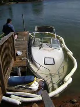
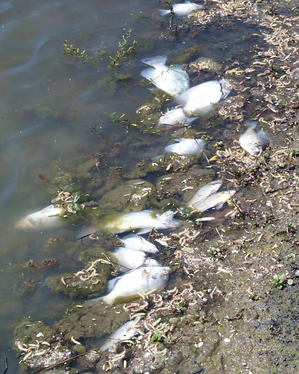
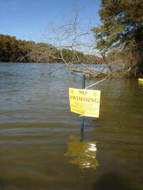

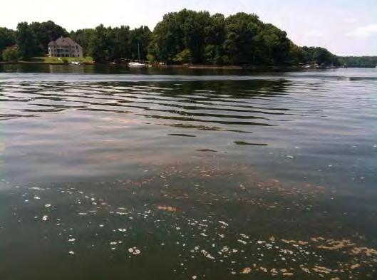
9 Lake Issues

10 Lake Monitoring Program Lake Norman 6 sites Lake Cornelius 1 site Lake Davidson 1 site Mtn. Island Lake 10 sites Lake Wylie 11 sites
")
11 Field Measurements Temperature Dissolved Oxygen Conductivity ph Turbidity Chlorophyll a Secchi Disk (clarity measurement)

12 Chemical Analysis of Water Fecal Coliform Bacteria Alkalinity Ammonia Nitrogen Nitrate / Nitrite Total Kjeldahl Nitrogen Total Phosphorus Total Suspended Solids Total Solids Copper, Zinc, Chromium, Lead, Mercury, Manganese, Selenium, Nickel, Cadmium, Arsenic, Iron, Barium VOCs

13 So What About the Fish? Mecklenburg County - fish program since Includes only the streams and its purpose is to assess water quality based on population diversity Historically, no fish monitoring in the lakes. Rely on NCDENR for tissue assessments 13

14 14
15 Storm Water Services Involvement Assisted the NC DHHS with Citizen Notification Partnership with NC DWQ to collect and test fish, and assist with funding 15

16 Why get involved? 857,301 freshwater fishing licenses issued in North Carolina 31,534 issued to Mecklenburg County residents 16
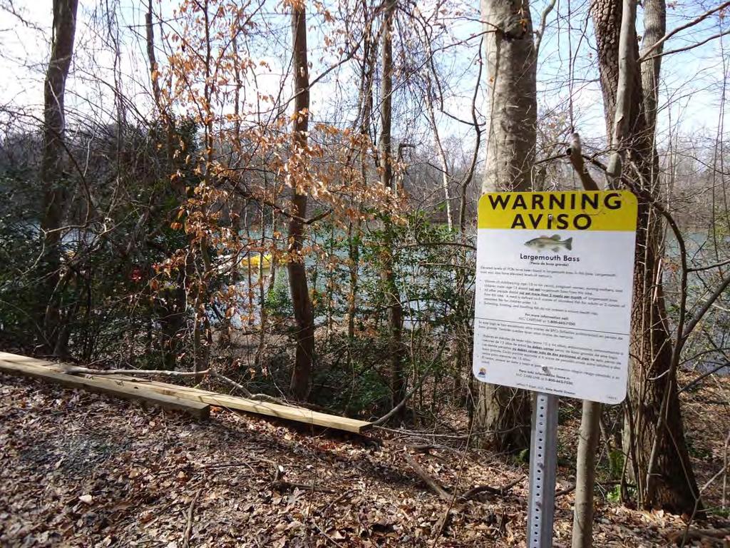
17 Citizen Notification Water bill mailing to over 220,000 citizens Distribution and posting of advisory signs Creation and distribution of informational flyers Distribution of information to Marine Commissions Posting of advisories on local website 17

18 18
19 Monitoring Partnership Purpose: Test fish that are popular for consumption Where: Lake Norman, Mountain Island Lake, Lake Wylie Species: Norman (6), Mountain Island (3), Wylie (4) Contaminants Tested: PCB, Mercury, Arsenic, Selenium 19


20 Fish Collection Electro shocking boat Setting Trot lines 20


21 Fish Collection Catfish collected on Mtn. Island Bass are measured and recorded Crappie collected on Mtn. Island 21
22 Testing Results 0.07 Lake Norman PCB Levels in Fish Tissue - July Parts Per Million (ppm) NC ACTION LEVEL Blue Catfish Black Crappie White Perch Channel Catfish Flathead Catfish Spotted Bass Composite Samples- July
23 Testing Results 0.07 Mtn. Island Lake PCB Levels in Fish Tissue - July Parts Per Million (ppm) NC ACTION LEVEL Blue Catfish Black Crappie White Perch Composite Samples - July
24 Testing Results 0.09 Lake Wylie PCB Levels in Fish Tissue - July Parts Per Million (ppm) NC ACTION LEVEL Channel Catfish Largemouth Bass Black Crappie White Perch Composite Samples - July
25 25
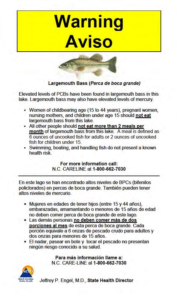
26 What Advisories are in Effect? # Species Location Contaminant Issued 5 Statewide Mercury Statewide south & east of I-85 1 Lake Wylie (SC) 2 Mountain Island Lake 1 Lake Wylie (NC) Mercury 2008 PCB 2011 PCB 2011 PCB
27 27
28 Conclusions NC DHHS requested additional collection and testing of blue catfish in Mtn. Island Lake. These fish were collected this past August and results are pending. 28
29 ? 29
Schedule of Accreditation issued by United Kingdom Accreditation Service 2 Pine Trees, Chertsey Lane, Staines-upon-Thames, TW18 3HR, UK
 2 Pine Trees, Chertsey Lane, Staines-upon-Thames, TW18 3HR, UK Mohammed Abdulmohsin Al-Kharafi & Sons for General Trading, General Contracting & Industrial Structures W.L.L. trading as MAK Sulaibiya Testing
Mill Creek/Rose Valley Watershed General Information Presented by Dr. Mel Zimmerman Lycoming College CWI
 Mill Creek/Rose Valley Watershed General Information Watershed Concerns Rose Valley Lake Areas of Interest Biodiversity of Interest in Rose Valley Lake Rose Valley Lake Bird Area Fishes of Rose Valley
MISSISSIPPI MAKEOVER A Plan for Restoration, Just Around the Bend
 MISSISSIPPI MAKEOVER A Plan for Restoration, Just Around the Bend Interim Report Card 2013 Project coordinated by the Dakota County Soil and Water Conservation District and sponsored by the Minnesota Pollution
LAKE DIANE Hillsdale County (T8-9S, R3W, Sections 34, 3, 4) Surveyed May Jeffrey J. Braunscheidel
 Surveyed May Jeffrey J. Braunscheidel") Michigan Department of Natural Resources Status of the Fishery Resource Report No. 2003-4, 2003 LAKE DIANE Hillsdale County (T8-9S, R3W, Sections 34, 3, 4) Surveyed May 2001 Jeffrey J. Braunscheidel Environment
Michigan Department of Natural Resources Status of the Fishery Resource Report No. 2003-4, 2003 LAKE DIANE Hillsdale County (T8-9S, R3W, Sections 34, 3, 4) Surveyed May 2001 Jeffrey J. Braunscheidel Environment
Pennsylvania Fish & Boat Commission Biologist Report. Wilmore Dam. Cambria County. May 2011 Trap Net, Electrofishing and Hoop Net Survey
 Pennsylvania Fish & Boat Commission Biologist Report Wilmore Dam Cambria County May 2011 Trap Net, Electrofishing and Hoop Net Survey Wilmore Dam is a 195 acre impoundment located in central Cambria County
LEARN MORE OUR RESEARCH QUESTIONS WHAT WE DID THIS BROCHURE. GRAND LAKE WATERSHED MERCURY STUDY Our study website
 LEARN MORE GRAND LAKE WATERSHED MERCURY STUDY Our study website http://www.grandlakemercurystudy.org KS OK GRAND LAKE Grand Lake watershed What s in your fish? fact sheet http://www.grandlakemercurystudy.org/whats_in_your_fish.pdf
NC DIVISION OF WATER RESOURCES (NCDWR) THIRD ROUND OF DAN RIVER FISH TISSUE METALS FOLLOWING
 THIRD ROUND OF DAN RIVER FISH TISSUE METALS FOLLOWING") NC DIVISION OF WATER RESOURCES (NCDWR) THIRD ROUND OF DAN RIVER FISH TISSUE METALS FOLLOWING THE EDEN COAL ASH SPILL (10 MONTH POST-SPILL ASSESSMENT), MAY 18, 2015. Key Findings Results for the NCDWR s
NC DIVISION OF WATER RESOURCES (NCDWR) THIRD ROUND OF DAN RIVER FISH TISSUE METALS FOLLOWING THE EDEN COAL ASH SPILL (10 MONTH POST-SPILL ASSESSMENT), MAY 18, 2015. Key Findings Results for the NCDWR s
CANTON RESERVOIR 5-YEAR FISHERIES MANAGEMENT PLAN
 CANTON RESERVOIR 5-YEAR FISHERIES MANAGEMENT PLAN NORTHWEST REGION OKLAHOMA DEPARTMENT OF WILDLIFE CONSERVATION PREPARED BY: JOHN STAHL, REGIONAL FISHERIES SUPERVISOR TY HARPER, FISHERIES BIOLOGIST Canton
NURSERY POND Fish Management Report. Jason C. Doll Assistant Fisheries Biologist
 NURSERY POND 2004 Fish Management Report Jason C. Doll Assistant Fisheries Biologist FISHERIES SECTION INDIANA DEPARTMENT OF NATURAL RESOURCES DIVISION OF FISH AND WILDLIFE I.G.C. South, Room W273 402
Fish were collected in April September 2013 by the Fisheries and Wildlife Division staff at DOEE.
 Fish were collected in April September 2013 by the Fisheries and Wildlife Division staff at DOEE. US EPA Guidance for Assessing Chemical Contaminant Data for Use in Fish Advisories Volume 1: Fish Sampling
A routine tissue monitoring program was identified as a key gap in NJ s Long-term Monitoring and Assessment Strategy
 A routine tissue monitoring program was identified as a key gap in NJ s Long-term Monitoring and Assessment Strategy Goal is to provide annual, cost-efficient monitoring Monitoring designs (Targeted and
Quemahoning Reservoir
 Pennsylvania Fish & Boat Commission Biologist Report Quemahoning Reservoir Somerset County May 2011 Trap Net, Gill Net and Electrofishing Survey Quemahoning Reservoir is an 899 acre impoundment located
CARL BLACKWELL LAKE MANAGEMENT PLAN
 CARL BLACKWELL LAKE MANAGEMENT PLAN Background Lake Carl Blackwell impounds Stillwater Creek, 10 miles west of Stillwater in Payne County, Oklahoma (Figure 1). The lake covers 3,370 surface acres and was
LITTLE WHITE OAK Knox County 2006 Fish Management Report. Debbie King Assistant Fisheries Biologist
 LITTLE WHITE OAK Knox County 2006 Fish Management Report Debbie King Assistant Fisheries Biologist Fisheries Section Indiana Department of Natural Resources Division of Fish and Wildlife I.G.C.-South,
Elk Lake, Antrim and Grand Traverse counties T. 28, 29 N., R. 8, 9 W., Sec. many. Lake surveys. began at 40 feet
 Elk Lake, Antrim and Grand Traverse counties T. 28, 29 N., R. 8, 9 W., Sec. many Physical and chemical data surveyed August 1931 Temperature ( F) Secchi disk (feet) 9. 6 Surface 74 Bottom 45 PH 8.0 Thermocline
SOONER LAKE MANAGEMENT PLAN
 SOONER LAKE MANAGEMENT PLAN Background Lake Sooner impounds Greasy Creek, 15 miles south of Ponca City in Noble and Pawnee Counties, Oklahoma (Figure 1). The Grease Creek basin that Sooner Lake impounds
APPENDIX A: Sources of Pollutants in Urban Areas.
 APPENDIX A: Sources of Pollutants in Urban Areas. Robert Pitt, Roger Bannerman, Shirley Clark and Derek Williamson Oversize tables from Chapters 23 and 24. 507 508 Oversize table from Chapter 23. Table
Fisheries Resources in White Pine County
 Fisheries Resources in White Pine County June 22, 2013 Update to the Nevada Board of Wildlife Commissioners Jon C. Sjöberg Chief of Fisheries Comins Lake Located 7 miles south of Ely. Built in 1953 as
Keystone Lakes November 20, 2014
 FISH SURVEY REPORT Keystone Lakes November 20, 2014 Prepared for: Keystone HOA 6231 Shoreham Drive Evansville, IN 47711 Prepared by: Aquatic Control Inc. P.O. Box 100 Seymour, IN 47274 November 2015 -
Are human consumers potentially at risk from toxic chemicals in Casco Bay fish and shellfish?
 8 Are human consumers potentially at risk from toxic chemicals in Casco Bay fish and shellfish? Background Through the process of bioaccumulation (see Chapter 1) toxic metals and organic chemicals present
Columbia Lake Dam Removal Project
 Columbia Lake Dam Removal Project The Columbia Lake dam located 1/4 mile upstream of the Paulins Kill River's confluence with the Delaware River in Knowlton Township, Warren County has been proposed for
DRIPPING SPRINGS LAKE 5 YEAR LAKE MANAGEMENT PLAN
 DRIPPING SPRINGS LAKE 5 YEAR LAKE MANAGEMENT PLAN FISHERIES DIVISION CENTRAL REGION OKLAHOMA DEPTMENT OF WILDLIFE CONSERVATION PREPARED BY: DANNY BOWEN OCTOBER 2013 1 Background Dripping Springs Lake impounds
FISHERIES MANAGEMENT. Georgia Freshwater Fisheries. Department of Natural Resources Wildlife Resources Division
 FISHERIES MANAGEMENT Georgia Freshwater Fisheries Fishing in Georgia 1.4 million resident anglers fish in Georgia. Fishing in Georgia generates $1.3 billion in retail sales and a $2.1 billion ripple effect
Crawford Reservoir. FISH SURVEY AND MANAGEMENT INFORMATION Eric Gardunio, Fish Biologist Montrose Service Center
 FISH SURVEY AND MANAGEMENT INFORMATION General Information: Crawford Reservoir is a popular fishery that provides angling opportunity for yellow perch, channel catfish, northern pike, rainbow trout, black
Pickwick Lake 2018 REEL FACTS Trevor Knight Fisheries Biologist (662)
") Pickwick Lake 218 REEL FACTS Trevor Knight Fisheries Biologist trevork@mdwfp.state.ms.us (662) 84-5176 General Information: Covering 43,1 acres, Pickwick Lake, which borders Alabama, Tennessee, and Mississippi,
Pickwick Lake 218 REEL FACTS Trevor Knight Fisheries Biologist trevork@mdwfp.state.ms.us (662) 84-5176 General Information: Covering 43,1 acres, Pickwick Lake, which borders Alabama, Tennessee, and Mississippi,
Claytor Lake View of the Claytor Lake dam from Claytor Lake State Park s boat ramp.
 Claytor Lake 2007 Imagine yourself on a waterbody that is more like a wide river than a lake. When you do, you will have a picture of Claytor Lake. Claytor Lake, a 4,475-acre reservoir, stretches northeastward
An Assessment of the Fish Community in Lake Acworth
 An Assessment of the Fish Community in Lake Acworth By John Damer Fisheries Biologist Georgia Department of Natural Resources Wildlife Resources Division Fisheries Section Calhoun, GA 30701 July 2008 Introduction
SUMMARY REPORT FOR LAKE ST. MALO FISHERIES ASSESSMENT. Prepared for the St. Malo and District Wildlife Association
 SUMMARY REPORT FOR LAKE ST. MALO FISHERIES ASSESSMENT Prepared for the St. Malo and District Wildlife Association Presented by August 25, 2014 Study dates thus far: Date Tasks February 16 Fishing derby;
Minnesota Department of Natural Resources
 Minnesota Department of Natural Resources Fisheries Management Lake Name: Colby Survey Type: Population Assessment DOW Number: 699 Survey ID Date: 7// Lake Identification Alternate Lake Name: Partridge
Alcona Dam Pond Alcona County (T25N, R5E, Sections various) Surveyed June 6-12 and September 16, 2003
 Surveyed June 6-12 and September 16, 2003") Michigan Department of Natural Resources Status of the Fishery Resource Report No. 2004-6, Year 2004 Alcona Dam Pond Alcona County (T25N, R5E, Sections various) Surveyed June 6-12 and September 16, 2003
Michigan Department of Natural Resources Status of the Fishery Resource Report No. 2004-6, Year 2004 Alcona Dam Pond Alcona County (T25N, R5E, Sections various) Surveyed June 6-12 and September 16, 2003
BAYKEEPER. Utilizing Volunteers in Baykeeper s Oyster Restoration Program
 NY/NJ BAYKEEPER Utilizing Volunteers in Baykeeper s Oyster Restoration Program Meredith Comi, Oyster Restoration Program Director Hooked on our Waters October 19, 2013 Baykeeper s Mission PROTECT, PRESERVE,
NEVADA DEPARTMENT OF WILDLIFE STATEWIDE FISHERIES MANAGEMENT
 NEVADA DEPARTMENT OF WILDLIFE STATEWIDE FISHERIES MANAGEMENT FEDERAL AID JOB PROGRESS REPORTS F-20-48 2012 RYE PATCH RESERVOIR WESTERN REGION NEVADA DEPARTMENT OF WILDLIFE, FISHERIES DIVISION JOB PROGRESS
Wampum Lake Population Survey
 Wampum Lake Survey Located in Thornton on Thornton-Lansing Rd. 1½ mile west of Torrence Ave. Wampum Lake is 35 acres is size and has a maximum depth of 14.1 feet. Northern pike, largemouth bass, bluegill,
EcoLogic Memorandum. TO: Ben Brezell; EDR FROM: Mark Arrigo RE: Possible Impacts of Dredging Snooks Pond DATE: 6/4/07
 EcoLogic Memorandum TO: Ben Brezell; EDR FROM: Mark Arrigo RE: Possible Impacts of Dredging Snooks Pond DATE: 6/4/07 Background EDR P.C. (EDR) has been contracted by a landowner to assess the feasibility
North Carolina Wildlife Resources Commission Agency Overview. Appropriations Subcommittee on Natural and Economic Resources February 22, 2011
 Agency Overview Appropriations Subcommittee on Natural and Economic Resources February 22, 2011 Agency Background Key Funding Elements Agency Board Economic Impacts Background Agency Purpose derived from
SKIATOOK LAKE MANAGEMENT PLAN
 SKIATOOK LAKE MANAGEMENT PLAN Background Skiatook Lake impounds Hominy Creek, 5 miles west of Skiatook in Osage County, Oklahoma (Figure 1). Skiatook Lake covers 10,540 surface acres and was constructed
Fisheries and Lake Management Planning. CAP Mtg Nov21,2012 Brett Tregunno Aquatic Biologist, Kawartha Conservation
 Fisheries and Lake Management Planning CAP Mtg Nov21,2012 Brett Tregunno Aquatic Biologist, Kawartha Conservation Outline Aquatic Habitat Types Fish Communities Significance of Resource Current Management
NEVADA DEPARTMENT OF WILDLIFE STATEWIDE FISHERIES MANAGEMENT
 NEVADA DEPARTMENT OF WILDLIFE STATEWIDE FISHERIES MANAGEMENT FEDERAL AID JOB PROGRESS REPORTS F-2-52 216 CHIMNEY RESERVOIR WESTERN REGION NEVADA DEPARTMENT OF WILDLIFE, FISHERIES DIVISION JOB PROGRESS
Minnesota Department of Natural Resources
 Minnesota Department of Natural Resources Fisheries Management DRAFT VERSION - PRELIMINARY DATA (AS OF 7/7/) Lake Name: Bloody Survey Type: Standard Survey DOW Number: -4- Survey ID Date: 7// Lake Identification
1 of 5 1/8/2017 8:09 PM
 Three s: Pools Aquariums[2] Ponds[4] Water that is especially cloudy or turbid can be unhealthy, regardless of whether that water is in a pool, aquarium, or pond. Different problems can cause high turbidity,
DOW# West Twin Lake
 DOW# 69-0696 West Twin Lake West Twin Lake has a surface area of 120.4 acres and is located on the east side of St. Louis County Road 31, south of Highway 2. West Twin Lake has a maximum depth of 18 feet
LAKE SURVEY REPORT DRAFT VERSION PRELIMINARY DATA (AS OF 08/30/2018) Fisheries Management. DOW Number: Survey ID Date: 08/27/2018
 Fisheries Management. DOW Number: Survey ID Date: 08/27/2018") Fisheries Management DRAFT VERSION PRELIMINARY DATA (AS OF 8/3/218) Lake Name: Wilmert (main bay) Survey Type: Standard Survey DOW Number: 6-1-1 Survey ID Date: 8/27/218 Lake Identification Alternate Lake
Fisheries Management DRAFT VERSION PRELIMINARY DATA (AS OF 8/3/218) Lake Name: Wilmert (main bay) Survey Type: Standard Survey DOW Number: 6-1-1 Survey ID Date: 8/27/218 Lake Identification Alternate Lake
Indiana Administrative Code Page IAC Aquaculture permit Authority: IC Affected: IC Sec. 17. (a) A person must not
 A person must not") Indiana Administrative Code Page 71 312 IAC 9-10-17 Aquaculture permit Affected: IC 14-22-27 Sec. 17. (a) A person must not import, raise, sell, or transport fish into or within Indiana without an aquaculture
Indiana Administrative Code Page 71 312 IAC 9-10-17 Aquaculture permit Affected: IC 14-22-27 Sec. 17. (a) A person must not import, raise, sell, or transport fish into or within Indiana without an aquaculture
MARTINDALE POND Wayne County 2004 Fish Management Report. Christopher C. Long Assistant Fisheries Biologist
 MARTINDALE POND Wayne County 2004 Fish Management Report Christopher C. Long Assistant Fisheries Biologist Fisheries Section Indiana Department of Natural Resources Division of Fish and Wildlife I.G.C.
Lake Seminole. and Waters Bordering Georgia and Alabama
 Lake Seminole and Waters Bordering Georgia and Alabama LAKE SEMINOLE Site Description Lake Seminole is a 37,500-acre reservoir located at the juncture of the Florida, Georgia, and Alabama state lines.
Rolling Knolls Pond Population Survey
 Located near the town of Elgin on the west side of Rohrssen Rd. between Illinois Route 58 and U.S.- 20. This small 1.8 acre pond has a maximum depth of 7.5 feet and is occasionally influenced by Poplar
North Carolina Wildlife Resources Commission. Gordon Myers Executive Director North Carolina Wildlife Resources Commission
 Gordon Myers Executive Director North Carolina Wildlife Resources Commission Federal Funding Board Overview Areas of Focus Organizational Review Efforts Economic Impacts Federal Funds: Sport Fish & Wildlife
NEVADA DEPARTMENT OF WILDLIFE STATEWIDE FISHERIES MANAGEMENT
 NEVADA DEPARTMENT OF WILDLIFE STATEWIDE FISHERIES MANAGEMENT FEDERAL AID JOB PROGRESS REPORTS F-20-50 2014 BILK CREEK RESERVOIR WESTERN REGION 1 NEVADA DEPARTMENT OF WILDLIFE, FISHERIES DIVISION JOB PROGRESS
located Let s go fishing Hydrilla
 Our Lake of the Month for November is Lake August (set your GPS to 27.2750-81.4136). The elevation of Lake August is 102.5. Lake August is a 52 acre dredge hole lake (man-made from a former wetland; see
Lake information report
 Page of 5 Lake information report Name: Whitewater Nearest Town: Hoyt Lakes Primary County: St. Louis Survey Date: 08/3/2007 Inventory Number: 69037600 Public Access Information Ownership Type Description
Tampier Lake Population Survey
 Located in Palos Park on 131 st St. between Wolf and Will-Cook Rd. s. Tampier Lake has 131 acres of fishable water, with a maximum depth of 9.4 feet. Walleye, northern pike, largemouth bass and channel
Paulding Soil & Water Conservation District Fish Sale Guide
 2018 Fish Sale Guide Phone: 419-399-4771 Patrick Troyer Education Specialist, Paulding SWCD Email: patrick.troyer@pauldingswcd.org Bluegill The bluegill is small freshwater fish normally measuring around
KICKAPOO LAKE Shakamak State Park Sullivan, Greene, and Clay Counties 2009 Fish Management Report. David S. Kittaka Fisheries Biologist
 KICKAPOO LAKE Shakamak State Park Sullivan, Greene, and Clay Counties 2009 Fish Management Report David S. Kittaka Fisheries Biologist Fisheries Section Indiana Department of Natural Resources Division
Bode Lake - South Population Survey
 Bode Lake - South Survey Located in Hoffman Estates on the north side of Bode Rd. 1 mile west of Barrington Rd. Bode Lake is made up of two lakes along Poplar Creek; the larger and deeper Bode Lake South
Overview of Recreational Pond Management
 Overview of Recreational Pond Management extension November 13 th 2013 Forrest Wynne State Extension Specialist for Aquaculture Kentucky State University Ponds are built for some of the following purposes:
ELIZABETH RIVER FACTS
 ELIZABETH RIVER FACTS How is she different from inland rivers? The Elizabeth River is an estuary a tidal finger of the Chesapeake Bay, rather than a freshwater river with a spring as origin. The Elizabeth
Trout Production at the Bobby N. Setzer Fish Hatchery
 Trout Production at the Bobby N. Setzer Fish Hatchery A informational slide show on how trout are reared. Prepared by NCWRC staff for the Trout in the Classroom program. NC Wildlife Resources Commission
Crooked Lake Oakland County (T4N, R9E, Sections 3, 4, 9) Surveyed May James T. Francis
 Surveyed May James T. Francis") Michigan Department of Natural Resources Status of the Fishery Resource Report No. 2004-1, 2004 Crooked Lake Oakland County (T4N, R9E, Sections 3, 4, 9) Surveyed May 2002 James T. Francis Environment Crooked
Michigan Department of Natural Resources Status of the Fishery Resource Report No. 2004-1, 2004 Crooked Lake Oakland County (T4N, R9E, Sections 3, 4, 9) Surveyed May 2002 James T. Francis Environment Crooked
2015 Annual Report. February 15, 2016
 2015 Annual Report February 15, 2016 2015 Round Lake Management Commission (RLMC) Annual Report Contents The Round Lake Mgt Commission 2015 Year in Review Huebner Fishery Mgt Foundation Shoreline Restoration
City of Jacksonville s Targeted Water Quality Monitoring Approach. Melissa M. Long, PE Fall Seminar 2017
 City of Jacksonville s Targeted Water Quality Monitoring Approach Melissa M. Long, PE Fall Seminar 2017 Goals and Objective Goals Identify Potential Water Quality Problem Areas Measure effectiveness of
BIG TWIN LAKE Kalkaska County (T28N, R05W, Section 18, and T28N, R06W, Section 13) Surveyed May 1999
 Surveyed May 1999") Michigan Department of Natural Resources Status of the Fishery Resource Report No. 2001-1, Year 2001 BIG TWIN LAKE Kalkaska County (T28N, R05W, Section 18, and T28N, R06W, Section 13) Surveyed May 1999
Michigan Department of Natural Resources Status of the Fishery Resource Report No. 2001-1, Year 2001 BIG TWIN LAKE Kalkaska County (T28N, R05W, Section 18, and T28N, R06W, Section 13) Surveyed May 1999
Notebooks or journals for drawing and taking notes
 Title: Have to Have a Habitat Grade Level: 5 th -8 th grade Topic: Trout Habitat Background: The following chart lists the ideal conditions for trout habitat. Dissolved Oxygen: > 7 mg/l ph: 5.5-7 Next
LOGAN MARTIN RESERVOIR MANAGEMENT REPORT. Prepared by. E. Daniel Catchings District Fisheries Supervisor
 LOGAN MARTIN RESERVOIR MANAGEMENT REPORT 2008 Prepared by E. Daniel Catchings District Fisheries Supervisor Robert O. Andress District Fisheries Biologist Department of Conservation and Natural Resources
NEVADA DEPARTMENT OF WILDLIFE STATEWIDE SPORT FISHERIES MANAGEMENT
 NEVADA DEPARTMENT OF WILDLIFE STATEWIDE SPORT FISHERIES MANAGEMENT FEDERAL AID JOB PROGRESS REPORT F-20-49 2013 Urban Sport Fisheries SOUTHERN REGION NEVADA DEPARTMENT OF WILDLIFE, FISHERIES DIVISION ANNUAL
Drinking-Water Systems Regulation O. Reg. 170/03
 2017 ANNUAL REPORT FOR WATER WORKS (R. 170/03, Sec. 11) Drinking-Water System Number: 220008523 Drinking-Water System Name: Island Lake Drinking Water System Drinking-Water System Owner: The Corporation
MIDDLE FORK RESERVOIR Wayne County 2004 Fish Management Report. Christopher C. Long Assistant Fisheries Biologist
 MIDDLE FORK RESERVOIR Wayne County 2004 Fish Management Report Christopher C. Long Assistant Fisheries Biologist FISHERIES SECTION INDIANA DEPARTMENT OF NATURAL RESOURCES DIVISION OF FISH AND WILDLIFE
Lake information report
 Lake information report: Minnesota DNR Page of 5 Lake information report jf Prinlable senior Name: Spring Nearest Town: Spring Lake (Scott) Primary County: Scott Survey Date: 08/02/200 Inventory Number:
MIDDLE FORK RESERVOIR Wayne County 2006 Fish Management Report. Christopher C. Long Assistant Fisheries Biologist
 MIDDLE FORK RESERVOIR Wayne County 2006 Fish Management Report Christopher C. Long Assistant Fisheries Biologist Fisheries Section Indiana Department of Natural Resources Division of Fish and Wildlife
Managing Chesapeake Bay s Land Use, Fish Habitat, and Fisheries: Studies. Jim Uphoff & Margaret McGinty, Fisheries Service
 Managing Chesapeake Bay s Land Use, Fish Habitat, and Fisheries: Positive Image and or Negative Graphic Case Studies Jim Uphoff & Margaret McGinty, Fisheries Service Maryland Fisheries Service has been
Arrowhead Lake Population Survey
 Located in Palos Heights at 135 th St, east of Harlem Ave. Arrowhead Lake is a 13 acre body of water with a maximum depth of 12.6 feet. Fish species found in this lake include largemouth bass, bluegill,
NEVADA DEPARTMENT OF WILDLIFE STATEWIDE FISHERIES MANAGEMENT
 NEVADA DEPARTMENT OF WILDLIFE STATEWIDE FISHERIES MANAGEMENT FEDERAL AID JOB PROGRESS REPORTS F-2-49 213 RYE PATCH RESERVOIR WESTERN REGION NEVADA DEPARTMENT OF WILDLIFE, FISHERIES DIVISION ANNUAL PROGRESS
Kemper County Lake 2019 Reel Facts Trevor Knight Fisheries Biologist (662)
") Kemper County Lake 219 Reel Facts Trevor Knight Fisheries Biologist Trevor.Knight@wfp.ms.gov (662) 84-176 General Information: Kemper Lake is a 96 acre impoundment nestled in the hardwood hills of Kemper
Kemper County Lake 219 Reel Facts Trevor Knight Fisheries Biologist Trevor.Knight@wfp.ms.gov (662) 84-176 General Information: Kemper Lake is a 96 acre impoundment nestled in the hardwood hills of Kemper
A Winter Wonderland?! February 22, 2014
 A Winter Wonderland?! February 22, 2014 A MONTHLY NEWSLETTER OF NEW HAMPSHIRE LAKES ASSOCIATION The groundhog was right earlier this month - it's been a long winter and there seems to be no end in sight.
Michigan Dept. of Natural Resources Status of the Fishery Resource Report Page 1. Weber Lake Cheboygan County, T34N, R3W, Sec.
 Michigan Dept. of Natural Resources 2012-143 Status of the Fishery Resource Report Page 1 Weber Lake Cheboygan County, T34N, R3W, Sec. 31 Neal Godby, Fisheries Biologist Environment Weber Lake is a 28.5-acre
Pascagoula River Marsh 2017 REEL FACTS Stephen Brown Fisheries Biologist
 Pascagoula River Marsh 217 REEL FACTS Stephen Brown Fisheries Biologist stephenb@mdwfp.state.ms.us General Information: The Pascagoula River marsh is 25 acres of tidal creeks, canals, bays, and streams
Lake Murray Fisheries Management Plan
 Lake Murray Fisheries Management Plan Southcentral Region Oklahoma Department of Wildlife Conservation Prepared by: Cliff Sager, Fisheries Biologist David Routledge, Fisheries Technician Matt Mauck, Region
Hope Mills Lake Recreational Improvement Plan. Lake Advisory Committee
 Hope Mills Lake Recreational Improvement Plan Phase I Phase II Phase III This Phase is the time period prior to impoundment of the Lake. These items must be accomplished prior to the Lake level rising
Schiller Pond Population Survey
 Located in the town of Schiller Park on Irving Park Rd. just west of Cumberland Ave. This small 6 acre pond has a maximum depth of 6.3 feet. In addition to largemouth bass and bluegill, Schiller Pond is
State of the Water. October 25, 2016 Union County Community Center
 State of the Water October 25, 2016 Union County Community Center What is a Watershed? Nashville Birmingham Atlanta Athens Etowah Cleveland Murphy Andrews Hayesville Copper Hill Blue Ridge Young Harris
Fish kill events and observed mortality reported to NCDWR during 2015
 Fish kill events and observed mortality reported to NCDWR during 205 2 Fish Kill Event Density in North Carolina 996 to 205 Total 205 Fish Kills: 2 Total 205 Fish Mortality: 2,65 205 Fish Kill Events (by
BIKE!CORNELIUS BICYCLE MASTER PLAN. Cornelius, North Carolina EXECUTIVE SUMMARY PREPARED AUGUST 2015 FOR PREPARED BY EXISTING CONDITIONS
 EXISTING CONDITIONS BICYCLE MASTER PLAN Cornelius, North Carolina EXECUTIVE SUMMARY PREPARED vi AUGUST 201 FOR PREPARED BY PLANNING PROCESS Bike!Cornelius, the Bicycle Master Plan of Cornelius is made
LAKE MANAGEMENT PLAN
 LAKE MANAGEMENT PLAN Region 1 Area Park Rapids D.O.W. Number 29-185 County Hubbard D.O.W. Lake Name Big Sand Lake Class 22 Acreage 1,635 GIS 465 littoral LONG RANGE GOALS: Maintain or improve the quality
After Gear Time we join Donna Reynolds in the kitchen for Simple Cooking. Fish and Game are Donna s specialty and you won t be disappointed.
 OUR 22nd SEASON Carolina Outdoor Journal is a weekly fishing program designed to highlight the best angling opportunities found across the state of North Carolina. Each week the Journal travels to a different
INLAND LAKE MANAGEMENT REPORT FY Spring 2008
 INLAND LAKE MANAGEMENT REPORT FY 2008 Spring 2008 Prepared by Robert O. Andress District Fisheries Biologist E. Daniel Catchings District Fisheries Supervisor Kevin W. Baswell District Biologist Aide Department
Maple Lake Population Survey
 Maple Lake Survey Located in Willow Springs approximately 1 mile west of Willow Springs Rd. (104 th Ave.) at Wolf Rd. and 95 th St. Constructed in the 1920 s this 60 acre lake drops down to 20.4 feet in
W ILDLIFE T ECHNICAL S ERVICES, I NC.
 W ILDLIFE T ECHNICAL S ERVICES, I NC. Memorandum To: From: Subject: Mr. Derrick Gibbs, Reunion Homeowner Association Lake Management Committee W. H. Tomlinson, President, Wildlife Technical Services, Inc.
California Steelhead: Management, Monitoring and Recovery Efforts
 California Steelhead: Management, Monitoring and Recovery Efforts Jonathan Nelson Steelhead Management, Research and Restoration Program Oncorhynchus mykiss irideus California Steelhead - Hot Topics Implementation
Pascagoula River Marsh 2018 REEL FACTS Stephen Brown Fisheries Biologist
 Pascagoula River Marsh 218 REEL FACTS Stephen Brown Fisheries Biologist stephenb@mdwfp.state.ms.us General Information: The Pascagoula River marsh is 25 acres of tidal creeks, canals, bays, and streams
Geology. Key Factors. Overfishing. Great Lakes Fishes. Historical Fishing. About 10,000 years since last glacial retreat very young ecologically
 Great Lakes Fishes Geology About 10,000 years since last glacial retreat very young ecologically Largest surface freshwater system on earth 21% of world s supply 84% of North America s supply Five unique
December 18, Dear Sir/Madam,
 December 18, 2000 Dear Sir/Madam, We are writing to bring you up-to-date on our efforts to develop fish community objectives for the St. Lawrence River. First of all, we want to thank you for participating
Sag Quarry - West Population Survey
 Located in Lemont on RT 83 and Archer Ave. just north of 111 th St. Like Sag Quarry East, this lake is an old limestone quarry, 14 acres in size and with a maximum depth of 10.3 feet. The species found
Fish kill events and observed mortality reported to NCDWR during 2013
 Fish kill events and observed mortality reported to NCDWR during 203 Total 203 Fish Kills: 3 Total 203 Fish Mortality: 20,608,452 203 Fish Kill Events (by County) Beaufort 9/30/203 WA3002 Pamlico River
NEVADA DEPARTMENT OF WILDLIFE STATEWIDE FISHERIES MANAGEMENT
 NEVADA DEPARTMENT OF WILDLIFE STATEWIDE FISHERIES MANAGEMENT FEDERAL AID JOB PROGRESS REPORTS F-20-52 2016 LAKE TAHOE WESTERN REGION NEVADA DEPARTMENT OF WILDLIFE, FISHERIES DIVISION ANNUAL PROGRESS REPORT
NEVADA DEPARTMENT OF WILDLIFE STATEWIDE FISHERIES MANAGEMENT
 NEVADA DEPARTMENT OF WILDLIFE STATEWIDE FISHERIES MANAGEMENT FEDERAL AID JOB PROGRESS REPORTS F-20-49 2013 LAKE TAHOE WESTERN REGION NEVADA DEPARTMENT OF WILDLIFE, FISHERIES DIVISION ANNUAL PROGRESS REPORT
Caro Impoundment, Tuscola County
 Caro Impoundment is a 200 acre impoundment of the Cass River located one mile south of the Village of Caro in Tuscola County. Caro Dam, originally constructed in 1906 for water supply to Michigan Sugar
Legacy Funding 2011 Special Session
 - Special Session FY2012 FY2013 Total FY2012 FY2013 Total Senate FY2012 FY2013 Total Senate 1 Art 1 - Outdoor Heritage Fund 2 3 Prairies 4 WMA, SNA, & Prairie Bank Easement Acq. Phase III 3,931-3,931 4,690-4,690
Penny Road Pond Population Survey
 Located in Barrington Hills on the south side of Penny Rd. west of Old Sutton Rd. This small 7 acre pond has a maximum depth of 4.6 feet and is connected to Spring Creek. The fish population of Penny Road
NEVADA DEPARTMENT OF WILDLIFE STATEWIDE FISHERIES MANAGEMENT
 NEVADA DEPARTMENT OF WILDLIFE STATEWIDE FISHERIES MANAGEMENT FEDERAL AID JOB PROGRESS REPORTS F-20-48 2012 LAKE TAHOE WESTERN REGION Contents NEVADA DEPARTMENT OF WILDLIFE, FISHERIES DIVISION ANNUAL PROGRESS
Green Lake Population Survey
 Located next to the Green Lake Aquatic Center in Calumet City on the north side of 159 th St, east of Torrence Ave. Size can be deceiving; this 5 acre lake is the deepest lake in the District with a maximum
FISH AND WILDLIFE MANAGEMENT PROCEDURAL MANUAL CHAPTER 2 FISHING REGULATIONS LICENSE REQUIREMENTS AUTHORIZATION TO FISH...
 FISH AND WILDLIFE MANAGEMENT PROCEDURAL MANUAL CHAPTER 2 FISHING REGULATIONS PARAGRAPH PAGE LICENSE REQUIREMENTS........... 2000 2-3 AUTHORIZATION TO FISH.......... 2001 2-4 USE OF BOATS...............