State of the Water. October 25, 2016 Union County Community Center
|
|
|
- Morris York
- 5 years ago
- Views:
Transcription
1 State of the Water October 25, 2016 Union County Community Center

2 What is a Watershed?

3 Nashville Birmingham Atlanta
4 Athens Etowah Cleveland Murphy Andrews Hayesville Copper Hill Blue Ridge Young Harris Hiawassee Morganton Blairsville Suches

5 Map of the Upper Hiwassee River Basin

6 Dec 2015 Record Flooding

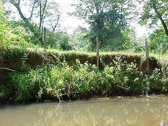
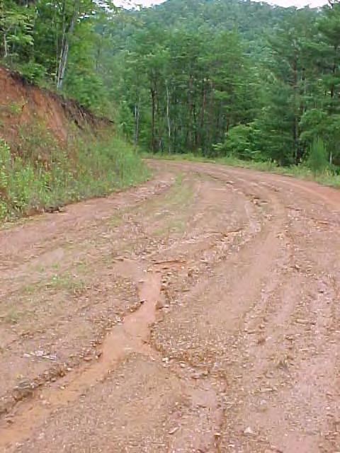
7 Dec 2015 Record Flooding

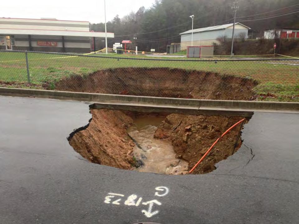
8 Dec 2015 Record Flooding
9
10


11 What is Water Quality? Physical Chemical Biological Habitat
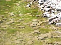
12 Major Water Quality Concerns in the Hiwassee River Basin 1. Excess Sediment 2. Pathogens (e.g. E. coli) 3. Excess Nutrients Too much runoff!


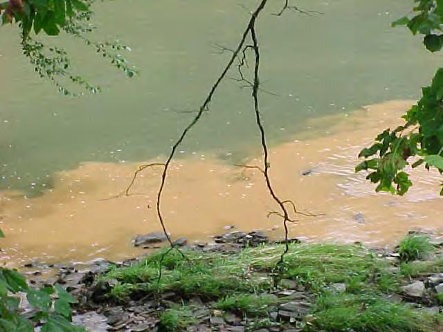
13 We want to prevent this!


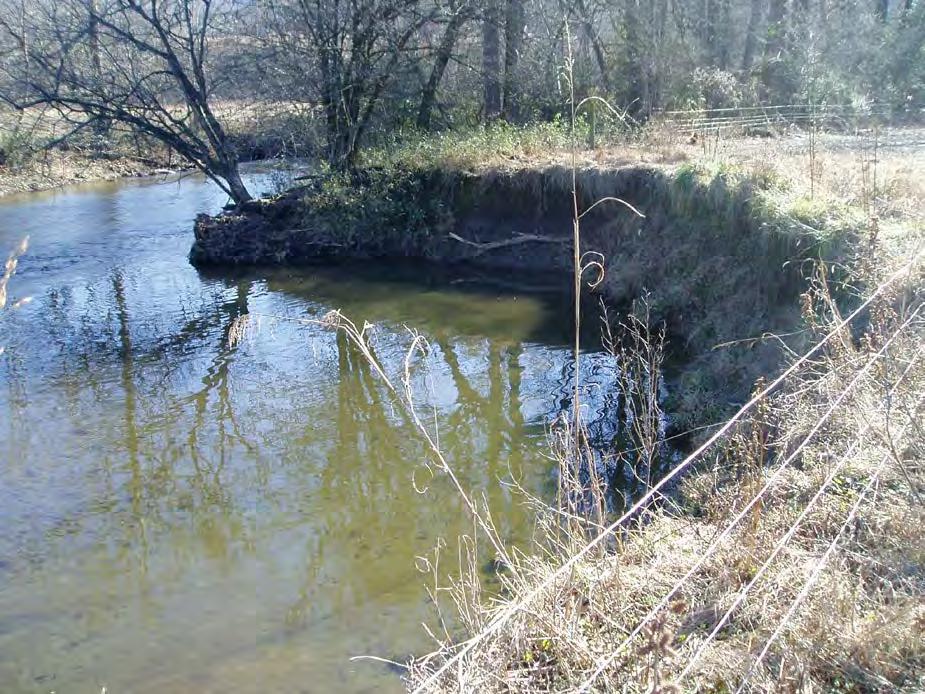
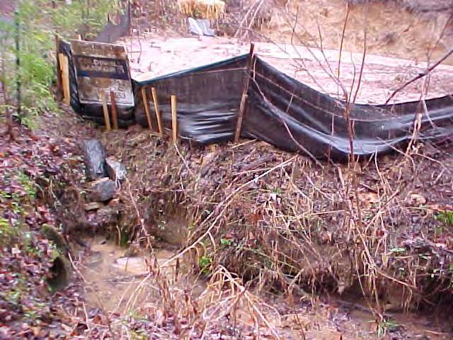
14 WQ Concerns Bank Erosion

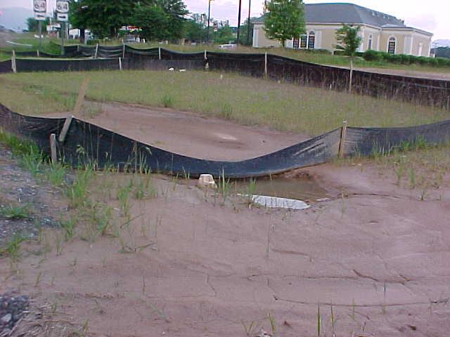
15 WQ Concerns Construction

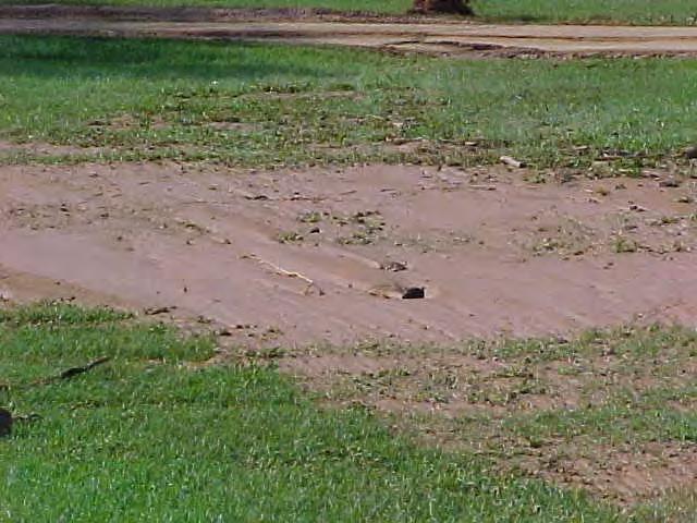
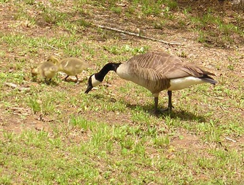
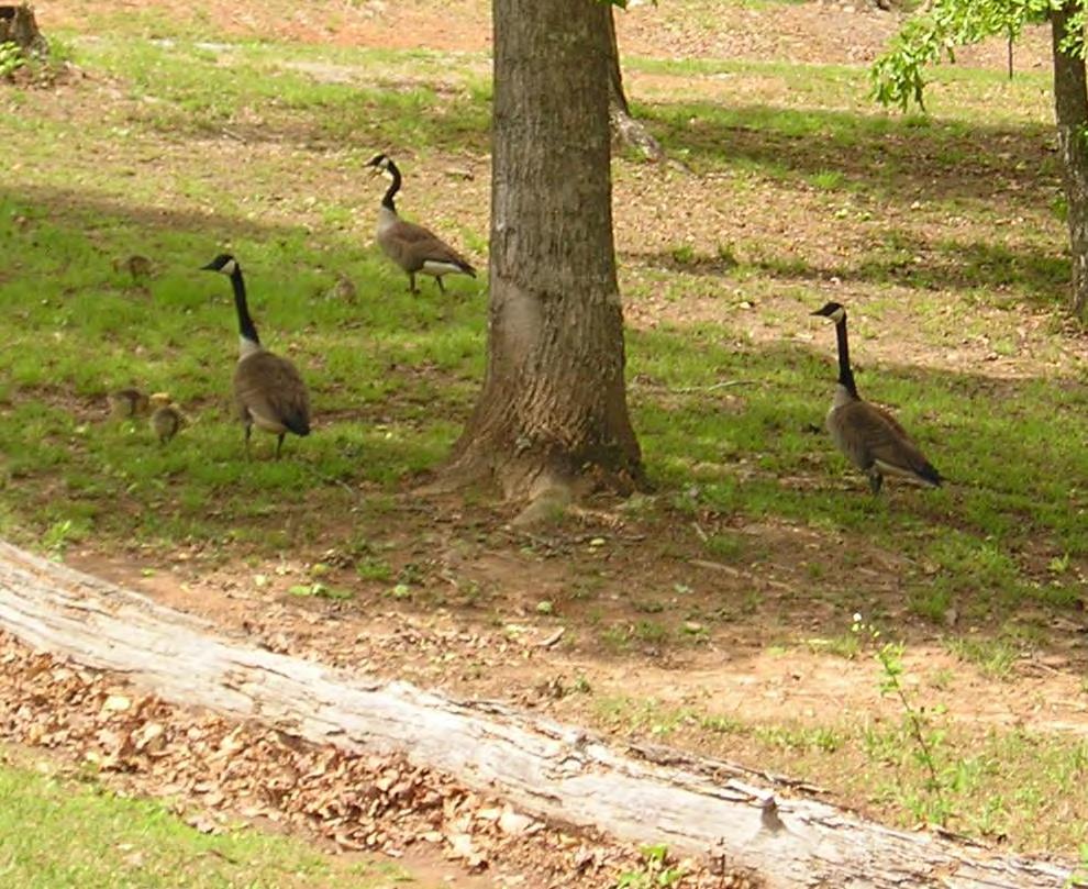
16 WQ Concerns Development of Steep Slopes


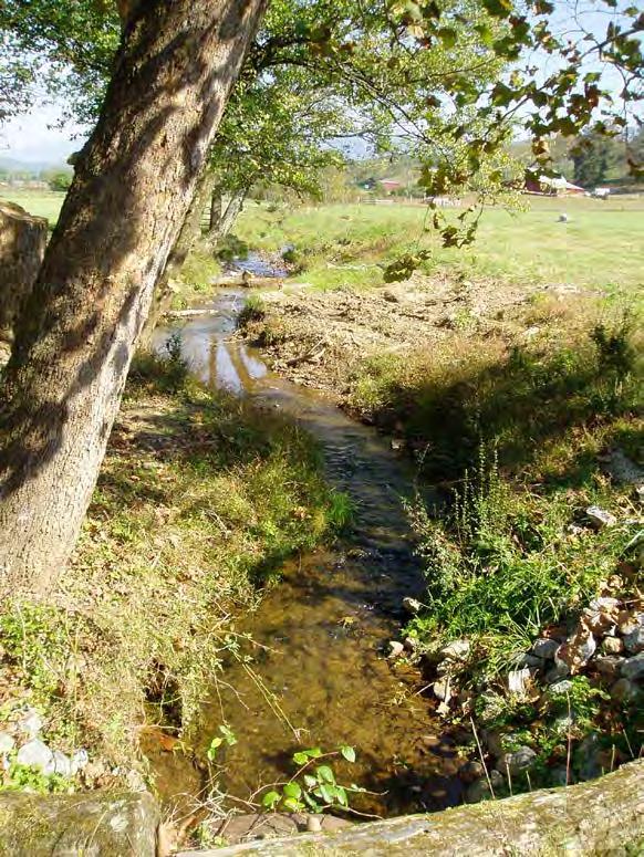
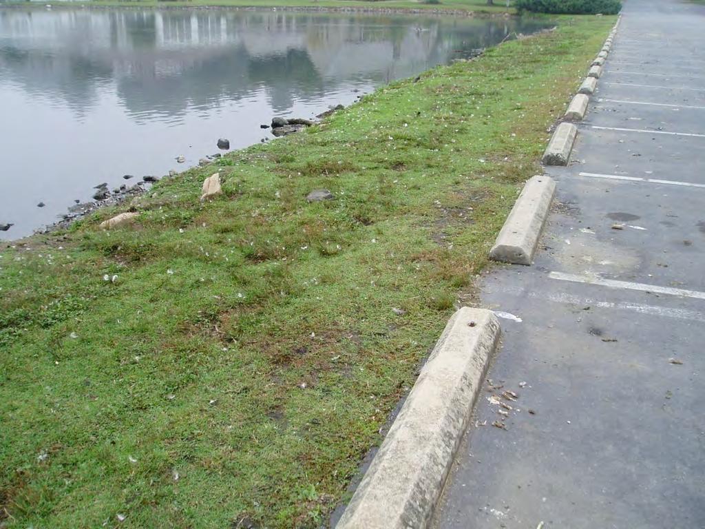
17 WQ Concerns Loss of Riparian Buffers & Channelization
18 Major Water Quality Concerns in the Hiwassee River Basin 1. Excess Sediment 2. Pathogens (e.g. E. coli) 3. Excess Nutrients Too much runoff!

19 We want to prevent this! And this!
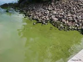
20 And this!

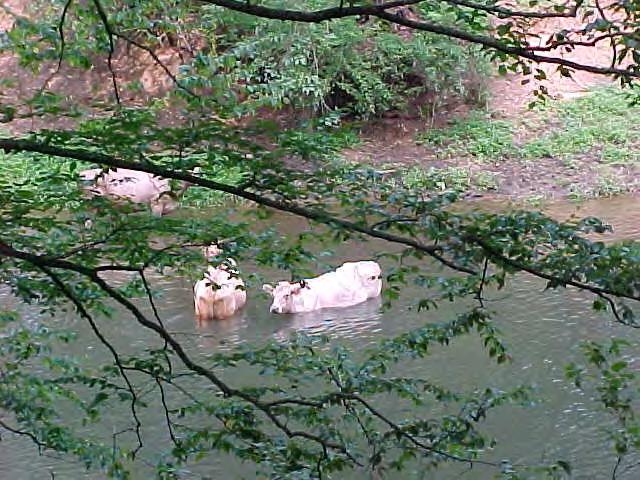
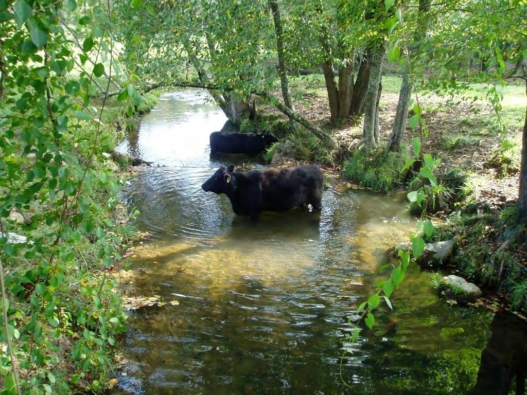
21 WQ Concerns Agriculture

22 Water Quality Concerns Leaking & Failing Septic Systems

23 WQ Concerns Geese


24 WQ Concerns Managed Turf


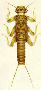
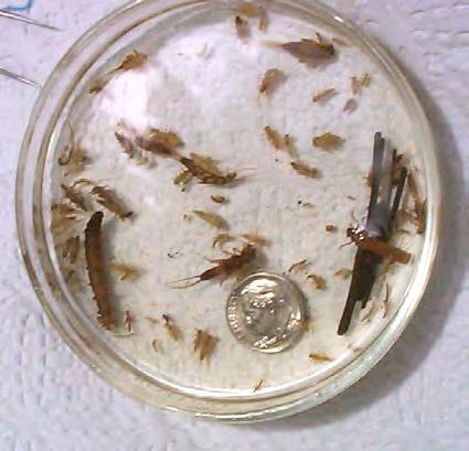
25 WQ Concerns Lack of Buffers


26 Other Nutrient Sources Not pathogens, if in compliance!
27 Major Water Quality Concerns in the Hiwassee River Basin 1. Excess Sediment 2. Excess Nutrients 3. Pathogens (e.g. E.coli) Too much runoff!


28 WQ Concerns Impervious Surfaces Roads and Parking Lots Driveways and Rooftops

29 WQ Concerns - Changing Hydrology Increased Runoff Increased Pollutants Impacts to Stream Banks Habitat Degradation Decline in Fishing

30 Use Impairment Data (every 2 years)
31 State Biological Data (5-year cycle)


32 Volunteer Monitoring (monthly!) 10+ years data from 21 sites; currently 55 active sites!
 Chatuge: Poor in 2012 Nottely: Poor in 2011 Hiwassee:")
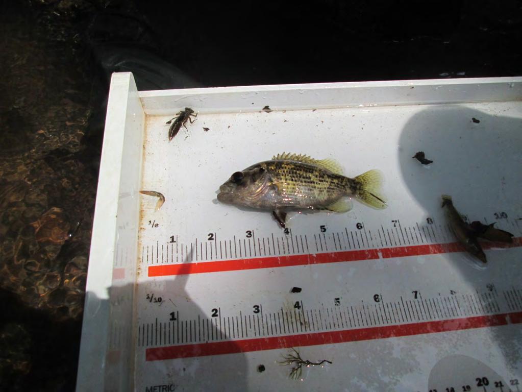
33 TVA Ecological Health Ratings (? Interval) Chatuge: Poor in 2012 Nottely: Poor in 2011 Hiwassee: Fair in 2012 Apalachia: Good in 2012

34 Water Quality Overview
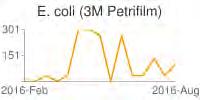
35 Nottely River Highlights Now sampling 2 locations on the river upstream and 7 locations on tributaries to the lake! At least fifteen E. coli samples collected at each of 4 locations on Butternut Creek No waters were added or removed from the list of impaired waters between 2014 and 2016 E. coli concentrations are well above recreation water quality standards at most monitored sites, including the Nottely River Rapier Mill Creek was added to the list of impaired waters in NC in 2016
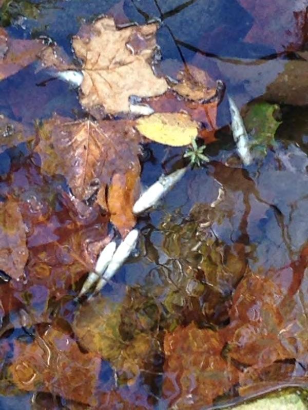
 GA Mtn. Exp.")

36 Nottely River Data Location Low High Ave Upstream Old Bald Mtn. Rd. (L) GA Mtn. Exp. Station (R) E. coli data reported in colonies/100ml A minimum of 15 samples were collected at each site.


")
37 Butternut Creek at Mountain Building Supply Butternut Creek at Union Co. Farmers Market Butternut Creek at the Golf Course Butternut Creek at Meeks Park (Colwell Fields)
38 Butternut Creek Data Location Low High Ave Notes Mtn. Bldg. Supply hits >200 Farmers Market hits >200 in 22 samples; 2 hits >1,000 Golf course hits >200 Meeks Park hits >200 E. coli data reported in Colonies/100mL A minimum of 15 samples were collected at each site.
39 Brasstown Creek Highlights Now sampling 4 locations on the creek; 2 in GA and 2 in NC! Early results indicate that the recreation standard is being met at all four locations! No waters were added or removed from the list of impaired waters between 2014 and 2016 Volunteers are needed to sample Corn Creek and Yewell Branch in Young Harris, as well as Brasstown Creek above Yewell Br. (Trackrock area)
40 Lake Chatuge Improvements 2006 phosphorus loading to Lake Chatuge 27% 34% Developed Areas Pasturelands Point Sources 39% 2,600 lbs/yr removed in 2016! 2,800 lbs/yr removed in
41 Hiwassee River Highlights Reactivated one Towns Co. site and added one in Clay Co. for a total of six on Hiwassee River Now have 4 years of recent data for the main Hiwassee River site above Lake Chatuge, added to 10 years of historical data It appears that all locations are generally meeting the recreation water quality standards Water temperatures were very high at the main Hiwassee River site this summer E. coli concentrations spike at two Clay County sites during high flow events

42 Hiwassee River Highlights Hiwassee River at The Retreat (formerly the Trout Lodge Temperature data reported in degrees Celsius.


43 Hiwassee River at The Retreat Towns County Hiwassee River at Streak Hill Rd. Towns County Hiwassee River at Martin Hill Clay County Hiwassee River at Sweetwater Park Clay County


44 Fish Kill on the Valley River
45 Other NC Highlights Martins Creek was removed from the list of impaired waters for fish & aquatic life! An older monitoring site on Shooting Creek was reactivated this year! Summertime temperatures in Shooting Creek were too high to support trout

46 Contact Information 90 Tennessee Street, Ste. D (Lewis Jones Nationwide Insurance Bldg.) Phone & Fax cmoore@hrwc.net
What is a River Basin Restoration Priority? 1. Criteria for Selecting a Targeted Local Watershed (TLW) 2. Hiwassee River Basin Overview 3
 2. Hiwassee River Basin Overview 3") Hiwassee River Basin Restoration Priorities 2008 TABLE OF CONTENTS Introduction 1 What is a River Basin Restoration Priority? 1 Criteria for Selecting a Targeted Local Watershed (TLW) 2 Hiwassee River
Hiwassee River Basin Restoration Priorities 2008 TABLE OF CONTENTS Introduction 1 What is a River Basin Restoration Priority? 1 Criteria for Selecting a Targeted Local Watershed (TLW) 2 Hiwassee River
Watershed Restoration Plan for the Hiwassee River Basin
 Watershed Restoration Plan for the Hiwassee River Basin i EXECUTIVE SUMMARY This document, prepared by the North Carolina Wetlands Restoration Program (NCWRP), presents a description of Targeted Local
Upper Iroquois River atershed Management Plan
 2013 Upper Iroquois River atershed Management Plan Daniel M Perkins Jasper County Soil and Water Conservation District 12/30/2013 Table of Contents 1.1 WATERSHED COMMUNITY INITIATIVE... 12 1.2 Project
1.Mill Creek Watershed Summary Description and Land Use
 1.Mill Creek Watershed Summary Description and Land Use Table xxx: Mill Creek Watershed Overview Watershed Size 31,435 acres/49.1 sq miles/ 127.1 sq km Elevation Range 5,594 feet [4,967-10,561] Stream
FISHERIES BLUE MOUNTAINS ADAPTATION PARTNERSHIP
 FISHERIES A warming climate, by itself, substantially affects the hydrology of watersheds in the Blue Mountains. Among the key hydrologic changes projected under all scenarios for the 2040s and beyond
Table xxx: Listed and Suspected Impairments for Willow Creek 2010 Reach Impairment Pollutant Impaired Uses
 1. (Fairmont) Watershed Summary Description and Land Use Table xxx: (Fairmont) Watershed Overview Watershed Size 18,331 acres/28.7 sq miles/74.3 sq km Elevation Range 2,615 feet [4,980-7,595] Stream Miles
Fighting for Life in French Creek
 Fighting for Life in French Creek Created By: An original Creek Connections activity created by David Hall, Creek Connections staff. Creek Connections, Allegheny College, Meadville, Pennsylvania, 16335
Searsville Dam Removal
 Searsville Dam Removal A unique opportunity for all Presented by the Beyond Searsville Dam Coalition San Francisquito Creek flows into the San Francisco Bay near the Palo Alto Airport and Golf Course seen
Temperature Profiling Within the Trout Creek Sub-Watershed 2013 Prepared by the Kennebecasis Watershed Restoration Committee January 2014
 Temperature Profiling Within the Trout Creek Sub-Watershed 2013 Prepared by the Kennebecasis Watershed Restoration Committee January 2014 A partnership project between the KWRC and Agriculture and Agri-Foods
1.1 Subbasin Overview
 Chapter 1 Watauga River Subbasin 04-02-01 Including the: Watauga River, Boone Fork, Laurel Fork, Cove Creek, Beaverdam Creek, Beech Creek, Elk River and Cranberry Creek 1.1 Subbasin Overview Subbasin 04-02-01
CATCHMENT HYDROLOGICAL RESPONSE TO CHANGING LAND SYSTEM IN KASHMIR HIMALAYA
 IGC, 2012 28 August, 2012 CATCHMENT HYDROLOGICAL RESPONSE TO CHANGING LAND SYSTEM IN KASHMIR HIMALAYA Prof. SHAKIL A ROMSHOO HEAD, DEPT OF EARTH SCIENCES KASHMIR UNIVERSITY PRESENTATION OVERVIEW KASHMIR
What was the historic coaster fishery like?
 1 of 6 1/30/2012 12:25 PM Home About Topics Contact Us Fishing Calendar Fish ID Tips FAQs Hack Noyes Research Vessel Is it a unique strain long lost from Wisconsin's shoreline? Fisheries Reports Tributaries
NYS Coastal Waters. Water Resources of NYS: THE NATURE of the COASTAL ZONE. NYS Coastal Waters. NYS Coastal Atlas. Coastal Zone Management 10/10/2014
 Water Resources of NYS: THE NATURE of the COASTAL ZONE NYS Coastal Waters NYS is the only state to border the Atlantic Ocean and the Great Lakes (Lakes Erie and Ontario). Great Lakes shoreline: 577 miles
Family Fun. Adventure Game! Official Game Book. page 1
 Family Fun Adventure Game! Official Game Book page 1 Family Fun Adventure Game KEY MAP and Driving Directions ^ N Ocoee River 2 mi 5 km 68 Copper Hill McCaysville old 2 2 Ducktown 5 1 3 Blue Ridge TENN.
TROUT CREEK WATERSHED (Second Year of Snowline Data)
") Extent of Snow Cover During the 2002 Spring Freshet For the TROUT CREEK WATERSHED (Second Year of Snowline Data) (Penticton Forest District) 1.0 INTRODUCTION The extent of snow cover over a watershed basin
Extent of Snow Cover During the 2002 Spring Freshet For the TROUT CREEK WATERSHED (Second Year of Snowline Data) (Penticton Forest District) 1.0 INTRODUCTION The extent of snow cover over a watershed basin
Emergent Sandbar Habitat Program Middle Missouri River
 Emergent Sandbar Habitat Program Middle Missouri River Jeremiah Szynskie, P.E. Hydrologic Engineering Branch Introduction Main Stem System Dam Closures Fort Peck 1937 Fort Randall 1952 Garrison - 1953
Sustaining the Raritan River Watershed
 Sustaining the Raritan River Watershed 8 th Annual Sustainable Raritan River Conference June 10, 2016 Rick Lathrop Department of Ecology, Evolution & Natural Resources Rutgers School of Environmental and
Cornwell brook Cornwell Manor
 Cornwell brook Cornwell Manor An Advisory Visit by the Wild Trout Trust February 2014 1 1. Introduction This report is the output of a Wild Trout Trust visit to a tributary of the Cornwell Brook at Cornwell
Maryland Chapter Trout Unlimited Brook Trout Conservation Effort
 Maryland Chapter Trout Unlimited Brook Trout Conservation Effort Photo by Matt Kline Portfolio of Recent Work MDTU Brook Trout Conservation Coordinator: Scott C. Scarfone, ASLA sscarfone@oasisdesigngroup.com
Mecklenburg County. Fish Consumption Advisories A Local Government Perspective
 Mecklenburg County Fish Consumption Advisories A Local Government Perspective David Caldwell Charlotte-Mecklenburg Storm Water Services Water Quality Program NCLMS October 4, 2012 Lake monitoring program
Minnesota Department of Natural Resources Division of Fish and Wildlife Section of Fisheries. Stream Survey Report. Cold Spring Creek.
 Minnesota F-29-R(P)-24 Area 315 Study 3 March 2015 Minnesota Department of Natural Resources Division of Fish and Wildlife Section of Fisheries Stream Survey Report Cold Spring Creek 2014 Mark Pelham Montrose
East Branch of the Delaware River
 Public Fishing Rights Maps East Branch of the Delaware River Description of Fishery The East Branch of the Delaware River is divided into two sections by the Pepacton Reservoir. Below the Pepacton Reservoir,
Nechako white sturgeon are an Endangered Species
 Nechako white sturgeon are an Endangered Species There are likely less than 350 Nechako white sturgeon, and historically there were over 5000 in the Nechako Watershed. Endangered as per the Species at
Feb 22, Supplemental Reclassification of Streams in the Catawba and Yadkin River Basins to Trout Waters
 Feb 22, 2010 Mr. Jeff Manning Supervisor, Classifications and Standards Unit Division of Water Quality North Carolina Department of Environment and Natural Resources 1617 Mail Service Center Re: Supplemental
Table VI-Proj SITE-SPECIFIC MANAGEMENT MEASURES FOR THE ROOT RIVER WATERSHED
 00216268.DOC 300-1104 MGH/JEB/pk 01/31/14, 02/04/14 Table VI-Proj SITE-SPECIFIC MANAGEMENT MEASURES FOR THE ROOT RIVER WATERSHED LRC-01 Habitat Hoods Creek entire length Village of Mt. Various Reiterate
1.Warm Springs Creek (Anaconda) Watershed Description and Land Use
 Watershed Description and Land Use") 1.Warm Springs (Anaconda) Watershed Description and Land Use Table xxx: Warm Springs Watershed Overview Watershed Size 92,288 acres/144.2 sq miles/373.6 sq km Elevation Range 5,781 feet [4,800-10,581]
1.Warm Springs (Anaconda) Watershed Description and Land Use Table xxx: Warm Springs Watershed Overview Watershed Size 92,288 acres/144.2 sq miles/373.6 sq km Elevation Range 5,781 feet [4,800-10,581]
San Lorenzo Valley Water District, Watershed Management Plan, Final Version Part I: Existing Conditions Report
 LIST OF FIGURES Figure 1-1. Map of the San Lorenzo River watershed Figure 2-1. The Santa Cruz Mountains Bioregion Figure 2-2. Protected areas within the San Lorenzo River watershed Figure 2-3. Primary
Chagrin River TMDL Appendices. Appendix F
 Appendix F The following are excerpts from the Eastern Brook Trout Joint Venture s Conservation Strategy (Working Draft v.6), Conserving the Eastern Brook Trout: Strategies for Action Found at: http://www.easternbrooktrout.org/constrategy.html
Outline. 1. Overview 2. Population 3. Flooding 4. Land Use 5. References. Overview
 Outline 1. Overview 2. Population 3. Flooding 4. Land Use 5. References Overview The two main rivers in the Cannon River watershed are the Cannon and Straight Rivers. The Cannon River originates in Shields
UPPER GALLATIN TMDL PLANNING AREA BIOLOGICAL MONITORING
 UPPER GALLATIN TMDL PLANNING AREA BIOLOGICAL MONITORING Sampling and Analysis Plan Prepared for: BLUE WATER TASK FORCE, INC. Katie Alvin PO Box 160513 Big Sky, MT 59716 AND MONTANA DEPARTMENT OF ENVIRONMENTAL
Trail Proposal #1; May 14, 2005
 Trail Proposal #1; May 14, 2005 Dennis Kaltenbruner Bow Cycle Dean Cockshutt Mountain Toys Dave Sheridan GPS map Coord. Plus many others! Rocky Mountain Dirt Riders Association (RMDRA), on behalf of all
Kootenai River Habitat Restoration Program. Kootenai Tribe of Idaho - January 27, 2014 Presentation for Kootenai Valley Resource Initiative
 Kootenai River Habitat Restoration Program Kootenai Tribe of Idaho - January 27, 2014 Presentation for Kootenai Valley Resource Initiative Decline of native species Kootenai River White Sturgeon ENDANGERED
UNDERSTANDING YOUR ESTUARY Level IA- ESTUARY SEARCH
 UNDERSTANDING YOUR ESTUARY Level IA- ESTUARY SEARCH Kakagon/Bad River Sloughs, a Lake Superior estuary located on the Bad River Reservation near Ashland, WI. GOAL Select one Wisconsin estuary to study
FISH PASSAGE IMPROVEMENT in California s Watersheds. Assessments & Recommendations by the Fish Passage Forum
 FISH PASSAGE IMPROVEMENT in California s Watersheds Assessments & Recommendations by the Fish Passage Forum FISH PASSAGE IMPROVEMENT in California s Watersheds The mission of the Fish Passage Forum is
Chapter 1: Introduction
 Chapter 1: Introduction 1.0 The Report Card 1.0.1 Background People are becoming more aware of environmental issues locally and globally and want to know what they can do to improve their local watersheds.
BIOLOGICAL DISCOVERIES IN THE CLINCH AND POWELL RIVERS AND THEIR IMPORTANCE TO FRESHWATER MUSSEL CONSERVATION
 BIOLOGICAL DISCOVERIES IN THE CLINCH AND POWELL RIVERS AND THEIR IMPORTANCE TO FRESHWATER MUSSEL CONSERVATION Jess W. Jones U.S. Fish and Wildlife Service Department of Fisheries and Wildlife Sciences,
Storm Damage Floating Culverts & Other Inlet Issues
 Storm Damage Floating Culverts & Other Inlet Issues Mark Bailey, PE - Hydraulic Manager, INDOT Dale Sedler, PE - Sr. Hydraulic Engineer, INDOT Road School 2016 What causes a culvert to float? 1. Accumulation
EXECUTIVE SUMMARY. Muskegon River Watershed Assessment
 EXECUTIVE SUMMARY This assessment for the Muskegon River watershed is one of a series being prepared by Michigan Department of Natural Resources, Fisheries Division, for river basins in Michigan. This
Minnesota Department of Natural Resources Division of Fish and Wildlife Section of Fisheries. Stream Survey Report. Cold Spring Creek.
 Minnesota F-29-R(P)-24 Area 315 Study 3 March 2013 Minnesota Department of Natural Resources Division of Fish and Wildlife Section of Fisheries Stream Survey Report Cold Spring Creek 2012 Mark Pelham Montrose
OVERVIEW OF MID-COLUMBIA FISHERIES ENHANCEMENT GROUP
 Mid-Columbia Fisheries Enhancement Group MISSION STATEMENT The Mid-Columbia Fisheries Enhancement Group is a non-profit organization dedicated to restoring selfsustaining salmon and steelhead populations
A Summary of Recommendations and Strategies for Trout Conservation on the Lower Boise River, Idaho.
 A Summary of Recommendations and Strategies for Trout Conservation on the Lower Boise River, Idaho. Completed for Ted Trueblood Chapter of Trout Unlimited By Candy Weast (Hammond) Albertson College of
Outstanding Iowa Waters, Trout Streams & Value to Northeast Iowa
 Outstanding Iowa Waters, Trout Streams & Value to Northeast Iowa Mike Steuck NE District Fisheries Supervisor Karst, WQ & Livestock: Finding a Balance for a Sensitive Geography May 30, 2017 Healthy Rivers,
CHINOOK SALMON SACRAMENTO RIVER WINTER-RUN ESU, CENTRAL VALLEY SPRING-RUN ESU, AND CENTRAL VALLEY FALL AND LATE FALL-RUN ESU
 CHINOOK SALMON SACRAMENTO RIVER WINTER-RUN ESU, CENTRAL VALLEY SPRING-RUN ESU, AND CENTRAL VALLEY FALL AND LATE FALL-RUN ESU Oncorhynchus tshawytscha USFWS: Endangered (Winter); Threatened (Spring); Candidate
Thursday September 28, 2006
 Center for Riverine Science and Stream Re-naturalization Field Trip Guide Fourth Annual National Conference Assessing Stream Restoration Success: Developing Sustainable Ecological and Physical Systems
Quassaick Creek. Watershed Management Plan. Advisory Committee Meeting #3 July 20 th, 2012
 Quassaick Creek Watershed Management Plan Advisory Committee Meeting #3 July 20 th, 2012 Assessment Report Subwatershed Delineation Characterizes watershed based on Hydrology/Topography (primary) Land
Importance of un-named tributary streams to Brook Trout populations. Dr. Jonathan M. Niles Dr. Dan Ressler
 Importance of un-named tributary streams to Brook Trout populations. Dr. Jonathan M. Niles Dr. Dan Ressler Pennsylvania Streams All streams of PA have a designated use - Huge resource - 8,011 named tributaries:
WFC 50 California s Wild Vertebrates Jan. 11, Inland Waters (Lakes and Streams) Lisa Thompson
 Lisa Thompson") Inland Waters: Lakes and Streams WFC 50 11 January 2011 Lisa Thompson Fisheries Extension Specialist Wildlife, Fish, & Conservation Biology Department University of California, Davis Take home messages
Inland Waters: Lakes and Streams WFC 50 11 January 2011 Lisa Thompson Fisheries Extension Specialist Wildlife, Fish, & Conservation Biology Department University of California, Davis Take home messages
Rainbow Smelt. Appendix A: Fish. Osmerus mordax. New Hampshire Wildlife Action Plan Appendix A Fish-125
 Rainbow Smelt Osmerus mordax Federal Listing State Listing Global Rank State Rank Regional Status SC S3 Photo by John Lyons Justification (Reason for Concern in NH) Rainbow smelt were once harvested by
Wisconsin s Citizen-Based Monitoring Partnership Program and Trout Unlimited Driftless Area Restoration Effort (TUDARE)
") Wisconsin s 2010-11 Citizen-Based Monitoring Partnership Program and Trout Unlimited Driftless Area Restoration Effort (TUDARE) TUDARE Stream Monitoring Sites Established in 2010-2011 Summary Prepared
Wisconsin s 2010-11 Citizen-Based Monitoring Partnership Program and Trout Unlimited Driftless Area Restoration Effort (TUDARE) TUDARE Stream Monitoring Sites Established in 2010-2011 Summary Prepared
Fish Friendly Crossings- Examples from Nash Stream
 Fish Friendly Crossings- Examples from Nash Stream Maggie Machinist- North Regional Forester, Division of Forests and Lands. Nash Stream Nash Stream Forest is 40,000 acres, owned and managed by NH Division
Creek. These SWWFs also represent important stakeholders in the protection and management of Big Walnut Creek.
 Creek. These SWWFs also represent important stakeholders in the protection and management of Big Walnut Creek. 5.0 WATER QUALITY ASSESSMENTS EXISTING AND CURRENT 5.1 IDEM Data A request was submitted to
U.S. Fish and Wildlife Service Stream Habitat Improvement Projects
 U.S. Fish and Wildlife Service Stream Habitat Improvement Projects Melanie Car ter and Corey Kanuckel U.S. Fish & Wildlife Service Partners for Fish & Wildlife (PFW) Stream Team: Drew Langston Hunter Kittrell
Delaware Basin Stream Management Program
 Delaware Basin Stream Management Program A partnership between NYCDEP and Delaware County Soil & Water Conservation District 2015 Update Delaware Basin - Topics 2015 Project Updates Restoration Projects
Swift Current Creek Watershed
 Swift Current Creek Watershed Watershed Boundary Gross drainage area 3939 km 2 973,343 acres Gross creek length 230 km 143 miles Primary water source for 20 000 people Major source of water base recreation
The Calawah River System
 The Calawah River System The Calawah River is the largest tributary of the Bogachiel River and is formed by the confluence of the north and south forks of the Calawah. The two forks of the Calawah, CALAWAH
DALE HOLLOW LAKE TROOPER ISLAND IMPROVEMENT PROJECT Proposal for Reservoir Fisheries Habitat Partnership (RFHP)
") DALE HOLLOW LAKE TROOPER ISLAND IMPROVEMENT PROJECT Proposal for Reservoir Fisheries Habitat Partnership (RFHP) A. Applicant Information: US Army Corps of Engineers, Dale Hollow Lake POC: Gregg Nivens
DALE HOLLOW LAKE TROOPER ISLAND IMPROVEMENT PROJECT Proposal for Reservoir Fisheries Habitat Partnership (RFHP) A. Applicant Information: US Army Corps of Engineers, Dale Hollow Lake POC: Gregg Nivens
Newsletter August, 2013
 Tie One On Newsletter August, 2013 Chattahoochee/Nantahala Chapter 692 Trout Unlimited www.ngatu692.com President: Joe Duket Secretary: Alan Sirmans Webmaster: Larry Bundy Vice President: Pat Bradley Treasurer:
Illinois Lake Management Association Conference March 23, 2018 By Trent Thomas Illinois Department of Natural Resources Division of Fisheries
 Illinois Lake Management Association Conference March 23, 2018 By Trent Thomas Illinois Department of Natural Resources Division of Fisheries Sources of Habitat Impairment Sedimentation Channelization
City of Jacksonville s Targeted Water Quality Monitoring Approach. Melissa M. Long, PE Fall Seminar 2017
 City of Jacksonville s Targeted Water Quality Monitoring Approach Melissa M. Long, PE Fall Seminar 2017 Goals and Objective Goals Identify Potential Water Quality Problem Areas Measure effectiveness of
ELK RIVER WATERSHED ACTION PLAN
 ELK RIVER WATERSHED ACTION PLAN Prepared for The Elk River Watershed Council Prepared by Chris Massingill Mainstream Contracting South Coast Watershed Council September 2001 South Coast Watershed Council
10 is bounded by wetlands between RM 1.8 and 3.1 on the south shore and more are scattered
 The Ozette System The Ozette watershed is made up of several lakes and large streams that combine to a total drainage area of 88.4 square miles. The most significant feature of the Ozette watershed is
Eastern Brook Trout: Status and Threats. Produced by Trout Unlimited for the Eastern Brook Trout Joint Venture
 Eastern Brook Trout: Status and Threats Produced by Trout Unlimited for the Eastern Brook Trout Joint Venture david anderson Eastern Brook Trout: Status and Threats Background: Brook trout (Salvelinus
Water of the Rogue Valley
 Water of the Rogue Valley An Activity Book for Grades 3-5 Welcome! You are about to embark on a journey of exploration. Your adventure begins at school and continues at North Mountain Park. This workbook
DECISION MEMO. Pursuant to 36 C.F.R (e), the following persons are exempted from this order:
, the following persons are exempted from this order:") DECISION MEMO Forest Supervisor s Orders for the Upper Tellico Off-Highway Vehicle System USDA Forest Service Southern Region Nantahala National Forest Tusquitee Ranger District Cherokee County, North
DECISION MEMO Forest Supervisor s Orders for the Upper Tellico Off-Highway Vehicle System USDA Forest Service Southern Region Nantahala National Forest Tusquitee Ranger District Cherokee County, North
Minnesota Department of Natural Resources Division of Fish and Wildlife Section of Fisheries. Stream Survey Report. Luxemburg Creek.
 Minnesota F-29-R(P)-24 Area 315 Study 3 March 2016 Minnesota Department of Natural Resources Division of Fish and Wildlife Section of Fisheries Stream Survey Report Luxemburg Creek 2015 Mark Pelham Sauk
Site selection criteria. Stream selection criteria
 Duluth Urban Watersheds Project 2014-2016 Advisory Council 1-22, 2015 Stream selection criteria Impaired (MPCA/EPA) DNR Trout Stream designation Geographic distribution across Duluth Acceptable site available
Climate Change Adaptation and Stream Restoration. Jack Williams;
 Climate Change Adaptation and Stream Restoration Jack Williams; jwilliams@tu.org 1 Goals for this presentation Develop strategies for adapting streams to climate impacts by Thinking like a watershed Understanding
Trout Buffer Variance
 Trout Buffer Variance Ashley L. Rodgers, PE Spring 2015 Why a Trout Buffer Capturing pollutants in runoff to keep the water clean. Capturing sediment to keep mud out of the water. Providing shade to keep
Common Name: HOLIDAY DARTER. Scientific Name: Etheostoma brevirostrum Suttkus and Etnier. Other Commonly Used Names: none
 Common Name: HOLIDAY DARTER Scientific Name: Etheostoma brevirostrum Suttkus and Etnier Other Commonly Used Names: none Previously Used Scientific Names: none Family: Percidae Rarity Ranks: G2/S2 State
STREAM SURVEY File form No..
 scanned for KRIS THE RESOURCES AGENCY OF CALIFORNIA California Department of Fish and Game STREAM SURVEY File form No.. Date: September 4, 1969. NAME: North Fork Schooner Gulch Creek COUNTY: Mendocino.
Barnegat Bay-Friendly Golf Course Certification Program
 Barnegat Bay-Friendly Golf Course Certification Program Businesses for a Better Barnegat Bay Thank you for your interest in becoming a Certified, Barnegat Bay-Friendly Golf Course. This American Littoral
PRE- PROPOSAL FORM - Lewis River Aquatic Fund
 PRE- PROPOSAL FORM - Lewis River Aquatic Fund 1. Applicant organization. USDA Forest Service Gifford Pinchot National Forest 2. Organization purpose Resource management agency 3. Project manager (name,
1. Eating wild salmon is healthy for you and healthy for our environment. But this fishery will only continue to exist with help from you.
 Save Our Wild Salmon: It s Up to You Notes to Accompany PowerPoint Presentation by Barbara Hawkins, Education Director Central Coast Women for Fisheries, Inc. 1. Eating wild salmon is healthy for you and
EXTENT OF OBSERVATION
 scanned for KRIS THE RESOURCES AGENCY OF CALIFORNIA Department of Fish and Game STREAM SURVEY Date: May 25 and 31, 1977. NAME: Unnamed Stream (Tributary to Sonoma Creek) COUNTY: Sonoma. STREAM SECTION:
Sleeping Dog Ranch LAKE CITY, COLORADO. Hunting Ranching Fly Fishing Conservation
 Sleeping Dog Ranch LAKE CITY, COLORADO Hunting Ranching Fly Fishing Conservation Sleeping Dog Ranch LAKE CITY, COLORADO Introduction: Featuring nearly 2 miles of exceptional trout fishing and surrounded
3. Some of this money will be spent on the Baker Creek Rehabilitation project in 2018 this project has already been approved by Mono Council.
 April 5, 2018 Mayor Laura Ryan & Mono Council 1. As per the Town of Mono-Headwater Streams Committee, MoU (March 12, 2012), any new project undertaken by the Headwater Streams Committee (HSC) involving
MINISTRY OF ENVIRONMENT ENVIRONMENTAL STEWARDSHIP DIVISION FISH AND WILDLIFE BRANCH. Horsefly River Angling Management Plan
 MINISTRY OF ENVIRONMENT ENVIRONMENTAL STEWARDSHIP DIVISION FISH AND WILDLIFE BRANCH Horsefly River Angling Management Plan January 30 th, 2006 Area/Fishery Description The Horsefly River watershed provides
Trout Unlimited Comments on the Scope of Environmental Impact Statement for the Constitution Pipeline Project, Docket No. PF12-9
 October 9, 2012 Kimberly D. Bose, Secretary Federal Energy Regulatory Commission 888 First Street, NE, Room 1A Washington, DC 20426 RE: Trout Unlimited Comments on the Scope of Environmental Impact Statement
FY17 Clean River Program. December 2, 2016
 FY17 Clean River Program December 2, 2016 2 FY18 Coordinated Monitoring Schedule 2017 San Antonio River Basin Highlight Report San Antonio River Basin FY17 Coordinated Monitoring Schedule FY17 Segment
Five Counties Salmonid Conservation Program - Fish Passage Design Workshop. February 2013
 Program - Aquatic Organisms and Stream Crossings Ecological Connectivity A watershed is a network of channels that drain a common boundary. Channel characteristics formed by interaction of precipitation,
Final Report August 2005
 2.0 REGIONAL STUDY AREA 2.1 Regional Setting 2.1.1 Topography The Los Angeles Region is located within the western portion of the Transverse Ranges Geomorphic Province. The San Andreas transform fault
Suitable Applications Check dams may be appropriate in the following situations: To promote sedimentation behind the dam.
 Categories EC Erosion Control SE Sediment Control TC Tracking Control WE Wind Erosion Control Non-Stormwater NS Management Control Waste Management and WM Materials Pollution Control Legend: Primary Category
Mill Creek/Rose Valley Watershed General Information Presented by Dr. Mel Zimmerman Lycoming College CWI
 Mill Creek/Rose Valley Watershed General Information Watershed Concerns Rose Valley Lake Areas of Interest Biodiversity of Interest in Rose Valley Lake Rose Valley Lake Bird Area Fishes of Rose Valley
Assessing Ecosystem Impacts from Road Stream Crossings through Community Involvement
 Assessing Ecosystem Impacts from Road Stream Crossings through Community Involvement Background Why is the NH Fish and Game Department interested in culverts? Block fish migration Reduce opportunities
Warden Tom Kasnick August 30, 1983
 scanned for KRIS Franz Creek Warden Tom Kasnick August 30, 1983 - Region 3 Franz Creek, Sonoma County - Fish Kill and Pollution Incident On August 3, 1983, you requested that I investigate a reported fish
Understanding the Impacts of Culvert Performance on Stream Health
 Understanding the Impacts of Culvert Performance on Stream Health Kristin Thomas Aquatic Ecologist Michigan Trout Unlimited Transportation and the Environment Conference 12/5/2018 Importance of adequately
MCCAW REACH RESTORATION
 Final Report MCCAW REACH FISH RESTORATION PHASE B Jack McCaw Inland Empire Action Coalition http://www.wwccd.net/ Phone: 509-956-3777 Hours: 8:00-4:30 Walla Walla County Conservation District Snake River
Okanagan Sockeye Reintroduction
 Okanagan Sockeye Reintroduction Backgrounder Elders accounts, and other forms of Traditional Ecological Knowledge (TEK) tell us that many species of salmon once came into the Okanagan Valley and tell us
Frequently Asked Questions About Revised Critical Habitat and Economic Analysis for the Endangered Arroyo Toad
 Q Frequently Asked Questions About Revised Critical Habitat and Economic Analysis for the Endangered Arroyo Toad Q. What is the arroyo toad? The arroyo toad (Bufo californicus) is a small, light greenish-grey
MISSISSIPPI MAKEOVER A Plan for Restoration, Just Around the Bend
 MISSISSIPPI MAKEOVER A Plan for Restoration, Just Around the Bend Interim Report Card 2013 Project coordinated by the Dakota County Soil and Water Conservation District and sponsored by the Minnesota Pollution
Southwestern RPO Prioritization Local Input Points for Division Needs Funding
 H172327 US 19 Business paved shoulders; include bicycle lanes and sidewalks. Location: extends 0.9 miles from Junaluska Road in Andrews to US 19/74. $ 6,100,000 9.20 H090251-AC R-3622AC NC 294 (southern
Fish Community. Fish Habitat, Streams and Rivers
 Clear, Ston(e)y and White Lake Plan Fish Community The lakes support a cool/warm water fishery including muskellunge, walleye, largemouth and smallmouth bass, yellow perch, pumpkinseed, rockbass, blue
KOOTENAI RIVER BASIN WATERSHED RESTORATION PLAN
 KOOTENAI RIVER BASIN WATERSHED RESTORATION PLAN by Jeff Dunn, Watershed Hydrologist Karen Filipovich, Outreach Consultant Gary Ingman, Water Resources Scientist prepared by RESPEC 3810 Valley Commons Drive,
Conserving the Forests, Lakes and Streams of Northeast Michigan
 4241 Old US 27 South, Suite 2, Gaylord, Michigan 49735 (989) 448-2293 www.huronpines.org info@huronpines.org Prioritized Restoration Projects in the AuSable River Watershed Summer 2015 Update from Huron
Water Quality Analysis of Total Phosphorus for the Lower Gunpowder Falls Watershed, Baltimore County, Maryland
 Water Quality Analysis of Total Phosphorus for the Lower Gunpowder Falls Watershed, Baltimore County, Maryland DEPARTMENT OF THE ENVIRONMENT 1800 Washington Boulevard, Suite 540 Baltimore MD 21230-1718
Managing Chesapeake Bay s Land Use, Fish Habitat, and Fisheries: Studies. Jim Uphoff & Margaret McGinty, Fisheries Service
 Managing Chesapeake Bay s Land Use, Fish Habitat, and Fisheries: Positive Image and or Negative Graphic Case Studies Jim Uphoff & Margaret McGinty, Fisheries Service Maryland Fisheries Service has been
Blue Creek Chinook Outmigration Monitoring Technical Memorandum
 Blue Creek Chinook Outmigration Monitoring 2012 Technical Memorandum Prepared by: Andrew Antonetti and Erika Partee Yurok Tribe Fisheries Program PO Box 1027 Klamath, California 95548 In Partnership with:
Abundance of Steelhead and Coho Salmon in the Lagunitas Creek Drainage, Marin County, California
 scanned for KRIS Abundance of Steelhead and Coho Salmon in the Lagunitas Creek Drainage, Marin County, California Prepared for: Marin Municipal Water District 220 Nellen Drive Corte Madera, California
Salmon Biology Station
 Salmon Biology Station OBJECTIVES: Students learn: Wild salmon are indicator species and keystone species whose survival is connected to the health of the watershed. o Riparian salmon need trees and trees
The Cove Run Brook Trout Restoration Project with the Northern Garrett High School AP Environmental Science Class,
 The Cove Run Brook Trout Restoration Project with the Northern Garrett High School AP Environmental Science Class, 2012 2014. Image or Graphic Presented By: Alan W. Klotz, Western Region District I, Inland