LESSON 4 Coastal Ecosystems Beach, Estuary, Marsh & Swamp 4H350. Reviewed October 2017
|
|
|
- Kristin Caldwell
- 5 years ago
- Views:
Transcription

1 4H350 Reviewed October 2017 LESSON 4 Coastal Ecosystems Beach, Estuary, Marsh & Swamp The Institute of Food and Agricultural Sciences (IFAS) is an Equal Opportunity Institution authorized to provide research, educational information and other services only to individuals and institutions that function with non-discrimination with respect to race, creed, color, religion, age, disability, sex, sexual orientation, marital status, national origin, political opinions or affiliations. For more information on obtaining other UF/IFAS Extension publications, contact your county s UF/IFAS Extension office. U.S. Department of Agriculture, UF/IFAS Extension Service, University of Florida, IFAS, Florida A & M University Cooperative Extension Program, and Boards of County Commissioners Cooperating. Nick T. Place, dean for UF/IFAS Extension.
2 Lesson 4: COASTAL ECOSYSTEMS - Beach, Estuary, Marsh & Swamp LESSON 4: Coastal Ecosystems - Beach, Estuary, Marsh & Swamp OBJECTIVES: Describe the differences and similarities of beaches, estuaries, marshes and mangrove swamps. Locate the important coastal ecosystems in your county and around the state. Identify ways in which coastal ecosystems are connected. Discover how coastal ecosystems function. Identify common and endangered plant and animal species found in coastal ecosystems. Describe examples of food webs and energy flow in coastal ecosystems. Explain the ways in which humans value and use coastal ecosystems. Explain how human activity can enhance or damage coastal ecosystems. Describe ways in which people can protect coastal ecosystems. LESSON TIME: minutes (up to 2 hours for field visits) ADVANCED PREPARATION: Read the BACKGROUND BASICS on Coastal Ecosystems. Review activities and choose appropriate one(s) to use. Secure necessary materials as described. PURPOSE: To become familiar with coastal ecosystems including beaches, estuaries, marches and mangrove swamps. DO: Here are some learning activities and suggested ways to implement the activities in Lesson Florida s diverse coastal ecosystems can be discovered with COASTAL MATCH-UP, in additional to learning about coastal plants. 4.2 What is a beach for besides sunbathing and fun in the ocean? Find out how beaches develop and why they are important with BEACH BONANZA. 4.3 Identify animals that depend on estuaries for survival and understand the functions of estuaries with CREATE AN ESTUARY. 4.4 Why are mangroves so important to humans and animals? MANGROVE MADNESS has the answer! 4.5 WHO EATS WHOM will help to explain the coastal 4.6 food chain and ARE WE IN-SEINE? will help to find REFLECT animals in the food chain. After completing the activities in this lesson, help youth reflect on what they have learned by asking the following questions: What is an estuary? An estuary is a body of water where fresh and saltwater meet and mix. 144

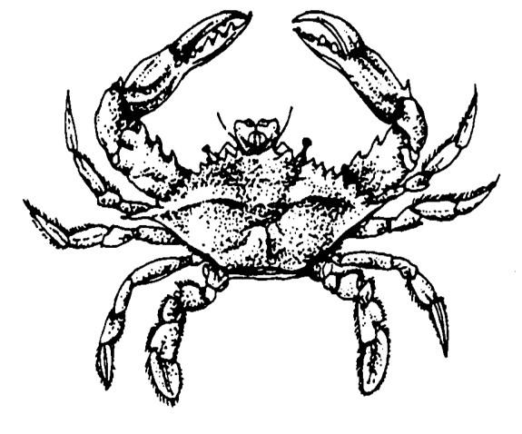
3 Lesson 4: COASTAL ECOSYSTEMS - Beach, Estuary, Marsh & Swamp Many animals depend on estuaries for part or all of their life cycle. Name two. Shrimp and blue crabs. What are three types of mangroves found in Florida? Red, white, and black mangroves. Why are mangroves called the protectors of the estuaries? Mangroves filter the runoff that flows into the estuaries from upland regions, thus trapping sediments and potential contaminants. Mangroves also buffer the shoreline from the wind and wave action caused by storms, reducing erosion and protecting upland areas. Which state has more miles of sandy beach than any other state? Florida! What important function does the beach provide for the land behind it? The beach protects the land from the ocean and the action of the waves. APPLY Help youth learn to apply what they have learned to their daily lives. Think about where you live. Do you live near a stream, river, lake or coastal region? How can what you do affect the coastal region? What are some of the ways your actions effect the coastal region? What are some action or community projects you, your club or your class could do to help others become aware of coastal ecosystems? Start a collection of sand from around the state. Compare the sand and learn why it is a certain color, texture, etc. How are beaches different/similar around the state? 145
4 Lesson 4: COASTAL ECOSYSTEMS - Beach, Estuary, Marsh & Swamp BACKGROUND BASICS...Coastal Ecosystems Coastal areas exist at the interface of land areas and large bodies of water. Florida has many miles of coastal areas due to the fact that it is a peninsula bordered by the Atlantic Ocean on the east, the Gulf of Mexico on the west and Florida Bay to the south. In addition to these areas, Florida also has an abundance of bays and estuaries associated with the state s river systems that add many miles to the coastline. These coastal and estuarine ecosystems are extremely productive areas for sea life. These areas are also one of the main features that attract millions of people to Florida. Of all Florida s natural areas, the coastal ecosystems of beach/dune/barrier islands, salt marshes, estuaries and mangrove swamps are the most threatened. Nearly 80% of the state s human population lives in coastal areas. The development resulting from this population pressure has consumed large portions of these coastal ecosystems. Human activities around the remaining coastal natural areas can impact water quality, beach development, sedimentation rates biodiversity and can further threaten these fragile ecosystems. In some areas even the salinity of the water can be altered by human activities. (Salinity is a term used to describe the relative amount of salts in water or in soil.) Storm water runoff, sewage discharges, bridges and other structures can alter water flow and either increase or decrease salinity levels. Salinity is important because some organisms can only live within a specific range of salinity. Since saltwater and freshwater from the land are often combined in coastal areas, the varying levels of salinity may determine the types of ecosystems that can exist. Beach/Dune/Barrier Island Ecosystems The beach/dune/barrier island ecosystem is probably the most dynamic habitat found in Florida. These areas change constantly with the action of winds, tides and currents. The most dramatic changes occur during storms as strong winds send waves crashing into dune areas or when hurricanes push storm surges far inland. These natural actions have occurred for millennia shaping and changing the coastal ecosystems. 146


5 Lesson 4: COASTAL ECOSYSTEMS - Beach, Estuary, Marsh & Swamp Recent human habitation has, in many areas, altered the cycles of sand movement, dune development and succession. Beach erosion has increased dramatically in some areas to a point where the replenishment of sand is done by dredging offshore areas or trucking sand from inland sandpits. In many instances, various physical structures are installed to prevent the erosion. Sea walls, jetties, groins and riprap are used to stop the natural forces at work. To understand part of the dynamics of the beach/dune/ barrier island complex, one should understand the differences between high wave energy and low wave energy areas. This can be interpreted simply by the size and the frequency of waves. Differences in wave energy will determine the amount of change in the physical environment, and its influence on the plant and animal species that can live in a coastal area. Very few plants or animals live directly on high energy ocean beaches, but many species depend on them for survival. Arthropods, mollusks, and insects escape the pounding surf by burrowing and/or living below the sand. Gulls, sandpipers and other shorebirds are common predators that probe the sand for food. One of Florida s most highly valued food fish, the pompano, also lives in this environment, feeding on sand fleas and mole shrimp that have burrowed into the sand at the shore line. Huge schools of baitfish including menhaden, cigar minnows, and Spanish sardines attract predators such as jack crevalle, Spanish mackerel, bluefish, and other sportfish. Surf fishing off many Florida beaches is a favorite pastime for many coastal residents because of this. Florida s east coast is considered a high wave energy system. Prevailing wind action on the Atlantic Ocean has many hundreds of miles to build swells. These swells increase as they approach shallow inshore areas and finally break, forming waves of significant height (3-12 ft.) depending on the power of the offshore wind. 147


6 Lesson 4: COASTAL ECOSYSTEMS - Beach, Estuary, Marsh & Swamp The force of high energy waves can move tremendous amounts of sand and bottom material from the beach to offshore sites. When sufficient materials are deposited in these areas barrier islands can develop. Sometimes the opposite occurs and sand is deposited at the beach front, where wind can move it inland to form sand dunes. In either case the beach is the all important buffer zone, absorbing the energy of waves that might otherwise erode dunes and other coastal formations. The west coast of Florida is much different. The height and frequency of waves along most of this coast are much smaller when compared to the Atlantic side. The smaller surface area of the Gulf of Mexico, combined with varying winds and bottom features produces less energy for wave formation. Fewer and much smaller beach areas exist in the Big Bend area of the Gulf coast due to the lower wave energy. Those that do exist are often part of a barrier island that also helps protect inshore marshes and land areas. Salt Marshes The gentle incline of the Gulf Coast reduces wave force and allows marsh grasses to establish themselves in shallow water areas. Salt marshes are communities of nonwoody, salt tolerant plants. The largest amount of salt marsh in Florida occurs from Tampa to Pensacola, with the greatest development in the Big Bend area. A smaller area of salt marsh occurs along the Indian River Lagoon and in the vicinity north of Jacksonville, Florida. Salt marshes are composed of a variety of different species, depending on location, including grasses, sedges, and rushes. This vegetation plays a critical role in shoreline stabilization, trapping sediments and eventually building land in the process. Marshes provide critical wildlife habitat and are breeding/nursery grounds for numerous fish and invertebrates. The plants are producer organisms in food chains and food webs that include insects (e.g., marsh fly, sand gnats, mosquitoes), birds (e.g., king fisher, great blue heron, hooded merganser), shellfish (e.g., fiddler crab, pink shrimp, clams), fish (e.g., croaker, Gulf menhaden, sea trout) and mammals (e.g., raccoon and otter). 148

7 Lesson 4: COASTAL ECOSYSTEMS - Beach, Estuary, Marsh & Swamp Estuaries Those water areas where saltwater and freshwater meet are known as estuaries. Estuaries such as the Indian River Lagoon, Tampa Bay and Charlotte Harbor form enormous areas along both coasts of Florida. The west coast of Florida alone has approximately 2.5 million acres of estuarine habitat that include open water, salt marshes and mangrove swamps. Estuaries are intricately interwoven with surrounding ecosystems through geological, biological, chemical, and ecological processes. The inflow of freshwater from springs and rivers, nutrients from upland areas, organic matter from salt marshes, tidal influences, and sediment loads from the land and offshore sources can all contribute to the health or demise of the fragile estuarine ecosystem. Two important factors related to the biological characteristics of estuary ecosystems are the diversity of habitats and the high productivity of the associated food webs. The variety of habitats including sandy bottom, sea grass beds, oyster bars, and mud flats provide living areas for over two thirds of Florida's commercially important fish and shellfish. The high nutrient levels in estuarine waters provide a rich "soup" that nourish plants and animals making estuaries one of the most productive ecosystems on earth. Many fish, including redfish and mullet, spawn in offshore locations where the eggs develop into larvae that are carried into estuaries by tides and currents. Huge numbers of microscopic algae, diatoms and other types of phytoplankton are estuarine producers that juvenile fish depend on for food. Larger plants such as turtle grass, manatee grass, and shoal grass provide food and cover for other consumers (e.g., crabs, scallops, shrimp, and small fish). Second order and third order consumers (e.g., great blue heron, cormorant, seatrout, redfish, and coastal shark species) also roam these fertile areas in search of smaller prey. Although estuaries are not sites of human development in the same ways as the beach/dune/ barrier islands, they still receive a great deal of human use. This use takes on many forms including: recreational boat traffic, shrimping, docking and loading areas, a place for municipal discharge and sites for mariculture. These uses have impact beyond the estuaries waters' 149

8 Lesson 4: COASTAL ECOSYSTEMS - Beach, Estuary, Marsh & Swamp both ecologically and in relationship to human values. Humans are influenced economically, aesthetically and culturally by this resource. With proper management and effective planning Florida's estuaries can remain a viable and important part of our future. Mangrove Swamps The mangrove swamp ecosystem exists in the southern part of the state from Cape Canaveral on the east coast to Tampa Bay on the west side. This limitation in distribution is a result of sensitivity to freezing temperatures. Although, mangroves have been reported sporadically north to the Mississippi Delta, but only in relatively frost free areas do the true mangrove forests develop. Mangroves can attain heights of 80 feet, but hurricanes often destroy mangroves before they have an opportunity to reach these heights. In the process though, mangroves buffer the storm and provide protection to inland areas. These bands of coastal mangroves also function as critical nursery areas for many species of fish and shellfish. The prop roots of the red mangrove give protection to shrimp, blue crab, and snook. Mangroves also provide areas for oysters to grow. Mangrove leaves drop to the water and as they decay, provide food for many species. The mangroves also help trap sediments from upland areas, filter estuarine waters of nutrients and can remove some pollutants from the water column. CONCLUSION The total area that Florida s coastal ecosystems cover is quite small when compared to the entire land mass of Florida. By some estimates, approximately 3% of Florida s land area consists of barrier islands, mangrove swamps and salt marshes. This should give you an idea of the limited area coastal ecosystems occupy, and the fragile nature of these areas. It s also easy to see that with 80% of the human population on or near these important coastal ecosystems the potential impact upon them is tremendous. By using the following activities in Lesson 4 individuals can gain a better understanding of these important ecosystems. From this understanding, an awareness hopefully will develop that leads individuals to act in appropriate ways to help protect and preserve this most important piece of Florida, our coastal ecosystems. 150
9 Lesson 4: COASTAL ECOSYSTEMS - Beach, Estuary, Marsh & Swamp Activity 1: Coastal Match-Up OBJECTIVES: For youth to Identify the different types of coastal ecosystems found in Florida. Identify two plant communities found in coastal ecosystems. LIFE SKILLS: Acquiring, analyzing and using information. SUNSHINE STATE STANDARDS SC.5.L.17.1 Compare and contrast adaptations displayed by animals and plants that enable them to survive in different environments such as life cycle variations, animal behaviors, and physical characteristics. SC.6.E.6.2 Recognize that there are a variety of different landforms on earth s surface such as coastlines, dunes, rivers, mountains, glaciers, deltas, and lakes and relate these landforms as they apply to Florida. MATERIALS A copy of COASTAL ECOSYSTEMS DEFINED and COASTAL ECOSYSTEMS Activity Pages for each youth Pencils TIME: 45 minutes SETTING A comfortable room with tables and chairs. ADVANCED PREPARATION Read Background Basics. INTRODUCTION Florida's coastal habitats are as rich in diversity as our coastline is long. In fact, if you started at the northwest most point, just west of Pensacola, and traveled down and around the peninsula all the way up to the Florida/ Georgia border, you would have travelled farther than the entire Atlantic coast from Florida to Maine. That's approximately 1,350 miles of coastline! The diverse habitats along the coast include sandy and rocky beaches, estuaries, mangroves, and salt marshes. Our coast provides the upland areas of the state with a buffer from the sea. Coastal ecosystems also provide invaluable habitat for wildlife such as wintering and breeding shorebirds, nesting turtles, manatees, food and game fish, shellfish, and endangered beach mice. The plants and animals that live in these coastal areas have evolved to survive in extremely harsh natural conditions. As we develop, dredge, and fill these valuable areas, humans put additional stress on habitats that these species depend on. Let's take a look at the different ecosystems and the characteristics that define each of them! DO Distribute COASTAL ECOSYSTEMS DEFINED and COASTAL ECOSYSTEMS Activity Pages to youth. Ask youth to read descriptions and write the correct name on each drawing. Discuss the key characteristics of each ecosystem and its importance. 151
10 Lesson 4: COASTAL ECOSYSTEMS - Beach, Estuary, Marsh & Swamp - Activity 4.1 Coastal Match-Up REFLECT What are the four coastal ecosystems identified in this activity? Beaches, estuaries, mangroves, and salt marshes. What is the sandy area between the land and the sea called? The beach. What is brackish water? Saltwater and freshwater mixed together. Where could you find brackish water? In estuaries, mangroves, and salt marshes. Why are estuaries sometimes referred to as "nurseries"? Because young fish and shell fish can find food to grow on and shelter that provides protection from predators. Which type of coastal ecosystem is called nature's protector of estuaries? Why? Mangroves are called nature's protector of estuaries because they filter the runoff that flows into the estuaries from upland regions. The roots in a mangrove forest also help prevent shoreline erosion. Salt marshes also protect the health of estuaries by trapping sediments, absorbing potential pollutants and buffering upland areas from wave action What are some other reasons that mangroves are important? Mangroves provide breeding, nesting, and feeding areas for many marine animals and birds. Many of Florida's important fish species use the waters beneath mangroves as spawning area which then provide nurseries habitat for the young. What does a salt marsh look like? A salt marsh looks like an overgrown lawn that has come up out of standing water. Few if any woody plants exist in a salt marsh. How are salt marshes important to humans? Salt marshes help filter impurities from the water and hold shorelines in place. 152

11 Lesson 4: COASTAL ECOSYSTEMS - Beach, Estuary, Marsh & Swamp - Activity 4.1 Coastal Match-Up How are salt marshes important to fish? Salt marshes provide shelter for young fish until they are large enough to move into open waters. Salt marshes provide nutrients important to the growth and survival of these young fish as well as for many other species. How did you decide which ecosystem a picture represented? APPLY Adopt-A-Shore: Take an active role in protecting a specific area of beach or an estuary's shoreline. Groups can adopt part of a shoreline and take responsibility for keeping is clean and protected. For more information, visit keepflbeautiful.org. Investigate: Many museums, The National Estuary Program, and Water Management Districts have special exhibits and seminars focusing on estuaries and other coastal environments. Call these agencies to find out more about what they have to offer. Write a letter: One of the most effective tools for getting attention and support for protecting coastal areas is a personal letter to responsible government officials. 153
12 Lesson 4: COASTAL ECOSYSTEMS - Beach, Estuary, Marsh & Swamp - Activity 4.1 Coastal Match-Up COASTAL ECOSYSTEMS DEFINED Beaches: The beach is the sandy area that is the interface between the land and the sea. Most Florida beaches are made of sand or a combination of sand and shell fragments. Sometimes, various minerals are contained in the sand and give it a grey or even black color. In some areas along the central eastern coast, compressed coquina shell rock is exposed on the beach. The wind and waves move the sand around. The wind can build the dunes up, and wind or waves can flatten the dunes. The beach protects the land from the ocean and the action of the waves. Estuaries: An estuary is a body of water where freshwater from rivers and streams meets the saltwater of the sea. Estuaries can be partially enclosed by islands, beaches, and the mainland. Estuaries are some of the most biologically productive systems on Earth. Estuaries provide young fish and shellfish with a home ("nursery") where they can find food while avoiding predators. Estuaries protect Florida by absorbing the force of storms from the sea and by providing an outlet for flood waters from the land. Mangroves: Mangrove swamps serve as nature's protector of estuaries. These special trees that can thrive in or near saltwater help purify the water in estuaries by filtering the runoff that flows into the estuaries from upland regions. Mangroves roots and dense vegetation help prevent shoreline erosion. Mangroves provide breeding, nesting, and feeding areas for many marine animals and birds. Several of Florida's economically important marine species, such as snook, shrimp, and blue crabs use the waters beneath mangroves as spawning areas and nurseries for their young. Although mangroves exist up to the Tampa Bay area on the west coast and to just below the Daytona Beach area on the east coast, the large swamp forests are restricted to the southern 1/3 of Florida. Salt marshes: Salt marshes are also an important part of a healthy estuary. Coastal marshes filled with brackish (salt and freshwater) waters occupy hundreds of thousands of acres surrounding estuaries. Here, young fish seek shelter until they are large enough to move out into open waters. These areas also provide a nutrient rich habitat that young marine organisms need for growth. Salt marshes also help filter impurities and nutrients from the water and hold shorelines in place. A salt marsh is a place where grasses and wildflowers grow up in standing water. Sometimes it is hard to tell where the land stops and the water begins because there is so much grass growing there. Most of Florida salt marshes are located in the Big Bend region and in the northeast corner of the state. 154

13 Lesson 4: COASTAL ECOSYSTEMS - Beach, Estuary, Marsh & Swamp - Activity 4.1 Coastal Match-Up COASTAL ECOSYSTEMS 155


14 Lesson 4: COASTAL ECOSYSTEMS - Beach, Estuary, Marsh & Swamp - Activity 4.1 Coastal Match-Up COASTAL ECOSYSTEMS 156
15 Lesson 4: COASTAL ECOSYSTEMS - Beach, Estuary, Marsh & Swamp Activity 2: Beach Bonanza OBJECTIVES: For youth to Discover how beaches develop and protect the land. LIFE SKILLS: Acquiring, analyzing and using information. SUNSHINE STATE STANDARDS SC.6.E.6.1 Describe and give examples of ways in which Earth s surface is built up and torn down by physical and chemical weathering, erosion, and deposition. SC.7.E.6.4. Explain and give examples of how physical evidence supports scientific theories that Earth has evolved over geologic time due to natural processes. MATERIALS Large cardboard box Fan Aquarium (15-20 gallon size may work the best) A piece of plywood or heavy cardboard that will fit into the aquarium Dry sand A few plants and rocks Water TIME: 45 minutes (more if a field trip is included) SETTING A comfortable room with tables and chairs. ADVANCED PREPARATION Read Background Basics. Gather all the materials in a setting that can be easily cleaned of spilled sand. Practice Parts 1 and 2 of this section before meeting with the youth group. INTRODUCTION Florida has more miles of sandy ocean beach than any other state. It is not surprising that Florida should become an attraction not only to tourists, but to people who want to study the beach and ocean as well. What is a beach? If you have ever been to a beach, you would probably answer this by saying something like, "it's a big sandy place where you play in the water," or maybe, "it's a place where you pick up seashells." If you looked up the word "beach" in a dictionary you probably would find something like "the shore of an ocean, sea, or lake." A beach is all of those things, and much more. Most of the beaches in Florida are made of sand. The beach may be pure sand, or it may have many tiny shell fragments mixed in it. Shell fragments are seashells that have been broken into tiny bits by the action of the waves on them. Some beach sand may be almost entirely shell fragments. In addition, some beach sand contains minerals that may cause it to appear grey or even black. At the beach there is an almost constant breeze blowing. The wind picks up the beach sand and blows it around, a few grains at a time. The wind can build up large piles of sand called dunes. After some time, dunes will develop plant communities which can help hold the dune together and prevent erosion by wind or waves. The water and waves can move sand around, moving sand from offshore areas to the beach and vice-versa. The action of water and waves can also destroy dunes that the wind has built. 157

16 Lesson 4: COASTAL ECOSYSTEMS - Beach, Estuary, Marsh & Swamp - Activity 4.2 Beach Bonanza During strong storms or hurricanes, waves and currents can change the whole shape of the beach zone by rearranging dunes, destroying vegetation and/or depositing large amounts of sand creating larger beach zones. An explanation of this process follows. The beach protects the land from the ocean and the action of the waves. During stormy weather, waves erode the sand from the beach. They carry the sand out to the longshore bar and leave it there. As the bar becomes higher, the waves break on it instead of hitting the beach, and erosion of the beach is greatly reduced. When the storm has passed and the weather becomes calm, waves pick up some of the sand from the longshore bar and carry it back to the beach. This helps to rebuild what the storm waves had eroded. The beach and the longshore bar work with the ocean to keep the waves from carrying away the land. Sand dunes are built by the actions of the wind on the sand. The wind picks up grains of sand and blows them along until they reach a plant, fence, or other structure that traps the sand grains. If a plant is present, and it can live under sandy, windy conditions, it will grow above the little pile of sand the wind has left. The process continues as the wind piles up more sand, and the plant may grow a little taller. After this has happened for a long enough time, the pile of sand may become several feet high. Over time additional plants will begin to grow and trap more sand. This is how dunes are formed. In very bad storms, dunes work with the beach and the longshore bar to protect the land. When a storm is very strong, the water may rise as high as the dunes. Then sand from the dunes is carried out to build up the longshore bar. When the storm is over, the sand is carried back to the beach so the wind and the plants can rebuild the dunes. Lets look at the ways sand, wind, and water affect our beaches. 158
17 Lesson 4: COASTAL ECOSYSTEMS - Beach, Estuary, Marsh & Swamp - Activity 4.2 Beach Bonanza DO Review the introduction material with the group, as it is important to understanding this activity. (Part 1) Place a large cardboard box on the table with one side removed. This open side should face the middle of the table. Place a fan on the table so that it blows air directly into the open side of the box. Hold a small amount of dry sand between the box and fan. Sprinkle the sand slowly so that it is blown into the box. Ask youth to observe and describe what happens as the air (wind) moves the sand. Place a few items such as rocks and plants inside the box to allow dunes to form as more sand is blown against them. (Part 2) Ask youth to place enough sand in an aquarium to fill half of the bottom area approximately three inches deep. Carefully add water to the bottom area not covered with sand until the water level is just below the height of the sand. Place the piece of plywood or heavy cardboard against the aquarium wall that is opposite to the sand filled part of the aquarium. Gently move the board back and forth creating small ripples on the water surface. Ask youth to observe and describe what happens as the waves strike the sand. Move the board and water more strongly and observe and describe the process that takes place. Create a small dune in the middle of the sandy side of the aquarium. Use the board to create large waves that break onto the sand dune. Ask youth to describe what is happening and what they would expect to happen over time, after the storm has ended. 159
18 Lesson 4: COASTAL ECOSYSTEMS - Beach, Estuary, Marsh & Swamp - Activity 4.2 Beach Bonanza REFLECT Which state has more miles of sandy beach than any other state? Florida has more miles of sandy beach than any other state. What are the three things that affect the beach? The sand, wind, waves and the water currents all affect the beach. What important function does the beach provide for the land behind it? The beach protects the land from the ocean and the action of the waves by absorbing the energy of the wave thus preventing erosion of land areas. How does the beach protect the land from the ocean and the action of the waves? Storm waves erode the beach. They carry the sand out to the longshore bar and build it up. Once it becomes high enough, the waves begin to break on it instead of on the beach, preventing more beach erosion. How does the eroded beach recover after a storm? During calm weather, waves pick the sand up from the longshore bar and carry it back to the beach, rebuilding what the storm waves eroded. How are sand dunes built? Sand dunes are built by the action of the wind on the sand. The wind picks up grains of sand and deposits them against plants, rocks or other objects. If there are enough plants or other obstructions present, more sand accumulates, and dunes are formed. Why are plants that are adapted to wind and beach conditions important to the dunes? Plants that are adapted to survive the harsh conditions at the beach are important because they provide the base around which the sand grains may accumulate. Without the beach plants, there would be no dunes, and without the dunes, there would be no beach plants. Why are dunes important? During very bad storms, dunes work with the beach and the longshore bar to protect the land. If the water rises as high as the dunes, it carries the sand from the dunes out to build the longshore bar. After the storm, the swells carry the sand back to the shore, where the wind and the plants rebuild the dunes. 160
19 Lesson 4: COASTAL ECOSYSTEMS - Beach, Estuary, Marsh & Swamp - Activity 4.2 Beach Bonanza APPLY Take a trip to a sandy shore so you can explore the beach. Use a hand lens to look closely at grains of sand, shell particles, and any other small objects you might find. Look for animal tracks and sieve shovelfuls of sand. (Maybe you'll find some small creatures - be gentle and return them to the area where you found them!) Look for shells on the beach these may give you an idea of the species found in the offshore areas. Draw pictures of the sand grains, tracks, and any plants or animals you see. Visit a coastal salt marsh and compare this area to the beach. What types of plants live there? Would you expect different animals in a salt marsh as compared to the beach area? Visit a beach/dune area after a storm. Take some photographs or map out the area and detail what types of plants are still present. Revisit the area three, six or twelve months later record any changes that might have taken place since the storm. You might also consider taking some photographs again to compare over time. Consider getting involved in a beach/dune restoration project. Contact your local State Park or Department of Environmental Protection for information on possible projects in your area. 161
20 Lesson 4: COASTAL ECOSYSTEMS - Beach, Estuary, Marsh & Swamp Activity 3: Create an Estuary OBJECTIVES: For youth to Define the characteristics and functions of estuaries. Identify at least three animals that are dependent on estuaries. LIFE SKILLS: Acquiring, analyzing and using information. SUNSHINE STATE STANDARDS C.5.L.17.1 Compare and contrast adaptations displayed by animals and plants that enable them to survive in different environments such as life cycle variations, animal behaviors, and physical characteristics. SC.6.E.6.2 Recognize that there are a variety of different landforms on earth s surface such as coastlines, dunes, rivers, mountains, glaciers, deltas, and lakes and relate these landforms as they apply to Florida. MATERIALS Copy of CUT OUT and CREATE AN ESTUARY Activity Pages foreach youth Paste or glue Scissors Crayons or colored pencils TIME: 30 minutes SETTING A comfortable room with tables and chairs. ADVANCED PREPARATION Read Background Basics. INTRODUCTION An estuary is a body of water where fresh and saltwater meet and mix. Freshwater enters the estuary through rivers, creeks, and canals. Saltwater enters from the ocean through inlets. Estuaries are full of life. The estuary's mangroves, marsh grasses, and seagrasses provide food and shelter for a large variety of organisms. For example, over 4,300 species of plants and animals may be found in the Indian River Lagoon (which is actually an estuary). Many of the fish and shellfish (shrimp, clams, oysters) that are important to Florida's economy must spend part or all of their lives in an estuary. Detritus (decaying plant and animal material) from mangrove leaves and other dead plant and animal materials provides food for many organisms in the estuary, including shrimp, crabs, and clams. For example, some species of shrimp spawn (lay eggs) offshore as adults. The eggs hatch in the ocean and the larvae move toward shore. The young shrimp that survive this hazardous journey from the sea enter the estuary and hide among the seagrasses and algae. As the shrimp become adults they leave the estuary and return to the sea, where the cycle begins again. The striped mullet have a similar life cycle. The adults spawn offshore and the juveniles (young fish) move into the estuary. In the winter they gather in groups called schools and return to the ocean to spawn. During this journey they become food for birds and many ocean fish. Thus the benefits of estuaries extend a long way from shore. 162
21 Lesson 4: COASTAL ECOSYSTEMS - Beach, Estuary, Marsh & Swamp - Activity 4.3 Create An Estuary In fact, their value has been felt all the way to the nation s capital. The U.S. Congress has declared: "It is in our nation's best interest to protect and preserve this important but endangered resource, our estuaries." We are very fortunate to live in Florida where there are many beautiful estuaries. We can enjoy estuaries in a variety of different ways such as careful boating, fishing, bird watching, and viewing a quiet sunset. Let's create our own estuary! DO Cut out each plant, animal, and habitat from the CUT OUT Activity Page. Glue each picture in an appropriate place on the CREATE AN ESTUARY Activity Page to create your own estuary. Color your estuary. REFLECT What is an estuary? An estuary is a body of water where fresh and saltwater meet and mix. Where does the freshwater in an estuary come from? Freshwater enters the estuary through rivers, creeks, and canals. Where does the saltwater in an estuary come from? The saltwater in an estuary comes from the ocean through inlets. How many species of plants and animals live in the Indian River lagoon? Over 4300 species of plants and animals. Name at least three animals that depend on the estuary for at least part of their life cycle. Shrimp, clam, manatee, oyster, snook and striped mullet. 163
22 Lesson 4: COASTAL ECOSYSTEMS - Beach, Estuary, Marsh & Swamp - Activity 4.3 Create An Estuary What do you think the great blue heron might eat in an estuary? Striped mullet are an important food source for many birds. What is the name for the decaying plant and animal matter that provides food for many animals in an estuary? Detritus Name some animals that eat detritus. Crabs and shrimp. APPLY Locate on a map the estuary that is closest to you. Is it near any large cities? If so, what possible impacts might this urban area have on this system? If possible, identify on the map what river(s) or stream(s) flows into the estuary you have identified above. Take a trip to this estuary. Keep a log of the different plants and animals you were able to identify. After returning from your estuary field trip contact local conservation groups or the Department of Environmental Protection to find out more information about this resource. Visit a local fish market. Try to identify those species that spend all or part of their lives in the estuary habitats. 164

23 Lesson 4: COASTAL ECOSYSTEMS - Beach, Estuary, Marsh & Swamp - Activity 4.3 Create An Estuary CREATE AN ESTUARY 165
24 Lesson 4: COASTAL ECOSYSTEMS - Beach, Estuary, Marsh & Swamp - Activity 4.3 Create An Estuary 166
25 Lesson 4: COASTAL ECOSYSTEMS - Beach, Estuary, Marsh & Swamp Activity 4: Mangrove Madness OBJECTIVES: For youth to Explain the function and importance of mangroves. List 3 types of mangrove trees. Name at least 5 marine animals that depend on mangroves. List 3 kinds of birds that nest in mangroves. LIFE SKILLS: Acquiring, analyzing and using information. SUNSHINE STATE STANDARDS SC.5.L.17.1 Compare and contrast adaptations displayed by animals and plants that enable them to survive in different environments such as life cycle variations, animal behaviors, and physical characteristics. SC.4.L.17.4 Recognize ways plants and animals, including humans, can impact the environment. SC.7.L.17.1 Explain and illustrate the roles of and relationships among producers, consumers, and decomposers in the process of energy transfer in a food web. INTRODUCTION Florida s coastal ecosystems are important for many reasons including their interdependence with other ecosystems and their value to humans. Mangroves are one of these special coastal ecosystems, and they occur in only a few places in the United States. Let's find out why mangroves are important to Florida and discover what kinds of plants and animals depend on them for survival! DO Distribute 1 set of MANGROVE MADNESS activity page to each youth. Ask youth to read about mangroves, then use the questions that follow the reading to fill in the blanks on the MANGROVE MADNESS activity page. MATERIALS Copy of MANGROVE MADNESS Activity Page for each youth pencils TIME: 45 minutes SETTING A comfortable room with tables and chairs. ADVANCED PREPARATION Read Background Basics. Make copies of appropriate activity sheets. REFLECT What are the three types of mangroves found in Florida? Red, white, and black mangroves. How can you distinguish a red mangrove from the others? A red mangrove tree has prop roots that extend from the trunk and branches down into the mud or water. 167
26 Lesson 4: COASTAL ECOSYSTEMS - Beach, Estuary, Marsh & Swamp - Activity 4.4 Mangrove Madness Which mangrove has short upright branches called pneumatophores that stick up out of the soil, sometimes forming a "carpet" below the tree? Black mangrove. Why do mangrove forests exist only in the southern part of the state? Mangroves cannot tolerate the below freezing temperatures that occur in the northern two-thirds of Florida's peninsula. Consequently, periodic cold spells kill mangroves and the plants never attain large sizes. Why are mangroves called the "protectors" of the estuaries? Mangroves filter the runoff that flows into the estuaries from upland regions and help reduce wave action that could cause turbidity in the estuary. Do mangroves protect the land as well as the estuaries? Yes, mangroves protect the land similar to ways these plants protect the estuary. Mangroves build land by trapping fine sediments from run-off. Mangroves also prevent shoreline erosion, and the dense vegetation protects the land from high winds and waves during storms. What endangered animal found in the Florida Keys eats the tough leaves of mangrove trees? Key deer (found primarily on Big Pine Key). After the mangrove leaves fall into the water, they begin to decay, forming another kind of food for small animals. What is this food called? Detritus. What other kinds of animals live in the maze-like "nursery" formed by the prop roots of red mangrove trees? Young blue crabs, oysters, shrimp, fish such as snook, mangrove snappers, and mullet. Why do you think these animals stay under the roots of the mangroves? Because the bigger fish that would prey on them cannot fit under the maze of roots, the smaller animals are protected from predation. What kinds of animals use the branches and crown of the mangrove trees? Birds such as brown pelicans, white ibis, snowy egrets, and double-crested cormorants use the trees to perch and for nesting. 168

27 Lesson 4: COASTAL ECOSYSTEMS - Beach, Estuary, Marsh & Swamp - Activity 4.4 Mangrove Madness Approximately how many acres of mangroves are left in Florida? About 450,000 acres. Are mangroves protected by the government? Yes. APPLY Visit a site where you might find all three species of mangrove growing. Can you identify the different species? If you live in an area where mangrove forests are present, explore the area and estimate how much of the forest has been altered by humans or damaged by previous storms. Can you find areas where mangroves are coming back? Are there any restoration efforts to restore mangroves in your area? Explore how mangroves are used in other countries. In some areas mangroves are grown and harvested for firewood or made into charcoal. Is the acreage of mangroves worldwide decreasing or increasing? What do you think? 169
28 Lesson 4: COASTAL ECOSYSTEMS - Beach, Estuary, Marsh & Swamp - Activity 4.4 Mangrove Madness Mangrove Madness Mangroves are special subtropical trees that grow only in the states of Florida and Hawaii. Mangrove swamps serve as nature's protector of estuaries and provide valuable habitat for many animals. There are three types of mangroves: the red, the black, and the white. Of the three types, white mangroves usually grow in patches at the highest elevations in the swamp. Red mangroves grow in the lower areas, with their arching "prop roots" often completely underwater at high tide. Black mangroves grow in between and sometimes with the white and red. Black mangroves have short upright breathing roots (called pneumatophores) that stick up out of the soil, often forming a "pin cushion effect under the tree. For the most part, mangrove forests exist only in the southern part of the state. Although, the black mangrove can be found further north they do not attain the heights found in the forests of the south due to periodic kill offs by frost. These mangrove forests occur from the Tampa Bay area southward on the Gulf Coast and below Daytona Beach on the Atlantic Coast. Mangroves protect the estuaries they border by filtering the runoff that flows into the estuaries from upland regions. By trapping sediments, mangroves actually build land, and the dense roots and vegetation help prevent shoreline erosion. During storms, mangroves protect land by breaking the force of high winds and waves. Mangroves provide food and habitat for many different kinds of wildlife. Mangrove leaves are very tough and not many animals will eat them from the tree. One animal that does eat mangrove leaves is the key deer, an endangered species that is now restricted to only a few islands in the Florida Keys. After the mangrove leaves fall into the water they begin to decay. The decayed matter in the water, called detritus, provides a valuable food source for small animals such as young shrimp and blue crabs. The mangrove prop roots create a maze-like "nursery" beneath the water where young crabs, shrimp, and small fish such as snook, mullet, and other baby animals can swim, but the large fishes that would prey on them cannot. The prop roots also provide a place for oysters, barnacles, and anemones to attach. The crown of the tree is an ideal nesting and roosting site for birds such as the double-crested cormorant, brown pelican, white ibis, and snowy egret. There are approximately 450,000 acres of mangroves in Florida. More that 23,000 acres of mangroves have been destroyed in Florida by dredging and filling operations. Because of the value of mangroves as ecosystems and because of how they are intricately tied to surrounding ecosystems such as estuaries, the government has passed laws protecting them. Even mangroves on private property are protected in Florida. 170

29 Lesson 4: COASTAL ECOSYSTEMS - Beach, Estuary, Marsh & Swamp - Activity 4.4 Mangrove Madness Use the previous information to answer the questions and fill in the blanks on the MANGROVE MADNESS activity page. 1. What type of mangrove does this look like? 2. Name two animals that might be found attached to the roots of this mangrove? 3. As the leaves fall into the water and decay they could provide food for what animal? 4. What do we call this decaying plant matter? 5. Name two species of animals might use the mangrove to roost in?. 6. What factor limits the range of mangrove forests? 7. What parts of the mangrove do you think might be affected by the above factor? 8. During a hurricane, how might mangroves protect adjacent land areas? 9. Which parts of this mangrove could function as a nursery? 10. What part of the mangrove can help trap sediments? 171
30 Lesson 4: COASTAL ECOSYSTEMS - Beach, Estuary, Marsh & Swamp - Activity 4.4 Mangrove Madness Mangrove Madness 172
31 Lesson 4: COASTAL ECOSYSTEMS - Beach, Estuary, Marsh & Swamp - Activity 4.4 Mangrove Madness Mangrove Madness ANSWER SHEET 1. Red Mangrove 2. Oysters, barnacles, or sea anemones 3. Shrimp or blue crabs. 4. Detritus. 5. Brown pelican, snowy egret, white ibis, or double crested cormorant. 6. Frost. 7. Leaves, branches. 8. By breaking the wind and waves. 9. Branches for birds, area between roots for marine creatures. 10. Roots. 173
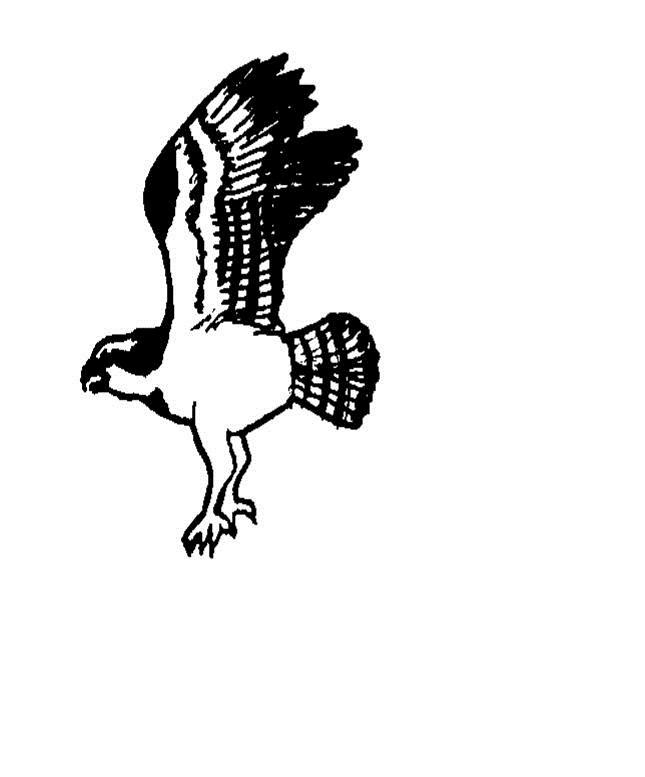
32 Lesson 4: COASTAL ECOSYSTEMS - Beach, Estuary, Marsh & Swamp Activity 5: Who Eats Whom OBJECTIVES: For youth to Identify the roles of producers, consumers, and decomposers in the food chain. Give an example of a predator-prey relationship. LIFE SKILLS: Problem Solving Working with Groups SUNSHINE STATE STANDARDS SC.4.L Trace the flow of energy from the Sun as it is transferred along the food chain through the producers to the consumers. SC.4.L Explain that animals, including humans, cannot make heir own food and that when animals eat plants or other animals, the energy stored in the food source is passed to them. SC.7.L Explain and illustrate the roles of and relationships among producers, consumers, and decomposers in the process of energy transfer in a food web. MATERIALS Colored cards labeled to represent three different levels in the food chain (example: pink = shrimp, white = redfish, blue = osprey). Popcorn or some other material that youth can find on the ground. This material would represent the mangrove leaves. TIME: 45 minutes SETTING: Large open area, indoors or outdoors. ADVANCED PREPARATION Prepare cards and popcorn or other material as described above INTRODUCTION Every living organism needs energy to live. Plants use the sun to make their own food through the process of photosynthesis. Plants are sometimes referred to as producers because of this ability to produce their own food. The production of leaves and fruits by plants can then be utilized or consumed by other animals. Animals that consume plant matter would be considered first order consumers. Animals also consume other animals for food. These organisms can be second or third order consumers depending on what prey species they might consume. When a plant or animal dies, it is consumed by living organisms called decomposers. These organisms include microscopic bacteria or fungi that are present in the water soils and air in any ecosystem. Decomposers are responsible for recycling some of the energy and much of the nutrients back through the system. The flow of energy from one living thing to another is called a food chain. Let's play a game that will demonstrate this energy flow as we act out an example of a simple food chain. DO At the learning site, give each youth a colored card labeled with the name of a member of the food chain. Pink for shrimp, white for redfish, and blue for osprey. Cards should be distributed evenly, creating three equal groups in the "ecosystem" at first. You may want to adjust numbers as you play the game. 174

33 Lesson 4: COASTAL ECOSYSTEMS - Beach, Estuary, Marsh & Swamp - Activity 4.5 Who Eats Whom Distribute the popcorn or other material over the playing area. Explain that those youth labeled as "shrimp" must crawl over the play area to gather their decomposing mangrove leaves represented by the popcorn. The shrimp must gather a hand full of popcorn to survive each round. The other "animals" (redfish and osprey) act out the food chain relationships by tagging their prey: redfish will tag shrimp, and osprey will tag redfish. If a shrimp gathers a hand full of popcorn before being tagged they are immune to predation by redfish. Play the first round without any osprey. As each player is tagged they must sit down where they are and hand their card to the animal that has "consumed" them. Play for one or two minutes, depending on the size of the group, then call time. Observe who is alive and who is dead. Any animal who has not "eaten" will be dead. Record the surviving populations for later discussion. Add the osprey to the game and play again. You may adjust the numbers of each group if needed (more shrimp and fewer osprey, for example) to affect the outcome at the end of the game. REFLECT The animals you played in the food chain had to do two things to live. What were they? Eat and avoid being eaten. What animals were predators in this food chain? Redfish and osprey. What was their prey? Redfish preyed upon the shrimp and the osprey preyed upon redfish. Was it harder to be a fish or an osprey? Redfish are both predator and prey...ospreys had no predators. What did you observe about the number of organisms surviving in each group at the end of the game? Most of the redfish died because of too many osprey and/or not enough shrimp. 175
34 Lesson 4: COASTAL ECOSYSTEMS - Beach, Estuary, Marsh & Swamp - Activity 4.5 Who Eats Whom What conclusions can we draw from these relationships? The higher you go up the food chain, the fewer organisms it can support. That is: many shrimp are needed to feed several redfish and a few osprey can survive on the redfish. Energy in the form of food is limiting the number of organism at each of the levels in the food chain. Was an important member of the food chain omitted? Yes, decomposers were not represented in this food chain. What would the energy source be for this food chain? The Sun is the energy source for almost all food chains on earth. What happened to the fish's body after the osprey ate it? The fish was digested by the osprey and the waste products were excreted. The decomposers then consumed the waste and changed it into nutrients to be recycled into the ecosystem. APPLY Name some other possible food chains in a coastal ecosystem--give examples. Where do humans fit in the food chain? Examples: Plankton - coquina clam - seagull Plants - mullet - snook - human Phytoplankton - zooplankton - sea trout fry - great blue heron Sea grasses - manatee Using an example of a typical human meal, have youth trace the food chain back to the plant source of each food item. Example: steak - cattle - corn & grasses The next time you are in a natural area, observe the animal interactions around you. Most likely you will see a food chain in action! Find an example of predator-prey relationship around your own home. (Hint: look for spiders, lizards, etc.) The next time you eat seafood, think about the food chain associated with it. Find out where the seafood came from and think about the energy it took to get it from the sea to your plate! 176
35 Lesson 4: COASTAL ECOSYSTEMS - Beach, Estuary, Marsh & Swamp Activity 6: Are We In-Seine? OBJECTIVES: For youth to: Correctly identify at least four marine vertebrates and invertebrates collected. Provide at least two examples of interrelationships that exist in the marine community. Identify at least one food chain in the marine habitat sampled. Demonstrate a knowledge of proper collecting and release methods. LIFE SKILLS: Working with others. Acquiring, analyzing and using information SUNSHINE STATE STANDARDS SC.4.N.1.6--Keep records that describe observations made, carefully distinguishing actual observations from ideas and inferences about the observations. SC.7.L Explain and illustrate the roles of and relationships among producers, consumers, and decomposers in the process of energy transfer in a food web. MATERIALS 10 ft. to 100 ft. seine net Cast nets and long handled scoop nets if available Five gallon buckets Magnifying glasses Leather gloves (2 pair) Old tennis shoes or water shoes Fish and invertebrate ID books (see reference list) TIME: 90 minutes at collection site ADVANCED PREPARATION Scout out a potential field trip site. A collection trip before you take a group out is suggested. Make sure the site is safe and is not too muddy or overgrown with vegetation. Encourage youth to wear swimsuits and shorts, diving booties or old tennis shoes on the day of this activity. Remember youth will have to get into the water to collect specimens. INTRODUCTION This activity is designed to provide an opportunity to explore a coastal ecosystem. The primary objective is to use nets and seines to collect marine vertebrates and invertebrates. Consideration should also be given to the interrelationships (such as predator-prey relationships) and the food webs that exist in these coastal communities. Collection techniques will vary depending upon the availability of equipment but seining (the use of a large net) is usually the most productive. Success in seining depends on the tides, the size of the waves, amount of wind, the presence or absence of schools of fish, and of course seining technique. Hint: A good sign is observing dolphins, pelicans, or terns feeding offshore, this usually indicates the presence of baitfish and other predatory fish. Some kinds of fish and invertebrates will be collected individually. For example, bottom dwellers like the star gazer, sea urchins and starfish are usually solitary. Fish traveling in schools might be caught in large numbers. In a school, if one fish makes a turn, it may cause the entire school to turn in the direction of your net. Some fish such as silversides which are very fast swimmers may not be caught at all, but can be observed in the habitat. So success in seining like other forms of fishing can be a hit or miss proposition. Usually good habitat will produce some fish and other invertebrates. Remember this is a catch and release activity. All specimens should be returned to the water as soon as possible to avoid injury and stress. 177

36 Lesson 4: COASTAL ECOSYSTEMS - Beach, Estuary, Marsh & Swamp DO Here is how to use the seine. Lay the seine out on the beach. Position two students at each of the end poles, and two others to walk behind the net. No one should walk in front of the net at any time (it scares the fish, and that person could get tangled in the net and tear it). As they move out into the water with one end, make sure the net is not tangled, and that the weights are on the bottom and the floats are on the top. Continue to pull the net out, one pole in the water near the beach, the other pole deeper, so that the net is perpendicular to the shore. The bottoms of the poles should barely touch the sand as they are moved. Bottom-dwelling animals will not be caught unless the net drags along the bottom. Keep the two poles apart but do not completely stretch the net out. Form a broad U as the seine is pulled through the water. Walk at a steady pace and do not stop pulling the net. After a while, stop the pole nearest the shore. The individual pulling the outer pole should continue walking toward the shore. When the net is parallel to the beach, both ends walk until the net is completely out of the water. Caution youth on how to handle certain creatures. Shake jellyfish out of the net, and rinse that area of the net. Use pliers to work catfish out of the net, and do not touch the poisonous barb on the dorsal fin. Grab crabs from the back and wear gloves when handling them. Handle stargazers, sea urchins, sting rays, and jellyfish only with leather gloves on. For those individuals not involved in the actual seining distribute long handled nets or cast nets and a pail or bucket to each team of two or three youth. These teams should work together in the habitat and collect as many specimens as possible. Remember only one or two examples of each species is sufficient for identification purposes. Put the animals into buckets of water. Have youth use ID books to identify each animal, and keep a log of those that are caught. Release the specimens after identification and observation by the entire group. Caution: Some animals will die within a few minutes after being placed in a bucket because of lack of sufficient oxygen, change in temperature, or damage by other animals release any delicate specimens first. Pull the seine a couple of times, and let interested youth try their hand at using the cast nets and scoop nets. Rinse the nets out with fresh water when you are finished because salt water deteriorates the net material. 178
Warm-up # 7 A day 5/17 - B day 5/18 UPDATE YOUR TABLE OF CONTENTS
 Warm-up # 7 A day 5/17 - B day 5/18 UPDATE YOUR TABLE OF CONTENTS Question: List all examples of surface water on Earth. Answer: Rivers and streams, lakes and reservoirs, (ponds) wetlands, estuaries and
Marine Ecosystems. Aquatic Ecosystems Section 2
 Marine Ecosystems Marine ecosystems are located mainly in coastal areas and in the open ocean. Organisms that live in coastal areas adapt to changes in water level and salinity. Organisms that live in
Examples of estuaries include bays, sounds, salt marshes, mangrove forests, mud flats, swamps, inlets, and sloughs.
 An estuary is a partially enclosed body of water where incoming seawater is mixed with fresh water coming from the land. Examples of estuaries include bays, sounds, salt marshes, mangrove forests, mud
SALINITY. It's the amount of dissolved salts the water contains.
 AQUATIC ECOSYSTEMS SALINITY The types of organisms in an aquatic ecosystem depend upon the water s Salinity. It's the amount of dissolved salts the water contains. Salinity determines the two main aquatic
WHAT ARE ECOSYSTEMS? Dr. V. N. Nayak Professor of Marine Biology (Retd)
") WHAT ARE ECOSYSTEMS? Dr. V. N. Nayak Professor of Marine Biology (Retd) An ECOSYSTEM is an interacting system of plant, animals, and humans and the surrounding environment. An ecosystem contains living
WHAT ARE ECOSYSTEMS? Dr. V. N. Nayak Professor of Marine Biology (Retd) An ECOSYSTEM is an interacting system of plant, animals, and humans and the surrounding environment. An ecosystem contains living
For Creative Minds. Salt Marsh Plants and Animals
 For Creative Minds The For Creative Minds educational section may be photocopied or printed from our website by the owner of this book for educational, non-commercial uses. Cross-curricular teaching activities,
Habitat Fact Sheets. Rocky habitats are dominated by seaweeds and often mussels, which rely on the rocks for attachment.
 Habitat Fact Sheets Habitats in the Gulf of Maine serve many important roles for the environment and for humans as well. These include: cycling nutrients, filtering pollution, trapping sediments, storing
Let s take a closer look at estuaries and learn why they are important.
 ave you ever wondered what happens where a river or stream flows into the ocean? When fresh water meets saltwater in a protected bay or inlet, a partially enclosed body of water called an estuary often
Definitions. The environment is the biological, chemical, physical, and social conditions that surround organisms.
 Marine Ecosystems Definitions An ecosystem is a geographically specified system of organisms (including humans), the environment, and the processes that control its dynamics. The environment is the biological,
Types of Freshwater Ecosystems. Streams originate from underground water. Rivers form when streams join together. Freshwater Biome
 Definition Streams originate from underground water sources Types of Freshwater Ecosystems Streams Rivers Rivers form when streams join together Freshwater Lakes Ponds Basic Characteristics Directional
A DAY AT THE WHITNEY LAB The Whitney Laboratory for Marine Bioscience An Institute for Marine Research and Biotechnology
 A DAY AT THE WHITNEY LAB The Whitney Laboratory for Marine Bioscience An Institute for Marine Research and Biotechnology STUDENT NAME: What s For Lunch? The Mission In this activity, you will make an educated
The Case of the Disappearing Shoreline
 Name The Case of the Disappearing Shoreline Humans change the earth's climate in many ways. One change is the increase of carbon dioxide in the atmosphere. As we burn more fossil fuels, we release more
CHAPTER 11.1 THE WORLD OCEAN MARINE BIOMES NOTES
 CHAPTER 11.1 THE WORLD OCEAN MARINE BIOMES NOTES 1. The world ocean can be divided into zones both and. The,, and zones that apply to large lakes also apply to the ocean. 2. In addition to the depth zones,
* Appalachian Mountains -the mountain range in the Eastern U.S. which terminates in north-central Alabama
 MR. SAND TEACHER'S MANUAL INTRODUCTION: Although Mr. Sand is a cartoon presentation that is attractive to children (of all ages), the material is technically accurate and quite significant to our understanding
Beach. Coastal Fishing
 Coastal Discoveries PROGRAM FOR GRADES 6-8 Beach Beach Seine Students explore the high energy surf zone using seine nets to sift and sort organisms. They will learn about functions of producers, consumers,
Figure 1. Schematic illustration of the major environments on Mustang Island.
 STOP #1: PACKERY CHANNEL BEACH TO BAY We will start this field guide near the north jetty of Packery Channel and hike across the island to Corpus Christi Bay (fig. 1). The island emerges from the Gulf
Fish Texas AQUATIC ECOSYSTEMS
 27 Additionally, healthy aquatic communities in Texas rivers, reservoirs and estuaries provide unparalleled recreational opportunities to millions of Texans. Our fresh and saltwater environments vary from
Today: Coastal Issues and Estuaries
 Today: Coastal Issues and Estuaries Coastal issues Human effect on coastlines What is an estuary Why are they so important? Circulation of water in estuary Environmental issues Coastal Issues: Problem
1. Distribute the activity sheet, and allow 20 minutes for the first use.
 A LOCAL WAY OF LEARNING Title: MISSING MANGROVE MESSAGE Author: Eulalie R. Rivera Elementary School Environmental Education Team Grade Level: 4-6 Concepts: 2.Ecosystem 6.Resources 9.Change Disciplines:
Marine Environments. Copyright 2011 LessonSnips
 Marine Environments I must go down to the seas again, for the call of the running tide Is a wild call and a clear call that may not be denied Excerpt from a poem by John Masefield Continents and islands
Coastal management has lagged behind the growth in population leading to problems with pollution
 Fifty percent of the population of the industrialized world lives within 100 km of a coast. Coastal management has lagged behind the growth in population leading to problems with pollution and natural
Marine Ecosystems. Objectives. Key Terms SECTION 2
 SECTION 2 Marine Ecosystems Marine ecosystems of the world are made up of a wide variety of plant and animal communities. Marine ecosystems are located mainly in coastal areas and in the open ocean. Organisms
Natural Bridges Field Trip Activity
 Natural Bridges Field Trip Activity This is due in class on MONDAY- March 1 - not in sections! Name TA: NOTE ON THE GRADING OF THIS ASSIGNMENT: Many of the questions below (especially in the tidepool part)
Oceans Humans both depend on it and threaten it with their activities
 Oceans Humans both depend on it and threaten it with their activities Oceans Water covers nearly ¾ of the Earth s surface More than 50% of the world s population lives within an hour of the coast Oceans
Texas Water Resources Institute
 Texas Water Resources Institute November/December 1982 Volume 8 No. 6 A Precise Environment By Lou Ellen Ruesink, Editor, Texas Water Resources Aquarium enthusiasts know just how particular fish are about
Indian River Lagoon: Lessons, Challenges and Opportunities
 Indian River Lagoon: Lessons, Challenges and Opportunities Upper Chain of Lakes Lake Kissimmee Kissimmee River Indian River Lagoon Caloosahatchee Estuary Lake Okeechobee St. Lucie Estuary Mark Perry, Executive
5/8/2018. Estuaries are classified by: > Mode of formation e.g. glaciers, deposition, sea level rise. > Patterns of water circulation
 Prepared by Diana Wheat-LBCC Compare and contrast the various types of estuaries, including their origin, size, shape, and general location on earth. Distinguish and describe the different types of habitats
The Sand Beaches of New Hampshire and Maine
 The Sand Beaches of New Hampshire and Maine Beach Preservation and Erosion Control Photographs provided by Joe Kelly and Steve Adams Cover photo: Reid State Park, ME Introduction The sand beaches of New
Dewees Island Game Fish & Shellfish
 Dewees Island Game Fish & Shellfish Red Drum Also called: spottail, spottail bass, channel bass, redfish, puppy drum Limit: 2 per person, per day Size: 15-inch minimum, 24-inch maximum Remarks: Red drum
Beach Ecology. As you walk along the beach, it often appears as if it is lacking obvious signs of life. However, beaches are one of the most dynamic
 Atlantic City Aquarium 800 N. New Hampshire Avenue Atlantic City, NJ 08401 609-348-2880 www.acaquarium.com Beach Ecology As you walk along the beach, it often appears as if it is lacking obvious signs
MARSH DEGRADATION AT THE MOUTH OF MOORE CREEK
 MARSH DEGRADATION AT THE MOUTH OF MOORE CREEK Hunter Winstanley, Department of Earth Sciences, University of South Alabama, Mobile, AL 36688. E-Mail: hcw501@jaguar1.usouthal.edu. Moore Creek is located
Beach Coastal ecology PROGRAM FOR GRADES Beach. Coastal Fishing
 Coastal ecology PROGRAM FOR GRADES 9-12 Beach Beach Seine Students explore the high energy surf zone using a seine net to sift and sort critters. They will learn about behavioral and structural adaptations
Sample page. Contents
 Contents Part A: Mangroves and seagrasses 5 A1. What do mangroves look like? 5 A2. Which animals use mangroves for shelter? 7 A3. How do mangroves grow? 8 A4. How do mangroves reproduce? 10 A5. Which animals
Formation and characteristics of different types of beaches
 Activity Title: Formation and characteristics of different types of beaches Focusing questions What different types of beaches are there in New Zealand? How are estuaries different to open coastal sandy
Refined Designated Uses for the Chesapeake Bay and Tidal Tributaries
 A-1 appendixa Refined Designated Uses for the Chesapeake Bay and Tidal Tributaries BACKGROUND Federal water quality standards regulations establish that states must specify appropriate water uses to be
Ups and Downs in an Estuary
 Ups and Downs in an Estuary Whooping Crane Dilemma Modified from Texas Aquatic Science and Estuaries in the Balance Curriculum TEKS 6.2 E; 6.3 C; 6.12 E; 7.2 E; 7.3 C; 7.5 A; 7.8 A; 7.13 A; 8.2 E; 8.3
Full Name Class Date. 1. Draw and describe your prediction of what will happen to the eggplant after the teacher applies salt to it.
 Full Name Class Date Investigation Booklet Exploring: Salt in Our Lives 1. Draw and describe your prediction of what will happen to the eggplant after the teacher applies salt to it. Use these ecosystem
NYS Coastal Waters. Water Resources of NYS: THE NATURE of the COASTAL ZONE. NYS Coastal Waters. NYS Coastal Atlas. Coastal Zone Management 10/10/2014
 Water Resources of NYS: THE NATURE of the COASTAL ZONE NYS Coastal Waters NYS is the only state to border the Atlantic Ocean and the Great Lakes (Lakes Erie and Ontario). Great Lakes shoreline: 577 miles
Haitian Curriculum Fourth Grade Science Lesson Plan Coral Reefs in Haiti
 Haitian Curriculum Fourth Grade Science Lesson Plan Coral Reefs in Haiti Content/Theme: Coral Reefs in Haiti/Ecosystems Grade: Fourth Primary Benchmark: SC.4.L.17.4 Recognize ways plants and animals, including
Coastal issues: Beaches and Estuaries. Recent Sea Level: Beaches: Baltimore D.C. Patomac R. Chesapeake Bay
 Coastal issues: Beaches and Estuaries Definitions: Coast = broad zone where both marine & terrestrial processes act It includes the beach, lagoons, marshes, bars etc. Coastal processes act to shape the
Third Grade Manatee Curriculum Lesson 12: Pollution and Other Threats to Manatees 1
 VM215 Third Grade Manatee Curriculum Lesson 12: Pollution and Other Threats to Manatees 1 Maia McGuire and Ruth Francis-Floyd 2 Description Students will learn about threats to manatee survival by playing
Harbours, bays and estuaries. at the edges of land and sea
 Harbours, bays and estuaries at the edges of land and sea Our prized snapper Snapper are fish that live not too far offshore mainly around the coasts of the North Island. They are one of New Zealand s
FLORIDA BAY: AN ECOSYSTEM ON THE BRINK
 E V E R G L A D E S R E S T O R A T I O N F A C T S H E E T FLORIDA BAY: AN ECOSYSTEM ON THE BRINK Background T he Florida Bay estuary is located at the southern edge of the Everglades ecosystem at the
Chesil Beach, Dorset UK High energy, shingle coastline. Brighton Beach, Sussex UK Pebble beach
 Beaches: Depositional landform Extends from the highest high tide to the lowest low tide. Very important temporary store in coastal system. Accretion: sediment returning to the visible portion of a beach
Geology of the Hawaiian Islands
 Geology of the Hawaiian Islands Class 24 8 April 2004 Any Questions? Rise and fall of sea level and its effect on Hawai`i Sea level Has fluctuated up and down many times in the geologic past Evidence?
FACT SHEET#4: SOME ANIMALS IN THE MANGROVE SWAMP
 FACT SHEET#4: SOME ANIMALS IN THE MANGROVE SWAMP SOME ANIMALS IN THE MANGROVE SWAMP A mangrove swamp is home to many animals. Below are some animals that can be commonly found in the mangrove swamp, and
Geographic Response Plan Map: SC-17
 79 37'30"W Geographic Response Plan Map: SC-17 79 30'0"W 33 7'30"N Charleston County 33 7'30"N 33 0'0"N 79 37'30"W [ Awendaw [j [e!d!s(!d Graham Creek FRANCIS MARION NATIONAL FOREST 450 Awendaw Creek [j
Puget Sound Shorelines. Waves and coastal processes. Puget Sound shorelines: Effects of beach armoring
 Puget Sound Shorelines Puget Sound shorelines: Effects of beach armoring Waves and coastal processes Factors affecting wave energy hitting the coast Processes transporting sediment along coastlines What
Overview. Beach Features. Coastal Regions. Other Beach Profile Features. CHAPTER 10 The Coast: Beaches and Shoreline Processes.
 Overview CHAPTER 10 The Coast: Beaches and Shoreline Processes Coastal regions constantly change. The beach is a dominant coastal feature. Wave activity continually modifies the beach and coastal areas.
Lecture Benthic Ecology
 Lecture Benthic Ecology Benthos Unlike the drifting plankton and swimming nekton, benthic organisms commonly referred to as benthos live on or near the ocean bottom A benthic habitat may be shallow or
Chapter 10 Lecture Outline. The Restless Oceans
 Chapter 10 Lecture Outline The Restless Oceans Focus Question 10.1 How does the Coriolis effect influence ocean currents? The Ocean s Surface Circulation Ocean currents Masses of water that flow from one
The Surge of the Storm By Margaret Olsen and Katie Greganti
 The Surge of the Storm By Margaret Olsen and Katie Greganti Grade Level: 5-12 Type of Activity: Hands on Focus Question: How does a hurricane s storm surge of a hurricane affect the low-lying areas along
LAB: WHERE S THE BEACH
 Name: LAB: WHERE S THE BEACH Introduction When you build a sandcastle on the beach, you don't expect it to last forever. You spread out your towel to sunbathe, but you know you can't stay in the same spot
Our Council s Own: Oceanography Cadette/Senior/Ambassador Badge
 Our Council s Own: Oceanography Cadette/Senior/Ambassador Badge Oceanography: The science that deals with oceans, the delimitation of their extent and depth, the physics and chemistry of their water, marine
Project Limulus on Napatree Point: Horseshoe Crab Surveys in 2017
 Project Limulus on Napatree Point: Horseshoe Crab Surveys in 2017 Laura Craver-Rogers & Kevin Rogers Napatree Point Conservation Area, Watch Hill Conservancy & Watch Hill Fire District Napatree Naturalist
Estuarine Shoreline Stabilization
 Estuarine Shoreline Stabilization Property Owner s Guide to Determining the Most Appropriate Stabilization Method Estuarine shorelines are dynamic features that experience continued erosion. Land is lost
VIRGINIA BARRIER ISLAND BACKGROUND
 VIRGINIA BARRIER ISLAND BACKGROUND Virginia's barrier islands are part of a barrier island chain extending 2,700 miles from Maine to Texas. These thin strips of sand provide valuable habitat for wildlife,
Lecture Outlines PowerPoint. Chapter 15 Earth Science, 12e Tarbuck/Lutgens
 Lecture Outlines PowerPoint Chapter 15 Earth Science, 12e Tarbuck/Lutgens 2009 Pearson Prentice Hall This work is protected by United States copyright laws and is provided solely for the use of instructors
page - Laboratory Exercise #5 Shoreline Processes
 page - Laboratory Exercise #5 Shoreline Processes Section A Shoreline Processes: Overview of Waves The ocean s surface is influenced by three types of motion (waves, tides and surface currents). Shorelines
Where Animals and Plants Are Found
 About Animals and Plants What I Need to Know Many different animals and plants live on Earth. The animals and plants live in different places and make up parts of different ecosystems. In an ecosystem,
Importance of Dunes Sign. Kim Scarola Suzanne Merrick Ariana Perez Johanna Mead
 Importance of Dunes Sign Kim Scarola Suzanne Merrick Ariana Perez Johanna Mead What role do dunes play in our coastlines? Part of a system of sand deposits and withdraws that helps keep the sand on our
Florida Seagrass Integrated Mapping and Monitoring Program
 Florida Seagrass Integrated Mapping and Monitoring Program - 2004 The following document is composed of excerpts taken from the 2011 publication, Seagrass Integrated Mapping and Monitoring for the State
Unit 11 Lesson 2 How Does Ocean Water Move? Copyright Houghton Mifflin Harcourt Publishing Company
 Unit 11 Lesson 2 How Does Ocean Water Move? Catch a Wave A wave is the up-and-down movement of surface water. Catch a Wave Catch a Wave (wave effects) Surface waves are caused by wind pushing against
Lesson 10: Oyster Reefs and Their Inhabitants
 Lesson 10: Oyster Reefs and Their Inhabitants Focus Question: What animals use oyster reefs for habitats? Objective: observe properties of animals found within a bag of oysters; Infer about the quality
Chapter. The Dynamic Ocean
 Chapter The Dynamic Ocean An ocean current is the mass of ocean water that flows from one place to another. 16.1 The Composition of Seawater Surface Circulation Surface Currents Surface currents are movements
Adaptations of Flora and Fauna in Rhode Island s s Estuaries
 Adaptations of Flora and Fauna in Rhode Island s s Estuaries Presented by: Kimberly Sullivan RIDEM Division of Fish and Wildlife Estuarine Habitats One of the most biologically diverse habitats in the
1.5 How do ocean waves and currents change the face of coastal areas? (Chapter 3)
") 1.5 How do ocean waves and currents change the face of coastal areas? (Chapter 3) 1. Hydraulic Action/Pressure - air being forced into crack in rocks. 2. Corrosion (Solution) Minerals such as calcium carbonate
1.5 How do ocean waves and currents change the face of coastal areas? (Chapter 3) 1. Hydraulic Action/Pressure - air being forced into crack in rocks. 2. Corrosion (Solution) Minerals such as calcium carbonate
Overview. What are Corals?
 Overview Coral Reefs extend back over 500 m.y. Grow in tropical seas with normal salinity Support a great variety of plant and animal life Cover less than 0.2% of sea floor Contain about 25% of marine
Green crabs: invaders in the Great Marsh Featured scientist: Alyssa Novak from the Center for Coastal Studies/Boston University
 Name Green crabs: invaders in the Great Marsh Featured scientist: Alyssa Novak from the Center for Coastal Studies/Boston University Research Background: Marshes are areas along the coast that flood with
The Oyster in Oyster Bay: Glaciers Set the Table
 The in Bay: Glaciers Set the Table In cooperation with NYS Department of Environmental Conservation Bay Long Island was created about 15,000 years ago when the last of the glaciers melted leaving behind
Species Conclusions Table
 Conclusions Table Project Name: Chesapeake Landing HOA- Breakwaters (NAO-14-0283) Date: February 25, 2014 /Resource Name Loggerhead sea turtle (Caretta caretta) Conclusion ESA Section 7 / Eagle Act Determination
ELIZABETH RIVER FACTS
 ELIZABETH RIVER FACTS How is she different from inland rivers? The Elizabeth River is an estuary a tidal finger of the Chesapeake Bay, rather than a freshwater river with a spring as origin. The Elizabeth
GONE! Coastal Erosion Happens During Storms! Why Worry About Coastal Setbacks? Goals for Today
 RI Regulatory Setbacks & Buffers: Coastal Zone Management Issues New England Onsite Wastewater Training Program @ URI OWT 155 November 21, 2013 Goals for Today Understand the impacts of storms, coastal
Exploring Tide Pools. Exploring Tide Pools. Visit for thousands of books and materials.
 Exploring Tide Pools A Reading A Z Level R Leveled Reader Word Count: 1,617 LEVELED READER R Exploring Tide Pools Written by Trica Oshant Hawkins Visit www.readinga-z.com for thousands of books and materials.
TITLE: North Carolina s Changing Shorelines. KEYWORDS: erosion - shorelines - mapping - sustainability
 UNC Coastal Studies Institute Teacher Resources 1 TITLE: North Carolina s Changing Shorelines KEYWORDS: erosion - shorelines - mapping - sustainability Changing shorelines impact coastal infrastructure.
Survival in an Estuary. Life in a Transition Zone
 Estuary An estuary is a semi-enclosed coastal body of water which has a free connection with the open sea and within which sea water is measurably diluted with fresh water derived from land drainage. (D.
Hatfield Marine Science Center Nature Trail Quest
 Hatfield Marine Science Center Nature Trail Quest 118 The Oregon Coast Book, 2019 20 Edition South Beach NOAA Marine Operations Center Marina Store HMSC HMSC Tsunami Sustainability Quest Quest START START
Historical and planned changes in the south Florida ecosystem 1
 FA127 Historical and planned changes in the south Florida ecosystem 1 Alex Score and Charles Jacoby 2 The core of the south Florida ecosystem is a unique watershed, the Kissimmee Okeechobee Everglades
Montserrat. Wise practices for coping with. i b bea n Se a
 Wise practices for coping with Montserrat Car i b bea n Se a Fisheries Division, Montserrat Physical Planning Department, Montserrat University of Puerto Rico, Sea Grant College Program Caribbean Development
Nearshore Sediment Transport What influences the loss of sediment on Beaches? - Waves - Winds - Tidal Currents - River discharge - Runoff
 Tides & Beaches Nearshore Sediment Transport What influences the loss of sediment on Beaches? - Waves - Winds - Tidal Currents - River discharge - Runoff Oceans Ocean Topography Physical Structure of the
4/20/17. #31 - Coastal Erosion. Coastal Erosion - Overview
 Writing Assignment Due Monday by 11:59 pm #31 - Coastal Erosion Beach front property! Great View! Buy now at a great price! See main class web pages for detailed instructions Essays will be submitted in
Zooplankton Migration Patterns at Scotton Landing: Behavioral Adaptations written by Lauren Zodl, University of Delaware
 Zooplankton Migration Patterns at Scotton Landing: Behavioral Adaptations written by Lauren Zodl, University of Delaware Summary: Zooplankton have evolved specific migration patterns that increase their
Hello, my name is Speck. I am a Spotted Sea Trout and live in estuaries and in waters along the coast of the Atlantic Ocean.
 Hello, my name is Speck. I am a Spotted Sea Trout and live in estuaries and in waters along the coast of the Atlantic Ocean. Hi, my name is Spot and I am, well, a Spot, named for my spot just behind my
Are fish and wildlife populations stable, increasing or decreasing?
 FOCUS QUESTION 4: Are fish and wildlife populations stable, increasing or decreasing? What was measured: recreationally important species abundance, ecologically important species abundance, commercially
The mangroves. The mangrove environment. The excursion
 The mangroves Now you are going to investigate an environment that you may have experienced the mangrove swamp. You will use this environment to practise writing food chains. To do this, you are going
FISHING SARASOTA MANATEE CHARLOTTE
 FISHING SARASOTA MANATEE CHARLOTTE The Florida Gulf Coast is a paradise for fish. Freshwater streams and rivers flow from Manatee, Sarasota and Charlotte County into a bay protected by the barrier islands.
UNDERSTANDING YOUR ESTUARY Level IA- ESTUARY SEARCH
 UNDERSTANDING YOUR ESTUARY Level IA- ESTUARY SEARCH Kakagon/Bad River Sloughs, a Lake Superior estuary located on the Bad River Reservation near Ashland, WI. GOAL Select one Wisconsin estuary to study
Hold onto Your Barnacles!
 Hold onto Your Barnacles! Developed by: Alexa Jefferis Adapted from: Olmstead, Adrienne. 2000. My Nature Journal. Lafayette, CA: Pajaro Time: 90 minutes Level: Grades 3-8 Overview This activity introduces
The Great Barrier Reef
 The Great Barrier Reef The Great Barrier Reef Where are the most biologically diverse places on the planet? If I asked you this question, you might guess the Amazon rainforest in Brazil or the jungles
US Beach Nourishment Experience:
 Beach Nourishment: Introduction of new sand to the beach by truck or dredge Large beach >1 million cubic yards (100,000 dump truck loads) Funding is a combination of federal, state, local & private Also
Before we get started, where in the world is Georgia? Do you know?
 Before we get started, where in the world is Georgia? Do you know? Georgia is in the Southeastern part of the United States, on the continent of North America. There it is! Georgia itself is divided into
Eastern Shore Islands Area of Interest Community Newsletter
 Eastern Shore Islands Area of Interest Community Newsletter Fall 2018 1ỊNTRODUCTION In addition to information on our Fisheries and Oceans Canada (DFO) website, we have now created a seasonal, community
Habitat Development: Habitat Boulders Lawson Pier Foreshore Enhancement
 Habitat Development: Habitat Boulders Improve the existing habitat by stabilising beach sediments. Increase biodiversity by creating new habitats and colonisation opportunities. Loose cobble is unstable;
Shorelines Earth - Chapter 20 Stan Hatfield Southwestern Illinois College
 Shorelines Earth - Chapter 20 Stan Hatfield Southwestern Illinois College The Shoreline A Dynamic Interface The shoreline is a dynamic interface (common boundary) among air, land, and the ocean. The shoreline
UTAH LAKE JUNE SUCKER
 UTAH LAKE JUNE SUCKER PROCEDURE: Activity Game: UTAH LAKE JUNE SUCKER GAME Instructions: 1. Hand out one Utah Lake Card per student. 2. Select one area of the gym to be Utah Lake and another to be Provo
Classroom Activity: Population Study Game (Oh, Deer!)
") Classroom Activity: Population Study Game (Oh, Deer!) Subject: Biology/Ecology Grades: 6-12 Standards: See end of lesson plan Time: 20 minutes (can last longer depending on how many rounds you play) Materials:
Classroom Activity: Population Study Game (Oh, Deer!) Subject: Biology/Ecology Grades: 6-12 Standards: See end of lesson plan Time: 20 minutes (can last longer depending on how many rounds you play) Materials:
Managing Chesapeake Bay s Land Use, Fish Habitat, and Fisheries: Studies. Jim Uphoff & Margaret McGinty, Fisheries Service
 Managing Chesapeake Bay s Land Use, Fish Habitat, and Fisheries: Positive Image and or Negative Graphic Case Studies Jim Uphoff & Margaret McGinty, Fisheries Service Maryland Fisheries Service has been
3.9 FROM ISLANDS TO ATOLLS
 3.9 1 3.9 FROM ISLANDS TO ATOLLS OBJECTIVES The students Listen to a description of the formation of volcanic islands, fringing reefs, barrier reefs, and atolls. Observe and participate in a simulation
Reading Material. Inshore oceanography, Anikouchine and Sternberg The World Ocean, Prentice-Hall
 Reading Material Inshore oceanography, Anikouchine and Sternberg The World Ocean, Prentice-Hall BEACH PROCESSES AND COASTAL ENVIRONMENTS COASTAL FEATURES Cross section Map view Terminology for Coastal
Map of Special Places in Florida
 Map of Special Places in Florida 17 5 FLORIDA INTRODUCTION Gulf Islands National Seashore Florida District BASIC SEASHORE FACTS With 12 units altogether in Florida and Mississippi, Gulf Islands National