Mooring Fields - From Concept to Construction
|
|
|
- Adam Maxwell
- 5 years ago
- Views:
Transcription


1 Mooring Fields - From Concept to Construction A Presentation for the Proposed Manatee Pocket Mooring Field Workshop (a project of the Martin County Board of County Commissioners) Thursday, November 30 th Stuart Corinthian Yacht Club, Port Salerno Presentation by: Robert Semmes, ATM
2 Presentation Outline Reasons for Considering Managed Mooring Fields Process for Establishing a Managed Mooring Field Planning, Design, and Construction of Mooring Fields Lessons Learned from Earlier Mooring Field Projects
3 Problems with Unmanaged and Unregulated Mooring Areas Vessels typically anchor in high traffic areas which could lead to navigational hazards Potential for illegal discharges Damage to seagrass, bottom, etc., from dragging anchor Damage to property and vessel from breakaway vessels Incorrect mooring radii Abandonment of unwanted vessels

4 Existing Mooring Fields in Florida

5 Problems with Unmanaged and Unregulated Mooring Areas

6 Problems with Unmanaged and Unregulated Mooring Areas
7 Solutions and Advantages of Managed Mooring Fields More affordable public access Improved navigation Properly designed mooring anchors Prevent damage to environment and local property Easy to manage Lower maintenance costs than a typical marina Cost effective ($2,500-$3,500 per mooring) Promotes tourism, thereby increasing income for waterfront communities Better able to manage illegal sewage discharges

8 Properly Managed Mooring Field
9 From Concept to Construction 1. Determine Market and Size of Vessels Anticipated 2. Identify Limitations (geotech, exposure, environmental) 3. Bathymetric Surveys, Ecological Resource Surveys, Geotechnical Investigation, and Archeological Investigations 4. Develop Concept Layout. Include Upland Facilities. 5. Start Permitting, Pre-Application Meeting (seagrass, manatees, shellfish, management plan, other benthic resources, etc.) 6. Establish Design Criteria (vessel size, depths, wind/wave exposure) 7. Mooring Design including Maintenance Considerations 8. Construct Mooring Field

10 Proper Layout and Planning

11 Detailed Layout Planning Titusville Municipal Marina and Mooring Field
12 Permitting Considerations in Florida New Noticed General Permit General Permit to Local Governments for Public Mooring Fields Seagrass Require adequate depths and flushing currents Damage from random anchoring vs. single-point Submerged Lands Ownership St. Augustine Owns and controls submerged lands Martin County Standard SSL no control outside of SSL Upland facilities Showers, restrooms, garbage collection, sewage pump-out, dinghy docks/tender vessel services, etc.
13 Florida Noticed General Permit General Permit to Local Governments for Public Mooring Fields Mooring Field Management Plan Details on the anchoring systems proposed for mooring vessels, any docks, pumpout facilities, kiosks, and in-water navigational signs and markers proposed A scaled bathymetry plan A benthic resource inventory Survey for Submerged Lands Lease Still requires a separate Section 10 Permit from Corps Waterway Marker Permit
14 Proper Engineering is Key Exposure Geotechnical Considerations Navigation Hazards Functionality of Mooring Considerations Design Load and Limitations Swing Radii Vessel Types
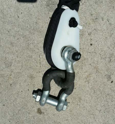
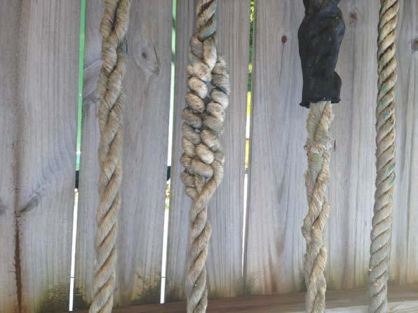
15 Mooring Technology: Old
16 Mooring Technology: New
17 Increasing Efficiency Note: Mooring station diameters are shown for an area with a small tide range, water depth of 6 ft, and 40 ft length vessel. Each location is site specific.

18 Typical Mooring Point

19 12/7/

20 Installation of Anchor

21 12/7/

22 Installation

23 12/7/

24 12/7/

25 Stabilizer


26 Through Buoy Design

27 12/7/

28 Attached Pennant Design

29 Pennant Connection

30 Punta Gorda Buoy Design


31 Titusville Buoy Design

32 St. Augustine Buoy Design


33 Opposing Wind and Current

34 New HPDE Thimbles

35 New Soft Sided Buoy with Rope Nest


36 12/7/

37 Load Testing Mooring Point


38 Load Testing Mooring Point


39 Maintenance Is Imperative


40
41 Summary Mooring fields are a cost-effective way to provide affordable in-water vessel storage Good for the environment regulated Necessary public access amenity for transient vessels Proper design is critical Maintenance is imperative

42 Questions? We thank you.
Good Mooring to You! Jensen Beach Mooring Field. Kathy Fitzpatrick, P.E. Coastal Engineer, Martin County
 Good Mooring to You! Kathy Fitzpatrick, P.E. Coastal Engineer, Martin County Penny Cutt Regional Manager, Coastal Systems International Mooring Field Advantages Provide a safe and secure anchorage at a
A Guide for Local Communities that are Considering Creating a Managed Mooring Field
 A Guide for Local Communities that are Considering Creating a Managed Mooring Field Betty Staugler, UF/IFAS Extension, Charlotte County Byron Flagg, The Flagg Firm, P.L. Andy Stevens, Parks and Natural
Lee County Board Of County Commissioners Agenda Item Summary Blue Sheet No
 1. REOUESTED MOTION: Lee County Board Of County Commissioners Agenda Item Summary Blue Sheet No. 20030985 ACTION REOUESTED: Approve Resolution requesting funding from the West Coast Inland Navigation District
HARBOR INFRASTRUCTURE INVENTORIES Caseville Harbor, Michigan
 HARBOR INFRASTRUCTURE INVENTORIES Caseville Harbor, Michigan Harbor Location: Caseville Harbor is located at the mouth of the Pigeon River on the east shore of Saginaw Bay, about 17 miles southwest of
HARBOR INFRASTRUCTURE INVENTORIES Lexington Harbor, Michigan
 HARBOR INFRASTRUCTURE INVENTORIES Lexington Harbor, Michigan Harbor Location: Lexington Harbor is located on the west shore of Lake Huron about 20 miles north of Port Huron, MI. Authority: Rivers & Harbors
UBCM Community Excellence Awards 2007 Submission
 UBCM Community Excellence Awards 2007 Submission Formatted: Left: 2.54 cm Category: Partnerships Project: Implementation of False Creek Anchoring Management System 1. A one-paragraph summary of the project/program
MEMORANDUM. Existing Operations. City of Clearwater. Michael Herrman. Date: January 26, Seminole Boat Launch Overview. M&N Job No.
 1509 W. Swann Avenue, Suite 225 Tampa, FL 33606 (813) 258-8818 Fax (813) 258-8525 www.moffattnichol.com MEMORANDUM To: From: City of Clearwater Michael Herrman Date: Subject: Seminole Boat Launch Overview
HARBOR INFRASTRUCTURE INVENTORIES West Harbor, OH
 HARBOR INFRASTRUCTURE INVENTORIES West Harbor, OH Harbor Location: West Harbor is located on the southern shore of Lake Erie in the township of Catawba Island, OH about 50 miles east of Toledo, OH. Authority:
The development of the historical harbour of Paphos, Cyprus H.J. van Wijhe*, M. Meletiou^ Division, P.O. Box 152, 8300 AD Emmeloord, The Netherlands
 The development of the historical harbour of Paphos, Cyprus H.J. van Wijhe*, M. Meletiou^ Division, P.O. Box 152, 8300 AD Emmeloord, The Netherlands Abstract The harbour of Paphos originates from ancient
New Orleans Municipal Yacht Harbor
 New Orleans Municipal Yacht Harbor Marina Schematic Design Update 601 Poydras St., Suite 1860 New Orleans, LA, 70130 504-648-3560 Post-Katrina Municipal Yacht Harbor: Introduction The MYH was an approximate
Page 1. CALL MEETING TO ORDER 2. DISCUSSION ITEMS
 1. CALL MEETING TO ORDER 2. DISCUSSION ITEMS CAROLINA BEACH Town Council Workshop Meeting Agenda Tuesday, July 25, 2017 @ 9:00 AM Council Chambers 1121 N. Lake Park Boulevard Carolina Beach, NC 28428 a.
F4. Coastal Mooring Zone and moorings outside the Coastal Mooring Zone
 F4. Coastal Mooring Zone and moorings outside the Coastal Mooring Zone F4.1. Zone description This section addresses the provisions relating to moorings in the Coastal Mooring Zone and those outside the
HARBOR INFRASTRUCTURE INVENTORIES Lorain Harbor, Ohio
 HARBOR INFRASTRUCTURE INVENTORIES Lorain Harbor, Ohio Harbor Location: Lorain Harbor is located on the southern shore of Lake Erie in the city of Lorain, OH about 45 miles west of Cleveland, OH. Authority:
HARBOR INFRASTRUCTURE INVENTORIES Port Sanilac Harbor, Michigan
 HARBOR INFRASTRUCTURE INVENTORIES Port Sanilac Harbor, Michigan Harbor Location: Port Sanilac Harbor is located on the west shore of Lake Huron, about 30 miles north of Port Huron, MI. Authority: Rivers
5 Year Recreation Plan Proposed Amendment Marina/Harbor/Boat Launch
 5 Year Recreation Plan Proposed Amendment Marina/Harbor/Boat Launch The DNR and Waterways Commission requires certain elements addressing marinas/harbors to be included in a communities 5 Year Recreation
CLEARWATER COMPREHENSIVE BOATING PLAN PUBLIC OUTREACH MEETING 2. December 16, 2015
 CLEARWATER COMPREHENSIVE BOATING PLAN PUBLIC OUTREACH MEETING 2 December 16, 2015 Introduction Project Team City of Clearwater Bill Morris Director of Marine and Aviation Kyle Brotherton Planning and Development
ARTICLE III. CERTAIN PUBLIC PLACES* DIVISION 1. GENERALLY DIVISION 2. MUNICIPAL YACHT BASIN DIVISION 3. MANAGED MOORING FIELD
 ARTICLE III. CERTAIN PUBLIC PLACES* *Cross References: Parks and recreation, Ch. 14. Secs. 17-56--17-65. Reserved. DIVISION 1. GENERALLY DIVISION 2. MUNICIPAL YACHT BASIN Sec. 17-66. Mooring. It shall
City of Harbor Springs Harbor, Waterfront and Marina Rules and Regulations (Approved by City Council April 17, 2006) (Revised February 8, 2006)
 (Revised February 8, 2006)") City of Harbor Springs Harbor, Waterfront and Marina Rules and Regulations (Approved by City Council April 17, 2006) (Revised February 8, 2006) A. Definitions. 1. The Harbor. Those waters of Little Traverse
City of Harbor Springs Harbor, Waterfront and Marina Rules and Regulations (Approved by City Council April 17, 2006) (Revised February 8, 2006) A. Definitions. 1. The Harbor. Those waters of Little Traverse
CITY OF GULFPORT MUNICIPAL MARINA RULES AND REGULATIONS
 CITY OF GULFPORT MUNICIPAL MARINA RULES AND REGULATIONS The City of Gulfport provides these Marina facilities for your comfort and convenience. For the safety and enjoyment of the marina, it is required
PWC CO OP AND KEY WEST ANGLERS USER CONFLICT RELIEF REQUEST
 PWC CO OP AND KEY WEST ANGLERS USER CONFLICT RELIEF REQUEST KEY WEST FISHING GUIDES, FISHERMEN AND LOWER KEYS PWC CO-OP TOUR OPERATORS The PWC CO-OP has reached out to work together with the Key West area
Provisions for Moorings
 Provisions for Moorings Tasman Resource Management Plan Summary Guide No. 11 Current: July 2013 1. Introduction Structures and occupation of the coastal marine area (CMA) are managed to control the location
Recreational Boating Definitions (2006)
") Page 1 of 5 Recreational Boating Definitions (2006) Vessels, Boats and Craft Vessels include every description of watercraft, including non-displacement craft and seaplanes, used or capable of being used
Page 1 of 5 Recreational Boating Definitions (2006) Vessels, Boats and Craft Vessels include every description of watercraft, including non-displacement craft and seaplanes, used or capable of being used
Port Elgin Harbour Strategic Assessment. Study undertaken by TOURISTICS and Shoreplan Engineering Limited
 Study undertaken by TOURISTICS and Shoreplan Engineering Limited 1 Study included: Review of existing recreational boating facilities in Bruce and Grey Counties An analysis of trends in recreational boating
STATE OF MAINE DEPARTMENT OF MARINE RESOURCES
 STATE OF MAINE DEPARTMENT OF MARINE RESOURCES IN THE MATTER OF THE APPLICATION OF GREAT ) EASTERN MUSSEL FARMS FOR AN AQUACULTURE ) FINDINGS OF FACT, LEASE LOCATED OFF OF HADLEY POINT IN THE ) CONCLUSIONS
Public Notice U.S. Army Corps In Reply to Application Number CENAB-OP-RMS (NATIONAL HARBOR (FORMERLY PORT Baltimore District AMERICA])
![Public Notice U.S. Army Corps In Reply to Application Number CENAB-OP-RMS (NATIONAL HARBOR (FORMERLY PORT Baltimore District AMERICA])](/thumbs/89/100795623.jpg "Public Notice U.S. Army Corps In Reply to Application Number CENAB-OP-RMS (NATIONAL HARBOR (FORMERLY PORT Baltimore District AMERICA])") Public Notice U.S. Army Corps In Reply to Application Number of Engineers CENAB-OP-RMS (NATIONAL HARBOR (FORMERLY PORT Baltimore District AMERICA]) 88-01361 PN 14-05 Comment Period: January 16, 2014 to
Public Notice U.S. Army Corps In Reply to Application Number of Engineers CENAB-OP-RMS (NATIONAL HARBOR (FORMERLY PORT Baltimore District AMERICA]) 88-01361 PN 14-05 Comment Period: January 16, 2014 to
Fort Hancock Sailing Center
 Response to the National Parks Service Request for Expressions of Interest to Redevelop Historic Structures at Fort Hancock in the Sandy Hook Unit of Gateway National Recreation Area Fort Hancock Sailing
HARBOR INFRASTRUCTURE INVENTORIES Fairport Harbor, OH
 HARBOR INFRASTRUCTURE INVENTORIES Fairport Harbor, OH Harbor Location: Fairport Harbor is located at the mouth of the Grand River on the southern shore of Lake Erie in the city of Fairport, OH, approximately
Plot the Path. Mary Anne Otten. lesson three
 Plot the Path Mary Anne Otten lesson three Subject/Grade: Grade 2, Math, Social Studies, Science Duration: one class period Materials needed: Per class: Day the Great Lakes Drained Away by Charles Ferguson
HARBOR INFRASTRUCTURE INVENTORIES Marquette Harbor, Michigan
 HARBOR INFRASTRUCTURE INVENTORIES Marquette Harbor, Michigan Harbor Location: Marquette Harbor is located in Marquette Bay on the south shore of Lake Superior, 160 miles west of Sault Ste. Marie, MI and
HARBOR INFRASTRUCTURE INVENTORIES Oak Orchard Harbor, New York
 HARBOR INFRASTRUCTURE INVENTORIES Oak Orchard Harbor, New York Harbor Location: Oak Orchard Harbor is located on the southern shore of Lake Ontario at the mouth of Oak Orchard Creek in the village of Point
Burrard Bridge Civic Marina. Class B Marina (No Liveaboard Facilities) A Prime Location in the Heart of Downtown Vancouver
 A Prime Location in the Heart of Downtown Vancouver") Features 1661 443 Water Moorage Slips (21 ft to 38 ft) 149 Land Storage Berths 12 Rowing Compounds BURRARD BRIDGE 36 Canoe/Kayak Racks 1601 Class B Marina (No Liveaboard Facilities) A Prime Location in
Features 1661 443 Water Moorage Slips (21 ft to 38 ft) 149 Land Storage Berths 12 Rowing Compounds BURRARD BRIDGE 36 Canoe/Kayak Racks 1601 Class B Marina (No Liveaboard Facilities) A Prime Location in
IMPLEMENTATION. Argyll Marine Special Areas of Conservation
 5 5 Argyll Marine Special Areas of Conservation 5.1 Implementation of the Management Plan Implementation of this management plan will be necessary to ensure compliance with the Habitats Directive. Although
RISK ASSESSMENT -HEATS-
 Honda RYA Youth RIB Championship 2018 RISK ASSESSMENT -HEATS- Issued by Royal Yachting Association October 2017 Page 1 of 12 Risk Assessment Event Summary Event Honda RYA Youth RIB Championship Organising
City of St. Petersburg. Waterfront Anchoring and Mooring Summit
 City of St. Petersburg Waterfront Anchoring and Mooring Summit Intent: To establish an anchoring management plan which will. Promote environmentally sensitive and responsible anchoring of vessels within
To: Ministry of Forests, Lands and Natural Resource Operations File # Transport Canada File #
 1 March 22, 2012 1268 Saltspring Pl. Parksville, B. C. V9P2X6 To: Ministry of Forests, Lands and Natural Resource Operations File #1413569 Transport Canada File # 2001-500236 Re: Proposed Resort Marina
HARBOR INFRASTRUCTURE INVENTORIES Cheboygan Harbor, Michigan
 HARBOR INFRASTRUCTURE INVENTORIES Cheboygan Harbor, Michigan Harbor Location: Cheboygan Harbor is located at the mouth of the Cheboygan River, emptying into western Lake Huron approximately 16 miles southeast
CLUB POLICIES AND GUIDELINES HARBOR RULES
 MOORINGS CLUB POLICIES AND GUIDELINES HARBOR RULES 1. The Harbormaster is charged with the responsibility of managing the LCYC anchorage area and interpretation of these rules. A mooring is defined as
Welcome! Did You Know...? Aquatic Centre Dock Rebuild. Key Objectives
 1 Welcome! Aquatic Centre Dock Rebuild The City of Vancouver is improving the dock at the Vancouver Aquatic Centre, which is nearing the end of its service life and is in need of replacement. This creates
Town of Essex Police Department Harbor Division HARBOR REGULATIONS
 Town of Essex Police Department Harbor Division HARBOR REGULATIONS 1. The following Harbor Rules and Regulations will become effective February 1, 2018. Upon this date, all other previously existing Harbor
Chapter 269: MOORING REGULATIONS
 Chapter 269: MOORING REGULATIONS [HISTORY: Adopted by the Board of Selectmen of the Town of Falmouth 11-24-1997. Amendments noted where applicable.] GENERAL REFERENCES Harbor Master See Ch. 53, Art. I.
TOMALES BAY MOORING PROGRAM REQUIREMENTS (POLICIES AND CRITERIA) AUGUST 25, 2017
 AUGUST 25, 2017") I. Introduction: The Tomales Bay Mooring Program (MP) was developed as part of the Tomales Bay Vessel Management Plan by NOAA s Greater Farallones National Marine Sanctuary (GFNMS) staff in partnership
I. Introduction: The Tomales Bay Mooring Program (MP) was developed as part of the Tomales Bay Vessel Management Plan by NOAA s Greater Farallones National Marine Sanctuary (GFNMS) staff in partnership
DREDGING AND DISPOSAL REPORT for the PORT OF BROOKINGS PORT OF BROOKINGS HARBOR, OREGON
 DREDGING AND DISPOSAL REPORT for the PORT OF BROOKINGS PORT OF BROOKINGS HARBOR, OREGON Attn: Mr. Ted Fitzgerald, Port Director PO Box 848 Brookings, OR 97415 By Jack Akin, EMC, Engineers/Scientists, LLC
SUMMARY OF GROUP DISCUSSIONS
 SAFE QUIET LAKES STAKEHOLDER MEETING PORT CARLING, APRIL 7, 2017 SUMMARY OF GROUP DISCUSSIONS INTRODUCTION At the sixth annual Safe Quiet Lakes Stakeholder meeting a set of six discussion groups were held
Use of Conservation Moorings as a Component of Eelgrass Restoration in two Massachusetts Harbors
 Use of Conservation Moorings as a Component of Eelgrass Restoration in two Massachusetts Harbors Massachusetts Bays Program Division of Marine Fisheries Jay Baker, Tay Evans, Mass Bays Program MarineFisheries
Storm Preparedness Plan for Manchester, Massachusetts Issued by the Manchester Harbormaster Department. A.
 Manchester-by-the-Sea Harbormaster Harbormaster 10 CENTRAL ST. MANCHESTER, MASSACHUSETTS 01944-1399 OFFICE (978)526-7832 CELL (978)473-2520 FAX (978)526-2001 HARBORMASTER@MANCHESTER.MA.US. Storm Preparedness
Inflatable Pontoons Listing ID:
 Australia - Great Britain - Indonesia - New Zealand - Philippines - Thailand - USA E: sales@seaboats.net (sales) - E: admin@seaboats.net (accounts) Inflatable Pontoons Listing ID: 427303 DESCRIPTION: AiroDock
City of Pittsfield HARBORMASTER RULES AND REGULATIONS on docks
 City of Pittsfield HARBORMASTER RULES AND REGULATIONS on docks Definitions Dock: Any permanently fixed or floating structure extending from the upland into the water, capable of use for vessel mooring
MILE POINT TRAINING WALL JACKSONVILLE, FL. Geotextile Tube Installation
 MILE POINT TRAINING WALL JACKSONVILLE, FL Geotextile Tube Installation PROJECT DESIGN Remove portion of existing training wall Construct new eastern and western training walls Deepen new flow improvement
Hydrographic Surveying Methods, Applications and Uses
 Definition: Hydrographic Surveying Methods, Applications and Uses It is the branch of surveying which deals with any body of still or running water such as a lake, harbor, stream or river. Hydrographic
EXHIBIT "A" CITY OF MORRO BAY - HARBOR DEPARTMENT RULES AND REGULATIONS FOR VESSELS USING CITY PIERS, DOCKS AND OFFSHORE MOORINGS
 EXHIBIT "A" CITY OF MORRO BAY - HARBOR DEPARTMENT RULES AND REGULATIONS FOR VESSELS USING CITY PIERS, DOCKS AND OFFSHORE MOORINGS INTRODUCTION The City of Morro Bay directly operates 2 piers, approximately
LaSalle Park Marina Wave Break
 LaSalle Park Marina Wave Break Federal and Municipal Environmental Assessment Background History of the Marina and LaSalle Park The LaSalle Park Marina is located in LaSalle Park at the foot of LaSalle
10/20/2010 Version 3. Guidelines for Developing Non-motorized Boat Launches in Florida
 Guidelines for Developing Non-motorized Boat Launches in Florida 1 These guidelines were prepared by the Florida Fish and Wildlife Conservation Commission with input from a Non-motorized Boating (NMB)
Wexford Harbour. Yachting Guide. Navigation
 Wexford Harbour Yachting Guide Navigation This document supersedes all previous editions. Approvals: Yacht Club Committee April, 2015 Wexford Board of Directors April, 2015 # Date Section Revision 1 6.5.2015
ADMINISTRATIVE INSTRUCTION No. STCW-14 QUALIFICATION / CERTIFICATION REQUIRED FOR OPERATION OF A DOMESTIC VESSESL
 ADMINISTRATIVE INSTRUCTION No. STCW-14 QUALIFICATION / CERTIFICATION REQUIRED FOR OPERATION OF A DOMESTIC VESSESL (Issued under section 3(5) of the Gibraltar Merchant Shipping (Safety etc.) Ordinance 1993
COUPLED MANAGEMENT STRATEGY LAKE CATHIE ESTUARY & COAST
 Lake Cathie Progress Association Inc. ABN 28 251 433 854 P.O. Box 247 Lake Cathie NSW 2445 PHONE/FAX: 02 6584 8211 EMAIL: r3packag@bigpond.com 20 th October 2009 Port Macquarie Hastings Council PO Box
City Council Workshop Agenda Item #3
 City Council Workshop Agenda Item #3 July 11, 2016 Portland Street Pier At the request of Councilor Morgan, the City Council will be talking about the Portland Street Pier facility located in Ferry Village.
DRAFT. October 17, 2014 File No Mr. Brendhan Zubricki Town Administrator Essex Town Hall 30 Martin Street Essex, MA.
 GZA GeoEnvironmental, Inc. Engineers and Scientists October 17, 2014 File No. 18.0171857.00 Mr. Brendhan Zubricki Town Administrator Essex Town Hall 30 Martin Street Essex, MA. 01929 DRAFT Re: Essex River
IALA Buoyage System and Visual Aids to Navigation. by Aleksandr D. Pipchenko
 IALA Buoyage System and Visual Aids to Navigation by Aleksandr D. Pipchenko IALA buoyage regions chart Which types of marks are provided by the system? Six types of marks provided by the system: Lateral
Town of Essex Police Department Harbor Division HARBOR REGULATIONS
 Town of Essex Police Department Harbor Division HARBOR REGULATIONS 1. The following Harbor Rules and Regulations will become effective April 1, 2011. Upon this date, all other previously existing Harbor
Caloosahatchee River Citizen s Association
 Caloosahatchee River Citizen s Association www.caloosahatchee.org Autumn 2002 Caloosahatchee Regional Park Plan Revised! Public Participation Pays off! Last fall the Lee County Parks & Recreation Department
WINDMILL MARINA ASSOCIATION, INC. RULES AND REGULATIONS AS OF JANUARY 1, 2003
 WINDMILL MARINA ASSOCIATION, INC. RULES AND REGULATIONS AS OF JANUARY 1, 2003 The term Members as used in these Rules and Regulations refers to owners and subleases (renters) of the Windmill Marina Association
INTRACOASTAL WATERWAY DEEPENING BROWARD COUNTY, FLORIDA HARD CORAL RELOCATION SUMMARY REPORT
 INTRACOASTAL WATERWAY DEEPENING BROWARD COUNTY, FLORIDA 17th Street Bridge to 4,000 Feet North of the Las Olas Blvd. Bridge HARD CORAL RELOCATION SUMMARY REPORT Prepared for: Prepared by: 204 N. Dixie
Planning Considerations for Nearshore Placement of Mixed Dredged Sediments
 Planning Considerations for Nearshore Placement of Mixed Dredged Sediments PURPOSE: Dredging planning and management decisions are based on a combination of engineering and economic factors tempered by
A Single-Point Mooring System for Direct Pumpout of Hopper Dredges
 ..-0. -..- DRP-3-08 November 1992 Dredging Technical Research Notes A Single-Point Mooring System for Direct Pumpout of Hopper Dredges Purpose This technical note describes a direct pumpout (DPO) system
Berkeley Island Marine Pre-Rental Instructions. If you do not have a
 Berkeley Island Marine Pre-Rental Instructions. If you do not have a safe boating certificate or a boat license in the state of NJ, or an equivalent in another state, you must take this instruction. Approximate
R. Randall Center for Dredging Studies Texas A&M University
 R. Randall Center for Dredging Studies Texas A&M University i Glory (Caisson) holes for subsea installations Pipeline trenches Deep ocean mining LNG ports & ship channels Summary WEDA 33 & TAMU 44 2 WEDA
NOTICE TO MARINERS. No 60(T) of Port of Southampton Southampton Boat Show, River Test 16 th to 25 th September 2016
 of Port of Southampton Southampton Boat Show, River Test 16 th to 25 th September 2016") NOTICE TO MARINERS No 60(T) of 2016 Port of Southampton Southampton Boat Show, River Test 16 th to 25 th September 2016 NOTICE IS HEREBY GIVEN that the Southampton Boat Show will take place on and adjacent
NOTICE TO MARINERS No 60(T) of 2016 Port of Southampton Southampton Boat Show, River Test 16 th to 25 th September 2016 NOTICE IS HEREBY GIVEN that the Southampton Boat Show will take place on and adjacent
LORD HOWE ISLAND. INFORMATION FOR YACHTS & SMALL CRAFT VISITING LORD HOWE ISLAND WORLD HERITAGE AREA and LORD HOWE ISLAND MARINE PARK
 LORD HOWE ISLAND INFORMATION FOR YACHTS & SMALL CRAFT VISITING LORD HOWE ISLAND WORLD HERITAGE AREA and LORD HOWE ISLAND MARINE PARK Masters of yachts & small craft are advised to contact the Lord Howe
Nicholas Brown. 31 Bennett Rd Wolfeboro NH Application submitted
 Nicholas Brown 31 Bennett Rd Wolfeboro NH 03894 603-856-5454 Nick4634@gmail.com Application submitted 8-12-2017 Description of proposed project A. General Methodology The site located approximately 600
Marina Marketing as a Worthwhile Investment by Amos Raviv
 Marina Marketing as a Worthwhile Investment by Amos Raviv My store begins in a small Mediterranean country called Israel, which boasts 180 kilometers of straight sandy beaches, avid beachgoers. and also
Anchoring Is Important
 BCC Sailing Classes - Third Theory Anchoring Anchoring Is Important 1 The Anchor is your last resort. Anchoring Keep off a lee shore. Needs to be shaped (type of anchor) to bury in the type of bottom for
Cruising Means Plans Change
 Cruising Means Plans Change In March, we stayed on a mooring in Stuart while we watched the weather for a calm period to cross the Gulf Stream to the Bahamas. Our departure point would be from Lake Worth
The Chilmark Waterways Rules & Regulations
 The Chilmark Waterways Rules & Regulations Approved by Board of Selectmen on November 7, 2005 I. Purpose The purpose of these regulations is to establish standard policies and practices within Chilmark
An Introduction To Marine Charts
 An Introduction To Marine Charts //captnmike.com Revised August 29, 2011 An Illustrated introduction to U. S. Aids to Navigation in the Shilshole Bay area of Puget Sound, Washington. The chart symbols
Sensor Platform Project Marine Trials Bidders Conference. Fundy Ocean Research Center for Energy fundyforce.ca
 Sensor Platform Project Marine Trials Bidders Conference Fundy Ocean Research Center for Energy fundyforce.ca 1 Project Team FORCE OceanWorks International Preliminary Design, Operational Procedures Murray
Mississippi Department of Marine Resources. Jimmy Sanders
 Mississippi Department of Marine Resources Jimmy Sanders Fish Aggregating Devices (FADs) Fish aggregating devices (FADs) are floating objects that are designed and strategically placed to attract pelagic
INTRODUCTION TO COASTAL ENGINEERING
 The University of the West Indies Organization of American States PROFESSIONAL DEVELOPMENT PROGRAMME: COASTAL INFRASTRUCTURE DESIGN, CONSTRUCTION AND MAINTENANCE A COURSE IN COASTAL DEFENSE SYSTEMS I CHAPTER
2018 Boat Slip & Mooring Lease Agreement
 BOATER INFORMATION 2018 Boat Slip & Mooring Lease Agreement Boat Owner(s) Name: Phone(s): Contact Email: Boat Name: Make: Registration #: Boat Length: Model: Boat Color: ** A copy of your current, valid
Hydrodynamic and hydrological modelling to support the operation and design of sea ports
 Hydrodynamic and hydrological modelling to support the operation and design of sea ports Data needs and examples Martijn de Jong (port/nautical requirements, waves, currents) Sofia Caires (mean and extreme
CHAPTER 6 10/29/2018 Clean Version REGULATING PIERS, WHARVES, MOORING BUOYS, SWIMMING RAFTS AND INFLATABLES ON ROCK LAKE
 1 2 3 4 5 6 7 8 9 10 11 12 13 14 15 16 17 18 19 20 21 22 23 24 25 26 27 28 29 30 31 32 33 34 35 36 37 38 39 40 41 42 43 44 45 46 CHAPTER 6 10/29/2018 Clean Version REGULATING PIERS, WHARVES, MOORING BUOYS,
Towing Officers' Assessment Record: Near Coastal/Oceans
 Towing Officers' Assessment Record: Near Coastal/Oceans NAME: LICENSE NO.: Task No. Considered Proficient Common Element Task or Duty DE's Initials Date A. Vessel Familiarization A.1. X Locate and demonstrate
REVISED SILT CURTAIN DEPLOYMENT PLAN
 Contract No.: HY/2009/11 Central Wanchai Bypass, North Point Reclamation REVISED SILT CURTAIN DEPLOYMENT PLAN Name Prepared by: China Harbour Engineering Co., Ltd. China Road and Bridge Corporation Joint
Plot the Path into the Harbor
 Plot the Path into the Harbor By Mary Anne Otten, Rudyard Area Schools and Joan Chadde, Michigan Technological University Subject/Grade: Grade 3 6, Math, Social Studies, Science Duration: 35 minutes Lesson
Paper for consideration by ENC Working Group. Use of AU6 ENC cells as an option for Bathymetric ENCs (benc)
") Paper for consideration by ENC Working Group Use of AU6 ENC cells as an option for Bathymetric ENCs (benc) Submitted by: Alvaro Sanchez (AHS) Executive Summary: Compilation of high density bathymetric
Paper for consideration by ENC Working Group Use of AU6 ENC cells as an option for Bathymetric ENCs (benc) Submitted by: Alvaro Sanchez (AHS) Executive Summary: Compilation of high density bathymetric
Procedure for Setting a Mooring
 The information below was provided by DSC member Jim Simons. Procedure for Setting a Mooring Here's a note he sent to Good Old Boat magazine a couple of years ago, which hits the high points. 1. All components
National Oceanic and Atmospheric Administration (NOAA)/ Mulberry Phosphate Trustee Council September 12, 2013
/ Mulberry Phosphate Trustee Council September 12, 2013") OYSTER REEF CREATION PROJECT DESIGN AND IMPLEMENTATION IN HILLSBOROUGH BAY, FLORIDA TAMPA BAY REGIONAL PLANNING COUNCIL AGENCY ON BAY MANAGEMENT MEETING National Oceanic and Atmospheric Administration
OYSTER REEF CREATION PROJECT DESIGN AND IMPLEMENTATION IN HILLSBOROUGH BAY, FLORIDA TAMPA BAY REGIONAL PLANNING COUNCIL AGENCY ON BAY MANAGEMENT MEETING National Oceanic and Atmospheric Administration
BOATING ACCIDENTS STATISTICAL REPORT
 BOATING ACCIDENTS STATISTICAL REPORT Cover Photos: (Courtesy of FWC) Officers working on boating accident investigations. BOATING ACCIDENTS STATISTICAL REPORT Violation Summary photo detail Top picture
WHEREAS, the ordinance will not create excessive additional requirements for public facilities and services at public cost.
 ORDINANCE 19-05 AN ORDINANCE OF VALLEY COUNTY, IDAHO, CREATING AN ORDINANCE TO BE ADMINISTERED BY THE VALLEY COUNTY SHERIFF S OFFICE AND TO BE KNOWN AS VALLEY COUNTY WATERWAYS ORDINANCE THAT INCLUDES PAYETTE
WATER SURFACE USE ORDINANCE STATE OF MINNESOTA COUNTY OF CROW WING ORDINANCE NO. 83
 WATER SURFACE USE ORDINANCE STATE OF MINNESOTA COUNTY OF CROW WING ORDINANCE NO. 83 AN ORDINANCE REGULATING THE SURFACE USE OF ALL WATERS OF CROW WING COUNTY Be it ordained and enacted by the Crow Wing
SHORE PROTECTION AND HABITAT CREATION AT SHAMROCK ISLAND, TEXAS ABSTRACT
 SHORE PROTECTION AND HABITAT CREATION AT SHAMROCK ISLAND, TEXAS M. Cameron Perry, P.E., and Daniel J. Heilman, P.E. Coastal Engineer Shiner Moseley & Associates., Inc. 555 N. Carancahua Corpus Christi,
Rope-less Fishing in Practice Today Ropeless Workshop Feb Woods Hole Oceanographic Institution. Michael Moore
 Rope-less Fishing in Practice Today Ropeless Workshop Feb 1 2018 Woods Hole Oceanographic Institution Michael Moore mmoore@whoi.edu Background To haul without endlines is a fundamental change in how most
Essential Safety. in Chichester Harbour. An essential guide for the new or less experienced mariner
 Essential Safety in Chichester Harbour An essential guide for the new or less experienced mariner 01243 512301 www.conservancy.co.uk 1 Enjoying Chichester Harbour in safety Chichester Harbour is renowned
YACHTING Carry out basic sailing and seamanship activities as a crew member on a keel boat
 1 of 5 level: 2 credit: 4 planned review date: October 2007 sub-field: purpose: entry information: accreditation option: moderation option: Outdoor Recreation People credited with this unit standard are
2005 ABC. Chapter 3 Part 2. Navigating with ATON's. Revision to D-13 Local Notes. Instructor Notes for Mike Brough. Mike Brough
 2005 ABC Chapter 3 Part 2 Navigating with ATON's Revision to D-13 Local Notes Instructor Notes for Mike Brough Mike Brough June 24 2008 June 24 2008 Slide 1 June 24 2008 New graphics Navigating on Water
Indian River Lagoon: Lessons, Challenges and Opportunities
 Indian River Lagoon: Lessons, Challenges and Opportunities Upper Chain of Lakes Lake Kissimmee Kissimmee River Indian River Lagoon Caloosahatchee Estuary Lake Okeechobee St. Lucie Estuary Mark Perry, Executive
Recreational Boating Feasibility and Capacity Study
 TOURISTICS + Shoreplan Engineering Limited were retained by: Town of Oakville; City of Burlington; and Regional Municipality of Halton. Note: Throughout the presentation boat lengths are identified in
 bow chocks 208-580-1904 www.fishfighterproducts.com table of contents Bow Chocks... Pgs. 1 Precision Boat Control with Drift Boat Socks...Pgs. 2-4 Anchor Retrieval...Pgs. 4-5 How to release a hung up anchor...pgs.
HARBOR INFRASTRUCTURE INVENTORIES Harbor Beach Harbor, Michigan
 HARBOR INFRASTRUCTURE INVENTORIES Harbor Beach Harbor, Michigan Harbor Location: Harbor Beach Harbor is located on the west shore of Lake Huron about 60 miles north of Port Huron, MI. Authority: Rivers
SWANSEA CHANNEL DREDGING TO IMPROVE NAVIGATION
 SWANSEA CHANNEL DREDGING TO IMPROVE NAVIGATION B.Morgan 1, G.Blumberg 1, A.Ling 2, H.Nelson 1 1 Royal HaskoningDHV, Sydney, NSW 2 NSW Department of Trade & Investment (Crown Lands), Newcastle, NSW Overview
SITKA PORT AND HARBORS COMMISSION Regular Commission Meeting Minutes November 13th, 2008 Harrigan Centennial Hall
 SITKA PORT AND HARBORS COMMISSION Regular Commission Meeting Minutes November 13th, 2008 Harrigan Centennial Hall I. CALL TO ORDER Chair Miller called the meeting to order at 7:20PM. II. ROLL CALL Members