3.9 VISUAL RESOURCES EXISTING CONDITIONS
|
|
|
- Theodore McCormick
- 5 years ago
- Views:
Transcription
1 3.9 Visual Resources 3.9 VISUAL RESOURCES This section is based on field evaluation performed in August 2014 plus visual simulations of the future condition at key view locations, and considers visually important resources as documented in planning documents of the adjacent cities. Information is also referenced from the 2012 RBSP EA/Final EIR (SANDAG 2011) for the materials placement/disposal discussion EXISTING CONDITIONS Visual resources are composed of natural and built features that give a particular area its aesthetic qualities. These features form landscape character, or the overall impression an observer perceives of an area. Landforms, water surfaces, vegetation, and built features are part of the landscape character. Regulatory Setting A full description of the regulatory setting for this document can be found in Appendix B. The following laws, regulations, policies, and plans are applicable to this resource area: California Street and Highways Code Buena Vista Lagoon Study Area The study area for visual impacts includes Buena Vista Lagoon and adjacent areas (about 1 mile distant) where there are public and private views of this feature. Buena Vista Lagoon itself is located in northern coastal San Diego County and appears as a large natural feature. It is generally bounded by developed suburban areas of Oceanside and Carlsbad (north and south, respectively). The elevational differences between the lagoon and the nearby urban areas to the north are modest, but to the south (Carlsbad) developed urban areas are located on more elevated slopes with broader views of the lagoon and Pacific Ocean. The lagoon appears initially as a typical coastal wetland of San Diego, with an intermittent western connection to the Pacific Ocean and an eastern freshwater source (Buena Vista Creek), but the ocean connection is physically curtailed by a weir and, often, a beach berm. The lagoon is traversed by north-south infrastructure elements, which include the weir at the lagoon mouth, NCTD railroad, Carlsbad Boulevard (becomes Coast Highway 101 in Oceanside), and I-5. The easternmost basin is encircled by the four-lane freeway SR 78 and two-lane Jefferson Street. Combined, the infrastructure constrains water flow and affects vegetation type. The weir is not readily visible, but the other transportation improvements present linear, built elements to viewers such as Page 3.9-1
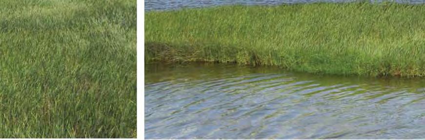
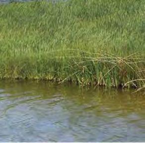
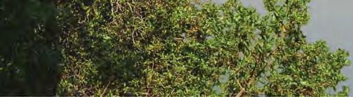
2 3.9 Visual Resources drivers on roads, bicyclists/pedestrians on adjacent roadways, and those residences to the north and south where there are elevated views. Views of the lagoon vary substantially by viewer location. The lagoon is characterized by open, blue water in the middle of each basin, with dense cattails and reeds at basin edges. The vegetation is generally monotypic, and appears dense, tall, and green with minimal variation in height or density. Cattails are most prevalent in the I-5 Basin and the relative amount of open water increases in each basin moving to the west (Figure 2-2). The western basin (Weir Basin) presents the greatest amount of open water and appears almost as a lake. Localized areas on the lagoon edge where habitat transitions include other types of trees or shrubs and the view is more mixed in color (shades of green and brown), and mixed in height (tall, brown exposed trunks at the lagoon upland edge as compared to mid-height reeds), with open patches through the vegetation. There are some locations in the study area, at the northern edge of the lagoon near Lagoon View Drive in particular, where the habitat is nonnative grassland or even unvegetated, with exposed brown soil and brown/tan vegetation. Within the lagoon are minimal built elements other than the roadways. The Nature Center on the northern edge, just east of Carlsbad Boulevard, has limited dirt trails but these are nearly covered by adjacent reeds and are not highly visible. Electrical utilities that cross the lagoon north to south present more signs of human intrusion with tall brown, linear features in contrast to the mounding green vegetation (see Section 3.14 Public Services and Utilities) but these do not diminish the overall character of a large, natural system. Viewers to the south and north are generally elevated as there are bluffs and hills above the lagoon elevation, but the views are mixed based on intervening terrain, intervening structures, and viewer orientation. There are open viewpoints (such as Maxton Brown Park on a small bluff) with an eastern vista of blue open water encircled by contrasting green vegetation in the foreground and middleground. Across the low-lying lagoon, there are distant views of slender trees (eucalyptus) and roadway infrastructure (I-5 and SR 78). In this same location, viewers can look north where the middleground views (0.25 to 0.5 mile) include the Nature Center building at the lagoon s edge and other commercial/residential development farther distant in Oceanside (greater than 0.5 mile). Looking west from this bluff, the lagoon element shrinks in size and middleground views shift to the St. Malo residential complex (with unique Tudor-influenced architecture) and the Pacific Ocean in the background. This view is similar to residential viewers on the bluff tops, south of the lagoon. In other locations (such as Hosp Grove Park), views are generally obscured by intervening vegetation (primarily eucalyptus trees). Drivers on Jefferson Street are bounded in large part by vegetation in the lagoon that limits views to the immediate foreground (dense curtain of green vegetation). There is an Ecological Wildlife Viewing Area near Jefferson Street and Marron Road, with a focus on bird watchers (Carlsbad 2011). Here Page 3.9-2
3 3.9 Visual Resources viewers have more open views of the lagoon water and thickets of vegetation in the immediate foreground. In the northeast, primary viewers are along SR 78, which is slightly elevated and adjacent to the lagoon. There are generally mixed views of open blue water, largely surrounded by dense, green vegetation, and distant trees/brownish-green slopes south of Jefferson Street and suburban development farther south of Carlsbad. As drivers are moving at freeway speeds, in the approximately ¾-mile length of this road between I-5 and Jefferson Street, the view would be available for less than 1 minute. In heavy traffic conditions, the view would be available for a longer period. Farther north are residential areas on the hillsides but views of the lagoon are limited to individual residences oriented south or west. There are also views from the commercial center on the north side of SR 78, elevated relative to the lagoon but not as elevated as the residences on the bluffs. To the northwest (west of I-5), typical views of the lagoon are limited to residential viewers on cul-de-sacs that end at the northern lagoon s edge. Here views may be mixed, with some more open views of the lagoon in the foreground and suburban development in the middle/background distances as well as some views nearly obscured by the green reeds. Even the Nature Center and adjacent trails have extremely limited views of the broader lagoon as the dense, reed thicket presents a green curtain. There are open lagoon views along Carlsbad Boulevard, primarily at the bridge, where pedestrians/bicyclists on the Coastal Rail Trail can look both east and west to a mixture of open blue water and dense, green vegetation in the foreground and middleground. Elsewhere, as this road traverses the lagoon, vegetation obscures views to the east or west. The bridge views to the west are similar to open views looking east from the residences in the private enclave of St. Malo because here the open water predominates. The immediate foreground views for St. Malo viewers (0.1 mile in the Weir Basin) would be more open water, with foreground views of the railroad tracks, and a mix of open water and green vegetation in the next basin (0.2 mile to the Railroad Basin). Viewers along I-5 also have clear views of the lagoon to the east and west, but only from certain vantage points. Northbound drivers descend between two small bluffs in Carlsbad that obscure the lagoon even north of the Jefferson Street overpass, until the driver is very nearly upon the lagoon. The highway bridge appears nearly level with the lagoon. Viewers can see open blue water and the green, dense border in the foreground in both directions, but this is only one element of the broader view of commercial/residential development, roadway infrastructure, and, for southbound drivers, a snapshot of the Pacific Ocean. Viewers here are also traveling at a high rate of speed so the actual duration of view is limited. West of the weir is the beach and the Pacific Ocean. The beach in this area is typically sandy but backed by riprap at the base of homes (St. Malo complex in Oceanside to the north) and along the base of bluffs that rise up to the south into Carlsbad. During most of the year, the beach is full Page 3.9-3
4 3.9 Visual Resources of sand in front of the weir and the water s edge begins more than 150 feet inland of the ocean. In winter, the beach may be more cobbly as storms carry the sand offshore. Also during winter, water flows from upstream toward the ocean may overtop the weir and beach berm to present a temporary water connection from the lagoon to the ocean. This condition occurs infrequently and does not last long. Materials Disposal/Reuse Study Area The two beach materials placement sites are characterized by generally sandy beaches that vary in width both annually and seasonally. The site in Oceanside is backed by rock revetments, then residences to the east with the ocean to the west. In Carlsbad, the site is backed by small bluffs that rise above the shoreline, typically developed with residential uses. Viewers of the sites are nearby residents (both bluff top and at similar elevation) and visitors (bluffs and down at the shore). The offshore site (LA-5) and nearshore site at Oceanside are in the ocean and are not described further because they are underwater and/or located at distances not readily visible. (LA-5 is approximately 30+ miles southwest of Buena Vista Lagoon.) Activities to place materials at the nearshore site include underwater pipelines that are not visible under the water surface and a transport barge that is a typical ocean vessel commonly used and seen along the coast. The specific characteristics and viewers of the two onshore sites are discussed separately below. Oceanside The Oceanside materials placement site is visible from numerous beachfront residences and businesses in the area. The Strand, a beachfront road that runs from Seagaze Drive to Wisconsin Avenue, abuts the northern end of the materials placement site, and users of the Strand would view the site. The materials placement site is severely eroded and portions of the beach, particularly at the southern end of the site, are visible only at low tide. This condition is dynamic and changes annually and seasonally, depending on coastal processes (e.g., wave energy and storm event frequency and severity) and periodic beach nourishment projects (like 2012 RBSP). Beachfront homes and condominiums are located east of this portion of the materials placement site. Huge boulders have been placed in front of these structures for ocean wave protection and are elevated slightly above the beach. Buccaneer Beach Park is located within the materials placement site, where Loma Alta Creek drains to the ocean. Because the immediate area has not been developed, there is a sandy beach approximately 150 feet wide and 125 feet from the road to the line of riprap, which protects homes on either side of the park. The delivery pipeline would likely extend northward from the Buena Vista Lagoon mouth and be located along the back of the beach at the toe of revetments. Beachfront homes and Page 3.9-4
5 3.9 Visual Resources condominiums are located east of the revetments. Similar to the southern part of the materials placement site, boulders have been placed in front of these structures for protection. Carlsbad Primary views of the proposed Carlsbad materials placement site are from beachfront residences, which front the proposed site from the northern boundary near the mouth of Buena Vista Lagoon to Pine Avenue. From Pine Avenue to the southern terminus near Hemlock Street, residents are located on the bluff tops east of Carlsbad Boulevard and a walkway is constructed near the base of the bluffs with intermittent beach access points. The North Carlsbad materials placement site is also visible for recreationalists on the beach at the mouth of Buena Vista Lagoon, drivers on Ocean Street where intermittent beach access is available, and Carlsbad Boulevard. Visual resources at the North Carlsbad materials placement site consist of a flat sandy beach lying in front of riprap or vegetated slopes, and sea walls that support beach-front structures. Slopes behind these protection structures rise to a height of approximately 30 feet. Structures along this materials placement site include single-family residences, apartments, condominiums, and a military preparatory school. The sand beach along this site is often under water during high tide. Light and Glare No source of lighting is available within the lagoon except street lights on Carlsbad Boulevard. Adjacent commercial and residential land uses contribute to the ambient lighting and brightness levels in the project area. Nighttime lighting along Carlsbad Boulevard, I-5, and SR 78 is from motor vehicles and light poles. Generally, the major sources of illumination for each of the possible materials placement sites are from streetlights, vehicle headlights, and interior and exterior building lighting in the surrounding land uses SIGNIFICANCE CRITERIA Per Appendix G of the State CEQA Guidelines, a significant impact to visual resources would occur if implementation of the Enhancement Project would result in any of the following: A. A substantial adverse effect on a scenic (public) vista; B. Substantial degradation of the existing visual character or quality of the site and its surroundings (i.e., viewshed); Page 3.9-5
6 3.9 Visual Resources C. Creation of a new source of substantial light and glare, which would adversely affect daytime or nighttime views in the area IMPACT ANALYSIS Overview of Methodology Lagoon enhancement would temporarily affect the visual environment during the construction time period and there would also be permanent changes in infrastructure. All alternatives, with the exception of the No Project Alternative, would generate material for disposal that would be placed in various locations, including beach sites (where appropriate). The significance of this visual change depends on a variety of factors, including the degree to which the project would be seen by potentially sensitive viewers, viewer attitudes and activities, the distance from which the project would be observed, and the extent the project would be consistent with established visual quality goals of the adjacent cities. The anticipated visual impact of the Enhancement Project was assessed in the field and based on a computer-generated visual simulation. Field and office evaluation was undertaken to document the visual contrast of the project based on the degree of change in line, form, color, and texture. Three levels of contrast were considered: weak, moderate, and strong. Weak contrast means minor or low visual contrast with the surrounding landscape, while strong contrast means the facilities would be highly evident or dominate a setting. Moderate contrast would be noticeable but not dominant. Each alternative was also considered in terms of conformance with applicable goals and policies in the Oceanside and Carlsbad General Plans. Sensitive Viewers Visual sensitivity is dependent upon viewer attitudes, the types of activities in which people are engaged when viewing the project, and the distance from which the project would be seen. Overall, higher degrees of visual sensitivity are correlated where people are engaged in outdoor recreational pursuits in public places, or participate in scenic or pleasure driving. Conversely, visual sensitivity is considered low to moderate in industrial or commercial areas where the scenic quality of the environment does not affect the value of the activity. For the lagoon enhancement evaluation, sensitive viewers are identified as users of recreation areas at or near the lagoon, drivers along scenic roads, and beach users. Carlsbad Boulevard is a designated scenic corridor (Carlsbad 2013). I-5 in this area is not included on the Caltrans list of officially designated scenic highways (Caltrans 2014c) but this well-traveled road offers the greatest number of viewers of the lagoon. The City of Oceanside does not designate scenic roads Page 3.9-6
7 3.9 Visual Resources or vistas, although the General Plan does reference the Nature Center and the lagoon (Oceanside 1995). The public vista point is the focus of the analysis. Eight key views are identified for evaluation (Table 3.9-1) and shown in Figure A photograph of each location is provided in Figures through Table List of Key Views Key View Number Location Representative Views Sensitivity Key View 1 Maxton Brown Park Recreation Residential viewers on hilltop homes in High to moderate Carlsbad (private views) Key View 2 Hosp Grove Park Recreation High to moderate Key View 3 Lagoon View Drive Recreation (fishing) High Key View 4 I-5 at Lagoon Crossing Driver Low to moderate Key View 5 Carlsbad Boulevard Scenic driver Coastal Rail Trail pedestrian/bicyclist Residential viewers in Oceanside (private views); similar but not identical to homes along the west and north sides of the Weir Basin High to moderate Key View 6 Nature Center Recreation High to moderate Key View 7 Mountain View Beach user, public access Open Space & Access High Key View 8 Beach, West of Weir Beach user, Recreation, public access High Computer-generated visual simulations are provided at Key View 1 to illustrate the changes to the site post-enhancement. There is a simulation for each project alternative looking east across the Coast Highway Basin from this location (three figures), plus a simulation looking north at the Boardwalk that is relative to each alternative. Two simulations at Key View 3 reflect the Freshwater and Saltwater Alternatives from Lagoon View Drive. Simulations are also provided for Key Views 7 and 8. Two simulations are provided for Key View 7, looking both northeast at the Weir Basin and directly west at the inlet toward the ocean under open tidal conditions (Saltwater and Hybrid Alternatives). One simulation is provided from the beach looking north (Key View 8). The simulations are not representative of exact project final design but provide a useful illustrative example. For the materials disposal/reuse site evaluation, sensitive viewers were identified as public beachgoers and public recreational users. There are also private residential viewers at hilltop homes in Carlsbad, with intermittent public staircases, and adjacent homes in Oceanside as summarized in Table Page 3.9-7
8 3.9 Visual Resources Table Representative Viewers at Materials Placement Sites Location Representative Viewers Sensitivity Oceanside Beach user Residential viewers (private views) High to moderate Carlsbad Beach user Residential viewers on hilltop homes (private views) High to moderate Lagoon Enhancement Lagoon enhancement would generally consist of vegetation removal, dredging and grading within the lagoon to raise or lower elevations, modifying existing lagoon infrastructure (weir, channels, bridge) to enhance tidal flow in and out of the lagoon (under the Saltwater and Hybrid Alternatives), disposing of sediments excavated from the lagoon to different locations, and restoring graded areas within the lagoon to facilitate recovery of habitat. The construction phase of the Enhancement Project would be temporary and is anticipated to occur over at least 15 months, and possibly up to 30 months depending on the construction methods implemented. No buildings would be constructed under any alternative. Proposed enhancement would require maintenance every 16 to 20 months, as well as potential adaptive management activities, so equipment would be periodically visible in the post-construction time period. The visible elements would vary substantially depending on the alternative. No permanent new sources of lighting would be created under any alternative. There is existing overhead lighting on Carlsbad Boulevard that would be replaced as part of the new bridge structure so changes may occur in the location of that lighting, but it would be modest and incremental along this already lighted roadway. As such, no impacts would occur and no further analysis related to permanent lighting impacts is warranted (Criterion C). The lagoon is traversed by a locally designated scenic corridor (Carlsbad Boulevard). Carlsbad Boulevard would be reconstructed in the identical location and would provide users with views at a slightly higher elevation. This would only occur in the Saltwater and Hybrid Alternatives. No trees, rock outcroppings, or historic buildings would be affected by any of the alternatives, but changes would occur to the scenic lagoon. Thus, the discussion of substantial damage to this scenic corridor will focus on the Saltwater and Hybrid Alternatives via the analysis of Key View 5. Freshwater Alternative During the construction phase, the visual character of the project site would change from existing conditions. Vegetation would be removed from all four basins, although 70 percent would come Page 3.9-8


9 arlsbad Blvd Pacific Coast Highwa Lagoon View Dr KV-3 (SIM) KV-5 C y KV-6 KV-4 Jefferson Ave KV-2 KV-8 (SIM) KV-7 (SIM) KV-1 (SIM) Source: 2014 Digital Globe Figure Key View Location Map Path: P:\2013\ _BVLEP_EIR\06GIS\6.1_Maps\EIR\3-9_KeyViewMap, 8/22/2014, averygl


10 I-5 SR 78 Oceanside SR 78 Key View 2- Hosp Grove Park looking northwest. Key View 4- I-5 Looking east from northbound lane. Jefferson Street Hosp Grove Park Carlsbad I-5 Oceanside Fishing at Shoreline Key View 3- Panorama view, Lagoon View Drive looking west near Jefferson Street intersection. \\ussdg1fp001.na.aecomnet.com\data\projects\2013\ _bvlep_eir\05graphics\view Figures\3.9-2 Typical Views 8/22/2014, bradyd Figure Typical Views of I-5 Basin (Key Views 2, 3, and 4)
.")

11 Key View 6- Audubon Nature Center looking southeast from picnic area. Key View 6- Audubon Nature Center looking southeast from parking lot (closed during remodel). Railroad Basin Carlsbad Boulevard Audubon Nature Center Coastal Highway Basin I-5 Key View 1- Panorama view, Maxton Brown Park looking northeast. Buena Vista Lagoon Enhancement Project Screencheck Final EIR \\ussdg1fp001.na.aecomnet.com\data\projects\2013\ _bvlep_eir\05graphics\view Figures\3.9-2 Typical Views 8/22/2014, bradyd Figure Typical Views of Coast Highway Basin (Key Views 1 and 6)


12 Maxton Brown Park Carlsbad Coastal Rail Trail Railroad Railroad Basin St. Malo Community Key View 5- Looking southeast from east side of Carlsbad Boulevard. Key View 5- Looking west from east side of Carlsbad Boulevard. Lagoon Channel Bridge Coastal Rail Trail Key View 5- Looking south near Nature Center entrance. Figure Typical Views at Carlsbad Boulevard and Railroad Basin (Key View 5) \\ussdg1fp001.na.aecomnet.com\data\projects\2013\ _bvlep_eir\05graphics\view Figures\3.9-2 Typical Views 8/22/2014, bradyd


13 Railroad Audubon Nature Center Weir Basin S t. Malo Residence S t. Malo Residence Channel Channel Key View 7A- Mountain View open space, looking northeast at Weir Basin. Key View 8- Beach, looking north at channel terminus. Pacific Ocean 50-foot-wide Channel with Weir St. Malo Residence Key View 7B- Panorama view, looking west from Mountain View open space and beach access. \\ussdg1fp001.na.aecomnet.com\data\projects\2013\ _bvlep_eir\05graphics\view Figures\3.9-2 Typical Views 8/22/2014, bradyd Figure Typical Views of Weir Basin and Beach (Key Views 7 and 8)
14 This page intentionally left blank. Buena Vista Lagoon Enhancement Project Screencheck Final EIR
15 3.9 Visual Resources from the Coast Highway Basin, and landform alteration would occur. Some activities would be visible, such as cutting and removing the cattails and construction staging, but most would be underwater (bottom contouring) with only a dredge (appearing as a flat-bottom boat), pipes, and some construction trucks visible. The staging areas would be located at along the lagoon edges in four locations, one per basin, as shown in Figure Specifically along Lagoon View Drive (I-5 Basin, Key View 3), at the Nature Center (Coast Highway Basin, Key View 6), just west of the Nature Center/Carlsbad Boulevard (Railroad Basin), and at the Mountain View open space (channel and Weir Basin, Key Views 7 and 8). Intermittent truck access would occur from Jefferson Street. Construction duration is estimated between 15 and 30 months. While there would not be construction activity through this entire period through the entire lagoon, it is likely that some activity could occur at the staging areas for the duration. Staging in the Weir, Railroad and Coastal Highway Basins would be highly visible to the public and sensitive viewers (beach users and users of the Coastal Rail Trail) and for a substantial duration (at least one year). The contrast would be high. During construction, the area on both sides of Lagoon View Drive would be used for staging and drying removed cattails (Figure 2-18). Current users typically fish from the shore but would likely be prevented from access in the short term, so their visual contrast would be minimal (see Section 3.1 Land Use for analysis of recreational uses). As shown in Figure 3.9-2, a portion of this area is fairly disturbed with exposed soil but vegetation is present in the immediate foreground, then an open fishing area, then more vegetation. The soil areas and vegetation closest to shore would be covered at various times in the construction window with soil for drying and staged equipment, so the visual change during construction would be moderate to high for other limited viewers that could include drivers along Jefferson Street and SR 78. Overall, there would be short-term, but significant, impacts to visual resources during construction (Criterion B). Changes in the I-5 Basin would ultimately include removal of cattails in the interior of the basin and lowering of the bottom elevation in those locations to prevent vegetation reestablishment. Existing vegetation at the edges, which is most visible from Hosp Grove Park and along Lagoon View Drive (Key Views 2 and 3), would remain, so the contrast would be weak. Figure provides a simulation of one view of the enhanced lagoon from Lagoon View Drive (near the Jefferson Street intersection) as compared to existing conditions. Ultimately, the area along Lagoon View Drive would be enhanced as a riparian (tree and shrub) system, and the marsh would be restored, so the contrast to returning recreational users would be low and possibly visually beneficial. Page
16 3.9 Visual Resources Viewers along I-5 (Key View 4) could observe the change as current patterns of green vegetation with intermittent blue water views would be transformed into a greater percentage of water views. The overall vision of a natural, wetland system would remain, and these drivers have extremely limited view durations so the contrast would be low. Figure provides a view of the change at Maxton Brown Park (Key View 1) looking generally northeast across the lagoon. As shown in the simulation, views in the foreground would change; specifically, the dense mat of green, lush, generally monotypic vegetation would be reduced in extent and more open water would be visible in both the immediate foreground and in the center of the basin. The contrast would be low. Figure provides a simulated view also from Maxton Brown Park, but looking more due north at Carlsbad Boulevard and the Nature Center. The current view is of a single roadway with fairly dense vegetation along the bulk of the roadway edge. There is a water opening at the channel. With the project, a wooden Boardwalk would be constructed in the lagoon along the eastern side of the road, and the existing tall, reedy vegetation would be removed to allow full basin views and fishing access for Boardwalk users. It should be noted that this simulation reflects the extremely modest salt marsh that could establish near the Boardwalk s edge under the Saltwater or Hybrid Alternatives, and the new Carlsbad Boulevard bridge. Under this alternative, there would actually be no low-growing vegetation, so the view would be of more open water up to the Boardwalk and no change to existing Carlsbad Boulevard. The change would be highly visible to these sensitive viewers, but the overall contrast would be moderate because this Boardwalk element is one of a larger view of the overall lagoon, and the new feature would not be out of place or scale in this type of system. Viewers at the Nature Center (Key View 6) would also be able to view the new Boardwalk but generally only in immediately foreground views and only when oriented in that direction. Users along Carlsbad Boulevard (Key View 5) include drivers traveling at a modest rate of speed (posted limit is 35 miles per hour) as well as pedestrians and bicyclists on the Coastal Rail Trail typically traveling slower with higher view expectations. Carlsbad Boulevard is a designated scenic corridor in the City s General Plan. Under this alternative, the change for these viewers would be an opening of the travel corridor for more broad views to the east (new Boardwalk and open water) and minimal change to the west (fringe of vegetation that nearly obscures longerdistance views). As with the change at Maxton Brown Park, the change would be highly visible, but the overall contrast would be moderate. The change at the Weir Basin and beach area under this alternative includes channel improvements and weir replacement. The existing 50-foot-wide channel (Figure 3.9-5) would be widened to 80 feet and the weir reconstructed. The weir may be more substantial in size but it is Page

17 Existing View - Southwest from Lagoon View Drive toward I- 5. Simulated View - Freshwater Alternative from Lagoon View Drive. Figure Key View 3 - Simulation - Freshwater and Hybrid Alternatives Path: P:\2013\ _BVLEP_EIR\06GIS\6.1_Maps\EIR\3-9_KeyViewMap, 8/22/2014, averygl


18 Existing View - Northeast from Maxton Brown Park. Simulated View - Freshwater Alternative from Maxton Brown Park. Path: P:\2013\ _BVLEP_EIR\06GIS\6.1_Maps\EIR\3-9_KeyViewMap, 8/22/2014, averygl Figure Key View 1 - Simulation - Freshwater Alternative


 Path:")

19 Existing View - Northwest from Maxton Brown Park toward Carlsbad Boulevard. Simulated View - Boardwalk and Carlsbad Boulevard bridge from Maxton Brown Park. (Saltwater and Hybrid Alternatives only) Path: P:\2013\ _BVLEP_EIR\06GIS\6.1_Maps\EIR\3-9_KeyViewMap, 8/22/2014, averygl Figure Key View 1 - Simulation - Boardwalk and Bridge
20 This page intentionally left blank. Buena Vista Lagoon Enhancement Project Screencheck Final EIR
21 3.9 Visual Resources largely underwater and not visible (Key View 7). The variable beach berm would not be modified (Key View 8). During construction, a staging area would be located along the Mountain View access point (Figure 3.9-5) but would be necessary for only 1 to 2 months. The channel sides would be strengthened with additional riprap, not unlike the rocks currently in place. The change would be noticeable but the overall contrast would be moderate as, ultimately, a wide coastal access and a wide beach berm would remain, but would continue to be dynamic and vary in size. Looking east back into the Weir Basin (Figure 3.9-5), the view would change only incrementally with the large expanse of open water remaining in the foreground up to the railroad tracks, and some fringe cattail vegetation establishing on the basin circumference. A fringe of vegetation could exist in this basin at this time, but it is removed periodically by the St. Malo homeowners, who also own this basin. The contrast would be low. Overall, implementation of this alternative would not have a substantial adverse effect on a scenic vista, or a substantial degradation of the existing visual character or quality of the lagoon and its surroundings. There would be no long-term significant impacts (Criteria A and B). The project would result in some temporary new light sources during 24-hour construction activities, but the light would be periodic and small scale. It would be necessary to have 24-hour dredging operations over the course of the project, which would include illumination of the immediate surrounding area of work and lighting contained within the enclosed cabin area. Lighting would be located on the dredge and would be comparable to bright street lights. A spotlight on the dredge may be used if anchors need to be reset. In addition to the lights from the dredge, the crew boats delivering dredge personnel to the dredge at the shift change during dark hours (generally around 11 p.m. and 6 a.m.) would have a spot light used to temporarily illuminate the immediate boarding area and waters in front of the boat while transiting to and from shore and the dredge plant. Lighting at construction launch or staging areas may also be necessary to facilitate nighttime activities, such as material deliveries, and would also be similar to a street light directed toward the work area. While the lighting would be noticeable and visible to surrounding viewers and may appear out of place within the unlit lagoon area, the area that would be lit would be localized and focused on the immediate work area. The lights would not be of a height or intensity that allows for expansive spreading or spill of light across a wide area. The light source would move slowly throughout the lagoon as dredging progresses from one location to another and would not stay at one location for an extended period of time. The nighttime lighting would be necessary during 24-hour dredging activities, for the approximately 12 to 24 months (dependent on alternative) duration of dredging and sand placement activities. The temporary presence of nighttime lighting within the lagoon would be a change from the existing non-lit night environment, and the temporary light and glare impact would be potentially significant (Criterion C). Page
22 3.9 Visual Resources Saltwater Alternative The Saltwater Alternative would create a greater mix of habitats within the lagoon and, while remaining a wetland, the vegetation characteristics would present a different experience for the viewer. Generally, existing conditions present as either blue open water or fairly monotypic, green, dense vegetation with coarse/thick texture. Under this alternative, the mixture of habitat types and tidal cycle of water would result in a more heterogeneous viewing experience in terms of color and texture. The post-project condition is based on 5+ years of active enhancement (planting plants) as well as natural recruitment. Similar to the Freshwater Alternative, during the temporary construction period (15 to 30 months) the Saltwater Alternative would have four staging areas and viewers could observe equipment operating at the edges of the lagoon, plus a dredge and vegetation removal machinery inside the various basins. Given the highly visible locations of the staging areas and adjacent sensitive viewers, the short-term visual impacts during construction would be considered significant (Criterion B). At the I-5 Basin, which has the greatest concentration of vegetation relative to open water under current conditions, the amount of open water would decrease and a mix of habitats would present a mixture of color and textures with a reduction in vertical elements. The far eastern part of the basin, toward Lagoon View Drive (Key View 1), would have a combination of mid, low, and high salt marsh habitats. Several islands of salt marsh already exist in this basin but are currently largely obscured by cattails closer to the edge where viewers are present (fisherman). Figure provides a simulation from Key View 3. As illustrated, the more dense and monotypic cattails would be replaced by low-growing marsh habitat that has more brown/tan/dark green tones. As with the Freshwater Alternative, there would likely be access restrictions during construction so viewers would be limited to drivers on Jefferson Street instead of people fishing. At Hosp Grove Park, where amenities such as play equipment/picnic tables/trails are available, views through the trees would change with less open water and more low-growing vegetation. The contrast would be moderate to high given the substantial change in views; however, at Key View 2, the lagoon itself is partially obscured by intervening trees and reedy vegetation along the lagoon fringe. Along I-5, the view both east and west would change from small, nearly obscured water channels surrounded by cattails to an open system in both directions (Key View 4). This lagoon would look more similar to other tidally influenced systems in the San Diego region. While the contrast would be moderate to high, the speed of the travelers and the typical wetland habitat mix would mute the overall change. Page
23 Existing View - Southwest from Lagoon View Drive toward I- 5. Simulated View - Saltwater Alternative from Lagoon View Drive. Remaining freshwater marsh habitat in foreground would transition over time to high salt marsh. Figure Key View 3 - Simulation - Saltwater Alternative Path: P:\2013\ _BVLEP_EIR\06GIS\6.1_Maps\EIR\3-9_KeyViewMap, 8/22/2014, averygl
24 This page intentionally left blank. Buena Vista Lagoon Enhancement Project Screencheck Final EIR
25 3.9 Visual Resources Figure provides a view of the change at Maxton Brown Park (Key View 1) looking generally northeast across the lagoon. As shown in the simulation, views under this alternative would change largely in the type of vegetation. The dense mat of green, lush, generally monotypic vegetation would be replaced by lower-growing salt march species that have varying hues of green and brown, and during the winter can transition to reddish. The coarse, upright cattails would be limited to a narrow strip at the water s edge, and otherwise largely replaced with mounding, low-growing species, or shorter grasses with more movement from the wind. The amount of visible water would vary over the course of the day and tidal regimes, with brown mud flats exposed at very low tides and covered with water during high tides. The contrast would be moderate to high depending on the point in the tidal cycle. Figure provides a simulated view from Maxton Brown Park illustrating the new Boardwalk and the new Carlsbad Boulevard bridge. As shown, under current conditions, dense vegetation exists along most of the length of the roadway edge with a water opening at the channel. With the project, a wooden Boardwalk would be constructed in the lagoon along the eastern side of the road and the existing tall vegetation would be removed. As shown, under the Saltwater Alternative there would be limited low-growing salt marsh species adjacent to the Boardwalk, mostly south of the channel opening. This new linear Boardwalk element, and the less dense vegetation would be noticeable, but the overall contrast would be moderate because this element is one of a larger view of the overall lagoon, which includes human-made linear features. And the Boardwalk would not be out of place or out of scale in this type of system. Under this alternative, the Carlsbad Boulevard bridge would also be reconstructed. It would be the same width, with the same roadway improvements on the surface, but the structure would be 4+ feet higher above the lagoon and there would be a broader channel width below the bridge (from 29 feet to 110 feet). Views from the park would change with introduction of a new Boardwalk as well as a larger bridge structure spanning a mix of vegetation types and tidally fluctuating water (Figure offers a simulation of both). The change would be highly visible to these sensitive viewers, and the overall contrast would be moderate to high. This infrastructure would be one element of a larger view of the overall lagoon, which is currently characterized by a variety of infrastructure, and the new bridge feature would not be out of place or scale in this type of system. Viewers at the Nature Center (Key View 6) would also be able to view the new Boardwalk when oriented toward that feature. Under this alternative, the intervening tall freshwater species would be removed or would eventually transition to lower-growing salt marsh species so more open views across the lagoon would be available for visitors at the Nature Center. This would be a change but could be viewed as beneficial. Page
26 3.9 Visual Resources Users along scenic corridor Carlsbad Boulevard (Key View 5) include vehicle drivers and users of the Coastal Rail Trail. Under this alternative, the change for these viewers would be an opening of the travel corridor for more broad views to the east and to the west. On the east side, the lower growing vegetation and the higher road elevation would provide for views of the new Boardwalk, low-growing vegetation, and water. The elevation could allow viewers looking west to see over the fringe of vegetation that currently nearly obscures longer-distance views. The change would be highly visible, and the overall contrast would be moderate, and possibly beneficial if increased viewing distance to the west allows for intermittent views of the ocean. Under the Saltwater Alternative, substantial changes would occur to the channel adjacent to the ocean. The existing weir would be removed and the channel widened from 50 feet to 100 feet, with riprap protection installed along the sides. The existing beach berm would be removed to create a full tidal connection with the ocean. Figure provides a photograph of the existing beach berm in late summer, when it is typically widest. Under this alternative, the white sandy beach at the shoreline would be replaced by a channel connection. The riprap protection would terminate where the residences end, so the exposed sides at the beach would appear as sandy sides with a water channel in the middle. The volume of water in the channel would vary by tide and season. This pattern is not unlike the lagoon mouth/ocean connection at San Elijo Lagoon or at Los Peñasquitos Lagoon (Torrey Pines). The visual contrast of these activities would be moderate to strong for beach users (Key View 8) and people accessing the beach via the Mountain View open space (Key View 7); both are considered sensitive viewers. The project would not introduce a new human feature on the beach nor would the ocean connection be out of character with the San Diego coastline. Figure shows a simulation of the view looking west along the Mountain View Drive open space where the open channel to the ocean would double in width (50 to 100 feet). Existing vegetation along the northern slopes would be replaced by riprap and more riprap would be added to the south side. Because the channel would be open to tidal influence, the water depth would vary. Visible riprap sides may vary in depth by several feet throughout the day. While providing a change for users accessing the beach, the focus on the ocean would not be hindered. The contrast would be moderate. The channel change and reintroduction of tidal flow would result in changes to the Weir Basin as well. Here the open water visible from Key View 7B, which is somewhat similar to views from the residential enclave of St. Malo, would become a tidally influenced basin with water fluctuations twice a day. The basin edges would become a mixture of low, mid, and high coastal marsh in narrow bands, but the majority of the basin would be open water. The change would be highly visible because the water view now is more of a lake with no fluctuation and the edges are more dense with cattails and reeds. Under this alternative, the variability would be noticeable in terms of the daily water regime, and less so due to habitat change at the basin fringe. The significance of this change is subjective, as it depends on preference for a certain type of view. Page


27 Existing View - Northeast from Maxton Brown Park. Simulated View - Saltwater Alternative from Maxton Brown Park. Figure Key View 1 - Simulation - Saltwater Alternative Path: P:\2013\ _BVLEP_EIR\06GIS\6.1_Maps\EIR\3-9_KeyViewMap, 8/22/2014, averygl
28 Pacific Ocean 50-foot-wide Channel with Weir St. Malo Residence Existing Panorama View - looking west from Mountain View open space. Pacific Ocean 100-foot-wide Channel, no Weir (Water Level Varies with Tide) St. Malo Residence Simulated View - Channel Widened to 100 feet (Saltwater and Hybrid Alternatives only). \\ussdg1fp001.na.aecomnet.com\data\projects\2013\ _bvlep_eir\05graphics\view Figures\3.9-2 Typical Views 8/22/2014, bradyd Figure Key View 7A - Simulation - Saltwater and Hybrid Alternatives
29 3.9 Visual Resources Figure provides a conceptual simulation from Key View 7B, looking northeast at the Weir Basin also from the Mountain View open space area. Some existing ornamental vegetation at the lagoon edge would be removed and more riprap installed for shoreline protection, but the overall scene would be similar. The contrast would be moderate. Beach users looking north at the channel (Key View 8) would have mostly foreground views of sand (see simulation in Figure ). Even with the channel widened and the water extending to the ocean, sand would come up to the riprap edges and partially obscure views of the channel. The view of the mouth would be more or less prominent based on seasonal width, but would be in keeping with other similar ocean connections. No permanent man-made features would extend beyond the current row of residences. The contrast would be moderate. Overall, implementation of this lagoon alternative would not have a substantial adverse effect on a scenic vista, or a substantial degradation of the existing visual character or quality of the lagoon and its surroundings. There would be no long-term significant impacts (Criteria A and B). The discussion of nighttime light and glare provided under the Freshwater Alternative would also apply to the Saltwater Alternative. The temporary and periodic light and glare during 24- hour construction activities would be potentially significant (Criterion C). The Saltwater Alternative would require maintenance every 16 to 20 months to remove beach quality sand at the inlet. Inlet maintenance would rely on land-based construction equipment to remove material and redistribute it to the beach materials placement site to the south. This would be very similar to routine maintenance that currently occurs at the existing San Elijo Lagoon inlet. The activities would occur over a 2- to 4-week period. Given the open nature of this channel, with public access along Mountain View to the south and the beach to the west, the activities would be visible to beachgoers. The temporary contrast of the construction equipment in this visual setting would be moderate and the vast majority of the lagoon would remain unaffected during maintenance. Therefore, the impact would be less than significant (Criteria A, B, and C). Hybrid Alternative The Hybrid Alternative presents a combination of visual changes, identical to the Freshwater Alternative for the I-5 Basin and very similar to the Saltwater Alternative for the Coast Highway and Railroad Basins. There is a variation in the Weir Basin that has visual ramifications. Page
30 3.9 Visual Resources As with the other two alternatives. during the temporary construction period (at minimum over 1 year) the Hybrid Alternative would have four staging areas and viewers could observe equipment operating at the edges of the lagoon, plus a dredge and vegetation removal machinery inside the various basins. Given the highly visible locations of the staging areas and adjacent sensitive viewers, the short-term visual impacts during construction would be considered significant (Criterion B). As described in the Freshwater Alternative, freshwater marsh vegetation (e.g., cattails) would generally be retained at the lagoon edges, which is most visible from Hosp Grove Park and along Lagoon View Drive (Key Views 2 and 3). Changes would include removal of cattails in the interior of the basin, and lowering of the bottom elevation in those locations to prevent vegetation reestablishment. Figure provides a simulation of one view of the enhanced lagoon from Lagoon View Drive (near the Jefferson Street intersection) as compared to existing conditions. The contrast is low. Viewers along I-5 (Key View 4) could observe the change as current patterns of green vegetation with intermittent blue water views would be transformed into a greater percentage of water views. The overall vision of a natural, wetland system would remain; these drivers have extremely limited view durations so the contrast would be low. At the Coast Highway Basin, the pattern of change would be similar to the Saltwater Alternative. That is, existing open water and monotypic green vegetation would be replaced by a broader mix of low-growing species. Figure provides a view of the change at Maxton Brown Park (Key View 1) looking generally northeast across the lagoon. As shown in the simulation, the dense mat of green, lush, generally monotypic vegetation would be replaced by lower-growing salt march species that have varying hues of green and brown, and during the winter can transition to reddish. The amount of visible water would vary with brown mud flats exposed at low tide and covered with water during high tide. The contrast would be moderate to high depending on season and tide elevation. Figure provides a simulated view from Maxton Brown Park illustrating the new Boardwalk and new Carlsbad Boulevard bridge. As with the Saltwater Alternative, low-growing salt marsh species under the Hybrid Alternative would occur near the Boardwalk and south of the channel (as simulated). This mix of open water and low-growing vegetation would compatible with the Boardwalk design. Also under this alternative, the Carlsbad Boulevard bridge would be replaced with a longer, higher structure. This infrastructure would be one element of a larger view of the overall lagoon, which is currently characterized by a variety of infrastructure, and the new Boardwalk feature would not be out of place or scale in this type of system. Users of the new bridge, a Carlsbad-designated scenic corridor, could be at an elevation allowing them to see over the fringe of vegetation on the west side that nearly obscures longer-distance views. The change Page

31 Railroad Audubon Nature Center Weir Basin Railroad Audubon Nature Center Existing View - Looking northeast at Weir Basin. Weir Basin Water Level Varies, Subject to Tidal Influence Simulated View - Saltwater Alternative, looking northeast at Weir Basin. \\ussdg1fp001.na.aecomnet.com\data\projects\2013\ _bvlep_eir\05graphics\view Figures\3.9-2 Typical Views 8/22/2014, bradyd Figure Key View 7B - Simulation - Saltwater Alternatives

32 S t. Malo Residence Channel Existing View - Beach, looking north at channel terminus. S t. Malo Residence Channel Connection to Ocean Channel, Widened and Extended Simulation View - Beach, looking north at widened channel that extends to ocean. \\ussdg1fp001.na.aecomnet.com\data\projects\2013\ _bvlep_eir\05graphics\view Figures\3.9-2 Typical Views 8/22/2014, bradyd Figure Key View 8 - Simulation - Saltwater and Hybrid Alternatives

33 Existing View - Northeast from Maxton Brown Park. Simulated View - Hybrid Alternative from Maxton Brown Park. Path: P:\2013\ _BVLEP_EIR\06GIS\6.1_Maps\EIR\3-9_KeyViewMap, 8/22/2014, averygl Figure Key View 1 - Simulation - Hybrid Alternatives
34 This page intentionally left blank. Buena Vista Lagoon Enhancement Project Screencheck Final EIR
35 3.9 Visual Resources would be highly visible, and the overall contrast would be moderate, and possibly beneficial if increased viewing distance to the west allows for intermittent views of the ocean. The Hybrid Alternative would also involve removal of the weir at the west end of the lagoon, widening of the channel, and creation of an ocean connection to facilitate tidal flow. The Hybrid Alternative, Option B has the same visual characteristics as the Saltwater Alternative relative to the beach area, channel, and Weir Basin, and impacts would be the same. Figures through provide simulations of the possible future conditions at these locations (Key Views 7 and 8). The Hybrid Alternative, Option A is a slightly modified version for channel improvements where an underwater channel guide would allow water in the bulk of the Weir Basin to be retained behind the elevated guide, and only have minimal tidal fluctuations compared to the channel and upstream basins, which would have full tidal fluctuations. Under this alternative, the bulk of the Weir Basin would have restricted flow and would appear more lake-like instead of fluctuating twice daily. For viewers on the western edge of the Weir Basin, this would provide a view more similar to existing conditions. For viewers to the south of the channel, including users of the Mountain View access and adjacent residents (Key View 7), the guide itself would introduce a new human feature in this basin. As shown in the conceptual rendering in Figure , the guide would be visible as a curved concrete/rock wall on the north side of the channel. The exposed wall would vary depending on the tide but would not be higher than the existing rock abutments along the channel to the west. While a new feature in the middle of the basin, this would not be dissimilar in nature to the railroad tracks, roadway, multistory residences, and utility poles that are part of the current character. Overall, implementation of this alternative would not have a substantial adverse effect on a scenic vista, or a substantial degradation of the existing visual character or quality of the lagoon and its surroundings. There would be no longterm significant impacts (Criteria A and B). The discussion of nighttime light and glare provided under the other alternatives would apply here as well. The temporary light and glare during 24-hour construction activities would be potentially significant (Criterion C). The Hybrid Alternative would also require routine channel inlet maintenance to remove accumulated sand and move it downstream to the Carlsbad materials placement site. This would be similar to routine maintenance that currently occurs at the existing San Elijo inlet. The activities would occur over a 2- to 4-week period. Given the open nature of this channel, with public access along the Mountain View to the south and the beach to the west, the activities would be visible to sensitive beachgoers. The temporary contrast of the construction equipment in this visual setting would be moderate and the vast majority of the lagoon would remain Page
36 3.9 Visual Resources unaffected during maintenance. Therefore, the impact would be less than significant (Criteria A, B, and C). No Project Alternative The No Project Alternative would not result in modifications to the lagoon, Carlsbad Boulevard, or the channel/weir and no immediate change would occur to existing visual conditions or resources. Under this alternative, the lagoon would remain a freshwater marsh system with cattails continuing to encroach into the waterways. While this may reduce habitat diversity and present a visually monotypic form over time compared to the Enhancement Project alternatives and existing conditions, the general open space aesthetic would remain and the visual contrast would be weak relative to adjacent wetlands. Therefore, impacts to visual resources would be less than significant because the project area would remain similar to its existing condition and the proposed habitat distributions under the various Enhancement Project alternatives (Criteria A, B, and C). Materials Disposal/Reuse Sites The visual impact analysis for the materials disposal/reuse sites addresses the potential for the various alternatives to impact existing visual conditions at the materials placement sites for adjacent viewers (beach users and viewers from vista points on the cliffs/bluffs above). Information is referenced from the 2012 RBSP EA/Final EIR (SANDAG 2011). Depending on the quality of materials to be exported, a number of different disposal and/or reuse scenarios are proposed. These methods include littoral placement (nearshore off Oceanside), onshore beach placement (at Oceanside and potentially North Carlsbad), and offshore disposal (LA-5). During future maintenance, excavated materials would be placed at the North Carlsbad site (Saltwater and Hybrid Alternatives only). The visual changes associated with the materials disposal/reuse component, including construction equipment and pipelines on the beach, would only occur during construction activities, resulting in temporary visual impacts. Once onshore materials placement is completed, the placement material would be similar to the existing beach. Materials placed on the beaches from construction would be dredged from the lagoon bottom where it has existed underwater and/or been covered by vegetation for years, likely decades. Decaying material falls to the bottom and mixes with the sediment. When freshly removed, this sediment can be darker than beach material that has been exposed to sun, wind, and water action. Discoloration of the sediment would be short term (typically 1 to 4 years) as it too becomes whitened by the elements and mixed with existing sand. This material would not present a substantial degradation of the Page
, Looking Northeast at channel guide concept. \\ussdg1fp001.na.aecomnet.")
37 Railroad Audubon Nature Center Weir Basin Weir Basin (Water level stable) Weir Basin (Water level varies, subject to tidal influence) Railroad Audubon Nature Center Existing View - Looking northeast at Weir Basin. Simulation View - Hybrid Alternative (Option A), Looking Northeast at channel guide concept. \\ussdg1fp001.na.aecomnet.com\data\projects\2013\ _bvlep_eir\05graphics\view Figures\3.9-2 Typical Views 8/22/2014, bradyd Figure Key View 7B - Simulation - Hybrid Alternative (Option A)
38 This page intentionally left blank. Buena Vista Lagoon Enhancement Project Screencheck Final EIR
39 3.9 Visual Resources overall sandy beach appearance. This nourishment material is a beneficial enhancement of the beach because sand is preferable to cobble both visually and recreationally. Some construction activities would be restricted to daytime hours, but some activities require operation 24 hours a day to remain efficient (e.g., dredging and subsequent placement/disposal activities). Additionally, activities like materials delivery may be scheduled for nighttime hours. Lights may be necessary at the beach sites to allow for 24-hour sand placement activities. Construction lighting would consist of lights on poles, similar to street lights, to illuminate the immediate work area when the dredge is discharging. Another light source may also include the headlights of construction equipment, such as bulldozers working to spread the material on the beach area. These lights would be only in the immediate work area in front of the equipment and would be focused toward ground level, similar to a car headlight. The lighting would only be necessary during onshore materials placement. Littoral Zone Nourishment Oceanside The Enhancement Project would alter existing views along the materials placement site during proposed beach replenishment operations because a pipeline would discharge sand, grading equipment (typically two large machines) would construct a training dike and move the sand and pipelines around the site, and several construction personnel would operate the equipment. Delivery of the material would be made entirely via pipeline. Construction lights would be placed at the work place to allow for construction after daylight hours. The City of Oceanside has a Light Pollution Ordinance (Ordinance No ) that prohibits certain types of outdoor lights and restricts outdoor lighting between 11:00 p.m. and sunrise. The intent of this ordinance is to support Palomar Observatory by restricting certain light fixtures that emit undesirable light rays into the night sky. There are exemptions for various activities and types of lighting. One exemption allows outdoor facilities to remain illuminated to complete specific organized activities that are in progress and under illumination at 11:00 p.m. The proposed construction lighting would be short term in nature and exempt. Sand placement of the maximum 420,000 cy would require approximately 40 days if the material were available all at once. It is likely that appropriate beach quality material would be available in intermittent time periods, so the construction could occur over many months instead. Sand placement operations during this time would temporarily degrade existing coastal views in the immediate area. Residents along the site and users of Buccaneer Beach Park would have clear views of the activity when the sand placement would occur near those specific uses. More distant views would be available for persons on the pier or the Strand. Sand placement would not affect Page
40 3.9 Visual Resources the entire length of the materials placement site for the construction period. Instead, up to approximately 175 linear feet could be affected in any single day. Sand placement activities at the southern end of the materials placement site would be a little less than a mile from the Strand, which would reduce the visual contrast of the action for those viewers. Subsequent to beach replenishment operations, the materials placement site beach would be enhanced. Sand replenishment would widen the existing beach, thereby eliminating views of the eroded beach south of Wisconsin Avenue. Operations would be short term overall and the daily construction area would travel along the beach, which would reduce the visual contrast to any one sensitive viewer. The end result would be enhancement of this important resource and visual impacts would be considered less than significant (Criteria A and B). The delivery pipeline would extend northward from the Buena Vista Lagoon mouth and be located along the back of the beach at the toe of revetments. During pipeline assembly, viewers along South Oceanside Beach or the Strand would see trucks and crew for approximately 1 week. In the remaining time period, the pipeline would be inert on the beach. The pipeline would be on the beach for as many months as needed for the materials disposal. The pipeline would be clearly visible when placed on the light sand because of its size (up to 3 feet in diameter) and dark color. For materials disposal in the nearshore off Oceanside, a pipeline would extend perpendicular into the ocean water and disappear from view. However, where the pipeline would be placed at the base of the Strand or along dark riprap, for delivery on-shore, the contrast would be small overall. Views for most residents looking west at the beach would be substantially eliminated because other features such as riprap would intervene. The visual contrast would be considered less than significant due to the presence of other man-made features (i.e., sea walls and riprap) that minimize the visual contrast, the placement of the pipe as far up the beach as possible, and the overall temporary nature of the pipeline. Overall, sand placement activities would not have a substantial adverse effect on the scenic ocean vista, or a substantial degradation of the existing visual character or quality of the beach materials placement site and its surroundings. There would be no short-term or long-term significant impacts (Criteria A and B). Some temporary lighting may also be required at the two booster pump locations during service and short-term checking by operations personnel. Booster pumps may be required at the inlet and farther north at Loma Alta creek. The lights would not create a substantial source of light and they are near areas that include street lighting, residential lighting, and lights associated with vehicle traffic; however, they would be necessary throughout sand placement at both the placement sites and along the pipeline. The temporary and intermittent use of night lighting for construction activities would be potentially significant (Criterion C). Page
41 3.9 Visual Resources Carlsbad While it is anticipated that sediment removed during construction would be placed at the Oceanside beach and nearshore sites, it is possible that this materials placement site could be utilized if the beach-quality material from the lagoon exceeds the quantity that can be placed at Oceanside. This site is also anticipated to be used for inlet maintenance needs associated with the Saltwater and Hybrid Alternatives. Similar to the Oceanside materials placement site, views of the North Carlsbad materials placement site would be temporarily degraded during construction operations associated with the Enhancement Project. At this site, the sand fill area would be constructed entirely seaward of the 1998 surveyed mean high tide line. Immediately following construction, the beach area directly in front of the existing revetment would remain similar to typical elevation, approximately 6 feet above mean lower low water (MLLW). At an estimated 35 feet seaward of the revetment, a slope would extend up to the top of the replenishment fill at 12 feet above MLLW. If the material to be placed is equal to the maximum allowed for this site (225,000 cy), then residents would view this higher berm near the middle of the beach and extending seaward. The berm would not block views of the ocean but would present a not-typical beach view. Very soon after sand placement, wave action and beach maintenance would flatten the berm and reduce the elevation difference. If less material is placed, then the berm may not be created. Ultimately, replenishment would enhance the beach. Further, beach replenishment operations would be short term and construction would move along the site, minimizing the visual contrast at any one location. Some temporary lighting may be needed if this site is used for construction material disposal, but no lights would be needed for maintenance activities (daytime only). Lights for construction disposal would not create a substantial source of light and they would be near other lights from streets, residences, and some vehicles; however, they would be necessary throughout sand placement at both the placement sites and along the pipeline. While changes would be highly visible in the short term, impacts to visual resources would not be significant (Criteria A and B). The temporary and intermittent use of night lighting for construction activities would be potentially significant (Criterion C). When this location is used for inlet maintenance only, then approximately 27,000 cubic yards of material would be placed west of the mean high tide line over a 2- to 4-week period every 12 to 20 months. Equipment would be land-based vehicles. While visible, these vehicles would be similar to equipment used for other beach maintenance activities (e.g., reshaping sand berm in front of weir) and short term, plus the material would enhance the beach with sand. Impacts to visual resources would be less than significant (Criterion B). Page
42 3.9 Visual Resources Offshore Disposal If dredged material is found unsuitable for nearshore or onshore disposal, it may be placed on a barge and shipped over 25 miles southwest to the LA-5 ocean disposal site. To transport that material from the lagoon to the barge, a pipe would be constructed onshore near the channel terminus, and run into the ocean (not visible). It would terminate at a small floating connection called a monobuoy outside the surf zone. Periodically, a barge would come into view at the monobuoy, load its cargo, and then transit into the ocean out of sight. The visible activity would be limited, typically 2 to 3 daylight hours and, while visible, the barge would appear on the horizon similar to other boats (fishing, pleasure, etc.). The activity could possibly occur at night so a light could be visible intermittently at the buoy and at the barge. Overall, such activities would not have a substantial adverse effect on the scenic ocean vista, or cause a substantial degradation of the existing visual character or quality of the beach, and lighting (if occurring at all) would be intermittent and short term. There would be no short-term or long-term significant impacts (Criteria A, B, and C). No Project Alternative No materials would be dredged or excavated that would need to be disposed of or used for littoral cell nourishment under the No Project Alternative. As a result, there would be no changes to beach or nearshore visual resources, and no impacts would occur (Criteria A, B, and C). Pedestrian Bridge for Land Use Mitigation There is a significant land use impact identified under the Saltwater and Hybrid Alternatives associated with the new ocean channel and elimination of safe public access laterally along the beach. Measure Land Use-1 has been identified to mitigate the significant impact to beach access; specifically construction of a new pedestrian bridge over the widened channel. The various pedestrian bridge options and location along the channel considered and rejected are noted in Section 3.1 Land Use. Figure provides a conceptual simulation of a possible pedestrian bridge from Key View 8 (beach users). While the bridge would be several hundred feet up-channel from the actual beach and shoreline, it would be visible as a new elevated, human-made element. It would be below the height of adjacent residences and tennis court fencing to the north, and well below bluff top residences to the south. This conceptual illustration does not completely convey the scale of the bridge, as it would need access stairs on either side of the channel. A path would need to be constructed on the north side of the channel, on top of the riprap alongside the tennis court and a Page
43 St. Malo Residence Channel Existing View - Beach, looking north at channel terminus. St. Malo Residence New Pedestrian Path Necessary on North Side of Channel Conceptual Pedestrian Bridge Channel, Widened and Extended Simulated Concept - Pedestrian bridge spanning channel (Saltwater and Hybrid alternatives only). \\ussdg1fp001.na.aecomnet.com\data\projects\2013\ _bvlep_eir\05graphics\view Figures\3.9-2 Typical Views 8/22/2014, bradyd Figure Key View 8 - Simulation - Pedestrian Bridge Mitigation
44 This page intentionally left blank. Buena Vista Lagoon Enhancement Project Screencheck Final EIR
45 3.9 Visual Resources residence, for pedestrian access between the beach and stairs. Figure provides a conceptual simulation of this possible bridge when viewed looking west from the Mountain View open space (Key View 7A). This elevated element would be a substantial obstruction to ocean views. Not shown in this conceptual rendering are the access stairs at either end of the bridge, and pedestrian path on the north side of the channel. Given the public expectation of open views in this defined open space area, both toward the ocean and from the ocean back to the lagoon, and the large scale of this bridge relative to the channel and adjacent features, this element would result in significant, unmitigable visual impacts (Criteria A and B) MITIGATION MEASURES No significant long-term impacts would occur with implementation of the three lagoon enhancement alternatives and thus no mitigation would be required for visual impacts at this time scale. However, there would be short-term, significant impacts to visual resources during construction. To reduce the visual impact, measures Visual-1 and Visual-2 would be required as mitigation: Freshwater, Saltwater, and Hybrid Alternatives: Visual-1 Temporary screening shall be placed around construction areas that are secured with a chain link fence (such as staging areas) to provide visual screening of the equipment. Screening could be brown or green mesh or other similar material attached to the fencing. It would be as high as the fence itself, which would range from approximately 6 to 10 feet. To reduce the short-term impact to below a level of significance, it would be necessary to minimize the exposure of viewers to the construction activities and operations. This could be accomplished through reduction of the construction duration or the staging areas located well away from sensitive viewers (beach and trail users at the Weir, Railroad and Coast Highway Basins). It is not possible to further minimize the construction duration as that is dictated by the time necessary to complete the actions required to accomplish the enhancement project. The placement of staging areas is dictated by the needs of the construction activities and other factors such as distance from noise receptors, biological and cultural resources locations, etc. Thus, even with implementation of Mitigation Measure Visual-1, it is not possible to fully mitigate this short-term impact to below a level of significance and it would remain significant and unavoidable for each of the enhancement alternatives. Page
46 3.9 Visual Resources If Mitigation Measure Land Use-1 were implemented to avoid a significant land use impact, there would instead be long-term, significant, unmitigable visual impacts from the Enhancement Project. Visual-2 Lights shall be downshielded to direct the light down toward the area of work and minimize spillage or glare. Implementation of Mitigation Measure Visual-2 would minimize lighting impacts to residential or sensitive habitat areas. By reducing the amount of light and glare in the project area, Mitigation Measure Visual-2 would reduce impacts to visual resources to a less than significant level for all alternatives. Page
 Simulated Concept - Pedestrian Bridge spanning channel (Saltwater and Hybrid Alternatives only) \\ussdg1fp001.na.aecomnet.")
47 Pacific Ocean 50-foot-wide Channel with Weir St. Malo Residence Existing Panorama view, looking west from Mountain View open space. Conceptual Pedestrian Bridge St. Malo Residence 100-foot-wide Channel, no Weir (water level varies with tide) Simulated Concept - Pedestrian Bridge spanning channel (Saltwater and Hybrid Alternatives only) \\ussdg1fp001.na.aecomnet.com\data\projects\2013\ _bvlep_eir\05graphics\view Figures\3.9-2 Typical Views 8/22/2014, bradyd Figure Key View 7A - Simulation - Pedestrian Bridge Mitigation
3.9 VISUAL RESOURCES EXISTING CONDITIONS
 3.9 VISUAL RESOURCES This section is based on field evaluation performed in August 2014 plus visual simulations of the future condition at key view locations, and considers visually important resources
3.10 TRAFFIC AND CIRCULATION
 3.10 TRAFFIC AND CIRCULATION Implementation of the Enhancement Project would require use of the local circulation system for construction activities and operations. This traffic analysis considers the
3.3 OCEANOGRAPHY/COASTAL PROCESSES
 3.3 OCEANOGRAPHY/COASTAL PROCESSES Beaches are dynamic and conditions vary based on the onshore/offshore movement of sand both seasonally and annually. Sand also moves alongshore within a generally defined
APPENDIX C. Fluvial and Tidal Hydraulics Report
 APPENDIX C Fluvial and Tidal Hydraulics Report BUENA VISTA LAGOON ENHANCEMENT PROJECT FLUVIAL AND TIDAL HYDRAULICS ANALYSES Prepared for: SANDAG 401 B Street, Suite 800 San Diego, California 92101 Contact:
SOLANA BEACH BICYCLE TRANSPORTATION PLAN SECOND ADDENDUM
 SOLANA BEACH BICYCLE TRANSPORTATION PLAN SECOND ADDENDUM Prepared by the City of Solana Beach January 2005 Introduction In June of 1993, the Solana Beach City Council adopted a Bikeway Master Plan as directed
Pre-Application Document Kaweah Project (FERC Project No. 298)
") TABLE OF CONTENTS Page 3.12 Aesthetic Resources... 3.12-1 3.12.1 Information Sources... 3.12-1 3.12.2 Setting... 3.12-1 3.12.3 Project Facilities... 3.12-2 3.12.4 Previous Visual Resources Assessment...
TABLE OF CONTENTS Page 3.12 Aesthetic Resources... 3.12-1 3.12.1 Information Sources... 3.12-1 3.12.2 Setting... 3.12-1 3.12.3 Project Facilities... 3.12-2 3.12.4 Previous Visual Resources Assessment...
Affects of Tides on Lateral Coastal Access at. Las Varas Ranch. Gaviota, California. Photos Courtesy of California Coastal Records Project
 Affects of Tides on Lateral Coastal Access at Las Varas Ranch Gaviota, California Photos Courtesy of California Coastal Records Project September 18, 2014 Santa Barbara County Trails Council 1 As part
Overview. Existing Conditions. Corridor Description. Assessment
 Overview A study of the 23 rd Street corridor was undertaken to document the existing conditions, analyze traffic operations, and recommend remedies for deficient situations Although 23 rd Street is frequently
GONE! Coastal Erosion Happens During Storms! Why Worry About Coastal Setbacks? Goals for Today
 RI Regulatory Setbacks & Buffers: Coastal Zone Management Issues New England Onsite Wastewater Training Program @ URI OWT 155 November 21, 2013 Goals for Today Understand the impacts of storms, coastal
Hospital Link Project Project Update September 2017
 Hospital Link Project Project Update September 2017 General The project provides a link from Riverside Drive and the Transitway to the Hospital Link Road. Construction is well underway. Read on for important
5 CIRCULATION AND STREET DESIGN
 5 CIRCULATION AND STREET DESIGN This chapter describes circulation and streetscape improvements proposed for the Northwest Chico Specific Plan Area. It includes detailed design specifications for existing
4.11 Transportation and Traffic
 4.11.1 Introduction This section evaluates whether implementation of the Russian River Estuary Management Project (Estuary Management Project) would result in potential adverse impacts related to transportation
Figure 1. Schematic illustration of the major environments on Mustang Island.
 STOP #1: PACKERY CHANNEL BEACH TO BAY We will start this field guide near the north jetty of Packery Channel and hike across the island to Corpus Christi Bay (fig. 1). The island emerges from the Gulf
Estuarine Shoreline Stabilization
 Estuarine Shoreline Stabilization Property Owner s Guide to Determining the Most Appropriate Stabilization Method Estuarine shorelines are dynamic features that experience continued erosion. Land is lost
RI Regulatory Setbacks & Buffers: Coastal Management Issues
 RI Regulatory Setbacks & Buffers: Coastal Management Issues New England Onsite Wastewater Training Program @ URI OWT 155 - November 29, 2012 James Boyd - Coastal Policy Analyst Photo: October 30, 2012
Donald Ballanti, Certified Consulting Meteorologist, Wind Impact Evaluation for the Menlo Park Facebook Campus Project, August 26, 2011.
 3.4 WIND Introduction This section describes wind conditions in the Project area and at the Project site. This section provides a general discussion of the relationship between building design and wind
summary of issues and opportunities
 1 summary of issues and opportunities EXECUTIVE SUMMARY CHAPTER 2: HISTORY - 3: LAND USE This first chapter is an overview of lessons learned from analysis of the existing conditions on El Camino as well
DRAFT. Malibu Bluffs Park Skate Park Facility Site Assessment. Prepared For: The City of Malibu Parks and Recreation Department
 Malibu Bluffs Park Skate Park Facility Site Assessment Prepared For: The City of Malibu Parks and Recreation Department Prepared on February 28, 2013 By: 1 INTRODUCTION AND PROJECT BACKGROUND For more
Hospital Link Project Project Update November 2017
 Hospital Link Project Project Update November 2017 General The project provides a link from Riverside Drive and the Transitway to the Hospital Link Road. Construction is well underway. Read on for important
Beach profile surveys and morphological change, Otago Harbour entrance to Karitane May 2014 to June 2015
 Beach profile surveys and morphological change, Otago Harbour entrance to Karitane May 2014 to June 2015 Prepared for Port Otago Ltd Martin Single September 2015 Shore Processes and Management Ltd Contact
4. ENVIRONMENTAL IMPACT ANALYSIS 9. TRANSPORTATION AND TRAFFIC
 4. ENVIRONMENTAL IMPACT ANALYSIS 9. TRANSPORTATION AND TRAFFIC 4.9.1 INTRODUCTION The following section addresses the Proposed Project s impact on transportation and traffic based on the Traffic Study
Bridges and Arizona Crossings
 Circulation and Transportation 5-11 Discovery Street/Barham Drive. Discovery Street is planned 5.4.3 Specific Plan Circulation Improvements to be extended eastward from its terminus at Craven Road Circulation
3.9 Recreational Trails and Natural Areas
 3.9 Recreational Trails and Natural Areas 3.9.1 Introduction Parks and other recreational facilities such as trails, bicycle routes, and open space are important community resources. This section discusses
2.0 Existing Conditions
 20 2.0 Existing Conditions 2.1 Land Use, Future Growth Patterns, Physical Barriers Geographic Overview Sutter County s land use pattern is characterized by extensive agricultural areas, significant natural
Circulation in Elk Grove includes: Motor vehicles, including cars and trucks
 Circulation, as it is used in this General Plan, refers to the many ways people and goods move from place to place in Elk Grove and the region. Circulation in Elk Grove includes: Motor vehicles, including
Coastal and marine recreation in New England is ingrained in the region s economic and
 RECREATION Coastal and marine recreation in New England is ingrained in the region s economic and social fabric. Recreation on the ocean and coast includes many of New Englanders most time-honored and
TRANSPORTATION NEEDS ASSESSMENT
 TRANSPORTATION NEEDS ASSESSMENT A travel demand analysis was carried out to determine the operational issues and the potential benefit that adding traffic capacity would have on the road network. All the
A plan for improved motor vehicle access on Railroad Avenue in Provincetown
 A plan for improved motor vehicle access on Railroad Avenue in Provincetown February 2011 A plan for improved motor vehicle access on Railroad Avenue in Provincetown INTRODUCTION AND PROBLEM IDENTIFICATION
Classification Criteria
 SCHEDULE D TO RECOMMENDED OFFICIAL PLAN AMENDMENT NO. 40 SCHEDULE C-4 Road Criteria Criteria Traffic Service Objective Land Service/Access Typical Daily Traffic Volume Flow characteristics Travel Speed
3.0 PROJECT DESCRIPTION
 The following section of the Draft EIR contains a description of the proposed Elk Grove Boulevard/SR 99 Interchange Modification project, consistent with the requirements of CEQA Guidelines Section 15124.
Shoreline Studies Program, Department of Physical Sciences, VIMS
 Living Shoreline Training Class 2017 1 Demonstration sites discussed in this talk. 2 A shoreline management plan for the entire creek made conceptual shoreline management recommendations along every stretch
RE: Hurricane Matthew Beach Damage Assessment and Recommendations [CSE 2416]
![RE: Hurricane Matthew Beach Damage Assessment and Recommendations [CSE 2416]](/thumbs/83/87675702.jpg "RE: Hurricane Matthew Beach Damage Assessment and Recommendations [CSE 2416]") October 25, 2016 Iris Hill Town Administrator Town of Edisto Beach 2414 Murray St Edisto Beach SC 29438 RE: Hurricane Matthew Beach Damage Assessment and Recommendations [CSE 2416] Dear Iris, Hurricane
October 25, 2016 Iris Hill Town Administrator Town of Edisto Beach 2414 Murray St Edisto Beach SC 29438 RE: Hurricane Matthew Beach Damage Assessment and Recommendations [CSE 2416] Dear Iris, Hurricane
APPENDIX A: Complete Streets Checklist DRAFT NOVEMBER 2016
 APPENDIX A: Complete Streets Checklist DRAFT NOVEMBER 2016 Complete Streets Checklist MetroPlan Orlando s Complete Streets Checklist is an internal planning tool for staff to further implementation of
JAP Additional Information Sheet
 JAP Additional Information Sheet Block 15: Purpose and Need The USACE purpose of the project is to provide a safe and reliable whitewater park for the recreational public in a city park, which will provide
Issues facing this region include the status of the Sluice Creek tide gates, various tidal wetlands, and locations of public access:
 5.6 Guilford Point to Madison Town Line Existing Resources This region extends from Guilford Point to the Madison town line. Named places include Grass Island and the East River. Residential, commercial,
RESILIENCE THROUGH RESTORATION
 RESILIENCE THROUGH RESTORATION RECLAMATION DISTRICT NO. 1601 TWITCHELL ISLAND SAN JOAQUIN RIVER SETBACK LEVEE PROJECT TWITCHELL ISLAND BASICS Nearly 12 miles of levee Storm drainage facilities Protects
City of Sammamish. Welcome. Issaquah-Fall City Road Improvements Project Phase I Design: 242nd Avenue SE to Klahanie Drive SE
 Welcome Welcome to the third community meeting for the Issaquah-Fall City Road Improvements Project. AGENDA 6:00 p.m. Welcome and sign-in 6:10 p.m. Presentation 6:50 p.m. Open house Learn about the roadway
Atlantic Coast of Long Island, Jones Inlet to East Rockaway Inlet, Long Beach Island, NY Construction Update
 Atlantic Coast of Long Island, Jones Inlet to East Rockaway Inlet, Long Beach Island, NY Construction Update June 2016 US Army Corps of Engineers Project Purpose Three specific damage mechanisms of coastal
Chapter 5 Future Transportation
 Chapter 5 Future Transportation The Future Land Use Plan identifies the desired land use designations. The land uses desired for Crozet depend, in large part, on the success of the transportation system,
Blakely Island, N Thatcher Bay. Restoration Recommendation: Rank Score (total score)
") Soft Shore Protection/Structure Removal Blueprint for San Juan County Forage Fish Beaches Appendix 2: Recommendations for sites scoring below the top ten, sorted by island (east to west) Blakely Island,
Soft Shore Protection/Structure Removal Blueprint for San Juan County Forage Fish Beaches Appendix 2: Recommendations for sites scoring below the top ten, sorted by island (east to west) Blakely Island,
Lee s Summit Road Improvement Study Public Open House June 7, 2007 Summary of Comment Card Responses
 Lee s Summit Road Improvement Study Public Open House June 7, 2007 Summary of Comment Card Responses Introduction At the Lee s Summit Road Improvement Study Public Open House held Thursday, June 7, 2007
Corpus Christi Metropolitan Transportation Plan Fiscal Year Introduction:
 Introduction: The Safe, Accountable, Flexible, Efficient Transportation Equity Act: A Legacy for Users (SAFETEA-LU) has continued the efforts started through the Intermodal Surface Transportation Efficiency
Blair/Williamson Intersection Expressed Needs
 Blair/Williamson Intersection Expressed Needs NORTH Blair Street is a barrier for pedestrians and bicycles Relocate Capitol City Trail crossing from Blair Street and John Nolen Drive intersection to Williamson
DUNE STABILIZATION AND BEACH EROSION
 DUNE STABILIZATION AND BEACH EROSION CAPE HATTERAS NATIONAL SEASHORE NORTH CAROLINA ROBERT DOLAN PAUL GODFREY U. S. DEPARTMENT OF INTERIOR NATIONAL PARK SERVICE OFFICE OF NATURAL SCIENCE WASHINGTON, D.
APPENDIX 11 WIND EFFECTS ASSESSMENT
 APPENDIX 11 WIND EFFECTS ASSESSMENT Summerset Villages (Lower Hutt) Ltd District Plan Change Request Prepared by Urban Perspectives Ltd 17 September 2014 341 49 342 Opus Research Report 14-529D84.00 Wind
New Jersey Coastal Zone Overview. The New Jersey Beach Profile Network (NJBPN) 3 Dimensional Assessments. Quantifying Shoreline Migration
 3 Dimensional Assessments. Quantifying Shoreline Migration") New Jersey Coastal Zone Overview The New Jersey Beach Profile Network (NJBPN) Objectives Profile Locations Data Collection Analyzing NJBPN Data Examples 3 Dimensional Assessments Methodology Examples Quantifying
New Jersey Coastal Zone Overview The New Jersey Beach Profile Network (NJBPN) Objectives Profile Locations Data Collection Analyzing NJBPN Data Examples 3 Dimensional Assessments Methodology Examples Quantifying
An Update of Coastal Erosion in Puerto Rico
 Jack Morelock and Maritza Barreto An Update of Coastal Erosion in Puerto Rico Department of Marine Sciences, University of Puerto Rico at Mayagüez and Geography Department, University of Puerto Rico at
August 3, Bay Trail Connection With The Community
 Ms. Lina Velasco, Senior Planner City of Richmond Planning Division P.O. Box 4046 Richmond, CA 94804 Dear Ms. Velasco: August 3, 2009 73 Belvedere Ave. Richmond, CA 94801 Phone/Fax: 510-235-2835 Email:tracbaytrail@earthlink.net
Puget Sound Nearshore Ecosystem Restoration Project Restore America s Estuaries Conference 2012 Tampa, FL
 Restore America s Estuaries Conference 2012 Tampa, FL presented by: Theresa Mitchell, WA Dept. of Fish & Wildlife Nearshore General Investigation Change Analysis: Comparison of historical and current
VIMS CCRM Coastal Management Decision Tools. Decision Tree for Undefended Shorelines and Those with Failed Structures
 VIMS CCRM Coastal Management Decision Tools Decision Tree for Undefended Shorelines and Those with Failed Structures Center for Coastal Resources Management Virginia Institute of Marine Science Gloucester
For more information or permission to reprint slides, please contact Donna Milligan at 1
 For more information or permission to reprint slides, please contact Donna Milligan at milligan@vims.edu 1 For more information or permission to reprint slides, please contact Donna Milligan at milligan@vims.edu
St. Francis Drive through the City of Santa Fe Corridor Study
 VII. ENGINEERING AND ENVIRONMENTAL EVALUATION TRAIL CONNECTIVITY In the southern portion of the Corridor there is a lack of a sidewalk, trail or bicycle facility within the right-ofway. However, the City
2.0 Ballpark District
 2.0 Ballpark District 2.1 Introduction The Ballpark District is located in the south central portion of the City of Lake Elsinore, just north of the City limit line in this area. The Ballpark District
page - Laboratory Exercise #5 Shoreline Processes
 page - Laboratory Exercise #5 Shoreline Processes Section A Shoreline Processes: Overview of Waves The ocean s surface is influenced by three types of motion (waves, tides and surface currents). Shorelines
Appendix 7. Wind and Comfort Impact Analysis
 Appendix 7 Wind and Comfort Impact Analysis Donald Ballanti Consulting Meteorologist 1424 Scott Street El Cerrito, CA 94530 (510) 234-6087 Abe Leider Rincon Consultants 449 15th Street, Suite 303 Oakland,
DESIGN CODE. Enterprise West Harlow London Road North Design Code 21
 DESIGN CODE Enterprise West Essex @ Harlow London Road North Design Code 21 4 MAXIMUM BUILDING HEIGHTS 4.1 Table 4A sets out maximum building height standards for each character area within the LDO boundary.
West Dimond Blvd Upgrade Jodhpur Street to Sand Lake Road
 West Dimond Blvd Jodhpur St to Sand Lake CSS Transportation Project Summary Municipality of Anchorage Project # 05 005 Project Manager: John Smith, P.E. (MOA PM&E) Project Administrator: Julie Makela,
6.0 PEDESTRIAN AND BICYCLE FACILITIES 6.1 INTRODUCTION 6.2 BICYCLE DEMAND AND SUITABILITY Bicycle Demand
 6.0 PEDESTRIAN AND BICYCLE FACILITIES 6.1 INTRODUCTION Bicycle and pedestrian travel along and in the vicinity of the corridor is part of the vision of Somerset and Hunterdon counties and the integrated
Figure 106. Locations of the 28 NJBPN profile stations in Ocean County, NJ.
 130 Figure 106. Locations of the 28 NJBPN profile stations in Ocean County, NJ. 131 2016-2017 Beach Fills in Ocean County: The federal/state/local storm damage reduction project (beachfill) between Manasquan
7/23/2017 VIA . Michael Hanebutt City of Sacramento Community Development Department 300 Richards Boulevard, 3 rd Floor Sacramento, CA 95811
 7/23/2017 VIA EMAIL Michael Hanebutt City of Sacramento Community Development Department 300 Richards Boulevard, 3 rd Floor Sacramento, CA 95811 RE: 65 th Street Apartments (DR17-220) Dear Mr. Hanebutt:
Alaskan Way, Promenade, and Overlook Walk Final EIS
 I-065-001 As described in Section 3.7.2 of the Draft EIS, the loss of on-street and off-street parking may require drivers to park off-street or travel farther to find available on-street or off-street
PLACEMENT OF SIGNS RECOMMENDED PRACTICES SUB-SECTION
 Page 1 of 6 RECOMMENDED PRACTICES PART SECTION SUB-SECTION HIGHWAY SIGNS GENERAL General Proper positioning of signs is an important element in the overall control of traffic within a roadway network.
JONESBORO HIGHWAY 63 HIGHWAY 18 CONNECTOR STUDY
 JONESBORO HIGHWAY 63 HIGHWAY 18 CONNECTOR STUDY Craighead County May 2007 JONESBORO HIGHWAY 63 HIGHWAY 18 CONNECTOR STUDY Craighead County May 2007 Prepared by Planning and Research Division Arkansas State
Giles Run Connector Road
 Giles Run Connector Road Laurel Hill Adaptive Reuse Area to Laurel Crest Drive South County Federation Meeting June 14, 2016 History Connector road included in the Laurel Hill Comprehensive Plan amendment
RLRC COMMUNITIES EAST GRAND FORKS AREA CHARACTER THE RED LAKE RIVER & THE RED RIVER OF THE NORTH CONFLUENCE EAGLE POINT BOAT LAUNCH DESIGN
 AREA CHARACTER THE RED LAKE RIVER & THE RED RIVER OF THE NORTH CONFLUENCE EAGLE POINT BOAT LAUNCH DESIGN DESIGN DETAILS 135 AREA CHARACTER East Grand Forks a city of 7,501 people is located across the
City of Elizabeth City Neighborhood Traffic Calming Policy and Guidelines
 City of Elizabeth City Neighborhood Traffic Calming Policy and Guidelines I. Purpose: The City of Elizabeth City is committed to ensure the overall safety and livability of residential neighborhoods. One
County of Santa Barbara Permit Option Analysis Goleta Beach JULY 13, 2017
 County of Santa Barbara Permit Option Analysis Goleta Beach JULY 13, 2017 Introduction 2 Goleta Beach Park welcomes 1.5 million visitors annually Amenities include: Picnic Areas and Group Areas w/bbqs
DRAFT. A fifth objective, other considerations, has been added to capture considerations not captured by the four primary objectives.
 TECHNICAL MEMORANDUM Albany - Washington Avenue Traffic Calming Evaluation Matrix of Conceptual Alternatives Date: May 17, 2017 Project #: 17356 To: Aleida Andrino-Chavez From: Laurence Lewis, Sara Muse,
TRAFFIC CALMING GUIDE FOR TORONTO CITY OF TORONTO TRANSPORTATION SERVICES DIVISION
 TRAFFIC CALMING GUIDE FOR TORONTO CITY OF TORONTO TRANSPORTATION SERVICES DIVISION CITY OF TORONTO TRANSPORTATION SERVICES DIVISION 2016 TRAFFIC CALMING GUIDE FOR TORONTO TABLE OF CONTENTS Introduction
Chapter 3: Multi-Modal Circulation and Streetscapes
 CHAPTER 3: MULTI-MODAL CIRCULATION AND STREETSCAPES Chapter 3: Multi-Modal Circulation and Streetscapes Overview Streetscape improvements have already been completed for Depot Street between Main Avenue
Figure 4, Photo mosaic taken on February 14 about an hour before sunset near low tide.
 The Impact on Great South Bay of the Breach at Old Inlet Charles N. Flagg and Roger Flood School of Marine and Atmospheric Sciences, Stony Brook University Since the last report was issued on January 31
Chesil Beach, Dorset UK High energy, shingle coastline. Brighton Beach, Sussex UK Pebble beach
 Beaches: Depositional landform Extends from the highest high tide to the lowest low tide. Very important temporary store in coastal system. Accretion: sediment returning to the visible portion of a beach
The Sand Beaches of New Hampshire and Maine
 The Sand Beaches of New Hampshire and Maine Beach Preservation and Erosion Control Photographs provided by Joe Kelly and Steve Adams Cover photo: Reid State Park, ME Introduction The sand beaches of New
NORTHERN CELL OPTIONS SHORTLIST RECOMMENDATIONS
 OPTIONS SHORTLIST RECOMMENDATIONS Coastal Unit C: Bayview Options recommended for MCDA scoring. Status quo. Planting 3. Renourishment (gravel) 6. Beach-scraping 7. Restore shingle crest. Inundation accommodation
Downtown BRT Corridor Alternatives Review: 1 st, 2 nd, 3 rd and 4 th Avenue. Bus Rapid and Conventional Transit Planning and Design Services
 Downtown BRT Corridor Alternatives Review: 1 st, 2 nd, 3 rd and 4 th Avenue Bus Rapid and Conventional Transit Planning and Design Services City of Saskatoon February 2018 Project Team HDR Corporation
SETTINGS AND OPPORTUNITIES MOBILITY & ACCESS
 7 mobility & access how do people use el camino what is it like to drive on el camino/to park along el camino what is the pedestrian experience like what is the role of transit along the corridor what
Follets Island Nearshore Beach Nourishment Project
 Coast & Harbor Engineering A division of Hatch Mott MacDonald Follets Island Nearshore Beach Nourishment Project Arpit Agarwal, P.E. April 1, 2016 Project Site!"#$% &'(% &)*+% )#,'-+% Shoreline Erosion
COUNTY OF SAN MATEO Parks Department
 Agenda Item 5.B COUNTY OF SAN MATEO Parks Department DATE: March 16, 2015 COMMISSION MEETING DATE: April 9, 2015 TO: FROM: Parks and Recreation Commission Cecily Harris, Development Consultant SUBJECT:
section 4 Existing Conditions, Issues, and Options
 section 4 Existing Conditions, Issues, and Options 4.0 Existing Conditions, Issues, and Options This section analyzes each segment of the corridor on a street to street basis. Each segment is discussed
US287 Asset Inventory Fort Collins. Figure 5-1 Fort Collins Bridges and Traffic Signals
 Chapter 5: City of Fort Collins US287 through Fort Collins is known as College Avenue, runs for approximately 9.25 miles, and bisects the City north to south. Within the City, US287 is a principal arterial.
APPENDIX E: Transportation Technical Report
 New Jersey Pennsylvania Lackawanna Cut-Off Passenger Rail Service Reston Project Environmental Assessment APPENDIX E: Transportation Technical Report E.1 Introduction As part of the overall environmental
Project Goals and Objectives
 Project Goals and Objectives Goal 1: Goal 2: Goal 3: Transform Coast Highway into a Complete Street that accommodates all roadway users (pedestrians, bicyclists, and autos) Objectives: Improve the pedestrian
TRAFFIC IMPACT STUDY CRITERIA
 Chapter 6 - TRAFFIC IMPACT STUDY CRITERIA 6.1 GENERAL PROVISIONS 6.1.1. Purpose: The purpose of this document is to outline a standard format for preparing a traffic impact study in the City of Steamboat
Waikanae River Environmental Strategy. 12. Arapawaiti/Otaihanga Reach
 74 Waikanae River Environmental Strategy 12. Arapawaiti/Otaihanga Reach Figure 12: Arapawaiti/Otaihanga Reach 75 PART C: Protecting and Improving the River Corridor / Arapawaiti/Otaihanga Reach Waikanae
Figure 1, Chart showing the location of the Breach at Old Inlet and sensors deployed in Great South Bay.
 The Impact on Great South Bay of the Breach at Old Inlet Charles N. Flagg and Roger Flood School of Marine and Atmospheric Sciences, Stony Brook University The Great South Bay project (http://po.msrc.sunysb.edu/gsb/)
Washington St. Corridor Study
 FIGURE 7.17 Bridge Alternatives - Cross Sections 86 Discarded Alternative: Short-Term Bridge Repair Short-term repairs and west bridge span replacement were considered during analysis. Short-term repairs
ADA on Construction. Guidance for Section C Plan Preparers
 ADA on Construction Guidance for Section C Plan Preparers Some impacts cannot be avoided and those impacts apply to residents, businesses, motorists, and pedestrians alike. However, good planning can minimize
Executive Summary Route 30 Corridor Master Plan
 Route Corridor Master Plan Project Overview The Route Corridor Master Plan is a coordinated multimodal transportation and land use plan for the entire stretch of Route through East Whiteland Township,
Vision: Traditional hamlet with an attractive business/pedestrian friendly main street connected to adjacent walkable neighborhoods
 N D. Focus Area II Vision: Traditional hamlet with an attractive business/pedestrian friendly main street connected to adjacent walkable neighborhoods Transit Road Focus Area II is located in the Hamlet
4 DISRUPTION MANAGEMENT PLAN HIGHWAY 7 RAPIDWAY CONSTRUCTION BETWEEN BAYVIEW AVENUE AND WARDEN AVENUE TOWNS OF MARKHAM AND RICHMOND HILL
 4 DISRUPTION MANAGEMENT PLAN HIGHWAY 7 RAPIDWAY CONSTRUCTION BETWEEN BAYVIEW AVENUE AND WARDEN AVENUE TOWNS OF MARKHAM AND RICHMOND HILL The Transportation Services Committee recommends the adoption of
Main-McVay Transit Study: Phase 2 Options Definition and High Level Constraints Evaluation
 Main-McVay Transit Study: Phase 2 Options Definition and High Level Constraints Evaluation APRIL 2016 A collaborative study between: For Additional Information or to Comment If you would like additional
North Coast Corridor:
 North Coast Corridor: Connecting People, Transportation & Environment Legislative Hearing: 11.8.10 1 North Coast Corridor Region s Lifeline A Regional Strategy Mobility, Economy & Environment North Coast
Accommodating Pedestrians in the Work Zone
 Accommodating Pedestrians in the Work Zone Guidance for Section C Plan Preparers Some impacts cannot be avoided and those impacts apply to residents, businesses, motorists, and pedestrians alike. However,
Appendix T CCMP TRAIL TRAFFIC & TRANSPORTATION DESIGN STANDARD
 Appendix T CCMP 3.3.4 TRAIL TRAFFIC & TRANSPORTATION DESIGN STANDARD 3.3.4 Trail Traffic and Transportation Design Multi-use trails have certain design standards, which vary depending on the agency that
4.11 TRANSPORTATION/CIRCULATION
 4.11 TRANSPORTATION/CIRCULATION This section was developed using information from a Traffic Analysis Report prepared for the project by OEG, Inc. (2010), the Paradiso del Mare Ocean and Inland Estates
10.0 CURB EXTENSIONS GUIDELINE
 10.0 CURB EXTENSIONS GUIDELINE Road Engineering Design Guidelines Version 1.0 March 2017 City of Toronto, Transportation Services City of Toronto Page 0 Background In early 2014, Transportation Services
UPTOWN REGIONAL BIKE CORRIDORS PROJECT SAN DIEGO ASSOCIATION OF GOVERNMENTS
 UPTOWN REGIONAL BIKE CORRIDORS PROJECT SAN DIEGO ASSOCIATION OF GOVERNMENTS SUMMARY REPORT: COMMUNITY UPDATE MEETING February 6, 2014 6 8:30 p.m. Roosevelt Middle School Library 3366 Park Blvd, San Diego
CONNECTIVITY PLAN. Adopted December 5, 2017 City of Virginia Beach
 CONNECTIVITY PLAN Adopted December 5, 2017 City of Virginia Beach CONTENTS 1.0 Background & Purpose... 2 2.0 Existing Inventory & Analysis... 3 ViBe District Existing Walking Conditions... 4 3.0 ViBe District
Habitat Development: Habitat Boulders Lawson Pier Foreshore Enhancement
 Habitat Development: Habitat Boulders Improve the existing habitat by stabilising beach sediments. Increase biodiversity by creating new habitats and colonisation opportunities. Loose cobble is unstable;
Subject: Wind Impact Evaluation for the Facebook Campus Project, Menlo Park
 Donald Ballanti Certified Consulting Meteorologist 1424 Scott Street El Cerrito, CA 94530 (510) 234-6087 Fax: (510) 234-6087 Justin Murphy, AICP Community Development Department City of Menlo Park 701