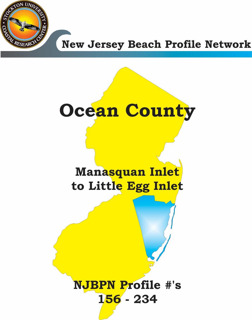
Figure 106. Locations of the 28 NJBPN profile stations in Ocean County, NJ.
|
|
|
- Ethel Wiggins
- 5 years ago
- Views:
Transcription
1 130

2 Figure 106. Locations of the 28 NJBPN profile stations in Ocean County, NJ. 131
3 Beach Fills in Ocean County: The federal/state/local storm damage reduction project (beachfill) between Manasquan Inlet and Barnegat Inlet commenced in May 2017 in Dover Township (Ortley Beach- NJBPN #149) via a betterment option funded by the state and municipality. This action was taken because of scheduling delays and the need to protect the most vulnerable oceanfront community while waiting for construction of the designed dune and berm. The entire federally-designed beachfill is expected to place approximately 10 million cubic yards of sand on nearly 14 miles of ocean shoreline between Point Pleasant Beach and Berkeley Township (USACE Project Fact Sheet, The reach that includes Island Beach State Park is not included in this storm damage reduction project. Because of project delays, the CRC focused its 2017 surveying efforts in northern Ocean County to obtain pre-beachfill project elevations. The CRC collected postbeach fill elevations only at NJBPN #153. The USACE posts the construction status at State/municipal and federal/state/municipal beachfills were completed on Long Beach Island in in response to damages from storms. The USACE posts the construction status of the LBI project at Individual Site Descriptions: Point Pleasant Beach, Water Street and Maryland Avenue; #156 and #155; The recreational beach at Water Street has no dune due to local custom and high volume beach use during the tourist season. The Maryland Avenue location has had a long-established dune with a crest near 16 ft NAVD88. Berm elevations at both sites approach 10 ft NAVD88. Bay Head, Johnson Avenue; #154; The site is backed by a rock revetment that was constructed after the 1962 March northeaster and has had an erratic history of shoreline stability. Berm widths varied from feet over the past year and the nearshore slope was steep with no evidence of nearshore bars. Mantoloking, 1117 Ocean Avenue; #153; The steel vertical sheet-pile wall was installed here in 2014 and has been exposed to wave action by even modest storms. Completed at top elevation of 16.0 feet NAVD 88, this wall was initially buried in recovery sand making up a dune containing the wall as a core. Northeast storm Jonas, January 23, 2016 exposed 85% of the wall s length leaving between 6 and 22 feet of vertical surface exposed above either a wet beach at low tide or a sand surface below the elevation of low tide. By the fall 2017 survey, the site received sand from the initial construction of the federal beachfill. This event expanded the base width of the dune and berm by 200 feet and elevated the berm to nearly 7.0 ft NAVD88. Brick Township, Public Beach #3, #152; The steel wall extends south past this site and in spring 2016 was covered with sand through local efforts. The resulting new dune was seaward of the previous and raised to approximately 25 ft. The remaining profile is characterized by a steep, narrow berm. A nearshore sandbar was measured in the fall 2017 survey indicating cross-shore transport. Toms River Township (Normandy Beach, Ortley Beach), 1 st Avenue and 8 th Avenue; #151 and #149; These sites were in desperate need of sand prior to the construction of the federal beachfill. Through a betterment, funding was available to place sand at the Ortley Beach location in May This included sand for the berm only. Dune and berm restoration will occur during the scheduled construction. The Normandy profile is characterized by a small, narrow dune at elevation 18 ft NAVD88 and a narrow berm. 132
4 Lavallette; White Avenue; #150; The post-sandy dune reaches nearly 23 ft, but is less than 100 ft at its base. In late 2017, the berm width expanded to 200 ft, possibly due to sand that was added to the littoral system in Ortley Beach in May Seaside Heights; Franklin Avenue; #248; This site does not include a dune due to local management efforts and the heavy beachgoer use. This site posted the greatest seasonal volume losses of all the Ocean County sites (between fall 2016 and spring 2017) but regained more sand over the summer 2017 to finish with a net volume gain over the year. Seaside Park; 4 th Avenue; #148; The Seaside Park profile contains a stable dune over 25 ft high and a moderate-width (100 ft) berm. Local efforts via sand fencing have incrementally moved the base of the dune seaward. Nearshore sand bars are a typical occurrence. Midway Beach (Berkeley Township); 6 th Avenue; #347 The profile at Midway Beach contains an impressive dune (> 25 ft and 150 ft wide) and a berm that measured over 100 ft. The berm was lowered by the January 2017 northeaster and did not regain its pre-storm elevation. Island Beach State Park; Sites #247, #246, and #146; All three locations recorded volume gains over the time frame, with the greatest gains occurring at the southernmost profile location (#146). The dunes remained in the same position and elevation, and most changes occurred in the seaward portion of the berm and in the nearshore. Barnegat Light Borough; 10 th Street and 26 th Street; #245 and #145; The Barnegat Light Borough locations display different profile features. The 10 th Street site is comprised of an extensive dune system (1200 ft) and very narrow berm, while the 26 th Street site contains a 350 ft wide dune and 400 ft berm. Both lost sand volume from the January 2017 northeaster. Over the time period, the 10 th Street profile losses were greater than at the 26 th Street site which regained much of the lost sand by the fall Long Beach Township (Loveladies); La Baia Street; #144; Sand was added to the Loveladies section of the Township in the summer of The result was an engineered dune at 22 ft NAVD88 that was placed seaward and dwarfed the previous dune system. In the time period, most of the volume changes occurred below the 0.0 ft datum. Harvey Cedars; 73 rd Street and Tranquility Drive; #143 and #142; A small state-funded beachfill occurred at the NJBPN #143 site in October 2016, but not at Tranquility Drive which received sand from the neighboring beachfills. Surf City; 20 th Street; #241; The 20 th Street site in Surf City was included in the initial construction of the federal beachfill in 2007 and later restored to the design template in 2013 following the passage of PL While there has been changes to the berm since the last restoration, the engineered dune has remained intact and at the design elevation and position. Ship Bottom; 8 th Street; #141; The Ship Bottom profile has retained its 150-ft wide dune and at least a 150-ft wide berm since the spring 2015 beachfill. Even with the volume loss in , the site has gradually accreted since Long Beach Township (Brant Beach, 32 nd St; #140; Beach Haven Crest, 81 st St; #139; Spray Beach) Old Whaling Rd; #138; All of the Township NJBPN locations received post-sandy restoration to the template design in 2015 or 2016 and each engineered dune has remained as designed and constructed. All of the sites showed seasonal changes 133
5 in the beachface and nearshore. NJBPN #139 measured the greatest volume loss of the three sites in but the berm was nearly 200 ft wide by the fall 2017 survey. Beach Haven; Taylor Ave; #137 and Dolphin Ave; #136; Both of the Beach Haven sites are located within the federal beachfill and initial construction was completed by Over the time period, site #137 appeared to be the more stable profile of the two. The Dolphin Avenue site has a narrower berm and showed larger swings in volume gains and losses, mostly below the 0.0 ft datum. Long Beach Township (Holgate); Webster Ave; #135; Initial construction of the engineered dune and berm was completed in summer Even with erosion of the beachface, the site gained in volume following the January 2017 northeaster. These gains occurred primarily below the datum. Forsythe National Wildlife Refuge; Located at the northern boundary with LBT; #234; Since commencement of the federal beachfill in Beach Haven and the Holgate section of the Township in 2016, this site has shown significant changes in the beachface and nearshore depending on when and where the sand was placed updrift of the site. The profile is located within the project s taper section immediately south of the Holgate terminal groin Storm Activity The only significant storm to affect the Ocean County shoreline was the January 24, 2017 northeaster which brought strong onshore flow and tidal flooding (NOAA Storm Events Database, 2017) 1&beginDate_yyyy=2017&endDate_mm=11&endDate_dd=15&endDate_yyyy=2017&county=OCEAN%3A2 9&hailfilter=0.00&tornfilter=0&windfilter=000&sort=DT&submitbutton=Search&statefips=34%2CNEW+JER SEY All of the NJBPN sites in Ocean County showed the effects of the storm. Hurricane Jose passed offshore New Jersey during a spring high tide in September (18-19) but damages to the shoreline were not observed. 134
.")
. Most of the volume gain was below the 0.0 ft NAVD datum.")
6 NJBPN 156 Water Street, Point Pleasant The Water Street site is located near the south end of the Point Pleasant Beach boardwalk and 1,400 ft south from the Manasquan Inlet jetty. The lack of dunes on the profile is the result of local beach maintenance activities. Between fall 2016 and fall 2017, the shoreline moved seaward (46 ft). This accumulation is barely visible in the photos above (left photo taken December 21, 2016 and right photo taken November 2, 2017). BOARDWALK Figure 107. Between fall 2016 and fall 2017 the profile gained in total volume (67.6 yds 3 /ft). Most of the volume gain was below the 0.0 ft NAVD datum. No sand was brought in during the year. 135
 show little change in the backshore as most of the annual")
 and the profile lost volume (-5.9 yd 3 /ft.). Above-datum losses exceeded the below datum gains.")
7 NJBPN 155 Maryland Avenue, Point Pleasant The Maryland Avenue profile is located over a mile south of Manasquan Inlet. The photos (left taken December 21, 2016 and right taken November 2, 2017) show little change in the backshore as most of the annual change occurred at the beachface. Figure 108. The most changes to the Maryland Ave profile occurred on the berm and beachface. Between fall 2016 and fall 2017 the shoreline moved landward (-23.3 ft) and the profile lost volume (-5.9 yd 3 /ft.). Above-datum losses exceeded the below datum gains. 136


8 NJBPN 154 Johnson Avenue, Bay Head The Johnson Avenue profile shows a narrow berm and steep nearshore (left taken December 22, 2016 and right taken January 19, 2018). The position of the 0.0 ft NAVD shoreline fluctuated by 20 ft throughout the year but arrived at in the same location in January BULKHEAD POLE DECK Figure 109. The December 2016 seaward dune slope follows the revetment surface. By January 2018 (fall 2017 survey) sand accumulated along the profile from sand captured from the littoral drift. The profiles lack significant nearshore bar development indicating limited amounts of sand available via cross-shore processes. Fall 2016 to fall 2017 volume change was 20.7 yd 3 /ft with most gains occurring below the datum. 137
 shows the results of the federal/state/municipal beach fill that was completed before the fall 2017")

9 NJBPN Ocean Avenue, Mantoloking At the Mantoloking Ocean Avenue location, the left photo (taken October 17, 2016) shows a narrow dry beach. In contrast, the right photo (taken December 21, 2017) shows the results of the federal/state/municipal beach fill that was completed before the fall 2017 survey. The 0.0 ft NAVD shoreline was moved seaward by ft from its fall 2016 position. Figure 110. The noticeable accumulation on the berm at the Ocean Avenue location is the result of the federal beach fill. Volume change between fall 2016 and fall 2017 was 63.9 yds 3 /ft with gains above and below the datum. 138
. Sand was pushed from the berm to protect the existing dune.")

10 NJBPN 152 Public Beach #3, Brick Township The photos of the Brick Township Public Beach #3 profile site show the change in the dune between December 22, 2016 (left) and November 1, 2017 (right). Sand was pushed from the berm to protect the existing dune. This site is scheduled to receive sand from the federal/state beachfill during the spring/summer of PAVILION Figure 111. The January 24, 2017 northeaster storm eroded the berm. Local efforts pushed sand to create a sand pile seaward of the existing dune as shown in the profile change between surveys 54 and 55. Survey 53 to Survey 55 comparison resulted in a volume gain (12.6 yds 3 /ft.) and shoreline movement was unremarkable (-0.5 ft). 139
 and do not show the effects of the January 2017 northeaster.")

11 NJBPN st Avenue, Normandy Beach The photos of the Normandy Beach profile show the conditions of the backshore adjacent to the dune fencing (left taken December 22, 2016 and right taken November 1, 2017) and do not show the effects of the January 2017 northeaster. The Normandy Beach portion of the federal/state beach fill is scheduled for summer Figure 112. Over the 18-month time frame, the modest man-made dune remained in position through changes in berm and nearshore elevations. Between fall 2016 and fall 2017, the shoreline moved 19.2 ft. seaward and the whole profile gained in volume (5.12 yd 3 /ft.). 140
. This location is scheduled for beach nourishment in late summer/fall of 2018. Figure 113.")
 as the profile rebounded during the summer months due to quiescent conditions and the possible influx of sand from the Ortley Beach May 2017")
12 NJBPN 150 White Avenue, Lavallette The photos of the dune at White Avenue show little changes inflicted by the January 2017 northeaster (left taken December 9, 2016 and right taken November 1, 2017). This location is scheduled for beach nourishment in late summer/fall of Figure 113. This site experienced a gain in volume between surveys 53 and 55 (17 yds 3 /ft.) as the profile rebounded during the summer months due to quiescent conditions and the possible influx of sand from the Ortley Beach May 2017 betterment project. The shoreline moved seaward (17 ft.) during this time period. 141
 this accumulation was gone but there was a gain in the berm elevation due to state/local efforts to place 267,400 cy of sand in Ortley Beach berm ahead of the")

13 NJBPN th Avenue, Ortley Beach The left photo (taken December 9, 2016) shows the mounds that were created from sand scraped from the lower berm through local efforts. By October 31, 2017 (right photo) this accumulation was gone but there was a gain in the berm elevation due to state/local efforts to place 267,400 cy of sand in Ortley Beach berm ahead of the federal schedule. The beach fill template will be completed via the federal project in summer BOARDWALK Figure 114. The fall 2016 to fall 2017 volume gain of 47.0 yds 3 /ft. was the result of gains in the berm and nearshore elevations from the state/local betterment efforts that occurred in May The berm expansion moved the shoreline seaward 75.5 ft. No sand was placed in the dune as a result of the betterment project. 142
. The beach fill will commence at this location in fall 2018. BOARDWALK Figure 115.")

14 NJBPN 248 Franklin Avenue, Seaside Heights The two annual photos at the Franklin Avenue site show a nearly identical berm shape and extent (left taken December 7, 2016 and right photo taken October 31, 2017). The beach fill will commence at this location in fall BOARDWALK Figure 115. The berm/nearshore elevations in the March survey (#54) show the impact of the January 2017 northeast storm (volume losses were nearly 40 yds 3 /ft from December 2016) but the profile made significant gains over the 2017 summer. Between surveys 54 and 55, the summertime volume gain was 52.3 yds 3 /ft. across the profile and the shoreline moved 83.7 ft seaward from its spring 2017 position. 143
.")

15 NJBPN th Avenue, Seaside Park The dune at 4 th Avenue remained in the same condition and size (left photo taken December 9, 2016, and right photo taken October 31, 2017). This Seaside Park location is scheduled for beach fill in fall BOARDWALK Figure 116. Between fall 2016 and fall 2017 the profile lost a modest amount of volume (-4.0 yd 3 /ft.) and the shoreline moved seaward (15.7 ft). Most of the volume loss occurred below the 0.0 ft datum as the nearshore bar was moved offshore. 144
 show the dune toe and a berm that is approximately 200-ft wide. The position of the 0.")

16 NJBPN th Lane, Midway Beach At the 6 th Lane location, both photos (left taken December 9, 2016 and right taken October 26, 2017) show the dune toe and a berm that is approximately 200-ft wide. The position of the 0.0 ft NAVD88 shoreline moved landward (-17.8 ft.) during this time period. Figure 117. Between fall 2016 and fall 2017 the profile lost volume ( yds 3 /ft.) as the seaward portion of the berm and nearshore reduced in elevation. 145
. The shoreline moved seaward (43.8 ft.) during this timeframe. Figure 118.")

17 NJBPN 247 North End, Island Beach State Park The shape of the dune including the seaward scarp remained consistent over the past year (left photo taken December 8, 2016 and right photo taken December 18, 2017). The shoreline moved seaward (43.8 ft.) during this timeframe. Figure 118. The sand that accumulated on the berm in late 2016 was gone by survey 54, but summer conditions allowed the berm to rebuild to a point seaward of the fall 2016 position. The erosional trend of the past couple of years reversed between fall 2016 and fall The profile gained in volume (9.69 yds 3 /ft.) with gains occurring at both above and below the datum. 146
. However, dune elevations remained the same during this period of evaluation (12.6 ft.")

18 NJBPN 246 Parking Lot A7, Island Beach State Park The sand fencing shown in both photos was responsible for trapping windblown sand and contributing to the small volume gains along the seaward portion of the dune (left photo taken December 8, 2016 and right photo taken December 18, 2017). However, dune elevations remained the same during this period of evaluation (12.6 ft. NAVD88) and still nearly 4 ft. below the pre-sandy elevation. Figure 119. This Island Beach location displayed significant gains in the berm and nearshore during the summer/early fall of This gain was also recorded at the other state park sites to the north and south. Between surveys 53 and 55, there was a volume gain across the profile (19.31 yds 3 /ft.) and the shoreline moved seaward (40 ft.). 147
. Most changes occurred at the berm and below the shoreline elevation. Figure 120.")

19 NJBPN 146 South End, Island Beach State Park At the southern Island Beach State Park site there was little change to the dune or backshore between 2016 and 2017 (left photo taken December 8, 2016 and right photo taken December 18, 2017). Most changes occurred at the berm and below the shoreline elevation. Figure 120. The profile at the South End site shows seasonal fluctuations of the beachface and nearshore. This was the only State Park location to gain sand volume following the January 2017 northeaster. Between Survey 53 and Survey 55, there was a volume gain (36.3 yds 3 /ft.) across the whole profile and the shoreline moved seaward (82.25 ft.). 148

. Figure 121. Between fall 2016 and fall 2017, the profile lost volume (-13.88 yds 3 /ft.")
20 NJBPN th Street, Barnegat Light The 10 th Street profile was established in 1994 to monitor the changes following the reconfiguration of the Barnegat Inlet jetties. After the fall 2016 survey, the foredune eroded landward and reduced in elevation (left photo taken November 18, 2016 and right photo taken September 14, 2017). Figure 121. Between fall 2016 and fall 2017, the profile lost volume ( yds 3 /ft.) but the shoreline moved seaward (10.75 ft.). The majority of the volume loss occurred above the 0.0 ft. datum ( yds 3 /ft.). 149
.")

21 NJBPN th Street, Barnegat Light The natural foredune at the 26 th Street profile is over 20 ft and remained stable in (left photo taken November 18, 2016 and right photo taken September 17, 2017). The stability is attributed to the profile s position with respect to the Barnegat Inlet south jetty which traps the northward-driven littoral drift. Figure 122. Between fall 2016 and fall 2017, changes to the profile occurred primarily below the 0.0 ft datum (with the profiles continuing to an ending distance of approximately 1050ft from the baseline). The profile lost volume (-5.0 yds 3 /ft.) and the shoreline moved seaward (9.5 ft.). 150
. Figure 123.")
 and there was a volume loss over the time period (-15.29 yds 3 /ft.). The loss occurred primarily below the 0.")
22 NJBPN 144 La Baia Street, Loveladies In 2016, the USACE completed the construction of a beach fill and engineered dune at the La Baia Street profile (left photo taken November 18, 2016 and right photo taken September 15, 2017). Figure 123. The profile at La Baia St was enhanced with offshore sand in summer 2016 and this event elevated and widened the dune, berm, and nearshore. Between surveys 53 and 55, the shoreline barely moved landward (-1.0 ft.) and there was a volume loss over the time period ( yds 3 /ft.). The loss occurred primarily below the 0.0 ft. datum. 151
. Figure 124.")

23 NJBPN rd Street, Harvey Cedars At the 73 rd Street profile, the engineered dune that was created in the 2009 federal beach fill remained in relatively the same position, though the seaward toe accumulated sand due to the presence of the sand fencing (left photo taken November 18, 2016 and right photo taken September 15, 2017). Figure 124. The state/municipality added sand to the berm in October The profile showed a seasonal change in survey 54, but regained berm sand by survey 55. Between fall 2016 and fall 2017 most of the changes occurred below the 0.0 ft datum where the nearshore was lower in elevation in survey 55. The shoreline moved landward (-13.0 ft) and the profile lost volume ( yds 3 /ft.). 152


24 NJBPN 142 Tranquility Drive, Harvey Cedars The photos from the dune crest at the Tranquility Drive location (left taken October 28, 2016 and right taken September 15, 2017) show no change in the engineered dune that was constructed in spring RETAINING WALL Figure 125. The Tranquility Drive profiles show significant seasonal variability in the width and elevation of the berm and nearshore while the dune remained relatively unchanged. Though not the recipient of a beach fill, this site benefitted from late summer/early fall 2016 beach fills in North Beach, Loveladies, and north of this location in Harvey Cedars. Following the January 2017 northeaster, the amount of sand in the littoral system allowed the site to regain its seaward extent by the fall 2017 survey. Between fall 2016 and fall 2017 the profile gained in volume (17.11 yds 3 /ft.) and the shoreline moved seaward 19.5 ft. 153
 though the shoreline moved 40.0 ft seaward over that time frame.")

25 NJBPN th Street Surf City This Surf City profile shows relatively no change in the berm elevation between the fall surveys (October 28, 2016 [left] and September 15, 2017 [right]) though the shoreline moved 40.0 ft seaward over that time frame. This site has not received sand via beach fill since September Figure 126. The profiles at the Surf City location show the seasonal changes of the berm and nearshore while the engineered dune remained relatively unchanged. Between fall 2016 and fall 2017, the site gained in volume (16.47 yds 3 /ft.), most of which was above the 0.0 ft. NAVD88 datum. 154
. Figure 127.")

26 NJBPN th Street, Ship Bottom The Ship Bottom profile location has retained the dune position and a wide berm since the spring 2015 beach fill (left photo taken October 28, 2016 and right photo taken September 14, 2017). Figure 127. The Ship Bottom profiles show seasonal changes in the berm elevation while the shoreline position has remained relatively similar since fall Most of the volume changes occurred below the 0.0 ft. datum due to changes in the nearshore bar position. Between fall 2016 and fall 2017, the profile lost volume ( yds 3 /ft.) and the shoreline moved landward (-7.0 ft.). 155
. Figure 128.")

27 NJBPN nd Street, Long Beach Township The backshore photos in Long Beach Township show little change in of the seaward dune toe and berm (left taken September 23, 2016 and right taken September 14, 2017). Figure 128. The dune and berm at the 32 nd Street profile remained relatively stable over the time period with the seaward portion of the berm showing a seasonal gain in fall 2016, then followed by erosion of the beachface in spring and fall of Between fall 2016 and fall 2017, the profile lost volume (-3.97 yds 3 /ft.) and the shoreline moved landward (-26.0 ft.). 156
. Figure 129.")

28 NJBPN st Street, Long Beach Township The 81 st Street profile in Long Beach Township received sand via federal beach fill in summer 2015 and planting of the dune vegetation was completed by fall The dune remained stable over the time period (left photo taken October 28, 2016 and right photo taken September 14, 2017, both views from the dune crest). Figure 129. The fall 2016 profile shows a restored berm following the weather events in January and September A January 2017 northeast storm influenced the spring 2017 profile by eroding the berm and moving the sand into a nearshore bar. Summer conditions allowed the berm to be restored by survey 55. Between fall 2016 and fall 2017, the shoreline moved landward ( ft.) and the profile lost volume ( yds 3 /ft.). 157
 show the conditions of the seaward dune toe and backshore which gained in elevation due to sand trapped by vegetation. Figure 130.")

29 NJBPN 138 Old Whaling Road (124 th Street), Long Beach Township The photos from the 124 th Street location (left taken September 23, 2016 and right taken September 14, 2017) show the conditions of the seaward dune toe and backshore which gained in elevation due to sand trapped by vegetation. Figure 130. While the dune and backshore at this Long Beach Township location remained relatively unchanged from September 2016, the seaward portion of the berm and beachface showed seasonal changes in elevation and position of the shoreline. Between fall 2016 and fall 2017 the profile gained in total volume (13.88 yds 3 /ft.) and the shoreline moved seaward (31.5 ft.). 158
. Figure 131.")
 but naturally regained the elevation by survey 55. Between fall 2016 and fall 2017, the volume gain was 4.")
30 NJBPN 137 Taylor Avenue, Beach Haven By the fall 2017 survey, planting of the engineered dune was completed at the Taylor Avenue location (photos from dune crest taken September 23, 2016 and right taken September 13, 2017). Figure 131. The engineered dune that was constructed at the Taylor Ave location in spring 2016 and remained in the same position and elevation throughout The berm, however lowered over the winter ( ) but naturally regained the elevation by survey 55. Between fall 2016 and fall 2017, the volume gain was 4.95 yds3/ft. (with the majority of gains occurring below the 0.0 ft. datum). The shoreline moved landward (-37.5 ft.). 159
. Planting of the engineered dune with vegetation was completed by the fall 2017 survey. Figure 132.")
, moving the shoreline landward (- 55.5 ft.). Between fall 2016 and fall 2017, the profile lost volume (-30.")
31 NJBPN 136 Dolphin Avenue, Beach Haven The photos at the Dolphin Avenue profile show the change in the berm width (left taken September 21, 2016 and right photo taken September 13, 2017). Planting of the engineered dune with vegetation was completed by the fall 2017 survey. Figure 132. The fall 2016 survey represents the shape and extent of the engineered beach fill profile. Since that time, the berm eroded (the result from the January 2017 northeaster), moving the shoreline landward ( ft.). Between fall 2016 and fall 2017, the profile lost volume ( yds 3 /ft.). Most of the losses occurred below the 0.0 ft. datum. 160
. Some sand accumulated at the seaward base of the dune between fall 2016 and fall 2017 as a result of sand trapped by fencing. Figure 133.")

32 NJBPN 135 Webster Avenue, Long Beach Township The Webster Avenue photos show the unvegetated and vegetated dune crest (left taken September 21, 2016 and right taken September 13, 2017). Some sand accumulated at the seaward base of the dune between fall 2016 and fall 2017 as a result of sand trapped by fencing. Figure 133. The fall 2016 profile represents the extent of the engineered dune and berm at Webster Avenue. Since then, the seaward portion of the berm displayed seasonal fluctuations in elevation. Between fall 2016 and fall 2017, the profile gained volume (27.98 yds 3 /ft.) and the shoreline moved seaward (20.75 ft.). Most of the volume gain occurred below the datum. 161
. The profile is located within the taper area of the federal beachfill. Figure 134.")

33 NJBPN 234 Forsythe National Wildlife Refuge, Holgate Entrance, Long Beach Township The photos above show the seaward portion of the berm immediately downdrift of the Holgate terminal groin (left photo taken September 21, 2016 and right photo taken September 13, 2017). The profile is located within the taper area of the federal beachfill. Figure 134. The dune that was constructed in post-hurricane Sandy recovery efforts remained unchanged in Most of the changes occurred at the seaward portion of the berm and in the nearshore. Sand was added immediately north of the profile in November 2016 in a re-pump project and the results of sand distribution are shown in survey 54. Between fall 2016 and fall 2017, volume loss was measured across the profile ( yds 3 /ft.) and the shoreline moved landward ( ft.). 162
34 Summary & Conclusions The northern Ocean County federal flood and coastal storm damage reduction project (beachfill) is a muchwelcomed event in protecting landward properties and infrastructure. The project commenced in Ortley Beach in May 2017 as a betterment to address the vulnerable shoreline conditions in the municipality. The Mantoloking beaches were the first to receive sand in the designed template and this is shown in the fall 2017 survey at NJBPN #153. Completion of the 14-mile initial construction of the federal project is scheduled for winter 2018/2019. With the exception of the fall 2017 Ortley Beach and Mantoloking profiles, the CRC fall surveys represent pre-project conditions. On Long Beach Island (LBI), several NJBPN sites received sand either in a federal repair from the January 2017 storm event or in a state/municipal beachfill. The LBI 2017 fall surveys were completed in September to capture the summer inflated profile. All of the NJBPN sites in Ocean County showed the effects of the January 2017 northeast storm. Appendix Tables 4 and 5 provide the seasonal and annual profile volume and shoreline changes for Ocean County. At most sites, the berms were lowered from the fall 2016 position. (Note changes between Survey 53 and Survey 54.) The two sites with the greatest volume loss from this event were at NJBPN #248 (Seaside Heights) and NJBPN #142 (Harvey Cedars). NJBPN #146 (Island Beach State Park), NJBPN #135 (Long Beach Township), and NJBPN #234 (Long Beach Township) recorded the greatest gains during this seasonal time period. The state park profile is closest to the Barnegat Inlet north jetty and probably benefitted from the southerly littoral transport and sand trapping by the jetty. The Webster Avenue profile showed gains below the datum in a nearshore bar, and the southernmost LBI profile gained volume both above and below the datum. This significant gain at NJBPN #234 is attributed to the additional sand in the littoral system. In November 2016, the beaches immediately north of the profile received a re-pump of approximately 300,000 cubic yards of sand. The greatest annual change in the position of the 0.0 ft. NAVD88 shoreline (fall 2016 to fall 2017) occurred at the Mantoloking profile site (184.5 ft.) and was directly related to the beachfill event in summer The site with the greatest landward movement during this timeframe was at 81 st Street in Long Beach Township ( ft.), and the result of erosion of the shoreline from the January 2017 storm (Appendix B). 163
Figure 38. Locations of the 28 NJBPN profile stations in Ocean County, NJ.
 52 Figure 38. Locations of the 28 NJBPN profile stations in Ocean County, NJ. 53 Individual Site Descriptions: Beaches in Northern Ocean County continued to recover slowly as sand transported offshore
Figure 38. Locations of the 28 NJBPN profile stations in Ocean County, NJ.
 55 Figure 38. Locations of the 28 NJBPN profile stations in Ocean County, NJ. 56 Individual Site Descriptions: Northern Ocean County recovered its beaches approaching pre-hurricane Sandy elevation or width,
Figure 46. Locations of the 28 NJBPN profile stations in Ocean County, NJ. A new site was added in the Borough of Seaside Heights (#248).
.") 90 Figure 46. Locations of the 28 NJBPN profile stations in Ocean County, NJ. A new site was added in the Borough of Seaside Heights (#248). 91 OCEAN COUNTY SPRING 2008 to FALL 2009 The Ocean County shoreline
90 Figure 46. Locations of the 28 NJBPN profile stations in Ocean County, NJ. A new site was added in the Borough of Seaside Heights (#248). 91 OCEAN COUNTY SPRING 2008 to FALL 2009 The Ocean County shoreline
Figure 41. Locations of the 28 NJBPN profile stations in Ocean County, NJ.
 57 Figure 41. Locations of the 28 NJBPN profile stations in Ocean County, NJ. 58 Hurricane Sandy s Impact on the Ocean County Shoreline; In general terms, all forms of damage to beaches, dunes and public
New Jersey Beach Profile Network Ocean County Profile Site Locations
 125 RICHARD STOCKTON COLLEGE OF NEW JERSEY COASTAL RESEARCH CENTER New Jersey Beach Profile Network Ocean County Profile Site Locations Figure 73 156 155 154 153 152 151 15 149 The Ocean County shoreline
SPECIAL SPRING 2018 STORM REPORT ON THE CONDITION OF THE MUNICIPAL BEACHES FOR THE BOROUGH OF STONE HARBOR, CAPE MAY COUNTY, NEW JERSEY
 SPECIAL SPRING 2018 STORM REPORT ON THE CONDITION OF THE MUNICIPAL BEACHES FOR THE BOROUGH OF STONE HARBOR, CAPE MAY COUNTY, NEW JERSEY Aerial photograph taken April 21, 2018 showing the view up the beach
Beach Dune Performance Assessment of. New Jersey Beach Profile Network (NJBPN) Sites at. Long Beach Island, New Jersey. After Hurricane Sandy
 Sites at. Long Beach Island, New Jersey. After Hurricane Sandy") Beach Dune Performance Assessment of New Jersey Beach Profile Network (NJBPN) Sites at Long Beach Island, New Jersey After Hurricane Sandy November 13, 2012 The Richard Stockton College of NJ Coastal Research
Beach Dune Performance Assessment of New Jersey Beach Profile Network (NJBPN) Sites at Long Beach Island, New Jersey After Hurricane Sandy November 13, 2012 The Richard Stockton College of NJ Coastal Research
OCEAN COUNTY 2006 to 2008
 OCEAN COUNTY 2006 to 2008 Ocean County finally started to benefit from long-awaited startup of Federal beach nourishment projects when sand was pumped onto Surf City, Long Beach Island in late 2006. This
23- Year Sand Volume Changes at Site 132, 15th Street, Brigantine
 149 Figure75. Location map for the 9 NJBPN profile sites in Atlantic County, NJ ATLANTIC COUNTY SPRING 2008 to FALL 2009 150 The Atlantic County oceanfront shoreline consists of three barrier islands.
2014 ANNUAL REPORT - TO THE CITY OF NORTH WILDWOOD ON THE CONDITION OF THE CITY BEACHES
 2014 ANNUAL REPORT - TO THE CITY OF NORTH WILDWOOD ON THE CONDITION OF THE CITY BEACHES View on September 25, 2014 looking northwest into Hereford Inlet. Considerable southerly expansion of the tip of
Figure79. Location map for the 10 NJBPN profile sites in Atlantic County, NJ 155
 154 Figure79. Location map for the 10 NJBPN profile sites in Atlantic County, NJ 155 ATLANTIC COUNTY SPRING 2009 to FALL 2010 The Atlantic County coastline consists of three barrier islands. Between Little
UPPER BEACH REPLENISHMENT PROJECT RELATED
 ASSESSMENT OF SAND VOLUME LOSS at the TOWNSHIP of UPPER BEACH REPLENISHMENT PROJECT RELATED to the LANDFALL OF HURRICANE SANDY - PURSUANT TO NJ-DR 4086 This assessment is in response to Hurricane Sandy
FINAL REPORT FOR 2013 ON THE CONDITION OF THE MUNICIPAL OCEANFRONT BEACHES THE BOROUGH OF AVALON, CAPE MAY COUNTY, NEW JERSEY
 FINAL REPORT FOR 2013 ON THE CONDITION OF THE MUNICIPAL OCEANFRONT BEACHES THE BOROUGH OF AVALON, CAPE MAY COUNTY, NEW JERSEY View from 12 th Street to the south taken February 28, 2013, following completion
2013 ANNUAL REPORT - TO THE CITY OF NORTH WILDWOOD ON THE CONDITION OF THE CITY BEACHES
 2013 ANNUAL REPORT - TO THE CITY OF NORTH WILDWOOD ON THE CONDITION OF THE CITY BEACHES View on June 18, 2013 from the 2 nd Avenue jetty looking south while the 2013 beach nourishment project was under
Figure 78. Map of Cape May County showing the locations of the 31 profile sites in the county.
 103 Figure 78. Map of Cape May County showing the locations of the 31 profile sites in the county. 104 Cape May County in 2015: Cape May County has 31 survey stations between Reeds Beach on the Western
Beach, dune and development in the Borough of Mantoloking as of January Prepared for The Borough of Mantoloking: April 2, 2008
 Summary of 20-years of Shoreline Monitoring Between Maryland Avenue, Point Pleasant Beach, Bay Head, Mantoloking, Brick Township, to 1 st Avenue in Normandy Beach, Ocean County, New Jersey & an Evaluation
A REVIEW OF THE CONDITION OF THE MUNICIPAL BEACHES AS A RESULT OF HURRICANE SANDY IN THE BOROUGH OF STONE HARBOR, CAPE MAY COUNTY, NEW JERSEY
 A REVIEW OF THE CONDITION OF THE MUNICIPAL BEACHES AS A RESULT OF HURRICANE SANDY IN THE BOROUGH OF STONE HARBOR, CAPE MAY COUNTY, NEW JERSEY View along the dune scarp from 103 rd Street on October 31,
ATLANTIC COUNTY 2006 to 2008
 ATLANTIC COUNTY 2006 to 2008 The Atlantic County oceanfront shoreline consists of three barrier islands where the northern one, Little Beach Island and a third of the second, Brigantine Island, are undeveloped
New Jersey Beach Profile Network Atlantic County Profile Site Locations
 215 RICHARD STOCKTON COLLEGE OF NEW JERSEY New Jersey Beach Profile Network Atlantic County Profile Site Locations COASTAL RESEARCH CENTER Figure 128 There are nine NJBPN survey sites on the Atlantic County
2015 ANNUAL REPORT - TO THE CITY OF NORTH WILDWOOD ON THE CONDITION OF THE CITY BEACHES
 2015 ANNUAL REPORT - TO THE CITY OF NORTH WILDWOOD ON THE CONDITION OF THE CITY BEACHES Ariel view of North Wildwood looking south from the Hereford Inlet perspective on June 24, 2015. The main channel
New Jersey Coastal Zone Overview. The New Jersey Beach Profile Network (NJBPN) 3 Dimensional Assessments. Quantifying Shoreline Migration
 3 Dimensional Assessments. Quantifying Shoreline Migration") New Jersey Coastal Zone Overview The New Jersey Beach Profile Network (NJBPN) Objectives Profile Locations Data Collection Analyzing NJBPN Data Examples 3 Dimensional Assessments Methodology Examples Quantifying
New Jersey Coastal Zone Overview The New Jersey Beach Profile Network (NJBPN) Objectives Profile Locations Data Collection Analyzing NJBPN Data Examples 3 Dimensional Assessments Methodology Examples Quantifying
FINAL REPORT FOR 2013 ON THE CONDITION OF THE MUNICIPAL BEACHES IN THE TOWNSHIP OF UPPER, CAPE MAY COUNTY, NEW JERSEY
 FINAL REPORT FOR 2013 ON THE CONDITION OF THE MUNICIPAL BEACHES IN THE TOWNSHIP OF UPPER, CAPE MAY COUNTY, NEW JERSEY Aerial photograph at Corson s Inlet showing conditions on December 1, 2013 of the north
The Stockton University Coastal
 Hurricane Sandy: Beach-dune recovery at New Jersey Beach Profile Network (NJBPN) sites By Kimberly K. McKenna 1, Stewart C. Farrell 1, and Jeffrey A. Gebert 2 1 Stockton University Coastal Research Center
FINAL REPORT FOR 2012 ON THE CHANGES SEEN ON THE OCEANFRONT BEACHES
 FINAL REPORT FOR 2012 ON THE CHANGES SEEN ON THE OCEANFRONT BEACHES IN THE BOROUGH OF MANTOLOKING, OCEAN COUNTY, NEW JERSEY FOCUSED ON THE IMPACTS OF HURRICANE SANDY View looking north on Route 5 on October
Volume and Shoreline Changes along Pinellas County Beaches during Tropical Storm Debby
 Volume and Shoreline Changes along Pinellas County Beaches during Tropical Storm Debby Ping Wang and Tiffany M. Roberts Coastal Research Laboratory University of South Florida July 24, 2012 Introduction
Figure 262. Location map for the 10 NJBPN profile sites in Atlantic County, NJ 279
 278 Figure 262. Location map for the 10 NJBPN profile sites in Atlantic County, NJ 279 ATLANTIC COUNTY SUMMARY The Atlantic County coastline consists of three barrier islands. The island of Little Beach
FINAL REPORT FOR 2011 ON THE CONDITION OF THE MUNICIPAL BEACHES IN THE CITY OF BRIGANTINE BEACH, ATLANTIC COUNTY, NEW JERSEY
 FINAL REPORT FOR 2011 ON THE CONDITION OF THE MUNICIPAL BEACHES IN THE CITY OF BRIGANTINE BEACH, ATLANTIC COUNTY, NEW JERSEY Photograph was taken October 10, 2011 from 10 th Street North looking south
PREPARED FOR: THE BOROUGH OF AVALON 3100 DUNE DRIVE AVALON, NJ 08202
 FINAL REPORT FOR 2012 ON THE CONDITION OF THE MUNICIPAL OCEANFRONT BEACHES FOLLOWING HURRICANE SANDY IN THE BOROUGH OF AVALON, CAPE MAY COUNTY, NEW JERSEY View from 78 th Street to the north immediately
Long Beach Island Holgate Spit Little Egg Inlet Historical Evolution Introduction Longshore Transport Map, Survey and Photo Historic Sequence
 Appendix B Long Beach Island Holgate Spit Little Egg Inlet Historical Evolution Introduction The undeveloped southern end of Long Beach Island (LBI) is referred to as the Holgate spit as it adjoins the
FINAL REPORT FOR 2009 ON THE CONDITION OF THE MUNICIPAL OCEANFRONT BEACHES IN THE BOROUGH OF AVALON, CAPE MAY COUNTY, NEW JERSEY
 FINAL REPORT FOR 2009 ON THE CONDITION OF THE MUNICIPAL OCEANFRONT BEACHES IN THE BOROUGH OF AVALON, CAPE MAY COUNTY, NEW JERSEY Storm waves pound the inlet revetment September 10, 2009 as the series of
Delaware Chapter Surfrider Foundation - Indian River Inlet Monitoring
 Delaware Chapter Surfrider Foundation - Indian River Inlet Monitoring In 2012, the Delaware Surfrider Foundation Chapter formed the Surf Quality and Access Committee to focus on issues such as surf spot
RE: Hurricane Matthew Beach Damage Assessment and Recommendations [CSE 2416]
![RE: Hurricane Matthew Beach Damage Assessment and Recommendations [CSE 2416]](/thumbs/83/87675702.jpg "RE: Hurricane Matthew Beach Damage Assessment and Recommendations [CSE 2416]") October 25, 2016 Iris Hill Town Administrator Town of Edisto Beach 2414 Murray St Edisto Beach SC 29438 RE: Hurricane Matthew Beach Damage Assessment and Recommendations [CSE 2416] Dear Iris, Hurricane
October 25, 2016 Iris Hill Town Administrator Town of Edisto Beach 2414 Murray St Edisto Beach SC 29438 RE: Hurricane Matthew Beach Damage Assessment and Recommendations [CSE 2416] Dear Iris, Hurricane
TABLE OF CONTENTS APPENDIX & BIBLIOGRAPHY
 TABLE OF CONTENTS Executive Summary 1 Acknowledgements 3 Introduction 3 The New Jersey Coastal Zone 3 Storm Recovery and Beach Project Effectiveness 3 Monmouth County 4 Figure 1. Monmouth County Station
ATLANTIC COAST OF LONG ISLAND, JONES INLET TO EAST ROCKAWAY INLET, LONG BEACH ISLAND, NY. Contract #2 Construction Scope. April 18th-19th 2018
 ATLANTIC COAST OF LONG ISLAND, JONES INLET TO EAST ROCKAWAY INLET, LONG BEACH ISLAND, NY Contract #2 Construction Scope April 18th-19th 2018 New York District PLAN COMPONENTS Length of Beachfill 35,000
Table 4. Volumetric Change Rates Pre-Project and Post-Project for the Town of Duck
 V. VOLUMETRIC CHANGES General Volumetric changes measured over the entire monitoring area for various time periods are provided in Table 4. The volume changes are given in terms of cubic yards/foot of
Atlantic Coast of Long Island, Jones Inlet to East Rockaway Inlet, Long Beach Island, NY Construction Update
 Atlantic Coast of Long Island, Jones Inlet to East Rockaway Inlet, Long Beach Island, NY Construction Update June 2016 US Army Corps of Engineers Project Purpose Three specific damage mechanisms of coastal
Absecon Island Shore Protection The planning behind the project
 Absecon Island Shore Protection The planning behind the project Most residents of Atlantic City, Ventnor, Margate and Longport are now aware of upcoming plans to protect their common coastline with a beachfill
North Shore of Long Island, Feasibility Study
 North Shore of Long Island, Asharoken New York Asharoken, Feasibility Study Asharoken, NY Public Meeting June 30, 2015 US Army Corps of Engineers US Army Corps of Engineers New York BUILDING STRONG BUILDING
Basic Dune Physical Characteristics
 Basic Dune Physical Characteristics New Jersey s Beach and Dune Characteristics Dunes in New Jersey are mainly confined to a narrow strip of land between the beach berm and upland development. While there
Protecting our Beaches
 Protecting our Beaches South Amelia Island Shore Stabilization Project Nassau County, FL Mr. Drew Wallace President South Amelia Island Shore Stabilization Association (SAISSA) Mr. Bill Moore, AICP Project
HURRICANE SANDY LIMITED REEVALUATION REPORT UNION BEACH, NEW JERSEY DRAFT ENGINEERING APPENDIX SUB APPENDIX D SBEACH MODELING
 HURRICANE SANDY LIMITED REEVALUATION REPORT UNION BEACH, NEW JERSEY DRAFT ENGINEERING APPENDIX SUB APPENDIX D SBEACH MODELING Rev. 18 Feb 2015 1 SBEACH Modeling 1.0 Introduction Following the methodology
Dune Monitoring Data Update Summary: 2013
 Dune Monitoring Data Update Summary: 13 Shoreline Studies Program Virginia Institute of Marine Science College of William & Mary Gloucester Point, Virginia September 13 Dune Monitoring Data Update Summary:
Figure 1. Survey site locations in Monmouth County.
 6 Figure 1. Survey site locations in Monmouth County. 7 Individual Site Descriptions: The restoration of the Sea Bright shoreline was essentially complete by the fall 2013 survey. The NY Corps District
Town of Duck, North Carolina
 Tracking No. 00.00.2010 Erosion Mitigation And Shoreline Management Feasibility Study Town of Duck, North Carolina Coastal Planning & Engineering of North Carolina February 28, 2013 Ken Willson 1 Tracking
Beach profile surveys and morphological change, Otago Harbour entrance to Karitane May 2014 to June 2015
 Beach profile surveys and morphological change, Otago Harbour entrance to Karitane May 2014 to June 2015 Prepared for Port Otago Ltd Martin Single September 2015 Shore Processes and Management Ltd Contact
ALTERNATIVES FOR COASTAL STORM DAMAGE MITIGATION
 ALTERNATIVES FOR COASTAL STORM DAMAGE MITIGATION Dave Basco Old Dominion University, Norfolk, Virginia, USA National Park Service Photo STRUCTURAL (changes to natural, physical system) hardening (seawalls,
Beach Dune Performance Assessment of. New Jersey Beach Profile Network (NJBPN) Sites at. Between Manasquan Inlet and Allenhurst, New Jersey
 Sites at. Between Manasquan Inlet and Allenhurst, New Jersey") Beach Dune Performance Assessment of New Jersey Beach Profile Network (NJBPN) Sites at Between Manasquan Inlet and Allenhurst, New Jersey Related to FEMA DR JI 4086 Declared for Hurricane Sandy December
Beach Dune Performance Assessment of New Jersey Beach Profile Network (NJBPN) Sites at Between Manasquan Inlet and Allenhurst, New Jersey Related to FEMA DR JI 4086 Declared for Hurricane Sandy December
Performance of Upham Beach T-Groin Project and Its Impact to the Downdrift Beach
 Performance of Upham Beach T-Groin Project and Its Impact to the Downdrift Beach Progress Report for the Period of October 2008 to April 2009 Submitted by Ping Wang, Ph.D., and Tiffany M. Roberts Department
STORM RESPONSE SIMULATION
 APPENDIX V STORM RESPONSE SIMULATION Final Environmental Impact Statement Village of Bald Head Island Shoreline Protection Project Brunswick County, North Carolina Delft3D Storm Response Simulations With
2018 Beach Preservation Project Information
 QUICK FACTS Beach Renourishment to begin late April 2018 o U.S. Army Corps of Engineers project o Project Area: 8 th St. E. to end of E. Ashley Ave. o Project Length: 2 miles o Cost: $10,900,000 o Funding:
ALTERNATIVES FOR COASTAL STORM DAMAGE MITIGATION AND FUNCTIONAL DESIGN OF COASTAL STRUCTURES
 The University of the West Indies Organization of American States PROFESSIONAL DEVELOPMENT PROGRAMME: COASTAL INFRASTRUCTURE DESIGN, CONSTRUCTION AND MAINTENANCE A COURSE IN COASTAL DEFENSE SYSTEMS I CHAPTER
Executive Director and Director of Education New Jersey Sea Grant Consortium
 Welcome to the 12 th Annual State of the Shore Media Event Claire antonucci Executive Director and Director of Education New Jersey Sea Grant Consortium CLAIRE ANTONUCCI Characterized by endless snowfall,
Chapter 15 SEASONAL CHANGES IN BEACHES OP THE NORTH ATLANTIC COAST OF THE UNITED STATES
 Chapter 15 SEASONAL CHANGES IN BEACHES OP THE NORTH ATLANTIC COAST OF THE UNITED STATES By John M. Darling Hydraulic Engineer, Research Division U. S. Army Coastal Engineering Research Center Corps of
Overview. Beach Features. Coastal Regions. Other Beach Profile Features. CHAPTER 10 The Coast: Beaches and Shoreline Processes.
 Overview CHAPTER 10 The Coast: Beaches and Shoreline Processes Coastal regions constantly change. The beach is a dominant coastal feature. Wave activity continually modifies the beach and coastal areas.
LAB: WHERE S THE BEACH
 Name: LAB: WHERE S THE BEACH Introduction When you build a sandcastle on the beach, you don't expect it to last forever. You spread out your towel to sunbathe, but you know you can't stay in the same spot
The Richard Stockton College of New Jersey Coastal Research Center
 The Richard Stockton College of New Jersey Coastal Research Center New Jersey Beach Profile Network 20-Year Report On Shoreline Changes In New Jersey Raritan Bay to Delaware Bay Prepared for: New Jersey
Recycling of Surplus Sand to Extend the Time Between Beach Fill Episodes
 Recycling of Surplus Sand to Extend the Time Between Beach Fill Episodes Cape May County, New Jersey Dr. Stewart Farrell Coastal Research Center 1795 Franklin Map Shows Inlets Inlet Morphology has Remained
ST. JOSEPH PENINSULA, GULF COUNTY, FLORIDA Beach Re-Nourishment and Environmental Enhancement Project RECOMMENDATIONS
 ST. JOSEPH PENINSULA, GULF COUNTY, FLORIDA Beach Re-Nourishment and Environmental Enhancement Project RECOMMENDATIONS January 23, 2018 543 Harbor Boulevard, Suite 204 Destin, Florida 32541 850.654.1555
Oceans and Coasts. Chapter 18
 Oceans and Coasts Chapter 18 Exploring the oceans The ocean floor Sediments thicken and the age of the seafloor increases from ridge to shore The continental shelf off the northeast United States Constituent
Beach Nourishment Impact on Beach Safety and Surfing in the North Reach of Brevard County, Florida
 Beach Nourishment Impact on Beach Safety and Surfing in the North Reach of Brevard County, Florida Prepared by John Hearin, Ph.D. Coastal Engineering Vice Chairman Cocoa Beach Chapter Port Canaveral Patrick
The purpose and needs of the Figure Eight Island Inlet and Shoreline Management Project are as follows:
 Chapter 2 PURPOSE AND NEEDS 1. What are the purpose and needs of this project? The main concern of residents and owners at Figure Eight Island are economic losses resulting from damages to structures and
Inlet Management Study for Pass-A-Grille and Bunces Pass, Pinellas County, Florida
 Inlet Management Study for Pass-A-Grille and Bunces Pass, Pinellas County, Florida Final Report Submitted By Ping Wang, Ph.D., Jun Cheng Ph.D., Zachary Westfall, and Mathieu Vallee Coastal Research Laboratory
Town of Duck, North Carolina
 Tracking No. 00.00.2010 Erosion Mitigation And Shoreline Management Feasibility Study Town of Duck, North Carolina Coastal Planning & Engineering of North Carolina August 15, 2012 Tom Jarrett Robert Neal
DELAWARE S VULNERABLE COASTAL AREAS. DELAWARE INLAND BAYS and DELAWARE BAY RECONNAISSANCE STUDY
 DELAWARE S VULNERABLE COASTAL AREAS and the DELAWARE INLAND BAYS and DELAWARE BAY RECONNAISSANCE STUDY Kimberly K. McKenna, PG Delaware Dept. of Natural Resources & Environmental Control Division of Watershed
Severe Beach Erosion Caused by Permanent Beach Sand Loss Through Rollover Fish Pass Bolivar Peninsula, Texas
 DRAFT DRAFT DRAFT DRAFT DRAFT DRAFT DRAFT DRAFT Severe Beach Erosion Caused by Permanent Beach Sand Loss Through Rollover Fish Pass Bolivar Peninsula, Texas September, 1999 For J. Martin Green and Alan
Photo by: Darryl Hatheway, 2011
 Photo by: Darryl Hatheway, 2011 September 11, 2015 Presentation Discussion Examine PFD V-Zone Mapping in Wave Runup Dominated West Coast Application of PFD V-Zone Mapping Criteria in Pacific G&S PFD V-Zone
CLAM PASS RESTORATION AND MANAGEMENT PLAN BATHYMETRIC MONITORING REPORT NO. 7 Including Interior Bay Dredge Cuts and Tidal Data
 CLAM PASS RESTORATION AND MANAGEMENT PLAN BATHYMETRIC MONITORING REPORT NO. 7 Including Interior Bay Dredge Cuts and Tidal Data Submitted to: Florida Department of Environmental Protection DEP File No.
Essentials of Oceanography Eleventh Edition
 Chapter Chapter 1 10 Clickers Lecture Essentials of Oceanography Eleventh Edition The Coast: Beaches and Shoreline Processes Alan P. Trujillo Harold V. Thurman Chapter Overview Coastal regions have distinct
Beach Restoration in Okaloosa and Walton Counties. FSBPA Technology Conference Clearwater, FL
 Beach Restoration in Okaloosa and Walton Counties FSBPA Technology Conference Clearwater, FL Presented by: Duncan Greer, E.I. February 5, 2015 PRESENTATION OUTLINE 1. Overview of Project Locations 2. Eglin
Shorelines Earth - Chapter 20 Stan Hatfield Southwestern Illinois College
 Shorelines Earth - Chapter 20 Stan Hatfield Southwestern Illinois College The Shoreline A Dynamic Interface The shoreline is a dynamic interface (common boundary) among air, land, and the ocean. The shoreline
Manasquan Inlet to Barnegat Inlet. Feasibility Study
 New Jersey Shore Protection Study US Army Corps of Engineers Philadelphia District New Jersey Department of Environmental Protection Manasquan Inlet to Barnegat Inlet Feasibility Study Volume 1 Integrated
Aspects of New Jersey Geology 2009 The Jersey Shore
 Aspects of New Jersey Geology 2009 The Jersey Shore Looking towards Belmar at sunset. Photo from VisitUSA.com. This calendar is available for free download from www.ganj.org, the website of the Geological
The Value of Created Dunes to address Coastal Hazards in Chesapeake Bay: Hurricane Isabel Impacts
 The Value of Created Dunes to address Coastal Hazards in Chesapeake Bay: Hurricane Isabel Impacts November 2000 NL42, 14 Oct 2003 The Value of Created Dunes to address Coastal Hazards in Chesapeake Bay:
2018 Annual Beach Monitoring Report
 May 1, 218 Town of Hilton Head Island, SC 218 Annual Beach Monitoring Report Submitted to: Town of Hilton Head Island, SC November 15, 217 Prepared by: Olsen Associates, Inc. 2618 Herschel Street Jacksonville,
Blakely Island, N Thatcher Bay. Restoration Recommendation: Rank Score (total score)
") Soft Shore Protection/Structure Removal Blueprint for San Juan County Forage Fish Beaches Appendix 2: Recommendations for sites scoring below the top ten, sorted by island (east to west) Blakely Island,
Soft Shore Protection/Structure Removal Blueprint for San Juan County Forage Fish Beaches Appendix 2: Recommendations for sites scoring below the top ten, sorted by island (east to west) Blakely Island,
Dare County Nourishment Project Town of Duck
 Dare County Nourishment Project Town of Duck Julien Devisse, P.E. and Ken Willson CB&I / Coastal Planning & Engineering of North Carolina, Inc. February 15, 2017 A World of Solutions Outline Background
Nearshore Sediment Transport What influences the loss of sediment on Beaches? - Waves - Winds - Tidal Currents - River discharge - Runoff
 Tides & Beaches Nearshore Sediment Transport What influences the loss of sediment on Beaches? - Waves - Winds - Tidal Currents - River discharge - Runoff Oceans Ocean Topography Physical Structure of the
Estuarine Shoreline Stabilization
 Estuarine Shoreline Stabilization Property Owner s Guide to Determining the Most Appropriate Stabilization Method Estuarine shorelines are dynamic features that experience continued erosion. Land is lost
DUNE STABILIZATION AND BEACH EROSION
 DUNE STABILIZATION AND BEACH EROSION CAPE HATTERAS NATIONAL SEASHORE NORTH CAROLINA ROBERT DOLAN PAUL GODFREY U. S. DEPARTMENT OF INTERIOR NATIONAL PARK SERVICE OFFICE OF NATURAL SCIENCE WASHINGTON, D.
CHAPTER 179. Performance of a Submerged Breakwater for Shore Protection
 CHAPTER 179 Abstract Performance of a Submerged Breakwater for Shore Protection Albert E. Browder',A. Member, ASCE; Robert G. Dean 2, Member, ASCE; and Renjie Chen 3 A summary is presented of the results
FINDING OF NO SIGNIFICANT IMPACT
 DEPARTMENT OF THE ARMY CHARLESTON DISTRICT, CORPS OF ENGINEERS 69A HAGOOD AVENUE CHARLESTON, SOUTH CAROLINA 29403-5107 FINDING OF NO SIGNIFICANT IMPACT EDISTO BEACH COASTAL STORM DAMAGE REDUCTION GENERAL
BALD HEAD ISLAND, NC SAND SHARING SYSTEM OVERVIEW AND ASSESSMENT. Erik J. Olsen, P.E. olsen associates, inc.
 BALD HEAD ISLAND, NC SAND SHARING SYSTEM OVERVIEW AND ASSESSMENT Erik J. Olsen, P.E. Olsen Associates, Inc. BACKGROUND Both the Village of Bald Head Island (VBHI) and the Bald Head Island Limited, LLC.
New Jersey Saltwater Fishing Beach Access compliments of New Jersey Beach Buggy Association
 New Jersey Saltwater Fishing Beach Access compliments of New Jersey Beach Buggy Association GATEWAY SANDY HOOK: Dates of operation: The season runs from Memorial Day to Labor Day, and the times are from
EVALUATION OF BEACH EROSION UP-DRIFT OF TIDAL INLETS IN SOUTHWEST AND CENTRAL FLORIDA, USA. Mohamed A. Dabees 1 and Brett D.
 EVALUATION OF BEACH EROSION UP-DRIFT OF TIDAL INLETS IN SOUTHWEST AND CENTRAL FLORIDA, USA Mohamed A. Dabees 1 and Brett D. Moore 1 The paper discusses the analysis of up-drift beach erosion near selected
Impact of Hurricane Matthew on the Atlantic Coast of Florida
 Impact of Hurricane Matthew on the Atlantic Coast of Florida A coastal engineer was driving across country and his jeep broke down in front of a monastery. It was late in the day and the monks invited
Reading Material. Inshore oceanography, Anikouchine and Sternberg The World Ocean, Prentice-Hall
 Reading Material Inshore oceanography, Anikouchine and Sternberg The World Ocean, Prentice-Hall BEACH PROCESSES AND COASTAL ENVIRONMENTS COASTAL FEATURES Cross section Map view Terminology for Coastal
Beach Renourishment in Jacksonville
 Beach Renourishment in Jacksonville Kevin Bodge, PhD, P.E. - Olsen Associates, Inc. 1978 Oct 2004 2000 2016 2011 Oct 2016 Coastal Duval County, FL Nassau Sound Blount Island Ft. George Inlet St. Johns
Construction and performance of six template groins at Hunting Island, South Carolina
 Construction and performance of six template groins at Hunting Island, South Carolina By Steven B. Traynum Coastal Science & Engineering P.O. Box 8056, Columbia, SC 29202 straynum@coastalscience.com Timothy
Affects of Tides on Lateral Coastal Access at. Las Varas Ranch. Gaviota, California. Photos Courtesy of California Coastal Records Project
 Affects of Tides on Lateral Coastal Access at Las Varas Ranch Gaviota, California Photos Courtesy of California Coastal Records Project September 18, 2014 Santa Barbara County Trails Council 1 As part
OECS Regional Engineering Workshop September 29 October 3, 2014
 B E A C H E S. M A R I N A S. D E S I G N. C O N S T R U C T I O N. OECS Regional Engineering Workshop September 29 October 3, 2014 Coastal Erosion and Sea Defense: Introduction to Coastal/Marine Structures
Anatomy of Coastal Regions
 The Coast I. BEACH ANATOMY Anatomy of Coastal Regions Terms for different parts of beaches and coastal regions Are all about ENERGY- ie, where the ocean s energy Mostly through tides and waves, and shape
Investigation of the Impact of Beach Raking on Beach Accretion/Erosion: West End Beaches of Galveston Island, Texas 2007/ 2008
 Investigation of the Impact of Beach Raking on Beach Accretion/Erosion: West End Beaches of Galveston Island, Texas 2007/ 2008 By Robert Webster 1, Timothy Dellepenna Ph.D. 1, 1 Texas A&M at Galveston
VIMS CCRM Coastal Management Decision Tools. Decision Tree for Undefended Shorelines and Those with Failed Structures
 VIMS CCRM Coastal Management Decision Tools Decision Tree for Undefended Shorelines and Those with Failed Structures Center for Coastal Resources Management Virginia Institute of Marine Science Gloucester
CHAPTER 281 INFLUENCE OF NEARSHORE HARDBOTTOM ON REGIONAL SEDIMENT TRANSPORT
 CHAPTER 281 INFLUENCE OF NEARSHORE HARDBOTTOM ON REGIONAL SEDIMENT TRANSPORT Paul C.-P. Lin, Ph.D., P.E. 1 and R. Harvey Sasso, P.E. 2 ABSTRACT The influence of nearshore hardbottom on longshore and cross-shore
Ocean County Department of Human Services Jill Perez, Director Tracy Maksel, Assistant Director
 Ocean County Department of Human Services Jill Perez, Director Tracy Maksel, Assistant Director Office for Individuals with Disabilites Marie Elena Sodeikes, Coordinator Terri Battaglio, Clerk Typist Philip
An Update of Coastal Erosion in Puerto Rico
 Jack Morelock and Maritza Barreto An Update of Coastal Erosion in Puerto Rico Department of Marine Sciences, University of Puerto Rico at Mayagüez and Geography Department, University of Puerto Rico at
Wind Blow-out Hollow Generated in Fukiage Dune Field, Kagoshima Prefecture, Japan
 R. Nishi Wind Blow-out Hollow Generated in Fukiage Dune Field, Kagoshima Prefecture, Japan Ryuichiro Nishi, Li Elikson and Myokhin PREFACE A sand dune is vulnerable to severe waves and wind. Therefore,
Sussex County, DE Preliminary Study Overview
 Sussex County, DE Preliminary Study Overview Coastal study scope: 102 miles of entire County shoreline Revised 102 panels for coastal study Riverine study scope: 14 streams, 67.1 miles, within the Nanticoke
Earth Science Chapter 16 Section 3 Review
 Name: Class: Date: Earth Science Chapter 16 Section 3 Review Multiple Choice Identify the choice that best completes the statement or answers the question. 1. The movement of water that parallels the shore
Fairhope Beach Management Plan
 for: Photo from al.com,http://media.al.com/photogallery/photo/8674838-standard.jpg,viewed June 3, Recommendations for a Beach Management Plan for Fairhope's Two Main Beaches September 3, Funding for this