A Body in the River: the application of environmental science in murder investigations. Carolyn Roberts
|
|
|
- Arron Nichols
- 5 years ago
- Views:
Transcription

1 A Body in the River: the application of environmental science in murder investigations Carolyn Roberts Specialist, UK Knowledge Transfer Network and Frank Jackson Professor of Environment, Gresham College London

2 April 1 st 2015, Turnford River, Hertfordshire another body

3 April 13 th 2015, Rochdale more body parts

4 Man murders adopted son with scaffolding pole before trying to dump body in River Thames Daily Telegraph, 1 st June 2015

5 A simple case I have been asked by the Metropolitan Police (Serious Crime Group) to investigate the likely movement of water through the Grand Union Canal at Camden Lock, London, in the period leading up to 11am on Sunday 8 th October 2000, when a male body was discovered in the water At the time I undertook my investigation it was unclear how long the body had been in the water..

6

7

8 Undertaking an inquiry Understanding the task Assembling the evidence Preparing the case Drawing conclusions Presenting the case Satisfying the client
9 Instructions can: Be given at short notice and require a rapid response Be unclear Require a very rapid grasp of the scientific and political context and the key issues Require decisions to be taken in the light of uncertainty Necessitate working within limited resources


10 Evidence of different types
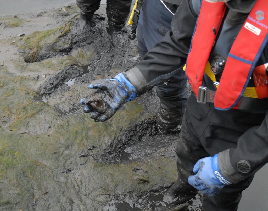
11 Witness Statements as I got approximately 1/3 of the way across the main river, I noticed what I first took to be a log floating in the river upstream of my position As I watched, I saw some air bubbles come up around it, which aroused my curiosity I am a full time member of the Thames Valley Police Underwater Search Team.There is a lot of debris on the bottom of both banks for a distance of 8 metres from the bank, ie scaffolding poles, car parts, old fridges, shopping trolleys etc I am the resident lock keeper at Boveney Lock On Wednesday 19 th September 2001 I set the gates to 10 feet crest, which is where the water was passing over the top of the gates. Eight of the gates were set at one foot below the surface, and The gates remained in this position until Saturday 29 th September

12 Presenting the case
13 Building a model of bodies in rivers 1. Entering the water 2. Decay and floatation 3. Moving with the water 4. Grounding
14 Operation WIROC Wolverhampton Canal Hydrology and Capacity for Transporting Human Remains


15 A

16

17

18

19

20
21
22 Insect bites Mr D last sighted on 8 th December Reports of body parts being seen in canal between January and March Decomposed torso found 30 th March 2008, by a walker. Entomological evidence suggested submersion or alternating periods of exposure and submersion, or potential isolation elsewhere, prior to recovery. However, the remains were unlikely to have been exposed to the atmosphere for long. The pathologist estimated the torso to have been in the water from between two and eight months, but more realistically three to six months.


23 Experimentation with model heads: schematic
24 1000 Cumulative count of lock openings at Wolverhampton Top Lock, from 26/11/2007 to 16/06/ /11/ /01/ /02/ /04/ /06/ /07/2008
25 Estimating likely flows Ml/day Lock 17 Bypass flow, 8.15 pm 7/12/07 to end 11/12/08 14 Ml/day Lock 17 Wolverhampton All Data Bypass Flow Ml/d Nov Dec Dec Dec Dec Dec Jan Jan Jan Jan Feb Feb-08

26
27 Building a model of bodies in rivers 1. Entering the water 2. Decay and floatation 3. Moving with the water 4. Grounding
28 Extent of deterioration Washerwomans fingers Some putrefaction Wrinkled skin Maceration and detachment of epidermis on hands, feet and face Bloat - Gas formation in abdomen and thorax Skeletonisation Timescale typical for UK A few hours in cold water Begins within a few days 1 week 2 weeks in a temperate summer, perhaps longer if cooler Variable Variable
29 Operation Sanderling: Birmingham A body in two suitcases in the Birmingham Canal

30

31

32


33 Witness Statements
34 m upstream of recovery site 3500 Travel distances upstream of recovery site for suitcase
35 First observation of floating case Case 1 found 106 River Levels at Calthorpe (red) and Sandwell (blue) (maod)

36
37 4/19/10 4/20/10 4/21/10 4/22/10 4/23/10 4/24/10 4/25/10 4/26/10 4/27/10 4/28/10 4/29/10 4/30/10 5/1/10 5/2/10 5/3/10 5/4/10 5/5/10 5/6/10 5/7/10 5/8/10 5/9/10 5/10/10 5/11/10 5/12/10 5/13/10 5/14/10 25 Saltley Total Daily Rainfall (mm)
38 Bearing Windspeed and Direction at Coleshill Knots
39 16 Air Temperature at Frankley (Daily Average in C)

40

41 BBC reporting


42 Bone reconstruction by the University of Warwick


43 River and estuarine diatom frustules in clothing Freshwater diatoms Severn Estuary diatoms

44 Types of pollen in clothing Next slide is a Look away moment

45 Insect infestation can establish the time of death, or whether the body has been exposed to air
46 Operation KELT Murder or accident in the River Ouse at York?

47

,")

48 Bootham Ms LD last seen here, July 6 th 2008 YORK The Ouse is a slow, turbid, wide river (c 55m in the city), engineered with smooth banks Body recovered here in 2013, c 7 miles
49 m3/s Major event River Ouse at Skelton, June 2008 to February 2010 Major event Body lost Mean flow 18.8m3/s
50 River Ouse flow, 6 th to 11 th July 2008 Ms LD last seen
51 Calculating. 1. Establish flow at nearest stations, from Environment Agency data, and model any significant differences from site of investigation 2. Survey velocity and cross section at site at low flow, and using Manning s equation, estimate channel roughness 3. Survey channel section occupied by water at the incident time, estimate water gradient and using previously calculated channel roughness, calculate mean water velocity at the time of the incident 4. Model velocity at different points in the channel at the time of the episode, based on characteristics of typical channels, and observations of this channel at low flow 5. Adjust to match relevant time of incident.
52 For conditions on 11 th July a calculation can be based on Manning s Equation V = (R 2/3 S ½ )/n, where R is the hydraulic radius of the channel, S the water surface slope, and n the roughness coefficient, and where R = A/(w+2D), where A is the wetted cross sectional area, w the width and D the depth of the water. This can be cross checked with alternative methodologies. A figure of 1m/s is estimated for the 11 th July. Scaling from this, on 6 th July, flow velocities close to the bank where Ms LD allegedly entered the water are likely to be well below 1m/s. However, even a velocity of 0.5 m/s can cause people to have difficulty standing upright.
53 Building a model of bodies in rivers 1. Entering the water 2. Decay and floatation 3. Moving with the water 4. Grounding

54
55 Building a model of bodies in rivers 1. Entering the water 2. Decay and floatation 3. Moving with the water 4. Grounding

56
57 Cold Case: Operation BUTE Baby K, missing near River Lippe at Schloss Neuhaus army base, Paderborn, Germany, November 1981


58 Site of Baby K s disappearance
59 Lippersee outline in 2010 (blue), based on satellite imagery (Google Earth 2009 base)


60 Lippersee outline in 1982 (green), based on 1:50,000 mapping (GoogleEarth 2009 base) Lippersee outline in 1979 (purple), based on aerial photography (GoogleEarth 2009 base)
")

61 Lippersee outline in 1986 (red), based on 1:25,000 mapping (GoogleEarth 2009 base) Lippersee outline in 1985 (yellow), based on aerial photography (GoogleEarth 2009 base)
")
62 Lippersee outline in 2010 (blue), based on satellite imagery (Google Earth 2009 base)
63 Operation The Bure: a tidal river in Norfolk, and some crucial evidence

64 River Bure, Norfolk Body found here
65 Depth of water above low tide level, m Level, m level m 0.6 Hoveton Broad T.S. TG level m Haven Bridge TG , Tidal Yare /20/02 9:00 4/20/02 21:00 4/21/02 9:00 4/21/02 21:00 4/22/02 9:00 4/22/02 21:00 4/23/02 9:00 4/23/02 21:00 4/24/02 9:00 4/24/02 21:00 4/25/02 9:00 4/25/02 21:00 4/26/02 9:00 4/26/02 21:00 4/27/02 9:00 4/27/02 21:00 4/28/02 9:00 4/28/02 21:00 4/29/02 9:00 4/29/02 21:00 4/30/02 9:00 4/30/02 21:00 5/1/02 9:00 5/1/02 21:00 Tidal cycles in the Bure, 27th-28th April /20/02 0:00 4/22/02 0:00 4/24/02 0:00 4/26/02 0:00 4/28/02 0:00 4/30/02 0:00 5/2/02 0: Reconstructed tidal cycle at site of recovery /27/02 4/27/02 12:00 4/27/02 13:00 4/27/02 14:00 4/27/02 15:00 4/27/02 16:00 4/27/02 17:00 4/27/02 18:00 4/27/02 19:00 4/27/02 20:00 4/27/02 21:00 4/27/02 22:00 4/28/02 23:00 0:004/28/02 1:004/28/02 2:004/28/02 3:004/28/02 4:004/28/02 5:004/28/02 6:004/28/02 7:004/28/02 8:00 4/28/02 9:00 4/28/02 10:00 4/28/02 11:0012: Haven Bridge, Yare Three Mile House Acle Bridge Hoveton /27/02 22:00 4/27/02 23:00 4/28/02 0:00 4/28/02 1:00 4/28/02 2:00 4/28/02 3:00 4/28/02 4:00 4/28/02 5:00 4/28/02 6:00 4/28/02 7:00 4/28/02 8:00 4/28/02 9:00 4/28/02 10:00 4/28/02 11:00 4/28/02 12:00
66 Time of peak, B.S.T. Figure 3. Time of peak high tide in River Bure, 27th-28th April :12 6:00 4:48 y = 9E-05x x R 2 = :00 3:36 3:30 2:24 1:12 0:30 0:00 22:48 22:56 23:15 21: Distance upstream from Vauxhall Bridge km
67 :00 09:15 09:30 09:45 10:00 10:15 10:30 10:45 11:00 11: :00 09:30 10:00 10:30 10:45 11:30 11: :00 12:00 11: :30 11: : /06/02 09:00 11/06/02 09:30 11/06/02 10:00 11/06/02 10:30 11/06/02 11:00 11/06/02 11:30 11/06/02 12:00 Haven Bridge Three Mile House
68 ms cm-1 Figure 1. Conductivity trend, 1/5/02 rising tide Saline Water Fresh Water Distance upstream from Vauxhall Bridge, km
69


70
71 A more likely scenario is an earlier release time, the body travelling upstream beyond the recovery site and back downstream, lodging direct on the muddy river bed shortly before B.S.T. I would estimate the likely time of release from Tarworks Road as minutes before the recorded high water at Three Mile House, the body following an upstream track similar to that followed on 7 th September The total travel time including the downstream element for these experimental conditions would be approximately three hours. The release time from Tarworks Road would hence be between approximately and B.S.T. on 27 th April 2002.

72 On 14 th October 2003 Filomeno Antonio LOPEZ was found guilty by a majority of 10 to 1 of an indictment of Murder and was sentenced to Life Imprisonment.Thank you for your assistance Norfolk Constabulary, Criminal Justice Unit
73 Thank You To the Institution of Environmental Sciences for producing some of the diagrams
Experiment (13): Flow channel
: Flow channel") Experiment (13): Flow channel Introduction: An open channel is a duct in which the liquid flows with a free surface exposed to atmospheric pressure. Along the length of the duct, the pressure at the surface
Experiment (13): Flow channel Introduction: An open channel is a duct in which the liquid flows with a free surface exposed to atmospheric pressure. Along the length of the duct, the pressure at the surface
STRUCTURE S-65 PURPOSE SPILLWAY OPERATION
 STRUCTURE S-65 This structure is a reinforced concrete, gated spillway with discharge controlled by three cable operated, vertical lift gates, and a reinforced concrete lock structure with two pairs of
Exercise (3): Open Channel Flow Rapidly Varied Flow
: Open Channel Flow Rapidly Varied Flow") Exercise (3): Open Channel Flow Rapidly Varied Flow 1) A hydraulic jump exists in a trapezoidal channel having a bed width of 7 m and side slope of 1:1. The flowing discharge is 25 m 3 /sec. Construct
Exercise (3): Open Channel Flow Rapidly Varied Flow 1) A hydraulic jump exists in a trapezoidal channel having a bed width of 7 m and side slope of 1:1. The flowing discharge is 25 m 3 /sec. Construct
Advanced Hydraulics Prof. Dr. Suresh A. Kartha Department of Civil Engineering Indian Institute of Technology, Guwahati
 Advanced Hydraulics Prof. Dr. Suresh A. Kartha Department of Civil Engineering Indian Institute of Technology, Guwahati Module - 4 Hydraulic Jumps Lecture - 1 Rapidly Varied Flow- Introduction Welcome
EXAMPLES (OPEN-CHANNEL FLOW) AUTUMN 2018
 AUTUMN 2018") EXAMPLES (OPEN-CHANNEL FLOW) AUTUMN 2018 Normal and Critical Depths Q1. If the discharge in a channel of width 5 m is 20 m 3 s 1 and Manning s n is 0.02 m 1/3 s, find: (a) the normal depth and Froude number
EXAMPLES (OPEN-CHANNEL FLOW) AUTUMN 2018 Normal and Critical Depths Q1. If the discharge in a channel of width 5 m is 20 m 3 s 1 and Manning s n is 0.02 m 1/3 s, find: (a) the normal depth and Froude number
Yale Reservoir Kokanee (Oncorhynchus nerka) Escapement Report 2016
 Escapement Report 2016") Yale Reservoir Kokanee (Oncorhynchus nerka) Escapement Report 2016 North Fork Lewis River Hydroelectric Project Yale FERC No. 2071 Prepared by: Jeremiah Doyle, PacifiCorp April 4, 2017 1.0 INTRODUCTION
Yale Reservoir Kokanee (Oncorhynchus nerka) Escapement Report 2016 North Fork Lewis River Hydroelectric Project Yale FERC No. 2071 Prepared by: Jeremiah Doyle, PacifiCorp April 4, 2017 1.0 INTRODUCTION
BC Ministry of Forests. March Fish Stream Crossing Guidebook. Forest Practices Code of British Columbia.
 FRST 557 Lecture 7c Bridges and Culverts: Water Velocity and Discharge Lesson Background and Overview: The previous two lessons presented methods for estimating water volume flow at a particular site and
Consigned to the deep: requiem or recovery of VR2W receivers in a freshwater river gorge after a 1:2-3 3 year ARI flood
 Consigned to the deep: requiem or recovery of VR2W receivers in a freshwater river gorge after a 1:2-3 3 year ARI flood 1 Ivars Reinfelds, 2,3 Chris Walsh and 1 Tim Haeusler 1 Department of Water and Energy,
River Study Fieldwork Sheets
 River Study Fieldwork Sheets Name Date Group Team Site Upper Valley 1 Lower Valley 1 Upper Valley 2 Lower Valley 2 IMPORTANT In order for data to be collected accurately and safely it is vital that you
Hydrologic Feasibility of Storm Surge Barriers
 Hydrologic Feasibility of Storm Surge Barriers Malcolm J. Bowman, School of Marine and Atmospheric Sciences State University of New York, Stony Brook, NY. Presented at Against the Deluge: Storm Surge Barriers
The Impact on Great South Bay of the Breach at Old Inlet Charles N. Flagg School of Marine and Atmospheric Sciences, Stony Brook University
 The Impact on Great South Bay of the Breach at Old Inlet Charles N. Flagg School of Marine and Atmospheric Sciences, Stony Brook University The previous report provided a detailed look at the conditions
PROFILE OF SACRAMENTO RIVER, FREEPORT TO VERONA, CALIFORNIA,
 PROFILE OF SACRAMENTO RIVER, FREEPORT TO VERONA, CALIFORNIA, FLOOD OF FEBRUARY 1986 By J.C. Blodgett and J.B. Lucas U.S. GEOLOGICAL SURVEY Open-File Report 88-82 CO CM I m r-h CM Sacramento, California
COST EFFECTIVE STORAGE CAPACITY INCREASE FOR ALUMINA TAILINGS DISPOSAL AREA THROUGH SPILLWAY OPTIMISATION
 COST EFFECTIVE STORAGE CAPACITY INCREASE FOR ALUMINA TAILINGS DISPOSAL AREA THROUGH SPILLWAY OPTIMISATION Abstract Lonie I * Tailings and Dams, GHD Brisbane, QLD, Australia Queensland Alumina Limited operates
THE POLARIMETRIC CHARACTERISTICS OF BOTTOM TOPOGRAPHY RELATED FEATURES ON SAR IMAGES
 THE POLARIMETRIC CHARACTERISTICS OF BOTTOM TOPOGRAPHY RELATED FEATURES ON SAR IMAGES Taerim Kim Professor, Ocean System Eng. Dept. Kunsan University Miryong Dong San 68, Kunsan, Jeonbuk, Korea, trkim@kunsan.ac.kr
STRUCTURE 65-B PURPOSE SPILLWAY OPERATION
 STRUCTURE 65-B This structure is a reinforced concrete, gated spillway with discharge controlled by three cable operated vertical lift gates and a reinforced concrete lock structure with two pairs of sector
Effect of Fluid Density and Temperature on Discharge Coefficient of Ogee Spillways Using Physical Models
 RESEARCH ARTICLE Effect of Fluid Density and Temperature on Discharge Coefficient of Ogee Spillways Using Physical Models M. SREENIVASULU REDDY 1 DR Y. RAMALINGA REDDY 2 Assistant Professor, School of
NOVEMBER 2006 FLOOD DOWNSTREAM OF THE KATSE DAM STRUCTURE
 THE LESOTHO HIGHLANDS DEVELOPMENT AUTHORITY (LHDA) NOVEMBER 2006 FLOOD DOWNSTREAM OF THE KATSE DAM STRUCTURE Effects of the November 2006 Flood THE DAMAGE CAUSED BY THE FLOOD AS IT PROPAGATES DOWNSTREAM
Discussion on the Selection of the Recommended Fish Passage Design Discharge
 Discussion on the Selection of the Recommended Fish Passage Design Discharge Introduction The provision of fish passage is a requirement for most proposed culvert and bridge installations in Alberta, depending
19.1 Problem: Maximum Discharge
 19.1 Problem: Maximum Discharge In partially full channel having an equilateral triangular cross section, the rate of discharge is Q = KAR/3 in which K is a constant, A flow area, R is the hydraulic mean
Interim Guidance Fish Presence Absence
 Interim Guidance Fish Presence Absence Source: Forest Practices Act Guidance for Division 635 of the forest practices act dealing with stream classification when no fish surveys have been done (referenced
Creek Trash Assessment (CTA) Methodology (Demonstration: Mill Run Creek, Cheltenham, Pa.)
 Methodology (Demonstration: Mill Run Creek, Cheltenham, Pa.)") Creek Trash Assessment (CTA) Methodology (Demonstration: Mill Run Creek, Cheltenham, Pa.) Mill Run Creek emerges from a storm sewer in Philadelphia to an open creek in Cheltenham. The Creek downstream
Creek Trash Assessment (CTA) Methodology (Demonstration: Mill Run Creek, Cheltenham, Pa.) Mill Run Creek emerges from a storm sewer in Philadelphia to an open creek in Cheltenham. The Creek downstream
HEC 26 Aquatic Organism Passage Design Manual Evolution & Application
 HEC 26 Aquatic Organism Passage Design Manual Evolution & Application Sven Leon, P.E., Hydraulics Engineer Federal Highway Administration 2015 Alaska Fish Passage Meeting October 13 14, 2015 VTRC, Juneau,
OPEN CHANNEL FLOW WORKSHEET 3 WATER SURFACE PROFILES
 Learning Objectives OPEN CHANNEL FLOW WORKSHEET 3 WATER SURFACE PROFILES 1. Learn about gradually varied flow and rapidly varying flow 2. Discuss different types of water surface profiles 3. Discuss the
ANSWERS TO QUESTIONS IN THE NOTES AUTUMN 2018
 ANSWERS TO QUESTIONS IN THE NOTES AUTUMN 2018 Section 1.2 Example. The discharge in a channel with bottom width 3 m is 12 m 3 s 1. If Manning s n is 0.013 m -1/3 s and the streamwise slope is 1 in 200,
AIRFLOW GENERATION IN A TUNNEL USING A SACCARDO VENTILATION SYSTEM AGAINST THE BUOYANCY EFFECT PRODUCED BY A FIRE
 - 247 - AIRFLOW GENERATION IN A TUNNEL USING A SACCARDO VENTILATION SYSTEM AGAINST THE BUOYANCY EFFECT PRODUCED BY A FIRE J D Castro a, C W Pope a and R D Matthews b a Mott MacDonald Ltd, St Anne House,
How do forensic scientists determine the time of death?
 How do forensic scientists determine the time of death? The eyes of a victim can hold answers to the time of death, as a thin cloudy film is developed over the eye within 3 hours after death has occurred.
Variability in the tropical oceans - Monitoring and prediction of El Niño and La Niña -
 Variability in the tropical oceans - Monitoring and prediction of El Niño and La Niña - Jun ichi HIROSAWA Climate Prediction Division Japan Meteorological Agency SST anomaly in Nov. 1997 1 ( ) Outline
Barge MM 46 Response Natchez, MS Lower Mississippi River Mile Marker 363
 UNCLASSIFIED Barge MM 46 Response Natchez, MS Lower Mississippi River Mile Marker 363 UNCLASSIFIED RRT Activation: Type of Product & Amount spilled: Cause of Spill: None Catalytic Cracked Clarified Oil
Experimental Investigation on Changes of Water Surface Profile with Gaussian Shaped Bottom and Side Roughness
 Experimental Investigation on Changes of Water Surface Profile with Gaussian Shaped Bottom and Side Md. Rafiue Islam a, Shariful Islam b*, Md. Abdul Qaiyum Talukder c, S. M. Rezwan Hossain d Abstract Bed
Mapping Cycle-friendliness towards a national standard
 Mapping Cycle-friendliness towards a national standard Cyclenation in collaboration with CTC would like the guidance contained in the appendices to this paper to be adopted as the national standard for
WATER RESCUE RESPONSE SOG
 WATER RESCUE RESPONSE SOG SCOPE This procedure applies to all members of the Stoney Point Fire Department that are trained as Surface Water Rescue Technician and Rescue Technicians and responsible for
To: The results of these surveys have been analysed and are summarised within this Technical Note.
 Technical Note Project: Histon Road / Milton Road, Cambridge Parking Surveys To: Andy Harrison Subject: Survey Report v1.6 From: Jonathan Barlow Date: 18 th February 2016 cc: Richard Jones / Dave Boddy
OCN 201 Tides. Tsunamis, Tides and other long waves
 OCN 201 Tides Tsunamis, Tides and other long waves Storm surges Caused by winds and low atmospheric pressure associated with large storms Can raise sea surface by up to 25 ft, bottom contours magnify effect
Components of a Barrage
 Components of a Barrage Definition The only difference between a weir and a barrage is of gates, that is the flow in barrage is regulated by gates and that in weirs, by its crest height. Barrages are costlier
Low Gradient Velocity Control Short Term Steep Gradient Channel Lining Medium-Long Term Outlet Control Soil Treatment Permanent [1]
![Low Gradient Velocity Control Short Term Steep Gradient Channel Lining Medium-Long Term Outlet Control Soil Treatment Permanent [1]](/thumbs/80/80811988.jpg "Low Gradient Velocity Control Short Term Steep Gradient Channel Lining Medium-Long Term Outlet Control Soil Treatment Permanent [1]") Check Dams DRAINAGE CONTROL TECHNIQUE Low Gradient Velocity Control Short Term Steep Gradient Channel Lining Medium-Long Term Outlet Control Soil Treatment Permanent [1] [1] Though not generally considered
Check Dams DRAINAGE CONTROL TECHNIQUE Low Gradient Velocity Control Short Term Steep Gradient Channel Lining Medium-Long Term Outlet Control Soil Treatment Permanent [1] [1] Though not generally considered
THE PROPOSED NETWORK RAIL (ESSEX AND OTHERS LEVEL CROSSING REDUCTION) ORDER DEPARTMENT FOR TRANSPORT REFERENCE: TWA/17/APP/05
 ORDER DEPARTMENT FOR TRANSPORT REFERENCE: TWA/17/APP/05") OBJ/148/W 003 H05 PATTENS CROSSING THE PROPOSED NETWORK RAIL (ESSEX AND OTHERS LEVEL CROSSING REDUCTION) ORDER PUBLIC INQUIRY, 18 OCTOBER 2017 DEPARTMENT FOR TRANSPORT REFERENCE: TWA/17/APP/05 OBJECTION
OBJ/148/W 003 H05 PATTENS CROSSING THE PROPOSED NETWORK RAIL (ESSEX AND OTHERS LEVEL CROSSING REDUCTION) ORDER PUBLIC INQUIRY, 18 OCTOBER 2017 DEPARTMENT FOR TRANSPORT REFERENCE: TWA/17/APP/05 OBJECTION
Advanced Hydraulics Prof. Dr. Suresh A. Kartha Department of Civil Engineering Indian Institute of Technology, Guwahati
 Advanced Hydraulics Prof. Dr. Suresh A. Kartha Department of Civil Engineering Indian Institute of Technology, Guwahati Module - 4 Hydraulics Jumps Lecture - 4 Features of Hydraulic Jumps (Refer Slide
DESIGN OF BELL-MOUTH SPILLWAY AT BARVI DAM
 DESIGN OF BELL-MOUTH SPILLWAY AT BARVI DAM Akshay Haldankar 1, Mahesh Bhadra 2, Rahul Harad 3, Darpan Kapre 4, Dipali Patil 5 1,2,3,4 Under graduate,dept. of Civil Engineering, DRIEMS Neral. 5Assistant
LESSON 2: SUBMARINE BUOYANCY INVESTIGATION
 LESSON 2: SUBMARINE BUOYANCY INVESTIGATION Lesson overview This lesson encourages students to investigate hands-on the property of neutral buoyancy, and to discuss its importance in terms of submarines.
Redd Dewatering and Juvenile Salmonid Stranding in the Lower Feather River,
 Redd Dewatering and Juvenile Salmonid Stranding in the Lower Feather River, 2005-2006 Interim Report for NOAA Fisheries Prepared by: California Department of Water Resources Division of Environmental Services
Exploring Localized Mixing Dynamics During Wet Weather in a Tidal Fresh Water System
 Exploring Localized Mixing Dynamics During Wet Weather in a Tidal Fresh Water System Ramona McCullough & Phil Duzinski Delaware Estuary Science & Environmental Summit January 27, 2015 Background and objectives
TROUT CREEK WATERSHED (Second Year of Snowline Data)
") Extent of Snow Cover During the 2002 Spring Freshet For the TROUT CREEK WATERSHED (Second Year of Snowline Data) (Penticton Forest District) 1.0 INTRODUCTION The extent of snow cover over a watershed basin
Extent of Snow Cover During the 2002 Spring Freshet For the TROUT CREEK WATERSHED (Second Year of Snowline Data) (Penticton Forest District) 1.0 INTRODUCTION The extent of snow cover over a watershed basin
Matt Mallinder, Cycling UK Dick Vincent, National Towpath Ranger. Living waterways transform places and enrich lives
 Matt Mallinder, Cycling UK Dick Vincent, National Towpath Ranger Living waterways transform places and enrich lives Cycling on Towpaths opportunities for Canal & River Trust Matt Mallinder Cycling UK Membership
Taranaki Tsunami Inundation Analysis. Prepared for Taranaki Civil Defence Emergency Management Group. Final Version
 Taranaki Tsunami Inundation Analysis Prepared for Taranaki Civil Defence Emergency Management Group Final Version June 2012 AM 12/07 HBRC Plan Number 4362 Asset Management Group Technical Report Prepared
Total Suspended Solids, Stable Flow, and Wet Weather Event Monitoring in the Bass River Watershed. December The Cadmus Group, Inc.
 Total Suspended Solids, Stable Flow, and Wet Weather Event Monitoring in the Bass River Watershed December 2004 The Cadmus Group, Inc. Grand Valley State University Annis Water Resources Institute Submitted
Presented by. Mr.Danish.D.R. M.Tech Coastal Management Institute for Ocean Management Anna University, Chennai Tamil Nadu, India.
 MATHEMATICAL MODEL STUDY OF THE EFFLUENT DISPOSAL FROM A DESALINATION PLANT IN THE MARINE ENVIRONMENT AT TUTICORIN Presented by Mr.Danish.D.R M.Tech Coastal Management Institute for Ocean Management Anna
Tidal River Management (TRM)-An Innovative Scientific Approach for Sustainable Sediment Management
-An Innovative Scientific Approach for Sustainable Sediment Management") Paper ID: WRE-029 954 International Conference on Recent Innovation in Civil Engineering for Sustainable Development () Department of Civil Engineering DUET - Gazipur, Bangladesh Tidal River Management
Paper ID: WRE-029 954 International Conference on Recent Innovation in Civil Engineering for Sustainable Development () Department of Civil Engineering DUET - Gazipur, Bangladesh Tidal River Management
Exercise (4): Open Channel Flow - Gradually Varied Flow
: Open Channel Flow - Gradually Varied Flow") Exercise (4): Open Channel Flow - Gradually Varied Flow 1) A wide channel consists of three long reaches and has two gates located midway of the first and last reaches. The bed slopes for the three reaches
Exercise (4): Open Channel Flow - Gradually Varied Flow 1) A wide channel consists of three long reaches and has two gates located midway of the first and last reaches. The bed slopes for the three reaches
Total Suspended Solids, Stable Flow, and Wet Weather Event Monitoring in the Unnamed Tributary to the Grand River Watershed.
 Total Suspended Solids, Stable Flow, and Wet Weather Event Monitoring in the Unnamed Tributary to the Grand River Watershed December 2004 The Cadmus Group, Inc. Grand Valley State University Annis Water
An Atlas of Oceanic Internal Solitary Waves (February 2004) by Global Ocean Associates Prepared for Office of Naval Research Code 322 PO
 by Global Ocean Associates Prepared for Office of Naval Research Code 322 PO") Overview covers approximately 2200 km of coast from Kenya to the tip of Somalia (approximately 39 o E, 4 o S to 51 o E, 12 o N)(Figure 1). Internal wave activity has been observed in the area the near
Overview covers approximately 2200 km of coast from Kenya to the tip of Somalia (approximately 39 o E, 4 o S to 51 o E, 12 o N)(Figure 1). Internal wave activity has been observed in the area the near
THE PROPOSED NETWORK RAIL (ESSEX AND OTHERS LEVEL CROSSING REDUCTION) ORDER DEPARTMENT FOR TRANSPORT REFERENCE: TWA/17/APP/05
 ORDER DEPARTMENT FOR TRANSPORT REFERENCE: TWA/17/APP/05") OBJ/148/W 005 E05 CROSSING, FULLERS END THE PROPOSED NETWORK RAIL (ESSEX AND OTHERS LEVEL CROSSING REDUCTION) ORDER PUBLIC INQUIRY, 18 OCTOBER 2017 DEPARTMENT FOR TRANSPORT REFERENCE: TWA/17/APP/05 OBJECTION
OBJ/148/W 005 E05 CROSSING, FULLERS END THE PROPOSED NETWORK RAIL (ESSEX AND OTHERS LEVEL CROSSING REDUCTION) ORDER PUBLIC INQUIRY, 18 OCTOBER 2017 DEPARTMENT FOR TRANSPORT REFERENCE: TWA/17/APP/05 OBJECTION
In addition, all personnel assigned to the Field Operations Division will be trained and prepared to support this effort.
 Rogers Fire Department Standard Operating Procedures Policy Title: Water and Ice Rescue Policy Number: 616 Volume: Special Operations Approved By: Tom Jenkins Last Updated: January 2016 CFAI Reference:
Eulachon: State of the Science and Science to Policy Forum
 Eulachon: State of the Science and Science to Policy Forum August 27, 2015 Robert Anderson Eulachon Recovery Coordinator National Marine Fisheries Service FCRPS, Dams, and Water Management in the Columbia
Earth s oceans covers 71 % _ of the planet s surface. In reality, Earth s ocean waters are all. interconnected as part of a single large global ocean.
 Ocean Motion Met 101: Introduction to the World's Oceans Produced by The COMET Program Geography: Name Pd. Earth s oceans covers 71 % _ of the planet s surface. In reality, Earth s ocean waters are all
Safety Monitor Requirements. September 2012
 Introduction This document sets out Safety Monitors for the 2012/13 winter, pursuant to National Grid s obligations under the Uniform Network Code (UNC), Section Q. Safety Monitors were introduced in 2004
Thames Passage From Brentford to Teddington
 Thames Passage From Brentford to Teddington Introduction: The Thames Ring route uses a tidal section of the river Thames between Brentford and Teddington that requires extra preparation and skill. We hope
Technical Report Culvert A Hydraulic Analysis
 DATE: November 3, 2011 Technical Report Culvert A Hydraulic Analysis TO: FROM: RE: Jim Reiser, P.E. Project Manager Parsons Brinckerhoff, Inc. Kurt Killian, P.E., CFM Parsons Brinckerhoff, Inc. Design
NORTH RIVER FISH KILL PRELIMINARY REPORT 2014 SUMMARY
 NORTH RIVER FISH KILL PRELIMINARY REPORT 2014 SUMMARY A fish kill on Nor River was reported to e 1-800 Environmental emergency number on August 9, 2014. Representatives from e PEI Department of Environment,
ECRR and ARRN Technical Exchange Meeting / ARRN forum 2014 (29 Oct in Vienna, Austria)
") Study on ecological flow of Nanxi River (China) based on ecological conservation objective China Institute of Water Resources and Hydropower Research Beijing Runheng EEI CO., LTD October 29, 214 Overview
Study on ecological flow of Nanxi River (China) based on ecological conservation objective China Institute of Water Resources and Hydropower Research Beijing Runheng EEI CO., LTD October 29, 214 Overview
Figure 1. The distance the train travels between A and B is not the same as the displacement of the train.
 THE DISTANCE-TIME RELATIONSHIP Q1. A train travels from town A to town B. Figure 1 shows the route taken by the train. Figure 1 has been drawn to scale. Figure 1 (a) The distance the train travels between
G. Meadows, H. Purcell and L. Meadows University of Michigan
 www.coj.net/departments/fire+and+rescue/emergency+preparedness/rip+current.htm G. Meadows, H. Purcell and L. Meadows Over 80% of all surf related rescues are attributable to Rip Currents According to the
An Atlas of Oceanic Internal Solitary Waves (February 2004) by Global Ocean Associates Prepared for Office of Naval Research Code 322 PO
 by Global Ocean Associates Prepared for Office of Naval Research Code 322 PO") Overview The is located in the North Atlantic Ocean between southern Ireland and southwest England (Figure 1). The Sea s western edge covers a continental shelf region characterized by rough and irregular
Overview The is located in the North Atlantic Ocean between southern Ireland and southwest England (Figure 1). The Sea s western edge covers a continental shelf region characterized by rough and irregular
Open Canoe Leader Training Notes
 Open Canoe Leader Training Notes Technical Syllabus The British Canoeing Canoe Leader should be trained to appreciate the importance of maintaining an active posture whilst adopting a variety of positions
Plan B Dam Breach Assessment
 Plan B Dam Breach Assessment Introduction In support of the Local Sponsor permit applications to the states of Minnesota and North Dakota, a dam breach analysis for the Plan B alignment of the Fargo-Moorhead
The Movement of Ocean Water. Currents
 The Movement of Ocean Water Currents Ocean Current movement of ocean water that follows a regular pattern influenced by: weather Earth s rotation position of continents Surface current horizontal movement
7.4 Temperature, Salinity and Currents in Jamaica Bay
 7.4 Temperature, Salinity and Currents in Jamaica Bay Arnold Gordon, Bruce Huber and Robert Houghton 7.4.1 INTRODUCTION Jamaica Bay stratification is weakly indicative of a shallow, tidally active environment,
Chinook Salmon Spawning Study Russian River Fall 2005
 Chinook Salmon Spawning Study Russian River Fall 2005 Sonoma County Water Agency 2150 West College Avenue Santa Rosa, California 95401 Prepared by David Cook - Senior Environmental Specialist March 27,
Water Rescue
 3.5.3.2 Water Rescue YOUR ORGANIZATION STANDARD OPERATING PROCEDURES/GUIDELINES TITLE: Water Rescue NUMBER: 3.5.3.2 PREPARED BY: SECTION/TOPIC: Special Rescue Operations ISSUE DATE: REVISED DATE: APPROVED
Coquitlam/Buntzen Project Water Use Plan
 Coquitlam/Buntzen Project Water Use Plan Temperature Monitoring Lower Coquitlam River Project Year 3 Report Reference: COQMON#6 Study Period: March 2008 April 2009 Report Date: April 2009 Trow Associates
Lecture 13 El Niño/La Niña Ocean-Atmosphere Interaction. Idealized 3-Cell Model of Wind Patterns on a Rotating Earth. Previous Lecture!
 Lecture 13 El Niño/La Niña Ocean-Atmosphere Interaction Previous Lecture! Global Winds General Circulation of winds at the surface and aloft Polar Jet Stream Subtropical Jet Stream Monsoons 1 2 Radiation
Tidal Energy from the Severn Estuary: Opportunities and Challenges
 Co-financed with the support of the European Union 1 ERDF Atlantic Area Programme Investing in our common future Tidal Energy from the Severn Estuary: Opportunities and Challenges Prof Roger Falconer,
La Rance tidal power plant in La Rance, France. Tidal and Wave Energy
 La Rance tidal power plant in La Rance, France Tidal and Wave Energy Tides Tides are caused by the pull of the moon. Tides involve the rise and fall of sea levels. Around the coast of Ireland, the sea
Syllabus. Safeguarding lives in, on and near water. National Water Safety Management Programme
 Syllabus Safeguarding lives in, on and near water ent Program me and This resource is the approved material for the RLSS UK s National Water and y awareness competencies. has been specifically designed
Standard Operating Guidelines: Swift Water Rescue Operations
 Standard Operating Guidelines: 014 2 4.2 Training Any person wishing to participate at the county level for Swiftwater the following will apply; 1. Each person shall be authorized by their respective department
River Tees Guidance Notes
 River Tees Guidance Notes Date Sept 15 Issue 00.00 Contents 1. Amendment Record 2. Introduction 3. Purpose of this Document 4. River Activities 5. River Events 6. River Access 7. Slipways & Launching 8.
SEAGRASS MAPPING FOR THE PENRHYN ESTUARY HABITAT ENHANCEMENT PLAN
 SEAGRASS MAPPING FOR THE PENRHYN ESTUARY HABITAT ENHANCEMENT PLAN PREPARED FOR SYDNEY PORTS CORPORATION By D. E. Roberts, S. R. Murray, G. R., Sainty August 2008 TABLE OF CONTENTS INTRODUCTION...3 METHODS...3
Scholarship 2018 Earth and Space Science
 S 93104R Scholarship 2018 Earth and Space Science 9.30 a.m. Wednesday 7 November 2018 RESOURCE BOOKLET Refer to this booklet to answer the questions for Scholarship Earth and Space Science 93104. Check
1.6.1 Inertial Reference Frames
 1.6.1 Inertial Reference Frames The laws of physics which apply when you are at rest on the earth also apply when you are in any reference frame which is moving at a constant velocity with respect to the
FOR INFORMATION ONLY. Gold Coast Seaway Channel Scour and Rock Wall Stability Investigation. R.B doc December 2011
 A part of BMT in Energy and Environment Gold Coast Seaway Channel Scour and Rock Wall Stability Investigation R.B18625.001.00.doc December 2011 Gold Coast Seaway Channel Scour and Rock Wall Stability Investigation
Annual Measurement of Solar UVB at a Reef Site Using a Polyphenylene Oxide Dosimeter
 Annual Measurement of Solar UVB at a Reef Site Using a Polyphenylene Oxide Dosimeter Alfio Parisi, Nathan Downs, Peter Schouten parisi@usq.edu.au University of Southern Queensland, Toowoomba, Australia
Summary of HEC 18, Evaluating Scour at Bridges FHWA NHI Should really follow HEC 18, but this summary will get you the main points.
 Summary of HEC 18, Evaluating Scour at Bridges FHWA NHI 01-001 Should really follow HEC 18, but this summary will get you the main points. 1: Determine scour analysis variables 2: Analyze long-term bed
Broadly speaking, there are four different types of structures, each with its own particular function:
 3 The selection of structures 3.1 Introduction In selecting a suitable structure to measure or regulate the flow rate in open channels, all demands that will be made upon the structure should be listed.
1. What do alligators eat? Is this what you think they will eat in the mangrove estuary? Why?
 Activity 1. Background research Before starting a scientific investigation it is important to do background research. We want to know as much as possible about the animals we are studying and the place
Search Techniques. Contents
 Search Techniques Contents Overview... 2 1. Developing the Search Plan... 2 1.1 Search Planning Sequence... 2 2. Search Terminology... 3 3. Search Patterns... 6 4. Searching and GPS... 8 5. Search Protocols...
Lower Coquitlam River Project Water Use Plan. Temperature Monitoring Lower Coquitlam River Project Year 2 Report
 Lower Coquitlam River Project Water Use Plan Temperature Monitoring Lower Coquitlam River Project Year 2 Report COQMON#6 Temperature Monitoring Study Lower Coquitlam River Study Period: Year 2-2007 Report
DEAD-ENDCHANNELFLUSHINGINHARBORS
 DEAD-ENDCHANNELFLUSHNGNHARBORS PURPOSE: The purpose of this technical note is to present some design con- siderations which benefit dead-end channel flushing. Some of these factors can also be used to
2D Modelling Series. Modelling Structures in Floodplains
 2D Modelling Series Modelling Structures in Floodplains Jessica Jefferys Products Manager XP Solutions XP-LIVE Webinars XP-LIVE educational program Webinars have been recorded and are available at http://www.xpsolutions.com/
Calculus 12: Evaluation 3 Outline and Review
 Calculus 12: Evaluation 3 Outline and Review You should be able to: 1. Differentiate various types of functions including trigonometric, exponential and logarithmic functions, 2. Solve various related
Feasibility Study for Dredging of Khaprabhanga Chapalir Don River in Patuakhali District for Improvement of Navigability
 IOSR Journal of Engineering (IOSRJEN) ISSN (e): 2250-3021, ISSN (p): 2278-8719 Vol. 04, Issue 06 (June. 2014), V3 PP 32-38 www.iosrjen.org Feasibility Study for Dredging of Khaprabhanga Chapalir Don River
Hydrographic Surveying Methods, Applications and Uses
 Definition: Hydrographic Surveying Methods, Applications and Uses It is the branch of surveying which deals with any body of still or running water such as a lake, harbor, stream or river. Hydrographic
INCREASE METHODS OF DRAINAGE DISCHARGE OF INUNDATED WATER IN LOW FLAT LAND CONSIDERING BED DEFORMATION CHARACTERISTICS
 INCREASE METHODS OF DRAINAGE DISCHARGE OF INUNDATED WATER IN LOW FLAT LAND CONSIDERING BED DEFORMATION CHARACTERISTICS Hiroshi Takebayashi 1, Sornthep Vannarat 2 and Saifhon Tomkratoke 2 1. Disaster Prevention
Name Class Date. Use the terms from the following list to complete the sentences below. Each term may be used only once. Some terms may not be used.
 Assessment Chapter Test B The Movement of Ocean Water USING KEY TERMS Use the terms from the following list to complete the sentences below. Each term may be used only once. Some terms may not be used.
Figure 1 - Photo of Surveyed Area. Figure 2 - Void Survey Results
 We have received the first PRELIMINARY results from several tests (science) conducted on the dam area. Per the engineers they are still refining the depths of the void areas (holes under the concrete areas).
Buckland Wind Resource Report
 Buckland Wind Resource Report By: Douglas Vaught, P.E., V3 Energy LLC, Eagle River, Alaska Date: September 17, 2010 Buckland met tower; D. Vaught photo Contents Summary... 2 Test Site Location... 2 Photographs...
SUMMARY OF MOVEMENT AND HABITAT USED BY TAGGED BROOK TROUT IN THE MAIN BRANCH AND NORTH BRANCH AU SABLE RIVER DURING SUMMER Data Submitted to:
 SUMMARY OF MOVEMENT AND HABITAT USED BY TAGGED BROOK TROUT IN THE MAIN BRANCH AND NORTH BRANCH AU SABLE RIVER DURING SUMMER 2014 Data Submitted to: Anglers of the Au Sable Submitted by: Dr. Mark R. Luttenton
NORTH COUNTY FIRE AUTHORITY POLICY & PROCEDURE MANUAL OPERATIONS
 PURPOSE: When responding to reported debris flows, fire personnel must take into consideration tactical priorities of Life Safety, Incident Stabilization, and Property Conservation. POLICY: Personnel safety
SINGER MODEL 106/206-RPS-L&H
 DESCRIPTION: Model 106/206-RPS-L&H dissipates surges caused by power failure to pumps. The valve anticipates the surge by opening on low line pressure associated with sudden stopping of pumps. This assures
SALINITY AND DISSOLVED OXYGEN IN THE MISSISSIPPI RIVER GULF OUTLET NAVIGATION CHANNEL AND IN ADJACENT SURFACE WATERS,
 SALINITY AND DISSOLVED OXYGEN IN THE MISSISSIPPI RIVER GULF OUTLET NAVIGATION CHANNEL AND IN ADJACENT SURFACE WATERS, 2008-2012 Southeast Louisiana Flood Protection Authority-East Coastal Advisory Committee
Multi-Scaled Socio-Ecology of the Everglades FCE III Conceptual Framework
 FRESH WATER SUPPLY 1 Multi-Scaled Socio-Ecology of the Everglades FCE III Conceptual Framework Global Climate Change Regional Climate Modulation 2 B O Carbon Cycle P T Organic Matter EXTERNAL DRIVERS LOCAL
SOUTH CAROLINA ELECTRIC & GAS COMPANY COLUMBIA, SOUTH CAROLINA
 SOUTH CAROLINA ELECTRIC & GAS COMPANY COLUMBIA, SOUTH CAROLINA SALUDA HYDROELECTRIC PROJECT FERC NO. 516 DOWNSTREAM TEMPERATURE STUDY DRAFT REPORT MAY 28 Prepared by: SOUTH CAROLINA ELECTRIC & GAS COMPANY