May 13, Project Manager: Region 7 Regional Tourism Organization Transition Team
|
|
|
- Kelly Bruce
- 5 years ago
- Views:
Transcription

1
 370-2309 info@bchughes.")
2 May 13, 2011 Project Manager: Region 7 Regional Tourism Organization Transition Team projects@region7transition.ca Consulting Team: BC Hughes Inc. (519) info@bchughes.ca
3 Table of Contents Table of Contents... 3 Executive Summary... 5 Introduction... 8 Regional Tourism in Ontario... 8 Regional Tourism Organization The Process Waterways Inventory Product Assessment Defining Waterways Tourism Product Criteria for Assessment Inventory Waterway Assets Criteria Checklists & Site Assessments RTO7 Tourism Print Materials RTO7 Tourism Websites Market Assessment Waterways Workshops The Market for Waterway Tourism Experiences Participant Characteristics Characteristics of Beach Goers Characteristics of Paddlers Characteristics of Motorboaters & Sailors Characteristics of Freshwater Fishermen The Region s Waterways Tourism Product Navigable Waterways Beaches Operators, Outfitters, Tour Operators & Attractions Marinas & Government Docks & Ramps Urban Waterfronts Waterways Workshops The Region s Marketing Resources
4 Recommendations Individual Site Recommendations Regional Recommendations Summary Appendices Appendix 1 Criteria for Assessment Appendix 2 Inventory of Waterways Assets Appendix 2a Inventory of RTO7 Navigable Waterways Appendix 2b Inventory of RTO7 Waterway Operators, Outfitters, Tour Operators and Attractions Appendix 2c Inventory of RTO7 Waterway Beaches Appendix 2d Inventory of RTO7 Waterway Marinas, Government Docks & Ramps Appendix 3 Criteria Assessments of Key Waterway Assets Appendix 4 Workshop Outcomes Appendix 5 Marketing Materials Review
5 Executive Summary When surveyed, Ontario residents listed 3 out of 5 of their top interests in Region 7 as water based. 1 Regional Tourism Organization 7 (RTO7) is defined by water not only by experiences but by geography. Bordered to the north and west by Lake Huron, Georgian Bay and the Trent Severn Waterway, and to the south by the watersheds of the Saugeen, Beaver, and Nottawasaga Rivers, and to the East by Lake, RTO7 is entrenched in waterways and shoreline. Highlights include: Over 1000 kilometres of shoreline 89 beaches 74 marina facilities Many paddling routes The world s longest and second longest freshwater beaches Canada s first underwater national marine park Canada s largest freshwater marina 18 Historically significant lighthouses Part of the Trent Severn historic waterway The SCUBA diving capital of Canada The Canadian Tourism Commission s Best Hidden Travel Gem (two years in a row) The results of this report are suggesting that RTO7 is or has the potential to be: The # 1 beach destination in Canada. World class freshwater boating. Famous for shipwrecks, lighthouses & marine heritage. A key destination for family river paddling. A significant water based destination. 1 Longwoods International,
6 All of this water represents opportunity but it also requires significant management. Many of the public water assets within RTO7 are the responsibility of various public agencies ranging from local municipalities to provincial and national parks to conservation authorities. If RTO7 is to become a significant water based destination in the province and in Canada it must consider reinvestment opportunities in the very assets that make it so significant. Recommendations and actions: 1. Position Grey Bruce as The Beach Destination in Canada Action 1 Develop a multifaceted campaign to position the region as the country s number one beach destination. Action 2 Work with local municipalities and land managers to invest in beach related maintenance and infrastructure in order to become best in class. 2. Create a regional paddling product cluster. Action 1: County Tourism Organizations should work together with the RTO, Conservation Authorities and land managers to upgrade access points where necessary. Action 2: Enhance the Grey Bruce paddling brochure and create a micro-site for the Grey Bruce paddling experience. Action 3: Consider increasing the product cluster by partnering with Region 4 RTO s Grand River Canoe Route to expand the experience. 3. RTO7 must ensure it is capitalizing on its waterways assets to the fullest possible extent. Action 1: Increase the profile of waterway awareness. Action 2: Connect urban waterfront public spaces to the downtown core. Action 3: Increase the presence and content of waterways/waterfront assets in all aspects of tourism promotion. Action 4: Support waterway asset capital development projects. 6
7 4. Continue to develop and invest in the Georgian Bay Destination Development Partnership (GBDDP) as a cross region initiative with the goal to attract long haul visitors to the area. 5. Recognition and enhancement of the relationship between marine operators and the regional tourism organization is necessary and encouraged to ensure continued positive growth. Action 1: Support the marine industry with communication and marketing intelligence and campaign inclusion. Action 2: Support the marine industry in government relations. Action 3: Support waterway resource sustainability. How to use this report: The report starts by giving the reader an introduction into regional tourism in Ontario and Regional Tourism Organization 7. It follows by outlining the steps undertaken during the project and the finding, ending with recommendations and associated actions for waterways within RTO7. Appendixes follow the report, summarizing the criteria used for evaluation, the full inventory of waterways sites and product for the region, evaluation summaries for each of the key sites assessed, marketing resource details and workshop outcomes. The individual site evaluation summaries are a useful tool for each individual site manager. Each was completed from a visitor s perspective. Acting on individual recommendations where appropriate will begin to enhance the overall destination s waterways experience one site at a time. 7

8 Introduction Regional Tourism in Ontario With the vision of creating a stronger more vibrant tourism industry, and as a result of the 2009 report Discovering Ontario A Report on the Future of Tourism the province was organized into 13 distinctive tourism regions in Each new region is now represented by an independent, not-for-profit, industry led Regional Tourism Organization. The challenge for these newly formed organizations is to work together to support the region as a tourism destination. The first step for many has been to determine what their region s tourism assets are and how best they can support, develop and market them. Regional Tourism Organization 7 Map: Region 7 in Southern Ontario 8
9 One of the 13 new regions within Ontario, Regional Tourism Organization 7 (RTO7) encompasses the Counties of Bruce, Grey and. Bound to the west by the waters of Lake Huron, to the north by Georgian Bay and encompassing many in-land lakes and rivers, RTO7 is an area rich with water resources. When initially formed, RTO7 began its existence governed by a Transition Team, whose main role was to establish a transition plan. This plan would oversee the establishment of an incorporated entity to represent Region 7, including a board of directors for the region. Formed with representatives from across the three counties, the 13 member team also began Priority Project research designed to determine the area s tourism resources, its needs and its market ready assets to allow their team and incoming board members to make informed decisions regarding the future directions of the Regional Tourism Organization. In performing these tasks, the Transition Team supported its vision of work(ing) collaboratively with its tourism partners and stakeholders to enrich the region s diverse tourism experiences in order to sustain and grow visitation, investment and tourism receipts. 2 The RTO7 Transition Team commissioned the report as part of the Priority Projects funded by the Ministry of Tourism in 2010/2011. The project has involved gathering data on surrounding waterways tourism product in the region and the outcome will allow the group to make informed product development and marketing decisions surrounding waterways tourism in the region going forward. The geography of the new region is large. While Grey and Bruce have collaborated on tourism initiatives in the past, the addition of County to the group is a considerable expansion of both geography and tourism product. The challenge in bringing the group together is in finding and championing commonalities, while recognizing and supporting differences. 2 Regional Tourism Organization 7, 9

10 Map: RTO7 The Process Recognizing the region s abundant waterways resources, the Transition Team realized that waterways may be an area of commonality for development. Undertaking a waterways product assessment has and will allow the group: To determine how much waterway tourism product is in the region To assess the market readiness of the waterways product that currently exists To determine if there is a critical mass of waterways product To highlight clustering opportunities To outline gaps and areas for potential product development To ensure product development is complete before marketing begins To begin promoting market ready waterway tourism product 10
11 Inventory Product Assessment Marketing Resource Assessment Product Assessment Process Market Assessment Waterways Workshops The product assessment process involved four areas of assessment and information gathering: waterways inventory product assessment, waterways marketing resource assessment, waterways market assessment and waterways workshops. 11
12 Waterways Inventory Product Assessment Definition Develop Criteria for Assessment Inventory Waterway Assets Criteria Checklists & Site Visits Inventory Product Assessment Defining Waterways Tourism Product The project began by establishing a definition for each waterway tourism product that would be analyzed as part of the process. The team determined that the scope of the project would include the analysis of waterways and water based tourism attractions within the region. For the purposes of the project, waterways have been defined as navigable bodies of water, such as rivers, channels, creeks or lakes. Water based tourism attractions include attractions offering tourists an on water experience. Based on these definitions, waterways product included in the project was summarized and agreed upon as: Navigable waterways (include rivers, channels, canals, creeks and lakes) Operators, outfitters, tour operators and attractions offering water based tourism experiences along or on the waterways Beaches public and private resort/camp beaches Marinas, and Government docks/ramps. As part of the process, the project also involved an assessment of marketing resources for the region. Criteria for Assessment To assess the market readiness of waterways tourism product in the region, a template was created for each of the product areas being assessed (beaches, waterways, attractions, marinas, docks and ramps) to measure the level of development of each product. To facilitate this assessment, a checklist was created for each of the categories being assessed. (See Appendix 1) 12
13 Designed to assess the attraction value, access and infrastructure, supporting facilities and advertising of each asset, a check on the template indicates that an asset meets the criteria (a positive assessment). The more checkmarks, the more market ready an asset is considered. Quantitative (number of checkmarks) as well as qualitative factors were taken into consideration in determining the positive attributes, gaps and conceived market readiness rating of each asset. Inventory Waterway Assets Research provided the information to complete a full inventory of the waterways product within RTO7. Summarized with significant attributes noted, the project involved creating a - complete list of waterways and water based tourism attractions under the following categories: Navigable waterways Beaches Operators, outfitters, tour operators and attractions Marinas, boat ramps and docks From this list, key sites were selected for evaluation of market readiness through a combination of assessment against the criteria and site assessments where appropriate. Criteria Checklists & Site Assessments To assess the level of development and market readiness of key sites, criteria checklists were completed and site assessments undertaken where necessary. Site photos were gathered and points surrounding strengths, needs and market readiness were summarized for each key site. Some waterways tourism assets do not have a physical address or place of retail business that supports the service being offered. In these cases, operators were called to complete the checklist. Seasonality of many of the businesses proved to be a challenge on the project, as the report was commissioned in the winter, when many of the operators were closed and waterways resources were covered in snow. Marinas were the last segment to be assessed due to the seasonality of their businesses. Phone interviews were conducted and attempted with significant operators, site visits were undertaken to those facilities willing to share information and their properties, detailed discussion with Boating Ontario staff and past President Jeff Stovold, and discussion with Parks Canada (Trent Severn) was used in order to gain information on the industry. 13
14 Marketing Resource Assessment RTO7 Tourism Print Materials Marketing Resource Assessment RTO7 Tourism Websites RTO7 Tourism Print Materials To gather a resource of print materials for assessment, RTO7 s administration team sent out a call to all tourism related organizations in their database of contacts. Organizations contacted included Destination Marketing Organizations (DMOS), municipalities, chambers of commerce and tourist associations and partnerships across the region. As a result of the request, packages were received from the following organizations: Bruce County Grey County County Bruce County Tourism Saugeen Shores Town of Kincardine Provincial Parks Miscellaneous Operators Blue Mountain Village Association Grey County Tourism Georgian Triangle Tourist Association (represents Grey and ) Ontario s Lake Country Southeast Georgian Bay Chamber of Commerce Tourism Barrie Tourism County 14
15 RTO7 Tourism Websites To assess the region s online presentation of waterways tourism information, the websites of all RTO7 DMOs, municipalities, chambers of commerce and tourism associations were visited. The information surrounding area navigable waterways, beaches, attractions and operators, marinas and government docks and ramps was documented. Market Assessment Regional market information for RTO7 has been summarized in addition to Ontario, Quebec and US interest in water based activities. As well, the characteristics of beach goers, paddlers, boaters, sailors and fisherman (due to their use of boat launches in the region) was summarized to gain an understanding of the market for waterways experiences in the region and the features of the participants. Waterways Workshops Three waterways workshops were hosted, in Southampton (Bruce County), Walters Falls (Grey County) and Midhurst ( County). The workshops were held to garner insight from waterways stakeholders throughout the region. The format and agenda was designed to give participants an understanding of the waterways resources throughout the region, as well as to gain their understanding of the resources and insight into the strengths and needs of the industry and its experiences. 15
16 Market Assessment Inventory Product Assessment Findings & Waterways Recommendations Waterways Workshop Marketing Resource Assessment 16
17 The Market for Waterway Tourism Experiences It seems that human attraction to waterways is something we are born with. Developing and changing over time, attraction to water started out as a survival tactic. Humans need to ingest water to stay hydrated. Early on, humans learned to swim to cross water and reach important objects such as food, shelter or transportation routes on the other side. With the invention of the boat, the possibilities for water expanded. Today our attraction to water, although still innate on a daily basis, as tourists is on a recreational level. Water allows us to swim, boat, paddle, explore and some would argue to relax away from the stresses of everyday life. A study of the research available from the Ontario Ministry of Tourism and Culture supports the importance of water in attracting visitors. E-TAMS results for 2006 show the top four waterbased activities by participation on overnight trips 3 taken by Ontario, Quebec and US residents as: Sunbathing/beaching Swimming in lakes Motorboating Kayaking or Canoeing Highlights for the most sought after water-based activities can be summarized as follows: Activities participated in while on trip in past two years Sunbathing or sitting Ontario Respondents Quebec Respondents United States Respondents Participated Activity Main Participated Activity Main Participated Activity Main on Trip Reason for on Trip Reason for on Trip Reason for Trip Trip Trip 40% 18% 40% 20% 28% 12% on a beach Swimming in lakes 39% 10% 29% 8% 16% 4% Fishing freshwater 22% 9% 21% 15% 14% 6% Motorboating 18% 4% 17% 4% 9% 2% Kayaking or canoeing 15% 5% 11% 4% 5% 2% While Ontario and Quebec respondents reported quite similar answers, results show that US respondents were slightly less influenced by the water. It is important to note, however when the same questions were asked of US respondents in relation to participation on trips taken to 3 A trip is defined by e-tams as an out of town trip of one or more nights in the past two years. 17
18 Ontario, that the answers were very much in line with those presented by Ontarians and Quebecers, indicating that while Americans aren t necessarily driven by water based activities, their trips to Ontario are more so. Research performed by Longwoods International as part of the 2010/11 RTO7 Tourism Strategy confirms just how powerful water is as an attractor, specifically in Region 7. The results show an even stronger association between water as a motivating factor for tourist activities in RTO7 than 2006 Ontario Ministry of Tourism and Culture e-tams results which summarize answers in response to trips to any geographic area. When surveyed by Longwoods, Ontario residents responded that 3 out of their top 5 interests in the region s attractions, activities and events were connected to water and waterways 4. 60% of respondents enjoy dining overlooking a bay or harbour. 52% of respondents enjoy taking a boat ride or cruise. 49% enjoy going to the beach and or swimming. While these activities are such that they may respond to the general population, more niche based experiences were also attractive to large percentages of Ontarians. 37% enjoy visiting historic lighthouses 29% enjoy visiting marine historic sites 28% enjoy sailing and or boating 26% enjoy canoeing and or kayaking 20% enjoy fishing and or hunting Residents of Quebec and the United States responded similarly with dining overlooking the bay or harbour taking the top spot once again while boat rides, visiting a beach, and swimming ranked in the top 6 responses. Percentage of respondents and other water based activities are summarized as follows: 4 Responses based on respondents expressing a strong interest by scoring 8, 9 or 10 on a 10 point scale 18
19 Attraction, Activity, Event 5 Ontario Respondents Quebec Respondents Dining overlooking a bay or harbour 60% 58% 64% Taking a boat ride/cruise 52% 47% 50% Going to the beach/swimming 49% 46% 44% Visiting historic lighthouses 37% 35% 40% Visiting marine historic sites 29% 26% 29% Sailing/boating 28% 22% 23% Canoeing/kayaking 26% 21% 20% Fishing/hunting 20% 16% 17% United States Respondents Participant Characteristics 2006 e-tams research shows the characteristics specific to survey respondents who enjoyed water-based activities while on a trip in the last two years. The following are activities that are relative to the waterways product being assessed as a part of this report. Characteristics of Beach Goers Highlights of characteristics of respondents who enjoyed sunbathing or sitting on a beach and swimming in lakes are summarized as follows: Age Ontario and Quebec respondents between the ages of participate relatively equally in going to a beach and swimming with a slightly higher response from those years of age. (US largest age group of respondents are and years old) Education Typically have a post-secondary education (Ontario and Quebec respondents). Over 50% of US respondents have a university degree. Gender Respondent beach goers are equally divided between the sexes. Household Income Ontario beachgoers are typically higher income households, while Quebec beachgoers show a more even spread across income levels. Benefits of Trip More than 70% of sunbathers and swimmers were looking to take a break from their day to day environment and relax and relieve stress on their vacation. 5 Longwoods International,
.")
20 Photo: Ethan Meleg Black Creek Provincial Park Characteristics of Paddlers Those who enjoy kayaking and canoeing can be characterized with highlights as follows: Age The largest sector of participants is between the ages of 25 and 44 years of age, with a slightly higher response form year olds (Ontario & Quebec). (US largest groups and years old) Education Respondents largely have a post-secondary education (over 40% of Ontario and Quebec respondents and 62% of Americans have university degrees). Gender Paddlers responding where equally split between the sexes in Ontario and Quebec, while 60% of US paddlers are male. Household Income Ontario paddlers responding were typically from high income households. Quebecer s were spread amongst the income levels with 20% in the $40,000 to $60,000 household income level and another 20% in the more than $100,000 income level. 20

21 Benefits of Trip Motivators for paddling trips varied. More than 70% of Ontarians were hoping to take a break and relax and more than 50% wanting to see something new and create lasting memories with family. Photo: Ethan Meleg Fathom Five National Marine Park Characteristics of Motorboaters & Sailors Boaters and sailors use marinas and government docks and ramps to access waterways. Characteristics of these groups of users are as follows: Age The highest percentage of Ontario respondents who motor boat or sail were between the ages of 35 and 54. The Quebec responses were slightly younger with the majority between 25 and 34. US responses were slightly older with the majority between 45 and 54. Education Ontario and Quebec motorboaters are evenly spaced between high school diplomas and post-secondary education while sailors are highly educated with university degrees. US motorboaters and sailors alike are educated with university degrees. 21

22 Gender Ontario and Quebec motorboaters are slightly more likely to be male, (54/46 split) while their American counterparts are more likely to be male (60/40 split). Quebec sailors are equally split between the sexes, Ontarians, slightly more likely to be male, and again their US counterparts are more likely to be male. Household Income Ontario boaters responding were from high income households. Quebec sailors follow suit, but Quebec motorboaters had the highest majority in the $40,000 to $60,000 range. Benefits of Trip The largest portion of respondents are looking to take break and relax while they are boating. Photo: Ethan Meleg Kincardine Harbour Characteristics of Freshwater Fishermen As with boaters and sailors, freshwater fisherman also use marinas and government docks and ramps to access waterways. Their characteristics as highlighted in e-tams research are as follows: 22

23 Age 25% of Ontario respondents were between the age of 35 and 44 years of age. Quebec fishermen are equally spaced between the ages of 35 and 54. Education Ontario and Quebec freshwater fishermen are relatively equally spaced in education levels, while their US counterparts are educated with post-secondary educations. Gender More than 60% of respondents were male. Benefits of Trip Fishermen responded that they are looking to take a break and relax while on a fishing vacation among other benefits. Photo: Telfer Wegg Wye River, Midland 23
24 The Region s Waterways Tourism Product With over 1000 kilometers of shoreline just along the outer edges of Lake Huron and Georgian Bay, RTO7 is a mecca of waterways opportunity. The sheer volume of accessible shoreline in Region 7 gives it a natural advantage over other regions, however the high quality of experiences and the proximity to large source markets are what will ultimately set it apart. Navigable Waterways The area s waterways are spectacular and vary from a Great Lake and impressive bays to small inland lakes and rivers that meander through valleys, wetlands and farmland. Inventorying navigable waterways netted 101 assets in the region (Appendix 2a). Notable Assets: Lake Huron Bordered on the west by Lake Huron, Region 7 boasts award winning sunsets, lighthouses and beaches that make it a significant destination asset. Cottagers consisting of wealthy families from Ontario and Michigan have occupied the Lake Huron shoreline since the early 1900 s. Today, the relatively warm waters of Lake Huron still prove to be a destination for the original families, now 4 th and 5 th generation as well as mainstream markets from Southern Ontario who are looking for that quintessential small town beach experience. Private vacation home rental companies, family owned motels, bed and breakfasts and campgrounds dot the shoreline combined with ice cream stands, beach fries and lakeside patios. Significant Facts Lake Huron 6 Second largest Great Lake by surface area Fifth largest freshwater lake in the world Longest shoreline of the Great Lakes (including the shorelines of Georgian Bay s 30,000 islands) 6,157 km of shoreline Manitoulin Island is the world s largest freshwater island Average depth 59 metres 6 Great Lakes Information Network, 24

25 Historically significant lighthouses Sauble Beach - 2 nd largest freshwater beach in the world Chantry Island in Southampton was voted Canada s Hidden Travel Gem in 2010 by the Canadian Tourism Commission s Locals Know campaign. The Phantom Piper pipes the sun down most summer nights in Kincardine Photo: Ethan Meleg Halfway Log Dump. Georgian Bay Georgian Bay Often called the sixth Great Lake, Georgian Bay is an RTO7 gem with world class attraction value. Following the shores of the northern part of the region, this waterway flows past the rugged coast of the Bruce Peninsula and Wasaga the world s longest freshwater beach, making Georgian Bay is a premiere destination for cottaging and boating. The attraction value of Georgian Bay lies in its well established Georgian Bay Destination Development Partnership between tourism organizations around the Bay and its ability to attract international tourists to Ontario. 25
26 Significant Facts Georgian Bay 7 Commonly referred to as the 6 th Great Lake 320 km long and 80 km wide Samuel de Champlain called it La Mer douce (the calm sea) Home to Canada s first underwater marine park Fathom Five Numerous National & Provincial Parks Serviced by the ChiCheemaun Ferry from Tobermory to South Baymouth Lake Noted as Ontario s fourth largest lake; Lake dramatically ads to the amount of shoreline found in Region 7. Home to many large private marinas, Lake is an entry point for cruising to the Trent Severn Waterway and is an active small craft fishing and ice fishing location. Bordered by two of the region s largest cities, Barrie and Orillia as well as Innisfil provide significant public land located along Lake s waterfront providing local residents and visitors with access to these amenities. Significant Facts Lake 8 Referred to as the other great lake at 725 sq km Renamed by John Graves in memory of his father Connects to Lake Couchiching and the Trent Severn Waterway Casino Rama offers free shuttle for boaters from dock to casino Famous for ice fishing One of the most intensely fished lakes in Ontario Cleaner warmer water attracts GTA residents to Lake s Beaches Trent Severn Waterway A National Historic Site, run by Parks Canada, the Trent Severn Waterway if a significant tourism attraction, partially located within RTO7. Connecting Lake Ontario to Georgian Bay through a series of 45 locks, in RTO7 the Trent Severn waterway creates a link between Lake and Georgian Bay. Eight of the 45 locks (Lock 38 to Lock 45) are located along the border of RTO7. 7 Wikipedia 8 Wikipedia 26

27 Significant Facts Trent Severn Waterway km long from Trenton to Port Severn 45 locks, 160 dams Managed by Parks Canada Took 87 years to build Built originally for shipping and transport now used exclusively for recreational boating. Photo: Telfer Wegg Saugeen River, Paisley Saugeen River 9 Wikipedia 27
28 The classic country river, meandering through Grey and Bruce County farmland, dotted by small towns along the way; the Saugeen River is the perfect family paddle or weekend adventure with friends. Sustaining good flow throughout the year, the Saugeen is an easy to intermediate paddle in spring, summer and fall. The beauty of the Saugeen is its suitability for beginners, its location to large source markets and its level of development as a tourist route. Outfitters organize and sell trips along the river, rent and shuttle canoes and kayaks and for the most part the canoe route infrastructure is in place. Campgrounds dot the route encouraging multi-day trips. Signage directs visitors to access points, access point maps orient at the put in and on river signs orient from on the water. There is room for improvement, and the site assessment for rivers (appendix 3) illustrates areas that could be approved upon, but as it stands, the Saugeen River paddling experience is a market ready waterway attraction in RTO7. Significant Facts Saugeen River Canoe route is 102km long from Hanover to Southampton Considered one of the best fly fishing rivers in North America The Waterwitch paddle wheeler once transported supplies and people from Southampton to Walkerton Beaver River The Beaver River winds through the heart of the Beaver Valley as it falls into Georgian Bay at Thornbury. This is a very scenic canoe or kayak trip, especially in the fall when the valley is one of Ontario s best fall colour locations. The river has four main signed access points that offer varying distances depending on experience. Most sections are flat and calm as they wind through valley marsh lands. Free Spirit Tours makes paddling easy with their guided trips, shuttles and rentals. The asset is market ready but requires improvements to access points to enhance the experience (Appendix 3). Significant Facts Beaver River The river flows in the shadow of the Niagara Escarpment a UNESCO World Biosphere Reserve Eugenia falls is the highest waterfall in Grey County The river today is much smaller than its post glacial predecessor which encompassed the entire valley 28
29 Nottawasaga River The Nottawasaga River flows from its headwaters near Alliston and empties 65 kilometres later at Wasaga Beach on Georgian Bay. Flowing through the Minesing Swamp, a RAMSAR internationally recognized wetland, to Wasaga Beach, past significant parabolic sand dunes and historical sites such as Nancy Island. The Nottawasaga served as a vital transportation link to Georgian Bay and west during the war of 1812 and was a key link in the settlement of RTO7. What the Nottawasaga lacks in awareness it makes up for in its potential for future development as a significant paddling resource for the region. It requires access point upgrades to become a market ready waterway. Significant Facts Nottawasaga River HMS Nancy met three American battleships at the mouth of the river during the war of and 1812 and sank. Flows through the Minesing Swamp a nationally significant wetland Canoe route flows from Nicolston (Alliston) to Wasaga Beach Beaches RTO7 is the Florida of the north for beaches boasting 89 with public access sites located in the region (Appendix 2c). With more than 1,000 kilometres of shoreline, and the top two largest freshwater beaches in the world, there is tremendous opportunity to dominate the beach market in all of Canada. From long sandy beaches to the boulder and flat rock beaches of the Bruce Peninsula and The Blue Mountains, RTO7 beaches offer many unique beach experiences. Notable Assets: 29

30 Photo: Wasaga Beach Wasaga Beach 14 kilometres of white sand makes Wasaga Beach the longest freshwater beach in the world attracting over 2 million visitors to the town each year. Recently one of the fastest growing communities in Canada, the town of Wasaga Beach on Georgian Bay has become a vibrant community as well as tourist town. Local tourism organizations are positioning this fast growing community as more than just a beach with So much to see So much to do, but with 14 kilometers of exquisite sand beach, from a tourism perspective the beach is the star attraction. 30

31 Photo: Telfer Wegg Sauble Beach Sauble Beach 11 kilometres of golden sand afford Sauble Beach the enviable title as the world s second longest freshwater beach. Located on Lake Huron, Sauble is a beach town through and through. Complete with kitschy beach shops, beachy accommodators, cottages and beach fries, it is the quintessential beach town. Other Key Locations: Kincardine s Station Beach, Port Elgin Beach, Southampton Beach, Balm Beach 31
32 Operators, Outfitters, Tour Operators & Attractions With water creating the backdrop of the region, it is to be expected that many experiences of the area would be geared toward getting visitors on the water (Appendix 2b). Boat Tour Operators Several large boat tours operate in the region, shuttling tourists onto the water to take in the local scenery. Tobermory Blue Heron Cruises Offering their classic glass bottom boat or their adventurous jet boat, the Blue Heron Company tours visitors to the Bruce Peninsula town of Tobermory through Fathom Five National Marine Park to Flowerpot Island and over shipwrecks. Midland/ Penetanguishene Midland Tours, Georgian Queen Cruising the 30,000 Islands region of Georgian Bay, the Miss Midland and the Georgian Queen depart from the Midland and Penetanguishene town docks to tour the rugged beauty of the Canadian Shield. ChiCheemaun The ChiCheemaun plays a significant role in the regional tourism economy both as a linkage to the north but also as an attraction that offers dinner cruises and custom group tours. The Big Canoe breathes life into Tobermory at the tip of the Bruce Peninsula with the beginning of each sailing season. Running from early May to mid-october, the ferry also plays a significant role in the Georgian Bay Coastal Route and numerous motorcycle tours than span northern Ontario. Other Key Boat Tour Operators: SummerBound Orillia Boat Cruises 32

33 Paddling Operators & Outfitters Thorncrest Outfitters From their locations in Southampton and Tobermory, Thorncrest Outfitters sells gear, rents and shuttles canoes and kayaks and guides paddling trips along the Saugeen and Rankin Rivers. They also offer sea kayaking excursions along the shores of Lake Huron and in and around the Tobermory area. Free Spirit Tours Free Spirit tours connect paddlers to the Beaver and Nottawasaga Rivers with rentals, shuttle service and guided tours. Sea kayaking tours leave from Northwinds beach in Collingwood to explore the Mary Ward shipwreck off shore. Other Key Operators & Outfitters: Suntrail Outfitters Attractions Lighthouses RTO7 boasts 18 lighthouses along the shores of both Lake Huron and Georgian Bay including Ontario s six imperial towers. These magnificent structures stand as testaments to the marine heritage of the region. Lighthouse tours have been developed including the Bruce Coast Lighthouse Tour and the Georgian Bay Coastal Route Lighthouse & Marine Heritage Tour. Fishing Although outside the parameters of this report, fishing remains an experience that attracts visitors to the region and onto the waterways. Lake and Lake Couchiching are heavily driven by sport fishing. National Parks, Ontario Parks & Conservation Areas Important public resources, National Parks, Ontario Parks and Conservation Areas give local residents and visitors public access to explore the shores of the area s waterways. Waterfall Tour 33

34 Anchored by the famous Niagara Falls in southern Ontario, Grey County waterfalls are located at the halfway point along the Niagara Escarpment s journey northwest. The nine falls that make up the waterfall tour are all very accessible and offer impressive vistas. Combined with local food, farm gates, apple markets and rural garden tours, it forms a significant tourism asset. Marinas & Government Docks & Ramps With so much waterfront access, you would expect many access points, and RTO7 delivers. Inventorying found 74 marinas, all of varying sizes and level of amenities and 60 boat launches and docks (Appendix 2d). A top level approach was taken for assessing marinas and government docks and ramps in the region. The time of year played a factor in assessing marinas and their market readiness. Facilities were closed during site visits and were not available or willing to discuss via telephone. Photo: Cranberry, Collingwood Large Private Facilities 34
35 Marinas in the eastern part of the region are large capital intensive facilities that offer full services and a resort like atmosphere for their clients. These massive private marinas on Georgian Bay and Lake, including Canada s largest freshwater marina, are essentially cottage resorts and offer all amenities for their customers. If boating continues to be a strong sector, these facilities will succeed and continue to offer a great product. Low vacancy rates and lack of interest to participate in regional tourism initiatives suggests the industry is performing very well. Boaters demand high customer service and most marinas have very high standards. Staff uniforms, training, environmental standards, full services, community halls, green spaces, barbecues, events, kids programs, pools and more are all making these facilities successful. Smaller Municipal Facilities On Lake Huron and western Georgian Bay, facilities are typically smaller and municipally run. These marinas have strong seasonal usage and also offer transient slips for boaters travelling to Tobermory and the North Chanel. Central Georgian Bay and Lake municipal marinas and ramps are launch points with docks to service the town amenities. For the most part, municipal marinas offer clean facilities, dockage, fuel, showers/washrooms and member areas. Most have Yacht clubs within the municipal facilities. Urban Waterfronts Numerous urban communities in RTO7 have very substantial public waterfronts. These are assets that play an important role in the tourism economy. Visitors are drawn to the water as an escape from their inland lifestyles to relax, take in the vista, play watersports, swim, sunbathe, spend time with family and friends and attend events. Some notable RTO7 communities with public waterfronts within close proximity to the urban core: City of Barrie Sauble Beach Orillia Lions Head Midland Tobermory Penetanguishene Owen Sound Innisfil Meaford Kincardine Thornbury Southampton Collingwood Wasaga Beach 35
36 Waterways Workshops Waterways workshops held in three separate locations throughout the counties attracted 50 attendees who came out to discuss waterways assets in RTO7 and opportunities for region wide development and marketing of these resources. Collaboration during the sessions was strong, with session attendees working together to define: The local waterways experience and why it is unique The regional waterways experience, its benefits and possible partnership opportunities, and Challenges and gaps in supporting these experiences. Workshop feedback uncovered many suggestions in each of four areas being explored: Sailing & Cruising (Marinas & Charters) Paddling & Watersports (Outfitters) Attractions (Cruise Operators & Waterways Managers) and Beaches Workshop outcomes have been summarized (Appendix 4) and have been considered in formulating the recommendations included in this report. The Region s Marketing Resources The region s tourism related marketing resources for the most part include information about waterway resources and attractions in RTO7, but lack some information required to entice visitors to the region for a water-based tourism experience. A review of tourism related websites of local DMOs, municipalities, chambers of commerce and tourism associations shows that they typically lack concrete planning information to allow visitors to design and execute their shoreline vacations. Organized information regarding waterway attractions, activities and accommodation listings with full details are often not being presented. Similarly, for a region with such high tourism waterway attraction value, it is surprising how little information and compelling waterway imagery is being presented in collateral print materials (Appendix 5). 36

37 Recommendations Individual Site Recommendations Assessments of key sites were undertaken to gain an understanding of the best waterway products in the region. These sites were assessed against a criteria checklist and a site visit was undertaken where beneficial. Individual site assessment outcomes are found in Appendix 3. Many of the assessments include suggestions of areas for development or ways to fulfill needs and gaps. Regional Recommendations 1. Position Grey Bruce as The Beach Destination in Canada Considering the sheer volume and diversity of beaches in RTO7 and the famous features of the most recognizable assets, the region has the ability to own the family beach market in Canada. Beaches in RTO7 37
38 Good freshwater beaches are rare and a major draw to those in highly urbanized environments as well as to people who are surrounded by salt water. The market appeal is broad from families to boomers, domestic to Quebec and international. Beaches act as core trip motivators in the summer to bring mass volumes of travelers to the region, similar to skiing in the winter. It then becomes the community s role to offer other complimentary experiences and services to benefit from this market. Action 1 Develop a multifaceted campaign to position the region as the country s number one beach destination. RTO7 beaches boast: 89 beaches The world s longest freshwater beach The world s second longest freshwater beach Nationally recognized Grotto in Bruce Peninsula National Park Over 1,000 kilometres of shoreline Similar to what Myrtle Beach is to golf, Whistler is to skiing and snowboarding, and Las Vegas is to partying; place all RTO7 beach products under one umbrella, and begin a campaign driven to position the region as having the best beaches in the country, leading with the significant beaches of the region. Match the campaign(s) to the seasonal nature of the beach experience. (Boomers spring/fall, Families & International summer/fall.) Thinking Outside the Suitcase Consider including RTO7 kiteboarding hotspots. This is a fast growing sport that has some popular locations in the region. The imagery and video for this campaign should be highly compelling with significant wow factor, to match the stellar quality of the beach product in the region. Think high quality footage such as gyro stabilizer, helicopter mounted camera footage to make it captivating. Oliphant Sauble Beach Craigleith Wasaga Beach 38

39 Responsibility: RTO7 marketing campaign Timing: Spring /Summer/Fall 2012 Successes: In North America Florida is regarded as a significant beach destination and the profile of the beach experience is elevated in all areas of promotion. Action 2 Work with local municipalities and land managers to invest in beach related maintenance and infrastructure in order to become best in class. Beaches require significant daily maintenance from a small army of dedicated employees due to high volume use. If there are paid parking fees in place, visitors expectation for enhanced services escalates. Clean, well maintained washrooms, garbage receptacles, picnic areas and easy parking are all required and expected services. Site assessments of beaches across the region found several areas where enhancements/upgrades are required. If the region is to own the beach brand in Canada it needs to exceed service expectations. Responsibility: Timing: Beach land owners Thinking Outside the Suitcase Pet beaches are difficult to find and in demand many people like to travel with their pets Consider expanding product by developing a nudist beach to appeal to a niche market of beach lovers Immediately 39


40 Successes: Kincardine s Station Beach Barrie s Centennial Beach 40

41 2. Create a regional paddling product cluster. Across the region there are several river and lake paddling assets that are significant draws to and experiences within the Grey, Bruce and. As a cluster, packaged together under one paddling experience, RTO7 can quickly becomes a major contender in the paddling destination market. Photo: Key Paddling Routes in RTO7 Action 1: County Tourism Organizations should work together with the RTO, Conservation Authorities and land managers to upgrade access points where necessary. Each of the three main canoe routes in the region are in varying stages of development. While the Saugeen and the Beaver Rivers are market ready assets, the Nottawasaga River requires many infrastructure upgrades to bring it up to par with the other two rivers. Regardless, all of 41
42 the paddling routes require some form of infrastructure upgrades. (See individual site assessment checklists included in Appendix 3 for specific route and access point needs). Ensuring all access points have the following requirements will ensure that the paddling experience is the best that it can be: Signage to the access point (numbered for reference purposes) 911 information on site for emergency purposes Defined parking of adequate size for backing up and turning around outfitter trailers Easy river access (put-in/pull-out) On-site interpretation Route mapping on site with you are here and GPS information Route brochure/map available on site to take along On route (under bridge) signage indicating location and distance to next access point On route signage indicating portage/dam routes, On route signage for nearby dining/accommodation/camping Supporting infrastructure such as garbage cans (with a pick-up maintenance plan) and picnic table Public washroom Responsibility: Work with land managers (Grey Sauble, Saugeen and Nottawasaga Valley Conservation Authorities, Ontario Parks, Parks Canada, and local municipalities) to develop an infrastructure improvement and maintenance plan for the paddling assets. Timing: Begin plan development with partners in 2011 for implementation in 2012 Successes: Signage to river access points Beaver & Saugeen Rivers Signage on river Saugeen River Canoe Route 42

43 Access point infrastructure Willow Creek /George Johnson Access to Minesing Swamp and Nottawasaga River Action 2: Enhance the Grey Bruce paddling brochure and create a micro-site for the Grey Bruce paddling experience. As it stands, very limited concrete information is available online to plan a paddling trip in RTO7. Creating a micro-site complete with all required information would allow for much easier trip planning. Items to consider include: River route mapping Access point mapping and GPS details Water flow and temperature Photo and video content Self-guided routes including time estimates 43
 What to bring/pack lists Thinking Outside the Suitcase Formalize a world class advanced sea kayaking route along the western Georgian Bay Shoreline.")
44 Daytrip and multiday trip itineraries Guided tour details Outfitter/rental/shuttle details Accommodation and camping information (especially on river resources) Dining information (especially on river dining opportunities) What to bring/pack lists Thinking Outside the Suitcase Formalize a world class advanced sea kayaking route along the western Georgian Bay Shoreline. Grey and Bruce have teamed up to create a paddling brochure complete with maps for 9 paddling locations in the two counties including the Saugeen and the Beaver Rivers. The Nottawasaga River is outlined on a Nottawasaga River Canoe Route brochure that could use updating and better access details. While expanding the Grey Bruce Paddling brochure to include County, or simply reprinting the Nottawasaga map would be options, creating a new top level brochure depicting the three main river experiences in RTO7 as well as defined sea-kayak routes would be beneficial. This brochure/map along with the website would act as the lure piece to entice visitors to the key paddling experiences in the region. Responsibility: RTO7 with assistance from tourism organizations, land managers and outfitters Timing: 2013 Successes: Brochure Grey Bruce Paddling brochure Website Every Trail - Action 3: Consider increasing the product cluster by partnering with Region 4 RTO s Grand River Canoe Route to expand the experience. Also offering a paddling experience for beginner to intermediate paddlers, the Grand River Canoe Route could be a natural way for RTO7 to expand the product offering. Canoe route access point upgrades have been proposed in this area and could also be an area where the two regions could 44


45 work together, first upgrading infrastructure along the four rivers, and then marketing the experience to consumers. The Grand River attracts high volumes of first time paddlers who once hooked, will be looking for the next progression in a paddling destination such as the Saugeen, Beaver & Nottawasaga. Responsibility: RTO7 working with RTO4, tourism organizations and land managers Timing: 2013 season 3. RTO7 must ensure it is capitalizing on its waterways assets to the fullest possible extent. Tourists are attracted to water. For some reason communities do not do a good job of telling visitors what waterways assets we have to boast about. During the site assessments for this project it was almost impossible to see any signage, or markings that named the bodies of water in the region. Marketing materials displayed limited enticing waterfront images, and waterways stories were told on interpretive panels throughout the region but you had to hunt for them. Region 7 should capitalize and make a big splash about these assets. 45
46 Action 1: Increase the profile of waterway awareness. Consider tagging local community names with the body of water it is located on and heighten the signage and wayfinding to community waterfronts. Thinking Outside the Suitcase Examples: Barrie the city on Lake Orillia on Lake Couchiching Owen Sound on Georgian Bay Southampton on Lake Huron Communities and DMOs should consider the placing large billboards along significant traffic routes to inform visitors what body of water is nearby. (ie highway 400 Barrie sign Lake ) Incorporate the waterway name into gateway signage, and frequent reminders throughout the community including interpretive centres at waterway focal points. Responsibility: Local DMO, Municipality Timing: Immediately Action 2: Connect urban waterfront public spaces to the downtown core. An urban waterfront can be a major economic driver when there is proximity to the retail strip. A strong connection linking the waterfront to the main street is a sure formula to enhance the visitor experience and increase tourism spending. Sound planning practices with a vision to have the waterfront as the face of the urban area is critical. In history, waterfronts were often the industrial heartlands and the residential and commercial areas turned their backs on the water. There are efforts and transformations to embrace waterfront connections but during the site assessment process it was revealed that most communities do not give the waterfront the profile and acknowledgement that it deserves. A visitor would pass through most communities and not even realize a world class waterfront exists. Each community has a well-manicured waterfront parks system and marina that should be the focal point of the community. Visitors will be attracted to this, stop, then with a strong connection to the commercial core will circulate and spend. 46

47 For a small city, Barrie has significant continuous public access to waterfront. Several other RTO7 communities have very dynamic spaces along the water that are very close to their downtown core. Waterfronts are the gathering place for the various water based experiences and real economic benefits only occur when these users are drawn into the retail commercial areas. Local DMOs need to work with their urban planners to help make these connections. Most involve significant capital improvements through building redesign, brownfield redevelopment and hard streetscaping. Tactics can be as simple as information kiosk placement, pole banners, sidewalk and path marking, and pedestrian guide signage to direct visitors from the waterfront and into the downtown or vice versa. There should be a seamless transition between the two locations. Communities currently in transition: Owen Sound Map: Owen Sound 47

48 Barrie Map: Barrie Port McNicoll Collingwood Communities requiring connections: Meaford Thornbury Port Elgin Orillia 48

49 Map: Orillia Responsibility: Local DMO s, municipal planners, engineers, councils Timing: Immediately begin working with land use planners and engineers to identify possible connections and waterfront/downtown connection opportunities. Successes: Kincardine (Harbour Street) The municipality recognized the need to make the connection between the beach, lighthouse, harbour and the main street. This pedestrian designed corridor is a model example of this recommendation. Alcona (Innisfil Beach Road) This brand new streetscape development makes the connection between the commercial core and the waterfront using tree islands, sidewalks and themed street lighting. 49

50 Action 3: Increase the presence and content of waterways/waterfront assets in all aspects of tourism promotion. To capitalize on the attraction value of the area s waterways, tourism organizations should be sure to adequately depict the importance of the shoreline in all tourism marketing materials. Currently there are varying levels of representation of these assets in tourism promotion vehicles. Consistency and quality in representing the assets is key and will begin to build the waterfront brand for the region. To reach this goal, several steps can be implemented. Print collateral materials (especially guide books and general area brochures and maps) should depict the professional and compelling waterway images. Online tourism resources in the region should also portray professional and motivating shoreline images Online information should provide enough information for a visitor to plan their trip. More than just member based business card listings, this involves presenting accurate, in-depth information about waterways experiences complete with maps, itineraries, packaging, photos and videos. Responsibility: Tourism Organizations implementation RTO7 Inform of importance and support with images and video from image acquisition project and how to/ branding guidelines Thinking Outside the Suitcase Include sunrise and sunset times and the best viewing locations on tourism websites. Timing: RTO7 recommend for immediate implementation Successes Online water header imagery used Ontario s Lake Country Print material & website imagery Newfoundland & Labrador Travel Guide & website Action 4: Support waterway asset capital development projects. 50
51 BC Hughes supports the philosophy of developing product and upgrading infrastructure before marketing resources to consumers. Other region strategies suggest leading with marketing and having infrastructure catch up based on built demand. Either way, the region requires suitable infrastructure one to justify marketing efforts for the area, or conversely to fulfill visitors expectations when they re lured to the region based on the latest marketing campaign. In RTO7 the private sector has made huge investments to meet the needs of their customers. Large scale marinas, tour boat operators, outfitters, attractions and retailers frequently reinvest in their operations to keep them competitive and profitable. Ironically the biggest public tourism assets that visitors are drawn to are often the last to acquire reinvestment. These public assets are managed by municipalities, Conservation Authorities, Ontario Parks, Parks Canada and other land managing groups, and are run on limited resources with varying mandates. Something as simple as garbage collection along the Saugeen River access points has been an issue for years. If RTO7 waterway assets are to become best in class then significant review of the management and operation of the assets needs to be undertaken. Political differences may also hamper progress on the infrastructure front. RTO7 can assist by urging the stakeholders to undertake these upgrades, and by building the business case for tourism revenues for the region. Taking it one step further, RTO7 could also consider a capital funding model to support small to medium sized infrastructure investments. RTO7 can also lend assistance in identifying resources, leveraging funds, and providing research on the importance of the assets for tourism economic development of the region. Examples of small to medium sized infrastructure needs in the region include: upgrading of canoe route access points (recommendation 2, action 1) Examples of large sized infrastructure need in the region include: Thinking Outside the Suitcase Ice cream and french fries are two staples of a waterfront experience. Encourage gluttony. encouragement of quality waterfront accommodations encouragement of on water dining experiences stronger waterfront downtown connections washroom upgrades at several area beaches boat launch upgrades throughout the region (Wasaga Beach is specifically in need) upgrading the Trent Severn Waterway locks and canals dredging and dock upgrades 51
 as a cross region initiative with the goal to attract long haul visitors to the area.")
52 Responsibility: RTO working with DMOs, private sector and land managers Timing: RTO7 support and lobbying ongoing Capital support of small & medium projects starting Continue to develop and invest in the Georgian Bay Destination Development Partnership (GBDDP) as a cross region initiative with the goal to attract long haul visitors to the area. A significant tourism asset within the province, the Georgian Bay brand is a powerful tool capable of attracting international visitors. The Georgian Bay Destination Development Partnership (GBDDP) has established partnerships between tourism organizations around the Bay. These organizations are well aware of the benefits of developing tourism experiences and marketing the region as a whole, creating synergies and allowing them to compete in ways they would not have been able to on their own. The GBDDP is a market ready asset that is ready to partner on cross regional marketing strategies. Currently pan regional projects are viewed favourably by the Ministry of Tourism. The GBDDP has received funding for the first cross regional project, installing Georgian Bay Thinking Outside the Suitcase Projects that cross regional boundaries have the ability to create a large provincial impact. Coastal Route interpretive and wayfinding signs along the route during the summer of

53 Photo: Georgian Bay RTOs 53
54 Responsibility: RTO7 in conjunction with RTO12 & RTO13a and the GBDDP Timing: Starting Fall 2011 and ongoing 5. Recognition and enhancement of the relationship between marine operators and the regional tourism organization is necessary and encouraged to ensure continued positive growth. The marine industry is performing very well within RTO7 especially compared to other parts of the Province. There are however, perennial issues such as low water levels, dredging and boater safety that affect all facilities each season and ongoing needs for upgrading infrastructure. Action 1: Support the marine industry in government relations. The RTO should be an ally and supporter for marine industry requests from the various levels of government. The industry is heavily regulated and consults with numerous agencies on a frequent basis on issues such as dock improvements, dredging, and boater safety. Action 2: Support waterway resource sustainability. The RTO can work alongside the marine industry to protect and enhance the waterway assets within its boundaries. Action 3: Support the marine industry with communication and marketing intelligence and campaign inclusion. Since waterways are a defining feature of the RTO, the boating industry will benefit from enhanced messaging encouraging visitors to experience the shorelines and water. This will inherently increase the brand awareness of the waterways to both potential new customers and reinforce with existing customers. The Trent Severn Waterway could immediately benefit from this relationship as they are working on a pan regional campaign to increase the awareness and 54
55 usage of the waterway. The Trent Severn is a very significant waterway asset that is partially located in RTO 7. Responsibility: RTO7, local DMO s and the marine industry Timing: Immediately Summary Moving Forward This report contains the overall recommendations that the consulting team feels very confident that the region should move forward with. Waterways are a defining feature of RTO7 and several of these assets are truly one of a kind and world class. In order to implement these recommendations, cooperation from the various stakeholders and tourism organizations will be required. In addition, the detailed assessments included in the appendix area are extremely valuable tools to improve the overall visitor experience at the various water based attraction and assets. Be sure to distribute these results to the individual suppliers and managers. The entire team at BC Hughes Inc. would like to thank RTO7 for the opportunity to complete this report. A special thank you goes out to Gloria (mapping & cartography), Brad (graphic design), Aaron and Becky (site assessments & research), Kyle (editing), Ethan, Telf, and Jeff (photography) and to all the operators and stakeholders who gave us their time and knowledge about this incredible resource. 55
56 Appendices 56
57 Appendix 1 Criteria for Assessment 57
58 Criteria for Assessment RTO7 Waterways Navigable Waterways Questions for Evaluating the Tourism Potential of a Waterway Details Evaluating Waterway Attraction Value Is the waterway area scenic, historic or culturally significant? Does the waterway have a famous or defining feature? (i.e. Flora, fauna, geographic, etc.) Does the waterway attract tourists? (List details of users.) Does the geographic area that the waterway is located in attract tourists? Does the waterway have mass market appeal? (List details if appeals to mass market users or a group of niche users). Is the waterway multi use? (List uses i.e. canoeing, kayaking, boating, sailing etc.) Is the waterway open for use in all four seasons? (List seasons waterway is open for use.) Is the waterway public? Is there a useful waterway map available for planning purposes? Is there interpretation on the waterway, or at the waterway access point? Is there potential to expand the waterway if demand increases? (Or potential to expand waterway access if demand increases). Does the waterway link to other waterway based attractions in the area? (List) Are events held on the waterway? Evaluating Waterway Access/Infrastructure Is the waterway access point easy to find? Is the waterway access on a paved road? Is the waterway near a major highway? (i.e. 400 series highway, provincial highway, county road) Is the waterway access wheelchair accessible (at least partially)? Is access to the waterway free? (List details of any membership or admission fees required.) Is there adequate parking? Is the access point well defined, designed and developed? Is there an interpretation panel or kiosk? Is there a route brochure/map available on site (to take along)? Is there adequate mapping of the waterway route along the waterway or at the trail head/access point? Is there a detailed map of the waterway for users to take with them while they use the waterway? Is there a designated launch area and is it easily accessible? Is there a designated launch area at reasonable intervals along the 58
59 Questions for Evaluating the Tourism Potential of a Waterway Details waterway? Is there adequate signage to direct visitors on the waterway? Is the waterway patrolled and are rules enforced? Does the waterway have a management / maintenance plan? Is there supporting infrastructure such as garbage cans, benches etc? Are there public washrooms available at the access point? Are there public washrooms available and easily accessible along the waterway? Evaluating Availability of Supporting Waterway Facilities Are there businesses or groups arranging guiding on the waterway? Are there businesses or groups outfitting or providing boat rentals along the waterway? Are there restaurants at or along the waterway? Are there restaurants near the waterway? (i.e. easily accessible to someone using the waterway given their mode of use). Are there accommodations (hotels, motels, B&Bs, inns, campgrounds) at or along the waterway? Are there accommodations (hotels, motels, B&Bs, campgrounds) near the waterway (i.e. easily accessible to someone using the waterway, given their mode of use). Are there other supporting natural or built attractions in the area? (i.e. museums, theatre, historic/cultural sites, trails etc.) Do the facilities (restaurants, accommodations, attractions) provide services especially for waterway users? Evaluating Waterway Advertising Is the waterway adequately described in a tourism guide book? Is the waterway adequately described on a website? Is the waterway adequately described on the local tourism website? Is the waterway being promoted by local tourism organizations? Has the waterway received any awards or endorsements? (i.e. Heritage river designation etc.) 59
60 Criteria for Assessment RTO7 Waterways - Beaches Questions for Evaluating the Tourism Potential of a Beach Details Evaluating Beach Attraction Value Does the beach have a famous or defining feature? Has the beach received any awards or endorsements? Is the beach a Blue Flag beach? Is the beach a significant beach in the local tourism industry? Is the beach a significant beach in the region? Is the beach of significant size/length? Does the beach attract tourists? (List details of users.) Does the geographic area that the beach is located in attract tourists? Does the beach have mass market appeal? (List details if appeals to mass market users or a group of niche users). Is the beach open for use in all three seasons? Is the beach public? Is the beach a sand beach? Are events held on the beach? Evaluating Beach Access/Infrastructure Is the beach easy to find and adequately signed? Is the beach access point on a paved road? Is the beach near a major highway? (i.e. 400 series highway, provincial highway, county road) Is the beach wheelchair accessible (at least partially)? Is access to the beach free? (List details of any membership, or admission.) Are there lifeguards? Is there a designated parking area and is it easily accessible and well defined/designed/developed? Is there a designated parking area at reasonable intervals along the beach? Is there designated RV/Motorcycle Parking? Is parking free? (list details of fees if any) Is there adequate signage to direct visitors to the beach? Is there adequate signage to direct visitors to the parking area? Are there interpretation kiosks, plaques etc. that tell the story of the beach area? Is the beach patrolled and are rules enforced? Is there supporting infrastructure such as garbage cans? Is there supporting infrastructure such as playground equipment, volleyball courts? Is there supporting infrastructure such as picnic tables / picnic area? Are there public washrooms available? Are there public washrooms available and are they adequate (format, 60
61 Questions for Evaluating the Tourism Potential of a Beach Details maintenance, cleanliness)? Are there public washrooms available and are they of adequate number and adequately spaced/placed to make them easily accessible along the beach? Is there a designated pet friendly area? Evaluating Availability of Supporting Beach Facilities Are there businesses or groups providing recreational activities along the beach? (i.e. personal watercraft rentals, beach volleyball etc.) Are there beach shops located at or very near to the beach? Are there restaurants at or along the beach? Are there restaurants near the beach? (i.e. easily accessible to someone using the beach). Are there accommodations (hotels, motels, B&Bs, campgrounds) at, along or near the beach? Are there other supporting natural or built attractions in the area? (i.e. museums, theatre, historic/cultural sites, trails etc.) Do the facilities (restaurants, accommodations, attractions) provide services especially for beach users? Evaluating Beach Advertising Is the beach adequately described in a tourism guide book? Is the beach adequately described on a website? Is the beach adequately described on the local tourism website? Is the beach being promoted by local tourism organizations? 61
62 Criteria for Assessment RTO7 Waterways - Operators, Outfitters, Tour Operators & Attractions Questions for Evaluating the Tourism Potential of an operator, outfitter, tour operator or attraction Evaluating Operator, outfitter, tour operator or attraction Attraction Value Does the operator, outfitter, tour operator or attraction have a famous or defining feature? (offer visitors the ability to experience something unique or special?) Has the operator, outfitter, tour operator or attraction received any awards or endorsements? Is the operator, outfitter, tour operator or attraction a significant operator, outfitter, tour operator or attraction in the local tourism industry? Is the operator, outfitter, tour operator or attraction a significant operator, outfitter, tour operator or attraction in the region? Is the operator, outfitter, tour operator or attraction of significant size? (able to handle significant volumes of tourists) Does the operator, outfitter, tour operator or attraction attract tourists? Does the geographic area that the operator, outfitter, tour operator or attraction is located in attract tourists? Does the operator, outfitter, tour operator or attraction have mass market appeal? (List details if appeals to mass market users or a group of niche users). Is the operator, outfitter, tour operator or attraction open for use in all three seasons? Evaluating operator, outfitter, tour operator or attraction Access/Infrastructure Is the operator, outfitter, tour operator or attraction easy to find and adequately signed? Is the operator, outfitter, tour operator or attraction access point on a paved road? Is the operator, outfitter, tour operator or attraction near a major highway? (i.e. 400 series highway, provincial highway, county road) Is the operator, outfitter, tour operator or attraction wheelchair accessible (at least partially)? Is access to the operator, outfitter, tour operator or attraction free? (List details of any membership, or admission.) Is there a designated parking area and is it easily accessible and well defined/designed/developed? Is there adequate signage to direct visitors to the operator, outfitter, tour operator or attraction? Is there adequate signage to direct visitors to the parking area? Are there public washrooms available? Is the operator, outfitter, tour operator or attraction reputable (have a good Details 62
63 Questions for Evaluating the Tourism Potential of an operator, outfitter, tour operator or attraction reputation as an operator)? Does the operator, outfitter, tour operator or attractions offer a high quality product? Is the operator, outfitter, tour operator or attraction considered an expert in their field? Is the operator, outfitter, tour operator or attraction highly qualified with staff that is qualified for their discipline having taken various courses to be certified? Evaluating Availability of Supporting Operator, outfitter, tour operator or attraction Facilities Are there restaurants at or nearby the operator, outfitter, tour operator or attraction? Are there accommodations (hotels, motels, B&Bs, campgrounds) at or near the operator, outfitter, tour operator or attraction? Are there other supporting natural or built attractions in the area? (i.e. museums, theatre, historic/cultural sites, trails etc.) Do the facilities (restaurants, accommodations, attractions) provide services especially for operator, outfitter, tour operator or attraction users? Evaluating Operator, outfitter, tour operator or attraction Advertising Is the operator, outfitter, tour operator or attraction adequately described in a tourism guide book? Is the operator, outfitter, tour operator or attraction adequately described on a website? Is the operator, outfitter, tour operator or attraction adequately described on the local tourism website? Is the operator, outfitter, tour operator or attraction being promoted by local tourism organizations? Details 63
64 Criteria for Assessment RTO7 Waterways - Marinas Questions for Evaluating the Tourism Potential of a Marina Details Evaluating Marina Attraction Value Does the marina attract tourists? (vs only attracting local boaters) Does the geographic area that the marina is located in attract tourists? Does marina offer patrons information on tourist activities to do in the area? Does the marina have mass market appeal? (List details if appeals to mass market users or a group of niche users). Is the marina open for use in all three seasons? (List operating season.) Is the marina public? Is the marina a blue flag marina? Evaluating Marina Access/Infrastructure Is the marina easy to find and adequately signed by land? Is the marina access on a paved road? Is the marina easy to find and adequately signed by water? Is the approach by water safe and straightforward? Is the marina near a major highway? (i.e. 400 series highway, provincial highway, county road) Is the marina wheelchair accessible (at least partially)? Is the marina staffed? Is the marine staffed and do they wear uniforms or have a dress code? Is there adequate trailer parking at the marina? Are there an adequate number of transient slips available for visitors? Are there an adequate number of transient slips available for visitors and overnight stays? Does the marina have a designated launch area? Is there adequate signage to direct visitors to the launch area? Are there boat repair/sales on site or close by? Is there supporting infrastructure such as garbage cans, picnic tables, dog area etc.? Does the marina have bilge water pump facilities? Does the marina offer black water pump facilities? Is there a gas dock? Is there diesel at the dock? Does the marina have electricity and water hookup available at the berths? Is there 50 amp service? Are there public washrooms available? Are there showers available? Is there a store with marine related items & souvenirs? Does the marina offer bicycles for patrons? Is there wi-fi or internet access? 64
65 Questions for Evaluating the Tourism Potential of a Marina Details Are there laundry facilities? Is an ATM available? Evaluating Availability of Supporting Marina Facilities Is the marina within walking distance to the downtown core? Are there businesses or groups providing shuttle service from the marina? Are there restaurants at or near (within walking distance of) the marina? Are there accommodations (hotels, motels, B&Bs, inns,) at or near the marina? Are there other supporting natural or built attractions in the area? (i.e. museums, theatre, historic/cultural sites, trails etc.) Evaluating Marina Advertising Is the marina adequately described in a tourism guide book? Is the marina adequately described on a website? Is the marina listed in the PORTS guide? Is the marina adequately described on the local tourism website? Is the marina being promoted by local tourism organizations? 65
66 Appendix 2 Inventory of Waterways Assets 66
67 Appendix 2a Inventory of RTO7 Navigable Waterways 67
68 County Bruce County Bruce County Navigable River, Channel, Canal, Creek or Lake Type Location Cameron/Cyp rus Lake Emmett Lake Inland Lake Inland Lake Northern Bruce Peninsula Northern Bruce Peninsula Navigable section in Region 7 Both Lakes Emmett Lake Access Points in Region 7 Bruce Peninsula National Park - Day Use Area Cameron Lake Public Access Bruce Peninsula National Park - Emmett Lake Road GPS (where readily available) X (where provided) Y (where provided) Details Website Link , , , These two small lakes are sheltered and offer a scenic way to explore the National Park. A secluded lake that links to other small lakes for the adventurous paddler Bruce County Gillies Lake Inland Lake Northern Bruce Peninsula Entire Lake Mountain Trout Camp - Gillies Lake , Motorboats and all paddle sports allowed on this very secluded lake atop the escarpment near Dyers Bay ntroutcamp.com/ Bruce County Bruce County Miller Lake Berford Lake Inland Lake Inland Lake Northern Bruce Peninsula South Bruce Peninsula Entire Lake Entire Lake Miller Lake Family Camp Summerhouse Park Municipal Boat Launch Municipal Park off Mar Sideroad Roth Park Family Camping , , , , , Motorboats with no restrictions and all paddles sports This shallow lake is good for small motorboats and paddle sports ark.ca familycamping.com/ 68
69 County Bruce County Navigable River, Channel, Canal, Creek or Lake Type Location Gould Lake Inland Lake South Bruce Peninsula Navigable section in Access Points Region 7 in Region 7 Entire Lake Public Access - Gould Lake Road GPS (where readily available) X (where provided) Y (where provided) Details Website Link , Small lake with good fishing. Heavy cottage development Bruce County Bruce County Bruce County Chesley Lake Arran Lake Teeswater River Inland Lake Inland Lake South Bruce Peninsula Arran Elderslie River Brockton Riversdale to Ellengowan Entire Lake Private Access - Chesley Lake Camp Entire Lake Public Access - Sideroad 10s, Arron Lake Conservation Area Non developed access points , , , Small cottaged lake with good fishing A good historic route through the Greenock Swamp that requires further development Bruce County Silver Lake Inland Lake Huron Kinloss Entire Lake Silver Lake Tent and Trailer Park , Small lake for motorboats and paddle sports. Private access etentandtrailerpark.c a/site/welcome.html Bruce County Otter Lake Inland Lake Huron Kinloss Entire Lake Fishermans Cove , Small lake, private access 10hp motor limit nscove.com/ Bruce County Lake Rosland/Marl Lakes Inland Lake Brockton Entire Lake No Public Access , Cottage lakes with no public access 69
70 County Bruce County Navigable River, Channel, Canal, Creek or Lake Type Location Navigable section in Region 7 Saugeen River River Saugeen River Canoe Route runs from Durham to Southampton Access Points in Region 7 Saugeen River Access Point #1 - Durham Conservation Area Saugeen River Access Point #2 - Old Bridge Rd. S (Grey Road 3 & Grey Road 4) Saugeen River Access Point #3 - Hanover Park Saugeen River Access Point #4 -Maple Hill Road, Brockton Saugeen River Access Point #5 - Lobie's Park, Walkerton Saugeen River Access Point #6 - Concession 8, Brant Township Saugeen River Access Point #7 - Concession 10, Brant Township Saugeen River Access Point #8 -Brant-Elderslie, Paisley GPS (where readily available) X (where provided) Y (where provided) Details Website Link , , , conservation.com/ca noe.php
71 County Navigable River, Channel, Canal, Creek or Lake Type Location Navigable section in Region 7 Access Points in Region 7 Saugeen River Access Point #9 - Paisley Hose Tower Saugeen River Access Point #10 - Bruce Road 3, Paisley Saugeen River Access Point #11, Saugeen Bluffs Conservation Area, Paisley Saugeen River Access Point #12, Concession 4, Saugeen Shores Saugeen River Access Point #13 - Bruce Road 17, Saugeen Shores Saugeen River Access Point #14 - Bruce Road 3, Saugeen Shores Saugeen River Access Point #15 - Carlisle Street, Southampton GPS (where readily available) X (where provided) Y (where provided) Details Website Link ,
72 County Bruce County Bruce County Navigable River, Channel, Canal, Creek or Lake Type Location Rankin River River North of Wiarton to Sauble Beach Navigable section in Region 7 North of Wiarton to Sauble Beach is traditionally navigable, however fallen trees have not been cleared and river is not easily navigable at this time. Sauble River River Sauble Beach Lake Huron Upstream to Rankin Confluence Access Points in Region 7 Saugeen River Access Point #16 - Southampton Boat Launch Rankin River Access #1 - Red Bay Road, Rankin River Access #2 - Isaac Lake Road, Rankin River Access # Bruce Road 13, Rankin River Access #4 - Sauble Falls Parkway, Sauble Beach Rankin River Access #5, 18 Marina Avenue, Sauble Beach Sauble Falls Provincial Park Sauble River Boat Launch GPS (where readily available) X (where provided) Y (where provided) Details Website Link , , Very good beginner paddling route with numerous boat rentals companies 72
73 County Bruce County Navigable River, Channel, Canal, Creek or Lake Type Location Lake Huron Lake (large) Western boundary of RTO 7 from Tobermory to Amberley Navigable section in Region 7 all Access Points in Region 7 See Marinas, Boat Launches & Ramps GPS (where readily available) X (where provided) Y (where provided) Details Website Link The RTO 7 section of Lake Huron is on the cruising circuit from the US to the North Channel as well as hosting several marinas and other unique watersports. Oliphant Fishing Islands Sea Kayak Route Oliphant government dock , Exceptional sea kayaking location Oliphant Kite Boarding location in the Oliphant region Several locations where public access permits , Oliphant is recognized in the kite surfing communities as one of the best location in Ontario. Bruce, Grey, Georgian Bay Lake (large) Tobermory to Port Severn all See Marinas, Boat Launches & Ramps See Marinas, Boat Launches & Ramps See Marinas, Boat Launches & Ramps Iconic portion of Lake Huron that showcases a diverse coastline y.com Sunset Beach Sea Kayak Route Sunset Beach , Launch area for sea kayak and windsurfing Georgian Bay Islands National Park Sea Kayaking Honey Harbour Marinas ,
74 County Navigable River, Channel, Canal, Creek or Lake Type Location Tobermory Navigable section in Region 7 Paddling route from Little Tub to Big Tub Harbours Access Points in Region 7 Tobermory Little Tub Boat Launch GPS (where readily available) X (where provided) Y (where provided) Details Website Link , Thorncrest Outfitters offers guided trips or rentals for this route Grey County Grey County Grey County Beaver River River Kimberley to Heathcote Lake Eugenia Lake Charles Lake (small) Inland Lake Navigable section from Kimberley to Heathcote Beaver River Access #1 - Grey Road 13 north of Kimberley Beaver River Access #2 - Epping Side Road Beaver River Access #3 - Heathcote Beaver River Access #4 - Slabtown , , , , Eugenia all Canrobert St , Georgian Bluffs all Concession 24 - Lake Charles Conservation Area , Good paddling river with solid year round flows This manmade lake offers motorboating and all paddlesports. North side of lake is undeveloped. Small lake suitable for paddling and small motor boats rg/wiki/lake_eugenia l- naturally/conservatio n- areas/index.cfm?i=
75 County Grey County Navigable River, Channel, Canal, Creek or Lake Type Location Bass Lake Inland Lake Georgian Bluffs Navigable section in Region 7 all Access Points in Region 7 Grey Road 17 S of Woolsley - Bass Lake Resort Park GPS (where readily available) X (where provided) Y (where provided) Details Website Link , Small deep lake with private access, good for water sports. park.ca/ Grey County Grey County Mountain Lake Francis Lake Inland Lake Inland Lake Georgian Bluffs Georgian Bluffs all all Mountain Lake Road - Almur Drive off Grey Rd , Shallow lake for small motor boats and paddle sports Small cottage developed lake nlakecamp.ca/index. html Grey County Grey County McCullough Lake Bells Lake Inland Lake Inland Lake Chatsworth all East side access point West side access point West Grey - Markdale all Bells Lake Conservation Area- Southern End , , , Small cottage lake, good for water sports and paddle sports, 2 public access points Natural lake with limited cottages, good small craft boating/paddling ca/ca.php?page=bell slake Grey County Wilder Lake Inland Lake Southgate - Varney all Homestead Resort , Small paddling lake with surrounding golf course Grey County Mud/Robson Lake/Connels /Hines Inland Lake Chatsworth - Holland Centre all 30 Sideroad , Small series of lakes developed with cottages. Good for small boats Grey County Bighead River River Meaford Bognor to the 7th Line Grey Road 29 Bognor Concession Rd , , Small river with seasonal flows god for canoe or kayak. Access points not 75
76 County County County Navigable River, Channel, Canal, Creek or Lake Type Location Nottawasaga River (including the Minesing Wetlands) Willow Creek (including the Minesing Wetlands) River Central Navigable section in Region 7 Alliston to Wasaga Beach River Minesing Minesing Wetlands GPS (where Access Points in Region 7 readily available) X (where provided) Y (where provided) Details Website Link St. Vincent , developed Sydenham Townline Sideroad , th Line , Grey Road , Sideroad , Sideroad , th Line , Nicolston Dam ,- Alliston Angus - from , former NVCA office on Hwy 90, east of Angus. Edenvale , Wasaga Beach , Willow Creek Canoe Access - from Minesing, travel south on George Johnson Road to the canoe access parking lot on the right. 75km paddling route through the heart of with class I to III rapids and two legal camping areas. om/canoedb/routed etails.php?routeid=
77 County County County County Navigable River, Channel, Canal, Creek or Lake Type Location Navigable section in Region 7 Mad River River Minesing Minesing Wetlands Lake Orr Lake Inland Lake Inland Lake Access Points in Region 7 Road, just west of Angus Barrie All See Marinas, Boat Launches & Ramps GPS (where readily available) X (where provided) Y (where provided) Details Website Link , th Largest inland lake in the Province Elmvale All Small lake with campgrounds good for paddle sports and water sports ff.com/ County Little Lake Inland Lake Midland All Little Lake Park , Small in town lake for non motorized use. Home to the Midland rowing club. king.com/waymarks/ WMEX0_Little_Lake_ Park_Midland_Ontari o County Bass Lake Inland Lake Orillia All Bass Lake Provincial Park , Good fishing and boating and access through the Provincial Park arks.com/english/bas s.html County County County Little Lake Earle Rowe Provincial Park Lake Couchiching Inland Lake Man Made Inland Lake Inland Lake Barrie All Cedar Park , Lawrence Park , Alliston All Earle Rowe , Provincial Park North of Orillia Sports fishing lake Recreational paddle boats or canoes/kayaks All See Marinas Good boating and fishing ttlelake.com/ arks.com/english/ear l-multiple.html 77
78 County County Navigable River, Channel, Canal, Creek or Lake Type Location Lake St. John Inland Lake North of Orillia Navigable section in Region 7 All Access Points in Region 7 Orillia/Lake St. John Water Aerodome GPS (where readily available) X (where provided) Y (where provided) Details Website Link , Ontario's oldest official water airport. County Mud Lake Inland Lake Concession Road , County Sparrow Lake Inland Lake North County On the Trent Severn County Trent Severn Waterway National Historic Site North County Port Severn to Washago Locks This National Historic Site is a significant boating attraction for the region. eng/lhnnhs/on/trentsevern/i ndex.aspx County County Matchedash Bay Farlain Lake Bay Inland Lake north of Coldwater, east of Waubaushen e Penetanguish ene Ramsar wetland See Boat Launches List all , Ramsar wetland designated as an Important Bird Area Small inland cottage based Lake for small boating h.on.ca/mbprovincial wildlifearea.htm County Kettles Lake Inland Lake Penetanguish ene all Awenda Provincial Park , Park boat rentals for this small lake within the park. arks.com/english/aw en.html County Gignac Lake Inland Lake Penetanguish ene Inaccessible , County Jerry's Lake Inland Lake on Christi an Island Tiny Twp all ,
79 County County County County County Navigable River, Channel, Canal, Creek or Lake Type Location Douglas Lake Inland Lake on Christi an Island Black River River County Holland River River County Tea Lake Lake Severn - south east of Big Chute Navigable section in Region 7 Access Points in Region 7 Tiny Twp all , GPS (where readily available) X (where provided) Y (where provided) Details Website Link County Tiny Marsh Marsh Northwest of Elmvale Tiny Marsh Provincial Wildlife Area hunting, hiking, dikes, Important Bird Area h.on.ca/tmprovincial wildlifearea.htm County County County Marl Lake Lake Northeast of the town of Wasaga Beach Coldwater River Waterthrush Woods River Wetla nd, River from the Oro Moraine west of Lake to Matchedash Bay north of Young Lake Marl Lake Resource Management Area - 1km portage from Ryther Road See Boat Launch List Waterfowl viewing, canoeing permitted (1km portage in) Nature Reserve - wetland accessible only by canoe h.on.ca/mlresourcem anagementarea.htm 79
80 Appendix 2b Inventory of RTO7 Waterway Operators, Outfitters, Tour Operators and Attractions 80
81 Waterway County Operator, Outfitter, Tour Operator, Attraction Category Use Address Town Location GPS Coordinates (where readily available) Phone Website Link Bruce Offshore Adventure Tour Operator Sailing Charters 698 Gustavous Port Elgin mts.com Bruce Temptation Charters Tour operator Boat Tours and fishing charters 251 Rankin Southampton bmts.com Bruce County Thorncrest Outfitters Tour Operator, Outfitter Canoe, Kayak Rental, Outfitter, Guided Trips 193 High Street Southampton restoutfitters.com Bruce County Cowan Canoe Kayak Livery Outfitter, Tour Operator Canoe and Kayak Rental, trips and classes Paisley 361 Victoria St, Paisley ON, NOG2N Bruce County Bruce County Makin' Waves Watersports Sauble Beach Kitesurfing School Outfitters, Tour operator Outfitter, instruction Seadoo rentals, Banana Boat rides, water trampolines, iceberg Lakeshore Boulevard North Sauble Beach Kiteboarding Main Street Sauble Beach ider.ca Bruce Bruce Jack n Jill's Surf shop Sauble River Marina & Lodge Resort Outfitters Outfitter, Tour Operator Surfboard and paddleboard rentals Watercraft Rentals, canoes, Kayaks, Peddle boats, waterslide 107 Main Street & 214 Main Street #18 Marina Ave. Sauble Beach Sauble Beach sales@jacknj ills.net saubleriverm arina@hotm ail.com Bruce By The Bay Resort Outfitters Boat & Motor Rentals 817 Pike Bay Rd Pike Bay bythebay@a mtelecom.ne t 81
82 County Bruce County Waterway Operator, Outfitter, Tour Operator, Attraction Category Use Address Town Location Thorncrest Outfitters Outfitter, Tour Operator Canoe, Kayak Rental, Outfitter, Guided Trips 7441 Hwy. #6 Tobermory GPS Coordinates (where readily available) Phone Website Link restoutfitters.com Bruce Lands End Park Boat Rentals Outfitter Boat, canoe, motor boat, paddle boat rentals P.O. Box 28, Tobermory, Ontario, Canada N0H 2R0 Tobermory mail$lansend park.com Bruce Blue Heron Cruises Tour Operator Bruce Bruce Bruce Bruce Bruce Chi-Cheemaun Ferry Bruce Peninsula National Park Molinari's Bed & Breakfast Fathom Five National Marine Park Divers Den Scuba Charters and Rentals Operator Attraction Tour Operator Boat Cruises Ferry Tobermory to Manitoulin Swimming, Hiking, Scenic Vista Yacht Tours 24 Carlton Street 8 Eliza St. Toberm ory 68 Water Drive Tobermory Tobermory Tobermory 8 km south of Tobermory on highway 6 Tobermory Outfitter Scuba Charters and Rentals 3 Bay St Tobermory blueheroncr uises@hotm ail.com brucefathomfive@ pc.gc.ca maria@them olinaris.com Attraction Tobermory brucefathomfive@ pc.gc.ca info@divers den.ca x 82
83 Waterway Operator, Outfitter, Tour Operator, Attraction Category Use Address Town Location County Bruce G&S Watersports Outfitters, Tour operator Rentals, Scuba, snorkeling, Kayaking, Fishing, Sightseeing, Ice Diving 8 Bay St S Tobermory GPS Coordinates (where readily available) Phone Website Link gswater@am telecom.net Bruce Island Boat Tours Tour Operator, Attraction Bruce Suntrail Source for Outfitter Adventure Boat Tours The Fishing Islands Canoeing, Kayaking 297 Shoreline Ave 60 Queen Street East, (Highway #6) Wiarton Hepworth 100 Spencer / 60 Queen East 17T UTM info@fishingi slandtours.c om suntrail@am telecom.net Bruce Ground Hog Divers Outfitter, Tour Operator Bruce Tobermory Aquasports Outfitter, Tour Operator Rentals, Scuba lessons Scuba lessons, sight-seeing, fishing charters 582 Gustavus 7037 Highway 6 Port Elgin Tobermory ghogd2@bm ts.com info@tober moryaquasp orts.com m Bruce Bruce Denny's Dam Conservation Area Durham Conservation Area Attraction Attraction picnic, camping, canoe route camping and day users, river frontage, waterfalls Dennys Dam Road Durham Road Southampton Durham located 5 km north of Southampton. The area is accessible via Denny s Dam road just off Highway 21, north of Southampton At the top of the hill in Durham turn right to historic Durham Road (follow the (off season) publicinfo@s vca.on.ca on.com/ca.php?page=dennysd am on.com/ca.php?page=durham 83
84 County Waterway Operator, Outfitter, Tour Operator, Attraction Category Use Address Town Location signs) and drive 1.6 km (1 mile) to the park entrance GPS Coordinates (where readily available) Phone Website Link Bruce Brucedale Conservation Attraction Swimming, boating, canoeing, camping, fishing Highway #21 Port Elgin Accessible from Hwy 21 between Kincardine and Port Elgin (off season) on.com/ca.php?page=brucedal e Grey Inglis Falls Attraction Inglis Falls, hiking, discovery shop, picnic Grey Grey Eugenia Falls Conservation Area Hibou Conservation Area Attraction Attraction Grey Waterfall Tour Tour (Self- Guided) Falls, hiking, picnic pavilion, washrooms Beaches, trails, picnic, playground Inglis Falls Road County Road 13 County Road 15 Owen Sound Latitude: West, Longitude: North Eugenia Latitude: West, Longitude: North Owen Sound Latitude: West, Longitude: North Self-guided tour n/a Grey County Located throughout Grey County and one in Bruce County tourism@visi tgrey.ca Sauble Falls ,
85 County Grey Waterway Operator, Outfitter, Tour Operator, Attraction Category Use Address Town Location Gyles Sails & Marine Outfitter, rentals kayak, canoe rentals, marine sales, service and supplies 4 King Street West Indian Falls , Jones Falls , Inglis Falls , Weavers Falls , Walters Falls , Eugenia Falls , Hoggs Falls , McGowan Falls , Thornbury GPS Coordinates (where readily available) Phone Website Link info@gylessa ils.com Grey Free Spirit Tours Outfitter, Tour Operator Grey Greens Outdoor Canoe Rentals Canoe, Kayak Rental, Outfitter, Guided Trips Box376 Collingwood Outfitter Canoe Rentals freespirittour s@hotmail.c om 85
86 Waterway Operator, Outfitter, Tour Operator, Attraction Category Use Address Town Location County Grey Feversham Gorge - Grotto Grey Georgian Shores Fishing Charter Attraction Swimming hole Grey County Road 2 Operator Fishing Charter Meaford Feversham Go east on Cty 4 to County 2 (one east of Maxwell) and turn left. Just before the turnoff to the village of Feversham, on the left, is a parking area GPS Coordinates (where readily available) Phone Website Link Grey U Catch'em Charters Eagle Adventure Experiences Operator Fishing Charter Highway 26, RR1 Meaford, N4L 1W5 Outfitter, Tour Operators SummerBound Boat tours, cruises, sailing tours North Coast Kite Boarding Outfitter, operator canoe, kayak, rental, outfitter, guided trips Meaford Collingwood Hwy 26 and Tank Range Road Tours offered from Owen Sound to lower Muskoka Tour operator Collingwood kiteboarding Wasaga Beach Lessons available in Wasaga Beach, Collingwood or Sauble Beach ucatchem1@ gmail.com rbowering@ sympatico.ca peterd@sum merboundon tario.ca lessons@nor thcoastkiteb oarding.com byte/ucatchem.html es.com om 86
87 County Waterway Operator, Outfitter, Tour Operator, Attraction Category Use Address Town Location Dive Sites GPS Coordinates (where readily available) Phone Website Link Port McNicholl Adventures Outfitter PWC Rentals, Fishing Boats, kayaks, guided tours, tubing 311 Talbot Street Port McNicholl Wye Marsh Nature Area canoeing, hiking, education Paddle In Outfitter canoe instruction and tripping, ORCKA programs Highway 12 East 503 Con15W Midland Penetanguish ene rsh.com liein.com Blazing Paddles Operator Canoe, Kayak instruction Barrie gmail.com Hindson Marine outfitter boat rental 79 Champlain Rd Discovery Harbour Attraction Marine Heritage 93 Jury Drive Penetanguish ene Penetanguish ene Lat: ( ) Long: ( ) nmarine.on.c a Glencairn Conservation Area Attraction (natural) Conservation Area - Park, scenic area, hiking Hogback Road Glencairn In the village of Glencairn at the junction of Webster and Hogback Road admin@nvca.on.ca ogramsandservices/landwater Stewardship/ConservationArea s/glencairn/index.htm 87
88 Waterway Operator, Outfitter, Tour Operator, Attraction Category Use Address Town Location County Minesing Wetlands Attraction (natural) New Lowell Conservation Area Attraction (natural) Conservation Area George Johnston Road Conservation Area 2894 Hogback Road Minesing Waterfowl Viewing - Follow Highway 90 west of the Nottawasaga River into Angus. Right on County Road 10, follow to Brentwood. Right on Concession 2 Sunnidale. Willow Creek Canoe Access - from Minesing, travel south on George Johnston Rd to canoe access parking on right. Nottawasaga Canoe Access - from former NVCA office on Hwy 90, east of Angus. GPS Coordinates (where readily available) Phone Website Link New Lowell admin@nvca.on.ca admin@nvca.on.ca ogramsandservices/landwater Stewardship/ConservationArea s/glencairn/index.htm ogramsandservices/landwater Stewardship/ConservationArea s/newlowell/index.htm 88
89 County Waterway Operator, Outfitter, Tour Operator, Attraction Category Use Address Town Location Osprey Wetlands Conservation Area Tiffin Conservation Area Tottenham Conservation Area Edenvale Conservation Area Attraction (natural) Attraction (natural) Attraction (natural) Attraction (natural) Conservation Area Centre Line Shelburne From Shelburne, travel north on Road 124 for 23 km. left on Centre Line, then 2km to area 1 and 8 km to area 2. Conservation Area 8195 Concession Line 8 Conservation Area #6558 8th Concession Utopia From Barrie, west on Count Rd 90 to the 8th line of Essa. Travel south for 4 km to entrance on left. GPS Coordinates (where readily available) Phone Website Link Beeton Conservation Area Edenvale Located on the west side of the river admin@nvca.on.ca admin@nvca.on.ca parks@town.newtecums eth.on.ca admin@nvca.on.ca ogramsandservices/landwater Stewardship/ConservationArea s/newlowell/index.htm ogramsandservices/landwater Stewardship/ConservationArea s/tiffincentre/index.htm ation.com ogramsandservices/landwater Stewardship/ConservationArea s/edenvale/index.htm Utopia Conservation Area Attraction (natural) Conservation Area 6th Concession of Essa Utopia From Barrie, west on County Road 90, to the 6th Concession of Essa. Turn south and travel 4km to the entrance on the left admin@nvca.on.ca ogramsandservices/landwater Stewardship/ConservationArea s/utopia/index.htm 89
90 County Waterway Operator, Outfitter, Tour Operator, Attraction Category Use Address Town Location Bass Lake Provincial Park Attraction (natural) Provincial Park Orillia Located West of Orillia GPS Coordinates (where readily available) Phone Website Link english/bass.html Georgian Queen Tour operator Miss Midland Tour operator Boat Tour Penetanguish ene Highway 93 to the Penetanguishene town dock. Boat Tour Midland King Street to Midland town dock eorgianbaycr uises.com ndtours.com s.com /MissMidland/midland.htm Canadian Yacht Charters Cosmos Yacht Charters Outfitter, Tour operators Tour operator Yacht charters, Boat Tour, yacht charter 30 Water Street Gore Bay Holland Landing ers.com Barrie Boat Cruise Tour operator Boat Tour Barrie Barrie town dock serendipity_ dlandtours.c om /Serendipity/barrie.htm Big Chute Cruise Tour operator Casino Rama Cruise Tour operator Boat Tour Big Chute Boat Tour Midland, Barrie, Port Sever or Big Chute serendipity_ dlandtours.c om ndtours.com /boats/bigchute.htm /casino/rama.htm 90
91 County Waterway Operator, Outfitter, Tour Operator, Attraction Category Use Address Town Location Washago Cruise Lines Tim's Diving Supplies Tropical North Windsurfing School & Surf Shop J.C. Morrison Wreckage Mnjikaning Fish Weirs Tour operator Outfitter Boat Tours, Cruise Washago Diving outfitter, courses 1209 Highway 26 Outfitter Lessons, rentals 42 Dunlop Street East Attraction (natural) Attraction Dive Site Barrie Centennial Beach National Historic Site Midhurst Barrie Atherley Atherley Narrows GPS Coordinates (where readily available) Phone Website Link Orillia Boat Cruises - Orillia Island Princess The Real Muskoka Experience Tour operator tour operator Boat tour, cruise Orillia At Port of Orillia Boat Tour, cruise 185 Cherokee Lane Gravenhurst capt@obcrui se.com Dive Central Outfitter Diving outfitter 349 Huronia Road Barrie info@divece ntral.ca 91
92 Appendix 2c Inventory of RTO7 Waterway Beaches 92
93 County Public Beach Type Amenities Address Town Location Phone Bruce Station Beach Beach Volleyball, snack Kincardine Huron booth Terrace 2731 GPS (where readily available) X (where provided) Y (where provided) Website Link kincardine@su nsets.com m Bruce Southampton Beach Beach playground, beach shops, parking Southampt on southamptoni nfo@saugeens hores.ca m Bruce Port Elgin Beach Beach Boardwalks, train, volleyball, mini golf, beach shops Bruce Sauble Beach Beach playground, beach shops, parking Port Elgin Sauble Beach Bruce Gobles Grove Beach sandy beach portelgin@sun sets.com info@saubleb each.com es.ca m ch.com m Bruce Point Clark Beach Lighthouse, playground, boat ramp Bruce Chantry Park Beach Beach Road, playground, beach access, public washrooms/cha nge rooms, fast food outlet, sheltered picnic area with picnic tables, lookout point for Chantry Island, dunes restoration project. 530 Lighthouse Road Point Clark Southampt on Long Dock Beach, Beach Road, Southampton, ON Bruce Boiler Beach Beach Kincardine Main beach in Kincardine kincardine@su nsets.com southamptoni nfo@saugeens hores.ca kincardine@su nsets.com m ores.ca m 93
94 County Public Beach Type Amenities Address Town Location Phone Bruce Bruce Beach Beach Sandy with Kincardine rocks 2731 Bruce Lorne Beach Beach Rocky beach Kincardine Lorne Beach Road Bruce Lurgan Beach Beach Sandy Beach Point Clark Bruce Lion's Head Beach Beach Sandy Beach, playground, washrooms Sandy beach, playground GPS (where readily available) X (where provided) Lion's Head Bruce Bluewater Park Beach Wiarton Bruce Point Clark Beach Sandy beach Point Clark , Bruce Dunks Bay Beach Dunks Bay Bruce Little Cove Beach Bruce Black Creek Beach Sandy Beach, Stokes Bay washrooms Bruce Pike Bay Beach Bruce Singing Sands Beach, Parks Tobermory Canada Bruce Indian Head Cove Beach Sandy beach, washrooms, picnic area, boardwalk, trails Rocky beach, hiking access only Tobermory South of Tobermory on Highway #6 At Bruce Peninsula National Park - south of Tobermory on highway Y (where provided) Website Link kincardine@su nsets.com m kincardine@su nsets.com kincardine@su nsets.com brucefathomfive@p c.gc.ca brucefathomfive@p c.gc.ca m m gc.ca/eng/pnnp/on/bruce/in dex.aspx 94
95 County Public Beach Type Amenities Address Town Location Phone Bruce MacGregor Beach, Dog friendly 1593 Port Elgin Point Campground beach, sandy Bruce Rd 7275 Provincial, Provincial beach, bike 33 Park Park trails, playground, campground Bruce North Shore Beach Dog friendly Port Elgin Park beach Bruce Bruce Brucedale Conservation Area Inverhuron Provincial Park Beach Beach, Campground, Provincial Park campground, swimming, boating, canoeing, playground, volleyball, fishing beach, campground, swimming, playground 19 Jordan Road Underwood Lakeview Drive Tiverton GPS (where readily available) X (where provided) Y (where provided) Website Link n/a ks.com brucedaleca@ svca.on.ca a.on.ca/ca.php? page=brucedale Bruce Hope Bay Beach Sandy Beach Beech St Hope Bay Bruce Red Bay Beach Sandy beach Red Bay Bruce Oliphant Beach Sandy beach Oliphant Grey Christie Beach Beach Sandy Beach, Christie Meaford End of change rooms, Beach Christie Beach 4739 washrooms, Road Road, off Hwy playground, 26 east of picnic shelter Meaford Grey Fred Raper Park Beach sand and gravel beach, picnic tables, playground, washrooms Meaford The corner of Sykes St. and Bayfield St n/a tourism@visit grey.ca n/a 95
96 County Public Beach Type Amenities Address Town Location Phone Grey Memorial Beach 179 Grant Park Avenue Grey Sunset Point Park Beach Sandy beach, playground, picnic shelter, washrooms, snack bar, campground Rock Beach, walks Meaford Collingwoo d Huron & Albert St Y (where provided) Website Link memorialpark aford.ca/planyourtrip/outdoors/6 0-memorialpark.html info@georgiantr iangle.com GPS (where readily available) X (where provided) Grey Grey Grey Grey Craigleith Provincial Park Northwinds Beach Thornbury Harbour Kelso Beach Park Beach, Campground, Provincial Park Beach Beach Beach Rock shale beach, washrooms, showers, campground, camp store, playground Sand and rock beach, swimming, Small beach next to harbour wall Beach, picnic, playground RR#3 Collingwoo d Thornbury Owen Sound In Craigleith west of Collingwood Between Thornbury & Collingwood at Craigleith At the harbour in Thornbury arioparks.com/e nglish/crai.html Grey Grey Hibou Conservation Area Cedar Hill Park Beach 2 natural sandy beaches, playground, picnic area Owen Sound North of Owen Sound on Grey Road 15 Beach Rocky beach Wiarton Just east of Wiarton along Grey Road tourism@visit grey.ca tourism@visit grey.ca ysauble.on.ca/c a_lands/hibou.h tml Grey Centennial Park Beach Rocky beach, picnic tables, washrooms, playground Wiarton Grey Road 1 between Wiarton and Owen Sound tourism@visit grey.ca 96
97 County Public Beach Type Amenities Address Town Location Phone Grey Blue Beach, Sandy beach, Town of the Hwy 26 East Mountain Private private for Blue of Thornbury 0231 Resort Private Beach, resort guests, Mountains Beach Resort water toys, paddle boats, kayak rentals, beach volleyball, badminton, bocce ball Grey Grey Lake Eugenia Public Beach Flesherton Pond Beach Swim Canrobert St. Beach Sandy beach, change rooms, Toilets, picnic area Eugenia Flesherton follow Canrobert St. east from Cty 13 in Eugenia, to the boat launching parking lot GPS (where readily available) X (where provided) Grey Sarawak Park Beach Grey Little River Beach Park Grey Big Bay Beach Wasaga Beach 14 km sand Wasaga Beach beach, Beach 3847 playground, beach shops and restaurants Awenda Provincial Park Beach, Campground, Provincial Park sand beach, campground Penetanguis hene From Penetanguish ene follow signs to the park Y (where provided) Website Link mail@bluemo untain.ca tain.ca wasaga@wasa gabeach.com flesherton.ca/?p age_id=87 flesherton.ca/?p age_id=87 ach.com ks.com/english/ awen.html 97
98 County Public Beach Type Amenities Address Town Location Phone New Lowell Beach, sandy beach at 2894 New Lowell Conservation Campground conservation Hogback 2942 Area, area, picnic area Road Conservation Area Tottenham Conservation Area Centennial Beach Beach, Campground, Conservation Area Beach sandy beach at conservation area, picnic area sand beach, playground, volleyball, mini putt, lifeguards, biking/walking paths, picnic shelter, picnic tables, concession, mini golf, boat launch Minet's Point Beach playground, picnic tables Allandale Station Beach walking/biking path, fish habitat islands, community centre #6558 8th Concession Beeton Barrie Barrie Barrie Lakeshore Drive between Bayfield Street and Tiffin Street East of Minet's Point Road on White Oaks Road north of Tollendal Mill Road Along Lakeshore Drive between Tiffin St & Minet's Point GPS (where readily available) X (where provided) Y (where provided) Website Link admin@nvca.o n.ca a.on.ca/ourprog ramsandservice s/landwaterste wardship/conse rvationareas/ne wlowell/index.h tm parks@town.n ewtecumseth. on.ca info@tourism barrie.com info@tourism barrie.com info@tourism barrie.com enhamconserva tion.com rismbarrie.com/ things_to_do/b eaches_and_pic nics.aspx rismbarrie.com/ things_to_do/b eaches_and_pic nics.aspx rismbarrie.com/ things_to_do/b eaches_and_pic nics.aspx 98
99 County Public Beach Type Amenities Address Town Location Phone Road GPS (where readily available) X (where provided) Y (where provided) Website Link Bayview Park Beach picnic shelter, playground Barrie South side of Dunlop Street East between Mulcaster Street and Poyntz Street info@tourism barrie.com rismbarrie.com/ things_to_do/b eaches_and_pic nics.aspx The Gables Beach woodland trails, picnic shelter Johnson Beach St. Vincent Park Tyndale Beach Park Beach Beach Beach gazebo, splash pad, walkway, paths, change rooms, duck pond, boat docking playground, picnic shelter playground, change rooms, picnic shelter, volleyball Barrie Barrie Barrie Barrie Northeast of Bay Lane on Tollendal Mill Road End of Johnson Street South (next to Barrie Yacht Club) South end of St. Vincent Street between Blake Street and Kempenfelt Drive East of Cox Mill Road north of Tollendal Mill Road on the lake side of Tyndale Road info@tourism barrie.com info@tourism barrie.com info@tourism barrie.com info@tourism barrie.com rismbarrie.com/ things_to_do/b eaches_and_pic nics.aspx rismbarrie.com/ things_to_do/b eaches_and_pic nics.aspx rismbarrie.com/ things_to_do/b eaches_and_pic nics.aspx rismbarrie.com/ things_to_do/b eaches_and_pic nics.aspx 99
100 County Public Beach Type Amenities Address Town Location Phone Dock Road Beach pier and small Barrie East end of Park beach dock road 9105 GPS (where readily available) X (where provided) Y (where provided) Website Link info@tourism barrie.com White Oaks Beach Wilkin's Parkette/Beac h Pete Pattersen Park Little Lake Park Beach small beach Barrie South east end of the Barrie Waterfront Trail between Southshore Centre and Minets Point Beach parkette, beach 121 Crimson Ridge Beach sand beach, playground, baseball diamond Beach playground, volleyball, picnic tables, picnic shelter, disc golf, stage, baseball diamond, skateboard park, rowing club Balm Beach Beach sand beach, restaurants, arcade, beach shops, water sports rentals Bluewater Beach Barrie Midland Midland Balm Beach Beach picnic area Tiny Township On Georgian Bay at Vindin Street and Fifth Street downtown Midland between King Street and Young Street Along Tiny Beaches Road in Balm Beach Trew Avenue info@tourism barrie.com info@tourism barrie.com 100
101 County Public Beach Type Amenities Address Town Location Phone Penetanguish Beach Penetanguis ene Rotary hene 7884 Park paved pathways, walking trails, playground, skateboard park On Penetanguish ene Bay from Town Dock to Centre Street GPS (where readily available) X (where provided) Y (where provided) Website Link Patterson Park Mackenzie Beach Tanner's Beach Waubaushen e Beach Park Lafontaine Beach Woodland Beach Beach Beach playground, picnic area sand beach, playground, picnic area Port McNicholl Victoria Harbour Beach picnic area Waubaushe ne Beach picnic area Waubaushe ne Beach Beach picnic area, playground picnic area, change rooms Huronia Park Beach Swimming, playground washrooms Lafontaine Road Fox Street Lafontaine Tiny Township Penetanguis hene On Patterson Blvd off First Street on Juneau Rd & Bergie Drive Between Victoria Harbour and Waubaushen e Tiny Concession Road 2 (Lawson Road) 101
102 County Public Beach Type Amenities Address Town Location Phone Couchiching Beach Lake Beach Park Couchiching Maple Leaf Park Aqua Theatre, ball diamond, beach - swimming, concession, flower gardens, outdoor rink, picnic shelter, picnic tables, playground equipment, walking path, washroom facilities, water fountain, change rooms. Beach Beach - swimming, picnic tables, playground equipment. Shannon Bay located on the west shore of Lake Couchiching at the intersection of Bay St. and Jarvis St., and adjoining Centennial Park. Maple Leaf Park is located on the east shore of Shannon Bay, Lake. The park is accessible from the end of Maple Leaf Avenue. GPS (where readily available) X (where provided) Y (where provided) Website Link ia.ca/visitors/lei sure_parks.htm #couchiching ia.ca/visitors/lei sure_parks.htm #couchiching 102
103 County Public Beach Type Amenities Address Town Location Phone Moose Beach Beach Beach - Lake Located swimming, Couchiching adjacent to beach - J.B. Tudhope volleyball, Memorial flower gardens, Park between picnic tables, Atherley Rd. playground and Lake equipment, Couchiching walking path, at the washroom and intersection change room of Atherley facilities. Rd. and Highway 12. Innisfil Beach Park Centennial Park Beach Beach, pond Baseball Diamonds, soccer pitches, swimming area, play structure, snack bar, picnic tables and washrooms Pavilions, Volleyball, Hydro, Swimming area, play structure, picnic tables and washrooms 676 Innisfil Beach Road, Innisfil, Ontario L9S 4H th Line, Innisfil, Ontario L9S 4H6 Bell Ewart Beach Arnold Street Bon Secour Beach Beach 2407 Beach / Leonard Leonards Street Beach Crescent Harbour Beach Beach Mapleview Drive Innisfil Innisfil Bell Ewart Innisfil Innisfil GPS (where readily available) X (where provided) Y (where provided) Website Link ia.ca/visitors/lei sure_parks.htm #couchiching n.innisfil.on.ca/ Parks-and-Trails n.innisfil.on.ca/ Parks-and-Trails 103
104 County Public Beach Type Amenities Address Town Location Phone Kilarney Beach Beach Kilarney Innisfil Beach Beach Road Little Cedar Point Beach Beach Little Cedar Avenue Stoney Point Beach Beach Stoney Point Road Innisfil Innisfil GPS (where readily available) X (where provided) Y (where provided) Website Link Tent City Beach Beach Houston Ave & 6th Line Washago Centennial Park Mara Provincial Park Beach 3398 Quetton Street Beach, Campground, Provincial Park Beach, picnic, playground, hiking, boating Innisfil Washago Orillia Southeast of Orillia arioparks.com/e nglish/mara.htm l McRae Point Provincial Park Beach, Campground, Provincial Park Beach, picnic, playground, hiking, boating Orillia Southwest of Orillia arioparks.com/e nglish/mcramultiple.html Bayview Memorial Park Beach Beach, picnic, playground, basketball Carthew Bay Small Beach Beach, boat launch 687 Lakeshore Road East Oro Medonte Oro Medonte Line 14 & Lakeshore Road
105 County Bruce Private Resort & Camps Beaches Type Amenities Address Town Location Phone GPS Lands End Park Campground with private beach Sand beach, campground 59 Corey Crescent Tobermory X (where provided) Y (where provided) Website Link mail@lands endpark.co dsendpark.com m / Bruce Bruce Bruce Summer House Park Miller's Family Camp Trillium Woods Camp Campground with private beach Campground with private beach Campground with private beach Sand beach, campground, cottages Sand beach, campground, cottages Beach, campground 197 Miller Lake Shore Road 108 Miller Lake Shore Road 129 Bryant Street Miller Lake Miller Lake Wiarton info@summ erhousepark.ca info@millers familycamp. com m.net mmerhousepar k.ca/ lersfamilycamp. com/ iumwoods.com / Bruce Cape Croker Indian Park Campground with private beach Beach, campground 112 Park Road Cape Croker rpark.com pecrokerpark.c om/ Bruce Bruce Bruce Wildwood Family Resort Evergreen Resort Arran Lake Resort Resort with beach Resort with beach Campground with private beach beach, accommodati ons beach, accommodati ons Beach, campground 118 Resort Road 139 Resort Road 53 Concessio n 12 West Mar Red Bay Allenford thomas@b mts.com resortredba y.ca info@arranl ake.com dwoodlodgeres ort.com/ ergreenresortre dbay.ca/ anlake.com/ Bruce Fishermans Cove Campground with private beach Beach, campground 13 Southline Avenue Kincardine info@fisher manscove.c om hermanscove.c om/ 105
106 County Grey Grey Private Resort & Camps Beaches Type Amenities Address Town Location Phone GPS Waterview on the Bay Bass Lake Park Resort with private beach Campground with private beach Sand beach, accommodati ons Beach, campground Island View Drive Grey Road 17 Wiarton Wiarton X (where provided) Y (where provided) Website Link stay@water view.ca terview.ca/ info@bassla kepark.ca slakepark.ca/ Grey Grey Grey Cobble Beach Cedars Resort Blue Mountain Resort Sunport Beach Motel & Resort Balm Beach Resort Bayfort Camp Resort with private beach Resort with private beach Resort with private beach resort with beach resort with beach Campground with private beach beach, accommodati ons beach, accommodati ons beach, accommodati ons beach, accommodati ons beach, accommodati ons Beach, campground 221 McLeese Drive 134 Cedars Resort Lane 108 Jozo Weider Boulevard 24 Tiny Beaches Road South 15 Tiny Beaches Road 3321 Ogden's Beach Road Kemble Collingwoo d Flesherton Balm Beach Balm Beach Midland , retreat@cob blebeach.co m info@cedarr esort.com mail@bluem ountain.ca sunport@ro gers.com info@balmb eachresort.c om achgolflinks.co m achgolflinks.co m tain.ca nportbeachreso rt.com/ mbeachresort.c om/ yfortcamp.com / 106
107 Appendix 2d Inventory of RTO7 Waterway Marinas, Government Docks & Ramps 107
108 County Marina Type Bruce Kincardine Yacht Club and Marina Bruce Bruce Bruce Bruce Bruce Bruce Bruce Bruce Bruce Bruce Bruce Kincardine Boat Launch Saugeen Marina Southampto n Boat Launch Port Elgin Marina Port Elgin Boat Launch Sauble River Marina & Lodge Resort Kit-Wat Marina Sauble River Boat Launch Sauble Beach Boat Launch Oliphant Boat Launch Little Red Bay Marina Total Slips Marina Huron Terrace Boat Launch Transient Slips Address Town Location Phone CenLat CenLong X Y Kincardine Harbour St & Huron Terrace n/a n/a 736 Huron Terrace Kincardine Marina 316 Saugeen Southampt on Boat Launch n/a n/a Southampt on Marina Tomlinson Drive Boat Launch At Kincardine Marina Chesley Street park n/a n/a Port Elgin At the dock in the harbour. Marina Marina Ave. Marina Sauble Falls Rd Boat Launch Boat Launch Boat Launch n/a n/a King Edward Street n/a n/a Sauble Falls Road Sauble Beach Sauble Beach Sauble Beach Sauble Beach n/a n/a Oliphant Shore Road, Oliphant Port Elgin Marina Resort Rd Red Bay kyc@bmts.com Website Link a erivermarin a.com saublerive rmarina@ hotmail.co m kitwat@bmt s.com info@sau blebeach. com 108
109 County Marina Type Bruce Howdenvale Boat Boat Launch Launch Bruce Bruce Bruce Bruce Bruce Bruce Bruce By The Bay Resort Stokes Bay Camp and Marina Stokes Bay Boat Launch Stokes Bay Government Dock Tobermory Marina (Little Tub Harbour) Big Tub Resort Tobermory Boat Launch Total Slips Transient Slips Address Town Location Phone CenLat CenLong X Y n/a n/a Howdenval e Pike Bay Marina yes 817 Pike Bay Rd Marina Tamarac Rd Stokes Bay Boat Launch n/a n/a 260 Tamarac Road Dock 5 5 Government Dock Road Marina Carlton St Tobermory Little Tub Harbour Marina Big Tub Road Boat Launch Stokes Bay Stokes Bay Tobermory n/a n/a Tobermory Little Tub Harbour (Bay Street) om.net mlyons@a mtelecom. net Website Link bay.on.ca bresort.ca Bruce Bruce Bruce Bruce Peninsula Marine Lion's Head Marina Lion's Head Boat Launch Dyers Bay Boat Launch Marina Stokes Bay Road Lions Head Marina Dock St Lion's Head Boat Launch Boat Launch n/a n/a 1 Dock St Lion's Head n/a n/a Dyers Bay
110 County Marina Type Total Slips Transient Slips Address Town Location Phone CenLat CenLong X Y 0 Website Link Bruce Bruce Bruce Bruce Wiarton Marina Murdoch McKenzie Ltd Bluewater Park Boat Launch Wiarton Government Dock Marina Bayview St. Wiarton Boat Launch n/a n/a 310 William Street Wiarton Bluewater Park Dock n/a n/a Wiarton County Road 9 at Mallory Beach Road Marina 10 RR#3 Wiarton Oliphant info@wiar tonmarina.ca m onmarina.c a Bruce Bruce Grey Grey Grey Grey Wiarton Town Dock Wiarton Boat Launch Big Bay Government Dock Owen Sound Marina Georgian Yacht Club Owen Sound West Boat Launch Dock n/a n/a Wiarton Bluewater Park Boat n/a n/a Wiarton Bluewater Launch Park Boat Launch Boat Launch, Marina n/a n/a Big Bay th Street West Marina rd Ave West Boat Launch n/a n/a st Avenue West Owen Sound Owen Sound Owen Sound n/a w.georgian yachtclub.c om/ 110
111 County Marina Type Grey Owen Boat Sound East Launch Side Boat Launch Grey Grey Grey Eugenia Lake Bells Lake Boat Launch Meaford Harbour & Marina Boat Launch Boat Launch Boat Launch & Marina Total Slips Transient Slips Address Town Location Phone CenLat CenLong X Y n/a n/a rd Owen Avenue East Sound n/a n/a Eugenia n/a n/a Markdale Trowbridge Street West Meaford Website Link Grey Grey Cliff Richardson Boats Thornbury Harbour Collingwood Yacht Club Marina Bayfield Street Marina Boat Launch Marina Thornbury Bruce Street at Thornbury Harbour Park few available when member s away Heritage Drive Collingwoo d Meaford ca info@colli ngwoodya chtclub.co m ord.com/ric hboats.htm l w.collingw oodyachtcl ub.com/ Collingwood Public Dock Collingwood Town Dock Dock n/a 3 1 Heritage Drive Collingwoo d Dock n/a n/a 2 Birch Street Collingwoo d
112 County Marina Type Cranberry Marina Sturgeon Bay Marina Limited Wasaga Beach Boat Launch Wasaga Beach Boat Launch Total Slips Marina Harbour Street Marina Boat launch Boat launch Transient Slips Address Town Location Phone CenLat CenLong X Y Collingwoo d 350 River Road East Wasaga Beach n/a n/a Wasaga Beach n/a n/a Wasaga Beach Beach area 1 Beside Nancy Island parking lot Website Link w.thecranb erryresort.c om/cranbe rry_marina. php sales@sp mw.com w.spmw.co m/ Jackson Park Boat Launch Cedar Point Boat Launch Boat launch Boat launch Marina Road Tiny Dock Lane Cedar Point Bay Moorings Beacon Bay Marina Dutchman's Cove Marina Harbour West Marina Hindson Marine Marina Fox Street Marina Champlain Road Marina Fox Street Marina 160 few 319 Champlain Road Marina Champlain Road Penetangui shene Penetangui shene Penetangui shene Penetangui shene Penetangui shene info@bay moorings. com beacon@c solve.net et harbourw est@hotm ail.com info@hind sonmarine.on.ca w.baymoor ings.com/ onbaymari na.com w.dutchma nscovemari na.on.ca/ onmarine.o n.ca 112
113 County Marina Type Historic Port Marina of & boat Penetanguis launch hene Northwest Basin Marina Discovery Harbour Docks Total Slips Transient Slips Address Town Location Phone CenLat CenLong X Y Main Street Penetangui At the pharwood shene Penetanguis hene Town 7777 guishene.c dock a Marina Champlain Road Boat launch AC Marine Marina Sunrise Court Bay Port Yachting Centre Midland Marina (Central Marine) Doral Marine Resort Midland Harbour & Town Dock Marina Marina Park Avenue Marina Midland Avenue Marina Ogden's Beach Road Penetangui shene 93 Jury Road Penetangui shene Penetangui shene Midland Midland Marina Midland Town dock - north end of King Street Midland info@nwb marina.co m Website Link w.penetan guishene.c a/siteengin e/activepa ge.asp?pag eid=130 w.nwbmari na.com/ w.bayporty c.com/ info@dora lmarineres ort.com rleaney@t own.midla nd.on.ca marinereso rt.com w.midland. ca/commu nity- Services/Ha 113
114 County Marina Type Total Slips Transient Slips Address Town Location Phone CenLat CenLong X Y Website Link rbour/inde x.htm Midland Public Launch Ramp Queen's Cove Marina Albert Street Dock Ellen Street Dock Bridgeview Marina & Storage Marsh's Waubaushe ne Marina Pier 69 Marina Twin Bridge Marina Waubaushe ne Public Dock Boat launch n/a n/a Midland Pete Petterson Park Marina Juneau Road Victoria Harbour Dock n/a n/a Albert Street Victoria Harbour Dock n/a n/a 50 Ellen Victoria Street Harbour Marina 48 very 55 Coldwater Waubaushe limited Rd ne Marina Ducks Bay Road Marina Duck Bay Road Marina Duck Bay Road Dock n/a n/a 4 Government Dock Road Waubaushe ne Waubaushe ne Waubaushe ne Waubaushe ne dockage@ queenscov emarina.c om w.queensc ovemarina. com/ w.bridgevie wmarina.ca / w.marshsm arina.com/
115 County Marina Type Bush's Boat Livery and Marine Driftwood Cove Marine Resort Inn at Christie's Mill Jim Earle Marine Lock 45 (Parks Canada) Lawson Line Boat Launch Rawley Resort Marina & Spa Severn Boat Haven Total Slips Marina Port Severn Road Transient Slips Address Town Location Phone CenLat CenLong X Y Port Severn Marina Port Severn Road North Marina Port Severn Road North Marina Marine Drive Docks & Moorin g Boat launch limit ed Marina Kellys Road Port Severn Port Severn Port Severn limited Port Severn Lawson Line Port Severn Port Severn Marina Kelly's Road Port Severn info@drift woodcove.com info@chri stiesmill.c om jim@jime arlemarin e.com info@rawl eylodge.o n.ca sbhaven@ hughes.ne t Website Link woodcove. com iesmill.com rlemarine.c om w.pc.gc.ca/ lhnnhs/on/tre ntsevern/vi sit/visit6/lo ck45.aspx w.rawleyre sort.com/ nboathave n.com 115
116 County Marina Type Severn Marina Gloucester Pool Resort Marina Maclean Dock & Wharf (Severn) Port Stanton Dock (Severn) Big Chute Marina Coldwater Dock & Wharf Big Chute Public Docks Severn Falls Marina The River Emporium (Governmen t Dock) Severn Falls Dock Stanton Bros. General Supplies (Port Stanton Total Slips Marina Port Severn Road North Transient Slips Address Town Location Phone CenLat CenLong X Y Port Severn Marina Narrows Road Dock n/a n/a 1914 Henry's Landing Dock n/a n/a 1557 Port Stanton Parkway Port Severn Port Severn Port Stanton Marina Coldwater Dock n/a n/a 76 River Coldwater Street Dock n/a n/a Big Chute Marina Upper Big Chute Road Dock n/a n/a Severn Falls Boat launch 1730 Earl Haid Dock n/a few 1500 Port Stanton Parkway Severn Falls Severn Bridge Severn Falls morris@ja ymorgrou p.com Website Link 116
117 County Marina Type Dock) Total Slips Transient Slips Address Town Location Phone CenLat CenLong X Y Website Link McGregor on the Water Marina 50 occasion ally 3331 McClelland Road Washago info@mot w.ca egoronthe water.ca Quetton Street Dock Dock n/a n/a 3420 Quetton Street Washago Washago Boat Launch Boat launch n/a n/a Bond Road Washago Albany Street Dock Dock n/a n/a 3337 Albany Street Washago Port of Orillia Marina Delray Mariposa Landing Starport Marina Crothers Twin Lakes Marina Marina 206 slips Marina Bayview Avenue Marina yes 430 Couchiching Pt. Rd. Marina 215 yes 3952 McRae Park Road Marina 206 Orillia Lake Couchiching 5 Queen Street Orillia Orillia Orillia Orillia marinadel ray@enco de.com boating@ mariposal anding.co m info@star portmarin a.com ymarina.co m osalanding. com ortmarina.c om 117
118 County Marina Type Centennial Boat Park launch Crates Lake Country Boats Blue Beacon Marina Ojibway Bay Marina Carthew Bay Wharf Marina Marina Total Slips Transient Slips Address Town Location Phone CenLat CenLong X Y no Orillia Located on the west shore of Lake Couchiching on Centennial Dr. between Tecumseth St. and Mississauga St. E. adjacent to Couchiching Beach Park. 674 Atherley Orillia Road Atherley Road Marina 150 yes Rama Just past Casino Rama Dock/B oat launch Line 14 South Carthew Bay Orillia (705) ojibway@ bconnex.n et Website Link w.orillia.ca/ visitors/leis ure_parks. htm#bayvie w w2.bconne x.net/~ojib way/ Hawkestone Yacht Club Hawkestone Government Marina 65 5 sailboats Hawkeston e Dock n/a n/a Line 11 South Hawkeston e Pass through the village and then turn left at the fork in the road w3.sympati co.ca/hawk estone/ 118
119 County Marina Type Wharf Total Slips Transient Slips Address Town Location Phone CenLat CenLong X Y Website Link Bradens Bay Boat Launch Oro Medonte Boat Launch Oro Medonte Boat Launch Gull Rock Marina Barrie Yacht Club Bayfield Street Boat Basin & Government Dock Brentwood Marine City of Barrie Marina Boat launch Boat launch Boat launch n/a n/a Bradens Bay Marina Lakeshore Road South Marina 74 other reciproc ating clubs only Marina &Dock Marina 132 (pow er boats only) Marina, boat launch West of the Oro Reef at Parkside Beach Line 9 South Oro Station Line 2 South Oro Station Johnson Street Oro Station Barrie Barrie Lakeshore Drive Tollendale Mill Road Lakeshore Drive Barrie Barrie Centennial Beach brentwoo dmarine@ bellnet.ca marina@b arrie.ca w.byc.on.c a/ w.brentwo odmarine.c a/ e.com 119
120 County Marina Type Kempenfelt Marina Bay Yacht Club Tiffin Boat Launch Big Bay Point Marine Cooks Bay Marina Boat launch Marina Marina, boat launch Total Slips Transient Slips Address Town Location Phone CenLat CenLong X Y 1 Toronto Barrie 705- Street n/a n/a Barrie Tiffin Street at Lakeshore Drive unde r devel opm ent 261 Big Bay Road 160 yes Innisfil Beach Road Innisfil Innisfil om Website Link w.kbyc.ca/ web/guest; jsessionid= FF1F5CB90 F01E7F497 9C8A22E8D 6C0F4 rdalepoint. com Town of Innisfil Dock Innisfil Town Dock Lake Marine & Government dock Lefroy Harbour Resort Monto Reno Marina Dock Innisfil Beach Road Innisfil Dock 30th Sideroad Innisfil Marina & dock 92 few 977 Isabella Street Marina 315 few 727 Harbour Street Marina, boat sales & rentals 105 dock s yes 1111 Killarney Beach Road Bell Ewart Lefroy northwest shore of Cook's Bay on Lake Lefroy info@lake simcoema rine.com om mcoemarin e.com harbour.co m oreno.com 120
121 County Marina Type Kon Tiki Marine Lauderdale Point Marina & Resort South Marina Crates Lagoon City Marina Total Slips Marina 200 yes Gilford Marina, boat launch Website Link harbour.co m Transient Slips Address Town Location Phone CenLat CenLong X Y Gilford Rd Gilford Marina Toll Road King Marina 150 Laguna Parkway Brechin info@coo ksbaymari na.com bob.cushn aghan@sy mpatico.c a gooncity.c om baymarina. com/index 1. w.crates.co m/default. aspx?pid=7 121
122 Appendix 3 Criteria Assessments of Key Waterway Assets 122


123 RTO7 Waterways - Waterways Name: Beaver River Location: Grey County Access 1 Kimberley 123


124 Access 2 Epping Sideroad Access 3 Heathcote 124

 Does the geographic area that the Bruce Trail Hikers, auto/bicycle/motorcycle touring enthusiasts, fall colour waterway is located in attract tourists?")
125 Access 4 Slabtown Questions for Evaluating the Tourism Potential of a Waterway Details Evaluating Waterway Attraction Value Is the waterway area scenic, historic or Very scenic at the bottom of the Beaver Valley culturally significant? Does the waterway have a famous or Surrounded by the Niagara Escarpment defining feature? (i.e. Flora, fauna, geographic, etc.) Does the waterway attract tourists? (List Free Spirit Tours brings guests from Blue Mountain details of users.) Does the geographic area that the Bruce Trail Hikers, auto/bicycle/motorcycle touring enthusiasts, fall colour waterway is located in attract tourists? Does the waterway have mass market Entry level paddle good for all users 125
126 for the most part Questions for Evaluating the Tourism Potential of a Waterway Details appeal? (List details if appeals to mass market users or a group of niche users). Is the waterway multi use? (List uses i.e. Canoe/kayak canoeing, kayaking, boating, sailing etc.) Is the waterway open for use in all four n/a seasons? (List seasons waterway is open for use.) Is the waterway public? Is there a useful waterway map available for Brand new Grey Bruce paddling map planning purposes? Is there interpretation on the waterway, or No. Could use interpretive panels at access points at the waterway access point? Is there potential to expand the waterway if Expand parking at entry points demand increases? (Or potential to expand waterway access if demand increases). Does the waterway link to other waterway Flows into Georgian Bay, lower end significant fishery based attractions in the area? (List) Are events held on the waterway? Evaluating Waterway Access/Infrastructure A1 A2 A3 A4 Is the waterway access point easy to find? hwy signage was down Is the waterway access on a paved road? Is the waterway near a major highway? (i.e. Grey Road 13 Grey Rd 13 Grey Rd 13 Grey Rd series highway, provincial highway, Heathcote Slabtown county road) Is the waterway access wheelchair accessible (at least partially)? Is access to the waterway free? (List details of any membership or admission fees required.) Is there adequate parking? Needs a bigger Decent Lots of grassy Yes if parking is at 126
127 Questions for Evaluating the Tourism Potential of a Waterway Is the access point well defined, designed and developed? turn around for vehicles with trailers and larger parking Needs brushing back and graveled parking but could be marked with a sign so people don t park on the road Very little indication that it is an access Details parking at Free Spirit Tours recycling station Is there an interpretation panel or kiosk? One is needed Needed Needed needed Is there a route brochure/map available on no No no no site (to take along)? Is there adequate mapping of the waterway route along the waterway or at the trail head/access point? no No No Could be provided from outfitter no Is there a detailed map of the waterway for users to take with them while they use the waterway? Is there a designated launch area and is it easily accessible? Is there a designated launch area at reasonable intervals along the waterway? Is there adequate signage to direct visitors on the waterway? Is the waterway patrolled and are rules enforced? Does the waterway have a management / maintenance plan? Is there supporting infrastructure such as garbage cans, benches etc.? yes yes Yes At outfitter yes Grass is mowed Gravel slope at side of bridge down to water Grassy yes yes yes yes No needs bridge distance markers no Not for paddling no no no no no yes no Unsure of where to take out above dam Confusing above the dam no trespassing sign 127
128 Questions for Evaluating the Tourism Potential of a Waterway Are there public washrooms available at the access point? Are there public washrooms available and easily accessible along the waterway? Evaluating Availability of Supporting Waterway Facilities Are there businesses or groups arranging guiding on the waterway? Are there businesses or groups outfitting or providing boat rentals along the waterway? Are there restaurants at or along the waterway? Are there restaurants near the waterway? (i.e. easily accessible to someone using the waterway given their mode of use). Are there accommodations (hotels, motels, B&Bs, inns, campgrounds) at or along the waterway? Are there accommodations (hotels, motels, B&Bs, campgrounds) near the waterway (i.e. easily accessible to someone using the waterway, given their mode of use). Are there other supporting natural or built attractions in the area? (i.e. museums, theatre, historic/cultural sites, trails etc.) Do the facilities (restaurants, accommodations, attractions) provide services especially for waterway users? Evaluating Waterway Advertising Is the waterway adequately described in a tourism guide book? Details no no For customers no no no no no Free Spirit Tours Free Spirit Tours, Eugenia Emporium Bakery in Heathcote Eugenia, Talisman Talisman, Kimberly Eugenia Falls, Old Baldy, Bruce Trail Eugenia Emporium 128
129 Questions for Evaluating the Tourism Potential of a Waterway Is the waterway adequately described on a website? Is the waterway adequately described on the local tourism website? Is the waterway being promoted by local tourism organizations? Has the waterway received any awards or endorsements? (i.e. Heritage river designation etc.) Details Needs a dedicated paddling site with maps, how to videos etc. Positives Opportunities / Gaps Summary Some investments need to be made in the access point, gravel, widened parking, interpretation, maps Beaver River is a very scenic, safe introductory river Niagara escarpment is a dramatic backdrop Investments have been made in signing access points New paddling brochure includes a map detailing access points Online planning information needed with mapping, photos, access points, rentals, outfitters and supporting facility information Free Spirit Tours does a very good job of putting visitors on the river. Market ready paddling asset, which could use some infrastructure and planning enhancements to allow it to become an even better experience. 129


130 RTO7 Waterways - Waterways Name: Nottawasaga River Location: County Access 1 Nicolston Dam Access 2 Essa Centennial Park 130


131 Access 3 Angus / Don Ross Fishing Park Access 4 Iron Bridge/McKinnon Road 131


132 Access 5 - Willow Creek 132


133 Access 6 Edenvale Access 7 Wasaga Sports Park/Klondike 133


134 Access 8 Nancy Island Boat Launch Access 9 Wasaga Beach Provincial Park / Georgian Bay 134
135 Questions for Evaluating the Tourism Potential of a Waterway Evaluating Waterway Attraction Value Is the waterway area scenic, historic or culturally significant? Does the waterway have a famous or defining feature? (i.e. Flora, fauna, geographic, etc.) Does the waterway attract tourists? (List details of users.) Does the geographic area that the waterway is located in attract tourists? Does the waterway have mass market appeal? (List details if appeals to mass market users or a group of niche users). Is the waterway multi use? (List uses i.e. canoeing, kayaking, boating, sailing etc.) Is the waterway open Details Historic waterway with connection to war of Used by settlers to settle the area. Minesing Swamp Canoe/kayak Canoe kayak fishing Spring, summer, fall 135
136 for the most part Questions for Evaluating the Tourism Potential of a Waterway for use in all four seasons? (List seasons waterway is open for use.) Is the waterway public? Is there a useful waterway map available for planning purposes? Does the waterway link to other waterway based attractions in the area? (List) Are events held on the waterway? Evaluating Waterway Access/Infrastructure Is the waterway access point easy to find? Is the waterway access on a paved road? Reprint/update required Georgian Bay, Wasaga Beach tourist area Details A1 A2 A3 A4 A5 A6 A7 A8 A9 sign to campground but no reference to canoe launch No No signs Need routing off hwy 26 & 90 No North and south side of No signage Missing connection signs from Wasaga Beach & hwy
137 for the most part Questions for Evaluating the Tourism Potential of a Waterway Is the waterway near a major highway? (i.e. 400 series highway, provincial highway, county road) Is the waterway access wheelchair accessible (at least partially)? Is access to the waterway free? (List details of any membership or admission fees required.) Is there adequate parking? Is the access point well defined, designed and developed? hwy 89 $2 launch $5 parking existing wellmaintained campground with all facilities, canoe rental for guests only. But hwy 90 hwy 90 Not accessible Not a defined parking area Existing trailer park with no canoe access from driveway Details hwy 26 hwy 26 hwy 26 hwy 26 washroom is wheelchair accessible $2 $3 $3 Provincial Park pass required Limited Limited Good features, garbage, tables parking etc. but not possible to Road washed out not possible to launch. gate locked frequently 137
138 several access points Questions for Evaluating the Tourism Potential of a Waterway Is there an interpretation panel or kiosk? Is there a route brochure/map available on site (to take along)? Is there adequate mapping of the waterway route along the waterway or at the trail head/access point? Is there a detailed map of the waterway for users to take with them while they use the waterway? Is there a designated launch area and is it easily accessible? Is there a designated launch area at reasonable intervals parking and launch for fee. Historical plaque and plaque describing fish habitat Outdated NVCA map for sale. launch canoe. Details interpretation but not related to the river Visitor centre opening soon Lower portion of the river well-spaced. 138
139 several access points have washrooms Questions for Evaluating the Tourism Potential of a Waterway along the waterway? Is there adequate signage to direct visitors on the waterway? Is the waterway patrolled and are rules enforced? Does the waterway have a management / maintenance plan? Is there supporting infrastructure such as garbage cans, benches etc.? Are there public washrooms available at the access point? Are there public washrooms available and easily accessible along the waterway? Evaluating Availability of Supporting Waterway Facilities Are there businesses or groups arranging Details No Not for paddling purposes. several access points have washrooms Outfitters focus on the last part of the river Edenvale to Wasaga Beach portion 139
140 Questions for Evaluating the Tourism Potential of a Waterway guiding on the waterway? Are there businesses or groups outfitting or providing boat rentals along the waterway? Are there restaurants at or along the waterway? Are there restaurants near the waterway? (i.e. easily accessible to someone using the waterway given their mode of use). Are there accommodations (hotels, motels, B&Bs, inns, campgrounds) at or along the waterway? Are there accommodations (hotels, motels, B&Bs, campgrounds) near the waterway (i.e. easily accessible to someone using the Outfitters focus on the last part of river. Last part of river Wasaga. Wasaga, Nicholson, Angus, Details Accommodations in Wasaga. Campgrounds at Nicolston dam, camping allowed at Edenvale, canoe only camping off MacKinnon Road. Wasaga Beach, Nicolston, Angus 140
141 Questions for Evaluating the Tourism Potential of a Waterway waterway, given their mode of use). Are there other supporting natural or built attractions in the area? (i.e. museums, theatre, historic/cultural sites, trails etc.) Do the facilities (restaurants, accommodations, attractions) provide services especially for waterway users? Evaluating Waterway Advertising Is the waterway adequately described in a tourism guide book? Is the waterway adequately described on a website? Is the waterway adequately described on the local tourism website? Is the waterway being Last part of river. Details NVCA publishes a Nottawasaga Canoe Route brochure requires updating and more information for navigation to access points. Not with planning information. Small amounts written without enough information to plan a trip. Minimal information presented not enough to plan self-guided trip. Info about outfitters presented. 141
142 Questions for Evaluating the Tourism Potential of a Waterway promoted by local tourism organizations? Has the waterway received any awards or endorsements? (i.e. Heritage river designation etc.) Details Positives Opportunities / Gaps Summary Centennial Park trailer park has opportunity for canoe launch and canoe camping. Upstream potential to allow camping in County Forest (Baxter Track) Established and well-maintained campground at Nicolston Dam that rents canoes to guests and offers launch and parking for a fee. Willow Creek provides a great alternative access to Nottawasaga River, optimal in spring and fall with flooding water, guide or GPS recommended as navigation is difficult in flooded areas. Access point is well designed with garbage, washrooms, interpretation, benches and signage. Significant natural area Minesing Potential additional access point could be developed on line 6 south of CR 21 where river crosses Consider removing McKinnon Road access from map as road is impassable due to flooding and maintenance issues. Local business park in Wasaga Beach could consider catering to paddlers (Tim Horton s, MacDonalds etc.) Both access points off hwy 90 cater to fishing not canoeing. Not possible to launch canoe without dock due to steep embankment. Unique opportunities in the Minesing Swamp for view rare wildlife, flora and fauna. Internationally recognized wetland. Definitely a unique experience. GPS or guided recommended Unique opportunity to view parabolic sand dunes near Wasaga Limited developed infrastructure Summary could be an excellent paddling resource if infrastructure upgrades made and trip planning details created. 142
143 Positives Opportunities / Gaps Summary Swamp, parabolic sand dunes Extensive shore work required creating Significant history trade/settlement route for area suitable launch. Multiple site locations in Angus. Angus launch is critical for proper spacing on route. Currently there are two outfitters and a local conservation authority working the lower Edenvale Wasaga Beach section of the river offering guided trips, shuttles and rentals. Work with these outfitters to expand and offer experiences on other sections of the river. Upgrading access points will allow outfitters easy turn around areas for their vehicles and trailers. Create several routes to help with the planning for paddlers: Nicolston Angus roughly 20km Starting near the headwaters east of Alliston paddle through the heart of County s agricultural land with sandy river shores, small swifts, mixed forests, farmland and County forests. The County forest Baxtor track could be used as a small interior campsite or lunch stop along river. This leg of the journey ends at Angus, close to accommodations in Angus or nearby Barrie. 143
144 Positives Opportunities / Gaps Summary This would be a good location for a Nottawasaga River interpretive kiosk given NVCA holds land near the access points off HWY 90. Angus Edenvale (Minesing Swamp) roughly 20km This section travels entirely through the internationally recognized (RAMSAR) Minesing Swamp with possible interior campsites at McKinnon Road (existing but not maintained) and at the Nottawasaga River Willow creek junction. This route offers a unique jungle like lowland scenery with rare flora and fauna flooded forests during spring paddles and historic settlements. This section is a remote wilderness paddle that could be marketed toward the more adventurous paddlers, GPS or guide recommended on this section. Camping is available at the end of this section at Edenvale Conservation Area provided the gate is open. Edenvale Wasaga Beach (Georgian Bay) This section would be the most travelled given its relatively easy navigation well- spaced access points and operators already working the river. The paddlers experience small lakes, 144
145 Positives Opportunities / Gaps Summary rapids, high sand dunes, fishing and Wasaga Beach Provincial Park at its terminus. Providing cooperation with local businesses paddlers could even get a hamburger or coffee along route, which adds the uniqueness of this section. Camping, accommodations and food are available at the end of this section. *Bonus Spring paddle to Edenvale via Willow Creek Starting just downstream from the historic 9 mile portage and Fort Willow. This route is only traversable during spring floods travels down the windy Willow creek through the heart of the wetland to meet up with the Nottawasaga River and its endless flooded silver maple forests. The traveler has a glade like experience paddling amongst the trees over the flooded forest floor and occasionally over flooded farm fields. GPS or guide recommended due to difficult navigation on flooded waters *Entire River - Nicolston Wasaga Beach Paddling the entire river on a two or three day trip with interior camping would appeal to the more adventurous paddlers seeking a multiday trip with backcountry campsites or 145
146 Positives Opportunities / Gaps Summary paddlers wishing to try their first multi-day, all within several kilometres of an urban area. This allows the traveller a true wilderness experience with security and comfort of nearby urban areas in case of injury or emergencies during trip. Better development of camping opportunities along the route required before marketing this trip. 146
")

147 RTO7 Waterways - Waterways Name: Saugeen River (Access 1 8) Location: Grey & Bruce Counties Access 1 Durham Conservation Area 147


148 Access 2 Old Bridge Road South Access 3 Hanover Park 148


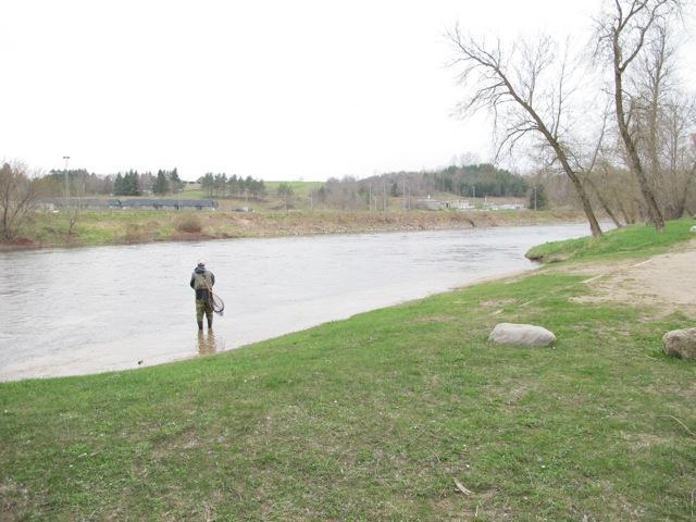
149 Access 4 Maple Hill Road Access 5 Lobie s Park 149


150 Access 6 Concession 8 Access 7 Concession


151 Access 8 Brant Elderslie Questions for Evaluating the Tourism Potential of a Waterway Details Evaluating Waterway Attraction Value Is the waterway area Significant waterway based on its level of development as a tourist paddling destination. scenic, historic or culturally significant? Does the waterway Significant fly fishing area. have a famous or defining feature? (i.e. Flora, fauna, geographic, etc.) Does the waterway Yes attracts paddlers and fishermen and campers. 151
152 Questions for Evaluating the Tourism Potential of a Waterway attract tourists? (List details of users.) Does the geographic area that the waterway is located in attract tourists? Does the waterway have mass market appeal? (List details if appeals to mass market users or a group of niche users). Is the waterway multi use? (List uses i.e. canoeing, kayaking, boating, sailing etc.) Is the waterway open for use in all four seasons? (List seasons waterway is open for use.) Is the waterway public? Is there a useful waterway map available for planning purposes? Details Yes the outflow is in Southampton which is a tourist town. Mass market appeal due to the relatively beginner level of paddling on the river. Canoeing, kayaking, stand up paddle-boarding Not accessible in the winter. Yes Grey Bruce paddling brochure has useful map of the route and access points. 152
153 n/a Questions for Evaluating the Tourism Potential of a Waterway Is there interpretation on the waterway, or at the waterway access point? Is there potential to expand the waterway if demand increases? (Or potential to expand waterway access if demand increases). Does the waterway link to other waterway based attractions in the area? (List) Are events held on the waterway? Evaluating Waterway Access/Infrastructure Is the waterway access point easy to find? No interpretation along the waterway. n/a Details Links to Lake Huron, and other Saugeen River tributaries. Annual May 24 th weekend paddle on the river from Walkerton to Paisley. Unpublicized event. A1 A2 A3 A4 A5 A6 A7 A8 Access point signed into park from highway (one sign missing) but not easy to find within Yes Signed from Grey Road 4 Yes signed from hwy on main street and also from road into park Yes signed from hwy Yes well signed signed from Bruce Rd 3 no sign at the bridge indicating access 153
154 for the most part n/a most free Questions for Evaluating the Tourism Potential of a Waterway Is the waterway access on a paved road? Is the waterway near a major highway? (i.e. 400 series highway, provincial highway, county road) Is the waterway access wheelchair accessible (at least partially)? Is access to the waterway free? (List details of any membership or admission fees required.) park if gatehouse is unattended (need in park signage) Yes paved road to conservation area Hwy 6 Unable to assess - docks may not have been in when visited No conservation area day rates Details point new bridge need to re-install signage No gravel Yes Grey Road 4 Yes Yes Grey Road 4 No No No No No No Yes No No no Yes Yes Yes Yes Yes Yes Yes 154
155 most most well developed Questions for Evaluating the Tourism Potential of a Waterway Is there adequate parking? Is the access point well defined, designed and developed? Is there an interpretation panel or kiosk? Is there a route brochure/map available on site (to take along)? Is there adequate mapping of the waterway route along the waterway or at the trail head/access point? Yes Not really developed as a river access point but within a campground, park which is well developed No defined parking lot parking available along the road (dead end) grass maintained limited ability to develop this location Yes large parking lot Limited parking on grass Yes Yes well defined limited development potential Details Yes well developed parking lot Yes great dock access Yes stairs to put in well developed Yes well defined and developed with new bridge excellent new put in No No No No No No No no No No No No No No No No Yes access point sign has map Yes access point sign has map Yes access point sign has map Yes access point sign has map Yes access point sign has map Yes access point sign with map needs replacing No new bridge just installed signage taken down and need No limited parking No limited parking and difficult access to the river Yes access point sign has map 155
156 Questions for Evaluating the Tourism Potential of a Waterway Is there a detailed map of the waterway for users to take with them while they use the waterway? Is there a designated launch area and is it easily accessible? Is there a designated launch area at reasonable intervals along the waterway? Is there adequate signage to direct visitors on the waterway? Is the waterway patrolled and are rules enforced? Does the waterway Details replacing Grey Bruce Canoe Rout Brochure but must bring the map with them when paddle not available on site. Easily accessible Yes grass cut, easily accessible Yes access point easily accessible, but portage across road does not have good access point Yes easily accessible limited development potential based on location Yes well developed, with dock for loading Yes, well developed with stairs for easy loading excellent new launch area built with new bridge 16 access points between Durham and Southampton. Well spaced - not too much space in between access points. Launch area is not well developed Signage on bridge at each access point from access point 4 to 16. Indicated access point the paddler is at and the distance to the next access point. Police patrol the river on key dates. SVCA watershed management, but no river maintenance plan related to paddling 156
157 Only some locations Some locations washrooms are available at 7 of the 16 access points more than usual Questions for Evaluating the Tourism Potential of a Waterway have a management / maintenance plan? Is there supporting infrastructure such as garbage cans, benches etc.? Are there public washrooms available at the access point? Are there public washrooms available and easily accessible along the waterway? Evaluating Availability of Supporting Waterway Facilities Are there businesses or groups arranging guiding on the Playground equipment, garbage, serviced conservation area campground with services Garbage Yes garbage, playground equipment, camping area (no services) No Details garbage, playground, camping area with services, trail, downtown within walking distance Yes No Yes No Yes Public washroom with showers No No No No No No Yes No Yes No Yes No No No Outfitters offering trips along the river. 157
158 Questions for Evaluating the Tourism Potential of a Waterway waterway? Are there businesses or groups outfitting or providing boat rentals along the waterway? Are there restaurants at or along the waterway? Are there restaurants near the waterway? (i.e. easily accessible to someone using the waterway given their mode of use). Are there accommodations (hotels, motels, B&Bs, inns, campgrounds) at or along the waterway? Are there accommodations (hotels, motels, B&Bs, campgrounds) near the waterway (i.e. easily accessible to someone using Details Several outfitters and organizations offering rentals and outfitting along the river. Restaurants available in any towns along the river. Yes in towns where there are restaurants, for the most part they are close enough to walk to (Walkerton, Paisley, Durham, Southampton boat launch). Several campgrounds along the river, both developed and rustic (with no amenities). Limited other accommodation along the waterway. Several campgrounds along the waterway. Some accommodations (B&Bs), but limited within easy access of the river. 158
159 Questions for Evaluating the Tourism Potential of a Waterway the waterway, given their mode of use). Are there other supporting natural or built attractions in the area? (i.e. museums, theatre, historic/cultural sites, trails etc.) Do the facilities (restaurants, accommodations, attractions) provide services especially for waterway users? Evaluating Waterway Advertising Is the waterway adequately described in a tourism guide book? Is the waterway adequately described on a website? Is the waterway adequately described on the local tourism Details Other tourist attractions in Southampton (beach, museum), somewhat limited in the other towns along the canoe route. Some of the campgrounds provide services specifically for camper (rentals, canoe only camping etc.). Page dedicated to paddling, but not enough information on the Saugeen to allow for trip planning. References paddling routes brochure. Saugeen Valley Conservation Authority describes the route, and offers a link to a map. Thorncrest Outfitters describes the route, gives distances for typical paddles and maps Explore the Bruce describes the river, and offers pdf download of the Paddling Grey Bruce guide Explore the Bruce 159
160 Questions for Evaluating the Tourism Potential of a Waterway website? Is the waterway being promoted by local tourism organizations? Has the waterway received any awards or endorsements? (i.e. Heritage river designation etc.) Details 160


161 Name: Saugeen River (Access 9 16) Access 9a & b - Paisley Hose Tower 161


162 Access 10 Bruce Road 3 Access 11 Saugeen Bluffs Conservation Area 162


163 Access 12 Concession 4 Access 13 Bruce Road


 164")
164 Access 14 Bruce Road 3 Access 15 Carlisle Street (Denny s Dam) 164


165 Access 16 Southampton Boat Launch 165
166 Questions for Evaluating the Tourism Potential of a Waterway Evaluating Waterway Attraction Value Is the waterway area See summary answer on previous pages for A1-8 scenic, historic or culturally significant? Does the waterway have a See summary answer on previous pages for A1-8 famous or defining feature? (i.e. Flora, fauna, geographic, etc.) Does the waterway attract See summary answer on previous pages for A1-8 tourists? (List details of users.) Does the geographic area See summary answer on previous pages for A1-8 that the waterway is located in attract tourists? Does the waterway have See summary answer on previous pages for A1-8 mass market appeal? (List details if appeals to mass market users or a group of niche users). Is the waterway multi use? See summary answer on previous pages for A1-8 (List uses i.e. canoeing, kayaking, boating, sailing etc.) Is the waterway open for See summary answer on previous pages for A1-8 use in all four seasons? (List seasons waterway is open for use.) Is the waterway public? See summary answer on previous pages for A1-8 Is there a useful waterway See summary answer on previous pages for A1-8 Details 166
167 Questions for Evaluating the Tourism Potential of a Waterway map available for planning purposes? Is there interpretation on the waterway, or at the waterway access point? Is there potential to expand the waterway if demand increases? (Or potential to expand waterway access if demand increases). Does the waterway link to other waterway based attractions in the area? (List) Are events held on the waterway? Evaluating Waterway Access/Infrastructure Is the waterway access point easy to find? See summary answer on previous pages for A1-8 See summary answer on previous pages for A1-8 See summary answer on previous pages for A1-8 See summary answer on previous pages for A1-8 Details A9 A10 A11 A12 A13 A14 A15 A16 sign off highway, but navigation does not take you to the access point Sign off highway Sign off highway, but no routing within park (needed if park office closed) Signs off highway and at access signs off highway signed off Bruce Road 3 Is the waterway access on a paved road? Is the waterway near a near on Bruce No signage at the road 167
168 Questions for Evaluating the Tourism Potential of a Waterway major highway? (i.e. 400 series highway, provincial highway, county road) Is the waterway access wheelchair accessible (at least partially)? Is access to the waterway free? (List details of any membership or admission fees required.) Is there adequate parking? Is the access point well defined, designed and developed? Details Bruce Road 3 Road 3 No No No No No No No No No conservation area day rate access fee required no developed parking at access A downtown parking available at alternate park access B down the road, but routing does not send users there. B is well defined with well developed parking area Yes paved entrance defined access point, relatively defined access point, well developed parking lot stone chipped parking well defined parking lot undeveloped parking along the side of an old roadway Natural access well developed parking lot well developed access very large parking lot boat launch well developed large 168
169 Questions for Evaluating the Tourism Potential of a Waterway Is there an interpretation panel or kiosk? Is there a route brochure/map available on site (to take along)? Is there adequate mapping of the waterway route along the waterway or at the trail head/access point? Is there a detailed map of the waterway for users to take with them while they use the waterway? docks, A not as well point, path leading to water entrance, grass cut undeveloped for this location could use a permanent put in/pull out to simplify entrance paved access Details access entry point flat and natural dock may no longer be in use No No No No No No No No No No No No No No No No Access point signage at entrance A, but not a god put in. No access point signage at B, but better access Access point signage with map at the access access point signage with map at the access access point signage with map See summary answer on previous pages for A1-8 access point signage with map Access point sign is missing its map Access point signage with a map parking lot, with boat launch No access point signage 169
170 Questions for Evaluating the Tourism Potential of a Waterway Is there a designated launch area and is it easily accessible? Is there a designated launch area at reasonable intervals along the waterway? Is there adequate signage to direct visitors on the waterway? Is the waterway patrolled and are rules enforced? Does the waterway have a management / maintenance plan? Is there supporting infrastructure such as garbage cans, benches etc.? Are there public washrooms available at the access point? A not easily accessible B has docks for easy access easily accessible See summary answer on previous pages for A1-8 See summary answer on previous pages for A1-8 See summary answer on previous pages for A1-8 See summary answer on previous pages for A1-8 B has garbage cans, camping No garbage, campground with services, playground Details flat entry, but natural natural access, but easily accessible easily accessible is even better if the dock is put in each year (not sure if being used any more) boat launch No No No picnic tables, garbage yes at B No No No No 170
171 Questions for Evaluating the Tourism Potential of a Waterway Are there public washrooms available and easily accessible along the waterway? Evaluating Availability of Supporting Waterway Facilities Are there businesses or groups arranging guiding on the waterway? Are there businesses or groups outfitting or providing boat rentals along the waterway? Are there restaurants at or along the waterway? Are there restaurants near the waterway? (i.e. easily accessible to someone using the waterway given their mode of use). Are there accommodations (hotels, motels, B&Bs, inns, campgrounds) at or along the waterway? Are there accommodations (hotels, motels, B&Bs, campgrounds) near the waterway (i.e. easily accessible to someone Details No No No No See summary answer on previous pages for A1-8 See summary answer on previous pages for A1-8 See summary answer on previous pages for A1-8 See summary answer on previous pages for A1-8 See summary answer on previous pages for A1-8 See summary answer on previous pages for A
172 Questions for Evaluating the Tourism Potential of a Waterway using the waterway, given their mode of use). Are there other supporting natural or built attractions in the area? (i.e. museums, theatre, historic/cultural sites, trails etc.) Do the facilities (restaurants, accommodations, attractions) provide services especially for waterway users? Evaluating Waterway Advertising Is the waterway adequately described in a tourism guide book? Is the waterway adequately described on a website? Is the waterway adequately described on the local tourism website? Is the waterway being promoted by local tourism organizations? Has the waterway received any awards or endorsements? (ie Heritage river designation etc.) Details See summary answer on previous pages for A1-8 See summary answer on previous pages for A1-8 See summary answer on previous pages for A1-8 See summary answer on previous pages for A1-8 See summary answer on previous pages for A1-8 See summary answer on previous pages for A1-8 See summary answer on previous pages for A
173 Positives Opportunities / Gaps Summary Signs direct traffic to all access points Access point signage on sites, but could use updating and replacing Signage on site includes mapping of the route Many of the access points are well developed, with developed parking and river entrances Garbage facilities should be available and pickup should be organized at each site signage directing paddlers to amenities in towns along the route market ready waterway for paddling with many infrastructure upgrades already in place some infrastructure/ amenity changes could be implemented to make it even better Newly printed paddling brochure includes mapping of access points Operator feedback on Saugeen River needs: Increase profile of river as paddling destination not party spot o Keep fencing cattle from river o Tell people where to park at access points o Develop garbage collection schedule for access points o Dockage at Denny s Dam o Beautify access points o Sign bridges with river name o End of Route - Dennys Dam improvements needed o Start of Route Hanover Acknowledgement needed 173

 Local surrounding area tiny township / midland Cyclists, motorcyclists, auto cruising stop Does the geographic area that the beach is located in attract tourists?")
174 RTO7 Waterways - Beaches Name: Balm Beach Location: Balm Beach Tiny Township Questions for Evaluating the Tourism Potential of a Beach Details Evaluating Beach Attraction Value Does the beach have a famous or defining feature? Has the beach received any awards or endorsements? Is the beach a Blue Flag beach? Is the beach a significant beach in the local tourism industry? Tiny township tourism Is the beach a significant beach in the region? Just within tiny /midland area Is the beach of significant size/length? Small and compact area Does the beach attract tourists? (List details of users.) Local surrounding area tiny township / midland Cyclists, motorcyclists, auto cruising stop Does the geographic area that the beach is located in attract tourists? Georgian bay Does the beach have mass market appeal? (List details if appeals to mass Family oriented beach market users or a group of niche users). Is the beach open for use in all three seasons? Is the beach public? Is the beach a sand beach? Are events held on the beach? Local festivals Evaluating Beach Access/Infrastructure Is the beach easy to find and adequately signed? Locals secret 174
175 Questions for Evaluating the Tourism Potential of a Beach Details Is the beach access point on a paved road? Is the beach near a major highway? (i.e. 400 series highway, provincial Hwy 93 highway, county road) Is the beach wheelchair accessible (at least partially)? Is access to the beach free? (List details of any membership, or admission.) Are there lifeguards? Is there a designated parking area and is it easily accessible and well defined/designed/developed? Parking would be full in high season Is there a designated parking area at reasonable intervals along the beach? Is there designated RV/Motorcycle Parking? Is parking free? (list details of fees if any) Is there adequate signage to direct visitors to the beach? Is there adequate signage to direct visitors to the parking area? Are there interpretation kiosks, plaques etc. that tell the story of the beach area? Is the beach patrolled and are rules enforced? Parking on local roads enforced Is there supporting infrastructure such as garbage cans? Is there supporting infrastructure such as playground equipment, volleyball courts? Is there supporting infrastructure such as picnic tables / picnic area? Are there public washrooms available? Are there public washrooms available and are they adequate (format, maintenance, cleanliness)? Are there public washrooms available and are they of adequate number and adequately spaced/placed to make them easily accessible along the beach? Is there a designated pet friendly area? Evaluating Availability of Supporting Beach Facilities Are there businesses or groups providing recreational activities along the beach? (i.e. personal watercraft rentals, beach volleyball etc.) Are there beach shops located at or very near to the beach? Are there restaurants at or along the beach? Are there restaurants near the beach? (i.e. easily accessible to someone using the beach). Are there accommodations (hotels, motels, B&Bs, campgrounds) at, along or near the beach. Are there other supporting natural or built attractions in the area? (i.e. museums, theatre, historic/cultural sites, trails etc.) Do the facilities (restaurants, accommodations, attractions) provide services especially for beach users? Evaluating Beach Advertising Is the beach adequately described in a tourism guide book? Local guidebook to beach published every 175


176 Questions for Evaluating the Tourism Potential of a Beach Details year by local business association Is the beach adequately described on a website? Is the beach adequately described on the local tourism website? Is the beach being promoted by local tourism organizations? Business Association of Balm Beach' Positives Opportunities / Gaps Summary Parking is a major issue within Tiny township. Local landowner dispute awkward for visitors Quintessential small beach town with local flare variety store, restaurant Old Ontario beach town authentic experience limited beach size Name: Centennial Beach/Barrie Waterfront Location: Barrie Questions for Evaluating the Tourism Potential of a Beach Details Evaluating Beach Attraction Value Does the beach have a famous or defining feature? Sculpture, significant events 176
177 Questions for Evaluating the Tourism Potential of a Beach Details Has the beach received any awards or endorsements? Is the beach a Blue Flag beach? Is the beach a significant beach in the local tourism industry? Is the beach a significant beach in the region? Is the beach of significant size/length? Within Barrie Small beach length but massive waterfront length Does the beach attract tourists? (List details of users.) Locals and event goers, close proximity to GTA Does the geographic area that the beach is located in attract tourists? Lake Does the beach have mass market appeal? (List details if appeals to Family, events, Urban mass market users or a group of niche users). Is the beach open for use in all four seasons? Winter activities include ice fishing Is the beach public? Is the beach a sand beach? Limited Are events held on the beach? Triathlons, festivals, Canada s largest arts and crafts fair Evaluating Beach Access/Infrastructure Is the beach easy to find and adequately signed? Is the beach access point on a paved road? Is the beach near a major highway? (i.e. 400 series highway, provincial highway, county road) Is the beach wheelchair accessible (at least partially)? Is access to the beach free? (List details of any membership, or admission.) Are there lifeguards? Is there a designated parking area and is it easily accessible and well defined/designed/developed? Is there a designated parking area at reasonable intervals along the beach? Is there designated RV/Motorcycle Parking? Is parking free? (list details of fees if any) Is there adequate signage to direct visitors to the beach? Is there adequate signage to direct visitors to the parking area? Are there interpretation kiosks, plaques etc. that tell the story of the beach area? Is the beach patrolled and are rules enforced? Barrie Police Is there supporting infrastructure such as garbage cans? Could benefit from better wayfinding from major access points 400 The waterfront is long and signage indicating uses may be helpful When lots are full it might become an issue 177
178 Questions for Evaluating the Tourism Potential of a Beach Details Is there supporting infrastructure such as playground equipment, Beach Volley ball, Mini-golf volleyball courts? Is there supporting infrastructure such as picnic tables / picnic area? Picnic Shelter Are there public washrooms available? Are there public washrooms available and are they adequate (format, Closed in winter maintenance, cleanliness)? Are there public washrooms available and are they of adequate number and adequately spaced/placed to make them easily accessible along the beach? Is there a designated pet friendly area? Pet friendly areas difficult to find Evaluating Availability of Supporting Beach Facilities Are there businesses or groups providing recreational activities along the beach? (i.e. personal watercraft rentals, beach volleyball etc.) Are there beach shops located at or very near to the beach? Downtown Are there restaurants at or along the beach? Ice cream Are there restaurants near the beach? (i.e. easily accessible to Downtown someone using the beach). Are there accommodations (hotels, motels, B&Bs, campgrounds) at, along or near the beach. Are there other supporting natural or built attractions in the area? (i.e. museums, theatre, historic/cultural sites, trails etc.) Beach volleyball, mini golf, no canoe, kayak, paddleboat rentals Old Howard Johnson hotel downtown old motel 3km from beach 7km waterfront trail, downtown theatre being built outdoor theatre during summer months. Ship wreck off beach for diving experience Do the facilities (restaurants, accommodations, attractions) provide services especially for beach users? The waterfront needs restaurant/accommodations Evaluating Beach Advertising Is the beach adequately described in a tourism guide book? Is the beach adequately described on a website? As the marquee experience for Barrie, good information, photos, video is hard to find Is the beach adequately described on the local tourism website? Needs more information, maps, videos etc. Is the beach being promoted by local tourism organizations? Needs to be positioned as the rock star of Barrie 178
 Likely one of the largest unobstructed urban public waterfronts in the Province Creates enormous opportunity for special events and to engage urban visitors with Lake Serendipity boat cruise allow")

179 Positives Opportunities / Gaps Summary Waterfront/trail rental opportunities (Bikes, canoes, kayaks etc.) Likely one of the largest unobstructed urban public waterfronts in the Province Creates enormous opportunity for special events and to engage urban visitors with Lake Serendipity boat cruise allow tourists a lake tour experience Great transformation of the main street businesses opening up the backs of their stores to the lake Desperately needs accommodation in the urban core. Enhance the connection to the downtown through design and signage On trail wayfinding is necessary with distance/time markers and you are here maps kiosks Enhance the profile of Lake / Barrie along the 400 & 11 corridor do visitors even know what Lake is? Barrie downtown is in a very enviable position having significant access to the waterfront. More accommodations and restaurants close to the water would enhance the experience. The downtown needs to be linked to/embrace the waterfront. Name: Christie Beach Location: Between Thornbury & Meaford off Highway
180 Questions for Evaluating the Tourism Potential of a Beach Details Evaluating Beach Attraction Value Does the beach have a famous or defining feature? Has the beach received any awards or endorsements? Is the beach a Blue Flag beach? Is the beach a significant beach in the local tourism industry? Is the beach a significant beach in the region? Is the beach of significant size/length? Small, end of road Does the beach attract tourists? (List details of users.) Locals beach Does the geographic area that the beach is located in attract tourists? Yes, Lora Bay Does the beach have mass market appeal? (List details if appeals to mass market users or a group of niche users). Is the beach open for use in all three seasons? Yes but washrooms only open in summer Is the beach public? Is the beach a sand beach? Are events held on the beach? Evaluating Beach Access/Infrastructure Is the beach easy to find and adequately signed? Did have CTODS before road rebuild Is the beach access point on a paved road? Is the beach near a major highway? (i.e. 400 series highway, provincial highway, county road) Is the beach wheelchair accessible (at least partially)? Is access to the beach free? (List details of any membership, or admission.) Are there lifeguards? Is there a designated parking area and is it easily accessible and well defined/designed/developed? Is there a designated parking area at reasonable intervals along the beach? n/a Is there designated RV/Motorcycle Parking? Is parking free? (list details of fees if any) Is there adequate signage to direct visitors to the beach? n/a Is there adequate signage to direct visitors to the parking area? n/a Are there interpretation kiosks, plaques etc. that tell the story of the beach area? Is the beach patrolled and are rules enforced? OPP Is there supporting infrastructure such as garbage cans? Is there supporting infrastructure such as playground equipment, volleyball Very old courts? Is there supporting infrastructure such as picnic tables / picnic area? Picnic Shelter Are there public washrooms available? Are there public washrooms available and are they adequate (format, maintenance, cleanliness)? The design creates significant odor Are there public washrooms available and are they of adequate number n/a 180
181 Questions for Evaluating the Tourism Potential of a Beach Details and adequately spaced/placed to make them easily accessible along the beach? Is there a designated pet friendly area? Not listed as a use Evaluating Availability of Supporting Beach Facilities Are there businesses or groups providing recreational activities along the beach? (i.e. personal watercraft rentals, beach volleyball etc.) Are there beach shops located at or very near to the beach? Are there restaurants at or along the beach? Are there restaurants near the beach? (i.e. easily accessible to someone Meaford/Thornbury using the beach). Are there accommodations (hotels, motels, B&Bs, campgrounds) at, along or near the beach. Are there other supporting natural or built attractions in the area? (i.e. museums, theatre, historic/cultural sites, trails etc.) Do the facilities (restaurants, accommodations, attractions) provide services especially for beach users? Evaluating Beach Advertising Is the beach adequately described in a tourism guide book? Is the beach adequately described on a website? On Grey Sauble website Is the beach adequately described on the local tourism website? Is the beach being promoted by local tourism organizations? Positives Opportunities / Gaps Summary Locals beach as the beach experience ie. sand quality, swimming opportunities is not the greatest Provides public access to Georgian Bay Beach serves an important purpose for public access to the waterfront but the experience is average. 181

 Waterfront attracts locals, boaters, motorcyclists, event participants, fishing Does the geographic area that the beach is located in attract tourists?")
182 Name: Couchiching Park/ Orillia Waterfront Location: Orillia Questions for Evaluating the Tourism Potential of a Beach Details Evaluating Beach Attraction Value Does the beach have a famous or defining feature? Louis Riel Statue Has the beach received any awards or endorsements? Is the beach a Blue Flag beach? Is the beach a significant beach in the local tourism industry? The waterfront helps to define Orillia Is the beach a significant beach in the region? Is the beach of significant size/length? Small beach area large park Does the beach attract tourists? (List details of users.) Waterfront attracts locals, boaters, motorcyclists, event participants, fishing Does the geographic area that the beach is located in attract tourists? Yes lake Couchiching Does the beach have mass market appeal? (List details if appeals to mass market users or a group of niche users). Tourists are attracted to the waterfront Is the beach open for use in all four seasons? Winter activities include ice fishing Is the beach public? Is the beach a sand beach? Limited Are events held on the beach? Triathlons, local festivals Evaluating Beach Access/Infrastructure Is the beach easy to find and adequately signed? Is the beach access point on a paved road? Is the beach near a major highway? (i.e. 400 series highway, provincial
183 Questions for Evaluating the Tourism Potential of a Beach Details highway, county road) Is the beach wheelchair accessible (at least partially)? Is access to the beach free? (List details of any membership, or admission.) Are there lifeguards? Is there a designated parking area and is it easily accessible and well defined/designed/developed? Is there a designated parking area at reasonable intervals along the beach? Is there designated RV/Motorcycle Parking? Is parking free? (list details of fees if any) Is there adequate signage to direct visitors to the beach? Motorcycle parking at restaurant Major asset needs better signage Is there adequate signage to direct visitors to the parking area? Are there interpretation kiosks, plaques etc. that tell the story of the beach area? Is the beach patrolled and are rules enforced? opp Is there supporting infrastructure such as garbage cans? Is there supporting infrastructure such as playground equipment, volleyball courts? Is there supporting infrastructure such as picnic tables / picnic area? Picnic Shelters Are there public washrooms available? Are there public washrooms available and are they adequate (format, maintenance, cleanliness)? Are there public washrooms available and are they of adequate number and adequately spaced/placed to make them easily accessible along the beach? Is there a designated pet friendly area? Could not find one Evaluating Availability of Supporting Beach Facilities Are there businesses or groups providing recreational activities along the beach? (i.e. personal watercraft rentals, beach volleyball etc.) No canoe, kayak, paddleboat rentals Are there beach shops located at or very near to the beach? Downtown Are there restaurants at or along the beach? Ice cream, pub, fine dining Are there restaurants near the beach? (i.e. easily accessible to someone Downtown using the beach). Are there accommodations (hotels, motels, B&Bs, campgrounds) at, along or near the beach. 2 Downtown close to beach Are there other supporting natural or built attractions in the area? (i.e. Waterfront trail museums, theatre, historic/cultural sites, trails etc.) Do the facilities (restaurants, accommodations, attractions) provide services especially for beach users? Motorcycle parking at lake front restaurant Evaluating Beach Advertising Is the beach adequately described in a tourism guide book? Is the beach adequately described on a website? On Orillia website 183


184 Questions for Evaluating the Tourism Potential of a Beach Details Is the beach adequately described on the local tourism website? Needs downloadable site map Is the beach being promoted by local tourism organizations? Positives Opportunities / Gaps Summary Linkage between the waterfront and the downtown, suffers from a disconnect. Can be corrected through streetscaping and signage. The waterfront is the main attraction, the mainstreet is where the commerce occurs, connect the two. Provides public access to lake Couchiching and opportunities to spend the night and enjoy downtown experience Knowledgeable staff at shops and restaurants Orillia is blessed with an abundance of public waterfront space. Orillia has a world famous festival and is a significant fishing community. Name: Indian Head Cove Location: Bruce Peninsula National Park Questions for Evaluating the Tourism Potential of a Beach Details Evaluating Beach Attraction Value Does the beach have a famous or defining feature? The Grotto Has the beach received any awards or endorsements? Canada s Hidden Travel Gem
185 Questions for Evaluating the Tourism Potential of a Beach Details Is the beach a Blue Flag beach? Is the beach a significant beach in the local tourism industry? Is the beach a significant beach in the region? Is the beach of significant size/length? Does the beach attract tourists? (List details of users.) Does the geographic area that the beach is located in attract tourists? Does the beach have mass market appeal? (List details if appeals to mass market users or a group of niche users). As a major attraction it attracts all market segments Is the beach open for use in all three seasons? Is the beach public? Is the beach a sand beach? Are events held on the beach? Evaluating Beach Access/Infrastructure Is the beach easy to find and adequately signed? rock Visitors are always looking for the Grotto Is the beach access point on a paved road? Is the beach near a major highway? (i.e. 400 series highway, provincial Hwy 6 highway, county road) Is the beach wheelchair accessible (at least partially)? Is access to the beach free? (List details of any membership, or admission.) Park fees apply Are there lifeguards? Is there a designated parking area and is it easily accessible and well defined/designed/developed? Is there a designated parking area at reasonable intervals along the beach? Hike in beach Is there designated RV/Motorcycle Parking? Is parking free? (list details of fees if any) Park fees apply Is there adequate signage to direct visitors to the beach? Park is working on new signage Is there adequate signage to direct visitors to the parking area? Are there interpretation kiosks, plaques etc. that tell the story of the beach area? Is the beach patrolled and are rules enforced? Park staff and wardens Is there supporting infrastructure such as garbage cans? Pack in pack out Is there supporting infrastructure such as playground equipment, volleyball Not a typical beach courts? Is there supporting infrastructure such as picnic tables / picnic area? Are there public washrooms available? Are there public washrooms available and are they adequate (format, maintenance, cleanliness)? Are there public washrooms available and are they of adequate number and adequately spaced/placed to make them easily accessible along the beach? Is there a designated pet friendly area? All pet friendly 185
186 Questions for Evaluating the Tourism Potential of a Beach Details Evaluating Availability of Supporting Beach Facilities Are there businesses or groups providing recreational activities along the beach? (i.e. personal watercraft rentals, beach volleyball etc.) Are there beach shops located at or very near to the beach? Are there restaurants at or along the beach? Are there restaurants near the beach? (i.e. easily accessible to someone using the beach). Are there accommodations (hotels, motels, B&Bs, campgrounds) at, along Campground or near the beach. Are there other supporting natural or built attractions in the area? (i.e. Fathom Five, Tobermory museums, theatre, historic/cultural sites, trails etc.) Do the facilities (restaurants, accommodations, attractions) provide services especially for beach users? Evaluating Beach Advertising Is the beach adequately described in a tourism guide book? Is the beach adequately described on a website? Is the beach adequately described on the local tourism website? Is the beach being promoted by local tourism organizations? Positives Opportunities / Gaps Summary The Rock Star of the Bruce Capacity issues in main season Bruce Peninsula National Peninsula Park is a significant attraction for RTO7 186

 Local and north Toronto Does the geographic area that the beach is located in attract tourists? Lake Does the beach have mass market appeal?")
187 Name: Innisfil Beach Location: Alcona Questions for Evaluating the Tourism Potential of a Beach Details Evaluating Beach Attraction Value Does the beach have a famous or defining feature?? Has the beach received any awards or endorsements? Is the beach a Blue Flag beach? Is the beach a significant beach in the local tourism industry? Big day use park Is the beach a significant beach in the region? Is the beach of significant size/length? Limited sand but lots of shoreline and property Does the beach attract tourists? (List details of users.) Local and north Toronto Does the geographic area that the beach is located in attract tourists? Lake Does the beach have mass market appeal? (List details if appeals to mass market users or a group of niche users). Day use beach for north Toronto residents Is the beach open for use in all three seasons? Outdoor ice rink in winter, ice fishing Is the beach public? Is the beach a sand beach? Limited Are events held on the beach? Multi-sport events Evaluating Beach Access/Infrastructure Is the beach easy to find and adequately signed? At end of main street Is the beach access point on a paved road? Is the beach near a major highway? (i.e. 400 series highway, provincial 400 highway, county road) Is the beach wheelchair accessible (at least partially)? Is access to the beach free? (List details of any membership, or admission.) 187
188 Questions for Evaluating the Tourism Potential of a Beach Details Are there lifeguards? Is there a designated parking area and is it easily accessible and well defined/designed/developed? Is there a designated parking area at reasonable intervals along the beach? Is there designated RV/Motorcycle Parking? Is parking free? (list details of fees if any) Pay for launching boat $25 annual pass $10 after 6pm Is there adequate signage to direct visitors to the beach? n/a Is there adequate signage to direct visitors to the parking area? Are there interpretation kiosks, plaques etc. that tell the story of the beach area? Is the beach patrolled and are rules enforced? Local bylaw Is there supporting infrastructure such as garbage cans? Is there supporting infrastructure such as playground equipment, volleyball courts? Is there supporting infrastructure such as picnic tables / picnic area? Are there public washrooms available? Are there public washrooms available and are they adequate (format, maintenance, cleanliness)? Are there public washrooms available and are they of adequate number and adequately spaced/placed to make them easily accessible along the beach? Is there a designated pet friendly area? Evaluating Availability of Supporting Beach Facilities Are there businesses or groups providing recreational activities along the beach? (i.e. personal watercraft rentals, beach volleyball etc.) Are there beach shops located at or very near to the beach? Redeveloped Innisfil Beach Rd close to beach Are there restaurants at or along the beach? Are there restaurants near the beach? (i.e. easily accessible to someone using the beach). Are there accommodations (hotels, motels, B&Bs, campgrounds) at, along or near the beach. Are there other supporting natural or built attractions in the area? (i.e. museums, theatre, historic/cultural sites, trails etc.) Do the facilities (restaurants, accommodations, attractions) provide services especially for beach users? Evaluating Beach Advertising Is the beach adequately described in a tourism guide book? Is the beach adequately described on a website? Is the beach adequately described on the local tourism website? Is the beach being promoted by local tourism organizations? Along Innisfil Beach Rd linked by path 188


189 Positives Opportunities / Gaps Summary Pet friendly area. Redevelopment of Innisfil Beach road is a text book case of good planning and design as it connects the waterfront to the downtown. Parking fee seems very high if a quick short stay is desired. Improvements to Innisfil Beach Rd near beach will greatly enhance the beach experience providing adequate and unique businesses open along strip. Name: Station Beach Location: Kincardine 189
190 Questions for Evaluating the Tourism Potential of a Beach Details Evaluating Beach Attraction Value Does the beach have a famous or defining feature? The Big Chair, boardwalk & pier Has the beach received any awards or endorsements? Blue Flag Is the beach a Blue Flag beach? Yes Is the beach a significant beach in the local tourism industry? Big attraction Is the beach a significant beach in the region? Within the county Is the beach of significant size/length? 1km Does the beach attract tourists? (List details of users.) Significant cottage community strong southern Ontario visitors Does the geographic area that the beach is located in attract tourists? Does the beach have mass market appeal? (List details if appeals to mass Family friendly market users or a group of niche users). Is the beach open for use in all three seasons? Is the beach public? Is the beach a sand beach? Are events held on the beach? Volleyball Evaluating Beach Access/Infrastructure Is the beach easy to find and adequately signed? New wayfinding system will be installed Is the beach access point on a paved road? Is the beach near a major highway? (i.e. 400 series highway, provincial highway, county road) Is the beach wheelchair accessible (at least partially)? Is access to the beach free? (List details of any membership, or admission.) Are there lifeguards? Is there a designated parking area and is it easily accessible and well defined/designed/developed? Is there a designated parking area at reasonable intervals along the beach? Is there designated RV/Motorcycle Parking? Is parking free? (list details of fees if any) Is there adequate signage to direct visitors to the beach? Very Obvious Is there adequate signage to direct visitors to the parking area? Are there interpretation kiosks, plaques etc. that tell the story of the beach area? Is the beach patrolled and are rules enforced? Is there supporting infrastructure such as garbage cans? Is there supporting infrastructure such as playground equipment, volleyball courts? Is there supporting infrastructure such as picnic tables / picnic area? 190
191 Questions for Evaluating the Tourism Potential of a Beach Details Are there public washrooms available? Are there public washrooms available and are they adequate (format, maintenance, cleanliness)? Are there public washrooms available and are they of adequate number and adequately spaced/placed to make them easily accessible along the beach? Is there a designated pet friendly area? Evaluating Availability of Supporting Beach Facilities Are there businesses or groups providing recreational activities along the Volleyball beach? (i.e. personal watercraft rentals, beach volleyball etc.) Are there beach shops located at or very near to the beach? Downtown is 2 blocks away Are there restaurants at or along the beach? Are there restaurants near the beach? (i.e. easily accessible to someone using the beach). Are there accommodations (hotels, motels, B&Bs, campgrounds) at, along or near the beach. Are there other supporting natural or built attractions in the area? (i.e. museums, theatre, historic/cultural sites, trails etc.) Lighthouse, Lions Park, Historic Downtown Do the facilities (restaurants, accommodations, attractions) provide services especially for beach users? Evaluating Beach Advertising Is the beach adequately described in a tourism guide book? Is the beach adequately described on a website? Difficult to find information, map, aerial view, amenities etc. Is the beach adequately described on the local tourism website? no Is the beach being promoted by local tourism organizations? Positives Opportunities / Gaps Summary Have designated motorcycle & RV parking Sand beach located very close to the main street. Well kept, washroom facilities, Jumbo Beach chairs for photo opportunities Create a profile page just for the beach to include a site map with all amenities and attractions, photos, web cam Station Beach is one of Kincardine s main assets. The implementation of the wayfinding system will visitors engage with the other waterfront assets. Implement wayfinding system Put a pedestrian kiosk at beach to show all town amenities. 191

 Day users and campers Does the geographic area that the beach is located in attract tourists? Does the beach have mass market appeal?")
192 Name: Memorial Park Location: Meaford Questions for Evaluating the Tourism Potential of a Beach Details Evaluating Beach Attraction Value Does the beach have a famous or defining feature? Has the beach received any awards or endorsements? Is the beach a Blue Flag beach? Is the beach a significant beach in the local tourism industry? With the campground Is the beach a significant beach in the region? Is the beach of significant size/length? Small beach Does the beach attract tourists? (List details of users.) Day users and campers Does the geographic area that the beach is located in attract tourists? Does the beach have mass market appeal? (List details if appeals to mass market users or a group of niche users). Is the beach open for use in all three seasons? Is the beach public? Is the beach a sand beach? With some rock Are events held on the beach? Evaluating Beach Access/Infrastructure Is the beach easy to find and adequately signed? Very hard to find Is the beach access point on a paved road? Is the beach near a major highway? (i.e. 400 series highway, provincial Hwy 26 highway, county road) Is the beach wheelchair accessible (at least partially)? Is access to the beach free? (List details of any membership, or admission.) Are there lifeguards? Is there a designated parking area and is it easily accessible and well 192
193 Questions for Evaluating the Tourism Potential of a Beach Details defined/designed/developed? Is there a designated parking area at reasonable intervals along the beach? Is there designated RV/Motorcycle Parking? Is parking free? (list details of fees if any) Is there adequate signage to direct visitors to the beach? None in park Is there adequate signage to direct visitors to the parking area? n/a Are there interpretation kiosks, plaques etc. that tell the story of the beach Needed area? Is the beach patrolled and are rules enforced? OPP, park staff Is there supporting infrastructure such as garbage cans? Is there supporting infrastructure such as playground equipment, volleyball courts? Is there supporting infrastructure such as picnic tables / picnic area? Are there public washrooms available? Are there public washrooms available and are they adequate (format, maintenance, cleanliness)? Are there public washrooms available and are they of adequate number and adequately spaced/placed to make them easily accessible along the beach? Is there a designated pet friendly area? Evaluating Availability of Supporting Beach Facilities Are there businesses or groups providing recreational activities along the beach? (i.e. personal watercraft rentals, beach volleyball etc.) Are there beach shops located at or very near to the beach? Are there restaurants at or along the beach? Snack bar at beach Are there restaurants near the beach? (i.e. easily accessible to someone using the beach). Are there accommodations (hotels, motels, B&Bs, campgrounds) at, along campground or near the beach. Are there other supporting natural or built attractions in the area? (i.e. Meaford harbour museums, theatre, historic/cultural sites, trails etc.) Do the facilities (restaurants, accommodations, attractions) provide services especially for beach users? Evaluating Beach Advertising Is the beach adequately described in a tourism guide book? A bit hidden Is the beach adequately described on a website? no Is the beach adequately described on the local tourism website? no Is the beach being promoted by local tourism organizations? Positives Opportunities / Gaps Summary Could be better promoted on the tourism websites A bit of a hidden secret used by campers and locals Could increase usage just by signing and advertising a pet friendly beach 193

 Locals beach Does the geographic area that the beach is located in attract tourists?")
194 Name: North Winds Beach Location: Craigleith off Highway 26 Questions for Evaluating the Tourism Potential of a Beach Details Evaluating Beach Attraction Value Does the beach have a famous or defining feature? Locals location for kite surfing, wind surfing, kayaking Has the beach received any awards or endorsements? Is the beach a Blue Flag beach? Is the beach a significant beach in the local tourism industry? Is the beach a significant beach in the region? Is the beach of significant size/length? Small sand area and parkette Does the beach attract tourists? (List details of users.) Locals beach Does the geographic area that the beach is located in attract tourists? Georgian Bay Does the beach have mass market appeal? (List details if appeals to mass market users or a group of niche users). Is the beach open for use in all three seasons? Yes but washrooms only open in summer Is the beach public? Is the beach a sand beach? Are events held on the beach? Evaluating Beach Access/Infrastructure Is the beach easy to find and adequately signed? Beside highway Is the beach access point on a paved road? Is the beach near a major highway? (i.e. 400 series highway, provincial HWY
195 Questions for Evaluating the Tourism Potential of a Beach Details highway, county road) Is the beach wheelchair accessible (at least partially)? Is access to the beach free? (List details of any membership, or admission.) Are there lifeguards? Is there a designated parking area and is it easily accessible and well defined/designed/developed? Is there a designated parking area at reasonable intervals along the beach? n/a Is there designated RV/Motorcycle Parking? Is parking free? (list details of fees if any) Is there adequate signage to direct visitors to the beach? n/a Is there adequate signage to direct visitors to the parking area? n/a Are there interpretation kiosks, plaques etc. that tell the story of the beach area? Is the beach patrolled and are rules enforced? opp Is there supporting infrastructure such as garbage cans? Is there supporting infrastructure such as playground equipment, volleyball courts? Is there supporting infrastructure such as picnic tables / picnic area? Picnic Shelter, bbq pits Are there public washrooms available? Are there public washrooms available and are they adequate (format, maintenance, cleanliness)? Are there public washrooms available and are they of adequate number n/a and adequately spaced/placed to make them easily accessible along the beach? Is there a designated pet friendly area? On leash Evaluating Availability of Supporting Beach Facilities Are there businesses or groups providing recreational activities along the beach? (i.e. personal watercraft rentals, beach volleyball etc.) Are there beach shops located at or very near to the beach? Are there restaurants at or along the beach? Are there restaurants near the beach? (i.e. easily accessible to someone using the beach). Are there accommodations (hotels, motels, B&Bs, campgrounds) at, along or near the beach. Are there other supporting natural or built attractions in the area? (i.e. museums, theatre, historic/cultural sites, trails etc.) Do the facilities (restaurants, accommodations, attractions) provide services especially for beach users? Evaluating Beach Advertising Is the beach adequately described in a tourism guide book? Craighurst Museum and Georgian trail across the street Is the beach adequately described on a website? Town of Blue Mountains Is the beach adequately described on the local tourism website? Is the beach being promoted by local tourism organizations? 195
196 Positives Opportunities / Gaps Summary Keep adding screen trees from highway to enhance on beach experience Provides public access to Georgian Bay Well maintained beach with all facilities, great swimming, interpretative signs describing geology, 911 sign with address in case of emergency Access point for paddlers who wish to paddle to nearby palm tree island, Nottawasaga island (lighthouse) or explore Mary ward shipwreck 196

 Does the geographic area that the beach is located in attract tourists? Does the beach have mass market appeal?")
197 Name: Port Elgin Location: Port Elgin Questions for Evaluating the Tourism Potential of a Beach Details Evaluating Beach Attraction Value Does the beach have a famous or defining feature? Sunsets Has the beach received any awards or endorsements? Is the beach a Blue Flag beach? Is the beach a significant beach in the local tourism industry? Is the beach a significant beach in the region? Is the beach of significant size/length? Does the beach attract tourists? (List details of users.) Does the geographic area that the beach is located in attract tourists? Does the beach have mass market appeal? (List details if appeals to mass Family, more youth market users or a group of niche users). Is the beach open for use in all three seasons? Is the beach public? Is the beach a sand beach? Are events held on the beach? Wed carnival Evaluating Beach Access/Infrastructure Is the beach easy to find and adequately signed? New sign system being installed Is the beach access point on a paved road? Is the beach near a major highway? (i.e. 400 series highway, provincial Hwy 21 highway, county road) Is the beach wheelchair accessible (at least partially)? 197
198 Questions for Evaluating the Tourism Potential of a Beach Details Is access to the beach free? (List details of any membership, or admission.) Are there lifeguards? Is there a designated parking area and is it easily accessible and well defined/designed/developed? Is there a designated parking area at reasonable intervals along the beach? Is there designated RV/Motorcycle Parking? Is parking free? (list details of fees if any) Is there adequate signage to direct visitors to the beach? n/a Is there adequate signage to direct visitors to the parking area? Are there interpretation kiosks, plaques etc. that tell the story of the beach area? Is the beach patrolled and are rules enforced? Is there supporting infrastructure such as garbage cans? Is there supporting infrastructure such as playground equipment, volleyball courts? Is there supporting infrastructure such as picnic tables / picnic area? Are there public washrooms available? Are there public washrooms available and are they adequate (format, maintenance, cleanliness)? Are there public washrooms available and are they of adequate number and adequately spaced/placed to make them easily accessible along the beach? Is there a designated pet friendly area? North Shore Park,, MacGregor Evaluating Availability of Supporting Beach Facilities Are there businesses or groups providing recreational activities along the volleyball beach? (i.e. personal watercraft rentals, beach volleyball etc.) Are there beach shops located at or very near to the beach? Are there restaurants at or along the beach? Are there restaurants near the beach? (i.e. easily accessible to someone using the beach). Are there accommodations (hotels, motels, B&Bs, campgrounds) at, along or near the beach. Are there other supporting natural or built attractions in the area? (i.e. museums, theatre, historic/cultural sites, trails etc.) MacGregor Point Prov Park Do the facilities (restaurants, accommodations, attractions) provide services especially for beach users? Evaluating Beach Advertising Is the beach adequately described in a tourism guide book? Is the beach adequately described on a website? Is the beach adequately described on the local tourism website? Is the beach being promoted by local tourism organizations? 198


199 Positives Opportunities / Gaps Summary Better linkage with main street Port Elgin is a beach town in the summer, the waterfront is animated with parks and a miniature train Waterfront committee is struggling Port Elgin is a developed beach tourism asset Name: Sauble Beach Location: Sauble Beach Questions for Evaluating the Tourism Potential of a Beach Details Evaluating Beach Attraction Value Does the beach have a famous or defining feature? 11kms of sand beach Has the beach received any awards or endorsements? Voted best beach in Ontario Toronto star Is the beach a Blue Flag beach? Is the beach a significant beach in the local tourism industry? Is the beach a significant beach in the region? Is the beach of significant size/length? 11kms Does the beach attract tourists? (List details of users.) Does the geographic area that the beach is located in attract tourists? Does the beach have mass market appeal? (List details if appeals to mass market users or a group of niche users). Attracts very diverse markets 199
200 Questions for Evaluating the Tourism Potential of a Beach Details Is the beach open for use in all three seasons? Is the beach public? Is the beach a sand beach? Are events held on the beach? 24 Weeks of Summer Evaluating Beach Access/Infrastructure Is the beach easy to find and adequately signed? New wayfinding system waiting to be installed Is the beach access point on a paved road? Is the beach near a major highway? (i.e. 400 series highway, provincial Bruce Rd 13/Hwy 6 highway, county road) Is the beach wheelchair accessible (at least partially)? New accessible viewing area Is access to the beach free? (List details of any membership, or admission.) Access to north section of beach free Are there lifeguards? Is there a designated parking area and is it easily accessible and well defined/designed/developed? Is there a designated parking area at reasonable intervals along the beach? Is there designated RV/Motorcycle Parking? Is parking free? (list details of fees if any) Is there adequate signage to direct visitors to the beach? Is there adequate signage to direct visitors to the parking area? Are there interpretation kiosks, plaques etc. that tell the story of the beach area? Angle parking, beach parking on south side Paid Soon to be installed Could use some in the downtown core where people spend time. Is the beach patrolled and are rules enforced? Bylaw opp Is there supporting infrastructure such as garbage cans? Is there supporting infrastructure such as playground equipment, volleyball Aging infrastructure courts? Is there supporting infrastructure such as picnic tables / picnic area? Are there public washrooms available? Are there public washrooms available and are they adequate (format, maintenance, cleanliness)? Are there public washrooms available and are they of adequate number and adequately spaced/placed to make them easily accessible along the beach? More adequate washroom facilities are needed. High volume high use Not enough for the length of the beach Is there a designated pet friendly area? North end Evaluating Availability of Supporting Beach Facilities Are there businesses or groups providing recreational activities along the beach? (i.e. personal watercraft rentals, beach volleyball etc.) Are there beach shops located at or very near to the beach? Are there restaurants at or along the beach? 200
 at, along or near the beach. Are there other supporting natural or built attractions in the area? (i.e. museums, theatre, historic/cultural sites, trails etc.")

201 Questions for Evaluating the Tourism Potential of a Beach Details Are there restaurants near the beach? (i.e. easily accessible to someone using the beach). Are there accommodations (hotels, motels, B&Bs, campgrounds) at, along or near the beach. Are there other supporting natural or built attractions in the area? (i.e. museums, theatre, historic/cultural sites, trails etc.) Sauble Speedway, Sauble Falls Do the facilities (restaurants, accommodations, attractions) provide services especially for beach users? Evaluating Beach Advertising Is the beach adequately described in a tourism guide book? Is the beach adequately described on a website? Is the beach adequately described on the local tourism website? Is the beach being promoted by local tourism organizations? Positives Opportunities / Gaps Summary Needs better infrastructure, washrooms for such a high volume destination Sauble is a major driver of summer business Sauble combined now with Wasaga are the two largest beaches in Canada Move forward with brand beautification Name: Singing Sands Location: Bruce Peninsula National Park 201
202 Questions for Evaluating the Tourism Potential of a Beach Details Evaluating Beach Attraction Value Does the beach have a famous or defining feature? Orchids, large sand area when water is low Has the beach received any awards or endorsements? Is the beach a Blue Flag beach? Is the beach a significant beach in the local tourism industry? Part of Bruce Peninsula Park, significant for peninsula Is the beach a significant beach in the region? Is the beach of significant size/length? Large sand area when water low Does the beach attract tourists? (List details of users.) Does the geographic area that the beach is located in attract tourists? Does the beach have mass market appeal? (List details if appeals to mass market users or a group of niche users). Bruce Peninsula Park users Is the beach open for use in all three seasons? Is the beach public? Is the beach a sand beach? Are events held on the beach? Evaluating Beach Access/Infrastructure Is the beach easy to find and adequately signed? Signed Singing Sands Is the beach access point on a paved road? Is the beach near a major highway? (i.e. 400 series highway, provincial Hwy 6 highway, county road) Is the beach wheelchair accessible (at least partially)? Is access to the beach free? (List details of any membership, or admission.) Park day use fee applies Are there lifeguards? Is there a designated parking area and is it easily accessible and well defined/designed/developed? Is there a designated parking area at reasonable intervals along the beach? One area Is there designated RV/Motorcycle Parking? Is parking free? (list details of fees if any) Park Day Use Fee Is there adequate signage to direct visitors to the beach? n/a Is there adequate signage to direct visitors to the parking area? n/a Are there interpretation kiosks, plaques etc. that tell the story of the beach area? Is the beach patrolled and are rules enforced? Park wardens Is there supporting infrastructure such as garbage cans? Is there supporting infrastructure such as playground equipment, volleyball courts? Is there supporting infrastructure such as picnic tables / picnic area? Are there public washrooms available? 202
203 Questions for Evaluating the Tourism Potential of a Beach Details Are there public washrooms available and are they adequate (format, maintenance, cleanliness)? Are there public washrooms available and are they of adequate number one and adequately spaced/placed to make them easily accessible along the beach? Is there a designated pet friendly area? Evaluating Availability of Supporting Beach Facilities Are there businesses or groups providing recreational activities along the beach? (i.e. personal watercraft rentals, beach volleyball etc.) Are there beach shops located at or very near to the beach? Are there restaurants at or along the beach? Are there restaurants near the beach? (i.e. easily accessible to someone Tobermory using the beach). Are there accommodations (hotels, motels, B&Bs, campgrounds) at, along Tobermory or near the beach. Are there other supporting natural or built attractions in the area? (i.e. museums, theatre, historic/cultural sites, trails etc.) Do the facilities (restaurants, accommodations, attractions) provide services especially for beach users? Evaluating Beach Advertising Is the beach adequately described in a tourism guide book? Is the beach adequately described on a website? Is the beach adequately described on the local tourism website? Is the beach being promoted by local tourism organizations? Positives Opportunities / Gaps Summary Parking area could be enhanced during high season Very unique beach due to its size fluctuation due to water levels. Significant location for orchids and rare plants Part of the National Park, Singing sands is a great contrast to the rock beaches of the Georgian Bay Shoreline 203

 Large family cottage Does the geographic area that the beach is located in attract tourists? Does the beach have mass market appeal?")
204 Name: Southampton Beach Location: Southampton Questions for Evaluating the Tourism Potential of a Beach Details Evaluating Beach Attraction Value Does the beach have a famous or defining feature? Chantry Island Lighthouse, sunset Has the beach received any awards or endorsements? Locals Know hidden travel gem 2010 Is the beach a Blue Flag beach? Is the beach a significant beach in the local tourism industry? Is the beach a significant beach in the region? Is the beach of significant size/length? Does the beach attract tourists? (List details of users.) Large family cottage Does the geographic area that the beach is located in attract tourists? Does the beach have mass market appeal? (List details if appeals to mass market users or a group of niche users). Is the beach open for use in all three seasons? Is the beach public? community Family friendly, not set up like Sauble Is the beach a sand beach? Are events held on the beach? Car shows, Lobster Dinner Evaluating Beach Access/Infrastructure Is the beach easy to find and adequately signed? Is the beach access point on a paved road? New wayfinding system is currently being installed 204
205 Questions for Evaluating the Tourism Potential of a Beach Details Is the beach near a major highway? (i.e. 400 series highway, provincial Hwy 21 highway, county road) Is the beach wheelchair accessible (at least partially)? Board walk Is access to the beach free? (List details of any membership, or admission.) Are there lifeguards? Is there a designated parking area and is it easily accessible and well defined/designed/developed? Parking is small and usually full in high season Is there a designated parking area at reasonable intervals along the beach? Some access points are on residential streets Is there designated RV/Motorcycle Parking? Is parking free? (list details of fees if any) Is there adequate signage to direct visitors to the beach? New wayfinding system being installed Is there adequate signage to direct visitors to the parking area? n/a Are there interpretation kiosks, plaques etc. that tell the story of the beach area? Is the beach patrolled and are rules enforced? Town bylaw Is there supporting infrastructure such as garbage cans? Is there supporting infrastructure such as playground equipment, volleyball courts? Is there supporting infrastructure such as picnic tables / picnic area? Are there public washrooms available? Are there public washrooms available and are they adequate (format, maintenance, cleanliness)? Are there public washrooms available and are they of adequate number and adequately spaced/placed to make them easily accessible along the beach? Is there a designated pet friendly area? Evaluating Availability of Supporting Beach Facilities Are there businesses or groups providing recreational activities along the Thorncrest beach? (i.e. personal watercraft rentals, beach volleyball etc.) Are there beach shops located at or very near to the beach? High Street Are there restaurants at or along the beach? Gerry s Fries Are there restaurants near the beach? (i.e. easily accessible to someone using the beach). Are there accommodations (hotels, motels, B&Bs, campgrounds) at, along or near the beach. Are there other supporting natural or built attractions in the area? (i.e. museums, theatre, historic/cultural sites, trails etc.) Do the facilities (restaurants, accommodations, attractions) provide services especially for beach users? Bruce Museum, Chantry Lighthouse, Saugeen River 205


206 Questions for Evaluating the Tourism Potential of a Beach Details Evaluating Beach Advertising Is the beach adequately described in a tourism guide book? Is the beach adequately described on a website? Is the beach adequately described on the local tourism website? Is the beach being promoted by local tourism organizations? Positives Opportunities / Gaps Summary Southampton is a quieter Look at beach parking Part of the diverse beach family friendly beach town experiences along the Bruce Coast Name: Wasaga Beach Location: Wasaga Beach 206
207 Questions for Evaluating the Tourism Potential of a Beach Details Evaluating Beach Attraction Value Does the beach have a famous or defining feature? Longest fresh water Has the beach received any awards or endorsements? Is the beach a Blue Flag beach? Is the beach a significant beach in the local tourism industry? Is the beach a significant beach in the region? Is the beach of significant size/length? 14 kilometres Does the beach attract tourists? (List details of users.) Toronto market Quebec interest Does the geographic area that the beach is located in attract tourists? Does the beach have mass market appeal? (List details if appeals to mass Car clubs - corvette club market users or a group of niche users). Is the beach open for use in all three seasons? Is the beach public? Is the beach a sand beach? Are events held on the beach? Evaluating Beach Access/Infrastructure Is the beach easy to find and adequately signed? Need more signage directing to beach areas from Mosely and river streets Is the beach access point on a paved road? Is the beach near a major highway? (i.e. 400 series highway, provincial HWY 26 highway, county road) Is the beach wheelchair accessible (at least partially)? Is access to the beach free? (List details of any membership, or admission.) Are there lifeguards? Is there a designated parking area and is it easily accessible and well defined/designed/developed? Is there a designated parking area at reasonable intervals along the beach? Is there designated RV/Motorcycle Parking? Is parking free? (list details of fees if any) Is there adequate signage to direct visitors to the beach? Is there adequate signage to direct visitors to the parking area? Are there interpretation kiosks, plaques etc. that tell the story of the beach area? Is the beach patrolled and are rules enforced? Is there supporting infrastructure such as garbage cans? Is there supporting infrastructure such as playground equipment, volleyball courts? Is there supporting infrastructure such as picnic tables / picnic area? Are there public washrooms available? Provincial park fee in some areas More parking spaces required Municipal parking fee 207
208 Questions for Evaluating the Tourism Potential of a Beach Details Are there public washrooms available and are they adequate (format, maintenance, cleanliness)? Are there public washrooms available and are they of adequate number and adequately spaced/placed to make them easily accessible along the beach? Is there a designated pet friendly area? Evaluating Availability of Supporting Beach Facilities Are there businesses or groups providing recreational activities along the beach? (i.e. personal watercraft rentals, beach volleyball etc.) Are there beach shops located at or very near to the beach? Are there restaurants at or along the beach? Are there restaurants near the beach? (i.e. easily accessible to someone using the beach). Are there accommodations (hotels, motels, B&Bs, campgrounds) at, along or near the beach. Are there other supporting natural or built attractions in the area? (i.e. museums, theatre, historic/cultural sites, trails etc.) Do the facilities (restaurants, accommodations, attractions) provide services especially for beach users? Evaluating Beach Advertising Is the beach adequately described in a tourism guide book? Is the beach adequately described on a website? Is the beach adequately described on the local tourism website? Is the beach being promoted by local tourism organizations? New Nancy Island visitor center and existing Nancy island museum World s longest freshwater beach 14km Provincial Park Positives Opportunities / Gaps Summary Large waterfront accommodation Wasaga Beach is a market ready significant tourist attraction for the region 208
209 RTO7 Waterways Operators, Outfitters, Tour Operators & Attractions Name: Blazing Paddles Location: Barrie Questions for Evaluating the Tourism Potential of an operator, outfitter, tour operator or attraction Details Evaluating Operator, outfitter, tour operator or attraction Attraction Value Does the operator, outfitter, tour operator or attraction have a famous or defining feature? (offer visitors the ability to experience something unique Cooking courses, drying food courses or special?) Has the operator, outfitter, tour operator or attraction received any n/a awards or endorsements? Is the operator, outfitter, tour operator or attraction a significant operator, n/a outfitter, tour operator or attraction in the local tourism industry? Is the operator, outfitter, tour operator or attraction a significant operator, n/a outfitter, tour operator or attraction in the region? Is the operator, outfitter, tour operator or attraction of significant size? n/a (able to handle significant volumes of tourists) Does the operator, outfitter, tour operator or attraction attract tourists? n/a Does the geographic area that the operator, outfitter, tour operator or attraction is located in attract tourists? Does the operator, outfitter, tour operator or attraction have mass market appeal? (List details if appeals to mass market users or a group of niche Certified Canoe / Kayak instruction users). Is the operator, outfitter, tour operator or attraction open for use in all three seasons? Evaluating operator, outfitter, tour operator or attraction Access/Infrastructure n/a Is the operator, outfitter, tour operator or attraction easy to find and adequately signed? n/a Is the operator, outfitter, tour operator or attraction access point on a paved road? n/a Is the operator, outfitter, tour operator or attraction near a major highway? (i.e. 400 series highway, provincial highway, county road) n/a Is the operator, outfitter, tour operator or attraction wheelchair accessible (at least partially)? n/a Is access to the operator, outfitter, tour operator or attraction free? (List Fee for courses 209
210 n/a n/a n/a n/a Questions for Evaluating the Tourism Potential of an operator, outfitter, tour operator or attraction details of any membership, or admission.) Is there a designated parking area and is it easily accessible and well defined/designed/developed? Is there adequate signage to direct visitors to the operator, outfitter, tour operator or attraction? Is there adequate signage to direct visitors to the parking area? Are there public washrooms available? Is the operator, outfitter, tour operator or attraction reputable (have a good reputation as an operator)? Does the operator, outfitter, tour operator or attractions offer a high quality product? unknown Details ORCKA certified instructors n/a n/a n/a n/a Is the operator, outfitter, tour operator or attraction considered an expert in their field? Is the operator, outfitter, tour operator or attraction highly qualified with staff that is qualified for their discipline having taken various courses to be certified? Evaluating Availability of Supporting Operator, outfitter, tour operator or attraction Facilities Are there restaurants at or nearby the operator, outfitter, tour operator or attraction? Are there accommodations (hotels, motels, B&Bs, campgrounds) at or near the operator, outfitter, tour operator or attraction? Are there other supporting natural or built attractions in the area? (i.e. museums, theatre, historic/cultural sites, trails etc.) Do the facilities (restaurants, accommodations, attractions) provide services especially for operator, outfitter, tour operator or attraction users? Evaluating Operator, outfitter, tour operator or attraction Advertising Is the operator, outfitter, tour operator or attraction adequately described in a tourism guide book? Is the operator, outfitter, tour operator or attraction adequately described on a website? Is the operator, outfitter, tour operator or attraction adequately described on the local tourism website? Is the operator, outfitter, tour operator or attraction being promoted by local tourism organizations? Great website with lots of paddling related resources. 210


211 Positives Opportunities / Gaps Summary Could combine courses with other similar area events/activities Market, food Mariposa Private canoe kayak instruction company for custom groups Small local company offering canoe / kayak instruction. Plus cooking courses, food drying. Name: Blue Heron Company Location: Tobermory 211
212 Questions for Evaluating the Tourism Potential of an operator, outfitter, tour operator or attraction Evaluating Operator, outfitter, tour operator or attraction Attraction Value Does the operator, outfitter, tour operator or attraction have a famous or defining feature? (offer visitors the ability to experience something unique or special?) Details Glass bottom boats, shipwrecks, flowerpot island Has the operator, outfitter, tour operator or attraction received any awards or endorsements? Is the operator, outfitter, tour operator or attraction a significant operator, outfitter, tour operator or attraction in the local tourism industry? Is the operator, outfitter, tour operator or attraction a significant operator, outfitter, tour operator or attraction in the region? Is the operator, outfitter, tour operator or attraction of significant size? (able to handle significant volumes of tourists) Does the operator, outfitter, tour operator or attraction attract tourists? Does the geographic area that the operator, outfitter, tour operator or attraction is located in attract tourists? Does the operator, outfitter, tour operator or attraction have mass market appeal? (List details if appeals to mass market users or a group of niche users). Is the operator, outfitter, tour operator or attraction open for use in all three seasons? Evaluating operator, outfitter, tour operator or attraction Access/Infrastructure Is the operator, outfitter, tour operator or attraction easy to find and adequately signed? Is the operator, outfitter, tour operator or attraction access point on a paved road? Is the operator, outfitter, tour operator or attraction near a major highway? (i.e. 400 series highway, provincial highway, county road) Is the operator, outfitter, tour operator or attraction wheelchair accessible (at least partially)? Is access to the operator, outfitter, tour operator or attraction free? (List details of any membership, or admission.) Major high volume operator High volume Tobermory, Fathom Five National Marine Park Hwy 6 Sample Rates for Flowerpot Trip Adults $33.19 Seniors $31.42 Children 4-12 $ & under $free Have designated your boat parking Is there a designated parking area and is it easily accessible and well defined/designed/developed? Is there adequate signage to direct visitors to the operator, outfitter, tour operator or attraction? Is there adequate signage to direct visitors to the parking area? Are there public washrooms available? At public washroom 212
213 Questions for Evaluating the Tourism Potential of an operator, outfitter, tour operator or attraction Is the operator, outfitter, tour operator or attraction reputable (have a good reputation as an operator)? Does the operator, outfitter, tour operator or attractions offer a high quality product? Is the operator, outfitter, tour operator or attraction considered an expert in their field? Is the operator, outfitter, tour operator or attraction highly qualified with staff that is qualified for their discipline having taken various courses to be certified? Evaluating Availability of Supporting Operator, outfitter, tour operator or attraction Facilities Are there restaurants at or nearby the operator, outfitter, tour operator or attraction? Are there accommodations (hotels, motels, B&Bs, campgrounds) at or near the operator, outfitter, tour operator or attraction? Are there other supporting natural or built attractions in the area? (i.e. museums, theatre, historic/cultural sites, trails etc.) Do the facilities (restaurants, accommodations, attractions) provide services especially for operator, outfitter, tour operator or attraction users? Evaluating Operator, outfitter, tour operator or attraction Advertising Is the operator, outfitter, tour operator or attraction adequately described in a tourism guide book? Is the operator, outfitter, tour operator or attraction adequately described on a website? Is the operator, outfitter, tour operator or attraction adequately described on the local tourism website? Is the operator, outfitter, tour operator or attraction being promoted by local tourism organizations? Details Best in class Best in class They own significant accommodation as well National Park They own gift shops and accommodations Positives Opportunities / Gaps Summary Could provide more animation and professional interpretation on boat cruises like: ens-newfoundland.html Boat tours in high traffic tourist area. Tours to Flowerpot Island, shipwrecks. Very good operator who has the visitor experience figured out. Could be used as a case study / example for other companies. Best in class tour operator. 213


214 Name: Bruce Peninsula National Park Fathom Five National Marine Park Location: Tobermory Questions for Evaluating the Tourism Potential of an operator, outfitter, tour operator or attraction Evaluating Operator, outfitter, tour operator or attraction Attraction Value Does the operator, outfitter, tour operator or attraction have a famous or defining feature? (offer visitors the ability to experience something unique or special?) Has the operator, outfitter, tour operator or attraction received any awards or endorsements? Is the operator, outfitter, tour operator or attraction a significant operator, outfitter, tour operator or attraction in the local tourism industry? Is the operator, outfitter, tour operator or attraction a significant operator, Details Shipwrecks, Flowerpot Island, Orchids Canada s Hidden Travel Gem
215 Questions for Evaluating the Tourism Potential of an operator, outfitter, tour operator or attraction outfitter, tour operator or attraction in the region? Is the operator, outfitter, tour operator or attraction of significant size? (able to handle significant volumes of tourists) Does the operator, outfitter, tour operator or attraction attract tourists? Does the geographic area that the operator, outfitter, tour operator or attraction is located in attract tourists? Does the operator, outfitter, tour operator or attraction have mass market appeal? (List details if appeals to mass market users or a group of niche users). Is the operator, outfitter, tour operator or attraction open for use in all three seasons? Evaluating operator, outfitter, tour operator or attraction Access/Infrastructure Is the operator, outfitter, tour operator or attraction easy to find and adequately signed? Is the operator, outfitter, tour operator or attraction access point on a paved road? Is the operator, outfitter, tour operator or attraction near a major highway? (i.e. 400 series highway, provincial highway, county road) Is the operator, outfitter, tour operator or attraction wheelchair accessible (at least partially)? Is access to the operator, outfitter, tour operator or attraction free? (List details of any membership, or admission.) Is there a designated parking area and is it easily accessible and well defined/designed/developed? Is there adequate signage to direct visitors to the operator, outfitter, tour operator or attraction? Is there adequate signage to direct visitors to the parking area? Are there public washrooms available? Is the operator, outfitter, tour operator or attraction reputable (have a good reputation as an operator)? Does the operator, outfitter, tour operator or attractions offer a high quality product? Is the operator, outfitter, tour operator or attraction considered an expert in their field? Is the operator, outfitter, tour operator or attraction highly qualified with staff that is qualified for their discipline having taken various courses to be certified? Evaluating Availability of Supporting Operator, outfitter, tour operator or attraction Facilities Details Does have capacity issues in high season 4 seasons Could use better signage for Visitor Centre and Grotto messaging at Cyprus Lake Hwy 6 VC Day use fees and camping fees apply Better signage needed to VC Spectacular landscapes Parks Canada is highly respected 215
 at or near the operator, outfitter, tour operator or attraction? Are there other supporting natural or built attractions in the area? (i.e. museums, theatre, historic/cultural sites, trails etc.")

216 Questions for Evaluating the Tourism Potential of an operator, outfitter, tour operator or attraction Are there restaurants at or nearby the operator, outfitter, tour operator or attraction? Are there accommodations (hotels, motels, B&Bs, campgrounds) at or near the operator, outfitter, tour operator or attraction? Are there other supporting natural or built attractions in the area? (i.e. museums, theatre, historic/cultural sites, trails etc.) Do the facilities (restaurants, accommodations, attractions) provide services especially for operator, outfitter, tour operator or attraction users? Evaluating Operator, outfitter, tour operator or attraction Advertising Is the operator, outfitter, tour operator or attraction adequately described in a tourism guide book? Is the operator, outfitter, tour operator or attraction adequately described on a website? Is the operator, outfitter, tour operator or attraction adequately described on the local tourism website? Is the operator, outfitter, tour operator or attraction being promoted by local tourism organizations? Details Tobermory Tobermory Boat Cruises, Ferry Showers Cyprus Lake Working on enhancements to their website, much needed Travel media love the parks Positives Opportunities / Gaps Summary Better signage, visitor overflow in high season A defining RTO7 natural attraction A well performing tourism asset Name: Chi-Cheemaun Location: Tobermory 216
217 Questions for Evaluating the Tourism Potential of an operator, outfitter, tour operator or attraction Evaluating Operator, outfitter, tour operator or attraction Attraction Value Does the operator, outfitter, tour operator or attraction have a famous or defining feature? (offer visitors the ability to experience something unique or special?) Has the operator, outfitter, tour operator or attraction received any awards or endorsements? Is the operator, outfitter, tour operator or attraction a significant operator, outfitter, tour operator or attraction in the local tourism industry? Is the operator, outfitter, tour operator or attraction a significant operator, outfitter, tour operator or attraction in the region? Is the operator, outfitter, tour operator or attraction of significant size? (able to handle significant volumes of tourists) Does the operator, outfitter, tour operator or attraction attract tourists? Does the geographic area that the operator, outfitter, tour operator or attraction is located in attract tourists? Does the operator, outfitter, tour operator or attraction have mass market appeal? (List details if appeals to mass market users or a group of niche users). Is the operator, outfitter, tour operator or attraction open for use in all three seasons? Evaluating operator, outfitter, tour operator or attraction Access/Infrastructure Is the operator, outfitter, tour operator or attraction easy to find and adequately signed? Is the operator, outfitter, tour operator or attraction access point on a paved road? Is the operator, outfitter, tour operator or attraction near a major highway? (i.e. 400 series highway, provincial highway, county road) Is the operator, outfitter, tour operator or attraction wheelchair accessible (at least partially)? Is access to the operator, outfitter, tour operator or attraction free? (List details of any membership, or admission.) Is there a designated parking area and is it easily accessible and well defined/designed/developed? Is there adequate signage to direct visitors to the operator, outfitter, tour operator or attraction? Is there adequate signage to direct visitors to the parking area? Are there public washrooms available? Is the operator, outfitter, tour operator or attraction reputable (have a good reputation as an operator)? Details The Big Canoe Car Ferry Hwy 6 Various rates based on vehicle size & # of passengers 217
218 Questions for Evaluating the Tourism Potential of an operator, outfitter, tour operator or attraction Does the operator, outfitter, tour operator or attractions offer a high quality product? Is the operator, outfitter, tour operator or attraction considered an expert in their field? Is the operator, outfitter, tour operator or attraction highly qualified with staff that is qualified for their discipline having taken various courses to be certified? Evaluating Availability of Supporting Operator, outfitter, tour operator or attraction Facilities Are there restaurants at or nearby the operator, outfitter, tour operator or attraction? Are there accommodations (hotels, motels, B&Bs, campgrounds) at or near the operator, outfitter, tour operator or attraction? Are there other supporting natural or built attractions in the area? (i.e. museums, theatre, historic/cultural sites, trails etc.) Do the facilities (restaurants, accommodations, attractions) provide services especially for operator, outfitter, tour operator or attraction users? Evaluating Operator, outfitter, tour operator or attraction Advertising Is the operator, outfitter, tour operator or attraction adequately described in a tourism guide book? Is the operator, outfitter, tour operator or attraction adequately described on a website? Is the operator, outfitter, tour operator or attraction adequately described on the local tourism website? Is the operator, outfitter, tour operator or attraction being promoted by local tourism organizations? Details Operate 2 large ferries On both sides On both sides National Park, flower pot island, Blue Heron cruise etc. Well advertised Positives Opportunities / Gaps Summary Even though its main purpose is as a transportation vehicle it could provide entertainment/interpretation to the captive audience Significant connection for the tourism industry Well-developed tourism asset 218


219 Name: Discovery Harbour Location: Penetanguishene Questions for Evaluating the Tourism Potential of an operator, outfitter, tour operator or attraction Evaluating Operator, outfitter, tour operator or attraction Attraction Value Does the operator, outfitter, tour operator or attraction have a famous or defining feature? (offer visitors the ability to experience something unique or special?) Has the operator, outfitter, tour operator or attraction received any awards or endorsements? Is the operator, outfitter, tour operator or attraction a significant operator, outfitter, tour operator or attraction in the local tourism industry? Is the operator, outfitter, tour operator or attraction a significant operator, outfitter, tour operator or attraction in the region? Is the operator, outfitter, tour operator or attraction of significant size? (able to handle significant volumes of tourists) Does the operator, outfitter, tour operator or attraction attract tourists? Does the geographic area that the operator, outfitter, tour operator or attraction is located in attract tourists? Details Historical interpretation of area and live theatre 219
220 Questions for Evaluating the Tourism Potential of an operator, outfitter, tour operator or attraction Does the operator, outfitter, tour operator or attraction have mass market appeal? (List details if appeals to mass market users or a group of niche users). Is the operator, outfitter, tour operator or attraction open for use in all three seasons? Evaluating operator, outfitter, tour operator or attraction Access/Infrastructure Is the operator, outfitter, tour operator or attraction easy to find and adequately signed? Is the operator, outfitter, tour operator or attraction access point on a paved road? Is the operator, outfitter, tour operator or attraction near a major highway? (i.e. 400 series highway, provincial highway, county road) Is the operator, outfitter, tour operator or attraction wheelchair accessible (at least partially)? Is access to the operator, outfitter, tour operator or attraction free? (List details of any membership, or admission.) Is there a designated parking area and is it easily accessible and well defined/designed/developed? Is there adequate signage to direct visitors to the operator, outfitter, tour operator or attraction? Is there adequate signage to direct visitors to the parking area? Are there public washrooms available? Is the operator, outfitter, tour operator or attraction reputable (have a good reputation as an operator)? Does the operator, outfitter, tour operator or attractions offer a high quality product? Is the operator, outfitter, tour operator or attraction considered an expert in their field? Is the operator, outfitter, tour operator or attraction highly qualified with staff that is qualified for their discipline having taken various courses to be certified? Evaluating Availability of Supporting Operator, outfitter, tour operator or attraction Facilities Are there restaurants at or nearby the operator, outfitter, tour operator or attraction? Are there accommodations (hotels, motels, B&Bs, campgrounds) at or near the operator, outfitter, tour operator or attraction? Are there other supporting natural or built attractions in the area? (i.e. museums, theatre, historic/cultural sites, trails etc.) Do the facilities (restaurants, accommodations, attractions) provide services Details Small signs directing from hwy 93 Hwy 93 Adults $7.00 Seniors (65+) $6.25 Students (13+) $6.25 Youth (6-12) $5.25 Children 5 yrs. and under FREE Penetanguishene, Midland, Barrie all 220

221 Questions for Evaluating the Tourism Potential of an operator, outfitter, tour operator or attraction especially for operator, outfitter, tour operator or attraction users? Evaluating Operator, outfitter, tour operator or attraction Advertising Is the operator, outfitter, tour operator or attraction adequately described in a tourism guidebook? Is the operator, outfitter, tour operator or attraction adequately described on a website? Is the operator, outfitter, tour operator or attraction adequately described on the local tourism website? Is the operator, outfitter, tour operator or attraction being promoted by local tourism organizations? Details Positives Opportunities / Gaps Summary Large attraction for the region Well organized provincially operated Illustrates the historic tourist attraction significance of the area significant to the area Name: Free Spirit Tours Location: Collingwood and area 221
222 Questions for Evaluating the Tourism Potential of an operator, outfitter, tour operator or attraction Evaluating Operator, outfitter, tour operator or attraction Attraction Value Does the operator, outfitter, tour operator or attraction have a famous or defining feature? (offer visitors the ability to experience something unique or special?) Has the operator, outfitter, tour operator or attraction received any awards or endorsements? Is the operator, outfitter, tour operator or attraction a significant operator, outfitter, tour operator or attraction in the local tourism industry? Is the operator, outfitter, tour operator or attraction a significant operator, outfitter, tour operator or attraction in the region? Is the operator, outfitter, tour operator or attraction of significant size? (able to handle significant volumes of tourists) Does the operator, outfitter, tour operator or attraction attract tourists? Does the geographic area that the operator, outfitter, tour operator or attraction is located in attract tourists? Does the operator, outfitter, tour operator or attraction have mass market appeal? (List details if appeals to mass market users or a group of niche users). Is the operator, outfitter, tour operator or attraction open for use in all three seasons? Evaluating operator, outfitter, tour operator or attraction Access/Infrastructure Is the operator, outfitter, tour operator or attraction easy to find and adequately signed? Is the operator, outfitter, tour operator or attraction access point on a paved road? Is the operator, outfitter, tour operator or attraction near a major highway? (i.e. 400 series highway, provincial highway, county road) Is the operator, outfitter, tour operator or attraction wheelchair accessible (at least partially)? Is access to the operator, outfitter, tour operator or attraction free? (List details of any membership, or admission.) Is there a designated parking area and is it easily accessible and well defined/designed/developed? Is there adequate signage to direct visitors to the operator, outfitter, tour operator or attraction? Is there adequate signage to direct visitors to the parking area? Details Caving Winter and summer, rock climbing etc. Since 1998 All four seasons, snowshoeing, ice caving TODS to Canoeing headquaters, they operate out of many locations Canoeing headquaters is TODS to Canoeing headquaters close to Grey Rd 13 Fee for services / guides, shuttles etc. TODS to Canoeing headquaters, they operate out of many locations 222
223 Questions for Evaluating the Tourism Potential of an operator, outfitter, tour operator or attraction Are there public washrooms available? Is the operator, outfitter, tour operator or attraction reputable (have a good reputation as an operator)? Does the operator, outfitter, tour operator or attractions offer a high quality product? Is the operator, outfitter, tour operator or attraction considered an expert in their field? Is the operator, outfitter, tour operator or attraction highly qualified with staff that is qualified for their discipline having taken various courses to be certified? Evaluating Availability of Supporting Operator, outfitter, tour operator or attraction Facilities Are there restaurants at or nearby the operator, outfitter, tour operator or attraction? Are there accommodations (hotels, motels, B&Bs, campgrounds) at or near the operator, outfitter, tour operator or attraction? Are there other supporting natural or built attractions in the area? (i.e. museums, theatre, historic/cultural sites, trails etc.) Do the facilities (restaurants, accommodations, attractions) provide services especially for operator, outfitter, tour operator or attraction users? Evaluating Operator, outfitter, tour operator or attraction Advertising Is the operator, outfitter, tour operator or attraction adequately described in a tourism guide book? Is the operator, outfitter, tour operator or attraction adequately described on a website? Is the operator, outfitter, tour operator or attraction adequately described on the local tourism website? Is the operator, outfitter, tour operator or attraction being promoted by local tourism organizations? Details Several guides on staff N/a customers can get picked up from many locations around Collingwood area for their adventures Blue Mountain Activity Central works closely with FST Positives Opportunities / Gaps Summary Well-organized outfitter with a Increased high volume Good reputable supplier. wide variety of services and opportunity on the adventures. Well respected in Nottawasaga area 223


224 Name: Georgian Queen Location: Penetanguishene Questions for Evaluating the Tourism Potential of an operator, outfitter, tour operator or attraction Evaluating Operator, outfitter, tour operator or attraction Attraction Value Does the operator, outfitter, tour operator or attraction have a famous or defining feature? (offer visitors the ability to experience something unique or special?) Has the operator, outfitter, tour operator or attraction received any awards or endorsements? Is the operator, outfitter, tour operator or attraction a significant operator, outfitter, tour operator or attraction in the local tourism industry? Is the operator, outfitter, tour operator or attraction a significant operator, outfitter, tour operator or attraction in the region? Is the operator, outfitter, tour operator or attraction of significant size? (able to handle significant volumes of tourists) Does the operator, outfitter, tour operator or attraction attract tourists? Does the geographic area that the operator, outfitter, tour operator or attraction is located in attract tourists? Does the operator, outfitter, tour operator or attraction have mass market appeal? (List details if appeals to mass market users or a group of niche users). Is the operator, outfitter, tour operator or attraction open for use in all three seasons? Evaluating operator, outfitter, tour operator or attraction Access/Infrastructure Is the operator, outfitter, tour operator or attraction easy to find and adequately signed? Details Variety of boat cruises on Georgian Bay Small signs directing from hwy
225 Is the operator, outfitter, tour operator or attraction access point on a paved road? Is the operator, outfitter, tour operator or attraction near a major highway? (i.e. 400 series highway, provincial highway, county road) Is the operator, outfitter, tour operator or attraction wheelchair accessible (at least partially)? Is access to the operator, outfitter, tour operator or attraction free? (List details of any membership, or admission.) Is there a designated parking area and is it easily accessible and well defined/designed/developed? Is there adequate signage to direct visitors to the operator, outfitter, tour operator or attraction? Is there adequate signage to direct visitors to the parking area? Are there public washrooms available? Is the operator, outfitter, tour operator or attraction reputable (have a good reputation as an operator)? Does the operator, outfitter, tour operator or attractions offer a high quality product? Is the operator, outfitter, tour operator or attraction considered an expert in their field? Is the operator, outfitter, tour operator or attraction highly qualified with staff that is qualified for their discipline having taken various courses to be certified? Evaluating Availability of Supporting Operator, outfitter, tour operator or attraction Facilities Are there restaurants at or nearby the operator, outfitter, tour operator or attraction? Are there accommodations (hotels, motels, B&Bs, campgrounds) at or near the operator, outfitter, tour operator or attraction? Are there other supporting natural or built attractions in the area? (i.e. museums, theatre, historic/cultural sites, trails etc.) Do the facilities (restaurants, accommodations, attractions) provide services especially for operator, outfitter, tour operator or attraction users? Evaluating Operator, outfitter, tour operator or attraction Advertising Is the operator, outfitter, tour operator or attraction adequately described in a tourism guidebook? Is the operator, outfitter, tour operator or attraction adequately described on a website? Is the operator, outfitter, tour operator or attraction adequately described on the local tourism website? Is the operator, outfitter, tour operator or attraction being promoted by local tourism organizations? Hwy 93 Washrooms on boat are not Individual adult $20 and up Family $49 and up Municipal parking Food available on boat Penetanguishene all Dinner cruises 225
226 Positives Opportunities / Gaps Summary Good high volume attraction to get visitors on the water Long time operating cruise line offering a wide variety of cruises to suit most visitors needs Name: Miss Midland Location: Midland Questions for Evaluating the Tourism Potential of an operator, outfitter, tour operator or attraction Details Evaluating Operator, outfitter, tour operator or attraction Attraction Value Does the operator, outfitter, tour operator or attraction have a famous or defining feature? (offer visitors the ability to experience something unique Variety of boat cruises on Georgian Bay or special?) Has the operator, outfitter, tour operator or attraction received any awards or endorsements? Is the operator, outfitter, tour operator or attraction a significant operator, outfitter, tour operator or attraction in the local tourism industry? Is the operator, outfitter, tour operator or attraction a significant operator, outfitter, tour operator or attraction in the region? Is the operator, outfitter, tour operator or attraction of significant size? (able to handle significant volumes of tourists) Does the operator, outfitter, tour operator or attraction attract tourists? Does the geographic area that the operator, outfitter, tour operator or attraction is located in attract tourists? Does the operator, outfitter, tour operator or attraction have mass market appeal? (List details if appeals to mass market users or a group of niche users). Is the operator, outfitter, tour operator or attraction open for use in all three seasons? Evaluating operator, outfitter, tour operator or attraction Access/Infrastructure Is the operator, outfitter, tour operator or attraction easy to find and Limited adequately signed? Is the operator, outfitter, tour operator or attraction access point on a paved road? Is the operator, outfitter, tour operator or attraction near a major highway? Hwy
227 Questions for Evaluating the Tourism Potential of an operator, outfitter, tour operator or attraction (i.e. 400 series highway, provincial highway, county road) Is the operator, outfitter, tour operator or attraction wheelchair accessible (at least partially)? Is access to the operator, outfitter, tour operator or attraction free? (List details of any membership, or admission.) Is there a designated parking area and is it easily accessible and well defined/designed/developed? Is there adequate signage to direct visitors to the operator, outfitter, tour operator or attraction? Is there adequate signage to direct visitors to the parking area? Are there public washrooms available? Is the operator, outfitter, tour operator or attraction reputable (have a good reputation as an operator)? Does the operator, outfitter, tour operator or attractions offer a high quality product? Is the operator, outfitter, tour operator or attraction considered an expert in their field? Is the operator, outfitter, tour operator or attraction highly qualified with staff that is qualified for their discipline having taken various courses to be certified? Evaluating Availability of Supporting Operator, outfitter, tour operator or attraction Facilities Are there restaurants at or nearby the operator, outfitter, tour operator or attraction? Are there accommodations (hotels, motels, B&Bs, campgrounds) at or near the operator, outfitter, tour operator or attraction? Are there other supporting natural or built attractions in the area? (i.e. museums, theatre, historic/cultural sites, trails etc.) Do the facilities (restaurants, accommodations, attractions) provide services especially for operator, outfitter, tour operator or attraction users? Evaluating Operator, outfitter, tour operator or attraction Advertising Is the operator, outfitter, tour operator or attraction adequately described in a tourism guide book? Is the operator, outfitter, tour operator or attraction adequately described on a website? Is the operator, outfitter, tour operator or attraction adequately described on the local tourism website? Is the operator, outfitter, tour operator or attraction being promoted by local tourism organizations? Details Individual adult $27 Family $66 Municipal parking Food available on boat Midland all Dinner cruises 227

 Has the operator, outfitter, tour operator or attraction received any awards or endorsements?")
228 Positives Opportunities / Gaps Summary Good high volume attraction Long time operating cruise that s get people to have an on line offering a wide variety water experience of cruises to suit most visitors needs Name: Orillia Boat Cruises Location: Orillia Questions for Evaluating the Tourism Potential of an operator, outfitter, tour operator or attraction Evaluating Operator, outfitter, tour operator or attraction Attraction Value Does the operator, outfitter, tour operator or attraction have a famous or defining feature? (offer visitors the ability to experience something unique or special?) Has the operator, outfitter, tour operator or attraction received any awards or endorsements? Is the operator, outfitter, tour operator or attraction a significant operator, outfitter, tour operator or attraction in the local tourism industry? Is the operator, outfitter, tour operator or attraction a significant operator, outfitter, tour operator or attraction in the region? Is the operator, outfitter, tour operator or attraction of significant size? (able to handle significant volumes of tourists) Does the operator, outfitter, tour operator or attraction attract tourists? Details Boat Cruise in Lake Couchiching 228
229 Questions for Evaluating the Tourism Potential of an operator, outfitter, tour operator or attraction Details Does the geographic area that the operator, outfitter, tour operator or attraction is located in attract tourists? Does the operator, outfitter, tour operator or attraction have mass market appeal? (List details if appeals to mass market users or a group of niche users). Is the operator, outfitter, tour operator or attraction open for use in all three seasons? Evaluating operator, outfitter, tour operator or attraction Access/Infrastructure Is the operator, outfitter, tour operator or attraction easy to find and Limited adequately signed? Is the operator, outfitter, tour operator or attraction access point on a paved road? Is the operator, outfitter, tour operator or attraction near a major highway? Hwy 11 and 12 (i.e. 400 series highway, provincial highway, county road) Is the operator, outfitter, tour operator or attraction wheelchair accessible (at least partially)? Is access to the operator, outfitter, tour operator or attraction free? (List details of any membership, or admission.) Is there a designated parking area and is it easily accessible and well defined/designed/developed? Is there adequate signage to direct visitors to the operator, outfitter, tour limited operator or attraction? Is there adequate signage to direct visitors to the parking area? Limited Are there public washrooms available? At park and on boat Is the operator, outfitter, tour operator or attraction reputable (have a good reputation as an operator)? Does the operator, outfitter, tour operator or attractions offer a high quality product? Is the operator, outfitter, tour operator or attraction considered an expert in their field? Is the operator, outfitter, tour operator or attraction highly qualified with staff that is qualified for their discipline having taken various courses to be certified? Evaluating Availability of Supporting Operator, outfitter, tour operator or attraction Facilities Are there restaurants at or nearby the operator, outfitter, tour operator or Downtown Orillia attraction? Are there accommodations (hotels, motels, B&Bs, campgrounds) at or near Downtown Orillia the operator, outfitter, tour operator or attraction? Are there other supporting natural or built attractions in the area? (i.e. Downtown Orillia museums, theatre, historic/cultural sites, trails etc.) Do the facilities (restaurants, accommodations, attractions) provide services 229
230 Questions for Evaluating the Tourism Potential of an operator, outfitter, tour operator or attraction especially for operator, outfitter, tour operator or attraction users? Evaluating Operator, outfitter, tour operator or attraction Advertising Is the operator, outfitter, tour operator or attraction adequately described in a tourism guide book? Is the operator, outfitter, tour operator or attraction adequately described on a website? Is the operator, outfitter, tour operator or attraction adequately described on the local tourism website? Is the operator, outfitter, tour operator or attraction being promoted by local tourism organizations? Details Positives Opportunities / Gaps Summary Well established cruise on Lake Couchiching. Name: Paddle In Location: Penetanguishene Questions for Evaluating the Tourism Potential of an operator, outfitter, tour operator or attraction Evaluating Operator, outfitter, tour operator or attraction Attraction Value Does the operator, outfitter, tour operator or attraction have a famous or defining feature? (offer visitors the ability to experience something unique or special?) Has the operator, outfitter, tour operator or attraction received any awards or endorsements? Is the operator, outfitter, tour operator or attraction a significant operator, outfitter, tour operator or attraction in the local tourism industry? Is the operator, outfitter, tour operator or attraction a significant operator, outfitter, tour operator or attraction in the region? Is the operator, outfitter, tour operator or attraction of significant size? (able to handle significant volumes of tourists) Does the operator, outfitter, tour operator or attraction attract tourists? Does the geographic area that the operator, outfitter, tour operator or attraction is located in attract tourists? Does the operator, outfitter, tour operator or attraction have mass market appeal? (List details if appeals to mass market users or a group of niche n/a n/a n/a n/a n/a n/a Details Certified Canoe instruction 230
231 Questions for Evaluating the Tourism Potential of an operator, outfitter, tour operator or attraction users). Is the operator, outfitter, tour operator or attraction open for use in all three seasons? Evaluating operator, outfitter, tour operator or attraction Access/Infrastructure Is the operator, outfitter, tour operator or attraction easy to find and adequately signed? Is the operator, outfitter, tour operator or attraction access point on a paved road? Is the operator, outfitter, tour operator or attraction near a major highway? (i.e. 400 series highway, provincial highway, county road) Is the operator, outfitter, tour operator or attraction wheelchair accessible (at least partially)? Is access to the operator, outfitter, tour operator or attraction free? (List details of any membership, or admission.) Is there a designated parking area and is it easily accessible and well defined/designed/developed? Is there adequate signage to direct visitors to the operator, outfitter, tour operator or attraction? Is there adequate signage to direct visitors to the parking area? Are there public washrooms available? Is the operator, outfitter, tour operator or attraction reputable (have a good reputation as an operator)? Does the operator, outfitter, tour operator or attractions offer a high quality product? Details Fee for courses ORCKA certified instructors Is the operator, outfitter, tour operator or attraction considered an expert in their field? Is the operator, outfitter, tour operator or attraction highly qualified with staff that is qualified for their discipline having taken various courses to be certified? Evaluating Availability of Supporting Operator, outfitter, tour operator or attraction Facilities Are there restaurants at or nearby the operator, outfitter, tour operator or attraction? Are there accommodations (hotels, motels, B&Bs, campgrounds) at or near the operator, outfitter, tour operator or attraction? Are there other supporting natural or built attractions in the area? (i.e. museums, theatre, historic/cultural sites, trails etc.) Do the facilities (restaurants, accommodations, attractions) provide services especially for operator, outfitter, tour operator or attraction users? Evaluating Operator, outfitter, tour operator or attraction Advertising n/a n/a n/a n/a 231
232 Questions for Evaluating the Tourism Potential of an operator, outfitter, tour operator or attraction Is the operator, outfitter, tour operator or attraction adequately described in a tourism guide book? Is the operator, outfitter, tour operator or attraction adequately described on a website? Is the operator, outfitter, tour operator or attraction adequately described on the local tourism website? Is the operator, outfitter, tour operator or attraction being promoted by local tourism organizations? Details Positives Opportunities / Gaps Summary Local company offering canoe instruction. Many courses located outside region with some local locations Name: SummerBound Location: Collingwood and area Questions for Evaluating the Tourism Potential of an operator, outfitter, tour operator or attraction Evaluating Operator, outfitter, tour operator or attraction Attraction Value Does the operator, outfitter, tour operator or attraction have a famous or defining feature? (offer visitors the ability to experience something unique or special?) Has the operator, outfitter, tour operator or attraction received any awards or endorsements? Is the operator, outfitter, tour operator or attraction a significant operator, outfitter, tour operator or attraction in the local tourism industry? Is the operator, outfitter, tour operator or attraction a significant operator, outfitter, tour operator or attraction in the region? Is the operator, outfitter, tour operator or attraction of significant size? (able to handle significant volumes of tourists) Details Sunset cruises, fishing and B&B accommodation on water Relatively small Small groups 2-25 depending on experience 232
233 Questions for Evaluating the Tourism Potential of an operator, outfitter, tour operator or attraction Does the operator, outfitter, tour operator or attraction attract tourists? Does the geographic area that the operator, outfitter, tour operator or attraction is located in attract tourists? Does the operator, outfitter, tour operator or attraction have mass market appeal? (List details if appeals to mass market users or a group of niche users). Is the operator, outfitter, tour operator or attraction open for use in all three seasons? Evaluating operator, outfitter, tour operator or attraction Access/Infrastructure Is the operator, outfitter, tour operator or attraction easy to find and adequately signed? Is the operator, outfitter, tour operator or attraction access point on a paved road? Is the operator, outfitter, tour operator or attraction near a major highway? (i.e. 400 series highway, provincial highway, county road) Is the operator, outfitter, tour operator or attraction wheelchair accessible (at least partially)? Is access to the operator, outfitter, tour operator or attraction free? (List details of any membership, or admission.) Is there a designated parking area and is it easily accessible and well defined/designed/developed? Details Winter activities are also offered Activity Central at Blue Mountain Resort Village at Blue Mountain HWY 26 Water based adventures are not but they offer other experiences that may be Operator will also pick you up you re your accommodations Is there adequate signage to direct visitors to the operator, outfitter, tour operator or attraction? Main location Blue Mountain Is there adequate signage to direct visitors to the parking area? At main location this will very depending on activity Are there public washrooms available? At main location this will very depending on activity Is the operator, outfitter, tour operator or attraction reputable (have a good reputation as an operator)? Does the operator, outfitter, tour operator or attractions offer a high quality product? Is the operator, outfitter, tour operator or attraction considered an expert in their field? Is the operator, outfitter, tour operator or attraction highly qualified with staff that is qualified for their discipline having taken various courses to be certified? Evaluating Availability of Supporting Operator, outfitter, tour operator or 233
234 Questions for Evaluating the Tourism Potential of an operator, outfitter, tour operator or attraction attraction Facilities Are there restaurants at or nearby the operator, outfitter, tour operator or attraction? Are there accommodations (hotels, motels, B&Bs, campgrounds) at or near the operator, outfitter, tour operator or attraction? Are there other supporting natural or built attractions in the area? (i.e. museums, theatre, historic/cultural sites, trails etc.) Do the facilities (restaurants, accommodations, attractions) provide services especially for operator, outfitter, tour operator or attraction users? Evaluating Operator, outfitter, tour operator or attraction Advertising Is the operator, outfitter, tour operator or attraction adequately described in a tourism guide book? Is the operator, outfitter, tour operator or attraction adequately described on a website? Is the operator, outfitter, tour operator or attraction adequately described on the local tourism website? Is the operator, outfitter, tour operator or attraction being promoted by local tourism organizations? Details At main location this will very depending on activity customers can get picked up from many locations around Collingwood area for their adventures Positives Opportunities / Gaps Summary Larger capacity boat tour that can take more people at once, offering lower price point Well-organized outfitter with a wide variety of services and adventures. Four season operator offering fishing and boat cruises in high traffic area Large market of visitors nearby staying at the Village at Blue Mountain looking for things to do Weather and geography becomes and issue calm water needed in Collingwood area to take boat out may be a limited factor in capital investment for any cruise operators in the area 234


235 Name: Suntrail Outfitters Location: Hepworth Questions for Evaluating the Tourism Potential of an operator, outfitter, tour operator or attraction Evaluating Operator, outfitter, tour operator or attraction Attraction Value Does the operator, outfitter, tour operator or attraction have a famous or defining feature? (offer visitors the ability to experience something unique or special?) Has the operator, outfitter, tour operator or attraction received any awards or endorsements? Is the operator, outfitter, tour operator or attraction a significant operator, outfitter, tour operator or attraction in the local tourism industry? Is the operator, outfitter, tour operator or attraction a significant operator, outfitter, tour operator or attraction in the region? Is the operator, outfitter, tour operator or attraction of significant size? (able to handle significant volumes of tourists) Details Fishing Island Sea Kayak tours Large operator especially for xcountry skiing Kayak trips are small group Does the operator, outfitter, tour operator or attraction attract tourists? Who need gear Does the geographic area that the operator, outfitter, tour operator or attraction is located in attract tourists? Does the operator, outfitter, tour operator or attraction have mass market appeal? (List details if appeals to mass market users or a group of niche users). Is the operator, outfitter, tour operator or attraction open for use in all three seasons? Evaluating operator, outfitter, tour operator or attraction Access/Infrastructure Is the operator, outfitter, tour operator or attraction easy to find and Outdoor enthusiasts, beginner paddlers 4 seasons 235
236 Questions for Evaluating the Tourism Potential of an operator, outfitter, tour operator or attraction adequately signed? Is the operator, outfitter, tour operator or attraction access point on a paved road? Is the operator, outfitter, tour operator or attraction near a major highway? (i.e. 400 series highway, provincial highway, county road) Is the operator, outfitter, tour operator or attraction wheelchair accessible (at least partially)? Is access to the operator, outfitter, tour operator or attraction free? (List details of any membership, or admission.) Is there a designated parking area and is it easily accessible and well defined/designed/developed? Is there adequate signage to direct visitors to the operator, outfitter, tour operator or attraction? Is there adequate signage to direct visitors to the parking area? Are there public washrooms available? Is the operator, outfitter, tour operator or attraction reputable (have a good reputation as an operator)? Does the operator, outfitter, tour operator or attractions offer a high quality product? Is the operator, outfitter, tour operator or attraction considered an expert in their field? Is the operator, outfitter, tour operator or attraction highly qualified with staff that is qualified for their discipline having taken various courses to be certified? Evaluating Availability of Supporting Operator, outfitter, tour operator or attraction Facilities Are there restaurants at or nearby the operator, outfitter, tour operator or attraction? Are there accommodations (hotels, motels, B&Bs, campgrounds) at or near the operator, outfitter, tour operator or attraction? Are there other supporting natural or built attractions in the area? (i.e. museums, theatre, historic/cultural sites, trails etc.) Do the facilities (restaurants, accommodations, attractions) provide services especially for operator, outfitter, tour operator or attraction users? Evaluating Operator, outfitter, tour operator or attraction Advertising Is the operator, outfitter, tour operator or attraction adequately described in a tourism guide book? Is the operator, outfitter, tour operator or attraction adequately described on a website? Is the operator, outfitter, tour operator or attraction adequately described on the local tourism website? Is the operator, outfitter, tour operator or attraction being promoted by local tourism organizations? Details Hwy 6 CTODS n/a Well trained staff Tim Hortons Sauble Beach, Oliphant 236

 Has the operator, outfitter, tour operator or attraction received any awards or endorsements?")
237 Positives Opportunities / Gaps Summary Suntrail is a well respected Well established operator outfitter Name: Thorncrest Outfitters Location: Southampton & Tobermory Questions for Evaluating the Tourism Potential of an operator, outfitter, tour operator or attraction Evaluating Operator, outfitter, tour operator or attraction Attraction Value Does the operator, outfitter, tour operator or attraction have a famous or defining feature? (offer visitors the ability to experience something unique or special?) Has the operator, outfitter, tour operator or attraction received any awards or endorsements? Is the operator, outfitter, tour operator or attraction a significant operator, outfitter, tour operator or attraction in the local tourism industry? Details Southampton Sunset Sea Kayak Tour, Saugeen River Shuttle Largest multi-location outfitter in Grey Bruce 237
238 Questions for Evaluating the Tourism Potential of an operator, outfitter, tour operator or attraction Is the operator, outfitter, tour operator or attraction a significant operator, outfitter, tour operator or attraction in the region? Is the operator, outfitter, tour operator or attraction of significant size? (able to handle significant volumes of tourists) Does the operator, outfitter, tour operator or attraction attract tourists? Does the geographic area that the operator, outfitter, tour operator or attraction is located in attract tourists? Does the operator, outfitter, tour operator or attraction have mass market appeal? (List details if appeals to mass market users or a group of niche users). Is the operator, outfitter, tour operator or attraction open for use in all three seasons? Evaluating operator, outfitter, tour operator or attraction Access/Infrastructure Is the operator, outfitter, tour operator or attraction easy to find and adequately signed? Is the operator, outfitter, tour operator or attraction access point on a paved road? Is the operator, outfitter, tour operator or attraction near a major highway? (i.e. 400 series highway, provincial highway, county road) Is the operator, outfitter, tour operator or attraction wheelchair accessible (at least partially)? Is access to the operator, outfitter, tour operator or attraction free? (List details of any membership, or admission.) Is there a designated parking area and is it easily accessible and well defined/designed/developed? Is there adequate signage to direct visitors to the operator, outfitter, tour operator or attraction? Is there adequate signage to direct visitors to the parking area? Are there public washrooms available? Is the operator, outfitter, tour operator or attraction reputable (have a good reputation as an operator)? Does the operator, outfitter, tour operator or attractions offer a high quality product? Is the operator, outfitter, tour operator or attraction considered an expert in their field? Is the operator, outfitter, tour operator or attraction highly qualified with staff that is qualified for their discipline having taken various courses to be certified? Evaluating Availability of Supporting Operator, outfitter, tour operator or attraction Facilities Are there restaurants at or nearby the operator, outfitter, tour operator or Details High volume rentals and shuttle Introductory paddle trips appeal to large market 4 Seasons Mainstreet in Southampton and Tobermory Hwy 21 & 6 n/a n/a Fully certified paddle staff Fully certified 238
239 Questions for Evaluating the Tourism Potential of an operator, outfitter, tour operator or attraction attraction? Are there accommodations (hotels, motels, B&Bs, campgrounds) at or near the operator, outfitter, tour operator or attraction? Are there other supporting natural or built attractions in the area? (i.e. museums, theatre, historic/cultural sites, trails etc.) Do the facilities (restaurants, accommodations, attractions) provide services especially for operator, outfitter, tour operator or attraction users? Evaluating Operator, outfitter, tour operator or attraction Advertising Is the operator, outfitter, tour operator or attraction adequately described in a tourism guide book? Is the operator, outfitter, tour operator or attraction adequately described on a website? Is the operator, outfitter, tour operator or attraction adequately described on the local tourism website? Is the operator, outfitter, tour operator or attraction being promoted by local tourism organizations? Details Partner with local accommodators to look after clients Positives Opportunities / Gaps Summary Outfitter has identified several capital improvements needed at river access points to enhance visitor experience Very reputable outfitter with a broad range of paddling experiences and product Offer gear, rentals, shuttles and guided trips from Southampton and Tobermory locations Thorncrest is a best in class operator. Name: Washago Cruise Lines Location: Washago Questions for Evaluating the Tourism Potential of an operator, outfitter, tour operator or attraction Evaluating Operator, outfitter, tour operator or attraction Attraction Value Does the operator, outfitter, tour operator or attraction have a famous or defining feature? (offer visitors the ability to experience something unique Details Small scale tours of the severn river with a 239
240 Questions for Evaluating the Tourism Potential of an operator, outfitter, tour operator or attraction Details or special?) colorful captain Has the operator, outfitter, tour operator or attraction received any awards or endorsements? Is the operator, outfitter, tour operator or attraction a significant operator, outfitter, tour operator or attraction in the local tourism industry? Is the operator, outfitter, tour operator or attraction a significant operator, outfitter, tour operator or attraction in the region? Is the operator, outfitter, tour operator or attraction of significant size? (able to handle significant volumes of tourists) Antique boat tours limit 2 Private charters Article in Orillia Packet & Times Small local operation Small local up to 50 on pontoon boat Does the operator, outfitter, tour operator or attraction attract tourists? Limited but yes Does the geographic area that the operator, outfitter, tour operator or Trent Severn attraction is located in attract tourists? Does the operator, outfitter, tour operator or attraction have mass market appeal? (List details if appeals to mass market users or a group of niche users). Is the operator, outfitter, tour operator or attraction open for use in all three seasons? Evaluating operator, outfitter, tour operator or attraction Access/Infrastructure Is the operator, outfitter, tour operator or attraction easy to find and adequately signed? Is the operator, outfitter, tour operator or attraction access point on a paved road? Is the operator, outfitter, tour operator or attraction near a major highway? (i.e. 400 series highway, provincial highway, county road) Is the operator, outfitter, tour operator or attraction wheelchair accessible (at least partially)? Is access to the operator, outfitter, tour operator or attraction free? (List details of any membership, or admission.) Small cruises on the trent severn- not aware of anyone else doing it in area Follows same schedule as trent severn Limited Hwy 11 $19 $175 antique boat cruise $179 charter 240
241 Questions for Evaluating the Tourism Potential of an operator, outfitter, tour operator or attraction Details Is there a designated parking area and is it easily accessible and well defined/designed/developed? Is there adequate signage to direct visitors to the operator, outfitter, tour operator or attraction? Is there adequate signage to direct visitors to the parking area? Are there public washrooms available? At inn Is the operator, outfitter, tour operator or attraction reputable (have a good reputation as an operator)? Does the operator, outfitter, tour operator or attractions offer a high quality product? Is the operator, outfitter, tour operator or attraction considered an expert in their field? Is the operator, outfitter, tour operator or attraction highly qualified with staff that is qualified for their discipline having taken various courses to be certified? Evaluating Availability of Supporting Operator, outfitter, tour operator or attraction Facilities Are there restaurants at or nearby the operator, outfitter, tour operator or attraction? Are there accommodations (hotels, motels, B&Bs, campgrounds) at or near the operator, outfitter, tour operator or attraction? Are there other supporting natural or built attractions in the area? (i.e. museums, theatre, historic/cultural sites, trails etc.) Do the facilities (restaurants, accommodations, attractions) provide services especially for operator, outfitter, tour operator or attraction users? Evaluating Operator, outfitter, tour operator or attraction Advertising Is the operator, outfitter, tour operator or attraction adequately described in a tourism guide book? Is the operator, outfitter, tour operator or attraction adequately described on a website? Is the operator, outfitter, tour operator or attraction adequately described on the local tourism website? Located out of Severn River Inn Local rep Small and local but entertaining, captain has good knowledge of area history Guided tours all over the world Food at inn Orillia or Severn River inn Trent Severn Waterway Not in Lake Country or Southeast Georgian Bay guide Linked on Tourism County but not on Ontario s Lake 241


242 Questions for Evaluating the Tourism Potential of an operator, outfitter, tour operator or attraction Is the operator, outfitter, tour operator or attraction being promoted by local tourism organizations? Country Details Positives Opportunities / Gaps Summary Captain has worked all over the world on cruise lines and has good knowledge of local river history Small scale, but could be an entertaining intimate almost personal cruise on a beautiful river Small scale cruise operation that offers a colorful experience on the Severn River and Trent system Name: Grey County Waterfall Tour Location: Grey County 242
Surfing Tourism Destination Feasibility Study, Kincardine, Ontario
 Surfing Tourism Destination Feasibility Study, Kincardine, Ontario Prepared for: Regional Tourism Organization 7 and the February 24, 2014 EXECUTIVE SUMMARY With support from the Regional Tourism Organization
Parks Canada + Boating = A Beautiful Thing! Darlene Upton Parks Canada
 Parks Canada + Boating = A Beautiful Thing! Darlene Upton Parks Canada 1 5 NATIONAL PARKS 2 37 NATIONAL HISTORIC SITES 1 WORLD HERITAGE SITE NATIONAL URBAN PARK 2 3 The Parks Canada Boating Offer 4 Partners
Niagara Cycling Tourism. Presented by: Susan Morin Prepared by Karine Whittingham May 5th, 2014
 Niagara Cycling Tourism Presented by: Susan Morin Prepared by Karine Whittingham May 5th, 2014 Agenda! Why Cycling Tourism! Economic Impact! Objective & Activities! Stakeholders! Product Development! Bicycle
Recreational Boating Feasibility and Capacity Study
 TOURISTICS + Shoreplan Engineering Limited were retained by: Town of Oakville; City of Burlington; and Regional Municipality of Halton. Note: Throughout the presentation boat lengths are identified in
HIGH YIELD ANGLERS IN RTO13: A SITUATION ANALYSIS EXECUTIVE SUMMARY
 HIGH YIELD ANGLERS IN RTO13: A SITUATION ANALYSIS EXECUTIVE SUMMARY PREPARED FOR TOURISM NORTHERN ONTARIO BY Research Resolutions & Consulting Ltd. MARCH 2013 2 INTRODUCTION As one of the ways to increase
ONTARIO BIKE SUMMIT 2012 Louisa Mursell Projects Director Phone: /
 ONTARIO BIKE SUMMIT 2012 Louisa Mursell Projects Director Phone: 416-392-1556 / 1-866-333-4491 Email: lmursell@transportationoptions.org www.welcomecyclists.ca 2012 Transportation Options Cycle Tourism
Waterfront User Needs Assessment & Detailed Design RESPONSE TO COMMENTS
 Waterfront User Needs Assessment & Detailed Design RESPONSE TO COMMENTS Town of Cobourg Presentation to Council Monday July 3, 2018 4 PM 1 Response topics Opportunity to clarify and correct misinterpretations
DRAFT Business Plan September 2013
 DRAFT Business Plan September 2013 Contents EXECUTIVE SUMMARY... 2 Background... 4 Summary... 5 INITIAL ACTIVITIES... 6 Marketing North Carolina as a Sailing Destination... 6 Recruiting Sailing Industry
Narrows West. Lots For Sale Overview
 Lots For Sale Overview Spring/Summer Sales Book 2017 My family has been living at the Lake Manitoba Narrows for approximately 100 years. One of my grandfathers settled on the west shore of the Narrows
Welcome to Scotland's Marine Tourism and Recreation Survey
 Welcome to Scotland's Marine Tourism and Recreation Survey The way Scotland's seas and coasts are managed is changing. Marine Scotland, the Scottish Government body with responsibility for managing Scotland's
RESEARCH Massachusetts Recreational Boater Survey. Project Summary
 Coastal and Marine Spatial Planning RESEARCH Project Summary 2010 Massachusetts Recreational Boater Survey The 2010 Massachusetts Recreational Boater Survey gathered spatial and economic data relating
UBCM Community Excellence Awards 2007 Submission
 UBCM Community Excellence Awards 2007 Submission Formatted: Left: 2.54 cm Category: Partnerships Project: Implementation of False Creek Anchoring Management System 1. A one-paragraph summary of the project/program
Climate Change Action Plan: Transportation Sector Discussion Paper: Cycling
 Climate Change Action Plan: Transportation Sector Discussion Paper: Cycling ontario.ca/climatechange Contents 1. Minister of Transportation s message... 3 2. Introduction... 5 3. Sector Overview and Support
UMPQUA VALLEY BICYCLE TOURISM STUDIO SOUTHERN OREGON WINE INSTITUTE APRIL 5, 2017
 UMPQUA VALLEY BICYCLE TOURISM STUDIO SOUTHERN OREGON WINE INSTITUTE APRIL 5, 2017 TELLING OUR STORIES Who am I and what do I do? Over the past year, a positive highlight from my experience with bicycling
Port Elgin Harbour Strategic Assessment. Study undertaken by TOURISTICS and Shoreplan Engineering Limited
 Study undertaken by TOURISTICS and Shoreplan Engineering Limited 1 Study included: Review of existing recreational boating facilities in Bruce and Grey Counties An analysis of trends in recreational boating
A Snapshot of the Canoeing & Kayaking Travel Market in North America
 A Snapshot of the Canoeing & Kayaking Travel Market in North America Prepared for the: Canadian Tourism Commission By: Judy Rogers Research Resolutions & Consulting Ltd. Ottawa June, 2003 A Snapshot of
Proportion (%) of Total UK Adult Population (16+)s. Participating in any Watersports Activity
 of Total UK Adult Population (16+)s. Participating in any Watersports Activity") Proportion (%) of Total UK Adult Population (16+)s Participating in any Watersports Activity Headlines Participation in any activities up 2.1% point 14.3m UK adults participating Highest volume recorded
Proportion (%) of Total UK Adult Population (16+)s Participating in any Watersports Activity Headlines Participation in any activities up 2.1% point 14.3m UK adults participating Highest volume recorded
PAUL BAGLOLE
 memories made here T here s something special about an island. Prince Edward Island will draw you into its comfortable, relaxed pace. Freed from the stresses of your regular routine, you ll soon find
The Economic Importance of Recreational River Use to the City of Calgary
 The Economic Importance of Recreational River Use to the City of Calgary Prepared by: Calgary River Users Alliance May 20, 2016 The Economic Importance of Recreational River Use to the City of Calgary
KAMLOOPS CANOE AND KAYAK CLUB: A STRATEGIC PLAN AND BUSINESS MODEL FOR 2012 TO 2016
 KAMLOOPS CANOE AND KAYAK CLUB: A STRATEGIC PLAN AND BUSINESS MODEL FOR 2012 TO 2016 Policy: The Kamloops Canoe and Kayak Club is a registered non-profit society (S-0026104) with a Board of Directors committed
*Sandy Point State Park Paddling Routes
 *Sandy Point State Park Paddling Routes *Paddleboards are crazy popular in Anne Arundel County creeks and rivers. The life guards on this park s beaches have paddleboards to use in recusing swimmers. Not
Issues facing this region include the status of the Sluice Creek tide gates, various tidal wetlands, and locations of public access:
 5.6 Guilford Point to Madison Town Line Existing Resources This region extends from Guilford Point to the Madison town line. Named places include Grass Island and the East River. Residential, commercial,
Cycle Tourism: Destination Burlington
 Cycle Tourism: Destination Burlington TOURISM BURLINGTON AGM May 24, 2018 Louisa Mursell Executive Director www.ontariobybike.ca 2018 Transportation Options What We Do Industry Standards & Certification
Cycle Tourism Regional Research Project 2016 Counters: An Important Part of Methodology
 Cycle Tourism Regional Research Project 2016 Counters: An Important Part of Methodology National Bicycle Tourism Conference November 2016 www.ontariobybike.ca 2016 Transportation Options ONTARIO, CANADA
JEFFERSON COUNTY BIKE PLAN 2010: EMPHASIS SUMMARY
 JEFFERSON COUNTY BIKE PLAN 2010: EMPHASIS SUMMARY Presented at Jefferson and Walworth County Bicycle Forum Series Summer 2011 By: Steve Grabow, Professor and Community Development Educator UW-Extension,
WALK Friendly Communities: Creating Vibrant, Inclusive Places for People
 WALK Friendly Communities: Creating Vibrant, Inclusive Places for People Walkers are the indicator species for vibrant communities ~ Dr. Rodney Tolley, Director, Walk21 Imagine yourself walking safely
The Value of Cycle Tourism
 The Value of Cycle Tourism Opportunities for the Scottish economy SUMMARY REPORT Ivan Zovko June 2013 www.scottishviewpoint.com Executive Summary BACKGROUND, SCOPE AND PURPOSE OF THE REPORT This report
Coastal and marine recreation in New England is ingrained in the region s economic and
 RECREATION Coastal and marine recreation in New England is ingrained in the region s economic and social fabric. Recreation on the ocean and coast includes many of New Englanders most time-honored and
Perryville TOD and Greenway Plan
 Perryville TOD and Greenway Plan Greenway Glossary Pathway: A bicycle and pedestrian path separated from motorized vehicular traffic by an open space, barrier or curb. Multi-use paths may be within the
Welcome. to the. Muskoka Ski Club
 Welcome to the Muskoka Ski Club Traditions begin with history The Muskoka Ski Club was established in 1971 as Hidden Valley Highlands Ski Club. The name was changed in 2008 to utilize the recognition factor
Cycling Tourism Growth Opportunities in Nova Scotia. Rum Runners Trail Team April 18, 2017
 Cycling Tourism Growth Opportunities in Nova Scotia Rum Runners Trail Team April 18, 2017 Cycling Tourism Insights Where did we gather cycling tourism information? 2015 Nova Scotia Visitor Exit Survey.
ONTARIO BY BIKE NETWORK
 Business Name: ONTARIO BY BIKE NETWORK Participant Registration Registration is also available and preferred on-line: www.ontariobybike.ca/join-the-network Business Category: Accommodations (incl. Campgrounds)
CANADIAN CANOE CULTURE OTMPC. Ontario Tourism Marketing Partnership Corporation An Agency of the Government of Ontario
 CANADIAN CANOE CULTURE OTMPC PURPOSE OF THE CAMPAIGN There s nothing else like it: your paddle cutting through the water, leaving eddies in your wake as you explore Canada s vast natural wonderland. Whether
Ontario Rock Climbing Management: Partnerships & Strategies
 Ontario Rock Climbing Management: Partnerships & Strategies Garrett Hutson, PhD Associate Professor Department of Recreation and Leisure Studies Brock University Mike Penney, Board Member Ontario Climbing
(centre) Destination Ontario; and (right) Great Lakes Waterfront Trail (GLWT)/ Simon Wilson/ Waterfront Regeneration Trust..
 Destination Ontario; and (right) Great Lakes Waterfront Trail (GLWT)/ Simon Wilson/ Waterfront Regeneration Trust..") Province-wide Cycling Network Study Report April 2018 Cover page photo sources: Current page photo source: (left) Destination Ontario; (centre) Destination Ontario; and (right) Great Lakes Waterfront Trail
Province-wide Cycling Network Study Report April 2018 Cover page photo sources: Current page photo source: (left) Destination Ontario; (centre) Destination Ontario; and (right) Great Lakes Waterfront Trail
RIVER ACCESS STRATEGY RIVER USAGE AND ATTITUDES BASELINE ONLINE SURVEY SUMMARY REPORT
 RIVER ACCESS STRATEGY RIVER USAGE AND ATTITUDES BASELINE ONLINE SURVEY JUNE 2014 RIVER ACCESS STRATEGY RIVER USAGE AND ATTITUDES SURVEY BACKGROUND The North Saskatchewan River Valley is one of North America
Introducing the Great Lakes
 Introducing the Great Lakes Just a few years ago, geologically speaking, a glacier passed this way, and that's why the Midwest has the Great Lakes. Size The Great Lakes and their connecting channels form
Dial a Ride. City of Kawartha Lakes ACCELERATING RURAL TRANSPORTATION SOLUTIONS. Case Study
 Case Study Dial a Ride City of Kawartha Lakes Rural Route Transit ACCELERATING RURAL TRANSPORTATION SOLUTIONS Information for this case study was provided by Enzo Ingribelli, Public Works Transportation
Active Transportation Infrastructure Investment A Business Case
 Active Transportation Infrastructure Investment A Business Case In 2016, the Real Estate Foundation awarded the Capital Regional District a $50,000 grant for Shifting Gears: Land Use Change through Active
ROUTE 2. Bateau Channel. Topographic Map 31 C/8 Navigation Charts 1438/39 Reference Maps
 Topographic Map 31 C/8 Navigation Charts 1438/39 Reference Maps ROUTE 2 Bateau Channel The shoreline marshes of the Bateaux Channel team with life. Wetlands provide breeding habitat for amphibians, fish
December 13, 2017 Invitation Bulletin
 December 13, 2017 Invitation Bulletin Welcome to the 2018 ICF Canoe Polo World Championships Greetings to everyone in the Canoe Polo community around the world! The 2018 ICF World Championships Host Organizing
Appendix 21 Sea angling from the shore
 Appendix 21 Sea angling from the shore LUC SMRTS2015 Final Report 342 March 2016 Appendix 21 Sea angling from the shore Table A21.1: Summary of sample confidence levels Responses Spatial data Questionnaire
Roanoke River Blueway
 Roanoke River Blueway Roanoke River Currents Conference Friday October 9, 2015 Ferrum College Shane Sawyer, Regional Planner Roanoke Valley - Alleghany Regional Commission Roanoke River Blueway www.roanokeriverblueway.org
A LIFESTYLE FOR A LIFETIME
 Membership A LIFESTYLE FOR A LIFETIME Located in the heart of some of nature s most masterful handiwork, Two Rivers Country Club is full of all the things that make life special an inviting atmosphere,
MARKET STUDY FOR BOATING ON THE MINNESOTA WATERS OF LAKE SUPERIOR
 MARKET STUDY FOR BOATING ON THE MINNESOTA WATERS OF LAKE SUPERIOR MARKET STUDY FOR BOATING ON THE MINNESOTA WATERS OF LAKE SUPERIOR CANADA Minnesota Apostle Islands Isle Royale Lake Superior Michigan Wisconsin
CITY OF COCOA BEACH 2025 COMPREHENSIVE PLAN. Section VIII Mobility Element Goals, Objectives, and Policies
 CITY OF COCOA BEACH 2025 COMPREHENSIVE PLAN Section VIII Mobility Element Goals, Objectives, and Policies Adopted August 6, 2015 by Ordinance No. 1591 VIII MOBILITY ELEMENT Table of Contents Page Number
Transportation Master Plan Advisory Task Force
 Transportation Master Plan Advisory Task Force Network Alternatives & Phasing Strategy February 2016 BACKGROUND Table of Contents BACKGROUND Purpose & Introduction 2 Linking the TMP to Key Council Approved
Canal Dock Boathouse, Inc. (CDBi) Paddle-Sports Request for Proposal Q & A Posted to CDBi website 9/16/2017
 Paddle-Sports Request for Proposal Q & A Posted to CDBi website 9/16/2017") Canal Dock Boathouse, Inc. (CDBi) Paddle-Sports Request for Proposal Q & A Posted to CDBi website 9/16/2017 *(All responses below are subject to further scrutiny by the City of New Haven and could be updated
Canal Dock Boathouse, Inc. (CDBi) Paddle-Sports Request for Proposal Q & A Posted to CDBi website 9/16/2017 *(All responses below are subject to further scrutiny by the City of New Haven and could be updated
2010 Kemp Lake Angling and Lake Infrastructure Improvement Proposal
 2010 Kemp Lake Angling and Lake Infrastructure Improvement Proposal Prepared for: Capital Regional District Juan de Fuca Electoral Area Community Parks and Recreation #2-6868 West Coast Road P.O. Box 283,
Rochester Area Bike Sharing Program Study
 roc bike share Rochester Area Bike Sharing Program Study Executive Summary ~ January 2015 JANUARY 2015 8484 Georgia Avenue, Suite 800 Silver Spring, MD 20910 3495 Winton Pl., Bldg E, Suite 110 Rochester,
INFORMATION REPORT. Chair and Members Emergency and Community Services Committee. Skateboard Park Study (CES17031) (City Wide)
 (City Wide)") INFORMATION REPORT TO: Chair and Members Emergency and Community Services Committee COMMITTEE DATE: July 12, 2017 SUBJECT/REPORT NO: WARD(S) AFFECTED: Skateboard Park Study (CES17031) (City Wide) City
INFORMATION REPORT TO: Chair and Members Emergency and Community Services Committee COMMITTEE DATE: July 12, 2017 SUBJECT/REPORT NO: WARD(S) AFFECTED: Skateboard Park Study (CES17031) (City Wide) City
Shifting Gears for a Healthier City
 Shifting Gears for a Healthier City Mississauga s Cycling Master Plan is an ambitious strategy that sets out to transform Mississauga into a city that is conducive to cycling for daily transportation needs.
Implementing Active Transportation (AT) Facilities in Small Communities
 Facilities in Small Communities") Implementing Active Transportation (AT) Facilities in Small Communities Dave McLaughlin M.ES, MCIP, RPP, Partner & Senior Project Manager Presenters: Jay Cranstone, MLA, OALA, CSLA, Associate & Senior
Implementing Active Transportation (AT) Facilities in Small Communities Dave McLaughlin M.ES, MCIP, RPP, Partner & Senior Project Manager Presenters: Jay Cranstone, MLA, OALA, CSLA, Associate & Senior
MARKET SEGMENTATION PROFILE EXECUTIVE SUMMARY
 MARKET SEGMENTATION PROFILE EXECUTIVE SUMMARY February 18, 2011 Research Objectives 2 Achieving significant gains in fishing and boating participation is going to require reaching new audiences with new
NOTES FROM JUNIOR COUNCIL ORIENTATION SESSION HELD ON MONDAY, JANUARY 22, 2018, AT 3:30 PM IN COUNCIL CHAMBERS, CITY HALL
 CITY OF KAMLOOPS Junior Council Meeting Agenda March 12, 2018, at 3:30 pm in Council Chambers, 7 Victoria Street West, Kamloops, BC Page 1. APPROVAL OF THE AGENDA 2. MINUTES Attachment Recommendation:
SUGGESTED. Recreational Activities & Excursions. For more information on these Excursions & activities or others please contact Recreation.
 Some of the highlighted excursions and activities ISLAND TOURS VISIT LOCAL ISLAND OR THE CAPITAL MALE SNORKELLING SUCH AS SHARK SAFARI FISHING TRIPS TROLLING, BIG GAME FISHING! SUGGESTED Recreational Activities
A Bicycle Network for a North American Metropolis: The Case of Montreal
 A Bicycle Network for a North American Metropolis: The Case of Montreal Marc Jolicoeur, Research Coordinator, Vélo Québec 1251 Rue Rachel Est, Montreal H2 J2J9, Canada marc-jolicoeur@velo.qb.ca Summary
Community Improvement Plans: Creating walkable and liveable communities that support local business
 Community Improvement Plans: Creating walkable and liveable communities that support local business Kate Hall Program Manager ~ WALK Friendly Ontario Canada Walks, Green Communities Canada khall@greencommunitiescanada.org
HARBOR INFRASTRUCTURE INVENTORIES Caseville Harbor, Michigan
 HARBOR INFRASTRUCTURE INVENTORIES Caseville Harbor, Michigan Harbor Location: Caseville Harbor is located at the mouth of the Pigeon River on the east shore of Saginaw Bay, about 17 miles southwest of
Lake Huron. Area AND. Stunning open water cruising, welcoming towns and great marinas welcome boaters all season long.
 Lake Huron AND Area Stunning open water cruising, welcoming towns and great marinas welcome boaters all season long. The towns and ports along the Lake Huron shoreline are collectively referred to as Ontario
Chapter I: Marine Resources
 NOTE TO READERS: This is a draft of the Kennebunk Comprehensive Plan. The Comprehensive Plan provides us with a description of the town today in a range of categories, and identifies issues and recommendations
County of Simcoe Transportation Master Plan
 FINAL REPORT County of Simcoe July 2008 PREPARED FOR: County of Simcoe County Administration Centre 1110 Highway #26 Midhurst, ON L0L 1X0 PREPARED BY: Earth Tech Canada Inc. 105 Commerce Valley Drive West
Boating Research Project Summer 2012
 Boating Research Project Summer 2012 Jamie Sage of Quebec - prize winner Page 1 Table of Contents 1.0 Introduction... 3 2.0 Methodology... 3 3.0 Survey Results... 4 3.1 Boater profile... 4 3.2 Ports of
Memorandum. To: City Council. cc: Tony Piasecki, City Manager Date: 3/3/2016. Introduction
 I Memorandum 211 To: City Council From: Joe Dusenbury, Harbormaster cc: Tony Piasecki, City Manager Date: 3/3/2016 Re: City Government 101 -The Marina Introduction Staff is presenting this material as
The Great Calusa Blueway
 The Great Calusa Blueway February 10-16, 2018 Start: Koreshan State Historic Site End: Pine Island Total Distance: 57 miles Trip Fee: Includes camping, meals, and shuttle. $700/adults $675/seniors (65+)
Port Elgin Harbour Strategic Assessment Final Report
 Port Elgin Harbour Strategic Assessment Final Report January 2018 i ii Table of Contents EXECUTIVE SUMMARY... ix SECTION 1 - INTRODUCTION... 1 1.0 Background... 1 1.1 Study Approach... 1 1.2 Report Format...
CHILDREN S ACTIVITIES
 Activities Salt Fork Lodge & Conference Center offers a variety of amenities, as well as recreational facilities, depending on the time of year you choose to visit us. These facilities are offered to all
Southampton. Our cottage/retirement home: The pre-build phase
 Southampton Our cottage/retirement home: The pre-build phase 2001-2004 Here s an aerial view of Southampton, ON taken from a post card. Southampton, part of the larger municipality of Saugeen Shores, has
sport tourism strategy
 sport tourism strategy Contents Introduction 4 Upcoming Initiatives 8 Hosting 9 Message from the Mayor As one of the fastest growing divisions of Canada s burgeoning tourism industry, Sport Tourism fosters
Strategic Plan. Updated January 2013
 Strategic Plan 2012 2016 Updated January 2013 Introduction WHO WE ARE: Basketball BC is the governing body for basketball in the province of British Columbia WHAT WE DO: Create, guide or support all programs
WELCOME. City of Greater Sudbury. Transportation Demand Management Plan
 WELCOME City of Greater Sudbury Transportation Demand Management Plan Public Consultation Session St. Andrew s Place, Activity Hall 111 Larch Street Wednesday September 13, 2017 6:00 to 8:00 pm Welcome
21st International Conference of The Coastal Society
 21st International Conference of The Coastal Society Fishtown at Leland, Michigan, owned by the Fishtown Preservation Society, http://www.fishtownpreservationsociety.org (photo courtesy of Keith Burnham,
THE SUMMER SIDE of COLLINGWOOD PUBLISHERS DIARY
 PUBLISHERS DIARY THE SUMMER SIDE of COLLINGWOOD BY GLORIA HILDEBRANDT n PHOTOGRAPHED BY MIKE DAVIS The Collingwood area along southern Georgian Bay can be a piece of heaven on a summer s day. Last year
 KITIGAN ZIBI ANISHINABEG P.O. Box 309, Maniwaki, QC J9E 3C9 Tel: (819) 449-5170 Fax: (819) 449-5673 KITIGAN ZIBI ANISHINABEG Request for Proposal (RFP) RFP PROJECT: Feasibility Study on First Nations Tourism
Characteristics from these programs were used to compare to and evaluate existing conditions in Howard County.
 EXECUTIVE SUMMARY Bike share is a mobility option that allows users to access a fleet of public bicycles throughout a community. Bike share systems have successfully been implemented in communities throughout
COQUITLAM FILM STRATEGY
 2017 2022 COQUITLAM FILM STRATEGY A special thank you to the following film sector professionals for their contributions to the 2017 2022 Coquitlam Film Strategy: RICK FEARON, LOCATION SCOUT, GEP MAGICIANS
Number-One for Four-Season Fun
 Number-One for Four-Season Fun Ready to feel like a kid again? Come home to Meredith Bay, where the beauty, fun, and excitement of New Hampshire s famed Lake Winnipesaukee await you every day of the year.
City of Novi Non-Motorized Master Plan 2011 Executive Summary
 City of Novi Non-Motorized Master Plan 2011 Executive Summary Prepared by: February 28, 2011 Why Plan? Encouraging healthy, active lifestyles through pathway and sidewalk connectivity has been a focus
Ontario Cycling Events & Tourism Impact Project - Cross Event Report -
 Ontario Cycling Events & Tourism Impact Project - Cross Event Report - Cyclists, Tourism Researchers, Strategists Funded in part by Cycling Events in Ontario Background Over the past few years, Ontario
Of the following, which best describes you?
 Summary of Downtown Des Moines Dam Debate April 26 th, 2016 The following are the responses we heard from participants in the Dam Debate cohosted by the Register and the Des Moines Area Metropolitan Planning
Fort Hancock Sailing Center
 Response to the National Parks Service Request for Expressions of Interest to Redevelop Historic Structures at Fort Hancock in the Sandy Hook Unit of Gateway National Recreation Area Fort Hancock Sailing
NATIONAL ACTION STRATEGY A VOICE FOR WALKING
 NATIONAL ACTION STRATEGY A VOICE FOR WALKING Canadians are coming together to create a unified voice for walking and to pick up the pace of action for walkable communities. Our goal: to restore everyday
HARBOR INFRASTRUCTURE INVENTORIES Fairport Harbor, OH
 HARBOR INFRASTRUCTURE INVENTORIES Fairport Harbor, OH Harbor Location: Fairport Harbor is located at the mouth of the Grand River on the southern shore of Lake Erie in the city of Fairport, OH, approximately
Dan Andrews. Expert Advisor to the Ontario Ministry of Tourism, Culture & Sport OPA Ed Conference, Burlington, ON March 1, 2018
 Dan Andrews Expert Advisor to the Ontario Ministry of Tourism, Culture & Sport OPA Ed Conference, Burlington, ON March 1, 2018 I Will Share With You Typical New User Experience Leading Towards Classification:
PEDESTRIAN ACTION PLAN
 ATTACHMENT 2 CITY OF SANTA MONICA PEDESTRIAN ACTION PLAN CITY OF SANTA MONICA PEDESTRIAN ACTION PLAN This page intentionally left blank EXECUTIVE SUMMARY CHAPTER 1 EXECUTIVE SUMMARY Setting the Stage
2016/2017 CANADIAN CANOE CULTURE OUTDOOR ADVENTURES. Ontario Tourism Marketing Partnership Corporation An Agency of the Government of Ontario
 2016/2017 CANADIAN CANOE CULTURE OUTDOOR ADVENTURES THE CANADIAN CANOE CULTURE SHAPING ONTARIO, CONNECTING CANADA With over 400,000 lakes, rivers and streams, the canoe played an integral role of building
WAIMEA PLANTATION A MIXED-USE COMMUNITY. KIKIAOLA LAND COMPANY LTD. Waimea, Kauai
 WAIMEA PLANTATION A MIXED-USE COMMUNITY KIKIAOLA LAND COMPANY LTD. Waimea, Kauai ALOHA Welcome to Waimea Plantation, 625 acres of privately owned land adjacent to the existing Waimea community on the
Maine Office of Tourism Visitor Tracking Research 2012 Calendar Year Annual Report Regional Insights: Kennebec & Moose River Valley
 Maine Office of Tourism Visitor Tracking Research 2012 Calendar Year Annual Report Regional Insights: Prepared by April 2013 1 1 Introduction and Methodology 2 The Maine Office of Tourism has commissioned
CYCLE TOURISM DESTINATION DEVELOPMENT
 CYCLE TOURISM DESTINATION DEVELOPMENT Louisa Mursell Projects Director Phone: 416-827-2774 / 1-866-701-2774 Email: lmursell@transportationoptions.org www.welcomecyclists.ca 2013 Transportation Options
Shifting Gears for a Healthier City.
 Shifting Gears for a Healthier City. Mississauga s Cycling Master Plan is an ambitious strategy that sets out to transform Mississauga into a city that is conducive to cycling for daily transportation
Appendix H Recreation and Tourism (Chapter 8) Contents. List of Tables
 Contents. List of Tables") Appendix H Recreation and Tourism (Chapter 8) Contents Trends Data... H-2 CA DMV records... H-2 CA DFG Hunting/Fishing Licenses... H-2 USDA Agricultural Tourism... H-4 United States Forest Service... H-6
Appendix H Recreation and Tourism (Chapter 8) Contents Trends Data... H-2 CA DMV records... H-2 CA DFG Hunting/Fishing Licenses... H-2 USDA Agricultural Tourism... H-4 United States Forest Service... H-6
Sugar Loaf Mountain Bike Park. A four season cycling destination overlooking Lake Michigan
 Sugar Loaf Mountain Bike Park A four season cycling destination overlooking Lake Michigan A four season mountain bike park Professionally built trails catering to all levels of riders, year round A skills
HARBOR INFRASTRUCTURE INVENTORIES Port Sanilac Harbor, Michigan
 HARBOR INFRASTRUCTURE INVENTORIES Port Sanilac Harbor, Michigan Harbor Location: Port Sanilac Harbor is located on the west shore of Lake Huron, about 30 miles north of Port Huron, MI. Authority: Rivers
University of Victoria Campus Cycling Plan Terms of Reference. 1.0 Project Description
 University of Victoria Campus Cycling Plan Terms of Reference 1.0 Project Description The Campus Cycling Plan, a first for the University, will provide a comprehensive and coordinated approach to support
YOUR BOATING HEADQUARTERS. e GUIDE TO... TOURIST AND CONVENTION BUREAU. Jacksonville and surrounding area... docking facilities,
 YOUR BOATING HEADQUARTERS e GUIDE TO... Jacksonville and surrounding area... docking facilities, navigable waters and vacation entertainment. TOURIST AND CONVENTION BUREAU 307 Hogan Street Jacksonville,
Rural Ontario s Hidden Sector: The Economic Importance of the Horse Industry Final Report
 Rural Ontario s Hidden Sector: The Economic Importance of the Horse Industry Final Report - 2009 Photo Credit: J.W. Wilton Dr. Bronwynne Wilton and Dr. Wayne Caldwell University of Guelph 1 Executive Summary
MIDL. We ll Meet you in the Midl. M a r k e t i n g
 MIDL We ll Meet you in the Midl M a r k e t i n g Creative Brief To Whom are We Advertising? The target market encompasses couples, who are in a relationship or newly married who have children living at
Comments The Plan for Port Whitby
 Comments The Plan for Port Whitby April 24th, 2013 Community Meeting #2 Summary Report Prepared by GLPi April 29th, 2013 1 Introduction The purpose of the Port Whitby Secondary Plan Update, Community Improvement
Public Works and Infrastructure Committee. General Manager, Transportation Services
 STAFF REPORT ACTION REQUIRED Establishment of One Toronto Marathon Date: January 21, 2010 To: From: Wards: Reference Number: Public Works and Infrastructure Committee General Manager, Transportation Services
Canoe Trip # Maps: 63L Amisk Lake 63M Pelican Narrows
 Canoe Trip #51 49 Southeast Arem Deschambault Lake - Pelican Narrows - Wunehikun Bay - Attitti Lake - Belcher Lake - Mukoman Lake - Ohoo Lake - Mukoman River - Sokatisewin Lake - Sandy Bay 170 Kilometers