NORTH END TRAFFIC MANAGEMENT PLAN
|
|
|
- Randolf Mosley
- 6 years ago
- Views:
Transcription
1 FINAL REPORT JUNE 2008
2
3 TABLE OF CONTENTS EXECUTIVE SUMMARY... I 1. INTRODUCTION Background Study Objectives Child and Family Friendly Neighbourhood Previous and Related Studies Downtown Transportation Master Plan Setting Sail: West Harbour Secondary Plan West Harbour Waterfront Recreation Master Plan Hamilton Downtown Mobility Street Master Plan Other Citywide and Regional Plans Study Process Consultation Process EXISTING CONDITIONS Neighbourhood Description Events in the North End Socio-Economic Environment Transportation Travel Patterns Street Network Parking Public Transit Pedestrian Facilities Bicycle Facilities TRANSPORTATION PROBLEMS AND OPPORTUNITIES Safety Traffic Volumes June 2008 Page i.
4 TABLE OF CONTENTS (CONT D) Existing Daily Traffic Volumes Assessment of Non-Neighbourhood Traffic Traffic Speeds Parking Development of Port Lands (Pier 8) and other Areas Other Issues Two-Way Conversions New Ferguson Avenue Bridge Summary of Problems and Opportunities IDENTIFICATION AND EVALUATION OF ALTERNATIVE SOLUTIONS Alternative Transportation Solutions Do Nothing Alternative 1 Signage, Education, Enforcement Alternative 2 Traffic Management/Diversion Alternative 3 Traffic Calming Alternative 4 Pedestrian Streets Alternative 5 Child and Family Friendly Neighbourhood Supporting Measures Public/Agency Input on Alternative Solutions Effectiveness of Measures Effectiveness of Traffic Calming Measures Speed Limits and the Ontario Highway Traffic Act Effectiveness of Speed Limit Reductions Evaluation of Potential Solutions DESCRIPTION OF PRELIMINARY PREFERRED PLAN Speed Limit Reductions Traffic Calming and Traffic Management Area-Wide Directional Signage Connections to Pier Signage and Public Art June 2008 Page ii.
5 TABLE OF CONTENTS (CONT D) Special Event Parking Transit Improvements Monitoring and Reporting Evaluation of the Preliminary Preferred Plan Impacts of Preferred Plan Public/Agency Input on Preliminary Preferred Plan Refinements to Preliminary Preferred Plan RECOMMENDED PLAN Status of Projects Under Class EA Description of Transportation Changes Speed Limit Reductions Traffic Calming and Traffic Management Area-Wide Directional Signage Connections to Pier Signage and Public Art Special Event Parking Transit Improvements Monitoring and Reporting Implementation and Funding Strategy Preliminary Cost Estimates Phasing Supportive and Mitigation Measures Appendix A: Copy of North End Neighbours Preferred Traffic Management Strategy Appendix B: Materials And Comments From Public Information Centre #1 Appendix C: Materials And Comments From Public Information Centre #2 Appendix D: Materials And Comments From Public Information Centre #3 Appendix E: Letters From External Experts On NEN Proposals June 2008 Page iii.
6 TABLE OF CONTENTS (CONT D) LIST OF EXHIBITS Exhibit ES 1-1: North End Neighbourhood Study Area... II Exhibit ES-1-2: Recommended Traffic Calming and Management Plan... V Exhibit 1-1: Study Area... 1 Exhibit 1-2: Streetscape Action Plan... 5 Exhibit 2-1: Major Public Events in Study Area... 8 Exhibit 2-2: Key Attributes of North End Neighbourhood... 9 Exhibit 2-3: Population by Age Group from 2001 Census... 9 Exhibit 2-4: North End AM Trip Destinations from 2001 TTS Data Exhibit 2-5: North End Neighbourhood Street Network Exhibit 2-6: Classification of North End Neighbourhood Streets Exhibit 2-7: Public Transit Routes Exhibit 2-8: Existing Bicycle Routes Exhibit 3-1: Intersection Collision Rates Exhibit 3-2: James Street/Strachan Street Intersection Collisions ( ) Exhibit 3-3: Southbound James Street Approaching Strachan Street Exhibit 3-4: James Street/Ferrie Street Intersection Collisions ( ) Exhibit 3-5: View South on John Street Approaching Strachan Street Exhibit 3-6: John Street Parking/Loading Activities Exhibit 3-7: Observed Daily Traffic Volumes Exhibit 3-8: Assessment of Non-Neighbourhood Traffic Exhibit 3-9: Location of Cut-Through Traffic Survey Checkpoints Exhibit 3-10: Traffic Speeds on Selected Streets Exhibit 3-11: Setting Sail - Pier 8 Road Connections Exhibit 3-12: Potential Pier 8 and Other Development Traffic Volumes Exhibit 3-13: Issues Identified Exhibit 4-1: Traffic Management/Diversion Exhibit 4-2: Horizontal Deflection Examples Exhibit 4-3: Vertical Deflection Examples Exhibit 4-4: Traffic Calming Alternative Exhibit 4-5: Potential Pedestrian Streets Exhibit 4-6: Examples of Measures to Create Pedestrian Streets Exhibit 4-7: Applicability of Traffic Calming and Management Measures Exhibit 4-8: Evaluation of Alternatives Exhibit 5-1: Components of Preferred Plan Exhibit 5-2: Traffic Calming and Management Components of Preferred Plan Exhibit 6-1: Traffic Calming and Management Components of Recommended Plan June 2008 Page iv.
7 EXECUTIVE SUMMARY Hamilton s North End Neighbourhood - An Opportunity in the Making Hamilton s North End Neighbourhood has been evolving since its creation more than 100 years ago, but one thing that has remained constant is its rich sense of community. This community spirit can be explained to a large degree by the characteristics that are present in the neighbourhood including: A mix of housing types and commercial uses; A connection to the waterfront and associated recreation activities; Presence of two schools embedded within the neighbourhood; A wide diversity of people, both in terms of age and ethnicity; Transit within walking distance of most residents; and A highly walkable street and block pattern. At the same time, the North End is home to approximately 5,250 people, all of whom live within walking distance of the downtown and its 25,000 jobs. The study area is shown on Exhibit ES 1-1 below. June 2008 Page I
8 Exhibit ES 1-1: North End Neighbourhood Study Area Pier 8 Study Area All of the above characteristics typify those of a sustainable neighbourhood. According to the Canada Mortgage and Housing Corporation: A neighbourhood with sustainable features is one that meets your needs while protecting the environment and leaving an affordable legacy. This type of neighbourhood offers homes that are located near shops, schools, recreation, work and other daily destinations. Like a village, these places are a pleasant, convenient and safe walk, cycle or bus ride from home. This helps you reduce driving costs and enjoy the health benefits of walking and cycling. Land and services, like roads, are used efficiently. Old or new, they also feature a choice of homes that you can afford 1. The fact that the North End embodies the characteristics of a sustainable neighbourhood should be seen as an opportunity to be protected and fostered. Many of these characteristics are related to the transportation system, and its relationship with a neighbourhood. Transportation issues such as speed, volume of traffic and perceptions of pedestrian safety are integral to a neighbourhood s 1 Canada Mortgage and Housing Corporation: Comparing Neighbourhoods for Sustainable Features June 2008 Page II
9 liveability and sustainability. It is these transportation system attributes that are the focus of the North End Neighbourhood Traffic Management Plan, both for the present situation as well as for the future. Rationale for Change During the course of this study, several landmark events and studies were observed: The Hamilton Pedestrian Workshop was held in November 2006 and Council approved the establishment of a Hamilton Pedestrian Committee; The 8th annual Walk21 conference was held in Toronto, an international event aimed to promote healthy sustainable and efficient communities where people choose to walk as a way to travel, to be healthy and to relax; A study published in the Canadian Medical Association Journal showed that in the past 15 years, the incidence of obesity has grown by more than 50 per cent in children aged 6 to 11 and by 40 per cent in those aged 12 to 17; and Canada s greenhouse gas emissions were found to be 35% higher in 2006 than in 1990, and transportation s role in the production of greenhouse gas emissions was rising. The North End Neighbourhood Traffic Study initially started out as straightforward study to examine local traffic issues and identify potential solutions. However, largely through the efforts of the community representatives, it was realized that there is potential for the North End study to help the entire City achieve its goals for sustainability, and to become a case study for other communities. It was also concluded that a traditional street by street approach to solving traffic issues was appropriate, and that the solutions would need to be community-wide and comprehensive. Guiding Principles The North End Traffic Management Study is about improving existing conditions as well as protecting the integrity of the neighbourhood in the future, as growth and change occurs. The study was initiated largely in response to concerns about the redevelopment of Pier 8, which is planned to be developed for mixed-use residential and commercial uses. A major concern, as expressed by several residents at the start of the study, was that roads such as Bay Street and Ferguson Avenue would be expanded in order to accommodate new development, and that the existing community would simply become a conduit between the waterfront and the rest of the city. Concerns expressed by residents helped to shape the direction of the study and its recommendations. First and foremost, the study put to rest very quickly the notion that expanding road capacity to accommodate future development would be an appropriate solution. More appropriate solutions would be to reduce non-neighbourhood destined through traffic (i.e. cutthrough traffic) on streets other than Primary Mobility Streets (traffic not destined to destinations in the neighbourhood accounts for about 25% of the traffic on Bay Street and Burlington Street), and to increase the reliance on walking, cycling and transit for existing and future residents. Residents also helped to craft a Vision for the plan that is based on creating a child and familyfriendly community near downtown Hamilton. One of the key elements of the Vision is to create pedestrian-friendly streets by, among other things, slowing down traffic. An important clarification is that the intent is not to penalize traffic such that it impacts the viability of businesses in the neighbourhood, but rather to create an environment where all drivers, including residents, respect June 2008 Page III
10 the fact that they are travelling through a residential community. As one resident summed it up it takes about 3 minutes to drive from one side of the North End to the other, adding another 30 seconds is not going to make or break someone s trip. A final point about the study is that many of the discussions focused on anticipating future traffic problems, and proactively implementing solutions in advance so that problems do not occur. All too often when new developments are proposed adjacent to existing communities, the only considerations are should the development occur or not. The North End Traffic Management Study is somewhat unique in that one of the objectives is to provide directions on the Pier 8 development and how its transportation system can be integrated with the existing community in a manner that creates a positive outcome for both existing and new residents. Alternative Solutions Considered and Preferred Solution The study followed an iterative process whereby a number of potential alternatives were identified, discussed, refined and combined to form the final recommended plan. Solutions included: Do Nothing; Signage, Education and Enforcement; Traffic Management/Diversion; Traffic Calming; Pedestrian Streets; and A combination solution focused on traffic calming features with speed limit reductions, including a blanket 30 km/hr speed limit, except on primary mobility streets. A total of three formal public information centres were held to 1) review existing problems and potential responses 2) present alternative solutions and their implications and 3) present the proposed solution and draft plan. Throughout these public events, there was strong support for any measure that improved the pedestrian environment and reduced traffic speeds. There was also a recognition that no one single measure or approach would achieve the objectives of creating a child and family friendly neighbourhood, and that the solution would need to consist of physical measures, regulatory measures (i.e. signage) and community-based initiatives. Accordingly, the preferred solution includes extensive physical traffic calming and speed limit reductions, as well as broader policy recommendations. Opportunities to include public art and streetscaping features into the neighbourhood are also recognized. Proposed Changes to Transportation System Exhibit ES-1-2 illustrates the proposed physical traffic calming and traffic management components of the plan. The preferred plan incorporates the following proposed changes to the neighbourhood: A blanket speed limit reduction for the neighbourhood, with the exception of Primary Mobility Streets; Two way conversion of MacNab Street and John Street; Westbound road closure on Burlington Street West, west of James Street; June 2008 Page IV
11 Westbound road closure on Simcoe Street East, west of Wellington Street; Roundabouts at James Street North and Strachan, and James Street North and Guise; and Traffic calming and pedestrian improvements on various streets within the neighbourhood The following measures are recommended to address expected traffic issues arising from development of the Pier 8 lands, and as such should be implemented in conjunction with development of those areas: Southbound road closure on Ferguson Avenue North, south of Burlington Street; Northbound road closure on Bay Street, north of Burlington Street; and Full road closure on Hughson Street North, South of Guise Street; Exhibit ES-1-2: Recommended Traffic Calming and Management Plan Proposed Signal Legend: June 2008 Full Road closure (bike/ped access maintained) Partial Road closure Lane narrowing One-way street conversion Additional on-street parking On-street bike lanes Off-street bike trail Round-about Curb extension Choker Crossing enhancements Page V New/Proposed Road (as per Setting Sail)
12 In addition, several related recommendations are proposed including: Improving transit service levels to the North End and to the waterfront; Implementing area-wide directional signage indicating appropriate routes for waterfront destinations; Ensuring that connections to the Pier 8 development are designed to direct automobile traffic to arterial streets and are designed to accommodate pedestrians and cyclists, as a key priority; and Developing neighbourhood specific signage to emphasise a child and family friendly theme and incorporating public art into the transportation system. Making It Happen Implementing all of the recommendations of the North End Traffic Management Plan will be a significant undertaking, both in terms of financial resources as well as in the staff resources required to design, implement and monitor the proposed improvements. The total cost of the proposed physical improvements is estimated at $1.6 million, not including a public art and signage program. The improvements will likely need to be implemented in a phased approach, given resource limitations. Implementing quick wins is one way to kick-start the implementation of the plan while maintaining public support for the overall plan. Recommended priorities for quick wins includes: Constructing the bike path along the north side of the railway tracks, south of Strachan Street; Implementing the two-way conversion on MacNab Street; Implementing the westbound closure on Burlington Street at James Street; and Implementing the proposed speed limit reductions. The potential for the North End Neighbourhood to help with the implementation of the plan should also be recognized. Residents should have input in the design of traffic calming features, their location and issues such as whether landscaping should be included. Residents, including children, can also participate in the design of public art and other streetscaping features. Finally, though there are few precedents in the city, some residents or businesses may also be able to help fund components of the plan, as there have been a number of prominent civic leaders raised in the North End who may be willing to give something back to the neighbourhood. City staff will also undertake to monitor potential funding programs that may be available from senior levels of government, particularly those aimed at creating more sustainable communities. June 2008 Page VI


13 1. INTRODUCTION 1.1 Background The North End Neighbourhood is located on the southeast periphery of Hamilton s Downtown area, and is home to approximately 5,250 residents. The study area for this project is Wellington Street North, the CN rail line to the south, and the harbour to the west and the north, as shown on Exhibit 1-1. Land use in North End is primarily older residential, with some high-density apartment buildings, and some mixed commercial uses. As with the surrounding neighbourhoods, the street network is a grid pattern made up of one-way and two-way streets. North End residents as well as the at large consider the Neighbourhood an integral part of the downtown community and of great value to the City s presence and character. Exhibit 1-1: Study Area The area is also one that is expected to undergo significant change over the next few decades. The planning document, Setting Sail, included a slightly larger study area than the North End Neighbourhood, and provides an overall planning framework and land use plan. It identifies three areas of major change, including the Waterfront, the Barton-Tiffany Area and the Ferguson- Wellington Corridor. Pier 8 specifically, would see the extension of the local streets onto it to provide for residential housing in the form of medium density and mixed-use buildings. While Setting Sail provides a long term vision for the North End Neighbourhood, including an overall transportation master plan, there remain several issues that affect liveability for existing residents. Issues that have been identified include cut-through traffic, traffic increases, potential loss of parking, impact of proposed network extensions into Pier 8, traffic from special events, and safety and speeding concerns. In response to a number of transportation issues identified through planning process for the Setting Sail Secondary Plan, the City initiated this traffic management study in the North End in January The study has been carried out according to the guidelines set out in Schedule B of the Municipal Engineers Association (MEA) Class Environmental Assessment described herein. While June 2008 Page 1
14 changes to the Act mean that traffic calming projects are no longer required to adhere to the Schedule B process, this study has nevertheless been carried out using the same Class EA process. All specific projects have been reviewed and they are either exempt from the Class EA or are identified as a schedule A or A+ project. 1.2 Study Objectives The objectives of this study are to investigate, quantify, and address traffic issues in the North End Neighbourhood, including issues that may arise from future development within and adjacent to the study area. Seek input from the general public regarding their transportation related concerns; Perform analysis and reviews to confirm potential causes of concerns; Develop alternatives to improve traffic conditions in the neighbourhood; and Determine a set of defensible criteria for the evaluation of the alternative solutions, undertake the evaluation, and present the rationale and findings in a report. An underlying objective of the study is to develop alternative solutions that promote travel modes that have less adverse impact on the community and are consistent with the principles of Vision 2020, such as transit, cycling and walking, and the City wide Transportation Master Plan CHILD AND FAMILY FRIENDLY NEIGHBOURHOOD During the course of the study, the Community Advisory Group (CAG) voiced a vision to: Create a child and family-friendly community in Downtown Hamilton; Build on unique attributes of North End Neighbourhood; Foster live-work opportunities; Create pedestrian-friendly streets; Increase walking, cycling and transit use; Integrate Pier 8 into community through active transportation links and economic/cultural links; and Promote waterfront events while managing traffic and parking. A copy of the final proposal from the North End Neighbours is included in Appendix A. Where possible, this study has attempted to meet the objectives as laid out by the CAG. June 2008 Page 2
15 1.3 Previous and Related Studies DOWNTOWN TRANSPORTATION MASTER PLAN The Downtown Transportation Master Plan study was undertaken as part of a set of initiatives, referred to as Putting People First: Downtown Land Use and Transportation. The Downtown Transportation Master Plan presented recommendations to guide transportation growth and planning in Downtown Hamilton over the next twenty years. The downtown study area extended north to Barton Street, but some of its recommendations extended into or otherwise had impacts on the North End, including: Conversion of James and John Streets from one-way to two-way operation; Proposed conversion of MacNab Street from one-way to two-way operation; Pedestrian and streetscape improvements on Bay Street to Strachan Street; and Designated bicycle lanes on Ferguson Street (also a primary pedestrian link). The Downtown Transportation Master Plan and its recommendations were approved by Council in 2001 and are therefore taken as official policy in the development of the recommendations for this current study. The Downtown Transportation Master Plan is currently undergoing a 5-year review in accordance with EA requirements SETTING SAIL: WEST HARBOUR SECONDARY PLAN The Setting Sail Secondary plan and the West Harbour Transportation Master Plan contained a number of policies intended to promote a balanced transportation network, promote and support public transit, and to review traffic impacts of proposed developments in the West Harbour area. A number of issues raised by residents during the Setting Sail consultation process related to traffic concerns, and were used to guide the investigation and analysis carried out for this current study. Key concerns raised included: Traffic and parking during special events; Traffic and parking impacts created by Waterfront development, in particular Pier 8, on the existing neighbourhood; Perception of speeding on Bay Street; and Destination signing to Waterfront attractions. In response to the identified concerns, Policy A of the Setting Sail Secondary Plan requires that: Prior to approval of any new development on a single block or multiple blocks on Piers 7 and 8, a comprehensive traffic calming study shall be completed and implemented. The study shall include the area north of the CN railway line. June 2008 Page 3
16 1.3.3 WEST HARBOUR WATERFRONT RECREATION MASTER PLAN The West Harbour Waterfront Recreation Master Plan study area covers the area from Bayfront Park to Pier 7. The area includes two major waterfront open space areas: Bayfront Park and Pier 4 Park. The study seeks to accommodate and facilitate a range of recreational boating uses, enhance access to the waterfront, create new active and passive recreational opportunities, provide public amenities for visitors and residents, protection and enhancement of natural shorelines and aquatic habitats, and provide a financial framework that allows for short-term and long-term improvements. The third Public Information Centre (PIC) for this project was held in May 2007, and the Master Plan is being prepared based on the preferred concept (Alternative B) identified at that PIC. The project team is continuing to refine the preliminary preferred concept plan based on comments received at the May 2007 public information centre and will be holding another public information centre in the future to present the refined plan, the draft Master Plan document and the Environmental Assessment components of the project. It is anticipated that the Waterfront Recreation Master Plan will be going to Council for endorsement in the Fall of Potential impacts related to transportation within the North End neighbourhood that would result from development of the preferred alternative include: Consolidation of marina facilities to one location (the Main basin) with centralized club facility may result in more traffic activity on Guise Street, transferred from Harbour Front Drive; Relocation of non-motorized recreation facilities to Macassa Bay, which may result in a reduction in traffic activity on Guise Street, Waterfront trail with separation between pedestrian and cycling paths; Recommendation for transit facilities at Bayfront Park and Pier 7 to improve transit to the area along with the removal of overflow parking at the upper plateau area of Bayfront Park; and Development of commercial space along harbour edge for retail, restaurants, and club facilities HAMILTON DOWNTOWN MOBILITY STREET MASTER PLAN The Hamilton Downtown Mobility Street Master plan is based on five key downtown streets, Bay Street, James Street, John Street, Hunter Street and Cannon Street. Within the study area, this includes Bay Street, James Street, and John Street. Within the plan, additional streetscaping work is included on Guise Street, Ferguson Avenue and Strachan Street. Within the study area, the Mobility Streets Master Plan indicated significant streetscaping work for James Street, John Street and Bay Street. Exhibit 1-2 below indicates the Streetscape Action Plan for the study area. June 2008 Page 4

17 Exhibit 1-2: Streetscape Action Plan OTHER CITYWIDE AND REGIONAL PLANS In addition to the more locally focused plans, and number of citywide and regional planning initiatives also impact the study area. Hamilton s Citywide Transportation Master Plan recommended rapid transit on James Street to form a key north-south corridor within a future rapid transit network for the city. The Shifting Gears bicycle plan included a number of citywide initiatives, including enhanced connections between the waterfront recreation trails and the rest of the City. A large planning effort is currently under way by Metrolinx that will shape the future of transportation in the Greater Toronto and Hamilton area. This will include a planning and funding structure for rapid transit initiatives that will also provide a framework for Hamilton s rapid transit initiatives. The above plans provide direction for the role of James Street as a transit corridor, and for enhanced bicycle connections through the study area. June 2008 Page 5
18 1.4 Study Process This study followed the provincially approved planning process outlined in the MEA document entitled Municipal Class Environmental Assessment (June 2000, as amended in 2007). The study was generally undertaken in accordance with the guidelines for Schedule B projects. A Schedule B Class EA encompasses projects that generally include improvements and minor expansions to existing facilities where there is the potential for some adverse environmental impacts; therefore, there is a requirement to proceed through a screening process to determine a preferred solution to a problem, including consultation with those who may be affected. The study was carried out by the Capital Planning and Implementation Division of the Public Works Department,. IBI Group was retained as the consultant to carry out all technical analysis, to assist in consultation, and to prepare the Project File Report. The study included extensive consultation with North End residents, primarily through public information centres and related feedback mechanisms as discussed below. 1.5 Consultation Process Consultation with affected parties was a major part of this study. Three formal public information centres (PICs) were held to consult with the neighbourhood: An initial PIC on May 1, 2006 to introduce the study to residents and to identify transportation problems and issues within the neighbourhood. A special notice of this meeting was delivered to all households in the neighbourhood through a special mailing, along with two notices in the Hamilton Spectator on April 20th and April 27th, A second PIC on December 7, 2006 to present the results of the technical analysis of transportation problems and to introduce possible alternatives to address these problems. This meeting was advertised in the Hamilton Spectator on November 24th and December 1st, 2006, and on the Website. Notices were also sent to individuals who had attended the first PIC or who had otherwise expressed interest in the study. A third PIC on June 26, 2007 to present the draft preferred plan and to receive feedback on this plan. This meeting was advertised in two issues of the Hamilton Spectator and on the Website. The notice was mailed to all registered mailing addresses in the neighbourhood, along with any addresses that were on the study mailing list. In addition to the formal PICs, five working meetings were held with the North End Neighbourhood Community Advisory Group (CAG) set up for this project by the. The CAG was used as a sounding board to identify/verify existing transportation problems, to provide feedback on possible transportation solutions, and as an opportunity for the neighbourhood to present its own alternatives for consideration. The CAG comprised a broad cross-section of individuals, reflecting residents from various areas of the North End and other stakeholders (i.e. Hamilton Port Authority, the Chamber of Commerce). Members were invited from the public who had expressed an interest at the PIC of May 1, 2007, and also from Traffic Engineering and Operations, Parking and Bylaw Services, Community Planning and Design and Transit (HSR), local business associations and a cycling committee representative. CAG meetings were held on July 20, August 8 and October 12, 2006, March 29 and May 2, Details of the material presented at PICs and comments received from the public are included in the Appendices of this report. June 2008 Page 6
19 2. EXISTING CONDITIONS 2.1 Neighbourhood Description Hamilton s North End Neighbourhood is uniquely situated next to the Downtown and adjacent to the waterfront. It is home to some 5,250 people, is a family-oriented neighbourhood and a keystone in the City s urban structure. Key features of the built environment within the North End Neighbourhood study area include: Dwelling houses and apartment buildings; Waterfront recreational facilities; Bayfront Park, Pier 4 Park, Eastwood Park, Bayview Park, Bennetto Park; Street trees; Recreation trails; and Shops, restaurants and commercial businesses. The North End also includes the Chamber of Commerce, Parks Canada Discovery Centre, several thriving businesses and a number of marine activities such as the Royal Hamilton Yacht Club, Leander Boat Club, and the Port Authority. Other clubs and businesses in the waterfront area include the Macassa Bay Yacht Club, MacDonald Marine Services and Hamilton Bay Sailing Club. Land use within most of the neighbourhood is expected to remain relatively stable over the next 20 years although there is scope for significant redevelopment and intensification of the Pier 8 area, and development in areas directly outside the study area such as the Barton-Tiffany neighbourhood. The downtown area to the south is a key centre for entertainment, shopping and employment activities. This study provides an opportunity to improve existing environmental conditions and reduce the impacts of potential future development by: Reducing emissions from automobiles by reducing traffic; Promoting alternative modes of transportation and reducing speeds; Reducing noise from traffic; and Increasing the amount of public space available for planting. 2.2 Events in the North End Due to the combination of features of the natural and built environment, the North End Neighbourhood is home to a large proportion of Hamilton s events and festivals. Exhibit 2-1 below includes a summary of major public events held in the North End. June 2008 Page 7
20 Exhibit 2-1: Major Public Events in Study Area Major Public Events Location Location Estimated Attendance Canada Day Fireworks Bayfront Park 25,000 Mardigras Bayfront Park 15,000 Racalmultese Bayfront Park 12,000 Port Days Pier 8 10,000 Dragon Boat Races Bayfront Park 5,000 Dream Cruise Bayfront Park 2,000 St. Mary's DREAMS Bayfront Park 2,000 Mother Daughter Walk Bayfront Park 800 Runner's Den Bayfront Park 700 Wesley Urban Ministries for Kids Bayfront Park 600 Hamilton Pride Bayfront Park 500 Hamilton Walk for ALS Bayfront Park 400 Aids Walk for Life Bayfront Park 300 Motorcycle Fundraiser Ride Bayfront Park 300 Ministry of Natural Resources July Bayfront Park 300 Row for Heart Bayfront Park 250 Sabrina's Walk for Smiles Bayfront Park 200 Georges P. Vanier High School Bayfront Park 200 Heel 'n' Wheel Thon Bayfront Park 125 Crohn's and Colotis Foundation Bayfront Park 125 Argyle & Southern Highlanders of Canada Bayfront Park 120 Wiggle Waggle Walkathon Bayfront Park 100 United Federation of Commercial Workers Picnic Pier 4 Park 30 Walkathon (Walk the World) Bayfront Park 30 A number of the above events have a significant impact on residents and businesses in the North End in terms of traffic and pedestrian activity. 2.3 Socio-Economic Environment In 2006, there were 5,250 residents living in the North End Study Area, a decrease of approximately 450 people since the last census in Exhibit 2-2 summarizes the key attributes for the North End Neighbourhood based on the 2001 Census. June 2008 Page 8
21 Exhibit 2-2: Key Attributes of North End Neighbourhood North End Hamilton Population, 1996 (100% data) Population, 2001 (100% data) Population percentage change, % 4.80% Land area in square kilometres, Population Density per sq.km Total population 15 years and over by legal marital status In the labour force Employed Unemployed Not in the labour force Participation rate 59.9% 63.7% Employment rate 55.1% 59.6% Unemployment rate 8.1% 6.4% Average family income in the North End is $48,000/year compared to $66,000/year for the whole City. Exhibit 2-3 below shows the distribution of population by age group from the census data. Exhibit 2-3: Population by Age Group from 2001 Census 9.0% 8.0% 7.0% 6.0% 5.0% 4.0% 3.0% 2.0% 1.0% 0.0% North End Hamilton On average, North End residents are younger than Hamiltonians as a whole. Census data from 2001 showed a higher proportion of children in the 5-14 age groups in particular when compared to citywide statistics. Overall, approximately 21% of the North End Population is younger than 15 years old, compared with 19% citywide. June 2008 Page 9
22 2.4 Transportation TRAVEL PATTERNS To investigate the travel characteristics of the North End Neighbourhood, the Transportation Tomorrow Survey (TTS) was reviewed. The most recent data available for the survey (2001) shown in Exhibit 2-4 below indicates the majority of trips made from the study area are within Hamilton, and of those trips ending outside the study area, most are made using automobiles. Exhibit 2-4: North End AM Trip Destinations from 2001 TTS Data Trips by Mode Mode Share Area Walk Auto Transit Total Walk Auto Transit Toronto % 0% 100% Mississauga % 100% 0% Oakville % 100% 0% Burlington % 100% 0% Flamborough % 100% 0% Ancaster % 100% 0% Stoney Creek % 100% 0% Hamilton Mountain % 89% 11% North End % 19% 0% DT East % 41% 39% Downtown % 50% 8% Westend % 81% 19% East End % 87% 13% Industrial % 57% 29% Other % 100% 0% Total % 60% 14% Total North End Origin Trips AM peak period 2001 East End 6% Industrial 5% Rest of the GTA 5% Burlington 7% Westend 8% Ancaster 2% Flamborough 5% Stoney Creek 2% Hamilton Mountain 7% Downtown 29% North End 12% DT East 12% June 2008 Page 10
23 Most trips made by North End residents are destined to the Downtown Area (29%) and Downtown East (12%). About 15% of these trips are made by transit and 79% by car. The remainder are by walking or cycling. In the above exhibit, the walk category includes walking and cycling trips STREET NETWORK The street network in North End is primarily a grid network consisting of arterial roads and local roads, although the grid is severed in some locations by the rail corridor. Exhibit 2-5 illustrates the street network while Exhibit 2-6 provides a map showing the road classifications of streets in the study area as set out in the West Harbour Transportation Master Plan. Exhibit 2-5: North End Neighbourhood Street Network Study Area The specific characteristics of the road network have an impact on the way streets inside the study area are used. In particular, the only through connection from east to west occurs at Burlington Street and the vast majority of traffic travelling through the neighbourhood does so via Burlington Street. The rail corridor at the southern edge of the study area also has an impact since crossing points are only possible where bridges occur, except for the at-grade rail crossing on Wellington Street. This effect tends to focus traffic on a number of streets, mainly Bay Street, James Street, June 2008 Page 11

24 MacNab Street and John Street, although traffic on MacNab Street and John Street is currently restricted to one-way movement through most of the study area. Mary Street used to provide another route to and from the south, but the Mary Street Bridge was closed to vehicular traffic in July 2005 for structural reasons. The Mary Street Bridge has been reconstructed as a pedestrian and cyclist bridge, and the City does not plan to reinstate vehicle access. Construction of a new bridge over the rail tracks at Ferguson Avenue is under way and will result in a continuous connection of Ferguson Avenue for pedestrians and cyclists from the Waterfront to the escarpment. Potential impacts of the new Ferguson Avenue Bridge are discussed further in Section Exhibit 2-6: Classification of North End Neighbourhood Streets Source: West Harbour Transportation Master Plan, 2005 Within the North End neighbourhood, there are different types or classifications of roads. Based on the definitions in the West Harbour Transportation Master Plan, James Street, Strachan Street from Bay to James, Wellington Street and Burlington Street are classified as Primary Mobility Streets. An additional section of Primary Mobility Streets is Guise Street to Dock Service Road and Ferguson Avenue to Burlington Street. Bay Street, Burlington Street and Guise Street west of James Street, John Street and Ferguson Avenue are classified as Neighbourhood Mobility Streets. The remaining streets within the neighbourhood are classified as local streets. The truck route network shows that no routes pass through the North End, but that routes provide access to the northeast section of the study area. Truck routes run along Wellington Street and Victoria Street and on Burlington Street, providing a link to Ferguson Avenue and Dock Service Road. The truck route network does not include Bay Street, Burlington Street West of Ferguson Avenue, James Street or John Street. June 2008 Page 12
25 2.4.3 PARKING Within the North End, parking is primarily provided on neighbourhood streets, as many homes do not have driveways. Off-street parking facilities are provided for most of the large apartment complexes as well as major parking generators such as the Chamber of Commerce and the Marine Discovery Centre. There are several types of on-street parking restrictions in the neighbourhood: Time limited parking (1-hour, 2-hour or 3-hour) residents of 1, 2 or 3 family dwellings or pre-approved apartments can apply for a parking pass to be exempt from these restrictions; Parking by Permit Only restrictions; Peak period parking restrictions; Seasonal and street maintenance restrictions; and Time limited metered parking generally adjacent to commercial land uses. In addition to the above, the has a specific policy for parking on the North End when special events take place at Bayfront Park. When the Special Event Parking Plan is in force, all on-street parking in proximity to Bayfront Park is designated for permit parking and is not available to the general public. Within the study area, the area affected is bounded by the harbour to the north and west, James Street to the east, and Barton Street to the south. Residents are mailed a parking permit in the spring that allows their vehicle or visitor s vehicles to park on-street, but the general public attending special events are unable to park in neighbourhood streets. The permit parking area is enforced and is advertised by large signs located at prominent entry points to the neighbourhood. The parking policy effectively results in neighbourhood streets maintaining their normal character, and not becoming a source of event parking during special events. By doing this, the policy reduces traffic volumes in the neighbourhood before and after events and is generally accepted to be successful PUBLIC TRANSIT The Hamilton Street Railway (HSR) operates one permanent bus route within the North End Neighbourhood as shown on Exhibit 2-7. In addition, a free seasonal shuttle service (Route 99: Waterfront Shuttle) from Jackson Square to the Parks Canada Marine Discovery Centre is run by HSR from June to September. The Waterfront Shuttle travels on James Street to Guise Street, then into the Port area to the Parks Canada Discovery Centre. June 2008 Page 13

26 Exhibit 2-7: Public Transit Routes While not classified as public transit, the Waterfront Trust provides a tourist shuttle, called the Waterfront Trolley. The trolley travels along the Waterfront Trail from the Parks Canada Discovery Centre past Pier 4 Park, Bayfront Park and further west to Desjardins Canal and Princess Point. The Citywide Transportation Master Plan envisages rapid transit on James Street as a key northsouth corridor within the City PEDESTRIAN FACILITIES Most streets within the neighbourhood are constructed with sidewalks on both sides of the street, with the exception of a short section of Bay Street and MacNab Street north of Burlington Street, and sections of Dock Service Road. Consistent with City policy, all pedestrian crossing activity occurs at intersections. Two signalized pedestrian crossings are provided within the neighbourhood; one on James Street at Simcoe Street, and the other on James Street at Picton Street. Pedestrians can also cross under controlled conditions at the signalized intersections within the neighbourhood on Burlington Street at John Street, Mary Street, and Wellington Street. School crossing guards are currently provided during school times at crosswalks adjacent to the schools on John Street. Additional pedestrian features are the Waterfront Trail and the links to the Waterfront Trail from Bay Street at Burlington Street, Picton Street and Harbourfront Drive. The Trans Canada Trail follows the same route along the Waterfront, before turning south up John Street to Brock Street, and then along Mary Street to Barton Street. June 2008 Page 14


27 2.4.6 BICYCLE FACILITIES Within the neighbourhood an on-street bike route follows a loop around Bay Street, Guise Street, Brock Street and Mary Street as shown on Exhibit 2-8. The route connects with the Waterfront Trail at Leander Drive and also at Harbourfront Drive. Following completion of the Ferguson Avenue Bridge, the bike route is likely to shift from Mary Street to Ferguson Avenue. Exhibit 2-8: Existing Bicycle Routes 3. TRANSPORTATION PROBLEMS AND OPPORTUNITIES 3.1 Safety To address concerns regarding safety, a review of collision statistics within the neighbourhood was undertaken. The approach taken was to examine aggregate collisions statistics to identify potential problem intersections/locations and then conduct a detailed review of these locations to determine appropriate safety counter measures. The results of the collision analysis are presented below while the corresponding recommended improvements are outlined in Section 5. Exhibit 3-1 summarizes the collision statistics for unsignalized and signalized intersections in the North End. For signalized intersections, the collision rates for North End intersections are generally similar to the average collision rate across the City. For unsignalized intersections, the collision rates are also similar to the average collision rate across the City. Specific exceptions are discussed after Exhibit 3-1. June 2008 Page 15
28 In addition to formal reported statistics, residents also reported that they observe minor collisions or near-misses, and numerous incidences of drivers rolling through stop signs. This creates a perception that some streets in North End have safety issues from a driver s or pedestrian perspective. Reports of near misses are common throughout most areas of the City and in other municipalities, but a comparison of existing safety issues can only be carried out using reported collisions as a base. Exhibit 3-1: Intersection Collision Rates Type Main Street Cross Street Collisions (Jan Dec 2004) Above Expected Collision Rate City-wide Rank* Signal Burlington John 10 N 1192 Signal Burlington Mary 2 N 1578 Ped Signal James Picton 1 N 1393 Ped Signal James Simcoe 1 N 1394 Two-way stop Macnab Strachan 5 Y 109 Two-way stop James Strachan 10 Y 163 Two-way stop Mary Strachan 4 N 466 Two-way stop James Ferrie 6 Y 698 Two-way stop Burlington Ferguson 3 N 1500 All-way stop Bay Burlington 0 N 1845 *Rank is based on a total of 2080 intersections contained in the City's database Notes: 1 The data is based on reportable collisions only. The legal threshold for reporting collisions is $1,000 damage, although not all higher damage collisions are necessarily reported. The above statistics represent the best available data and are suitable for making comparisons between intersections. 2 City-wide Rank is a measure used to compare intersections across the, and ranks all intersections based on the number of collisions versus the expected number of collisions for the type of intersection and traffic volume. From the above collision analysis, the signalized intersections in the study area with the highest collision ranking were ranked lower than over 50% of the total intersections City-wide. Three unsignalized intersections showed collision rates that were higher than expected; MacNab at Strachan, James at Strachan and James at Ferrie. Generally speaking, with the exception of the intersections referred to above, the majority of intersections within the North End Neighbourhood appear to have no significant recorded collision problem. The MacNab/Strachan intersection ranked 109th City-wide over the five year analysis period; however, the future operating conditions will change substantially with the reconstruction of the MacNab Street Bridge. It was also noted that the operating conditions at the Mary Street/Strachan Street intersection have substantially changed with the closure of the Mary Street Bridge to vehicles. Based on the above review, detailed collision summaries were requested for the James Street/Strachan Street and James Street/Ferrie Street intersections. At the Public Information Centre #1, residents expressed safety concerns along John Street at the Strachan Street intersection and along the frontage of the schools and community centre. June 2008 Page 16
29 The three locations noted above were subjected to detailed field investigations to review potential safety issues and improvement options. A summary of findings is outlined below. James Street/Strachan Street A total of ten collisions have occurred at the James Street/Strachan Street intersection over the five year analysis period. Exhibit 3-2 is a summary of the collision configuration. Exhibit 3-2: James Street/Strachan Street Intersection Collisions ( ) James Street Strachan Street The limited number of collision records at the intersection makes it difficult to identify significant trends; however, it is noted that 50% of the collisions are right angle collisions between southbound and east/west vehicles. Our field reviews focussed on this collision potential. Over-representation of adverse temporal or weather conditions was not noted. Traveling southbound on James Street, unfamiliar motorists may not realize the potential conflict associated with cross-street traffic entering from Strachan Street for the following reasons: The James Street bridge and its wide open appearance due to the lack of on-street parking, may draw the motorist s attention past the Strachan Street intersection; Motorists may not be expecting an intersection immediately adjacent to a bridge; and During some times of the day southbound motorists may be challenged to identify the presence of the side street, as the curb lines and street name signs are not readily visible upon approach. This condition is illustrated in Exhibit 3-3 June 2008 Page 17

30 Higher operating speeds and general inattentiveness on the part of the southbound motorists may result from the above condition. Exhibit 3-3: Southbound James Street Approaching Strachan Street Another contributing factor for the right-angle collisions may be the available sight distance to the north from the west approach. When on-street parking is present in the southbound curb lane, the available sight distance is greatly reduced. The improvement alternatives considered in the overall traffic management plan should include: Advanced or more prominent street name signage for Strachan Street; Revision to the on-street parking area in the northbound direction, if required; and Other physical means of identifying the location of the intersection. James Street/Ferrie Street A total of six collisions have occurred at the James Street/Ferrie Street intersection over the five year analysis period. Exhibit 3-4 is a summary of the collision configuration. June 2008 Page 18
31 Exhibit 3-4: James Street/Ferrie Street Intersection Collisions ( ) James Street Ferrie Street The low collision frequency is not conducive to identifying definitive trends. Three of the six collisions occurred in wet or snowy conditions. All collisions occurred in relatively free flow conditions in the mid-afternoon (3:00 to 5:00 pm) or late evening (11:00 to 12:00 pm). Field investigations netted no real safety issues. There is potential for the postal box on the northwest quadrant of the intersection to temporary obscure an eastbound motorists view of an approaching southbound vehicle, but the collision-risk is relatively low. John Street The safety concerns identified by the residents on John Street in the vicinity of the school/community centre and at the Strachan Street intersection have not manifested into reported collisions over the analysis period. The John Street/Strachan Street intersection has an atypical configuration associated with the oneway/two-transition and poor sight lines due to the bridge over the rail corridor. These physical challenges may be resulting in increased motorist awareness at the location and thus resulting in less collision experience. June 2008 Page 19

32 Exhibit 3-5: View South on John Street Approaching Strachan Street The primary concern associated with John Street in the vicinity of the schools and community centre is the school arrival and departure periods. Concerns included: On-street pick-up and drop-off activities by parents; and Students crossing at unsignalized and mid-block locations. The school crossing guard locations appeared to be readily visible to northbound vehicles. Field reviews identified a number of potential safety concerns associated with the John Street operations associated with the school: The south crossing guard location does not coincide with a side street/access or primary pedestrian route. In some cases, young pedestrians are crossing at upstream/downstream intersections without assistance; In some cases, parents park on the west side of John Street and conduct their loading/unloading tasks within the live traffic lane; Temporary parking on both sides of the roadway at the same time creates a hazardous condition for through motorists and the awareness of the crossing guard location (Refer to Exhibit 3-6); and An opening in the fence just north of the crossing guard location and coincident with Ferrie Street promotes unprotected crossings at this unsignalized location (Shown in Exhibit 3-6). June 2008 Page 20

33 Exhibit 3-6: John Street Parking/Loading Activities The improvement alternatives to address the above issues should include: Closure of the school fence opposite Ferrie Street; Evaluation of the school crossing guard location; Promoting parent pick-up/drop-activities on side streets, on the east side of John Street or within the staff parking area. The relative benefits and impacts of these options will need to be carefully considered; and/or Providing a pick-up/drop-off facility on the school property, in conjunction with the redevelopment of the old community centre into a local clinic. 3.2 Traffic Volumes EXISTING DAILY TRAFFIC VOLUMES Many of the problems in the North End Neighbourhood stem from the fact that it is largely a residential neighbourhood, yet it experiences a significant proportion of non-neighbourhood traffic. This is partially due to the fact that the North End Neighbourhood lies between the downtown core and industrial areas on the waterfront, but it is also an outcome of a road system that tends to funnel traffic through the neighbourhood. Outside of the study area, Bay Street, James Street and John Street are all major roads that feed into the study area from the south, while Burlington Street feeds into the area from the east. While Wellington Street and Victoria Street are intended to be the key north-south arterial roads to connect to the industrial port area, observations made in the field indicate that a portion of this traffic uses Burlington Street to connect to James Street, Bay Street or other neighbourhood streets. Exhibit 3-7 summarizes the existing daily traffic volumes for the major streets in the study area. June 2008 Page 21
34 Exhibit 3-7: Observed Daily Traffic Volumes Street Name 1999 Observed Volumes (veh/day) 2006 Observed Volumes (veh/day) Bay Street Burlington Street Ferguson Avenue n/a 780 James Street John Street MacNab Street n/a 180 Mary Street 1250 n/a Victoria Avenue 5950 n/a Wellington Street 4770 n/a ASSESSMENT OF NON-NEIGHBOURHOOD TRAFFIC In the case of the North End, it is expected that a certain proportion of traffic on James Street and Burlington Street east of James Street would be traffic travelling between different areas of the City in accordance with these streets classification as Primary Mobility Streets. This type of through traffic that is legitimately using James Street and Burlington Street should be considered differently from traffic that may be using other streets in the neighbourhood as a short cut between Primary Mobility Streets, or as an alternative route. This latter type of traffic is referred to in this study as non-neighbourhood cut-through traffic. As part of this study, two surveys were carried out to assess the extent of non-neighbourhood cut-through traffic travelling through North End. The first survey involved taking a sample of licence plates numbers for cars at a number of locations where non-neighbourhood traffic was reported to be a problem. These plate numbers were then sent to the Ministry of Transportation who provided the first three digits of the postal code of the registered vehicle owner s address. Assuming that either the start or the end of the trip is the owner s home address makes it possible to estimate what portion of the traffic on various streets is local and what portion is regional. Exhibit 3-8 below shows the results of the first, more general, survey. June 2008 Page 22
35 Exhibit 3-8: Assessment of Non-Neighbourhood Traffic Percent of Total Sample 100% 90% 80% 70% 60% 50% 40% 30% 20% Other GTA Other Hamilton Other Central Hamilton St Catharines/Niagara Downtown/Durand East Hamilton/Stoney Crk 10% 0% James SB at Strachan Bay SB at Strachan WB Burlington to SB James Burlington W of James John NB at Picton Simcoe at SOR tracks Bayfront The amount of traffic generated by vehicles that are from outside the study area is quite significant on some of the streets surveyed. In particular, on Burlington Street west of James Street, approximately 90% of traffic was from vehicles registered outside of the study area including approximately 50% registered in East Hamilton, Stoney Creek and Niagara/St. Catharines. Similar results were evident for Bay Street, where the amount of non-neighbourhood traffic was recorded at 70%. The above survey does not differentiate between vehicles that are registered outside of the study area but have an origin or destination within the study area, and vehicles that are registered outside the study area but have no origin or destination within the study area. That is, employees of North End businesses who drive to their place of work from outside the study area would be classified as non-neighbourhood traffic in the above survey. To determine the amount of nonneighbourhood traffic that does not have an origin or destination in the study area, a second type of survey is required as described below. An additional traffic survey to determine the actual amount of non-neighbourhood cut-through traffic was carried out along the Burlington Street/Bay Street route. This survey was carried out using the licence plate trace method where plates were recorded at defined entry and exit points to track the path of a vehicle. Where the same licence plate entered and exited within a 10-minute period, this trip was counted as a through trip. Exhibit 3-9 below shows the location of checkpoints for the more detailed cut-through traffic survey. June 2008 Page 23
 Burlington WB, West of Wellington Burlington WB, West of James Bay SB, North of Strachan The survey found that of approximately 500 northbound")
36 Exhibit 3-9: Location of Cut-Through Traffic Survey Checkpoints North End Licence Plate Survey AM Survey Locations (7 AM 10 AM) Bay NB, North of Strachan Burlington EB, East of James Burlington EB, West of Wellington PM Survey Locations (3 PM 6:30 PM) Burlington WB, West of Wellington Burlington WB, West of James Bay SB, North of Strachan The survey found that of approximately 500 northbound vehicles on Bay Street at Harbour Front Drive (checkpoint 1), some 72% continued on Burlington Street east of James Street (checkpoint 2). Approximately 26% of the northbound vehicles on Bay Street were counted again at checkpoint 3 on Burlington Street. This indicates that approximately 230 of the 500 vehicles entering the neighbourhood via Bay Street had destinations somewhere in the study area between James Street and Wellington Street. In the opposite direction during the evening peak period, approximately 73% of westbound traffic on Burlington Street west of James Street (checkpoint 5) was counted again at checkpoint 6, travelling south on Bay Street. Approximately 24% of westbound traffic on Burlington Street at Wellington Street (checkpoint 4) was counted again at checkpoint 6, travelling south on Bay Street. This compares closely with the results of the first survey that indicated approximately 70% of southbound vehicles on Bay Street were registered outside of the study area and were assumed to be traffic originating outside the neighbourhood. The overall level of non-neighbourhood traffic contributes to noise, safety issues and pollution. Options to discourage non-neighbourhood cut-through traffic include traffic calming techniques (e.g. speed humps and road narrowing) as well as road closures. These options are discussed further in Section 5. June 2008 Page 24
37 3.3 Traffic Speeds Prior to the study, and at several of the public information centres, many residents have stated that traffic speed is a major concern. To help quantify the extent of the speeding problems in the North End, speed studies were undertaken by the. Speeds were collected over a 24- hour period using vehicle detectors placed on the pavement at key locations. The results of the speed studies are shown on Exhibit Exhibit 3-10: Traffic Speeds on Selected Streets Average Speed (km/h) 85th %ile Speed (km/h) % above 50 km/h Street Name Direction James Street Northbound % James Street Southbound % John Street Northbound % Burlington Street Eastbound % Burlington Street Westbound % Bay Street Northbound % Bay Street Southbound % MacNab Street Northbound % Ferguson Avenue Northbound % Ferguson Avenue Southbound % * 15% of traffic travelling above this speed Typically, streets with 85th percentile speeds greater than 55 km/h are candidates for review, however, tolerable speeds depend on the road type, adjacent land uses and how many cars are grossly exceeding the speed limit. For local and collector streets, an 85th percentile speed greater than 50 km/h may be excessive. Using these guidelines, it can be concluded that most streets surveyed in the North End have speeds in the normal range for the type of roadway. The 85th percentile speeds on Burlington Street and James Street appear at first glance to be high, but are common operating speeds for four-lane arterial roads in the. On westbound Burlington Street, more than 1,100 vehicles in one day exceeded 60 km/h, almost one vehicle every minute. On Bay Street, approximately 200 vehicles in one day exceeded 60 km/h, or one vehicle every seven minutes. Of those vehicles, 46 vehicles exceeded 80 km/hr. Average speeds on James Street and Burlington Street are greater than the speed limit of 50 km/h, reflecting the large proportion of motorists who travel faster than the speed limit. Speeds on James Street and Burlington Street are a deterrent to pedestrians and cyclists and have a substantial impact on the quality of life in general of residents living or carrying out activities adjacent to these streets. The impacts of speeding on pedestrians are compounded by the fact that on most streets, sidewalks are directly adjacent to the pavement, which means there is little separation or buffer between pedestrians and vehicles. The results of the speed studies substantiate some of the concerns expressed by local residents, but do not indicate any significant speeding issues on local streets. June 2008 Page 25

38 3.4 Parking Residents have raised concerns about the availability of on-street parking in the North End, and specifically the problems that residents have finding parking close to home, and finding parking during events and busy summer weekends when the number of visitors to the area is high. Many of the older houses in the neighbourhood do not have driveways and rely on on-street parking. The has a process whereby residents can petition for changes to parking restrictions on their street. To date, several permit parking, time limited parking and alternate side parking restrictions have been implemented, in addition to the Special Event parking policy. 3.5 Development of Port Lands (Pier 8) and other Areas A key concern raised by the North End Neighbourhood is the potential future traffic impacts generated by the future development of Pier 8. The neighbourhood area will experience traffic impacts that will be dependent on the type and scale of development, and the number and type of connections that will be made to the existing road network. Recommendations from the Setting Sail Plan A states that Development of Pier 8 shall extend and refine the existing grid of streets and blocks, as indicated on Schedule "M-2". The precise location of new streets shall be determined in Plans of Subdivision but shall generally conform with the street pattern in Schedule "M-2". A copy of the street pattern contained in Setting Sail is included below as Exhibit Exhibit 3-11: Setting Sail - Pier 8 Road Connections A number of residents were concerned about additional traffic on John Street and Hughson Street in particular, and suggested potential mitigation measures including restricting the number and location of connections to the existing street grid, and provision of a new road to connect directly to Burlington Street at Wellington Street. The expected number of residential units and density of non-residential development was supplied by the City, and was used in this study to gauge the traffic impacts and determine potential June 2008 Page 26
39 measures that would mitigate the impacts on the existing community. Approximately residential units could be developed on Pier 8, and up to 1,875 new residential units in the Barton- Tiffany area. The Setting Sail Transportation Master Plan assessed the potential for trip generation based on Waterfront development including tourist/institutional uses that would generate approximately 400,000 visitors per year, and redevelopment of the Barton-Tiffany and Ferguson-Wellington areas. The Setting Sail Plan estimated an addition of up to 1,900 weekday evening peak hour trips from all of the above sources. Based on the above development densities, an assessment was made of the additional number of vehicle trips that could be expected on North End Neighbourhood streets, based on the existing road network. Exhibit 3-12 below shows the estimated additional two-way traffic volumes during the PM peak hour. Exhibit 3-12: Potential Pier 8 and Other Development Traffic Volumes Potential Future Traffic Increase (PM Peak Hour vehicles) Additional development will also occur in the study area itself, including the proposed relocation and expansion of the North Hamilton Community Health Centre from its current location on John Street north of Burlington Street to the site formerly occupied by Bennetto School on John Street at Picton Street. This will largely be a transfer of activity from the existing location to the new location, but may cause some minor increases in traffic on neighbourhood streets. June 2008 Page 27
40 3.6 Other Issues In addition to the problems and opportunities described above, two other issues were taken into account during this study. These can be summarized as follows: TWO-WAY CONVERSIONS As noted in Section 1.3.1, the Downtown Transportation Master Plan approved by Council in 2001 included a recommendation for one-way to two-way conversions of James Street, John Street, and MacNab Street, among others. In the study area, the two-way conversion of MacNab Street is yet to be implemented but, when completed, would provide an alternate southbound route to the Downtown. Based on the anticipated impacts of the proposed two-way conversion of MacNab Street, it is not expected that significant changes to the rest of the neighbourhood road network would be required. The Phase 1 two-way conversion of John Street was reduced in scope from that originally considered due to geometric constraints and the presence of schools on John Street north of Simcoe Street. This report considers the potential for changes to John Street in the vicinity of the schools that would allow completion of the original two-way conversion of John Street to Burlington Street NEW FERGUSON AVENUE BRIDGE The construction of the Ferguson Avenue Bridge will provide another north-south link between the North End and the Downtown. The decision to close the Mary Street Bridge to vehicular traffic and construct a new bridge on Ferguson Avenue was made following an Environmental Assessment that was completed in Because of the grades involved in crossing the rail corridor, the existing connection from Strachan Street to Ferguson Avenue will no longer be provided once the bridge is constructed. The need for the Ferguson Avenue Bridge and the potential future impacts to the neighbourhood was the subject of several comments at public forums. In particular, it was noted that the new route may be preferable to Wellington Street since Wellington Street is affected by an at-grade railway crossing, while Ferguson Avenue will be grade-separated. A related concern is that during times when the railroad crossing barriers are down, southbound traffic on Wellington Street may divert to Ferguson Avenue via Simcoe Street. This is based on anecdotal evidence of existing traffic patterns where residents indicate that vehicles turn onto Simcoe Street to avoid delays when the railroad crossing barriers are down. 3.7 Summary of Problems and Opportunities The following Exhibit 3-13 illustrates the location and nature of traffic issues identified through the study. June 2008 Page 28
41 Exhibit 3-13: Issues Identified Legend Volumes/Cut-thru traffic Speeding (85 th % >50 km/hr) Reported Collision issues Neighbourhood concern Potential Future Traffic Increase Existing problems as quantified through data and based on input from residents can be summarized as follows: Speeding on streets such as Bay, Guise, James, John and Burlington; Inconsistency between traffic volumes and desire for streets to function as child and pedestrian-friendly spaces; Concerns about air quality and noise from traffic; and Special event traffic and parking. Emerging issues include the following: Concerns over Pier 8 development; Concerns over neighbourhood becoming conduit to waterfront; and Concerns about integrity of street network. Key opportunities arising from the study include the following: June 2008 Page 29
42 Promote North End Neighbourhood as safe place to live, work, play, relax, walk, cycle; Implement changes to transportation system that define the North End Neighbourhood; Implement changes to prevent future traffic problems in advance of their occurrence; and Integrate existing and new waterfront development into community in sustainable manner. 4. IDENTIFICATION AND EVALUATION OF ALTERNATIVE SOLUTIONS 4.1 Alternative Transportation Solutions Based on a review and quantification of traffic issues in the North End Neighbourhood, it can be concluded that the majority of identified problems are related to speeds, high proportions of cutthrough traffic, and safety concerns (primarily for pedestrians but also vehicular safety). Solutions that respond to these problems include changes to the road network or physical layout of the roads, including traffic calming and traffic management, and changes to encourage different driver behaviour. This study did not consider major changes to the road network, such as new by-pass routes nor did it consider things such as new transit infrastructure that are beyond the scope of a neighbourhood traffic study. Following the initial PIC and in consultation with the North End CAG, five general alternatives were developed to address neighbourhood traffic issues, in addition to a do nothing scenario. These alternatives were not designed to be independent solutions; rather the approach was to identify the advantages and disadvantages of each alternative so that the best alternatives could be combined to form the preferred transportation solution. The alternative solutions were presented at the second PIC in December 2006, and are listed and discussed below DO NOTHING Under the Municipal Class EA, the Do Nothing Option is valid if all other options produce impacts that are unacceptable. Under the Do Nothing Option, no changes would be made to the transportation network in the North End Neighbourhood as part of this study. However, this does not preclude changes that were recommended as part of the Downtown Transportation Master Plan, namely the conversion of MacNab Street from one-way to two-way operation and also the streetscaping initiatives resulting from the Mobility Streets Master Plan. Advantages: Low risk e.g. residents know what their neighbourhood will look like; and Low cost. Disadvantages: Does not address problems of speed, safety and cut-through traffic; Does little to enhance quality of life in the neighbourhood; June 2008 Page 30
43 Does not address potential future traffic growth resulting from Waterfront development and development of areas adjacent to the North End; and Does not fulfill policy A in the Setting Sail Secondary Plan ALTERNATIVE 1 SIGNAGE, EDUCATION, ENFORCEMENT The first alternative involves limited physical changes to roads, with a focus on signage and actions undertaken by community to reduce speeds. This alternative would include such measures as a speed limit reduction on neighbourhood streets, community specific signage, school programs, increased police enforcement, and organized walkabouts by community members to promote pedestrian activity. Advantages: Sign installation is relatively economical compared to physical improvements; and Potential for minor speed reduction. Disadvantages: Reduced speed limits without physical measures requires frequent and aggressive enforcement efforts to have an impact, police have indicated resources are limited, and speed enforcement can be difficult on some streets due to constrained road width; Signs in use in some communities such as Traffic calmed neighbourhood and No through traffic signs are not regulatory signs, and can not be enforced; and Signage to implement one-way streets and turn restrictions may impede local access for residents. Note, as presented at the PIC and as discussed in Section 4.3.2, prior to January 2007, the Ontario Highway Traffic Act (HTA) required traffic calming to be in place for a speed limit reduction to 30 km/h. Without traffic calming in place, an amendment to the HTA would have been required ALTERNATIVE 2 TRAFFIC MANAGEMENT/DIVERSION This alternative would rely on regulatory signage and physical diversions to direct traffic away from residential streets and towards the primary mobility streets of James Street, Burlington Street and the one way couplet of Wellington Street and Victoria Street. To be as effective as possible, this alternative would require changes to signage outside the study area, for example to direct waterfront-bound traffic on York Boulevard via Victoria Street. Exhibit 4-1 below shows the traffic management/diversion alternative presented at the public information centre of December June 2008 Page 31


44 Exhibit 4-1: Traffic Management/Diversion Channel Traffic to Primary Mobility Streets With Partial Closures/ Lane Configurations Westbound Through Closure Southbound Right Restriction Southbound Right Restrictions Advantages: This alternative addresses existing through traffic and future traffic issues resulting from development of Pier 8 and other waterfront development; and Improves non-vehicle travel on restricted roadways by reducing pedestrian-vehicle and cyclist vehicle conflicts. Disadvantages: Does not address speeding; Restricts access for local traffic in addition to non-local traffic; Potential to divert traffic to parallel routes; Police enforcement required to ensure effectiveness of turn restrictions; and May have high implementation costs where partial or full road closures are implemented ALTERNATIVE 3 TRAFFIC CALMING Alternative 3 involves a combination of physical devices and on-street parking to address speed and safety concerns. This alternative is one that has been used extensively in communities throughout Ontario and throughout the world. This type of solution seeks to address vehicle speeds June 2008 Page 32


45 by introducing measures that force cars to manoeuvre over or around physical devices known as horizontal and vertical deflection. Included in Exhibit 4-2 are examples of horizontal deflection devices. Exhibit 4-2: Horizontal Deflection Examples Chicane Curb Extensions Traffic Circle (Regular and Mini -circle) Vertical Deflection Vertical deflections include raised crosswalks, raised intersections, speed humps, and textured sidewalks. Included in Exhibit 4-3 are examples of vertical deflection devices. June 2008 Page 33


46 Exhibit 4-3: Vertical Deflection Examples Speed Hump Textured Sidewalk Advantages: Physical measures such as speed humps have immediate and direct impact on excessive speeds; Typically only have minor impacts on local access; and Physical measures provide support for a speed limit reduction to 30 km/h with less enforcement requirements. Disadvantages: Costs can be significant ($3,000 to $5,000 per speed hump depending on design); Potential to divert traffic to parallel routes (depending on type of measures used); May increase emergency response times; Vertical deflection devices and some horizontal deflection devices generally not appropriate for transit routes and for key routes used by emergency vehicles; and Some devices can impact road maintenance such as street cleaning and snow plowing. Exhibit 4-4 below shows the traffic calming alternative that was presented at the public information centre of December June 2008 Page 34


47 Exhibit 4-4: Traffic Calming Alternative Relax parking restrictions Double sided on-street parking One-way street conversion Curb extensions Speed Humps Roundabout On-street parking Curb Extension ALTERNATIVE 4 PEDESTRIAN STREETS Alternative 4 involves a combination of devices and design features that promote pedestrian activity and in turn decrease the priority for vehicular traffic. Creation of pedestrian streets would involve such measures as the use of trees, planters, parking areas and other obstacles to slow traffic and create areas for public activity. This alternative could be implemented in a phased approach, starting with low cost options. Exhibit 4-5 shows the potential pedestrian streets network that was presented at the December 2006 public information centre. The network is set up to provide internal pedestrian routes through the neighbourhood to the waterfront. June 2008 Page 35
48 Exhibit 4-5: Potential Pedestrian Streets June 2008 Page 36


49 Exhibit 4-6: Examples of Measures to Create Pedestrian Streets Planters (with curb extensions) Narrow Streets and on-street parking Potential longer term changes for selected streets Curb Extensions Advantages: Can be implemented in a phased approach; and Potential to distinguish North End Neighbourhood as a unique area within the City. Disadvantages: Full implementation would be costly; Potential liability concerns if non-standard approaches are used; and Obstructions may create barriers for cyclists, emergency vehicles ALTERNATIVE 5 TRAFFIC CALMING WITH SPEED LIMIT REDUCTIONS The fifth alternative presented at the December 7, 2006 PIC was created by the neighbourhood and referred to by the neighbourhood as a Child and Family Friendly Neighbourhood alternative. The stated goals of the alternative were to divert through traffic from the North End and reduce speed throughout the neighbourhood, and to create a neighbourhood environment that is in line with the Child- and Youth-Friendly Land-Use and Transport Planning Guidelines produced by the Centre for Sustainable Transportation. A summary of the alternative as presented at the PIC is reproduced below: Specific elements of the plan are to divert through traffic as much as possible from the neighbourhood. Any through traffic remaining should be directed, as much as is possible, to James and Burlington Streets. Diversion of traffic would be achieved by lane reductions or directional June 2008 Page 37
50 street closures at entry points and associated signage. Signage on all entrances to North End to identify area and to notify drivers they are entering a Child and Family Friendly Neighbourhood with reduced speeds and traffic calming. Ensure Pier 8 street layout and connections to existing streets minimizes traffic flowing onto existing neighbourhood streets. The other key element of the North End Neighbours plan is to reduce speed limits on all streets to 30 km/h, along with the use of traffic calming measures on all streets. While the North End Neighbours plan extends a proposed 30 km/h speed limit to James Street and Burlington Street east of James Street, this is not compatible with the classification of these roads as Primary Mobility Streets with an important function in the citywide arterial road network. Potential methods of narrowing the available roadway width to reduce speeds include use of parking on both sides, two way streets, placement of planters or curb bump-outs and painted bike lanes. Exact use and placement of measures would be determined in conjunction with residents. The City may seek partners for a research project on the impacts to air quality and health in correlation with reduced traffic and speeds. Advantages: Sign installation is relatively economical compared to physical improvements; Physical measures provide support for a speed limit reduction to 30 km/h with less enforcement requirements; and Improves non-vehicle travel on restricted roadways by reducing pedestrian-vehicle and cyclist vehicle conflicts. Disadvantages: Signs in use in some communities such as Traffic calmed neighbourhood and No through traffic signs are not regulatory signs, and can not be enforced; Restricts access for local traffic in addition to non-local traffic; Potential to divert traffic to parallel routes; May reduce emergency response times; Police enforcement required to ensure effectiveness of turn restrictions and speed limits, and speed enforcement on two lane residential streets has logistical difficulties; and May have high implementation costs where partial or full road closures are implemented SUPPORTING MEASURES In addition to the above alternatives, the following supporting measures were presented at the public information centre of December 7, These measures could be combined with any of the alternatives. Options to Address Special Event Traffic Increase number of events where special event parking is in effect; June 2008 Page 38
51 Consider new municipal parking lot near Liuna Station; Provide parking shuttle from York Parkade or other downtown parking lots for major events (or increase frequency of Gore to Shore Shuttle); and Promote selected streets as pedestrian streets during events (e.g. MacNab Street, Bay Street north of Strachan). Options to Address Pier 8 Traffic Make Hughson, John and Catharine priorities for pedestrianization treatments, lane narrowings, and curb extensions with planters; Enforce urban design standards; and Improve transit service levels. 4.2 Public/Agency Input on Alternative Solutions The alternative traffic strategies described above were presented to the CAG on October 12, 2006 and to the wider public at the PIC held on December 7, Comment forms were provided to people attending the PIC to allow comments to be made on the alternatives presented. Copies of the consultation material and comment sheets are included in the Appendices. General comments made include: Do nothing is not an option; Enforcement and signage alone is not effective; Traffic should be diverted to major streets as much as possible; Strong support for traffic calming and safety improvements, but general opposition to speed humps; Pedestrian-oriented streets may improve look of neighbourhood, but questions about costs and maintenance responsibilities; and Blanket speed limit reduction sounds like a great idea. These comments and others made during the PICs held for this project were considered during the development of the potential solutions as outlined below. Between the December 2006 PIC and the third CAG meeting in March 2007, the project team made a presentation to the Chamber of Commerce on the directions for the traffic study, and met with City Parking Services to discuss special event parking. The project team also conducted additional research on speed limit reductions, developed a preliminary plan for traffic calming and looked into potential sources of funding for a child-friendly neighbourhood research project. 4.3 Effectiveness of Measures As part of the evaluation of alternative solutions, the effectiveness of measures was reviewed. June 2008 Page 39
52 4.3.1 EFFECTIVENESS OF TRAFFIC CALMING MEASURES Traffic calming measures have varying effectiveness depending on the type of application. Exhibit 4-7 below shows the range of applicability of traffic calming and traffic management measures. June 2008 Page 40
53 Exhibit 4-7: Applicability of Traffic Calming and Management Measures Measures Vertical Deflection Local Road Low- Volume Collector Other Collector Type C Arterial Speed Hump Speed Cushion Raised Intersection Sidewalk Extension Horizontal Curb Extension Deflection Traffic Circle Mini Roundabout Raised Median Island Corner Radius Reduction Chicane, 1-Lane On-Street Parking Obstruction Directional Closure Right-In/Right-Out Island Raised Median Through Intersection Intersection Channelization Diverter Full Closure Signage Traffic-Calmed Neighbourhood (when used primarily for Turn Prohibited Through Traffic Prohibited traffic calming) One Way Maximum Speed Yield Stop Warning signs (playground, school, etc) = Appropriate Measures = Use with Caution = Not Recommended In general, each traffic calming and traffic management device is most effective where the above exhibit shows the measure to be recommended. By the same token, if the devices are applied at locations where the above exhibit suggests that their use is not recommended, the effectiveness of the device in that context is expected to be minimal. June 2008 Page 41
54 4.3.2 SPEED LIMITS AND THE ONTARIO HIGHWAY TRAFFIC ACT There have been a number of recent changes in the Ontario Highway Traffic Act (HTA) that have affected the ability of municipalities to set speed limits below 40 km/h. Prior to March 2006, the HTA did not make provision for municipalities to set speed limits lower than 40 km/h. From March 2006 until January 2007, the HTA did not permit municipalities to set speed limits lower than 40 km/hr, unless traffic calming containing physical impediments is present, in which case the minimum legal speed limit could be 30 km/h. In versions of the HTA throughout 2006, a section was in place describing the lowest applicable legal speed limits where traffic calming was in place: Section 128 (3.1) Rate in traffic calming areas- where the roadway of a highway, or of a portion of a highway, has physical impediments for the purpose of reducing traffic speeds to less than 40 km/h, the council of a municipality may by by-law prescribe a rate of speed of 30 km/h for motor vehicles driven on the highway or portion of the highway. On January , Section 128 (3.1) of the HTA, dealing with the rate of speed in traffic calming areas was repealed. This change allows municipalities to set speed limits lower than the previous lowest legal speed limit of 40km/h without the need to include physical traffic calming measures. Accordingly, information presented at PICs prior to the January 2007 change in the HTA referred to a need to make amendments to the HTA in order to introduce a speed limit lower than 40 km/h, or to introduce physical traffic calming measures in conjunction with the lower speed limit EFFECTIVENESS OF SPEED LIMIT REDUCTIONS The effectiveness of reducing speed limits without introducing physical measures was reviewed as part of this study. The sections below contain a summary of some research on impacts of reducing speed limits. It should be noted that in most cases, it is difficult to determine the extent of marketing and education that was in place to support each of the projects. The effectiveness of any program can be influenced by marketing, education, promotion, enforcement, and many other variables. Evidence from case studies in Canada, the United States and overseas suggests that reducing speed limits without supporting physical measures is not an effective solution to speeding problems. US and International Experience Lindenmann, Hans, The Effects on Road Safety of 30 Kilometer-Per-Hour Zone Signposting in Residential Districts, ITE Journal (June 2005). This study reviewed the effectiveness of 30 km/hr zones in Switzerland and concluded that a substantial and lasting reduction in the speed level of vehicles in 30 km/h zones can be achieved only by installing carefully selected and located traffic calming measures (e.g. speed humps and street narrowings). The study noted that when the speed limit reductions were implemented without physical traffic calming measures, there was no reduction in speeds. Michaud, F., Tache, M.A. and Bellalite, L. The Perception of Citizens Regarding the Effectiveness of Lowering Speed Limits ITE Journal (2006). This recent article published in the ITE Journal documented a study that analyzed public opinion of people living in close proximity to streets where the speed limit had been lowered by km/h June 2008 Page 42
55 without any physical works such as traffic calming. The study found that 65% of respondents asserted that a reduced speed limit proved to be ineffective for drivers who travel at excess speeds, and that 45% of respondents stated that the incidence of drivers not respecting safe following distances was more frequent after the speed limits were reduced. The Impact of the Safer City Project on Road Traffic Emissions in Gloucester: , P.G. Boulter, Transportation Research Laboratory, This is one of the most comprehensive studies, which looked at an overall program of safety measures, including education and publicity. It looks at the results of a variety of measures related to road hierarchy, traffic redistribution, measures for vulnerable users and traffic management. There are a lot of results in this study on both speeds and emissions. The study noted that the overall speed in the city calculated using the speed index decreased from 35.4 km/h in 1996 to 33.9 km/hr in Results varied by link, with some links realizing a reduction in speeds and others seeing an increase. Synthesis of Safety Research Related to Speed and Speed Limits, Federal Highway Administration This study focuses on higher speed roadways (i.e. highways) and therefore may not be applicable to the North End circumstances. However, the results do provide insights into driver behaviour in the US. In particular, the article notes that In general, changing speed limits on low and moderate speed roads appears to have little or no effect on speed and thus little or no effect on crashes. This suggests that drivers travel at speeds they feel are reasonable and safe for the road and traffic regardless of the posted limit. The article also includes a review of traffic calming measures, which suggests there is potential for significant reductions in both speeds and crashes. The Need for Strong, Coherent Policy on Traffic Speed and The Benefits of Slower Speeds This is an interesting collection of opinions on slower speeds. A number of links are provided. One reference states that a recent study of traffic calming schemes in 20 mph zones provides overwhelming evidence of their benefits. Average speeds fell by 9.3 mph and casualties fell 60%. Child pedestrian casualties fell 70% Canadian and Ontario Experience Canadian Guide to Traffic Calming, Transportation Association of Canada, 1998 The Canadian Guide to Traffic Calming, though dated, does include a discussion of maximum speed limits. Benefits of Maximum Speed Signs are discussed on page It is noted that reductions in posted legal vehicle speeds from 48 km/h (30 mph) to 40 km/h (25 mph) resulted in changes in vehicles speed ranging from reductions of up to 2 km/h to increases of up to 3 km/h. Compliance rates are also presented in the Guide, though little documentation is provided as to the background of these studies. Compliance rates tend to reduce with lower speed limits. Compliance rates are 40 km/h are reported to be 17% (based on an unknown number of studies). The Guide also notes that reductions of speeds on a street-by-street basis do not result in significant reductions and that area-wide maximum vehicle speeds should be established through municipal policies. Region of Waterloo Community Safety Zones June 2008 Page 43
56 This report presents findings on the Region of Waterloo s experience with Community Safety Zones. Community Safety Zones are a tool whereby increased fines can be increased in conjunction with increased enforcement. Table 1 at the end of the report shows that the effect of increased enforcement is generally positive (i.e. speeds are reduced), with reductions in 85%ile speeds ranging from 1 to 5 km/hr, except for one location were speeds increased by 9 km/hr. A study by the on Community Safety Zones found similar results. City of Kingston, Community Safety Zones and Reduced Speed Limits, This is a brief assessment of the effectiveness of Community Safety Zones and reduced speed limit areas in Kingston and is posted for information purpose on the City s website. The article notes that without constant and aggressive enforcement by police, motorists continue to drive at the speed that they are comfortable with, despite the Community Safety Zone Signage or the 40 km/hr regulatory signage. For example, on Queen Mary Road where the posted speed was reduced from 50 km/hr to 40 km/hr, numerous speed studies concluded that the majority of motorists continued to drive the same speed that they did when the speed limit was posted at 50 km/hr. Overall Summary and Potential Application to North End Neighbourhood From the review of the above sources, the following observations are made: The literature review indicates that speed limit reductions without physical traffic calming measures are typically not effective; Experience in Ontario with speed reductions and Community Safety Zones has not shown reduced speeds, suggesting an alternative approach is warranted; Speed limit reductions are most effective if implemented in combination with traffic calming measures; Speed limit reductions on a street by street basis do not appear to be effective, and hence this points to the need for area-wide policies (see Canadian Guide to Traffic Calming); Physical traffic calming measures can have a significant impact on speeds and collision potential; and There may be potential for a comprehensive marketing program and to enhance the effectiveness of a speed limit reduction pilot project. 4.4 Evaluation of Potential Solutions Following comments from the PIC of December 2006, and further meeting and review with the CAG in March 2007, evaluation of potential solutions was carried out. To determine the preferred solution to carry forward to the third PIC, each alternative was evaluated against a set of criteria broadly grouped as: Protection and enhancement of the environment; Socio-cultural factors; Economic factors; and June 2008 Page 44
57 Technical factors. The evaluation matrix used in the development of the preliminary preferred plan is shown in Exhibit 4-8 below. June 2008 Page 45
58 Exhibit 4-8: Evaluation of Alternatives OBJECTIVES AND CRITERIA DO NOTHING SIGNAGE, EDUCATION AND ENFORCEMENT TRAFFIC MANAGEMENT/ DIVERSION TR AFFIC CALMING PEDESTRI AN STREETS BLANKET SPEED LIMIT REDUCTION (NEW ALT) PROTECT AND ENHANCE ENVIRONMENT Reduces air emissions Reduces Noise Increases green space - Maintains existing traffic patterns and behav ior, and associated impacts - May reduce air and noise impacts if implemented in combination with other measures - Reduces traffic v olumes and associated impacts on selected streets, overall reductions may not be signif icant - Reduces traffic speeds - Potential f or noise impacts f or speed humps - Potential to increase street trees and plantings -Lower emissions are possible; howev er, emissions rates do not v ary signif icantly between 30 km/hr and 50 km/hr - Potential f or increased brake dust as braking is required to maintain slow speed SOCIO- CULTURAL FACTORS Reduces cutthrough traff ic on local streets Improv es road safety Promotes activ e and healthy lif esty les Minimizes impacts on residents - Maintains existing traffic patterns and behav ior, and associated impacts - May not hav e signif icant eff ect on cut-through traffic, eff ects may be short-liv ed - Higher potential f or residents to get traffic tickets - Signif icant potential to reduce traffic on selected streets - May increase traffic on some streets - Traff ic reductions will depend on degree of implementation -Safety is generally improv ed - Traff ic reductions will depend on degree of implementation - May be saf ety concerns if non-traditional approaches are used - May reduce cut-through traffic if speed limit is enf orced - Higher potential f or residents to get traff ic tickets ECONOMIC FACTORS Increases onstreet parking Improves neighbourhood image Maintains access for businesses/ waterf ront activ ities -Does not increase onstreet parking or improv e image -Access for Waterf ront activities will not be aff ected - May improv e neighbourhood image; howev er excessiv e signage can hav e a negativ e impact - No impacts on on-street parking - May restrict access to waterf ront -On-street parking opportunities increased -Neighbourhood image could be improv ed significantly - On-street parking opportunities increased -Neighbourhood image could be improv ed significantly - Can help distinguish North End f rom other neighbourhoods -Excessive signage can hav e a negativ e impact TECHNICAL FACTORS Costs are in line with benefits Maintenance Cost Consistent with existing City policies - Minimal cost impacts, but no benef its - Consistent with City policies - Reducing speed limit to below 30 km/hr is not currently permitted by Highway Traffic Act and is not consistent with City policy -Requires continued police enf orcement, which is costly - Signage is low cost - Requires continued police enf orcement, which is costly -Speed humps, curb extension, etc are expensiv e to construct - Full implementation inv olv ing pav ers, lane narrowings, etc would be expensiv e - Signage alone has shown to hav e little impact on speeding - Reducing speed limit to below 30 km/hr is not currently permitted by Highway Traffic Act and is not consistent with City policy -Requires continued police enf orcement, which is costly OVERALL ASSESSMENT June 2008 Page 46
59 The above evaluation indicates that all of the potential alternatives are generally beneficial, with the pedestrian streets and traffic calming alternatives appearing as the alternatives that are most responsive to the identified issues. 5. DESCRIPTION OF PRELIMINARY PREFERRED PLAN The preliminary preferred plan was refined based on comments received at and after the second PIC on December 2006 and discussions at the third CAG meeting on March 29, 2007, and refined for the third PIC on June 26, 2007, and is shown in Exhibit 5-1 below. The following exhibit shows how the preferred plan meets the strategic objectives based on the community and other public input received. The following sections describe each component of the preliminary preferred plan. Exhibit 5-1: Components of Preferred Plan Strategic Objectives* Reduce speeds on all streets, except Primary Mobility Streets. Divert through traffic as much as possible from the neighbourhood. Any through traffic remaining should be directed, as much as is possible, to Wellington and Victoria Streets Ensure Pier 8 street layout and connections to existing streets minimizes traffic flowing onto Neighbourhood streets. Use signage on all entrances to North End to identify area and notify drivers of Child and Pedestrian Friendly Neighbourhood with reduced speeds and traffic calming. Manage parking from special event traffic to minimize impacts on residential neighbourhood while supporting waterfront activities. Components of Preferred Plan (See following boards for details) 1. Implement speed limit reductions in conjunction with traffic calming and comprehensive education and enforcement campaign. This will be the defining element of a pilot project put forward by the NEN to City Council. 2. Implement physical traffic calming and road restrictions/diversions as part of comprehensive traffic management plan 3. Implement area-wide directional signage 4. Develop interface between Pier 8 and existing streets as pedestrian-oriented streets in conjunction with selected road closures. Direct traffic as much as possible to Dock Service Road. 5. Incorporate signage and public art into traffic calming at neighbourhood entrances and develop neighbourhood specific signage 6. Continue special event parking program and consider residential permit parking if necessary Encourage more people to use transit Potentially monitor effects of above measures on traffic volumes, speed, safety, air quality and child activity. 7. Establish permanent transit route designed to serve North End residents and waterfront uses 8. Outline a monitoring program in conjunction with the NEN, academic institutions and other agencies * Based on input from North End Neighbourhood Association, the public and other stakeholders. June 2008 Page 47
60 5.1.1 SPEED LIMIT REDUCTIONS The objective of this component of the preferred plan is to reduce speeds throughout the neighbourhood (except James and Burlington Streets), in line with the desire of the North End Neighbourhood to have a 30 km/h speed limit on all streets in the study area. In order to be successful, the speed limit reduction must be combined with traffic calming measures, increased enforcement, marketing initiatives and community support, since this study s assessment of nonneighbourhood traffic found that the majority of traffic in the study area has origins or destinations within the study area TRAFFIC CALMING AND TRAFFIC MANAGEMENT To support the objectives of reduced speed and cut-through traffic, a range of traffic calming and traffic management measures were proposed as part of the preferred plan. Exhibit 5-2 below shows the traffic calming and traffic management measures presented as part of the preferred plan at the PIC of June Exhibit 5-2: Traffic Calming and Management Components of Preferred Plan Proposed Signal Legend: Full Road closure (bike/ped access maintained) Partial Road closure One-way street conversion Additional on-street parking Round-about Curb extension On-street bike lanes Crossing enhancements June 2008 Lane narrowing Off-street bike trail New/Proposed Road (as per Setting Sail) Page 48 Choker
61 A full road closure is proposed on Hughson Street south of Guise Street, coordinated with the development of the Pier 8 lands. A full road closure will occur at the intersection of Strachan Street and Ferguson Avenue although this will be required due to construction of the Ferguson Avenue Bridge and would occur regardless of this neighbourhood traffic management study. Partial road closures are proposed to prevent northbound traffic on Bay Street at Burlington Street, westbound traffic on Burlington Street at James Street, southbound traffic on Ferguson Avenue at Burlington Street, and westbound traffic on Simcoe Street at Wellington Street. Lane narrowings are proposed at key entry points to the neighbourhood on Bay Street, MacNab Street, John Street and Burlington Street A one-way to two-way street conversion is proposed on MacNab Street in accordance with the Downtown Transportation Master Plan, and conversion of the remaining section of John Street is proposed if a lay-by area can be provided on the west side of John Street to accommodate school drop-off activity. The creation of a lay-by on John Street for school drop-off activity would require land outside the current right-of-way and should therefore be viewed as a long term measure that would not be implemented along with the other measures recommended in this plan. Additional on-street parking is proposed on Burlington Street between Ferguson Avenue and Mary Street to reduce available road width and contribute to reduced speeds. Additional on-street parking is also recommended on James Street and on John Street. On Ferguson Avenue, Guise Street and Bay Street, on-street bicycle lanes are recommended, and an off-street bike trail is proposed south of Strachan Street and along Ferguson Avenue/Dock Service Road. A roundabout is proposed at the intersection of James Street and Strachan Street to act as a gateway feature and to reduce traffic speeds on James Street. A series of curb extensions and chokers are proposed throughout the neighbourhood. Enhanced pedestrian crossing facilities, primarily through pavement markings, are proposed on Guise Street at Bay and James, on John Street at Simcoe and Wood, and on Burlington Street at Wellington, Ferguson and Mary. The pedestrian crossing at the intersection of Burlington Street and Ferguson Avenue is recommended as an intersection pedestrian signal AREA-WIDE DIRECTIONAL SIGNAGE Directional signage would be installed in the wider area that would promote the use of Wellington Street and Victoria Street as the main routes to and from the harbour from the downtown area and from key arterial routes such as York Street and Cannon Street. This is more practicable for traffic coming from the east, but re-routing traffic from the west to use Victoria Street instead of Bay Street or James Street to reach some waterfront destinations may result in a circuitous route that may cause negative impacts on vehicle travel time and emissions CONNECTIONS TO PIER 8 Proposed policies to be recommended by North End Traffic Management Study are to (in conjunction with Pier 8 development): Close Hughson Street at Guise; June 2008 Page 49
62 Close Ferguson Ave to southbound traffic at Burlington subject to Pier 8 traffic volumes; Close Bay Street to northbound traffic immediately north of Burlington Street West; Discourage use of John Street for vehicular traffic through physical measures (see examples to right); Maintain full connections for pedestrians and cyclists; and Promote Dock Service Road as major entry/exit route SIGNAGE AND PUBLIC ART The introduction of neighbourhood-specific signs, banners and public art are recommended since they can help to raise awareness for drivers entering the area. This component of the recommendation should be designed in consultation with the neighbourhood, and could be tailored to tie in with a marketing campaign to raise awareness of the proposed pilot project SPECIAL EVENT PARKING The current program of restricting neighbourhood parking during special events should be continued, and could be expanded in coverage or frequency as required TRANSIT IMPROVEMENTS Several transit improvements could be considered that would provide stronger alternatives to the use of private automobiles, including: Introduce permanent transit service to Waterfront, building on seasonal Waterfront shuttle; Request HSR to use buses that minimize air emissions (hybrids and natural gas); and Potentially use North End to test neighbourhood transit pass MONITORING AND REPORTING The North End can serve as a test-bed for pedestrian-oriented improvements, sustainable transportation initiatives, community consultation, and public-private partnerships. Proposed measures/methods to measure the impacts of traffic management measures include monitoring the following: Traffic volumes and speeds; Air quality measurements (potential to link to McMaster Research); Transit use and modal shift; Resident surveys and businesses before and after implementation; and On-going comments received by City. June 2008 Page 50
63 While it is expected that the City would provide the necessary resources, neighbours can also participate in the monitoring and follow-up. Based on the outcomes of the monitoring, modifications to the plan should be implemented where required. 5.2 Evaluation of the Preliminary Preferred Plan IMPACTS OF PREFERRED PLAN Impacts on Traffic Operations/Volumes Most of the proposed changes in the preferred plan have been designed to reduce traffic speeds and discourage cut-through traffic. If these measures are implemented, traffic would be transferred to the arterial network, primarily via Wellington Street and Victoria Street. Partial and full road closures as described in Section will impact the ability of some residents to get to and from their homes, and will also affect the ease of access to the Port Authority parking lot on Burlington Street, but the closures are considered necessary in order to discourage through traffic. Impacts on Transit Operations No lane reductions, chokers or other traffic calming devices are proposed on transit routes in the neighbourhood. However, allowing additional parking on James Street may have potential to impact transit operations by restricting the ability of buses to pull in and out of bus stops. A concept design for the proposed roundabout at the intersection of James Street and Strachan Street has been tested with bus tuning templates to ensure that transit service will not be adversely impacted. Impacts on Emergency Services As speed humps or other vertical measures are not proposed as part of this study, impacts on emergency services should be minor. Additional time may be required for fire trucks to negotiate corners with curb extensions, although this should be fairly minimal as these will only be constructed in a few locations. Partial road closures will still allow passage by emergency vehicles, and it is only the full road closures that have the potential for significant impacts to emergency vehicles. On Strachan Street, access to Ferguson Avenue is to be closed due to construction of the new bridge, not as a result of this study. A potential full road closure on Hughson Street is proposed at the time of development of the Pier 8 lands. Vehicular access immediately adjacent to Hughson Street to the east and west will still be available via John Street or James Street respectively. The addition of two-way traffic on MacNab Street and John Street as endorsed by the preferred plan may improve routing opportunities for emergency vehicles and may therefore reduce response times in some instances. Impacts on Street Maintenance Curb extensions, chokers, partial road closures and lane reductions are expected to result in an increased burden for street maintenance activities such as street sweeping and snow removal. In particular, during heavy snowfalls, the curb extensions and traffic islands could be difficult to see and could cause damage to snow removal equipment. June 2008 Page 51
64 To help increase the visibility of curb extensions in winter, it is recommended that at least two delineators be placed on the outer edge of the curb extensions. In addition, snowplow drivers working in the North End neighbourhood should be given advance notice of the installation of the curb extensions and a map of their locations. Full road closures can have impacts on additional services such as garbage and recycling pickup, where logistics of picking up and ability for garbage trucks to turn around can become complicated. In this case, the closure of Strachan Street at Ferguson Avenue is being carried out as part of the Ferguson Avenue Bridge project and a turning circle is to be provided on Strachan Street to allow garbage trucks to turn. For the proposed full road closure on Hughson Street, the location of the closure between Guise Street and Brock Street is such that garbage truck routing can be adjusted so that no properties would be affected PUBLIC/AGENCY INPUT ON PRELIMINARY PREFERRED PLAN The final PIC was held on June 26, 2007, and was attended by 91 people. Comments were received on the preferred plan. The major comments from this meeting are summarized below with an explanation of how they were addressed in the final plan. A summary document was prepared by the facilitators of the meeting, and is attached in Appendix B. Comments related to adding items to the preferred plan Suggestion of adding blanket 30 km/h speed limit on all neighbourhood streets to preferred plan, as advocated by North End Neighbourhood Association. Without physical measures to slow traffic on James Street and Burlington Street, it is unlikely, based on research on case studies, that reducing the speed limit to 30 km/h would have any impact on reducing operating speeds. Due to their arterial nature, it is not considered appropriate to add physical traffic calming measures to these two streets or to reduce their speed limit. Addition of painted bike lanes on Ferguson Avenue and Bay Street. The proposed layout of Ferguson Avenue includes a narrowed roadway that would create a low speed environment to be shared by bicycles and other vehicles. Implementation of the Bay Street streetscaping in line with the Mobility Streets Master Plan will likely see a bike lane on Bay Street. Suggestion of adding a partial road closure to prevent northbound traffic entering Bay Street at Strachan Street. This suggested addition may result in transferring traffic from Bay Street to MacNab Street, as well as impacts on local access for residents. The preferred plan includes a lane narrowing on Bay Street north of Strachan Street, and curb extensions at each intersection north of Strachan Street to address speeding. Suggestion of implementing a full road closure on Bay Street between Guise Street and Burlington Street. Based on available data, it appears that the significant majority of southbound traffic in that corner of the neighbourhood is currently arriving from Burlington Street. The preferred plan includes a partial closure of Bay Street, preventing northbound traffic continuing on Bay Street north of Burlington Street. June 2008 Page 52
65 Suggestion of adding a pedestrian crossing enhancement on Bay Street at Picton Street. The preferred plan includes curb extensions on Bay Street at Picton Street, reducing the crossing distance for pedestrians. Partial road closures on Bay Street and Burlington Street will reduce traffic volumes on Bay Street and provide more opportunities for crossing. Comments related to removing items from the preferred plan While there were several comments that there were no traffic problems that needed fixing in the neighbourhood, few comments in opposition to specific elements of the preferred plan were received. Do not make MacNab Street two-way since it will be too narrow. The measured width allows for two lanes and parking on one side. While the width will be constrained, there are examples in the city of streets with similar widths and configurations and the addition of two-way traffic is not expected to create any undue safety hazards. Do not close Simcoe Street to westbound traffic at Wellington Street. The partial closure is intended to address the expected issue of traffic from Wellington Street using Simcoe Street and Ferguson Avenue to avoid delays at the rail crossing on Wellington Street when a train is crossing. There are a number of other options for access into the neighbourhood from the east. Do not close Burlington Street to westbound traffic at James Street. The partial closure is intended to remove through traffic from Burlington Street and Bay Street. It is recognized that this will adversely impact access for businesses that currently have parking access on Burlington Street west of James Street, but the volumes are minor in comparison to the volume of through traffic, and alternate routing to the parking lots will be available. Do not close Bay Street to northbound traffic at Burlington Street. The partial closure is intended to address the expected issue of traffic from the waterfront and in particular the future development of Pier 8 and adjacent lands using Bay Street to travel downtown. The closure may require some existing trips to divert to James Street to reach their destination, this is not considered unreasonable given James Street s classification as a primary mobility street. Do not remove one westbound through lane on Burlington Street at Wellington Street. Removing the lane is intended to support the goal of keeping non-local traffic on arterial streets and transferring a portion of westbound traffic from Burlington Street to Wellington Street and then to Cannon Street. Providing continued access but with reduced capacity is seen as a key way to reduce traffic volumes travelling through the neighbourhood. 5.3 Refinements to Preliminary Preferred Plan Based on comments received and consultation undertaken with stakeholders, the following changes to the preliminary preferred plan are recommended (subject to approval by City Council): June 2008 Page 53
66 Introduce 30 km/h speed limit on all residential streets within the neighbourhood, excluding James Street and Burlington Street east of James Street, supported by physical traffic calming measures. For James Street and Burlington Street east of James Street, retain a 50 km/h speed limit. Implement partial road closure for northbound traffic on Bay Street north of Burlington Street, and full road closure of Hughson Street between Guise Street and Brock Street, only upon development of Pier RECOMMENDED PLAN The Recommended Plan is based on the preliminary preferred plan described in Section 5 above, modified as noted in Section 5.3. This section provides an overview of the Class EA approvals process, the Recommended Traffic Plan, its implications and the recommended actions to mitigate impacts of the changes. 6.1 Status of Projects Under Class EA The North End Neighbourhood Traffic Management Plan has been carried out according to the guidelines set out in the Municipal Engineers Association Class Environmental Assessment (EA) document (June 2000, as amended in 2007). The Class EA process includes a framework to assist proponents in understanding the status of various projects. Projects are categorized into Schedules A, B, and C with reference to their magnitude of environmental impact, Schedule 'A' projects having the least impact and Schedule 'C' projects having the most impact. Type of Project EA Category Full and Partial road closures A+ Two-way conversions A+ Bike lanes in road right-of-way A+ Lane narrowing, curb extensions exempt As per the Class EA, projects identified as Schedule A+ are typically minor in scope and are automatically approved. Since there are no identified Schedule B or Schedule C projects recommended in this Traffic Management Study report, the report will be filed for informational purposes only, and there will be no Part II Order process to bump up project approvals. A+ activity notification was satisfied in the Notice of Study Completion issued for this project. 6.2 Description of Transportation Changes The recommended traffic plan is outlined below. June 2008 Page 54
67 6.2.1 SPEED LIMIT REDUCTIONS Implementation of a 30 km/h speed limit on all neighbourhood streets in the study area, supported by physical traffic calming measures. Retention of a 50 km/h speed limit on James Street, and on Burlington Street between James Street and Wellington Street TRAFFIC CALMING AND TRAFFIC MANAGEMENT To support the objectives of reduced speed and cut-through traffic, a range of traffic calming and traffic management measures are recommended as shown on Exhibit 6-1 below. June 2008 Page 55
68 Exhibit 6-1: Traffic Calming and Management Components of Recommended Plan Proposed Signal Legend: Full Road closure (bike/ped access maintained) Partial Road closure Lane narrowing One-way street conversion Additional on-street parking On-street bike lanes Off-street bike trail Round-about Curb extension Choker Crossing enhancements New/Proposed Road (as per Setting Sail) Road closures in conjunction with Pier 8 development: A full road closure on Hughson Street between Guise Street and Brock Street, and partial road closures to prevent northbound traffic on Bay Street at Burlington Street, and close Ferguson Ave to southbound traffic at Burlington Street. Partial road closures (not associated with Pier 8 Development) are proposed to prevent westbound traffic on Burlington Street at James Street, and westbound traffic on Simcoe Street at Wellington Street. Lane narrowings are proposed at key entry points to the neighbourhood on Bay Street, MacNab Street, John Street and Burlington Street June 2008 Page 56
69 A one-way to two-way street conversion is proposed on MacNab Street in accordance with the Downtown Transportation Master Plan, and conversion of the remaining section of John Street is proposed if a lay-by area can be provided to accommodate school drop-off activity. The creation of a lay-by on John Street for school drop-off activity would require land outside the current right-ofway and should therefore be viewed as a long term measure that would not be implemented along with the other measures recommended in this plan. Additional on-street parking is proposed on Burlington Street between Ferguson Avenue and Mary Street to reduce available road width and contribute to reduced speeds. Additional on-street parking is also recommended on James Street and on John Street. On Ferguson Avenue, Guise Street and Bay Street, on-street bicycle lanes are recommended, and an off-street bike trail is proposed south of Strachan Street and along Ferguson Avenue/Dock Service Road. A roundabout is proposed at the intersection of James Street and Strachan Street to act as a gateway feature and to reduce traffic speeds on James Street. A series of curb extensions and chokers are proposed throughout the neighbourhood. Enhanced pedestrian crossing facilities, primarily through pavement markings, are proposed on Guise Street at Bay and James, on John Street at Simcoe and Wood, and on Burlington Street at Wellington, Ferguson and Mary. The pedestrian crossing at the intersection of Burlington Street and Ferguson Avenue is recommended as an intersection pedestrian signal AREA-WIDE DIRECTIONAL SIGNAGE Directional signage would be installed in the wider area that would promote the use of Wellington Street and Victoria Street as the main routes to and from the harbour from the downtown area and from key arterial routes such as York Street and Cannon Street CONNECTIONS TO PIER 8 Proposed policies to be recommended by North End Traffic Management Study are to (in conjunction with Pier 8 development, and in addition to road closures recommended above): Maintain full connections for pedestrians and cyclists; and Promote Dock Service Road as a major entry/exit route SIGNAGE AND PUBLIC ART The introduction of neighbourhood-specific signs, banners and public art is recommended SPECIAL EVENT PARKING The current program of restricting neighbourhood parking during special events should be continued, and could be expanded in coverage or frequency as required. June 2008 Page 57
70 6.2.7 TRANSIT IMPROVEMENTS Several transit improvements could be considered that would provide stronger alternatives to the use of private automobiles, including: Introduce permanent transit service to Waterfront, building on seasonal Waterfront shuttle; Request HSR to use buses that minimize air emissions (hybrids and natural gas); and Potentially use North End to test neighbourhood transit pass MONITORING AND REPORTING The goal of improving traffic conditions within the North End Neighbourhood should not cease with the implementation of the recommended plan. It is recommended that approximately 3-6 months after implementing the preferred plan, a follow-up study be completed to collect data on traffic speeds and volumes, as well as any known vehicular or safety concerns. Proposed measures/methods to measure the impacts of traffic management measures could include monitoring the following: Traffic volumes and speeds; Air quality measurements (potential to link to McMaster Research); Transit use and modal shift; Resident surveys and businesses before and after implementation; and On-going comments received by City. Based on the outcomes of the monitoring, modifications to the plan should be implemented where required. 6.3 Implementation and Funding Strategy PRELIMINARY COST ESTIMATES Planning level cost estimates were developed for the recommended traffic plan. The estimated capital costs arising from the recommended plan are approximately $1.6 million. Further costs for detailed design work may be required, depending on extent of services carried out by City staff. June 2008 Page 58
71 Exhibit 6.1: Preliminary Cost Estimate Number Unit Cost Total Cost Curb Extensions (Segments) 37 $ 3,000 $ 111,000 Temporary Curb Extensions (Segments) 14 $ 750 $ 10,500 Traffic Circles 1 $120,000 $ 120,000 Road Closure - Hughson 1 $ 60,000 $ 60,000 Road Closure - Simcoe - Partial Road Closures 3 $ 15,000 $ 45,000 Two-way Conversion - MacNab $ 80,000 Two-way Conversion - John $ 150,000 Neighbourhood Signage 4 $ 5,000 $ 20,000 Marked Crossings/textured Cross-walks-Full 4 $ 9,000 $ 36,000 Marked Crossings/textured Cross-walks-Single 2 $ 3,000 $ 6,000 Sidewalk Reconstruction-Leander 1 $ 25,000 $ 25,000 On-Street Parking Changes (Assume 20 signs) $ 6,000 Speed Limit Signage (Assume 45 signs) $ 13,500 New traffic signal (Ferguson/Burlington) 1 $200,000 $ 200,000 Bike Lane - Guise $ 25,000 Bike Lane - Ferguson $ 25,000 Lane Reduction - John at Strachan $ 30,000 Lane Reduction - Burlington at Wellington $ 20,000 Off-street bike path - School Drop-off $ 120,000 Total Cost Hard Cost $ 1,103,000 Marketing and Education $ 50,000 Detailed Design and Construction Administration (assume 20%) $ 220,600 Contingency (assume 20%) $ 220,600 Total Cost $ 1,594, PHASING The preferred plan should be implemented in a phased manner, with components designed to address existing concerns, and less complex components being implemented as soon as resources are available, as long as the timing is in accordance with Policy A of the Setting Sail Secondary Plan. June 2008 Page 59
72 A Phase 2 implementation would contain that more resource-intensive components of the recommended plan and components designed to address traffic arising from areas on the waterfront that are yet to be developed. The specific elements that are recommended to be deferred as part of a phased implementation are: Road closures in conjunction with Pier 8 development: A full road closure on Hughson Street between Guise Street and Brock Street, and partial road closures to prevent northbound traffic on Bay Street at Burlington Street, and close Ferguson Ave to southbound traffic at Burlington Street. A roundabout at the intersection of James Street and Strachan Street to act as a gateway feature and to reduce traffic speeds on James Street. A one-way to two-way street conversion on John Street in accordance with the Downtown Transportation Master Plan, only if a lay-by area can be provided to accommodate school drop-off activity. The partial road closures associated with traffic impacts arising from the development of the Pier 8 lands, and the roundabout at the intersection of James Street and Strachan Street account for approximately $350,000 of the capital costs. 6.4 Supportive and Mitigation Measures The preferred plan will go a long way to addressing speeding and pedestrian safety concerns. The effectiveness of this plan can be increased through the following supporting measures: Increased police enforcement following implementation to ensure compliance with the new stop controls and to re-enforce to the public the need to reduce speeds (note: current limitations on police resources would require that increased enforcement be short-term and targeted to specific locations); Use of the City s Speed Watch program to provide immediate feedback to drivers on streets with reduced speed limits, using speed display boards; Implementing a trial of photo radar on residential streets to deter speeding, but only if the Province of Ontario changes its current policy on the use of photo radar; and Ensuring that new developments in Pier 8 are planned to reduce the potential for increased traffic, for example by promoting the inclusion of local services and amenities in new communities, reducing parking requirements and encouraging transit supportive development. J:\11352\10.0 Reports\TTRfinal tmp_ _ docx\ \cl June 2008 Page 60
73 APPENDIX A COPY OF NORTH END NEIGHBOURS PREFERRED TRAFFIC MANAGEMENT STRATEGY June 2008 Page 1
74
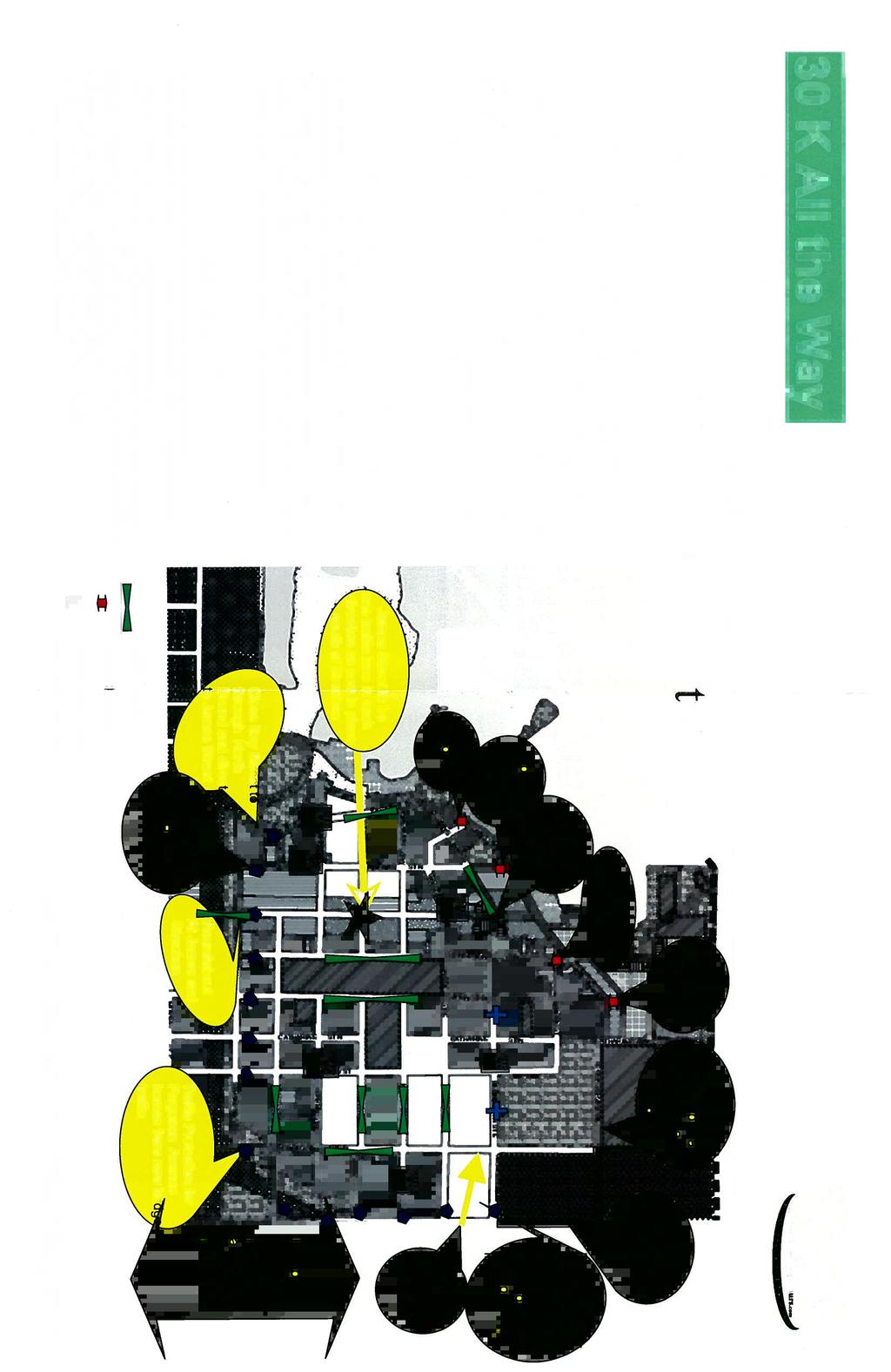
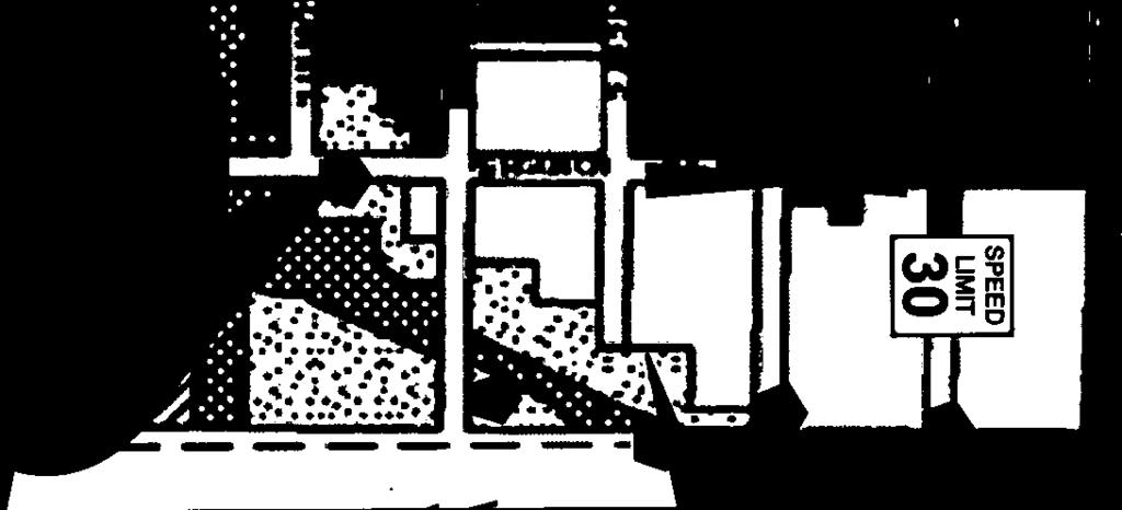


75
North End Traffic Management Study. Community Advisory Meeting #1
 Community Advisory Meeting #1 Meeting Purpose Review of First PIC Results of Data Collection Future Traffic Projections Potential Options to Address Stated/Observed Issues Next Steps Overview of PIC #1
North End Traffic Management Study
 Public Meeting and Open House June 26, 2007 Presentation of Preferred Plan Meeting Purpose Re-iterate nature of existing problems, future opportunities and a Vision for the North End transportation system
8 PROPOSED ROUNDABOUT DUFFERIN STREET AND KING VAUGHAN ROAD INTERSECTION CITY OF VAUGHAN
 8 PROPOSED ROUNDABOUT DUFFERIN STREET AND KING VAUGHAN ROAD INTERSECTION CITY OF VAUGHAN The Transportation Services Committee recommends the adoption of the recommendation contained in the following report
University of Victoria Campus Cycling Plan Terms of Reference. 1.0 Project Description
 University of Victoria Campus Cycling Plan Terms of Reference 1.0 Project Description The Campus Cycling Plan, a first for the University, will provide a comprehensive and coordinated approach to support
Welcome. If you have any questions or comments on the project, please contact:
 Welcome This drop-in public open house is intended to provide information about the Bay Street bike lanes project. This project proposes a dedicated cycling facility along Bay Street between Aberdeen Avenue
Comments The Plan for Port Whitby
 Comments The Plan for Port Whitby April 24th, 2013 Community Meeting #2 Summary Report Prepared by GLPi April 29th, 2013 1 Introduction The purpose of the Port Whitby Secondary Plan Update, Community Improvement
Transportation Assessment
 Transportation Assessment Midtown Open House February 10, 2018 Overview Midtown in Focus Overview & Purpose of Today Transportation Assessment overview Summary of Transportation work to date Review & Analysis
EXECUTIVE SUMMARY OF CALEDON TRANSPORTATION NEEDS STUDY
 EXECUTIVE SUMMARY OF CALEDON TRANSPORTATION NEEDS STUDY The Caledon Transportation Needs Study has been undertaken as a joint project by the Town of Caledon and the Region of Peel to determine the existing
Downey Road. Transportation Improvement Study
 Downey Road Transportation Improvement Study Workshop 2 Participant Handbook Workshop 1 May 18 and 19, 2016 Workshop 2 June 23 and 28, 2016 Prepared By: City of Guelph Paradigm Transportation Solutions
Sixth Line Development - Transit Facilities Plan
 Memorandum Date: November 13, 2012 To: From: c.c. Subject: Rob Freeman (Freeman Planning) Kevin Phillips Sixth Line Development - Transit Facilities Plan 33016631 This memo was prepared to review the transit
Prepared For: Shieldbay Developments Inc. c/o Matson, McConnell Ltd. 2430A Bloor Street West Toronto, Ontario M6S 1P9.
 Prepared For: Shieldbay Developments Inc. c/o Matson, McConnell Ltd. 2430A Bloor Street West Toronto, Ontario M6S 1P9 Prepared By: URS Canada Inc. 4 th Floor, 30 Leek Crescent Richmond Hill, Ontario L4B
CITY OF HAMILTON PLANNING AND ECONOMIC DEVELOPMENT DEPARTMENT Transportation Planning and Parking Division
 CITY OF HAMILTON PLANNING AND ECONOMIC DEVELOPMENT DEPARTMENT Transportation Planning and Parking Division TO: Chair and Members Public Works Committee COMMITTEE DATE: June 18, 2018 SUBJECT/REPORT NO:
Tonight is for you. Learn everything you can. Share all your ideas.
 Strathcona Neighbourhood Renewal Draft Concept Design Tonight is for you. Learn everything you can. Share all your ideas. What is Neighbourhood Renewal? Creating a design with you for your neighbourhood.
APPENDIX 2 LAKESHORE ROAD TRANSPORTATION REVIEW STUDY EXECUTIVE SUMMARY
 APPENDIX 2 LAKESHORE ROAD TRANSPORTATION REVIEW STUDY EXECUTIVE SUMMARY Appendix 2 City of Mississauga Lakeshore Road FINAL REPORT Transportation Review Study December 2010 EXECUTIVE SUMMARY Study Purpose
Ontario Municipal Board Commission des affaires municipales de l Ontario
 ISSUE DATE: December 27, 2012 Ontario Municipal Board Commission des affaires municipales de l Ontario PL050408 Harbour West Neighbours Inc., Michael Poworoznyk, Shawn Selway and John Mattinson have appealed
TRANSPORTATION NEEDS ASSESSMENT
 TRANSPORTATION NEEDS ASSESSMENT A travel demand analysis was carried out to determine the operational issues and the potential benefit that adding traffic capacity would have on the road network. All the
Welcome. The Brooklin Secondary Plan and Transportation Master Plan are collectively referred to as the Brooklin Study.
 Welcome The Town of Whitby is undertaking a study to prepare a Secondary Plan and Transportation Master Plan to guide and manage growth in the Brooklin area. The Brooklin Secondary Plan and Transportation
CONNECTING PEOPLE TO PLACES
 CONNECTING PEOPLE TO PLACES 82 EAST BENCH MASTER PLAN 07 Introduction The East Bench transportation system is a collection of slow moving, treelined residential streets and major arteries that are the
CITY OF SAINT JOHN TRAFFIC CALMING POLICY
 CITY OF SAINT JOHN TRAFFIC CALMING POLICY VERSION: 1.0 April 10, 2012 Pedestrians, Cyclists and Motorists Sharing Street Spaces CONTENTS INTRODUCTION... 3 POLICY GOAL... 3 POLICY OBJECTIVES... 3 GUIDING
WELCOME. Purpose of the Open House. Update you on the project. Present a draft recommended plan. Receive your input
 WELCOME Purpose of the Open House The Town of Smiths Falls has initiated the Beckwith Street Redevelopment Plan that includes the preparation of a streetscape functional design for the renewal of Beckwith
EXECUTIVE SUMMARY: TRANSIT-ORIENTED DEVELOPMENT IN SMITHS FALLS, ONTARIO; A COMPARISON BETWEEN TWO SITES
 EECUTIVE SUMMARY: TRANSIT-ORIENTED DEVELOPMENT IN SMITHS FALLS, ONTARIO; A COMPARISON BETWEEN TWO SITES Topic and Purpose In 2007, the Mayor of Ottawa s Task Force on Transportation suggested adding a
Centennial Neighbourhoods Transportation Management Plan Summary of Phase 1 Consultation. Overview of Issues
 1 Centennial Neighbourhoods Transportation Management Plan Summary of Phase 1 Consultation The Centennial Neighbourhoods Transportation Management Plan (CNTMP) is being undertaken to support the Secondary
Exhibit 1 PLANNING COMMISSION AGENDA ITEM
 Exhibit 1 PLANNING COMMISSION AGENDA ITEM Project Name: Grand Junction Circulation Plan Grand Junction Complete Streets Policy Applicant: City of Grand Junction Representative: David Thornton Address:
WELCOME! To the Centennial Neighbourhoods Secondary Plan and Transportation Management Plan Information Centre. City of Hamilton
 WELCOME! To the Centennial Neighbourhoods Secondary Plan and Transportation Management Plan Information Centre City of Hamilton Public Information Centre #2 Dec 1, 2015 CENTENNIAL NEIGHBOURHOODS SECONDARY
Active Transportation Infrastructure Investment A Business Case
 Active Transportation Infrastructure Investment A Business Case In 2016, the Real Estate Foundation awarded the Capital Regional District a $50,000 grant for Shifting Gears: Land Use Change through Active
POLICY: TRAFFIC CALMING
 2006 MAY REFERENCE: COUNCIL APPROVED BY COUNCIL MAY 23, 2006 CITY OPERATIONS - NO. 608 POLICY: TRAFFIC CALMING A. All requests for traffic calming within the City shall be considered in accordance with
Transportation Master Plan Advisory Task Force
 Transportation Master Plan Advisory Task Force Network Alternatives & Phasing Strategy February 2016 BACKGROUND Table of Contents BACKGROUND Purpose & Introduction 2 Linking the TMP to Key Council Approved
A CHANGING CITY. of Edmonton, it is essential that it reflects the long-term vision of the City.
 A CHANGING CITY By the year 2040, Edmonton will be home to more than 1 million people. To accommodate growth and support a healthy and compact city, we need a new approach to development/redevelopment
WELCOME TO OPEN HOUSE # 1 June 14, 2017
 Langstaff Road Weston Road to Highway 7 Class Environmental Assessment Study WELCOME TO OPEN HOUSE # 1 June 14, 2017 Please sign in and join our mailing list Purpose of Open House #1 & Study Area York
City of Hamilton s Transportation Master Plan (TMP) Public Consultation 3 December 2015
 Public Consultation 3 December 2015") City of Hamilton s Transportation Master Plan (TMP) Public Consultation 3 December 2015 McPhail Transportation Planning Services Ltd. AGENDA 6:00 7:00 pm Viewing Boards / Q & A with the Team 7:00 7:50
City of Hamilton s Transportation Master Plan (TMP) Public Consultation 3 December 2015 McPhail Transportation Planning Services Ltd. AGENDA 6:00 7:00 pm Viewing Boards / Q & A with the Team 7:00 7:50
Chapter 7. Transportation. Transportation Road Network Plan Transit Cyclists Pedestrians Multi-Use and Equestrian Trails
 Chapter 7 Transportation Transportation Road Network Plan Transit Cyclists Pedestrians Multi-Use and Equestrian Trails 7.1 TRANSPORTATION BACKGROUND The District of Maple Ridge faces a number of unique
Executive Summary Route 30 Corridor Master Plan
 Route Corridor Master Plan Project Overview The Route Corridor Master Plan is a coordinated multimodal transportation and land use plan for the entire stretch of Route through East Whiteland Township,
CITY OF COCOA BEACH 2025 COMPREHENSIVE PLAN. Section VIII Mobility Element Goals, Objectives, and Policies
 CITY OF COCOA BEACH 2025 COMPREHENSIVE PLAN Section VIII Mobility Element Goals, Objectives, and Policies Adopted August 6, 2015 by Ordinance No. 1591 VIII MOBILITY ELEMENT Table of Contents Page Number
Governance and Priorities Committee Report For the July 2, 2015 Meeting
 CITY OF VICTORIA For the July 2, 2015 Meeting To: Governance and Priorities Committee Date: From: Subject: Brad Dellebuur, A/Assistant Director, Transportation and Parking Services Executive Summary The
Public Information Centre
 WELCOME Public Information Centre Father Tobin Road Lougheed Middle School - Library Wednesday November 7, 2012 7:00 p.m.to 9:00 p.m. Please sign in Neighbourhood Traffic Calming Guide Background The City
WEST AND SOUTH WEST RING ROAD DOWNSTREAM TRAFFIC IMPACTS
 Page 1 of 9 EXECUTIVE SUMMARY Alberta Transportation ( AT ) is preparing to construct the final sections of the Calgary Ring Road. This includes the South West Ring Road ( SWRR ) (from Lott Creek Blvd
4 Ridership Growth Study
 Clause 4 in Report No. 15 of Committee of the Whole was adopted, without amendment, by the Council of The Regional Municipality of York at its meeting held on November 16, 2017. 4 Ridership Growth Study
Public Event 1 Community Workshops
 Public Event 1 Community Workshops Nov. 24 & Dec. 3, 2016 Welcome Workshop Purpose We re looking to you for ideas and insights to help guide future transportation infrastructure planning in the Park Lawn
CITY OF WEST KELOWNA COUNCIL POLICY MANUAL
 CITY OF WEST KELOWNA COUNCIL POLICY MANUAL Page 1 of 7 DEPARTMENT: Engineering Services SUBJECT: Traffic Calming Policy (Revised June 6, 2017) Policy Statement: The provision of traffic calming measures
East Burke Transportation, Safety and Capacity Improvements
 East Burke Transportation, Safety and Capacity Improvements The purpose of this project is to increase mobility and improve safety for pedestrians, cyclists, and motor vehicles along VT Route 114 in the
Moving Cambridge. City of Cambridge Transportation Master Plan Public Consultation Centre. March 7, :00 8:00 PM.
 City of Cambridge Transportation Master Plan Public Consultation Centre March 7, 2018 5:00 8:00 PM Region of Waterloo City of Cambridge Transportation Master Plan Public Consultation Centre March 7, 2018
Bikeway action plan. Bicycle Friendly Community Workshop March 5, 2007 Rochester, MN
 Bikeway action plan Summary The was held on March 5, 2007 at the Rochester Mayo Civic Center. The workshop was hosted by Rochester-Olmsted County Planning Department in collaboration with the League of
City of Elizabeth City Neighborhood Traffic Calming Policy and Guidelines
 City of Elizabeth City Neighborhood Traffic Calming Policy and Guidelines I. Purpose: The City of Elizabeth City is committed to ensure the overall safety and livability of residential neighborhoods. One
Classification Criteria
 SCHEDULE D TO RECOMMENDED OFFICIAL PLAN AMENDMENT NO. 40 SCHEDULE C-4 Road Criteria Criteria Traffic Service Objective Land Service/Access Typical Daily Traffic Volume Flow characteristics Travel Speed
STONY PLAIN ROAD STREETSCAPE
 Jasper Place Revitalization Strategy: Vision The people involved in the Jasper Place Revitalization Strategy envision: Goal 1: Feeling safe in our community Create a community where feeling safe is common--where
Appendix 1 Transit Network Analysis
 Appendix 1 Transit Network Analysis APPENDIX 1 TRANSIT NETWORK ANALYSIS The purpose of this appendix is to provide an update on the transit network analysis as it pertains to: i. SmartTrack ii. Scarborough
Nanaimo Transportation Master Plan. Phase 1 Consultation Summary
 Nanaimo Transportation Master Plan Phase 1 Consultation Summary Transportation Advisory Committee Meeting Wednesday December 12, 2012 Agenda Study Update Phase 1 Consultation Process Phase 1 Consultation
APPENDIX A: Complete Streets Checklist DRAFT NOVEMBER 2016
 APPENDIX A: Complete Streets Checklist DRAFT NOVEMBER 2016 Complete Streets Checklist MetroPlan Orlando s Complete Streets Checklist is an internal planning tool for staff to further implementation of
Vision: Traditional hamlet with an attractive business/pedestrian friendly main street connected to adjacent walkable neighborhoods
 N D. Focus Area II Vision: Traditional hamlet with an attractive business/pedestrian friendly main street connected to adjacent walkable neighborhoods Transit Road Focus Area II is located in the Hamlet
Ann Arbor Downtown Street Plan
 1 Ann Arbor Downtown Street Plan Public Workshop #1 We know that. 2 Public right-of-way (streets, sidewalks, and alleys) make up 30% of the total District area of downtown. Streets need to provide mobility
Appendix A. Road Classification Review of Outstanding Issues and Proposed Classifications (All Wards) Staff Report Road Classification System
 Staff Report Road Classification System") Appendix A Road Classification Review of Outstanding Issues and Proposed Classifications (All Wards) Staff Report 2000 A.1 of A.10 A.2 of A.10 STAFF REPORT January 26, 2000 To: From: Works Committee Barry
Appendix A Road Classification Review of Outstanding Issues and Proposed Classifications (All Wards) Staff Report 2000 A.1 of A.10 A.2 of A.10 STAFF REPORT January 26, 2000 To: From: Works Committee Barry
122 Avenue: 107 Street to Fort Road
 : 107 Street to Fort Road November 24, 2015 4:30 8:00 p.m. Meeting Purpose Summarize project work completed to date Share results of public input from Phase 1 Share the draft concept plan and proposed
AIRPORT ROAD ENVIRONMENTAL ASSESSMENT
 WELCOME TO PUBLIC INFORMATION CENTRE #1 AIRPORT ROAD ENVIRONMENTAL ASSESSMENT From Braydon Boulevard/Stonecrest Drive to Countryside Drive November 23, 2017 6:30 PM 8:30 PM Please sign in and fill out
PEDESTRIAN ACTION PLAN
 ATTACHMENT 2 CITY OF SANTA MONICA PEDESTRIAN ACTION PLAN CITY OF SANTA MONICA PEDESTRIAN ACTION PLAN This page intentionally left blank EXECUTIVE SUMMARY CHAPTER 1 EXECUTIVE SUMMARY Setting the Stage
WALK Friendly Communities: Creating Vibrant, Inclusive Places for People
 WALK Friendly Communities: Creating Vibrant, Inclusive Places for People Walkers are the indicator species for vibrant communities ~ Dr. Rodney Tolley, Director, Walk21 Imagine yourself walking safely
REGIONAL BICYCLE AND PEDESTRIAN DESIGN GUIDELINES
 REGIONAL BICYCLE AND PEDESTRIAN DESIGN GUIDELINES November 16, 2011 Deb Humphreys North Central Texas Council of Governments Bicycle and Pedestrian Advisory Committee Snapshot of the Guide 1. Introduction
City of Novi Non-Motorized Master Plan 2011 Executive Summary
 City of Novi Non-Motorized Master Plan 2011 Executive Summary Prepared by: February 28, 2011 Why Plan? Encouraging healthy, active lifestyles through pathway and sidewalk connectivity has been a focus
Southside Road. Prepared for: City of St. John s Police & Traffic Committee. Prepared by: City of St. John s Traffic Division
 Southside Road Prepared for: City of St. John s Police & Traffic Committee Prepared by: City of St. John s Traffic Division January 2007 Southside Road - Traffic Report Page 1 of 9 BACKGROUND: th At the
DRAFT for a State Policy for Healthy Spaces and Places
 DRAFT for a State Policy for Healthy Spaces and Places 1 DRAFT State Policy for Healthy spaces and Places 1. Purpose To encourage the use and development of land that builds healthy communities through
NOTES FROM JUNIOR COUNCIL ORIENTATION SESSION HELD ON MONDAY, JANUARY 22, 2018, AT 3:30 PM IN COUNCIL CHAMBERS, CITY HALL
 CITY OF KAMLOOPS Junior Council Meeting Agenda March 12, 2018, at 3:30 pm in Council Chambers, 7 Victoria Street West, Kamloops, BC Page 1. APPROVAL OF THE AGENDA 2. MINUTES Attachment Recommendation:
Appendix A-K Public Information Centre 2 Materials
 Appendix A-K Public Information Centre 2 Materials Our Rapid Transit Initiative Make an impact on the future of transit Join the discussion on Rapid Transit in London You re invited to a Public Information
Circulation in Elk Grove includes: Motor vehicles, including cars and trucks
 Circulation, as it is used in this General Plan, refers to the many ways people and goods move from place to place in Elk Grove and the region. Circulation in Elk Grove includes: Motor vehicles, including
2. Context. Existing framework. The context. The challenge. Transport Strategy
 Transport Strategy Providing quality connections Contents 1. Introduction 2. Context 3. Long-term direction 4. Three-year priorities 5. Strategy tree Wellington City Council July 2006 1. Introduction Wellington
Corporate. Report COUNCIL DATE: June 26, 2006 NO: C012 COUNCIL-IN-COMMITTEE. TO: Mayor & Council DATE: June 22, 2006
 Corporate NO: C012 Report COUNCIL DATE: June 26, 2006 COUNCIL-IN-COMMITTEE TO: Mayor & Council DATE: June 22, 2006 FROM: General Manager, Engineering FILE: 0410-20(MoT/Gate) SUBJECT: Surrey Response on
Pattullo Bridge Replacement Project Community Connections Phase 2 Consultation. Appendix 3: Open House Display Boards
 Replacement Project Community Connections Phase 2 Consultation Appendix 3: Open House Display Boards November 2016 Welcome! Welcome to the Replacement Project Public Open House We Want to Hear from You
CITY OF OTTAWA ROADWAY MODIFICATION APPROVAL UNDER DELEGATED AUTHORITY
 RMA-2015-ATM-038 CITY OF OTTAWA ROADWAY MODIFICATION APPROVAL UNDER DELEGATED AUTHORITY DATE: April 22, 2015 SUBJECT Approval of Roadway Modifications Recommended through an Area Traffic Management Study
GLEN EIRA CITY COUNCIL. MURRUMBEENA Transforming our neighbourhood together our concepts based on your ideas
 GLEN EIRA CITY COUNCIL MURRUMBEENA Transforming our neighbourhood together our concepts based on your ideas 1 WHAT HAVE WE HEARD? WHAT NOW? Stage one Tell us what you love about your shopping strip November
WELCOME Public Information Centre
 WELCOME Public Information Centre Fernforest Drive Brampton Soccer Centre Community Room #2 Tuesday January 19, 2016 6:30 p.m.to 9:00 p.m. Please sign in Neighbourhood Traffic Calming Guide Background
Corporate. Report COUNCIL DATE: May 25, 1998 NO: R1500 REGULAR COUNCIL. TO: Mayor & Council DATE: April 27, 1998
 R1500 : Traffic Safety at 25 Avenue and 128 Street Intersection Corporate NO: R1500 Report COUNCIL DATE: May 25, 1998 REGULAR COUNCIL TO: Mayor & Council DATE: April 27, 1998 FROM: General Manager, Engineering
Hamilton Transportation Master Plan Public Consultation. Public Information Centre One Summary
 Hamilton Transportation Master Plan Public Consultation Public Information Centre One Summary Table of Contents Introduction 1 Purpose 2 What Was Presented 2 Who Came to the Meeting 2 The Breakout Sessions
a) receiving of legal advice subject to solicitor client privilege and labour relations regarding contract negotiations
 receiving of legal advice subject to solicitor client privilege and labour relations regarding contract negotiations") Regional Municipality of Waterloo Planning and Works Committee Agenda Tuesday, April 4, 2017 9:30 a.m. (Following Closed Session) Regional Council Chamber 150 Frederick Street, Kitchener Media Release:
Regional Municipality of Waterloo Planning and Works Committee Agenda Tuesday, April 4, 2017 9:30 a.m. (Following Closed Session) Regional Council Chamber 150 Frederick Street, Kitchener Media Release:
Corpus Christi Metropolitan Transportation Plan Fiscal Year Introduction:
 Introduction: The Safe, Accountable, Flexible, Efficient Transportation Equity Act: A Legacy for Users (SAFETEA-LU) has continued the efforts started through the Intermodal Surface Transportation Efficiency
Proposed Bridge Street East Bicycle Lanes Public Open House Thursday, April 27, 2017
 WELCOME Proposed Bridge Street East Bicycle Lanes Public Open House Thursday, April 27, 2017 Purpose of the Open House The purpose of this Open House is to gain public input on the bicycle lanes proposed
TRAFFIC CALMING GUIDE FOR TORONTO CITY OF TORONTO TRANSPORTATION SERVICES DIVISION
 TRAFFIC CALMING GUIDE FOR TORONTO CITY OF TORONTO TRANSPORTATION SERVICES DIVISION CITY OF TORONTO TRANSPORTATION SERVICES DIVISION 2016 TRAFFIC CALMING GUIDE FOR TORONTO TABLE OF CONTENTS Introduction
CLOSED. The draft concept design has been broken down into 5 categories for the purpose of this survey:
 Old Strathcona s neighbourhood renewal process is now at the draft concept design phase. Over the last several months, the city has been gathering local knowledge and resident input that has been used
Welcome to the Open House
 Leslie Street Between 19 th Avenue and Stouffville Road Addendum to Class Environmental Assessment Study Welcome to the Open House Please sign in at the front desk. March 28, 2017 Richmond Green Sports
COUNCIL POLICY NAME: COUNCIL REFERENCE: 06/119 06/377 09/1C 10llC 12/1C INDEX REFERENCE: POLICY BACKGROUND
 COUNCIL POLICY NAME: COUNCIL ADVISORY COMMITTEES - TERMS OF REFERENCE ISSUED: APRIL 3, 2006 AMENDED: NOVEMBER 27, 2006 NOVEMBER 23, 2009 JANUARY 11, 2010 DECEMBER 17, 2012 POLICY COUNCIL REFERENCE: 06/119
Speed Limit Policy Isle of Wight Council
 APPENDIX B Speed Limit Policy Isle of Wight Council 2009 Contents Section 1 Introduction 1.1 Links with the Local Transport Plan Section 2 Speed Limits on Urban Roads and Residential Areas 2.1 20mph Limits
Shifting Gears for a Healthier City
 Shifting Gears for a Healthier City Mississauga s Cycling Master Plan is an ambitious strategy that sets out to transform Mississauga into a city that is conducive to cycling for daily transportation needs.
Frequently Asked Questions (FAQ)
") Frequently Asked s (FAQ) Study Process... 2 Rapid Transit Service and Operations... 5 Public Consultation... 8 Business Impacts... 8 Design and Property Impacts... 9 Construction Impacts...12 Traffic,
Frequently Asked s (FAQ) Study Process... 2 Rapid Transit Service and Operations... 5 Public Consultation... 8 Business Impacts... 8 Design and Property Impacts... 9 Construction Impacts...12 Traffic,
West Village Mobility & Integration
 West Village Mobility & Integration PRESENTED TO TOPCA Town Hall November 9, 2017 [7189-21] Port Credit 2 West Village + Mobility AWalkable Community A CompleteCommunity A SustainableCommunity 3 Mobility
REPORT. Engineering and Construction Department
 REPORT COMMUNITY SERVICES COMMITTEE MEETING DATE: JUNE 11, 2013 FROM: Engineering and Construction Department DATE: May 24, 2013 SUBJECT: Great Lakes Boulevard Mini Roundabout LOCATION: Great Lakes Boulevard
CITY OF VAUGHAN EXTRACT FROM COUNCIL MEETING MINUTES OF OCTOBER 30, 2012
 CITY OF VAUGHAN EXTRACT FROM COUNCIL MEETING MINUTES OF OCTOBER 30, 2012 Item 31, Report No. 39, of the Committee of the Whole, which was adopted without amendment by the Council of the City of Vaughan
Improving Cyclist Safety at the Dundas Street West and Sterling Road Intersection
 STAFF REPORT ACTION REQUIRED Improving Cyclist Safety at the Dundas Street West and Sterling Road Intersection Date: August 17, 2012 To: From: Wards: Reference Number: Public Works and Infrastructure Committee
Wyldewood Estates. Pre-Application Public Engagement Summary of Issues and Responses
 Wyldewood Estates Pre-Application Public Engagement Summary of Issues and Responses March 2016 Executive Summary Morguard Residential Properties has been thoughtfully planning the redevelopment of Wyldewood
Welcome to the Public Meeting. Red Hill Business Park South Transportation Master Plan Addendum. December 4, :00 p.m. to 8:00 p.m.
 Welcome Welcome to the Transportation Master Plan Addendum December 4, 2012 6:00 p.m. to 8:00 p.m. Please sign-in Background PIC#1 Public Information Centre #1 (PIC#1) was held on June 25, 2012. Feedback
o n - m o t o r i z e d transportation is an overlooked element that can greatly enhance the overall quality of life for the community s residents.
 N o n - m o t o r i z e d transportation is an overlooked element that can greatly enhance the overall quality of life for the community s residents. 84 Transportation CHAPTER 11 INTRODUCTION Transportation
NACTO Designing Cities Conference Project Evaluation: Tools for Measuring Success and Building Support. October 29, 2015
 NACTO Designing Cities Conference Project Evaluation: Tools for Measuring Success and Building Support October 29, 2015 The case for evaluation: Have a social contract with City Council, staff and community
Proposed. City of Grand Junction Complete Streets Policy. Exhibit 10
 Proposed City of Grand Junction Complete Streets Policy Exhibit 10 1 City of Grand Junction Complete Streets Policy Vision: The Complete Streets Vision is to develop a safe, efficient, and reliable travel
3 FRAMEWORK FOR IMPLEMENTATION OF LAKE-TO-LAKE CYCLING ROUTE
 3 FRAMEWORK FOR IMPLEMENTATION OF LAKE-TO-LAKE CYCLING ROUTE The Planning and Economic Development Committee recommends the adoption of the recommendations contained in the following report dated December
ALBERTA AVENUE WHAT WE HEARD REPORT BUILDING GREAT NEIGHBOURHOODS
 ALBERTA AVENUE WHAT WE HEARD REPORT BUILDING GREAT NEIGHBOURHOODS FEBRUARY 2019 EXECUTIVE SUMMARY Starting in 2019, Alberta Avenue will see the replacement and enhancement of its aging collector and local
Solana Beach Comprehensive Active Transportation Strategy (CATS)
") Solana Beach Comprehensive Active Transportation Strategy (CATS) 3.0 Goals & Policies The Solana Beach CATS goals and objectives outlined below were largely drawn from the Solana Beach Circulation Element
Solana Beach Comprehensive Active Transportation Strategy (CATS) 3.0 Goals & Policies The Solana Beach CATS goals and objectives outlined below were largely drawn from the Solana Beach Circulation Element
City of Wayzata Comprehensive Plan 2030 Transportation Chapter: Appendix A
 A1. Functional Classification Table A-1 illustrates the Metropolitan Council s detailed criteria established for the functional classification of roadways within the Twin Cities Metropolitan Area. Table
Hamilton Transportation Master Plan. Public Information Centre Three Summary
 Hamilton Transportation Master Plan Public Information Centre Three Summary Table of Contents Introduction 1 Purpose 1 What was Presented? 1 Key Questions: Town Hall Polling 2 Comment Sheet Feedback 10
Chapter 2. Bellingham Bicycle Master Plan Chapter 2: Policies and Actions
 Chapter 2 Bellingham Bicycle Master Plan Chapter 2: Policies and Actions Chapter 2: Policies and Actions The Bicycle Master Plan provides a road map for making bicycling in Bellingham a viable transportation
We support the following: Tom Davies Square 200 Brady Street Sudbury, Ontario
 April 4, 2014 Tom Davies Square 200 Brady Street Sudbury, Ontario RE: Second Avenue Reconstruction Project and Panel Consultation Dear City of Greater Sudbury Mayor and Council: The (SMAP), a council appointment
RESOLUTION NO ?? A RESOLUTION OF THE CITY OF NEPTUNE BEACH ADOPTING A COMPLETE STREETS POLICY
 RESOLUTION NO. 2018-?? A RESOLUTION OF THE CITY OF NEPTUNE BEACH ADOPTING A COMPLETE STREETS POLICY WHEREAS, safe, convenient, and accessible transportation for all users is a priority of the City of Neptune
Welcome. Background. Goals. Vision
 Welcome The formal Public Information Centre (PIC) for the Transportation Master Plan How We GO will be held in early 2017. At that time we will present the recommended transportation system for Niagara
Climate Change Action Plan: Transportation Sector Discussion Paper: Cycling
 Climate Change Action Plan: Transportation Sector Discussion Paper: Cycling ontario.ca/climatechange Contents 1. Minister of Transportation s message... 3 2. Introduction... 5 3. Sector Overview and Support
CORPORATE. Transportation Department Traffic Services Division Neighbourhood Traffic Management Policy. Revision Date January 24, 2006
 CORPORATE POLICY NO. POLICY AND PAGE 1 of 10 PROCEDURE EFFECTIVE DATE JULY 1998 REVISION JANUARY 2006 Tab Authority Subject Approved by Transportation Department Traffic Services Division Neighbourhood