North End Traffic Management Study. Community Advisory Meeting #1
|
|
|
- Claude Green
- 5 years ago
- Views:
Transcription
1 Community Advisory Meeting #1
2 Meeting Purpose Review of First PIC Results of Data Collection Future Traffic Projections Potential Options to Address Stated/Observed Issues Next Steps
3 Overview of PIC #1 53 people signed in Wide ranging interests, issues and opinions Lots of specific issues Some confusion/mis-information on future transportation plans Desire to protect positive attributes of neighbourhood
4 Key Issues and Frequently Asked Questions MacNab Street Bridge Will it be two way? Will it be pedestrian only? Mary Street Bridge vs. Ferguson Avenue Bridge Why is a Ferguson Bridge needed and what will it look like? What will the Mary Street Bridge look like? Pier 8 traffic and Special Event traffic on neighbourhood roads What will the impacts be and how can they be mitigated?
5 Existing Volumes and Speeds Legend 85th percentile speed Peak number of vehicles per hour
6 Results of License Plate Survey LOCATION OF SPOT SURVEYS 100% 90% Other Percent of Total Sample 80% 70% 60% 50% 40% 30% 20% GTA Other Hamilton Other Central Hamilton St Catharines/Niagara Downtown/Durand East Hamilton/N. Stoney Creek 10% Bayfront 0% James SB at Strachan Bay SB at Strachan WB Burlington to SB James Burlington W of James John NB at Picton Simcoe at SOR tracks
7 Existing Travel Characteristics Distribution of Auto Trips from North End Zone AM Peak Period 2001 Toronto, Mississauga, Other 2% Milton, Oakville 4% Burlington 11% Flamborough, Ancaster 10% Stoney Creek 4% AM Peak Period Auto driver trips/capita = 0.26 trips/person AM Peak Period Transit Mode Share for trip origins = 15% AM Peak Period Auto Mode Share = 79% Hamilton Downtown 58% Hamilton Mountain 11%
8 Collision Data Field investigation carried out at locations where reported collision rates higher than expected in City s network screening report Type Main Street Cross Street Collisions (Jan Dec 2004) Above Expected Collision Rate City-wide Rank* Signal Burlington John 10 N 1192 Signal Burlington Mary 2 N 1578 Ped Signal James Picton 1 N 1393 Ped Signal James Simcoe 1 N 1394 Two-way stop Macnab Strachan 5 Y 109 Two-way stop James Strachan 10 Y 163 Two-way stop Mary Strachan 4 N 466 Two-way stop James Ferrie 6 Y 698 Two-way stop Burlington Ferguson 3 N 1500 All-way stop Bay Burlington 0 N 1845 *Rank is based on a total of 2080 intersections contained in the City's database


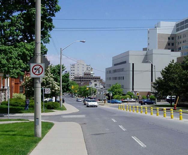
9 Field Investigations High Collision Locations Southbound James Approaching Strachan Looking North on James Street from Ferrie Street

10 Field Investigations John Street Concerns raised by residents include: On-street pick-up and drop-off activities by parents; and Students crossing at unsignalized and mid-block locations


11 Field Investigations - Other Bay Street Lack of bike facilities Bay/Guise Accessibility issues


12 Field Investigations - Other Burlington Street at Wellington wide cross-section approaching NEN Burlington Street at James Information overload
13 Future Traffic Projections - Preliminary % Inbound in PM Peak PM Inbound Trips Potential Development Typical Trip Rate 1 Hour Trips Estimated Peak Pier medium density residential units 0.4 /unit % 300 5,200 m 2 commercial 1.6 /100 m % 17 1,500 m 2 retail 2.2 /100 m % 16 10,800 m 2 institutional 2.0 /100 m % 108 TOTAL Barton-Tiffany 85 low density residential units 0.5 /unit % medium density residential units 0.4 /unit % 524 2,000 m 2 retail 2.2 /100 m % 22 TOTAL Ferguson-Wellington 85 low density residential units 0.5 /unit 25 75% medium density residential units 0.4 /unit % 300 s.f retail 2.2 /100 m % 103 TOTAL Two-way peak hour trip rate. Institutional rates will vary depending on use. Retail trip rates assume 20% pass-by
14 Implications of Future Trips Pier 8 Approximately 500 trips entering neighbourhood in PM peak hour Similar to peak direction volumes on James (440) and Burlington (550) Next step is to look at where these trips will go
15 Initial Issues Raised by Residents Traffic infiltration Overall increase in traffic in neighbourhood Possible loss of on-street parking on local and mobility streets Extension of grid network into Waterfront (Pier 8) Traffic from special events Traffic safety and speeding
16 Broader Issues Raised Air quality and health Impacts Maintaining and improving child-friendly aspects of community Concern that north-end will become core to shore conduit Generating local interest and grassroots changes
17 Scoping of Potential Options/Solutions POSSIBLE OPTIONS ISSUES/CONCERNS Road Closures or Restrictions Traffic Calming Safety Improvements On-street Parking Bike Facilities Travel Demand Management Enforcement Community Initiatives Policies and Guidelines Traffic infiltration Overall increase in traffic in neighbourhood Possible loss of on-street parking Extension of grid network into Waterfront (Pier 8) Traffic from special events Traffic safety and speeding Air quality and health Impacts Child-friendly streets Avoid core to shore conduit Generating local interest and grass-roots changes
18 Road Closures or Restrictions Turn restrictions Physical restrictions Partial Closure Full Closure
19 Road Closures/Restrictions - Examples Partial Closure Full Closure
20 Traffic Calming Horizontal Deflections Curb extensions Traffic circles Chicane Vertical Deflections Speed humps Raised Cross-walks/Intersections Lane Reductions/Lane Narrowing Speed limit reductions One-way to two-way conversions Additional On-street parking


21 Traffic Calming - Examples Curb Extension Raised Intersection
22 Safety Improvements Traffic control changes Signage Pavement markings Delineated pedestrian areas Traffic calming Education programs (e.g. schools)


23 On-street parking Reallocate vehicle lanes Change/Reduce parking restrictions Implement permit parking Bay Street Before Bay Street After
24 Bike facilities On-street bike lanes Off-street bike paths Bike parking in key areas (parks, school) Community facilities End-use facilities (outside neighbourhood)
25 Travel Demand Management Increase use of transit by residents Increased service levels Neighbourhood transit pass Increase use of transit by others Improved service to employment areas Transit for special events Options to promote carpooling, ride sharing, etc Walk to school programs
26 Enforcement Increased police presence overall Increased enforcement of specific locations/issues (e.g. turn restrictions) Effects tend to be short-lived
27 Community Initiatives Speed watch and similar programs Neighbourhood associations User groups (bikes, accessibility committee, transit users) Community meetings School-related programs
28 Policies and Guidelines Streetscaping Guidelines Urban Design Guidelines Traffic Impact Study Guidelines Various City-wide TMP policy papers Key is to make these known and lobby for their enforcement
29 Next Steps Confirm study directions Refine future traffic projections Look at where traffic will go Work with residents to define what their ideal vision is for specific streets Apply potential solutions to specific locations and evaluate impacts Neighbourhood walk-about Generate community interest/involvement
North End Traffic Management Study
 Public Meeting and Open House June 26, 2007 Presentation of Preferred Plan Meeting Purpose Re-iterate nature of existing problems, future opportunities and a Vision for the North End transportation system
NORTH END TRAFFIC MANAGEMENT PLAN
 FINAL REPORT JUNE 2008 TABLE OF CONTENTS EXECUTIVE SUMMARY... I 1. INTRODUCTION... 1 1.1 Background... 1 1.2 Study Objectives... 2 1.2.1 Child and Family Friendly Neighbourhood... 2 1.3 Previous and Related
Welcome. The Brooklin Secondary Plan and Transportation Master Plan are collectively referred to as the Brooklin Study.
 Welcome The Town of Whitby is undertaking a study to prepare a Secondary Plan and Transportation Master Plan to guide and manage growth in the Brooklin area. The Brooklin Secondary Plan and Transportation
Byron Avenue. Public Meeting. Thursday June 16, Traffic Calming Design Sherbourne Road to Island Park Drive
 Byron Avenue Traffic Calming Design Sherbourne Road to Island Park Drive Public Meeting Thursday June 16, 2016 Our Lady of Fatima Parish 153 Woodroffe Avenue 6 9pm 1 Project Summary Area Projects Background
POLICY: TRAFFIC CALMING
 2006 MAY REFERENCE: COUNCIL APPROVED BY COUNCIL MAY 23, 2006 CITY OPERATIONS - NO. 608 POLICY: TRAFFIC CALMING A. All requests for traffic calming within the City shall be considered in accordance with
CITY OF OTTAWA ROADWAY MODIFICATION APPROVAL UNDER DELEGATED AUTHORITY
 RMA-2015-ATM-038 CITY OF OTTAWA ROADWAY MODIFICATION APPROVAL UNDER DELEGATED AUTHORITY DATE: April 22, 2015 SUBJECT Approval of Roadway Modifications Recommended through an Area Traffic Management Study
Weston Downs Traffic Study City of Vaughan. Appendix B. Public Consultation Materials. Page 1
 Weston Downs Traffic Study City of Vaughan Appendix B Public Consultation Materials Page 1 Weston Downs Traffic Study City of Vaughan Community Action Committee Meeting 1 May 05, 2016 Page 30 Weston Downs
PROJECT OVERVIEW. 20th Avenue Project Limits (Lincoln Way to Wawona St)
") PROJECT OVERVIEW In 2014, San Francisco adopted Vision Zero as City policy, with a commitment to eliminate all traffic deaths in the City by 2024. nue Project Limits (Lincoln Way to St) Collision data
PROJECT OVERVIEW In 2014, San Francisco adopted Vision Zero as City policy, with a commitment to eliminate all traffic deaths in the City by 2024. nue Project Limits (Lincoln Way to St) Collision data
WELCOME Public Information Centre
 WELCOME Public Information Centre Fernforest Drive Brampton Soccer Centre Community Room #2 Tuesday January 19, 2016 6:30 p.m.to 9:00 p.m. Please sign in Neighbourhood Traffic Calming Guide Background
NEIGHBOURHOOD TRAFFIC COMMITTEE POLICY AND PROCEDURE
 The City of Vaughan 2141 Major Mackenzie Drive Vaughan, Ontario Canada L6A 1T1 Tel (905) 832-2281 NEIGHBOURHOOD TRAFFIC COMMITTEE POLICY AND PROCEDURE REVISED JUNE 2010 APPLICABILITY The Neighbourhood
Public Information Centre
 WELCOME Public Information Centre Father Tobin Road Lougheed Middle School - Library Wednesday November 7, 2012 7:00 p.m.to 9:00 p.m. Please sign in Neighbourhood Traffic Calming Guide Background The City
GIS Based Data Collection / Network Planning On a City Scale. Healthy Communities Active Transportation Workshop, Cleveland, Ohio May 10, 2011
 The Purpose of GIS Based Network Planning GIS Based Data Collection / Network Planning Healthy Communities Active Transportation Conference Tuesday, May 10, 2011 10:00 AM Norman Cox, LLA, ASLA. Ann Arbor,
Welcome. If you have any questions or comments on the project, please contact:
 Welcome This drop-in public open house is intended to provide information about the Bay Street bike lanes project. This project proposes a dedicated cycling facility along Bay Street between Aberdeen Avenue
Centennial Neighbourhoods Transportation Management Plan Summary of Phase 1 Consultation. Overview of Issues
 1 Centennial Neighbourhoods Transportation Management Plan Summary of Phase 1 Consultation The Centennial Neighbourhoods Transportation Management Plan (CNTMP) is being undertaken to support the Secondary
Edenbrook Hill Drive Traffic Calming Study
 WELCOME Public Information Centre Edenbrook Hill Drive Traffic Calming Study Fletchers Meadow Secondary School Wednesday January 20, 2016 6:30 p.m.to 9:00 p.m. Please sign in Neighbourhood Traffic Calming
TRAFFIC CALMING GUIDE FOR TORONTO CITY OF TORONTO TRANSPORTATION SERVICES DIVISION
 TRAFFIC CALMING GUIDE FOR TORONTO CITY OF TORONTO TRANSPORTATION SERVICES DIVISION CITY OF TORONTO TRANSPORTATION SERVICES DIVISION 2016 TRAFFIC CALMING GUIDE FOR TORONTO TABLE OF CONTENTS Introduction
March 2011 Engineering Services
 March 2011 Engineering Services March 2011 i TABLE OF CONTENTS 1 INTRODUCTION...1 1.1 Background...1 1.2 Purpose...1 1.3 What is Traffic Calming?...1 1.3.1 Traffic Calming Advantages and Disadvantages...2
Bicycle Friendly Streets
 Bicycle Friendly Streets 4.1 Guiding Principle and Objectives Bicycles are recognized as vehicles under the Highway Traffic Act, and as such, should be afforded the same consideration as motor vehicles
Laurier Segregated Bike Lane Pilot Project July 2013 update
 Laurier Segregated Bike Lane Pilot Project July 2013 update Presentation Overview Background Pilot Monitoring Results Mitigation Recommendations Next Steps Laurier 2 Background Laurier Avenue Segregated
Traffic Calming Review. Max Becker Drive. Thursday, November 30, 2017 Presentation at 7:00 p.m. WT Townshend Public School
 Traffic Calming Review Max Becker Drive Thursday, November 30, 2017 Presentation at 7:00 p.m. WT Townshend Public School Agenda 1. Introductions 2. Traffic Calming Review Process 3. Study Area & Existing
APPENDIX 2 LAKESHORE ROAD TRANSPORTATION REVIEW STUDY EXECUTIVE SUMMARY
 APPENDIX 2 LAKESHORE ROAD TRANSPORTATION REVIEW STUDY EXECUTIVE SUMMARY Appendix 2 City of Mississauga Lakeshore Road FINAL REPORT Transportation Review Study December 2010 EXECUTIVE SUMMARY Study Purpose
Appendix C. TRAFFIC CALMING PROGRAM TOOLBOX
 Appendix C. TRAFFIC CALMING PROGRAM TOOLBOX PHASE I...2 Do Not Enter Sign...3 One-Way Sign...4 Turn Prohibition...5 Pavement Markings...6 Speed Monitoring Trailer...7 Neighborhood Speed Watch...8 Police
to the Public Information Centre for the Downtown Traffic Study
 to the Public Information Centre for the Downtown Traffic Study City of Sault Ste. Marie July 25, 2018 Purpose of Study Determine if changes to one-way corridors can enhance downtown s character and spaces
City of White Rock. Strategic Transportation Plan. May 16, 2005
 City of White Rock Strategic Transportation Plan May 16, 2005 1 Outline Scope of Plan & Approach Council input and direction Key issues based on existing conditions Range of strategies to consider? Next
Prepared By: Town of Waxhaw Traffic Calming Policy
 Policy For Resolutions for Town Meetings Prepared By: Town Manager Michael McLaurin Director Greg Mahar CPD Waxhaw N.C. Community Planning &Development Administrative Department Department: Date Approved
Markham Sports, Entertainment and Cultural Centre Transportation Overview
 Markham Sports, Entertainment and Cultural Centre Transportation Overview ARENA LOCATION 2 3 TRANSPORTATION VISION IN MARKHAM On April 12, 2011, Markham Council adopted a long-term Transportation Vision
CITY OF WEST LAKE HILLS. Forest View Neighborhood Traffic Calming Study
 CITY OF WEST LAKE HILLS 901 South Mopac Expressway Building V, Suite 220 Austin, Texas 78746 Texas P.E. Firm Registration No. F-929 Klotz Associates Final Report Submittal: March 20, 2015 Revised Final
EXECUTIVE SUMMARY: TRANSIT-ORIENTED DEVELOPMENT IN SMITHS FALLS, ONTARIO; A COMPARISON BETWEEN TWO SITES
 EECUTIVE SUMMARY: TRANSIT-ORIENTED DEVELOPMENT IN SMITHS FALLS, ONTARIO; A COMPARISON BETWEEN TWO SITES Topic and Purpose In 2007, the Mayor of Ottawa s Task Force on Transportation suggested adding a
Glebe Neighbourhood Cycling Plan
 Glebe Neighbourhood Cycling Plan Summary of Public Comments received after June 5 th Public Information Session Comment STUDY NETWORK CS9, CS8, E, E0 CS4, E CS4 CS8 E Suggestions for alternate cycling
Prepared For: Shieldbay Developments Inc. c/o Matson, McConnell Ltd. 2430A Bloor Street West Toronto, Ontario M6S 1P9.
 Prepared For: Shieldbay Developments Inc. c/o Matson, McConnell Ltd. 2430A Bloor Street West Toronto, Ontario M6S 1P9 Prepared By: URS Canada Inc. 4 th Floor, 30 Leek Crescent Richmond Hill, Ontario L4B
Ontario Municipal Board Commission des affaires municipales de l Ontario
 ISSUE DATE: December 27, 2012 Ontario Municipal Board Commission des affaires municipales de l Ontario PL050408 Harbour West Neighbours Inc., Michael Poworoznyk, Shawn Selway and John Mattinson have appealed
TRAFFIC CALMING POLICY & PROCEDURES
 TRAFFIC CALMING POLICY & PROCEDURES AS ADOPTED BY MONTCLAIR TOWNSHIP COUNCIL AUGUST 4, 2009 TABLE OF CONTENTS 1. INTRODUCTION... 2 Purpose... 2 Traffic Calming Definition... 2 Statement Of Township Council
CITY OF WEST KELOWNA COUNCIL POLICY MANUAL
 CITY OF WEST KELOWNA COUNCIL POLICY MANUAL Page 1 of 7 DEPARTMENT: Engineering Services SUBJECT: Traffic Calming Policy (Revised June 6, 2017) Policy Statement: The provision of traffic calming measures
CITY OF ORILLIA POLICY MANUAL
 Page 1 of 34 1 INTRODUCTION 1.1 Background The Public Works Department receives numerous concerns, both real and perceived, from residents regarding high traffic volumes, short-cutting, speeding and overall
TOWN OF HALTON HILLS TRAFFIC CALMING PROTOCOL. Page 1 of 25
 TOWN OF HALTON HILLS TRAFFIC CALMING PROTOCOL Page 1 of 25 PROCESS FOR INSTALLATION OF TRAFFIC CALMING DEVICES The Process for Installation of Traffic Calming Devices has been prepared to provide an objective
CITY OF SLO SEEKS INPUT ON PREFERRED ALTERNATIVE FOR BROAD STREET BICYCLE BOULEVARD PROJECT
 City of San Luis Obispo, News Release DATE: August 1, 2017 RELEASE: Immediate CONTACT: Luke Schwartz (805) 781-7190 Transportation Planner-Engineer, Public Works CITY OF SLO SEEKS INPUT ON PREFERRED ALTERNATIVE
RapidRide Roosevelt Seat Sea t t le t le Depa De r pa t r men men t of Sept T an r sp an or sp t or a t t a ion
 RapidRide Roosevelt Seattle Bicycle Advisory Board 1 Our mission, vision, and core values Mission: deliver a high-quality transportation system for Seattle Vision: connected people, places, and products
City of Cape Coral Traffic Calming. City Council May 16,
 City of Cape Coral Traffic Calming City Council May 16, 2016 1 In This Presentation Why Traffic Calming? What is Traffic Calming? Examples Traffic Calming in the City of Cape Coral How to develop a Traffic
Downtown BRT Corridor Alternatives Review: 1 st, 2 nd, 3 rd and 4 th Avenue. Bus Rapid and Conventional Transit Planning and Design Services
 Downtown BRT Corridor Alternatives Review: 1 st, 2 nd, 3 rd and 4 th Avenue Bus Rapid and Conventional Transit Planning and Design Services City of Saskatoon February 2018 Project Team HDR Corporation
TRAFFIC CALMING REVIEW MAX BECKER DRIVE INFORMATION PACKAGE AND PUBLIC COMMENT FORM
 TRAFFIC CALMING REVIEW MAX BECKER DRIVE INFORMATION PACKAGE AND PUBLIC COMMENT FORM Wednesday, May 31, 2017 Presentation: 7:00pm 9:00pm WT Townshend Public School 245 Activa Avenue BACKGROUND: Transportation
Bellevue Downtown Association Downtown Bike Series
 Bellevue Downtown Association Downtown Bike Series Meeting 2 Franz Loewenherz Andreas Piller Kyle Potuzak Chris Long October 26, 2017 Today s Agenda: 1) Meeting Purpose 2) 9/28 Meeting Recap 3) Candidate
GIS Based Non-Motorized Transportation Planning APA Ohio Statewide Planning Conference. GIS Assisted Non-Motorized Transportation Planning
 The Purpose of GIS Assisted Network GIS Assisted Non-Motorized Transportation 2011 APA Ohio Statewide Conference Friday, 10:45 AM to Noon Focus on near-term projects wwwgreenwaycollabcom The purpose of
HENDERSON DEVELOPMENT 213, 217, 221, 221 ½, 223 HENDERSON AVENUE and 65 TEMPLETON STREET OTTAWA, ONTARIO TRANSPORTATION OVERVIEW.
 HENDERSON DEVELOPMENT 213, 217, 221, 221 ½, 223 HENDERSON AVENUE and 65 TEMPLETON STREET OTTAWA, ONTARIO TRANSPORTATION OVERVIEW Prepared for: 2294170 Ontario Inc. February 2, 2017 117-652 Report_1.doc
Dowling/Beaty Cycling Route
 Public Meeting #2 Dowling/Beaty Cycling Route May 17, 2017 6:00 p.m. 8:00 p.m. Parkdale Public Library - Auditorium 1303 Queen Street West How to Participate Share your questions, ideas and concerns We
Tonight is for you. Learn everything you can. Share all your ideas.
 Strathcona Neighbourhood Renewal Draft Concept Design Tonight is for you. Learn everything you can. Share all your ideas. What is Neighbourhood Renewal? Creating a design with you for your neighbourhood.
As the Toronto Transit Commission (TTC) operates a transit service on Avenue Road, City Council approval of this report is required.
 operates a transit service on Avenue Road, City Council approval of this report is required.") REPORT FOR ACTION Corridor Safety Review - Avenue Road Date: September 27, 2017 To: Toronto and East York Community Council From: Acting Director, Transportation Services, Toronto and East York District
REPORT FOR ACTION Corridor Safety Review - Avenue Road Date: September 27, 2017 To: Toronto and East York Community Council From: Acting Director, Transportation Services, Toronto and East York District
Hamilton Transportation Master Plan. Public Information Centre Three Summary
 Hamilton Transportation Master Plan Public Information Centre Three Summary Table of Contents Introduction 1 Purpose 1 What was Presented? 1 Key Questions: Town Hall Polling 2 Comment Sheet Feedback 10
Downey Road. Transportation Improvement Study
 Downey Road Transportation Improvement Study Workshop 2 Participant Handbook Workshop 1 May 18 and 19, 2016 Workshop 2 June 23 and 28, 2016 Prepared By: City of Guelph Paradigm Transportation Solutions
Major Bike Routes 102 Avenue Workshop April 21, 2015
 Major Bike Routes 102 Avenue Workshop April 21, 2015 Our Purpose Today Provide context on how Major Bike Routes fit into Edmonton s future Share information on what we heard in our last phase, and how
City of Vestavia Hills Traffic Calming Policy for Residential Streets
 City of Vestavia Hills Traffic Calming Policy for Residential Streets PURPOSE: The purpose of the Traffic Calming Policy for Residential Streets is to address safety concerns related to vehicular traffic
Recommendations. Central Salem Mobility Study
 Central Salem Mobility Study The Central Salem Mobility Study evaluated a range of multimodal transportation issues affecting downtown Salem, including circulation, access, and safety for people traveling
CITY OF COCONUT CREEK IMPLEMENTATION GUIDELINES FOR TRAFFIC CALMING
 CITY OF COCONUT CREEK IMPLEMENTATION GUIDELINES FOR TRAFFIC CALMING I. Introduction: The City of Coconut Creek recognizes that the conditions of residential streets can greatly affect neighborhood livability;
Southside Road. Prepared for: City of St. John s Police & Traffic Committee. Prepared by: City of St. John s Traffic Division
 Southside Road Prepared for: City of St. John s Police & Traffic Committee Prepared by: City of St. John s Traffic Division January 2007 Southside Road - Traffic Report Page 1 of 9 BACKGROUND: th At the
WELCOME! To the Centennial Neighbourhoods Secondary Plan and Transportation Management Plan Information Centre. City of Hamilton
 WELCOME! To the Centennial Neighbourhoods Secondary Plan and Transportation Management Plan Information Centre City of Hamilton Public Information Centre #2 Dec 1, 2015 CENTENNIAL NEIGHBOURHOODS SECONDARY
Hamilton Transportation Master Plan Public Consultation. Public Information Centre One Summary
 Hamilton Transportation Master Plan Public Consultation Public Information Centre One Summary Table of Contents Introduction 1 Purpose 2 What Was Presented 2 Who Came to the Meeting 2 The Breakout Sessions
WELCOME Mission-Geneva Transportation Study
 WELCOME Mission-Geneva Transportation Study Study Process and Schedule 2005 2006 Oct Nov Dec Jan Feb Mar Apr May Jun Jul Aug Sept Oct Task 2 Develop Outreach Plan Task 3 Document Existing Conditions/ Prioritize
CORPORATE. Transportation Department Traffic Services Division Neighbourhood Traffic Management Policy. Revision Date January 24, 2006
 CORPORATE POLICY NO. POLICY AND PAGE 1 of 10 PROCEDURE EFFECTIVE DATE JULY 1998 REVISION JANUARY 2006 Tab Authority Subject Approved by Transportation Department Traffic Services Division Neighbourhood
Traffic Calming Review. Sims Estate Drive. Wednesday, November 22, 2017 Presentation at 7:00 p.m. Centreville-Chicopee Community Centre
 Traffic Calming Review Sims Estate Drive Wednesday, November 22, 2017 Presentation at 7:00 p.m. Centreville-Chicopee Community Centre Agenda 1. Introductions 2. Traffic Calming Review Process 3. Study
West Village Mobility & Integration
 West Village Mobility & Integration PRESENTED TO TOPCA Town Hall November 9, 2017 [7189-21] Port Credit 2 West Village + Mobility AWalkable Community A CompleteCommunity A SustainableCommunity 3 Mobility
County of Spartanburg South Carolina
 County of Spartanburg South Carolina Traffic Calming Program June 2012 (Revised/Program on Hold) PURPOSE The potential negative impacts from vehicular traffic on residential roads have been a longstanding
Welcome. Welcome to the second open house on the Downtown Transportation Study.
 Welcome 1 Welcome to the second open house on the Downtown Transportation Study. The purpose of this meeting is to: Recap the study objectives Summarize feedback to date Present information on the alternatives
CITY OF SAINT JOHN TRAFFIC CALMING POLICY
 CITY OF SAINT JOHN TRAFFIC CALMING POLICY VERSION: 1.0 April 10, 2012 Pedestrians, Cyclists and Motorists Sharing Street Spaces CONTENTS INTRODUCTION... 3 POLICY GOAL... 3 POLICY OBJECTIVES... 3 GUIDING
complete streets design and construction standards public primer City of Edmonton
 complete streets design and construction standards public primer City of Edmonton introduction Complete Streets are streets for everyone: people who walk, wheel, bike, take transit, or drive. They are
CENTENNIAL NEIGHBOURHOODS SECONDARY PLAN STUDY CITY OF HAMILTON SPECIFIC MAP COMMENTS FROM DECEMBER 1st PUBLIC INFORMATION CENTRE #2
 OPTION #2 - MIXED USE MEDIUM DENSITY OPTION #3 - MIXED USE MEDIUM AND HIGH DENSITY Look at other uses besides industrial along Barton Street over the long term. Residential facing waterfront over long
Northbound San Jose Avenue & I-280 Off-Ramp Road Diet Pilot Project
 Project Overview Fed by a two-lane Interstate-280 (I-280) off-ramp, high vehicular volumes and speeds are longstanding issues along San Jose Avenue. Residents in the surrounding neighborhoods have expressed
Welcome! San Jose Avenue Open House August 25, 2015
 Welcome! San Jose Avenue Open House August 25, 2015 Vision Zero The City and County of San Francisco adopted Vision Zero San Francisco Vision Zero High Injury Network as a policy in 2014, committing an
Meeting of the City Commission City Hall Meridian Avenue Dade City, Florida
 Meeting of the City Commission City Hall 38020 Meridian Avenue Dade City, Florida Tuesday, October 25, 2016 4:00 PM CITY COMMISSION / PLANNING AGENCY / CRA Camille S. Hernandez, Mayor Eunice M. Penix,
HIGHBURY AVENUE/HAMILTON ROAD INTERSECTION IMPROVEMENTS PUBLIC INFORMATION CENTRE 1 MAY 14, 2015
 HIGHBURY AVENUE/HAMILTON ROAD INTERSECTION IMPROVEMENTS Municipal Class Environmental Assessment PUBLIC INFORMATION CENTRE 1 MAY 14, 2015 ACCESSIBILITY Under the Accessibility Standards 2015 for Customer
City of Hamilton s Transportation Master Plan (TMP) Public Consultation 3 December 2015
 Public Consultation 3 December 2015") City of Hamilton s Transportation Master Plan (TMP) Public Consultation 3 December 2015 McPhail Transportation Planning Services Ltd. AGENDA 6:00 7:00 pm Viewing Boards / Q & A with the Team 7:00 7:50
City of Hamilton s Transportation Master Plan (TMP) Public Consultation 3 December 2015 McPhail Transportation Planning Services Ltd. AGENDA 6:00 7:00 pm Viewing Boards / Q & A with the Team 7:00 7:50
Enclosure 1. Crimson Drive Traffic Safety and Calming Review Report
 Enclosure 1 Crimson Drive Traffic Safety and Calming Review Report Prepared by: Tahir Hameed, P.Eng. Traffic Safety Engineer Planning Engineering and Safety Transportation Planning and Engineering Date:
Complete Streets. Designing Streets for Everyone. Sarnia
 Complete Streets Designing Streets for Everyone Sarnia Complete Streets ~ Sarnia ~ 2018 Introduction Our City is made up of a network of streets that we use to go for a walk, cycle to work, drive to the
TRAFFIC CALMING TOOLBOX. For the residents of the City of Decatur, Georgia
 TRAFFIC CALMING TOOLBOX For the residents of the City of Decatur, Georgia 2 City of Decatur Traffic Calming Toolbox Public Works Department 2635 Talley Street Decatur, GA 30030 404.377.5571 3 Welcome to
Pedestrian & Bicycle Safety Innovations & Applications
 Pedestrian & Bicycle Safety Innovations & Applications County Engineers Association of Maryland Spring, 2017 Conference May 25, 2017 George Branyan Pedestrian Program Coordinator District Department of
City of Wayzata Comprehensive Plan 2030 Transportation Chapter: Appendix A
 A1. Functional Classification Table A-1 illustrates the Metropolitan Council s detailed criteria established for the functional classification of roadways within the Twin Cities Metropolitan Area. Table
Balancing Operation & Safety for Motorized and Non-Motorized Traffic
 Balancing Operation & Safety for Motorized and Non-Motorized Traffic Brian Willham, PE, PTOE Iowa Director - MOVITE June 30, 2014 Learning Objectives: When & Why should we measure the performance of complete
Broad Street Bicycle Boulevard Design Guidelines
 Broad Street Bicycle Boulevard Design Guidelines Building from the strategies introduced in the 2013 Bicycle Transportation Plan and community input received thus far, City Transportation Staff have identified
VILLAGE OF NILES TRAFFIC CALMING POLICY
 INTRODUCTION There is increasing interest across the country in developing new strategies to reduce the speed and amount of traffic in residential neighborhoods. Measurement of speeds, traffic volumes,
II. EXISTING NEIGHBORHOODS
 TABLE OF CONTENTS Page I. INTRODUCTION Purpose... 1-1 How To Use This Document... 1-1 Goals and Objectives....... 1-2 History of the Policy.... 1-3 For Further Assistance... 1-6 Policy Revisions......
Water Street Promenade Engineering and Design Services
 Preliminary Design Presentation Parking & Traffic Safety Committee Water Street Promenade Engineering and Design Services July 16,2014 November 3, 2016 Education / Infrastructure / Innovation 1 Project
Speed Limits in the Hoddle Grid
 Speed Limits in the Hoddle Grid Recent History of speed limits March 2013 Docs # 7738485 1 Introduction Muncipalities have power to Erect speed limit signs BUT Municipalities DO NOT have the power to approve
NEIGHBOURHOOD TRAFFIC CALMING PROCESS AND GUIDELINES
 ATTACHMENT 2 NEIGHBOURHOOD TRAFFIC CALMING PROCESS AND GUIDELINES CITY OF ST. ALBERT April, 2016 Neighbourhood Traffic Calming Process and Guidelines Page 1 TABLE OF CONTENTS 1.0 Introduction... 4 1.1
Transportation Assessment
 Transportation Assessment Midtown Open House February 10, 2018 Overview Midtown in Focus Overview & Purpose of Today Transportation Assessment overview Summary of Transportation work to date Review & Analysis
Leaside Traffic Calming Plan Update. Community Meeting 2 November 22, :00 PM
 Leaside Traffic Calming Plan Update Community Meeting 2 November 22, 2016 7:00 PM Welcome and Study Background Welcome and Thank You! Study background from LPOA s perspective: Why are we doing this study?
$ 12" $#&%$ 86.) *1! *1 /3 )00, , (1* Neighborhood Traffic Calming Part 3 Solutions Bradley William Yarger, P.E.
 *1! *1 /3 )00, , (1* Neighborhood Traffic Calming Part 3 Solutions Bradley William Yarger, P.E.") $ 12" $#&%$ 86.)3+5+2 714 *1! *1 /3 )00,12 3.+ -0127 1, (1* Neighborhood Traffic Calming Part 3 Solutions by Bradley William Yarger, P.E. It is extremely tempting to jump to this step of the process thinking
$ 12" $#&%$ 86.)3+5+2 714 *1! *1 /3 )00,12 3.+ -0127 1, (1* Neighborhood Traffic Calming Part 3 Solutions by Bradley William Yarger, P.E. It is extremely tempting to jump to this step of the process thinking
TRANSPORTATION NEEDS ASSESSMENT
 TRANSPORTATION NEEDS ASSESSMENT A travel demand analysis was carried out to determine the operational issues and the potential benefit that adding traffic capacity would have on the road network. All the
DEVELOPMENT OF TRAFFIC CALMING POLICY & WARRANT TASK 4 DELIVERABLE: TRAFFIC CALMING POLICY
 FINAL REPORT MAY 2011 DOCUMENT CONTROL Client: Project Name: St. John's Traffic Calming Report Title: IBI Reference: 27794 Version: 5.0 Development of Traffic Calming Policy & Warrant Task 4 Deliverable:
Complete Streets: Policy Framework Complete Streets: Implementation Plans A more Complete Street: Laurier Bike Lane Pilot Project
 Complete Streets Initiatives City of Ottawa Complete Streets: Policy Framework Complete Streets: Implementation Plans A more Complete Street: Laurier Bike Lane Pilot Project Zlatko.Krstulic@Ottawa.ca May
Traffic Management and Mitigation Study in the Leslieville Community Transportation Services Division & IBI Group IBI GROUP
 Traffic Management and Mitigation Study in the Leslieville Community Transportation Services Division & IBI Group IBI GROUP July 18, 2018 Study Background and Objectives Background - Many development projects
SFMTA PROJECT TIMELINE
 SFMTA PROJECT TIMELIE Internal SFMTA Processes Opportunities for Public Input Data Collection and Analysis Car and bike volumes, safety (collision) data Roadway and intersection geometry June 2016 Pop
Sixth Line Development - Transit Facilities Plan
 Memorandum Date: November 13, 2012 To: From: c.c. Subject: Rob Freeman (Freeman Planning) Kevin Phillips Sixth Line Development - Transit Facilities Plan 33016631 This memo was prepared to review the transit
Evaluation and Changes to Pedestrian Priority Phase Signal (Scramble Crossing) at Bay Street and Bloor Street
 at Bay Street and Bloor Street") PW2.2 STAFF REPORT ACTION REQUIRED Evaluation and Changes to Pedestrian Priority Phase Signal (Scramble Crossing) at Bay Street and Bloor Street Date: February 12, 2015 To: From: Public Works and Infrastructure
PW2.2 STAFF REPORT ACTION REQUIRED Evaluation and Changes to Pedestrian Priority Phase Signal (Scramble Crossing) at Bay Street and Bloor Street Date: February 12, 2015 To: From: Public Works and Infrastructure
Balancing Highway Speeds and Community Needs
 Balancing Highway Speeds and Community Needs State/Tribal Transportation Conference September 2016 Three parts to this session: Session Overview What are the WSDOT considerations? What are issues we are
Off-road Trails. Guidance
 Off-road Trails Off-road trails are shared use paths located on an independent alignment that provide two-way travel for people walking, bicycling, and other non-motorized users. Trails specifically along
CITY OF ALPHARETTA DOWNTOWN MASTER PLAN TRAFFIC EVALUATION
 CITY OF ALPHARETTA DOWNTOWN MASTER PLAN TRAFFIC EVALUATION June 2015 CITY OF ALPHARETTA DOWNTOWN MASTER PLAN TRAFFIC EVALUATION Introduction The Alpharetta Downtown Master Plan was developed in the fall
North Shore Transportation Improvement Strategy
 North Shore Transportation Improvement Strategy Preliminary, Near-term Recommendation 2016 April Transportation Improvement Strategy (TIS) Comprehensive and Analytical A multi-modal transportation strategy
BALBOA AREA: TRANSPORTATION PROJECTS & PLANNING
 BALBOA AREA: TRANSPORTATION PROJECTS & PLANNING TRANSPORTATION FOR ALL AGES, ABILITIES & MEANS CHANGING PATTERNS: TRENDING TO WALKING, BIKING, TRANSIT San Francisco s Change in Number of Commuters by Mode
List of Display Boards
 List of Display Boards Welcome Introduction Municipal Class Environmental Assessment (EA) Process Need and Justification for an Interchange Alternatives for Evaluation Vertical and Horizontal Alignments
OFFICE/RETAIL DEVELOPMENT 1625 BANK STREET OTTAWA, ONTARIO TRANSPORTATION BRIEF. Prepared for: Canada Inc.
 OFFICE/RETAIL DEVELOPMENT 1625 BANK STREET OTTAWA, ONTARIO TRANSPORTATION BRIEF Prepared for: 9402209 Canada Inc. December 15, 2015 115-625 Report_2.doc D. J. Halpenny & Associates Ltd. Consulting Transportation
3.1 TRAFFIC CALMING PROCESS SUMMARY
 SECTION 3 3.0 TRAFFIC CALMING 3.1 TRAFFIC CALMING PROCESS SUMMARY Traffic calming is a means in which to reduce speeds and minimize vehicular traffic on local neighborhood streets. Citizen involvement
Committee of the Whole Report For the Meeting of October 6, 2016
 CITY OF VICTORIA For the Meeting of October 6, 2016 To: Committee of the Whole Date: September 29,2016 From: Subject: Fraser Work, Director of Engineering and Public Works RECOMMENDATION That Council direct