TYPE QUESTIONS INTO THE Q&A BOX. Q&A Box
|
|
|
- Catherine Joseph
- 6 years ago
- Views:
Transcription
1


2 TYPE QUESTIONS INTO THE Q&A BOX Q&A Box

3 AICP CM CREDITS Visit to log your credits


4 WHO ARE WE?

5 THE 9-COUNTY GREATER PHILADELPHIA REGION

6
7 Design Solutions for Walkability Challenges


8 TODAY S PRESENTERS Amanda Serock has been the Township Manager in Chadds Ford Township for 3 years. Chadds Ford Township is a semi-rural community located 25 miles west of Philadelphia in Delaware County. In her current role she has successfully received grant monies to construct the Township s first public walking trail and DCNR grant monies to update the Township s Open Space Plan to include trails and recreational opportunities. Ms. Serock received her Master s in Public Administration from Villanova University in Pete Simone is a planner and licensed landscape architect in six states with over 40 years professional experience. He is founding principal of Simone Collins Landscape Architecture located in Norristown, Pennsylvania. Pete and Simone Collins has completed scores of walkability, trail and streetscape projects across the region. Simone Collins serves as planner to several area municipalities and the firm completes most of its project assignments for the public sector. The firm has authored successful grant applications of over $19 million for its clients and in 2016 alone, those successful grants totaled $3.35 million. Pete is a Fellow of the American Society of Landscape Architects. Amanda Serock and Pete Simone Dave Grady Jeannette Brugger

9 TODAY S PRESENTERS Dave Grady is the Assistant Township Manager at Nether Providence Township, in Delaware County. He has been there since March of Prior to his time at Nether Providence, he worked as a CPA for Ernst & Young in Philadelphia and VWR in Radnor. After leaving the accounting and finance world, Dave obtained a Masters in Public Administration from Villanova University while working for New Britain Township, Bucks County. In his current role, he has written 7 successful grant applications which have brought in $2.5M for Nether Providence. He has also helped oversee 5 sidewalk and transportation projects. Amanda Serock and Pete Simone Dave Grady Jeannette Brugger

10 TODAY S PRESENTERS Jeannette Brugger is a city planner with more than 10 years of experience in the Philadelphia region in land use, transportation, and active transportation. She has worked for the City for more than 6 years, including 5 years as the transportation planner at the City Planning Commission coordinating transportation and trails projects with PCPC, Streets, and the Office of Transportation & Infrastructure Systems. Ms. Brugger holds a Bachelor of Arts from New York University in Urban Design Studies and a Master of City Planning from the University of Pennsylvania. Amanda Serock and Pete Simone Dave Grady Jeannette Brugger
11 IN TODAY S WEBINAR Ideas on improving local infrastructure Sidewalks and Crosswalks, Trails Land Use and Building Design Rethinking Streets - road diets, speed management techniques Wayfinding signage Enforcing policy/local codes Funding ideas Examples Chadds Ford Twp, Delaware County, PA Nether Providence Twp, Delaware County, PA City of Philadelphia Questions and Answers
12 Improving Local Infrastructure

13 SIDEWALKS & CROSSWALKS Sidewalks create a safe space for pedestrians, young and old alike Are economically advantageous Increase opportunities for good health Promote social interaction Crosswalks help define the roadway, let drivers know when and where to stop


14 TRAILS Width. Widths typically range from 8 to 12 feet. Preferred trail surface. Macadam or hard cinder pavement, depending upon the trail. Traffic and Safety. On trails with heavy peak or seasonal volumes, a centerline stripe on the path can help keep people safe and traffic flowing. A broken yellow line can be used to indicate where passing is permitted. Where trails get very heavy use, it may make sense to separate pedestrian and other bicycle traffic entirely.


.")
15 LAND USE AND BUILDING DESIGN MIXED USE AND RETAIL AREAS All streets should be interconnected and streets should extend to adjacent properties when logical. Blocks should be relatively short; public pedestrian connections are important. Building design needs to be attractive to pedestrians. Buildings need to be tall enough to allow for both a mix of uses and the density to support a pedestrianoriented design. Building heights are appropriate up to six stories (or more). In some situations, a tiered height system may be appropriate, where the core of the building is the tallest.


16 LAND USE AND BUILDING DESIGN RESIDENTIAL AREAS Streets should be narrow, have sidewalks on both sides, and interconnected. 26 to 30 feet wide is enough for two-way traffic and on-street parking on one or both sides of the street. Front yard setbacks should be varied. Street trees are important for the walking environment they provide shade, greening, and can buffer pedestrians from vehicles. New homes need good design. Amenities like porches promote outdoor socialization. Garages should not dominate the landscape. Centrally-located open space is an important destination in residential areas.

17 RETHINKING STREETS Road diets an effort to reduce excess street widths and vehicle lanes

18 RETHINKING STREETS Typically, a road diet entails converting an existing four-lane, undivided roadway segment to a three-lane segment consisting of two through lanes and a center, two-way left-turn lane. The results? Vehicle crash reduction Reduced vehicle speeds Improved mobility and access by all road users Integration of the roadway into surrounding uses. Reclaimed space can be allocated for other uses A before and after illustration from Haverford Road, Delaware County


19 RETHINKING STREETS Speed management Street Narrowing Street furniture/planters Street trees Bumpouts Horizontal Deflection Crossing islands Roundabouts Profile alterations Textured pavement Speed humps/tables Raised crosswalks/intersection Traffic management Signage Traffic signals


20 WAYFINDING Helps people feel comfortable in what might be an unfamiliar setting Helps people who are already comfortable make new decisions such as walk instead of drive or take transit


21 WAYFINDING

22 WAYFINDING Walk Your City 1. Colorcoding by type of place (purple for commercial locations, green for open space, etc) 2. How long it will take? 3. Where you are going? 4. How do I get there? 5. Which way is it? 6. Who supports this campaign?

23 ENFORCING POLICY/LOCAL CODES Planning for pedestrians should be proactive! Implement policies and other activities to help reduce pedestrian crashes and injuries. Increase the visibility of pedestrians at street crossings. Focus on pedestrian networks which fill gaps and improve access in urban, suburban and rural areas. Facilitate pedestrian connections to other modes of transportation. Encourage local land use policies and practices that support increased walking.

 CMAQ Congestion Mitigation and Air Quality Improvement Program SRTS (New")
24 FUNDING IDEAS TCDI Transportation and Community Development Initiative New round of funding announced in Spring 2018 TAP Transportation Alternatives Program (new round 2018?) CMAQ Congestion Mitigation and Air Quality Improvement Program SRTS (New Jersey) PennDOT MTF Multimodal Transportation Fund

25

26 Project Location Delaware & Chester County Chadds Ford Township & Pennsbury Township Center of Culture & Art Brandywine River Museum Chadds Ford Historical Society Sanderson Museum Economic Engine Shops, Restaurants, Lodging Historic, Preserved Landscape Brandywine Conservancy Lands Brandywine Battlefield Identity Maker for the Region Chadds Ford Chic

27 1937

28 TODAY

29


30 CONNECTING OUR CULTURE & HISTORY Battle of the Brandywine American Revolution


31
32

33


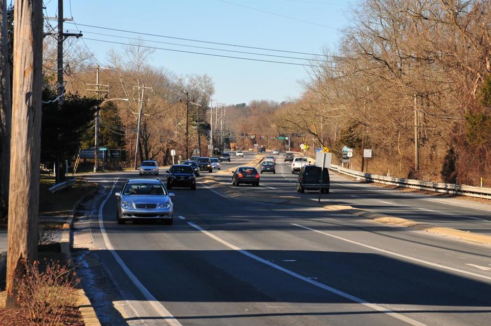
34 EXISTING CONDITIONS High volumes of traffic at high speeds Village bifurcated by Route 1 Lack of cohesive identity and sense of place Challenging environment to do business No sidewalks / lack of basic pedestrian amenities Parking challenges At the same time, tremendous resources and opportunities that are waiting to be coalesced into a village. Public / Private Partnerships Key to success
35 Five Phase Approach 1. Chadds Ford Village Master Plan (2014) 2. Harvey Run Trail Opening / High Trail & Bridge Design ( ) 3. Chadds Ford Village Design (2017) 4. TAP (Transportation Alternatives Program) Application (2017) 5. Phase 1 Construction ( )

36 PHASE 1 Chadds Ford Master Plan Identified the Challenges and Opportunities Suggested a range of possible options

37


38 Harvey Run Trail Opened April 29, 2017 PHASE 2

39 PHASE 2 High Trail / High Bridge VIEW

40 High Trail / High Bridge

41 PHASE 3 Village Design pre TAP application


42

43

44
45


46

47

48

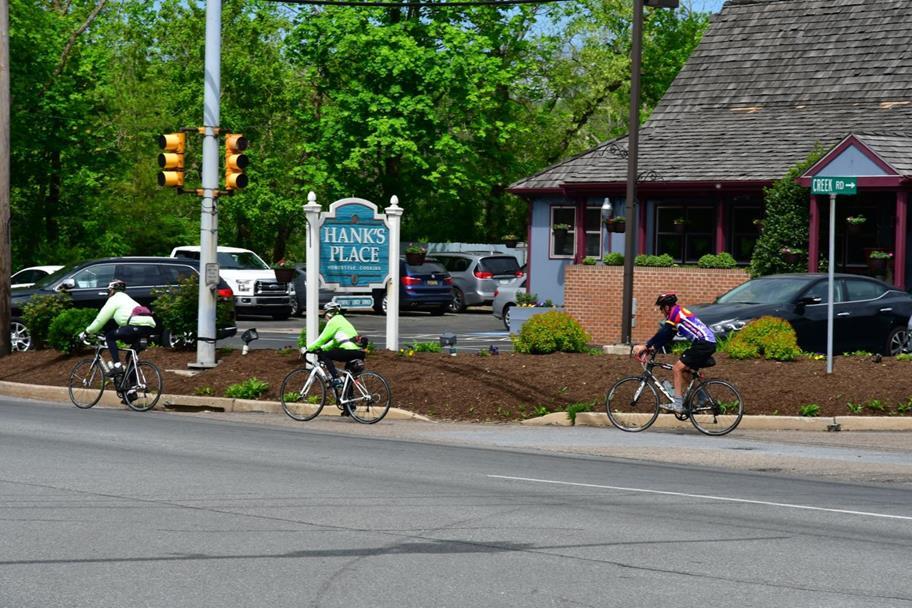
49 North Creek Road - looking south

50 North Creek Road - looking south

51 South Creek Road - looking north
52 South Creek Road - looking north


53 Design Vocabulary

54 Conclusions / Lessons Being Learned Phase 1: Create a Bold Vision that Elevates Walkability to its rightful position within the Multi-Modal Hierarchy. Emphasize Safety Emphasize Economic Development Emphasize Beauty Emphasize Sustainability Phase 2: Create Successes over the Short Term that Maintain Enthusiasm. Appoint the Right Community Members to Your Project Steering Committee Retaining the Correct Professional Team to Advance Your Vision Phase 3: Transform your Concepts into Reality Get into the Details! Phase 4: Finance the Project Through Grants and Public / Private Partnerships Phase 5: Plan for Future Maintenance Costs as a Part of the Construction Planning.


55 Walkable Chadds Ford Stay tuned!

56 Nether Providence Township Delaware County Dave Grady, Assistant Township Manager
57 Background on Nether Providence Sidewalks In 2007, the Board of Commissioners established the Walkable Wallingford Committee Created a Proposal for Sidewalks and Safe Routes Was adopted by Board and used as basis for sidewalk decisions

58 Walkable Wallingford Committee
59

60 Sidewalk Committee The Board of Commissioners established a Sidewalk Committee Serves as the Traffic Calming subcommittee to the Board of Commissioners. Uses the PennDOT Traffic Calming Handbook as guidance. ions/pub%20383.pdf

61 Traffic Calming Matrix
62 Determining Where Sidewalks Are Needed Board of Commissioners - final determination Traffic Calming Committee Public Works Department Township Engineer Parks Commission Walkable Wallingford Graduate student projects Multi-municipal comprehensive plan Private homeowners or payment in lieu-of

63 Master Bicycle and Pedestrian Plan
64 Paying for the Sidewalks The Township General Fund Grants DCED Multimodal Transportation Fund (MTF) DCED Greenways, Trails and Recreation Program PennDOT Transportation Alternatives Program (TAP) DVRPC Congestion, Mitigation, Air Quality (CMAQ) DCNR Community Conservation Partnerships Program (C2P2) Safe Routes to School Program (SRTS)

65 Current Projects Wallingford Ave sidewalks, SRTS Copples Lane sidewalks, TAP Moore Road sidewalks, TAP E. Possum Hollow Rd sidewalks, CMAQ Furness Park trails, DCED Greenways, Trails and Recreation E. Rose Valley Rd sidewalks, MTF


66 Sidewalk to Mass Transit Before After


67 Safe Routes to School Before After
68 Designing Sidewalks Public meetings are held to show designs Input from the public is welcomed Information is shared with residents as construction begins.

69 Maintenance Generally, property owners are responsible Township will maintain in some instances

70 Future Circuit Trails Board considering resolution to support Circuit Trails Program Connectivity to other regional trails and sidewalks Collaborate with neighboring municipalities


71 Planning & Designing for Walkability Jeannette Brugger, AICP Bicycle & Pedestrian Coordinator

72 Planning for Walkability Setting Goals, Tracking Progress


73 Planning for Walkability Sidewalk Network Sidewalk Network Inventory Sidewalk Gaps Analysis


74 Planning for Walkability Trail Network Trail Inventory Trail Plan Trail Development Guidelines


75 Designing for Walkability the Sidewalk Network Complete Streets Handbook Complete Streets Checklists

76 Designing for Walkability the Sidewalk Network Complete Streets Handbook Complete Streets Checklists

77 Designing for Walkability the Sidewalk Network Complete Streets Handbook Complete Streets Checklists


78 Promoting the Walking Network Walk Philadelphia Signage


79 Planning for Walkability Future Projects Sidewalk Repair Program Study Complete Streets Calculator Construction Standards

80 Planning for Walkability S Broad Street Modified Urban Intersections High Volume Pedestrian Intersections Walnut & Chestnut Sidewalk Level LED Lighting & Other Streetscape Upgrades
81 A policy that states clearly that traffic deaths are preventable and unacceptable. CORE PRINCIPLES: Human life takes priority over mobility; Human error is inevitable and unpredictable; People are inherently vulnerable and speed is a fundamental predictor of crash survival; Safe human behaviors, education, and enforcement are essential contributors to a safe system.
82

83 Thank you Jeannette Brugger, AICP Bicycle & Pedestrian Coordinator phila.gov

84 QUESTIONS AND ANSWERS
85 FOR MORE INFORMATION Speaker contact info: Anne Leavitt-Gruberger Peter Simone Amanda Serock Dave Grady Jeannette Brugger
86
Executive Summary Route 30 Corridor Master Plan
 Route Corridor Master Plan Project Overview The Route Corridor Master Plan is a coordinated multimodal transportation and land use plan for the entire stretch of Route through East Whiteland Township,
Exhibit 1 PLANNING COMMISSION AGENDA ITEM
 Exhibit 1 PLANNING COMMISSION AGENDA ITEM Project Name: Grand Junction Circulation Plan Grand Junction Complete Streets Policy Applicant: City of Grand Junction Representative: David Thornton Address:
Eastern PA Trail Summit October 1, 2018
 Eastern PA Trail Summit October 1, 2018 WHO WE ARE + WHY + WE RE * HERE * * * * * * Session Goals: Discuss how to coordinate planning and design in small, urbanized towns Consider how to develop alternative
Living Streets Policy
 Living Streets Policy Introduction Living streets balance the needs of motorists, bicyclists, pedestrians and transit riders in ways that promote safety and convenience, enhance community identity, create
VISIONZEROPHL.COM #VISIONZEROPHL
 What is Vision Zero? What is Vision Zero? A policy that states clearly that traffic deaths are preventable and unacceptable. CORE PRINCIPLES: Human life takes priority over mobility; Human error is inevitable
Bicycle Lanes Planning, Design, Funding South Mountain Partnership Trails Workshop Roy Gothie PennDOT Statewide Bicycle Pedestrian Coordinator
 Bicycle Lanes Planning, Design, Funding 2018 South Mountain Partnership Trails Workshop Roy Gothie PennDOT Statewide Bicycle Pedestrian Coordinator Policy Changes: BOP Bicycle Policy Changes The OLD Way
Goal 3: Foster an environment of partnerships and collaboration to connect our communities and regions to one another.
 Non-Motorized Transportation Plan (NMTP) Draft Vision, Goal and,, Tri-County Regional Planning Commission (TCRPC) Purpose The purpose of the Tri-County Regional Planning Commission (TCRPC) Non-Motorized
Bicycle and Pedestrian Chapter TPP Update Overview. TAB September 20, 2017
 Bicycle and Pedestrian Chapter TPP Update Overview TAB September 20, 2017 Bicycling & Walking in the Twin Cities Where are we now? The Bike-Pedestrian system Current trends New developments Where are we
Vision: Traditional hamlet with an attractive business/pedestrian friendly main street connected to adjacent walkable neighborhoods
 N D. Focus Area II Vision: Traditional hamlet with an attractive business/pedestrian friendly main street connected to adjacent walkable neighborhoods Transit Road Focus Area II is located in the Hamlet
NJDOT Complete Streets Checklist
 Background The New Jersey Department of Transportation s Complete Streets Policy promotes a comprehensive, integrated, connected multi-modal network by providing connections to bicycling and walking trip
Proposed. City of Grand Junction Complete Streets Policy. Exhibit 10
 Proposed City of Grand Junction Complete Streets Policy Exhibit 10 1 City of Grand Junction Complete Streets Policy Vision: The Complete Streets Vision is to develop a safe, efficient, and reliable travel
COMPLETE STREETS PLANNER S PORTFOLIO
 COMPLETE STREETS PLANNER S PORTFOLIO ISSUE 3 APRIL 2016 PLANNER S PORTFOLIO COMPLETE STREETS 1 2 6 10 14 OVERVIEW MATURE NEIGHBORHOODS GROWING SUBURBS CENTRAL PLACES ACTIVITY CORRIDORS Planner s Portfolio
7/23/2017 VIA . Michael Hanebutt City of Sacramento Community Development Department 300 Richards Boulevard, 3 rd Floor Sacramento, CA 95811
 7/23/2017 VIA EMAIL Michael Hanebutt City of Sacramento Community Development Department 300 Richards Boulevard, 3 rd Floor Sacramento, CA 95811 RE: 65 th Street Apartments (DR17-220) Dear Mr. Hanebutt:
EXECUTIVE SUMMARY. Vision
 Vision Walking and bicycling in Salt Lake City will be safe, convenient, comfortable, and viable transportation options that connect people to places, foster recreational and economic development opportunities,
TOWN OF PORTLAND, CONNECTICUT COMPLETE STREETS POLICY
 TOWN OF PORTLAND, CONNECTICUT COMPLETE STREETS POLICY I. VISION, GOALS & PRINCIPLES VISION To improve the streets of Portland making them safer and more accessible for all users including pedestrians,
REGIONAL BICYCLE AND PEDESTRIAN DESIGN GUIDELINES
 REGIONAL BICYCLE AND PEDESTRIAN DESIGN GUIDELINES November 16, 2011 Deb Humphreys North Central Texas Council of Governments Bicycle and Pedestrian Advisory Committee Snapshot of the Guide 1. Introduction
TYPE QUESTIONS INTO THE Q&A BOX. Q&A Box
 TYPE QUESTIONS INTO THE Q&A BOX Q&A Box AICP CM CREDITS Event ID #9120988 Visit www.planning.org/cm to log your credits WHO ARE WE? THE 9-COUNTY GREATER PHILADELPHIA REGION Why Walking Matters TODAY S
 Time of Change We Are Growing We Are An Attractive Place To Live We Are Age Diverse + Living Longer 50000 40000 30000 20000 10000 0 2010 Census Job Density Housing Sheds Transit Sheds The Project FUNDING
Complete Streets: Planning, Policy & Performance
 Complete Streets: Planning, Policy & Performance Tell Us About Your CS Experiences Successes Hardships Funding Politics Safety Not every street needs to be complete, but every mode needs a complete network.
RESOLUTION NO ?? A RESOLUTION OF THE CITY OF NEPTUNE BEACH ADOPTING A COMPLETE STREETS POLICY
 RESOLUTION NO. 2018-?? A RESOLUTION OF THE CITY OF NEPTUNE BEACH ADOPTING A COMPLETE STREETS POLICY WHEREAS, safe, convenient, and accessible transportation for all users is a priority of the City of Neptune
Perryville TOD and Greenway Plan
 Perryville TOD and Greenway Plan Greenway Glossary Pathway: A bicycle and pedestrian path separated from motorized vehicular traffic by an open space, barrier or curb. Multi-use paths may be within the
Paoli Road Improvement Feasibility Study
 Paoli Road Improvement Feasibility Study & Public Participation Project March 24, 2015 Prepared for: Tredyffrin Township Prepared by: McMahon Associates, Inc. with Town Planning Partnership, LLC Glackin
Chapter 7. Transportation. Transportation Road Network Plan Transit Cyclists Pedestrians Multi-Use and Equestrian Trails
 Chapter 7 Transportation Transportation Road Network Plan Transit Cyclists Pedestrians Multi-Use and Equestrian Trails 7.1 TRANSPORTATION BACKGROUND The District of Maple Ridge faces a number of unique
MASTER BICYCLE AND PEDESTRIAN PLAN
 VILLAGE OF NORTHBROOK MASTER BICYCLE AND PEDESTRIAN PLAN DRAFT PLAN OPEN HOUSE May 2, 2018 AGENDA 1. Community Engagement 2. Vision and Goals 3. General Structure of Plan 4. Recommendations Overview 5.
Omaha s Complete Streets Policy
 Omaha s Complete Streets Policy (Adopted August 2015) VISION To create great places and enhance our quality of life, the City of Omaha will provide safe, accessible streets for all users. Complete Streets
Chapter 2: Standards for Access, Non-Motorized, and Transit
 Standards for Access, Non-Motorized, and Transit Chapter 2: Standards for Access, Non-Motorized, and Transit The Washtenaw County Access Management Plan was developed based on the analysis of existing
Agenda. Overview PRINCE GEORGE S PLAZA METRO AREA PEDESTRIAN PLAN
 PRINCE GEORGE S PLAZA METRO AREA PEDESTRIAN PLAN May 28, 2008 Agenda Welcome and introductions Project overview and issue identification Planning context and strengths Design challenges and initial recommendations
Brian D. Hare, P.E. Bureau of Design PennDOT PA APA Annual Conference Investing in a Sustainable Future October 5, 2009
 Brian D. Hare, P.E. Bureau of Design PennDOT 2009 PA APA Annual Conference Investing in a Sustainable Future October 5, 2009 1 What is Smart Transportation? Photographer: heyjude. Used through license
MAG Town of Cave Creek Bike Study Task 6 Executive Summary and Regional Significance Report
 Page 1 MAG Town of Cave Creek Bike Study Task 6 Executive Summary and Regional Significance Report August 1, 2012 MAG Project #481 Page 2 Task 6 Executive Summary and Regional Significance Report Introduction
Table #6 VISION CHARACTERISTICS
 Table #6 VISION White Flint is a place to live, work, play, shop, and walk with sufficient density to encourage quality redevelopment. Vibrant streets and consistent streetscapes are important. CHARACTERISTICS
Plant City Walk-Bike Plan
 Plant City Walk-Bike Plan Plant City Commute Mode Share 2.2% 1.4% 2.9% Drove alone 10.2% Carpooled Public transportation (0.1%) Walked Used a Bike (0.4%) 82.9% Taxicab, motorcycle, or other means Worked
CONNECTING PEOPLE TO PLACES
 CONNECTING PEOPLE TO PLACES 82 EAST BENCH MASTER PLAN 07 Introduction The East Bench transportation system is a collection of slow moving, treelined residential streets and major arteries that are the
Prince George s County plans, policies, and projects
 Prince George s County plans, policies, and projects Over 250 projects for trails, bikeways, designated bike lanes and sidewalk construction Trail projects that improve access to Metro Sidewalk and trail
CITY OF BLOOMINGTON COMPLETE STREETS POLICY
 CITY OF BLOOMINGTON COMPLETE STREETS POLICY POLICY OBJECTIVE: The City of Bloomington will enhance safety, mobility, accessibility and convenience for transportation network users of all ages and abilities,
PRINCE GEORGE S PLAZA METRO AREA PEDESTRIAN PLAN
 PRINCE GEORGE S PLAZA METRO AREA PEDESTRIAN PLAN May 28, 2008 Agenda Welcome and introductions Project overview and issue identification Planning context and strengths Design challenges and initial recommendations
City of Waterloo Complete Streets Policy
 City of Waterloo Complete Streets Policy Chris Hodgson P. Eng City of Waterloo Complete Streets Forum 2011 April 28-29 Toronto Waterloo context: Current population Major employers Universities and student
THE PHILADELPHIA COMPLETE. an overview
 THE PHILADELPHIA COMPLETE STREETS DESIGN HANDBOOK an overview WHAT ARE COMPLETE STREETS? Complete Streets are streets designed to accommodate all users, from pedestrians to drivers Complete Streets provide
Designing Complete Streets: What you need to know
 Designing Complete Streets: What you need to know Getting from this to this. Continuous sidewalk Buffer w/trees Bicycle lane Raised median Buildings close to the street Flexibility in design Design and
CHAPTER 3: Vision Statement and Goals
 Davidson Walks & Rolls: Active Transportation Master Plan CHAPTER 3 Contents: Overview Vision Statement Measurable Goals Public Outreach CHAPTER 3: Vision Statement and Goals Overview The vision statement
Table of Contents Introduction. 2 Purpose of the Plan...2 The Benefits of Walking and Bicycling...3 Vision and Goals of the Plan...
 BICYCLE AND This plan was created through a grant from the Healthy Communities Program with the cooperation of the City of Cynthiana, Cynthiana Main Street, Cynthiana-Harrison County-Berry Joint Planning
APPENDIX A: Complete Streets Checklist DRAFT NOVEMBER 2016
 APPENDIX A: Complete Streets Checklist DRAFT NOVEMBER 2016 Complete Streets Checklist MetroPlan Orlando s Complete Streets Checklist is an internal planning tool for staff to further implementation of
Performance Criteria for 2035 Long Range Transportation Plan
 Minimizing Impacts on Natural, Historic, Cultural or Archeological Resources 2035 LRTP Weighting Factor: 7% Objective 1.1: Use appropriate planning and design criteria to protect and enhance the built
NM-POLICY 1: Improve service levels, participation, and options for non-motorized transportation modes throughout the County.
 Transportation PRINCE WILLIAM COUNTY 2008 COMPREHENSIVE PLAN NON-MOTORIZED PLAN CONTENTS Goals, Policies, and Action Strategies Table 4 (Bike Facility Classifications and Descriptions) Table 5 (Bike Facility
Welcome! San Jose Avenue Open House August 25, 2015
 Welcome! San Jose Avenue Open House August 25, 2015 Vision Zero The City and County of San Francisco adopted Vision Zero San Francisco Vision Zero High Injury Network as a policy in 2014, committing an
East Burke Transportation, Safety and Capacity Improvements
 East Burke Transportation, Safety and Capacity Improvements The purpose of this project is to increase mobility and improve safety for pedestrians, cyclists, and motor vehicles along VT Route 114 in the
TRAFFIC CALMING PLANNER S PORTFOLIO
 TRAFFIC CALMING PLANNER S PORTFOLIO ISSUE 8 January 2017 PLANNER S PORTFOLIO TRAFFIC CALMING 1 OVERVIEW 2 3 4 ENGINEERED TRAFFIC CALMING MEASURES SIGNS AND PAVEMENT MARKINGS EMERGENCY RESPONSE DELAYS 5
Morristown, NJ Complete Streets Policy
 Morristown, NJ Complete Streets Policy Introduction A Complete Street is defined as a means to provide safe access for all users by designing and operating a comprehensive, integrated, connected multi-modal
City of Novi Non-Motorized Master Plan 2011 Executive Summary
 City of Novi Non-Motorized Master Plan 2011 Executive Summary Prepared by: February 28, 2011 Why Plan? Encouraging healthy, active lifestyles through pathway and sidewalk connectivity has been a focus
City of Elizabeth City Neighborhood Traffic Calming Policy and Guidelines
 City of Elizabeth City Neighborhood Traffic Calming Policy and Guidelines I. Purpose: The City of Elizabeth City is committed to ensure the overall safety and livability of residential neighborhoods. One
Physical Implications of Complete Streets Policies
 Presentation Overview Physical Implications of Complete Norm Cox, ASLA, LLA Landscape Architect Ann Arbor, Michigan, 10:45 to Noon What Are Complete Streets? What Matters to Bicyclists and Pedestrians
Kelowna On the Move. Pedestrian and Bicycle Master Plan
 Kelowna On the Move Pedestrian and Bicycle Master Plan Executive Summary April 2016 Purpose of the Plan The Pedestrian and Bicycle Master Plan identifies infrastructure, planning, and policy requirements
A Village Improvement Study of Plumsteadville. Building On A Foundation Of Excellence
 A Village Improvement Study of Plumsteadville Plumstead Township Plumstead Township Board of Supervisors Dan Hilferty, Chair Stacey Mulholland, Vice Chair Nick Lykon, Secretary Brian Trymbiski, Treasurer
o n - m o t o r i z e d transportation is an overlooked element that can greatly enhance the overall quality of life for the community s residents.
 N o n - m o t o r i z e d transportation is an overlooked element that can greatly enhance the overall quality of life for the community s residents. 84 Transportation CHAPTER 11 INTRODUCTION Transportation
Shifting Gears for a Healthier City
 Shifting Gears for a Healthier City Mississauga s Cycling Master Plan is an ambitious strategy that sets out to transform Mississauga into a city that is conducive to cycling for daily transportation needs.
MONTCLAIR SAFE COMPLETE STREETS IMPLEMENTATION PLAN. Monday November 13, 2017 Michael Dannemiller, Principal Engineer NV5, Inc.
 MONTCLAIR SAFE COMPLETE STREETS IMPLEMENTATION PLAN Monday November 13, 2017 Michael Dannemiller, Principal Engineer NV5, Inc. PROJECT TEAM THE OFFICE OF BICYCLE AND PEDESTRIAN PROGRAMS, NEW JERSEY DEPARTMENT
LANCASTER CITY BICYCLE NETWORK
 LANCASTER CITY BICYCLE NETWORK Downtown Merchants Meeting Wednesday, July 19, 2017 http://www.lancasteratp. DOWNTOWN WALKABILITY ANALYSIS What changes can be made, in the least amount of time, and for
Bicycle-Pedestrian Master Plan: Chapters 3 and 4 Distribution
 Bicycle-Pedestrian Master Plan: Chapters 3 and 4 Distribution Finksburg Planning and Citizens Council March 22, 2018 Overview Progress Citizen Outreach Vision Chapter 3 - Existing Conditions Chapter 4
Solana Beach Comprehensive Active Transportation Strategy (CATS)
") Solana Beach Comprehensive Active Transportation Strategy (CATS) 3.0 Goals & Policies The Solana Beach CATS goals and objectives outlined below were largely drawn from the Solana Beach Circulation Element
Solana Beach Comprehensive Active Transportation Strategy (CATS) 3.0 Goals & Policies The Solana Beach CATS goals and objectives outlined below were largely drawn from the Solana Beach Circulation Element
 COMPLETE STREETS CHECKLIST City of Philadelphia The City of Philadelphia's Complete Streets policies are designed ensure that city streets are safe, comfortable and convenient for people of all ages and
BIKE PLAN CONTENTS GATEWAY
 CONTENTS Acknowledgments...vii Great Rivers Greenway District Board of Directors... vii Great Rivers Greenway District Staff... vii Project Consultants... vii Committees... viii Citizens Advisory Committee
complete streets design and construction standards public primer City of Edmonton
 complete streets design and construction standards public primer City of Edmonton introduction Complete Streets are streets for everyone: people who walk, wheel, bike, take transit, or drive. They are
Request for Authorization to Open Public Comment Period
 Request for Authorization to Open Public Comment Period May 12, 2015 LRP, TIPs, and Conformity Reasons for Requested Action: LRP and TIP Amendment to Connections 2040 LRP, and Draft FY 2016 TIP for New
CITY OF COCOA BEACH 2025 COMPREHENSIVE PLAN. Section VIII Mobility Element Goals, Objectives, and Policies
 CITY OF COCOA BEACH 2025 COMPREHENSIVE PLAN Section VIII Mobility Element Goals, Objectives, and Policies Adopted August 6, 2015 by Ordinance No. 1591 VIII MOBILITY ELEMENT Table of Contents Page Number
5. Pedestrian System. Accomplishments Over the Past Five Years
 5. Pedestrian System Accomplishments Over the Past Five Years The Alamo Area Metropolitan Planning Organization (MPO) and its partner agencies recognize the importance of improving pedestrian mobility.
Montford Drive Parking & Circulation Study
 Montford Drive Parking & Circulation Study Parking & Circulation Study Follow up to the Area Plan based on what we heard Purpose 1 2 3 4 To look closer and evaluate parking and network related issues (including
Thank you for this opportunity to discuss with you how we can work together to make our streets more complete.
 Thank you for this opportunity to discuss with you how we can work together to make our streets more complete. 1 2 3 Thank you for this opportunity to discuss with you how we can work together to make
Chapter 5. Complete Streets and Walkable Communities.
 Chapter 5. Complete Streets and Walkable Communities. 5.1 Description of Complete Streets. Cities throughout the world, and specifically the United States, are coming to embrace a new transportation and
Make Lincoln Highway an economically vibrant corridor that is safe, efficient, and beautiful for local residents and visitors.
 Lincoln Highway Streetscape Plan Stakeholder Workshop #2 Handout Contents Introduction and Project Vision Planning Principles Specific Recommendations including a Proposed Typical Roadway Section Renderings
Transportation Alternatives Set-Aside Program. June 28, 2017
 Transportation Alternatives Set-Aside Program June 28, 2017 What is Transportation Alternatives Set- Aside Program (TASA)? Enhancement program (combined separated programs; old TAP) Not a grant program
MARKET/JFK VISION ZERO PILOT PROJECT FEBRUARY 2019 EVALUATION REPORT
 MARKET/JFK VISION ZERO PILOT PROJECT FEBRUARY 2019 EVALUATION REPORT WHY IS THIS PROJECT IMPORTANT? Market Street and JFK Boulevard in Center City are key east-west corridors in the core business district.
APPROVE A RESOLUTION ADOPTING A COMPLETE STREETS POLICY
 STAFF REPORT MEETING DATE: September 13, 2016 TO: FROM: City Council Bob Brown, Community Development Director Russ Thompson, Public Works Director Patrick Filipelli, Management Analyst 922 Machin Avenue
12/4/2016 VIA . RE: Grocery Outlet Del Paso (DR16-328)
") 12/4/2016 VIA EMAIL Ethan Meltzer, Assistant Planner City of Sacramento Community Development Department 300 Richards Blvd, 3 rd Floor Sacramento, CA 95811 RE: Grocery Outlet Del Paso (DR16-328) Dear Mr.
12/4/2016 VIA EMAIL Ethan Meltzer, Assistant Planner City of Sacramento Community Development Department 300 Richards Blvd, 3 rd Floor Sacramento, CA 95811 RE: Grocery Outlet Del Paso (DR16-328) Dear Mr.
COMPLETE STREETS POLICY Exhibit A to Ordinance
 CITY OF WENATCHEE COMPLETE STREETS POLICY Exhibit A to Ordinance 2016-24 Prepared and Reviewed By: City of Wenatchee Community & Economic Development Department City of Wenatchee Public Works Department
Town of Bethlehem. Planning Assessment. Bethlehem Town Board
 Town of Bethlehem US 9W Corridor Transportation Planning Assessment Presented e to: Bethlehem Town Board June 2009 Overview Study Background Route 9W Corridor Conditions and Improvements Selkirk Bypass
A CHANGING CITY. of Edmonton, it is essential that it reflects the long-term vision of the City.
 A CHANGING CITY By the year 2040, Edmonton will be home to more than 1 million people. To accommodate growth and support a healthy and compact city, we need a new approach to development/redevelopment
5/7/2013 VIA . RE: University Village Safeway Expansion (P13-019)
") 5/7/2013 VIA EMAIL David Hung, Associate Planner Community Development Department, Current Planning Division City of Sacramento 300 Richards Boulevard, 3 rd Floor Sacramento, CA 95811 RE: University Village
5/7/2013 VIA EMAIL David Hung, Associate Planner Community Development Department, Current Planning Division City of Sacramento 300 Richards Boulevard, 3 rd Floor Sacramento, CA 95811 RE: University Village
10/8/2014 VIA . RE: CVS Pharmacy (P13-002) Revised August 2014
 Revised August 2014") 10/8/2014 VIA EMAIL David Hung, Associate Planner Community Development Department, Current Planning Division City of Sacramento 300 Richards Boulevard, 3 rd Floor Sacramento, CA 95811 RE: CVS Pharmacy
10/8/2014 VIA EMAIL David Hung, Associate Planner Community Development Department, Current Planning Division City of Sacramento 300 Richards Boulevard, 3 rd Floor Sacramento, CA 95811 RE: CVS Pharmacy
Prioritizing Transportation Policy and Funding for Active Transportation, Safety, Equity and Health
 Mayor Karl Dean, Chairman Prioritizing Transportation Policy and Funding for Active Transportation, Safety, Equity and Health Leslie A. Meehan, AICP Planning and Implementing the Active Community Webinar
Washington County, Oregon
 Washington County, Oregon Photo add here 1 Washington County, Oregon Total population: 536,370 City population: 320,000 Based on 2010 Census Rural population: 26,000 Urban Unincorporated Population: 190,000
Route 7 Corridor Study
 Route 7 Corridor Study Executive Summary Study Area The following report analyzes a segment of the Virginia State Route 7 corridor. The corridor study area, spanning over 5 miles in length, is a multi
Item to be Addressed Checklist Consideration YES NO N/A Required Description Complete Streets Guidelines
 Passaic County Complete Streets Checklist - Concept Development Project Name Item to be Addressed Checklist Consideration YES NO N/A Required Description Complete Streets Guidelines Existing Plans Have
Chapter 5 Future Transportation
 Chapter 5 Future Transportation The Future Land Use Plan identifies the desired land use designations. The land uses desired for Crozet depend, in large part, on the success of the transportation system,
San Jose Transportation Policy
 San Jose Transportation Policy Protected Intersections in LOS Policies to Support Smart Growth Presented by: Manuel Pineda City of San Jose Department of Transportation Bay Area Map San Francisco Oakland
Hennepin County Bicycle and Pedestrian Planning
 Hennepin County Bicycle and Pedestrian Planning 1 Value of bicycle and sidewalk systems Safety Livability Mobility Health Personal Finances Economic Sustainability Clean Air Recreation Parking and congestion
David Hung, Associate Planner City of Sacramento Community Development Department 300 Richards Boulevard, 3 rd Floor Sacramento, CA
 June 13, 2016 VIA EMAIL David Hung, Associate Planner City of Sacramento Community Development Department 300 Richards Boulevard, 3 rd Floor Sacramento, CA 959811 RE: Fire Station 14 (DR16-128) Dear Mr.
7 Complete Streets & Roadway Aesthetics
 7 Complete Streets & Roadway Aesthetics 7.1 OVERVIEW Our streets lay the foundation for how we interface with travel needs, physical exercise, social exchanges and access to goods and services. They are
City of Charlottesville Bicycle and Pedestrian Master Plan Update
 City of Charlottesville Bicycle and Pedestrian Master Plan Update September 17, 2014 I. Welcome and meeting overview II. Project status update III. Network overview IV. Break-out groups Pedestrian Network
5/31/2016 VIA . Arwen Wacht City of Sacramento Community Development Department 300 Richards Blvd., 3 rd Floor Sacramento, CA 95811
 5/31/2016 VIA EMAIL Arwen Wacht City of Sacramento Community Development Department 300 Richards Blvd., 3 rd Floor Sacramento, CA 95811 RE: El Pollo Loco (P16-028) Dear Ms. Wacht: WALKSacramento has reviewed
City of Birmingham Draft Multi-modal Transportation Plan
 City of Birmingham Draft Multi-modal Transportation Plan City Commission Public Hearing Monday, November 25, 2013 7:30 pm Norman Cox, PLA, ASLA The Greenway Collaborative, Inc. Ann Arbor, Michigan The
COUNCIL POLICY NAME: COUNCIL REFERENCE: 06/119 06/377 09/1C 10llC 12/1C INDEX REFERENCE: POLICY BACKGROUND
 COUNCIL POLICY NAME: COUNCIL ADVISORY COMMITTEES - TERMS OF REFERENCE ISSUED: APRIL 3, 2006 AMENDED: NOVEMBER 27, 2006 NOVEMBER 23, 2009 JANUARY 11, 2010 DECEMBER 17, 2012 POLICY COUNCIL REFERENCE: 06/119
Linking Transportation and Health in Nashville & Middle Tennessee
 Linking Transportation and Health in Nashville & Middle Tennessee Fit Nation New Orleans CPPW Mentoring Grant Built Environment Program May 14, 2011 Local Transportation Planning Framework Federal U.S.
How to Develop a Pedestrian Safety Action Plan
 How to Develop a Pedestrian Safety Action Plan Course Introduction Presented by: Peter Eun FHWA RC Safety Engineer Ryan Snyder President, Ryan Snyder Associates, LLC Paul Zykofsky Director, Land Use and
ACTIVE TRANSPORTATION
 ACTIVE TRANSPORTATION Mobility 2040 Supported Goals Improve the availability of transportation options for people and goods. Support travel efficiency measures and system enhancements targeted at congestion
West Village Mobility & Integration
 West Village Mobility & Integration PRESENTED TO TOPCA Town Hall November 9, 2017 [7189-21] Port Credit 2 West Village + Mobility AWalkable Community A CompleteCommunity A SustainableCommunity 3 Mobility
Bicycle Master Plan Goals, Strategies, and Policies
 Bicycle Master Plan Goals, Strategies, and Policies Mobilizing 5 This chapter outlines the overarching goals, action statements, and action items Long Beach will take in order to achieve its vision of
4/14/2017 VIA . Miriam Lim, Junior Planner City of Sacramento Community Development Department 300 Richards, 3 rd Floor Sacramento, CA 95811
 4/14/2017 VIA EMAIL Miriam Lim, Junior Planner City of Sacramento Community Development Department 300 Richards, 3 rd Floor Sacramento, CA 95811 RE: Mack & Franklin Development (P17-016) Dear Ms. Lim:
Complete Streets implementation in Chicagoland
 Complete Streets implementation in Chicagoland presented by Active Transportation Alliance Chicago Metropolitan Agency for Planning National Complete Streets Coalition 1 Speakers: Paul Lippens, AICP Senior
RSTF Measurements and Status
 RSTF Measurements and Status Items in green text are on or ahead of target. Items in red text need attention. Objective & Measures Status November, 2011 Winter, 3/8/12 Build, Maintain, & Leverage Partnerships
Bicycle-Pedestrian Master Plan Update
 Bicycle-Pedestrian Master Plan Update Planning & Zoning Commission November 29, 2017 Overview Project Purpose & Scope Project History Plan Vision & Goals Chapter 5: Making Connections-Beyond the Path Next
INNER LOOP EAST. AIA Rochester Annual Meeting November 13, 2013 TRANSFORMATION PROJECT. Bret Garwood, NBD Erik Frisch, DES
 INNER LOOP EAST TRANSFORMATION PROJECT AIA Rochester Annual Meeting November 13, 2013 Bret Garwood, NBD Erik Frisch, DES Why? We are building a city that encourages walking, biking and enjoying the outdoor