PART 4: Proposed Sidewalk Routes
|
|
|
- Melvyn Armstrong
- 5 years ago
- Views:
Transcription

1 ::. ~-N 1848
2 Cit of Geor etown Sidewalk Stud PART 4: Proposed Sidewalk Routes A. Evaluation of the Planned Sidewalk Routes City of Georgetown personnel provided HDR with a drawing indicating planned sidewalk routes. (Refer to the Planned Sidewalk Routes Exhibit on the following page.) We were asked to evaluate the information contained on this drawing. t was a very comprehensive plan covering all portions of the city and including many of the unincorporated areas adjacent to the city. Our evaluation consisted of determining what areas really needed sidewalks upon total build out of the city's complete sidewalk system. We began by eliminating those areas that would seldom be used by pedestrians. U.S. nterstate 35 (and its attendant frontage roads) is a good example of a vehicular system with little need for sidewalks and pedestrian movement. This roadway would be very hostile and unsafe to pedestrian movements, and it is not expected that it would be used very much by citizens walking through Georgetown. Other planned sidewalk locations that could be eliminated for similar lack of use issues include: Austin Avenue south of Leander Road F.M. 971 east of Cooper Elementary School Maple Street south of Southwalk Street SE nner Loop Road (and the proposed extensions of this loop road to the northeast and southwest) Leander Road south of Riverview Drive As has already been stated elsewhere in this report, it was determined that sidewalks outside the limits of the city would not be included in the master sidewalk plan. These areas present an unknown factor to the city that can be evaluated once a particular development takes place and/or those areas become an official part of the city. n general, the remaining planned sidewalk routes proposed by the city are in excellent locations, and will be included in the final master sidewalk plan. 4.1 Final Report

3 , /, l. _.- ~~ ~- ~ """" J ""' / Legend Proposed Walk l-ilt --- PLANNED ;~ SDEWALK 4.2 R 0 U T E S...-..,... Georgetown Sidewalks Study ~ ceorg JQ~t1. ~Q
4 Cit of Geor etown Sidewalk Stud B. Proposed Sidewalk Locations 1. Master Sidewalk Plan The Proposed Master Sidewalk Plan indicates where HDR recommends new sidewalk construction occur now and in the future. (Refer to the Master Sidewalk Plan Exhibit on the following page.) This plan is based on careful evaluation of the criteria mentioned previously in this report, and a careful analysis of the field conditions (existing sidewalk inventory and conditions) within the "focus area". The key to this plan was providing the city with safe and effective pedestrian movements all throughout the city, but in particular at the "Critical Linkage Areas". The Proposed Master Sidewalk Plan is similar to the city's planned sidewalk routes plan in many respects. However, as was discussed in a previous part of this report, many of the sidewalk routes have been eliminated due to no apparent current need for sidewalks in those particular areas. There are other areas where new sidewalks have been added based on a definite need or opportunity for improvement in pedestrian movement. Specifically, sidewalks have been added in the following locations: Old Town Area - Sidewalks have been added in several locations to complete this heavily-used pedestrian area. The Master Sidewalk Plan completes several links in the "Ridge" area and also adds new locations in the downtown and Williams Middle School area. Gabriel Heights Area - Sidewalks have been added in this residential area to provide links to Rhea McCoy Elementary School, as well as to Williams Drive. Reata Trails Area - Sidewalks have been added in this residential area to provide links to a public swimming pool on Lakeway Drive at Williams Drive, and to the Frost Elementary/Benold Middle School area. San Gabriel Heights Area - Sidewalks have been added in this area to provide links into downtown Georgetown via Leander Road, as well as links for the multi-family residential areas to the Dell Pickett Elementary School area. lill 4.3 Final Report

5 "' MASTER SDEWALK PLAN 4.4 Georgetown Sidewalks Study ~ GeCrgeto!1. rv-u ,.
6 Ci of Gear etown Sidewalk Stud 2. Phase Sidewalk Plan The Phase Sidewalk Plan consists of the sidewalks proposed for implementation as part of the initial $500,000 budget. This plan was presented in concept to city personnel on August 7, At that meeting, it was basically decided that the recommendations for Phase implementation were good. Several small adjustments to the plan have been made based on input received at that meeting, including the following: ntroduction of a pedestrian route underneath U.S. nterstate 35 beginning at Williams Drive and extending to Morrow Street in a southwesterly direction Elimination of some sidewalks proposed in the Reata Trails area Addition of sidewalks along Dawn Drive instead of Westwood Lane Addition of sidewalks to complete the area around Frost Elementary Adding a pedestrian crossing at Scenic Drive and University Avenue, rather than Railroad Avenue and University Avenue. The sidewalks proposed in Phase will provide the city with the best use of these available monies, and give Georgetown a great start in becoming a "pedestrianfriendly'' city. (Refer to Phase Sidewalk Plan Exhibit on the following page.) HR 4.5 Final Report

7 ,....:::; -.. ~. ', t'j. Ge_orgetown Stdewalks Study
8 Cit of Geor etown Sidewalk Stud 3. Phase Sidewalk Detail Plans The Phase Sidewalks occur throughout the city. These new sidewalks have been grouped into five general areas. What follows is a brief description of the new sidewalks proposed for each of these areas. a. Reata Trails - This area is located in the northwest portion of Georgetown. This area contains two schools, Frost Elementary and Benold Middle School. The GSD administration building is also located in this area. A public swimming pool is located at the intersection of Lakeway Drive and Williams Drive, and is a major attraction for pedestrian movements (during certain months of the year, primarily June through August). This area also contains several fast food restaurants, convenience stores, shopping, and basketball courts/recreation areas that can generate pedestrian movements. The following sidewalk construction is proposed for Phase. (Refer to the Reata Trails Exhibit on the following page.) Provide a connection from the residential areas to the north by extending a sidewalk from Lakeway Drive to Wagon Wheel Trail along Buffalo Springs Trail. Provide a sidewalk that connects Buffalo Springs Trail to the school grounds via Western Trail allowing residents easy access to the schools. Provide a sidewalk that completes the run of existing sidewalks at the corner of Northwest Boulevard and Lakeway Drive. Provide a segment to complete the existing sidewalk along Williams Drive. Approximate Cost to complete sidewalk construction in this area: $61, Final Report

9 ' l GEORG MUN ARP 4.,. 1 <)' > (~ ' v v ', lir --- $j;..:::: REATA 4.8 Georgetown Sidewalks Study ~ Georgeto~ tt 1f..rlQ.. -..
10 Cit of Geor etown Sidewalk Stud b. Gabriel Heights - This area is located on the west side of U.S. nterstate 35, and on the north side of Williams Drive. This area contains the Rhea McCoy Elementary School. The following sidewalk construction is proposed in Phase. (Refer to the Gabriel Heights Exhibit on the following page.} Provide a connection from the residential areas to Rhea McCoy Elementary School via Dawn Drive, Central Drive, and Park Lane. Provide sidewalk segments along Williams Drive to complete sidewalks on north side. Provide sidewalks from Williams Drive to the hike/bike trail underneath U.S. nterstate 35. Link Williams Drive with the hike/bike system located along the San Gabriel River underneath U.S. nterstate 35. This will provide safe pedestrian passage east to west within the city without requiring pedestrians to navigate the U.S. nterstate 35 and Williams Drive intersection. Future sidewalk extensions from underneath U.S. nterstate 35 along West Morrow Street to the east will serve as valuable links to the city's Parks and Recreation Center, and other existing municipal facilities as well. (Refer to the Williams/nterstate Pedestrian Bypass Sketches on the following pages.} Approximate Cost to complete sidewalk construction in this area: $235,480 lill 4.9 Final Report

11 _ GOLDEN c;. ' ' '.. GABREL 4.10 HEGHTS

12 Cit of Geofi etown Sidewalk Stud Williams/nterstate Pedestrian Bypass Existing Condition Proposed- Sketch #1 HR 4.11 Final Report

13 Cit of Geofi etown Sidewalk Stud Williams/nterstate Pedestrian Bypass Existing Condition Proposed- Sketch #2 lil Williams/nterstate Pedestrian Bypass 4.12 Final Report

14 Cit of Geor etown Sidewalk Stud Existing Condition Proposed- Sketch #3 ffi Final Report
15 Cit of Geor etown Sidewalk Stud c. Old Town- West- This area is located on the east side of U.S. nterstate 35 and contains most of downtown Georgetown, Blue Hole Park and Carver Elementary School. Also included in this area is the hospital and U.S. Post Office. The following sidewalk construction is proposed in Phase. (Refer to the Old Town - West Exhibit on the following page.) Provide a sidewalk connection from the residential areas ("The Ridge") across University Avenue to Railroad Avenue. Provide sidewalks on the east side of Railroad Avenue from University Avenue to 1 ih Street. Provide sidewalks connecting Railroad Avenue to Carver Elementary School via 1 ih Street and 18 1 h Street. Provide sidewalks from Church Street to Elm Street along 15th Street. Approximate Cost to complete sidewalk construction in this area: $63,620 Jill 4.14 Final Report

16 // /,/~ /.---- R HLLS 'SSVE W- ' 0 -- RVER HLLS '. /...- -, Georgetown Sidewalks Study r~ vwrgeto ~ ~Q
17 Cit of Geor etown Sidewalk Stud d. Old Town - East- This area is located on the east side of U.S. nterstate 35 and contains the east side of downtown Georgetown, VFW Park, Williams Middle School and Annie Purl Elementary School. Also included in this area is Southwestern University and Smith Branch Park. The following sidewalk construction is proposed in Phase. (Refer to the Old Town -East Exhibit on the following page.) Provide sidewalks to complete the connection between East 2ncs Street and Williams Middle School along College Street. Provide sidewalks along East 7th Street to connect Southwestern University with the downtown area. Provide sidewalks along 15th Street to provide a connection for Church Street with Annie Purl Elementary. Provide sidewalks along East 18th Street to provide a connection for residential areas with Annie Purl Elementary School. Provide sidewalks along Quail Valley Drive and Maple Street allowing access to Annie Purl Elementary and Smith Branch Park. Approximate Cost to complete sidewalk construction in this area: $70,920 Jill 4.16 Final Report

18 y ~ ~ --- ' --. ' ' KU~T LANDRUM'' GOLF COURSE Q ~ / / -~ y ( ' (/1 / /,($ - '... (. UNVERSTY. PARK.. ' '..,
19 Cit of Geor etown Sidewalk Stud e. San Gabriel Heights- This area is located on the west side of U.S. nterstate 35 and contains Dell Pickett Elementary School and Tippit Middle School. The following sidewalk construction is proposed in Phase. (Refer to the San Gabriel Heights Exhibit on the following page.) Provide sidewalks to complete the connection along Leander Road between U.S. nterstate 35 and San Gabriel Boulevard (refer to sketch below). Provide sidewalks along Rockcrest Drive to provide access to the schools from Leander Road. leander between San Gabriel Boulevard and U.S. nterstate 35 - Complete the sidewalk connection along Leander Road between U.S. nterstate 35 and San Gabriel Boulevard. This will provide for a safe crossing at grade for this busy intersection. A footbridge will be constructed between the U.S. nterstate 35 frontage road and Southfork Drive to allow drainage to pass through this area. Curb ramps along with crosswalk striping will complete this pedestrian route. Approximate Cost to complete sidewalk construction in this area: $35, Final Report

20 ,. 3E """""" SDEWAUS - fihase SO(WAU:S - ~NJ('S"-AN (~...,...,,.,_ 0..., ,.,..,..,..,. OOSS«l ~ VOSTNCJ CJOSSWAL. Summary l'lia.f OEWAl.U un $.1....,...,..,... COSSL"G ljri.w«:(m HT ~ l a.u..s 12 SAN 4.19 " HEGHTS Georgetown Sidewalks Study ~ GeOr gjo,w.n. ~Q
21 Cit of Geor etown Sidewalk Stud C. Summary of Approximate Costs for Phase Areas The following is a breakdown of the approximate costs for Phase by area: Reata Trails - 15,415 $4 per S.F.= $ 61,660 Gabriel Heights - 58,870 $4 per S.F.= $235,480 Old Town- West- 15,905 $4 per S.F.= $ 63,620 Old Town - East - 17,730S.F.@ $4perS.F.= $ 70,920 San Gabriel Heights- 8,921 $4 per S.F.= $ 35,684 Misc. Site mprovements (Bridges. drainage, ramps, etc.)= $ 32,636 TOTAL - $500,000 lill 4.20 Final Report
22
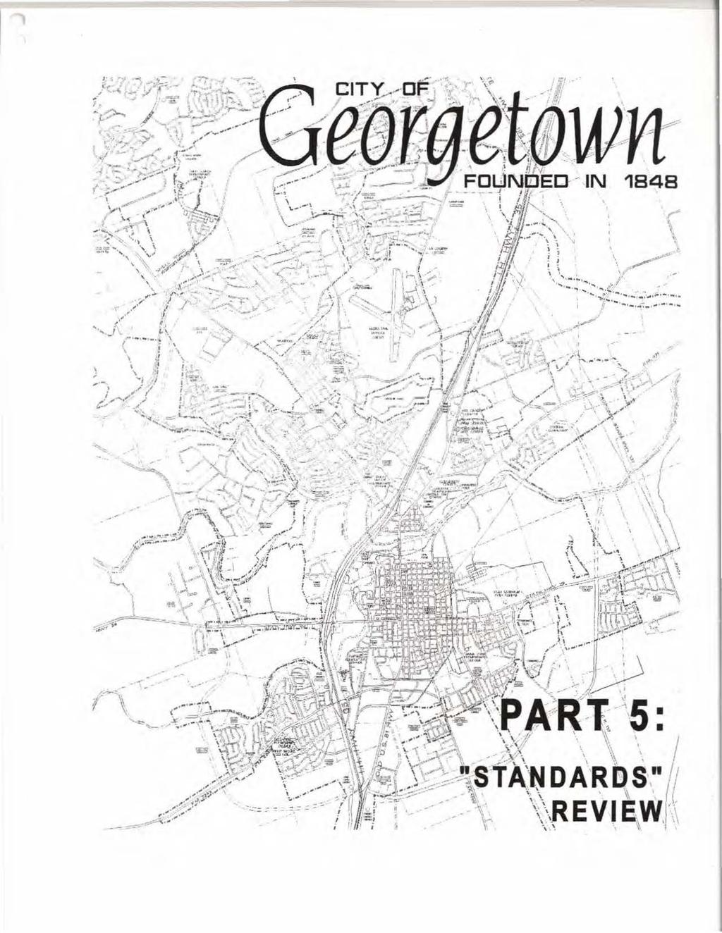
23 Cit of Geor etown Sidewalk Stud PART 5: Standards Review A. Standards Sidewalk implementation standards are an important part of providing quality pedestrian movements within a city. HDR has assembled a set of guidelines that serve as sidewalk implementation strategies for sidewalks proposed in this study, and for future construction of sidewalks in the future. These guidelines, fairly general and simplistic, but necessary to be stated for the purpose of establishing standards that all parties can acknowledge, are as follows: Sidewalks should be located on at least one side of every roadway within the city. Some roadways, in particular the major arterials, should have sidewalks located on both sides of the roadway throughout the developed portions of the city. Sidewalks should be separated from the curb and/or edge of roadway wherever possible. This separation provides for much safer movement of pedestrians through all areas. Sidewalk segments that are currently "missing" should be filled in as soon as possible. Filling in these areas will provide for quick and relatively easy upgrades to the current sidewalk system. Specific field determinations should be made by the city on an as needed basis in regard to constructing sidewalks around existing vegetation, mailboxes, utility poles and other miscellaneous obstacles. Some areas may require demolition or relocation of existing items before the sidewajk can be constructed. n some areas it may make sense to demolish and/or relocate, while in other instances it may be best to simply go around these existing items. Well-marked crosswalks should be provided at all points where sidewalks meet street intersections. This is especially critical where intersections are signalized, and where the pedestrian movements continue on beyond that intersection. Sidewalks should be constructed in new subdivision areas when there is enough critical mass to "complete" the pedestrian linkages. solated segments should be avoided. As new subdivisions develop, the city could request that an "escrow'' of funds be started for the desired sidewalks to be constructed. Once continuous lengths of sidewalk forming a pedestrian link could be constructed (because the development patterns have matured in that area), then sidewalks could be built from the escrow funds and function better for overall pedestrian movements in the city. Jill 5.1 Final Report
24 Cit of Geor etown Sidewalk Stud As part of this study, we have also conducted a brief review of Georgetown's current standard sidewalk details. The "Concrete Driveway Approach Type A and 8", "Sidewalk Section and Joint Detail", and "Sidewalk Ramp Details" were included in this evaluation. Driveway approaches were the first details evaluated. t became important for HDR to evaluate these details in "plan" versus the isometric view. (Refer to the city's Driveway Approach Type 'A' and Type '8' details on the following pages.) By evaluating these details in plan view, several important points can be made. First, the Type 'A' Driveway Approach should be used only in unusual locations. This detail provides the least desirable pedestrian movement across the driveway. This is because the pedestrian is forced to travel "unprotected" across the greatest width of the driveway, and in a location where all the vehicle movements and/or turns are occurring. The Type '8' Driveway Approach should be the city's preferred detail as it provides for a shorter "unprotected" distance across the driveway (and further away from the vehicle movements and/or turns). The sidewalk should be separated as far away from the curb as possible, and the pedestrian movement across the driveway should occur at the narrowest possible driveway width. (Refer to sketches below for additional information.) O~V(WAY ORV(fiAY TYPE 'A' DRVEWAY APPROACH DRVEWAY DRVEWAY lyp 6'1JRVEW.AY APPROACH Upon further review, the remaining city details are consistent with industry standards for general "constructability''. Minor comments for these details can be found on the following pages. HR 5.2 Final Report
25 Ci of Geo~ etown Sidewalk Stud / / / NOTES: l. MAXMUM WDTH OF APPROACH SHALL BE 24'-0" FOR RESDENTAL, 30'-0" FOR NON-RESDENTAL UNDVDED AND 45' -0'' FOR NON-RESDENTAL DVDED. 2. DRVEWAY PERMTS TO BE ACQURED FROM CTY NSPECTON OFFCE. 3. SPACNG OF DRVEWAY CUTS SHALL BE AS REQURED BY SECTONS OF THE CTY'S SUBDVSON REGULATONS. 4. MNMUM WDTH OF APPROACH SHALL BE 10' -o FOR RESDENTAL AND 15'- o FOR NON-RESDENTAL. 5. LNEAR "RADUS" AT CORNERS, PERMTED FOR "SNGLE FAMLY" OR "TWO FAMLY" RESDENTAL DRVEWAY APPROACH. --1SS_UE_DA_TE:_MA_Y_199_6-1 CTY OF GEORGETOWN REVSONS OWG. SD-15 SD15.DWG CONCRETE DRVEWAY APPROACH TYPE "A" ~ ~~ ~~ C~O~M~M~UN~l~~O~W~N~E~D~UmT~LT~E~S~----~ ~ SCALE: N.T.S. CONSTRUCTON STANDARDS AND DETALS 5.3 Final Report Novembor 27, 2001
26 Cit of Geot< etown Sidewalk Stud NOTES: 1. MAXMUM WDTH OF APPROACH SHALL. BE 24'-0" FOR RESDENTAL, 30' - 0" FOR NON-RESDENTAL UNDVDED AND 45' -0" FOR NON-RESDENTAL DVDED. 2. DRVEWAY PERMTS TO BE ACQURED FROM CllY NSPECTON OFFlCE. 3. SPACNG OF DRVEWAY CUTS SHALL BE AS REQURED BY SECTONS OF THE CTY'S SUBDVSON REGULATONS. 4. MNMUM WDTH OF APPROACH SHALL BE 10'-0" FOR RESDENTAL AND 15'-0" FOR NON-RESDENTAL 5. LNEAR "RADUS" AT CORNERS, PERMTED FOR "SNGLE FAMLY" OR WO FAMLY" RESDENTAL DRVEWAY APPROACH. 6. SDEWALK LOCATON TO BE APPROVED BY CflY ENGNEER PROR TO FNAL DESGN. 1--l_ssu_E _DAT_E: _MA_Y_19_96--t CTY OF GEORGETOWN REVSONS CONSTRUCTON STANDARDS AND DETALS owe. eso-16 S016.DWG CONCRETE DRVEWAY APPROACH TYPE "8" ~ ~~ ~~------~C~O~M~MU~N~~~O~W~N~EO~UT~LniT~E~S ~ SCALE: N.T.S. 5.4 Final Report
27 Ci of Geo~ etown Sidewalk Stud 1/2" PREAOL!JE!J E%PA!VSOA.101#7 A7 40'-0" CE!V7ER 70 CENTER tar. TYPE - TYPE - AS REQURED FOR SNGLE FAMLY, DUPLEXES AND TOWNHOUSES. AS REQURED FOR APARTMENTS, OFFCE AND PARKNG LOTS, COMMERCAL AND NDUSTRAL. VARES 5' - 0" TYPE 6' - 0" TYPE [ CURB AND GUTER ROADWAY 2" 'sand BEDDNG POLYPROPYLENE FBRLlATED FlBERS, OR 6" x 6" W1.4 x W1.4 WELDED WRE FABRC 1. FOR ROLLER STAMPED SDEWALK: 4000 P.S.. CONCRETE WTH 3/8" AGGREGATE. 2. STANDARD LOCAT ON OF SDEWALK S OFF BACK OF CURB. SPECAL DESGNS MAY BE APPROVED BY THE CTY ENGNEER, PROR TO FNAL DESGN. SSUE DAlE: AUGUST 1995 REVSONS CTY OF GEORGETOWN OWG. RSD-12 S012.0WG 7/'ll ROUER SAMP SOEWALJ( NOT MRS COMMUNTY OWNED UTLTES SCALE: N.T.S. CONSTRUCTON STANDARDS AND DETA.LS 5.5 Final Report
28 Cit of Geoli etown Sidewalk Stud!r- BACK OF CURB ~ 0 ' ~ SDEWALK f.c <.l )..., v~ 1/2" LP- U1 w 7'-o" 0:: ~ PLAN-TYPE"B"!r- BACK OF CURB 0 ~ '- i.o ;.., 1/2" UP / 1 5'-0" 6:1 SLOPE PLAN-TYPE"A" 1 /2 ~ MA)(. j ELEVATON o SDEWALK CURB AND GUlTER t 1 NOTE: 1. SDEWALK LOCATON TO BE APPROVED BY CTY ENGNEER PROR TO FNAL DESGN. SSUE DATE: MAY 1996 REVSONS SCALE: N.T.S. CTY OF GEORGETOWN SDEWALK RAMP DETALS COMMUN!i OWNED UTLTES CONSTRUCTON STANDARDS AND DETAJLS DWG. SD-13 S013.0WG 5.6 Final Report

29 Wn.::;:::..;. ;_:::'! ' ' N 1848
30 Cit of Geor etown Sidewalk Stud PART 6: Summary and Further Recommendations A. Summary and Further Recommendations This study was performed to provide Georgetown with professional design recommendations for making their community a "Pedestrian Friendly" city. Pedestrian circulation is a vital component to a city's overall livability. This study is intended to guide sidewalk implementation in the near term, but also serve as a platform for future integration of a comprehensive sidewalk system into the city's plans for future development. Following are a few summary statements and further recommendations for the city to consider as the results of this study are implemented. HDR looks forward to participating in helping Georgetown with further development of these ideas. The city needs to further develop detailed plans for the Williams/nterstate pedestrian bypass under U.S. nterstate 35. This could be a marvelous and unique "feature" for the city to offer to their citizens. Phase costs need to be investigated further to confirm estimates included in this report. The city should continue to monitor existing sidewalks on a regular basis, and update the conclusions of this report annually. The city should pursue a meeting with TXDOT officials to review the findings of this study and determine a comprehensive course of action that accommodates their concerns and/or requirements. The findings of this report should be shared with the city's Parks and Recreation Department. Every opportunity to collaborate on projects that enhance pedestrian movements within the city should be pursued by all city agencies. New sidewalks should be required for all new developments within the city (especially for multi-family residential and commercial developments). The city should continue to pursue upgrades to sidewalks within the older neighborhoods of the city. The city should continue to capitalize on existing drainage ways as opportunities to enhance pedestrian movements within the city. The city should continue to collaborate with GSD officials, particularly as concerns sidewalks for school-aged children to use going to and returning home from their schools. The city should pursue a comprehensive study of utilizing the abandoned railroad rightof-way within the city for pedestrian movements. The city should document all barriers to accessibility within the existing sidewalks in the city and begin a program of removing these barriers in conjunction with ongoing sidewalk maintenance budgets. This would include the correction of all ADA deficiencies as well. The city should pursue detailed designs for pedestrian movements within the "Critical Linkage Areas" designated. HR 6.1 Final Report
CITY MANUALS AND STANDARDS REVIEW
 GEORGETOWN SIDEWALK MASTER PLAN CITY MANUALS AND STANDARDS REVIEW RESOURCES AND STANDARDS As part of the Master Plan process, a review and evaluation of current City documents and policies relevant to
ADA TRANSITION PLAN 2013
 ADA TRANSITION PLAN 2013 TABLE OF CONTENTS Contents Introduction 1 Purpose 2 Identified Obstacles to the Public Right of Way 3 Criteria for Determining Impediments at Village Facilities 4 Removing Barriers
Corpus Christi Metropolitan Transportation Plan Fiscal Year Introduction:
 Introduction: The Safe, Accountable, Flexible, Efficient Transportation Equity Act: A Legacy for Users (SAFETEA-LU) has continued the efforts started through the Intermodal Surface Transportation Efficiency
IMPLEMENTATION STRATEGIES
 GEORGETOWN SIDEWALK MASTER PLAN 34% of funding is dedicated to Downtown Overlay District sidewalks 28% of funding is recommended within 1/4 mile of Southwestern University 26% of funding is recommended
Solana Beach Comprehensive Active Transportation Strategy (CATS)
") Solana Beach Comprehensive Active Transportation Strategy (CATS) 3.0 Goals & Policies The Solana Beach CATS goals and objectives outlined below were largely drawn from the Solana Beach Circulation Element
Solana Beach Comprehensive Active Transportation Strategy (CATS) 3.0 Goals & Policies The Solana Beach CATS goals and objectives outlined below were largely drawn from the Solana Beach Circulation Element
Final Sidewalk Feasibility Study
 Garfield Drive From Anastasia Drive to Elizabeth Place City of South Daytona July 23, 2009 Final Sidewalk Feasibility Study Prepared for: Prepared by: Final Sidewalk Feasibility Study Garfield Drive 2
Proposed. City of Grand Junction Complete Streets Policy. Exhibit 10
 Proposed City of Grand Junction Complete Streets Policy Exhibit 10 1 City of Grand Junction Complete Streets Policy Vision: The Complete Streets Vision is to develop a safe, efficient, and reliable travel
Non-Motorized Transportation 7-1
 Non-Motorized Transportation 7-1 Transportation facilities no longer mean just accommodating a vehicle powered by a combustion engine. Pedestrian and non-motorized facilities are important modes of travel
Complete Streets Funding Program Project Prioritization Plan
 Funding Program Project Prioritization Plan Location and Type Needs South Street Crosswalk Installation Stripe a new formalized crosswalk across South Street at the Anne T. Dunphy School pedestrian path
Perryville TOD and Greenway Plan
 Perryville TOD and Greenway Plan Greenway Glossary Pathway: A bicycle and pedestrian path separated from motorized vehicular traffic by an open space, barrier or curb. Multi-use paths may be within the
INTRODUCTION THOROUGHFARE SYSTEM CLASSIFICATIONS
 INTRODUCTION The thoroughfare plan will assist public officials in the development of a specialized system for efficient and safe movement of vehicular traffic while minimizing potential conflicts with
Americans with Disabilities Act Transition Plan for Public Right-of-Way Improvements
 Americans with Disabilities Act Transition Plan for Public Right-of-Way Improvements Prepared by: Public Works Department Engineering Division October 2015 Table of Contents Section I Introduction.. 3
Hidden Oaks Elementary School
 Hidden Oaks Elementary School SCHOOL ROUTE PLAN For HIDDEN OAKS ELEMENTARY SCHOOL LOCATION 13 ORANGE COUNTY Prepared for: ORANGE COUNTY SCHOOL ASSESSMENT PROGRAM ORANGE COUNTY PUBLIC WORKS Traffic Engineering
CITY OF COCOA BEACH 2025 COMPREHENSIVE PLAN. Section VIII Mobility Element Goals, Objectives, and Policies
 CITY OF COCOA BEACH 2025 COMPREHENSIVE PLAN Section VIII Mobility Element Goals, Objectives, and Policies Adopted August 6, 2015 by Ordinance No. 1591 VIII MOBILITY ELEMENT Table of Contents Page Number
122 Avenue: 107 Street to Fort Road
 : 107 Street to Fort Road November 24, 2015 4:30 8:00 p.m. Meeting Purpose Summarize project work completed to date Share results of public input from Phase 1 Share the draft concept plan and proposed
3.0 Future Conditions
 3.0 Future Conditions In order to be able to recommend appropriate improvements to the transportation system of the Town, it is important to first understand the nature and volume of traffic that is expected
5/31/2016 VIA . Arwen Wacht City of Sacramento Community Development Department 300 Richards Blvd., 3 rd Floor Sacramento, CA 95811
 5/31/2016 VIA EMAIL Arwen Wacht City of Sacramento Community Development Department 300 Richards Blvd., 3 rd Floor Sacramento, CA 95811 RE: El Pollo Loco (P16-028) Dear Ms. Wacht: WALKSacramento has reviewed
MAG Town of Cave Creek Bike Study Task 6 Executive Summary and Regional Significance Report
 Page 1 MAG Town of Cave Creek Bike Study Task 6 Executive Summary and Regional Significance Report August 1, 2012 MAG Project #481 Page 2 Task 6 Executive Summary and Regional Significance Report Introduction
7/23/2017 VIA . Michael Hanebutt City of Sacramento Community Development Department 300 Richards Boulevard, 3 rd Floor Sacramento, CA 95811
 7/23/2017 VIA EMAIL Michael Hanebutt City of Sacramento Community Development Department 300 Richards Boulevard, 3 rd Floor Sacramento, CA 95811 RE: 65 th Street Apartments (DR17-220) Dear Mr. Hanebutt:
CITY OF ELKO BICYCLE AND PATHWAY PLAN
 CITY OF ELKO BICYCLE AND PATHWAY PLAN INTRODUCTION: The City of Elko is intended to provide the basic framework for the development of a functional bicycle and pathway system for the community with connections
PEDESTRIAN ACTION PLAN
 ATTACHMENT 2 CITY OF SANTA MONICA PEDESTRIAN ACTION PLAN CITY OF SANTA MONICA PEDESTRIAN ACTION PLAN This page intentionally left blank EXECUTIVE SUMMARY CHAPTER 1 EXECUTIVE SUMMARY Setting the Stage
AMERICANS WITH DISABILITIES ACT TRANSITION PLAN LEON COUNTY FOR CURB RAMPS AND SIDEWALKS DEPARTMENT OF PUBLIC WORKS. 1 P age
 AMERICANS WITH DISABILITIES ACT TRANSITION PLAN FOR CURB RAMPS AND SIDEWALKS 2015 LEON COUNTY DEPARTMENT OF PUBLIC WORKS 1 P age INTRODUCTION The goal of the Americans with Disabilities Act (ADA) Transition
ADA TRANSITION PLAN. For
 Page 1 of 7 ADA TRANSITION PLAN For PUBLIC WORKS DEPARTMENT 121 SW Port St. Lucie Boulevard Port St. Lucie, FL 34983 Phone: 772-871-5177 Website: www.cityofpsl.com September 2018 Table of Contents 1) Introduction
M-58 HIGHWAY ACCESS MANAGEMENT STUDY Mullen Road to Bel-Ray Boulevard. Prepared for CITY OF BELTON. May 2016
 M-58 HIGHWAY ACCESS MANAGEMENT STUDY Prepared for CITY OF BELTON By May 2016 Introduction Missouri State Highway 58 (M-58 Highway) is a major commercial corridor in the City of Belton. As development has
ADA Transition Plan. City of Gainesville FY19-FY28. Date: November 5, Prepared by: City Of Gainesville Department of Mobility
 ADA Transition Plan FY19-FY28 Date: November 5, 2018 Prepared by: City Of Gainesville Department of Mobility 1.0 INTRODUCTION 1.1 BACKGROUND The federal statute known as the Americans with Disabilities
2.0 Existing Conditions
 20 2.0 Existing Conditions 2.1 Land Use, Future Growth Patterns, Physical Barriers Geographic Overview Sutter County s land use pattern is characterized by extensive agricultural areas, significant natural
o n - m o t o r i z e d transportation is an overlooked element that can greatly enhance the overall quality of life for the community s residents.
 N o n - m o t o r i z e d transportation is an overlooked element that can greatly enhance the overall quality of life for the community s residents. 84 Transportation CHAPTER 11 INTRODUCTION Transportation
Chapter 7. Transportation. Transportation Road Network Plan Transit Cyclists Pedestrians Multi-Use and Equestrian Trails
 Chapter 7 Transportation Transportation Road Network Plan Transit Cyclists Pedestrians Multi-Use and Equestrian Trails 7.1 TRANSPORTATION BACKGROUND The District of Maple Ridge faces a number of unique
Duwamish Way-finding and CTR Report
 V. North Tukwila When the North Tukwila Manufacturing and Industrial Center was designated in 1992 as part of the region s land use and transportation plan, the plan called for the area to set a light-rail
This chapter describes the proposed circulation system and transportation alternatives associated with
 5.0 Circulation 5.1 OVERVIEW This chapter describes the proposed circulation system and transportation alternatives associated with West Landing, and summarize the information contained in the Existing
5/7/2013 VIA . RE: University Village Safeway Expansion (P13-019)
") 5/7/2013 VIA EMAIL David Hung, Associate Planner Community Development Department, Current Planning Division City of Sacramento 300 Richards Boulevard, 3 rd Floor Sacramento, CA 95811 RE: University Village
5/7/2013 VIA EMAIL David Hung, Associate Planner Community Development Department, Current Planning Division City of Sacramento 300 Richards Boulevard, 3 rd Floor Sacramento, CA 95811 RE: University Village
5 Transit & Traffic. Overview
 5 Transit & Traffic Overview Montgomery Place s roadways and overall traffic circulation are unique in the city due to the narrow streets and avenues with boulevards; however, no sidewalks or curbs in
3.9 Recreational Trails and Natural Areas
 3.9 Recreational Trails and Natural Areas 3.9.1 Introduction Parks and other recreational facilities such as trails, bicycle routes, and open space are important community resources. This section discusses
SR-203 Sidewalks and Town-Wide Mobility Improvements. Town Council Presentation September 7, 2016
 SR-203 Sidewalks and Town-Wide Mobility Improvements Town Council Presentation September 7, 2016 SR-203 Sidewalks and Town- Wide Mobility Improvements SR-203 Sidewalks and Appurtenances Town-Wide Mobility
Roosevelt Estates Neighborhood Improvements
 Roosevelt Estates Neighborhood Improvements Transportation Alternatives Application May 5 th, 2016 Qualifying Activities Construction of on-road and off-road trail facilities for pedestrians, bicyclists,
WHEREAS delivery trucks also pass through the Narrows, into the northern parking lot, to loading docks in the back of the building.
 CEDAR-ISLES-DEAN NEIGHBORHOOD ASSOCIATION ( CIDNA ) RESOLUTION OPPOSING A DRUG STORE DRIVE THRU, AND COMMENDING DORAN COMPANIES FOR PROPOSING MITIGATING AMENITIES INCLUDING NEW LANDSCAPING AND A DEDICATED
AGENDA REPORT. Issue: Discussion of potential improvements on Barnwell Road at Niblick Drive
 AGENDA REPORT To: From: By: Honorable Mayor and City Council Members Warren Hutmacher, City Manager Tom Black, Public Works Director Date: March 23, 2016 Agenda: March 28, 2016 WORK SESSION AGENDA: Barnwell
8/31/2016 VIA . RE: Freeport Arco Fuel Station (P16-039)
") 8/31/2016 VIA EMAIL Garrett Norman, Assistant Planner City of Sacramento Community Development Department 300 Richards Boulevard, 3 rd Floor Sacramento, CA 95811 RE: Freeport Arco Fuel Station (P16-039)
8/31/2016 VIA EMAIL Garrett Norman, Assistant Planner City of Sacramento Community Development Department 300 Richards Boulevard, 3 rd Floor Sacramento, CA 95811 RE: Freeport Arco Fuel Station (P16-039)
St. Francis Drive through the City of Santa Fe Corridor Study
 VII. ENGINEERING AND ENVIRONMENTAL EVALUATION TRAIL CONNECTIVITY In the southern portion of the Corridor there is a lack of a sidewalk, trail or bicycle facility within the right-ofway. However, the City
Improvements Infrastructure Gap Assessment and Improvements Street Striping
 Infrastructure Project Proposal The federal-aid Safe Routes to School program funds infrastructure/engineering projects that fall into two categories: Design (available only to School Development Authority
12/4/2016 VIA . RE: Grocery Outlet Del Paso (DR16-328)
") 12/4/2016 VIA EMAIL Ethan Meltzer, Assistant Planner City of Sacramento Community Development Department 300 Richards Blvd, 3 rd Floor Sacramento, CA 95811 RE: Grocery Outlet Del Paso (DR16-328) Dear Mr.
12/4/2016 VIA EMAIL Ethan Meltzer, Assistant Planner City of Sacramento Community Development Department 300 Richards Blvd, 3 rd Floor Sacramento, CA 95811 RE: Grocery Outlet Del Paso (DR16-328) Dear Mr.
Complete Streets. Designing Streets for Everyone. Sarnia
 Complete Streets Designing Streets for Everyone Sarnia Complete Streets ~ Sarnia ~ 2018 Introduction Our City is made up of a network of streets that we use to go for a walk, cycle to work, drive to the
COWETA HIGH SCHOOL AND EAST HIGHWAY 51
 COWETA HIGH SCHOOL AND EAST HIGHWAY 51 Lack of sidewalks along Ben Lumpkin Rd. Lack of crosswalks and ramps at intersection. Hwy 51 is wide to cross as a pedestrian. No ADA compliance or connection to
4/14/2017 VIA . Miriam Lim, Junior Planner City of Sacramento Community Development Department 300 Richards, 3 rd Floor Sacramento, CA 95811
 4/14/2017 VIA EMAIL Miriam Lim, Junior Planner City of Sacramento Community Development Department 300 Richards, 3 rd Floor Sacramento, CA 95811 RE: Mack & Franklin Development (P17-016) Dear Ms. Lim:
Caltrans Sloat Boulevard Pedestrian Safety Project Response to Community Questions, Comments & Concerns
 Caltrans Sloat Boulevard Pedestrian Safety Project Response to Community Questions, Comments & Concerns Revised: May 10, 2016 The California Department of Transportation (Caltrans) is planning various
TRAFFIC ACTION PLAN. Laurie Meadows Neighborhood CITY OF SAN MATEO
 TRAFFIC ACTION PLAN Laurie Meadows Neighborhood CITY OF SAN MATEO Draft January 2017 Table of Contents Introduction... 2 The Traffic Forum Process... 5 Neighborhood Traffic Issues... 7 Neighborhood Recommendations
2.0 Ballpark District
 2.0 Ballpark District 2.1 Introduction The Ballpark District is located in the south central portion of the City of Lake Elsinore, just north of the City limit line in this area. The Ballpark District
11/28/2016 VIA
 11/28/2016 VIA EMAIL Ethan Meltzer, Assistant Planner City of Sacramento Community Development Department 300 Richards Blvd., 3 rd Floor Sacramento, Ca 95811 RE: Natomas Corporate Center Commercial Building
10/8/2014 VIA . RE: CVS Pharmacy (P13-002) Revised August 2014
 Revised August 2014") 10/8/2014 VIA EMAIL David Hung, Associate Planner Community Development Department, Current Planning Division City of Sacramento 300 Richards Boulevard, 3 rd Floor Sacramento, CA 95811 RE: CVS Pharmacy
10/8/2014 VIA EMAIL David Hung, Associate Planner Community Development Department, Current Planning Division City of Sacramento 300 Richards Boulevard, 3 rd Floor Sacramento, CA 95811 RE: CVS Pharmacy
CHAPTER 16 PEDESTRIAN FACILITIES DESIGN AND TECHNICAL CRITERIA TABLE OF CONTENTS
 CHAPTER 16 PEDESTRIAN FACILITIES DESIGN AND TECHNICAL CRITERIA TABLE OF CONTENTS Section Title Page 16.1 General... 16-1 16.1.1 AASHTO Reference... 16-1 16.1.2 ADA Requirements... 16-1 16.2 Sidewalks...
Fitting Light Rail through Well-established Communities
 Fitting Light Rail through Well-established Communities San Francisco 2008 Michael D. Madden Chief, Project Development, Maryland Transit Administration Project Setting Located inside the Capital Beltway
TOWN OF CHAPEL HILL POLICY AND PROCEDURES FOR TRAFFIC CALMING MEASURES
 TOWN OF CHAPEL HILL POLICY AND PROCEDURES FOR TRAFFIC CALMING MEASURES (Adopted by the Town Council on June 30, 2004) (Revised December 6, 2010) (Revised February 8, 2016) POLICY AND PROCEDURES FOR TRAFFIC
Driveway Design Criteria
 Design Manual Chapter 5 - Roadway Design 5L - Access Management 5L-4 Driveway Design Criteria A. General For efficient and safe operations, access drives and minor public street intersections can be improved
Orange Center Elementary School
 Drag and drop pic and stretch/crop to the limits of the blue rectangle (delete this text box) Orange Center Elementary School Drag and drop pic and stretch/crop to the limits of the blue rectangle (delete
CONNECTIVITY PLAN. Adopted December 5, 2017 City of Virginia Beach
 CONNECTIVITY PLAN Adopted December 5, 2017 City of Virginia Beach CONTENTS 1.0 Background & Purpose... 2 2.0 Existing Inventory & Analysis... 3 ViBe District Existing Walking Conditions... 4 3.0 ViBe District
11/3/2017 VIA . RE: River Oaks Phase 2 (P17-051)
") 11/3/2017 VIA EMAIL Ethan Meltzer, Assistant Planner City of Sacramento Community Development Department 300 Richards Blvd., 3 rd Floor Sacramento, CA 98811 RE: River Oaks Phase 2 (P17-051) Dear Mr. Meltzer:
11/3/2017 VIA EMAIL Ethan Meltzer, Assistant Planner City of Sacramento Community Development Department 300 Richards Blvd., 3 rd Floor Sacramento, CA 98811 RE: River Oaks Phase 2 (P17-051) Dear Mr. Meltzer:
PEDESTRIAN NETWORK PLAN
 GRAHAM PEDESTRIAN TRANSPORTATION PLAN Chapter 3 A 3.1 Overview new pedestrian network plan for the City of Graham has been developed based on an examination of the existing conditions (Chapter 2) and an
FOCUS AREA 1 - Alberta Avenue Pocket Park 3 (121 Ave and 92 St)
") FOCUS AREA 1 - Alberta Avenue Pocket Park 3 (121 Ave and 92 St) New benches Plant evergreen trees Widen existing sidewalk from 1.5m to 1.8m Marked crosswalk 1.8m wide sidewalk Add pedestrian oriented lights
FOCUS AREA 1 - Alberta Avenue Pocket Park 3 (121 Ave and 92 St) New benches Plant evergreen trees Widen existing sidewalk from 1.5m to 1.8m Marked crosswalk 1.8m wide sidewalk Add pedestrian oriented lights
McLEAN CITIZENS ASSOCIATION
 McLEAN CITIZENS ASSOCIATION RESOLUTION DULLES RAIL SUPPLEMENTAL EIS With ATTACHMENT A - PEDESTRIAN AND BICYCLE ACCESS ISSUES DULLES CORRIDOR RAIL STATIONS IN TYSONS CORNER (Charts - 7 pages) Approved by
PROPOSED BICYCLE AND PEDESTRIAN FACILITY Vicinity of Route 123/I-495 Interchange Tysons, Fairfax County, Virginia
 PROPOSED BICYCLE AND PEDESTRIAN FACILITY Vicinity of Route 123/I-495 Interchange Tysons, Fairfax County, Virginia PRELIMINARY ENGINEERING REPORT Prepared for: Prepared by: July 2017 Table of Contents 1
Pattullo Bridge Replacement Project Community Connections Phase 2 Consultation. Appendix 3: Open House Display Boards
 Replacement Project Community Connections Phase 2 Consultation Appendix 3: Open House Display Boards November 2016 Welcome! Welcome to the Replacement Project Public Open House We Want to Hear from You
Bikeway action plan. Bicycle Friendly Community Workshop March 5, 2007 Rochester, MN
 Bikeway action plan Summary The was held on March 5, 2007 at the Rochester Mayo Civic Center. The workshop was hosted by Rochester-Olmsted County Planning Department in collaboration with the League of
PROJECT OBJECTIVES. Improve vehicle capacity for the intersection. Improve pedestrian and bicycle access
 COMMUNITY MEETING Project Update March 15, 2010 Purcellville, Virginia OVERVIEW Project need / objectives Project recap Design elements Proposed improvements Summary of project benefits / next steps PROJECT
East Downtown Tax Increment Reinvestment Zone (TIRZ) No. 15 Infrastructure Assessment Study
 No. 15 Infrastructure Assessment Study") East Downtown Tax Increment Reinvestment Zone (TIRZ) No. 15 Infrastructure Assessment Study Houston, TX Technical Memorandum April 15 th, 2009 Prepare by: 2950 North Loop West, Ste. 900 Houston, TX 77092
East Downtown Tax Increment Reinvestment Zone (TIRZ) No. 15 Infrastructure Assessment Study Houston, TX Technical Memorandum April 15 th, 2009 Prepare by: 2950 North Loop West, Ste. 900 Houston, TX 77092
West Dimond Blvd Upgrade Jodhpur Street to Sand Lake Road
 West Dimond Blvd Jodhpur St to Sand Lake CSS Transportation Project Summary Municipality of Anchorage Project # 05 005 Project Manager: John Smith, P.E. (MOA PM&E) Project Administrator: Julie Makela,
Item No. 14 Town of Atherton
 Item No. 14 Town of Atherton CITY COUNCIL STAFF REPORT CONSENT AGENDA TO: THROUGH: FROM: HONORABLE MAYOR AND CITY COUNCIL GEORGE RODERICKS, CITY MANAGER MICHAEL KASHIWAGI, COMMUNITY SERVICES DIRECTOR MARTY
Living Streets Policy
 Living Streets Policy Introduction Living streets balance the needs of motorists, bicyclists, pedestrians and transit riders in ways that promote safety and convenience, enhance community identity, create
Comments EXECUTIVE SUMMARY
 Comments 1. Under any Alternatives, MCDOT should provide better at-grade pedestrian crossing of Georgia Avenue and Forest Glen Road, including improved crosswalks with wider medians and adequate signal
See Figure 38, Existing Nonmotorized Connections.
 Nonmotorized Connections Existing Nonmotorized Connections Pedestrian, vehicle and bike traffic access and movements are confined primarily to Penny Drive on campus. Due to the steep slope along the length
CITY OF SAINT JOHN TRAFFIC CALMING POLICY
 CITY OF SAINT JOHN TRAFFIC CALMING POLICY VERSION: 1.0 April 10, 2012 Pedestrians, Cyclists and Motorists Sharing Street Spaces CONTENTS INTRODUCTION... 3 POLICY GOAL... 3 POLICY OBJECTIVES... 3 GUIDING
Borough of Danville, PA Traffic Calming Program Guidelines
 Borough of Danville, PA Traffic Calming Program Guidelines Adopted by Borough Council on 1 INTRODUCTION Speeding Traffic is a major concern in the Borough of Danville because of its detrimental impacts
TRANSPORTATION COMMISSION Agenda Staff Report
 TRANSPORTATION COMMISSION Agenda Staff Report Agenda Item No. 5.a DATE: JULY 31, 2014 TO: FROM: SUBJECT: TRANSPORTATION COMMISSION COMMUNITY DEVELOPMENT DEPARTMENT - PLANNING DRAFT OLYMPIC CORRIDOR PREFERRED
ADA TRANSITION PLAN FOR ACCESSIBILITY OF PEDESTRIAN FACILITIES WITHIN THE PUBLIC RIGHT-OF-WAYS FRANKLIN COUNTY, FLORIDA
 ADA TRANSITION PLAN FOR ACCESSIBILITY OF PEDESTRIAN FACILITIES WITHIN THE PUBLIC RIGHT-OF-WAYS FRANKLIN COUNTY, FLORIDA APPROVED BY THE FRANKLIN COUNTY BOARD OF COUNTY COMMISSIONERS MAY 5, 2015 1 I. INVENTORY
Building Great Neighbourhoods BELLEVUE AND VIRGINIA PARK
 Building Great Neighbourhoods BELLEVUE AND VIRGINIA PARK This is Meeting 2 Unfortunately, some residents in Bellevue and Virginia Park received the wrong information for this public open house (Meeting
Meadow Woods Elementary School
 Drag and drop pic and stretch/crop to the limits of the blue rectangle (delete this text box) Meadow Woods Elementary School Drag and drop pic and stretch/crop to the limits of the blue rectangle (delete
IMPLEMENTATION WORKBOOK
 Lawrence Township Bicycle and Pedestrian Planning Assistance Study IMPLEMENTATION WORKBOOK Final Action Plan - Part 2 April 2009 Prepared For: The Township of Lawrence and the New Jersey Department of
RE: Park Plaza Walgreens (P12-016)
") 12/5/2014 VIA EMAIL David Hung, Associate Planner City of Sacramento Community Development Department 300 Richards Blvd., 3rd Floor Sacramento, CA 95811 RE: Park Plaza Walgreens (P12-016) Dear Mr. Hung:
12/5/2014 VIA EMAIL David Hung, Associate Planner City of Sacramento Community Development Department 300 Richards Blvd., 3rd Floor Sacramento, CA 95811 RE: Park Plaza Walgreens (P12-016) Dear Mr. Hung:
5 CIRCULATION AND STREET DESIGN
 5 CIRCULATION AND STREET DESIGN This chapter describes circulation and streetscape improvements proposed for the Northwest Chico Specific Plan Area. It includes detailed design specifications for existing
9/21/2016 VIA . RE: The Knot (DR16-270)
") 9/21/2016 VIA EMAIL Garrett Norman, Assistant Planner City of Sacramento Community Development Department 300 Richards Boulevard, 3 rd Floor Sacramento, CA 95811 RE: The Knot (DR16-270) Dear Mr. Norman:
9/21/2016 VIA EMAIL Garrett Norman, Assistant Planner City of Sacramento Community Development Department 300 Richards Boulevard, 3 rd Floor Sacramento, CA 95811 RE: The Knot (DR16-270) Dear Mr. Norman:
NJDOT Complete Streets Checklist
 Background The New Jersey Department of Transportation s Complete Streets Policy promotes a comprehensive, integrated, connected multi-modal network by providing connections to bicycling and walking trip
City of Birmingham Draft Multi-modal Transportation Plan
 City of Birmingham Draft Multi-modal Transportation Plan City Commission Public Hearing Monday, November 25, 2013 7:30 pm Norman Cox, PLA, ASLA The Greenway Collaborative, Inc. Ann Arbor, Michigan The
Washington St. Corridor Study
 FIGURE 7.17 Bridge Alternatives - Cross Sections 86 Discarded Alternative: Short-Term Bridge Repair Short-term repairs and west bridge span replacement were considered during analysis. Short-term repairs
Tonight is for you. Learn everything you can. Share all your ideas.
 Strathcona Neighbourhood Renewal Draft Concept Design Tonight is for you. Learn everything you can. Share all your ideas. What is Neighbourhood Renewal? Creating a design with you for your neighbourhood.
Goodlettsville Bicycle and Pedestrian Plan Executive Summary
 Goodlettsville Bicycle and Pedestrian Plan July 2010 In Cooperation with the Nashville Area Metropolitan Planning Executive Organization Summary Introduction Progressive and forward thinking communities
Appendix T CCMP TRAIL TRAFFIC & TRANSPORTATION DESIGN STANDARD
 Appendix T CCMP 3.3.4 TRAIL TRAFFIC & TRANSPORTATION DESIGN STANDARD 3.3.4 Trail Traffic and Transportation Design Multi-use trails have certain design standards, which vary depending on the agency that
TOWN OF PORTLAND, CONNECTICUT COMPLETE STREETS POLICY
 TOWN OF PORTLAND, CONNECTICUT COMPLETE STREETS POLICY I. VISION, GOALS & PRINCIPLES VISION To improve the streets of Portland making them safer and more accessible for all users including pedestrians,
Exhibit 1 PLANNING COMMISSION AGENDA ITEM
 Exhibit 1 PLANNING COMMISSION AGENDA ITEM Project Name: Grand Junction Circulation Plan Grand Junction Complete Streets Policy Applicant: City of Grand Junction Representative: David Thornton Address:
Sixth Line Development - Transit Facilities Plan
 Memorandum Date: November 13, 2012 To: From: c.c. Subject: Rob Freeman (Freeman Planning) Kevin Phillips Sixth Line Development - Transit Facilities Plan 33016631 This memo was prepared to review the transit
City of Edinburg Department of Public Works 415 W. University Dr. Edinburg, TX (956) SPEED HUMPS INSTALLATION POLICY
 SPEED HUMPS INSTALLATION POLICY") City of Edinburg Department of Public Works 415 W. University Dr. Edinburg, TX 78541 (956) 388-8210 SPEED HUMPS INSTALLATION POLICY A. GENERAL Speed humps are an effective and appropriate device for safely
City of Edinburg Department of Public Works 415 W. University Dr. Edinburg, TX 78541 (956) 388-8210 SPEED HUMPS INSTALLATION POLICY A. GENERAL Speed humps are an effective and appropriate device for safely
2011 Capital Projects University Area - Community Council Priority List Municipality of Anchorage
 2011 Capital Projects University Area - Community Council Priority List Municipality of Anchorage 2 Project Management and Engineering Projects on 40th Ave Extension - Lake Otis Pkwy to Dale St $18,103,000
Roadway Classification Design Standards and Policies. Pueblo, Colorado November, 2004
 Roadway Classification Design Standards and Policies Pueblo, Colorado November, 2004 Table of Contents Page Chapter 1. General Provisions 1.1 Jurisdiction 3 1.2 Purpose and Intent 3 1.3 Modification 3
CONNECTING PEOPLE TO PLACES
 CONNECTING PEOPLE TO PLACES 82 EAST BENCH MASTER PLAN 07 Introduction The East Bench transportation system is a collection of slow moving, treelined residential streets and major arteries that are the
Cross Street Corridor Non-Motorized Enhancement Project Project Description
 Cross Street Corridor Non-Motorized Enhancement Project Project Description A cooperative study of the Cross Street neighborhood was completed in May 2002 by the City of Ypsilanti, the Depot Town Downtown
This page intentionally left blank.
 This page intentionally left blank. COMMUNITY Coweta Community Overview Coweta Coweta, a residential community located in Wagoner County, is a suburb of Tulsa situated southeast of the metropolitan area
Chapter 5 Future Transportation
 Chapter 5 Future Transportation The Future Land Use Plan identifies the desired land use designations. The land uses desired for Crozet depend, in large part, on the success of the transportation system,
TRAFFIC ACTION PLAN. North Central Neighborhood CITY OF SAN MATEO
 TRAFFIC ACTION PLAN North Central Neighborhood CITY OF SAN MATEO Draft February 2017 Table of Contents Introduction... 1 The Traffic Forum Process... 4 Neighborhood Traffic Issues... 6 Neighborhood Recommendations
AGENDA ITEM NO. 5b HCAOG TAC meeting of May 8, 2014
 Humboldt County Association of Governments Eureka, CA, 95501 AGENDA ITEM NO. 5b HCAOG TAC meeting of May 8, 2014 DATE: May 1, 2014 TO: HCAOG Technical Advisory Committee (TAC) FROM:, SUBJECT: Letters of
Executive Summary Route 30 Corridor Master Plan
 Route Corridor Master Plan Project Overview The Route Corridor Master Plan is a coordinated multimodal transportation and land use plan for the entire stretch of Route through East Whiteland Township,
MINERAL AVENUE CORRIDOR ASSESSMENT STUDY IMPLEMENTATION STRATEGY
 MINERAL AVENUE CORRIDOR ASSESSMENT STUDY IMPLEMENTATION STRATEGY INTRODUCTION City Personnel Sign-in Sheet Comment Forms Please Write Down Any Feedback INTRODUCTION List of Topics for Presentation Study
Citywide Sidewalk and Crosswalk Programs
 Citywide Sidewalk and Crosswalk Programs Council Meeting October 20, 2015 Presented by Rita Hu and Jamal Mahmoud Program Goals Implement the City s comprehensive plan. Provide pedestrian with safe walking